A collection of walks, discoveries, insights and pictures of exploring Dartmoor National Park
April 13, 2024
Bush Down Tin Mine
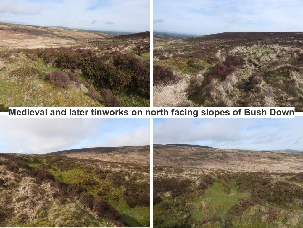
Bush Down Mine is located a short distance from Bennett’s Cross just north west of the Postbridge – Moretonhampstead Road (B3212) and is marked on modern OS maps. The area was worked for tin in two periods; firstly through tin openworks (gullies) estimated to initially date from around the 16th or 17th century and then latterly the sett was re-opened for a short time in the 1860s and 1870s in conjunction with the West Vitifer mine, which lies to the north in the North Walla Brook Valley.
The older tin openworks in the area lie on the moderate north facing slope of Bush Down and it is one of these openworks (gullies), located (more or less) parallel with the road, where a shaft was sunk in the 19th century. The Victorian mine was a simple affair with two adits which were driven into the hillside below and to the north of the shaft, a building platform constructed close to the shaft, plus a small building which was located a short distance away from the shaft to the north east up the openwork gully. There does not appear to be any information as to how successful the mine was but it appears to have been limited in scale and was probably unsuccessful.
Bibliography
Jeremy Butler – (1991) – Dartmoor Atlas of Antiquities: Volume Two – The North, 33, Map 25
Dr Phil Newman – (2002) – Headland Warren and the Birch Tor and Vitifer Mines (Report – Survey)
Dave Brewer – (2002) – Dartmoor Boundary Markers, 2nd Edition
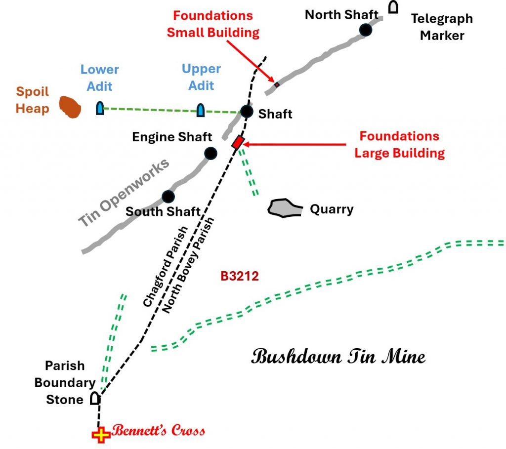
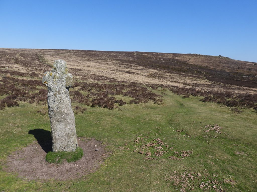
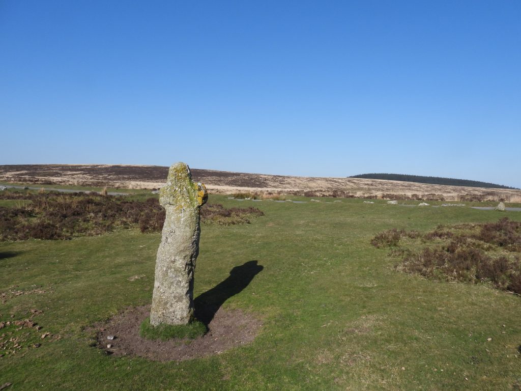
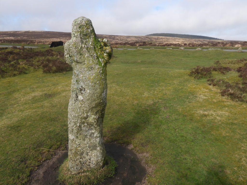
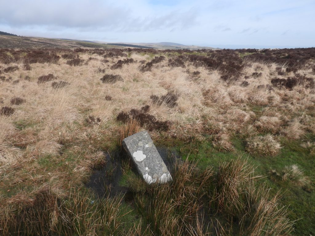
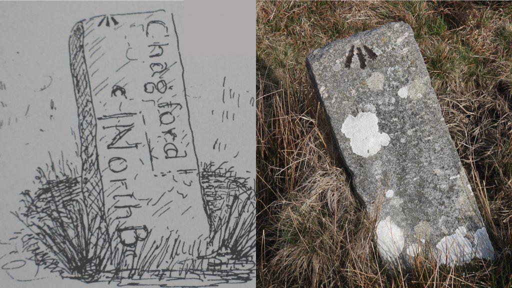
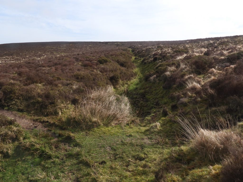
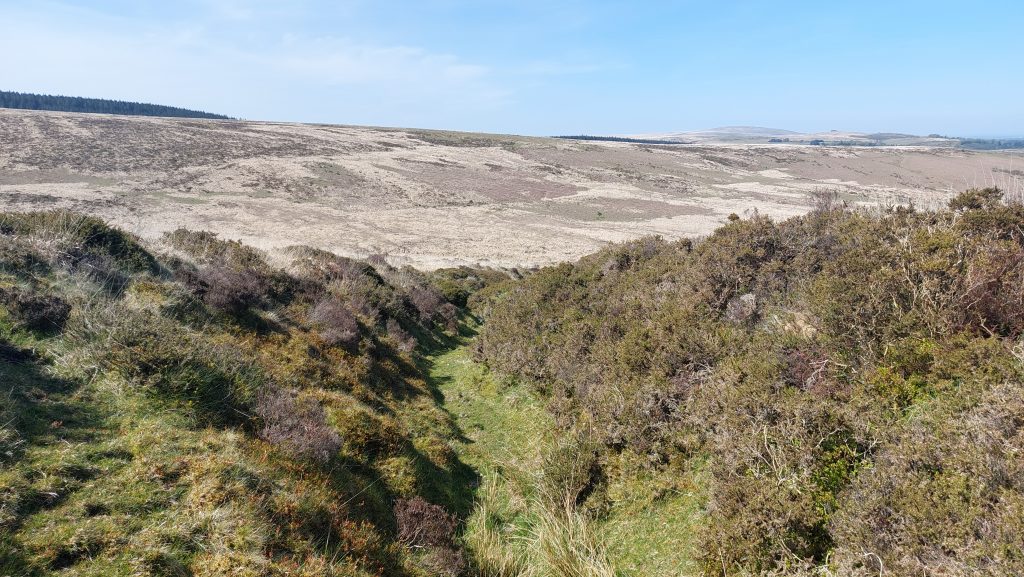
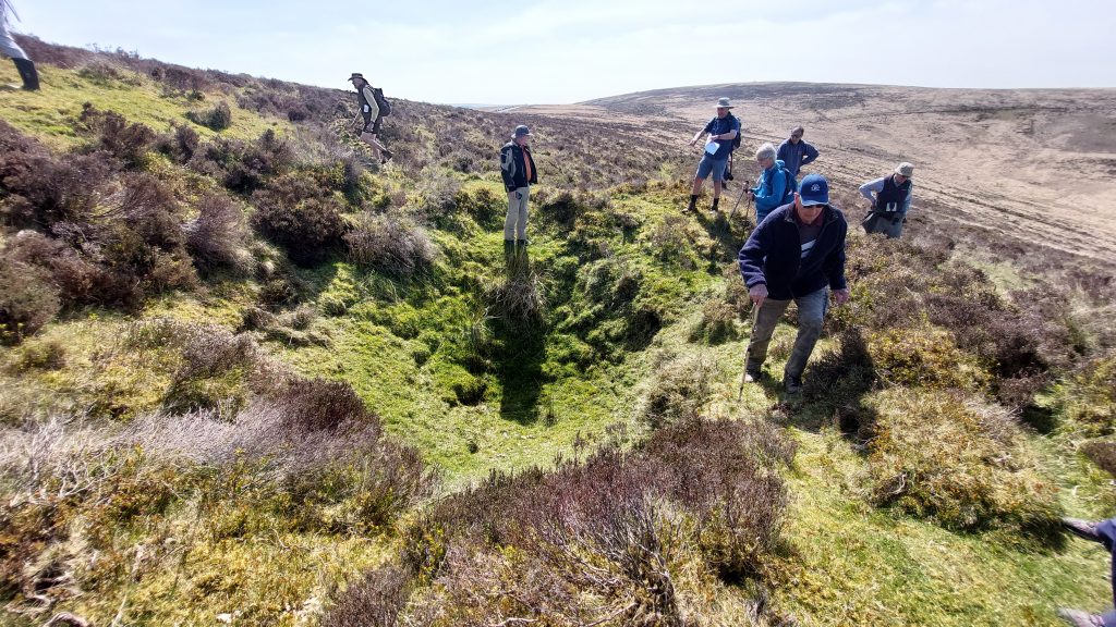
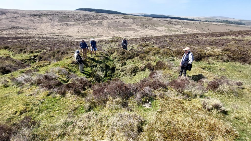
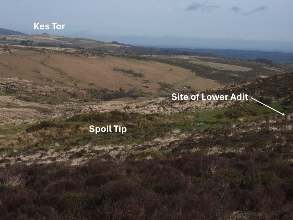
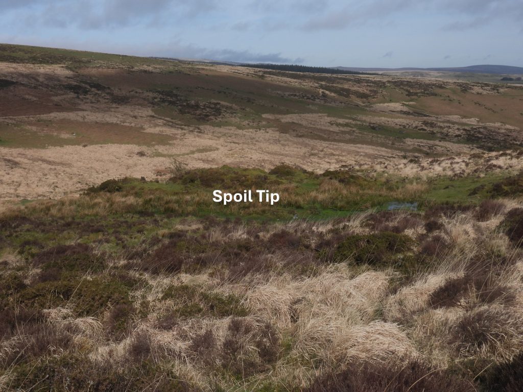
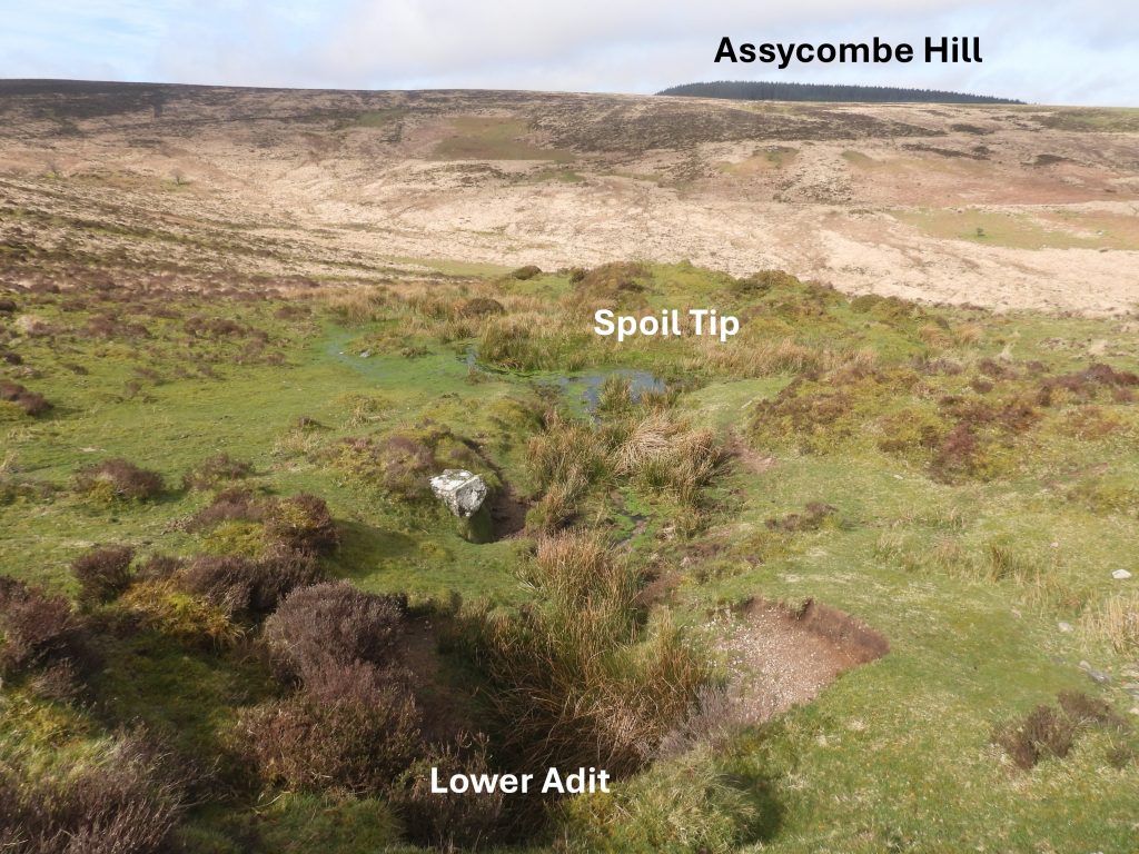
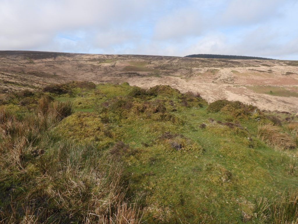
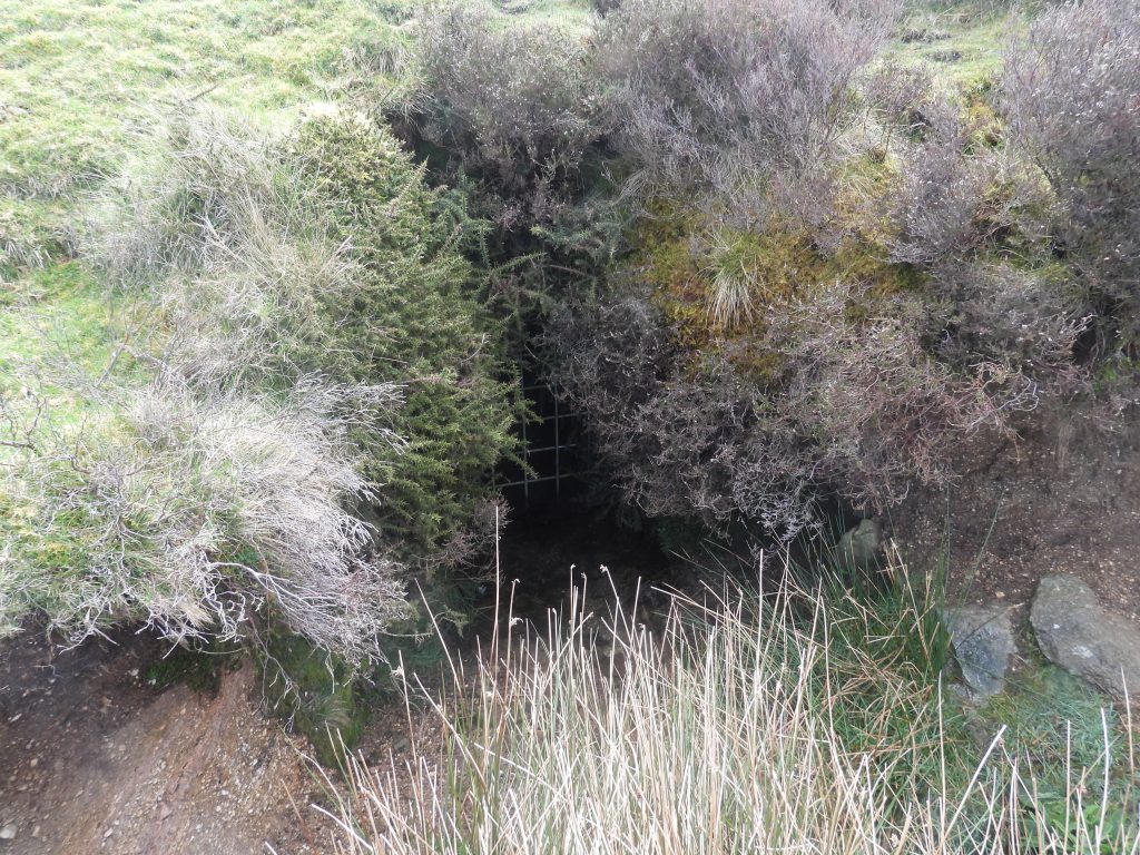
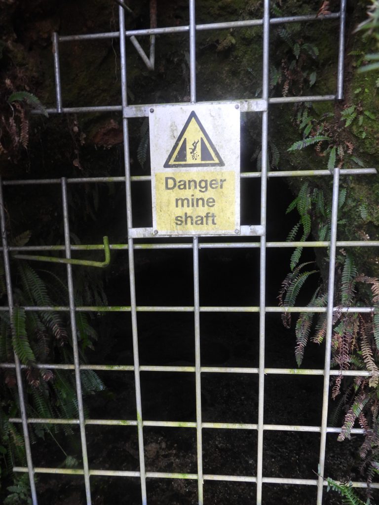
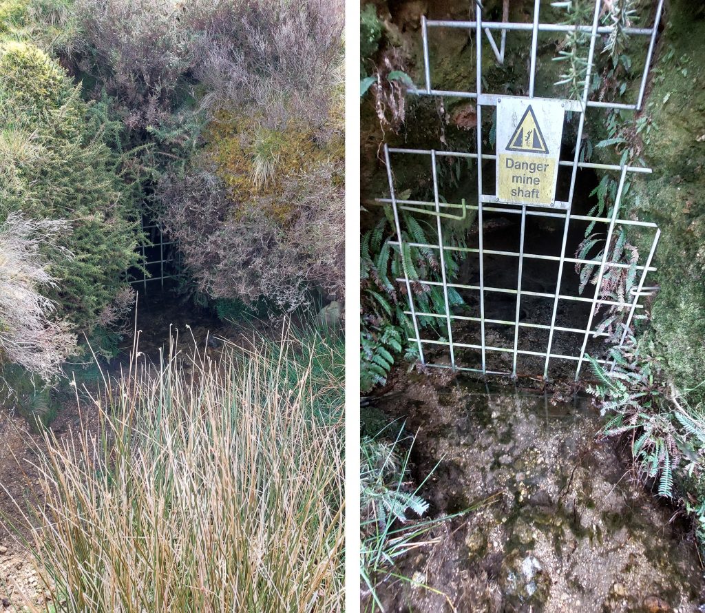
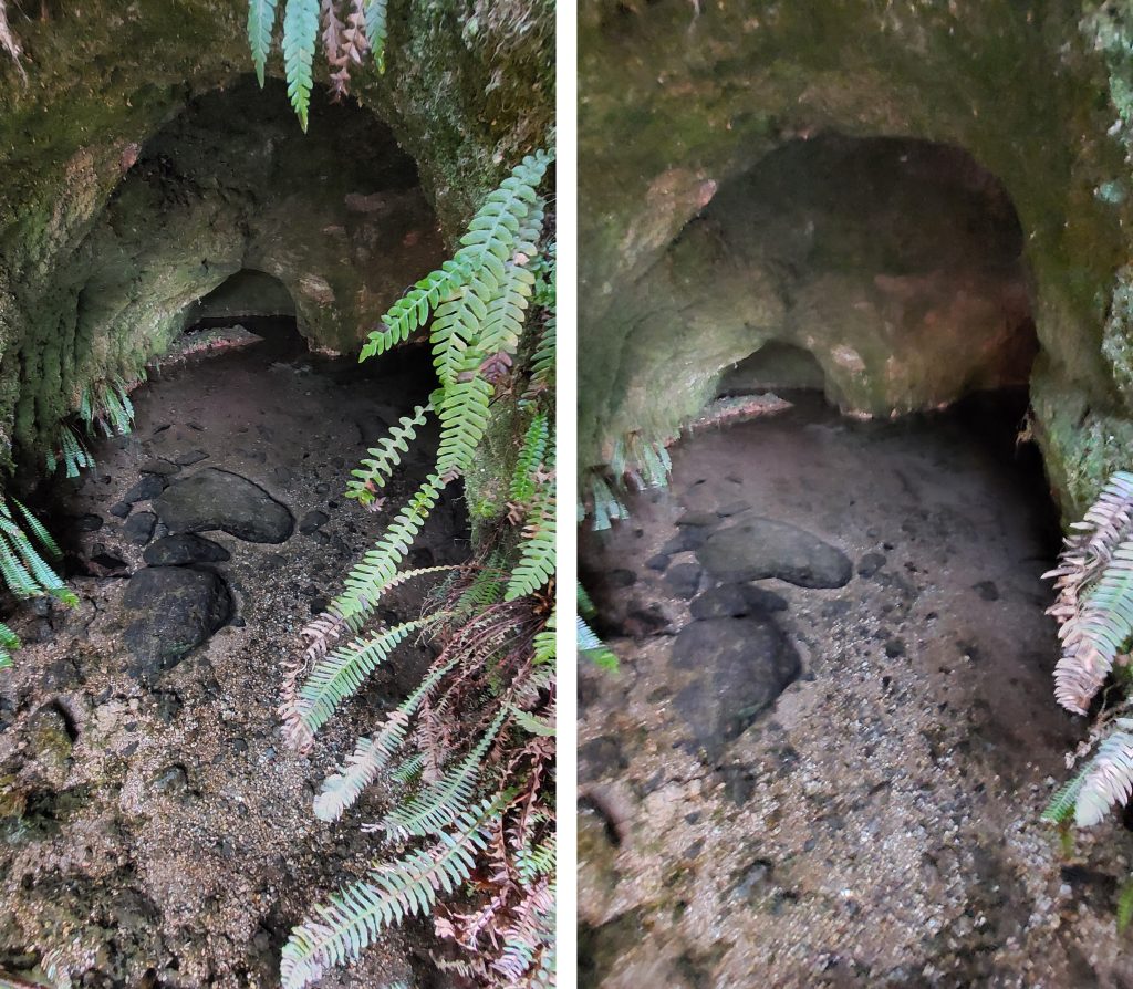
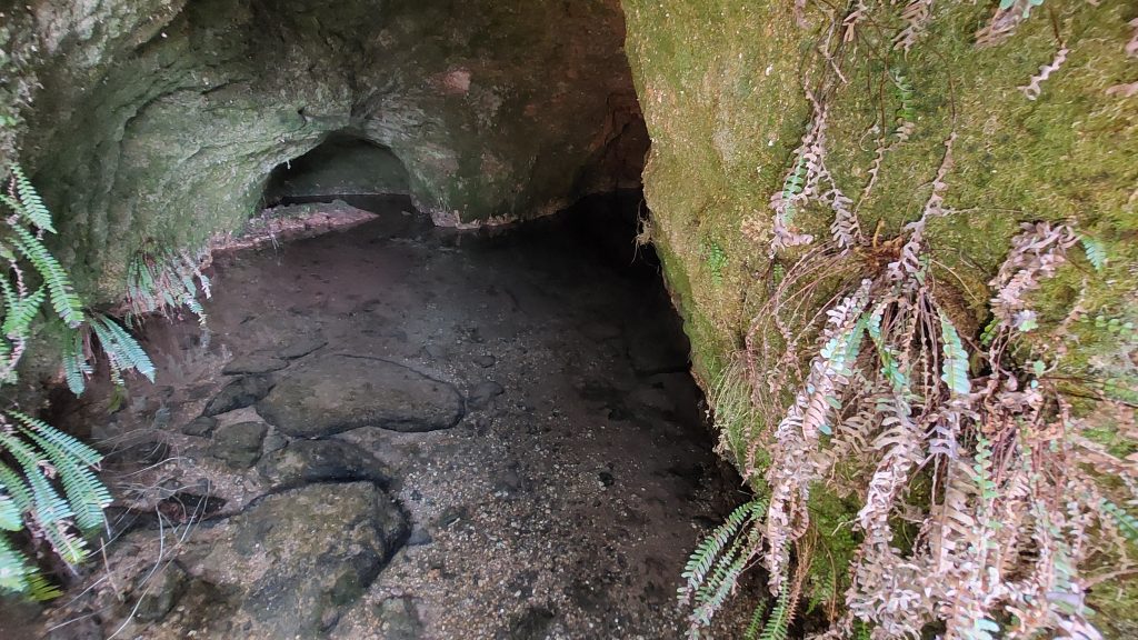
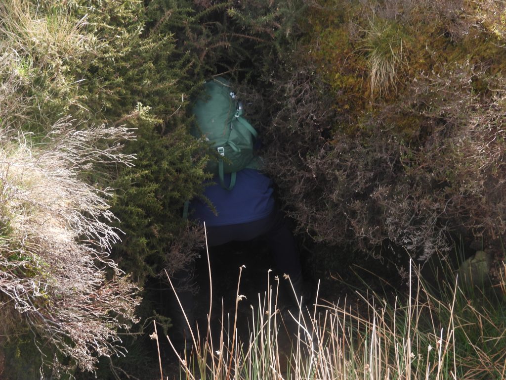
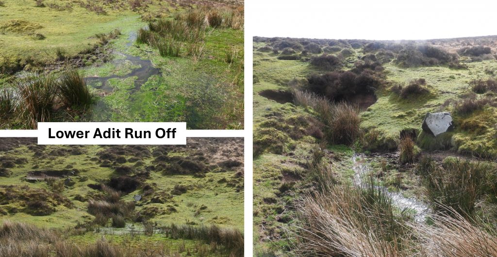
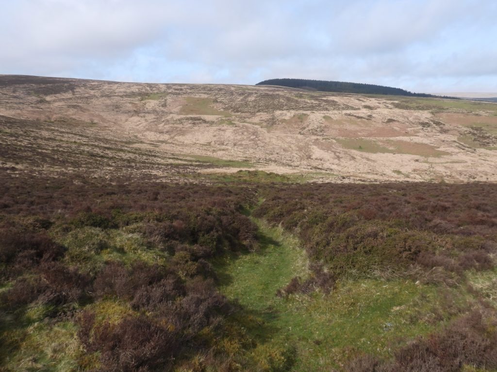
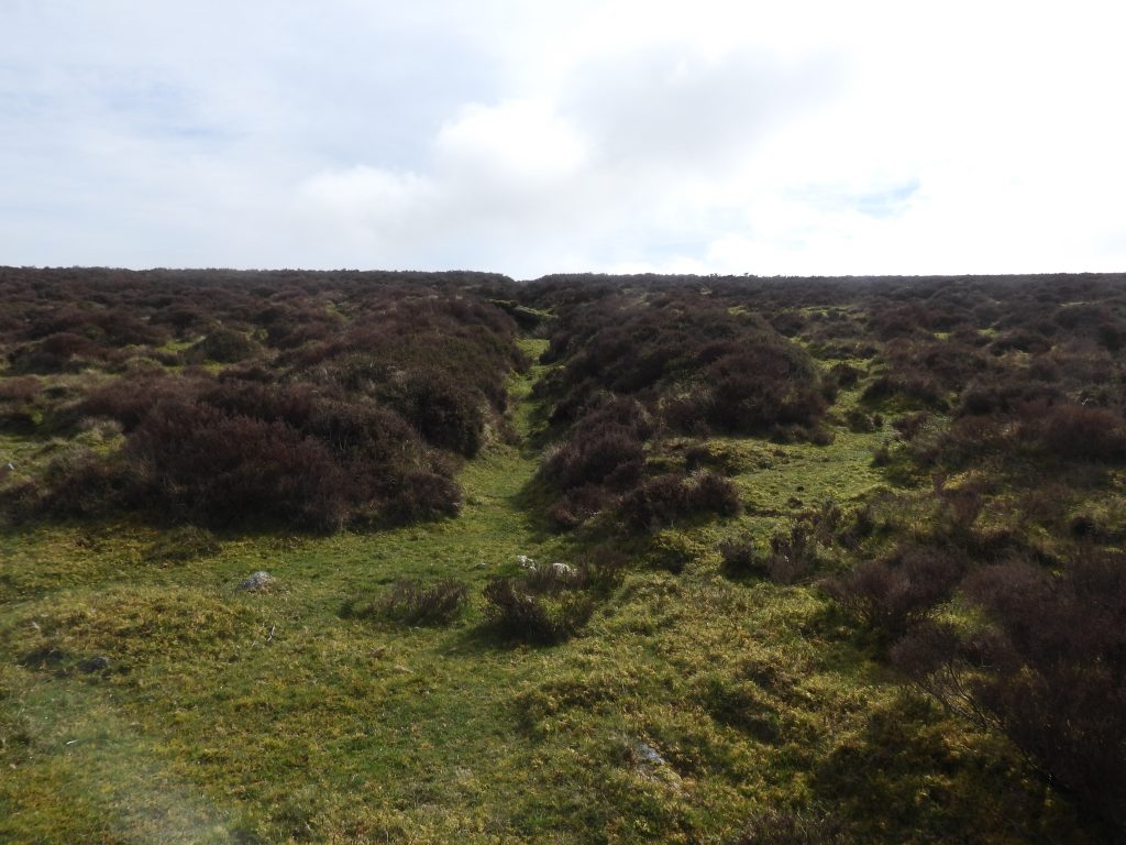
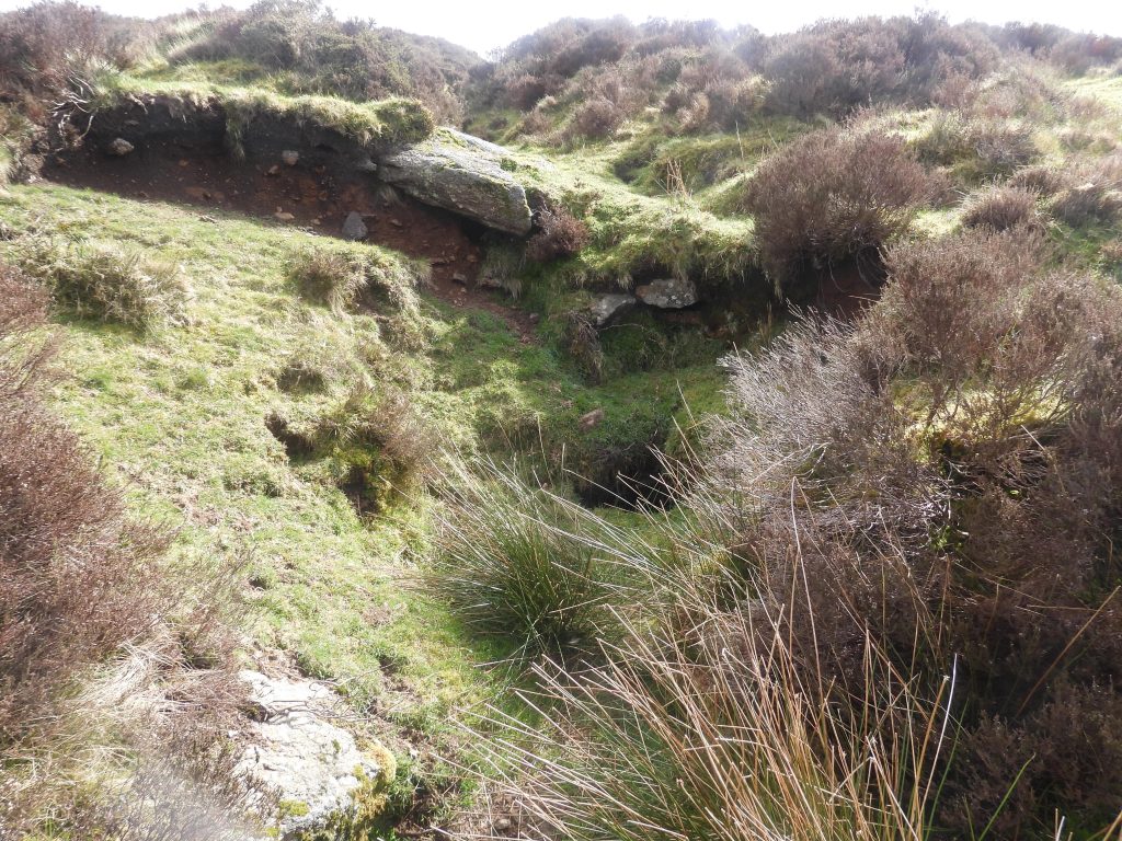
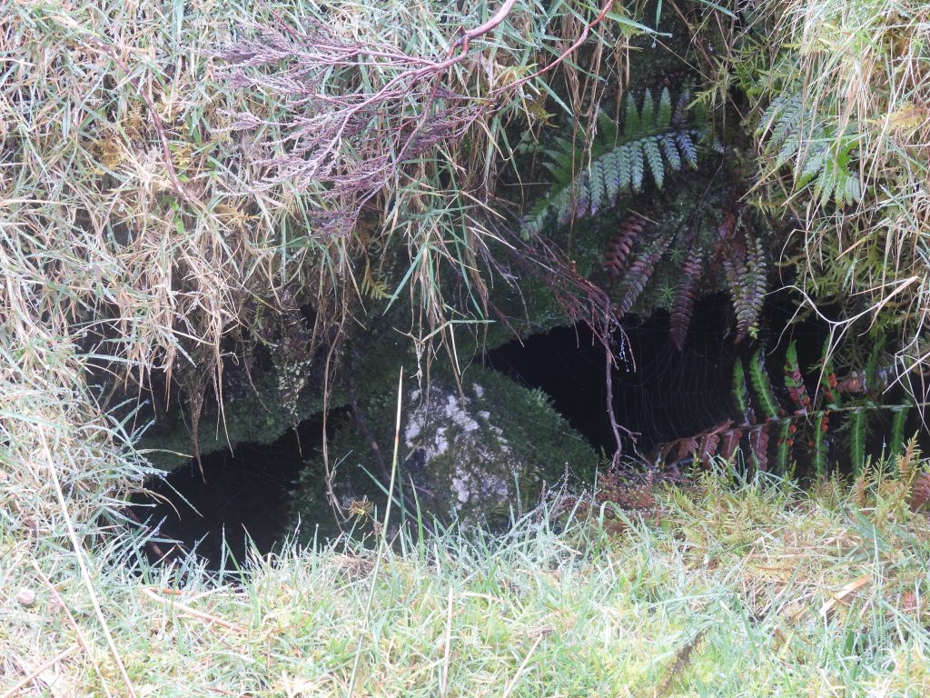
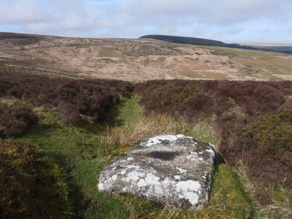
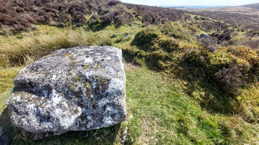
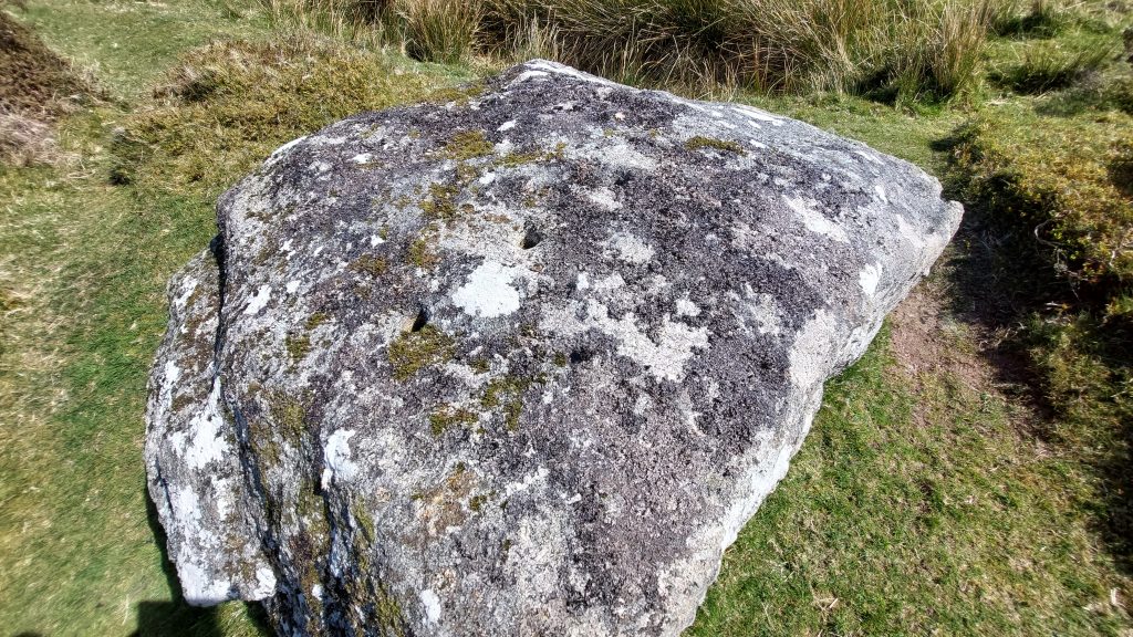
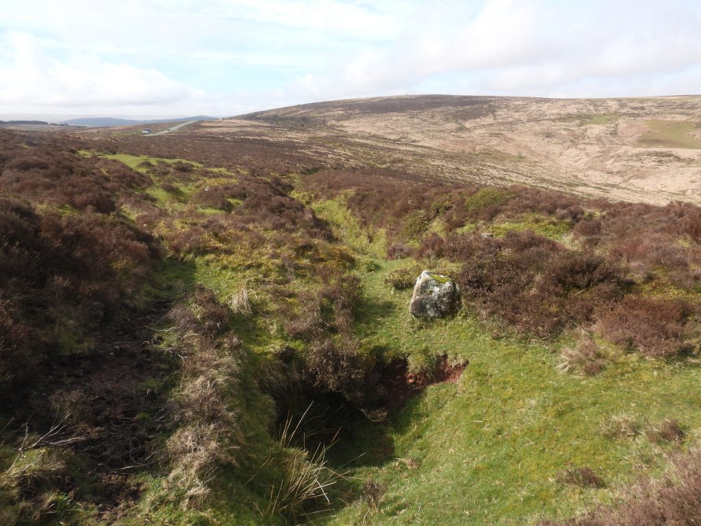
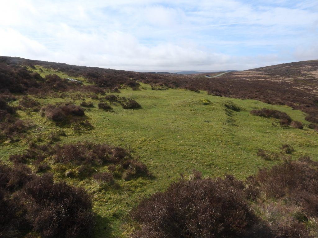
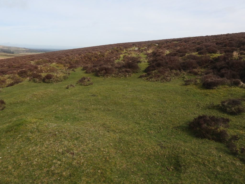
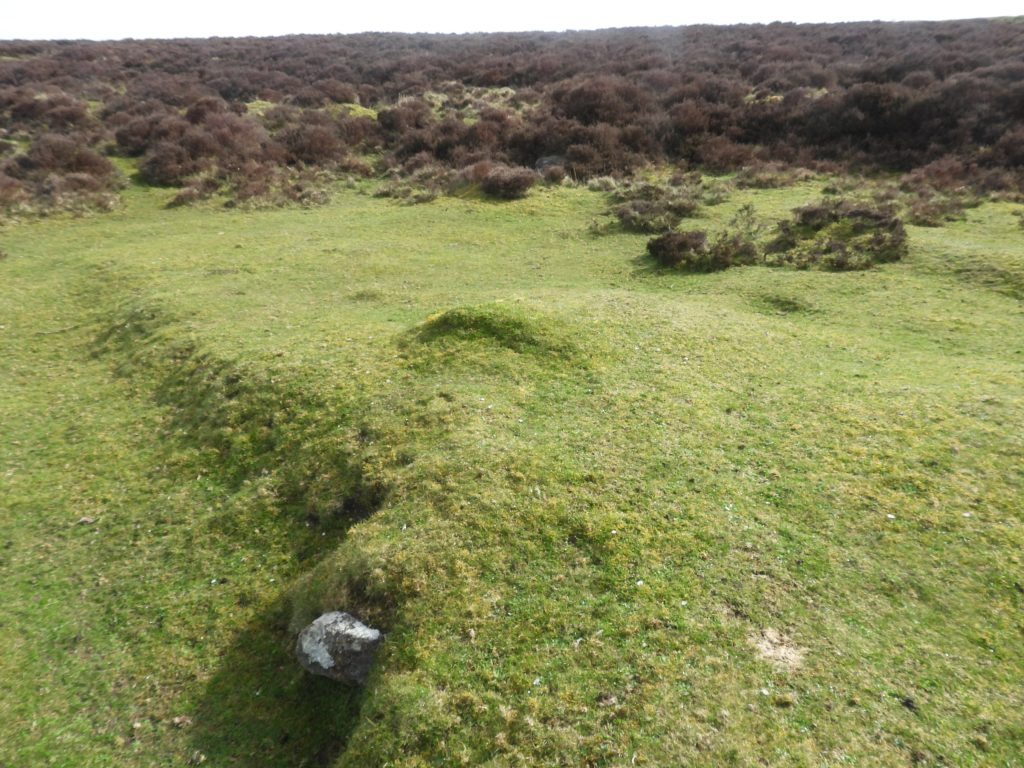
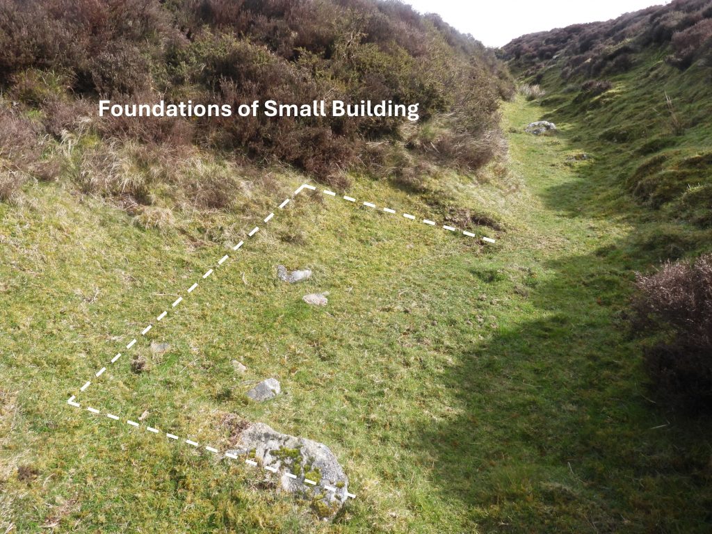
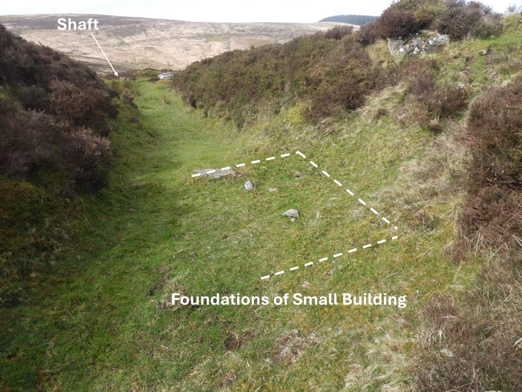
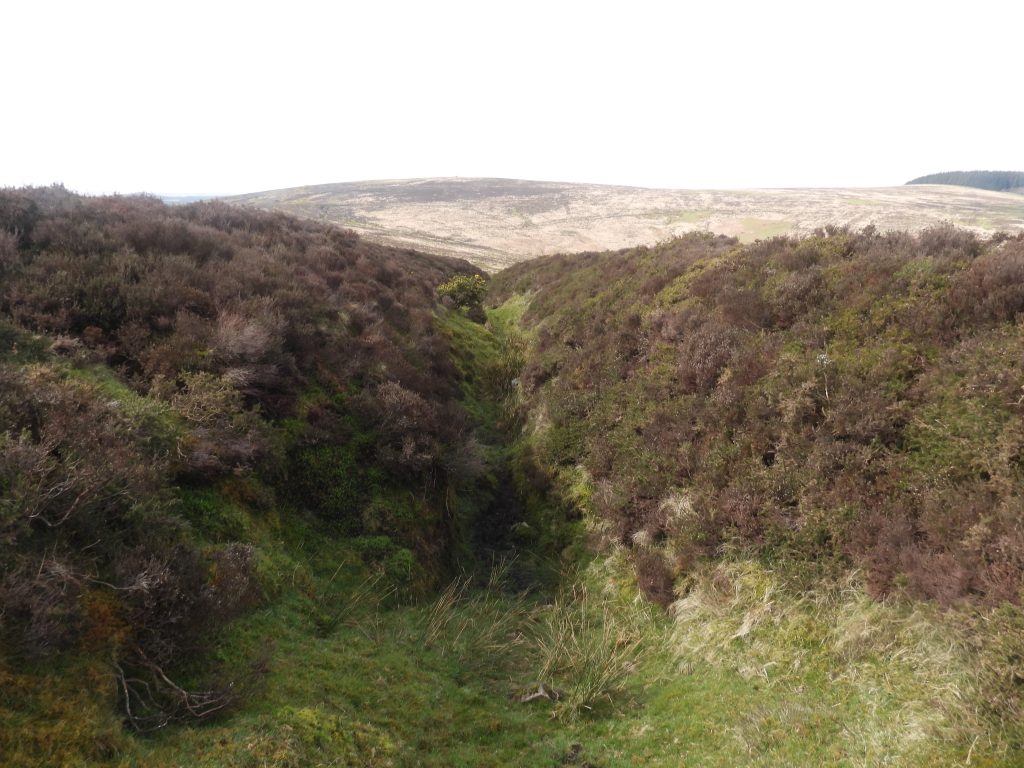
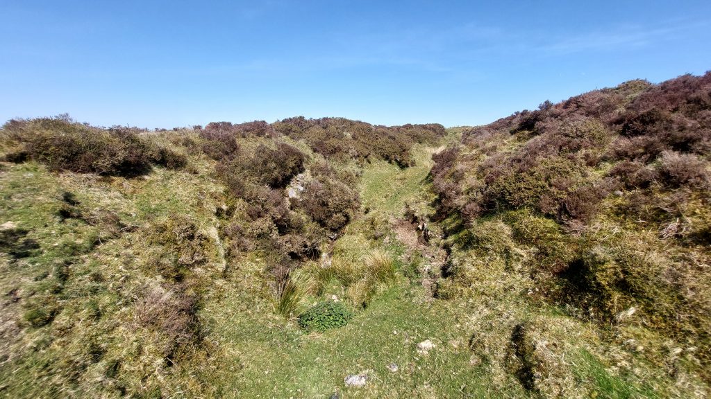
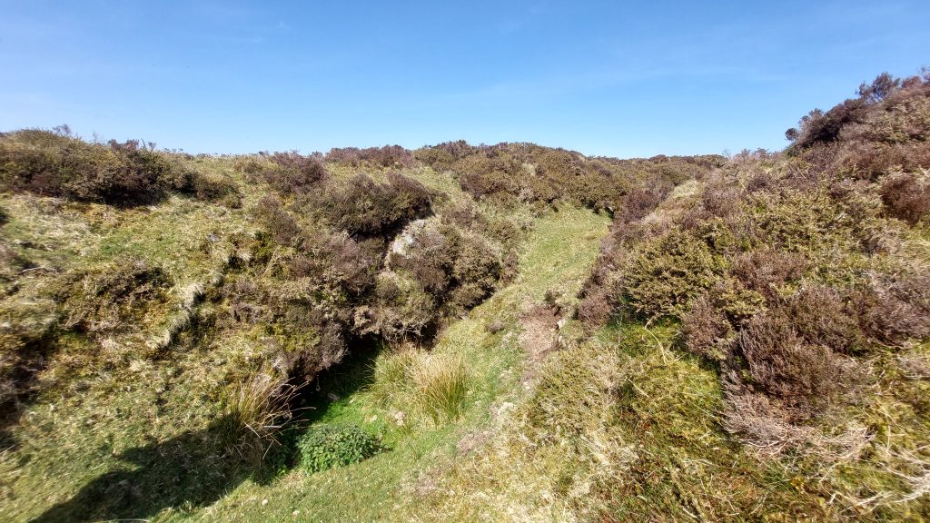
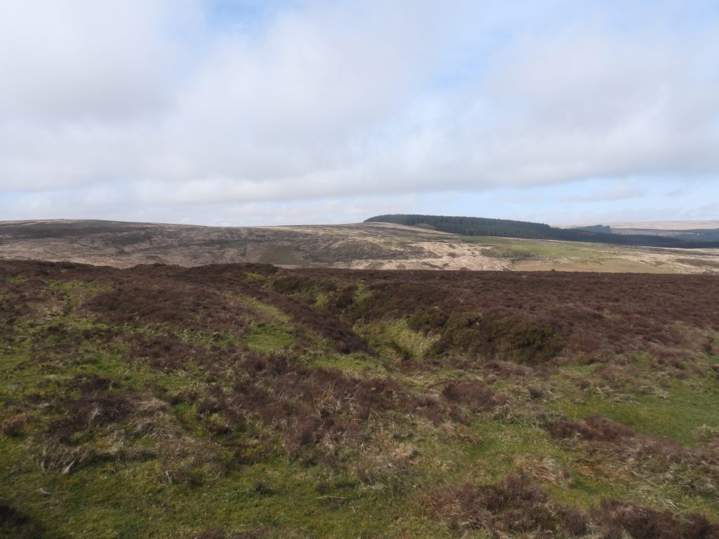
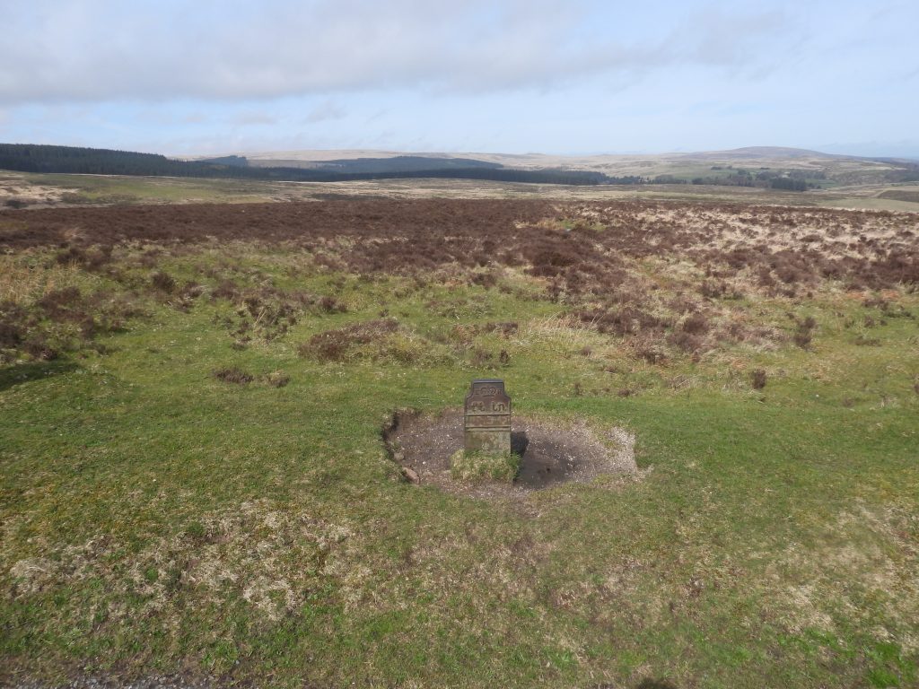
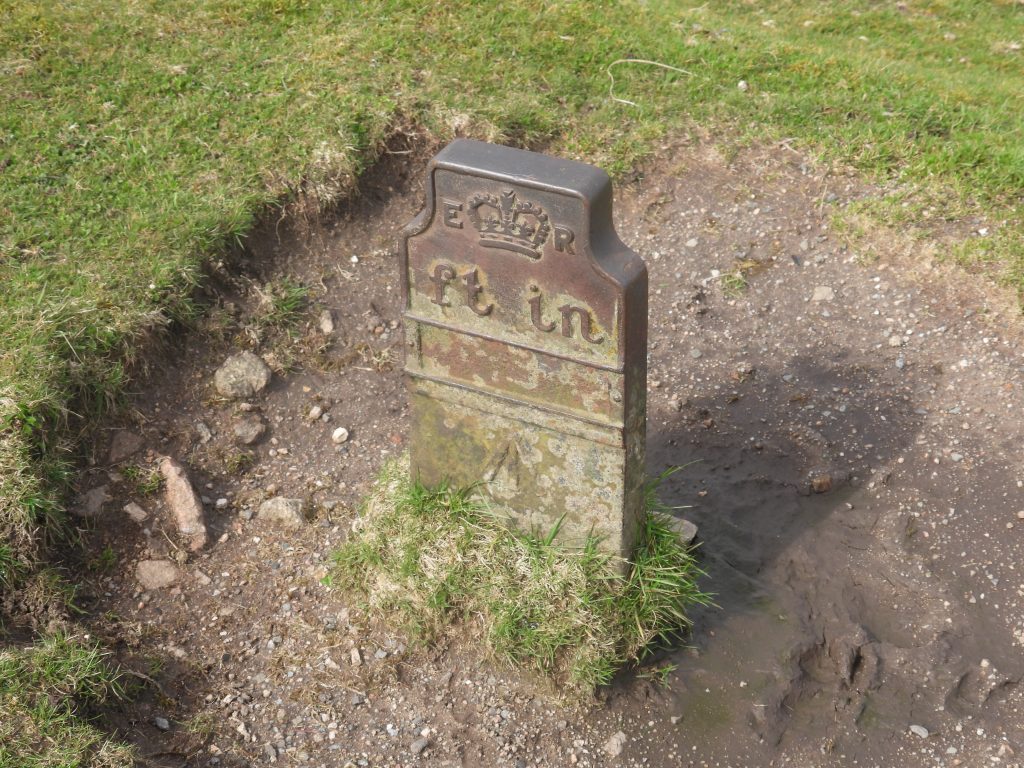
Sketch map of the area around Bush Down Mine, showing the key features covered in this postA good starting point to visit Bush Down Mine is to park near Bennett’s Cross. The picture shows the Cross with Birch Tor on the horizon.This wayside cross is oddly misshapen and is probably one of the most photographed crosses on the moor. It is also a boundary stone between Chagford and North Bovey parishes and has been used as a boundary stone for Headland Warren as it has “WB” (Warren Bounds) inscribed on its north face.In the Dartmoor Historic Environment Record, it is speculated that the cross may be a Christianised prehistoric standing stone.Of interest, Jeremy Butler in Dartmoor Atlas of Antiquities: Volume Two – The North, 33, Map 25, states that the old tin openworks were ‘owned’ by Chagford Parish. The boundary marker shown in the photograph is located a few metres from the road to the north of Bennett’s Cross and marks the boundary between North Bovey and Chagford parishes. This boundary is shown on the sketch map. The parish boundstone inscriptions are very worn and light has to be near perfect to make them out. The stone is inscribed ‘Chagford’ and ‘North Bovey’, with only the “B” in “Bovey” being above ground. The sketch shown in the picture is from the Dave Brewer Dartmoor Boundary Markers, 2nd Edition from 2002 (page 74). The boundary marker has a benchmark inscribed near its top and there appears to have once been a benchmark rivet located on top Not far to the north from the parish boundary marker a number of tin openworks (gullies). Newman records that: “…..there are three main openworks, which are partially interconnected in places”. He continues: “…the tinworks consist of narrow linear, trenches with a V profile. The longest is approximately 580 metres in length and the average width is 8 metres”. This picture was taken near to the south west end of the open tinwork gully, where the 19th century Bush Down Tin Mine is located. From here a footpath (which is just shown in the photograph on the left) can be taken and leads the explorer towards the lower adit and associated spoil tip.Open tinwork gullyEngine Shaft – members of the DTRG in April 2026Engine Shaft is located at SX68136 81932Approaching the site of the lower adit and the spoil tip from the aforementioned footpath. West Vitifer Mine can just about be made out from this location down in the North Walla Brook ValleyNewman records this spoil tip (heap) as being 28m long by 20 metres wide and approximately 2.5m high.There is no doubt that the spoil tip relates to the lower adit.The top of the spoil tip is located at SX67978 81990The lower adit can be found hidden under a cloak of heather and gorseThe lower adit has a gated entrance, which is a relatively recent additionThe gated entrance is located at SX68010 81987The lower adit, comprises a narrow tunnel which lasts for a few metres after which it becomes blocked. There appears to be two former tunnels withinAdit is April 2026Taking photographs through the grill at the entrance to the lower aditThe run off from the lower adit runs very clear and there is evidence of pond life hereTo the east and uphill from the lower adit is a linear channel, which leads to the upper adit. The photograph shows the linear channel looking back towards the lower adit with Assycombe Hill beyondLooking east (uphill) along the linear channel. This channel may have represent the early run off from the upper adit. The upper adit is located near the ‘head’ of the linear channel. The upper adit is now completely blockedThe upper adit can be found at SX68140 81990This large granite boulder marks the top of the linear channel where it joins the open tinwork, where a 19th century shaft is locatedHoled RockThe Holed Rock is located at SX68184 81989Another Bush Down Mine shaft is sited in an old tin openwork at SX68182 81984. It consists of a conical pit of approx 2.5m diameter and is surrounded by spoil. There is no evidence of any other structure such as a whimA short distance (to the south) from the shaft is a flat area, where there are earthwork foundations of a large rectangular buildingAny wall foundations hear are now completely covered by turf. Newman records that the lack of rubble here “indicates that this was probably a timber structure constructed on a masonry base”.The approximate dimensions of the probable wooden structure would have been. 11.5m by 5.4m. The location is SX68165 81945Of interest, there is a small building shown on 19th century maps in the openworks gully to the north-east of shaft. The foundations of the small building are still discernibleThe author speculates that the building might have been a store, given its size. As it is located away from the main building and the shaft it may have been for tools or perhaps explosives (if used of course). These foundations are located at SX68211 82003More views of the old tin openwork to the north east of the shaft and small building foundationsNorth ShaftNorth Shaft is located at SX678297 82063The top (north east) end of the old tin openwork, which is located just a few metres from the roadA short distance along the road from the top of the old tin openworks is this metal marker. It is one of a series of Telegraph Cable Markers which mark the location of a buried telegraph cable which crossed the South West and into Cornwall. There is a fabulous article by Simon Dell in Issue 124, Autumn 2016 (page 77) of the Dartmoor Magazine titled ‘DARTMOOR Curiosities’, which describes the history. This marker is located at SX68349 82088At the top of each marker is a Royal Cypher (ER) and Crown which represents King Edward VII who reigned from 1901 to 1910, which dates the marker. (NOTE: in other parts of the country there are similar markers with VR (Victoria) and GR (George V)). The broad arrow (called a ‘pheon’) represents objects purchased with the monarch’s money. There are two guided slots below the ‘ft in’ inscription which would have been the location of a numerical guide, which the author assumes relates to the feet and inches from the marker to the cable. There are other Telegraph Markers across Dartmoor which can be found at: Moretonhampstead Square; Moretonhampstead, Court Street; Shapley Common; King’s Bungalow near Warren House Inn; Tavistock, Callington Road.