
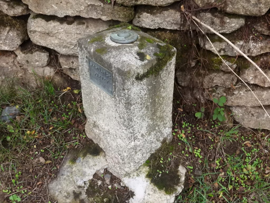
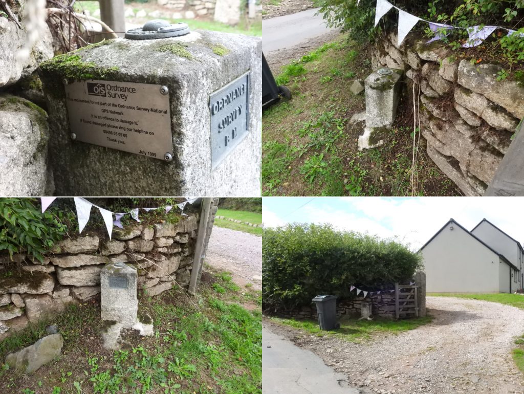
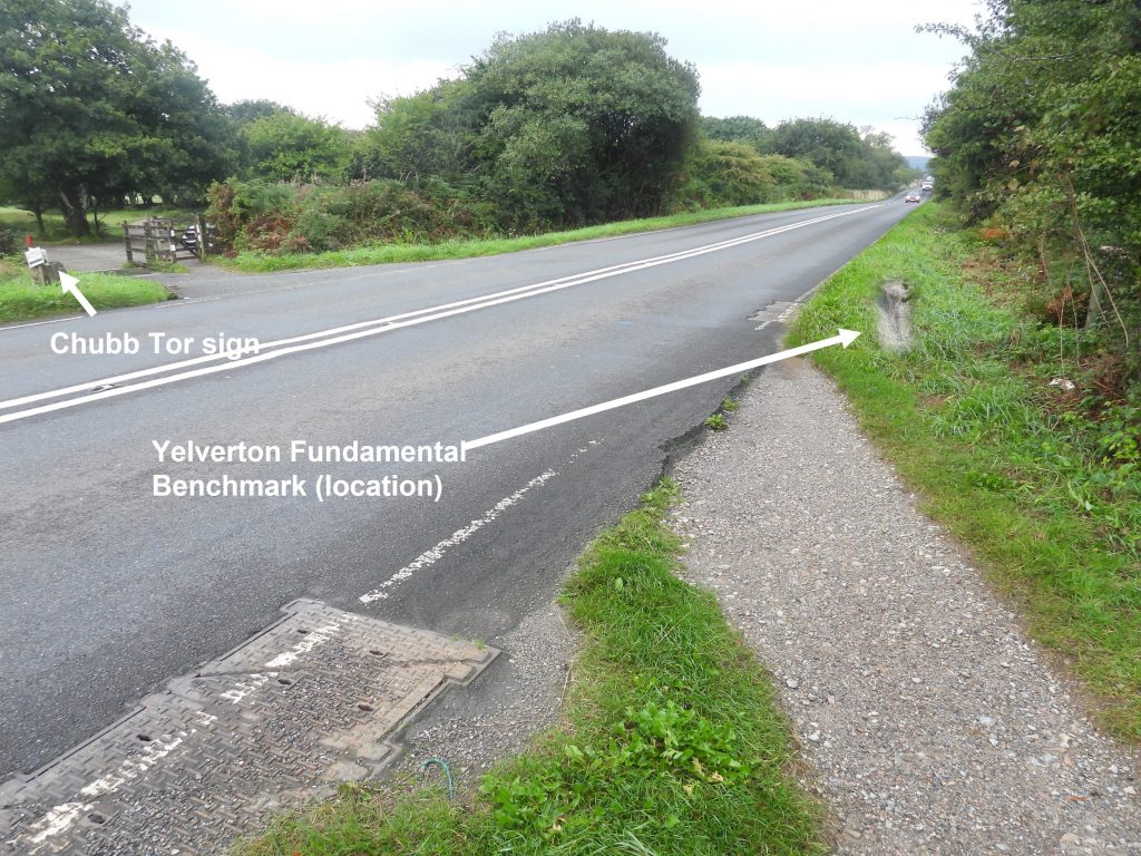
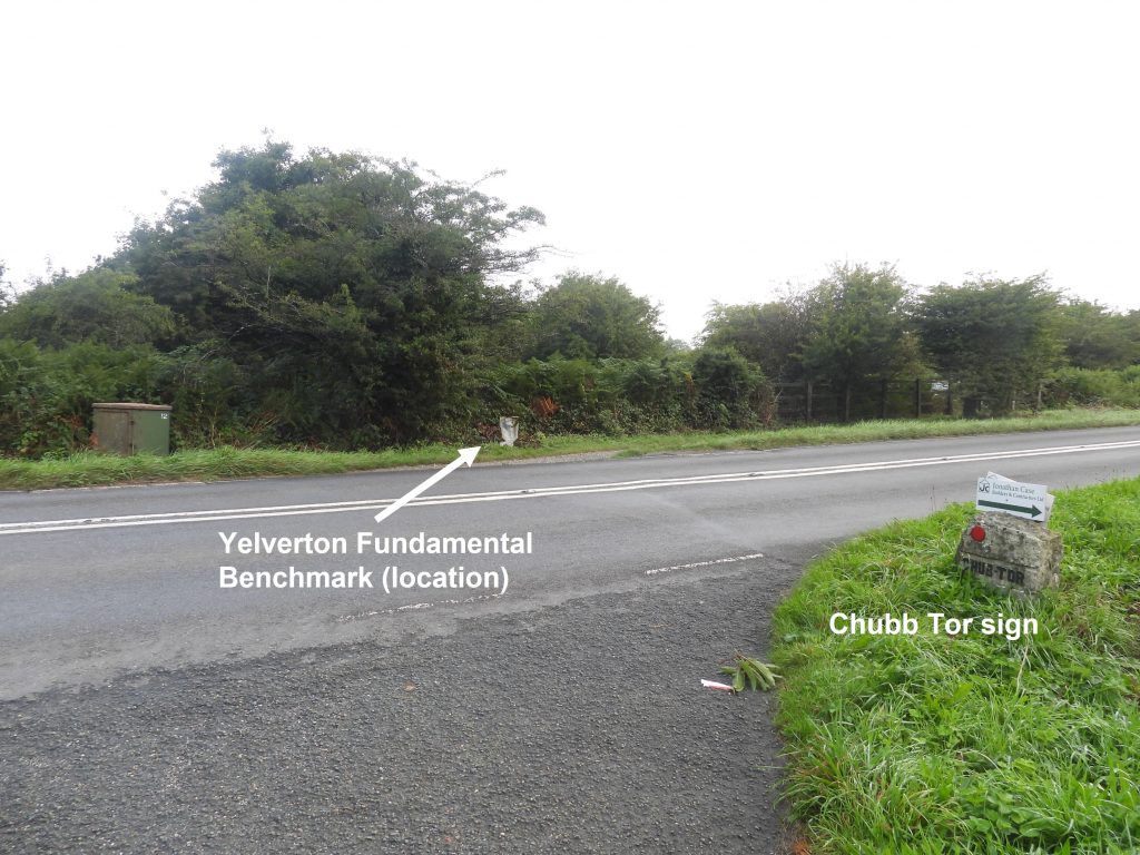
There are three ‘Fundamental Benchmarks’ (FBMs) within Dartmoor National Park – Two are from the Ordnance Survey (OS) Geodetic Levelling period(s) and one from the GPS era. The two original FBMs are located at Bridford and Yelverton and were used as part of the chain of OS primary levelling lines linking the whole country to the UK Fundamental Benchmark in Newlyn, Cornwall. The third FBM is located in Yelverton and is part of Ordnance Survey’s network of passive GPS stations throughout Great Britain allowing GPS surveyors to precisely position their survey stations for their coordinate systems.
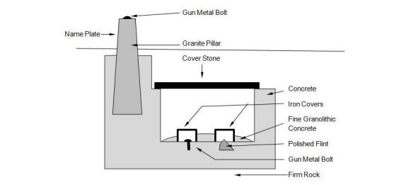
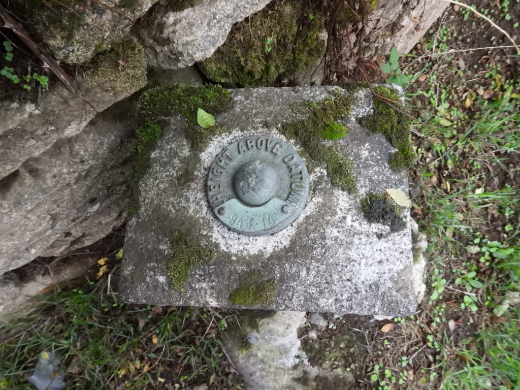
FBMs in *Geodetic Levelling era: There is a UK Fundamental Benchmark at Newlyn, Cornwall where there is a brass bolt which was the reference point for the whole of the United Kingdom, that is, all heights are referenced to this point. The height of the benchmark (bolt) at Newlyn was established over a six year period from 1915 to 1921, when mean sea level was found and this vertical level transferred to the head of the bolt. The bolt head was 4.751 metres above the 1915/1921 mean sea level and is now 4.551 metres above mean sea level as sea levels have risen. There were at one point around 250 FBMs across the UK on specially selected sites where foundations were set on stable strata such as bedrock so that movement of the mark is minimised. They provided a stable network for levelling and there is one approx. every 40km. The FBMs were ‘joined’ in ‘levelling lines’ using flush brackets, OS Bolts and other benchmarks, then ultimately to the UK FBM at Newlyn. On Dartmoor, the main levelling line was between Bridford and Yelverton. NOTE: *Geodetic means accounting for the earth’s curvature.
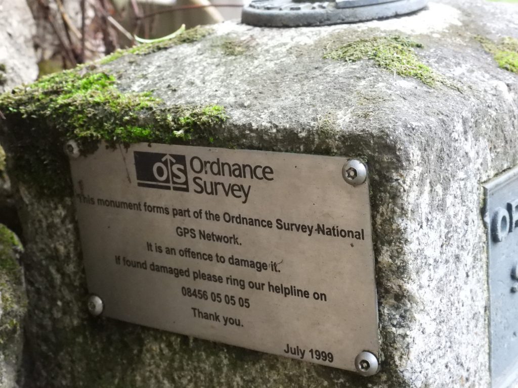
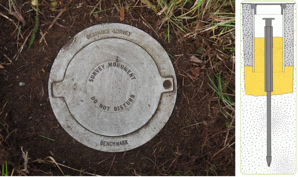
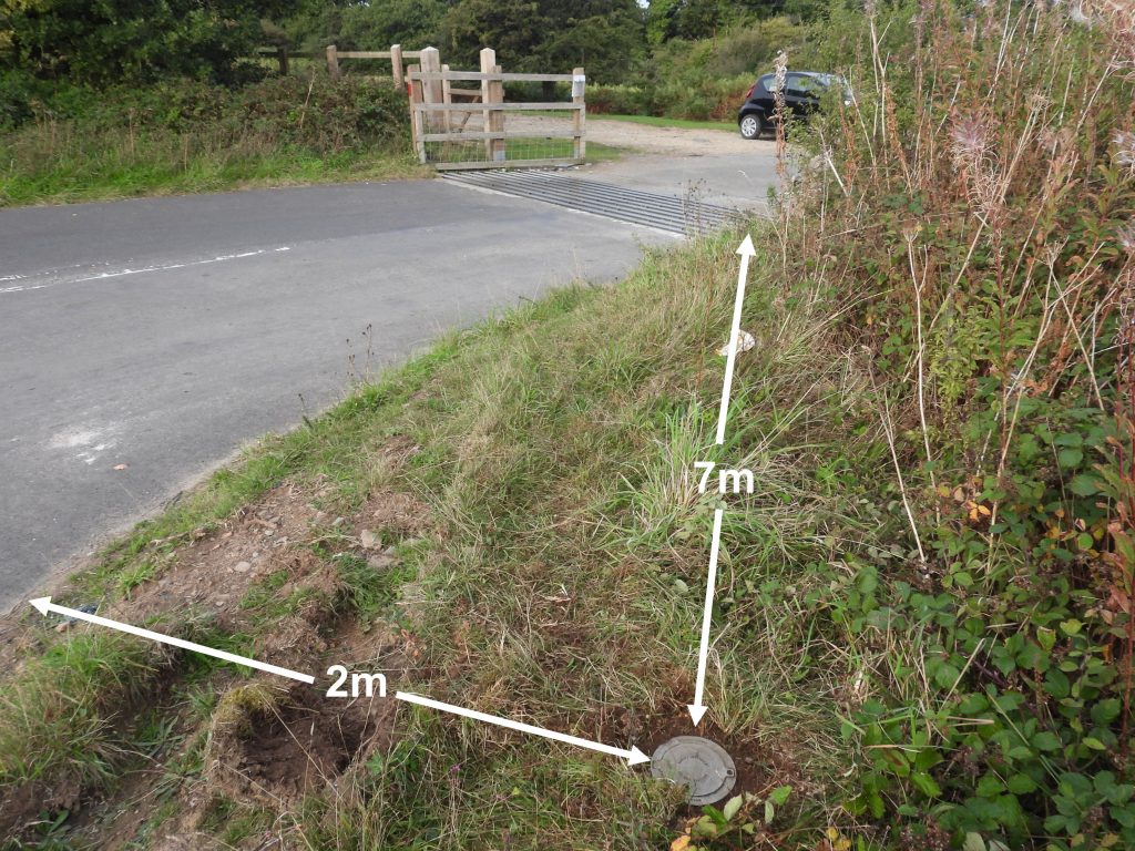
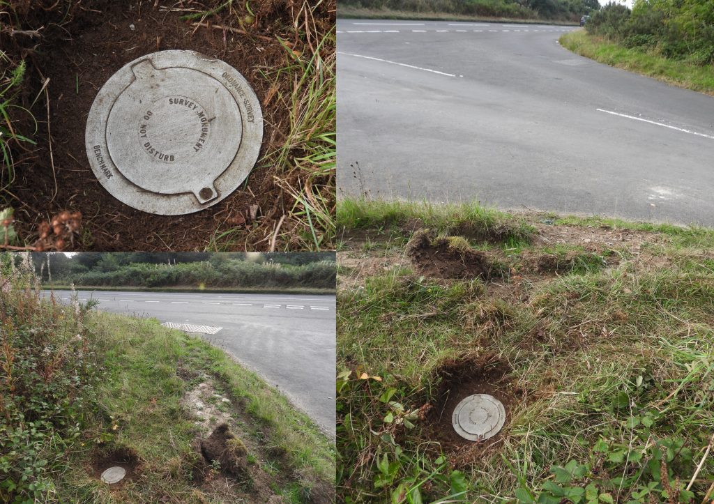
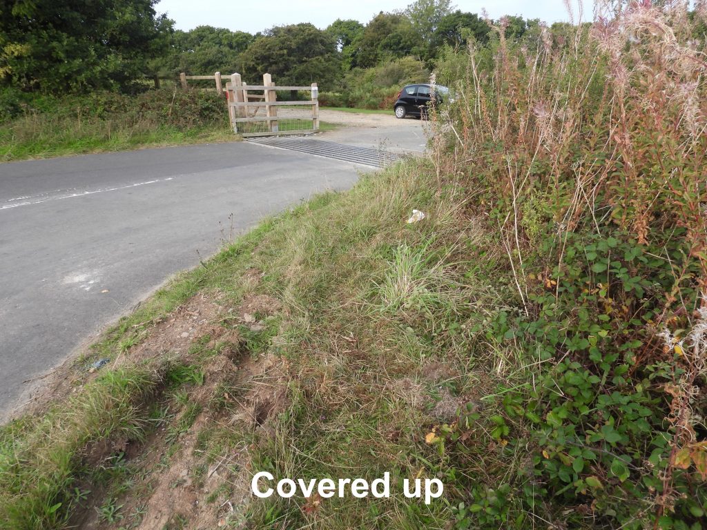
FBMs in GPS era: From 1989, OS installed and operated a combination of ‘Passive Stations’ and ‘Active Stations’ as part of the Global Positioning System calibration. Some OS ‘Passive’ GPS stations are known as FBM Aux (Auxiliary) and are geodetic quality ground markers (like the previous generation of FBMs) and are in user-accessible locations. (Note: Other ‘Passive Stations used are pillars and bolts from the previous geodetic survey periods). In the UK most of these ‘Passive Stations’ are within 20-35 km of each other. OS have a network of around 1000 ‘Passive Stations’ and around 180 ‘Active Stations” (which are sited at about 30 locations). At the ‘Active Stations’, GPS receivers constantly log readings allowing a very high level of positional accuracy to be achieved, without the need to physically occupy one of the ‘Passive Stations’. The ‘Passive Stations” are surveyed on a five-yearly basis but require the user’s own GPS reference receiver during the survey. On Dartmoor, there is a ‘Passive Station’ (FBM Aux type) at Yelverton, known as Yelverton FBM Aux.

https://www.jonglew.com/Walking/Benchmarks/2018/20180624-YelvertonFBM_OS_Sketch.jpg
![]() 0
0![]()
![]()
![]()
![]()
![]()
![]()
Paul A Sherwood May 27, 2026
Just found your website, quite comprehensive, I have just completed visiting all the FBM’s & Berntsen’s from a diagonal line from the SW corner of the NS ordnance survey block to the NE corner of the NT block. Can’t venture too far in to haggis-land. Down to the SM, SN, SO, SP, TL & TM southern boundary, including the three or so at the top of SS & ST to complete the Severn estuary coast of Wales. Started in March 2017, gives you something to do once retired!
I noticed you mention the ‘flint’ in the FBM chamber, have you any idea why it’s there, why flint, nobody including OS staff, including retired local (North Yorkshire) OS staff have a clue!!
SteveGriggDartmoor May 27, 2026 — Post author
Hi Paul,
Thank you for your message. You will have noted the references where I obtained the information for the post.
I am unaware of reason for the ‘flint’ in the FBM chamber. I obtained this information from the following reference, which I hope may be of help to you
Site
Engineering
Guide
ORDANCE SURVEY:
NATIONAL GRID &
BENCH MARKS
Updated: 05/01/13
Andrew Burgess B.Sc Hons
http://www.ajb-settingout.co.uk