A collection of walks, discoveries, insights and pictures of exploring Dartmoor National Park
November 1, 2023
Mysteries surrounding Shaden Moor Cross
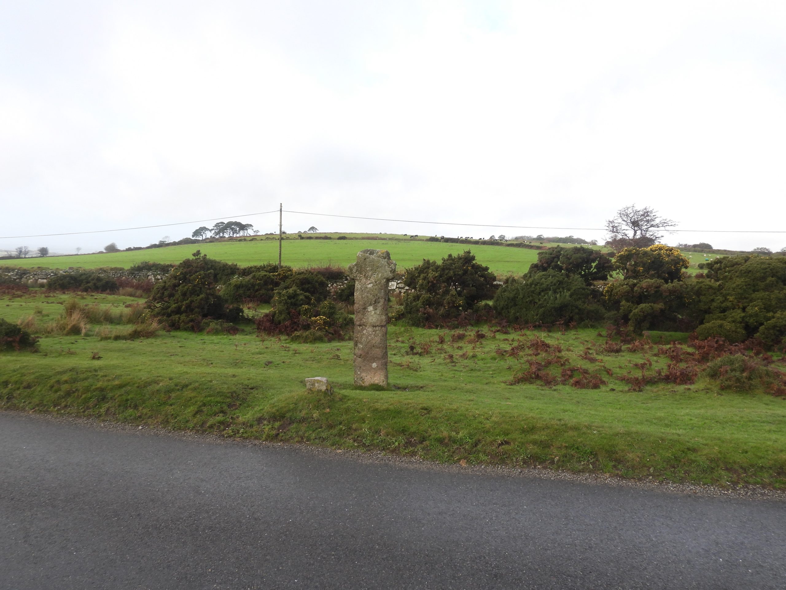
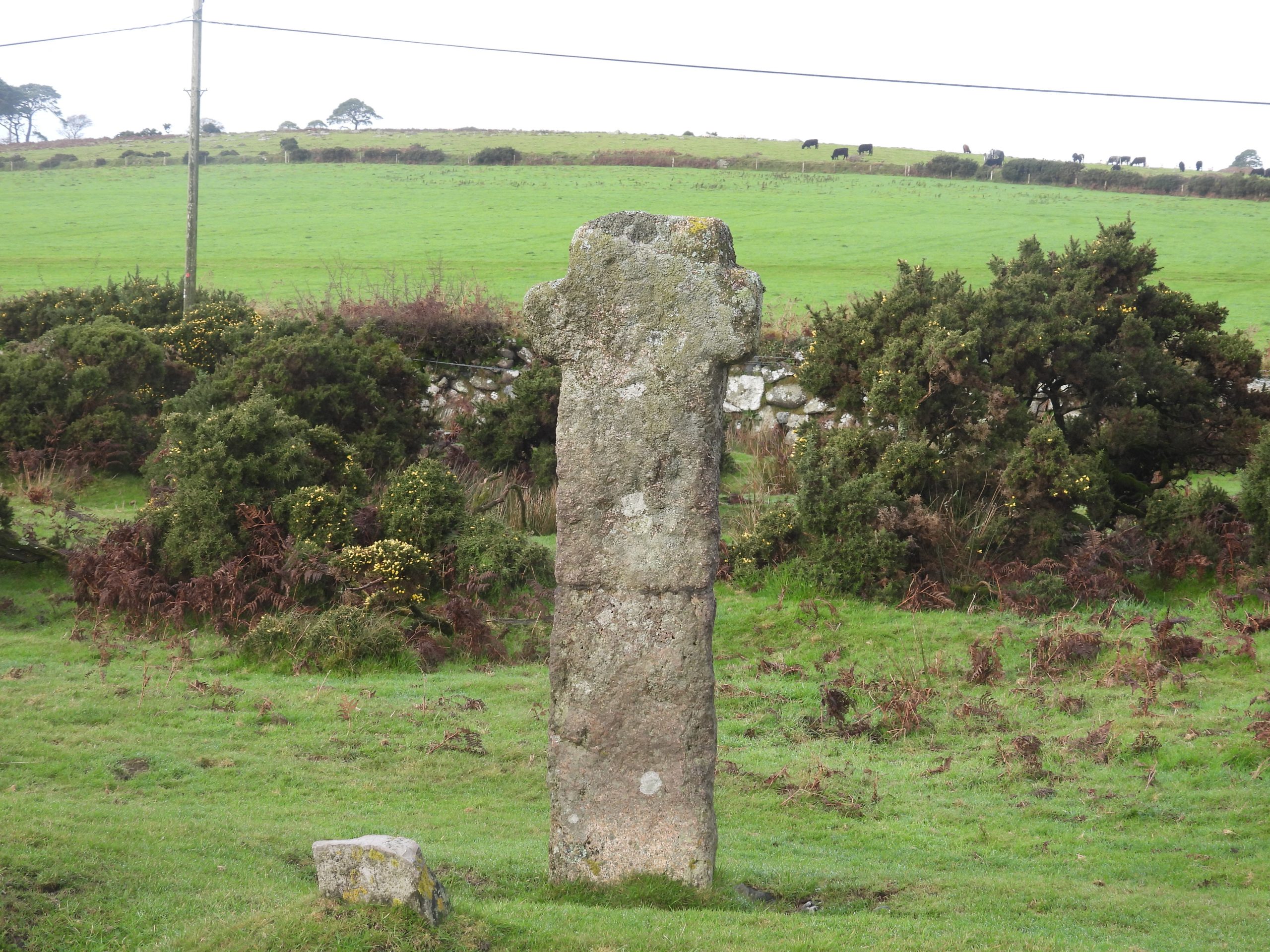
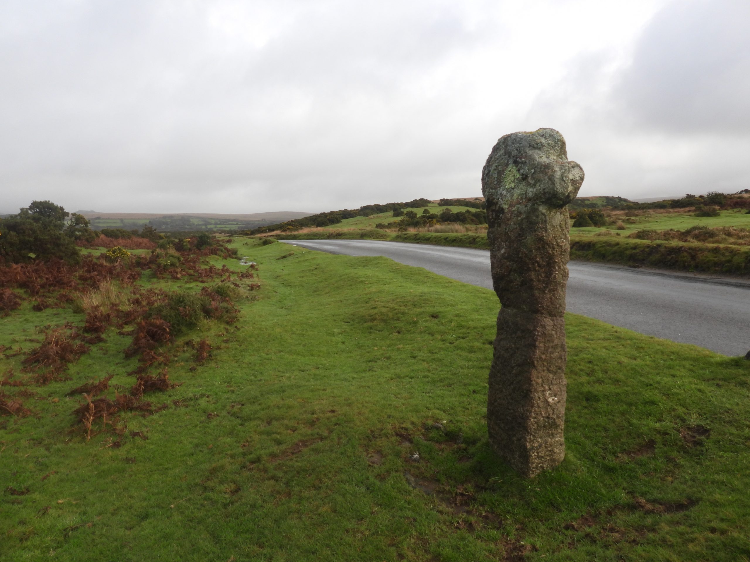
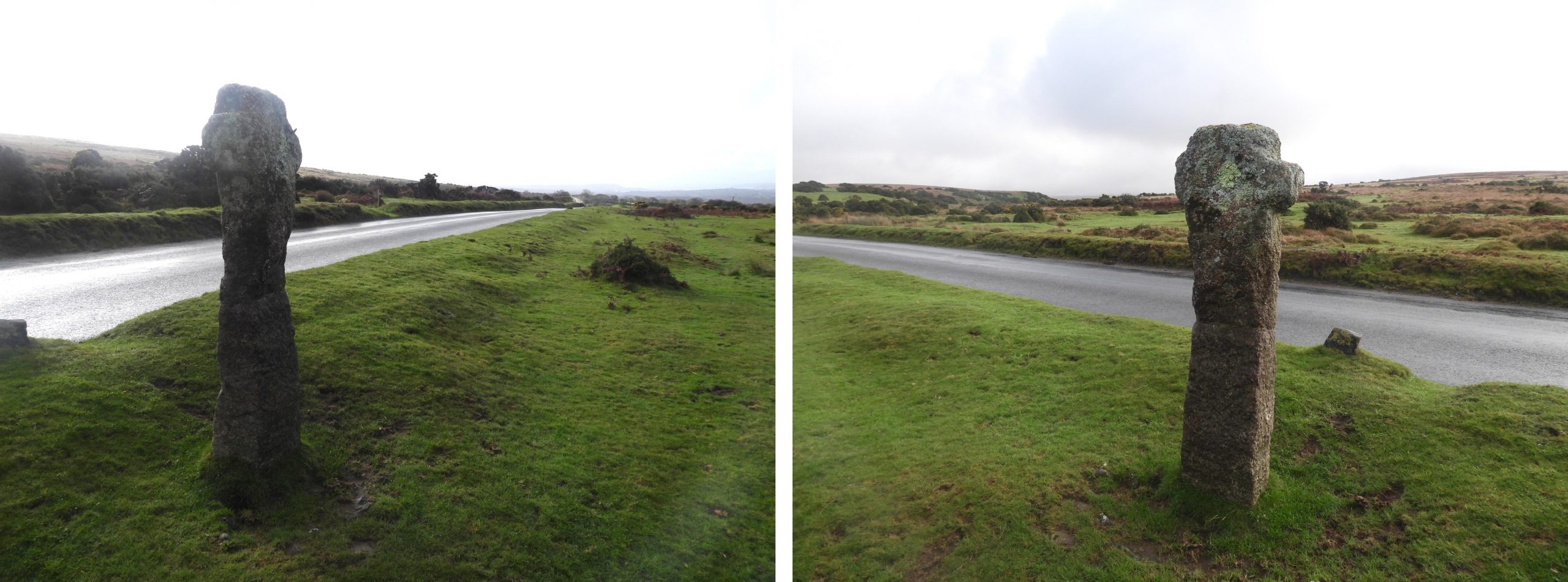
Shaden Moor Cross stands on a granite base beside the road, just north of the Brag Lane junction with the road between Beatland Corner and Cadover Bridge. It is a typical of other Dartmoor Crosses insofar as the shaft and cross do not ‘match’; the granite cross being quite ancient and the shaft being relatively modern. There isn’t anything particularly remarkable about this.
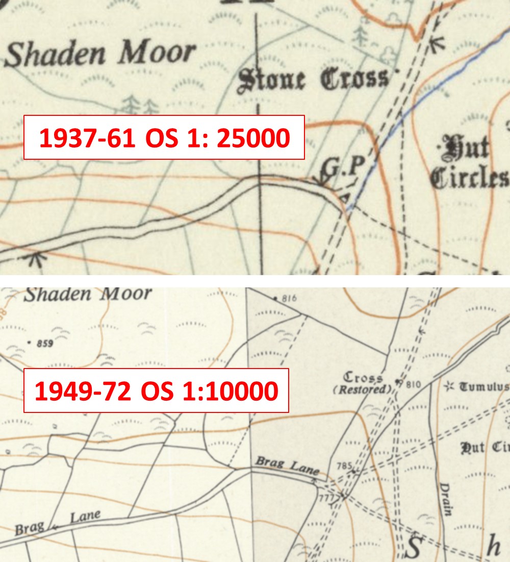
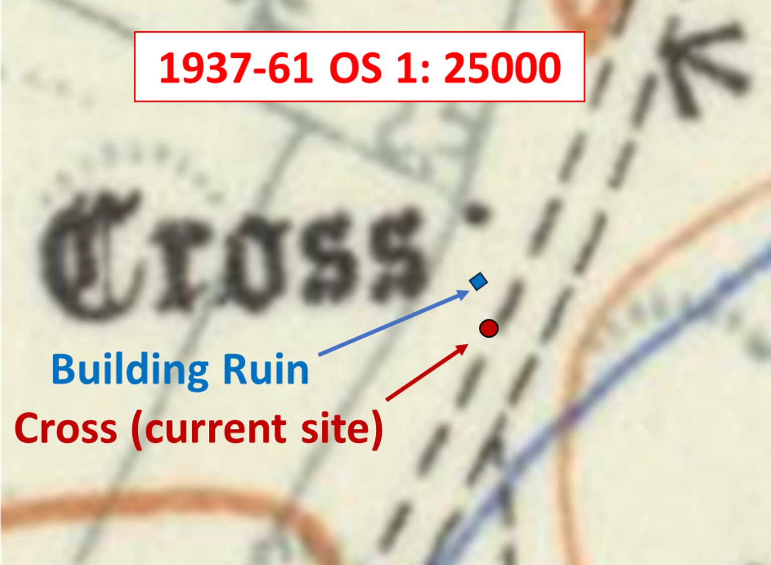
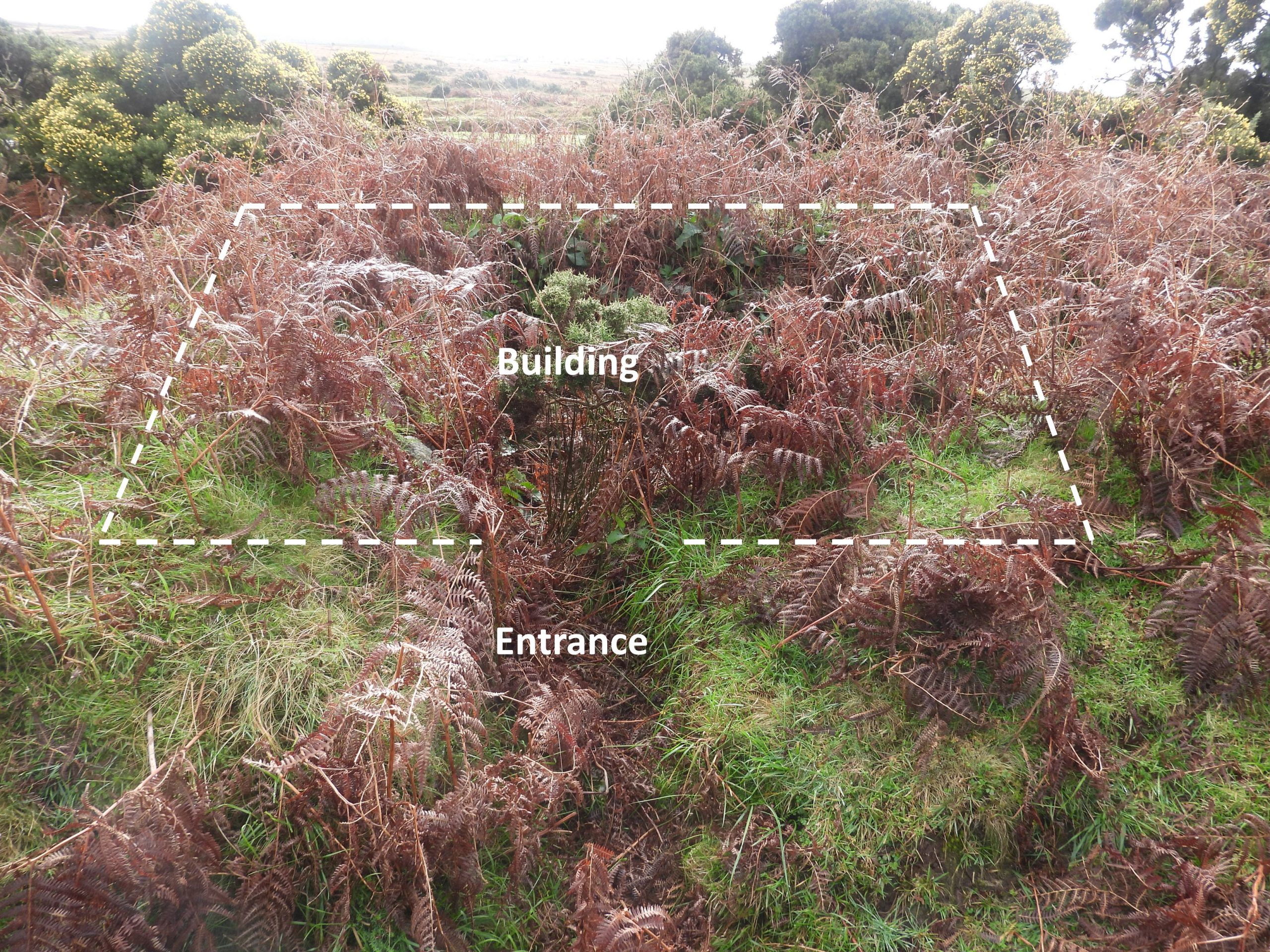
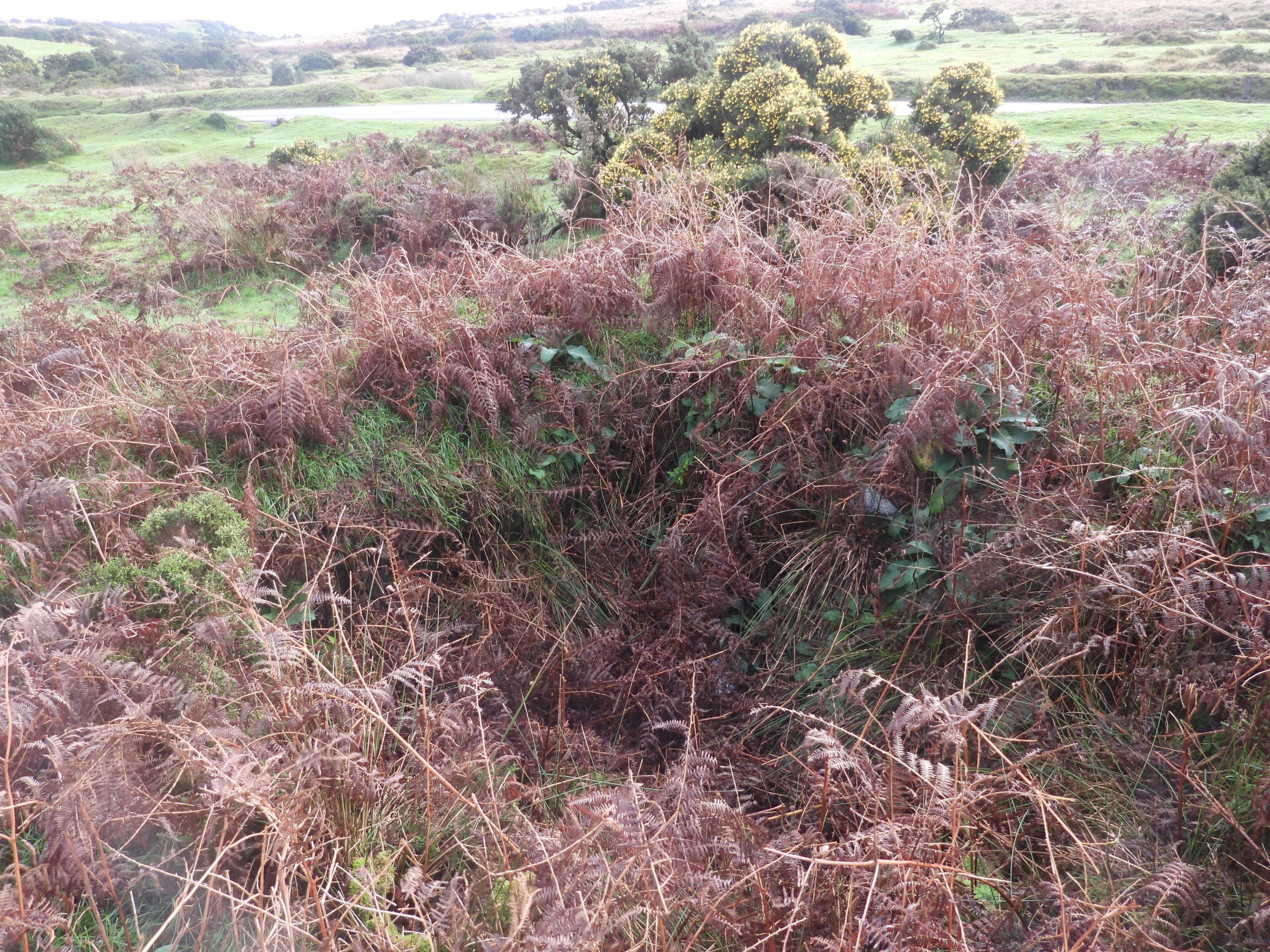
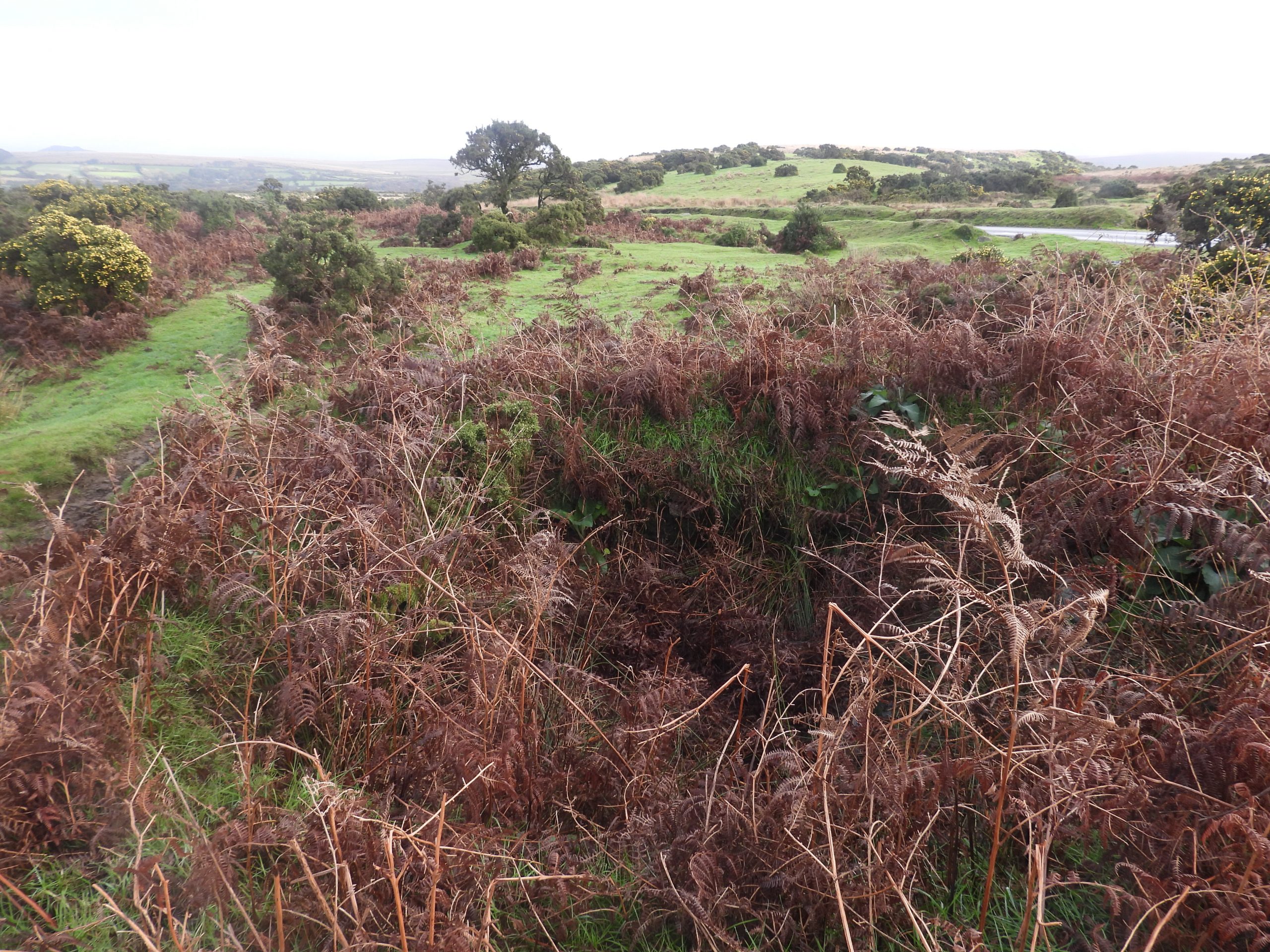
That said, there are a couple of mysteries surrounding the cross. Firstly, according to two differently dated 20th century OS maps (1937 and 1949), the cross appears that it may well have been ‘moved’ around 30m from beside a drystone wall adjacent to Shaden Moor to its current position next to the road. Is this a map makers error which might date back to the 19th century where the cross is also located on maps beside the drystone wall or was it actually physically moved sometime in the middle of the 20th century? Secondly, there is a ruin of a modern looking building located approx. half way between the two aforementioned locations relating to the cross. The building ruin is quite small and is unusual insofar as the walls are very thick. It is possible that the building was constructed in the 20th century and it is not inconceivable dates back to the time when the map makers changed the location of the cross (ie between 1937 and 1949). Therefore, is it possible that the moving of the cross and the construction of the building are related (however bizzare that may sound)?
Bibliography:
E.NMasson Phillips (1937) – The Ancient Stone Crosses of Devon
T. Sandes (1997) – A Pilgrimage to Dartmoor’s Crosses
M. Fletcher and S. Probert (1998) , Shaugh Moor, Devon – An Archaeological Survey (Report – Survey).
dartmoor-crosses.org.uk
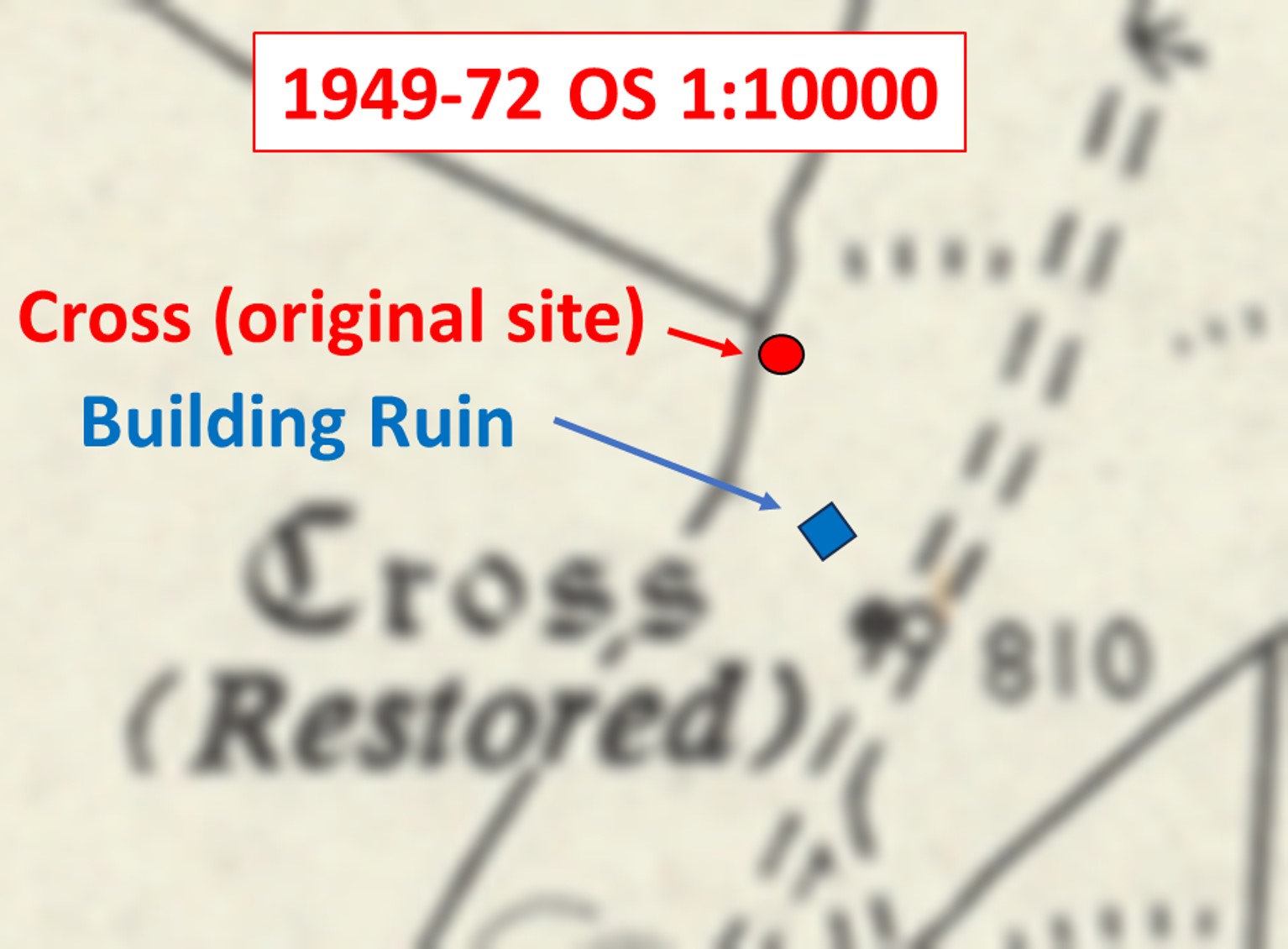
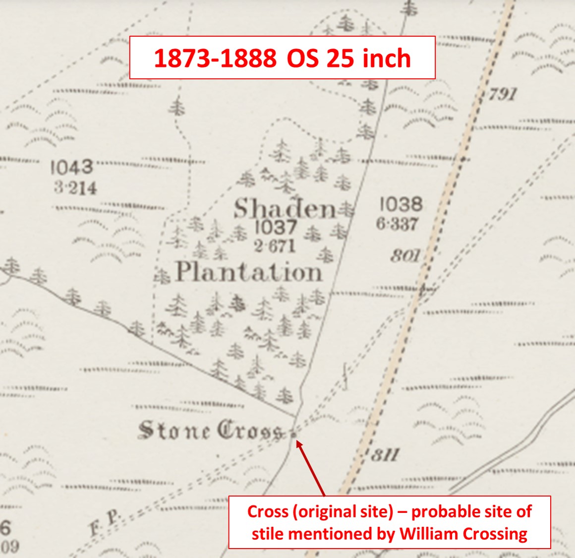
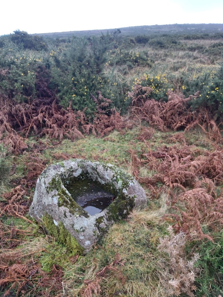
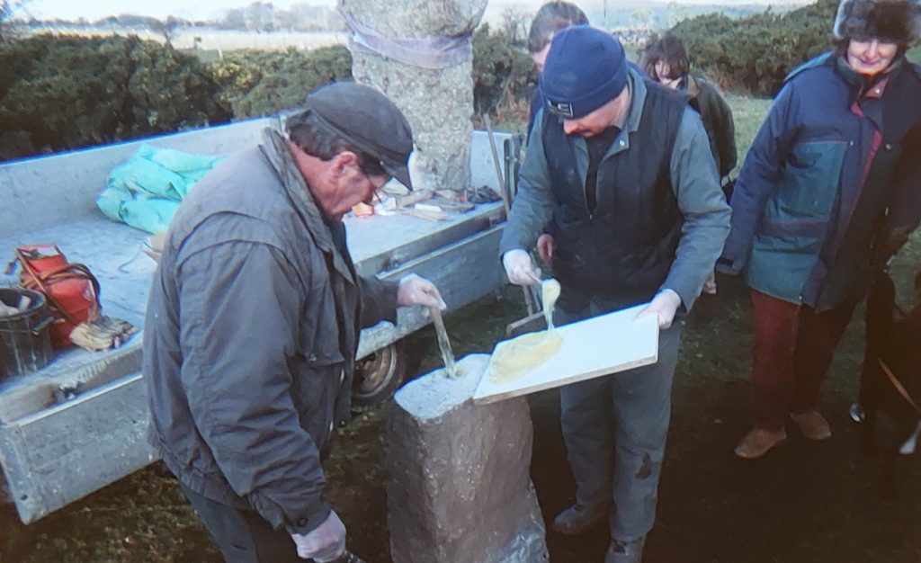
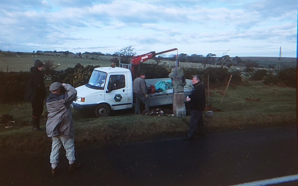
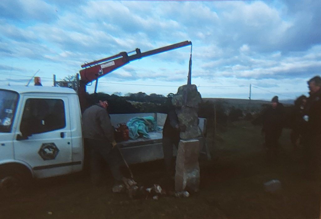
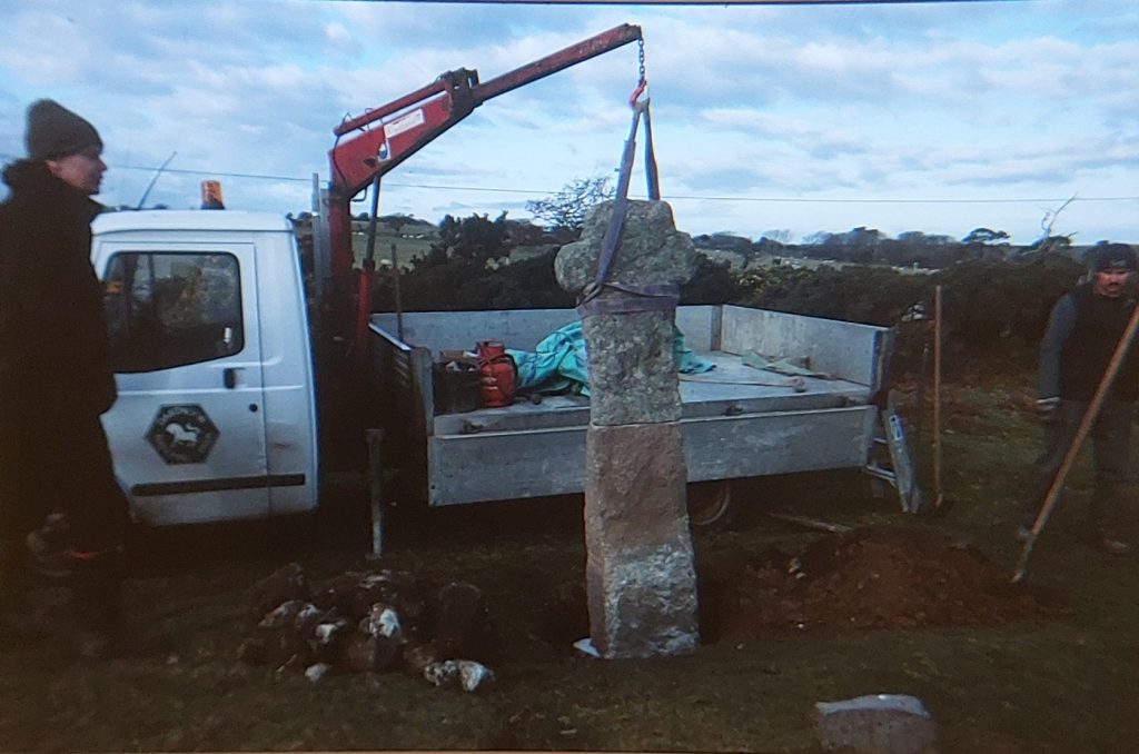
These two annotated maps date from 1937-61 and 1949-72 and clearly show Shaden Moor Cross has moved. It also seems that the benchmark to the north of the cross has moved from the east side of the road to the west, which is bizzare. The 1937 location of the cross is SX55223 63495 and the 1949 of the cross is SX55238 63467. Was the cross physically moved or did the map makers realise they had made a error dating back a century?There is an excellent write up of Shaden Moor Cross on dartmoor-crosses.org.uk website, which is well worth visiting for this (and any other cross on the moor). The website states that: “William Crossing wrote, in his 1902 book ‘The Ancient Stone Crosses of Dartmoor’, that the medieval section of cross was found in use as the bottom stone of a stile, at nearby Shaden Brake. It was this discovery that led to its alternative name of Shaden Brake Cross”. Crossing also states that it sometimes was referred to as ‘Stony Cross’Zoomed in portion of the 1937 map with the annotated locations of the building ruin and the current site of the cross. If the cross location isn’t a map makers mistake and the cross was physically moved then the author hasn’t found any documentary evidence of this occurrence. Had the cross been moved, in all probability dartmoor-crosses.org.uk would have mentioned it on their website as they are very thorough in their research.The cross we see today at the brow of the hill includes a (2nd) new shaft, which is only just over 20 years old. As part of the 50th anniversary of Dartmoor as a National Park (2001), the Dartmoor Trust funded the cost of a replacement shaft. On dartmoor-crosses.org.uk website they record that the work was undertaken by the Dartmoor National Park Conservation Works Team and the completed works were unveiled at a small ceremony on 20th December 2001.Zoomed in portion of the 1949 map with the annotated locations of the building ruin and the ‘original’ site of the cross. The cross was originally only about 1m tall, when it was discovered at Shaden Moor Brake and subsequently erected. The cross is said to have been re-erected in 1915 by the Reverend H. Hugh Breton having been used as the bottom stone of a stile and then propped up against a nearby wall. Did the Reverend re-erect the cross next to the drystone wall or in its current location? Sometime around 1915, a first replacement shaft was made for the cross only to be replaced in December 2001. The reason for the second new shaft was that the first replacement 86 years previously was a very poor match! This annotated map is very revealing. It dates from 1873 and shows a stone cross next to the wall where a footpath passed through (probably with a stile). Therefore this map is very likely to provide part evidence of Crossing’s observation that the cross was once the bottom step of a stile. Furthermore, Reverend Breton (in 1915) may well have re-erected said cross exactly at this point. Then, in mid-20th century (between 1937 and 1949), the cross was moved to its current location.William Crossing suggests that the cross could once have fitted the Beatland Corner Cross Socket (see photograph), which is located at SX54837 62424. Crossing’s suggestion is pure conjecture. The Cross Socket is located approx. 1km to the south of the location of the cross. If this is the case then the cross certainly has had a eventful existence with being moved possibly twice and having had at least 3 shaftsThe second replacement shaft was made for Shaden Moor Cross and put in place on 20th December 2001. The picture shows adhesive being applied. Picture courtesy of Gillian and Steve Garlick from Ted Dixon collectionCross head being manoeuvred into positionLowering the cross head onto its new shaft – easy does itLowering the cross head onto its new shaft – in placeThe cross was described by Masson Phillips (1937) and further recorded in 1980 by Ordnance Survey Archaeology Division thus : “The base of the modern shaft is set in rough stones mortared together. The total height of the cross is 2m of which the Medieval head is 0.9m in height, and 0.6m. in width”. Later the height was recorded as 2.13m. Of course all these dimensions related to the first new shaft. With the second new shaft, which measures 0.81 metres high, 0.41 metres wide and 0.23 metres deep, the cross is now only 1.7m (ref: dartmoorcrosses.org.uk)Between the former and current locations of Shaden Moor Cross are the remains of a small building, which is quite modern looking. It lies in an area of linear gullies, watercourses and disturbed ground. There is an obvious entrance on the north west side around 0.5m across. The building ruin is unusual insofar as the walls are very thick, suggesting perhaps it might have been built for protection of the occupants or contents. Alternatively, the thick walls may be for protection of those on the outside if the contents stored in the building were dangerous. Explosive buildings / huts sometimes had thick walls.The building is located at SX55226 63478. The building is a 5.8m square structure with drystone walling 1.4m wide and 1.0m highThe author has a random (unsubstantiated) theory about the building believing it dates from WWII as it looks like it has military origins (thick walls). The author has a notion that Shaden Moor Cross was moved at around the same time this building was constructed. Another Dartmoor mystery ?
ROBERT JAMES NOAKES December 19, 2023
Here is a photograph of Shaden Brake Cross by the wall.
SteveGriggDartmoor December 19, 2023 — Post author
Thank you Robert, that is a great picture and completes the story!
With Kind Regards,
Dartmoor Explorations (Steve)