A collection of walks, discoveries, insights and pictures of exploring Dartmoor National Park
September 7, 2021
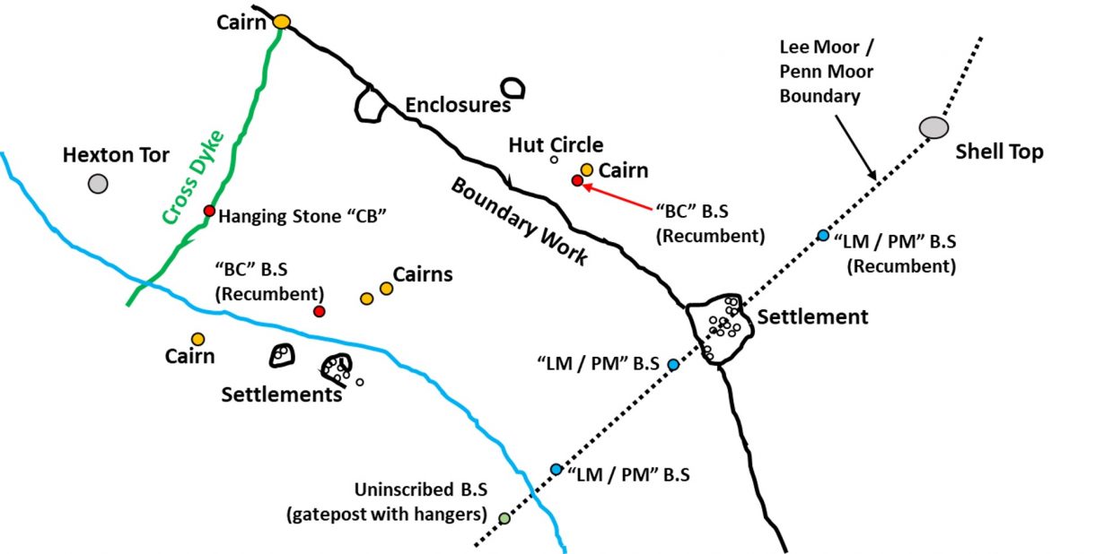
Boundary Markers in China Clay Country (Lee Moor)
This post covers an exploration of the moor bounded by the China Clay workings at Cholwichtown and Whitehill Yeo in the south, the Lee Moor / Penn Moor boundary to the east, Cross Dyke Reave to the west and up to and Shell Top to the north. Within this area there are at least 6 inscribed boundary stones plus inscriptions on Shell Top. The “CB” and “BC” stones may relate to Cholwich or possibly are the bounds of an original clay sett . The “LM / PM” stones are boundary markers. Other features from the area are also included in this post.
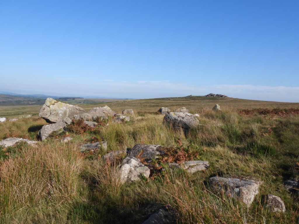
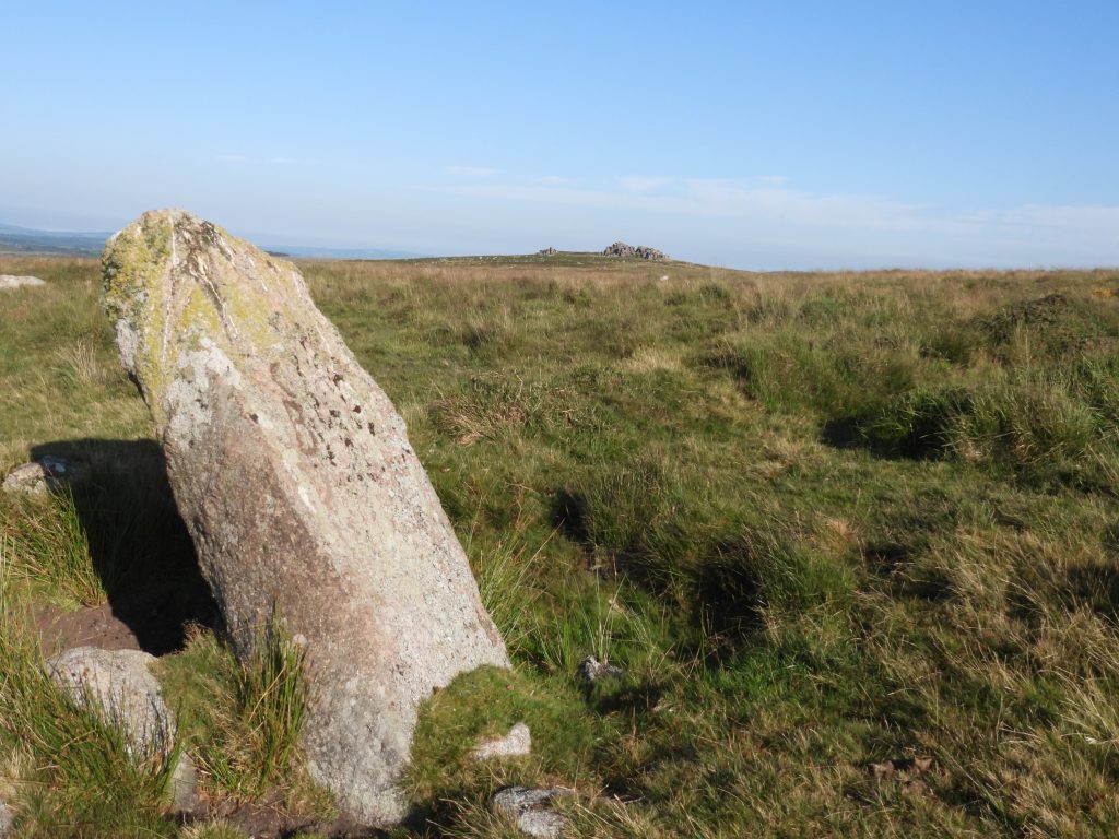
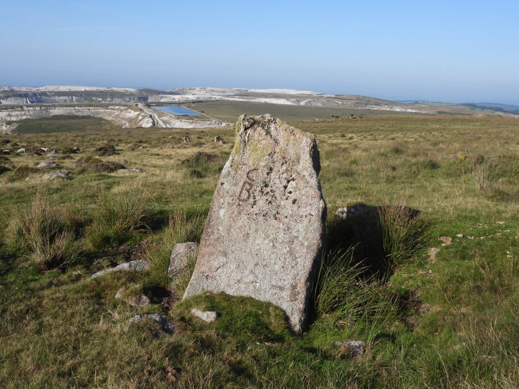
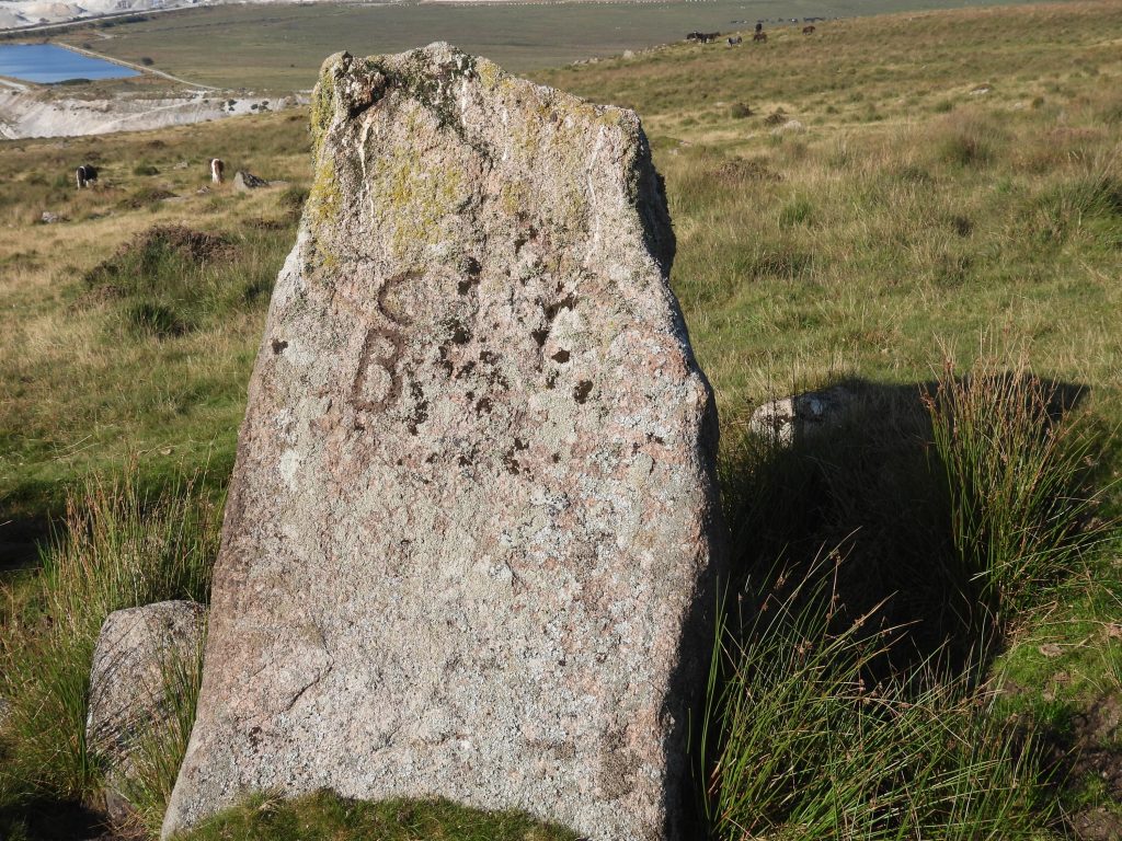
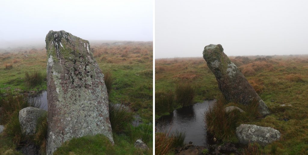
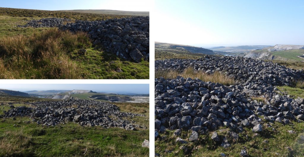
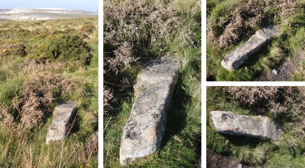
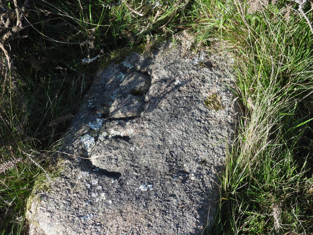
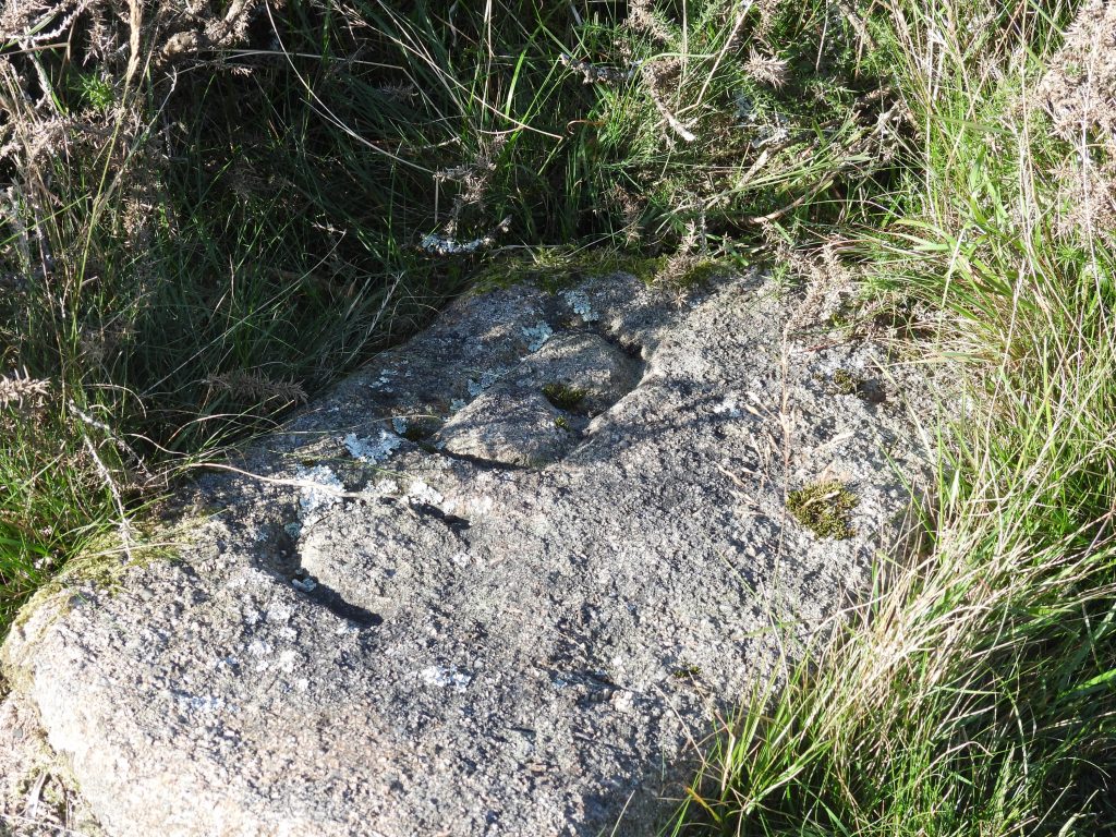
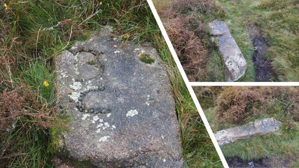
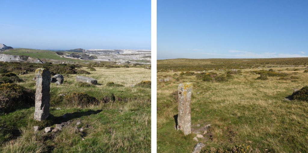
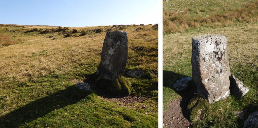
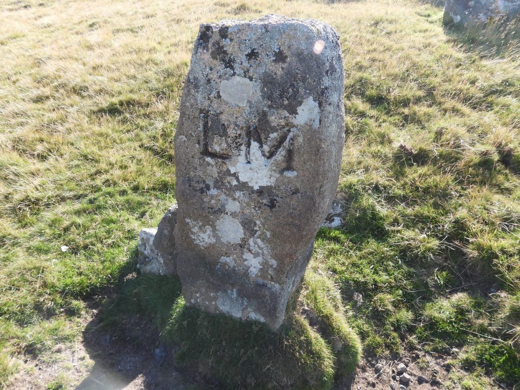
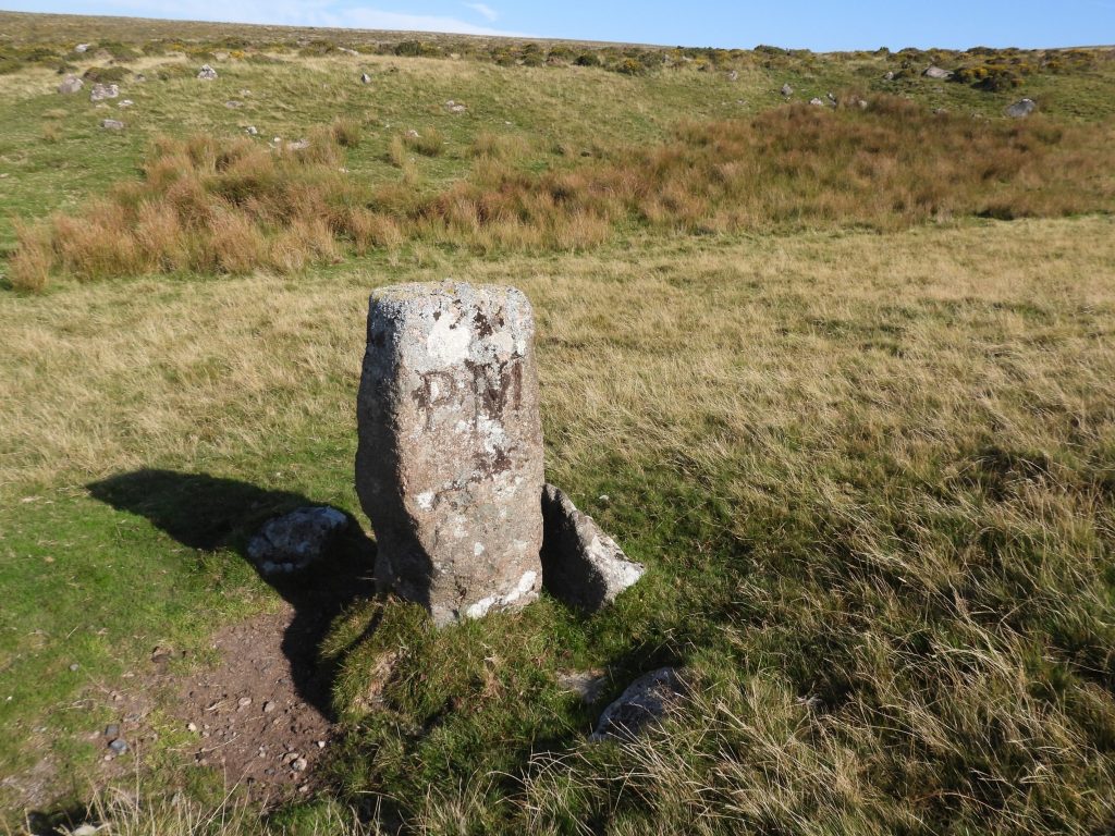
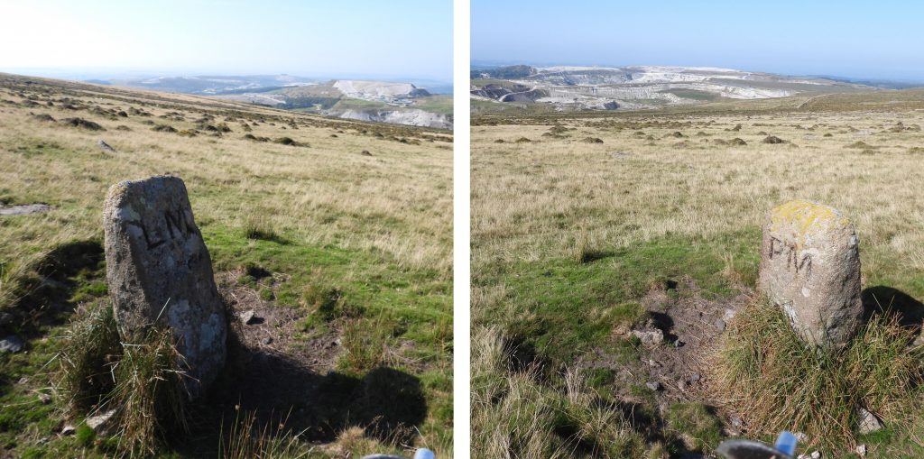
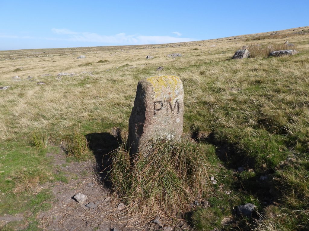
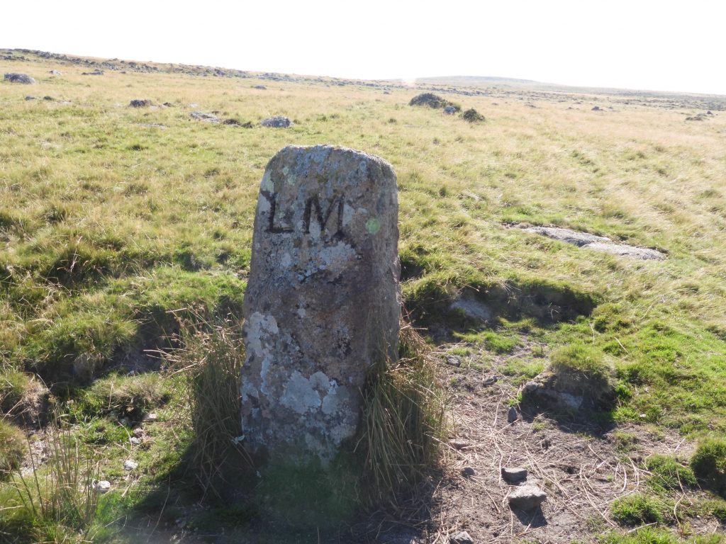
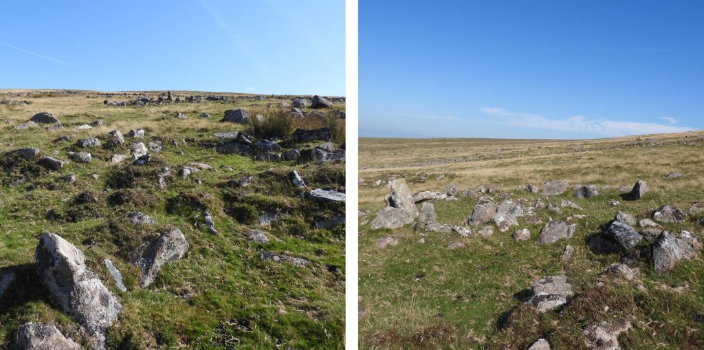
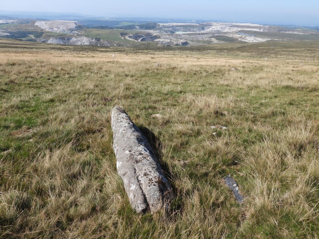
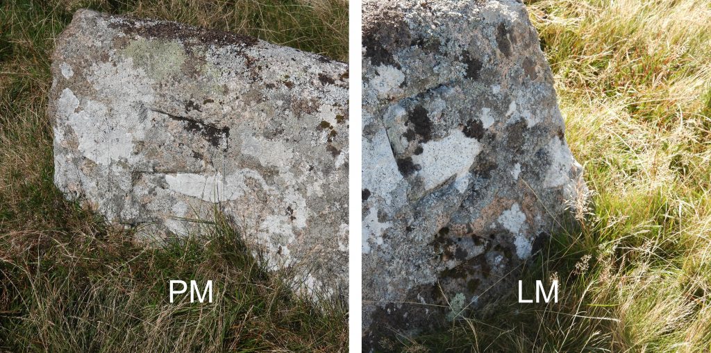
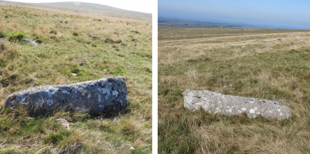
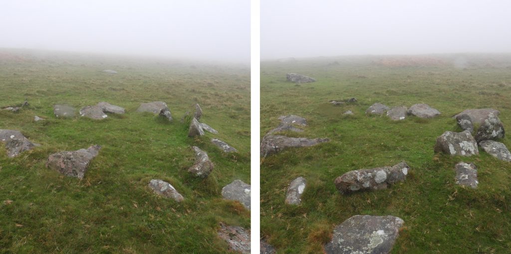
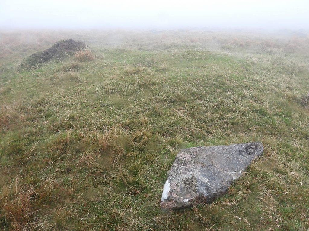
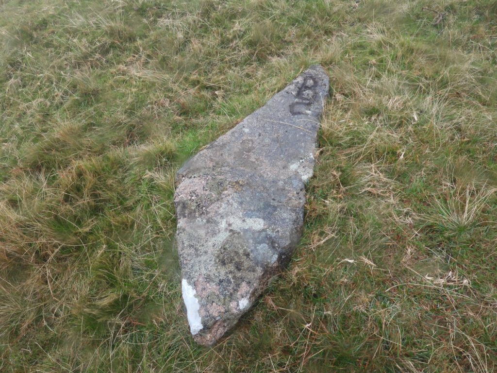
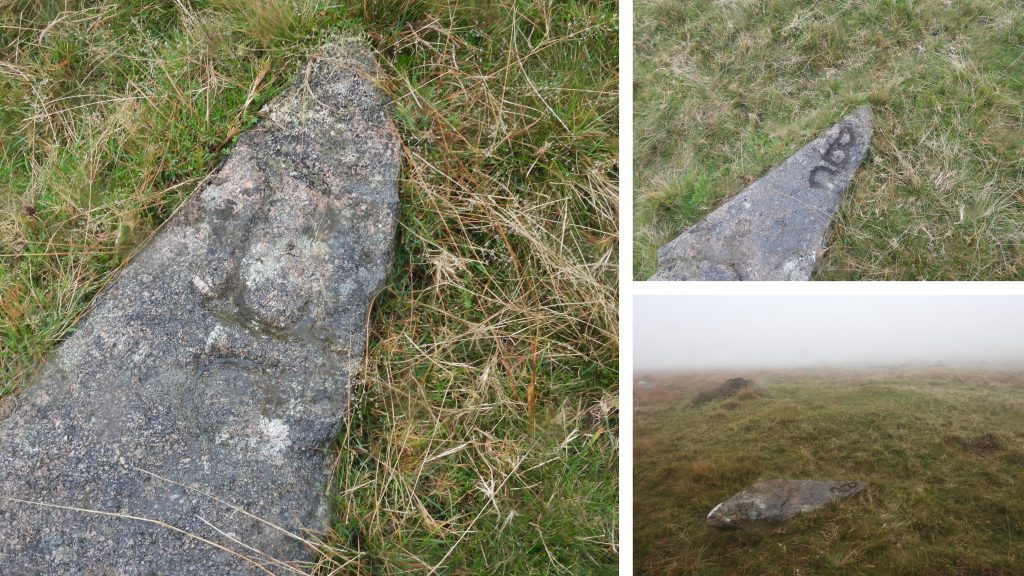
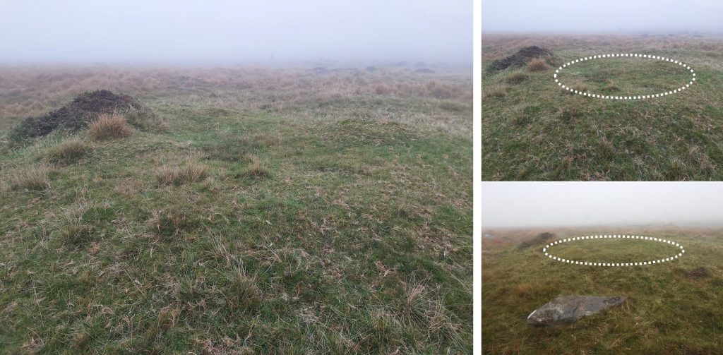
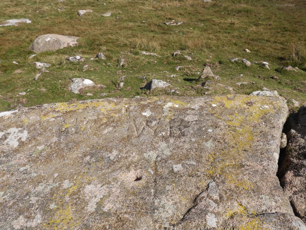
Sketch map of the area covered in this postHexton Tor near Cross Dyke Reave with Great Trowlesworthy in the distance.The Hanging Stone with Great Trowlesworthy beyond The Hanging Stone is inscribed with “C B”. In the “Dartmoor Boundary Markers” book (2nd edition) by Dave Brewer (page 235) it is suggested that this stone might relate to Cholwich. He further states that possibly this is part of the bounds of an original clay sett. The Hanging Stone can be located at SX58372 63701The Hangingstone in the mistThree cairns comprising: Two small cairns to the north-west of the large cairn. The small cairns are 2.5 metres diameter by up to 0.15 metres high and the large cairn is 26 metres by 24 metres and 1.2 metres high. The large cairn was investigated in the later 19th century when it was interpreted as the remains of huts, a chambered cairn or a large cairn with inserted shelters. Source: Dartmoor HER. The edge of the cairn was recorded at SX58673 63515.The Hanging Stone has initials “CB”. Approx 150 paces from the chambered cairn, this recumbent stone can be found. It bears the inscription “BC” and is believed to mark the same boundary which incorporates the Hanging Stone.The “BC” appears to have been inscribed by the same person (due to the similarity) as inscribed the Hanging Stone. Dave Brewer in his Dartmoor Boundary Markers book speculates that the “C” might stand for Clay, similar to the “CW 2” stone at Little Kings Tor which is related to Clay.The recumbent “BC” stone can be found at SX58546 63502The recumbent “BC” stone on a damp misty day.On the Lee Moor / Penn Moor boundary (just below the track) a standing stone (or ex gate post as it has gate hangers still in it) can be found. The boundary also marks the Cornwood and Shaugh Prior parish line. The post can be found at SX58951 63049 This standing stone is marked with “LM” on one face and “PM” on the other. It lies on the Lee Moor / Penn Moor boundary and subsequently the Cornwood / Shaugh Prior boundary. The boundary stone can be found at SX59054 63148“LM” for Lee Moor“PM” for Penn Moor.Climbing the hill from the previous “LM” / “PM” boundary marker a second such stone can be found. This one is at SX59286 63366Once again “PM” for Penn MoorOnce again “LM” for Lee MoorThe Lee Moor / Shaugh Moor boundary passes through a large settlement. The Dartmoor HER describes it as being an enclosed hut circle settlement of 115 metres by 110 metres containing at least thirteen hut circles of varying sizes.This recumbent Boundary Stone is depicted on older maps but not on the modern OS map. It is the third “LM” / “PM” stone on the hillside between the china clay workings and Shell Top.The “PM” and “LM” inscriptions are very well defined.This third Lee Moor / Penn Moor boundary marker can be found at SX59525 63583Lone hut circle at SX58970 63766. To the north-east of a low wall marked “boundary work” on modern OS maps, the second recumbent “BC” inscribed rock can be found. It is just a few metres (WSW) from a cairn mound and it may have once stood upright on the cairn.With a mud makeover the inscription “BC” is clearly shown and is similar to the other recumbent “BC” stone further down the hill. The stone can be located at SX59104 63750.The Heritage Gateway records this stone as being 1.55m long by 0.57m wide and being lozenge shaped. It is theorised that the letter “C” could represent Cholwich Town/Manor or Cornwood Parish, while the “B” could denote Blandford Manor.This round cairn is recorded on the Heritage Gateway as “an 8.5m long (north to south) by 7m wide (east to west) mound standing up to 1.1m high”. It has two separate hollows dug into the mound suggest partial early excavation or robbing. It is adjacent to the recumbent “BC” stone. The centre of the cairn was recorded at SX59107 63752Shell Top, which is also known as Shiel Top, Penshiel or even Shell Tor.On the summit of Shell Top is the inscription “AR WR”. The reason behind these letters is unknown. The hole in the rock is believed to be where a flagpole would have been located when firing in the area took place during war time.