A collection of walks, discoveries, insights and pictures of exploring Dartmoor National Park
January 20, 2023
Possible Duchy incursions into Walkhampton Parish near North Hessary Tor
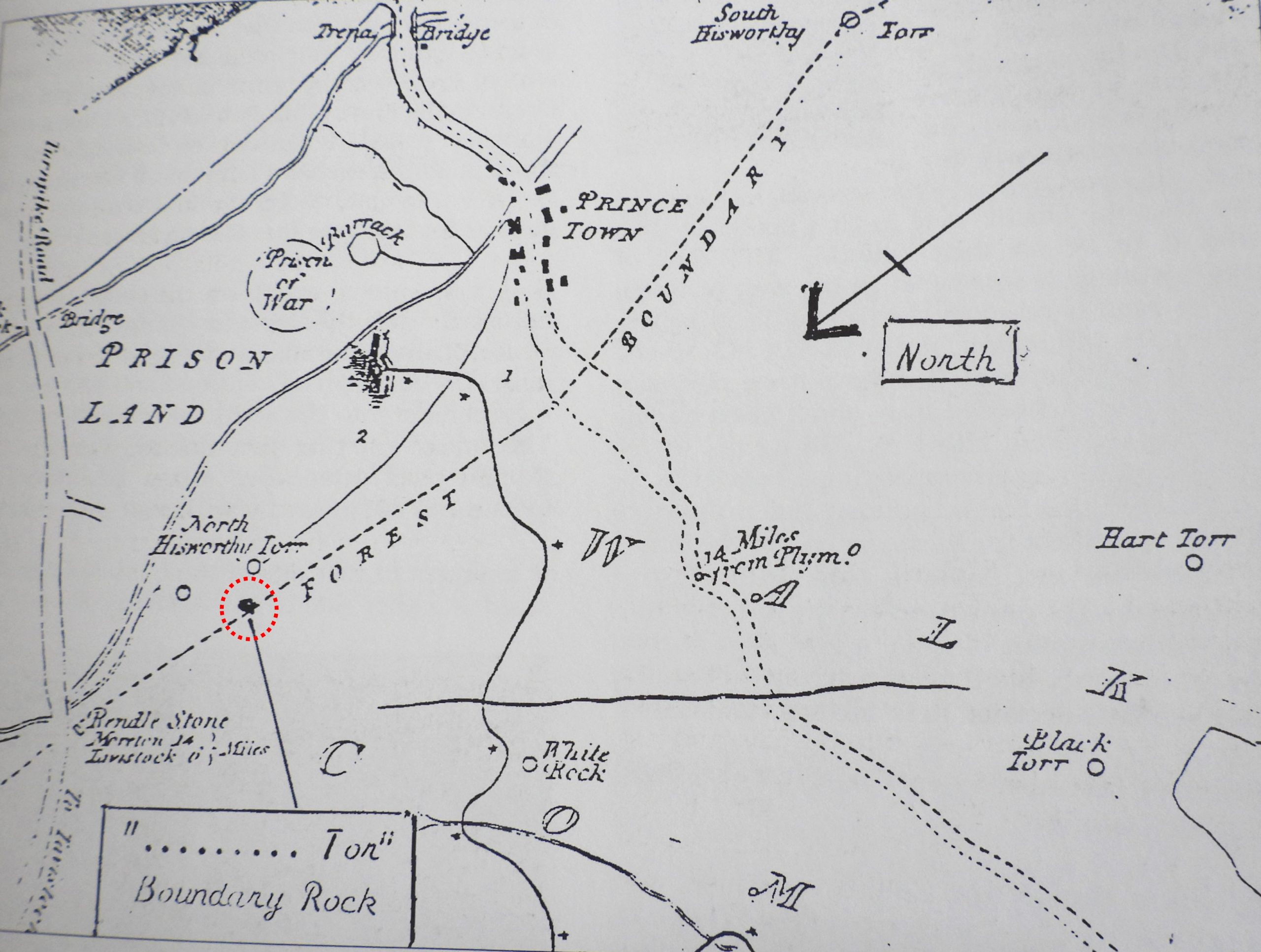
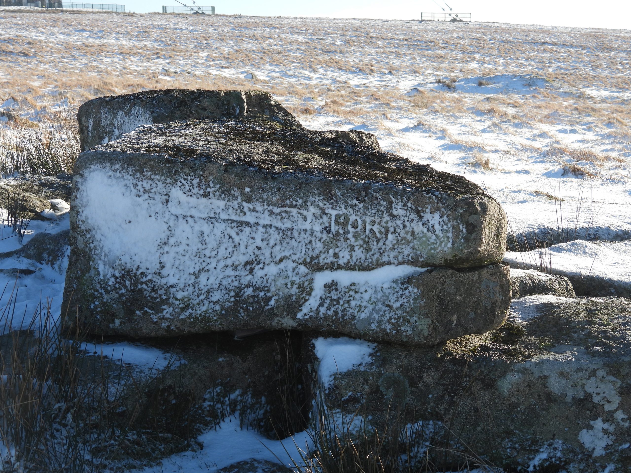
It has been documented that during the late 18th and early 19th centuries the Duchy was in conflict with a number of parishes including Gidleigh, Throwleigh and Walkhampton. Regarding the latter, there appears to be some ‘physical’ evidence of this, insofar as there is an inscribed outcrop to the north and west of North Hessary Tor, marked with the letters “TOR”, which is preceded by and indecipherable ‘cartouche’.
Dave Brewer in his book Dartmoor Boundary Markers, 2nd edition (page 208) and in a letter to Dartmoor Magazine (Winter 1993 edition – page 29) supposes the inscription is related to an old map which was incorporated in a prospectus by Sir Thomas Tyrwitt, published in 1818, which extolled the virtues of having a railway to Princetown. On the map, it appears that the Duchy had claimed erroneously the line of the Forest Bounds from South Hessary Tor to ‘Rendlestone’, not through North Hessary Tor but to the north and west via the small outcrop which has the inscribed rock.
The inscription on the small outcrop can be difficult to photograph (especially the indecipherable part), so the author took advantage of a bright day with snow on the ground to record it. The Tyrwitt prospectus map can be found in the Brewer book. Couple this with and looking at the tithe map from circa 1840, it can be speculated what the erroneous boundary was, which had been claimed by the Duchy. This post is part speculation and the author would welcome receiving any additional information.
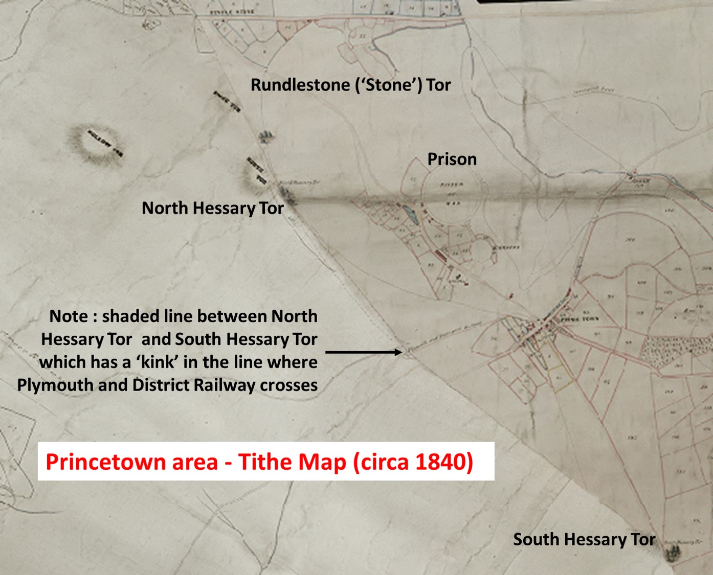
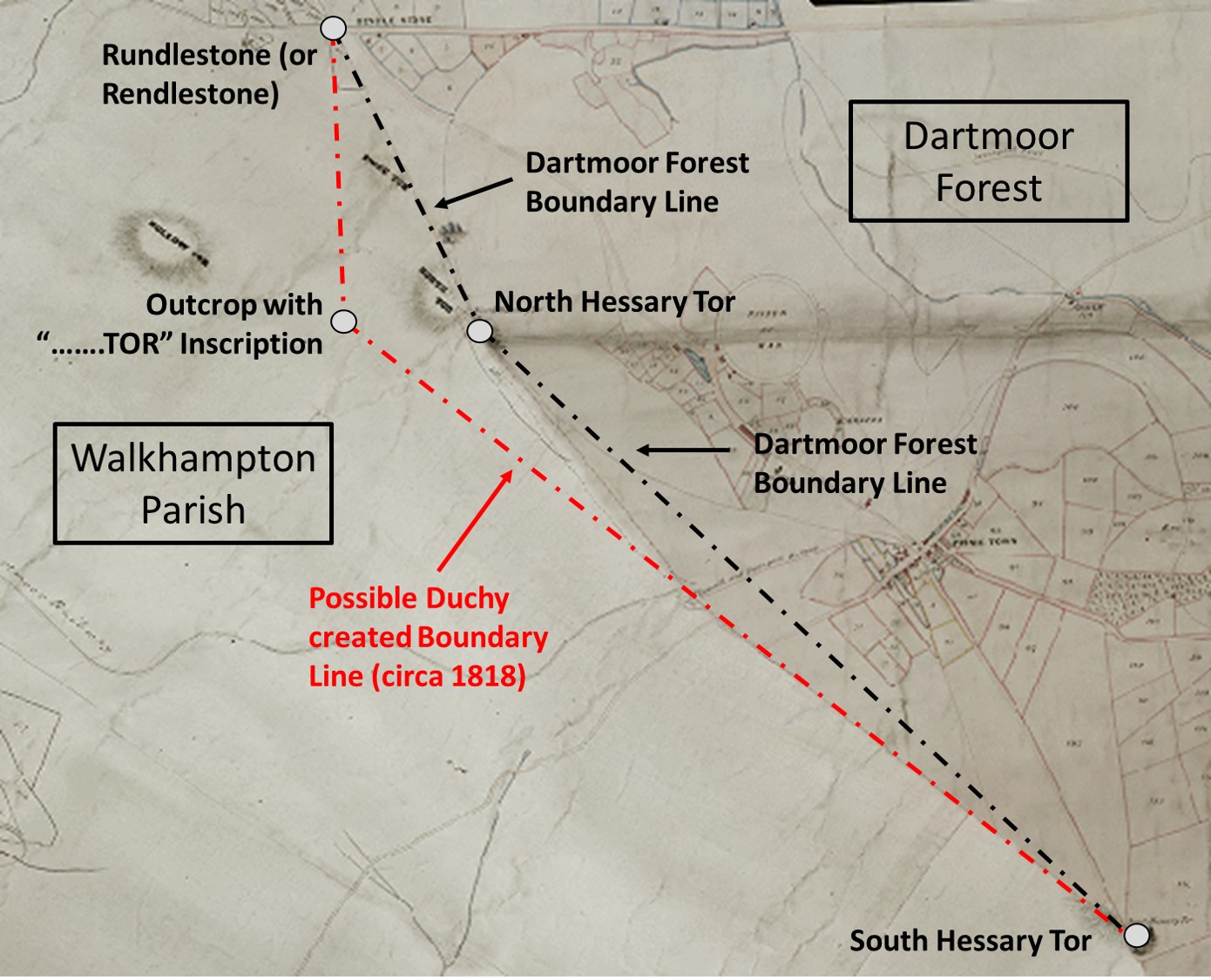
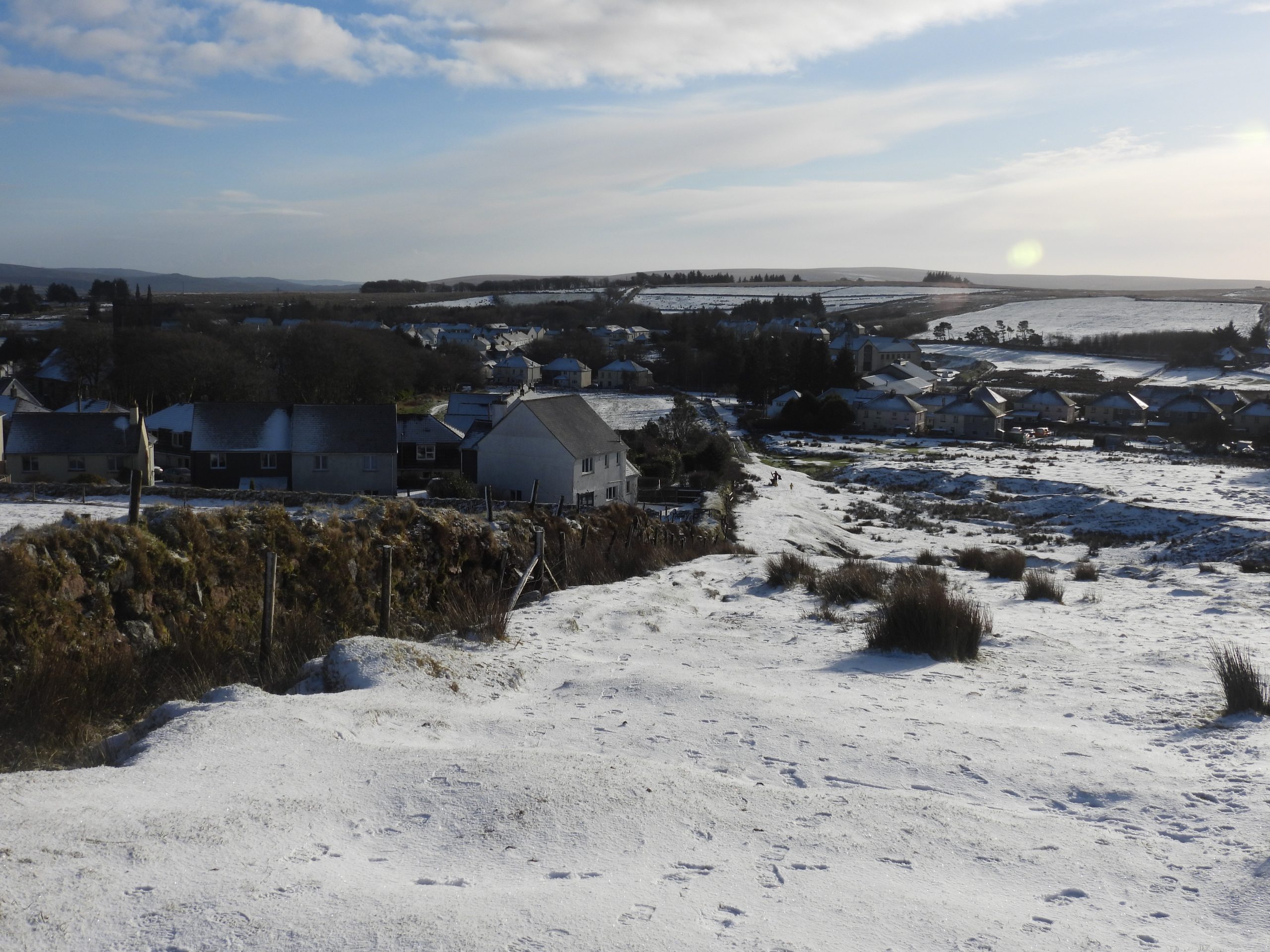
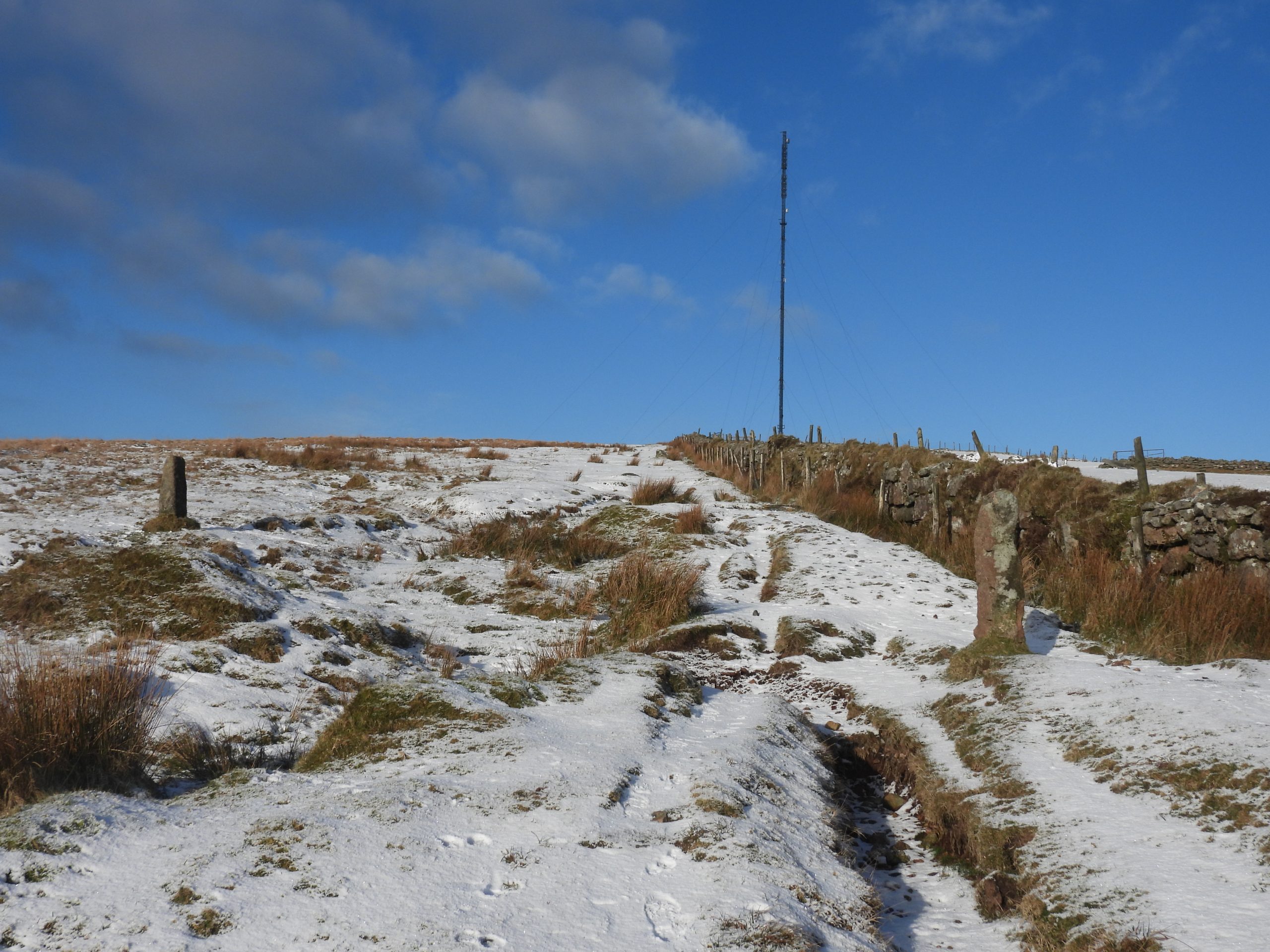
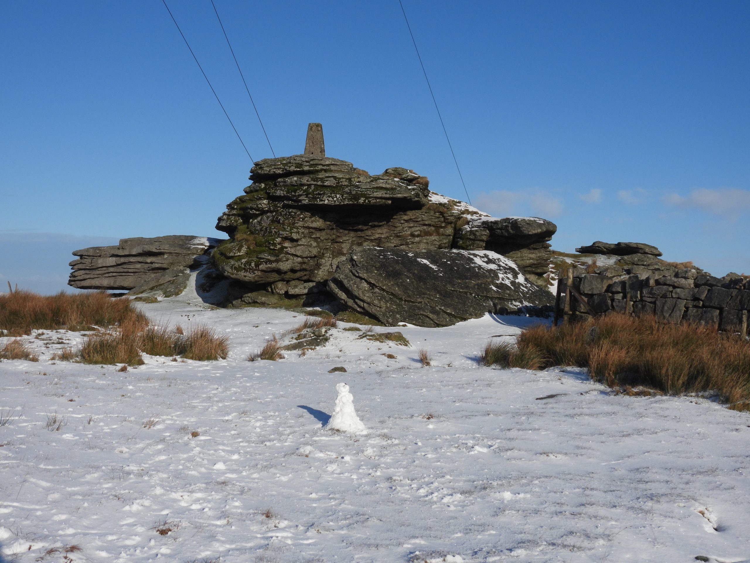
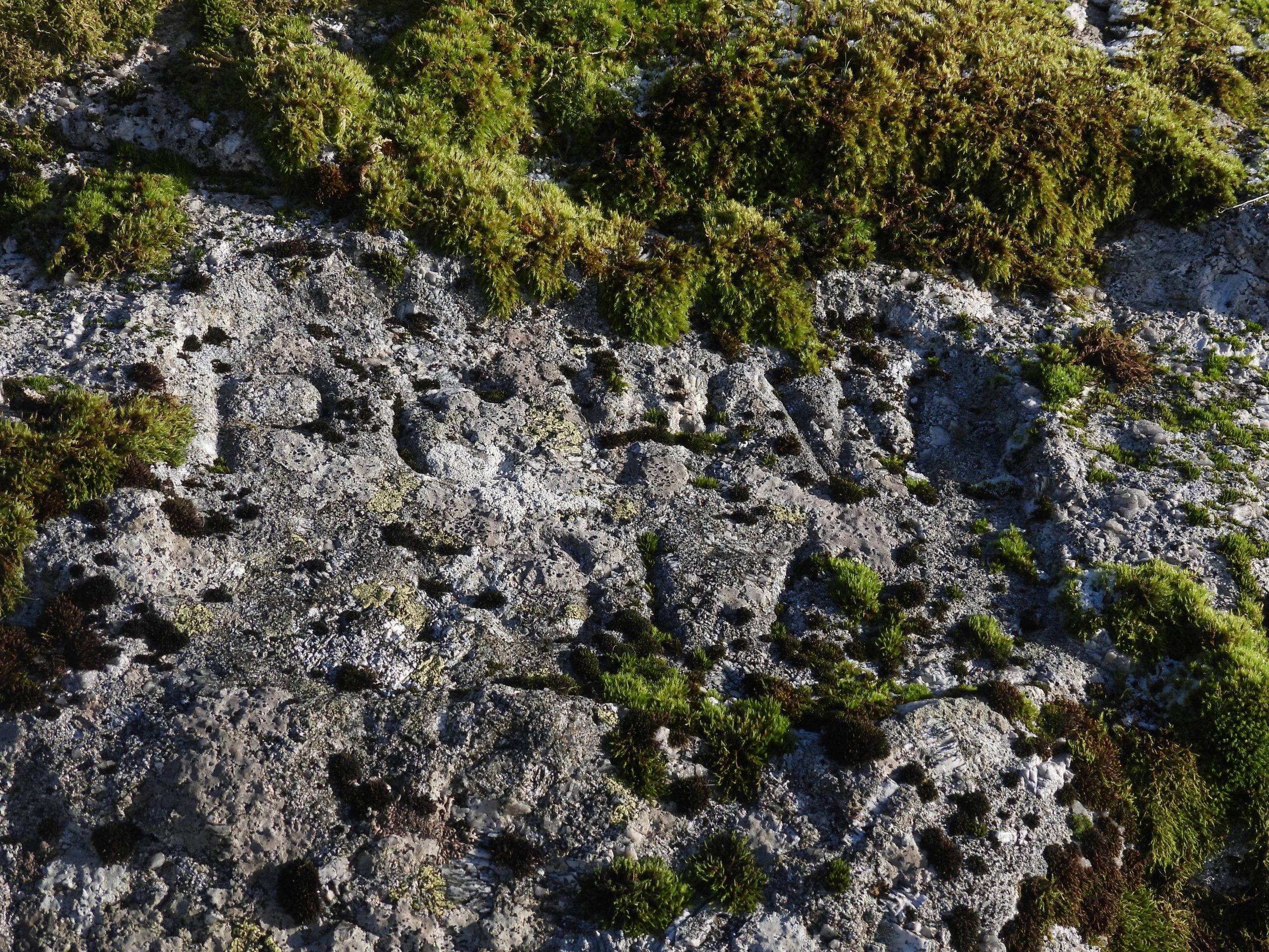
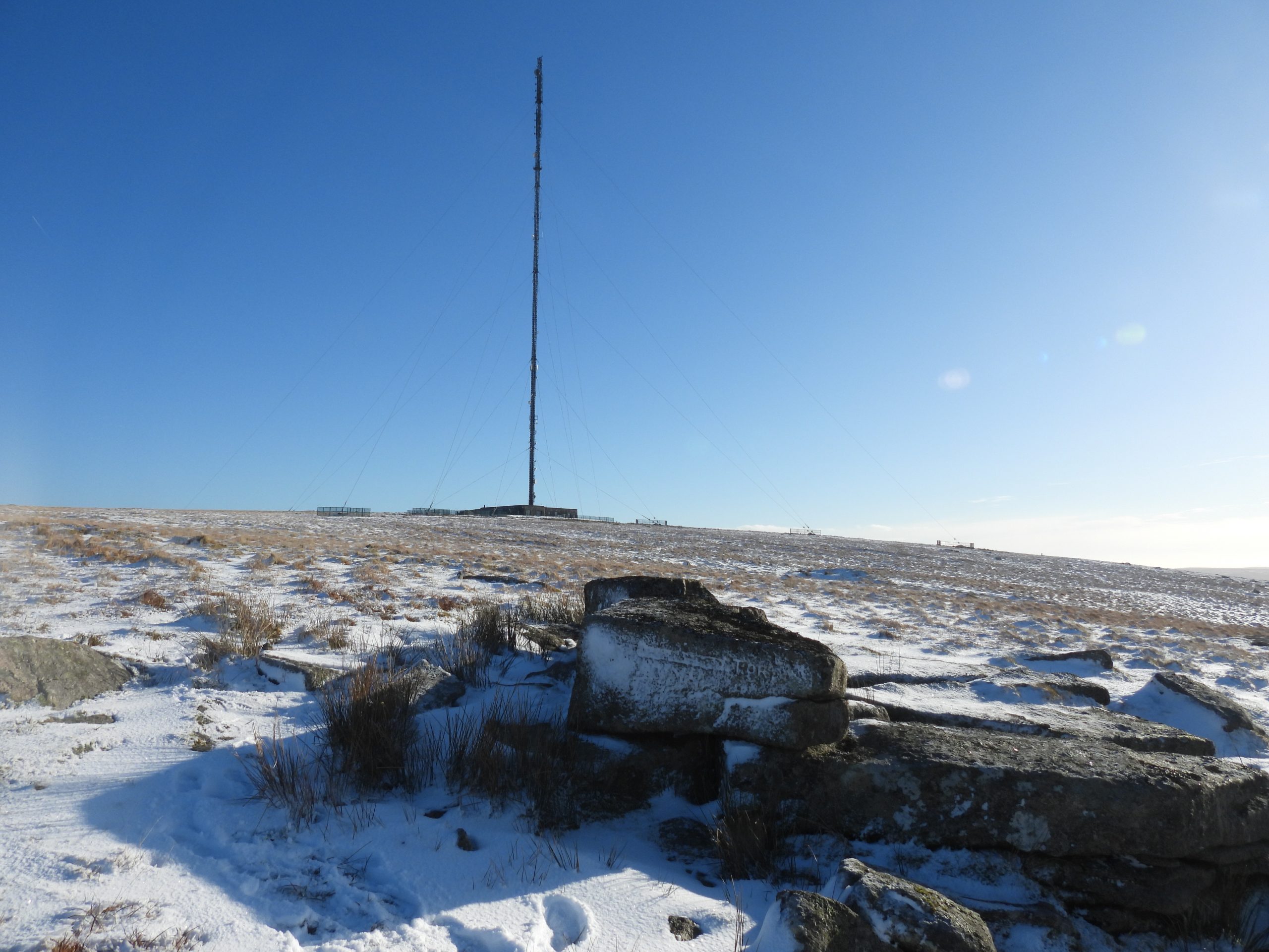
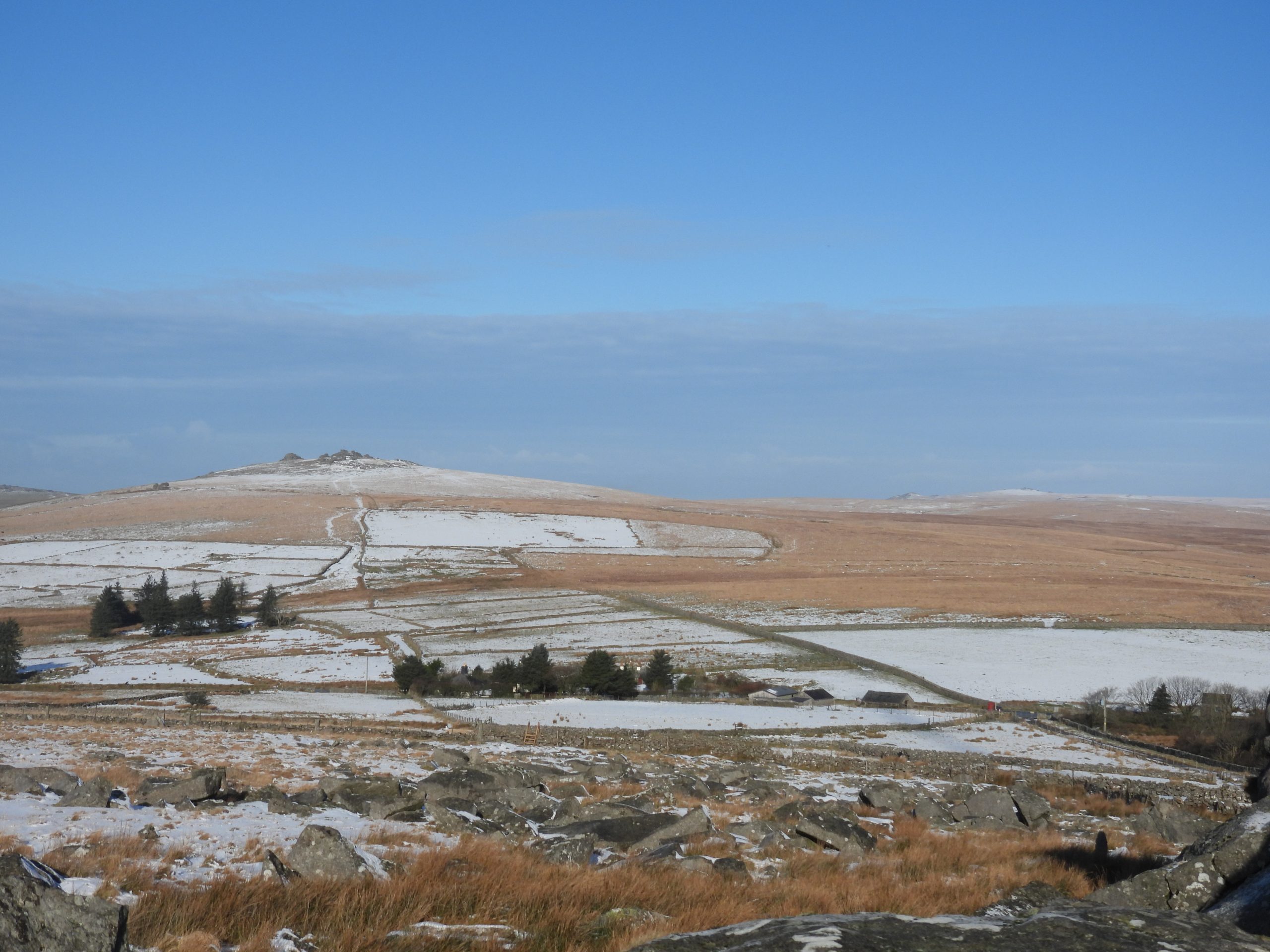
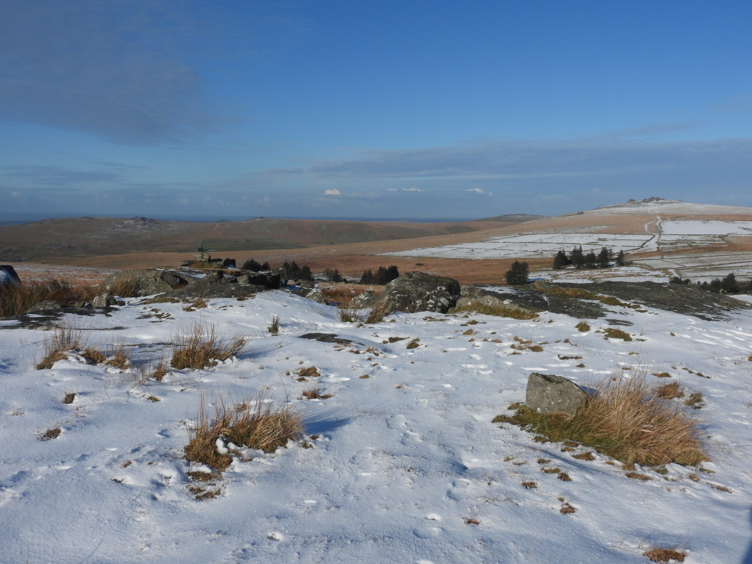
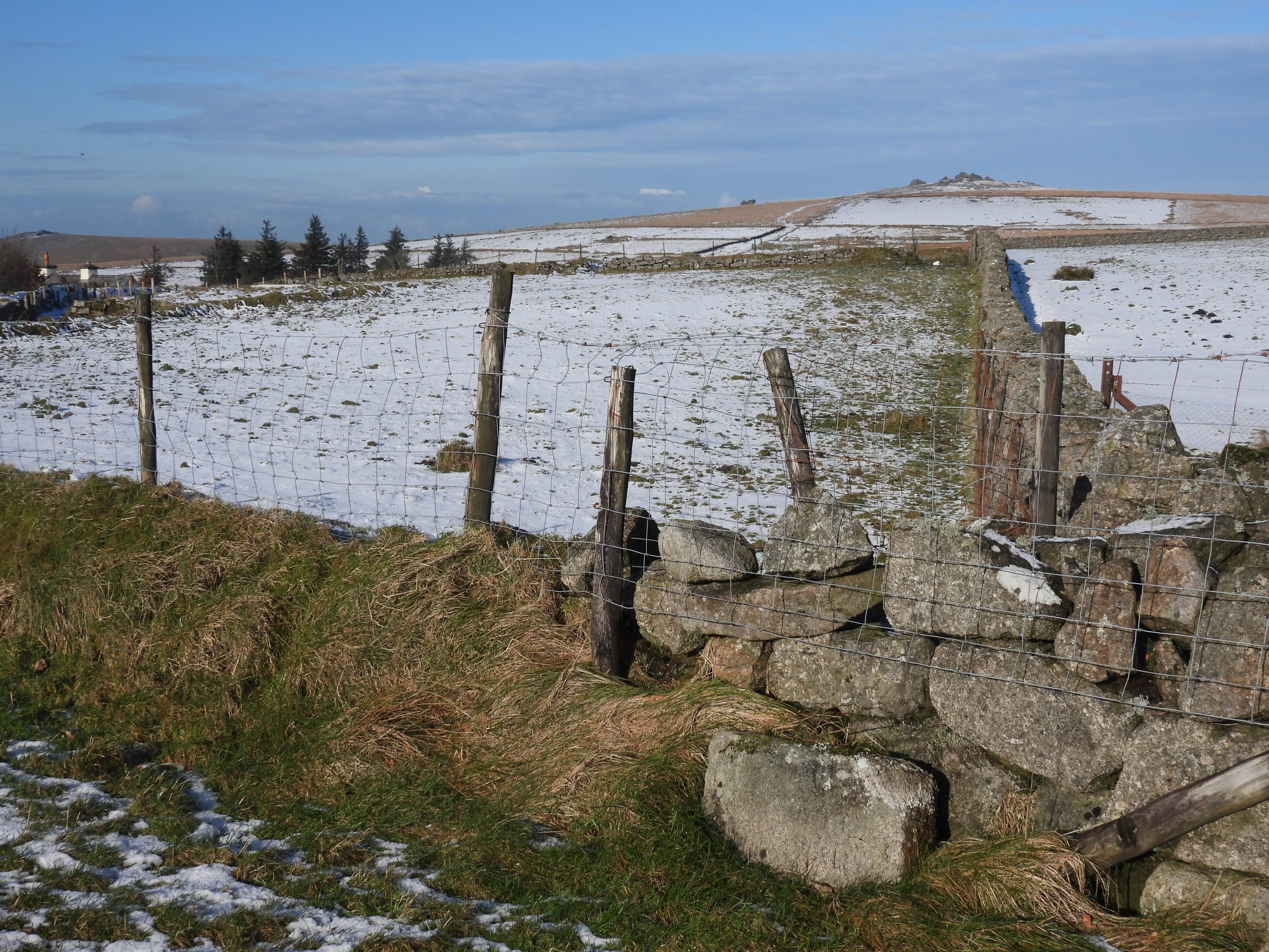
The Thomas Tyrwhitt prospectus clearly shows the forest boundary not running through North Hessary Tor, which is where the conjecture of the duchy incursion has come from. Note that the map is not to any scale and does have obvious errors such as the physical line between Black Tor and South Hessary Tor (more or less) runs through Hart Tor.Having looked initially at the Tyrwitt prospectus, the author continued his research by looking at the old Tithe Map from the Princetown area. What was interesting was there appeared to be two shades on the map, coupled with a ‘kink’ and an old boundary line. The ‘kink’ (probably only coincidently) is where the Plymouth and District Railway crosses the line. Purely speculating, the author has annotated the Tithe Map, drawing a straight line (red) along the shaded part of what looks like a boundary and beyond the ‘kink’. Ironically this line leads straight to the outcrop with the inscription “……..TOR”. If one considers this is the turning point of the possible erroneous Duchy claims, then the author speculates it would have followed a straight line to Rendlestone (Rundlestone). The true line actually runs marginally to the west of ‘Rendlestone’ but is marked as such as it ties in with the Brewer evidence. Is this a reconstruction of the map in the Sir Thomas Tyrwitt prospectus ?Leaving Princetown on a bright day with snowy conditions. The Forest Boundary runs from the west side of the wall to the east side of the wall in a direct line from South Hessary to North Hessary. It would be easy to believe the line of the wall was the boundary.Looking north to the North Hessary mast. The boundary stone on the left (west) is a former DCP (Director of Convicts Prisons) stone which has an incised ‘broad arrow’ on it. The boundary stone on the right (east) is an old Forest of Dartmoor boundary stone. The true Forest Boundary follows a straight line from here to North Hessary Tor and bisects the wall from west to east.North Hessary Tor with its 1930’s Triangulation PillarOn the west side of the tor, there is an inscription “PCWW 1917” which stands for Plymouth Corporation Water Works. It does not add to the story in this post but is added as it is one for those inscriptions which is usually very difficult to photograph. The sunlight and shade was just about perfect in this photograph. More information can be found here:https://dartmoorexplorations.co.uk/plymouth-corporation-water-works-pcww-granite-boundary-posts-and-cast-iron-markers/The small outcrop to the north and west of North Hessary Tor which bears the inscription. The snowy conditions didn’t disappoint and the inscription was much enhanced by the snow and ice filling the letters in. The outcrop appears historically to be un-named but in recent times has been given the name ‘Little Hessary Tor’ (not an unreasonable label). It could easily be have been called ‘West Hessary Tor’. https://www.torsofdartmoor.co.uk/tor-page.php?tor=little-hessary-torClose up of the inscription. The Letters “TOR” are very discernible. The cartouche to the left of “TOR” was speculated at reading ‘N. Hisworthy’ or ‘N. Hessary’ by Dave Brewer. If this is the case, was this done by the hand of a Duchy official as a proclamation that the Forest Boundary ran to ‘N. Hisworthy Tor’ and this was that tor ! Others have speculated that it might read ‘Peter Hill’ or ‘Dewer Hill’. (ref: Dartefacts). That said, as stated by Brewer the inscription has been professionally chiselled away, thus making it almost indecipherable (even when filled with snow and ice). The location is SX57460 74250View of Great Mis Tor from Rundlestone TorRundlestone Tor (name as ‘Stone Tor’ on the Tithe map).The Tavistock Trust road was built between 1772 to 1776. The inscriptions on the obtusely angled faces of this ‘turnpike’ stone, which is today is completely illegible reads: Walk / hamp / ton and Lid / ford (Ref: E.N Masson Phillips – 1943). By an act of parliament, the Tavistock Trust (formed in 1762) were bound to erect suitable milestones and boundstones where their roads crossed a parish boundary. Dave Brewer comments that it was the site of the ‘Rundle Stone’ (which once stood near here), would have caused the Tavistock Trust to site this stone (incorrectly as its 150m inside the boundary).