A collection of walks, discoveries, insights and pictures of exploring Dartmoor National Park
January 17, 2023
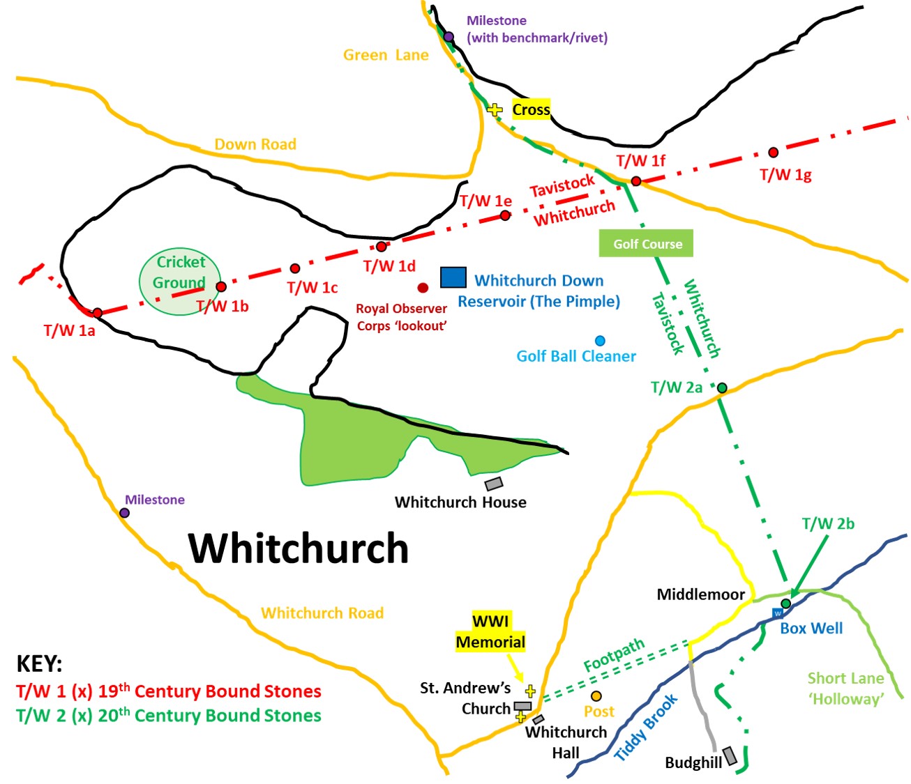
Whitchurch Down (Tavistock / Whitchurch) Parish Boundaries and Manorial Rights
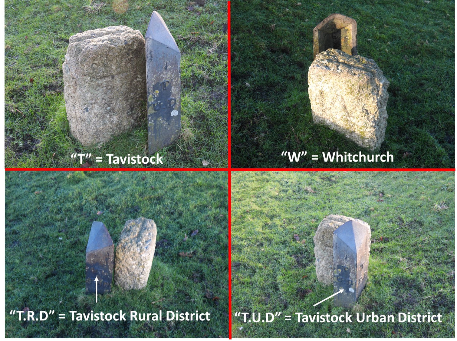
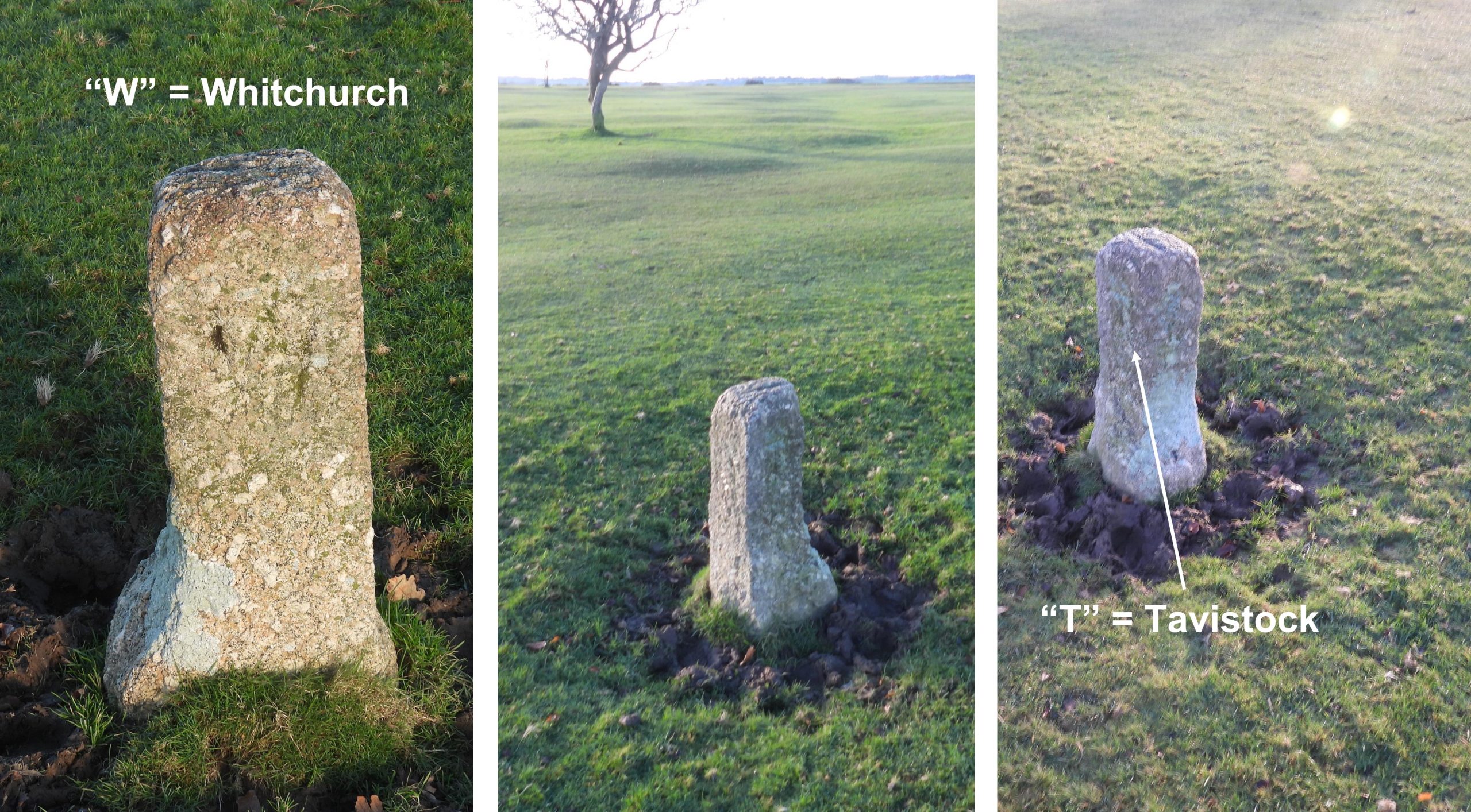
In the 19th century, Whitchurch Down was divided between the parishes of Whitchurch and Tavistock on a (more or less straight) line which ran from the cricket ground in the west to Furzy Bridge on Taviton Brook in the east. The land to the north of that line belonged to Tavistock and the land to the south of the land to Whitchurch. This boundary was (and still is) marked by a series of boundary stones inscribed with a “T” on one side and a “W” on another side. All the stones are extant with the exception of one (at the south west end of the line). Thus begins a rather complicated story of parish boundaries and manorial rights, which have been excellently told by Joyce Metcalf in a booklet publication by Tavistock and District Local History Society, titled “Whitchurch Down”.
The story begins with the soil rights of the down in the mid 19th century which were owned by a Colonel Harris, later to be passed to a G.H. Bulteel, who was a banker. On Bulteel’s death in 1909, the rights were bought by the Duke of Bedford, which brought the whole of the down under his ownership. In 1911, the Duke sold farms over the part of the down on the Tavistock side, albeit some parts of the common were excluded due to the imminent Down Road development. In 1964, the trustees of the Bedford Estate sold the manorial rights of the down to Tavistock Urban District Council for £750. The area purchased was a smaller portion of the Tavistock parish and a larger portion of the Whitchurch parish. To confuse the story, part of the manorial rights sold by the Bedford Estate were offered to the Tavistock Rural District Council, but they declined.
With local government re-organisation on 1st April 1966, the two Tavistock District Councils (Urban and Rural) were amalgamated, thus Tavistock became a parish with an enlarged rural district. The new Tavistock Town Council believed at that time that they had acquired all the manorial rights of the down. This proved an issue as the former Tavistock Rural District Council were found to still to own some manorial rights. The final ownership of the manorial rights of the down were finally completed and in 1974 the Tavistock Parish Council became the Tavistock Town Council.
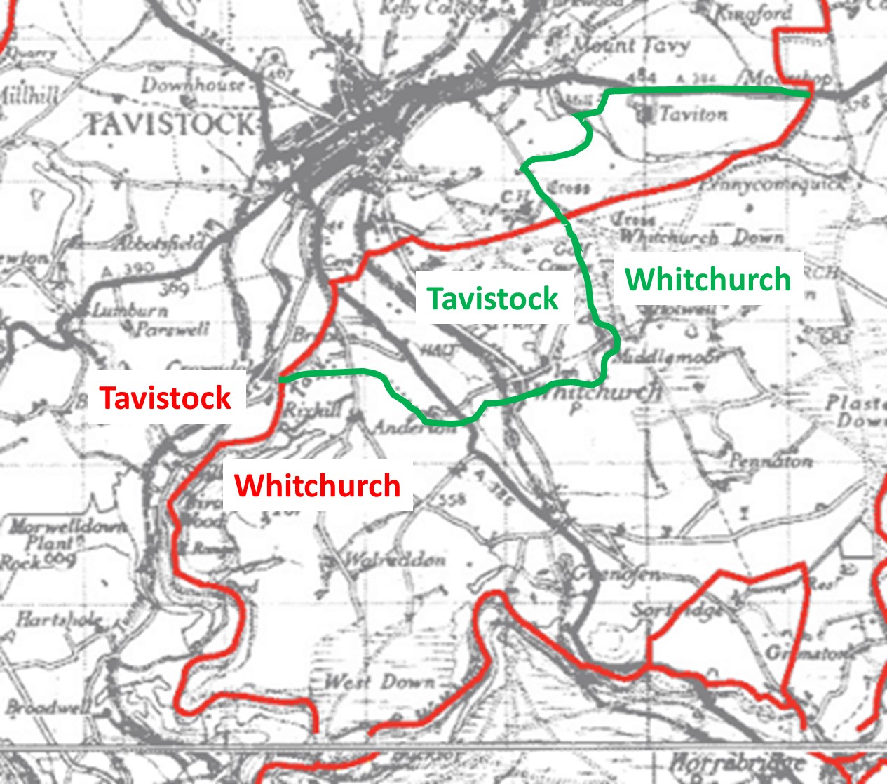
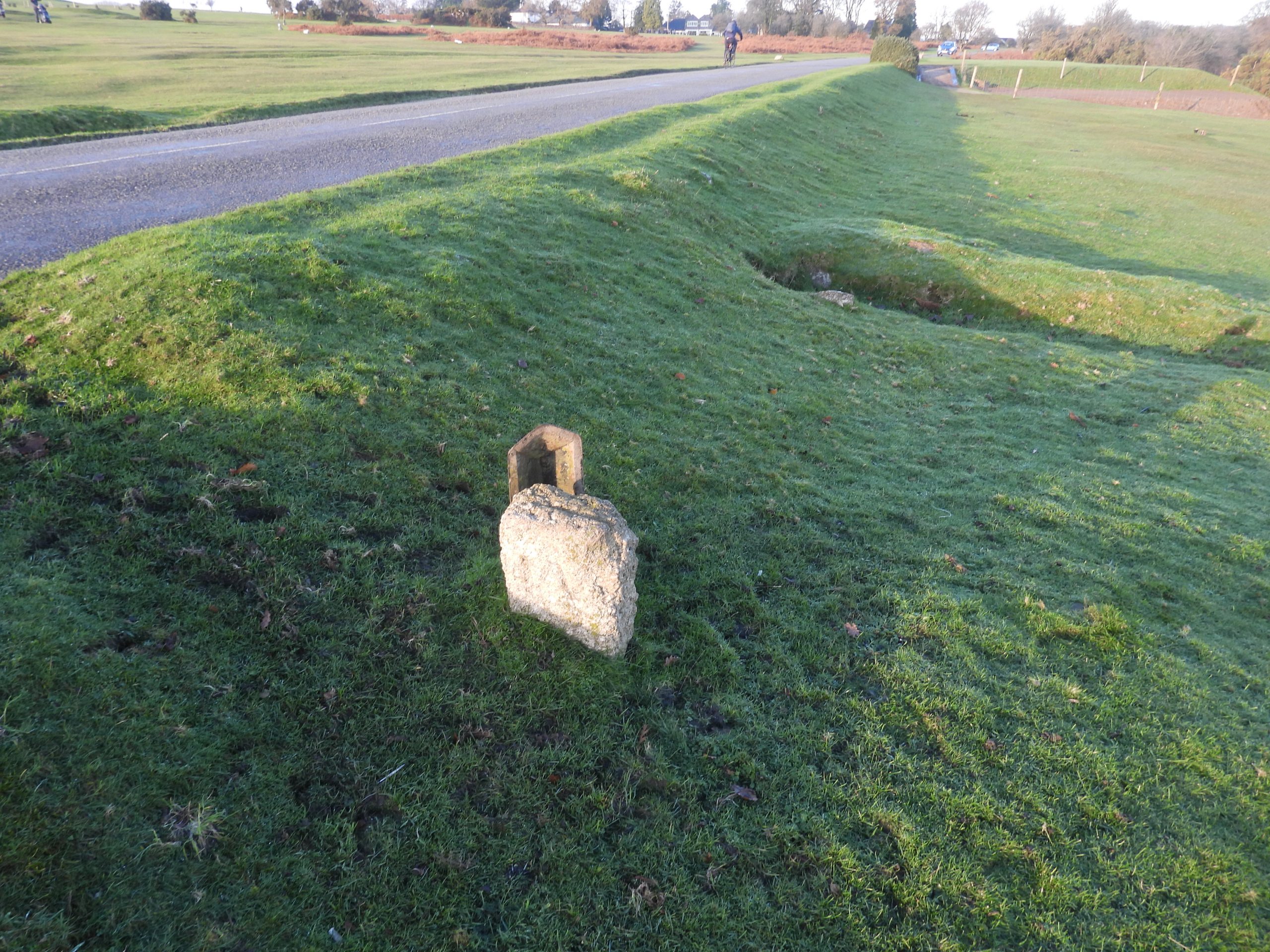
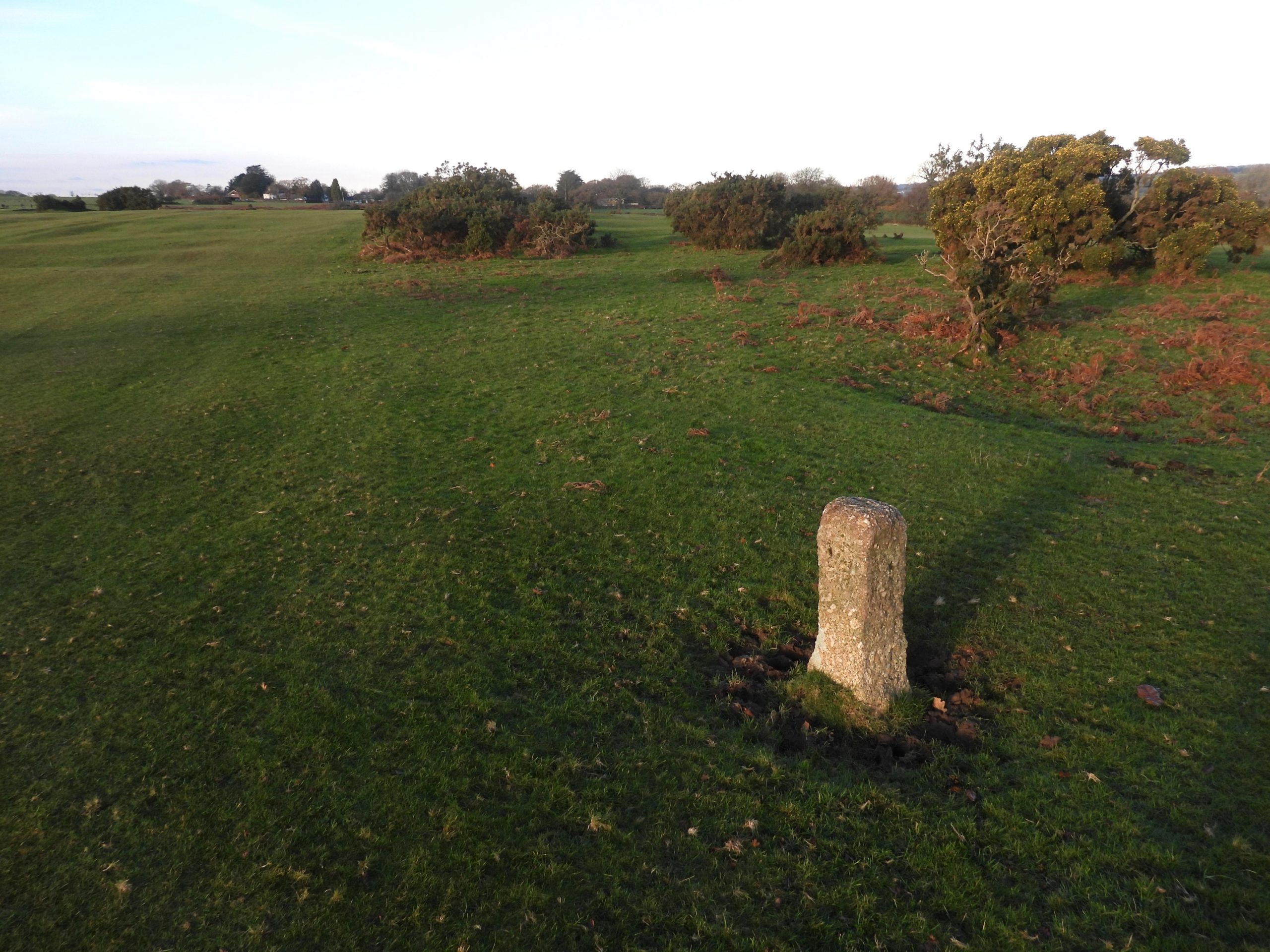
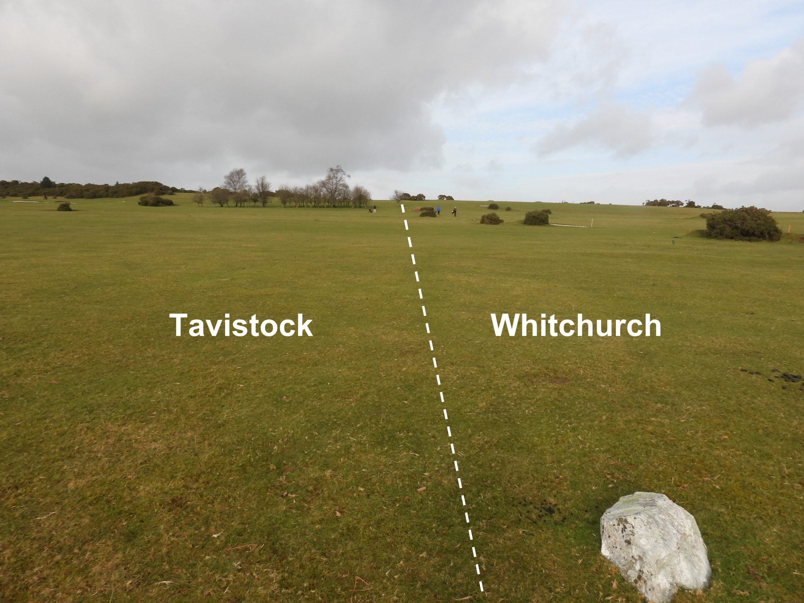
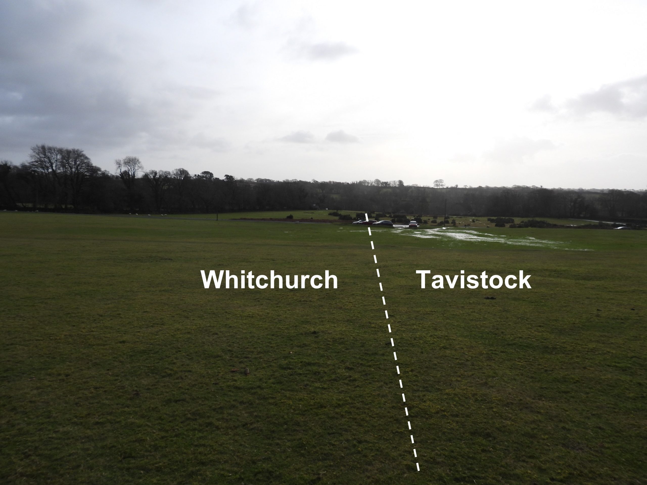
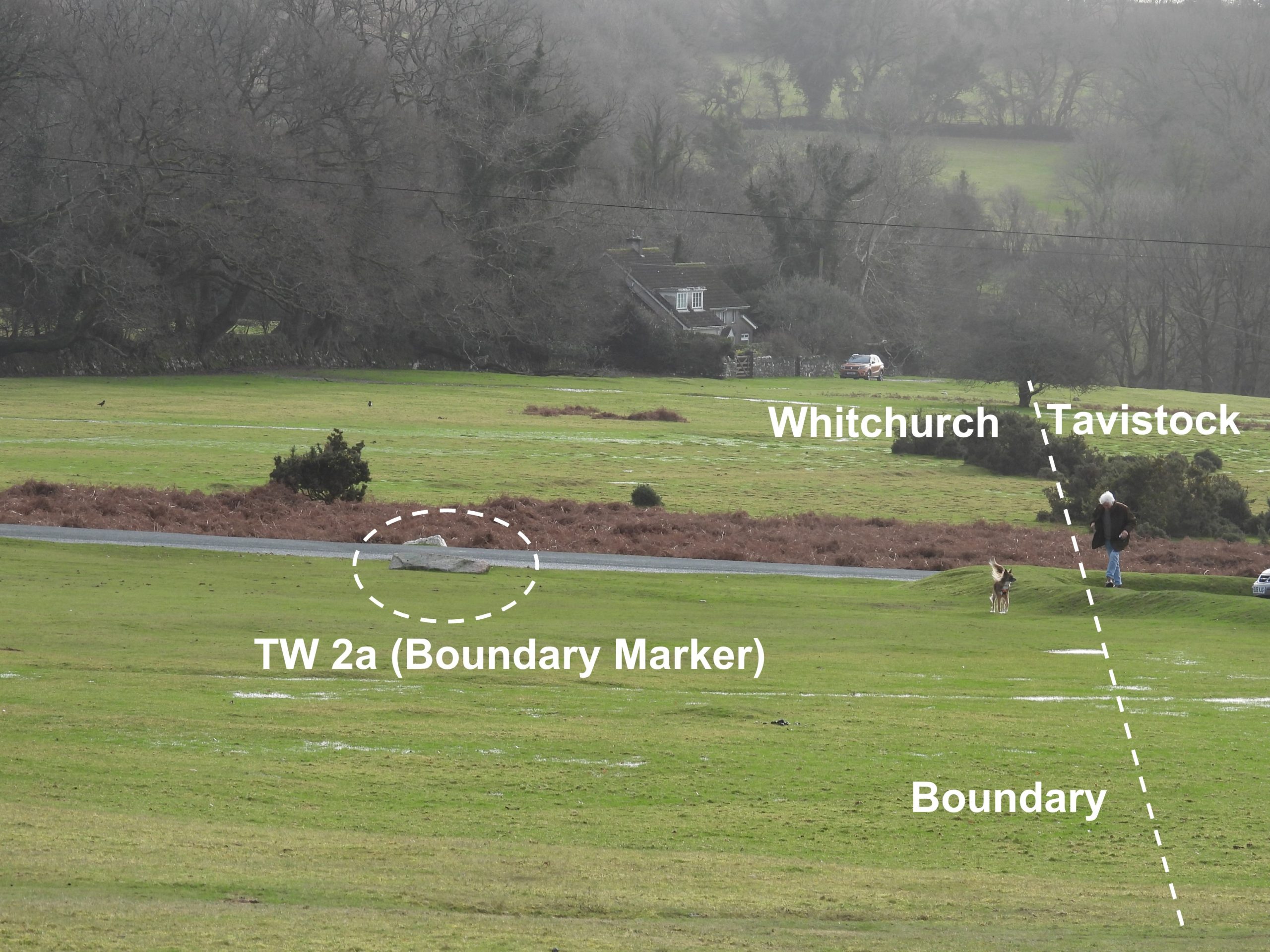
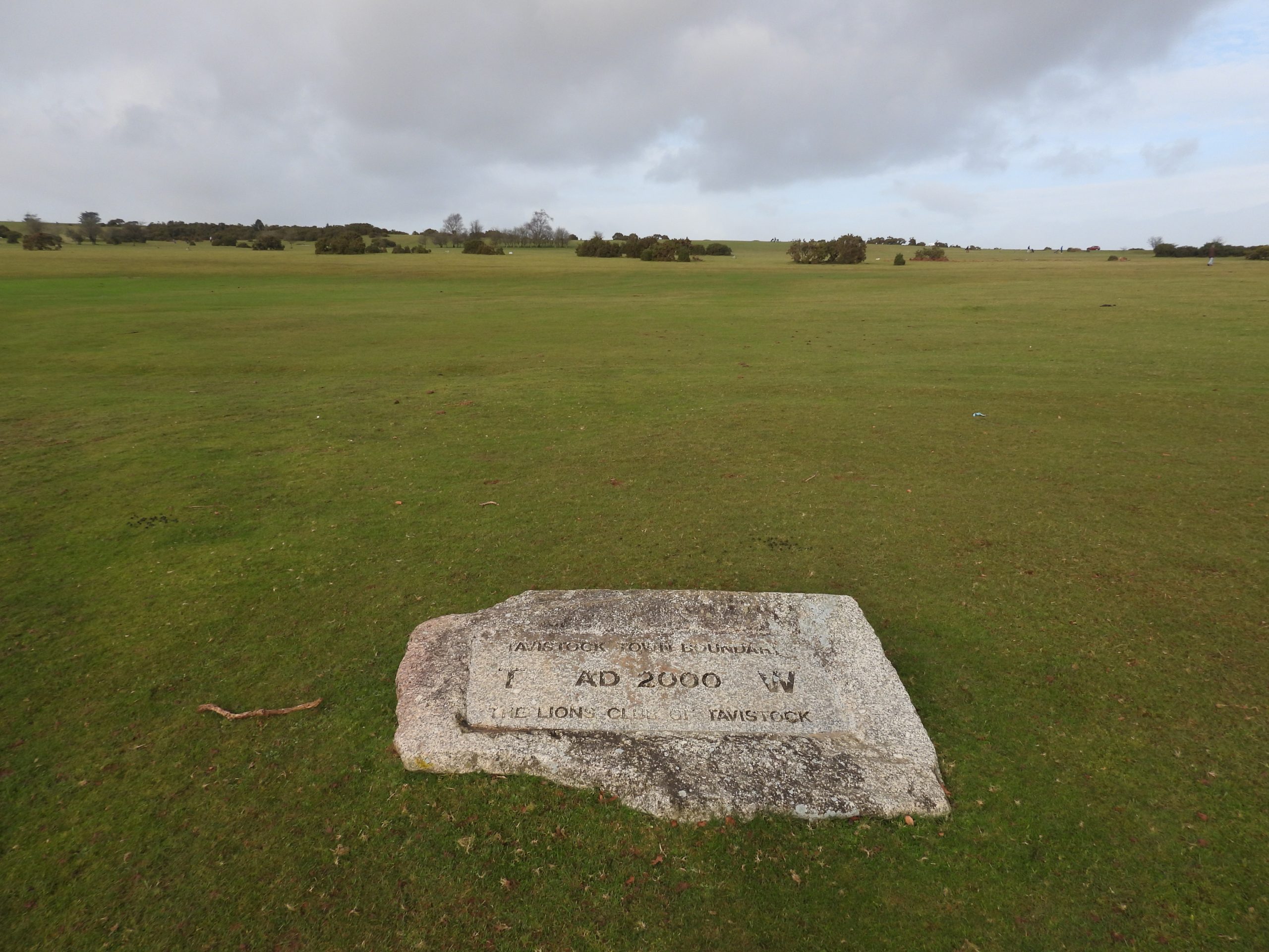
To confuse matters, at some time in the early 20th century, the historic boundary between the two parishes of Whitchurch and Tavistock changed from the south west / north east line (as previously defined) to a more north / south line from Green Lane to Middlemoor. The author is unsure of exactly when this change occurred but it seems that the new north / south line was in place on 1920’s OS Map, which was is assumed may have been as a result of the Duke of Bedford selling farms, circa 1911. If anyone reading this post can add any detail to this the author would be very grateful. The author is aware of only two new boundary markers on this north / south line, which were placed in the millennium, thus: the first one to the south of the golf course (near the football pitch) and the second one at Middlemoor, near Tiddy Brook.
This post records the 19th and 20th century parish boundaries and other features of interest around Whitchurch Down, Middlemoor and Whitchurch village.
Bibliography:
Booklet publication by Tavistock and District Local History Society, titled “Whitchurch Down”. Section 5, authored by Joyce Metcalf.
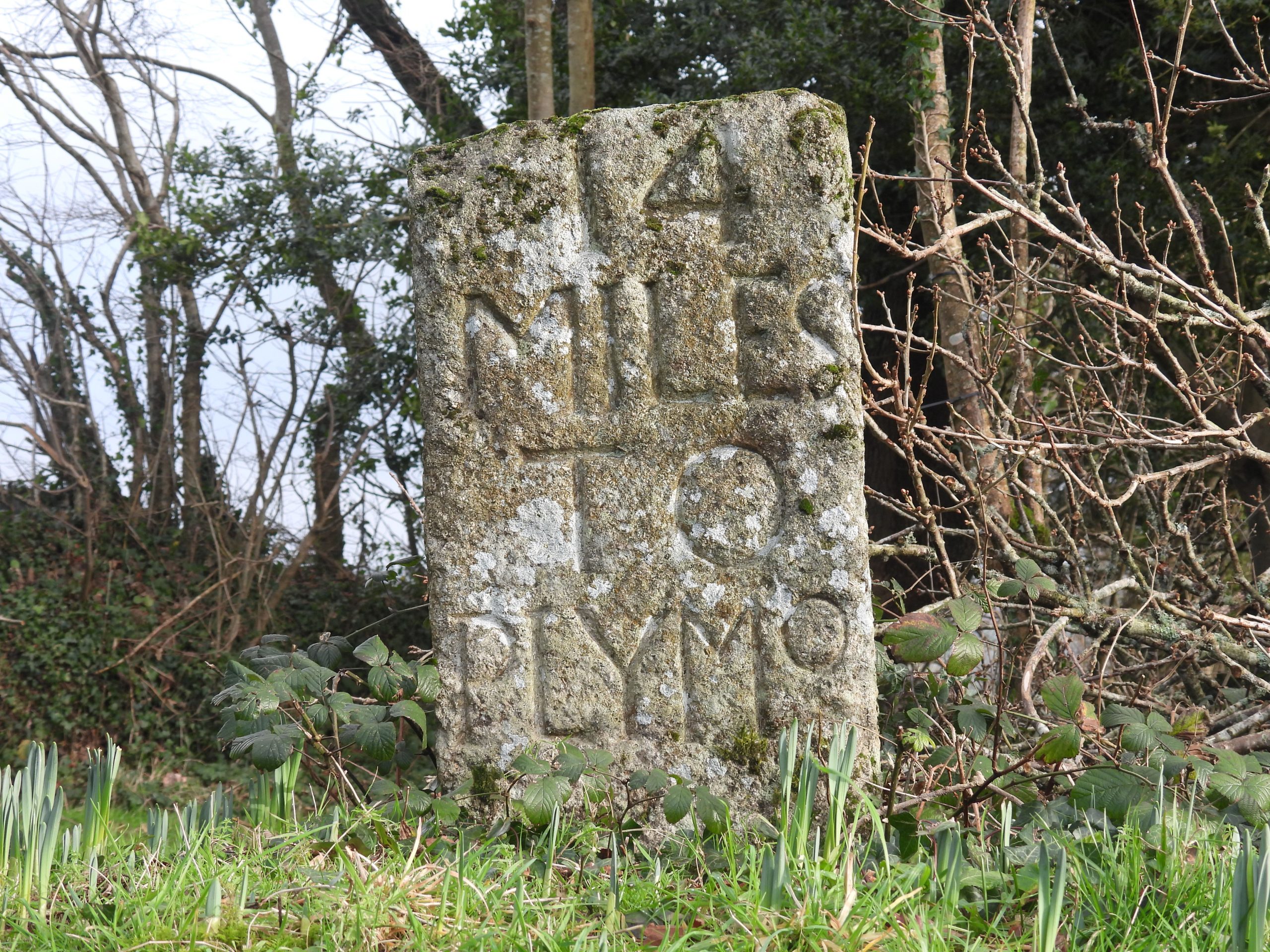
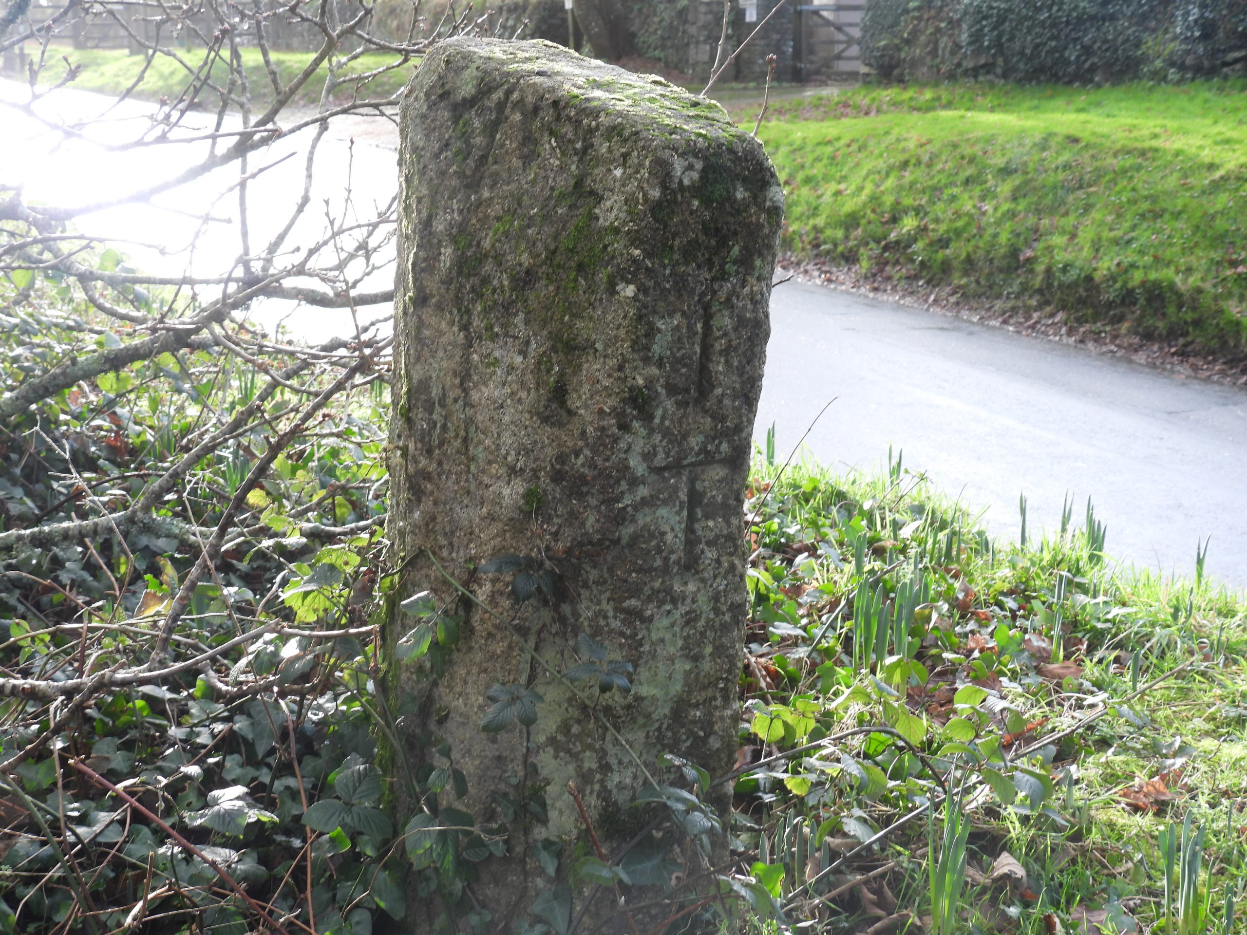
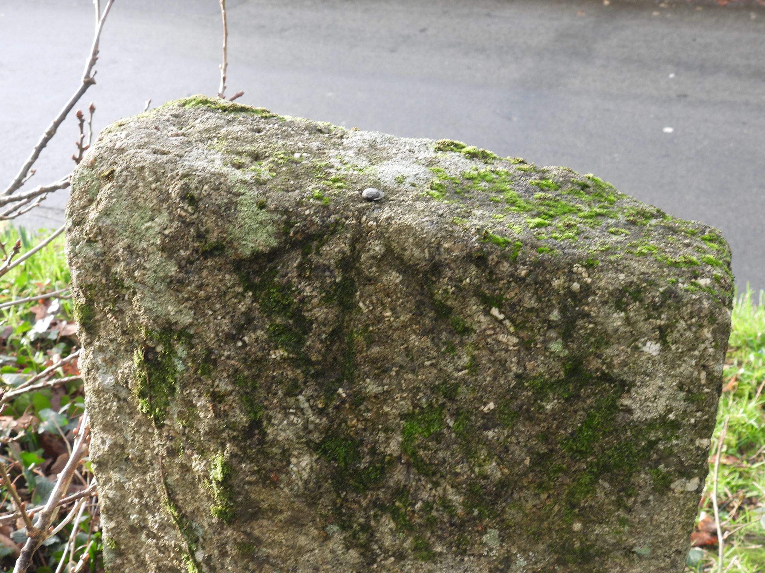
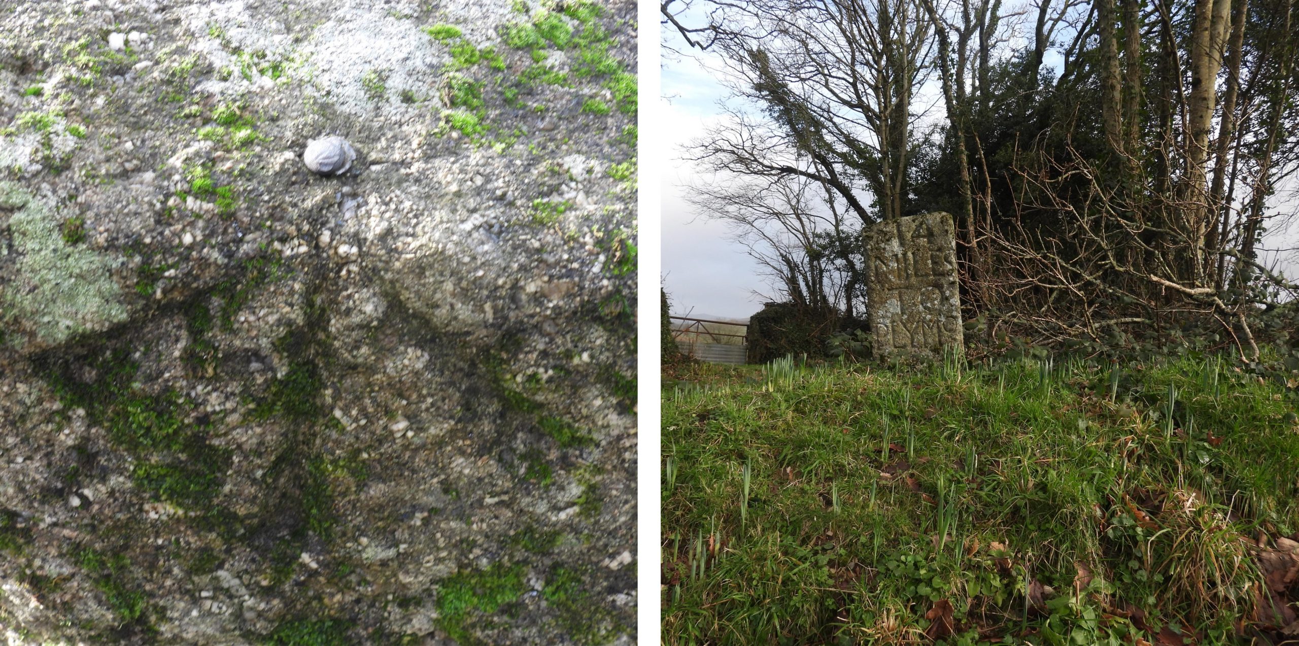
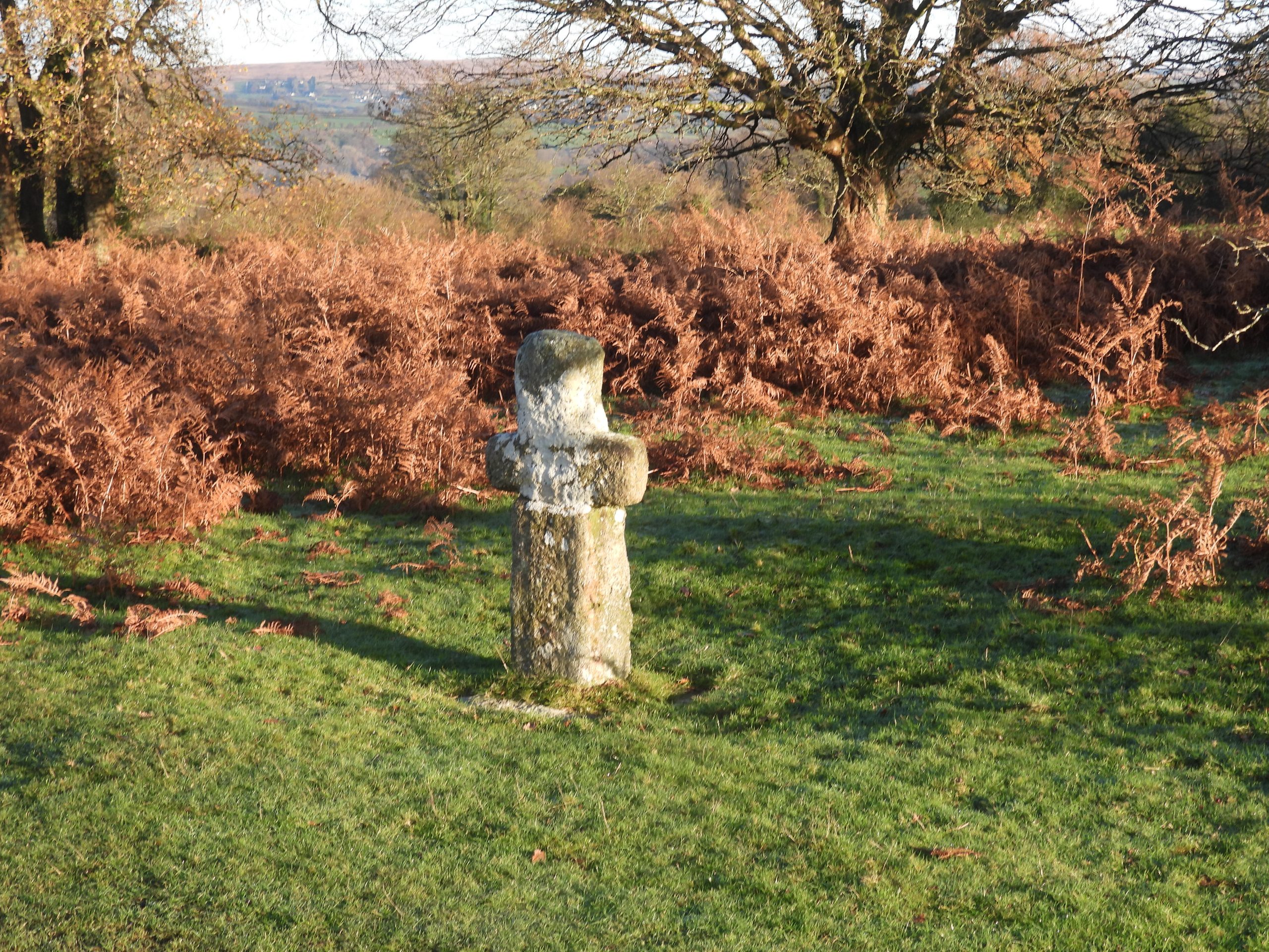
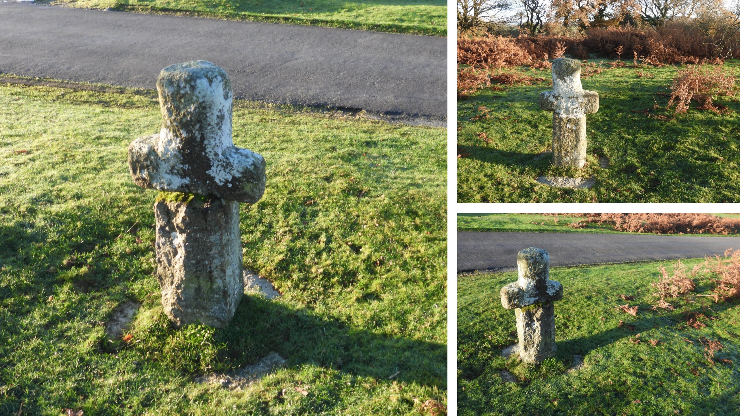
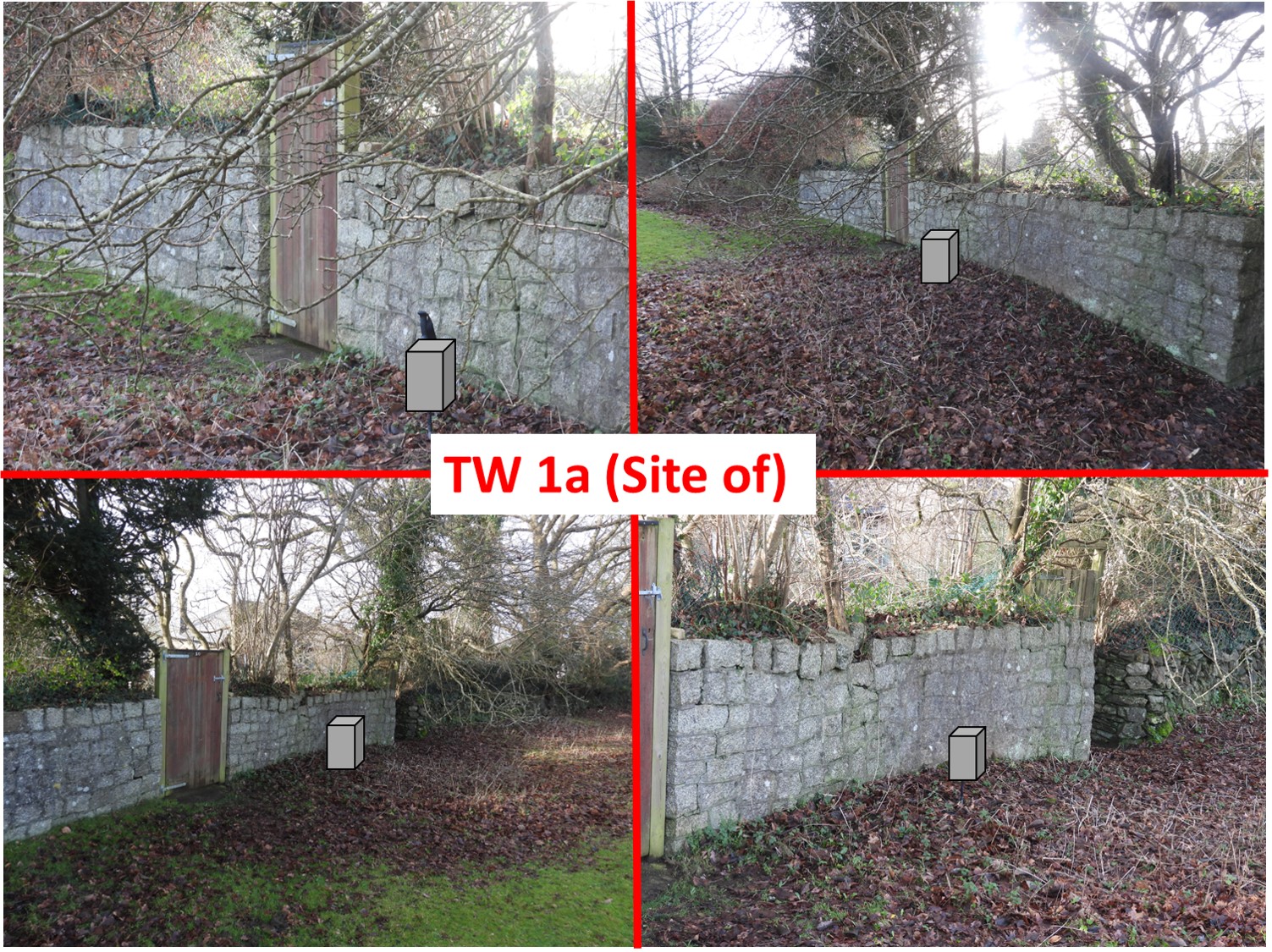
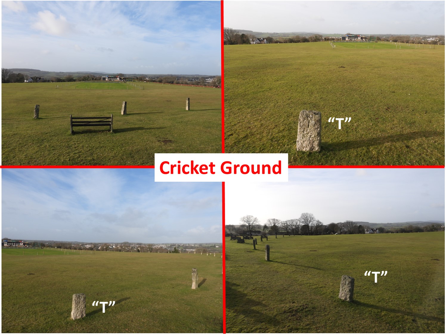
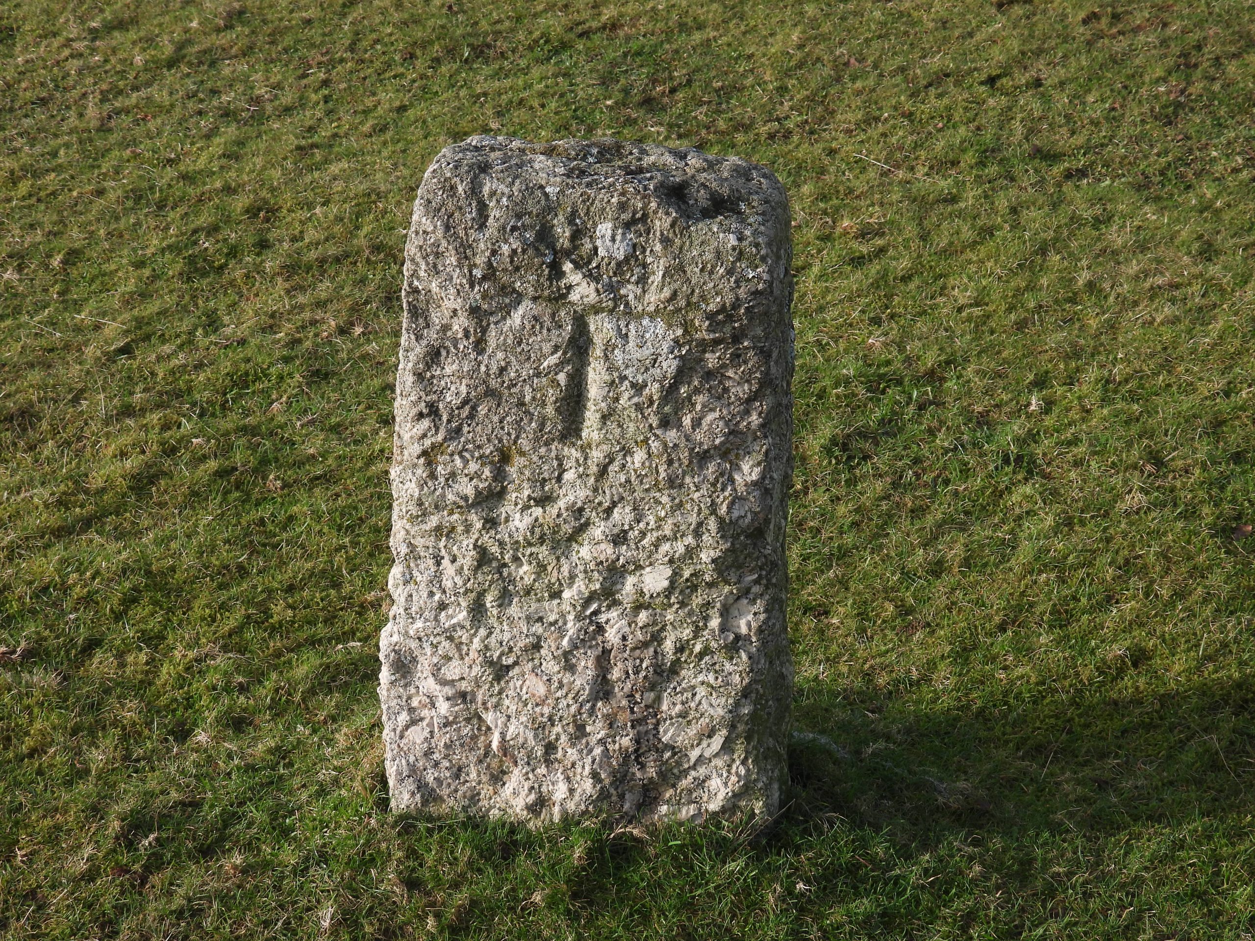
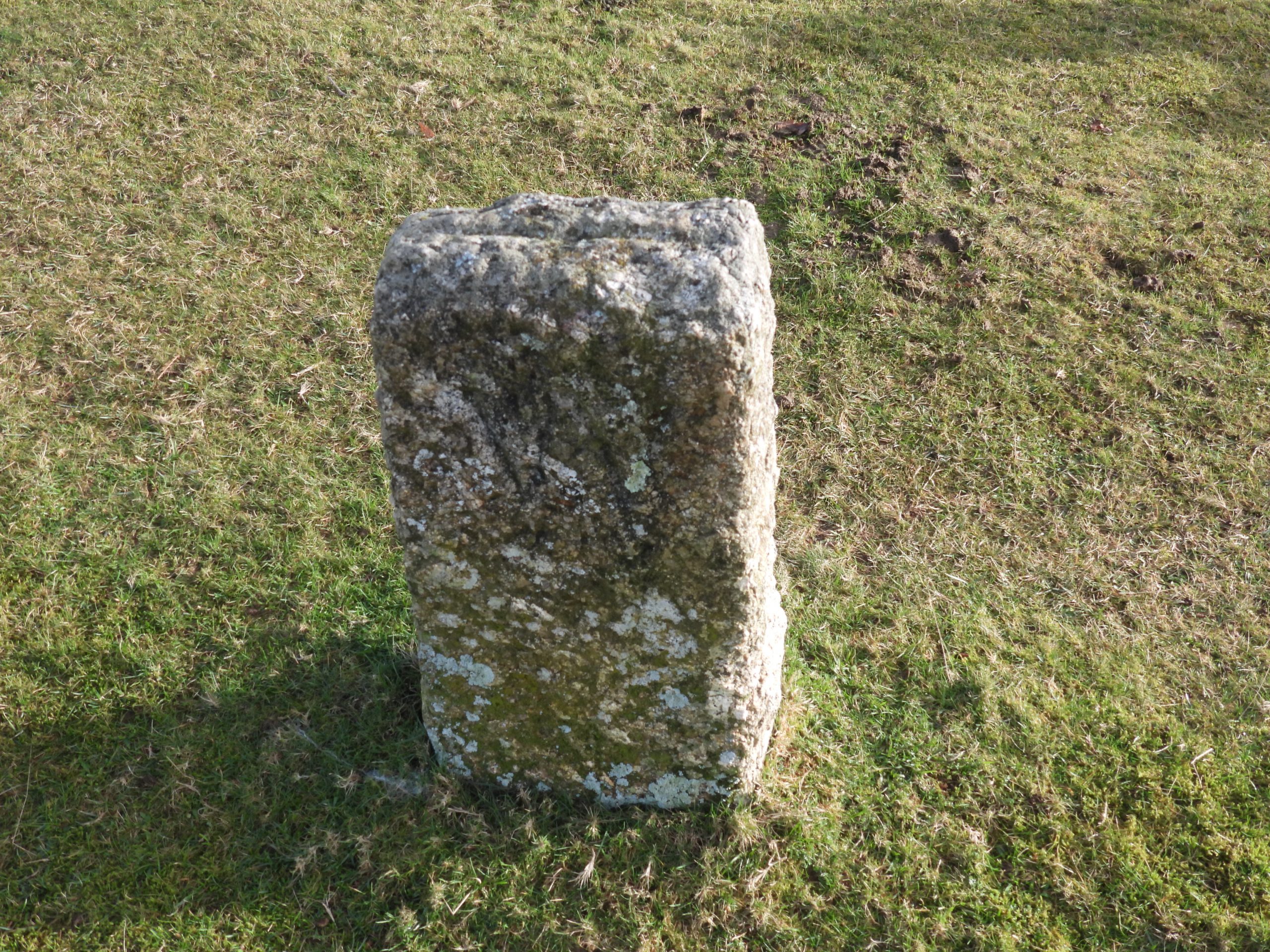
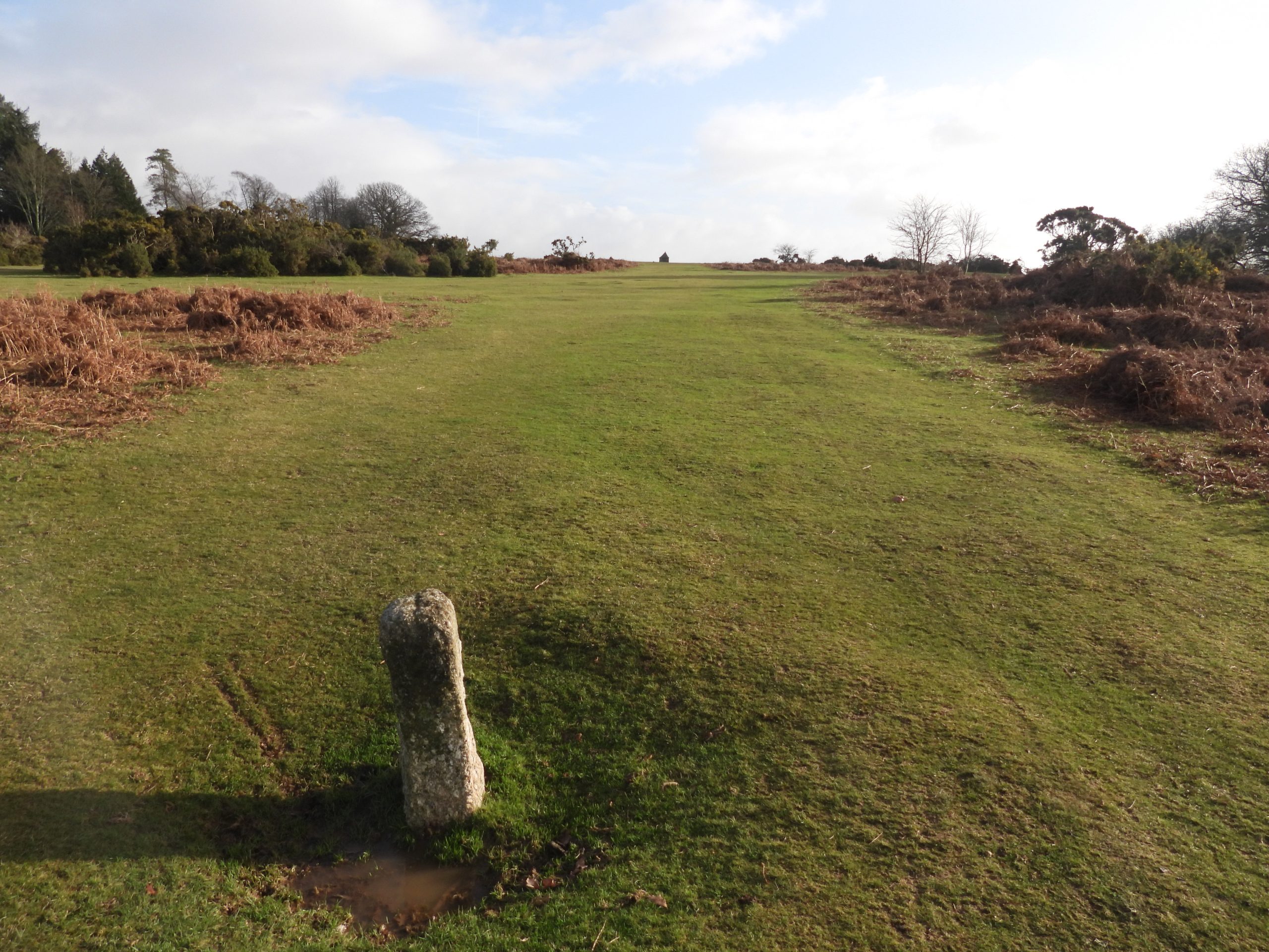
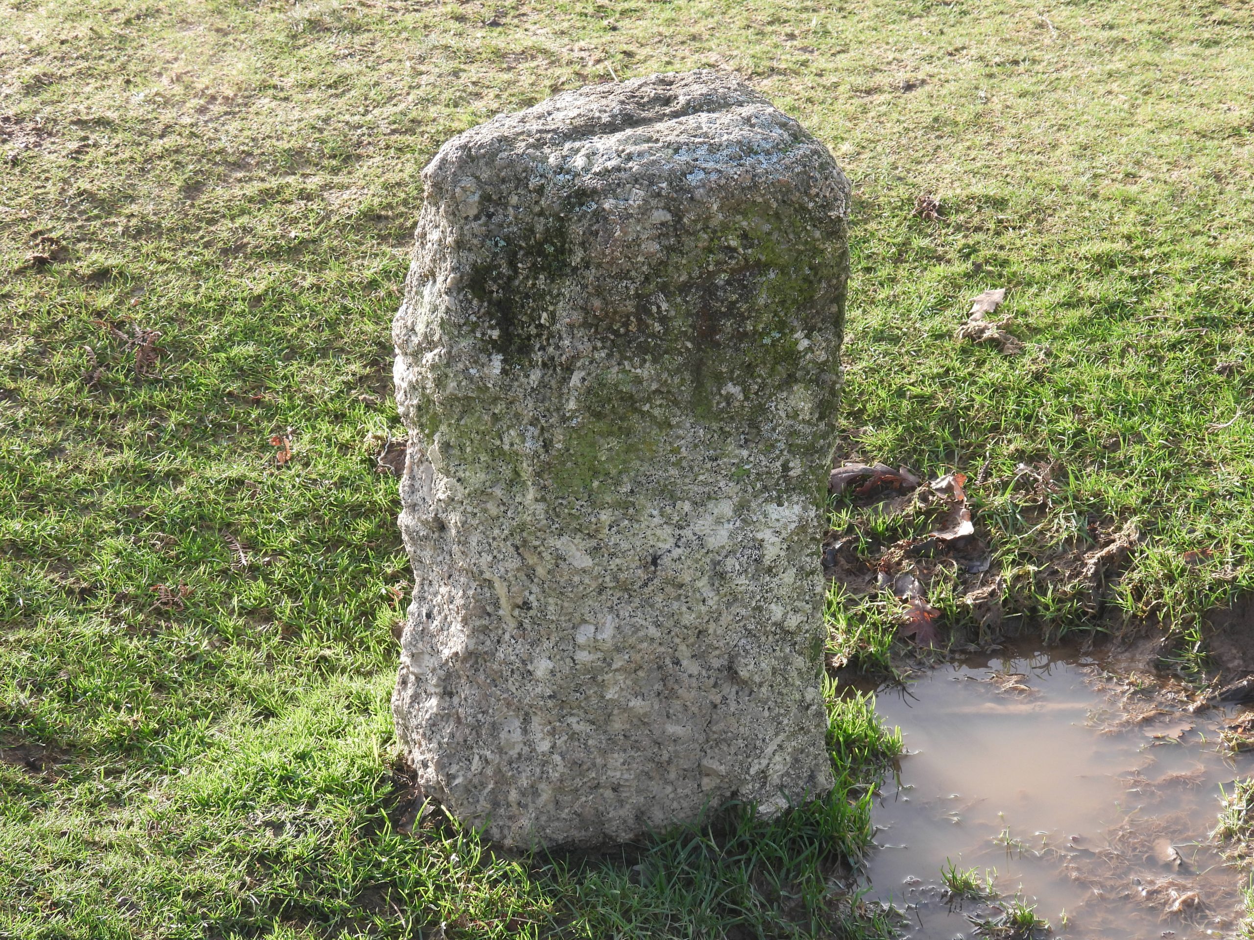
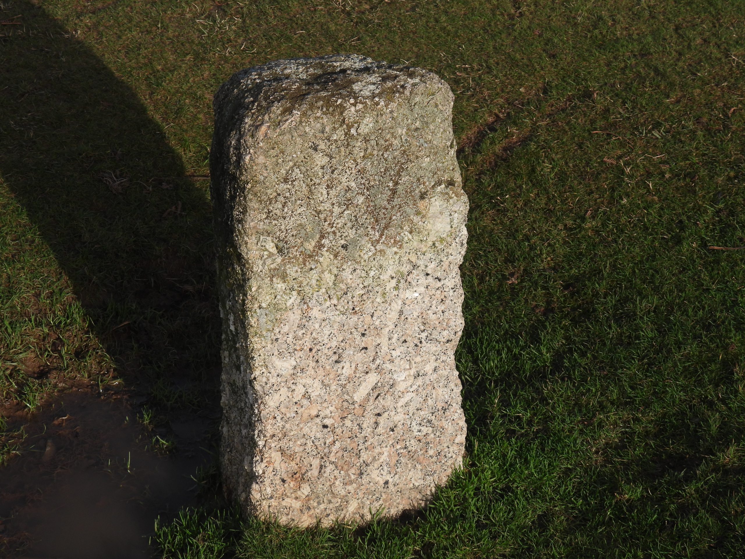
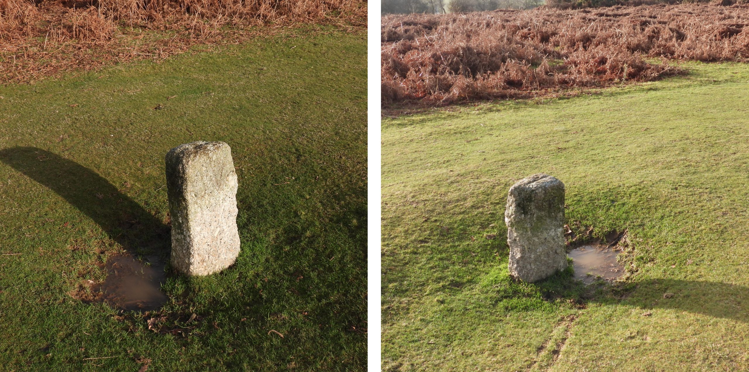
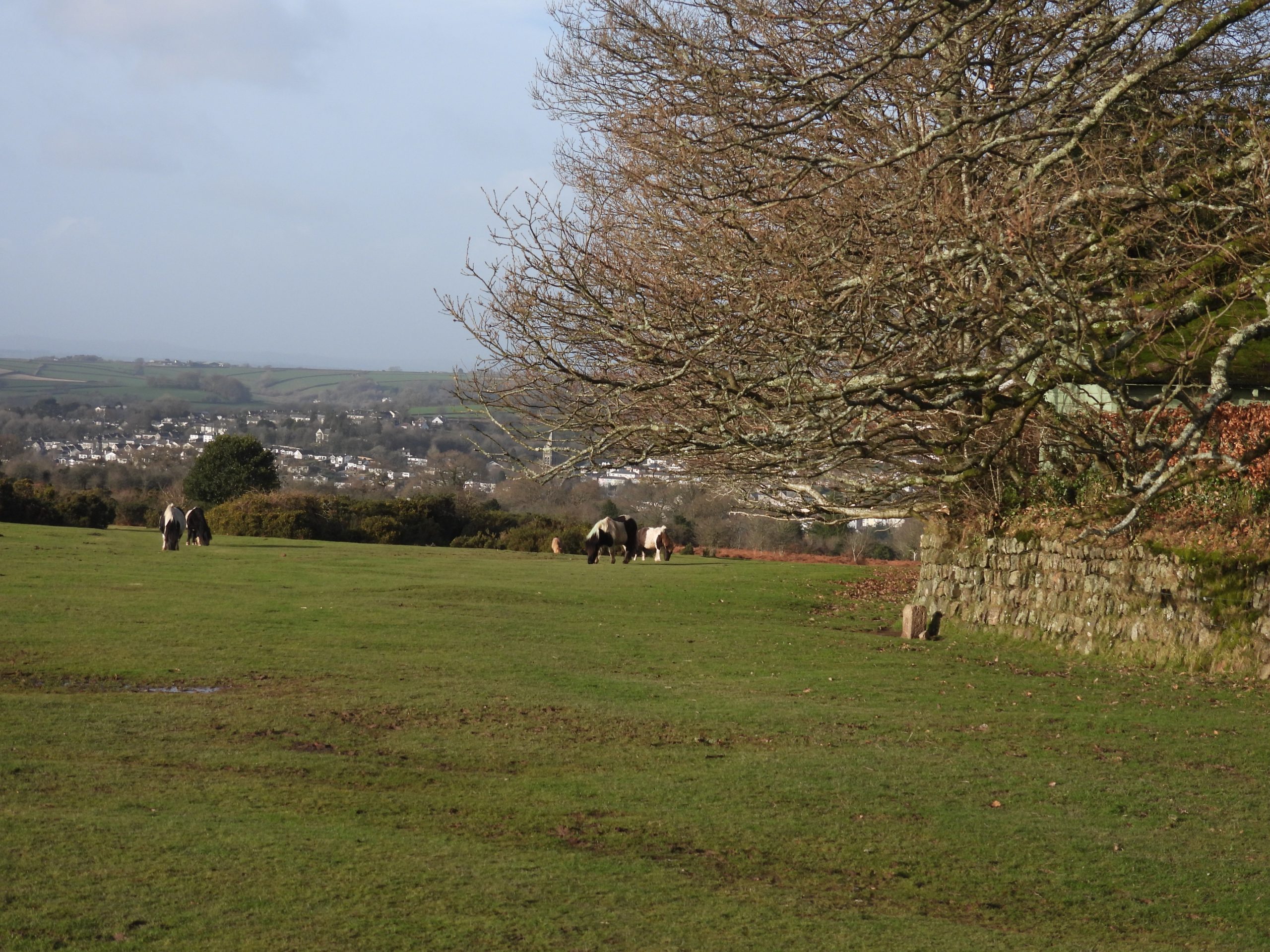
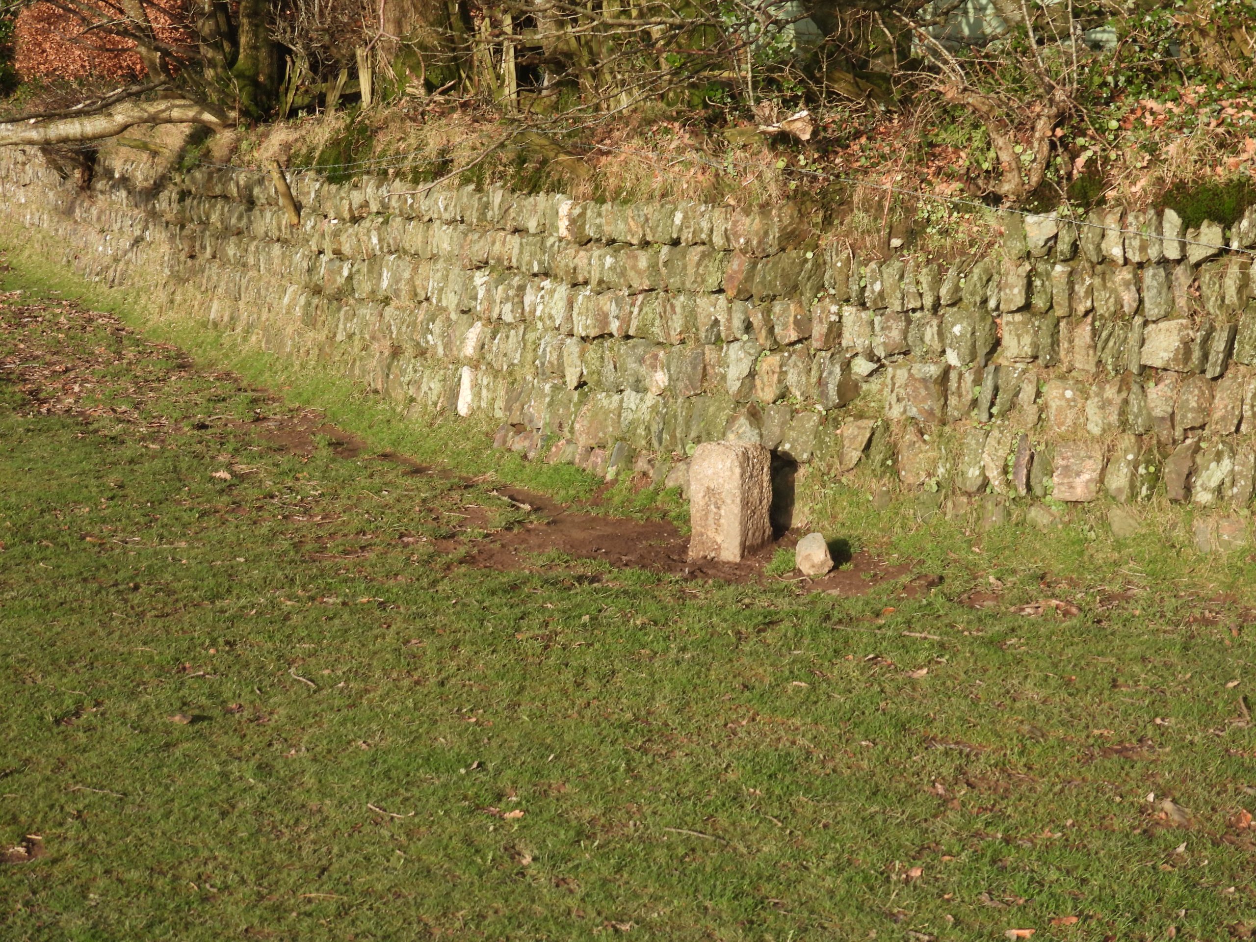
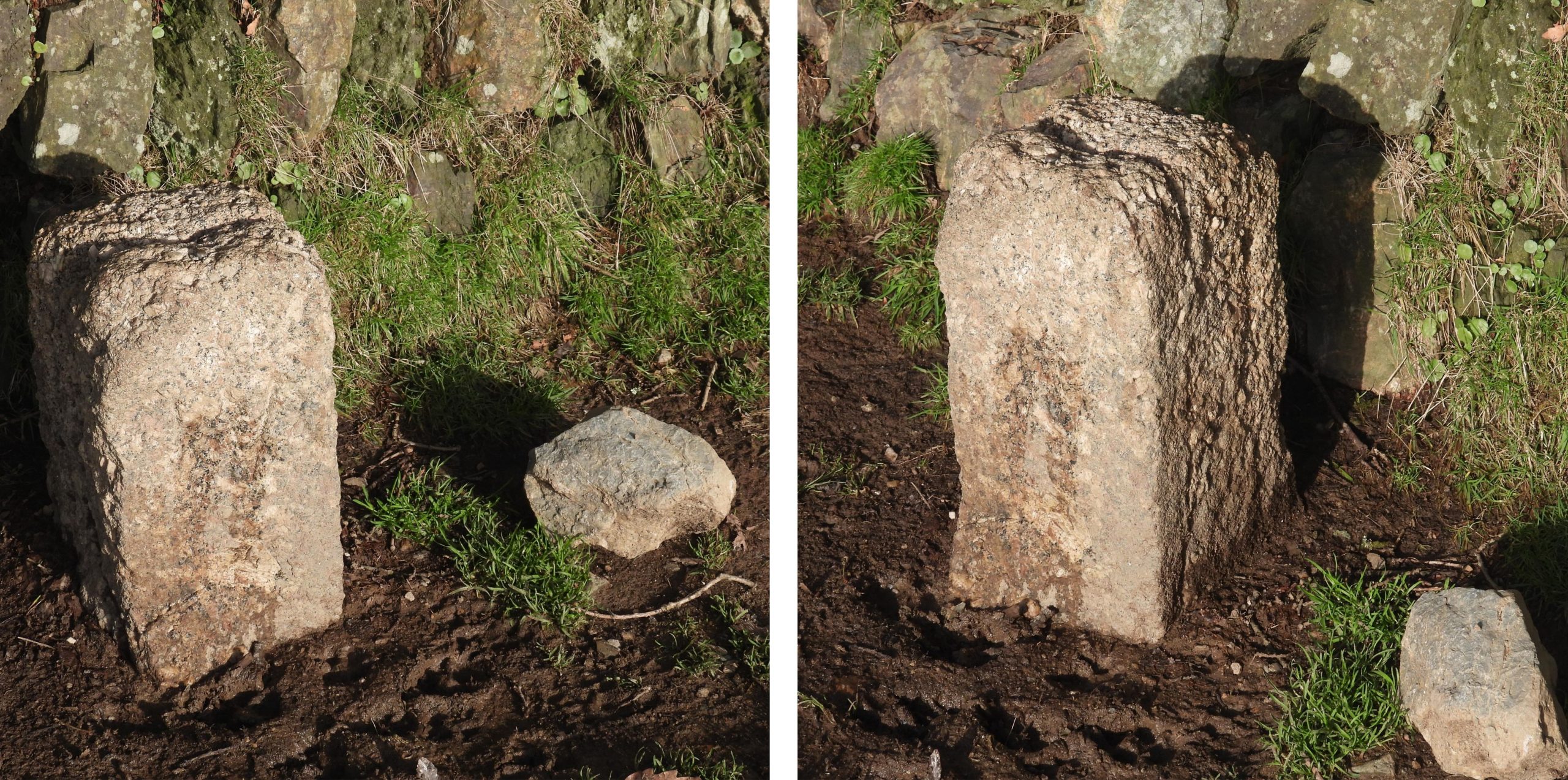
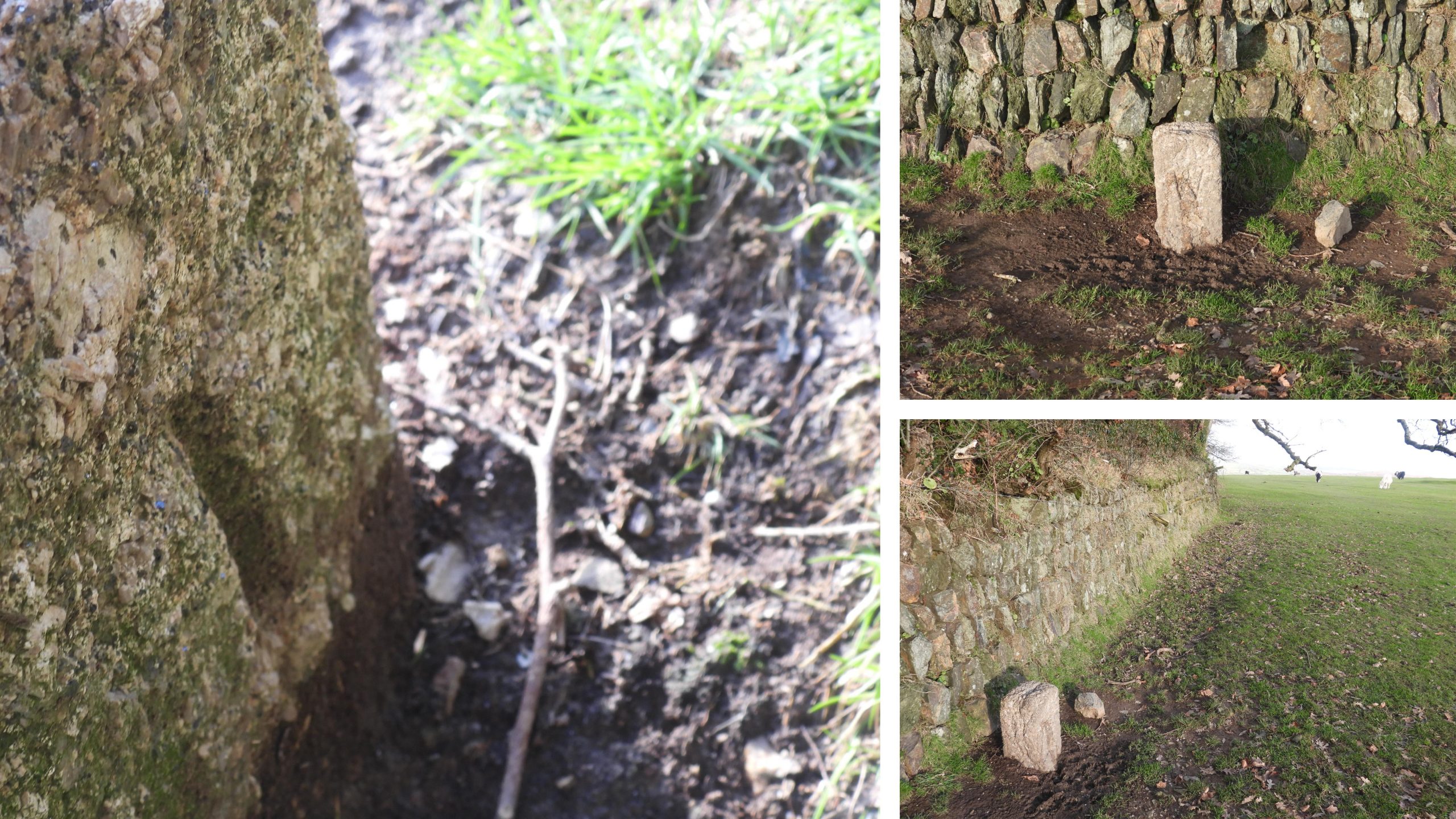
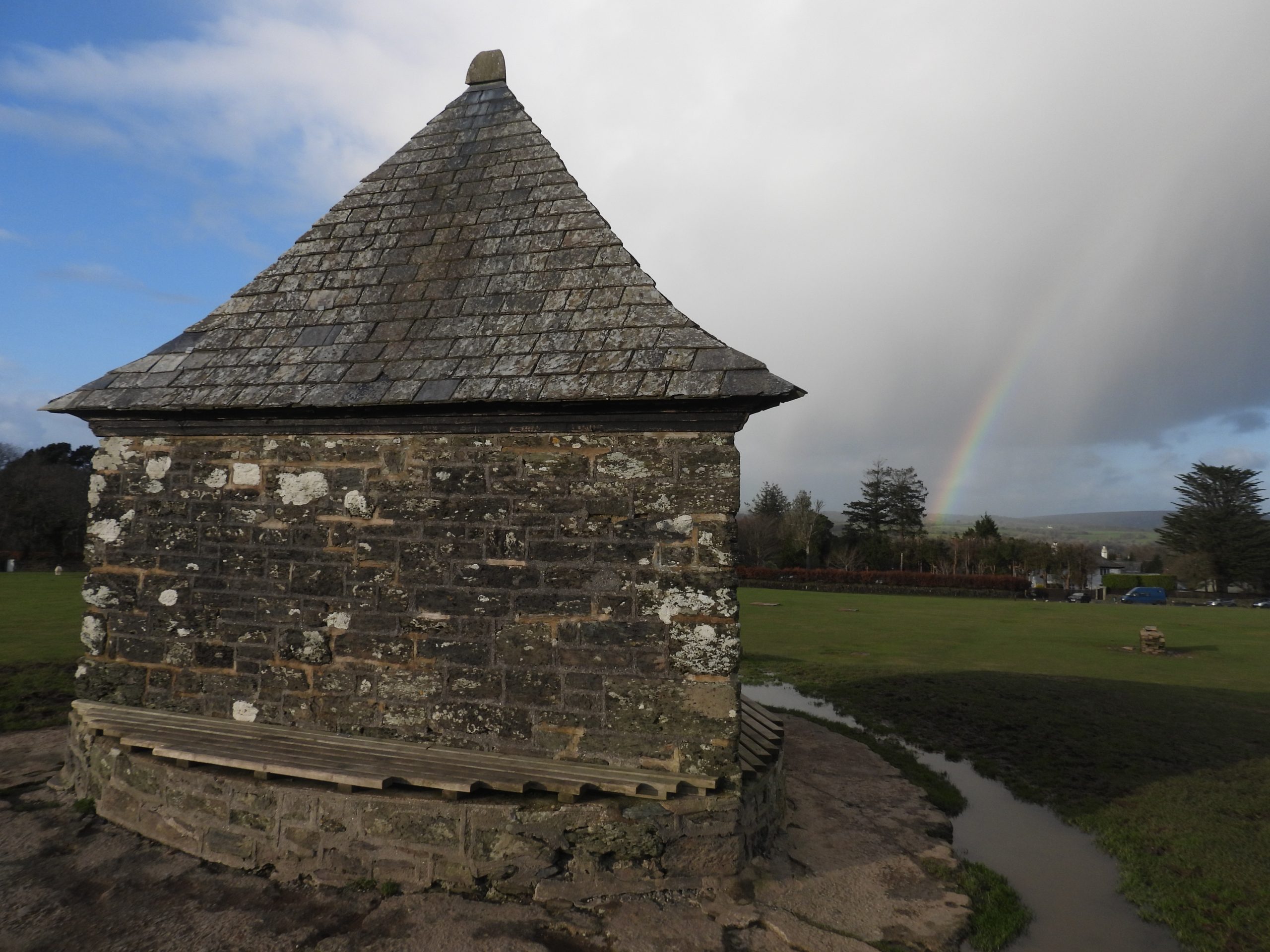
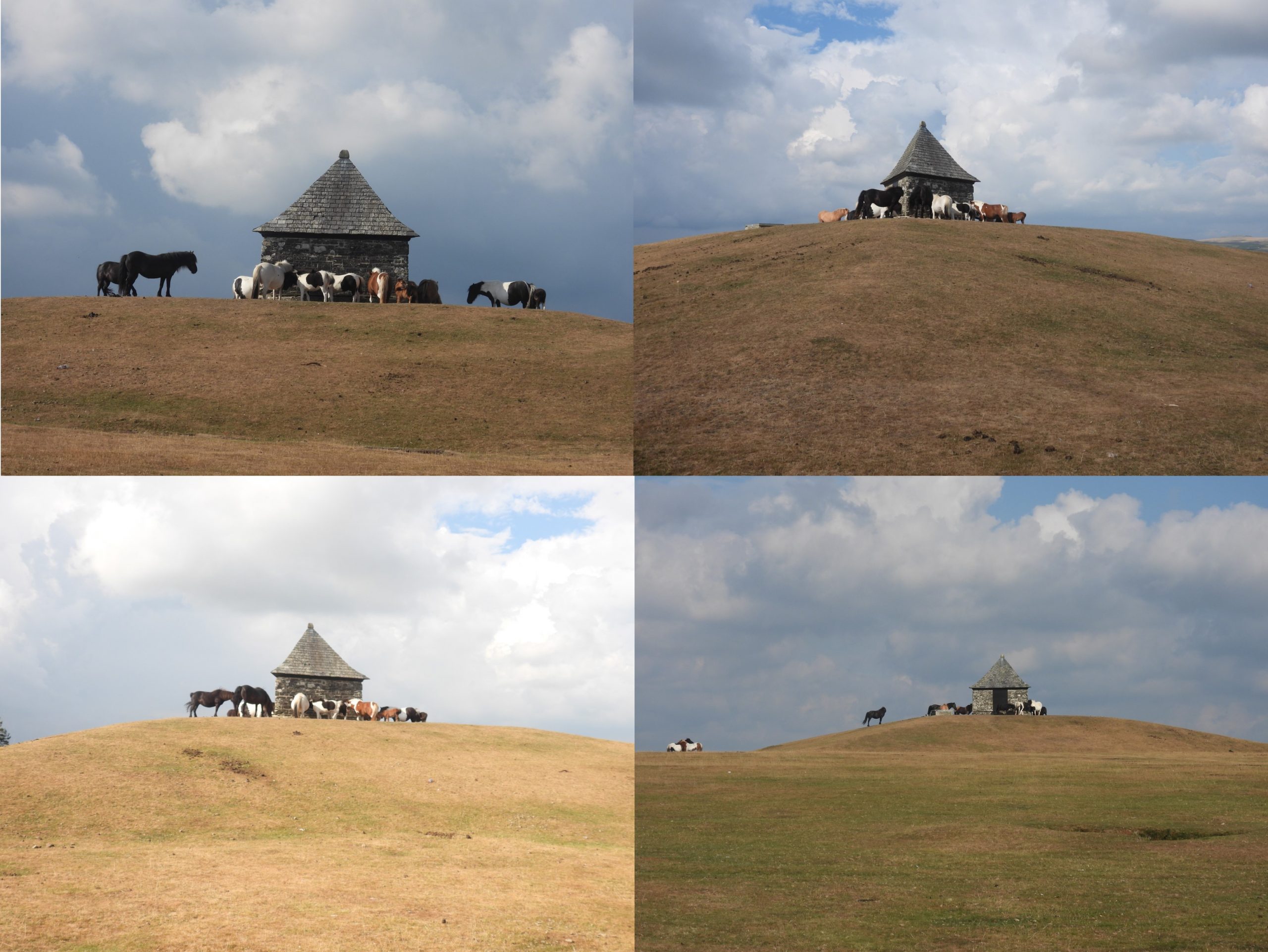
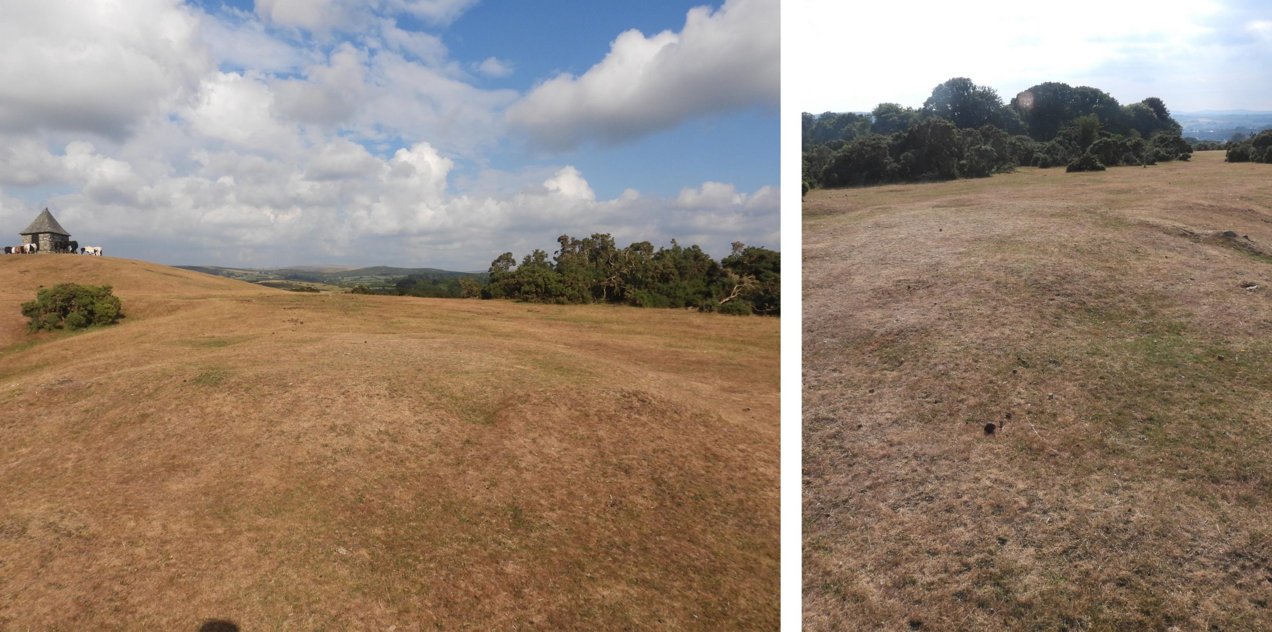
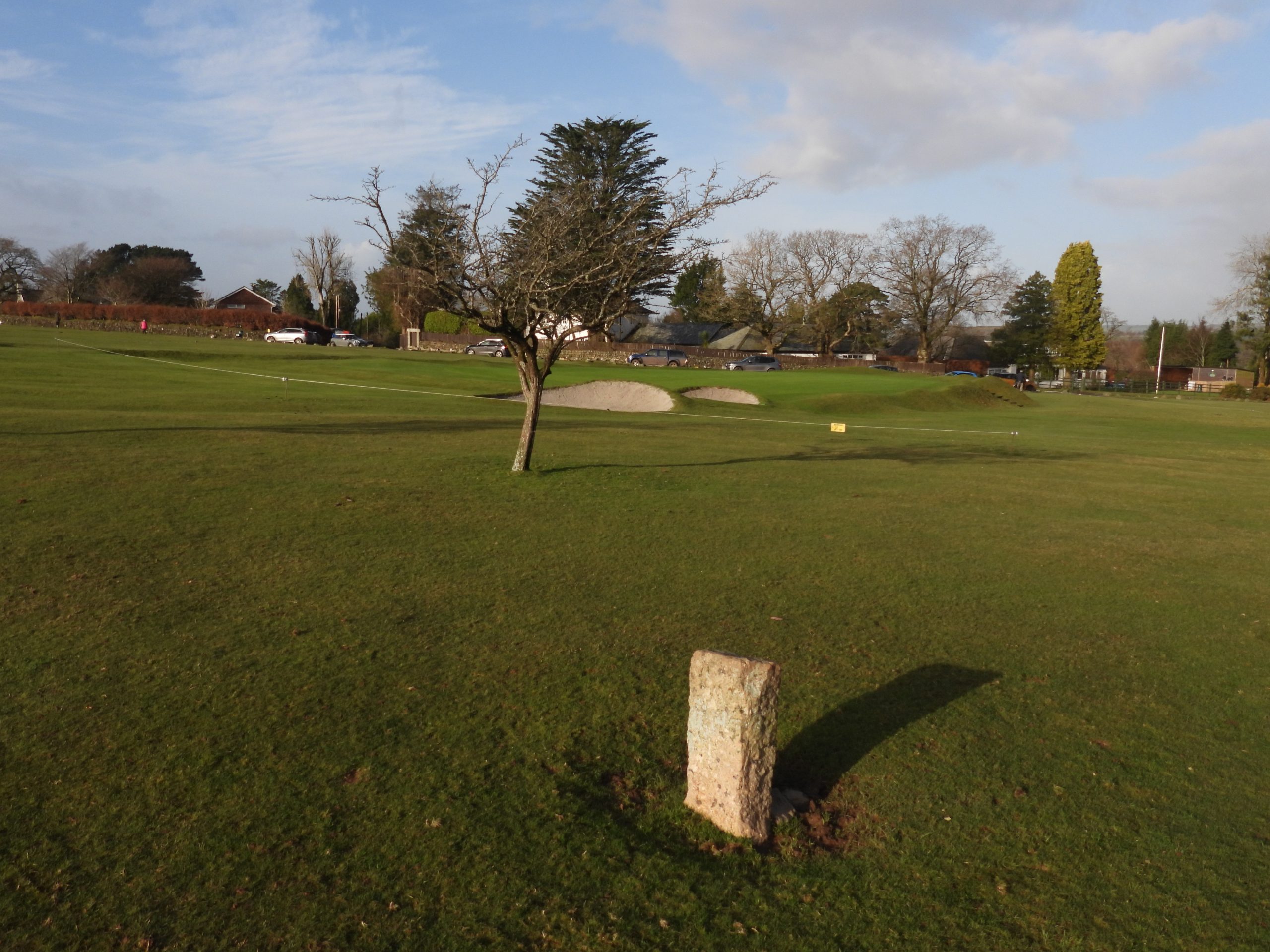
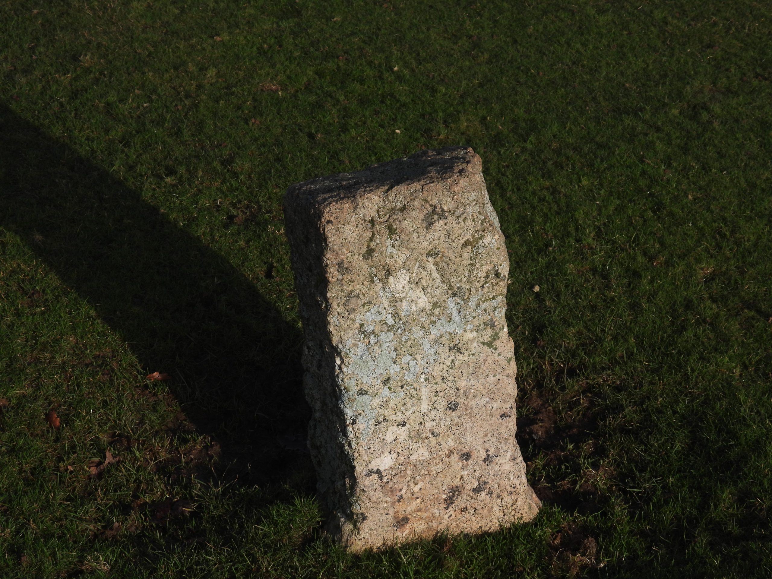
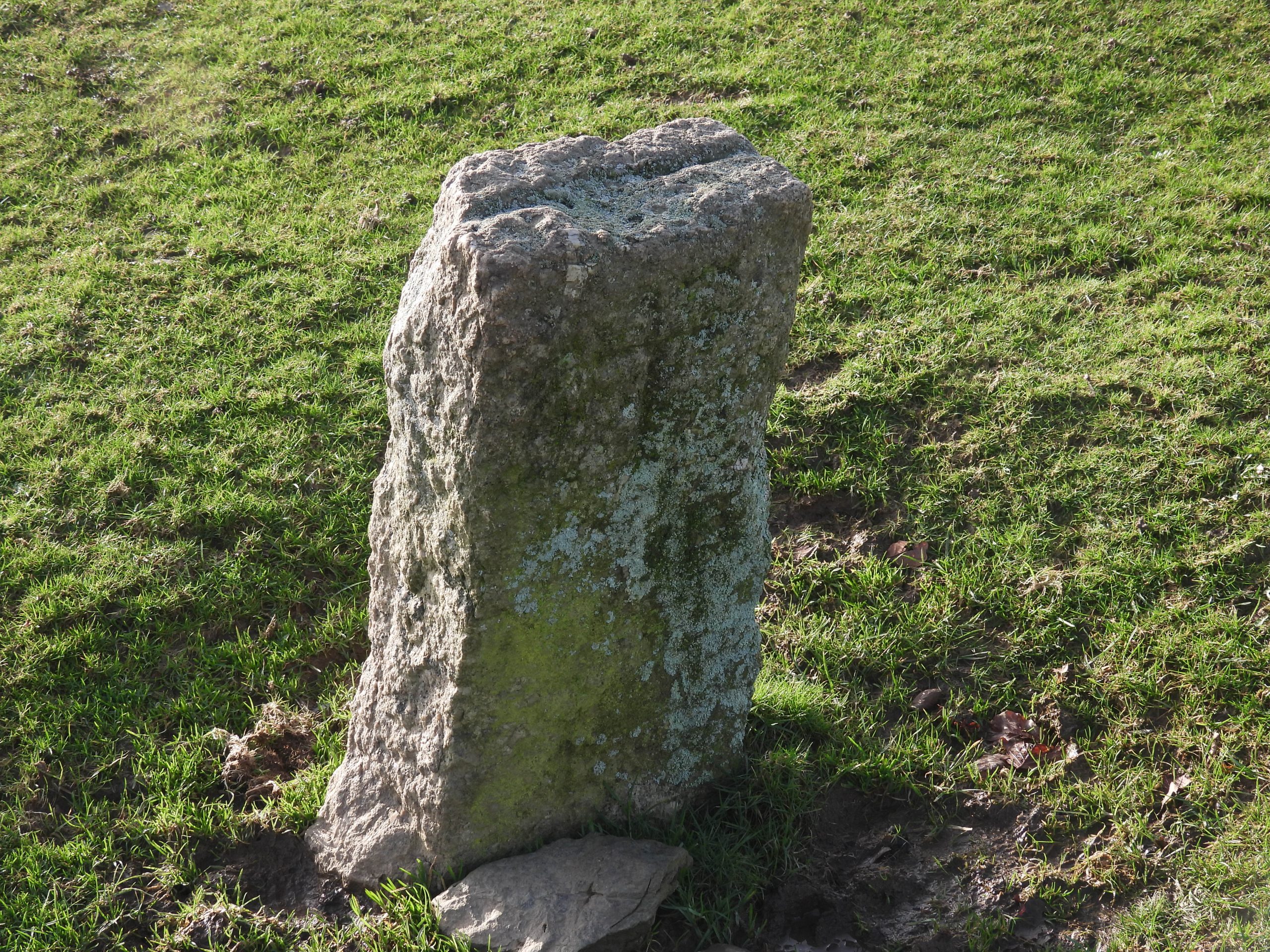
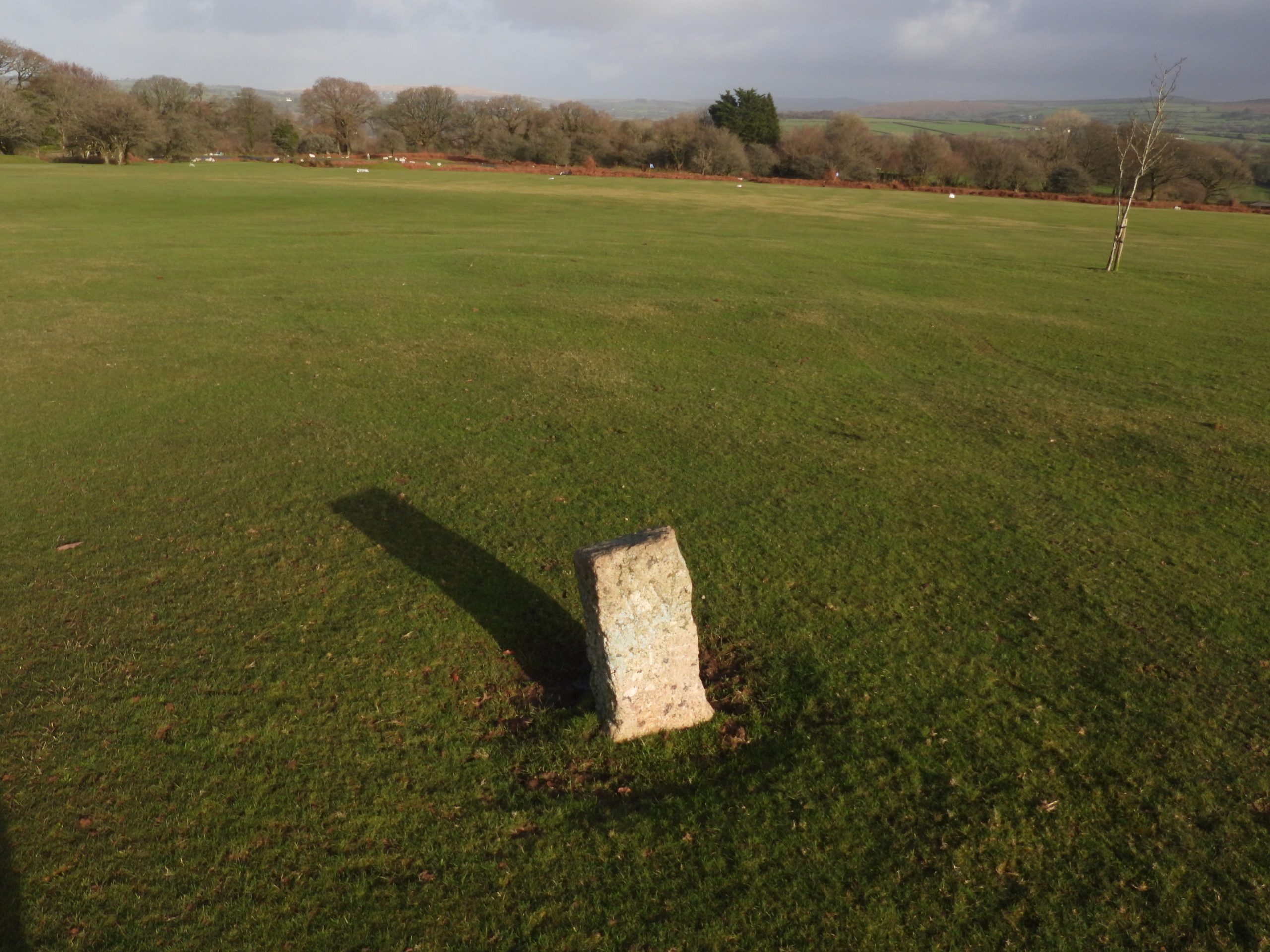
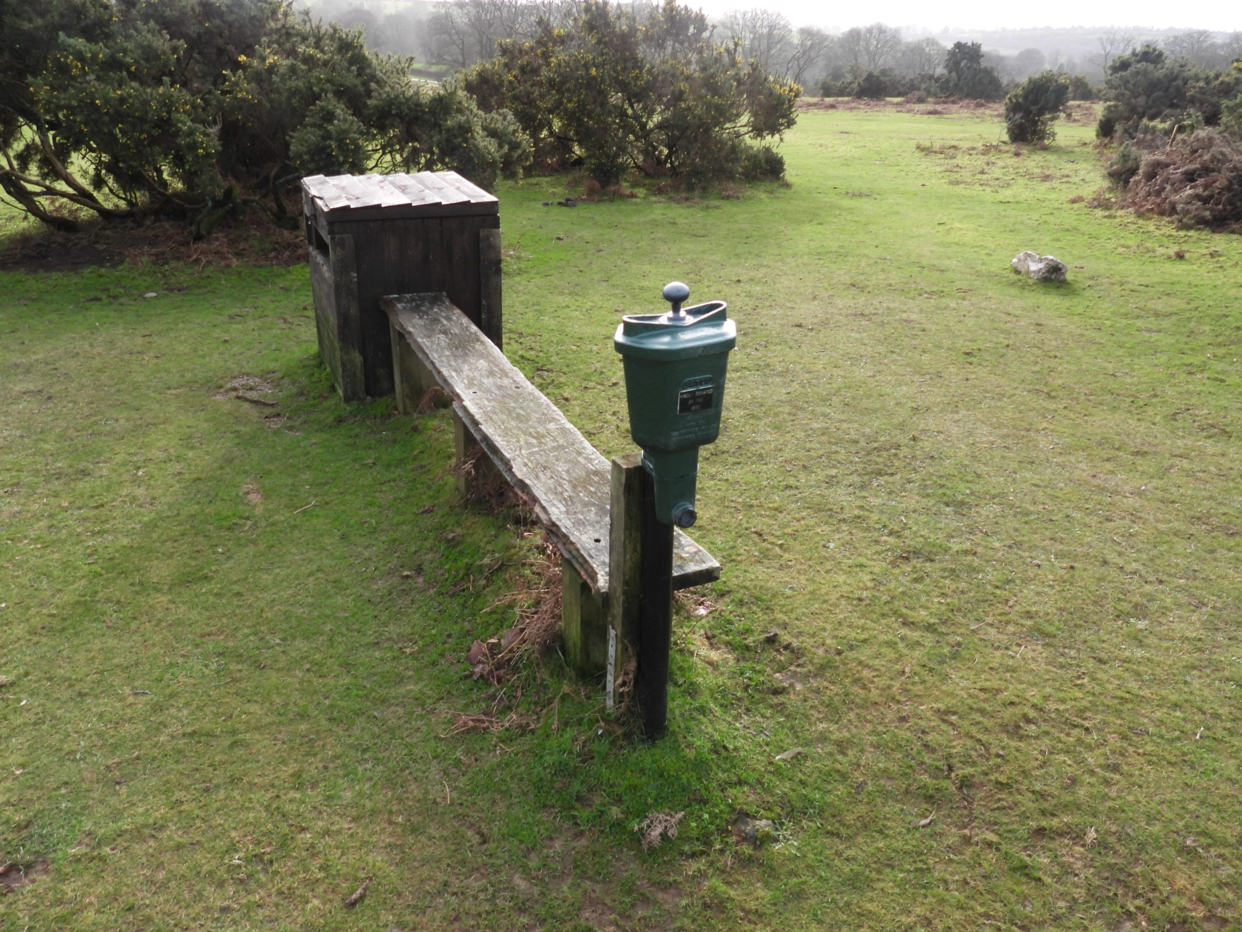
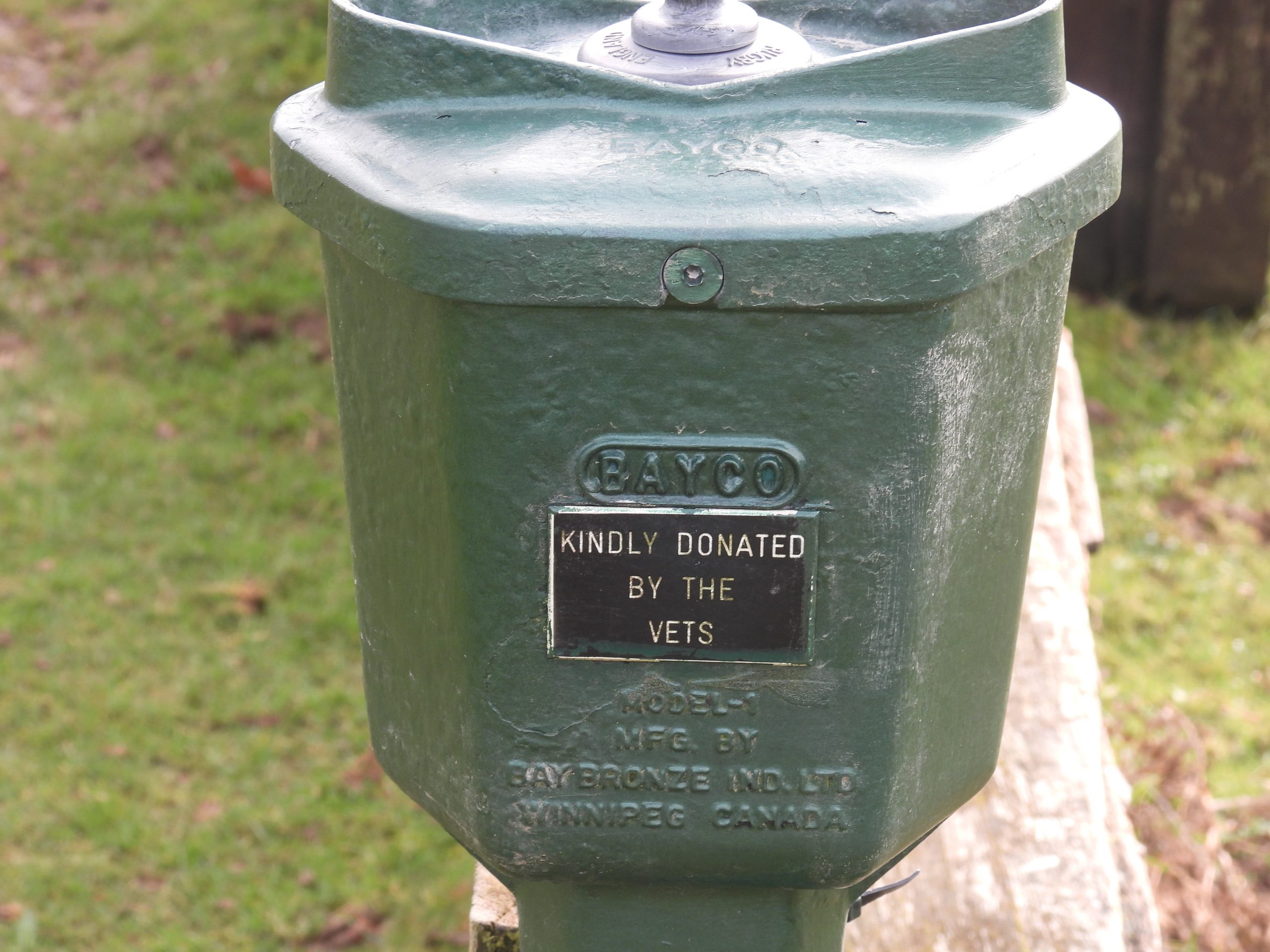
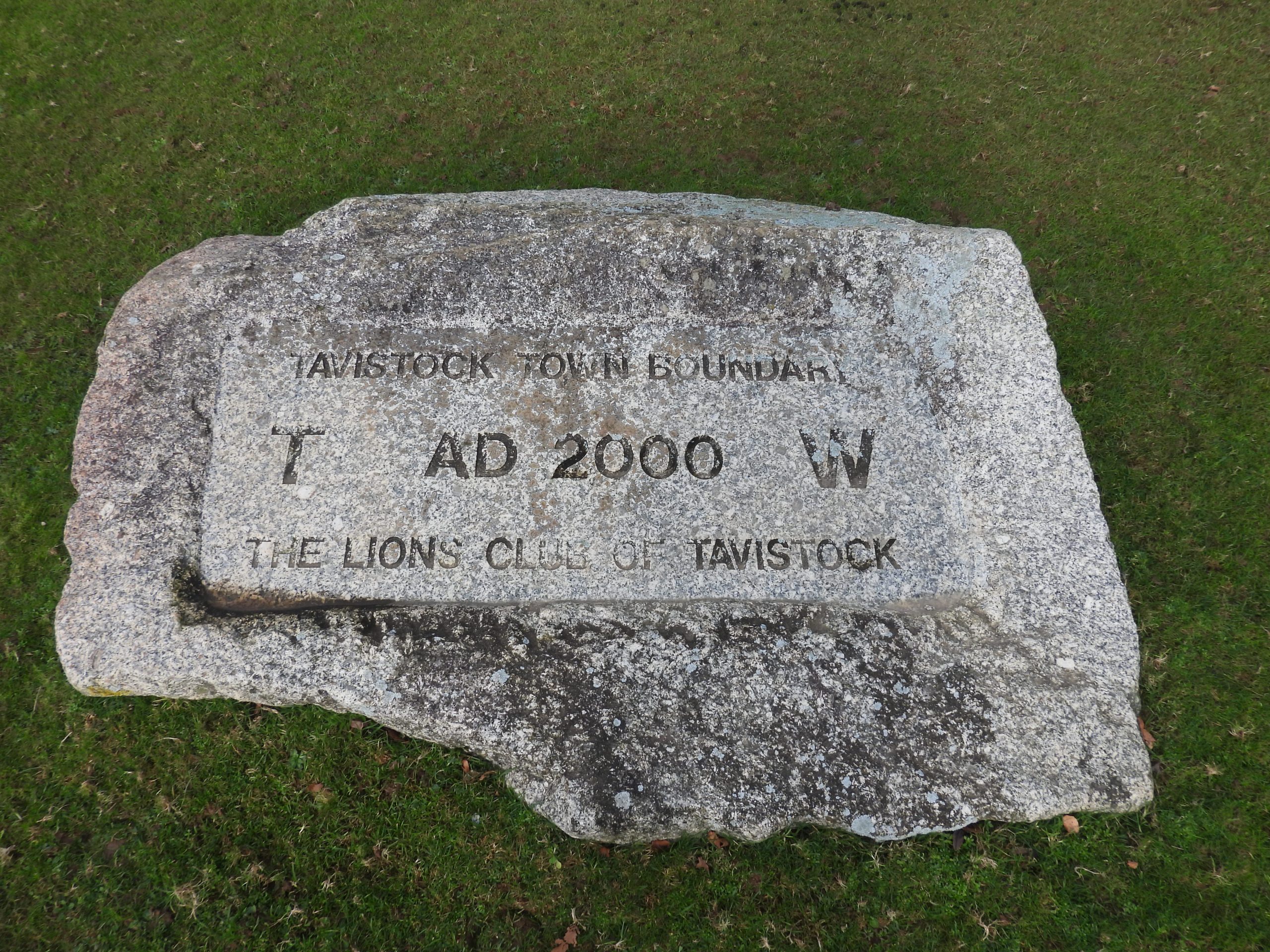
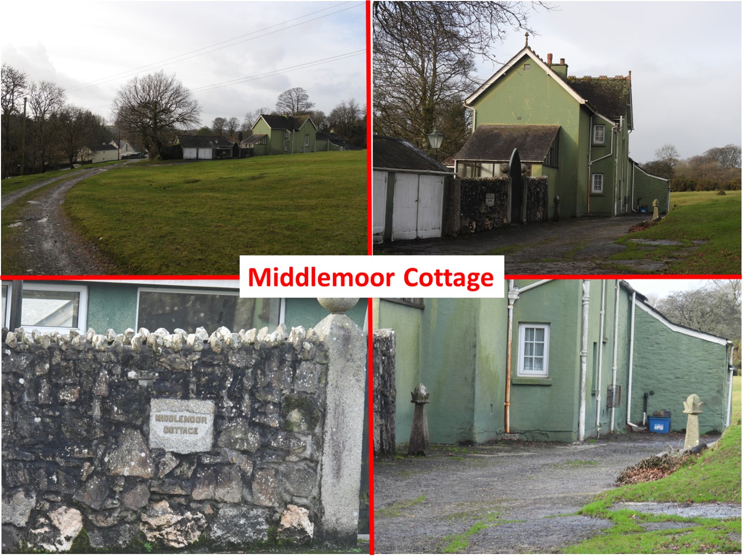
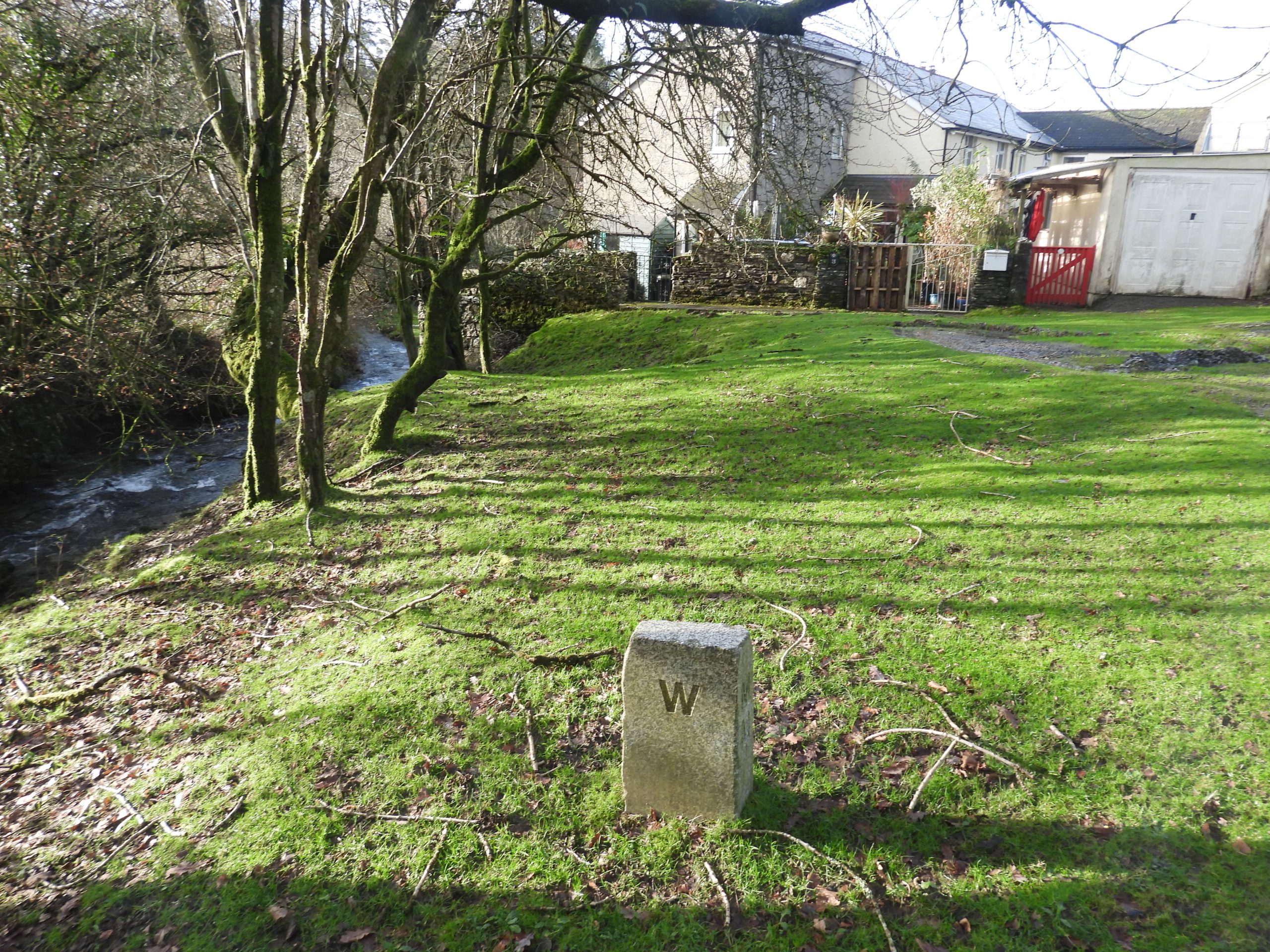
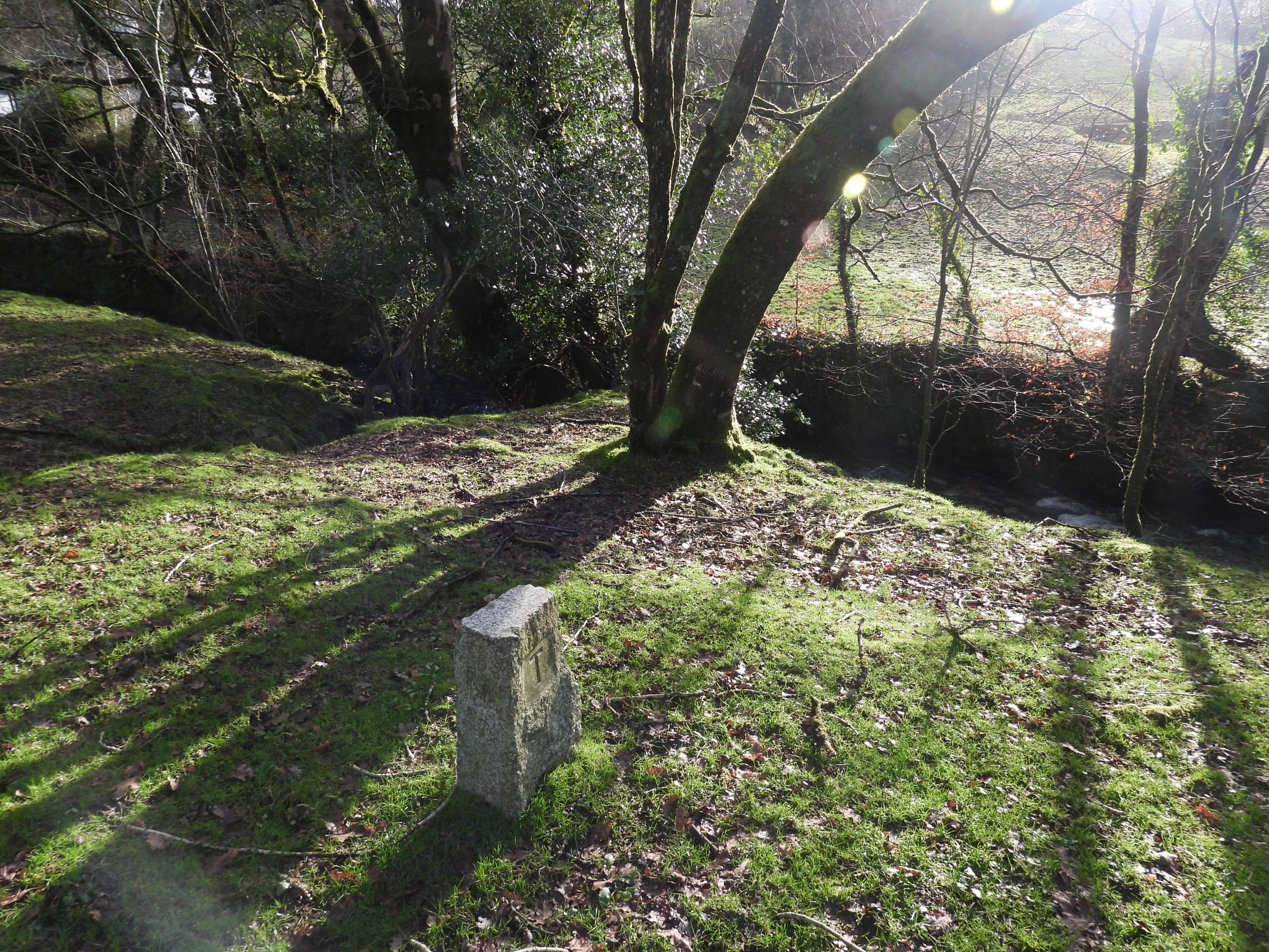
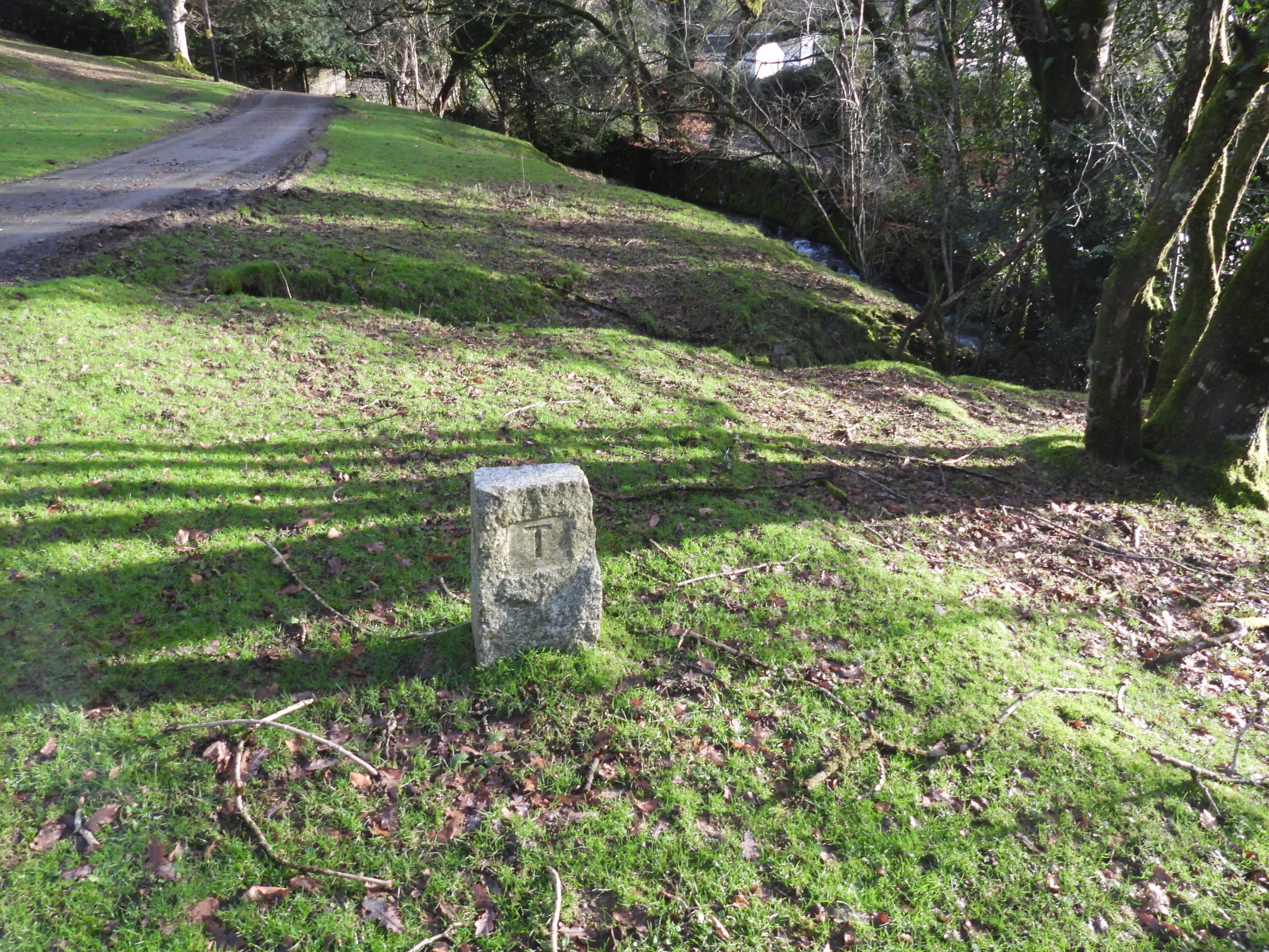
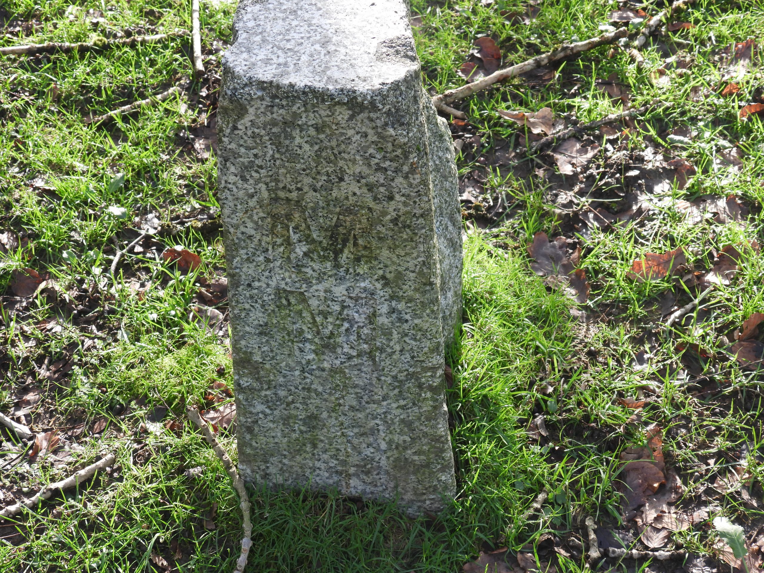
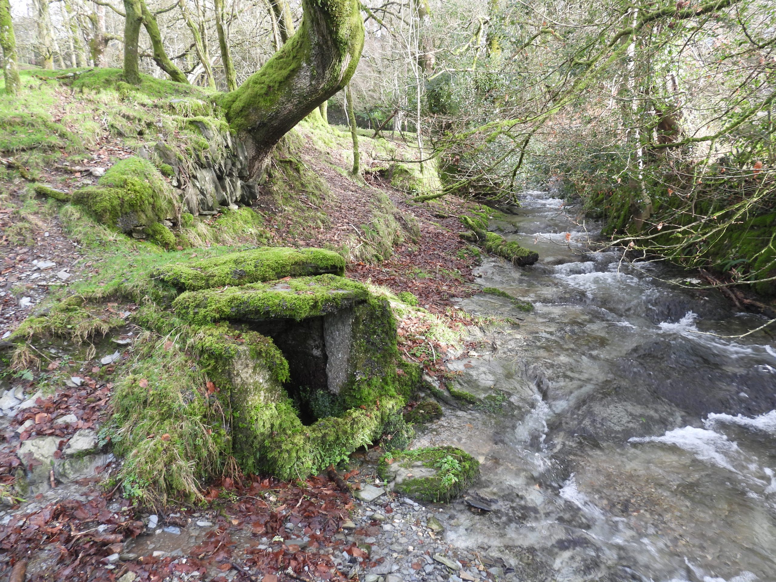
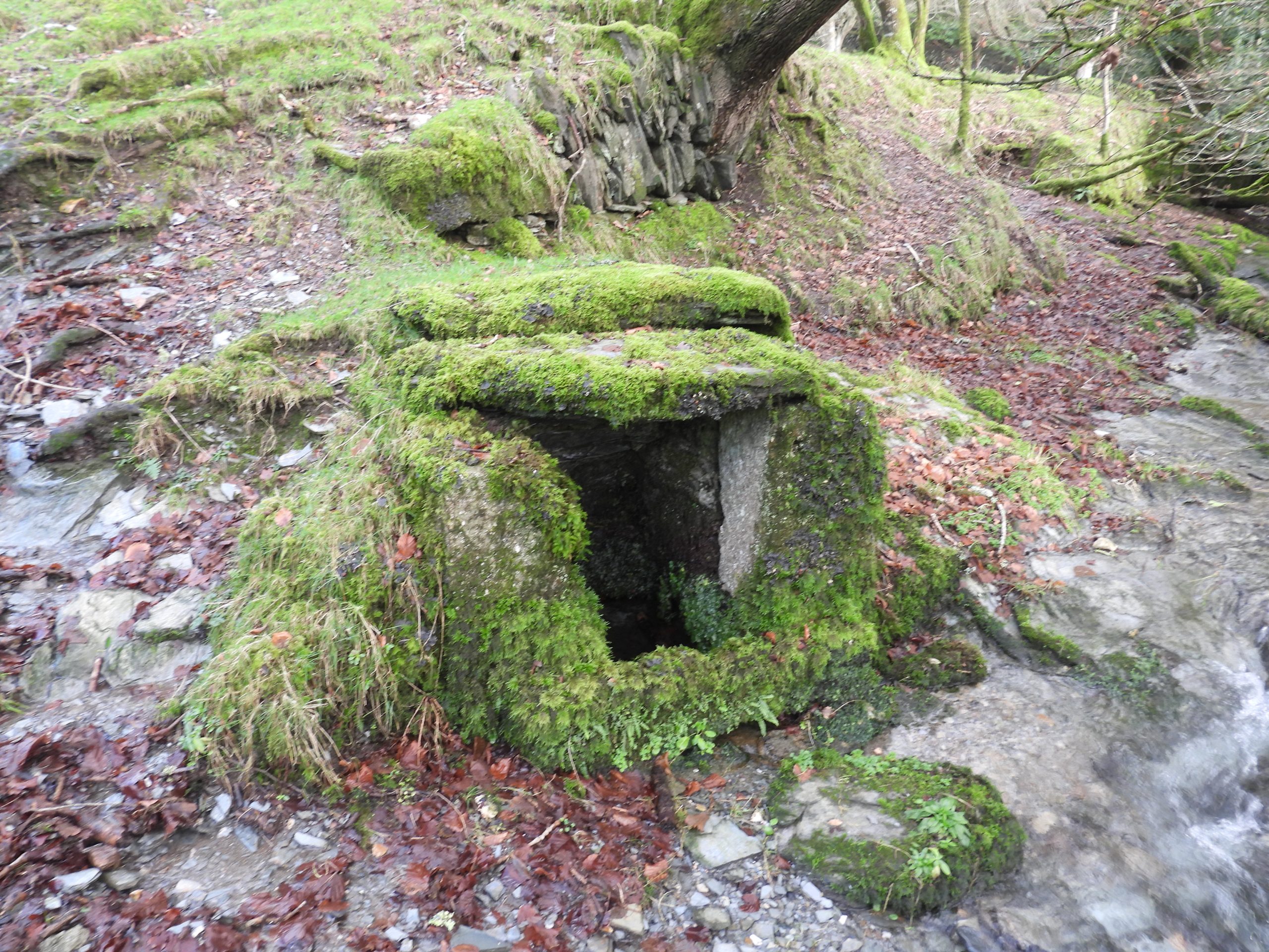
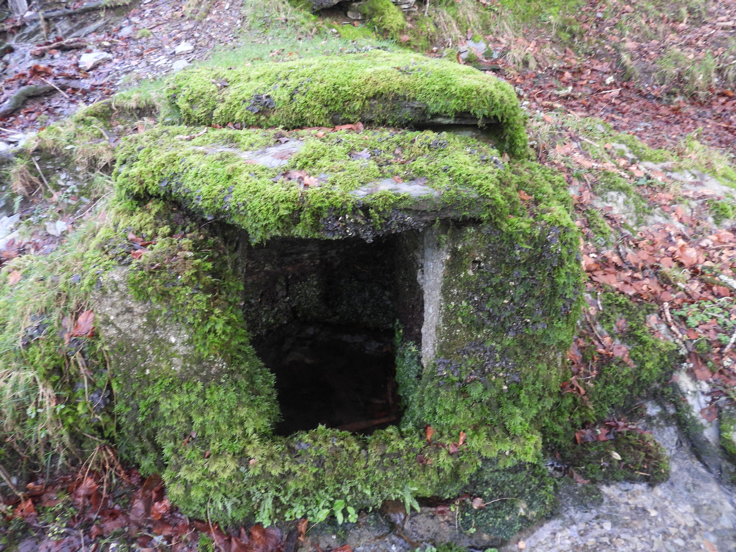
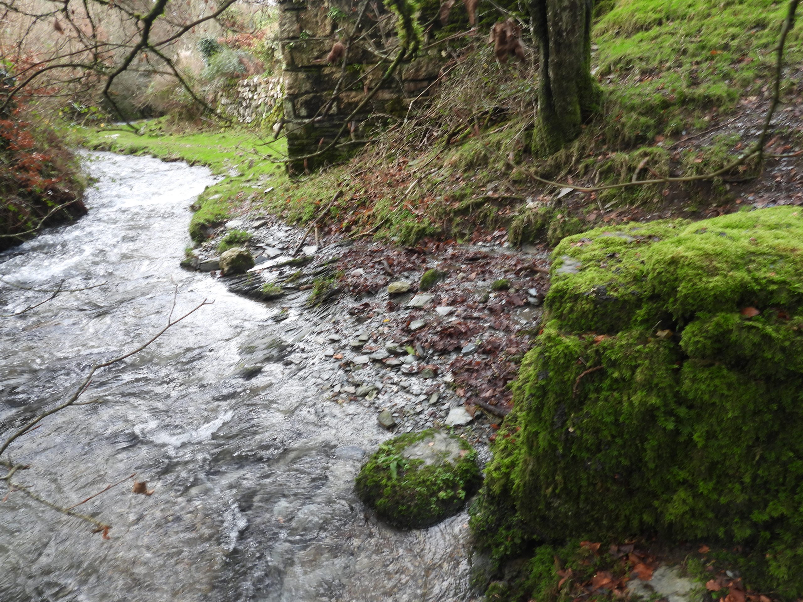
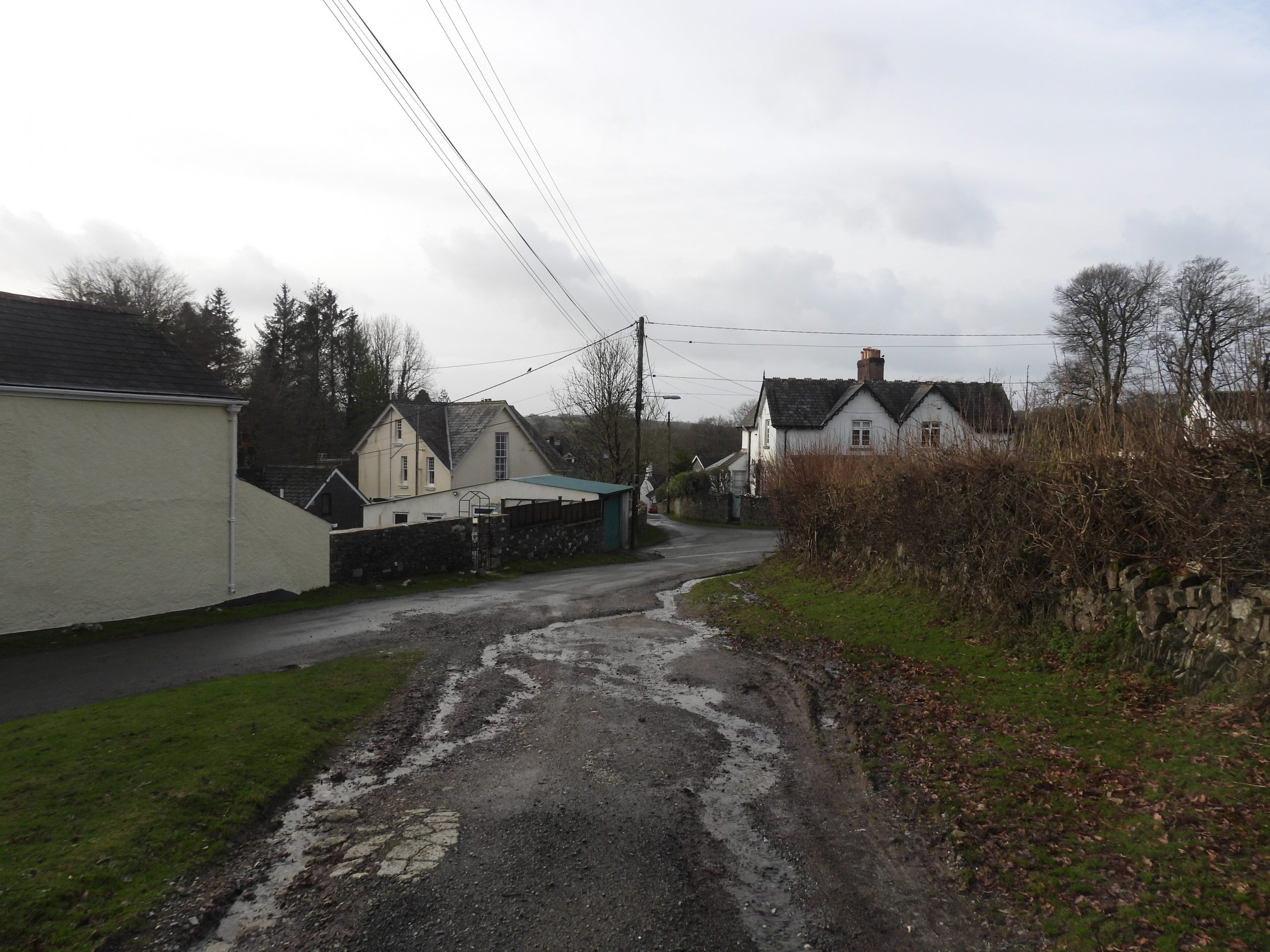
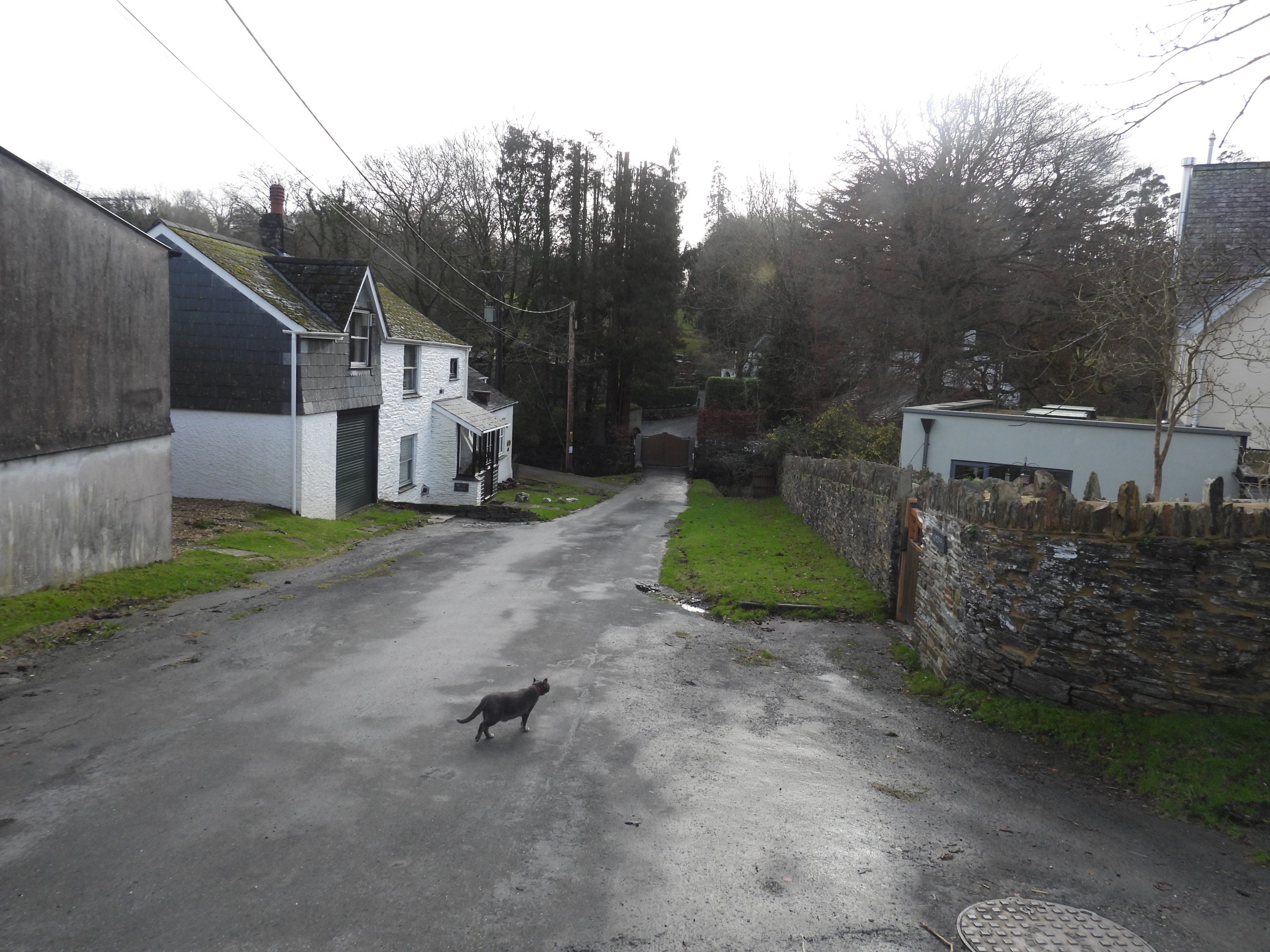
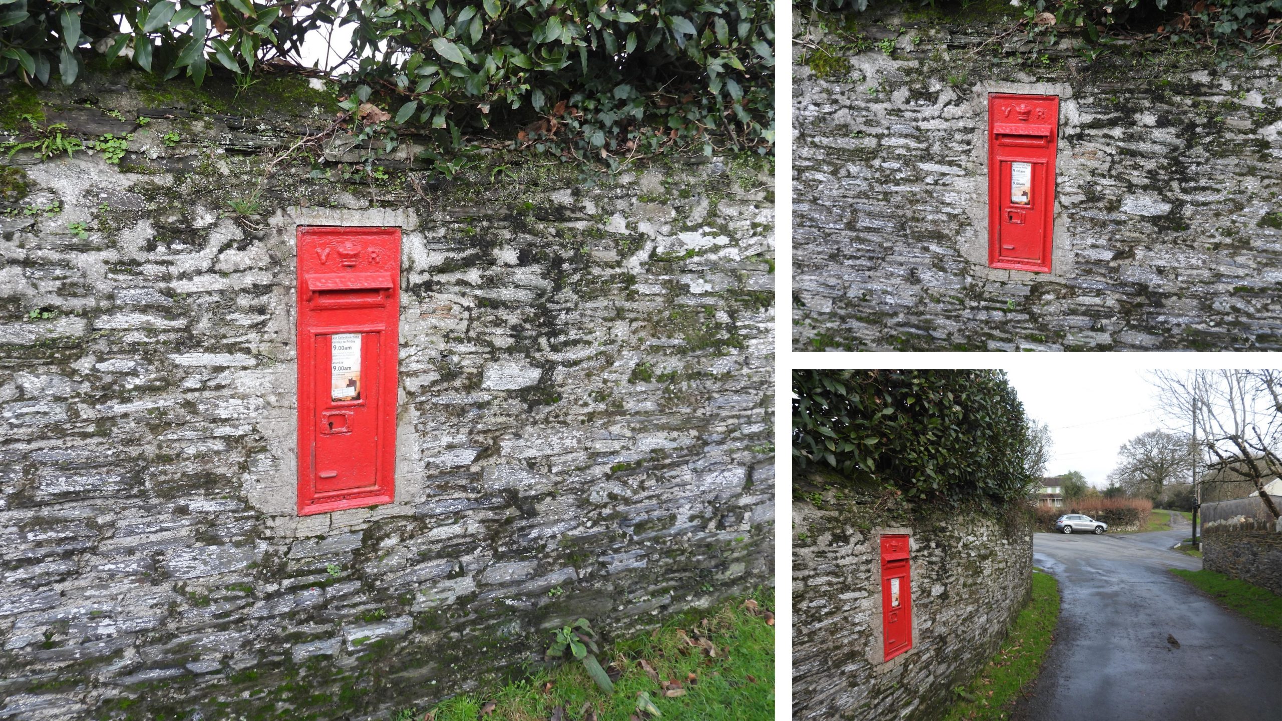
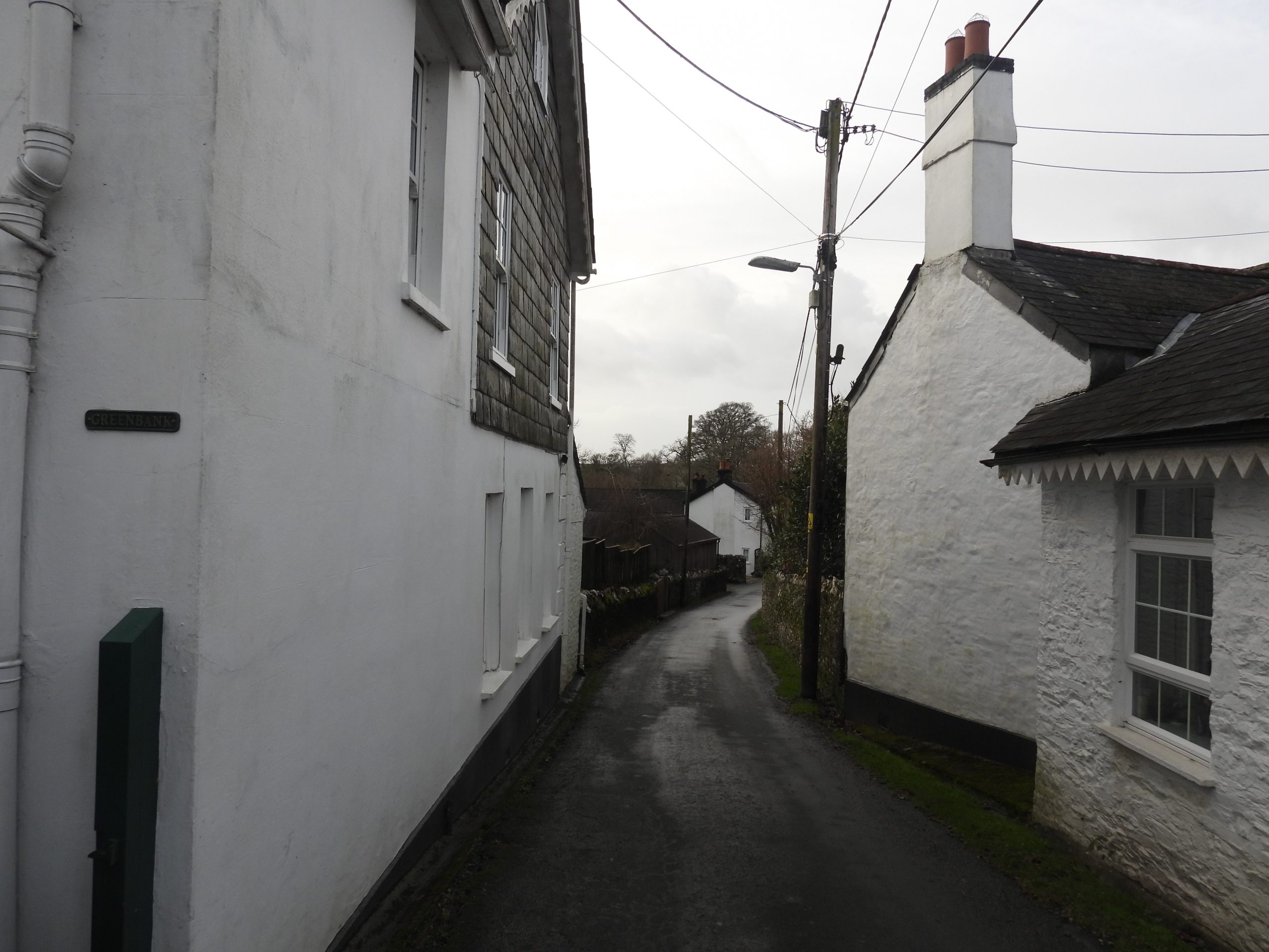
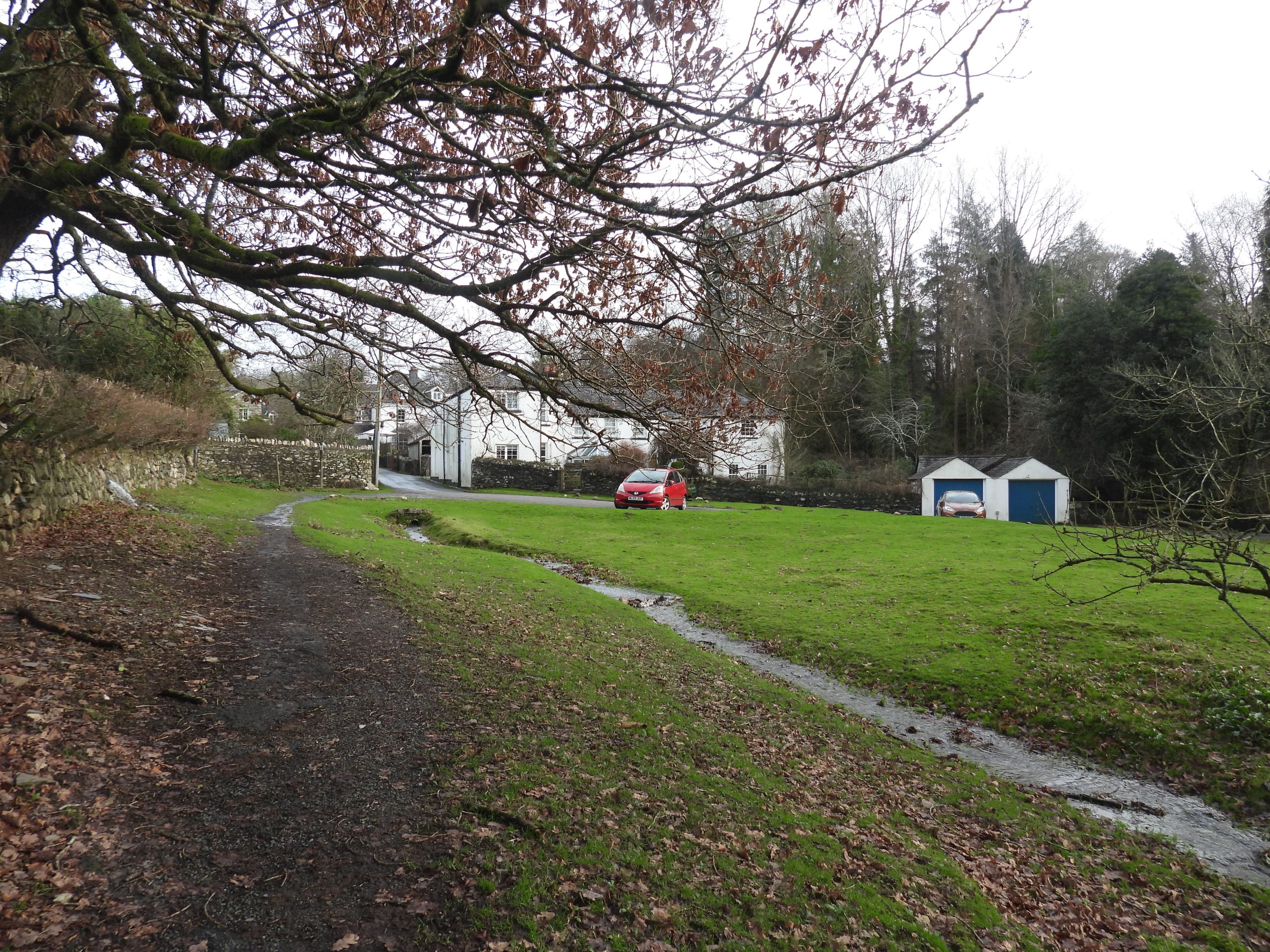
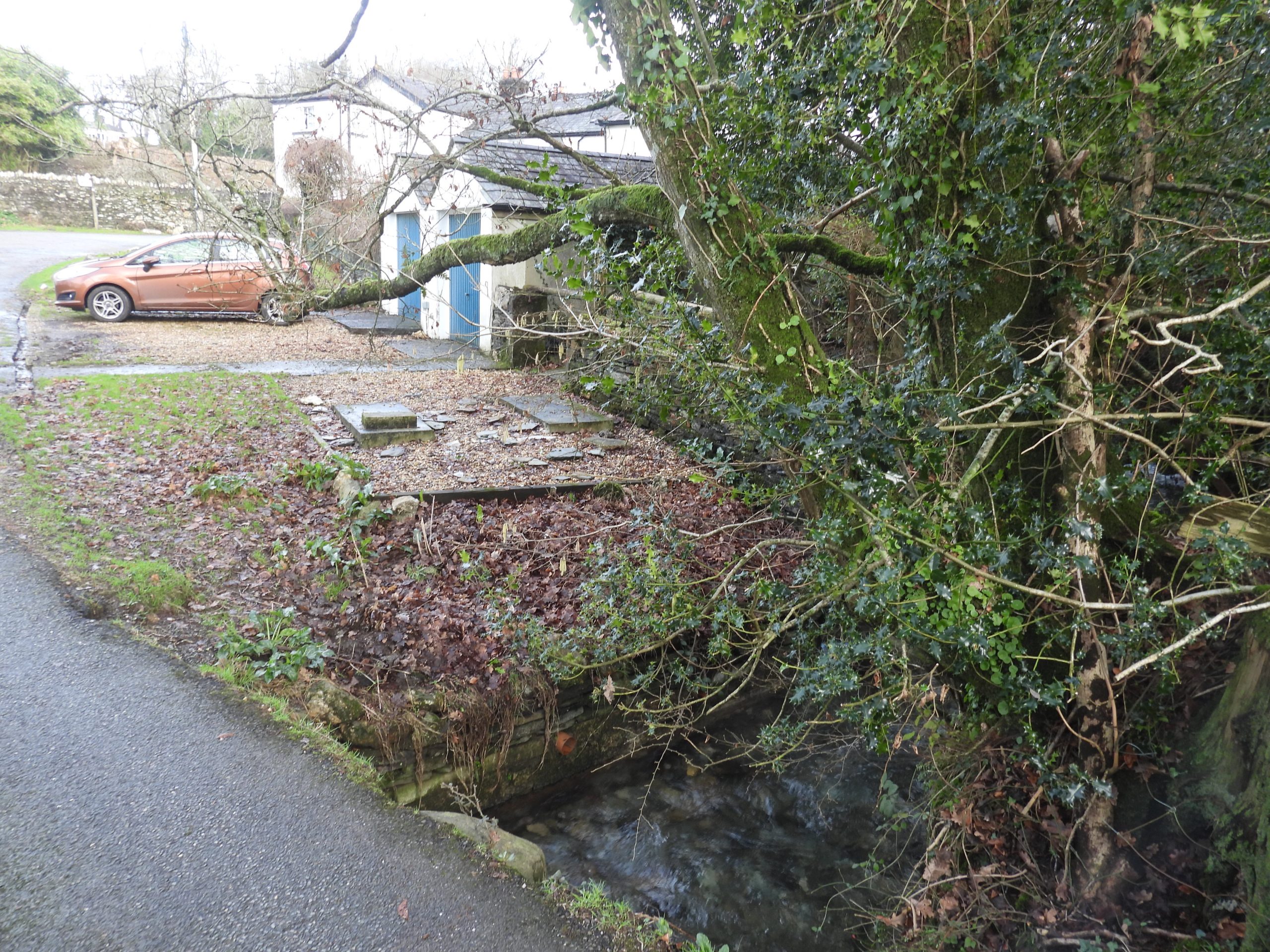
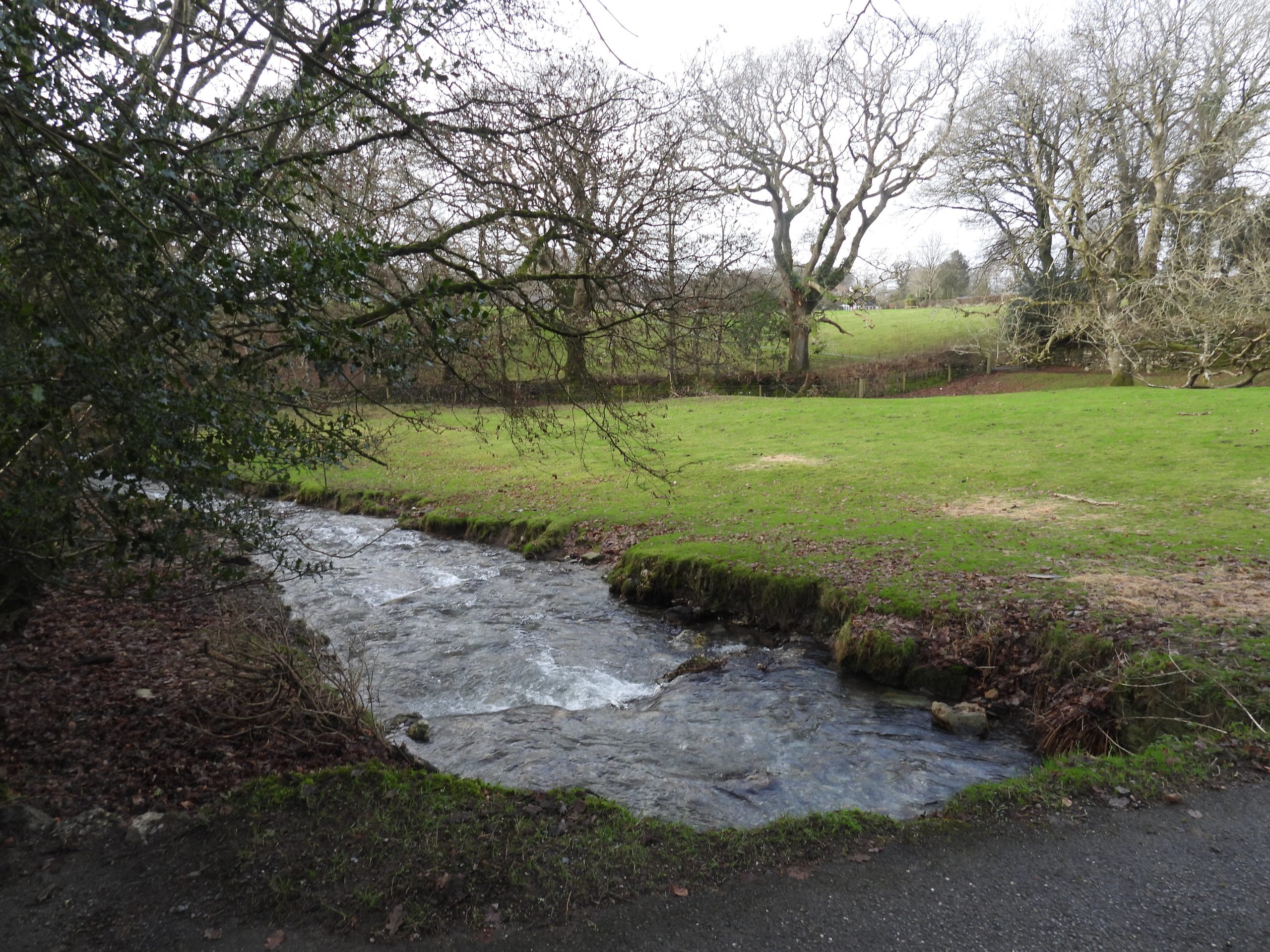
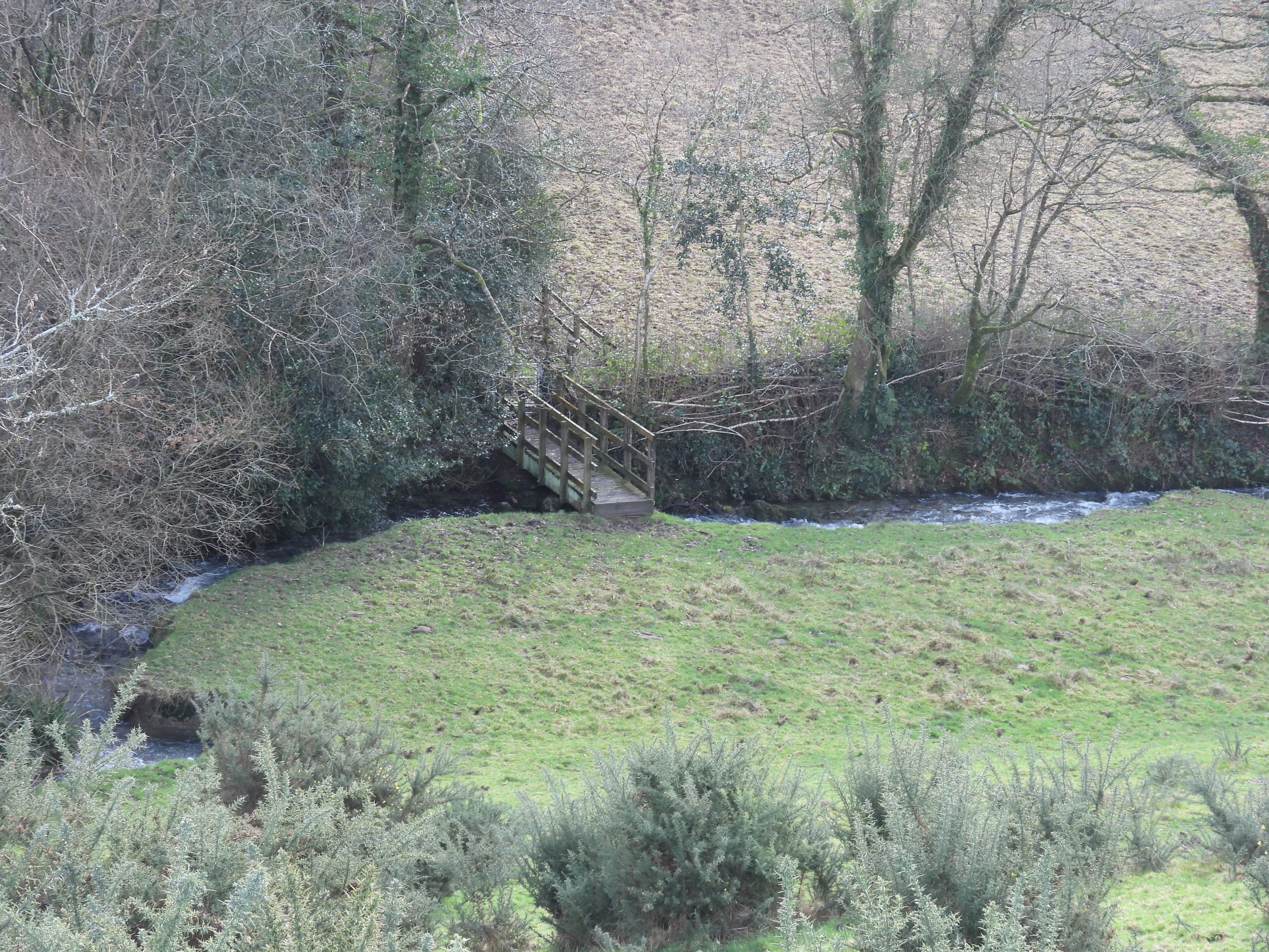
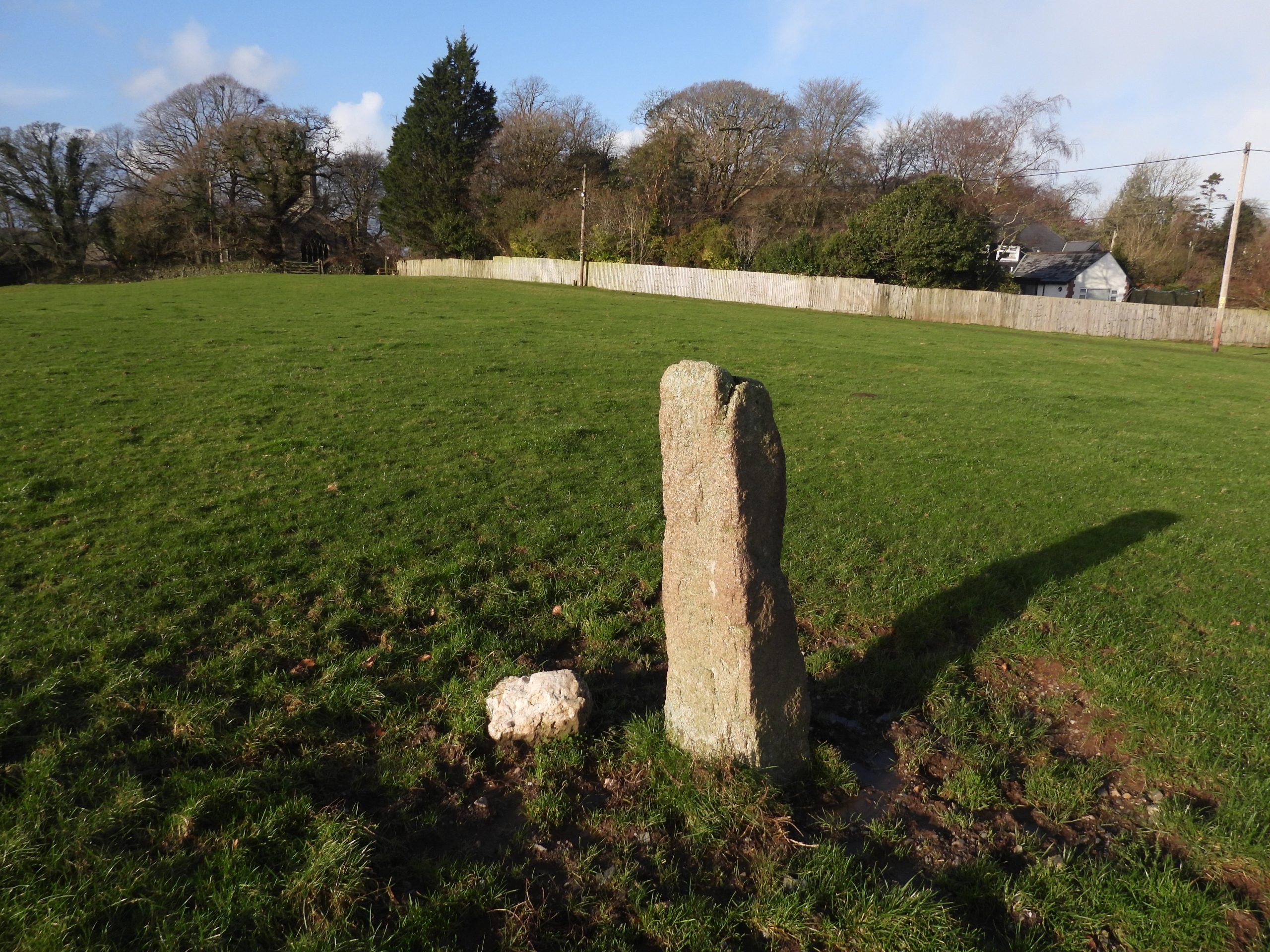
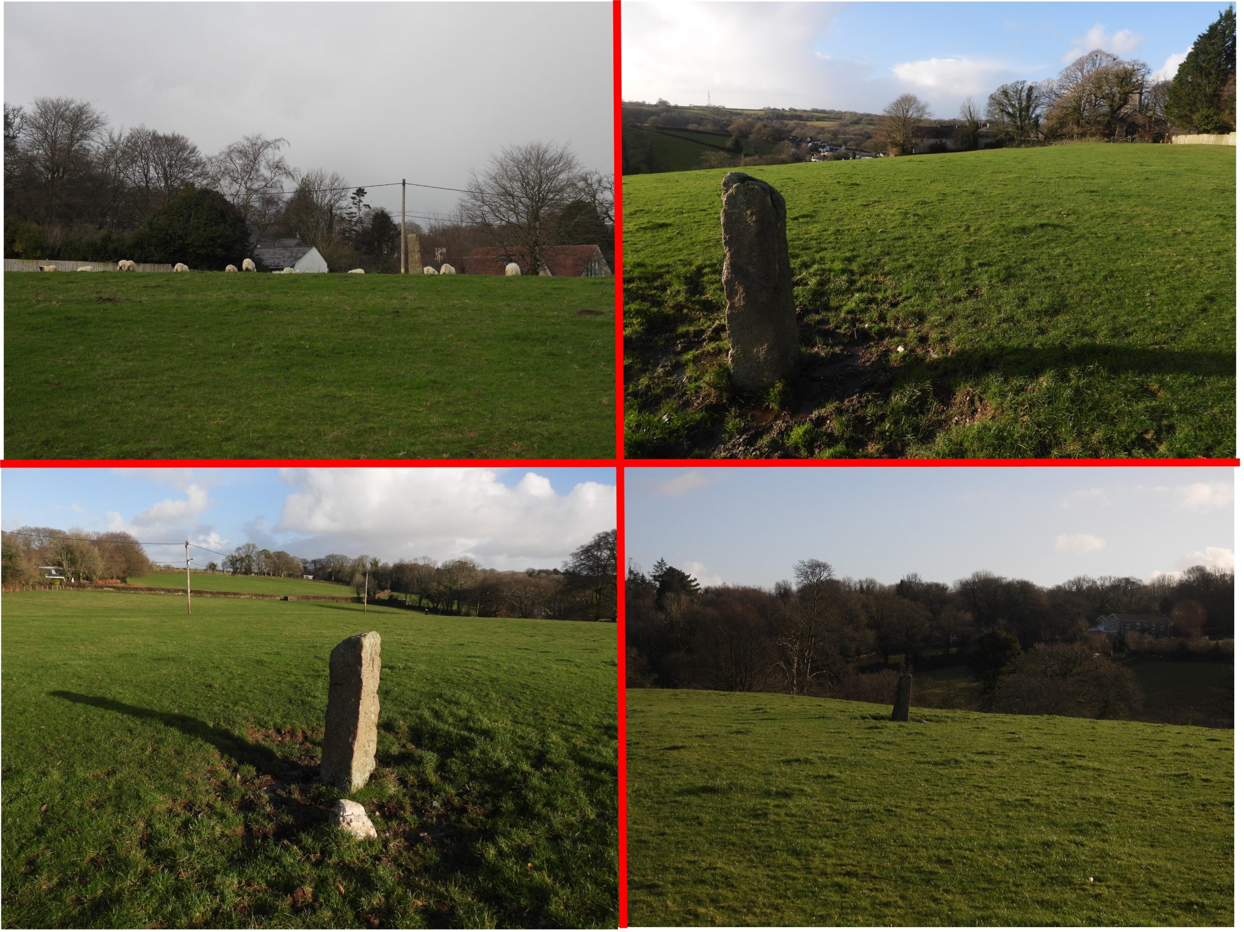
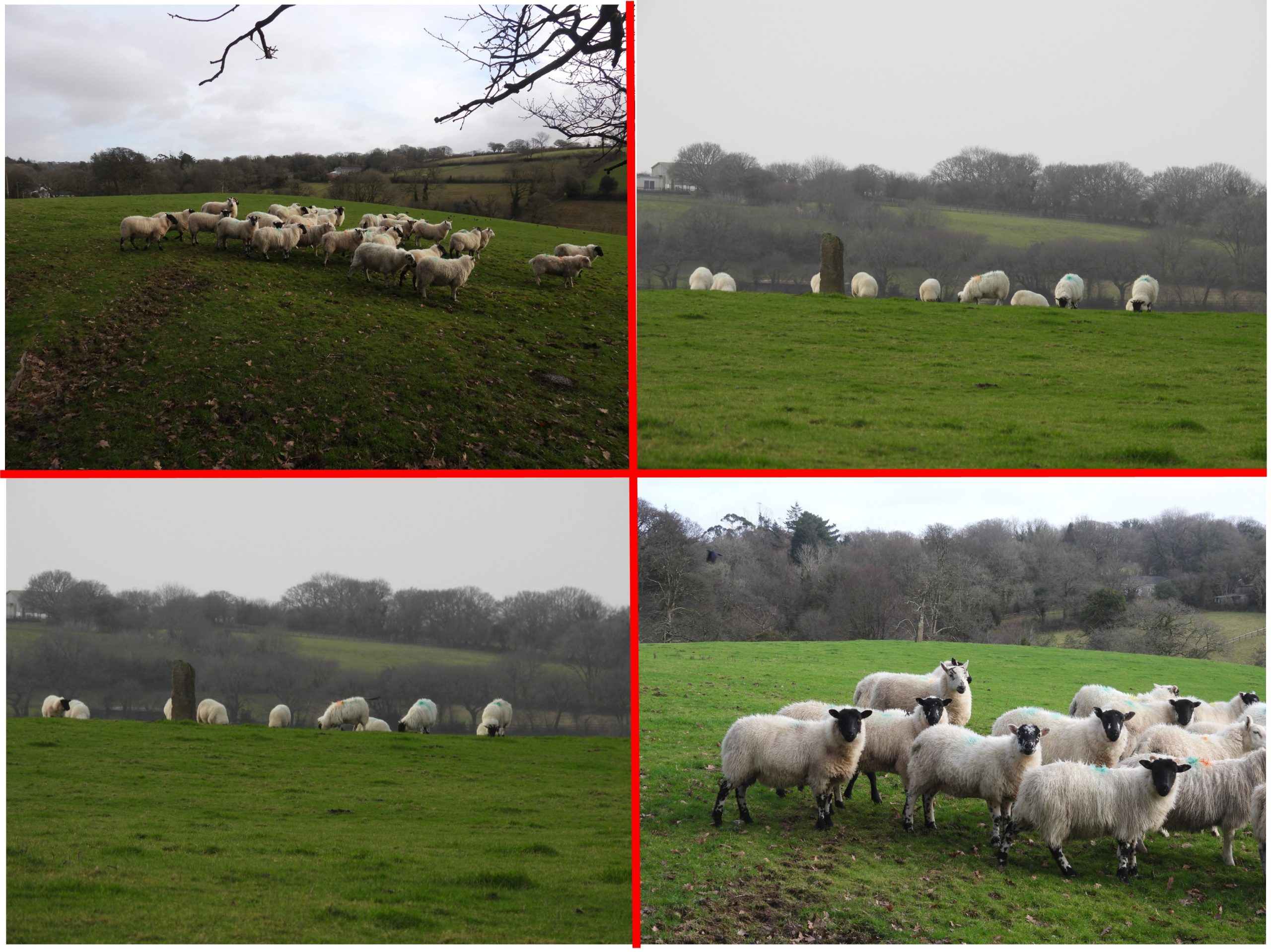
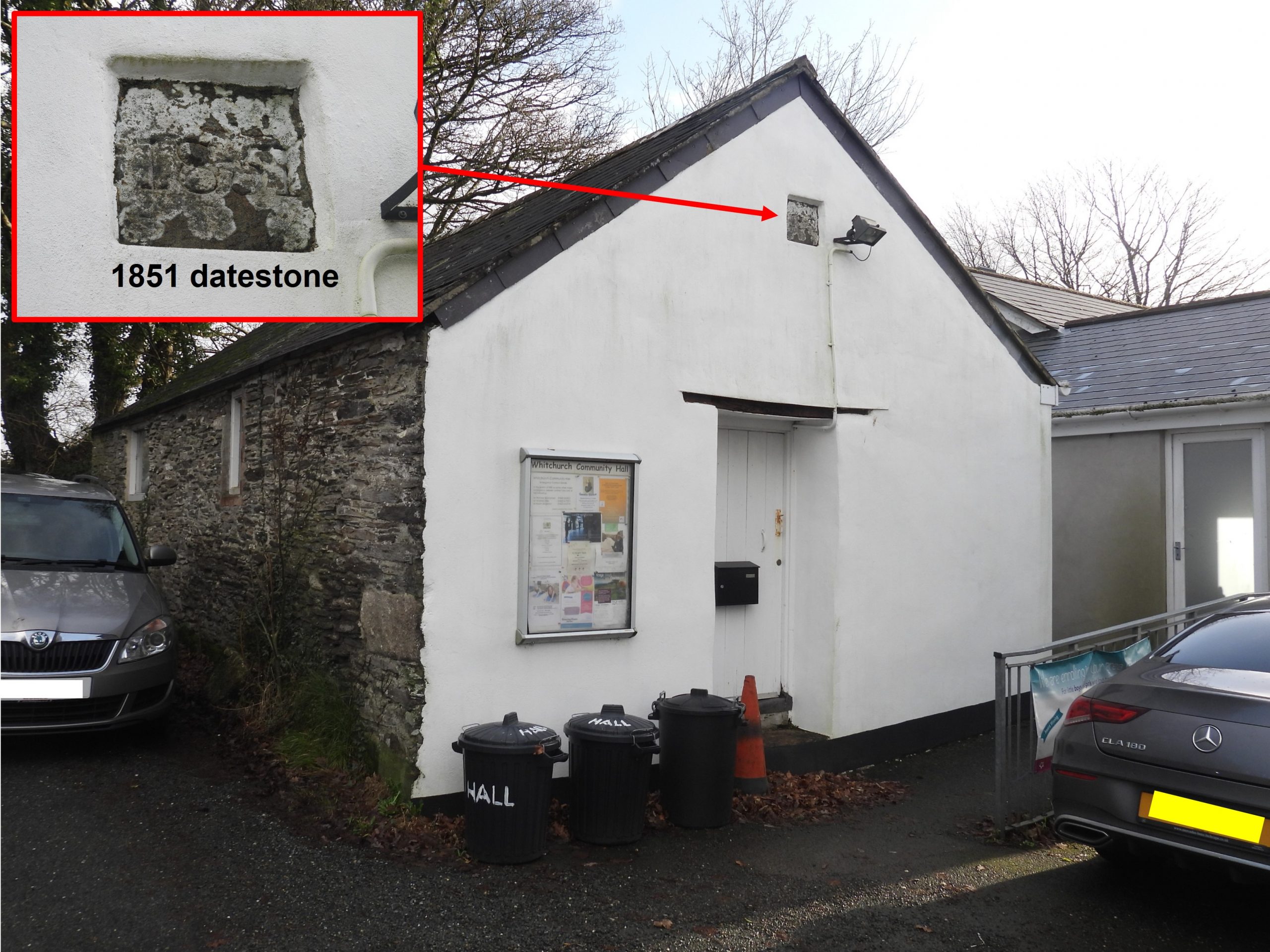
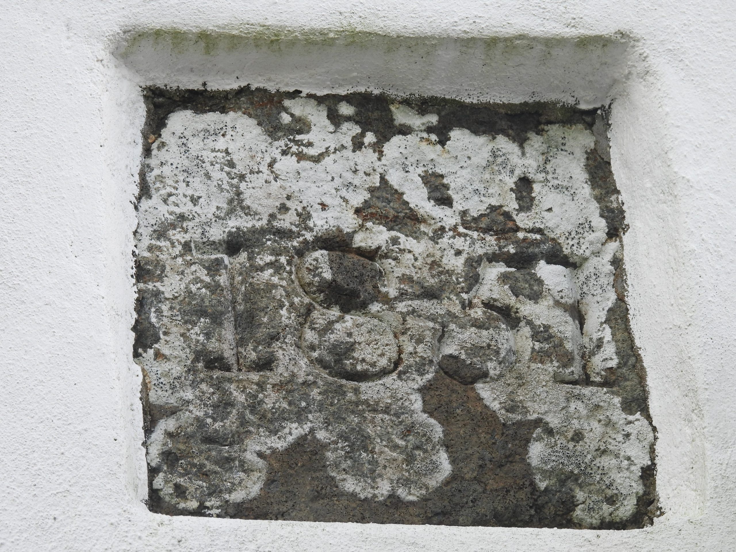
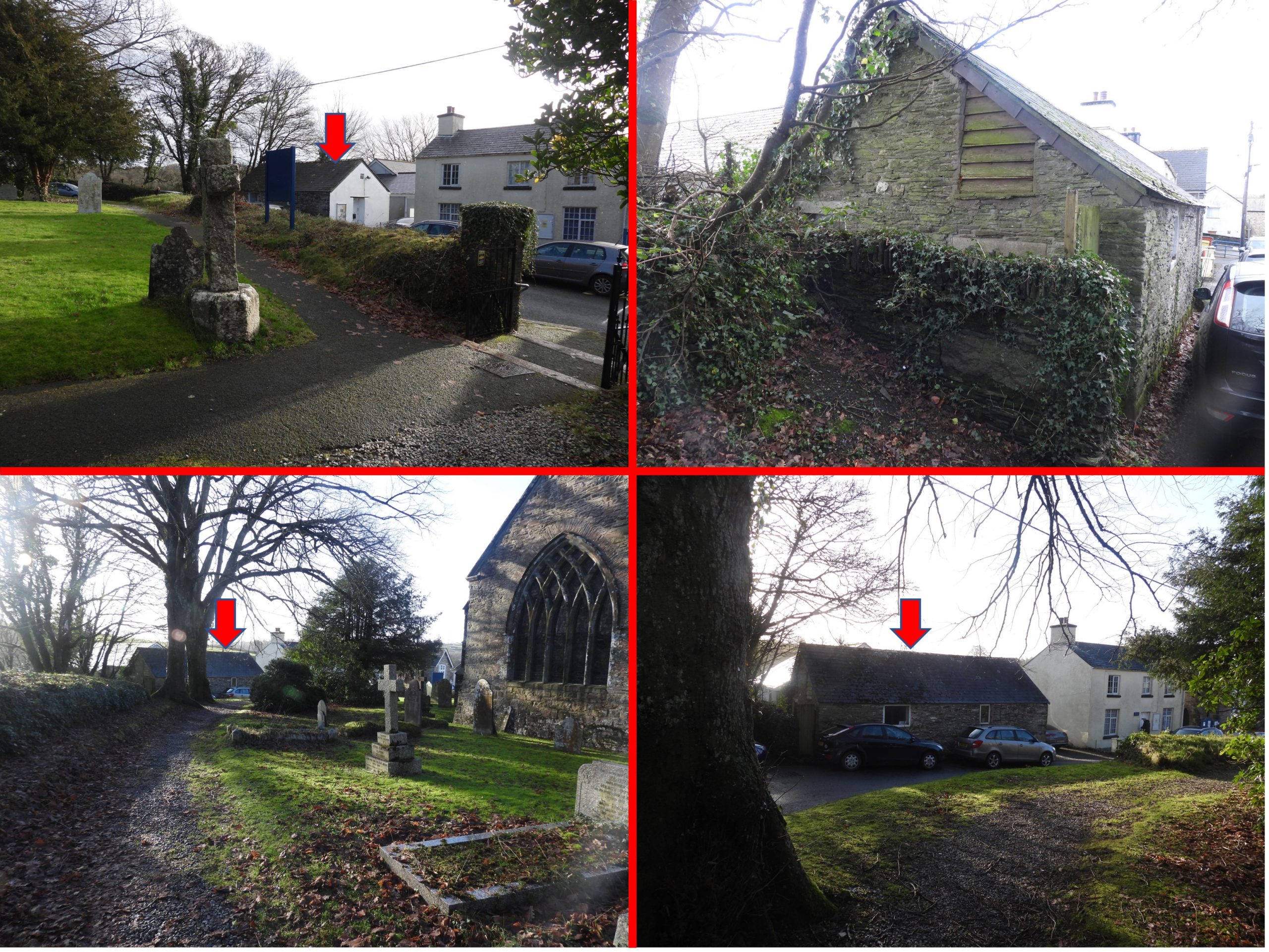
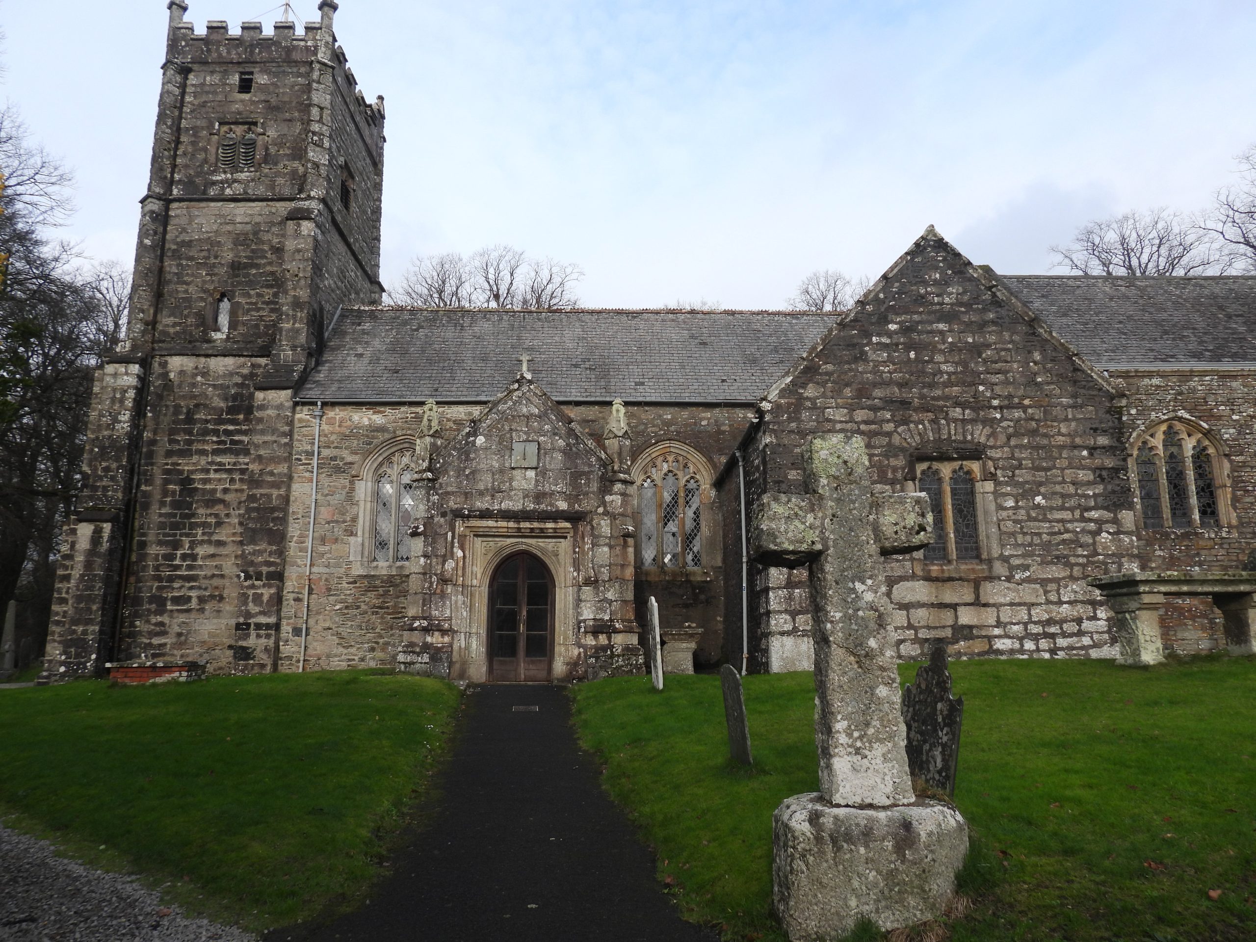
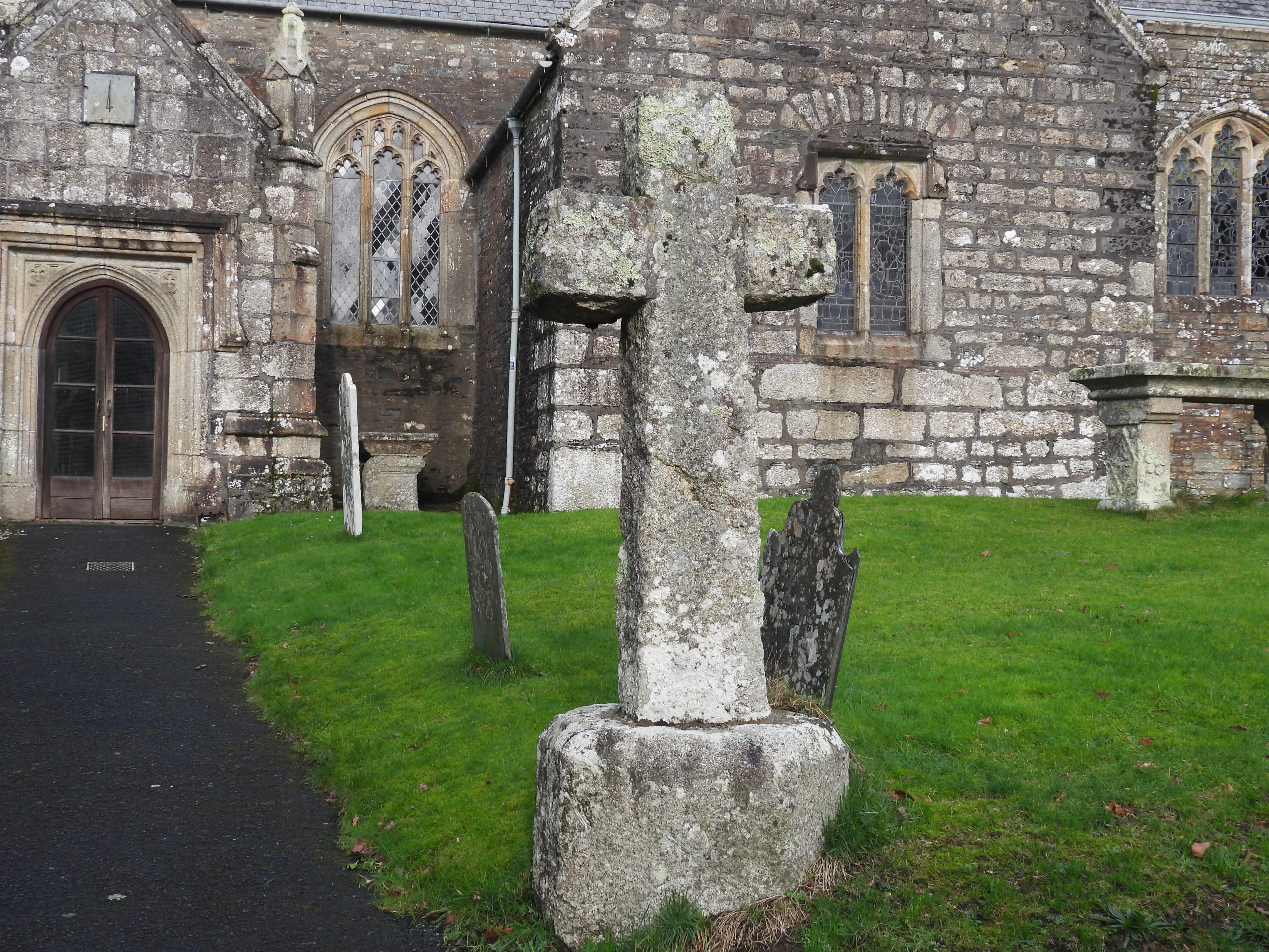
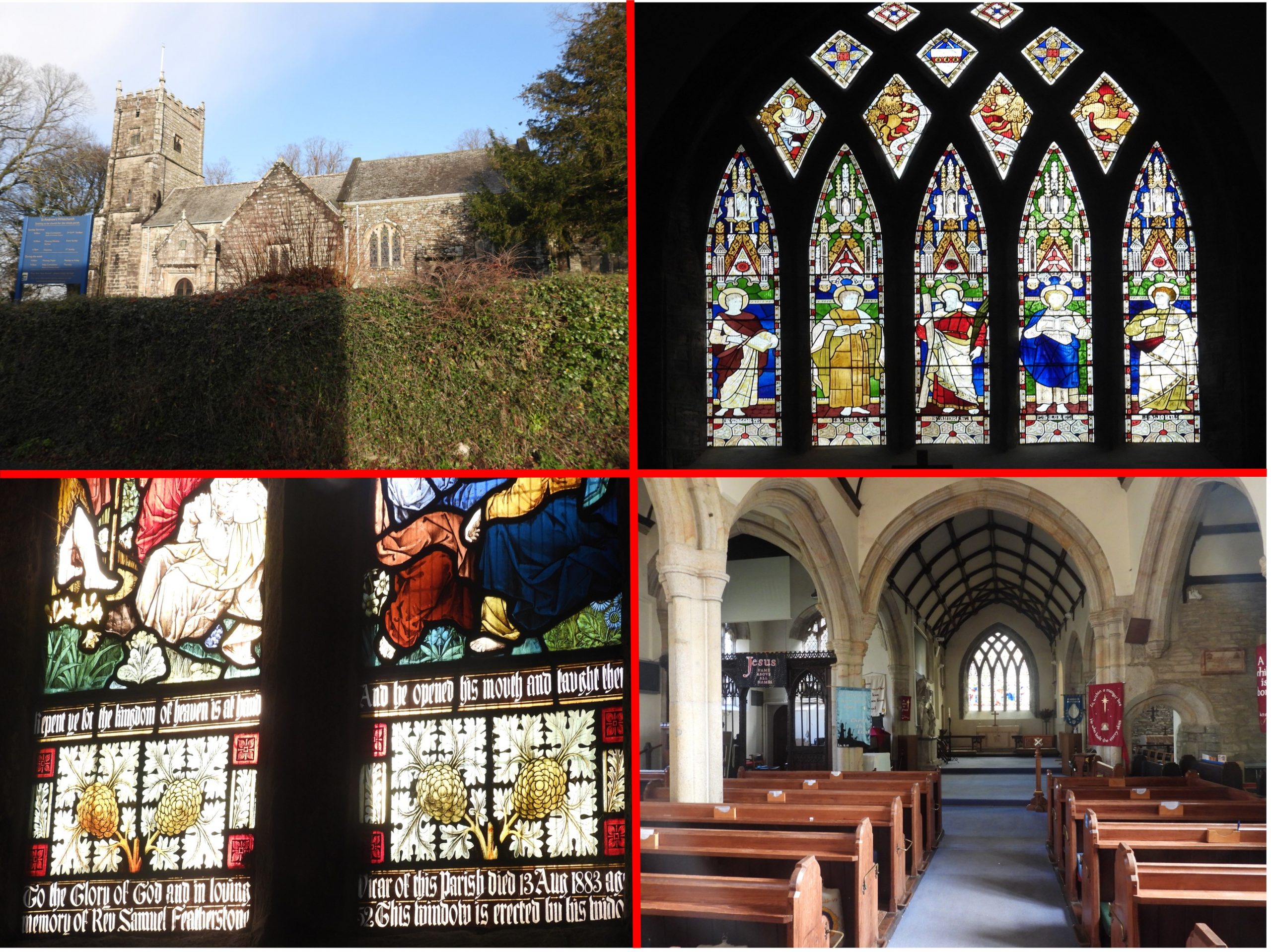
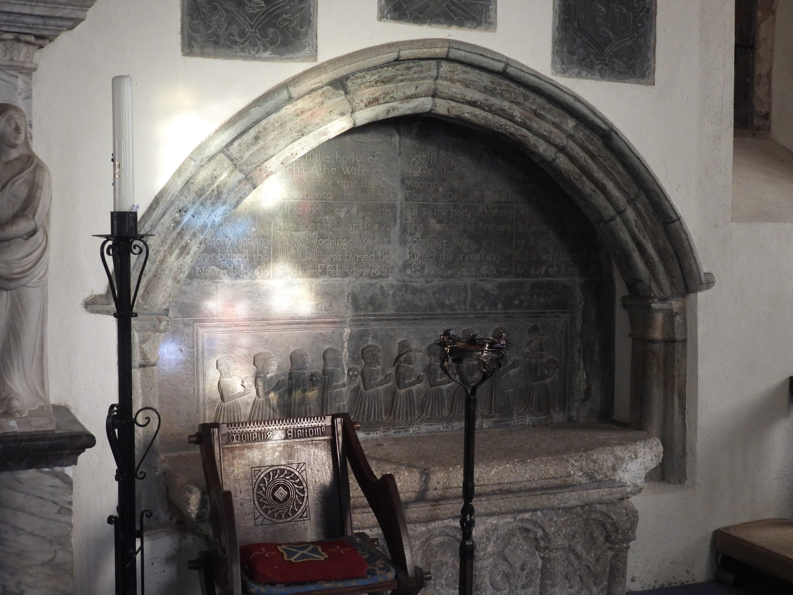
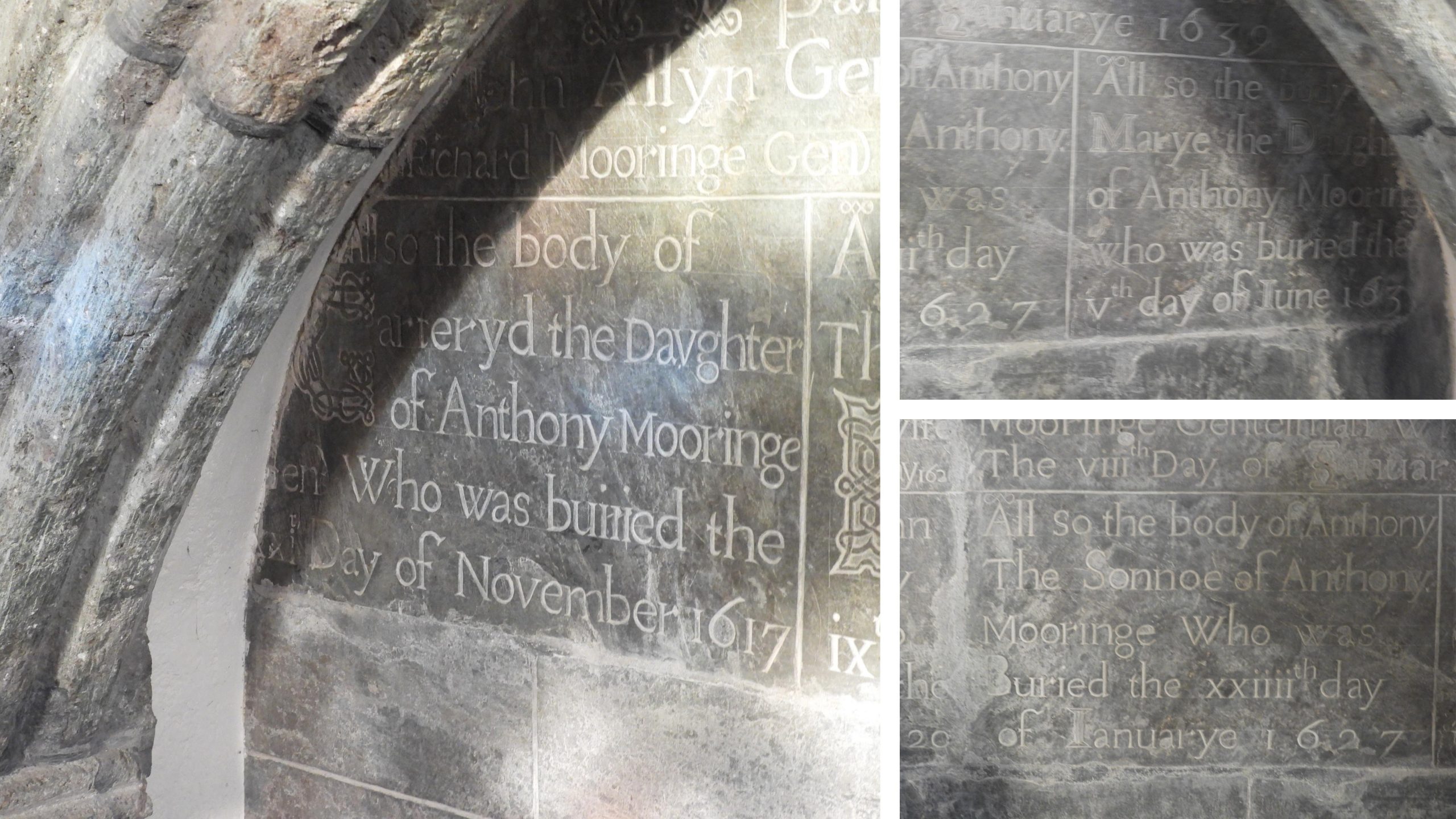
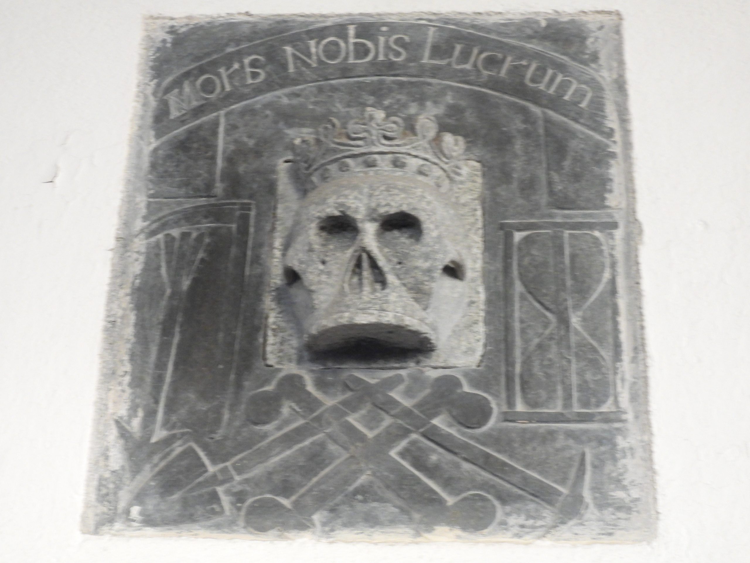
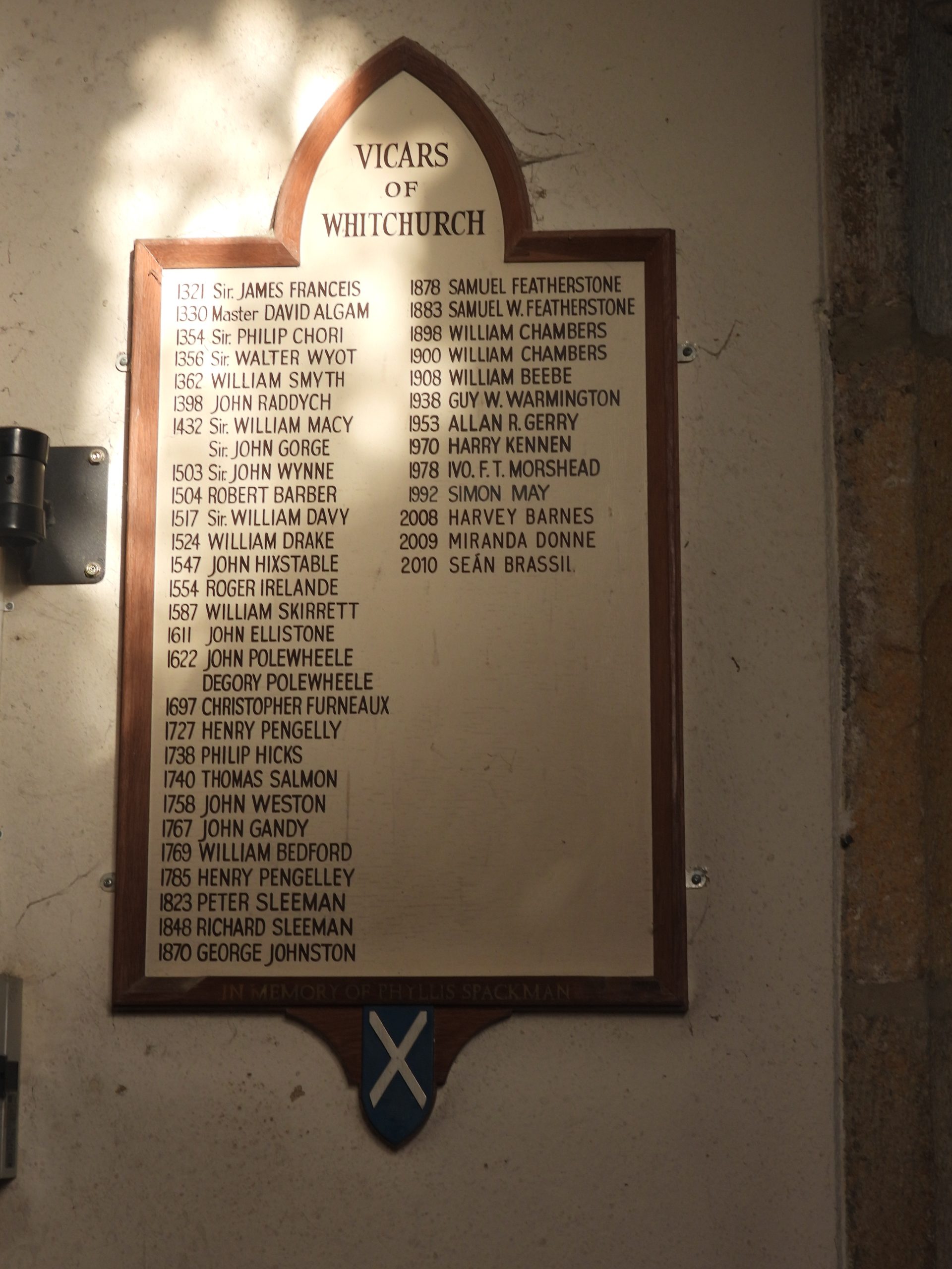
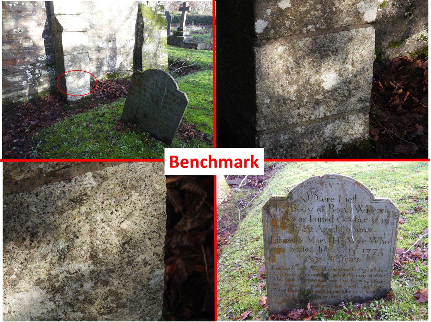
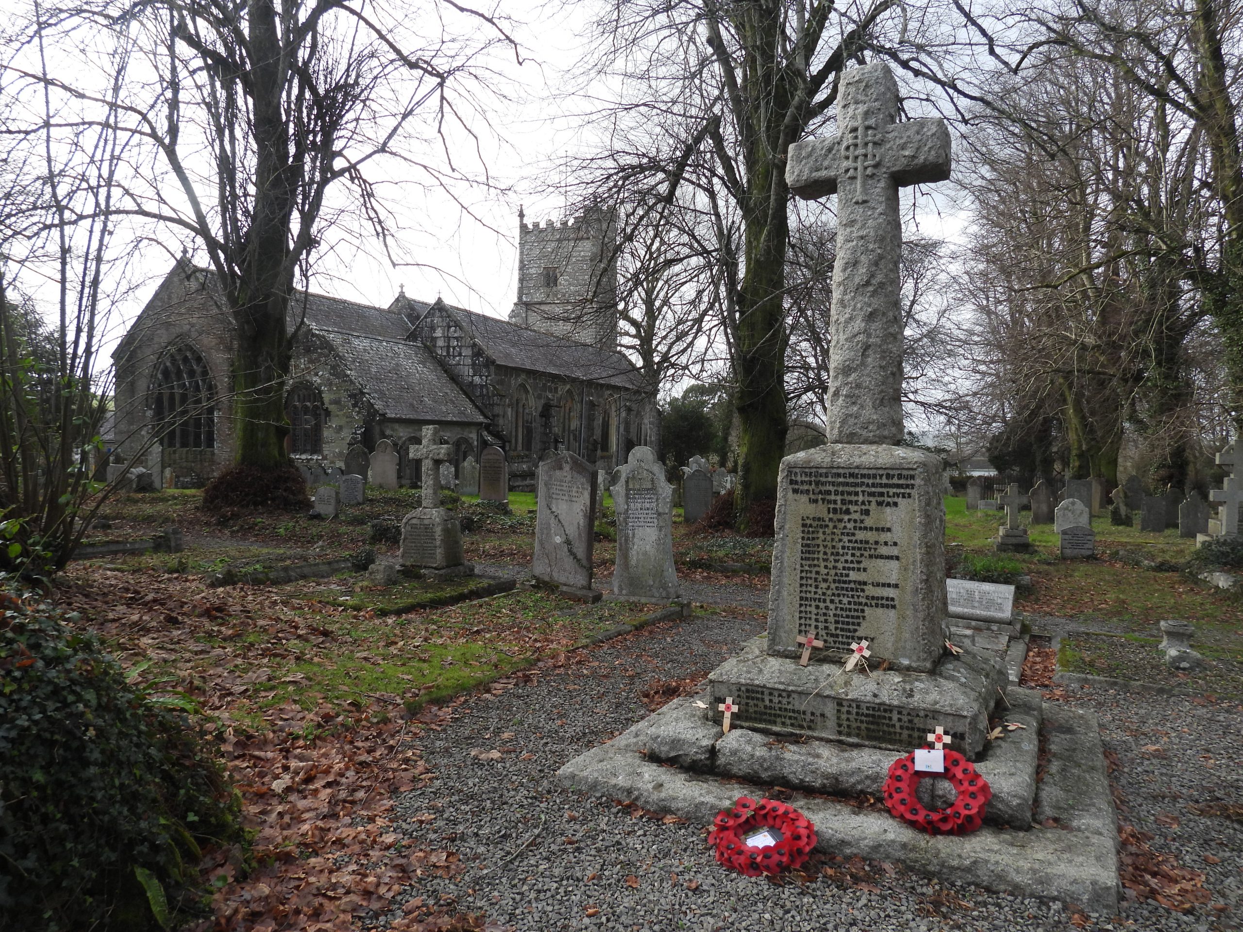
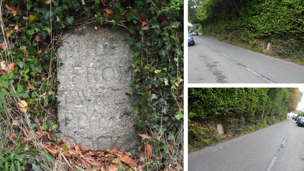
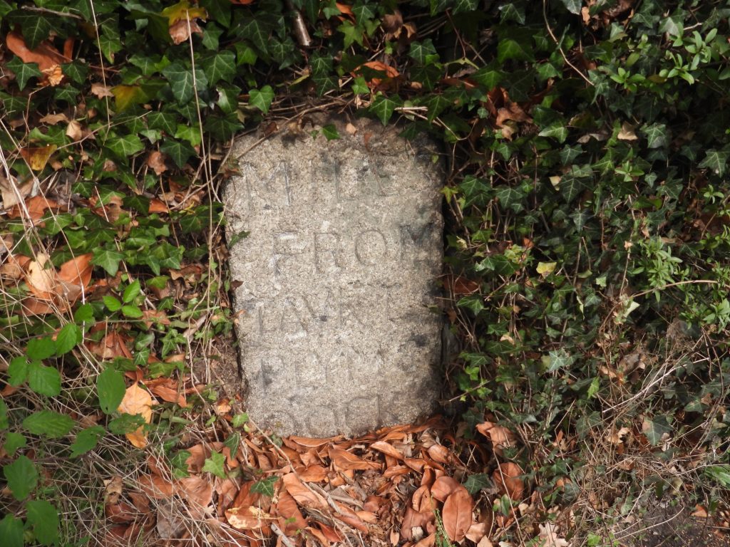
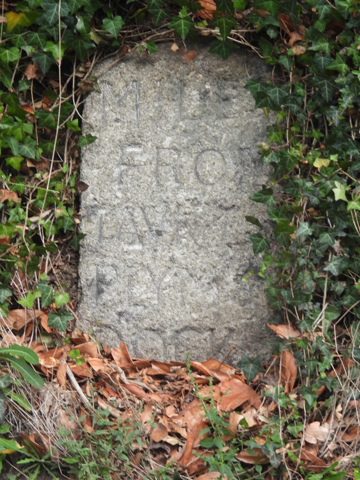
Sketch map of the area covered in this post. The two parish boundary lines are shown in red (19th century) and green (20th century). The GENKUI parish maps from 19th century (red lines) overlaid with the current parish boundary lines (taken from 21st century OS maps – dotted lines). Milestone in Green Lane lies on the 20th / 21st century boundary of the two parishes. It also lies on the route of ‘The Abbots Way’, which was first named as such in late 18th century and which is alleged to be the route of monks took between Tavistock and Buckfast Abbeys, across the southern moor. The inscription on the road side reads “14 miles to plymo” On the slim, north face of the milestone is the inscription “1 T”, which stands for one mile to Tavistock.The milestone also has an inscribed benchmark and rivet (bolt) on it. It is referenced as B.M 514.5 on 19th century maps suggesting it was inscribed between 1840 and 1860 (first geodetic period)The milestone / benchmark is located at SX49182 74002Dartmoor National Park Boundary Marker at SX49224 73949 is one of a 41 signs recorded by Mark Fenlon in 2021. Mark records that this plaque has an old style ‘Pony’ logo introduced in 1959 which was replaced in 2010 and that this stone was moved approximately 400 metres north-west from its original position on Whitchurch Down at SX49548 73740.This medieval roadside cross at north-west end of Whitchurch Down, near the Tavistock golf clubhouse has been restored. It is located at SX49293 73851 on the 20th / 21st century parish boundaries.E.N Masson Phillips, (1937) in ‘The Ancient Stone Crosses of Devon: Part I, 315-316’ records about this cross: “A roughly-shaped socket-stone sunk in the turf (with a square socket- hole penetrating the stone) bears a modern stumpy shaft, on which is mounted the ancient head portion with the arms of the cross of rough rectangular section. On each face between the arms, there is an incised cross. Restored in 1934”.On the 19th century Tavistock / Whitchurch parish boundary the first B.S at the south west end of the line was once located just outside the boundary walls of properties in Chollacott Close. Its location was SX48470 73491 and is referenced TW1a on the sketch map in this post. The author knows an ex-work colleague who lives in Chollacott Close, who has never known the boundary stone to be there, so it has been missing for at least 30 years or more.The cricket ground called ‘The Ring’ was established in 1849 with the Tavistock Cricket Club having the patronage of the 7th Duke of Bedford, who gave permission for granite posts to be set up on the boundary. Originally, the posts were linked by chains, but these were removed for the war effort. The second (19th century) Tavistock / Whitchurch boundary stone (TW 1b) is located on 19th maps as being at SX48695 73534. That said, the said boundary stone appears to be one of the ring of granite posts and is located at SX48720 73542, which is around 20m from the map position. Is the map incorrect or was the boundary stone moved to accommodate a larger cricket pitch ?The boundary stone on the cricket pitch boundary is inscribed with “T” (obviously for Tavistock) on its eastern face.The boundary stone on the cricket pitch boundary is inscribed with “W” (obviously for Whitchurch) on its western face.The third boundary stone in the series (TW 1c) is located on a wide path between the cricket ground and the pimple.The 3rd boundary stone with its inscribed “T” The 3rd boundary stone with its inscribed “W”The 3rd boundary stone is located at SX48825 73561 (as per 19th century map)The fourth boundary stone in the series (TW 1d) is located next to the wall at the corner of what once was an field (now part of the Down Road development).The boundary stone is located at SX49030 73602The outer face is inscribed with a “W”The inner face, which is difficult to photograph is inscribed with a “T”.The iconic ‘Pimple’ on Whitchurch Down with a rainbow to the north. The ‘Pimple’ (as it is affectionately known) was designed by Sir Edwin Lutyens in 1914 and is constructed from Hurdwick Stone. It was re-slated in 1993. The building provides access to a service reservoir below. The tank apparently is 40′ x 40′ x 10′ having a capacity of 100,000 gallons.Ponies around the ‘Pimple’. The service reservoir was originally commissioned by Major Gallie for the design of the house called ‘Littlecourt’ at the top of forthcoming Down Road development. The reservoir was to supply water to this property and future houses.Near the ‘Pimple’, there once was a Royal Observer Corps (ROC) post. It opened in October 1940 and was required until December 1952. It is located at SX49130 73046.The fifth boundary stone in the series (TW 1e) is located on the golf course, so care must be taken if visited as (I believe it is close to the 18th fairway). The “W” inscription.The “T” inscription.The fifth boundary stone is located at SX49285 73656 (same as marked on 19th century maps).The sixth boundary stone in the series is located next to the road which leads away from Tavistock (Green Lane) towards Horrabridge. Tim Jenkinson, (2007) in ‘Miscellaneous Milestones and Boundary Markers of Dartmoor Roads’ wrote: “Boundary stone just down from the second tee of Tavistock Golf Club on side of fairway/grass verge beside TUD/TRD iron marker” He further stated that it is thought to date from 1822.The boundary marker is on the Whitchurch / Tavistock parish boundary. The granite post is shown on 19th century maps and is located at SX49543 73710. The author is unaware of the date of the iron post but is assumed to be early 20th century (possibly around the time of the Duke of Bedford farm sales in 1911). The author would be most grateful if anyone could pinpoint a date and confirm if anymore iron markers are extant on the common.The seventh boundary marker in this series (TW 1g) is located at SX49839 73771. Due consideration was given to golfers in the area when this was visited. Please note that although this is the last 19th century boundary stone covered in this post there are four more located between this one and Furzy Bridge. These can be found at SX50095 73824, SX50351 73879, SX50555 74038 and SX50803 74117This boundary stone (like others) has the legend “W” and “T”. “W” stands for Whitchurch, “T” for Tavistock. Turning attentions to the 20th century Tavistock/ Whitchurch boundary, the author came across this item at SX49470 73409 whilst walking the edge of the golf course close to the boundary line. He has been informed that it is a golf ball cleaner. Fun fact found on Twitter is that the golf ball washers at Carnoustie, Scotland (and on most Open courses) are like this one and were made in Winnipeg. The ‘familiar’ Bayco Model-1, is the same style on Whitchurch Down as at other (more famous?) courses.The 20th century Tavistock/ Whitchurch boundary runs across the golf course in a north / south direction (as indicated by dotted lines on modern OS Maps).The 20th century Tavistock/ Whitchurch boundary looking south runs through one of the many car parks on the down.To the east of the 20th century boundary line there is a boundary marker (labelled TW 2a in this post). One assumes it is located here to avoid the car park and the rather water logged ground to the north. The boundary marker (TW 2a) was placed by the Lions Club in 2000. The “T” is to the west and the “W” is to the east.This boundary marker is located at SX49705 73303 and is the first of two boundary markers that the author is aware of on the 20th century boundary.Following the boundary into Middlemoor village. One of the first properties encountered is Middlemoor Cottage which lies to the north of Shorts Lane. It was once part of a row of five agricultural labourers’ cottages, of which only two remain. These remaining two plus an adjoining newer building form the dwelling today.The second boundary stone (known to the author) on the 20th century boundary lies near Tiddy Brook. It has “W” inscribed on its east face.Labelled TW 2b on the post sketch map can be found at SX49836 72905This boundary marker has “T” inscribed on its west face.On its north face the boundary marker is inscribed “MM”, which is assumed is for the year 2000 (ie roman numerals). That said, is there a double meaning here with MM also standing for MiddleMoor ?Box well next to the Tiddy Brook looking upstream.The box well intercepts the hillside springs before they fall into the brook with the flow of water rising up within a covered chamber. The sill level is above the normal brook level. This well (and one at Middlemoor Cottages) provided potable water before piped water came to Whitchurch in 1914.Bow well looking downstream. It is located at SX49823 72886Middlemoor village from the lane leading down from Middlemoor Cottages.Local (feline) resident in Middlemoor.Lovely VR letterbox in Middlemoor at SX49736 72880The narrow lane through Middlemoor (Greenback cottage on the left and Edgemoor on the right).Leaving Middlemoor by footpath to Whitchurch (Tavistock Footpath 9). The white buildings are Braeside and Burnside.Bridge over Tiddy Brook leading to Budghill near BurnsideTiddy Brook from ‘Budghill Bridge’Footbridge over Tiddy Brook taken from the open field alongside the footpath. The bridge is public access and the footpath beyond takes you to Boyton and onto SortridgeUpright stone near the footpath between Middlemoor and Whitchurch (St. Andrews Church). The stone is not on any known boundary (at least to the knowledge of the author).The standing stone is at SX49424 72698Sheep near the standing stone. The author believes this stone is either a hitching post or a scratching post. Age unknown.On 9th January 1851, at a Vestry meeting in Whitchurch, the parishioners agreed to build new stables for the parish. The resulting building is now the Whitchurch Community Hall. John Toop provided the datestone, which is still in situ today.SX49310 72669The stables (now community hall) stand in a prominent position across the road from the churchyard of St. Andrew’s.St. Andrews Church has a chancel dating from circa 1300. The west tower nave, south transept and north aisle date from 15th century, whereas in the 19th century the chancel aisles and south porch were added..This ancient octagonal socket stone stands in the churchyard, near its south entrance. and bears a modern memorial cross, which was erected in the early 1980s. It bears a plaque – ‘Erected in memory of William Henry Mudge 1981, Captain of the church bell ringers’.Views of St. AndrewsNear the alter is a monument in Easter Sepulchre recess to Paschaw Allyn (died 1626) with a long row of kneeling children on a slate plate. Some of the children (and possibly adults) appear to be carrying skulls, which the author believes relates to raising the dead.Slates relating to deceased of the Mooringe family from 17th century. ‘Mors Nobis Lucrum’ translates to “Death is our gain” or “Death to me is reward”. It is a common epitaph from St. Pauls epistle to the Phillippians. The author is not aware if there is a link between this plaque and the monument to Paschaw Allyn.St. Andrews vicars through the ages. Richard Sleeman was the vicar at the time of the vestry meeting, which led to the stables being built in 1851. One wonders if he chaired the said meeting ?Benchmark at St. Andrews on south east corner. B.M 402.2 at SX49319 72688. Nearest (18th century) gravestone to the benchmark makes for an interesting read: “Farewell vain world I’ve seen enough of thee…….”This war memorial in St. Andrews churchyard is 3.3m high granite Latin cross set atop a tapering plinth. The main inscription is on a smoothed granite area of the eastern face of the plinth in leaded lettering and reads: TO THE UNDYING MEMORY OF OUR BRAVE WHITCHURCH PARISHIONERS WHO LAID DOWN THEIR LIVES IN THE GREAT WAR 1914 – 1918This milestone on the Whitchurch Road which is possible to have been used as a parole stone for prisoners of the Napoleonic War. The stone would have marked the boundary (1 mile) that French Prisoners were allowed out of Tavistock. (Ref: Tim Jenkinson – Dartmoor HER)The milestone is built into the hedge which bounds the Whitchurch road on the north side and is situated near the entrance to Chollacott Lane. It bears the following incised description showing miles to Tavistock, Plymouth and Dock (Devonport): MILES FROM TAVK I PLYMo & Dock XIII.The ‘XIII’ part of the inscription is buried amongst the leaf litter. The stone can be found atSX48521 73086
Other examples of the TRD/TUD boundary posts are shown on some old maps. I have listed them below. Those found to be extant are Nos. 1, 7, 8, 10, 11, 12, 14.
TUD | TRD 1 SX47776 73220. Brook Lane. Original site:
SX47936 72629. Brook Lane. Current site:
TUD | TRD 2 SX47639 73369. Crowndale Road.
TUD | TRD 3 SX46818 73407. A390 Callington Road.
TUD | TRD 4 SX46708 73938. Crease Lane.
TUD | TRD 5 SX46765 74798. Church Park Road.
TUD | TRD 6 SX47006 74862. New Launceston Road.
TUD | TRD 7 SX47338 75821. Hurdwick Farm, Butcher Park Hill.
TUD | TRD 8 SX48188 75774. Kilworthy Road.
TUD | TRD 9 SX49205 75561. Old Exeter Road.
TUD | TRD 10 SX49283 75027. Vigers Hall.
TUD | TRD 11 SX49279 75410. A386 Weir Bridge.
TUD | TRD 12 SX49559 75045. Mount Tavy.
TUD | TRD 13 SX49558 74694. Taviton.
TUD | TRD 14 SX49130 74103. Green Lane. Original site:
SX49541 73712. Whitchurch Down. Current site:
TUD | TRD 15 SX48286 73493. Whitchurch Road.
TUD | TRD 16 SX47840 73229. A386 Plymouth Road.
Mark Fenlon January 22, 2023
Other examples of the TRD/TUD boundary posts are shown on some old maps. I have listed them below. Those found to be extant are Nos. 1, 7, 8, 10, 11, 12, 14.
TUD | TRD 1 SX47776 73220. Brook Lane. Original site:
SX47936 72629. Brook Lane. Current site:
TUD | TRD 2 SX47639 73369. Crowndale Road.
TUD | TRD 3 SX46818 73407. A390 Callington Road.
TUD | TRD 4 SX46708 73938. Crease Lane.
TUD | TRD 5 SX46765 74798. Church Park Road.
TUD | TRD 6 SX47006 74862. New Launceston Road.
TUD | TRD 7 SX47338 75821. Hurdwick Farm, Butcher Park Hill.
TUD | TRD 8 SX48188 75774. Kilworthy Road.
TUD | TRD 9 SX49205 75561. Old Exeter Road.
TUD | TRD 10 SX49283 75027. Vigers Hall.
TUD | TRD 11 SX49279 75410. A386 Weir Bridge.
TUD | TRD 12 SX49559 75045. Mount Tavy.
TUD | TRD 13 SX49558 74694. Taviton.
TUD | TRD 14 SX49130 74103. Green Lane. Original site:
SX49541 73712. Whitchurch Down. Current site:
TUD | TRD 15 SX48286 73493. Whitchurch Road.
TUD | TRD 16 SX47840 73229. A386 Plymouth Road.
SteveGriggDartmoor January 23, 2023 — Post author
Thank you Mark for these. I will explore these sometime
Kind Regards,
Dartmoor Explorations