A collection of walks, discoveries, insights and pictures of exploring Dartmoor National Park
January 23, 2023
Rundlestone Farm (Rundlestone Inn / Big House)
Rundlestone (sometimes called Rendlestone) Corner at the junction of the Princetown road and the Tavistock / Two Bridges road may appear to the casual observer to be devoid of any interest. However, on closer inspection, historically there was a building here which was named; Rundlestone Farm, Rundlestone Inn and finally Big House. The area also (still) has three inscribed rocks and a fourth was here historically.
The building at Rundlestone is no longer extant. However the gateway entrance and the level platform on which it once stood can still be found. The three inscribed rocks (which the author has also described in other posts) are a Director Convicts Prison (DCP) stone inlaid into the road, a Tavistock Turnpike stone and an old milestone. There was also once a large (7ft) upright inscribed with an “R” which was called the “Rundle Stone” or the “Great stone called Roundle”.
Bibliography:
Devon County Council, 1838-1848, Tithe Mosaic, approximately 1838-1848
S. Probert, (circa2002), An archaeological survey and evaluation of Dartmoor Prison Farm
Christopher Gardner-Thorpe, 2003, The Book of Princetown – Thomas Tyrwitt’s Dartmoor Town
E. Stanbrook, (2002), Dartmoor’s War Prison & Church 1805-1817
R. Joy, (2002), Dartmoor Prison A Complete Illustrated History Volume 2 The Convict Prison 1850-Present Day At Her Majesty’s Pleasure,
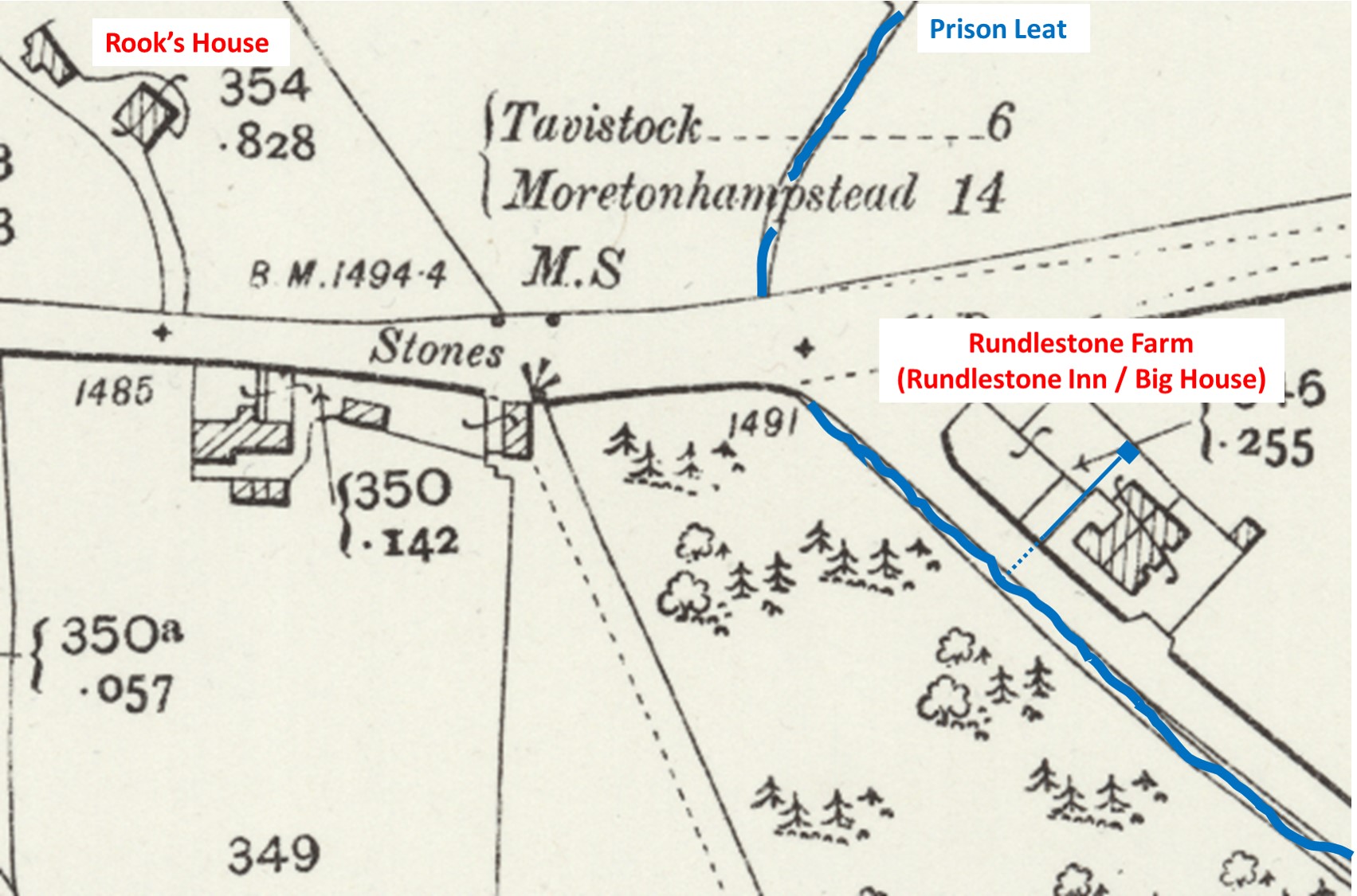
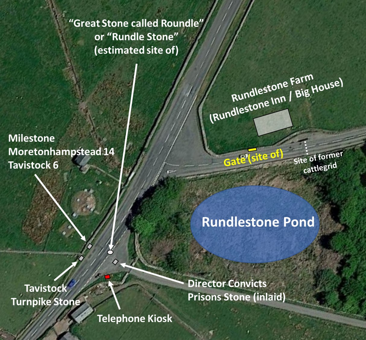
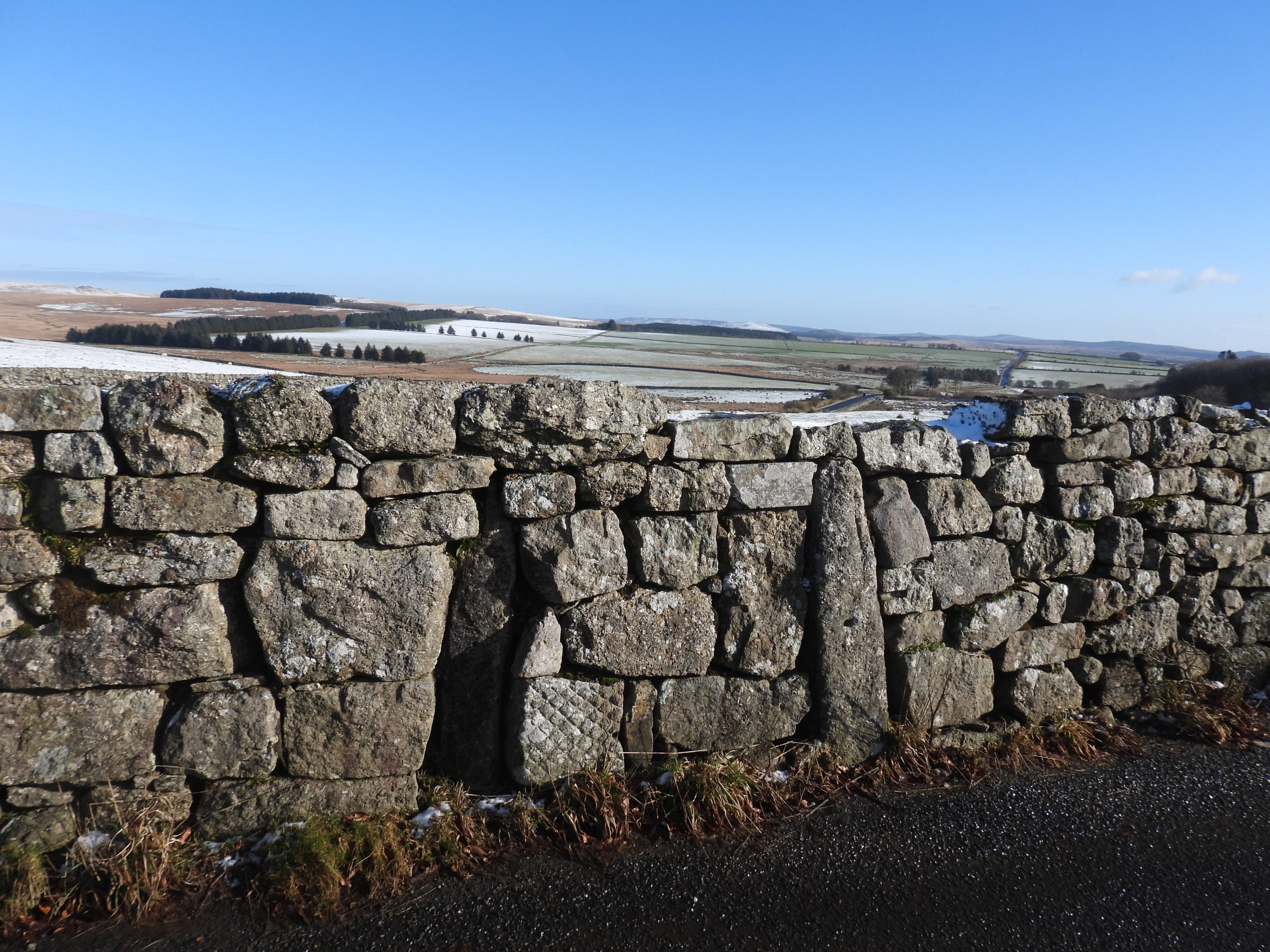
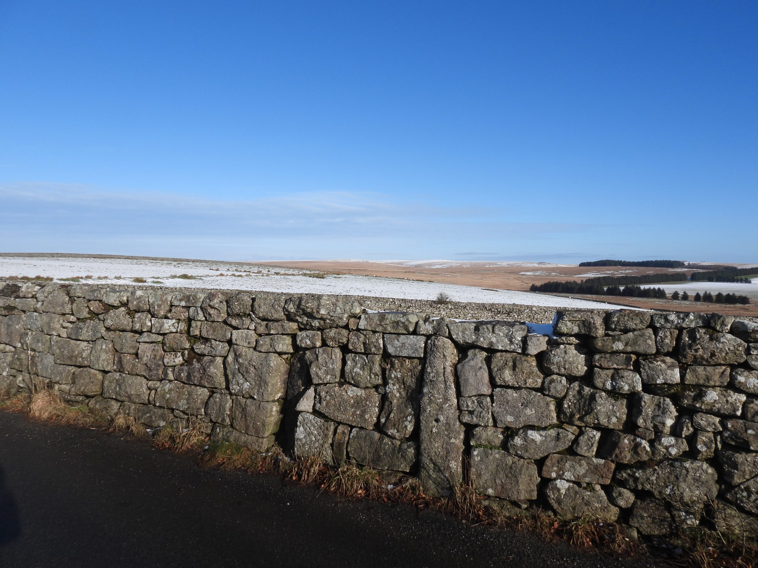
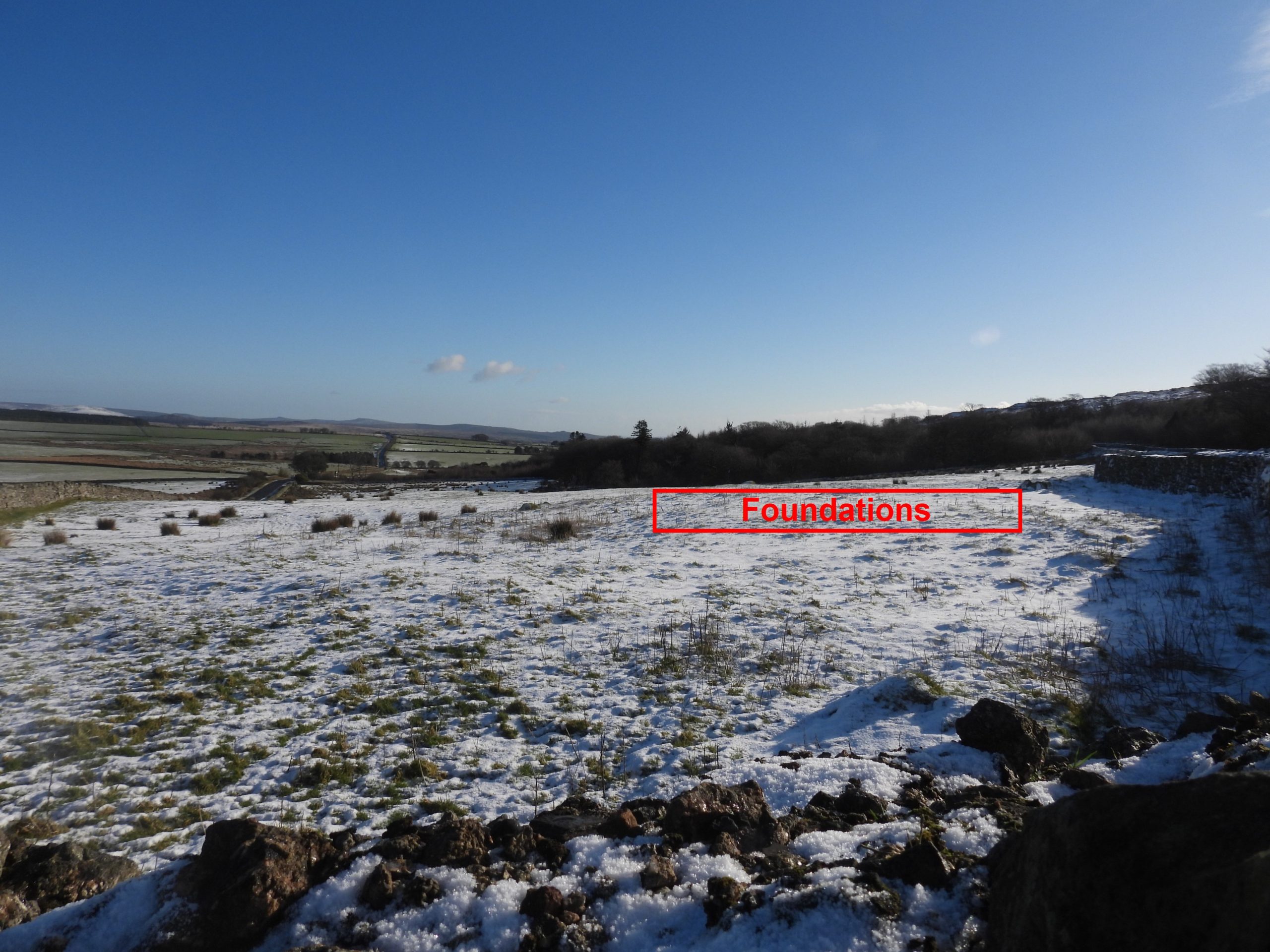
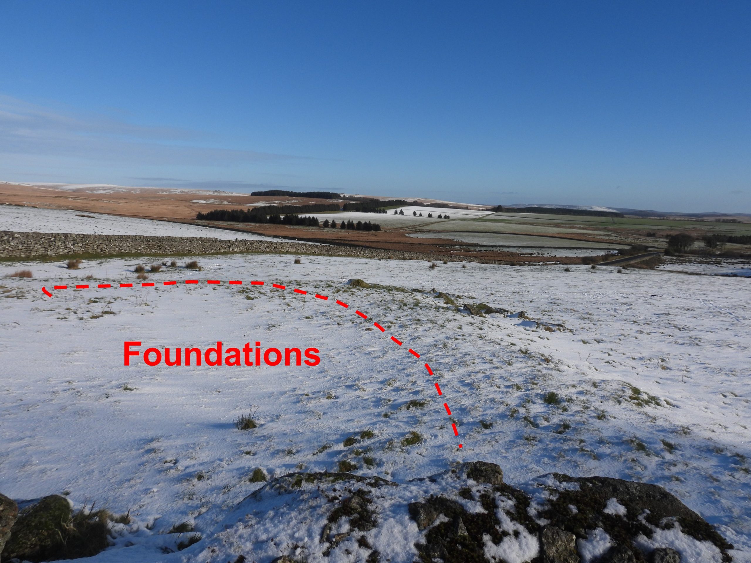
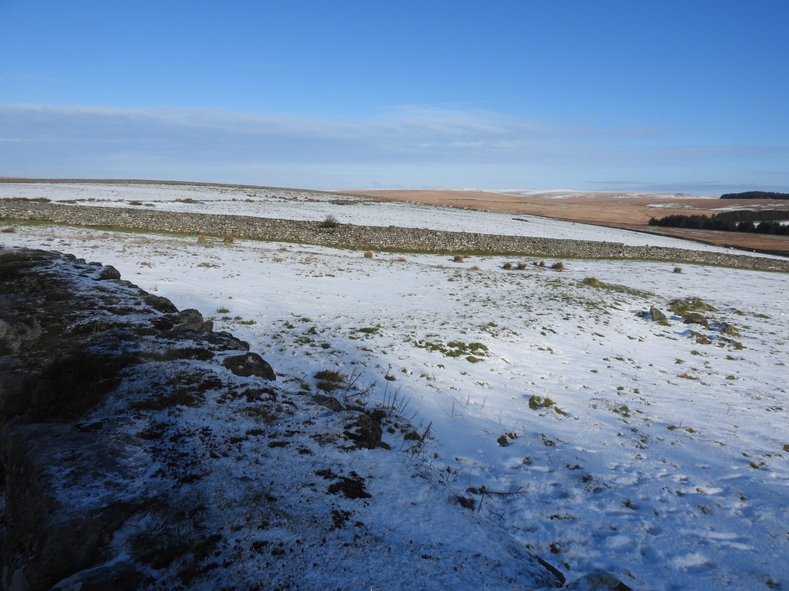
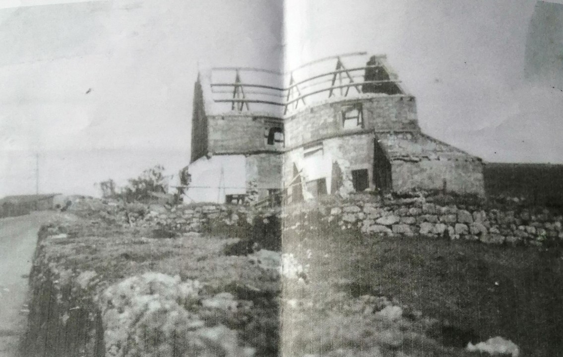
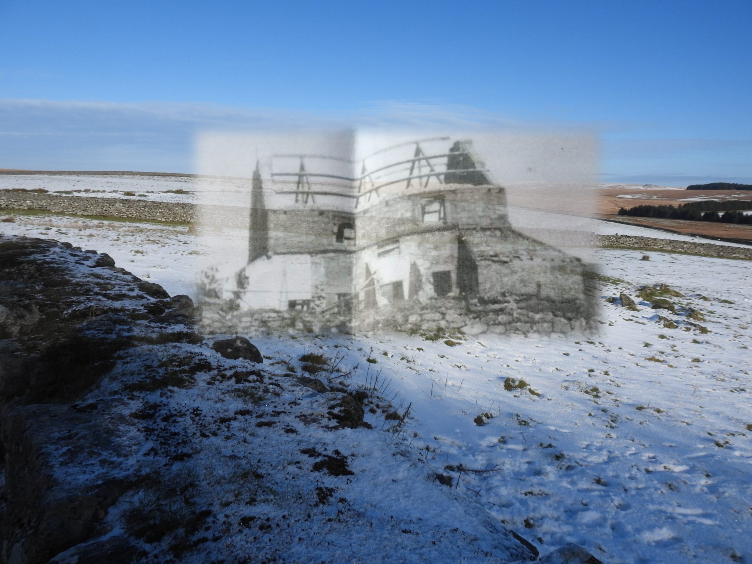
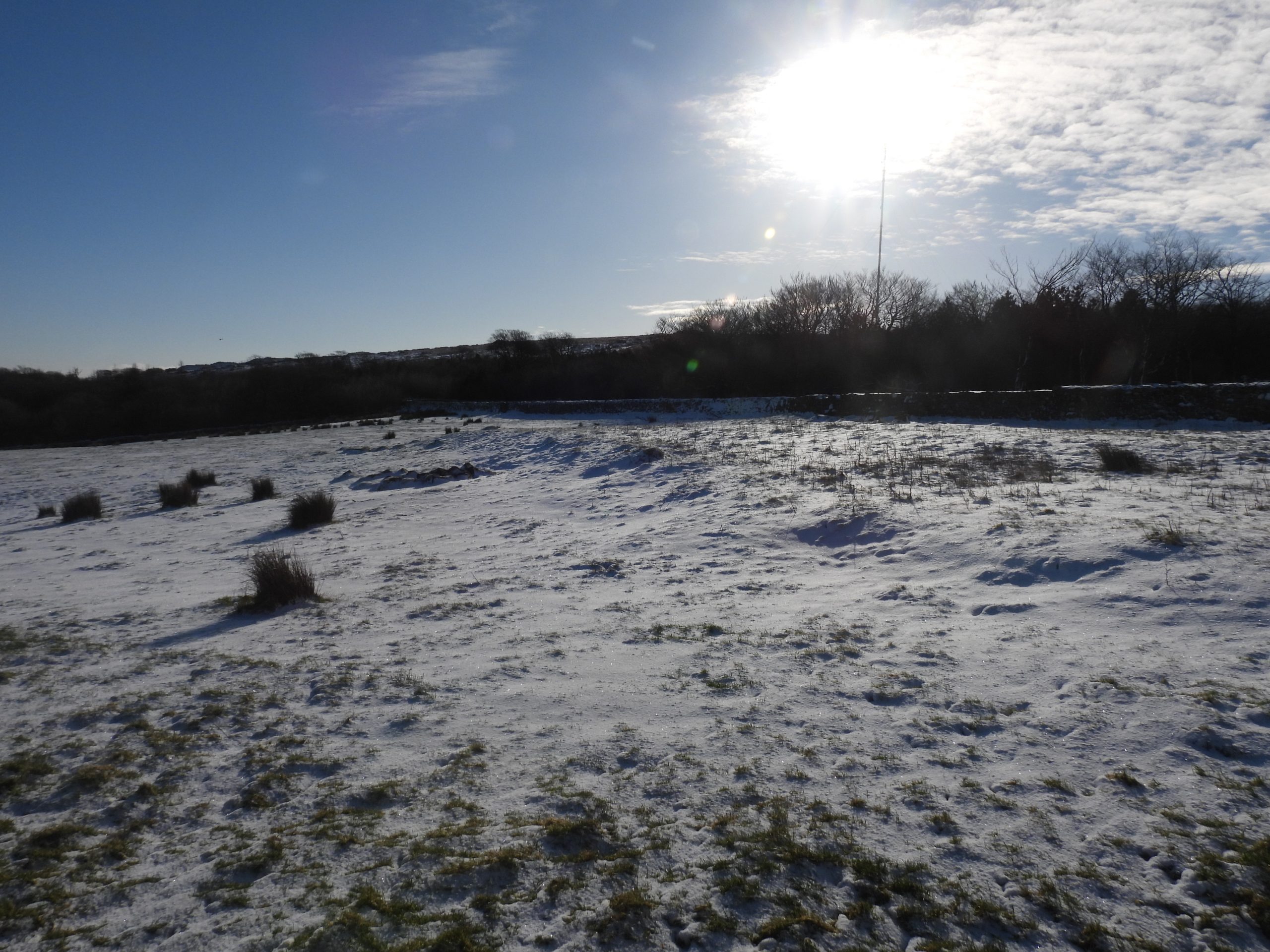
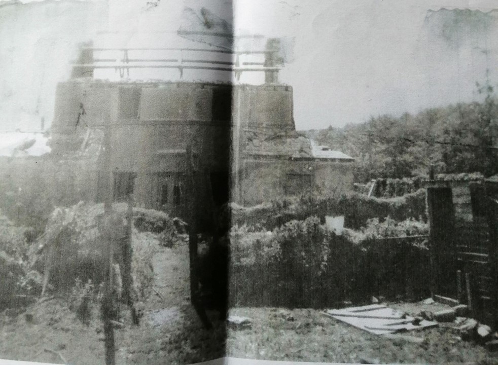
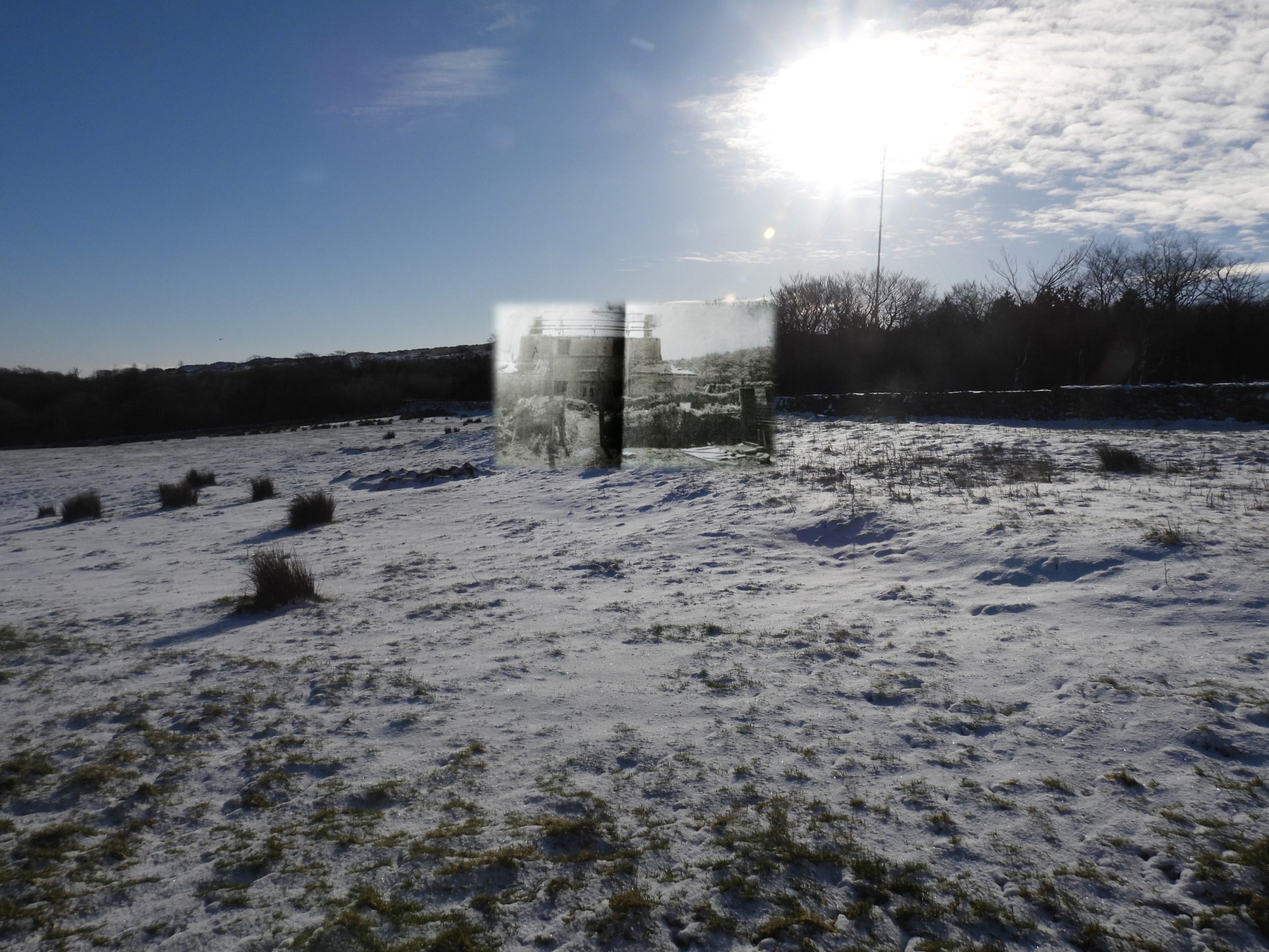
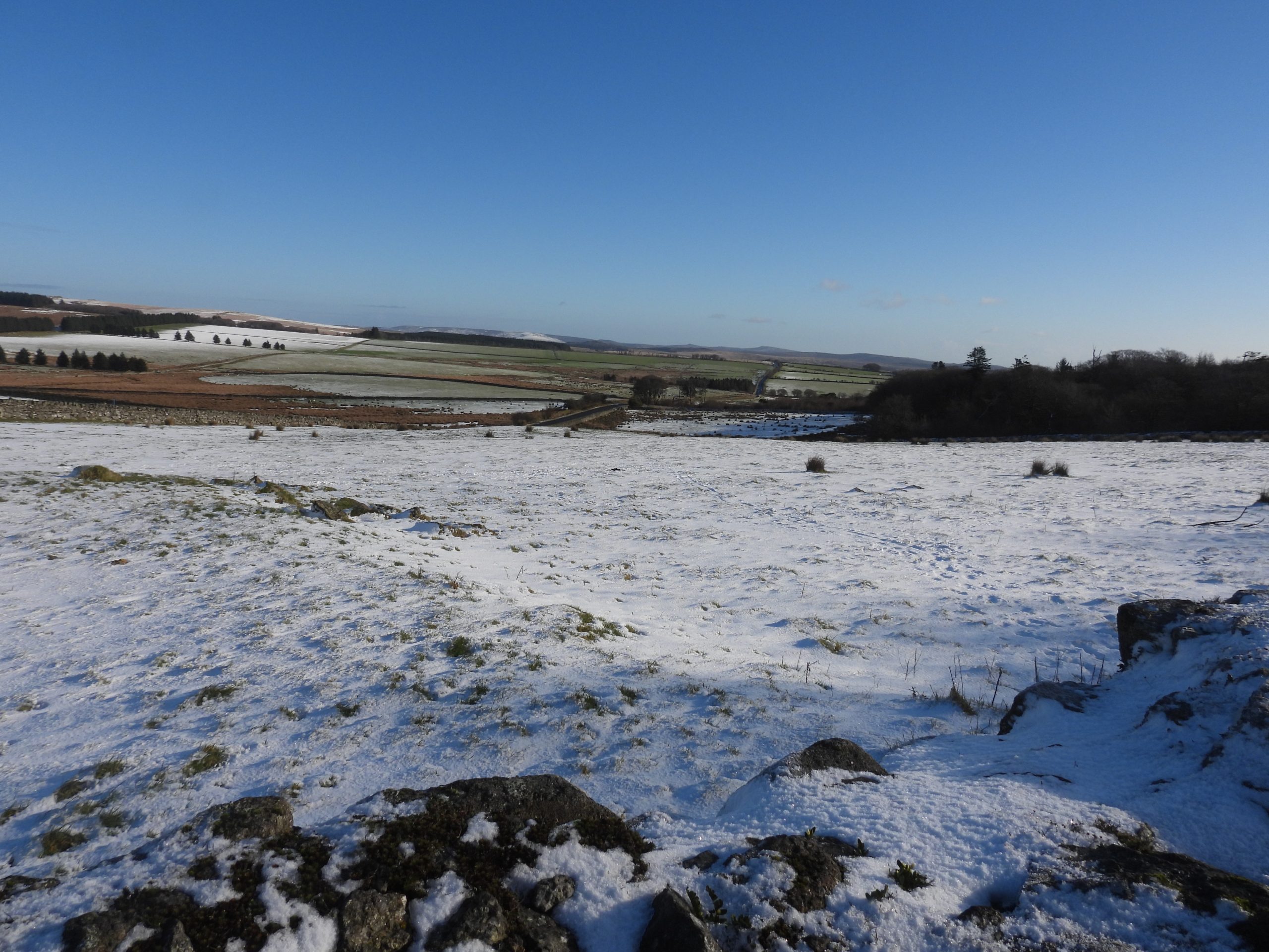
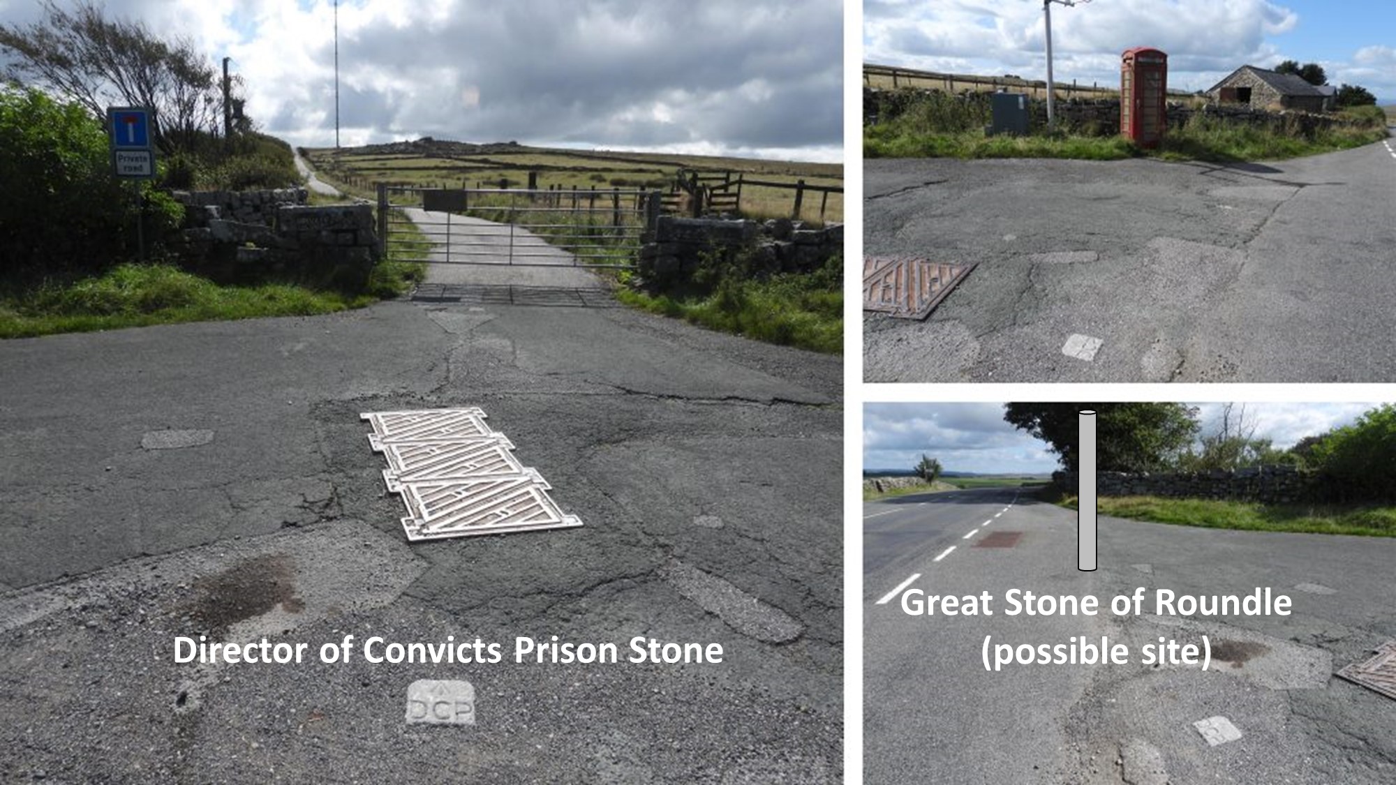
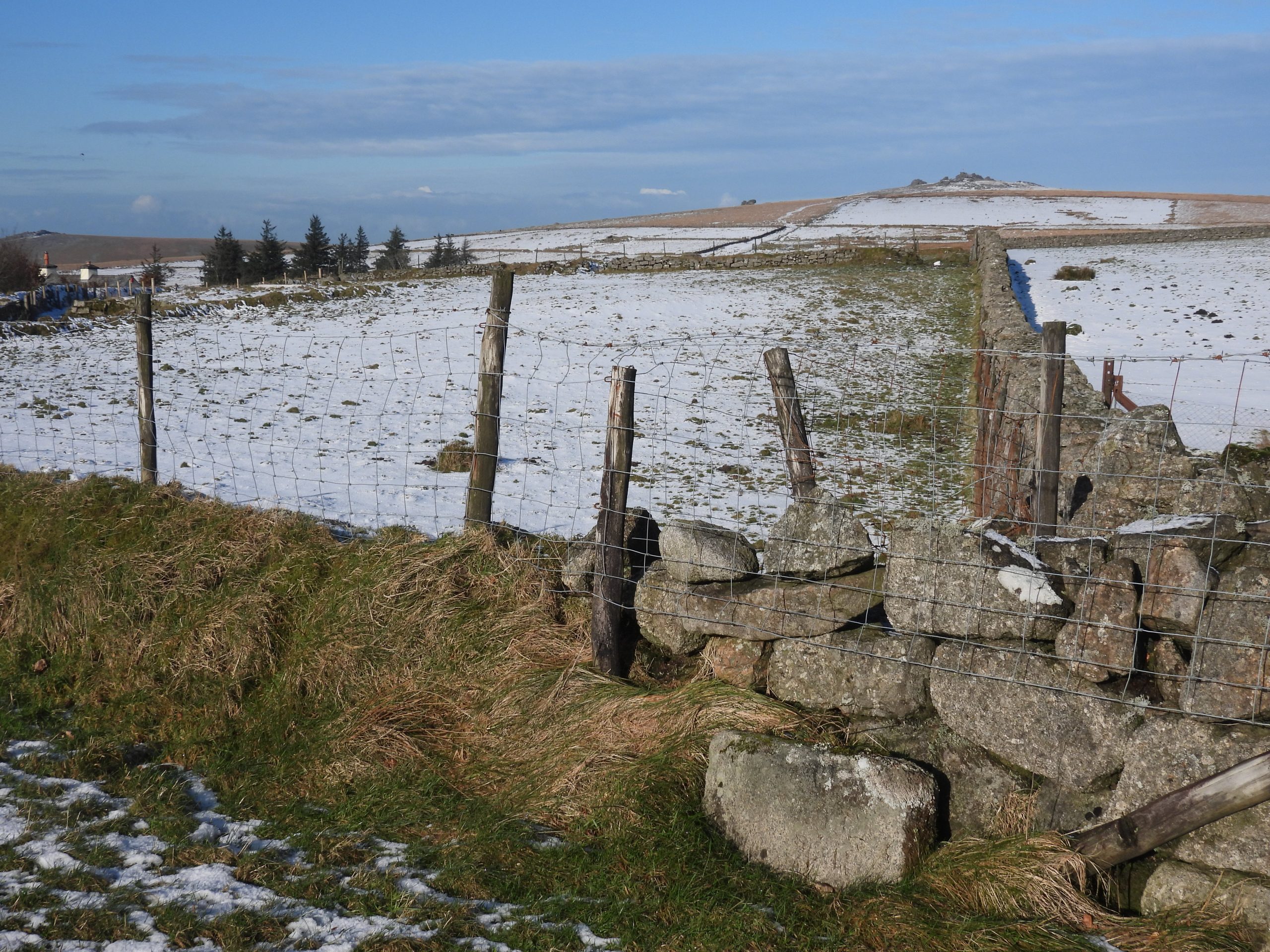
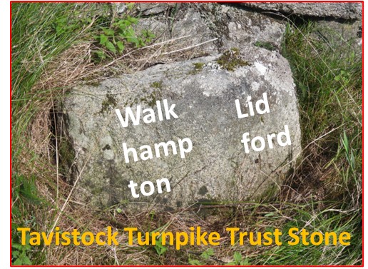
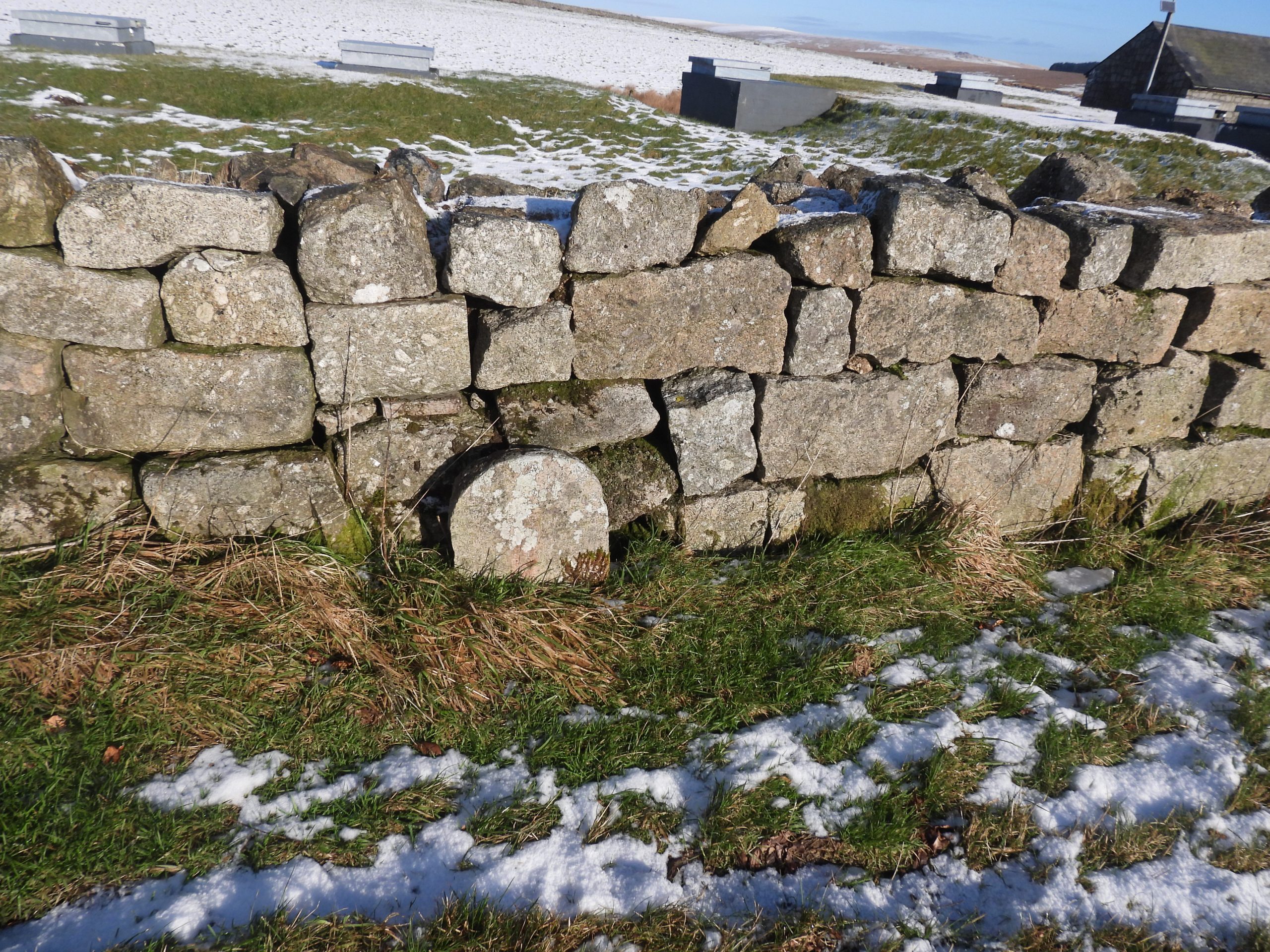
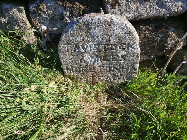
Annotated 19th century map showing the location of Rundlestone Farm (Rundlestone Inn / Big House). Of significance is the water supply to the building, which came from the Prison Leat (piped under the road). Potable water, however, was obtained from a tap at Rook’s House a short distance away to the north west until mains water from the pumping house arrived in 1938.The features covered in this post. The site of the “Great stone called Roundle” or the “Rundlestone” is open to some debate. Some observers record it as having been on the north side of the road and some of the south. Rundlestone “Big House” and Rundlestone Pond. This picture must have been taken at the bottom of the tarmac road which leads up to North Hessary. The pond is said to have been filled in with junk, which included shell cases from the war,The entrance to the Rundlestone Farm can still be found next to the Princetown road at SX57638 74932.Of interest in the filled in gateway is a square “cross-hashed” stone. One wonders if this was a step relating to the old building where ‘grip’ was required.Looking over the wall (from B3357) at the location of the former building. The building is shown on most 19th century maps and on the Tithe Map it is depicted as being square shaped and has a small square building to the east. The associated gardens are to the north and some of the boundaries survive as low banks 1.5m wide x 0.3m high.The foundations are more evidence when viewed from the Princetown road at the “pull-in”, which was formerly the location of a cattle grid (which ironically is still shown on OS Maps). The Tithe Apportionment for ‘Rendle Stone Farm’ lists Field Number 1 as ‘Dwelling-house, Outhouse, Court and Garden’. The picture shows the remains of a 50m x 20m platform quite clearly in the snow (January 2023). There is a slight contradiction in the historical records insofar that Elisabeth Stanbrook wrote (in 2002) that the building was known as “The Rundlestone Inn” and appeared to date from 1814, under licensee Richard Hall. The Book of Princetown suggests it was built in the 1830s. Therefore, there is a 20 year span of probable date it was built and a contradiction of use (unless it was both a farm and an inn at the same time). This picture (Kindly supplied by Gary Liversidge through Princetown History Society Facebook page) is the building from 1950’s, at which point it was called “Big House”. The picture is likely to have been taken around 1957 when the building was demolished.An attempted overlay of the 1957 picture onto a January 2023 scene. The author believes the orientation is correct due to the terrain and walls surrounding the black and white picture.The name Paul Rendle appears to have been synonymous with Rundlestone Inn in the 1830s. It is recorded that a mid-19th century landlord was called Hannaford. There is further historical contradictions regarding when the Inn was closed and became known as “Big House” under the ownership of the prison. Joy wrote in 2002 that “The old Rundlestone Inn at Rundlestone junction was converted into two quarters for prison officers in 1861”. However, in far more detail in The Book of Princetown, it records that the sale didn’t occur until February 1882 and the Inn had a tenant (called William Friend) between 1851-62 and there was a Hugh Hill (Farmer) who was there until at least 1871.The Inn was sold with over 26 acres of land, a dwelling house and two fields. What is known is that the prison used the two semi-detached houses (presumably converted) to provide prison accommodation. The picture was taken around 1957 (supplied with thanks by Gary Liversidge), just prior to demolition. Stone from the house was used to elevate the car parking area at Great Mis Lodge. The plantation can be seen on the right of the picture.Overlay of the 1957 picture onto a snowy (January 2023) scene taken from B3357 road. A Donald Warne was born at the house in 1930 and stayend until 1947. A Eric Green lived in the northernmost (and largest) part of the house between 1945 and 1952.This picture was taken by the large “pull-in” where the old cattle grid once was located. Here there must also have been a large access gate. Joy wrote in 2002 that there were no services (water, gas, electricity or mains drainage) to the houses. However, there does appear to have been water supplied by the Prison Leat, which is located just a few metres away on the opposite side of the road. To add to this, the Book of Princetown states that there was an earth closet outside.In 1850, prison lands comprised 390 acres which had been granted on a 99 year lease by the Duchy of Cornwall. A series of boundary stones were erected to mark the prison boundary, each were of red granite and had an incised ‘broad arrow’. In 1867, the prison boundary was extended by a further 1000 acres under a new lease. With this new boundary a new series of boundary stones were erected. The once ‘in laid’ into the tarmac near the telephone box is once of the stones. The “Great stone of Roundle” is recorded by Crossing as being “….on the south of the way, opposite to the modern boundary stone, which we shall observe on the left. This bears the names of the parishes, that here meet each other – Lydford and Walkhampton”. With this description in mind the author believes the stone once stood as indicated in the bottom right picture. Crossing further states “The stone was broken up several years ago, when a wall was built nearby”. Therefore it is still possible that the “R” inscription which is said to have been on the stone, may still be there but built into a wall.The parish stone of “Lydford and Walkhampton” as referred to by Crossing is in actual fact a Tavistock Trust Turnpike stone. It is believed to have been located here around 1822 (Source: Tim Jenkinson – 2004). The stone was sketched in the Ordnance Survey Boundary ‘remark book’ from 1881. Dave Brewer (Dartmoor Boundary Markers) comments that it was the site of the Rundle Stone, which would have caused the Tavistock Trust to site this stone (incorrectly as its 150m inside the boundary). The Tavistock Trust road was built between 1772 to 1776. The inscriptions on the obtusely angled faces of the stone, which is today is completely illegible reads: Walk / hamp / ton and Lid / ford (Ref: E.N Masson Phillips – 1943). By an act of parliament, the Tavistock Trust (formed in 1762) were bound to erect suitable milestones and boundstones where their roads crossed a parish boundary. Milestone which is still depicted on modern OS Maps.The milestone reads: “Tavistock 6 Miles Moretonha mpstead 14 Miles”
Thank you very much for this. My Hill family lived at Rundlestone from 1806, having moved from Hatherleigh/Northlew. Hugh Hill, my ggg grandfather, married Ann Smale in 1806. The family farmed at Rundlestone and Hugh Hill had the licence of the Rundlestone Inn. Mary Ann Hill, the daughter of Hugh and Ann, married Richard Crowle, in 1831. He was Stonecutter and Stonemason from Cornwall. My great-grandfather was born there in 1833 and also became a Stonemason. They worked on Dartmoor granite and in the nearby quarries.
Dr Gael E Phillips March 19, 2024
Thank you very much for this. My Hill family lived at Rundlestone from 1806, having moved from Hatherleigh/Northlew. Hugh Hill, my ggg grandfather, married Ann Smale in 1806. The family farmed at Rundlestone and Hugh Hill had the licence of the Rundlestone Inn. Mary Ann Hill, the daughter of Hugh and Ann, married Richard Crowle, in 1831. He was Stonecutter and Stonemason from Cornwall. My great-grandfather was born there in 1833 and also became a Stonemason. They worked on Dartmoor granite and in the nearby quarries.
SteveGriggDartmoor March 19, 2024 — Post author
Thank you for sharing this, lovely to add names and dates to the buildings in the area.
Kind Regards
Dartmoor Explorations (Steve)