A collection of walks, discoveries, insights and pictures of exploring Dartmoor National Park
September 21, 2020
BRENT MOOR LEAT SYSTEMS AND CLAY CHANNELS
Steve Grigg and Frank Collinson
In the Autumn 1989, 16th edition of the Dartmoor Magazine, Dave Brewer wrote an article simply titled “Brent Moor”. The two page article summarised extensive field research that Dave and his wife Kath had conducted over Brent Moor, covering 5 working leats and 4 clay channels relating to clay extraction at Knattaburrow and Petre’s Pits (at Bala Brook Head) and to tin prospecting on Middle Brook. This post has been constructed to provide a visual pictorial summary of that fabulous work carried out by Dave and Kath Brewer.
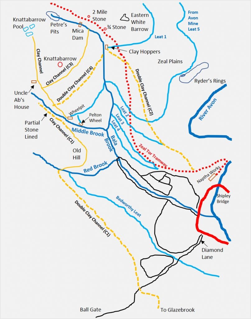
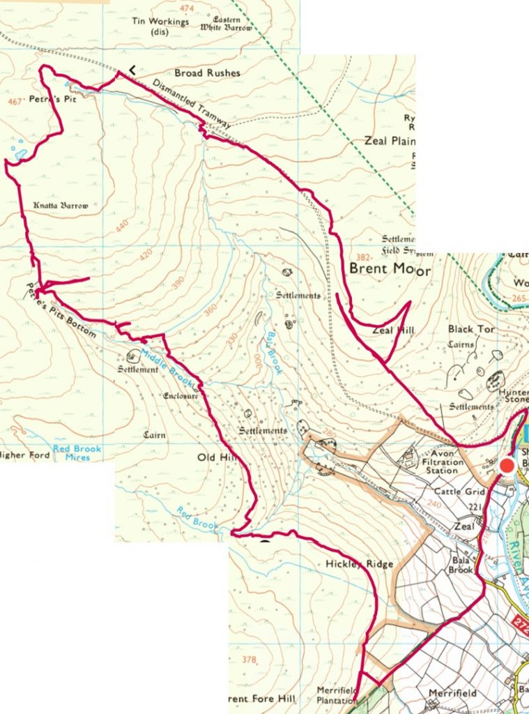
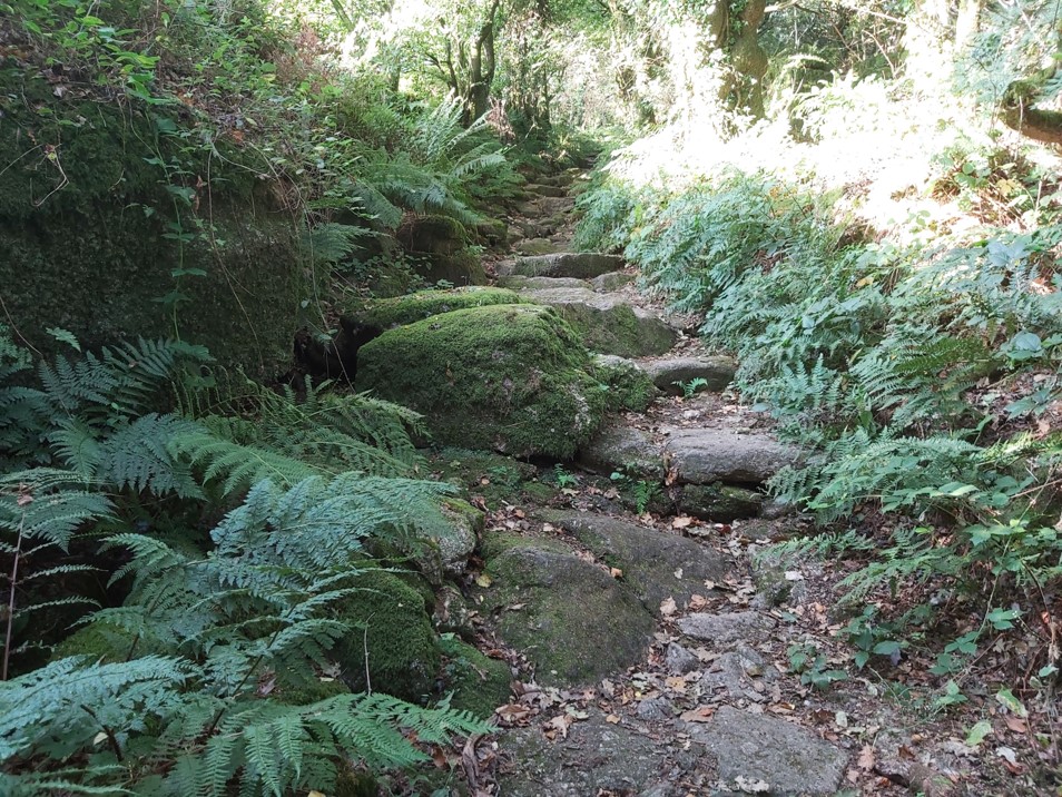
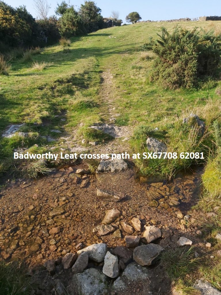
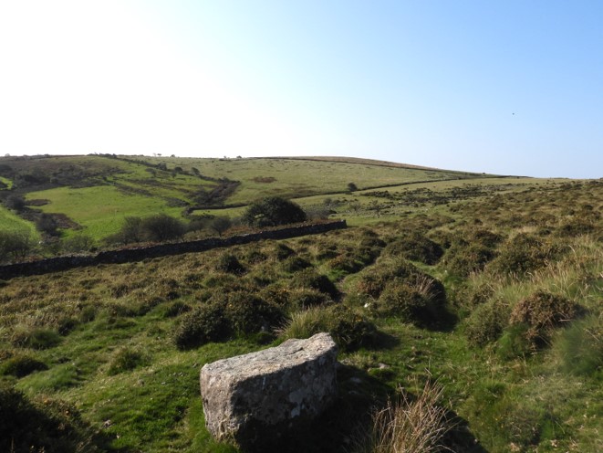
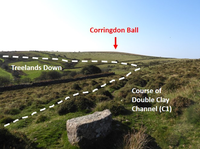
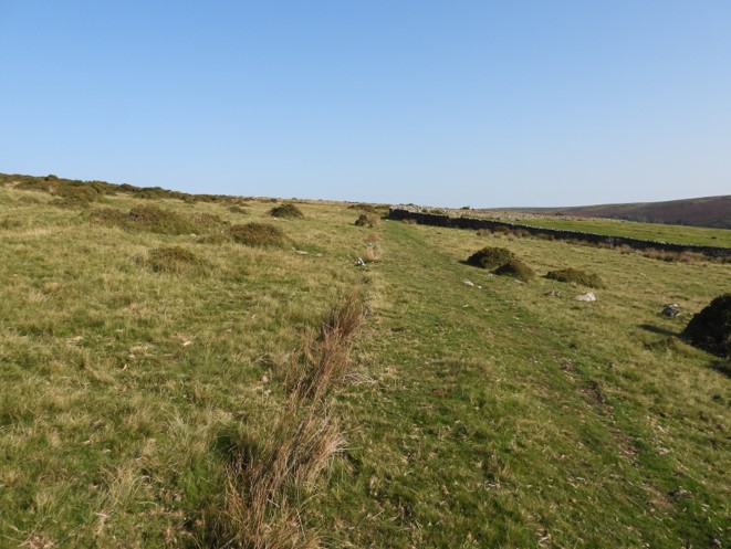
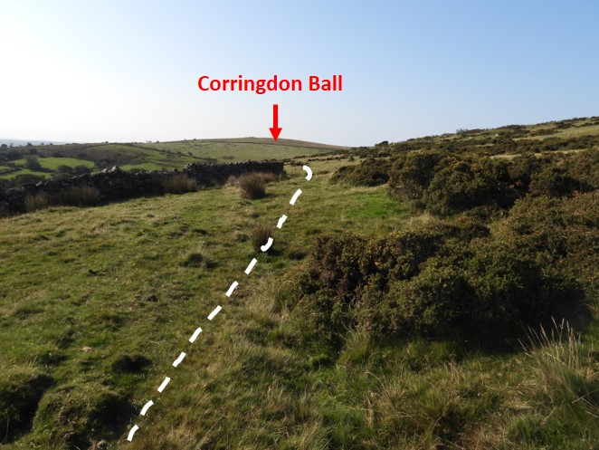
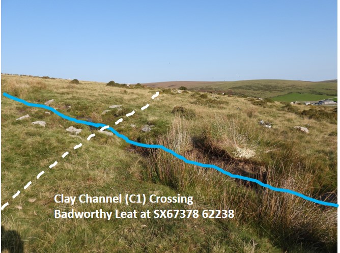
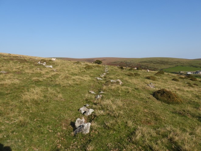
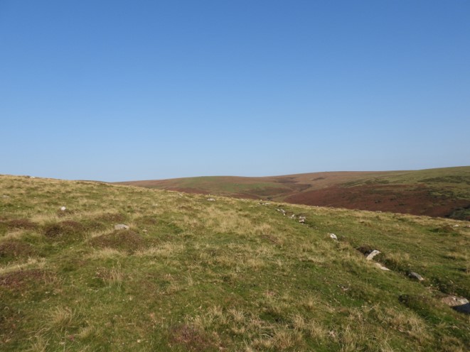
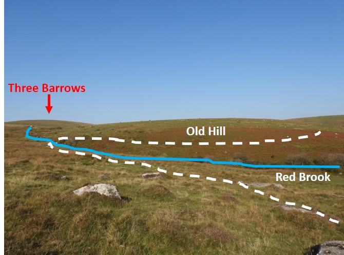
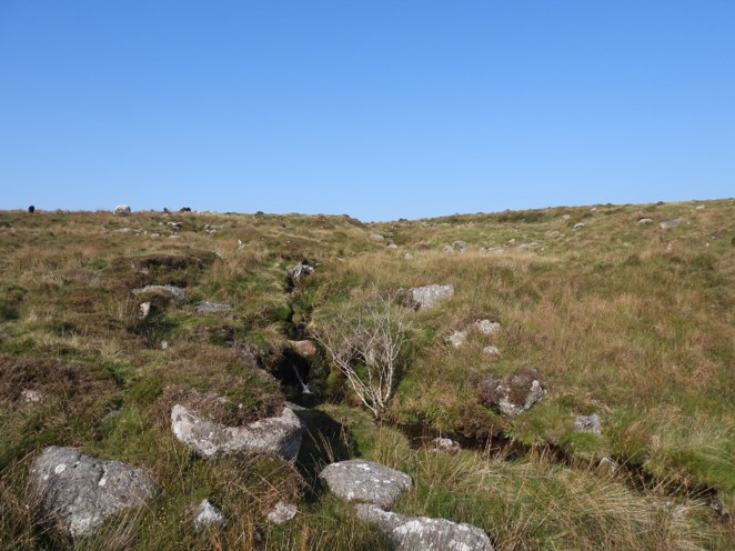
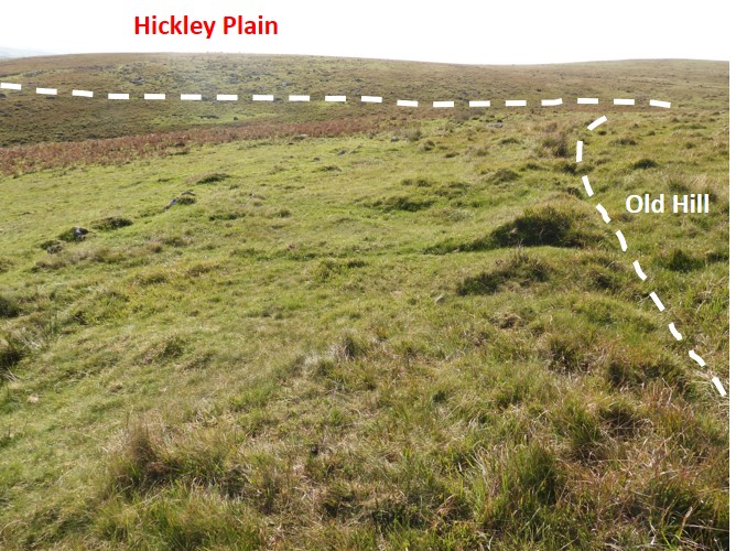
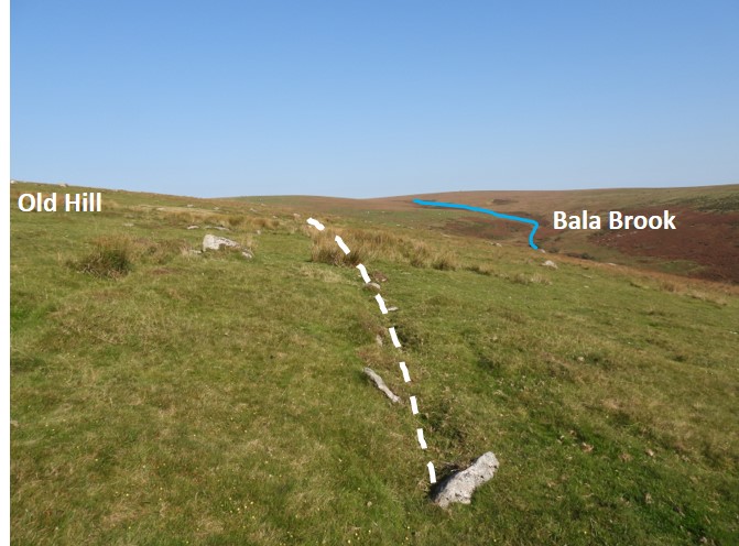
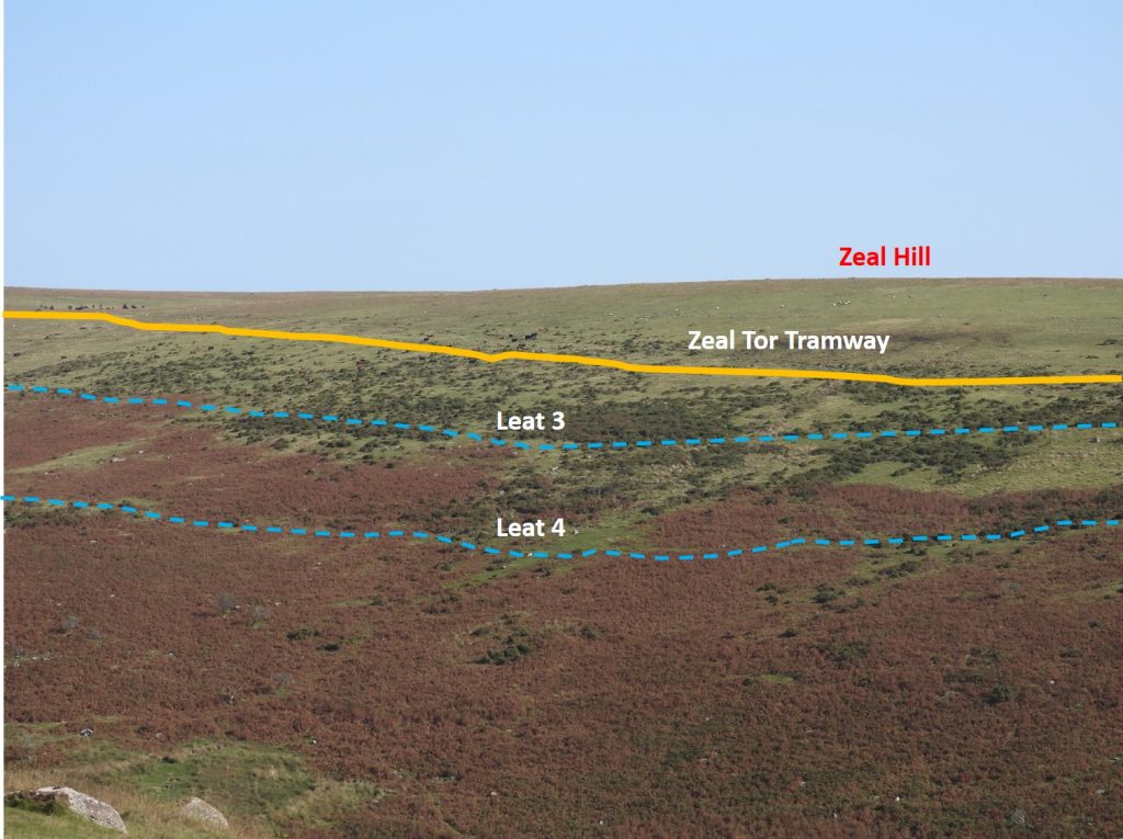
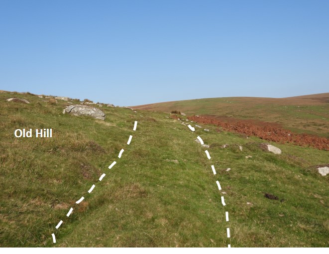
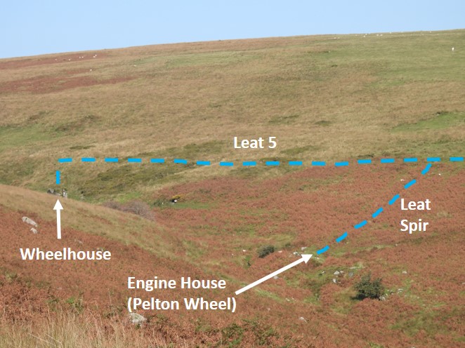
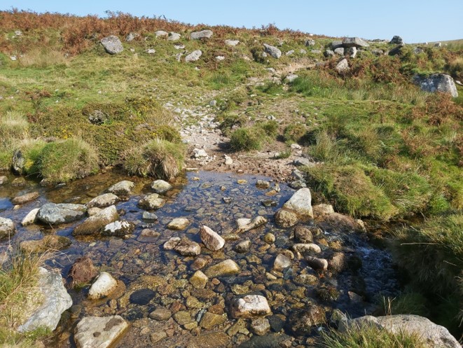
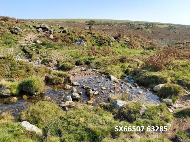
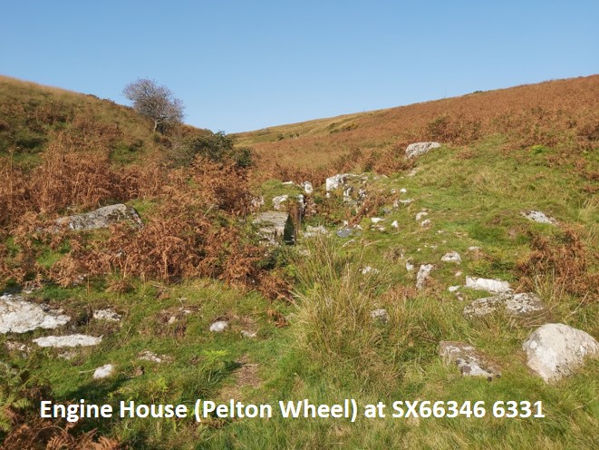
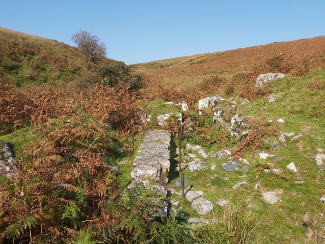
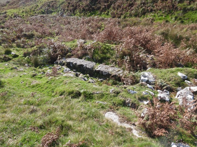
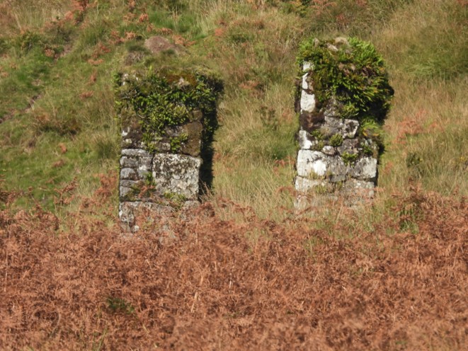
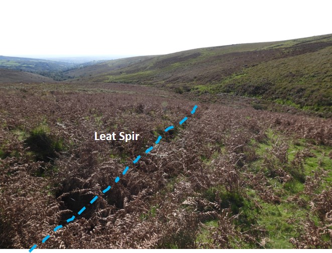
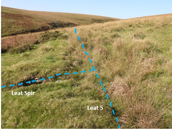
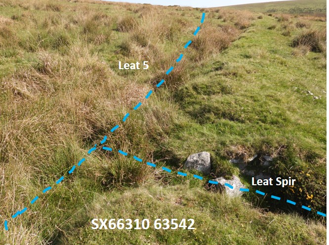
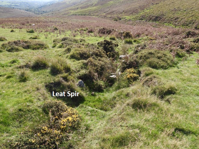
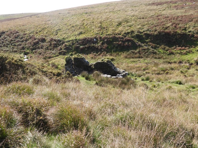
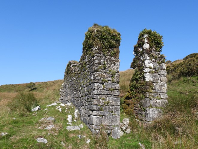
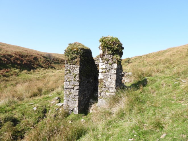
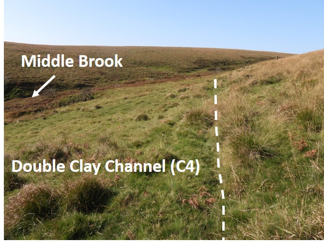
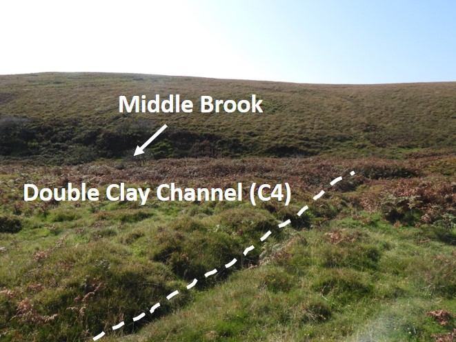
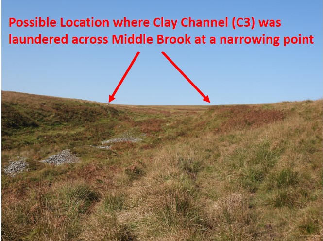
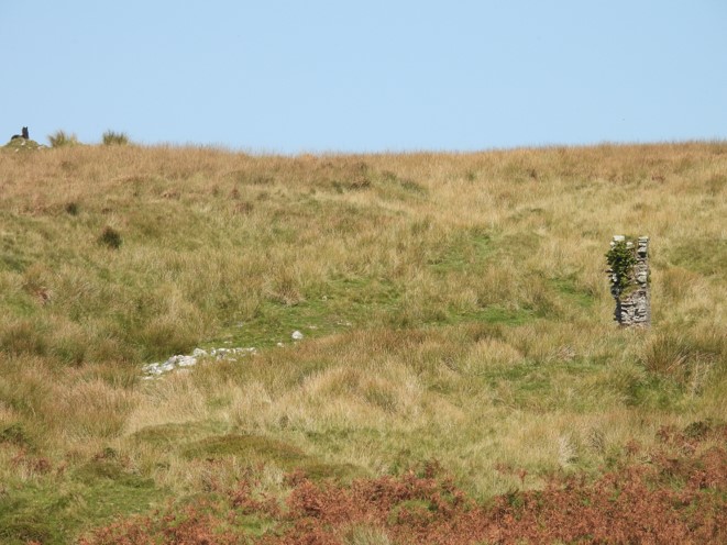
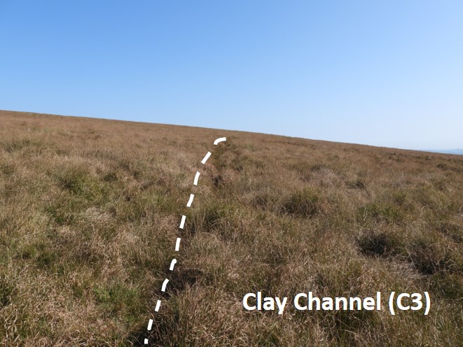
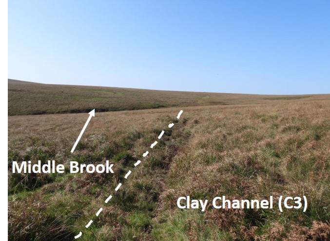
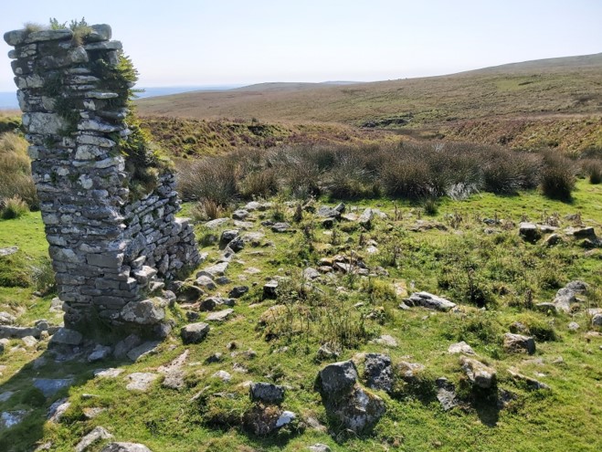
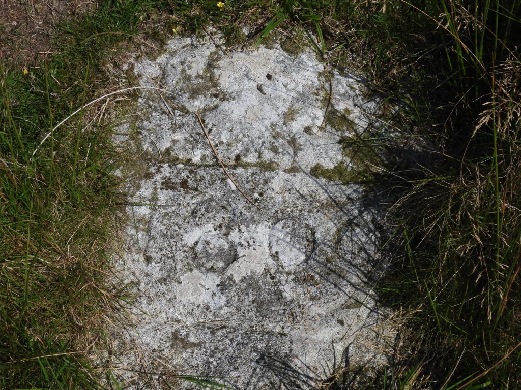
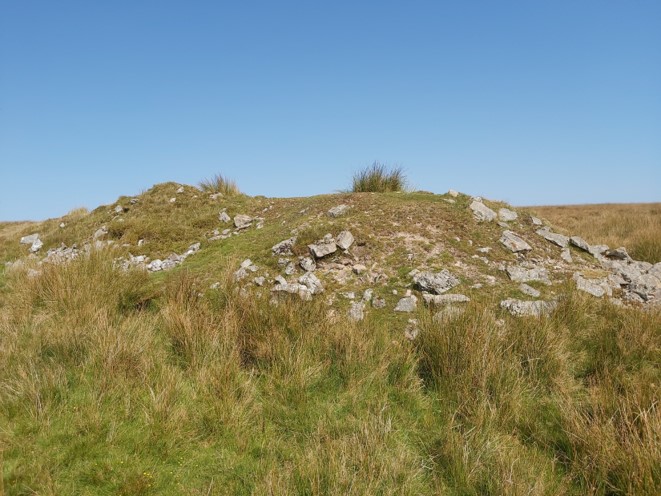
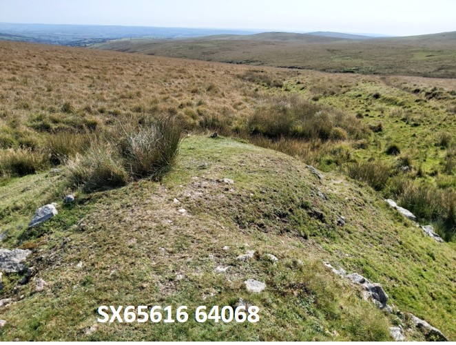
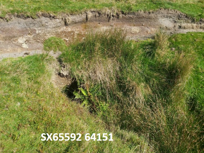
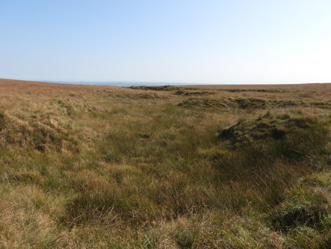
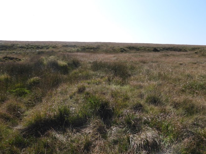
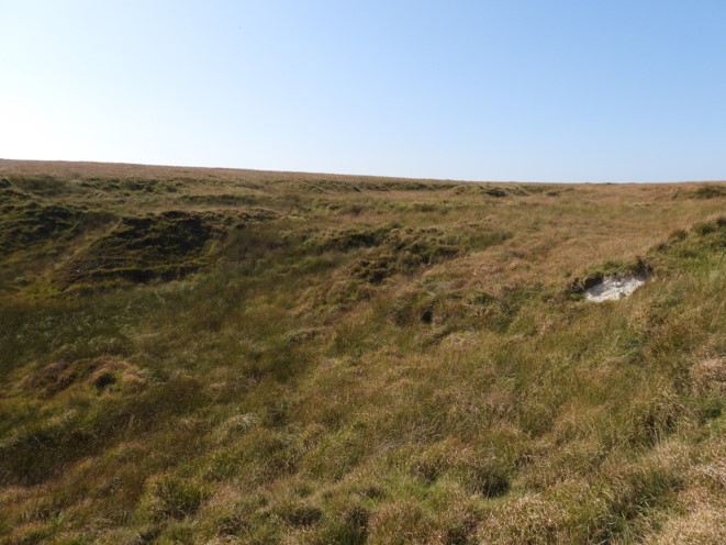
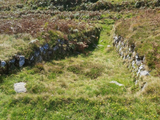
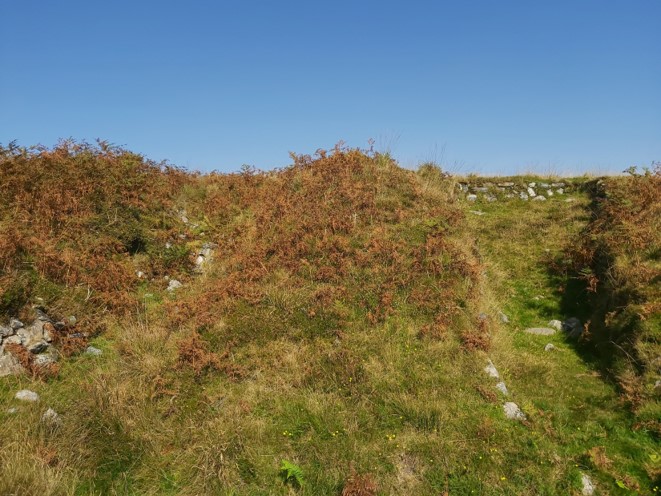
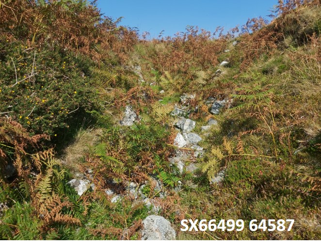
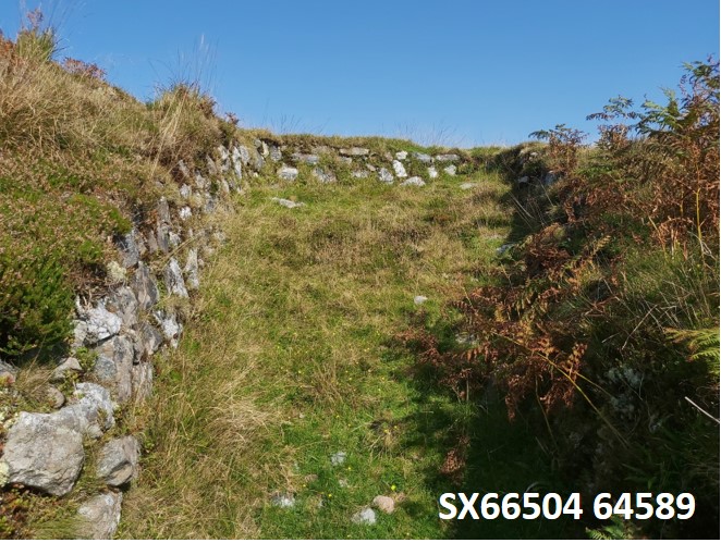
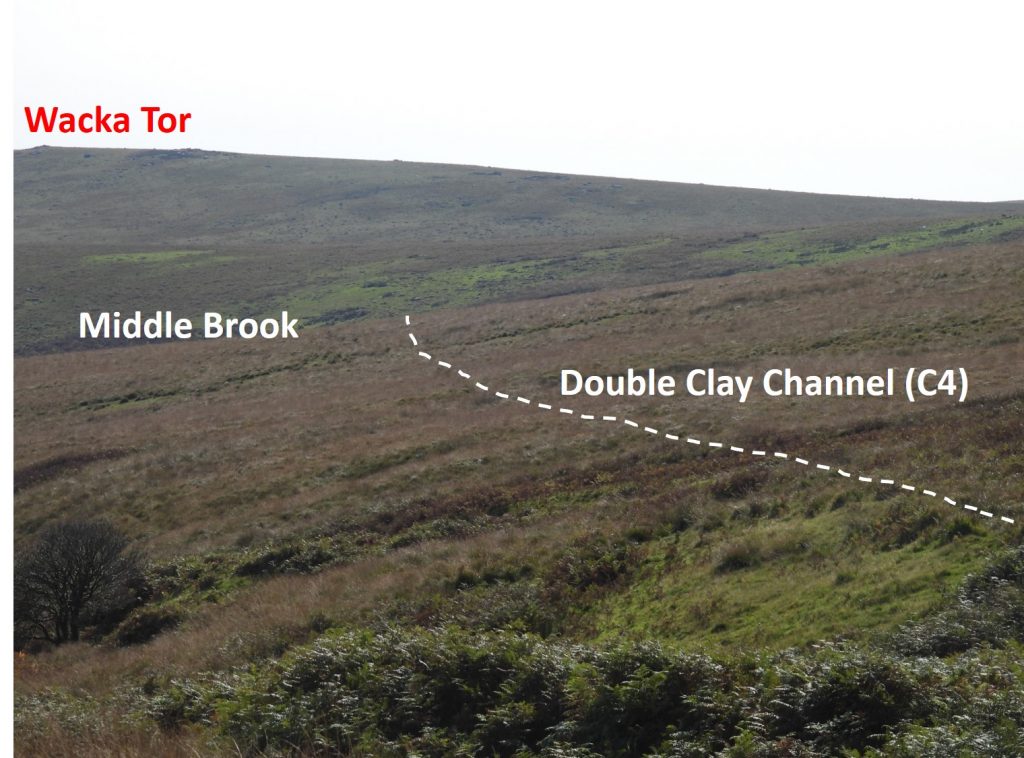
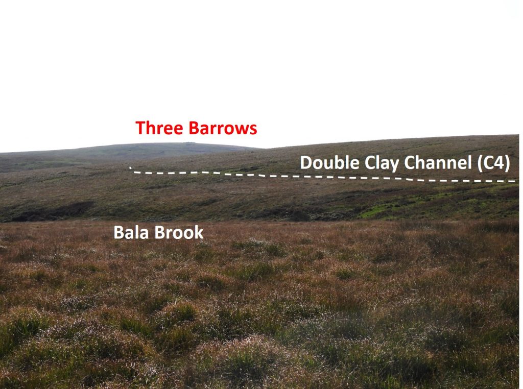
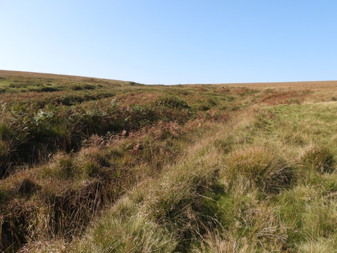
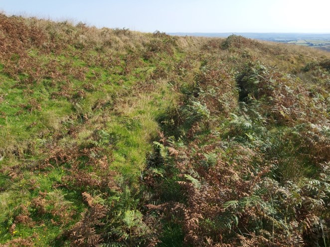
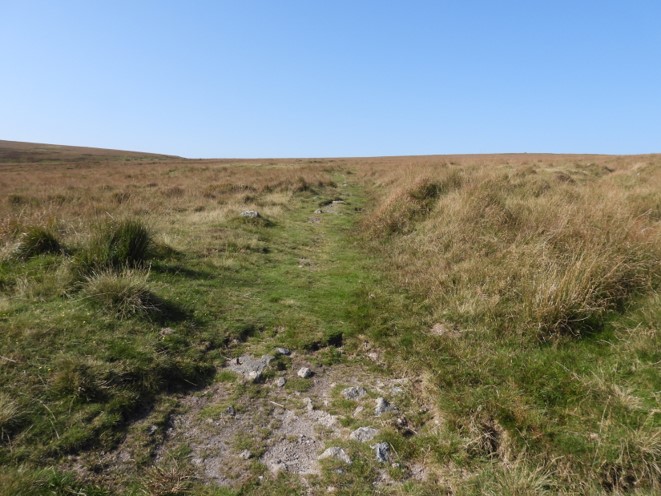
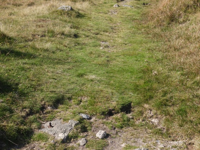
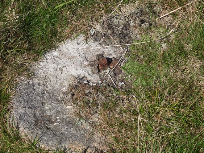
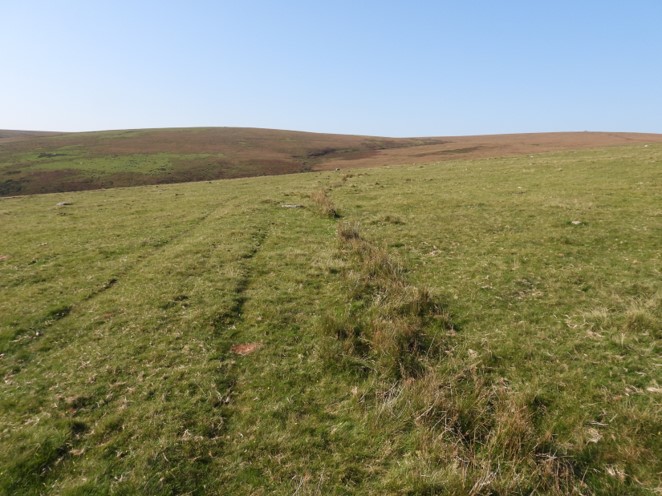
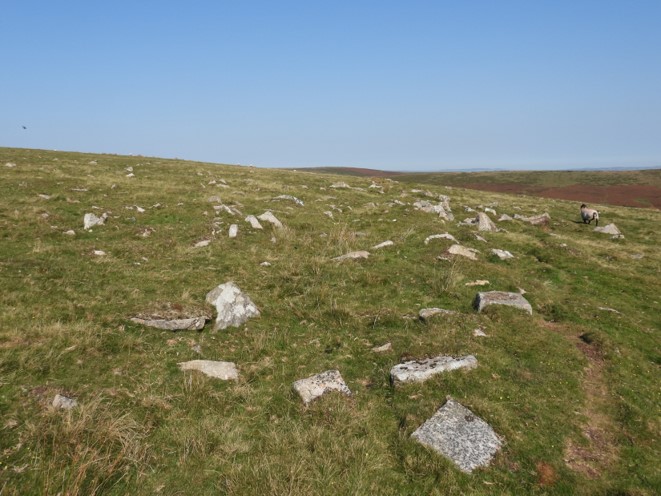
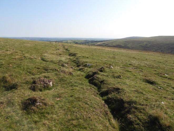
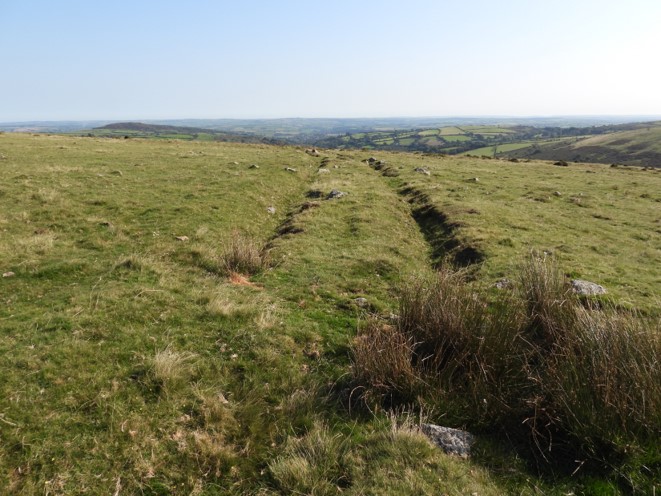
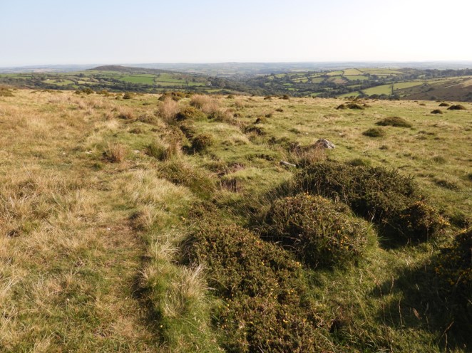
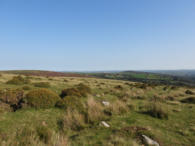
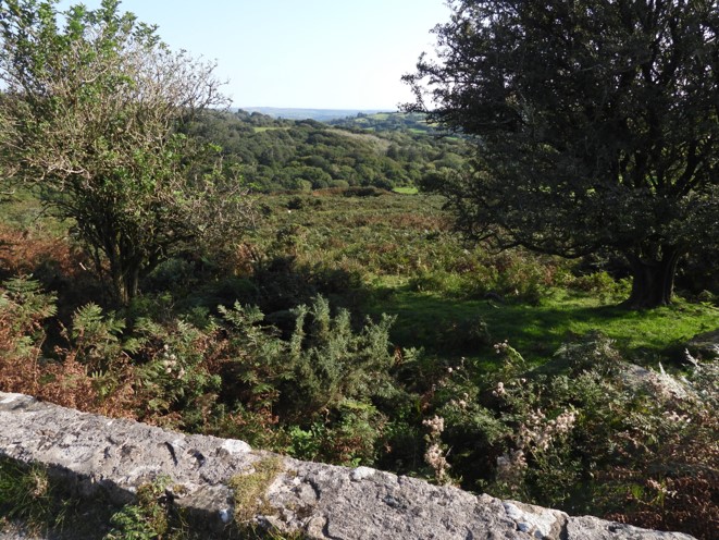
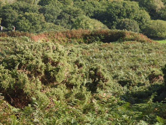
The above plan is a reproduction of the original Dave Brewer sketch found in the Dartmoor Magazine in Autumn 1989. Please note it is not fully to scale but is sufficient enough with a map to explore this fascinating areaGPS tracks showing the extent of this post. Some leats and clay channels were explored at close quarters, whilst some were viewed from afar, where a distance view portrayed the line of the leat / channel to a greater extent.Parking at Shipley Bridge, then making our way past the dwellings known as Zeal and Bala Brook, we made our way up Diamond Lane (above picture). There is an abandoned granite trough to be found up this delightful rock strewn laneAfter Diamond Lane, the route crosses Badworthy Leat en-route towards Merrifield Plantation and Corringdon Ball in order to pick up the clay channel (C1)This view is of Corringdon Ball in the distance, taken from clay channel (C1) above Merrifield Plantation. This clay channel extends down across Treeland Down, then across Corringdon Farm (underground) and would have terminated with some clay settling pits and a clay dry building with a kiln near the hamlet of Pennaton next to the railway line at Glazebrook ViaductZooming in on Corringdon Ball gate, from previous pictureThe course of the clay channel, can easily be followed on Brent Fore Hill. This view is looking north-east towards the higher end of an enclosure above diamond laneLooking south-west from just beyond the enclosure wallThe clay channel, starts to appear as a double channel as it approaches and crosses Badworthy Leat (the second time we’ve crossed this water course)The clay channel as indicated by Dave Brewer is stone lined in places. This picture is looking north-east on Brent Fore Hill. The Avon Filtration Station can just be made out on the right hand side.The channel is doubled up in the above picture. The clay would have come from the knattaburrow workings and possibly (at one point) from the Bala Brook workings (via clay channels 3 and 4)The clay channel (C1) get a little indistinct as it approaches Red Brook However, there is a faint line of its course which can be seen contouring around Old HillThis appears from the lay of the land to be the most likely place the clay channel would have crossed the Red Brok (via a wooden launder, no doubt).On Old Hill, we pick up the clay channel again. Looking back towards Hickley Plain, its course can only be summised.As Old Hill is contoured Bala Brook can be seen belowFrom the vantage point on Old Hill, we can discern Leat 3 and Leat 4 (both dry) below Zeal Tor Tramway. Dave Brewer states that these two leats, which lead from the Bala Brook, would have flowed to the mica drags and earlier settling pits at Shipley Bridge for washing purposes.The channel around Old Hill is doubled up (one assumes one channel can be repaired / maintained, whilst the other is still in use). From this point Middle Brook comes into view below and to the right.As the clay channel (C1) became harder to follow, we decided to descend into the Middle Brook Valley to see the tin workings and associated leats mentioned in the Dave Brewer article. This view shows Leat 5 (and its spir) feeding a wheelhouse and and engine house (Pelton Wheel) respectivley.A ford on Middle Brook, below the engine houseAnother view of the fordThis is described in the dartmoor HER (ref MDV27820), thus: “Foundations of rectangular building close to L bank middle brook 8.5m x 2.9m overall, in the centre of which is a raised rectangular plinth with iron bolts at the sides suggesting an engine bed. A water course from the leat higher on the hillside appears to supply the building, suggesting that this was a pelton wheel”Closer view of the engine house. The Dave Brewer sketch, simply stated a Pelton Wheel at this location. This construction is believed to date from the beginning of 20th century (Brewer).Looking down on the engine houseZoomed in view of Middle Brook Wheelhouse from just above the engine houseA leat spir (from leat 5), mentioned by Dave Brewer can be found leading uphill from the engine house.The leat spir comes from leat 5, which originates from the Avon, having skirted initially around Ryders Rings. Detail of the leat spir, which initially is stone lined and has a very narrow section.Leat Spir widens as it cascades down the hillsideThe Middle Brook Wheelhouse as seen from end of Leat 5. Dave Brewer states that the orientation of the Wheelhouse is 310 degrees to the leat and although this leat was the source of water for the 19th century overshot wheel, he speculates that possibly at one time, it may have been an additional source of water to help the clay (via the channels across the valley) enroute to Pennaton – an interesting theory. The Middle Brook WheelhouseThe Middle Brook Wheelhouse looking upstream. A little further upstream from the Wheelhouse, the double clay channel (C4) which originates from the Bala Brook workings can be found. This clay channel, presumably would have had a launder, joining clay channel (C1), which we have previously followedMore detail of the clay channel. One would assume that this clay channel pre-dates the 1872 Petre’s pits clay workings and is most likely dated from 1850’s. Was clay ever processed at Pennaton and Shipley Bridge at the same time? Continuing north towards Petre’s Pits Bottom (not to be confused with Petre’s Pits) in search of clay channel 3, there is a natural “narrowing” of the valley, which would have made the perfect spot for the 1850’s claymen to to laundered their clay channel to join up with channel (C1) enroute to PennatonFrom the point where the valley narrows, we can get our first glimpse of the ruins of the building known as Uncle Ab’s HouseClay Channel C3, coming from Bala Brook workingsClay channel 3 as it approaches Middle Brook and the “narrow” pointUncle Ab’s House, which in William Crossings day was more usually known as Petre’s Pits House. This is located next to the old Jobbers Path.
The Dartmoor Archive has a photograph of Uncle Ab’s House from 5th September 1943 (record 1948) as seen below.
Known as Uncle Ab's House it was the former stables for the #horses employed on the Zeal Tor #tramroad A detail from an inscription on the original door lintel read ‘GB 1809’, so the building pre-dates the tramroad. Taylor Collection https://t.co/E4KwECAT0O#1800s
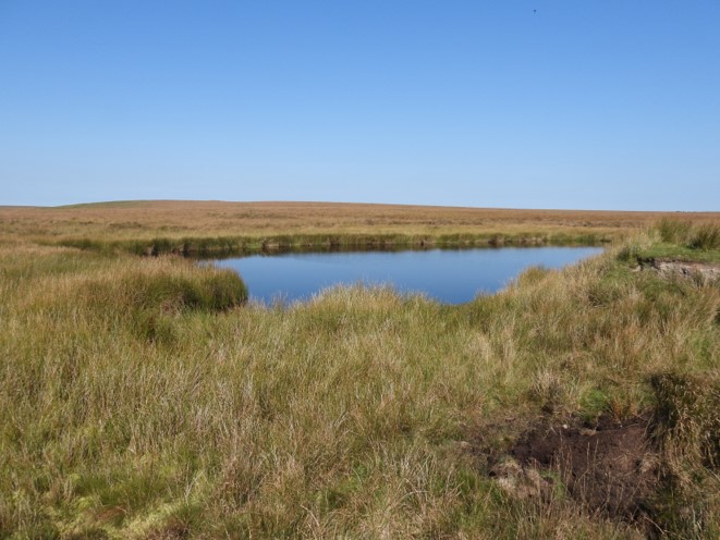
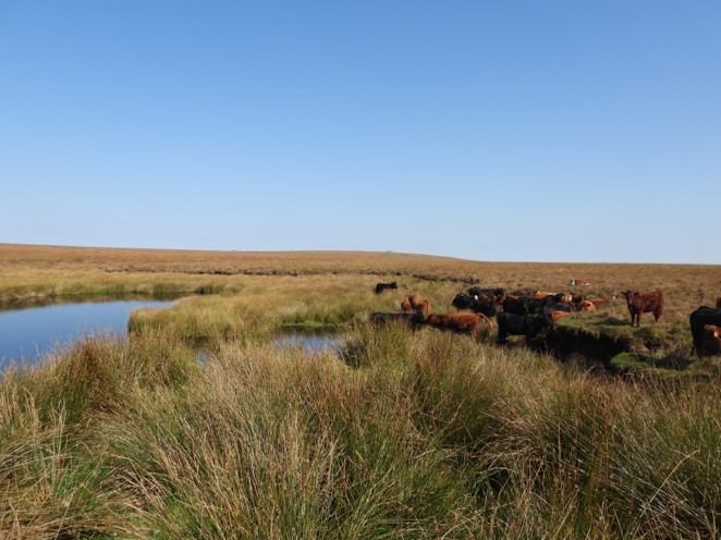
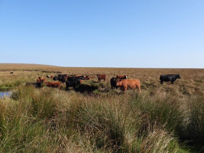
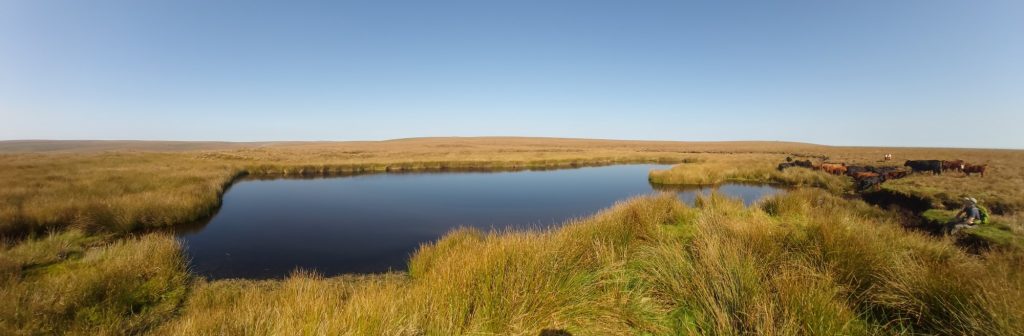
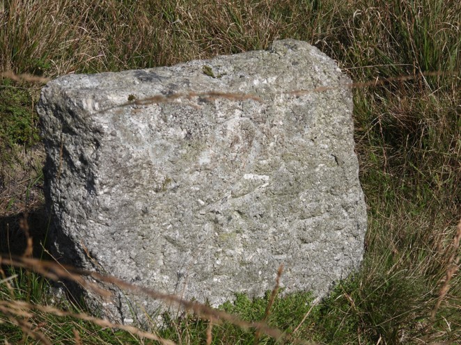
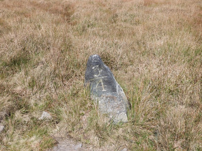
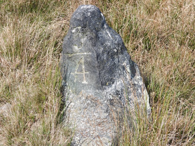
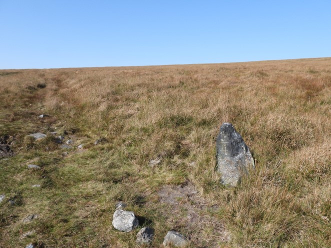
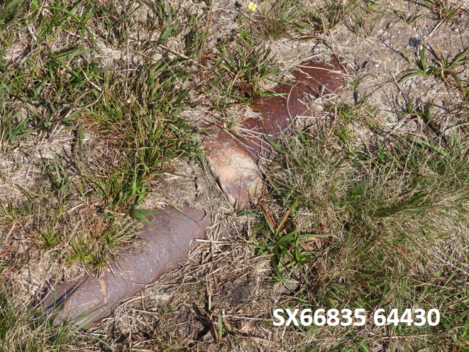
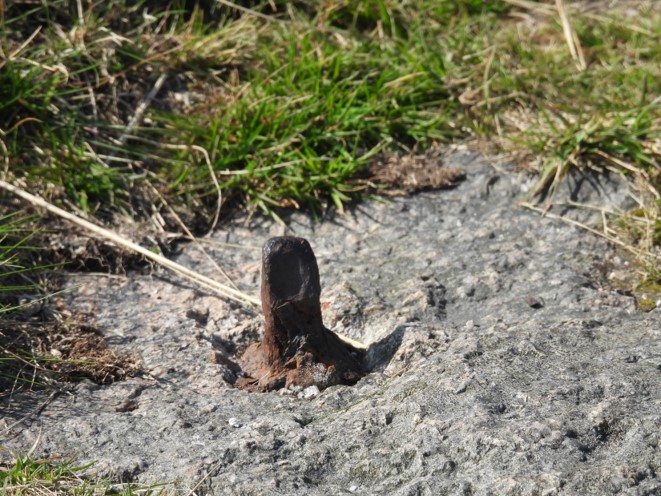
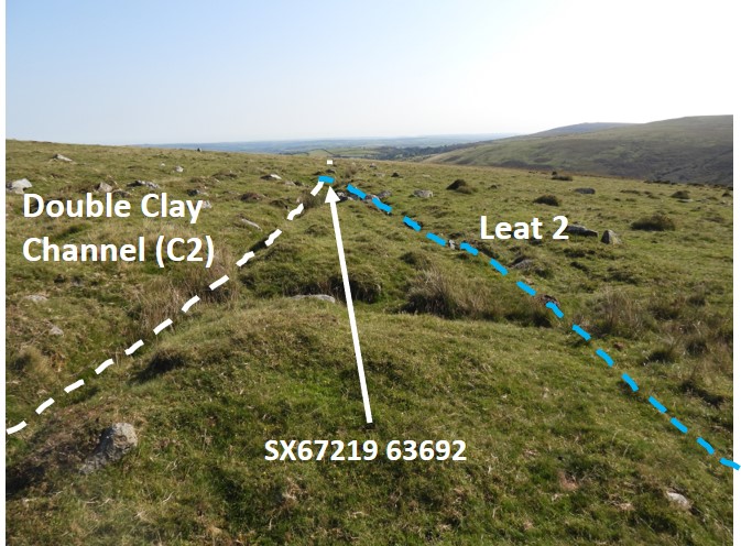
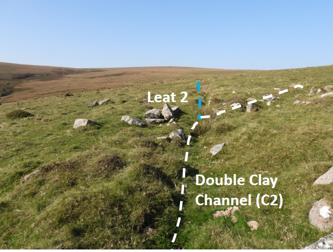
Close up of the remaining wall at Uncle Ab’s House. It is said that this building was used as a stable for horses used on Zeal Tor Tramway (1872 clay workings). The building, however was most likely over 60 years old when this happenedA dated stone “CB 1809” lies a short distance from the ruin and is very unlikely to have been placed randomly in such an isolated spot. Therefore, does this house pre-date the clay workings at Knattaburrow, which are believed to have dated from 1836 (Dr Penderell Church – ECC). In 1846 peat was being extracted from Red Lake Mire, so the buiding was in all likelihood constructed because of the Jobbers Path.Bewteen Uncle Ab’s House and Knattaburrow Pools (clay workings), there is evidence of tin prospectingView from on top of tinners mound seen in the previous picture, looking south About 200m up from Uncle Ab’s House (and mentioned in Dartmoor HER) is horizontally driven Adit.Knattaburrow Pools, an isolated spot, location of clay workings from 1836The pools today seem to be a natural watering hole form the localsThe herd looked very healthy.Panorama view of the poolsWalking across from Knattaburrow Pools to Bala Brook Head, you encounter some tough ankle tugging tussocky grass. This a is view looking south-east(ish) from the top of Bala Brook HeadTop of Petre’s Pits, with the mica dam left / middle / centre of this pictureJust south-east of the mica dam at Petre’s PitsMore views of Petre’s Pits with evidence of clay extraction.Next to Zeal Tor Tramway is a stone marked “2 Miles”, which is the distance to this point from Shipley. Therefore, as Zeal Tor Tramway was 3 miles long, Red Lake Mire (where peat was extracted and was the original reason for the tramway pre-clay extraction) would be 1 mile away. A quarter of a mile towards Shipley down the Zeal Tor Tramway, a stone marked 3/4 is encountered. This indicated 1 and 3/4 miles from Shipley. Of note is that is a far better “cut” than that of the “2 Miles” stone, so is it possible that it dates from the clay extraction period of the tramway (ie 1872) and the “2 Miles” stone dates from the 1846-1850 peat extraction period of the tramway ?Detail of the 3/4 stoneThe 3/4 stone alongside the tramwayHeading away from the tramway, towards the Bala Brook, there are two clay “hoppers” (Brewer) or chutes, which mark the location where the clay channel (C2) starts. It is at this point Dave Brewer points out that leat 1, water source was used to liquify the clay in the 1872 enterprise. The Leat terminates at the top of the two “hoppers”Looking up into the two clay “hoppers”. It is likely that clay came in by tracks on the level ground above and was poured down. Leat 1 was noted by Crossing in Amid Devonias Alps , that on a walk in 1872, he visited Heng Lake (a tributary) of the Avon, where a launder had been built. This appears to be the start of the leat which contours around Eastern White BarrowHopper 1 and its locationHopper 2 and its locationLooking across from the “hoppers” clay channel (C4) can be seen. Previously, this channel was seen at its west end at Middle Brook. This was most likely the first clay transport channel and most likely pre-dates the two “hoppers” as they fed clay channel (C2), which descends down to ShipleyAnother view of clay channel (C4) across the Bala BrookStart of the double clay channel (C2) leading away from the two clay “hoppers”. Another view of clay channel (C2)The clay pipe from clay channel (C2) makes a brief appearance as it crosses the Zeal Tor TramwayZeal Tor Tramway had wooden rails on granite setts. It is 3 miles long and was horse drawn. It was used in the 1846-1850 peat extraction enterprise from Red Lake Mire . The peat was taken to Shipley where Charcoal and Naphtha were processed by a company formed by L.H. Davy and Wm. Wilkins of Totnes.In parts, some of the metal spikes used to connect the wooden rails to the granite setts can be found. The tramway would have been used in the 1872 clay extraction enterprise, where the old Charcoal / Naphtha processing plant had been converted for clay processingClose up of a metal spikeAnd another spikeThis is the course of the mine leat (Leat 5), which terminates at the Middle Brook Wheelhouse and engine house (pelton wheel). This is on Zeal Hill (Bala Brook is seen in middle distance).Another view of leat 5 through some clitter looking east towards Ryder’s Rings.Just around Zeal Hill from leat 5, one can find the point were leat 2 (which comes from Bala Brook) where it connects with clay channel 2 (which came from the clay “hoppers”). Dave Brewer conjectures that this leat dates from 1855-58. No doubt at some stage it was used to further liquify the clayLooking North at the leat / clay channel junction. Clay Channel (C2) as it descends towards ShipleyDistinct doubling of the Clay Channel (C2) as it descends towards ShipleyClay Channel (C2) as it descends towards Shipley with Brent Hill now coming into viewClay Channel (C2) as it descends towards Shipley, now starting to be choked with gorseBridge to Avon Filtration Works, which I conjecture the pipeline would have crossed (the tarmac road at this point would have been on the course of the Zeal Tor Tramway)Zooming in on one of the settling pits at the Shipley clay processing area, which is the subject to another post on this web site at : https://dartmoorexplorations.co.uk/brentmoor-china-clay-works-exploration/
Hello. I walked the Zeal Tramway today. Thanks for the information on the Brent Moor workings, fascinating stuff.
Unfortunately the links to Uncle’s Abs house don’t work….?
I will be exploring this area again soon, despite the weather!
Hi Andy,
Thank you for the feedback and thank you for referring to the website.
It would appear the Dartmoor Trust Archive doesn’t have the Uncle Ab’s House pictures accessible currently.
I have added an “embedded” dartmoor Trust Archive Twitter post showing a picture of Uncle Ab’s House from 1943. I hope this link still works.


Andy Bullock December 9, 2021
Hello. I walked the Zeal Tramway today. Thanks for the information on the Brent Moor workings, fascinating stuff.
Unfortunately the links to Uncle’s Abs house don’t work….?
I will be exploring this area again soon, despite the weather!
SteveGrigg1961 December 9, 2021 — Post author
Hi Andy,
Thank you for the feedback and thank you for referring to the website.
It would appear the Dartmoor Trust Archive doesn’t have the Uncle Ab’s House pictures accessible currently.
I have added an “embedded” dartmoor Trust Archive Twitter post showing a picture of Uncle Ab’s House from 1943. I hope this link still works.
Kind Regards,
Dartmoor Explorations