A collection of walks, discoveries, insights and pictures of exploring Dartmoor National Park
April 8, 2023
Lints Tor Brook Tin Streaming and Tinners’ Huts
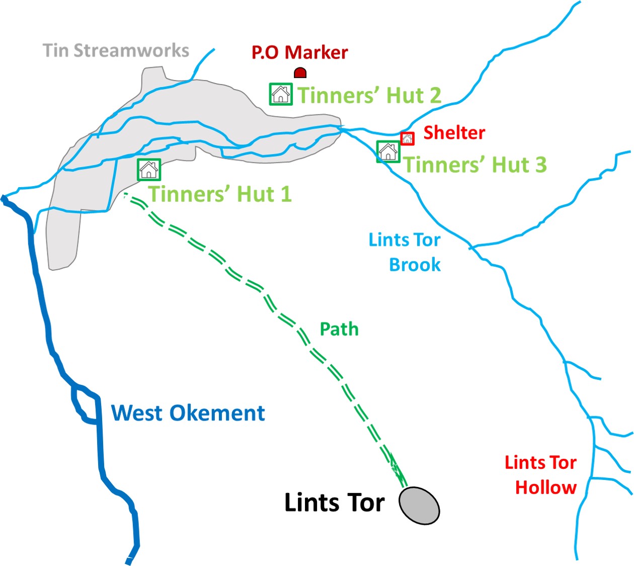
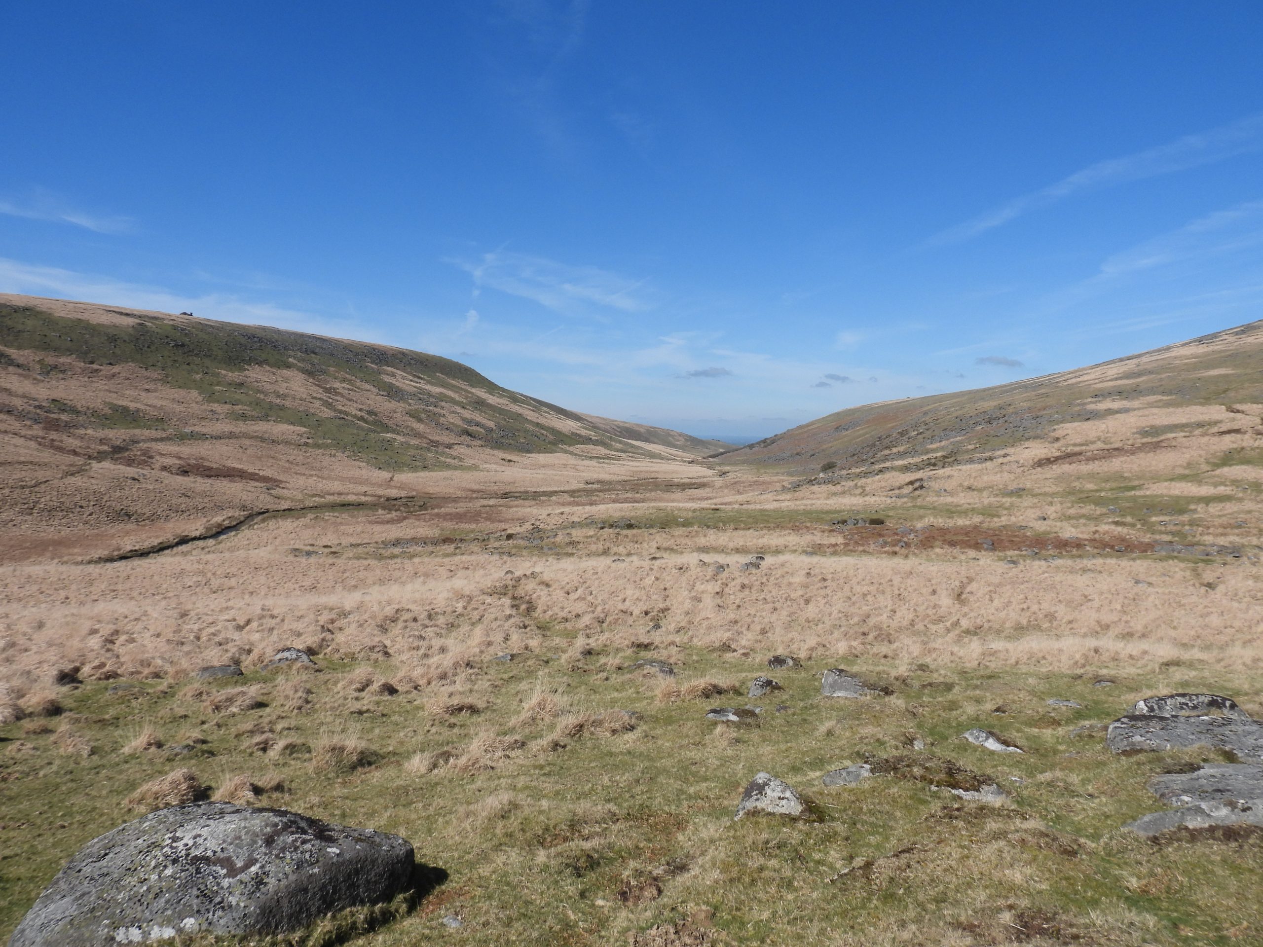
Anyone making the effort to walk to Lints Tor is likely on a clear day to be in awe of the views and surrounds. There are three primary routes to the tor, namely; up the West Okement Valley from Meldon (from the north) or down the hill from Dinger Tor (from the east) or down the hill from Kitty Tor (from the west). If visiting the tor, the author would highly recommend a short side trip up Lints Tor Brook to view this little known small Dartmoor valley, which contains at least three Tinners’ Huts plus a couple of miscellaneous features.
Bibliography
Royal Commission for the Historical Monuments of England, 1993-1998, Dartmoor Royal Forest Project (Report – Survey). (Ref: SDV346608)
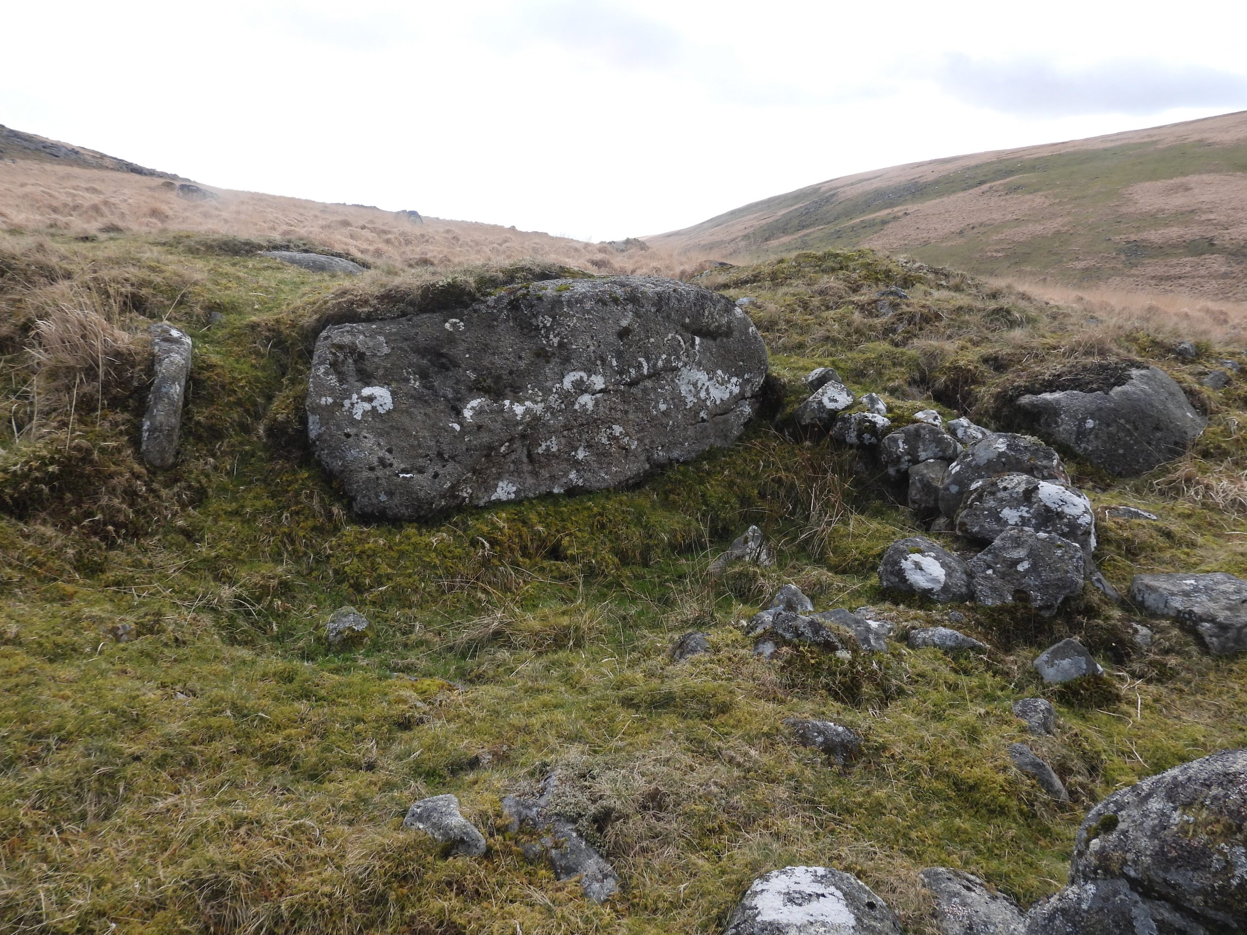
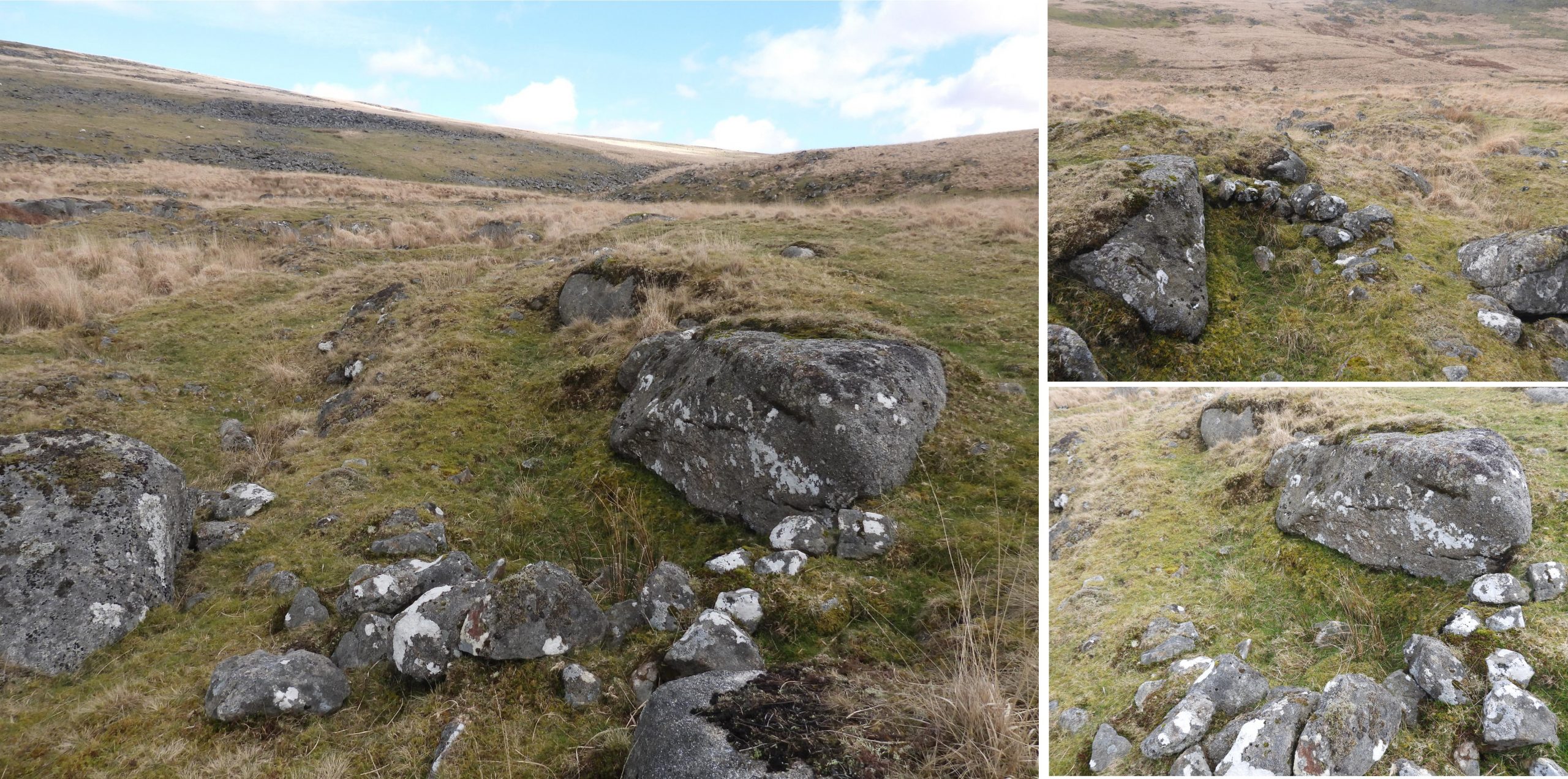
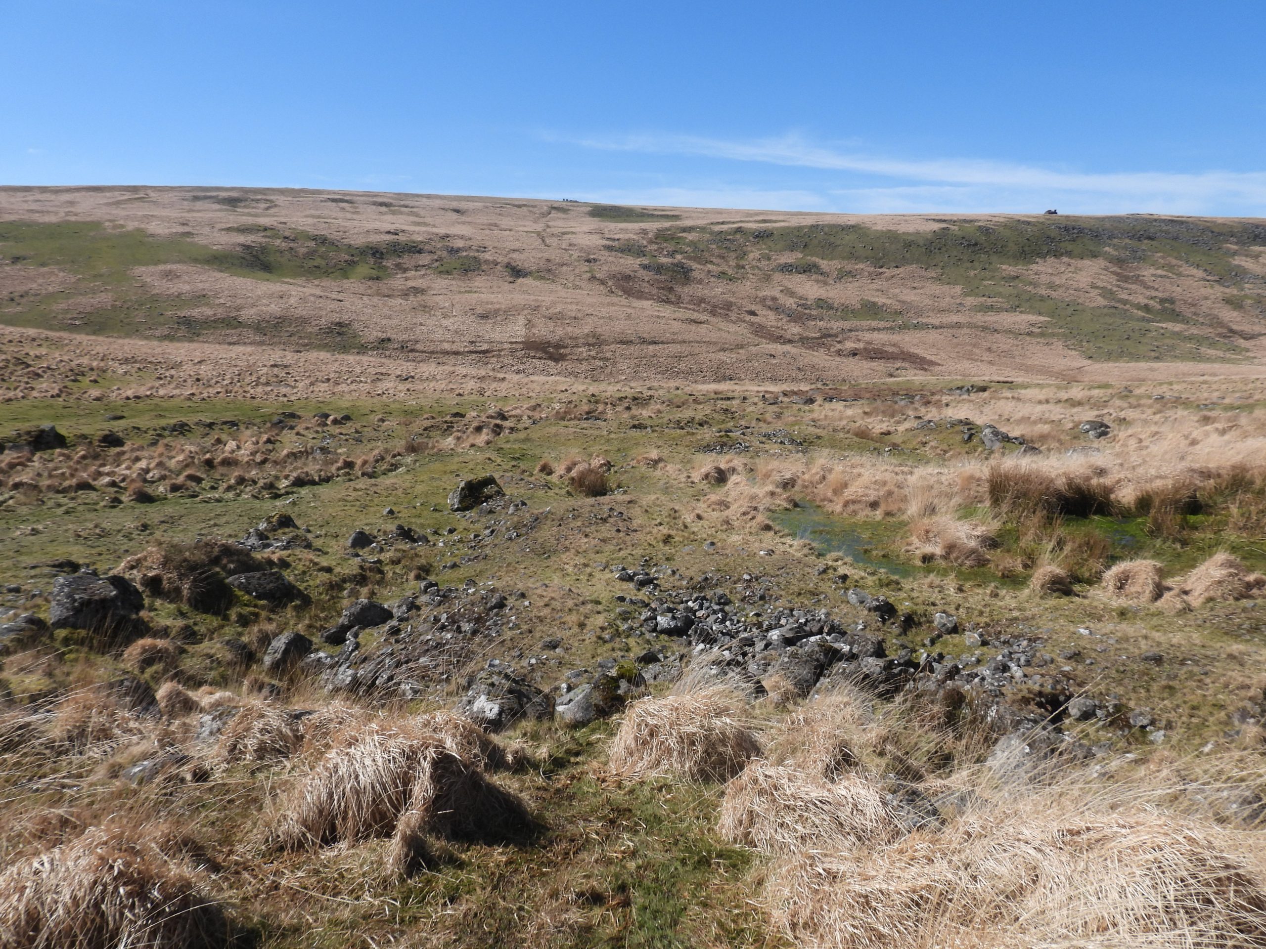
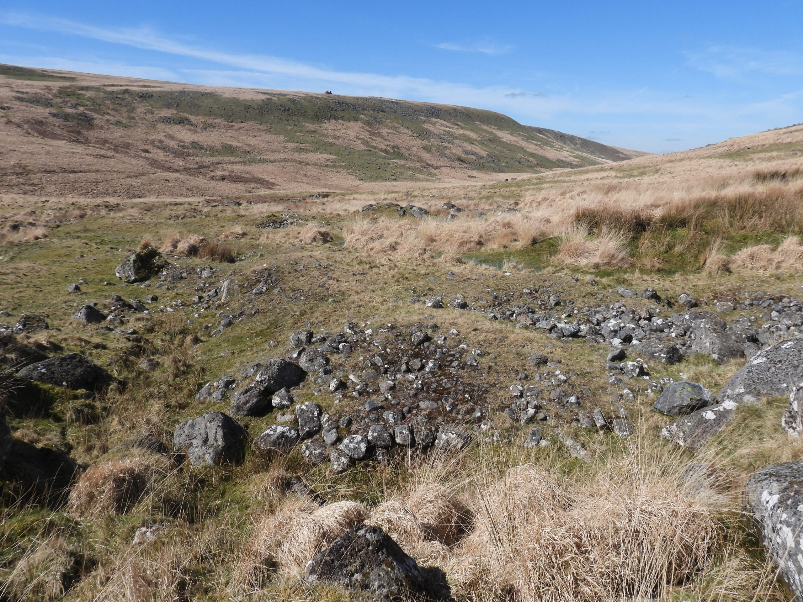
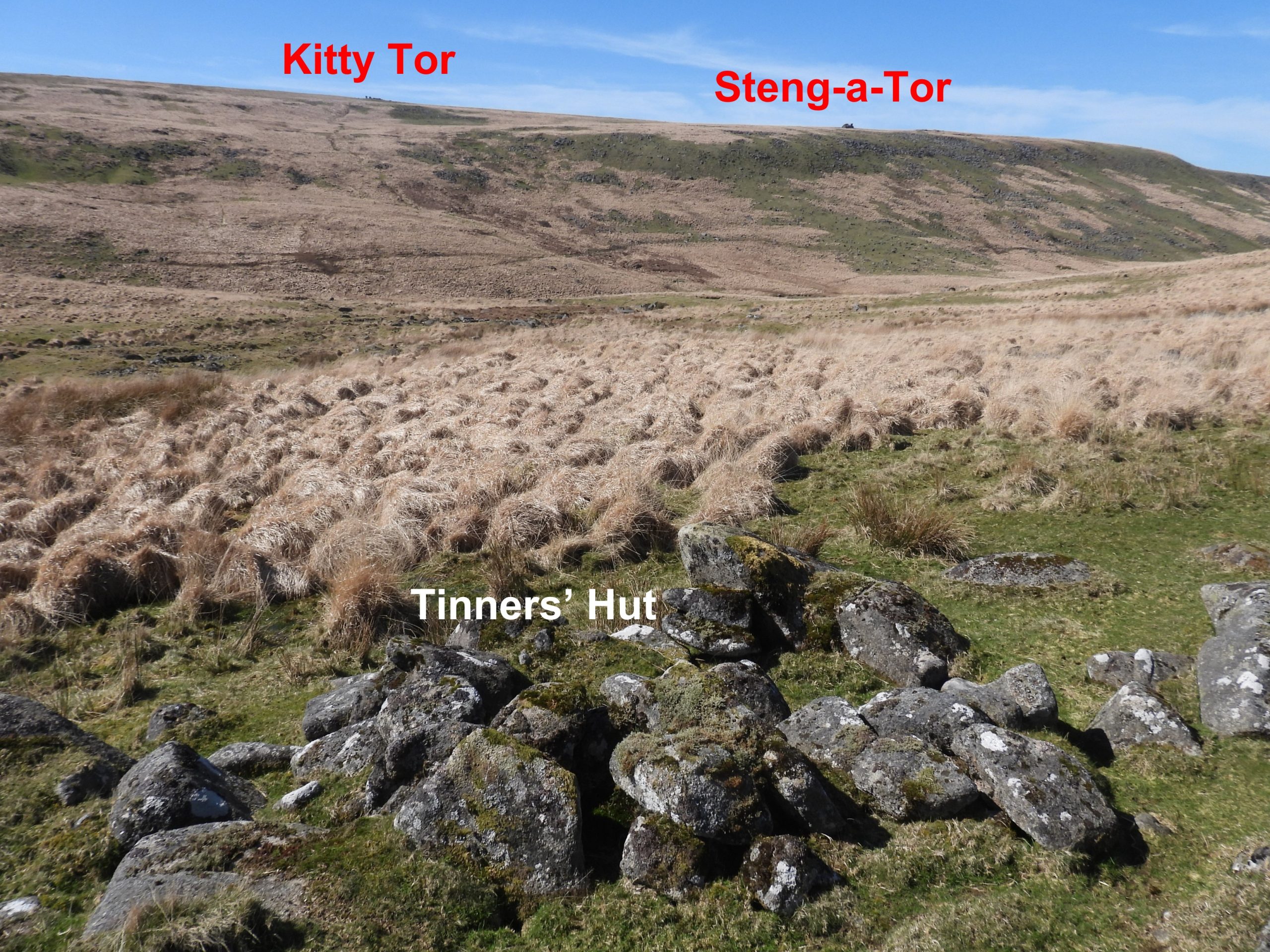
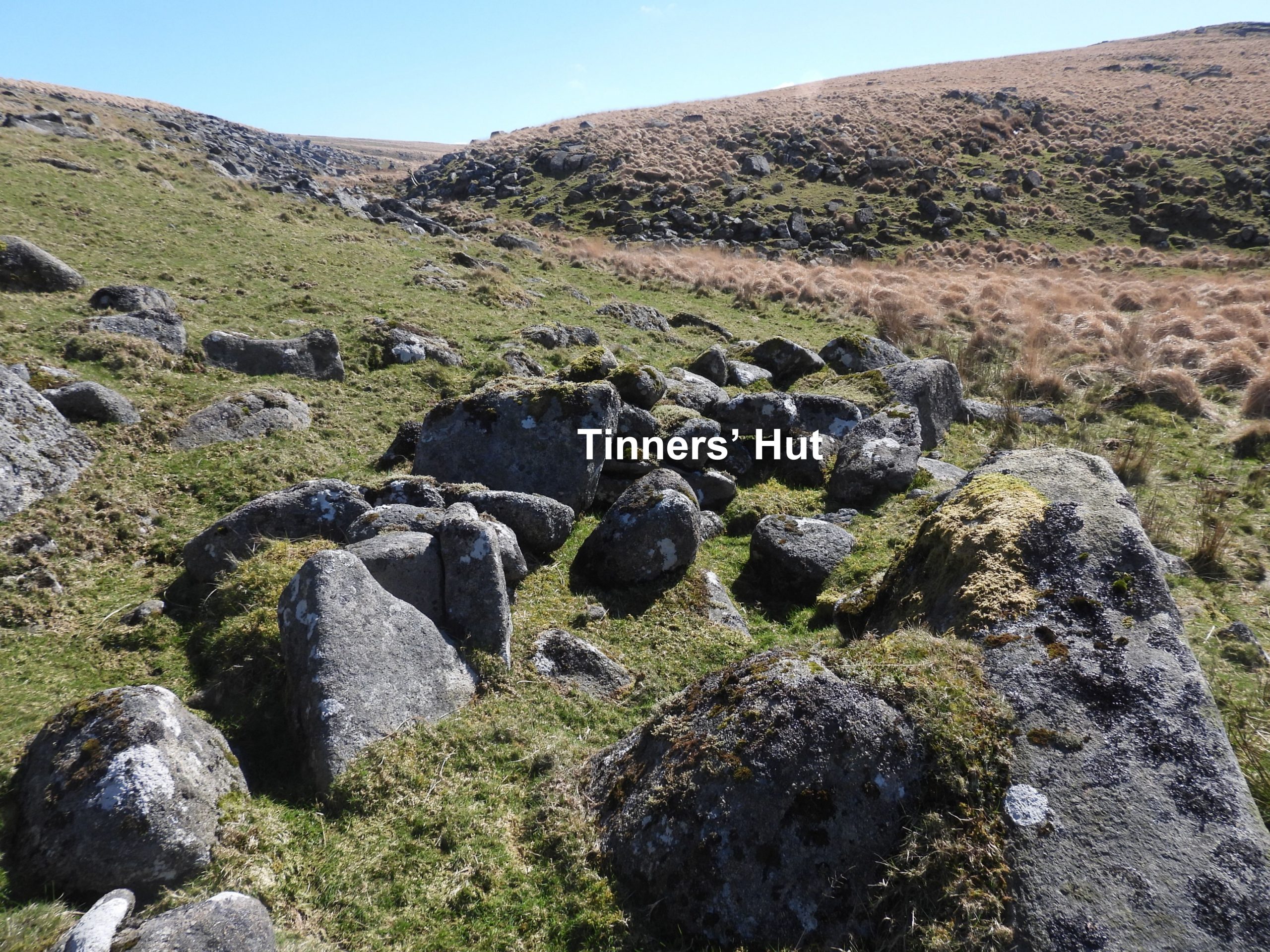
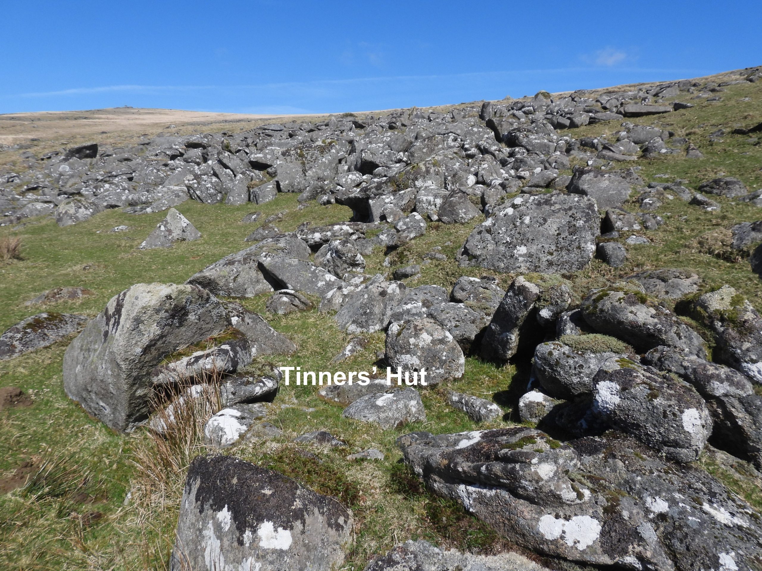
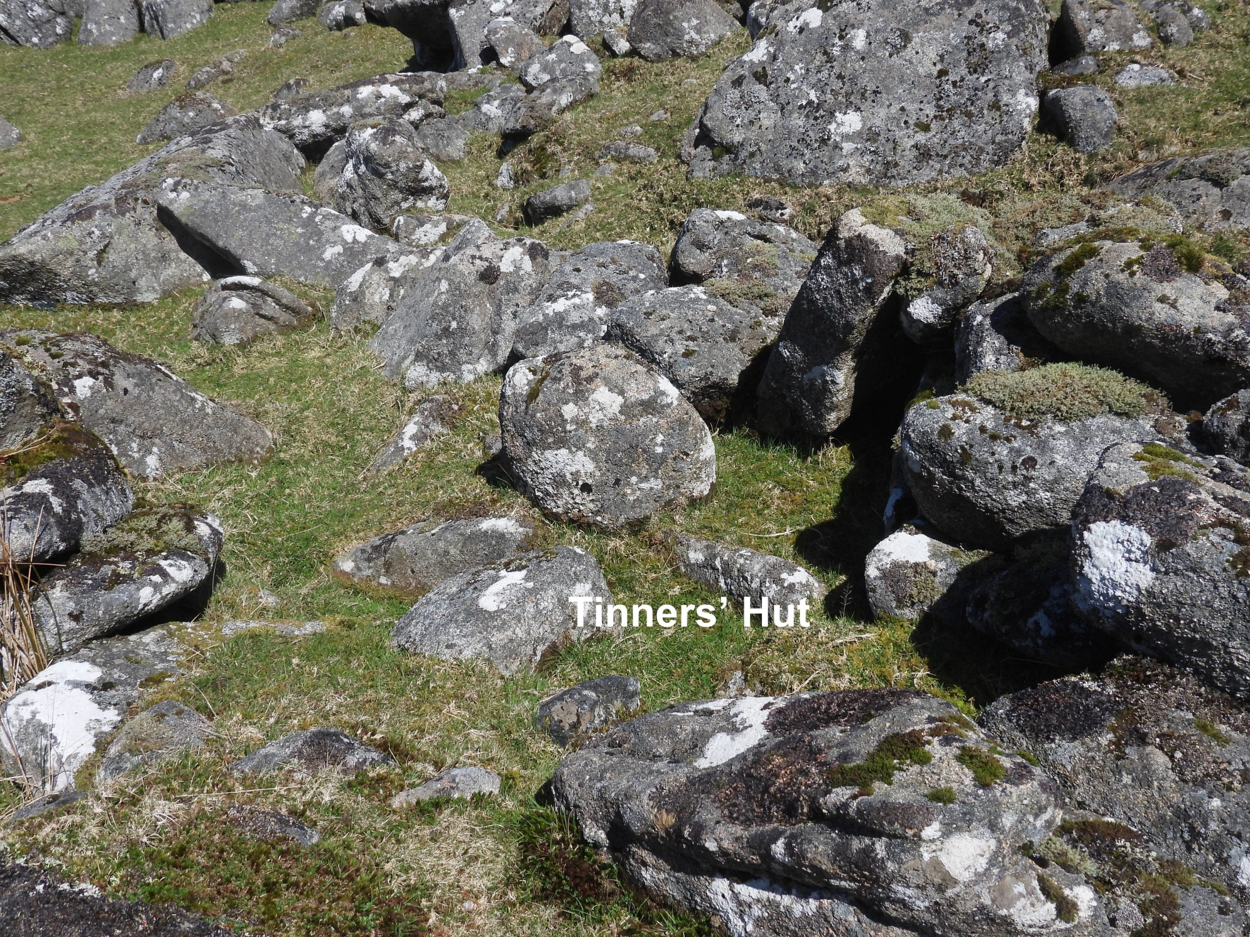
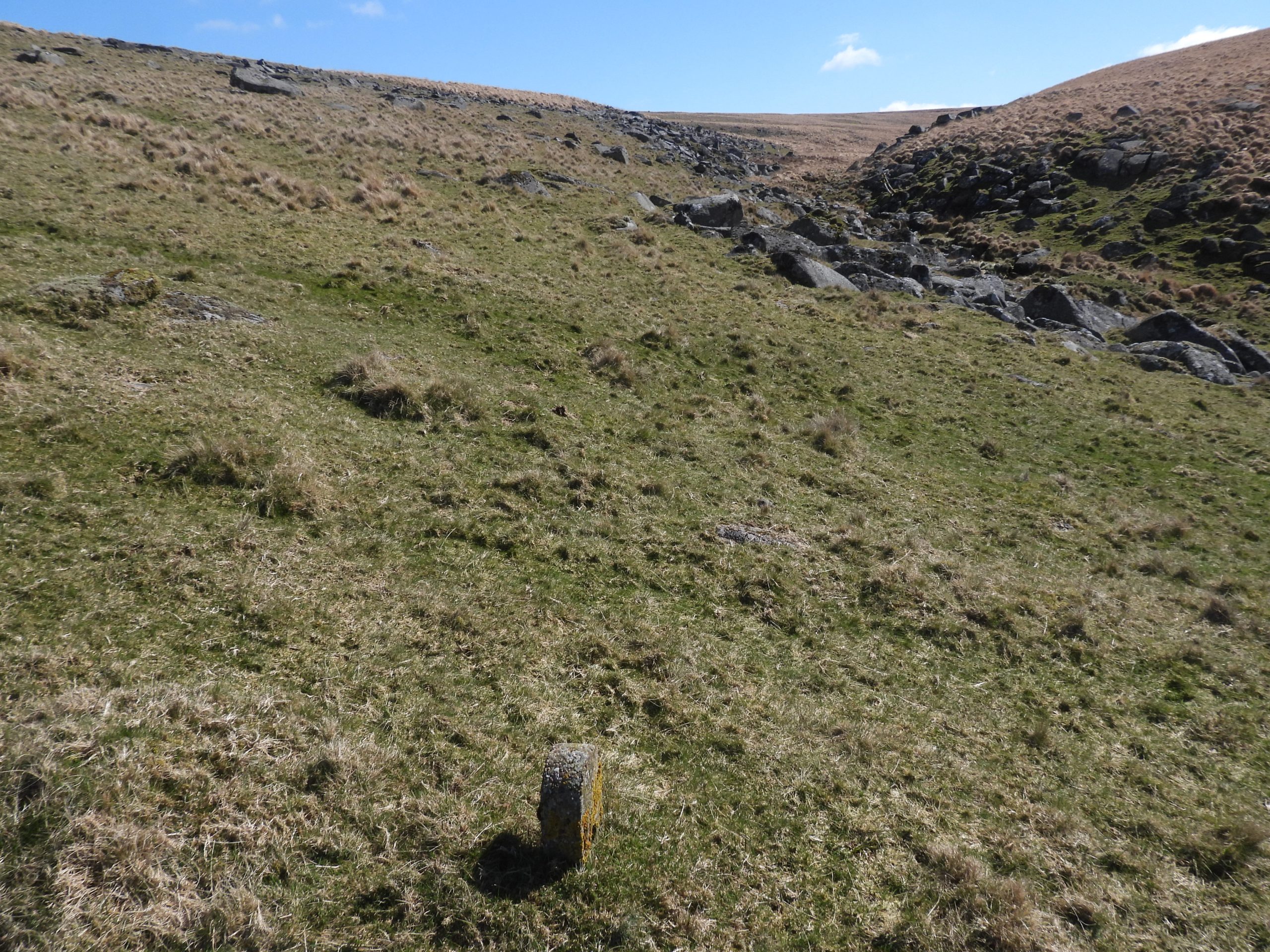
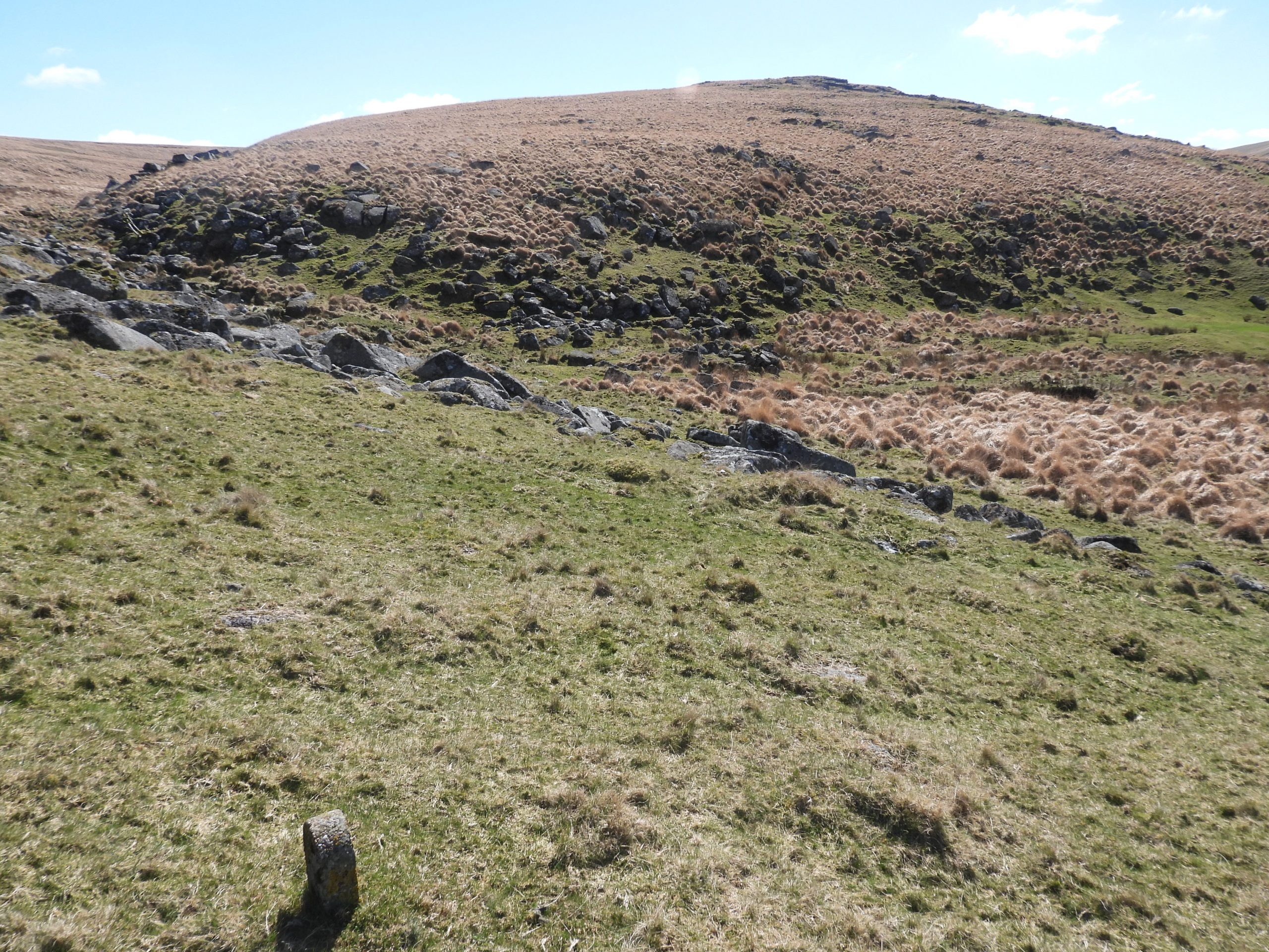
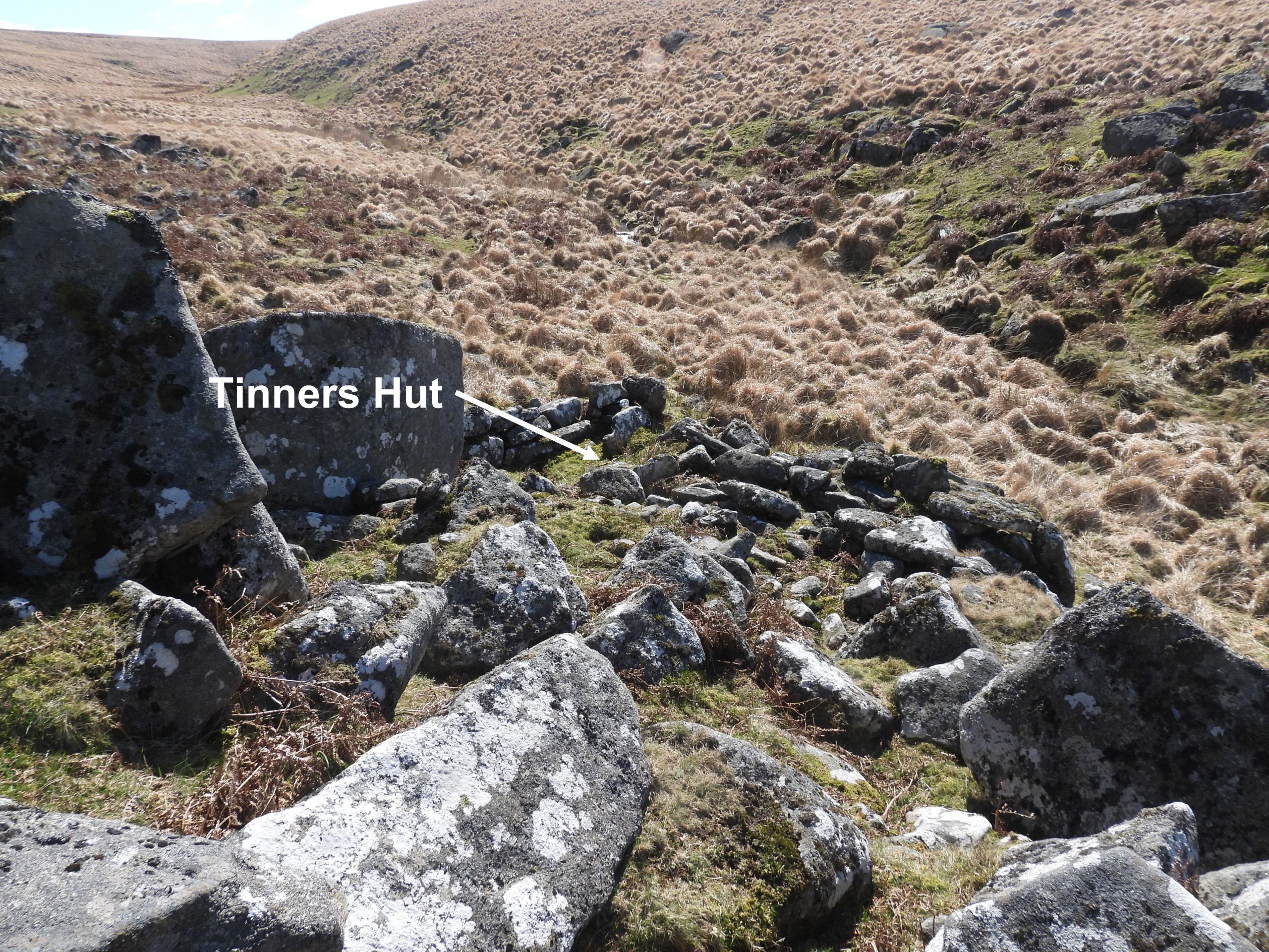
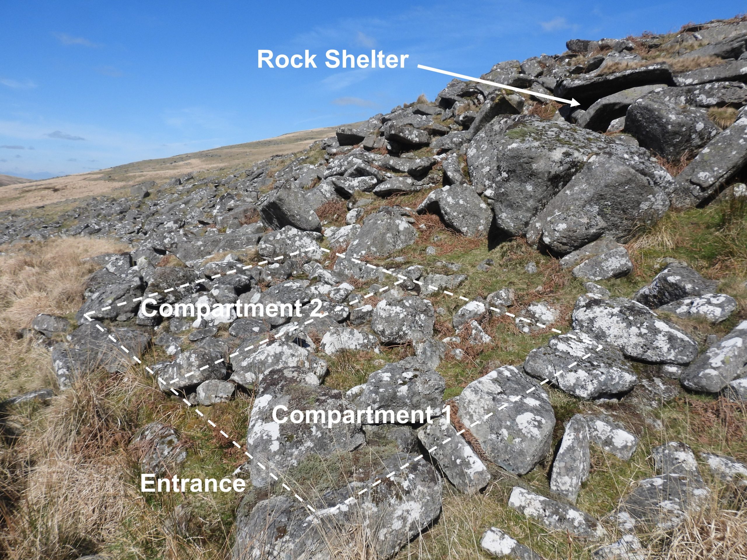
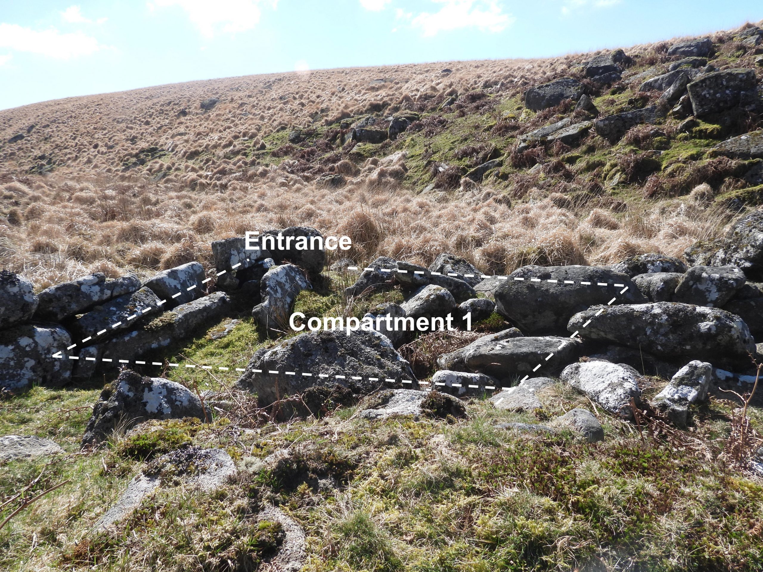
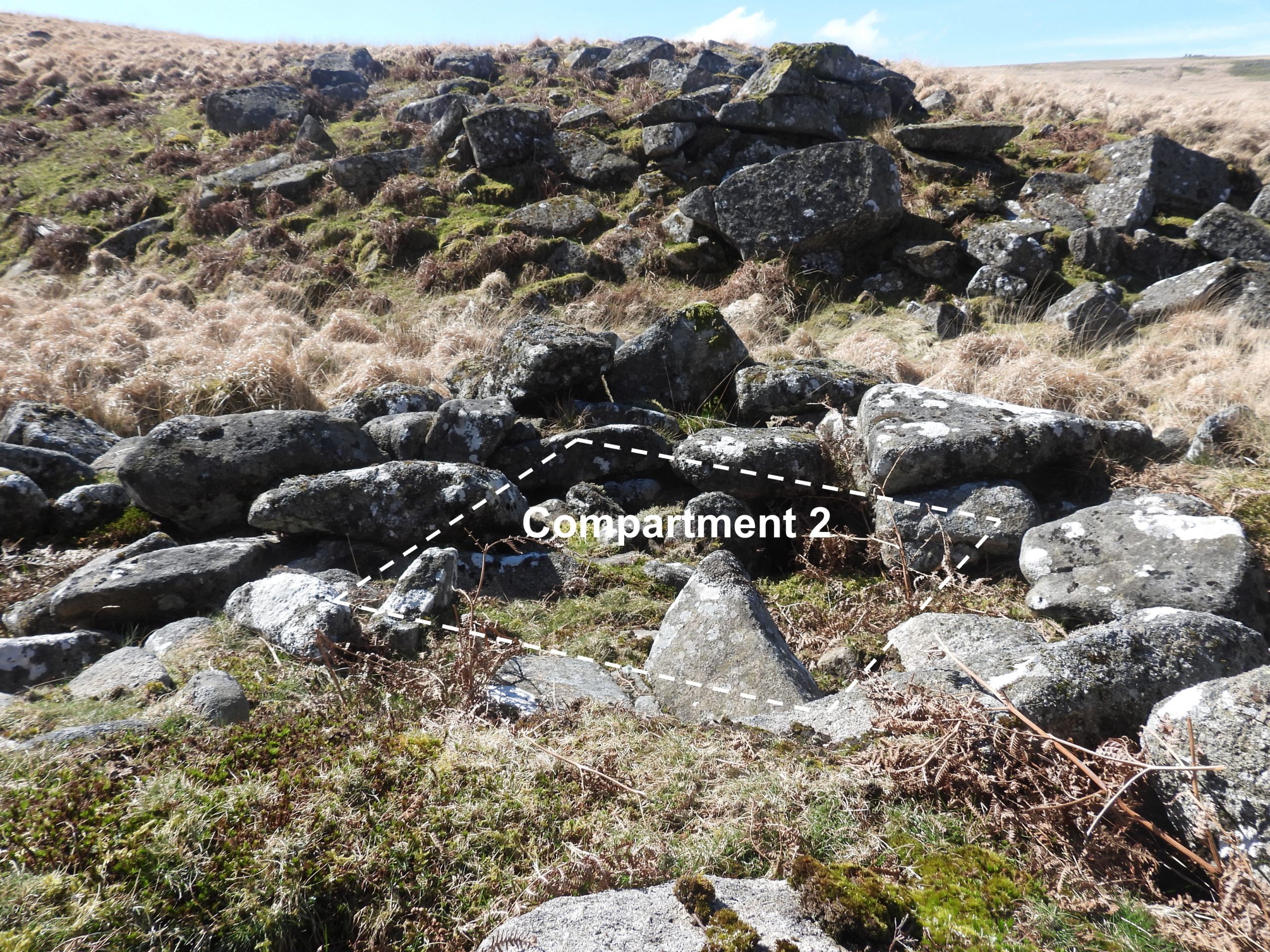
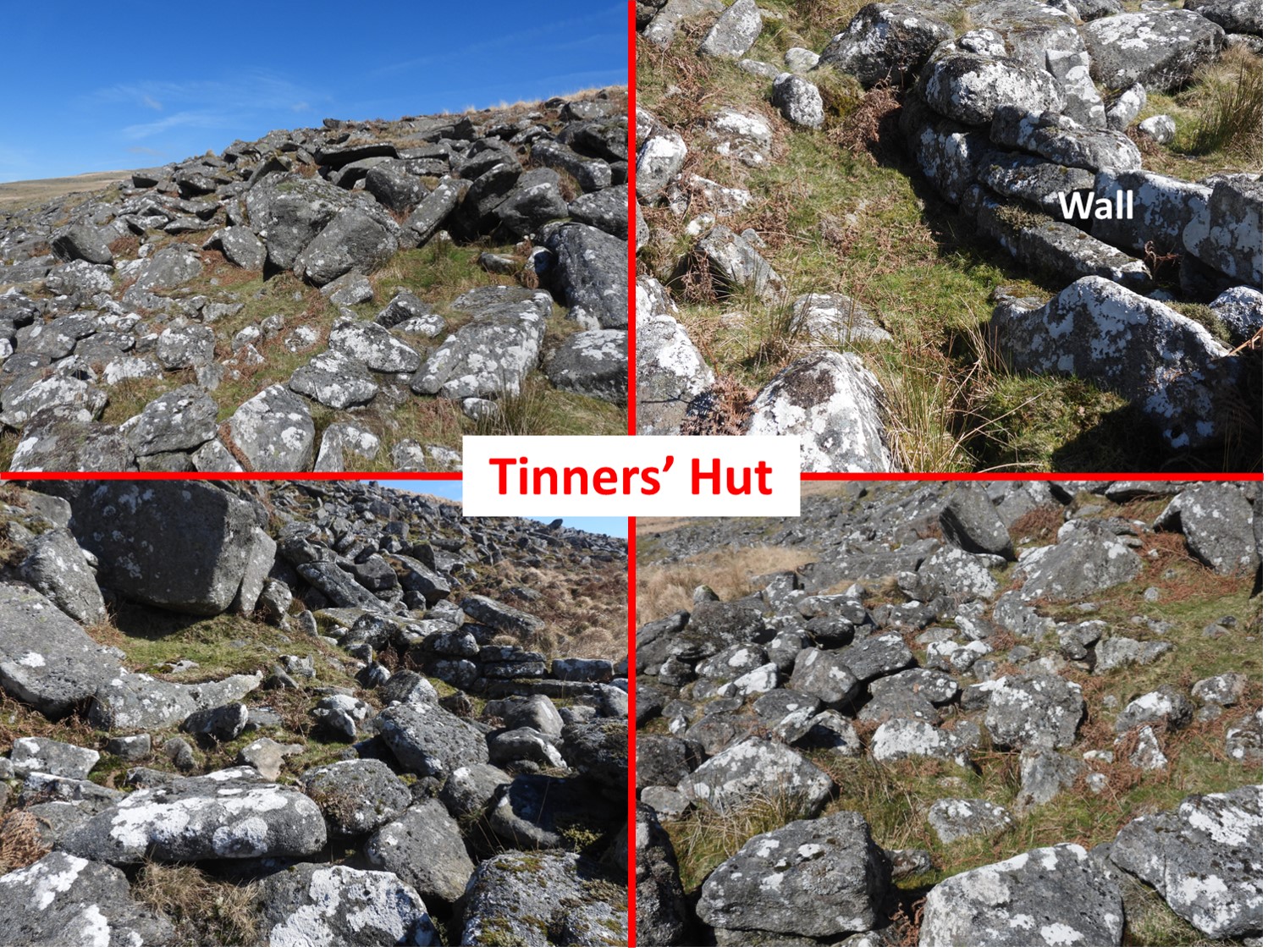
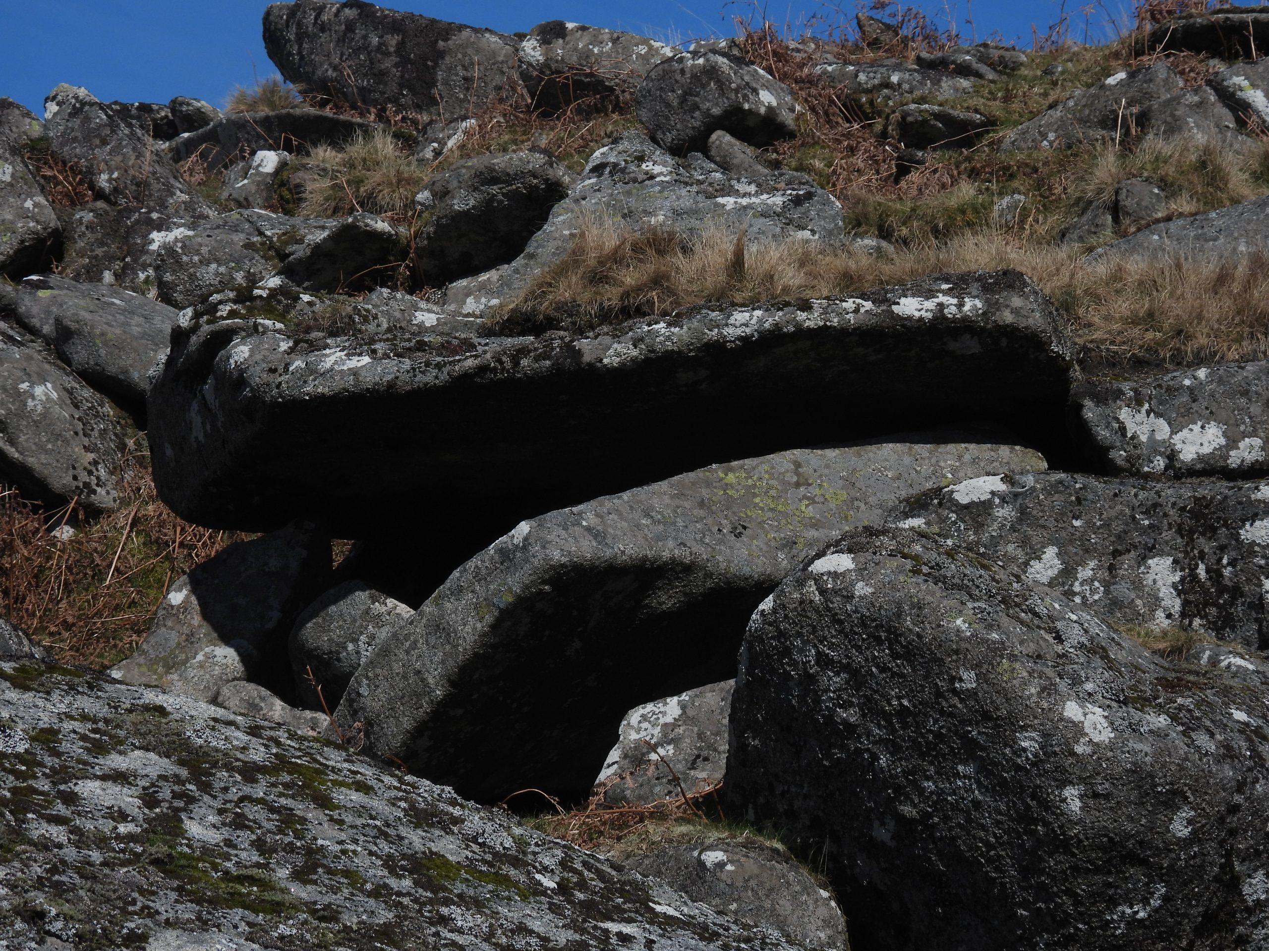
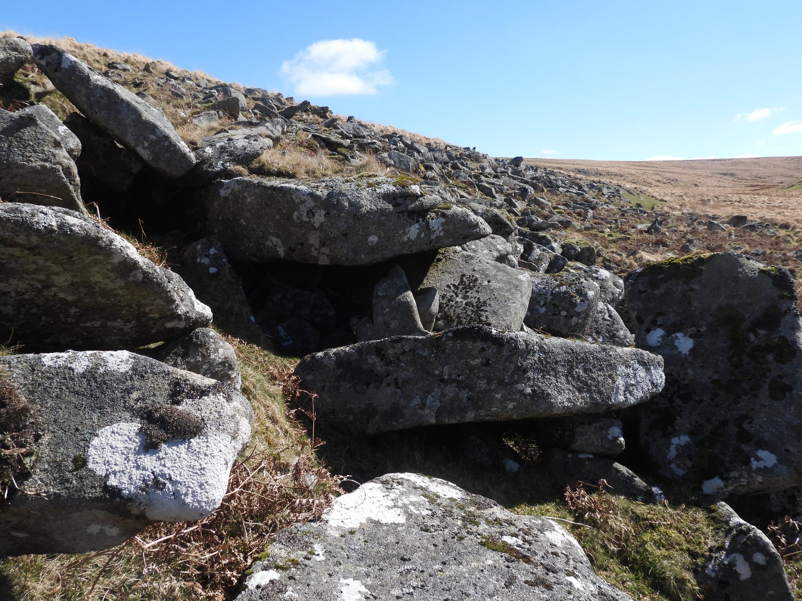
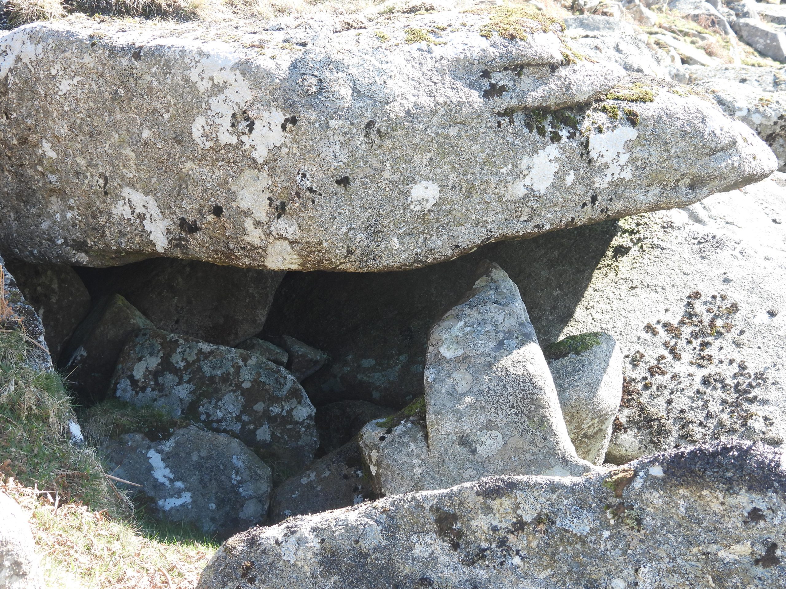
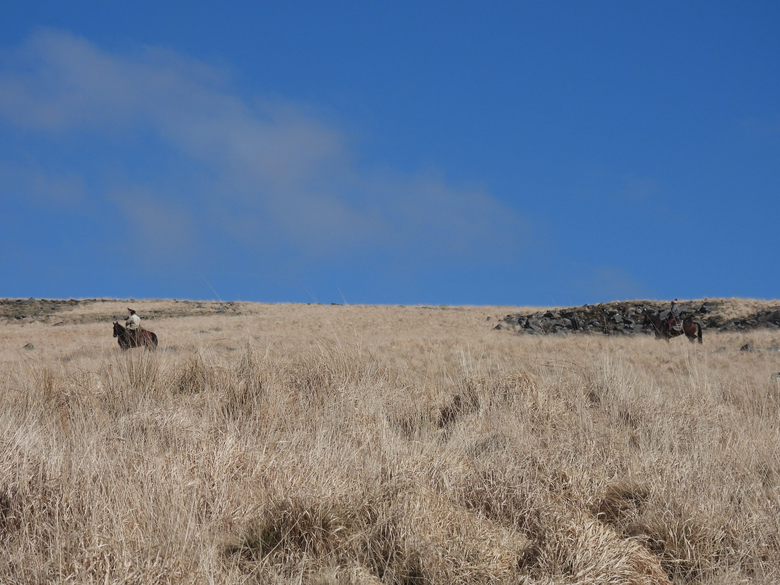
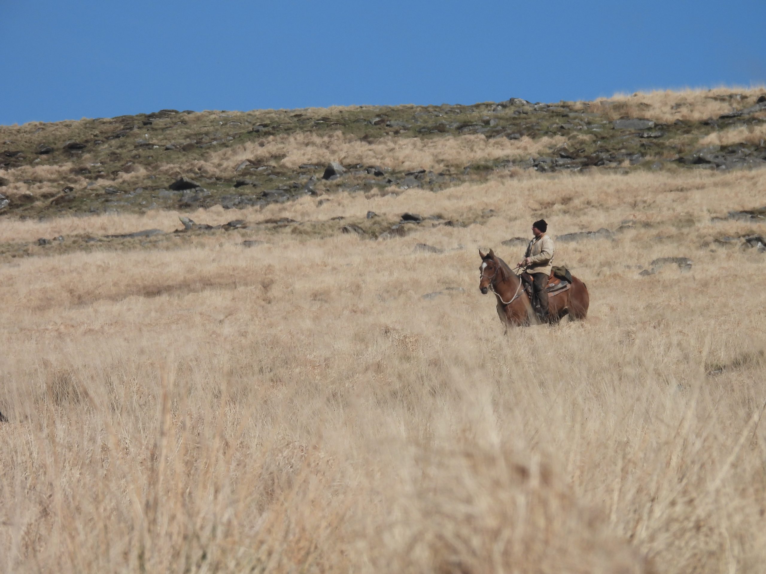
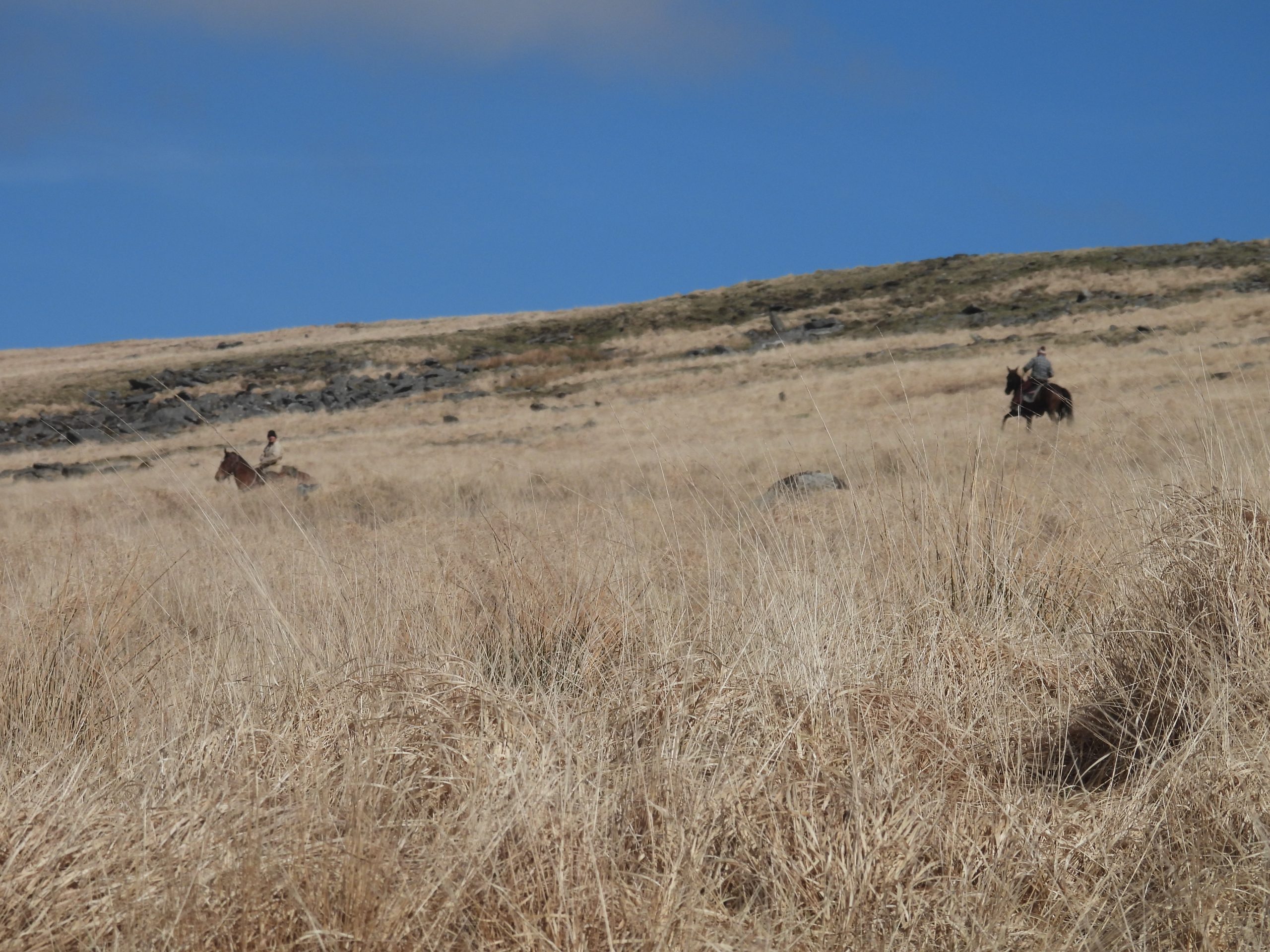
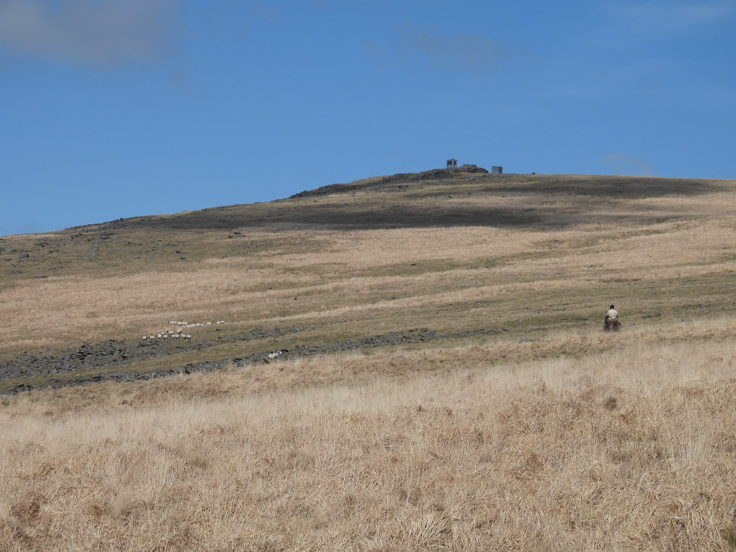
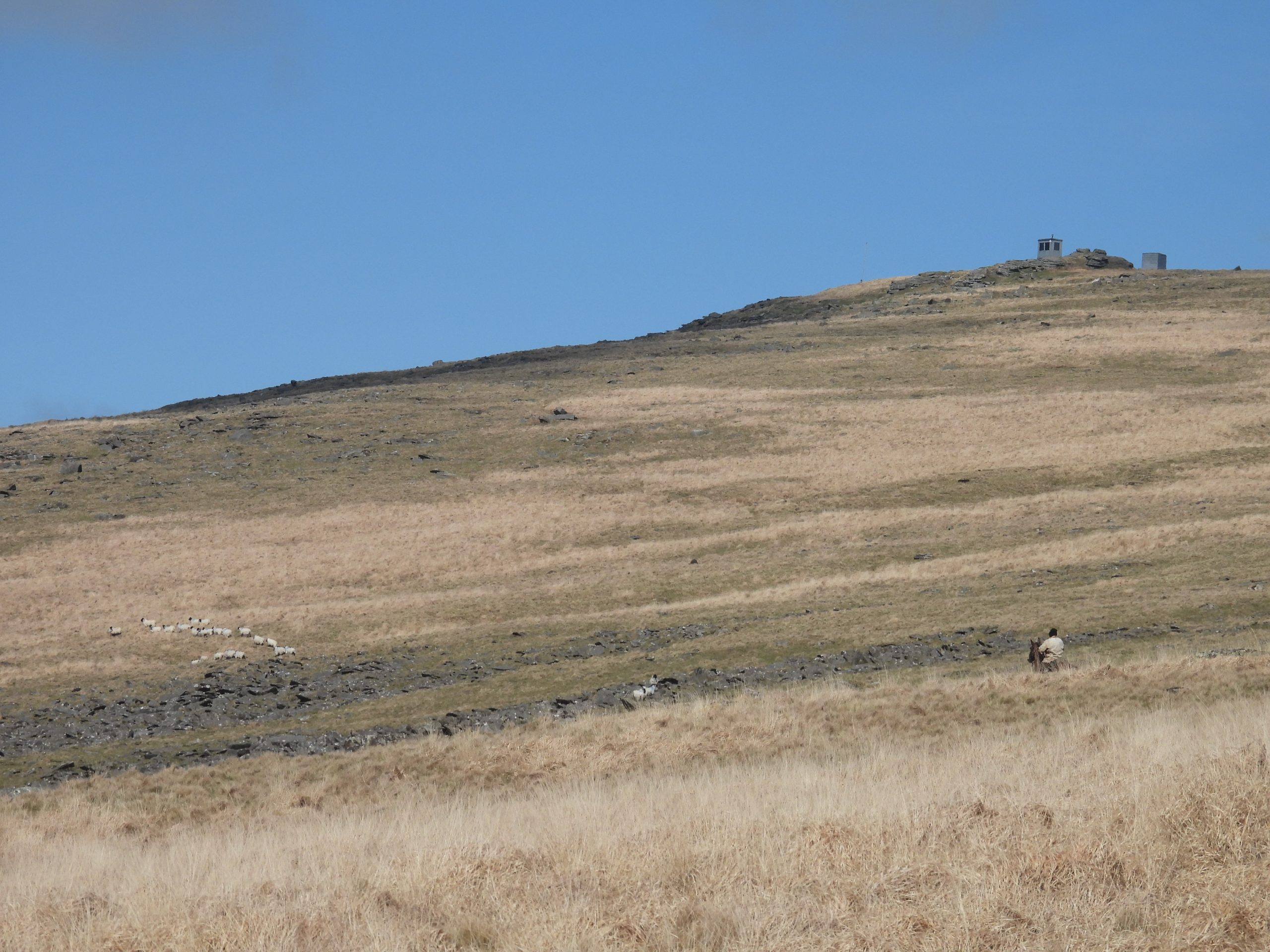
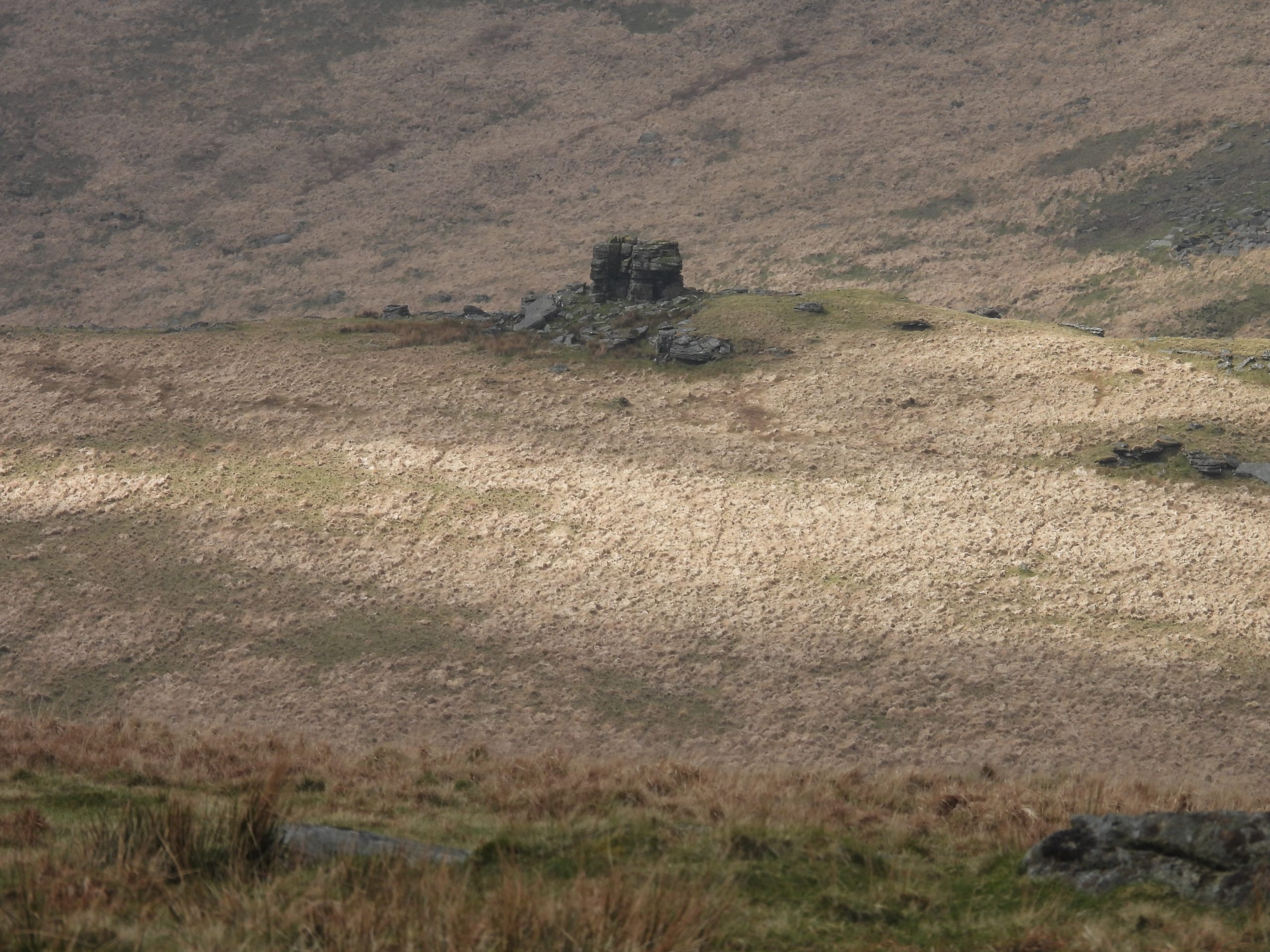
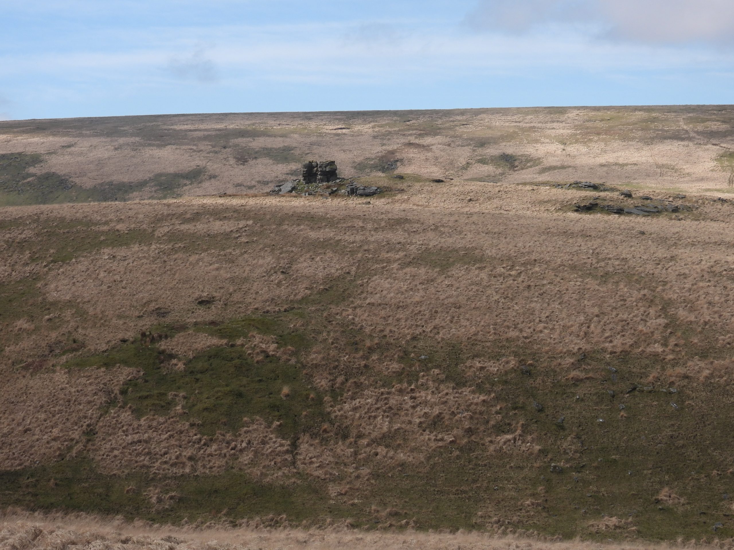
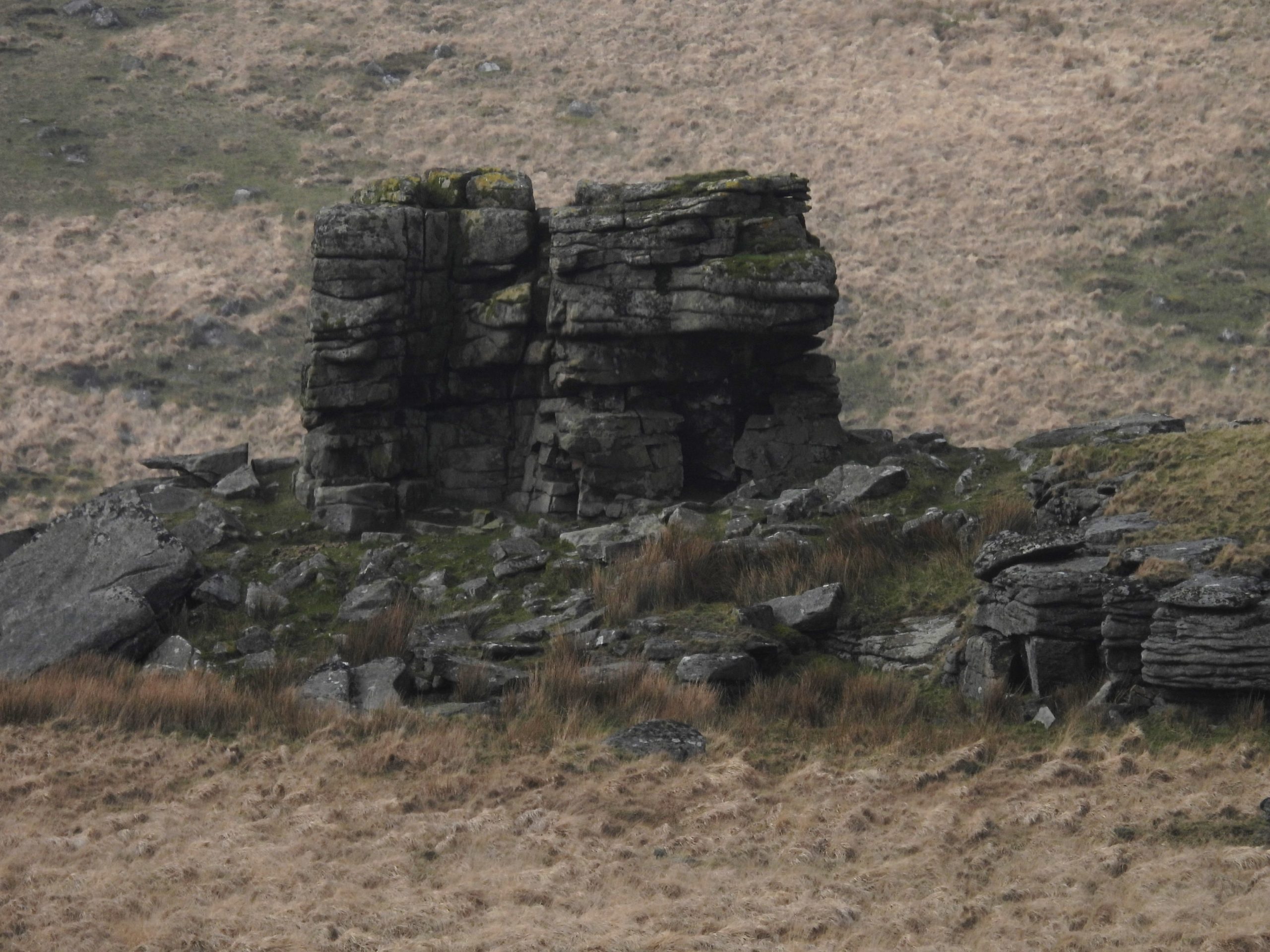
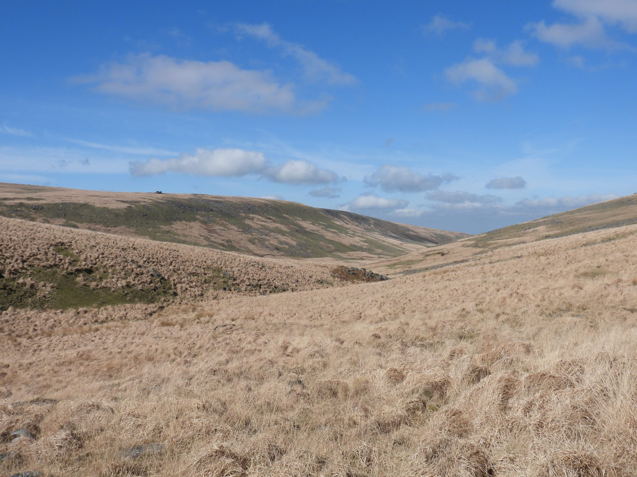
Sketch map of the area featured in this post. Note that Tinners’ Hut 1 was also featured in a previous Dartmoor Explorations post: https://dartmoorexplorations.co.uk/west-okement-tinners-huts-miscellaneous-shelters-and-a-possible-shepherds-hut/Near Lints Tor Brook this Tinners’ Hut (1) can be found. It measures 3m x 1.4mThis Tinners’ Hut is poorly preserved. It comprises a levelled platform oriented WSW to ENE cut into the cliff marking the edge of former tinners’ streamworks. It is located atSX57700 87848.The RHCME describe the Tinners’ Hut very well: 1. There is one short length of coursed wall, 0.5m high, at the WSW end (see picture on left -foreground); 2: There is a massive granite block approximately 3.2m long forming the S side of the structure; The N side stands open.From near its junction with the West Okement, there is an area of tinners’ streamworks along Lints Tor Brook which is marshy in parts and extends for 270m. It covers approx. 2.5 hectares.The Lints Tor Brook streamworks are likely to be medieval in origin.This very small, ruinous sub-rectangular building lies at the foot of the SW facing slope. From certain angles it look just like a jumble of rocks. The function of the structure is uncertain according to RCHME, but due to its proximity to the streamworks suggests an industrial link. It is labelled as Tinners’ Hut 2 on the sketch map.RCHME record this structure as being 20m N of the streamworking remains on the Lints Tor Brook. It is further described as measuring an average 1m wide and up to 0.45m high. The rocks in the top left of the photograph is where Tinners’ Hut (3) is located.The structure measures around 2.2m E-W x 1.2m and is located at SX57832 87919There is a possible entrance 0.5m wide in the W side.Slightly uphill from Tinners’ Hut 2 there is a small concrete ‘P.O’ marker, which is testament to military activity in the area. It is located at SX57849 87919The ‘P.O’ marker probably marks the position of a communications cable. Between the marker and the main track leading up to Lints Tor is a very narrow depression, which looks like where the cable is probably buried.Moving upstream from Tinners’ Hut 2 and the P.O marker at the base of a group of large boulders, the remains of a very ruinous Tinners’ Hut (labelled as 3 on the sketch map) can be located. It is mostly constructed of a single course of walling.The Tinners’ Hut has an obvious entrance gap in the south west side. The Tinners’ Hut has two rooms (or compartments) and there is a possible rock shelter above in the jumble of large boulders. This is a lovely sheltered spot, which is ideal for a refreshment break.The two rooms (compartments) are very difficult to show in photographs due to the jumble of rocks within the hut. That said, a cross wall can be discerned close up. Room 1 is 2.7m by 3.0mRoom 2 measures 2.6m by 2.0mThe Tinners’ Hut is located at SX57942 87861. The walls are just over 1m wide.The rock shelter above Tinners’ Hut 3. It has a natural boulder forming one side and a slab roofThe slab roof is just over 1m above the floor.It is thought that a former wall may be represented by some inward tumble on the north side of the shelter.Whilst exploring Lints Tor Brook, the author was intrigued to see two horse riders with a number of dogs (maybe 3 or 4) herding sheep.One of the two horse riders. The dogs and sheep were several hundred of metres away for a lot of the time.The two sheep herding horse ridersThe sheep were being herded from the Dinger Tor area in a north west direction below Fordlands Ledge (huts in the picture) into the West Okement valley.There were around 2 or 3 dozen sheep being herded presumably onto different pastures.Returning to Lints Tor Brook on the north side Brian Le Messurier recorded in April 1975 two further ruined huts which were stated at being around 3m x 3m and 2.5m x 1.2m. The author explored a number of ‘possibilities’ for these two huts but nothing definitively could be found. The above picture is the only evidence the author could find of anything that might resemble a wall. Lints Tor Hollow can be seen in the background.Lints Tor looking across the Lint Tor Brook valleyAnother view of Lints Tor looking across the Lint Tor Brook valleyZoomed in view of Lints TorWest Okement valley from above Lints Tor BrookWest Okement Valley from the lower slopes of Lints Tor