A collection of walks, discoveries, insights and pictures of exploring Dartmoor National Park
April 14, 2023
Merrivale Bridges and Hamlet
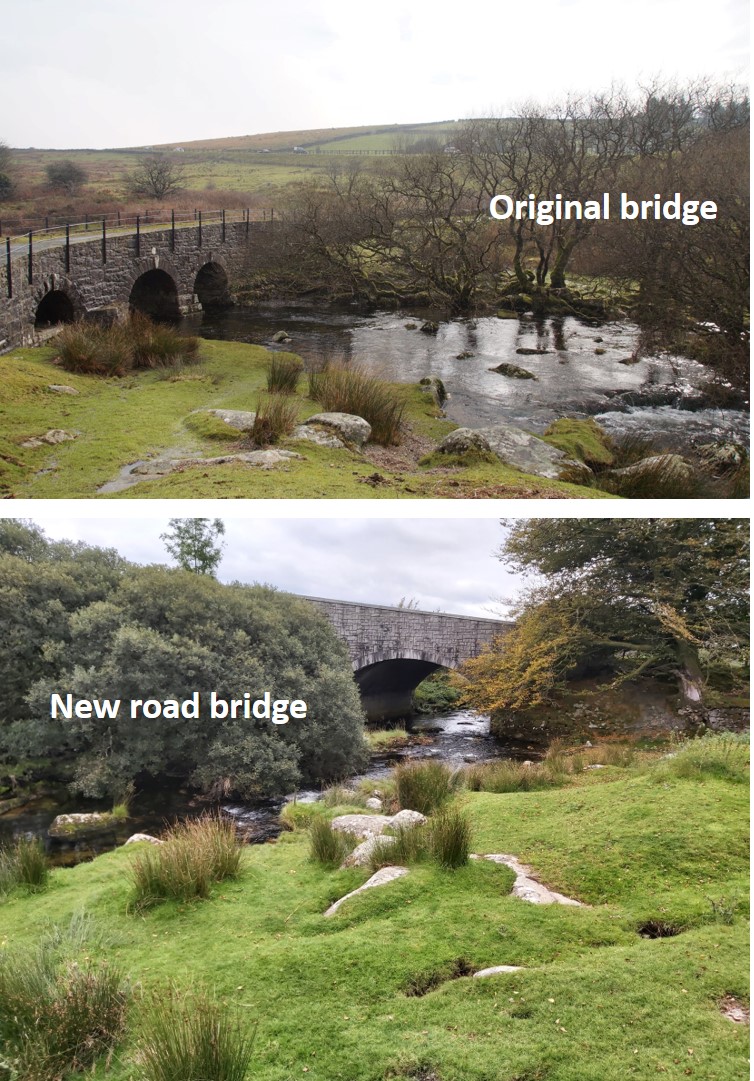
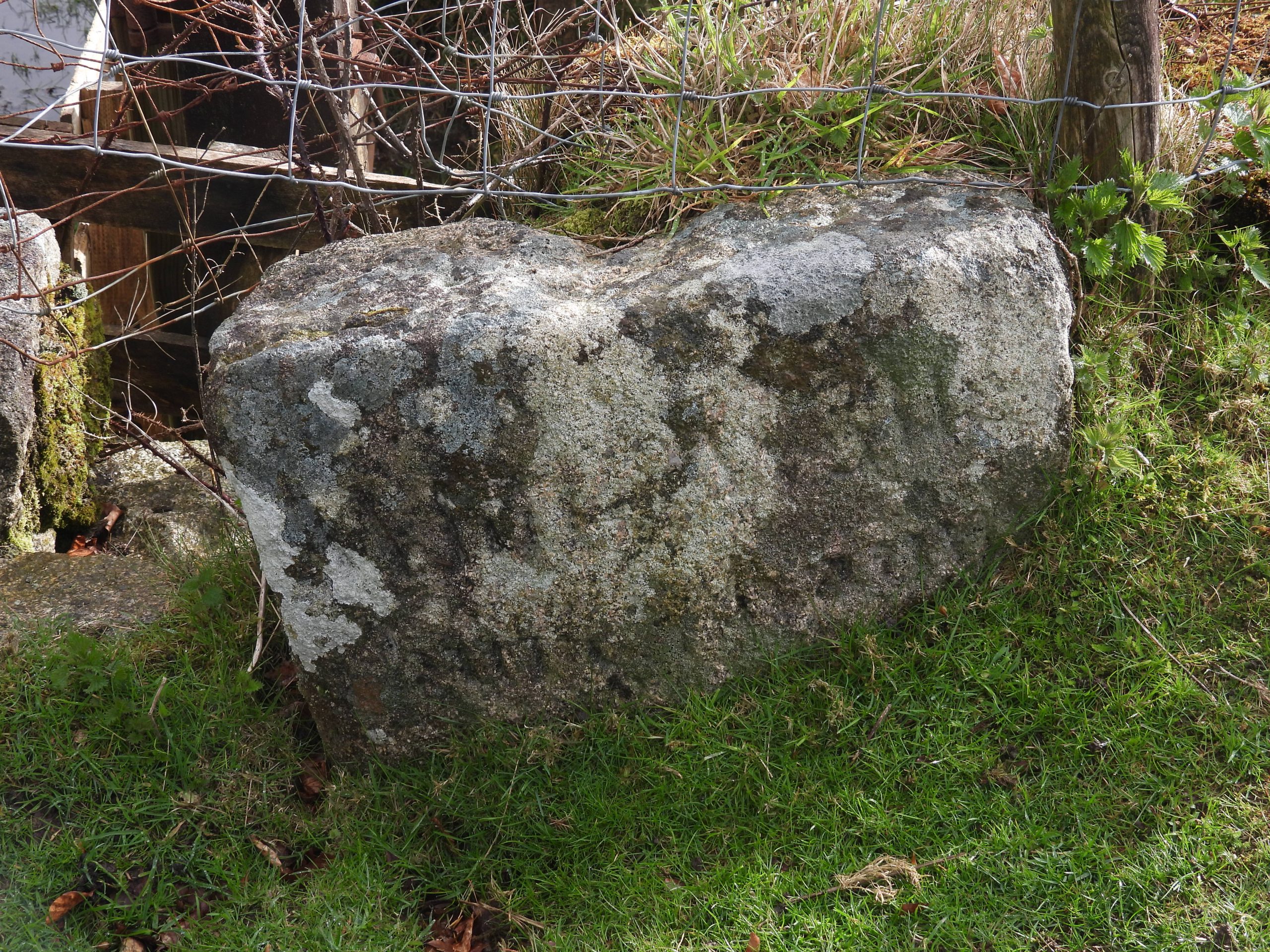
Merrivale is a delightful little hamlet, which lies in the moorland portion of the Walkham valley. The area clearly would have benefitted from the construction of the Turnpike road in the late 18th century which connected Tavistock to Moretonhampstead. The original (clapper) bridge crossing the river had probably been extant for 100 years or more when the turnpike was constructed and the bridge rebuilt. As with many bridges across the moor (and county) there is a “C” (for County) stone located here. Additionally there is a parish boundary stone here as this is where there is the boundary (River Walkham) between Whitchurch and Walkhampton parishes. The modern bridge was added in mid 20th century and was the site of an ancient ford.
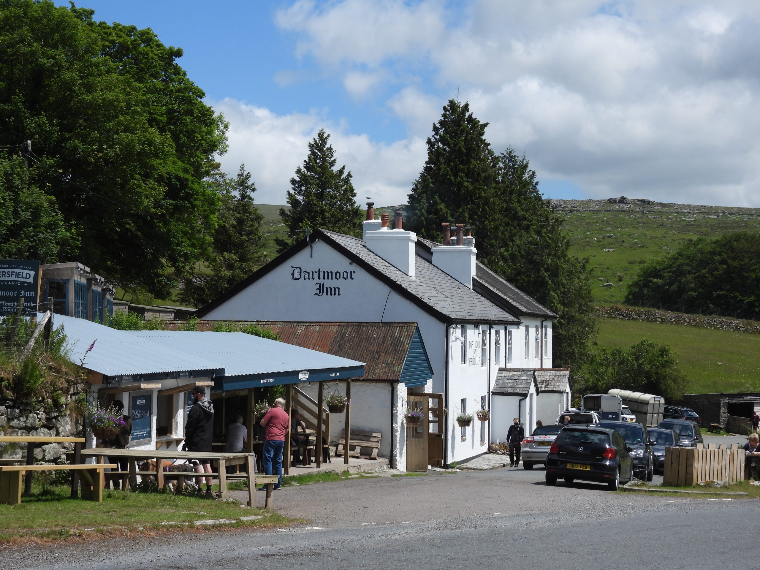
Of interest in the area are many buildings (which include two farms, an Inn and an old Post Office), the quarry and a couple of benchmarks.
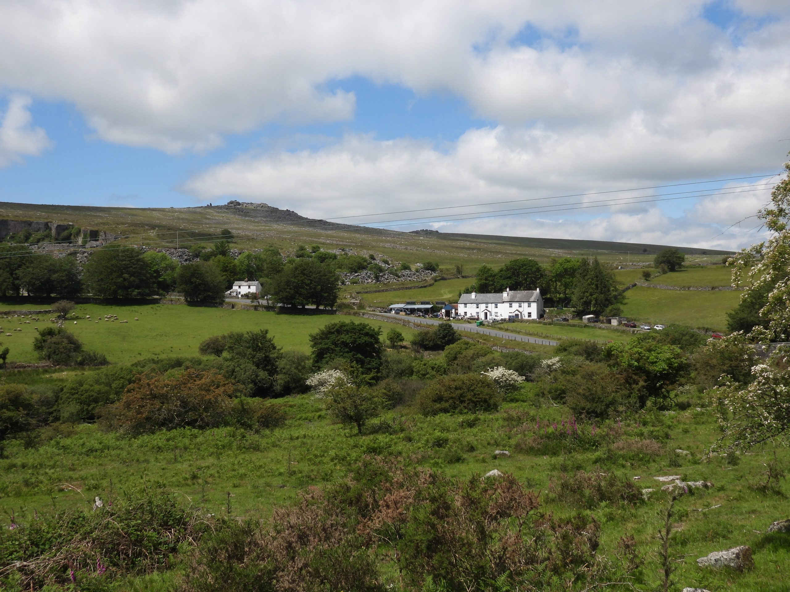
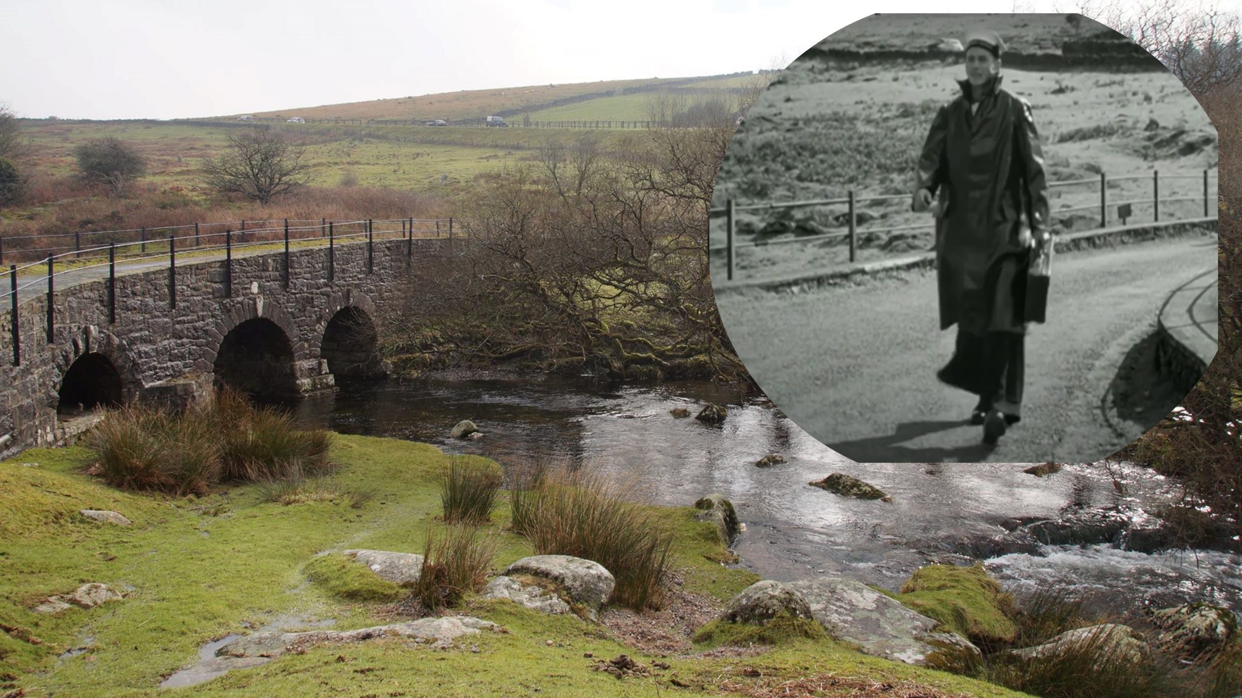
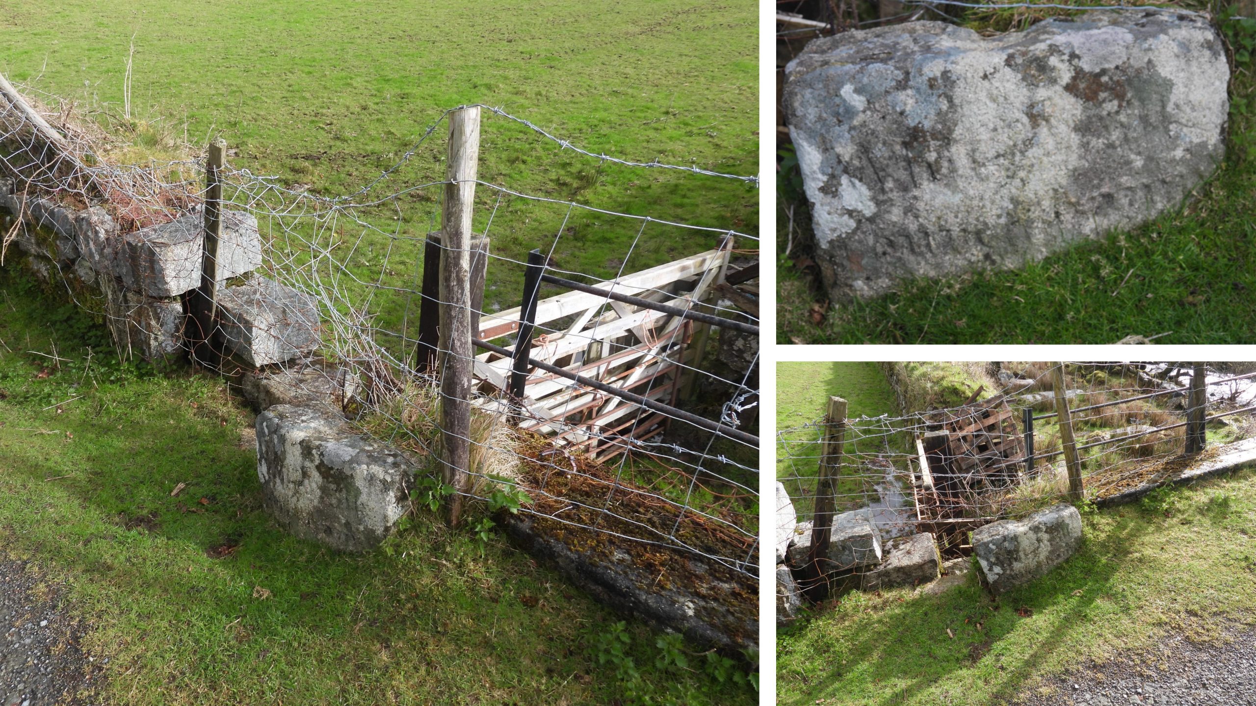
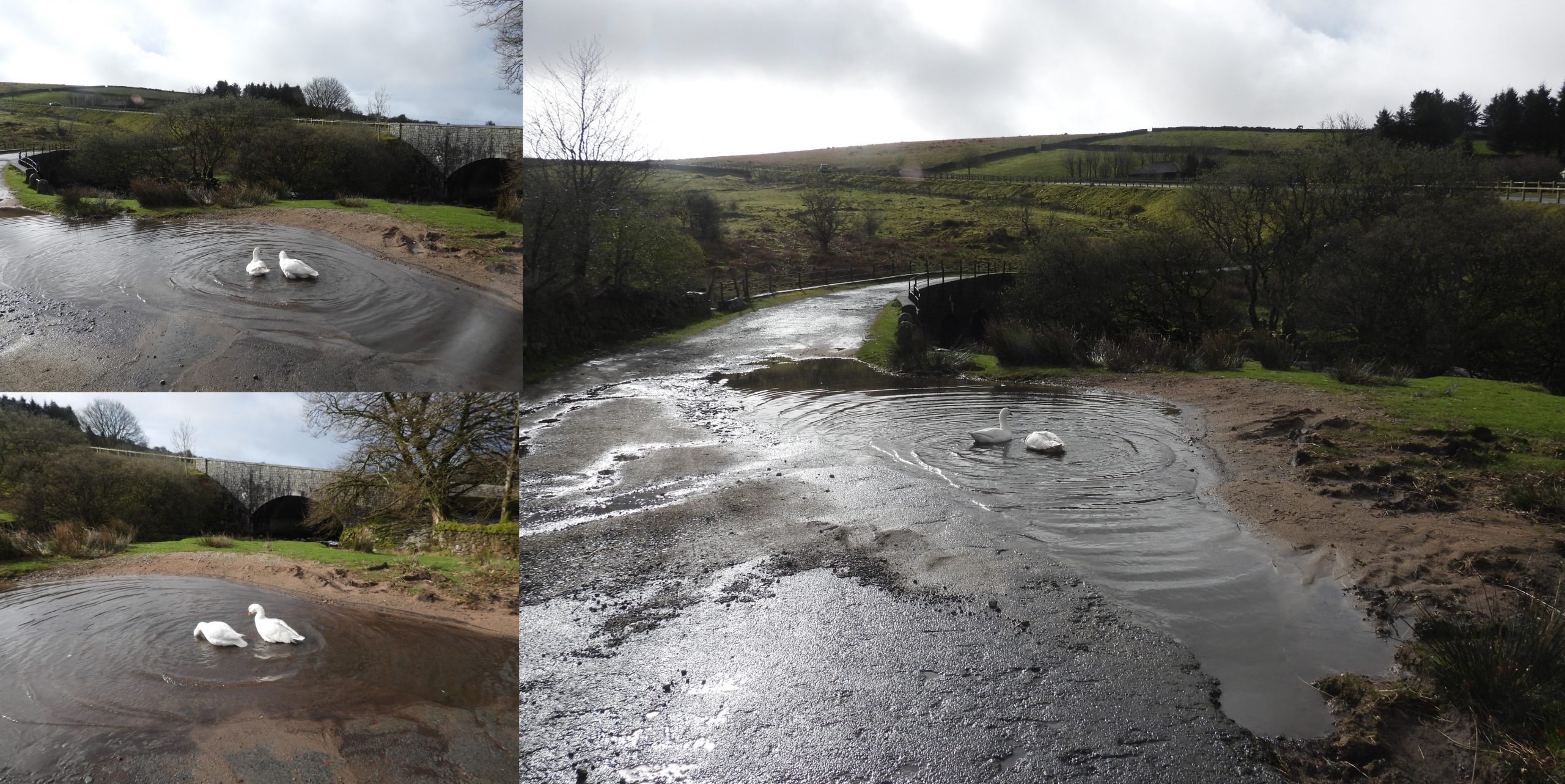
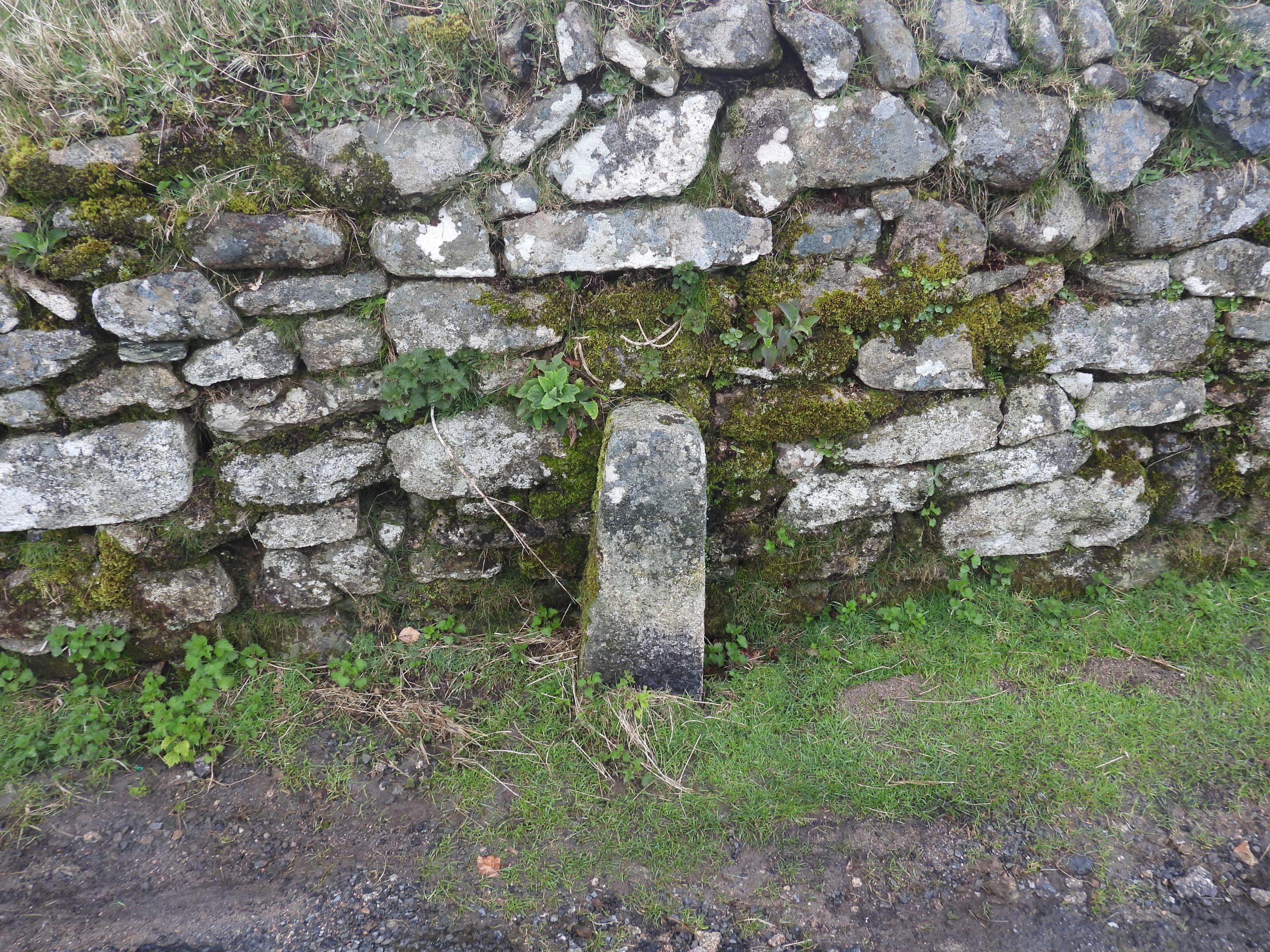
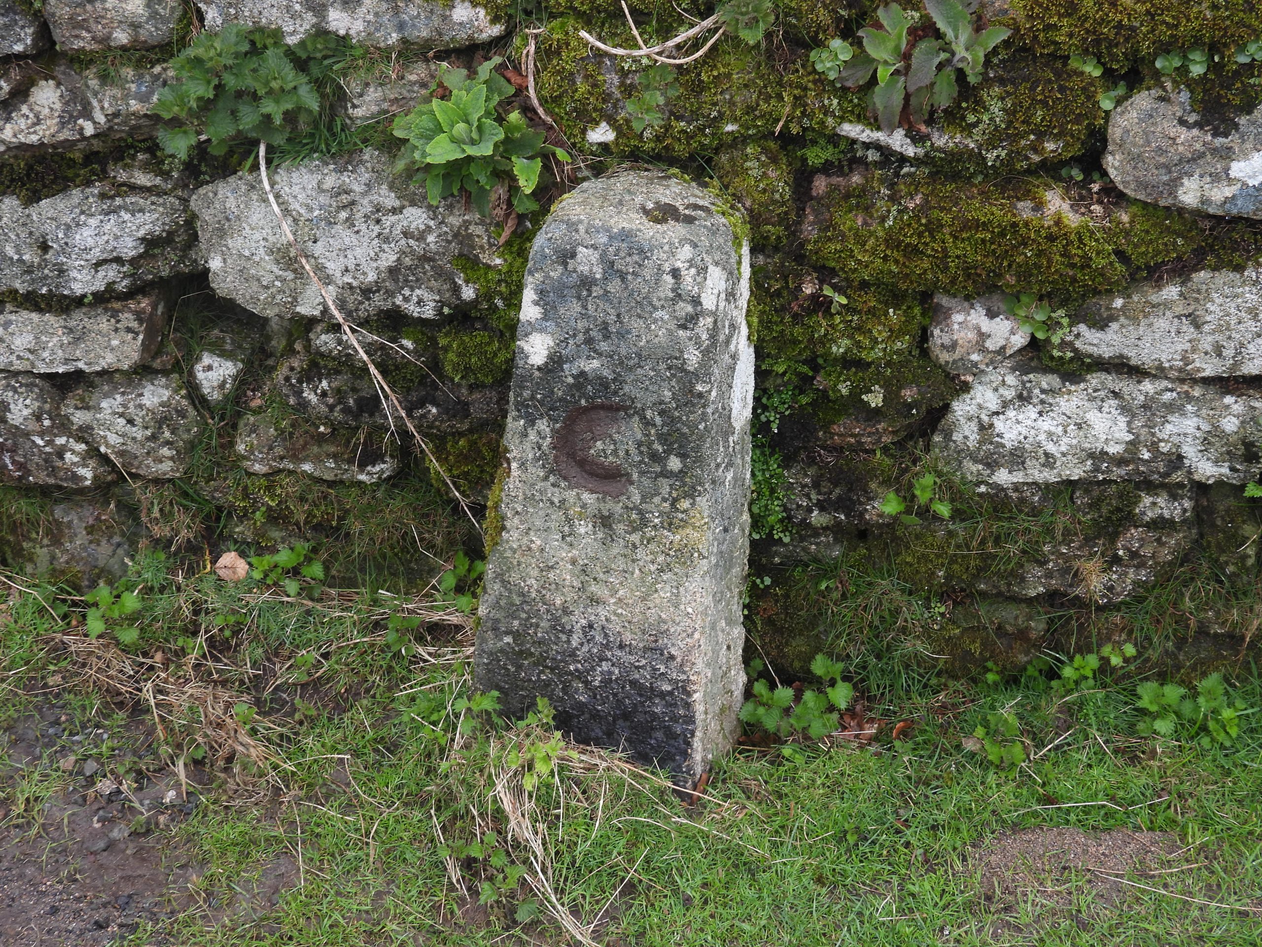
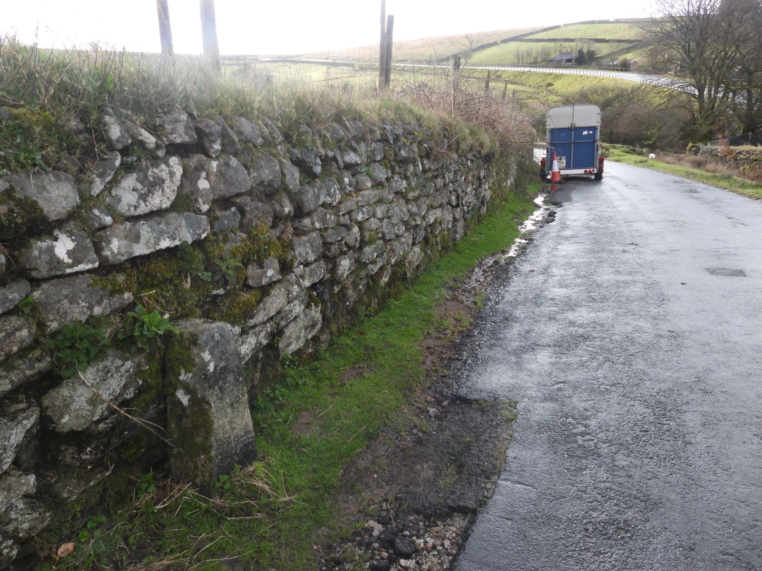
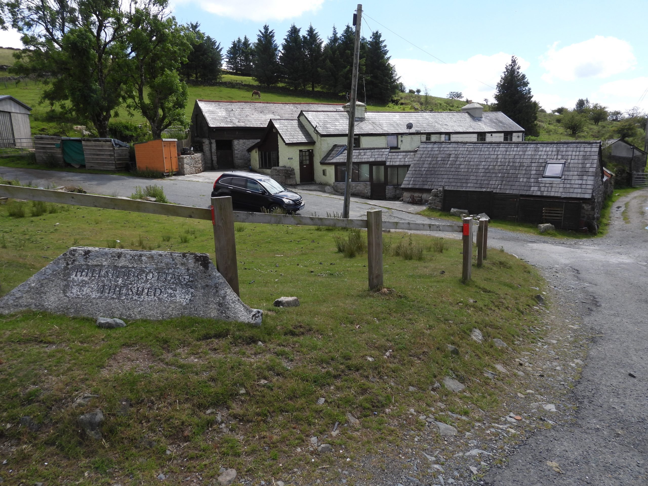
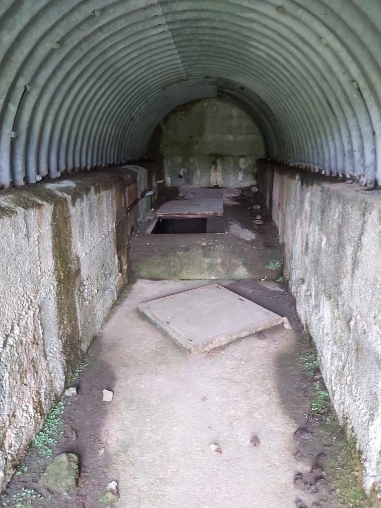
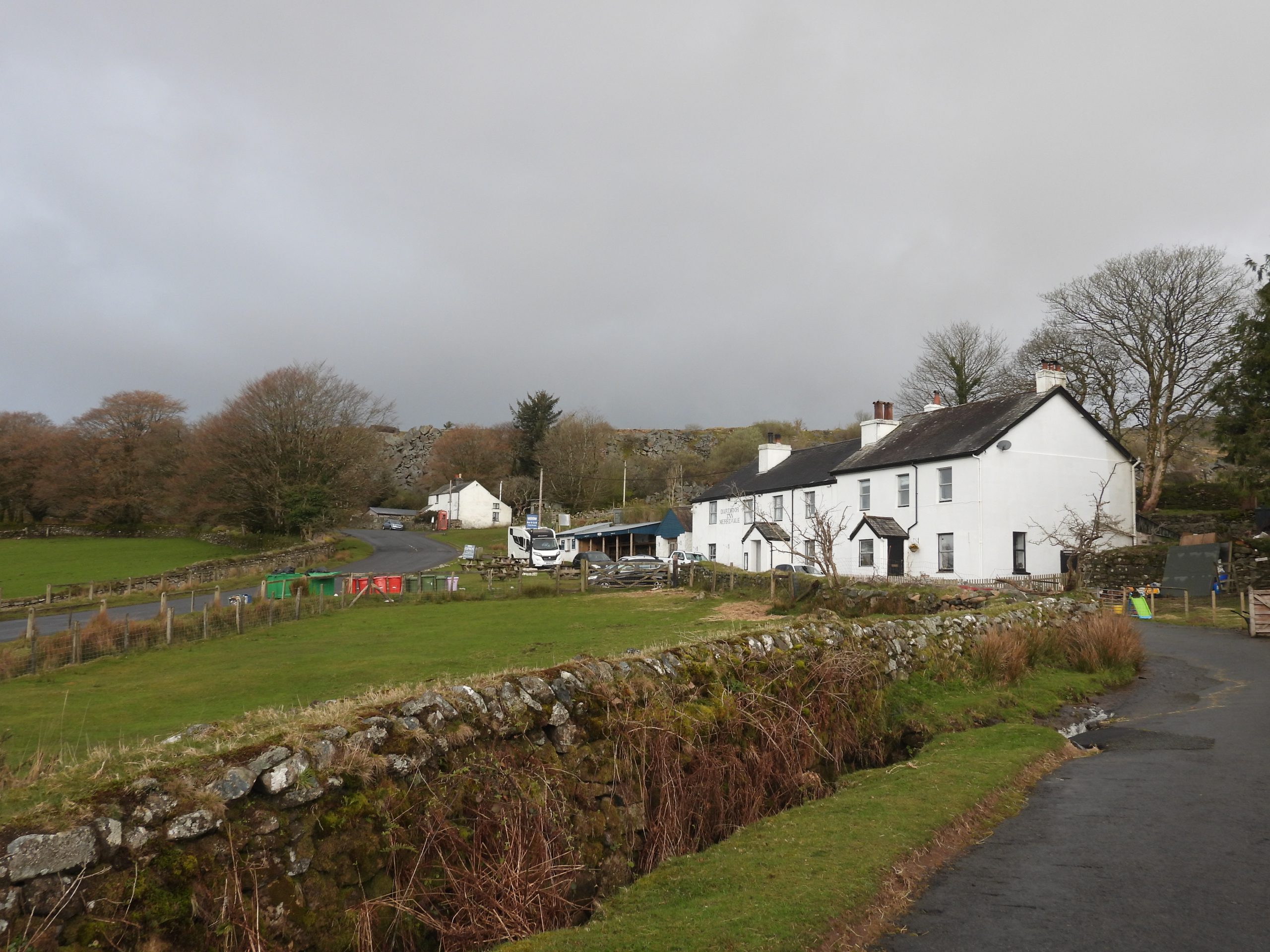
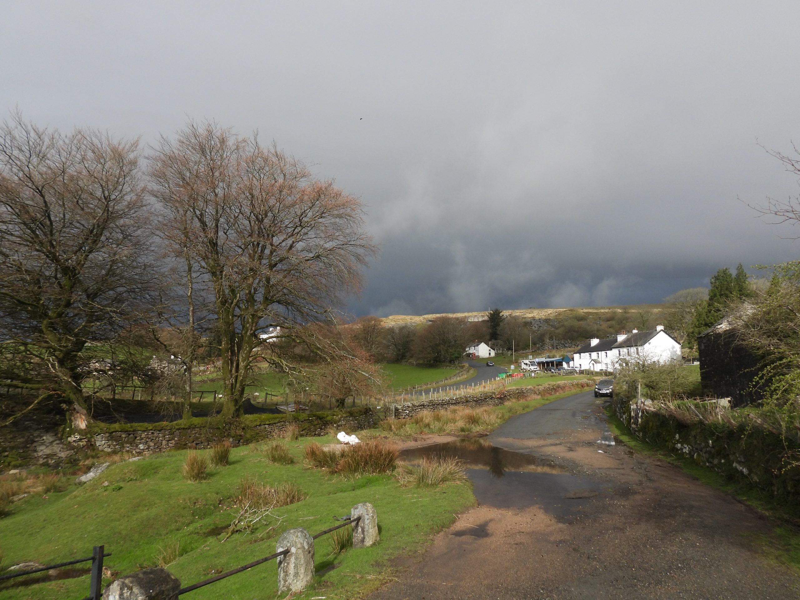
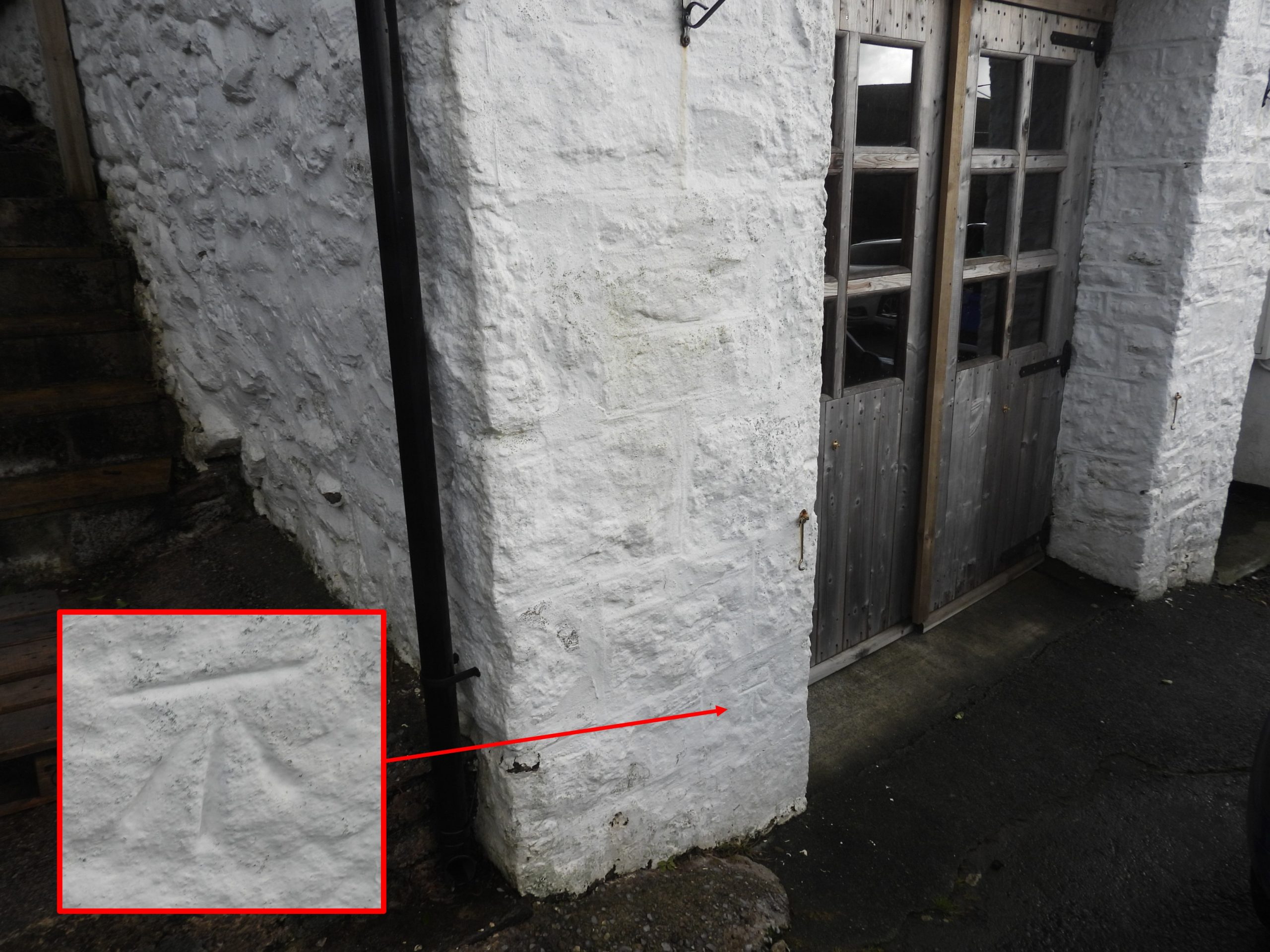
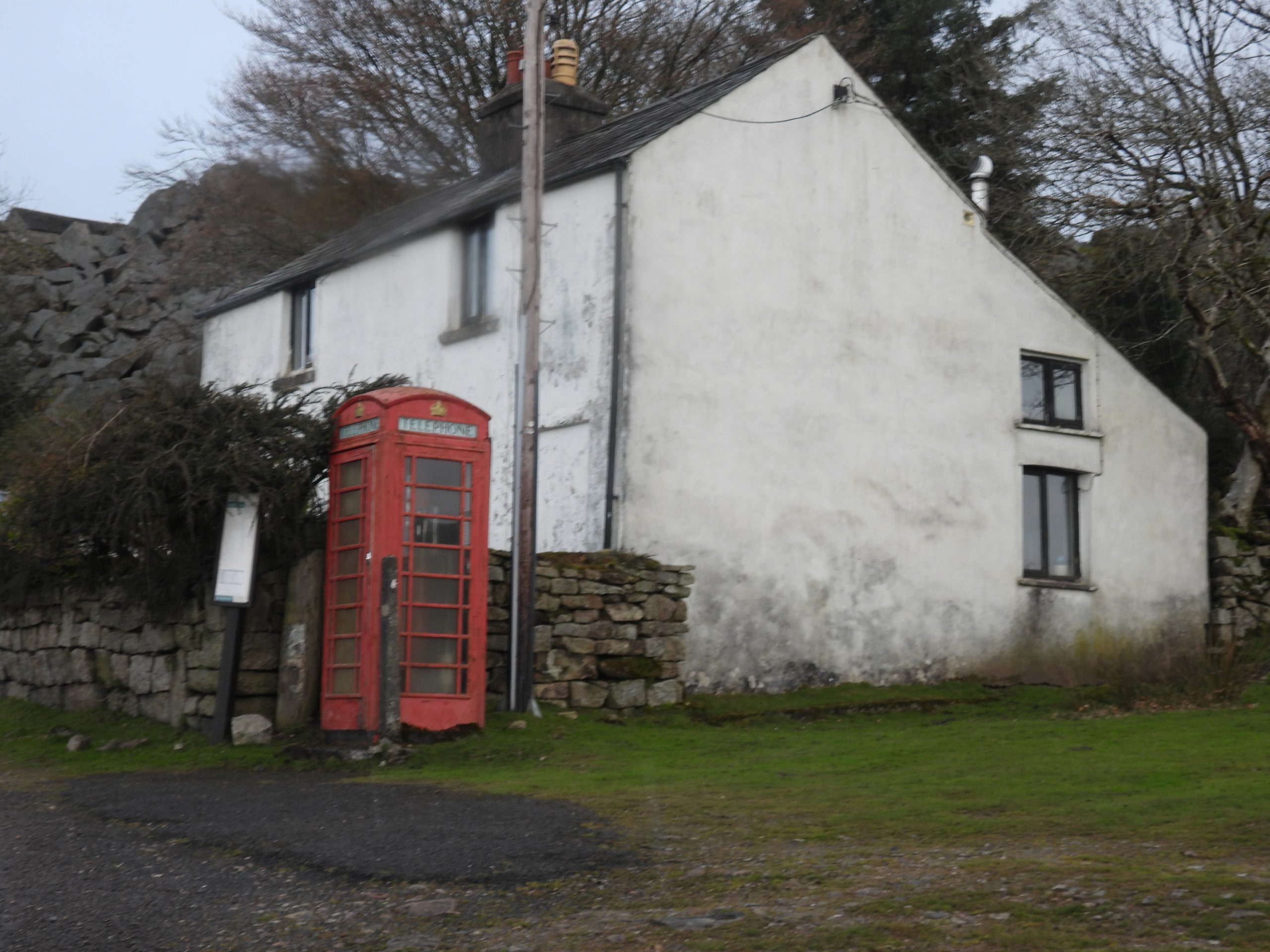
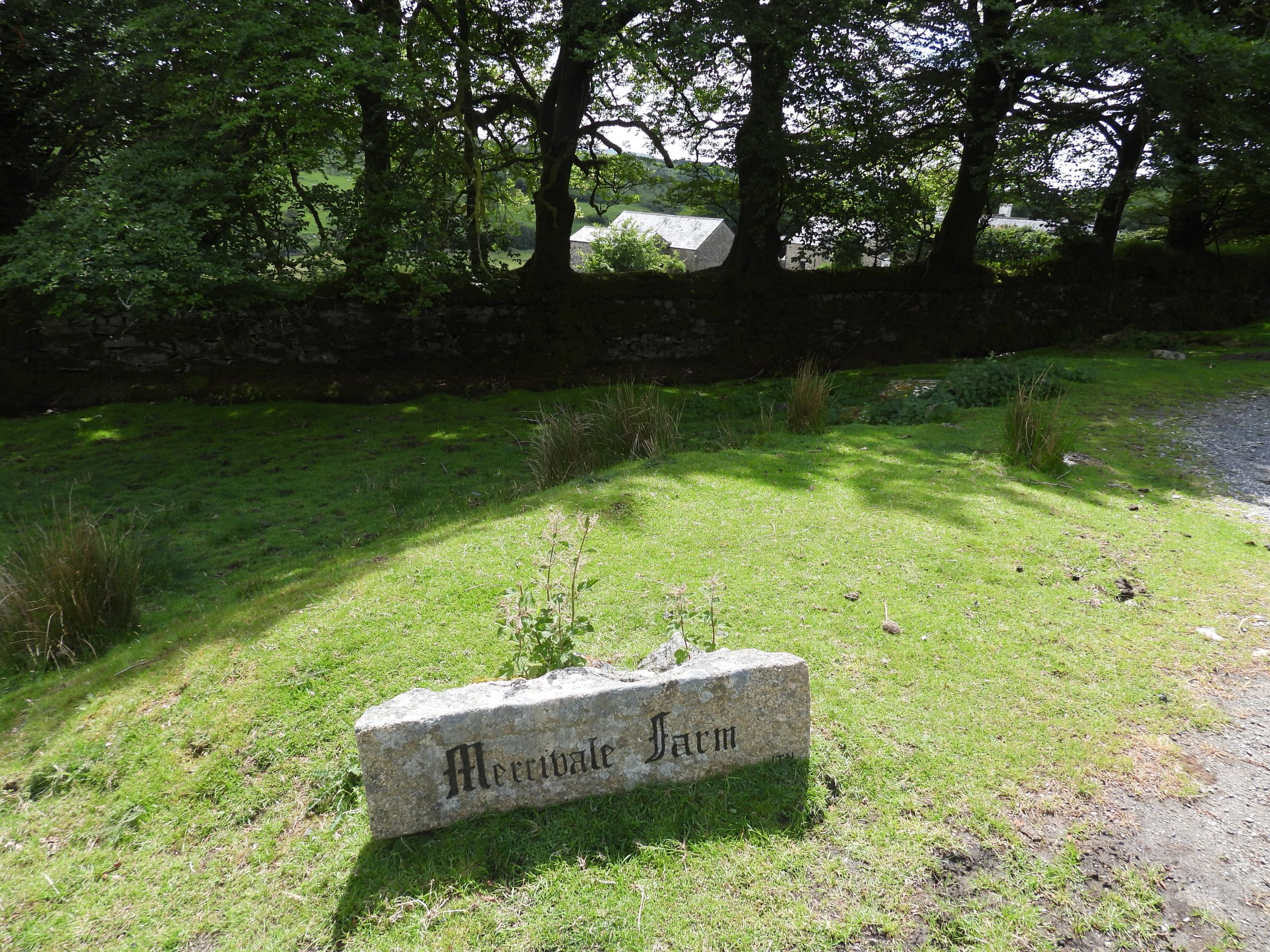
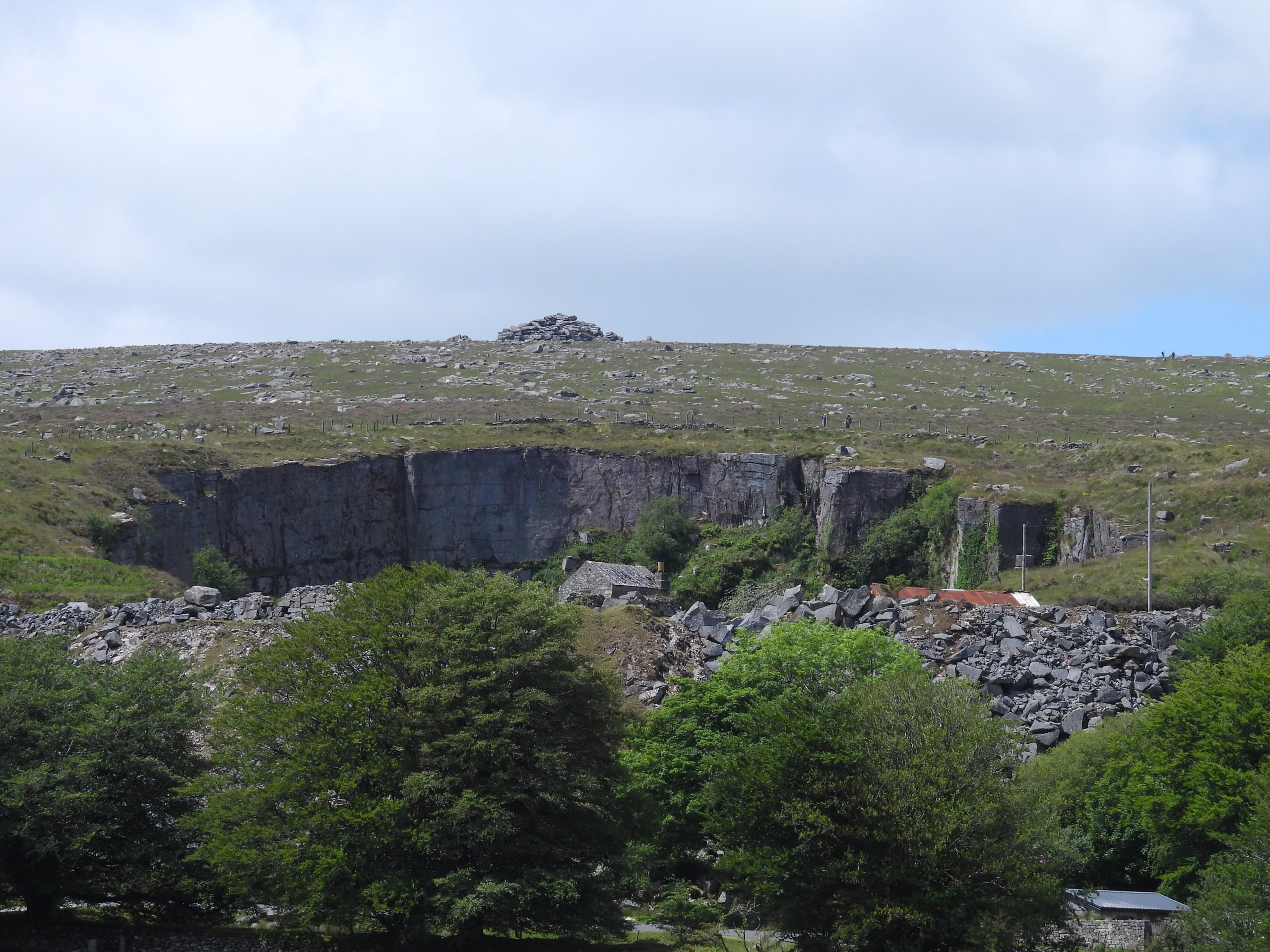
Sketch map of Merrivale hamlet showing the location of the original road before the modern ‘straightening’ and new bridge were constructed in 1957/8.The hamlet of Merrivale in the 21st century with a backdrop of Great Staple Tor and Roos Tor in the distanceAnother view of Merrivale hamlet including the quarry, Merrivale Farm and the three Staple Tors (Little, Middle and Great).English heritage record the original bridge over the River Walkham as being from 18th century, incorporating ashlar work probably from 17th century. The railings are 20th century. The length of bridge about 12 metres and the span across is about 4 metres. The parapet has been rebuilt and is slightly above the road level.The two bridges at Merrivale in the 21st century spanning the River Walkham. A delightful spot. The Duke of Bedford’s turnpike act of 1772 resulted in the construction of a road across the moor. It followed the old track and was known as Carter’s Road after the name of the contractor. The original (clapper) bridge would have carried the original track before it was reconstructed into the ‘old’ bridge we see todayOn 16th December 1954, a BBC TV documentary film called ‘Brief Journey’, was transmitted to mark the opening of the south-west’s first television transmitter. The full film was nearly 30 minutes long and followed a Royal Navy sailor on a weekend run ashore from Devonport. BBC Spotlight revisited the film in September 2018 and on one evening aired an extract from the journey the Royal Navy sailor took. It showed a train journey from Yelverton to Kings Tor Halt, where he alighted. The original film included a descriptive commentary from Charles Stidwell. The final part of the Royal Navy sailor’s journey on foot shows him crossing the 18th century Merrivale Bridge (see inset in picture). The modern road bridge was constructed between 1957 and 1958 and therefore wouldn’t have been around when the film was made. The sailor stayed at Merrivale Farm and during his time he witnessed a livestock sale. The shortened, BBC Spotlight clip can be found here: https://www.youtube.com/watch?v=diIJ8Xdpx3IAt west end of the old bridge stands a rather inconspicuous granite block with two faces inclined at an angle. This stone marks boundary between the two parishes of Whitchurch and Walkhampton. The actual boundary is the river itself.The Left-hand face (west) is inscribed WHIT/CHURCH, and right-hand face WALK/HAMP/TON (east). These inscriptions are difficult to discern in the 21st century. The Tavistock Trust road here was built between 1772 to 1776. By an act of parliament, the Tavistock Trust (formed in 1762) were bound to erect suitable milestones and boundstones where their roads crossed a parish boundary. Tim Jenkinson (Dartmoor HER) dates the stone as c.1822. This boundary marker is at the west edge of the Walkampton parish boundary. The shape of this boundary marker is very similar (obtuse faces) to the boundary marker at the at the eastern edge of the parish boundary, where it adjoins the forest boundary of Lydford at Rundlestone. The marker at Rundlestone is controversially located. The story is told here: https://dartmoorexplorations.co.uk/erroneous-dartmoor-forest-boundary-change-in-18th-century-at-rundlestone/Local residents enjoying a puddle by the bridges after some heavy rain.This upright marker is around 50m to the northwest of the old bridge at and around 30m to the east of the Dartmoor Inn. It is inscribed with a ‘C’.The ‘C’ stone with a ‘mud makeover’ to define the inscription more clearly for photographing.As with many bridges across the moor (and county) there are or at least were two “C” (for County) inscribed stones up to approx 100m from each end of the bridge identifying that the county was responsible for maintaining the bridge and approaches between the two stones. This is the Merrivale ‘west’ stone. The ‘east’ stone doesn’t appear extant but would have probably been located near the Hillside Farm near the large ‘kink’ in the old road.An unusual location for a benchmark. One wonders how the OS surveyors actually managed to inscribe this and to use it as a datum. The benchmark is shown on 19th century maps as ref B.M 922.1On 8th July 1870, the Tavistock Gazette reported a coaching accident at Merrivale Bridge, which might have started near a series of ‘S’ bends near to Over Tor: “The coach connected with the South Devon Railway, commenced running from this place [Tavistock] to Moretonhampstead on Friday last. ‘Coaching it’ over the moor has lost its novelty with us, but the fact of the starting of what was considered an opposition coach, attracted many of those to the station, who are usually to be found on the occurrence of such exciting events. The weather was most favourable for such a trip as was contemplated, and on the arrival of the 9.15am train, a start was made with several passengers. The coach is well horsed, as it need be, the road over which it runs being of the roughest description. On Tuesday, the fourth day of running, a serious accident occurred on the home journey. On descending the hill to Merrivale Bridge, the pole chain which connects the near horse broke, when the horse began to kick, and the driver lost all control over the animals, which started off at a rapid pace down the hill”. Hillside Farm / Cottages where there was a sharp ‘kink’ in the original turnpike road. If the “pole chain” on the horse coach was not broken near the ‘S’ bends at Over Tor the incident described would have been here. The description of the incident recorded in the Tavistock Gazette continues: “……..on turning the corner by Merrivale Bridge, the coach came into violent contact with the walling of the bridge, when a smash was the result. Mr Bevan, the driver, was thrown from his seat, and broke his arm in two places, the side of the coach was broken in, and one of the horses received some injury. Happily there were no passengers. Another coach was obtained during the night by train, and took its place on the road the following day”.If the old turnpike road is followed to the south east side up towards the embankment of the ‘new road’ then this unusual store (?) can be found, which is under the current B3357. One can only assume that when the new road was built circa 1957/8, this was a tunnel to maintain a connection using the old road, perhaps for use to allow safe passage of animals as well as humans. The bricked up end looks new (ish), maybe late 20th century.The Dartmoor Inn building and adjacent cottages (the latter were incorporated with the inn in the early 20th century) as viewed from the old Turnpike road. The first Inn was recorded here in 1841 and would have benefitted by local trade and passing trade with the new (ish) Turnpike road. No doubt, trade would have been further boosted when the quarry opened in 1876.The Dartmoor Inn on a summers day. Tom Quick (1992) in the book ‘Dartmoor Inns’ records that the Inn was : “Made up of four or five cottages dating from the 17th century, originally it was just the main cottage that was the inn which probably served as a coaching stop (the building on the left is thought to have been the stables)”. Tom adds: “The inns water supply comes from the Grimstone and Sortridge Leat; there are seven storage tanks in the loft and the water is filtered and treated with ultra-violet light”.Dartmoor Inn from Merrivale Bridge looking west along the old road. Menacing skies behind Merrivale Quarry.A benchmark can be found on what the author believes was the old stable. Intriguingly the first benchmarks were inscribed between 1840 and 1860 (‘First Geodetic Levelling’ survey), so it is likely that this was inscribed not long after the Inn was established (or at least first recorded in 1841). The ref number shown on 19th century maps is B.M. 0939.5.The Telephone kiosk outside the old Merrivale Post Office is (Ref English Heriatage) a type K6, which was designed in 1935 by Sir Giles Gilbert Scott. It stands next to the location of the current bus stop.Entrance to Merrivale Farm with a rather elegant granite sign. It is here in 1954 where the The sailor from the BBC documentary stayed and during his time here witnessed a livestock sale.Virtually opposite the entrance to Merrivale Farm (and a little way up the hill from the old Post Office) is a ‘GR’ postbox. This dates the box (between 1910-1936). Merrivale Quarry (formerly known as Tor Quarry) dominates the area. It started operation in 1876 and finally closed in 1997.
My friend just sent me the film on this link from BBC Archive on YouTube.
I’d not encountered the BBC Archieve channel so there may be other equally great starting points for other investigations if like myself it’s new to anyone.
I was googling to try and find out if there were any of the quarry houses remains seen just after he left the King’s Tor Platform in the film.
Certainly an interesting film and has led as you say David to some interesting rabbit holes to disappear down https://www.youtube.com/watch?v=7JHTXxZxY4c


David Green December 14, 2025
Came here as a result of googling “King Tor train platform” while watching the film “A Brief Journey” which you can see in it’s entirety at https://youtu.be/iug0h34TPeM?si=fGL1METhIPfnjzX0.
Lovely film, and this is a terrific website!
Paul Hoskin June 9, 2026
My friend just sent me the film on this link from BBC Archive on YouTube.
I’d not encountered the BBC Archieve channel so there may be other equally great starting points for other investigations if like myself it’s new to anyone.
I was googling to try and find out if there were any of the quarry houses remains seen just after he left the King’s Tor Platform in the film.
Certainly an interesting film and has led as you say David to some interesting rabbit holes to disappear down
https://www.youtube.com/watch?v=7JHTXxZxY4c
SteveGriggDartmoor June 9, 2026 — Post author
Hi Paul,
Thank you for your comments
Kind Regards,
Steve