A collection of walks, discoveries, insights and pictures of exploring Dartmoor National Park
December 15, 2021
Holne Moor Clappers
Holne Moor is criss-crossed by a number of leats (Holne Moor, Holne Town Gutter and Wheal Emma) and tracks (Ringleshutes Mine and Sandy Way). The first impression the walker may have when hiking in this area is that there are few features and little to see. A previous post on the Dartmoor Explorations website records all the leats in the Holne Moor area and includes some interesting features such as bullseye stones, water regulators and aqueducts, which can be found here: https://dartmoorexplorations.co.uk/holne-moor-leats/
This post covers a number of clapper bridges on the east side of Holne Moor. The history behind some of these clappers, in the authors opinion adds more interest to the area.
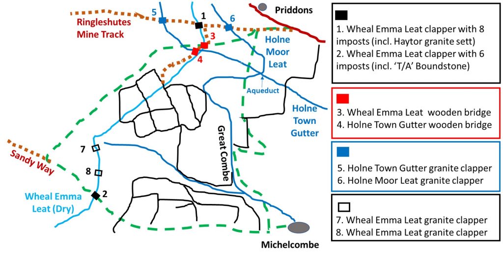
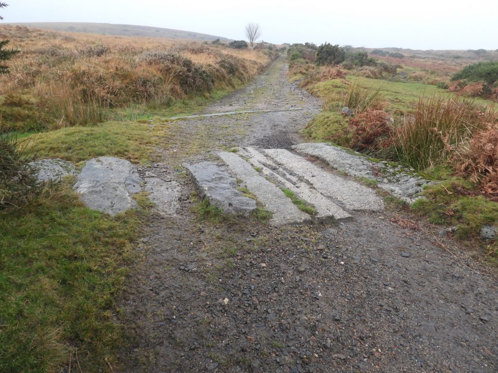
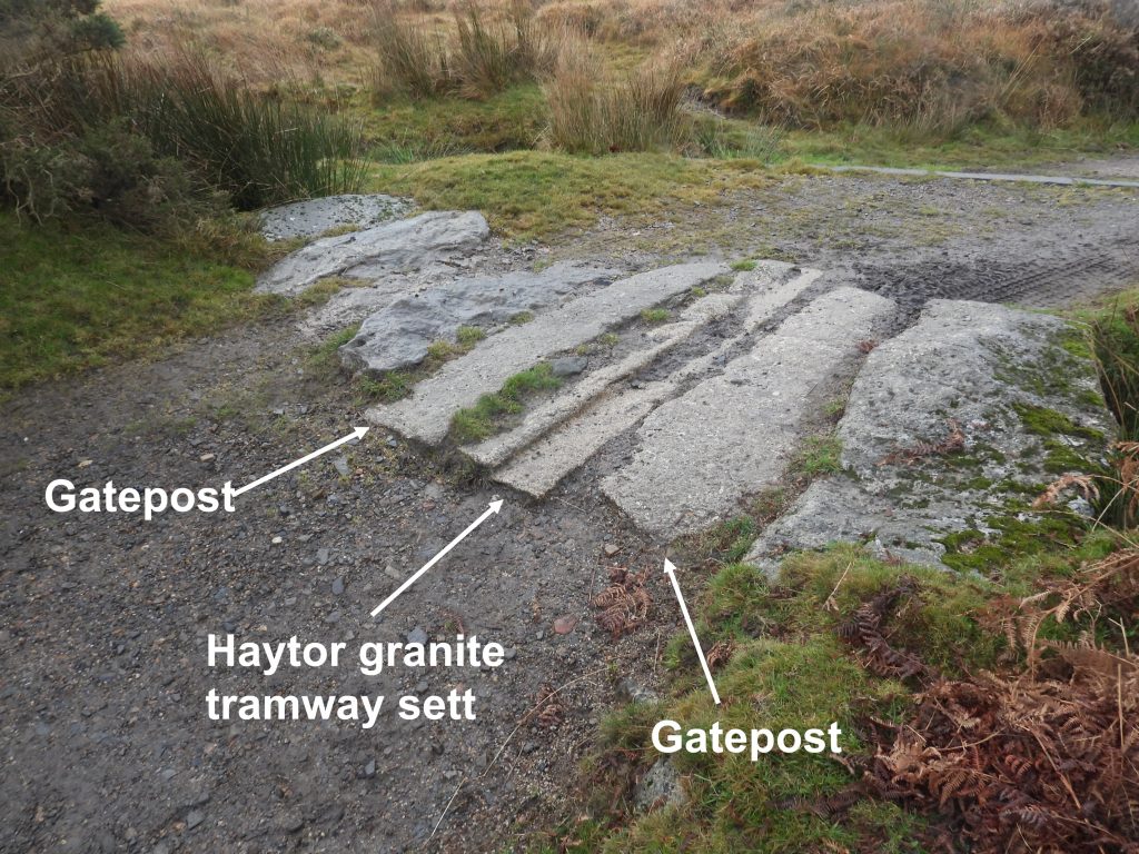
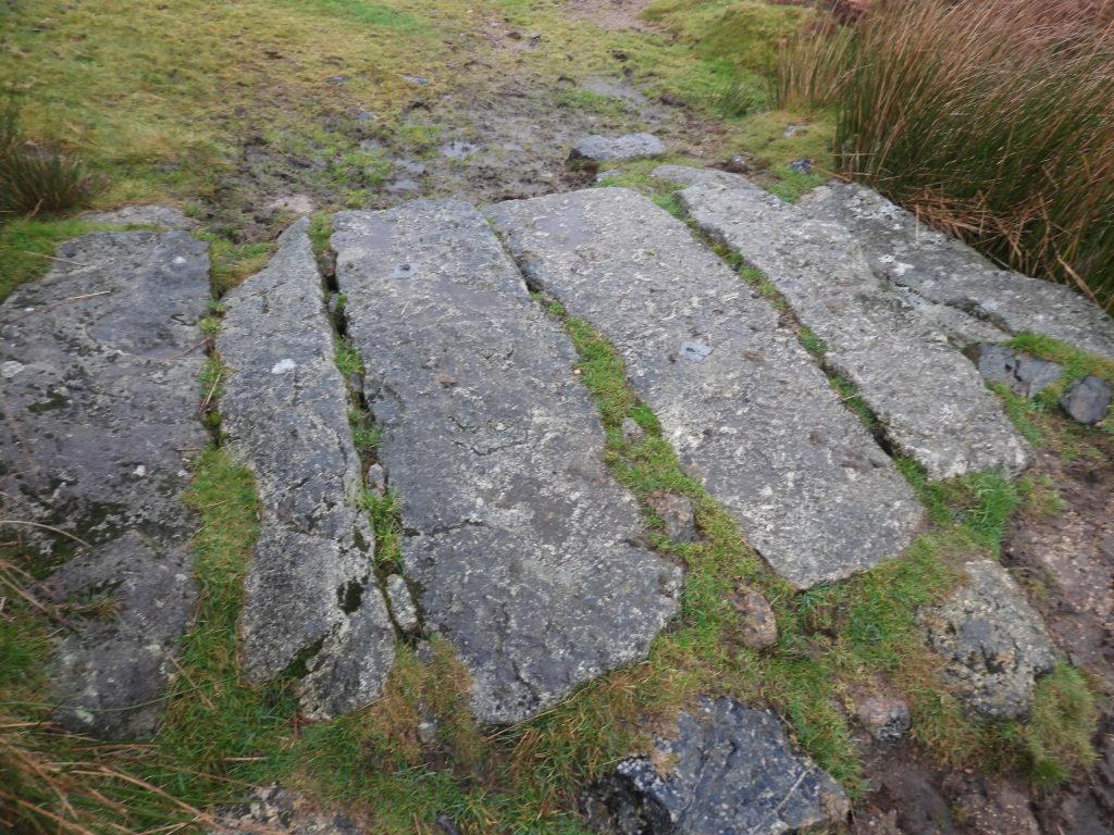
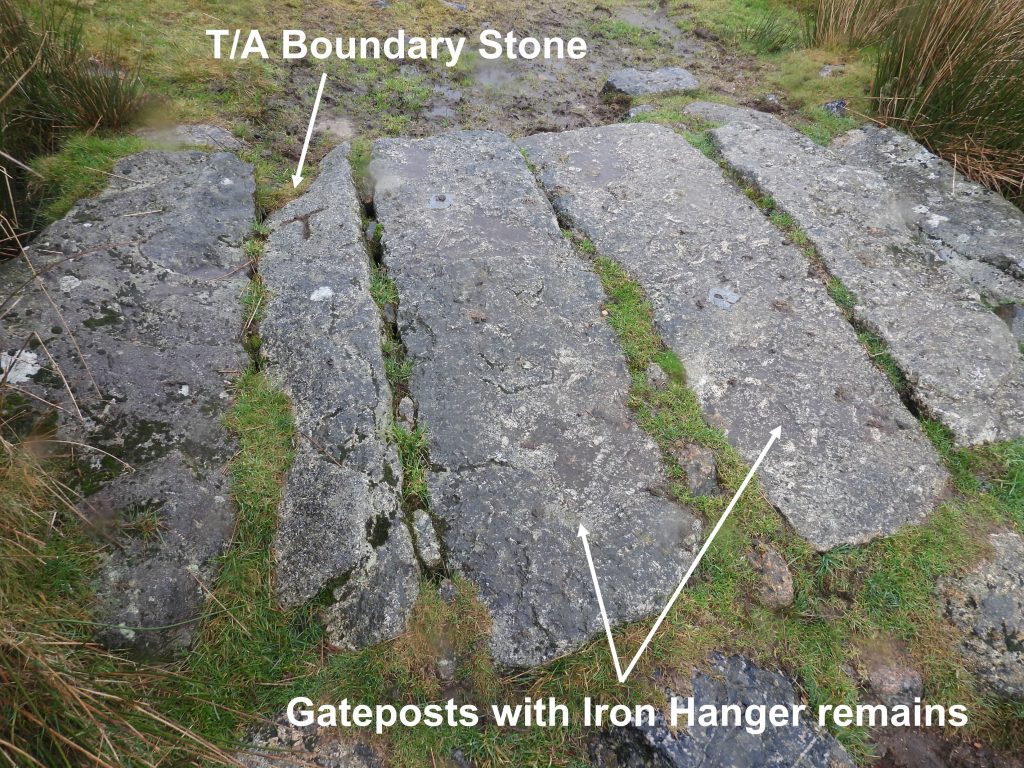
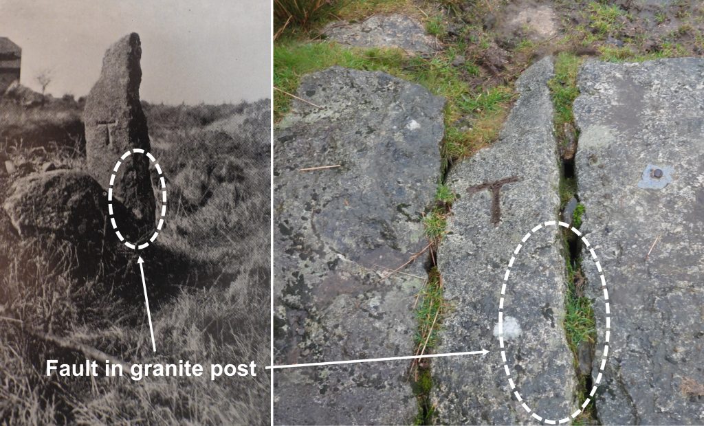
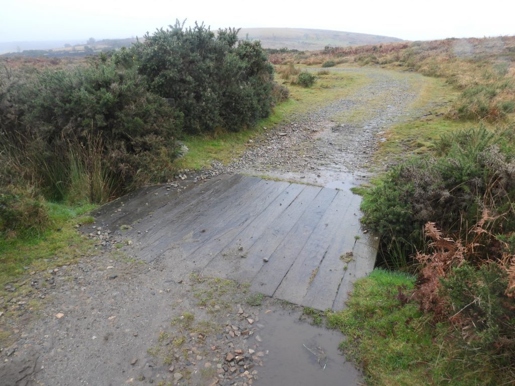
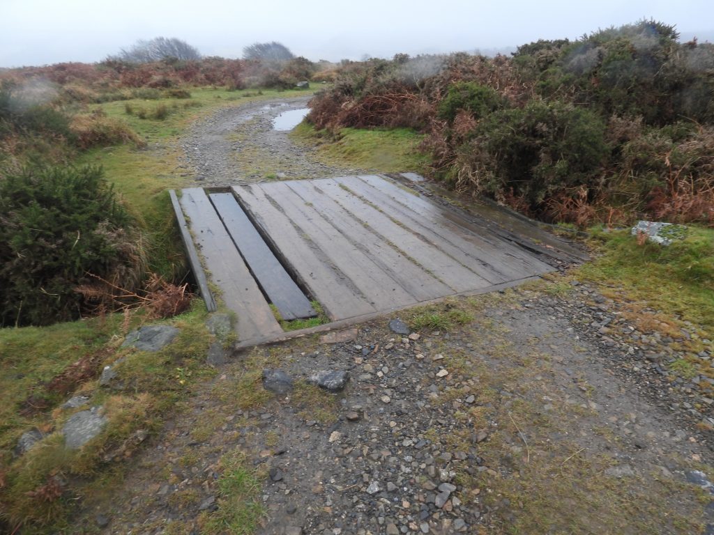
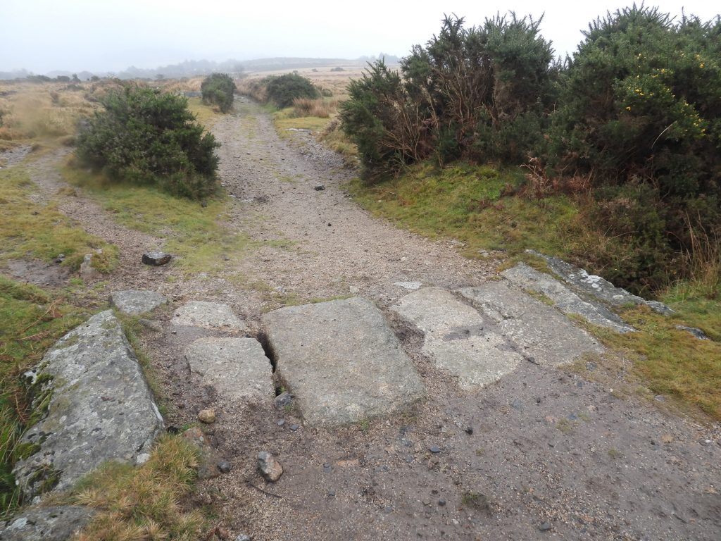
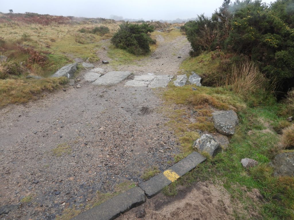
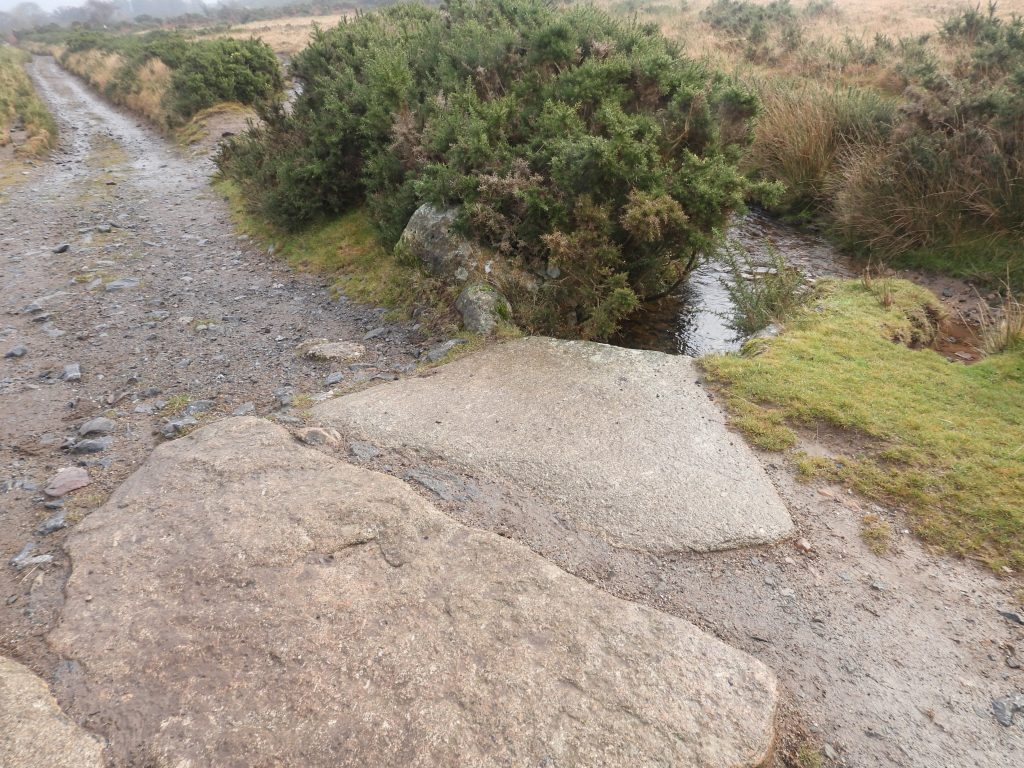
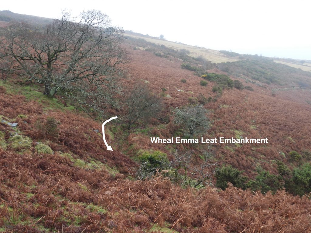
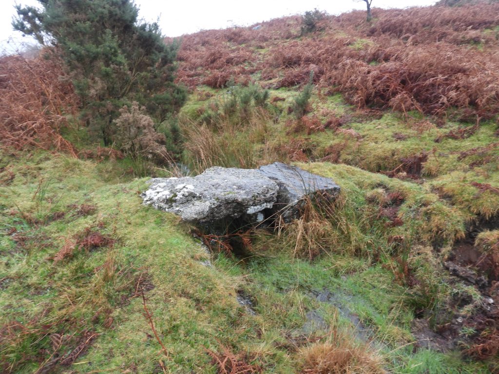
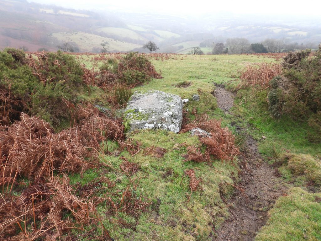
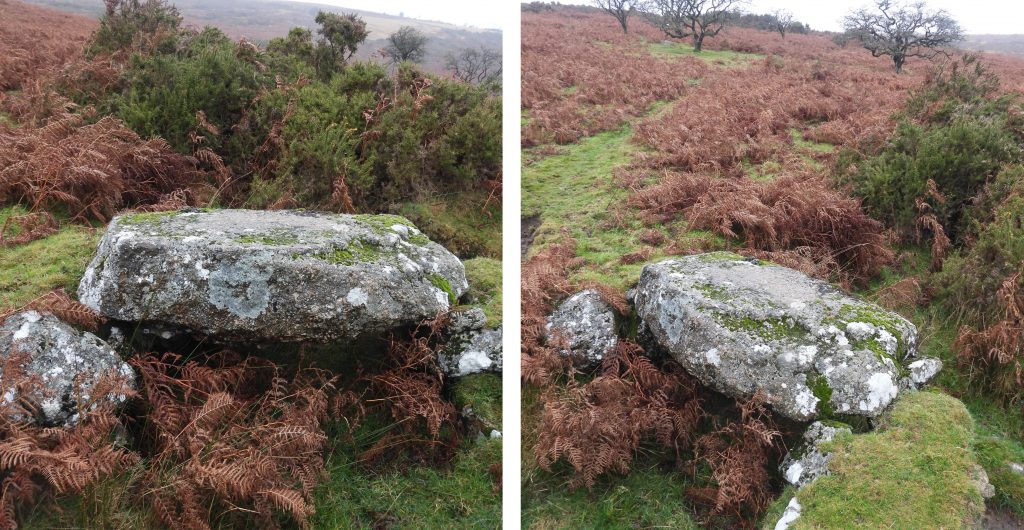
Sketch map of the clappers and bridges covered in this post.Wheal Emma Leat clapper with 8 imposts (ref 1 on map) – SX69118 70058This modern bridge was built / refurbished around 1987-8 as part of flood prevention. This was around the time that the property “Priddons” was built. The NPA agreed at that time to make repairs to leats on Holne Moor so that surplus water in Holne Town Gutter were controlled in such a manner that occasional flooding would be prevented. This work involved all the three leats in the area. Source: Report by Dave Brewer – “The Tavistock – Ashburton Packhorse Track and its Guidestones” (1991). In the report is a annotised picture of this bridge which identifies constituent parts being old gateposts and a piece from Haytor Granite Tramway.Above Michelcombe where the Sandy Way crosses the Wheal Emma Leat is a 6 granite impost bridge (ref 2 on map). This clapper / cart bridge also appears in the Dave Brewer publication as one of the 6 imposts is a former Tavistock – Ashburton ‘T/A’ stone. The bridge is believed to have been built / refurbished around the same time as the Ringleshutes bridge (1987-8) and can be found at SX68554 69091After a “mud makeover” the ‘T” of T/A becomes more obvious. The post originally (at least for part of its life) can be traced back to Lowery Farm, near Burrator. It was recorded by Hansford Worth (ref: “Worths Dartmoor” (page 401)) that this stone had been “taken” for use as a gatepost by Lowery Crossing. Prior to the stone prior to being taken to Lowery it came from Princetown. Worth states: “Mr Samuel Pearce, of Broomhill, Harford tells me that this stone was, he understands, brought back to Lowery by his great uncle, on his return with an empty cart from Princetown, where he had been delivering farm produce to the prison. Mr Pearce believes, it was taken from some point between the end of the range of stones as we have now planned it, and the present site of the Princetown Railway”.The stone was removed from Lowery in 1969 (believed due to the consequence of conifer growth) by the DNP Head Warden. The stone spent some time at Two Bridges (acting as a step in the mobile information caravan located there). It then was moved to Postbridge Information Centre, where it was left recumbent. The final piece of the evidence to confirm this stone is the one located at Lowery is by comparing a Worth photograph (plate 79B between pages 334 and 335 in “Worths Dartmoor”) with one from today. Comparing the photographs, the shape looks similar and as compelling is the location of a fault line below and to the right of the inscribed “T”.Modern wooden bridge over the Wheal Emma Leat (ref 3 on map) – SX69131 69906 Modern wooden bridge over the Holne Town Gutter (ref 4 on map) – SX69110 69901Holne Town Gutter bridge with 6 granite imposts along the Ringleshutes track (ref 5 on map) – SX68925 70082A few metres from the Holne Town Gutter bridge along the Ringleshutes track there is what appears to be a line of setts (probably for flood damage prevention), one of which appears to have once been used parking control ! Holne Town Leat bridge along the Ringleshutes track (ref 6 on map) – SX69299 70023Wheal Emma Leat Embankment to the east of the two-piece clapper. Fabulous 19th century engineering.Two piece clapper over Wheal Emma Leat (ref 7 on map)The two-piece clapper is located at SX68579 69384 Singe piece clapper over Wheal Emma Leat (ref 8 on map) The single piece clapper is located at SX68595 69228


Nigel Machin December 15, 2021
Love the detective work on the T/A stone! I thought I knew these bridges well but I now need to go back if only to spot that 🙂
SteveGrigg1961 December 15, 2021 — Post author
Thank you Nigel.
The stone certainly has had a varied life. It would be nice to think it could return to the “line” of T/A’s near Princetown sometime.
Regards,
Steve