A collection of walks, discoveries, insights and pictures of exploring Dartmoor National Park
December 19, 2021
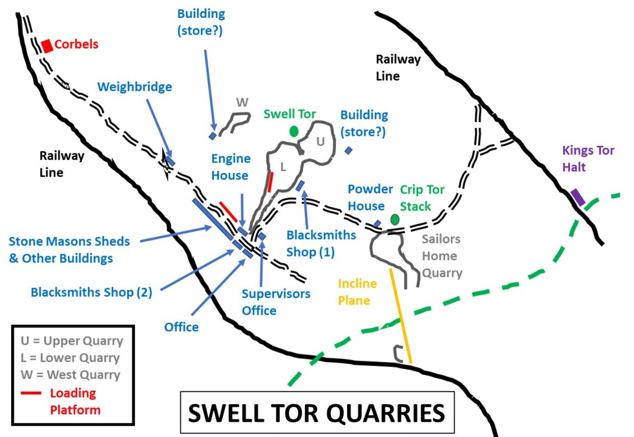
Swelltor Quarries
Swell Tor Quarries are believed to have began working around the time of the opening of Plymouth to Dartmoor Railway (officially opened on 26th September 1823). Three years earlier, an agreement was signed on 21st September 1820 when William Johnson and his business partner Brice were granted a long lease for the granite of Walkhampton Common from Sir Massey Lopes. The railway was horse drawn and terminated at Kings Tor (from Sutton Pool). The railway carried lime, coal, timber and other items in the northerly direction and granite in the southerly direction. Work continued at Swelltor until the First World War in 1914, when around 90 men were employed. Production declined in the early 20th century and the workings closed, although they were briefly reopened in 1937 when waste granite was taken for use by the Devon County Council as road metal. Swelltor finally closed in 1938.
No post about Swelltor quarries would be complete without reference to London Bridge. In November 1823 a letter was sent to the engineer of London Bridge protesting that Hay Tor granite had been specified, which had left Kings Tor / Foggintor / Swelltor out in the cold. Roger Hopkins (from P&DR) and Williams Johnson were asked to quote as a result. It is believed that they stated they could save £20,000 by using their granite. It is believed that they did they not succeed in their quest. However, interestingly, in the book “stones of London” it states that London Bridge was built from Princetown quarry granite with some from Haytor. The evidence does suggest that Swelltor (and indeed Walkhampton Common) granite was not used in any part of the building of the new London Bridge in the 1820s.
The Johnson Bros (who owned the Walkhampton quarries) in the late 1830s secured a 7 year lease for Haytor quarries then proceeded to close them down. To add insult, they renamed their own company the Haytor Granite Company, thus eliminating the competition and having the wherewithal to pass their own products off as superior quality than they actually were. Was this done as it rankled them that Haytor granite had been used in the construction of the London Bridge 1820s instead of theirs ? This renaming of the company is probably the reason why sometimes it is recorded that Swelltor granite was used in the London Bridge construction.
Dressed granite from Swelltor was, however, supplied for widening of London Bridge, which commenced in April 1903. The lease holders at that time were Pethick & Co. from Plymouth. Part of the supply was subcontracted to Duke & Co. from Merrivale quarry (which had opened in 1876). The source of information for this post has been obtained from “The Railways, Quarries and Cottages of Foggintor” by Kath Brewer.
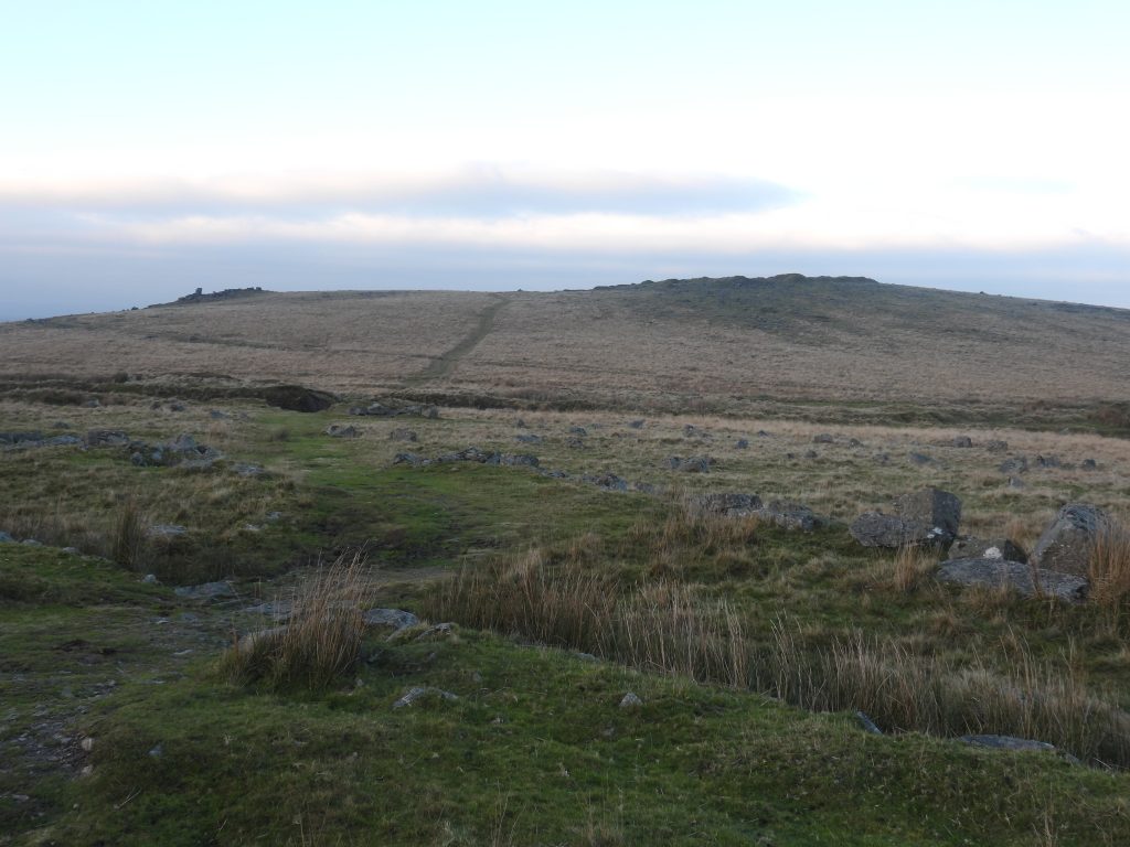
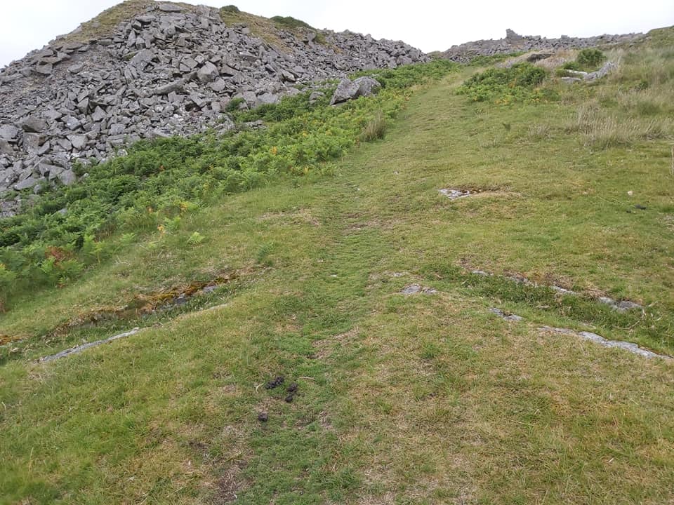
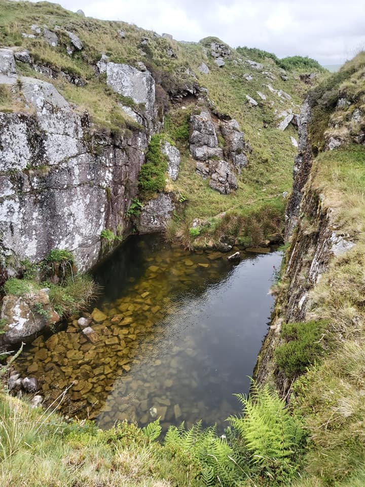
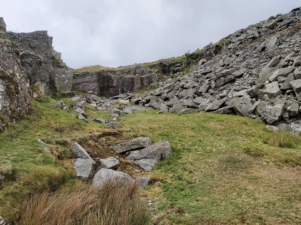
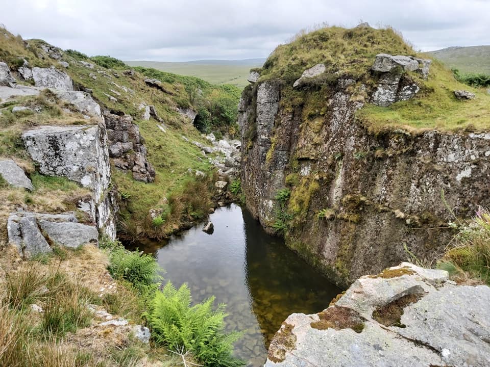
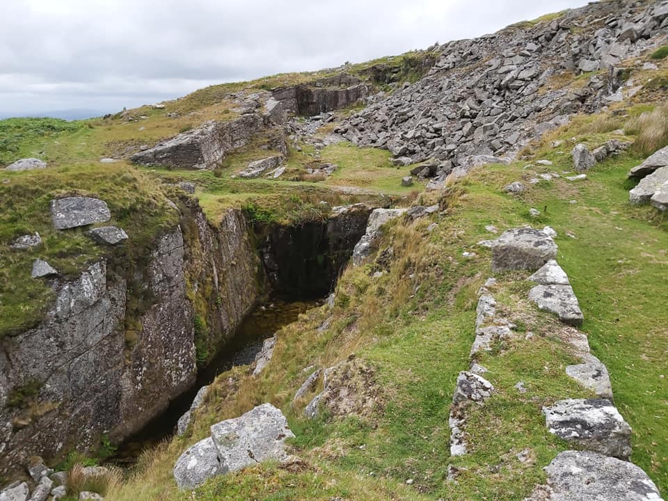
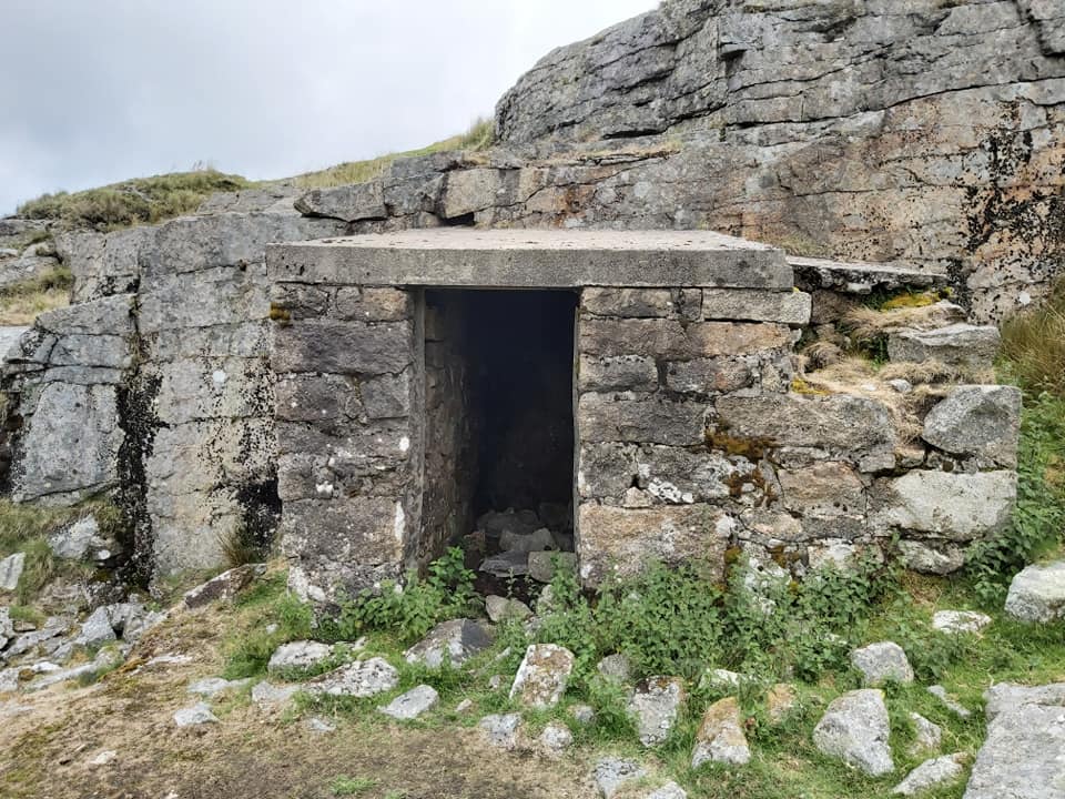
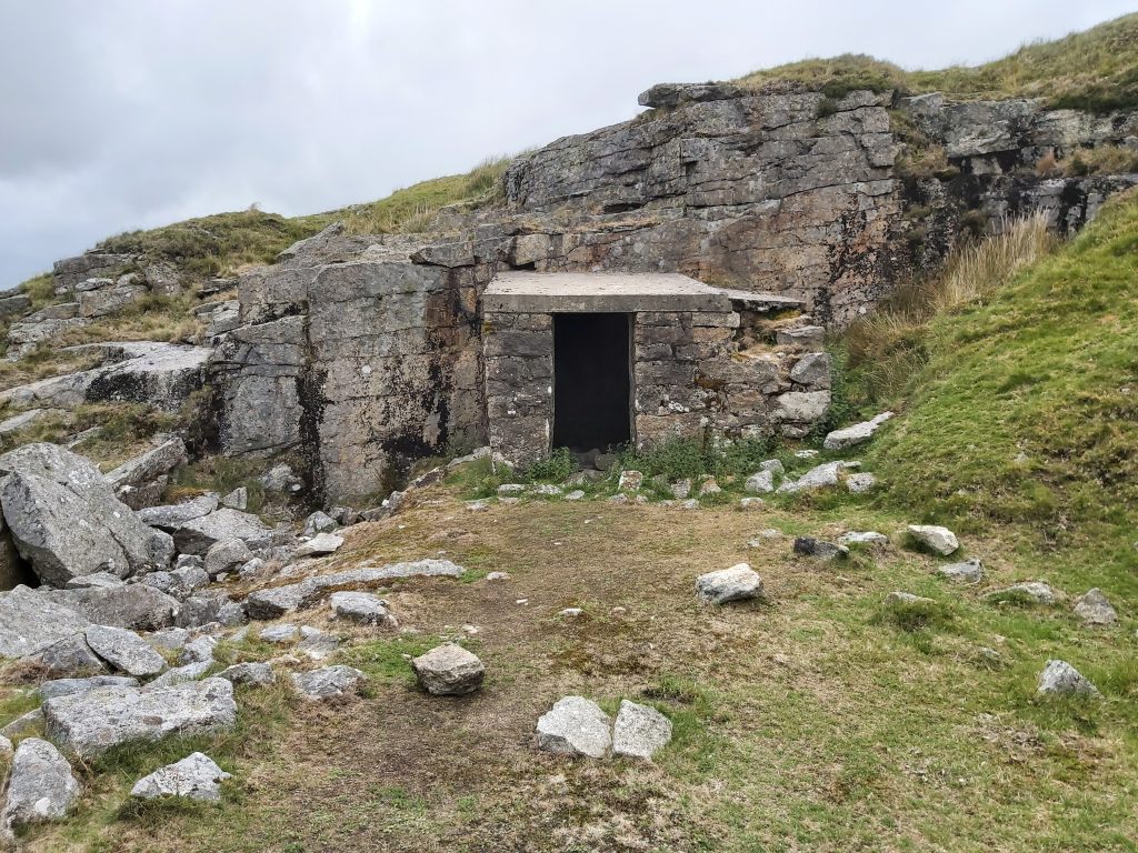
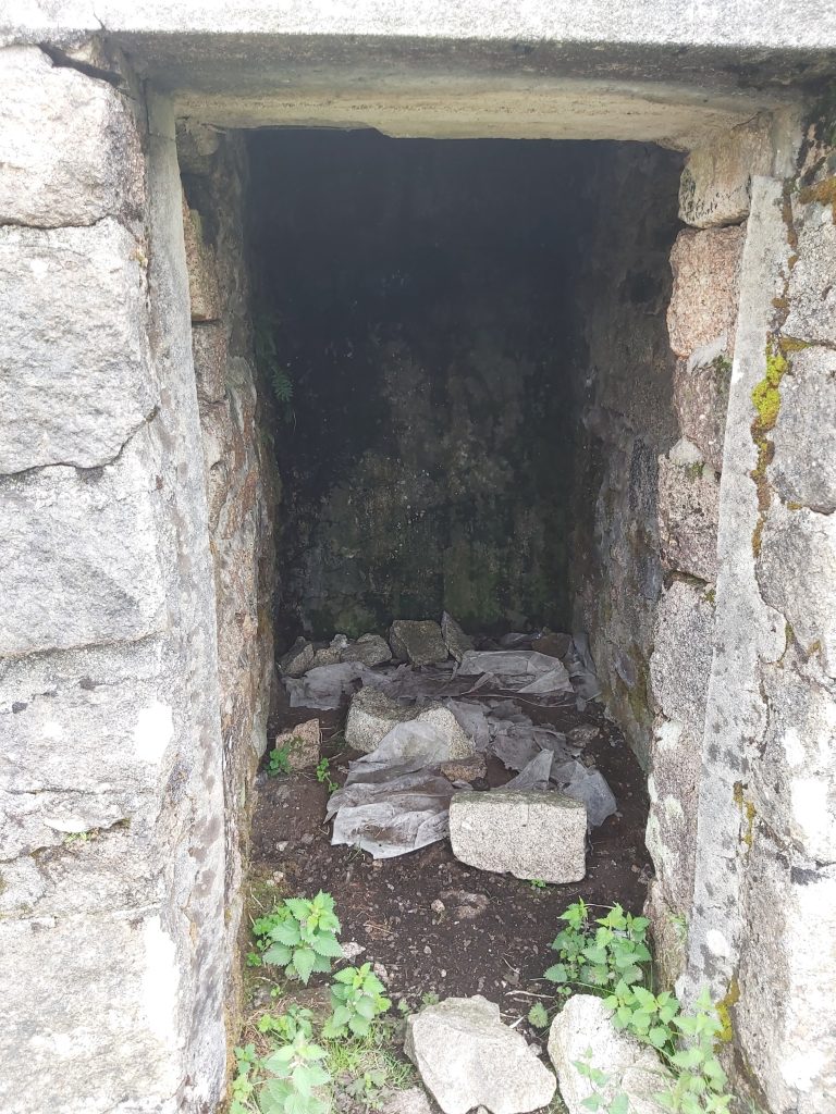
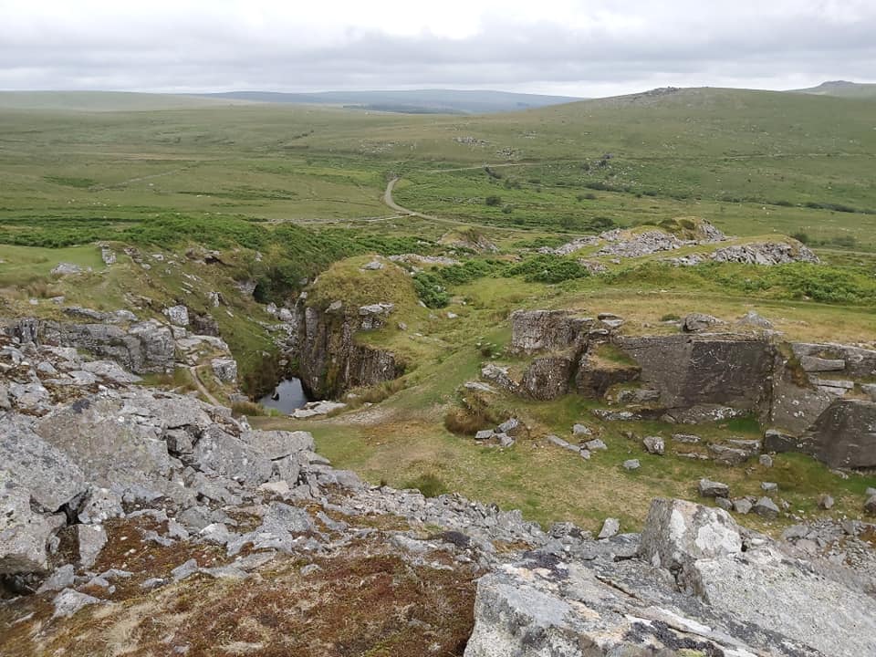
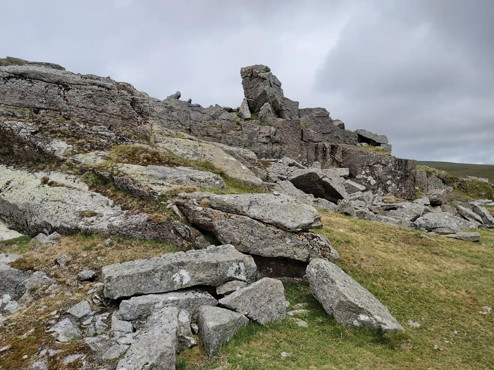
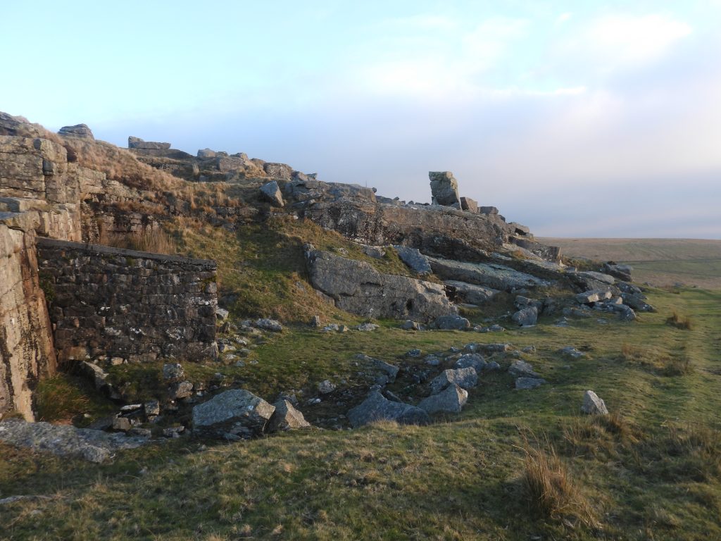
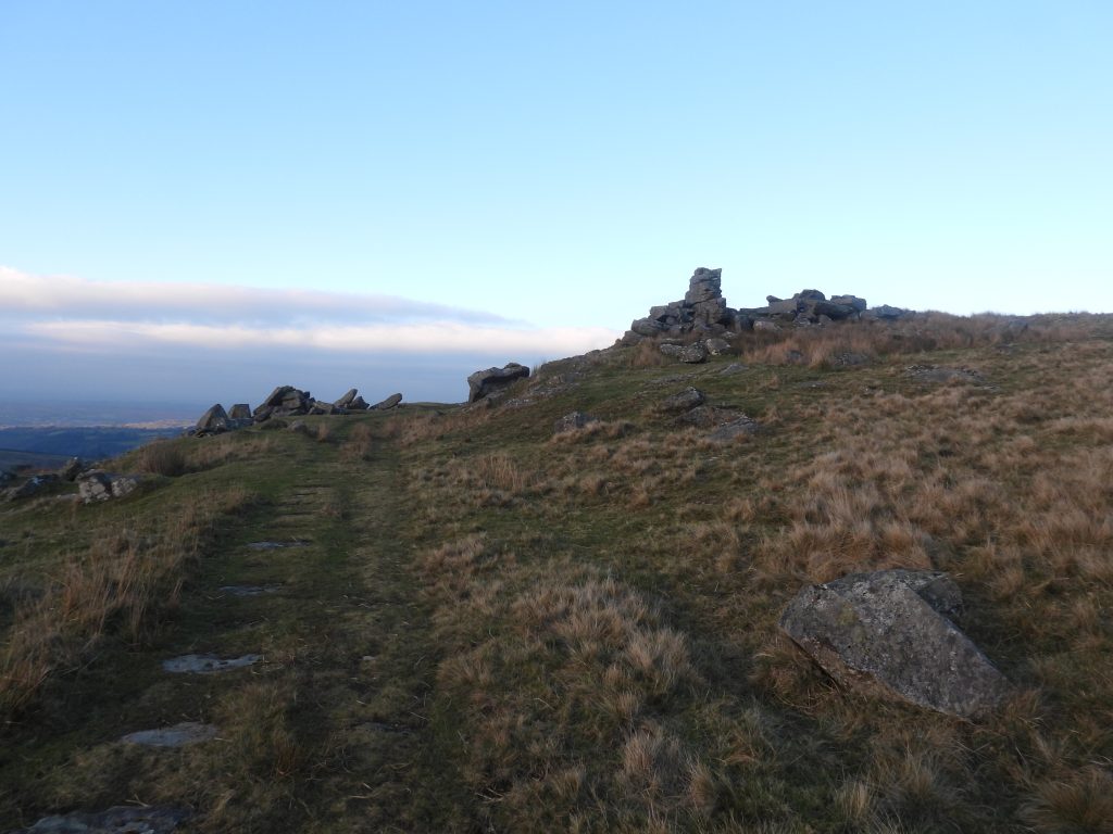
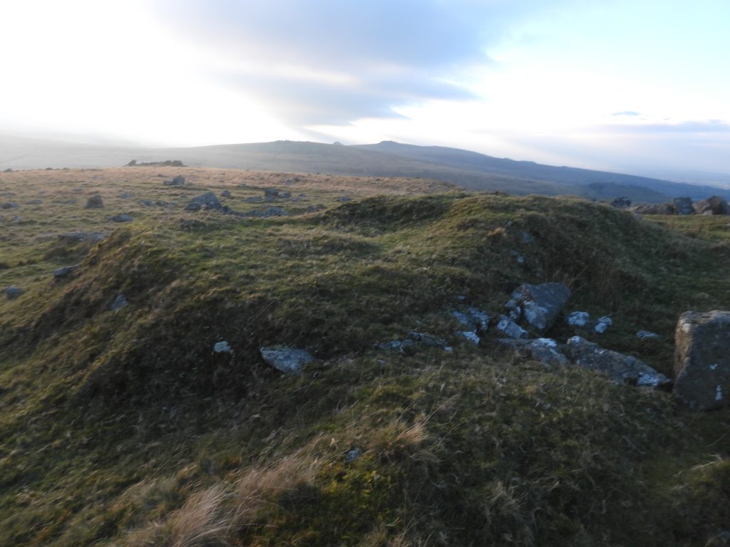
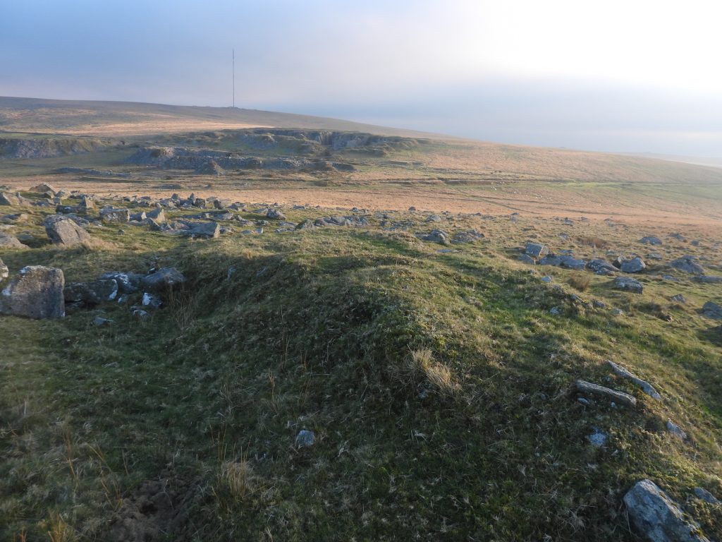
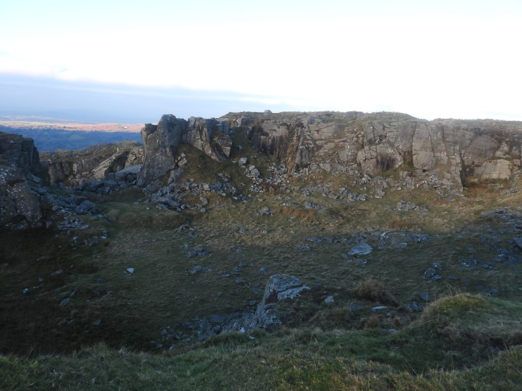
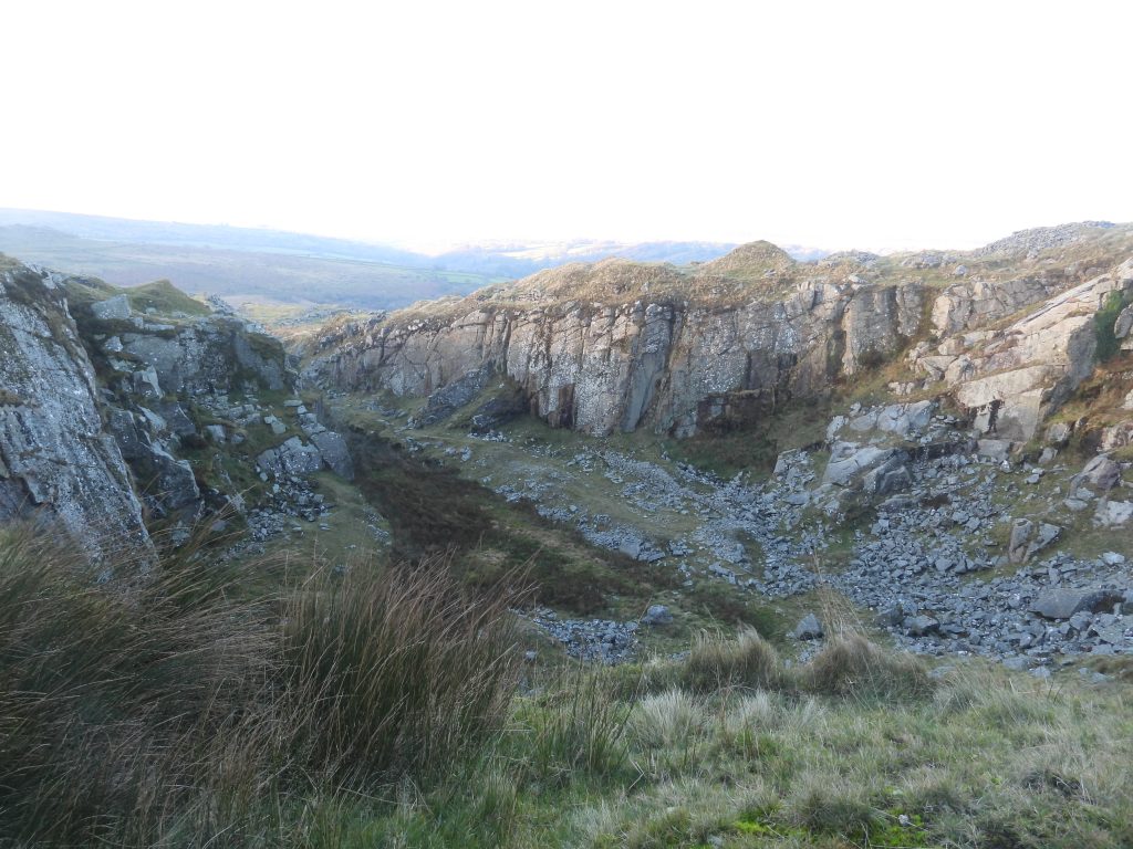
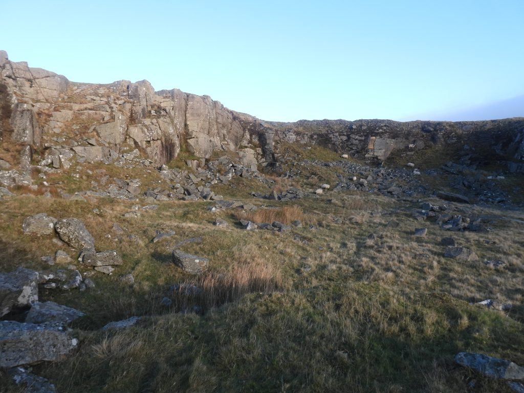
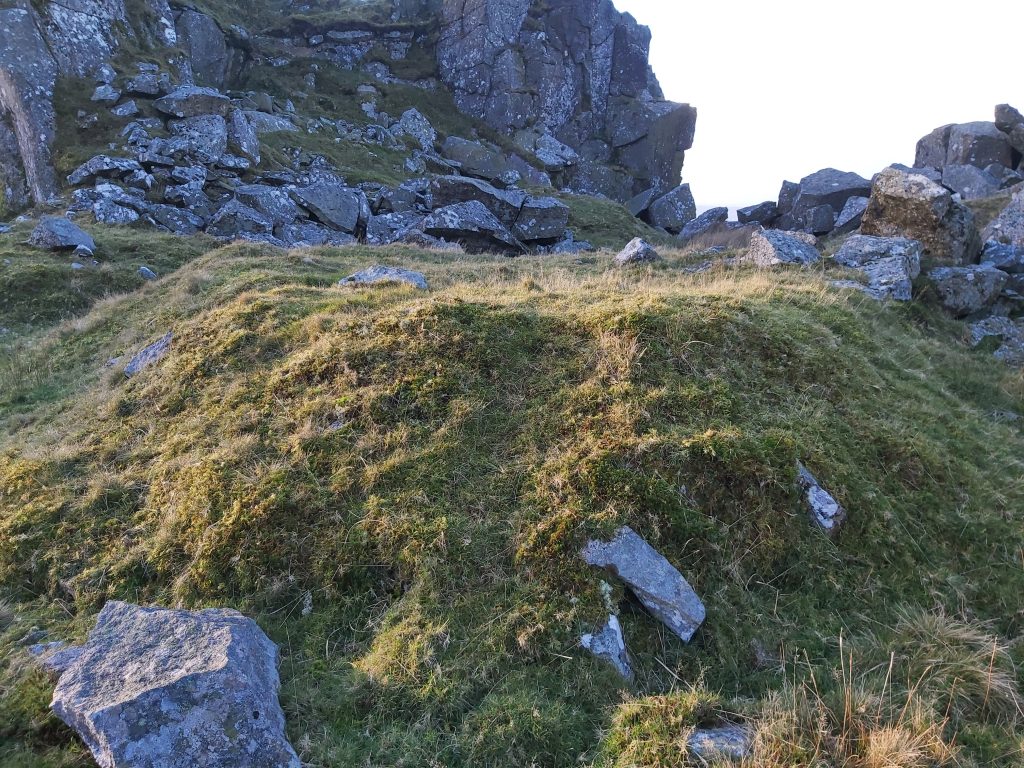
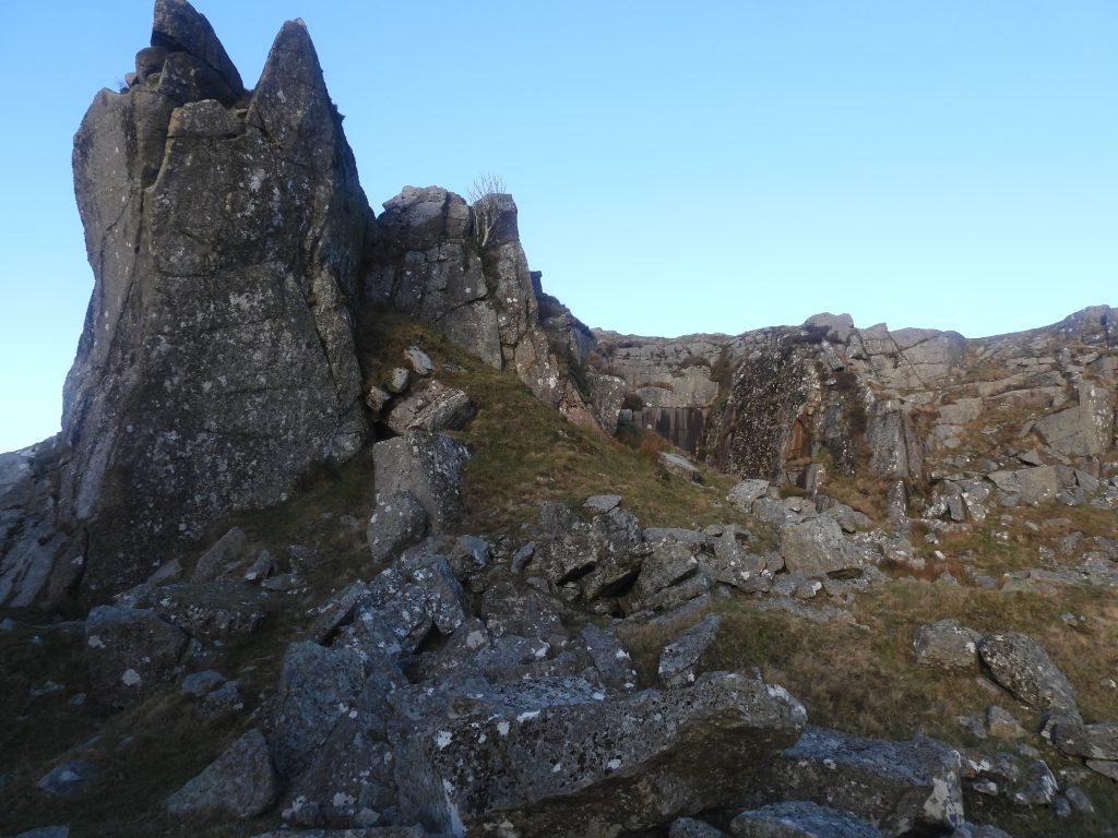
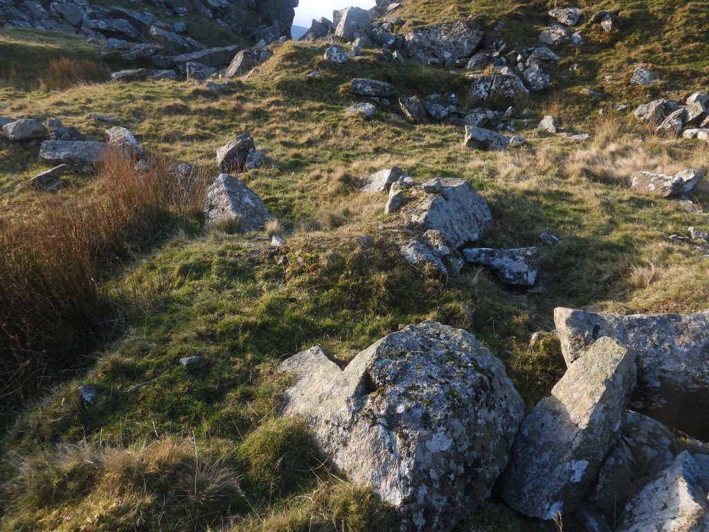
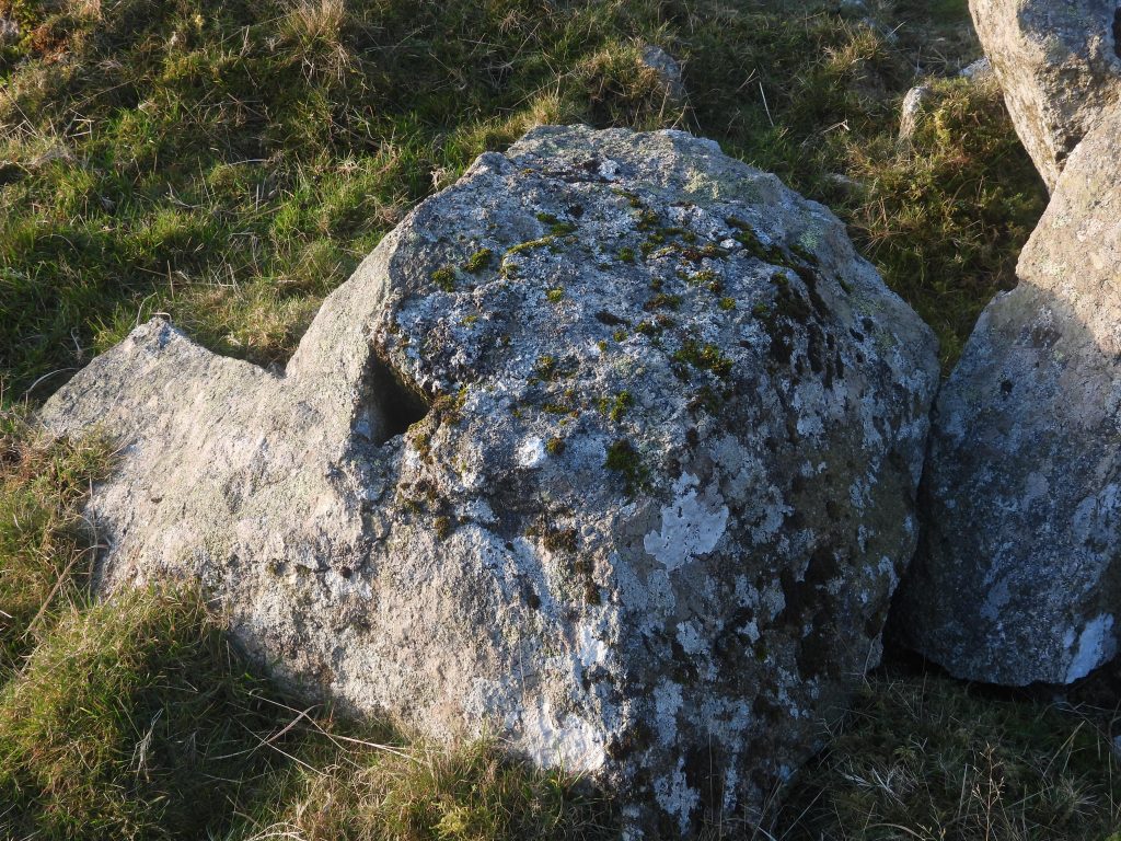
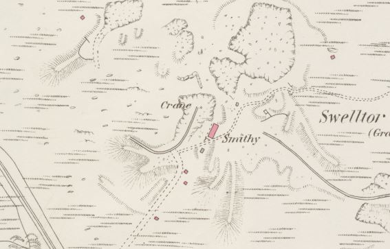
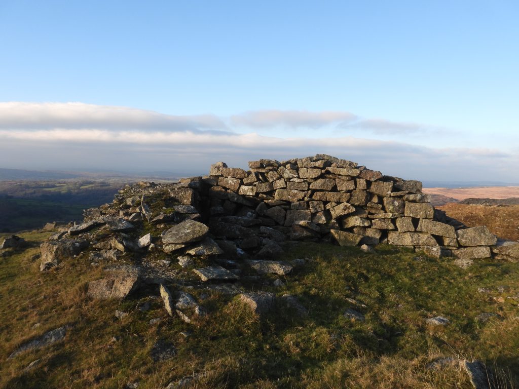
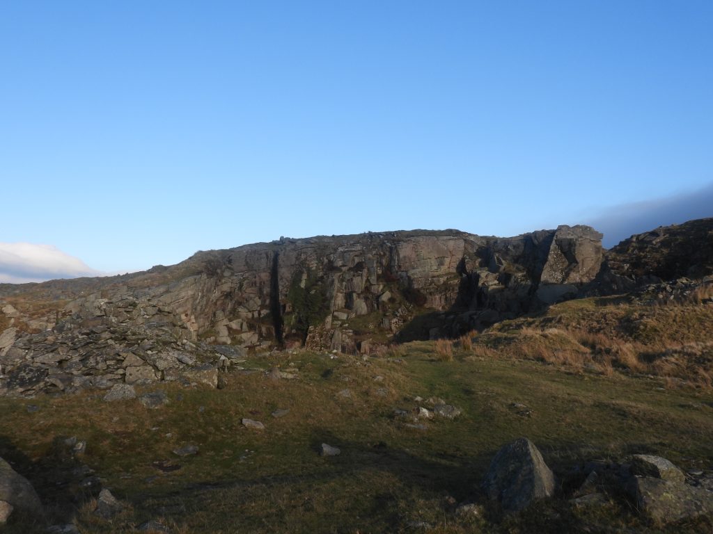
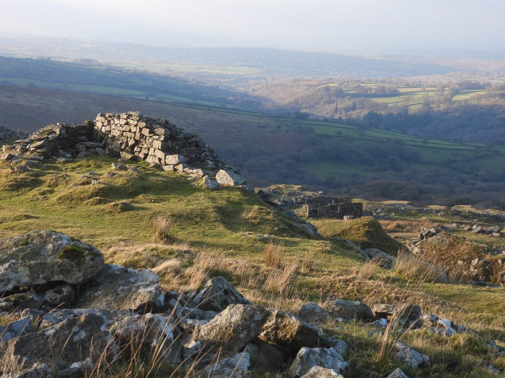
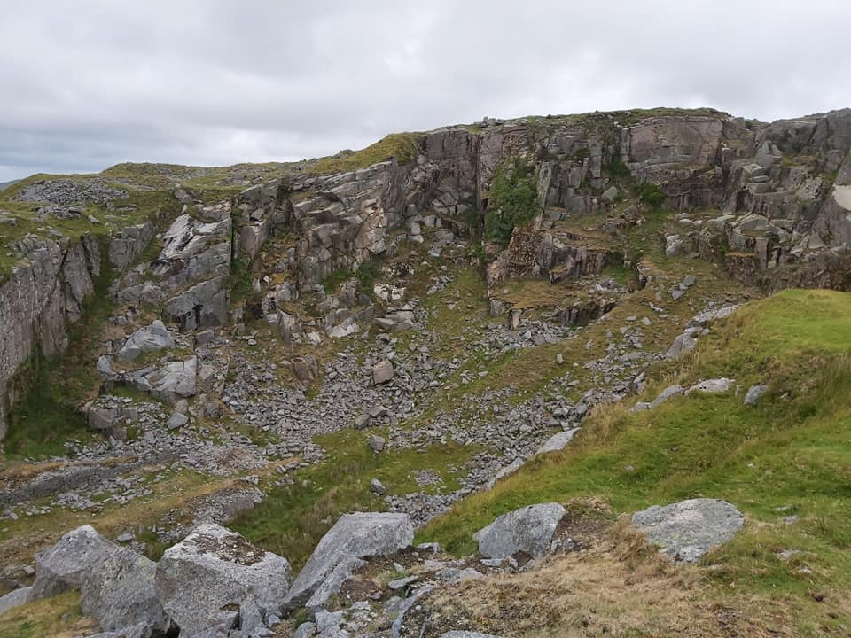
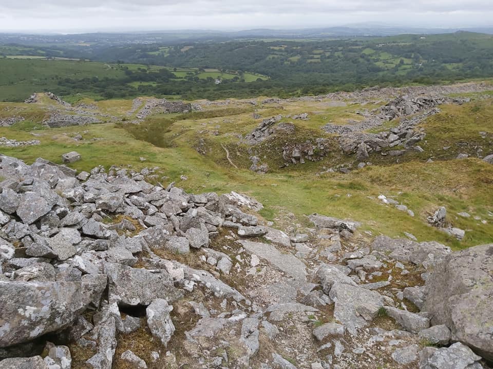
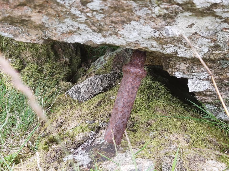
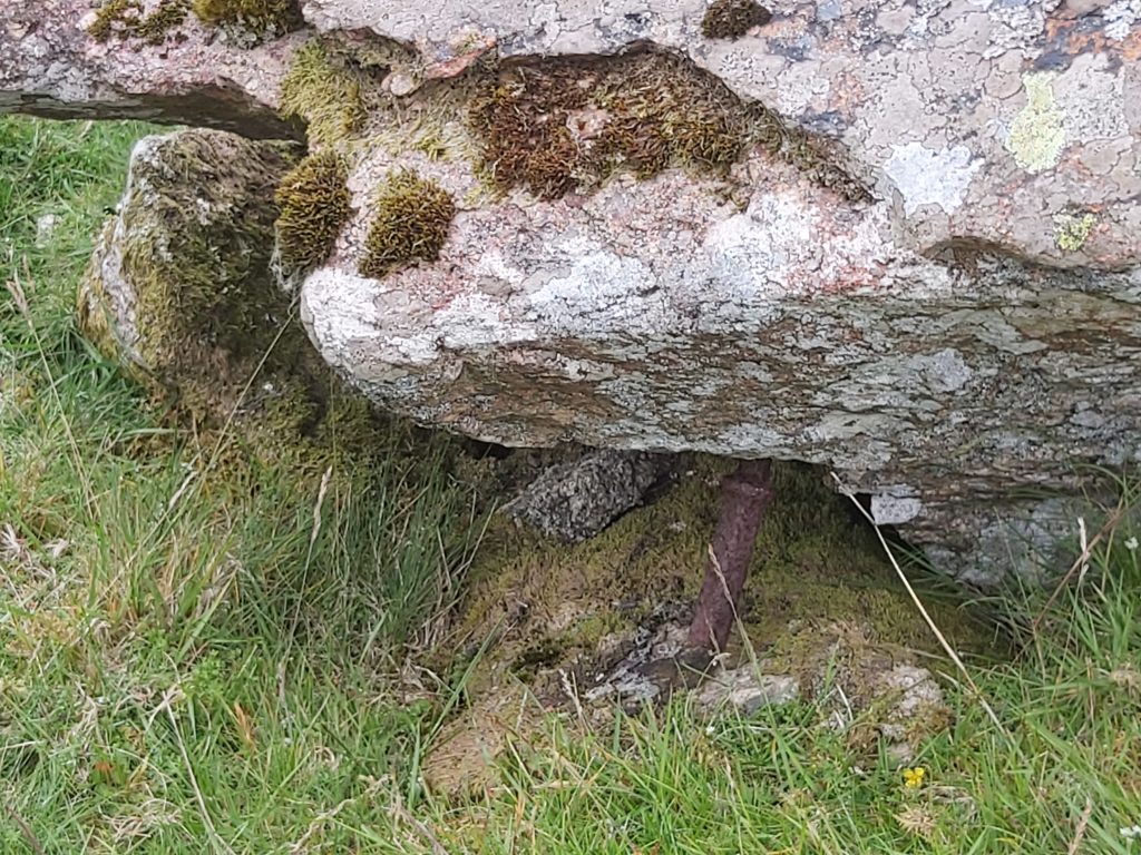
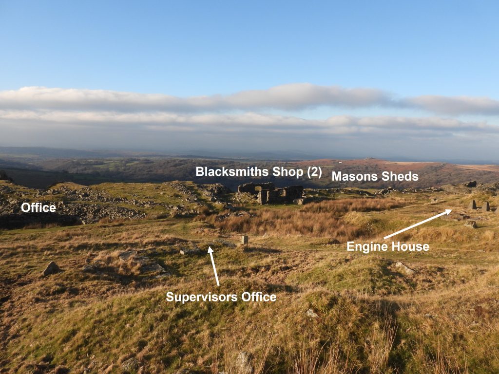
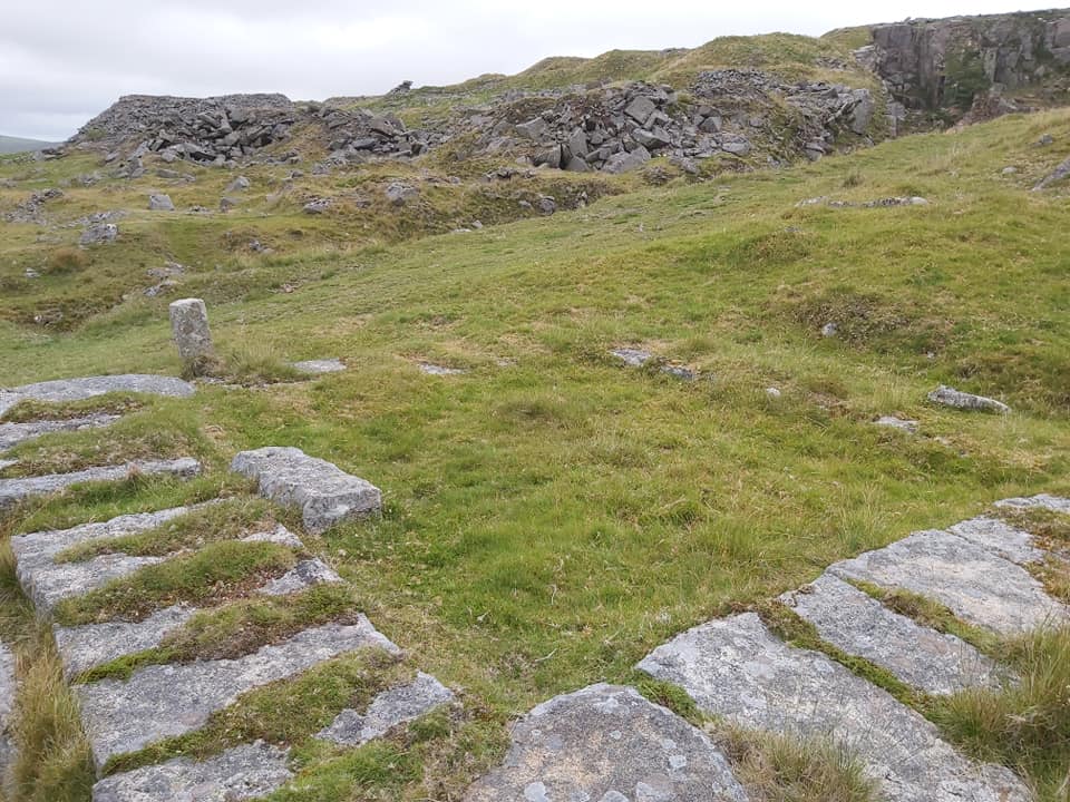
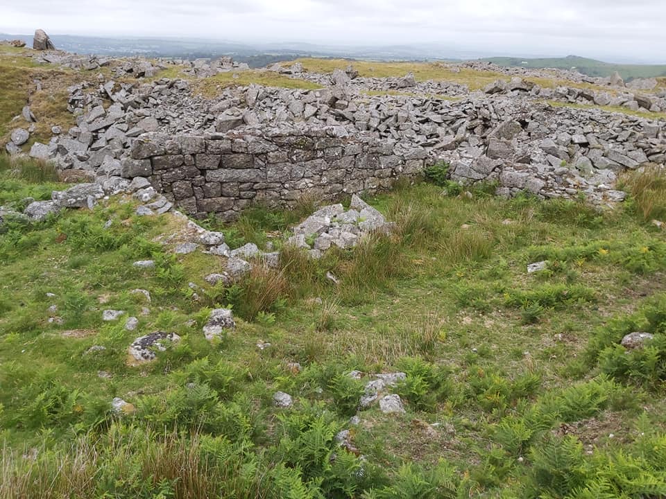
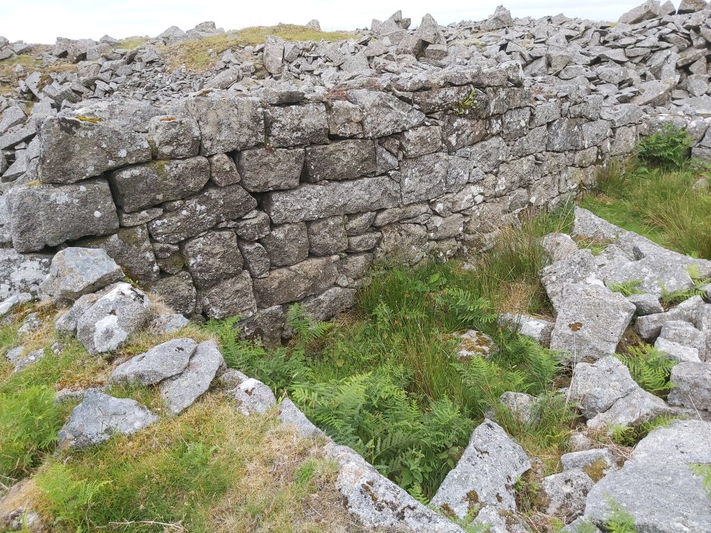
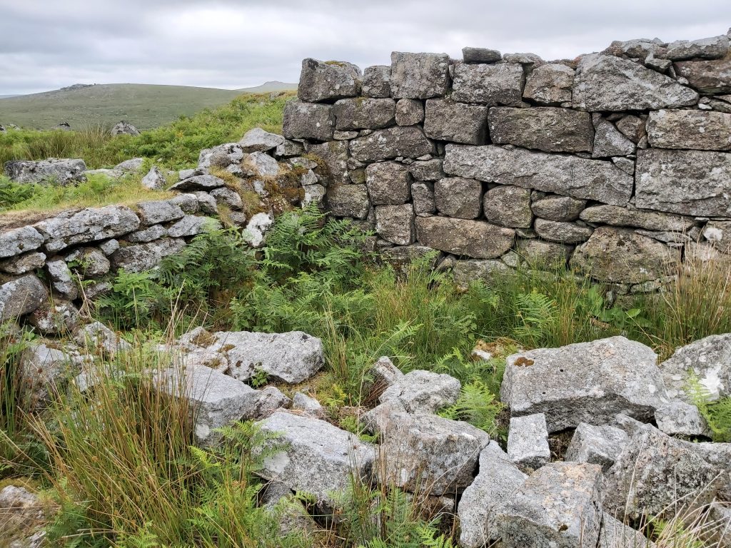
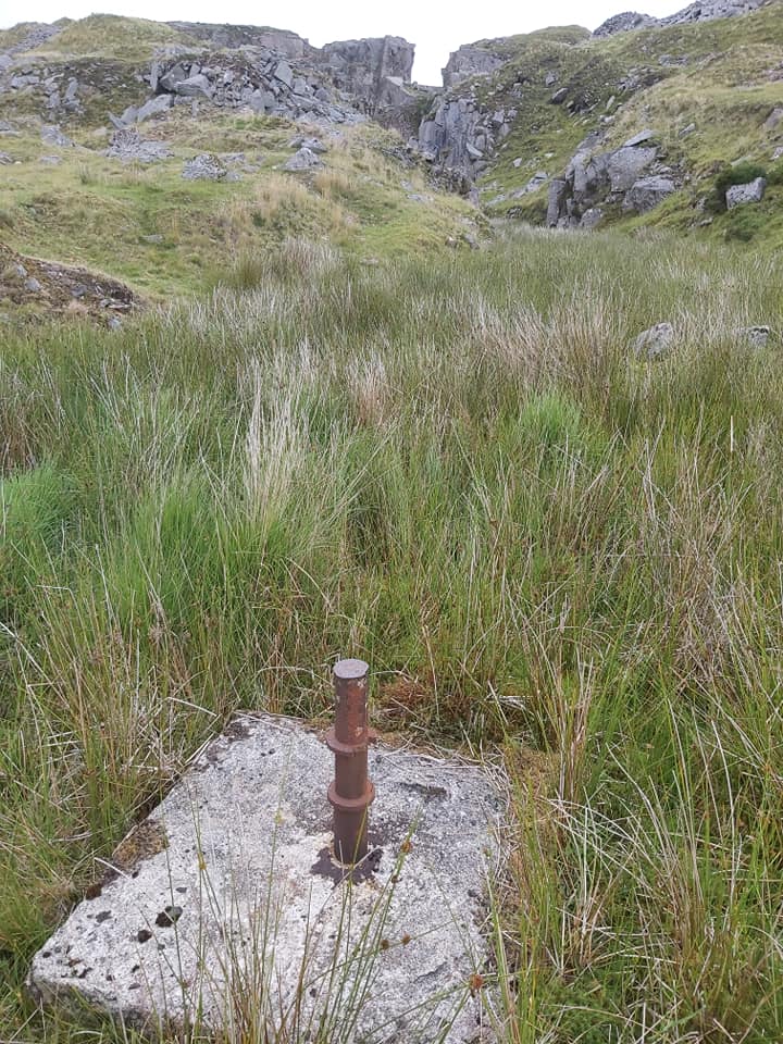
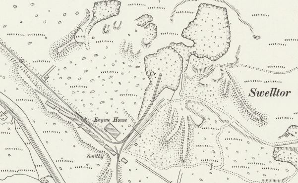
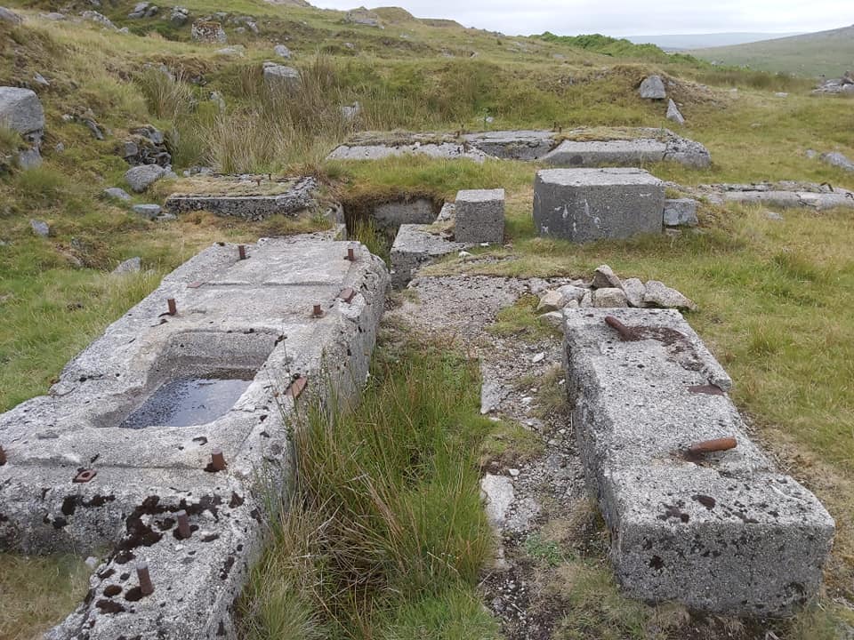
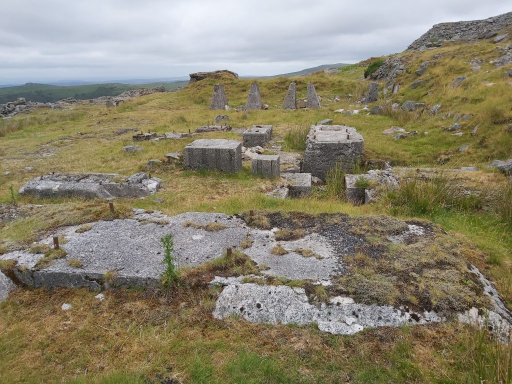
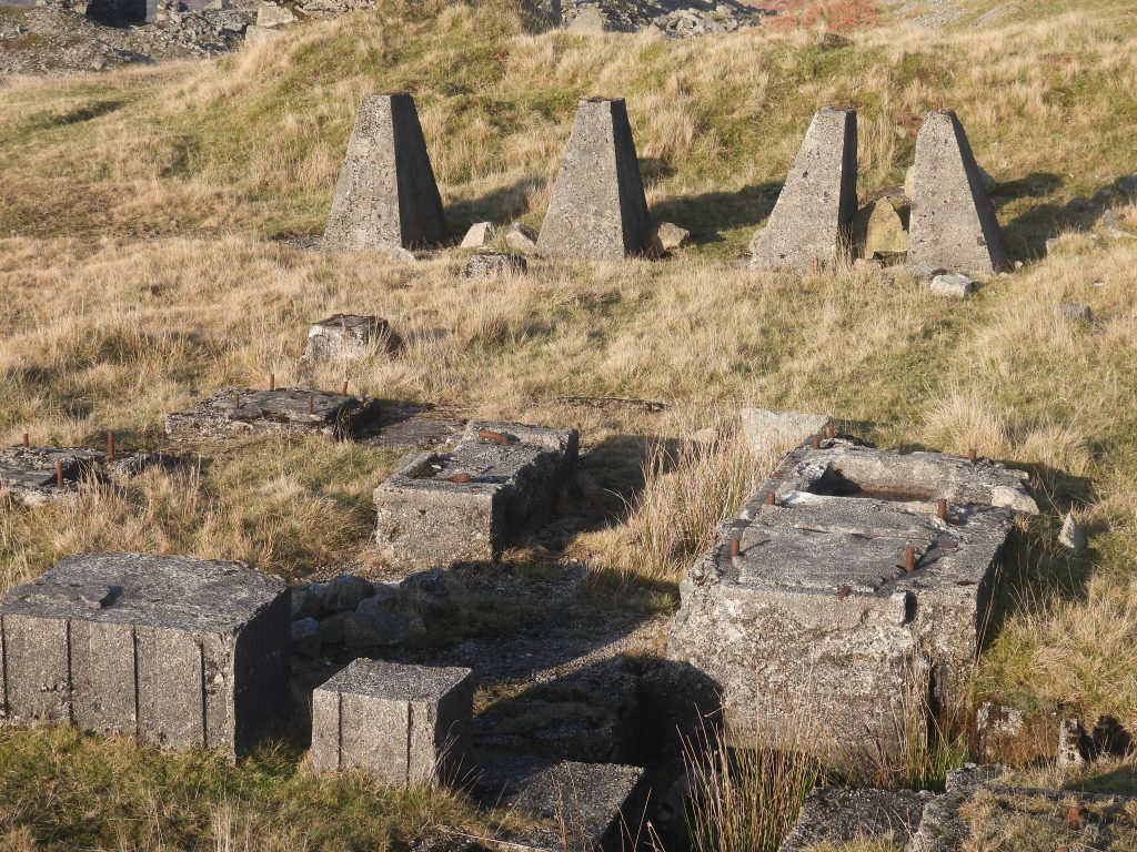
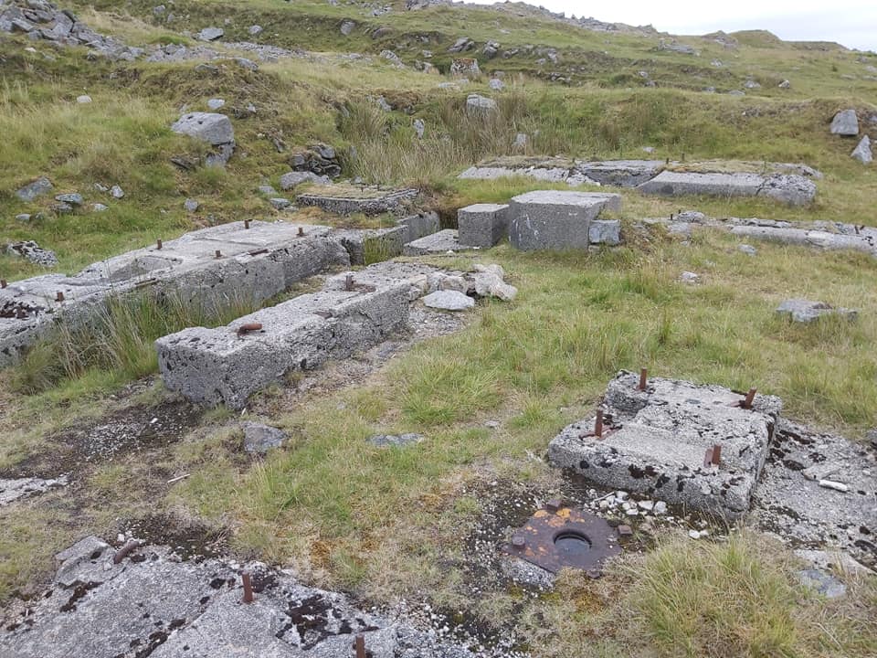
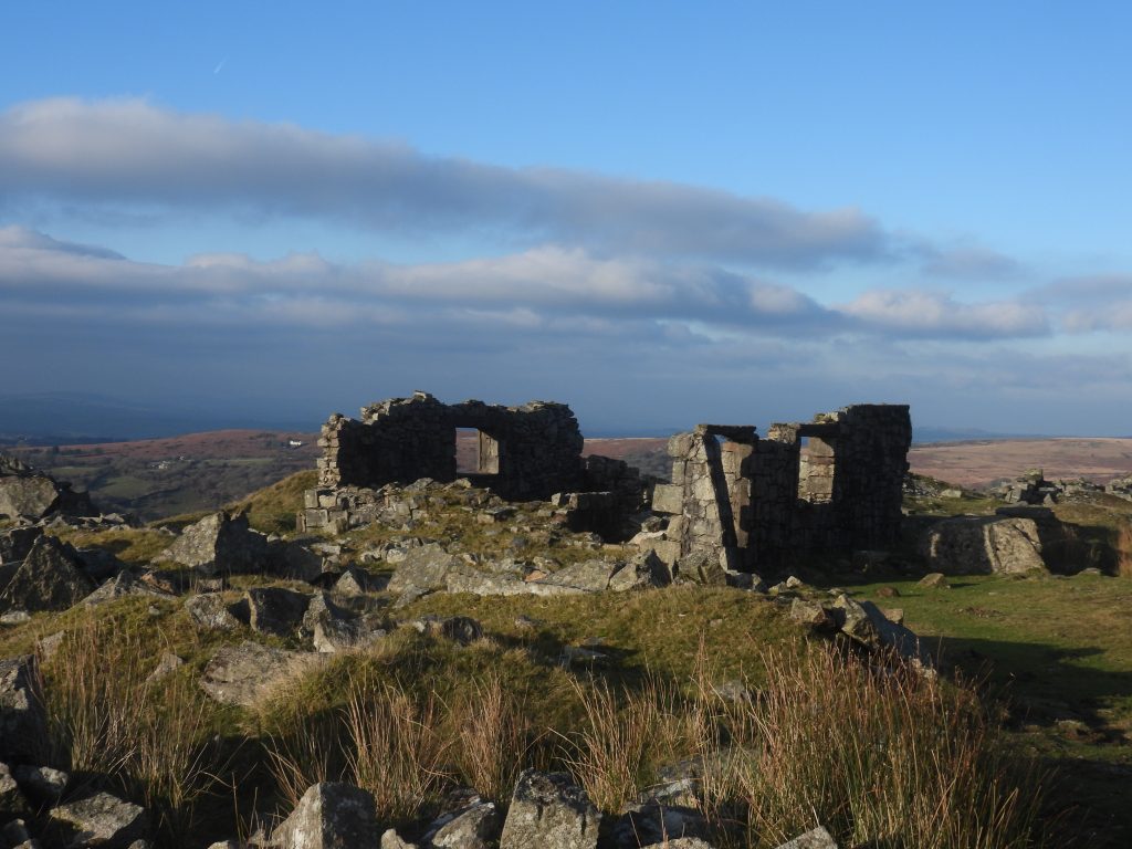
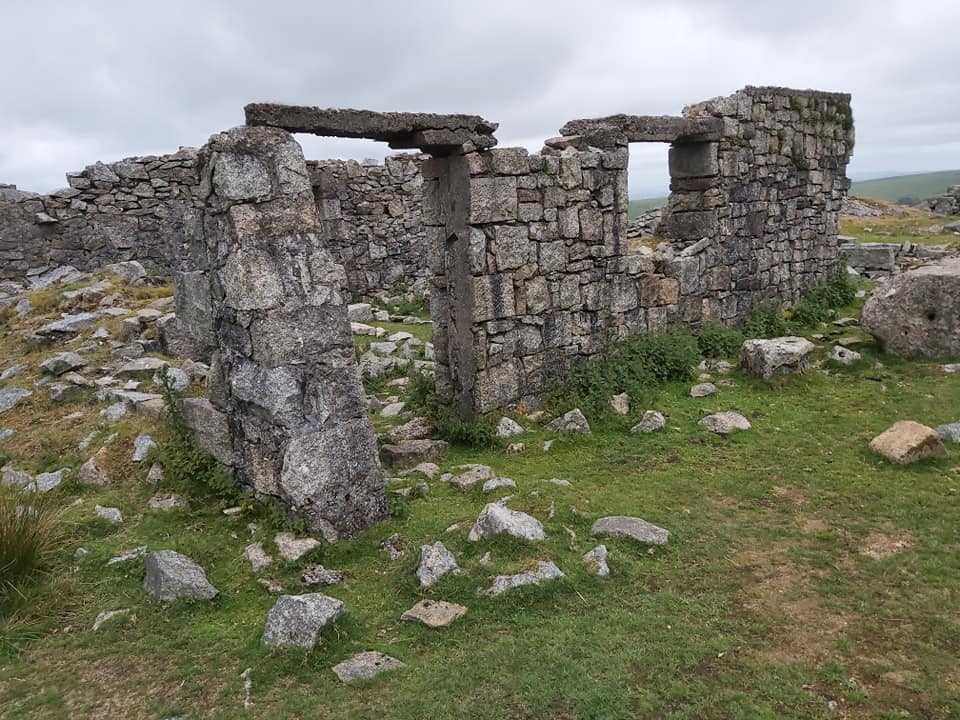
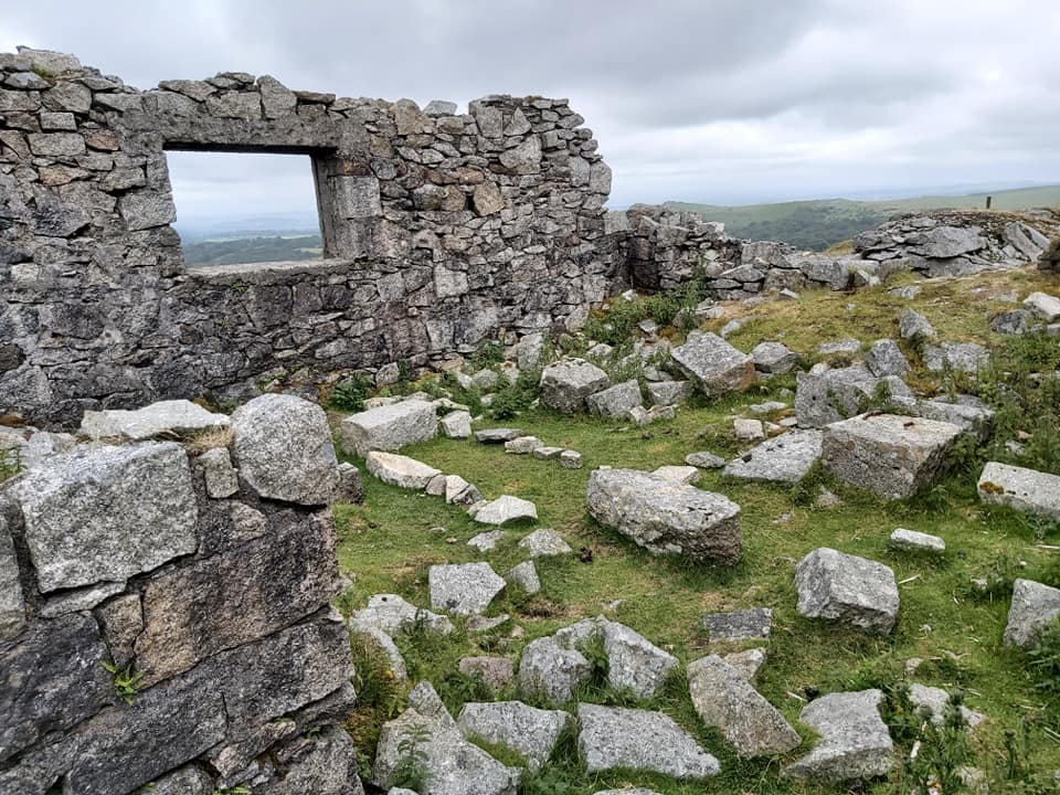
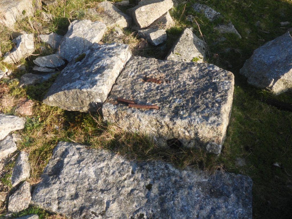
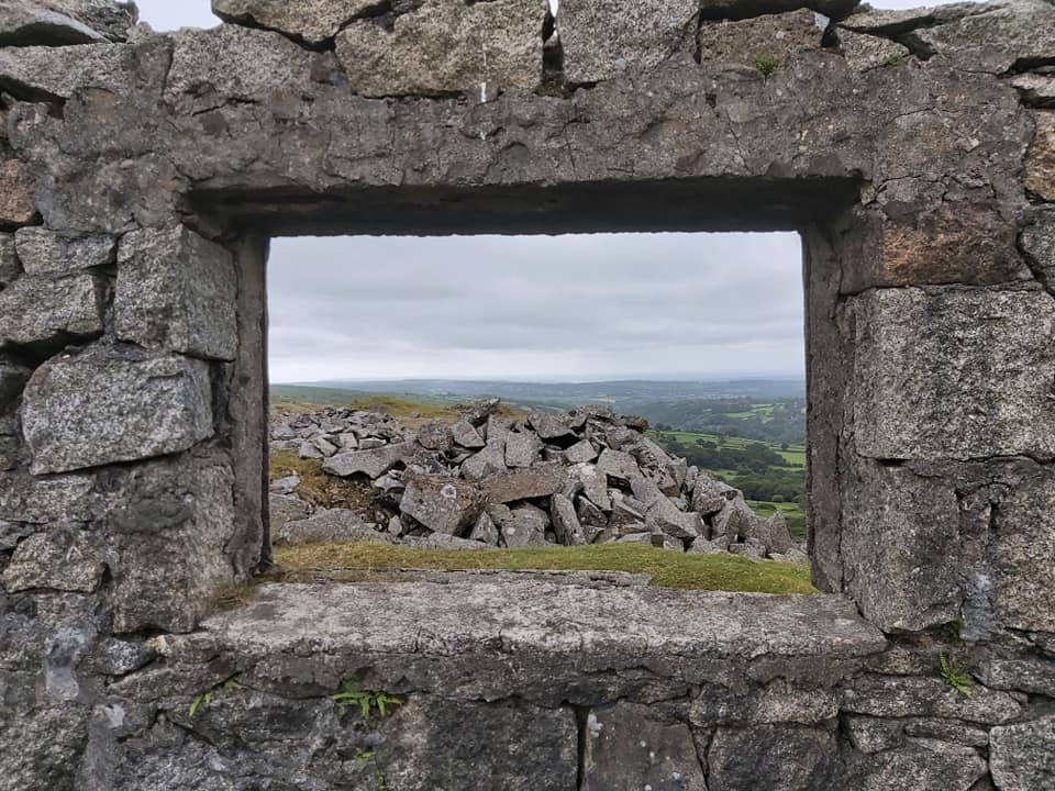
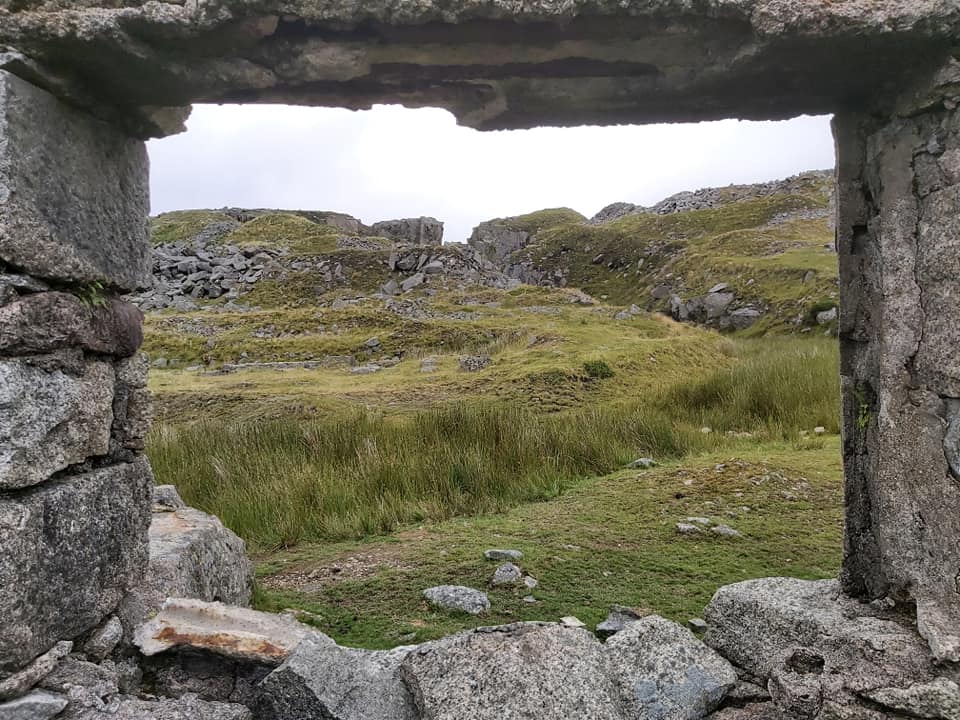
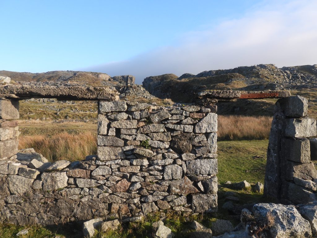
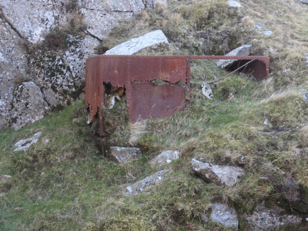
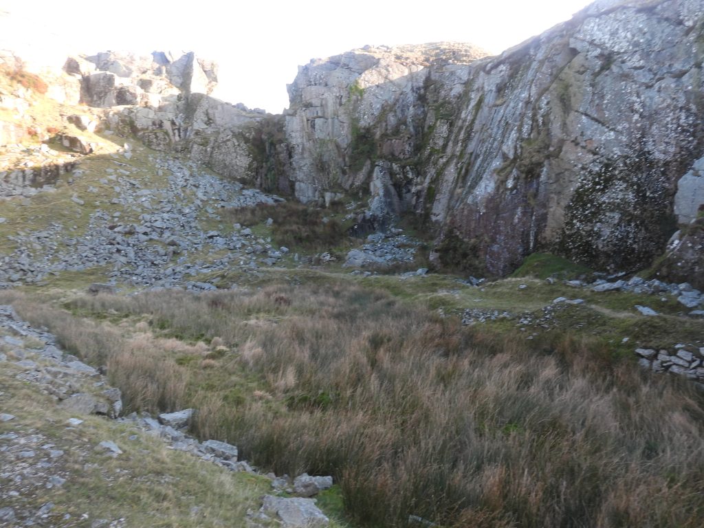
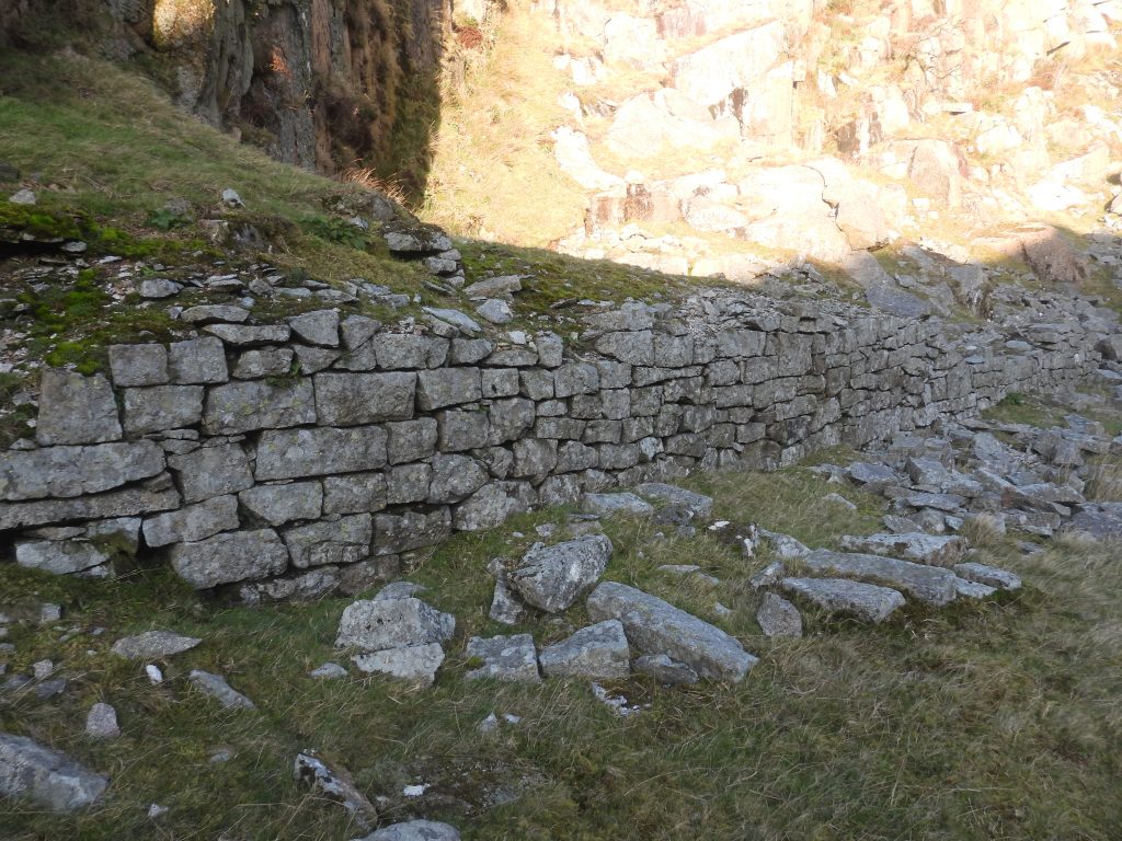
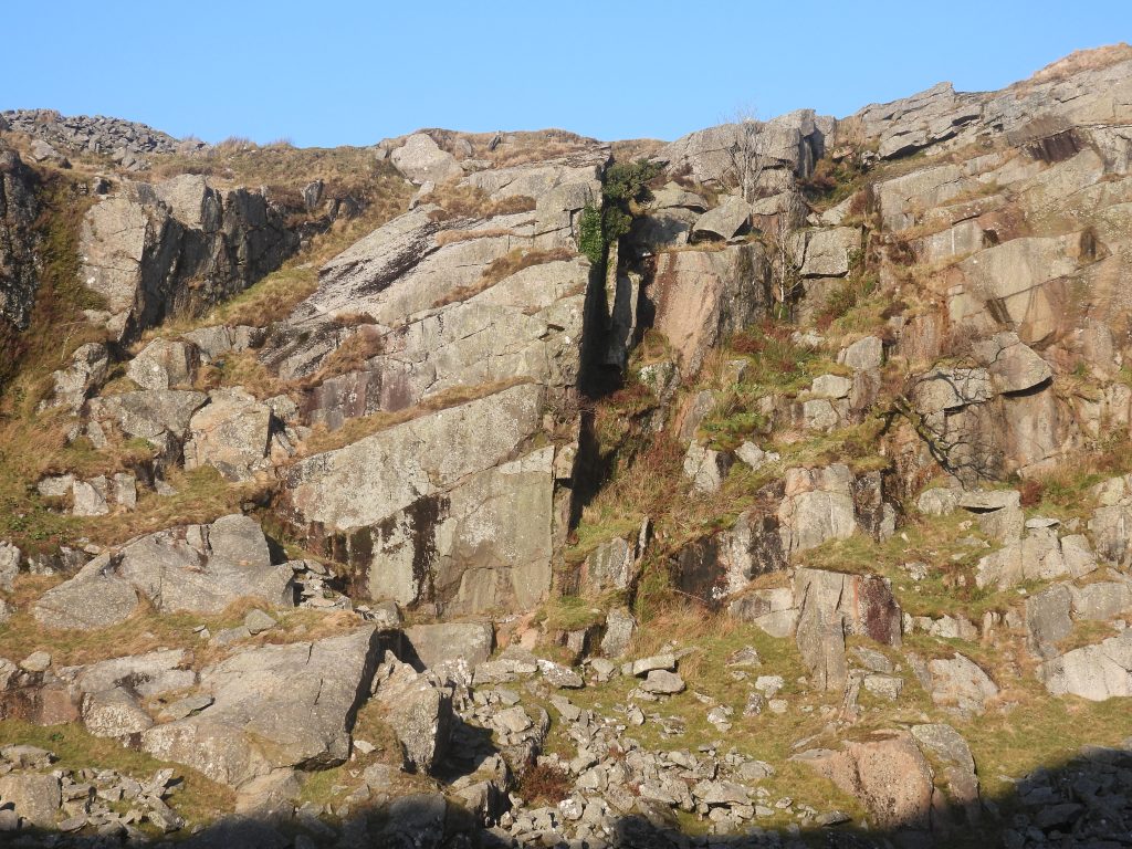
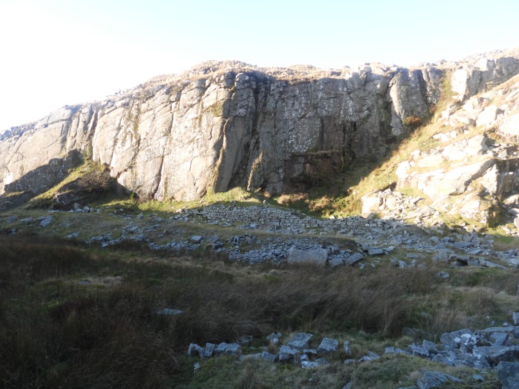
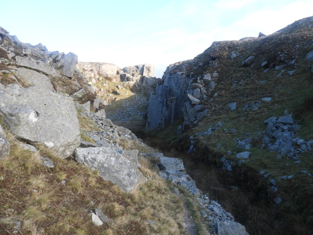
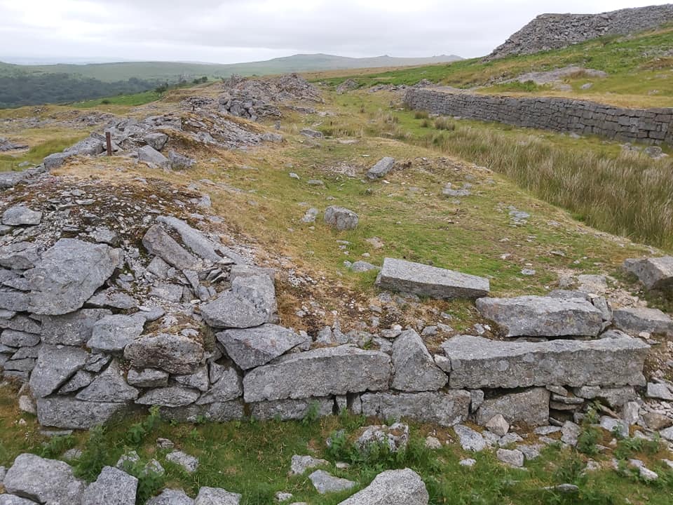
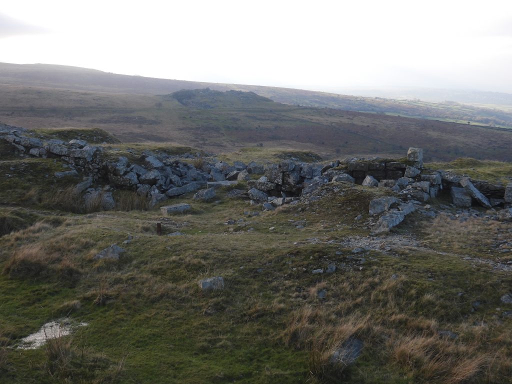
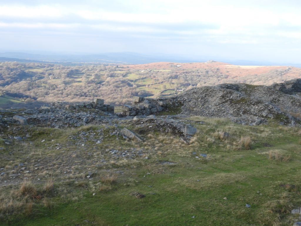
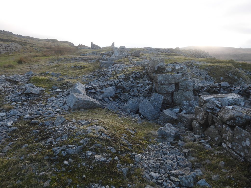
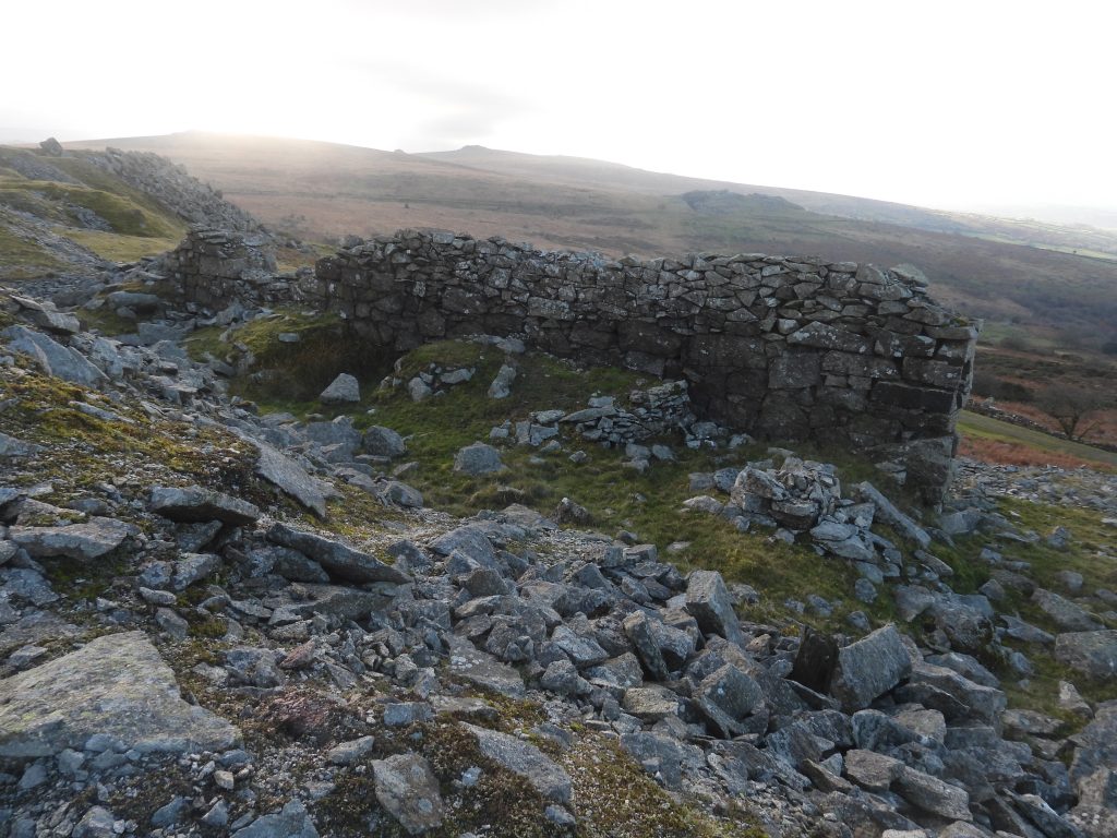
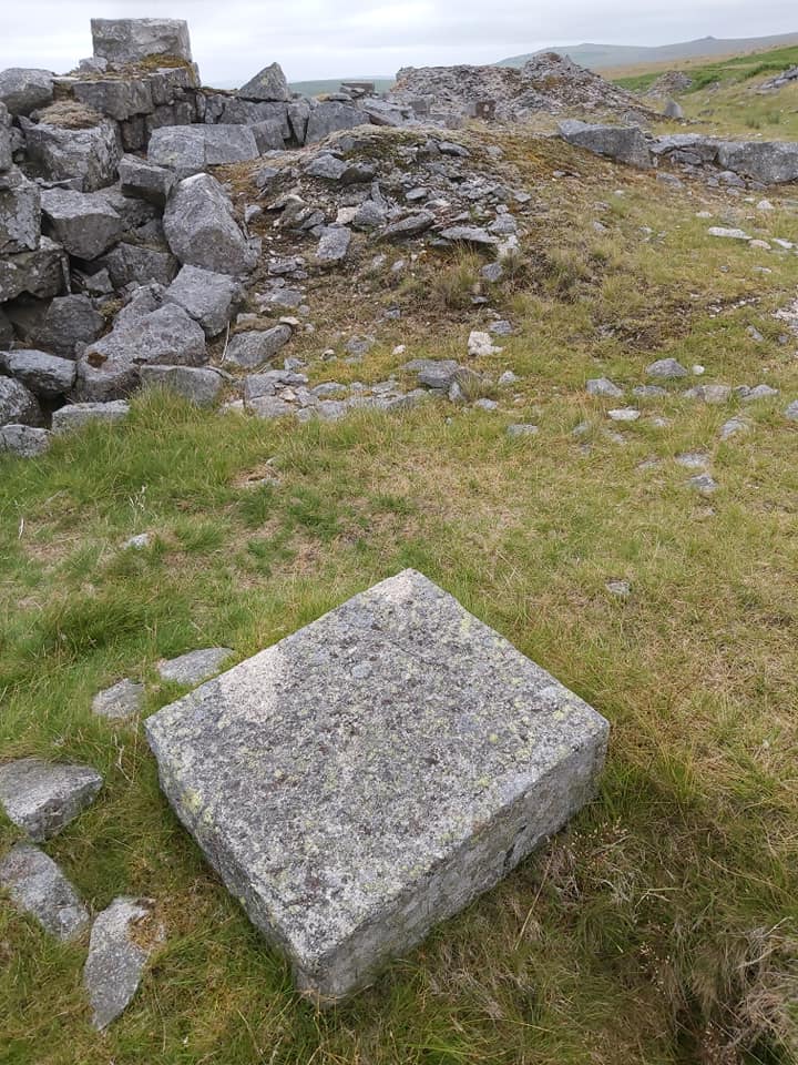
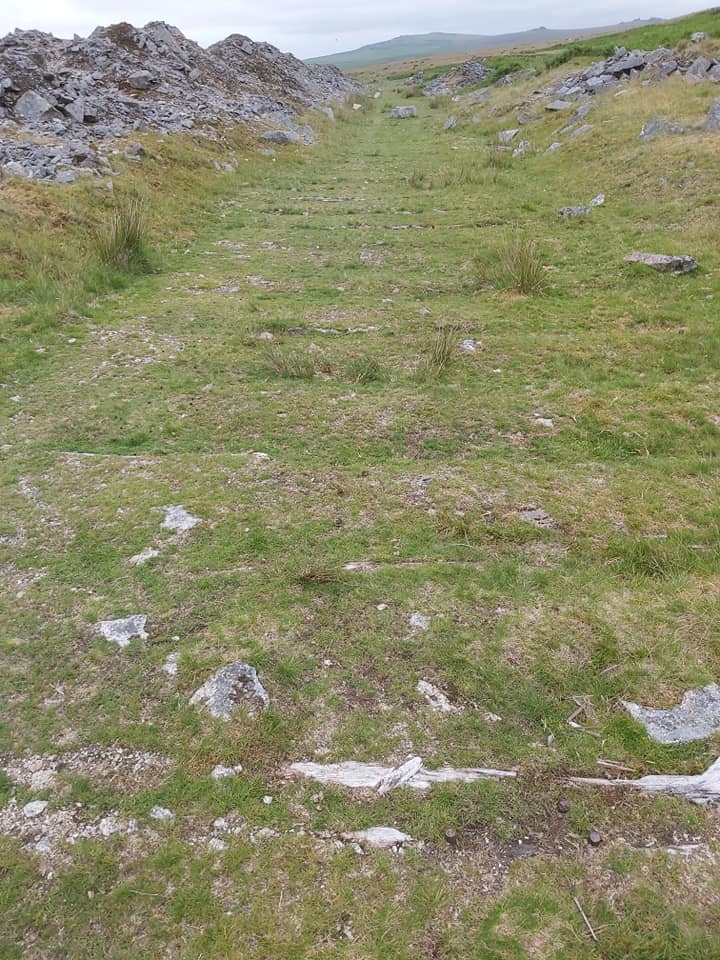
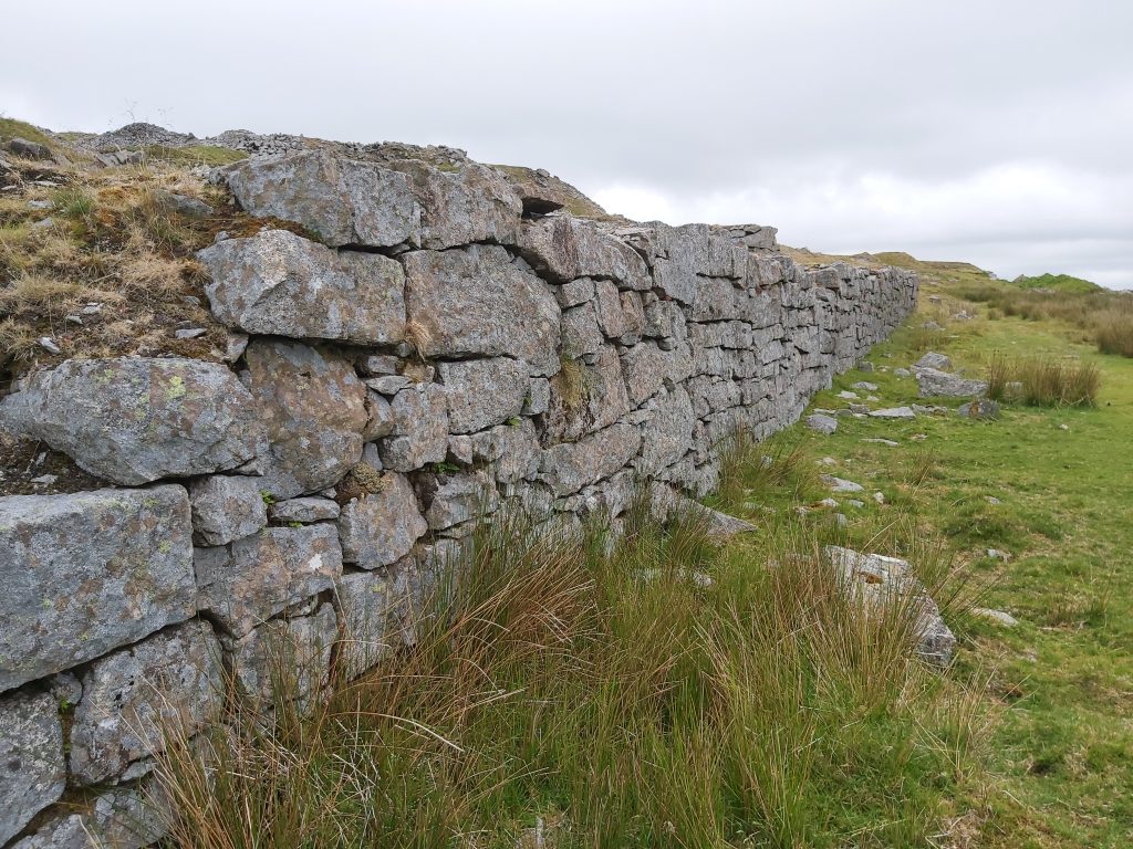
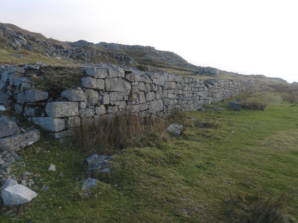
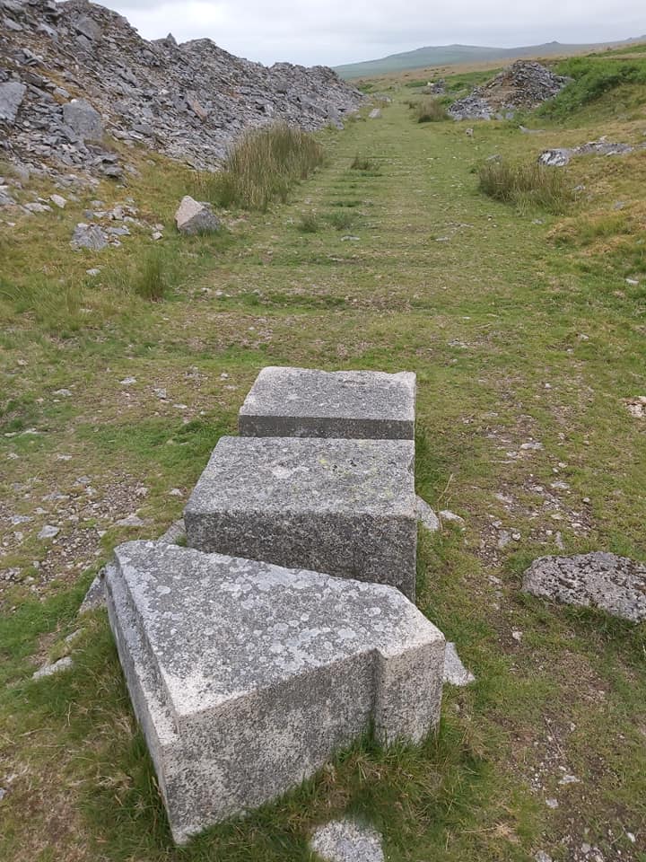
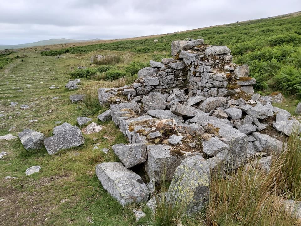
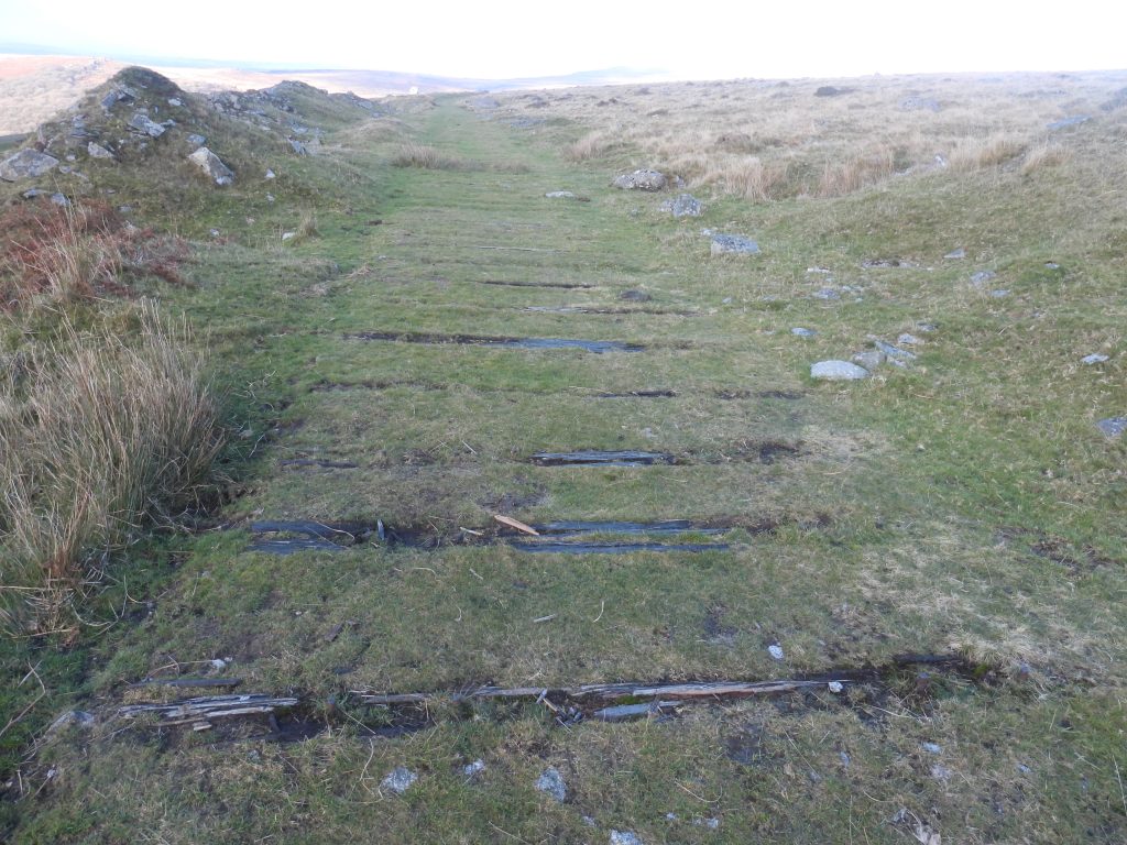
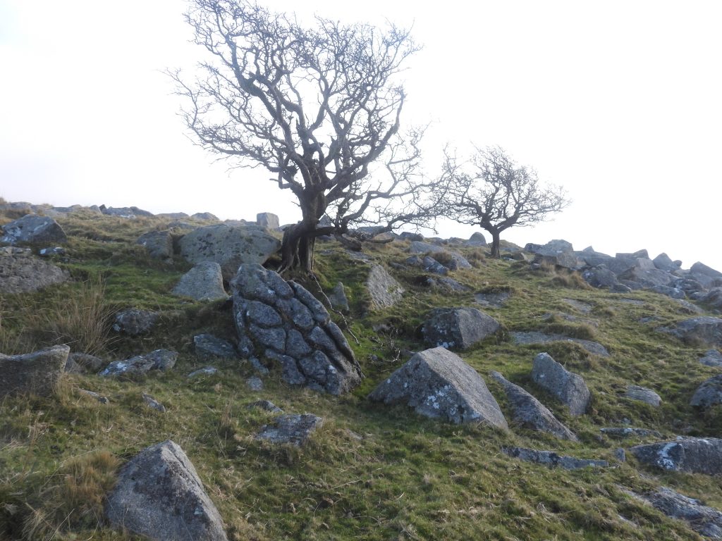
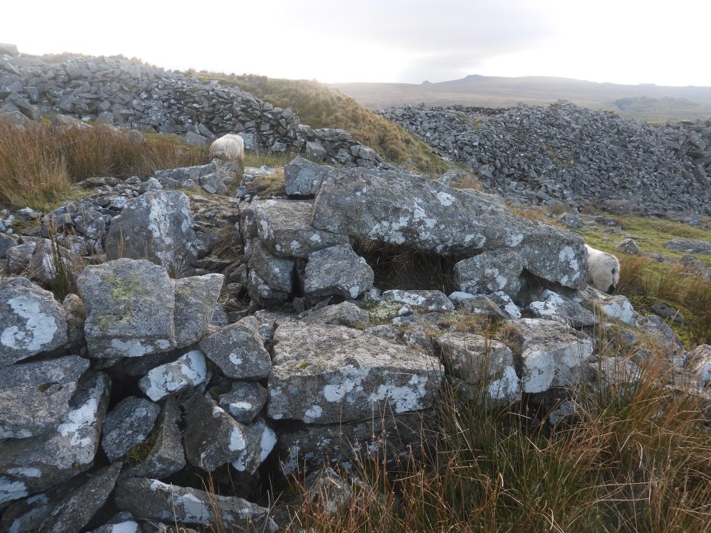
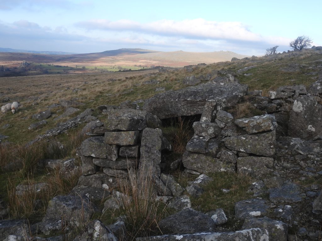
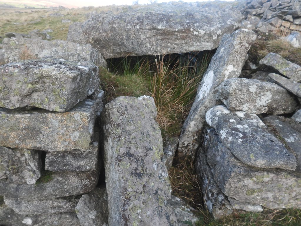
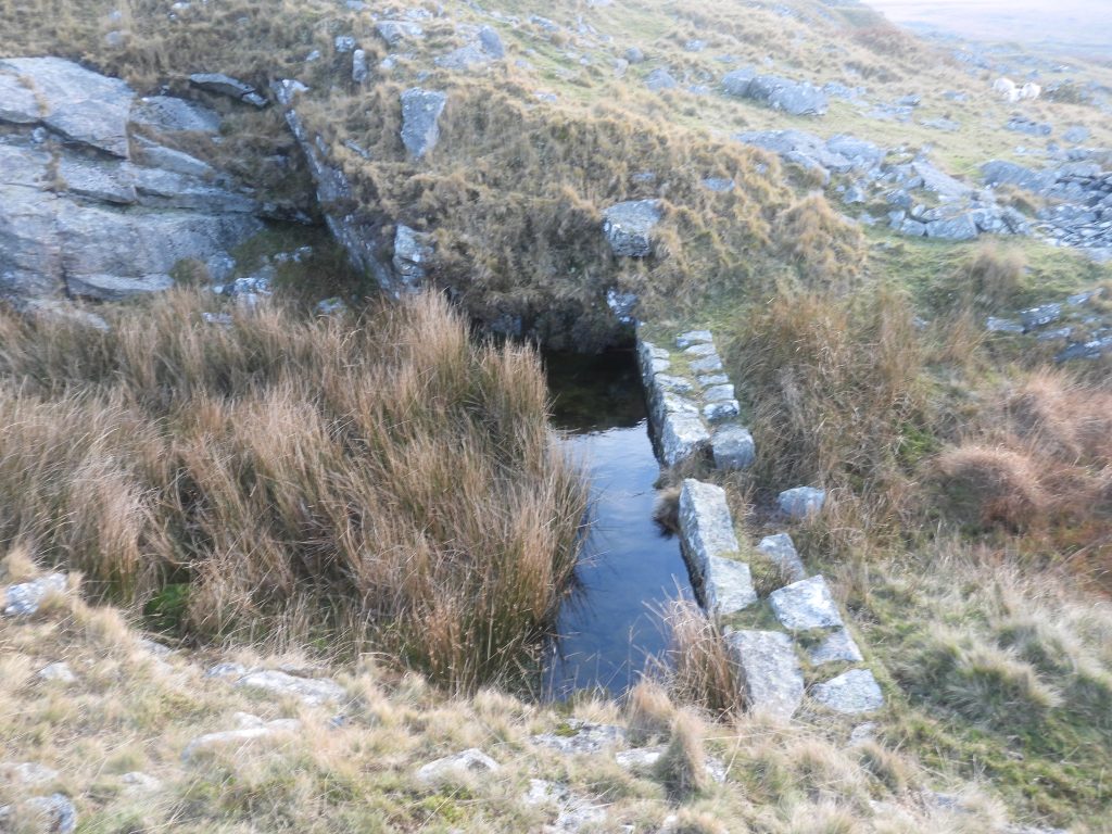
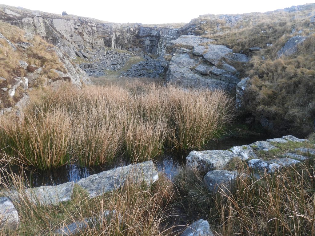
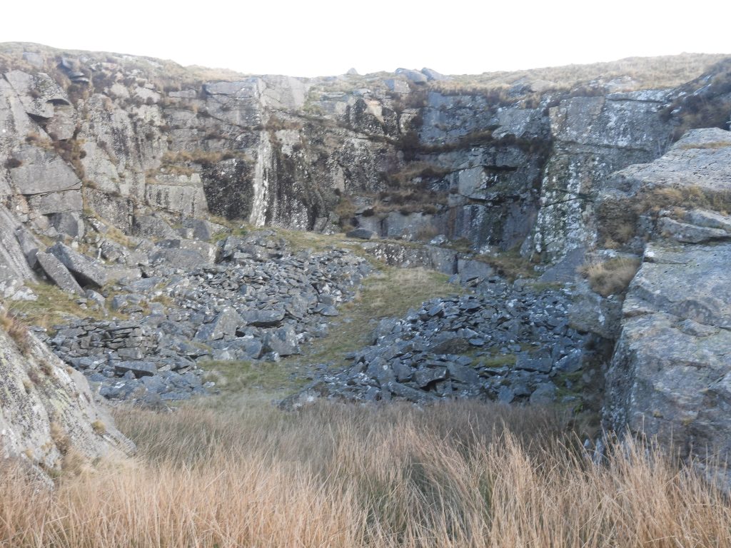
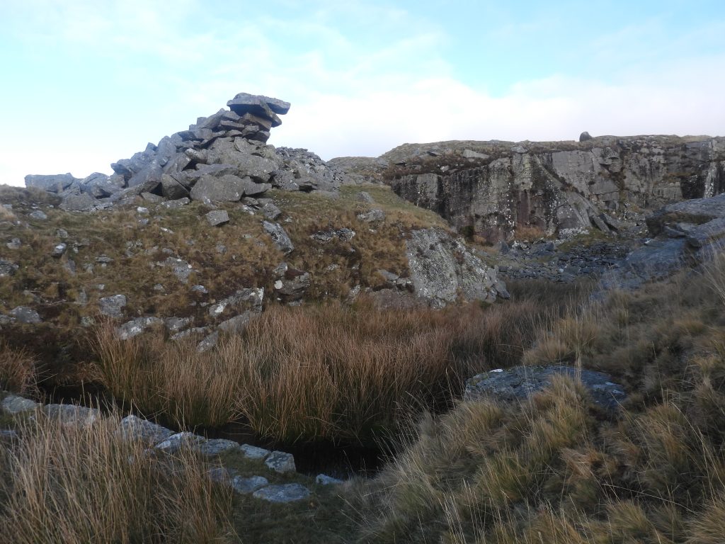
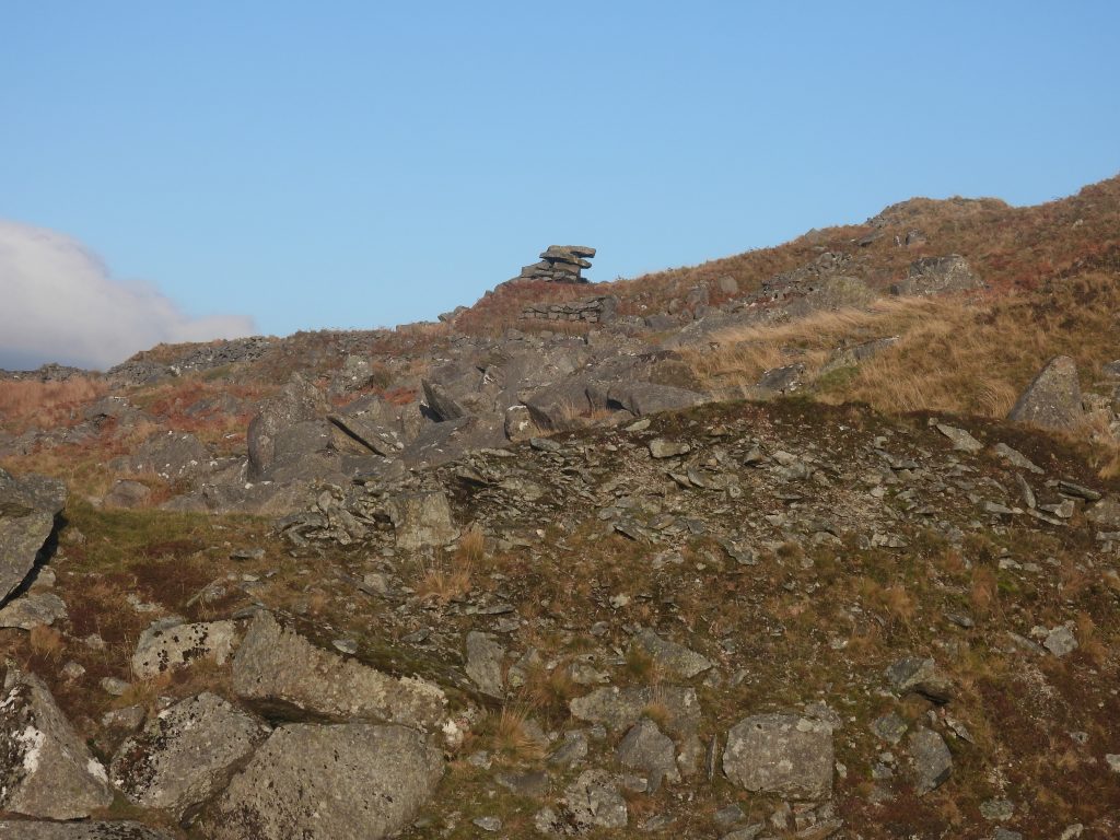
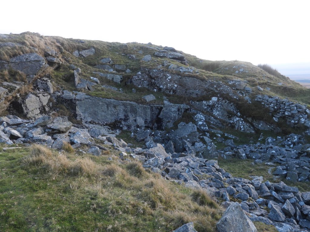
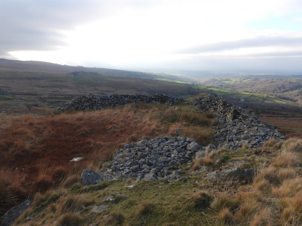
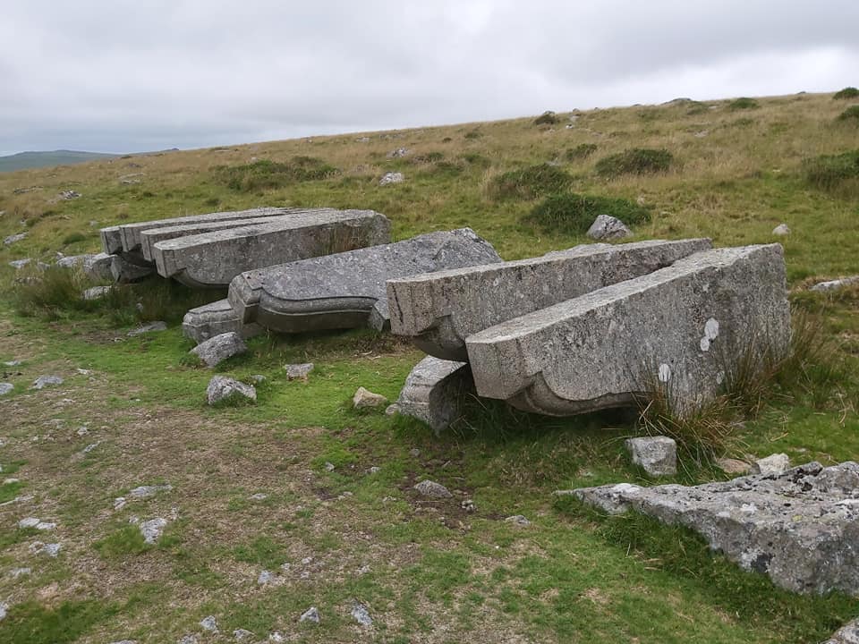
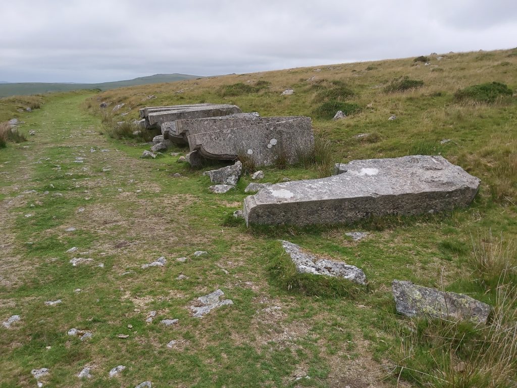
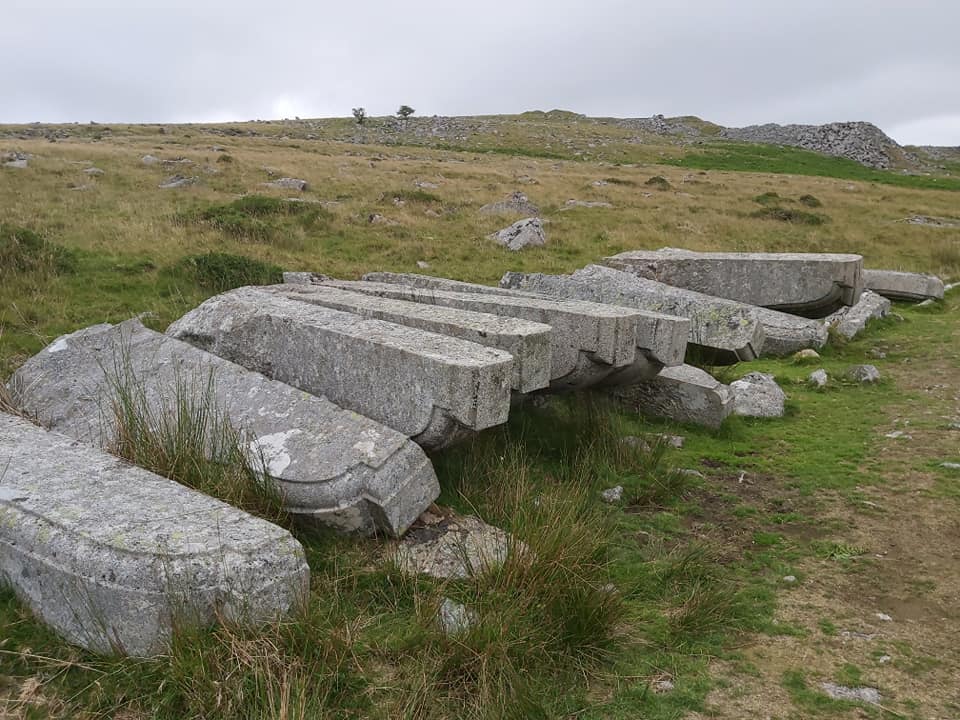
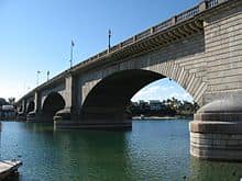
This sketch of the quarries around Swell Tor shows the approximate location of the features contained in this post. Approaching the quarries from the north east. The line of the old Princetown railway is mid picture running left / right. On the hillside is Crip Tor (left) and Swell Tor (right)The start of our exploration of the quarries is from approx half way up the incline plane, where there is a pair of chevrons, which can only be surmised as being for either drainage or as some part of the operation of the incline. SX56177 73015. One assumes this was in use in the early days of the quarries to link them to the Plymouth and Dartmoor Railway below (to the south). Access to the quarries was also by a branch line from near Kings Tor.This quarried out section is on the east side near the top of the incline plane. It is known as ‘Sailors Home Quarry’.‘Sailors Home Quarry’ on the east side.Looking south (ish) into ‘Sailors Home Quarry’ near top of the incline plane.View of the ‘Sailors Home Quarry’, the flooded section below and the dry section above.This building was a powder house and is referred to as ‘Sailors Home’ in the Kath Brewer book. It can be found at SX56139 73156The Powder House is recorded in the Dartmoor HER (ref: MDV61878) : 3.5m x 2.9m, x 2.1m high, and built against quarry face. Constructed of quarried waste granite, bonded with coarse lime mortar. Door opening on s side has been partially blocked. Small drain emerges from under nw side of w wall. Originally had roof, probably of felt and tar ( which survives on w wall and quarry face above building). At some point, half interior was filled with rubble and blocked with mortar wall, while roof was replaced with existing 2-level reinforced concrete oneDoorway of the Powder House. The blocked wall described in the Dartmoor HER is on the right side of the entrance.View from near the top of the quarry (aka Sailor’s Home Quarry), the curve of the old GWR line clearly visible mid picture. The incline plane and grass road are also visible from here.Swell Tor Stack (aka Incline Plane Tor or Crip Tor).Side on view of the Powder House (left) with Crip Tor beyond.To the east of Crip Tor is a line which links the quarry area to the later railway line (near to Kings Tor Halt). The Tors of Dartmoor website discusses the naming of Crip Tor in this location as there is evidence on the Tithe Map for the Parish of Walkhampton, calling it as such. The website further states: “Much has been plundered by the extensive quarrying of the hill but the outcrop, often attributed to Swell Tor, is the likelier candidate for Crip Tor”. Ref: https://www.torsofdartmoor.co.uk/tor-page.php?tor=crip-tor-tithe-mapNear the ‘Upper Quarry” is the outline of a building. It is shown as a small red square on the 1873 map (shown later in this post). It is of no great size and most likely was one of the earliest buildings in the area. Could this have been an early store ?The foundations of the small building near the upper quarry, can be found at SX56098 73306.The upper quarry from the east rim. The upper quarry is believed to have been one of the earliest worked in the area.Inside the upper quarry, taken from the south end.The upper quarry with a possible crane base (at the bottom of the photograph). The possible crane base can be found at SX56020 73307.Large outcrop between the upper and the lower quarry. Swelltor is covered in Tors of Dartmoor website, where (Eric) Hemery is quoted as saying: “Swell Tor has been decapitated and disembowelled by the quarrymen. On the brink of the quarry face a few lumps of granite remain of the original tor.” https://www.torsofdartmoor.co.uk/tor-page.php?tor=swell-torAn unusual feature in the upper quarry is a round boulder with a triangular hole drilled through it. What was its purpose ?The boulder with the triangular hole can be found at SX56014 73327.This map dates from 1873 and shows the location of a smithy next to (above and east of) the lower quarry. In later years this smithy appears to have been relocated to near the entrance of the lower quarry. Compare this map with one from 1892 later in this post.Above the ‘Lower Quarry’ can be found the foundations of the “Smithy” shown on the 1873 map. The author has annotated this as Blacksmiths Shop (1) on his sketch map, which is shown at the start of this post. This structure is located at SX55980 73228.The “Smithy” (on left of picture) in relation to the ‘lower quarry’ The Smithy [Blacksmiths Shop (1)] with the (probably) later version, Blacksmiths Shop (2) in the background.View of the lower quarry from the east side.Looking South West (ish) towards the ruined buildings of the quarry. An intrigue. This looks like a drill embedded into the underside of a rock at SX55912 73167The drillThe key buildings below the ‘lower quarry’ entrance.Foundations of the “supervisors office” at SX55915 73155. Dartmoor HER: Late 19th century, measuring 4.7 by 4.75 metres. Two foundation courses of large dressed granite blocks survive , with a porch to the north. Office – Small square building, replaced by larger rectangular structure, with interior features. Mid-19th century, 13.3 by 5.6 metres, by 1.8 metres high. Possibly had a tar roof. The office is located at SX55898 73131Inside the office showing the “interior features” as described in the Dartmoor HER. Is this a winching post at the entrance to the main quarry ? SX55890 73153This map dates back to 1892 and shows the location of the Engine House and SmithyEngine House with ruins where a steam engine and compressor would have been located. SX55878 73173This 19th century Engine House is believed to have been constructed of sheeting on metal beams supported on granite footings. Source: Dartmoor HER. The building is recorded as measuring 17.5 metres by 11.3 metres.Close up of the Engine HouseThe steam engine and compressor is believed to be from the latter part of the life of the quarry (1920s) to provide air pressure to drive pneumatic drills.Blacksmiths Shop (2) as labelled on the sketch map The Blacksmiths Shop (2) is located at SX55868 73149 The ruins are recorded as measuring 12 metres by 5.5 metres by 1.6 metres high, with two surviving walls, being constructed of quarried waste granite.Inside the Blacksmiths shop (2)Inside Blacksmiths Shop (2) – granite boulder with boltsLooking south from the Blacksmiths shop (2)Looking north into the quarry from the Blacksmiths shop (2)Blacksmith Shop (2) looking towards the lower quarryPossible water tank inside the entrance of the lower quarry.Inside the lower quarryProbable loading platform in the lower quarry. Recorded at SX55946 73277.Sheer west wall of the lower quarryInside the lower quarry looking west towards the loading platform.The entrance to the lower quarry.Ruins of Stone Masons / Cutters sheds to the immediate west side of the Blacksmiths shop (ref Kath Brewer book). Dartmoor HER describes a 20th century mason’s dressing shed as being constructed from quarried waste granite, with an internal division and a chimney at the south end. 19.5 by 8.7 by 1.4 metres high. This ruin fits the Dartmoor HER description.Views, looking south at the ruins of Stone Masons / Cutters sheds. More views, looking south at the ruins of Stone Masons / Cutters sheds. View along the ruins of the stone cutters / masons sheds looking east towards Blacksmiths Shop(2).The western most structure along the line of stone cutters buildings.Swell Tor quarry “leftover”. SX55847 73170Wooden rails in the siding leading to the quarry. Amazing to think the wood has survived so long.Main loading quayMain loading quayMore “leftovers”. SX55808 73219Weighbridge (for chippings) mentioned in the Kath Brewer at SX55741 73284. Recorded on Dartmoor HER as being built of quarried waste granite, with a door on the east side and measuring 2.7 by 3.7 metres by 1.5 metres highOld railway sleepers between the weighbridge and the corbels.Near the west quarry (close to two lone trees) is this rather unusual rock formation.Slightly west of the ‘west quarry’ is a very small building / shelter, marked on the sketch map. It is also marked on 19th century maps. It most likely was a store.The building (store?) by the west quarry is located at SX55831 73357Close up of the building (store?)At the entrance to the ‘west quarry’ is a construction which looks like a dam.Entrance to the ‘west quarry’. The dam is located at SX55847 73335The ‘west quarry’Swell Tor west quarry “stack”. Swell Tor west quarry “stack” as viewed from near the entrance of the lower quarry.This small quarry lies slightly north of the ‘west quarry’ and the ‘upper quarry’.Looking south from the entrance of the ‘west quarry’.Twelve corbels manufactured for the 1903-4 widening of London Bridge – some believe these were just surplus. It is thought that either they were condemned due to iron marks in them (as told by the late blacksmith) or they were cut too short. These corbels were not part of the original 1820’s build but, were made as part of the widening in 1903/4.Another view of the corbels looking back towards the quarry.On 18th April 1968, oil tycoon Robert McCulloch bought the old London Bridge for £3million. It has been reported that he thought he was buying Tower Bridge. Whether this is true of not, it makes a good story! Due to the costs of transportation to Lake Havasu City in Arizona, quarry workers from Merrivale were engaged in cutting stones and only the facing blocks were sent to Arizona (in 1971), where a concrete replica had been built. The Arizona version is 15ft narrower that the original and was designed to cope with the Arizona heat. Much of the old London Bridge remain in Merrivale quarry with some even being built into the quarry walls. It is believed that originally there were more corbels at Swelltor sidings and some were transported to Arizona in 1971 (in spite of perceived imperfections).