A collection of walks, discoveries, insights and pictures of exploring Dartmoor National Park
December 12, 2021
Ditsworthy Warren
The earliest records of Ditsworthy (Derkysworthy) appears to date from the 15th Century but in all probability it could have dated from and earlier period. The land was owned by the abbots at Buckland and a lease for 70 years for Ditsworthy, Sheepstor has been found dating to 1493. Other known documents date from 1474.
Ditsworthy was first recorded as a warren around 1676, when Sir Nicholas Slanning leased the holding to Edward Meade who was described as a ‘Warrener’. The land was held by Meade until 1719 when it transferred to William Nicholls (who also held Legis Tor Warren). The warren was then handed onto his son John Nicholls in 1780. There was a break between 1782 and 1800 of the Nicholls family as tenants, but they continued between 1800 until 1830, when the land passed to Nicholas Ware who leased the holding. Warrening came to an end in 1947 when the Ware family finally closed down the warren in upon the death of Percy Ware. Of significance is that the Maristow Estate estate funded work at Ditsworthy in 1824-25 with a rebuild, extension and stabling added
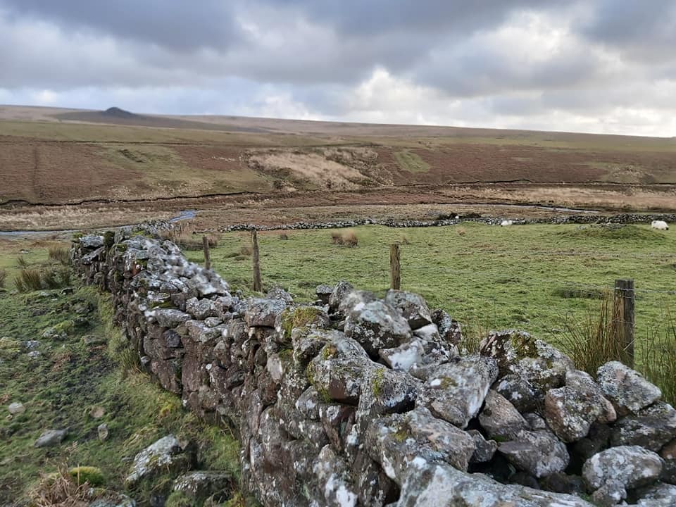
Ditsworthy Warren was approx 220 acres (according to the Tithe Map 1844). Its boundary is defined on the Dartmoor HER as “on the south by the Plym; on the west by a long wall from the Legis Tor Warren boundary to Sheepstor Brook at Burrcombe Gate. The eastern boundary down to the Plym is problematical but is believed Sheepstor Brook upstream for a little distance then east to the ridge of Eastern Tor then following a line of unmarked boundary stones to Drizzlecombe Brook and the Plym”. According to the Devon and Dartmoor Historic Environment Register (HER), in its heyday Ditsworthy was the largest warren in Britain.
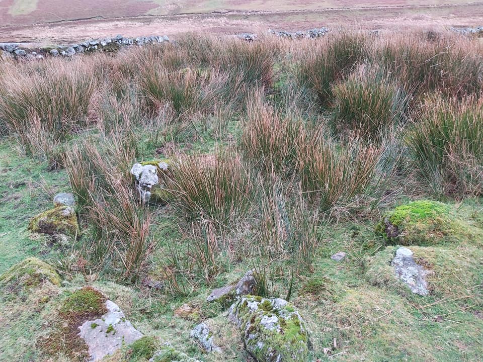
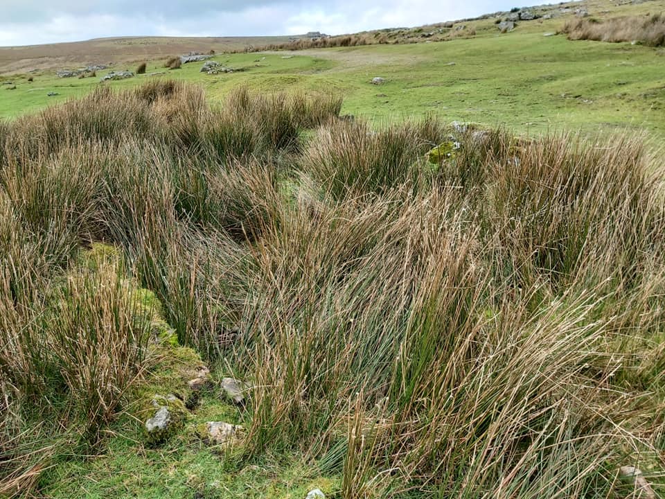
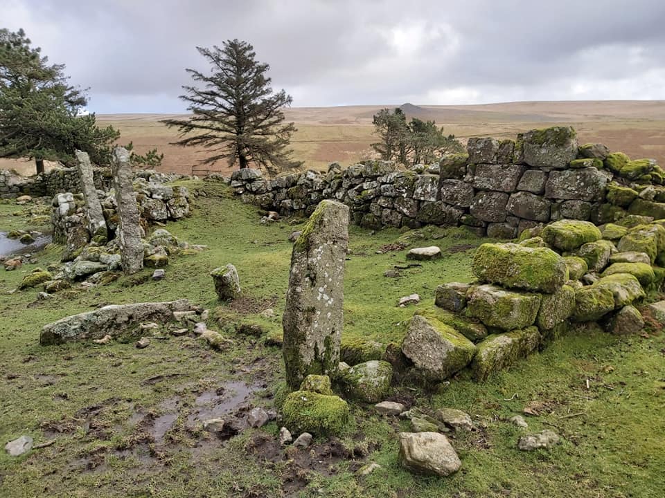
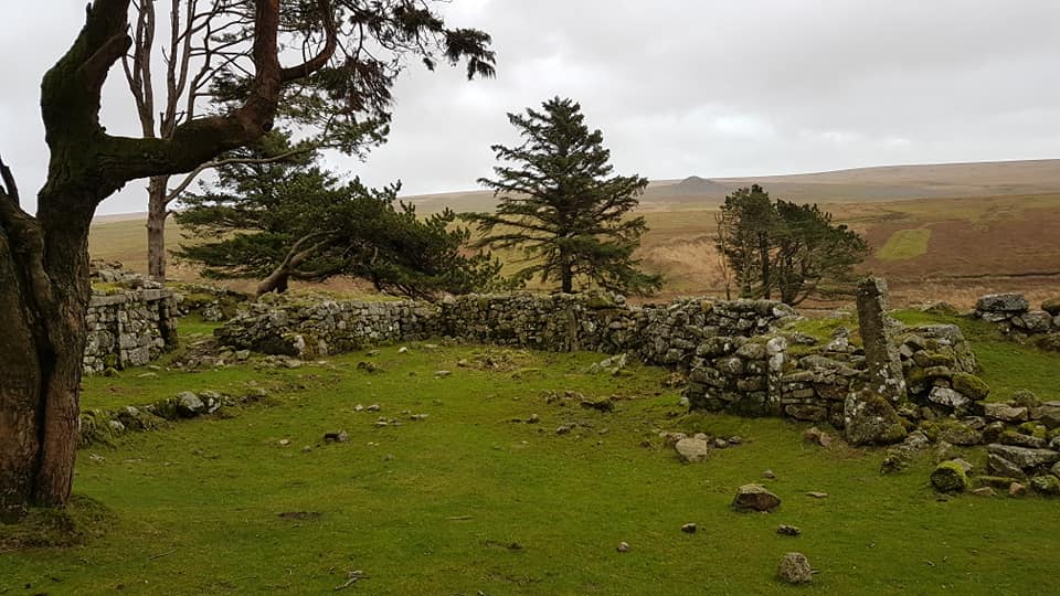
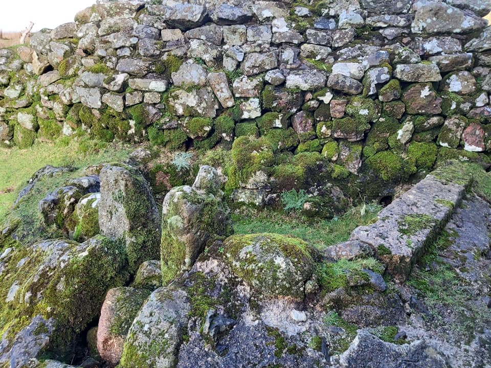
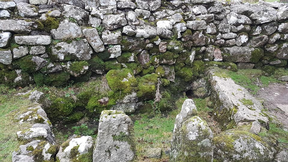
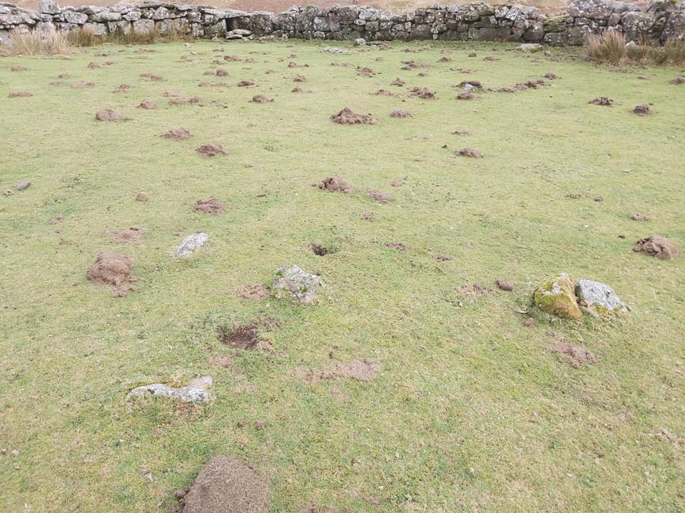
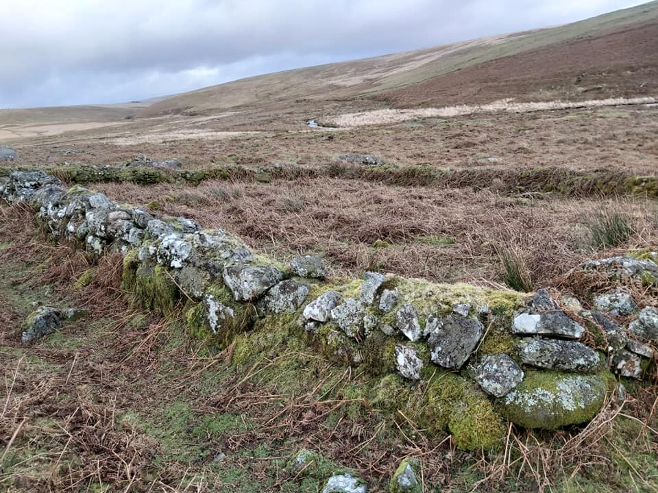
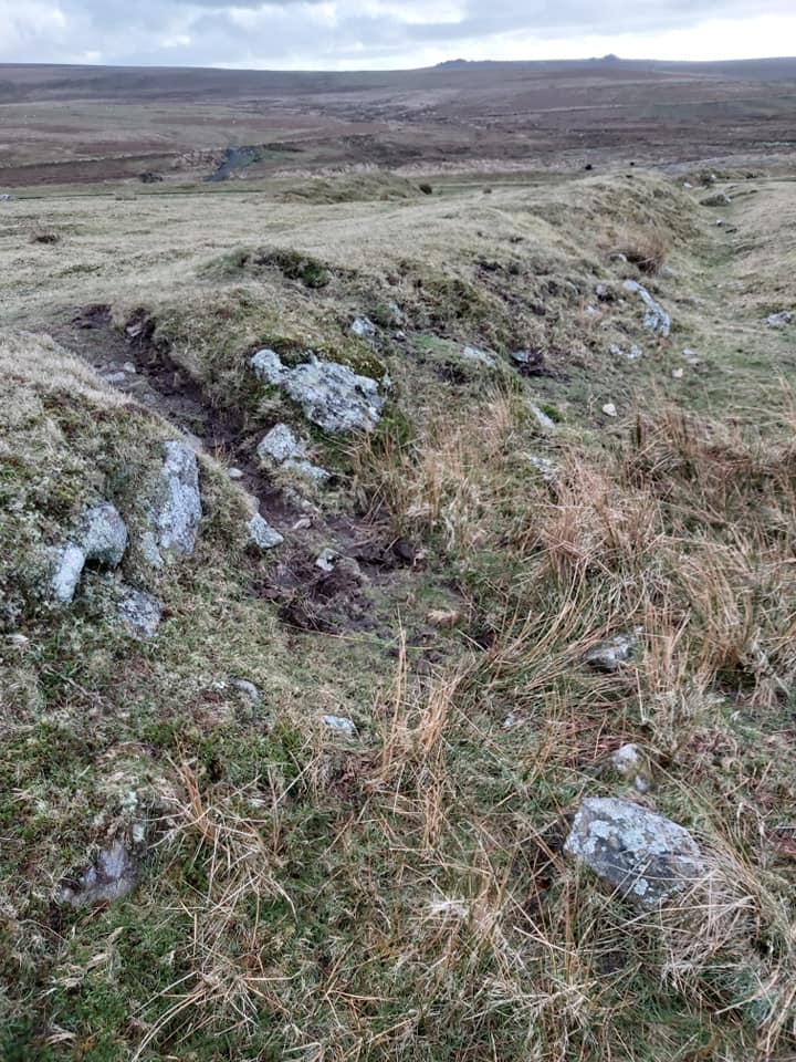
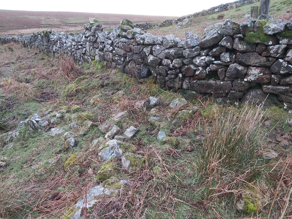
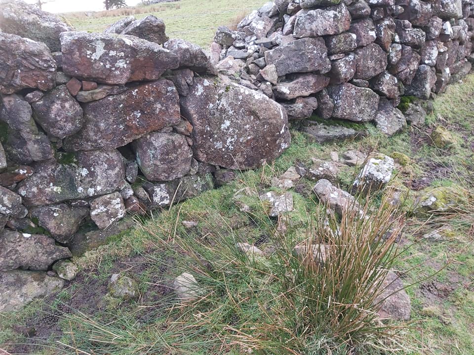
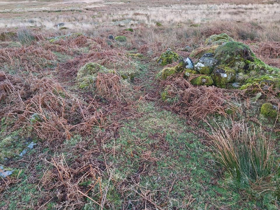
Apart from the warren house enclosure, there are numerous features around the warren itself including over 50 buries (pillow mounds) and fourteen Vermin Traps (recorded by R.G Haynes with some being shown in this post). There is evidence everywhere that the warreners dug ditches to drain and keep dry hill slopes and bury areas. Further reading of the Warren House can be found in William Crossing’s book ‘The Dartmoor Worker’.
Bibliography
Eric Hemery (1983) – High Dartmoor, pages 217-220
Colin Wakeham (2003) – Maristow Estate Farmhouses 1800-1913: A Chronological Development
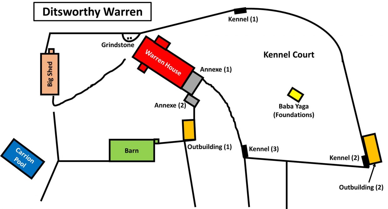
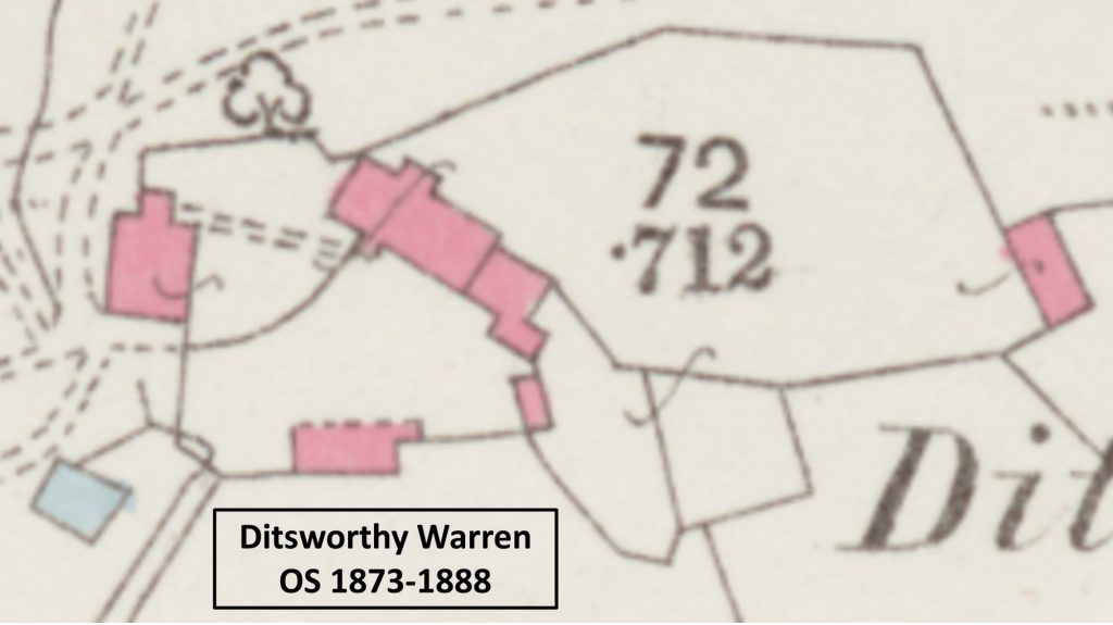
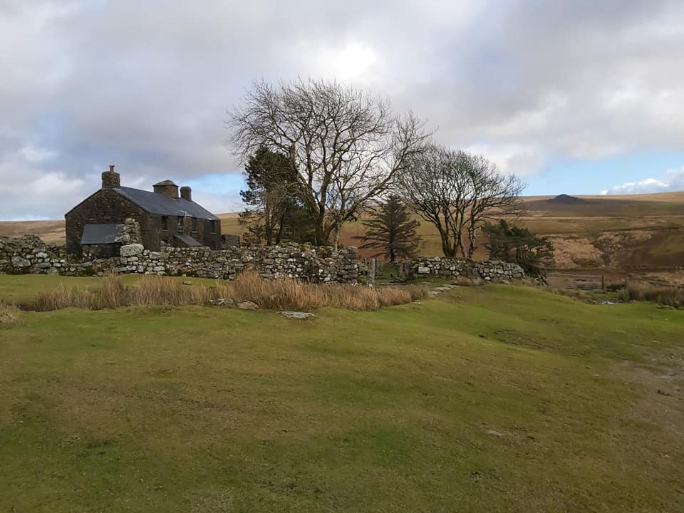
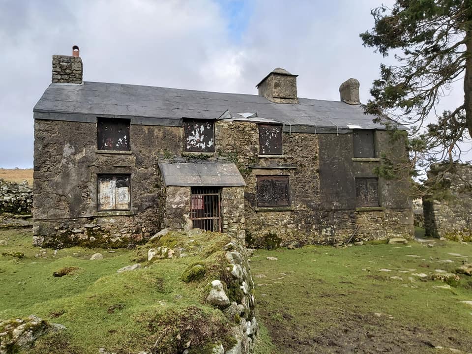
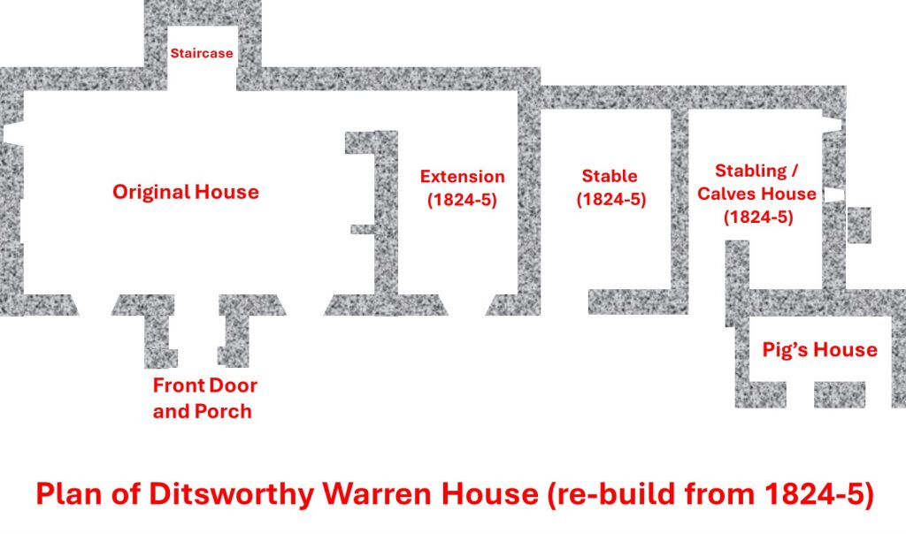
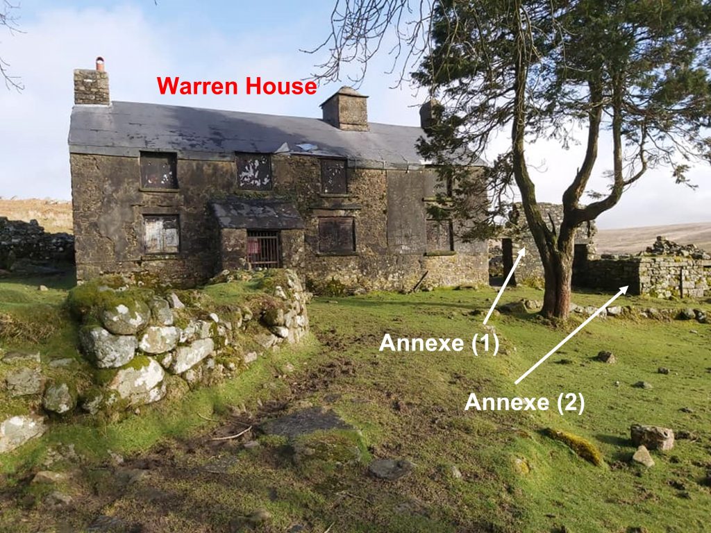
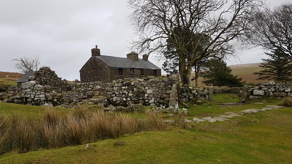
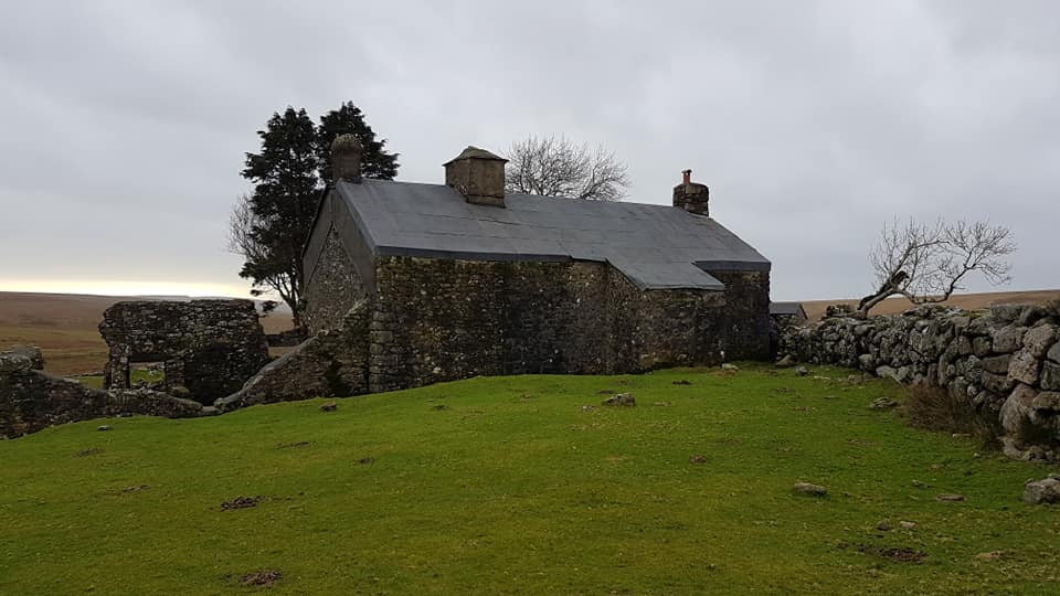
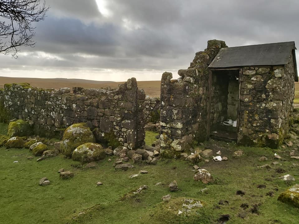
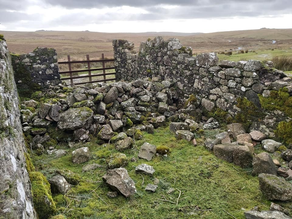
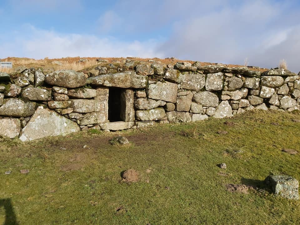
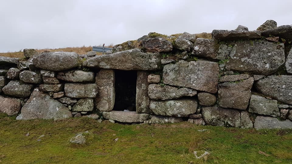
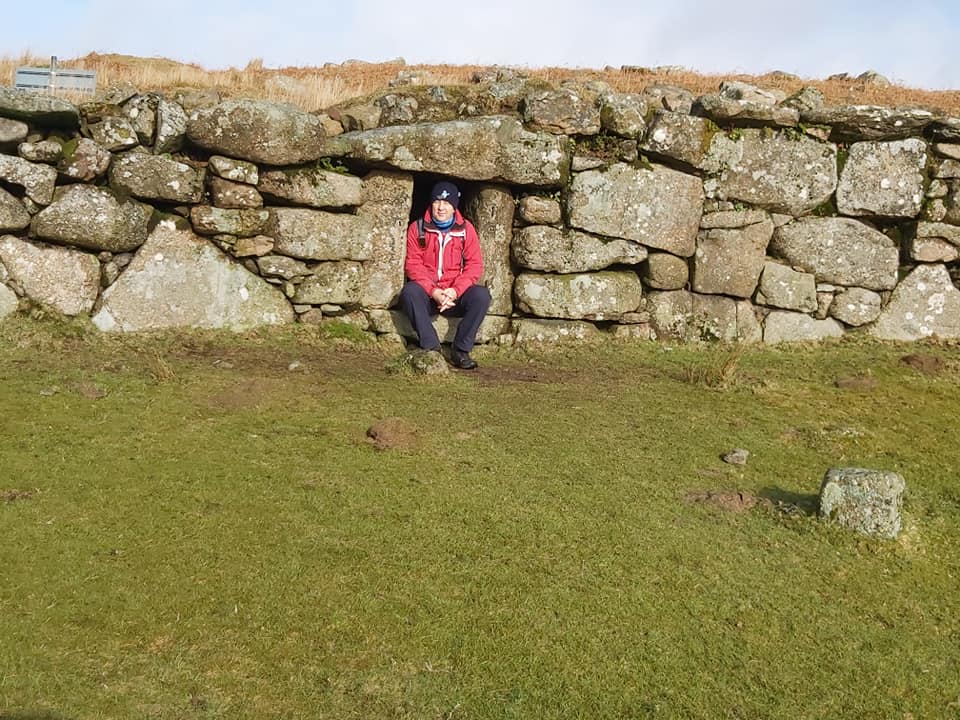
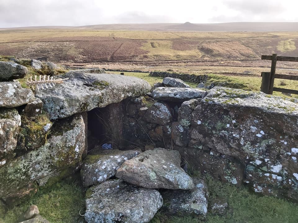
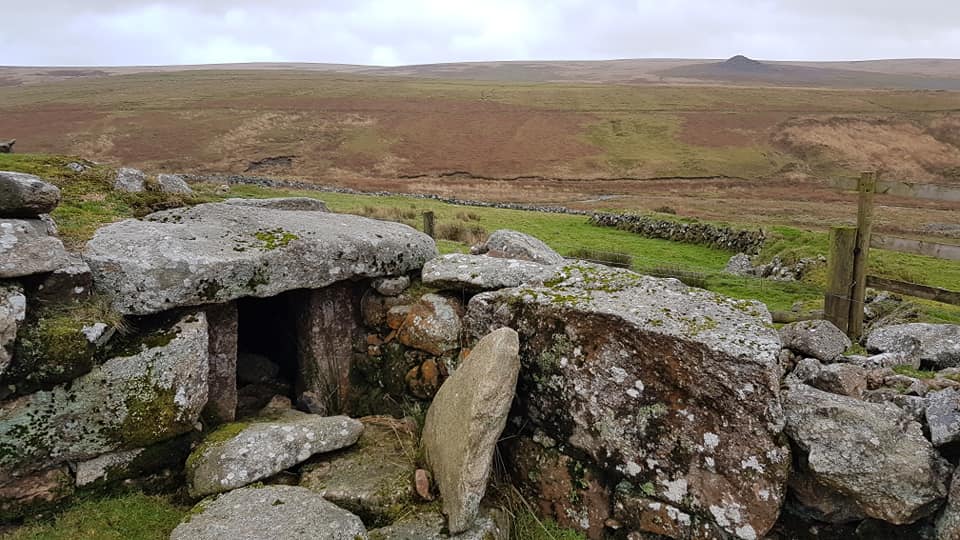
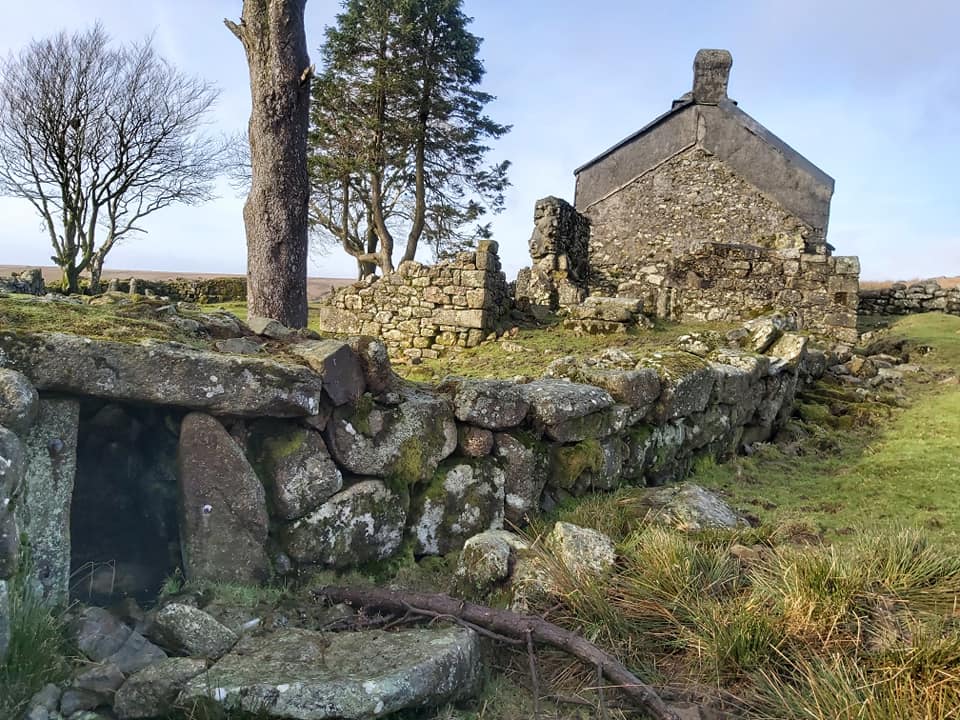
Sketch map of the features around the Ditsworthy Warren enclosure. Ditsworthy Warren from OS 1873-1888 map (side-by-side : National Library of Scotland). Unusually, the Dartmoor HER doesn’t mention the Carrion Pool (blue area) or the pink building out to the east.Approaching Ditsworthy Warren House from the west, Hen Tor just visible in the distance.The Warren House. The building was abandoned in 1947.Sketch of the farmhouse and other buildings which remain in the 21st Century. The majority of the work was conducted by the Maristow Estate circa 1824-5Ditsworthy Warren House is flanked by an annexe of two rooms, marked annexe (1) and annexe (2) by The author. These were part of the 1824-5 work conducted by the Maristow Estate. They are located at SX58415 66272 and SX58416 66268.The west gateway into the Ditsworthy Warren House enclosure with ‘Big Shed’ in the foreground in front of the Warren House.The rear (north side) of the Warren House. Annexe (1) ruins are on the east side of the house. ‘The Big Shed’. This was where the rabbits were dressed and cleaned ready for market. The building is 10 metres long by 3 metres wide with gable ends. A small annexe is attached to the gable end to the north.Inside ‘Big Shed’. The centre of the structure is at SX58394 66271.The foundations of a ‘Carrion Pool’ are located at SX58376 66250.The ‘Carrion Pool’ was an artificial pool. It was known locally as the ‘Carronpool’ (Carrion Pool), which in here carcasses were kept prior to being fed to the warren dogs. Simply, the pool acted as a refrigerator keeping the meat fresh. A ruined barn at SX58399 66255, lies to the south of the Warren House.An outbuilding lies to the south east of the two annexes and the Warren House at SX58417 66262.This semi-circular structure (small reservoir) lies a few metres to the north-west of the Warren House. It is 1.8 metres across and has two upright stone posts 30 centimetres apart (Source: Dartmoor HER). The two upright stones are the location of where a grindstone would have once been located. Adjoining the front of the reservoir is a small trough. The reservoir was fed by a leat.The grindstone can be found at SX58400 66277.There are three dog kennels within the walls of an oval enclosure on the east side of Ditsworthy Warren farmstead. Kennel (1) is shown in the photograph. The height of the wall suggests the purpose of the enclosure was to contain rather than exclude animals. The 19th century Tithe Apportionment refers to the enclosure as ‘Kennel Court’, with the function to provide shelter for the warreners dogs.Kennel (1) is located at SX58431 66297.The author in the dog house at Kennel (1)Kennel (2) is located at SX58466 66268.Kennel (2) with views to the Plym and Hen Tor beyond.Kennel (3) with the two annexes (1 and 2) on the end of the Warren House beyond. Kennel (3) is located at SX58246 66265.This is the foundations of the ‘Baba Yaga’ description by Eric Hemery, High Dartmoor, page 220 at SX58438 66274. Eric states: “Additional, cosy shelter was built by Percy Ware. He would make a very large bench in the centre of kennel court: below it he built two box-like compartments, and above it a rick of ferns (bracken); this he thatched with rushes. Thus were the occupants of this Baba Yaga bungalow on legs protected from the elements”. All that remains of this today are the small supporting granite blocks that stand in the centre of the Kennel Court.“Ware’s Garden” enclosure overlooking the Plym with Hen Tor in the background.To the east of Ditsworthy Warren House at SX58606 66316 lies Mrs Ware’s potato field. The Wares lived at DWH for over 100 years.Vermin Trap at SX58162 66328. Ref RG Haynes, Ditsworthy Warren #10 “west of Ditsworthy House, a ruinous trap of small stones at the junction of three ancient walls”. The description fits well, but Haynes GR was SX5810 6635.Vermin Trap at SX58578 66209. Ref RG Haynes, Ditsworthy Warren #6 “SE corner of Ditsworthy enclosure ; crumbling and dilapidated with two shortened funnel walls against a high field wall”. The description fits well, but Haynes GR was SX5860 6620.This is the most likely location (imo) of another Vermin Trap at SX58545 66259. Ref RG Haynes, Ditsworthy Warren #12 “lies a few yds E of the enclosure known as Ware’s Garden, E of DWH, built against an enormous boulder, which itself forms part of an ancient wall.”. The description fits ok (ish), but I’m not fully convinced. Haynes GR was very different from this at SX5860 6635.Vermin Trap at SX58772 66483. Ref RG Haynes, Ditsworthy Warren #11 “half a mile E of DWH, set at right angled turn on an ancient wall”. The description fits very well, but Haynes GR was SX5870 6640. The author followed the wall east until he met the right angle!