A collection of walks, discoveries, insights and pictures of exploring Dartmoor National Park
January 6, 2024
Butchery Stream, Princetown
The author first became aware of this water course through an article titled “The Butchery Stream” – another little mystery by Dave Brewer published in the Dartmoor Magazine (Issue 6, Spring 1987). Brewer recorded in his article that he had first became aware of the Butchery Stream whilst reading in a back issue of the Devon Historian called “The early water supply of Plymouth, an introduction” by David Hawkings (April 1982). The story begins with the the Hawkings article recording that Devonport Leat often provided an inadequate supply of water; townsfolk of Plymouth going short of water whilst the military complained of low water pressure. As a result of this, the Devonport (Dock) Water Company were often under attack from consumers, which resulted in the company employing unscrupulous tactics to improve the supply. One such tactic took place in 1822, when without legal authority they (Devonport Water Company) diverted the ‘Butchery Stream’ into Devonport Leat.
The diversion of the stream into Devonport Leat appears to have gone well until there was a complaint about effluent discharged by the Dartmoor Tile Company into the stream which thus entered the leat. The effluent discharge had resulted in discolouration of the water supply. The Butchery Stream diversion appears to have ceased around 1852 after the complaint, which was made to the Duchy (and happened to have been by the Devonport Water Company themselves). This was rather odd situation, as the Devonport Water Company complaint to the Duchy about the discoloured water source (ie Butchery Stream) was regarding water they had diverted 30 years earlier and weren’t even entitled to in the first place !
The ‘Butchery stream’ is now better known as Moor Brook, albeit its location in the heart of Princetown doesn’t appear to be well known as part of its infant course is now underground. This post covers the mysteries surrounding this stream; The first part of the mystery is why was it called the ‘Butchery Stream’ and secondly where had the Dartmoor Tile Company been located to have polluted the stream ?
Bibliography
Dave Brewer (Spring 1987), Dartmoor Magazine (page 25) ‘The Butchery Stream – another little mystery’
Ron Joy (2002), Dartmoor Prison A Complete Illustrated History Volume 1 The War Prison 1809-1816 Parcere Subjectis, (page 33)
Elisabeth Stanbrook, (2002), Dartmoor’s War Prison & Church 1805-1817
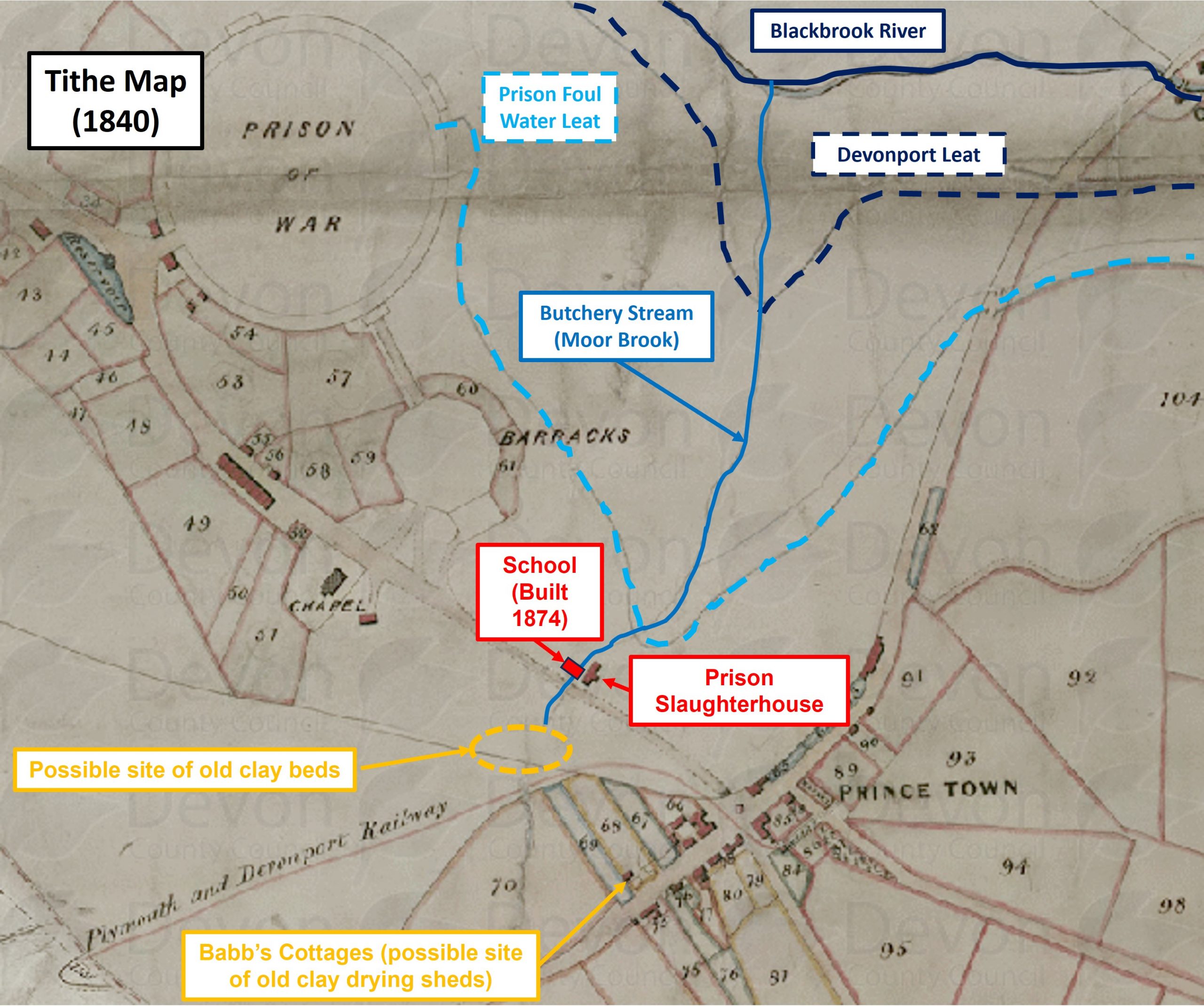
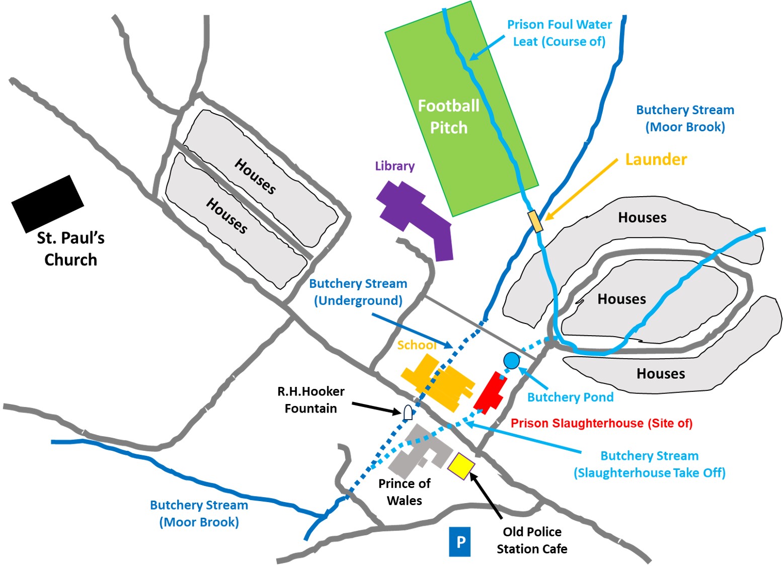
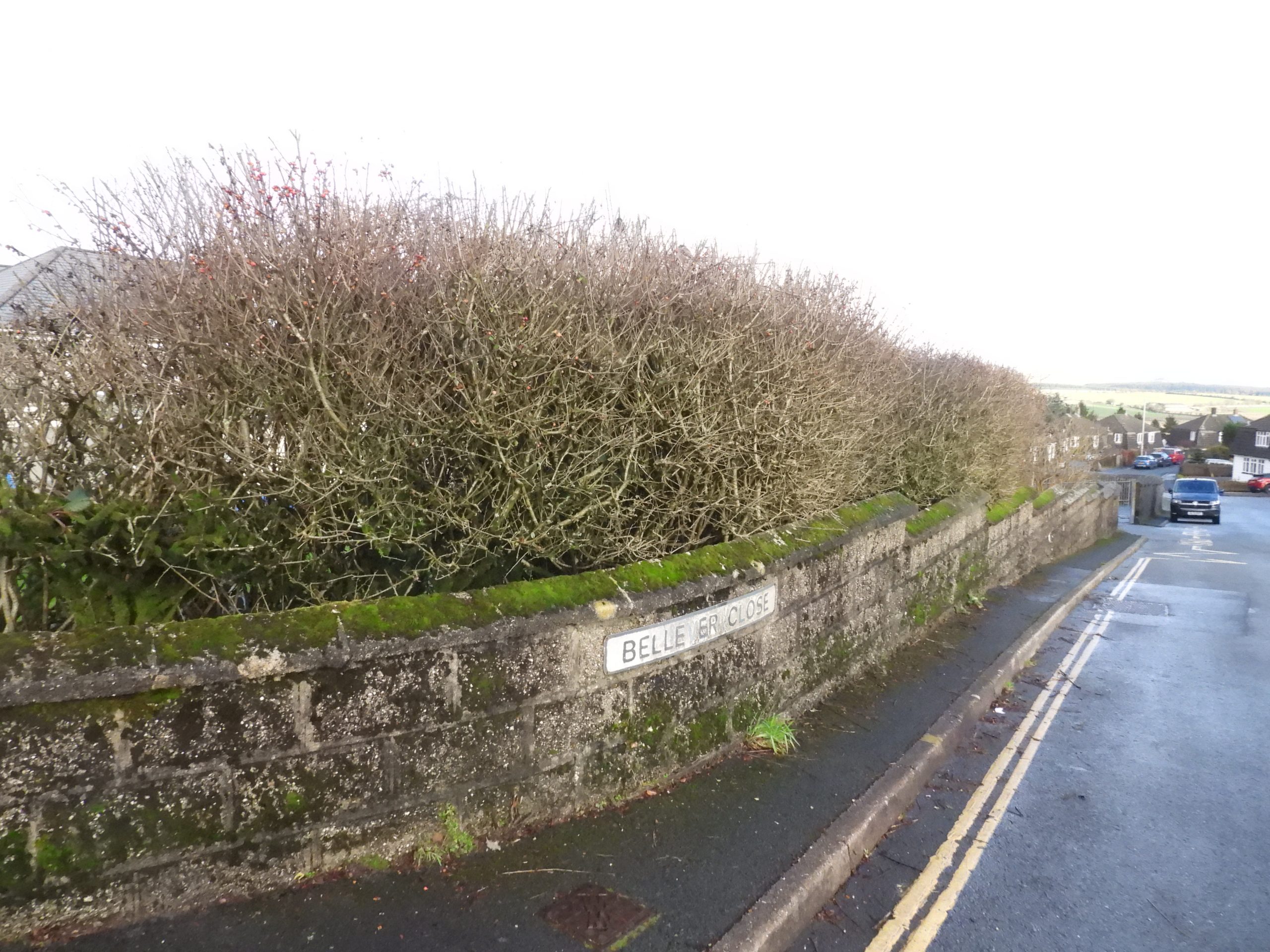
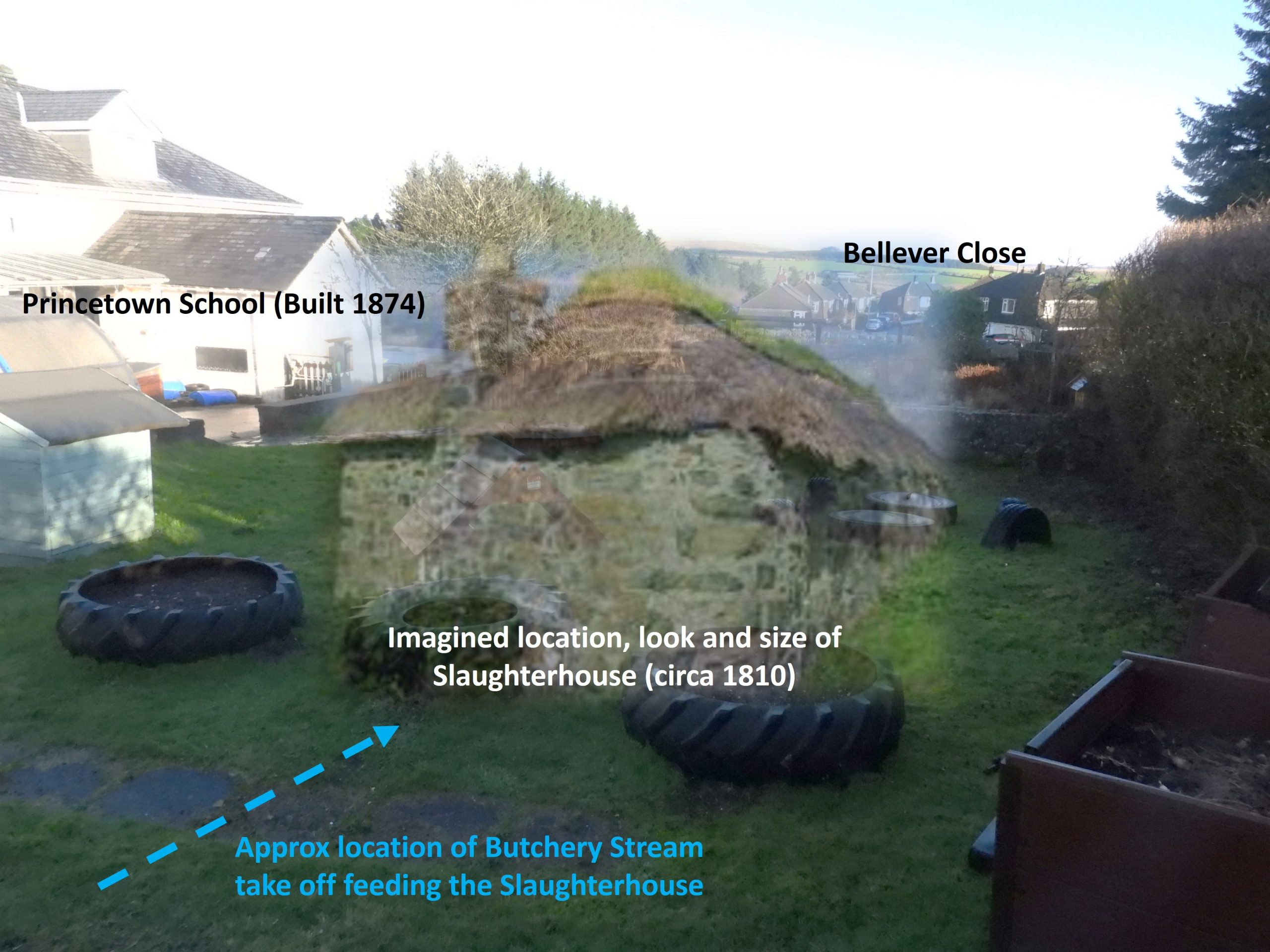
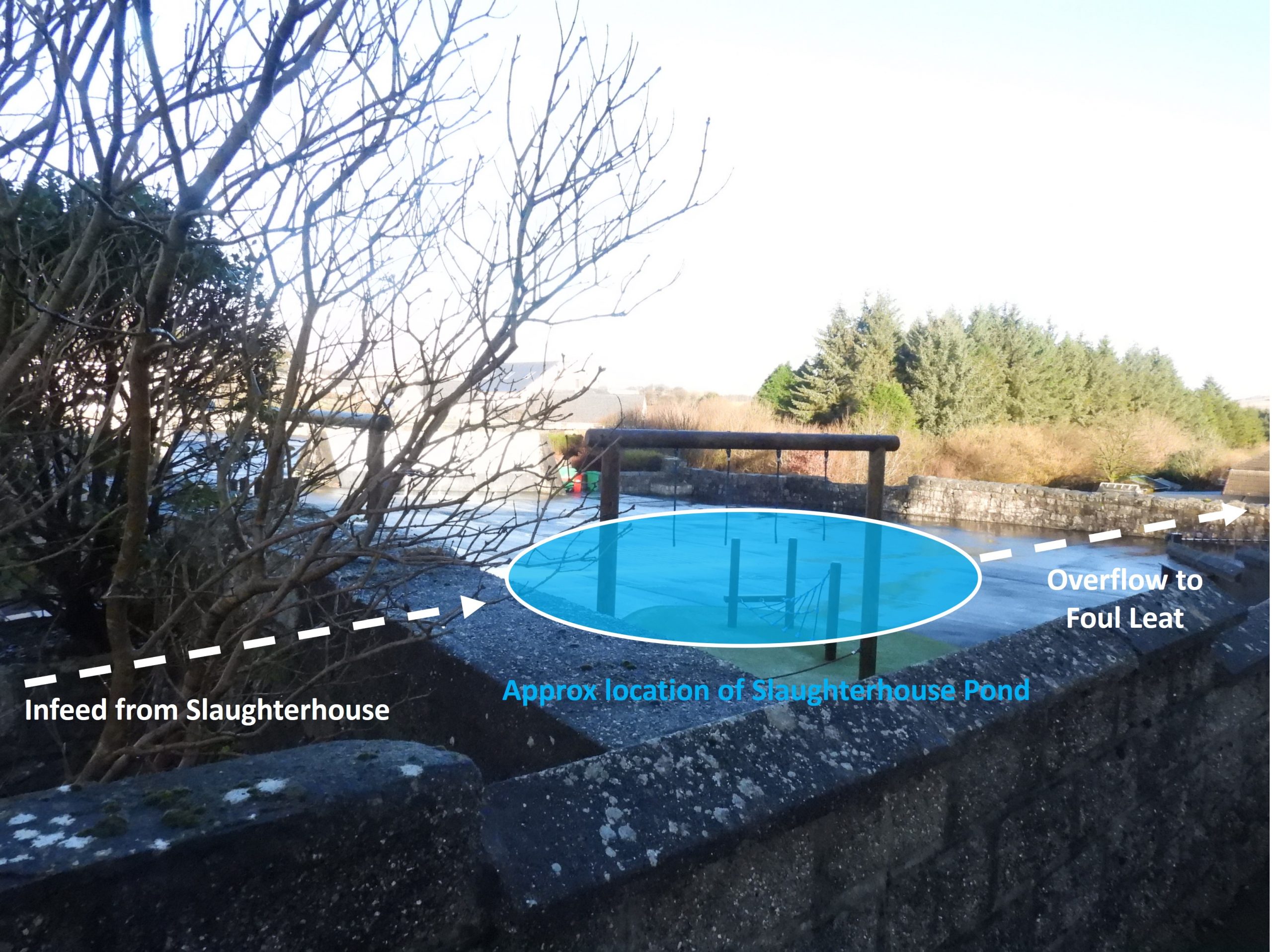
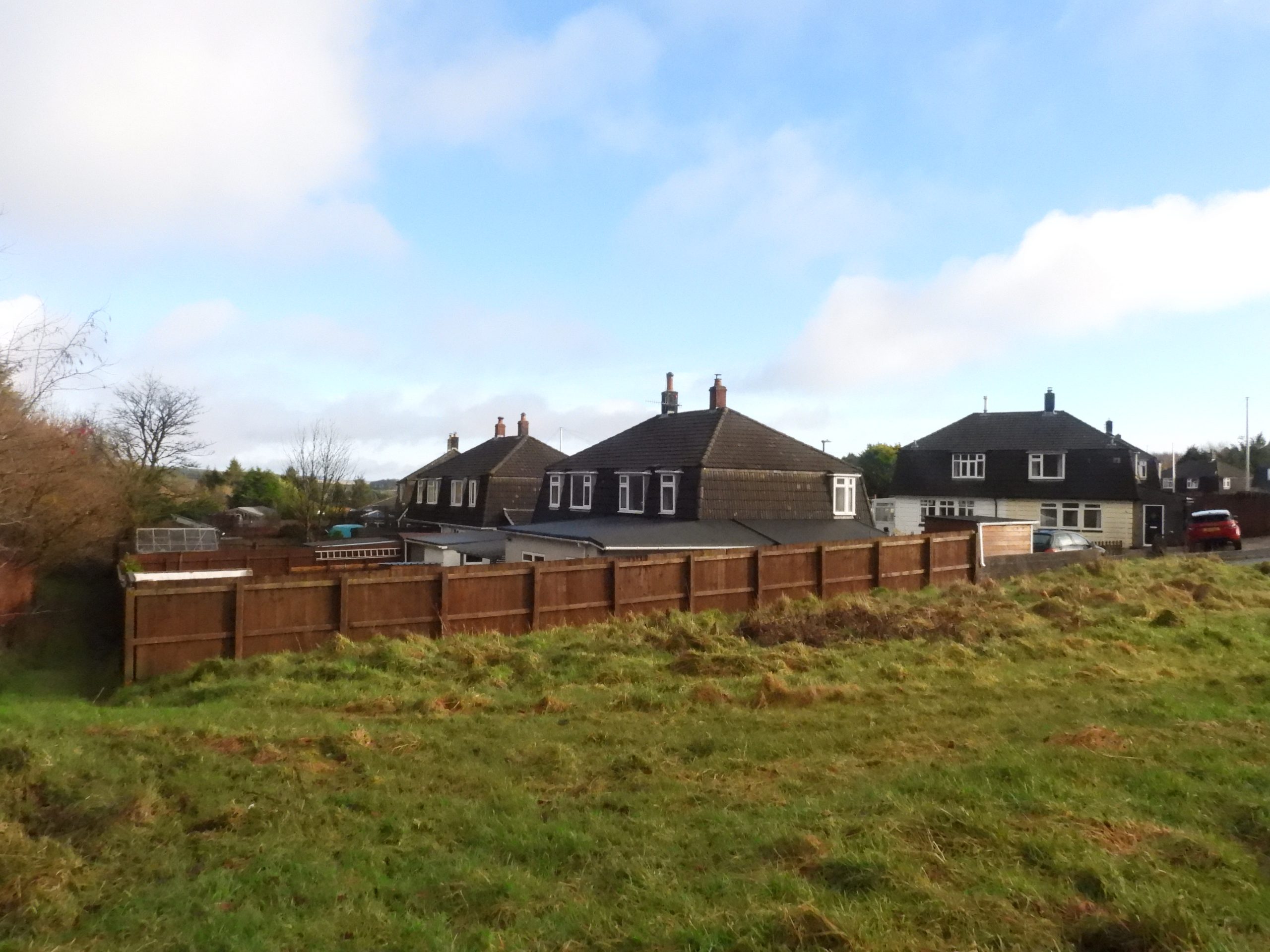
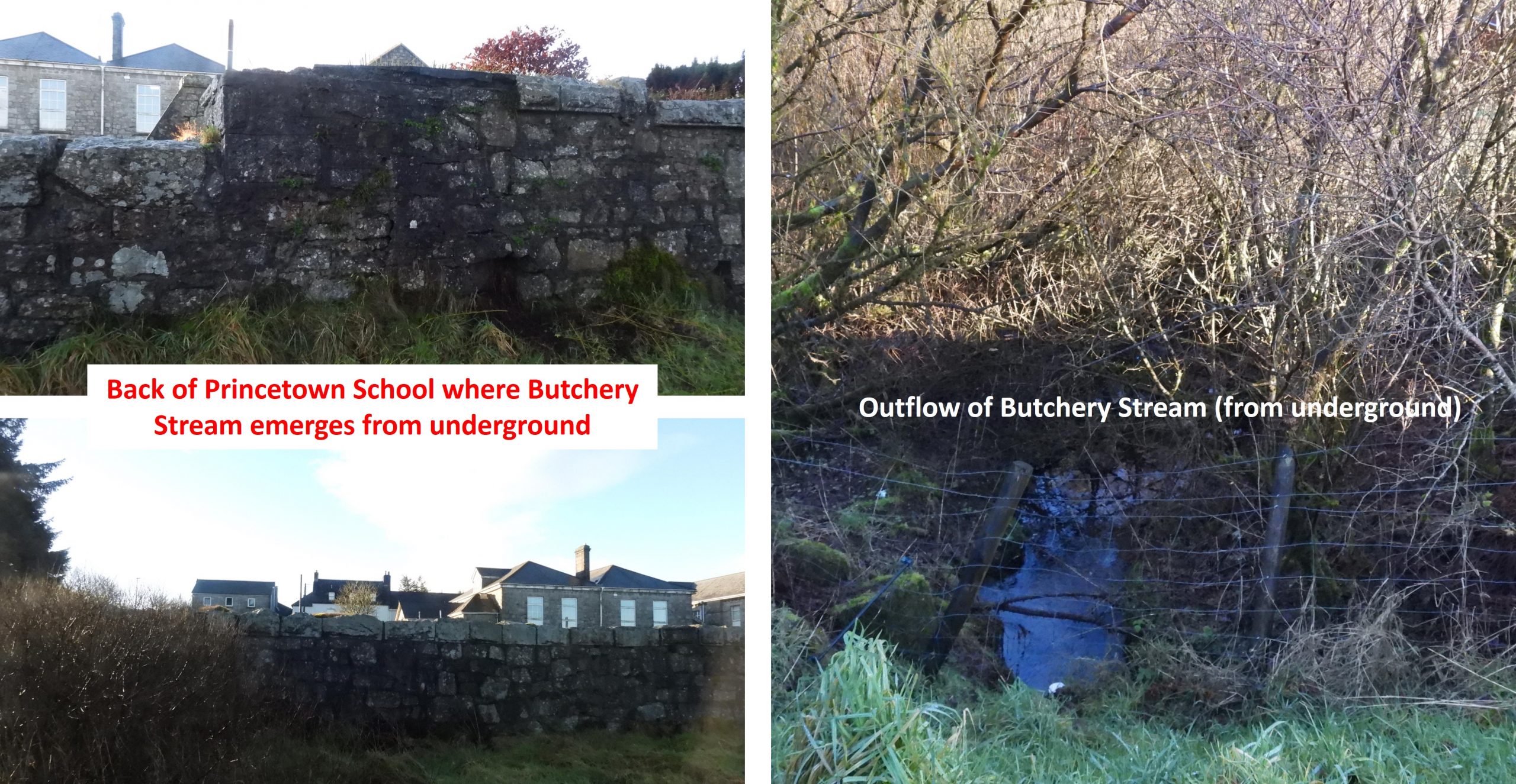
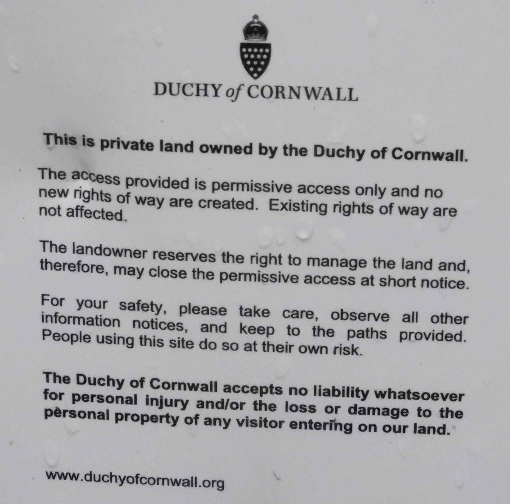
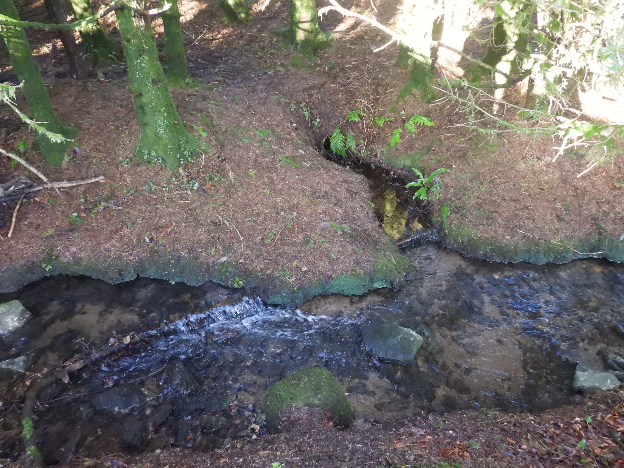
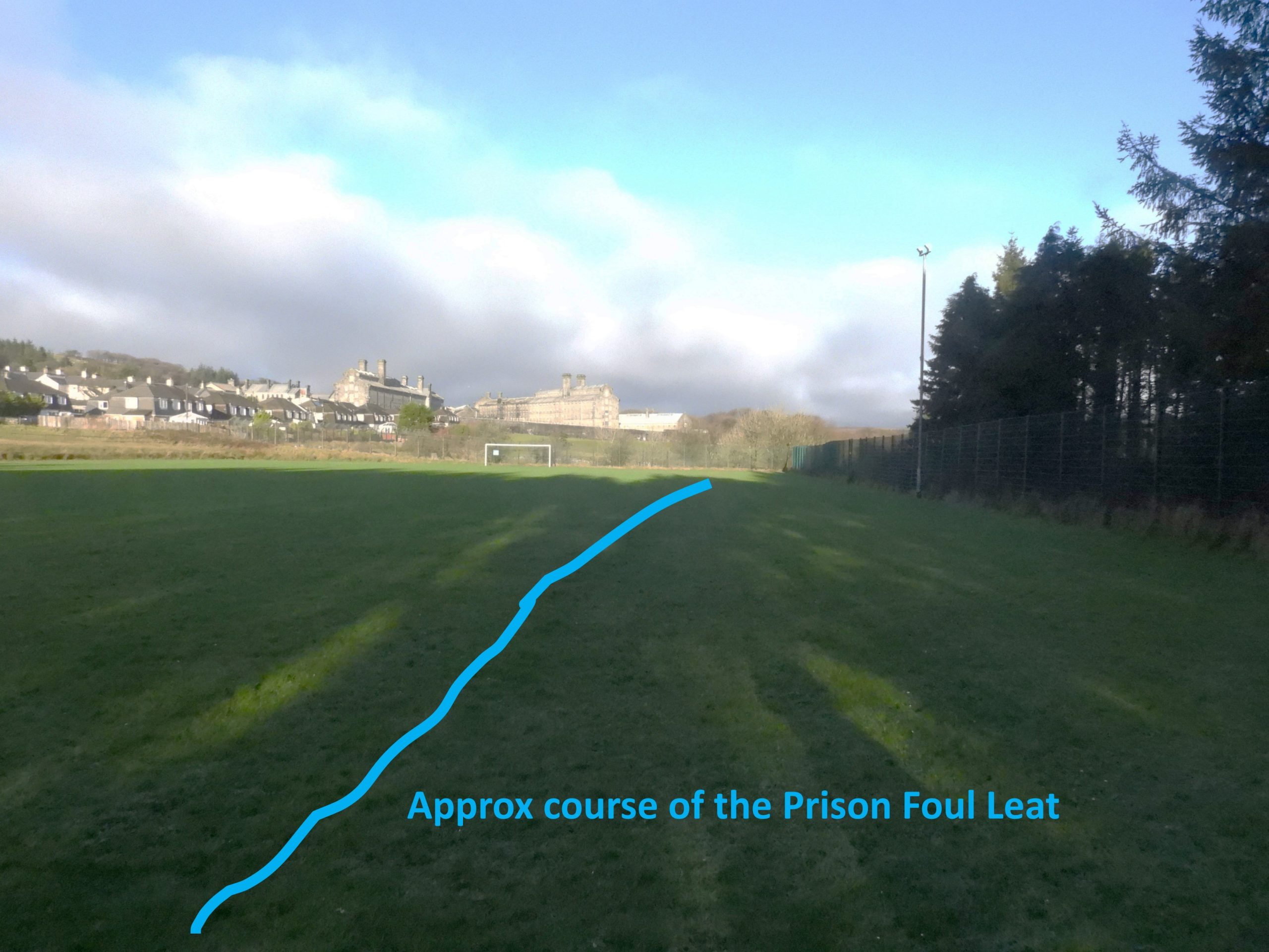
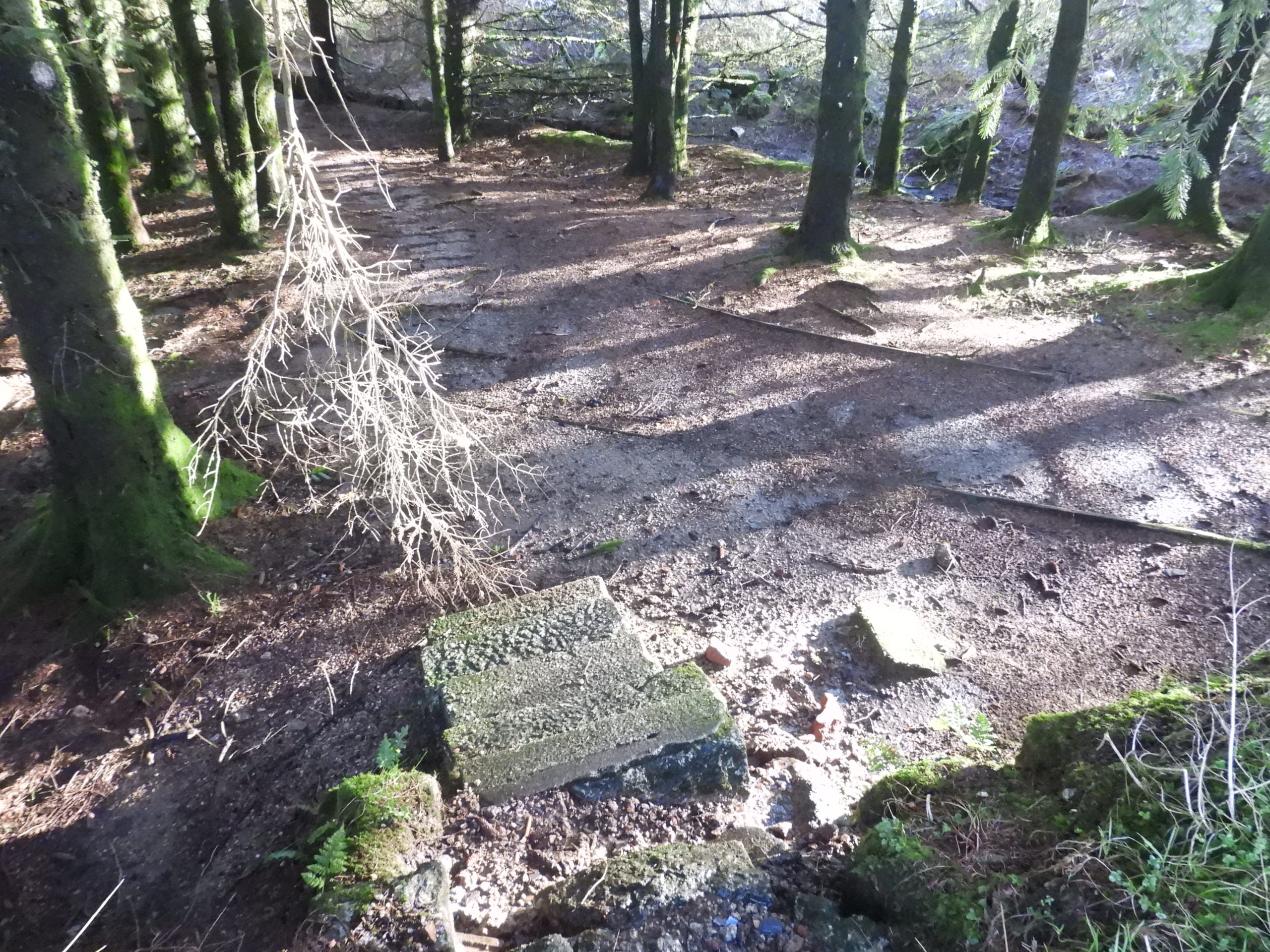
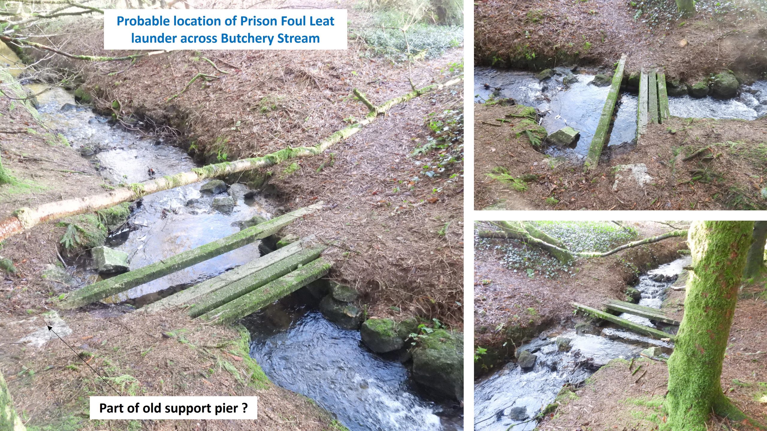
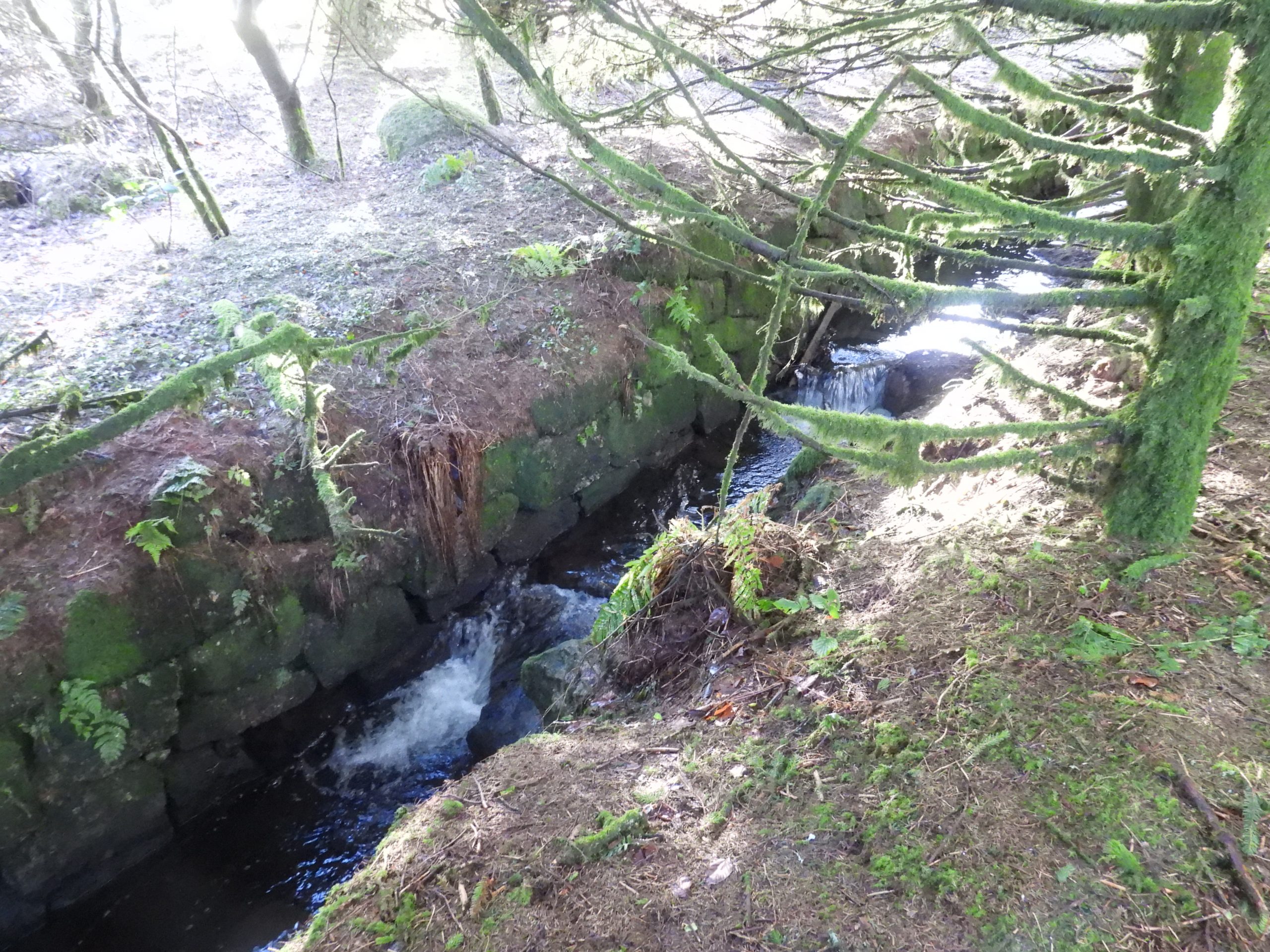
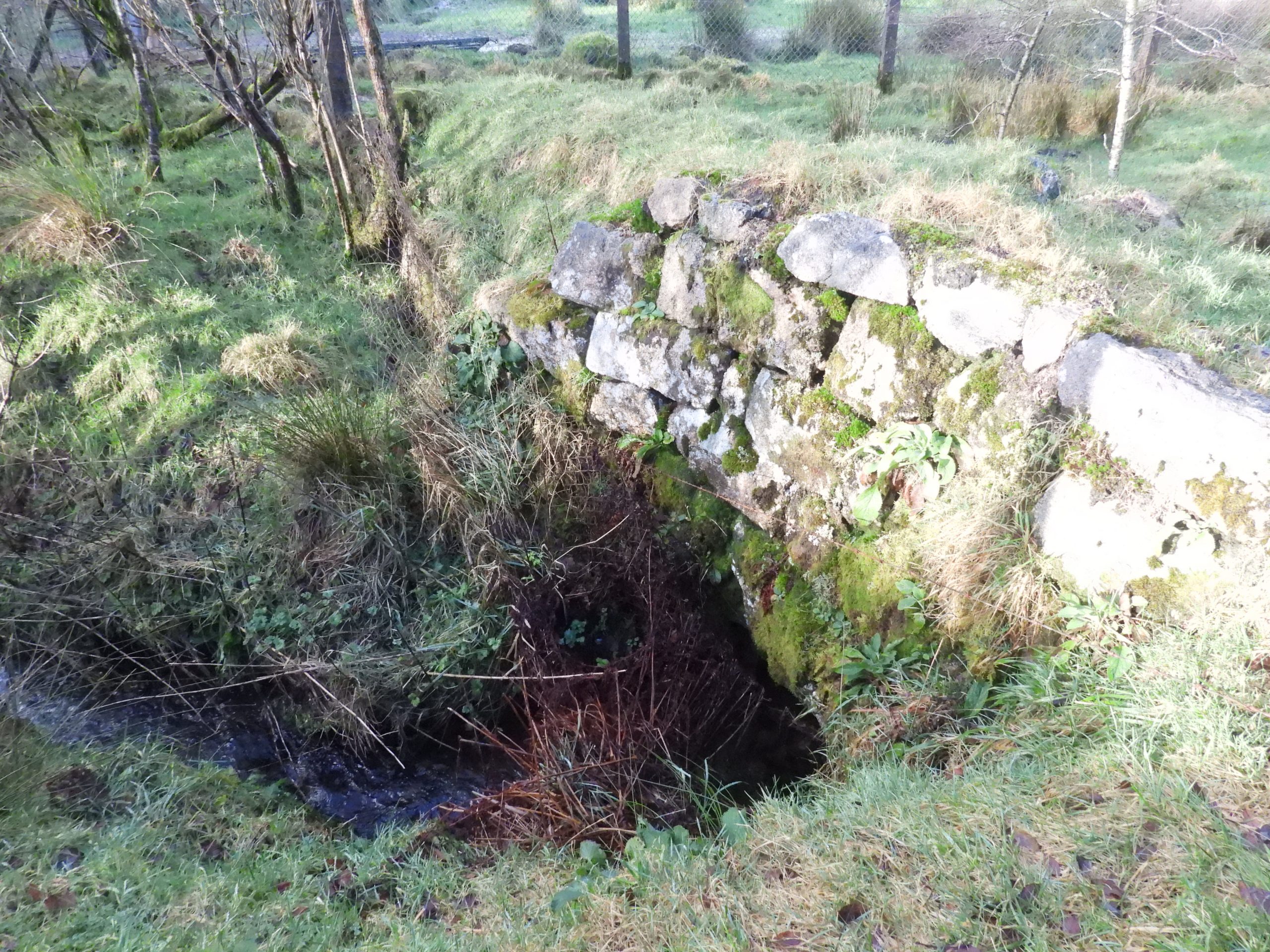
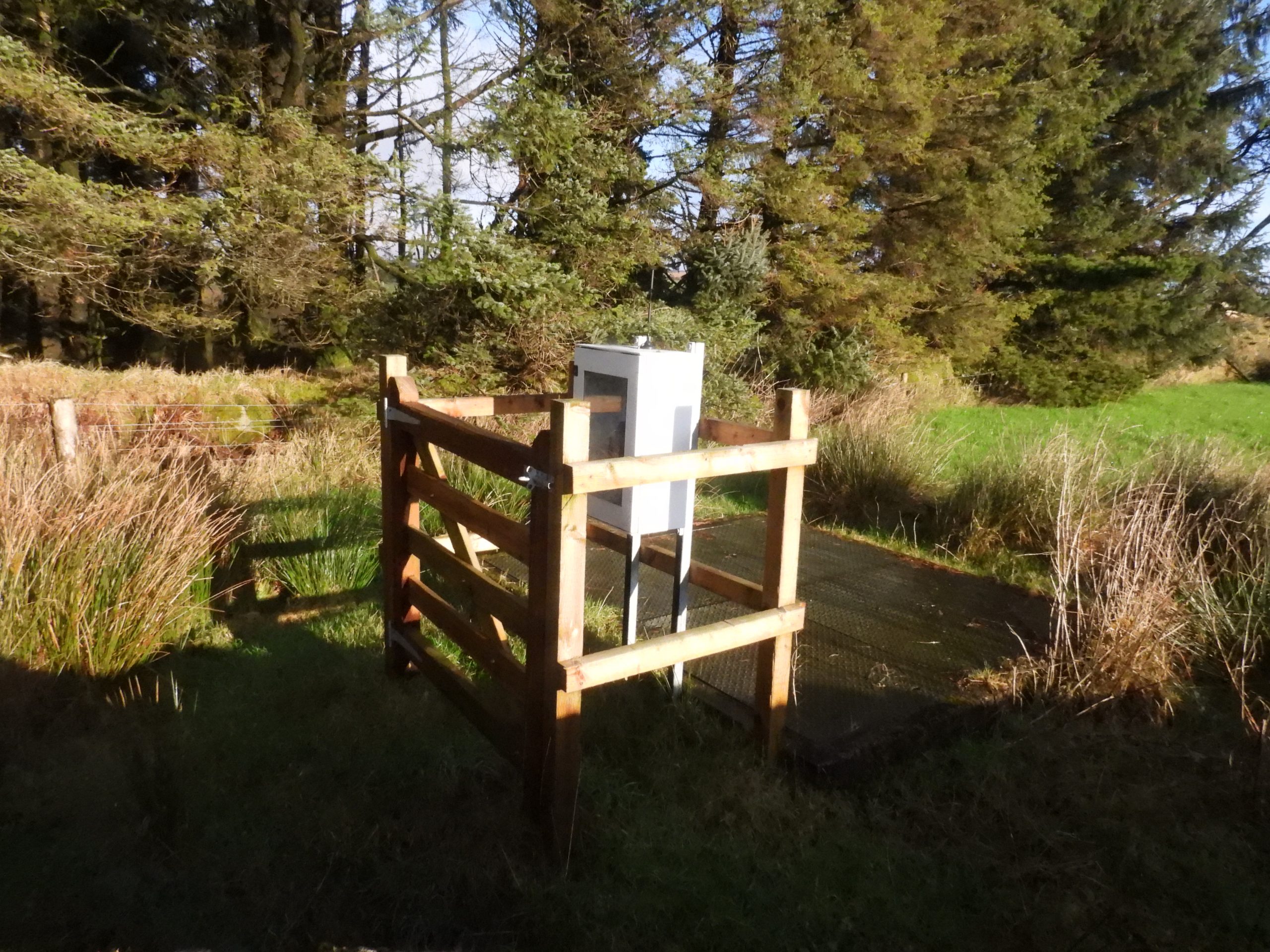
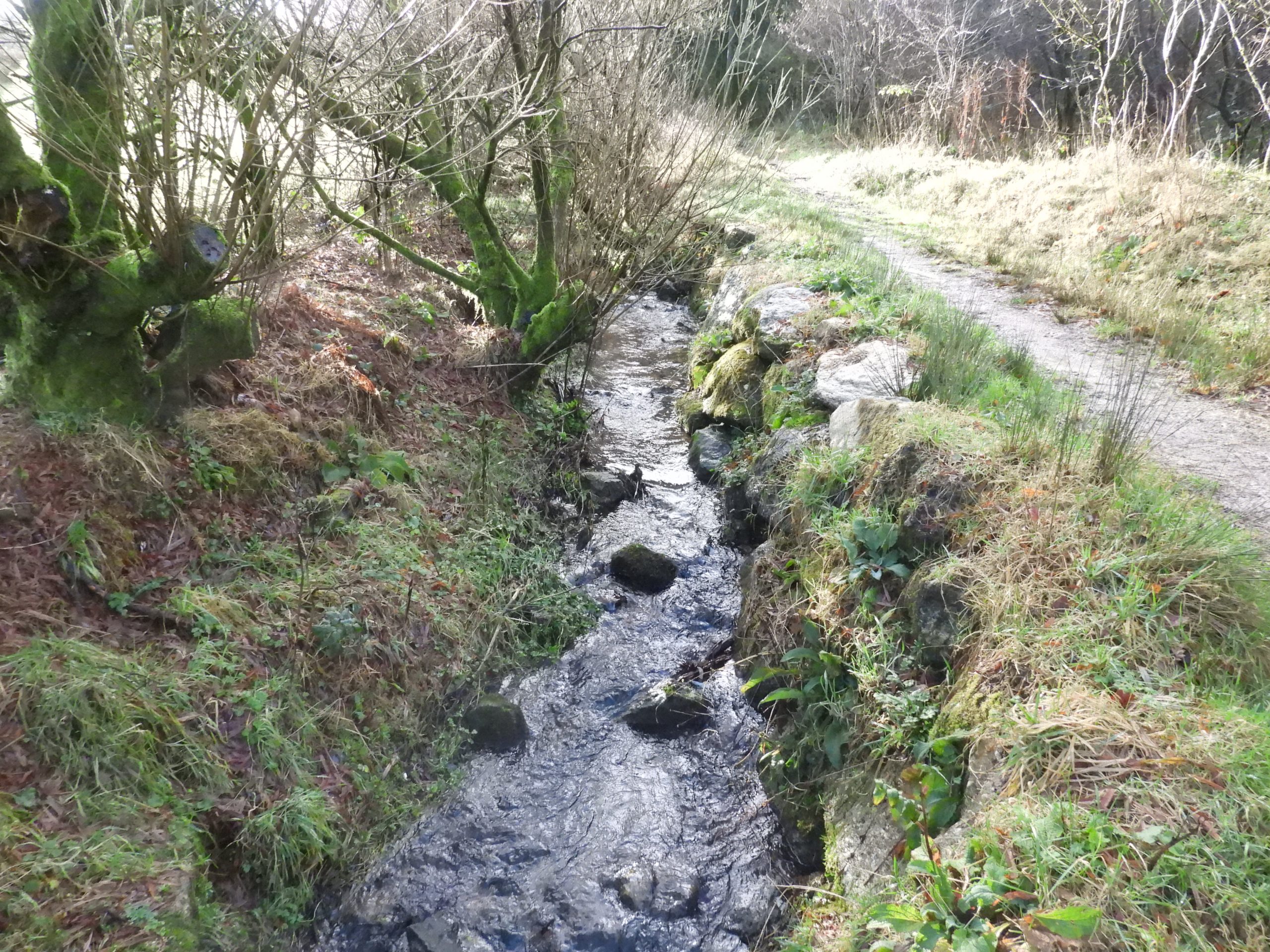
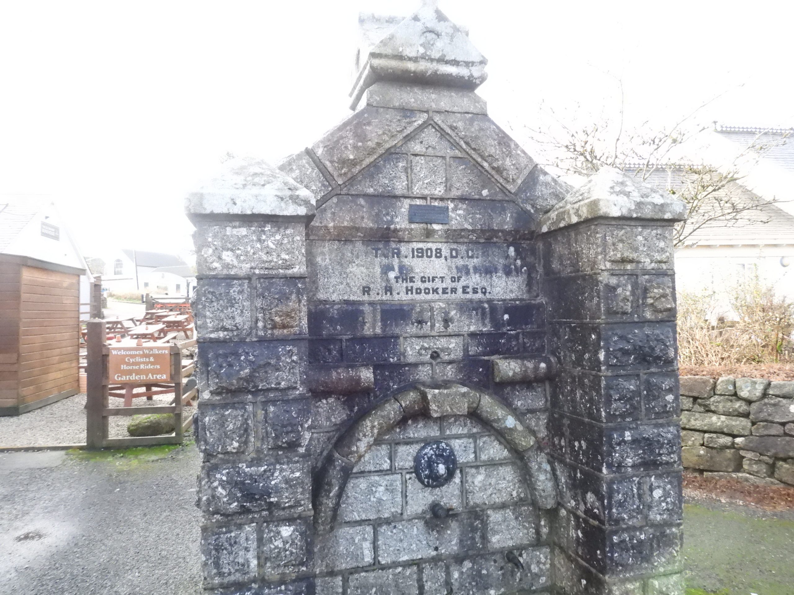
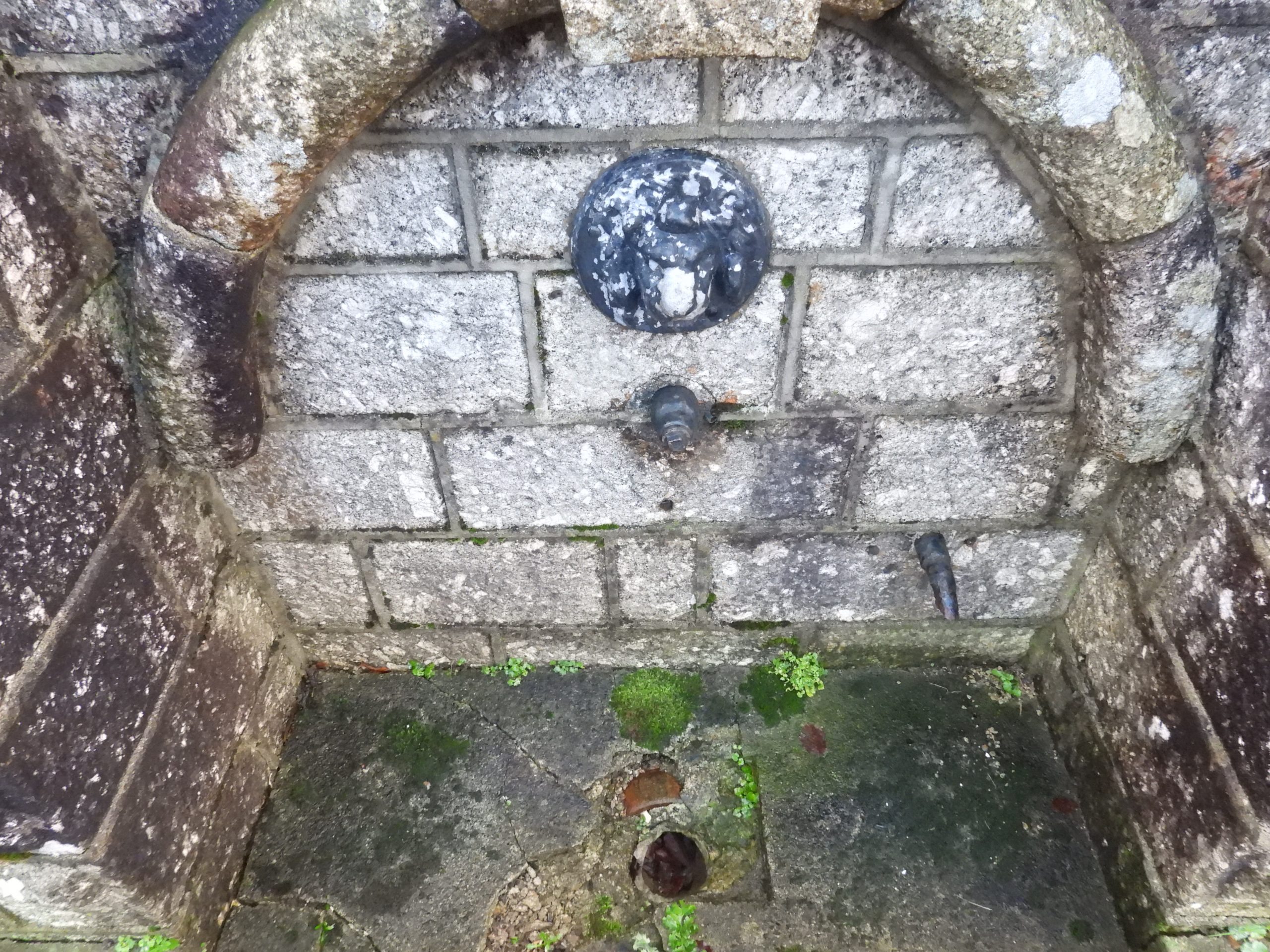
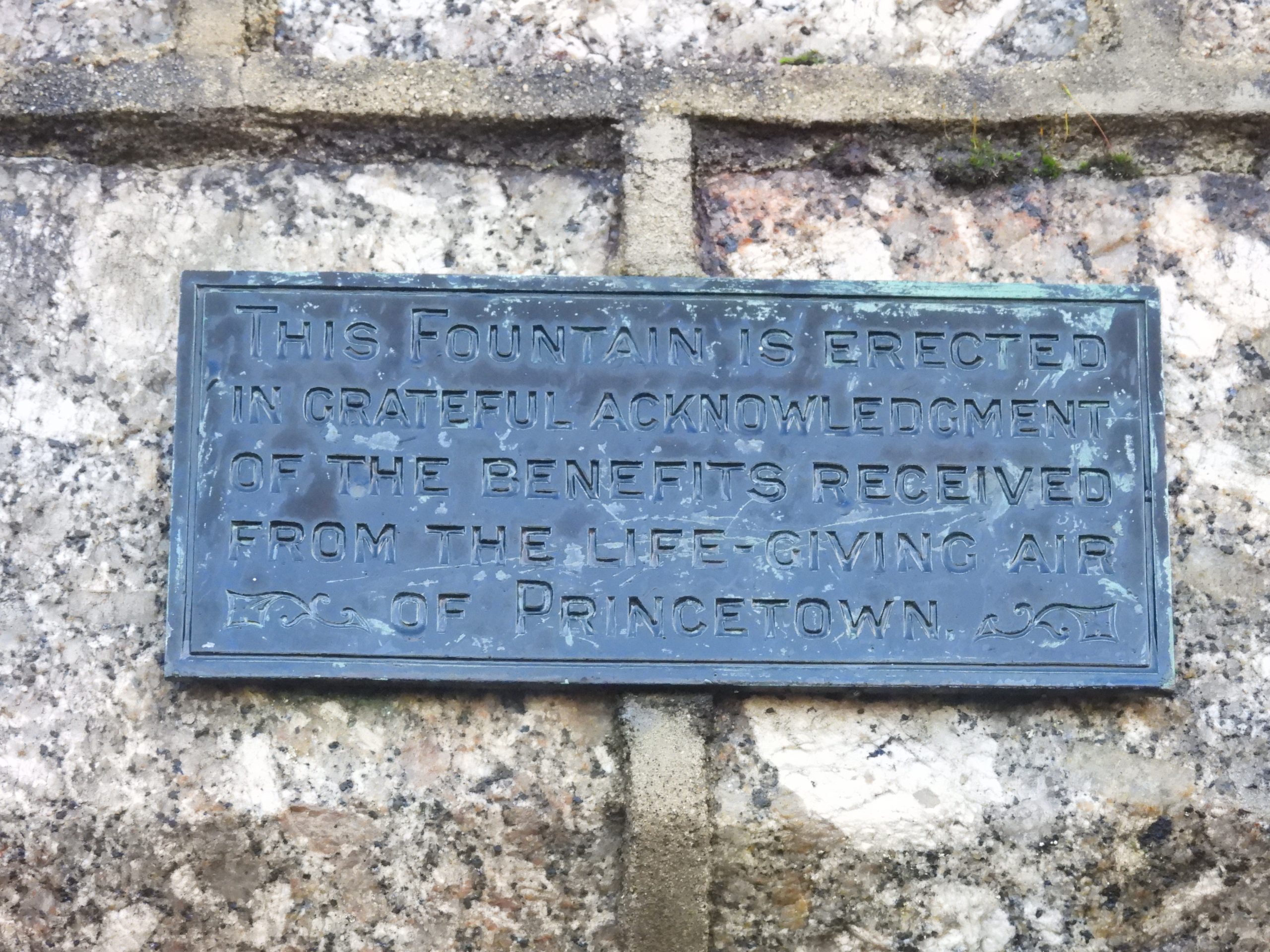
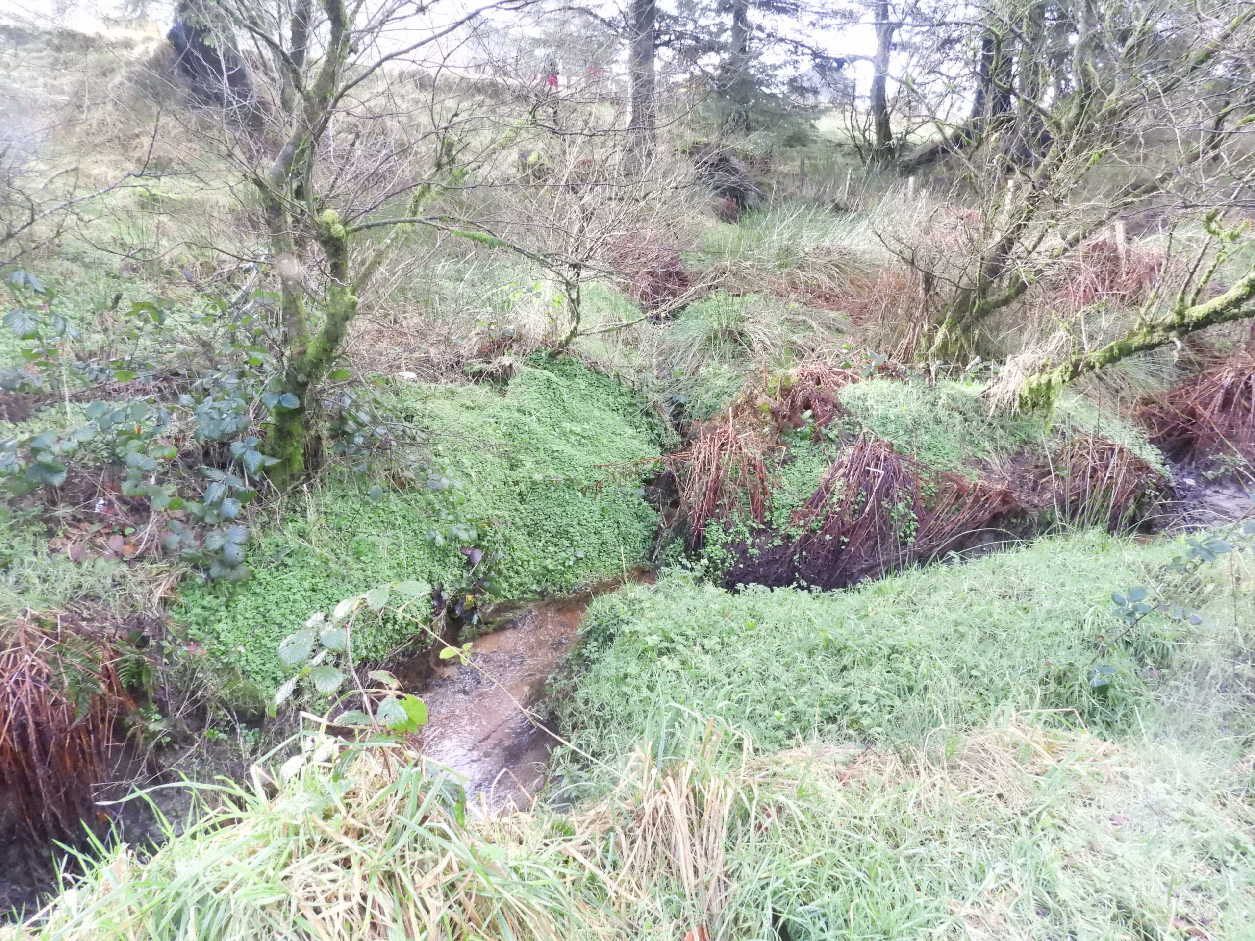
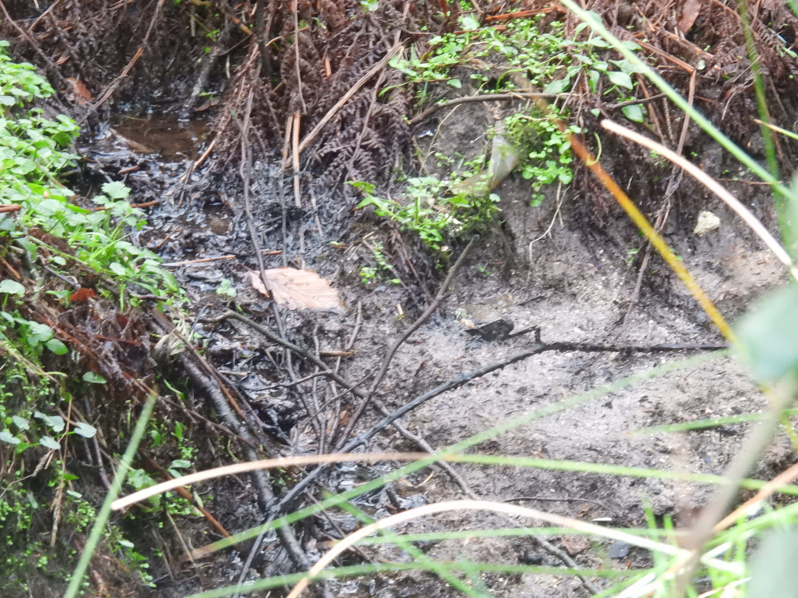
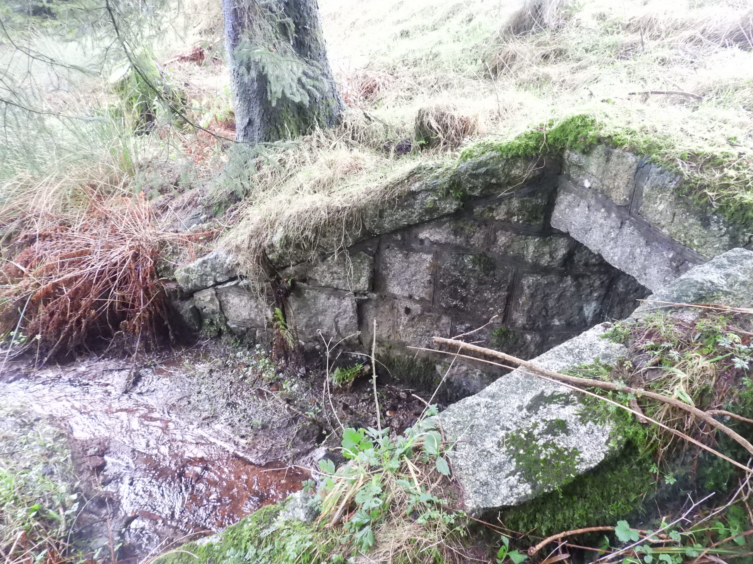
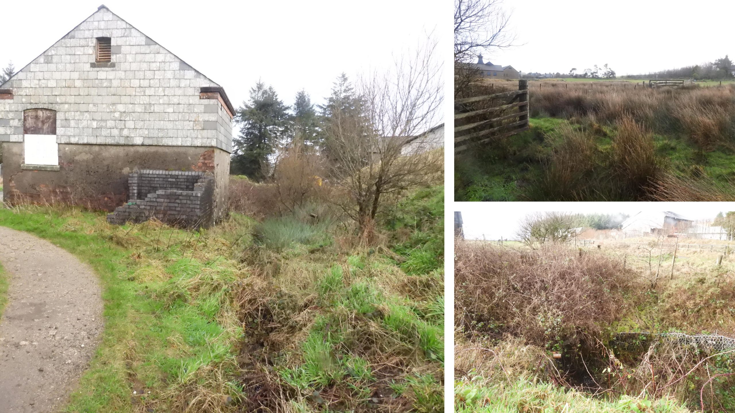
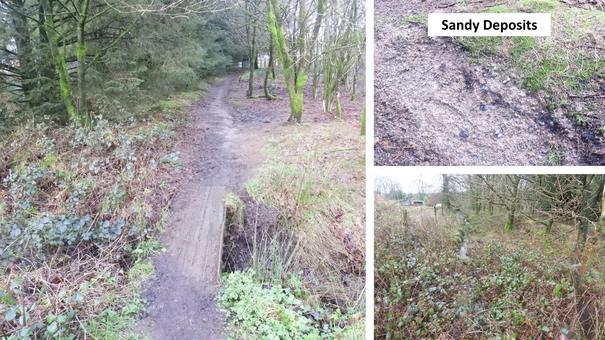
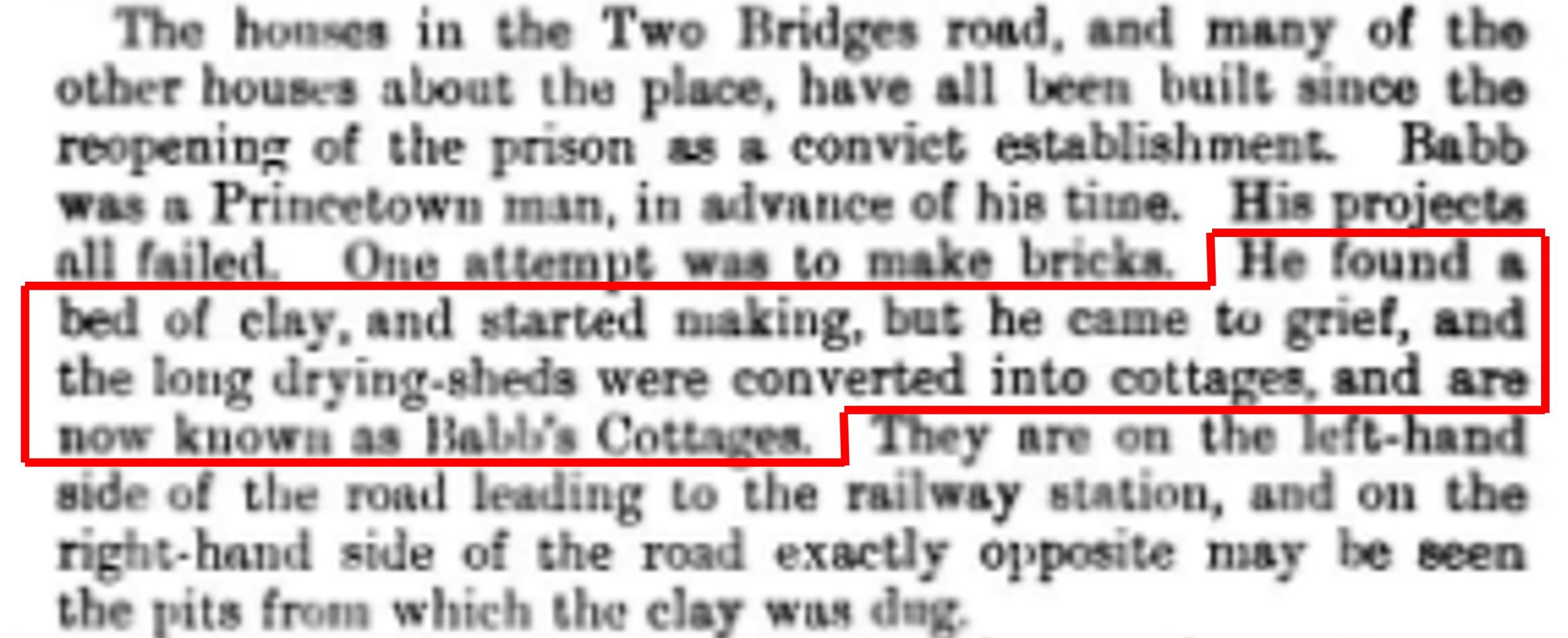
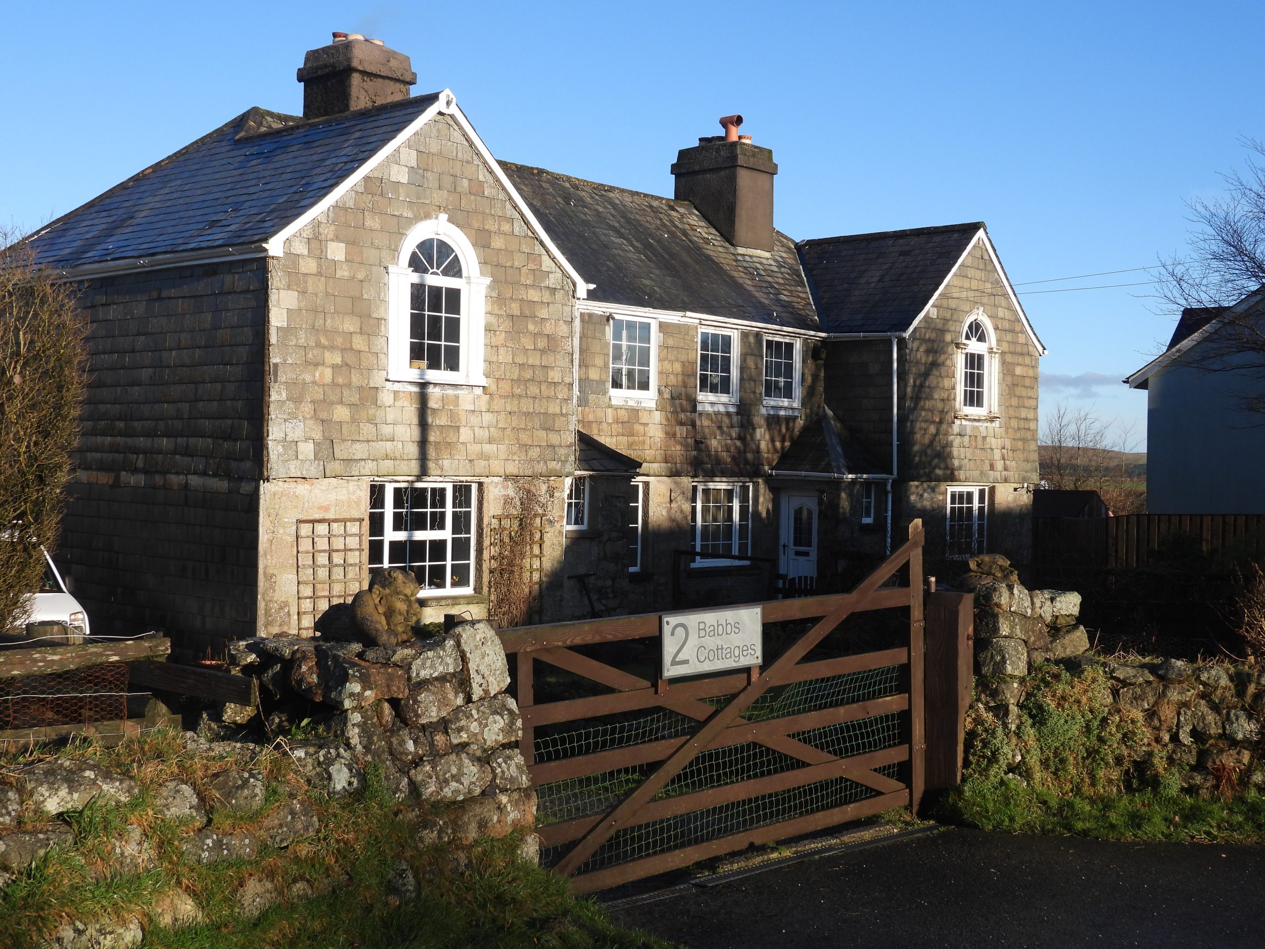
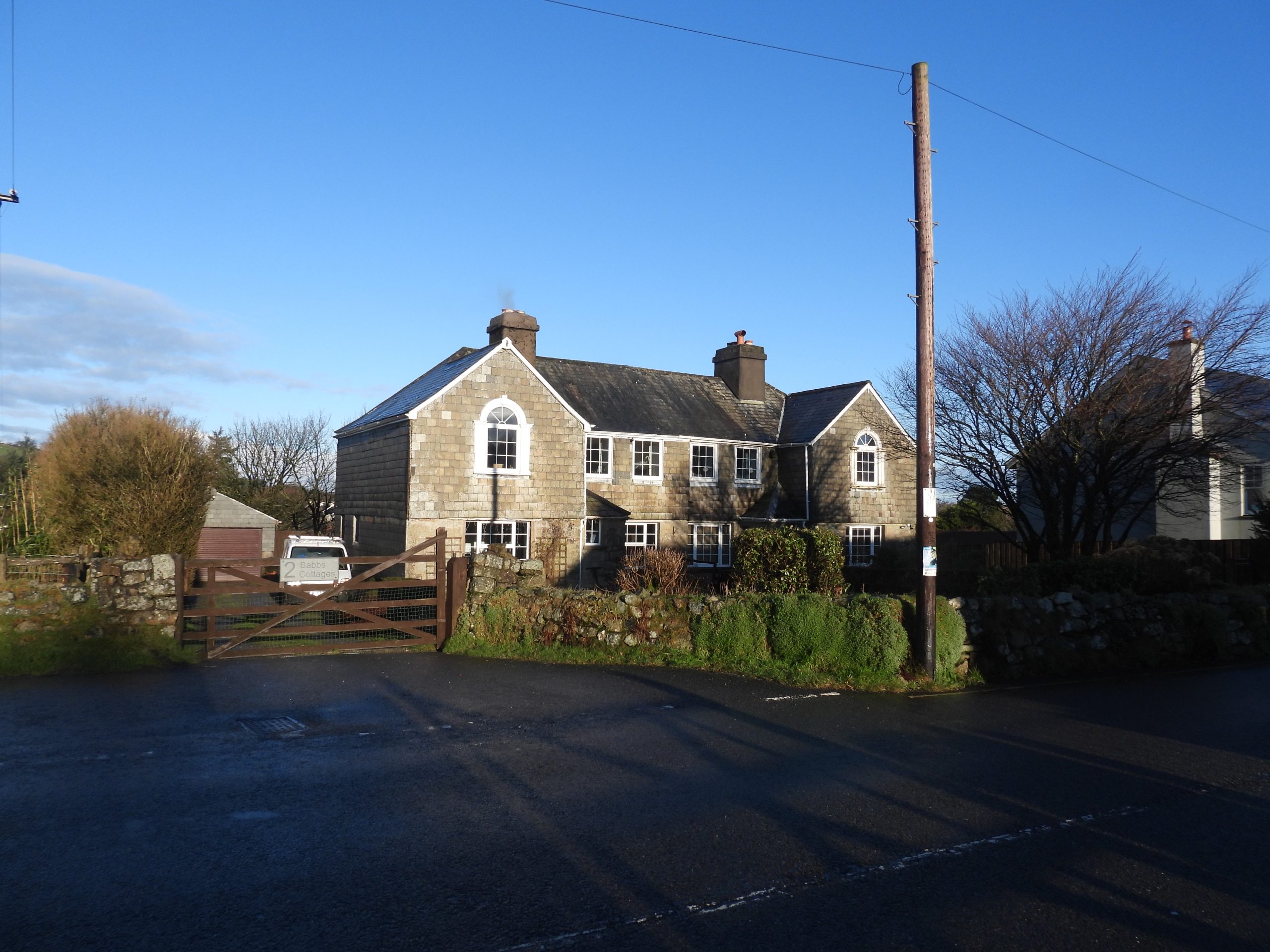
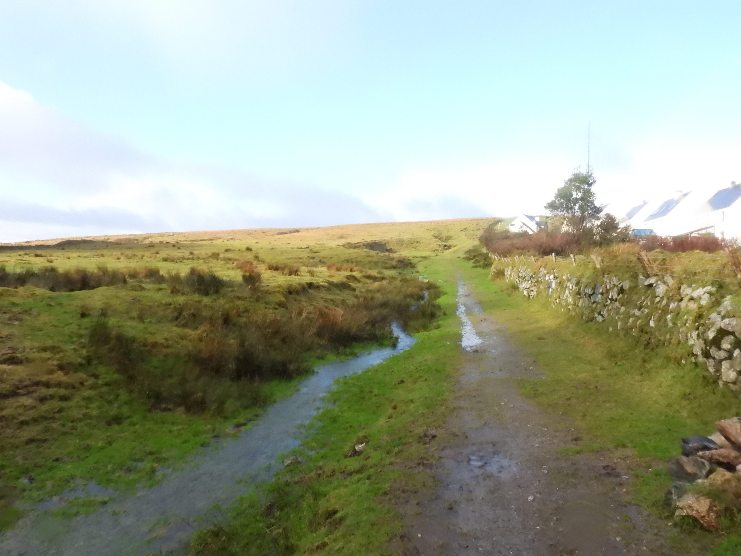
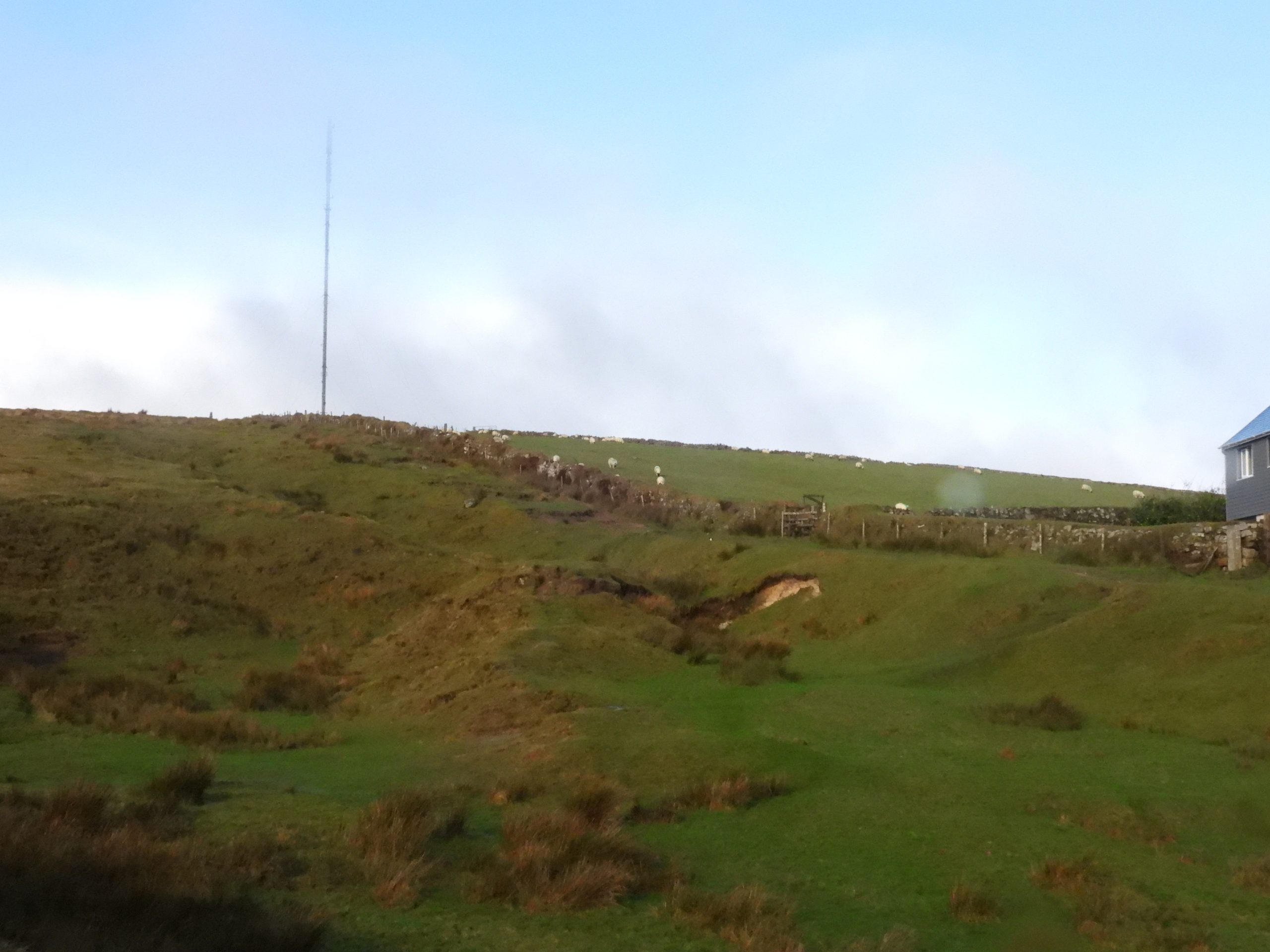
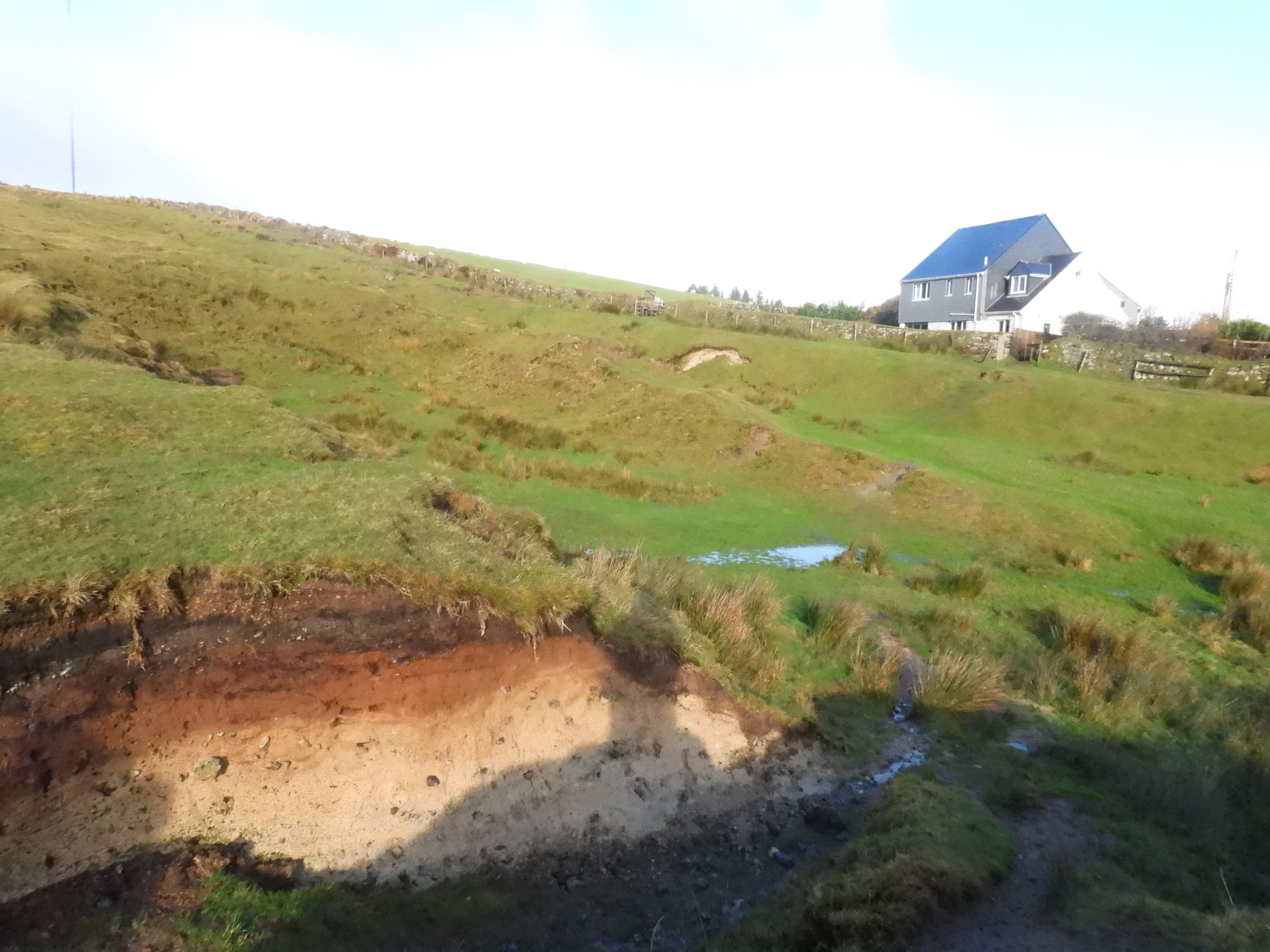
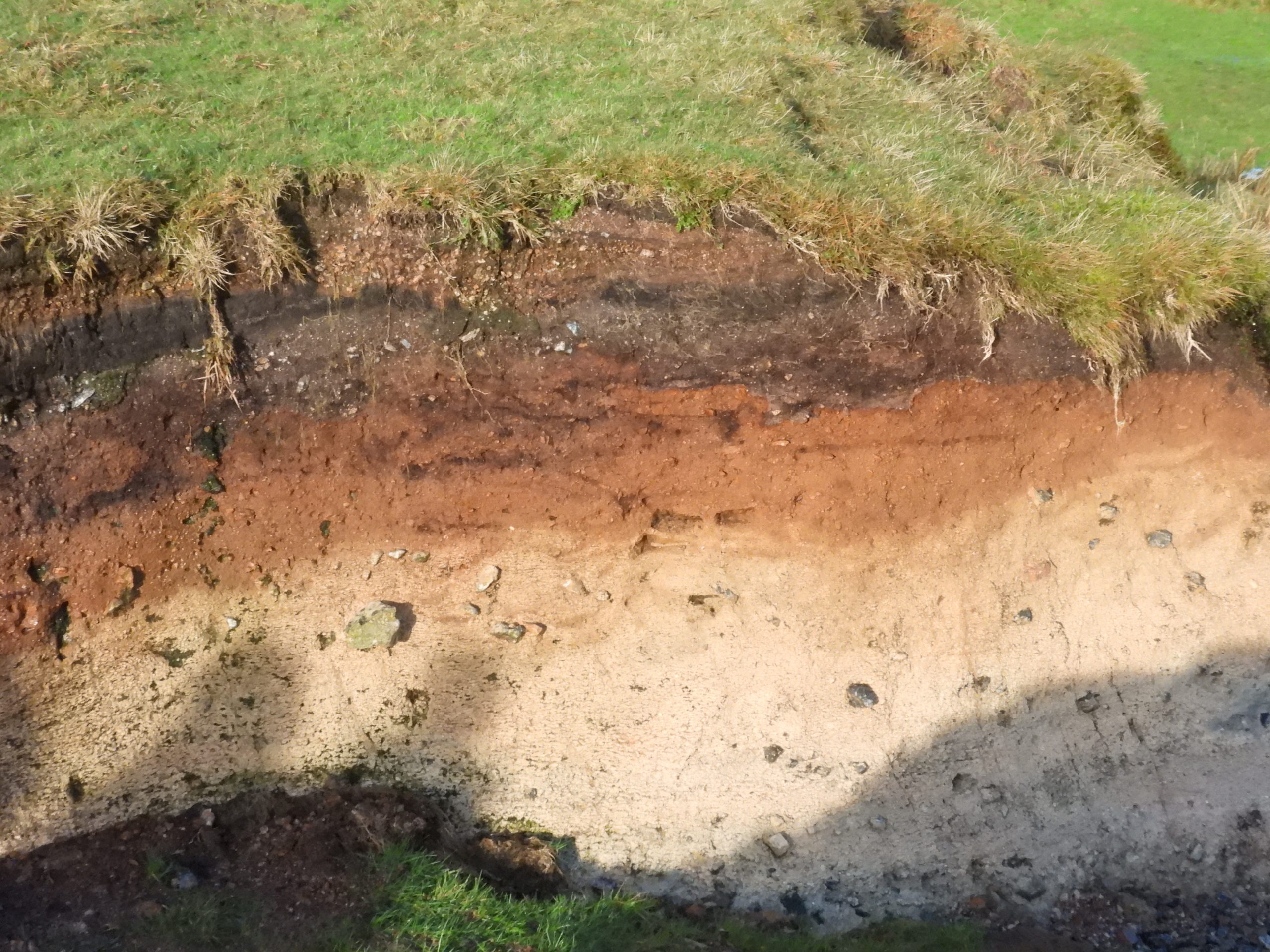
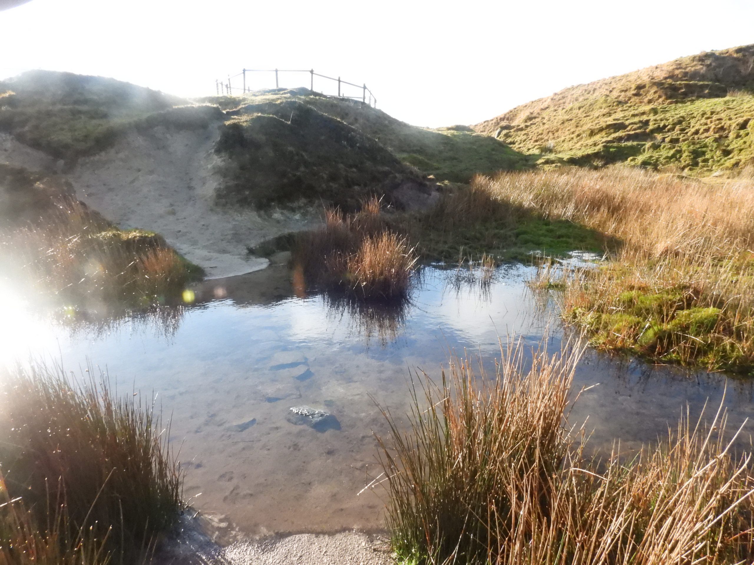
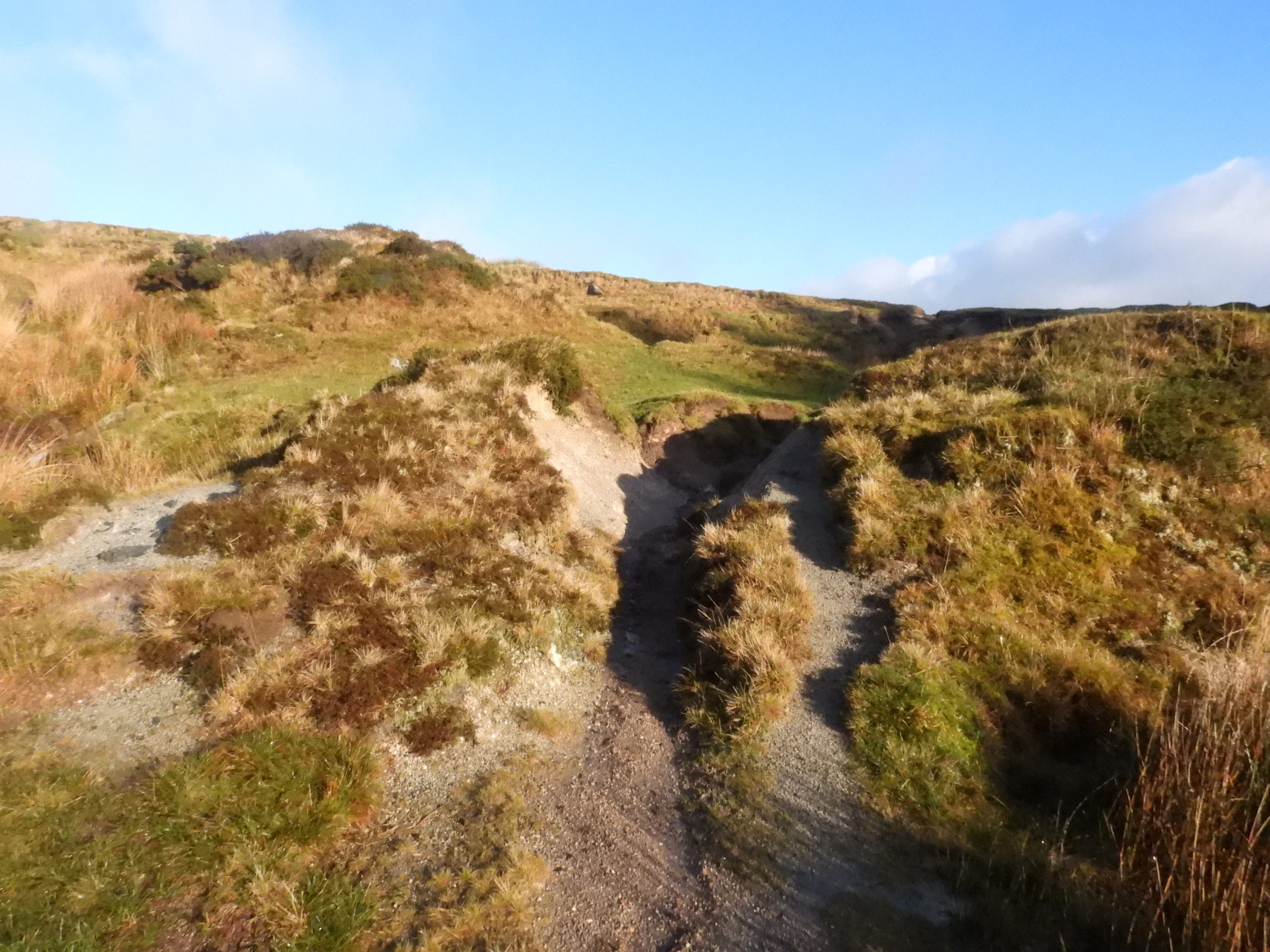
The tithe map of Princetown (circa 1840) shows the Butchery Stream (Moor Brook) crossing what is now Tavistock Road leading down to the Blackbrook River. Its location to the early 19th century Prison Slaughterhouse appears to be why it was called the ‘Butchery Stream’. The stream/ brook was crossed (laundered) by both the Prison Foul Leat and Devonport Leat. The site of the clay beds (whose effluent entered the stream) were believed to be near the approach road to what would become the Railway Station. Covered later in this post, research has lead to the knowledge that a Princetown resident (Babb) had some associated clay drying sheds, which were said to have been built over by what are now Babb’s Cottages. Therefore, the author suggests that the clay drying sheds are in the area / field marked 68. The school wasn’t built until 1874, but has been annotated onto the map for clarity showing its relative position to the Slaughterhouse.This sketch map shows the relative locations of the Slaughterhouse, a Butchery pond and the Prison Foul Leat with respect to the modern buildings and houses. The Butchery Stream now flows underground for several hundred metres and once would have had a take off point to the Slaughterhouse. The author has noted that the R.H. Hooker fountain (from 1908) appears to be located immediately above the course of the stream / brook and surmises this was its water source. The butchery pond was noted in a sketch in the publication by Ron Joy (2002), Dartmoor Prison A Complete Illustrated History Volume 1 The War Prison 1809-1816 on page 33.The entrance to Bellever Close. Behind this wall and hedge is where the Prison Slaughterhouse was once located.The war prison at Princetown had over 10,000 men including the staff. A slaughterhouse was requested in 1809 and took just under a year to complete as at a cost of £370 (about £37k in modern day terms). The Butchery Stream, now called Moor Brook, which runs down to the Blackabrook River flowed past the site and was diverted to the Slaughterhouse building, to supply a fresh supply of water for their operation. The annotated (imagined) photograph of a superimposed building shows a thatched roof, which is what the Slaughterhouse once had. In July 1813 a fire broke out at the slaughterhouse, and the roof was completely destroyed. The roof was replaced with slates. The school wasn’t built until 1874 and one assumes the stream / brook wasn’t completely underground at the time the Slaughterhouse was in operation.Below the Slaughterhouse, there was a pond which was used as a filter / settlement of waste. Its overflow was discharged into the Prison Foul Leat. The approx. location of the pond is where there is a playground today.The strip of land near Bellever Close is where the water which had been taken off Butchery Stream and used by the Slaughterhouse (and through the pond) was fed into the Prison Foul Leat. This trees on the far left of the picture are where Butchery Stream (Moor Brook) flows.The Butchery Stream outflow (from underground) is located a short distance to the north east of the wall at the back of Princetown School. The stream / brook flows underground for a few hundred metres (including under the school). The stream / brook enters its underground route to the south west of the Prince of Wales public house.There is a path leading down from behind the school to the Butchery Stream (Moor Brook). Although the area is private land, access is allowed on a permissive basis.The Butchery Stream a short distance downstream from where it emerges from undergroundThe Prison Foul (sewerage) Leat ran from the east side of the prison, through the Prison grounds, was laundered across the Butchery Stream, crossed the turnpike road (B3212) enroute to the Tyrwhitt estate and fields near Tor Royal. The course of the leat crossed what is the football pitch at Princetown, the route annotated on the above photograph. Incidentally, the author played football on this pitch for several seasons in the 1990s playing for the Plume of Feathers pub, being totally oblivious of this history at that time.Steps leading from the Football Pitch to the footpath alongside the Butchery Stream. These blocks appear repurposed and possibly might have once been part of the Prison Foul Leat infrastructure.There are four concrete posts placed across the Butchery Stream at the location the author believes is where the Prison Foul Leat was laundered. Here, there is a square piece of granite which possibly was a a support pier for the launder. The location is SX58972 73696Intriguingly, the Butchery Stream below where the Prison Foul Leat was laundered across it, appears to to have been lined with granite blocks to protect its banks. It would be interesting to know when this was done and why? Perhaps it was done around the same time Bellever Close was built ?The stream flowing under some walling as it descends adjacent to Prison propertyThis weather station is about as far as one can go when following the stream downhillReturning back upstream. Note the path and more blocks protecting the bankThis fountain on Tavistock Road was a gift by R. H. Hooker Esq. and is dated 1908. TRDC is Tavistock Rural District Council. The fountain appears to be located exactly on top of the Butchery Stream / Moor Brook and possibly took its source of water from it ? Close up of the fountain. From this location looking north west and south east along Tavistock Road, it is evident that this location lies at the shallow ‘dip’ in the road perhaps indicating the old course of the stream / brook which now lies undergroundPlaque on the Hooker fountain. The fountain is located at SX58900 73579The infant Butchery Stream / Moor Brook can be located to the south west of the Prince of Wales public house. Near where the stream / brook goes underground and thus under Tavistock Road there is evidence of the water course being very sandy with possible deposits of clay. Could this be indication of where the stream was polluted in the mid 19th century ?The stream flows through a culvert under the approach road to the old Princetown Railway Station. This picture was taken at SX58837 73504There appears to be two ‘arms’ of the Butchery stream on the west side of Princetown. The pictures above are of the infant stream near the footpath leading from the fire station and is close to the old Princetown Railway Station. Dr Tom Greeves records that in 1969, he spoke to an old Princetown resident who stated that “around 1900, when I was a boy, there was good clay was got around the Princetown Station”The second ‘arm’ of the stream can be found heading north alongside the footpath which is adjacent to the Dartmoor Brewery. There does appear to be some possible sandy / clay deposits along this path.Researching the second part of the ‘Butchery Stream’ mystery, in terms of where was the source of the clay effluent discharged by the Dartmoor Tile Company into the stream lead the author to an article (on page 474) in the 1905 Transaction of the Devonshire Association by J. Brooking Rowe titled : “Sir Thomas Tyrwhitt and Princetown”. The article mentions a Princetown man, called Babb, who attempted to make bricks from a source of clay near the Railway Station. Could Babb have been the owner of the Dartmoor Tile Company around 1852 who was responsible to discharging effluent into the stream? Certainly the location suggested by Brooking Rowe is close to both the north and west arms of the ‘Butchery Stream’ head and therefore fits the mystery. The location also seems confirmed by the conversation Dr Tom Greeves had with the old Princetown resident in 1969.On Plymouth Hill, there is evidence of the name Babb. The cottages appear to be located at field 68 (from the tithe) and possibly were the location of the clay drying sheds (circa 1840’s / early 1850’s)A short distance behind (to the north) of these cottages is the source (head) of the Butchery Stream. Although there is no definitive clay beds to be found near the head of ‘Butchery Stream’ there is evidence of sand and clay close by. Near and to the north of Moorland View, as indicated on old 19th century maps, are some old ‘sand pits’. After heavy rainfall, water flows downhill and towards the ‘north’ arm of the Butchery Stream. The ‘sand pits’ at the base of North Hessary. Evidence of sand and clay in the area, but probably too far from the ‘Butchery Stream’ to have polluted itClay deposits near the ‘sand pits’Close up of the clay depositsMore clay deposits can be found in the workings of the Wheal Duchy mineWheal Duchy Mine workings with clay depositsWheal Duchy Mine workings with more clay / sand deposits
There is a culvert / drain. Granite lined that runs from the direction of Babbs cottage towards the brook. It runs adjacent to the old lodge, pressed men building. The main brook can be heard running and is open although fenced off in royal court.

Steve September 22, 2024
There is a culvert / drain. Granite lined that runs from the direction of Babbs cottage towards the brook. It runs adjacent to the old lodge, pressed men building. The main brook can be heard running and is open although fenced off in royal court.
SteveGriggDartmoor September 23, 2024 — Post author
Thank you for this information