A collection of walks, discoveries, insights and pictures of exploring Dartmoor National Park
July 24, 2020
Holne Moor Leats
Steve Grigg and Frank Collinson
This post cover the exploring of leat water regulation around the East side of Holne Moor, which serves / served mines, farmsteads and whole communities. I lay much credit to Dave Brewer who wrote two articles in Dartmoor Magazine (issue 4 – Autumn 1986 and issue 7 – Summer 1987) for inspiring this exploration. Additional information was gleaned from John Robins (Follow the Leat) and Eric Hemery (Walking the Dartmoor Waterways).
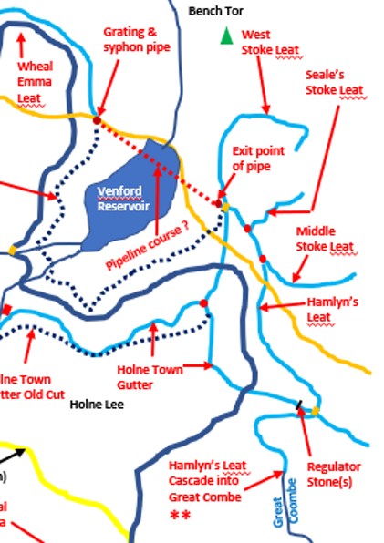
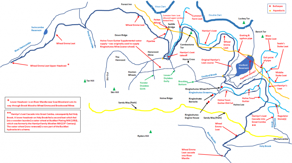
This drawing shows the main Leat systems of whole of Holne Moor and beyond. The leat systems comprise 4 main areas, namely; Wheal Emma Leat (now dry), Hamlyn’s Leat, Holne Town Gutter and the side leats feeding farmsteads off of Hamlyn’s Leat. Both Dave Brewer and Eric Hemery produced similar drawings in their publications. This drawing is best viewed if opened up into a new Tab.
This post specifically covers the area immediately to the East and South East of Venford Reservoir. There will be further posts on these and other leat systems in due course.
The Wheal Emma Leat is the longest leat in the area and the Higher Headweir can be traced from River Swincombe, to the O Brook and Venford Reservoir before it enters the River Mardle. The water is then taken off further downstream at a Lower Headweir near Scae Wood which cuts its way through Brook Wood to Wheal Emma and Brookwood Mines.
The Hamlyn’s (Holne Moor) leat takeoff is from the O Brook. For much of its journey on the high moor, it runs parallel with the Wheal Emma Leat. It still runs and cascades into the Holy Brook (via Great Combe). A Lower Headweir on Holy Brook fed a second leat which fed (via a wooden launder) a water wheel at Buckfast Plating Mill (1953) , which was formerly the Hamlyn Family Woollen Mill (19th Century). The water wheel (now renewed) is now part of the Buckfast hydroelectric scheme.
Holne Town Gutter was cut to serve the local farmsteads and Holne itself. Much of the use of this leat to the “Stoke” farmsteads is covered by this post. Eric Hemery describes that the term “Gutter” is a Dartmoor Word describing a water channel of any sort. In his “Walking the Dartmoor Waterways”, explains its seniority over Wheal Emma and Hamlyn Leats.
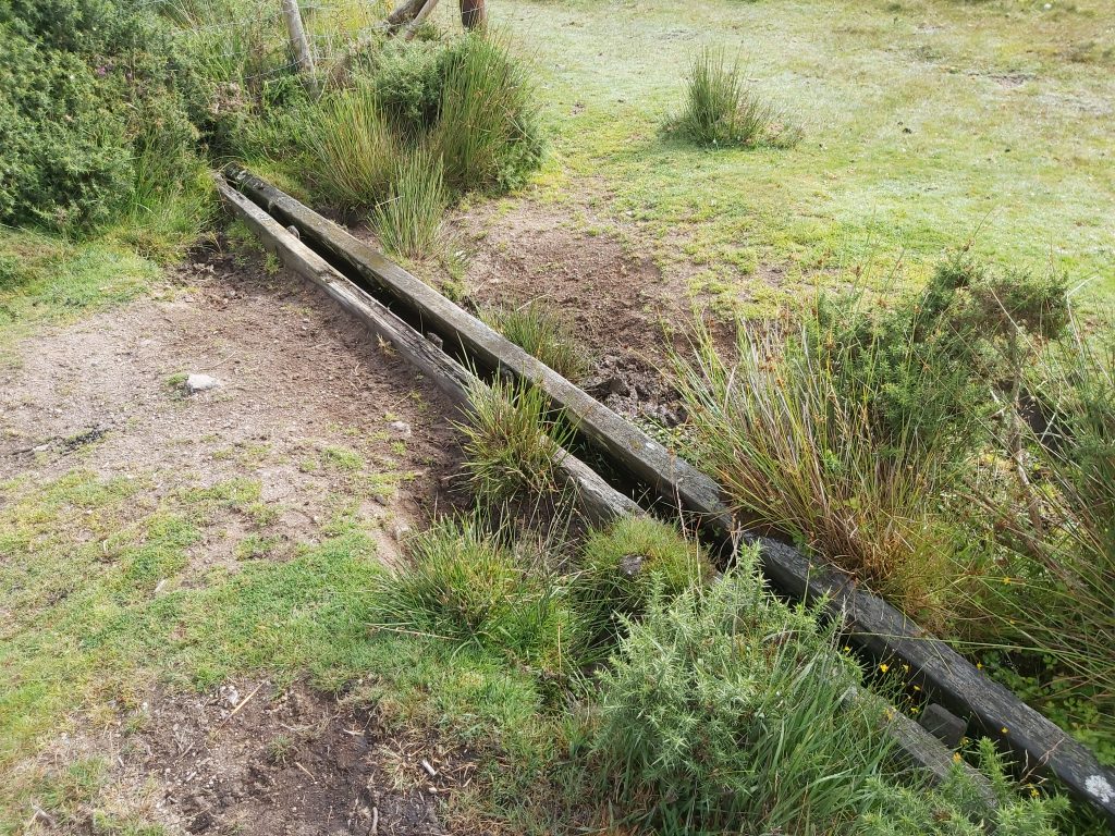
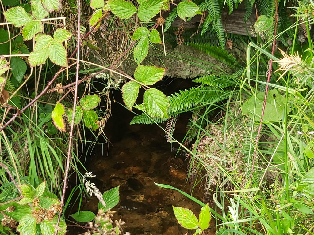
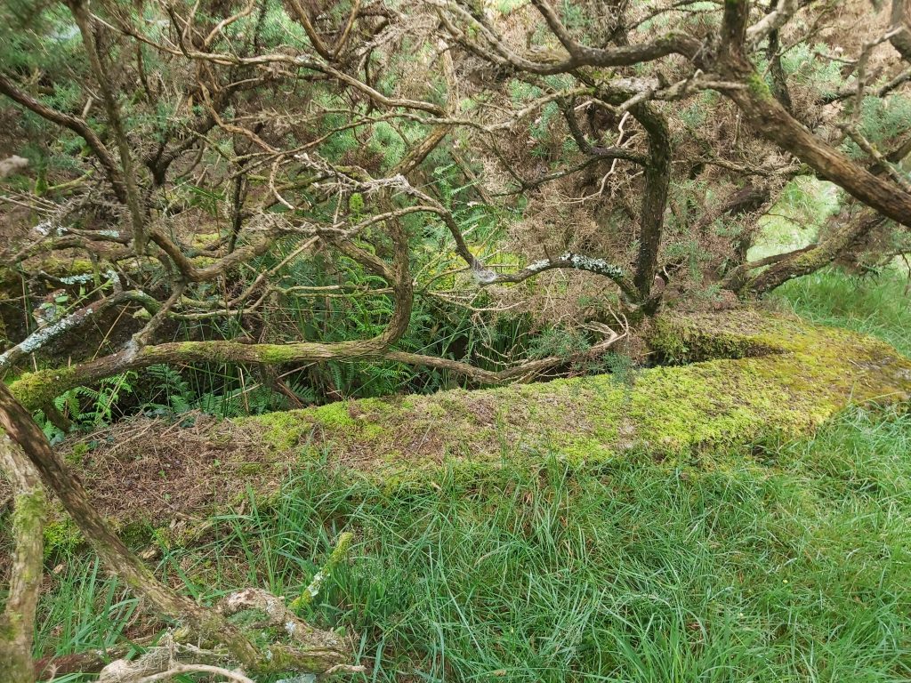
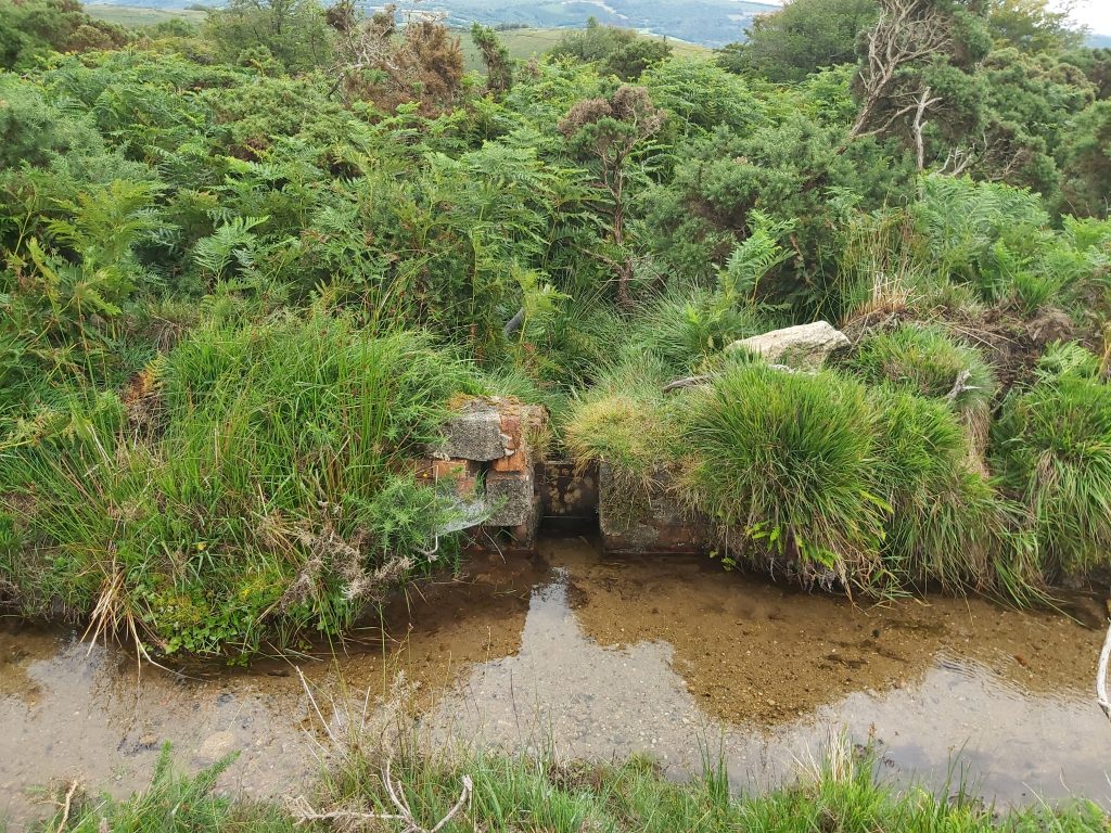
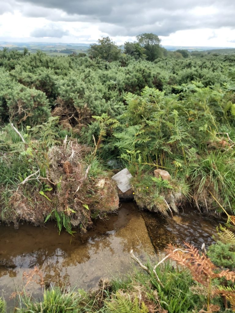
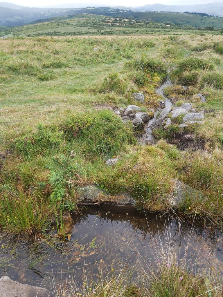
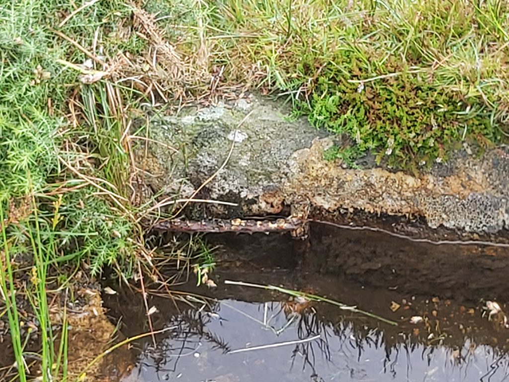
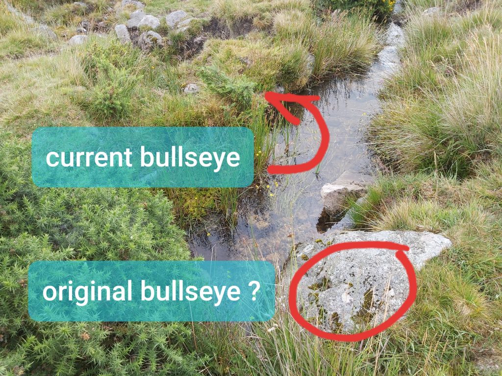
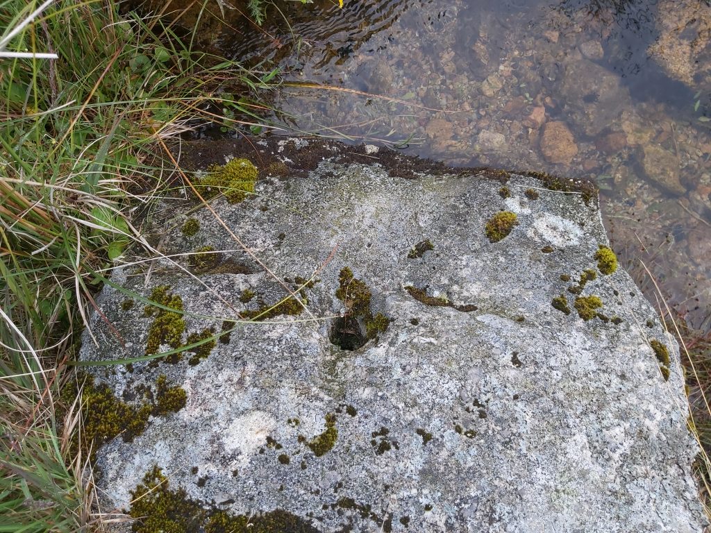
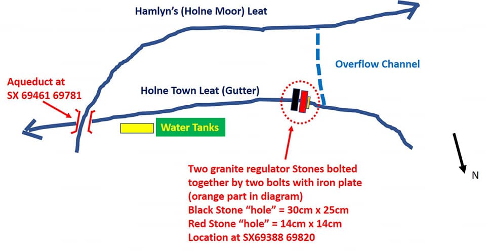
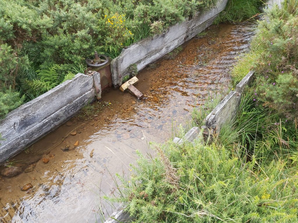
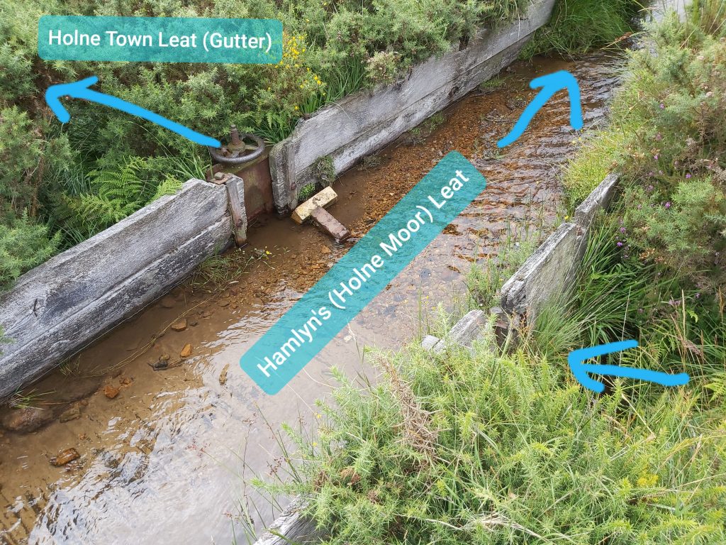
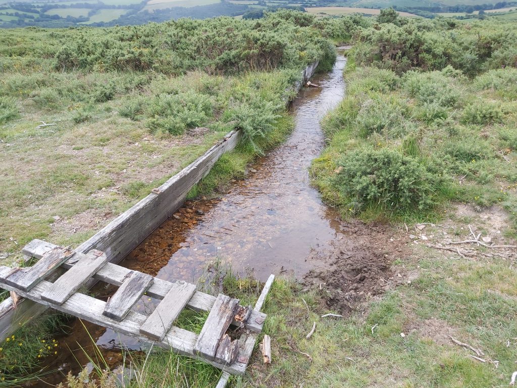
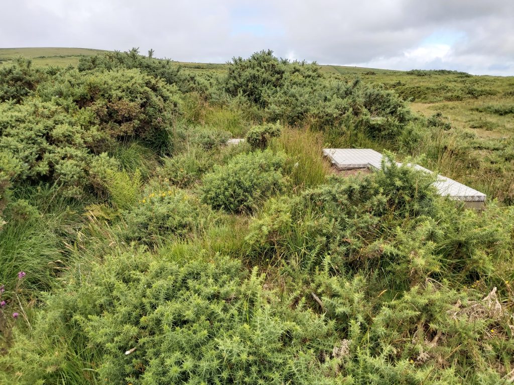
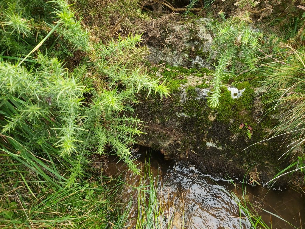
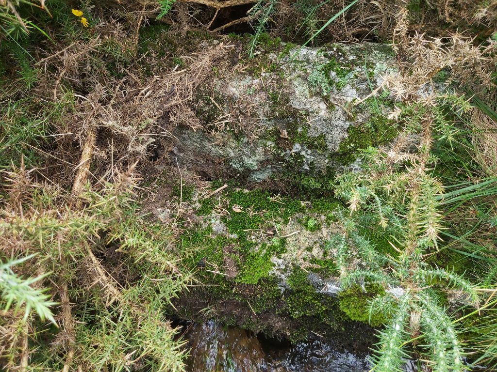
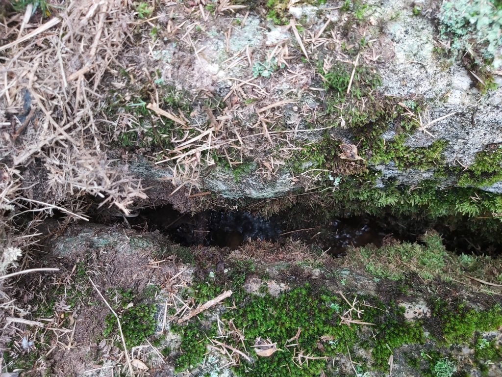
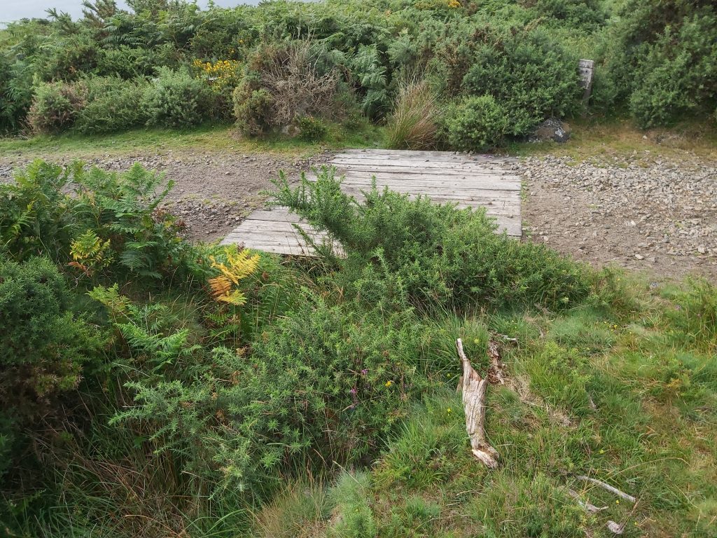
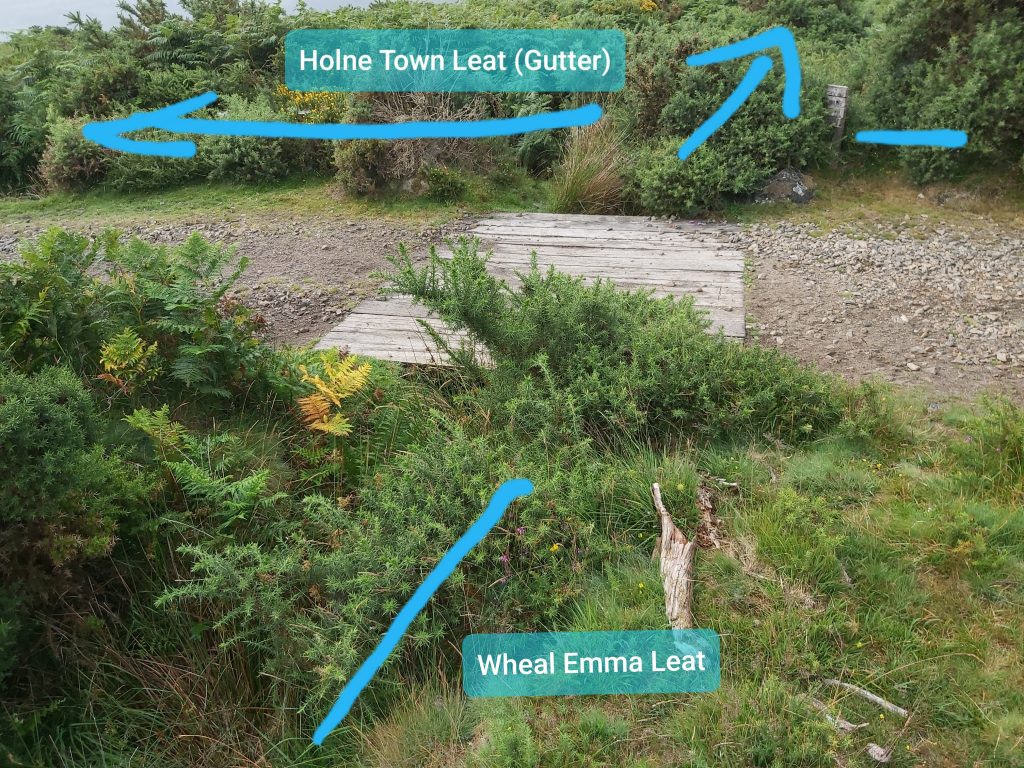
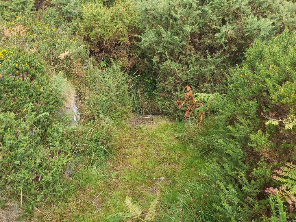
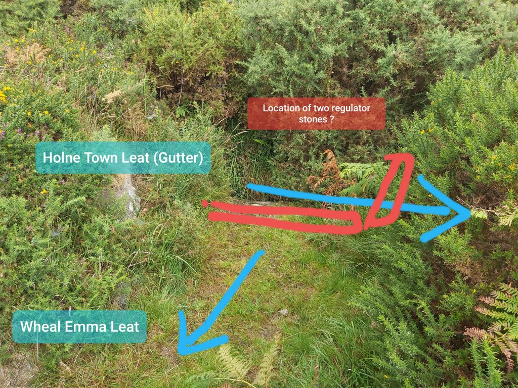
Leat protection (presumably from animals) at SX69015 70775. This is the Holne Town Leat (Gutter) “extension” which feeds West Stoke, Seale’s Stoke and Middle Stoke farmsteads. Shortly after this location this leat joins Hamlyn’s (Holne Moor) Leat as it exits from underground.Leat exiting from a walled section after just splitting to West Stoke. Unsure if there is a bullseye here as very overgrown. The other side of the wall is also an underground exit of a second leat. This is at SX69021 70854. At this point the leat is called Hamlyn’s (Holne Moor) Leat.Leat underground exit. Dave Brewer suggests this comes from Hamlyn’s (Holne Moor) Leat from the Venford Reservoir direction. Note that this is covered in gorse if visiting. It is at SX69010 70848. Its entrance tunnel is at SX68334 71282 the other side of the reservoir. It used to sweep round to the south but was rerouted underground when the reservoir was built. Bullseye to feed water to Seale’s Stoke from Hamlyn’s (Holne Moor) Leat. SX69108 70742Close up of the bullseyeBullseye to feed water to Middle Stoke from Hamlyn’s (Holne Moor) Leat. SX69192 70589.This bullseye feed water to West Stoke, Seale’s Stoke and Middle Stoke from Holne Town Leat (Gutter). Previously in this post I have called the water flowing off to these farmsteads from this point as Holne Town Leat (Gutter) “extension”. SX68881 70349.Close up of bullseyeIs there an original bullseye stone at this location ?Is this the original bullseye stone for this location just a few yards upstream.Adapted sketch based on Dave Brewers original from DM issue 7. This area has an aqueduct and two regultor stones which are bolted together.The aqueduct.Hamlyn’s (Holne Moor) leat crossing Holne Town Leat (Gutter). The sluice was, by agreement with the Hamlyn management, operated to admit water on one day each year into the gutter. The sluice was renewed in 1985. (Source Is Eric Hemery). All the leats in this area appear to be very inter-connected and ironicallly, some of the water from Holne Town Gutter would have entered Hamlyns Leat by way of the bullseye, going all the way down hill to West Stoke etc before swinging back south to this location.Looking upstream of the Hamlyn’s (Holne Moor) LeatWater tanks on right, with Holne Town Leat (Gutter) on left (the line coming through the gorse bushes)The two regulator stones bolted together with iron plate in front. So why is this in the Holne Town Leat (Gutter) ? Dave Brewer’s theory is that these are an overflow control but were originally used further up the leat where it was crossed by the Wheal Emma Leat.Close up of the two stonesDetail of the two regulator stones. Please note this is heavily overgrown and can easily be missed. Photograph taken stood in the leat itself.Location of where Dave Brewer summises the two Regulator stones originated. This is where Wheal Emma Leat crosses the Holne Town Leat (Gutter). Just to confuse a track crosses this point as well.Another view of Wheal Emma Leat (dry) in foreground and Holne Town Leat (Gutter) flowing mid picture left to right. Is this where the two regulator stones were once located ?Dave Brewer summises this is how the two Regulator stones might have been located. In his DM article (issue 7) he states that Eric Hemery argued that the two leats met on a “flattish” plain and were allowed to flow their respective directions after inter-mingling. However, Dave Brewer states that he could not accept Eric Hemery’s argument and hence put forward his alternative theory. I wonder why just a simple wooden launder (aqueduct) couldn’t have been employed ?
1 Pingback