A collection of walks, discoveries, insights and pictures of exploring Dartmoor National Park
June 26, 2022
Dartmoor Way – Stage 2 – Shipley Bridge to Ashburton
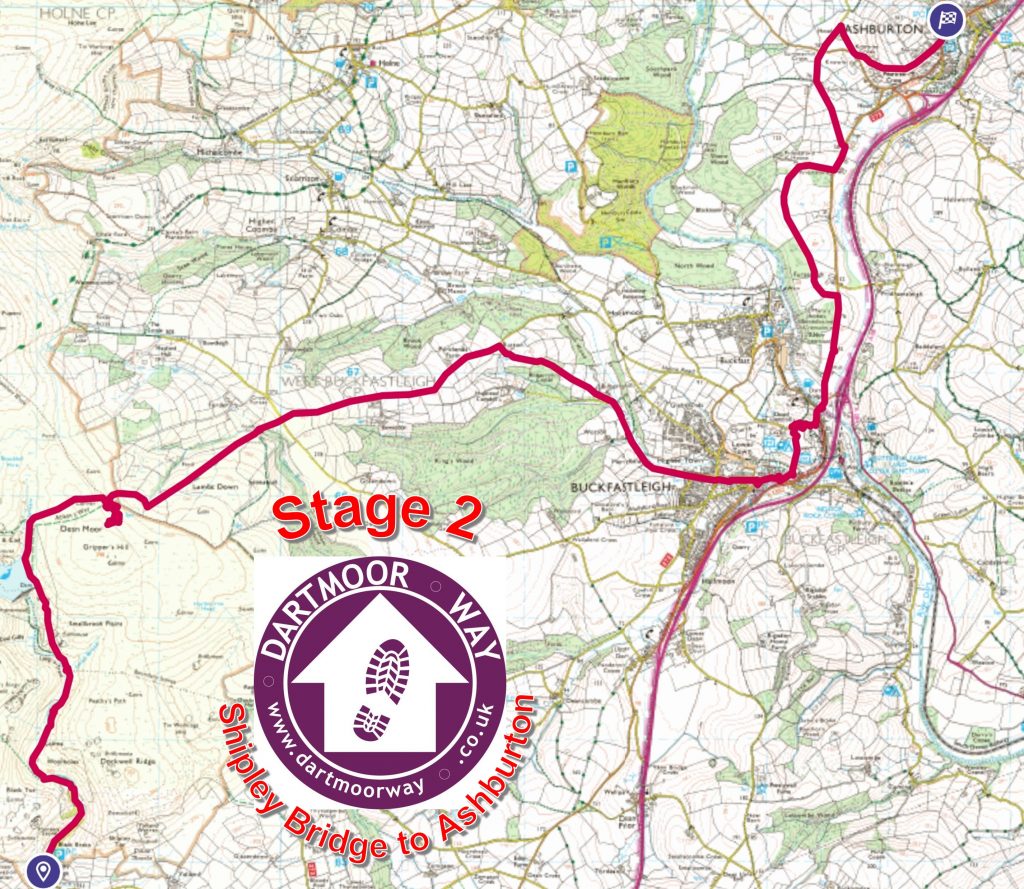
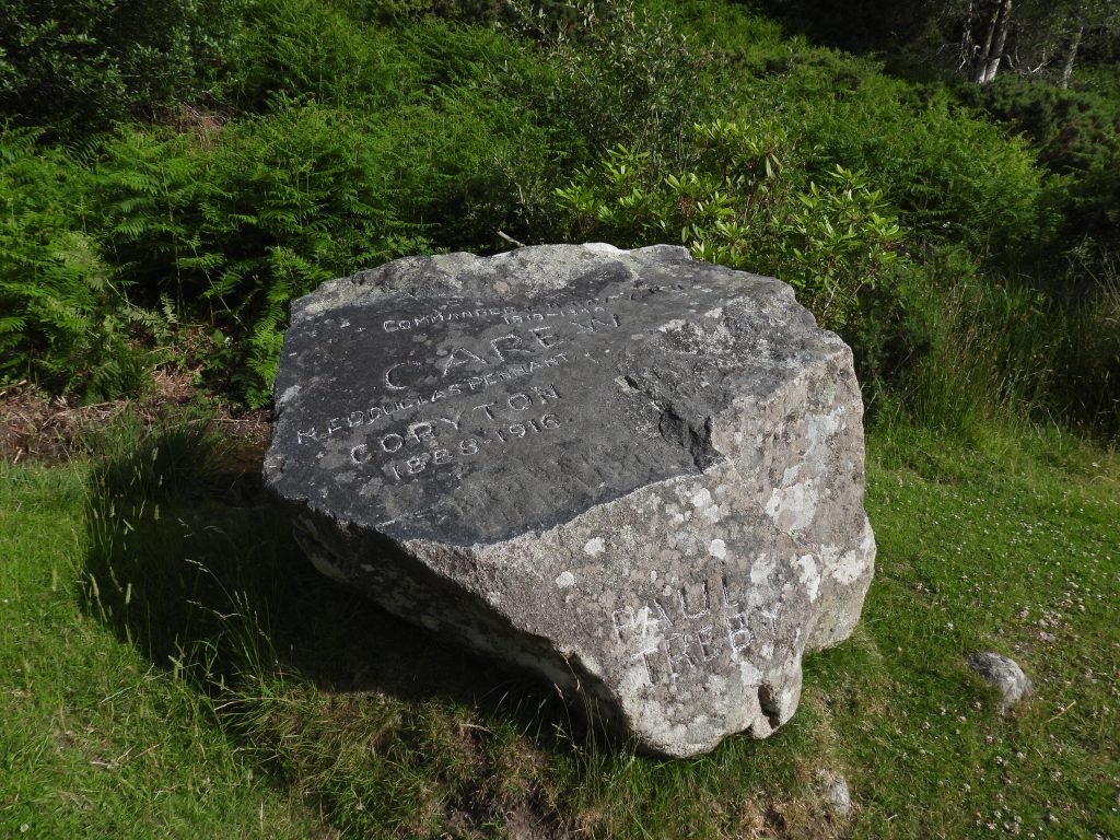
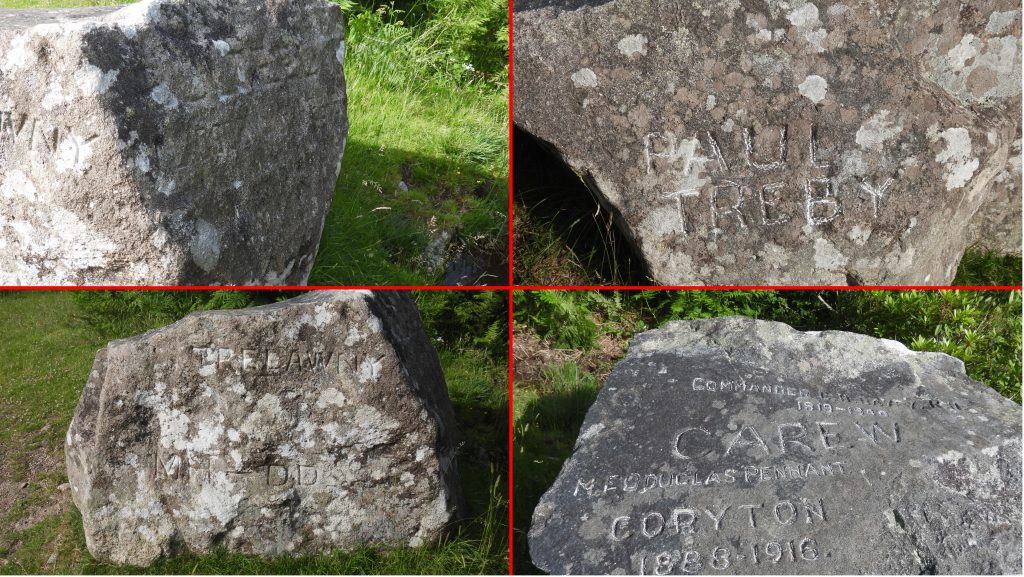
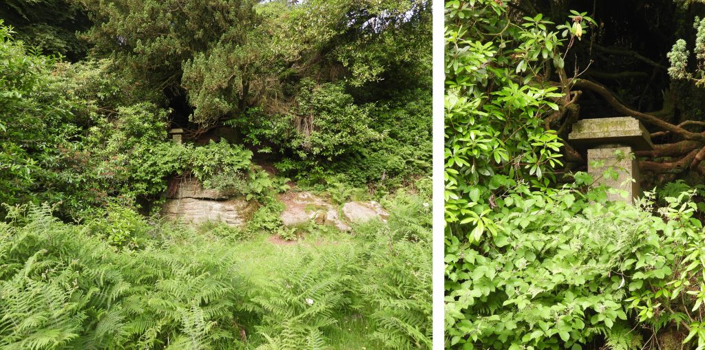
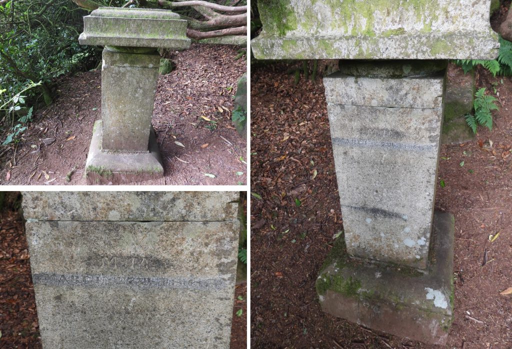
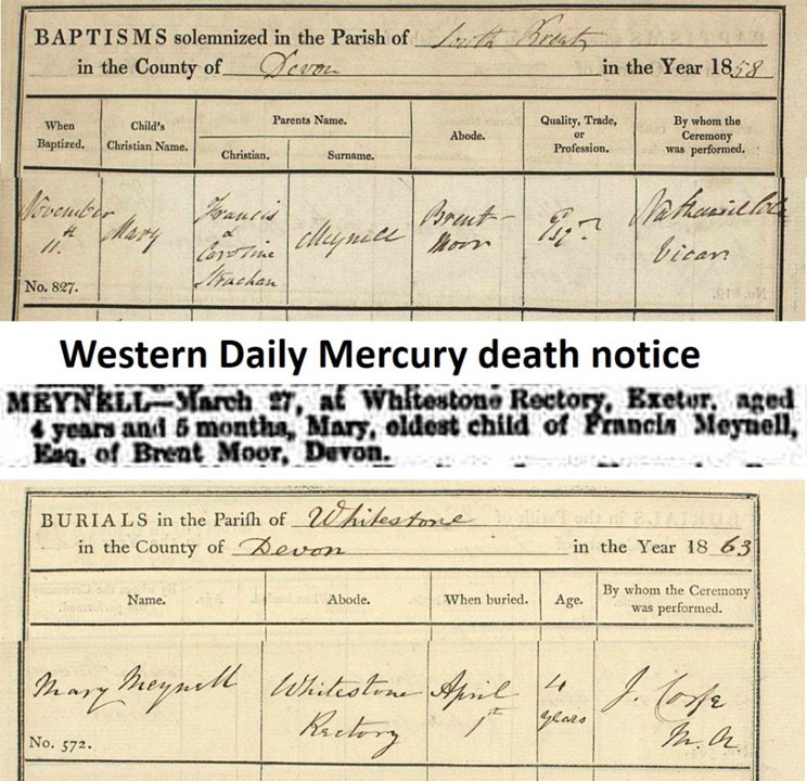
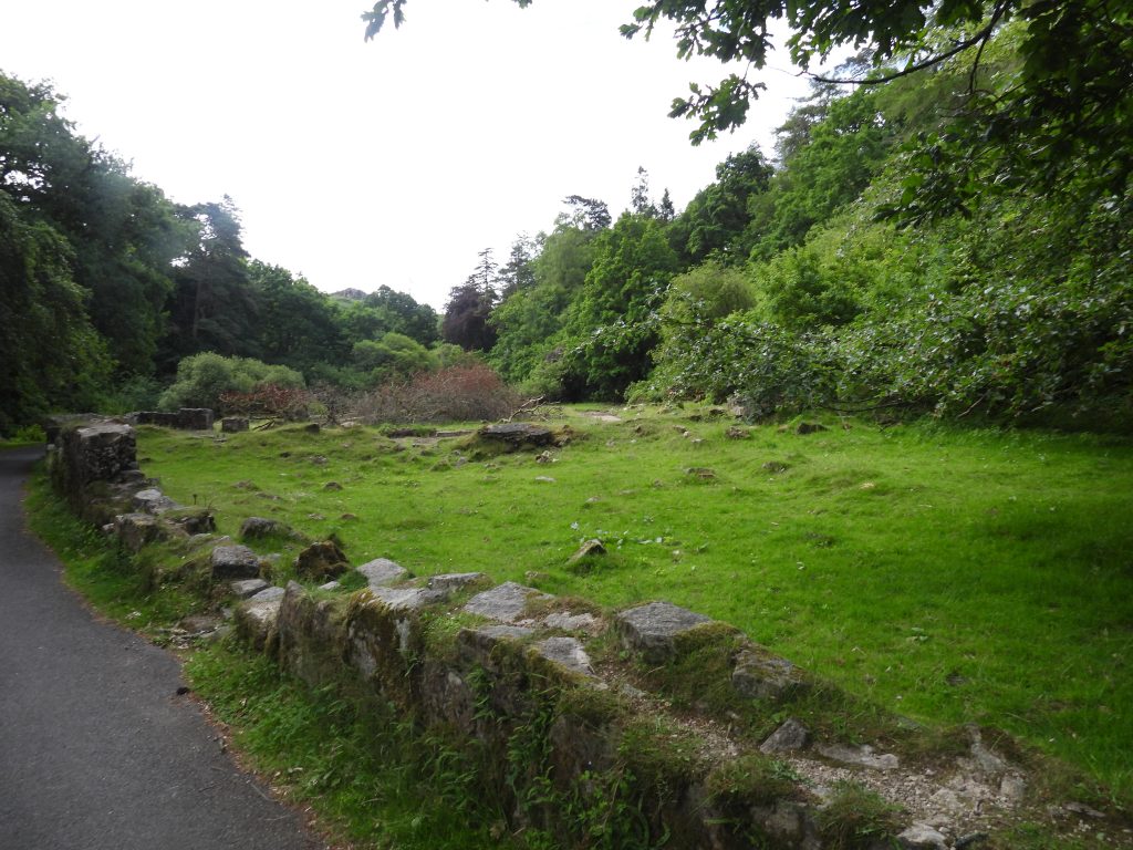
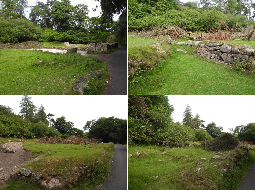
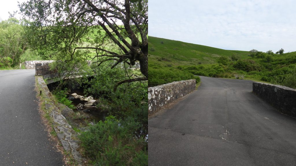
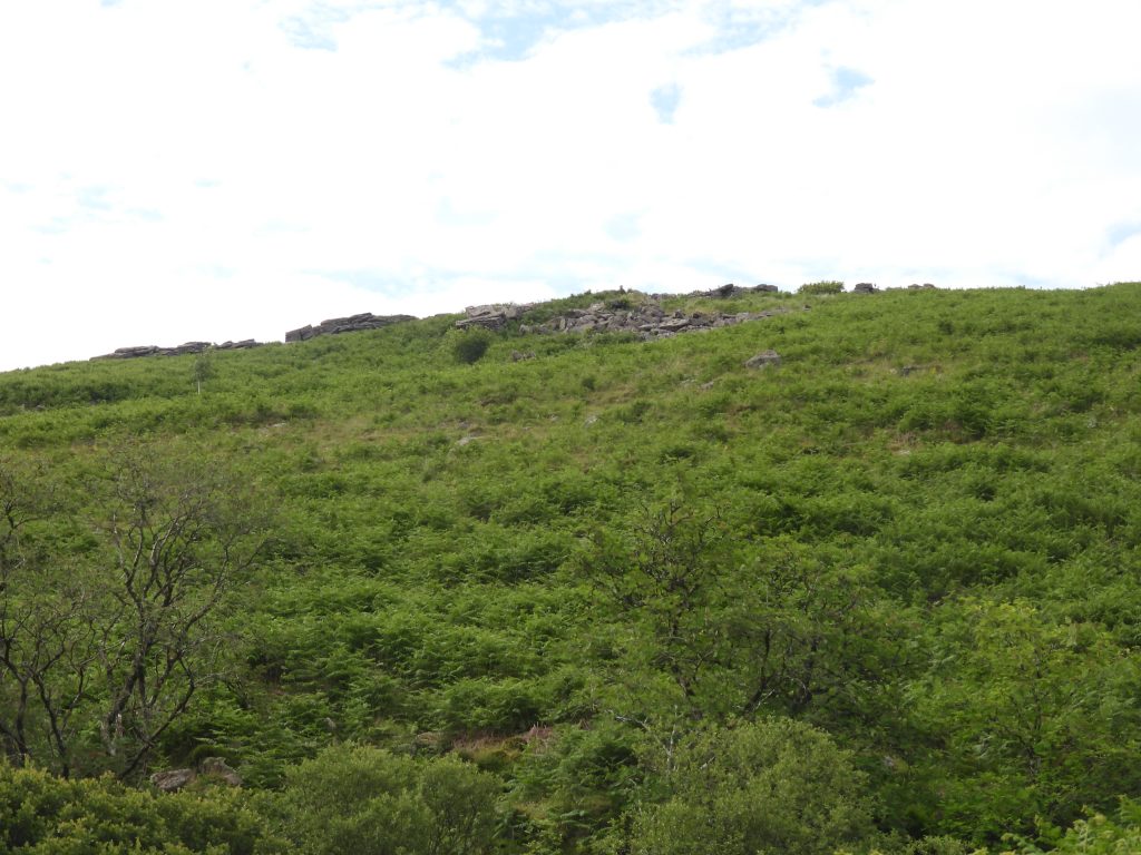
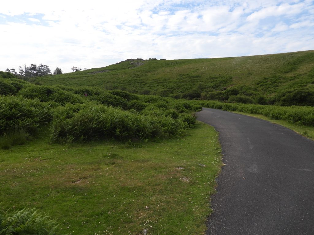
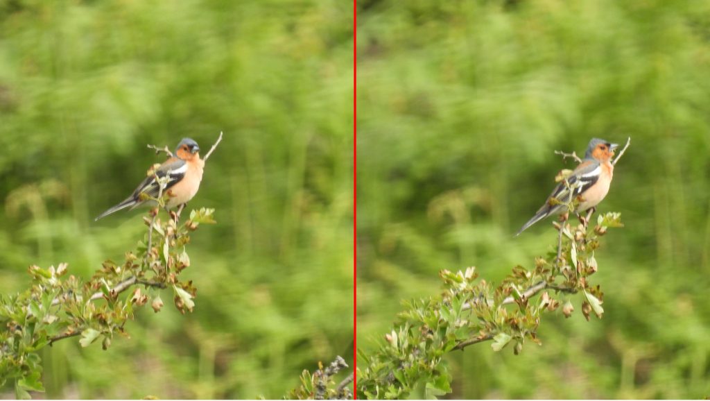
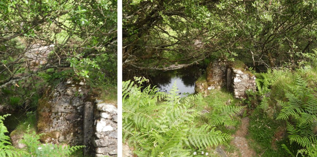
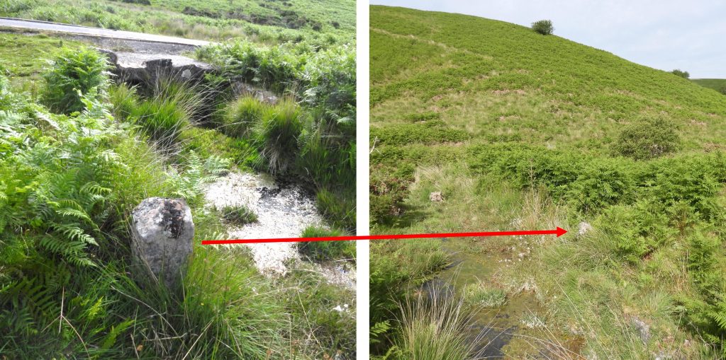
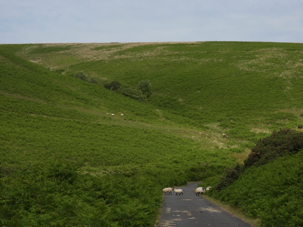
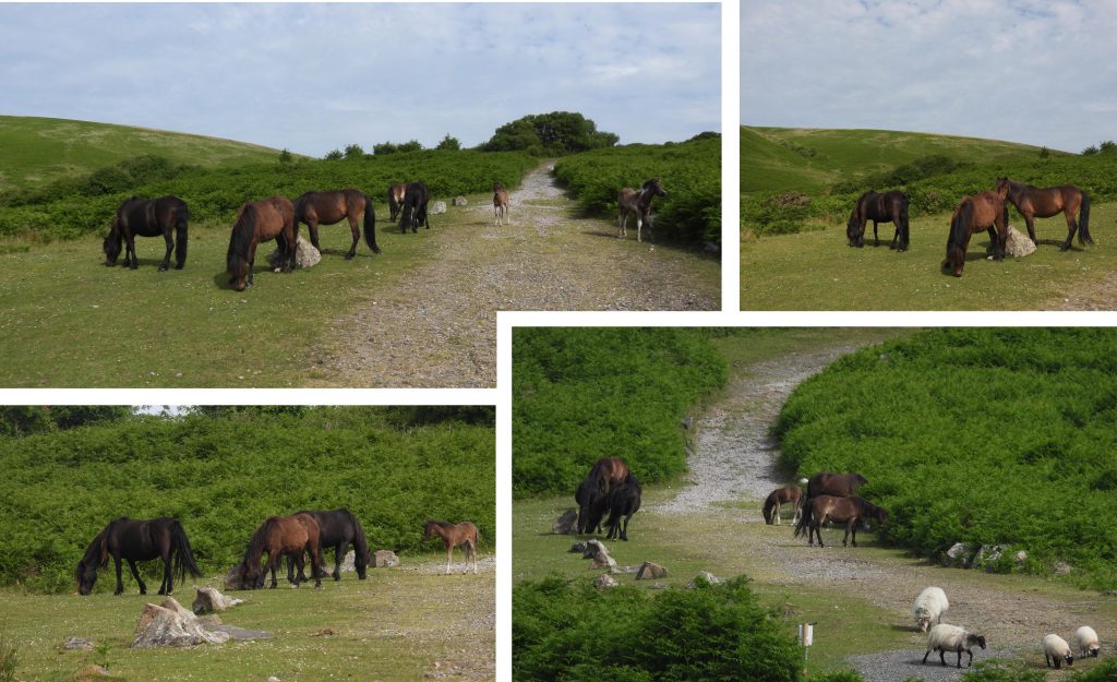
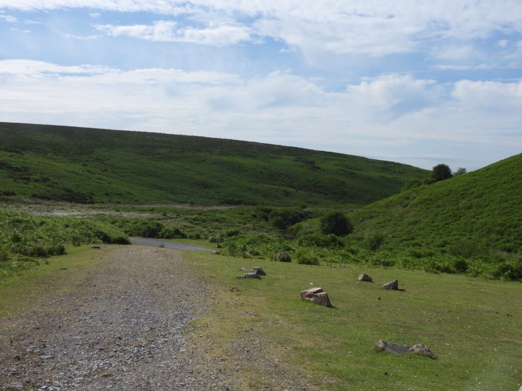
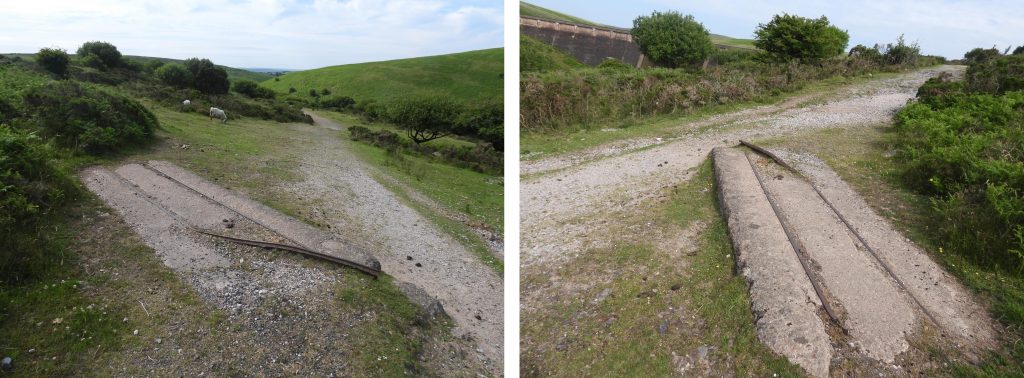
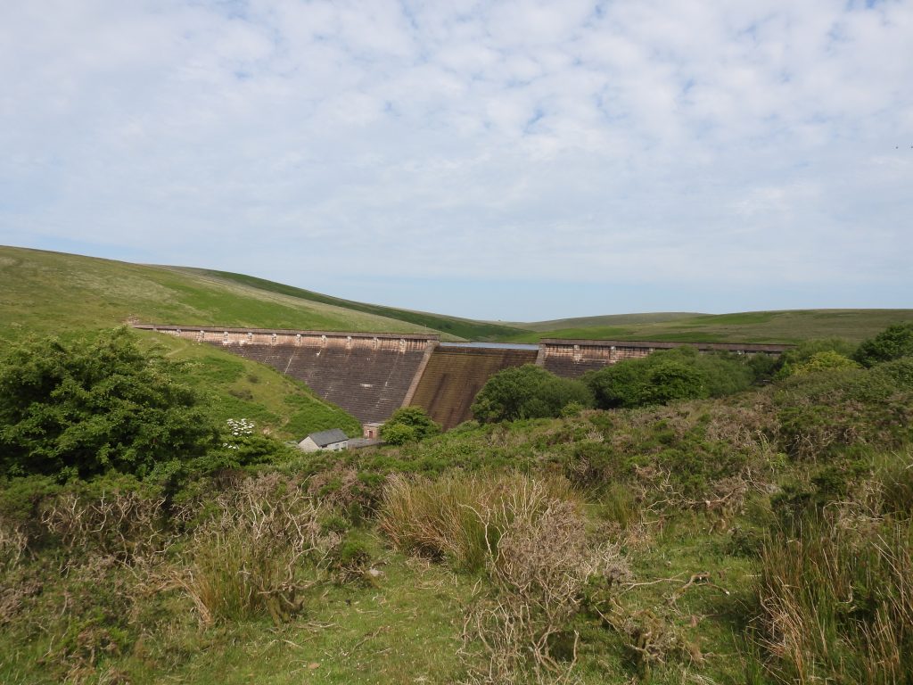
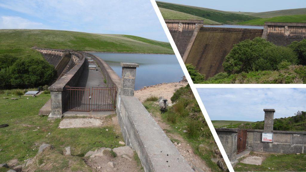
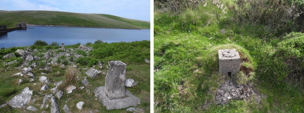
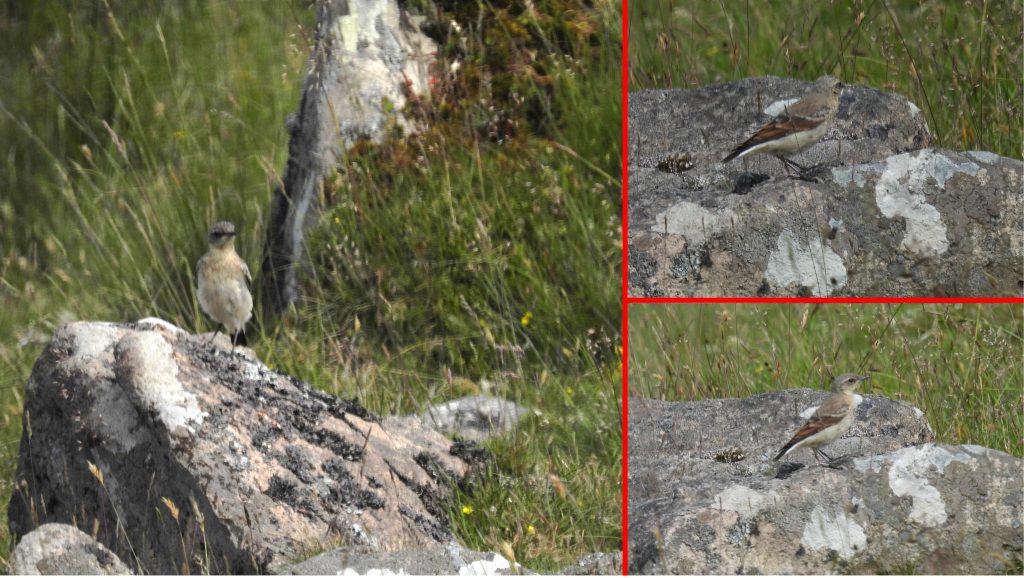
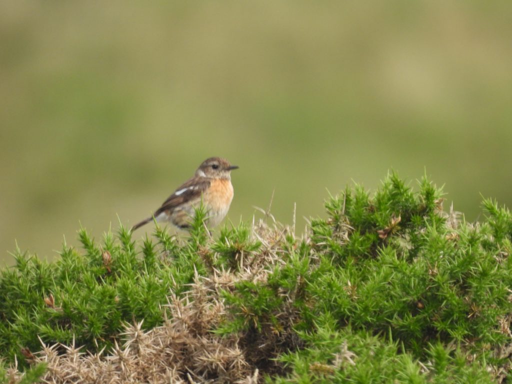
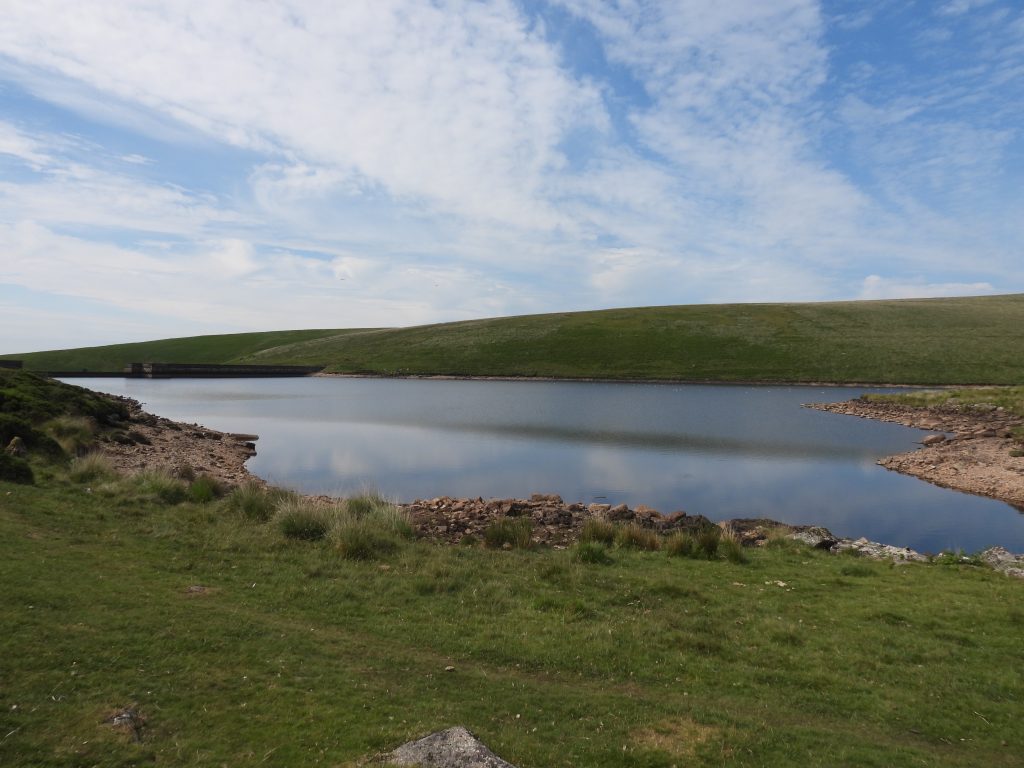
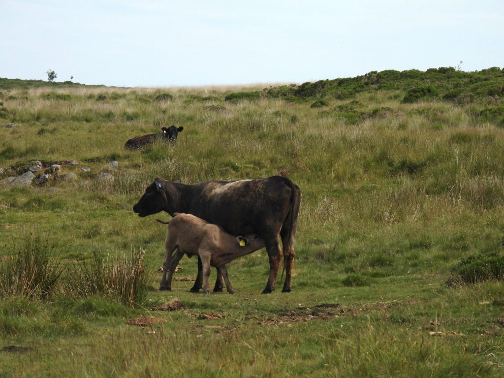
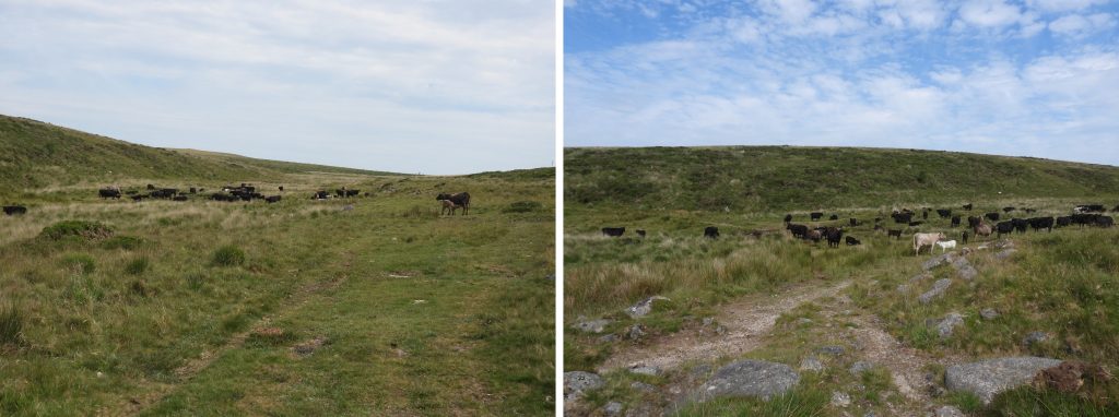
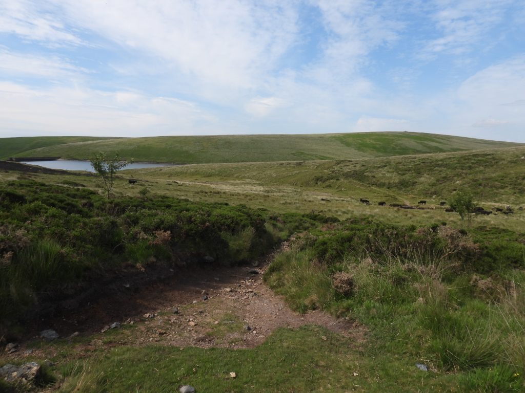
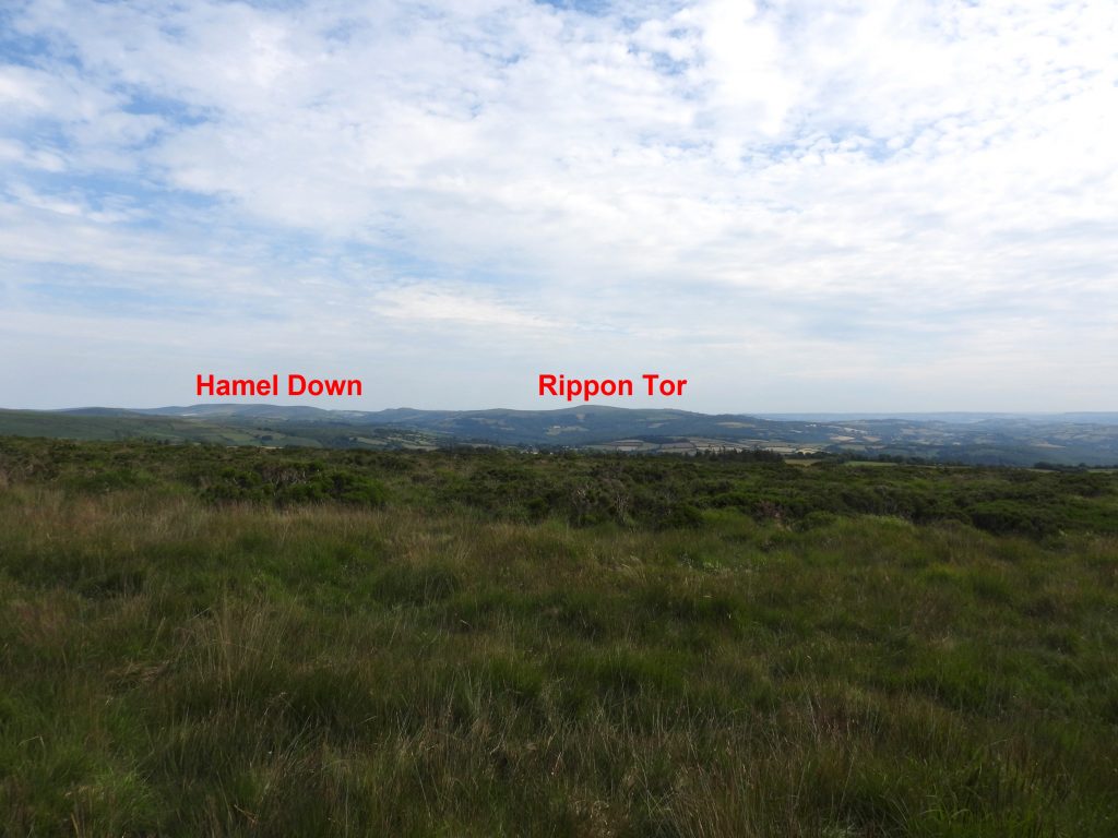
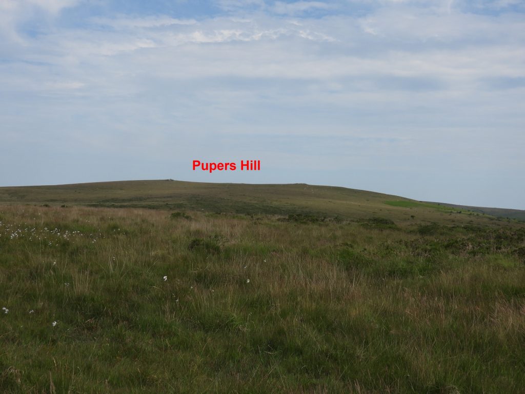
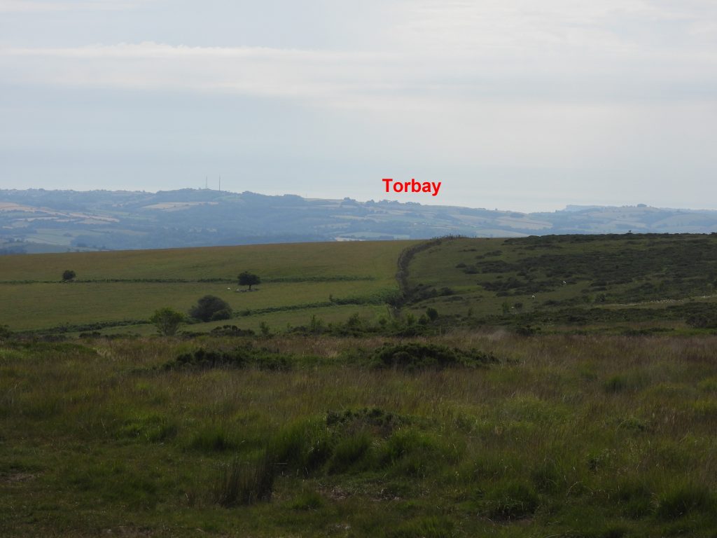
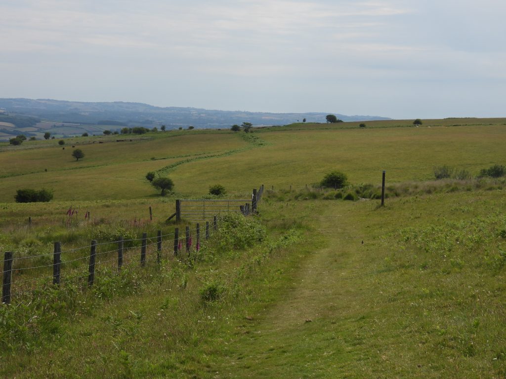
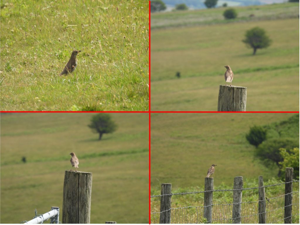
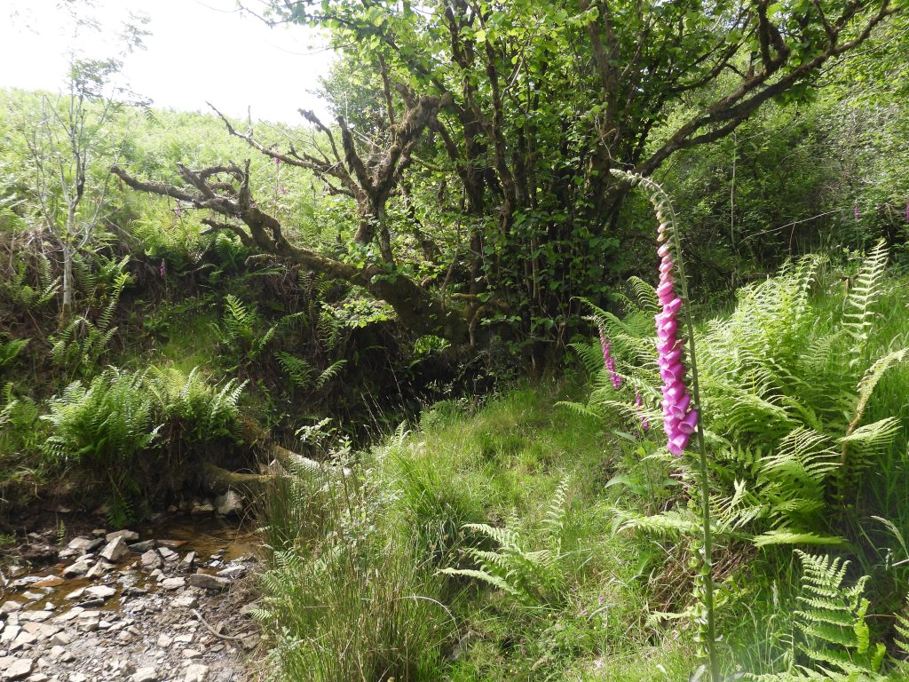
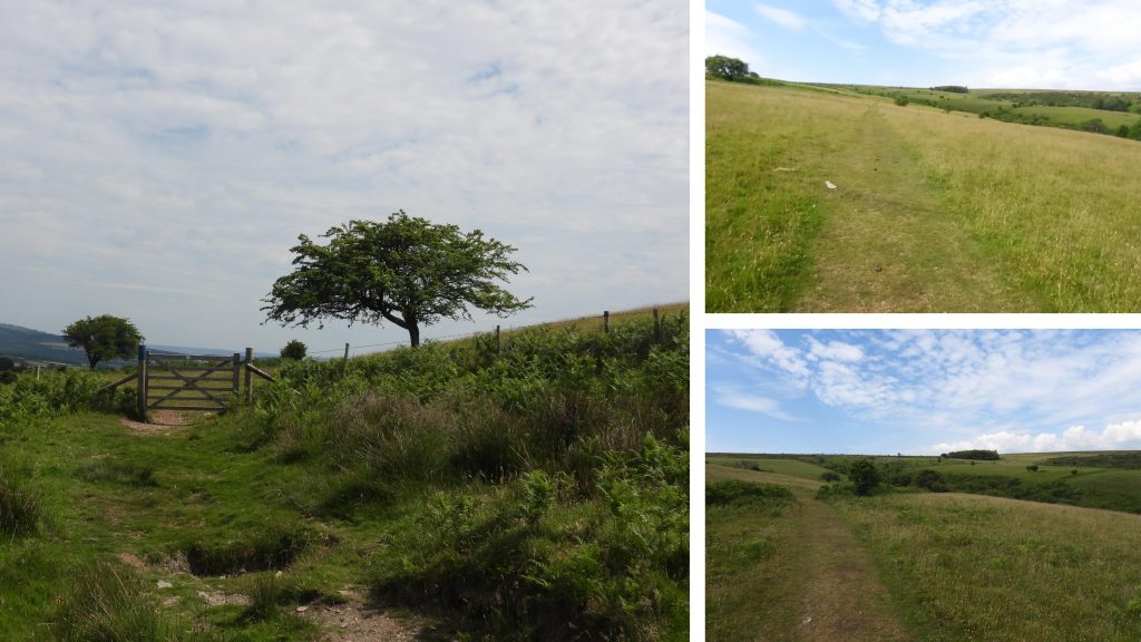
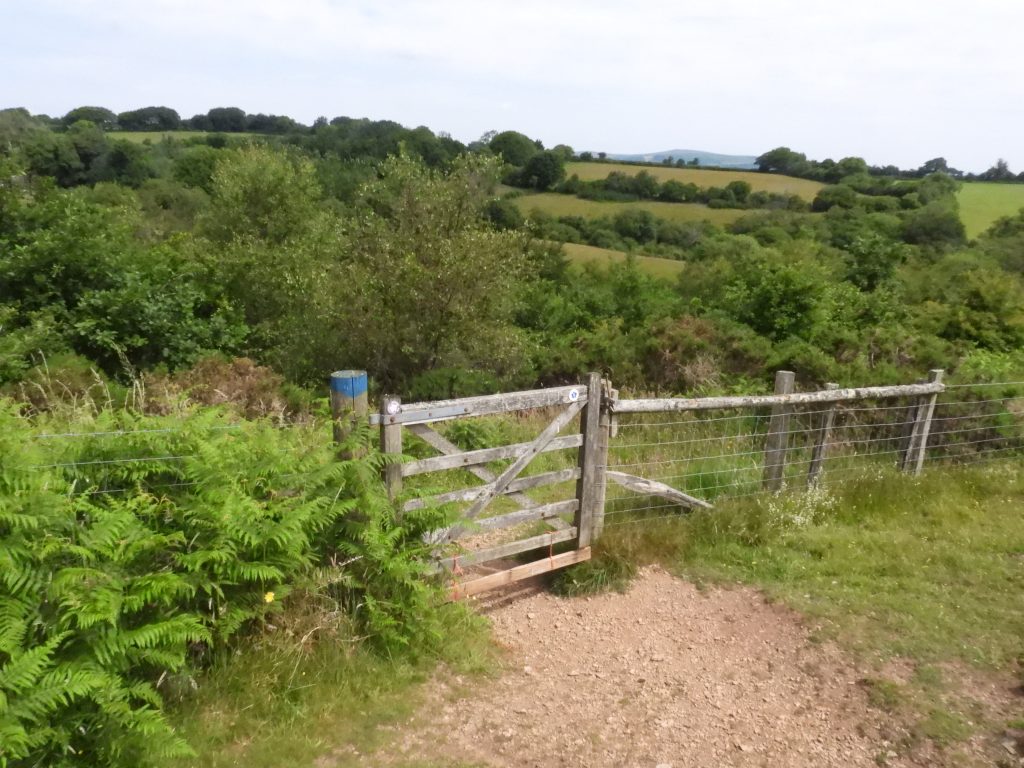
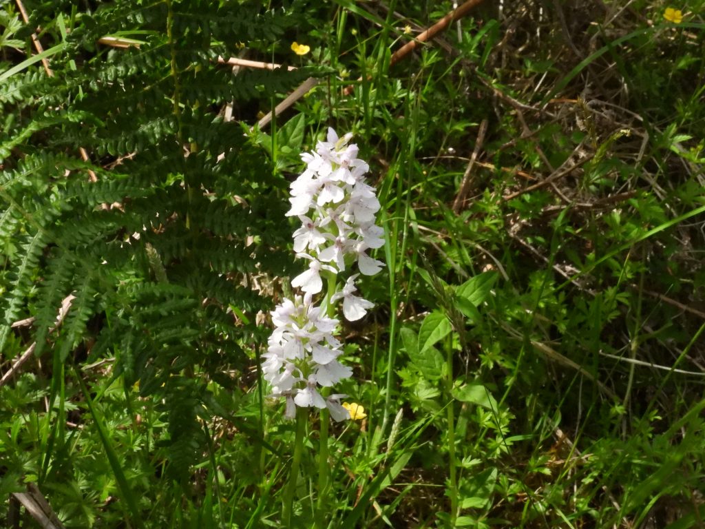
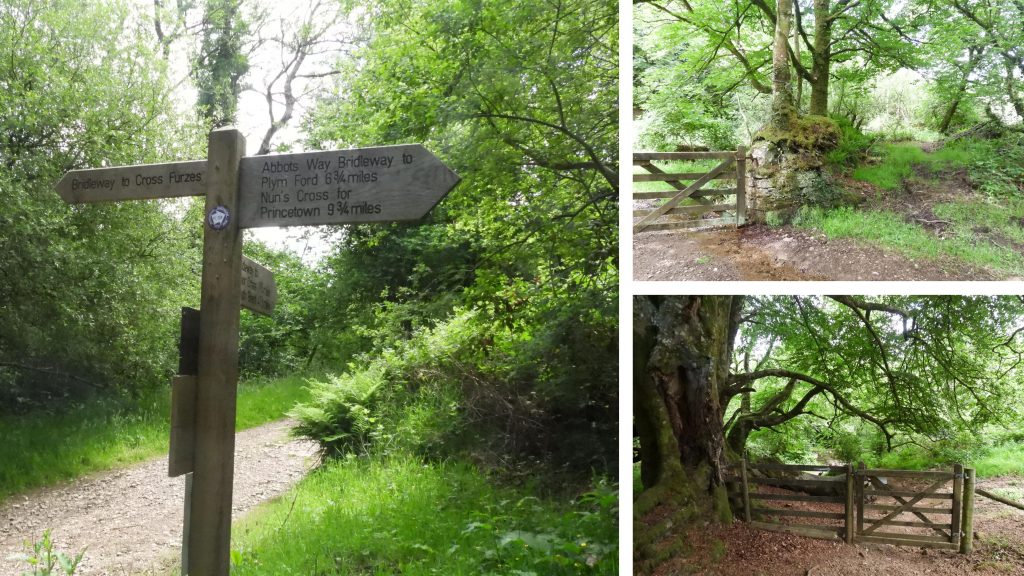
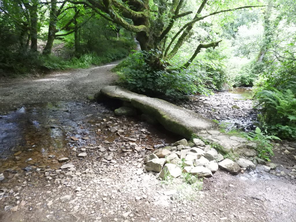
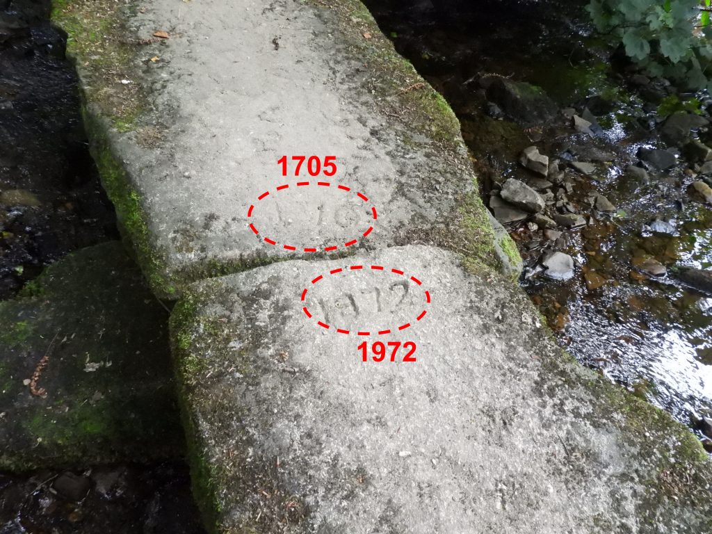
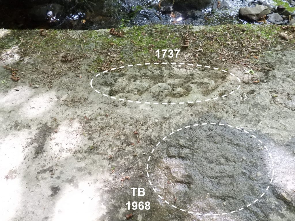
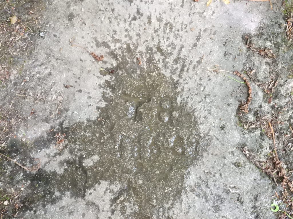
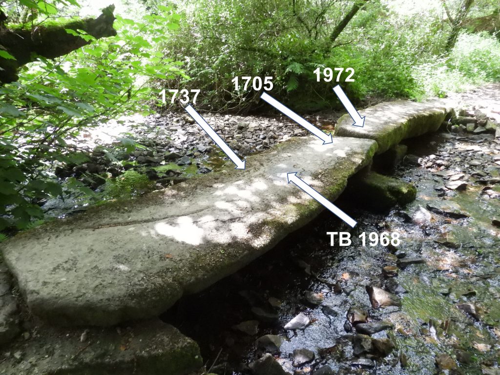
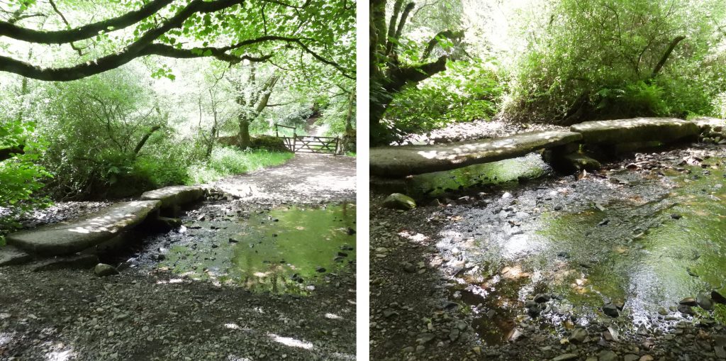
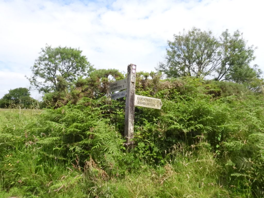
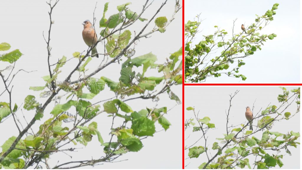
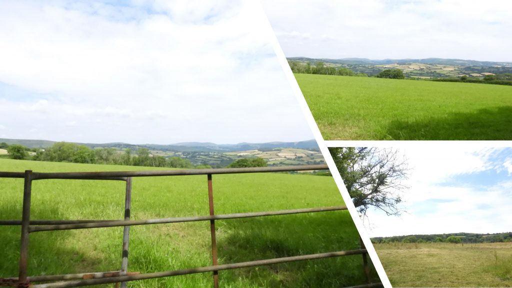
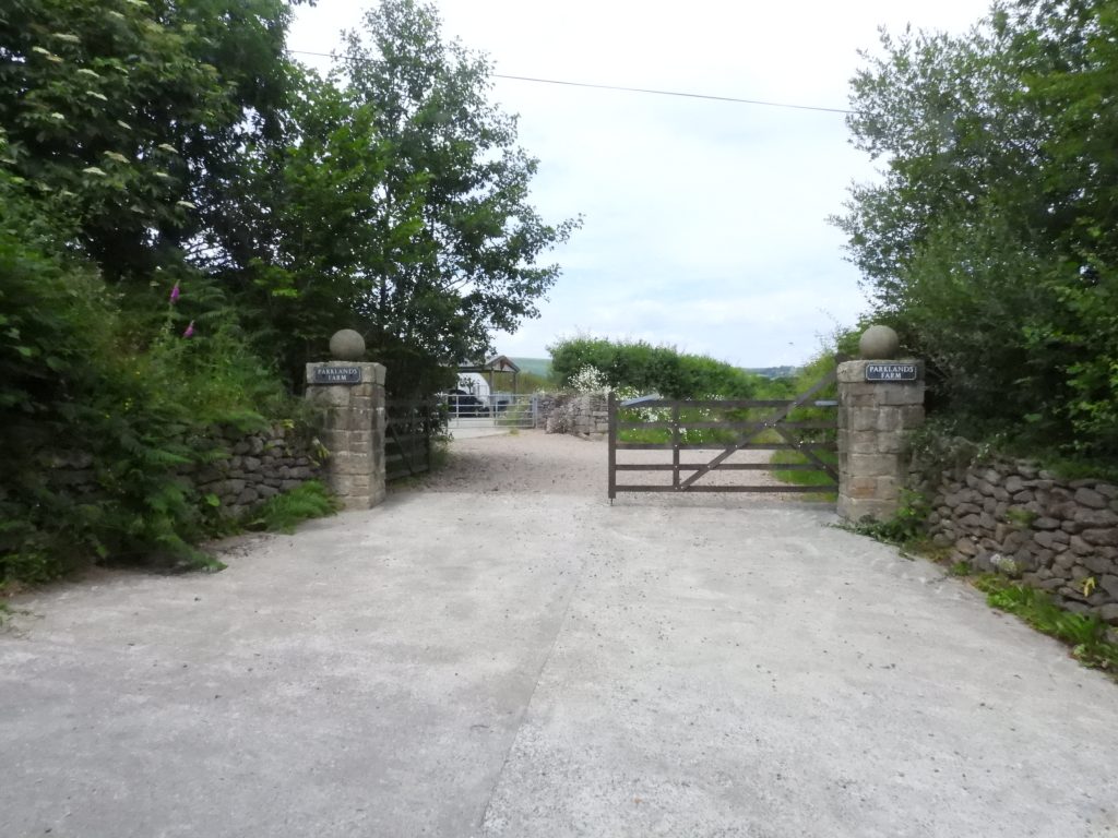
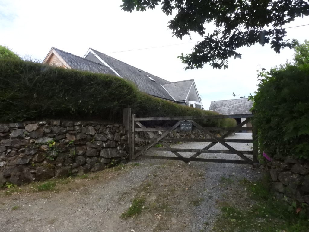
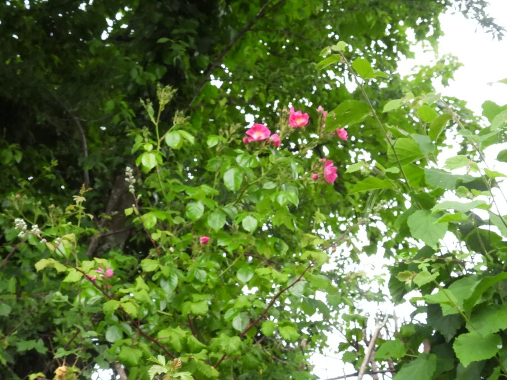
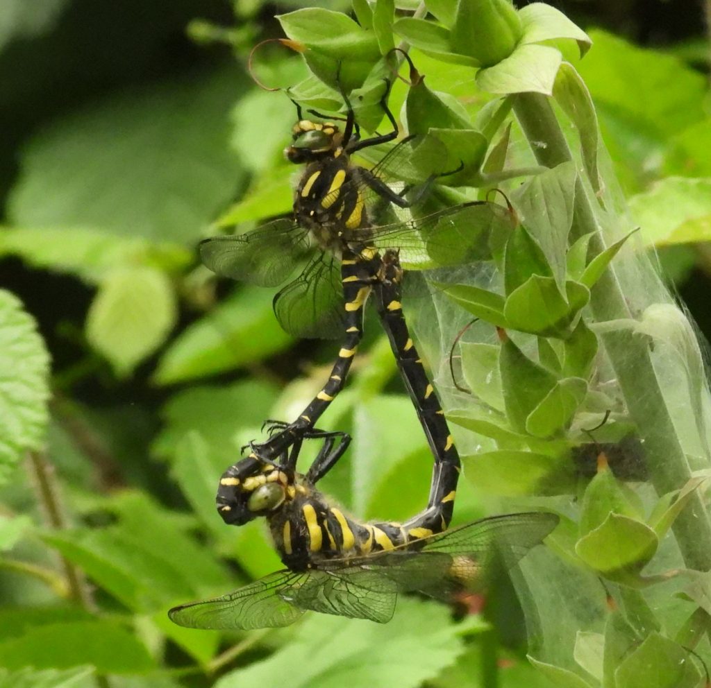
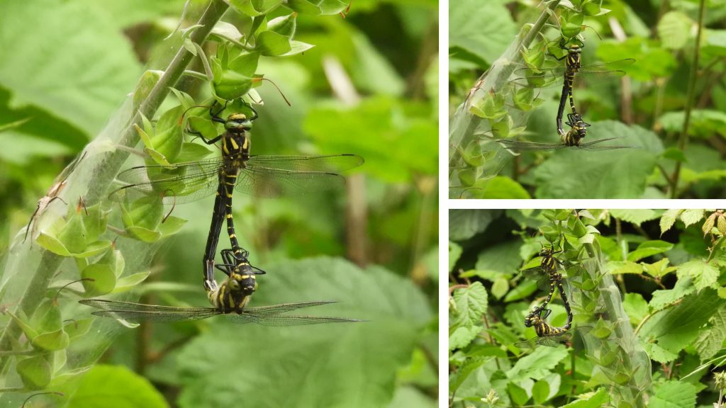
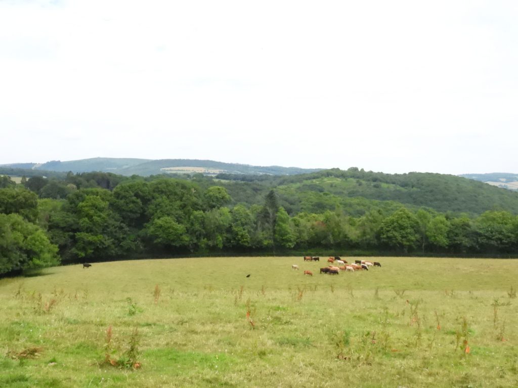
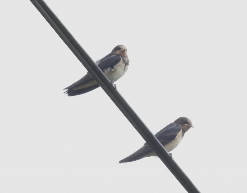
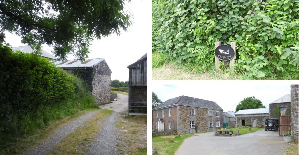
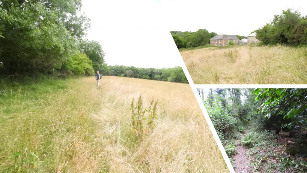
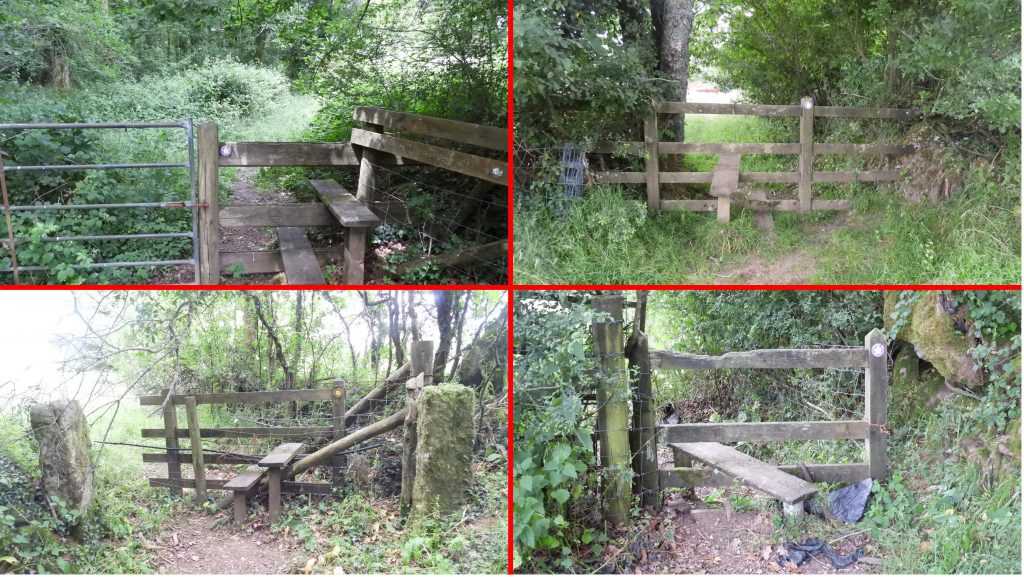
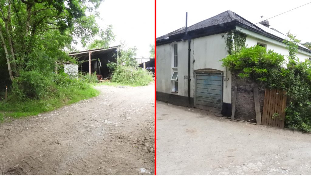
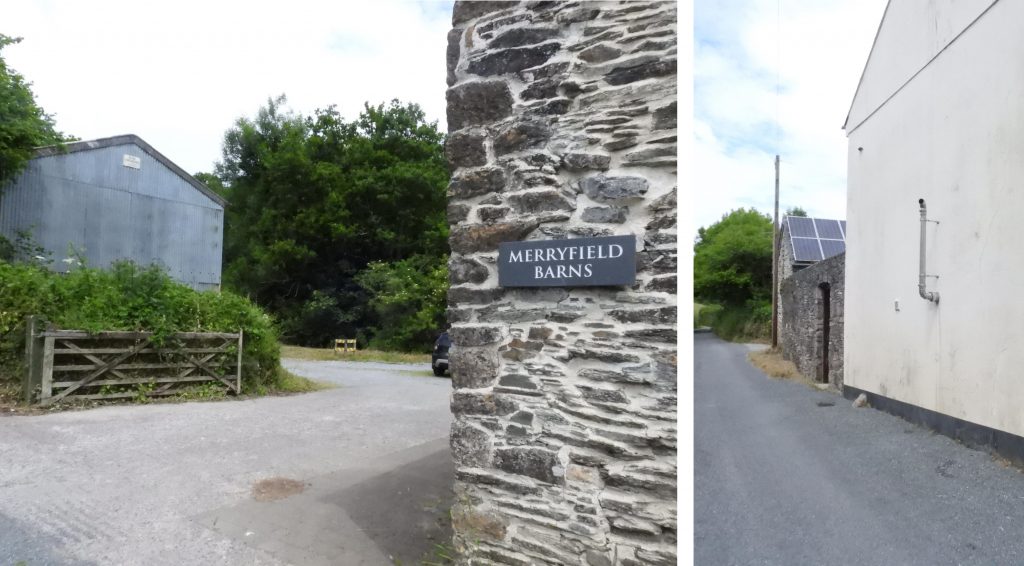
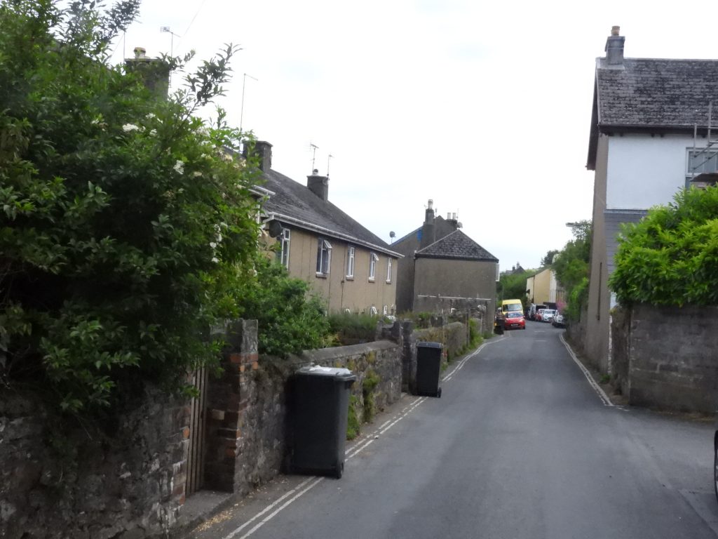
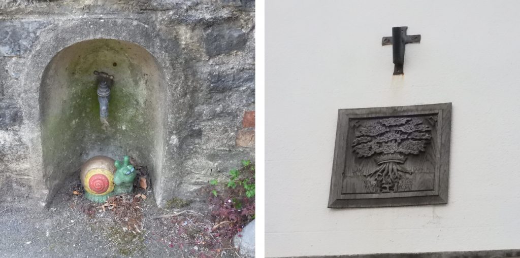
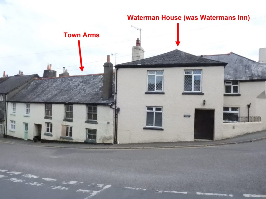
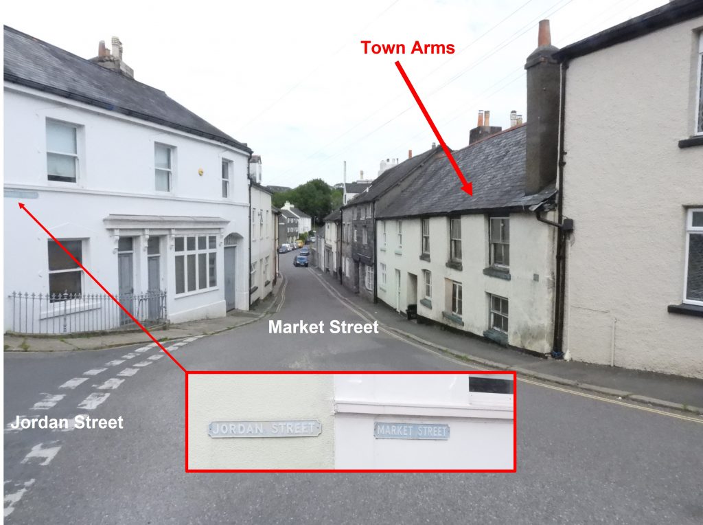
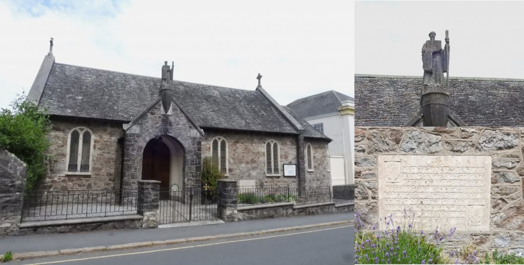
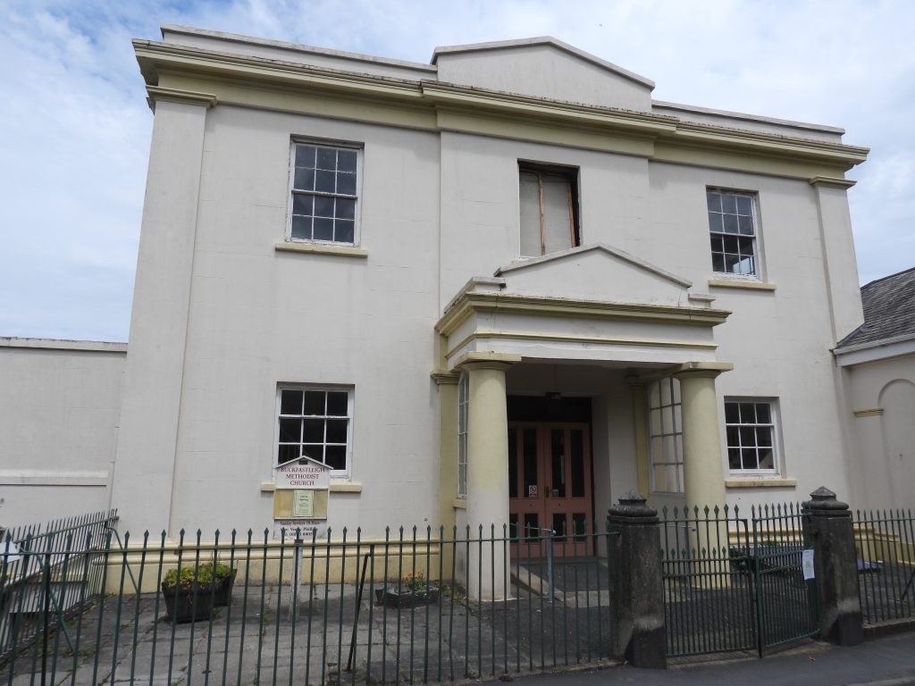
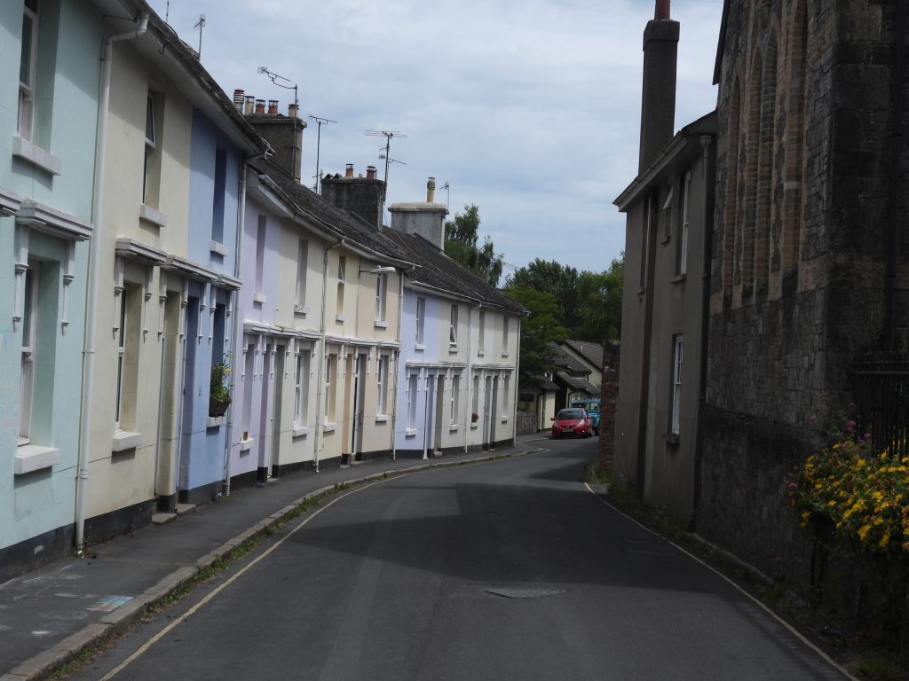
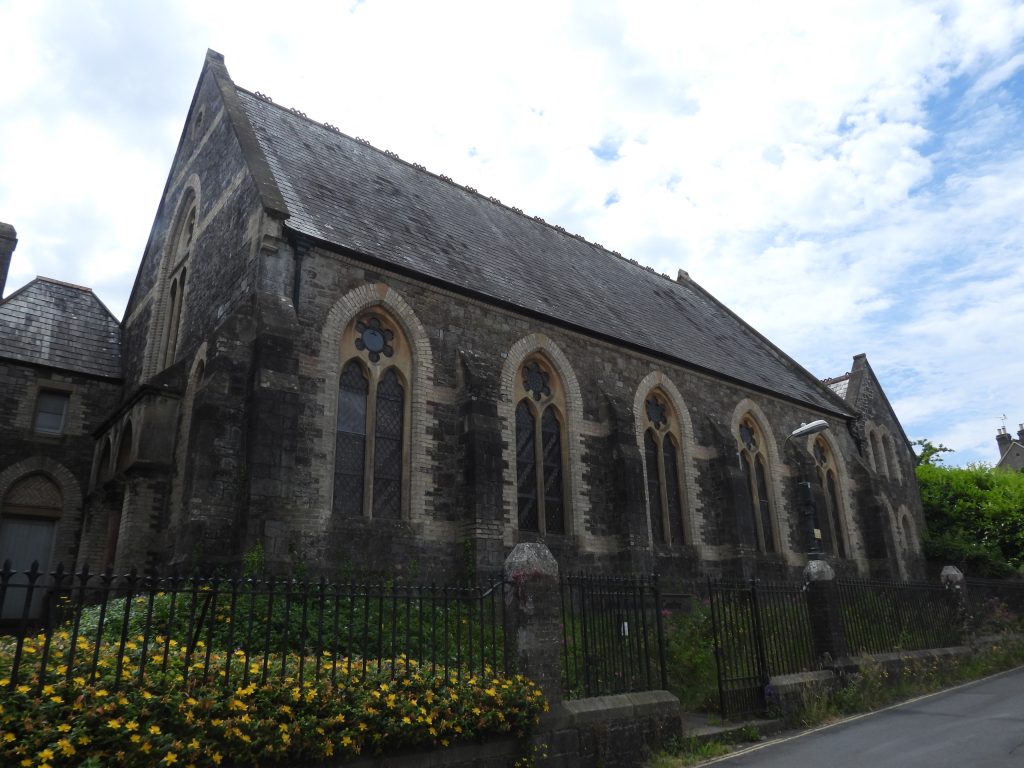
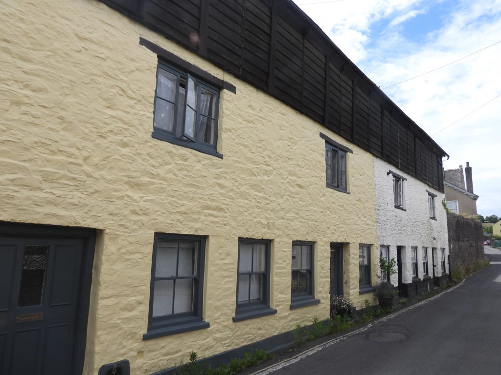
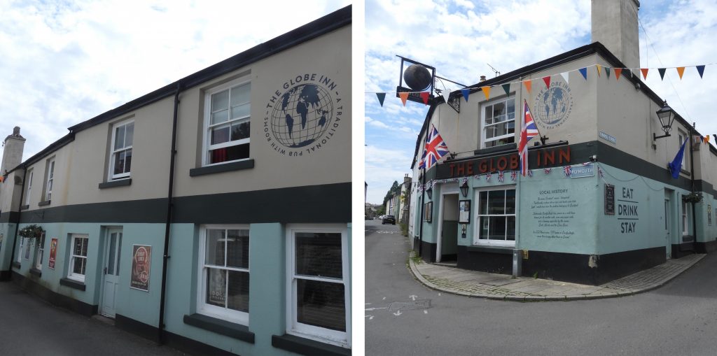
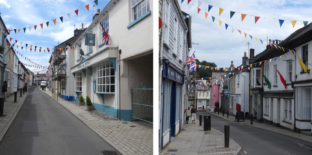
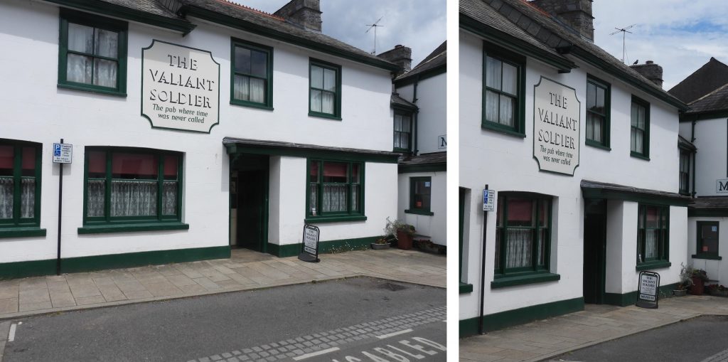
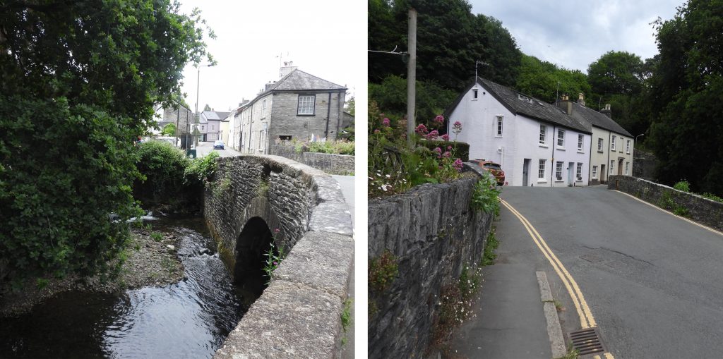
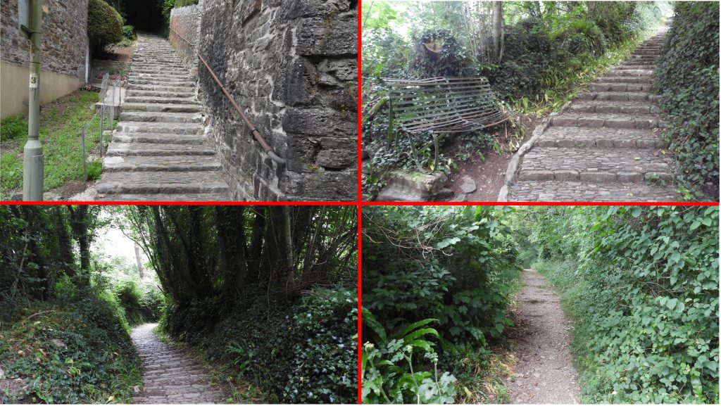
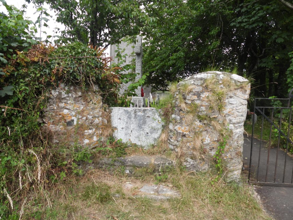
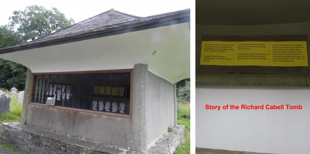
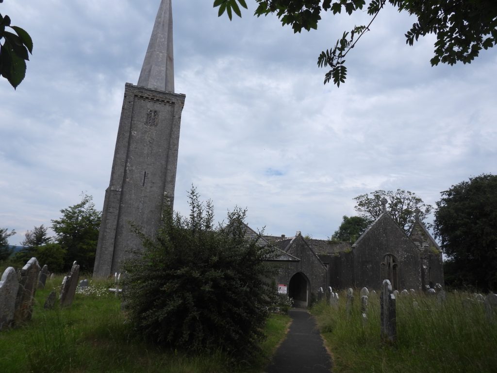
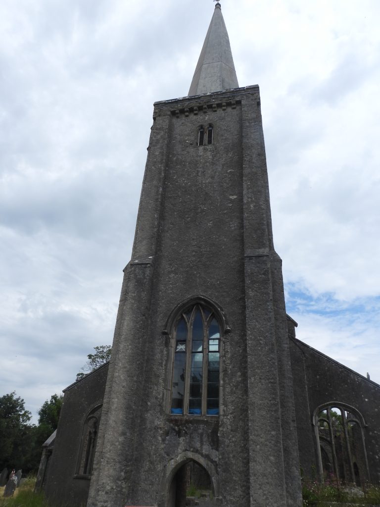
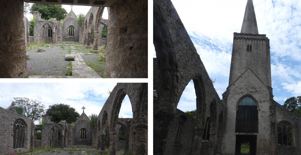
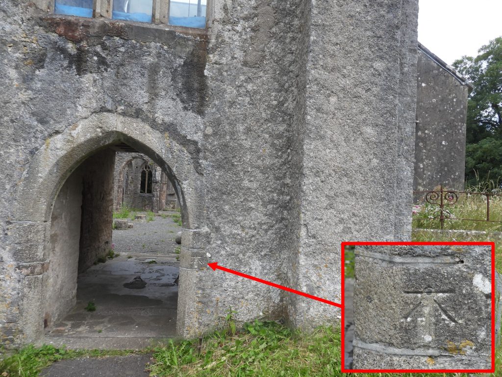
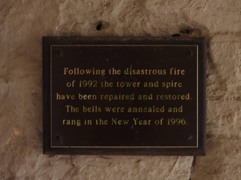
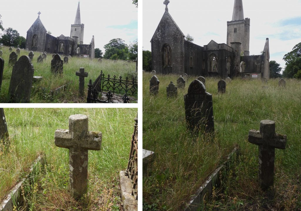
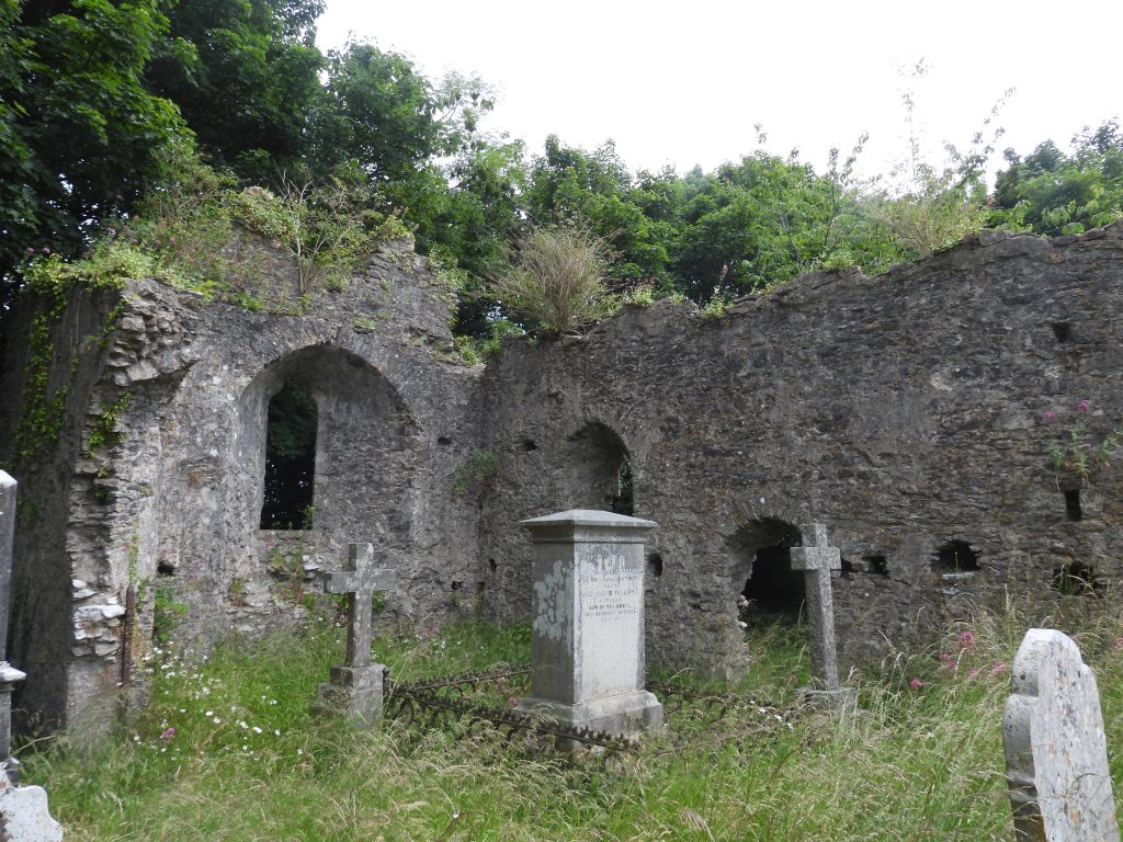
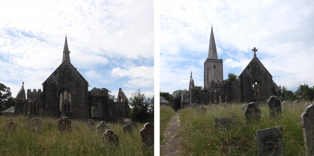
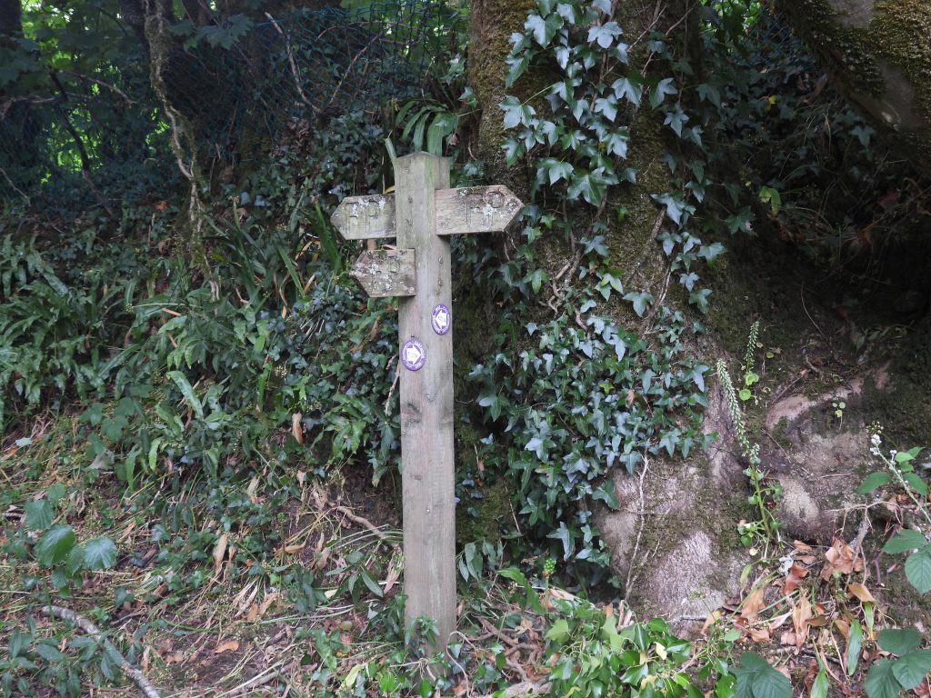
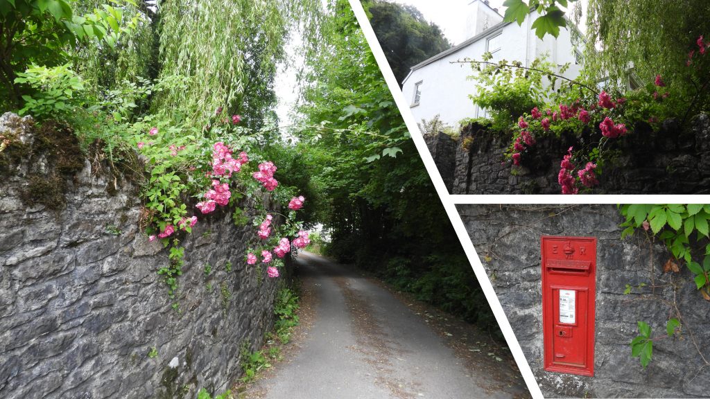
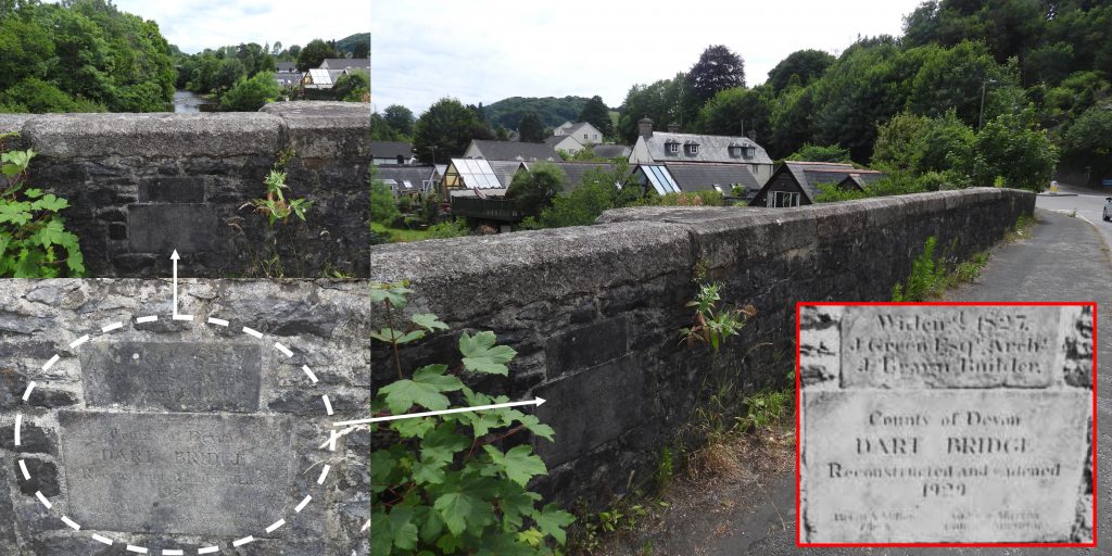
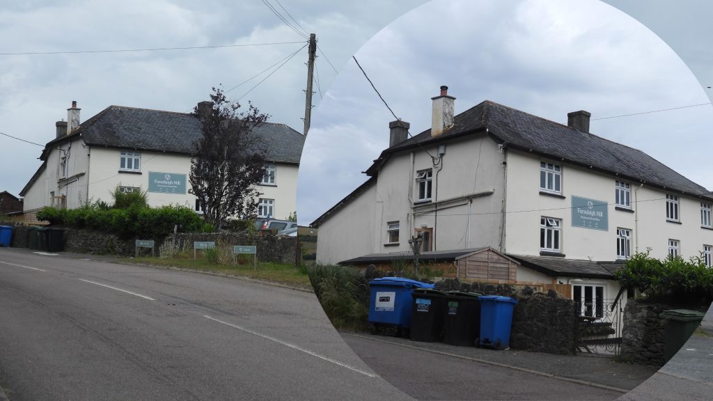
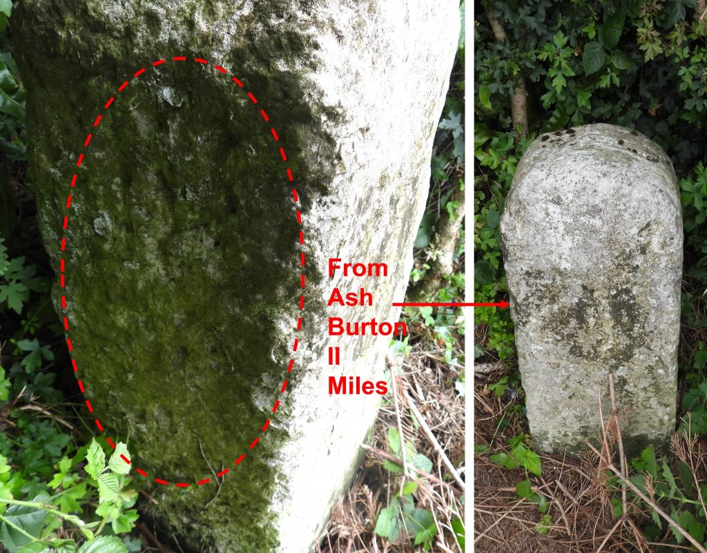
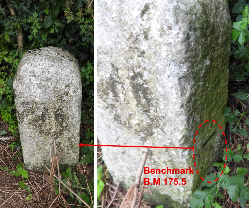
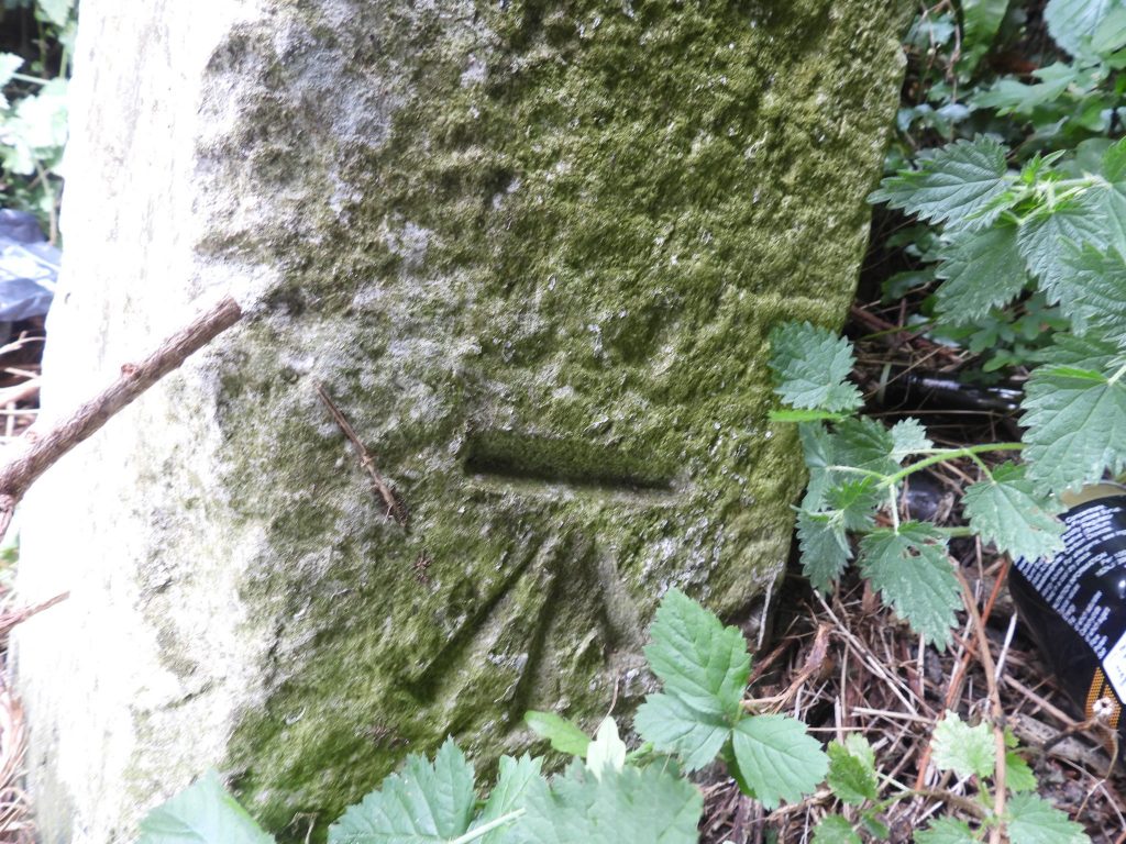
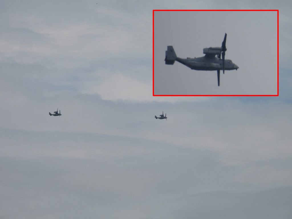
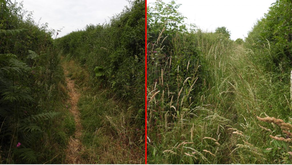
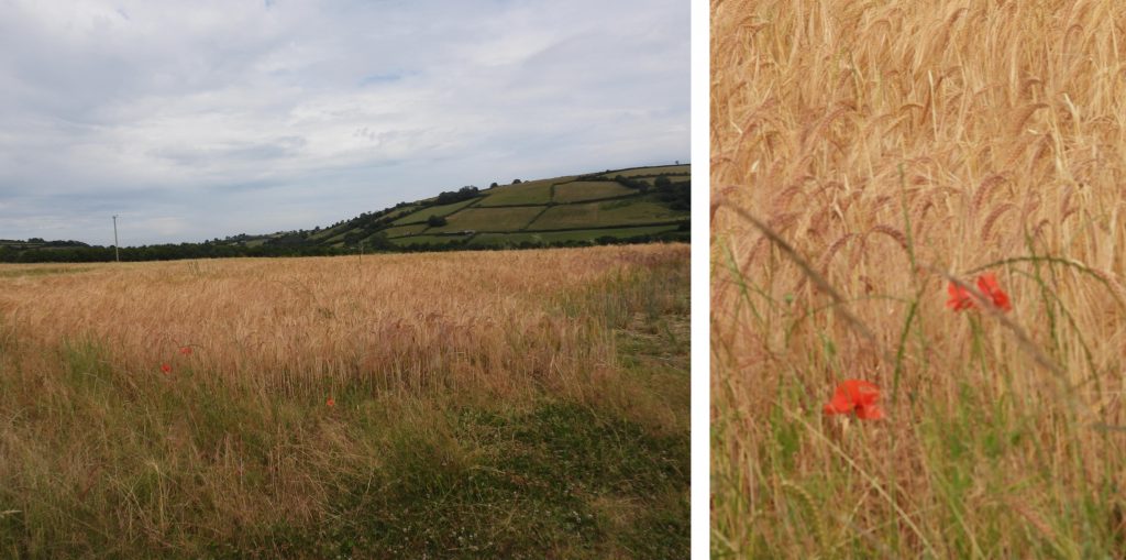
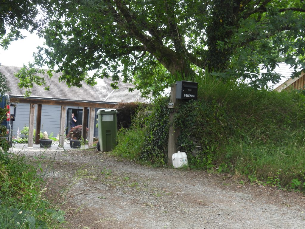
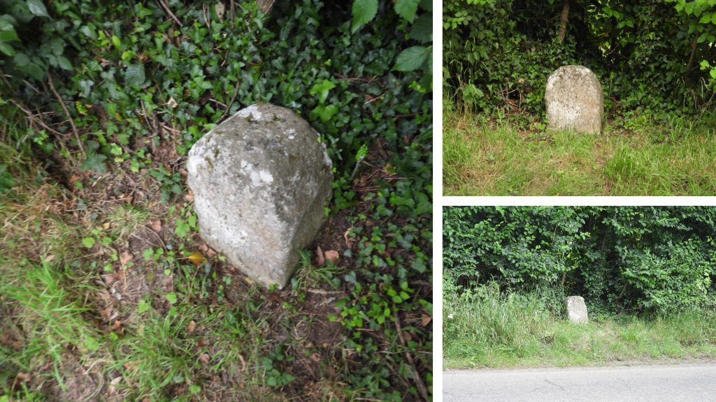
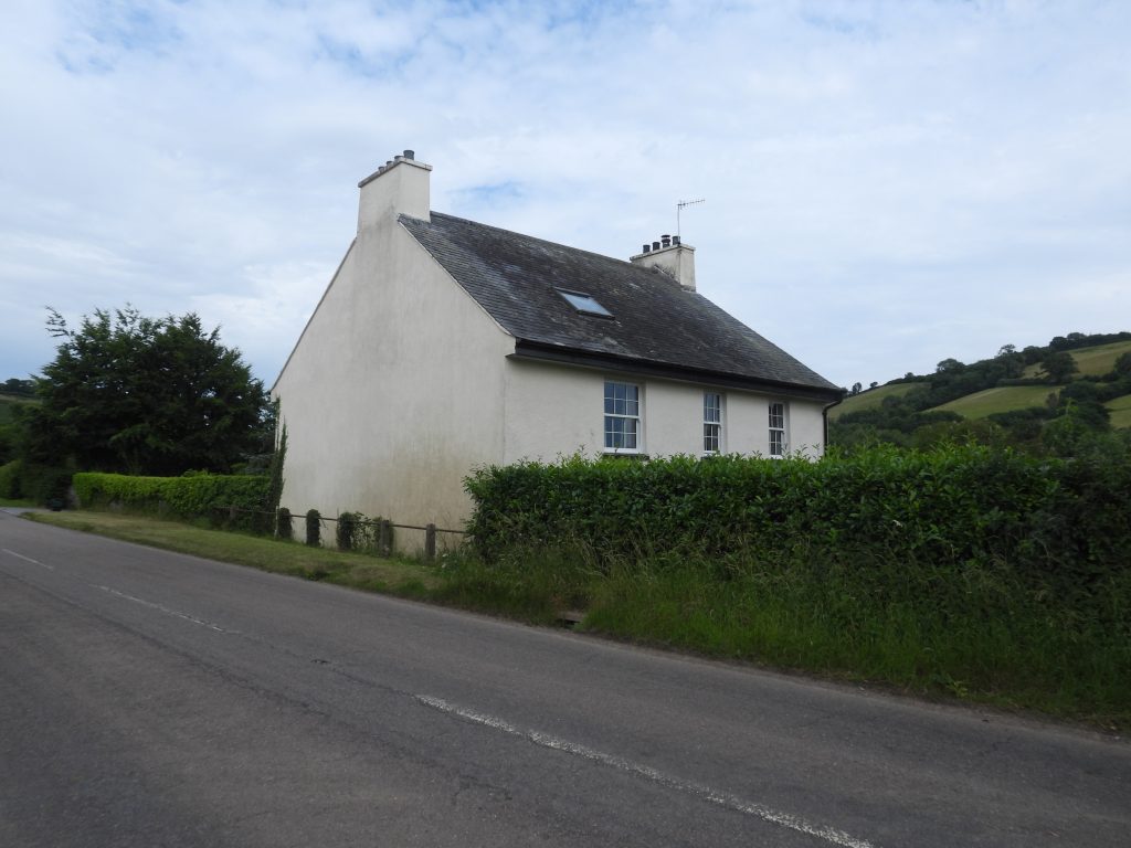
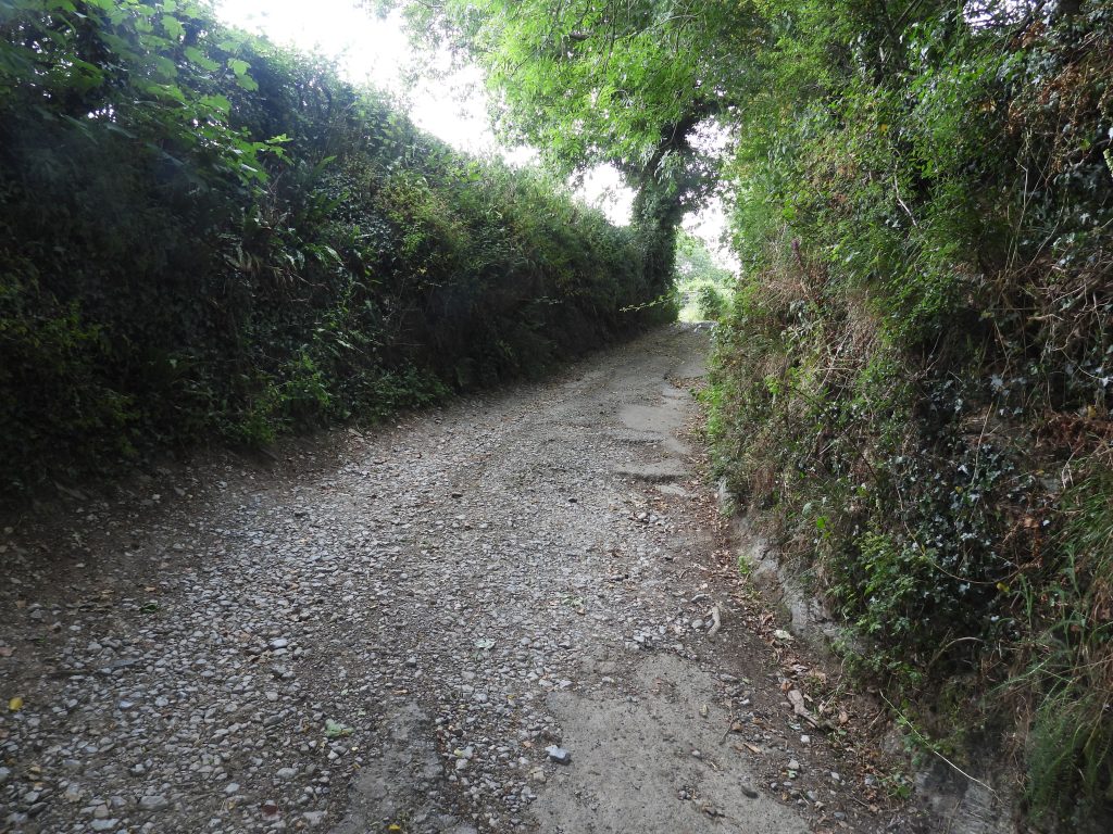
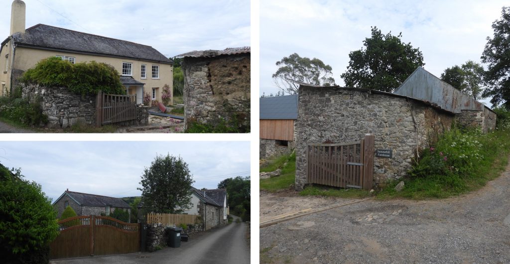
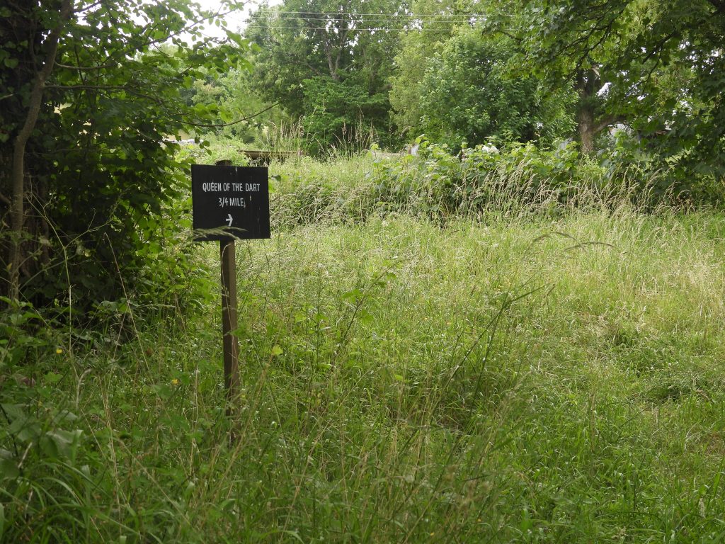
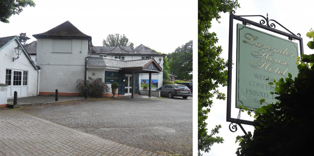
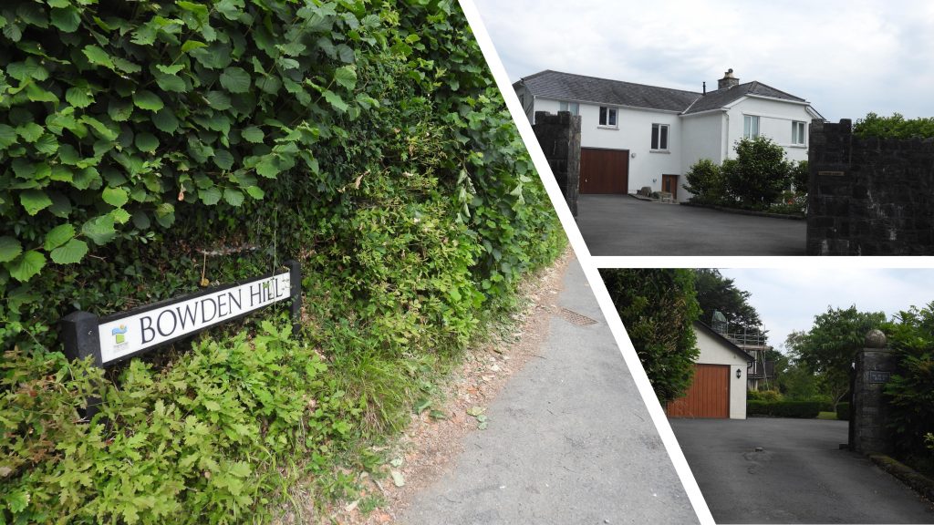
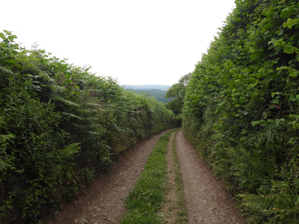
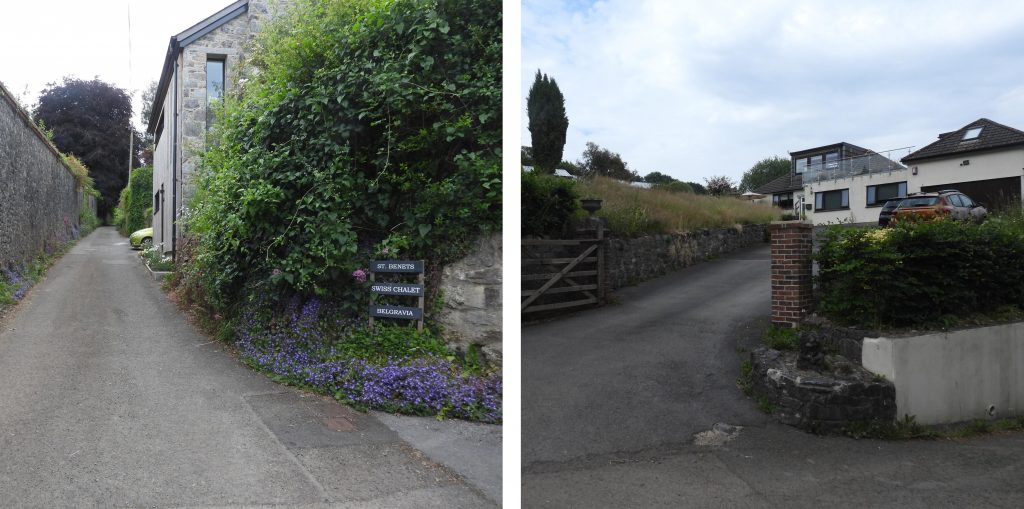
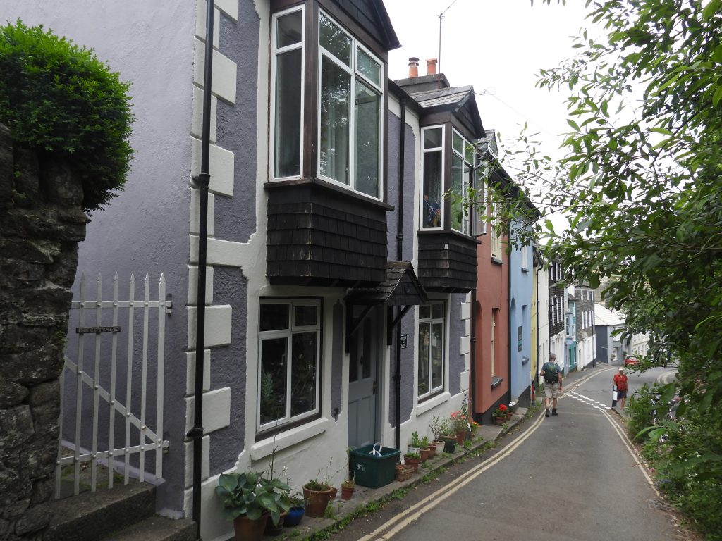
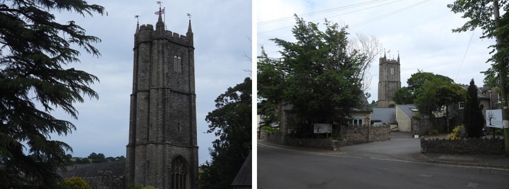
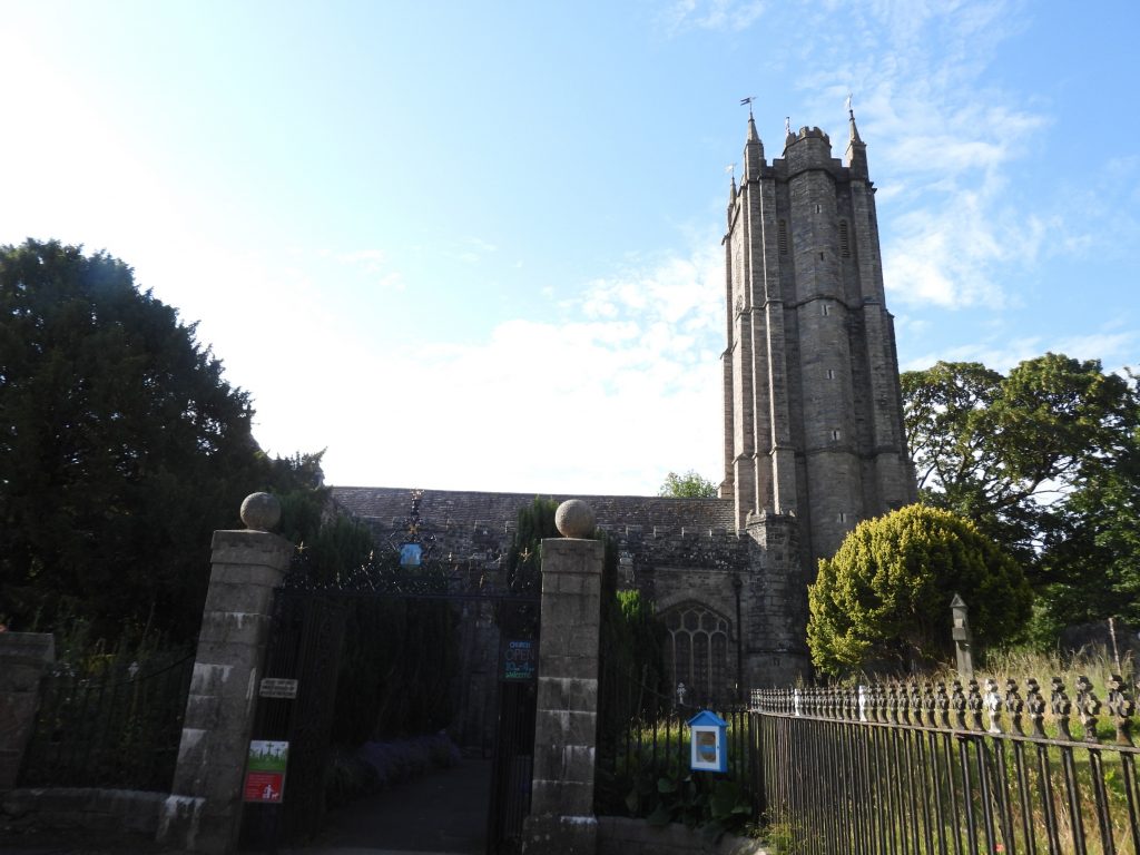
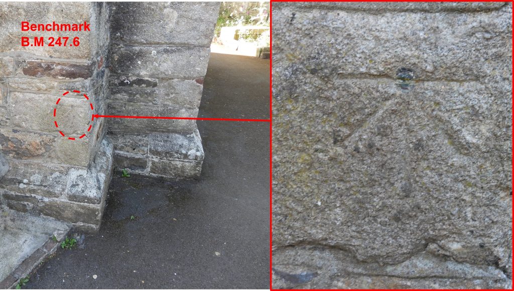
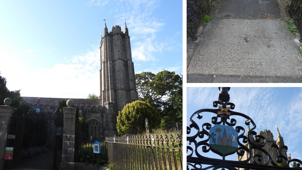
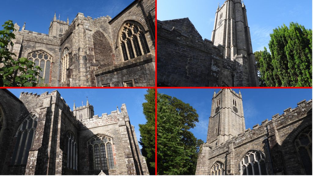
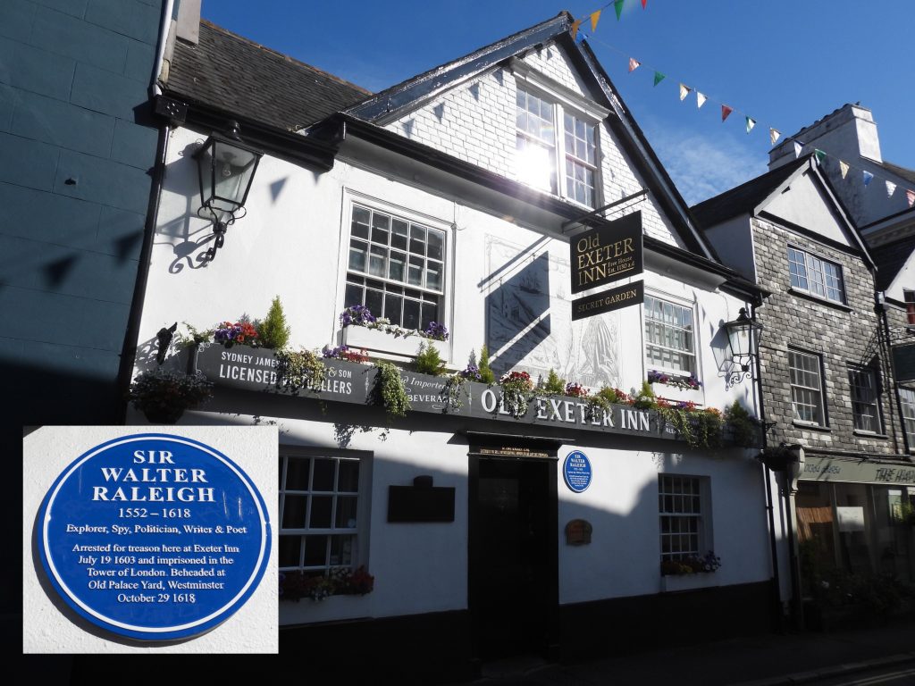
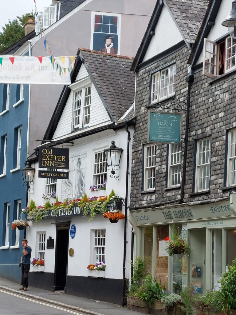
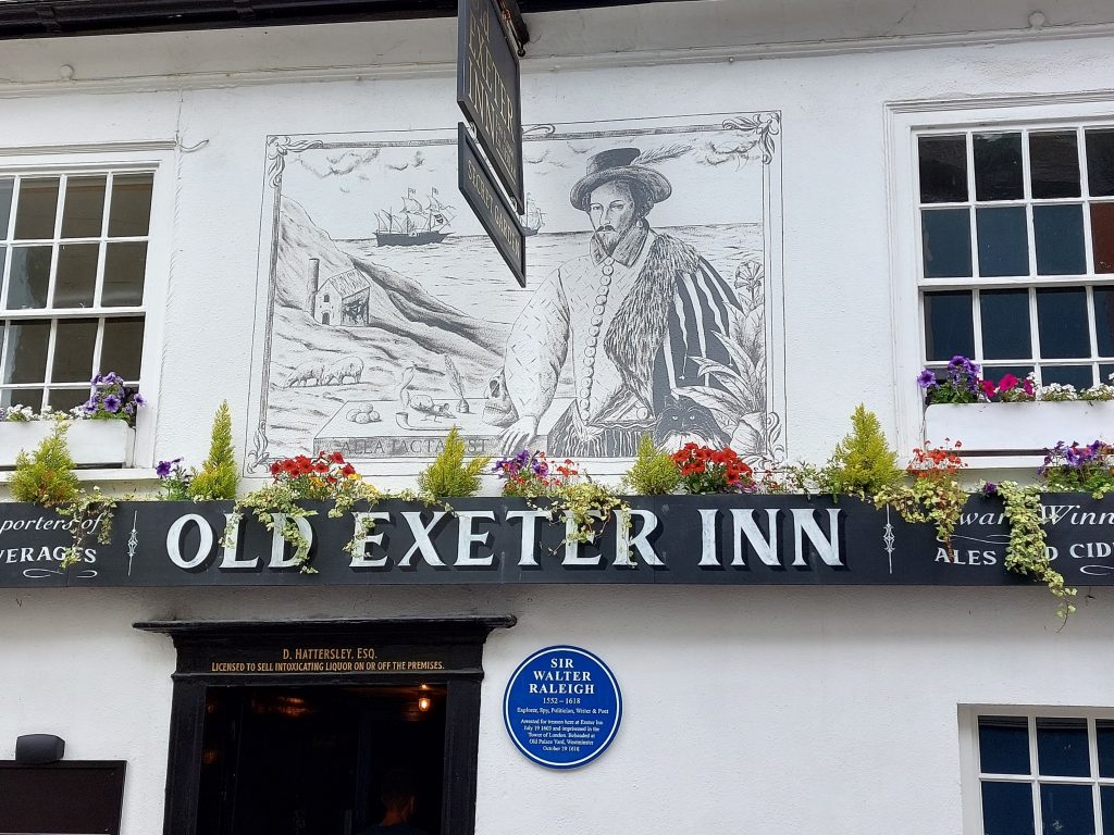
This second stage of the Dartmoor Way is stated on the official website (dartmoorway.co.uk) as being 10.5 miles (16.75km) starting at Shipley Bridge car park and finishing at Ashburton. The elevation climb is 1469ft (448m). The whole Dartmoor Way is a long circular 108 mile (173km) route around split into 10 sections with a further 2 making up a “High Moor Link”, which adds another 23.2 miles (37km). This post covering the second stage was recorded by the author as being 19.1km (just under 12 miles). That said the author had a period of (fruitless) searching for a benchmark near Water Oak Corner, which probably added at least 500m to the total. This post records some historical features, far reaching views, wildlife and points of interest by way of annotated photographs taken by the author along the route.
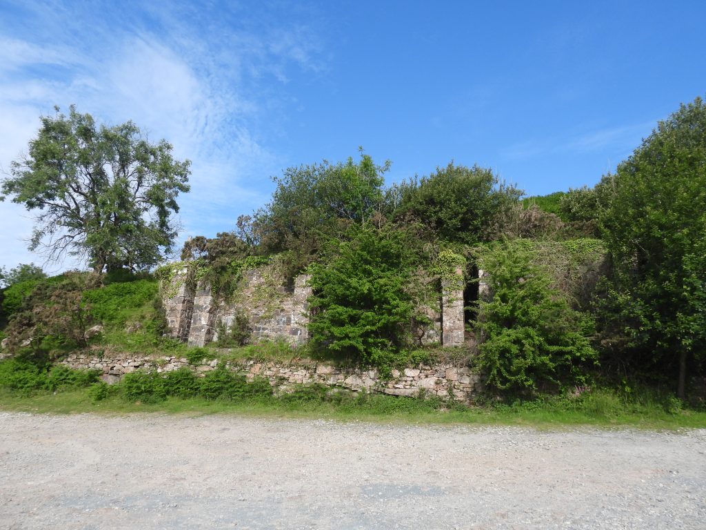
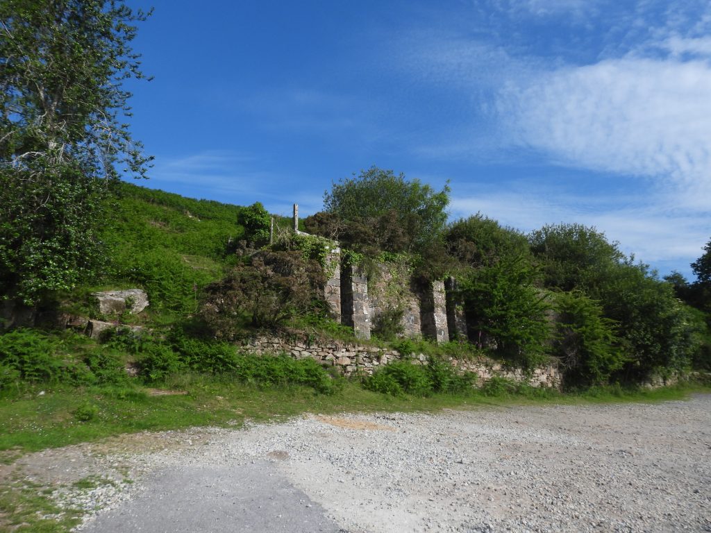
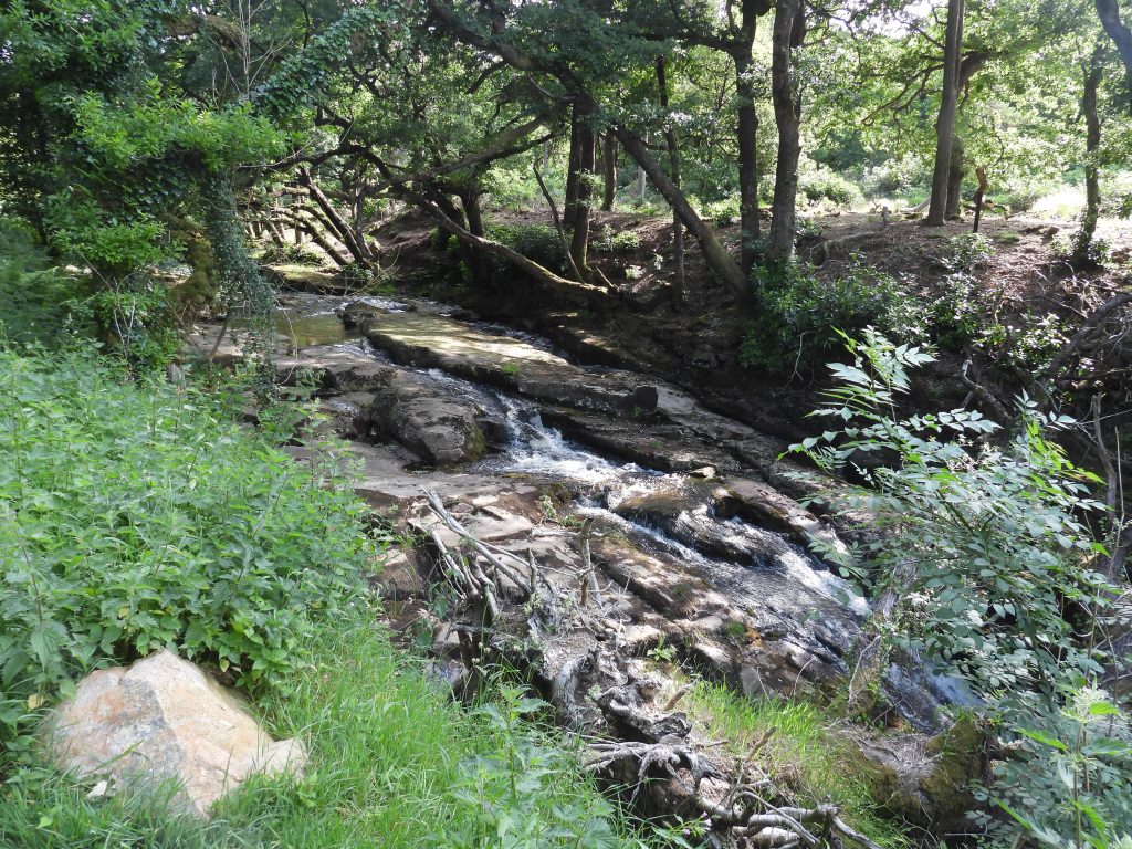
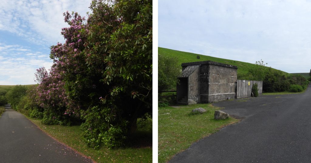
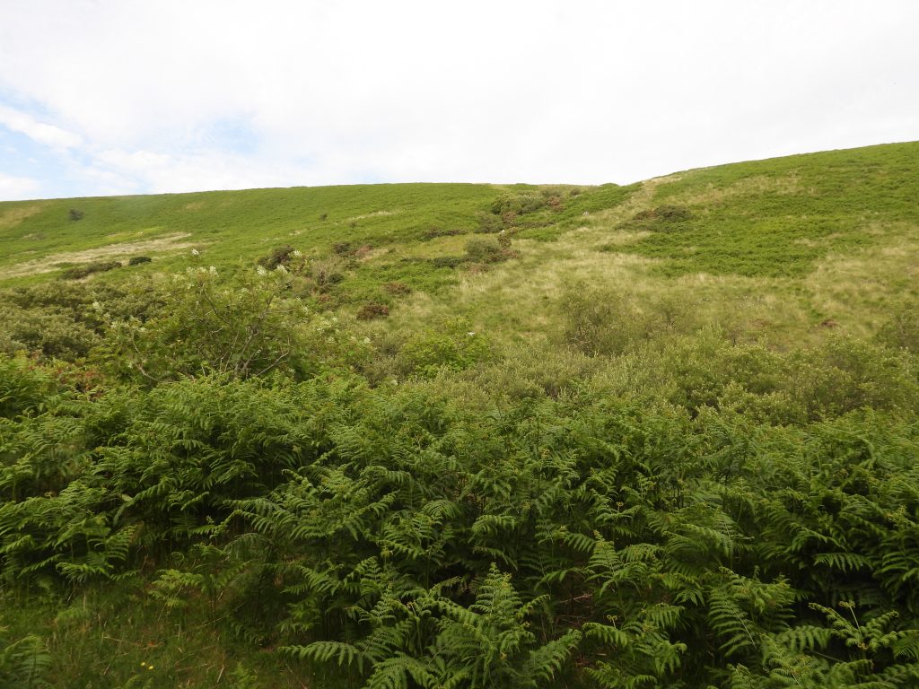
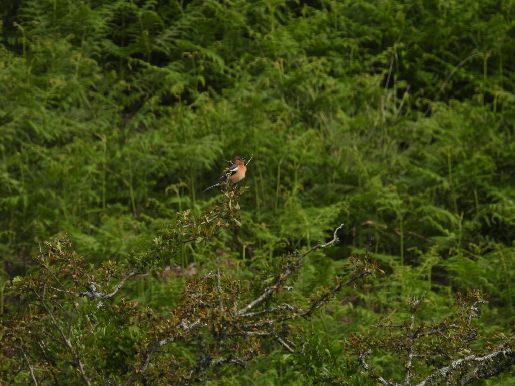
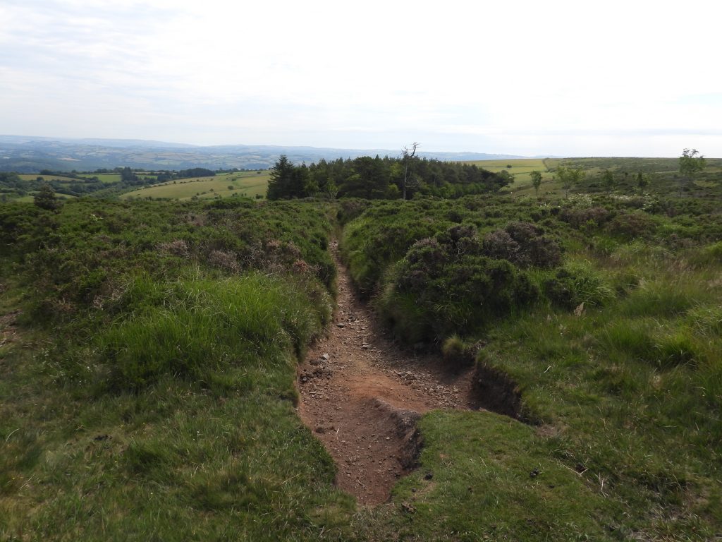
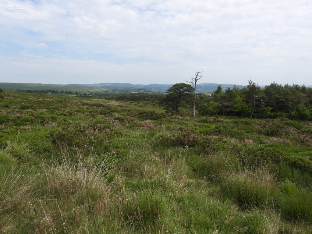
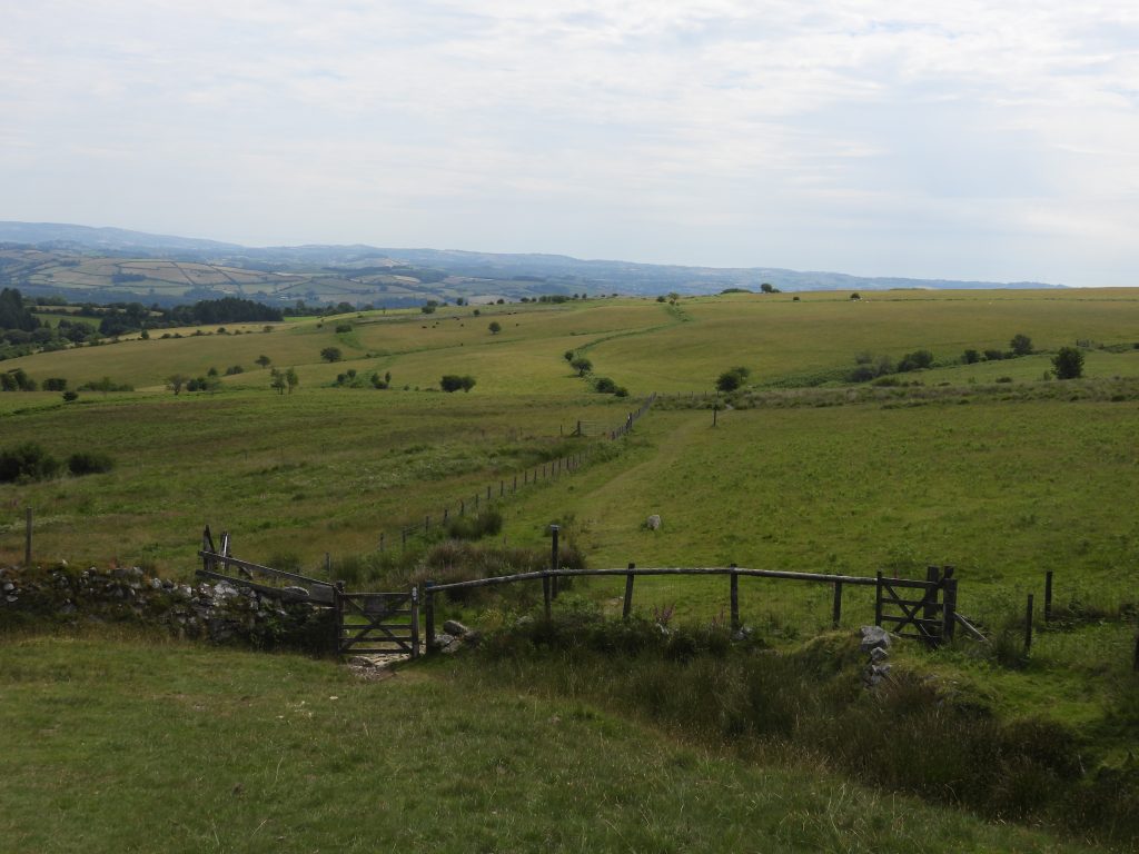
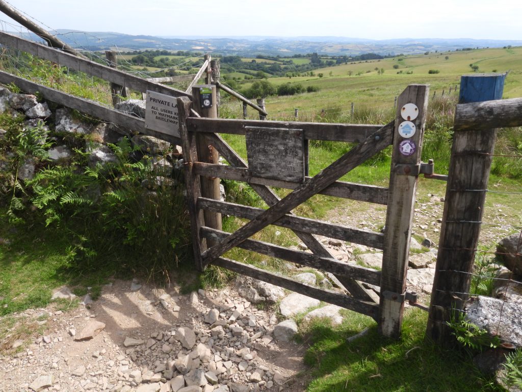
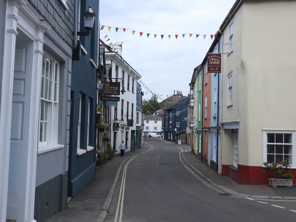
This GPS plot follows faithfully the stage 2 Dartmoor Way route. The only minor deviation was the fruitless search for a benchmark at Water Oak Corner (just north of Grippers Hill), where there is a lot of gorse. This deviation can be see by the series of “squiggles” in the GPS plot.Shipley Bridge car park, the finish point for stage 1 and starting point for stage 2 on the Dartmoor Way. The car park was once the final drying pan for the clay operations at Petre’s Pits, the clay being transported through open channels initially then through pipes over 2 miles distance.The “slotted building” is believed to have been adapted from earlier naphtha works. In the clay era it was the thickening tank. The naphtha distillation works and peat charcoal plant was set up in 1847 by Totnes businessmen Davy and Wilkin but was dissolved by 1850. Peat was cut near Red Lake and transported along the Zeal Tor tramway. by 1858 a company known as ‘The Clay Company Ltd’ was working clay deposits on Brent Moor near the head of the Bala Brook. Clay was washed from the extraction site and transported as a liquid in open channels to the processing works at Shipley Bridge. River Avon above Shipley Bridge.This boulder is known as the Hunters’ Stone and is located beside the intersection of the track that leads up to the Avon Dam and the old Zeal tor tramway. The name “Hunters Stone” was first quoined in the Western Morning News on the 24th August 1904 in relation to an article on an old pound on Zeal Hill. The stone was cut by the behest of Mr. C. A. Mohun-Harris, the one time owner of Brent Moor House and on it are inscribed the names of Masters of the Dartmoor Foxhounds celebrated in the history of Brent Moor House and various later hunts. The stone was moved to its current location in (ref Legendary Dartmoor).This collage of pictures shows the inscribed names of the Hunters Stone. Top Left: BULTEEL, W. L. GOODMAN 1983 -1981 and R. W. F. POOLE 1964 -1967, Top Right: PAUL TREBY, Bottom Left: TREAWNY MH-DD, Bottom right : COMMANDER C.H. DAY RH 1919 – 1940, CAREW and M. F. DOUGLAS PANNANT (the only female whose name appears on the stone), CORYTON 1888 – 1916. The Hunters stone was “in position” by 1896 but moved in 1954 to its current location as it was in the way for the construction vehicles of the Avon DamRiver Avon between the Hunters Stone and the ruins of Brentmoor house. This stretch of the river evokes memories for the author who was brought her by his grandparents (who lived in South Brent) in the 1970s during summer holidays.Gate posts, which were part of the original Brentmoor house estate.In the grounds of Brentmoor house on a wooded granite crag about 20 metres from the path is a memorial stone to Mary Meynell, the daughter of Francis and Caroline Meynell of Brentmoor house. It would appear that many mistakes in recording the details of this event have appeared in many publications over the last 30 years or so. The author has read that the girl has on occasions been called Margaret, her year of death being recorded as 1865 and that she died in a riding accident. The author has taken the Tim Jenkinson article, in Dartmoor Magazine Issue 137 Winter 2019 as the most definitive.Mary Meynell, the little girl from Brentmoor house died aged 4 years of tonsillitis and laryngitis on this date. William Crossing (1889) first mentions the location of the memorial in his book “Amid Devonia’s Alps“. The memorial is inscribed with the following: M.M 27th March 1863 My lovely little Lily Thou wert gathered very soon, In the fresh and dewy morning Not in the glare of noon The saviour sent His angels To bear thee hence his own And they’ll plant thee in that garden Where decay is never known.Mary was baptised on 11th November 1858. Her death was recorded in Western Daily Mercury. She was buried on 1st April 1863. A very sad story for which the author always has a moment of reflection when at the memorial.Brentmoor House was originally a small 17th century farmstead. In 1855, Francis Meynell bought the 3000 acre estate. With his wife Caroline, Francis Meynell rebuilt the farmstead into a substantial house. During his time at Brentmoor, Francis suffered two tragic deaths of Mary (daughter) and Geoffrey (son). In 1870, Francis moved to Dawlish where he passed away. Brentmoor was left empty for a number of years (in the 1881 census it was listed as ‘uninhabited’). – ref: Lost Heritage websiteIn the 1880s /1890s, the Brentmoor house was owned by Mr. C.A. Mohun-Harris (who commissioned the Hunter’s Stone). By the turn of the 20th century, Brentmoor house was used as accommodation for the Master of the Dartmoor Foxhounds. Fast forward to WWII, between 1941-44, Brentmoor house was leased by the Friends Relief Service (FRS) as an evacuation home for 16 deaf children from Hartley House school in Plymouth, plus three teachers and five staff. After the war, it became part of the Youth Hostel Association network until 1955. The house was closed up when the construction of the Avon Dam was taking place and and was left derelict until the Royal Marines were brought in to finish the task with explosives in 1968. ref: Lost Heritage website“Modern” bridge over the River Avon at Woolholes. Small vegetation covered quarry at Woolholes which possibly is associated with another moderately sized granite quarry a few hundred metres away near the bend of the tarmac road going to Avon Dam. Crossing stated the other quarry was opened in connection with the South Devon Railway construction. (ref: Robinson, R., 1977-1979, South Brent Parish Checklist)Black Tor above Brentmoor House and a wood known as “Whisky and Soda” wood.Black Tor can be seen from the tarmac road leading to the Avon Dam. It is 1050 ft (322m) above sea level.Views long the Avon Dam tarmac road. There are some large rhododendrons and a small building (probably associated with the water extraction at Avon Dam). The tarmac road is officially labelled “South Brent Bridleway 26”.The small stream / gully running down the hill from just south of Ryder’s Rings to the Avon is unnamed on the OS map but is known as Dry Brook Common Chaffinch seen in the Avon valley.Common Chaffinch. The author isn’t an expert ornithologist but believes this is a male as the female has more subdued colours.These stone structures (on both sides of the River Avon) appears to be a relatively modern weir which is depicted on the modern mapping but is not shown on historic maps dating from the late 19th century – 1950s, suggesting it is probably linked to the construction of the Avon Dam in 1957.Near to the point where Small Brook passes under the tarmac road before entering the River Avon the parish boundary between South Brent and Dean Prior is located (denoted by dots on OS map). At this point the 14th (of 14) boundary non-inscribed boundary stones in the area can be found delineating this boundary.Next to the area marked on the OS map as “Long-a-Traw”, the Dartmoor Way bears off right up an unmarked track towards the eastern end of the dam.A zoomed in picture from the turning point of the Dartmoor Way showing Zeal Gully. The line that can be seen near the top of the picture is a dry leat which once carried water from the Avon (near Buckland Ford) across Bala Brook to Middle Brook where it fed a water wheel (wheel house still remains) and a pelton wheel. More details can be found here: https://dartmoorexplorations.co.uk/brent-moor-leat-systems-and-clay-channels/Ponies and sheep with their offspring on the track leading to Avon dam.Looking south from just after the tarmac road / track to Avon dam turning point. The broad hill is Dockwell Ridge. The rough track is labelled as Dean Prior Bridleway 9.As the dam is approached a short section of narrow gauge rail tracks can be found. These would have been used during the construction of the reservoir (1954-7) and are believed to have been been for a crane.A new dam on the Avon river was proposed in 1948 and approved by the government in 1950. Construction began in 1954 and was completed in 1957. A new dam on the Avon river was proposed in 1948 and approved by the government in 1950. The concrete gravity wall rises to the spillway, 94ft above the river level. The reservoir can hold 305 million gallons. and now holds 305 million gallons.Dartmoor has eight reservoirs for drinking water which were constructed over a 111 year period between 1861 and 1972. The Avon reservoir was number 7 constructed during this period. The Avon Dam has a total length of 870ft (265m), in plan it is 1200ft (365m) radius. The spillway is 120ft (36.5m) – the data was extracted from High Dartmoor by Eric Hemery (page 327).These concrete bollards / plinths would have been used during the construction of the reservoir. There exact use is unknown by the author. During the construction of the dam 15,000 tonnes of cement was used with 30,500 cu yards (23,300 cu metres) of “soft” excavation and 53,000 cu yards (40,500 cu metres) of rock excavation.The author believes this is a Wheatear and would welcome either confirmation of correction !StonechatAvon Reservoir taken from near where Brockhill Stream enters. The water catchment area for the reservoir totals 3125 acres.Mother and calf near Brockhill StreamCattle near Brockhill Ford where the Abbots Way crosses the small valley. Leaving Brockhill Steam via Abbot’s Way. The small “pip” of Eastern White Barrow can be seen on the horizon. The Abbots Way marked on OS maps is one of several trans-moorland track which were used by the medieval monks when travelling between the monastic centres of Buckfast, Tavistock, Plympton and Buckland. The route wasn’t dubbed the “Abbot’s Way” until the nineteenth century, with earlier records naming it simply as the “Jobber’s Way”. A traveller called John Andrews first dubbed it the Abbot’s Way in 1794. (ref : Legendary Dartmoor)From the crest of Grippers Hill on the Abbots Way, the views to the north east include Hamel Down and Rippon TorFrom the crest of Grippers Hill on the Abbots Way, the views to the north west includes Pupers Hill.From the crest of Grippers Hill on the Abbots Way, the views to the west includes Torbay. Marldon masts can also be seen.Approaching the small plantation at Water Oak Corner along the Abbot’s Way as the path passes through low-growing gorse.The author took a rather fruitless diversion her in search for a benchmark. If the benchmark is still extant (and there is no reason why it shouldn’t) it will be amongst this dense vegetation.The gate a short distance to the north of Water Oak Corner with the path leading across Lambs Down beyond.The gate near Water Oak Corner.The path across Lambs Down. There is a thrush on the path between the camera and the guide post.Zoomed in views of the thrush on Lambs Down.The path across Lambs Down crosses a small stream, which is a tributary of Dean Burn further down the valley.Path across Lambs DownExit gate from Lambs Down leading down to the Dean Burn valleySpotted Orchid between Lambs Down and Dean BurnThe gates and signpost en-route to Dean BurnDean Burn Clapper which is inscribed with various dates and initials across the two slabs.Two dates inscribed on the clapper are “1705” on the eastern slab and “1972” on the western slab. William Crossing records that there are also the initials “GR” are inscribed and the letters “BDA”. These latter inscriptions aren’t easy to discern.On the east slab there is also the date “1737” inscribed plus a more crude inscription which reads “TB 1968”Water added to the eastern slab in an attempt to enhance the “TB 1968” inscriptions. Close up of “1737” date. It is recorded on the Dartmoor HER that there is very worn date “1601” (possibility) above the “1737”.The locations of the inscriptions.The age of the clapper is unknown but the author guesses (from the dates) that it is most likely late 17th or early 18th century.Lane junction to the south of Cross Furzes. At this point the Buckfast / Ashburton road is followed on the Dartmoor Way.BullfinchViews from the lane which descends towards Buckfast (before the turn down the footpath to Buckfastleigh)Parklands Farm is named on modern OS mapsParklands Bungalow next to Parklands FarmThe author believes this is a Dog Rose, which was found close to Parklands BungalowPair of Golden Ringed Dragonflies (Cordulegaster boltonii)According to the British Dragonfly Society, the female is the UK’s longest because of her long ovipositor and the male has a slight club shaped to the abdomen.More views from the lane to Buckfast just before the bridlepath turn to “Button”. The view are to the north and east across the Mardle and Holy Brook valleys towards Hembury Woods.Pair of swallowsThe Dartmoor Way follows the bridlepath which passes through “Button” farmhouse. The farmhouse is early-19th century and is constructed from stone rubble with slate hung front. There is a gable-ended wing at rear forming L-shaped plan.Leaving Button, heading through Billberryhill copse towards Billberryhill on path labelled West Buckfastleigh Footpath 10Stiles between Button and Billberryhill on West Buckfastleigh Footpath 10. What is the collective noun for stiles ?An unusual planter near Billberryhill.Bilberryhill farmstead is shown on 19th century map as a large L-shaped building with a group of small buildings and enclosures to the north and west (ref: HER)Merryfield (Merrifield) farmstead and barns just outside Buckfastleigh.The Dartmoor Way enters Buckfastleigh “Higher Town” at Jordan StreetA snail and a oak tree plaque are just two of some unusual features found in Jordan Street.The author has been told that Buckfastleigh had 29 public houses at one time. On the junction of Chapel Street, Market Street and Jordan Street, there were two hostelries; The Waterman’s Inn and the Town Arms. The Waterman’s Arms (now 22 Chapel Street) dates from the 16th century and was originally thought to have been a cider house. It has been suggested that the correct name of the inn is the ‘Waterman Arms’. A previous inn sign showed the family crest of the Waterman family who many years ago appear to have had some connection with Buckfastleigh. (Source: Quick, T., 1992, Dartmoor Inns, 135-6).Next to the Waterman House (22 Chapel Street) is 1 Market Street, which is shown as the “Town Arms” on the Ordnance Survey First Edition (1880s) map and is believed to be late 17th century or earlier in origin. It is now divided into two houses. St Benedict’s church on Chapel Street is an “Arts and Crafts” influenced design and was completed in 1939 when the Catholic Church was in expansion. It was funded by Mrs Edith Hamilton. There is a statue of St. Benedict over the entrance.The Methodist Church in Chapel Street is next door to St. Benedict’s Church. This Methodist and United Reformed church was built in 1835. It is a stuccoed classical building with slate hipped roof.This complex of workers housing actually comprises two main terraces backing onto a communal rectangular space. The Chapel Street elevation shows the houses to be rendered, with sash windows and a little ornamentation. Behind is Orchard Terrace (and the 2nd terrace) of houses, which comprise unrendered stone and casement windows. (Ref: Dartmoor National Park Authority, 2012, Buckfastleigh Conservation Area Appraisal) This former Congregational chapel and Manse is depicted on the Tithe Map, so is presumed to be at least early-mid 19th century in date. There is gothic detailing on the building.This row of four unusual cottages on Chapel Street are late 17th or early 18th century. The weather boarded loft of wooden construction gives them an unusual look. These tenter loft(s) were used for drying cloth and are clear evidence of the wool industry in the area.Globe Inn is located on Weech Corner, facing Fore Street and on the junction of Plymouth Road and Chapel Street. It was originally a coaching inn dating from the early 17th century, with the stables situated at the rear. In 1966 there were plans to remove Weech Corner on which the Inn stands and it was threatened with demolition; it’s business was to transfer to the Valiant Soldier. Ironically, the proposals never materialised and it was the Valiant Solider that ended up closing down. (Source: Quick, T., 1992, Dartmoor Inns)The Dartmoor Way continues into Fore Street in Buckfastleigh.The Valiant Soldier in Fore Street is known as “the pub where time was never called”. It is thought that originally it was two 17th century houses, which were apparently combined at some point. The Valiant Soldier was a public house between at least 1813 and 1965. When the pub closed its artefacts and domestic items were simply left, leaving the building in a “time warp”. It is now a museum and the town information centre.Church Bridge over the River Mardle is in Station Road. It was constructed circa 1749 from local limestone rubble and granite and has a single span with segmental arch. Just after Church Bridge, the Dartmoor Way turns left up a long fight of (195) steps. They are thought to be 19th century or earlier and lead up to Holy Trinity Church. The pictures are: Top Left – bottom of steps, Top right – part way up steps by a convenient bench, Bottom Left – top of steps and Bottom Right – above steps en-route to the church.Stone stile at the SW side of churchyard of Holy Trinity Parish ChurchThe War memorial in the churchyard of Holy Trinity Church was erected circa 1920. It comprises a hammered granite stone cross and shaft upon tapering square plinth. The inscriptions read as follows: 1. Front: TO THE GLORY OF GOD/ AND IN MEMORY OF/ THE MEN OF BUCKFASTLEIGH/ WHO MADE THE SUPREME SACRAFICE/ IN THE GREAT EUROPEAN WAR/ 1914 – 1918/ AND THE SECOND WORLD WAR/ 1939 – 1945/ “BLESSED ARE THE DEAD THAT DIE IN THE LORD”/ REVELATION XIV.13; 2. Sides: List of names of those who fell in WWI; 3. Rear: List of names of those who fell in WWII.Richard Cabell (the 3rd) was Lord of the Manor of Brook and was a man of very ill repute and was the subject of a local legend. It is said that on the night of his death (5th July 1677) black hounds, breathing fire and smoke, raced over Dartmoor and surrounded Brook Manor House, howling. He is buried at Holy Trinity Church, and his tomb in the churchyard (see pictures) is known locally as the sepulchre. It was designed to imprison his remains and prevent his haunting the neighbourhood. At the mausoleum is a sign which provides information for the visitor. Cabell is said to have been the inspiration for Sir Arthur Conan Doyle’s, Hugo Baskerville in “Hound of the Baskerville’s”.The parish church of Holy Trinity is now a ruin following a fire on 21st July 1992.The Holy Trinity Church has a 13th century tower. The chancel and transepts are also possibly 13th century in origin with the aisles and chancel chapels being 15th century.The church underdtook a thorough restoration of 1844-45 to the designs of John Hayward of Exeter which included new roofs and the upper part of the spire.There is a benchmark (ref: B.M 275.5 ) can be found at the west end of the church at SX74220 66565Sign just inside the west entrance doorway.Cross in Holy Trinity Churchyard recorded on Dartefacts: ‘Crossing recorded that R J King, owner of Brigadon estate within the parish acquired the cross with the intention of having it set up on Dartmoor where it is thought to have originated as a wayside cross, but he left the area before fulfilling his plan and a subsequent owner, Lady Littler, finally had it erected in the Buckfastleigh churchyard in the mid-1800s.’This Chapel ruin lies to the east of Holy Trinity Parish Church. Its origins are believed to be 12th to early 13th century. The chapel is a rectangular single celled building measuring approx 13.7 metres long x 7 metres. (ref: HER)An interesting extract from the Historic Environment Record states that excavations undertaken in 2002 revealed an apse-like structure (possibly early Christian) and five well-preserved later Anglo-Saxon burials in substantial wooden coffins. It is surmised that this is evidence that Holy Trinity Church was the focus for the early medieval monastic community before this moved northwards to the present site of Buckfast Abbey.Following the Dartmoor Way from Holy Trinity Church to Dart Bridge. This fingerpost is the junction of Buckfastleigh Footpath 7 to the left and Buckfastleigh Footpath 4 to the right.The tarmac road at Fairies Hall descending to the road at Dart Bridge. There is an Edward VII letterbox here.The Dart Bridge has two tablets that show the dates of successive alterations in 1827 and 1929. The inset black and white picture is from MILESTONES & WAYMARKERS – The Journal of the Milestone Society – Volume Nine 2016Furzeleigh Corn Mill (converted to a hotel in 20th century) is of late 16th or early 17th century origin.This Milestone is from the Ashburton & Totnes Tunpike Trust (1820s) and is located under a hedge beside a lay-by on the east side of the B3380 Buckfastleigh to Ashburton. It is located approx 150m to the north of Furzeleigh Mill. It is a badly worn limestone marker an is inscribed with : ‘From / Ash / Burton / II / Miles’ on the north face.The milestone near Furzeleigh Mill has a benchmark on its south face. B.M 175.5. It is located at SX74554 67179The benchmark is difficult to photograph but is a rather splendid exampleThese two “Ospreys” seemed to be following the A38 and were practicing for the armed forces day in Plymouth. Furzeleigh historic farmstead was established by 1304 and originally formed part of the medieval manor of Pridhamsleigh. By 1461, it was part of a Devon and Cornwall wide land holding held by Sir Baldwin Fulford. By 1800, it was part of the estate owned by Richard Barre Dunning (Lord Ashburton) then was passed to further owners including Alice Louisa Wilson who sold it to Buckfast Abbey in 1926 (Source: Brown, S., 2009, The Farmhouse at Furzeleigh Farm, Ashburton)The Dartmoor Way turns in a westerly direction near Furzeleigh, following a path labelled as Ashburton Footpath 13. A short distance along the path an unusual angle of Buckfast abbey Ashburton Footpath 13 is easy to negotiate at its southern end before the tall grass (up to 6′ in places) takes over. Thankfully it was dry when the author negotiated this path.Wheat and poppies.Sherewood – a modern building.Inscribed 19th century milestone of the Ashburton & Totnes Turnpike Trust to the south of Gages Mill. This badly worn limestone marker from the 1820s is inscribed ‘From/Ash/Burton/I/Mile’ and can be located at SX74610 68766.‘Gages’ shown on 19th century map as a group of four buildings with three small enclosures.This lane from Ganges to Summerhill is still shown as a class C road (yellow designation on OS Maps). It is largely devoid of tarmac and deeply rutted, which probably should be avoided by a typical 2 wheel drive vehicle.Summerhill farmstead which is believed to date from 18th or 19th centuriesAshburton Footpath 17 (aka Summerhill Lane in Dartmoor 365 parlance) is a dead end route to the former “Queen of the Dart” mine. Lavender House Hotel is passed on the Dartmoor Way, the route chosen to enable safe passage between Summerhill and Knowles Cross, thus avoiding the B3352West side of Bowden Hill near Knowles Cross.The lane leading up Bowden HillEast side of Bowden HillBottom of Bowden Hill as meets West Street in Ashburton.St. Andrew’s Parish Church as viewed from West Street. It is a 15th century building with some features of earlier church incorporated.Gate entrance to St. Andrew’s Parish Church from West Street.Benchmark B.M 247,6 on north west corner of St. Andrew’s Parish Church at SX75496 69748Gate entrance to St. Andrew’s Parish Church has a inscribed slab and the town crest on the ironwork. The author has been unable to find and history relating to the slab. The crest has a teasel*, the sun and the moon (representing the wool, copper and tin industries respectively). The crest also shows the church and a St. Andrews cross. Note: *Teasels were used to ‘tease’ woollen cloth to improve its texture. Ashburton was one of the four Dartmoor Stannary Towns (the other three being Plympton, Tavistock and Chagford).During the first half of the 16th century there was a thorough restoration of the parish church while Thomas Prideaux was warden. Various parts of the church were “reseated” which took five years to complete until 1516.Old Exeter Inn is a late medieval public house, which was remodelled in the early 18th century. The building is thought to have been built in the early 12th century as accommodation for the builders of the original church in Ashburton. It is believed Sir Francis Drake often stayed here when travelling between Plymouth and London. There is a plaque recording history of Sir Walter Raleigh being arrested here in 1603 (because he was part of a plot against King James I).Sir Walter Raleigh can still be seen today, looking down from a window onto West Street.In 1616, Raleigh was released to lead a second expedition in search of El Dorado, but broke the conditions of his pardon and a peace treaty with Spain, so on his return to England he was executed (in 1618). On his return to England he was arrested at Radford House, Plymstock.West Street, where buildings are dated from across the centuries, mainly between 16th – 19th centuries.