A collection of walks, discoveries, insights and pictures of exploring Dartmoor National Park
June 20, 2022
Dartmoor Way – Stage 1 – Ivybridge to Shipley Bridge
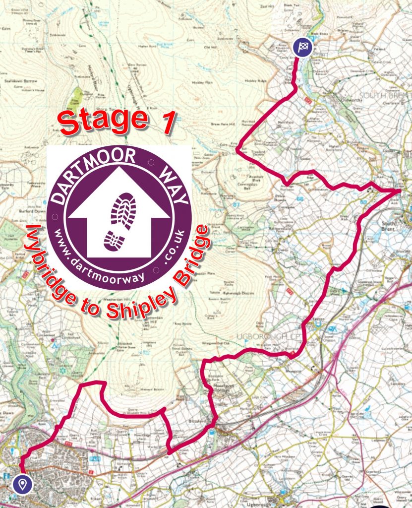
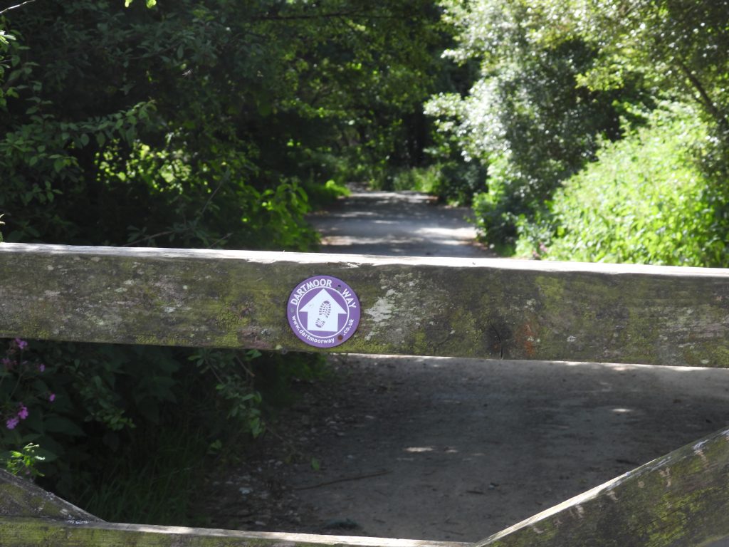
The Dartmoor Way is a waymarked 108 mile (173km) long circular route around Dartmoor split into 10 sections with a further 2 making up a “High Moor Link”, which adds another 23.2 miles (37km). The author volunteered in assisting with some of the signage for the way in 2019. The first stage starts in Ivybridge (by the medieval bridge on Harford Road, finishing at Shipley Bridge car park) and is stated on the official website for the “way” as being 10 miles (16km) in distance and an elevation climb of 2037ft (621m) or the equivalent of walking from sea level to the top of High Willhays. This post covers the first stage and shows historical features, far reaching views, wildlife and points of interest recorded by the author along its route.
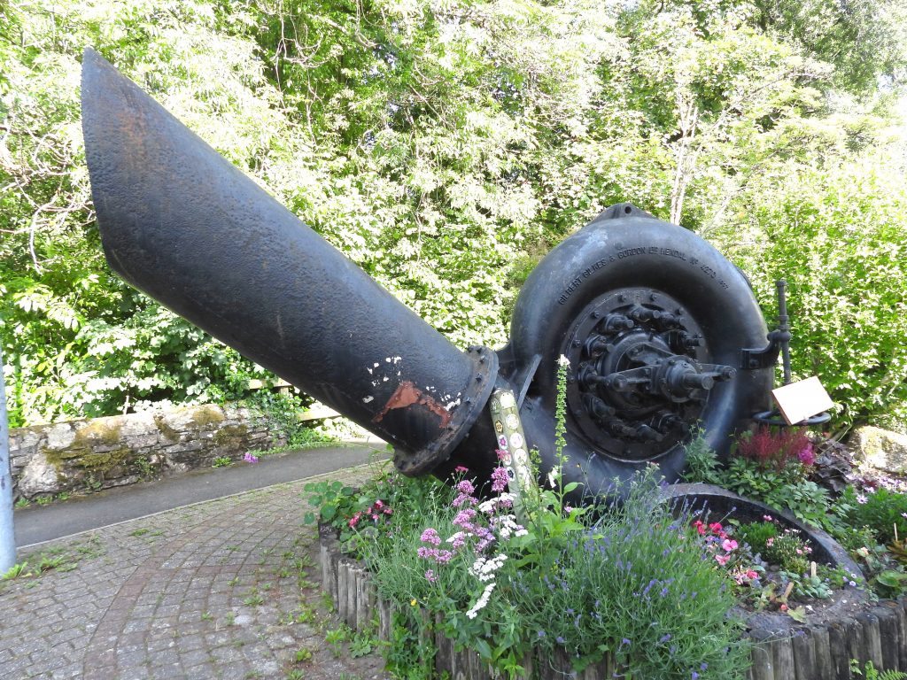
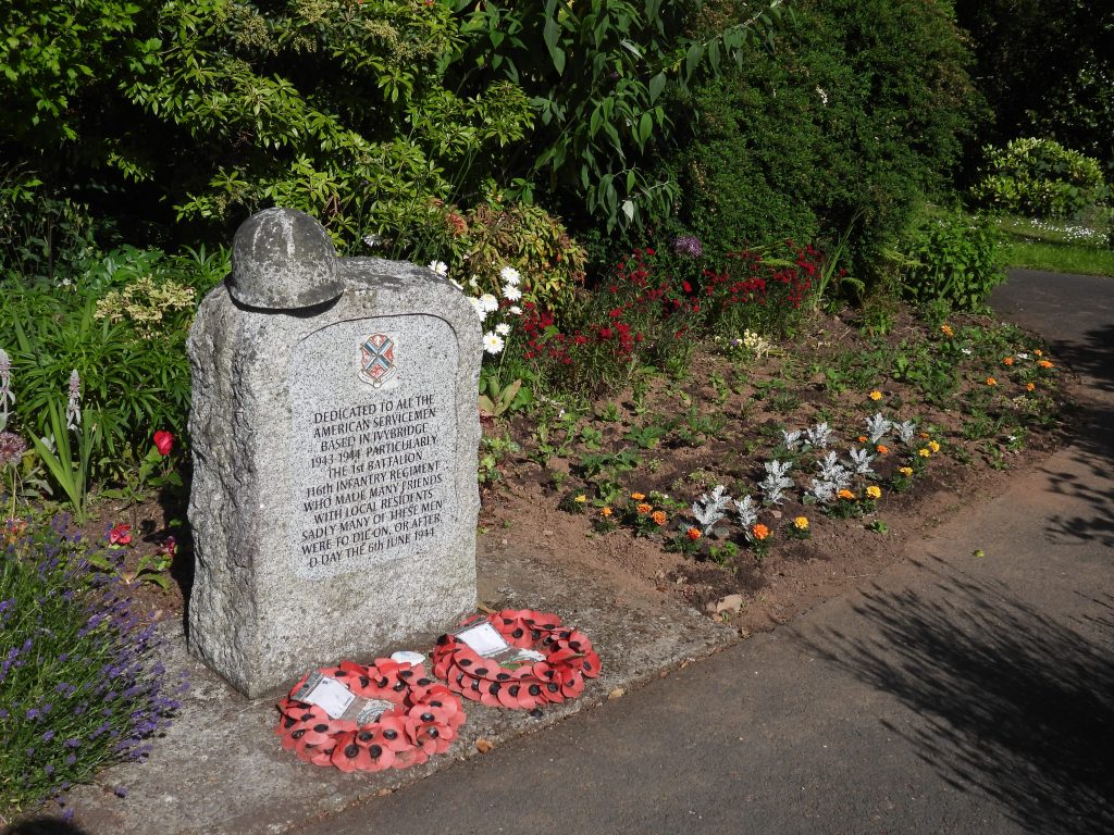
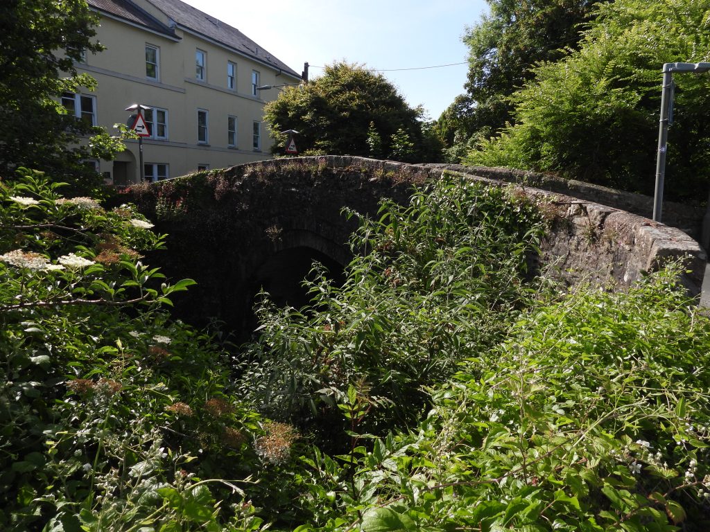
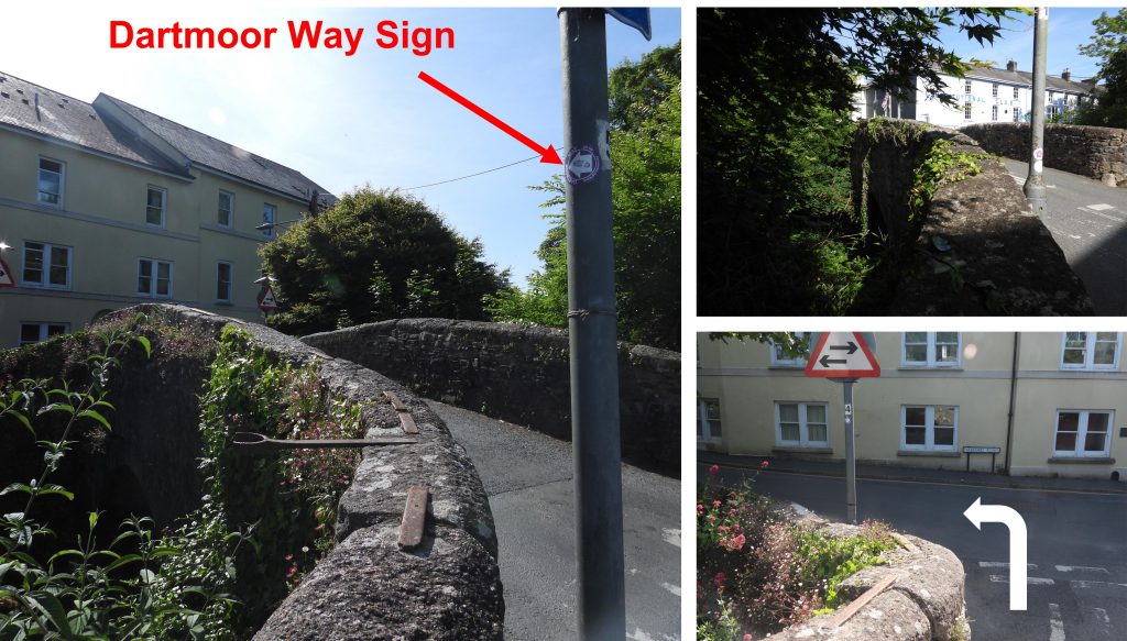
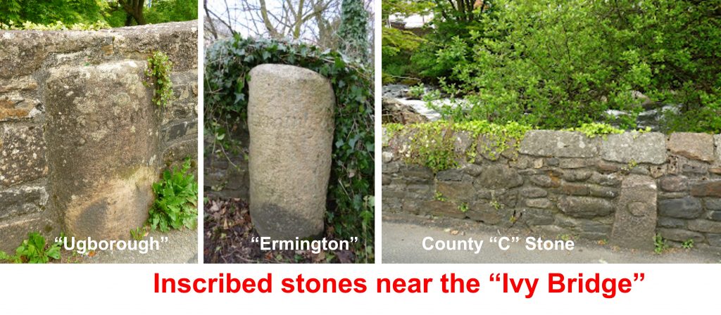
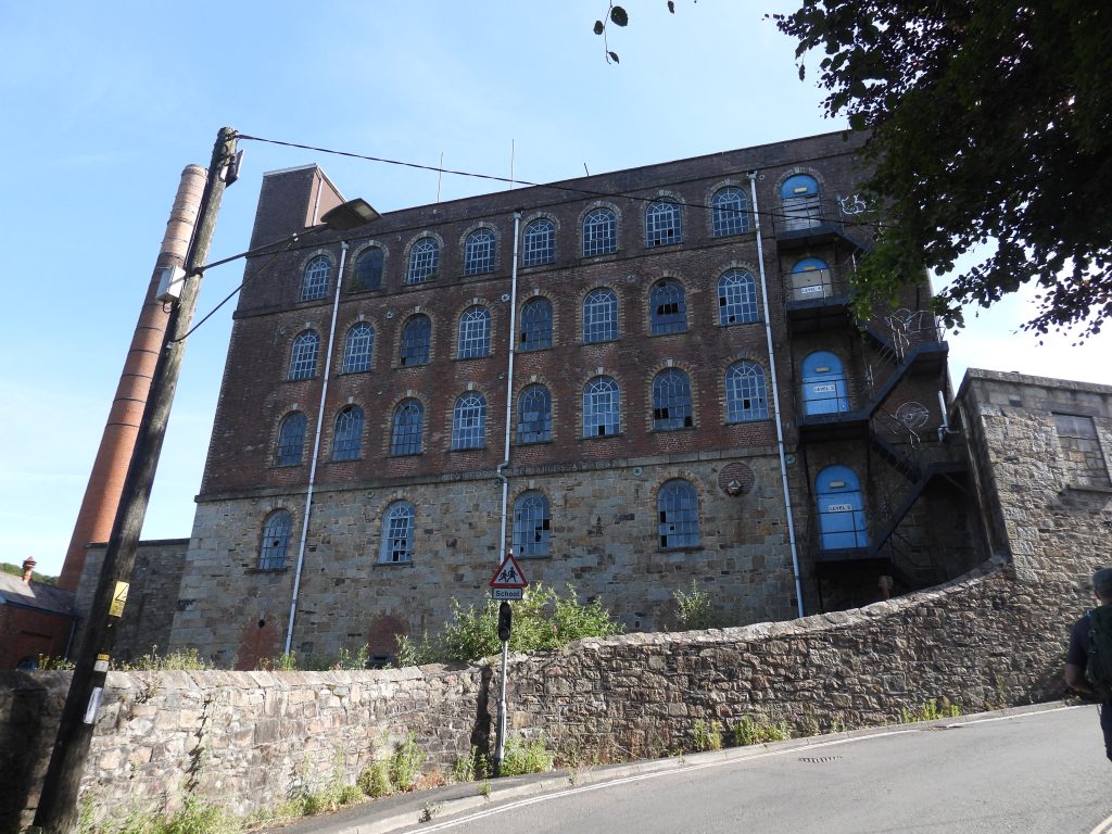
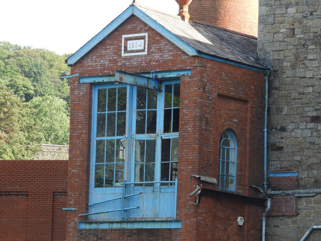
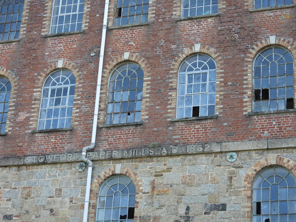
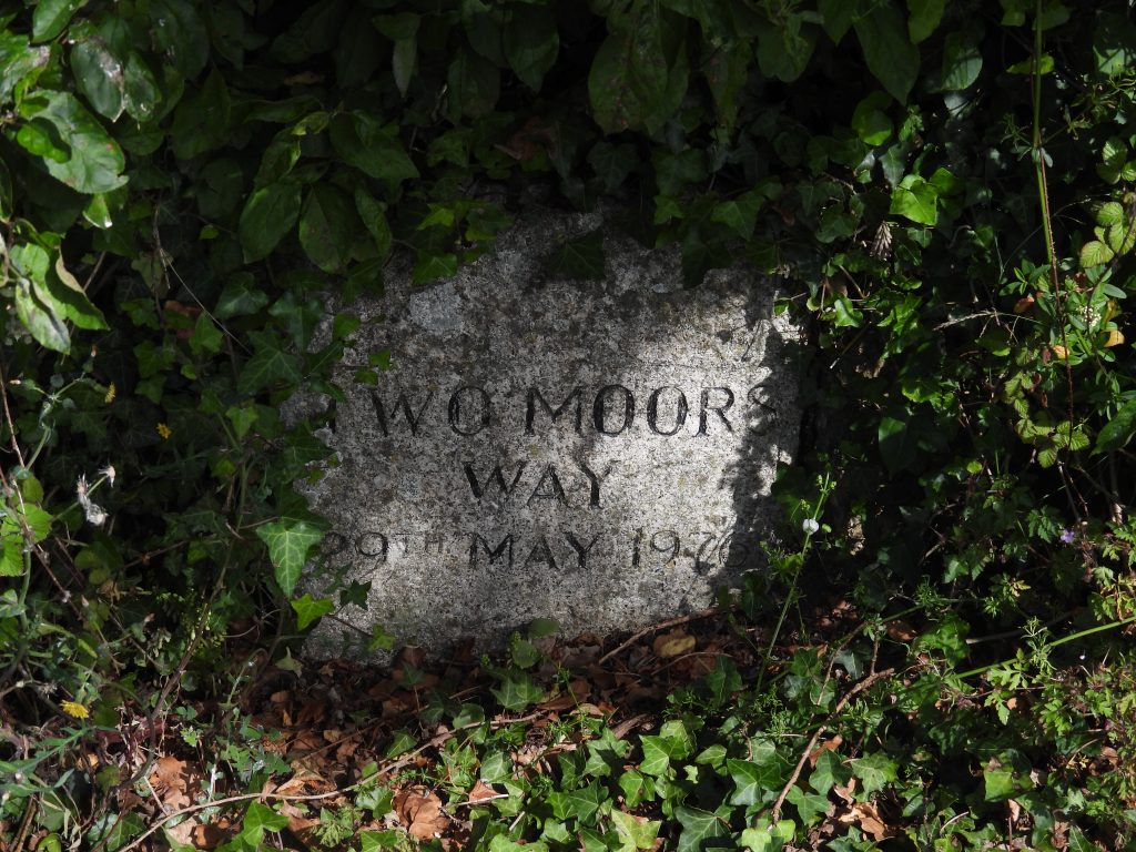
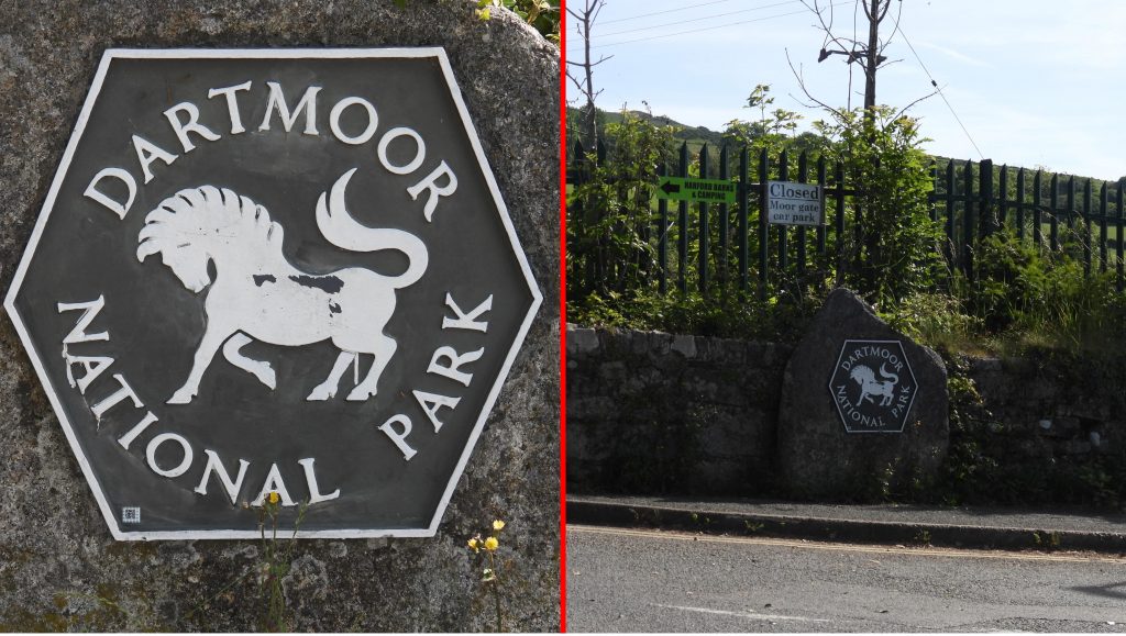
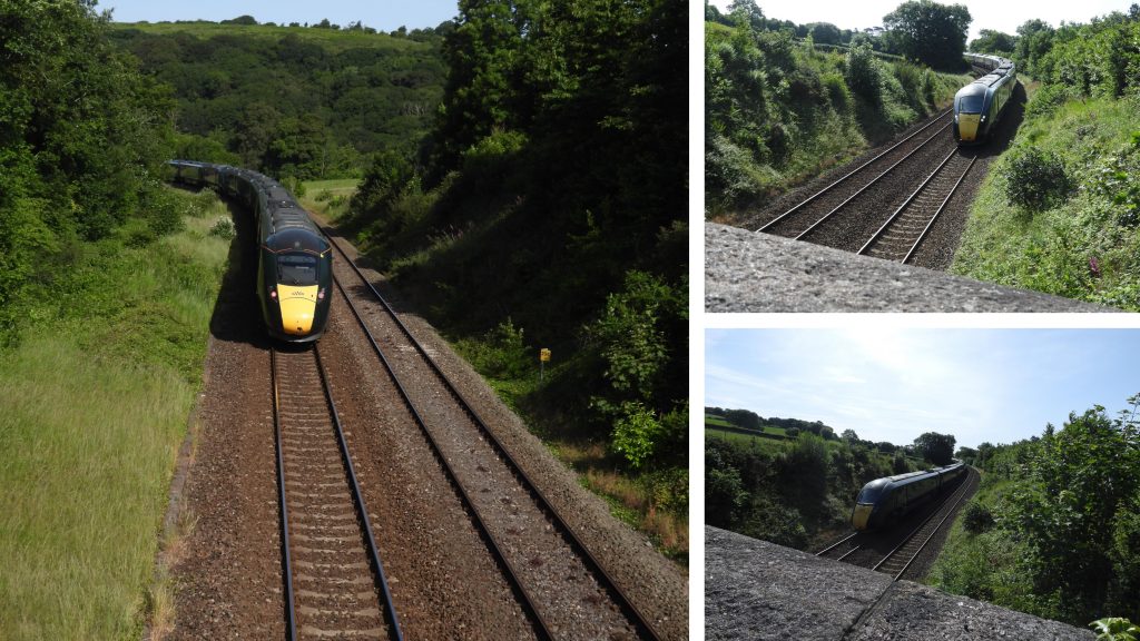
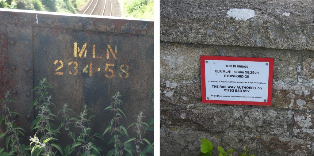
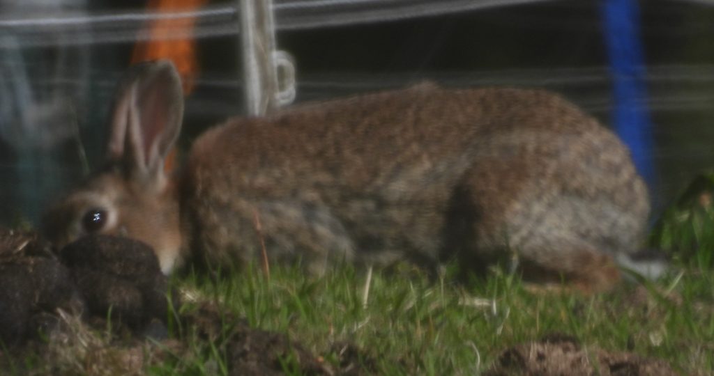
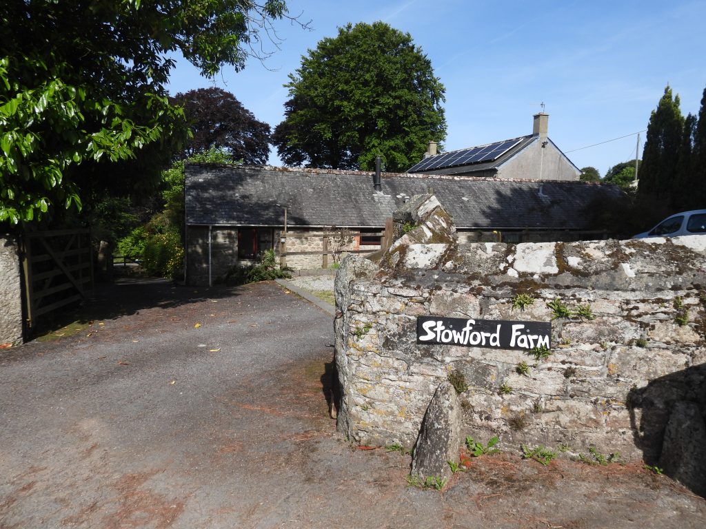
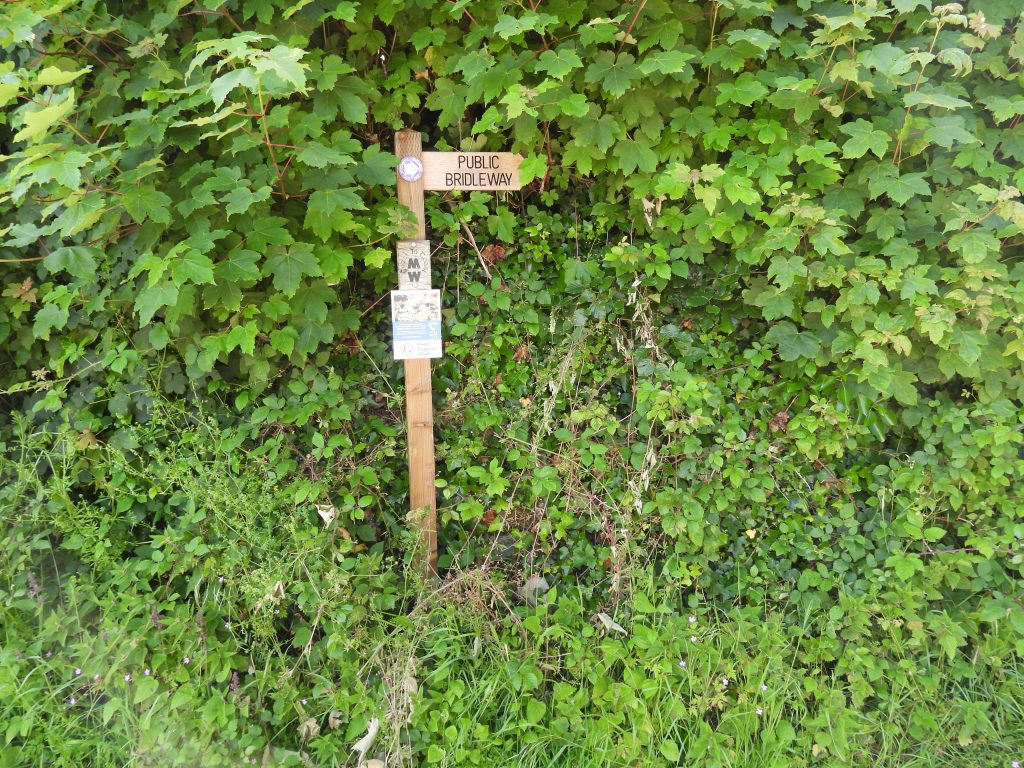
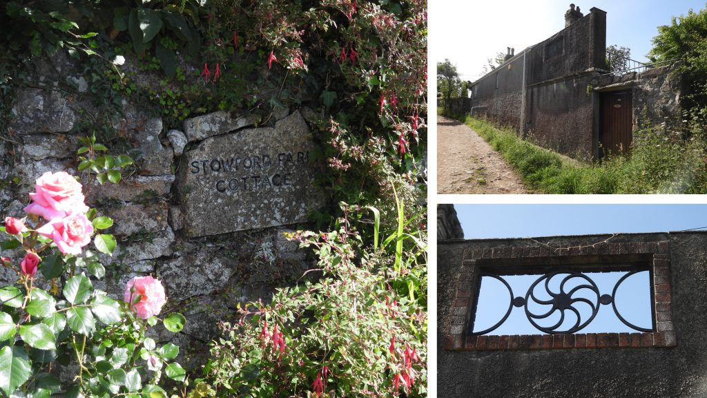
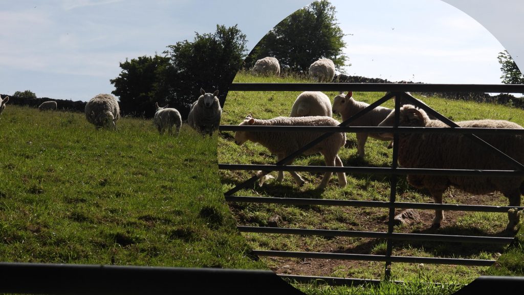
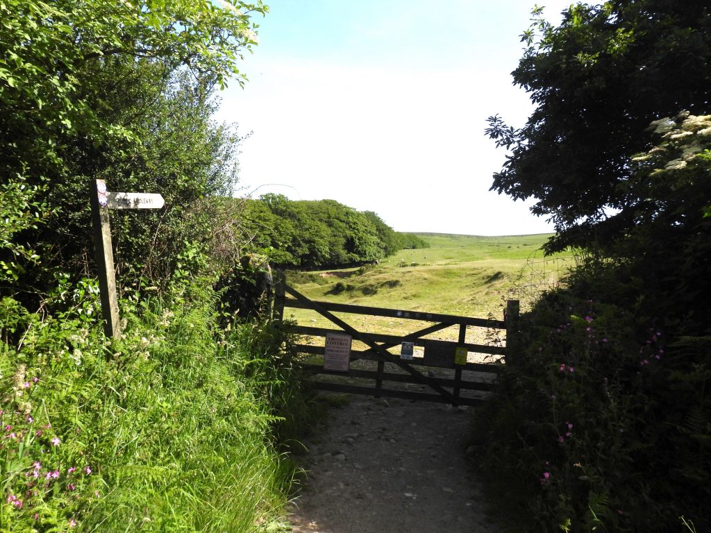
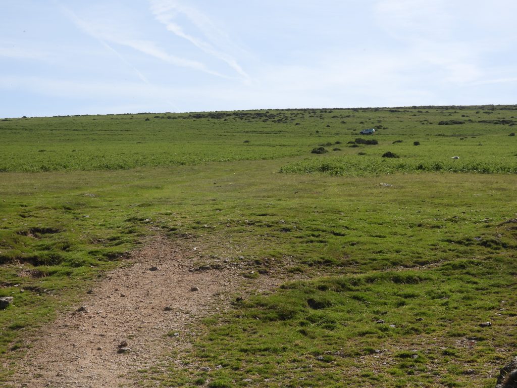
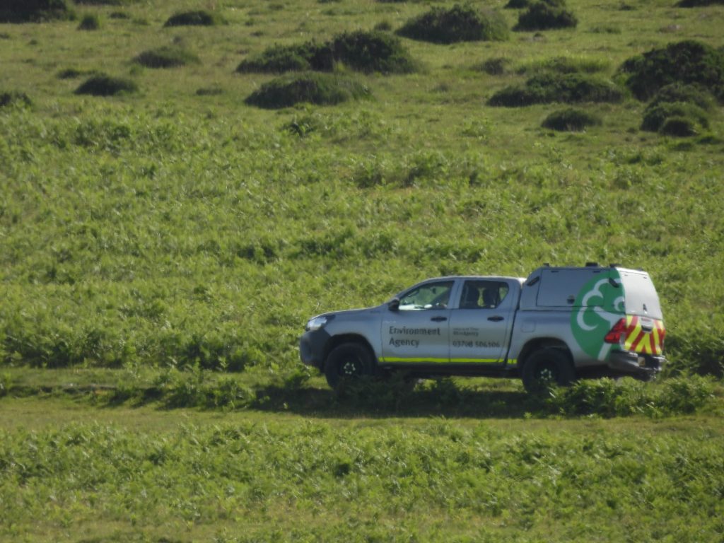
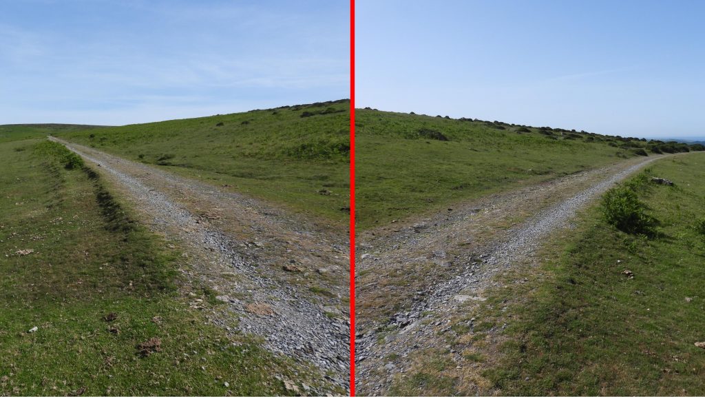
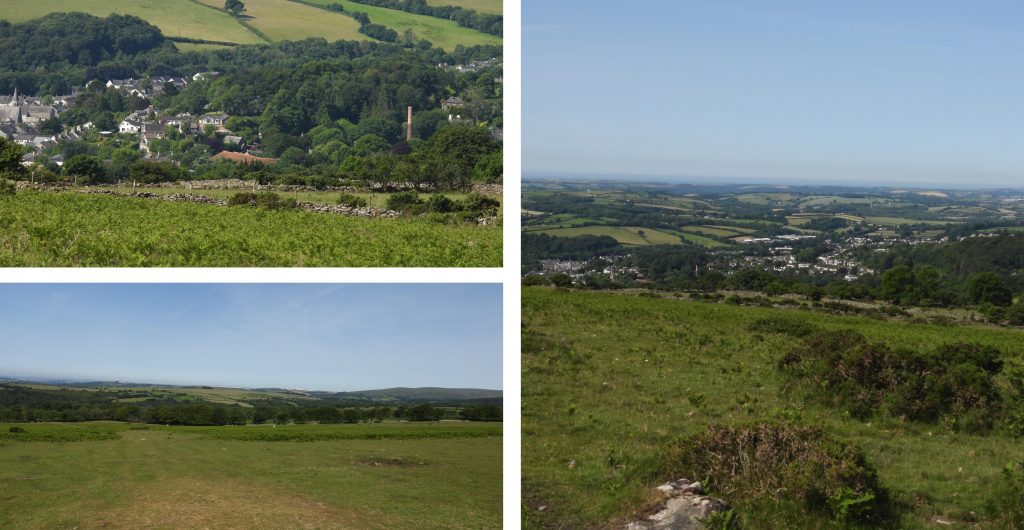
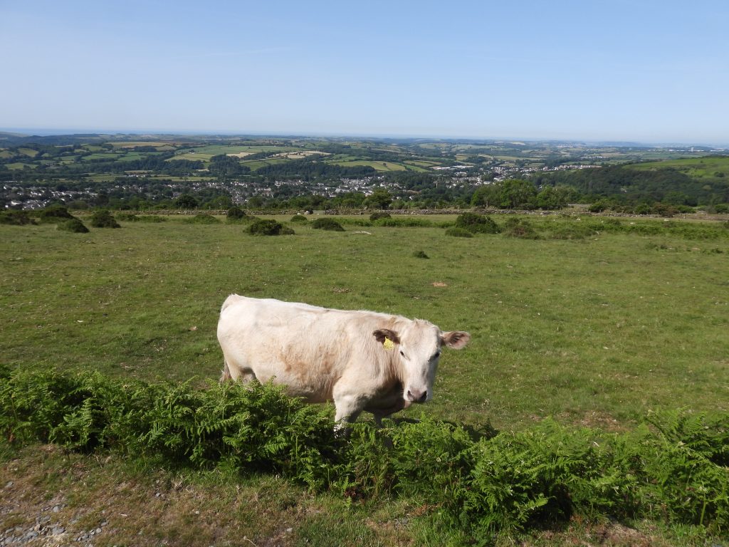
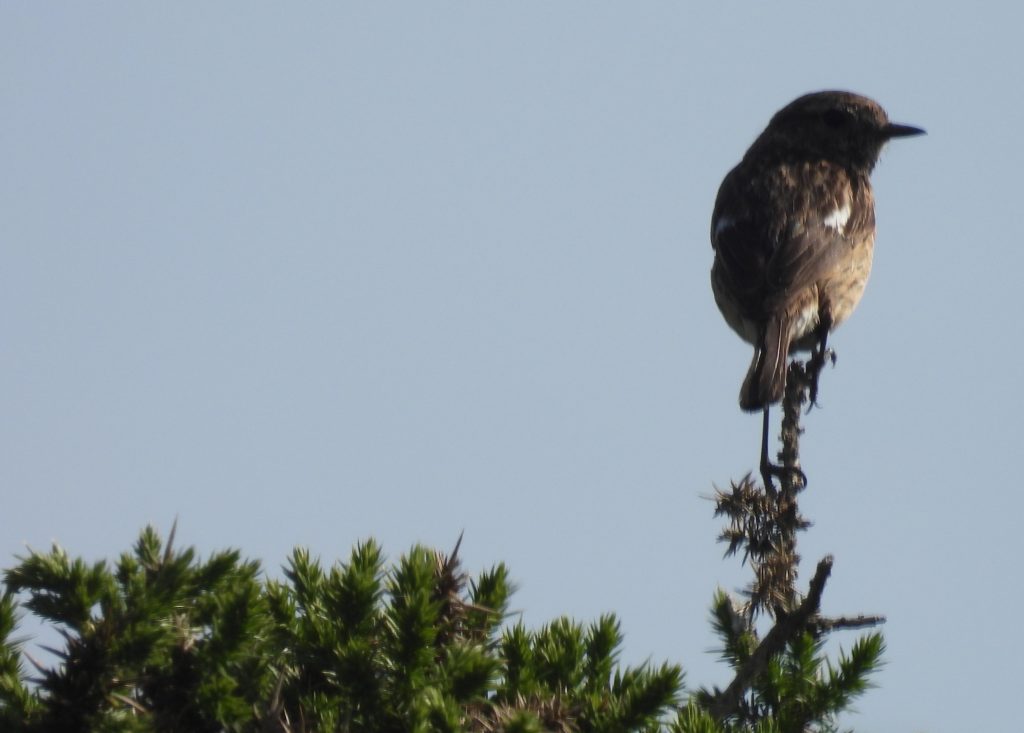
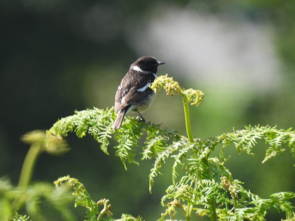
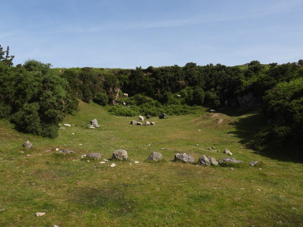
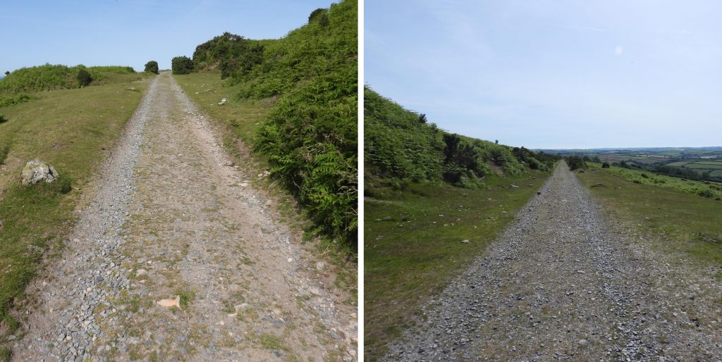
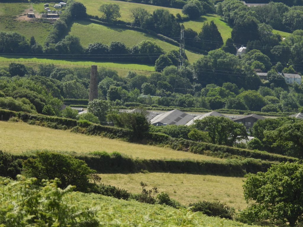
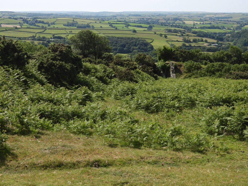
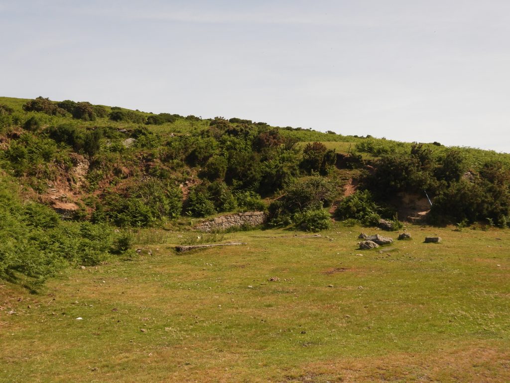
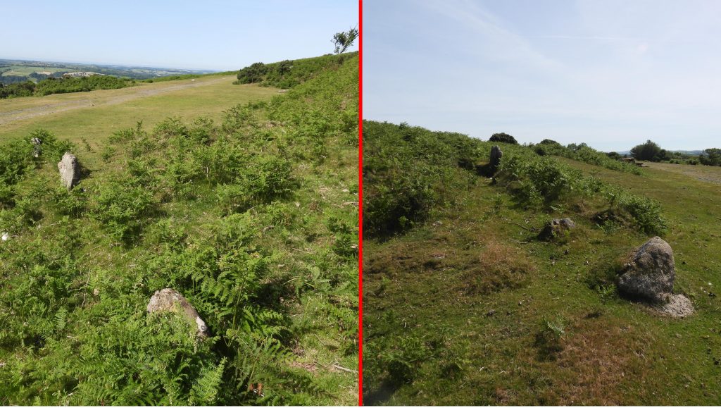
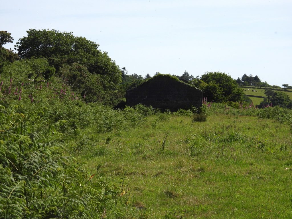
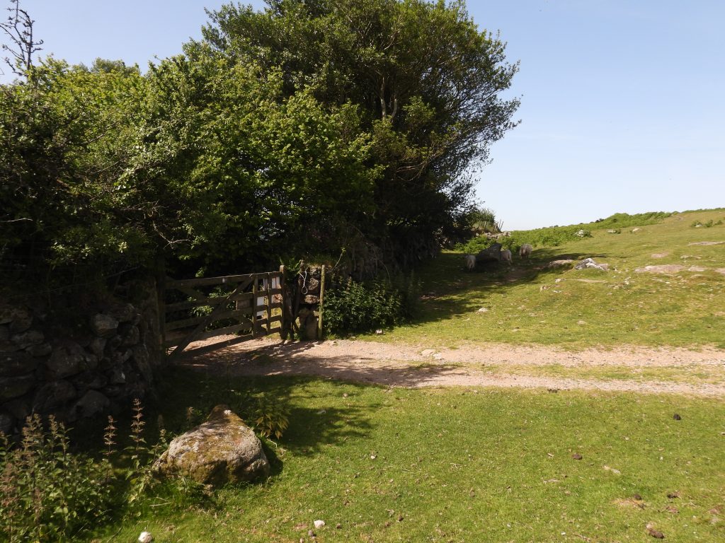
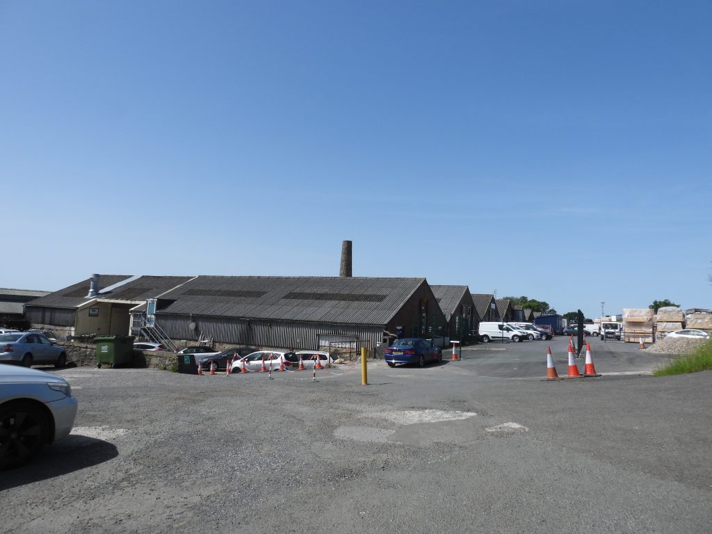
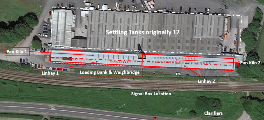
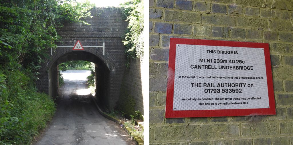
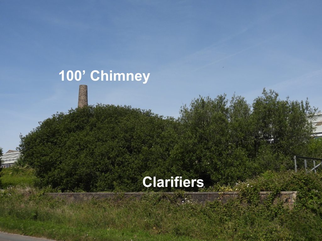
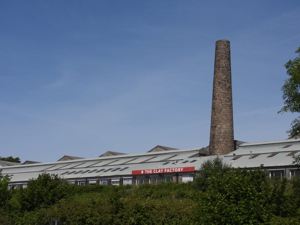
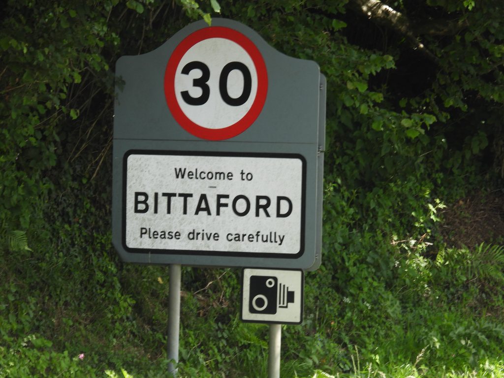
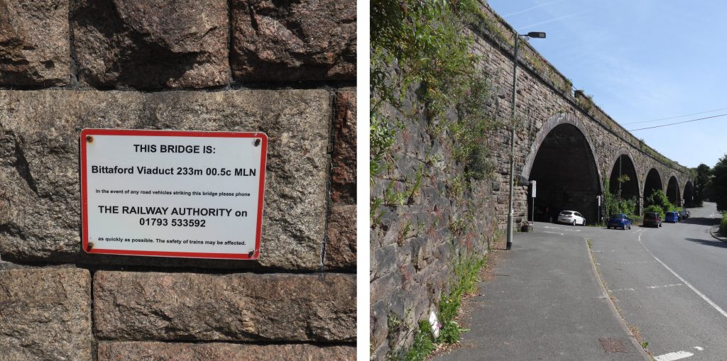
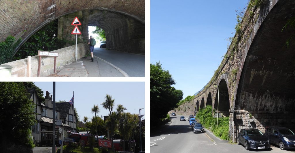
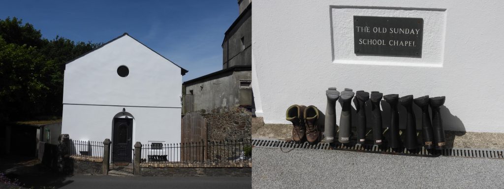
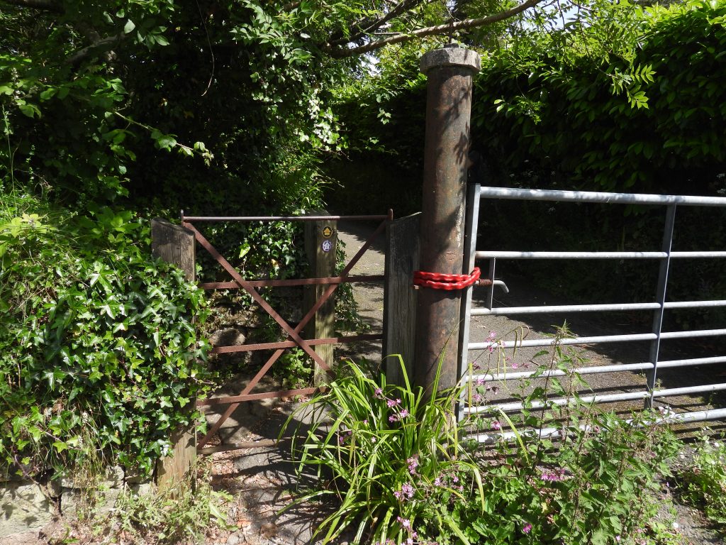
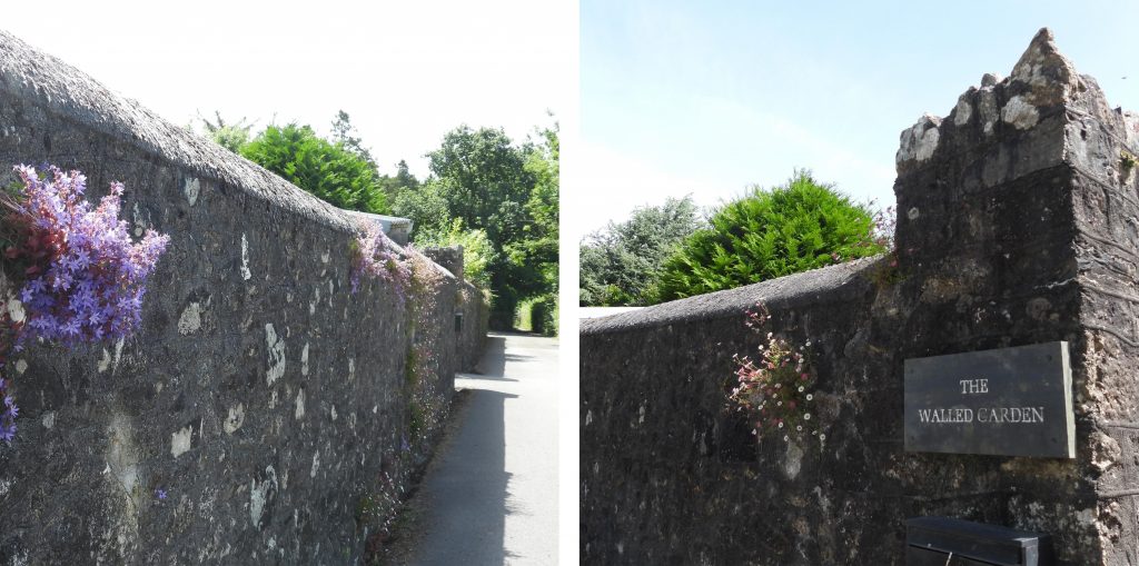
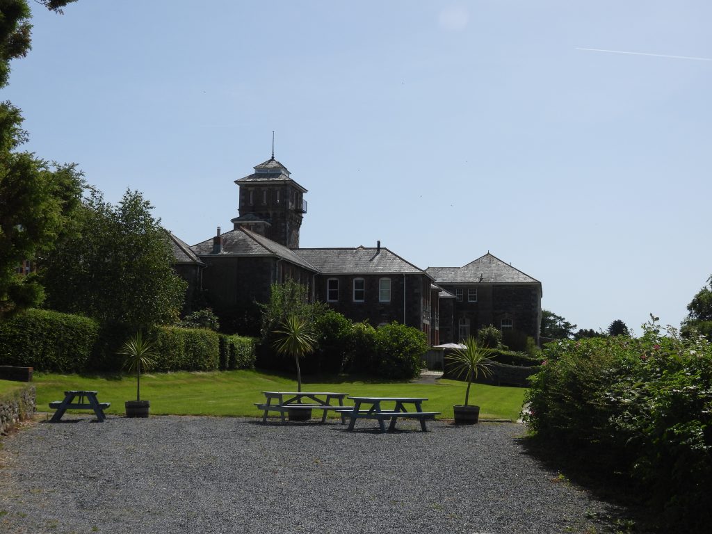
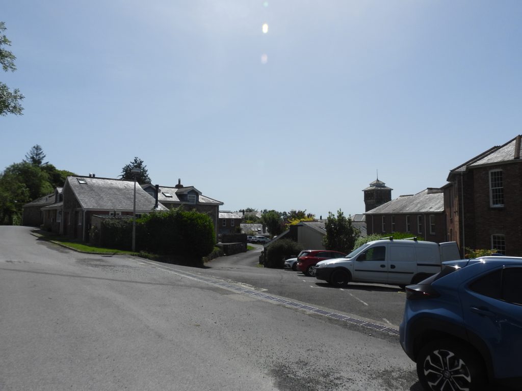
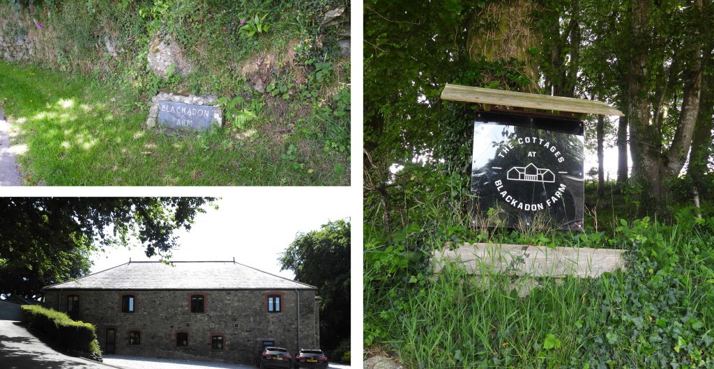
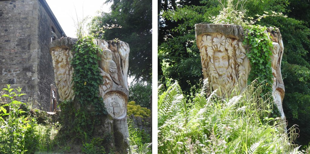
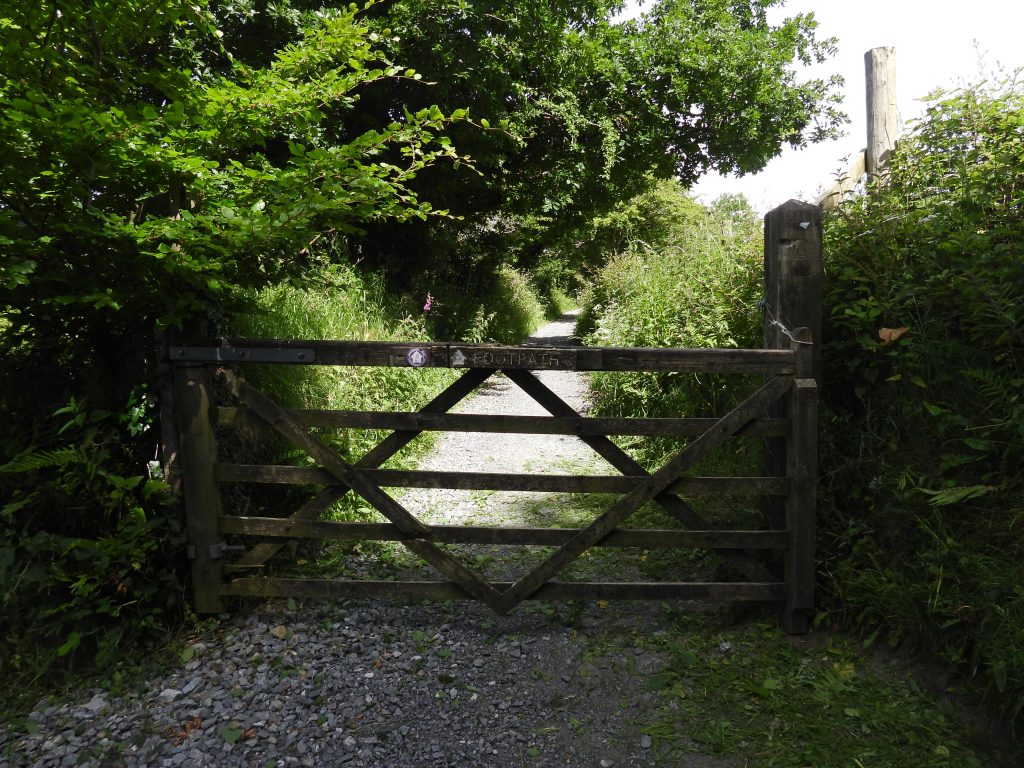
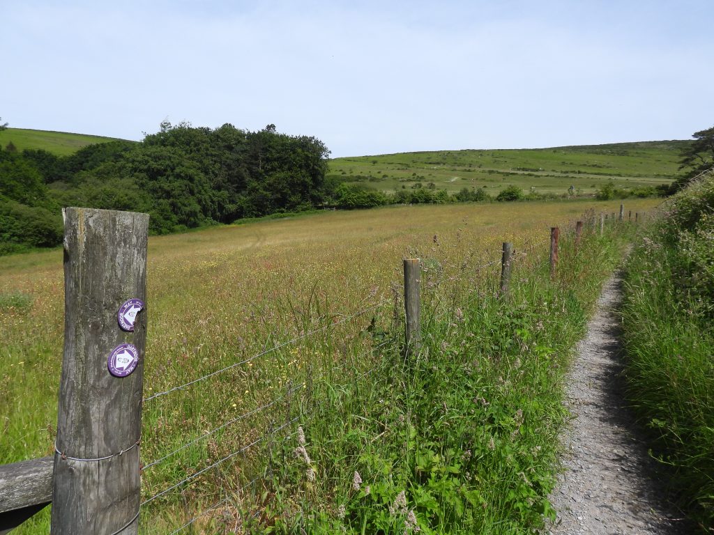
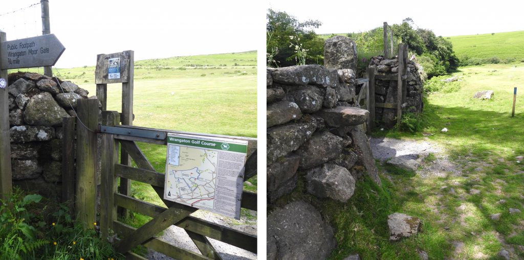
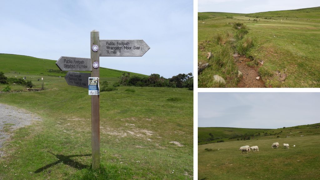
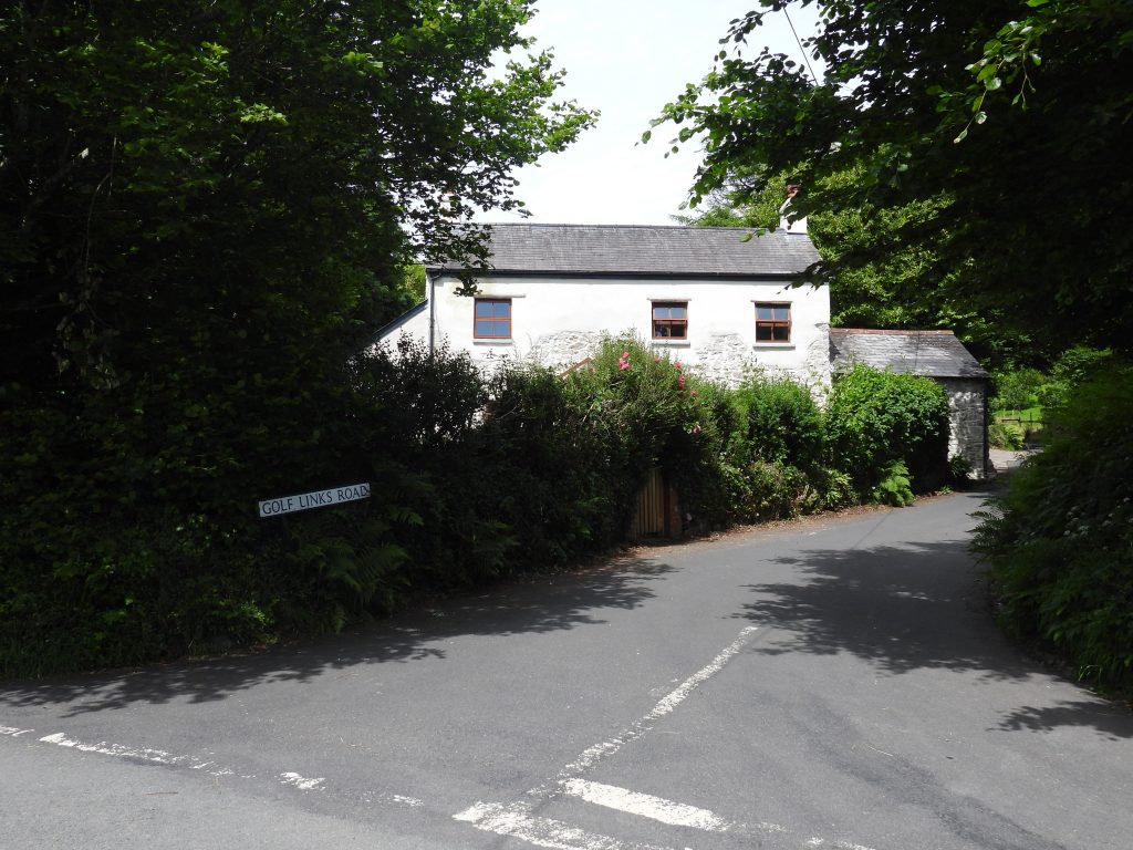
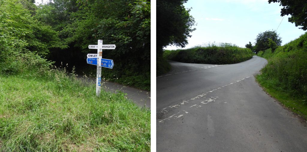
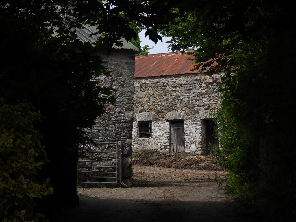
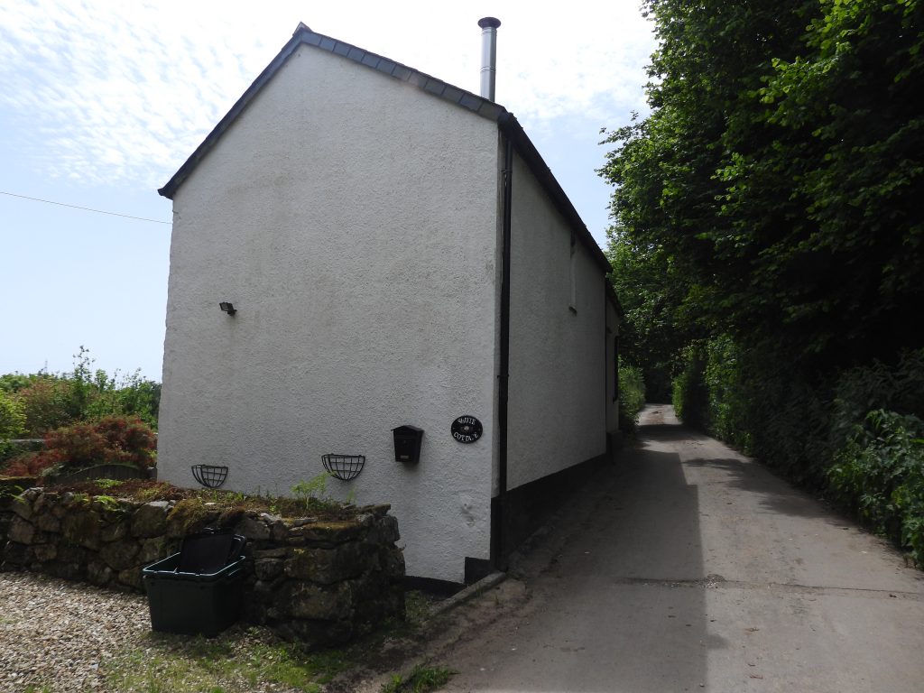
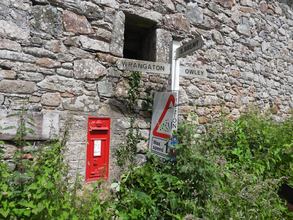
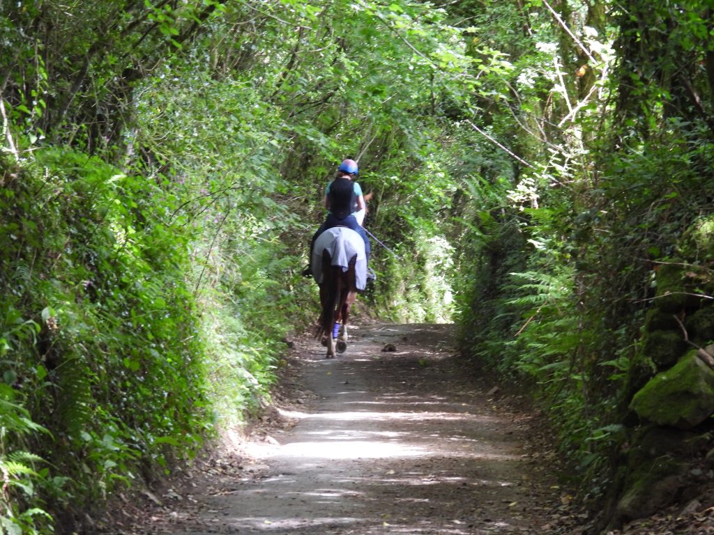
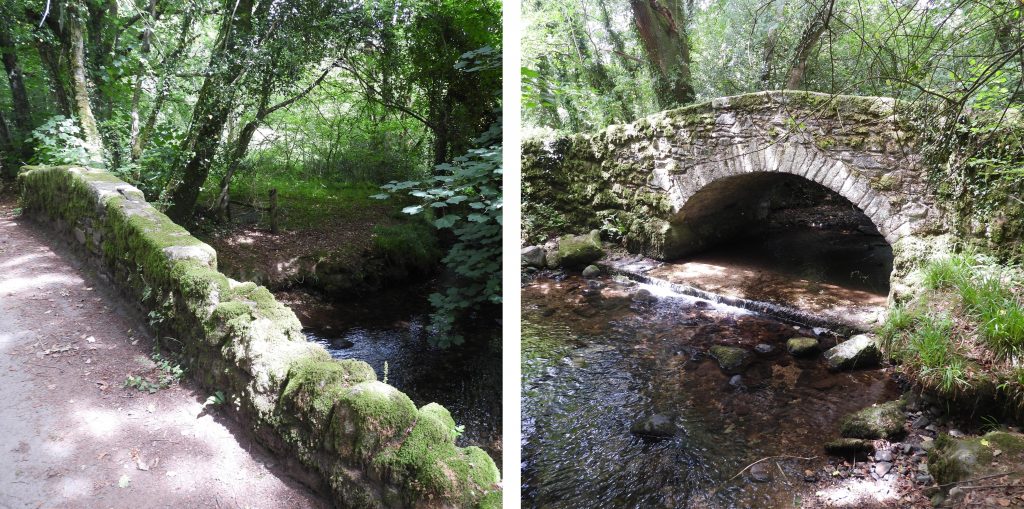
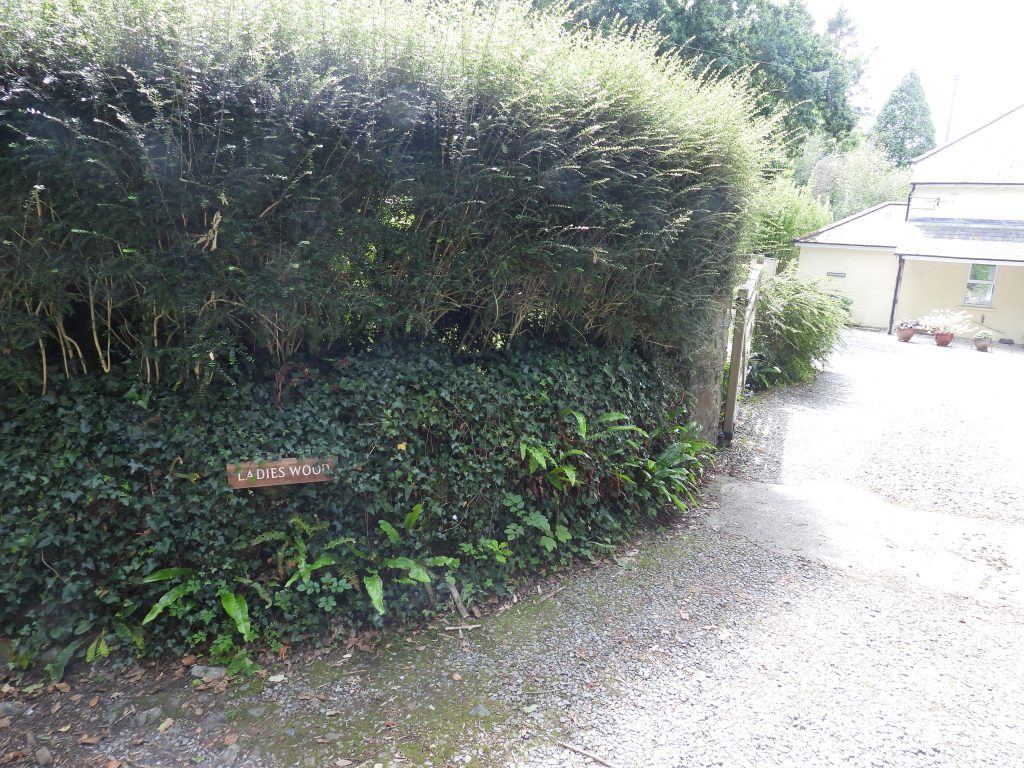
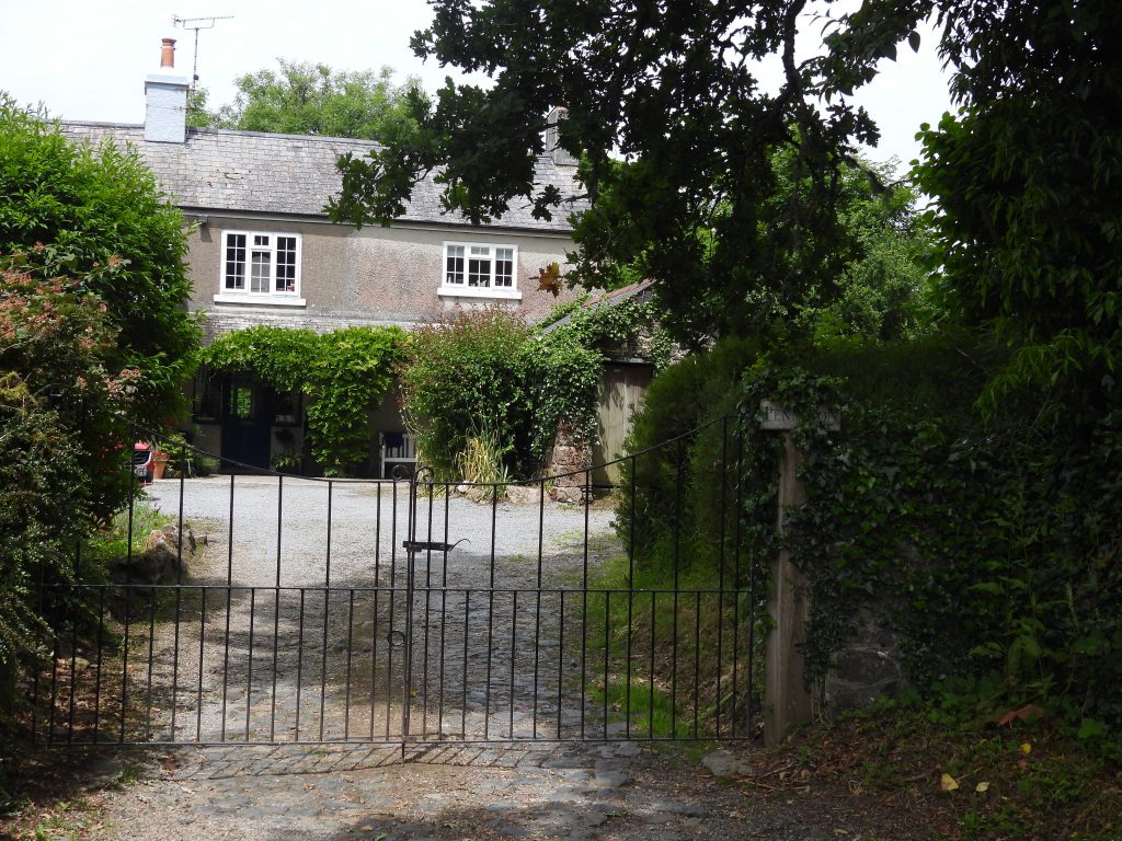
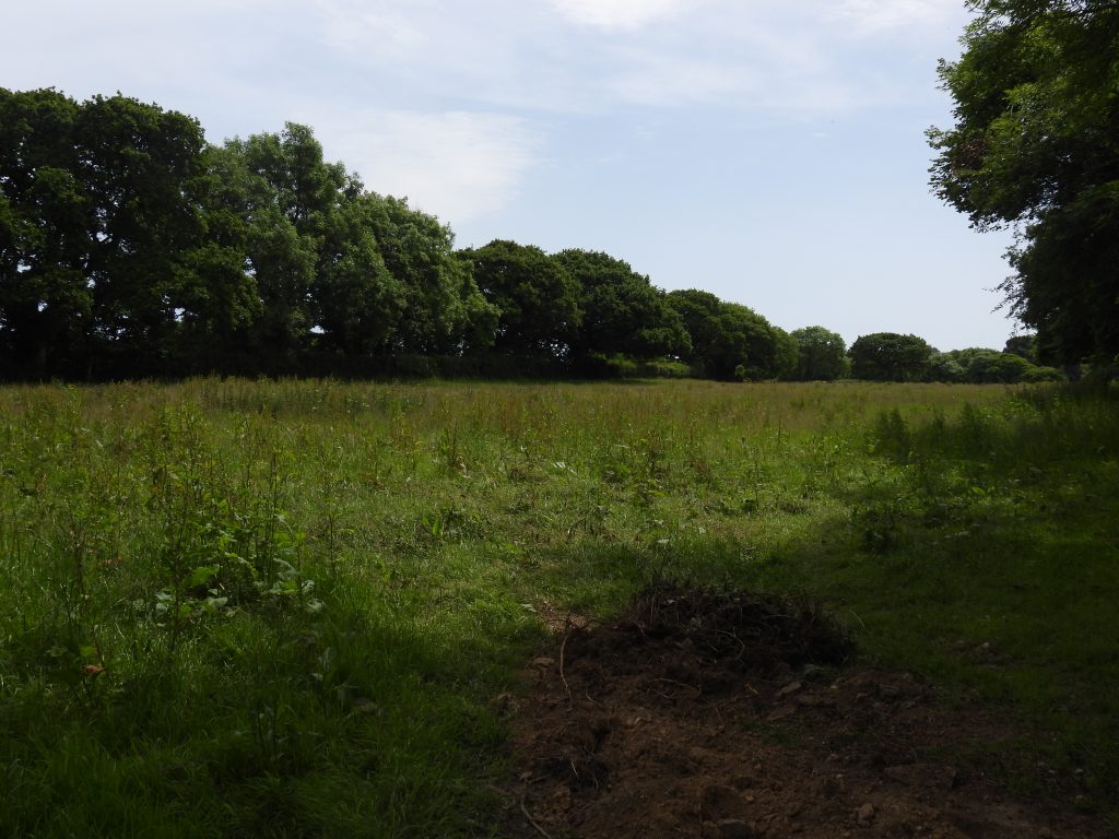
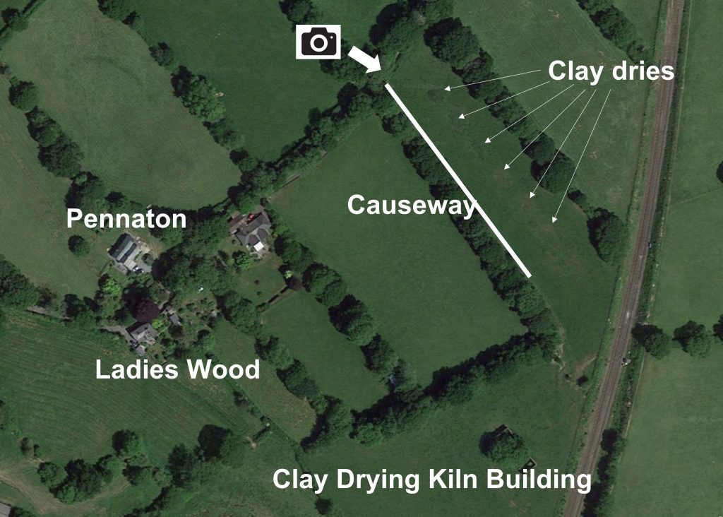
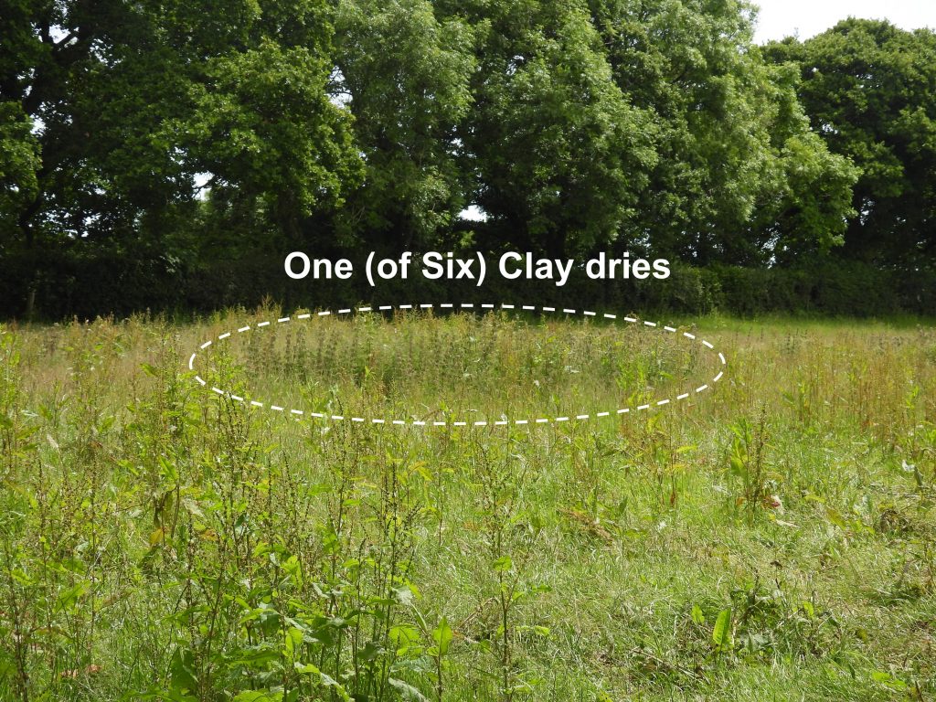
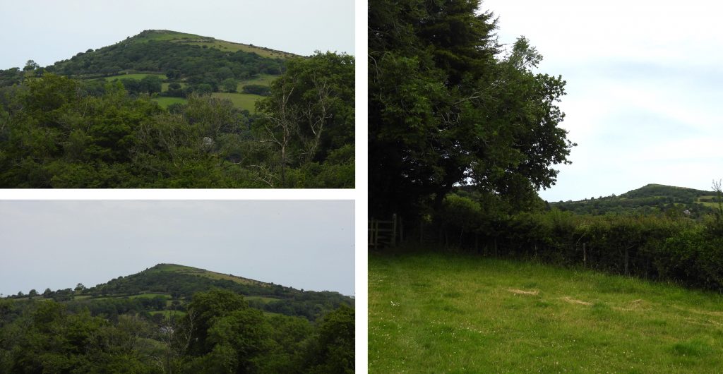
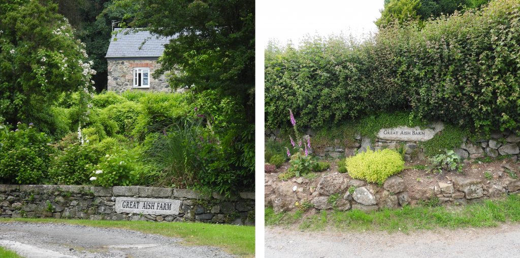
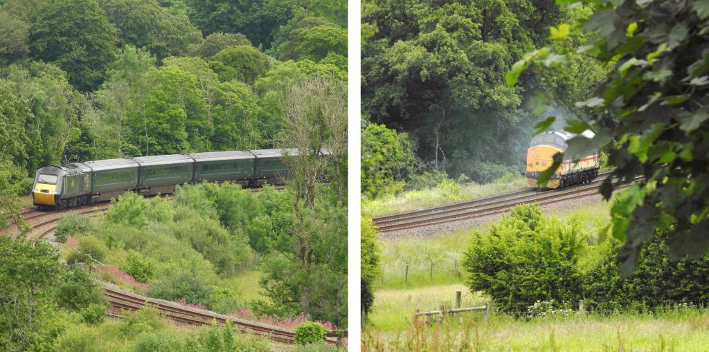
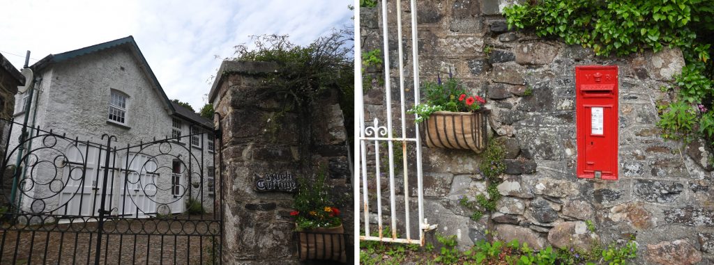
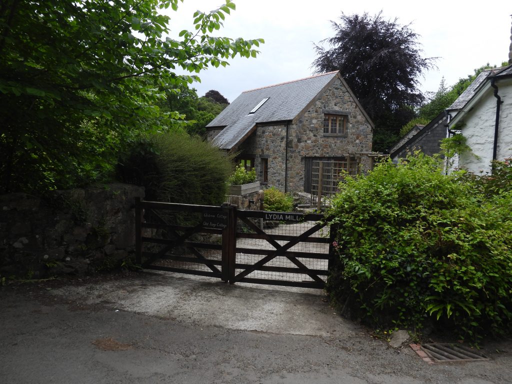
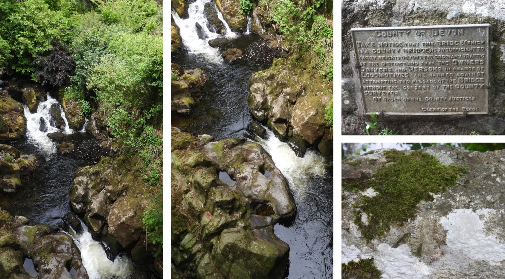
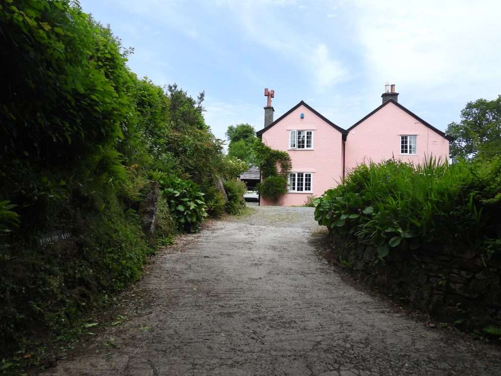
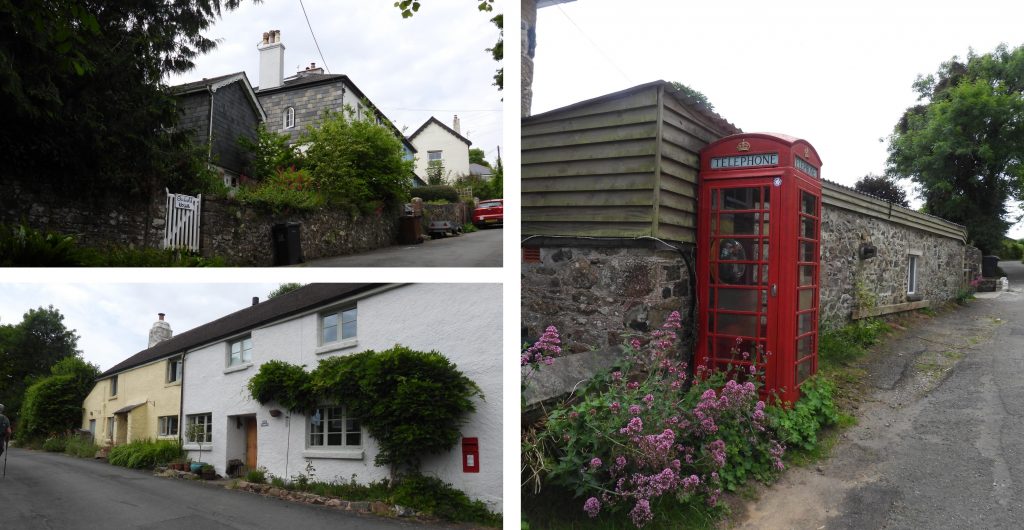
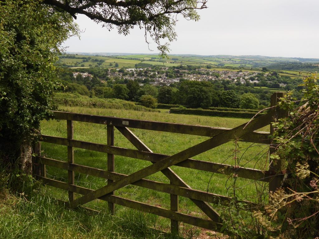
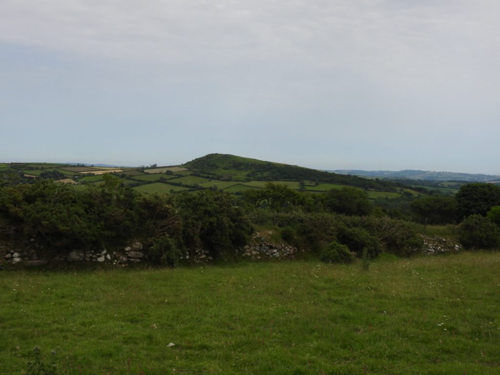
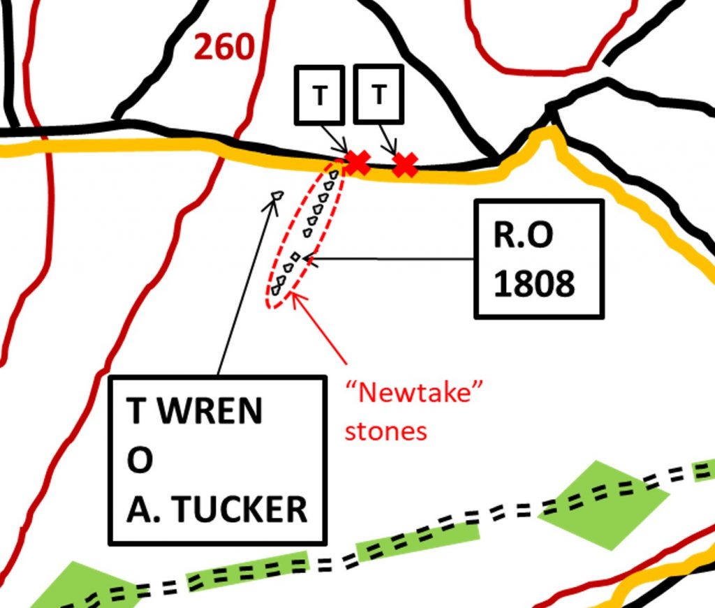
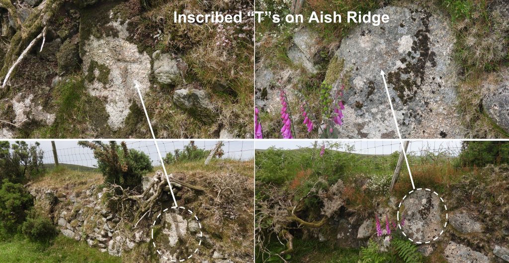
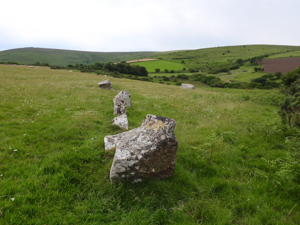
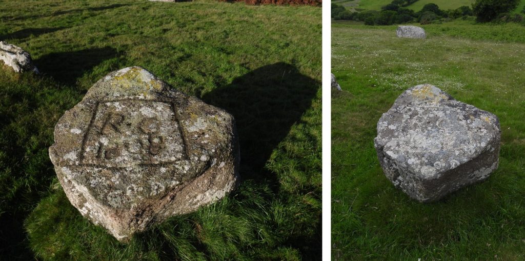
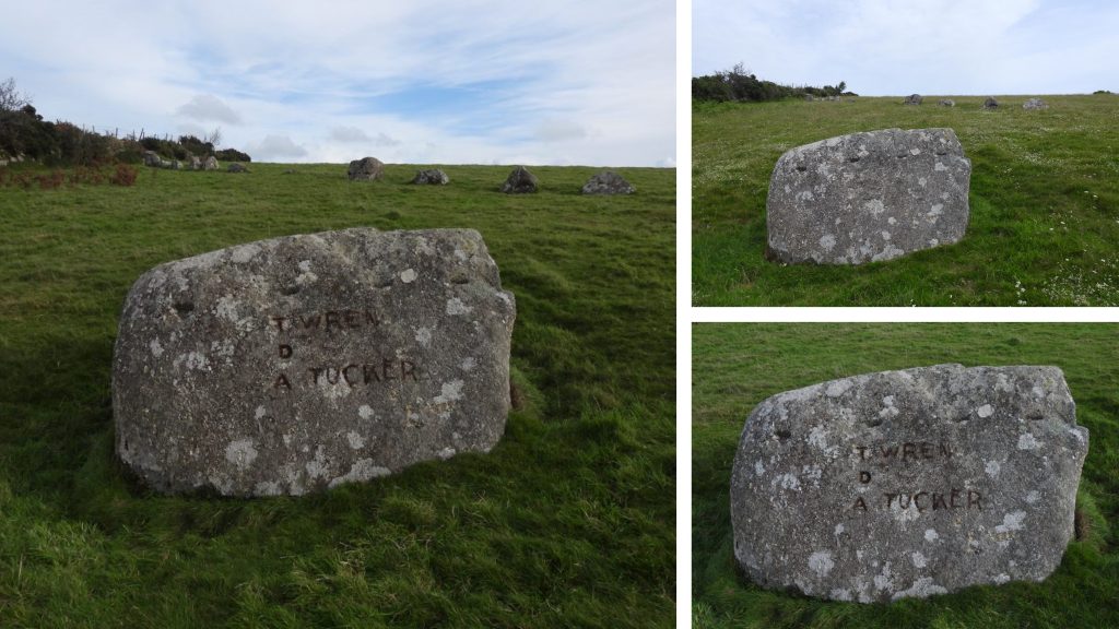
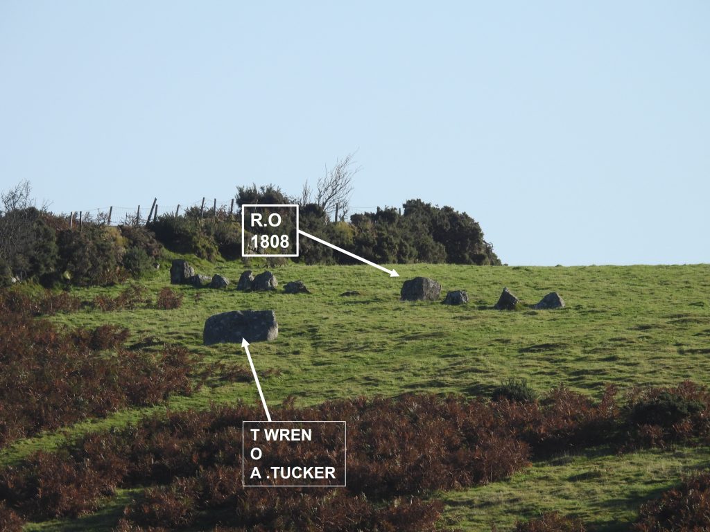
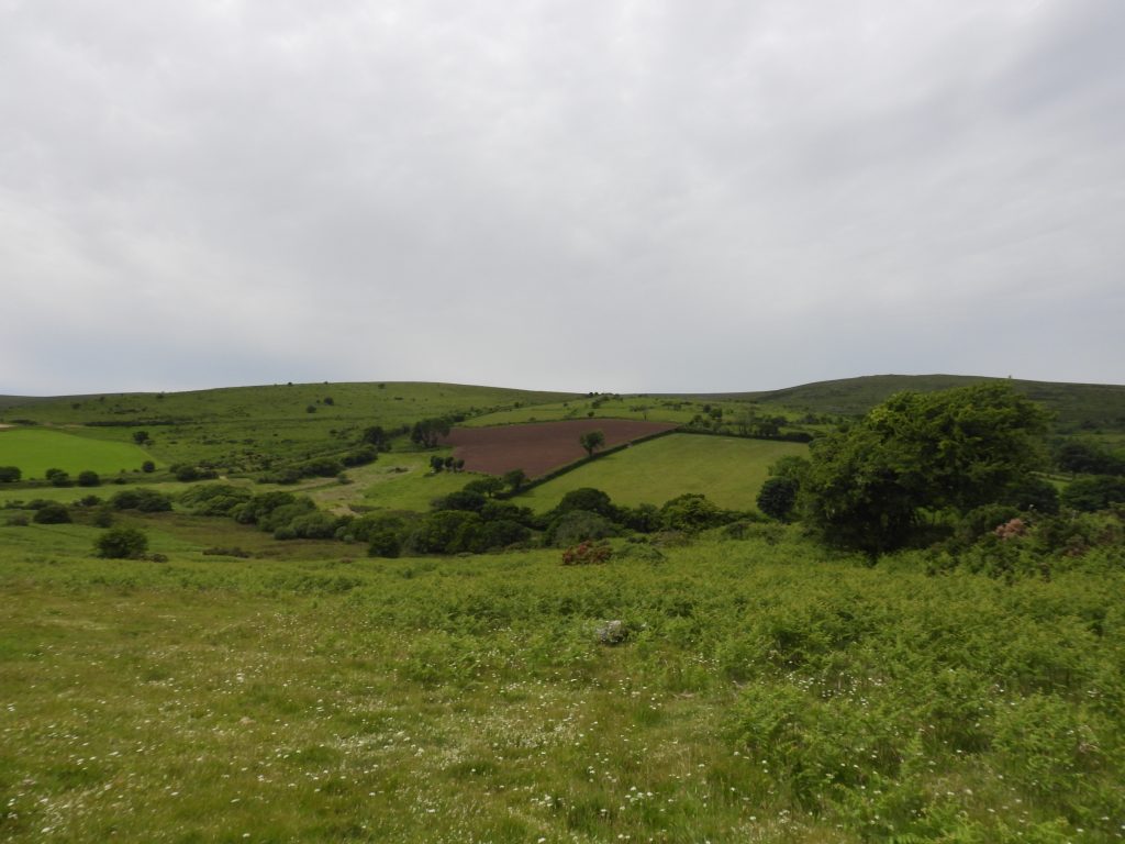
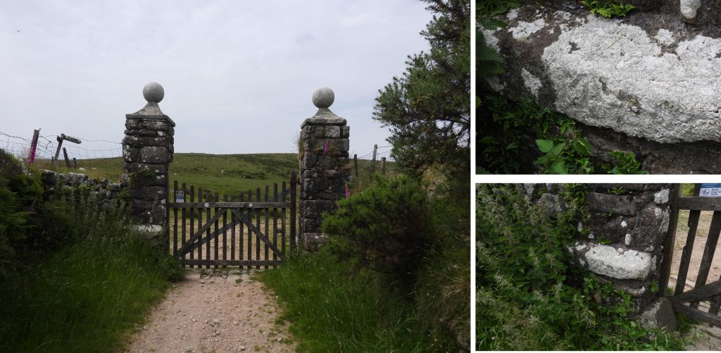
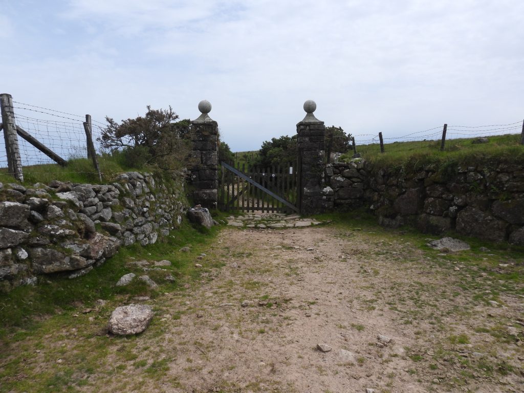
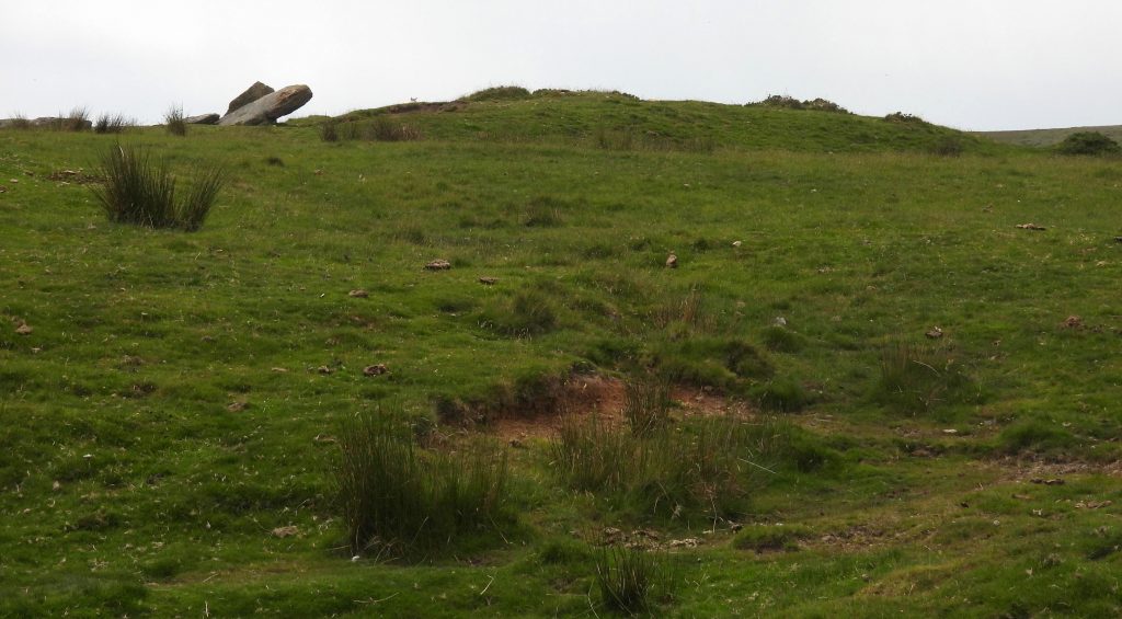
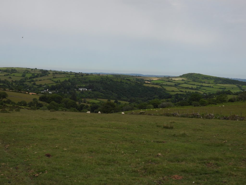
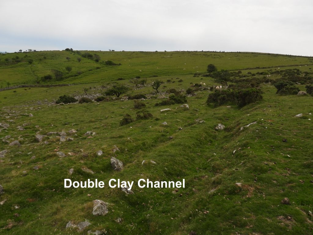
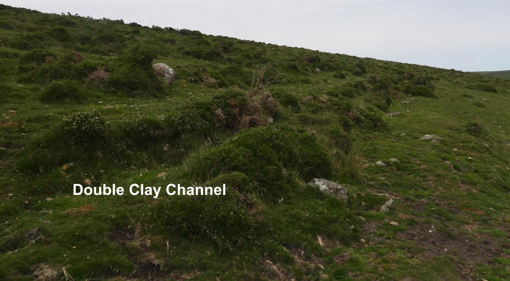
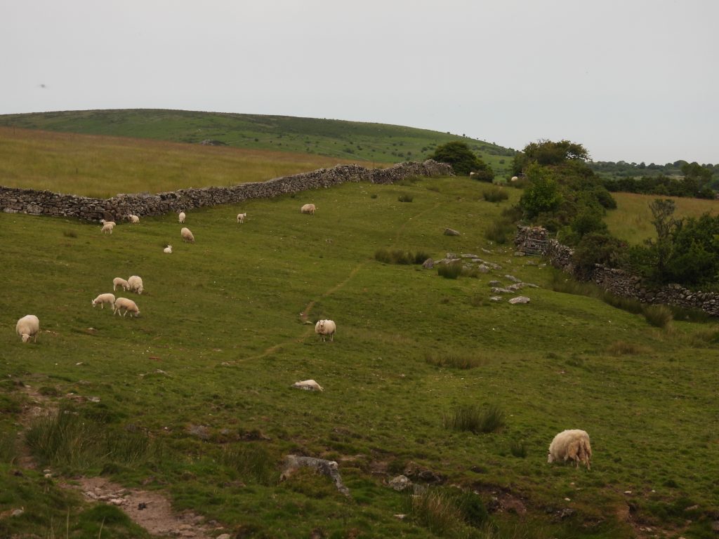
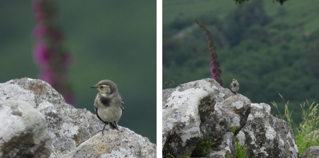
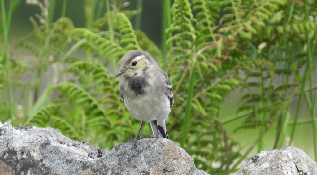
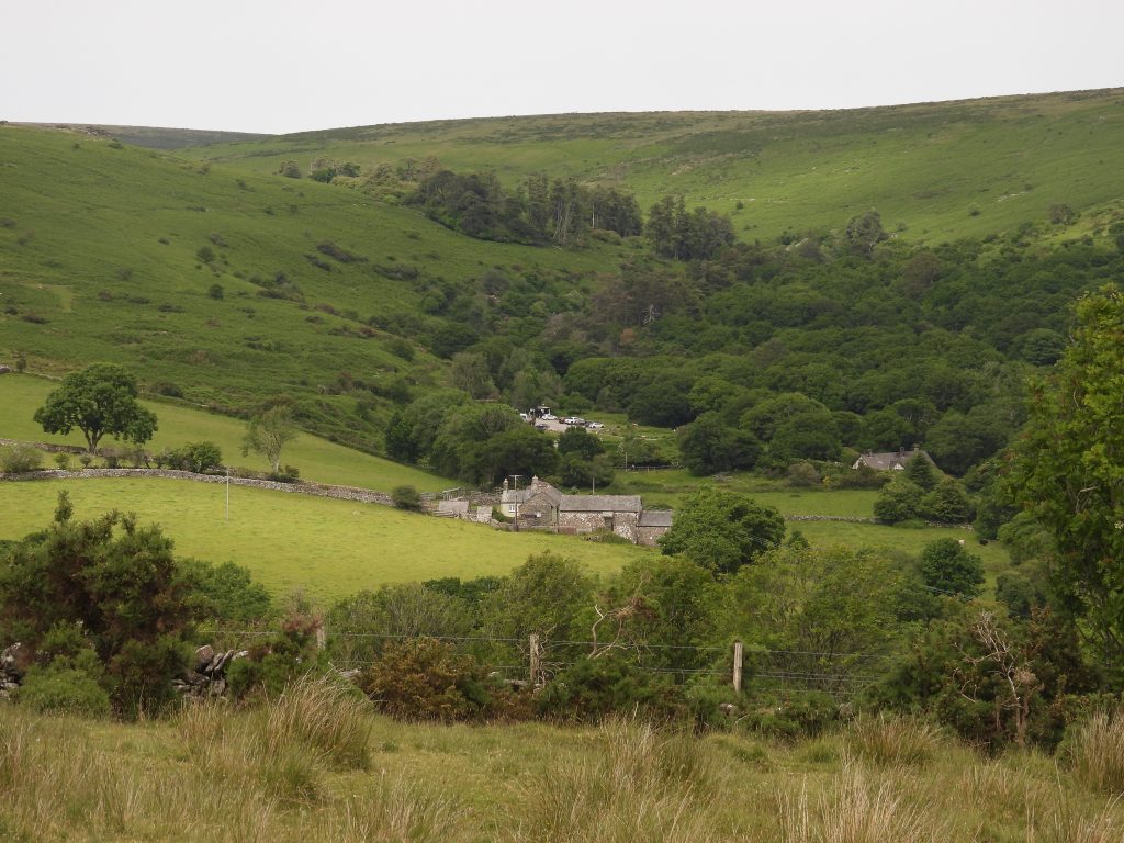
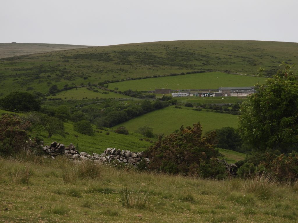
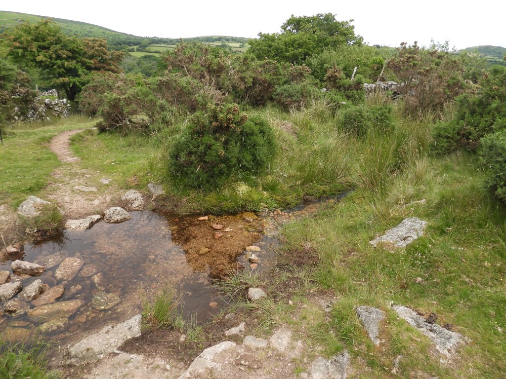
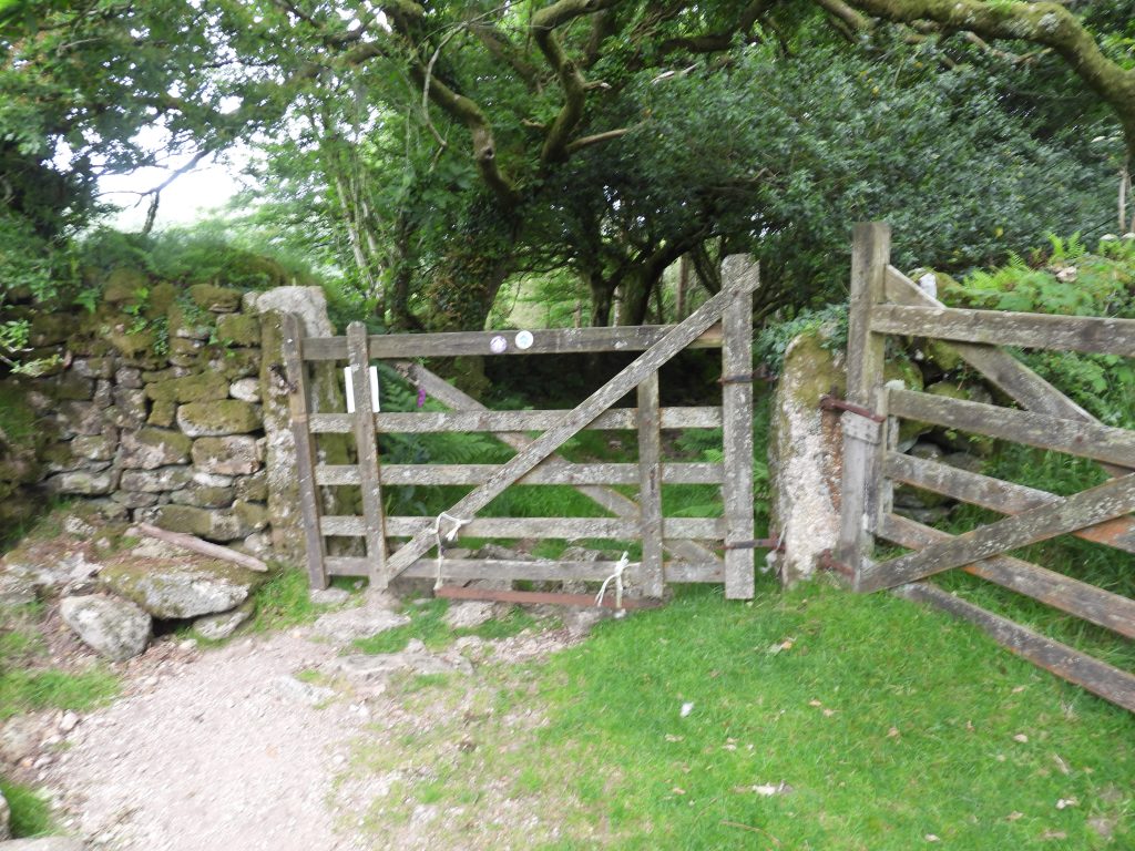
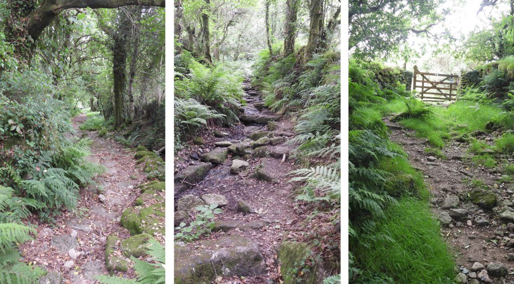
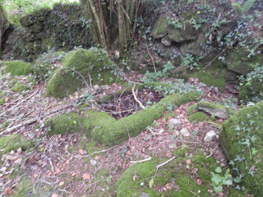
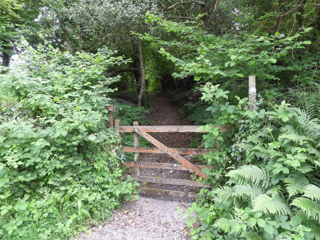
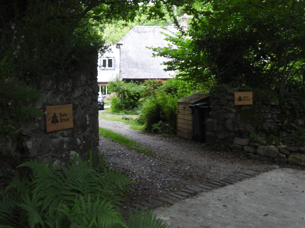
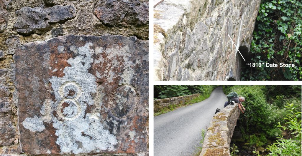
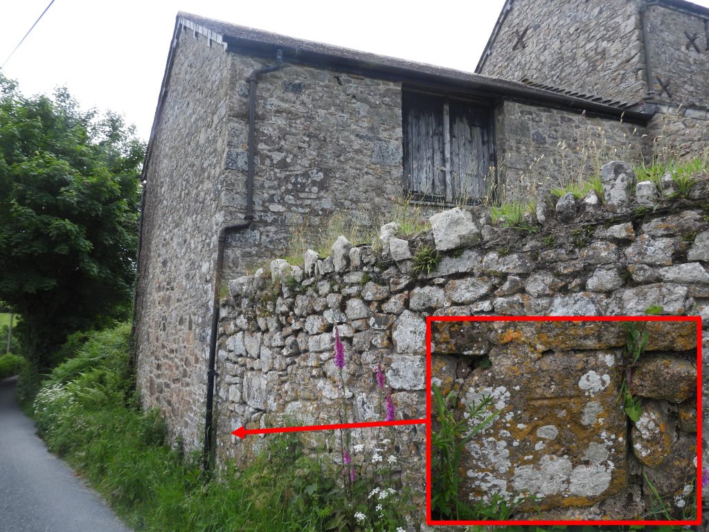
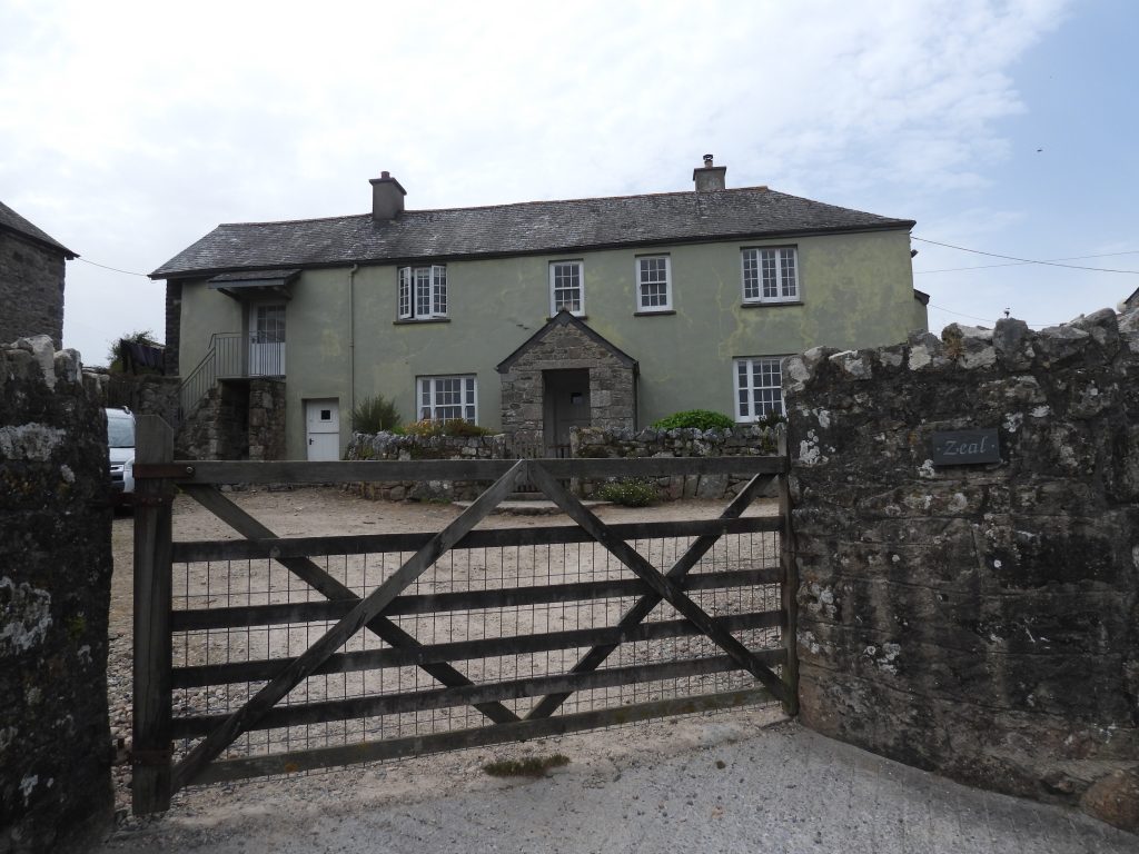
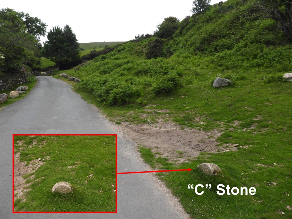
This GPS plot shows the route of stage 1 covered by the author. The distance covered by the author was 10.8 miles / 17.3km (slightly more than the official distance) as it included the added section between the long term car park in Ivybridge to the start point plus a minor “side trip” on Aish Ridge to view the inscribed stones and attempted newtake (standing stones) that can be found there. This Pelton Wheel turbine was resited to Harford Road Car Park, next to the Erme, from the former Union Town Mills (now Glanville Mill area) a short distance downstream. It was built by Gilbert, Gilkes & Gordon in 1937. During the day a 22ft water wheel powered the mill, then by night the water turbine produced electricity for the town of Ivybridge.In the run up to D-Day on 6th June1944, troops from the 1st Battalion 116th Infantry Regiment (mainly from Bedford, Virginia), were based in the Ivybridge area. The 116th are reported as being the first ashore on Omaha Beach on D-Day. Tragically, by the end of the day, most of the men had died. This memorial (next to the water turbine at Harford Road Car Park) commemorates the friendships the troops had formed with local people.The “Ivy Bridge” is the official starting point of Stage 1 of the Dartmoor Way. The bridge was built in 17th Century on the site of an earlier bridge and carried the main Exeter to Plymouth road until the construction of the lower bridge in 1825. The bridge was widened around 18th Century / 19th Century.The Ivy Bridge is a single span with a pronounced pointed high round arch and was constructed from granite rubble with dressed granite voussoirs. It was originally a packhorse bridge (description from the HER). The Dartmoor Way follows Harford road on the east side of the bridge uphill towards Stowford Mill.The Ivy bridge is located on the borders of four parishes, namely: Cornwood, Ermington, Harford and Ugborough. There are two parish boundary stones sited by the bridge, one inscribed “Ugborough” located on Harford Road and one inscribed “Ermington”, on the Erme Road. There is also a “C” (County) stone located on the Erme Road, which indicated that the county was responsible for the upkeep and maintenance of the bridge and the approach to it (from the stone).Stowford Mill – The first papermill on the site was built in 1787. The site was redeveloped by John Allen in the mid 19th century.In 1914, a fire at the mill destroyed the upper floors of the rag store, which were subsequently rebuilt in steel. Other works were also carried out at this time, which included the construction of a brick built engine house at the west end of the mill, which bears the date 1914 (see picture). This building housed a steam engine which replaced a beam engine that was apparently in existence by 1875. (Source: Devon HER)“In 1849 the mill was sold to John Allen who undertook a major redevelopment of the site including the rebuilding of Stowford Lodge and a bridge across the Erme which is dated 1859. The adjacent corn mill was demolished and the paper mill expanded over the site. A new rag loft, built in brick on a granite base still forms the principal building on the site. A string course at second floor level has the inscription, STOWFORD PAPER MILLS A.D. 1862. Allen also installed two new paper machines and new rag boilers, breakers and beaters, all the work apparently completed by 1867. The mill was subsequently run by his two sons until sold to a syndicate in 1910″. (Source: Watts, M., 2013, Stowford Mill, Ivybridge, Devon. Historic Building Appraisal) Two Moors Way sign near to Stowford Bridge. It is dated 29th May 1976, when the Two Moors Way was opened. The original Two Moors Way covered 102 miles from Ivybridge on the southern boundary of Dartmoor National Park to Lynmouth on the North Devon coast in Exmoor National Park. However, many walkers now wish to complete a Coast to Coast walk and complete the Ivybridge to Wembury (on the South Devon coast) by following the Erme-Plym trail, adding around 15 miles. Dartmoor National Park sign next to Stowford Bridge.Main railway line at Stowford Bridge. The railway had arrived at Ivybridge by 1848, which was developing as a mill town during the 19th century.Stowford Bridge mileage signs. The bridge is 234 miles, 58.25 Chains from London (via Bristol). There are 80 chains in a mile.Young rabbit enjoying the early morning sunshine in field below Stowford FarmStowford Farmstead dates from at least the 16th century (which is based on the date of the manor house). Fingerpost to Stowford Moor Gate with Dartmoor Way and Two Moors Way (MW) signs attached.Stowford farm cottage is believed to pre-date 1838, however, the exact age of the building is unknown. The tithe map shows a small habitation on the site. The cottage is adjacent to the lane leading to Stowford Moor Gate.Field next to Stowford Moor Gate Lane.Stowford Moor Gate is believed to be one of ten moor gates on the southern edge of Dartmoor and dates from the 15th century. It was originally called ‘stonorde yeat’, which William Crossing is said to have agreed with.Path leading to the Redlake Tramway below Western Beacon. An Environment Agency vehicle on the Redlake Tramway. The author surmises that it was on its way to the Leftlake area where part of the Southwest Peatlands regeneration project.Joining the Redlake Tramway. The line official opening was 11th September 1911, albeit the line wasn’t fully completed until months later.The line carried men and materials 8.25 miles (13km) on a 3′ gauge railway to the clay extraction locations of Redlake (and latterly Leftlake) in the middle of the south moor. The whole clay extraction operation lasted barely 20 years.Views of Ivybridge and the west towards Lee Moor clay works from the Redlake Tramway. The original hamlet of Ivybridge was developed at a crossing point of the River Erme and later became a staging post on the London to Plymouth road. Ivybridge only officially became a town in 1977.Local resident next to Redlake TramwayFemale Stonechat on north side of tramwayFemale Stonechat on south side of tramwayEric Hemery says of Western Beacon that; “Between Ivybridge and Bittaford, the land escapes northward from development and rises to Western Beacon (1,088 feet), southernmost point of the moor. Known locally as ‘Cantrel Hill’, it commands wide views of the South Hams and the English Channel.” (Source: torsofdartmoor.co.uk).Western Quarry at SX65235 57141. This is where the ballast for the tramway (track) and embankments came from. All distances on the tramway were measured from the locomotive shed, and this quarry is 41 chains up the track (approx. 1/2 mile).Looking down the tramway (east) from near the quarry (right picture) and looking back up the tramway towards the quarry (left picture).Glimpse of the Cantrell clay processing plant from the tramwayTop of the incline plane leading down to the Cantrell processing plant. Wagons of coal and material were hauled up here (but not clay, which had it’s own pipeline all the way from Red Lake and Leftlake).Location of the winding engine house just above the incline plane. This Stone Row is described in Jeremy Butler’s Dartmoor Atlas of Antiquities: Volume Four – The South-East, thus: “Cantrell double stone row’ is 48 metres long and runs diagonally down the slope from a cairn at the upper end as far as the track of the clayworks railway. A total of eighteen stones have been identified”. Redlake Tramway carriage shed as viewed from gate near to top of the lane leading down to Cantrell. The low walls are the original building but it is believed the more “modern” light weight concrete blocks were an addition to convert this into a pig sty. Behind the carriage shed (not shown in picture) was the locomotive shed, where three locomotives which one time or another operated on the line (their names were CA Hanson, Dartmoor and Lady Mallaby Deeley).Leaving the open moor at Cantrell GateCantrell Gate with Dartmoor Way signCantrell Clay Processing Plant now home to business units and an art and enterprise space.This aerial view of the Cantrell Clay Procssing Plant shows the locations of 12 settling tanks, which fed two pan kiln dries (coal fired hence the 100′ chimney). The clay was, in turn then hand shovelled into the two linhays for bagging. Then onto the loading bank and away by rail. Cantrell underbridge at 233 miles and 40.25 chains from London (via Bristol).A low wall next to the old A38 road between Ivybridge and Bittaford was the clay “clarifiers”, the final stage of water filtering before waste water was piped back into the Lud Brook, near Torpeek to the south. On the opposite side of the road, the water course can be seen alongside a hedge as it descends downhill towards Lud Brook. The 100′ chimney of the clay processing plant has stood as a local landmark for over 110 years and would have been where the kiln furnace for clay drying was located.Cantrell clay processing plant is now called the “Clay Factory”, a nod to its history.The settlement of Bittaford was known as ‘Bradeforda’ at the time of the Domesday book, when it was held by Reginald de Valletorta.Bittaford viaduct splits the village into two parts. It is rather a magnificent stone structure which is 233 miles and 1/2 chain from London. The stone structure replaced the original Brunel timber viaduct.The Dartmoor Way turns north under the viaduct along Wrangaton Road just before the Horse and Groom public house.Bittaford Methodist Chapel, built in 1874 can be found a short distance up Wrangaton Road from the viaduct. It is a rectangular building with round arched door in the centre of the front wall, over which there is a round window and above this the gable of the roof. It was used a a Sunday School Chapel as indicated by the nameplate outside.This kissing gate with a rather wide gatepost (which looks like it may have had a dome sat atop it at one point), is located a short distance down from Moorhaven village.The “Walled Garden” is located alongside the lane leading to Blackadon and the open moor. The garden was part of the site of Moorhaven Hospital (which was constructed in the late 19th century as the Plymouth Borough Lunatic Asylum).Part of Moorhaven Village which was formally Moorhaven Hospital owned and run by Plymouth Corporation. It had opened on October 16th 1891, when it was originally known as Blackadon Lunatic Asylum. The hospital was designed for mentally ill patients who were not able to be taken in to the workhouse and was constructed following the Lunacy Act of 1890. (Ref : Moseley, B., 2011, Plymouth Data; The Encyclopaedia of Plymouth History (Website)).Another part of 65 acre site of Moorhaven Village. The original hospital could accommodate 200 patients in six wards when it was opened. It was expanded in the early 20th century, doubling the capacity for patients. It has previously been called Plymouth Mental Hospital and a separate unit, was named Moorfields Hospital. It was not until around 1947 that the name Moorhaven was used, it having been chosen by a poll of the staff. The closure process started in May 1992, with the last patients being moved out on February 23rd 1993. (Ref : Moseley, B., 2011, Plymouth Data; The Encyclopaedia of Plymouth History (Website)).Blackadon Farm and cottages. The original Blackadon farmhouse was built in the late 19th/early 20th century. There was also a medieval Blackadon Farm, which was destroyed in the building of the hospital in the late 19th century. Today there is a modern building (holiday cottages) with extensive outbuildings built on three sides of a square, constructed in black and grey granite with yellow sandstone from fields nearby.Fabulous wood sculptures at Blackadon Cottages adjacent to the lane.Gate leaving the Blackadon area leading to the open moor and Wrangaton golf course.Path leading to Wrangaton golf course from Blackadon.Gate leading to Wrangaton golf course and the open moor. Note the “step stile” in the right picture.View of Ugborough Beacon across the Wrangaton golf course. In the torsofdartmoor.co.uk website, the beacon and rocks are also known as “Ugborough Beacon Rocks, Ugborough Hill, Beacon Rocks, East Pigedon Tor, Eastern Beacon, Peek Down Rocks, Peek Down Hill, Pikdon Rocks and Picken Hill”There is a public footpath across the golf course.Bottom of Golf Links Road at Marwood Cross. The Tithe Map depicts there was a dwelling and sty at this crossroads. The dwelling is the one shown in the picture and is recorded as having been extended to the rear (north-west side) in the 20th century, but otherwise remains largely as depicted on the 19th century historic maps. (Ref: Dartmoor HER).A rather sad story is associated with Shute Cross – On 10th February 1900 a fatal accident befell a local farmer on the highway near the cross, which was reported in the South Brent Times. The report stated, the farmer was from Bullhornstone, Brent and was returning home (on horseback) by way of Cheston when a stirrup leather broke, and he was thrown, striking a stone in the road so hard that he was rendered unconscious. The farmer died within 24 hours of the accident. At the inquest a verdict of “Accidental Death” was returned, and the jury added a recommendation to the Totnes District Council that the rock in question, which had caused the injury, should be forthwith removed owing to its dangerous situation. Shute farmstead – The linhay, barn and shippon are all thought to date to the late 17th/early 18th century, with the farmhouse being mid to late 18th century (with possible earlier origins).Shute cottage can be found between Shute farmstead and Cheston.The farmstead at Cheston dates to at least the early-mid 19th century and is depicted on the Tithe Map as a house and offices. There is a lovely “GR” postbox built into the wall of an outbuilding facing the road.Horserider on a lovely quiet lane between Cheston and Pennaton.Pennaton bridge over Glaze Brook date from early 19th century. It is described as being a “small granite rubble hump back bridge with single segmental arch with dressed granite voussoirs”. (ref: Dartmoor HER)Ladies Wood is a modern dwelling between Pennaton bridge and Pennaton farmstead.Pennaton farmstead dating from 18th century.This field (on south side of the road near Pennaton) is numbered 798 / “Long Close” on the tithe map which has six circular depressions which represent filled in china clay settling tanks. The china clay came from Knatta Barrow and was fed in open ditches and clay pipes to these settling pits. In a field adjacent to the pits is a ruined building with brick kiln. The author was fortunate to have visited the site (with permission as its on private land) in September 2020. The six circular depressions are more evident close up. On the west edge of the field is a causeway which according to local information, carried the china clay liquid in a launder from which sluices controlled its passage to the settling tanks. (ref: Dartmoor HER).Google earth shows all six former circular settling tanks clearly visible on the ground, evenly-spaced in a straight line. The centre of the south-eastern tank is at SX68894 59468 and the north-western tank at SX68813 59571. The camera “icon” indicates the location the previous and following pictures were taken.North western settling tank or clay dry as seen from the gate in lane .Ugborough Beacon from the south east showing some of its summit rocks.This slotted gatepost and large oak tree mark the point where the Dartmoor Way leaves the lane and following a footpath across a couple of fields towards Great Aish.Wonderful views of Brent Hill from the footpath (known as South Brent Footpath 4) between the aforementioned large oak tree / slotted gatepost and Great Aish.Great Aish Farm is recorded as dating from at least the 11th century, but may have Saxon origins. It is depicted on the Tithe Map, albeit a few key buildings are now gone, including a possible medieval longhouse. (Ref Devon HER)Great Western Railway train heading north around the curve just before the former South Brent station (left picture) and a old diesel engine (possibly a class 37 – from google search) heading south near the Pennaton Clay dries (right picture).Lovely stone stile on footpath from Great Aish heading towards Lydia Bridge One of four fields crossed by the footpath between Great Aish and Lydia Bridge. This is South Brent Footpath 3.A short side trip off the Dartmoor Way down towards Lydia Bridge and back is recommended. Near Lydia Bridge is “Rock Cottage” which was built in the late 19th century and served as the coachhouse. There is a lovely Victoria “VR” letterbox set in to the wall here.Taken from Watts, M., Feb 2013, Lydia Mill, South Brent, Devon. Historic Building Appraisal : “Lydia Mill forms part of a group of buildings including a cottage and a former forge on the south side of the road. The earliest documentary reference to Lydia Mill is to a fulling mill in 1580 although it is possible that the mill had its origins as the corn mill that served the medieval manor of Aish. Lydia Bridge has lovely views into a small gorge (upstream side). The current Lydia bridge is a 17th / 18th century packhorse bridge with single arch hump back built with stone rubble. It was first referenced in the mid 13th century. On the north side of the bridge is a plate explaining that the bridge is a “county bridge” and cannot be used to “carry weights beyond normal traffic”. On the south side of the bridge is a benchmark (B.M. 0414.3) with a bolt / rivot on top.Relatively modern dwelling – Lower AishAish Hamlet includes a defibrillator in an old phone box. The Dartmoor Way passes Little Aish farmstead, which dates to at least the early-mid 19th century (mentioned on Tithe Map), at the western end of the hamlet.Climbing the lane to Aish Ridge (via Bullhornstone Farmstead), magnificent views of South Brent and the South Devon countryside can be had. In the Domesday Book (1086), the manor of ‘Brenta’ was recorded as belonging to the Abbot of Buckfast. South Brent’s main period of growth was during the 13th and 14th centuries, but it never reached the same status as the nearby towns such as Buckfastleigh and Ashburton.Aish Ridge and another view of Brent Hill. The Dartmoor Way crosses Aish Ridge by way of Aishridge Plantation. However, a short (few hundred metre) diversion to the top of the ridge is worth considering as it is here several inscribed and standing stone, which have a story to tell can be found.Map of the top of Aish Ridge, showing the locations of inscribed and standing stones. The Dartmoor Way is depicted by the large green dashes and diamonds at the bottom of the map.There are two “T” inscribed stones in the eastern wall on Aish Ridge. It has been suggested (ref. Brewer) that the “T” stones relate to possibly local names of Treeby or Treelands.There are some upright boulders / stones on Aish Ridge in a line which are recorded on the Dartmoor HER as an “unfinished newtake wall running from the wall of one of the staddon fields south west onto the open ridge”. The “newtake” boulders are parallel to the long narrow fields above gribblesdown farm and is conjectured that they represent an attempt to enclose the furthest open fields of aish manor. There are 12 boulders over a length of about 10m.The fourth boulder from the west end of the row of the “newtake” boulders is a square cuboid inscribed within a cartouche with “R.O 1808”. The boulder can be located at SX68129 60961. The reason behind this inscription is unknown.Approx. 20m to the west of the “newtake” wall is an unusually inscribed stone. It has the words “WREN” and “TUCKER” inscribed horizontally into it. There also appears to the letters “TDA” or “TOA” are inscribed vertically down. After a “mud makeover” the inscriptions become very clear. In a letter to the Dartmoor Magazine, issue 37 (page 32), Dave Brewer suggests the inscription could possibly read “TO WREN A.TUCKER” and that it could be a memorial.A contextual view of the aforementioned inscribed stonesNorth side of Aish Ridge with views of Corringdon Ball (to left of ploughed the field) and Wacka Tor (to the right of the ploughed field)View of Ugborough Beacon from Aish RidgeGateway and Dartmoor Way signs near Aishridge PlantationPath and lane on the east side of Corringdon Ball, leading to Corringdon Ball gate.Corringdon Ball gate from south side. In the west pillar side there is a benchmark (B.M. 1012.4).Corringdon Ball gate from north (moorland) side. The Ball finials were replaced in 1988 following repairs in 1986.Close to Corringdon Ball gate is the only known chambered long barrow on Dartmoor. The chamber was at the south end and is wrecked and has a large capstone. Corringdon Ball chambered tomb is described as being 42.0 metres by 18.0 metres by 2.4 metres high and one of the largest burial monuments on the moor (Ref: Butler, J., 1993, Dartmoor Atlas of Antiquities: Volume Four – The South-East, 94-95, 246, Map 56, Figure 56.10).The Dartmoor Way leaves Corringdon Ball gate in a north east direction near Merrifield Plantation. There are views of Brent Hill and the tiny hamlet of Didworthy, where the “Voluntary Assisted Sanatorium” was located. It opened in 1903 for the treatment of consumptives (those suffering from tuberculosis) in Devon and Cornwall. Approaching Merrifield Plantation the Dartmoor Way crosses a pair of parallel ditches. These represent a double clay channel, which brought clay from the Knattabarrow area. The channels extends down across Treeland Down, then across Corringdon Farm (underground) and terminated at the clay settling pits (with clay dry building with kiln) near Pennaton as covered earlier in this post.The course of the clay channel, can easily be followed onto Brent Fore Hill, across Red Brook and around Old Hill. More information can be found here: https://dartmoorexplorations.co.uk/brent-moor-leat-systems-and-clay-channels/The path passes between a walls after Merrifield Plantation. This trackway is suggested by Crossing to be an ancient route from Buckfast to Plympton.Friendly wagtail next to the trackway.Close up of the wagtailView from near top of Diamond Lane looking east towards Zeal, Shipley Bridge car park and the Avon valley.Avon Filtration station with Zeal Hill behind and Eastern White barrow on horizonCrossing Badworthy Leat near the top of Diamond Lane. The water source for the leat is Red BrookDiamond lane (top gate) which opens out onto Hickley Ridge and Brent Fore Hill.Diamond lane is thought to have been part of the ancient track followed by monks from Buckfast Abbey to Plympton (suggested by Crossing). The “lane” extends from SX703638 to SX668601. Diamond lane was part of a route around the periphery of the open moor which passed by the way of Dockwell, Yalland, Shipley, and the fords on the East and West Glaze Brooks, onto Spurrell’s Cross and Harford (Ref: Dartmoor HER).In Diamond lane is an unfinished granite trough which is roughly ‘d’ shaped. The Dartmoor HER records its internal depth as 15cm and its external depth at least 35cm. It is further stated that it is probable that it has never been hollowed to its full depth. It lies on the south side of the lane at a corner close to the field bank at SX67911 62225.The bottom gate of Diamond lane next to the Aish – Shipley road.A relatively property called “Bala Brook” is located between Zeal bridge and Diamond LaneZeal bridge over the Bala Brook (just above its junction with the River Avon) is recorded on the Dartmoor HER as having a Date Stone “1810” on the west or up-river side. The bridge carries the road from Aish to Shipley and has never been a county bridge. The date “1810” on the Bridge is on a plain square tablet over the arch. The bridge general construction is granite with some slate and it is suggested that it was constructed in 1810. It is known to have been widened in 20th century.The Department of Environment in 1986, (ref: South Brent, 51 (List of Blds of Arch or Historic Interest). SDV178295) records the Zeal Farm Barn as being “immediately to the south of Zeal Farmhouse. It is a bank barn over a shippon from circa early 19th century. It is constructed from granite rubble. It has grouted scantle slate roof with gabled ends”. There is a benchmark located next to a drain pipe at SX67929 62591. The benchmark is shown on the HER environment viewer and on OS map from 1949. It doesn’t appear to have a reference number as is the norm.Zeal is believed to date from at least the later 13th century, based on documentary evidence, but the site may possibly date back to the Saxon period. Zeal is ‘recorded as Sele’ in a document dating to 1279. The 1840s Tithe Map depiction at Zeal shows a simple farm with a rectangular dwelling in the centre and farm buildings to the north and south. It is believed that little has changed since later 19th century historic map depictions.The “C” (County Stone) on the West side of Shipley Bridge, is now sunken into the verge. The stone is located at SX68006 62840. This County Bridge stone is recorded as being 27 centimetres by 33 centimetres by 21 centimetres with the height of the ‘C’ being 13 centimetres.Shipley Bridge car park was once the final drying pan for the clay operation at Petre’s Pits. The “slotted building” is believed to have been adapted from earlier naphtha works. In the clay era it was the thickening tank.
Hi. i live in Bittaford. I note your section on the village. I have searched the Domesday book and there is no mention of Bittaford or ‘Bradeforda’ or it being in the holdings of Reginald de Valletorta? I’d be grateful if you could supply your sources please? Thanks

Ross Welch September 4, 2025
Hi. i live in Bittaford. I note your section on the village. I have searched the Domesday book and there is no mention of Bittaford or ‘Bradeforda’ or it being in the holdings of Reginald de Valletorta? I’d be grateful if you could supply your sources please? Thanks
SteveGriggDartmoor September 11, 2025 — Post author
Hi Ross,
Sorry for the delay in replying as been away.
The reference is:
Reichel, O. J., 1928 – 1938, The Hundreds of Devon: The Hundred of Ermington in Early Times, 319,320,331 (Article in Monograph). SDV177050.
Bittaford was ‘Bradeforda’ in Domesday. It was held by Reginald de Valletorta of the Count of Mortain. Early descents given.
This can be found on the Devon Historic Environment Record (aka Heritage Gateway)
I hope this helps
Kind Regards,
Dartmoor Explorations (Steve)