A collection of walks, discoveries, insights and pictures of exploring Dartmoor National Park
July 5, 2022
Dartmoor Way – Stage 3 – Ashburton to Bovey Tracey
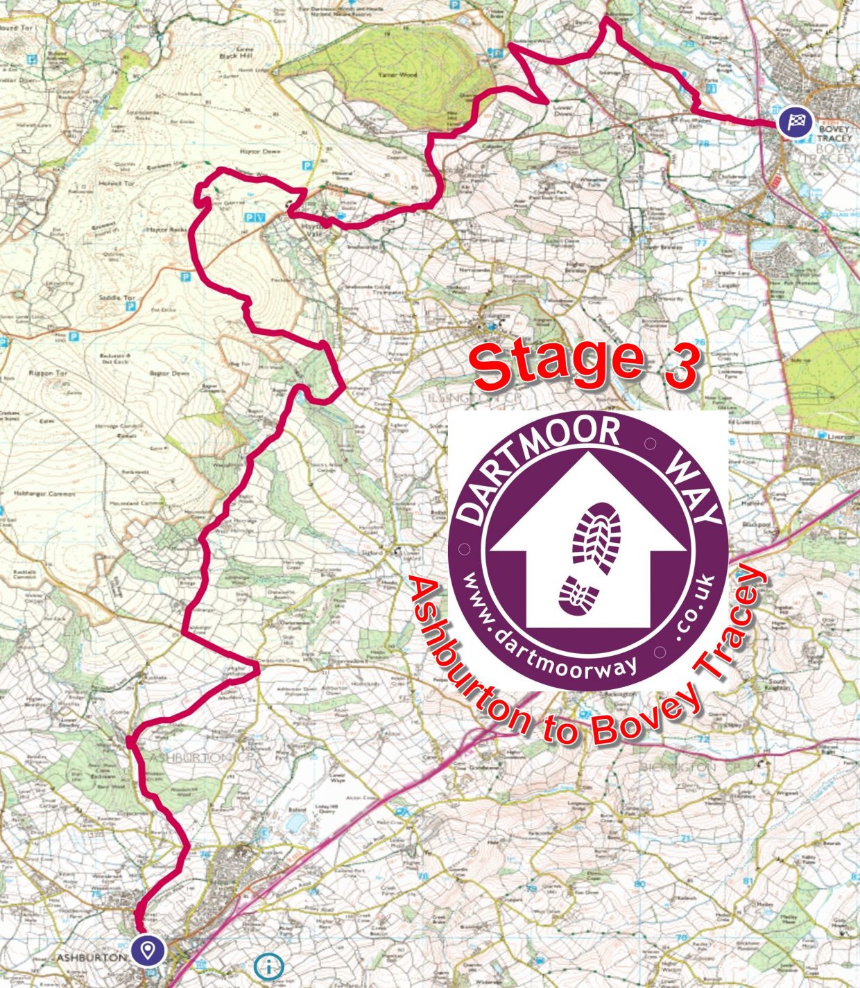
This third stage of the Dartmoor Way is stated on the official website (dartmoorway.co.uk) as being 12.25 miles (19.75km) starting at Ashburton and finishing at Bovey Tracey. The elevation climb is 2,303ft (702m), with the longest climb being across Pinchaford Ball and over Haytor rocks. The whole Dartmoor Way is a long circular 108 mile (173km) route around split into 10 sections with a further 2 making up a “High Moor Link”, which adds another 23.2 miles (37km). This post covering the third stage was recorded by the author as being 22.52 km (around 14 miles). That said, the author made a slight deviation from the official route, by taking a route through Haytor Vale (for a liquid refreshment at “The Rock Inn”), then following the path to the old Iron Mine, then onto the lane by the Cot which affords glorious views across the South Hams and to the coast. This slight deviation was instead of following the granite tramway alongside B3387 and is in the authors humble opinion, the slightly more scenic route. This post records historical features, shows pictures of some far reaching views, shows pictures of wildlife and shows pictures of points of interest – all photographs taken by the author along the route are annotated.
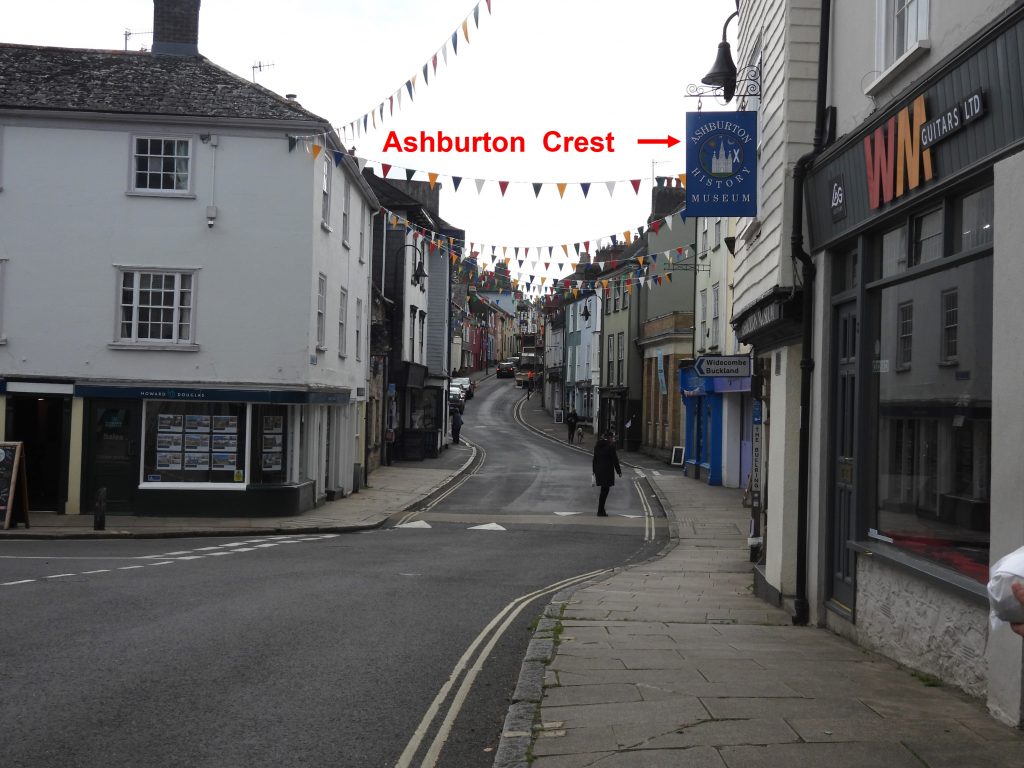
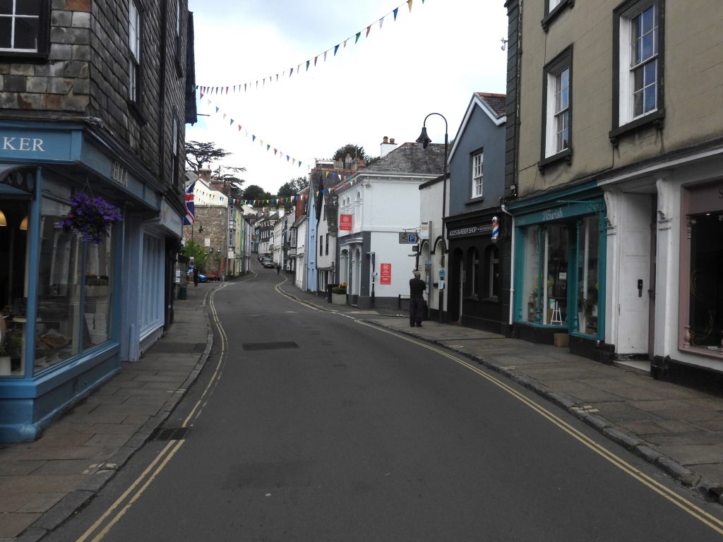
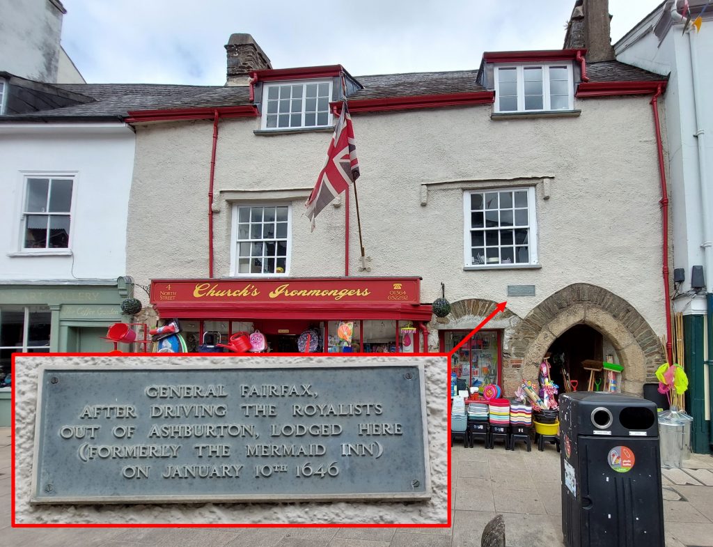
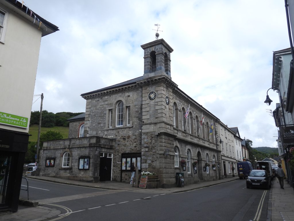
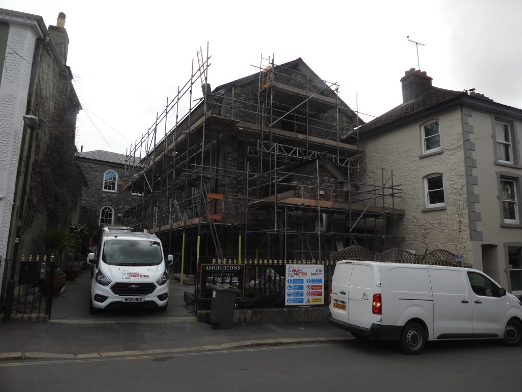
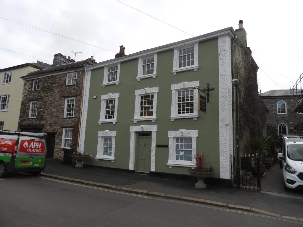
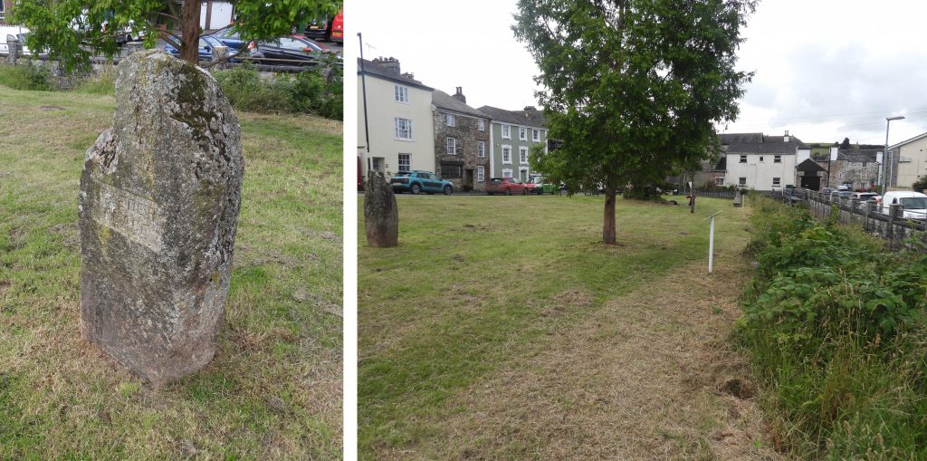
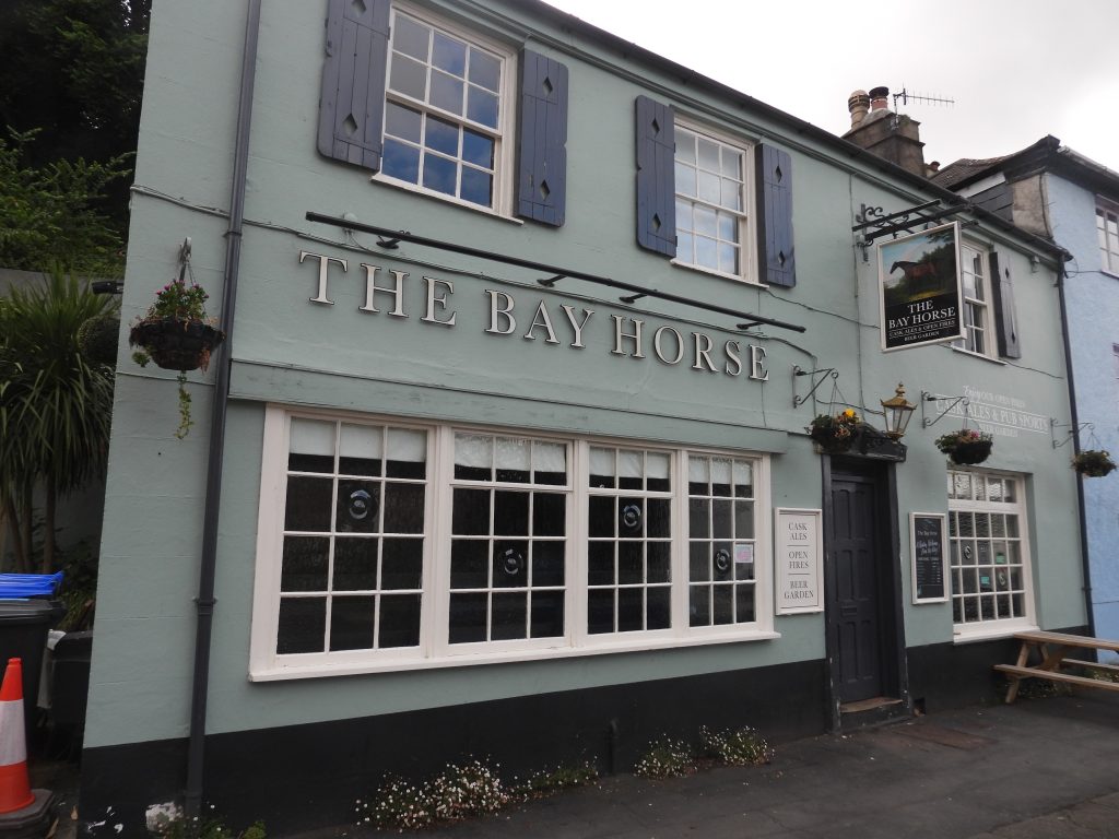
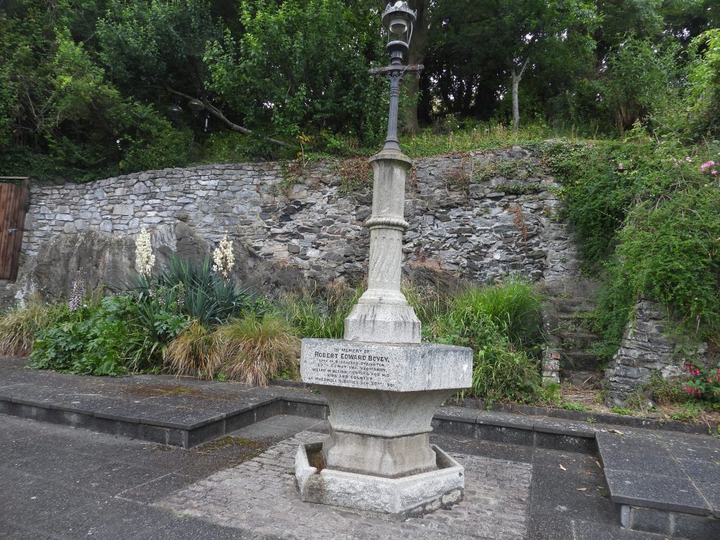
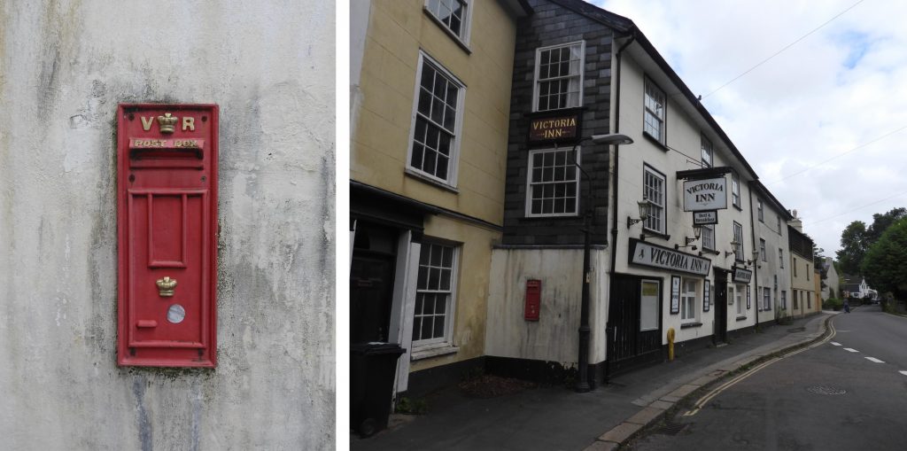
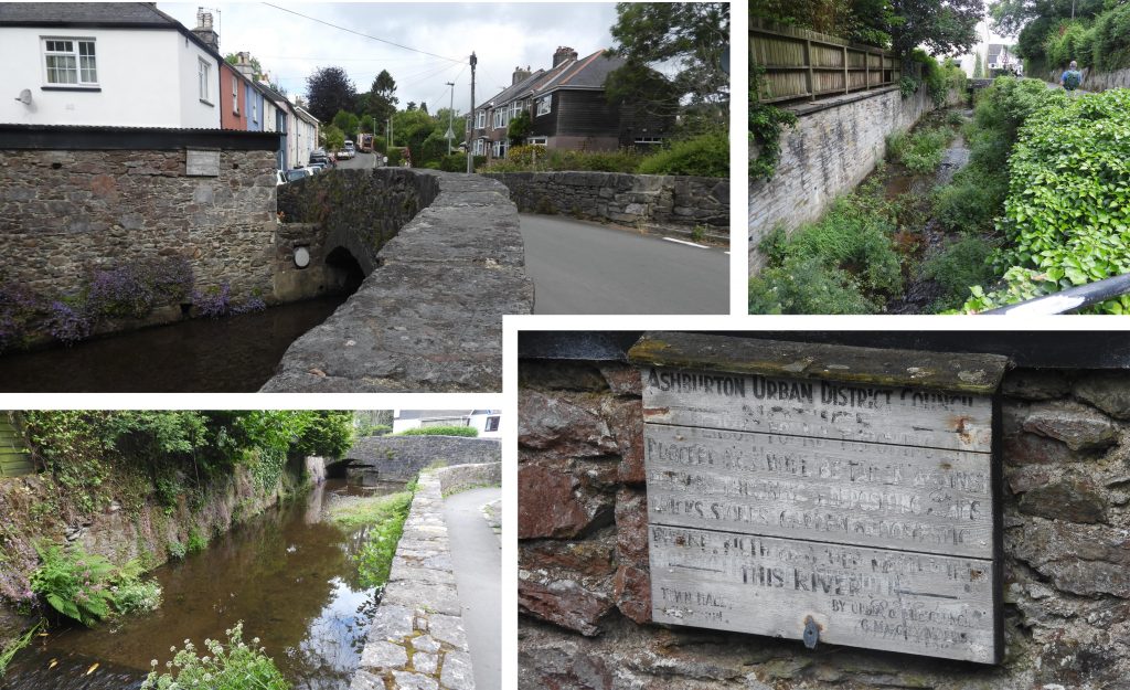
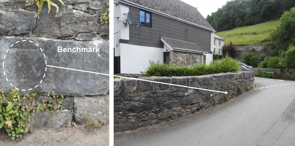
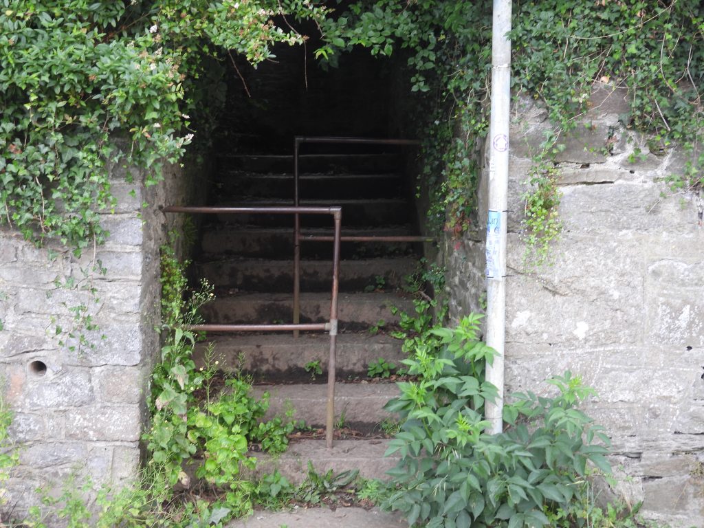
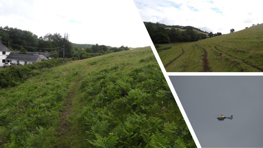
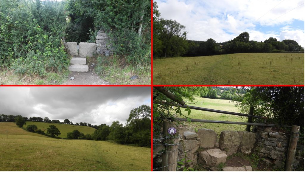
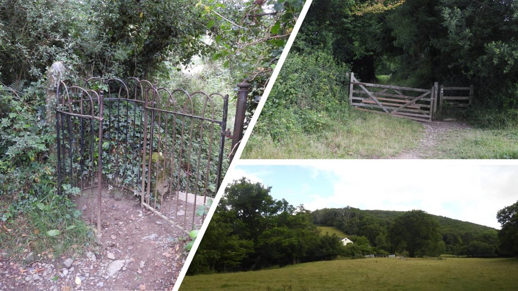
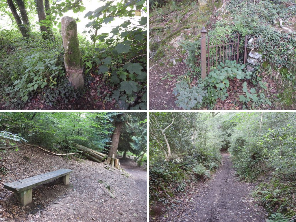
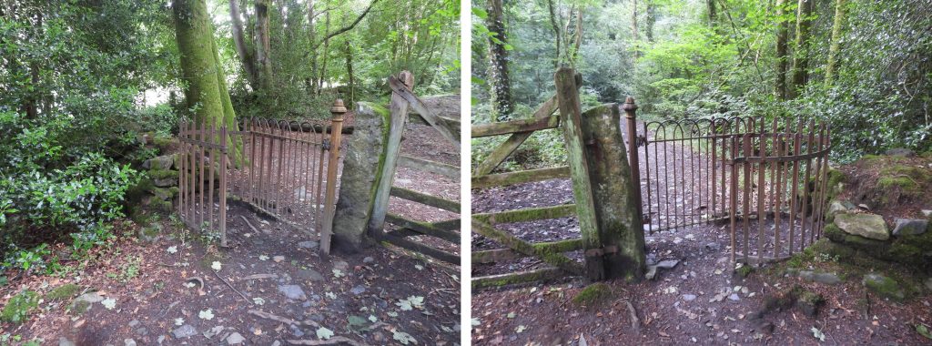
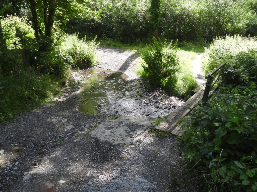
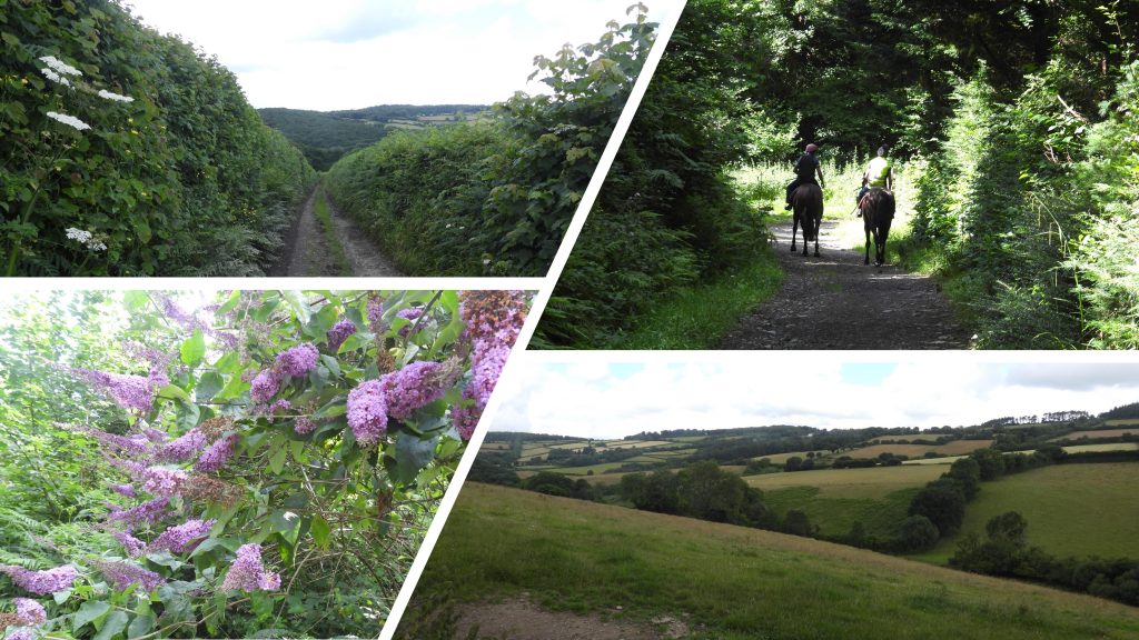
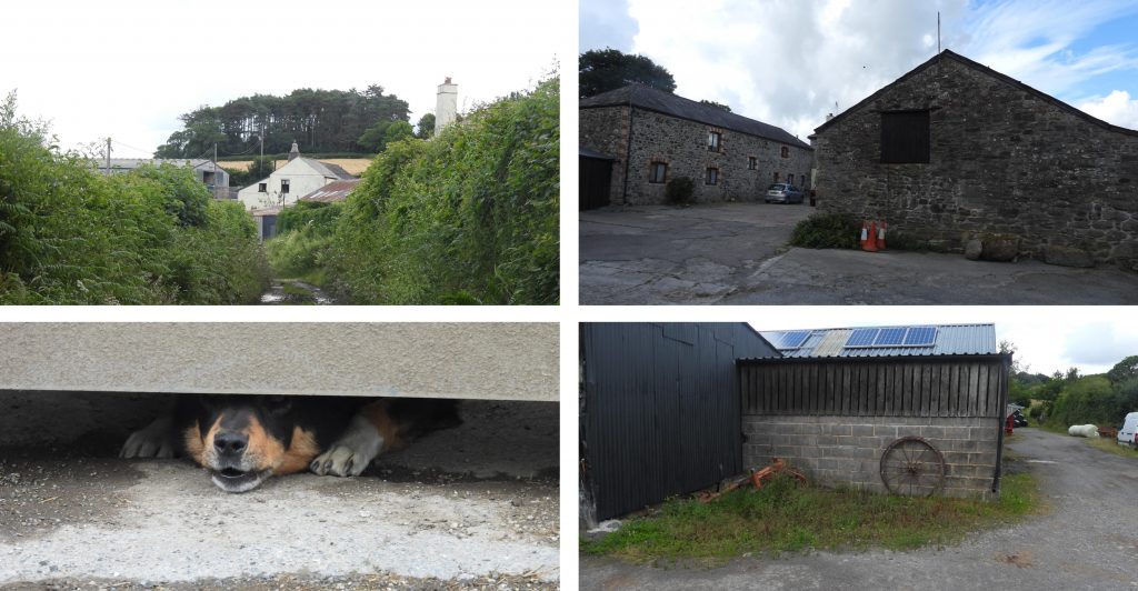
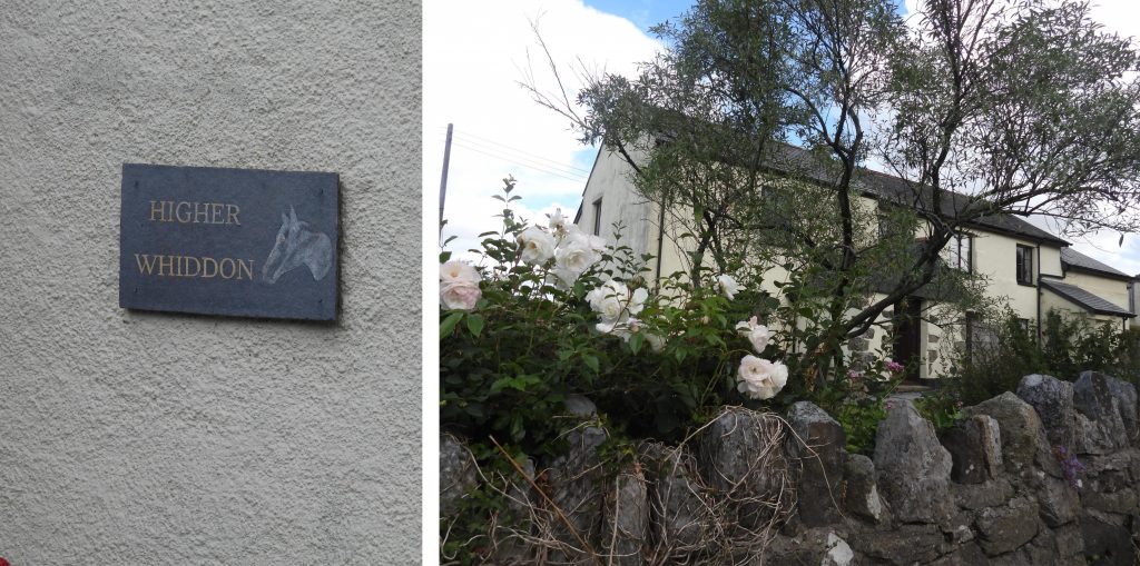
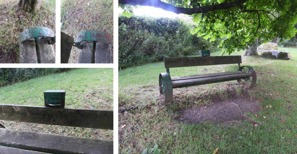
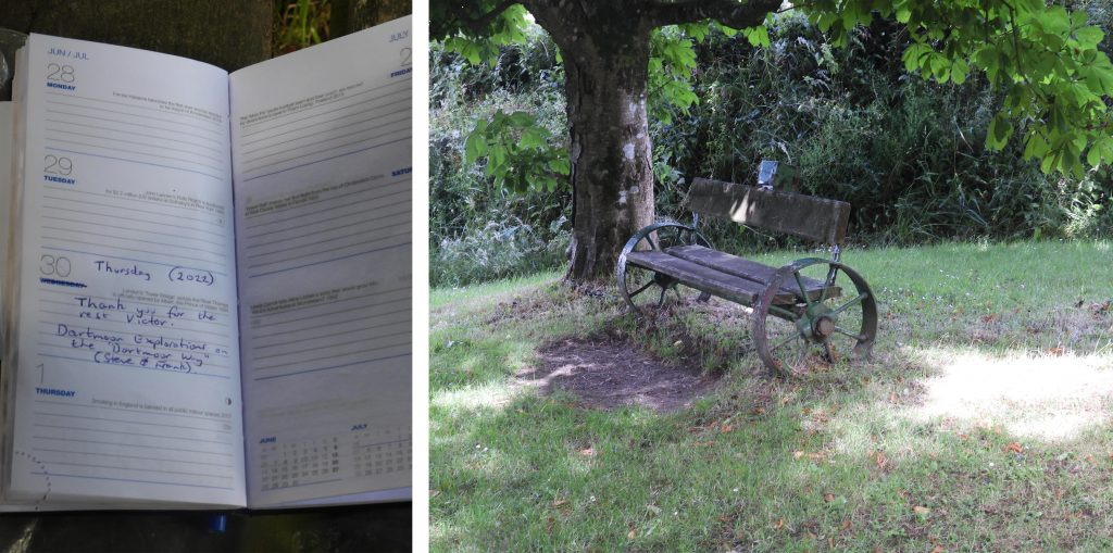
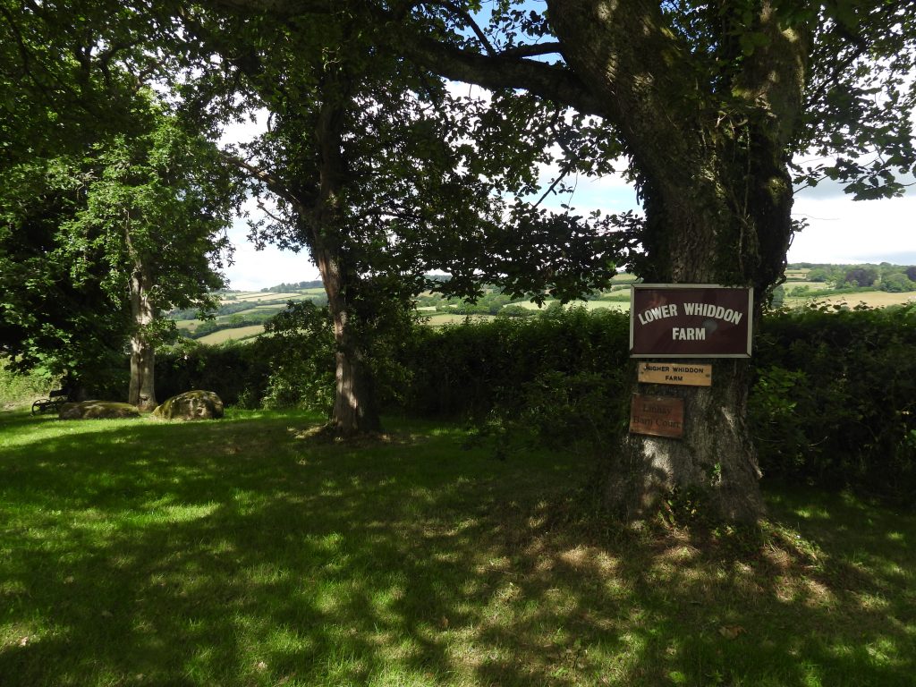
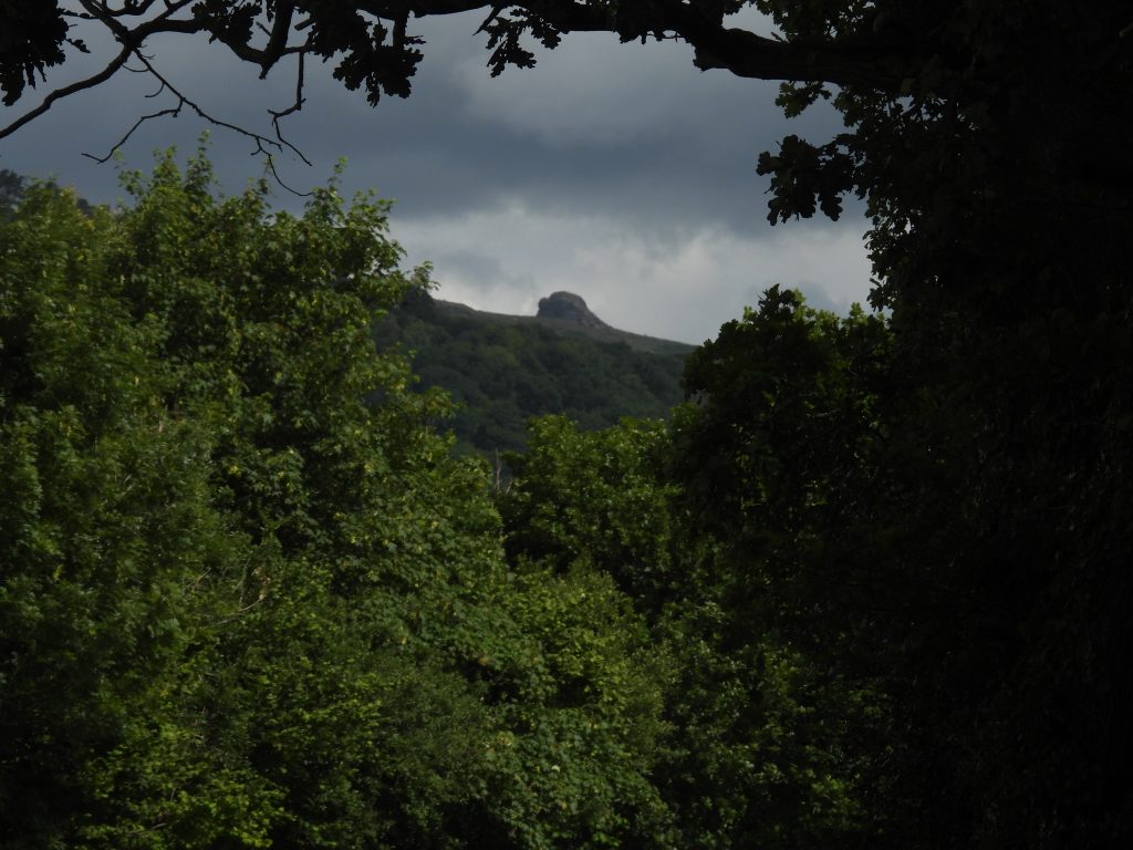
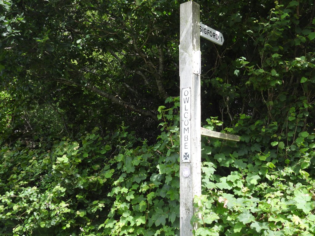
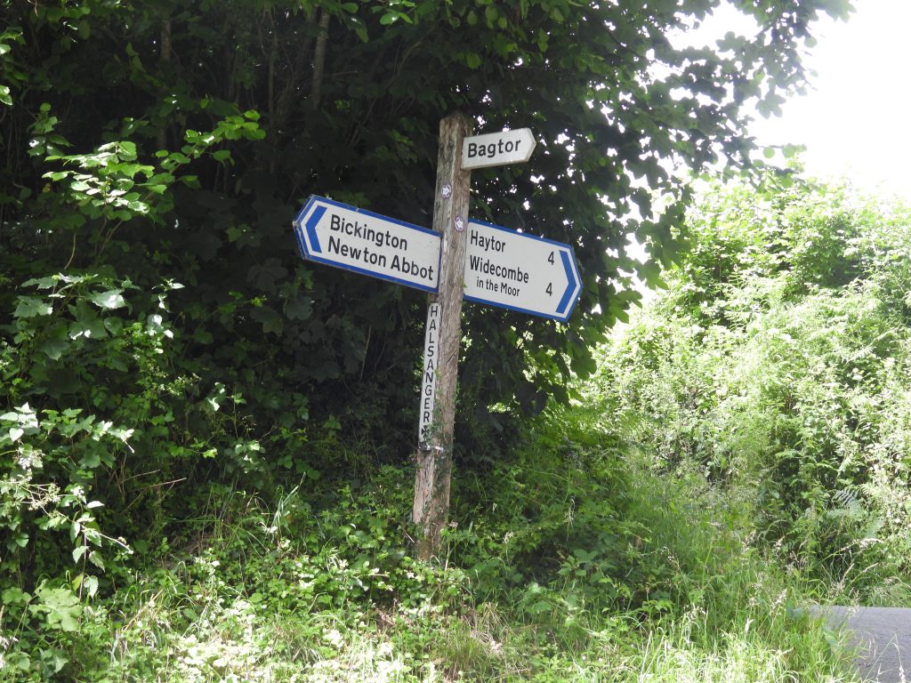
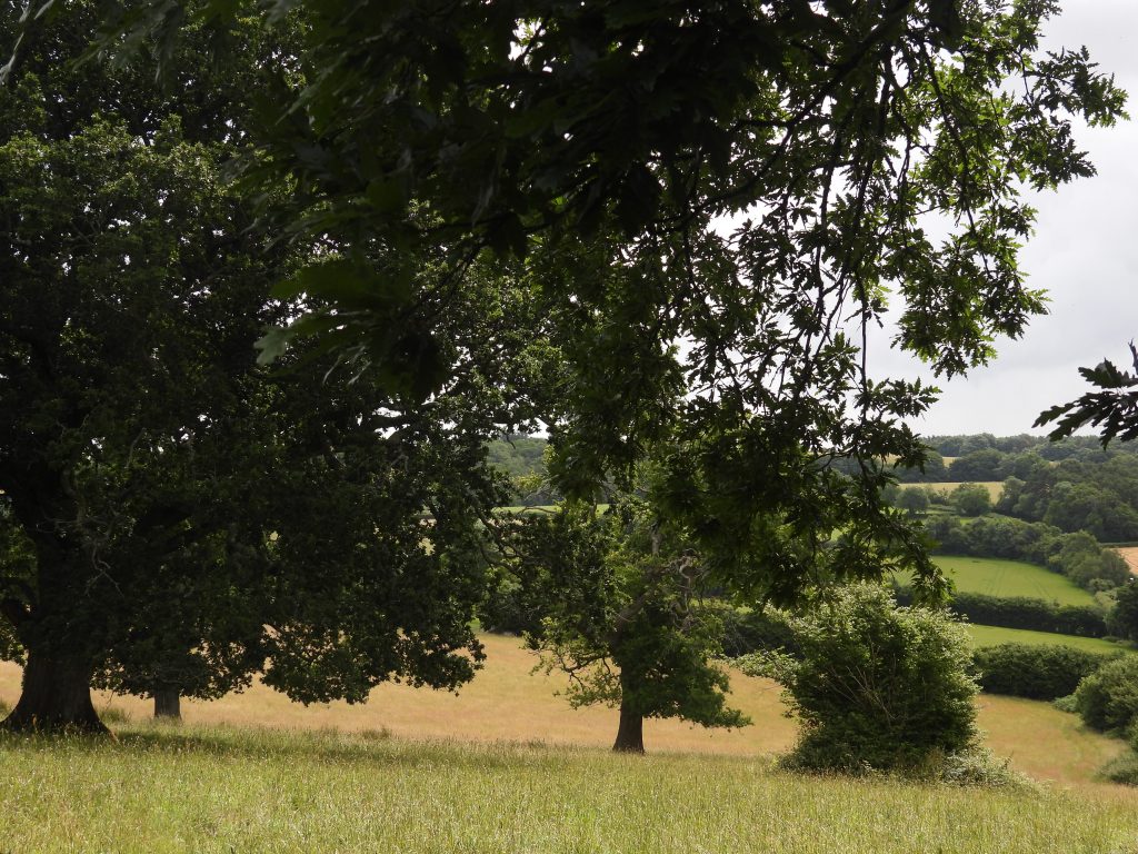
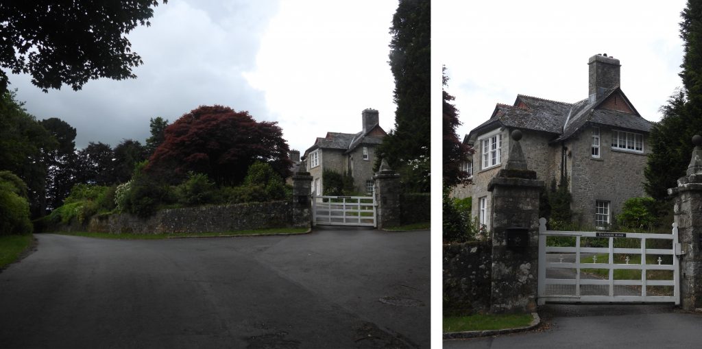
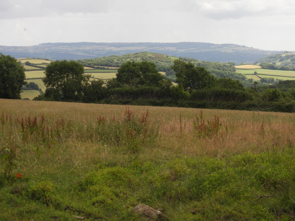
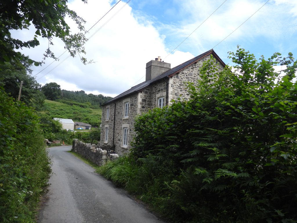
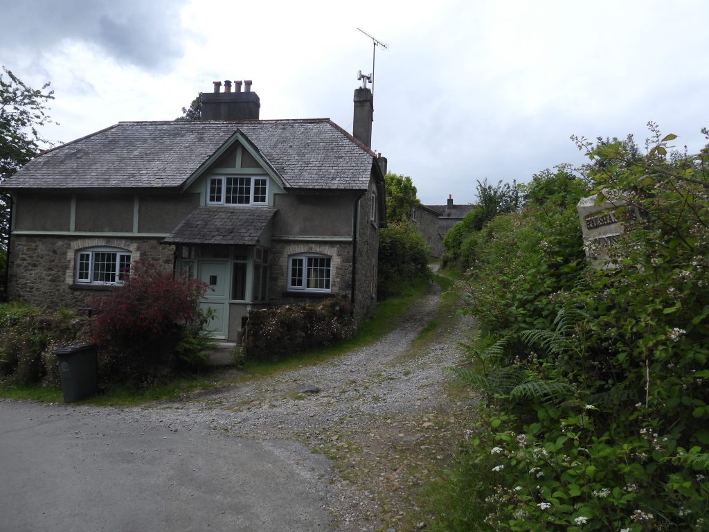
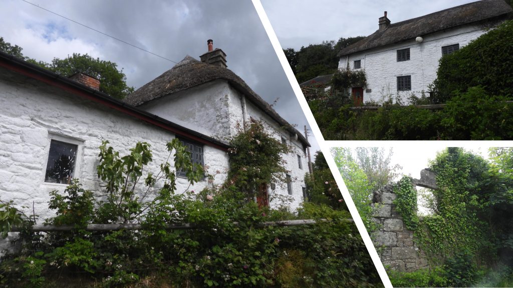
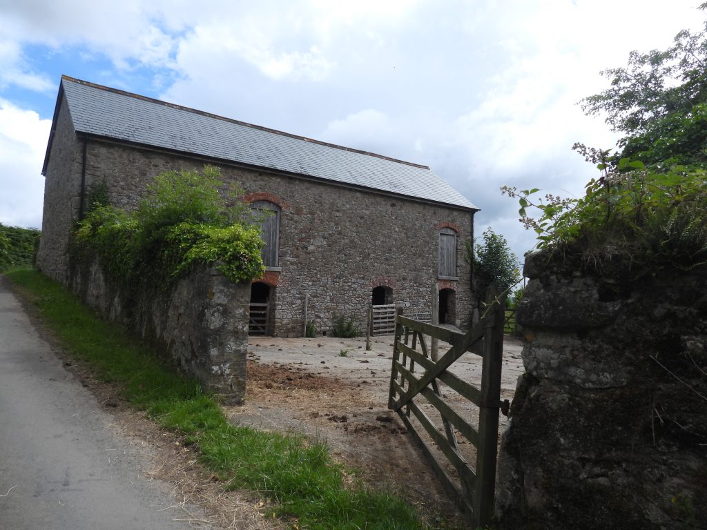
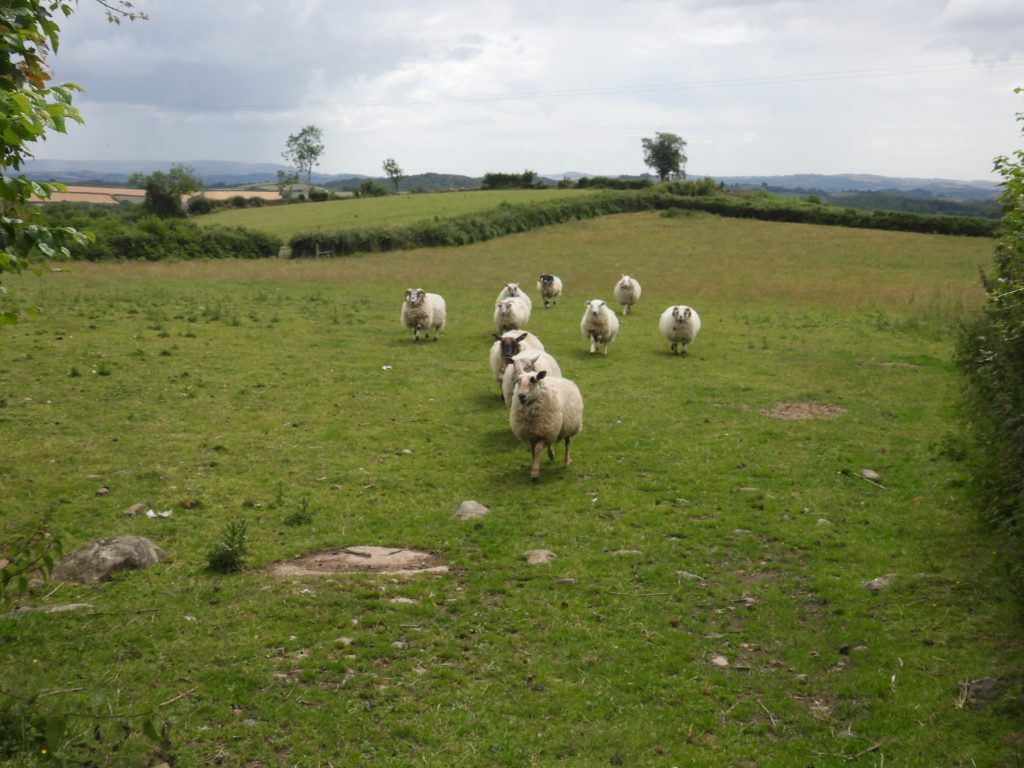
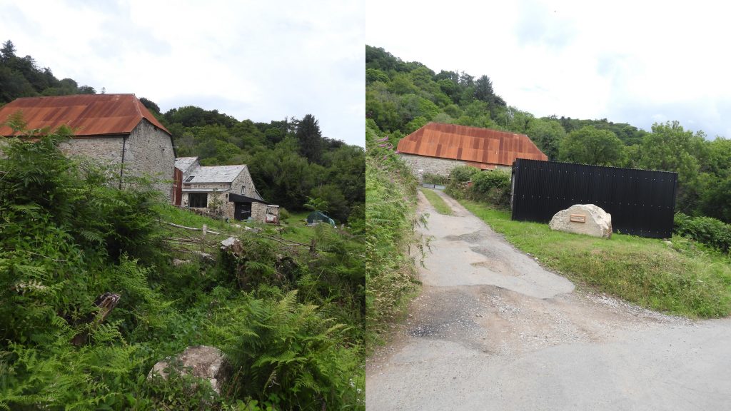
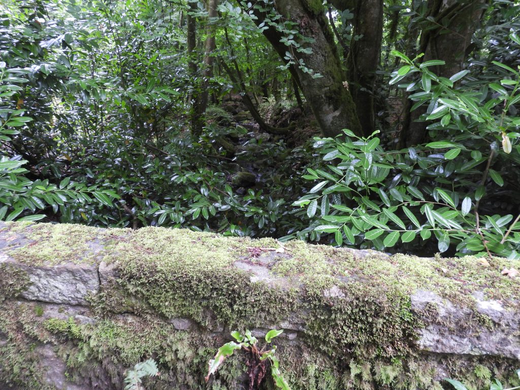
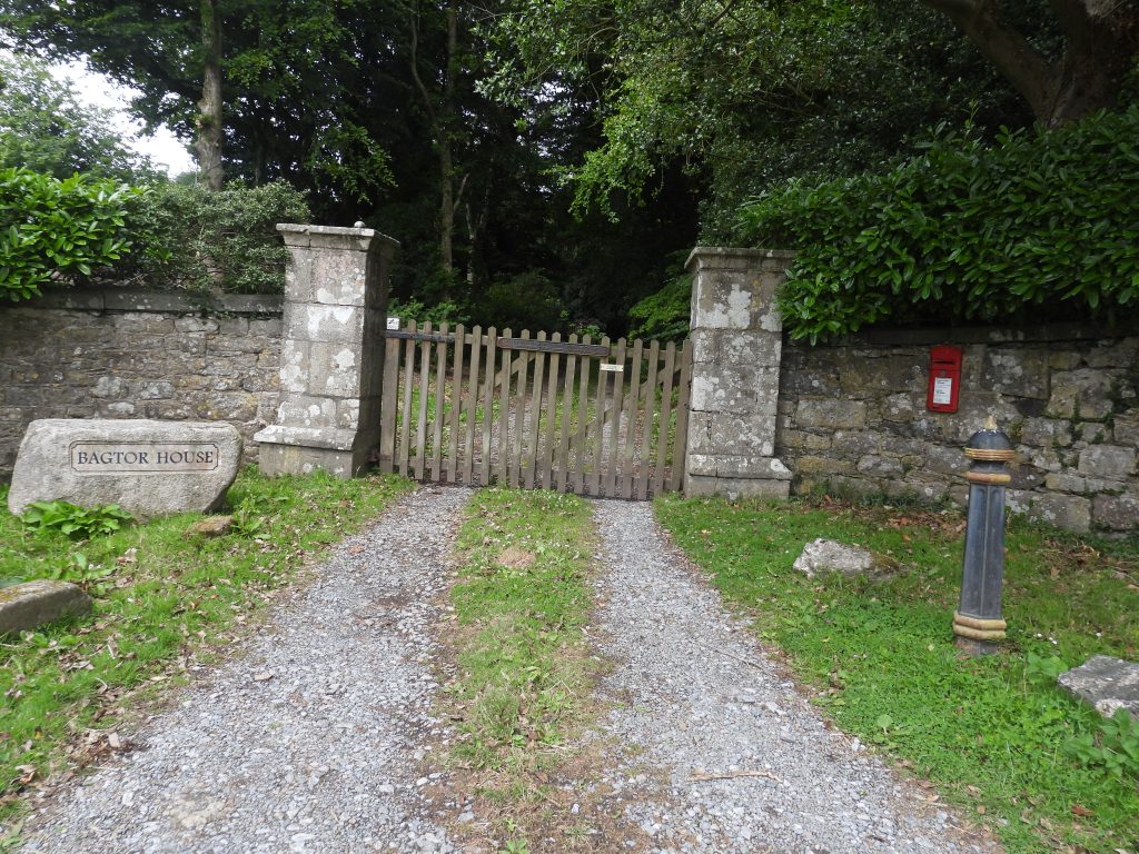
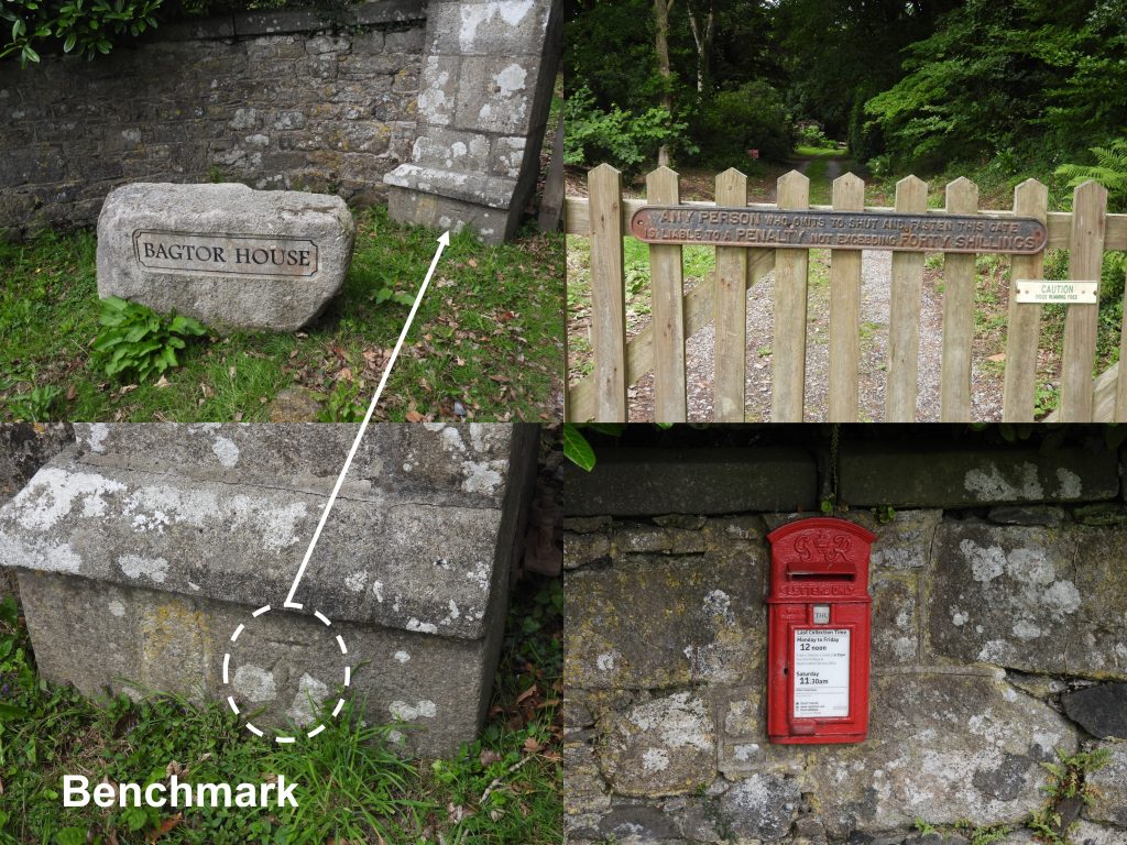
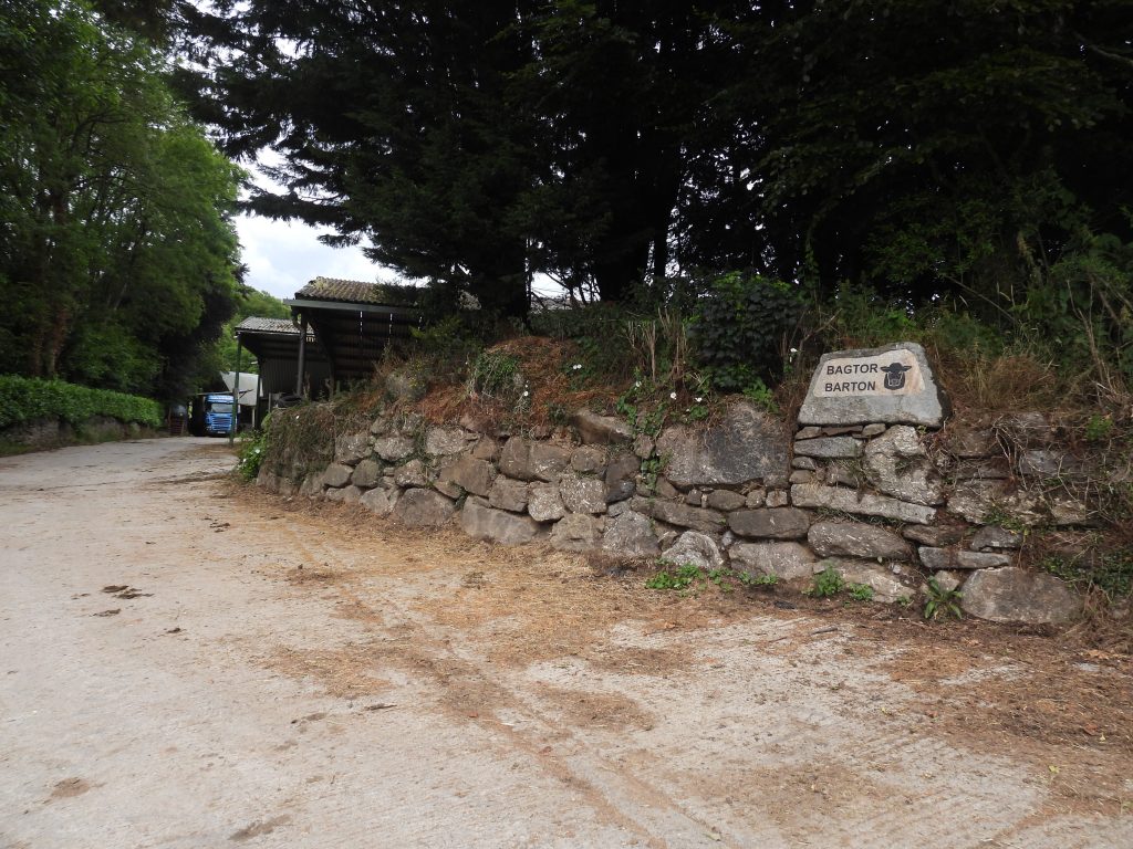
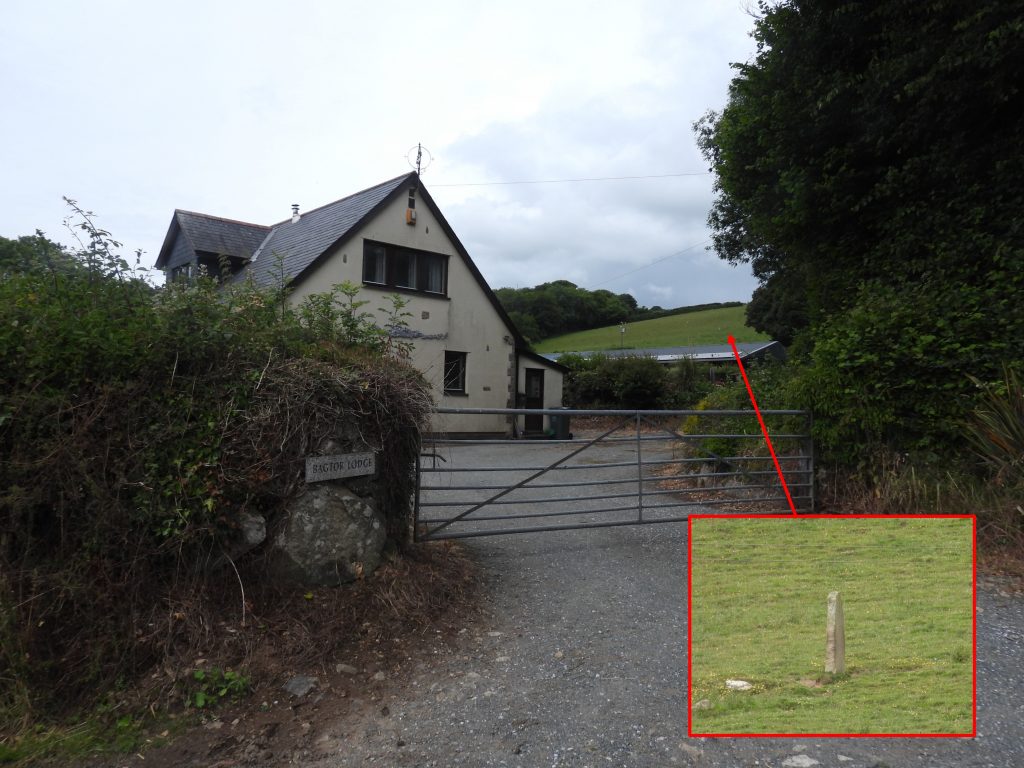
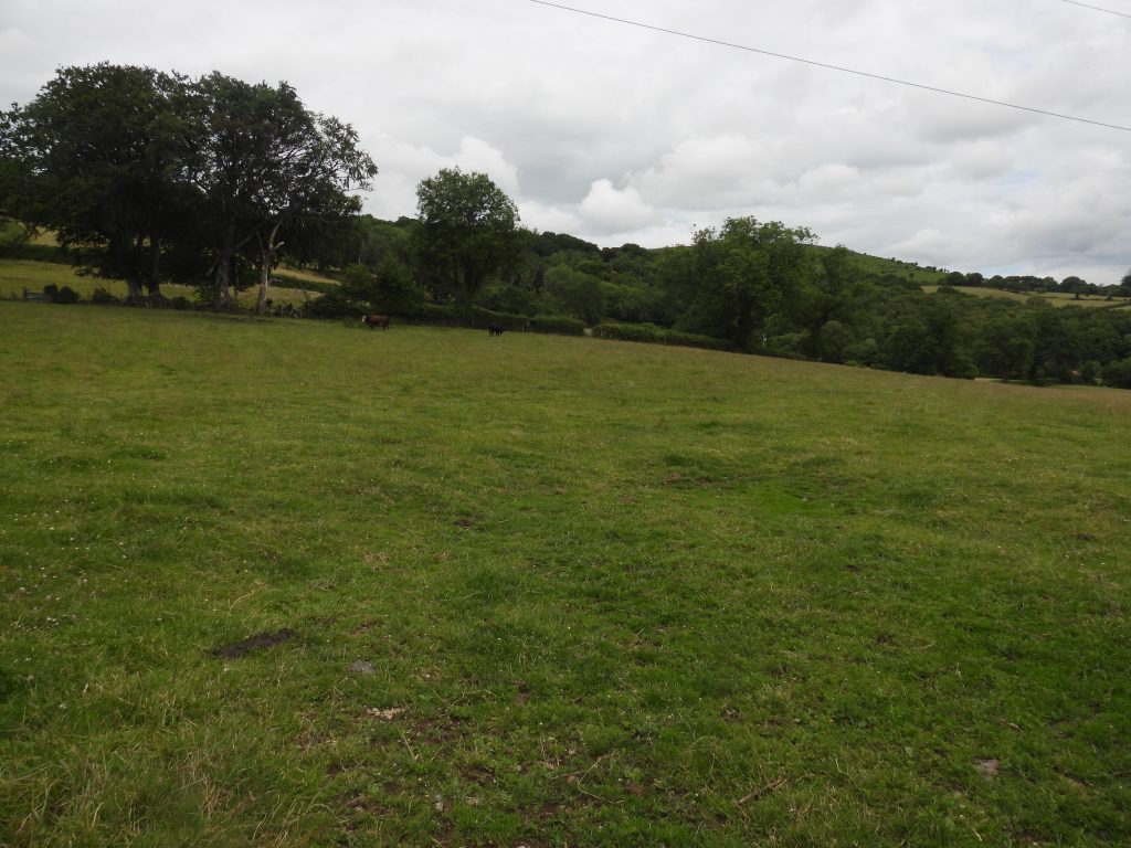
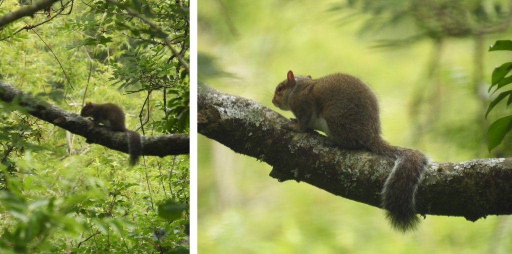
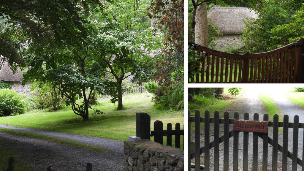
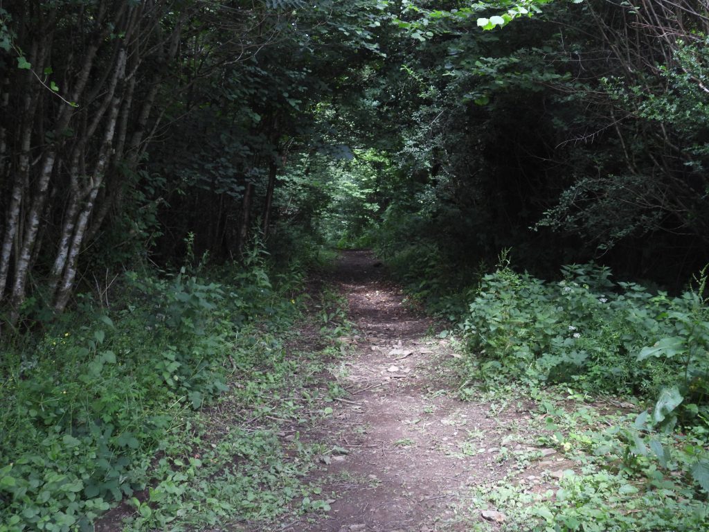
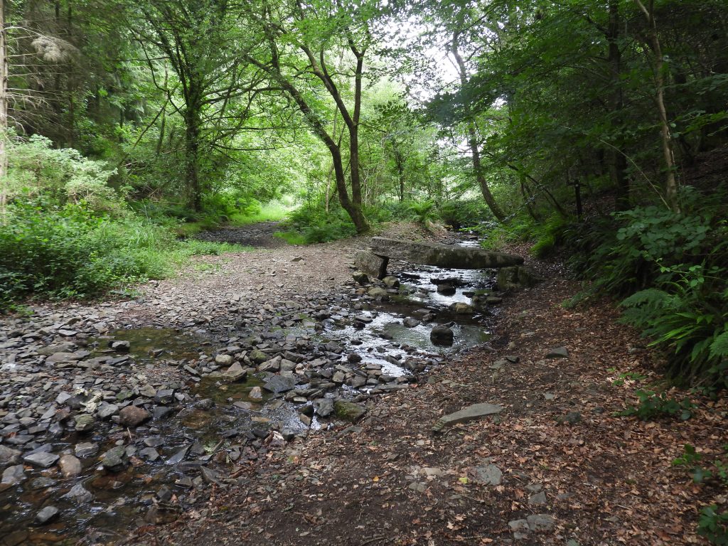
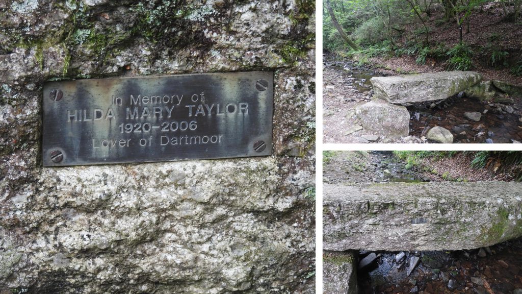
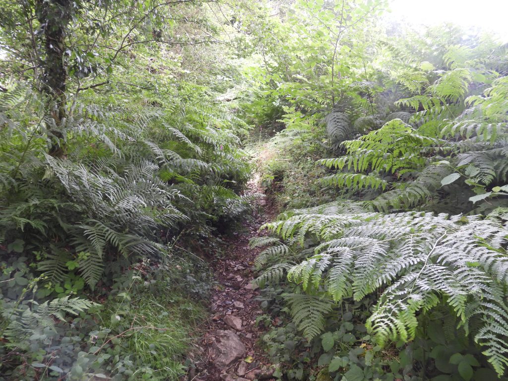
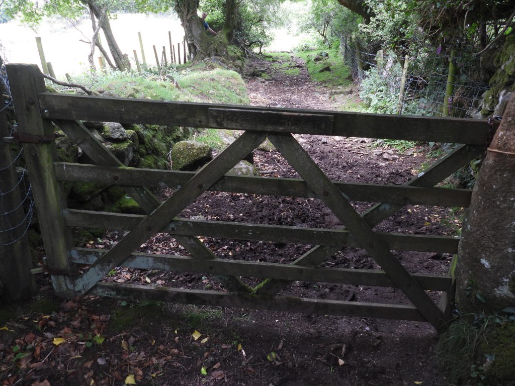
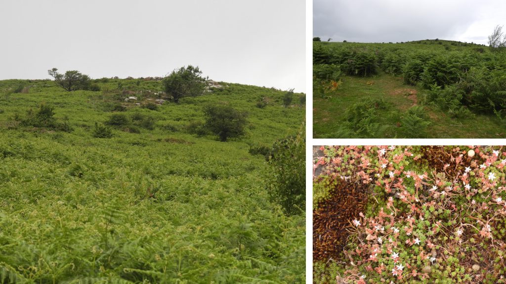
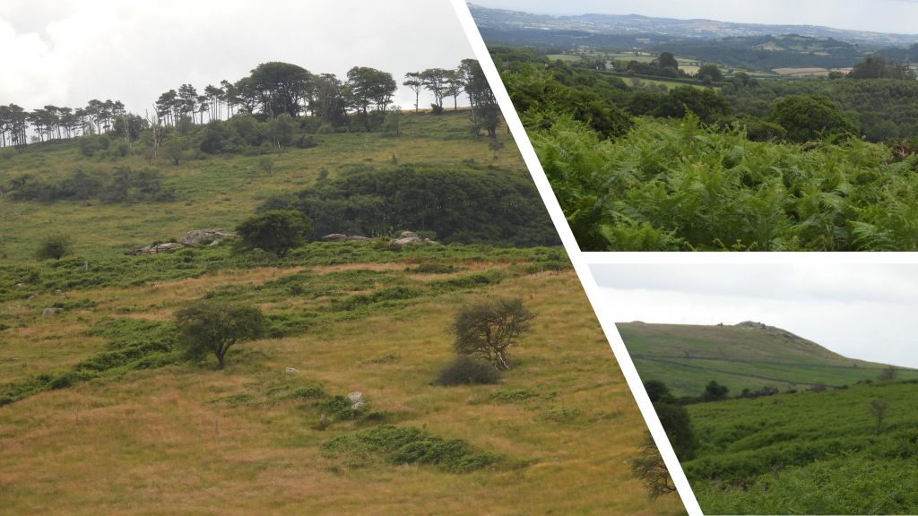
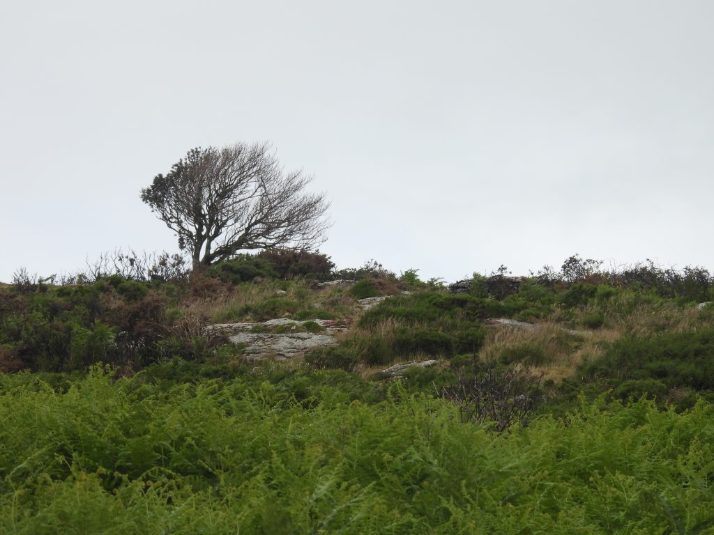
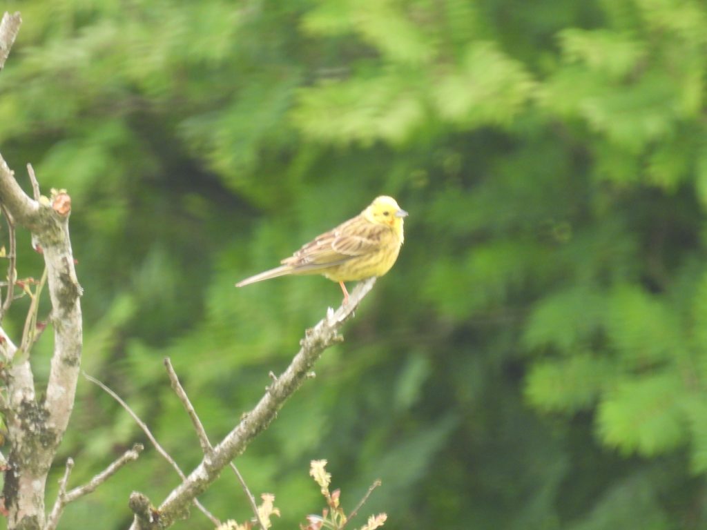
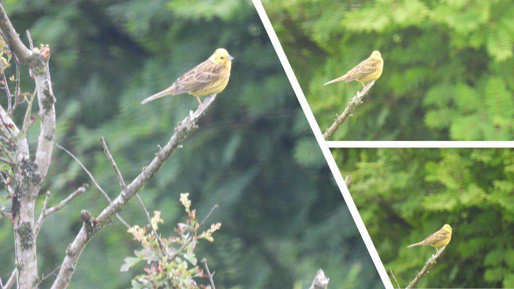
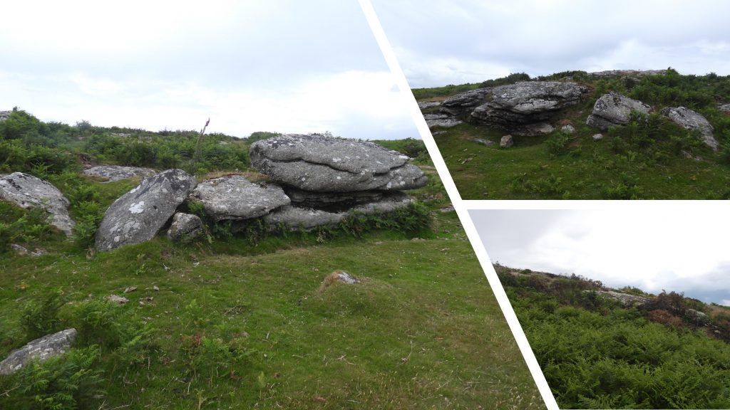
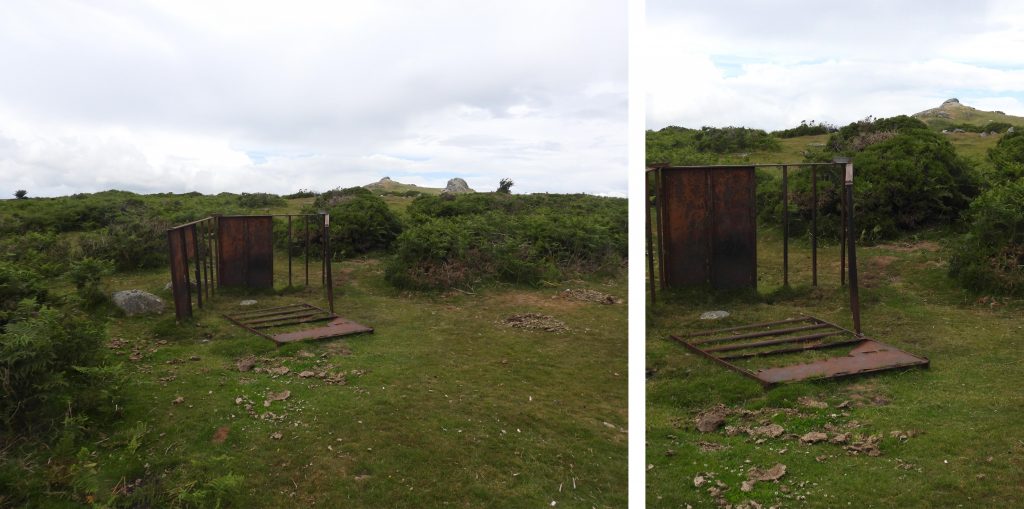
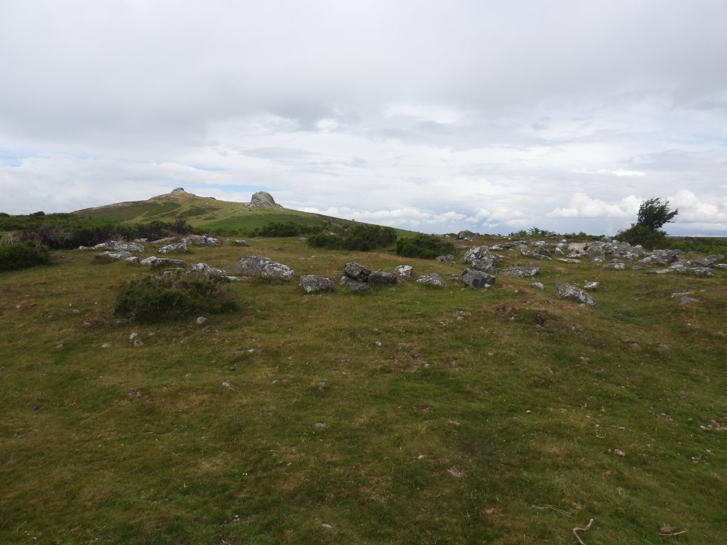
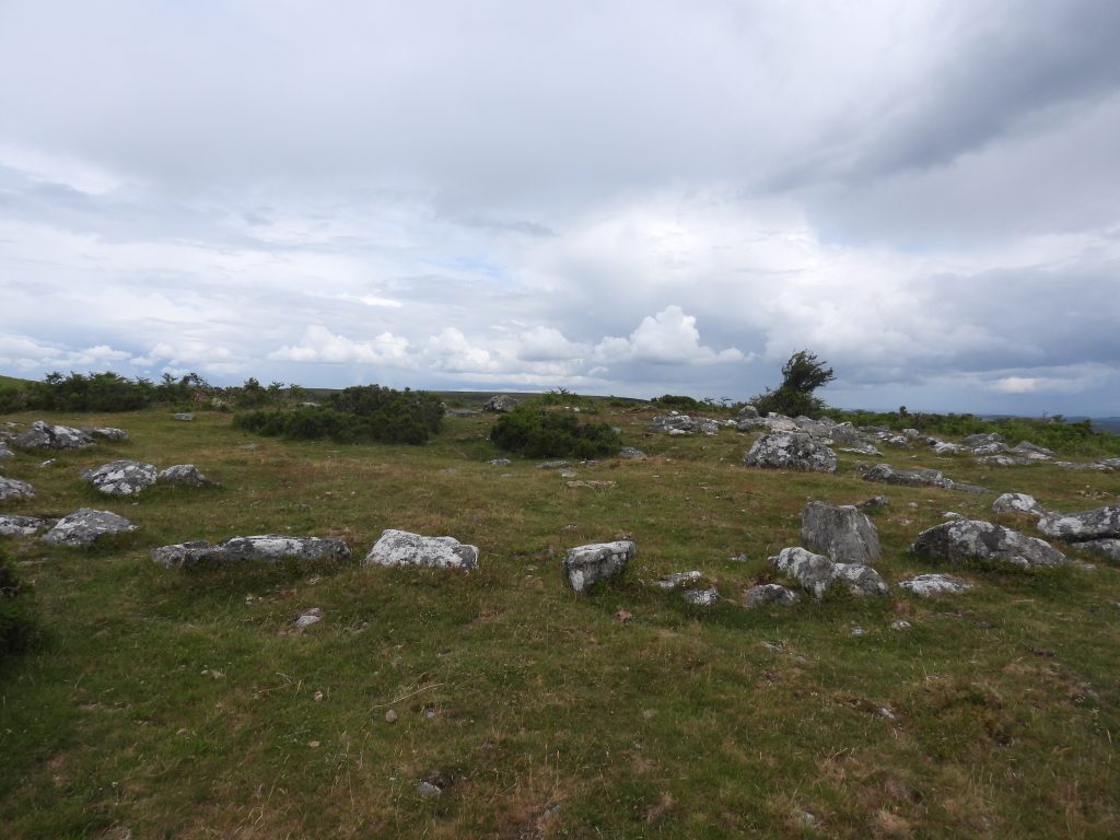
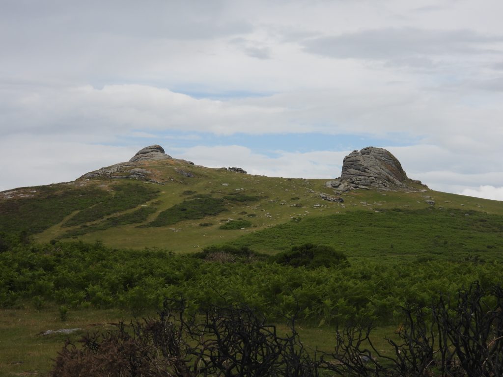
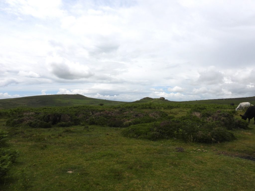
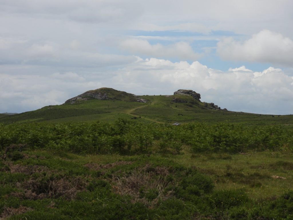
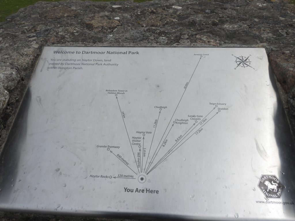
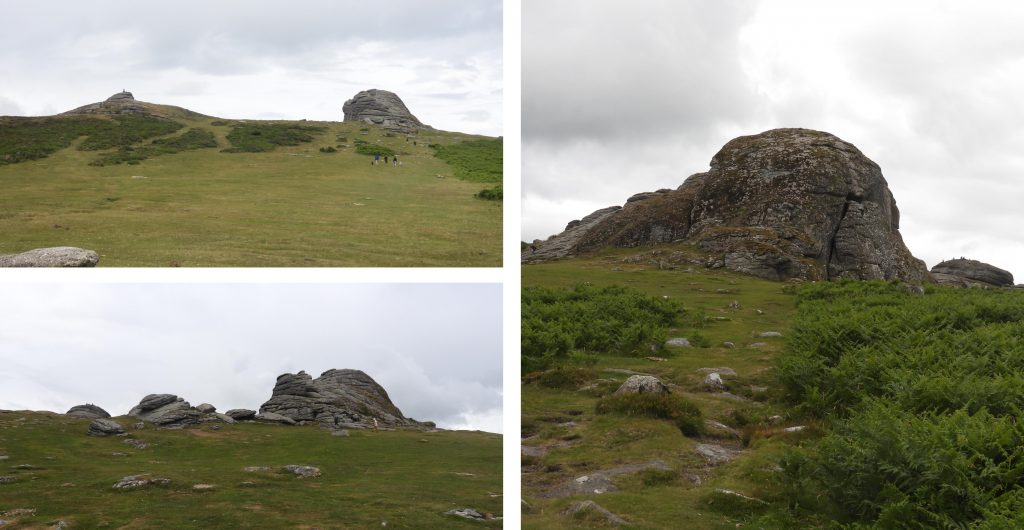
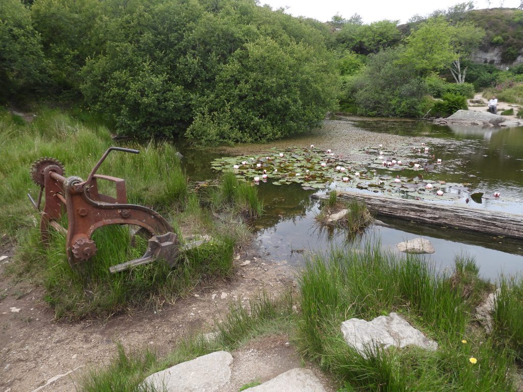
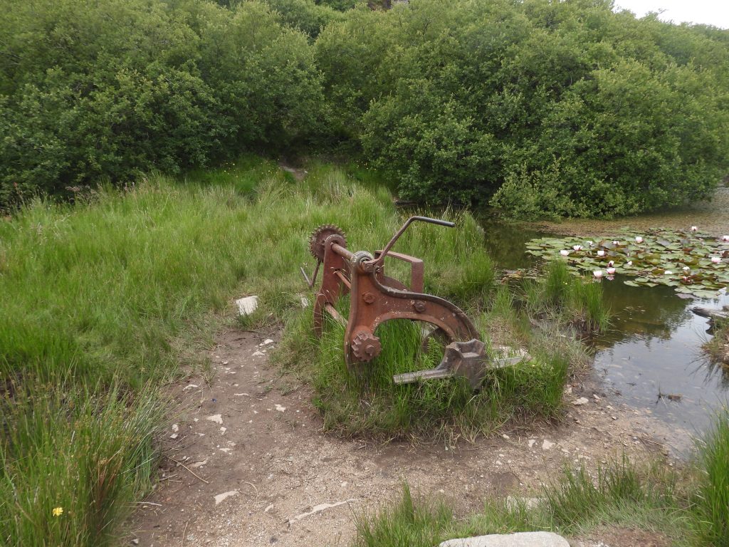
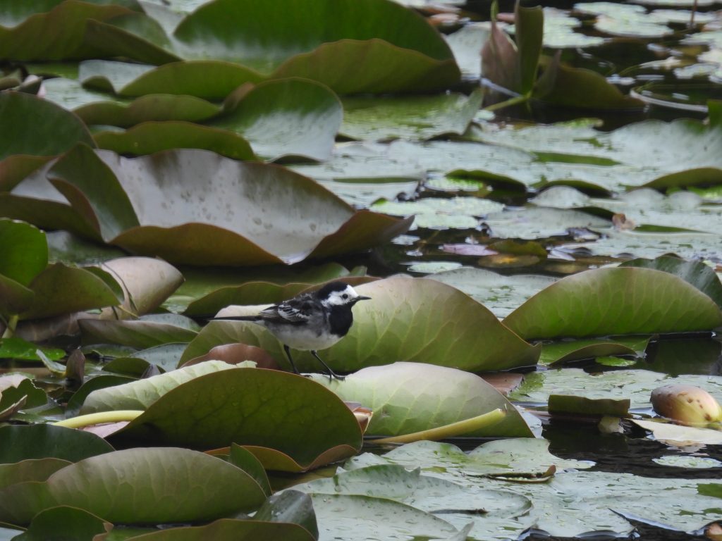
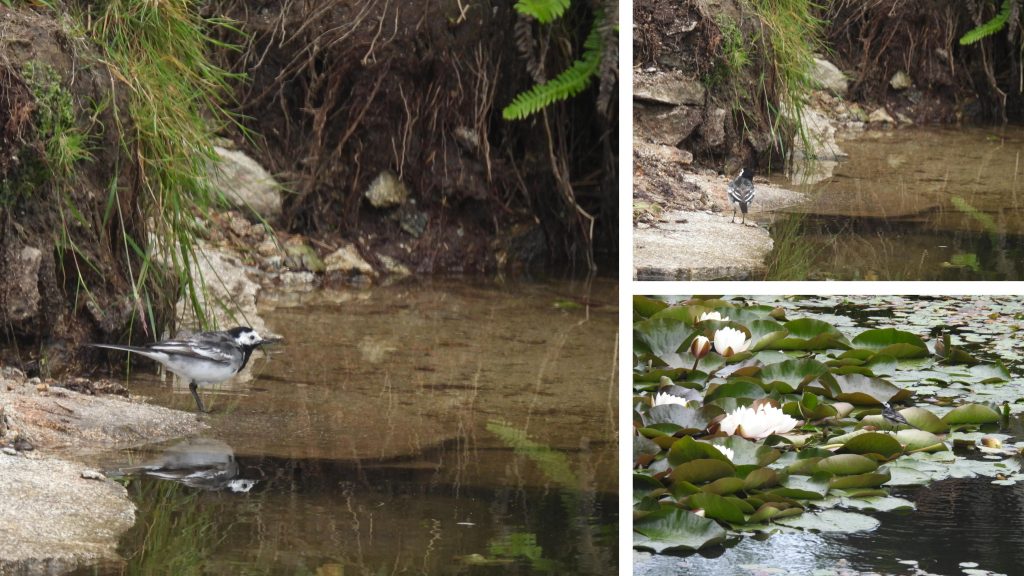
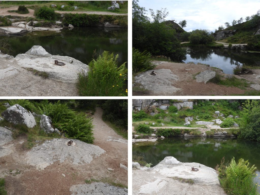
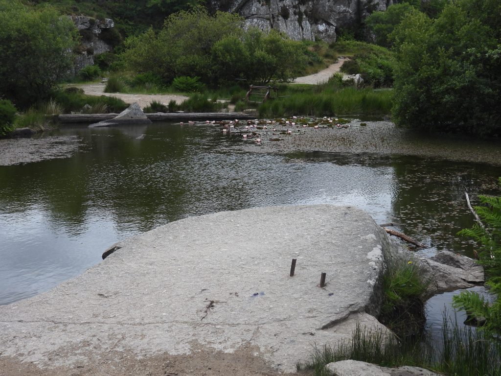
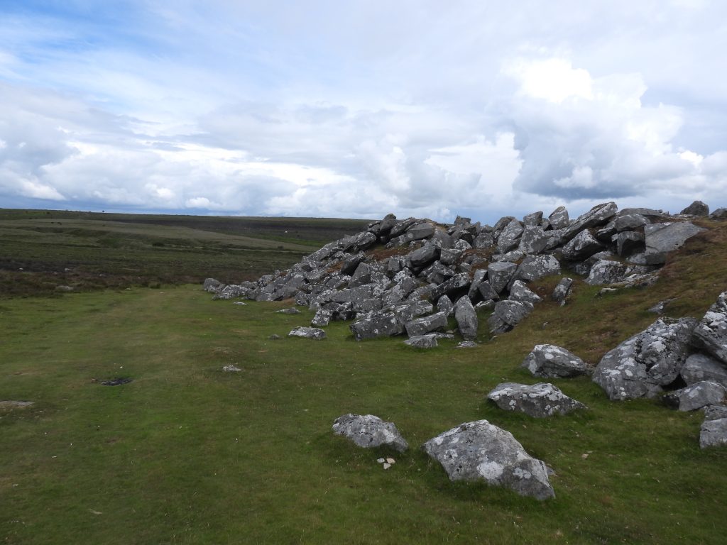
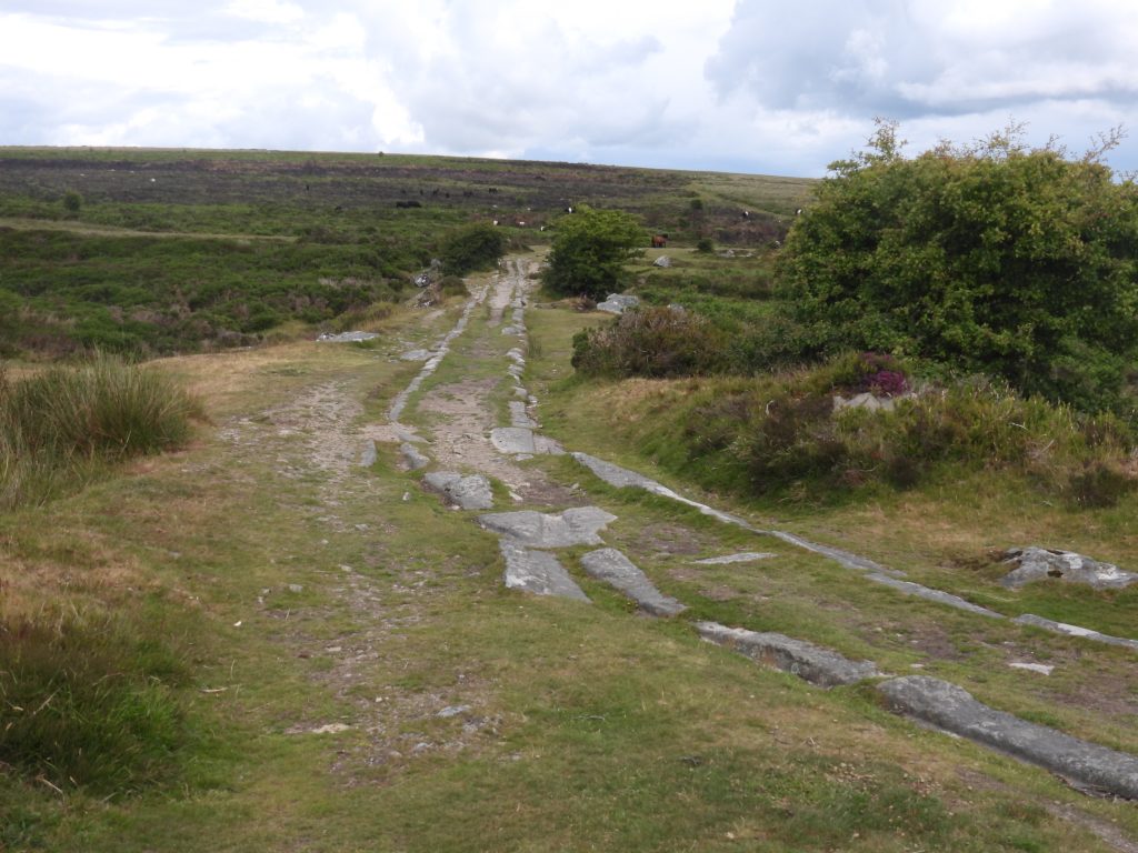
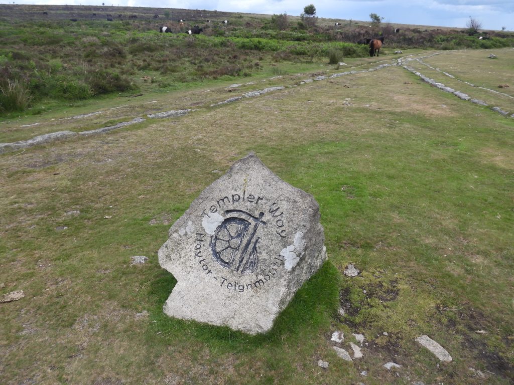
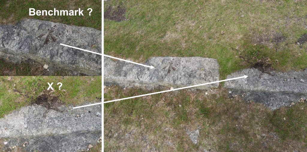
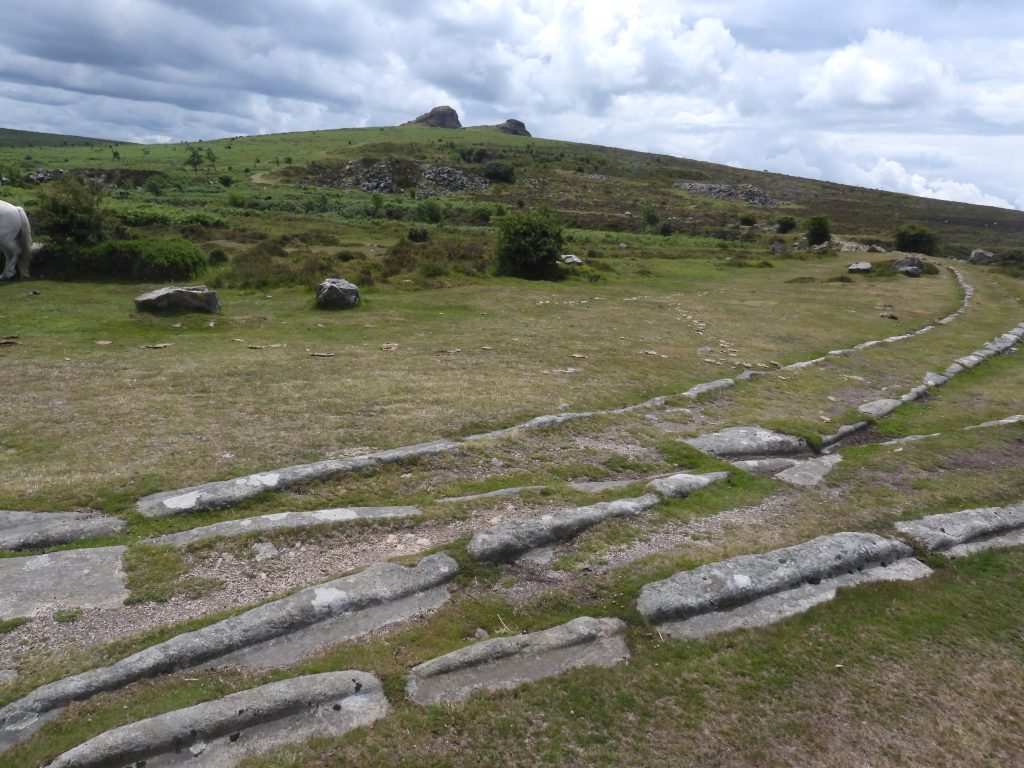
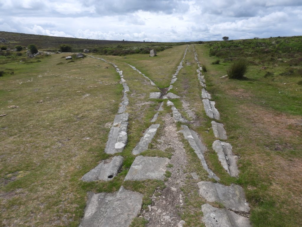
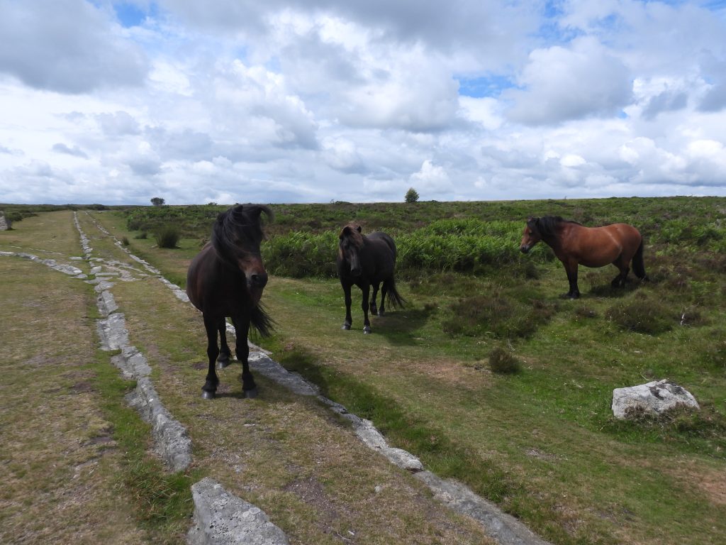
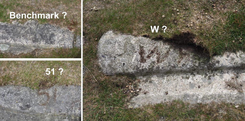
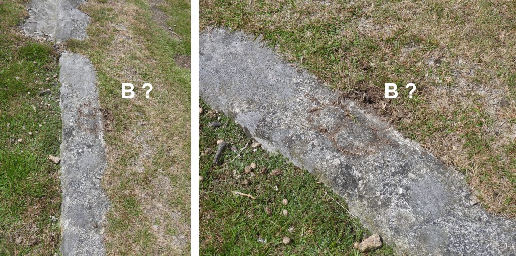
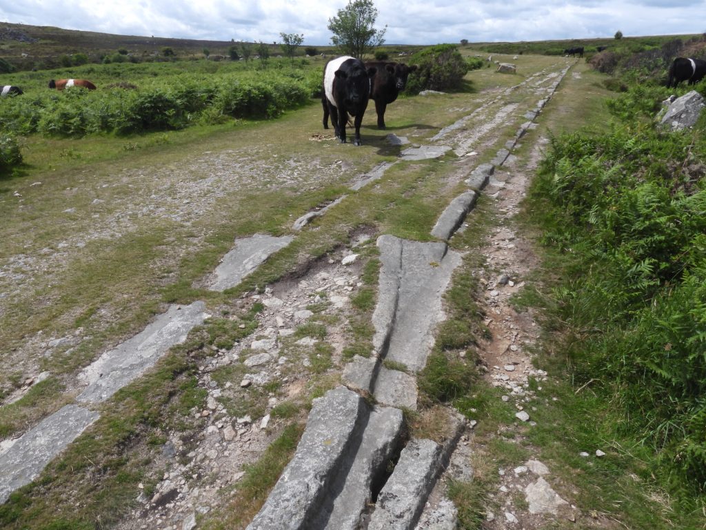
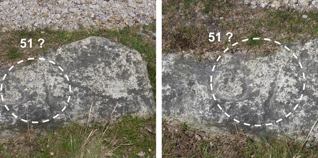
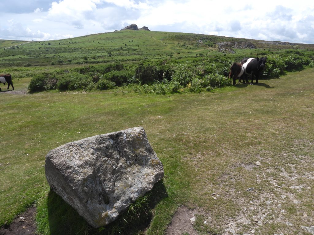
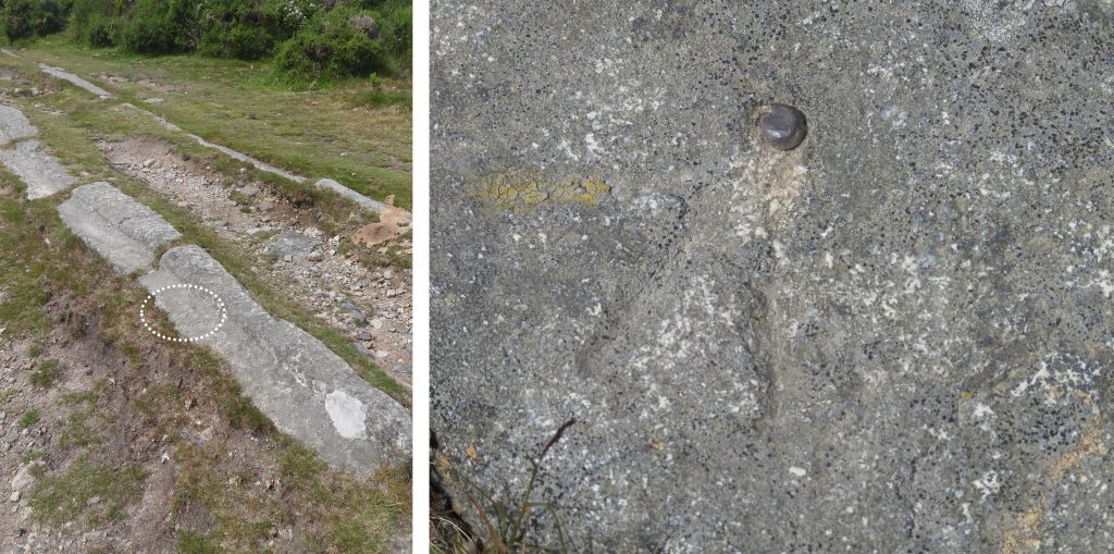
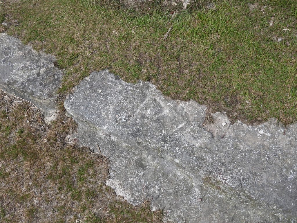
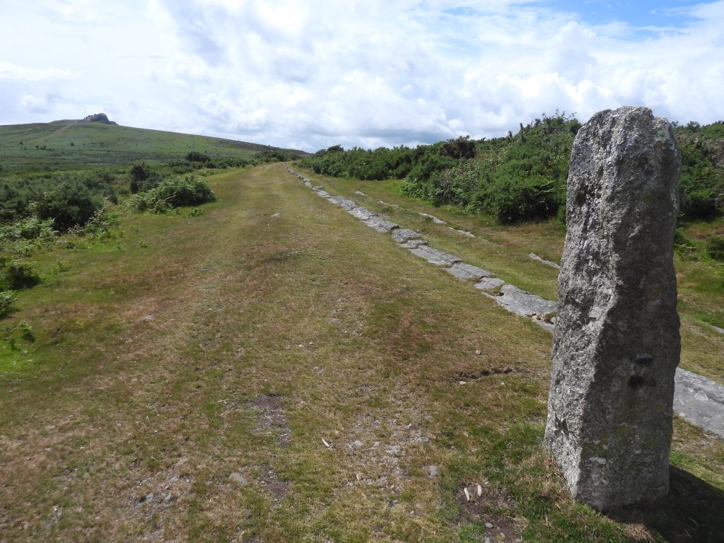
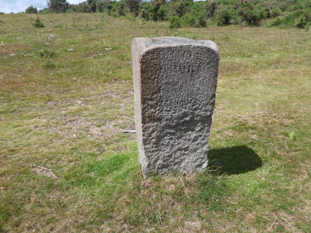
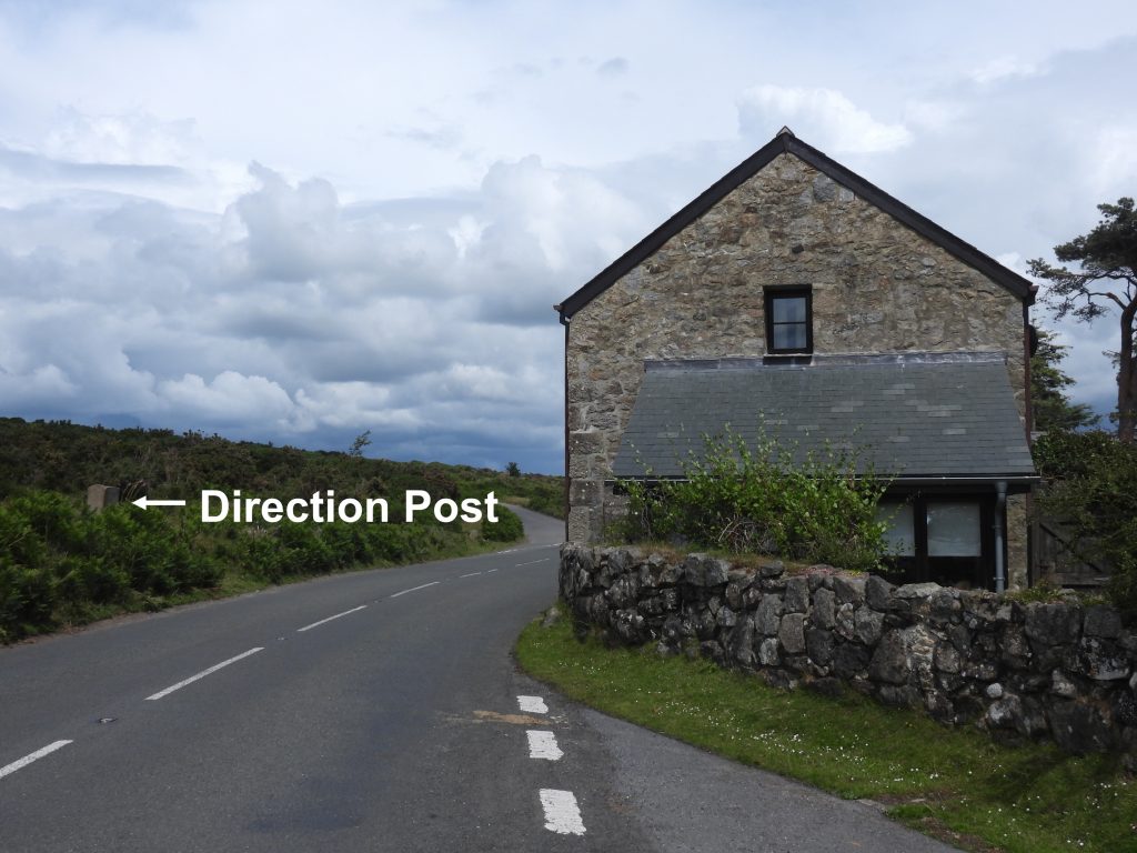
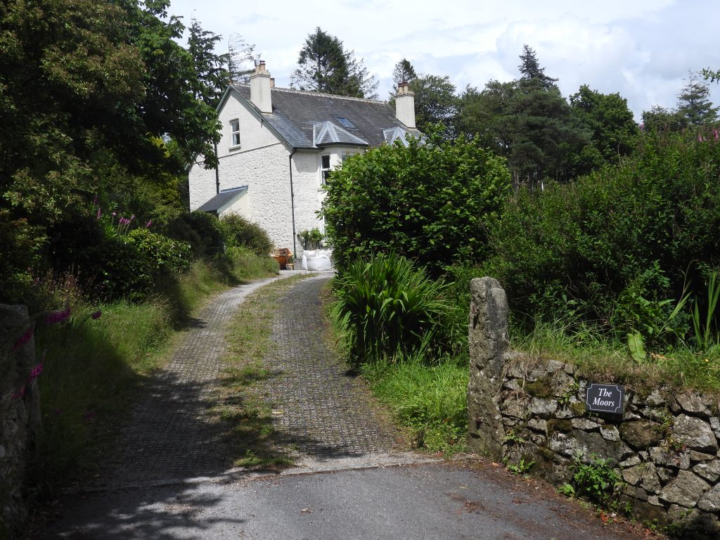
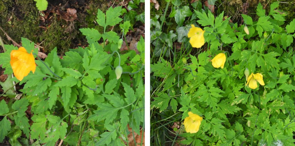
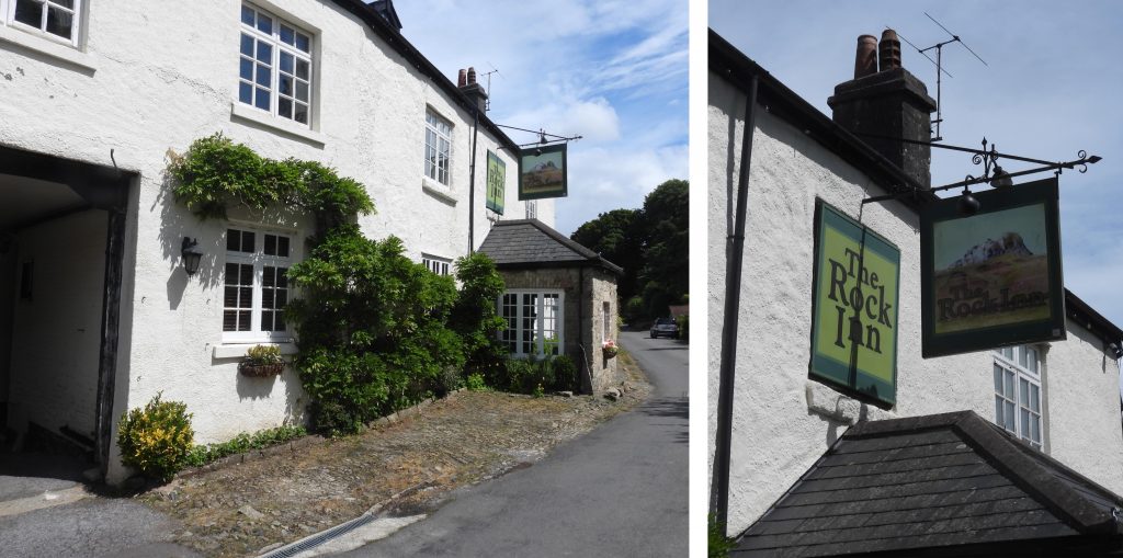
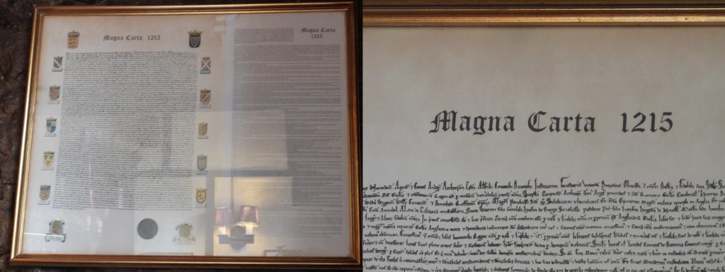
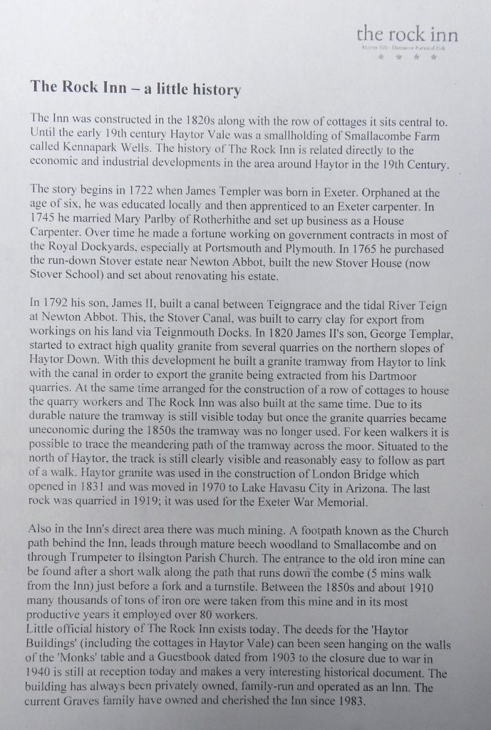
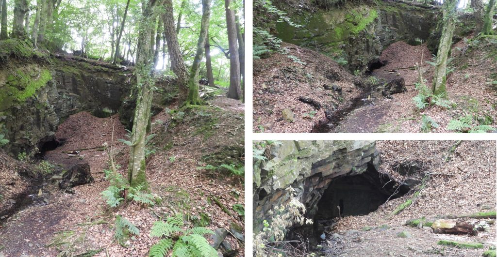
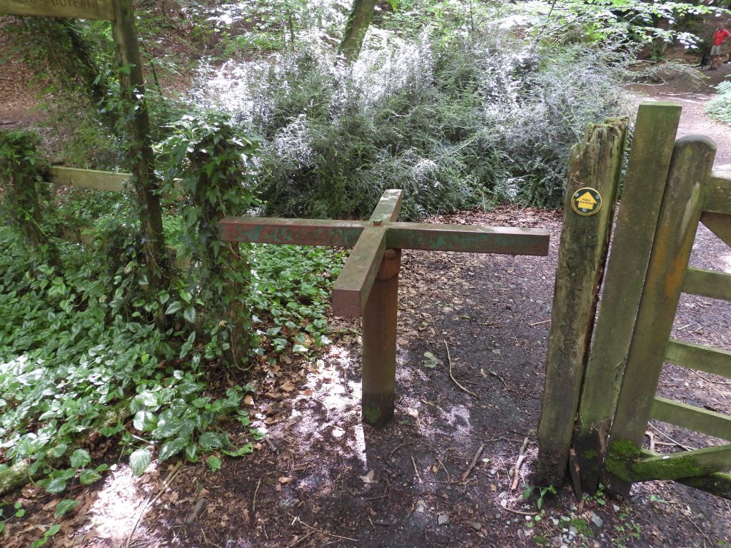
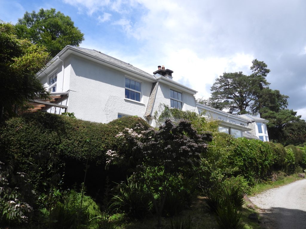
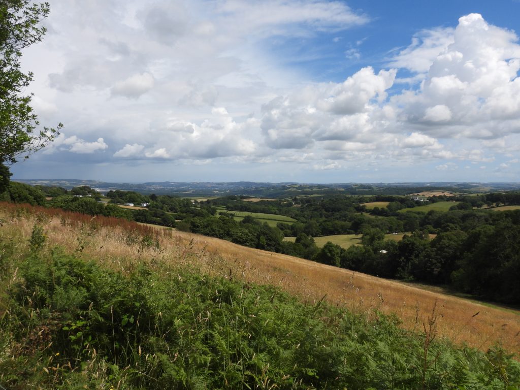
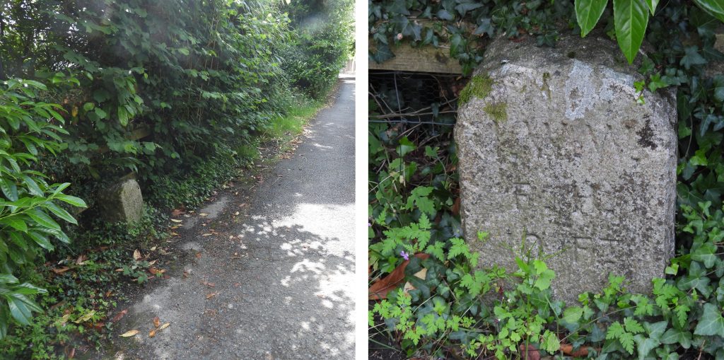
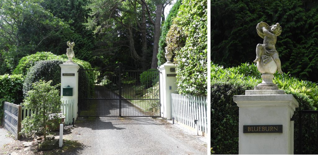
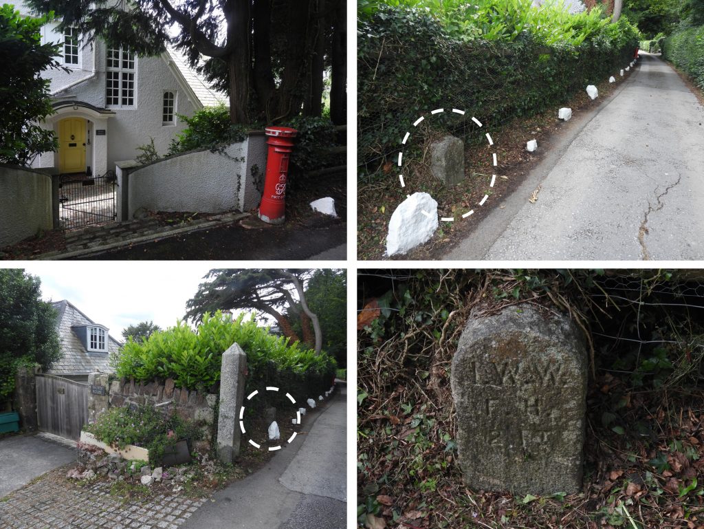
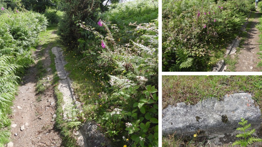
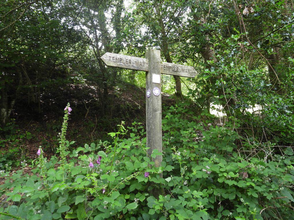
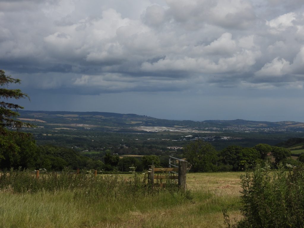
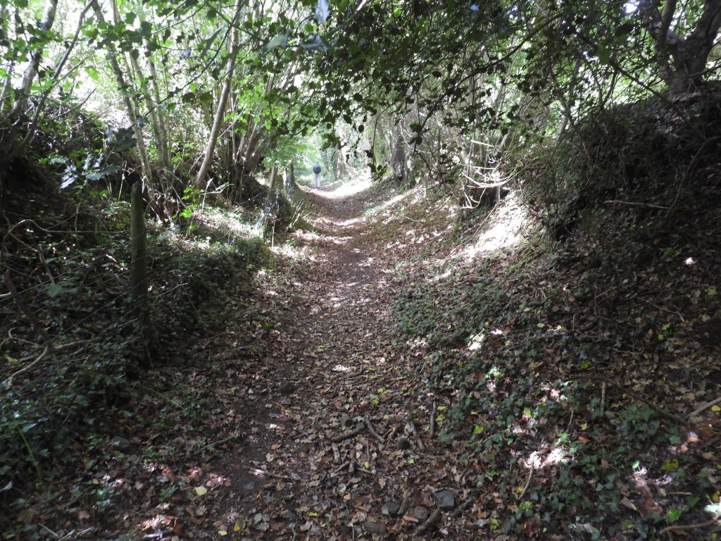
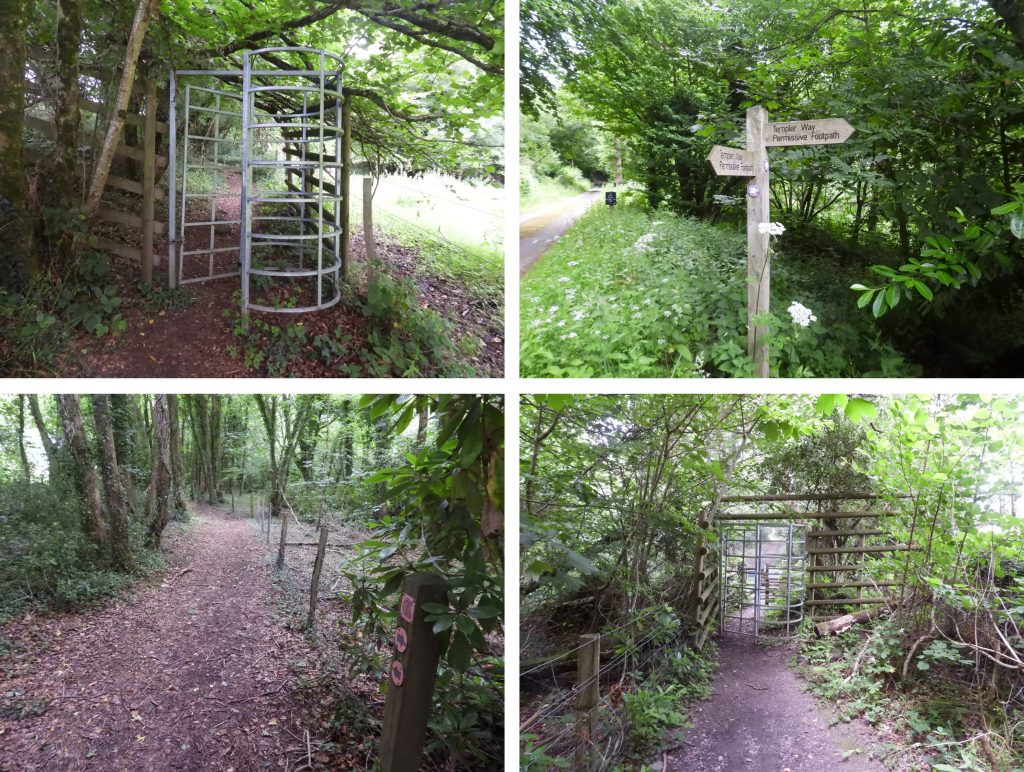
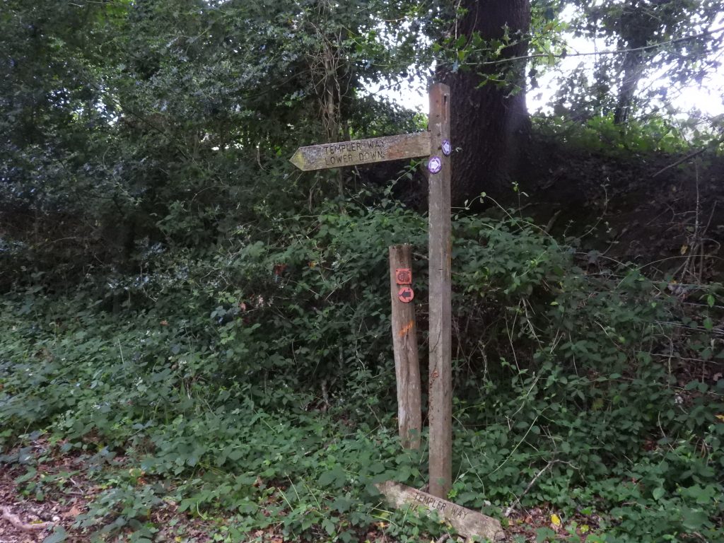
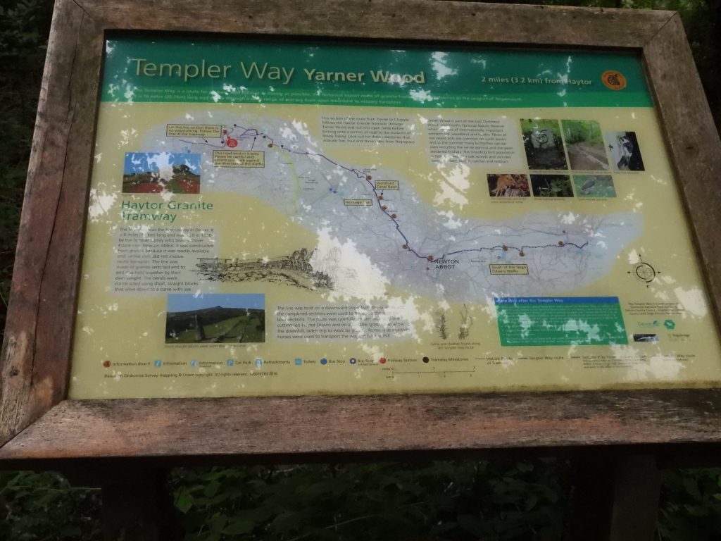
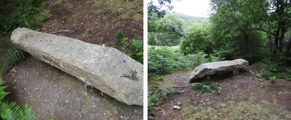
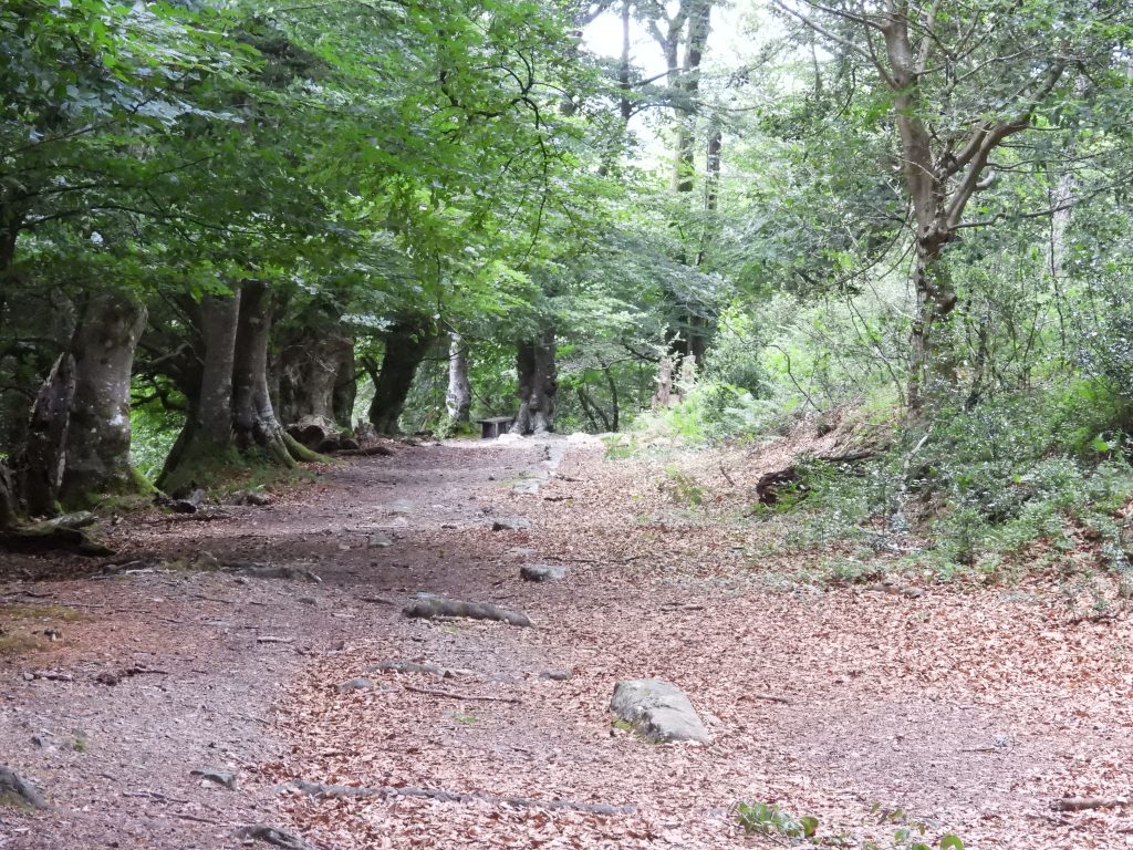
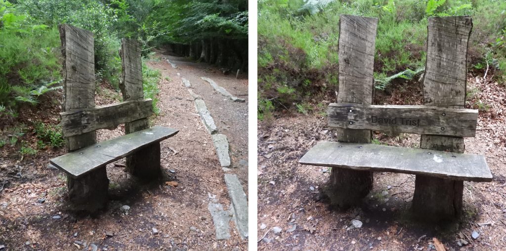
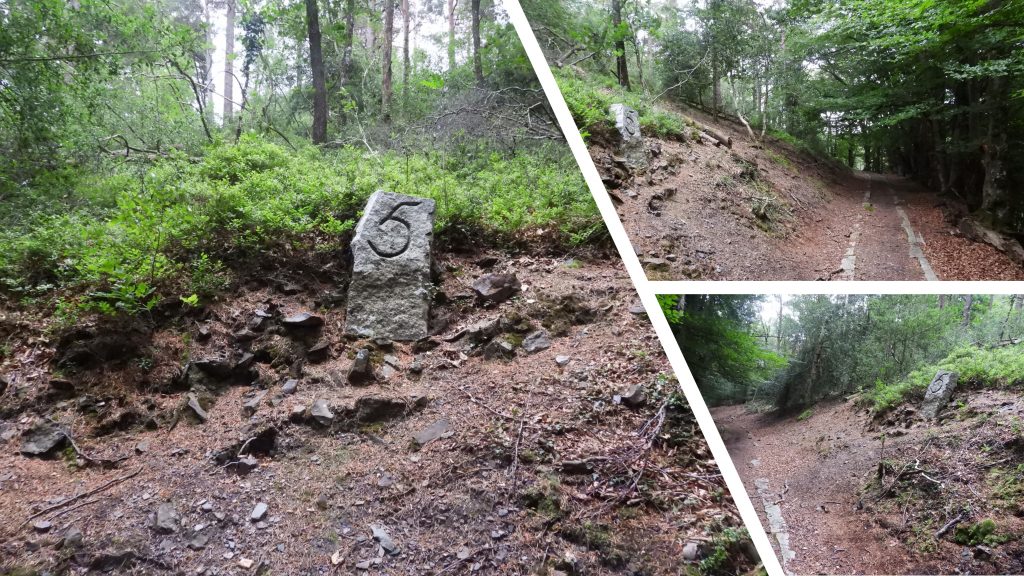
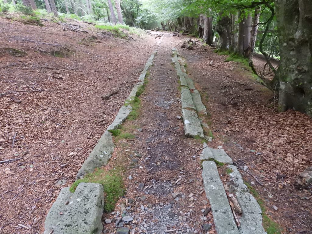
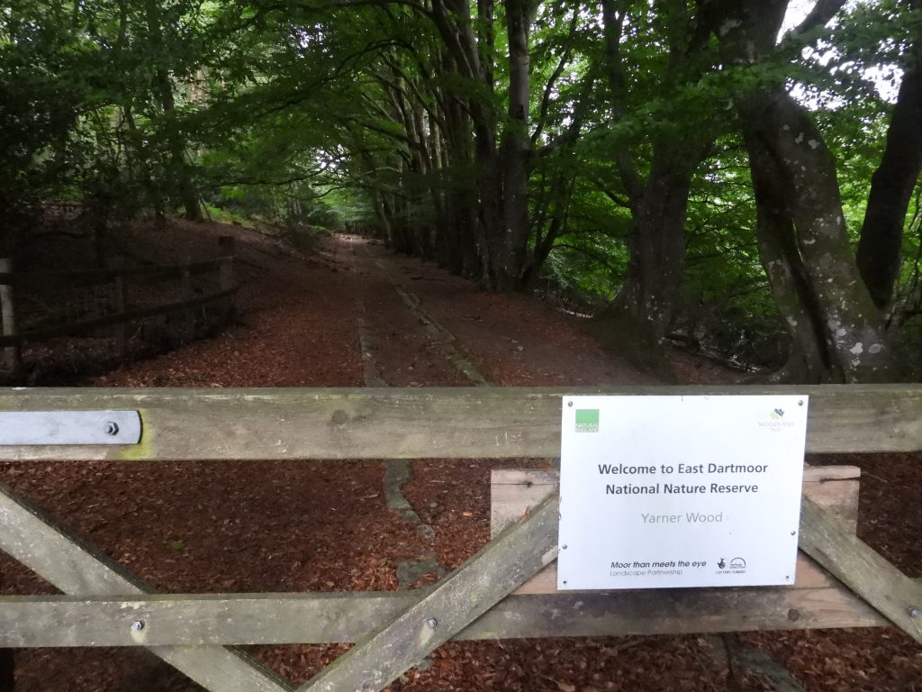
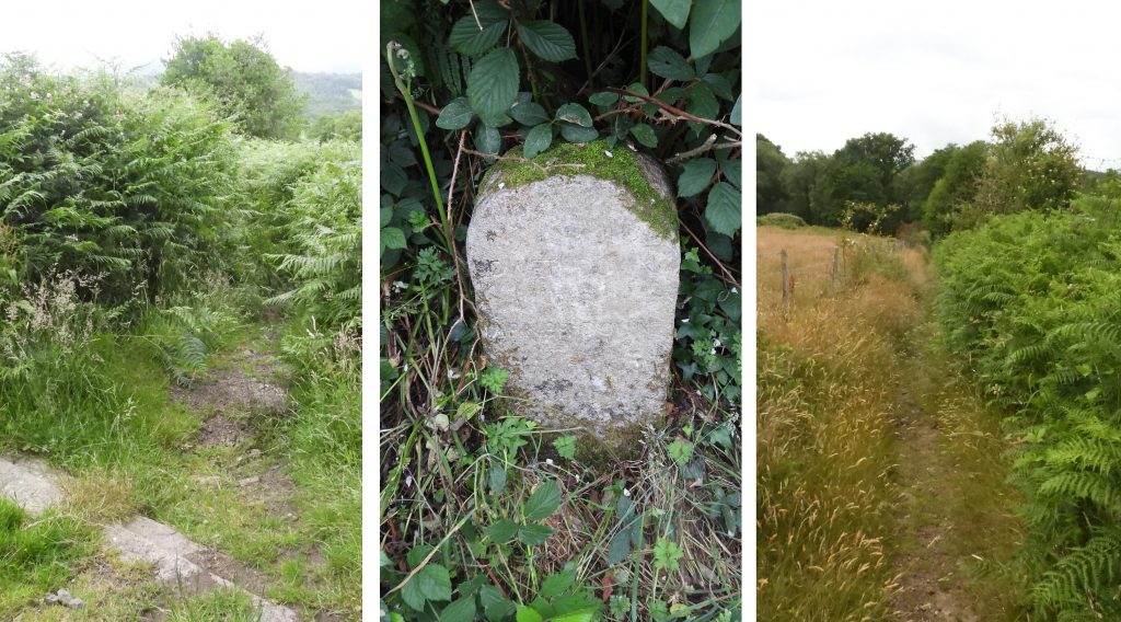
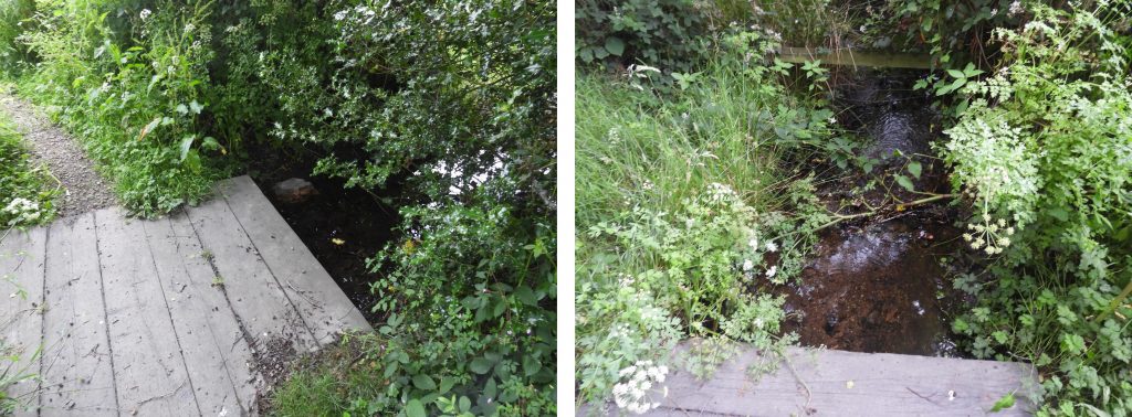
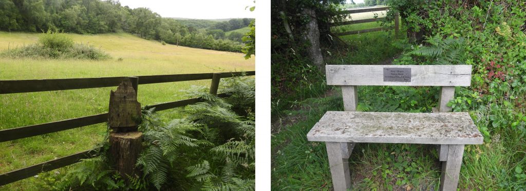
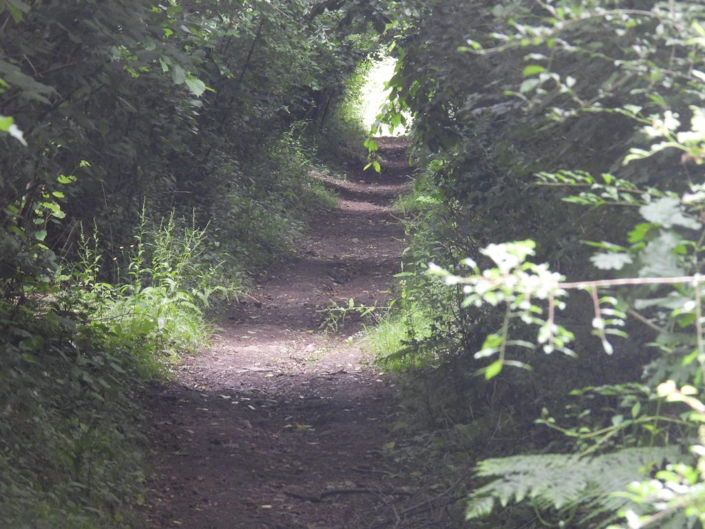
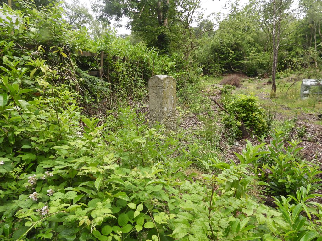
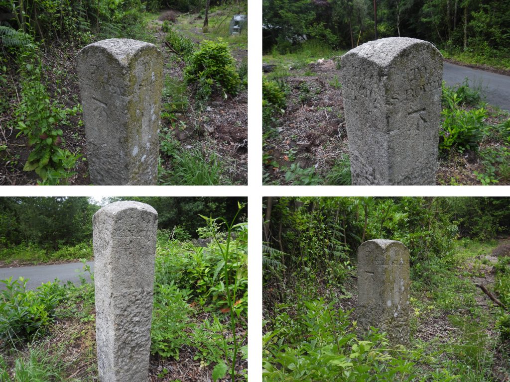
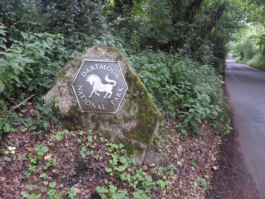
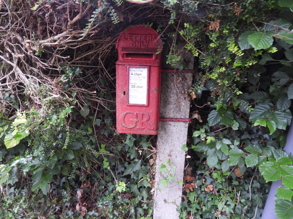
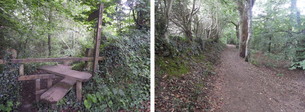
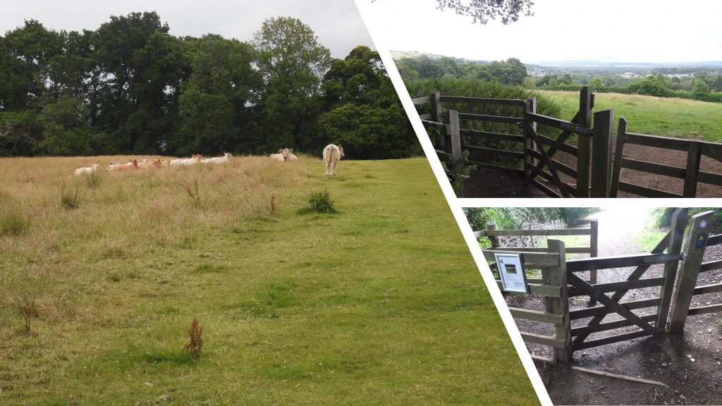
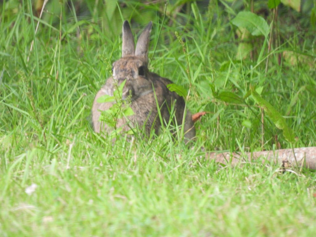
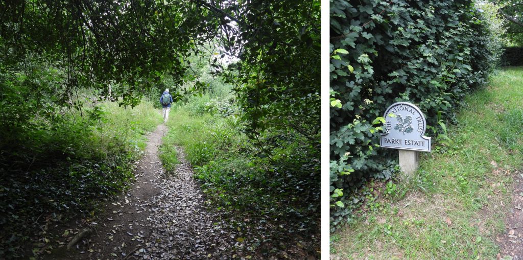
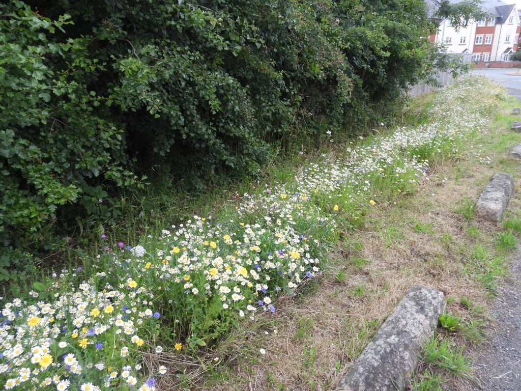
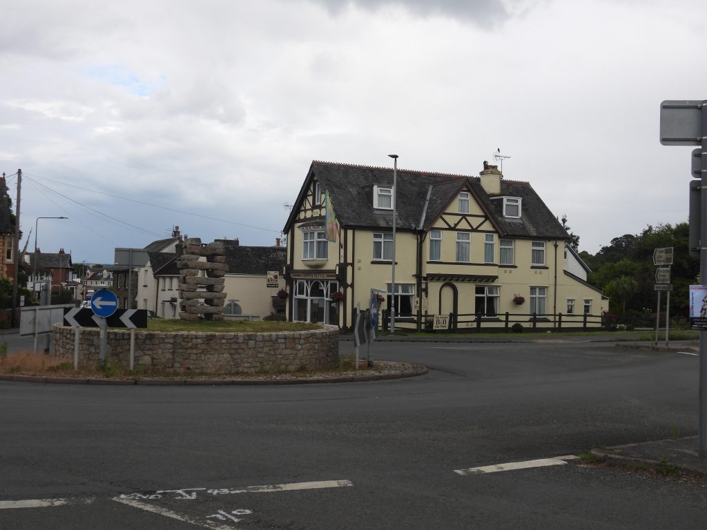
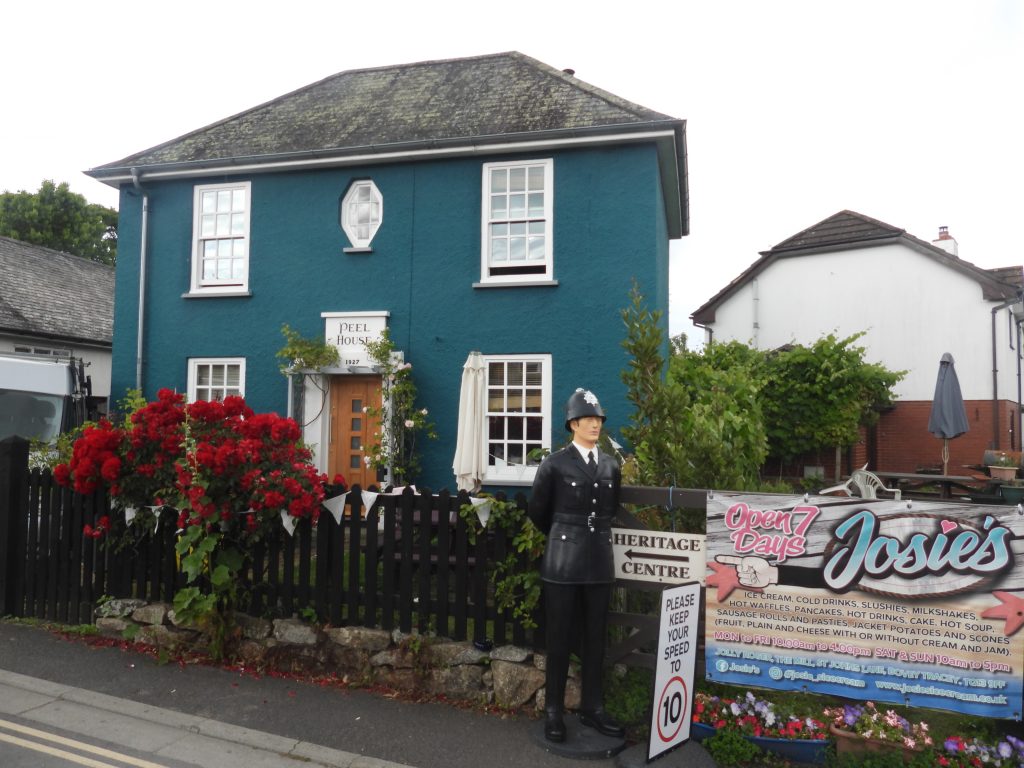
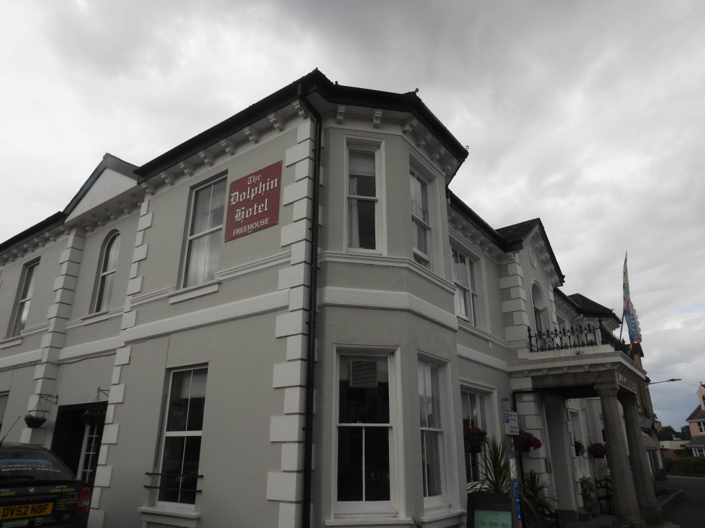
This GPS plot follows faithfully the stage 3 Dartmoor Way route except the slight deviation through Haytor Vale.Ashburton – photograph taken at junction of North Street, West Street and East Street (looking towards East Street). The Ashburton crest can be seen outside the museum. The crest has a teasel*, the sun and the moon (representing the wool, copper and tin industries respectively). The crest also shows the church and a St. Andrews cross. Note: *Teasels were used to ‘tease’ woollen cloth to improve its texture. Ashburton – West Street. Hard to believe this was once the main A38 just 50 years ago.No. 4 North Street was once the “Mermaid Inn” and is recorded (plaque) as being the lodgings for General Fairfax on 10th January 1646. It is thought by some to have been an early Church House Inn and the building dates from the early 15th century, with 16th century alterations (ref: Webb, P., 1995, The Pubs and Inns of Ashburton)The Market hall is now the Town Hall. It was built between 1849-50 with Lord Clinton as the architect. Interestingly, between 1933 and 1945, the Town Hall was used as the Fire Station Headquarters.The building with the scaffolding is a former Congregational Church and schoolrooms. It is recorded that the church was erected in 1739 on the site of the barn. Of interest is that there was a public house in front of it (North Star Inn) but was demolished in 1850, when the later part of the church was built. The church could be accessed in secret through the inn ! 38 North Street, now named the “Meeting House”. This attractive building has late medieval origins (18th Century) and was first remodelled in early 19th century. Cleder Place, Ashburton is on the site of nos. 21-47 North Street (odd numbers) which were demolished in 1970. Ashburton was twinned with Cleder (Brittany) in 1975. This building is believed to date from the 17th century, and was originally known as the Barnstable Inn. Being on the route of the ‘Mariner’s Way’, it is thought to have been a stopping point between the north and south Devon coasts.This granite and iron drinking fountain, dates from c1901. It has a two stage octagonal base, with the lower stage being a trough for dogs. On west side (facing street) is an incised inscription, which reads: “In memory of Robert Edward Bovey late of Baddaford Staverton 27th Compy Imp Yeomanry. Killed in action fighting for his king and country at Mordwell S Africa, Sep 30th 1901”.The Victoria Inn is thought to date back to the 15th century although it has only been an inn for around 100 years. Apparently it is known to the locals as the ‘First and Last’ as it is the first pub going into Ashburton on North Street and last coming out again. The building was once part of a series of weavers’ cottages (ref: Quick, T., 1992, Dartmoor Inns, 130-1). Views of the Great Bridge and the river Ashburn. Please note that the bridge is beyond the point where the Dartmoor Way exits North Street (on the opposite side of the river), so some retracing of steps is needed if this bridge is viewed.There is a benchmark on the Great Bridge and is referenced B.M 264.4. The National Library of Scotland Maps from 19th century show this benchmark as being north facing on the south wall, but in actual fact its on the opposite wall.The Dartmoor Way leaves North Street via this narrow opening and steps, which are officially labelled as Ashburton Footpath 1The path below the “Terrace Walk” is the route taken by the Dartmoor Way. The police helicopter was hovering overhead.Ashburton Footpath 2 crosses a few fields and over a couple of stiles en-route to Cuddyford CrossEn-route to Woodencliff Wood and Whiddon Scrubs takes the explorer through a kissing gate and across a field before reaching a gate. The white building is Lurgecombe farmstead.Views of the path through Woodencliff Wood and Whiddon Scrubs is officially named Ashburton Footpath 3. The path is a beautiful walk with old iron gates, granite gateposts and benches being seen en-route.Kissing gate, granite gatepost and wooden gate at north end of Whidden Scrubs.Waterleat ford close to the former Whiddon Tin Mine.Climbing the bridlepath between Waterleat ford and Lower Whiddon on Ashburton footpath 19.‘Lower Whiddon’ farmstead is shown separately on early 20th century maps but as part of ‘Whiddon’ on 19th century maps. There is documentary evidence suggesting its existence in the early 16th century (Source: HER). Higher Whiddon (like ‘Lower Whiddon’), is also separately shown on early 20th century maps but as part of ‘Whiddon’ on 19th century maps. ‘Whiddon’ was known as ‘Wheddoune’ in early 16th century.Victors Bench near the junction of the lane leading to Whiddon and what is believed to have been a Transhumance Route from Cockington to Dartmoor. The weld marking on one of the wheels reads: “V.Hichen 8.2.2000”. The second weld marking on the second wheel is barely legible.Victors Bench has a visitors book, which was duly signed during a brief coffee stop.Head of Whiddon Lane – Victors Bench can just be seen on the far left of the photograph.The first glimpse of Haytor through the treesOwlcombe Cross marked Owlacombe Cross on OS Maps. Halsanger Cross. The Dartmoor Way follows the Bagtor roadViews from Halsanger CrossHalshanger Manor was built on the site of a 12th/13th century manor house. The original manor house was totally demolished in 1806 with the present house being built in 1807. View from Halsanger Cross / Bagtor lane looking east.Approaching Langworthy Bridge.Mountsland Farm was first mentioned in the 13th century.West Horridge – Horridge has historically been recorded as ‘Holerigge’, ‘Holrig’, ‘Holrigge’, ‘Holrugge’, ‘Haurig’ and ‘Horugg’. 19th century maps show the farmhouse as an L-shaped range of buildings, with two additional structures shown to the east, either side of the road. East Horridge comprises just one used building in modern times – a two storied barn. The farmhouse, which was located across the lane was destroyed by troops in the second world war. The farmstead was shown on the Tithe Map.Sheep at East HorridgeWestabrook Farm below Bagtor woods dates to at least the early-mid 19th century. The farm sign calls it “Westerbrook Farm” but maps as recent as mid-20th century state WestabrookWestabrook bridge over the River Sig.Entrance to Bagtor House, which was a small domesday manor (of Bagathora) which developed into a mansion. The main part of Bagtor House is from Georgian period.At the entrance to Bagtor House, there is a “GR” postbox, a “Penalty” notice for not fastening the gate plus a benchmark Bagtor Barton farmstead when first mentioned in the Domesday Book (of 1086)Bagtor Lodge. The author noted a standing stone in the field behind, which is most likely an animal scratching post.Views from the lane between Bagtor Lodge and Bagtor MillChilling squirrelModern buildings at Bagtor MeadowBagtor MillBirchanger Cross and adjacent house. The Dartmoor Way turns at the cross from an easterly direction to a northerly direction towards Smokey Cross.The footpath leading off the Birchanger Cross / Smokey Cross road leads down to the infant River LemonThe infant River Lemon with a rather large clapper spanning it.On closer inspection of the clapper a plaque can be found, which reads: “In Memory of HILDA MARY TAYLOR 1920-2006 Lover of Dartmoor”The path from the clapper bridge leading to Pinchaford Ball Gate between the fields en-route to Pinchaford BallAscending Pinchaford Ball from the River Lemon is the biggest ascent on stage 3. There is a path through the bracken with the outcrops of Pinchaford Ball Tor becoming more evident as the hill is climbed. The author came across a large patch of Sedum Anglicum (English Stonecrop) which is described in W. Keble Martin’s “The Concise British Flora in Colour” (Plate 33) as being prostrate with short erect, forked flower stems, leaves spurred, found on rocks especially granite and sandy soil. Flowers June – August.Some of the views climbing Pinchaford Ball. Left: Bag Tor, Top Right: Looking south to South Hams, Bottom Right: Rippon Tor.Lone tree near outcrop of Pinchaford Ball TorThe author believes this is a Female Yellowhammer – confirmation or otherwise would be appreciated.Female Yellowhammer on Pinchaford BallPinchaford Ball Tor with its logan stone was called Punchaford Ball by William Crossing.Iron Pen on Pinchaford BallPinchaford Ball cairn with Haytor Rocks.Pinchaford Ball Cairn is named in Jeremy Butler’s Dartmoor Atlas of Antiquities (Volume One – The East – Map 4 – item 4) as “Haytor South East Cairn” . Butler further states that: “little of the original structure is left, merely a quantity of scattered stones surrounding a large pit and a few set stones around the edge. Most of the stones have been removed and the cairn is now 0.4m high at most with a diameter of 24m. Probably the structure was too close to the road to survive intact”.Approaching Haytor Rocks, which are probably the most iconic and photographed rocks on Dartmoor. William Crossing and Eric Hemery spell the name as Hey Tor. The western outcrop is sometimes called Low Man. Views towards Rippon Tor (left) and Saddle Tor (right)Close up of Saddle Tor. Viewpoint plaque at Haytor upper car park. More views of Haytor Rocks. The Dartmoor Way passes to the right (east) of the outcrops.Haytor Quarry is a delightful short diversion off the Dartmoor Way and an ideal spot for lunch. It is one of five quarries in the area which were worked from 1820 onwards by George Templer. This piece of winding machinery in the quarry is affectionally known to come as “The Mangle”.A Pied Wagtail amongst the Water Lilies at Haytor Quarry. Also known as the Water Wagtail as it is often seen near ponds, streams and reservoirs.More views of the Pied Wagtail who was catching flies and insects near and across the surface of the quarry.There are two iron rings which are still extant in the quarry, which were most likely used for tensioning cables to help secure a crane to the quarry floor.These fixed iron pegs inserted into and earthfast piece of granite also most likely used for tensioning cables to help secure a crane to the quarry floor.Granite “spoil” at Haytor. Of interest, mentioned by Minchinton, W. E., 1976, Industrial Archaeology in Devon: “For a period several thousand tons of granite were exported each year and used in the construction of the British Museum, National Gallery, London Bridge etc. In 1850 100 men were employed; but by 1858 the trade had declined due to competition from coastal Cornish quarries and the quarries were closed in 1865”.This is a branch of the granite tramway, which was in use between 1820 and 1858 to transport granite using horse drawn wagons from the quarries at and around Haytor to the terminus of the Stover Canal at Teigngrace. From that point it could then be transported to the coast at Teignmouth.The granite tramway was constructed under the supervision of George Templer, whose father James had built the canal. The Templer Way, is a walk between Haytor and Teignmouth which traces the historic route of the transportation of granite. The “logo” of the Templer Way cleverly combines the wheel of the tramway with a rudder of a barge / boat used on the canal.There are some curiosities along the granite tramway in the shape of benchmarks and stonemasons marks. This benchmark (?) and X (?) can be found near to the Templer Way markers and the granite “points”.Granite tramway points with Haytor Rocks in the distance.Another view of the Granite points. The left tramway heads to Haytor quarry and the tramway straight ahead heads towards Holwell quarry. The Templer Way marker is located between the tramways.Curious ponies in the tramway as the author was “mud painting” some stonemasons inscribed marks.More stonemasons marks – a possible benchmark (?), a W (?) and a 51 (?)“B” (?) stonemasons markBelted Galloways inspecting some points on the tramwayAnother “51” (?) stonemason marks. This one is at SX76396 77652The boulder in the foreground has a drilled hole in it – another curiosityBenchmark with bolt on the tramwayPossible “P” at SX76579 77645This standing stone next to the tramway is close to a “C road” which the tramway (and the Dartmoor Way) crosses en-route to Yarner Wood. The author at this point made a diversion through Haytor Vale and a pathway by “The Cot” for refreshment at the Rock Inn and because that route in his humble opinion is slightly more scenic. The official Dartmoor Way follows the B3387 alongside the tramway. The authors diversion picks up the Dartmoor Way once more at the junction of the lane from “The Cot” and the B3387 and lengthened his walk by several hundreds of metres.This direction post is close to the turning to Haytor Vale. It is dated from early 19th century and is inscribed on all fours faces (albeit very faint). On the south-west side is carved “to Widecombe”, on the north-west side “to Manaton”, on the north-east side “to Bovey”, and on the south-east side (side shown in picture) “to Ashburton”. Turning to Haytor Vale from B3387, showing the location of the direction post.“The Moors” – a relatively modern building at the top (west) end of Haytor ValeWild poppies in the hedgerow at Haytor ValeThe Rock Inn, Haytor Vale. The inn is connected to a group of former workers cottages which were built around 1826 by George Templer to house his workers from the nearby Haytor Vale Quarry. The Rock Inn was constructed at the same time.Inside the inn there is a eclectic mix of artefacts. For reason unknown, there is a copy of the Magna Carta on one of the walls.The bar staff at the inn showed the author this printed sheet of the history of the inn, which makes interesting readingOn leaving the Rock Inn, the author was advised to walk through the passageway (known locally as “The Tunnel”) as it lead to Church Path and the Iron Mine thence onto the B3387 to rejoin the Dartmoor WayHaytor Iron Mine. Recorded by Helen Harris (1968, Industrial Archaeology of Dartmoor) as follows: “The most productive of the iron mines were in Ilsington parish. The Haytor Iron Mine, worked first at the surface and later by adit was in production in the early and middle years of the 19th century, and also at times during the early part of the 20th century up to 1921. An iron ore, magnetite was worked with a variety of other minerals. Local people still remember the ore being brought from the mines to the Bovey road near Blue Burn by an elaborate tramway and carted along the road by traction engines”.An unusual feature in the form of a turnstile between Church Path and the lane (Ilsington Footpath 5) leading back to the B3387.The Shotts – in estate agent parlance, this is a 7 bedroom detached property with a “magical, fairy tale feel” as inside it has lots of exquisite Moroccan tiles. It has fabulous views.The view from the lane next to the Shotts, down towards the Teign estuary. In the lane leading back to the B3387 are three inscribed standing stones. The first one is close to the Shotts and is inscribed “I.W.W F.H 2 FT”, which stands for Ilsington Water Works Fire Hydrant 2 feet. The date of the stone is unknown but the author speculates late 19th / early 20th century and would welcome any additional information if anyone has any. It is located at SX77490 77190The second inscribed standing stone is located near to a house called “Blueburn”. It is inscribed “I.W.W F.H 10 FT” (Ilsington Water Works Fire Hydrant 10 feet) and is located at SX77644 77270Entrance to “Blueburn”Shotts House is located near the east end of the lane and is where the third inscribed stone. It is inscribed “I.W.W F.H 2 FT” (Ilsington Water Works Fire Hydrant 2 feet) and is located at SX77853 77343Rejoining the Dartmoor Way. The route follows the Templer Way with the granite tramway. There appears to be evidence of more stonemasons inscribed marks along the section leading to Yarner WoodFingerpost of Templer Way with the Dartmoor Way “circles” attached to the post.Views to Preston Manor clay pits (White Pit Quarry) just before the Dartmoor Way / Templer Way enters Yarner WoodEntering Yarner WoodThe route in Yarner Wood includes negotiating two large kissing gates.Fingerpost to Lower Down. The “arm” pointing to Haytor is lying on the ground.Templer Way notice board in Yarner WoodLovely granite bench inscribed “Rosie” is next to the path.The tramway through Yarner WoodWooden bench marked “David Trist” next to the tramway at SX78498 78440This granite marker, indicates the point on the tramway that is 5 miles from Teigngrace. The tramway is remarkably preserved in parts of Yarner Wood.Leaving Yarner Wood, which is part of East Dartmoor National Nature Reserve as indicated by the sign on the gate.The Dartmoor Way leaves the Templer Way a short distance after it leaves Yarner Wood, close to the point marked Lower Down on the OS map. The footpath leads downhill to Reddaford Water. Alongside the path is an inscribed stone (albeit very faint) marked “Lower Down of Yarner Down” (SX79135 78438). This stone was one of four stones, which marked the grazing rights of the occupants of Shewte, when it was common land. (Note: There is another stone inscribed “Shewte Rights” close by). The whole area at one time was called Yarner Down and the land below the tramway was called Lower Down, hence the inscription “Lower Down of Yarner Down”. Ref: Dartmoor Boundary Markers, 2nd Edition (page 245) by Dave Brewer.The footpath leading to Reddaford Water crosses the Bovey Pottery Leat at a bridge made of wooden planks. The leat was dug by the Bovey Tracey Pottery Company (established 1843) from its source near Becky Falls.A short distance below the Pottery Leat is a seat fashioned from a tree trunk which sits opposite a bench, which has a plaque on it, which reads: “Alan’s Bench Yarner Wood In loving memory of Alan” Bottom end of the path leading from Lower Down to Reddaford WaterThis guidestone is at Reddaford Water, just a few metres from where the Dartmoor Way meets the Bovey Tracey / Manaton road having descended the hill along a footpath near Lower Down. The Reddaford Water guidestone has inscriptions which give directions to Lustleigh, South Bovey (Bovey Tracey) and Manaton. It also has an OS benchmark cut into its surface.Dartmoor National Park sign on Bovey Tracey – Manaton road.“GR” letterbox near the road junction leading to Blackmoor Copse (and close to Shewte).Blackmoor Copse at north-west end of Parke EstateGrazing land in Parke Estate. These cows appeared to know rain was on its way as they were sitting down to ensure getting their dry patches of ground.This rabbit was chilling out on the Parke Estate and appeared to be staring at the author the whole time as he passed.The Parke Estate is recorded as having existed in Saxon times and is mentioned in Domesday Survey. However, it was not referred to as ‘the Parke’ until 1596. Prior to 1596 it had been referred to as ‘Richmond Land’ after the Duchess of Richmond who inherited estate in 1487. Ref: Molland, S., 1996, Historical Summary of Parke, Bovey Tracey for the National TrustWildflowers next to B3387 near the roundabout of A382Roundabout on A382 with Copper Kettle (Licensed Tearoom & Restaurant) Peel House at junction of Station Road and St. John’s Lane with a date over the door (1927). This building was a former Police Station before closure in c2001. It has an interesting octagonal window over the front door.The Dolphin Hotel in Station Road dates from circa 1850-60 and is a grade II listed building.