A collection of walks, discoveries, insights and pictures of exploring Dartmoor National Park
November 3, 2021
Yeoland Mine Bound Stones
There was a East Yeoland Mine reported in 1848 and West Yeoland Mine reported in 1851 as recorded in Dave Brewers 2nd edition Dartmoor Boundary Markers book (P209). These mine reports are complemented with a visual record of a Yeoland Mine shown on 19th Century maps with it being located to the east of the A386 on Roborough Common near Yeoland Farm. Also on 19th Century maps, to the east of the aforementioned location of the Yeoland Mine, there are four “stones” marked. These stones mark out a roughly rectangular shape from Yeoland Farm enclosures in the east and the former Plymouth and Dartmoor Tramway in the west. In the Dave Brewer publication, it is recorded that the four “bound” stones represent an area leased to James Yonge, Joseph Square and Ponsford Fisher by Lord Roborough in 1847.
The mine was put up for sale in 1857, this in spite that £13,000 (equivalent to £1.4m in 2021) worth of black tin being mined in 1856. Dave Brewer in his book, further states that the mine finally closed around 1890 (although he states this date is unconfirmed).
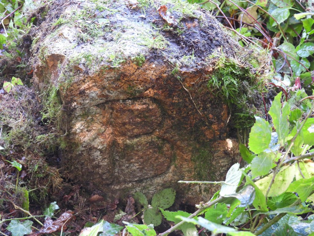
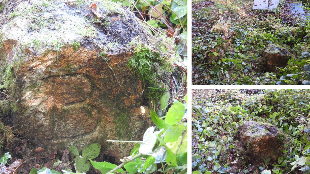
The author is grateful to Mark Fenlon for additional information is finding the B inscribed stone.
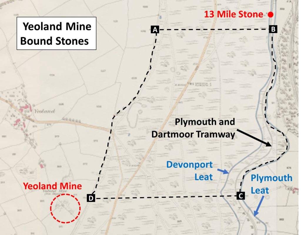
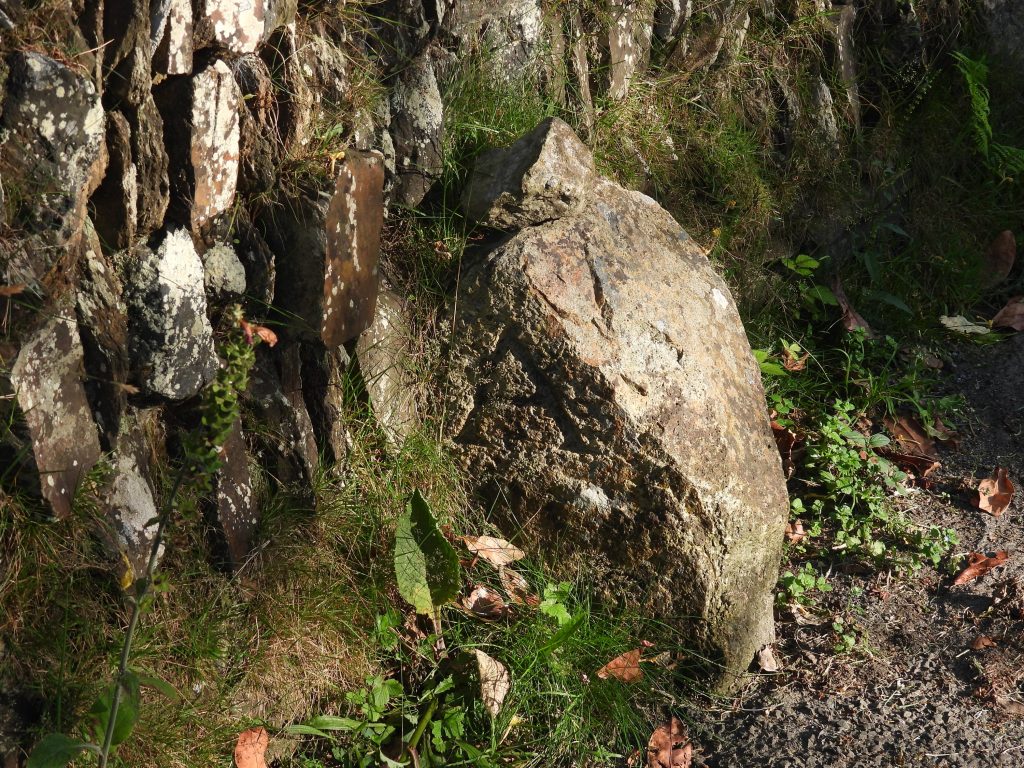
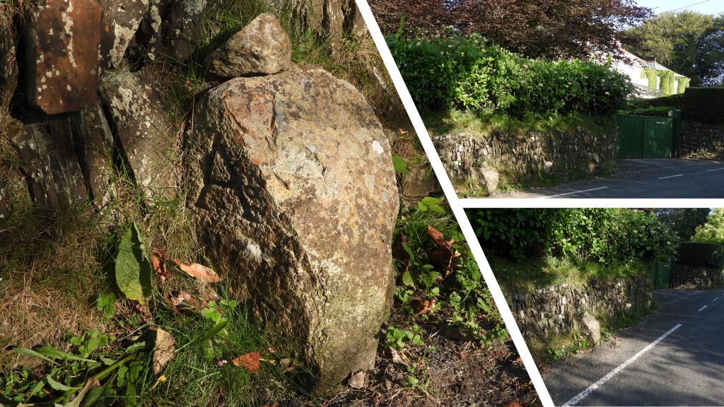
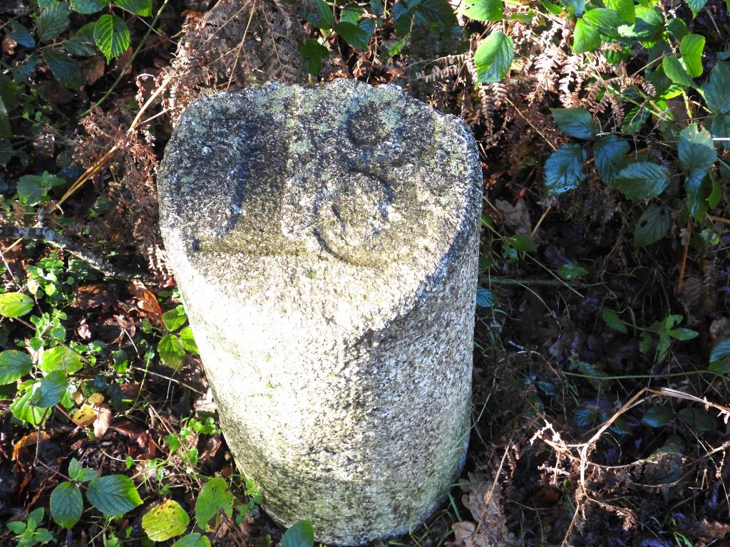
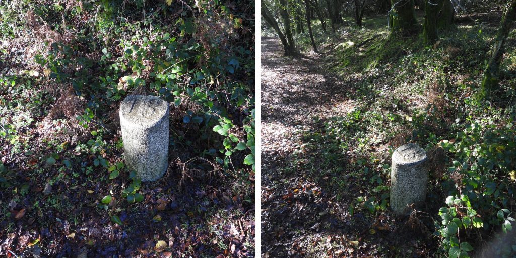
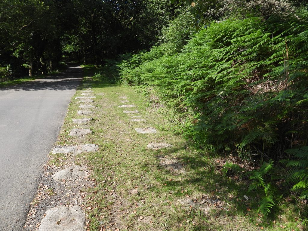
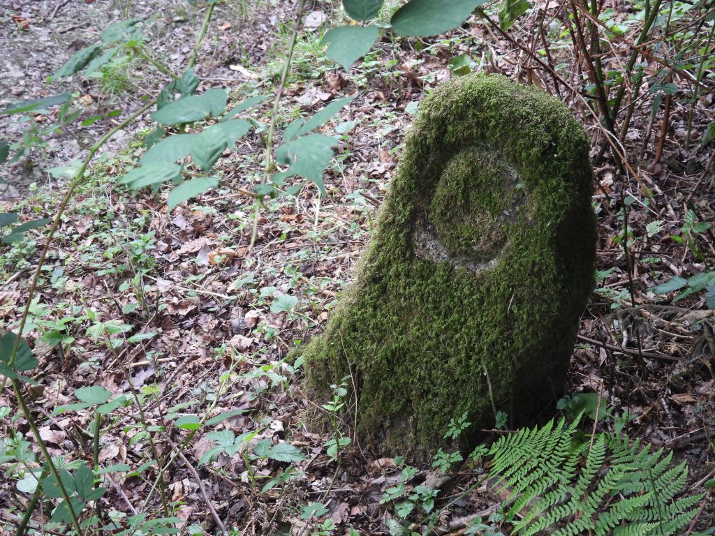
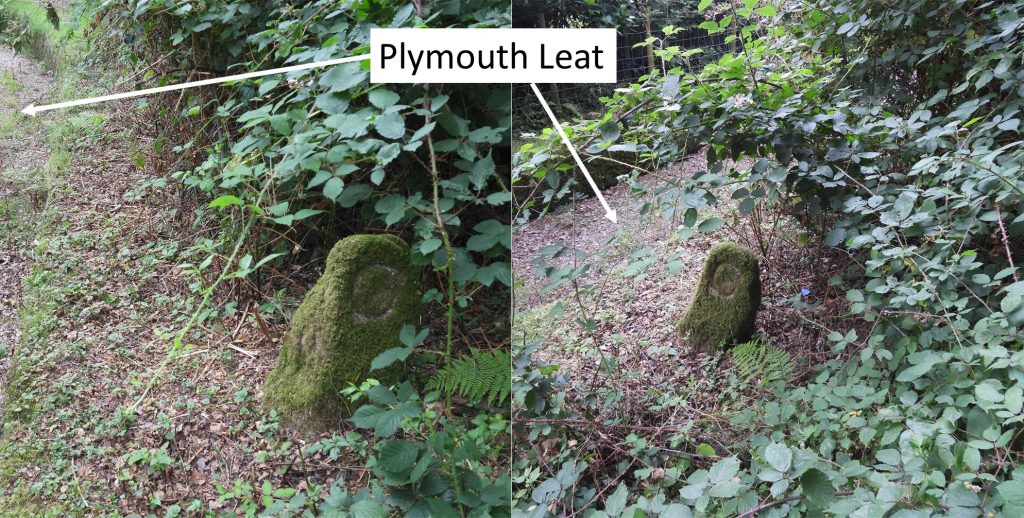
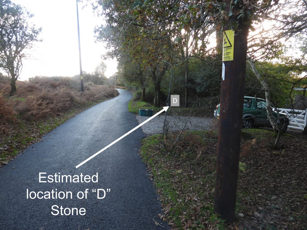
The map shows the area leased by Lord Roborough in 1847. The lease area was described as “All that part and portion of Roborough Down bounded on the eastern and western sides by the hedges and fences of lands already inclosed (sic), and on the northern side by a straight line to be drawn from a granite post inscribed A set up on the western side of said Down to another granite post inscribed B set up on the eastern side…..and on the southern side by a straight line to be drawn from a granite post inscribed C set up on the eastern side of the said Down to another granite post inscribed D on the western side”. The first of the granite posts at the north west corner of the defined area can be found on Golf Links Road.The location of the A inscribed stone is SX51513 66677.Near the eastern side of the area defined by the four granite posts (and close to inscribed granite post B) lies the 13 mile marker of the former Plymouth and Dartmoor Tramway. The horse drawn tramway was opened in 1823 and would have been in operation when the granite posts were put in situ. At this point the tramway lies between the two old water courses of Devonport Leat and Plymouth Leat.The 13 mile stone is located at SX51986 66727. The granite post at the north east corner of the defined area can be found amongst some undergrowth, next to the old Plymouth Leat on the edge of the property named ‘Whinacre’. The author asked the owner of the property if he could clear the stone from vegetation and was told the land here belongs to the Maristow Estate. That said, a polite friendly request to conduct some gardening was in order as the stone is so close to the aforementioned property.The B inscribed stone lies just a few 10’s of metres from the 13 mile stone and can be located at SX51990 66668.Along route between the B and C inscribed granite posts, there is still evidence (granite setts) of the former Plymouth and Dartmoor Tramway. The tramway gauge was 4ft 6in (1,372 mm).The C inscribed granite post is located at SX51835 65976. The granite post at the south east corner of the defined area can be found amongst some undergrowth, next to the old Plymouth Leat as can be seen in the photographs. The only stone which remains elusive is inscribed stone D. The author spoke to the owner of September Cottage, whose boundary is where the stone is most probably located (using the National Library of Scotland’s online mapping service, aka a side-by-side maps). The gentleman stated he had lived at the property for 12 years and had never heard of let alone seen the stone.Using the National Library of Scotland’s online mapping service, the stone should be at SX51218 65986. The author asked the owner of the property if he could use his trekking pole to have a quick “rummage” around the undergrowth (beyond the fence). Unfortunately, the stone couldn’t be located, albeit there were plenty of stones underneath the vegetation making up an old stone wall. There is a high probability that the stone is still extant, but some serious gardening would be needed !