Dartmoor Explorations

A collection of walks, discoveries, insights and pictures of exploring Dartmoor National Park

Newland’s Brakes Longhouse

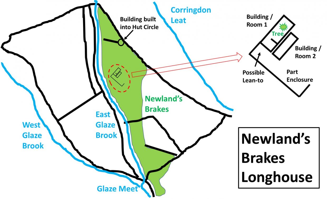
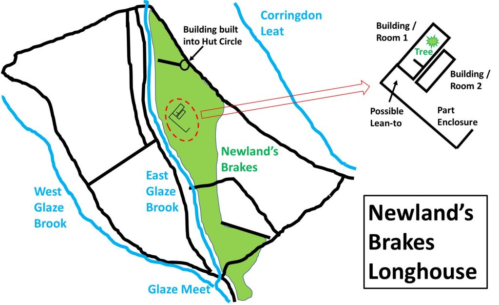
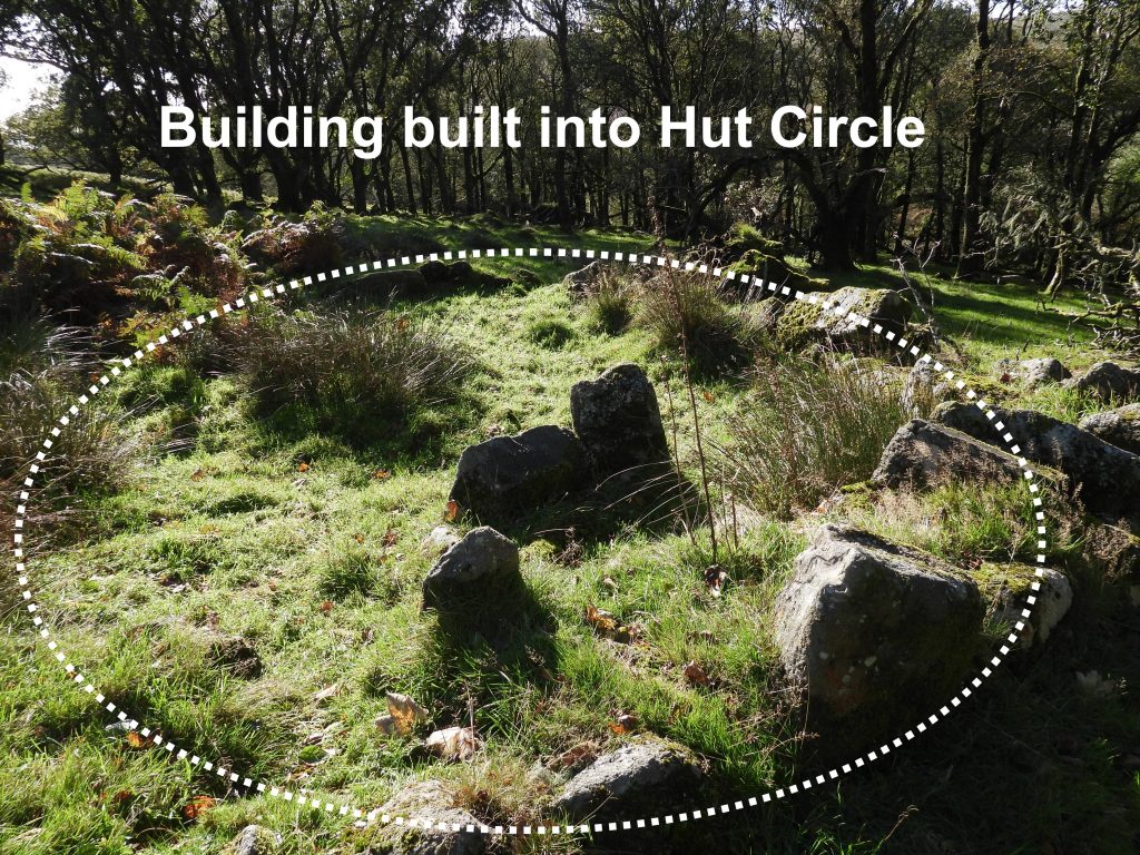
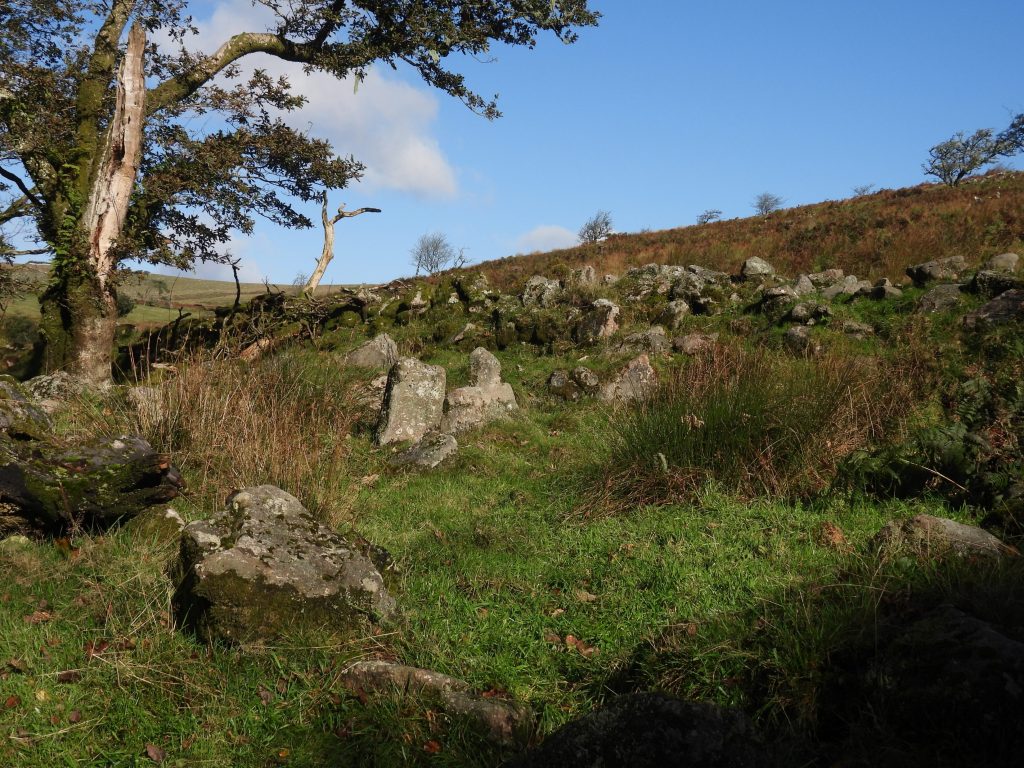
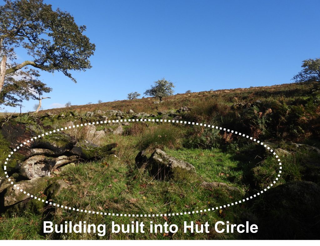
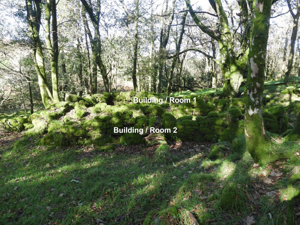
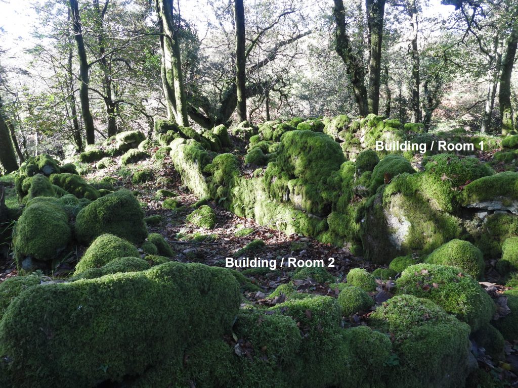
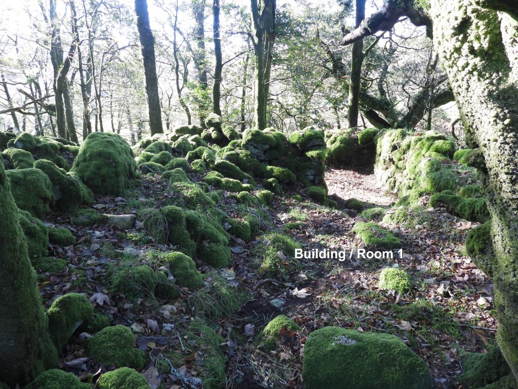
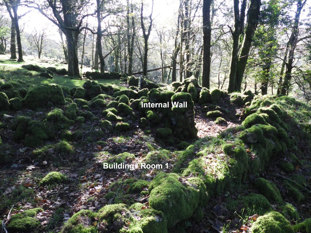
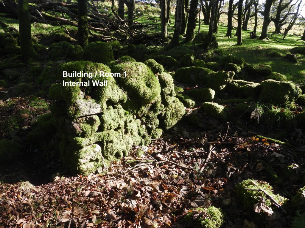
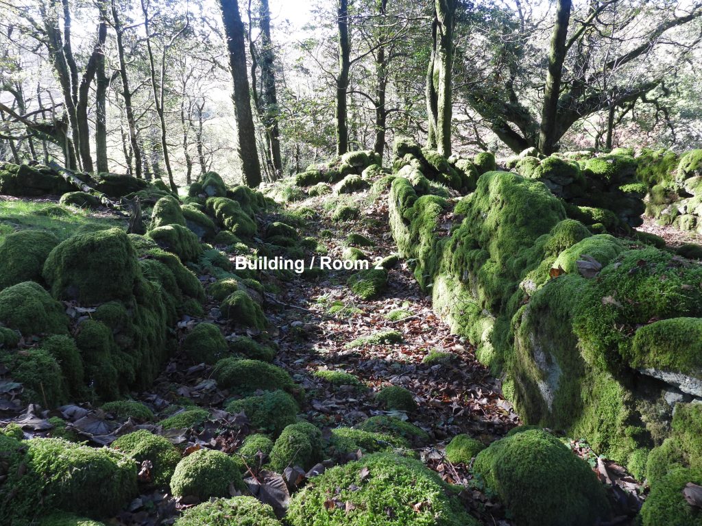
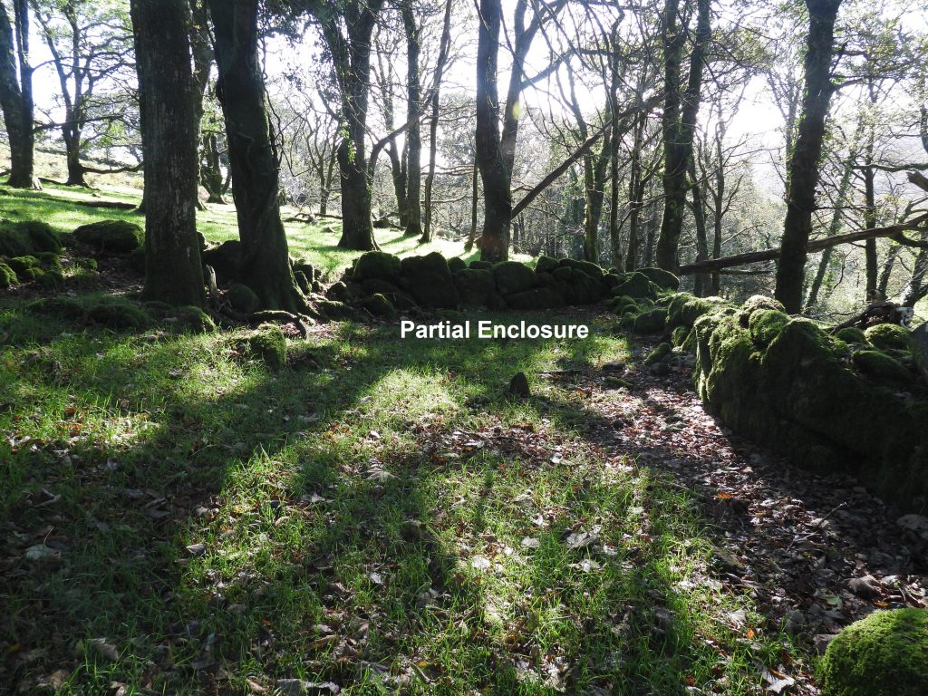
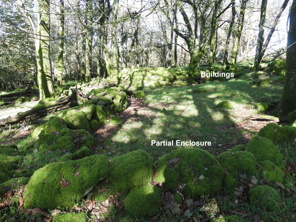
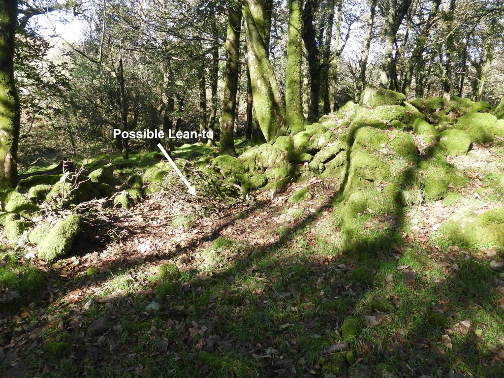
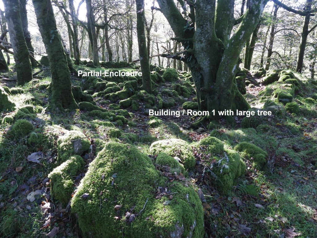
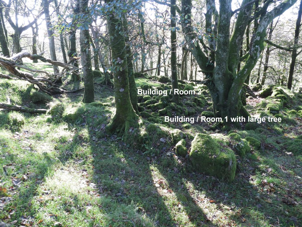
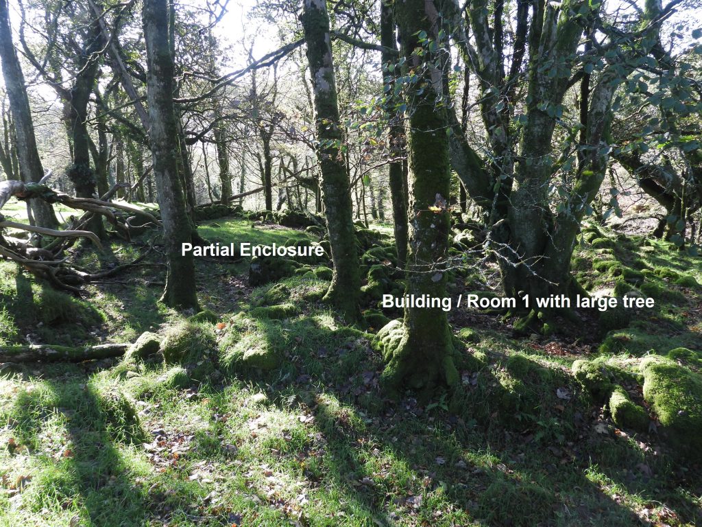
Near the East Glaze Brook and Glaze Meet, in an enclosed area of woodland called Newland’s Brakes are the remains of three buildings. Two of the buildings are side-by-side which have a length of walling forming a partial enclosure adjacent to them. The third building lies a short distance away to the north and appears to be a rebuilding of a prehistoric hut circle. This post covers all these features. The Heritage Gateway records that there is no name found yet for the farmstead, but the land tax of 1747 records – ‘William Bickford for Sagwills late Newlands’.

Newlands Brakes Map
Sketch map showing the locations of the buildings covered in this post
NB1
This building that appears to be a rebuilding of a prehistoric hut circle and lies immediately west of the cornditch bounding Newlands Brakes
NB2
The building which seems to be incorporated into an hut circle has a couple of uprights located at its centre.
NB3
This structure is located at SX66780 60694
NB4
From the Heritage Gateway, R.G.Hayes (1966-9) describes this structure as “a substantial two-roomed longhouse with lean-to”. It is also described by others as two separate buildings.
NB5
R.G.Haynes further describes that as the house stands in deciduous wood it is for that reason is has not become turfed over.
NB6
The Ordnance Survey Archaeology Division from 1977 describes the larger building (number 1 in this post) as being 14.0 meters by 6.0 meters overall, with walls 0.8 meters thick and a maximum height of 1.2 meters of dry-stone construction.
NB7
Building / Room 1 towards its lower (west end) has an internal wall, which appears to create a smaller internal room.
NB8
The small “internal” room at the west end of Building / Room 1 is located at SX66763 60623.
NB9
The Ordnance Survey Archaeology Division from 1977 describes the smaller building (number 2 in this post) as being 10.0 meters by 3.0 meters overall with similar wall construction and size. The centre of building / room 2 was recorded at SX66768 60618.
NB10
To the south lies two walls which are perpendicular to each other and are described as being a partial enclosure on the Heritage Gateway
NB11
The partial enclosure (by the southern wall) was recorded at SX66764 60608.
NB12
Just below (to the west) of the two buildings / rooms appears to be the location described in the Heritage Gateway as a “lean-to”. The location is SX66766 60611.
NB13
Building / Room 1 ruins now has a large tree within its walls. The centre of Building / Room 1 is located at SX66771 60625.
NB14
The two buildings / rooms taken from the north-east corner.
NB15
The partial enclosure can be seen from the north-east corner of building / room 1.


Total Page Visits: 951 - Today Page Visits: 1

Next Post

Previous Post

Leave a Reply

© 2024 Dartmoor Explorations

Theme by Anders Norén

Social media & sharing icons powered by UltimatelySocial