A collection of walks, discoveries, insights and pictures of exploring Dartmoor National Park
July 30, 2023
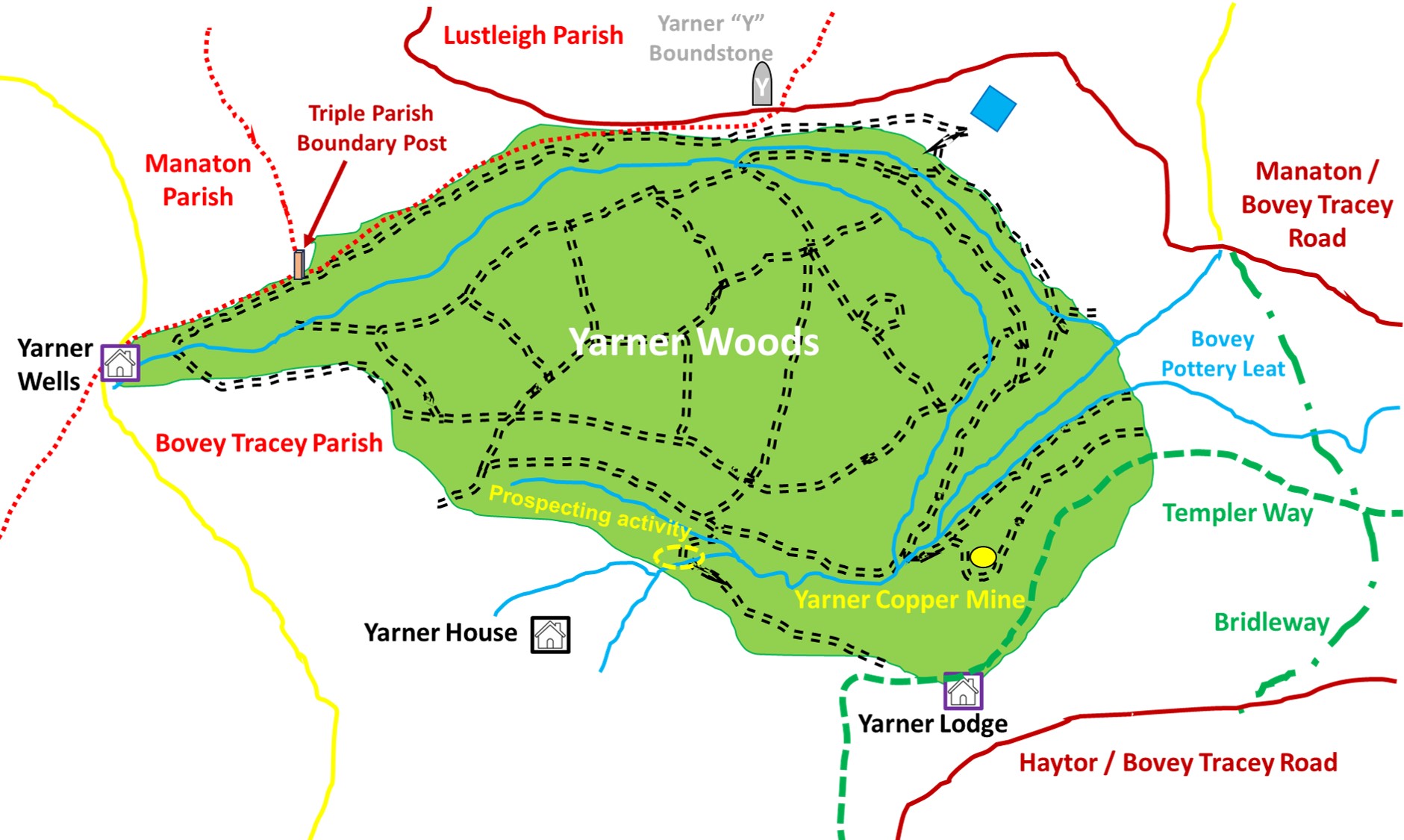
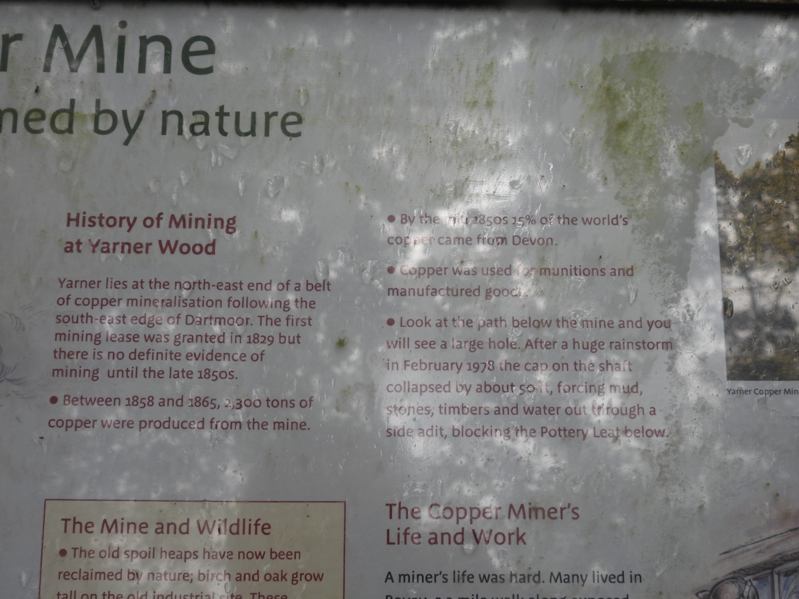
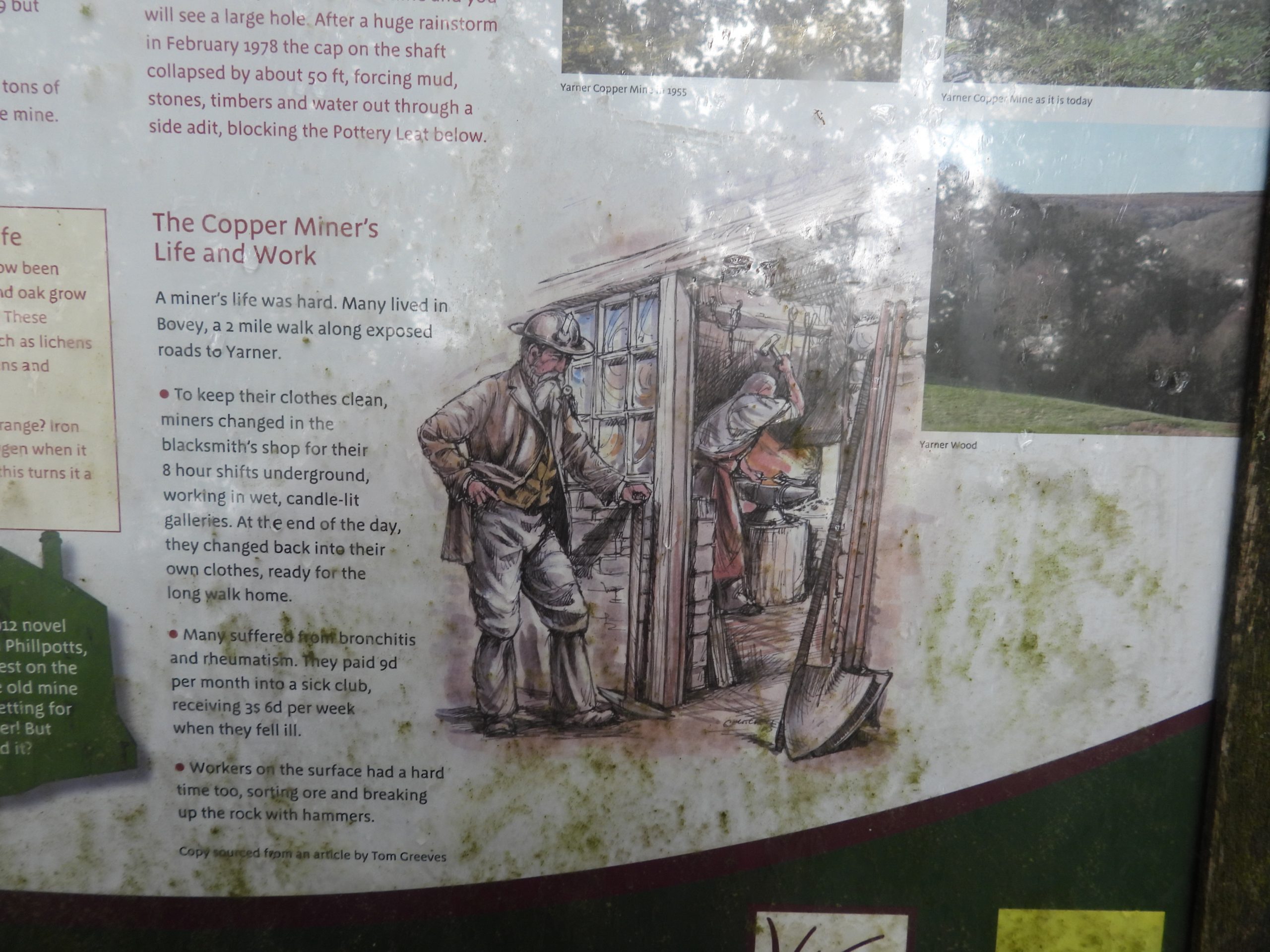
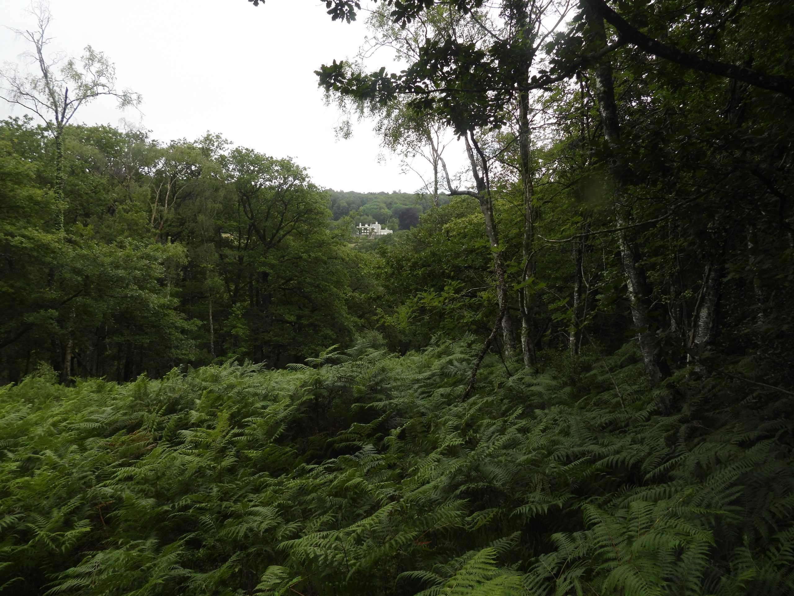
Yarner Copper Mine and Yarner Woods environs
Located near Haytor Vale, the Yarner estate in the 21st century is divided into two separate entities, namely; Yarner House and Yarner Wood. The house, is a Grade II listed building and has its own private grounds of 250 acres and Yarner Wood is a 365 acre broad leaf (predominantly oak) woodland which is managed by Natural England as part of East Dartmoor National Nature Reserve.
At the time of the Norman Conquest, Yarner was land within the Manor of Bovey Tracey owned by the crown. However, by the end of the 16th century, the ‘estate’ was split up and sold. Thus, from this point the Yarner estate changed hands very frequently, illustrating financial dealings and mineral speculation which were prevalent over the centuries.
This post mainly considers the mineral speculations, specifically copper mining operations of the mid-19th century including the site of Yarner Copper Mine and other prospecting activities within Yarner Woods. Other features in this post within the immediate environs of Yarner Woods, include: Yarner House, Yarner Wells, two boundary markers and wooden sculptures.
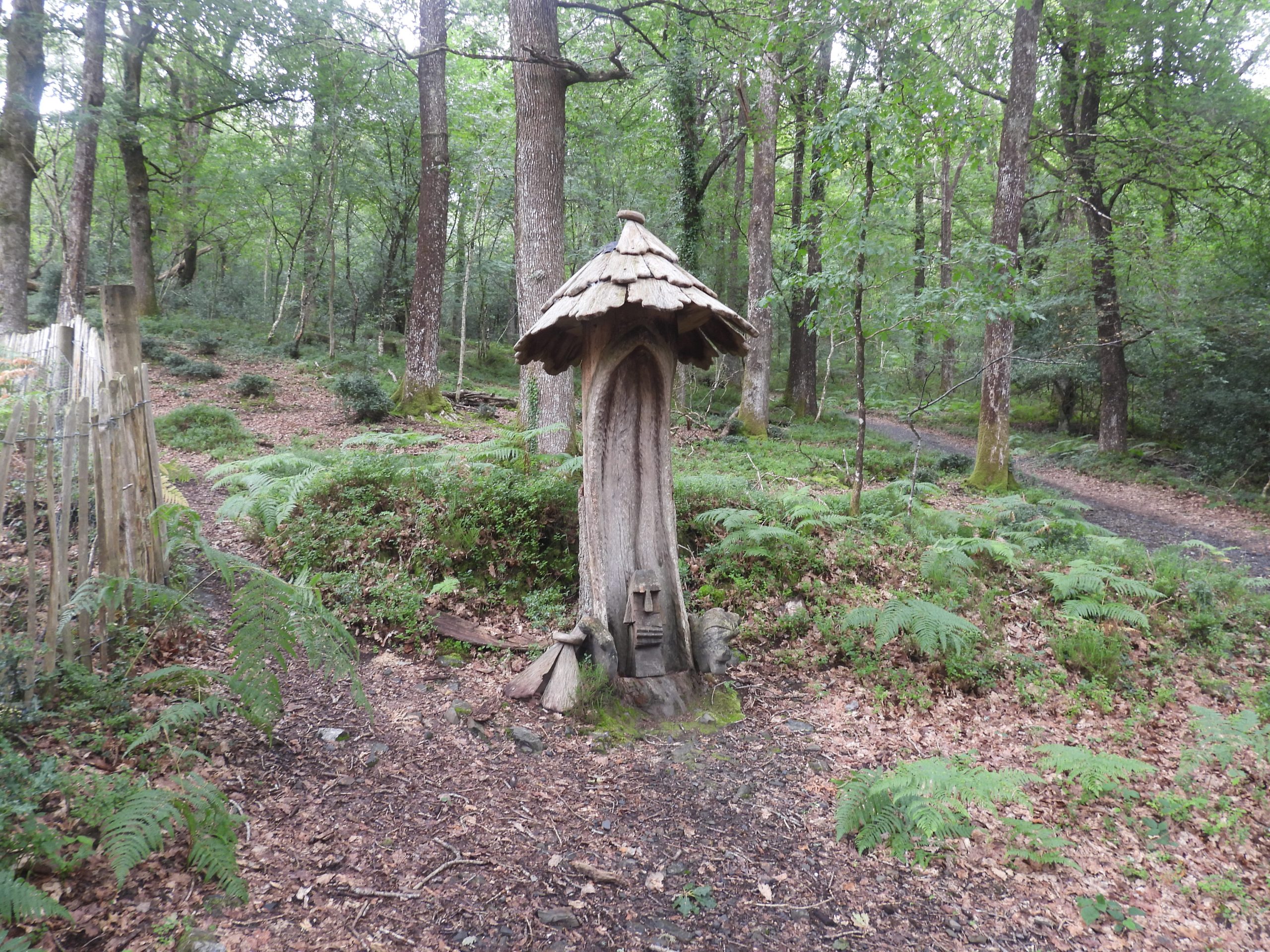
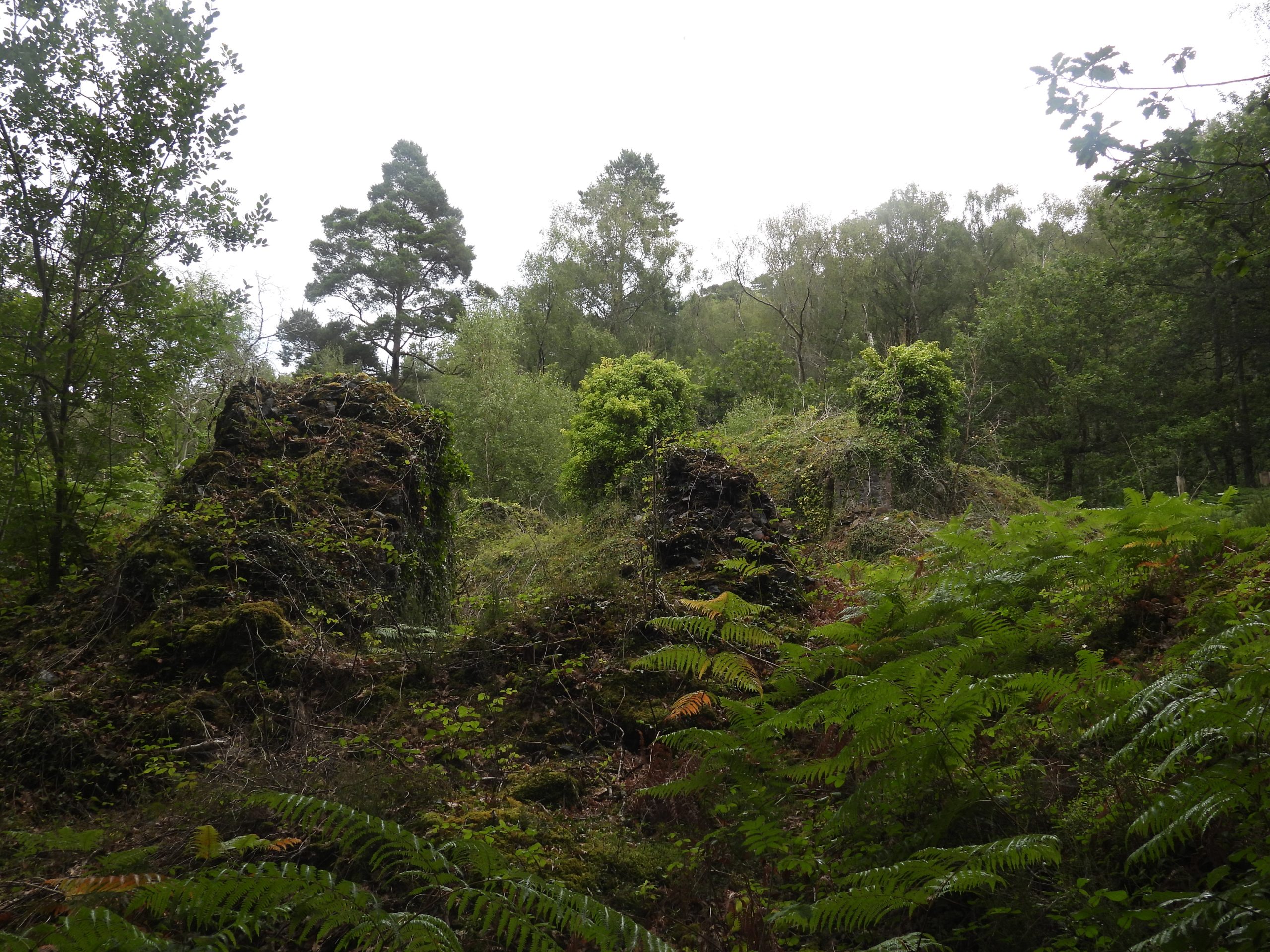
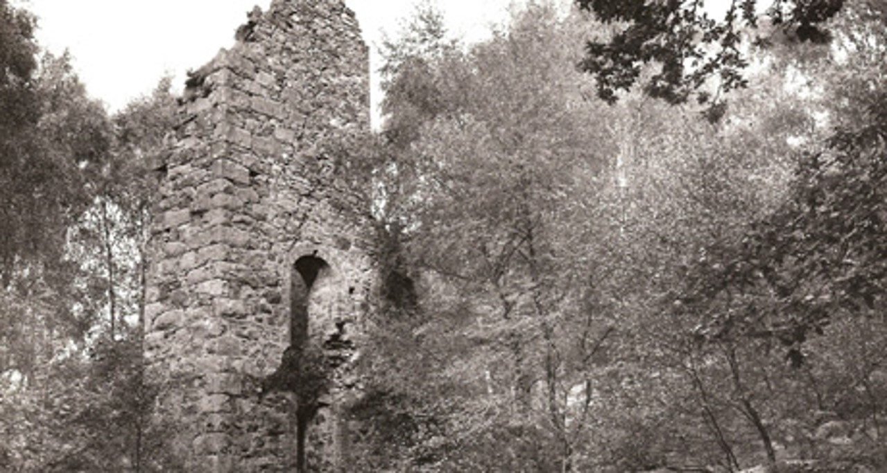
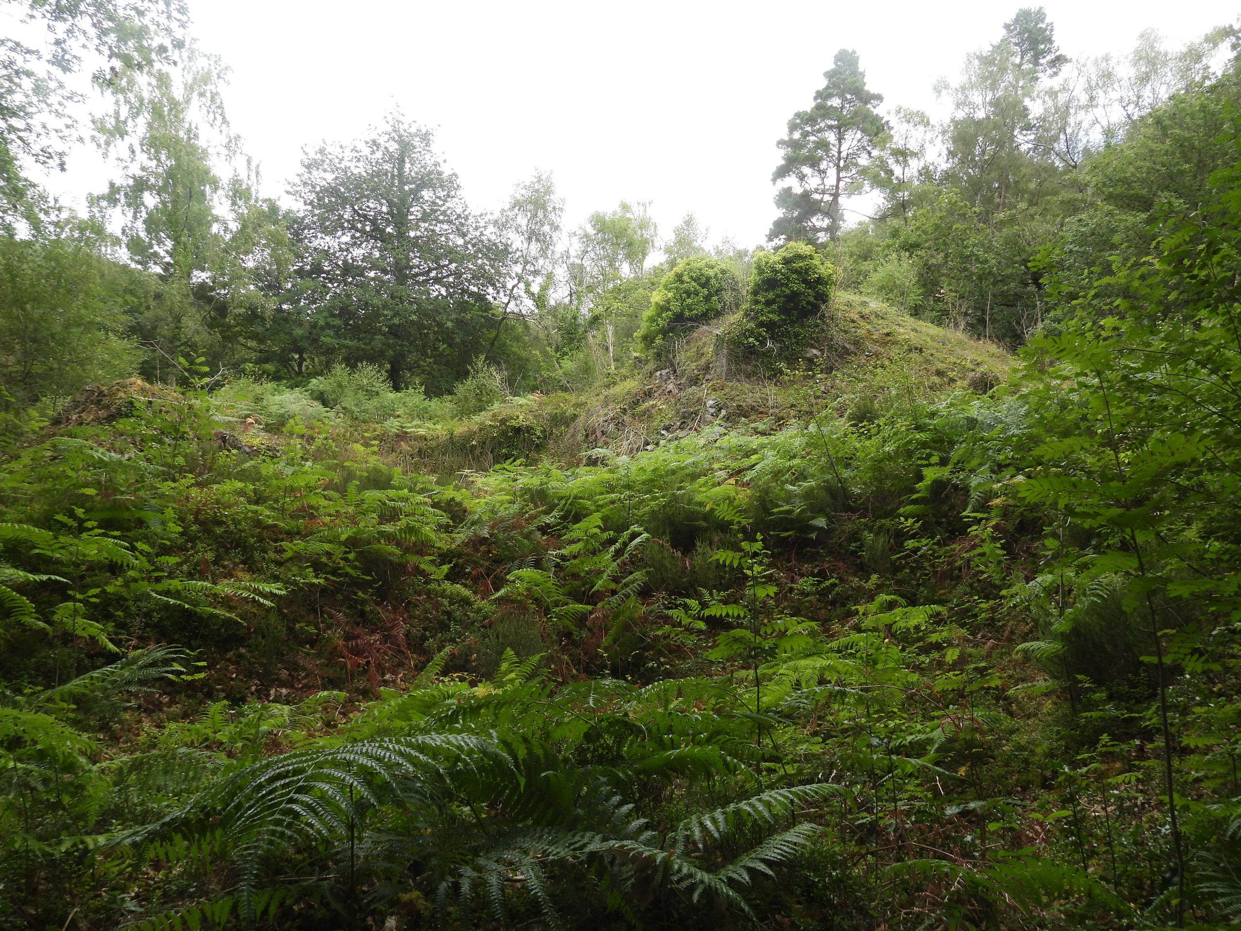
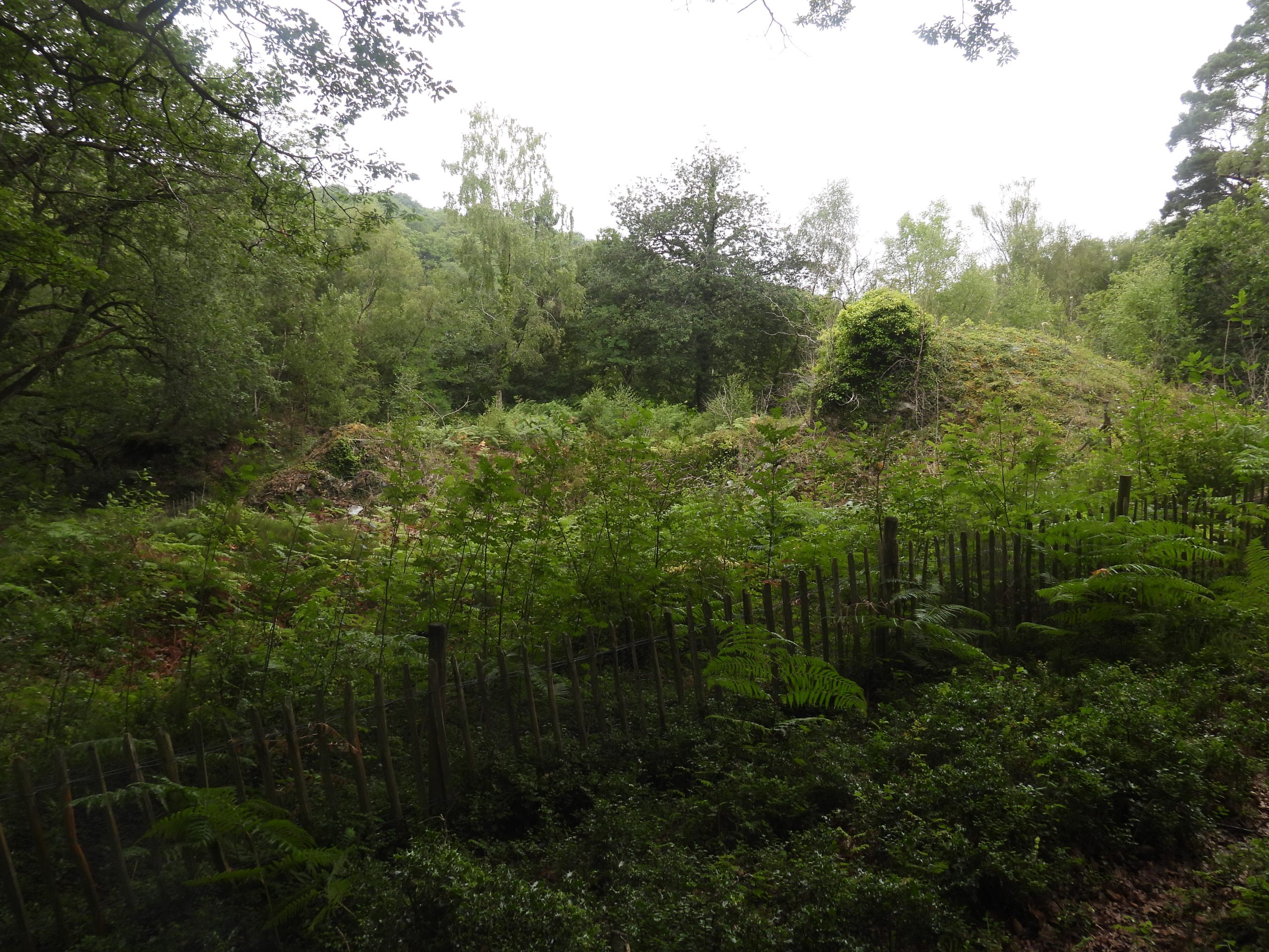
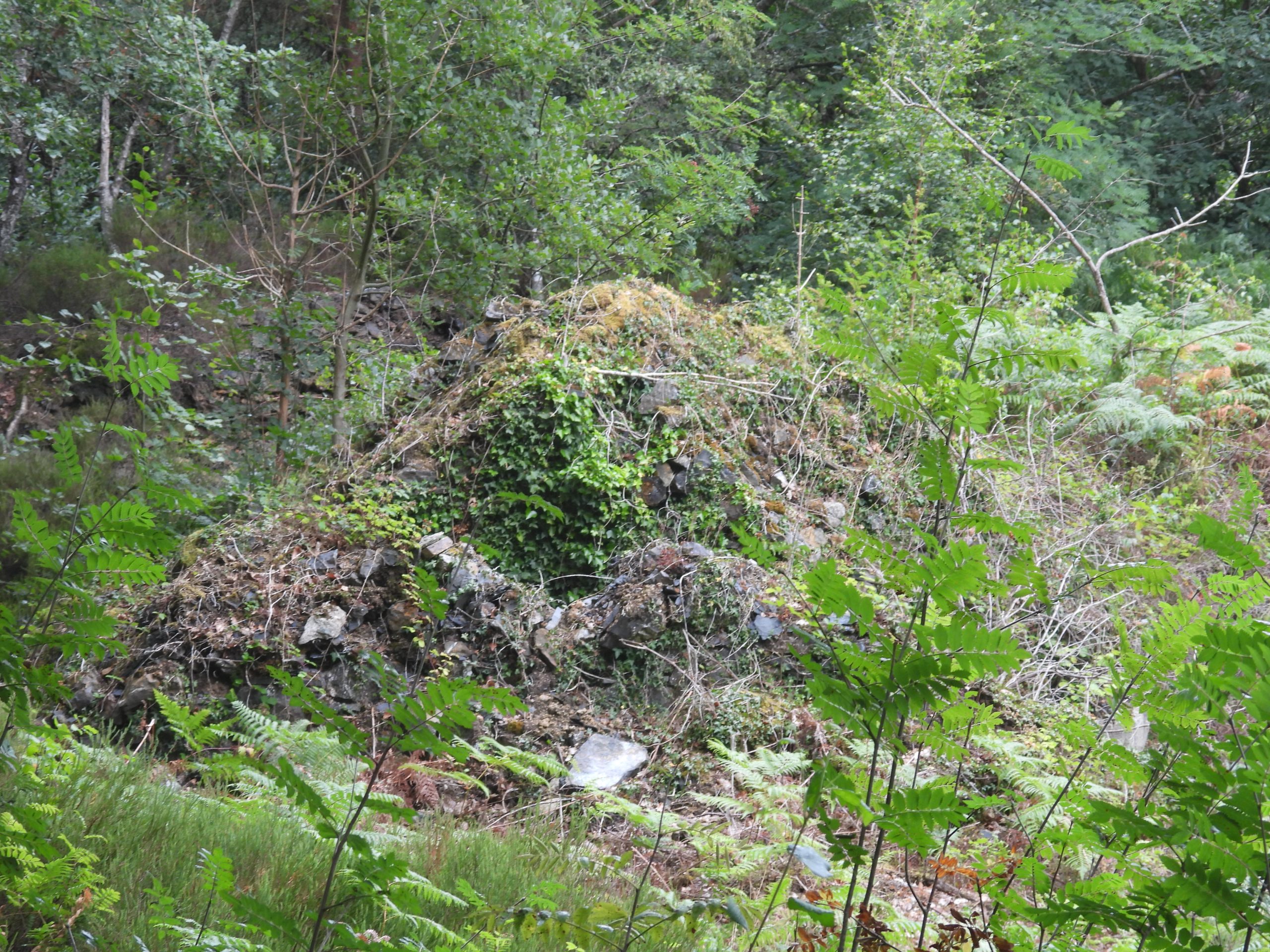
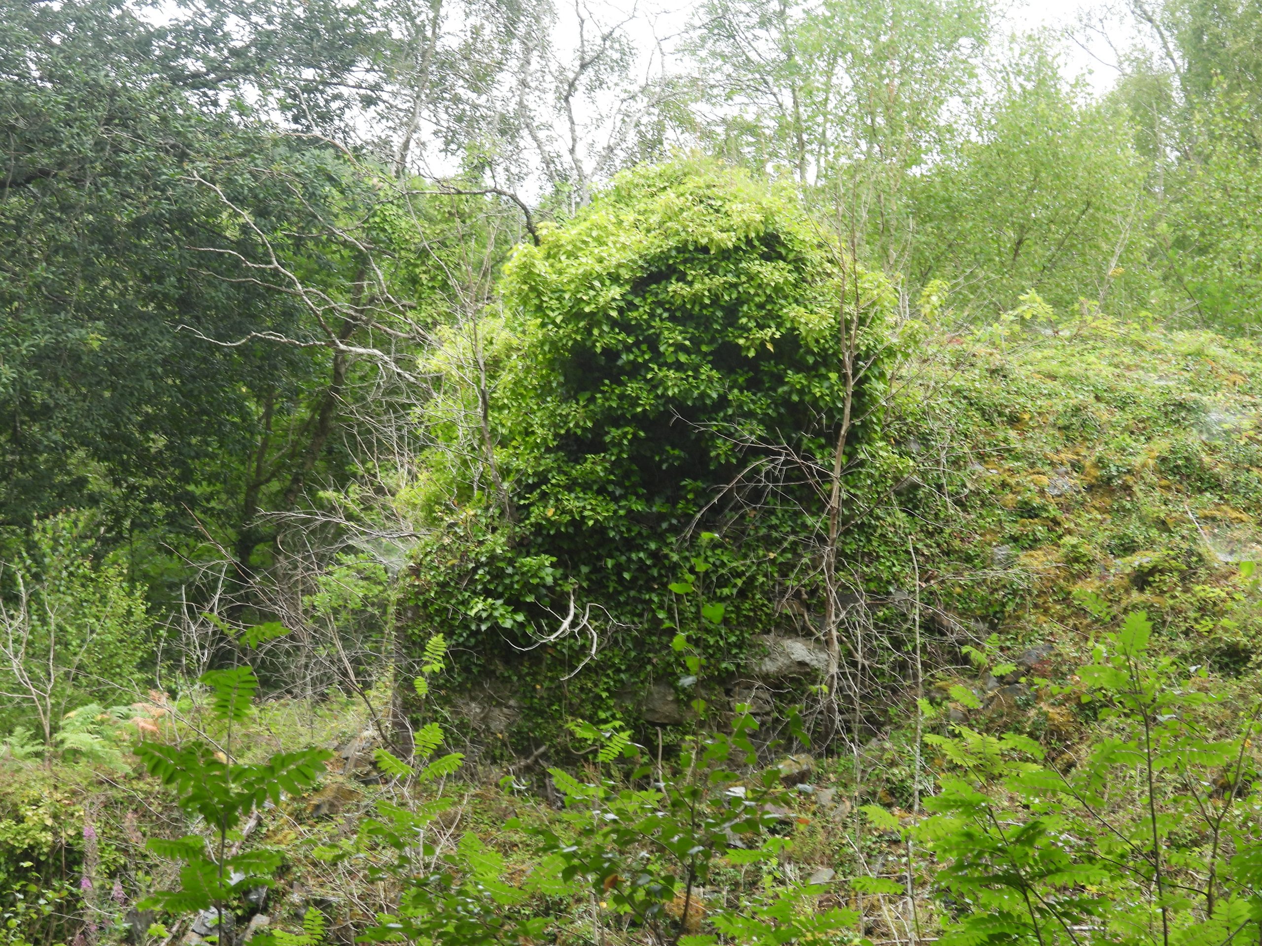
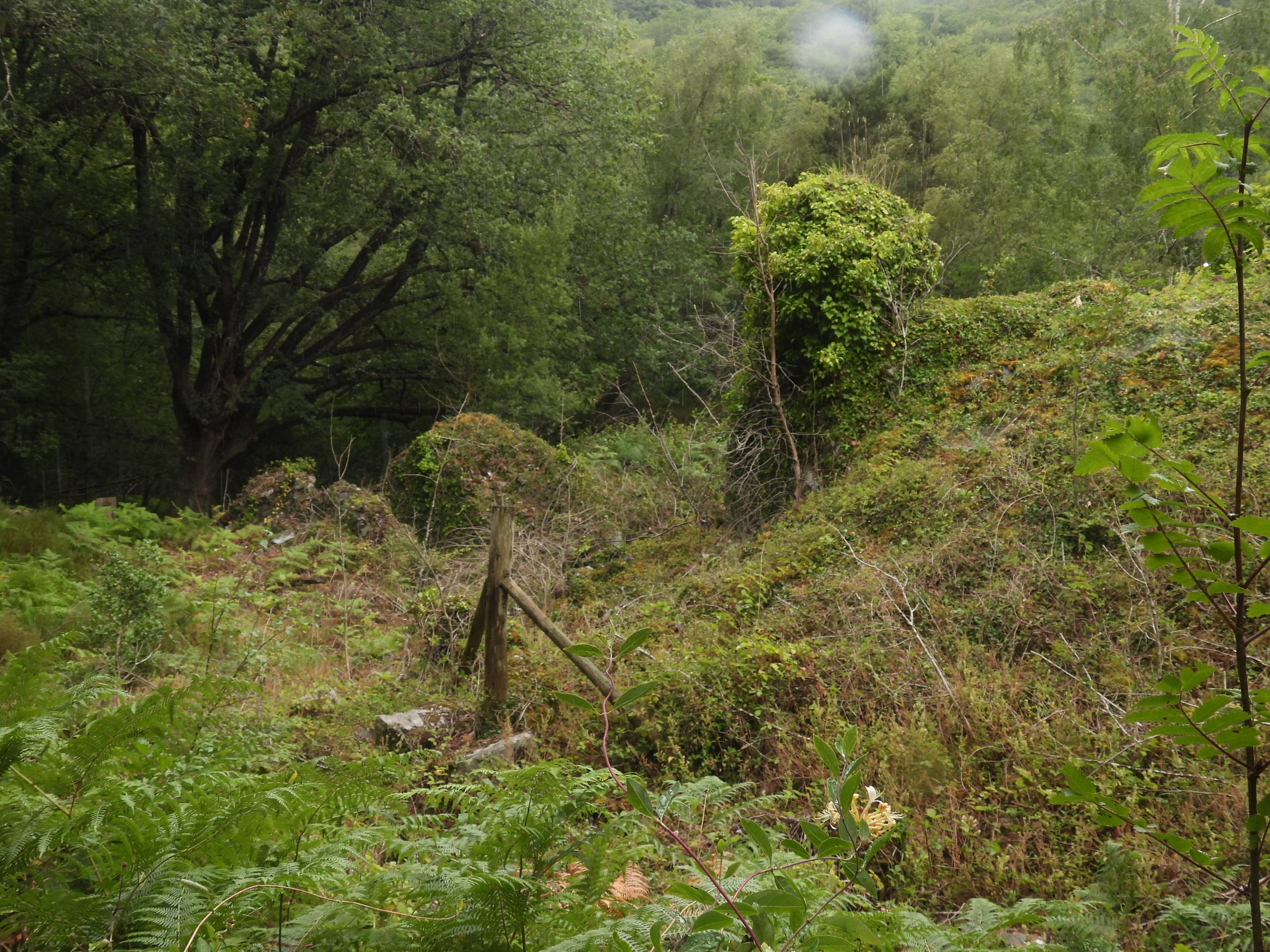
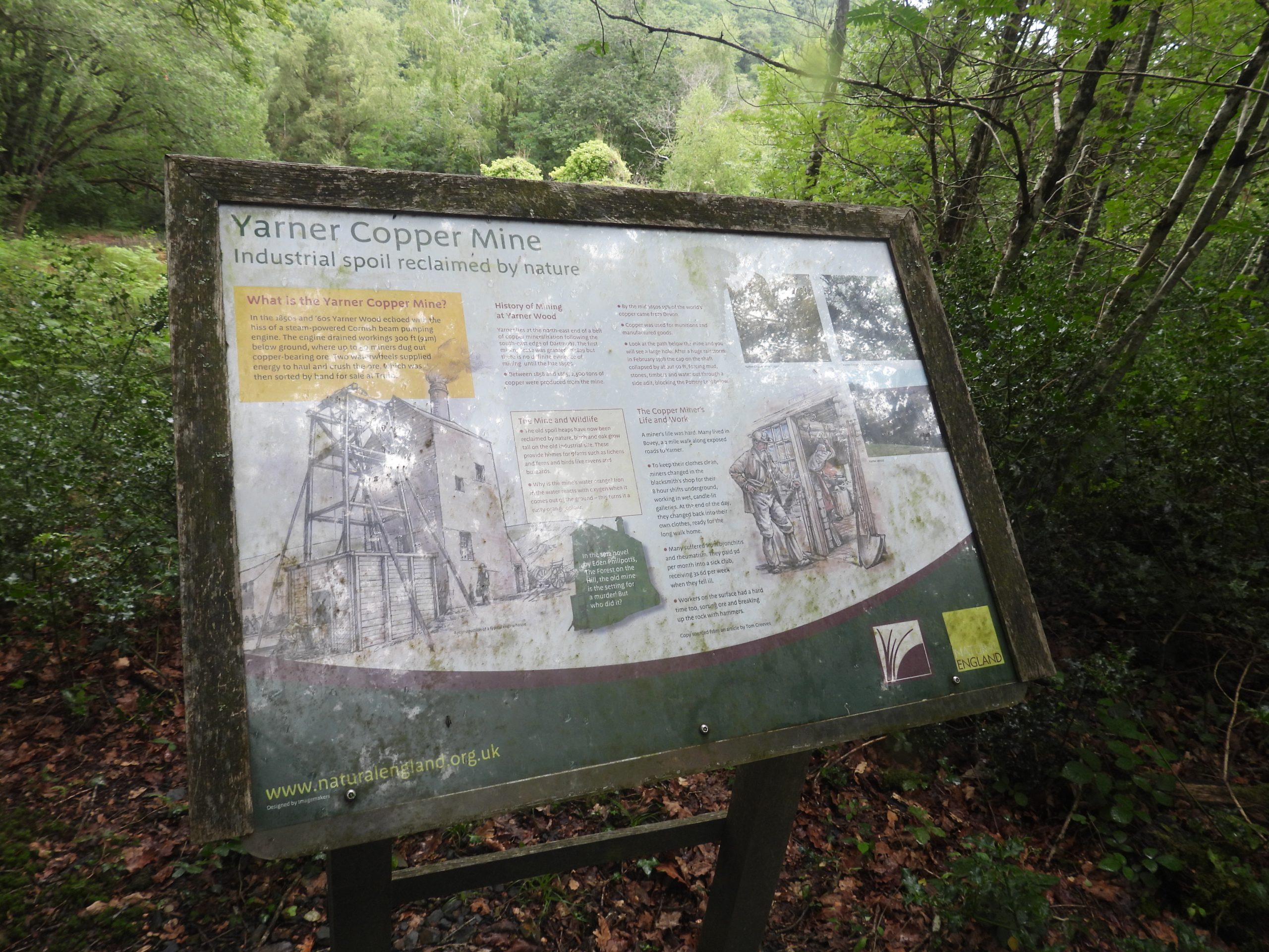
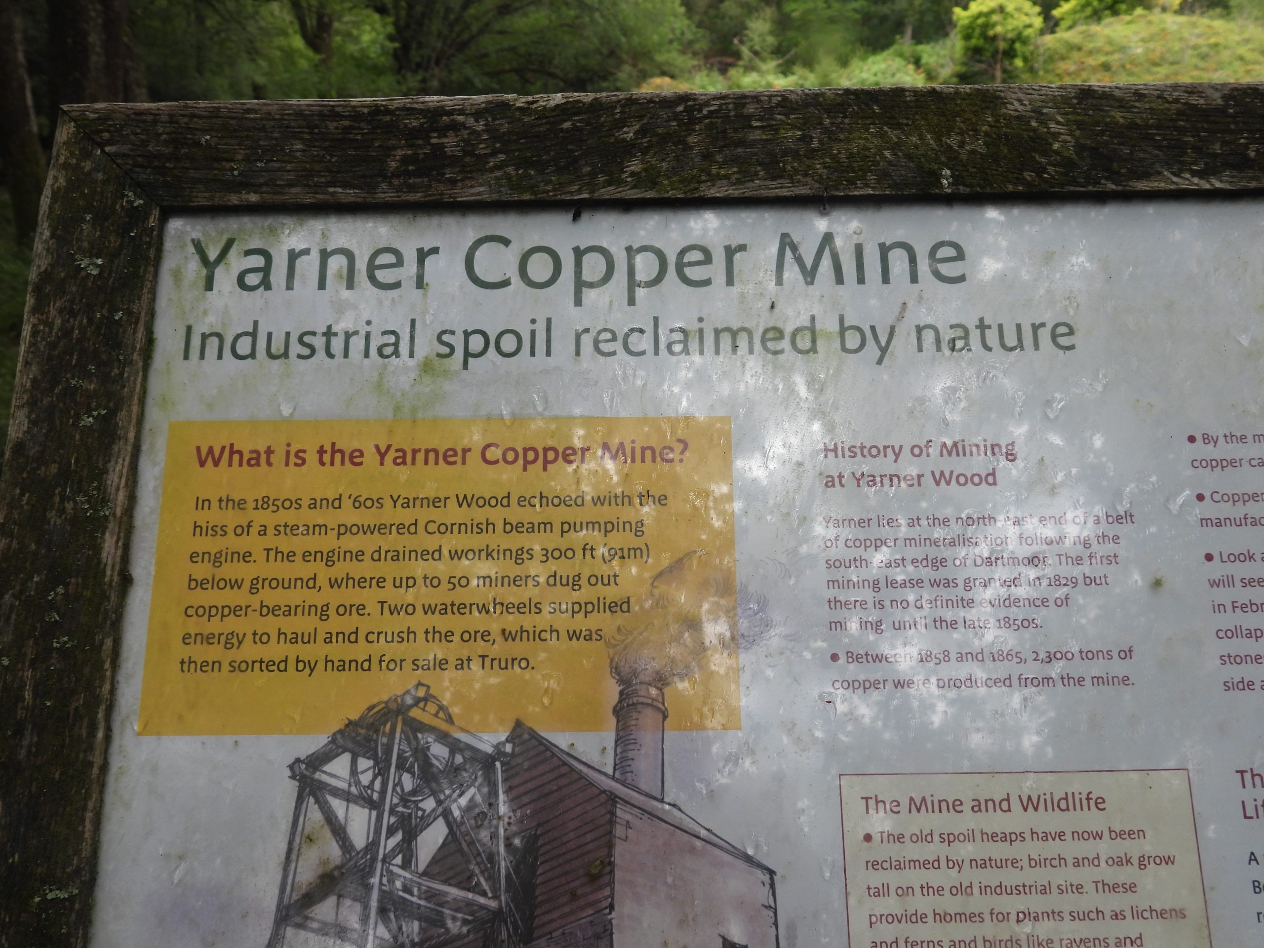
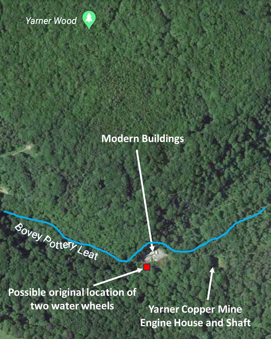
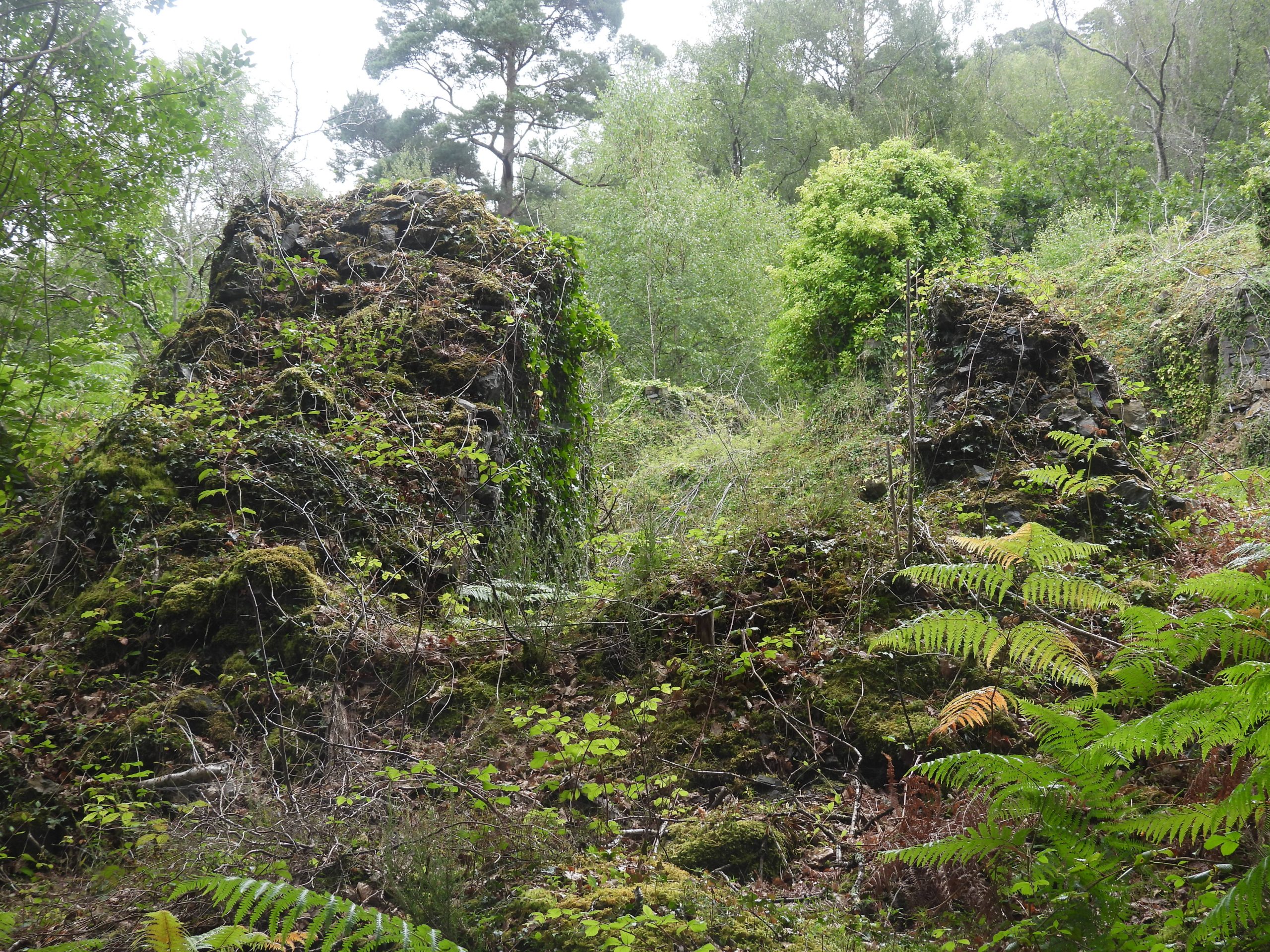
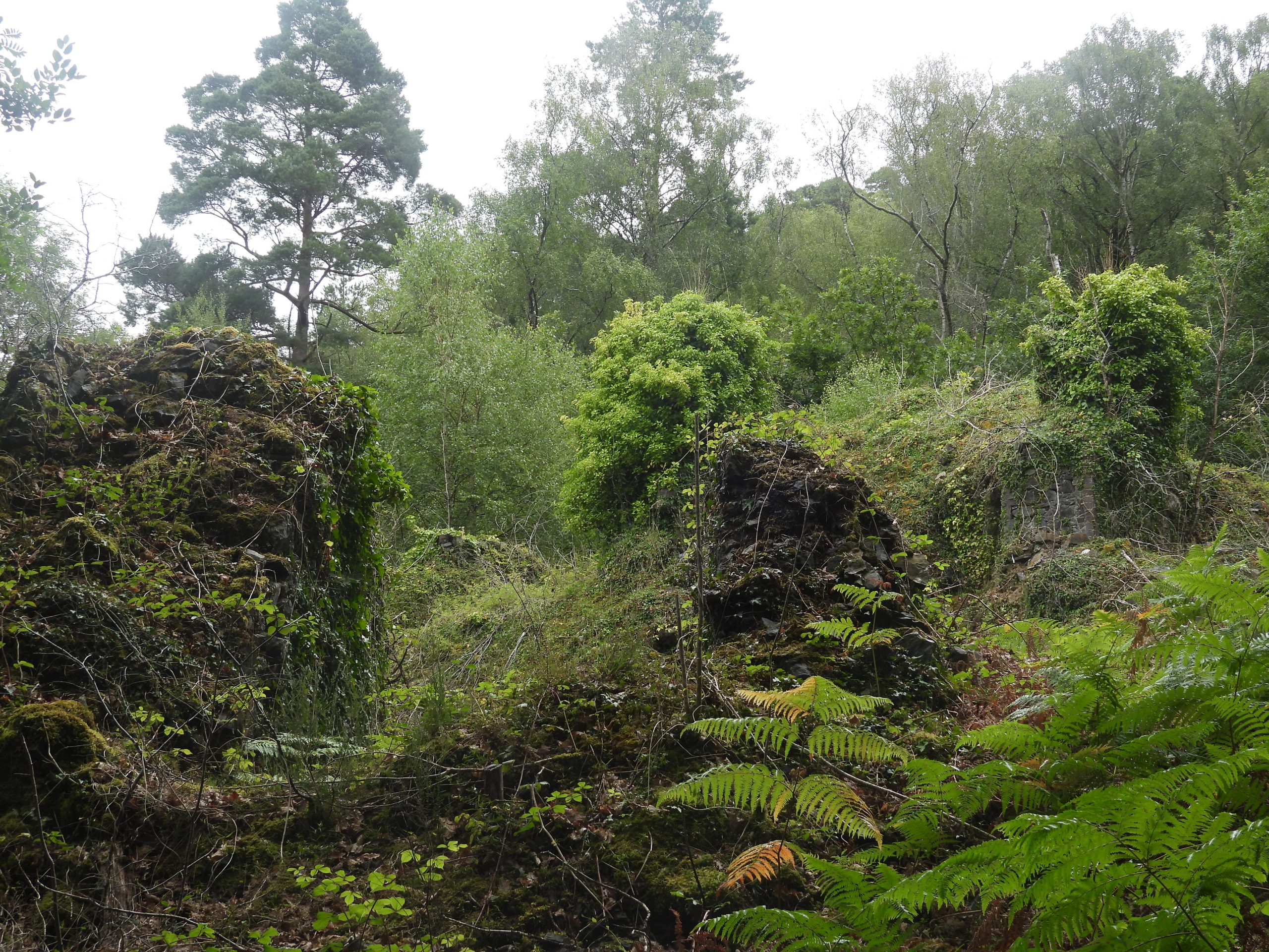
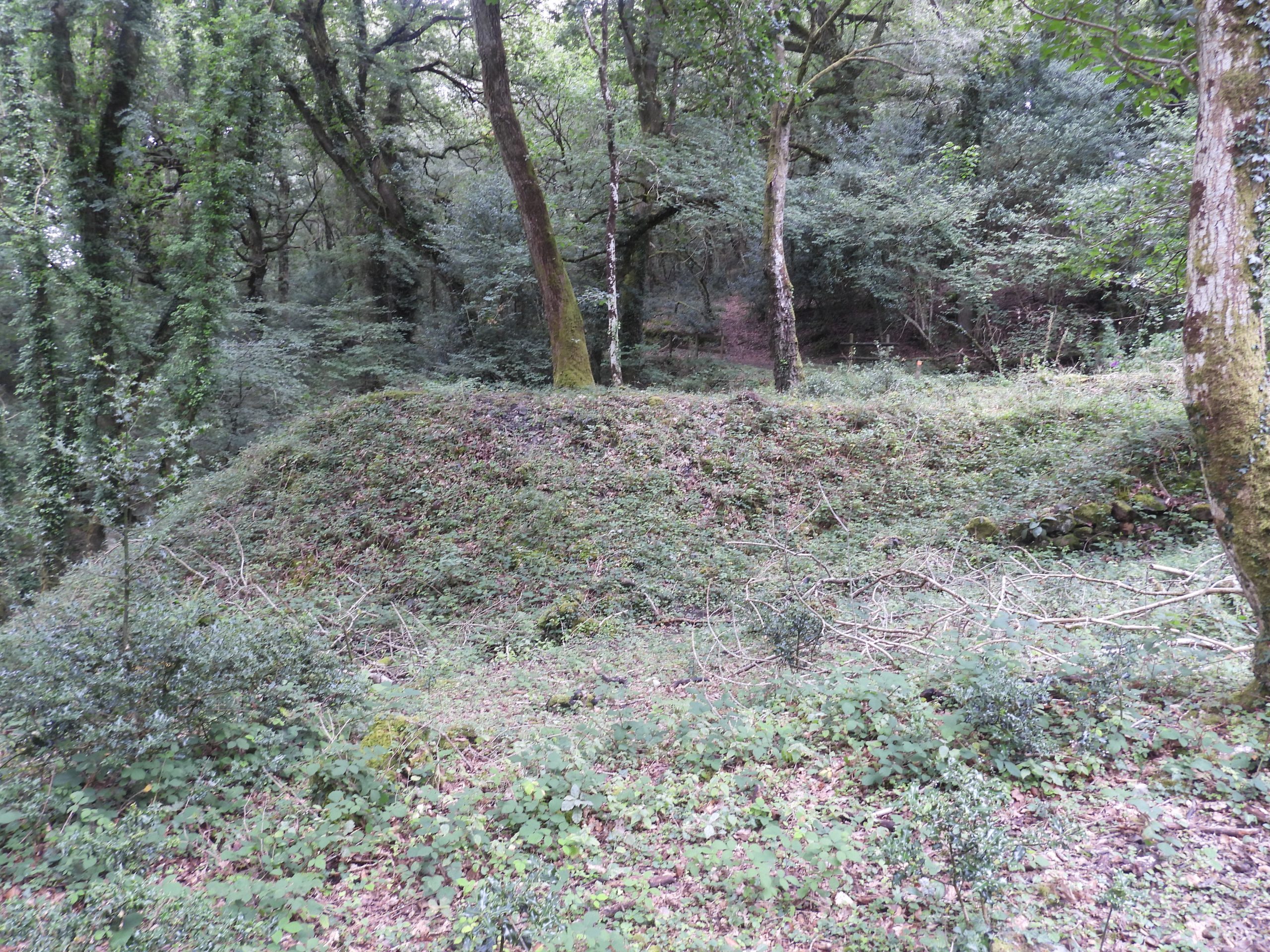
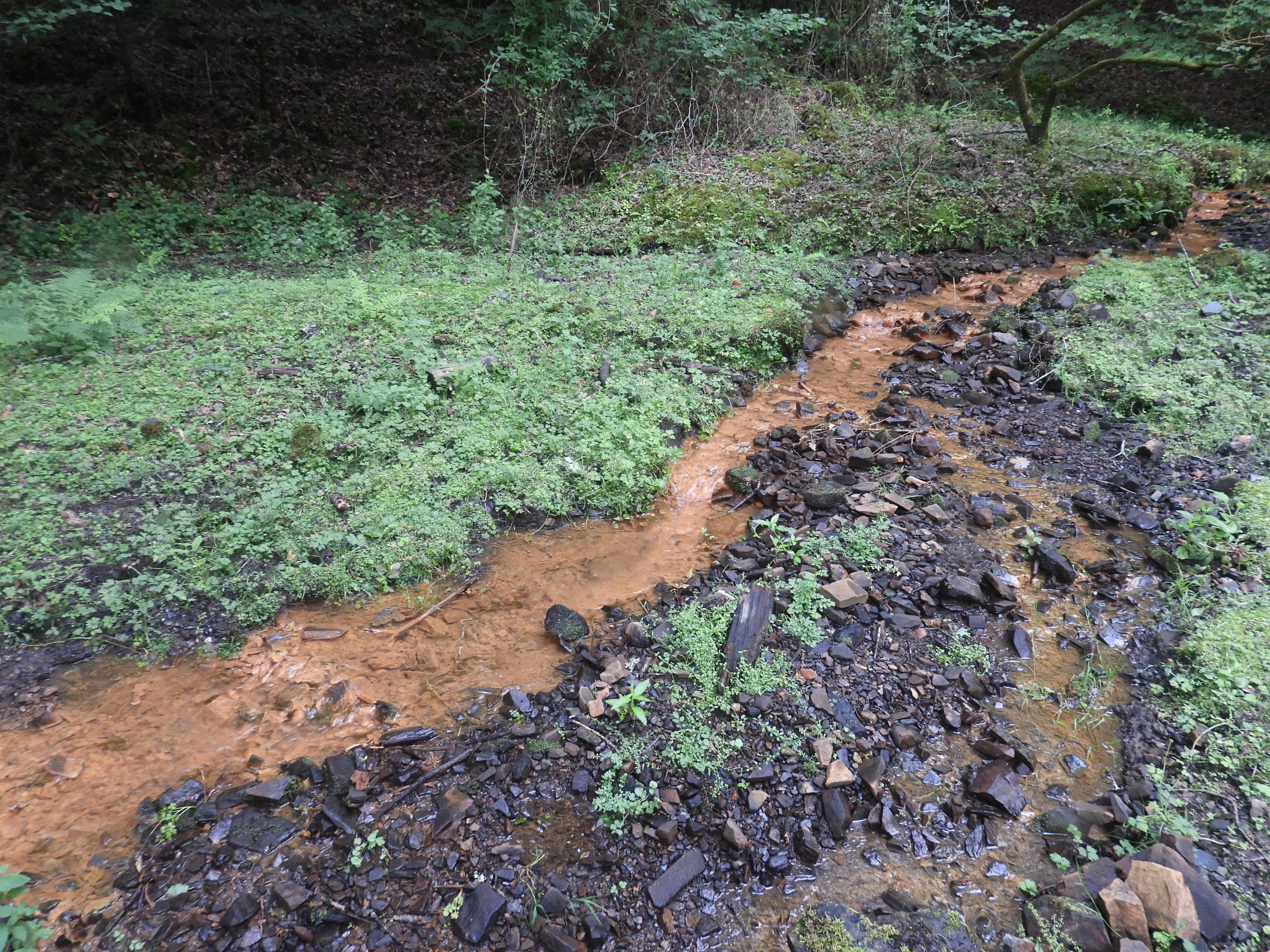
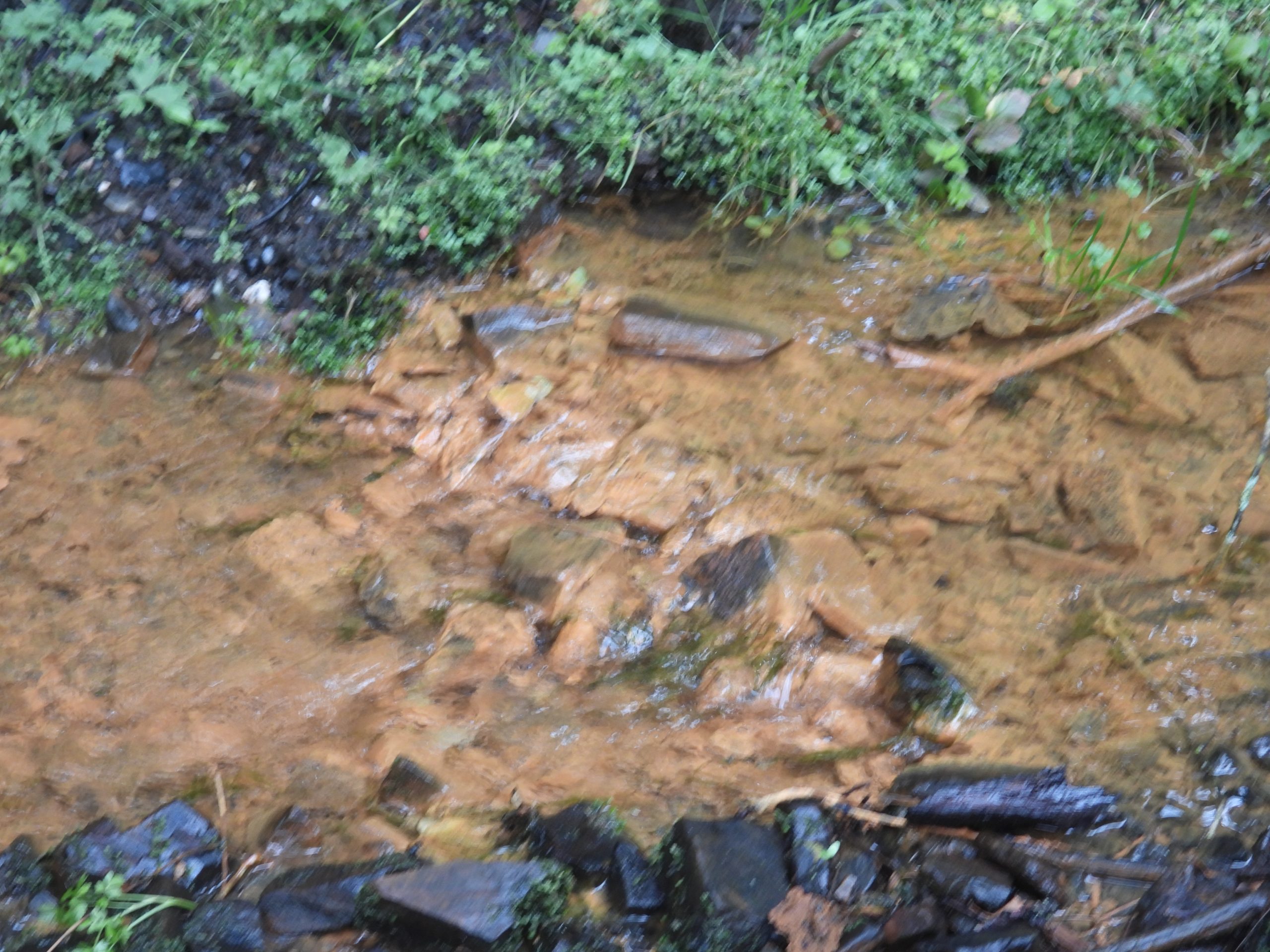
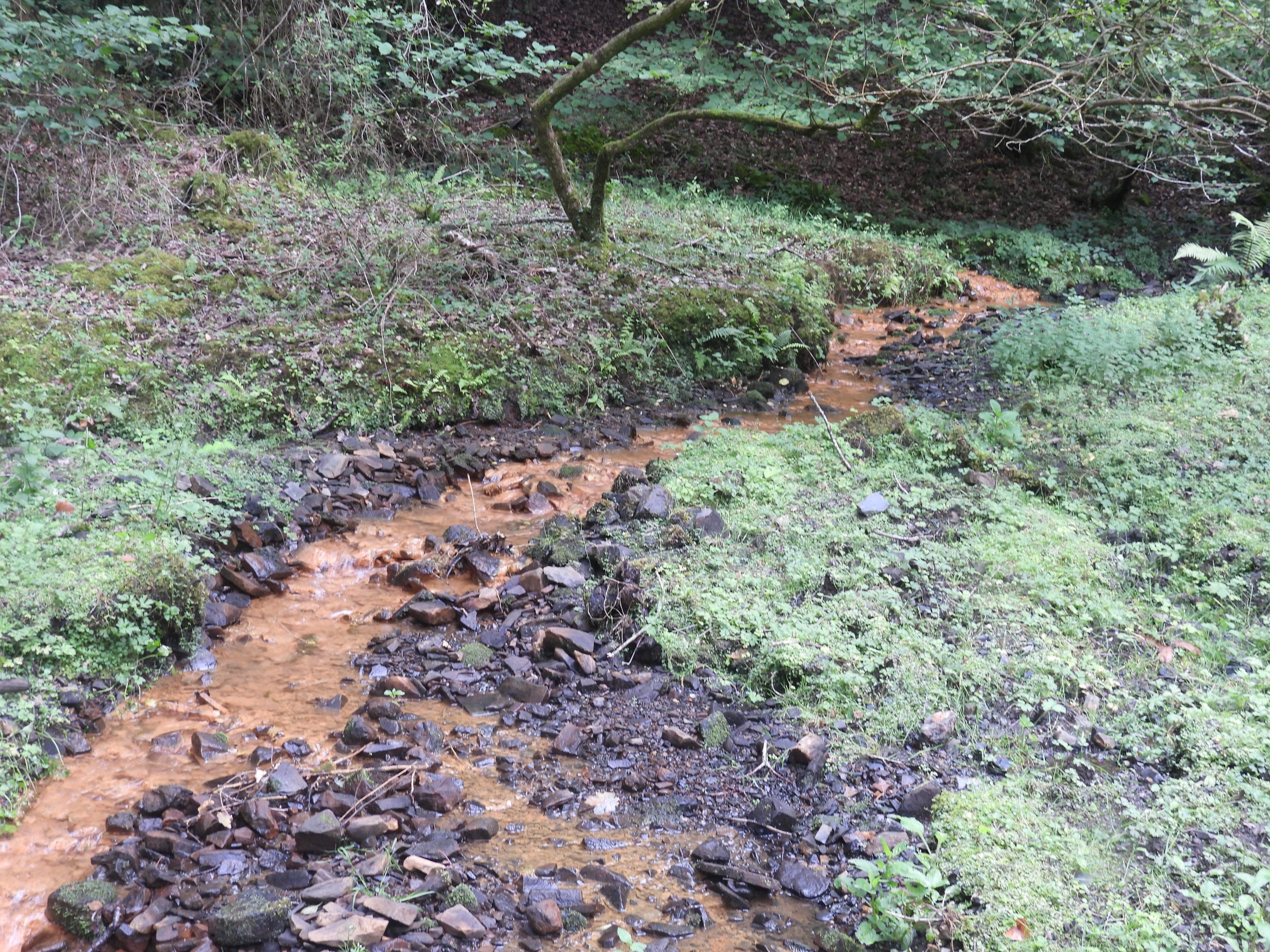
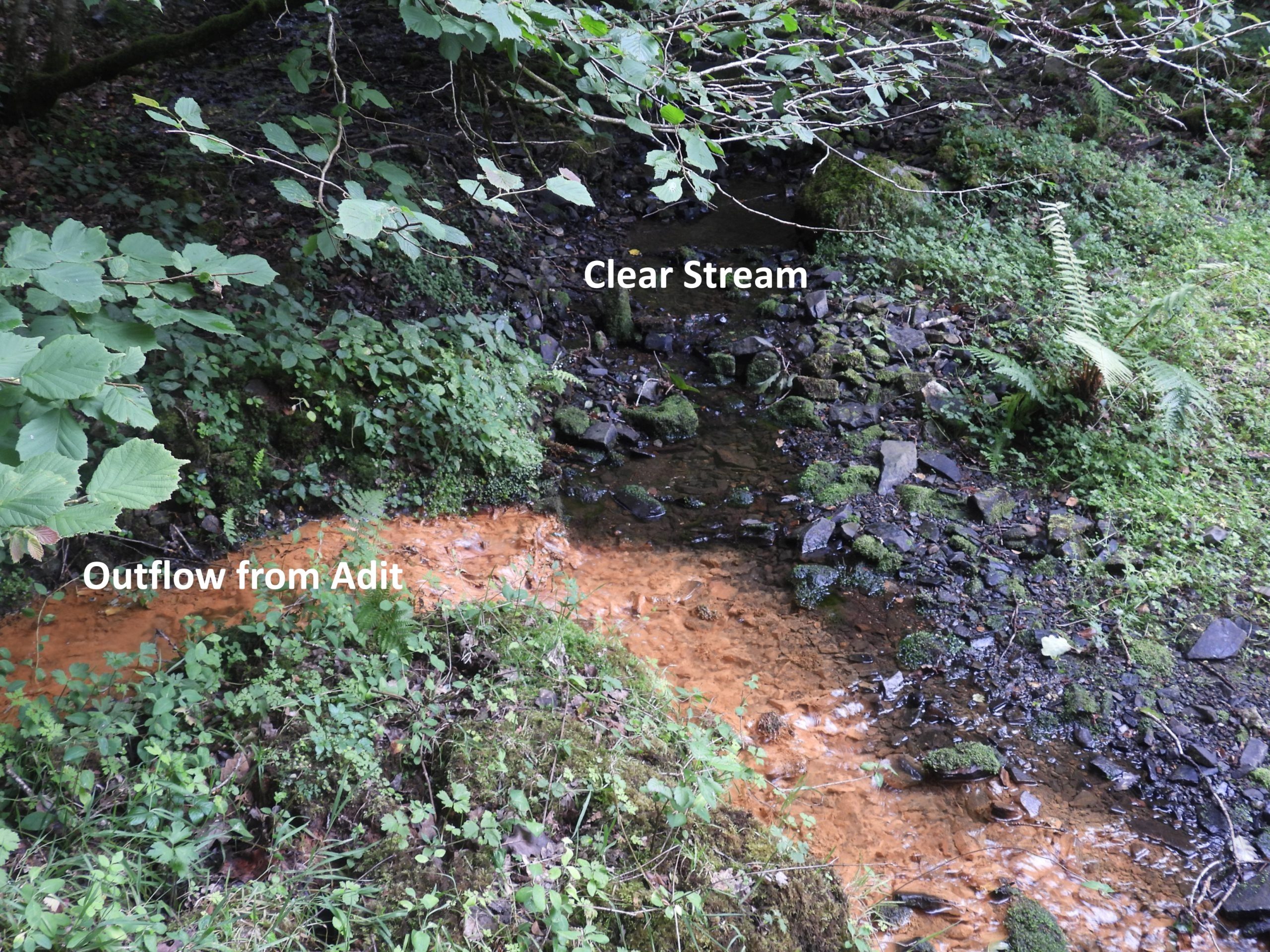
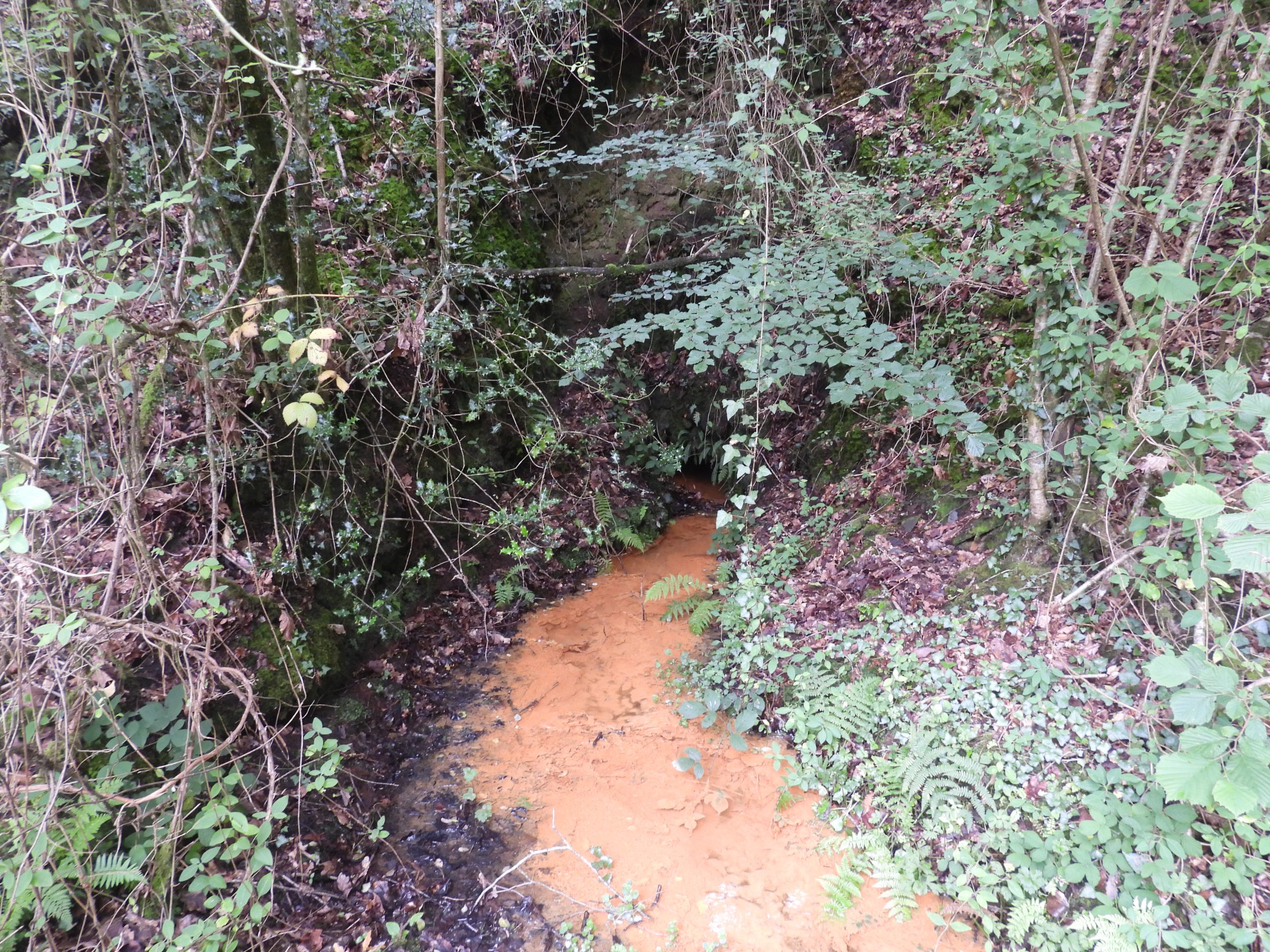
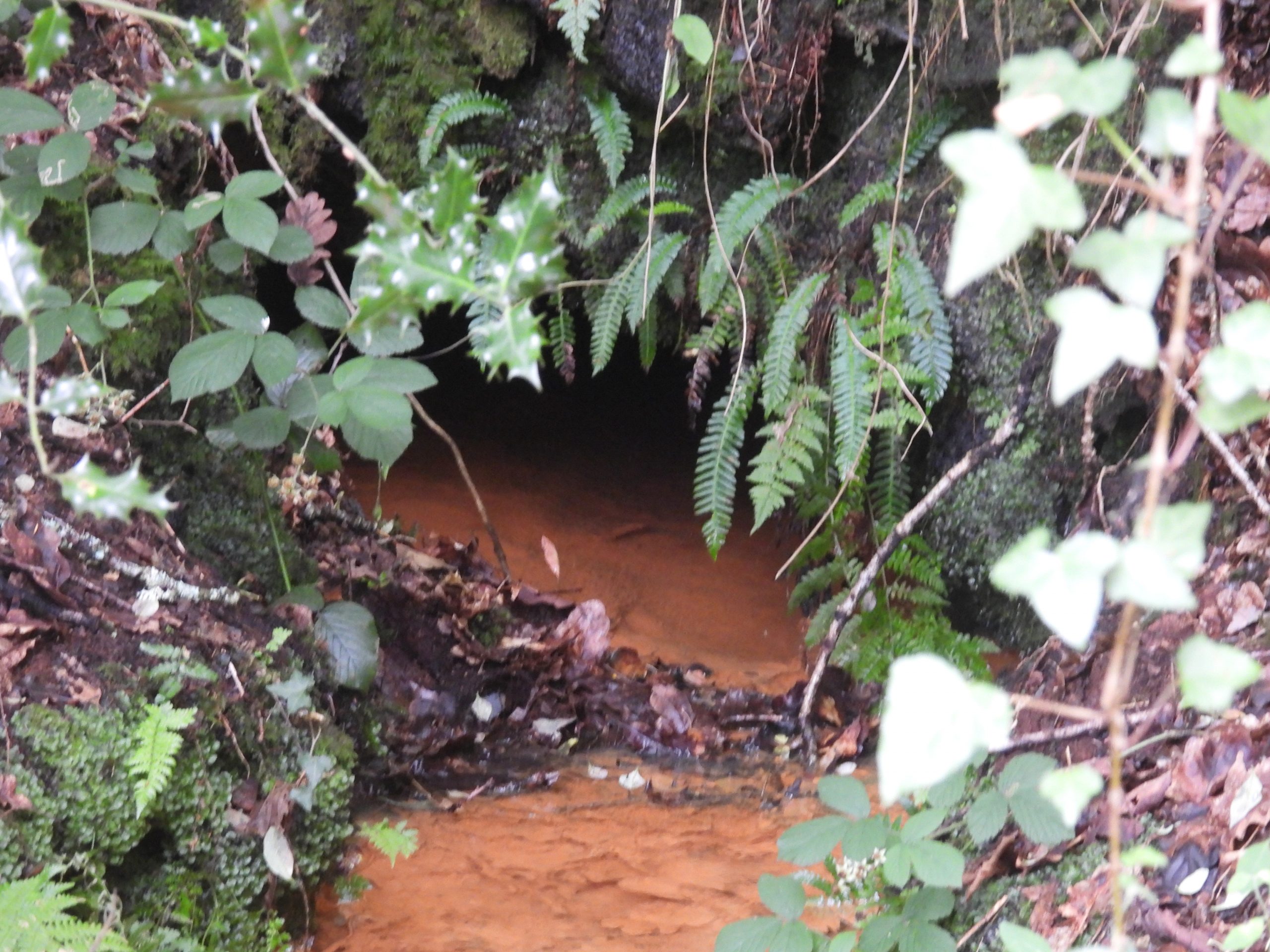
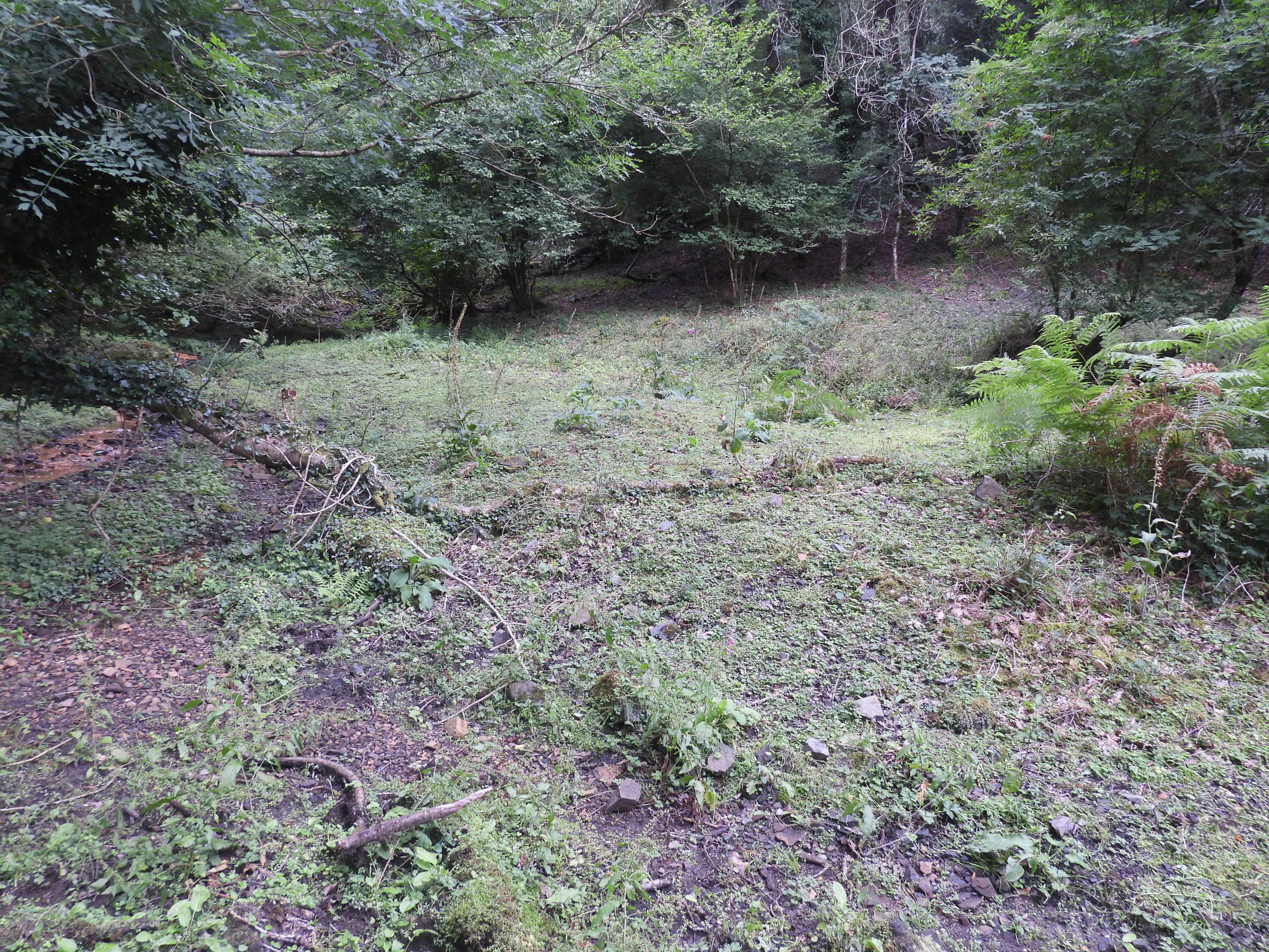
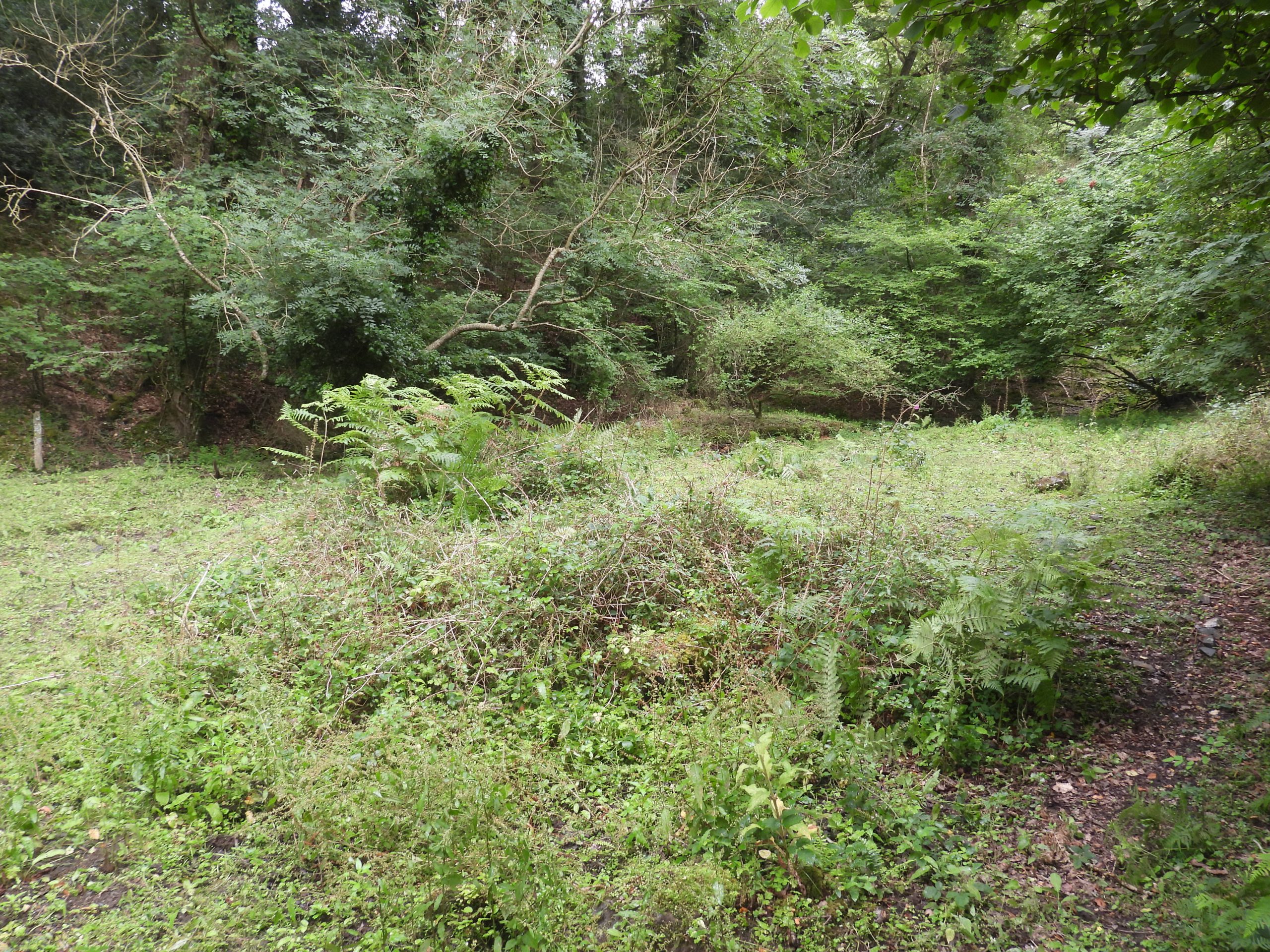
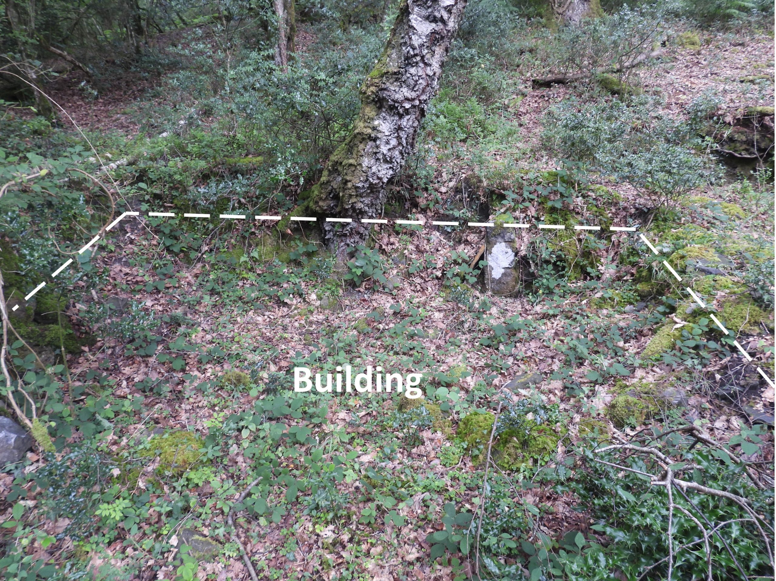
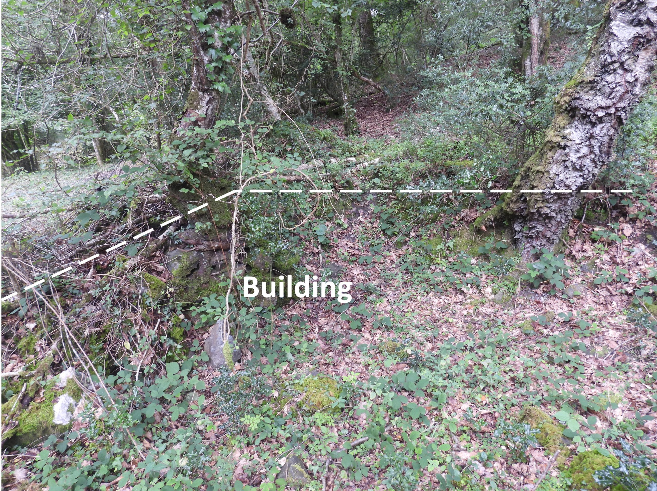
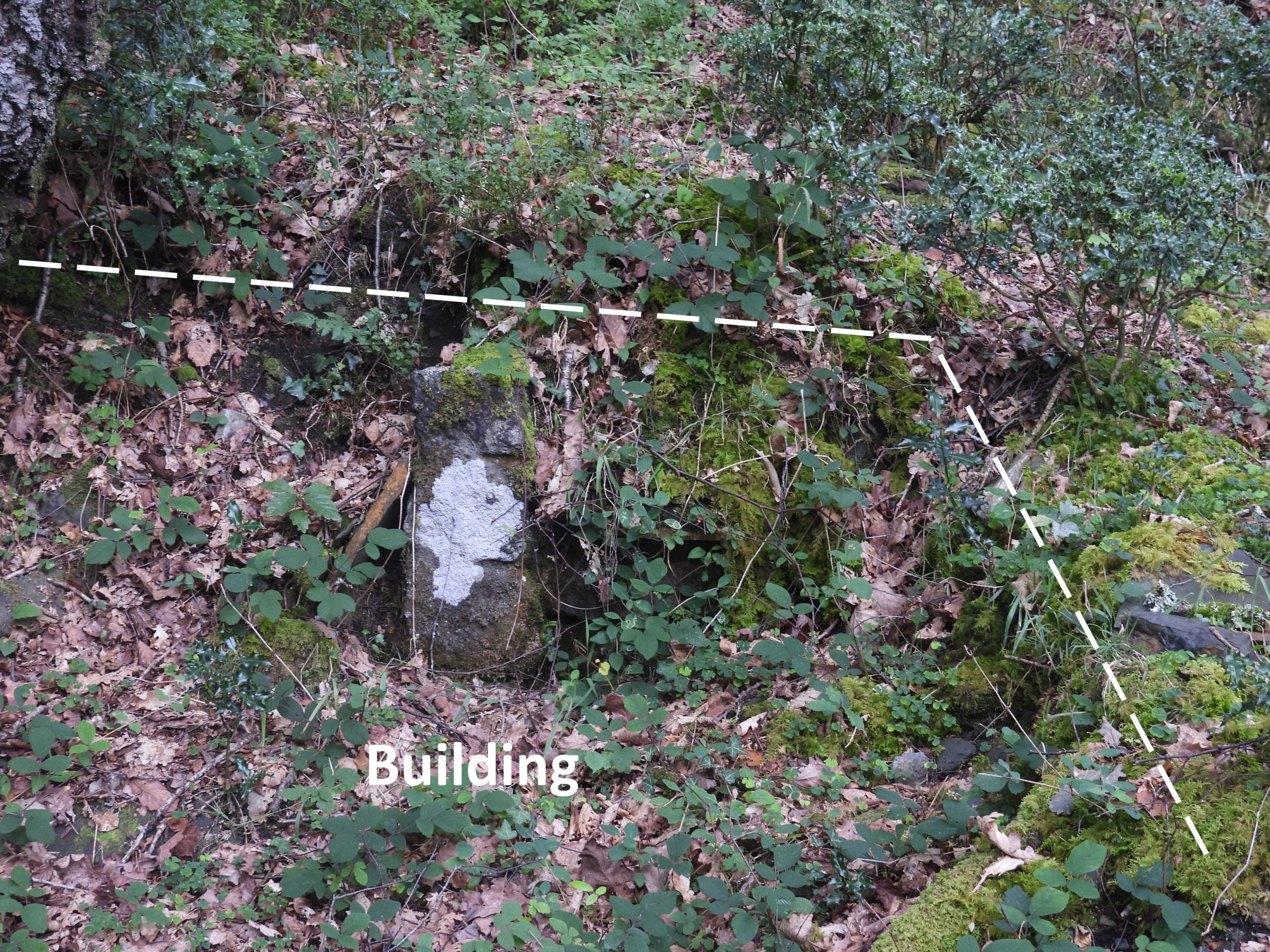
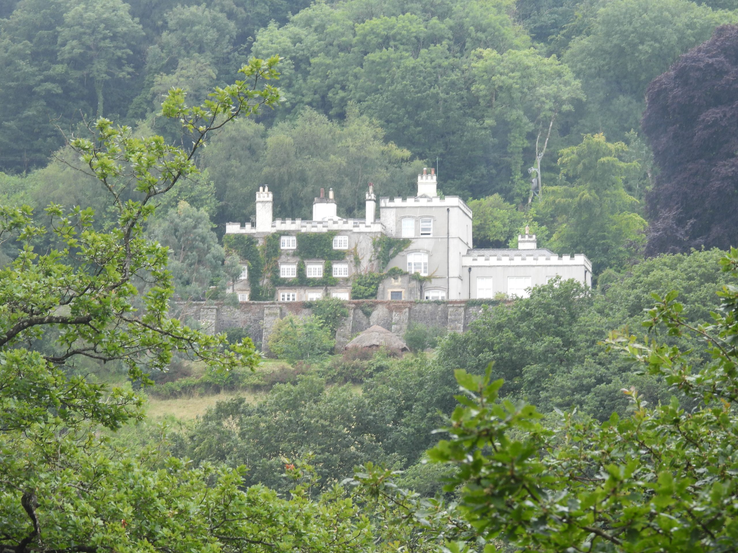
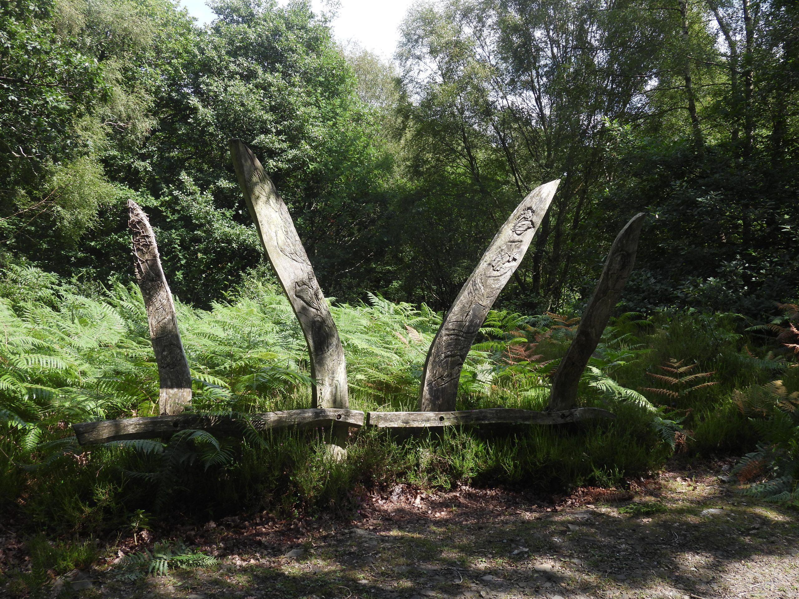
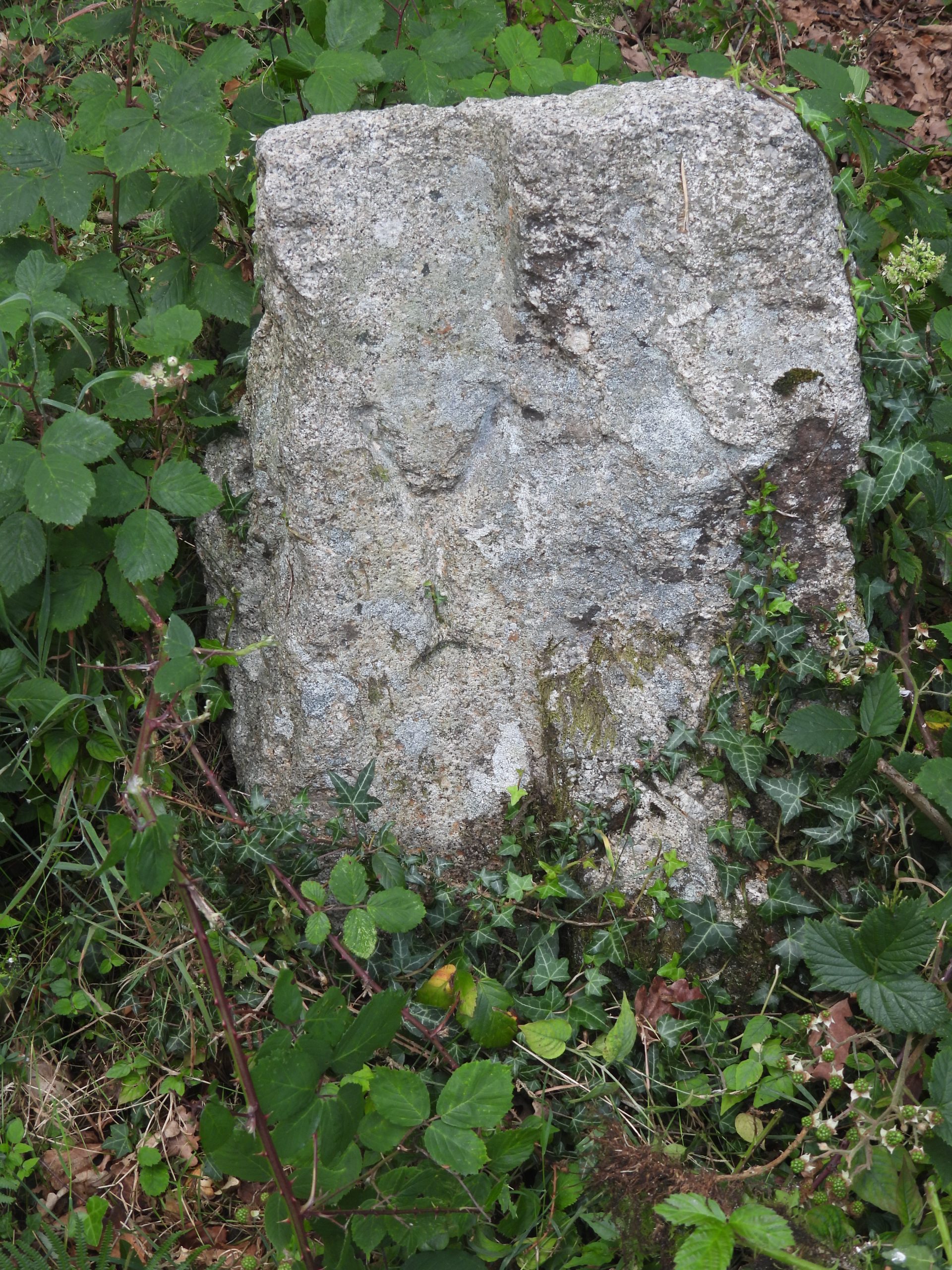
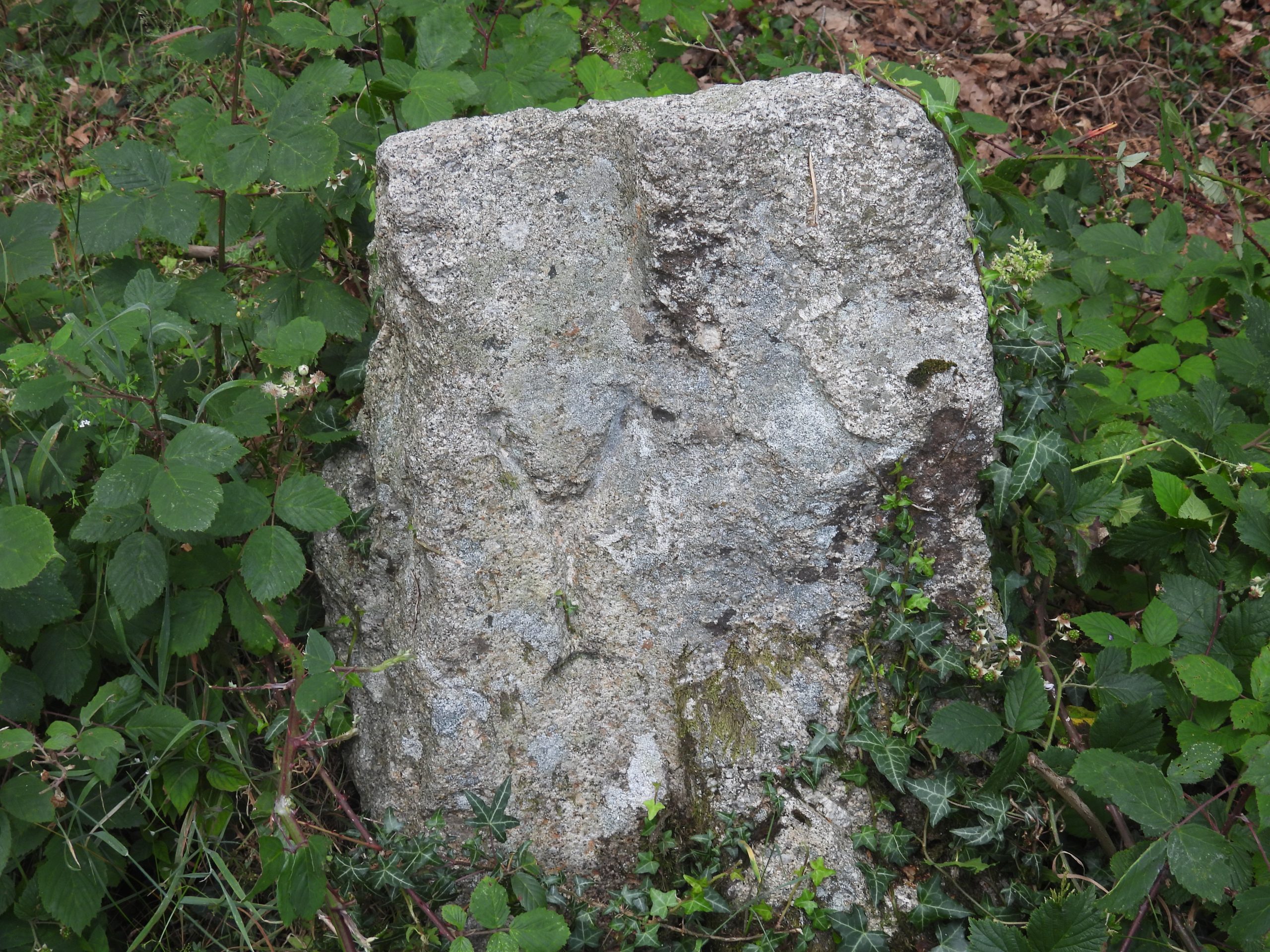
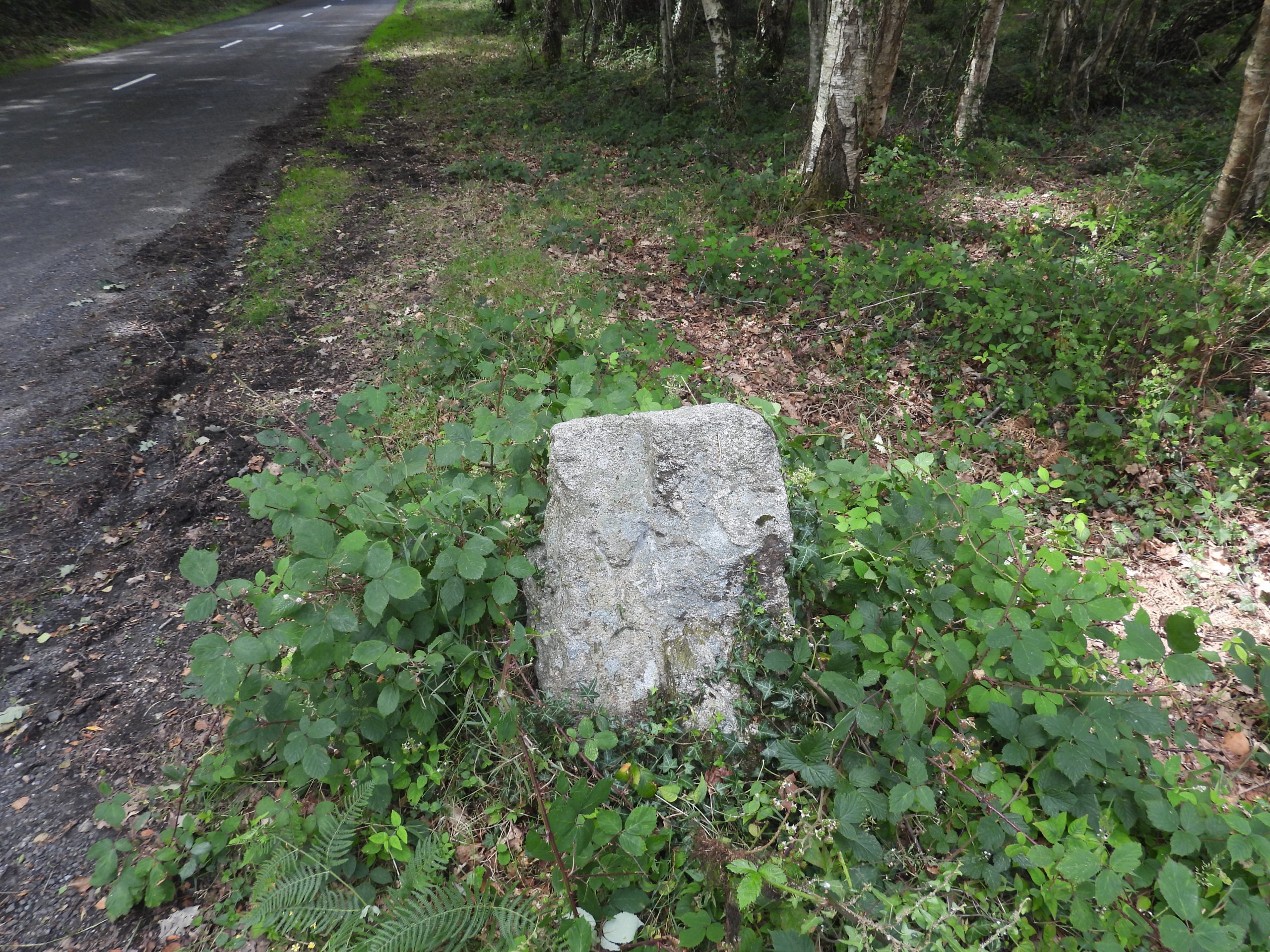
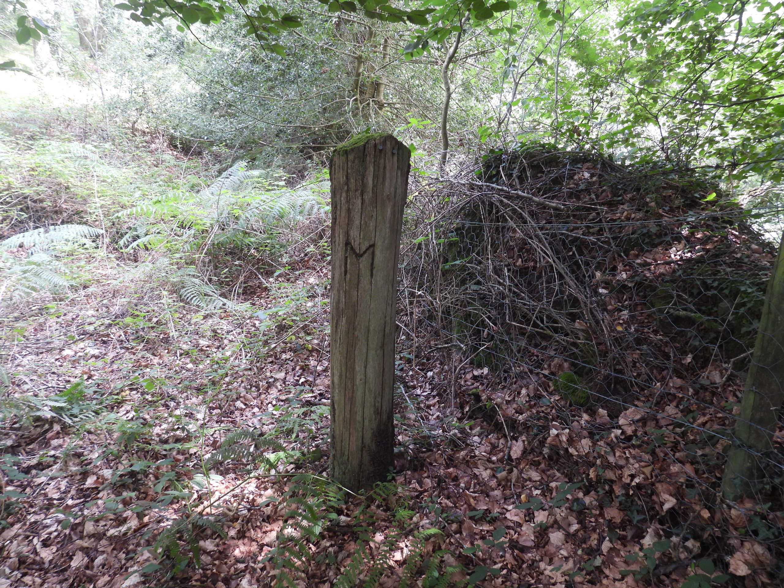
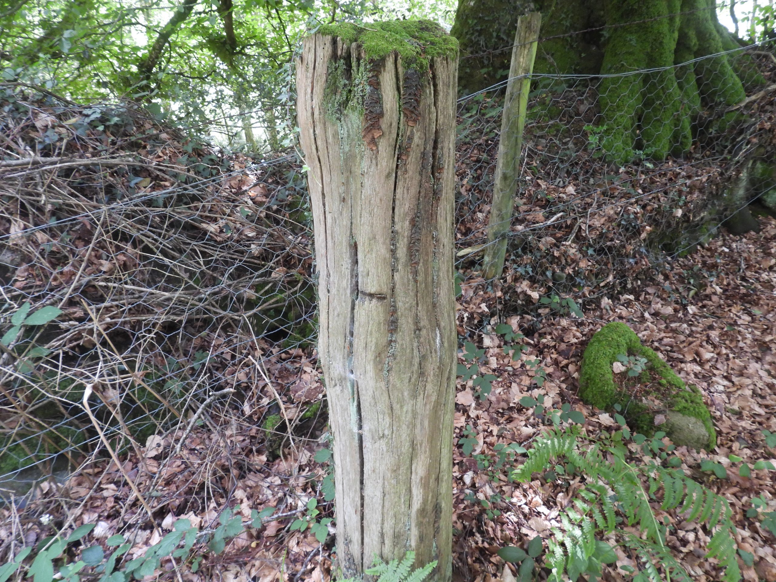
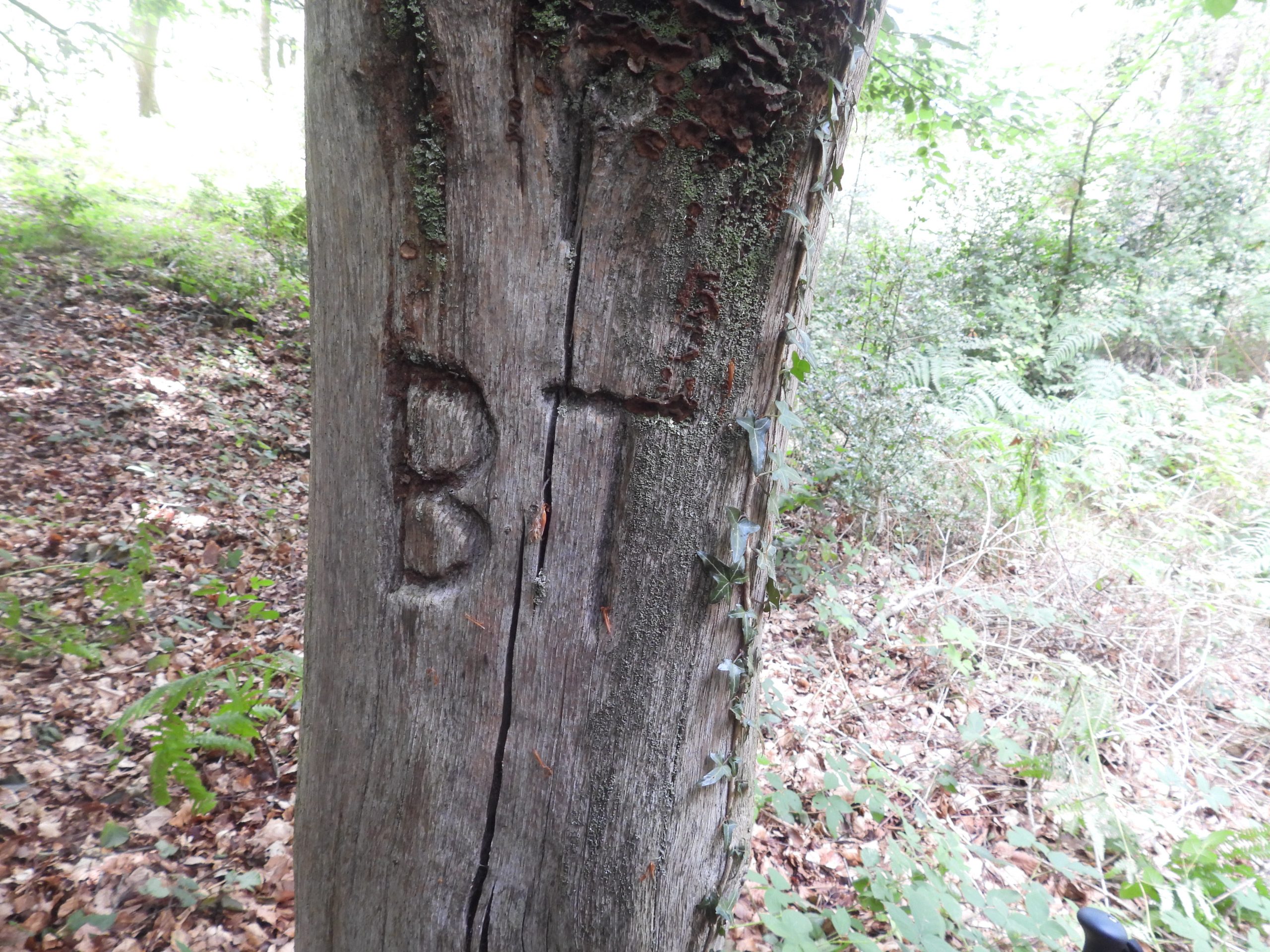
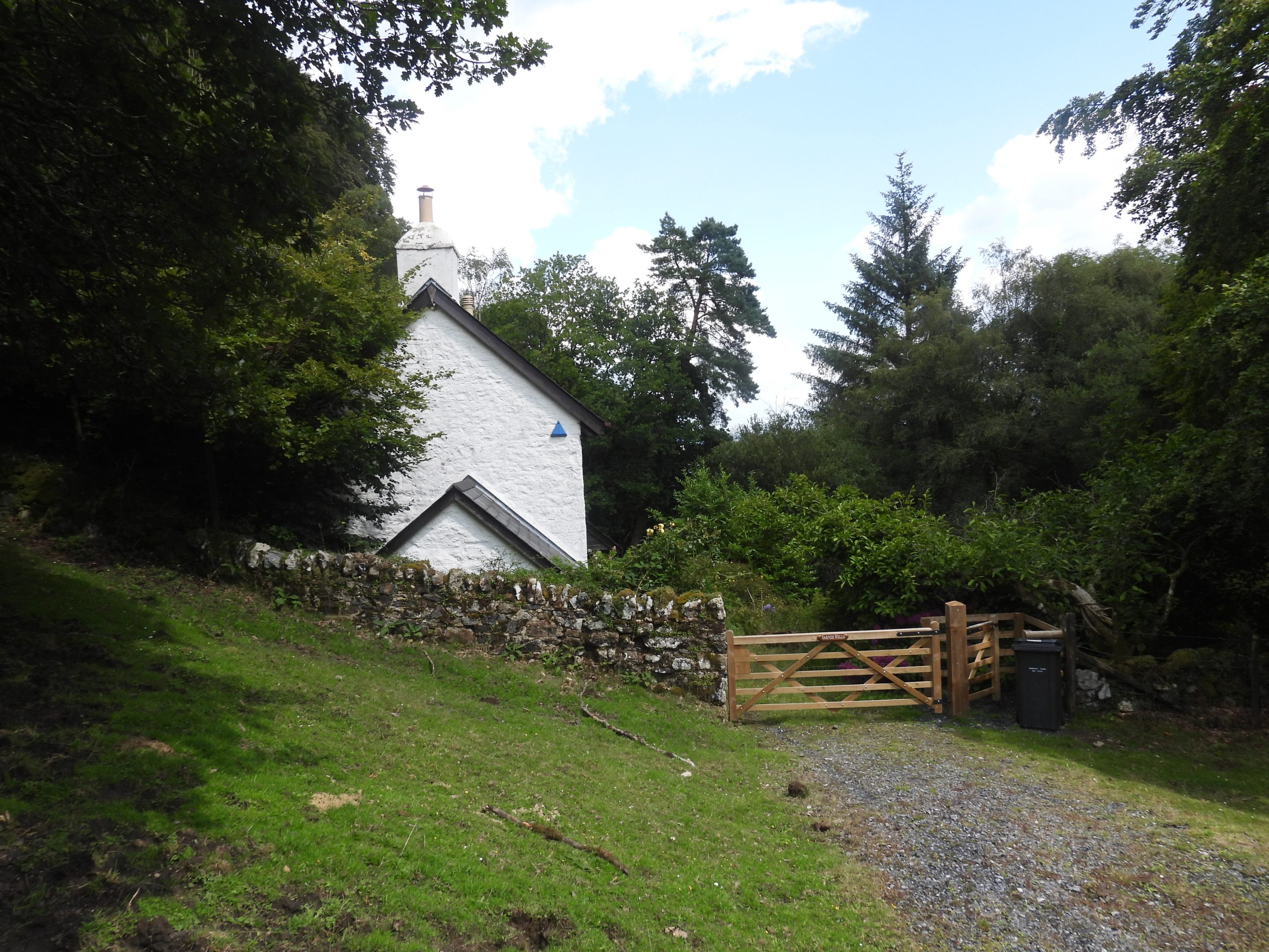
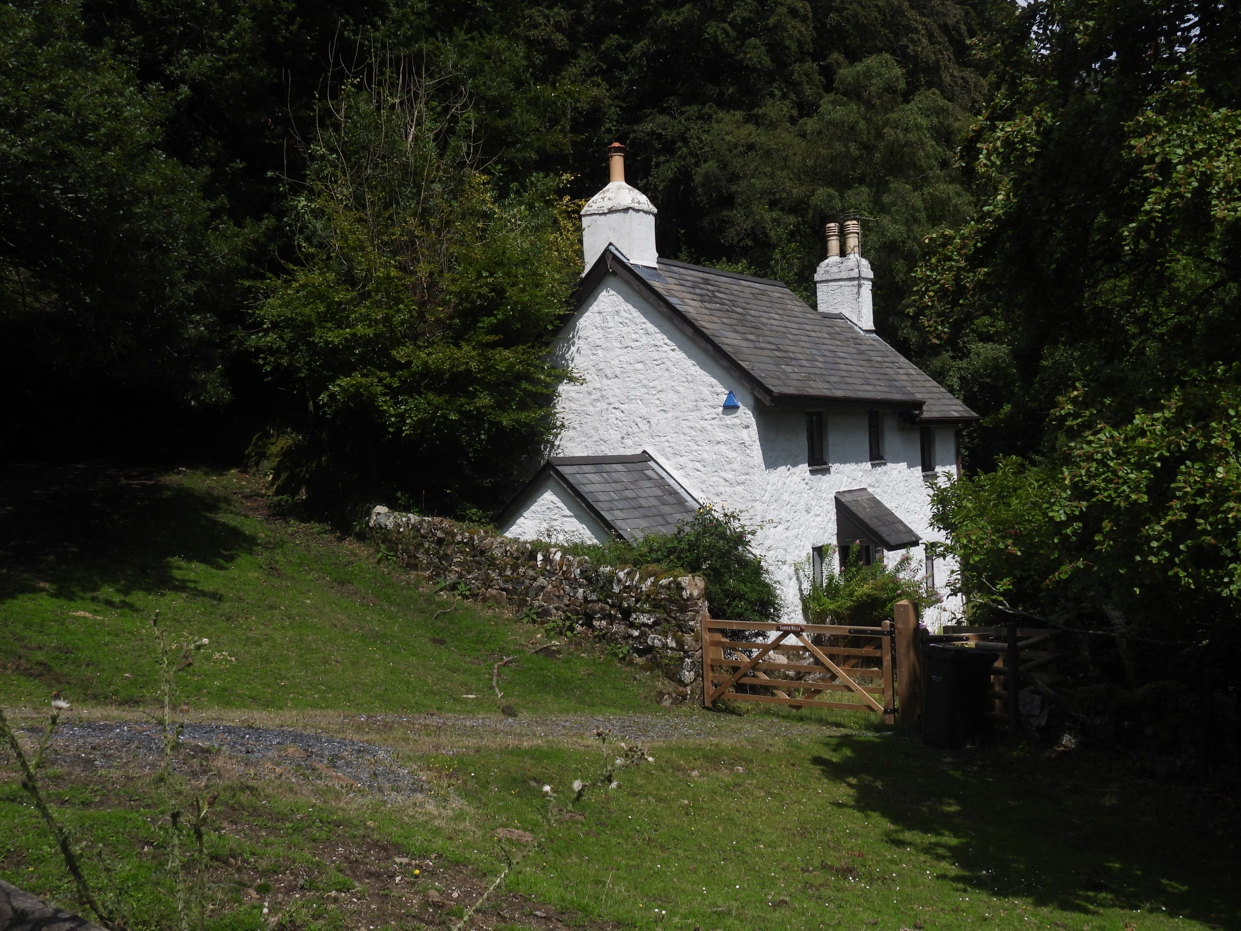
Sketch map showing features covered in this post, namely; Yarner Copper Mine, (the) Prospecting activity, Yarner House, Yarner Wells, the ‘Y’ boundstone and the Triple Parish Boundary PostWood sculpture near the fenceline surrounding Yarner Copper Mine Shaft and Engine HouseThe main remains of Yarner Copper Mine are sited near the eastern end of East Dartmoor National Nature Reserve in Yarner Woods, on the moderate north-facing slope near an unnamed stream. The most striking remains are those of a ruined engine house, approximately 150m east of the modern buildings, along a modern track. The location is at SX7837 7837. The Engine House from 1955. This photograph would have been taken nearly 100 years after the mining was at the height of its operation.As can be seen from the photograph, the engine house is now completely collapsed with only a stump of stonework with some brick visible above ground. As the area surrounding the main Mine Shaft and Engine House being in an extremely dangerous condition the area is fenced off. The shaft has a diameter of approximately 5m and is now recorded as being blocked 3m below the surface. A moderate spoil heap adjacent to the west side of the shaft has been robbed, probably for aggregate (Ref: Heritage Gateway)The ruins of the buildings are difficult to discern amongst the foliage and general tumbledown nature of the mineYarner Copper Mine was known to have been worked between 1857 and 1865 before being bought by the nearby Devon Frances (or Francis) Mine. It is believed that operations may have continued as Devon Frances between 1866-1872Helen Harris records that the workings here were 50 fathoms deepYarner Copper Mine information board – a welcome addition in the humble opinion of the authorThe information board citing the mine operated in the 1850’s and 1860’s and had a steam-powered Cornish Beam Pumping Engine. Mention of two waterwheels on the board reflect the record of Hamilton Jenkin who stated the mine had, in the 1860s, two waterwheels, one of 40ft and another of 25ft diameterIt is believed that the two waterwheels mentioned on the Yarner Copper Mine information board and by Hamilton Jenkin might have been powered by water from the Bovey Pottery Leat because the nearby stream on its own would not have provided an adequate or reliable supply. The entry in the Heritage Gateway (ref: Dr Phil Newman) states: “The only possible location that these wheels could have been sited so as not to have depleted the water in the leat was near to the foot of a steep channel where the leat changes height. The water could then have been returned to the lower section of the pottery leat after passing over the wheels. Unfortunately this is the area which has since been levelled to accommodate the modern timber sheds so this theory is difficult to prove”. The annotated Google Earth picture is the authors attempt to illustrate the above description.Some interesting information; 2300 tons of copper produced in 7 years and Devon produced 15% of the world’s copper in the 1850’sThe miner’s lives were very toughAn entry in the Heritage Gateway mentions, two closely spaced parallel walls on the opposite (west) side of the shaft. The author believes this photograph shows these parallel walls. The parallel walls are said to have (probably) accommodated a balance beamA linear spoil heap approximately 15m long is located around 500m west of the main Yarner Copper Mine, where there is evidence of prospecting activity. This is located 475m at around SX 7778 7835. The linear spoil heap lies next to a track. This may have been part of the Devon Wheal Frances (or Francis) original sett, which was quite distinct from the original Yarner Copper Mine operationsJust uphill from the spoil heap and the track a rather red – ochreous stream can be found providing further evidence of prospecting in the areaThis stream appear to be a small tributary of the River Bovey and also supplied water to the Bovey Pottery Leat. The water from this stream passes through Reddaford Water on the Bovey Tracey / Manaton road. Did Reddaford Water get its name from the mineral deposits in the water during the time of mining operations in Yarner Woods ?If the red – ochreous stream is followed upstream, the source of the colouring can be locatedThe once clear stream appears to joined by an outflow from an aditA short distance from where the red – ochreous stream meets the clear stream an old adit can be found. No doubt the prospectors were looking for copper, but the ochre colour obviously indicate iron content. There is a well known Cornish river called ‘Red River’ which runs through the once rich area of tin and copper mining around Camborne.This Adit entrance was driven into the foot of a steep slope and has red – ochreous water emanating. It is located at SX77738 78320A flattened area close to the stream with the discharge from the aditA slightly ‘raised’ flat area near the ‘adit discharge’ stream which could conceivably have had a wooden construction placed on top. Outline of a very ruined rectangular building near the prospecting areaThe building has rough stone walls just under 1m high and internal dimensions of approximately 3m x 3m. It almost certainly was associated with the mining activities in the areaThe ruined building is located at SX77740 78354Views of Yarner house from Yarner Woods are limited. This view is from a four way crossing of tracks which are located to the north east of the prospecting areaYarner House, is a Grade II listed building believed to be of 17th century origins. It lies within its own private grounds of 250 acres; The striking feature of the exterior of the building is its crenulations, which one assumes were part of ,or added to, during the remodelling and enlargement in the 19th century, which doubled the size of the house.Wooden sculpture near the upper / centre part of Yarner Woods, near where 5 tracks meet (the location can be identified on the sketch map in this post)Next to the Bovey Tracey / Manaton road, near the entrance to a small car parking area is a rather fabulous Boundstone inscribed with the letter ‘Y’, which is assumed relates to YarnerThe boundstone is mentioned by Dave Brewer on pages 245/6 of ‘Dartmoor Boundary Markers (2002, 2nd edition), where he remarks that “..in spite of being on the Lustleigh / Bovey parish bounds, it is unmarked by the O.S”. Of significance, the boundstone is located where the parish bounds change direction from approx east / west to north-east / south west.The ‘Y’ boundstone is located at SX77912 79233In May 1980, Lustleigh Parish set up and unusual Boundary Marker, insofar as it was a wooden post. This marks the point where three parishes meet, namley Manaton, Lustleigh and Bovey Tracey. The picture shows a letter ‘M’ cut into the post, representing Manaton.Letter ‘L’ cut into the post, representing Lustleigh.Letters ‘BT’ cut into the post, representing Bovey Tracey. The post is located at SX77007 78911Yarner Wells (aka North Lodge) is located uphill from the Triple Parish Boundary Post and just downhill from Black Hill. It would appear that this cottage was occupied by the Yarner Estate Head Keeper (at least for a short period at the turn of the 20th century. From the 1901 census, the cottage is recorded to have been occupied by Edward Joint, who was the Head Keeper of the Yarner Estate. Edward Joint lived here with his wife and three children. Yarner Wells was unoccupied when the 1891 census took placeBy 1911 (from census), Yarner Wells was still occupied by the Head Keeper. At this time the Head Keeper position was held by Edward Low, who was born in Marldon Parish. He lived there with his wife Emma. Of interest is that by the 1920s the Head Keeper (Len Evans), was resident in the Lower Lodge at the eastern end of the Estate, not at Yarner Wells.