A collection of walks, discoveries, insights and pictures of exploring Dartmoor National Park
December 7, 2022
Copper Mines (and other features) in Whitchurch Down area – Old Surprise, Wheal Surprise and Devon Burra Burra
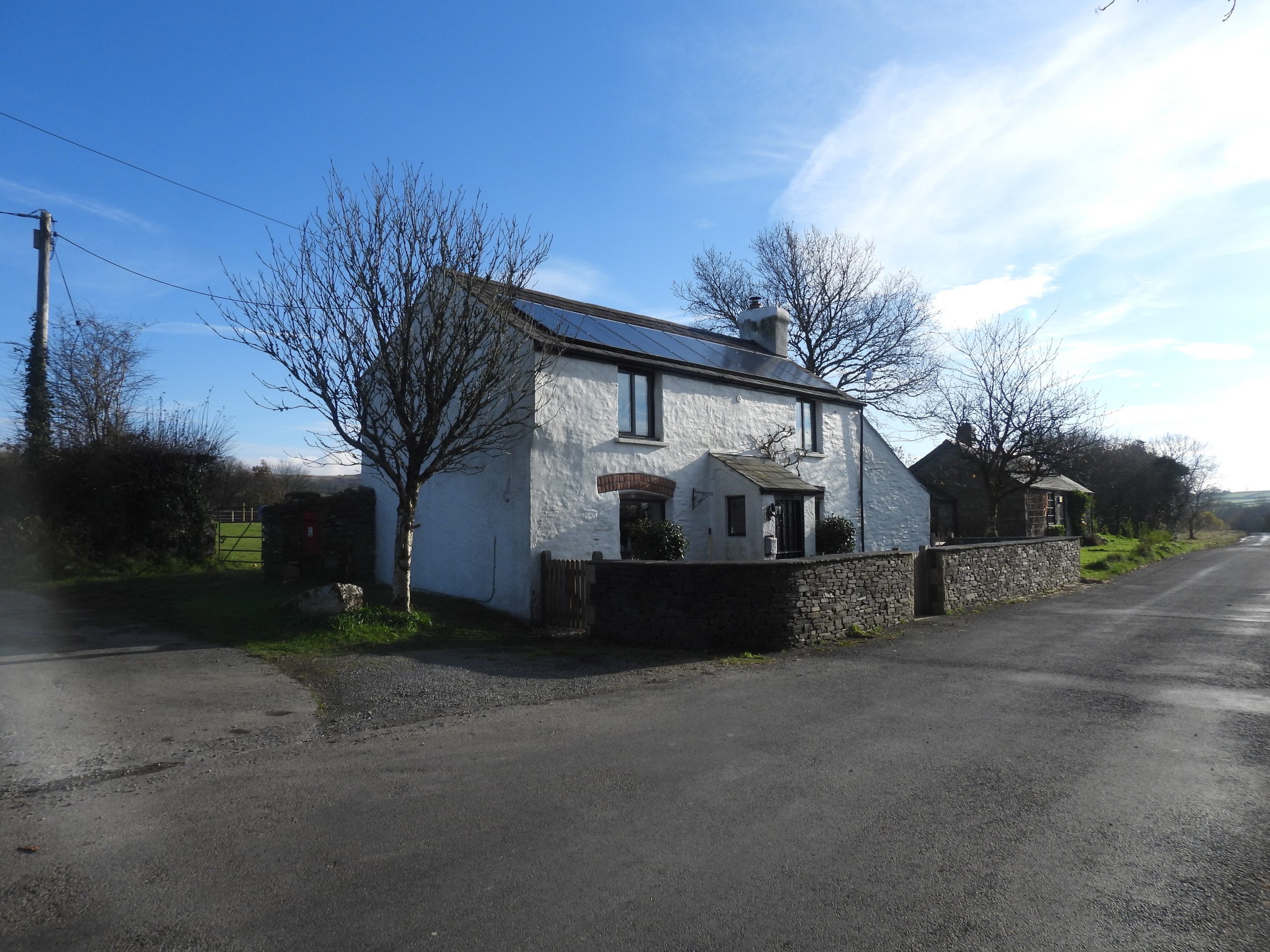
Whilst trawling through Dartmoor books at his local charity shop (to add to the burgeoning library), the author chanced upon a book simply called ‘Whitchurch Down’, which had been published by the Tavistock and District Local History Society. It was first published in 1990 (in A4 format and sold 200 copies) but there was a second edition (the one in the charity shop) which was published in 2000 in a booklet format. The front of the booklet, caught the eye as it was edited by well known Dartmoor author, Helen Harris and inside she had written a section within the book on Industrial Archaeology.
The author already owned a signed copy of a Helen Harris publication from 1968 called ‘Industrial Archaeology of Dartmoor’ and so was familiar with her work . The author was aware from the Helen Harris 1968 publication that there was a “Surprise and Devon Burra Burra copper workings in Whitchurch” but the information was very scant. Having visited this area on numerous occasions the author thought he knew the it quite well with features such as the Parish Boundary Stones, the two crosses, the pool, the milestone and the old smithy which are covered in this post.
However, what the author was unaware of was the detail and extent of the Copper Mining (ie Wheal Surprise and Devon Burra Burra) which took place here in the late 17th to mid-18th centuries, which was covered in industrial archaeology section of the ‘Whitchurch Down’ book. The book was duly purchased and the information in it has been used as a guide to explore the area. Further research using the Dartmoor HER didn’t reveal any additional information and so much of this exploration was reliant on the Harris descriptions and some ‘interpretation’ on the ground.
Further information in the form of mine plans of both Wheal Surprise and Devon Burra Burra has been kindly passed onto the author by Dartmoor Chris, which supplements some of the detail contained in this post.
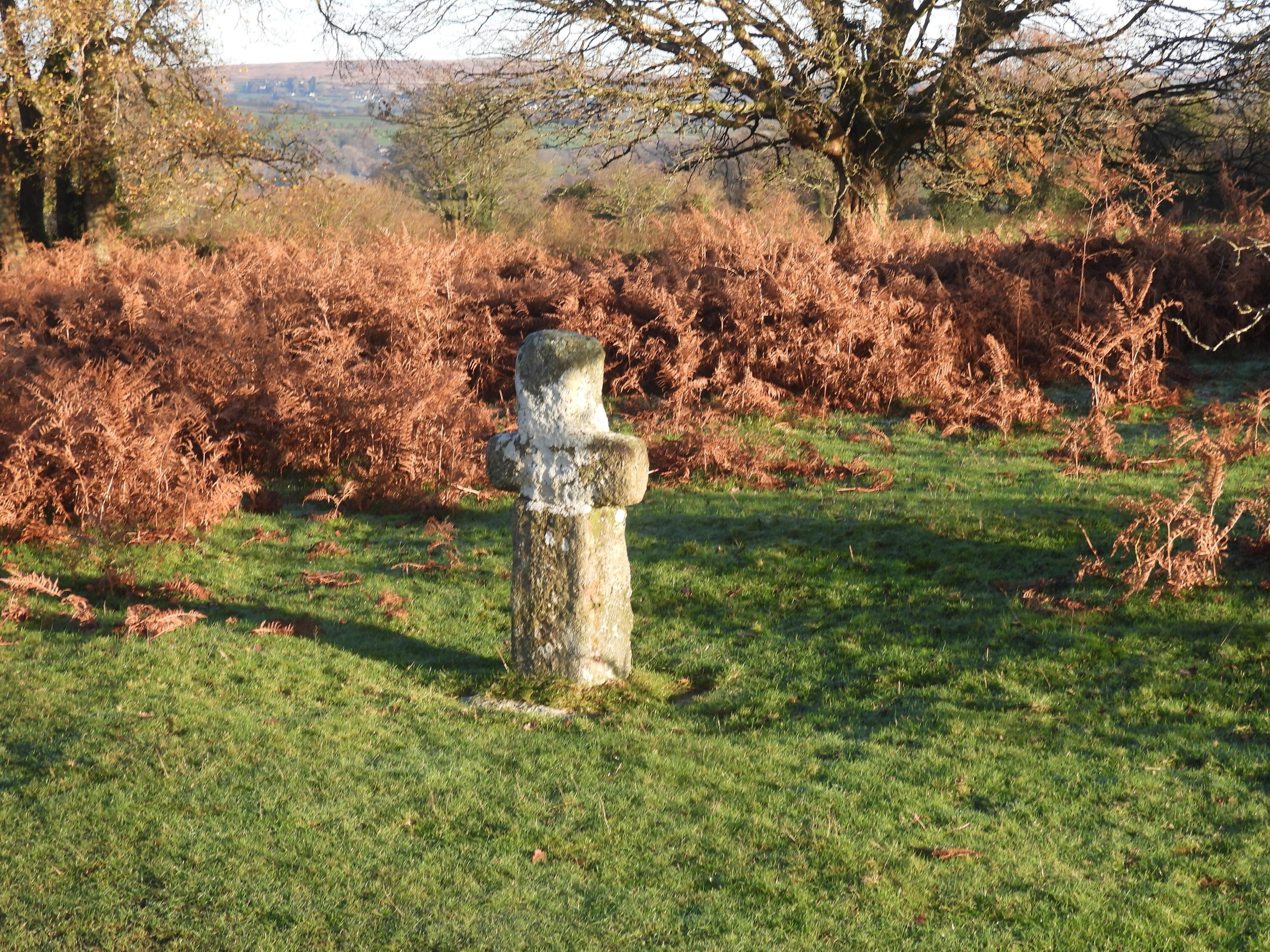
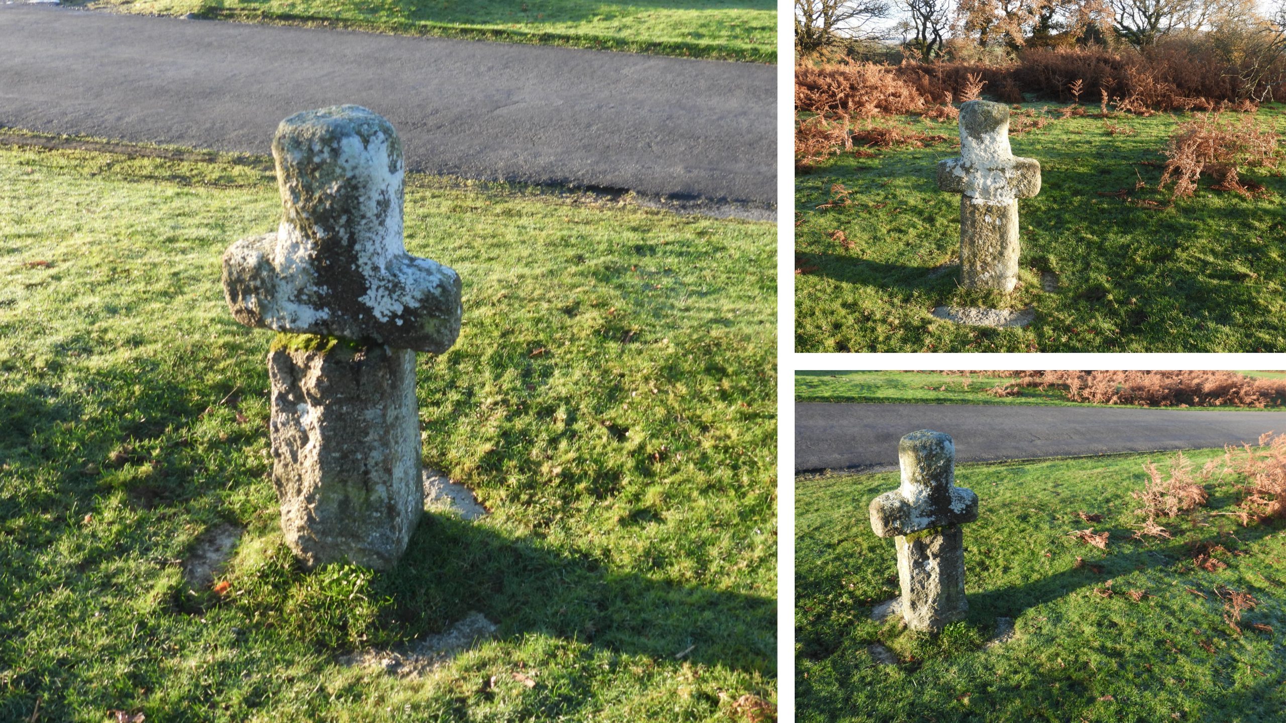
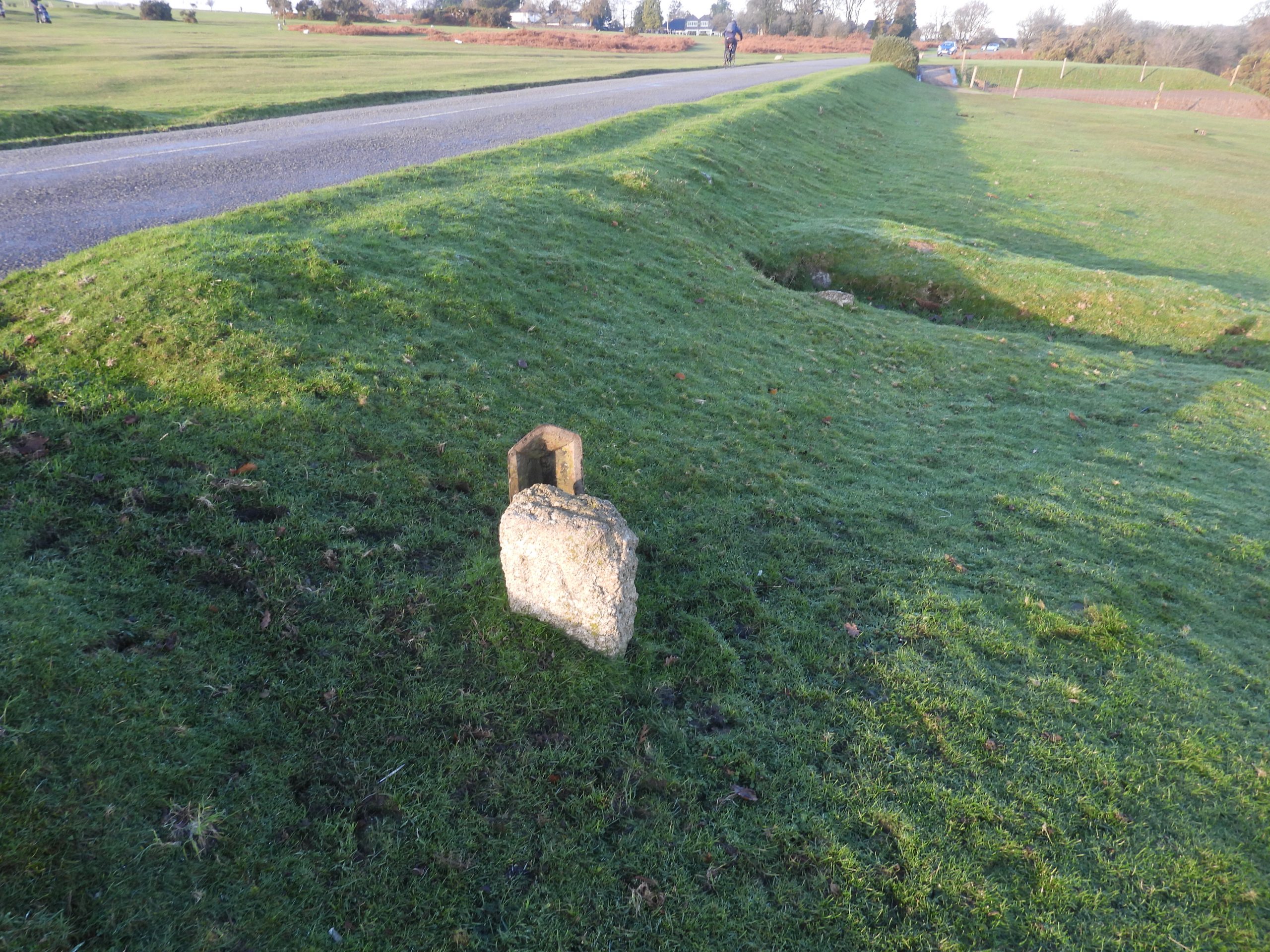
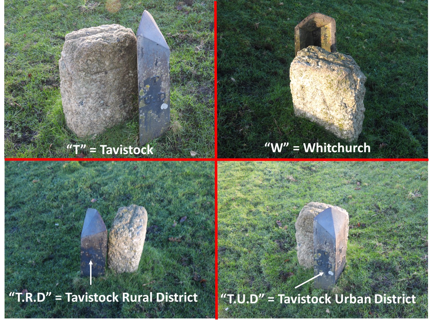
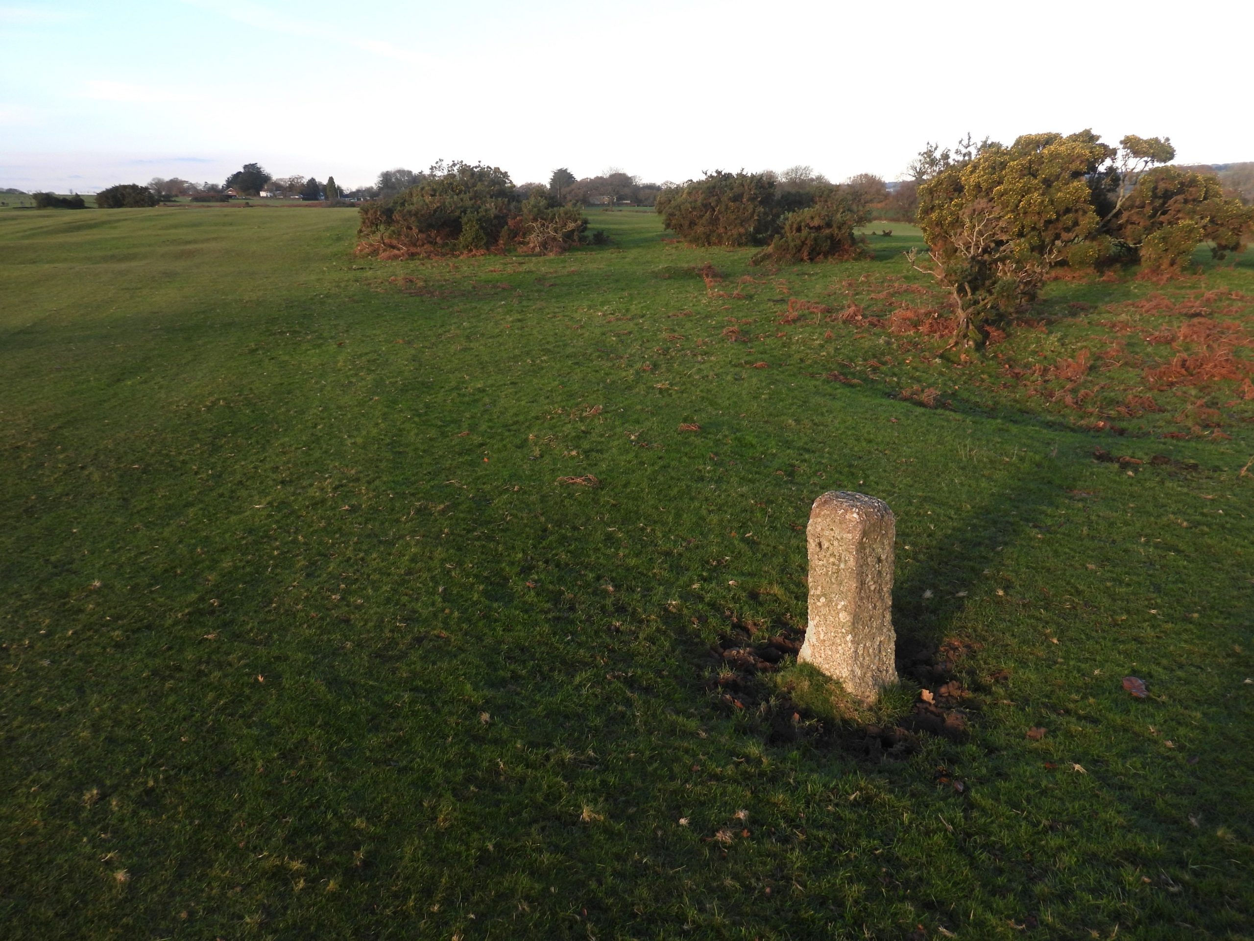
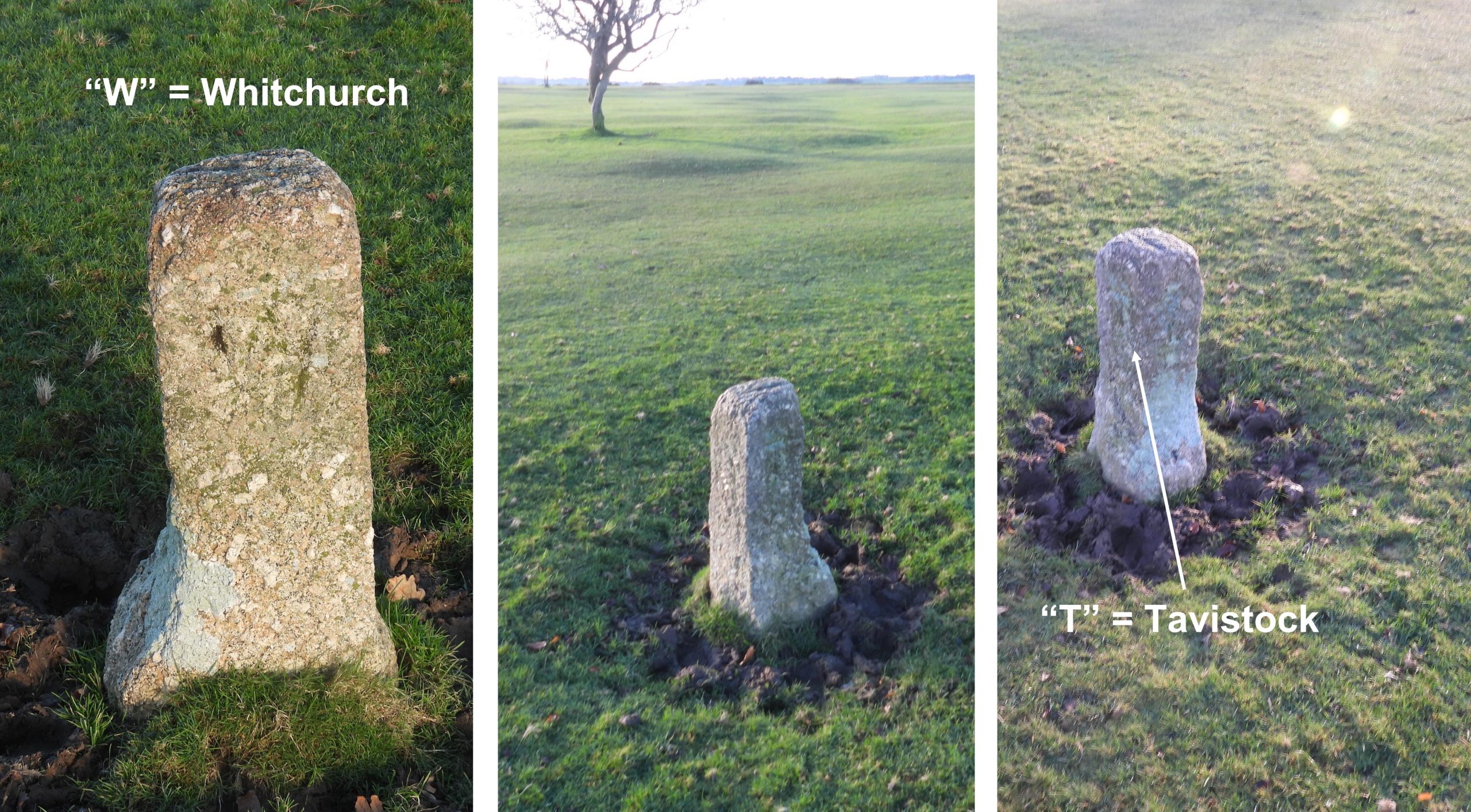
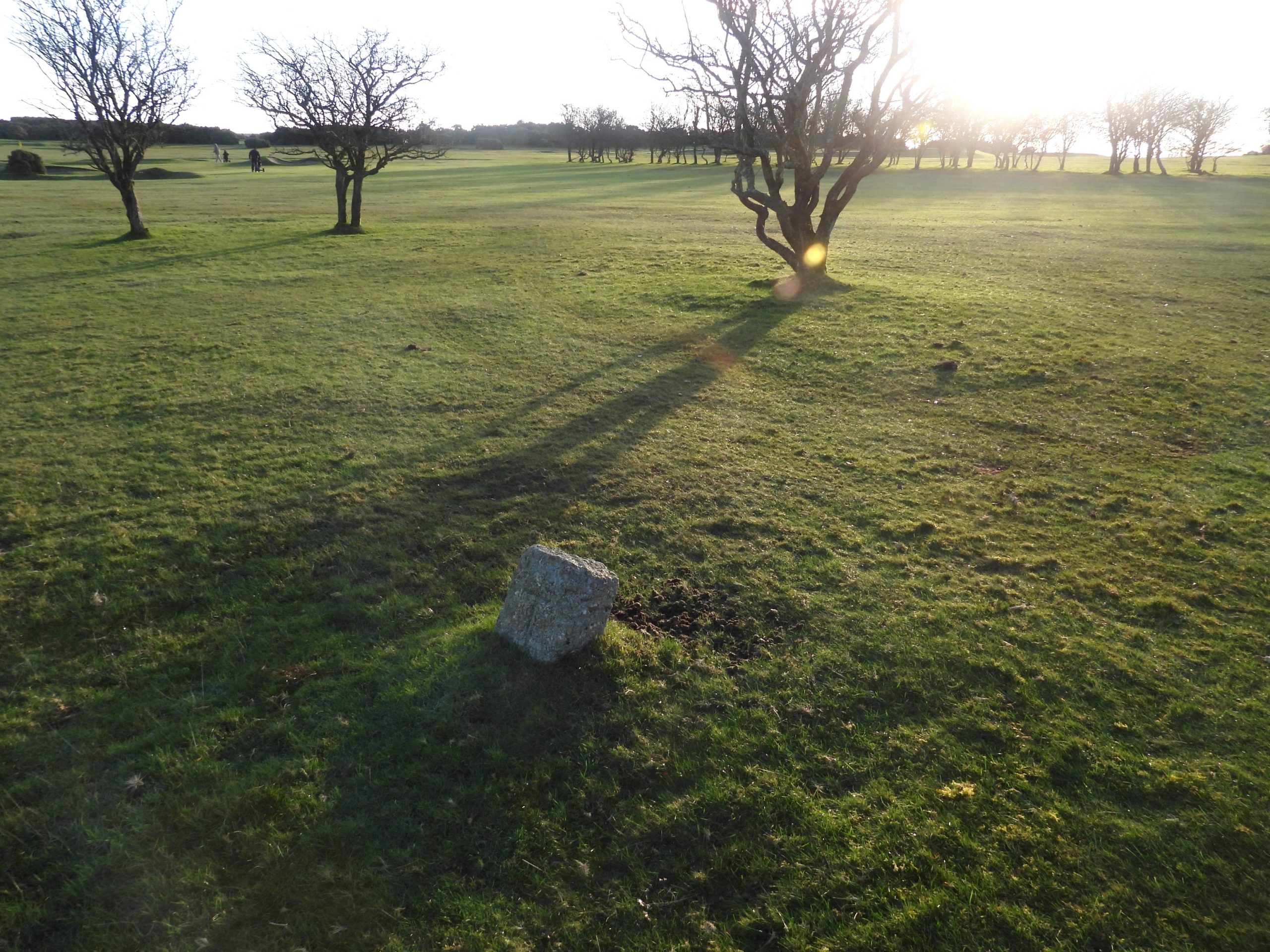
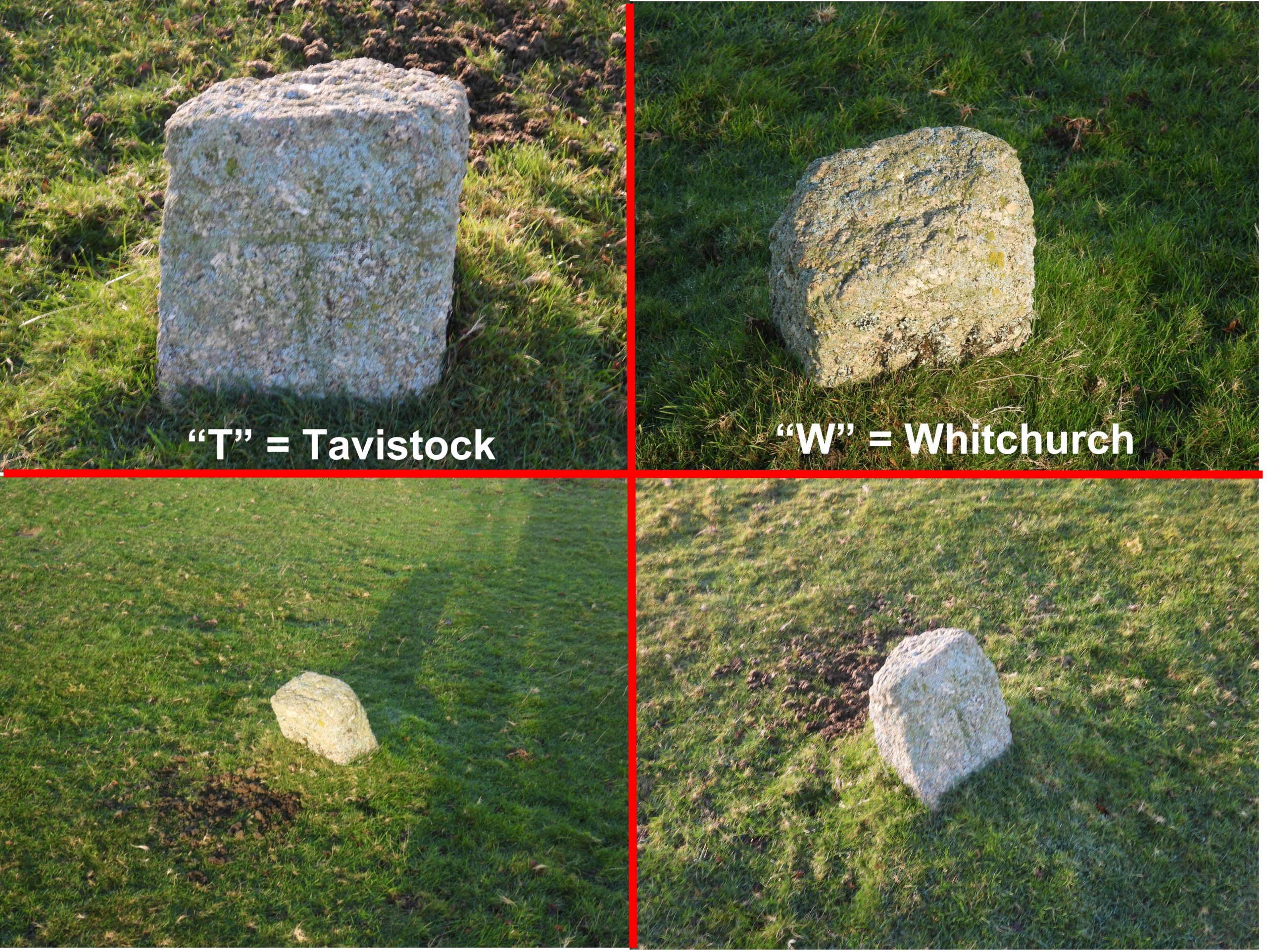
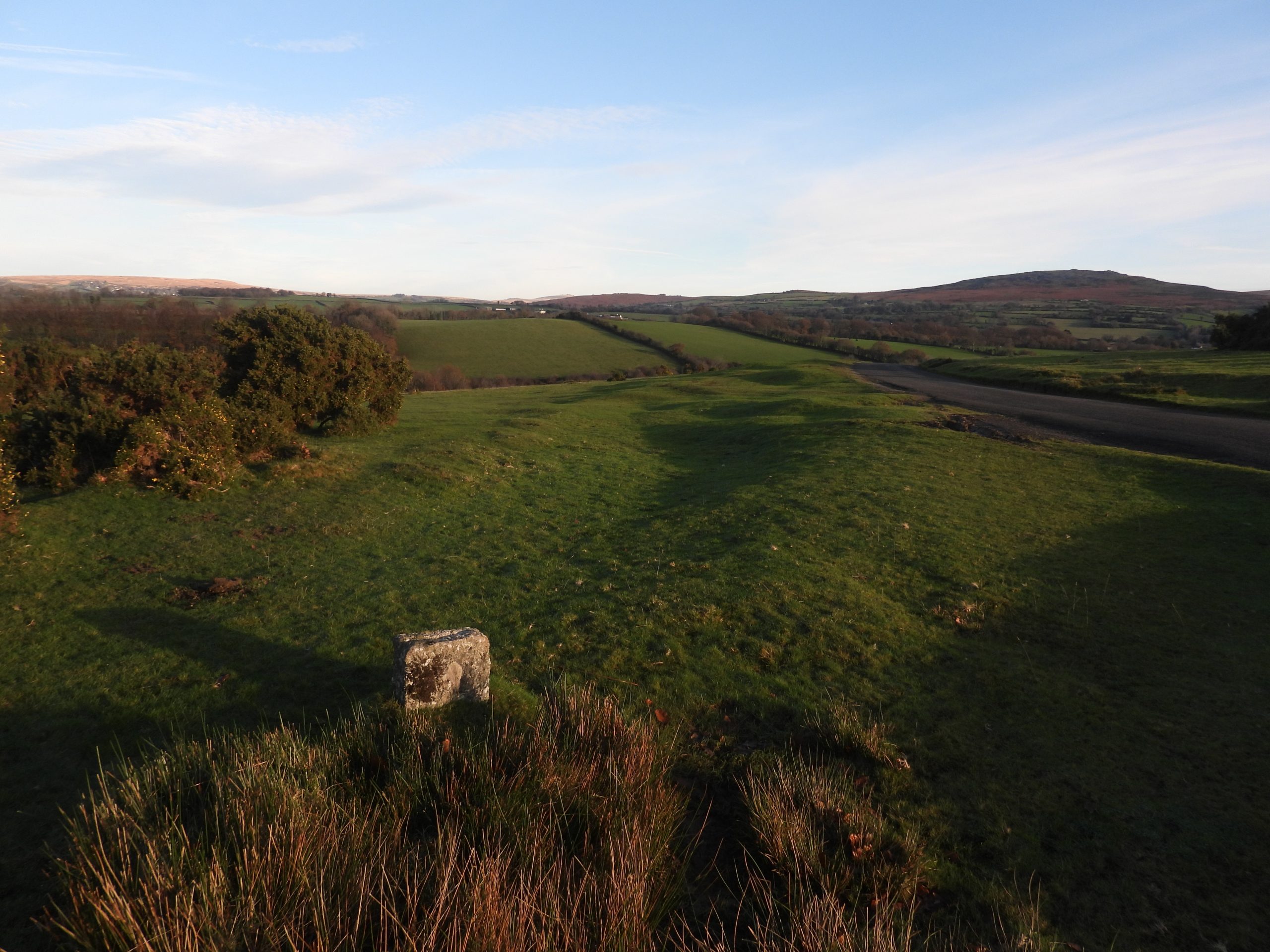
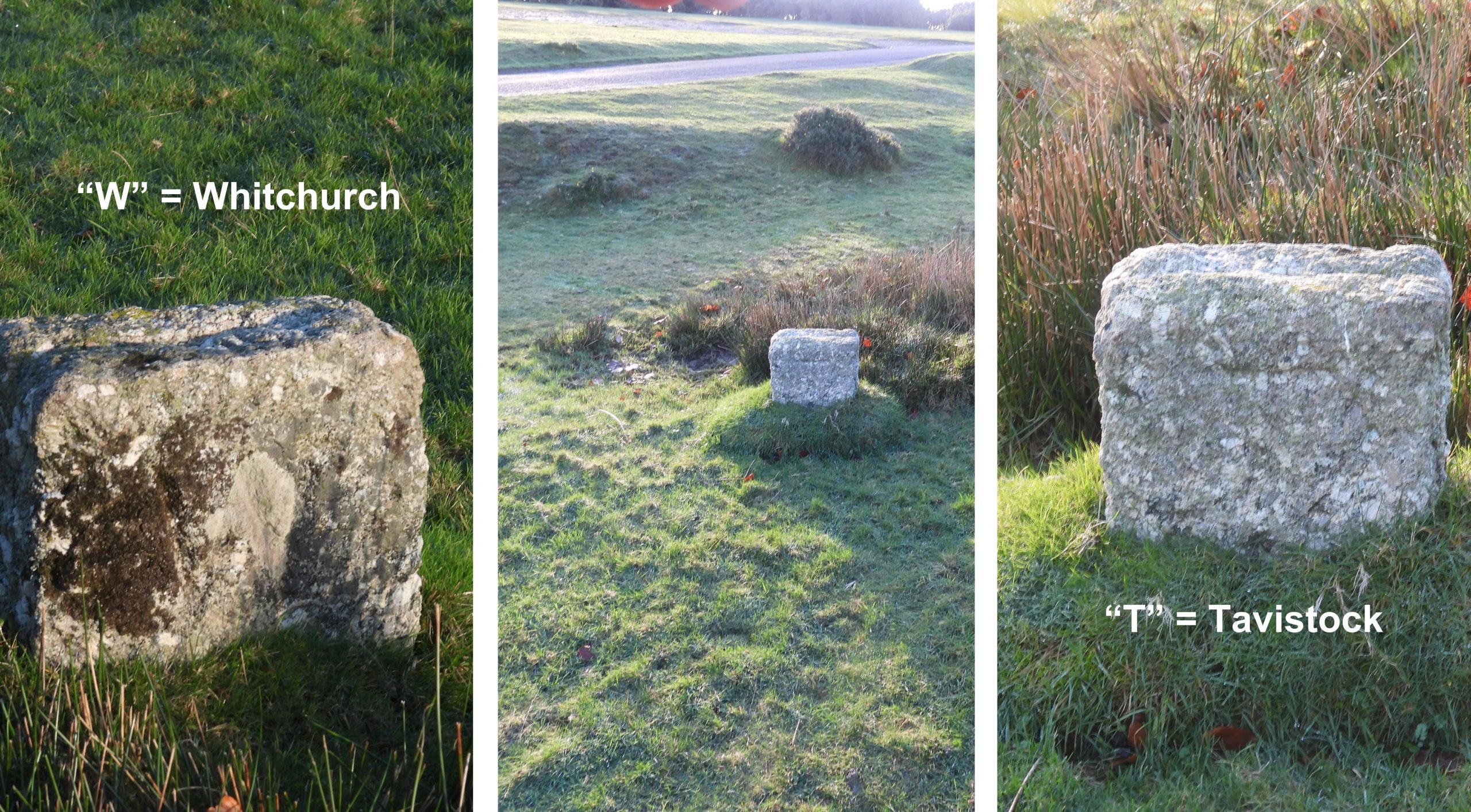
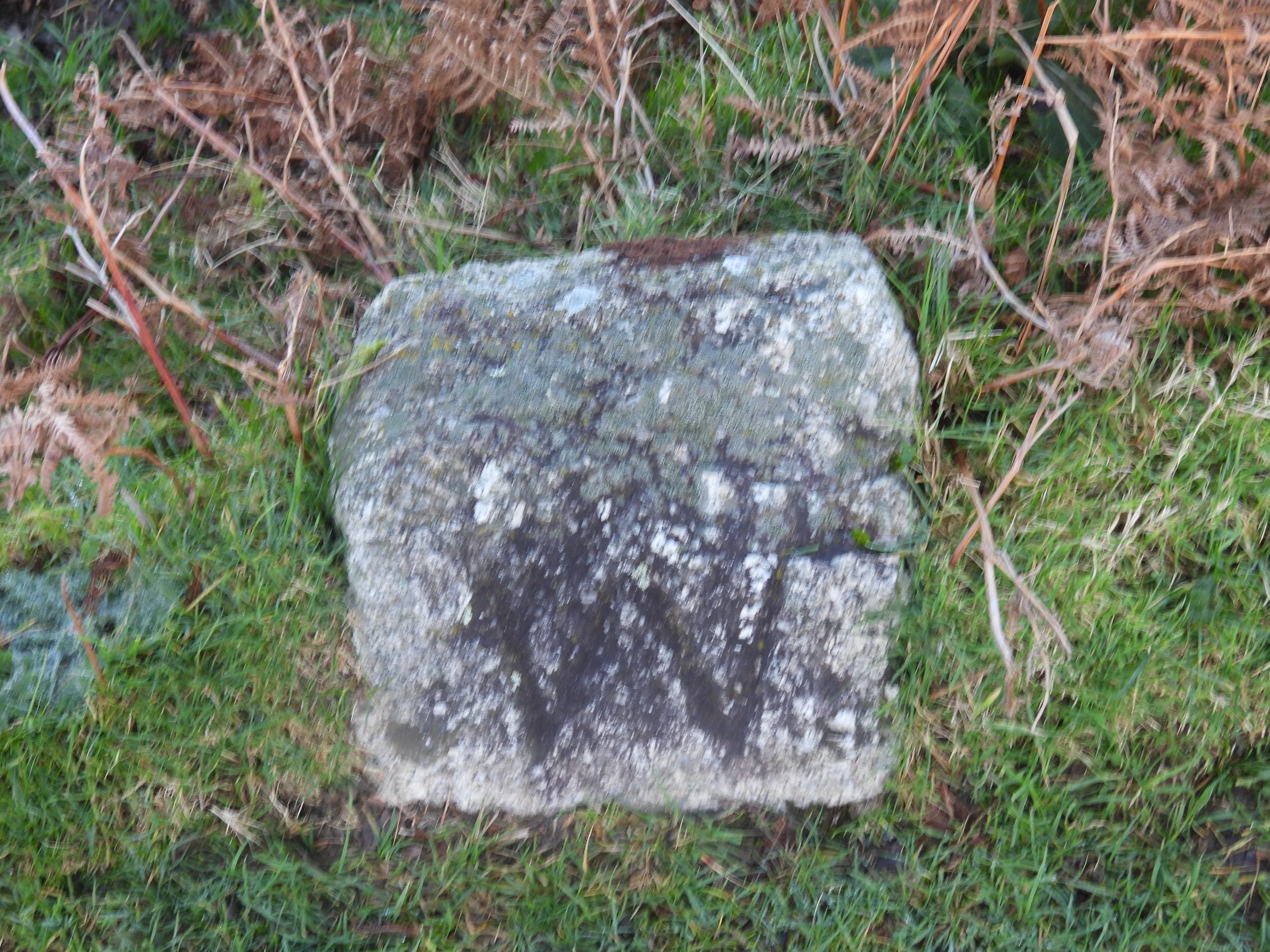
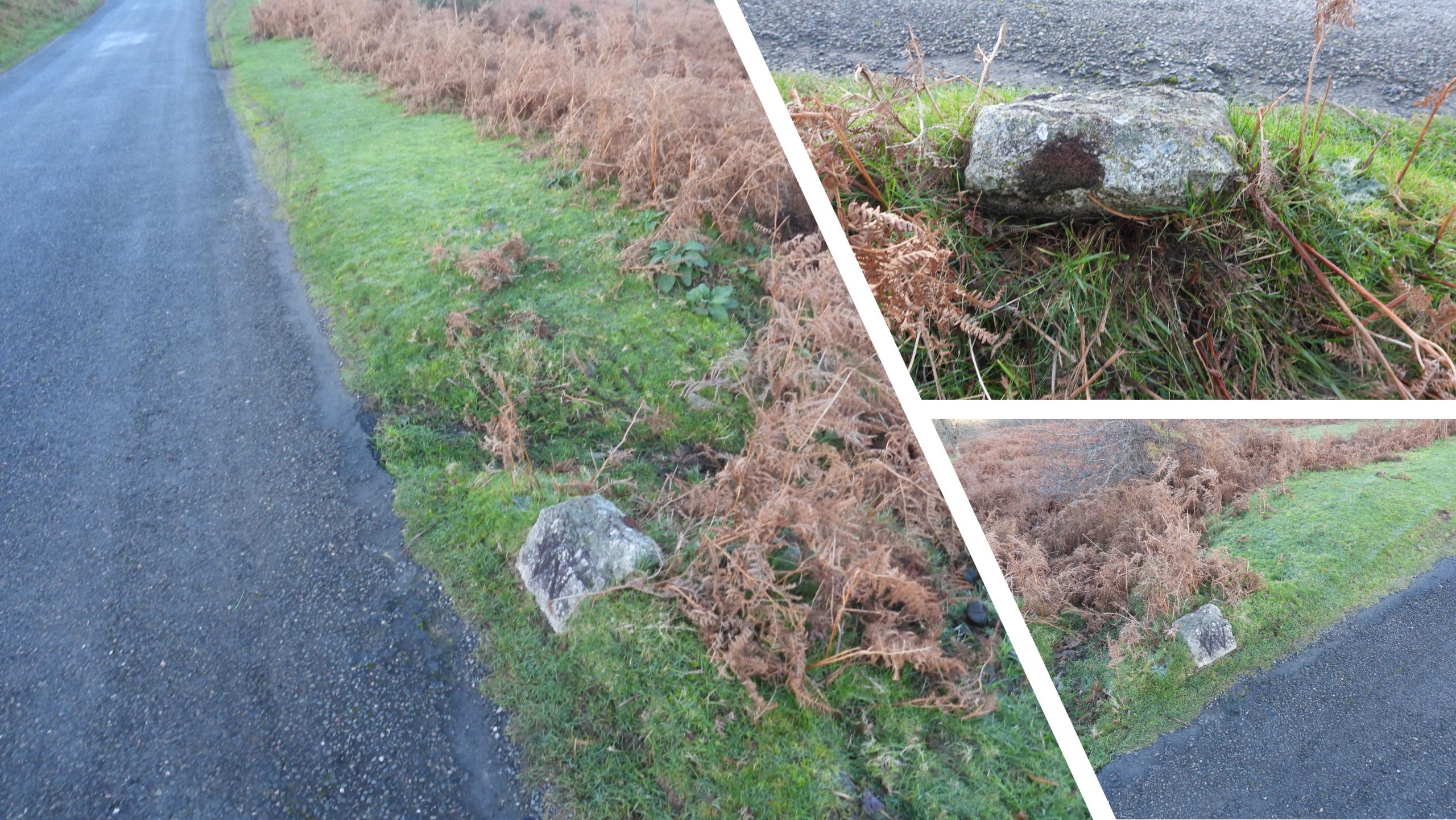
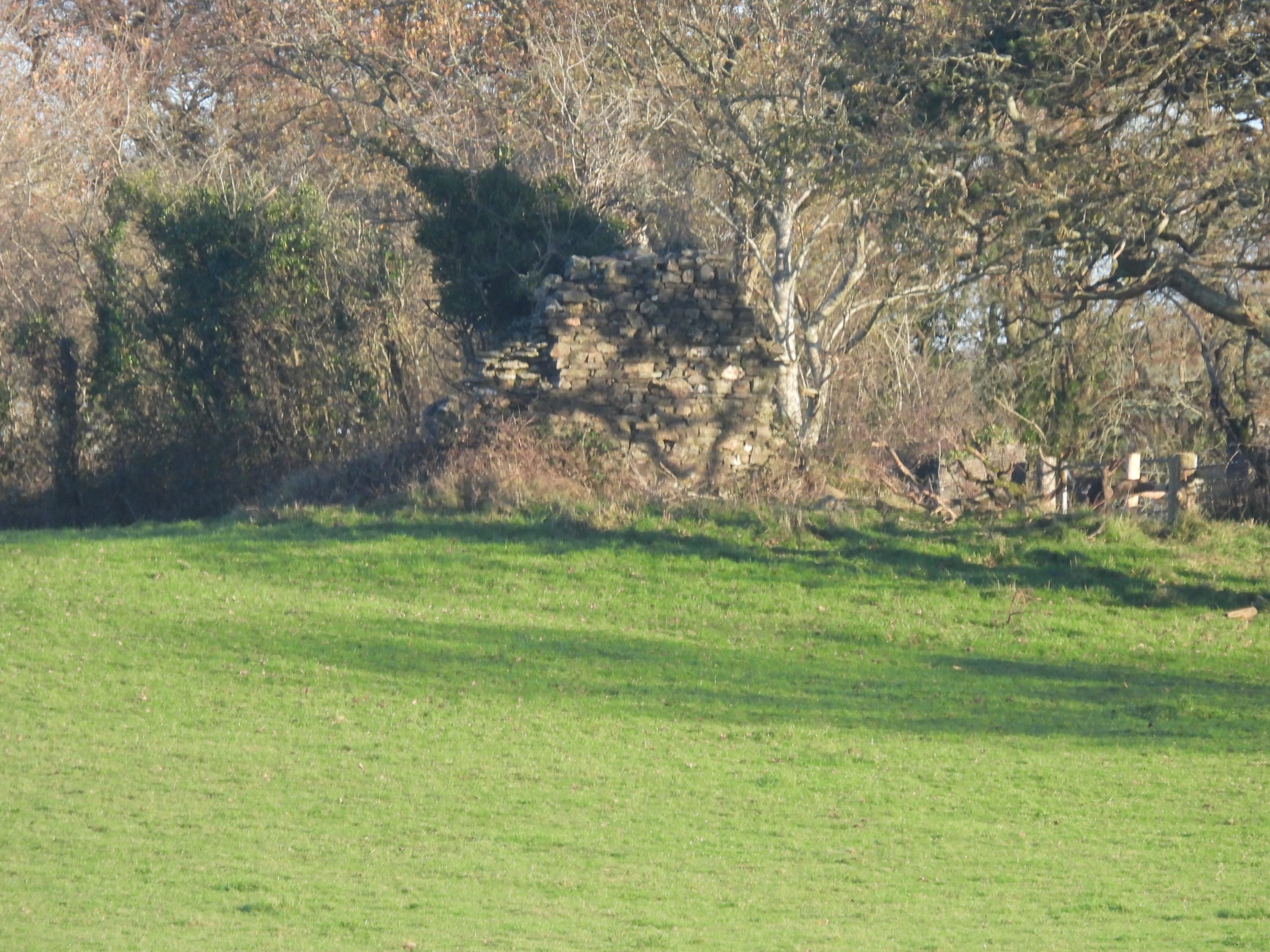
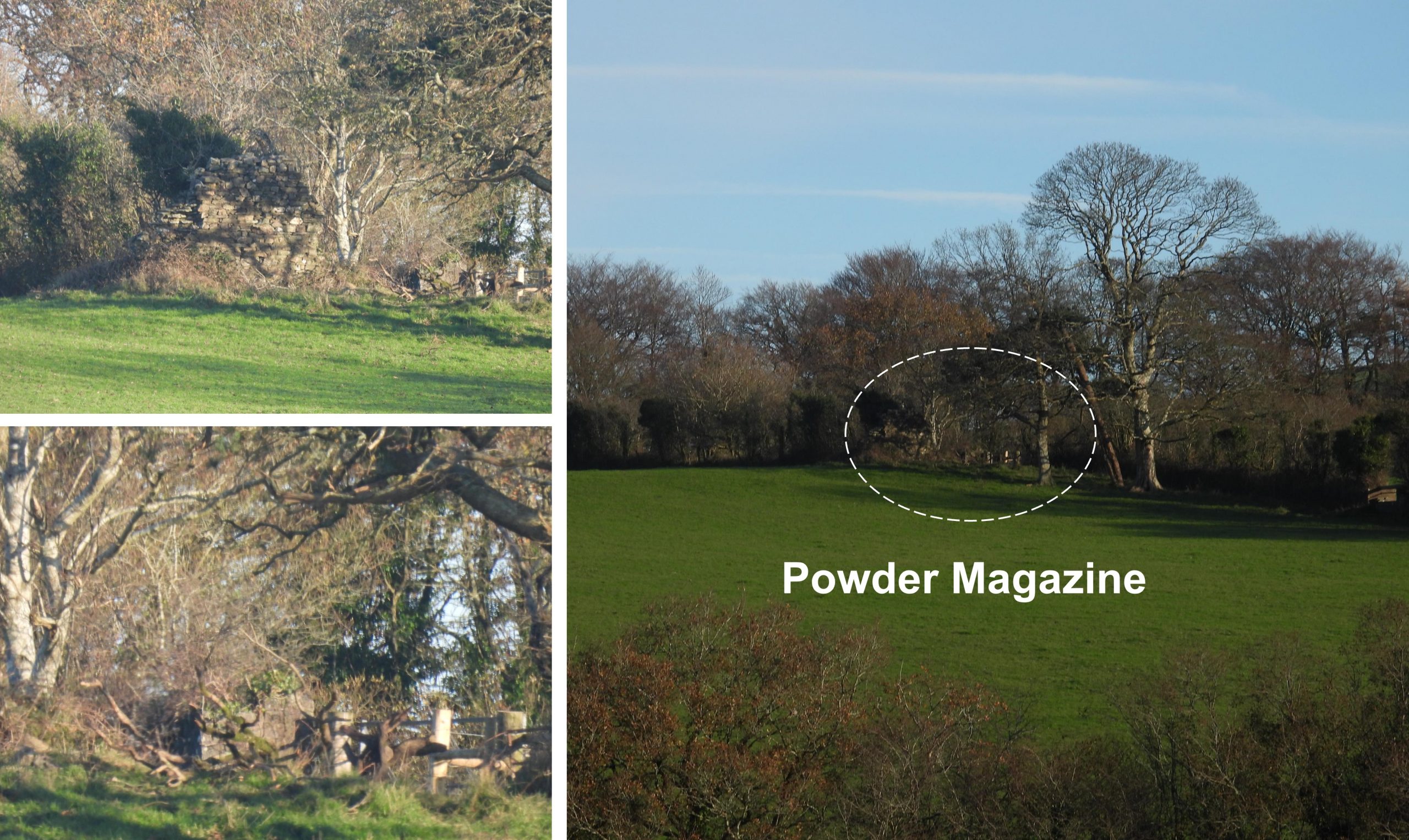
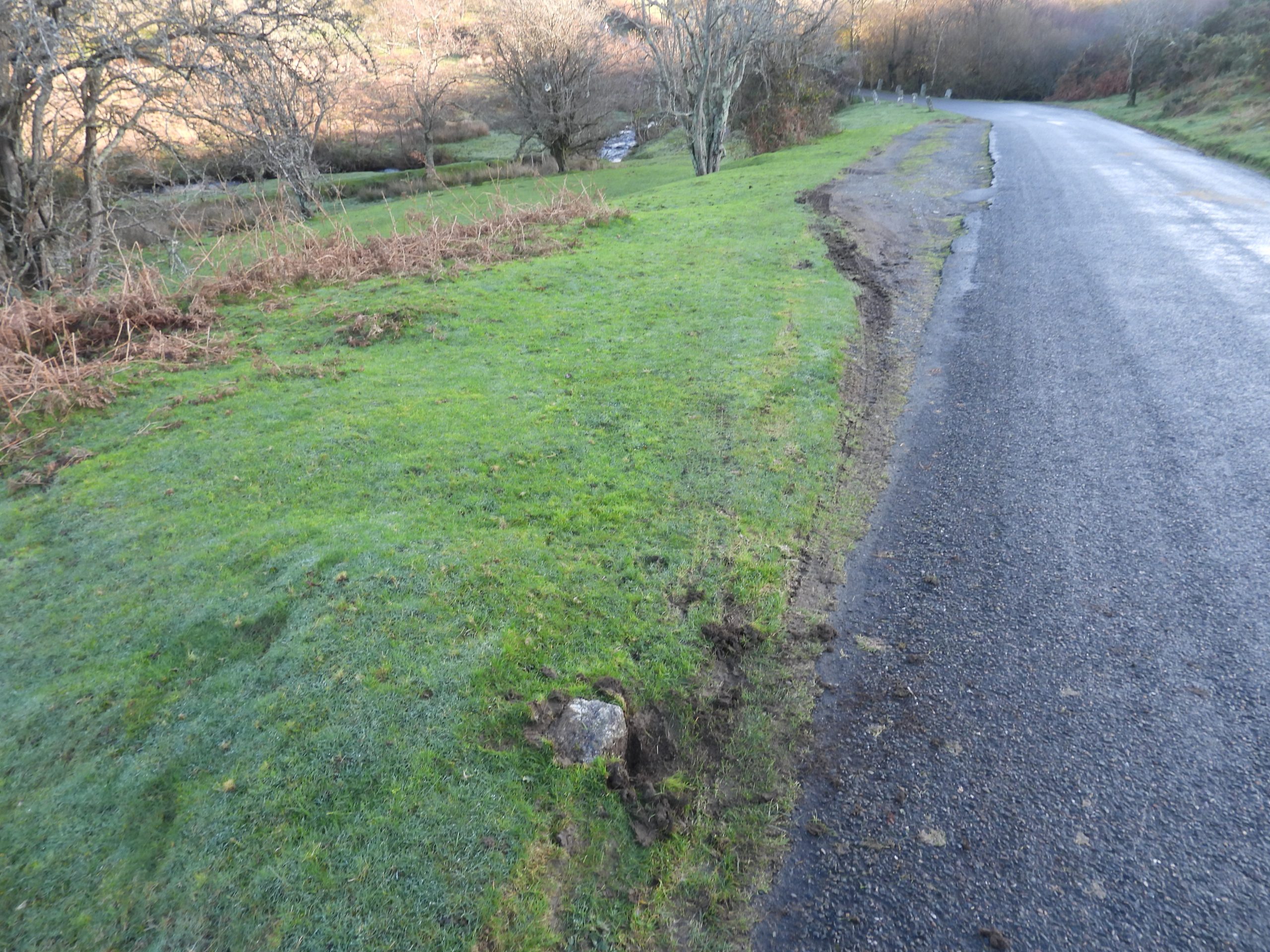
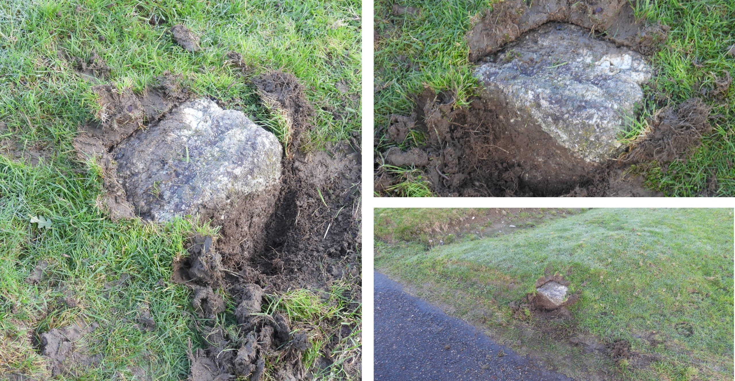
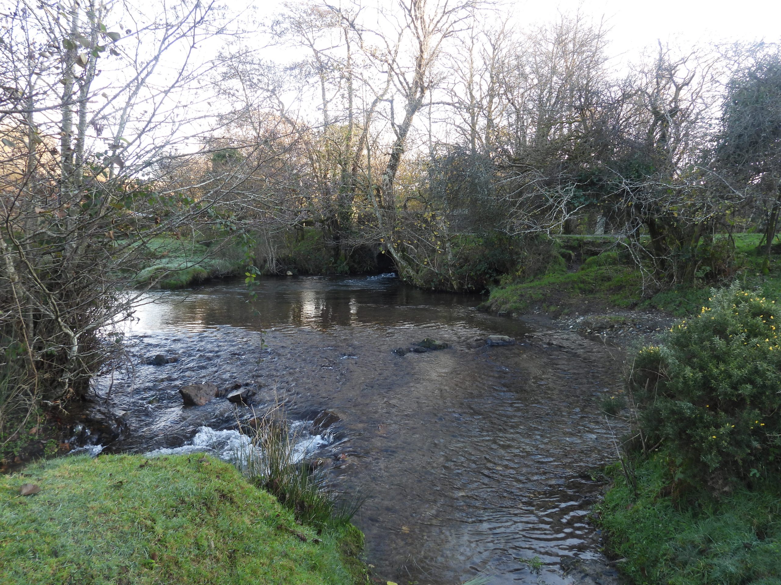
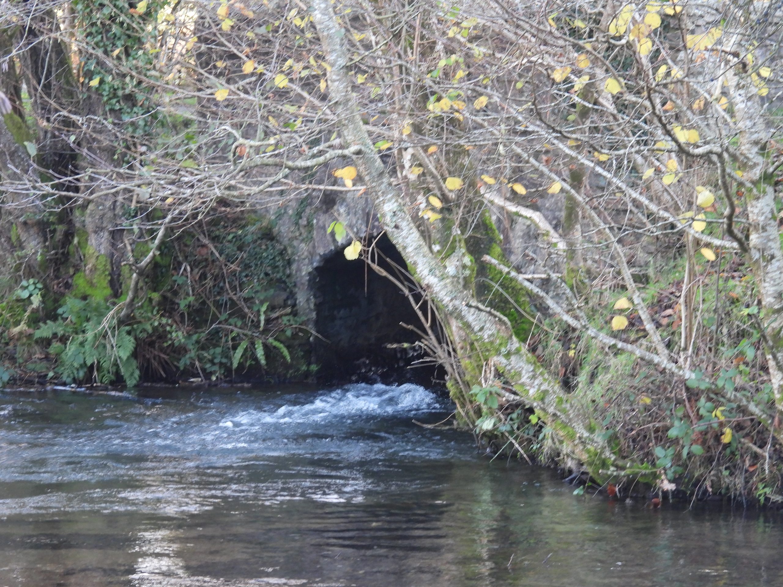
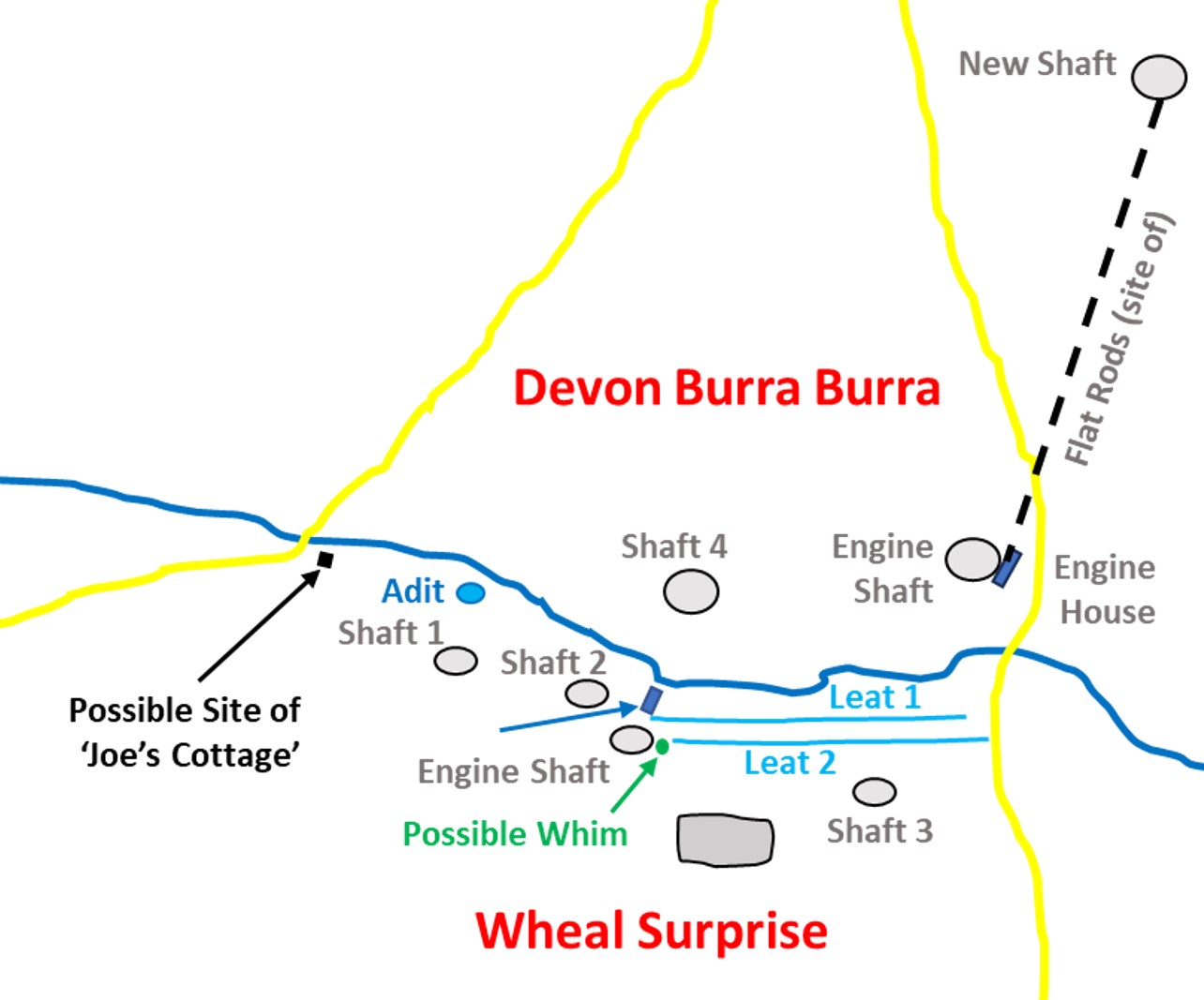
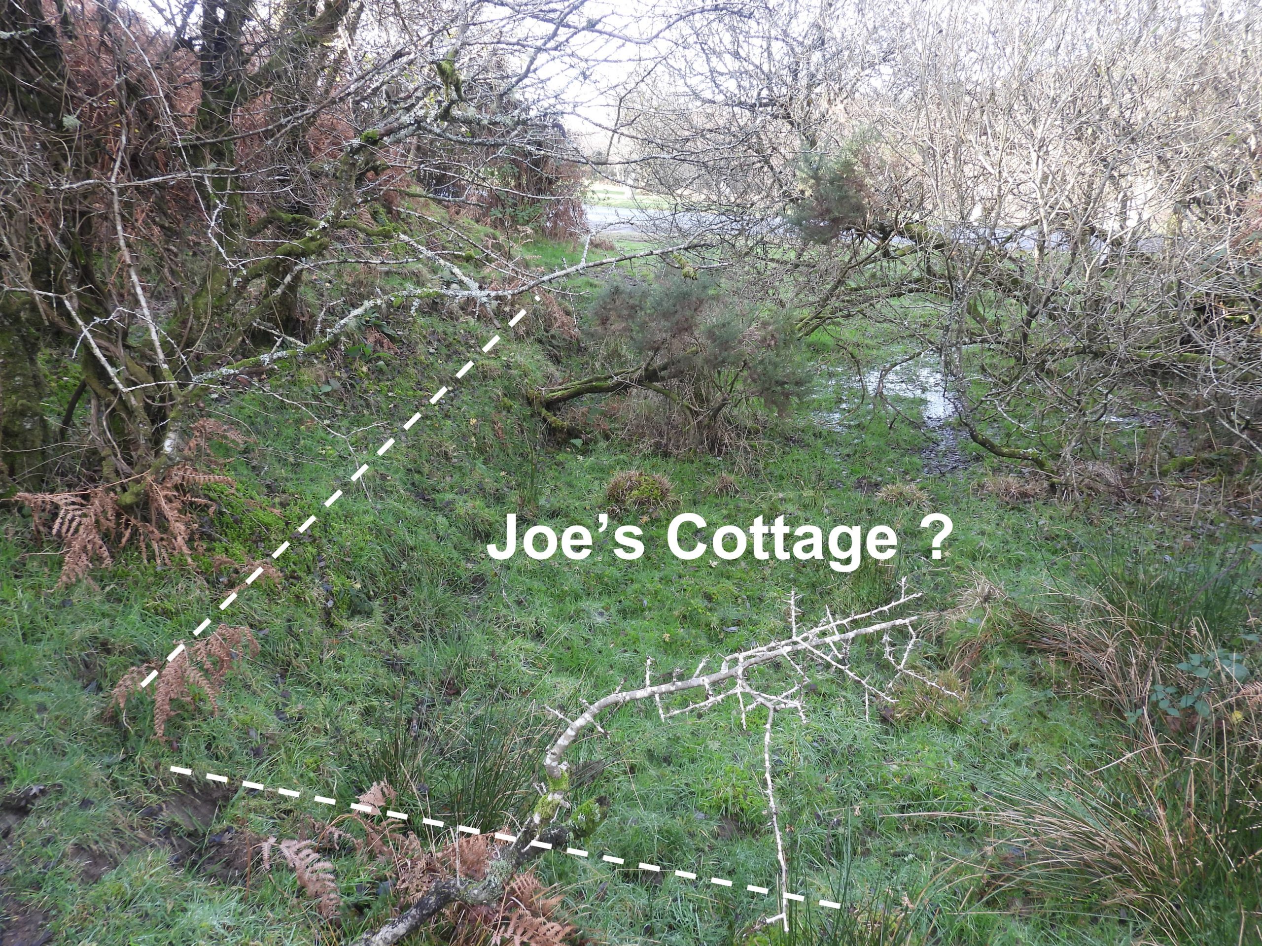
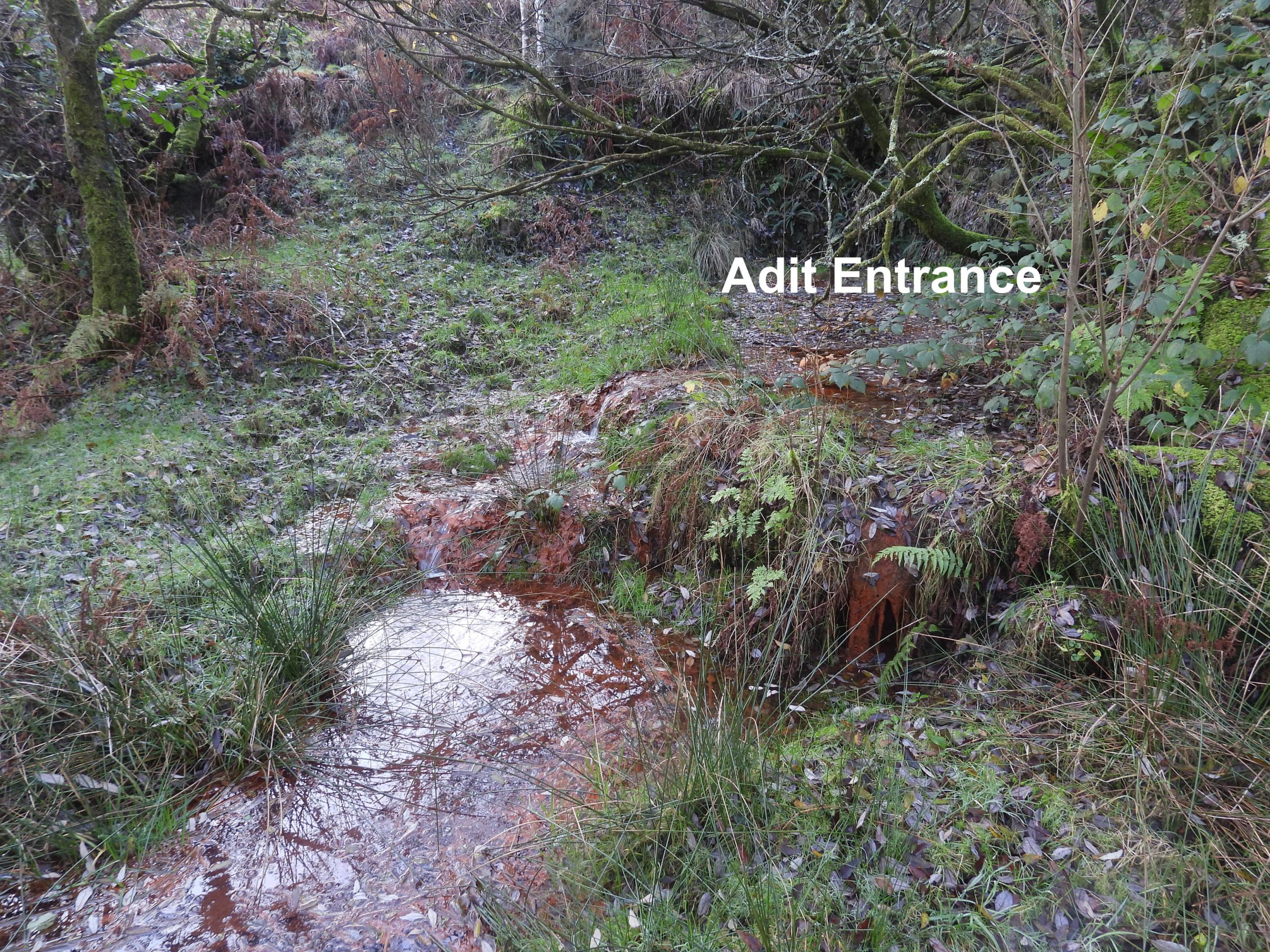
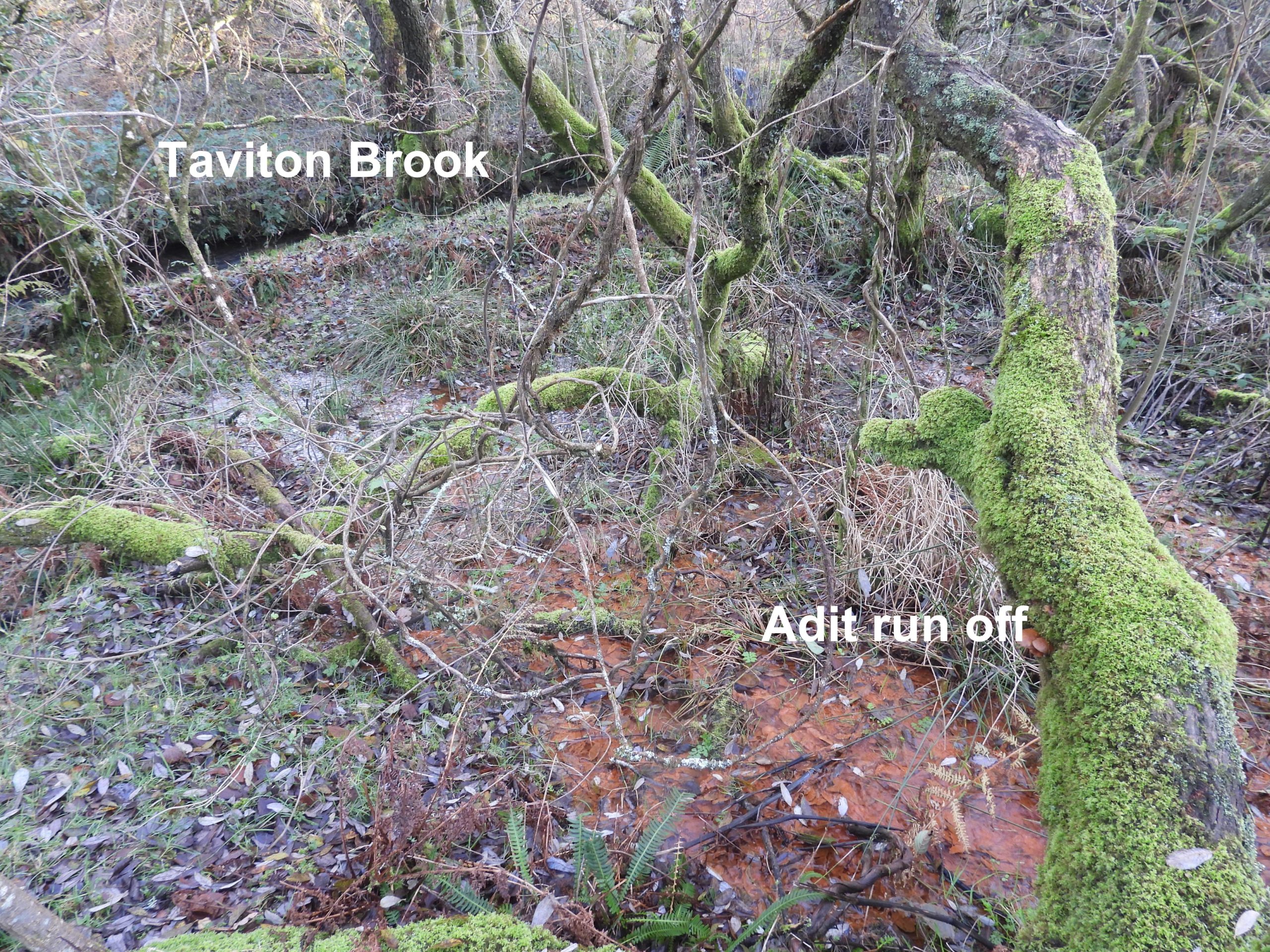
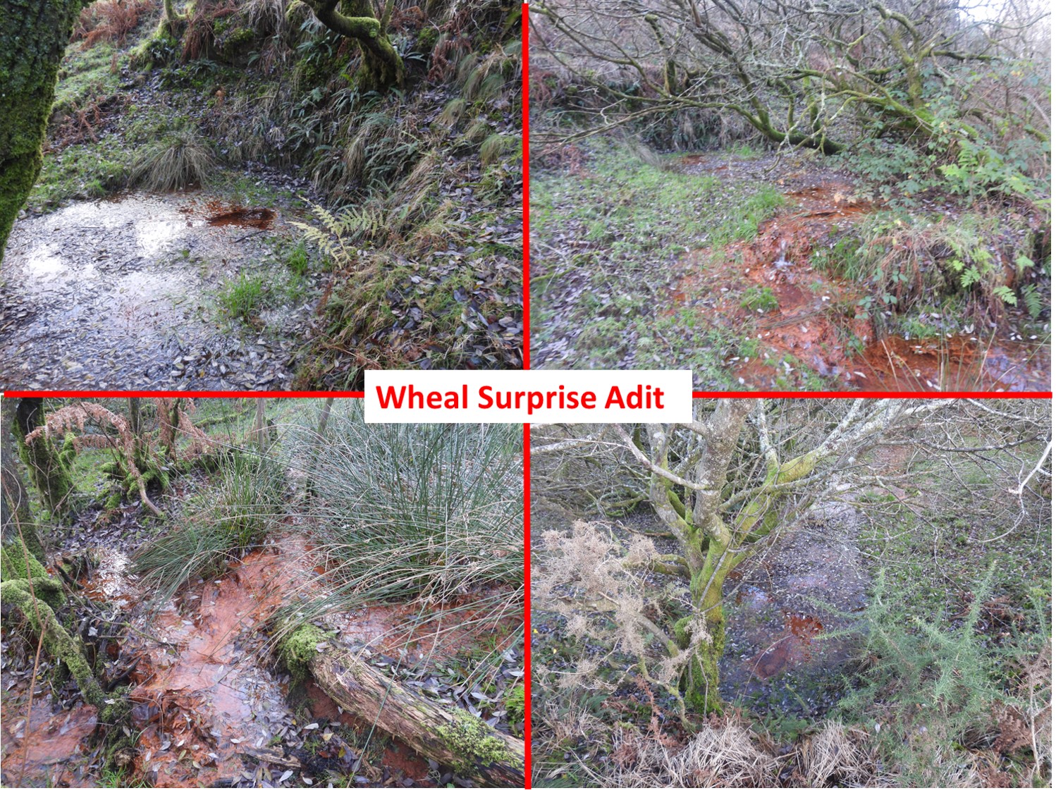
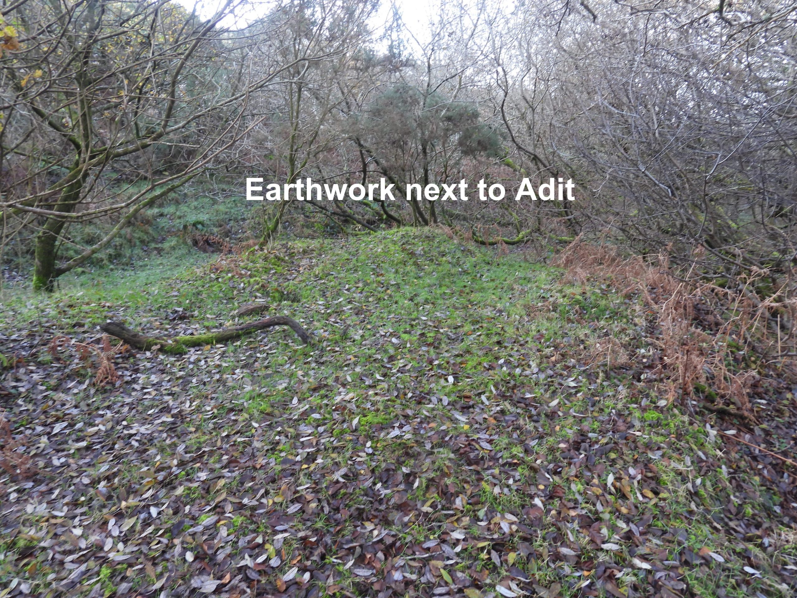
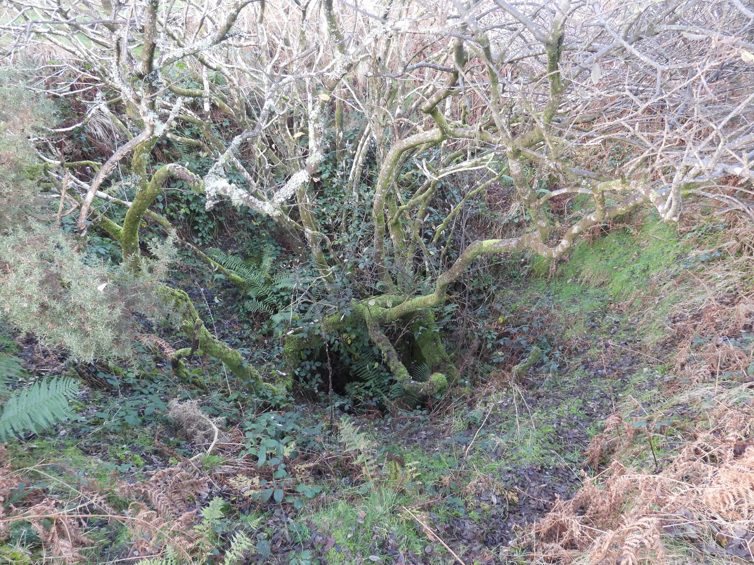
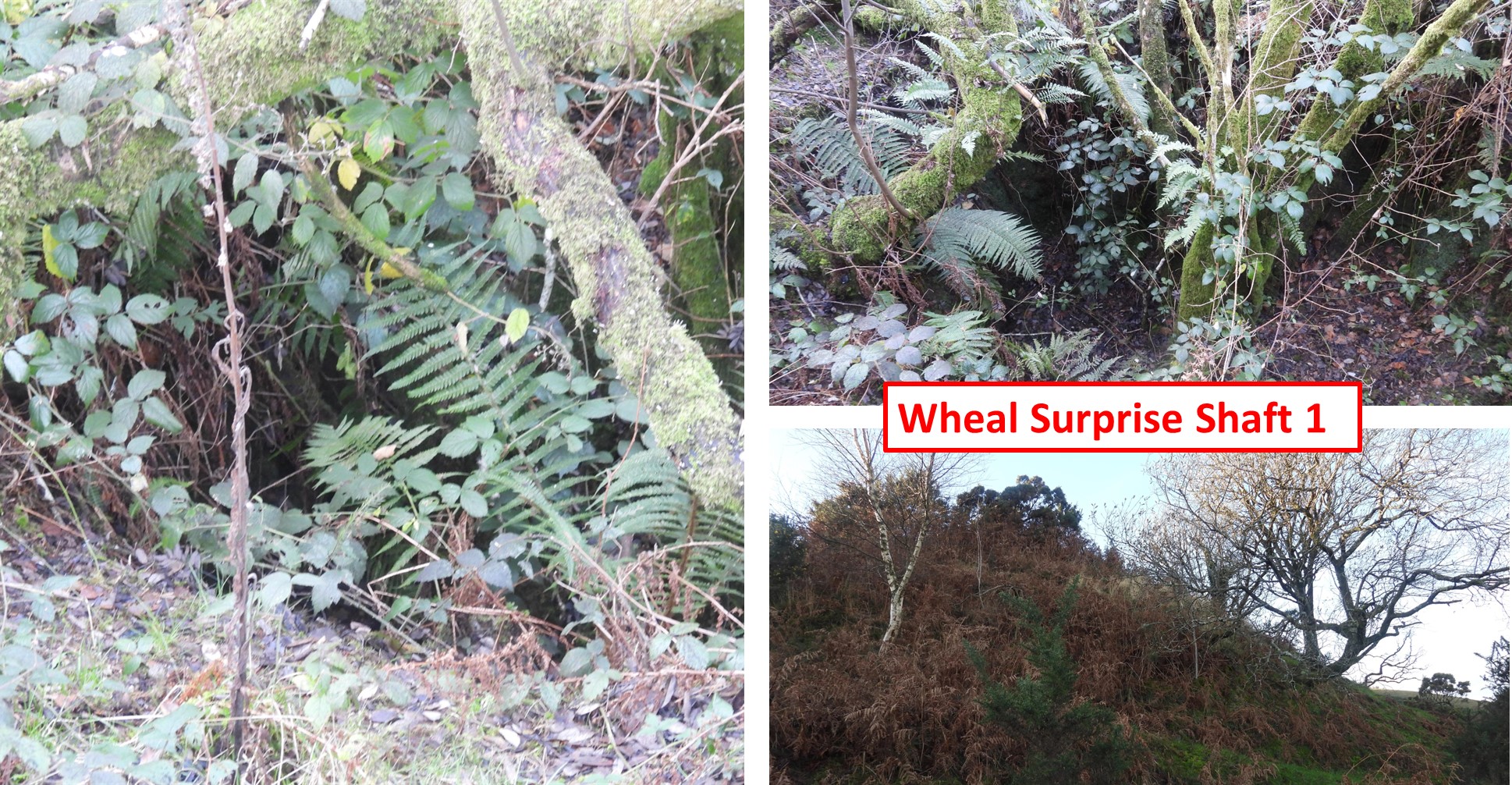
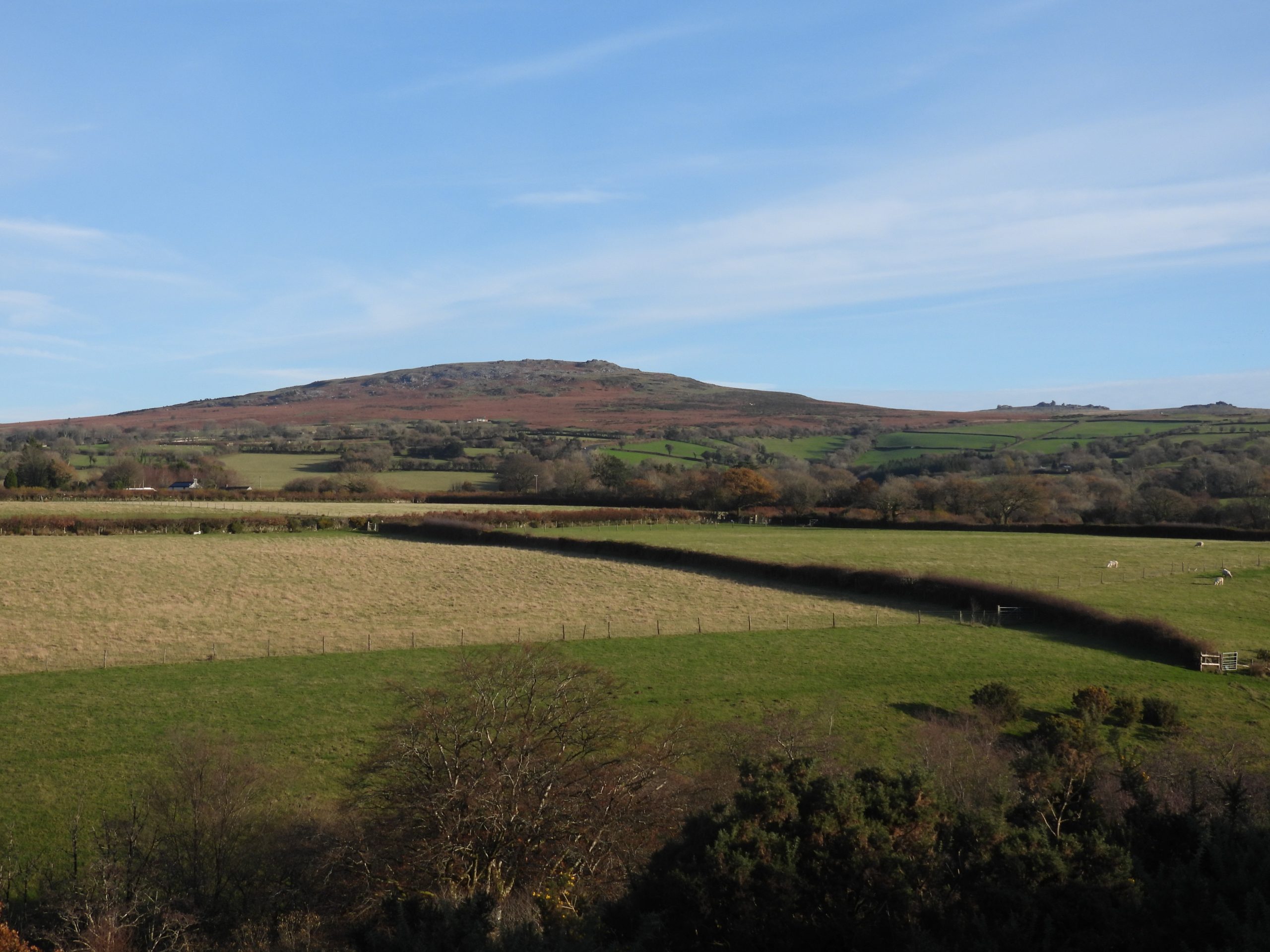
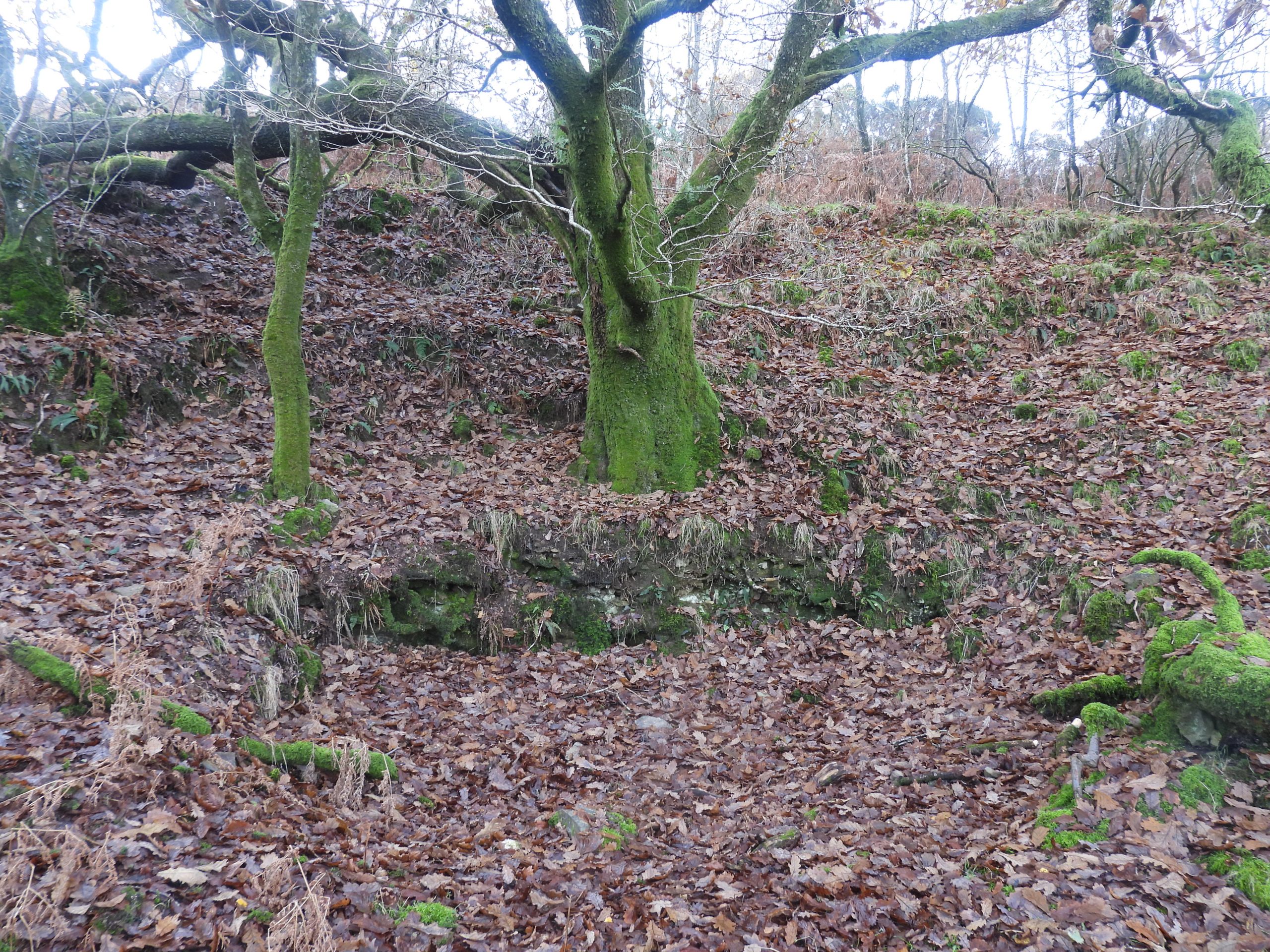
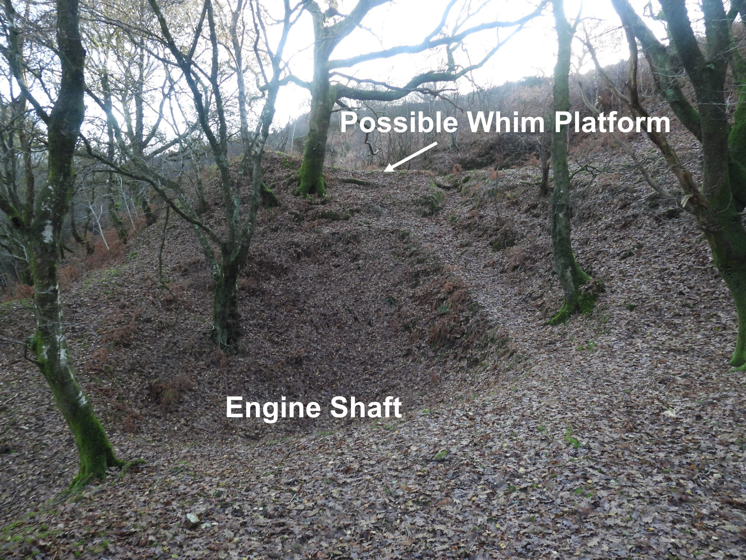
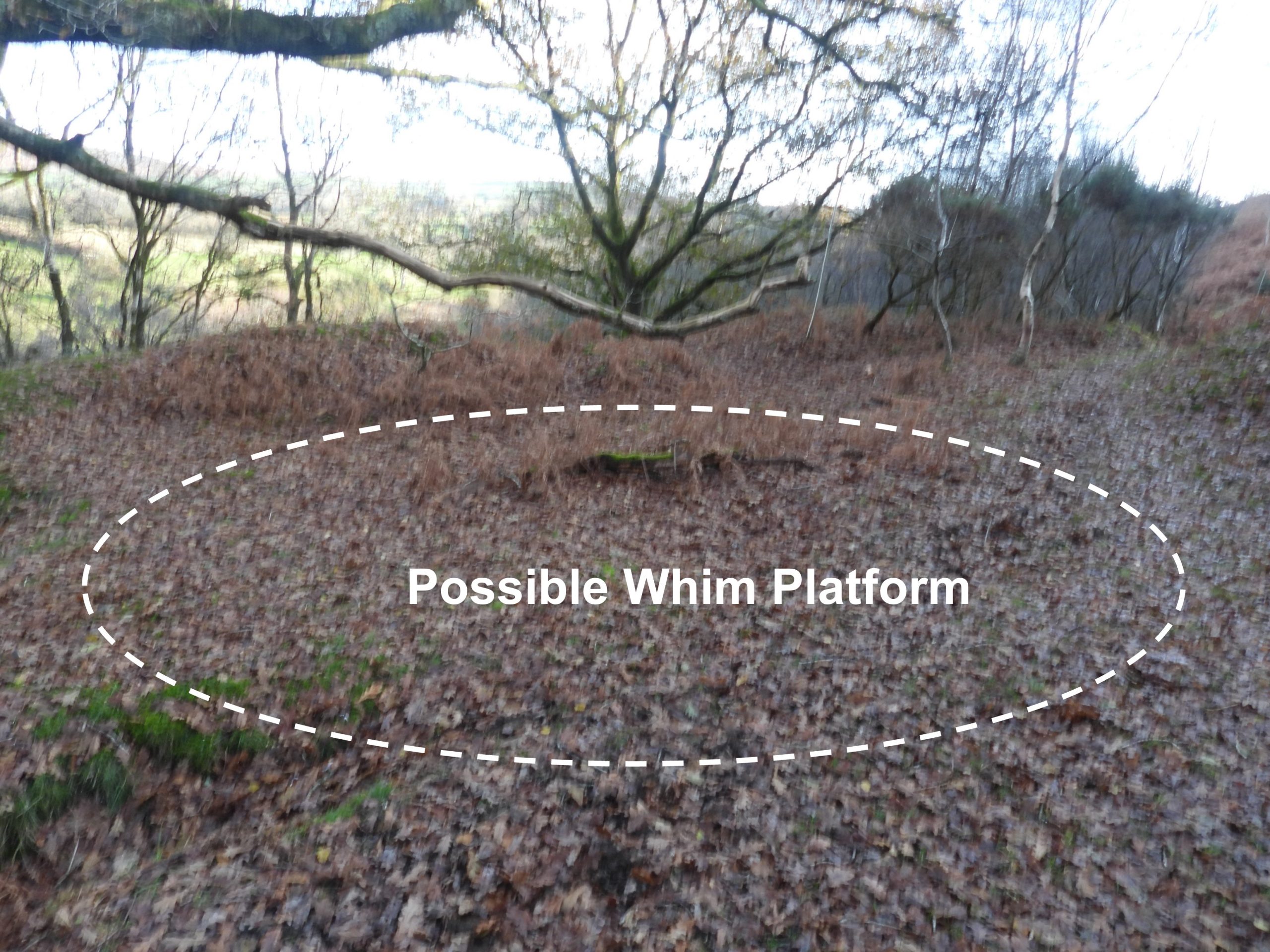
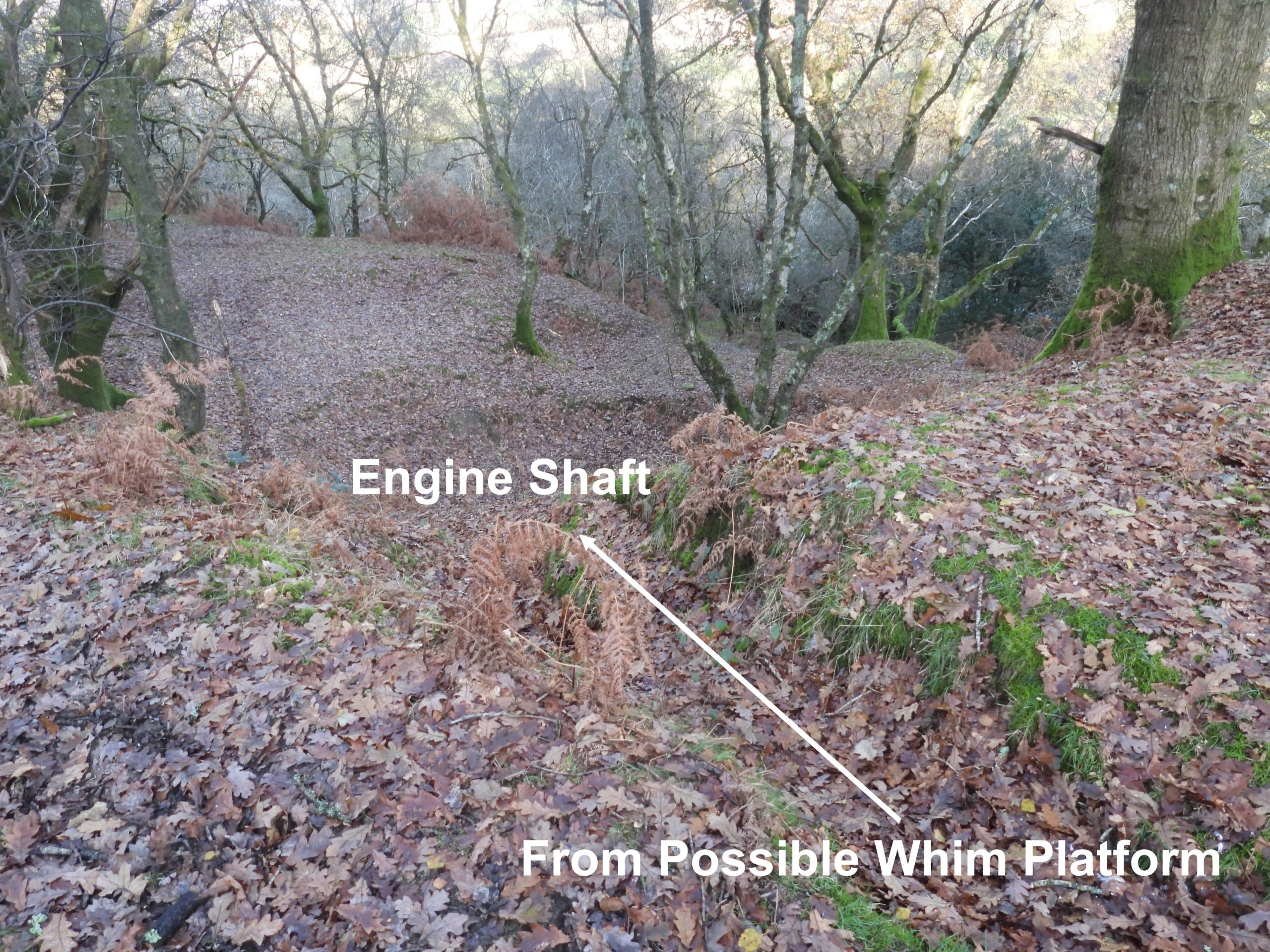
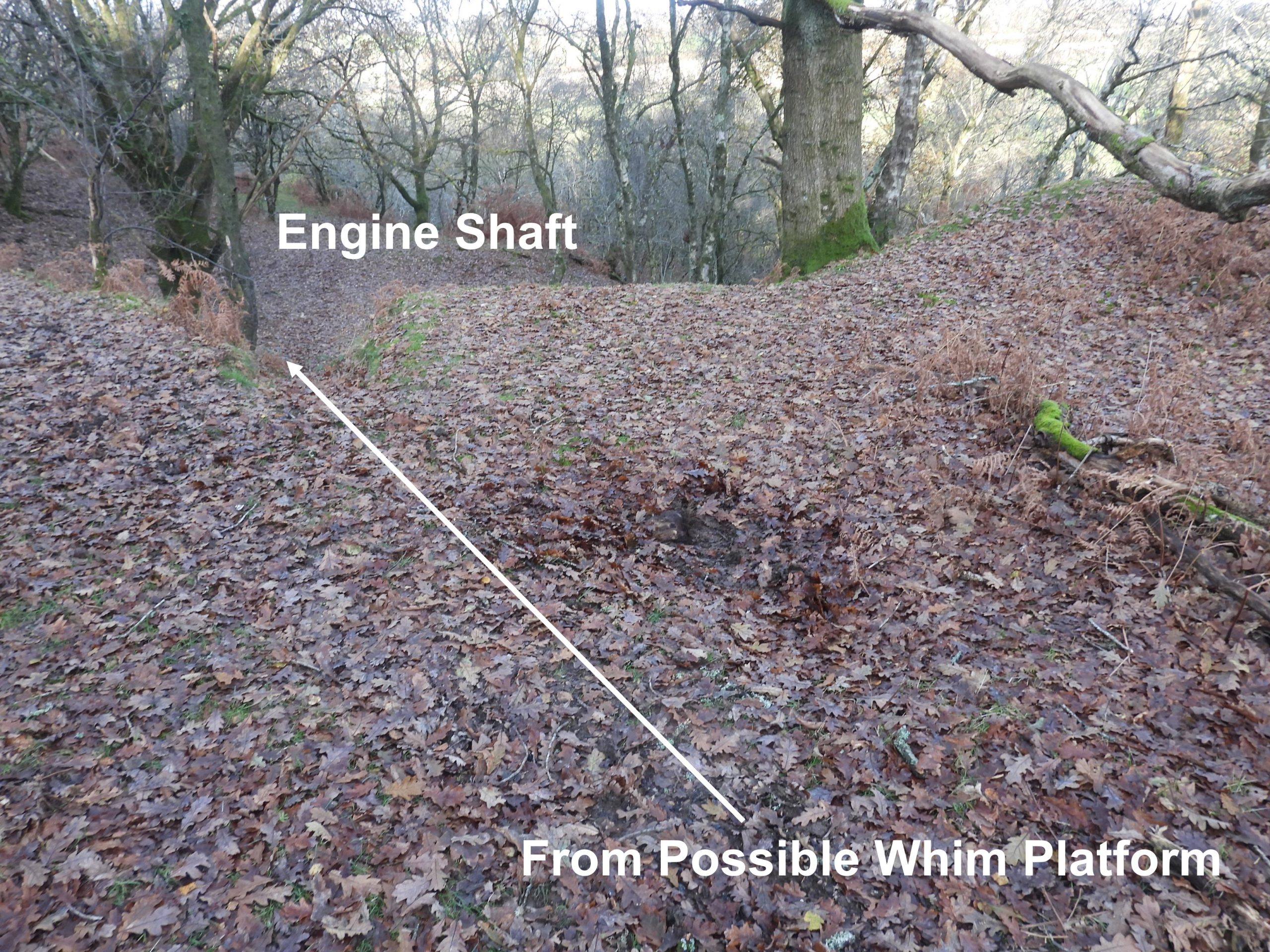
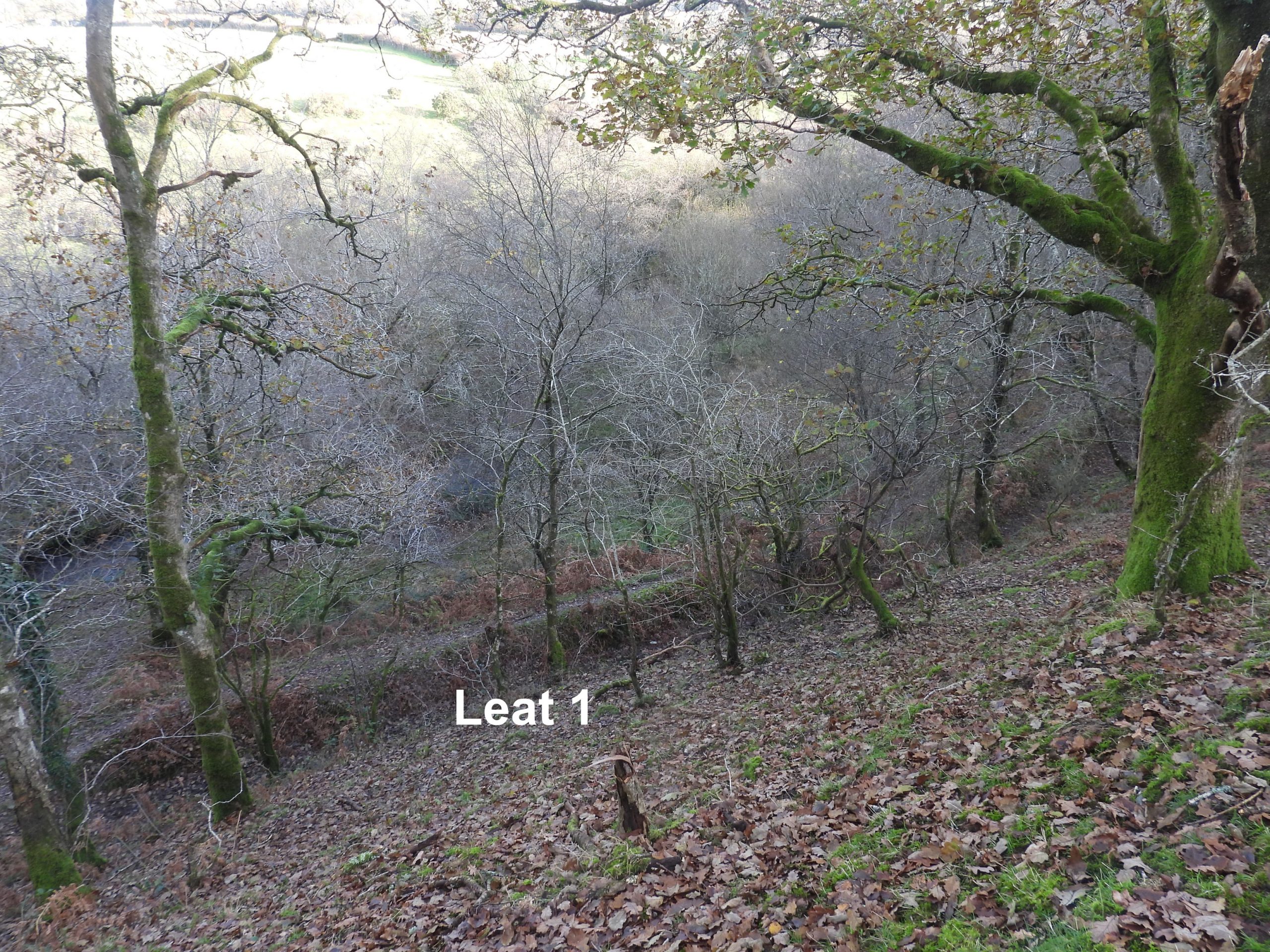
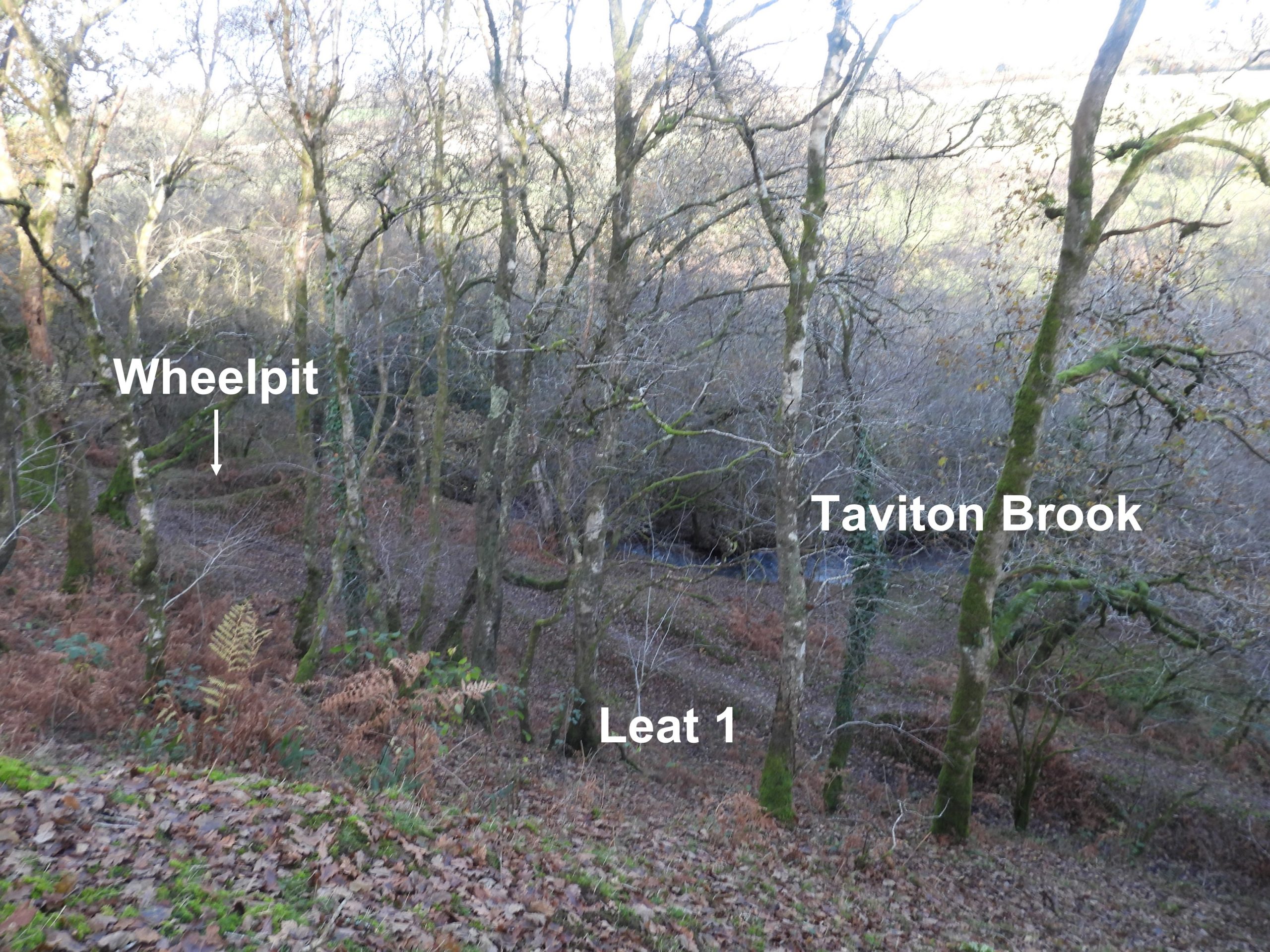
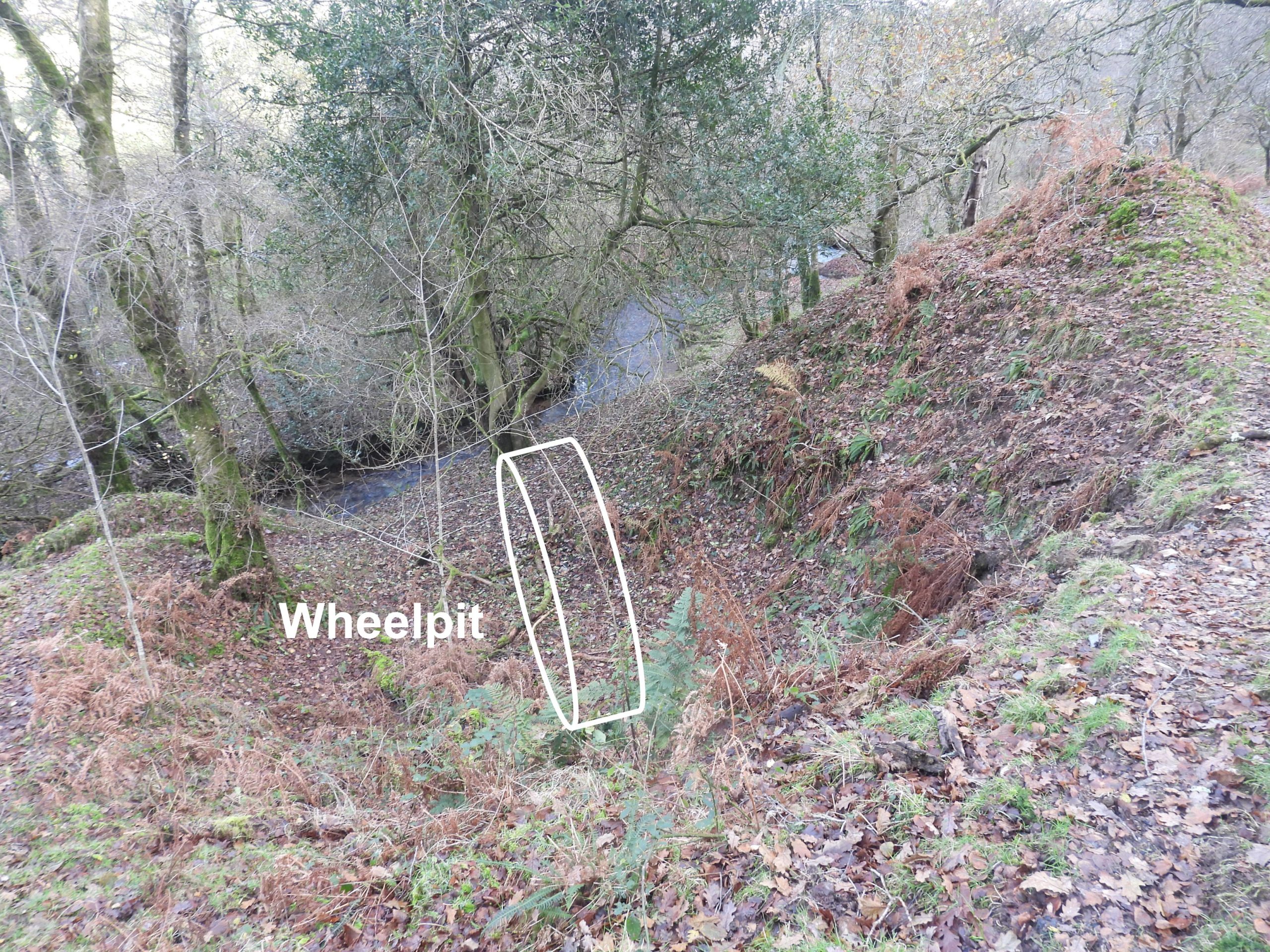
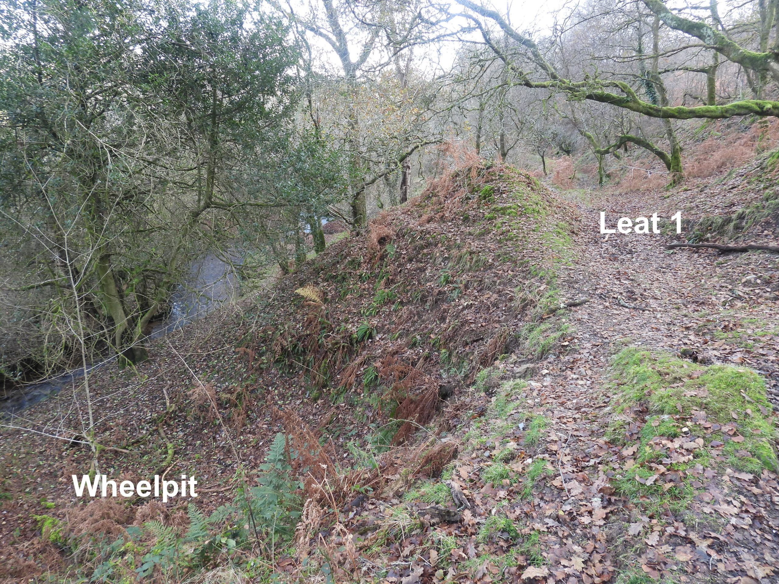
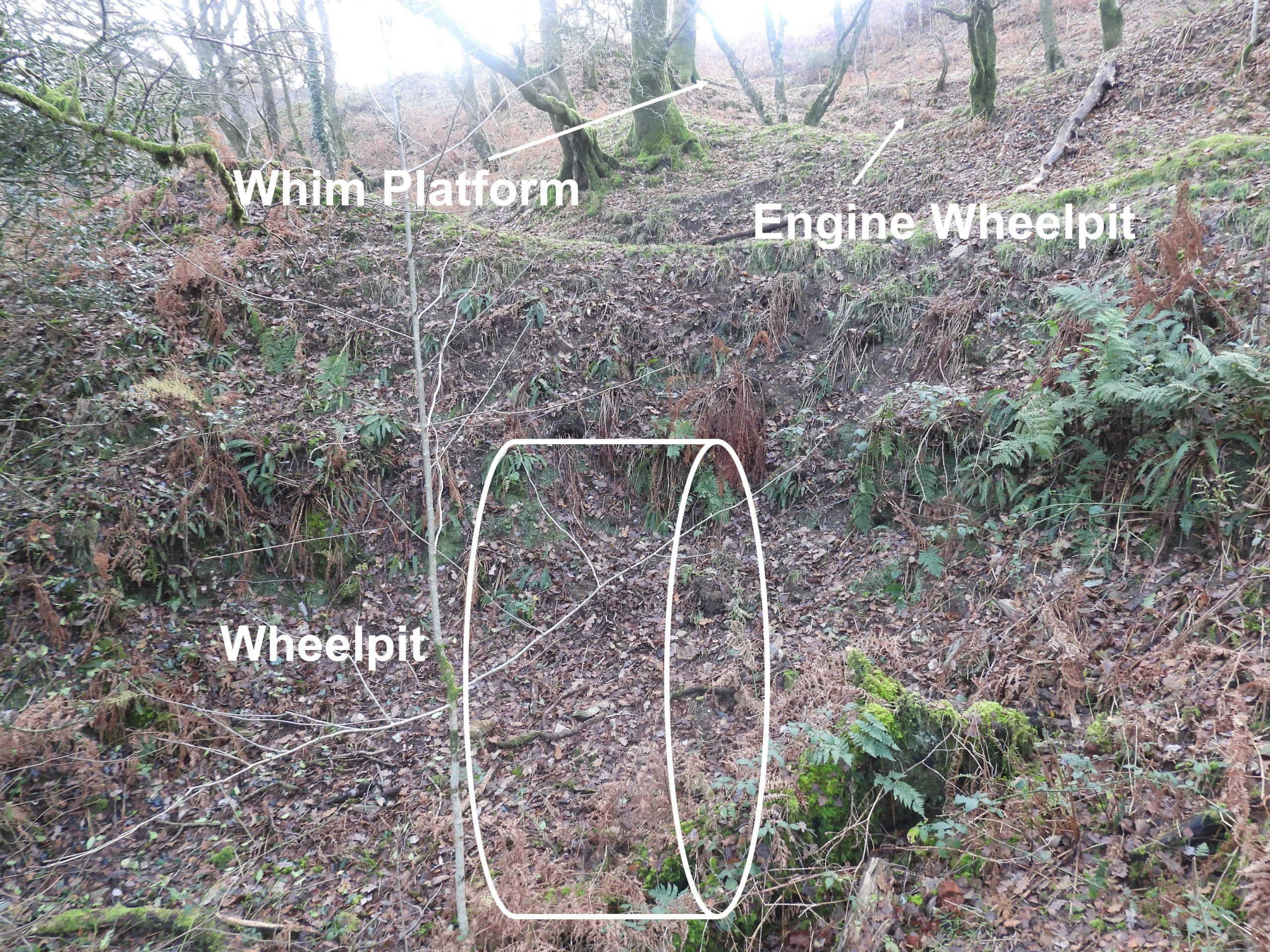
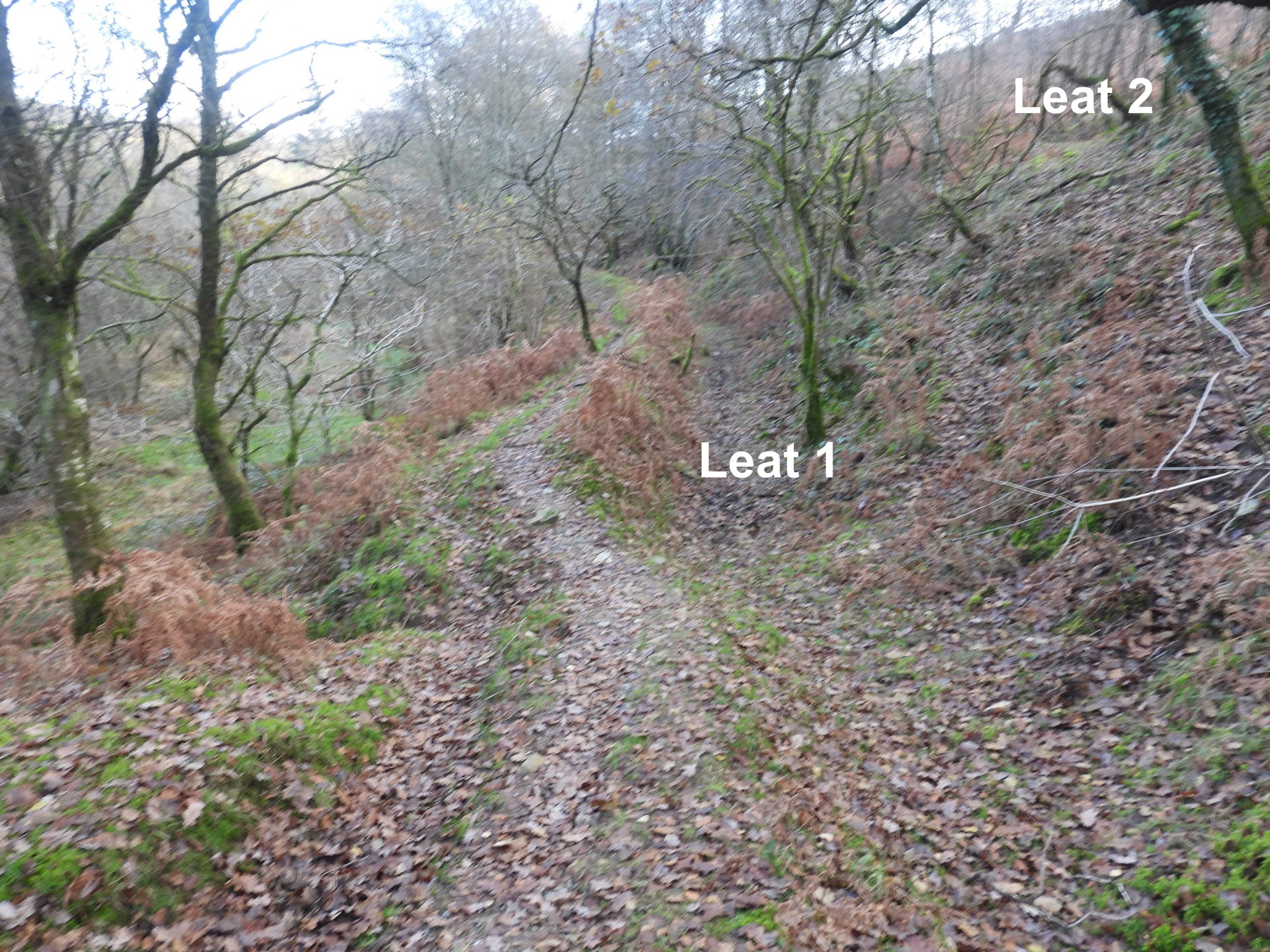
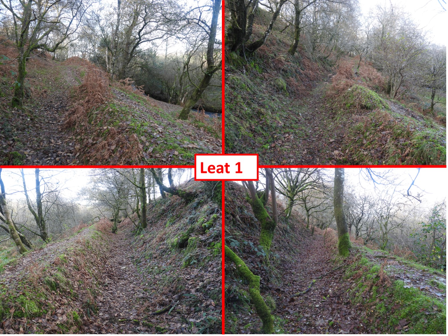
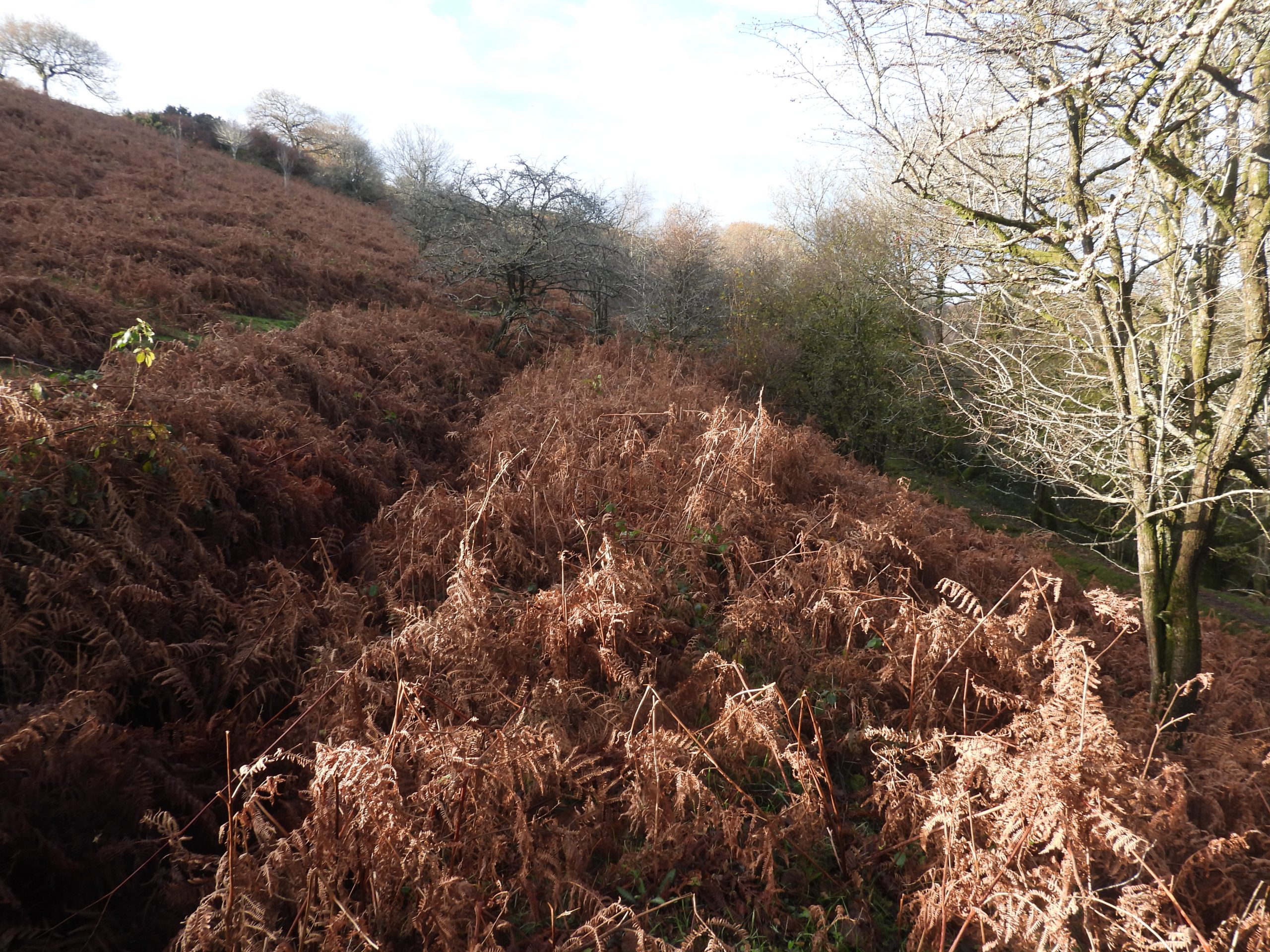
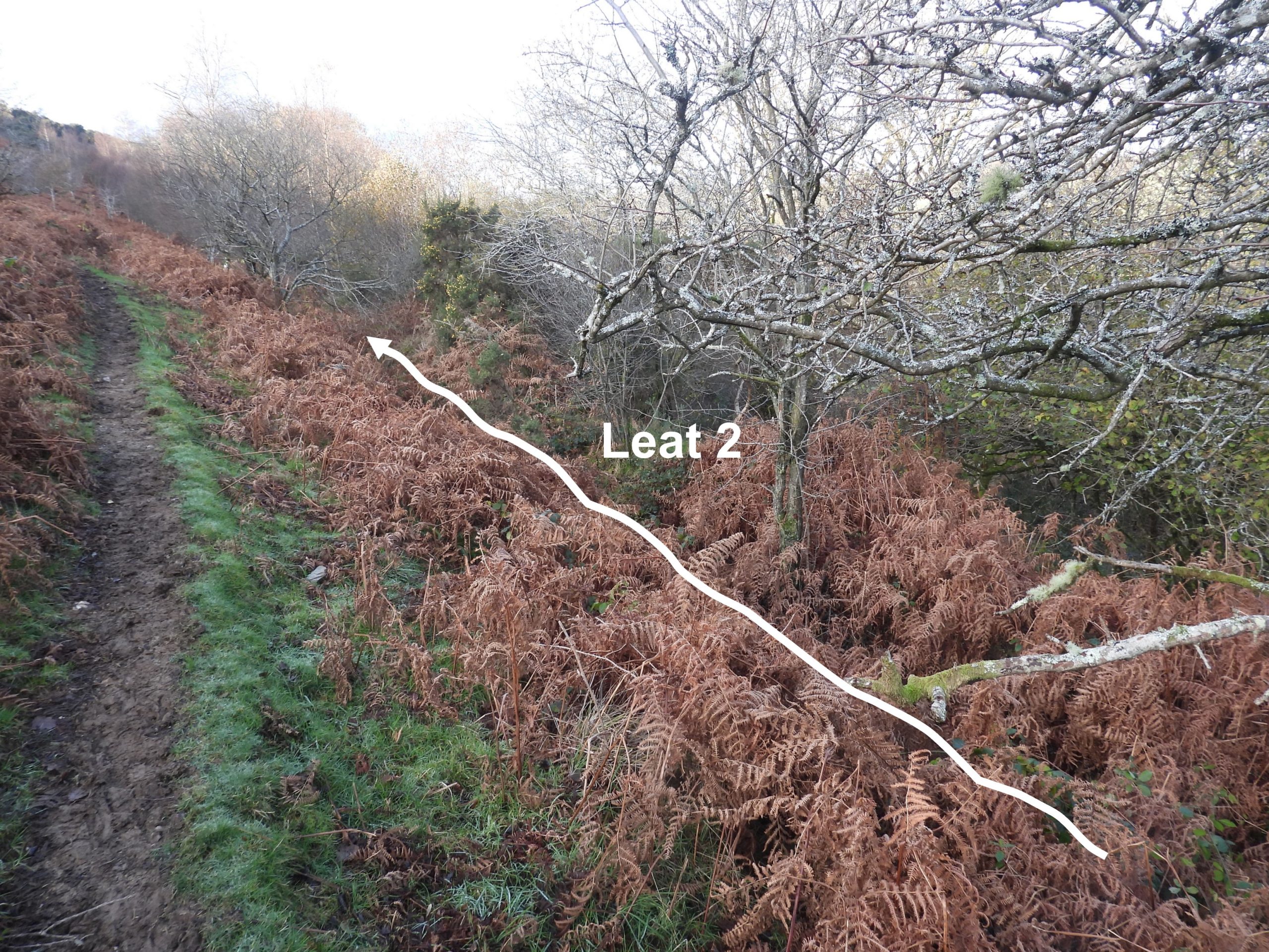
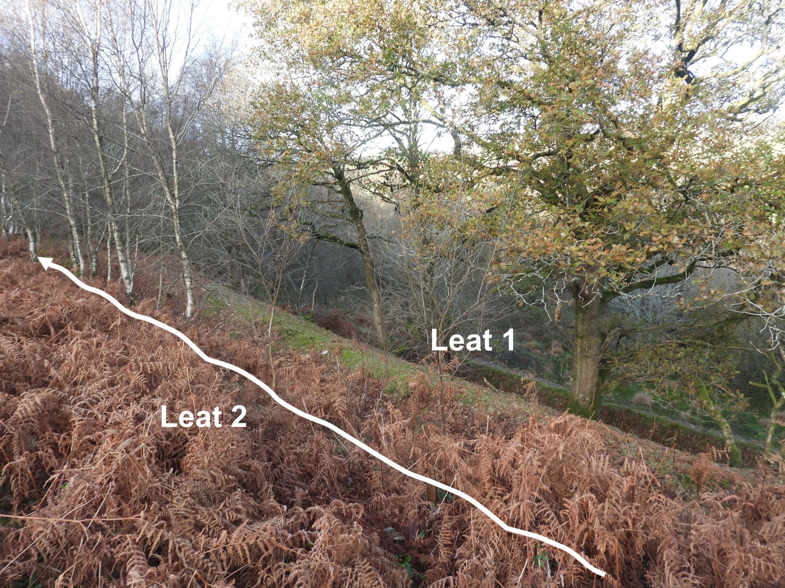
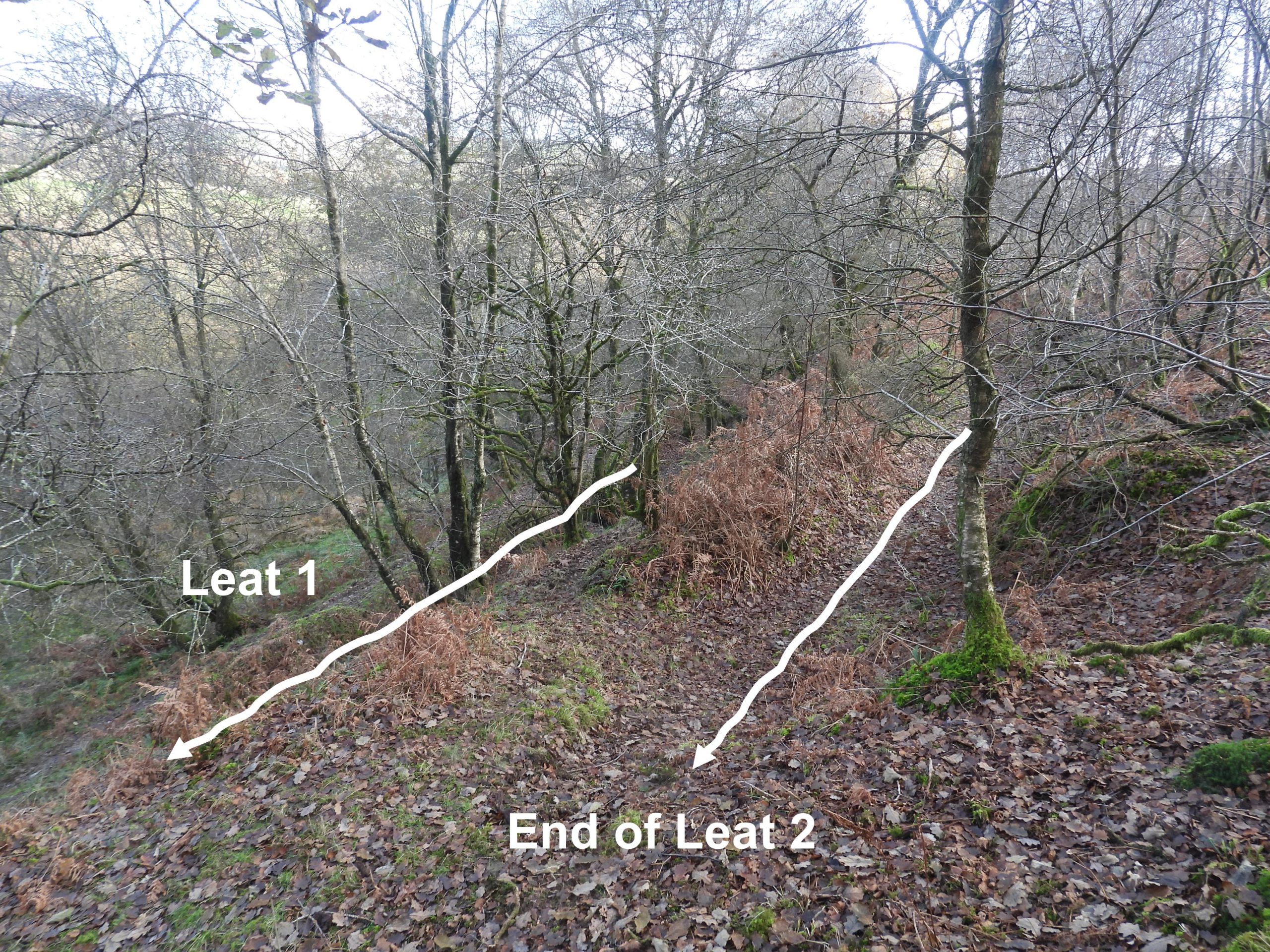
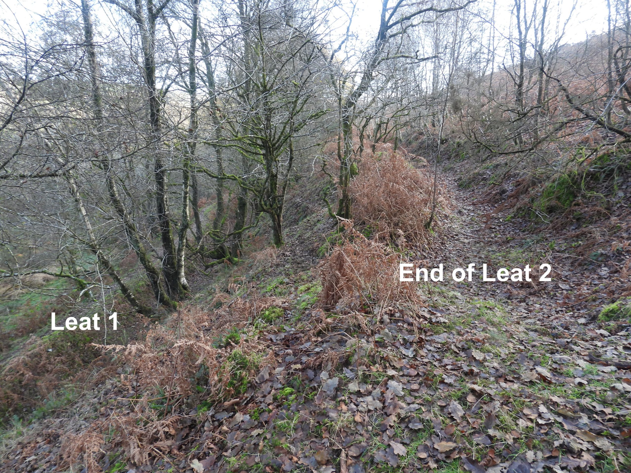
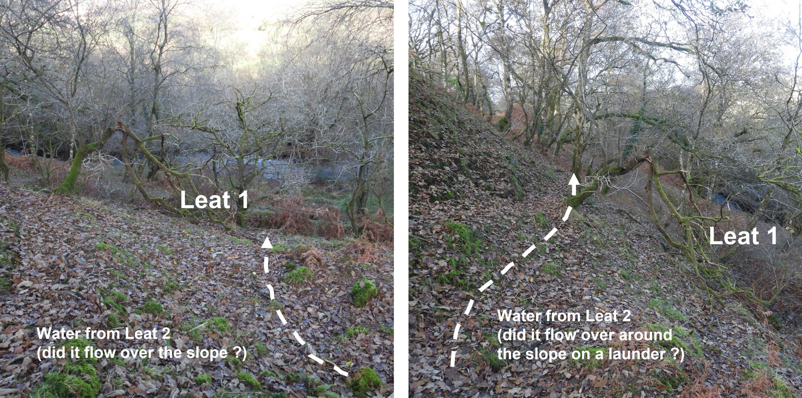
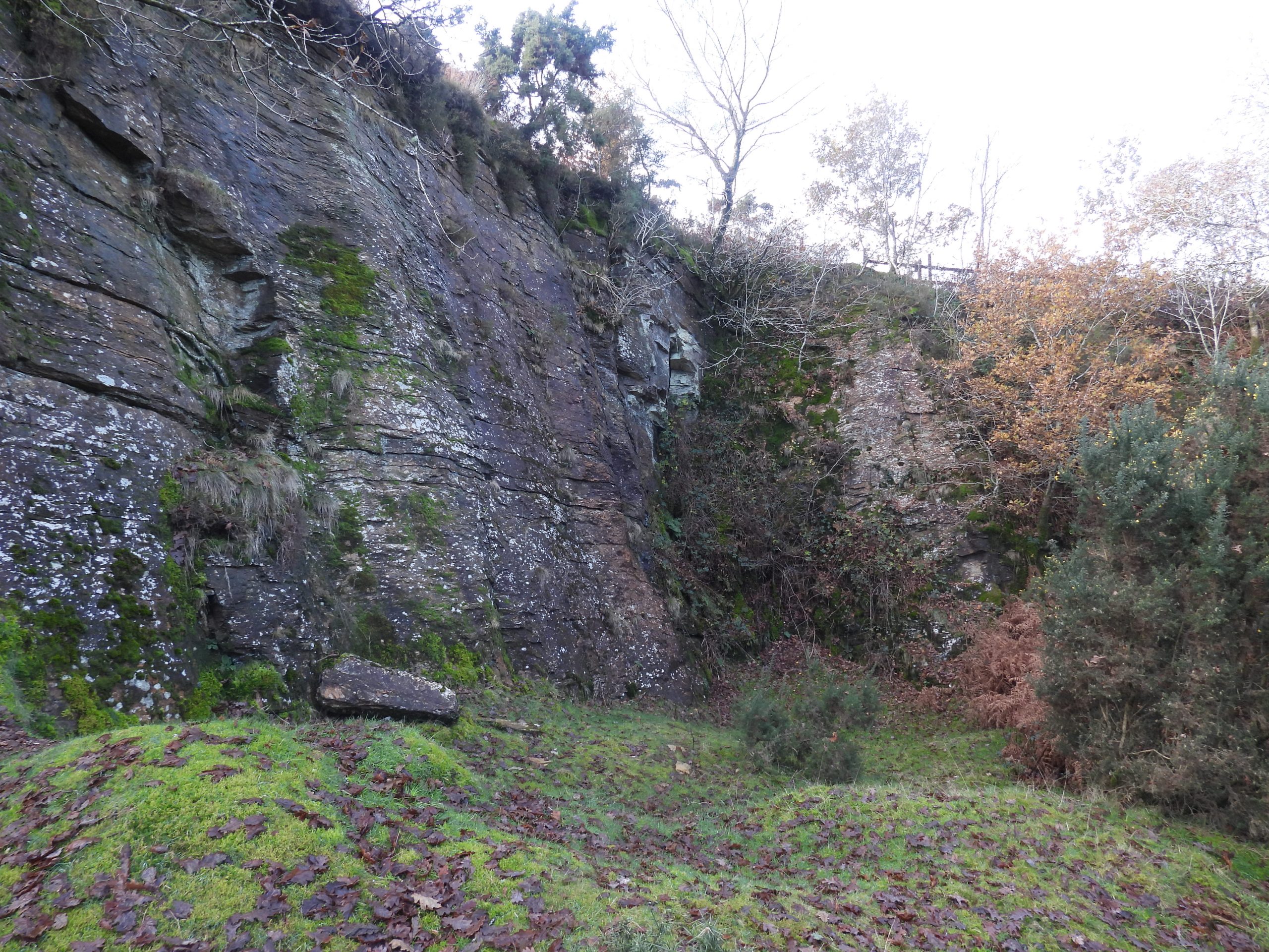
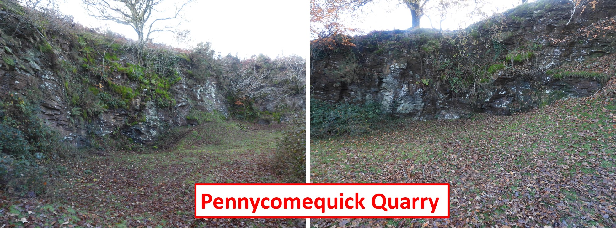
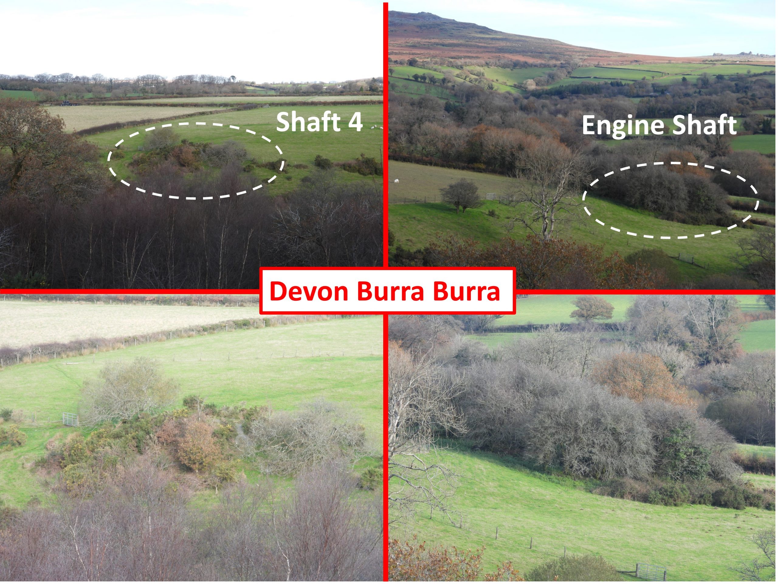
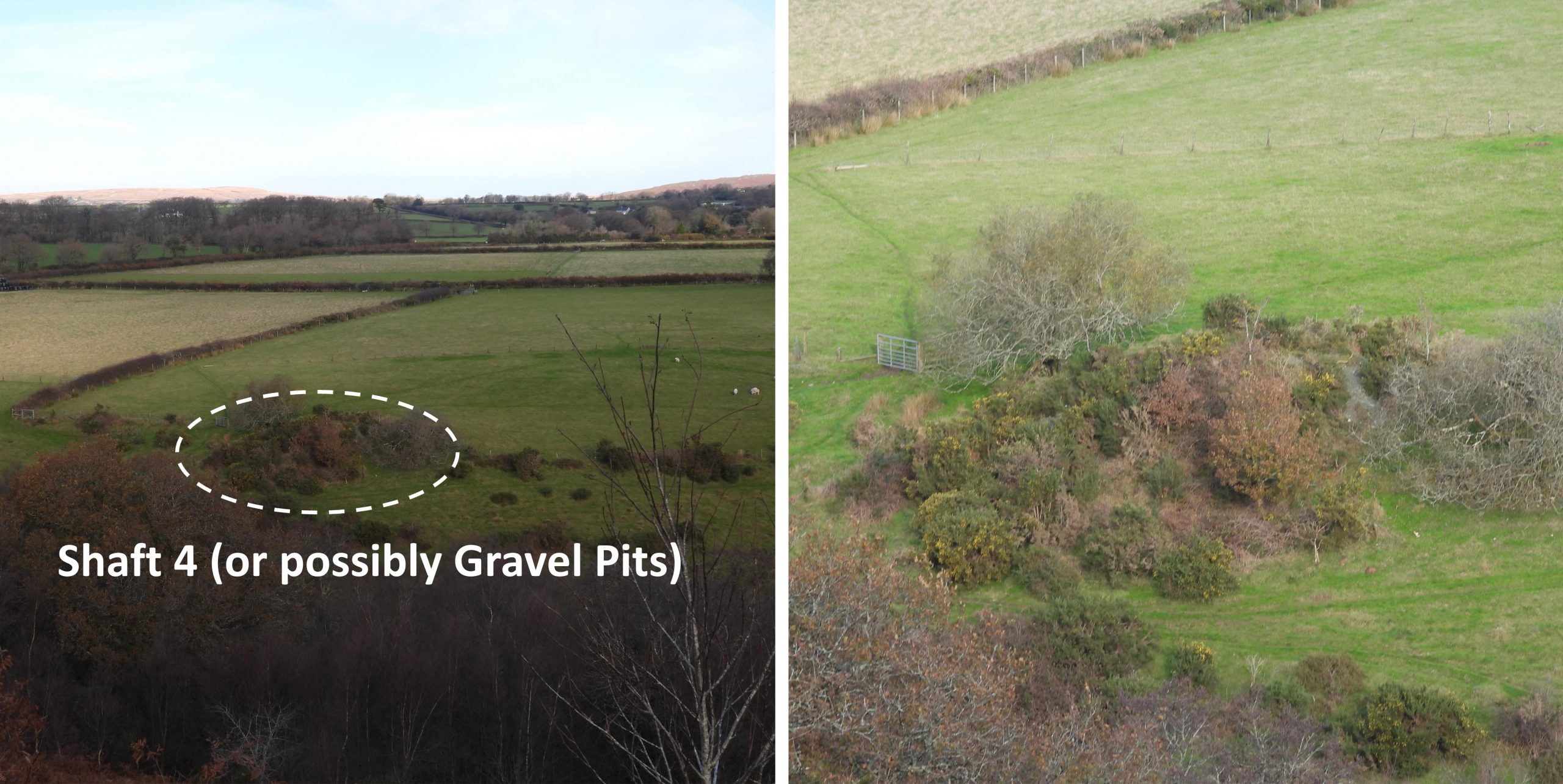
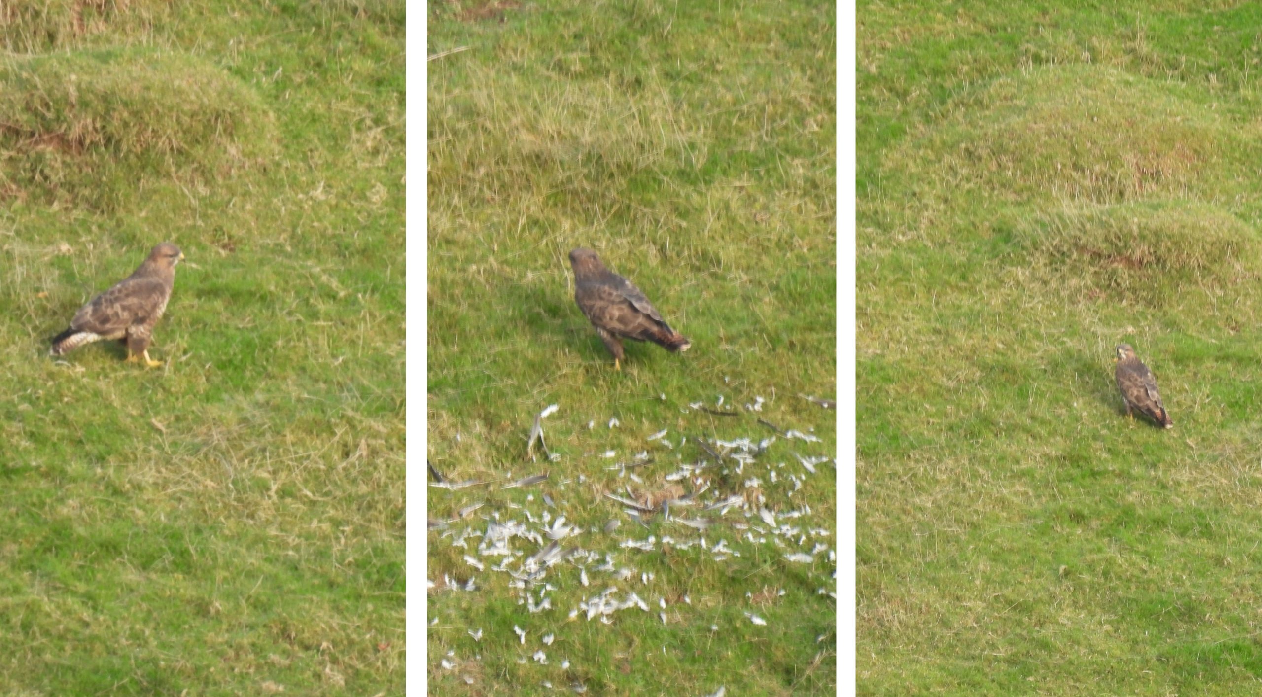
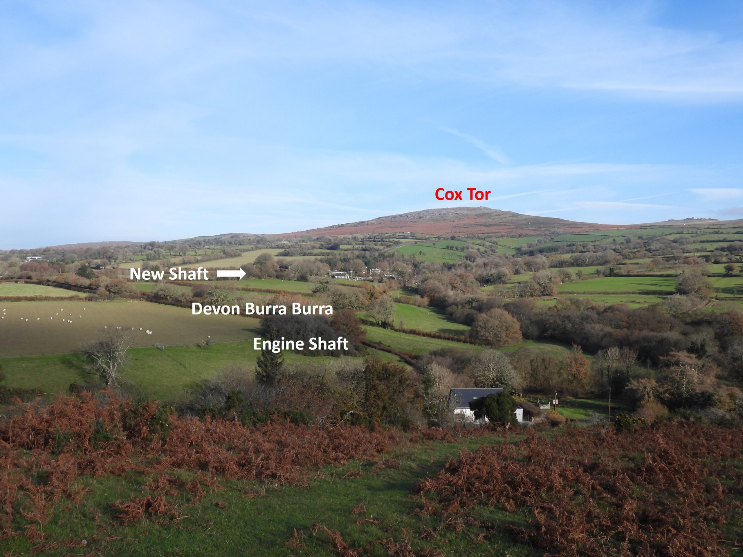
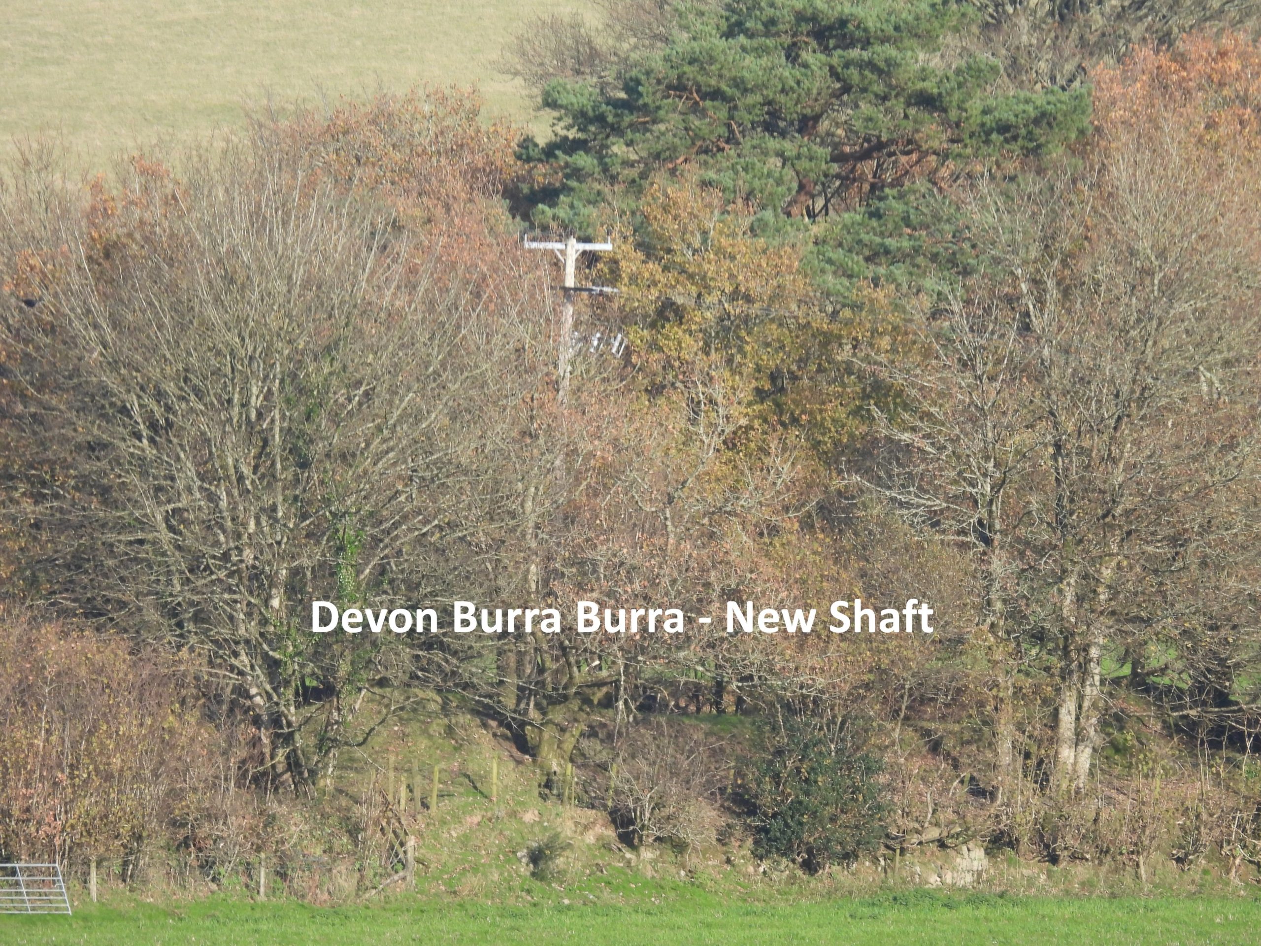
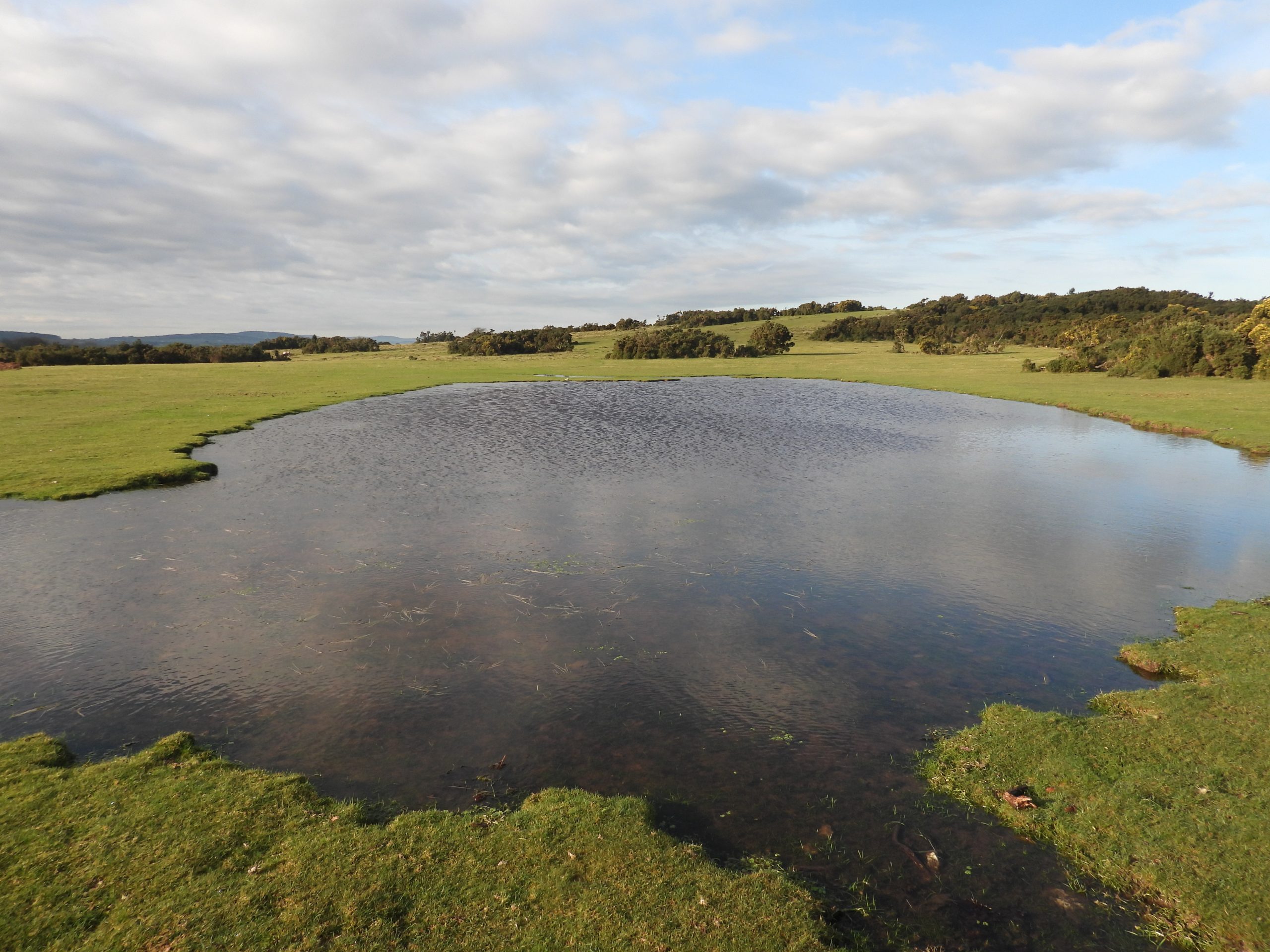
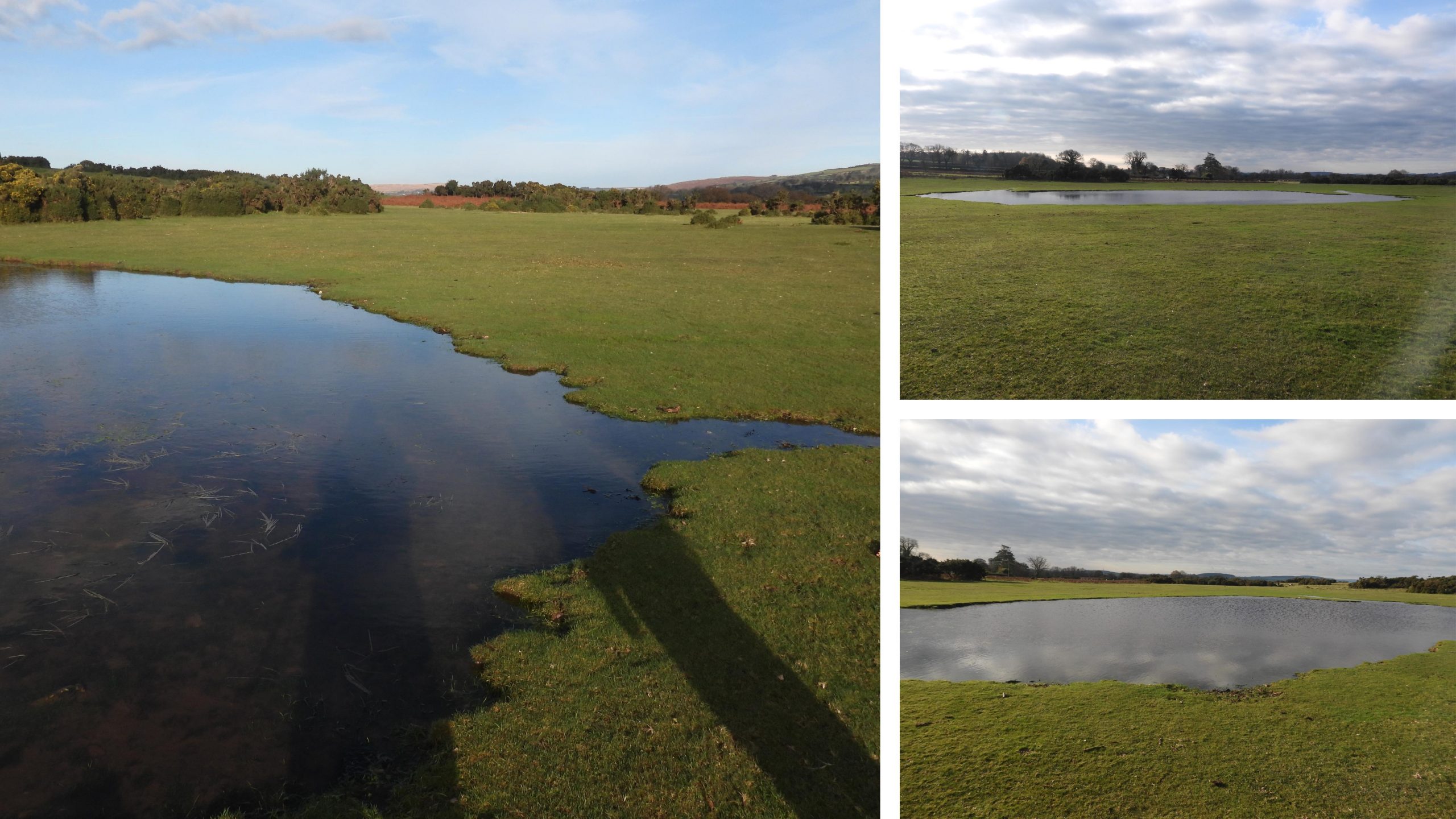
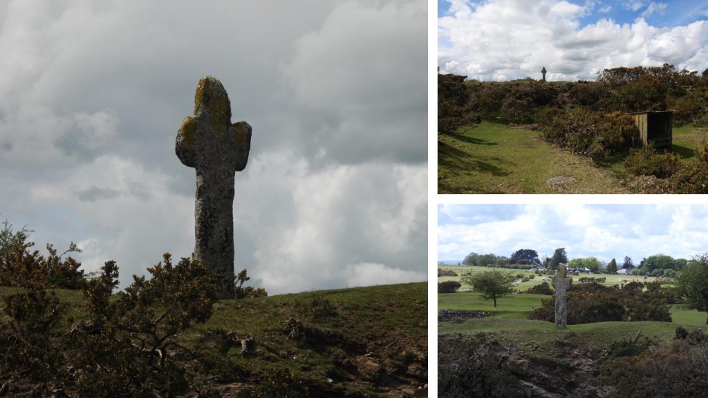
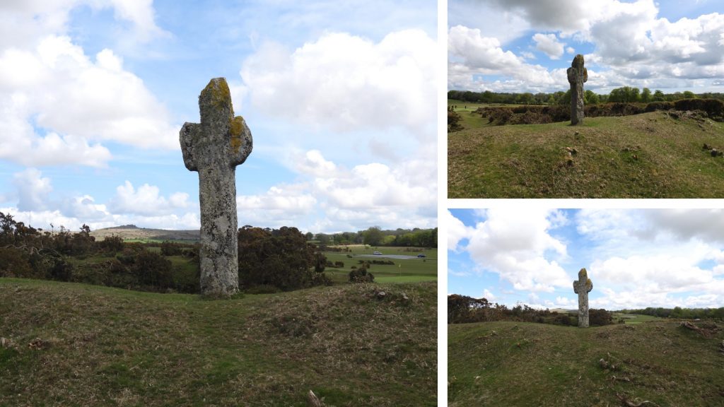
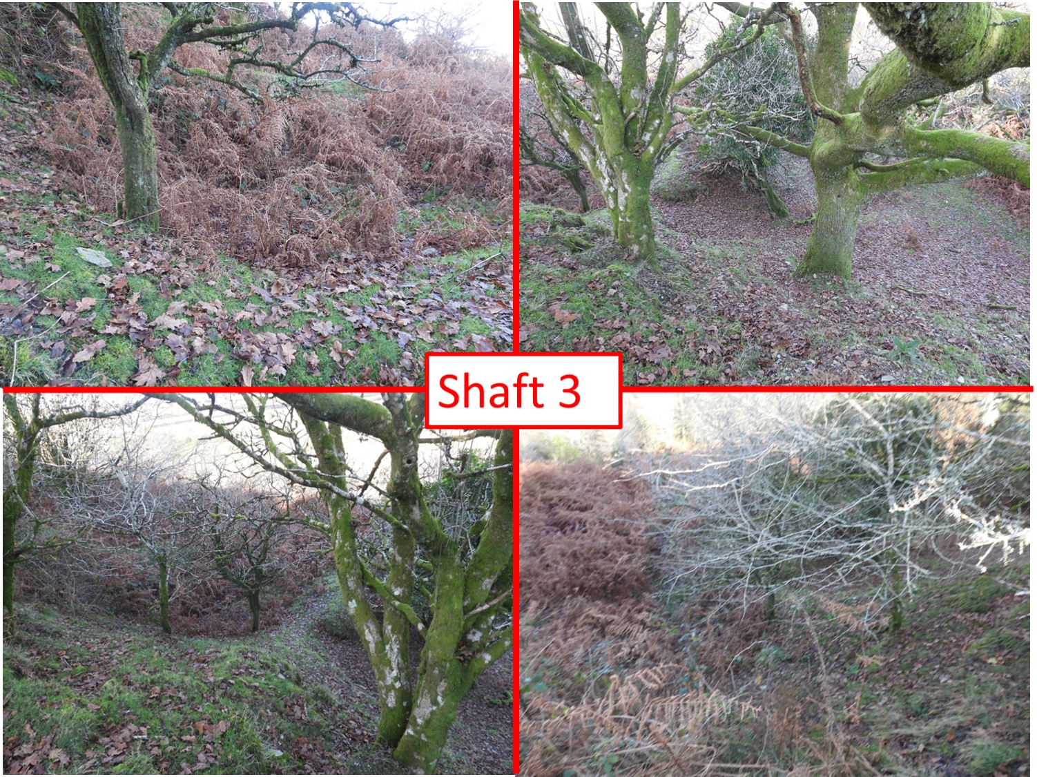
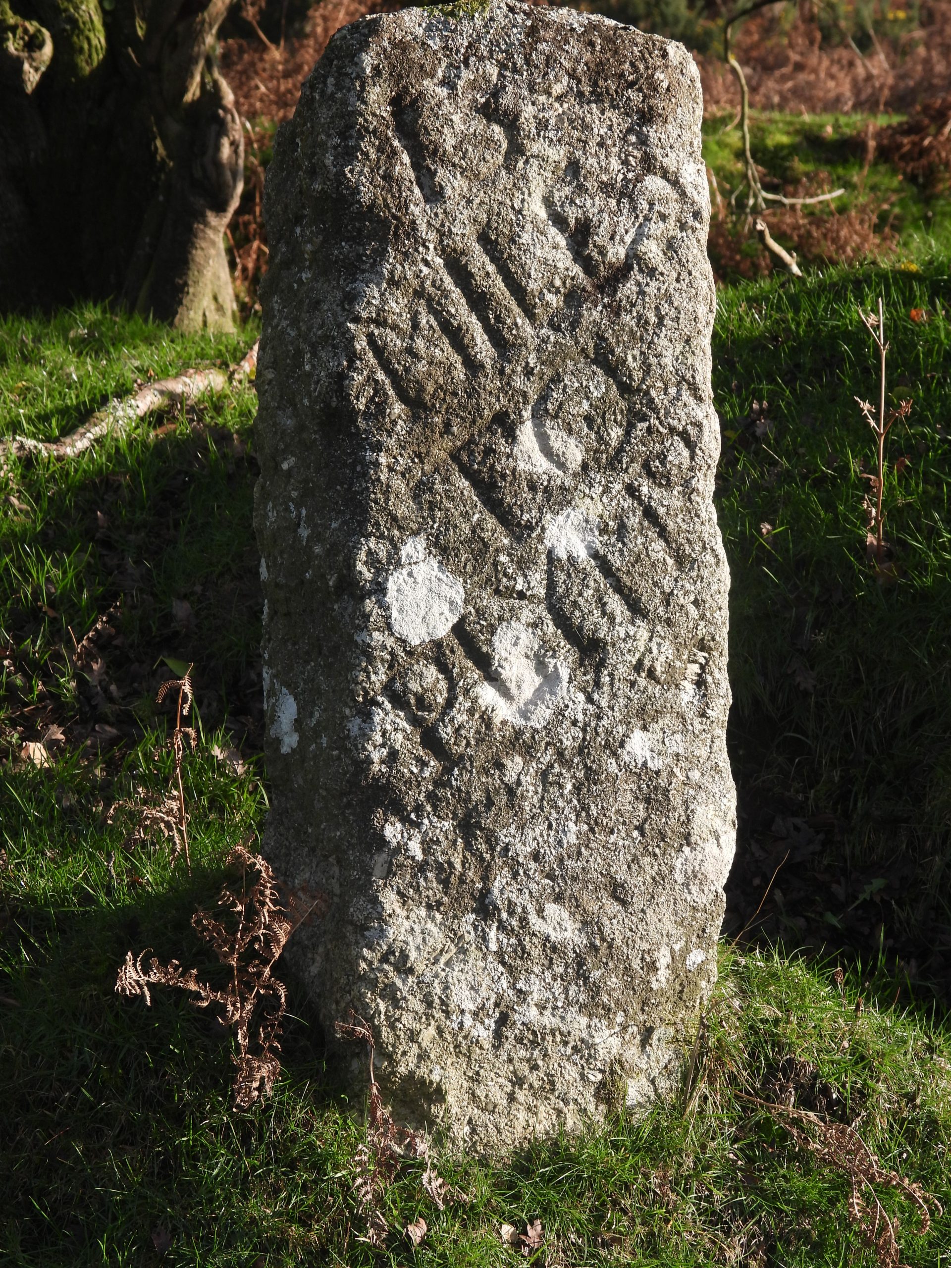
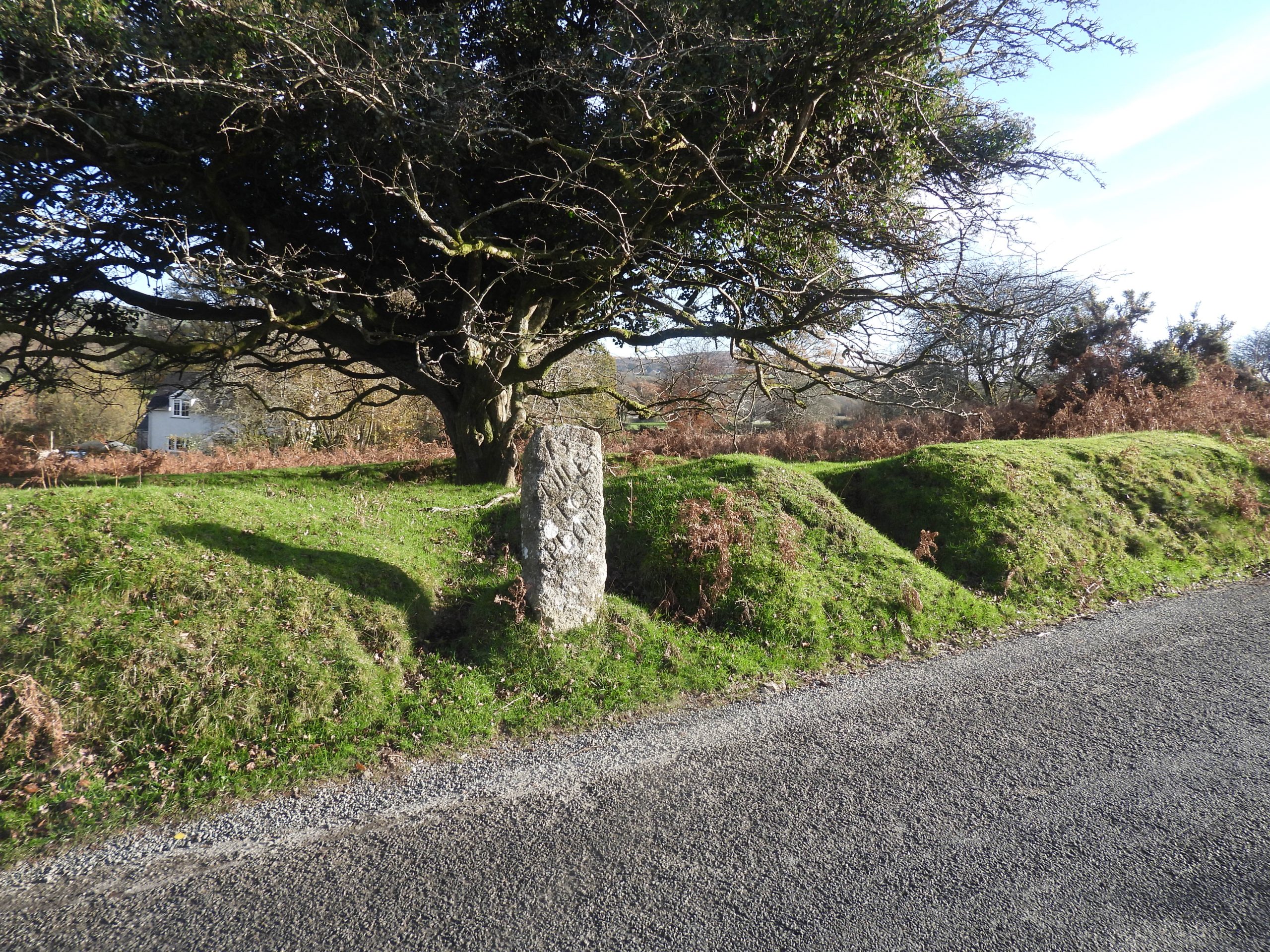
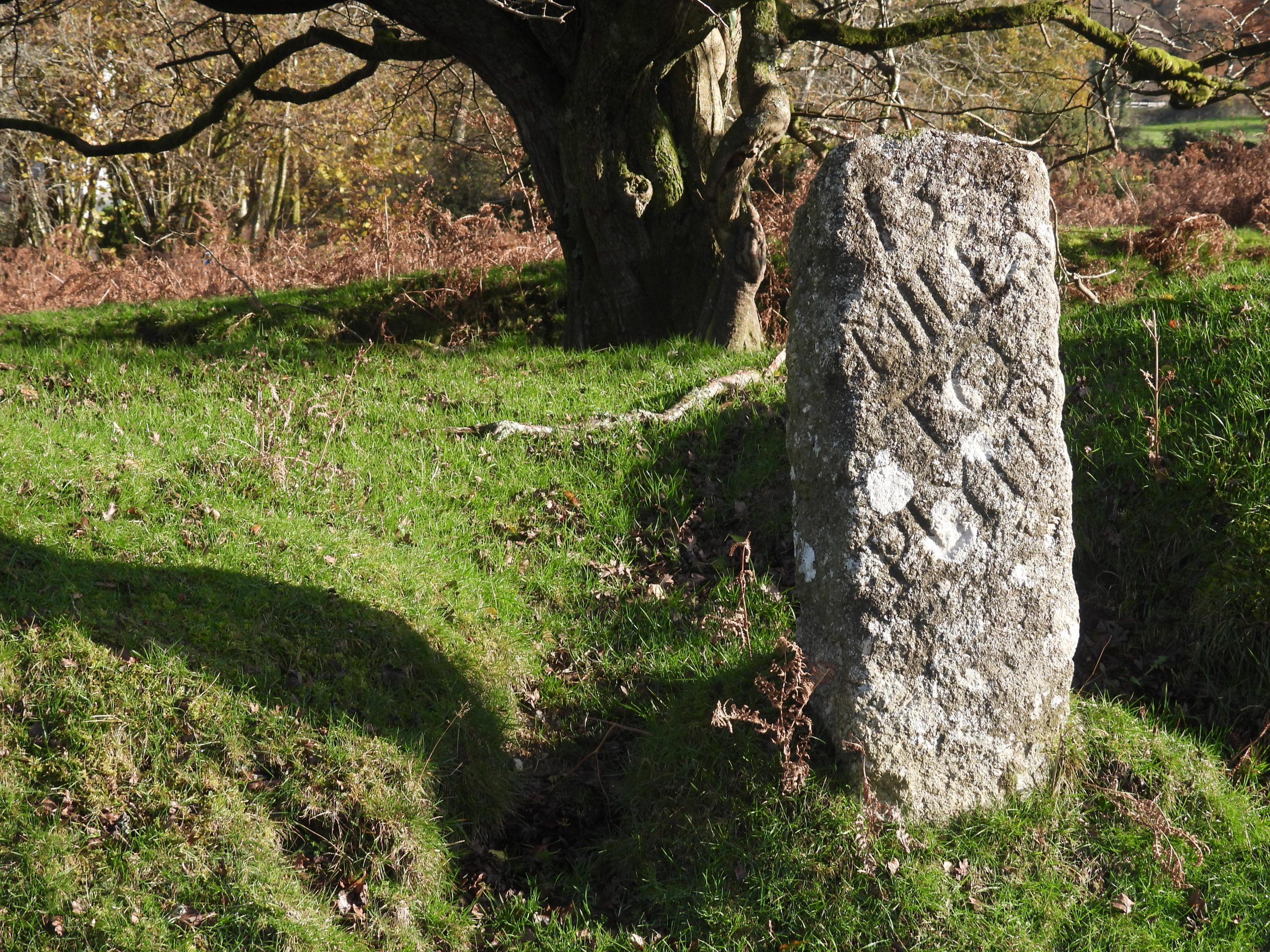
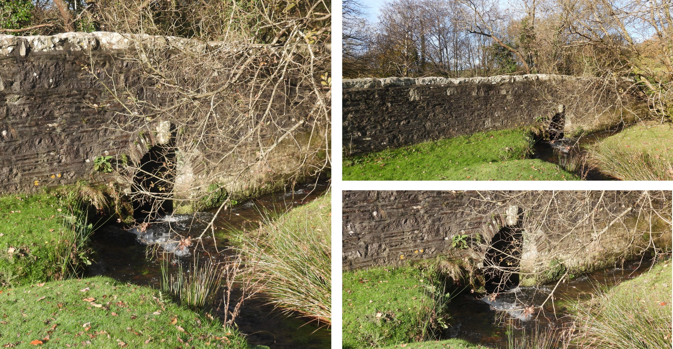
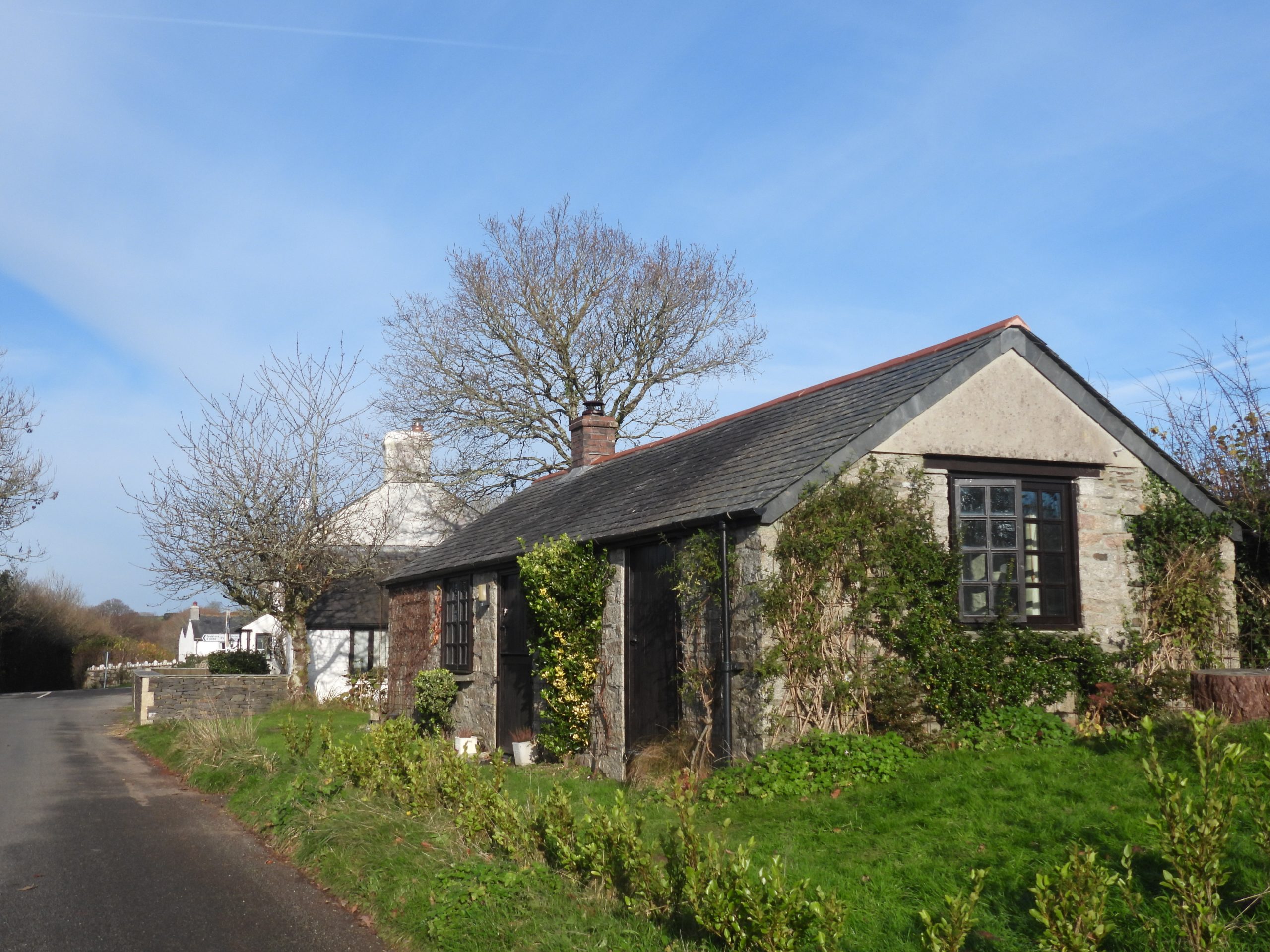
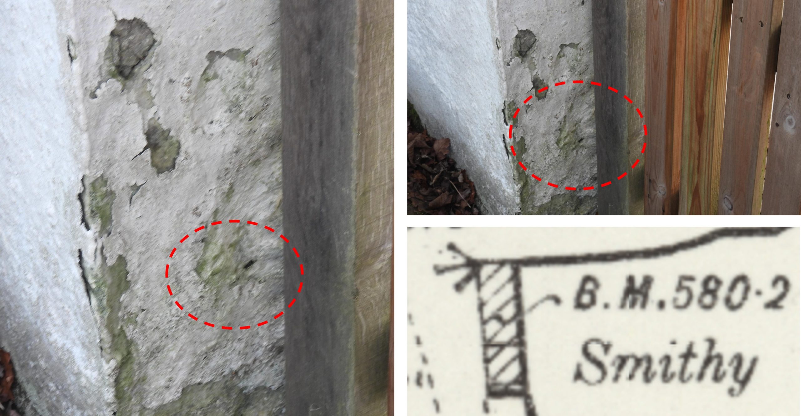
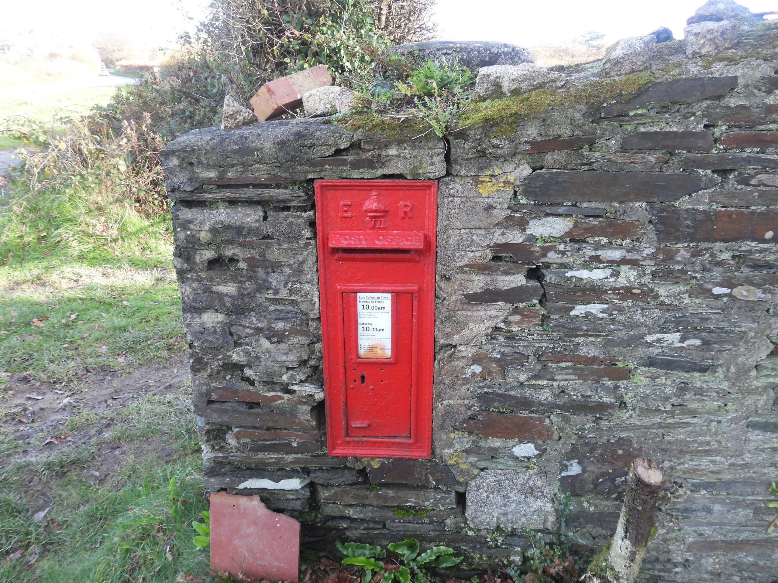
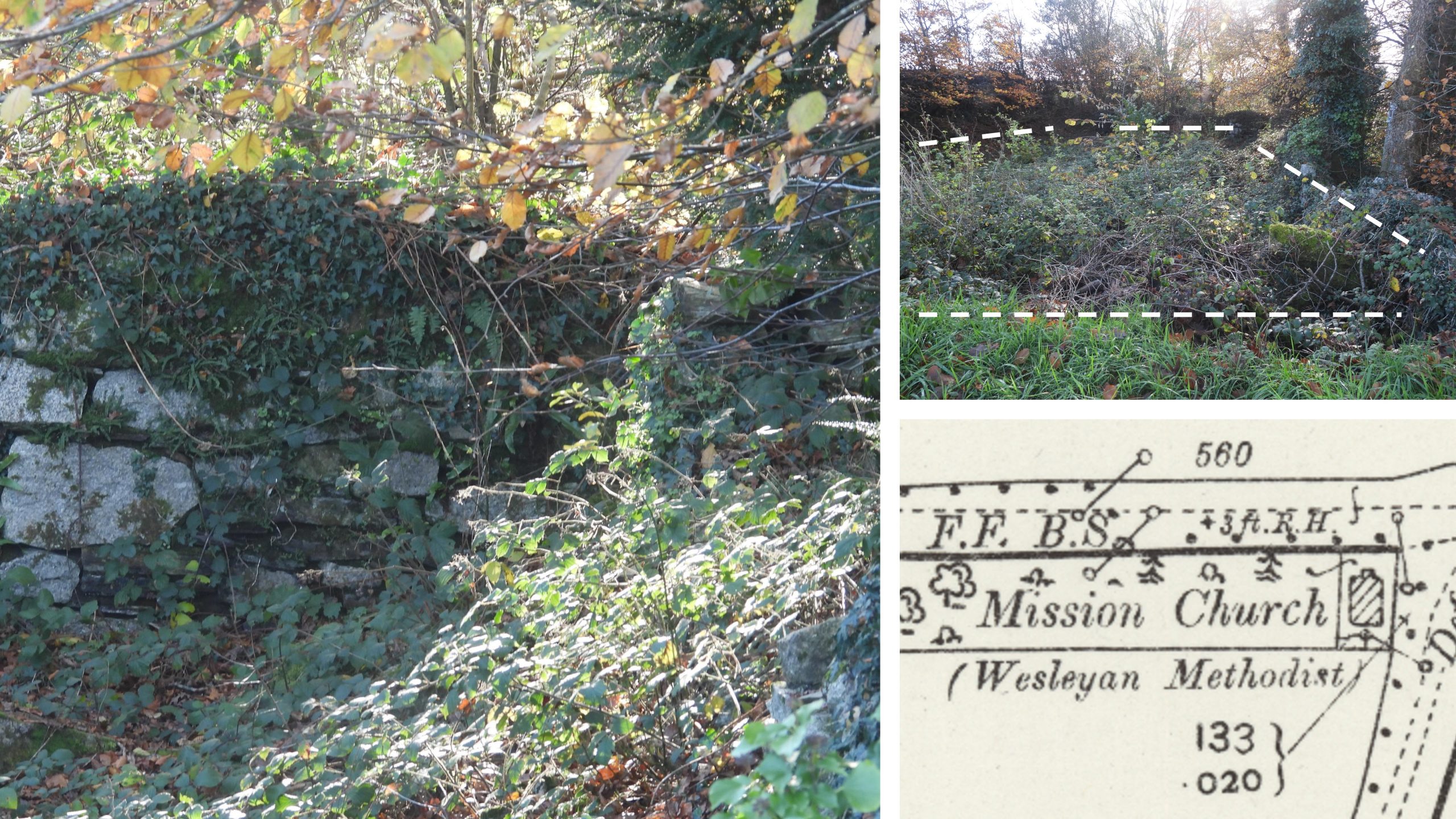
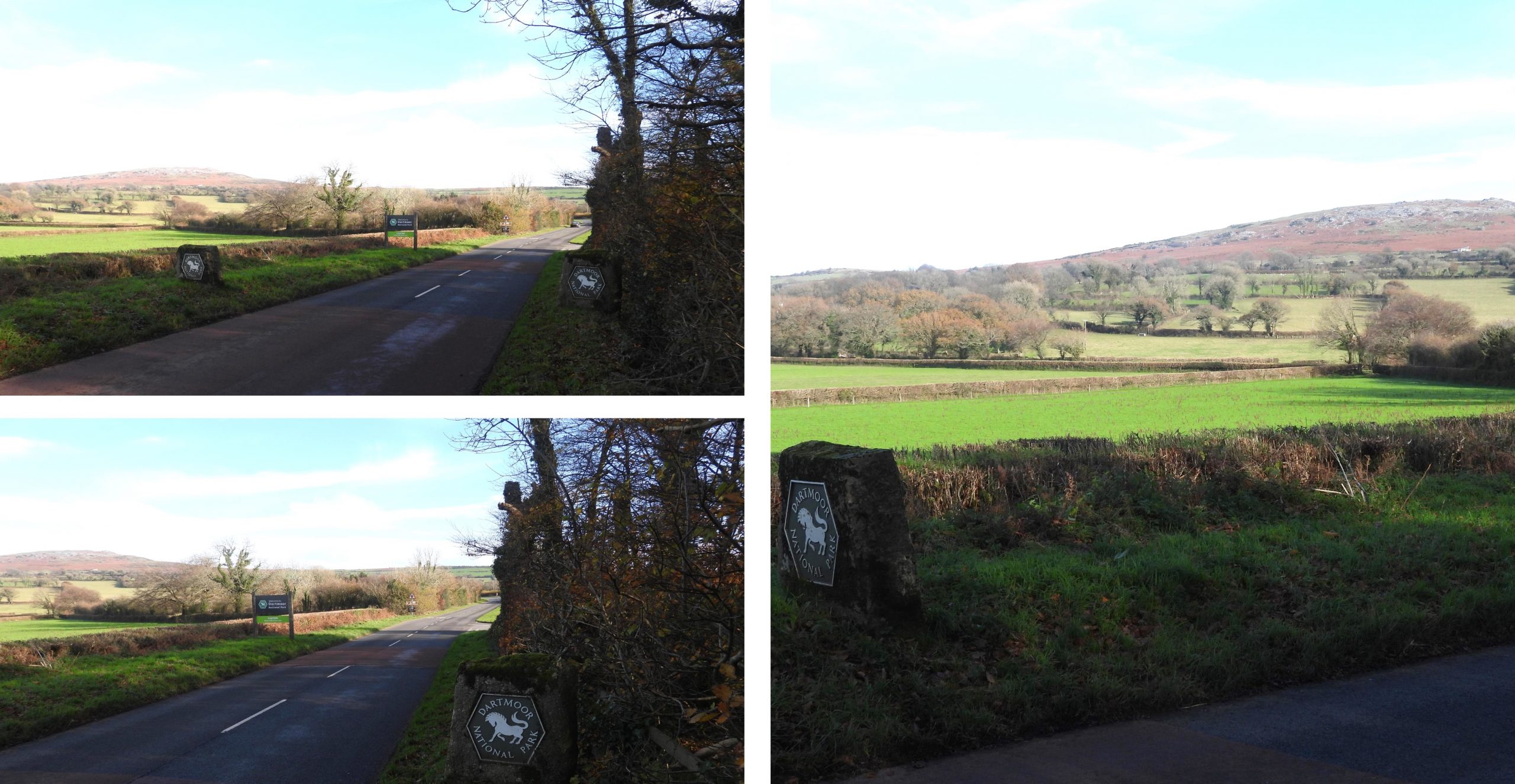
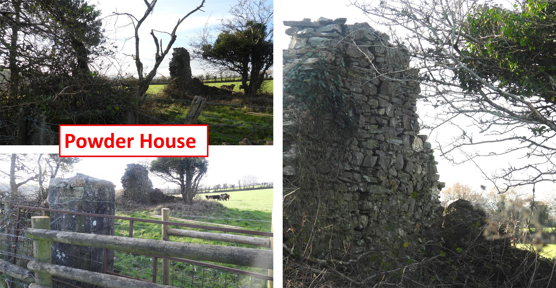
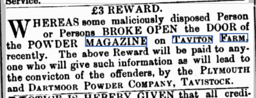
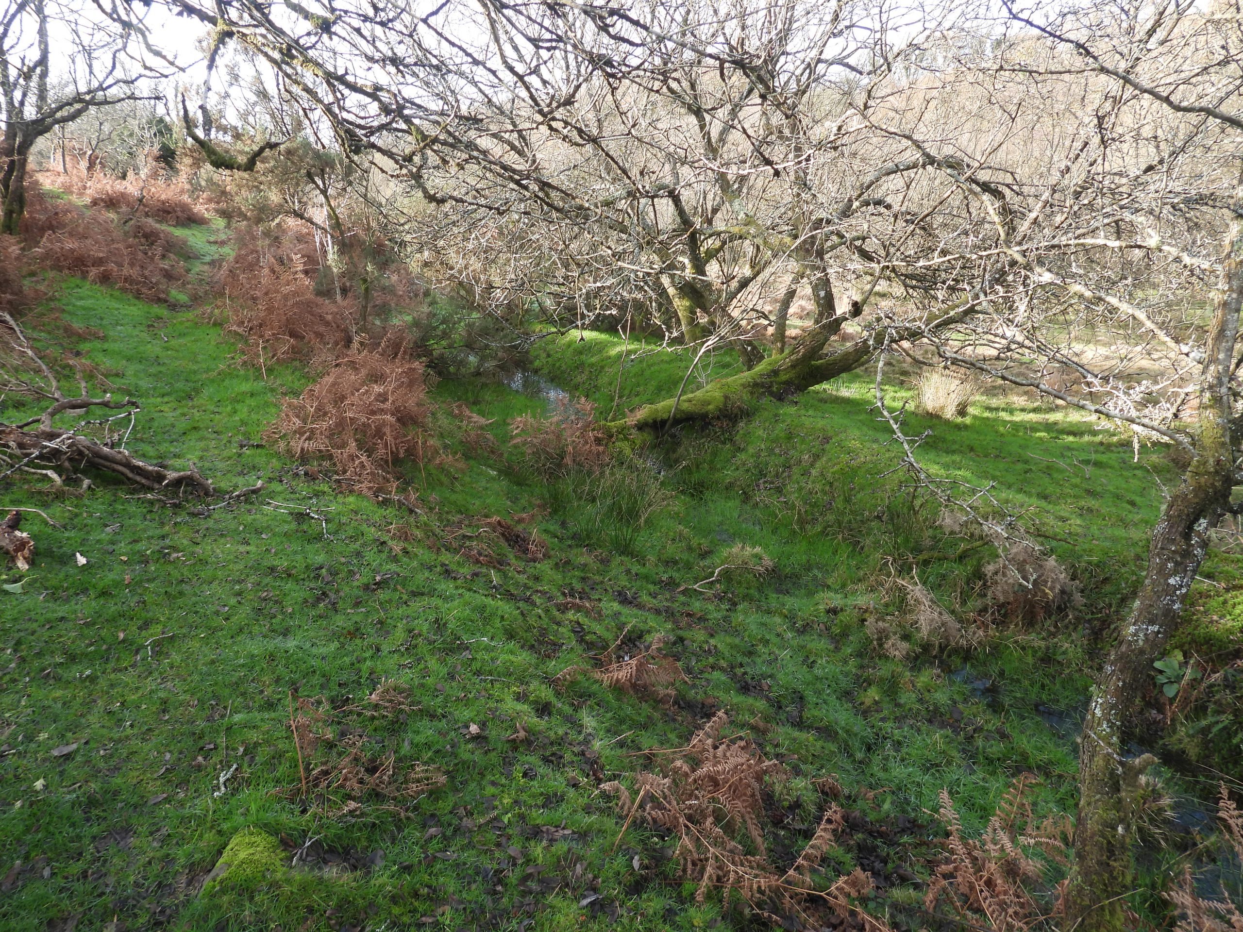
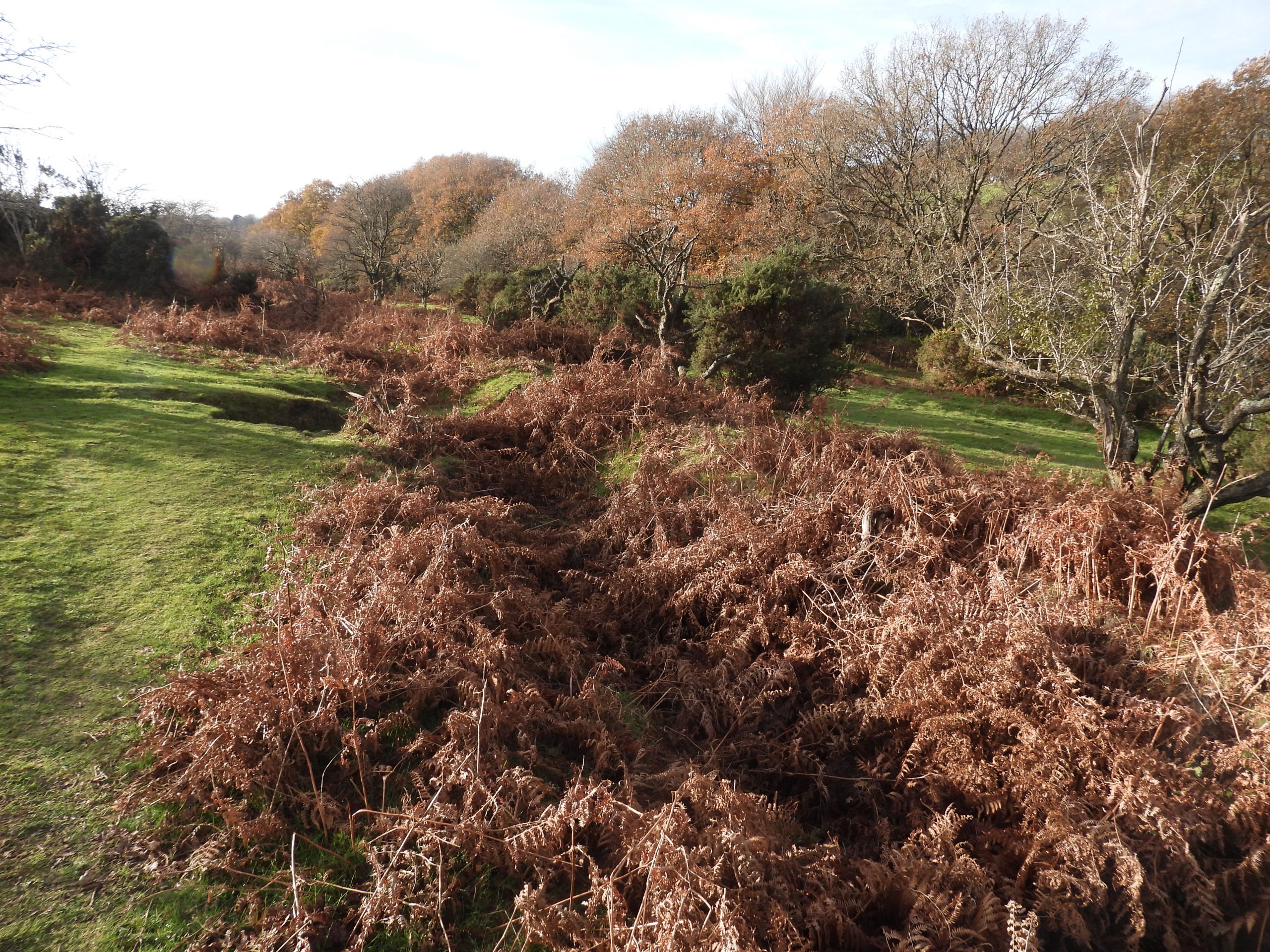
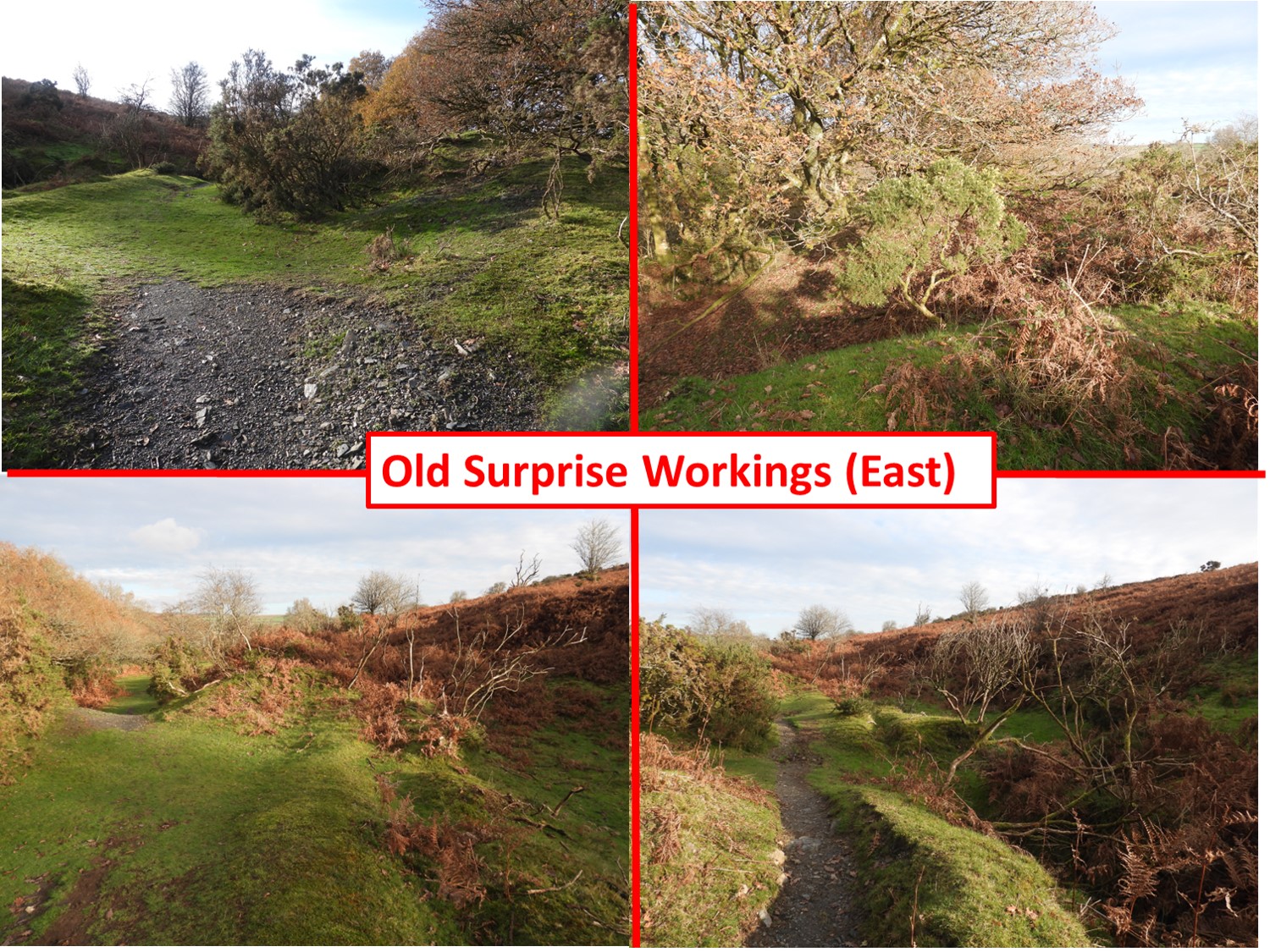
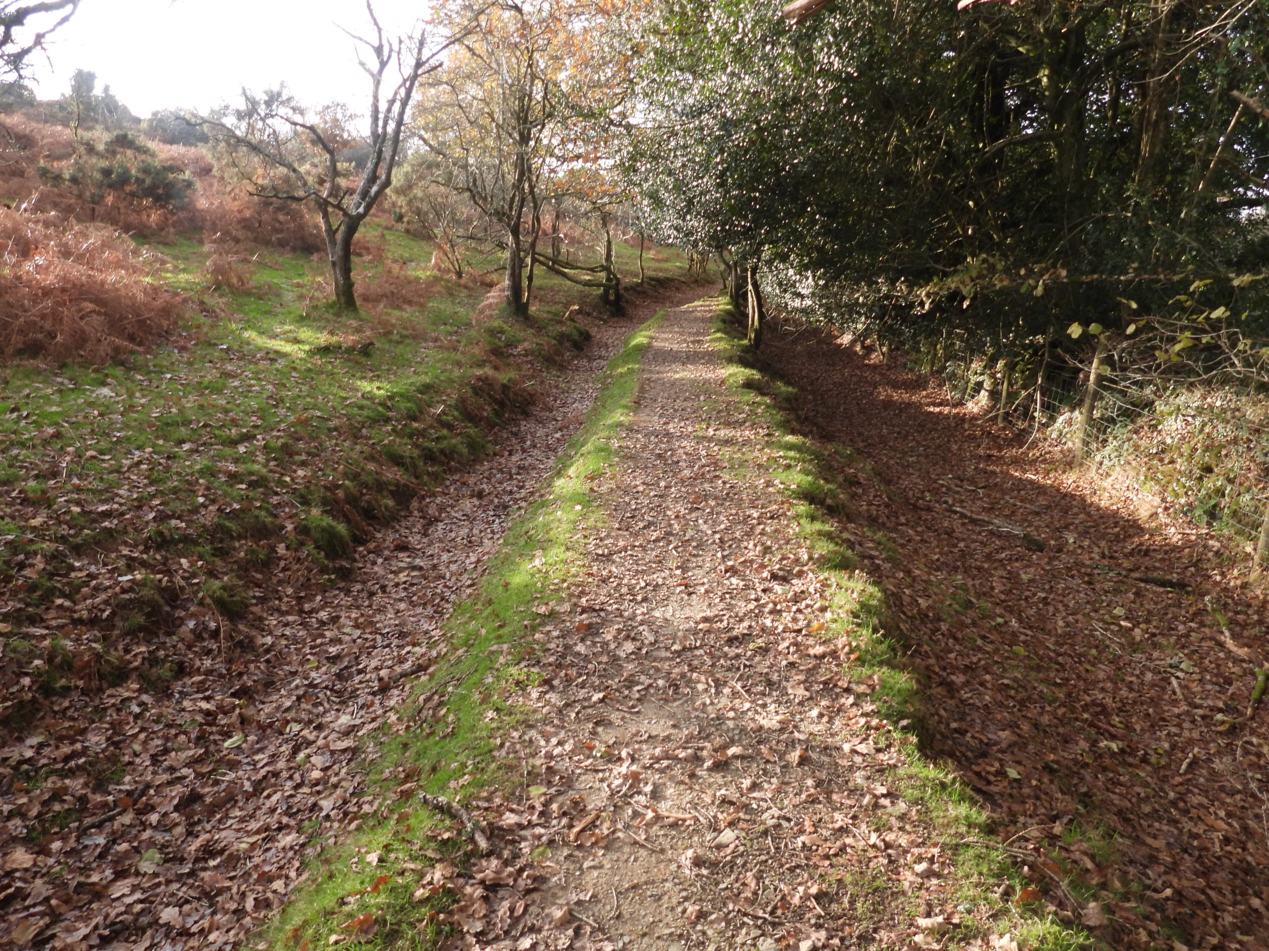
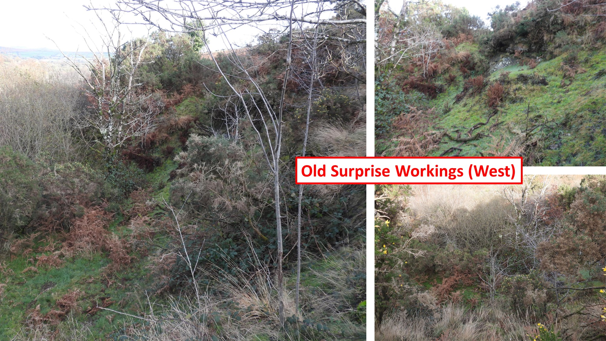
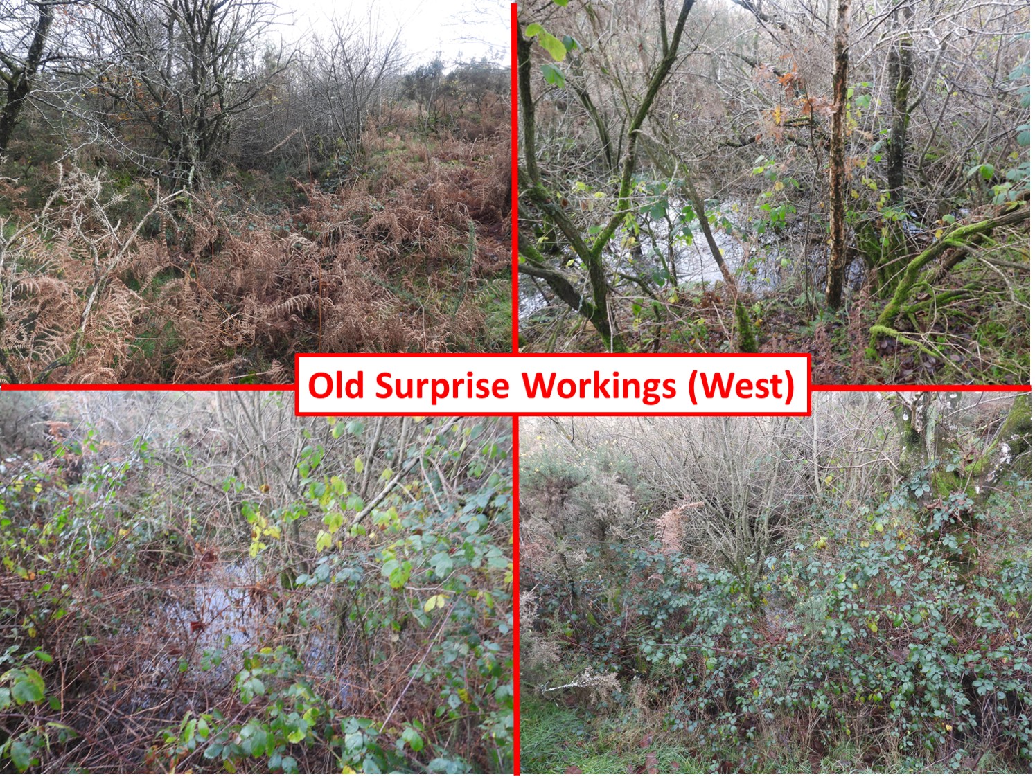
Sketch map of the area and features covered in this post. The post includes the three copper mines, a couple of old quarries, a sacred pool, a milestone, an old smithy, two crosses, an old Wesleyan Chapel, an old Powder House (outlying store for Powder Mills) plus 6 boundary markers of the Tavistock / Whitchurch parishes. This medieval roadside cross at north-west end of Whitchurch Down, near the Tavistock golf clubhouse has been restored. It is located at SX49293 73851E.N Masson Phillips, (1937) in ‘The Ancient Stone Crosses of Devon: Part I, 315-316’ records about this cross: “A roughly-shaped socket-stone sunk in the turf (with a square socket- hole penetrating the stone) bears a modern stumpy shaft, on which is mounted the ancient head portion with the arms of the cross of rough rectangular section. On each face between the arms, there is an incised cross. Restored in 1934”. Tim Jenkinson, (2007) in ‘Miscellaneous Milestones and Boundary Markers of Dartmoor Roads’ wrote : “Boundary stone just down from the second tee of Tavistock Golf Club on side of fairway/grass verge beside TUD/TRD iron marker” He further stated that it is thought to date from 1822.The boundary marker is on the Whitchurch / Tavistock parish boundary. The granite post is shown on 19th century maps and is located at SX49543 73710. The author is unaware of the date of the iron post.With due consideration to golfers the author followed the line of boundary markers across the golf course. This picture was taken early on a bright December morning when there were only two golfers around. The boundary marker is located at SX49839 73771.This boundary stone (like others) has the legend ‘W’ and ‘T’. ‘W’ stands for Whitchurch, ‘T’ for Tavistock. The third ‘W’ / ‘T’ boundary marker is located at SX50095 73824Close up of the third ‘W’ / ‘T’ boundary marker. The inscribed ‘W’ is partially buried.The fourth ‘W’ / ‘T’ boundary marker is located at SX50351 73879,next to Furzy Lane.Tim Jenkinson (2007), Miscellaneous Milestones and Boundary Markers of Dartmoor Roads, described this stone thus: “Boundary stone approximately 5 metres from road near to the 7th tee of Tavistock Golf Course on a small mound by track leading across course”. As with the other boundary stones it is thought to date from 1822.The fifth ‘W’ / ‘T’ boundary marker is located at SX50555 74038,also next to Furzy Lane.This boundary stone is part sunken in grass verge very close to edge of road. The inscribed ‘T’ is almost entirely buried.Descending Furzy Lane, on the hillside to the north (zoomed in) an outlying 19th century powder magazine of Powdermills Gunpowder Factory can be seen. This is visited later in the postThe Powder Magazine is located around 200 metres south off the main Tavistock to Princetown road (B3357). It was licensed in 1847 and is named as a magazine on the first edition Ordnance Survey map. It was a Powder Mills outlying storeThe final (sixth) boundary marker on the Tavistock / Whitchurch boundary is virtually buried and can easily be missed.The sixth ‘W’ / ‘T’ boundary marker is located at SX50803 74117,also next to Furzy Lane and close to the bridge over Taviton Brook. The two inscriptions ‘W’ and ‘T’ cannot be seen due to how buried the stone is. Ideally, the marker needs digging out and being reset.Taviton BrookFurzy Lane bridge over Taviton Brook.This sketch map is the authors interpretation of the features at Wheal Surprise using the descriptions by Helen Harris in the ‘Whitchurch Down’ publication and from mine plans supplied by Dartmoor Chris. It would seem that the workings south of the Taviton Brook were Wheal Surprise (sometimes known as Whitchurch Down Consols) and north of Taviton Brook were Devon Burra Burra. Located between Furzy Lane bridge and Pennycomequick, Wheal Surprise was first worked around 1810, before becoming inactive for several years. Interest in the mine was revived in the 1850’s. Work (re) started here in October 1851, shortly after the formation of Wheal Gatepost / Devon Burra Burra (covered later in this post).Described as being on a levelled area a few feet above stream level (Taviton Brook), ‘Joe’s Cottage’ is reputed to have been the birthplace of Joe Pengelly. He later lived at Kelly’s Cottage at Pennycomequick and died aged 96 shortly before the 2nd world war. The Cottage is not shown on 19th century maps and the author has “assumed” a location having explored the area extensively. The location is by no means definitive and is at SX50878 74119.Moving east from Furzy Lane bridge along a footpath of the valley floor of Taviton Brook the visible remains of the Wheal Surprise adit can be found. The water here can be seen ‘bubbling’ out of the adit and is a reddish / brown colour. The adit run-off is still discharging into Taviton BrookThe adit is located at SX51013 74089. In the ‘Whitchurch Down’ publication it states that: “Dines (ref: The Metalliferous Mining Region of South-West England, Vol 2, 1956, p 691) reports that an adit driven to 70 fathoms west-south-west from a portal near the stream”. It is further stated that the driven adit meets the north lode at 40 fathoms (240 feet or 73 metres).There is a flat topped earthwork ‘dump’ next to the adit which is centred at SX51008 74097.Recorded on 19th century maps as ‘Gravel Pit’, this has been interpreted by the author as a shaft which meets the driven adit level. This location of this probable shaft is at SX51001 74043. The disturbed ‘upthrust’ of earth to the north of the hole is further evidence this is a mine shaft and not a Gravel Pit. It can be found directly uphill from the adit.View from Wheal Surprise Shaft 1 towards Cox Tor and the Staple Tors.This depression lies between Shaft 1 (above the adit) and the Engine Shaft (above the wheelpit), which the author speculates it is either an air shaft or possibly just a ground collapse. The depression is quite pronounced and is located at SX51109 74020. This location is marked as a quarry on some 19th century maps. There is also evidence of walling here.To the east of the 2nd shaft is where the author believes the main shaft (Engine Shaft) is located. The shaft is at SX51146 74005. There is a platform area above the shaft which looks like it might have been a whim platform.The platform above the Engine Shaft has a shallow depression at its centre. When plant was auctioned in March 1856, it is recorded that there were two horse whims at the mine. Being above the Engine Shaft, it is likely that this was one of those whims and was used to haul men and materials down the shaft. There is a ‘scooped out’ section between the possible whim and the Engine Shaft. This may have nothing to do with the operation as it is not part of a path and the erosion may purely be from walkers.Another view of the ‘scooped out’ between the whim platform and the Engine Shaft. There was a lack of productivity at the mine (for the £4000 capital spent) and by February 1856 there was much discord including accusations of irregularities in account keeping. Shortly afterwards, bailiffs came to the mine and plant was auctioned. The auction included the waterwheel, pumps, two horse-whims, zinc air-pipes, tools and count-house furniture. In spite these events, in October 1856, the sett was purchased by a Mr Hill for £50 and was re-floated as Whitchurch Down Consols. The re-name was probably a ‘diversion’ to deceive prospective share investors. There does not appear to have been any saleable production in spite the name change.Looking down (north) from the whim platform the banks of a leat (marked as Leat 1 on the sketch map) can be seen with Taviton Brook beyond.At the west end of Leat 1 is where the author believes the recorded water wheel was located.The water wheel at Wheal Surprise was recorded as being installed in early 1852. The site is at SX51150 74025.End of Leat 1 and the (probable) site of the wheelpit.The (probable) wheel pit is where the 30ft x 4 ft waterwheel would have been located. It is recorded that by June 1853 the sinking of the Engine Shaft had reached a depth of 47 fathoms (86 metres). The location of the probable wheelpit is immediately below Engine Shaft. At a depth of 47 fathoms it is probable that the water wheel was used to drive a pump system (flat rods) which are described in the auction of plant from March 1856. The shaft would have been sunk to below the level of Taviton Brook. Also, at that depth, a horse whim would be needed to support the raising an lowering of man and materials down the shaft.There are two leats to the east of the probable wheelpit site.Leat 1 can be easily followed east towards Pennycomequick Bridge, close to where the water take off point would have been. It is believed this lower leat was probably fed by water from Taviton Brook, which was dammed near the bridge.Near Pennycomequick, climbing the hill (south) the second leat can be found.There is a path next to the second leat (Leat 2).Following Leat 2 westwards, Leat 1 can be seen below. The water which supplied this second leat is unclear. The ‘Whitchurch Down’ book speculates that that water for this leat was fed via gullies or channels east of the road from a point farher upstream.The end of Leat 2 with Leat 1 below.Another view of the end of Leat 2.Where Leat 2 finishes it is unclear how Leat 2 would have fed Leat 1 and ultimately the water wheel. The author speculates one of two possibilities; either flowing over the slope (maybe by control of a small dam) or even via a launder flowing around the slope (close to where the whim is located)Whitchurch Down lies on the metamorphic Devonian and Carboniferous beds which surround Dartmoor Granite. Pennycomequick quarry is the largest in the area and was worked primarily for building requirements (shales and slatey rocks) up to the 1920s.The centre of the quarry was recorded by the author as being at SX51201 73900. It is believed stone from this quarry was used to help built the Golf Club House and also the house at Warren’s Cross.There are two (now overgrown) areas of disturbed ground which are marked as Gravel Pits on 19th century maps, which lie to the north of Taviton Brook. The author did not explore these two locations and has marked them both as shafts 4 and Engine Shaft on the sketch map, these would have been part of Devon Burra Burra. Next to the Engine Shaft there was an Engine House and flat rods connecting to a shaft (called New Shaft) further up the hill to the north east. Shaft 4 may have possibly been a Gravel Pit as it is not positively identified as a shaft on the Devon Burra Burra mine planAnother view of shaft 4 (or possible gravel pit) on the north side of Taviton Brook. This view was taken from next to Pennycomequick quarry.Between Shaft 4 (?) and Shaft 5 (?), the author zoomed in on a buzzard who appeared to be picking over some carrion.Devon Burra Burra – In June 1851, a gatepost was discovered in this area which was impregnated with copper. It was this discovery that caused speculation fever in the area and initially a company called “Wheal Gatepost” was formed. Within a few weeks of its formation in the Summer of 1851 a number of trenches revealed a number of lodes. Also found were workings of the ‘ancients’. Undeterred, a shaft was sunk to 8 fathoms (ref: Hamilton-Jenkin – Mines of Devon). The author has scoured 19th century maps and believes the shaft (new shaft) was close to Longford just to the east of Moorshop Cross, the location of which is shown in the photograph. New Shaft was connected to an Engine House (which was located next to Engine Shaft) by a line of flat rodsIn September 1851, the original gatepost was sent to London (complete with its hangings) for publicity. More publicity followed an blocks of ore containing 30% fine copper were sent to the city. At the time the ‘Mining Journal’ supported a claim that the Devon Great Consols Main Lode ran through the Wheal Gatepost sett. It was around this time the mine was renamed Devon Burra Burra after the famous South Australia mine. It was these beginnings that inspired the formation of Wheal Surprise along the Taviton Brook. Using the National Library of Scotland maps (side by side), the author estimates New Shaft was located at SX51550 74511Whitchurch Down Sacred Pool (or Dew Pond). Dr Tom Greeves, wrote in 2019, an article titled ‘Dartmoor’s Sacred Pools. Design in the Prehistoric Landscape’. He recorded that the “Whitchurch Down pool measures 38 by 18m. One of over 40 such ‘sacred’ pools identified on Dartmoor that are thought to have potentially been designed during the prehistoric period, and may have been used to deposit votive items, although these Dartmoor examples may have alternative significance as designed prehistoric elements in the landscape”. The Whitchurch Down sacred pool is located at SX51167 73671.Pixie’s Cross was first registered on Historic England database on 7th July 1959. List entry number 1008926. On the database it states: “The cross is Listed Grade II. There are incised carvings on the WNW face of the cross, including a crude cross measuring 0.4m vertically by 0.3m horizontally. The cut is approximately 0.04m wide by 0.01m deep. The bank on which the cross stands forms a continuous ring to the east, broken only by the entrance to the quarry. The bank has an external ditch which has been partially filled on the east side by relatively recent dumping of soil. It appears that the bank and ditch are earlier than both the quarry, which is presently on the site, and the cross. The enclosure formed by the bank and ditch is c.143m in circumference and c.45m in diameter”.On the database it further states about Pixie’s Cross: “The monument includes a monolithic cross of coarse-grained granite, in a very prominent position in the middle of Whitchurch Down, sited in a slight hollow on the bank of an associated earthwork enclosure. There is no sign of a socket stone, but the cross seems very firmly set in the turf. The top two-thirds of the shaft curve slightly to the WNW. The cross has crude stumpy arms which are aligned NNE-SSW. The cross shaft is of neat rectangular section, 0.32m by 0.3m. The total height of the cross is 2.25m. The arms have a total width of 0.75m, and their maximum extent beyond the shaft is 0.25m. The head of the cross extends a maximum of 0.46m above the arms”.Back to Wheal Surprise. There is a (probable) third shaft between Pennycomequick Quarry and Pennycomequick Bridge. Helen Harris in the ‘Whitchurch Down’ book states that this shaft appears to be incorporated or adjoining a small old quarry. Indeed, it is marked as an ‘old quarry’ on 19th century maps. The author recorded the site of the (probable) shaft as being SX51318 73947This milestone is beautifully inscribed and is located on the Warren Cross to Pennycomequick Bridge road at SX51447 73923The milestone is just over 1m tall and is inscribed: ’13 Miles To Plymo’This milestone is believed to have been erected by the Tavistock Turnpike Trust around 1832.Pennycomequick Bridge has a small arch (by comparison to the rest of the stonework). The Taviton Brook appears to have been re-aligned around this area.This ‘Smithy’ is shown on 19th century maps.On early 20th century maps the ‘Smithy’ as having two adjoining buildings.The main road (from Tavistock to Merrivale) appears to have been re-aligned sometime in the late 20th century. The old road passed within a few metres of the ‘Smithy’ and can be seen on the far left of this picture.19th century maps show the old ‘Smithy’ had a benchmark on its north west corner (ref: B.M 580.2). If the benchmark is still extant it is very faint and could be located at SX51357 74560.Next to the ‘Smithy’ is an Edward VII letterbox at SX51362 74565.Whilst researching historical features in the area, the author noted that there was a Mission Church (Wesleyan Methodist) on 19th century maps, which appeared to have disappeared by 20th century. This is located at the junction of the Tavistock / Merrivale road and Furzy Lane. The surrounding external walls of the church are the only features which remain in 2022. The location is SX51182 74587There are two Dartmoor National Park signs on either side of the Tavistock / Merrivale road near to the former site of the Mission Church.The Powder House (or Powder Magazine), just off the Tavistock / Merrivale road at SX50897 74447. The building has very thick walls (0.45 metre) and has external dimensions of 5.2 metres square. The doorway is recorded as being located in the centre of what was its eastern wall. Only the southern wall remains to any reasonable height (nearly 3 metres high).Newspaper article from Tavistock Gazette on Friday 28th December 1877 regarding vandalism at the Powder Magazine, courtesy Dartmoor ChrisMoving back to Taviton Brook (Furzy Lane Bridge), to the west lies the remains of a prominent channel (leat). This leat can be traced for approx 1.5km and appears to have had its ‘take-off’ point adjacent to Furzy Lane Bridge. Helen Harris records that this leat was most likely used for mining purposes (‘Old Surprise’) and beyond that conveying water to cattle troughs.The leat to the west of Furzy Lane bridge can easily be followed.The first of two of the ‘Old Surprise’ workings can be found around SX50350 74100 and are shown as a ‘star shape’ (visible earthworks) on modern OS maps. There are lots of remains of old spoil tips at this location where the old leat passes through. It is likely the water from the leat was used as part of the mine operations (e.g Treatment of ore). ‘Old Surprise’ is believed to have been last worked in 1795 (ref: Lyson and Lyson; Magna Britannia Devon, 1822). The dumps here have specimens of shillet rock which have amounts of pyrite and residual sulphur.The old dry leat continues to the west of the first ‘Old Surprise’ workings. The hedgebank (on the right) is mentioned in the ‘Whitchurch Down’ book insofar as from this point the leat continued to cattle drinking troughs. Taviton Brook lies to the north (right of) the hedgebank.The second of two of the ‘Old Surprise’ workings can be found around SX50144 74032 and is shown as a visible earthwork on modern OS maps.The ‘Old Surprise Workings’ (West) are quite extensive and there are remains of a possible shaft here. Taviton. In 1931, (Gover, Mawer and Stenton) in ‘The Place-Names of Devon: Part One’, is it recorded: “Taviton is ‘Tavyton’ in 1284 in feudal Aids, 1321 Assize Rolls ‘farm by the Tavy’. The present farm is at a little distance from the river, but the original site of the settlement was at the spot now called Mount Tavy”.En-route back to Tavistock and adjacent to the golf course is a drystone wall (evident on modern OS maps). Behind (to the north) of the wall is an area of former quarry workings