A collection of walks, discoveries, insights and pictures of exploring Dartmoor National Park
December 24, 2020
Wigford Down Standing Stones (plus two Crosses, two Longhouses and a Benchmark)
A circumnavigation of Wigford Down in search of Standing Stones (“BA” stones and “L” stones), two crosses, two longhouses and a benchmark
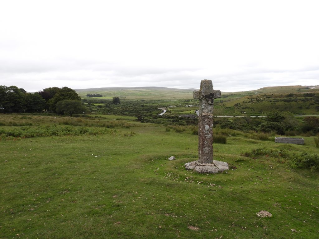
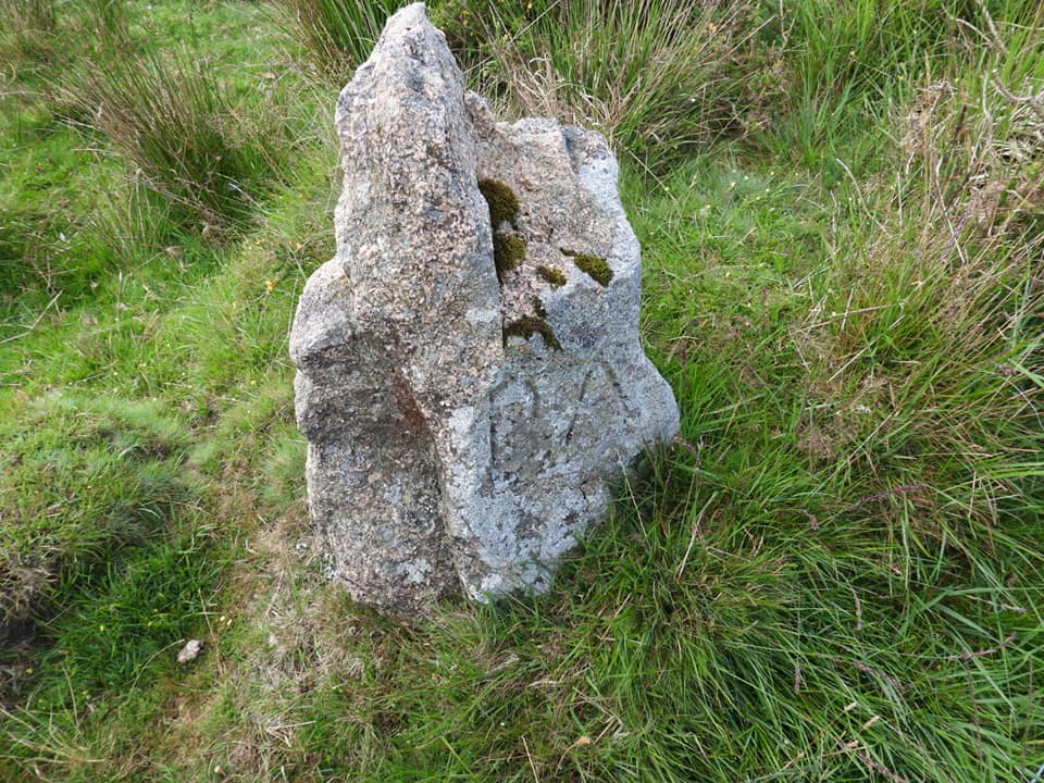
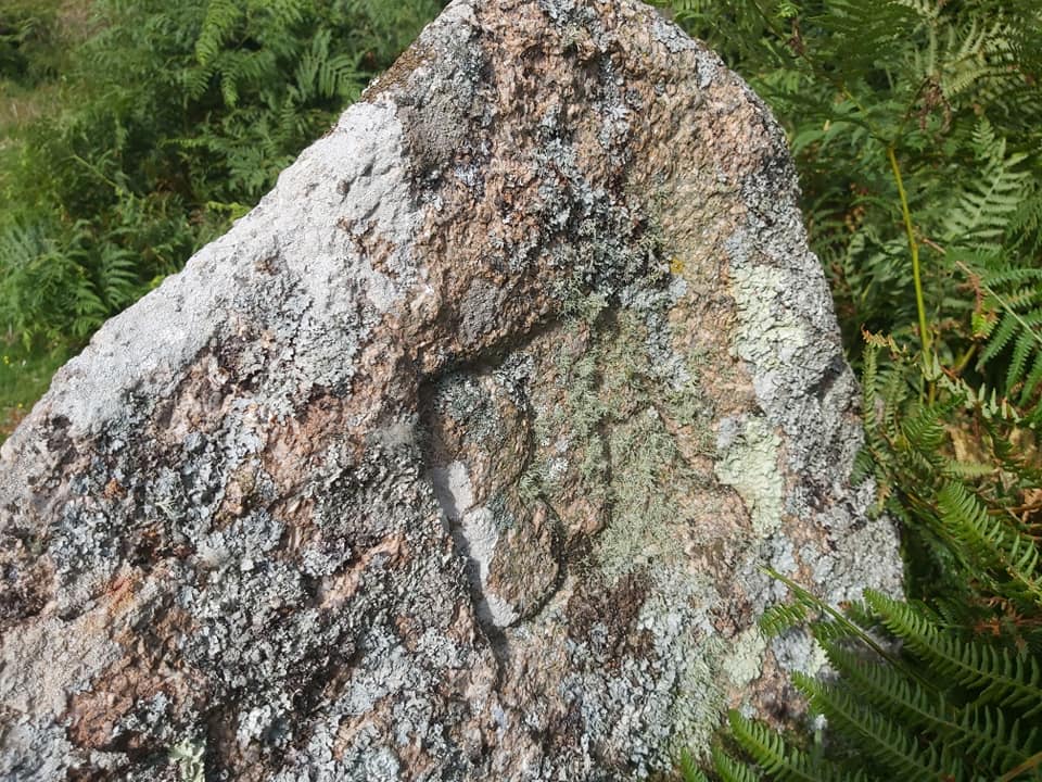
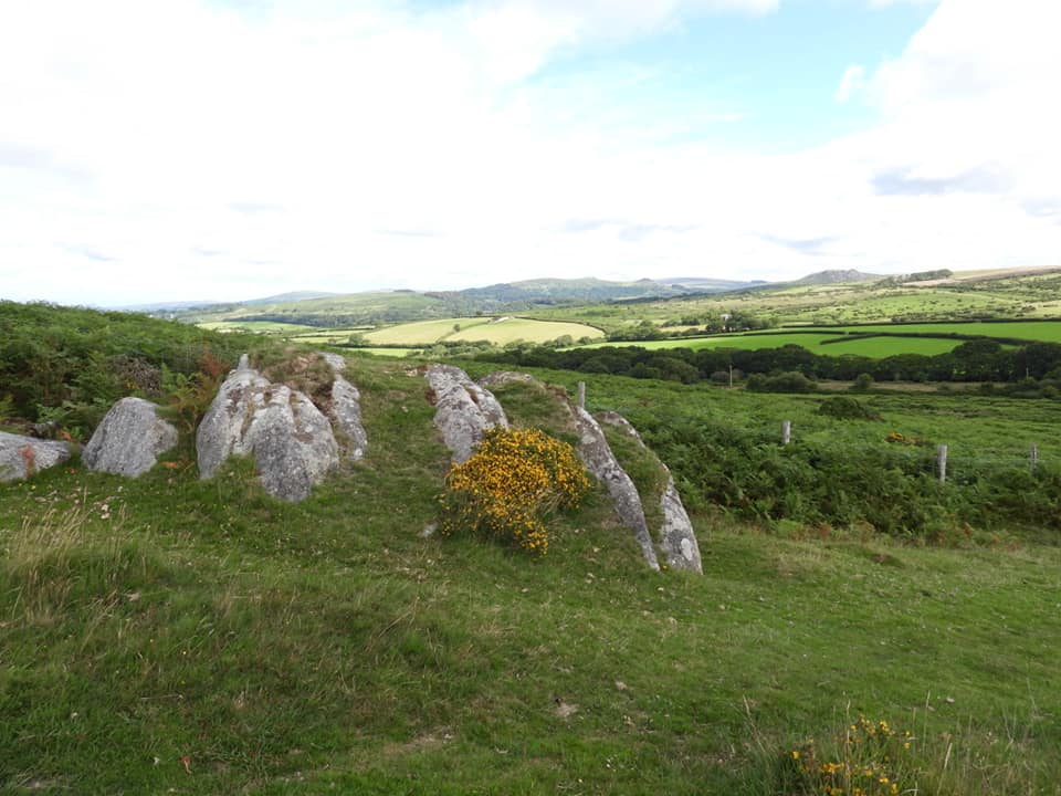
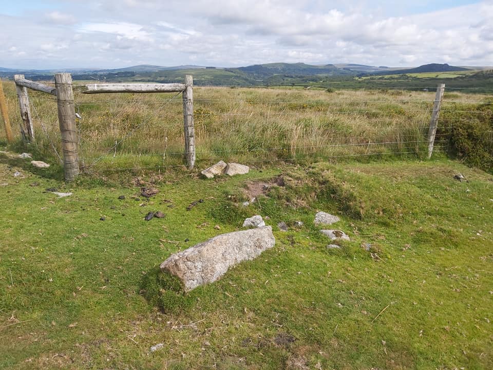
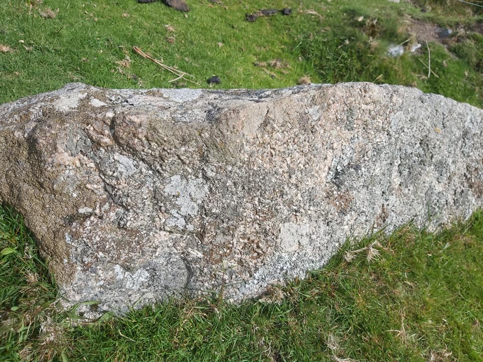
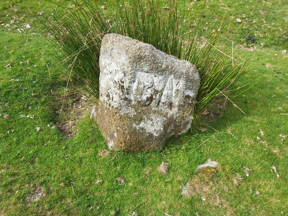
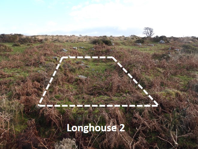
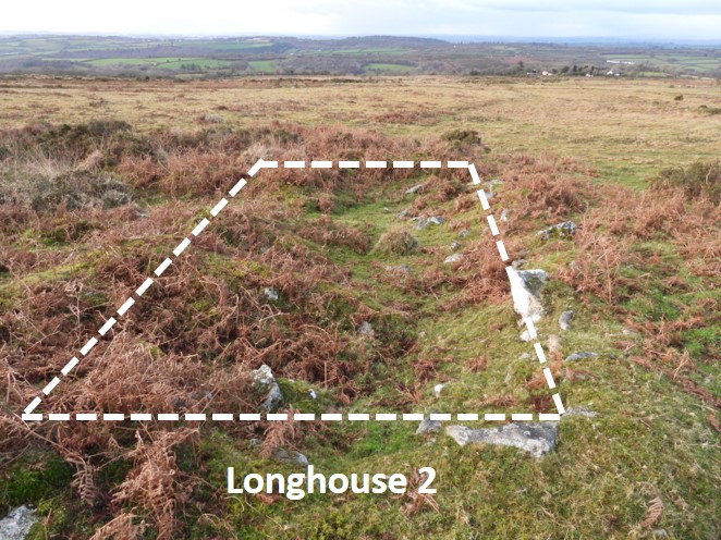
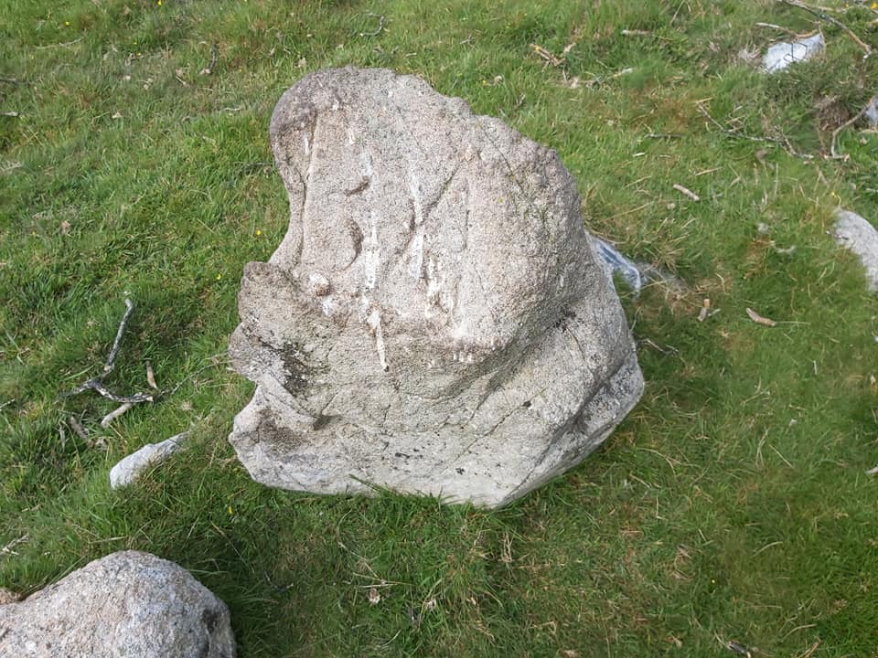
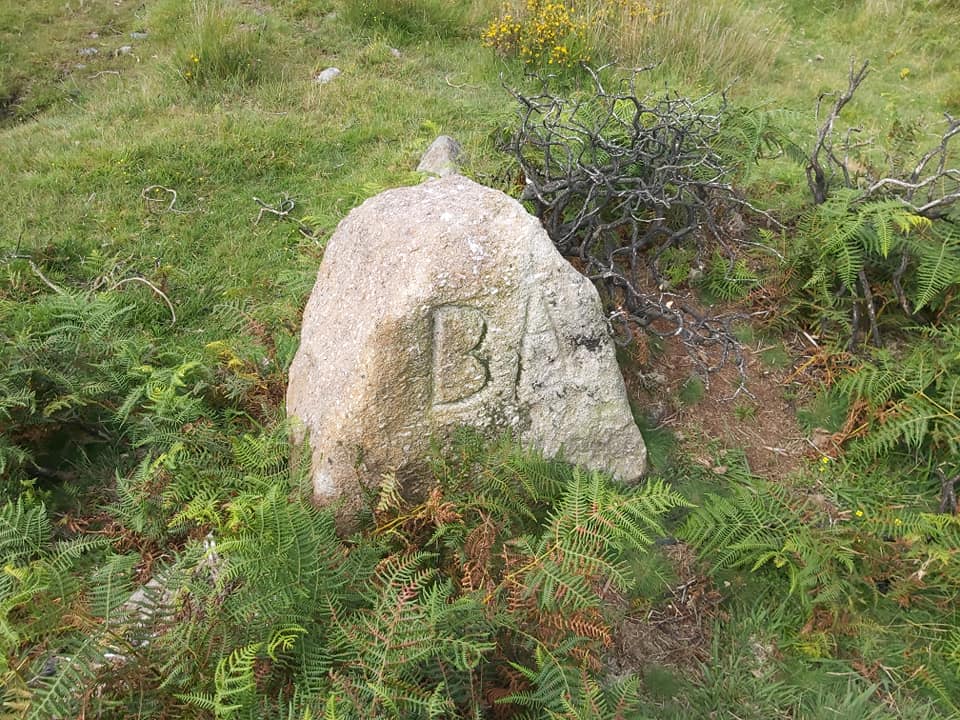
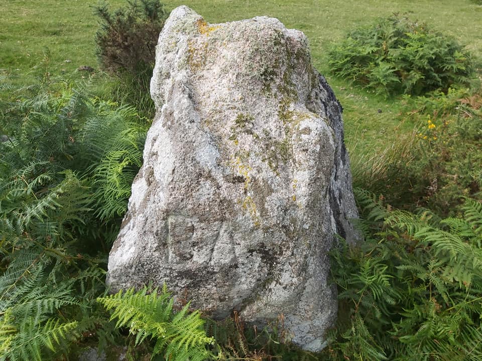
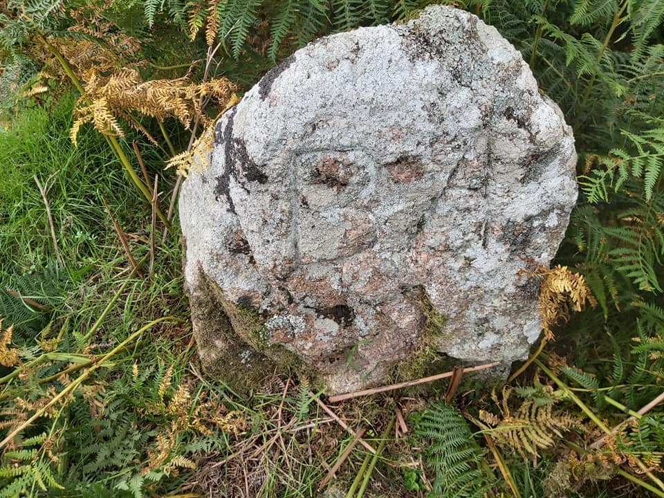
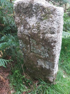
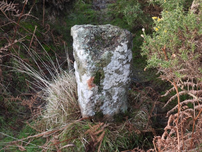
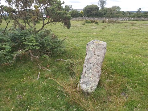
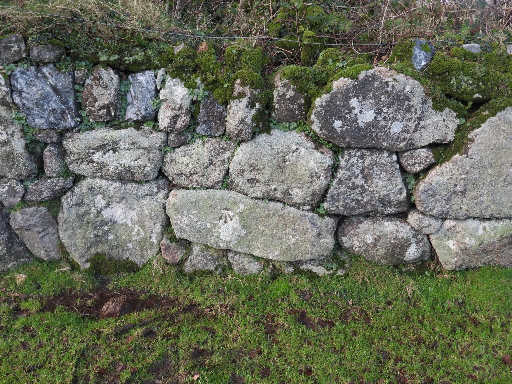
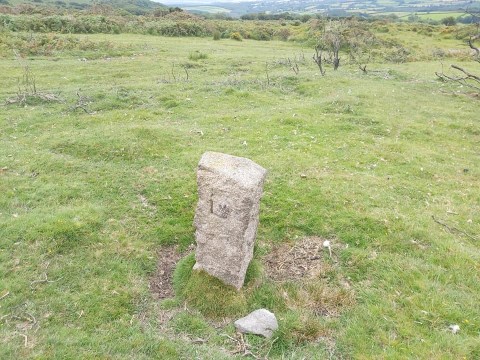
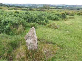
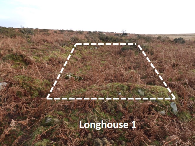
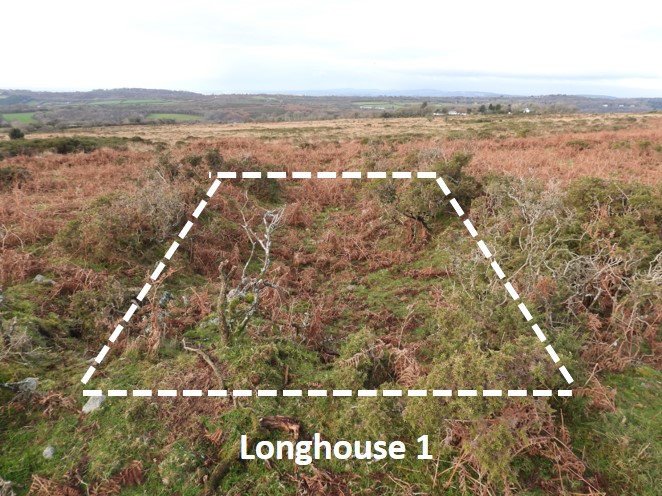
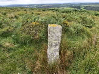
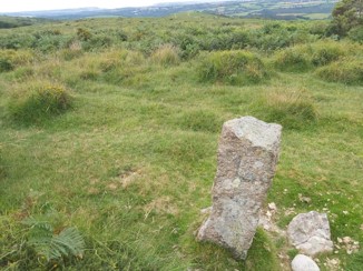
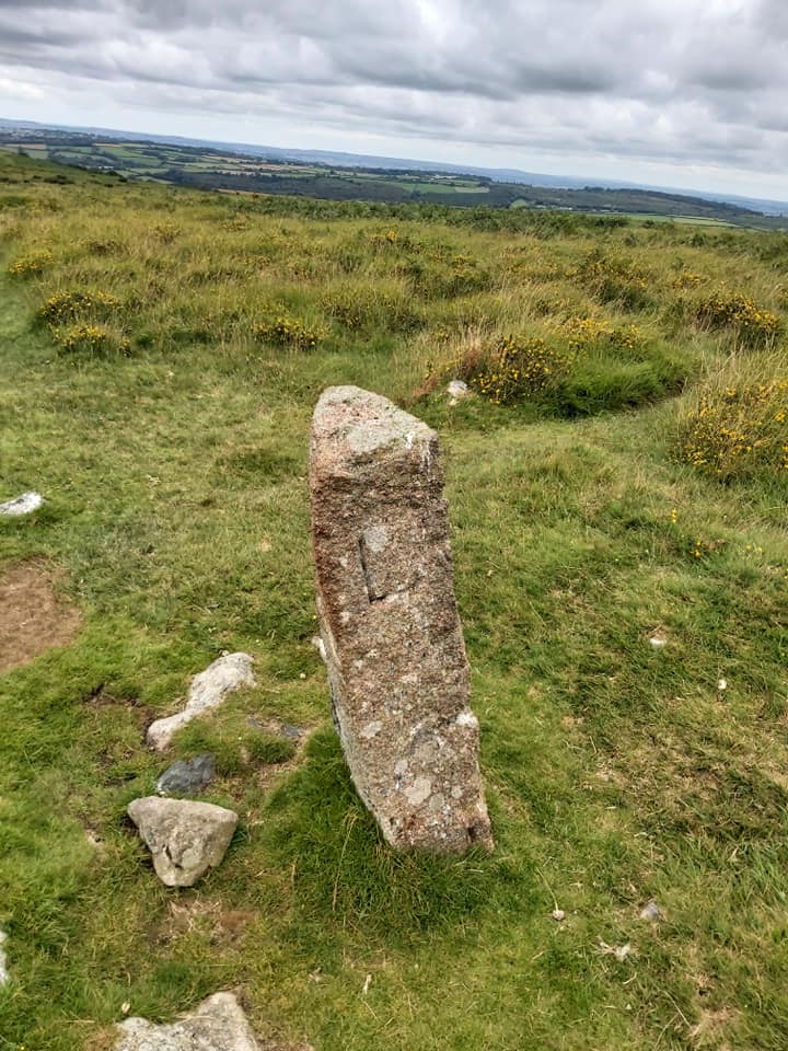
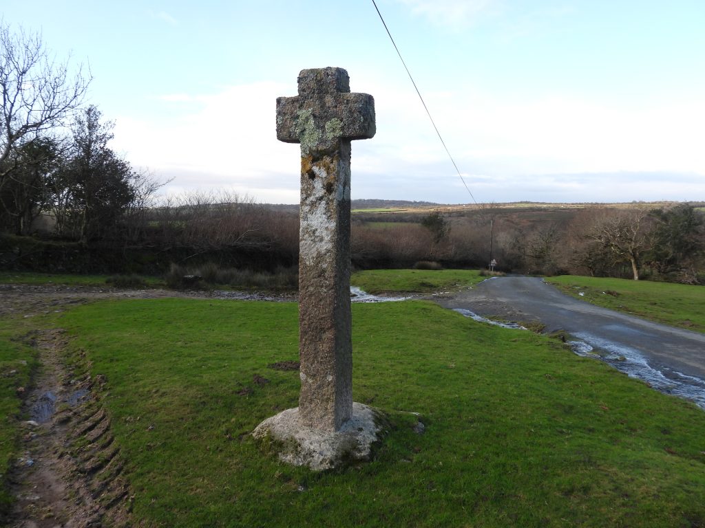
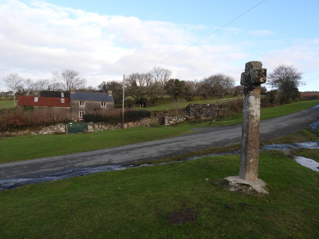
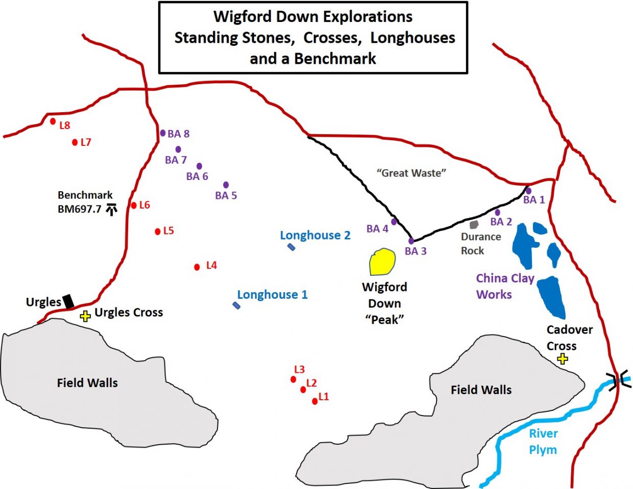
Sketch map showing the approx. locations of the items covered in this post. 10 digit National Grid References for each item is captioned in this post. The pictures in this post were taken from two visits and are shown (more or less) in order, East to West and back.Cadover Cross. In 1873, the top section of the cross was found recumbent by some soldiers who were on an exercise from their camp on Ringmoor Down. The cross was erected but became recumbent by the turn of the 20th century. In 1915, Rev. Hugh Breton arranged for a new shaft to be made and fitted to the cross. He came across a large granite boulder which turned out to be the original socket stone for the cross, still in situ. Information taken from http://www.dartmoor-crosses.org.uk/. The location of the cross is SX 55330 64718The first of eight inscribed stones with “”BA” on them. This one is at SX55199 65341The second of eight inscribed stones with “”BA” on them. This one is at SX55078 65264. The 8 stones are located on the north side of the down. In a fabulous survey by Dr Phil Newman of Wigford Down , he states he stones mark out a plot of land and are each uncut moorstone less than 1m high.Durance Rocks (as titled from 1840 Tithe Map).The third of the eight inscribed stones with “”BA” on them is recumbant. This one is at SX54772 65146A close up of the third stoneThe fourth of eight inscribed stones with “”BA” on them. This one is at SX54710 65226.This Longhouse is one of two shown in Jeremy Butler – Atlas of Antiquities , the South West Map 48 (Fig 48.1). This one is at SX54292 65121Jeremy Butler, describes this area thus: “The ancient field pattern is confused by banks and ditches of medieval date, cutting across the site, probably associated with the two longhouses). This one is at SX54292 65121The fifth of eight inscribed stones with “”BA” on them. This one is at SX54074 65357. Dr Newman states this one is set against an enclosure known as Great Waste.The sixth of eight inscribed stones with “”BA” on them. This one is at SX53977 65432. There have been several theories as to the “BA” inscriptions (by Dr Newman and Dave Brewer from his book on standing stones). They include it might stand for Buckland Abbey.The seventh of eight inscribed stones with “”BA” on them. This one is at SX53899 65499. It has also been muted “BA” stands for Brisworthy Arrishes.The eighth and final inscribed stones with “”BA needed some gardening to get to it as it was overgrown with ferns. This one is at SX53842 65556…..and so to the (L) stones. This one is at SX53421 65595.The ‘L’ boundstones are a series of tall pillars (eight in all), rough hewn, and each bearing the letter ‘L’, which for years researchers generally assumed signified the Lopes family who once owned large tracts of land on the southwestern fringes of Dartmoor — part of their extensive Maristow estate. This one is at SX53487 65534These stones (of which eight remain), follow a similar route as shown on the 1840 Tithe map. This stone is at SX53732 65272A short distance from the previous “L” Stone is Benchmark B.M 697.7, shown on side-by-side maps. It is located at SX53684 65245.L Stones story as portrayed in Mike Brown CD on Dartmoor : On 18th February 1841, George Giles, the steward and land agent of the Maristow-owned manors, wrote to a land surveyor by the name of William J Stentaford, thus:”I have been with Sir Ralph Lopes & Mr Scobell on Wigford Down this day they both returned to my office…and ultimately agreed on an equal division of the 393a 3r 15p, the boundary to be shown by Granite posts, when the line has been traced — and that Mr Scobell’s portion shall be that moiety next adjoining his inclosed lands of Urgles and Good-a-Meavy beginning north from the corner of outher Diamond park…across towards Oxen Torr — or somewhere in that direction, wherever the line of equal division may fall…the line…must be taken up from Sir Trayton Drake’s boundary of Greenwell Down — and should it fall upon Shaugh Prior Boundary it must not be carried across it…This is a matter that requires your earliest attention. Sir Ralph and Mr Scobell will again meet on the locus in quo when you are prepared to shew the divisional line. This Job is to be at the joint expense of each party.” This particular stone is located at SX53820 65177So, these stones represent the boundary between lands of the Maristow Estate (Lopes) on the East and those of Edwin Scobell to the west. This one is at SX53964 65054This Longhouse is one of two shown in Jeremy Butler – Atlas of Antiquities , the South West Map 48 (Fig 48.1). This one is at SX54118 64934Longhouse looking west. SX54118 64934Notably only an “L” is inscribed on these stones for Lopes. (Edwin) Scoble doesn’t get a mention. This stone is at SX54329 64633The boundary now follows in part lands owned by the National Trust. The penultimate L stone at SX54359 64602The most well known of the L Stones as it’s on the main path between Cadover Bridge and The Dewerstone. SX54407 64548Urgles Cross: From http://www.dartmoor-crosses.org.uk/ : “William Crossing recorded that, by the turn of the 20th Century, only the original socket stone was still in place and no sign of the original cross could be found. At some point since William Crossing’s visit, the socket stone has been removed to Good-a-Meavy House and is now used to support a relatively modern cross. This was erected by Mr Hill, the owner, as a memorial to his son, who was killed in the Dardanelles during World War I.”Urgles Cross: From http://www.dartmoor-crosses.org.uk/ : In order to compensate for the loss of the original Urgles Cross, another one was made and erected in its place at some time during the first half of the 20th Century. It is sometimes referred to as Good-a-Meavy Cross. Located at SX53506 64873