A collection of walks, discoveries, insights and pictures of exploring Dartmoor National Park
October 9, 2021
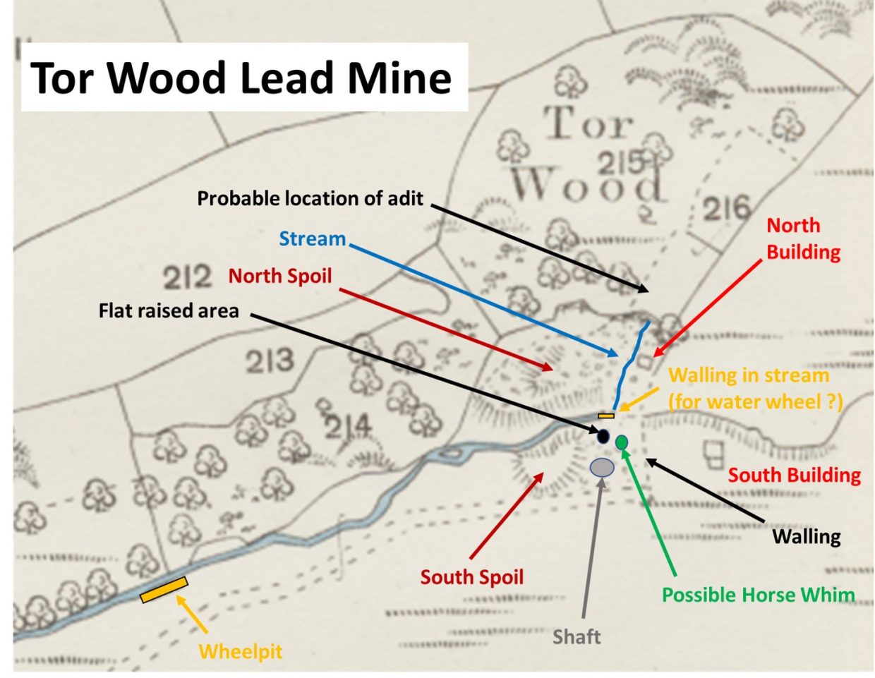
Tor Wood Mine
Tor Wood mine was a small venture and was worked in the 1820s when the miners chased a 70-fathom adit driven along a lead lode of 2ft wide. The mine is located beside the Deep Valley Brook, a tributary of the Crandford Brook which is adjacent to Tor Wood and 300m east-north-east of Lake viaduct. The mine is clearly shown on late 19th century maps but not on the latest OS maps. This mine is assumed to lie on an extension of the sulphide-rich mineralised bed worked by the Forest and Homerton mines (both submerged under Meldon reservoir) to the east. The mine is recorded as being for sale in 1828 when a 30ft by 4ft water wheel, pumps, pitwork, a horse whim, capstan and other materials were on offer.
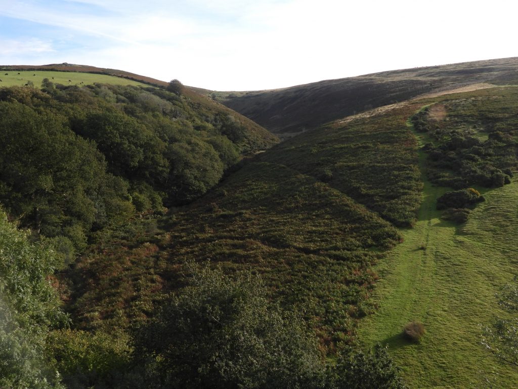
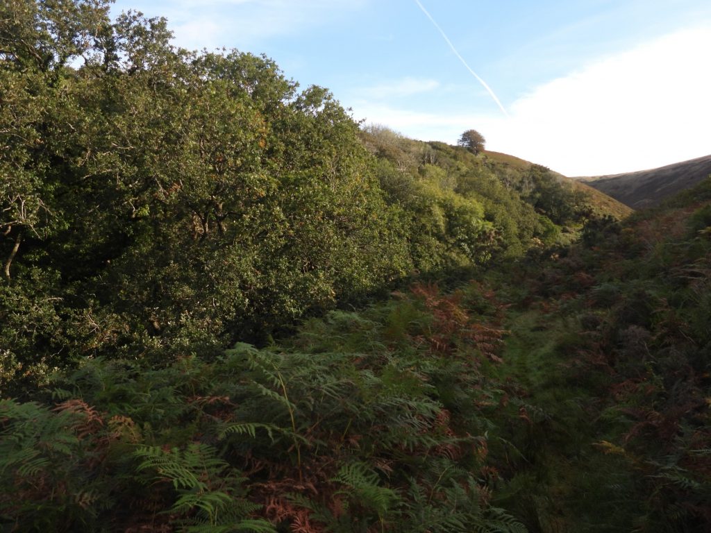
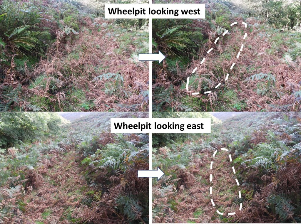
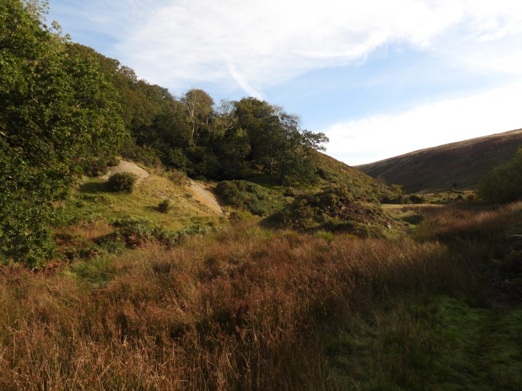
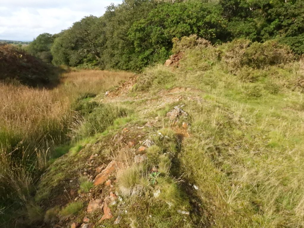
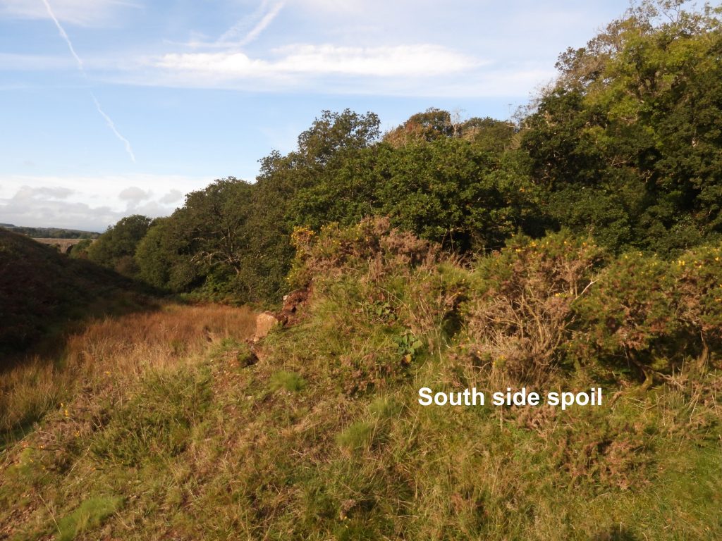
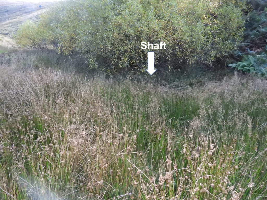
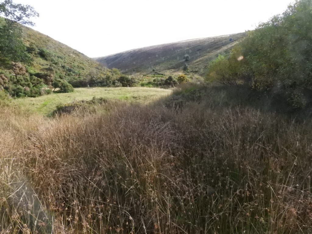
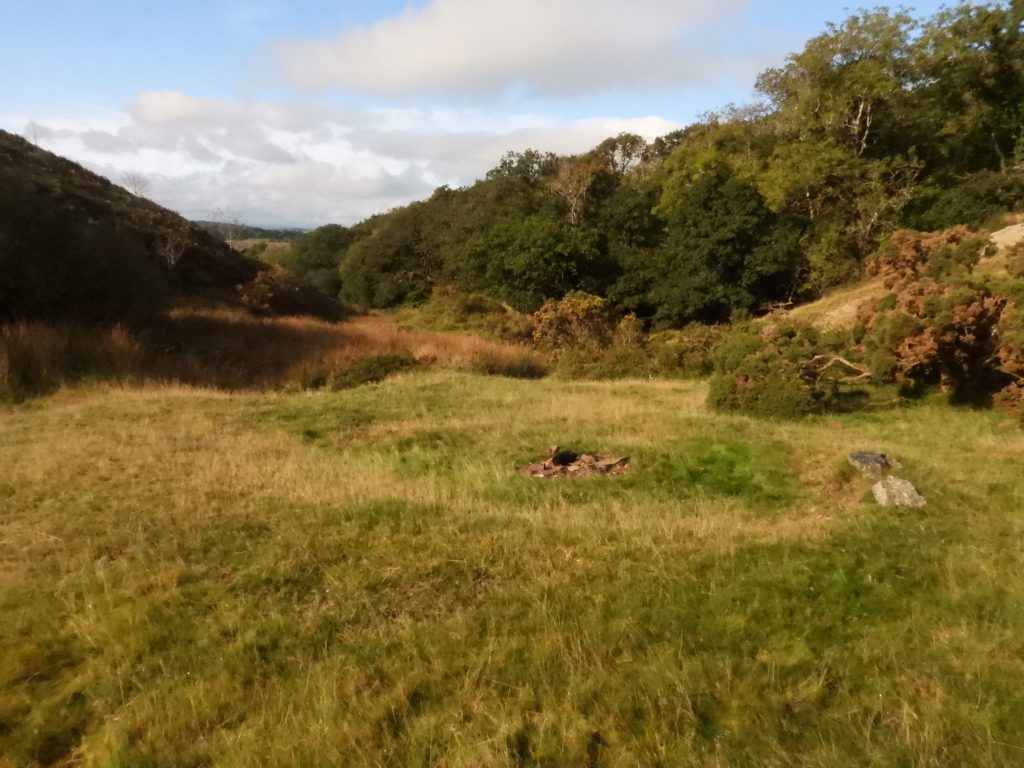
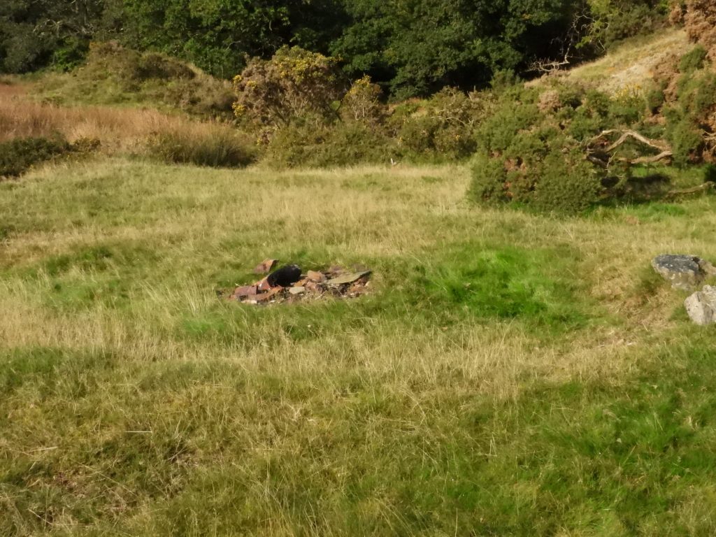
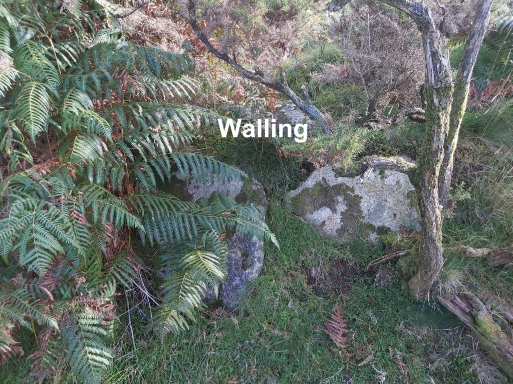
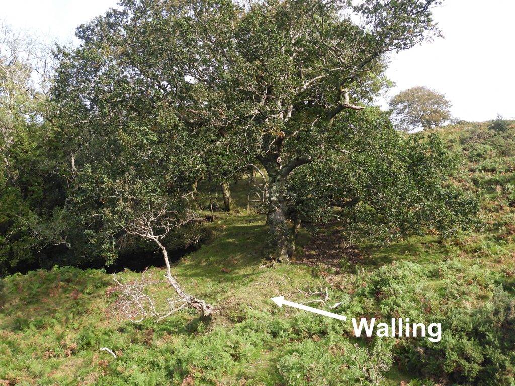
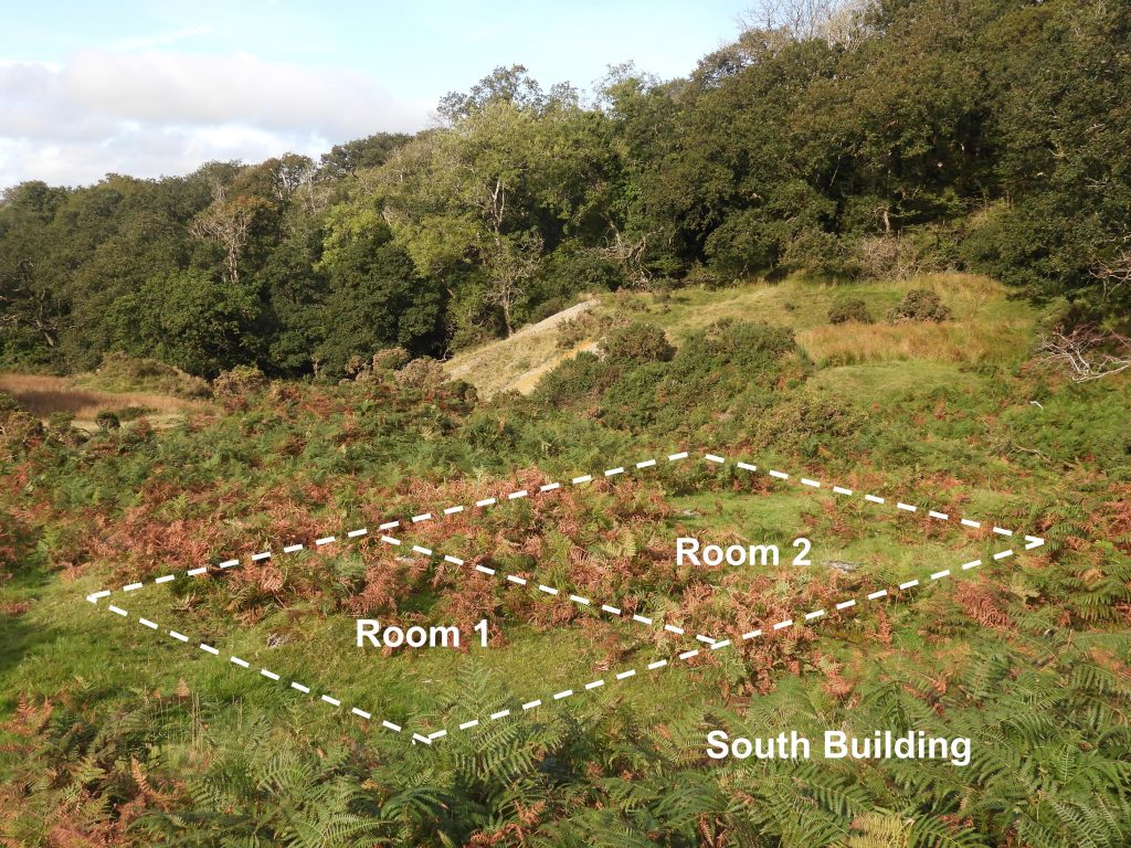
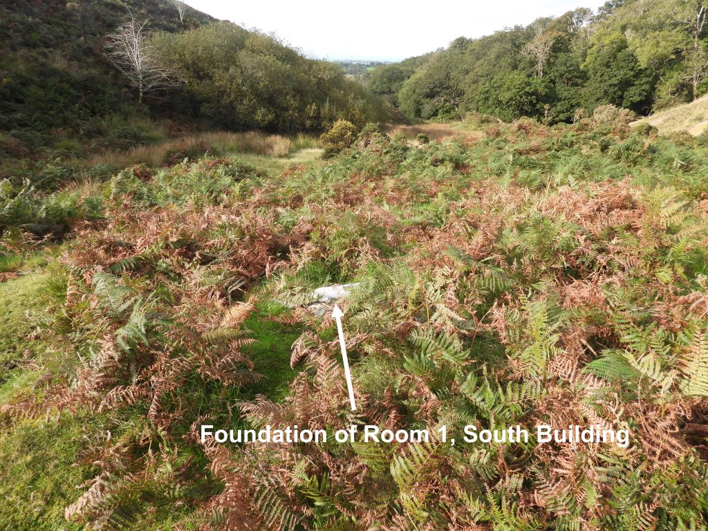
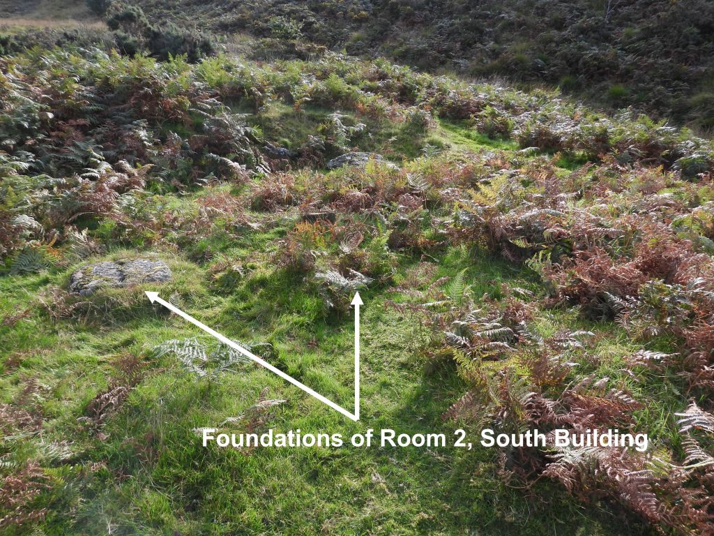
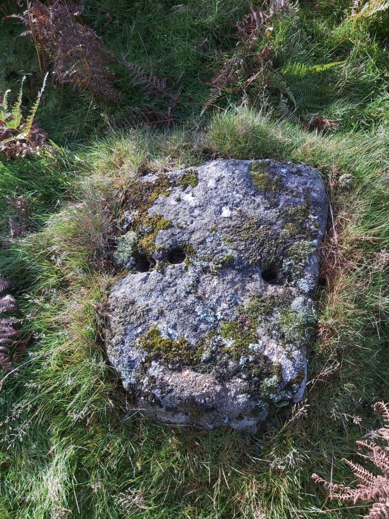
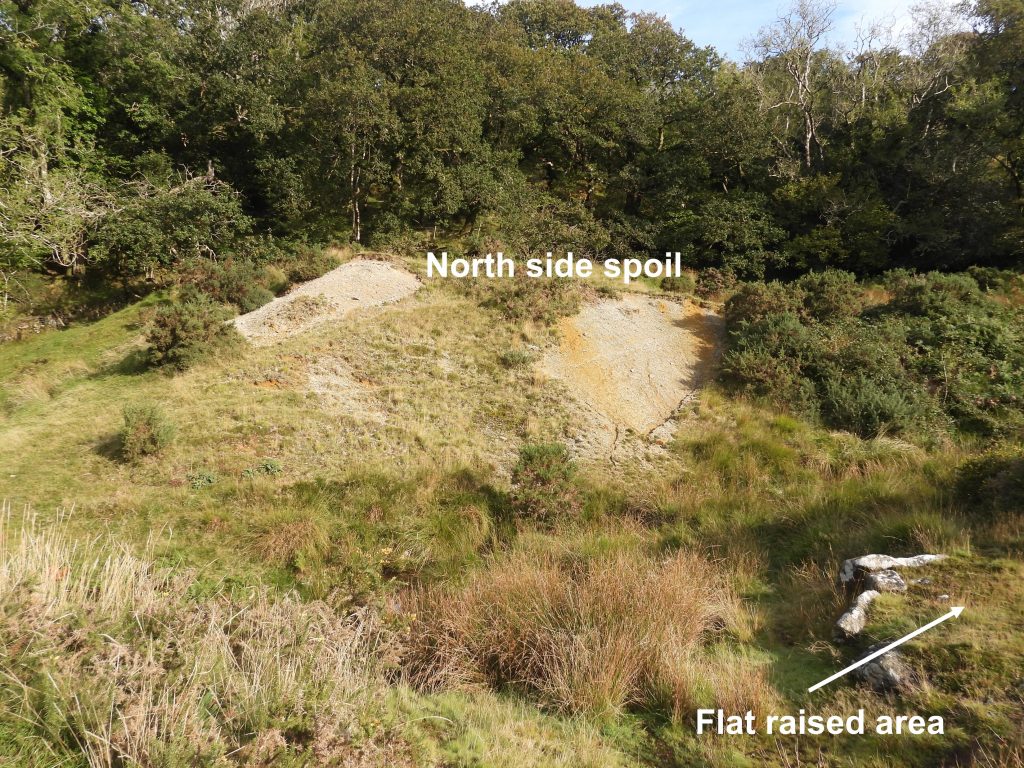
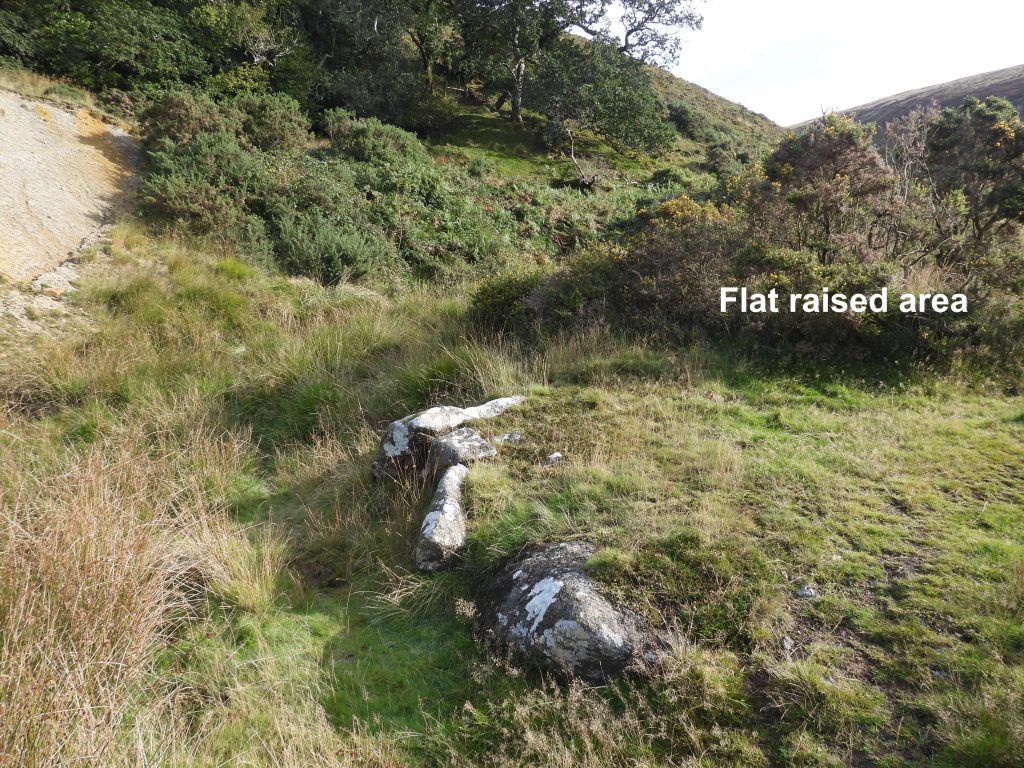
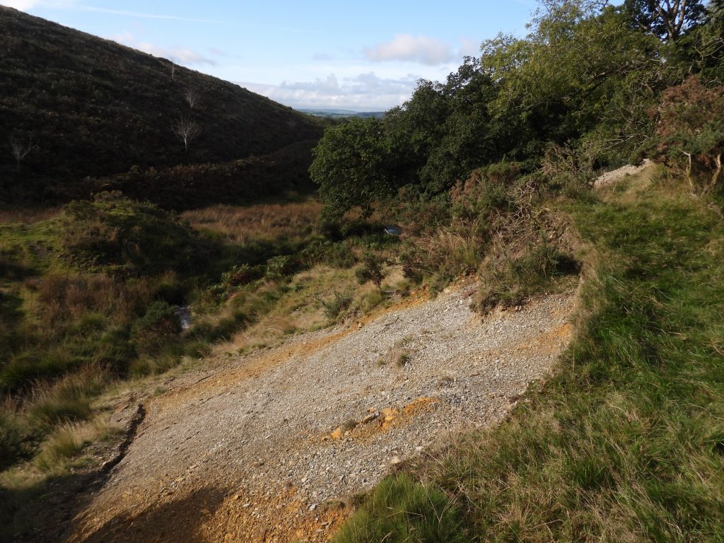
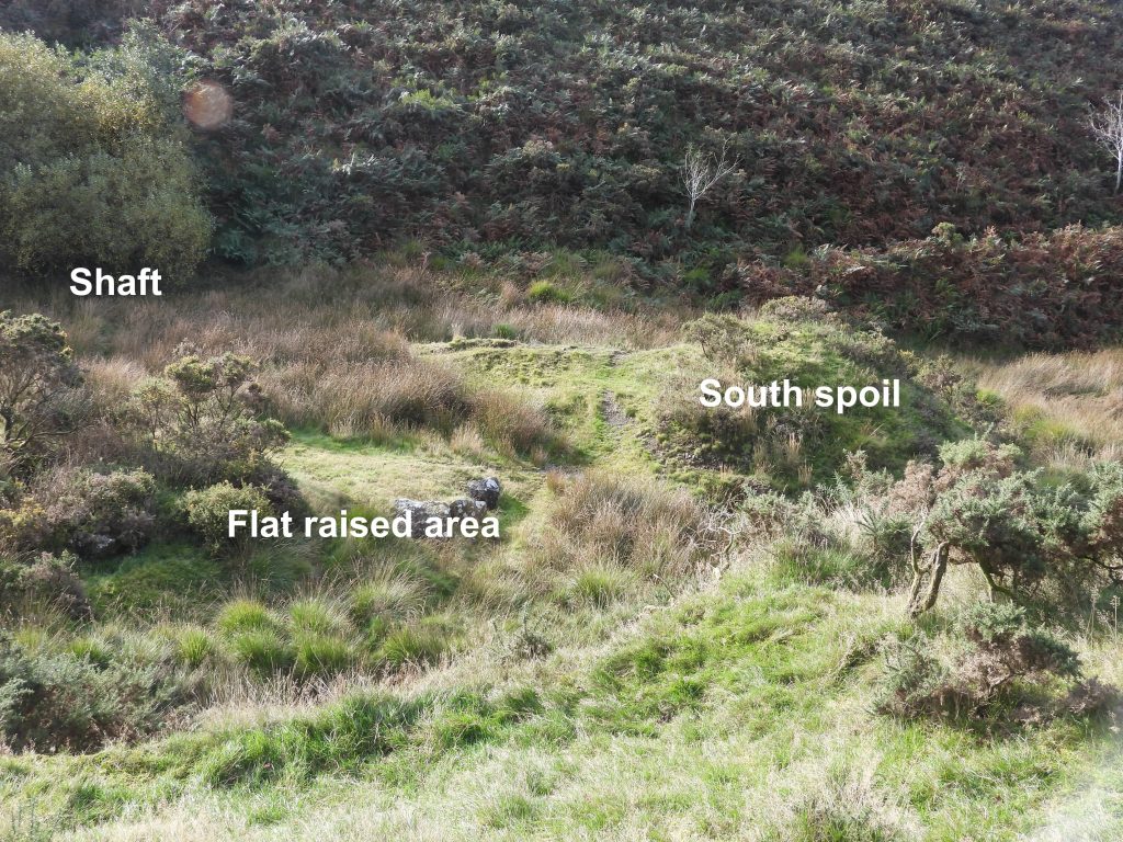
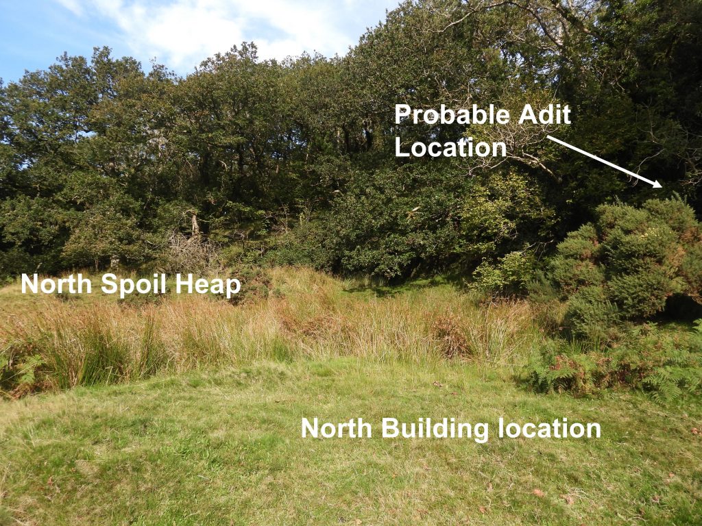
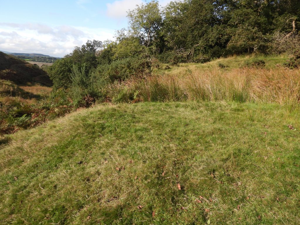
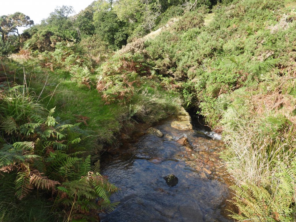
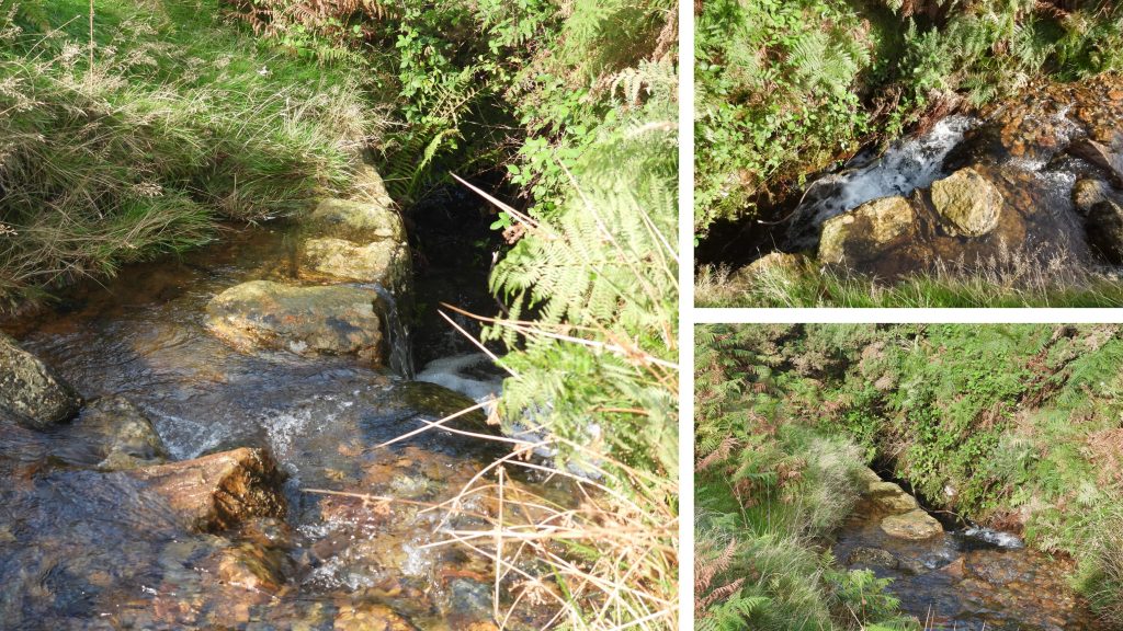
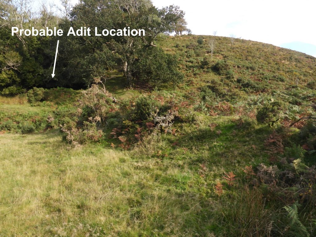
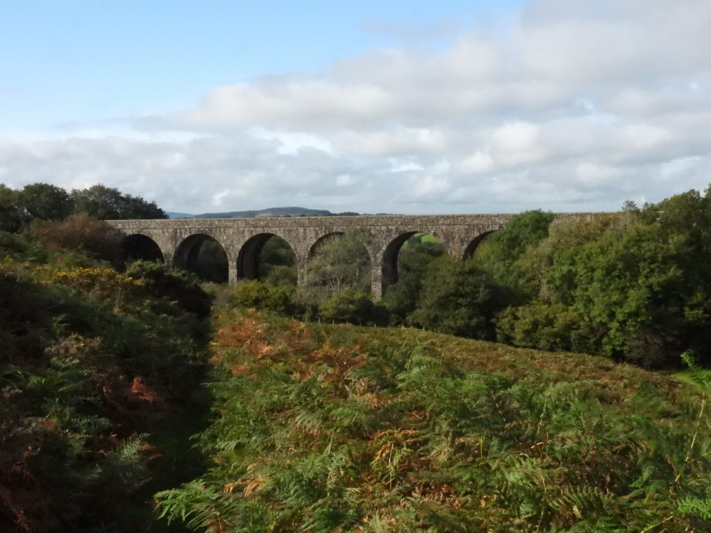
The map is from late 19th century and is annotated with features described in the Dartmoor HER or interpreted by the author. Deep Valley Brook as seen from Lake viaduct (looking east). There is easy access to the mine along the track which runs diagonally from the grassy area (bottom right) into the valley by the trees.A rectangle depiction on the west edge of the mine area on late 19th century maps is believed to be the location of a wheelpit. The picture shows the location looking east up the valley towards the main mine area. The clearing of some bracken reveals some of the possible wheelpit structure. According to the Dartmoor HER the wheel may have once measured 7m by 1m wide. The remains are unconvincing, albeit there is a line of overgrown stones here which might well have been part of a wheelpit. The location is, however, well positioned to take advantage in the fall of the stream via a very short leat and to power flatrods to the shaft. The wheelpit remains can be found at SX53552 89044.Approaching the main mine area from the west, the obvious features which first meets the explorer are spoil heaps, of which there are two, one either side of the Deep Valley brook.The south spoil heap is a stony heap which extends from east to west. The material emanates from a blocked shaft. The south spoil heap can be found at SX53649 89068.Close up of the south spoil tip with Lake viaduct just visible (towards top left of picture).It is difficult to get close to the mine shaft as its surrounded by a very boggy area. It is described as being “filled to the brim with wet ochreous liquid”.Looking across the boggy area by the shaft a flat grassy area to the east can be seen and draws the explorer up the Deep Valley brook.As mentioned in the mine sale of 1828, there was a horse whim. A circular area just east of the shaft could possibly have been the location of that horse whim. It is not mentioned in the Dartmoor HER description.Close up of the possible horse whim, which can be found at SX53677 89073. On the south side of the brook an old piece of walling must be crossed to reach the building foundations on this side of the brook. This walling is shown as a dotted line on 19th century maps. This piece of walling can be found at SX53680 89077.The walling on the south side of the brook continues on the north side and up the slop past Tor WoodThe building on the south side of the brook survives as a rectangular earthwork terrace. To the east is a slight revetment. It is likely that it would have been a mainly timber building, so few foundations remain. The terrace measures approximately 7m by 6m.Some stone survives amid the turf and is probably part of the foundations. Room 1 of the south building is estimated as being at SX53704 89071.Room 2: some stone survives amid the turf and is probably part of the foundations.In room 2 of building 1, there is a stone with three holes drilled in it, which may well have been part of the foundations. The stone can be located at SX53705 89078Just south of the brook, several metres to the north of the shaft is a flat raised area with banking made up of a number of large boulders. This definitely looks man made. It does seem to be placed to prevent flooding of the shaft. It is quite a small area. Could it have housed a small building or a capstan ?Close up of the flat raised area which can be found at SX53657 89080.Spoil on the north side of Deep Valley brook. This linear spoil heap is estimated as being approximately 20m long by 5m high. The source of this material is not certain (Dartmoor HER) but it is possible that an adit was driven north into the hillside a short distance away.View from on top of the north spoil looking south. The centre of the north spoil is at SX53656 89104.As described in Dartmoor HER. It is believed that an adit was driven north into the hillside just east of the spoil, where a spring emerges from a cutting which runs up the slope within Tor Wood. This area is currently inaccessible but it is possible that other evidence may survive within the wood.Of the two buildings depicted on the 19th century map, the one on the north bank survives only as a terrace. It is located at SX53677 89094Not recorded in the Dartmoor HER, in Deep Valley brook is a channel built of large granite blocks, approximately 2 feet wide and 4 feet deep. Is it possible this was for another water wheel ? The blocks in Deep Valley brook are located at SX53679 89090.Another view of the possible adit locationLeaving the mine and heading west towards Lake viaduct which is 50 years younger than the mine having being built in 1874.
Hi, There is a filled in shaft on the east side of the brook. There is an (probable) adit on the west side of the brook. It is possible that there is a shaft or shafts in Tor Wood (to meet up with the adit) but this is on private land.
Glennon Chatting-Walters February 23, 2022
What happened to the shafts in this one?
SteveGrigg1961 February 28, 2022 — Post author
Hi, There is a filled in shaft on the east side of the brook. There is an (probable) adit on the west side of the brook. It is possible that there is a shaft or shafts in Tor Wood (to meet up with the adit) but this is on private land.
Regards,