A collection of walks, discoveries, insights and pictures of exploring Dartmoor National Park
January 5, 2021
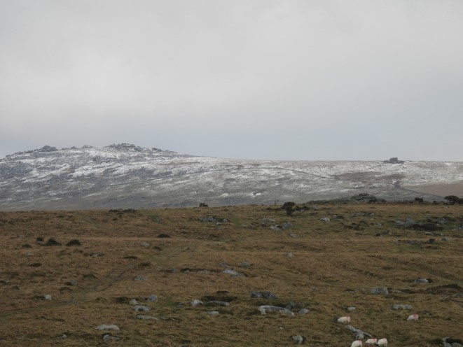
PEW TOR (PROTECTIVE BOUNDARY MARKINGS TO PREVENT ENCROACHMENT BY QUARRYMEN)
Steve Grigg and Frank Collinson
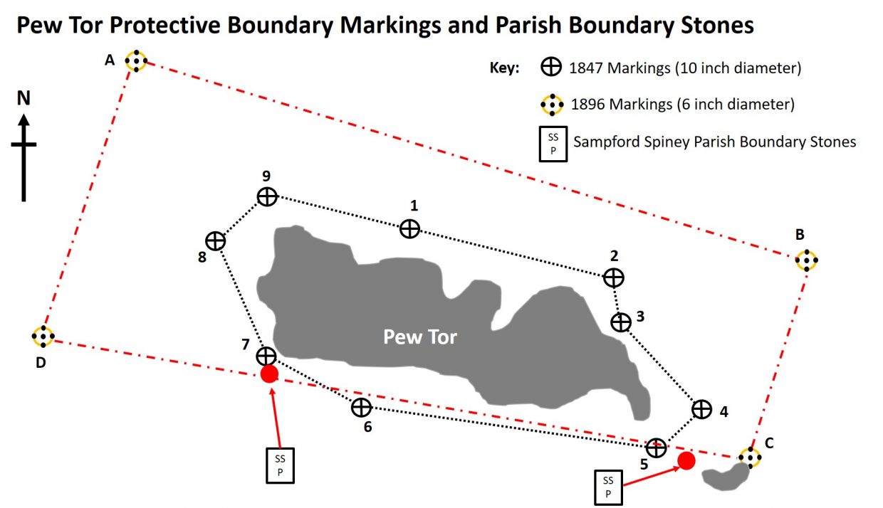
In the 19th Century, leases giving the right to cut granite on Western Dartmoor needed to be obtained from the Duchy of Cornwall. However, such was the demand for granite at the time, it resulted in damaging encroachments from the quarrymen on the tors themselves. The problem around Pew Tor, was addressed in 1847, when limits were set, within which it was forbidden to remove stone. All contractors to whom leases were made were obliged to conform to these limits. References: a) Nineteenth Century Granite Working on Pew Tor and Staple Tor Western Dartmoor Transactions of Devonshire Association 1981 by Helen Harris and b) Dartmoor Boundary Markers (1986, 1st edition and 2002, 2nd edition).
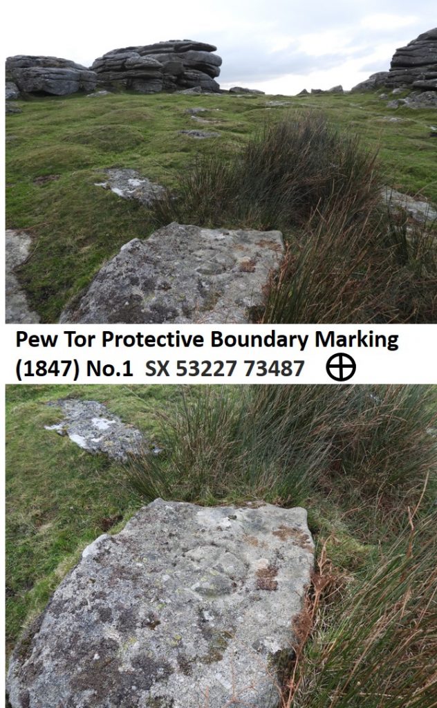
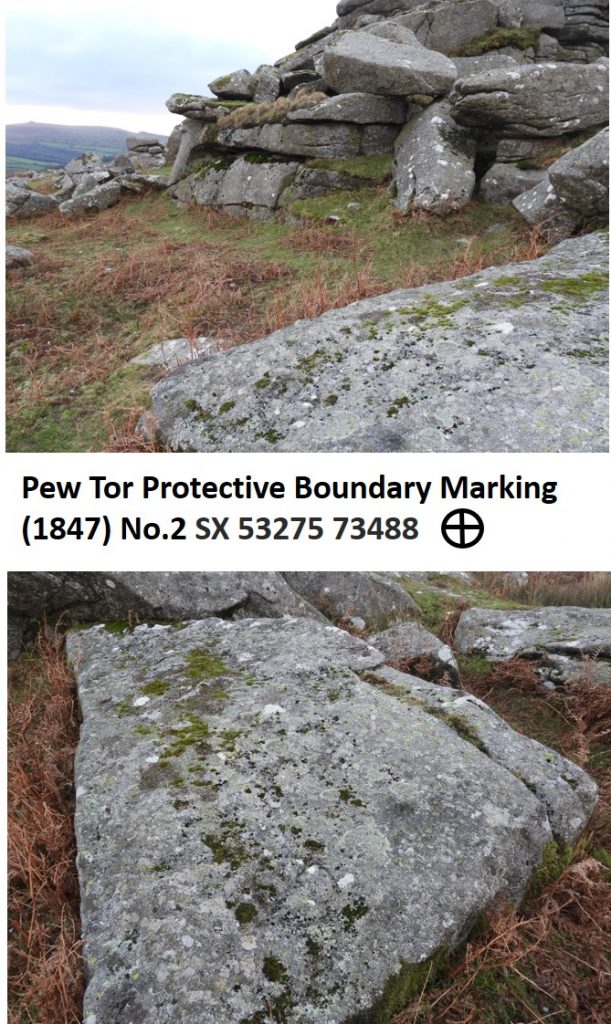
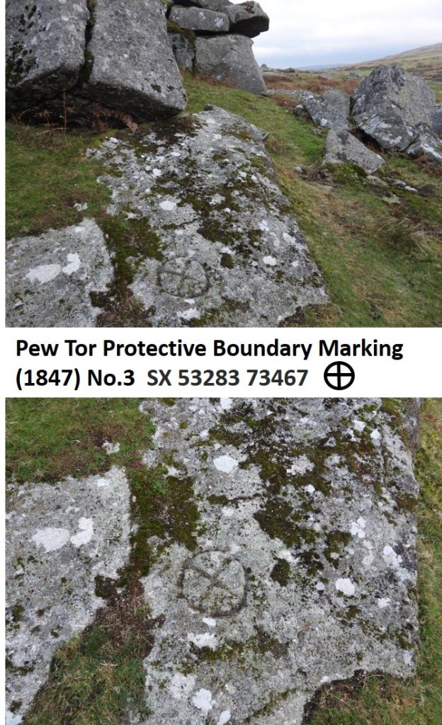
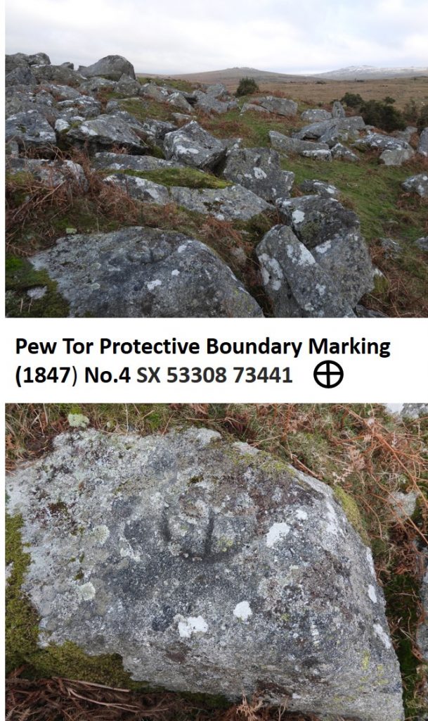
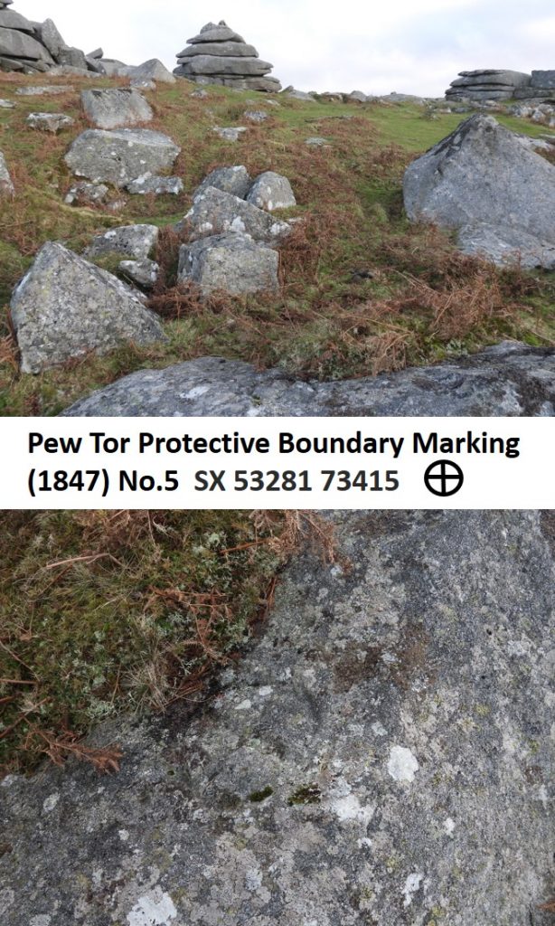
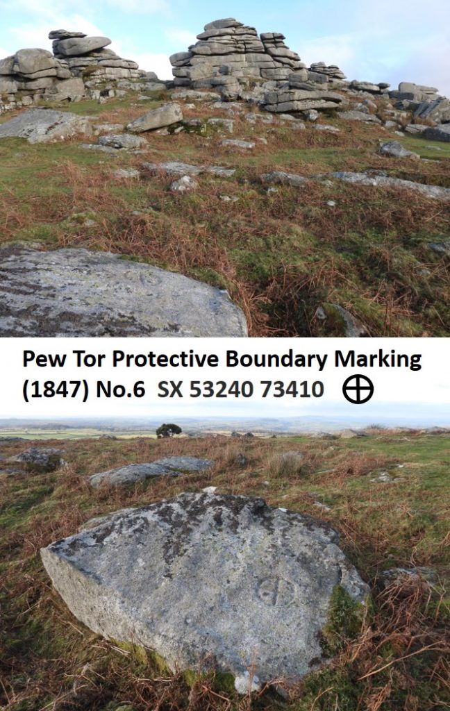
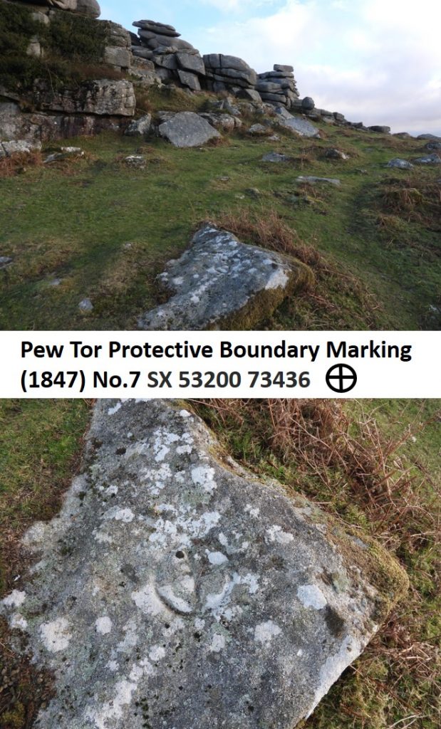
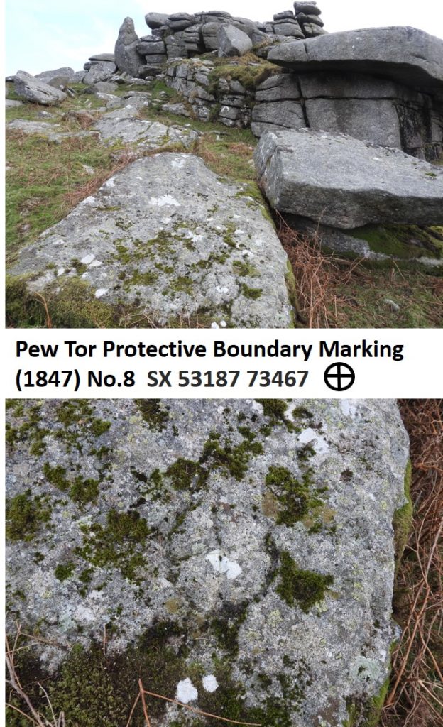
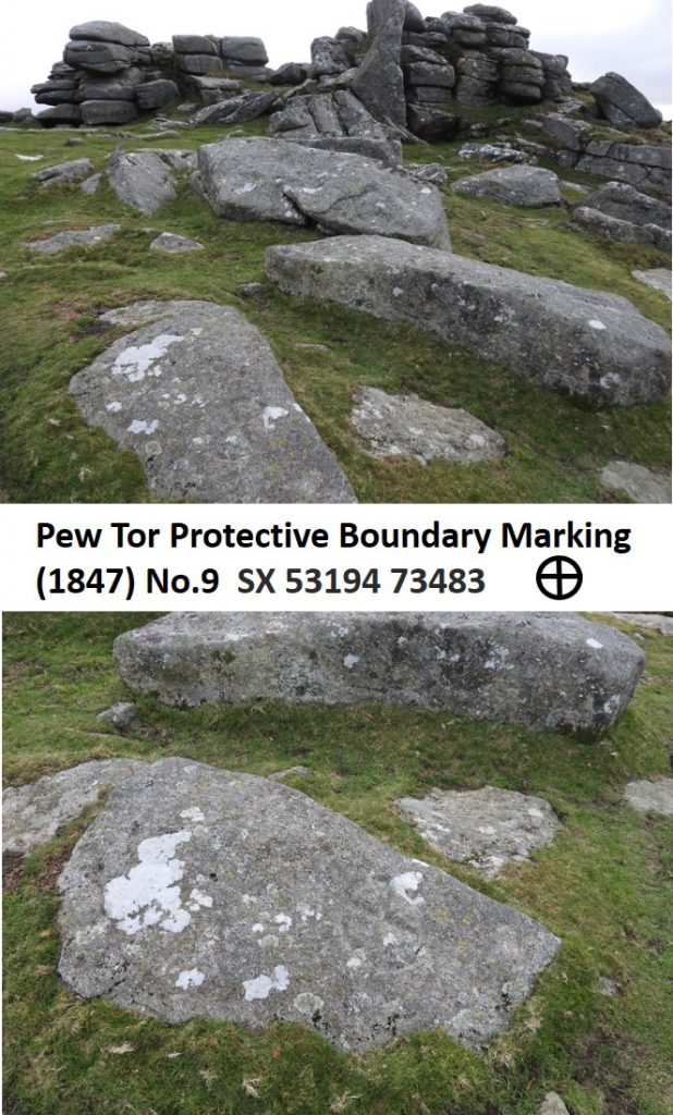
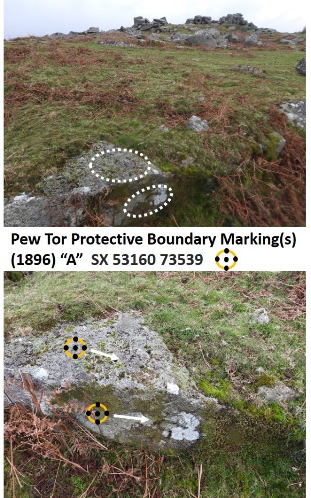
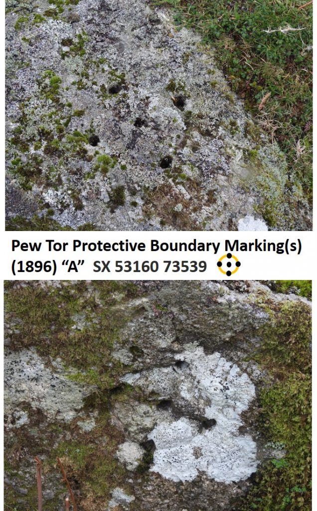
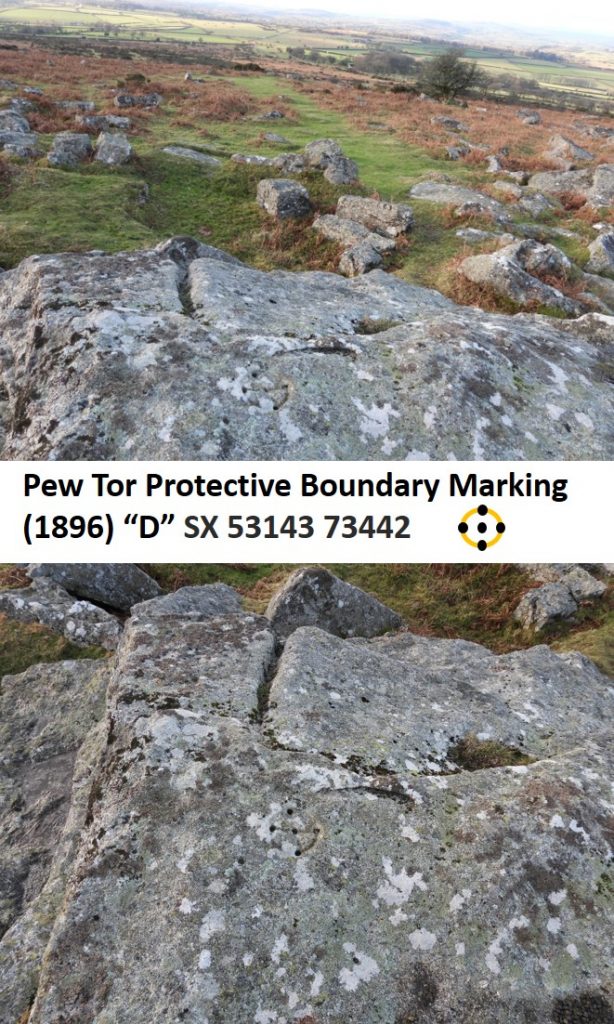
Sketch adopted from the Dave Brewer publications. 1. In 1847 a series of nine natural stones / boulders were incised with a “hot cross bun” incised shape of 10” diameter. As can be seen from the sketch these were relatively close to the tor (just a matter of a few metres in most cases). 2. In 1896, a Mr Duke of Merrivale Quarry, needed to renew his licence. However, the Duchy would only offer him a fresh lease provided even more extended protective limits were set up around the tor. The agreement was that: “Mr Duke would have marks cut in blocks of stone to define the limits”. It was reported on 30th December 1896, that this had been done and that there were four marks being 5 holes (4 on a circle perimeter and 1 in the centre on a 6” diameter). Each hole being around 1” deep.
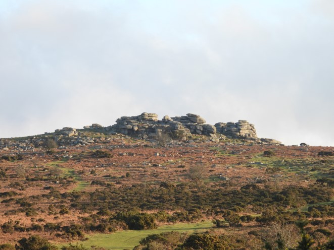
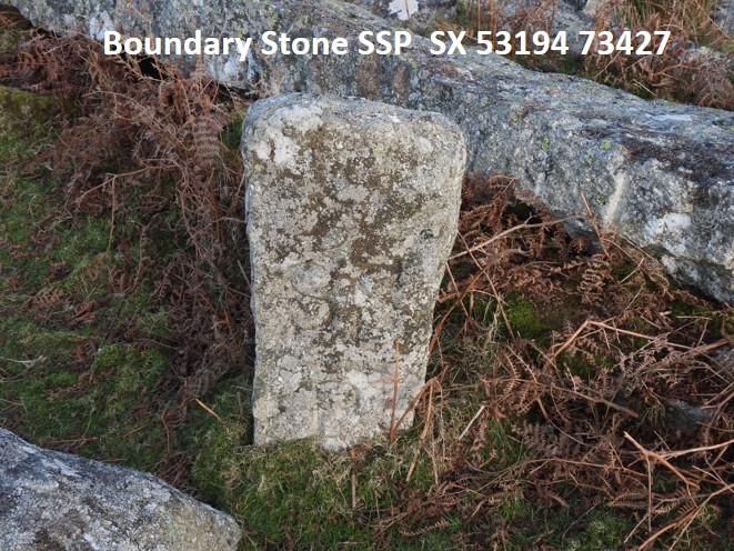
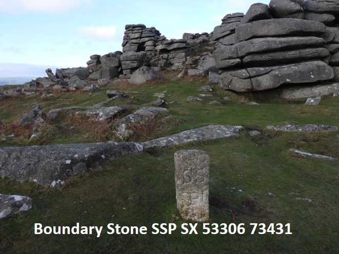
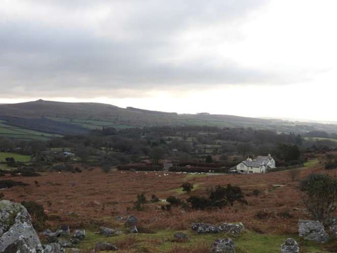
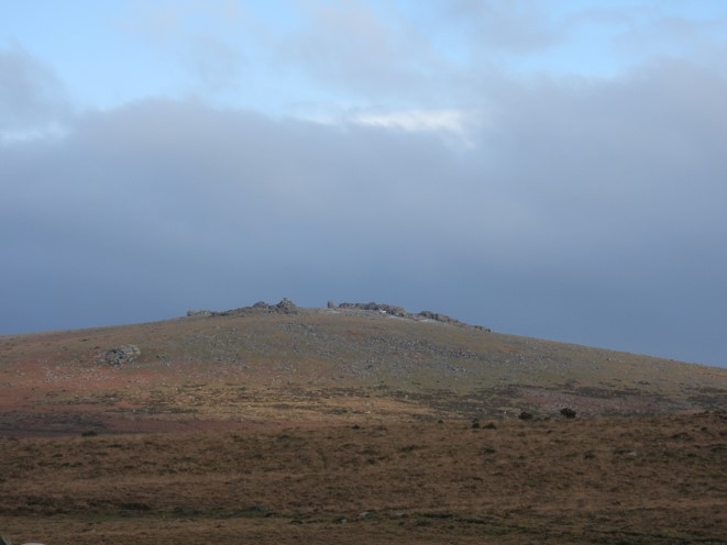
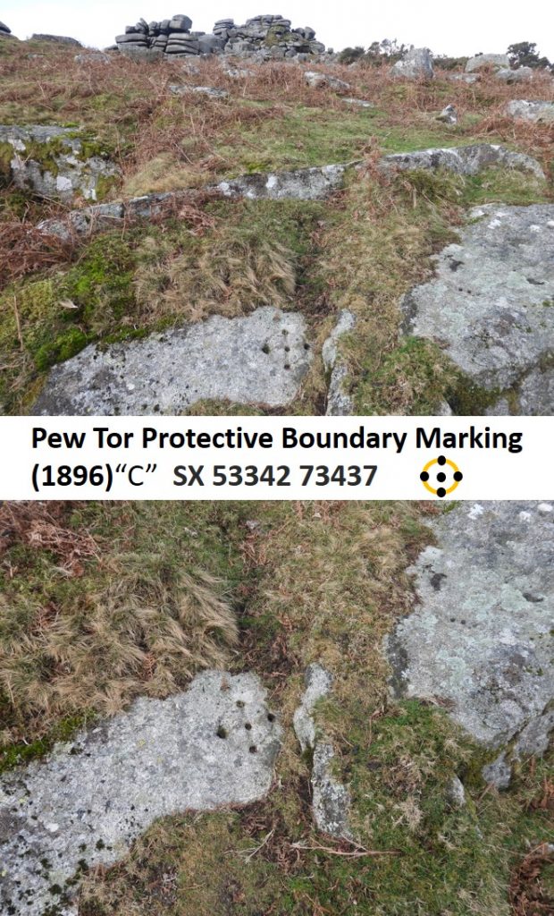
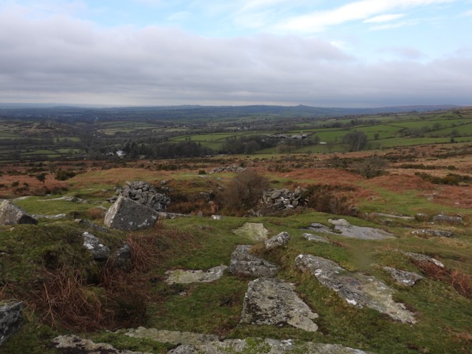
Approaching Pew Tor from the SouthPew Tor Protective Boundary Marking (1847) – No. 1Pew Tor Protective Boundary Marking (1847) – No. 2Pew Tor Protective Boundary Marking (1847) – No. 3Pew Tor Protective Boundary Marking (1847) – No. 4Pew Tor Protective Boundary Marking (1847) – No. 5Pew Tor Protective Boundary Marking (1847) – No. 6Pew Tor Protective Boundary Marking (1847) – No. 7Pew Tor Protective Boundary Marking (1847) – No. 8Pew Tor Protective Boundary Marking (1847) – No. 9A Sampford Spiney Parish (SSP) Boundary Stone close to Pew Tor Protective Boundary Marking (1847) – No. 7A Sampford Spiney Parish (SSP) Boundary Stone close to Pew Tor Protective Boundary Markings (1847) – Nos. 4 and 5. The two SSP boundary stones are almost exactly on the 1896 protective boundary.View from Pew Tor – Pew Tor CottageView from Pew Tor – Staple TorsView from Pew Tor – Liitle Mis and Great Mis TorsThere were four 1896 marked stones which extended further away from the tor than the 1847 marked boundary. Only three of the four 1896 markings have been found in recent times. The one which alludes many searches is on the North East Corner. That said, in the Helen Harris document in 1981 only two of the markers had been found.Pew Tor Protective Boundary Marking(s) (1896) “A” are unusual insofar as these are two of them on a rock, one on the horizontal face and one on the vertical face.Pew Tor Protective Boundary Marking (1896) “C” Pew Tor Protective Boundary Marking (1896) “D” Pew Tor Quarry – west side of tor