A collection of walks, discoveries, insights and pictures of exploring Dartmoor National Park
May 31, 2021
Widecombe Town Manor
A perambulation of the MANOR OF WIDECOMBE, alias Widecombe Town. Historically it was described as extending to a length of about 2 1/2 miles from the hut circle called “ Seven Lords’ Lands,” near Hennesbury Gate, across the vale of Widecombe to its western boundary on the ridge of Hameldon. Its area is estimated as being about 1,575 acres, of which 706 are commons.
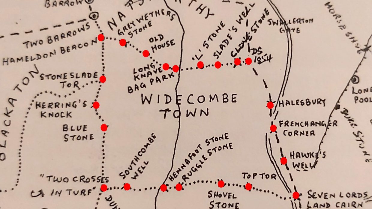
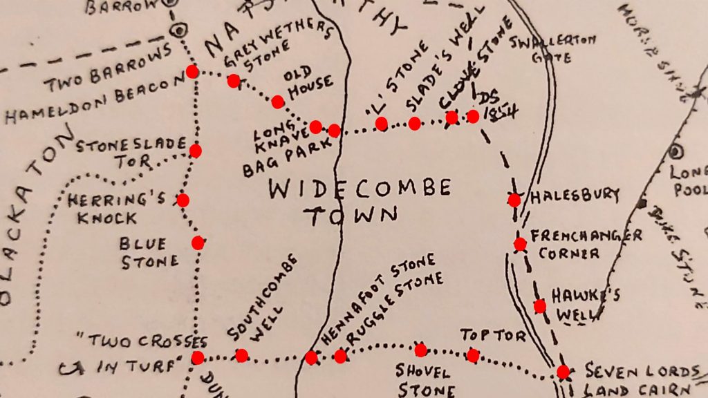
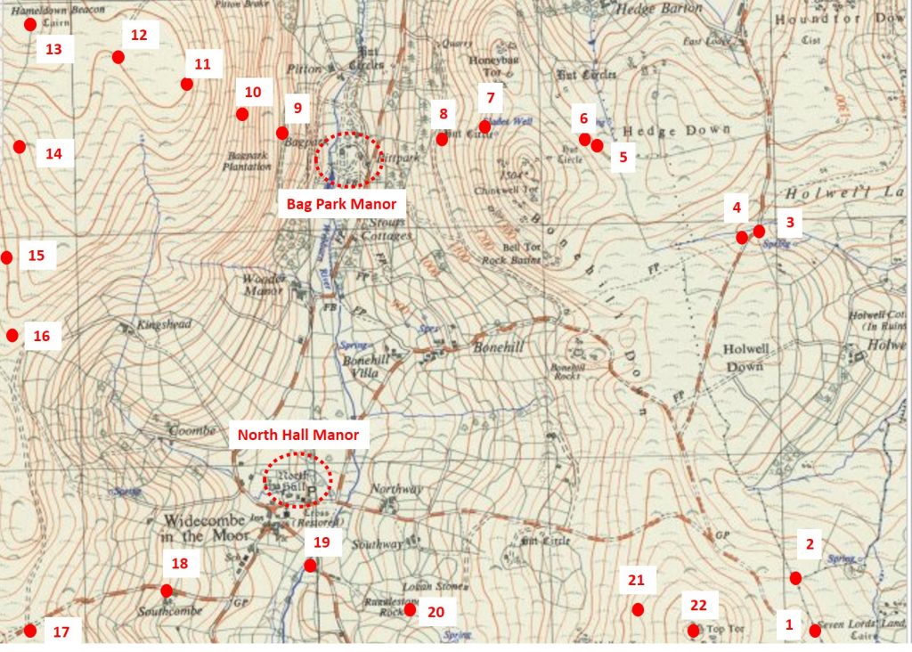
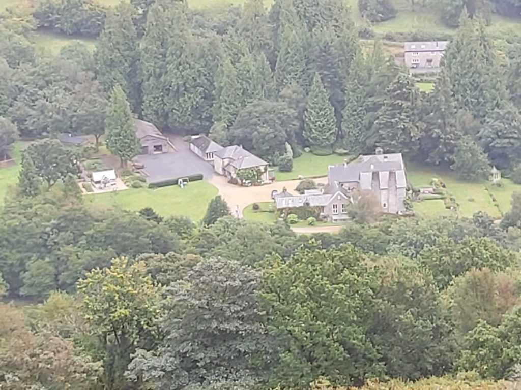
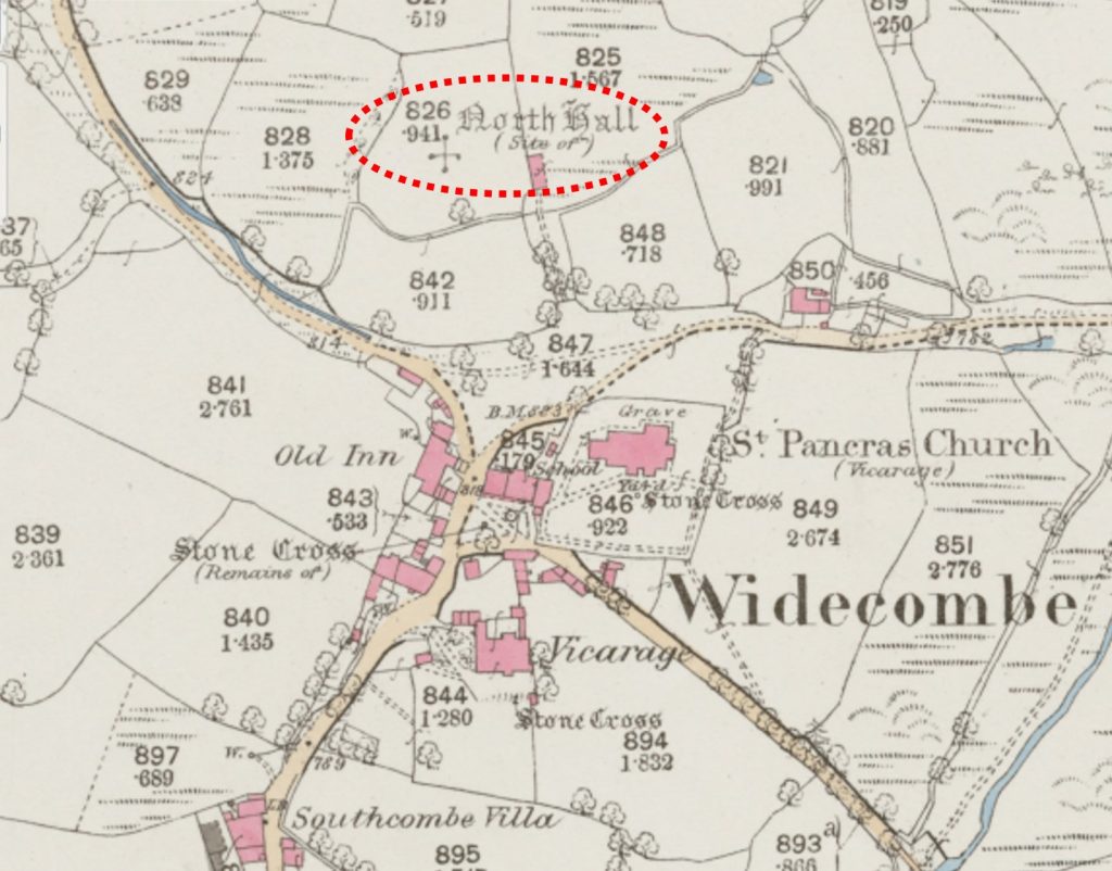
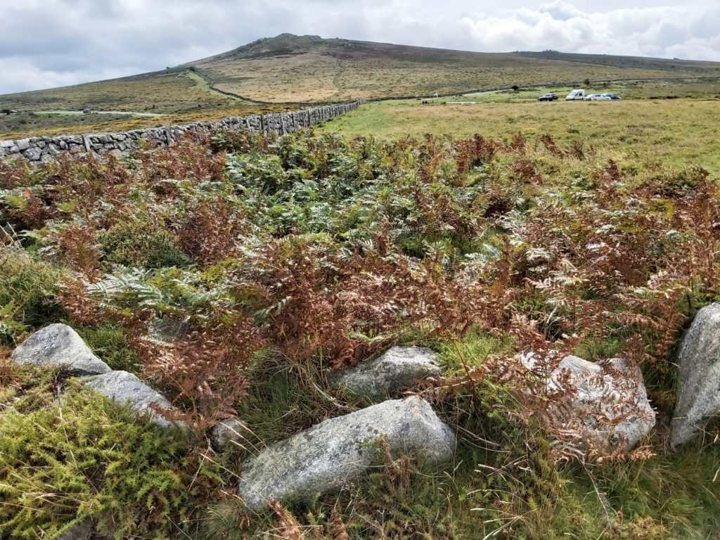
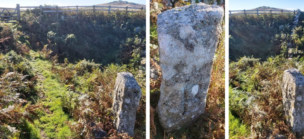
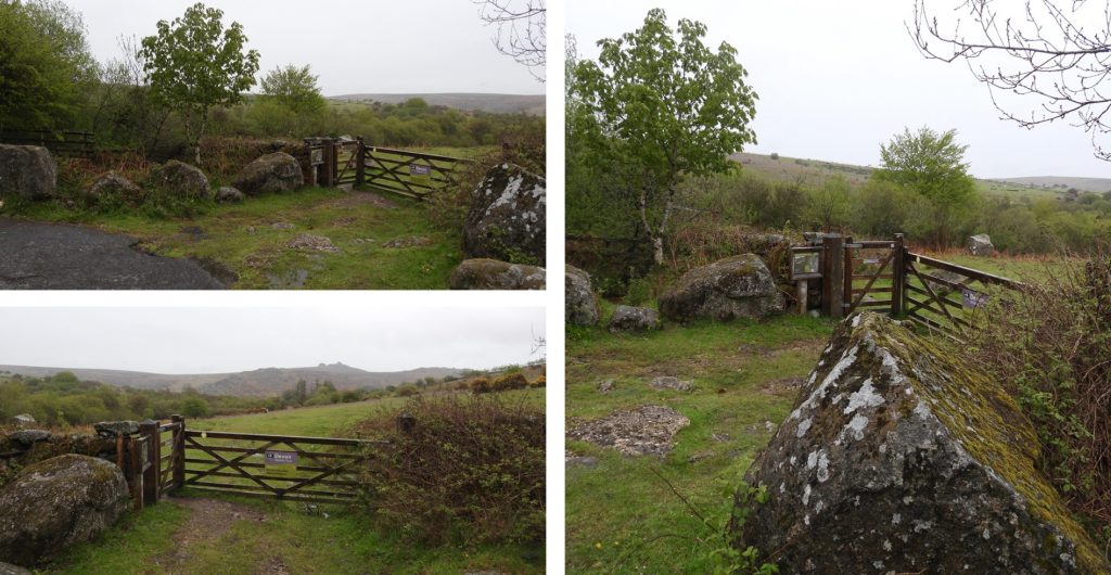
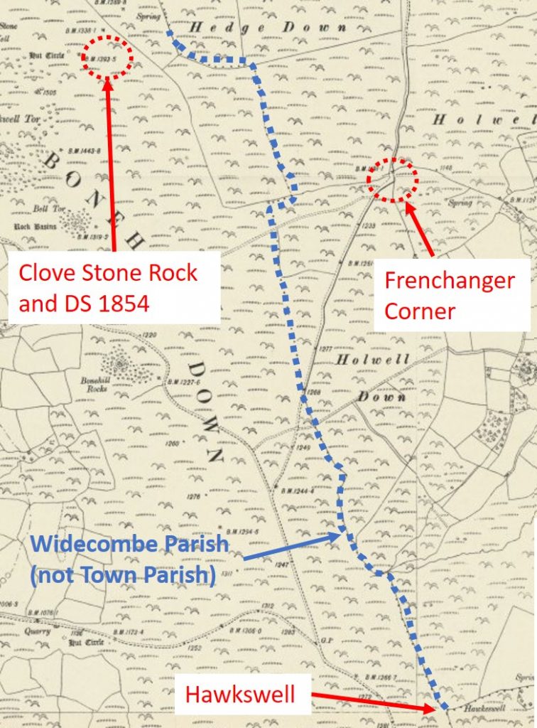
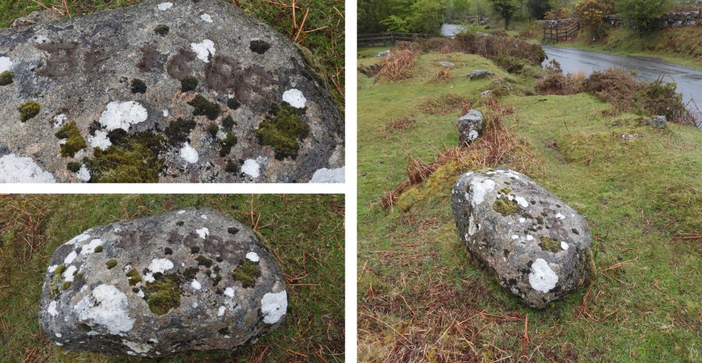
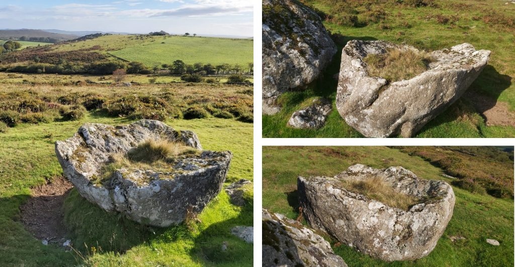
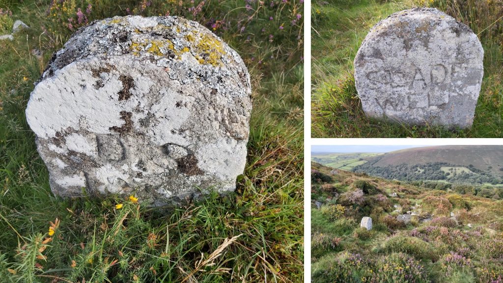
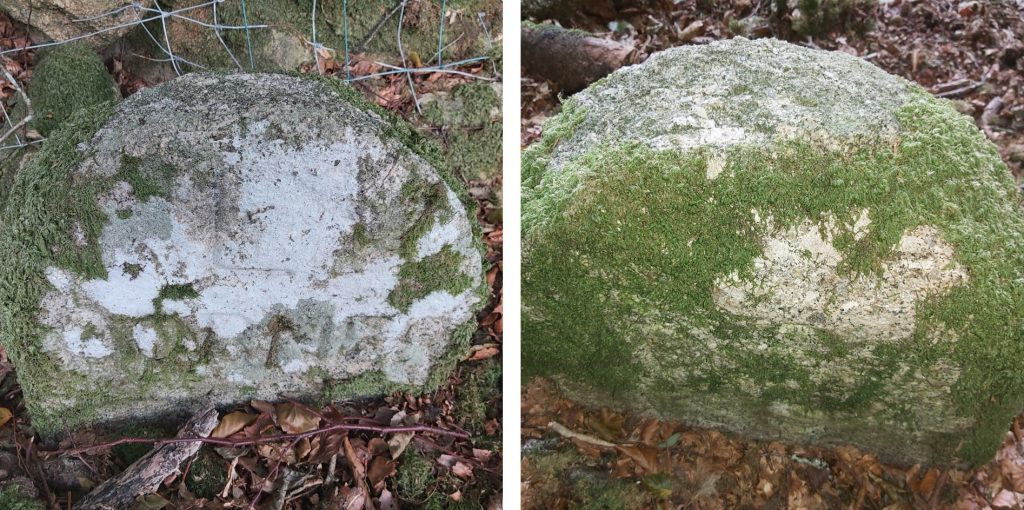
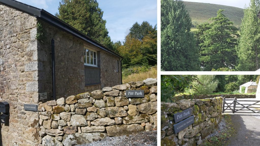
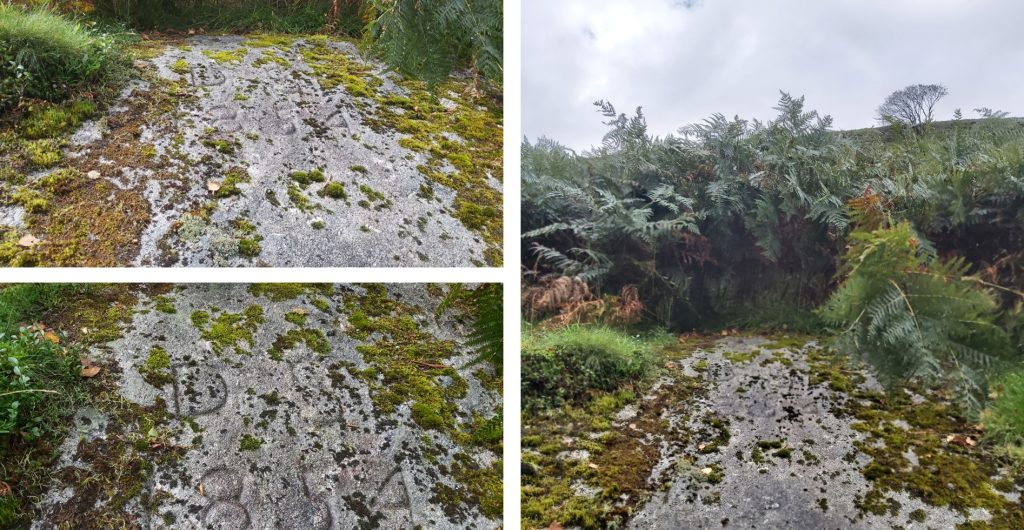
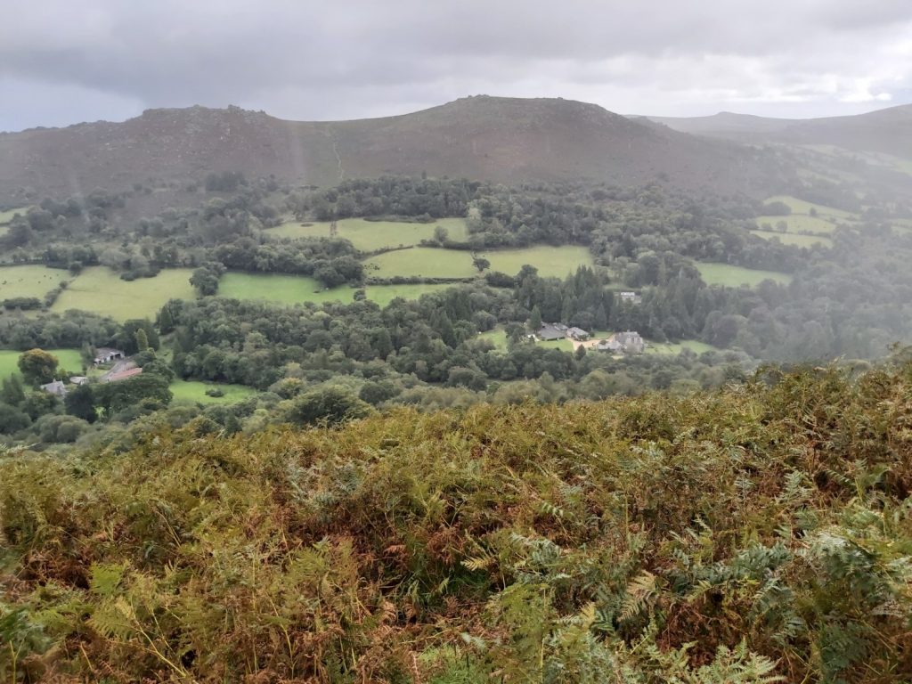
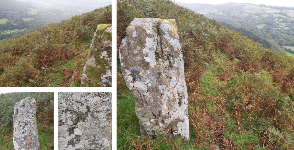
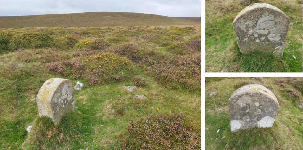
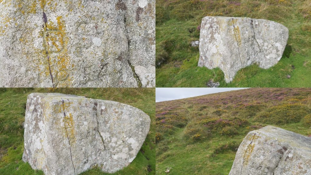
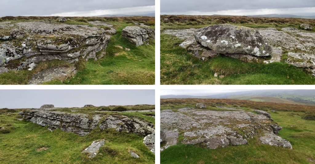
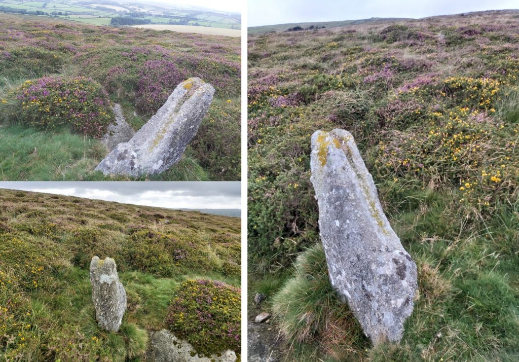
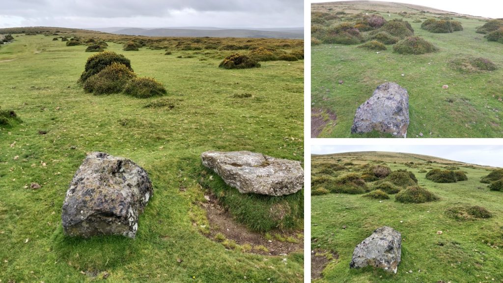
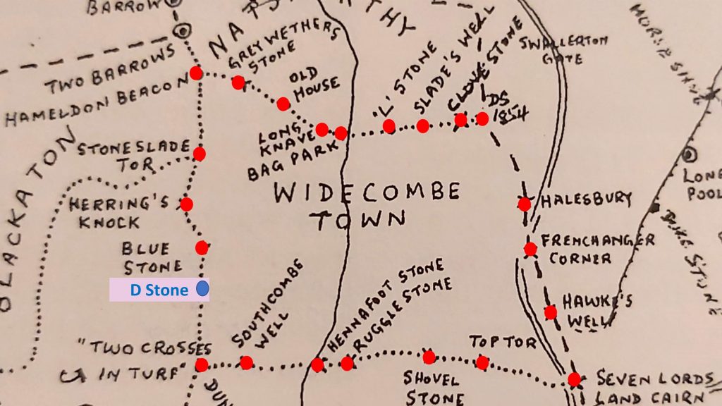
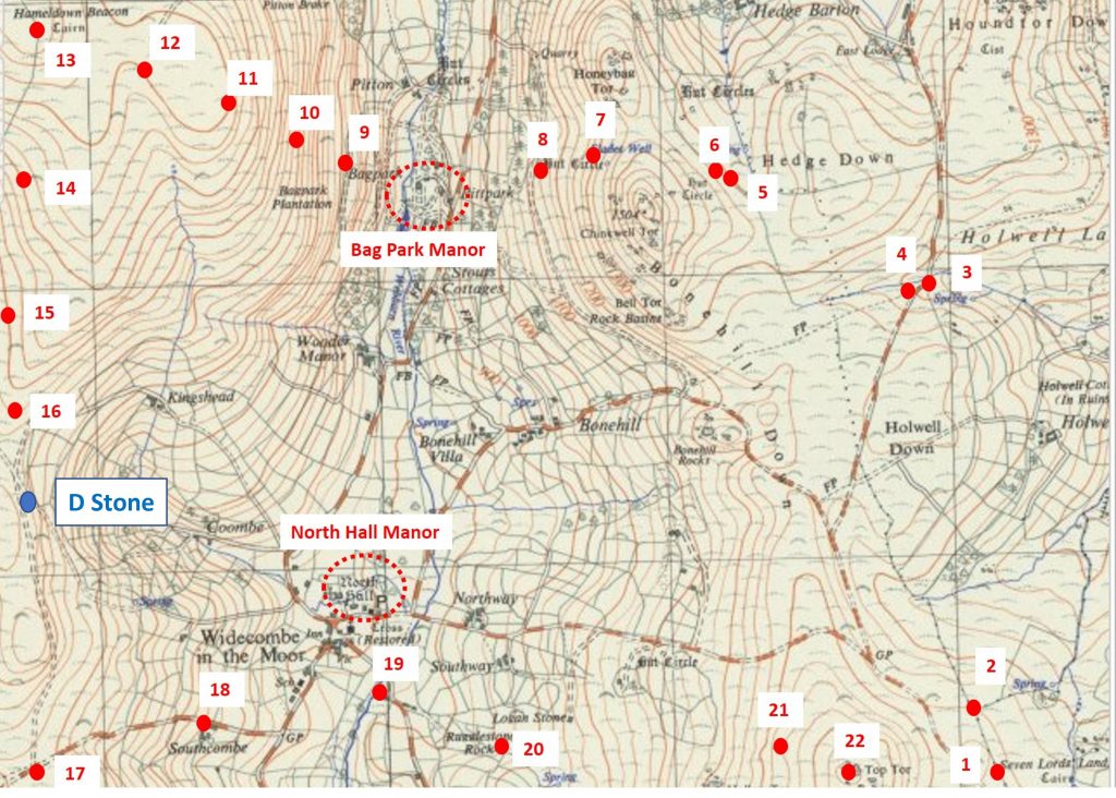
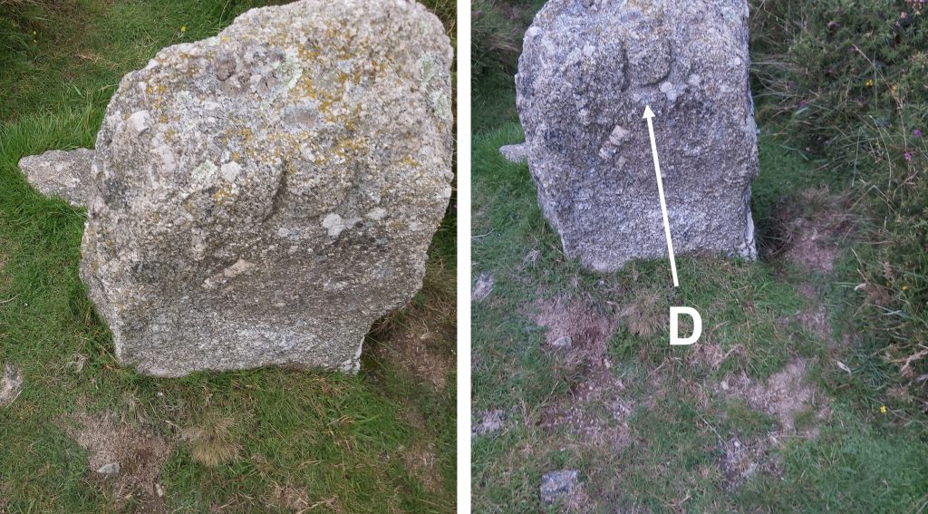
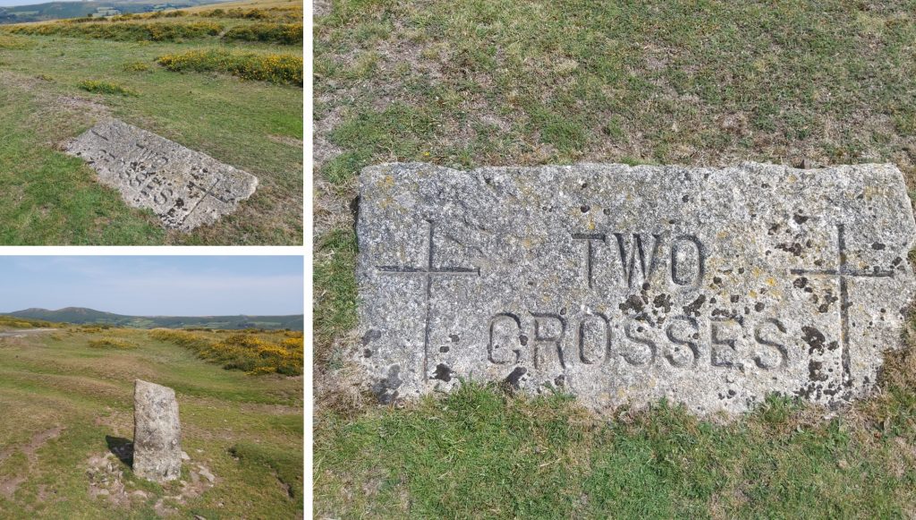
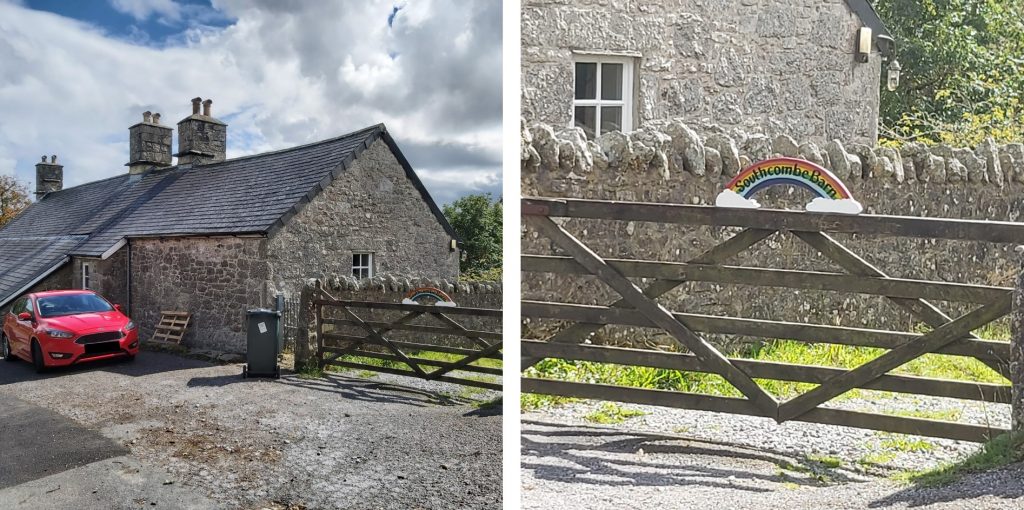
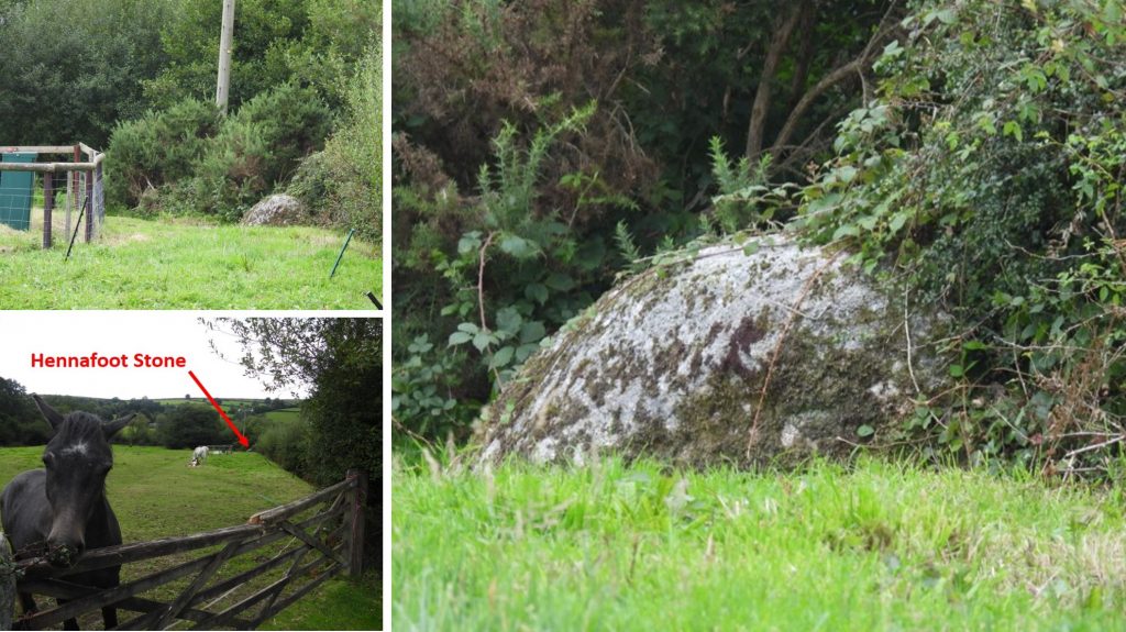
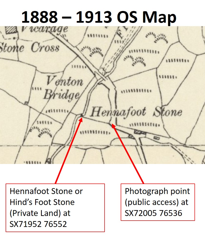
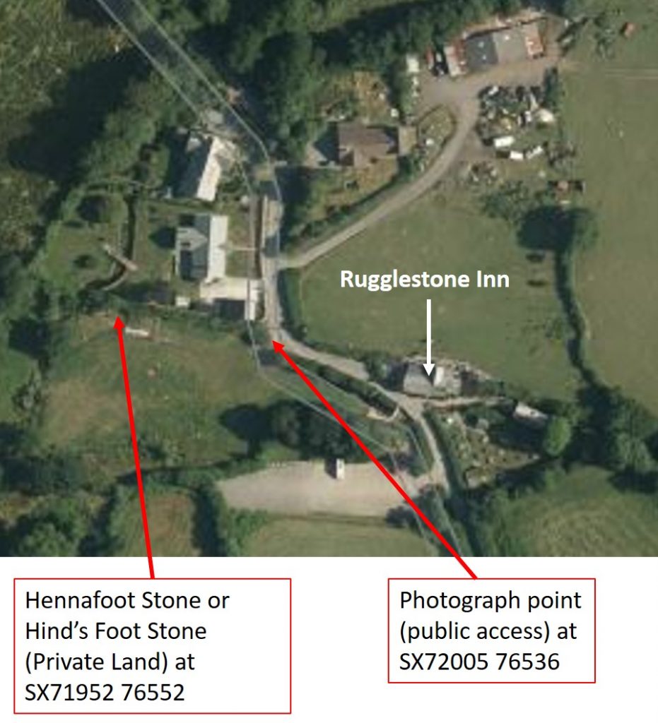
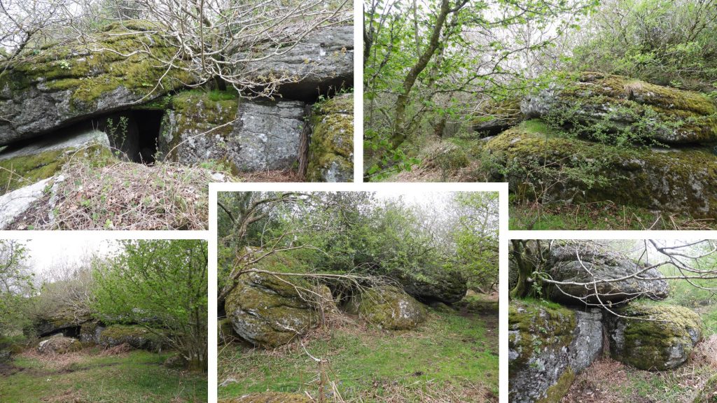
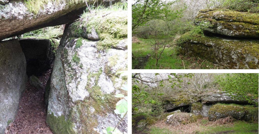
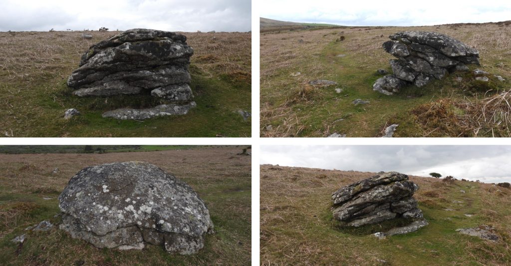
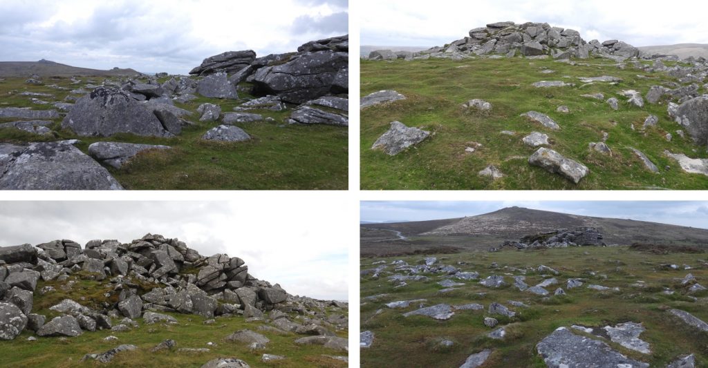
The above map is taken from the wonderful Dave Brewer publication “Dartmoor Boundary Markers” (second edition), which shows 22 locations on the bounds. A Perambulation of the Bounds of this manor is entered in the Court Rolls as follows :—From Seven Lords’ Lands [a hut circle near Hennesbury Gate, on the eastern boundary of the parish] to Hawk’s Well, and from thence to Frenchanger Corner, thence to Halesbury, thence through Hedge Newtake along a Reeve and across the wall between Hedge Newtake and Bonehill Common to Clove Stone Rock, otherwise Saddle Clove Rock : from thence to Slade’s Well : from Slade’s Well to L. Corner: from thence to Pitt Park’s Bridge : from thence to a broad rock in Bag Parks: from thence to Long Knave Stone on Hameldon : from thence to Old House on Hameldon; from thence to Grey Wether’s Stone : from thence to Hameldon Beacon: from thence to Stoneslade Tor: from thence to Herring’s Knock: from thence to a Blue Stone at the corner of Kingshead : from thence to Two Crosses [these are cut on the turf] : from Two Crosses to Southcombe Well : from thence, including Southcombe Estate, to Hennafoot [Hind’s foot ?] Stone in a hedge belonging to Southway Estate: from Hennafoot Stone to the north part of Rugglestone Rock [a logan stone] : from thence to Shovelstone Rock: from thence to the north point of Top Tor and from thence to Seven Lords’ Lands.Map of the 22 boundary locations contained in this post. The map also shows the location of two manors linked to the parish, namely: At Bag Park and more anciently the medieval one North Hall.Bag Park ManorNorth Hall – The Lost Medieval Manor. The village of Widecombe developed around the medieval manor house of North Hall. The manor house has long since vanished and the stone from its once impressive buildings has disappeared; perhaps reused around the village. All that remains is a mark on an old map. To learn more about this lost manor house, archaeologists and volunteers have undertaken several excavations. They have found tantalising glimpses of the past; broken wall foundations, and thousands of fragments of pottery. Some of the pottery has come from across Europe, including Germany, France, and Spain. The earliest piece of pottery was a French Barrel Costrel- a drinking vessel which dates the building to the 13th century. Archaeologists have also revealed that there was a moat around the manor house at least 10m wide and 4m deep; an important and rare discovery for Devon. https://www.dartmoor.gov.uk/__data/assets/pdf_file/0033/97647/North-Hall-Manor-report-March-2017.pdfBound Location 1: Seven Lords Land Cairn (SX74124 76237) is said to be where the lands of seven manors once came together. Now next to the Ilsington / Widecombe Parish Boundary (wall in picture). Rippon Tor in background. In all reality the seven manorial bounds co-join within the vicinity of the cairn not exactly at the cairn, these manors are; Widecombe Town, Natsworthy, Buckland, Bagtor, Halshanger, Great Houndtor and Dunstone with Blackslade. Bound Location 2: At SX74044 76459 there is a 1835 stone inscribed with I and B. Set just outside the wall above the ‘Hawks Well’Bound Location 3: Frenchanger Corner.There is mystery surrounding Halesbury, bound location 4. The modern perambulator knows where bound locations 2 (Hawkswell), 3 (Frenchanger Corner) and 5 (DS 1854 stone below the Clove Stone Rock) are. But where is Halesbury, bound location 4 ? To add to the confusion the Widecombe Parish (not Town Parish) is marked away from Frenchanger Corner. The Widecombe Parish map: https://www.genuki.org.uk/big/eng/DEV/WidecombeintheMoor/ParishMapBound Location 4 of Halesbury. The only ‘known’ boundary marker between Frenchanger Corner and the DS 1854 stone below the Clove Stone Rock is one inscribed ‘BI 1688’ at SX73882 77922. Dave Brewer in his Dartmoor Boundary Book (2nd edition), page 101, states that this rock is on the Manaton / Ilsington boundary and was part of the re-setting of the old 1566 parish boundary line. It is unlikely that this marker was used for the Widecombe Town Manor but must be close to the location called Halesbury. If anyone has any further information about the ‘Halesbury’ bound location, the author of this post would welcome receiving any further information.Bound location 5: This boulder on the manor bounds lies at SX73177 78362. Is is inscribed DS 1854 and lies a short distance away from the Clove Stone, bound location 6Bound Location 6: The Clove Stone or Saddle Clove Rock is mentioned in 19th century records. It is an unusual shaped rock, having split along a natural fault horizontally, which the upper part has fallen into the inverted position. Located at SX73127 78339Bound Location 7 is SLADE WELL where there is an inscribed stone located at a natural spring and has the DS 1854 on the reverse. It is located at SX72820 78394.Bound Location 8: The Boundary marker point 8 from the map is where the L Stone or “Ell Stone” marked L CORNER can be found. It is located at the corner of Ell Field at SX72523 78344.The bridge over the East Webburn at Pitts Park was a manor boundary marker, which is on private land. The pictures show the entrance to Pitts Park and a glimpse of the hillside where the next two markers are located (Bag Park and Long Knave).Boundary Location 9: The next boundary marker is described as “a broad rock in Bag Park”. This marker is a 3m x 2m boulder with DS 1854 inscribed on it and in reality is just outside the Bag Park boundary. It is located at SX 71895 78503View across the East Webburn valley towards Chinkwell Tor and Honeyhag Tor between Bound Location 9 and 10. This is just down from LONG KNAVE boundary marker just before the extremely steep ascent / decent from the boundary marker near Bag Park.Bound Location 10: The 10th bound location on the perambulation is located on a very steep part of the hill and is called LONG KNAVE. It is a rough set stone simply inscribed DS on the eastern side. Location is SX71711 78546Bound Location 11: OLD HOUSE boundary marker within the ring of a ruined cairn. Referred to in 1566 as “Vome Borough”, then “Vomeburrow” in 1659. Within the mound there is the remains of a shepherd’s shelter. The stone has DS 1854 on the reverse. SX71447 78661Bound Location 12: The Grey Wethers Stone, formerly called “Greystone” or “to the grey stone” was used in saxon times to state the importance of a boundary mark. This is a natural boulder inscribed with DS 1854 on it. It lies near Coal Mires at SX71085 78878.Bound Location 13: On Hameldon Beacon is a stone inscribed HAMILTON BEACON with a two lines for the HAMIL and TON parts. DS 1854 on the reverse. This dressed stone also lies on the junction of the Natsworthy Manor bounds. This was formerly called “Fire Beacon” in 1566 and “Fire Barrow” in 1659. Found at SX70822 78917.Bound Location 14: Stoneslade Tor at SX70946 78288 is an obvious location as a boundary marker.Bound Location 15 is Aaron’s (or Herrings Knock) rock at SX70932 78032. The name for this stone was applied by William Crossing in his guide. Further to his guide, in the book ‘Folk Rhymes of Devon’, Crossing talks about a couplet that is said to have been repeated each time the bounds of the Manors of Widecombe Town and Jordan were beaten. It goes: “Aaron’s Knock, Made this Chock”. The reference is due to the gash or cleft, said to be made by Aaron’s staff. It is also speculated that the name derives from ‘Heron’s Cnoc’ (the Hill of the Herons). Bound Location 16 is the Blue Stone at SX70782 77596. It is a rough boulder of course red granite with intrusions of tourmaline, giving it a blue / grey appearance.This map shows the location of another potential boundary marker, called the “D Stone”, which was not mentioned in the Dave Brewer Dartmoor Boundary Markers, Second Edition (2002) or even in the Perambulation of the Widecombe Town Manor Bounds Court Rolls. The boundary marker would have been recumbent in 2002 when the book was published as it was re-erected in 2010.Location of the “D Stone” between Aaron’s Knock (16) and Two Crosses (17) near Langworthy Hill and Kingshead Corner.The “D” on this stone is believed to stand for Dewdon Manor. Some commentators have suggested that the “D” stands for Dunstone Manor but that manor lies a little further south and east from this stones location which is SX70743 77275. The stone was re-erected in February 2010, with the assistance of Jane Marchand, Andy Cribbett and Sam Edwards of Dartmoor National Park (Dartmoor Magazine issue 99), having been mentioned by Maureen and Robin Vane in the letters page of Dartmoor Magazine (issue 95). The stone shows about 90% of an inscribed capital “D”. It is located near Kingshead Corner below Langworthy Hill. The location is on the boundary of Widecombe Town Manor and Jordan Manor (which was formerly Dewdon Manor).Bound Location 17 is Two Crosses at SX70765 76331. It is recorded that: ‘Robert Dymond in the nineteenth century had intended to erect a stone cross at the “Two Crosses in Turfe” on the northernmost point of his bounds of Dunstone. Having regard to the name of the site, it was proposed that the cross should have two pairs of arms, or alternatively, that two crosses should be erected, but unfortunately, neither came to pass’. Today, there is a modern granite marker inscribed with “Two Crosses” as well as plain granite boundstone. In 2008, a Mr Whale donated the “Two Crosses” stone to the DNP and Andy Cribbett, (the National Park Authourity’s Stonemason), undertook to engrave the stone. Bound Location 18 is Southcombe Well. The farm at Southcombe is at SX71352 76471Bound Location 19 is the Hennafoot Stone.Looking at side-by-side maps, it is possible to photograph the stone from the road.Google Earth location near the Rugglestone InnBound Location 20 is the Rugglestone Rock. SX72348 76434Bound Location 20 is the Rugglestone Rock.Bound Location 21 is the Shovel Stone. SX73422 76310.Bound Location 22 and the final one on the Widecombe Town Parish perambulation is Top Tor.