A collection of walks, discoveries, insights and pictures of exploring Dartmoor National Park
June 3, 2021
Holne Parish Boundary Rocks and Stones
The earliest recorded beating of the bounds of Holne was on 8th October 1790. From the second world war to the end of the 20th century the bounds were only beaten three times; in 1951, 1977 and 1990. Most moorland bounds are beaten on a 7 year cycle, so only having the bounds beaten three times in over fifty years is rather unusual. This post records the following of the bounds on the “high moorland” section between Horse Ford and Holne Well, locating all the boundary stones and rocks inscribed with ‘H’ (for Holne) en-route. The post also has three boundary stones inscribed ‘B’ (for Buckfastleigh), two of which are on the shared Holne / Buckfastleigh Parish boundary. Much of the information in the post was obtained from the Dartmoor Boundary Markers (2nd edition) book by Dave Brewer. The author has also used ‘side-by-side’ maps to assist in obtaining a more accurate grid reference ‘fix’ for a few of the less conspicuous boundary markers.
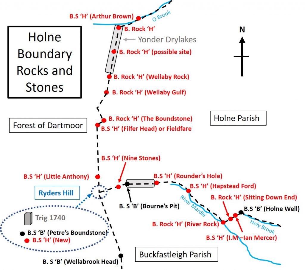
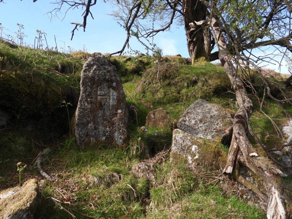
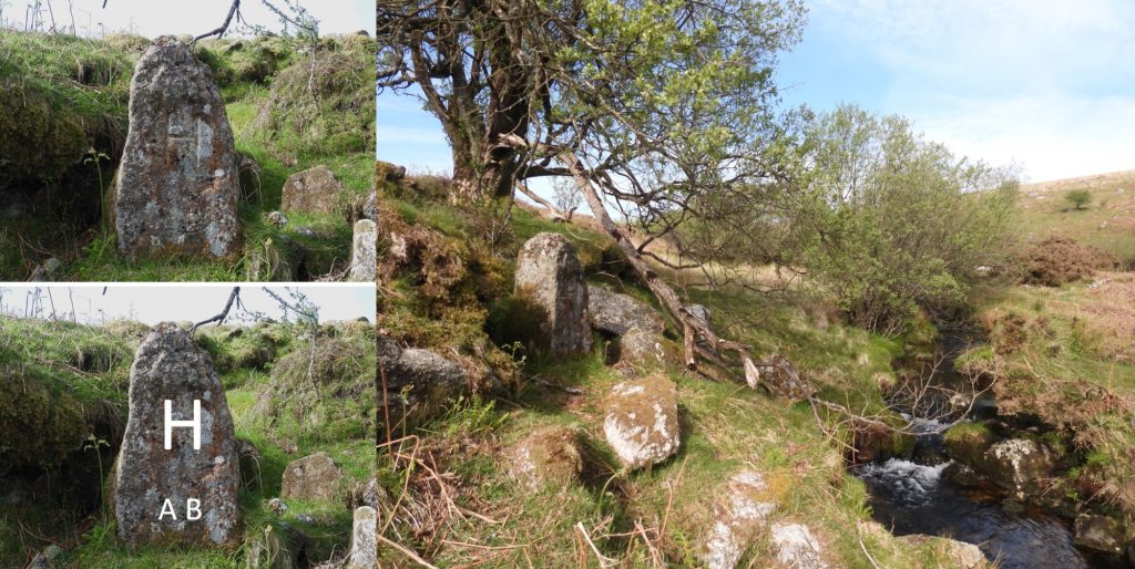
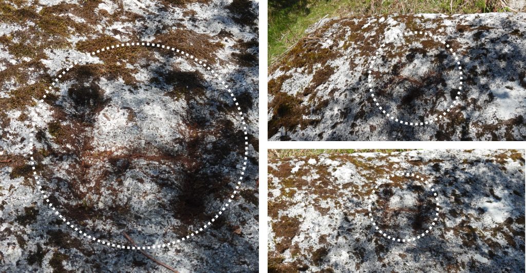
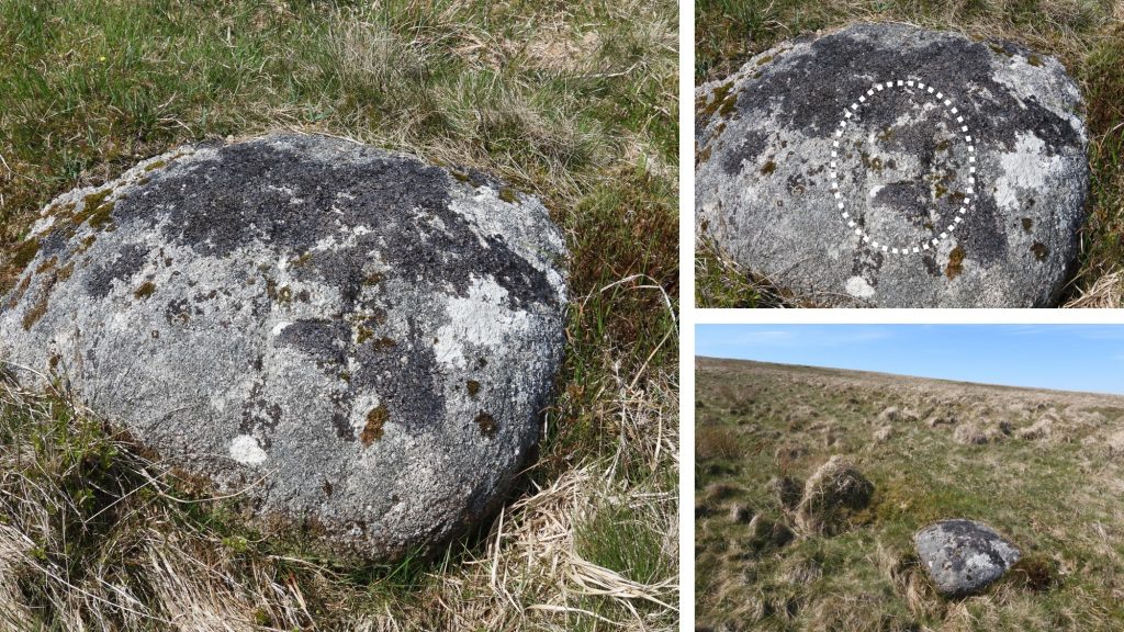
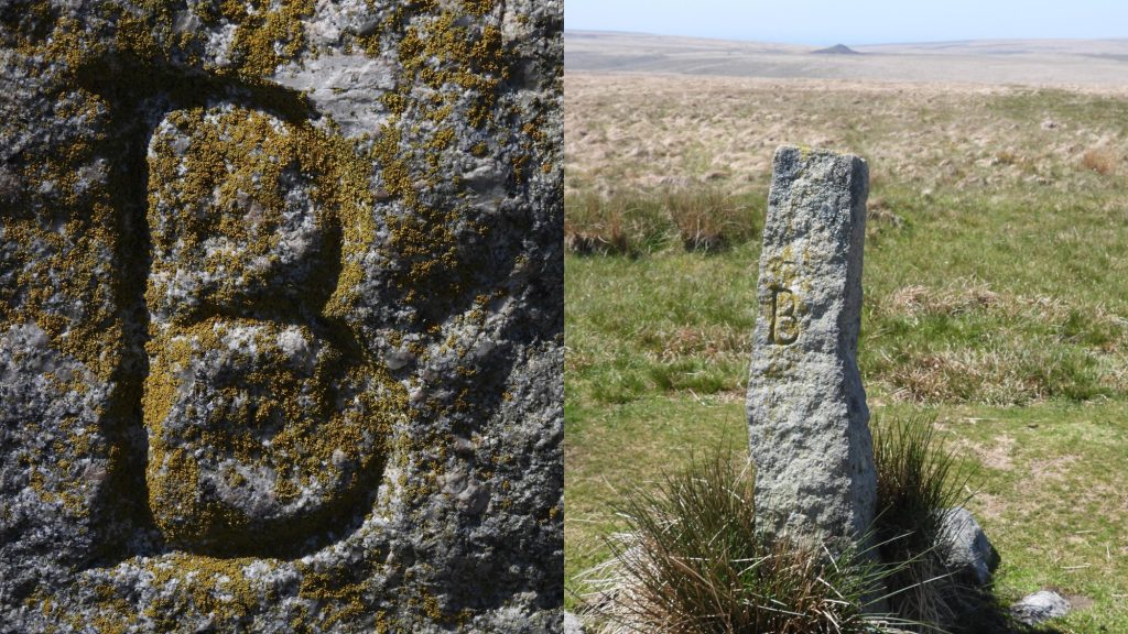
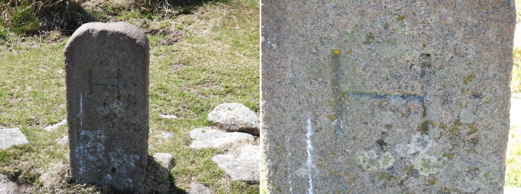
This sketch of the ‘High Moorland’ section of the Holne Parish Bounds covered in this post. The sketch is based on one from Dave Brewer in his book. The Holne ‘H’ inscribed rocks and stones are in red and the Buckfastleigh ‘B’ inscribed stones are in black.Boundary Marker 1: At Horse Ford there used to be an inscribed stone marked ‘H’, which was one of the slabs formerly paving the crossing point on the O Brook of the Monastic Way between Buckfast Abbey and Tavistock / Buckland Abbeys. The rock is recorded to have been washed away in 1965. In the late summer of 1995, a commemorative stone was erected, just downstream from Horse Ford and is shown in the picture above. The stone can be located at SX66372 71123.Boundary Marker 1: The commemorative stone is not strictly (exactly) on the parish boundary. It is dedicated to Arthur Brown (inscribed with ‘A B’), who was the foreman of the Manor Jury in 1949. He died in 1993.Boundary Marker 2: This boundary rock is near the junction of the O Brook and Drylake. This large slab can be found amongst the trees at SX66030 70985. To the casual observer the inscribed ‘H’ could be easily missed.Boundary Marker 2: The ‘H’ had to be filled in with some dry mud to make it discernible for the photographs.
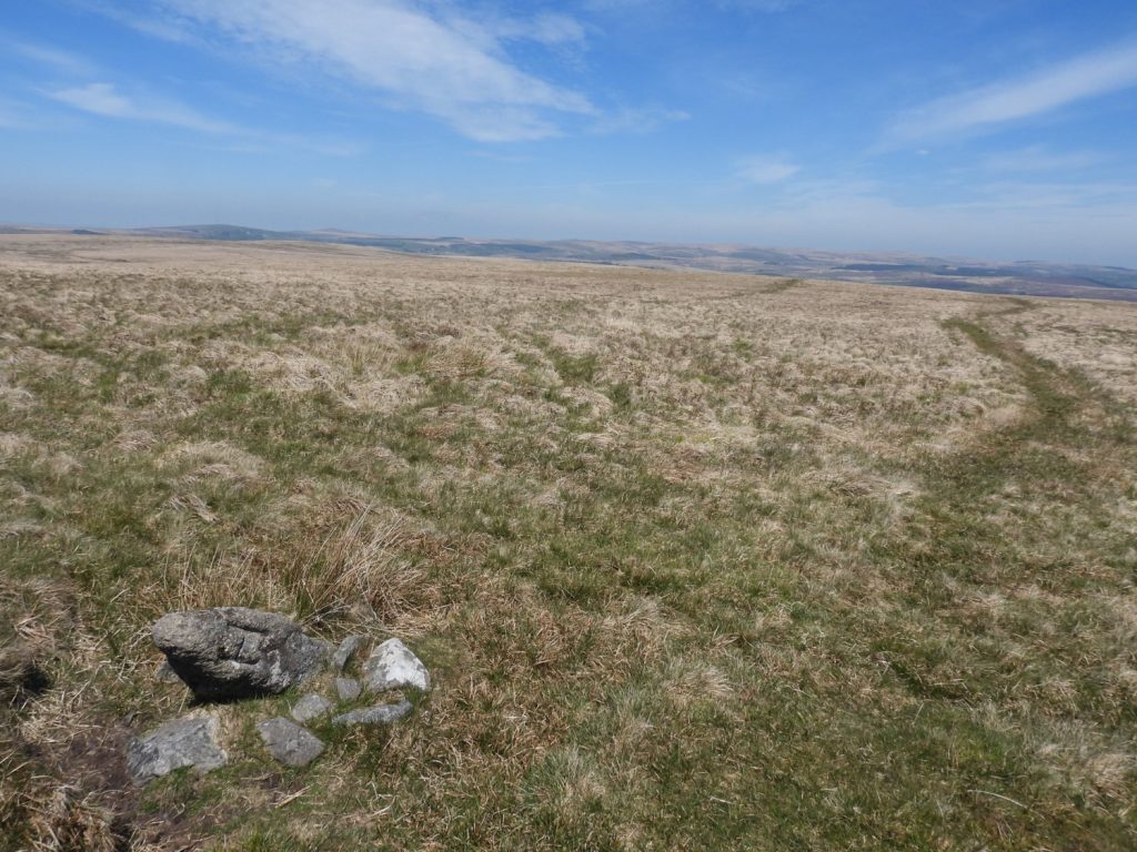
Dave Brewer in his book mentions states that he once found another bound stone in Drylake (Yonder Drylakes) which was embedded in tinners’ waste. However, he further states that he failed to find it at a later date. The author has walked through this gully over the last 4 decades and has never seen such a stone. The stone is marked on the map sketch for completeness for this post. The author would be most grateful if such a stone was to be found.
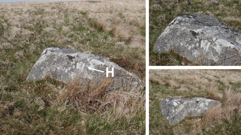
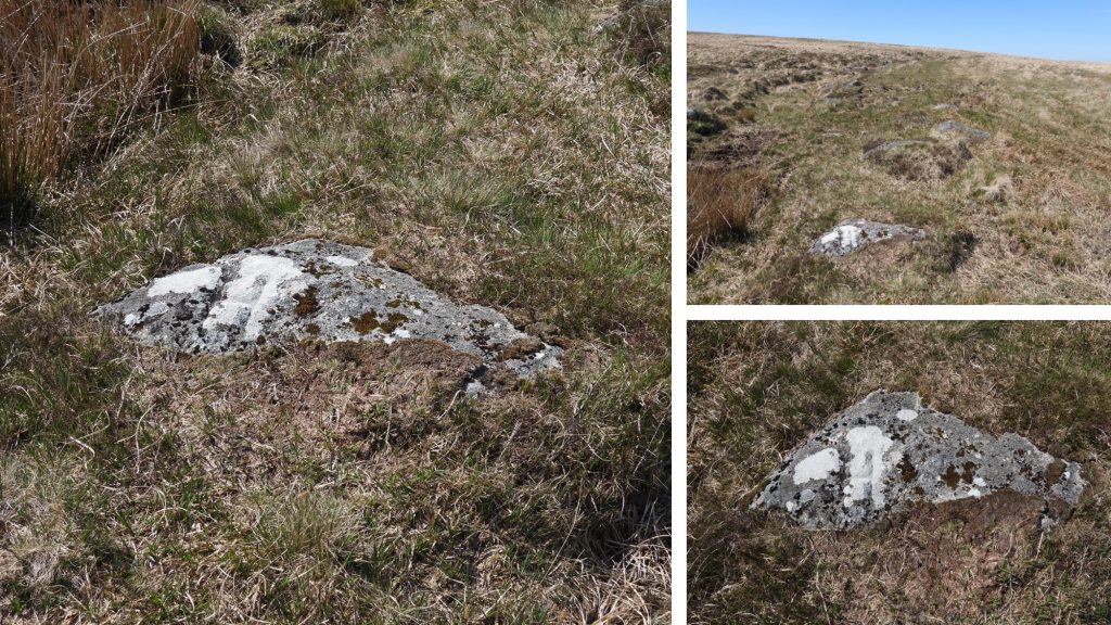
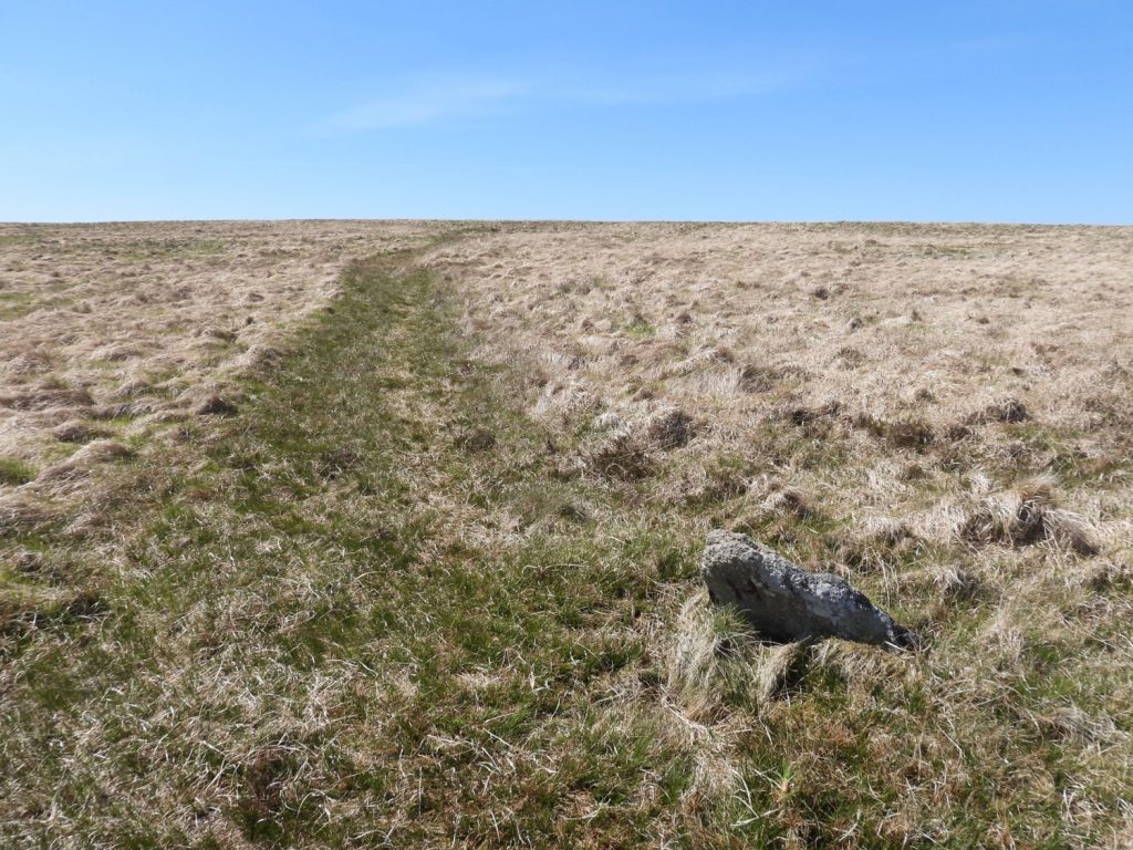
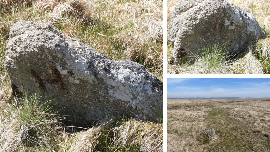
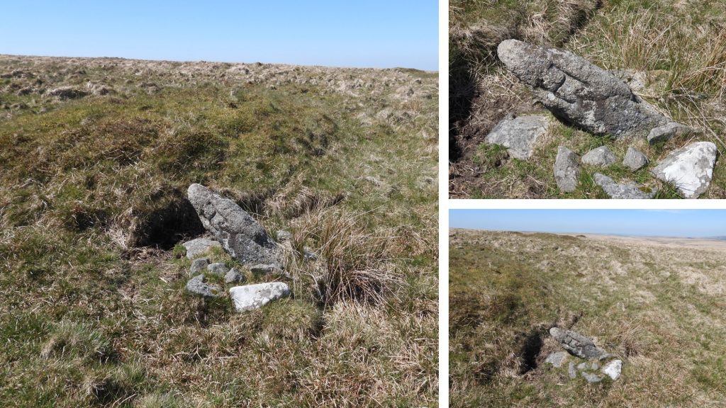
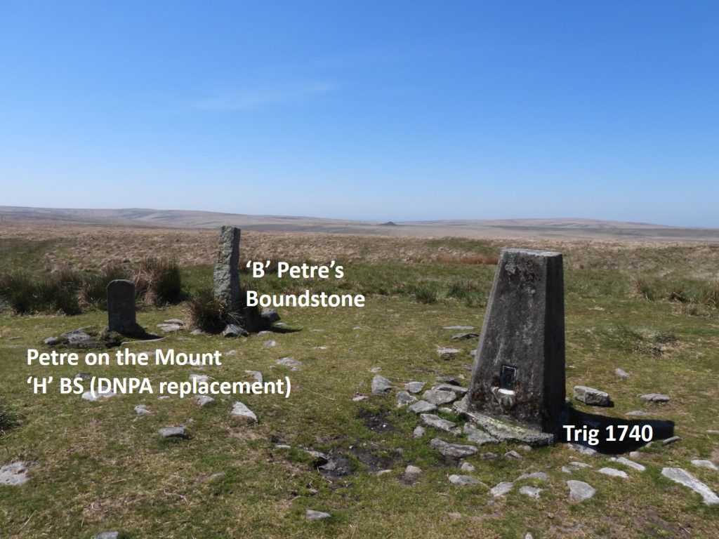
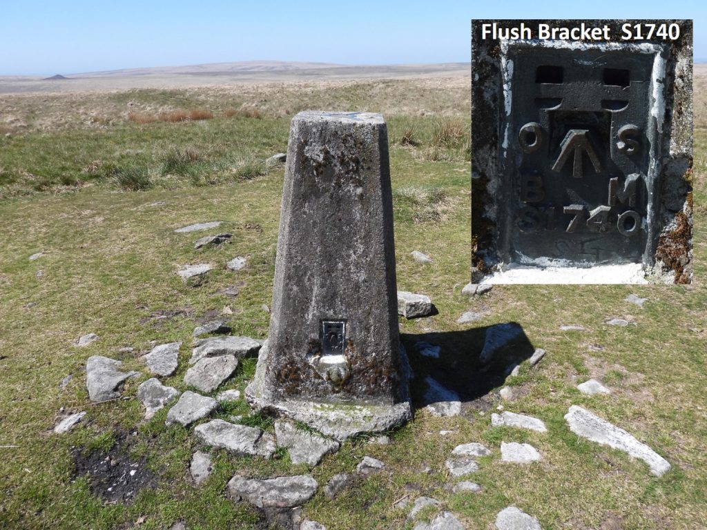
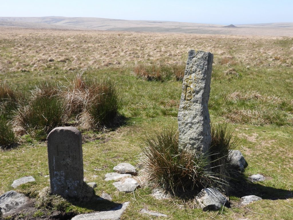
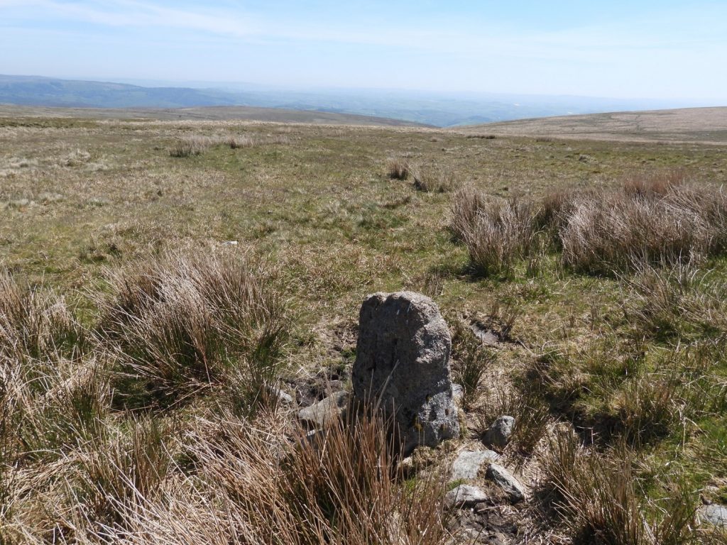
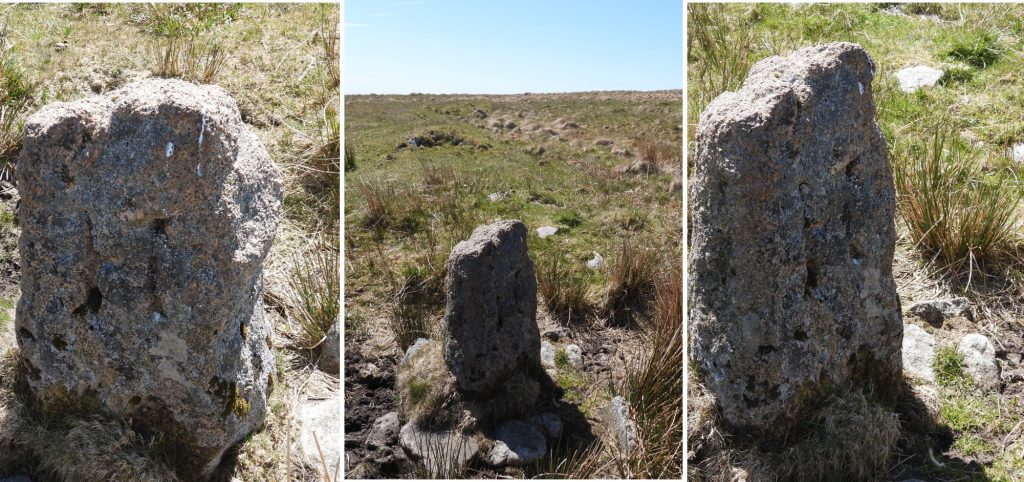
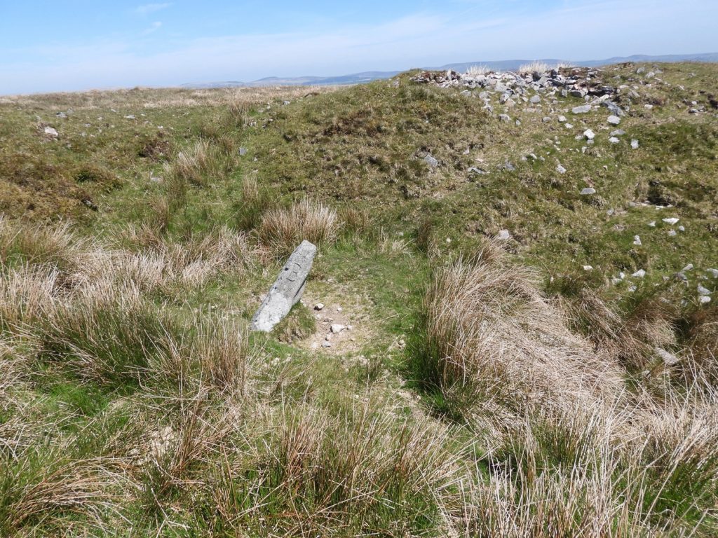
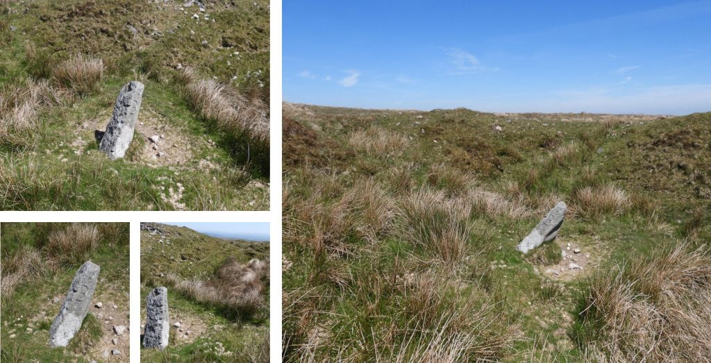
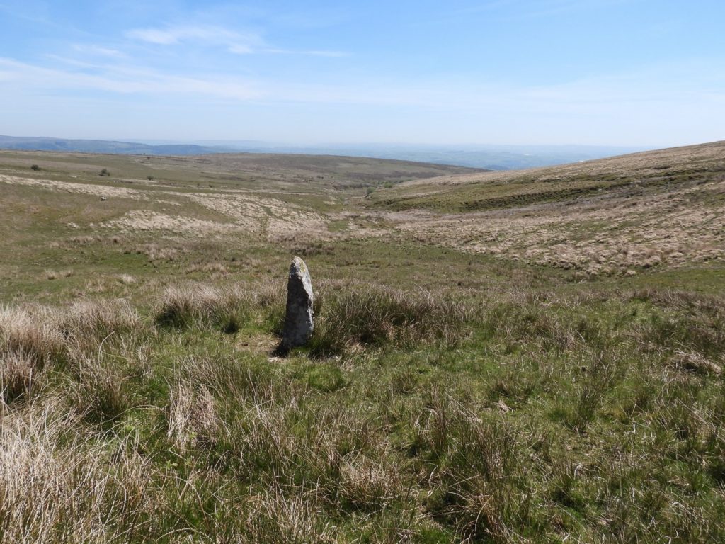
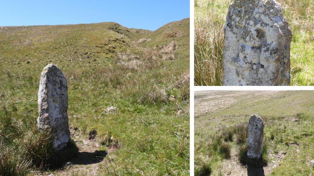
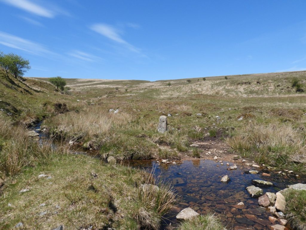
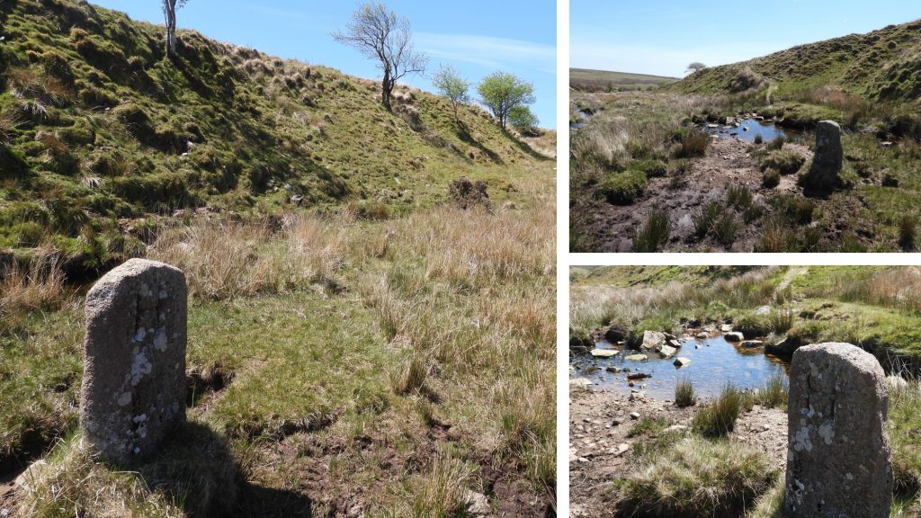
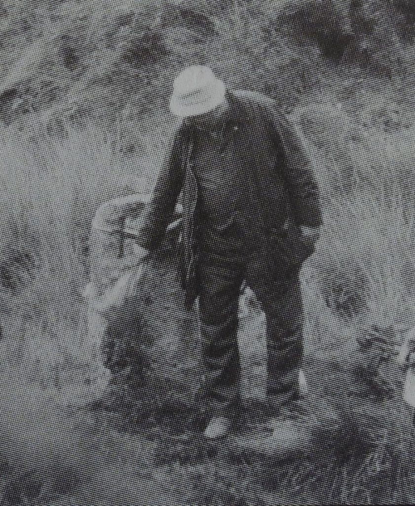
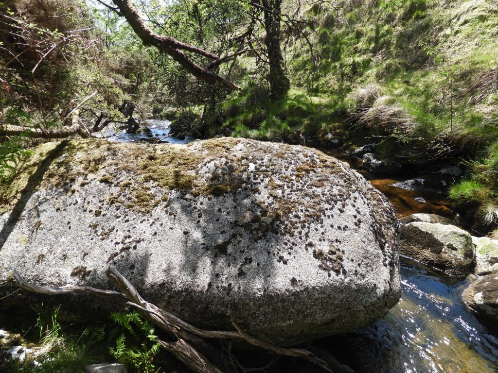
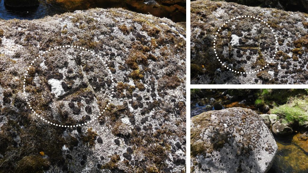
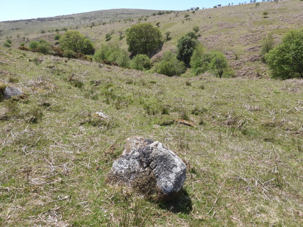
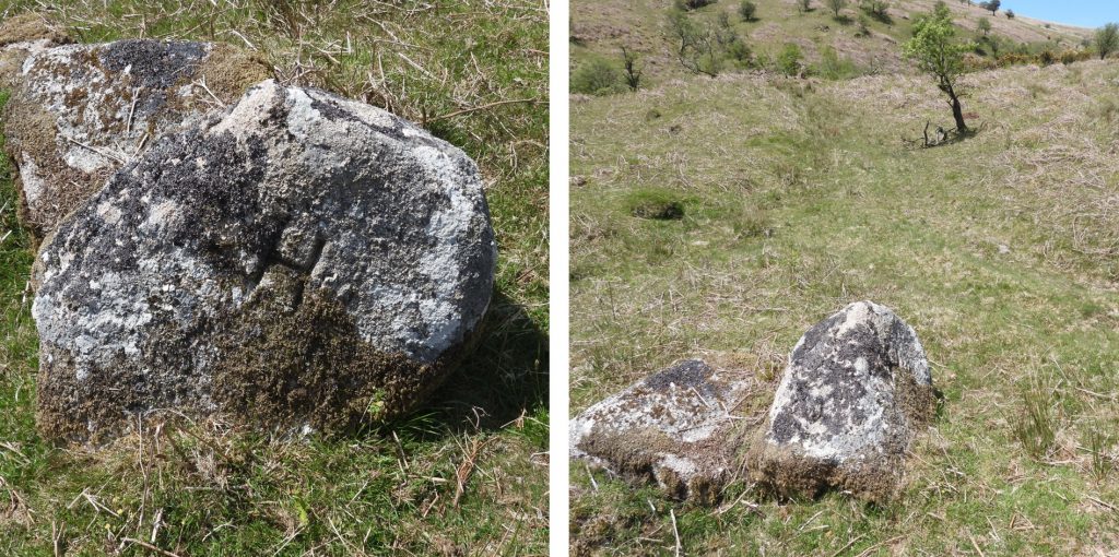
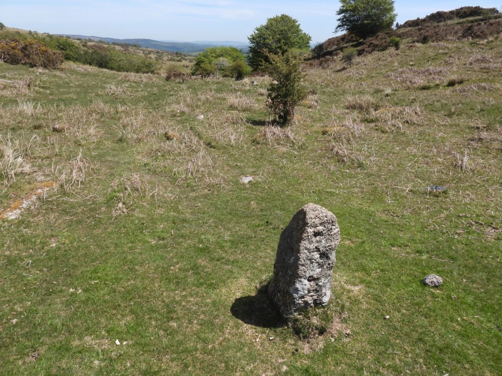
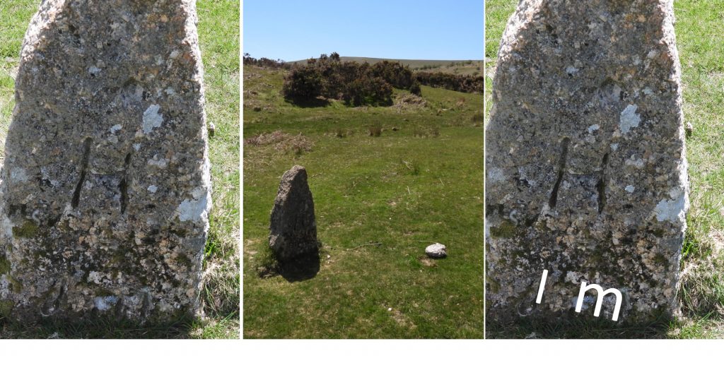
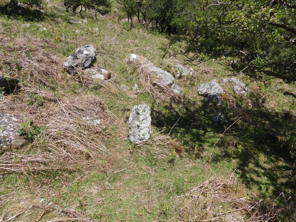
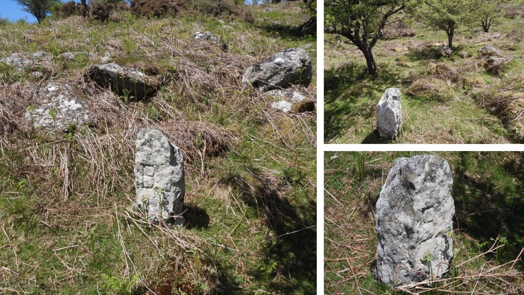
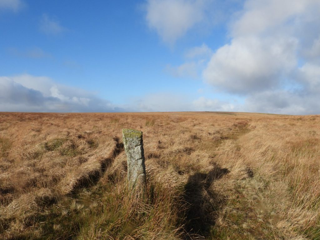
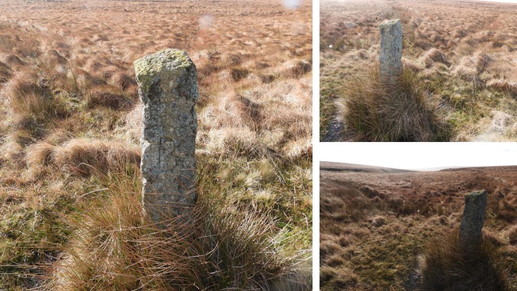
Boundary Marker 3: The 3rd boundary marker can be found near the head of Drylake. It can be found at SX65987 70263. This is a well embedded rock and is clearly marked with an ‘H’. This rock is known as Wellaby Rock.Boundary Marker 3: Close up of Wellaby Rock. The ‘H’ is located at centre, towards the top of the rock.Boundary Marker 4: This marker is the first on this post to be still marked on the modern OS map. It is known as Wellaby Gulf and can be located at SX65939 70128.Boundary Marker 4: Close up of Wellaby Gulf ‘H’ rock.Boundary Marker 5: Close and just to the north of the Sandy Way is a earth bound rock called “The Boundstone”. The picture clearly shows the Sandy Way running east / west and the boundary marker 5 (Filfer Head) can just be seen. This rock can be located at SX65949 69656. Boundary Marker 5: Close up of “The Boundstone”.Boundary Marker 6: This set boundstone is semi-recumbent and is known as Filfer Head or Fieldfare. It can be located at SX65945 69624.Boundary Marker 6: Close up of Filfer Head or Fieldfare, with a mud makeover to emphasise the ‘H’. Boundary Marker 7: Another semi-recumbent set boundstone known as Little Anthony. Dave Brewer states that it is speculated that the stone got its name from a monk from Buckfast Abbey called Anthony. It can be located at SX65957 69190Boundary Marker 7: A closer view of Little AnthonyRyders Hill: The bounds on the highest point of the south moor (515m) change direction at this point from the southerly direction to an easterly direction. This point was known as “Cattyshill” or “Knattleborough” to the Forest of Dartmoor perambulators. Here two boundstones and a trig point can be found. The trig was built in March 1937, exactly over the old buried triangulation mark. The flush bracket number is S1740The two set boundstones, with Red Lake tip visible in the background.Boundary Marker 8: Petre’s Boundstone close up. This Buckfastleigh ‘B’ boundstone is believed to be either 19th or 20th century.Boundary Marker 9: Petre on the Mount (new). This stone was replaced by DNPA in early 1990’s, the original having disappeared in 1986. It is called today ‘Peter on the Mount’Boundary Marker 10: Known as Nine Stones. It can be found at SX66129 69168. Boundary Marker 10: Close up of the ‘H’ inscription on Nine Stones.Boundary Marker 11: At the top of a tinners’ girt is another Buckfastleigh ‘B’ set boundstone. This is known as Bourne’s Pit and can be found at SX66181 69219.Boundary Marker 11: More pictures of Bourne’s PitBoundary Marker 12: Rounders Hole at SX66496 69247. It is located at the bottom of the tinners’ girt and just above the head of the River MardleBoundary Marker 12: More views of Rounders Hole set boundstone with inscribed ‘H’. This stone at one time used to be recumbent and was re-erected for the millennium.Boundary Marker 13: This stone was re-erected for the Millennium and is located at Hapstead Ford. It had been found recumbent some distance away (a few hundred metres) in 1996, some distance from the parish boundary. It can be located at SX67050 69237.Boundary Marker 13: When, on 17th September 2000 when the stone was being dedicated by Ian Mercer, it is reported that the ladies present had a glass of sloe gin whilst the men had whiskey. Boundary Marker 13: Hapstead Ford. This picture is from 17th September 2000 and is Ian Mercer dedicating the stone. Ian Mercer was the first Dartmoor National Park Officer and the first chief executive of the Countryside Council for Wales. He held many offices in an illustrious career including being: President of the Field Studies Council and the Devon Wildlife Trust for decades, chairman of the South West Uplands Federation and vice-president of the Campaign for National ParksBoundary Marker 14: This is known as (for obvious reasons), River Rock. It is in a rather overgrown area and care should be taken when descending to the river. It marks the point where the parish bounds leave the River Mardle. It can be located at SX67729 68588.Boundary Marker 14: The inscribed ‘H’ on River Rock can be located on the upstream side. Boundary Stone 15: This small natural stone at SX67778 68622 is called ‘Sitting Down End’. It is where the Commoners used to have their lunch during their perambulation. It is not shown on OS MapsBoundary Stone 15: Close up of the inscribed ‘H’ at Sitting Down End.Boundary Marker 16: This is a relatively new set boundstone, dating from 1990. It is located at SX67820 68647. It was ‘unveiled’ at the 1990 beating of the bounds, when Ian Mercer, the then Dartmoor Park Officer and acting steward of Holne Manor on behalf of Devon County was asked to remove a covering of bracken to reveal it. Boundary Marker 16: The stone is inscribed with the obligatory ‘H’ but also (in sans-serif apparently) the initial I M (Ian Mercer). The stone was a token of appreciation by the Commoners for Ian Mercer for all he had done for the moorland farming community and Dartmoor in general. He was, apparently, ceremoniously ‘bumped’ on the stone, being lifted by several of those assembledBoundary Marker 17: This ‘B’ stone can be found at Holne Well. The grid reference is SX67880 68682Boundary Marker 17: More views of the Holne Well ‘B’ stone. This is close to where the Holy Brook starts.Boundary Marker 18: This boundary stone is between Ryders Hill and Snowdon. It is on the Buckfastleigh parish boundary at Western Wella Brook Head, which is known as “capud de Westerewelebrok”. It is shown on the map sketch in this post.Boundary Marker 18: This set boundstone can be found at SX 66459 68558.