A collection of walks, discoveries, insights and pictures of exploring Dartmoor National Park
May 31, 2023
Whitethorn Farmstead / Cottages
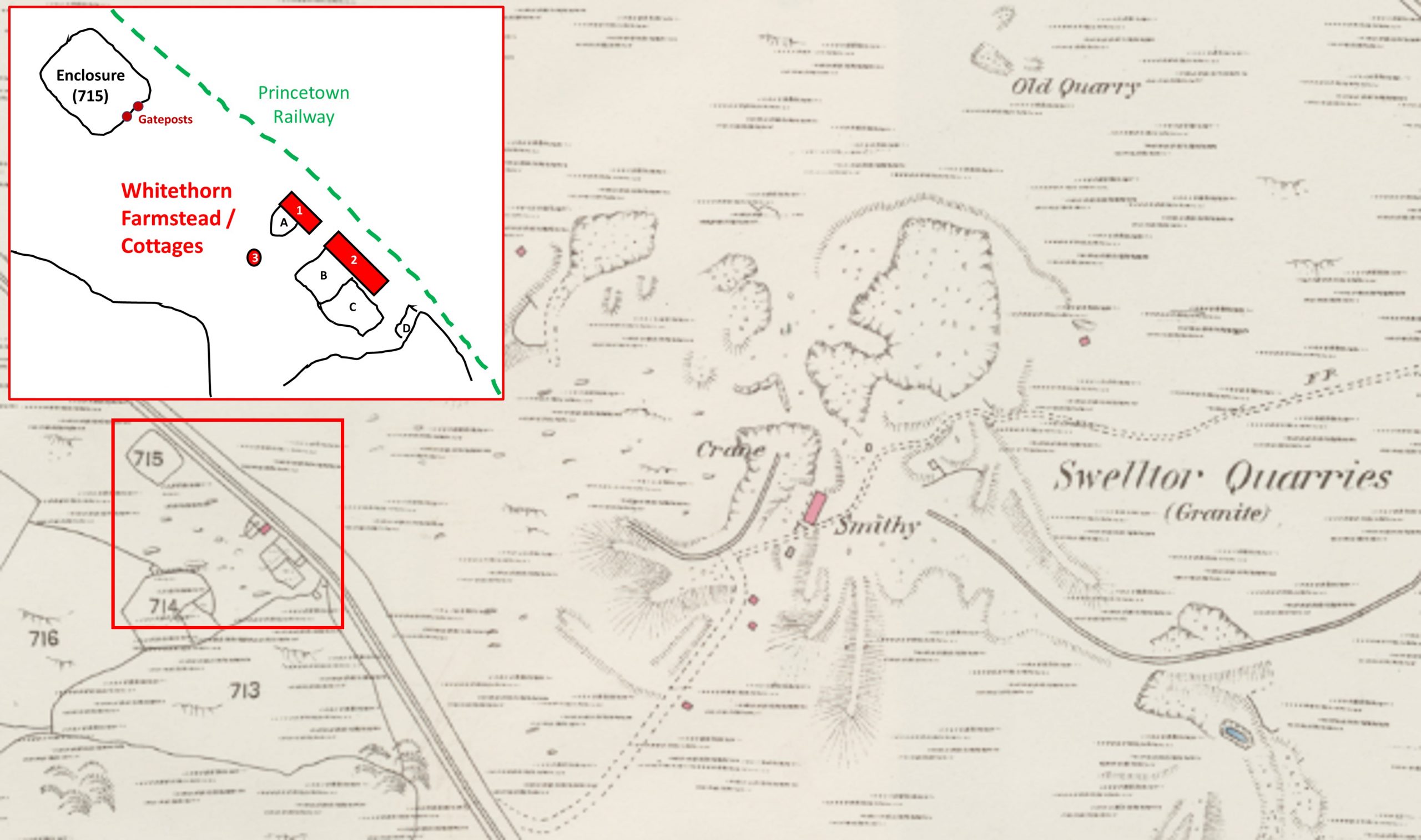
In Eric Hemery’s ‘High Dartmoor’ on page 1032, mention is made of Whitethorn, a Cottage on the south side of King’s near the railway. Being aware of some ruins and enclosures to the south of King’s Tor and to the west of Swelltor Quarries the author believed these were the aforementioned ‘Whitethorn’ and decided to investigate further.
The Dartmoor Historic Environment Record (HER) provided two records but each had little information on the ruins. The first record simply states that it was a farmstead or deserted settlement but does not supply a name. Secondly, a record by West Air Photography from 1975, recorded that there were: “Three rectangular buildings about 10m by 4m and associated enclosures are visible on aerial photograph. May be a deserted Medieval site”. The dating of the site by this second record appears to the very inaccurate.
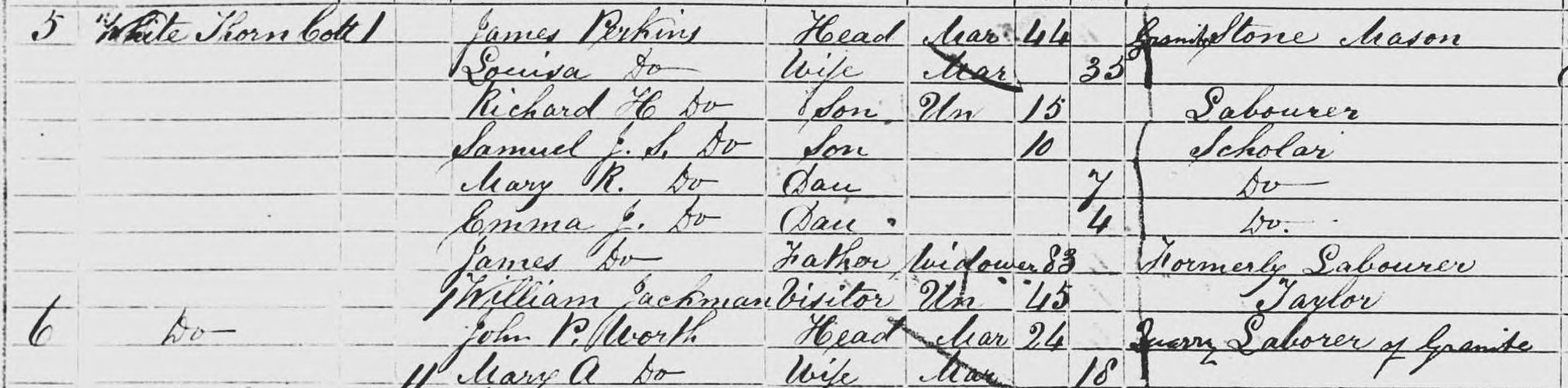
The farmstead / settlement (HER description) does not appear on the tithe map (1840) and appears to be abandoned as shown on late 19th century maps (frustratingly, the author cannot find a map with the name ‘Whitethorn’ annotated). Examining the Walkhampton census records for ‘Whitethorn’, there appears to be entries for 1851 and 1861 only. Therefore, one could conclude from the map records and census records that the farmstead / settlement was constructed most probably in the 1840’s but was abandoned in the 1860’s and is the aforementioned ‘Whitethorn’. The tenants appear to have been stone masons and agricultural labourers. This post attempts to record and interpret the ruins of the ‘Whitethorn’ farmstead / settlement and to consider the lives and occupations of the tenants who lived there. If any reader of this post can add (or correct) any information contained herein, the author would be most grateful in hearing from them. Thank you.
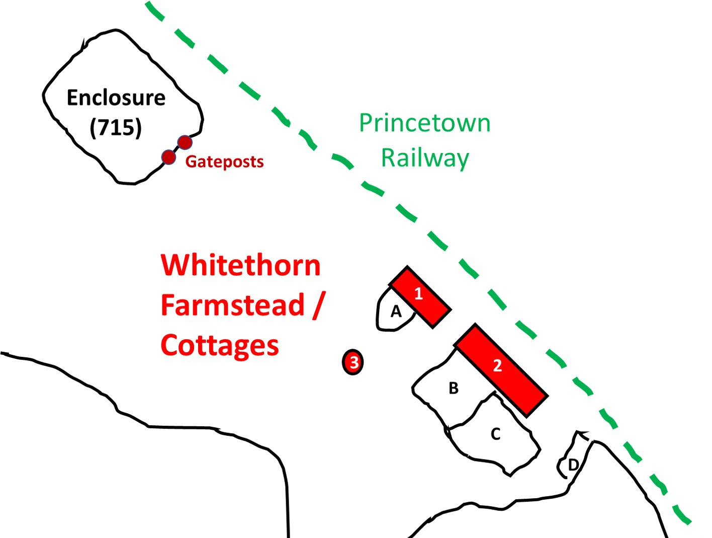
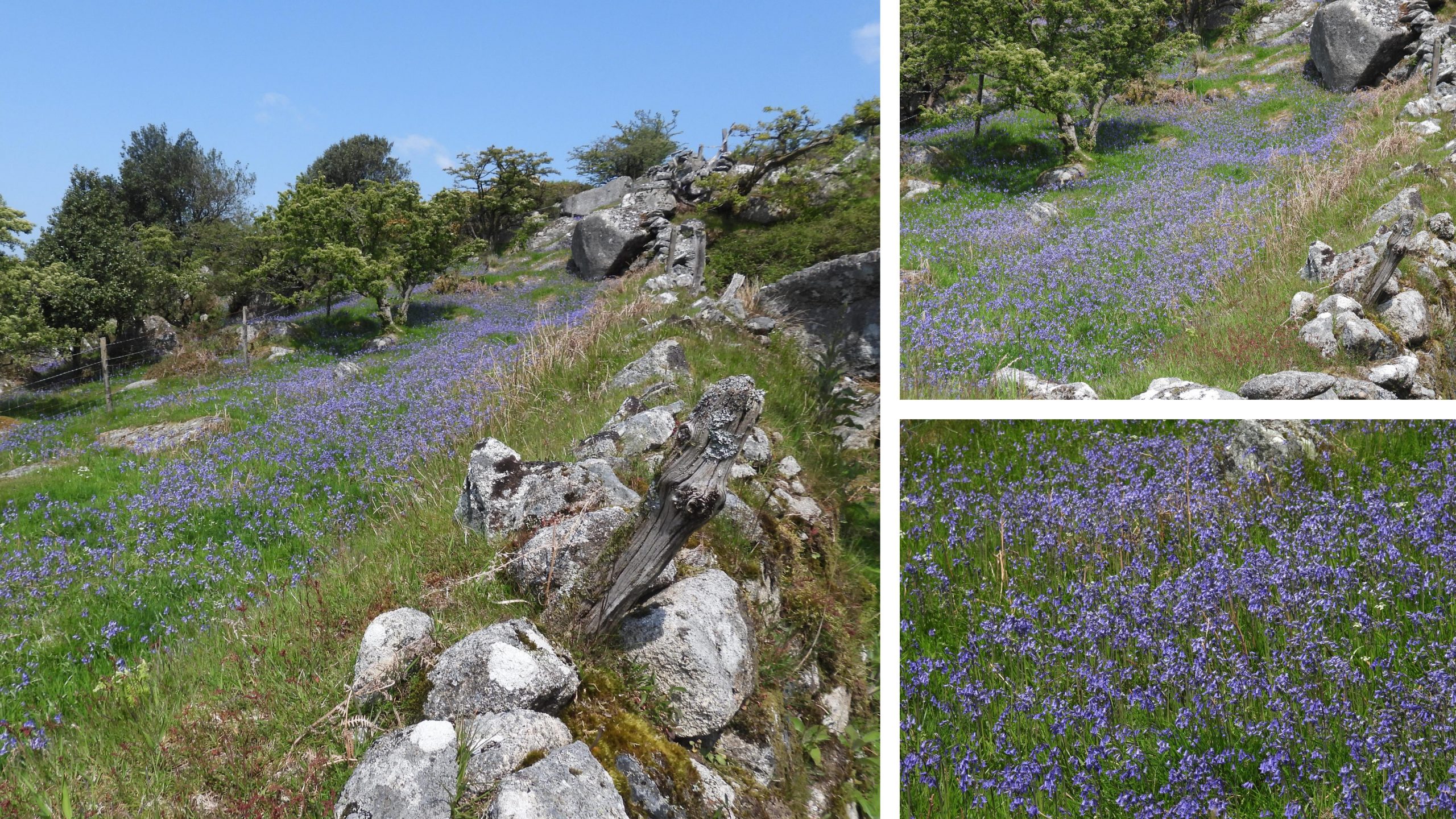
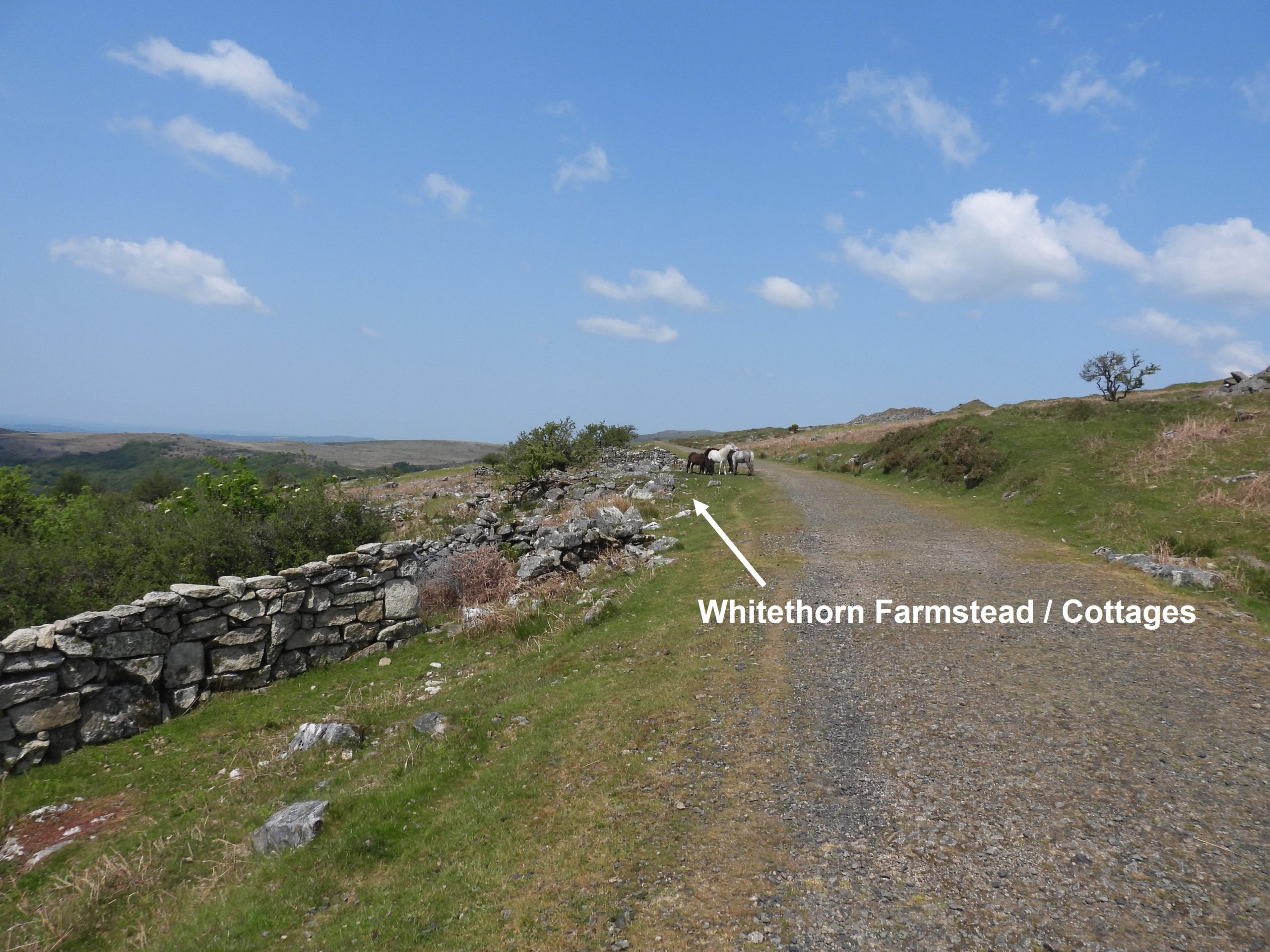
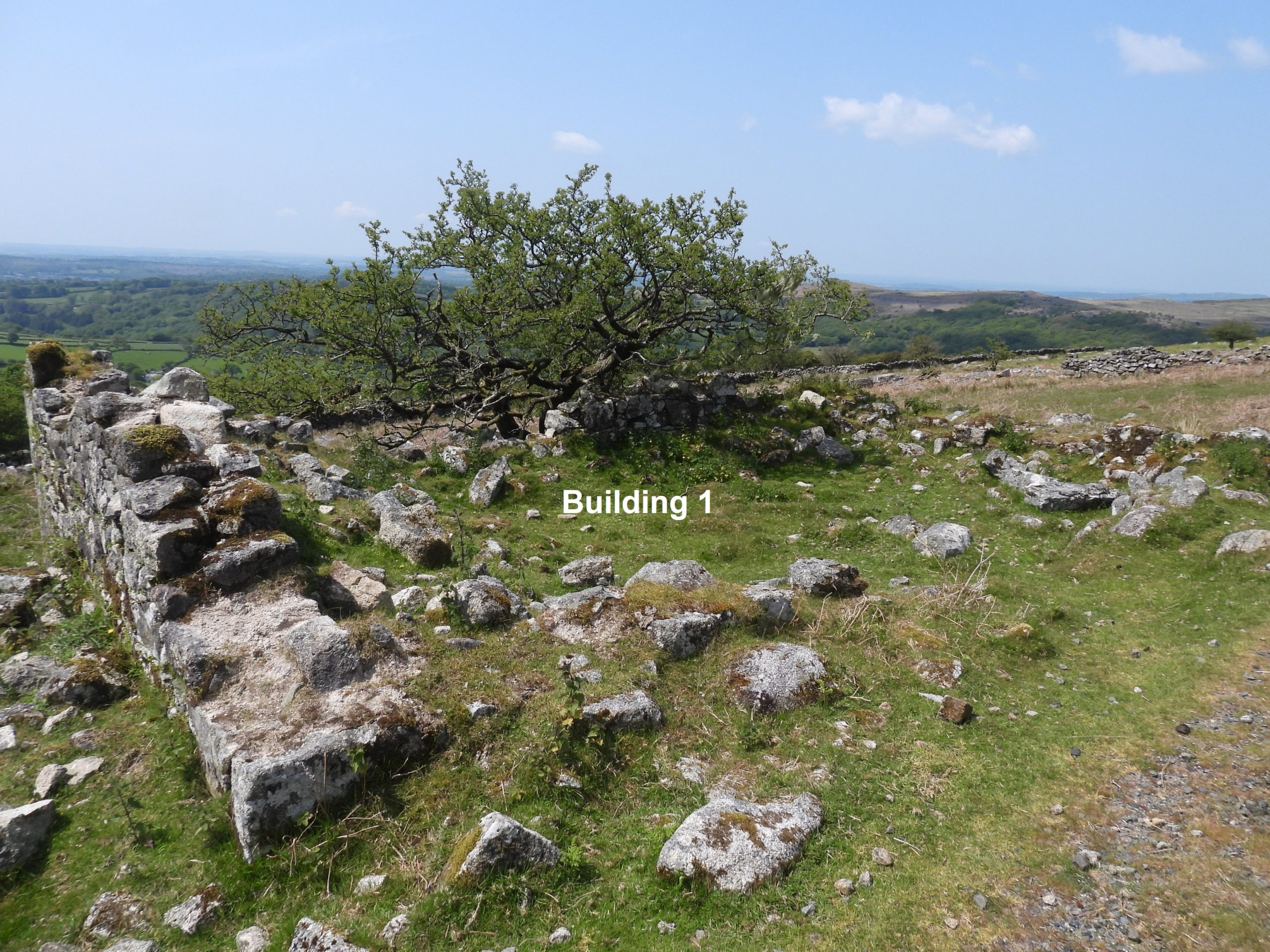
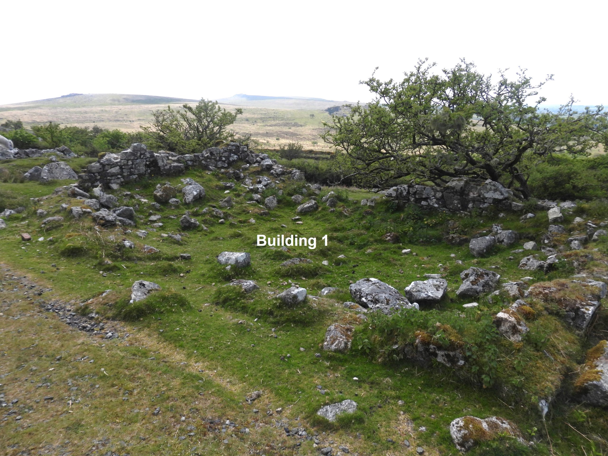
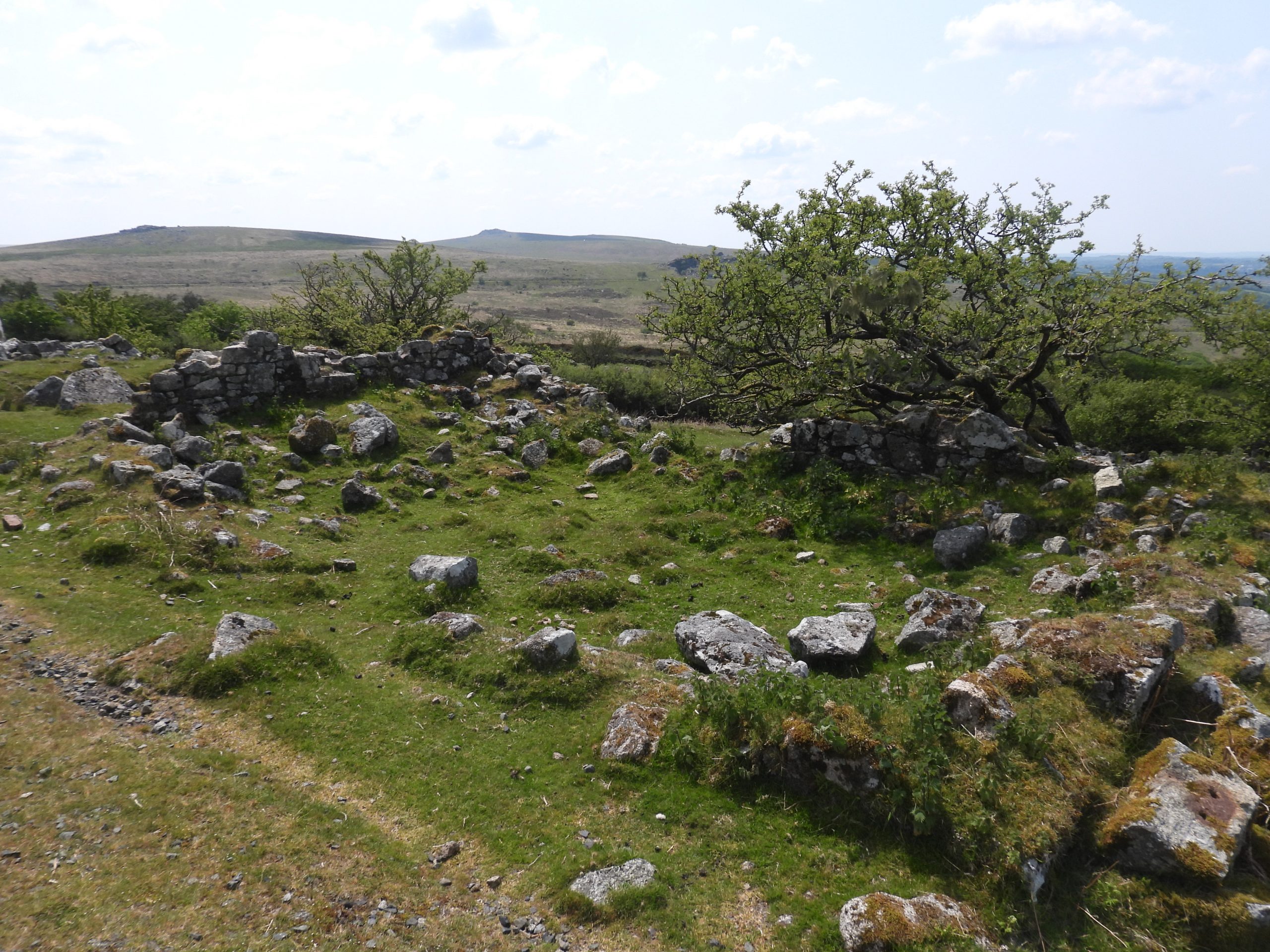
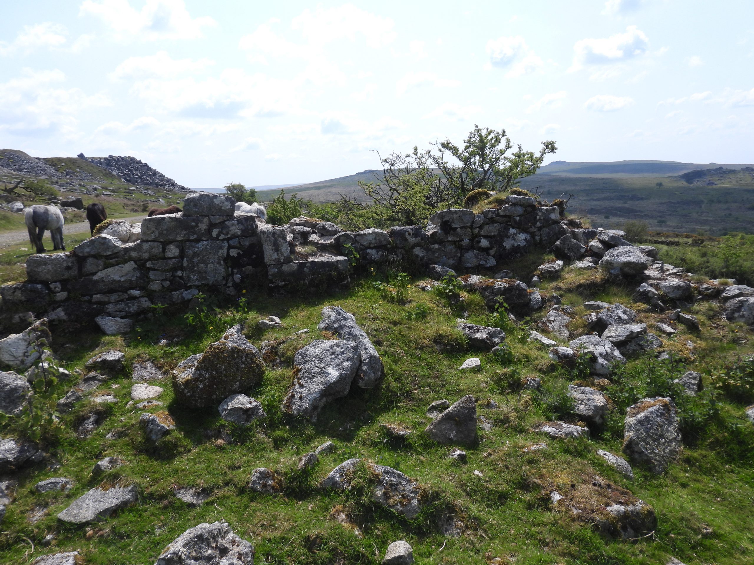
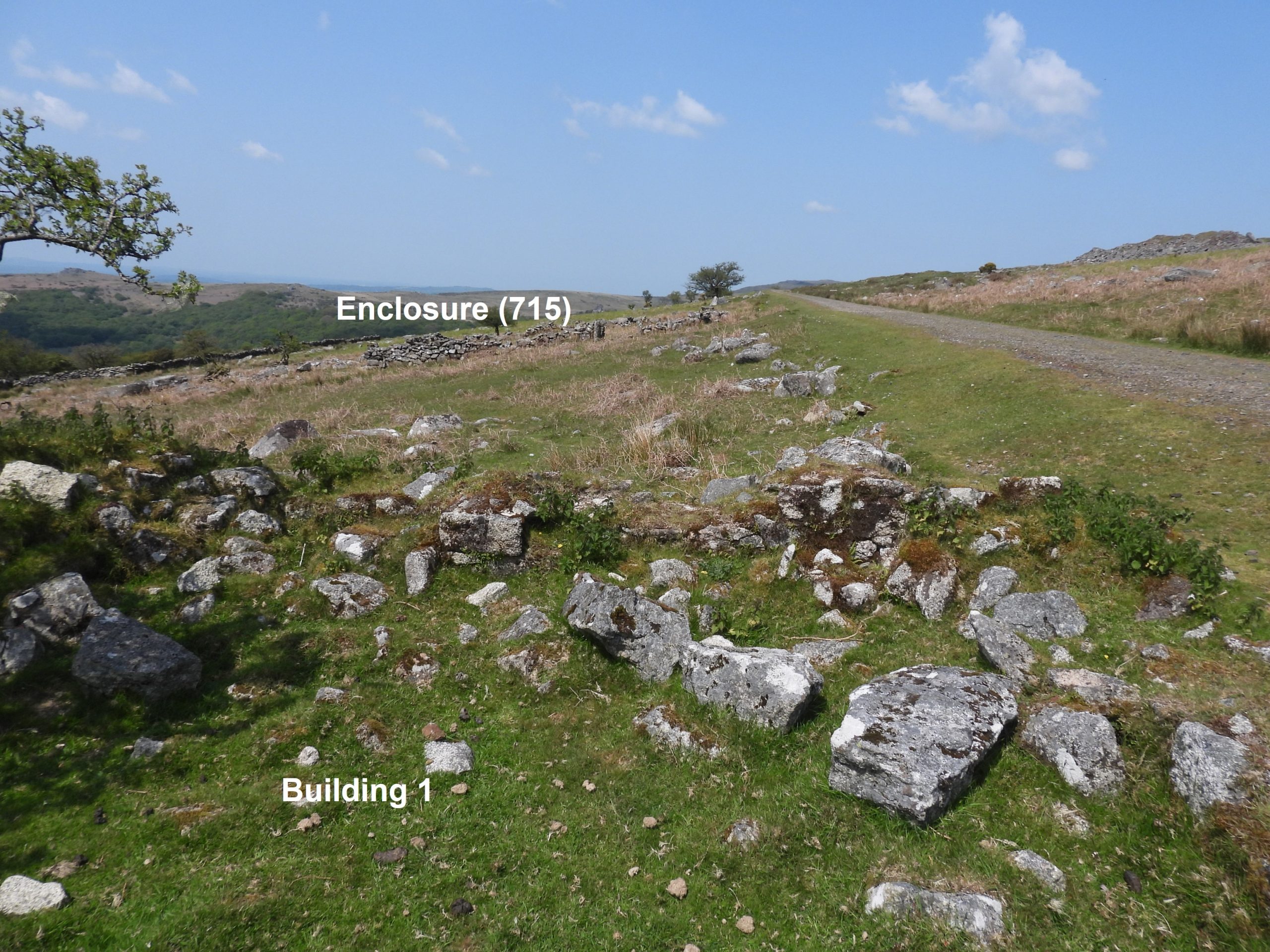
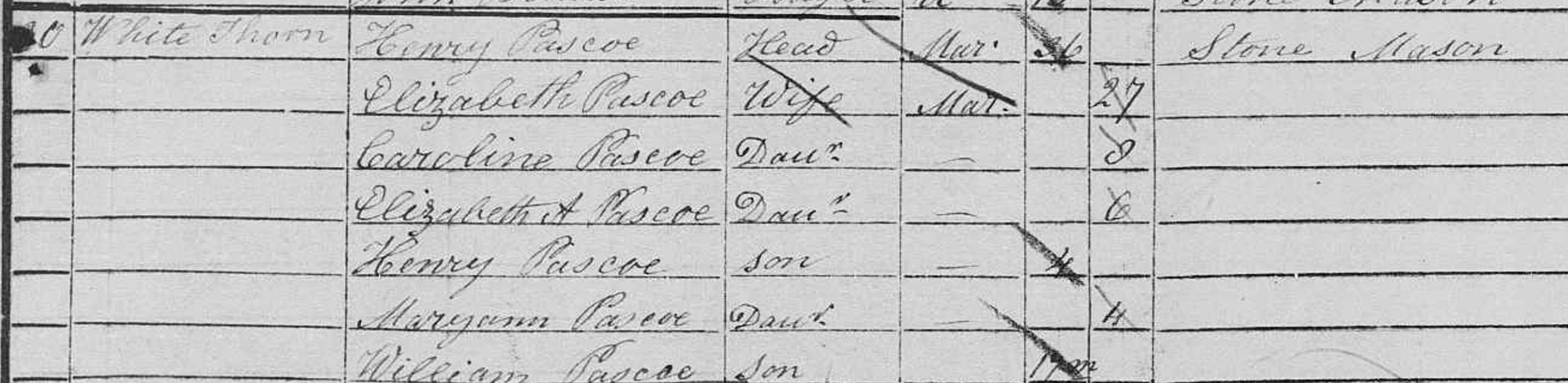
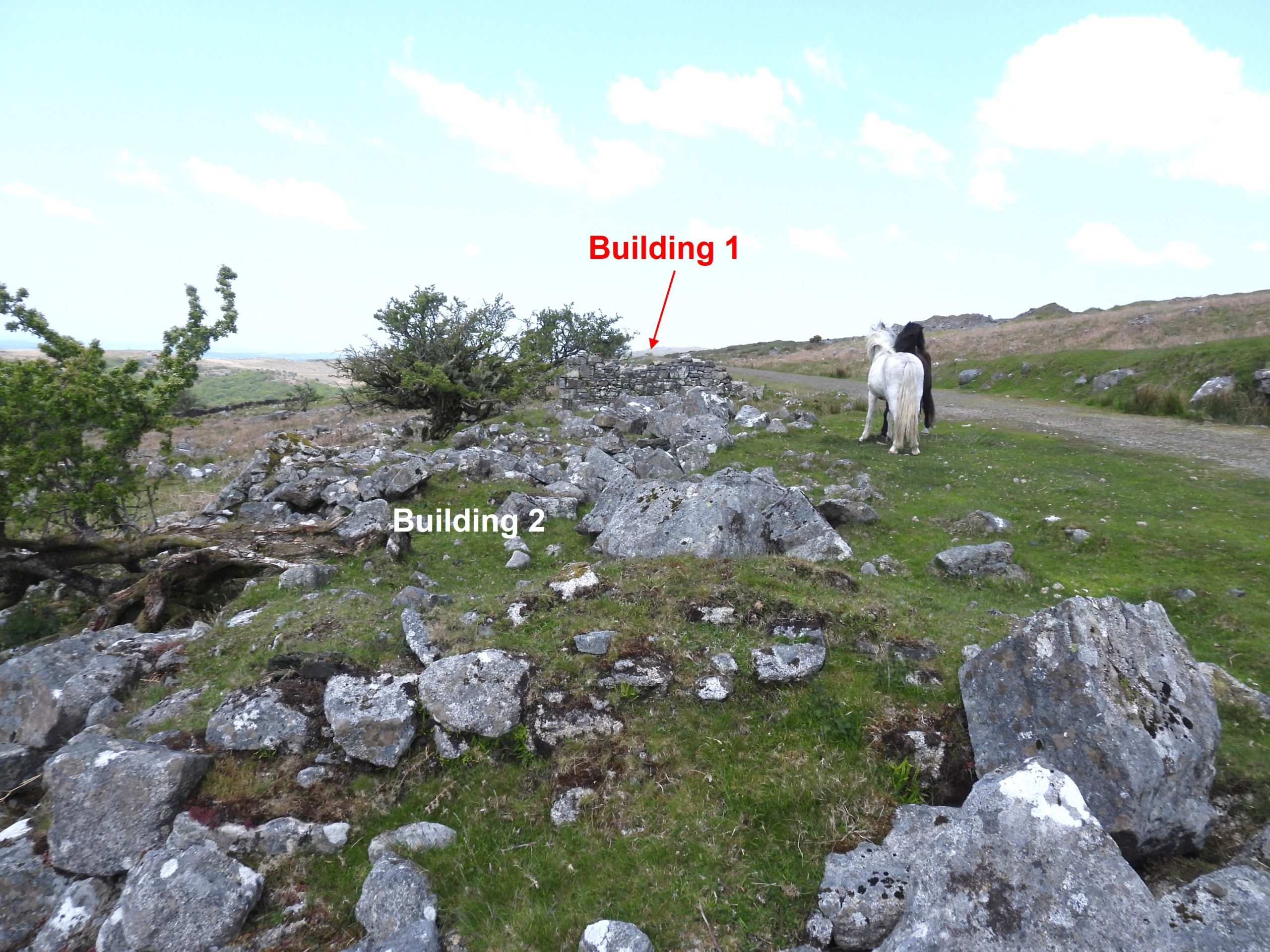
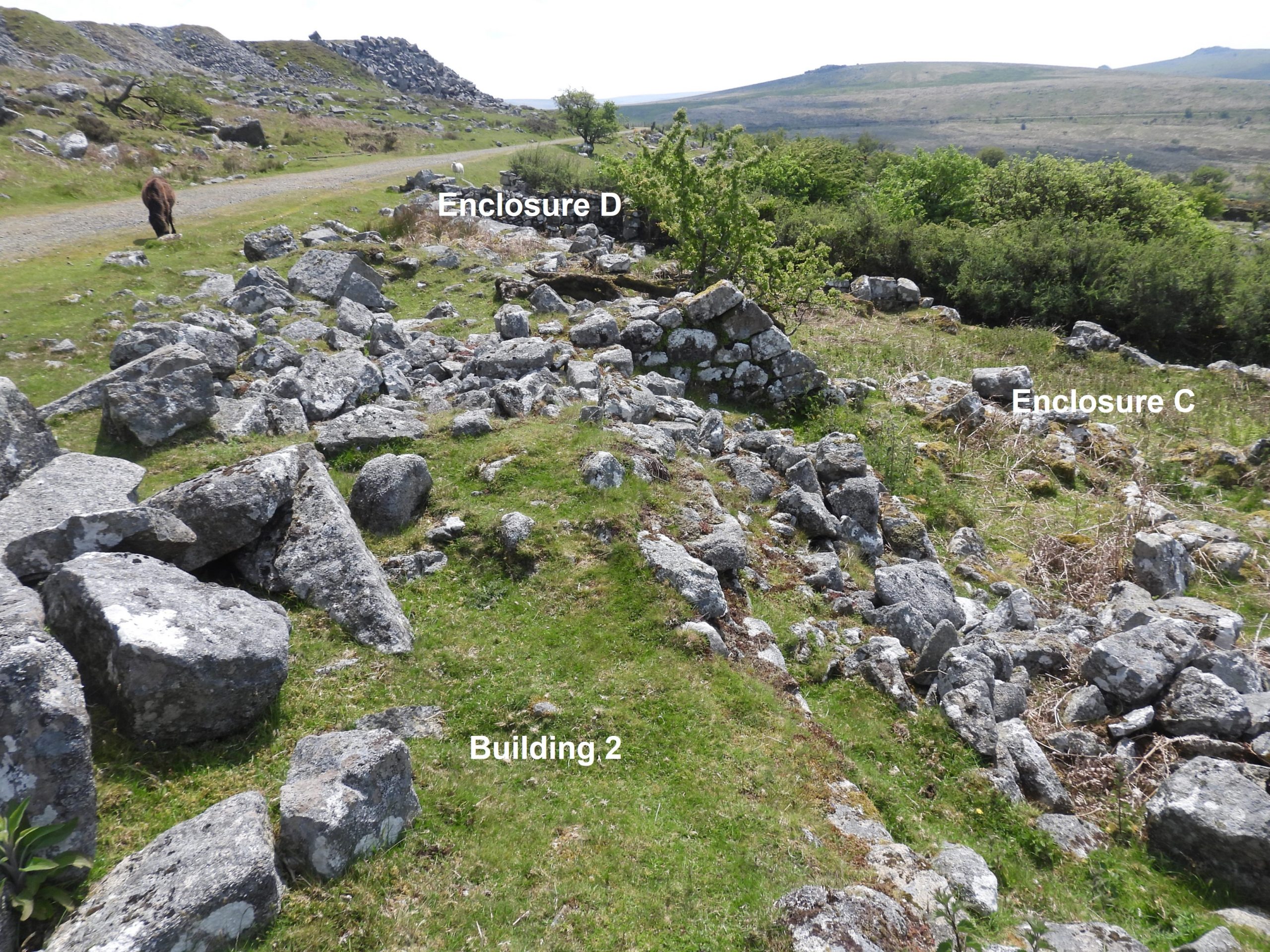
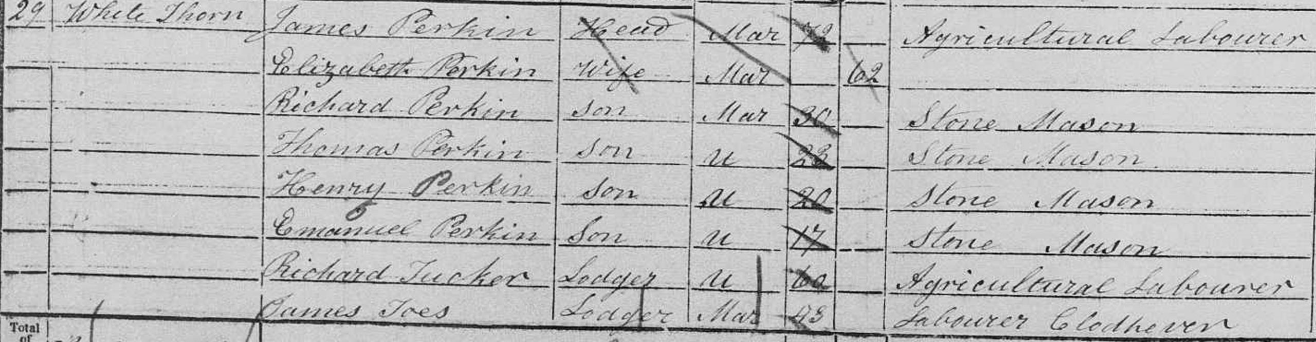
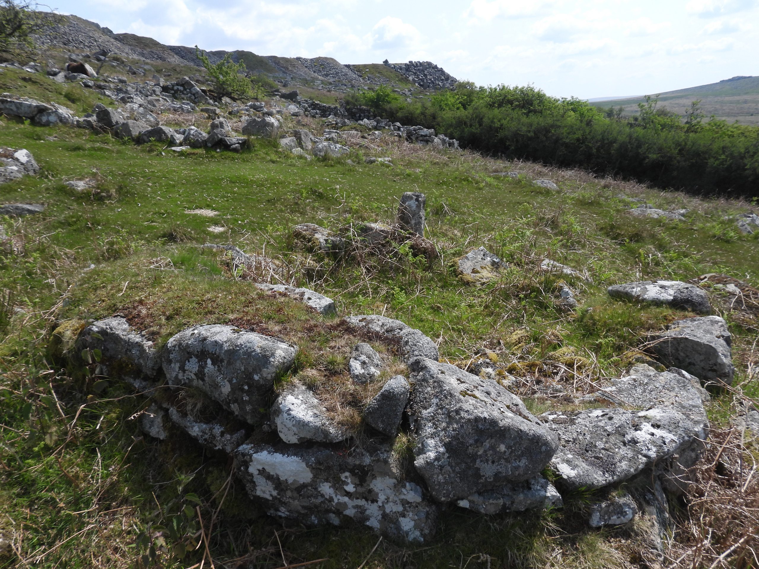
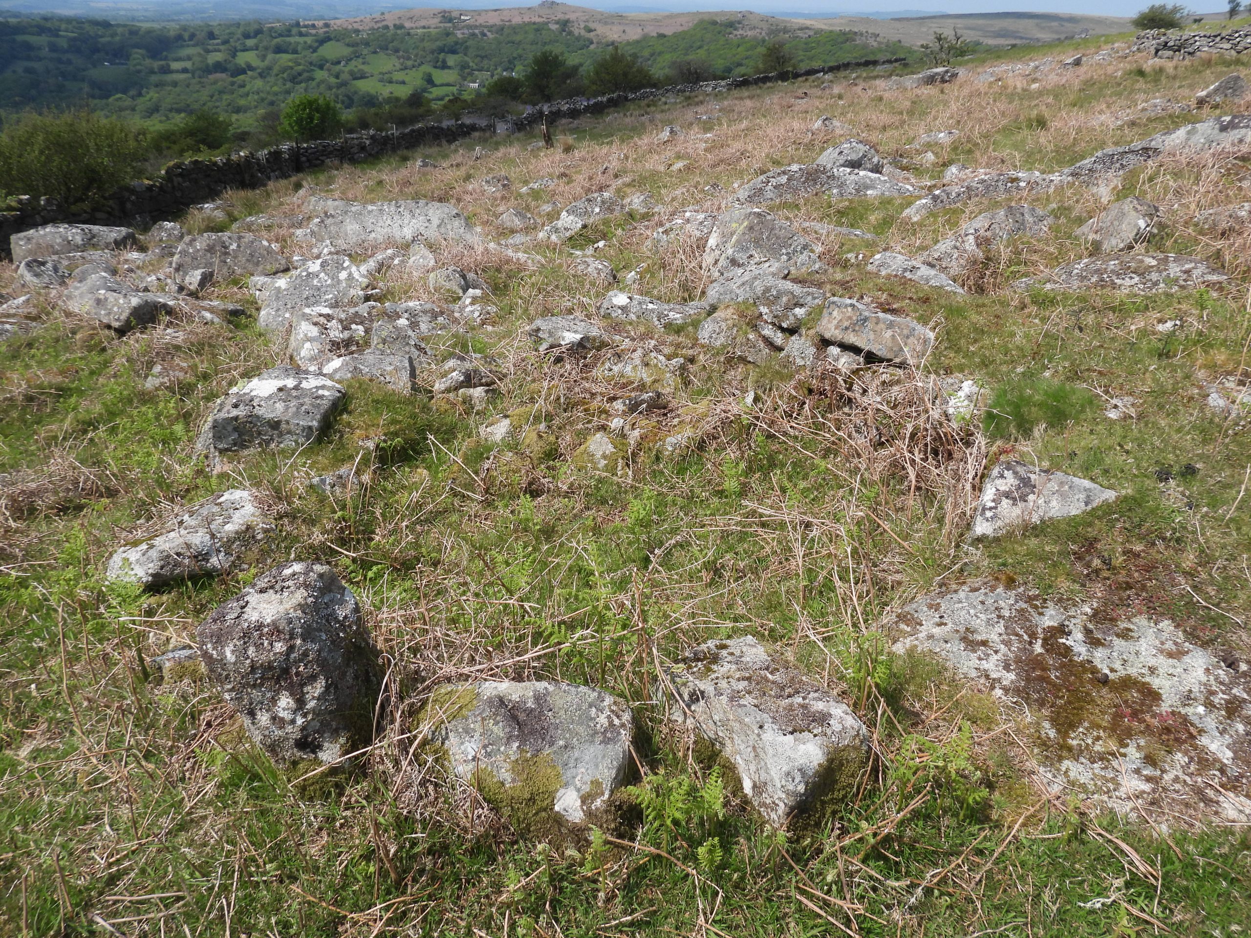
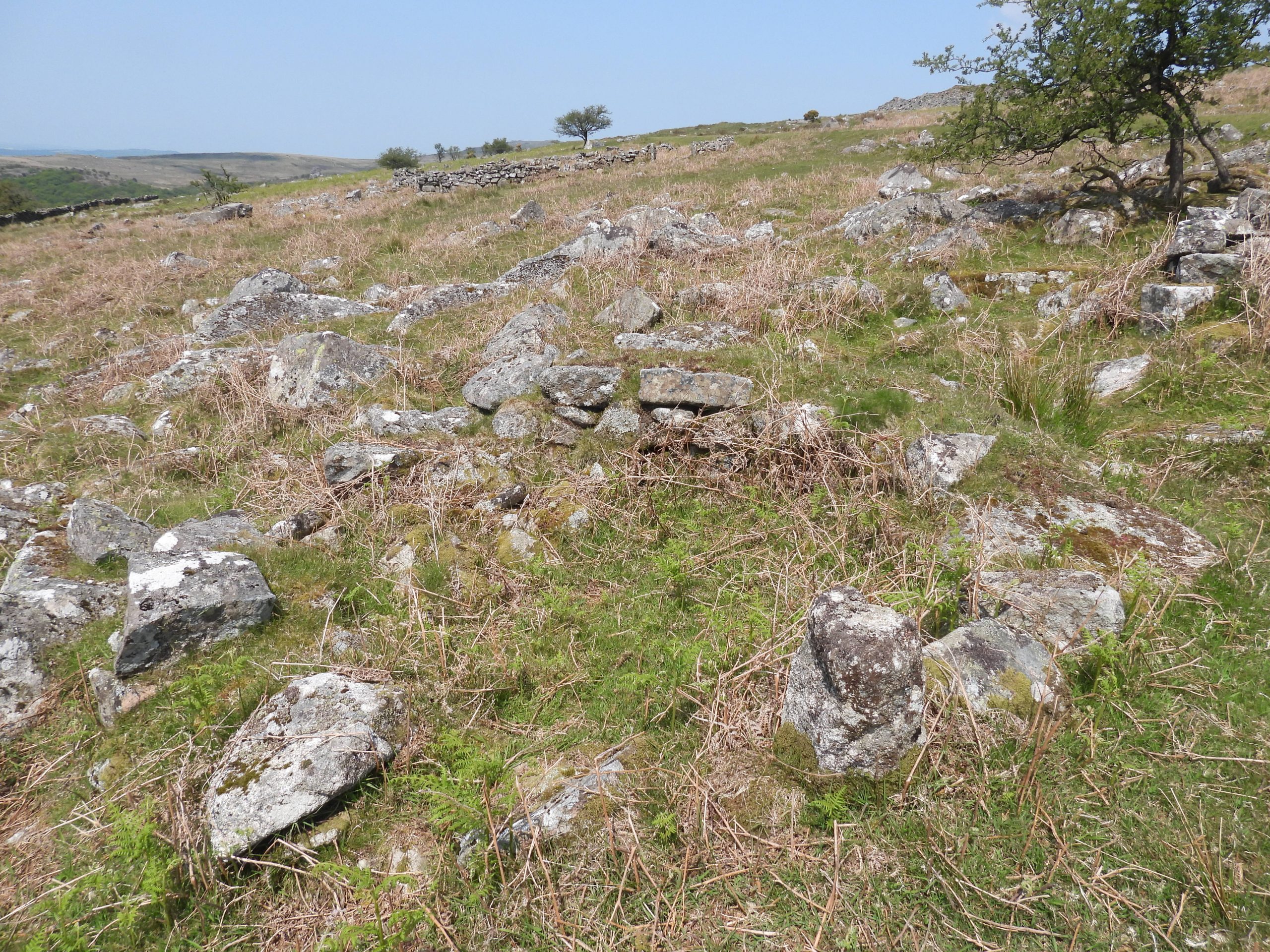
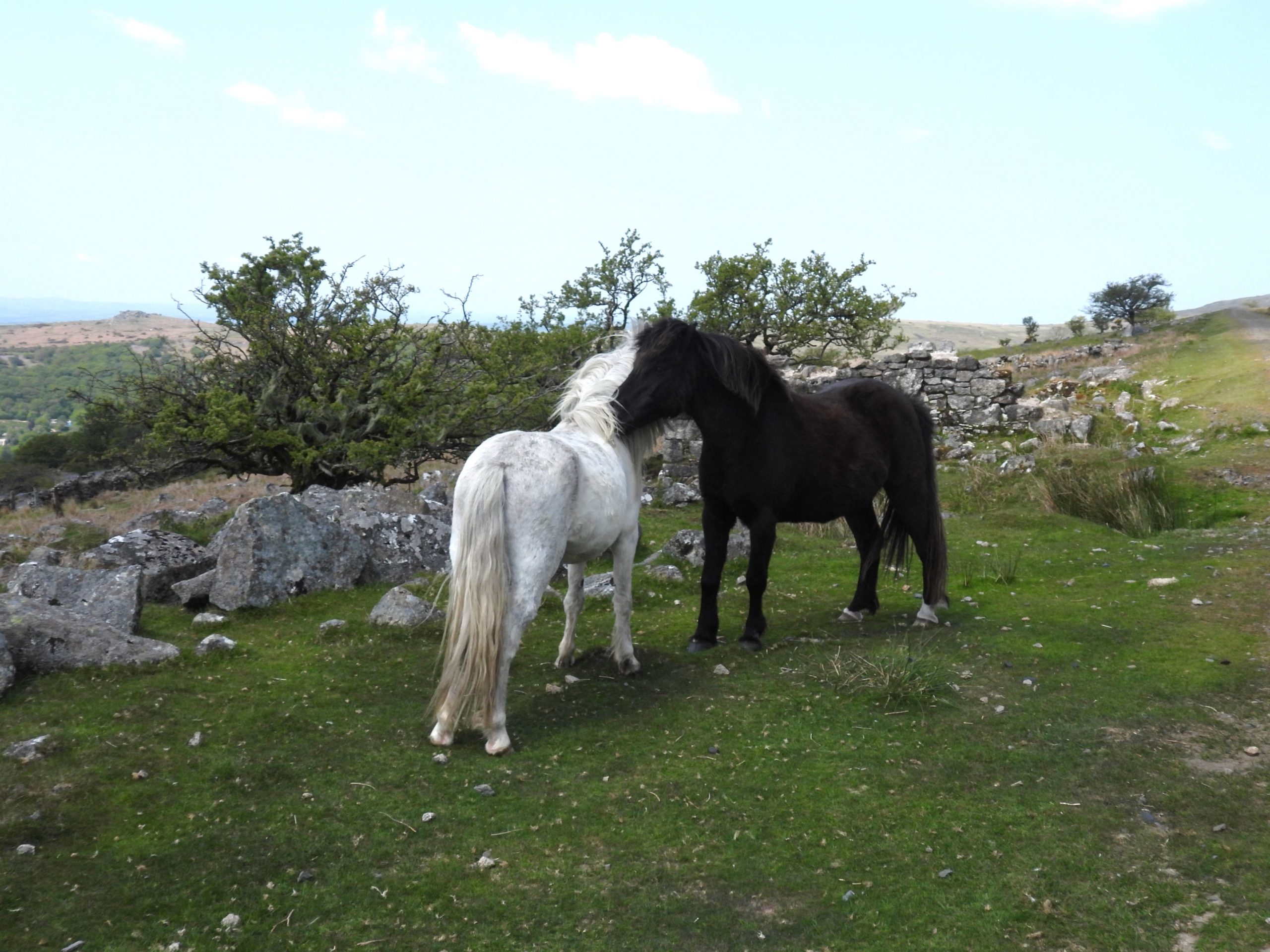
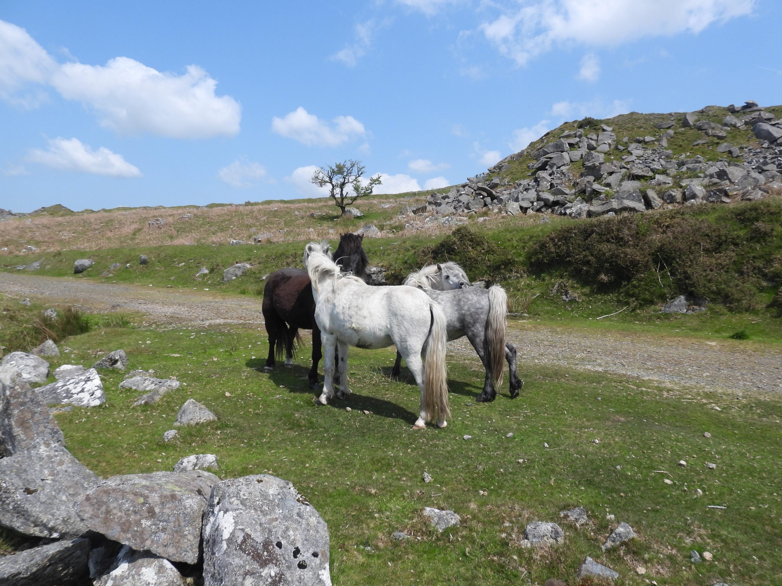
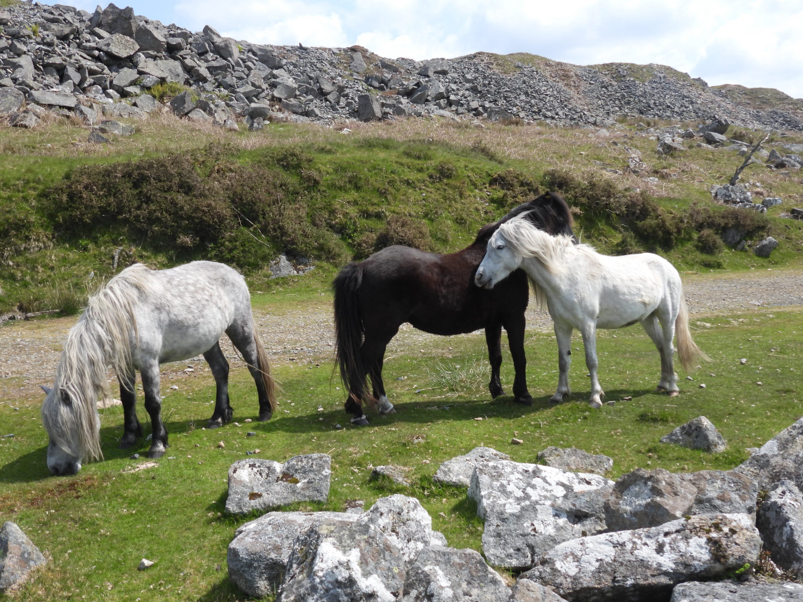
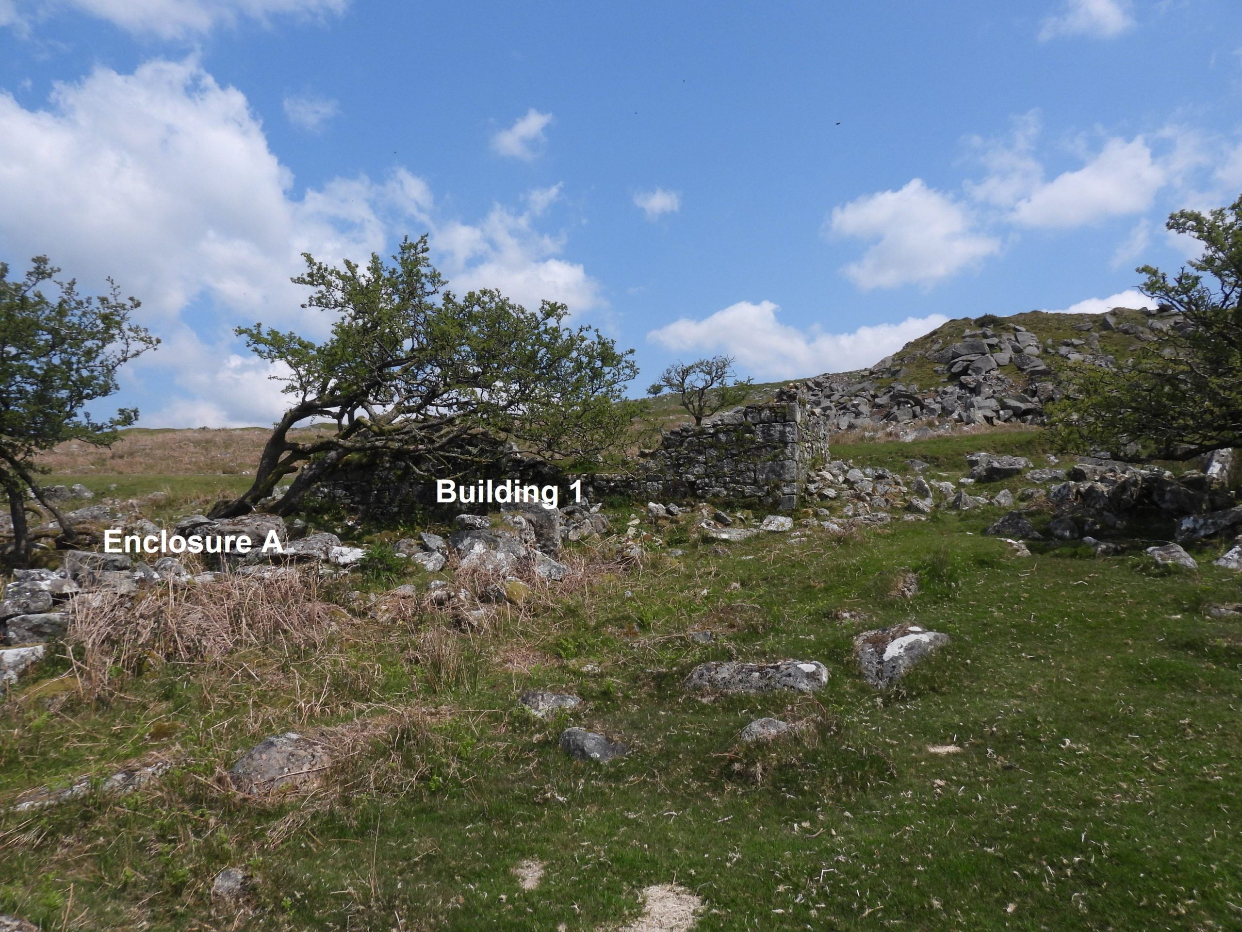
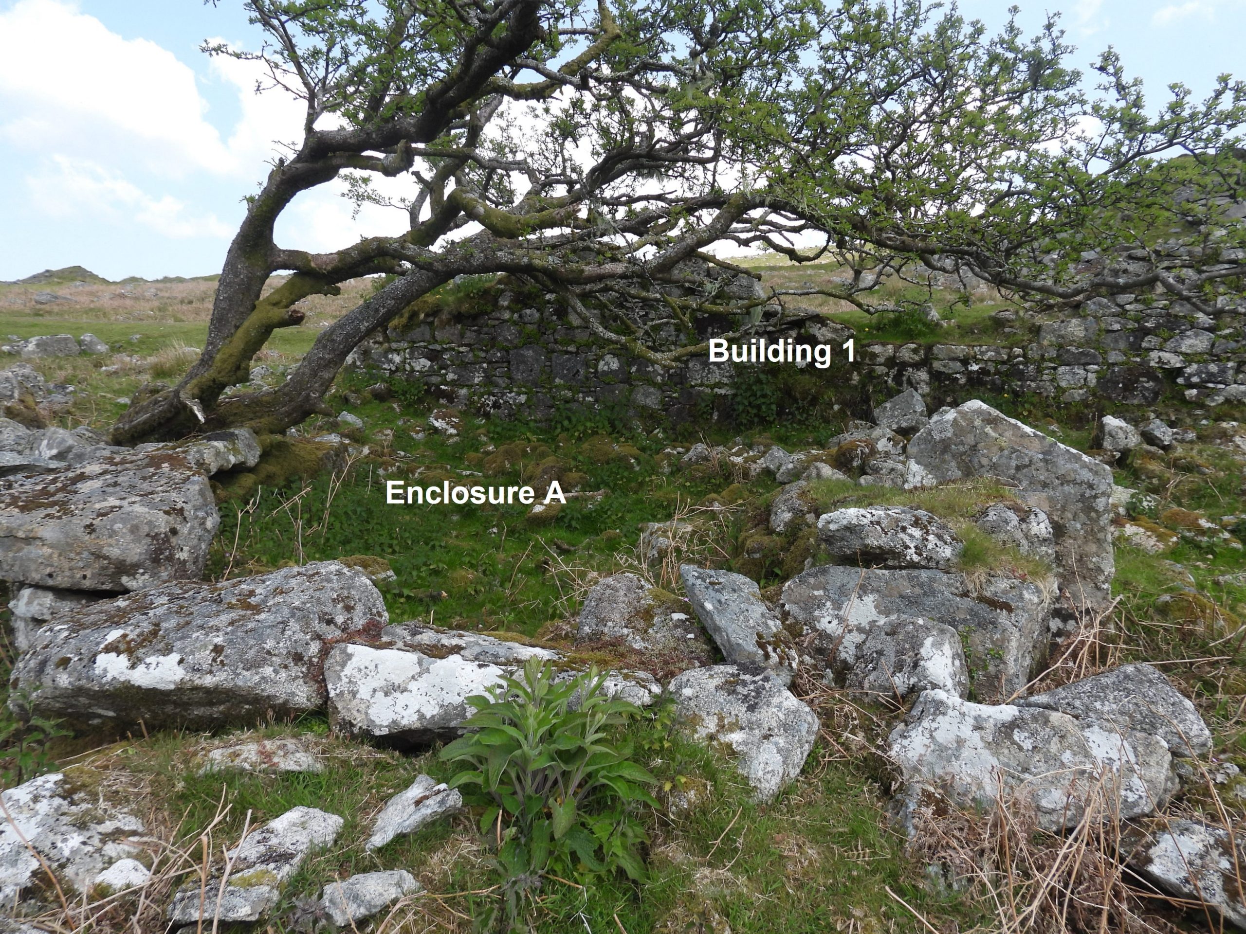
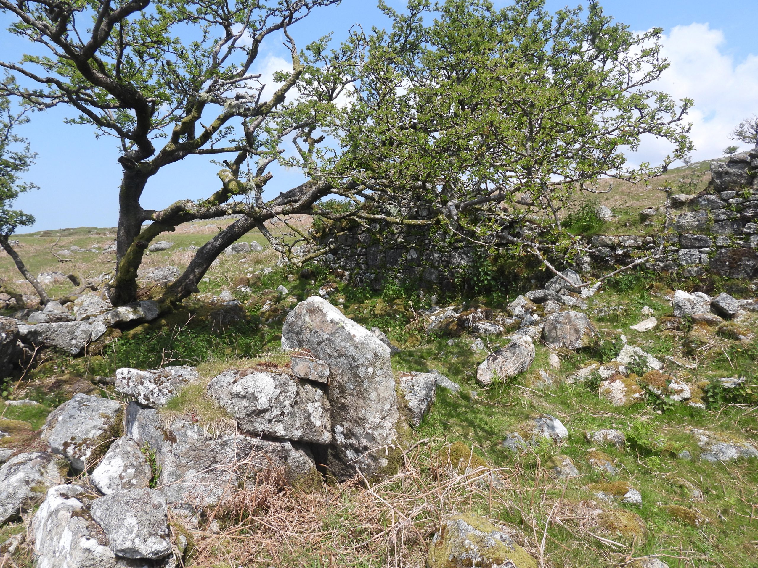
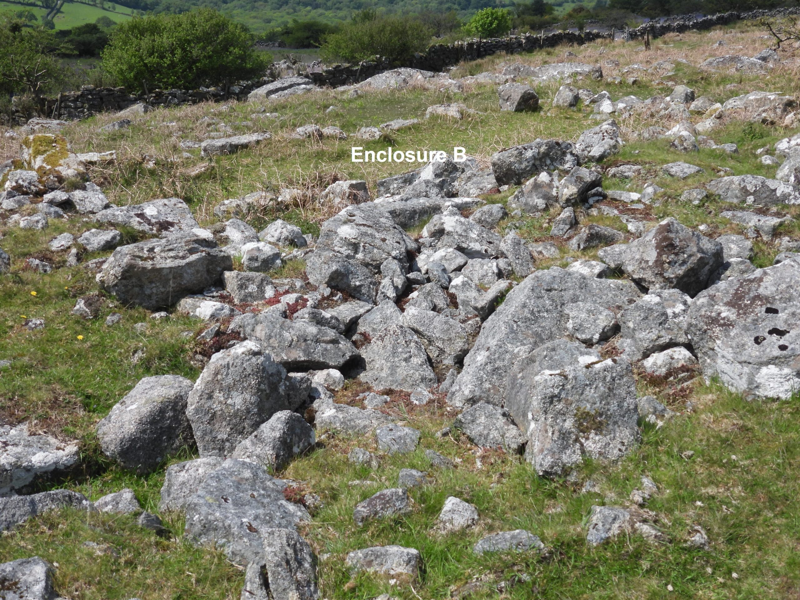
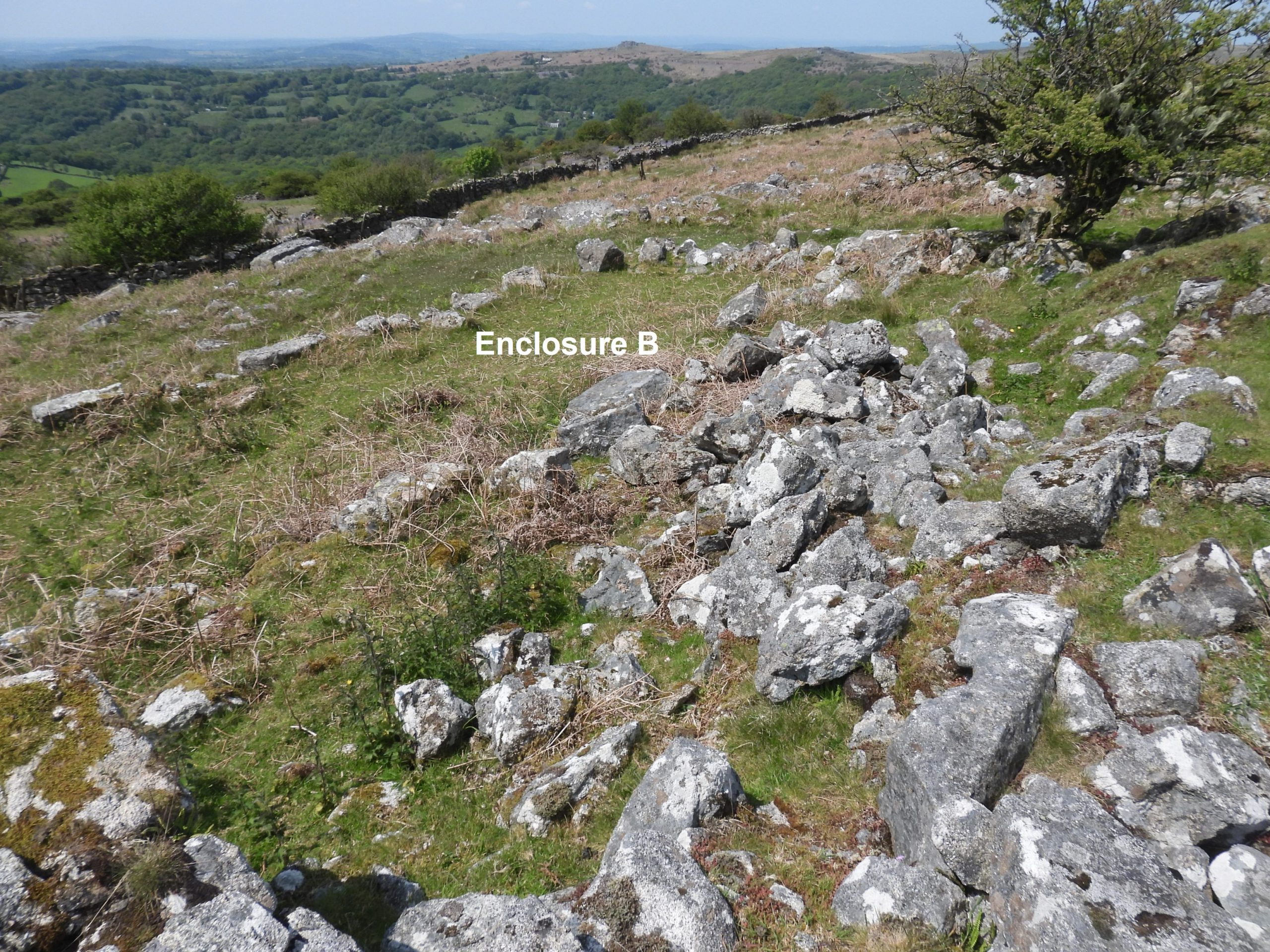
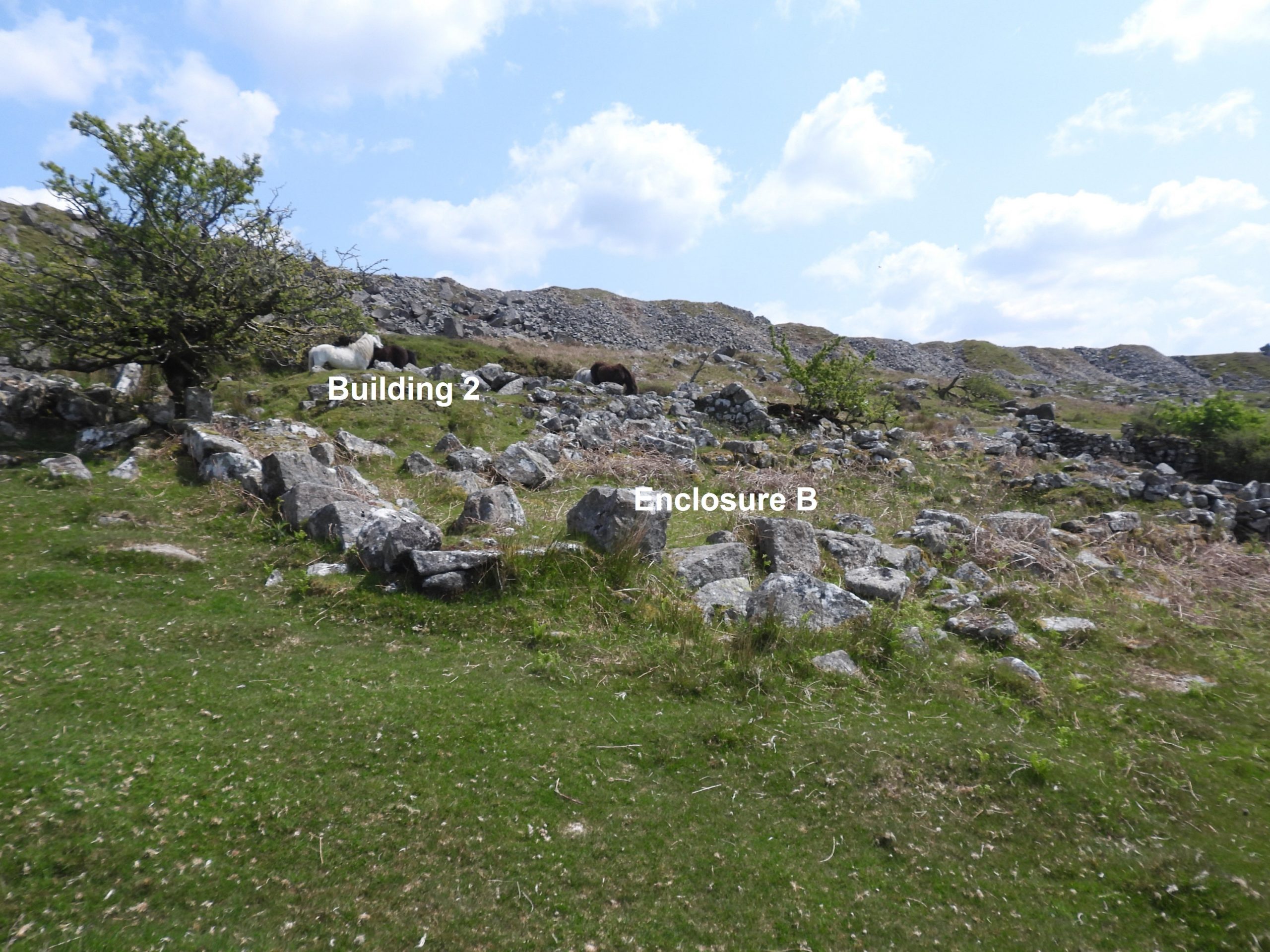
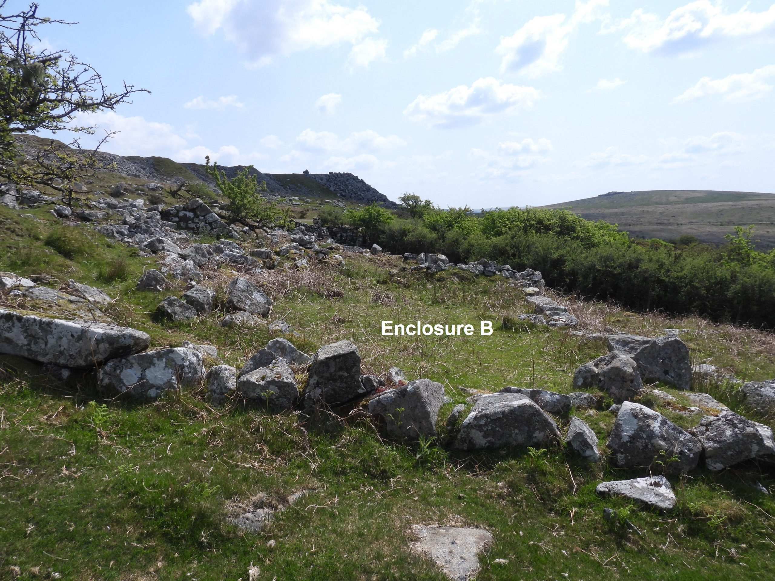
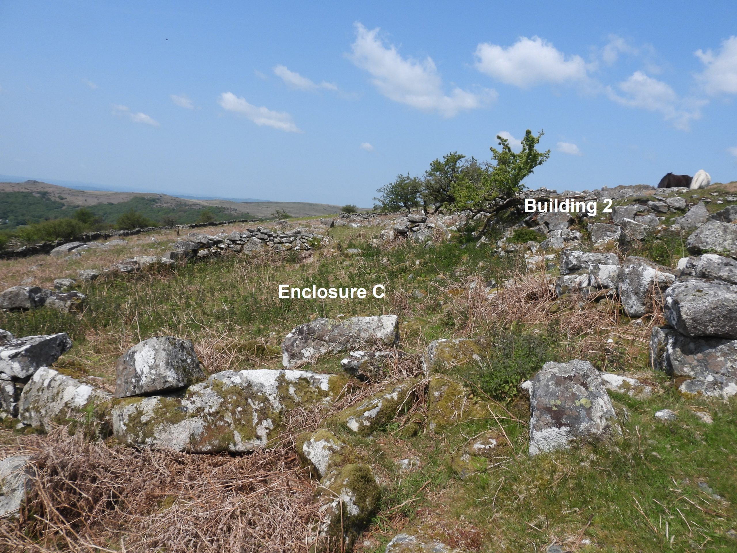
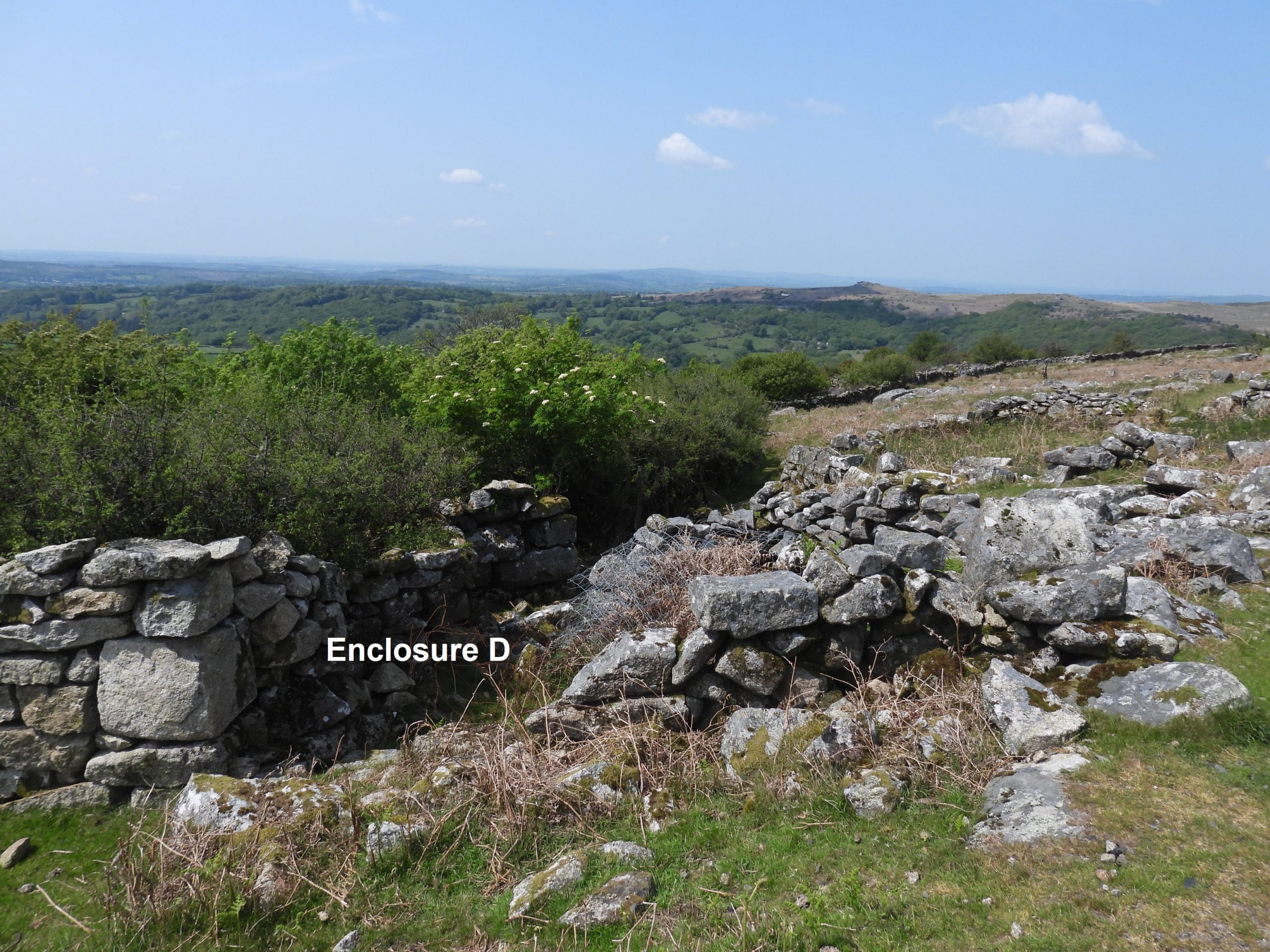
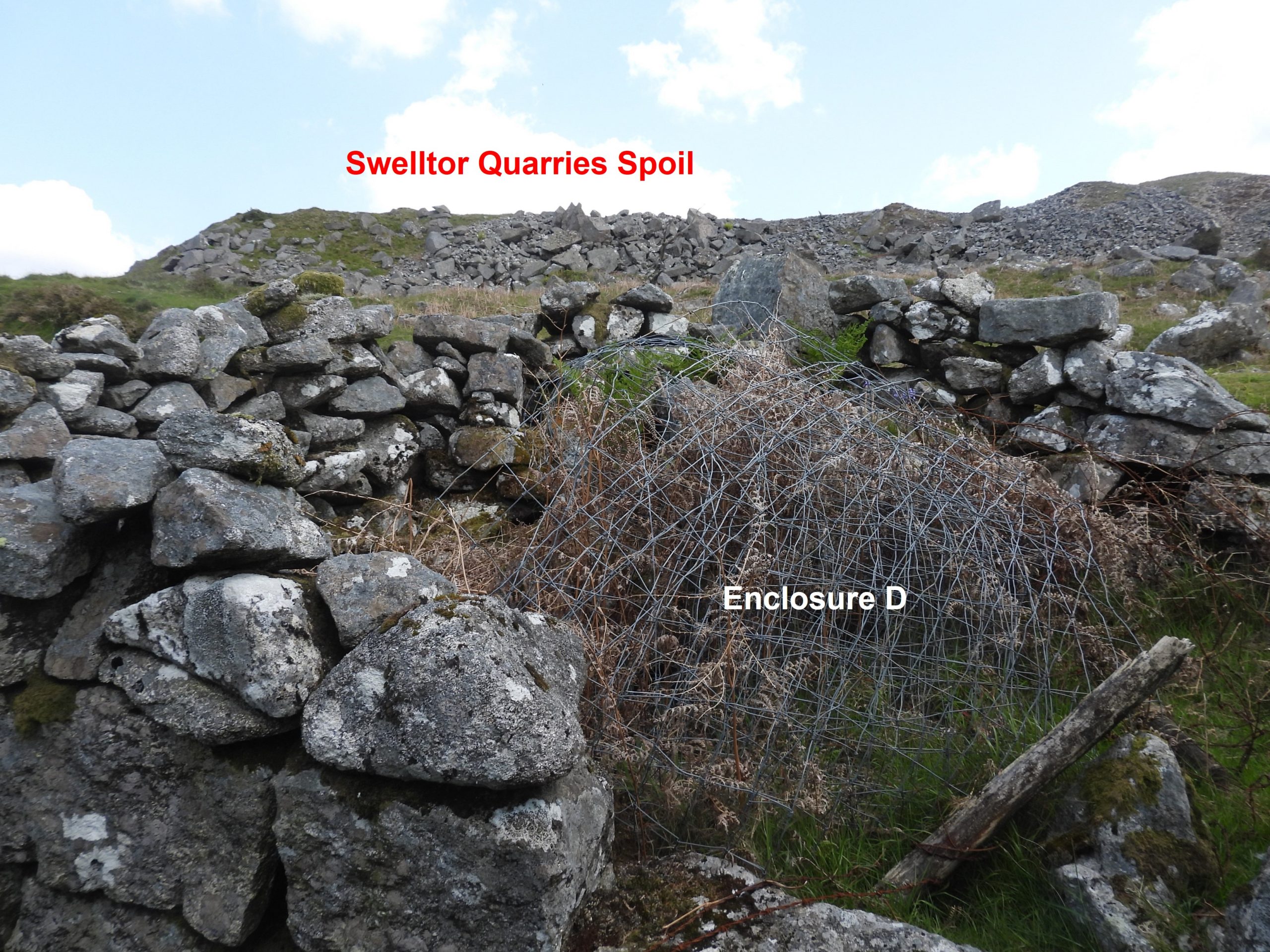
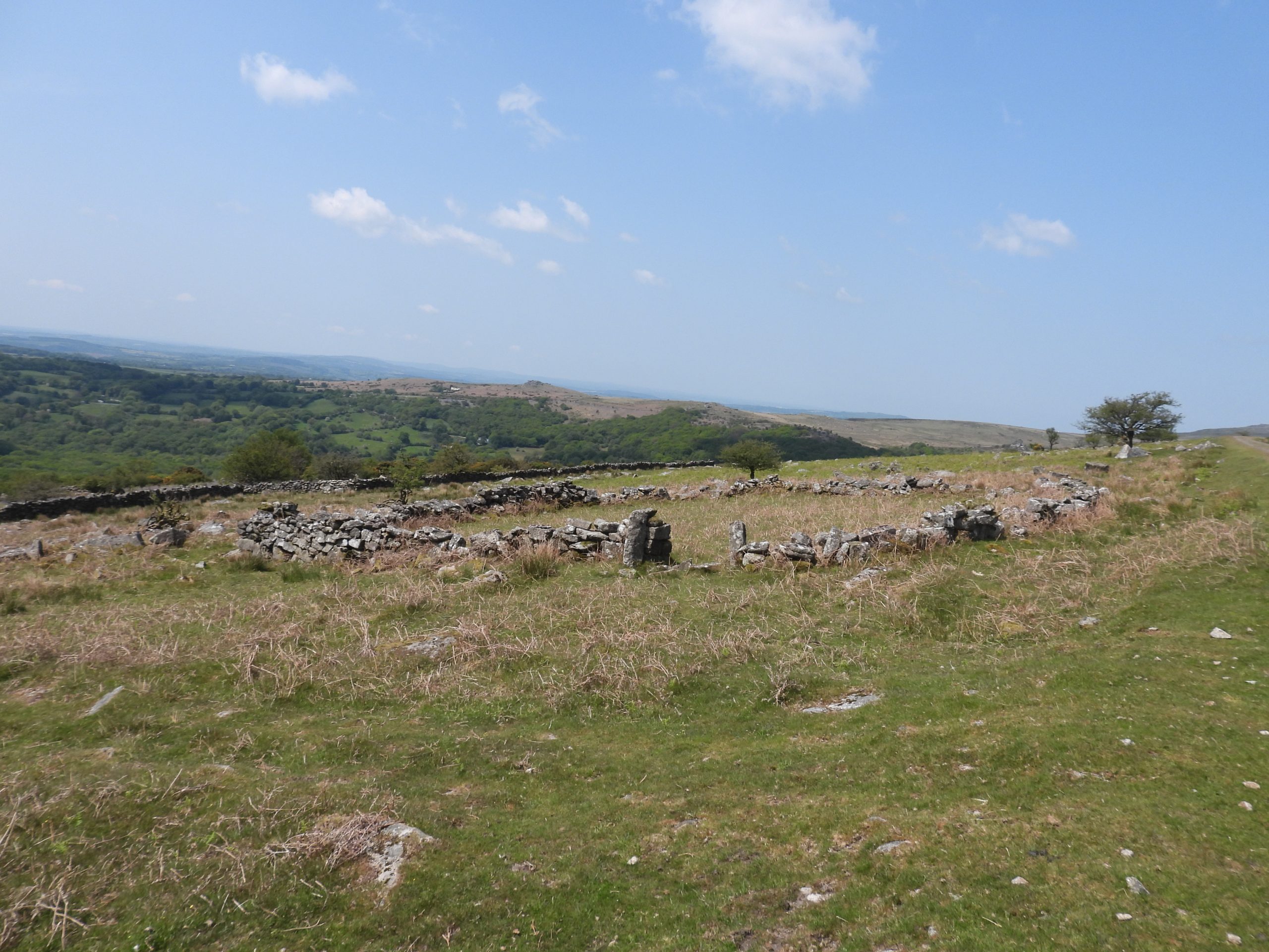
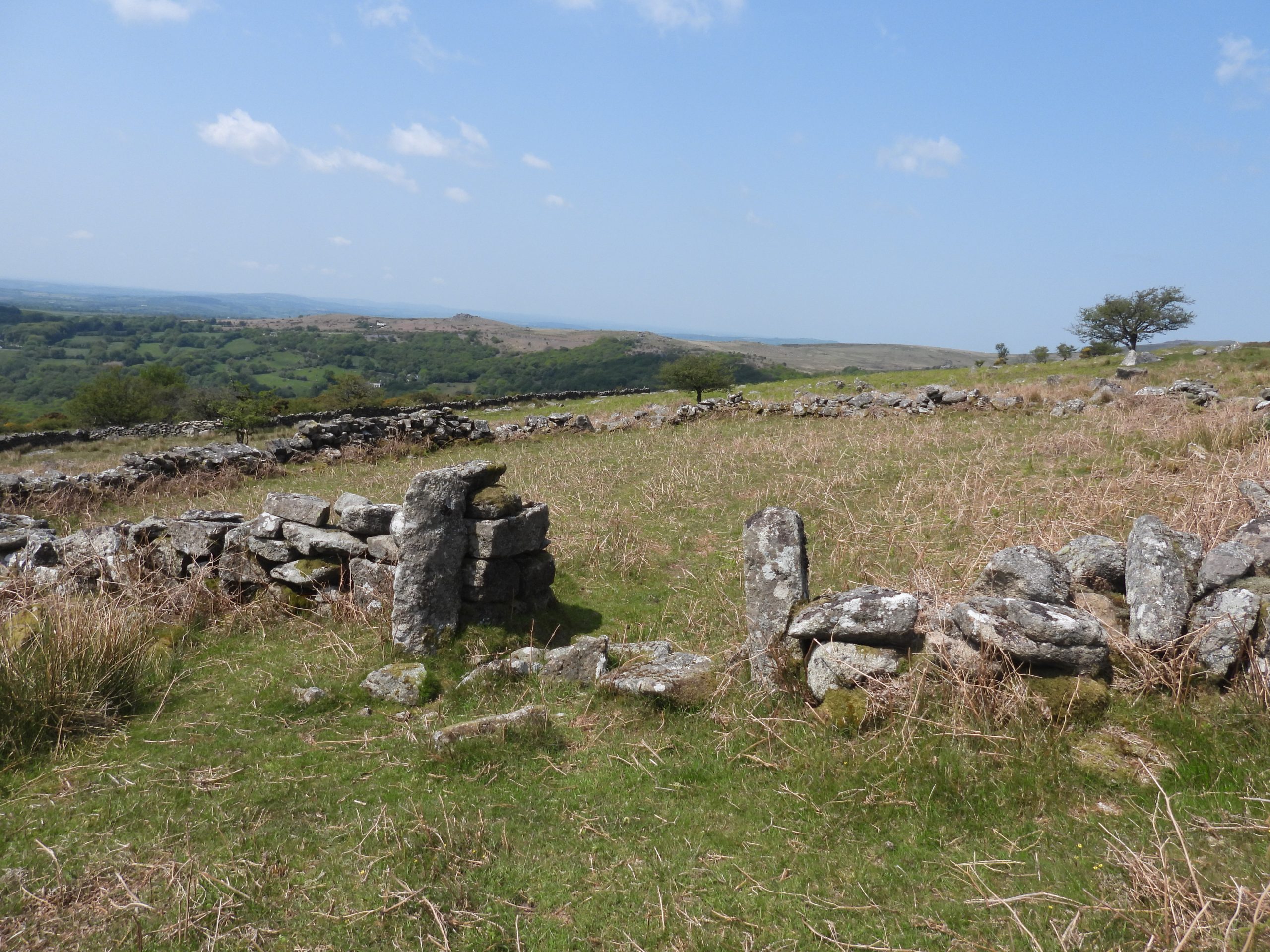
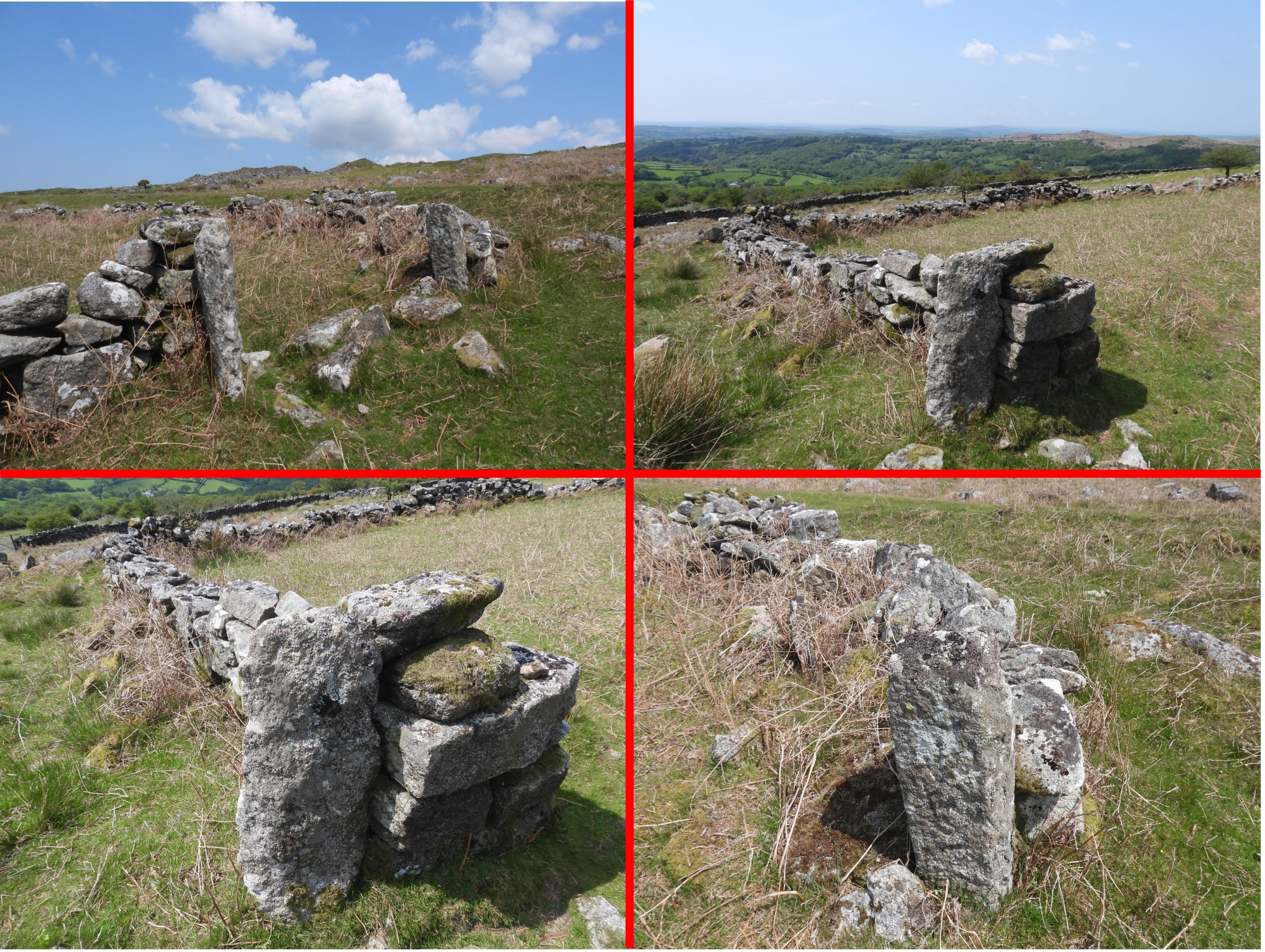
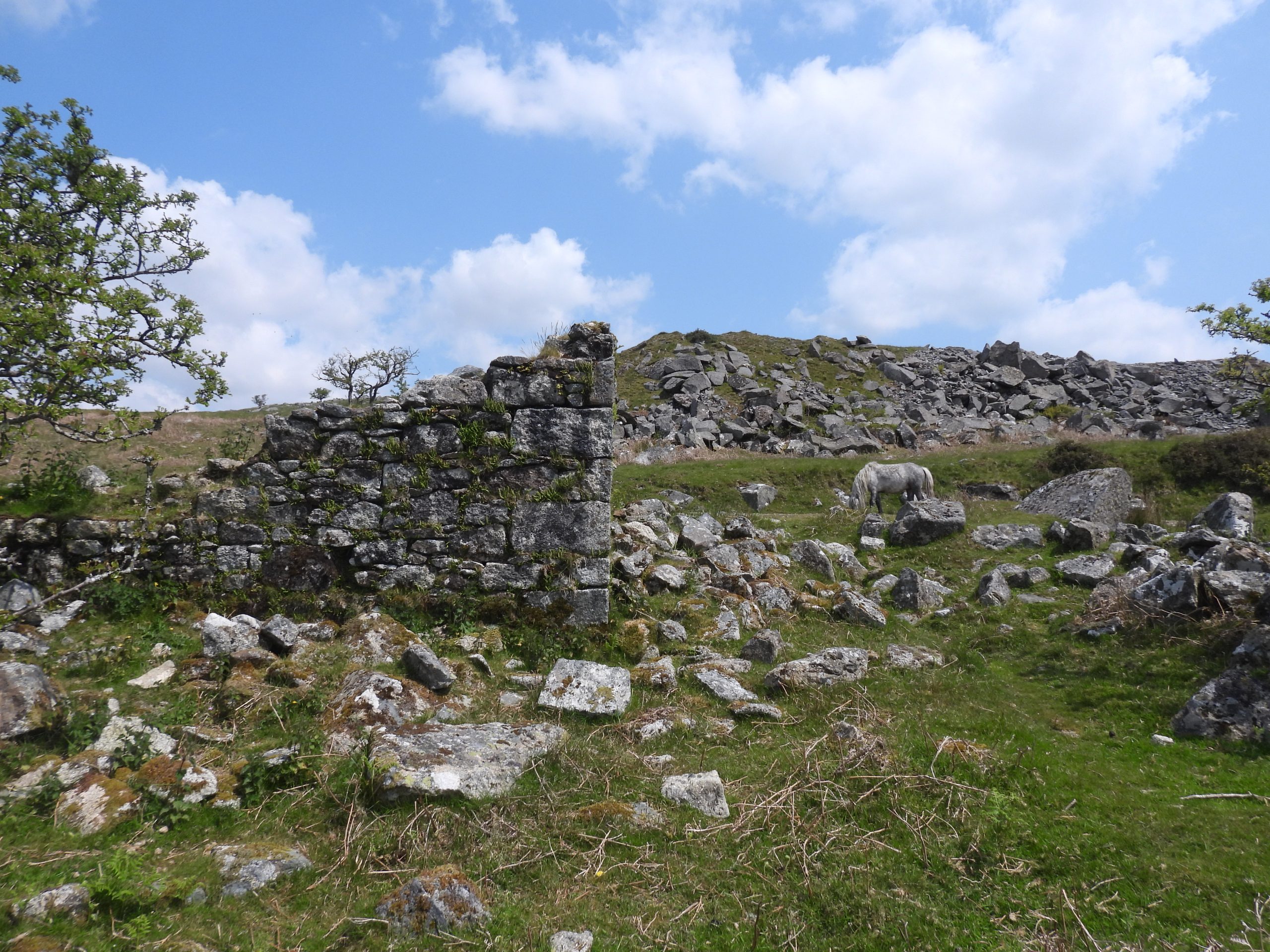
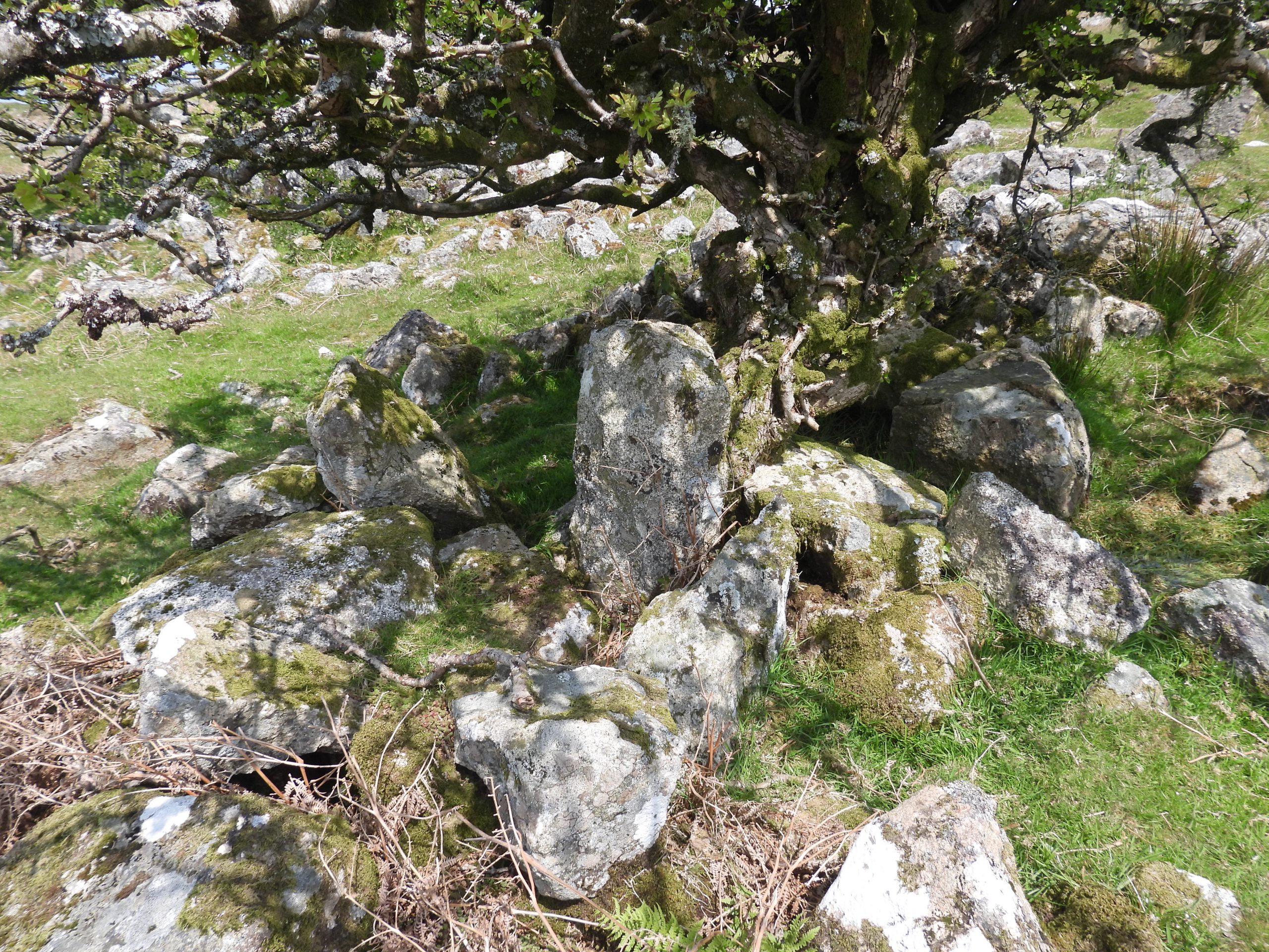
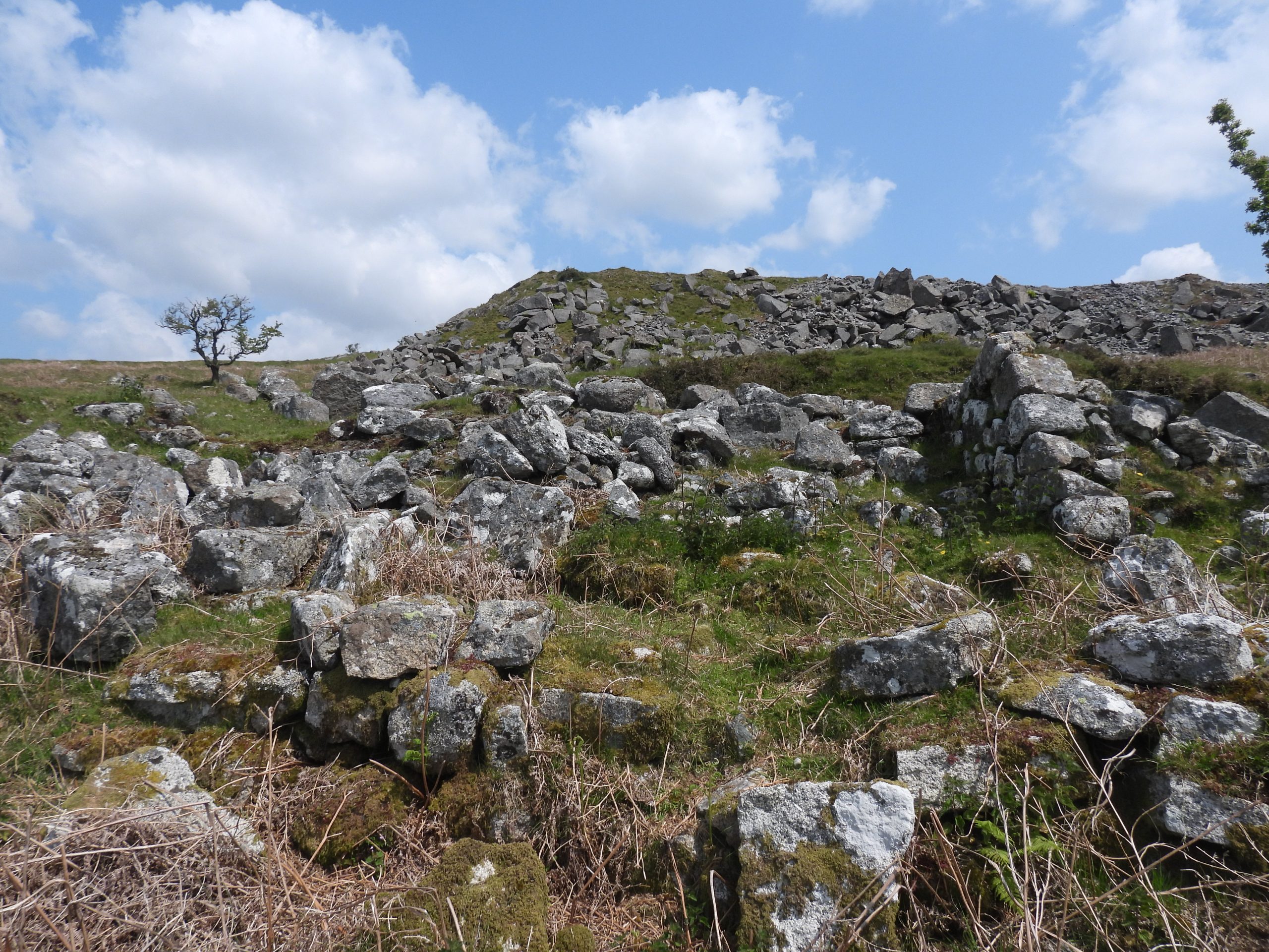
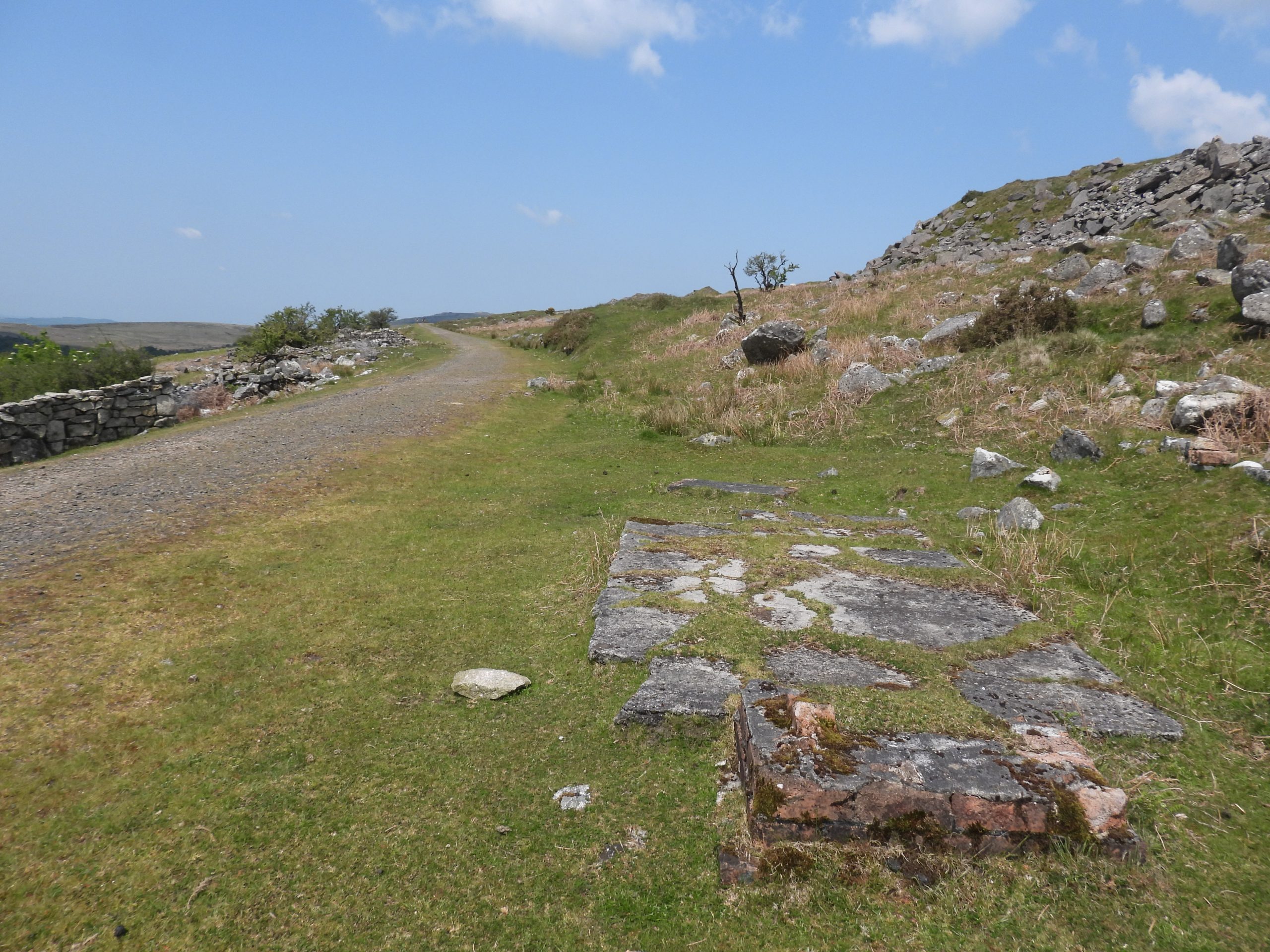
Map showing the location of ‘Whitethorn’ farmstead / cottages in relation to Swelltor Quarries. The annotated map dates from 1873The authors interpretation of the site. There appears to be 2 main buildings (labelled 1 &2), a possible w.c (labelled 3) and 4 enclosures (labelled A through D). The enclosure (labelled 715) is shown on the tithe map and therefore will have been constructed before ‘Whitethorn’.Approaching ‘Whitethorn’ from the south along the footpath from Criptor with late spring bluebells in the enclosures.Travelling north west along the old Princetown Railway Track, ‘Whitethorn’ is located on the left hand side just after the enclosure wall turns from 90 degrees having been parallel to the track for 100-200m or so.The most obvious ruin is labelled Building 1 on the sketch map. The walls are around 1m thick comprising of a double skin of blocks. The wall are between 1-2 m high (the back of the building is where the highest points of the walls are located) Building 1 is located at SX55697 73230Building 1 is appears to be the smaller of the two and the author conjectures that the Pascoe Family (2 adults and 5 children) lived here in 1851 (a copy of the census is shown later in this post). Building 1 looking south east. The Swelltor quarries spoil clearly visible in the top left of the picture.From the north east end of Building 1, enclosure (715) can be seen a few 10’s of metres awayThere are 2 entries in the 1851 census for Whitethorn (Walhampton Parish). This first entry shows the Pascoe family, Henry and Elizabeth who had 5 children under 10 years. Interestingly Henry (junior) and Maryann are both aged 4 – were they twins or was one of them just 4 and the other almost 5 ? Henry Pascoe one assumes, worked at Swelltor Quarries as he was a stone mason. The author believes they lived in building 1 on the basis this is the smaller of the two buildings and the second census entry will reveal more people (8 adults !)Building 2 appears to the larger of the two dwellings and is to the south east of Building 1. One wonders where the occupants of these buildings managed to get their water from. The nearest sources are Yes Tor Brook, Pila Brook and the Walkham, none of which are that close.Building 2 appears to have been extensively ‘robbed’ of stone but the foundations are still clearly visible. Building 2 is located at SX55710 73214The second entry in the 1851 census for Whitethorn (Walhampton Parish) shows 8 adults. James Perkin’s son (James Junior) appears on the 1851 census as being one of the tenants at Yestor Farm around 1 km south east down the track. James and Elizabeth had 4 grown up sons living with them (who were all stone masons). There were also two lodgers (a Richard Tucker who was an agricultural labourer and a James Toes who is curiously employed as a Labourer Clodhever). One assume the word ‘Clodhever’ means ‘Turf Cutter’ ? One assumes these people all lived in ‘Building 2’ as it appears to be the larger of the two main buildings. There is no entry in the 1871 census for ‘Whitethorn’.Below the two main buildings is a small circular construction at SX55687 73215. The author has labelled this a Building 3 on the sketch map. The structure is around 3m in diameter. This structure doesn’t appear to be an enclosure and may well be the W.C ?Building 3 walls are best preserved on the north west side.The 1861 census for Whitethorn (Walhampton Parish) shows 6 adults and 4 children across two entries. It would seem that James Perkins (Junior), who had resided at Yestor Farm ten years earlier (1851 census) had moved in with his family. James senior was 83 and now a widower, with Elizabeth no longer on the record. Given Elizabeth’s age (62) on the 1851 census, one assumes she died in her mid to late 60’s. There appears also to have potentially been another death in the family with James (Junior) Perkins son, another James not appearing on the 1861 census but having appeared on 1851 census (at Easter Green / Yestor Farm). This youngest James would have been around 16 in 1861. Of course, he may have moved away. Interestingly there is a visitor mentioned on the 1861 census plus a young married couple.Mutual grooming at ‘Whitethorn’.Three’s a crowdBack to two mutual groomingThe back of Building 1 showing a little more clearly now tall the remaining walls are. The south east corner is around 2m tall.Undoubtedly, the occupants of ‘Whitethorn’ were mainly employed as stone masons. That said, there are (at least) 4 enclosures to the south west of the two buildings. Enclosure A next to Building 1 looks like it might have been a small yard or possibly vegetable garden.Close up of Enclosure A. If vegetables were being grown here, the need for water would have been that must greater of course.Enclosure B is to the south west of Building 1. The enclosure is clearly shown on late 19th century maps.Enclosure B – possibly used to grow crops or possibly used to keep livestock.Another view of Enclosure B in relation to Building 2Enclosure B looking south eastBeyond Enclosure B and below Building 2 is Enclosure C. The walls here are slightly taller, possibly suggesting the keeping of livestock ?Enclosure D seems to have been created alongside the original Criptor enclosure walls. It looks like it could have been used as an animal poundEnclosure D with abandoned fencing. It is located at SX55727 73197To the north west of ‘Whitethorn’ lies Enclosure (labelled 715 on the tithe map). This was extant before the farmstead / cottages were built.Did the occupants of ‘Whitethorn’ ever use this enclosure? Perhaps the ‘Agricultural Labourers’, from ‘Whitethorn’ either directly or indirectly used this. The gateposts and the height of walls here suggest it was probably a livestock field.Gateposts to Enclosure (715) are located at SX55656 73257Returning to the back of Building 1. There are 7 courses of blocks still in place on the south east corner.Standing stone (gatepost) next to Enclosure ABack of Building 2. A large section of angled walling which is still intact can be seen to the right of this picture. Could this have been a storage area below Building 2 ?A few 10’s of metres down the track from ‘Whitethorn’ there are the foundations of a small building which is almost certainly relate to the building and maintenance of Princetown Railway Line (circa 1880). It is most likely a Platelayer’s Hut*. The foundations are located at SX55748 73185. *A platelayer (or fettler / trackman) is /was a railway employee who inspects and maintains the ‘permanent way’ of a railway,
Claude Williams June 27, 2024
Very informative. Great maps and photos.
SteveGriggDartmoor June 29, 2024 — Post author
Thank you