A collection of walks, discoveries, insights and pictures of exploring Dartmoor National Park
June 3, 2023
Plym Consols Tin Mine
Plym Consols was a 19th century tin mine which is located on the north side of Newleycombe Lake adjacent to a very large old tin openwork. Newleycombe farm ruins lies to the north east. The mine appears largely undocumented and there is no known record of production.
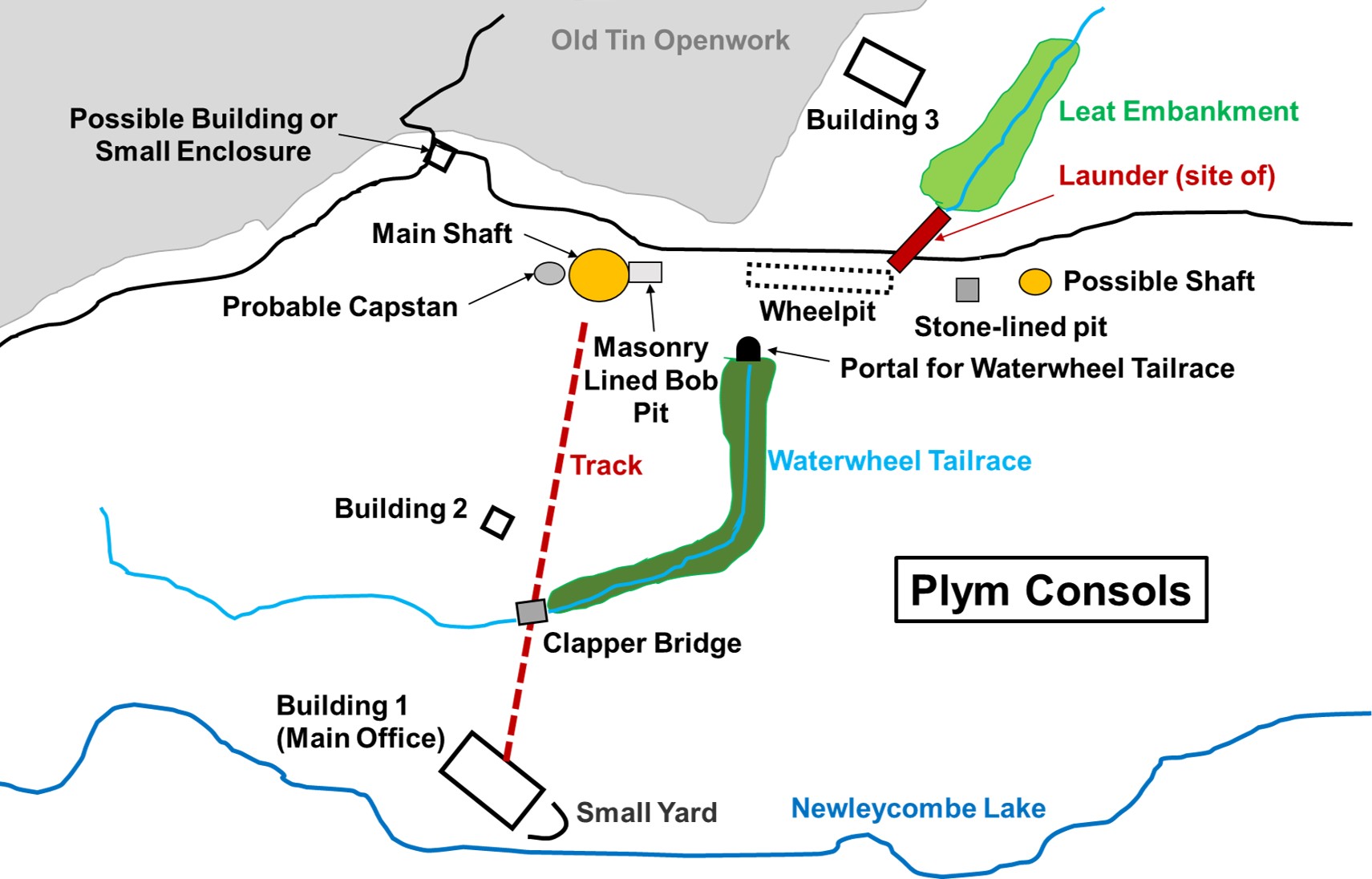
Modern OS maps only label ‘Tinner’s Huts’ huts in the immediate area, which in all likelihood were part of the mine complex. There are numerous artefacts which remain at the mine, some of which are being encroached by gorse. The remains comprise a main shaft (with a possible 2nd), a wheel pit, a bob pit, a capstan pit, a leat embankment, a stone lined pit, a tailrace portal, a clapper, three buildings (with a possible 4th or small enclosure). The remains are about one hour’s stroll from Norsworthy Bridge and are worth exploring for those interested in industrial archaeology.
Bibliography
Phil Newman, 2007, Cramber Tor Training Area Monument Baseline Condition Survey.
R.G Haynes, 1966-1969, Ruined Sites on Dartmoor, 138
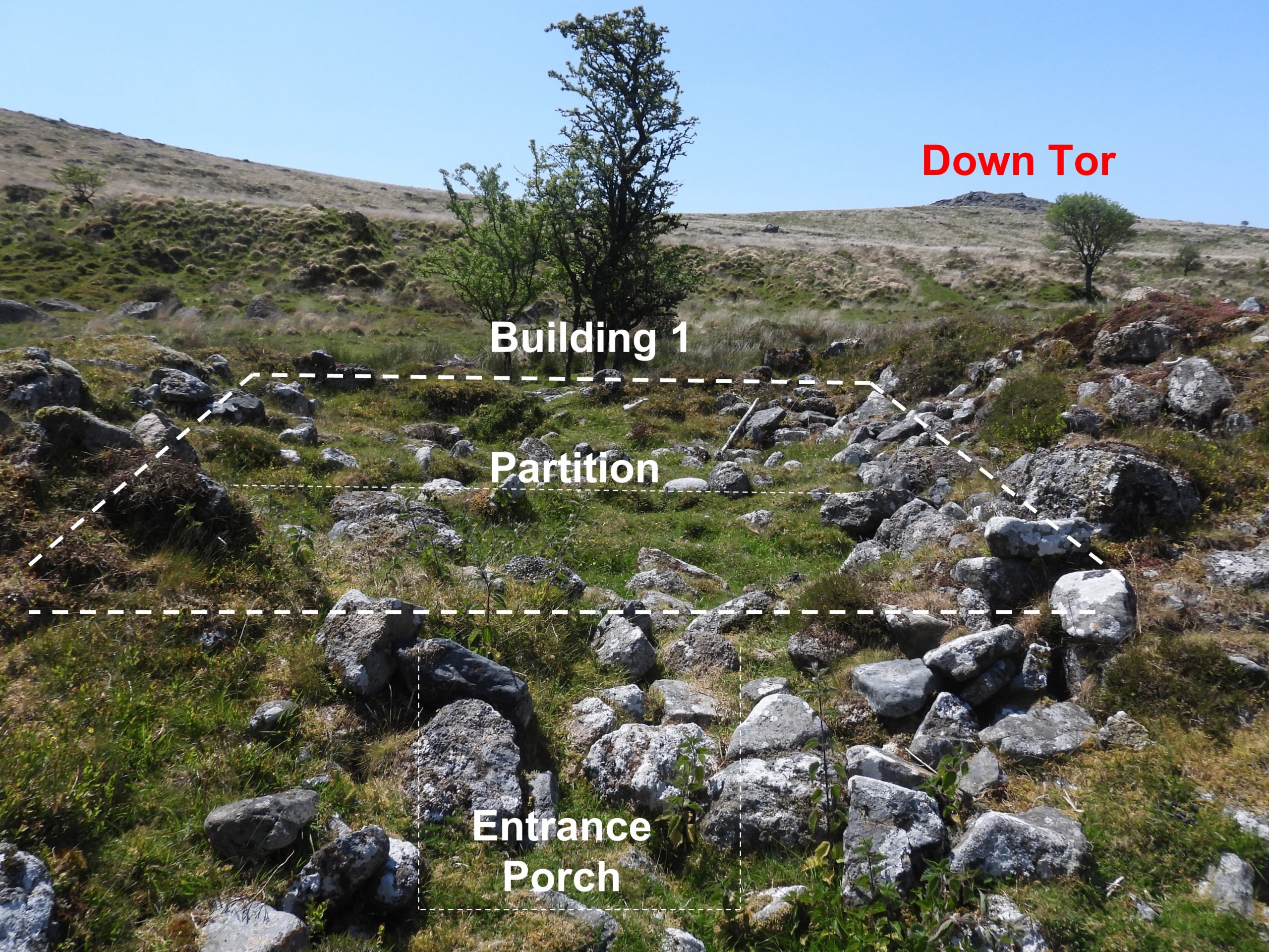
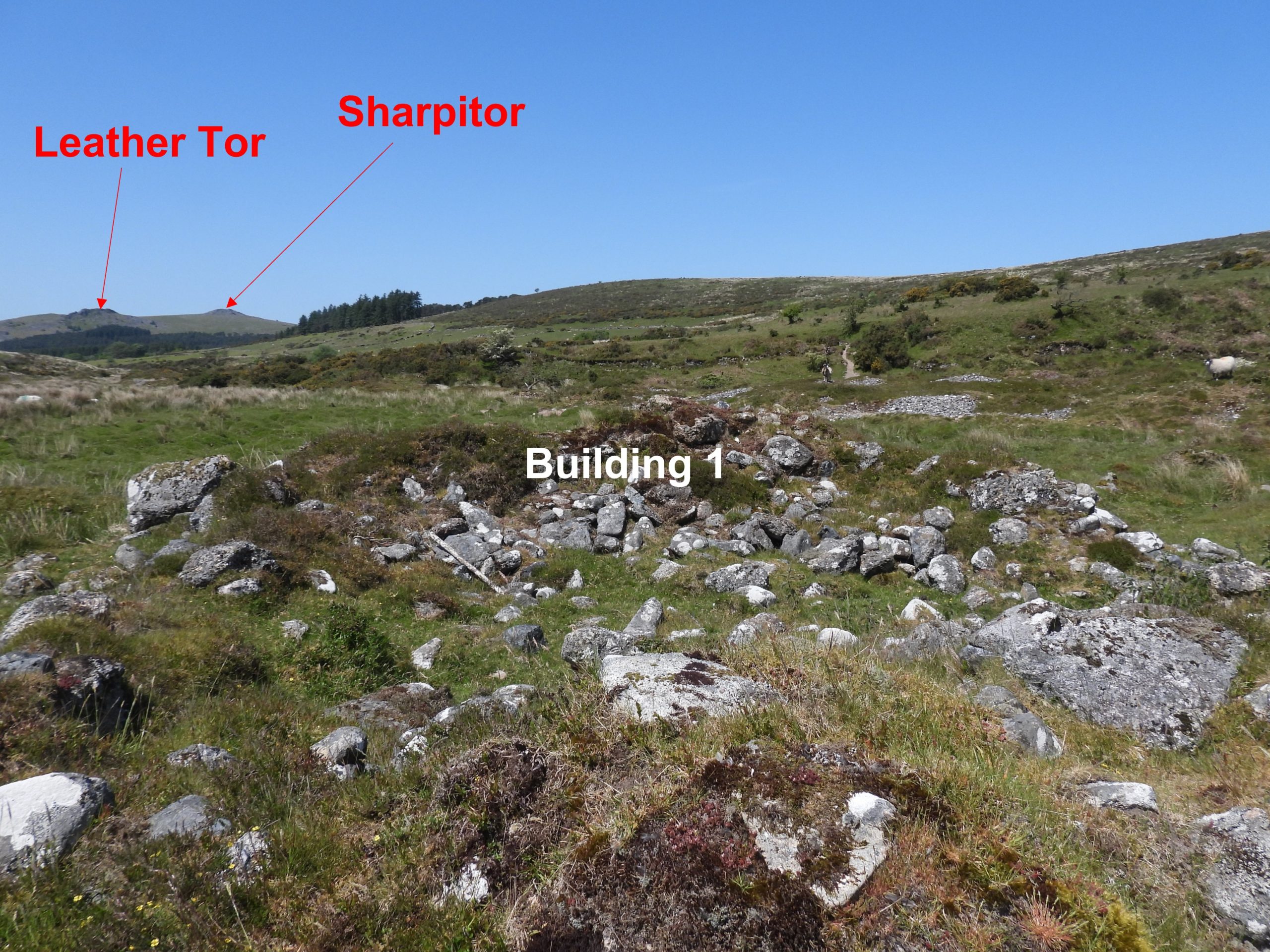
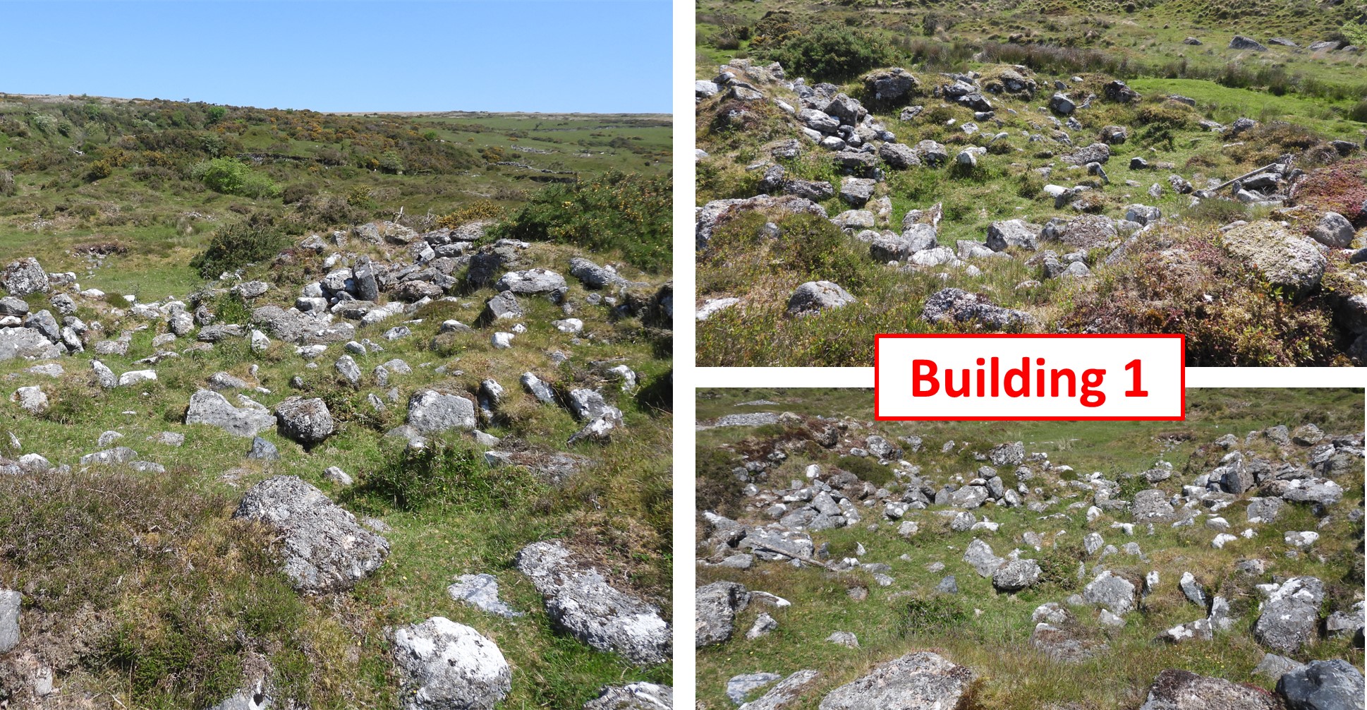
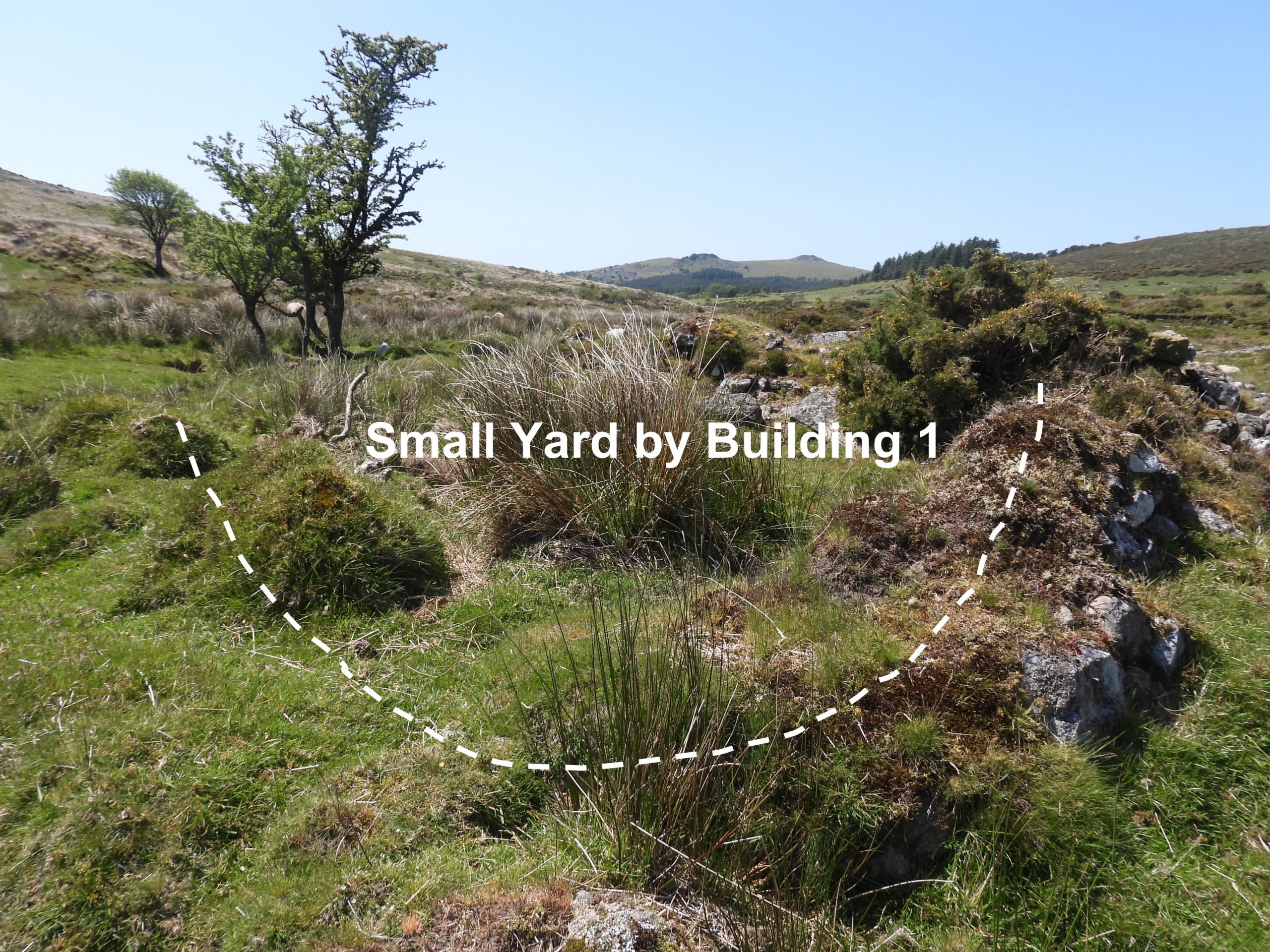
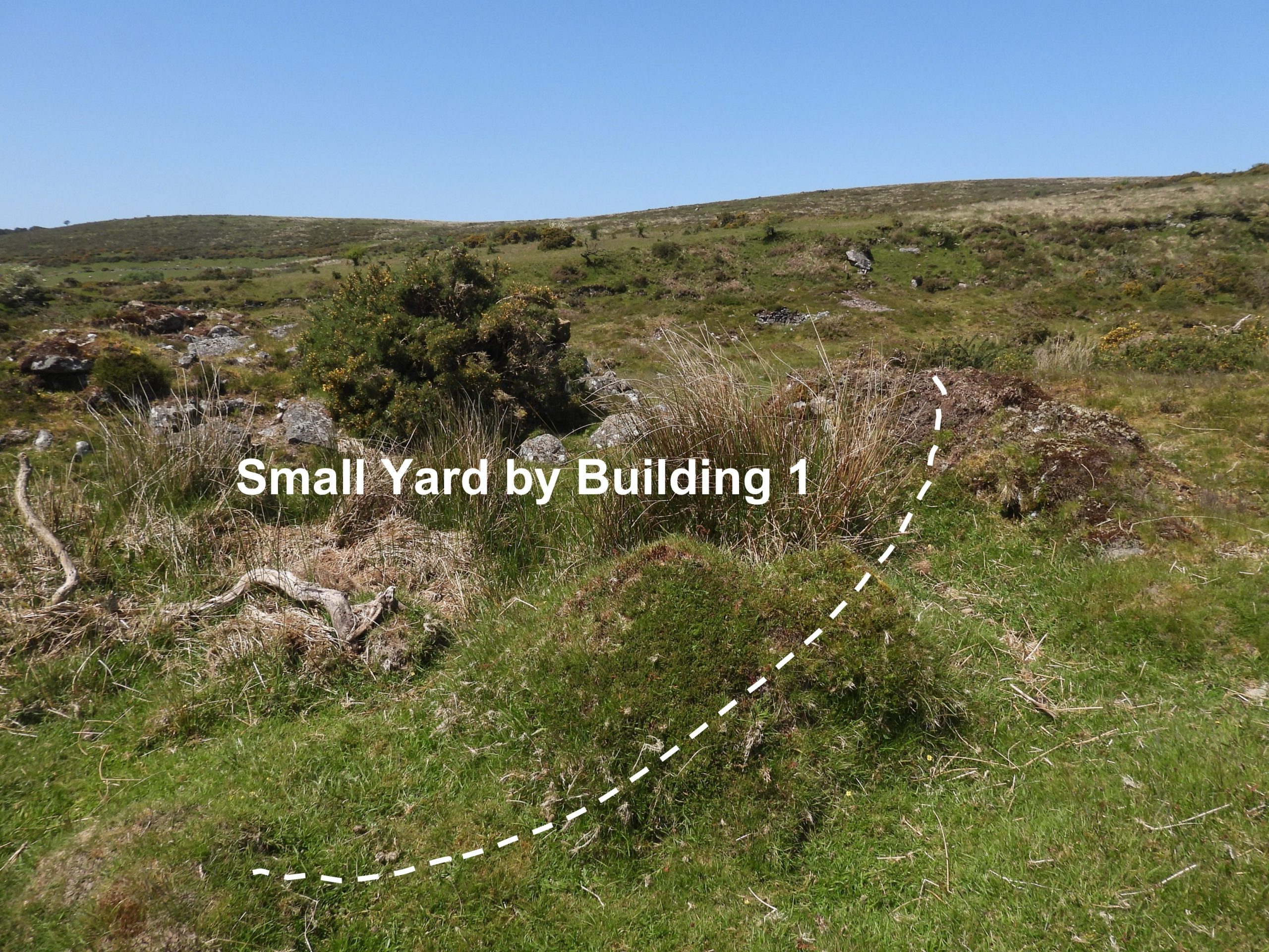
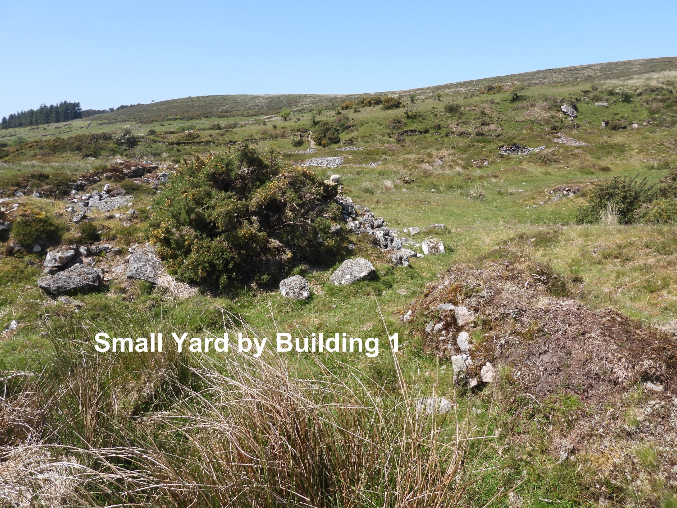
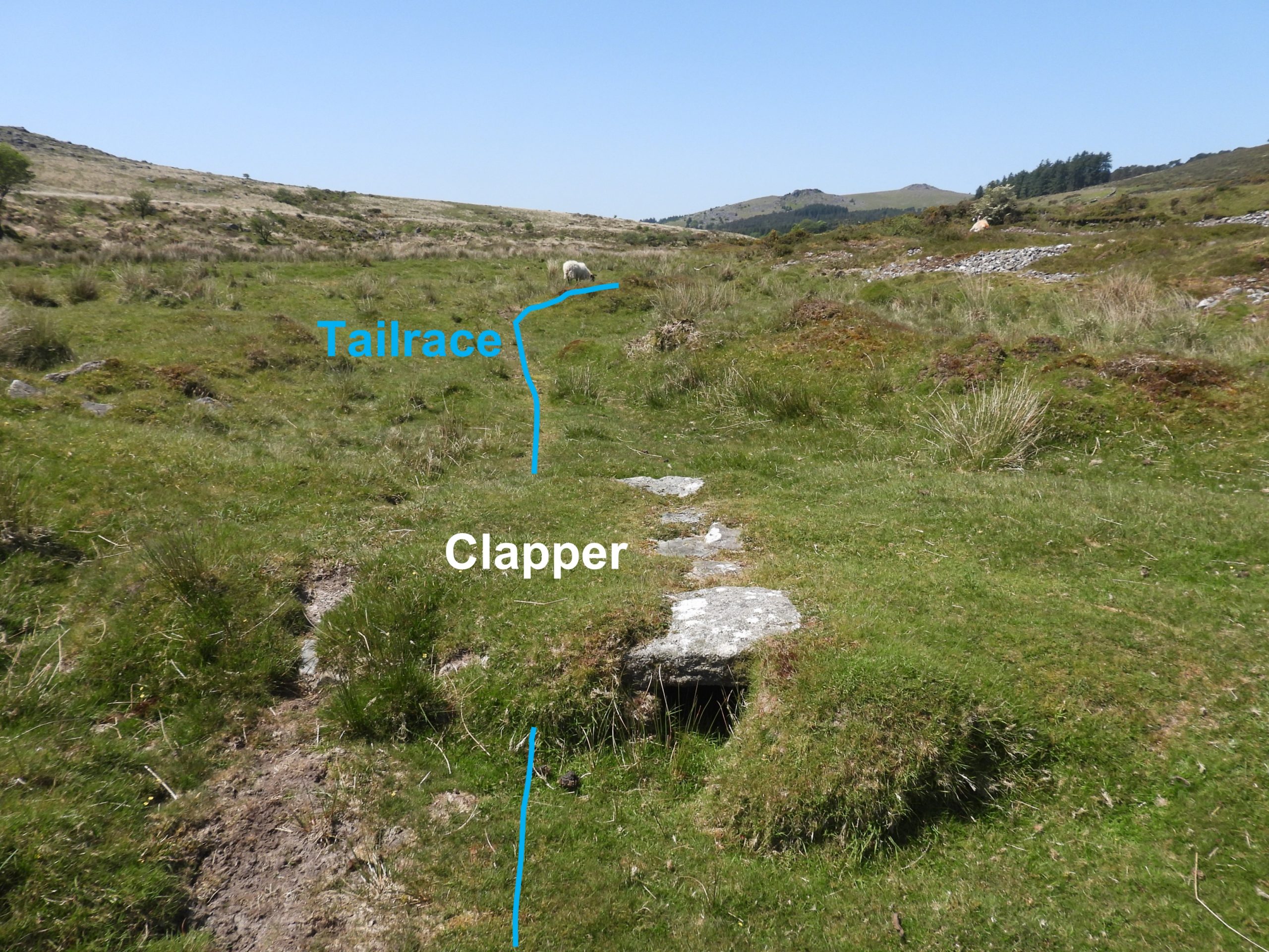
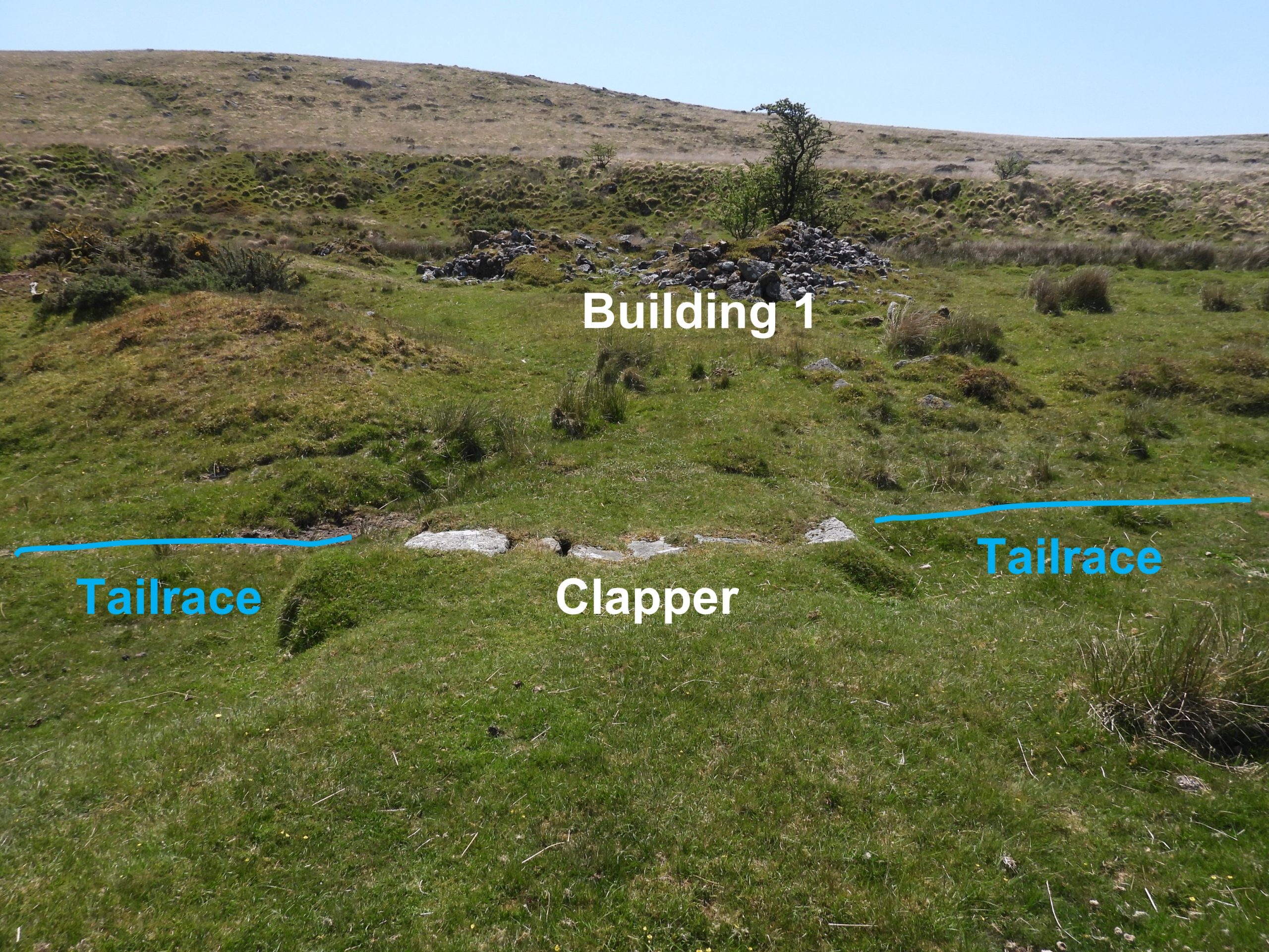
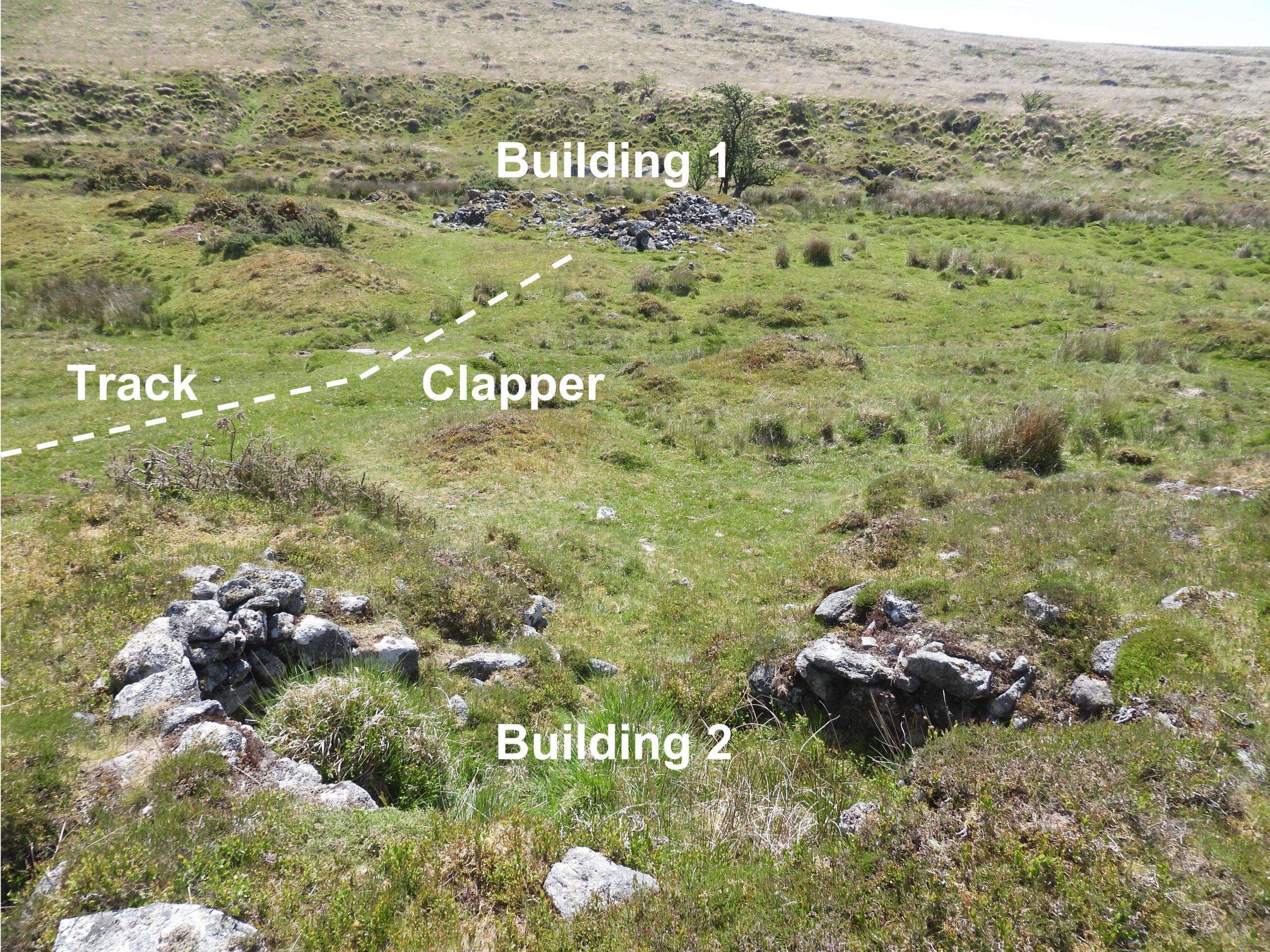
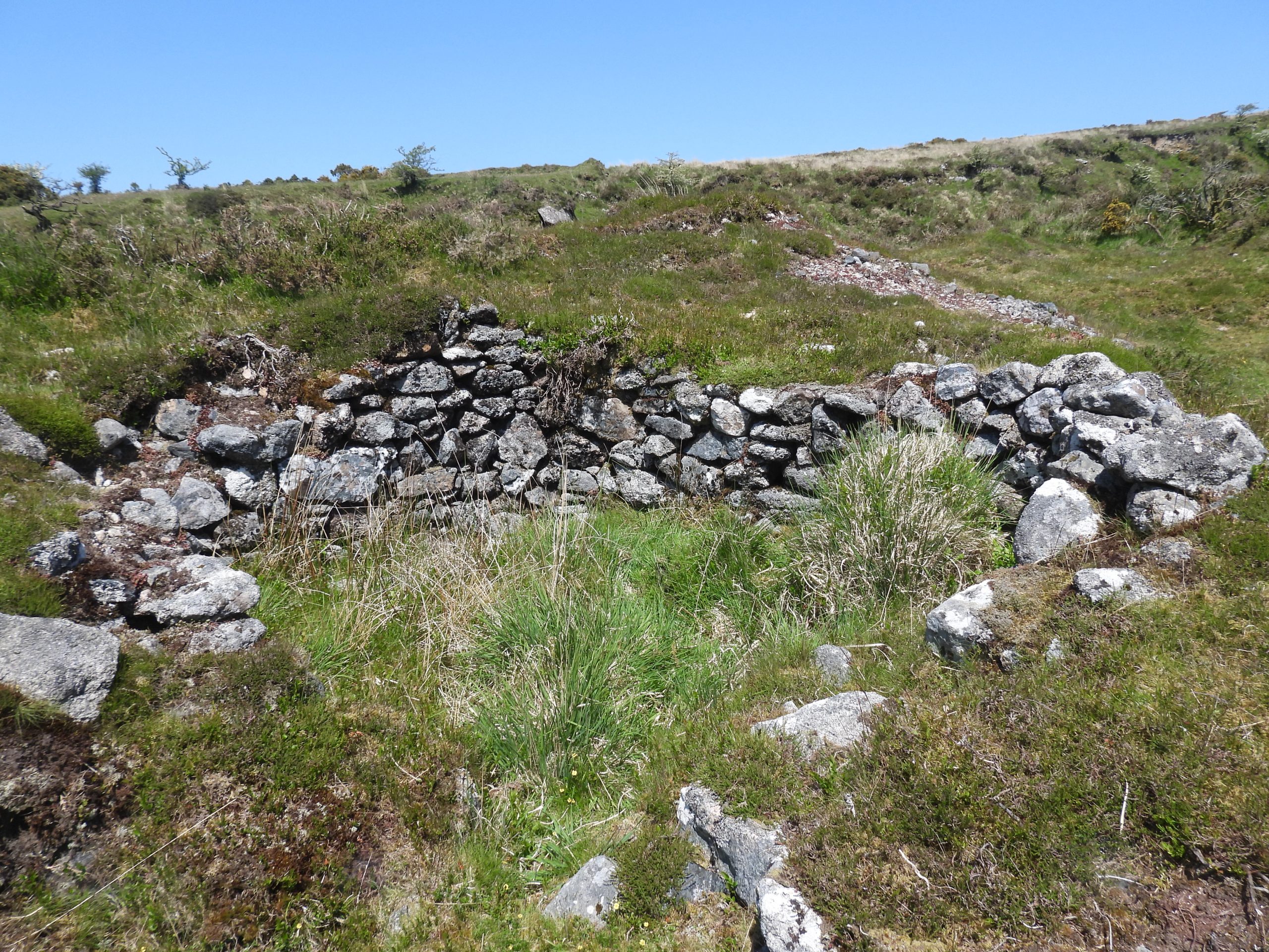
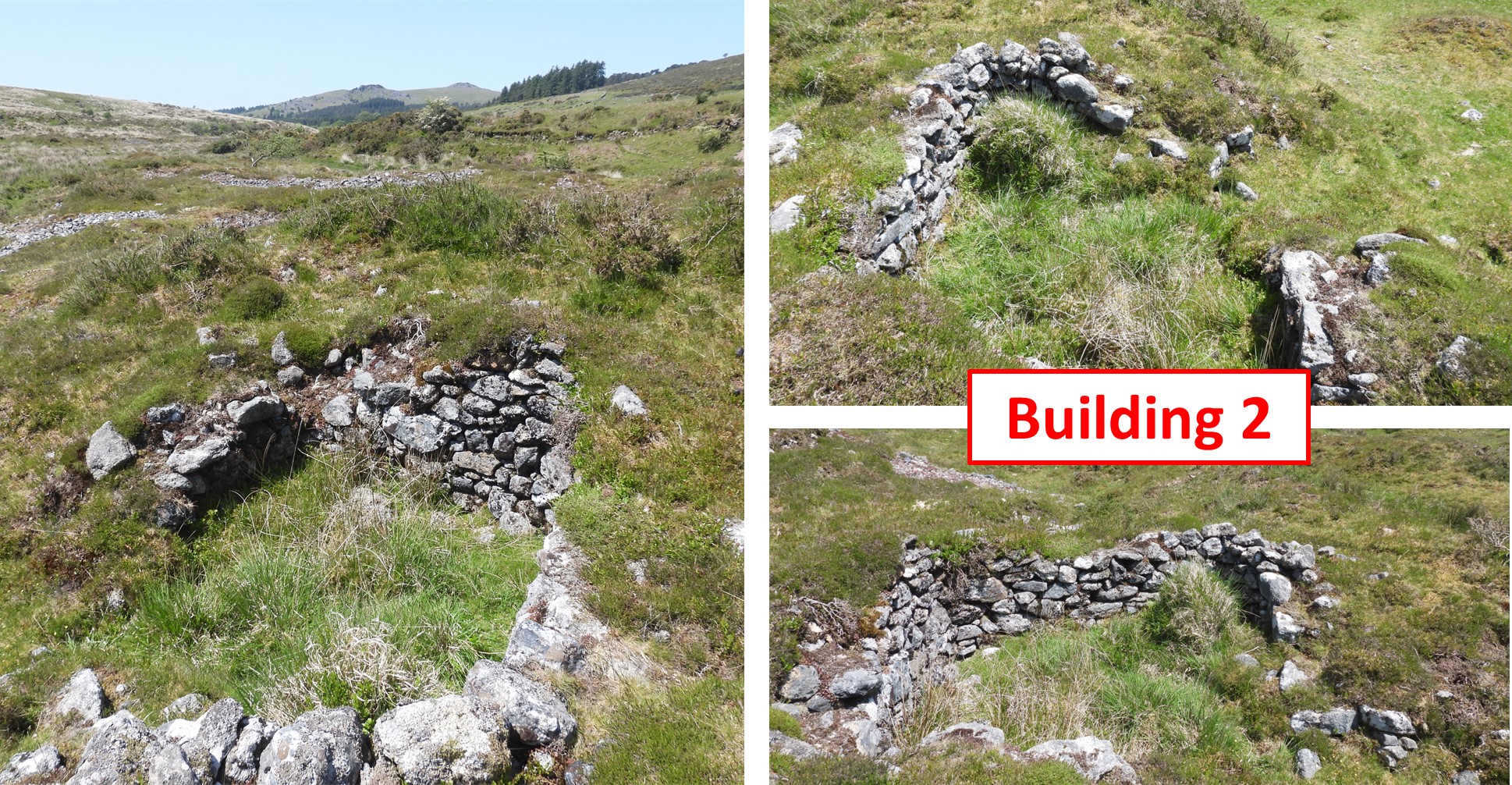
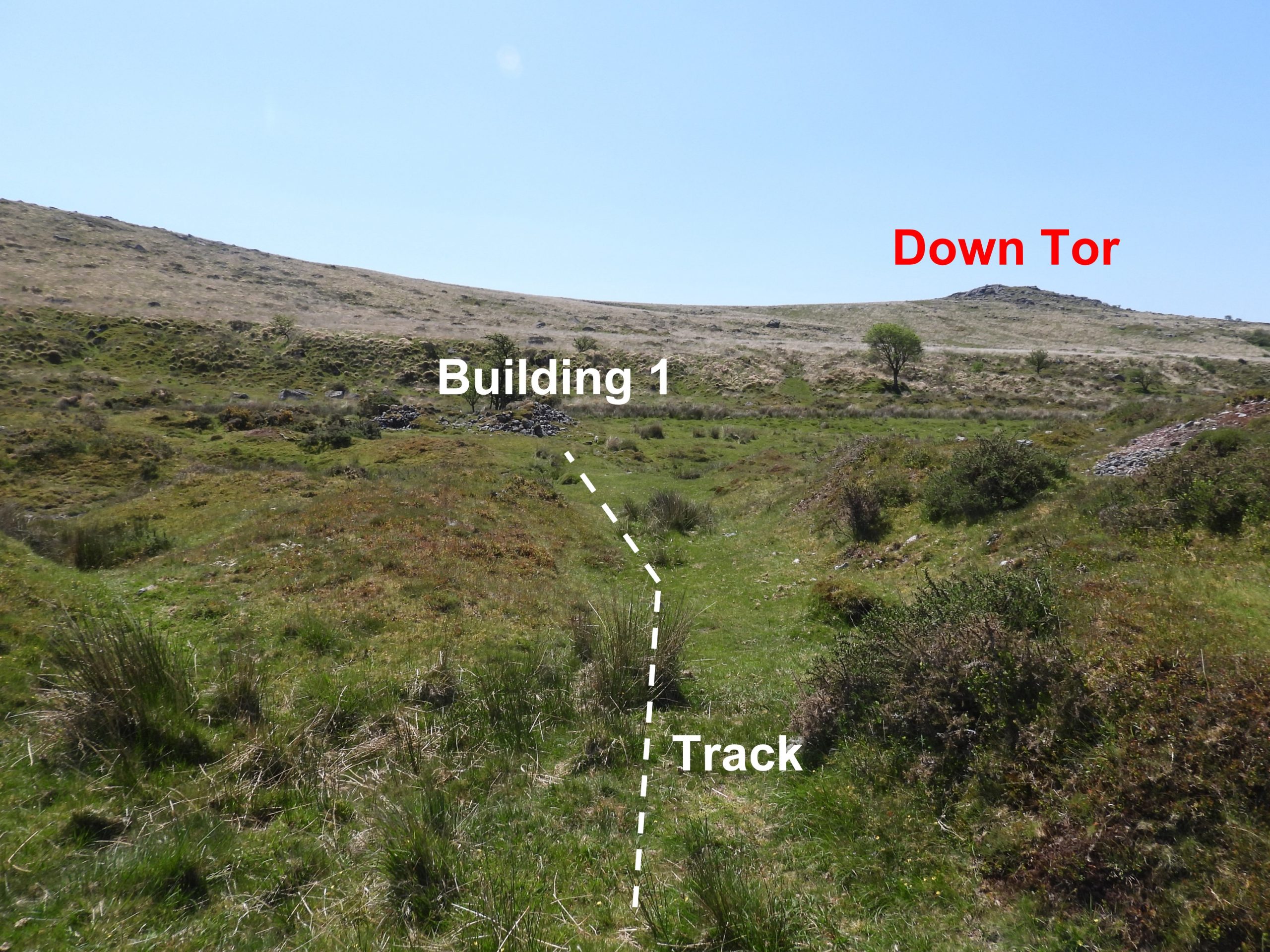
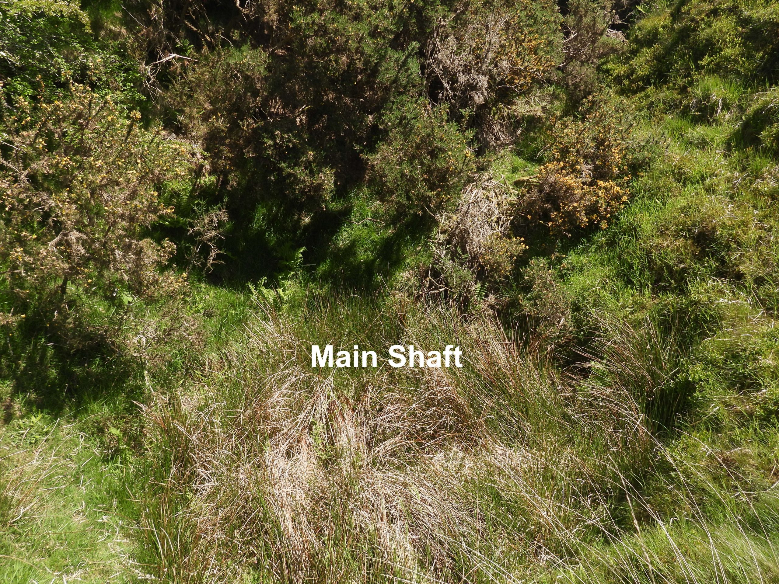
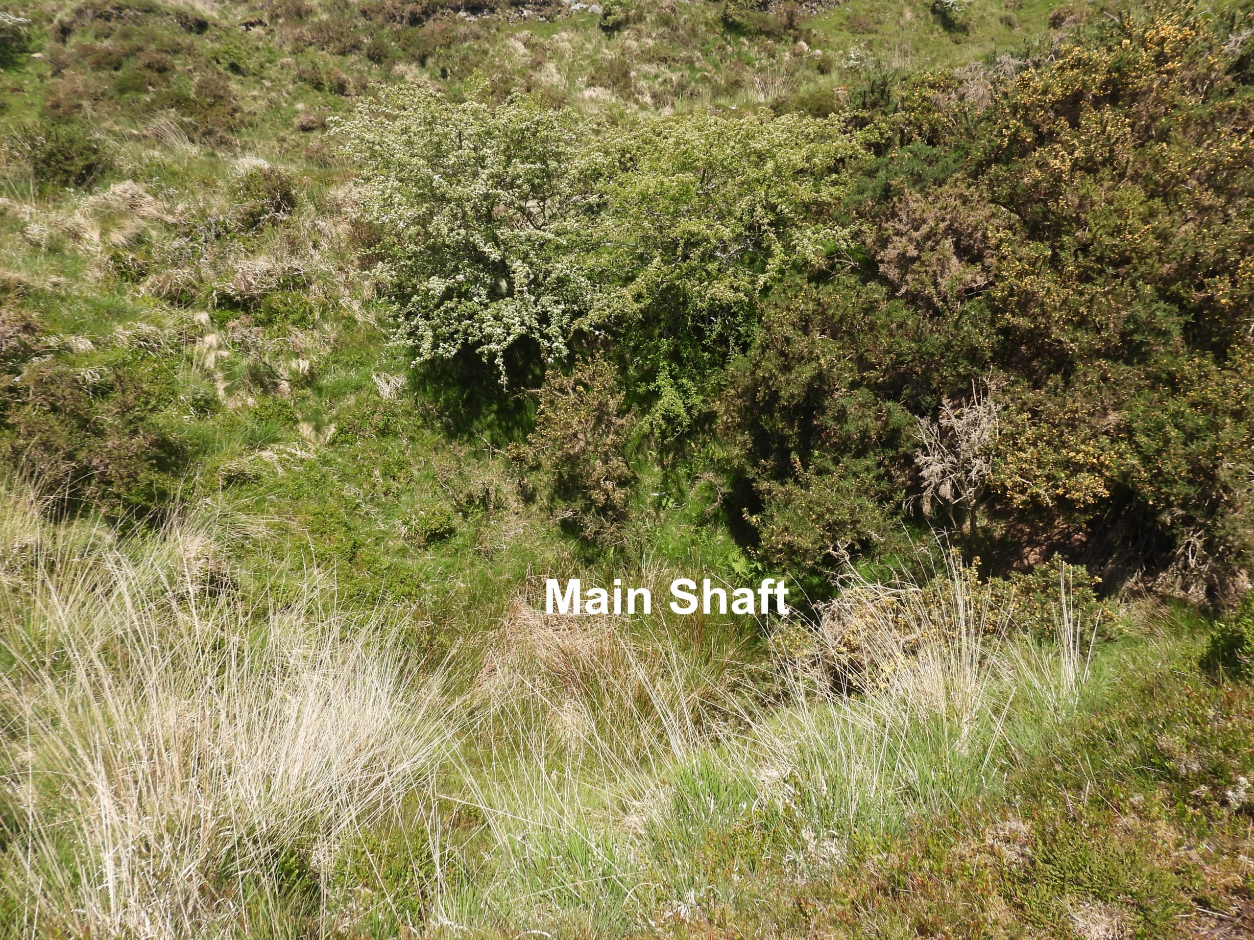
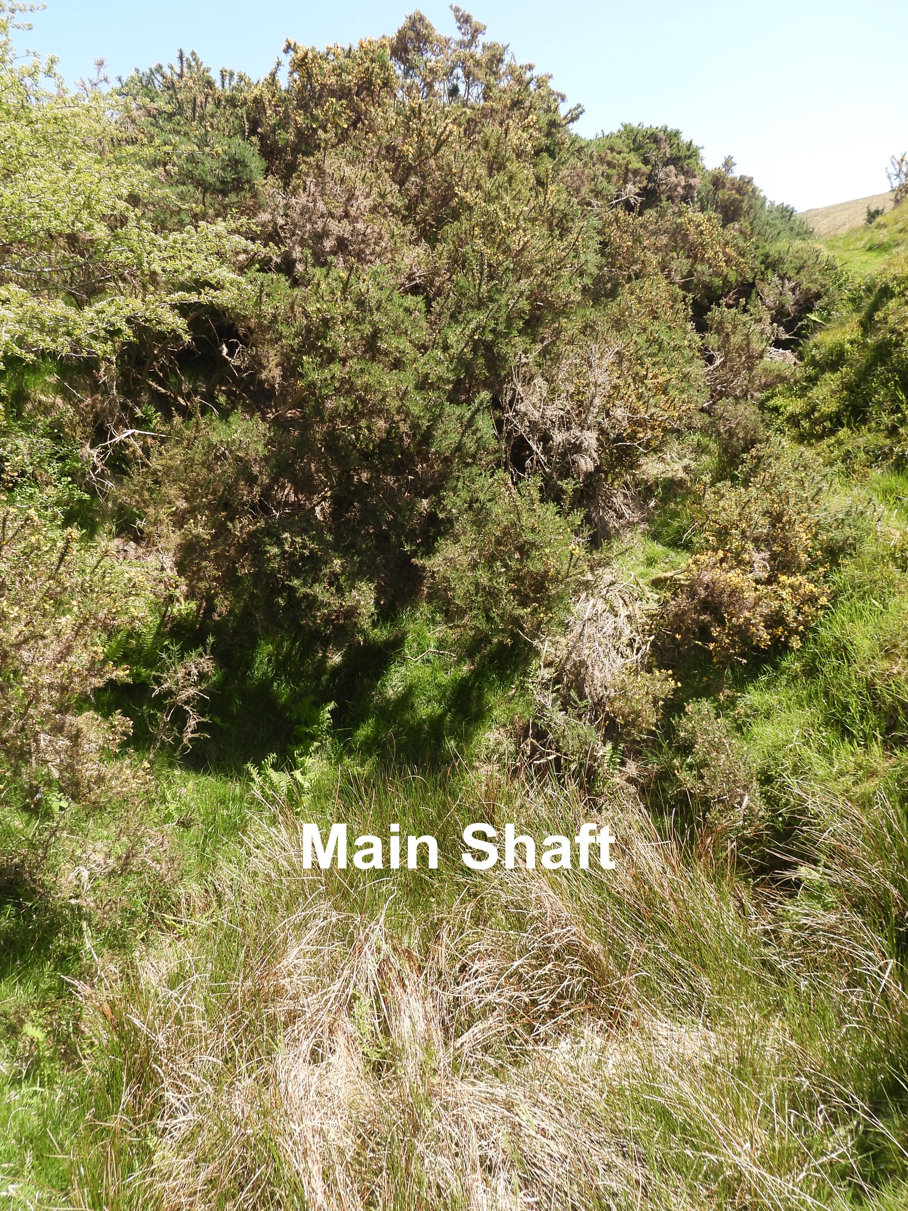
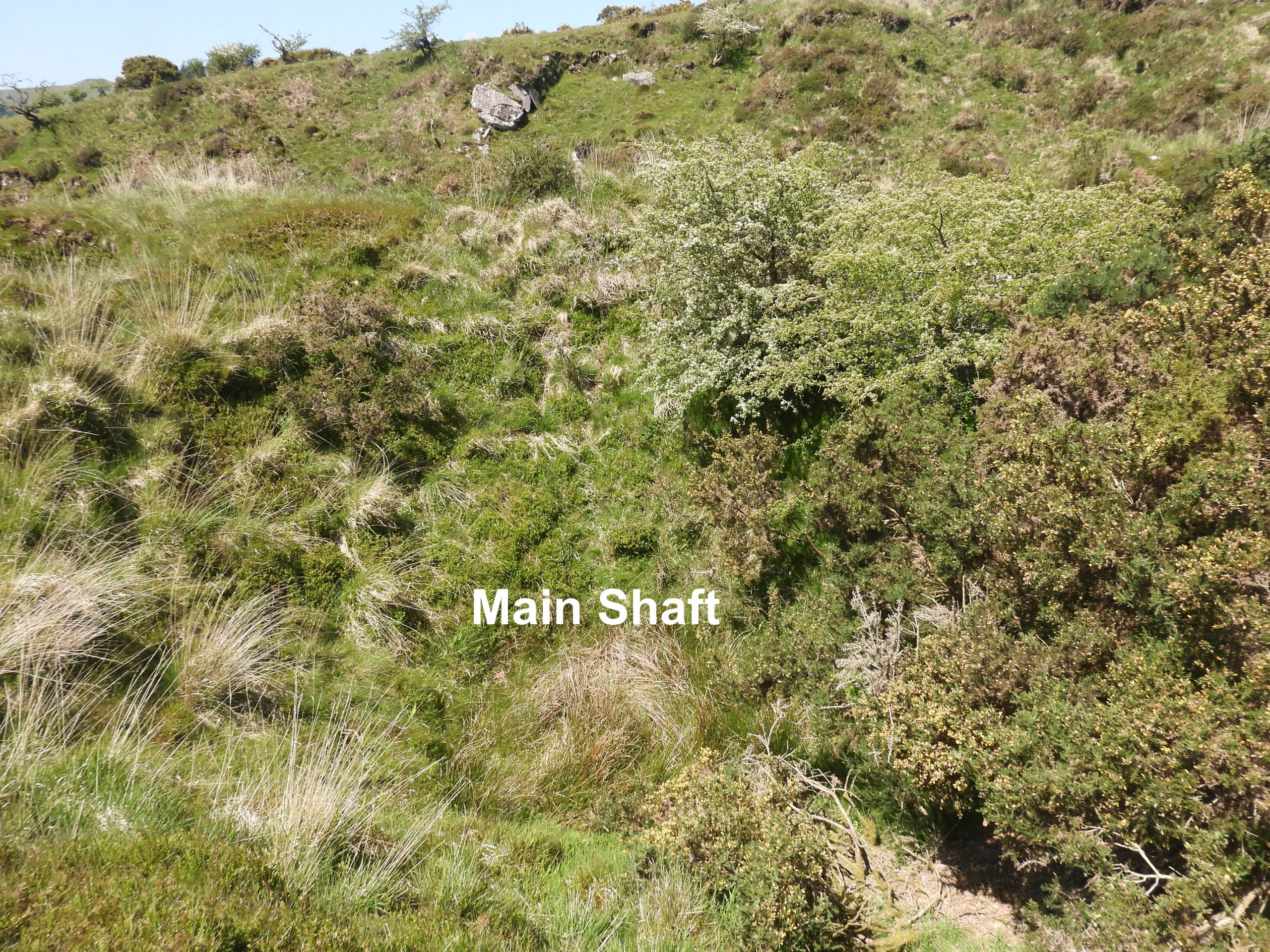
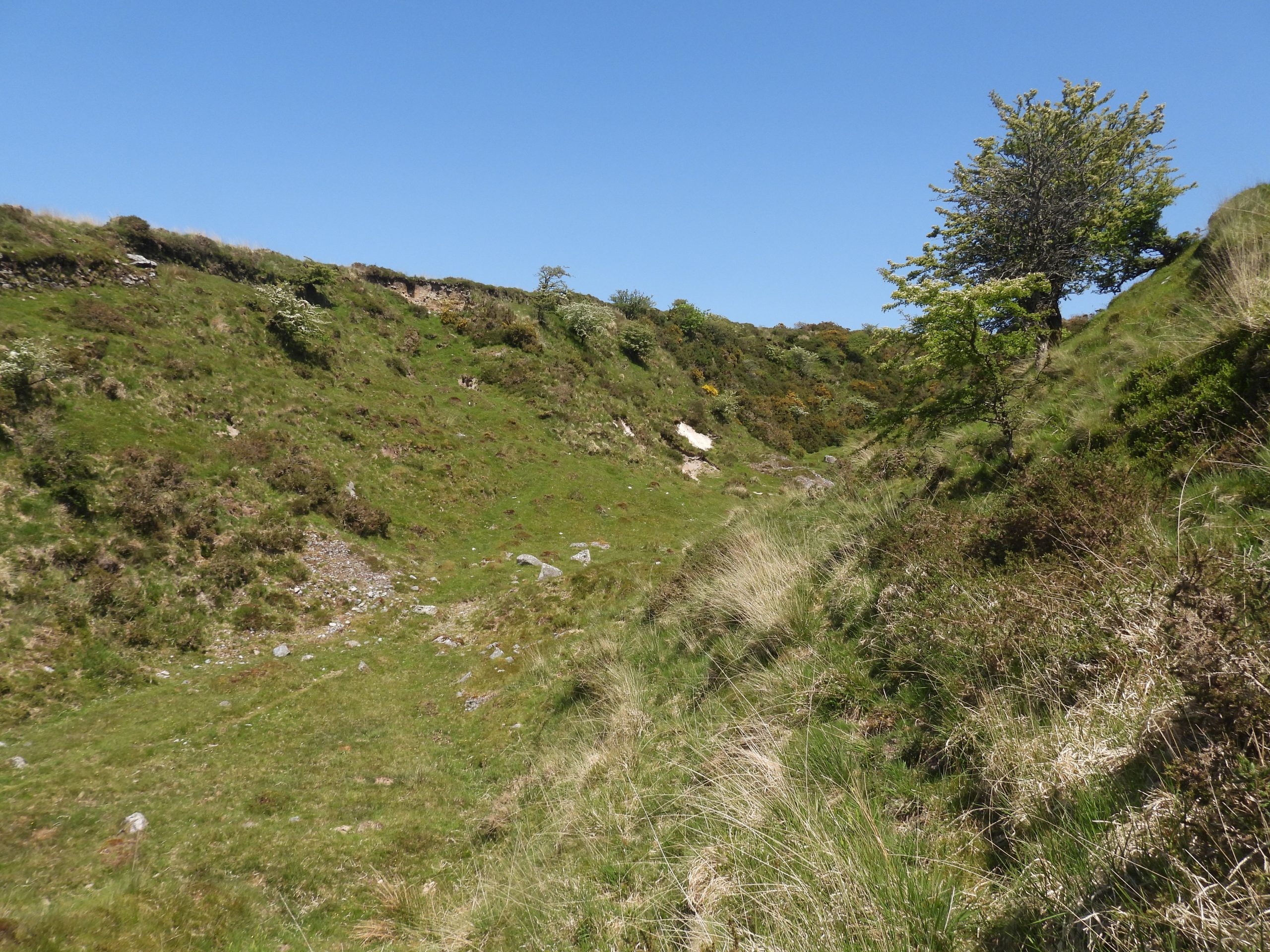
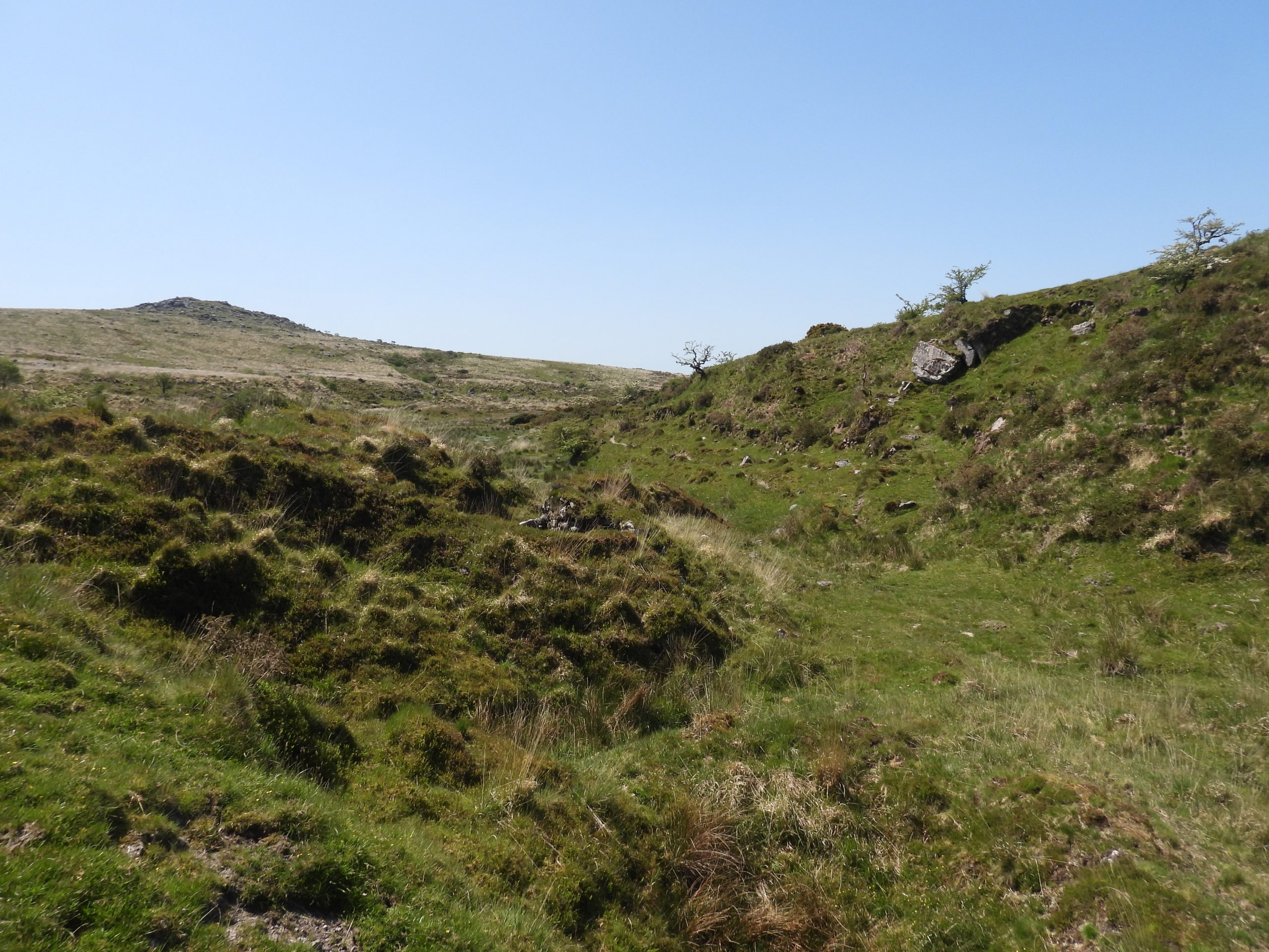
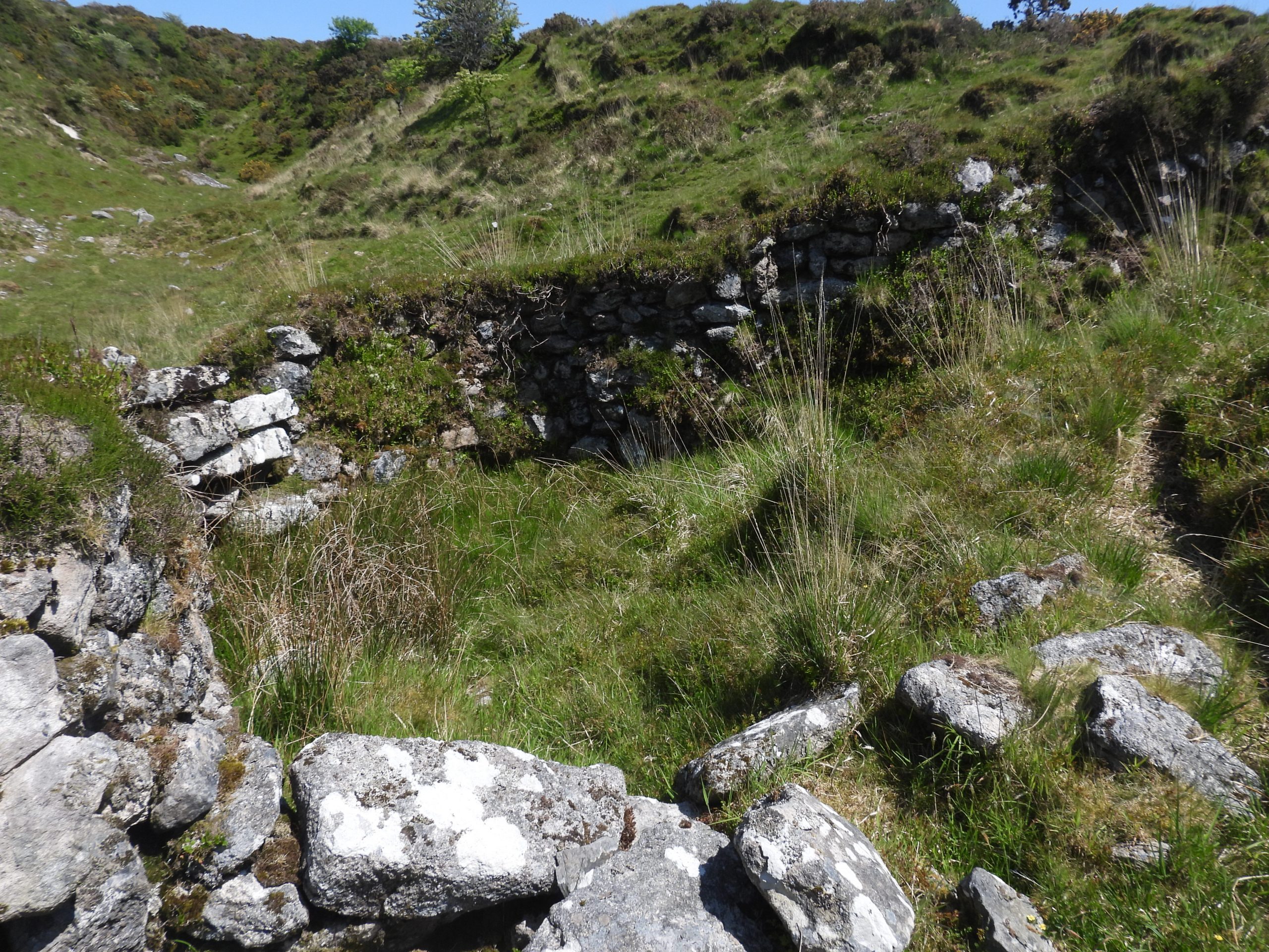
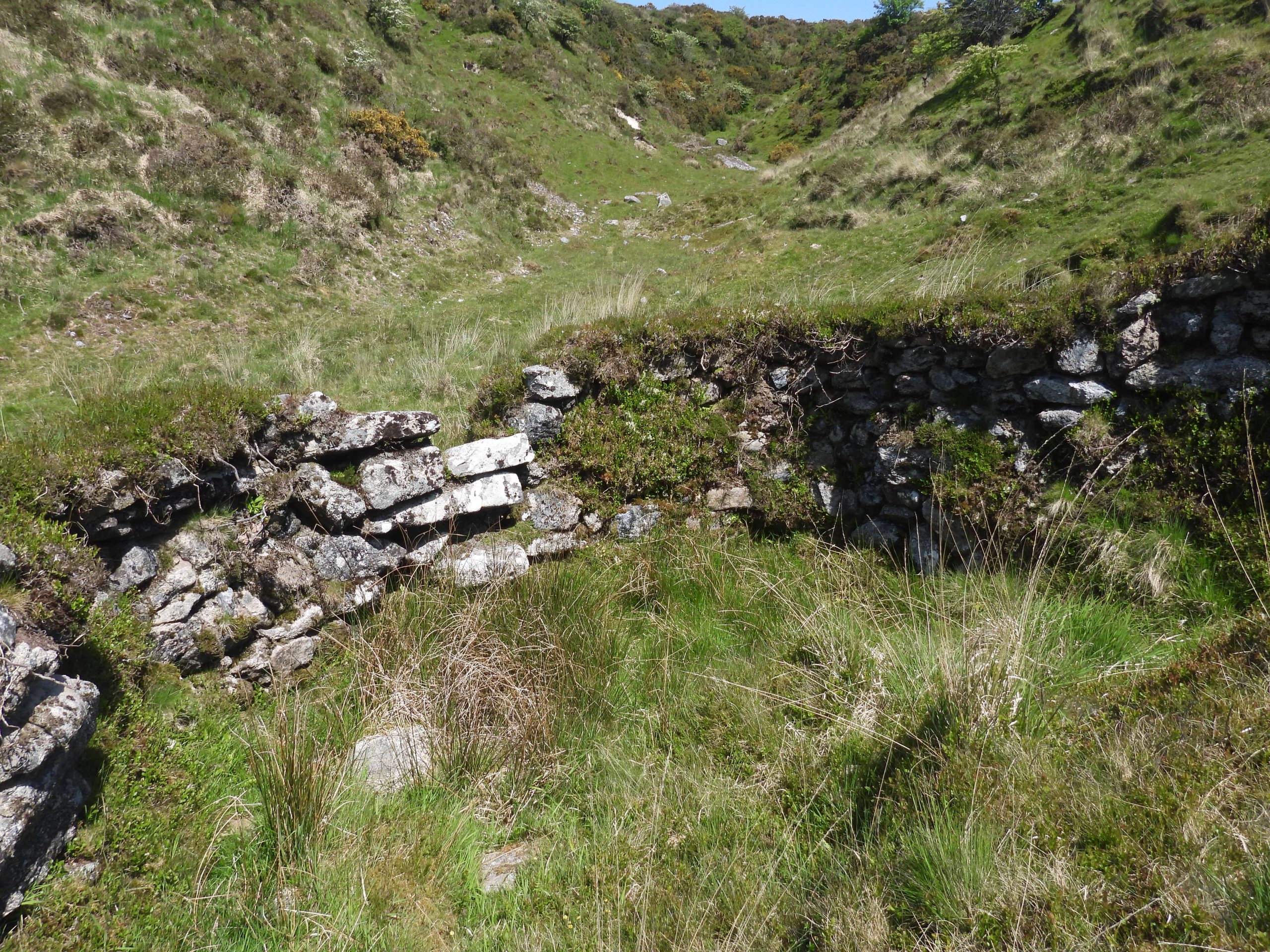
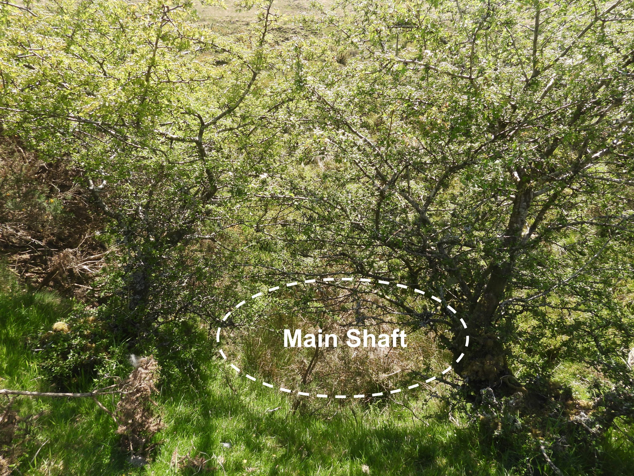
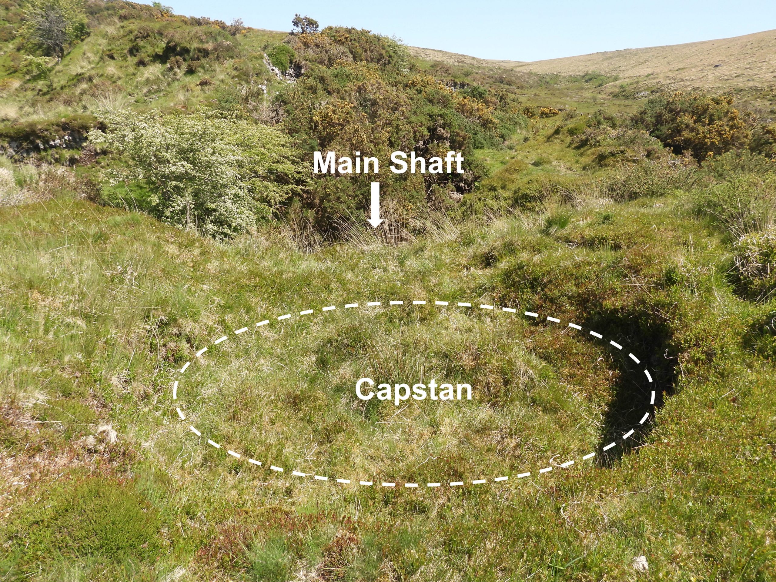
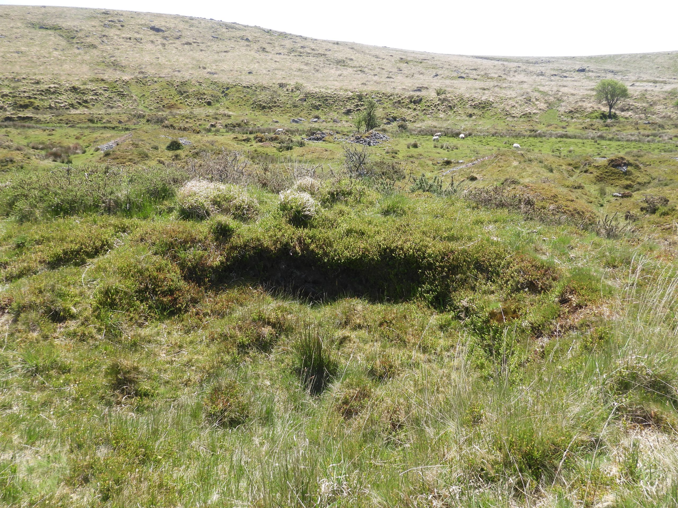
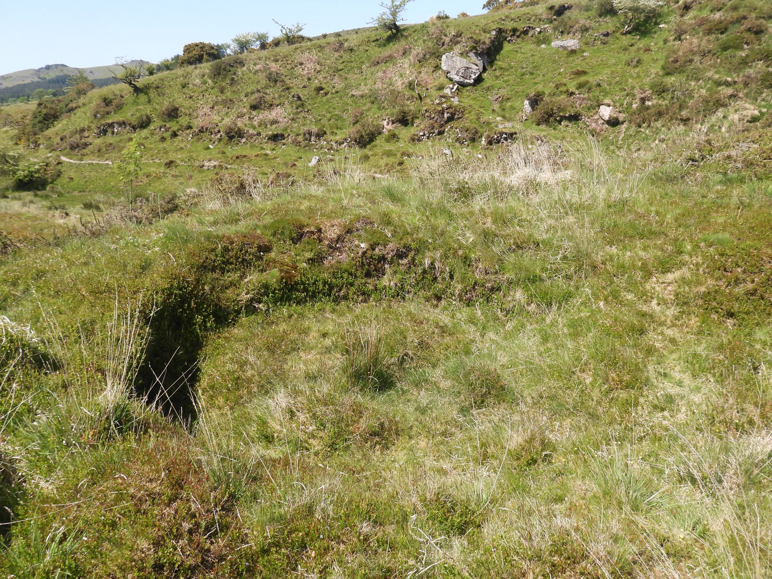
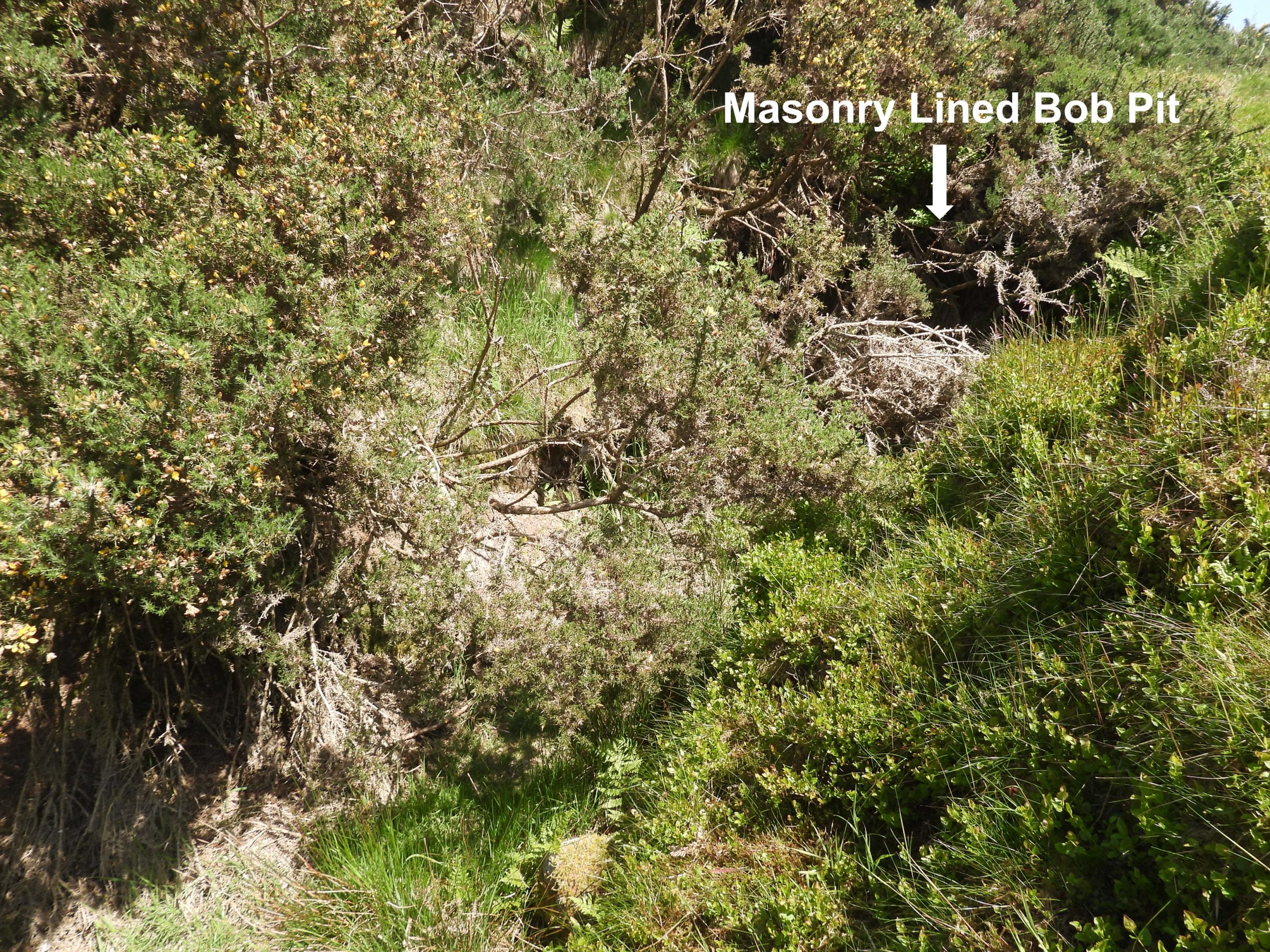
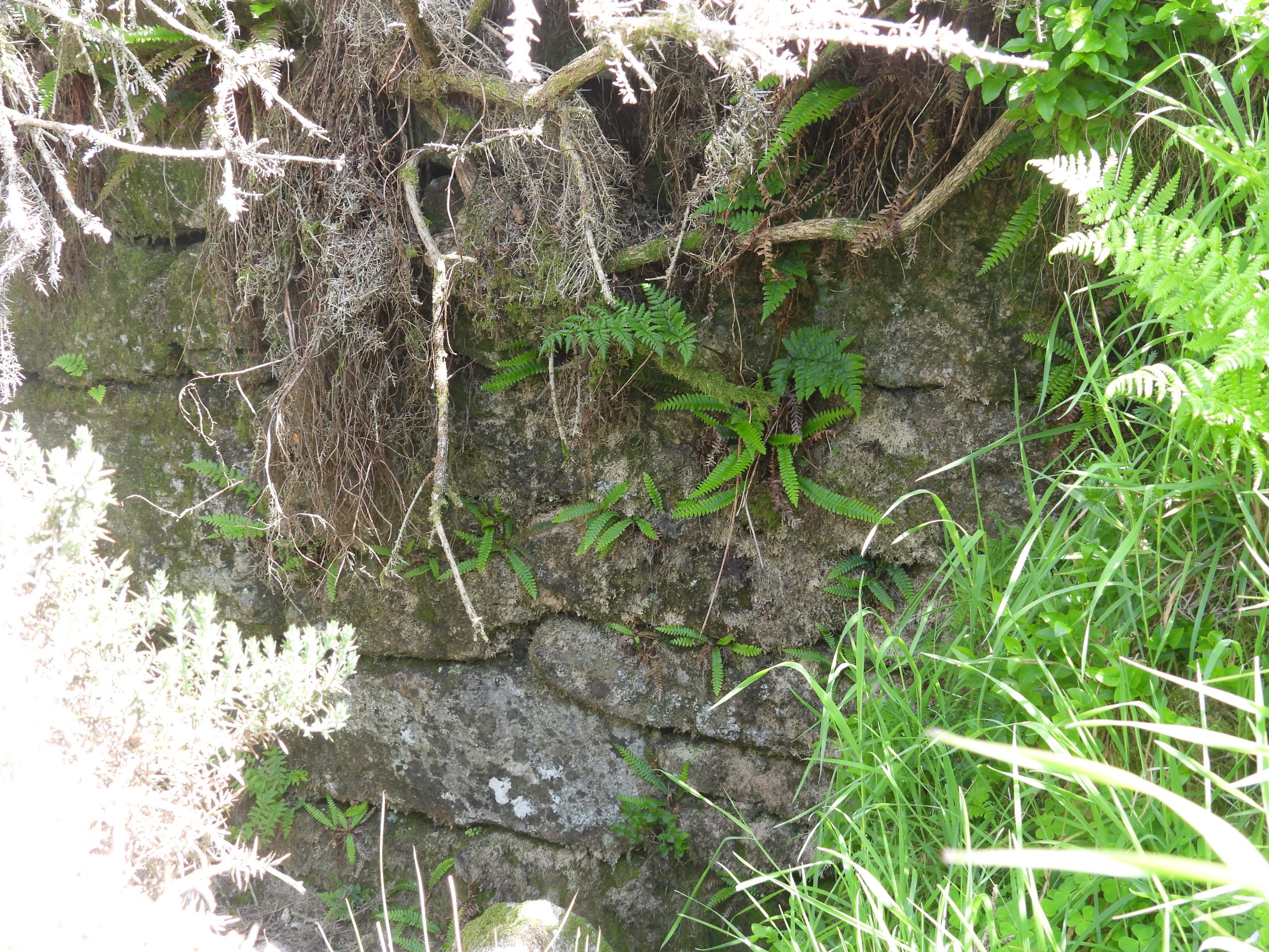
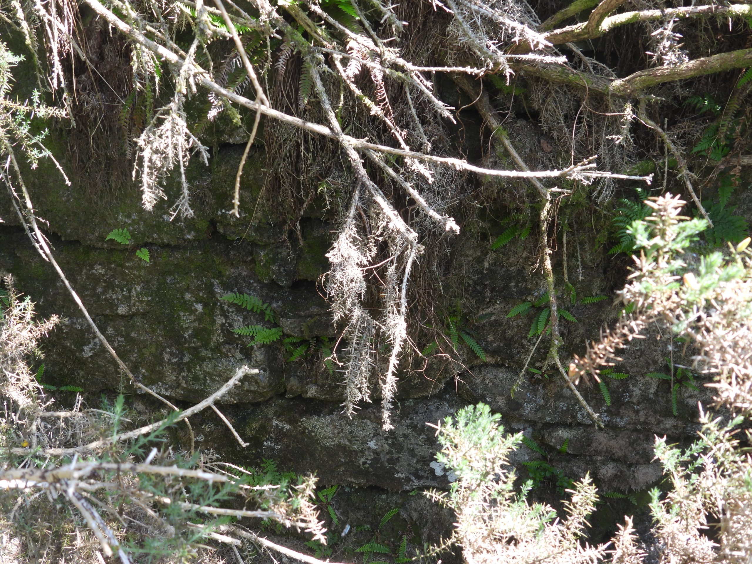
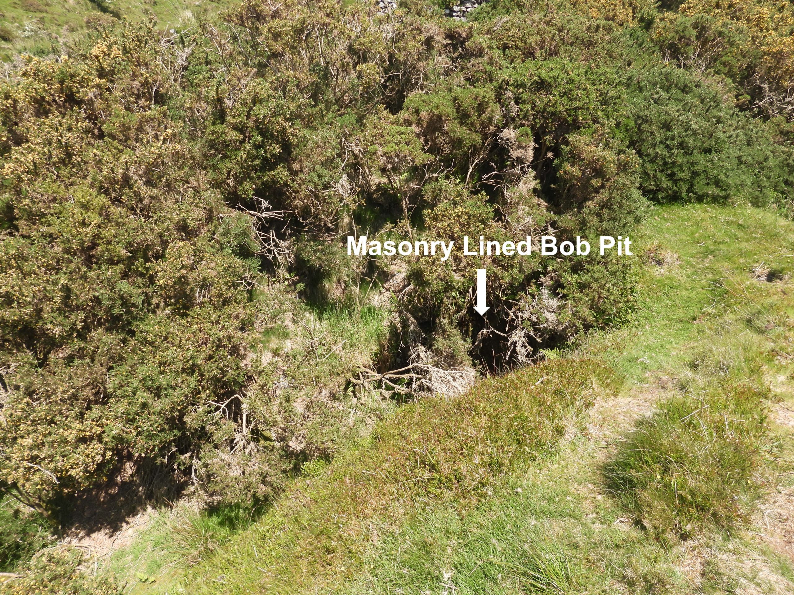
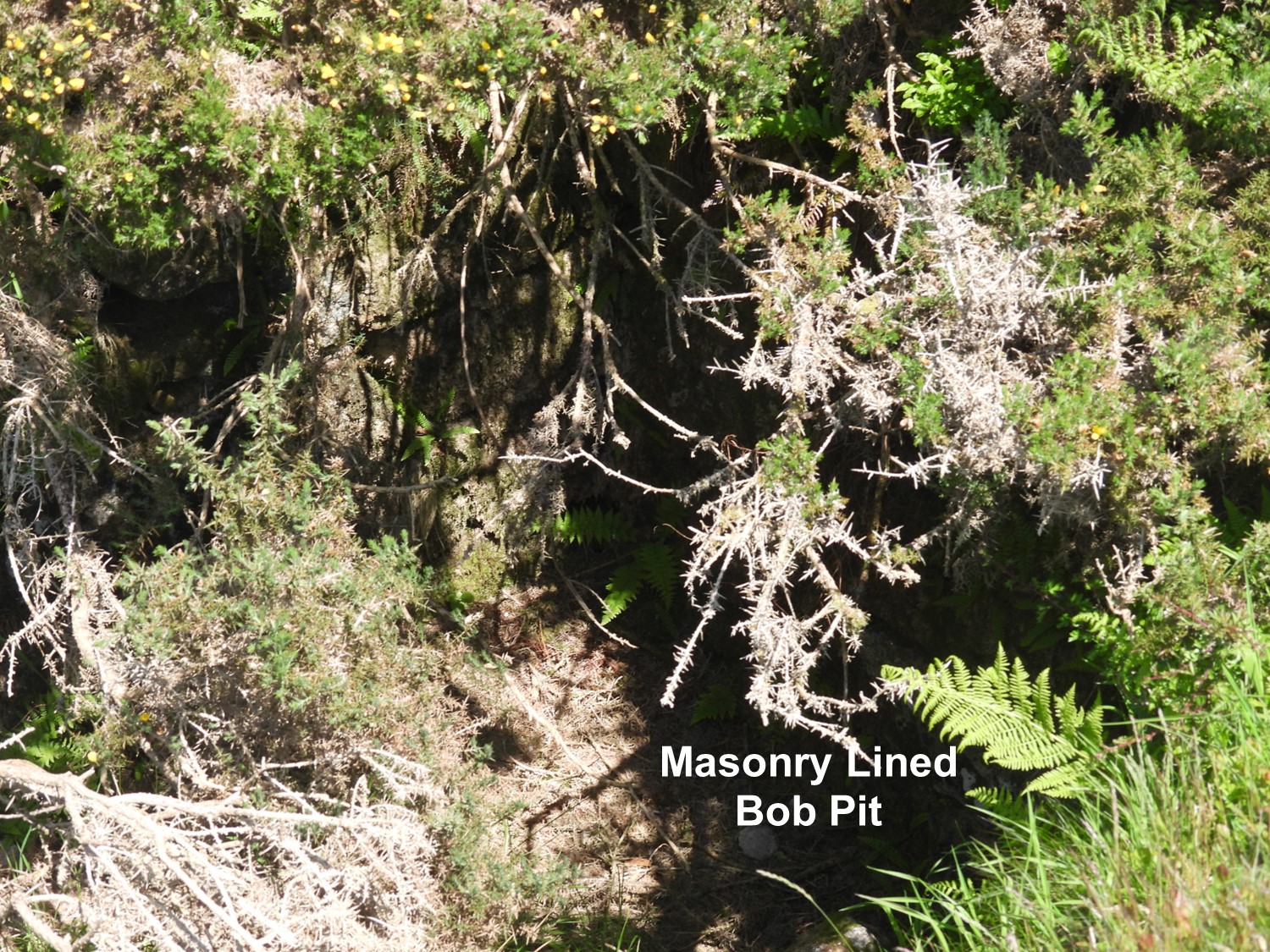
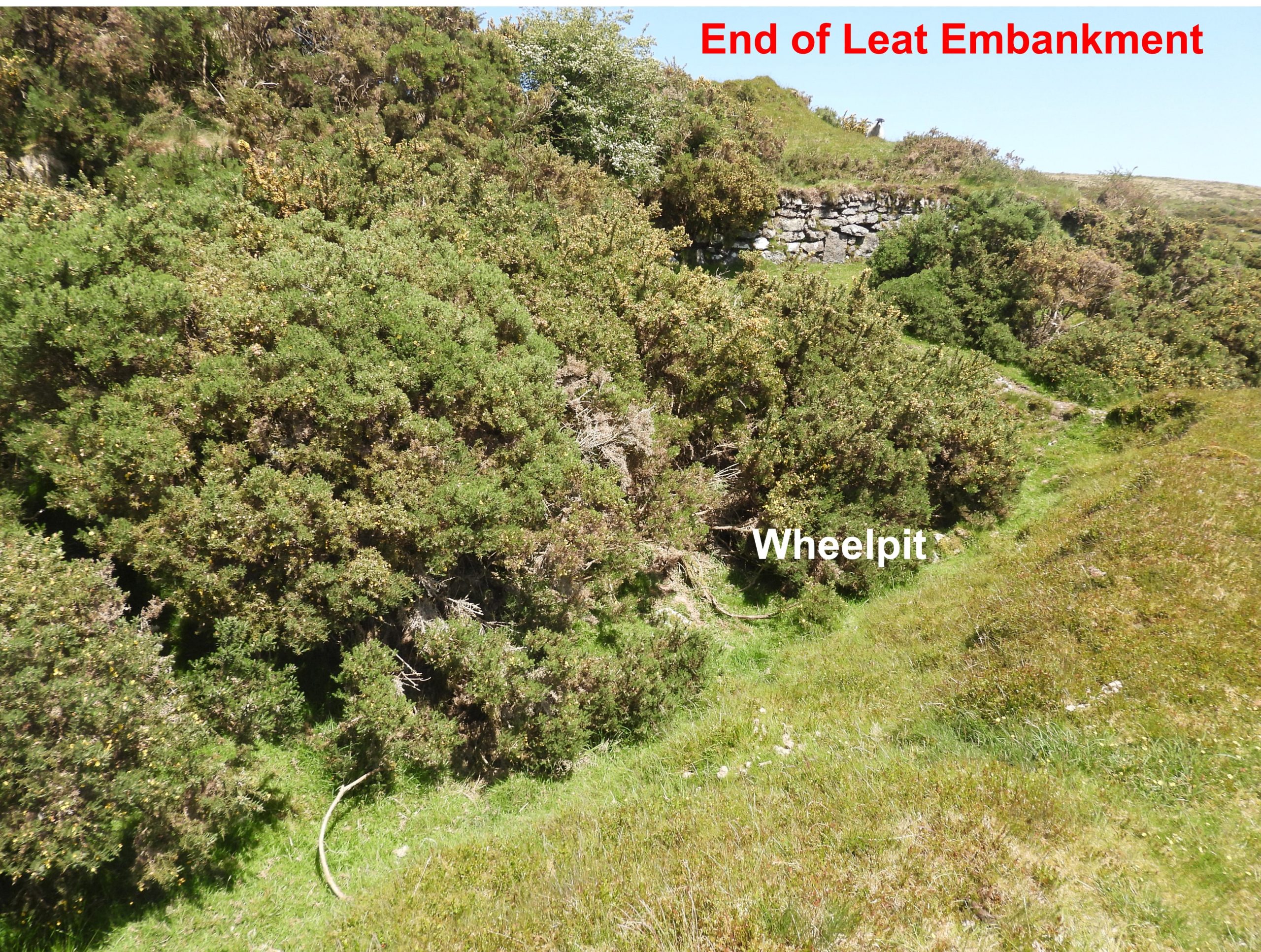
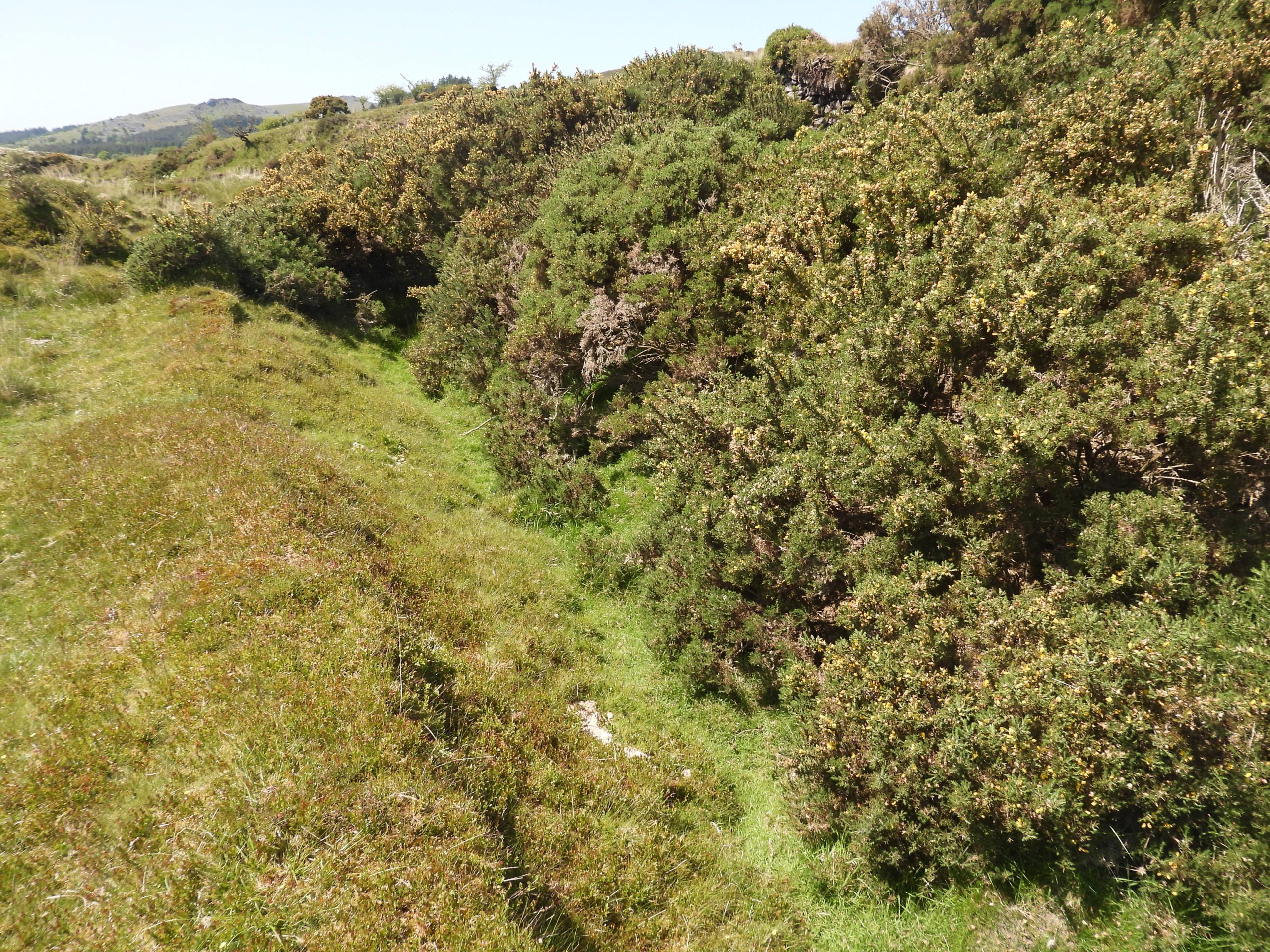
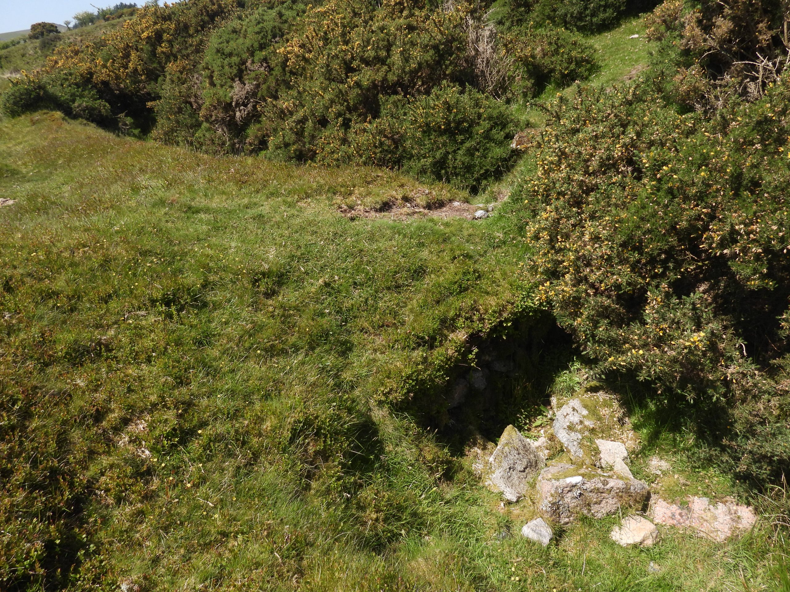
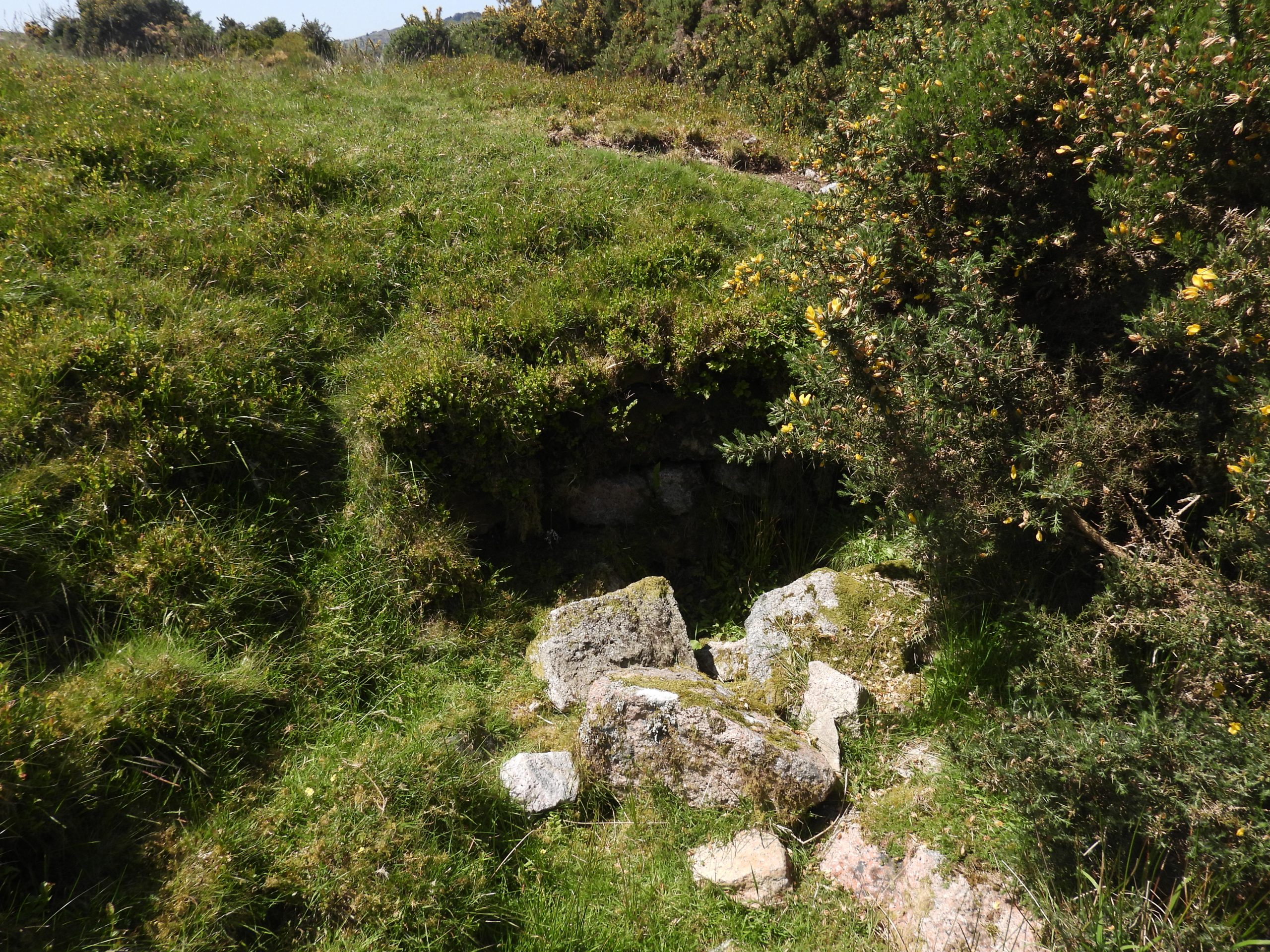
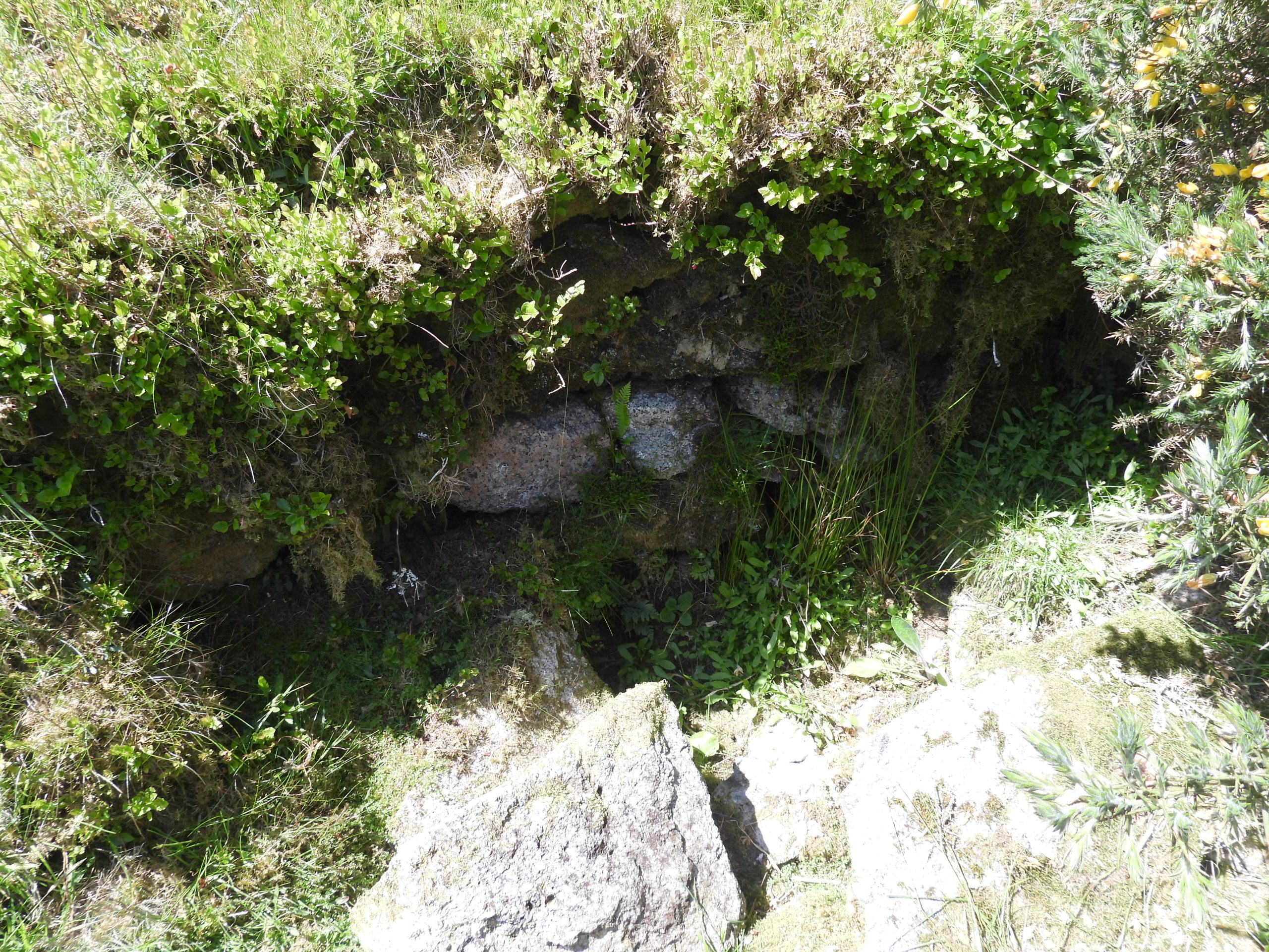
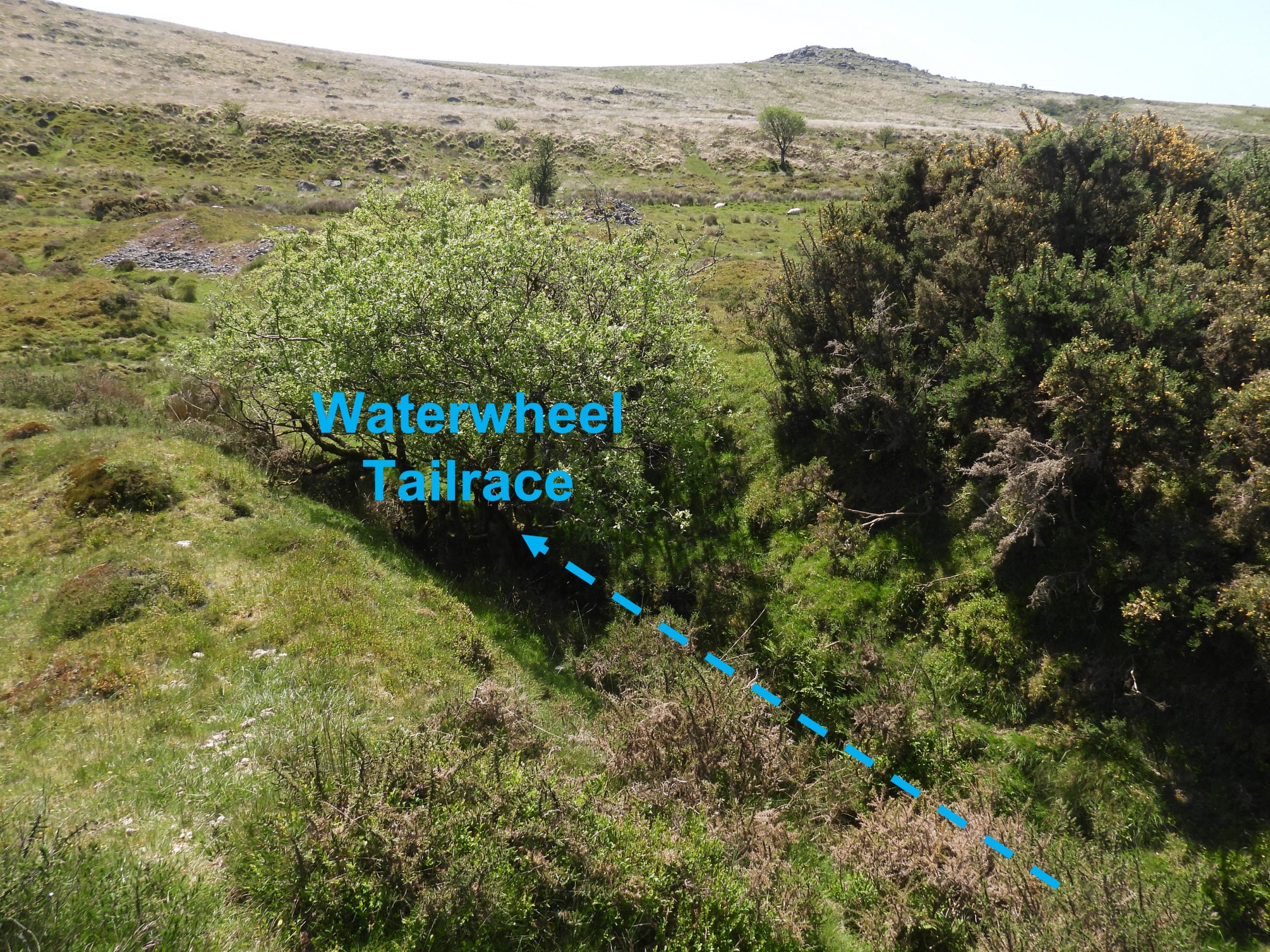
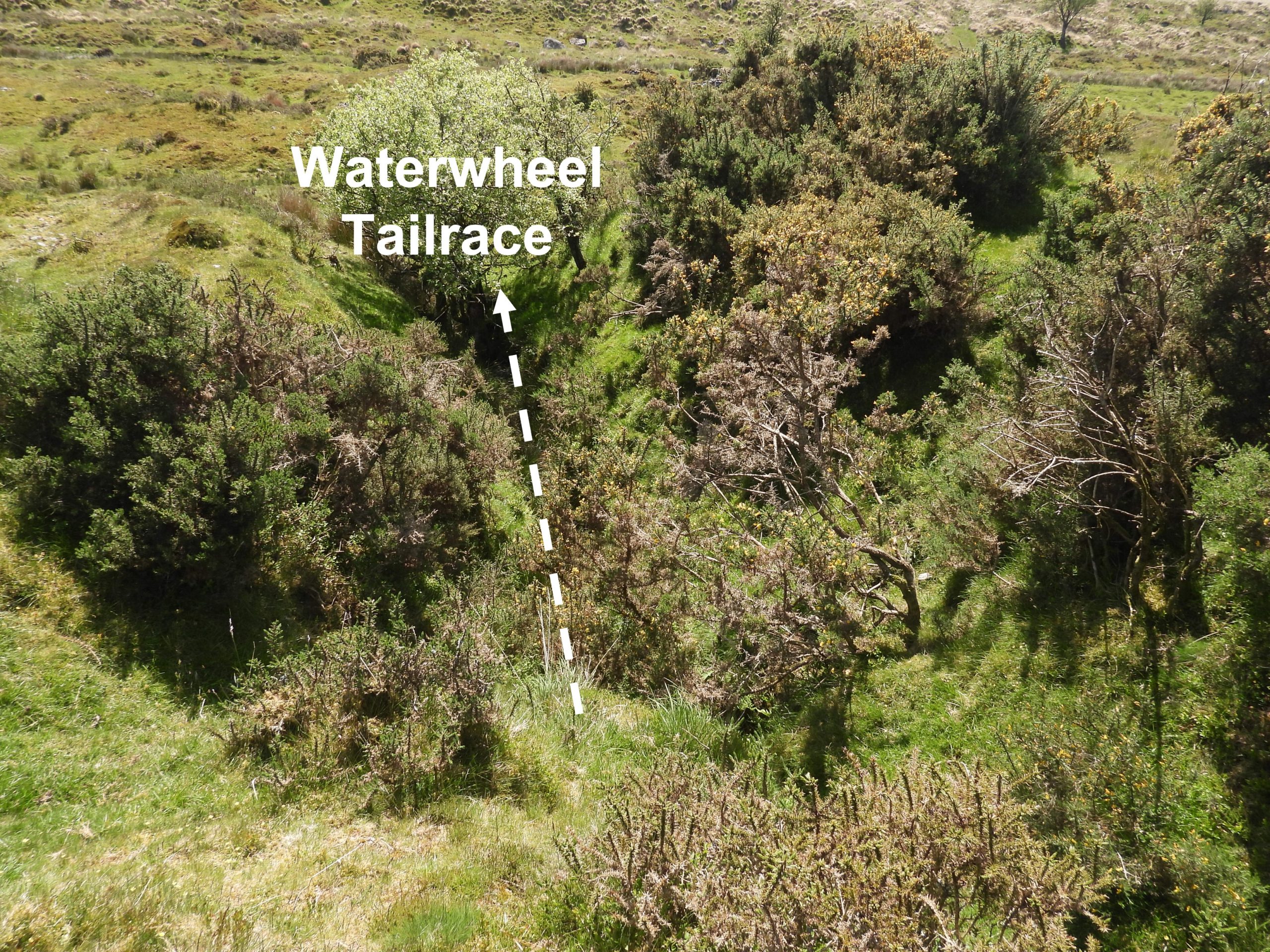
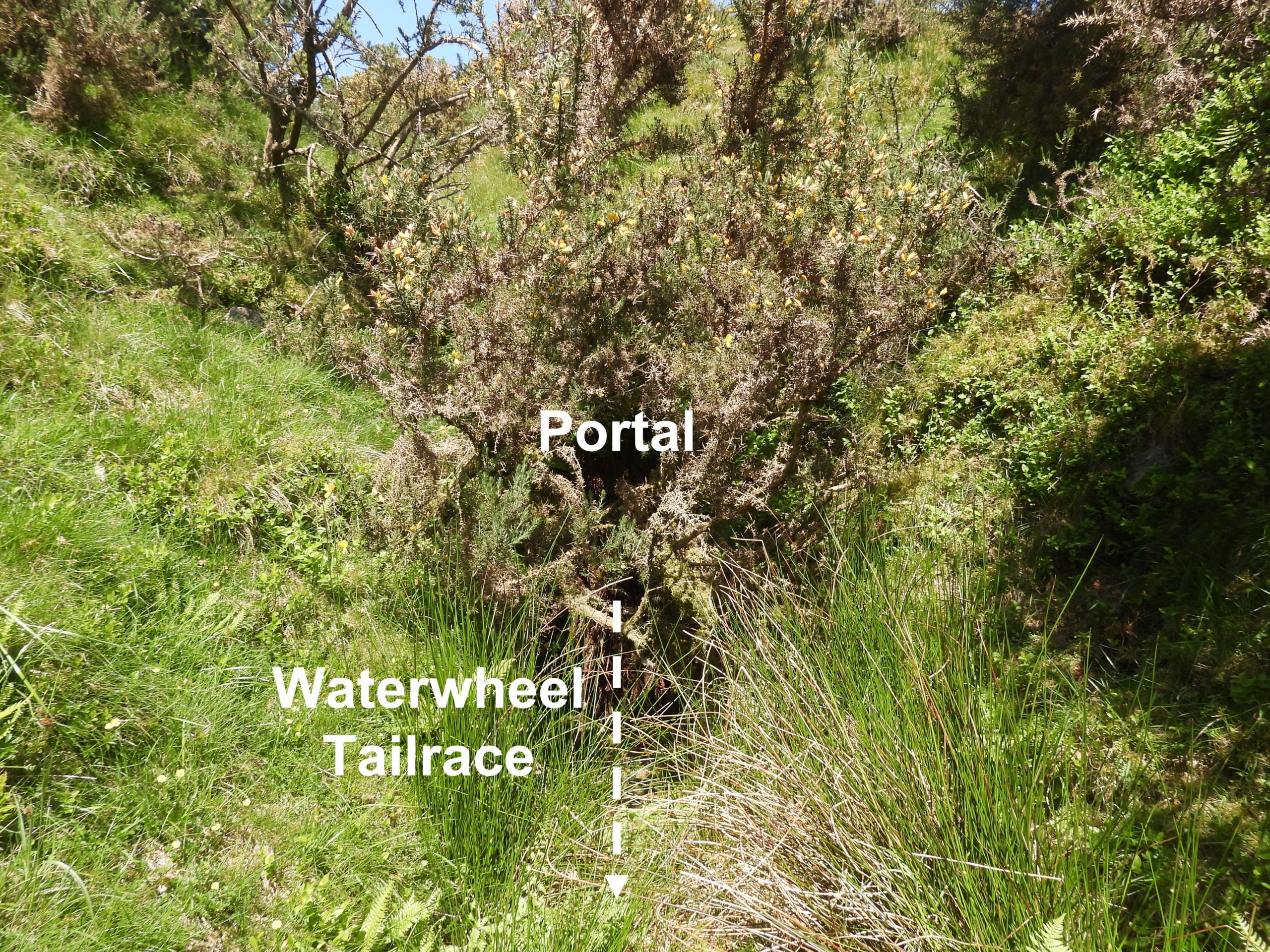
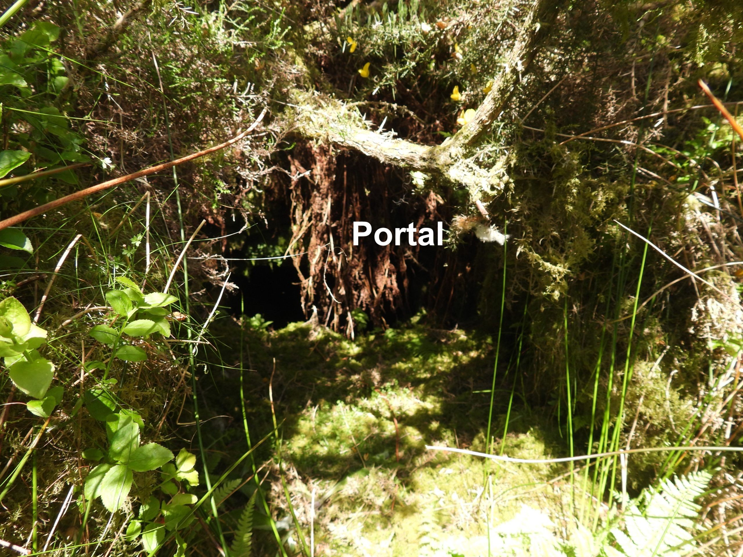
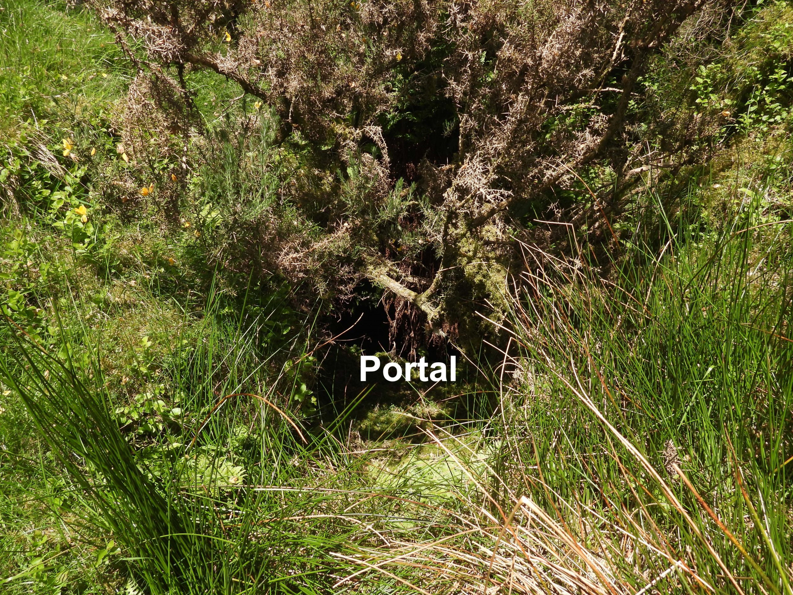
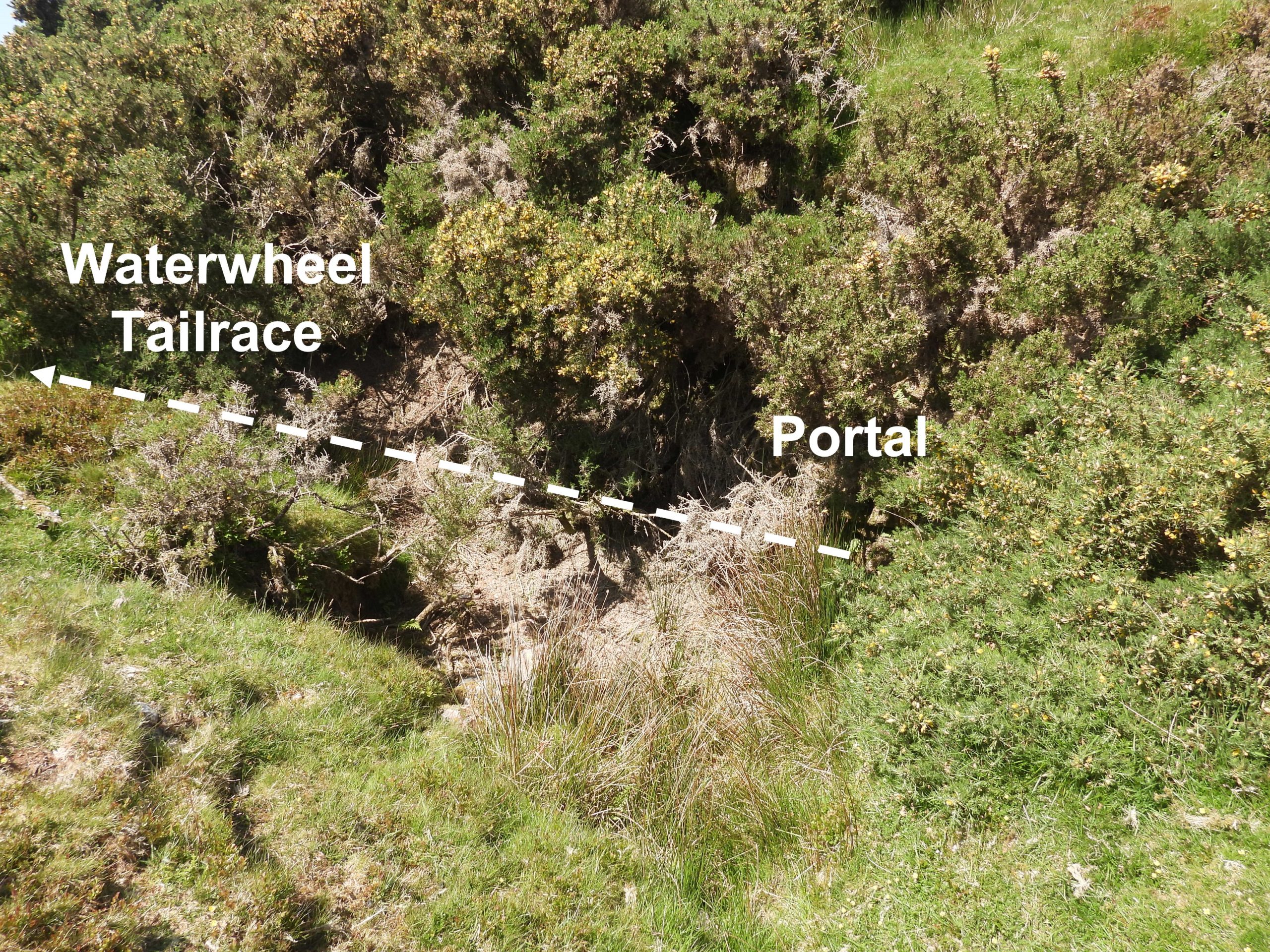
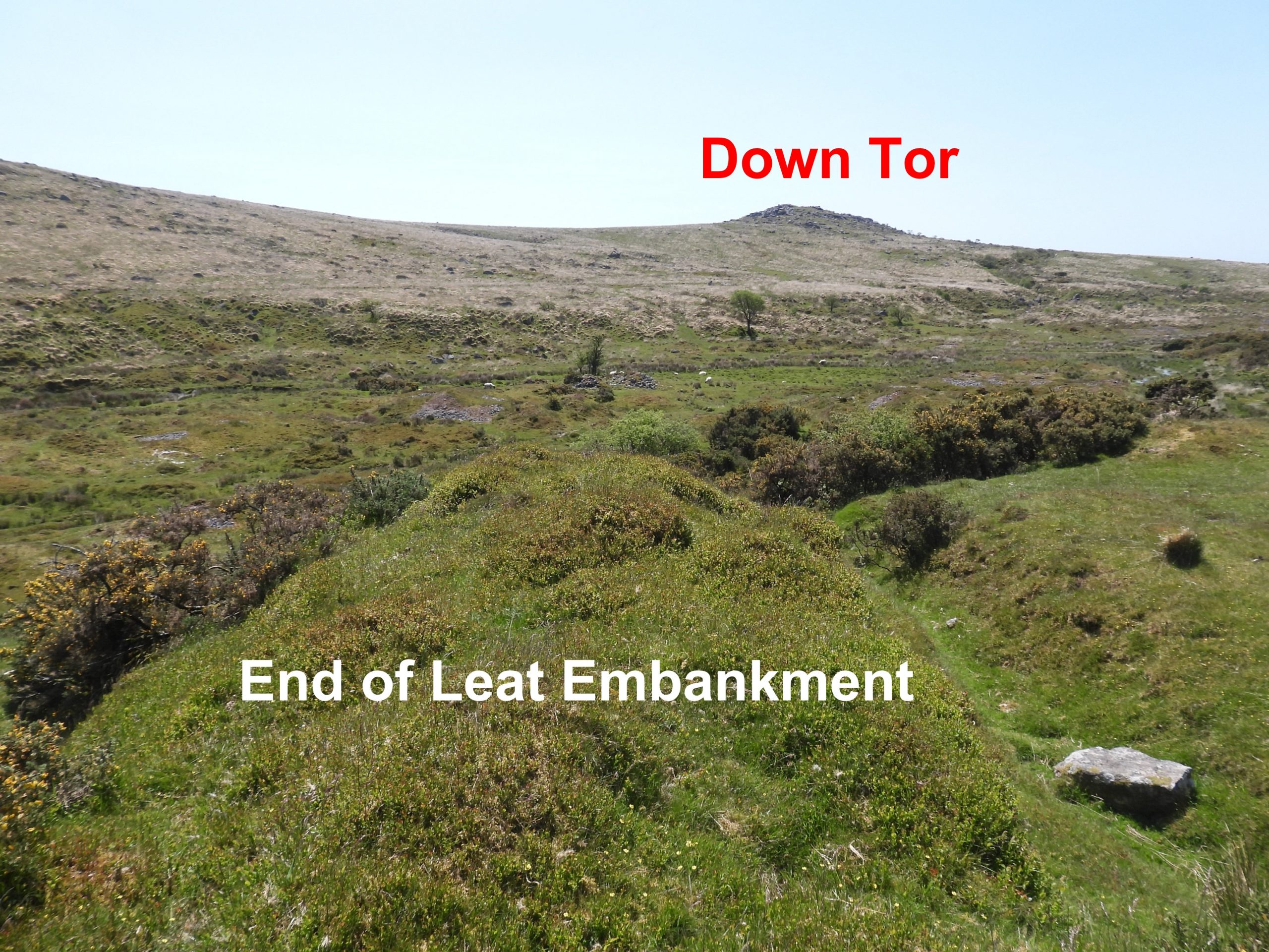
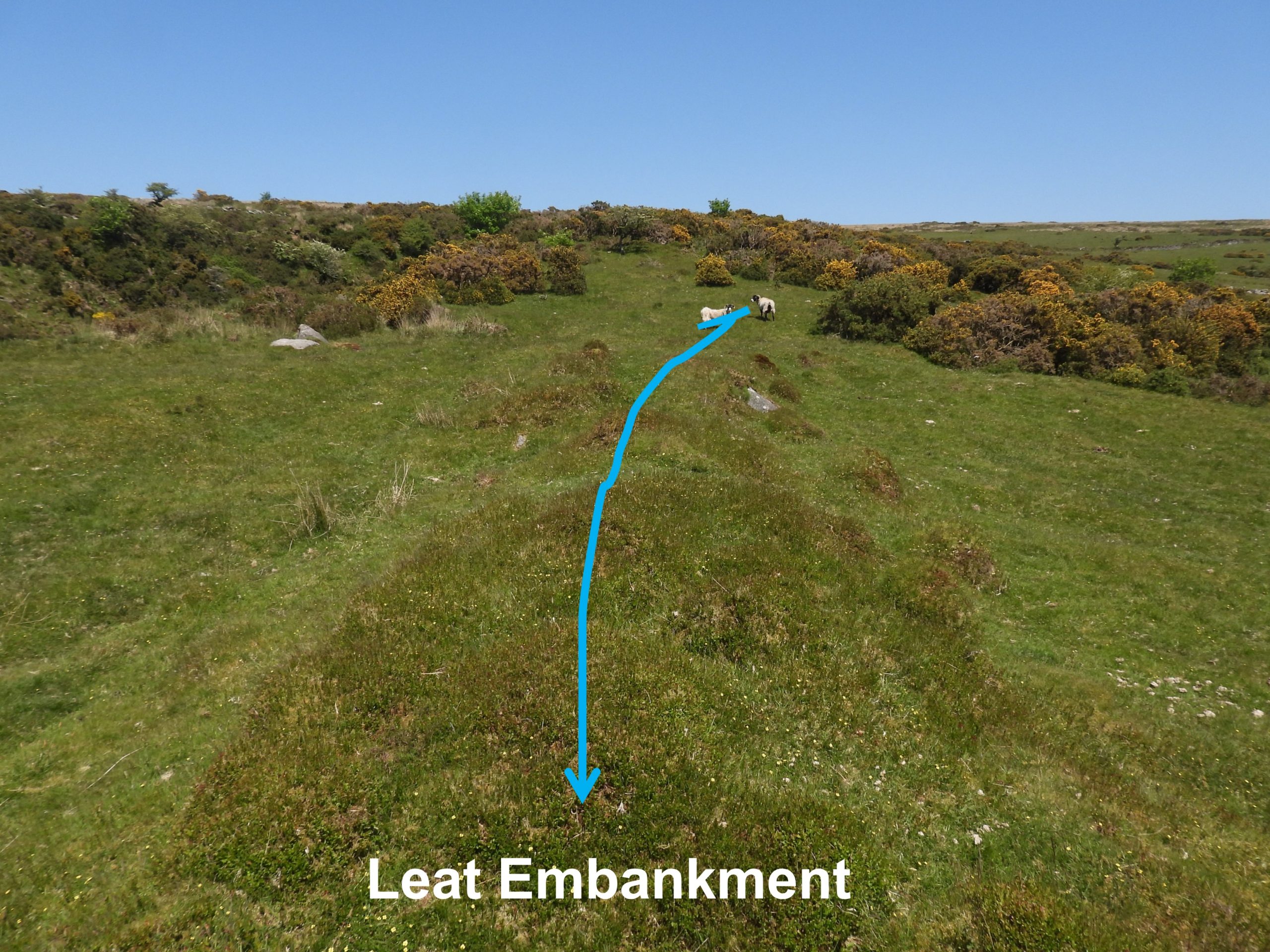
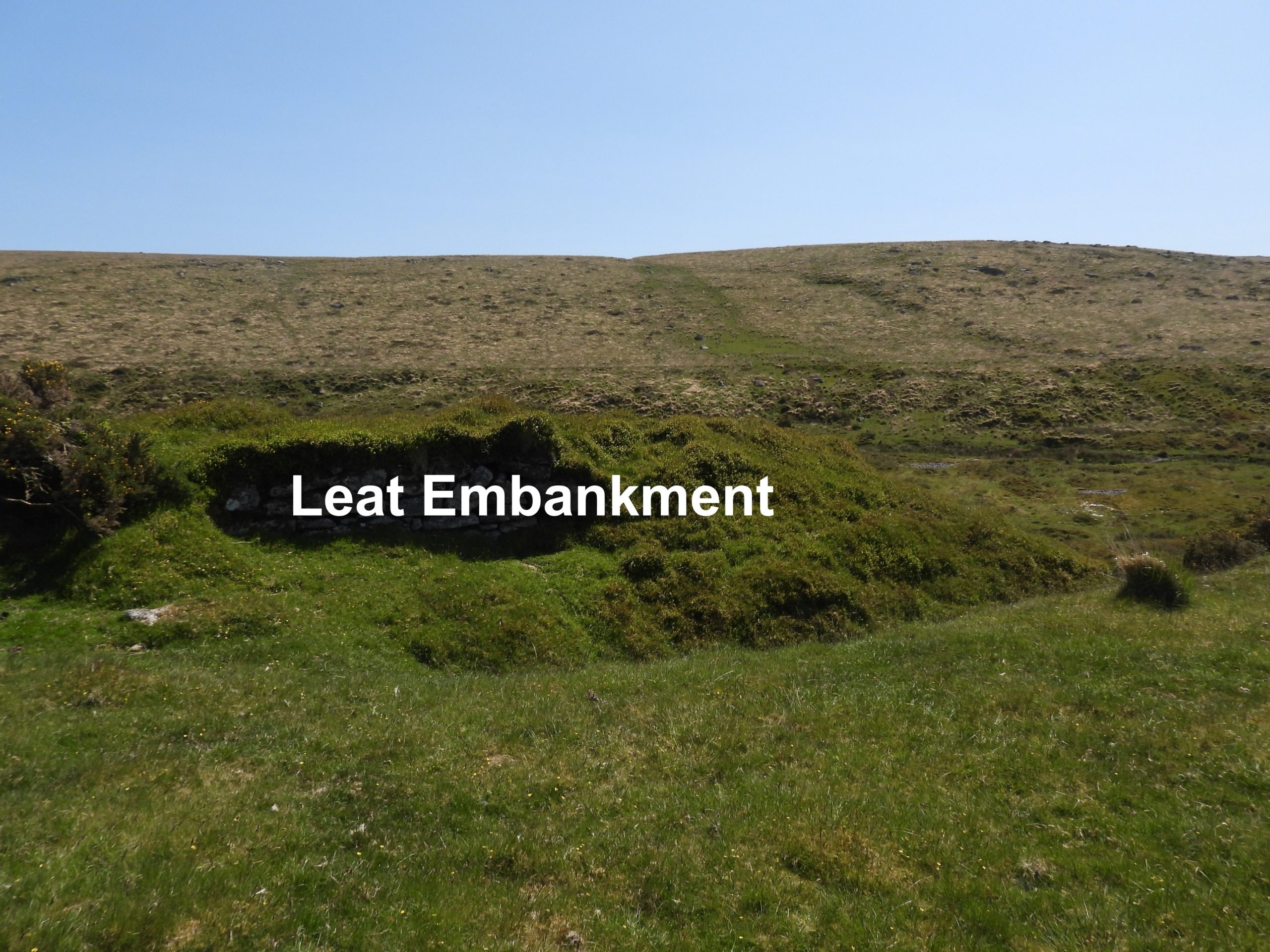
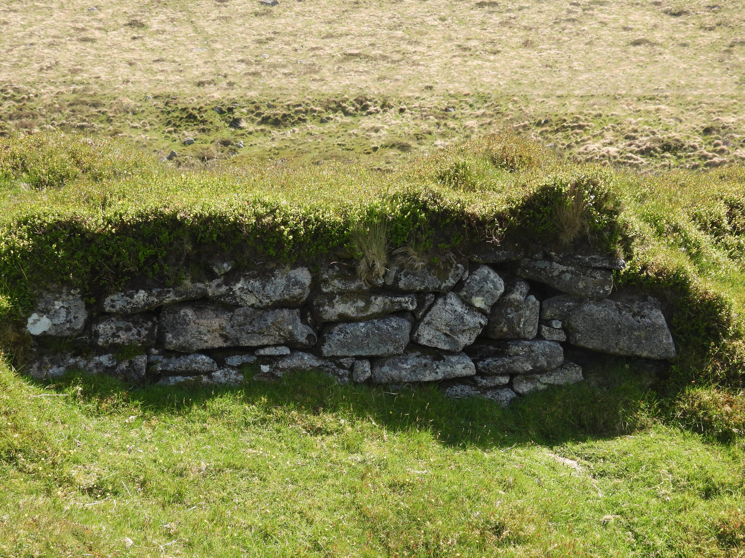
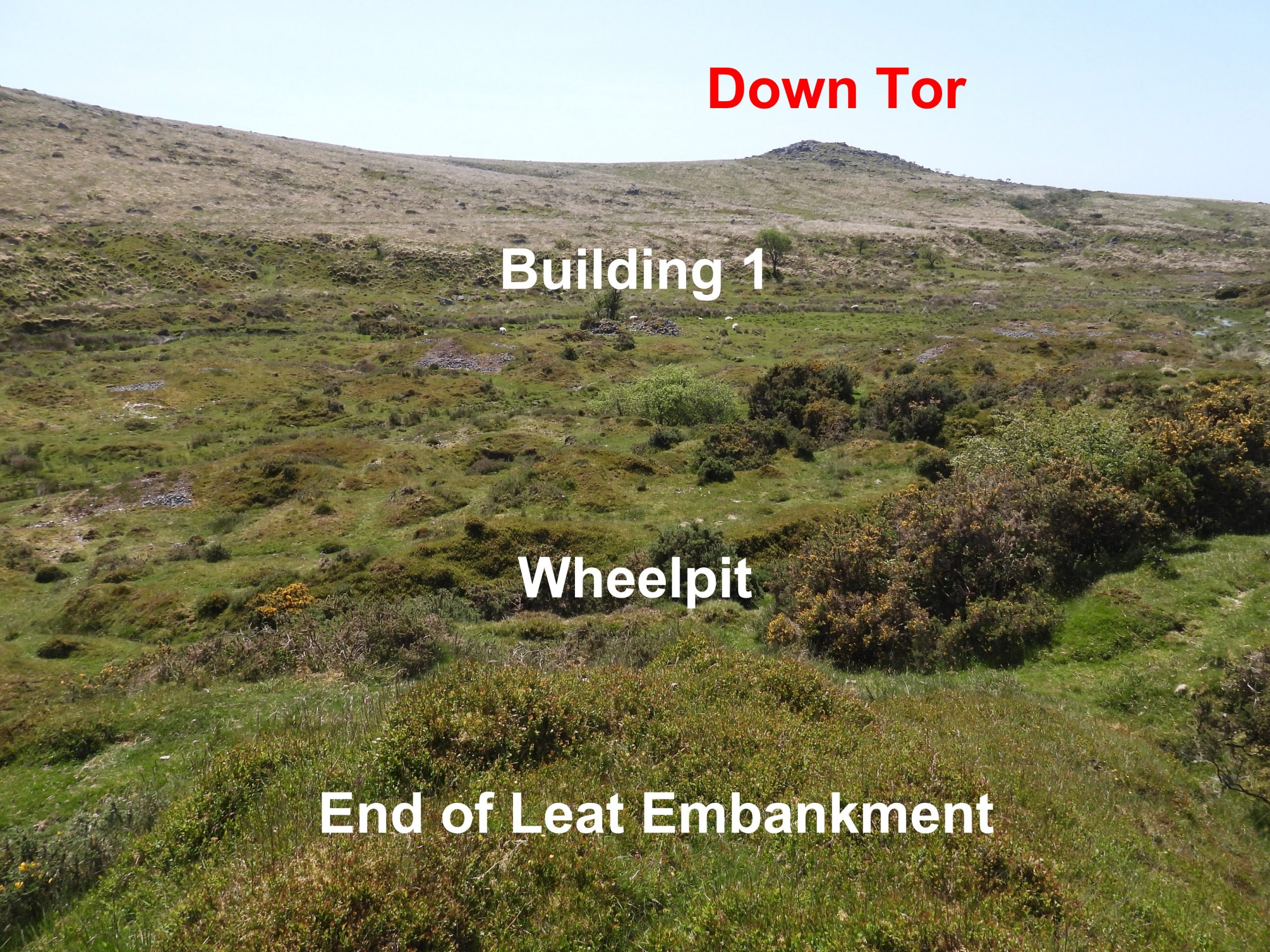
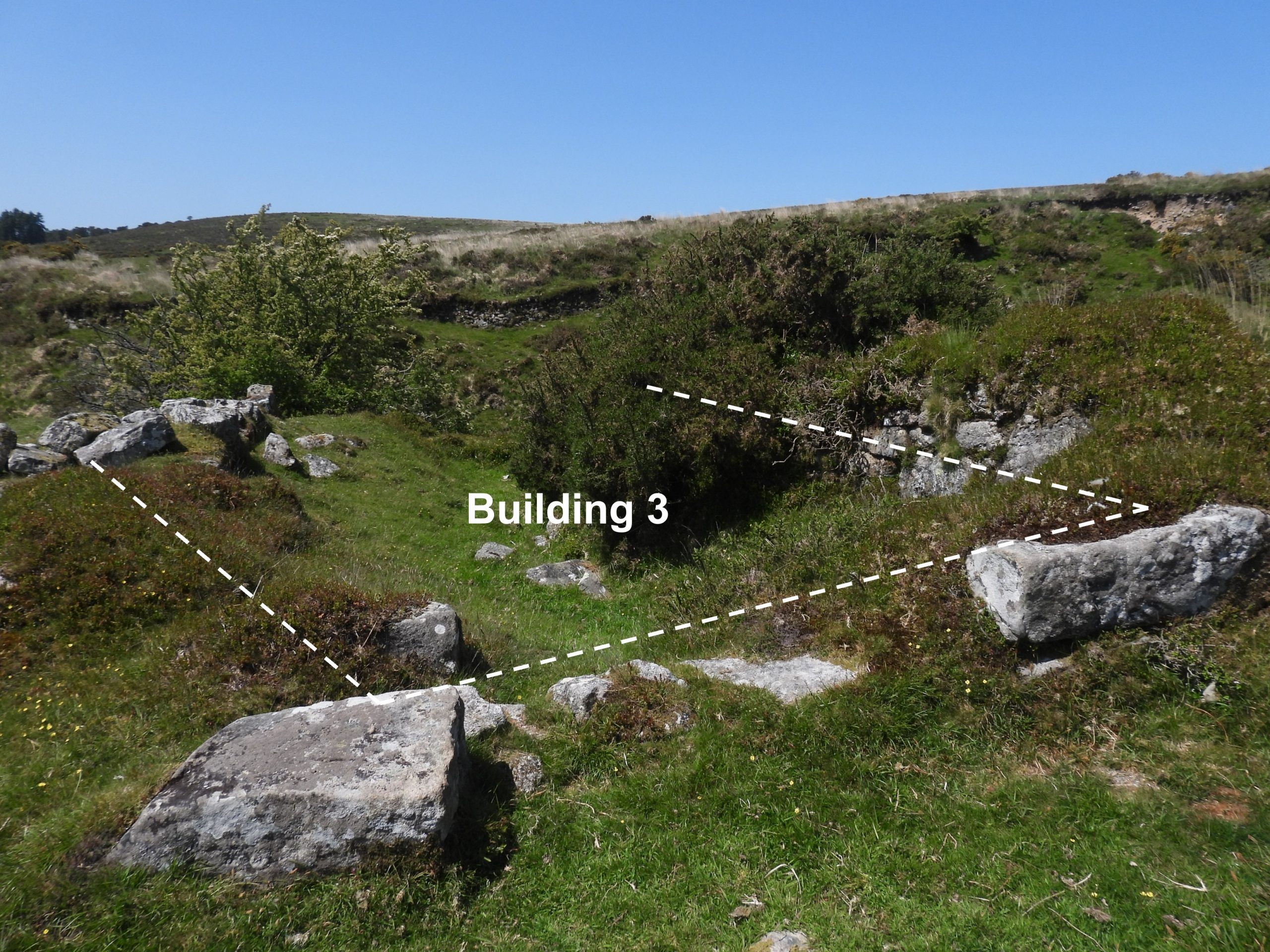
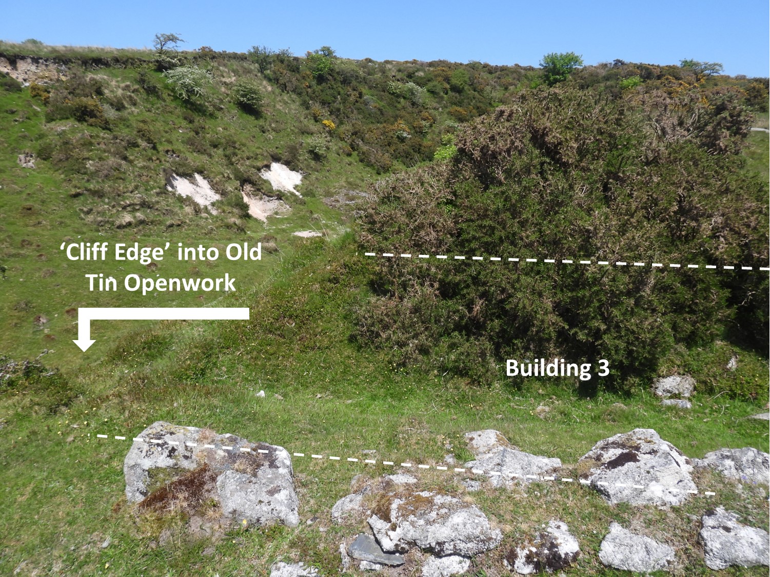
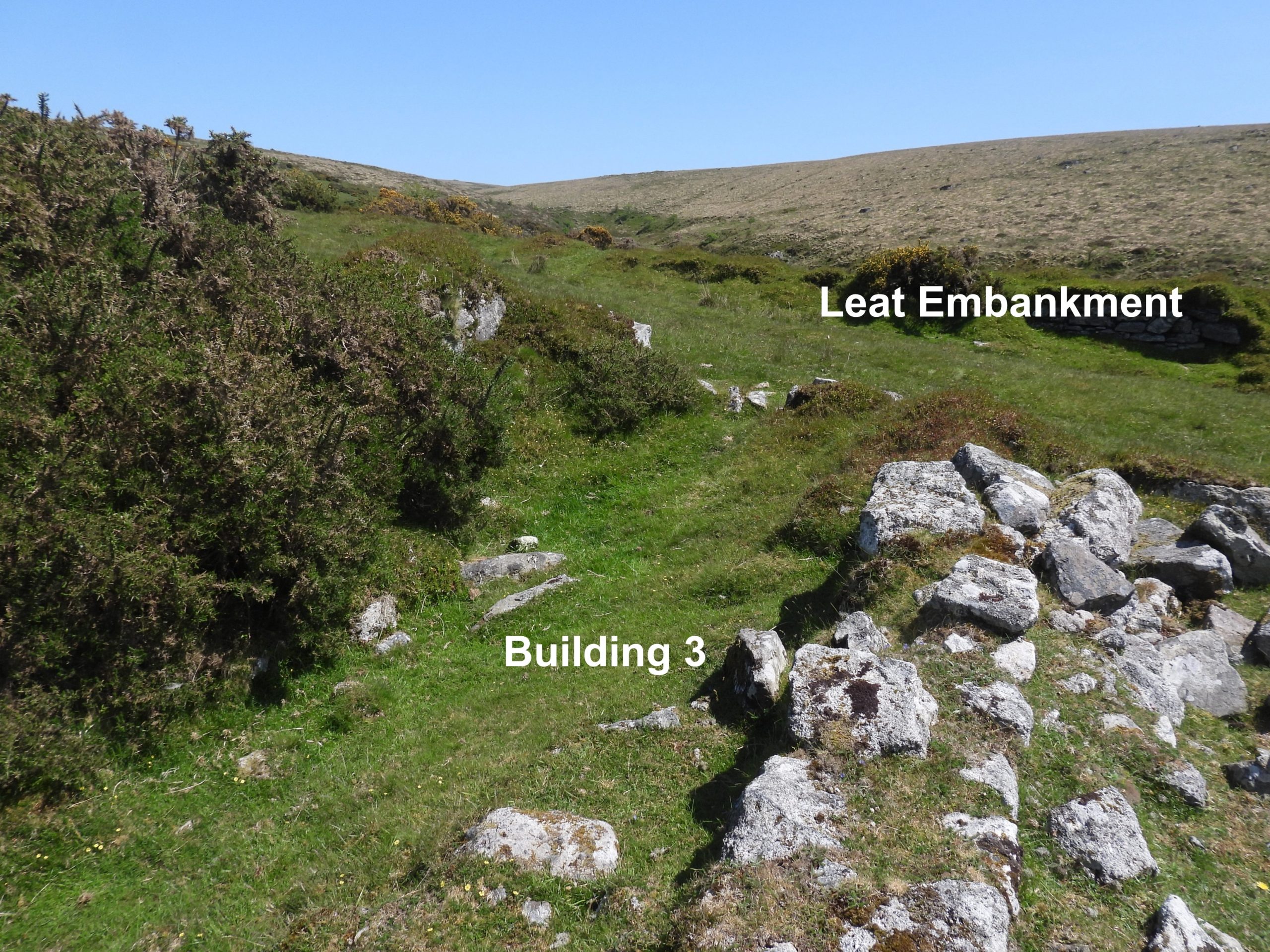
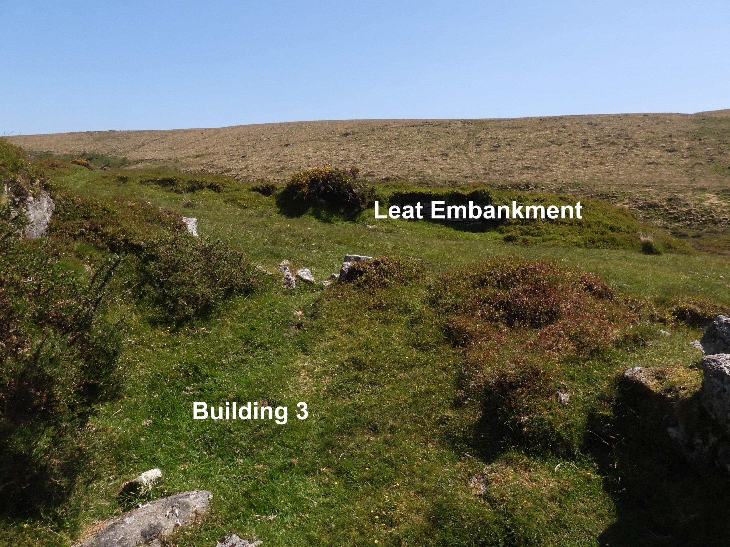
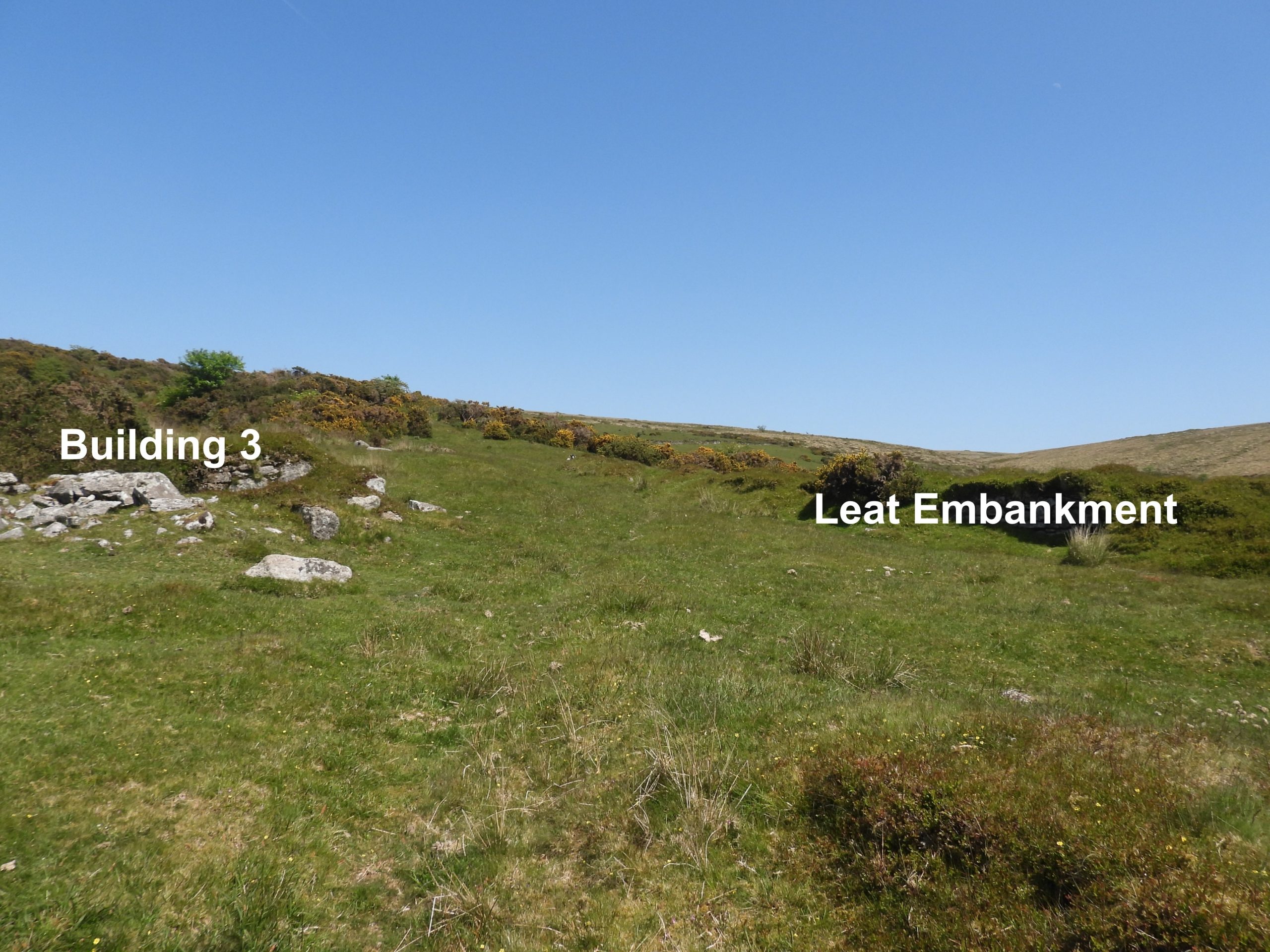
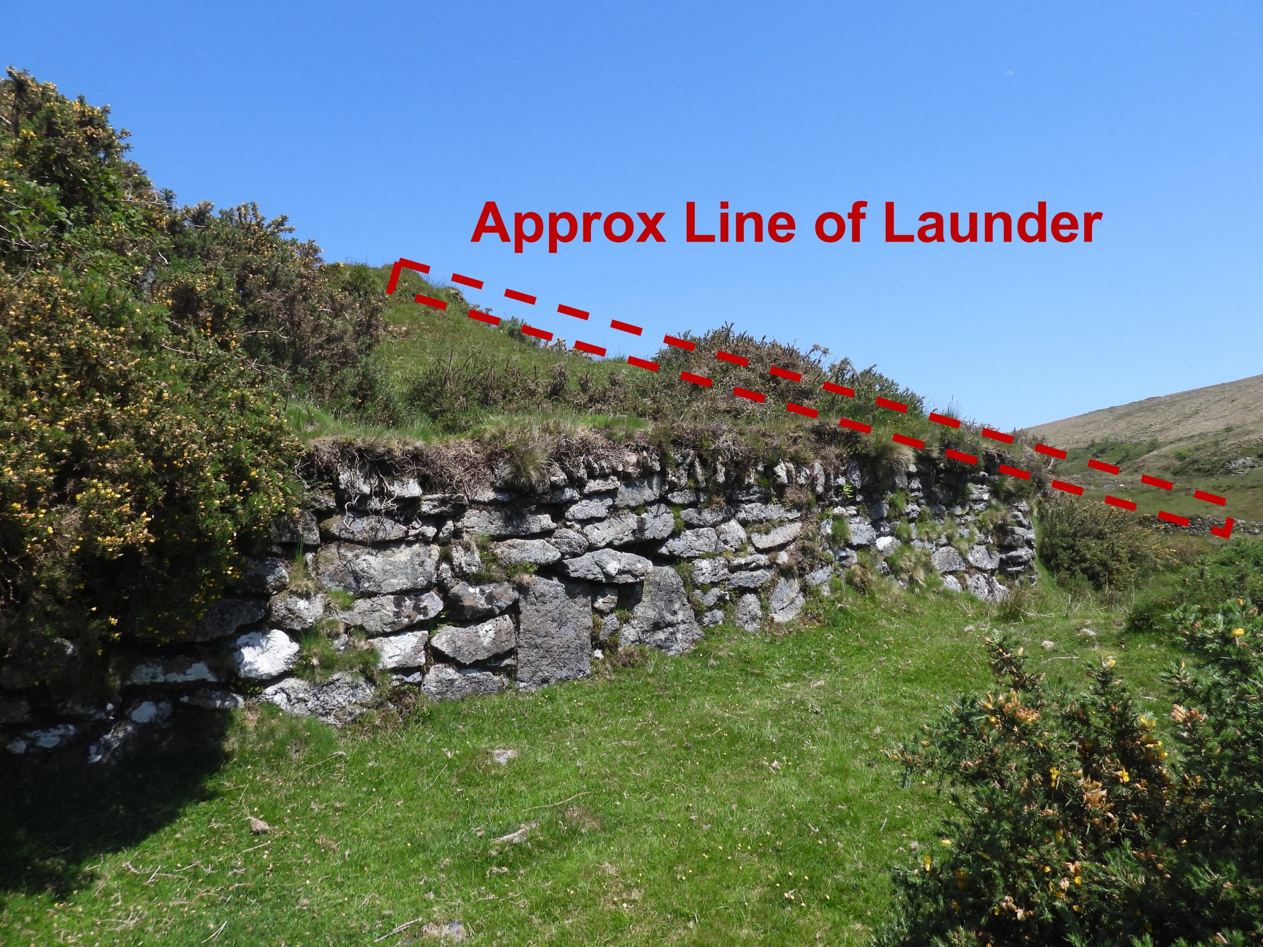
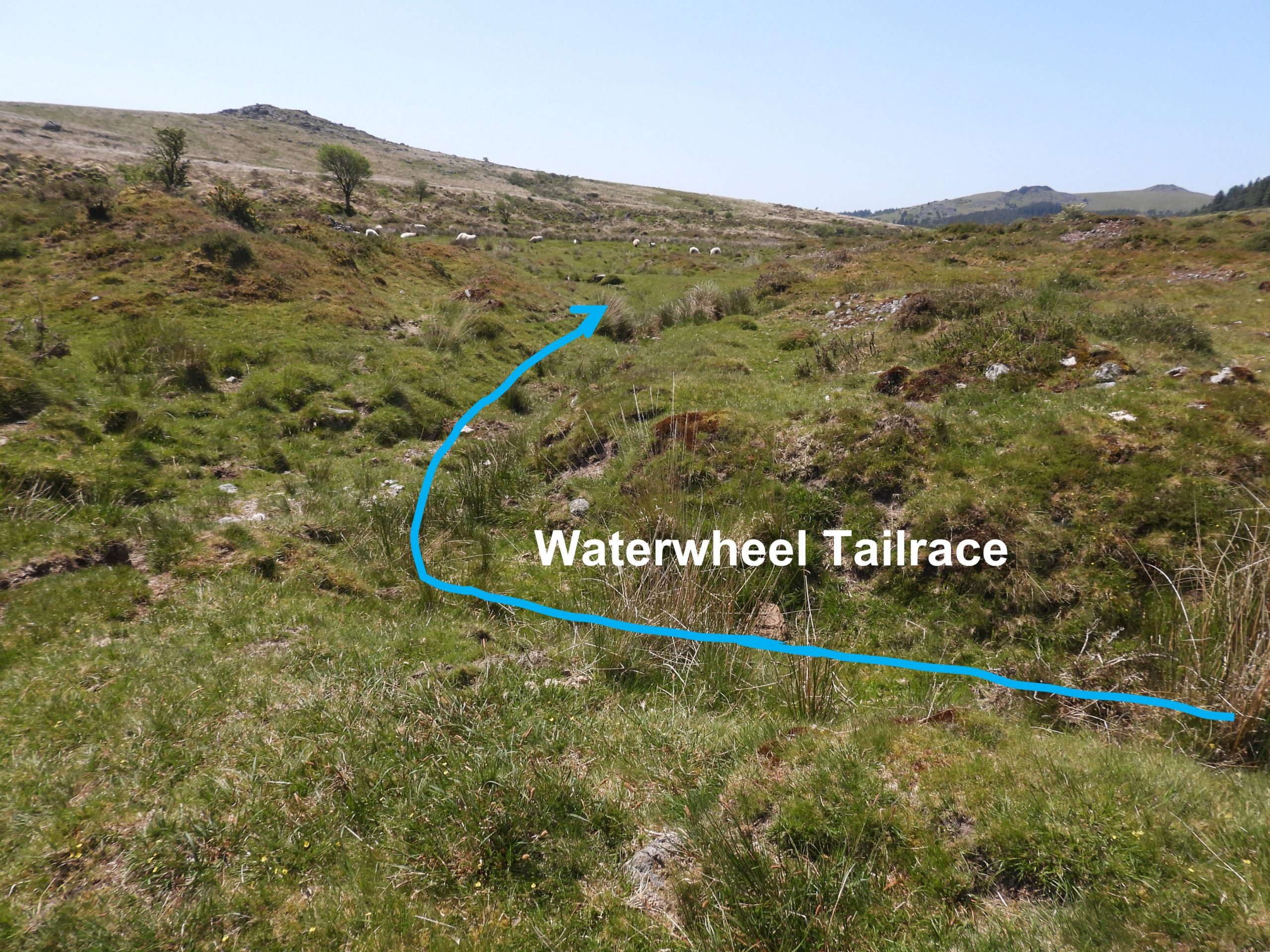
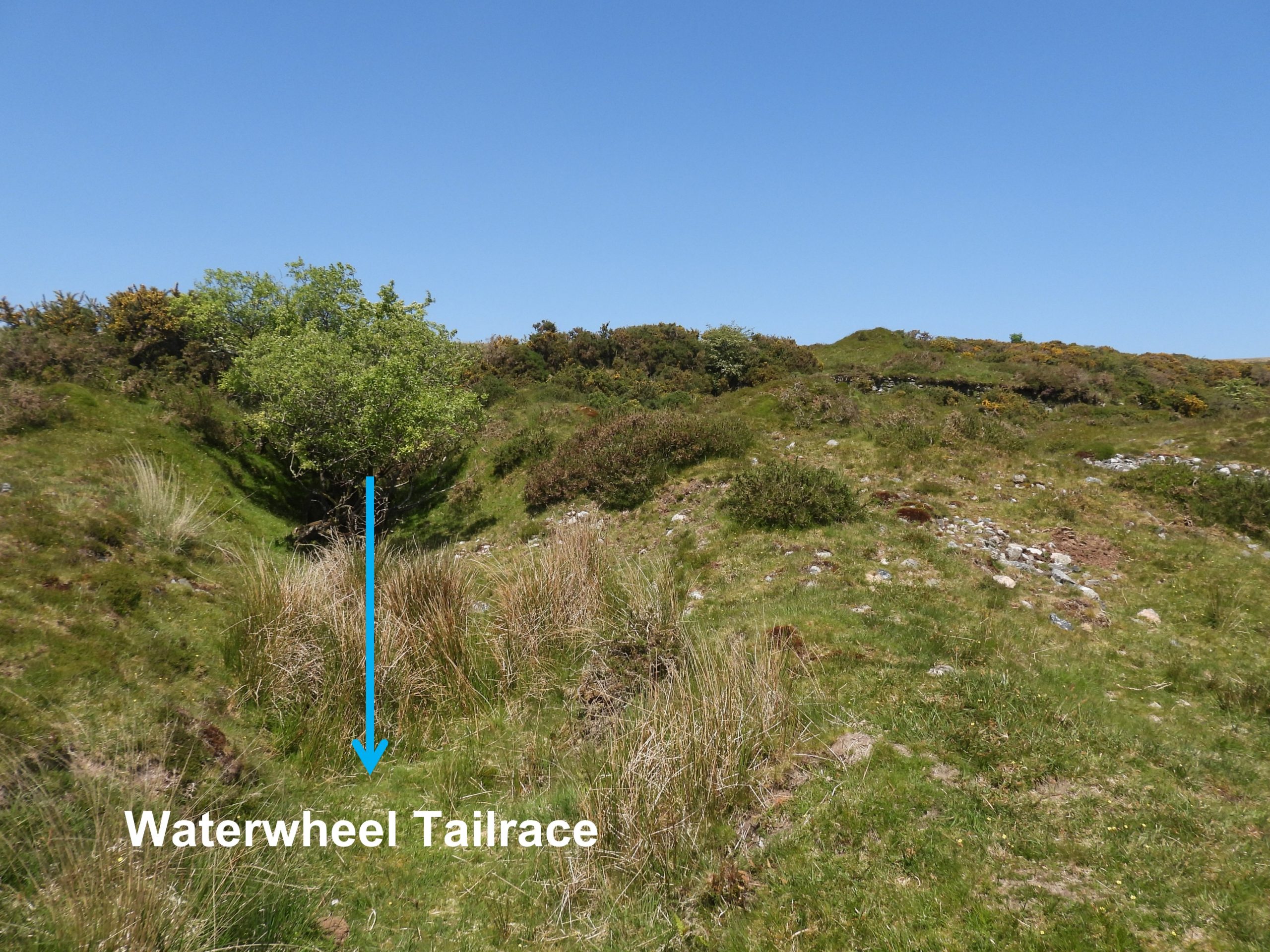
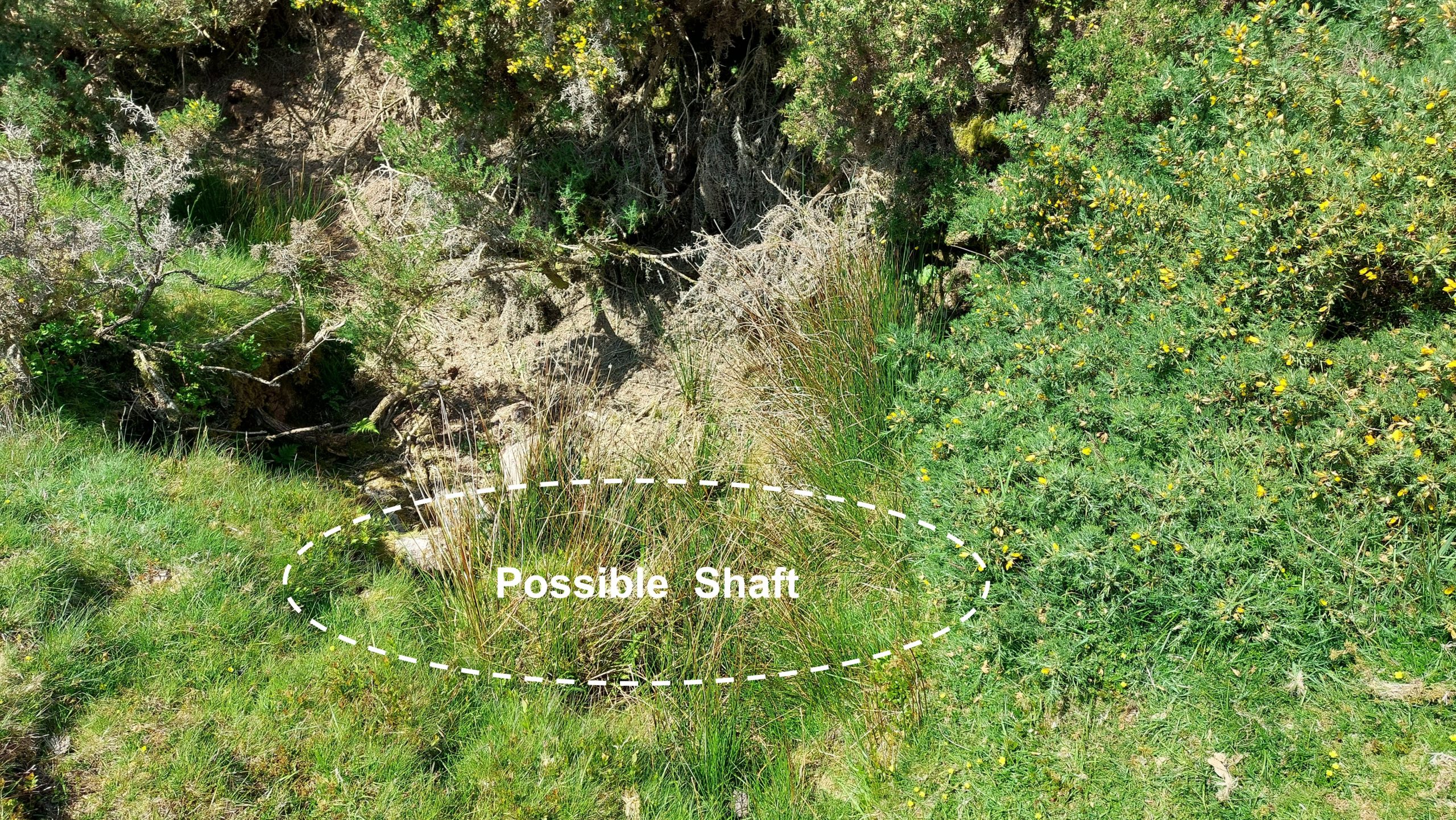
Sketch Map layout of the site of Plym Consols. Please note the Bob Pit and Portal for Waterwheel Tailrace are very overgrown and difficult to access and require extreme care if closer view required.Building 1 was visited by the well known Dartmoor observer / writer R.G Haynes in May 1966. He described it as “A small stone house, partitioned lengthways with porch”. This building is labelled as a ‘Tinners Hut’ on modern OS maps. The author has spoken to a member of Dartmoor Tin Research Group (DTRG) who called it the ‘Main Office’Building 1 is located in an area of older streamworks, around 70m south of the main mine working. The Ordnance Survey Archaeology Division in 1979 recorded it as measuring 5.5m by 5.1m. Entries in the Heritage Gateway suggest the building was associated with Plym Consols. To the author, it doesn’t look like a Tinners Hut from an earlier era.Building 1 is located at SX58557 69824On the north east corner of Building 1 are the fragmentary remains of a wall, which some observers think might possibly define a small yard.The ‘Small Yard’ is at SX58564 69818The walls of the ‘Small Yard’ are about 0.5m high.Heading north (ish) from Building 1 is a small clapper, which comprises 4 or 5 imposts. The clapper appears to have been constructed over the waterwheel tailrace and is part of a track between Building 1 and the main shaft of the mine. The clapper is located at SX58560 69844View looking south of the clapper and Building 1Near the track leading up to the main shaft from Building 1 is a second building, which is also labelled as a Tinners Hut on modern OS maps.Building 2 is well preserved and looks like a shelter or a small store. Building 2 is located at SX58553 69856. Like Building 1, this ruin doesn’t look like a Tinners Hut from an earlier era.The main shaft and the other artefacts associated with Plym Consols can easily be located by following the wide track from Building 1. The track leads directly to the main shaft. One assumes the material from the shaft was transported down this track ?The main shaft is very overgrown with gorse encroaching from the northThe main shaft is located at SX58574 69890The main shaft lies a few 10’s of metres to the east of a large earlier openwork. The 19th century miners must have believed there was still tin to be exploited in this area in spite of the large openwork worked by the ‘old men of the moor’View of the main shaft looking west. The large boulder in the top / centre of the photograph is part of the west side of the large old openworkThe large old openwork looking northThe large old openwork looking south with Down Tor in the distance.Next to the large old openwork are a series of walls, which at the point in the photograph look like they had been constructed into a small enclosure or possibly a crude building.The small enclosure / crude building is located at SX58571 69903The main shaft as viewed from the north, emphasising how overgrown it is becoming.To the west of the main shaft is a circular ‘cut out’, which looks like a location where there was a Capstan Wheel. It looks too small to have been a whim. The circular Capstan Wheel cut out is located at SX58568 69889The circular cut out for Capstan Wheel looking west across the very large old openworkTo the east of the main shaft is a masonry lined bob pit. It is very overgrown.Climbing carefully down the wall lining of the bob pit can be seen. It is very well constructed. The balance-bob helped to “balance” to the waterwheel in its operation. The bob pit is located at SX58581 69889The masonry lined bob pit can easily be missed when walking along the small path seen in the photograph, which links the main shaft and the wheelpit. It is engulfed by gorse.The granite wall within the pit cannot be easily seen from the path. Care should be taken if climbing down to investigate furtherAbout 10-15 metres east of the main shaft is a ruined wheelpit. It is now filled in and turfed over. The end of the leat embankment can be seen above (and behind) an old drystone wall.The wheelpit is located at SX58600 69893To the east of the wheelpit is a stone lined pit. The purpose of the stone lined pit is unknownThe stone lined pit is located at SX58607 69887The tailrace leading from the waterwheel is located in a deep overgrown gully running north to south.The waterwheel tailrace as viewed from aboveAn tailrace emerges through a portal, having been underground for around 8 metres from the wheelpit.Carefully climbing down into the gully, the author took a few shots of the portalThe portal exit is located at SX58590 69878The waterwheel tailrace and the portal are heavily overgrown and as with the balance-bob pit if a closer inspection / view is taken, the author would advise extreme care if climbing downClimbing to the top of the mine complex, superb views can be gained from the leat embankment The course of the leat along the leat embankment can easily be imagined. The author recorded the leat embankment at SX58616 69899The leat embankment as viewed from north westThe leat embankment was constructed with large granite blocksView across the mine complex from the end of the leat embankmentBetween the leat embankment and the very large openwork is a third building (Building 3)Building 3 lies on the very edge of the deep openworkBuilding 3 is located at SX58610 69910Building 3 (as Buildings 1 & 2) was most likely associated with the mineContextual view of Building 3 in relation to the Leat Embankment This spot alongside a drystone wall was a lunchspot for the author. It would have been the location where a wooden launder was located connecting the leat embankment and the waterwheel Heading towards the southern end of the mine complex, the waterwheel tailrace can be followed from the portal down towards the clapper shown at the start of this post. The picture shows where the tailrace turned 90 degrees from north-south to east-west orientation.The waterwheel tailrace as it exits the deep gully onto more open moorlandThe is a possible (exploratory?) shaft located at SX58619 69886