A collection of walks, discoveries, insights and pictures of exploring Dartmoor National Park
September 11, 2020
Merrivale Light Railway
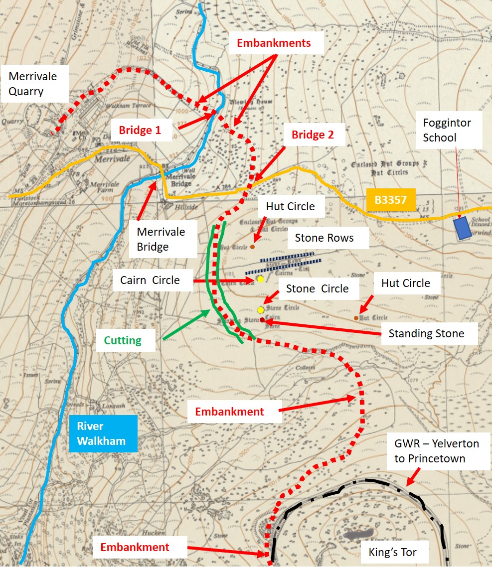
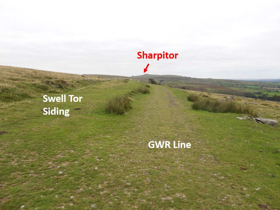
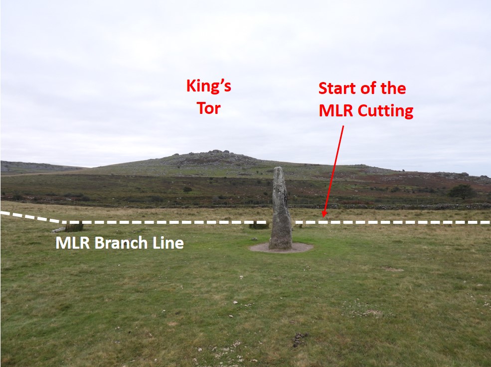
In Anthony R. Kingdom’s book, “The Yelverton to Princetown Railway” (1991), there is mention on page 75 of a proposed connection from the GWR line near King’s Tor to Merrivale Quarry. In 1908 plans were drawn up by Prigg & Lindon (Engineers) for this railway. It was to be 1 mile, 5 furlongs and 7.25 chains long, which is 1.72 miles or 2.76km. (NOTE: A furlong is 220 yards and a chain is 22 yards). It was to be known as the “Merrivale Light Railway” (MLR) of standard 4 ft 8.5″ gauge and its departure point was just past the Swell Tor sidings on the main Yelverton – Princetown line. This post traces the course of that railway and what might have been.
The estimate for the construction was around £12.6k in 1908, which in 2020 prices would be around £1.53m. The estimate can be found here:
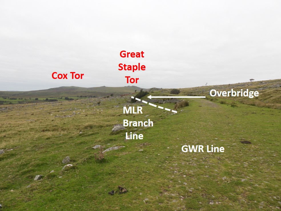
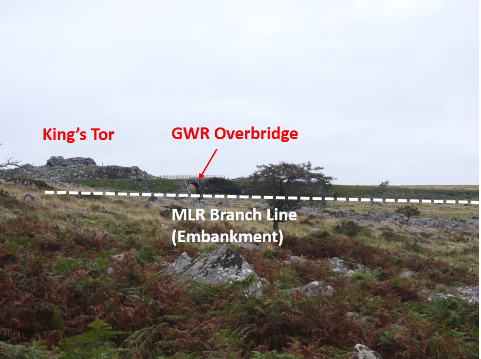
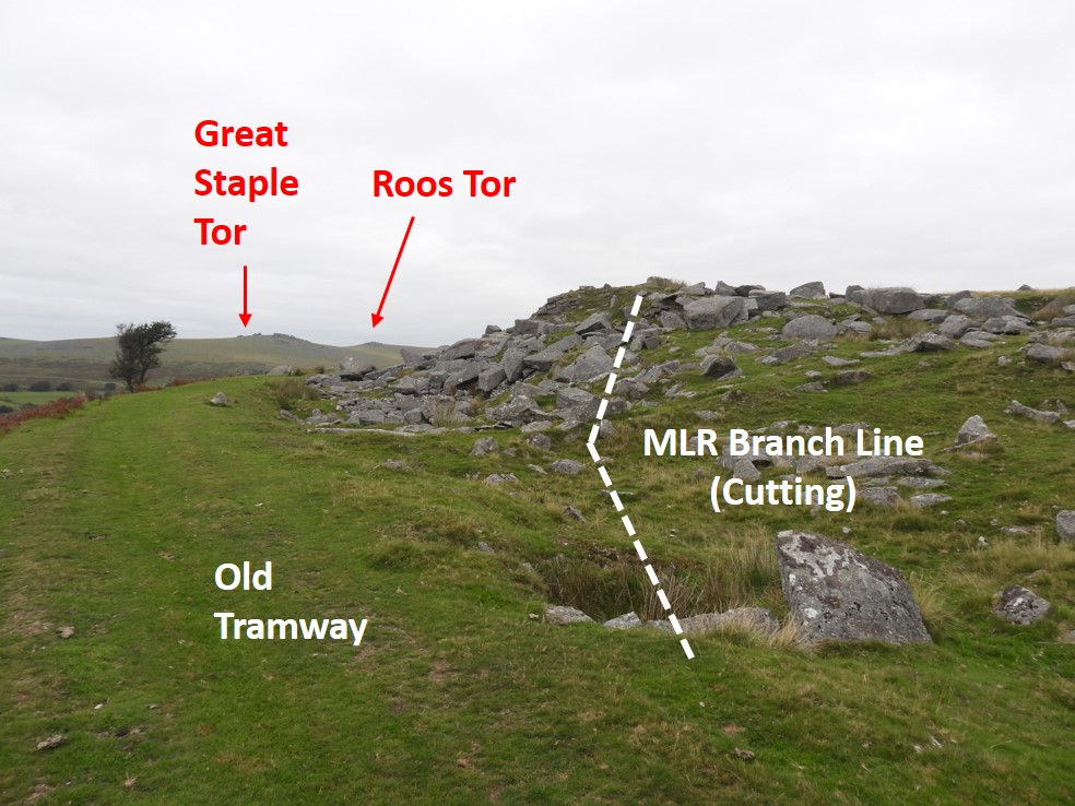
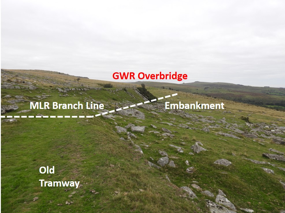
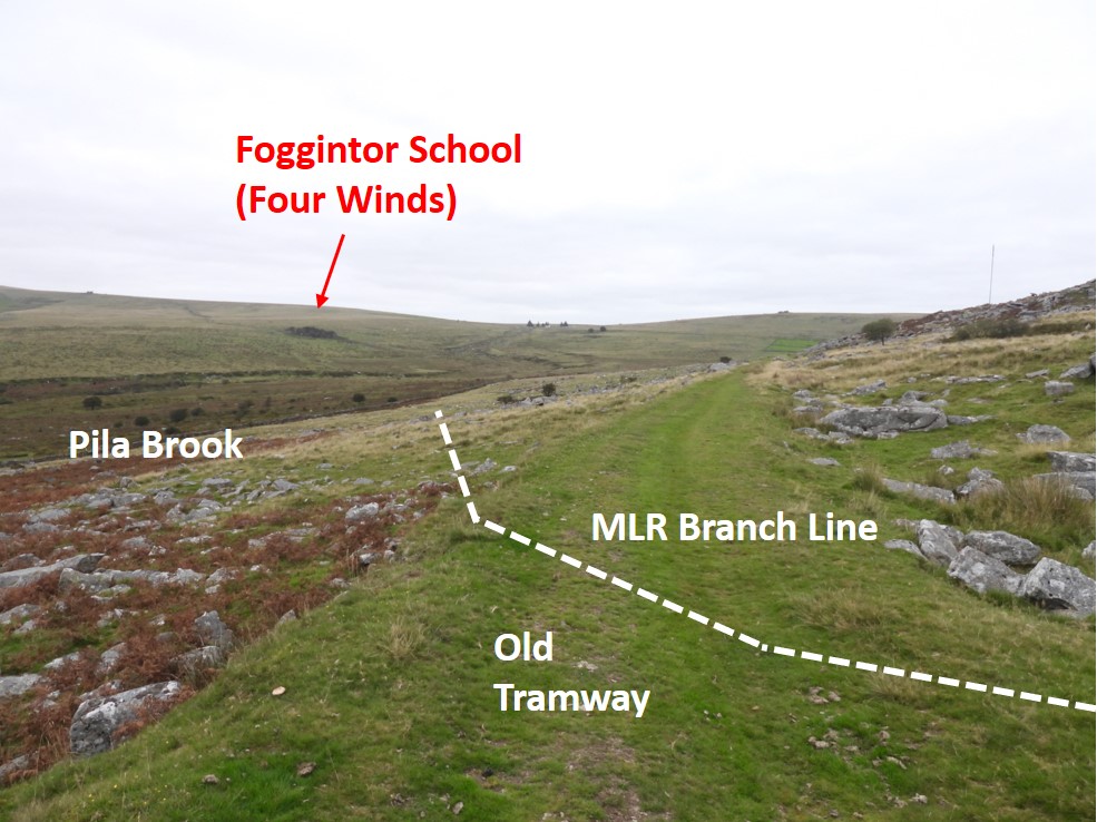
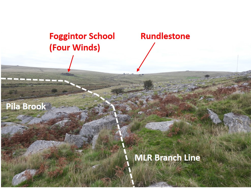
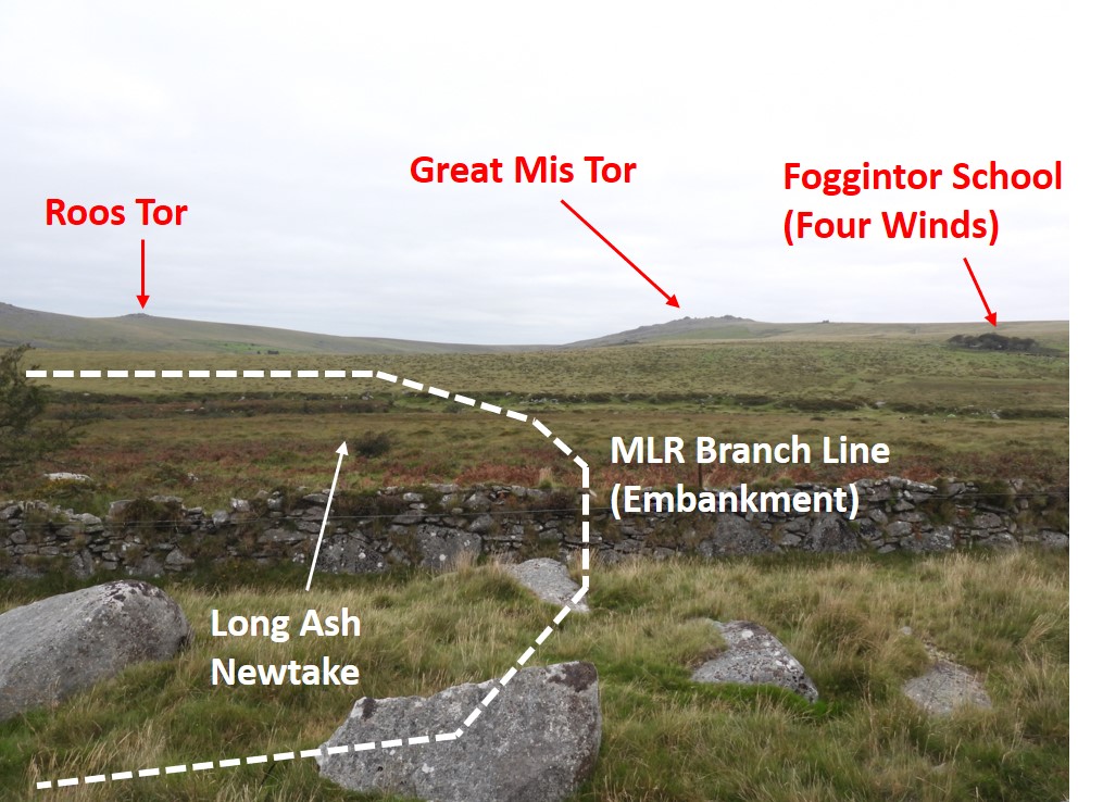
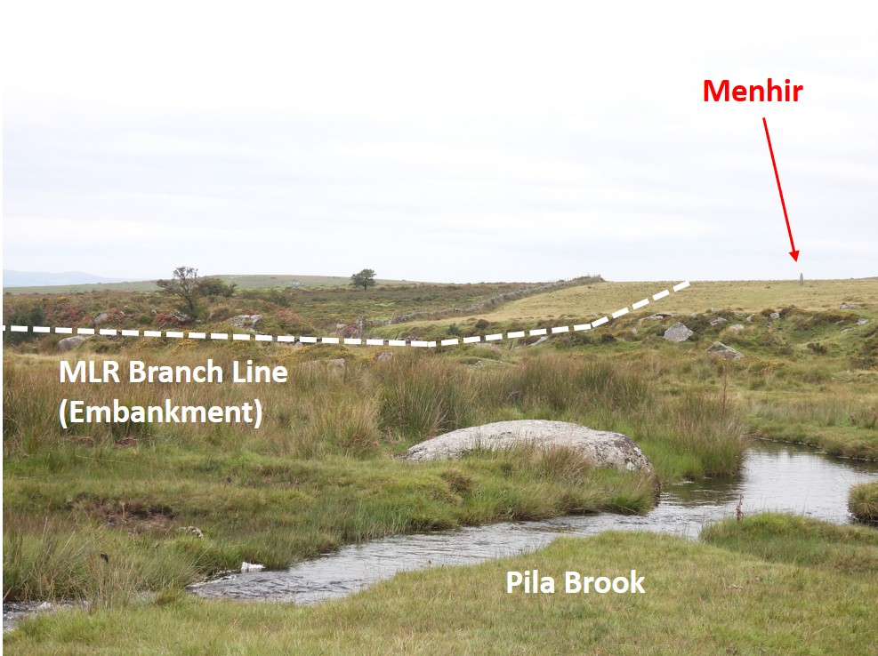
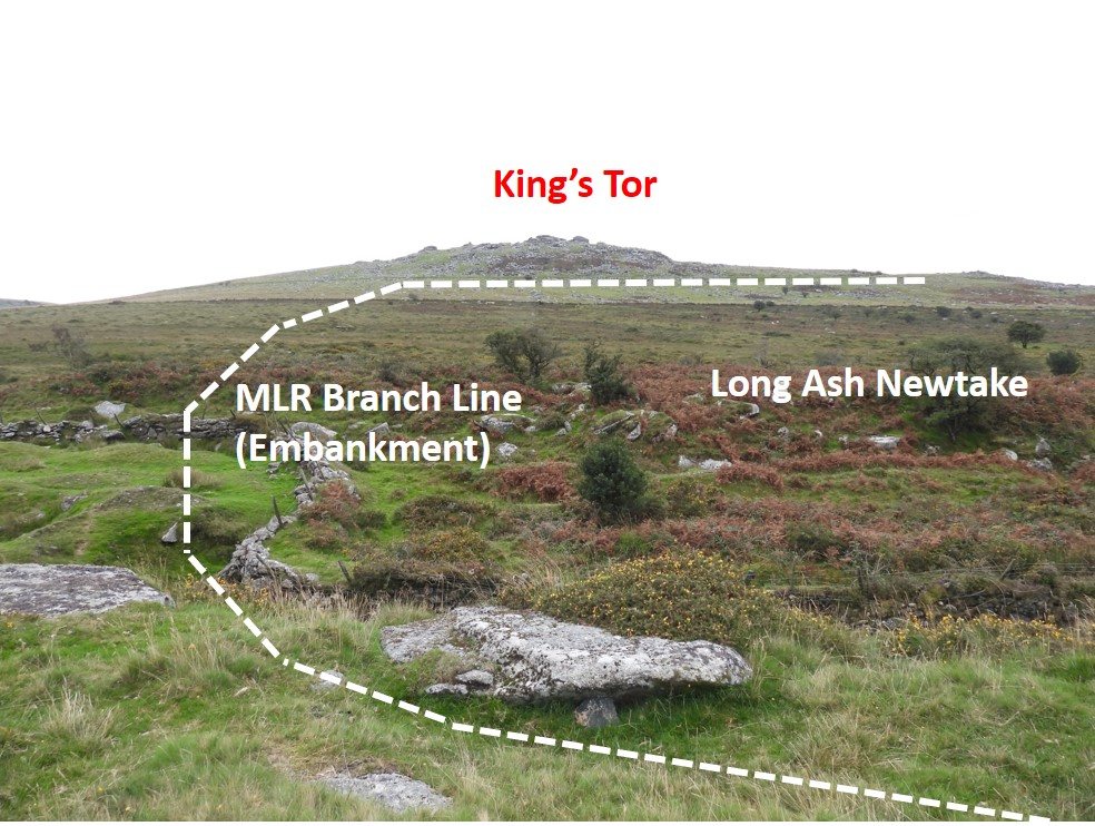
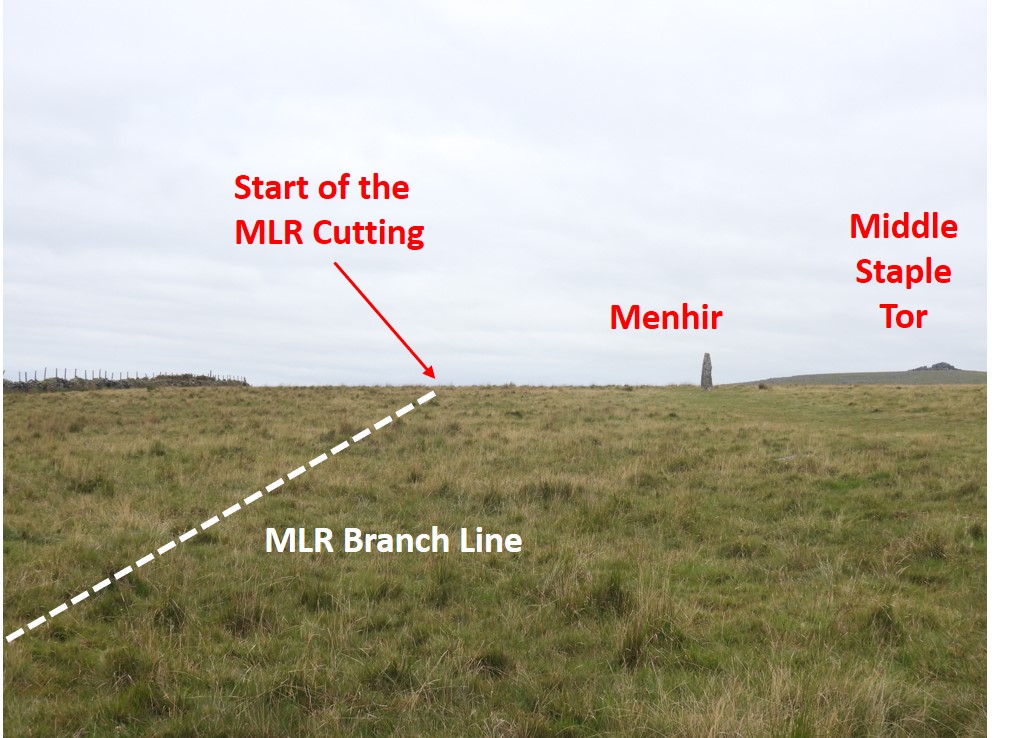
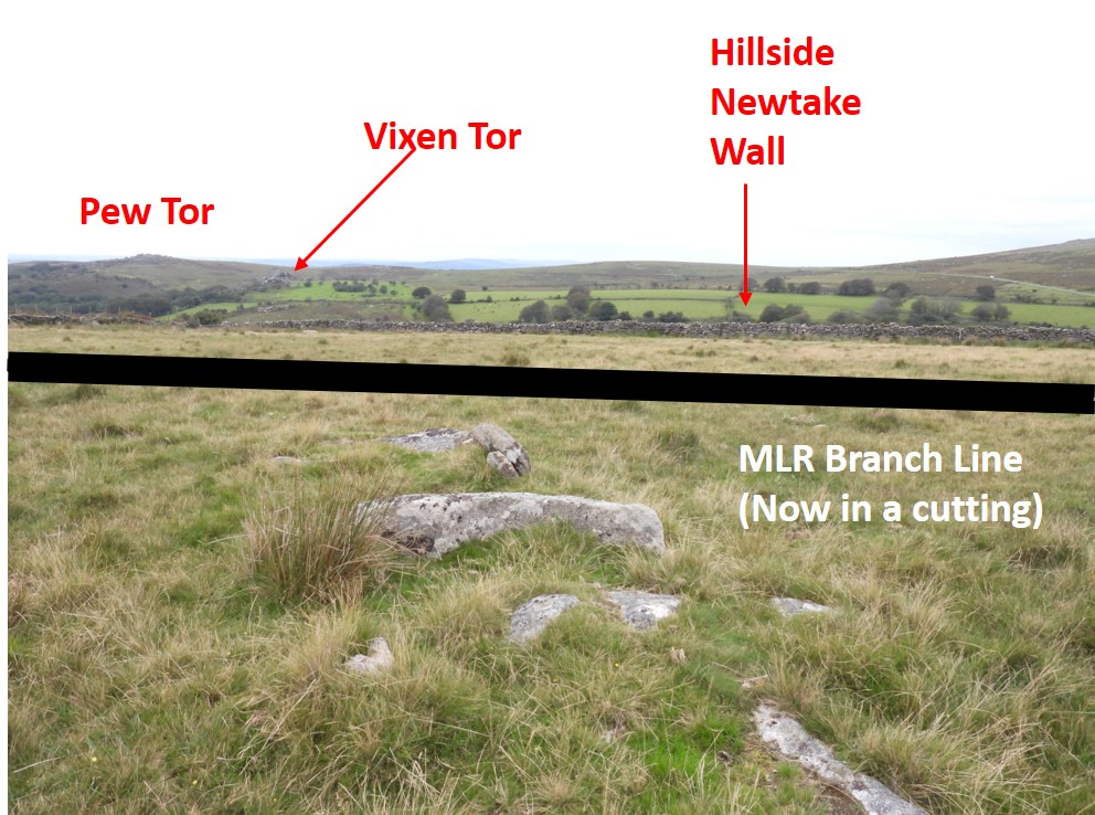
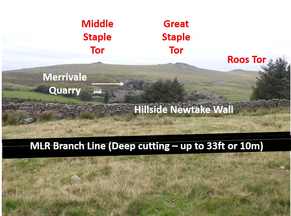
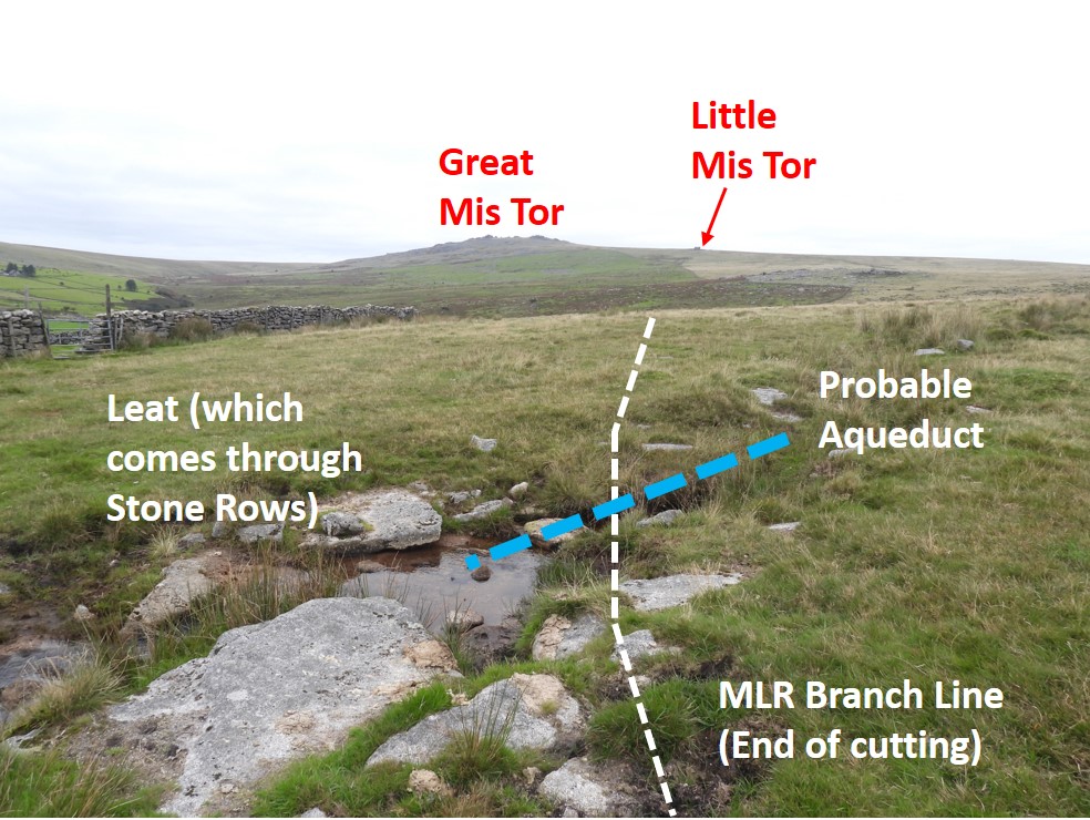
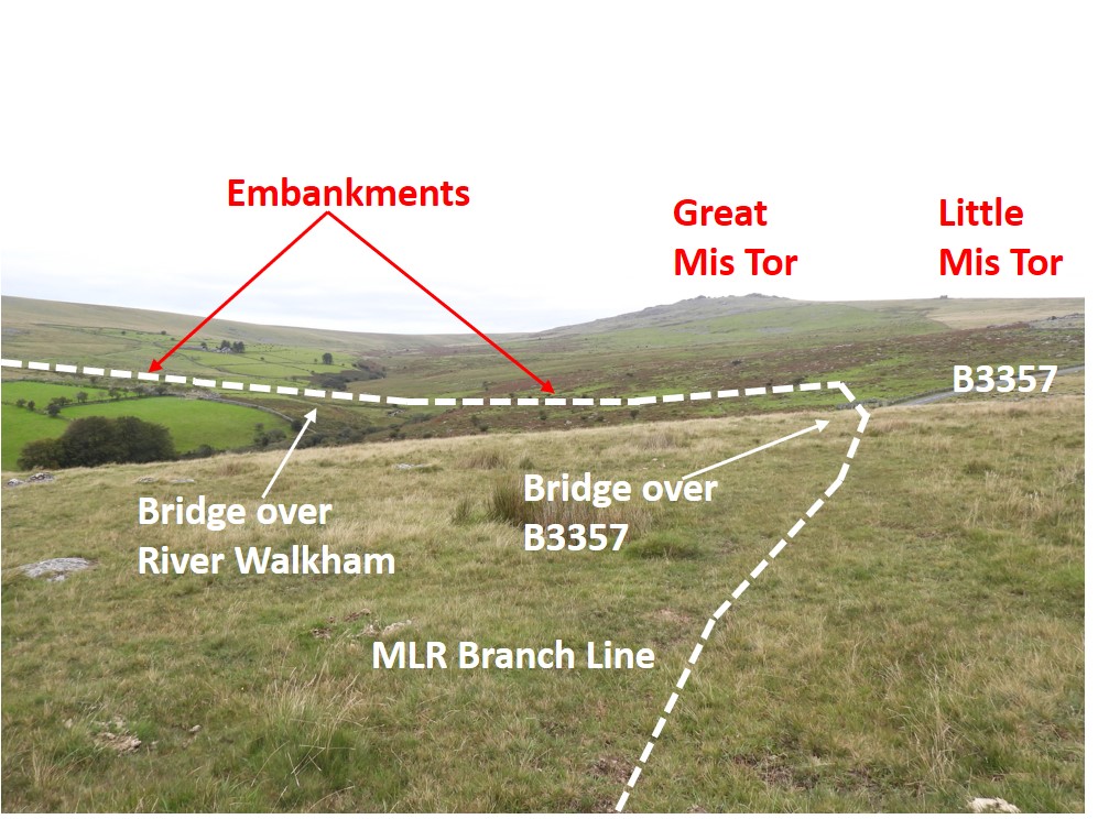
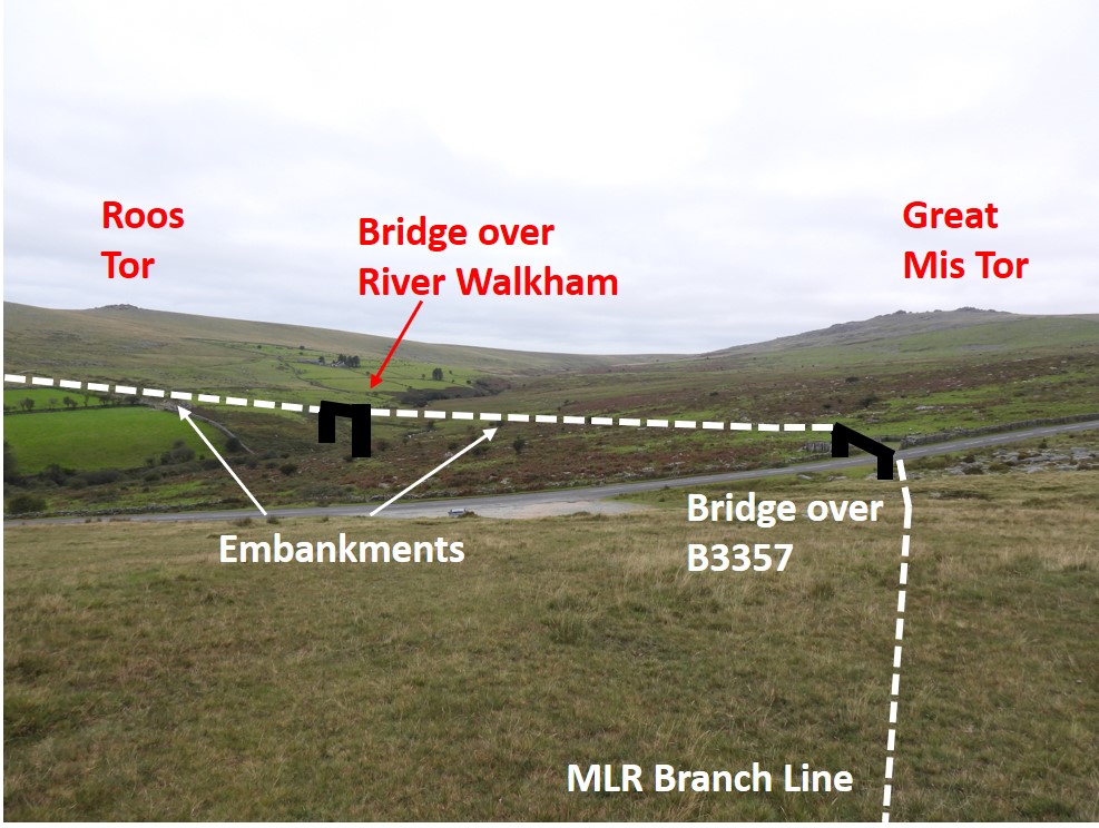
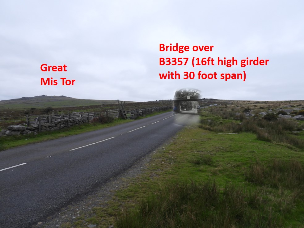
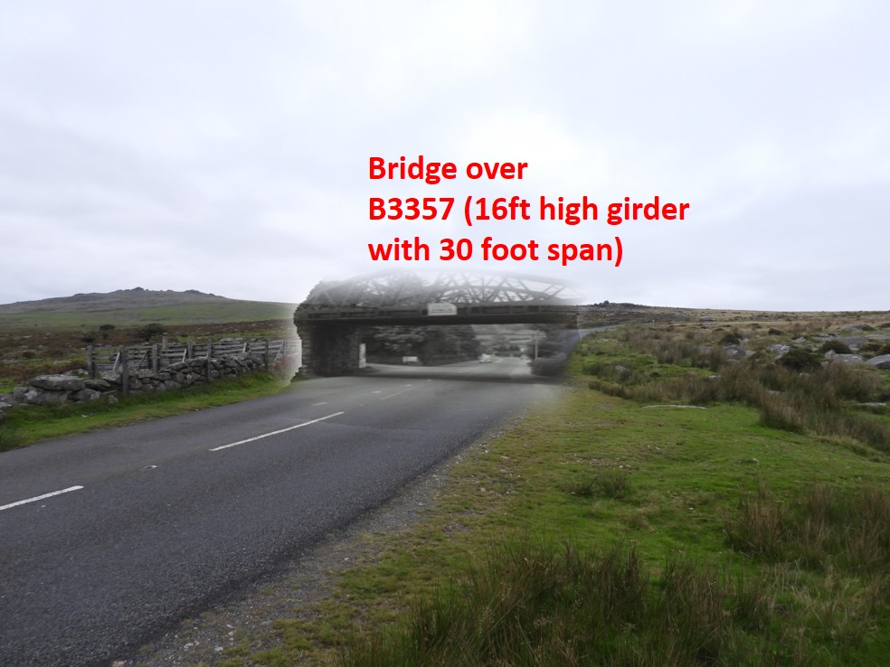
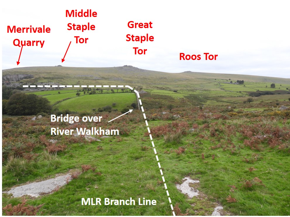
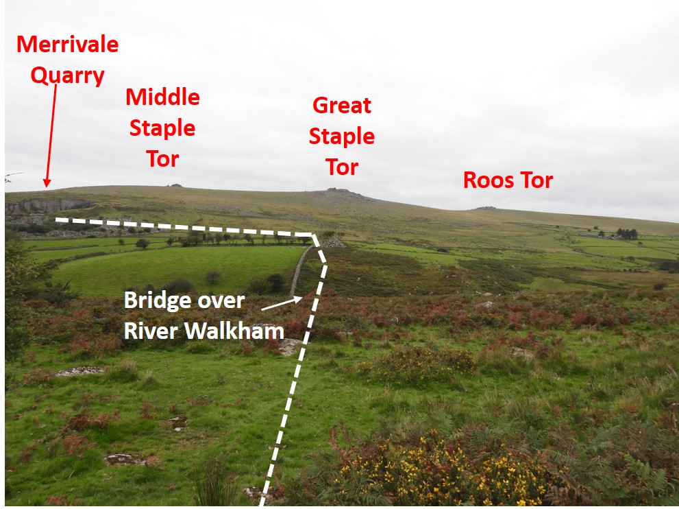
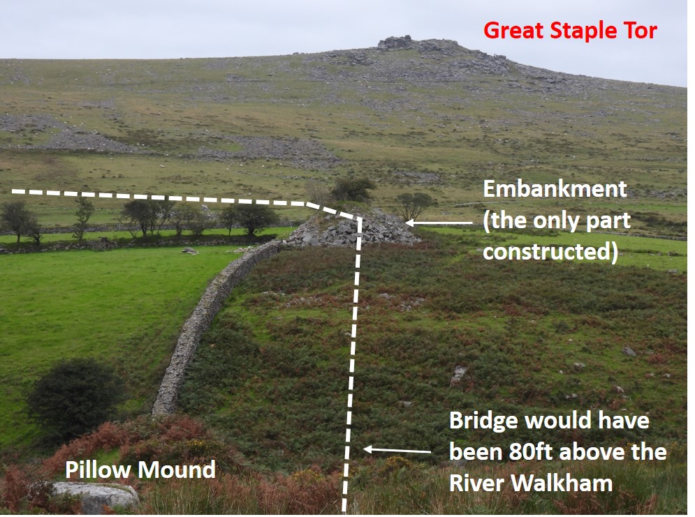
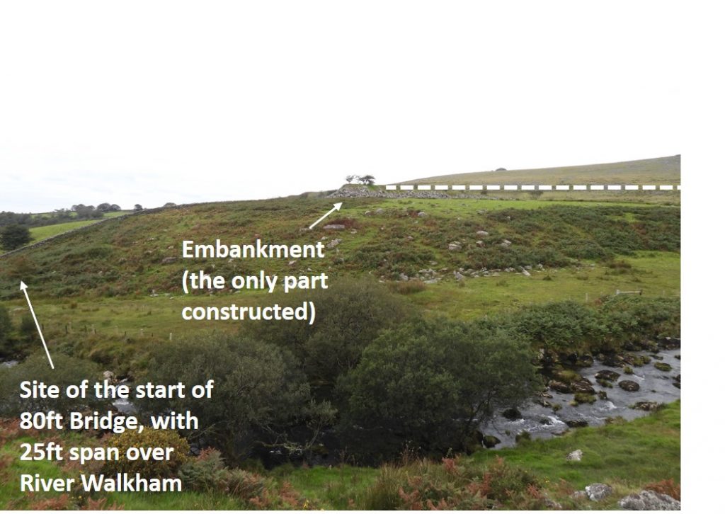
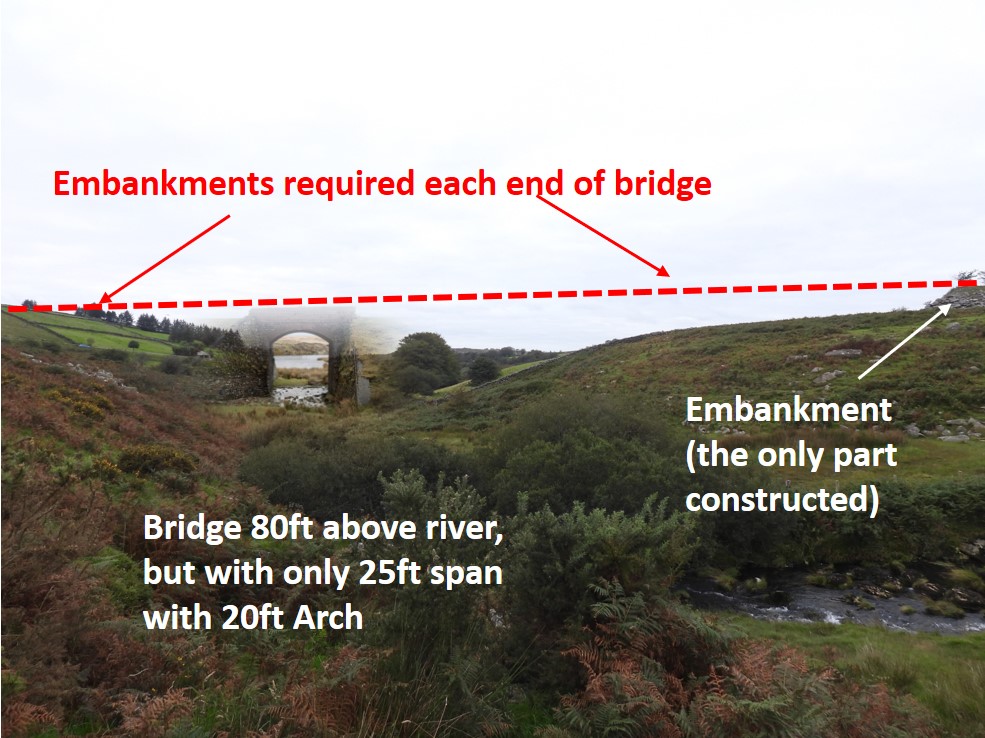
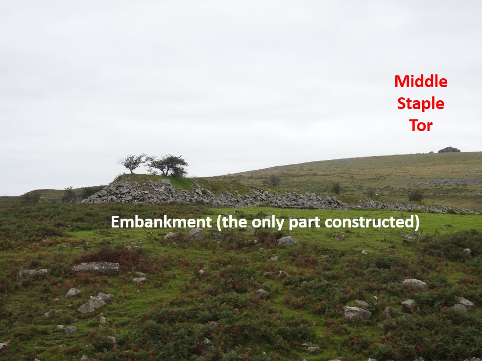
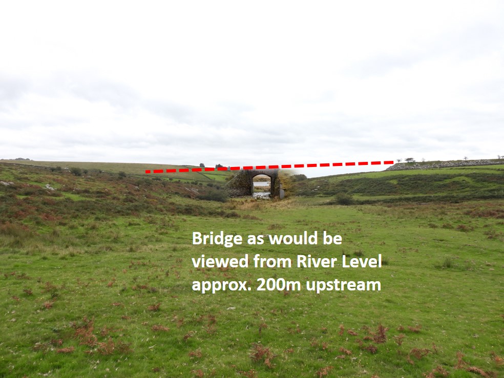
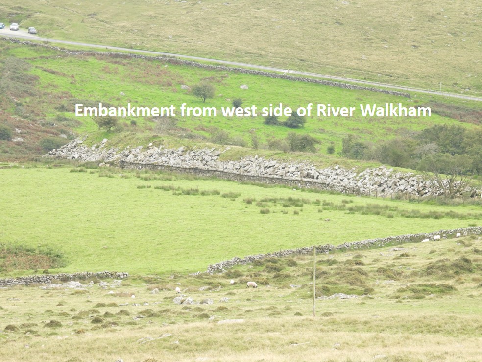
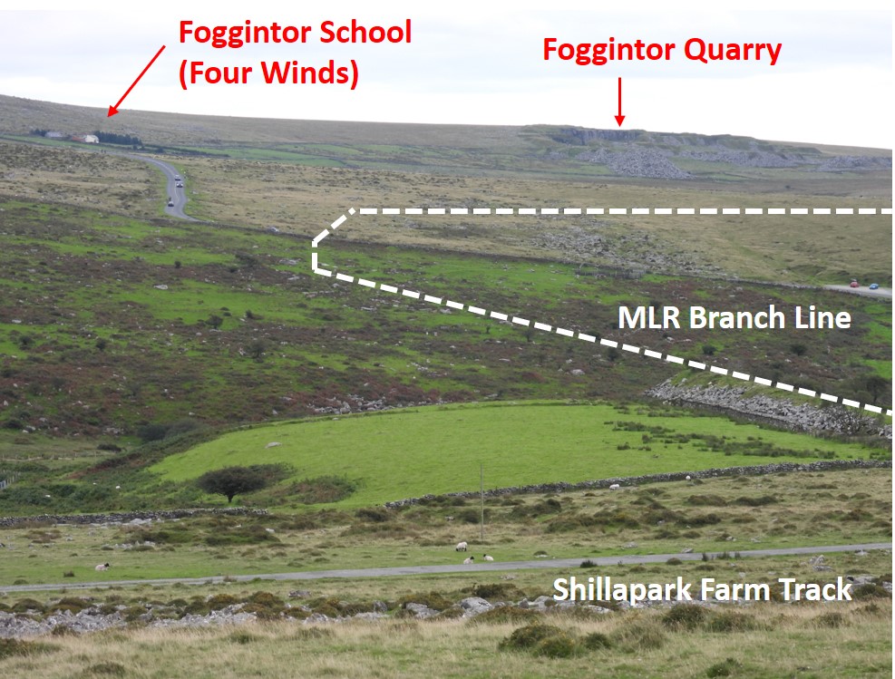
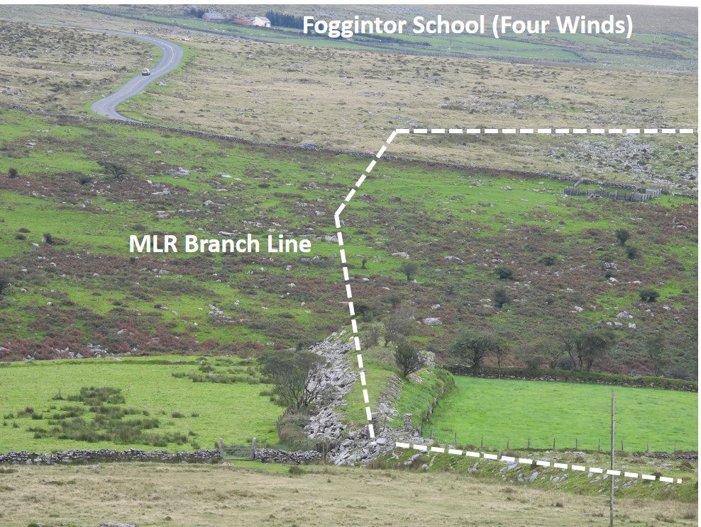
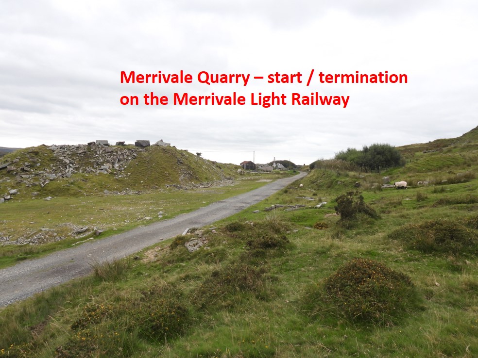
Taking the plans from Anthony R. Kingdom’s book (Pages 76 and 77), I have “overlaid” the railway proposed route onto a map from that era. There would have been 4 embankments, 2 bridges and a cutting. It is hardly surprising it was never financially viable.Close to the start of the MLR showing Swell Tor SidingsThe MLR would have had an embankment which would have been built alongside the existing embankment of the GWR railwayThe MLR construction would have needed to take into account the overbridge, which I have always assumed was for sheep and cattleThis part of the plan is confusing as the proposal was to cut across the old tramway (close to where the GWR line wraps around King’s Tor) and through a boulder strewn area. I assume it was to enable appropriate “curves” and gradients necessary to build the line down towards Long Ash Newtake.Another angle looking back at the GWR overbridgeThe Pila Brook side of the old tramway curve. A slight descent would have been necessary from this point.Boulder strewn hillside would have presented some construction problems no doubtThe plans involved cutting across Long Ash Newtake, so planning to cut through private land didn’t seem to matter ! An embankment would have been necessary here as the land drops down to the Pila BrookThe Pila Brook would have had to be crossed. Maybe a culvert was planned ? Looking across Pila Brook and Long Ash Newtake at the course the MLR would have takenThe plan was to run the MLR just south of the Merrivale Antiquities (fortunately). At that time, one wonders if the DPA (Hansford-Worth) had knowledge of these plans ?The start of the cutting for the MLR would have been close to menhirThe MLR cutting would have been up to 33ft (10m) in depthThe MLR would have run very close to Hillside Newtake WallAnother obstacle, the leat which comes off the Pila Brook near West Mead Quarry / Red Cottages area and runs across Long Ash Hill through one of the stone rows.Approaching the B3357The sites of the two proposed bridges plus two huge embankmentsThe B3357 road bridge was proposed to be a girder construction and would have looked out of place in this moorland setting. Here, I have superimposed a picture of a girder railway bridge in an attempt to show what it might have looked likeA close up of the proposed bridge. After crossing the B3357 the largest obstacle lay ahead, the River Walkham Valley just north of Merrivale BridgeApproaching the Walkham ValleyLooking across the Walkham Valley, there is an embankment, which is believed was part of the proposed construction.View of the embankment above the Walkham gives a sense of the height the railway would have had to run above the riverThe superimposed bridge, is a photograph of Leftlake Bridge on the Redlake Tramway. As the plans describe an “arch” I have assumed it would have been a bit more elegant than the girder bridge crossing the B3357. It would certainly have dwarfed the surroundingsA closer up view of the existing embankmentView from near river levelThe embankment taken from near the Grimstone and Sortridge Leat, just above the Shillapark Farm track A wider view of the proposal taken from Grimstone and Sortridge LeatLooking down on the embankment into the Walkham ValleyMerrivale Quarry, the reason behind the 1.72 mile (2.76km) railway plan. One wonders at the devistation this construction would have caused.
Fascinating ‘what might happened’ research. though really this and the news and other research material only highlights what a daft plan it really was. To say nothing of the potential environmental damage for such a tiny project. Thoughts and minds in 1908 were very different compared with the 1950’s and today I guess.
Fascinating ‘what might happened’ research. though really this, the news and other research material on this subject only highlights what a daft plan it really was. To say nothing of the potential environmental damage for such a tiny project. Thoughts and minds in 1908 were very different compared with the 1950’s and today I guess.

Simon Dell November 5, 2021
A wonderful piece of research Steve thanks so much for bringing this to the public arena.
Ian Waugh July 27, 2023
Fascinating ‘what might happened’ research. though really this and the news and other research material only highlights what a daft plan it really was. To say nothing of the potential environmental damage for such a tiny project. Thoughts and minds in 1908 were very different compared with the 1950’s and today I guess.
SteveGriggDartmoor July 27, 2023 — Post author
Hi Ian,
Thank you for your comments. I agree with you regarding the thoughts and minds of the quarrymen in 1908.
Kind Regards,
Steve Grigg
Ian Waugh July 27, 2023
Fascinating ‘what might happened’ research. though really this, the news and other research material on this subject only highlights what a daft plan it really was. To say nothing of the potential environmental damage for such a tiny project. Thoughts and minds in 1908 were very different compared with the 1950’s and today I guess.