A collection of walks, discoveries, insights and pictures of exploring Dartmoor National Park
April 5, 2024
Wheal Friendship (1870s to 1950s)
Wheal Friendship Mine in Mary Tavy from the late 18th century up until around 1870 was synonymous with copper mining and had been very profitable. By 1865 it was estimated that the mine had produced 145,805 tons of copper, 1170 tons of lead , 120 tons of tin and 4,343 tons of arsenic. P.H.G. Richardson in ‘Mines of Dartmoor and the Tamar Valley after 1913’ (Chapter 4) states that the mine was second only in magnitude to Devon Great Consols (in the Tamar Valley). However, copper mining and production diminished in the 1870s and the mine owners and management began to turn their attention to arsenic (with a small amount of tin production).
Thus the landscape in Mary Tavy changed considerably in the 1870s and 1880s when enormous arsenic condensing chambers and flues were built, new shafts were sunk and an incline tramway laid. This later ‘second phase’ in the life of the mine relating to Arsenic and Tin production lasted until around 1925, albeit some working of dumps and tailings continued until the 1950s. It is this period of time which leaves us with most of the mining (above ground) artefacts we can see in the area today.
Further to previous visits to the mine (using Richardson’s publication as a guide), the author was fortunate enough in March 2024 to join a guided walk with the Dartmoor Tinworking Research Group (DTRG) to the mine and was able to gain access to hitherto parts of the operations at Wheal Friendship which are on private land. Visits to the mine, prior to the DTRG walk, had been restricted to using public footpaths, albeit this does provide with careful planning some appreciation of the many remaining artefacts.
This post has been created to concentrate on the ‘second phase’ of Wheal Friendship Mine (1870s to 1950s), just as Richardson did in Chapter 4 of his book, although some mention of the copper production years is also considered.
Bibliography
P.H.G. Richardson: ‘Mines of Dartmoor and the Tamar Valley after 1913’ – Chapter 4
Wheal Friendship Minute Book and Ledgers (1816-1875) – Mike Brown.
R. Waterhouse (2017), The Tavistock Canal. Its History and Archaeology, 433-436
J.R.L Thorp(1997), The Miner’s Dry, Mary Tavy,
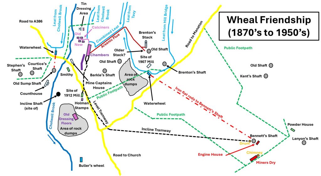
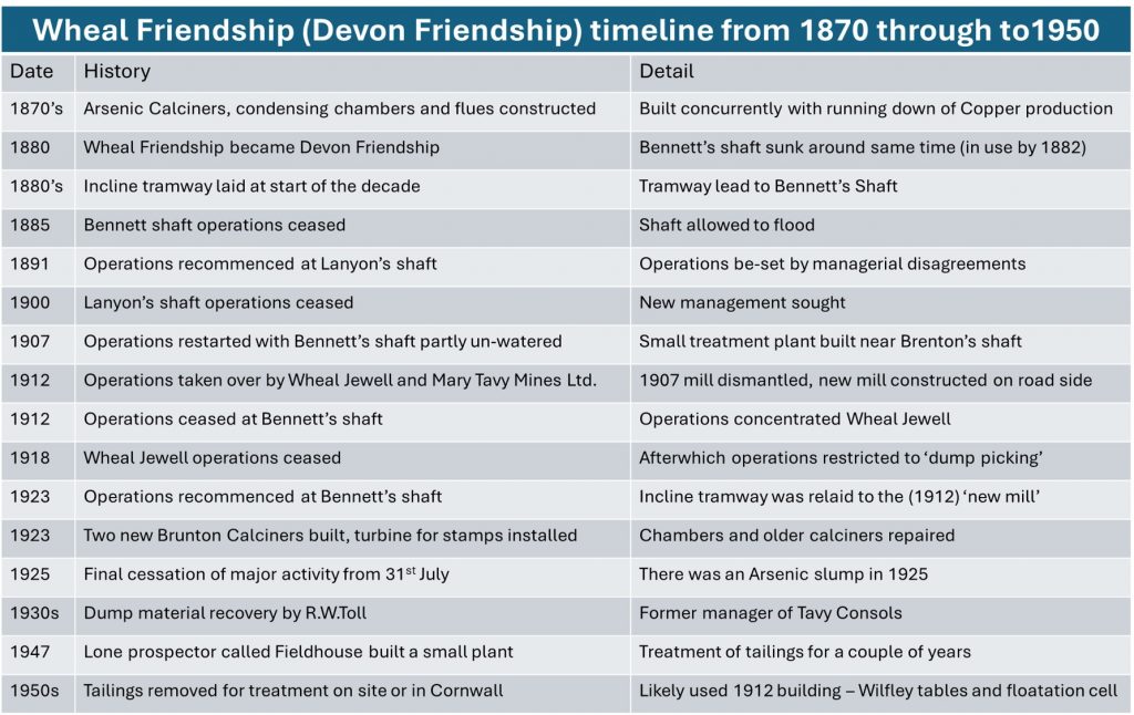
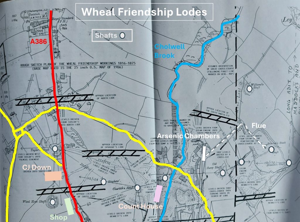
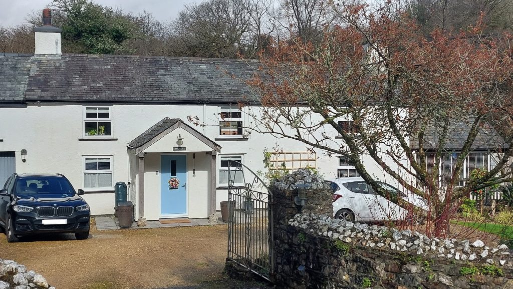
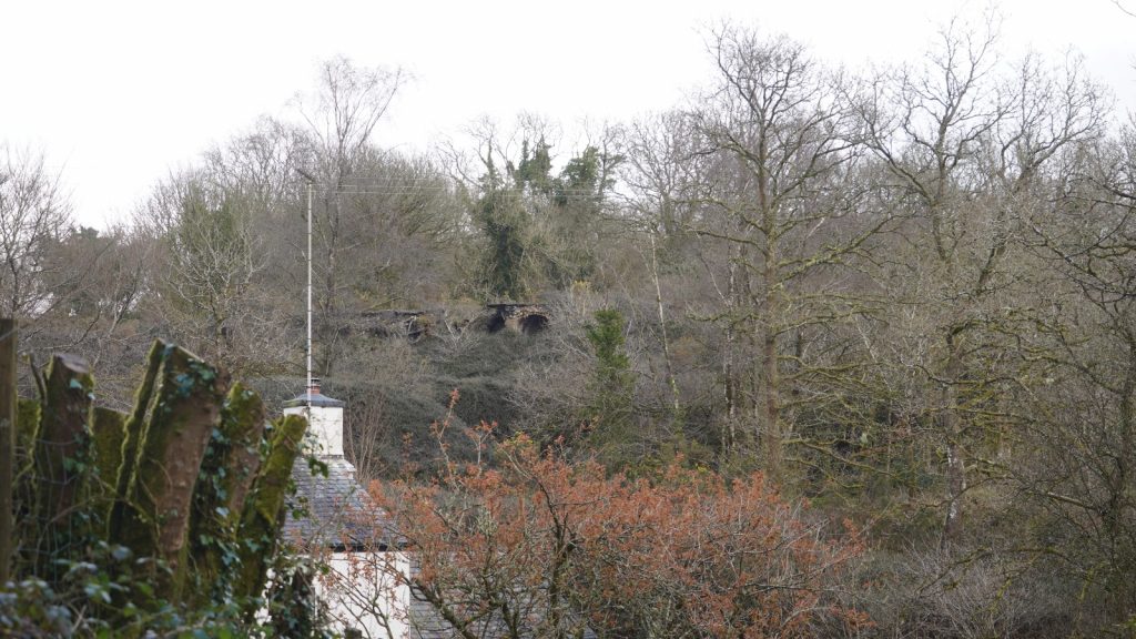
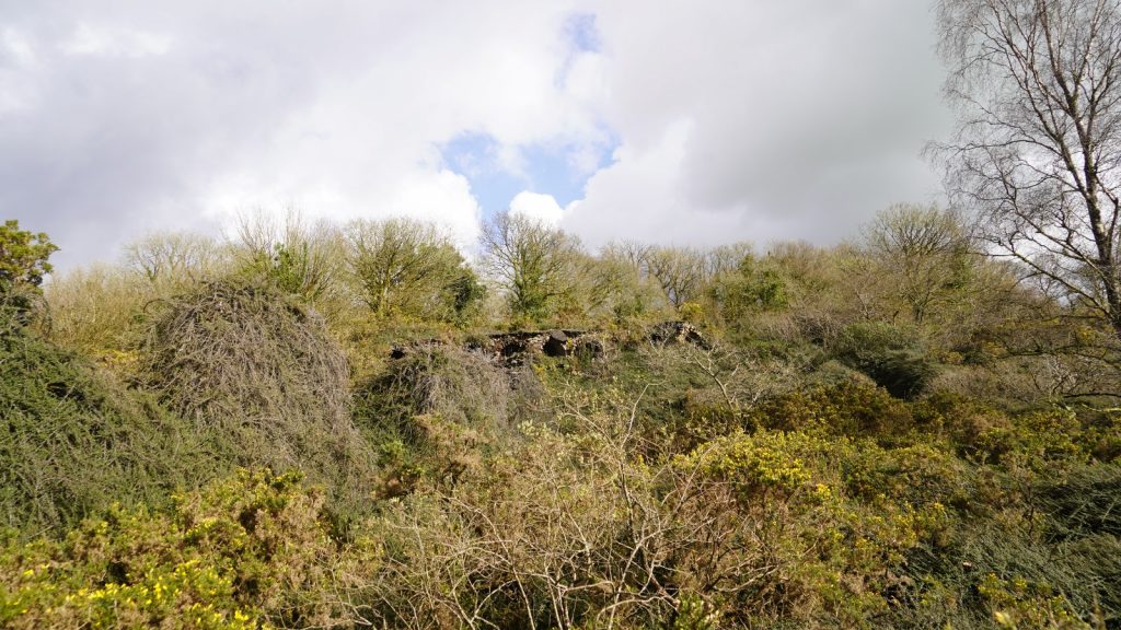
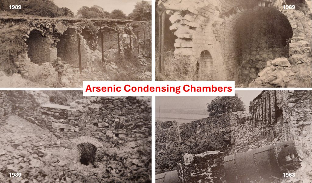
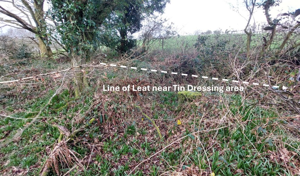
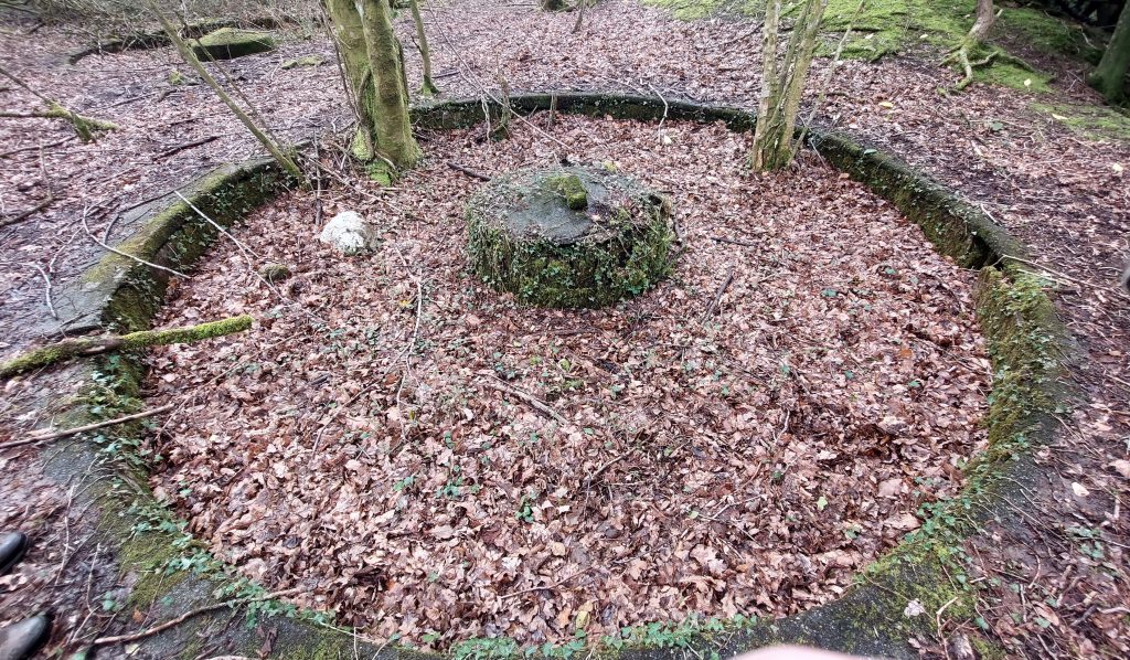
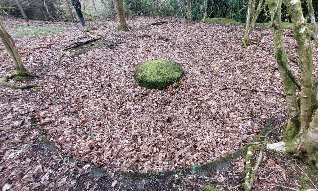
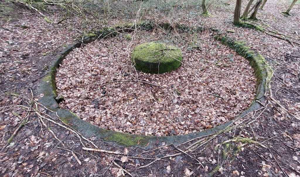
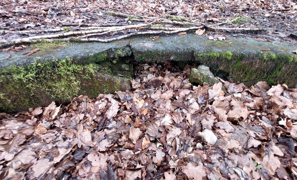
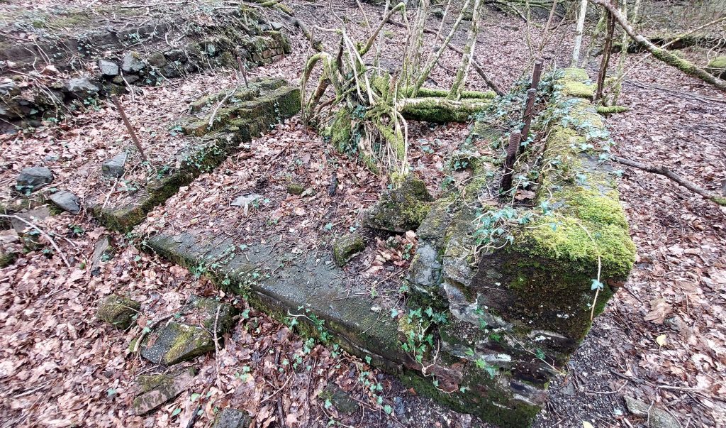
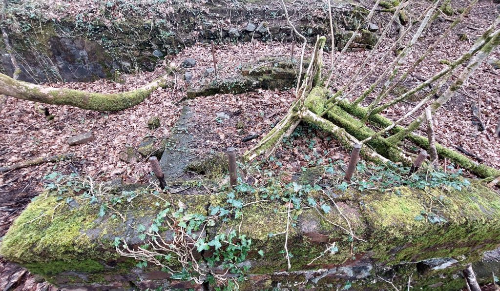
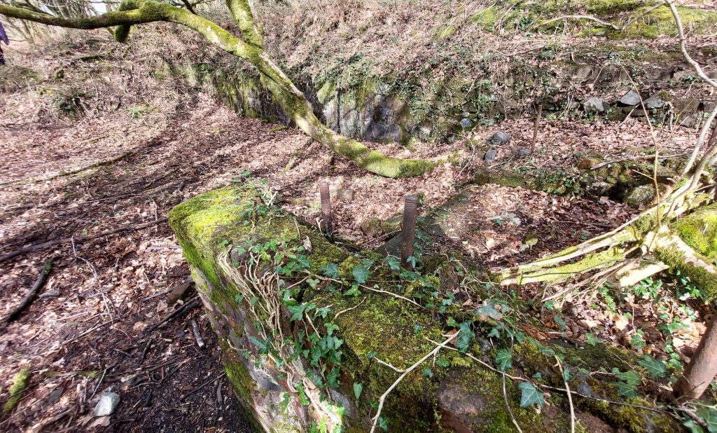
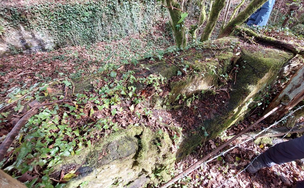
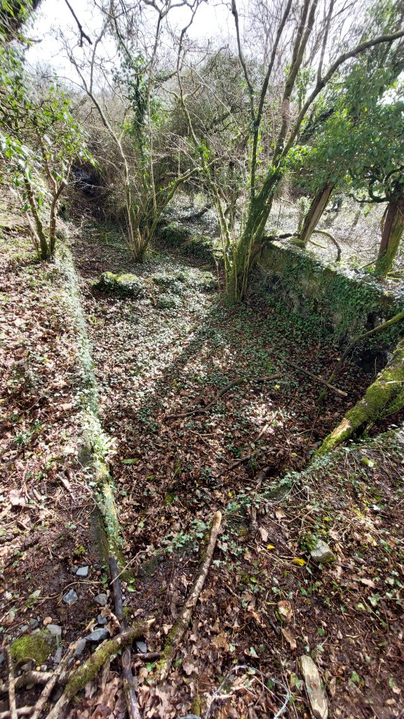
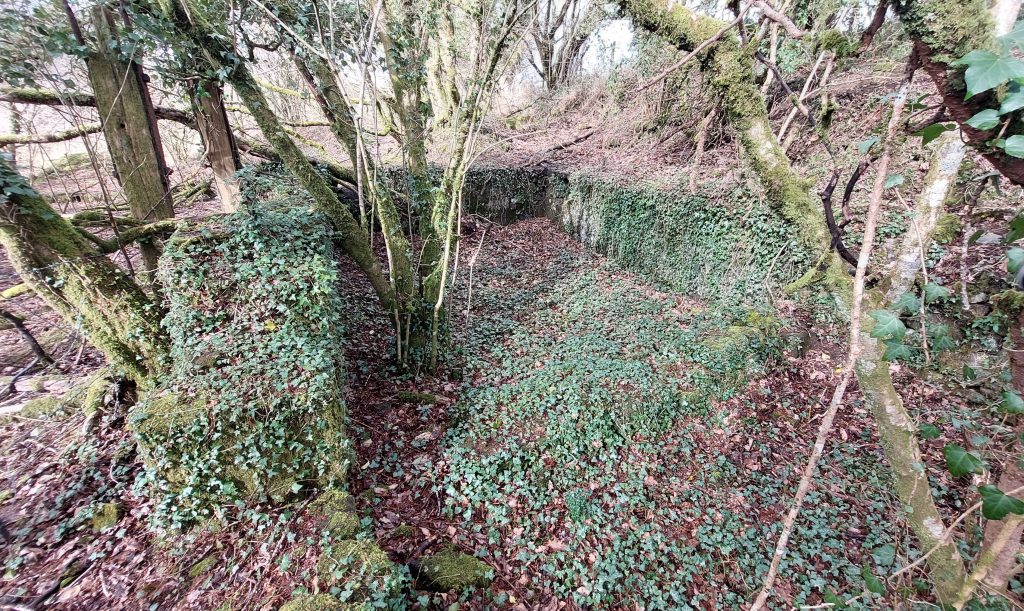
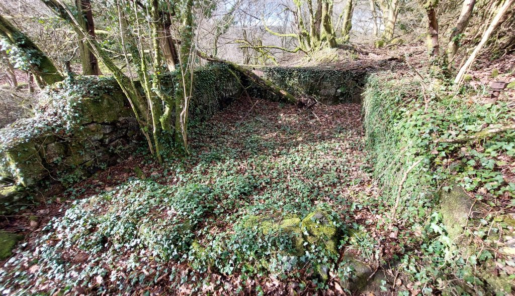
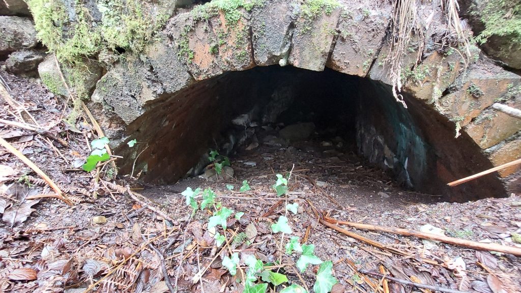
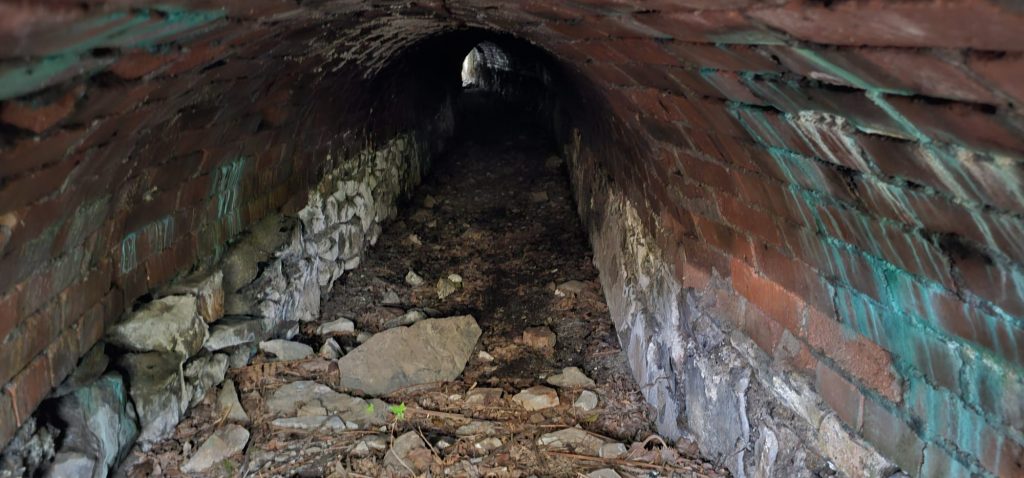
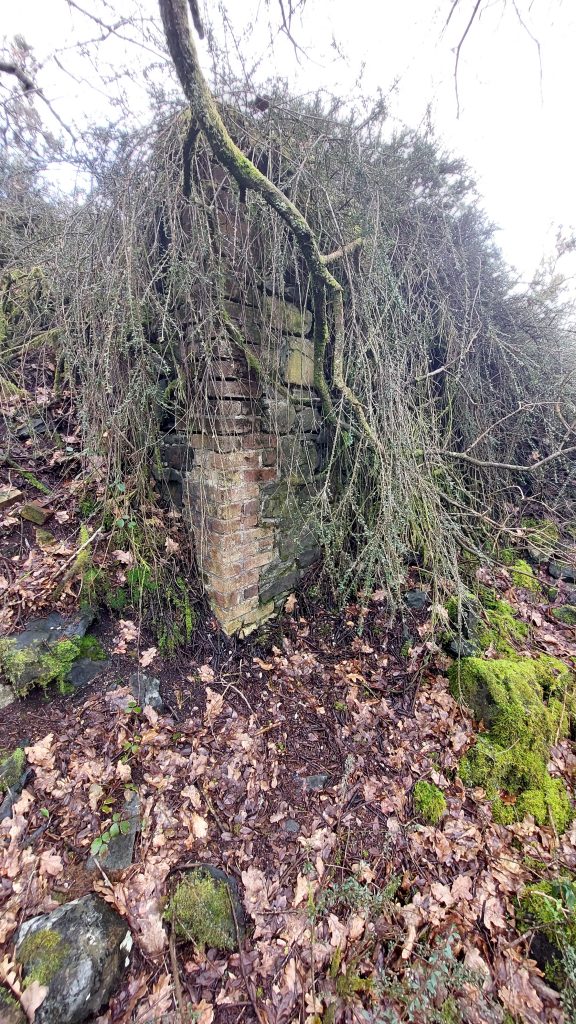
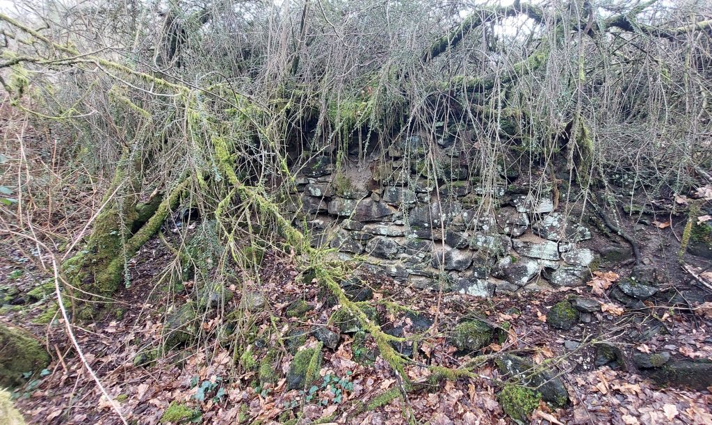
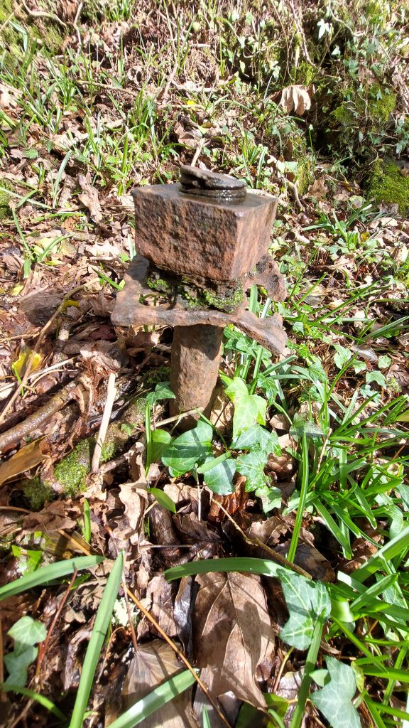
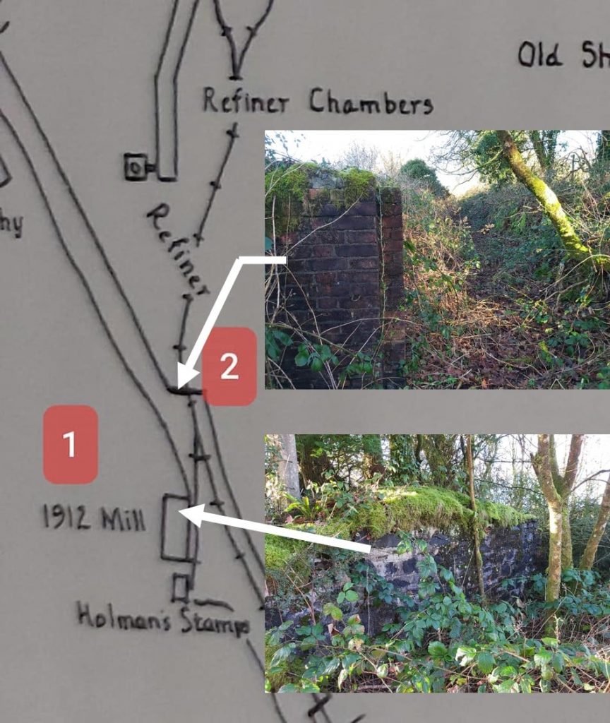
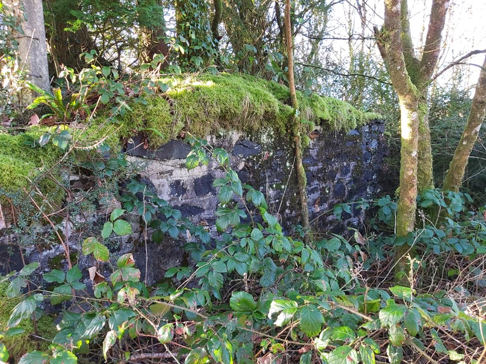
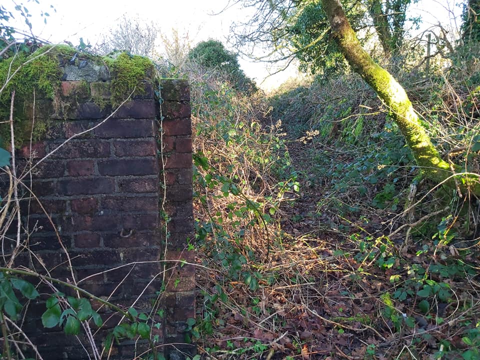
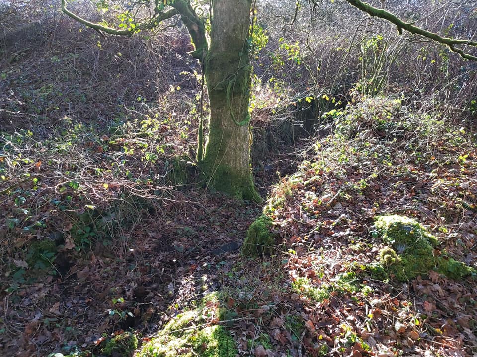
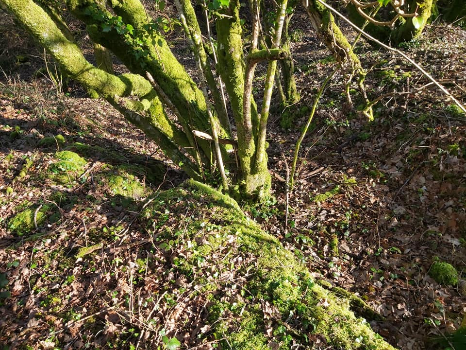
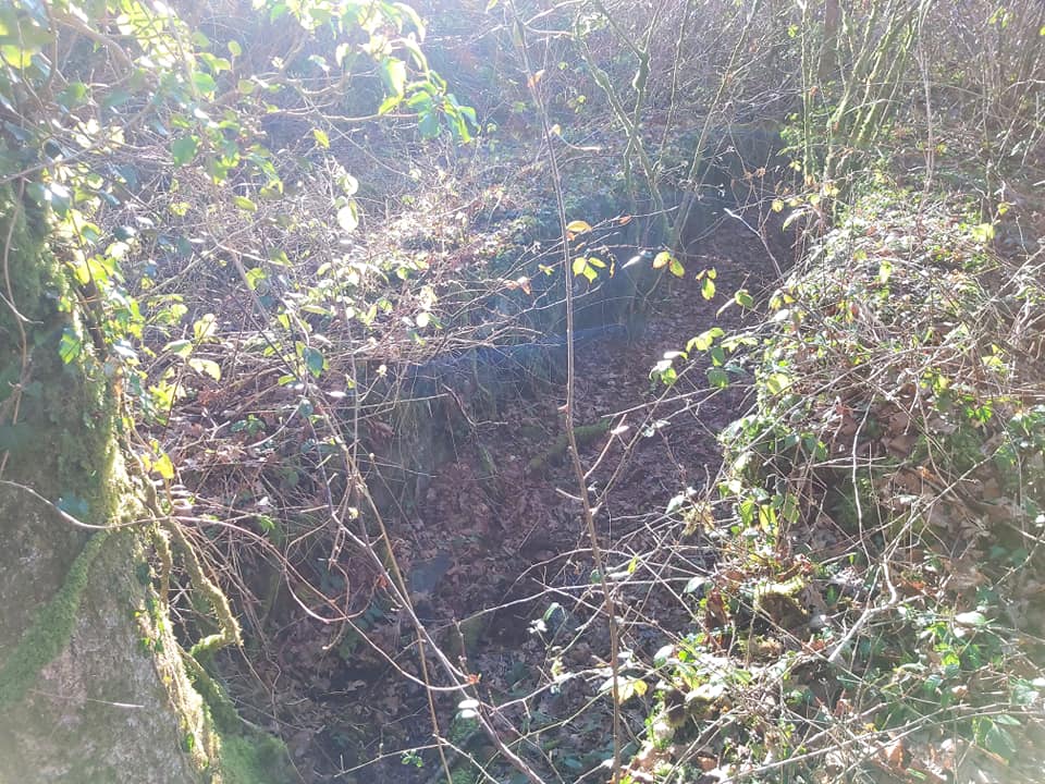
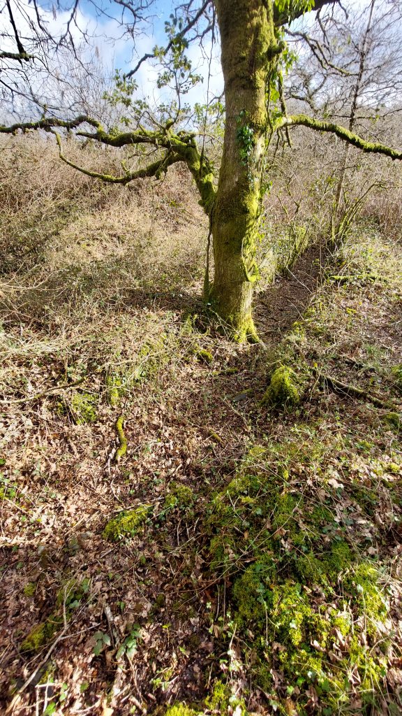
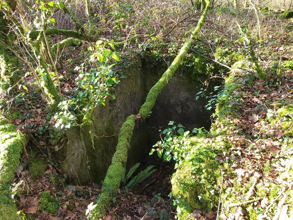
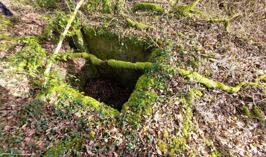
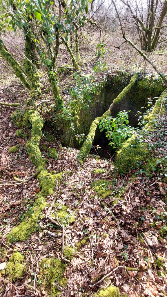
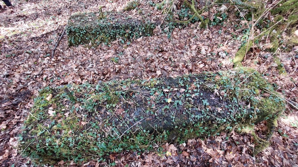
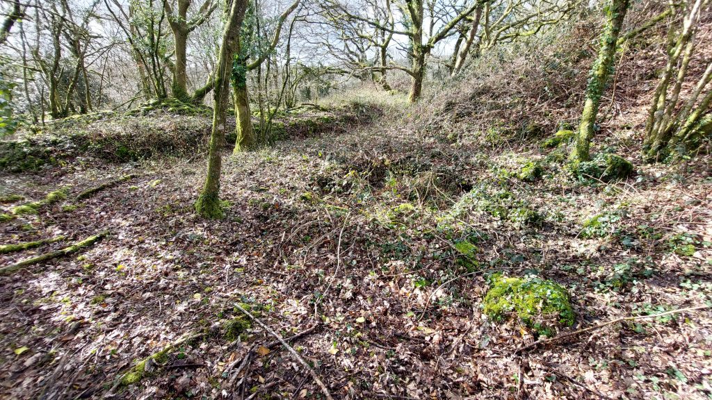
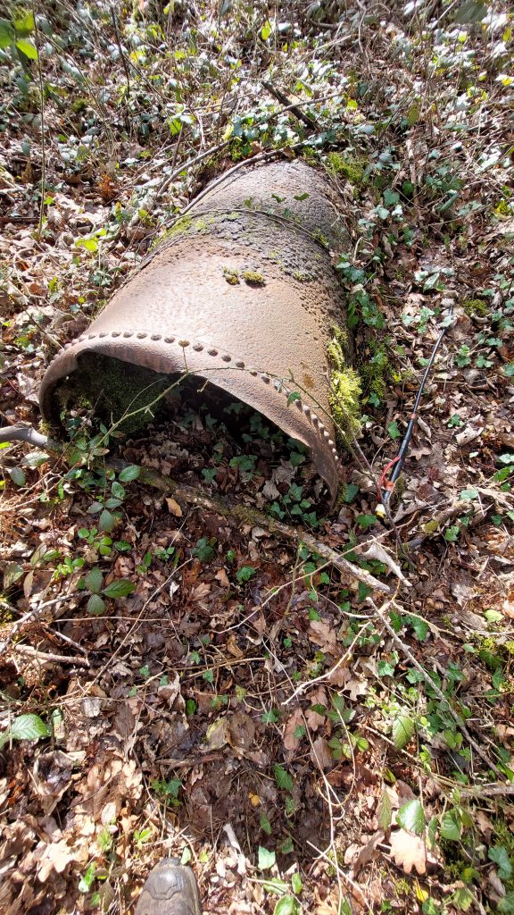
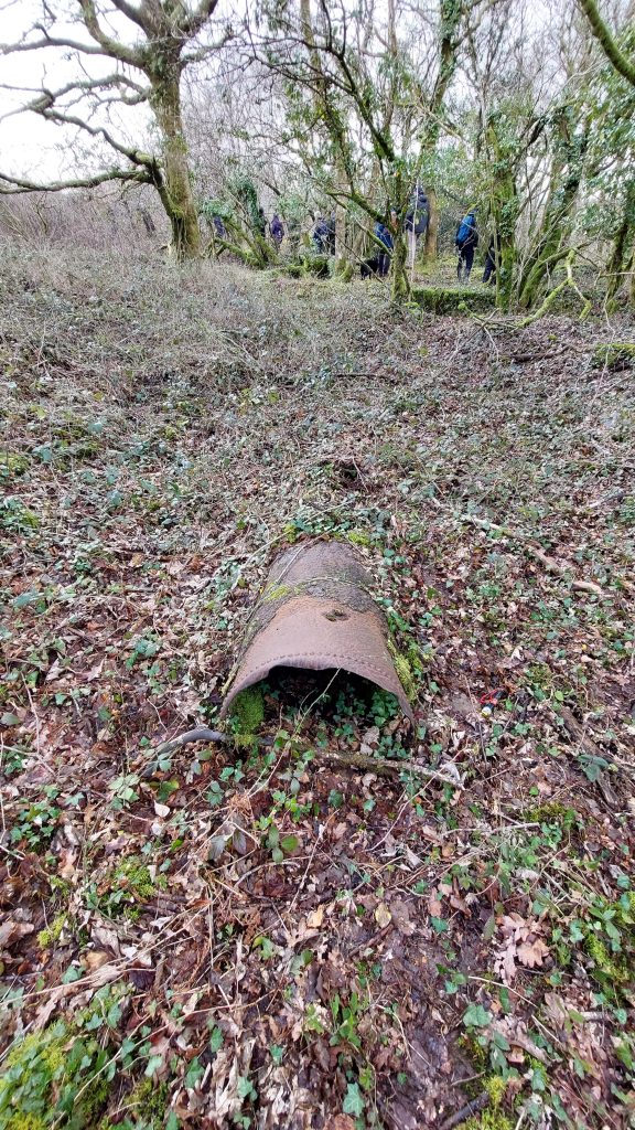
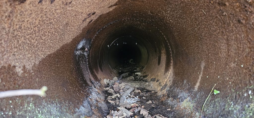
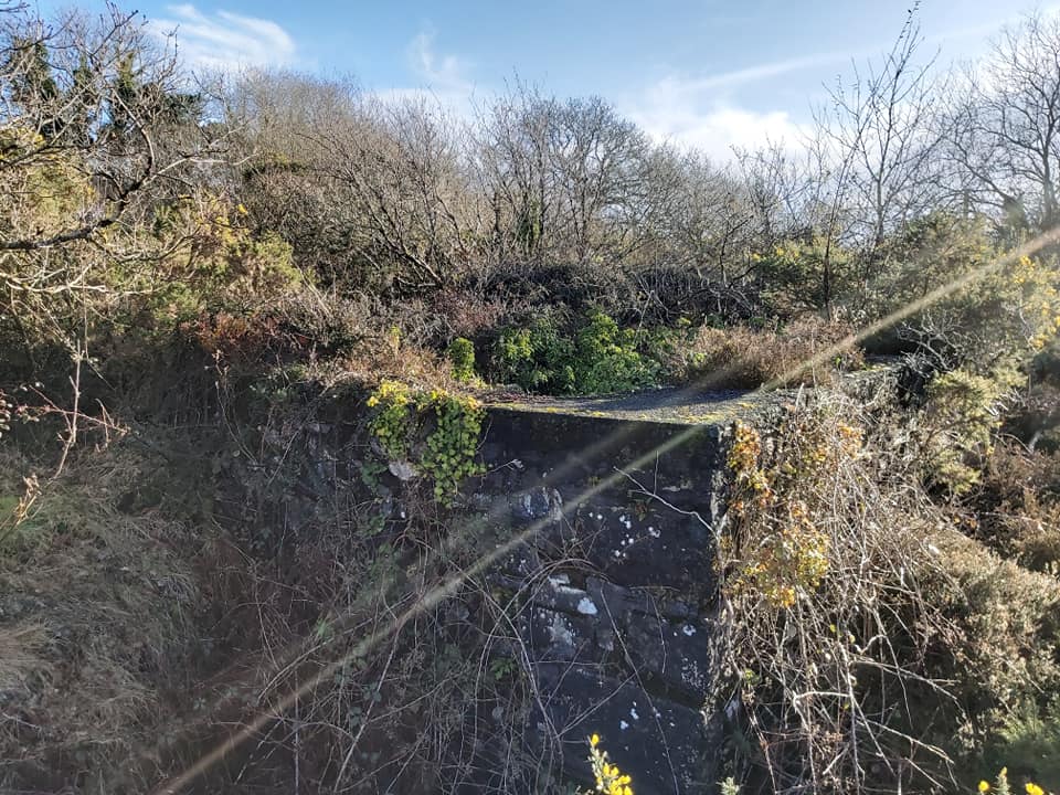
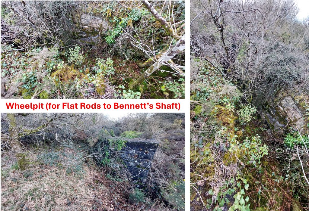
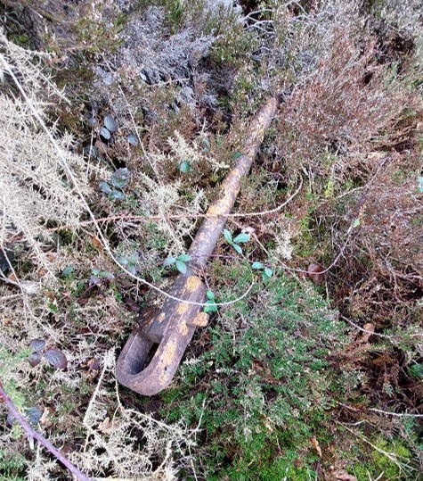
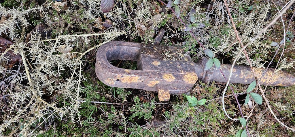
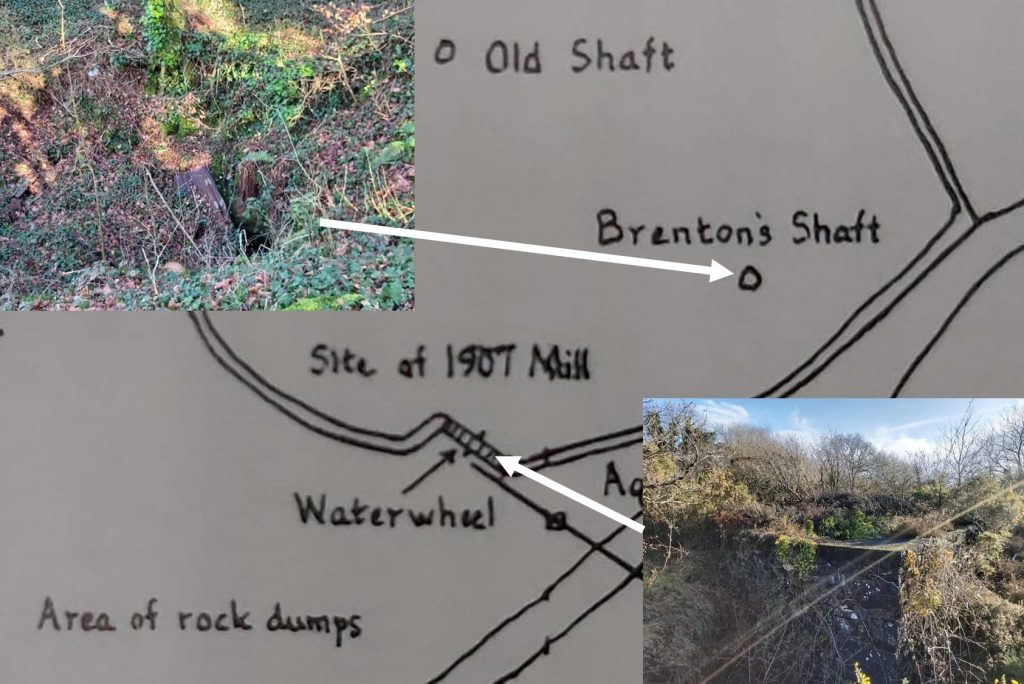
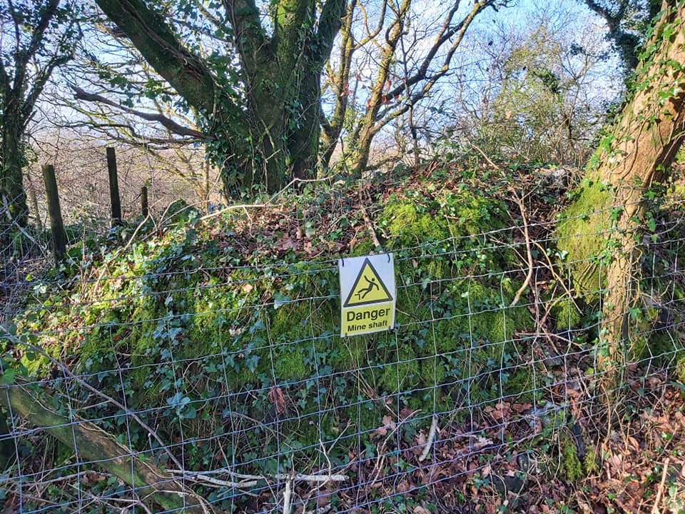
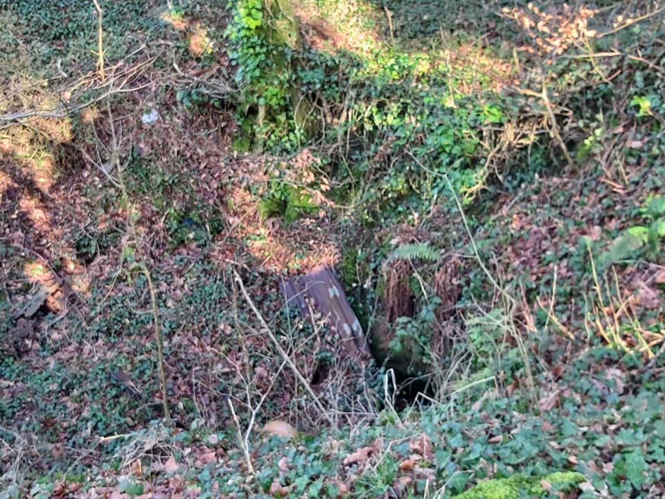
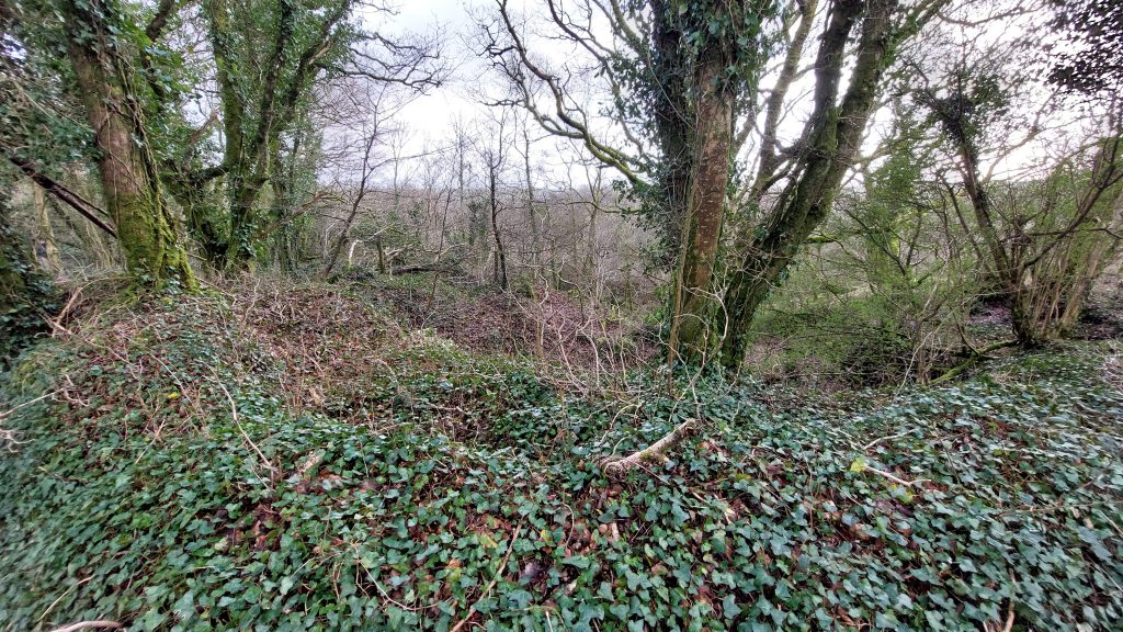
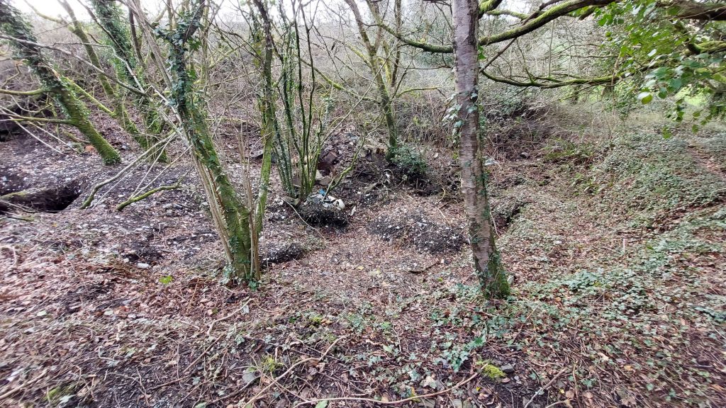
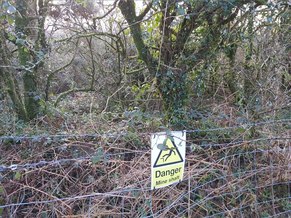
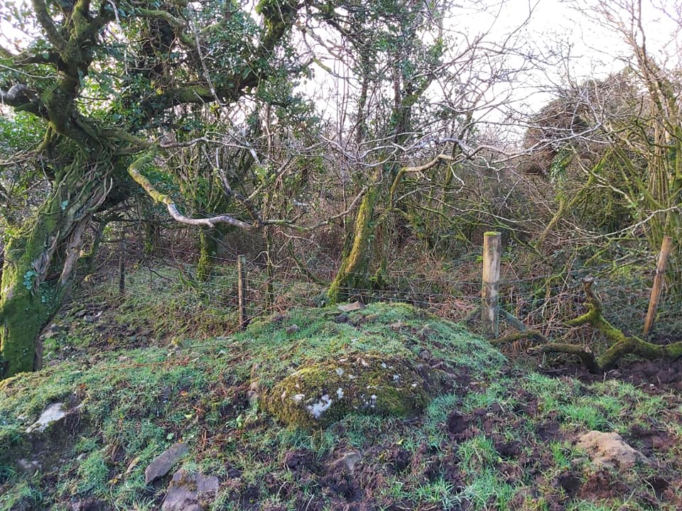
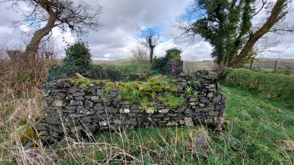
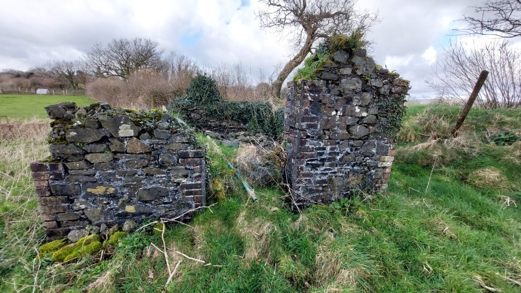
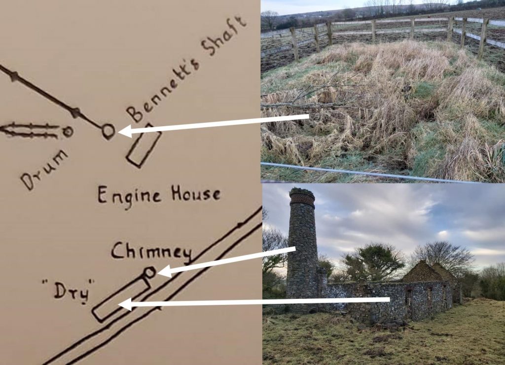
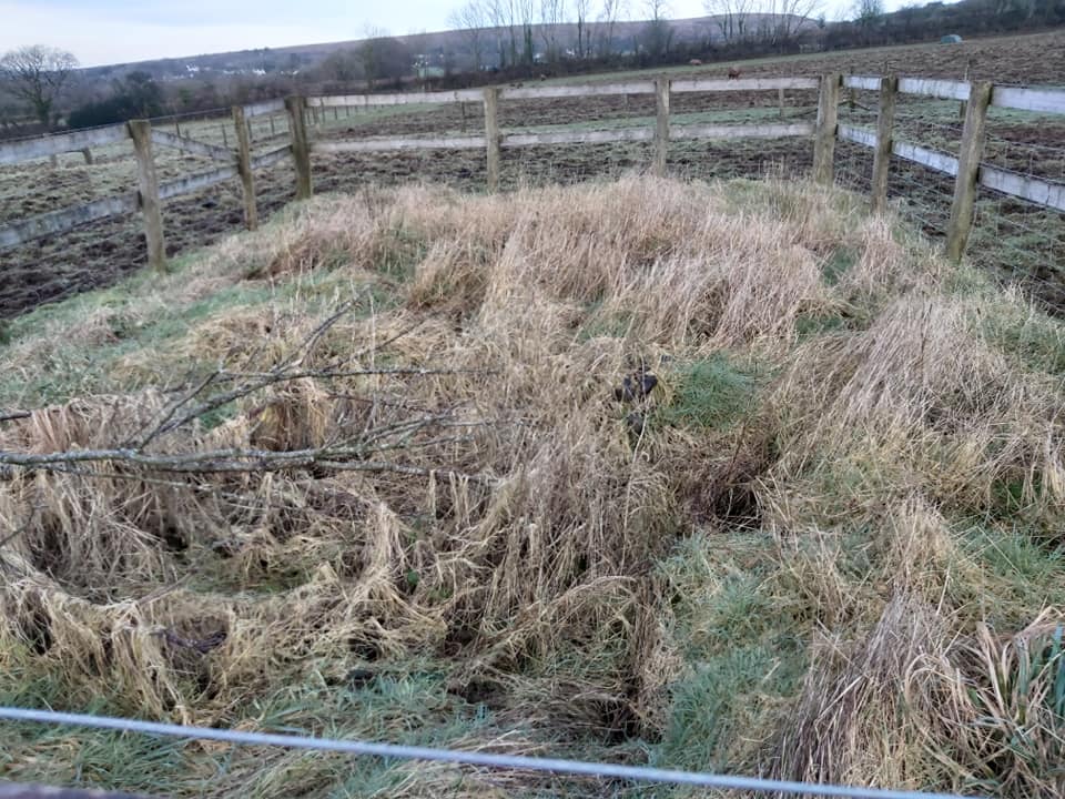
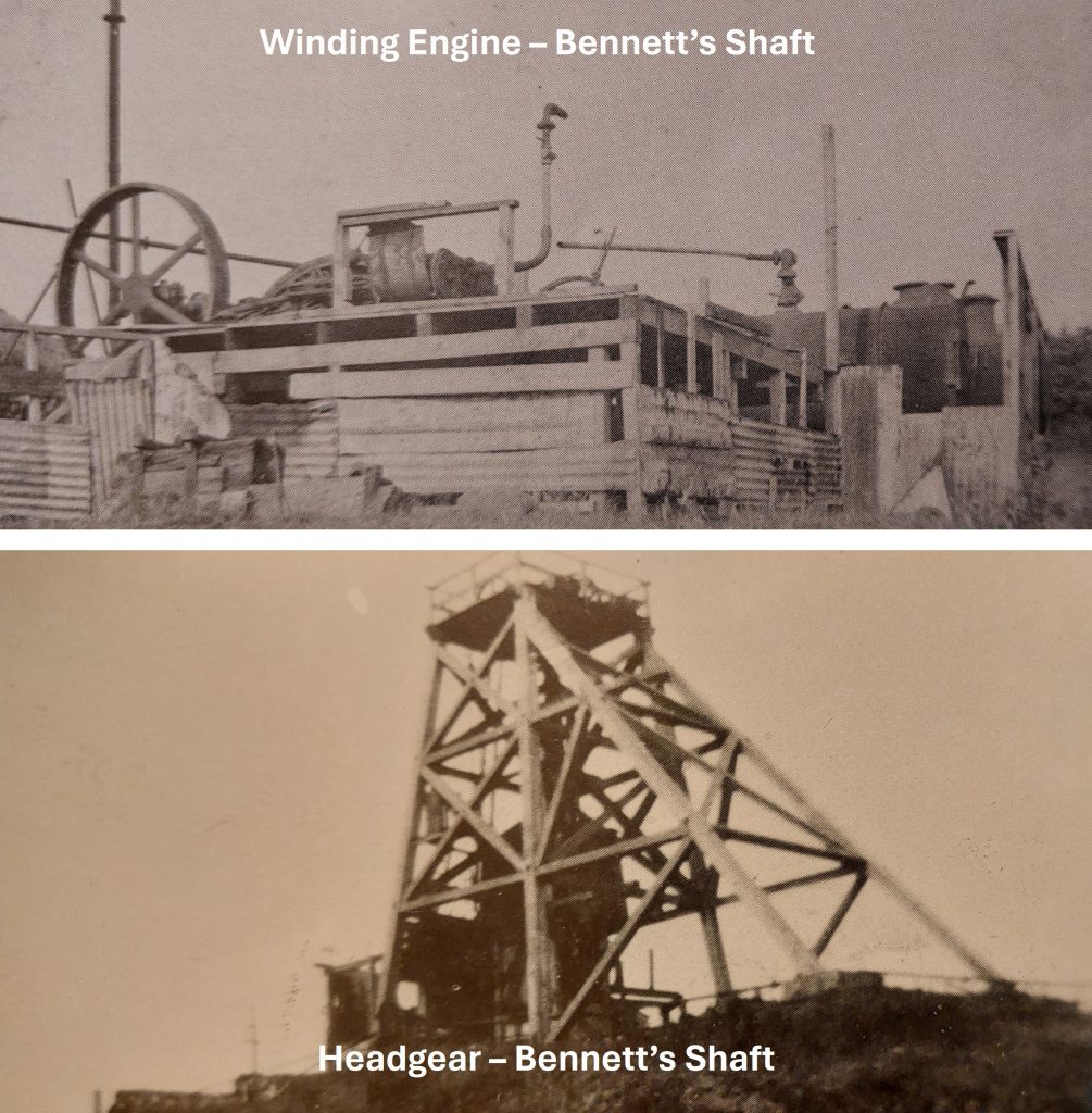
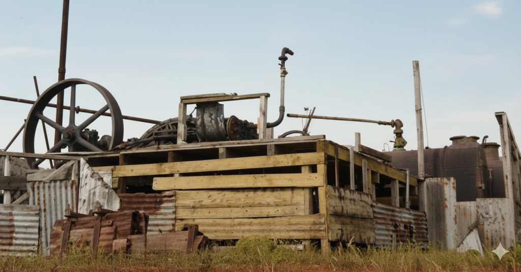
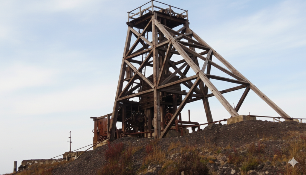
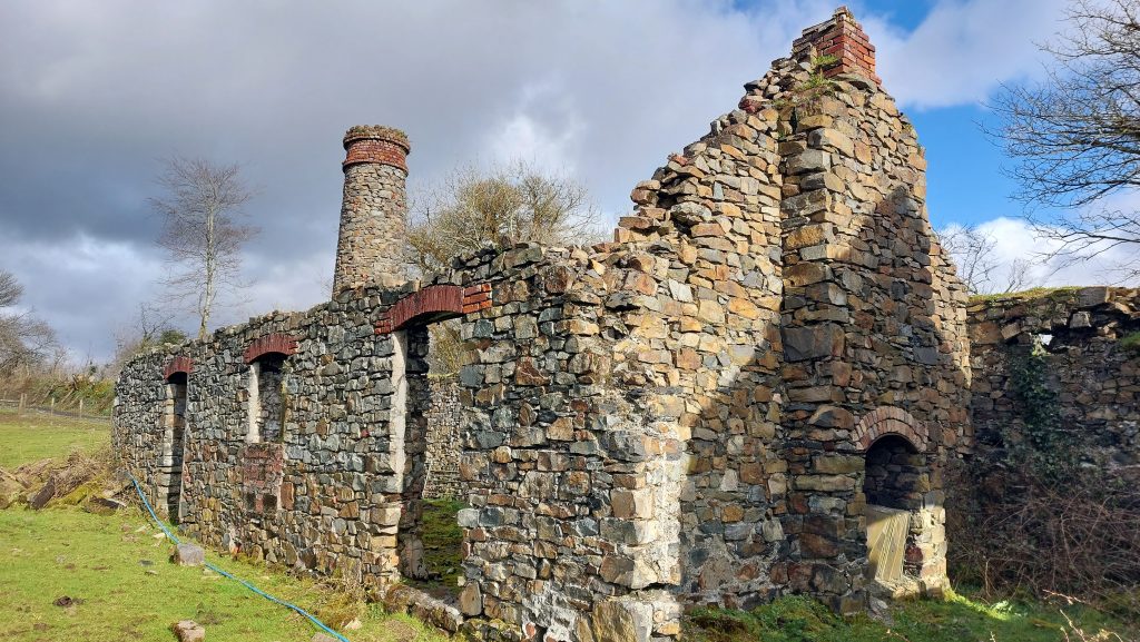
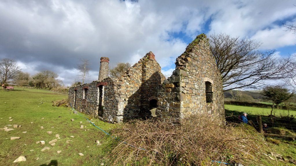
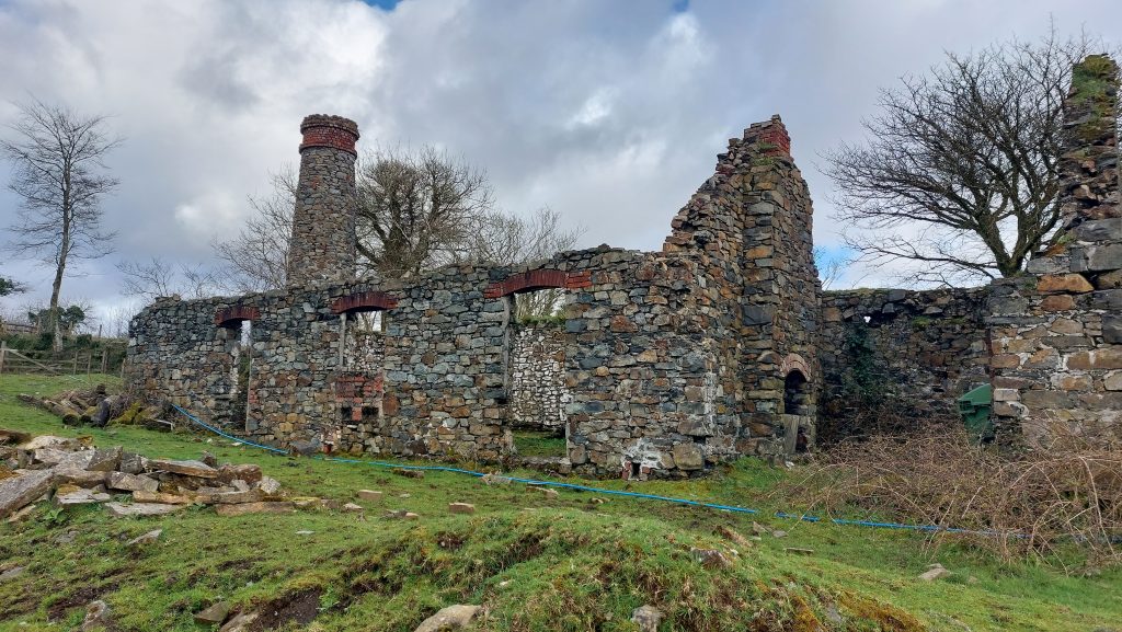
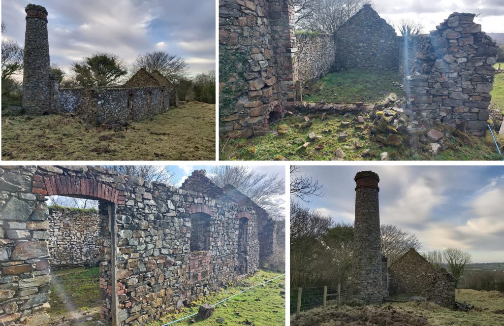
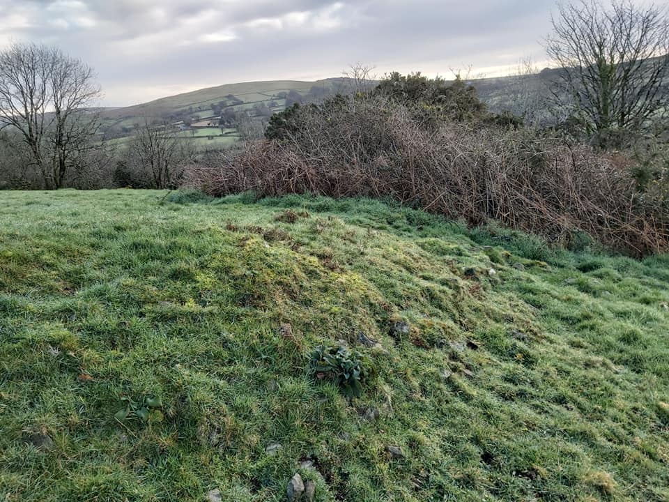
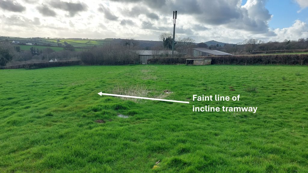
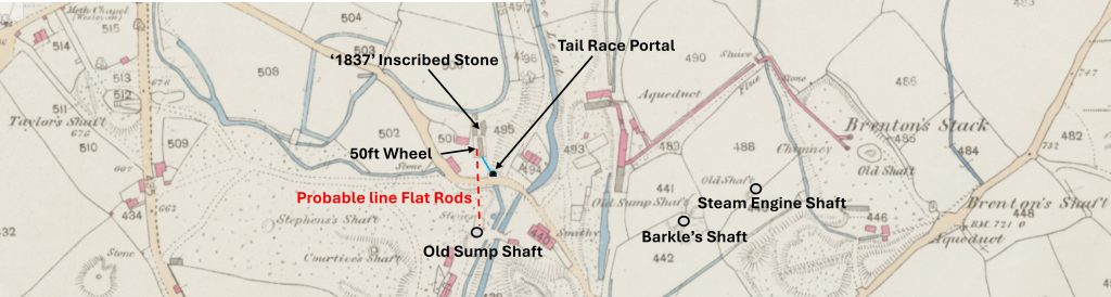
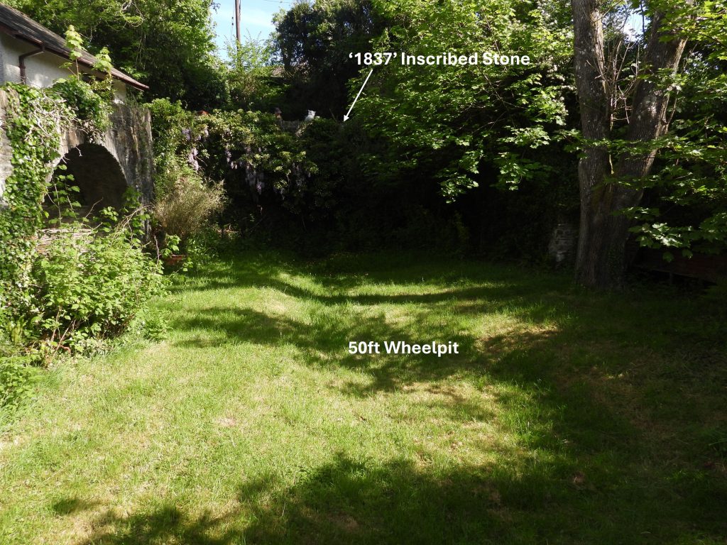
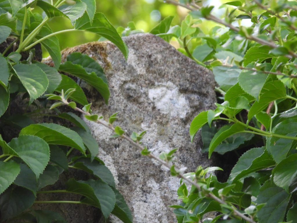
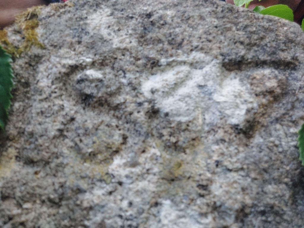
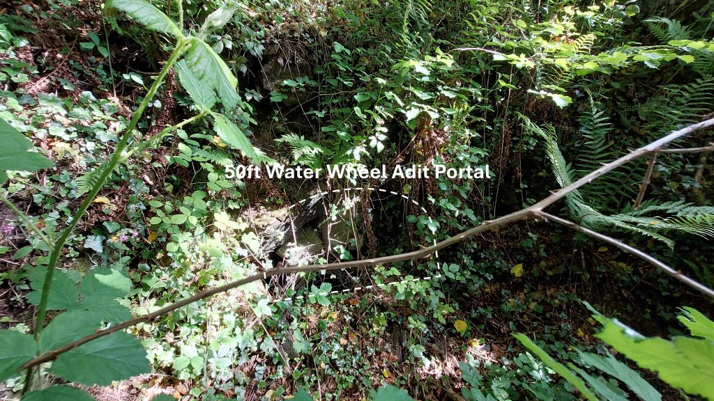
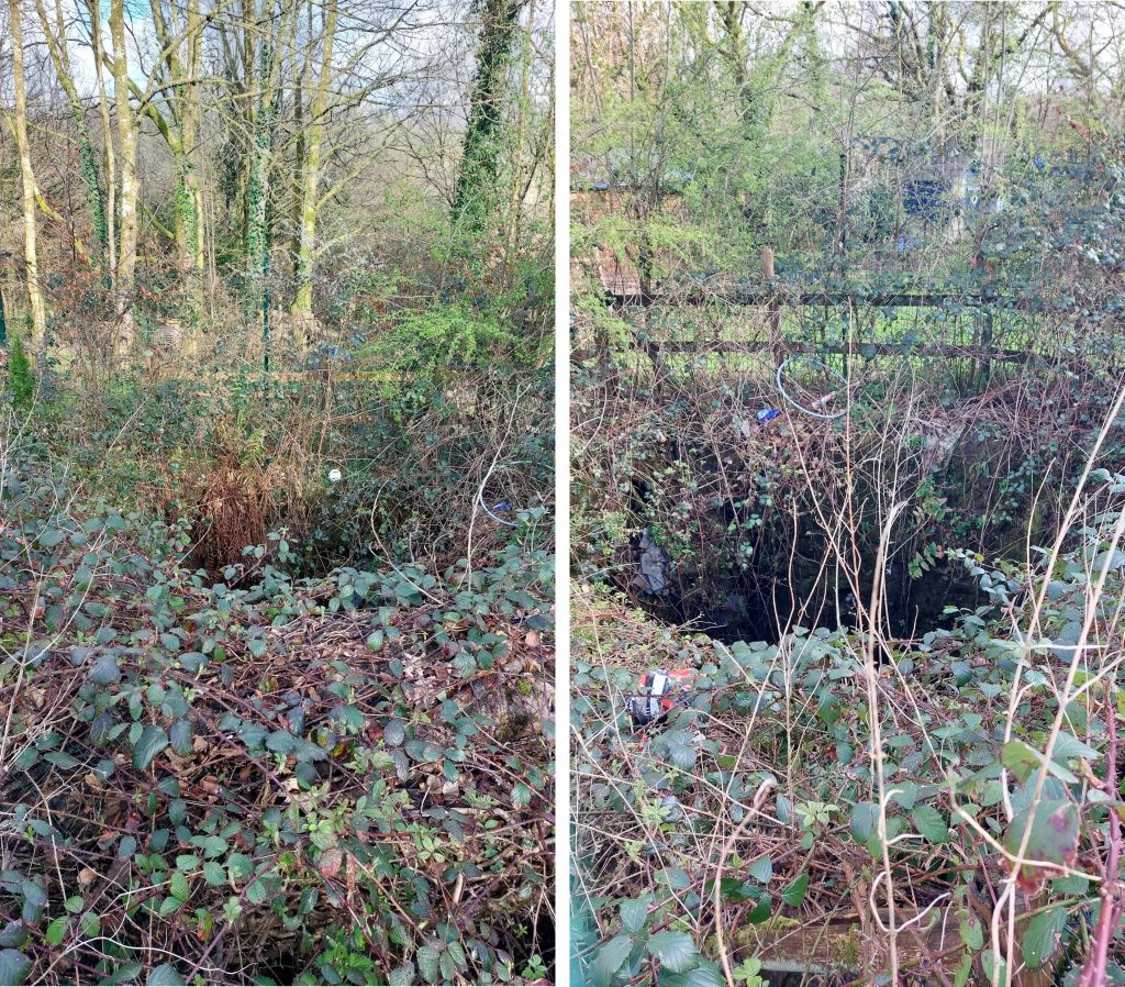
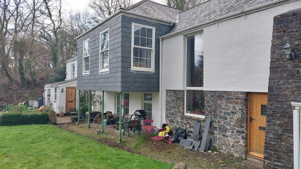
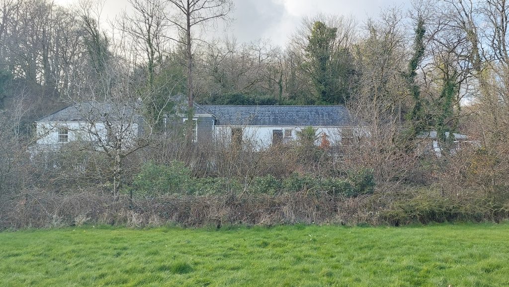
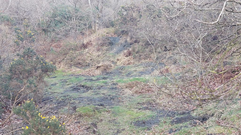
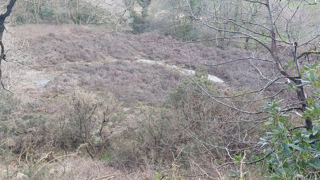
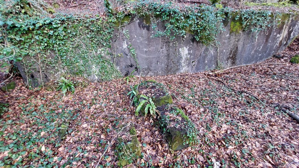
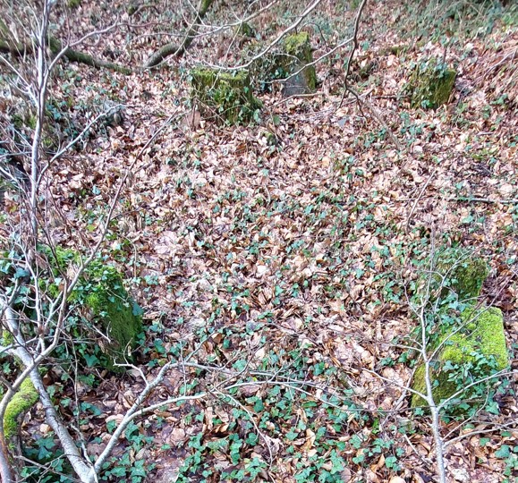
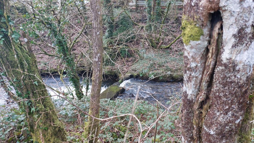
This sketch map is an adaptation of the map found in the P.H.G. Richardson’s ‘Mines of Dartmoor and the Tamar Valley after 1913’ book from page 37. Public footpaths have been added so any would be visitor can get an appreciation of access to some of the many mine artefacts.P.H.G. Richardson’s book provides a superb description of the mine between the 1870s and 1950s. The above table summaries the timeline of the mine, taken from pages 36 through 45 of the book. The operations certainly seemed to be an ‘on-off’ affair from 1885 through to 1925 when there was a final cessation of mining due to an slump in the arsenic market. This annotated map was taken from the Wheal Friendship Minute Book and Ledgers (1816-1875) from a publication from Mike Brown. Much of the period from 1816 to 1870 was concerned with Copper Mining with only Arsenic becoming more prominent (with a little tin) from around 1870. Of note is that some shafts appear over time to have name changes (for example the shaft near the Counting House was once called ‘Old Sump Shaft’ and the shaft called ‘Old Sump Shaft’ on the map was also once called ‘Barkle’s Shaft’). The two shafts that caught the eye of the author were Taylor’s Shaft and Wheal Hope Shaft as they are located so close to the modern A386. Taylor’s Shaft lies next to where CJ Down coaches used to park and Wheal Hope Shaft is now part of someone’s garden behind the shop. Both these shafts relate to the copper mining period (pre-1870s)Brookside, Mary Tavy next to Cholwell Brook. The house dates to at least the early-mid 19th century, and is depicted on the Tithe Map. It is believed this was once the mine captains house associated with the Wheal Friendship mine.From the roadside, viewing above the mine captains house, the condensing chambers associated with two pairs of calciners used for Arsenic production can be seenFlues from the two pairs of calciners (built in 1870s and 1923) were connected to the same flue to two separate ranges of Arsenic condensing chambers. The picture shows one of two ranges of chambers. There were 8 chambers in each range which condensed crude Arsenic. Richardson records the size of chambers as being 10ft x 5.5ft x 9ft (high). There was a long (800ft) flue from the chambers which led to a chimney near Brenton’s Shaft.Pictures of the Arsenic Condensing Chambers from 1963 and 1989From Brookside, there is a footpath which follows the Cholwell Brook in a northerly direction. Then, after crossing the brook by way of a footbridge and ascending a slope an old leat is reached. On the DTRG walk, the old leat was then followed south in order to find the tin dressing area from 1930s and 1940s. There are remains of three buddles in the former tin dressing area. The first is located at SX50629 79506The second buddle is located at SX50624 79500. The third buddle is located at SX50627 79497In the side of each buddle there is a drain portal. The drain in the above picture is in buddle 3After the mine closed in July 1925, work was undertaken to recover dump material. Firstly, in the 1930s by R.W. Toll (formerly the manager of Tavy Consols), then in about 1947 by a lone prospector named Fieldhouse who put up a ‘small plant’. This structure which looks like it may have been used to house / bolt down some machinery and possibly dates to 1947 and the Fieldhouse operation. The structure is located at SX50633 79501Close up of some retaining bolts on the unknown structure. It is possible that Toll started the tin dressing in the 1930s and this was taken over by Fieldhouse in 1947Behind the structure with the retaining bolts is a square sunken area, which appears to have been associated with the old dry leat which had been followed to get to the tin dressing areaAnother structure in the tin dressing area. A rather solid looking structure with ironwork associated with it and a unusual ‘cut out’ with an arch incorporatedThe square sunken area leads to a tunnel, which leads to the area of the two pairs arsenic calciners (built in 1870s and 1923). The author speculates if this could have been a small reservoirLooking west into the possible small reservoir. It might have been a building but as it leads to a tunnel, the author suspects this was not the case.Another view of the possible reservoirAt the east end of the ‘reservoir’ is this arched tunnelLooking inside the tunnel, where the far end is still visible. This construction appears to be located immediately to the east of the two pair of calciners. (Picture courtesy of Frank Collinson)This piece of walling near the old tin dressing floor is likely to be part of one of the original 1870s calciners. Of interest is that P.H.G Richardson on page 46 of his publication records that: “I remember R.W.Toll saying his plant was behind the calciners”. This description fits in well with the locations of all the artefacts (buddles et.al.). Another piece of walling, likely to be part of the 1870s calcinersOld bolt and nut at SX50638 79497Returning to the road through Mary Tavy two more points of interest can be found. Artefact 1 is walling from what Richardson records as being a 1912 Mill. Artefact 2 is the tramway entrance to the calciners and chambers (the tramway having come from Bennett’s shaft).Richardson recorded that in 1964, he had found in the 1912 mill ruin three Wilfley tables (traditional shaking (oscillating) tables to concentrate of heavy minerals) and a floatation cell. These items are ‘out of context’ (date-wise) with the 1912 building as they date from mid-20th century. The 1912 Mill was a stamping mill and replaced the mill at Brenton’s Shaft. This mill had included a pair of Holman pneumatic stamps on the site of earlier Cornish stamps. The mill is located at SX50614 79294The tramway entrance to the calciners and chambers can be found at SX50626 79311Shaft seen from the road named Old Sump Shaft on 19th century maps. Members of DTRG were told this shaft was once known as Barkle’s shaft. A short distance to the south east of this view there is a footpath which heads in a north westerly direction, which leads to Brenton’s shaft, the wheelpit associated with Bennett’s shaft flat rods and the 1907 Mill. A few minutes up the footpath from the road a dry leat is reached. The leat take off was from the River Tavy at Hill Bridge, with the water powering a wheel that drove flat rods to Bennett’s Shaft. From this point the leat joined the leat from Tavy Cleave at the angle of the main arsenic flue (see sketch map). The combined flow of the two leats probably flowed down beside the flue to the lower parts of the mine (this is conjecture by Richardson).Another view of the leat which came from Hill Bridge. The leat from Hill Bridge still flows but has been routed to feed the Mary Tavy Power Station, some distance to the south east. The location is SX50799 79398, now with a tree growing in the channelA short distance to the north where the dry leat crosses the footpath, the 1907 Mill is located. Amongst the undergrowth is this square aperture, which looks too small to have been a wheelpit. DRTG members speculated that this might have housed a turbineThis square aperture is almost certainly part of the 1907 Mill. The mill was constructed when new owners took over the mine which also involved the partial re-opening (de-watering) of Bennett’s shaft. It is located at SX50799 79398The 1907 mill appears to have only lasted 5 years, as when the mine was taken over by the Wheal Jewell and Mary Tavy Mines Ltd in 1912, this mill is recorded as being dismantledPart of the 1907 Mill, which is described as being a treatment plantAnother view of the former 1907 MillThis iron pipe is an unusual find amongst the 1907 Mill ruinsThe iron pipe appears to disappear underground and head towards the ‘square aperture’. Where these two features related ?Inside the pipe. This clearly shows the pipe hasn’t just been dumped in its current location. (Picture courtesy of Frank Collinson)This wheelpit housed a wheel which drove flat rods to Bennett’s shaft for pumping The wheelpit (or partial wheel house) is rather overgrown. It is likely that it was constructed around the early 1880s when Bennett’s shaft was sunk. The wheel is estimated as being around 40ft (not measured)Alongside the wheelpit / wheelhouse is the end of a flat rod, complete with housing for bearing brasses. The author believes this is the only remaining flat rod artefact left on (public access) Dartmoor. Close up of the flat rod end. It is located at SX50853 79361 (Picture courtesy of Frank Collinson)The relative locations of the water wheel, the 1907 Mill and Brenton’s shaft as depicted by RichardsonWheal Friendship had the first inclined railway shaft at any British metalliferous mine. There were three in total completed, the first one completed between in 1807-1808, under the direction of John Taylor. This was during the halcyon copper production days. Brentons Shaft was the third incline shaft which was commenced in 1834 and was in use by around 1836. Impressively, Brenton’s shaft followed the underlie of the main lode and descended from surface to beside the road south-east of Brenton’s Engine Shaft. The angle was about 45 degrees down to the 100 fathom level. Inclined shafts helped reduce production costsBrenton’s shaft is located at SX50856 79428To the north west of Brenton’s shaft is a further shaft. These old workings are about as far as is possible before entering thick undergrowth. These workings may well represent another shaft and will be close to ‘Brenton’s Stack’. The stack replaced an older one as it did not have sufficient height to ‘draw’ the approximately 300 metre long flue. The location of the two stacks are shown on the sketch map and on 19th century maps. Brenton’s stack was demolished during Territorial Army exercises in 1954Leaving the Brenton’s shaft area and crossing the Mary Tavy – Horndon road this old shaft can be found. This shaft is not shown on modern maps and is located in a little copse near spot height 248 at SX51251 79384. The shaft in the small copse is recorded on 19th century maps as being named ‘Old shaft’ and is no doubt an early shaft from the copper production days. Close by is another shaft which the author has seen being referred to as ‘Kent’s shaft’ (or even Lanyon’s shaft)To the south east of ‘Old shaft’ and ‘Kent’s shaft’ / ‘Lanyon’s shaft’ and just to the north of the remains of Bennett’s shaft is this building, which the author was told was an old powder house. It is not recorded on the Devon Historic Environment Record. The powder house is located at SX51353 79197The relative locations of the Bennett’s shaft, flat rods (end of), tramway (end of), Miners Dry and Chimney as depicted by Richardson.The remains of Bennett’s shaft. The shaft was sunk in the early 1880s and was operational by 1882. Arsenic and tin were the main products from this shaft. Richardson records there was an engine house here. As previously mentioned in this post, there was an inclined tramway to the works (arsenic and tin) plus a flat rod bed which was driven by the water wheel near Brenton’s shaft. Further to this Richardson recorded headgear was still standing here in the 1930s, but had gone by 1949. He further states the engine house had been demolished by 1943 and the shaft infilled in the 1960s.Winding Engine and Headgear from Bennett’s shaft from 1930sWinding Engine at Bennett’s Shaft colourised photograph from black and white original. A steam line leading to the headgear can be seen on the left beyond the flywheel of the engineBennett’s Headgear colourised photograph from black and white photograph taken in 1932The Miners Dry near to Bennett’s shaft. It is constructed from local stone rubble and brick and was formerly roofed in Welsh slate with ridge tiles. Thorp recorded in 1997, that: “The dry measures 17.5 meters by 5.4 meters internally and the walls stand to a height of 2.8 meters. A single storey gable-ended building six bays long, divided into two compartments”. The smaller room at the south-west end (right side in the photograph) was heated by a fireplace and may have been used as a changing room.The larger ‘dry’ end of the building has an associated chimney stack. To the east of the Miners Dry and Bennett’s shaft is this reservoir, which is fed by the leat which comes from Hill Bridge. From here, water enters a pipe which leads down to Mary Tavy Power StationA short distance from the reservoir is another shaft which the author has variously seen as being named ‘Lanyon’s shaft’ or ‘Kent’s shaft’. It is more probably Lanyon’s shaft due to its location and its history associated with Bennett’s shaft nearby. Richardson states: “Lanyon’s Shaft became the principal producing shaft at Wheal Friendship, taking over from Bennett’s Shaft in 1891”. Using the public footpaths from Bennett’s shaft, heading back to Mary Tavy, the faint outline of the incline tramway can (just about) be discernedIn Wheal Friendship Minute Books and Ledgers (1816-1875) transcribed by Mike Brown, there is an interesting entry relating to 1837, when there was the erection of a new water wheel 50ft in diameter and 10ft abreast. The records show that it was planned to be: “so situated that the two streams which work the wheels applied to Taylor’s Shaft will be combined and pass over the machine, thus giving an immense amount of power, which can be advantageously applied to the Old Sump Shaft”The author was contacted by the current owner of a property (‘Wheal Friendship’) which is located adjacent to Bal Lane, who informed him that the wheepit relating to the aforementioned (1837) water wheel was still extant and located in his back garden. The author is grateful that he was able to view the wheelpit and to his surprise was shown an stone inscribed ‘1837’ which neatly tied in the date of the erection of the wheelClose up of 1837 inscribed stone. The mine ledgers recorded that the wheel was located between Taylor’s Shaft and the Steam Engine Shaft and intimated that Old Sump Shaft had not been used for many years and needed to be deepened from 90 to 170 fathoms. The costs of all the work was to be around £8000. A considerable sum in 1837Zoom in on 1837 inscription. Of note is that old 19th century maps do not label the shafts as expected. Indeed the shaft marked ‘Old Sump Shaft’ was once known as Barkle Shaft and the un-named shaft near the former count house was once known as ‘Old Sump Shaft’. With these duly annotated on the map in this post (as is the location of the ‘Steam Engine Shaft’), it can be seen that the description from mine ledgers ties up the location of the 1837 wheel plus where a line of flat rods probably were located in order to drain ‘Old Sump Shaft’.Next to the road, opposite to the entrance to Glebe House (aka Counthouse), a tail race from the 1837 water wheel. It ‘lines up’ with the shaft just inside the Glebe House grounds. In 1837, the price of copper was on the increase and so it was hoped that the costs would be met purely out of returns without the necessity of raising more capital by a further share call. It was at this time that Wheal Friendship severed ties with its neighbour, Wheal Besty and no longer had the financial burden of propping it up. The suggestion is that the expense of this water wheel may have been the final catalyst for Wheal Friendship to stop its financial support for Wheal Betsy.The DTRG were allowed access to the land surrounding the former Counthouse. Within the grounds and not far from the Counthouse is an shaft, named as ‘Old shaft’ on maps but believed was once called ‘Old Sump shaft’ (circa 1837) when the water wheel was erected to drain this . The Dartmoor Historic Environment Record indicate that this is thought to have been the first inclined plane railway mine shaft at Wheal Friendship as previously mentioned in this post. That said, DTRG were told there was an old incline shaft on the east side of Cholwell Brook and not at this location.Glebe House (aka Counting House). The Dartmoor Historic Environement Record states that this was both a former Mine Captain’s House and a Counting House during the period when the mine was Devon Friendship. Furthermore, an adjoining structure is said to have been added sometime after 1840 and thought to have been used to house animals. Within the grounds of Glebe House, there is a bridge which crosses Cholwell BrookGlebe House from the east side of Cholwell BrookWithin the grounds of Glebe House, there is a copper ore dressing area including sand and rock dumps (as shown on sketch map)Edge of the sand and rock dumps looking down the Cholwell Brook valleySandy area next to Cholwell Brook. One wonders how polluted the brook may have once beenBehind and below the 1912 Mill, on Glebe House ground this walling appears to have been part of the copper production dressing floorStone blocks at the copper production dressing floorReturning back from the dressing floor towards Glebe House, this weir on Cholwell Brook was spotted. The weir is depicted on the modern OS maps but is not shown on historic maps dating from the late 19th century – 1950s. The need for its construction is unknown.
Hello! Interesting and informative website! I myself have scoured there area and have explored underground workings to a point including Barkle’s shaft from below which used to be open and gave access to the workings but now looks like someone has a shoved a barn down it. It’s not a nice place to be hanging around down there – ochre mania!
I am doing a write up for a club report and wondered how to get permission to use data from Mike Brown’s ‘Wheal Friendship Minute Book and Ledgers’ (1816-1875)? I have seen the original ledgers in Plymouth and found a copy of Mike’s book in Tavistock Library but it is Copyright (you are not even allowed to look at it in the Plymouth Record office without permission from the publishers?!?) . . .
Any pointers appreciated as I see you reproduced the map of the area and have referenced Mike Brown and his book. I am wondering if I reference him the same then I will be permitted to use the material?
I was given a copy of the Wheal Friendship Minute Book and Ledgers by an acquaintance (now sadly passed). It didn’t have any copyright information on it.
It’s a shame I didn’t know anything about the DTRG visit, but if you have any interest in the Old Sump Wheel operation & maybe getting some photos, do get in touch, as it’s in my garden.


Bill Booth September 16, 2024
Hello! Interesting and informative website! I myself have scoured there area and have explored underground workings to a point including Barkle’s shaft from below which used to be open and gave access to the workings but now looks like someone has a shoved a barn down it. It’s not a nice place to be hanging around down there – ochre mania!
I am doing a write up for a club report and wondered how to get permission to use data from Mike Brown’s ‘Wheal Friendship Minute Book and Ledgers’ (1816-1875)? I have seen the original ledgers in Plymouth and found a copy of Mike’s book in Tavistock Library but it is Copyright (you are not even allowed to look at it in the Plymouth Record office without permission from the publishers?!?) . . .
Any pointers appreciated as I see you reproduced the map of the area and have referenced Mike Brown and his book. I am wondering if I reference him the same then I will be permitted to use the material?
Hoping you can help, Cheers, Bill
SteveGriggDartmoor September 23, 2024 — Post author
Dear Bill,
Many thanks for your comments
I was given a copy of the Wheal Friendship Minute Book and Ledgers by an acquaintance (now sadly passed). It didn’t have any copyright information on it.
Kind Regards,
Dartmoor Explorations
Nick Butland April 26, 2025
It’s a shame I didn’t know anything about the DTRG visit, but if you have any interest in the Old Sump Wheel operation & maybe getting some photos, do get in touch, as it’s in my garden.