A collection of walks, discoveries, insights and pictures of exploring Dartmoor National Park
April 4, 2024
Redwater Valley Medieval Farmstead / Settlement
The Redwater Valley, which lies to the south east of the Warren House Inn is generally associated either with tinworking or warrening. Indeed, much has been documented about the Birch Tor and Vitifer Mine which is known to have operated from around 1796 to around 1939 and Headland Warren (Redwater valley being the west side of the warren) which dates from the early 18th to the early 20th century .
Prior to this period, the area was being exploited through considerable tin streamworks, openworks, prospecting and extractive pits, which although cannot be dated precisely (because they are mostly undocumented), are likely to be post-medieval (i.e. c. 1450-1700).
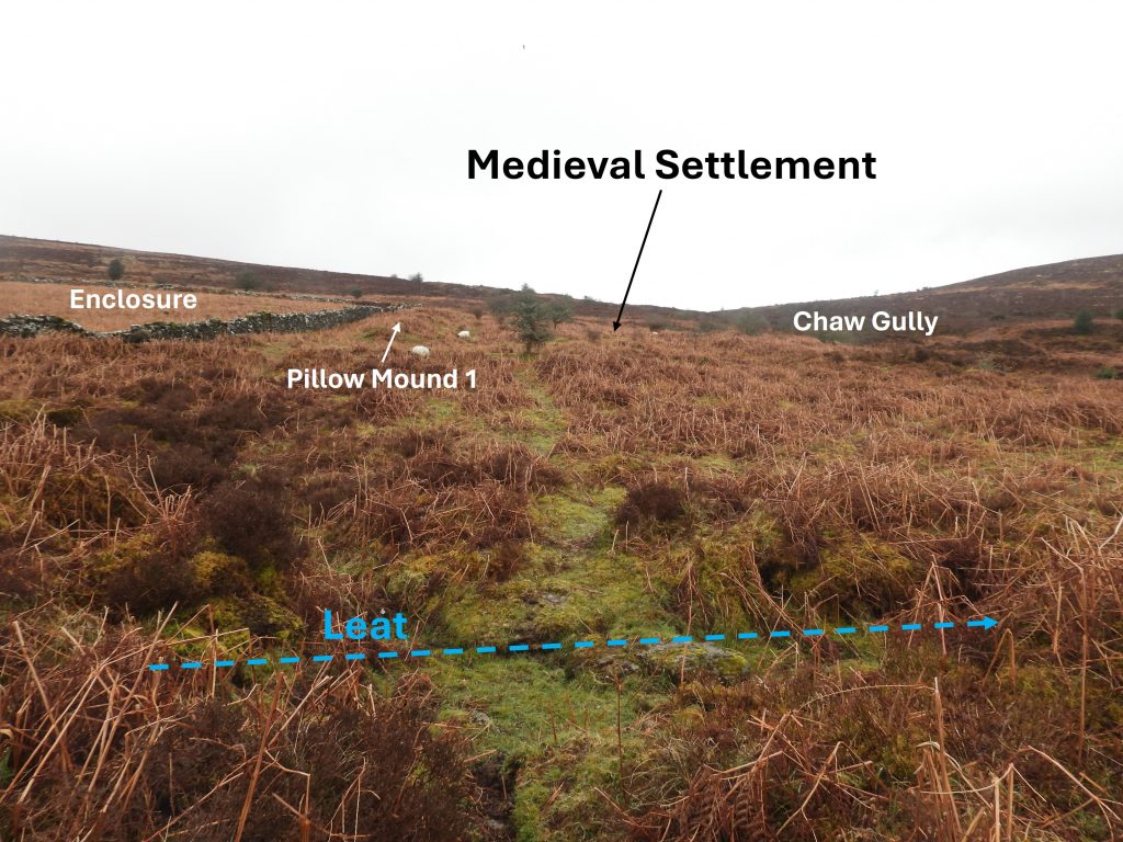
Aside the tinners and the warreners, during the Medieval period, much of Headland Warren area was enclosed by a series of fields. One such area is a small farmstead, centred at SX6848 8076, which includes at least two longhouses and associated enclosures. It is sandwiched between large tin streamwork to the south, a 18th century enclosure (which in all probability was associated with Headland Warren) to the north and a 20th Century Tinners Mill to the west. The northern edge of the streamwork appears to truncate the farmstead / settlement and it is possible that once it would have been much larger.
This post covers an exploration of the Medieval farmstead / settlement and some of the interesting artefacts and features, which surround and post date it. These features include an adit in the tin streamworks, the 20th century tinners mill, the 18th century enclosure, several pillow mounds, a vermin trap and an benchmark.
Bibliography
Dr P. Newman, (2001), Headland Warren Part 2: Medieval Settlement and Enclosures, (Report – Survey).
Helen Harris’s The Industrial Archaeology of Dartmoor (page 155)
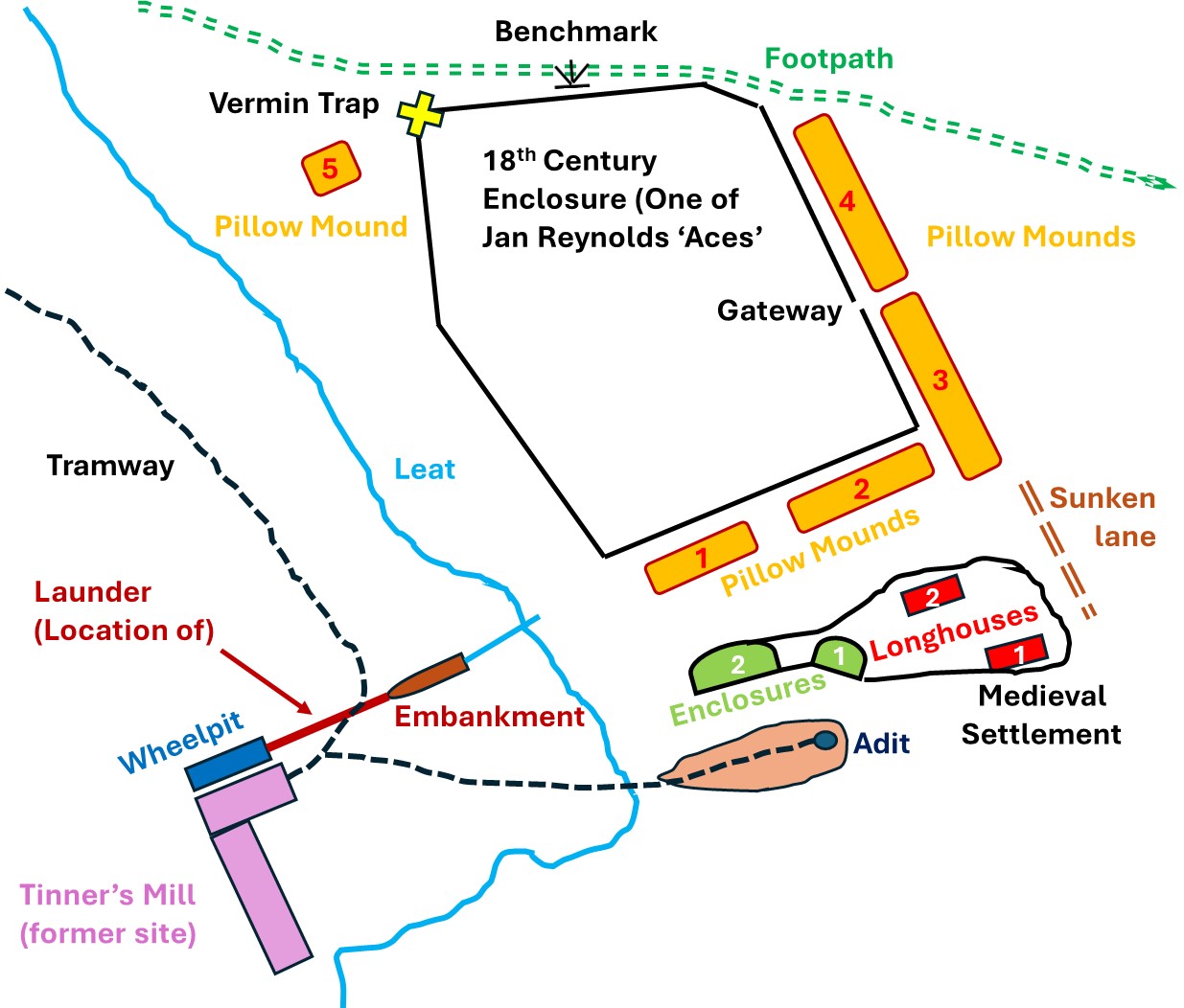
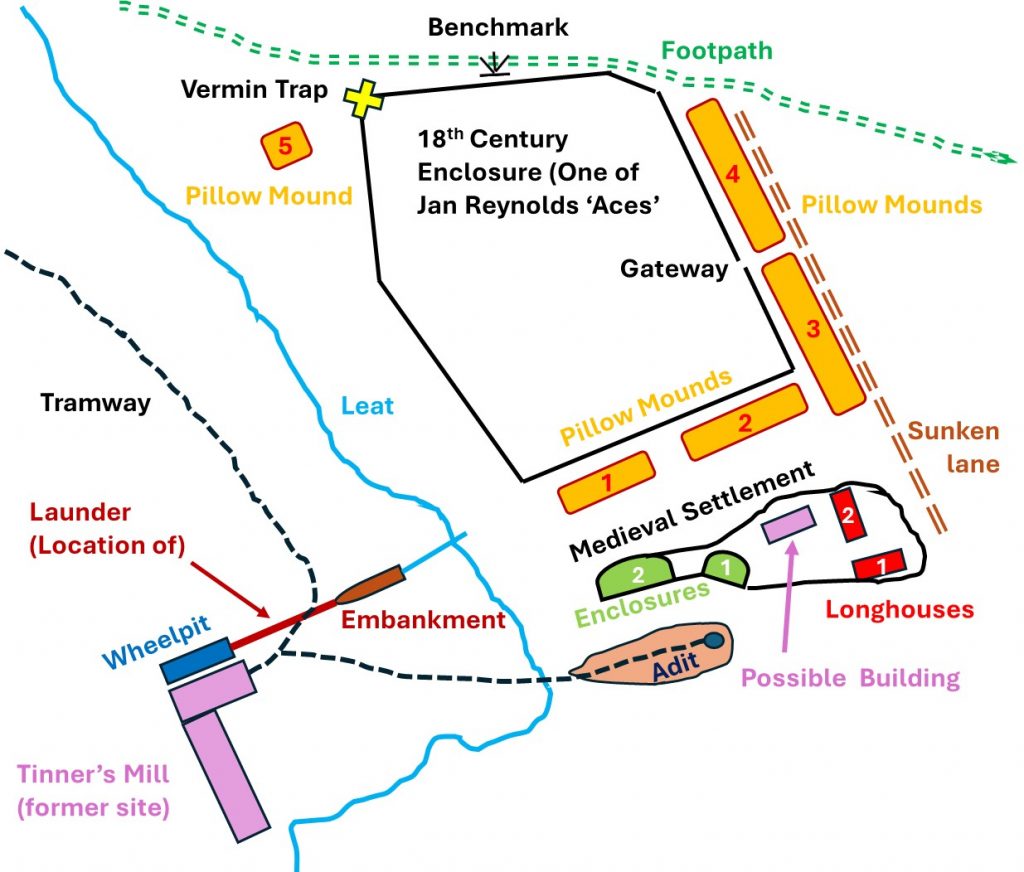
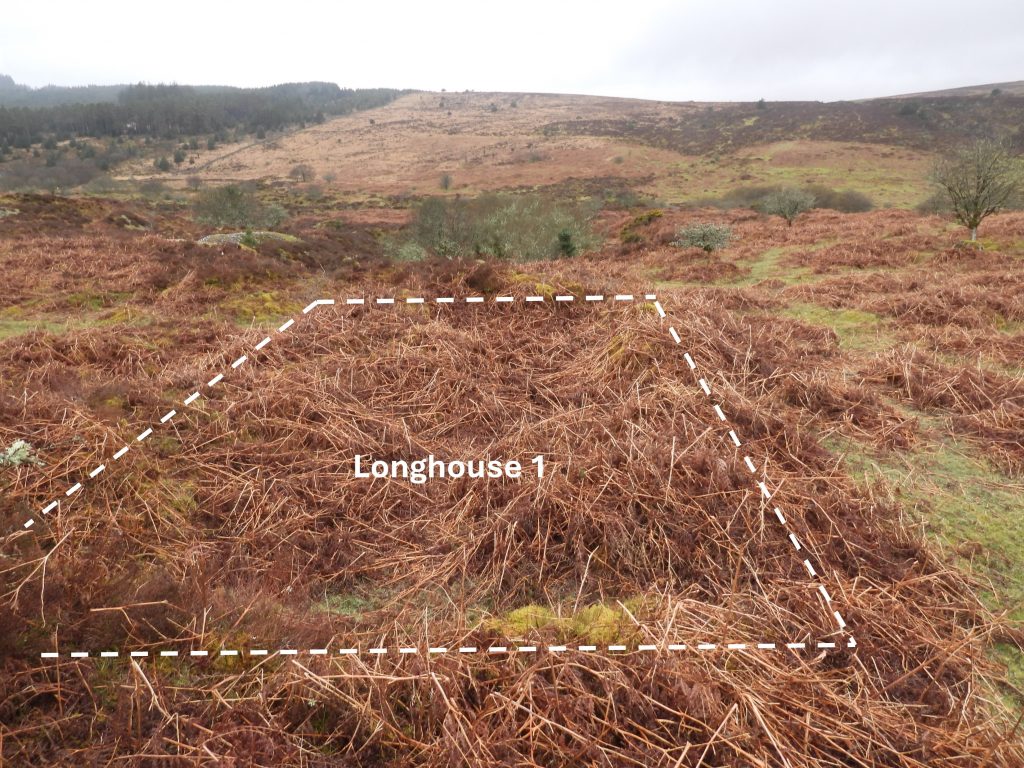
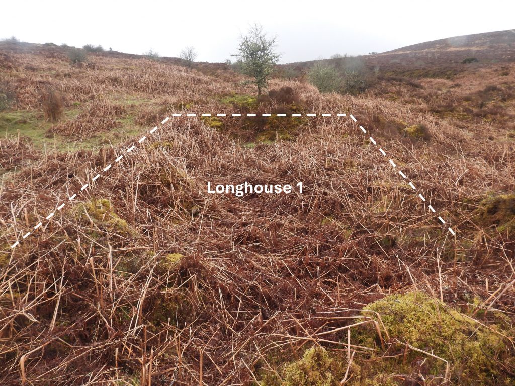
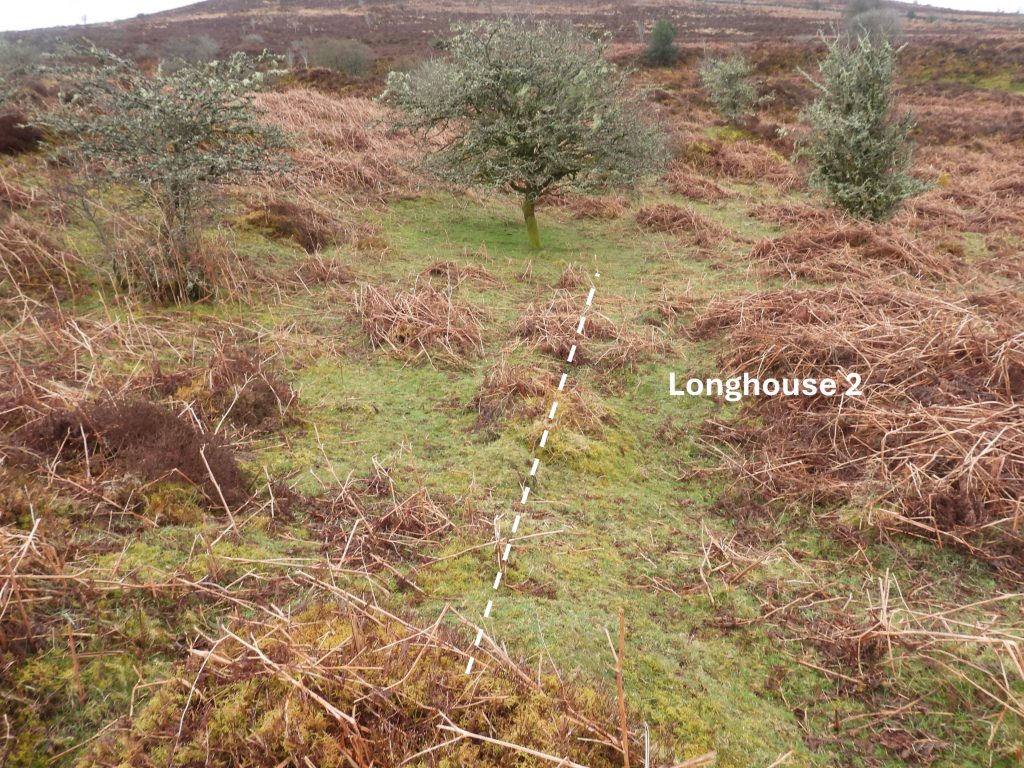
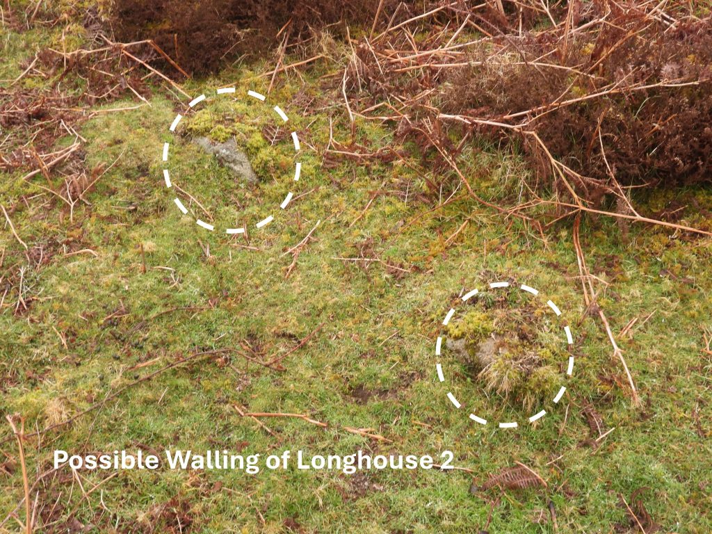
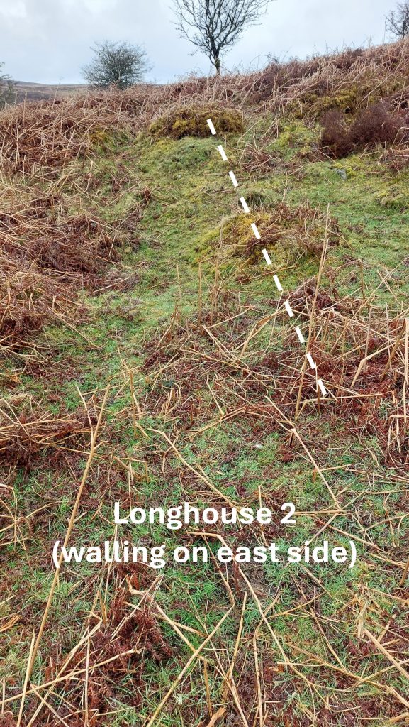
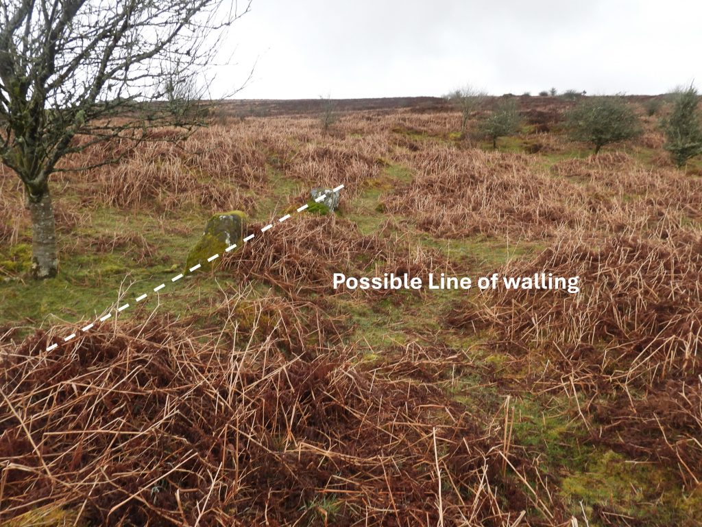
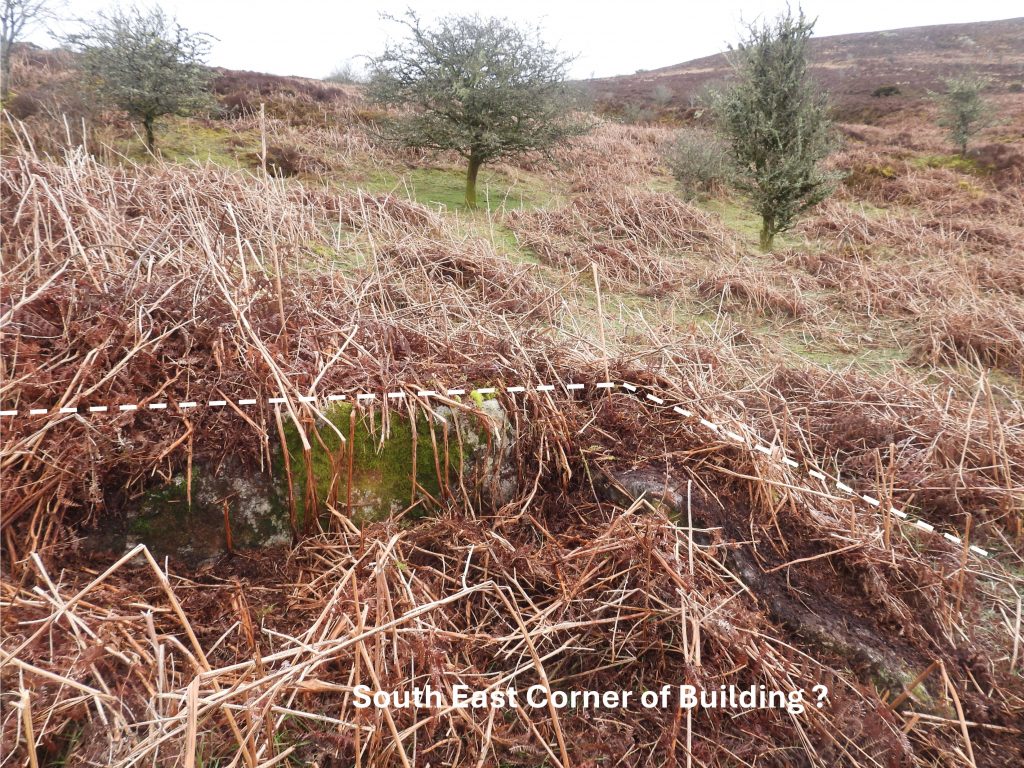
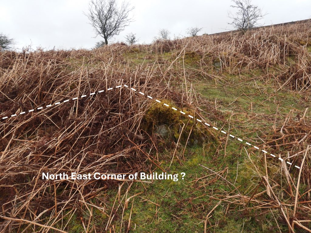
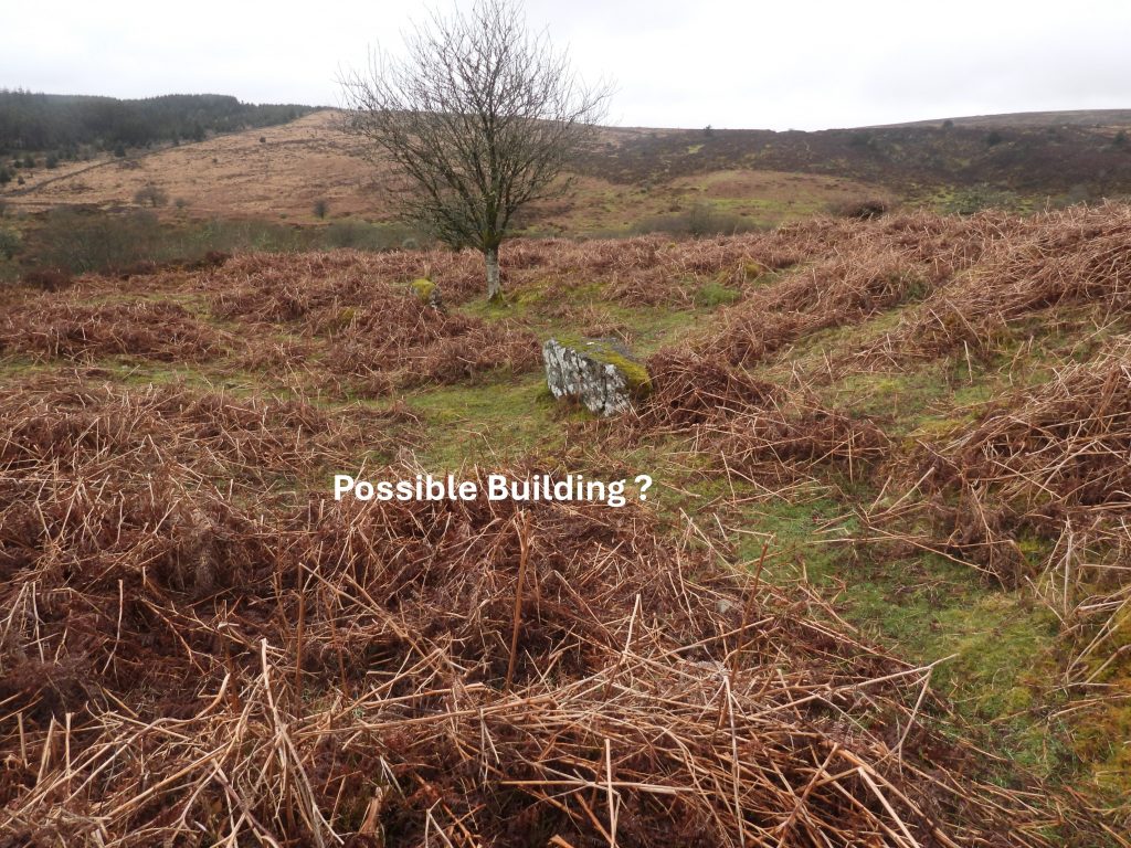
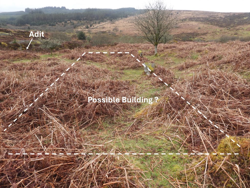
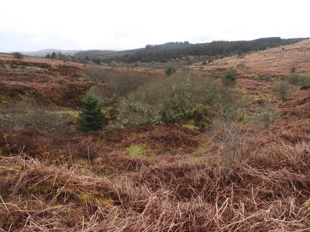
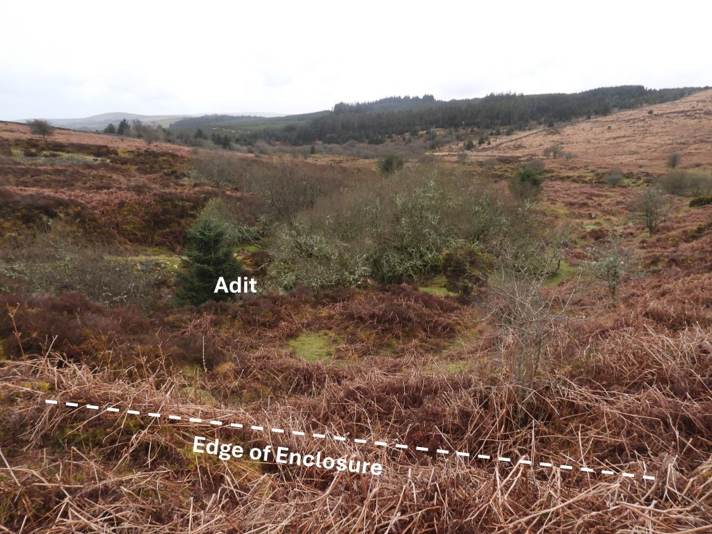
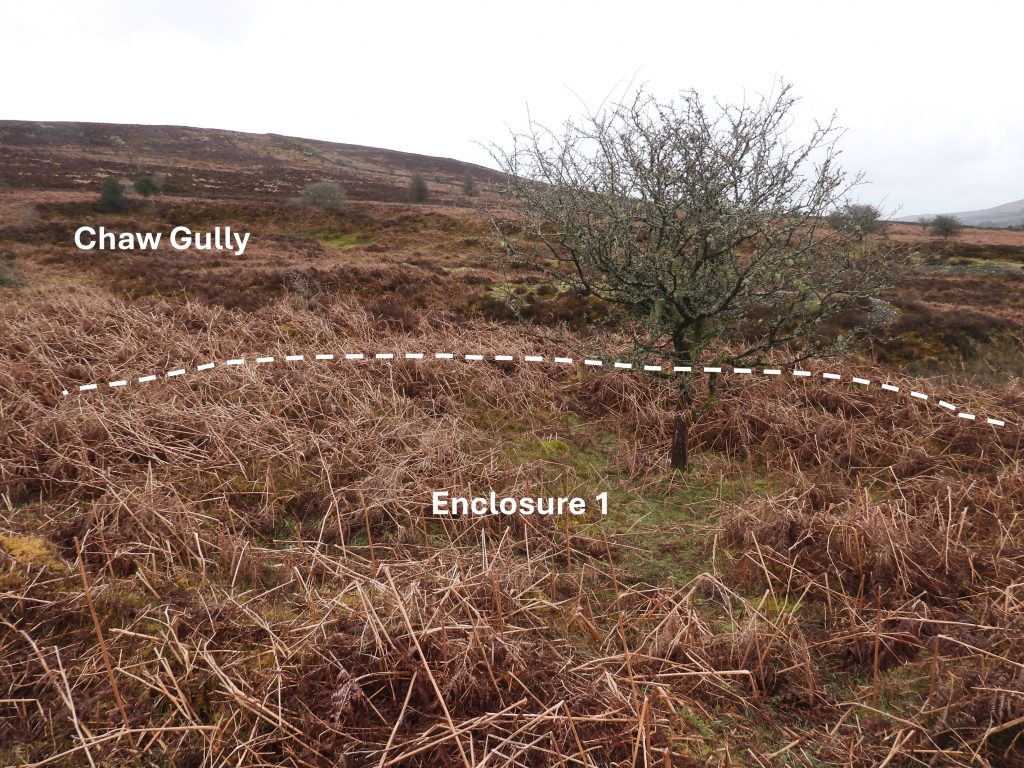
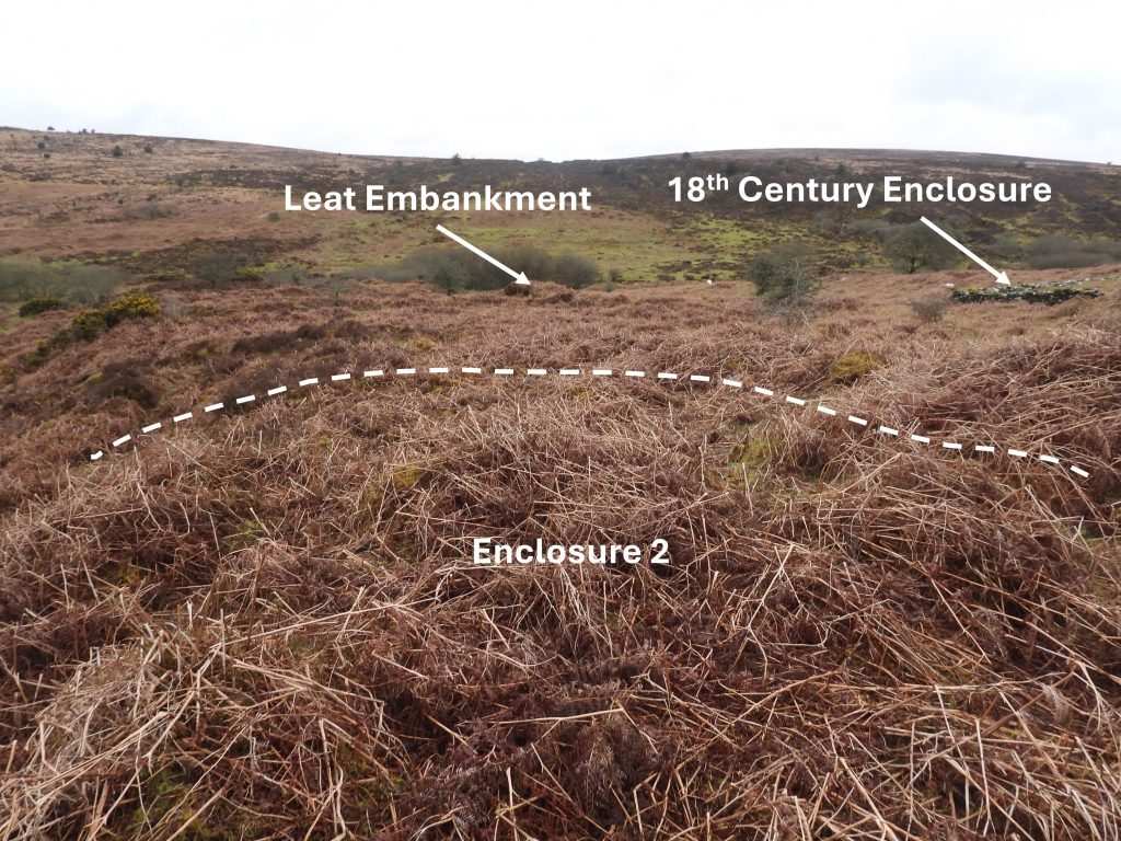
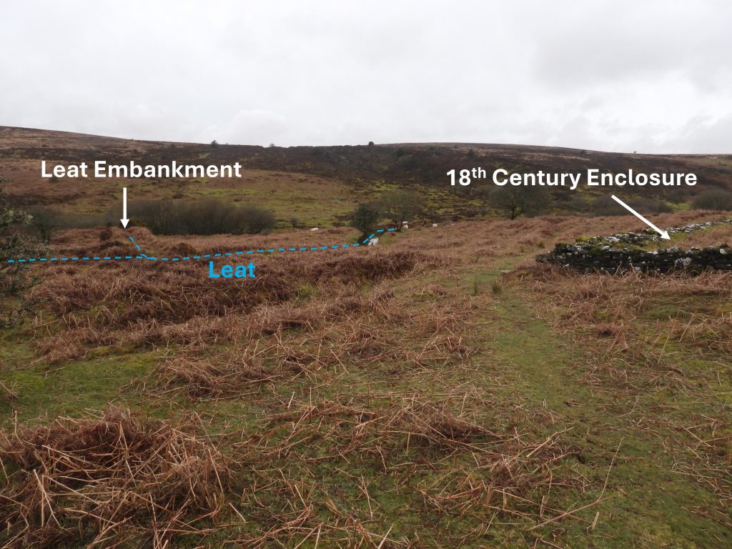
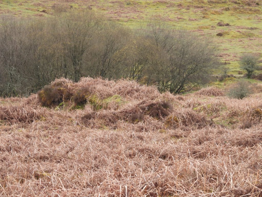
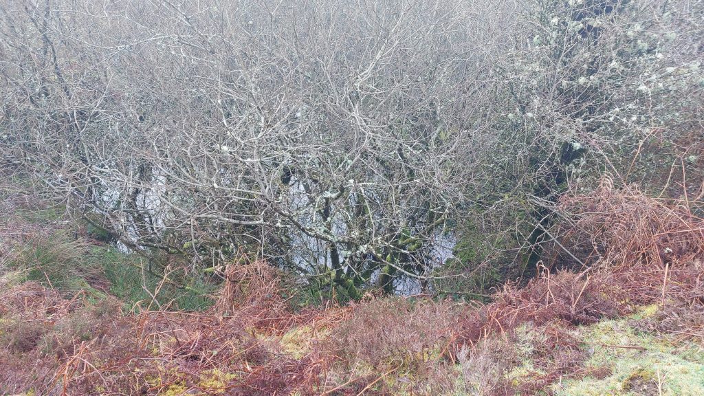
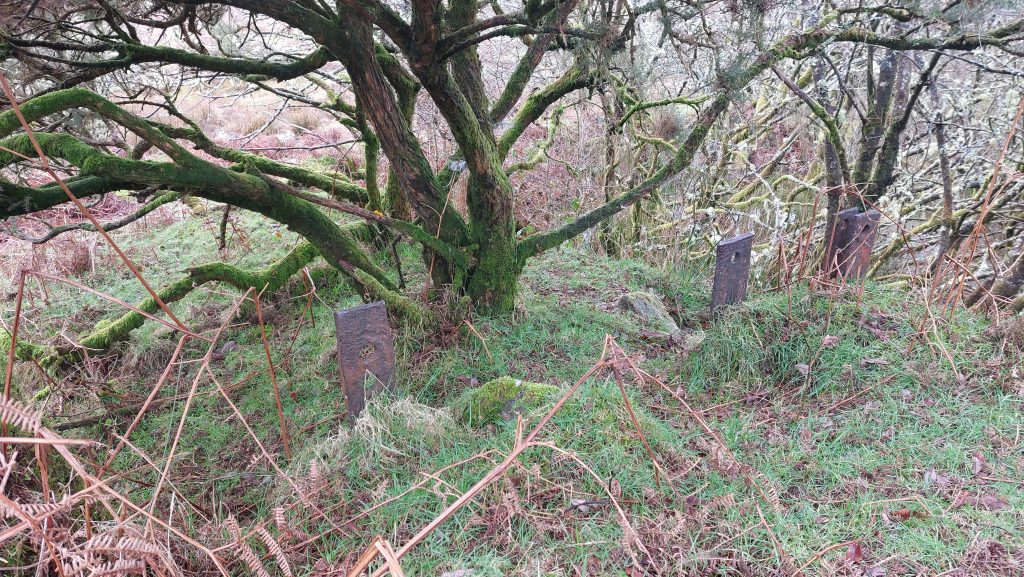
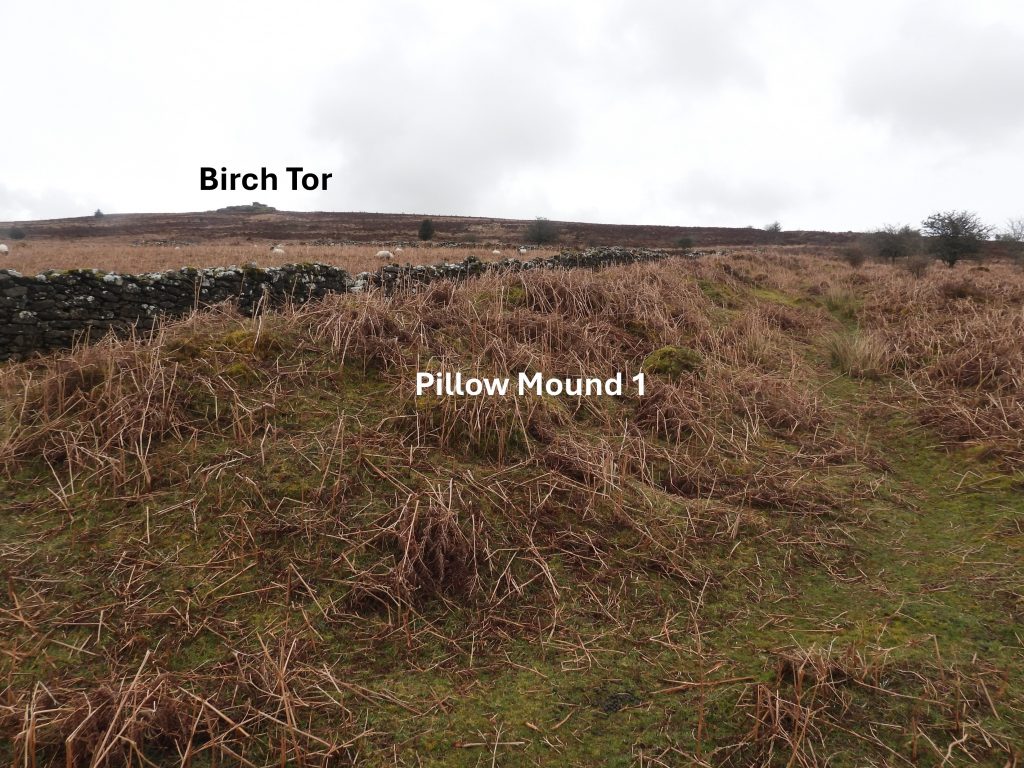
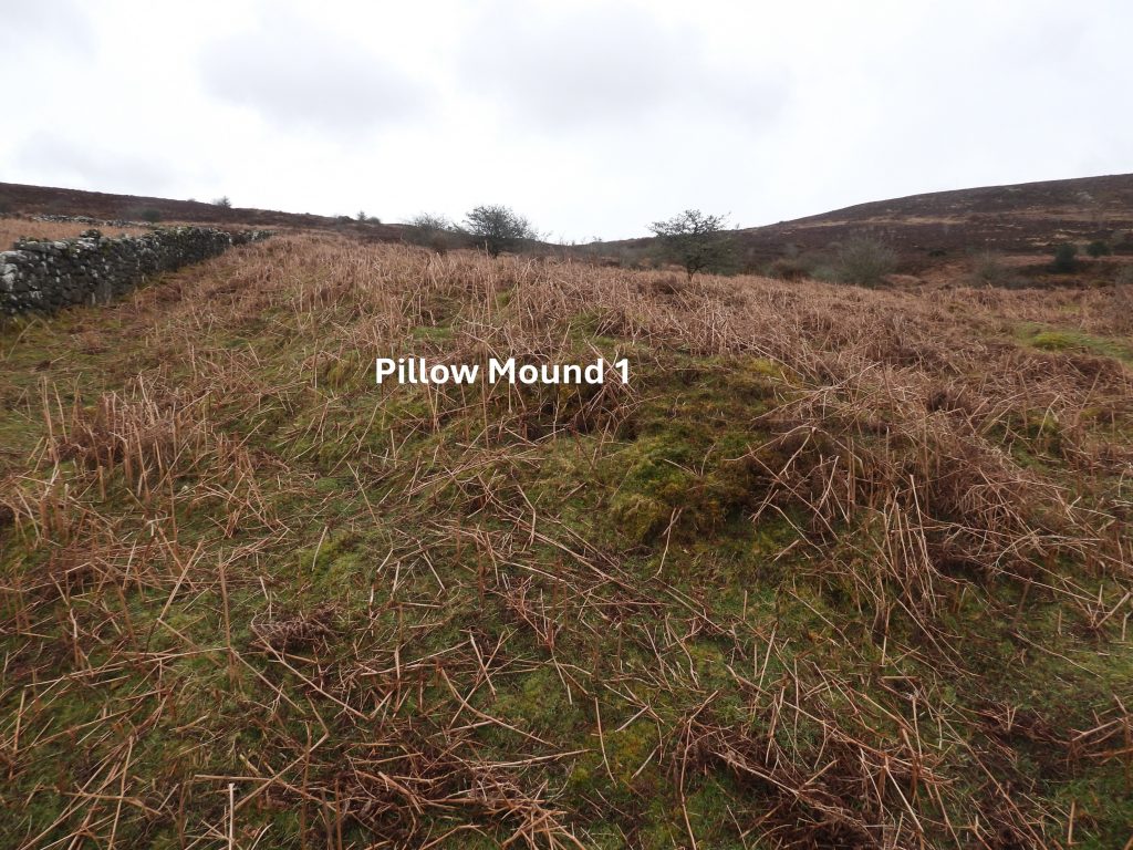
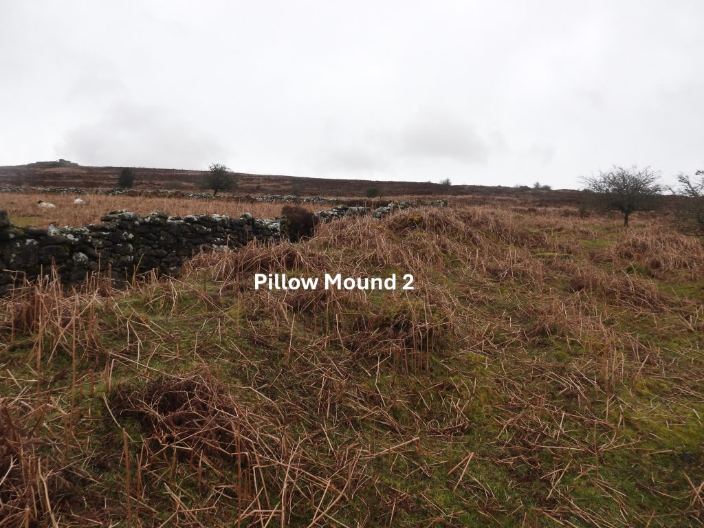
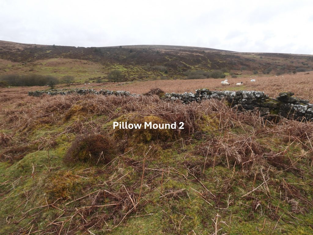
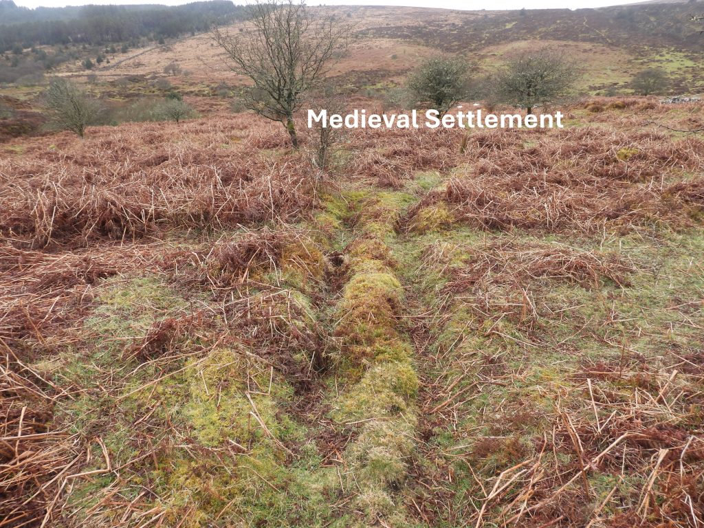
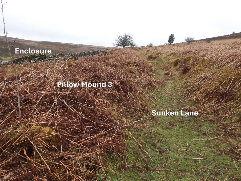
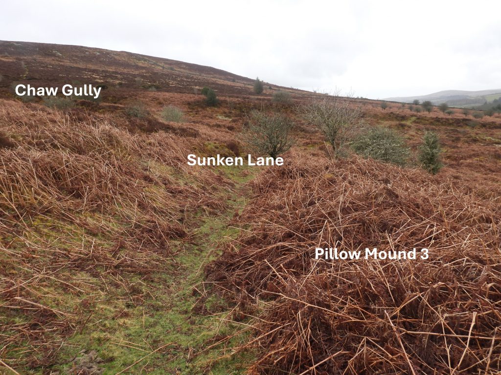
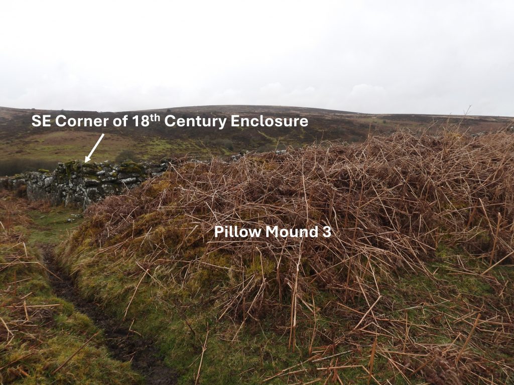
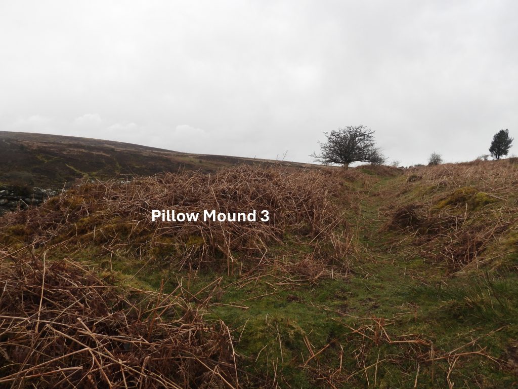
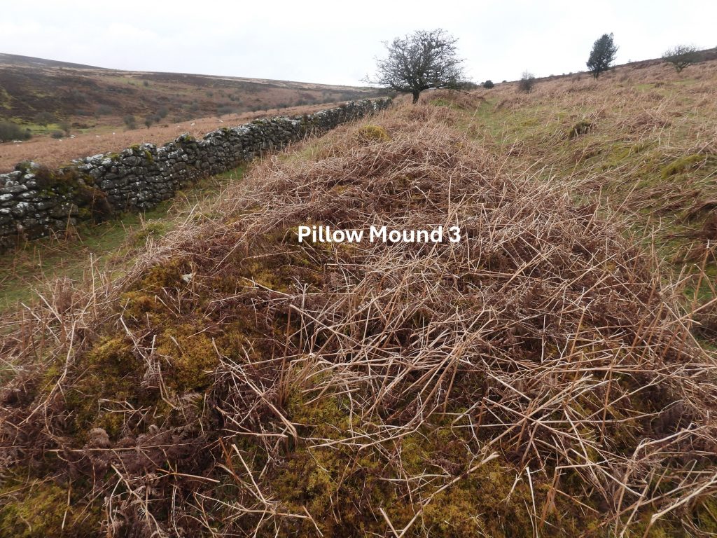
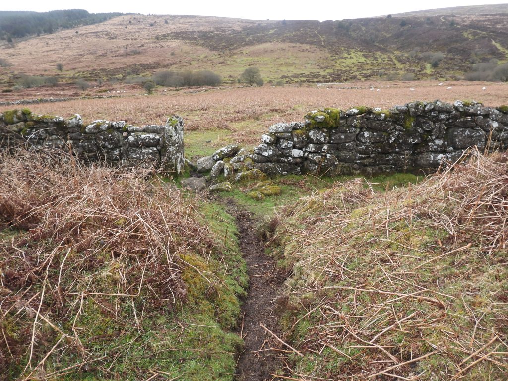
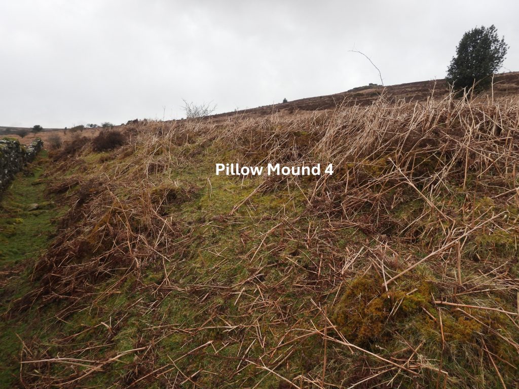
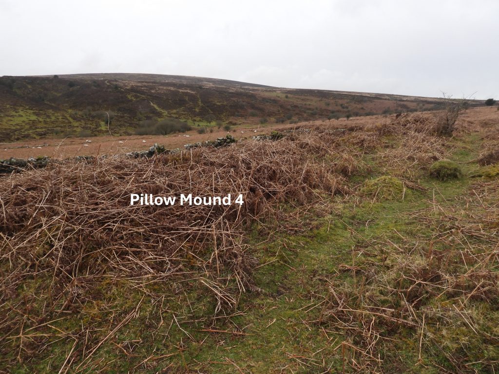
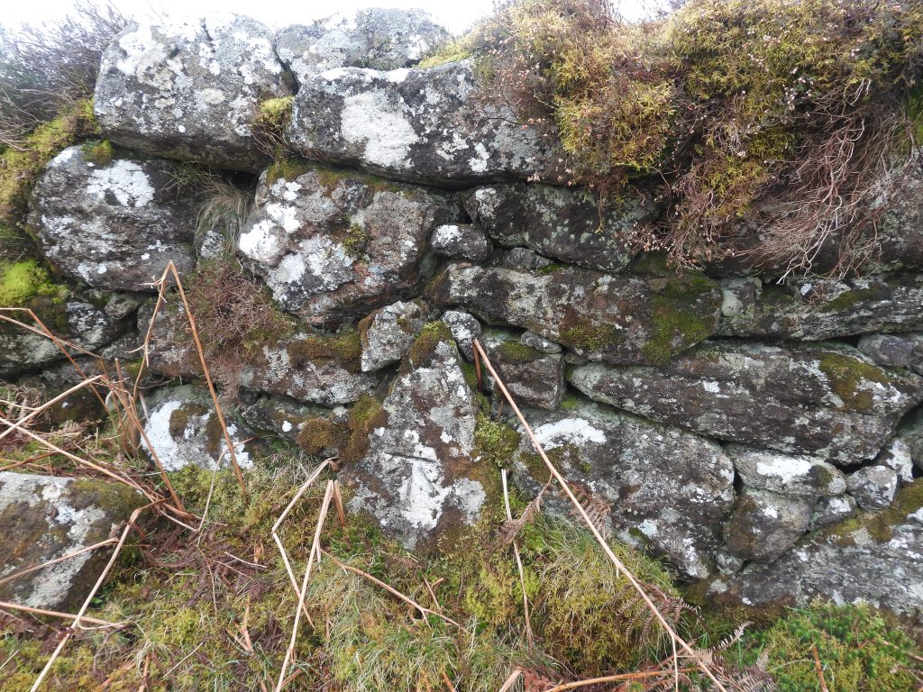
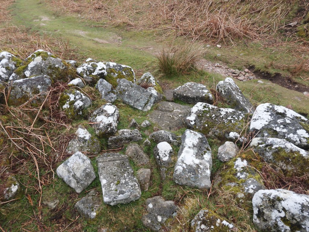
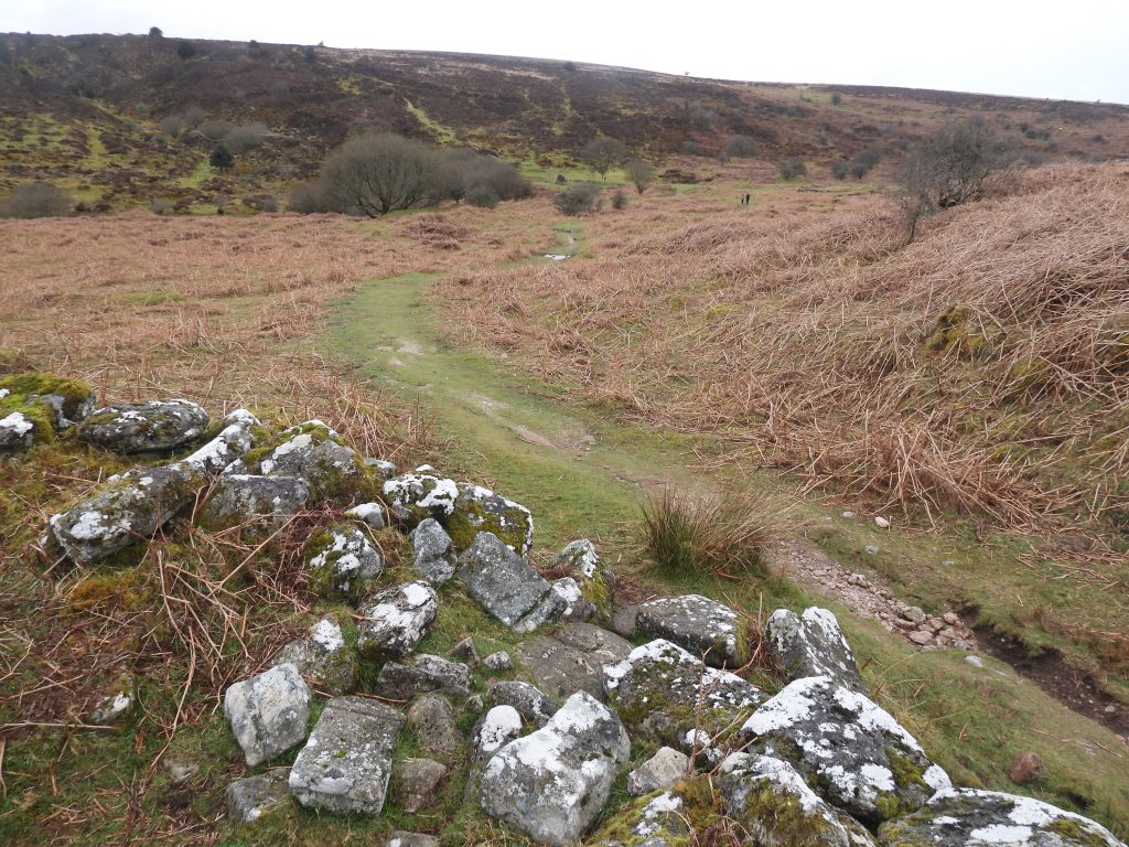
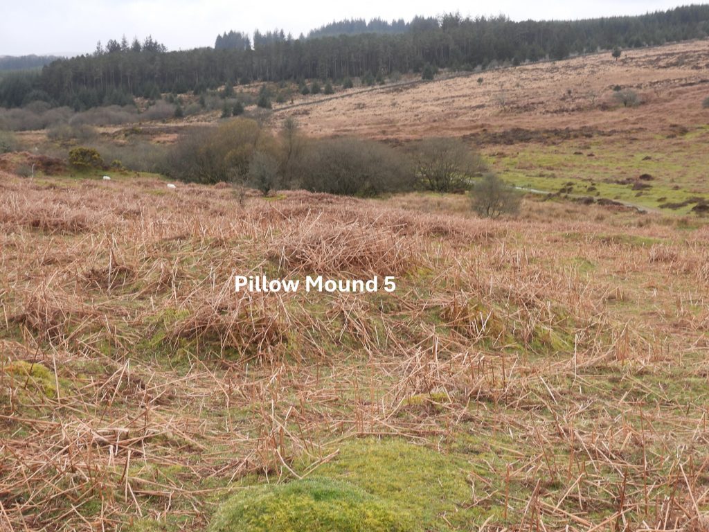
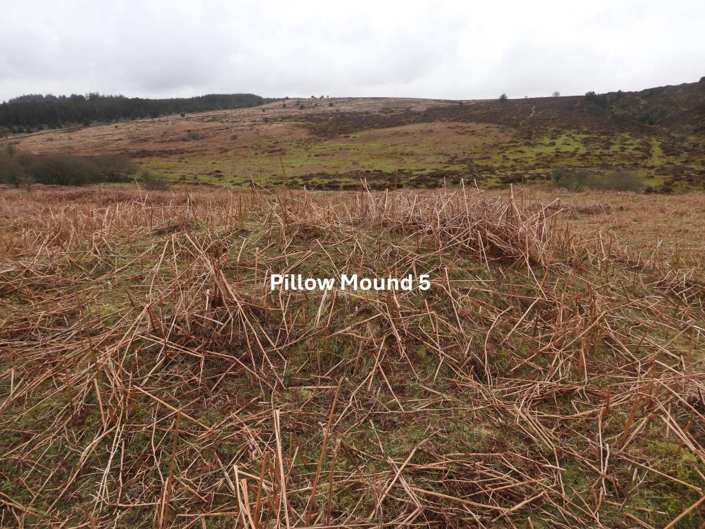
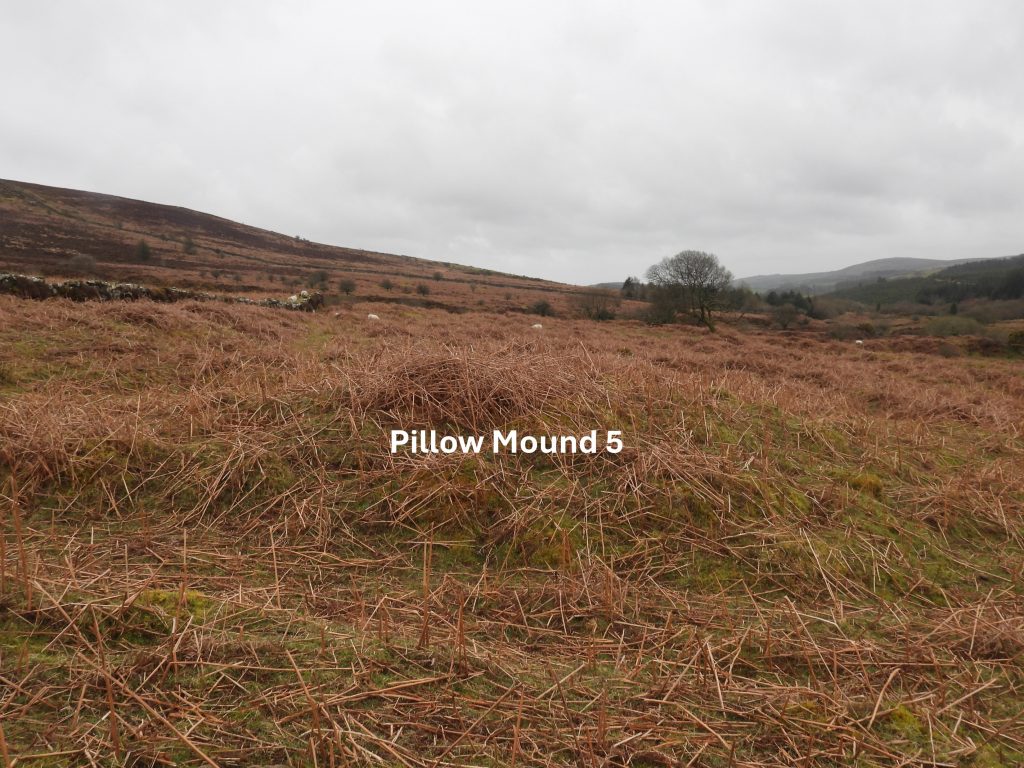
Sketch map of the area covered in this post. The Medieval settlement itself is quite small and can easily be overlookedApproaching the Medieval Farmstead / Settlement from the west. Keeping the 18th century Enclosure on the left (north) and Chaw Gully on the right (south) the Farmstead / Settlement can be found. A visitor may also note a dry leat which once served the 20th Century Tinners Mill and one of several Pillow Mounds in the area.Recorded by Newman on the Devon Historic Environment Record are two longhouses. A visit to the area, ideally should be made in the Winter of early Spring when the bracken is down, else this longhouse would be very difficult to discern. The substantial longhouse (labelled number 1 on the sketch map) is oriented east to west at the edge of the streamwork. Newman records the internal dimensions as 11 metres by 2.7 metres. The photograph doesn’t do justice to the longhouse which is more discernible to the naked eye. Although no walls survive there is a possible entrance visible in the centre of the north side (on the right hand side dotted line in the photograph). Soussons plantation can be seen in the distance.Longhouse 1 looking east. The longhouse (centre) was measured at SX68522 80748. Challacombe Down can be seen in the background.At the eastern end of the Medieval Settlement is a flattish area which (to the authors untrained eye) looks as if there once might have been a wall located (SX68515 80770). Newman, in the Devon Historic Environment, describes this as being the second building. It is about 15 metres to the north of the longhouse 1. The walling is oriented north-north-west to south-south-east. It is labelled as Longhouse 2 on the sketch map.Part of Longhouse 2 wallingIt is suggested that the minimum internal length would be 9 metres by 3 metres wide. That said, this second longhouse is difficult to interpret.A possible line of walling relating to a third building (longhouse?) or possible enclosure is not shown on the Devon Environment Viewer map. The two upright boulders on the north side of the settlement, which in the authors opinion, when first seen, most probably represented the site of the third building. They could also have been the gateposts to the entrance to the Farmstead / Settlement.To the east of the twin uprights are some intriguing wall remains. By removing some of the old bracken, the south east corner of a possible third building (Longhouse?) was exposed. The stones here are quite substantial being around 0.5m wide. Does this confirm a building or maybe its just part of an enclosure wall?As per the south east corner, by removing some of the old bracken, the north east corner of a possible building was exposed. These two corners were around 5m apartIn line with the ‘north east corner’ (exposed walling) extending westward are the previously mentioned two upright boulders which could have formed the northern wall of a building?If the aforementioned features were indeed building ruins, crudely measured it would have been around 5m wide by 20m long. The picture shows how close the tinstreaming works and later adit were to the Medieval Settlement. The centre of this possible building is located at SX68499 80760Tinstream working and an adit are located immediately to the south of the Medieval Settlement. The Longhouses have not been affected by these workings, but the associated enclosures appear to have been truncated by themA short distance from the Medieval Settlement and Tinner’s Mill at SX68456 80728 is an adit (collapsed). The adit was driven over 1300 feet east on ‘D lode’ with cross-cuts to other lodes. This was dug near the end of the life of Birch Tor and Vitifer mine not long before the company suspended operations in 1914 due to a lack of labour. There was a tramway (as shown on 19th century maps), which would have lead from this area to the Tinner’s Mill.To the west of the two longhouses there are two (very overgrown) small enclosures. The enclosure seem to have been both truncated by Tinner’s streamwork and workings. Newman records their areas as being around 0.16 hectares each.Enclosure 1 is located around SX68475 80749Enclosure 2 is located around SX68457 80748Near the south west corner of the 18th Century Enclosure, a leat to the Tinner’s Mill can be found where its course takes a 90 degree bend before passing over an embankment from which a launder would have taken the water over an overshot waterwheel. The leat course also carried on down the valley to Golden Dagger Mine.Leat embankment leading to the Tinner’s Mill. The top of leat embankment is located at SX68390 80751The site of a 20th century Tinner’s Mill is extremely overgrown and is barely discernible. The edge of the mill was recorded at SX68456 80728. The Tinner’s Mill was destroyed when unexploded WWII bombs were brought from Plymouth to be detonated here.Within the Tinner’s Mill are some old metal posts which might represent part of an old stamps area. They are located at SX68335 80714There are five pillow mounds surrounding the 18th Century enclosure, which are part of Headland Warren where there are said to be 37 in total. A ‘Pillow Mound’ is a man-made rabbit warren and is superbly described by Helen Harris in ‘The Industrial Archeology of Dartmoor’ (page 155). In her book, Harris uses another name (buries) and states: “A bury was made by first digging a trench with branches leading from it, bridged over with stones and covered with more stones and soil, leaving entrance holes”.Pillow Mound 1 is centred at around SX68449 80774Pillow Mounds 1 and 2 are located on the southern edge of the 18th Century Enclosure. The Pillow Mounds (or Buries) were well drained to protect the rabbits and therefore are more often than not found on slopes of hillsides.Pillow Mound 2 is found at SX68483 80793Near the eastern end of the Medieval Farmstead / Settlement are these distinct ‘grooves’, which might just be natural erosion but the author speculates may well have been man made (possible cart track?)Access to the Medieval Settlement may have been via a sunken lane on the eastern side. The sunken lane runs in a northerly direction and is parallel to a later (18th century) enclosure and two pillow mounds (labelled 3 and 4 on the sketch mapThe Sunken Lane looking south. The Medieval Settlement lies to the right (west) once the end of Pillow Mound 3 and the south east corner of the 18th Century enclosure is reached.South east corner of the 18th Century Enclosure and the southern end of Pillow Mound 3. In Thurlow’s Dartmoor Companion on page 286-7 there is a lovely sketch of a Pillow Mound (Bury) and a description which states: “A bury or artificial burrow are found across Dartmoor Warrens. The term ‘Pillow Mounds’ has been revived in recent years”. Harris describes that once a rabbit had been introduced upon the scene they would soon find these (Pillow Mounds) and make themselves at home, and the banks would have eventually grassed over. Each of the Pillow Mounds around the enclosure are around 1.2m high.Pillow Mound 3 is located at SX68506 80812The enclosure was first recorded on a map of the warren in 1797 together with 6 similar examples in the Redwater and West Webburn valleys. The gate appears to be located between Pillow Mounds 3 and 4. The purpose of the enclosure is not fully understood but is likely to have been utilised in some way with the trapping and harvesting of rabbits at the warren (they is a vermin trap on the north west corner of this enclosure). The gate is located at SX68489 80840To the north of Pillow Mound 3 is Pillow Mound 4, both of which are adjacent to the east side of the enclosure. Most Pillow Mounds are usually surrounded by ditches.Pillow Mound 4 is located at SX68489 80852Benchmark (B.M 1249.1) on the outside of the wall of the 18th Century enclosure. It can be found at SX68420 80893.This part vermin trap comprises three individual stones each with a linear slot. Vermin traps were constructed out of granite with slate shutters to catch weasels and stoats and so to protect the warrened rabbits (at Headland Warren). Vermin traps can be found around the moor predominantly in the area of upper River Plym.This part vermin trap can be found at SX68382 80896 at the north west corner of the enclosureThis (unusual) circular mound located on the north-west side of the enclosure is Pillow Mound 5Pillow Mound 5 is located at SX68351 80873Pillow Mound 5, looking south down Redwater Valley