A collection of walks, discoveries, insights and pictures of exploring Dartmoor National Park
October 9, 2022
Bachelor’s Hall Tin Mine
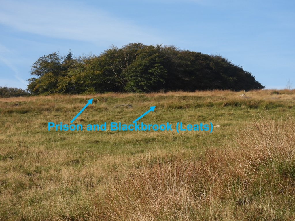
Bachelor’s Hall tin mine opened in the late 18th century, originally as an opencast concern before three shafts were sunk with their workings running NNE-SSW along the five tin lodes. Tin was first discovered in the late 1790s when Dock leat (as it was known then) was being cut in the area. The original Dock leat weir (take off) was from the Blackbrook river not far north of the mine and was completed in 1797. Of course Dock Leat became known later as Devonport Leat (circa 1824). The extension of Dock Leat to the Cowsic and West Dart Rivers was completed by 1802. In spite of the waters of Dock Leat, the mine did not use them to power its three water wheels which operated stamps and flat rods as two other leats were used for this purpose, namely; Prison Leat and Blackbrook Leat.
In 1795, a licence for 31 years was granted to Thomas Gray of Exeter to develop a mine here and it is recorded that around that time sixteen men were employed, 2 of whom worked the windlass or whim, which was usually the reserve of horse power. Mr Gray is reported initially to have set up a smelting house and a stamping mill next to a small Brook, which is now commonly called Bachelor’s Hall Brook. Between 1798 and 1804 the smelting house produced 223 blocks of tin weighing 27 tons. In 1825, the lease for the mine transferred to Sir Thomas Tyrwitt but it is said he had difficulty running the mine. The mine changed hands in the ensuing years before It finally closed in 1862. Today, although the mine has been thoroughly stripped of most of its stonework an associated fittings the majority of its main features are still evident as well-defined turf-covered earthworks or scarps. Although much of the mine is situated on private land, a very good appreciation of the workings can be had by walking along the footpath between New London (Princetown) and Bachelor’s Hall, looking on Google Earth, exploring the Bachelor’s Hall Brook near to where it enters Blackbrook River and by walking south along Dock (Devonport) Leat to the east of where the main wheelpit and dressing floors once operated. Information for this post has been obtained from ‘Follow the Leat’ by John Robins (2nd edition 1984) and from the Dartmoor Historic Environment Record.
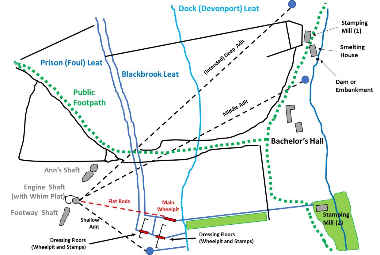
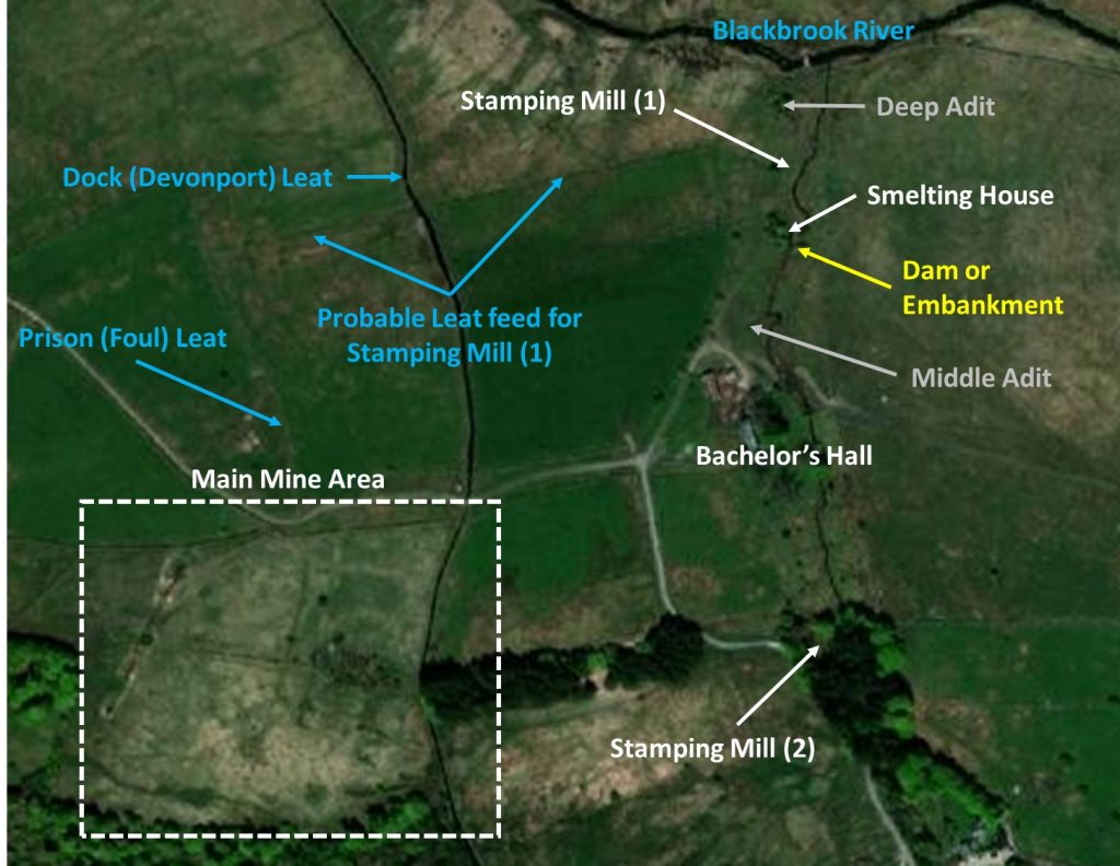
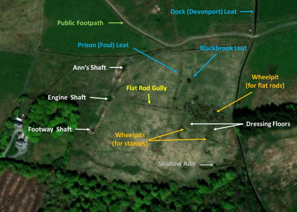
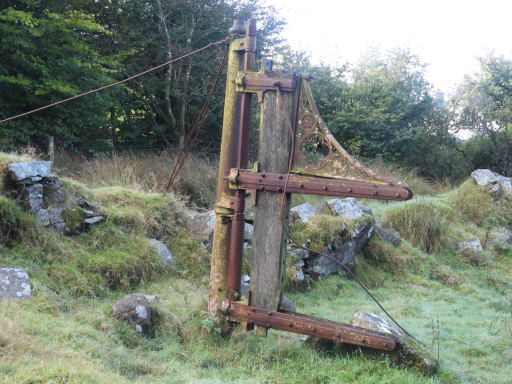
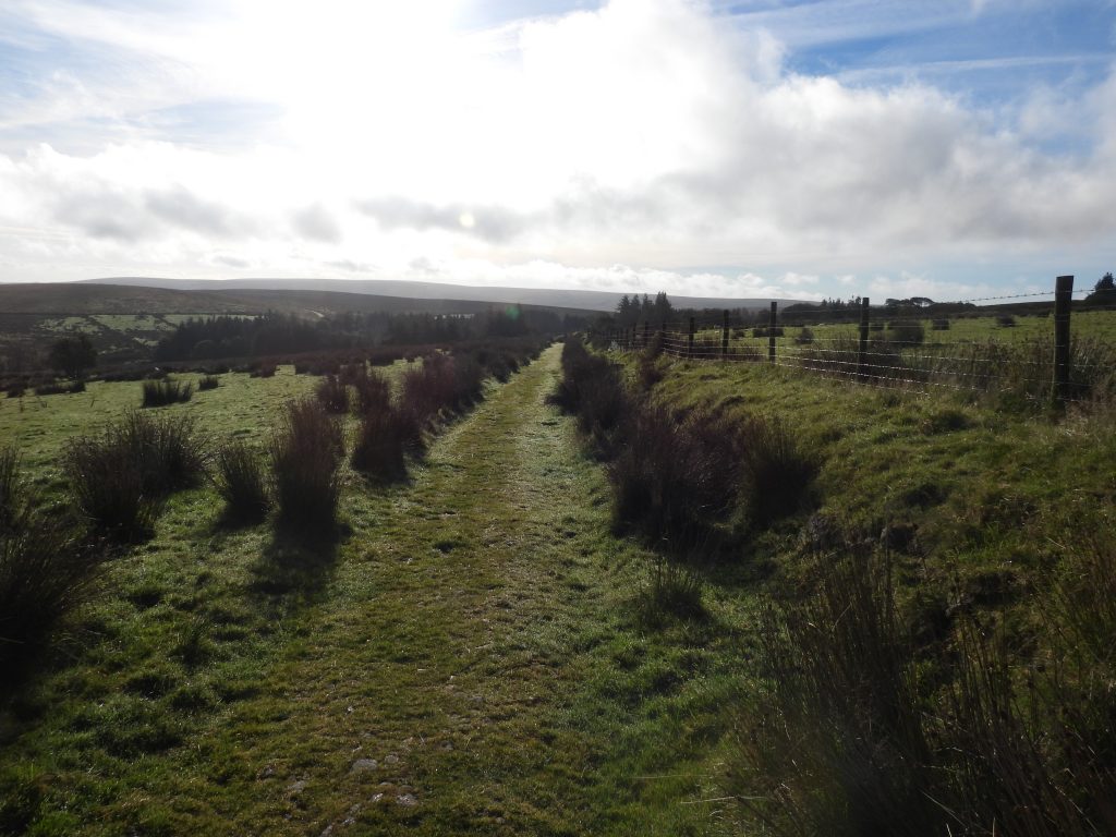
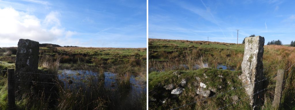
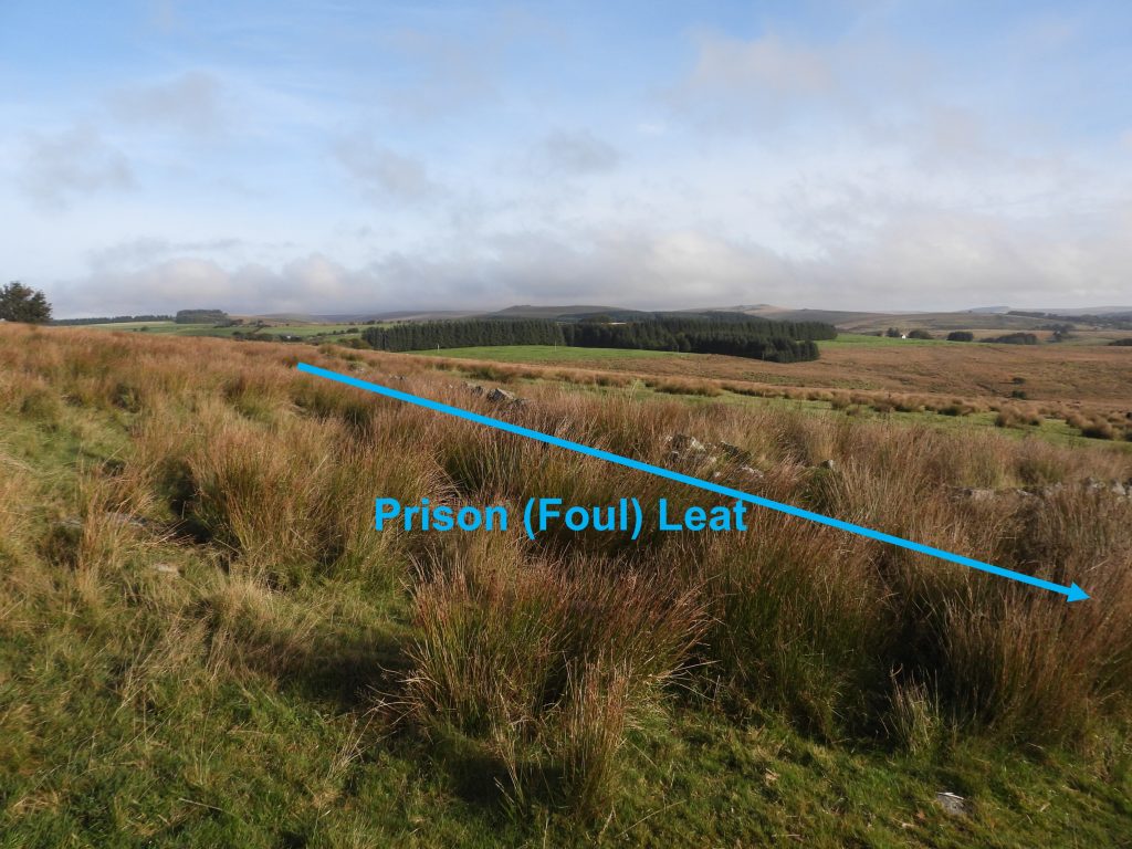
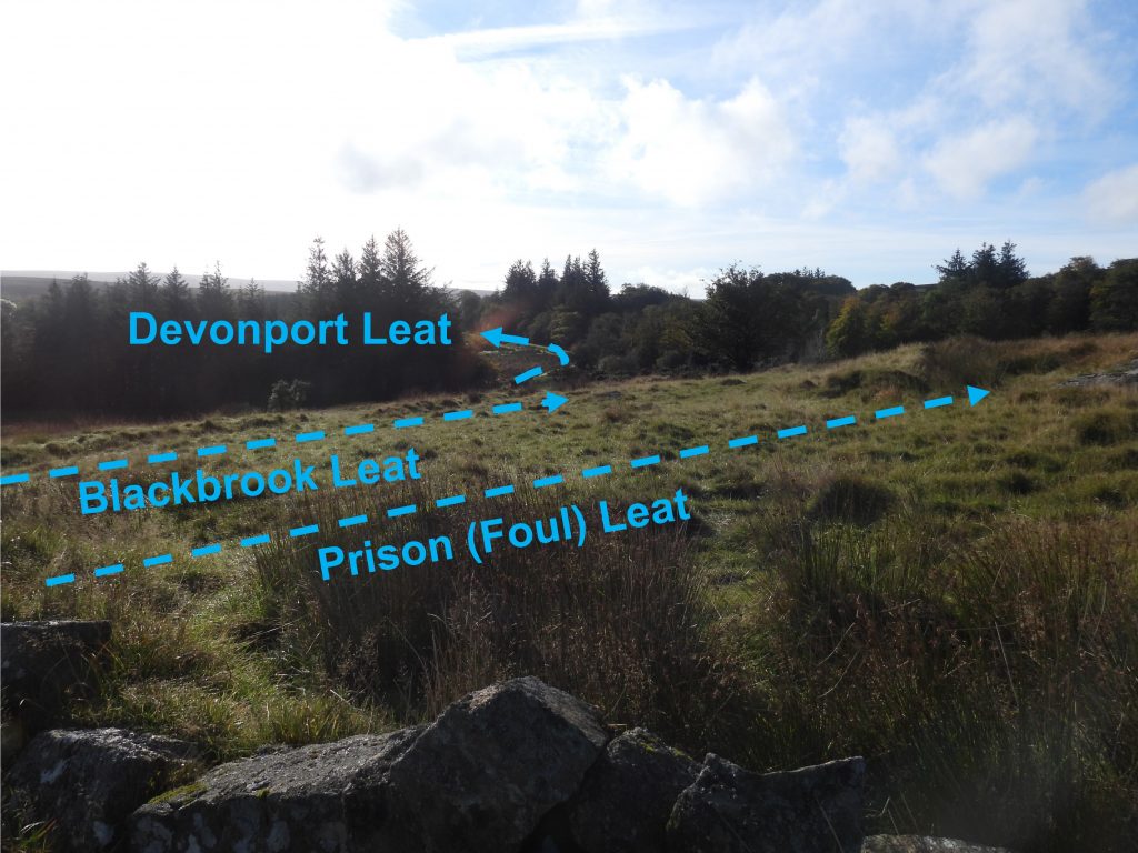
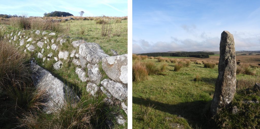
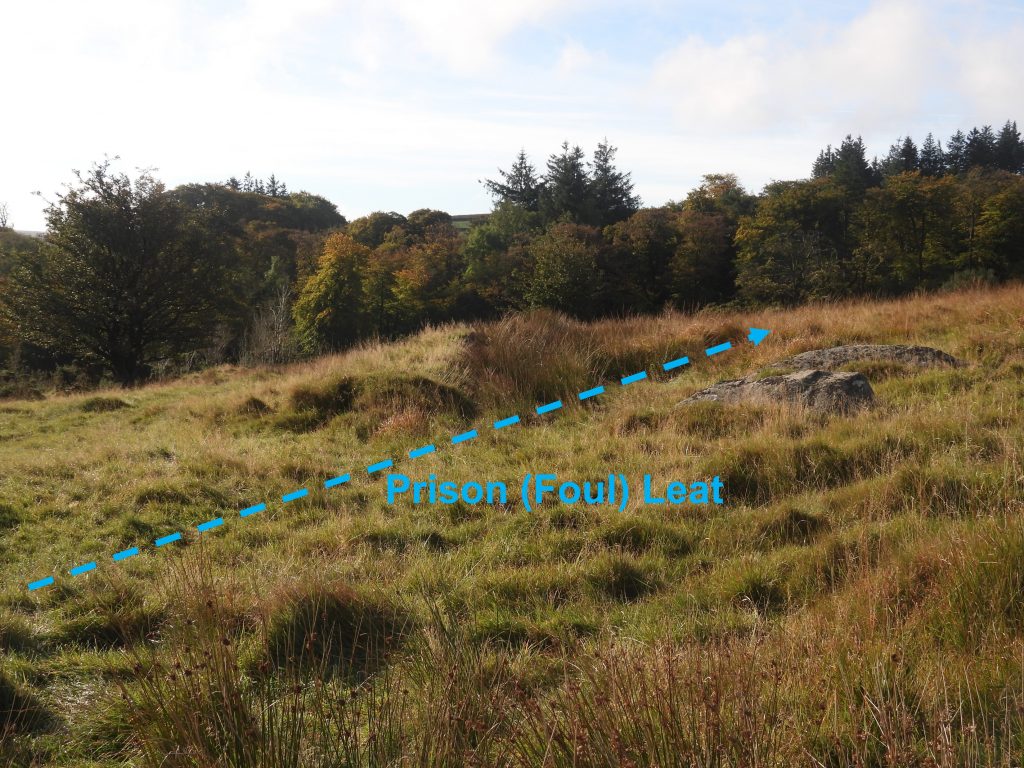
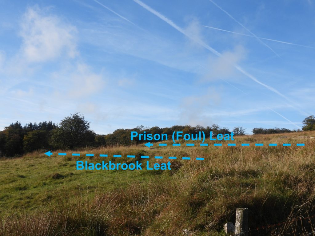
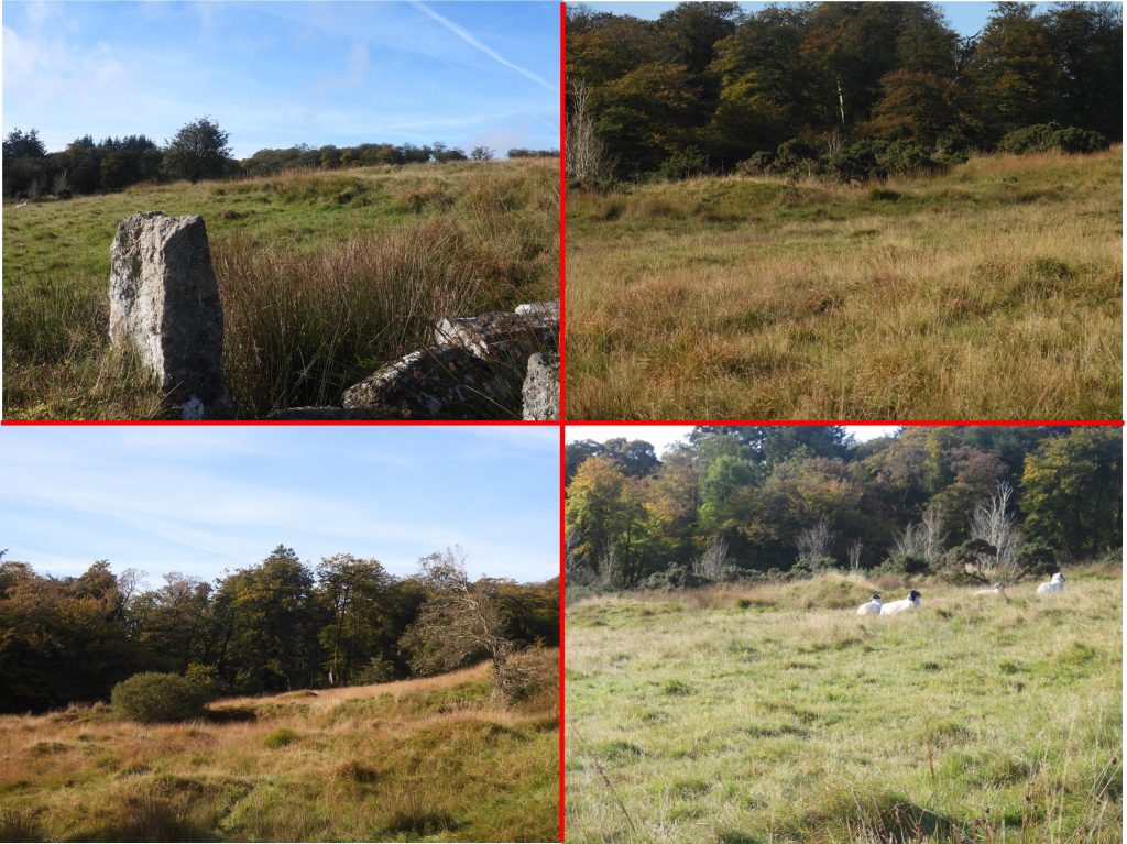
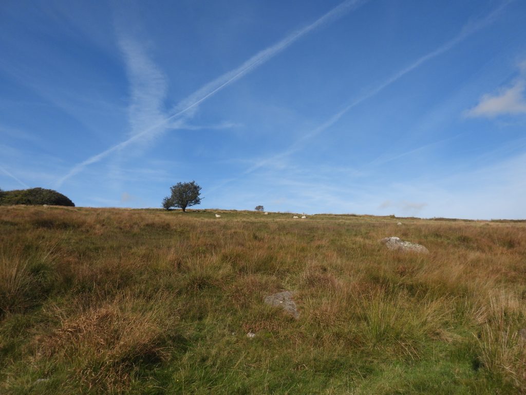
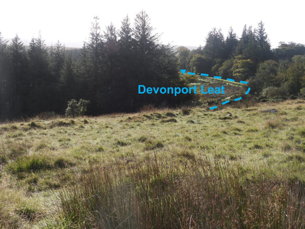
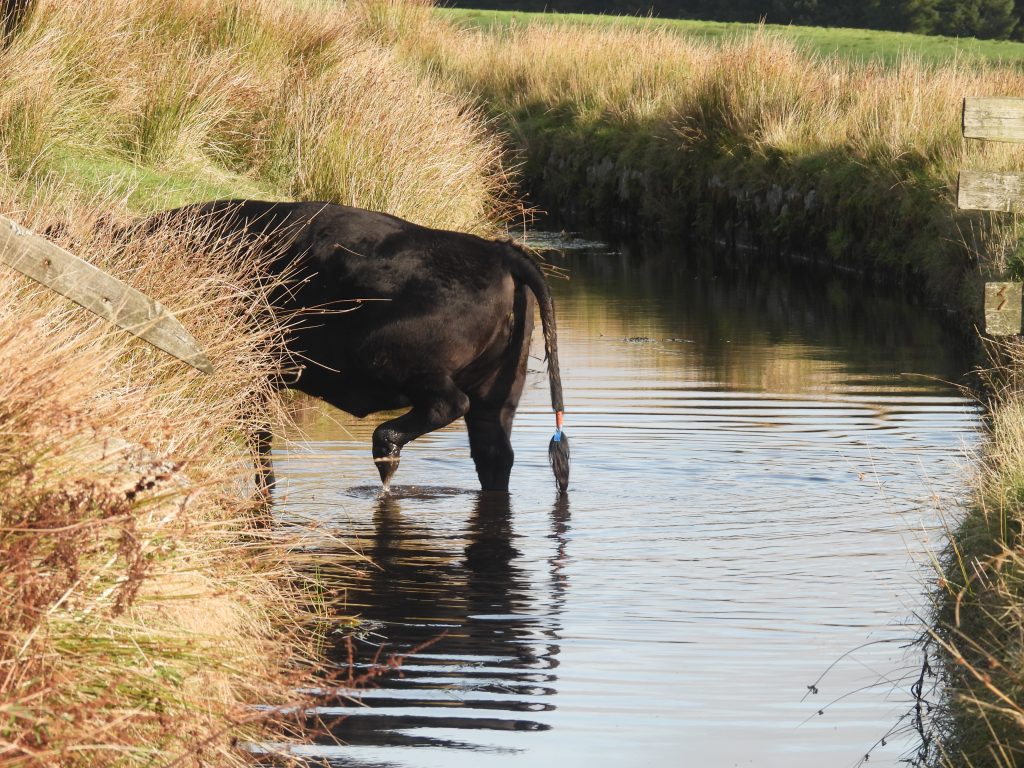
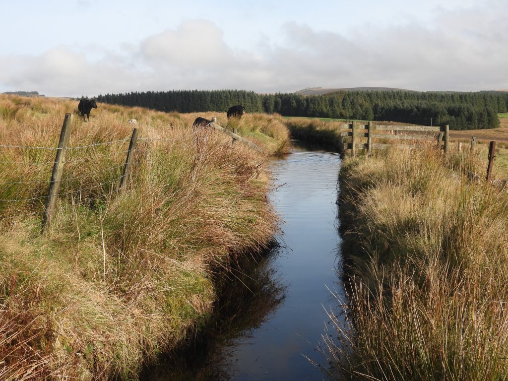
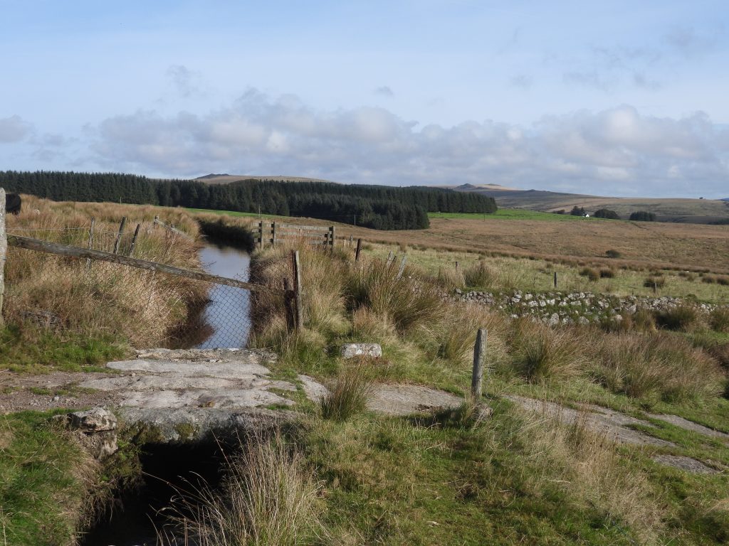
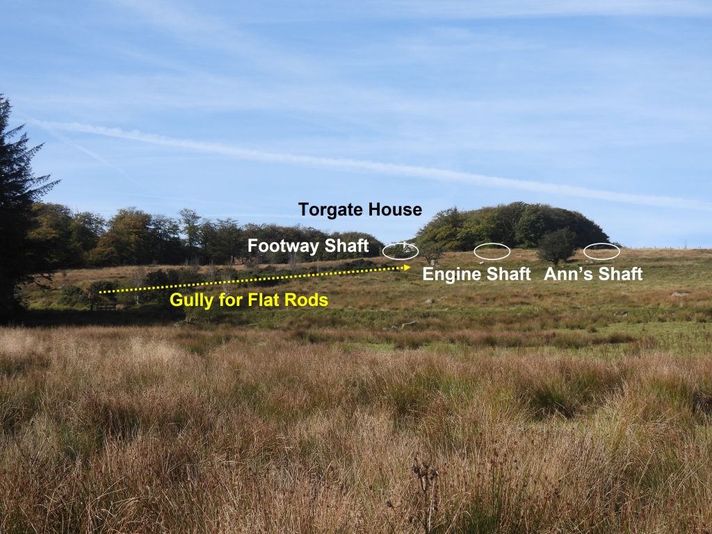
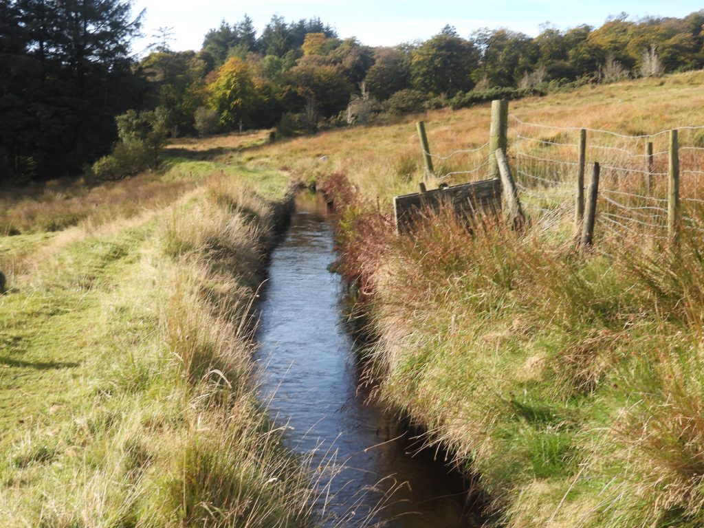
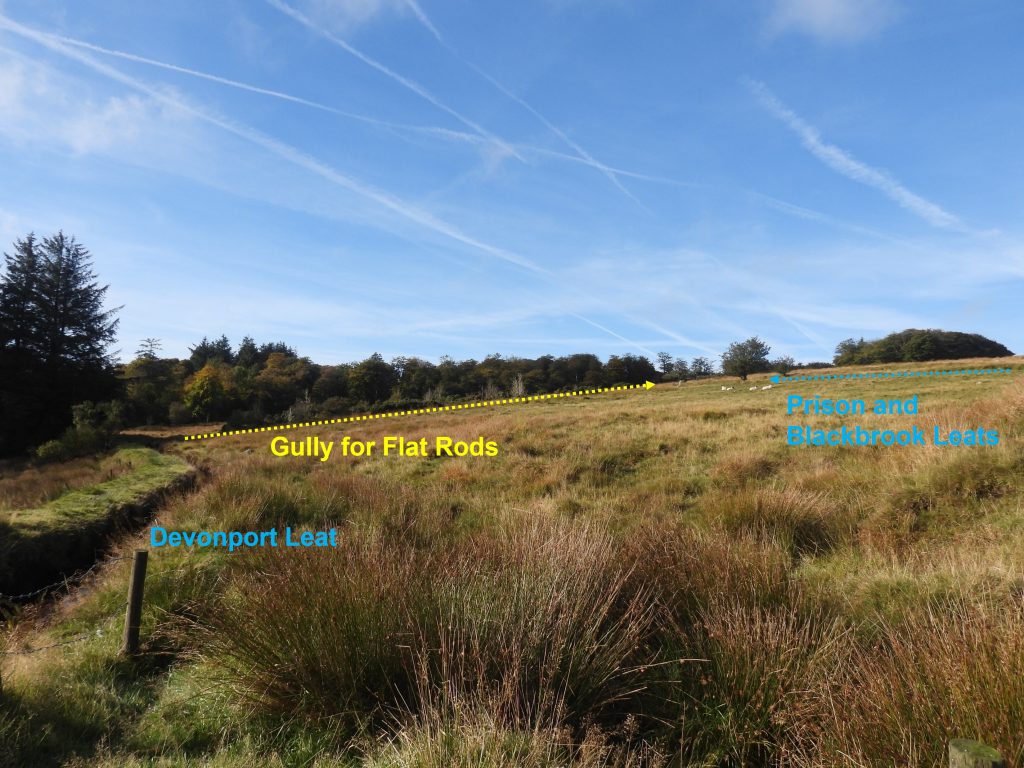
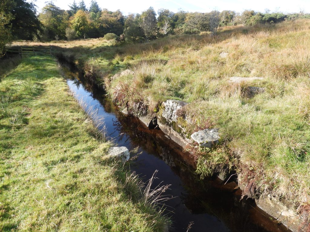
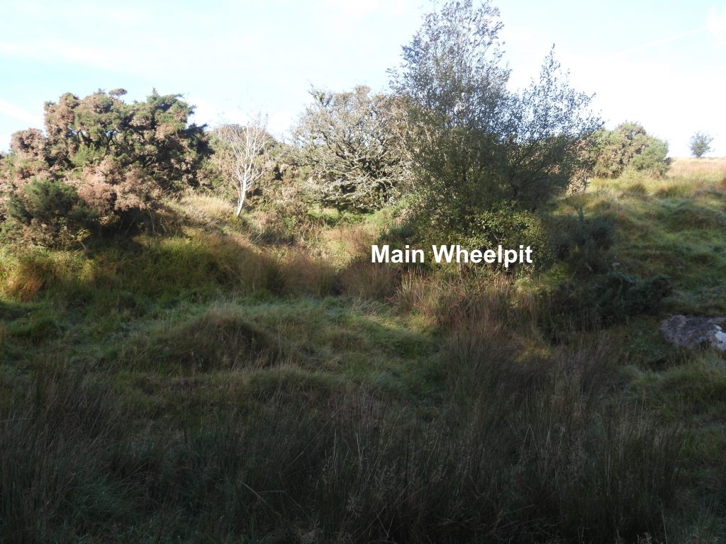
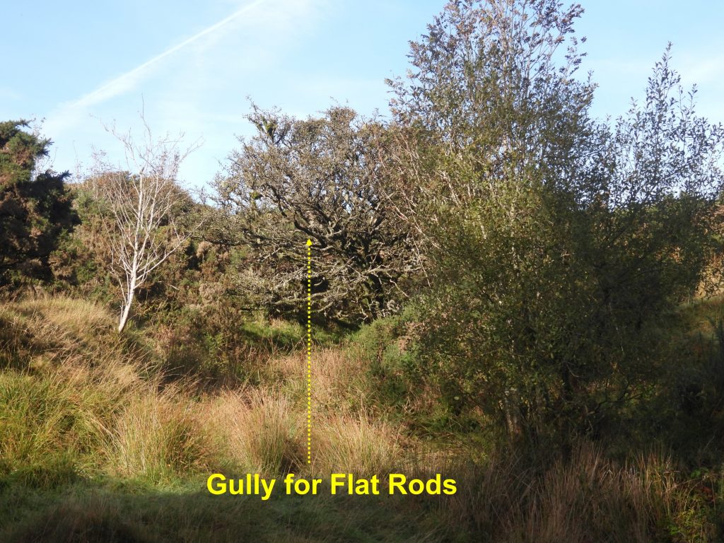
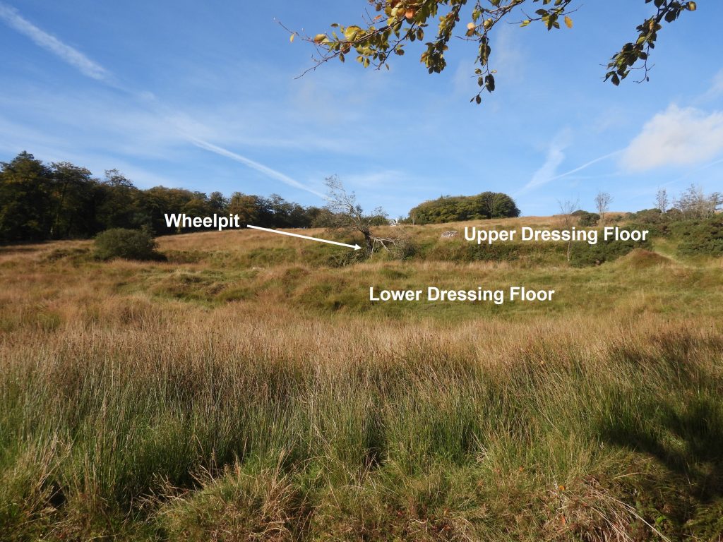
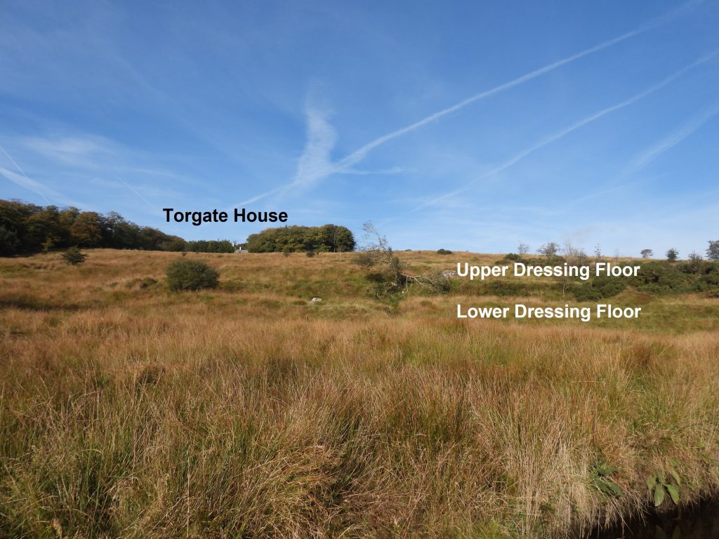
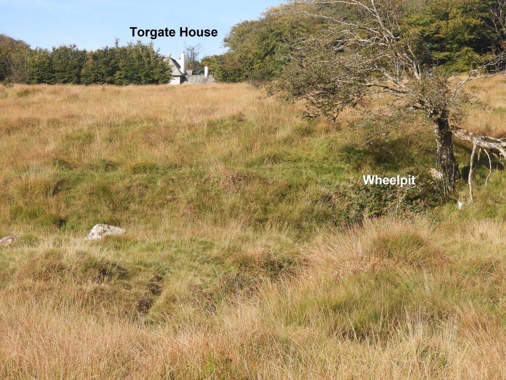
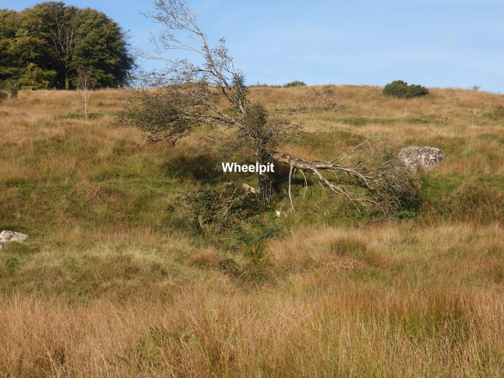
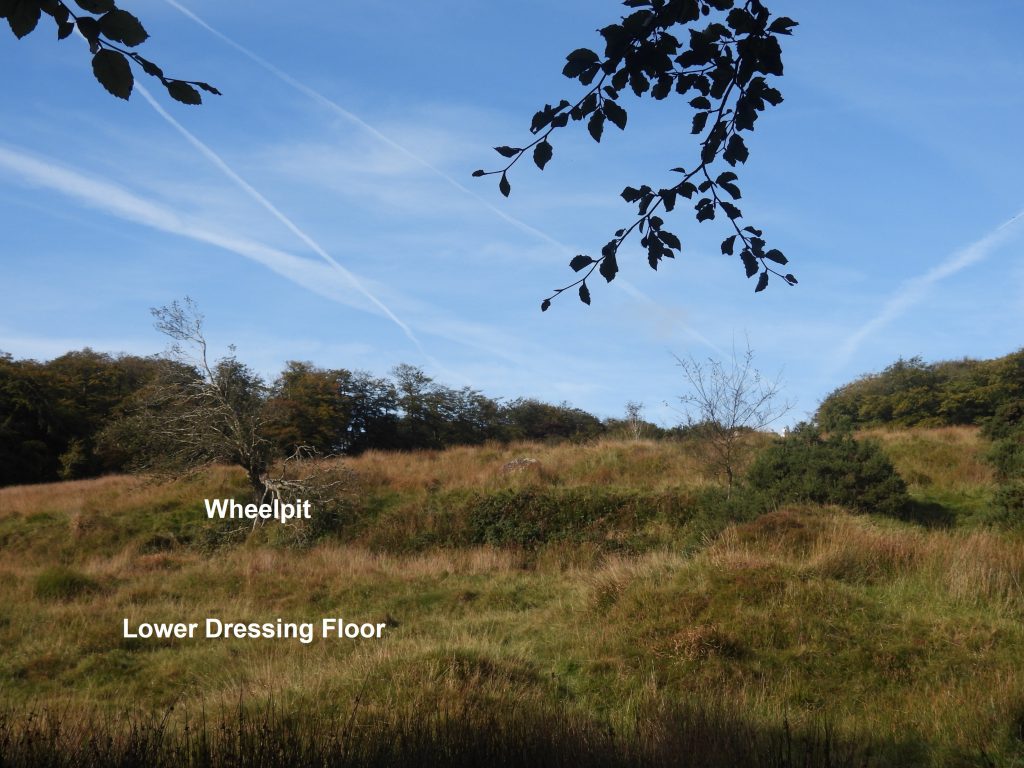
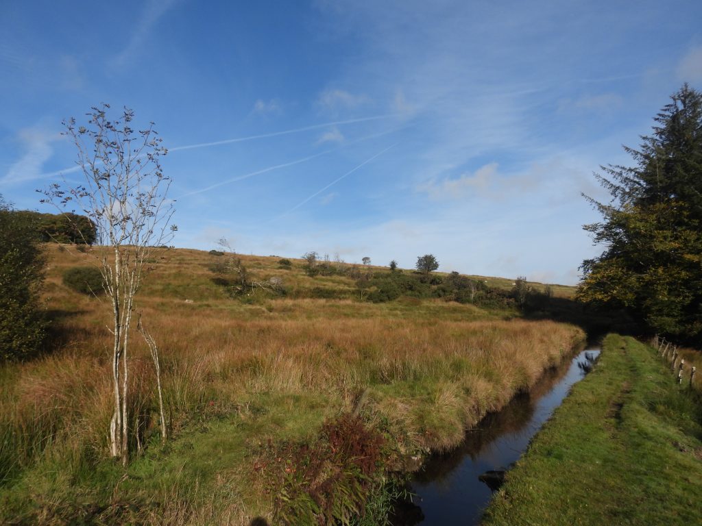
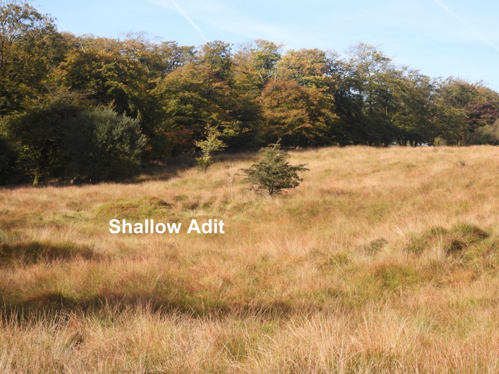
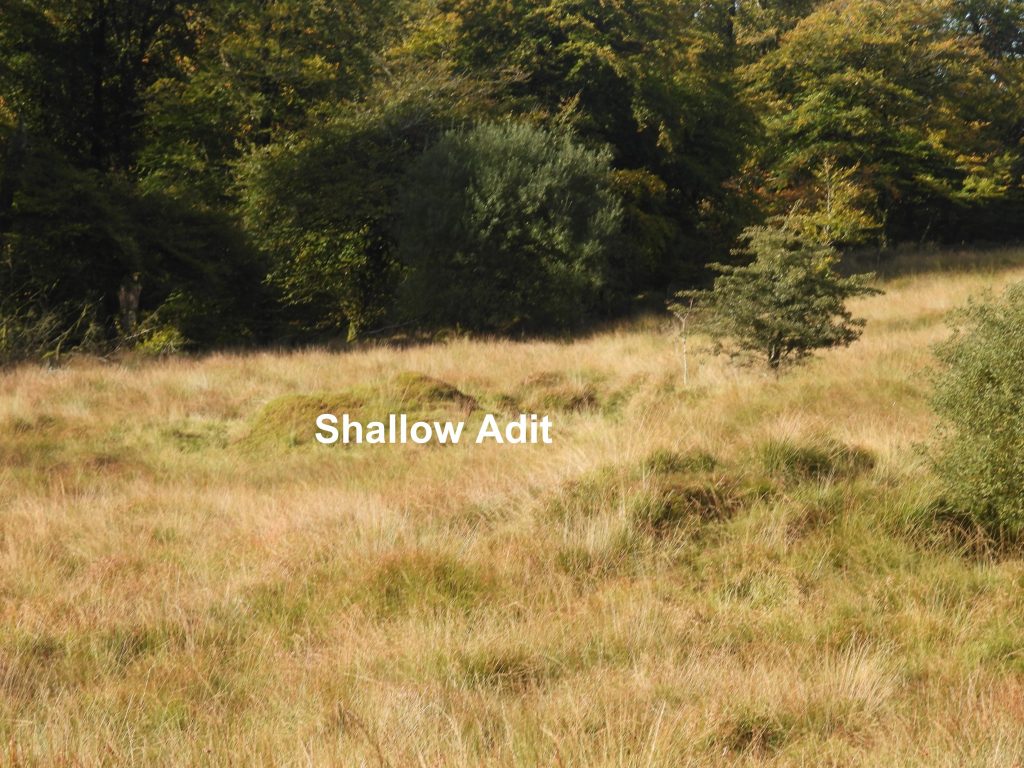
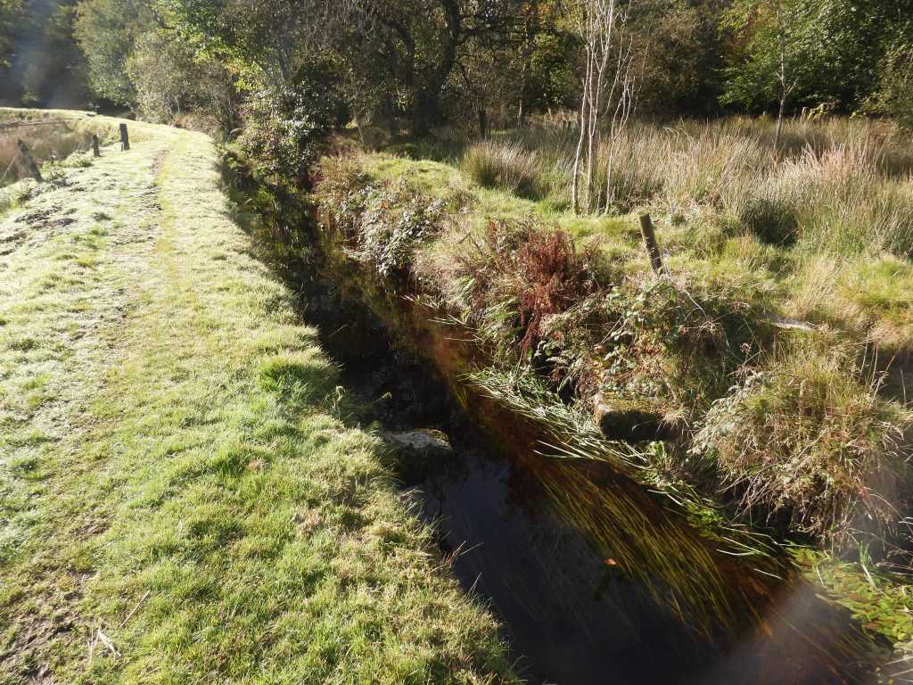
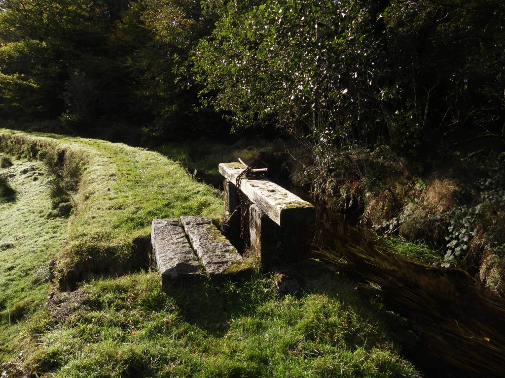
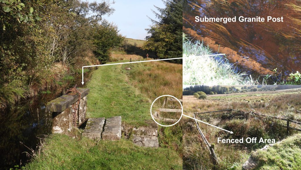
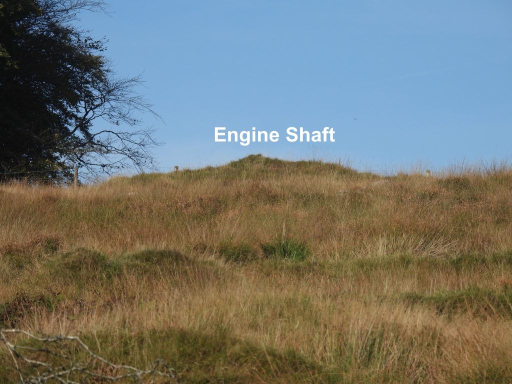
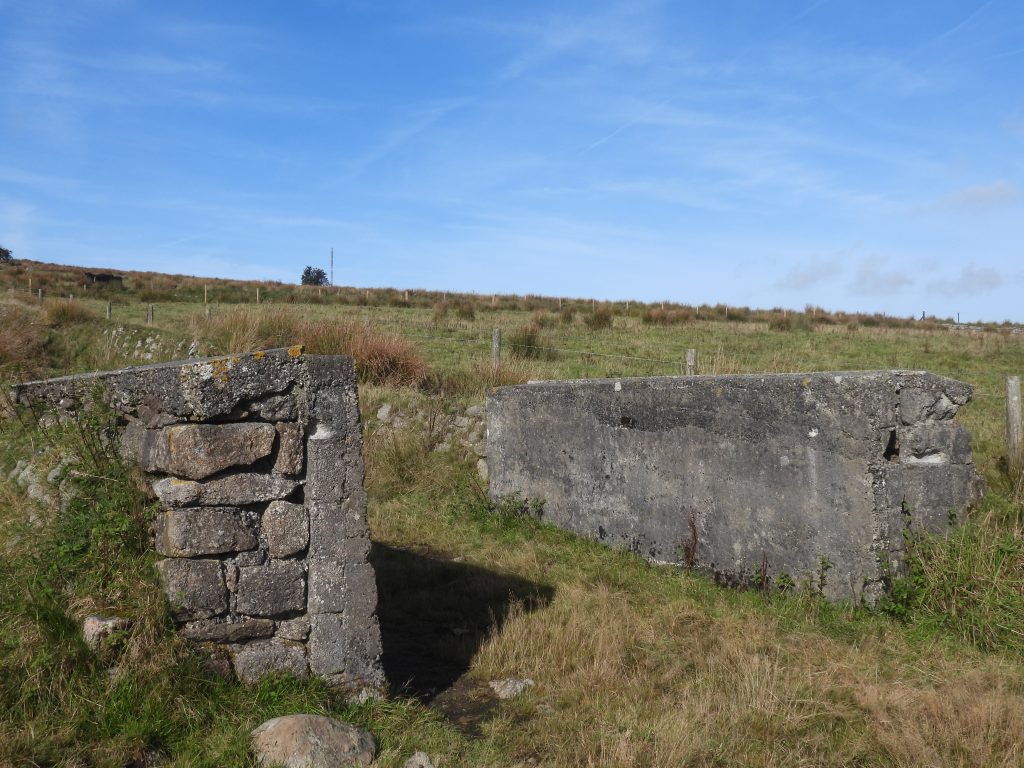
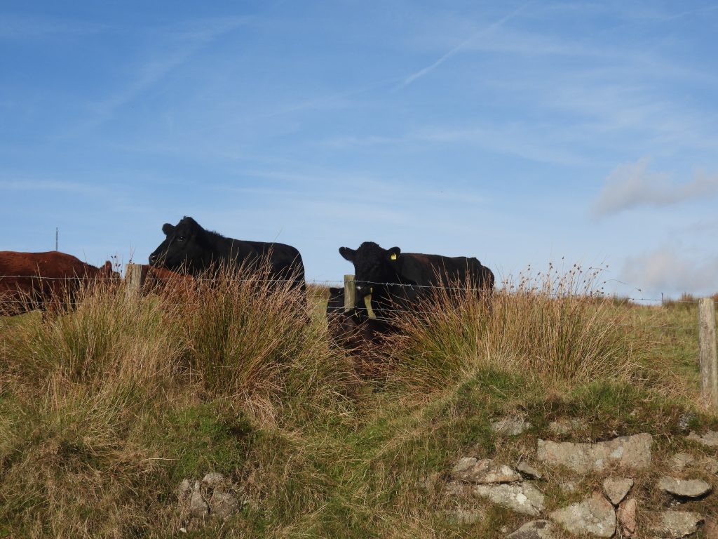
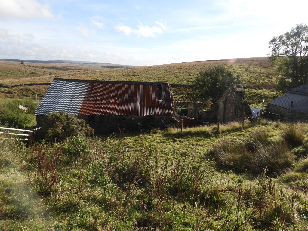
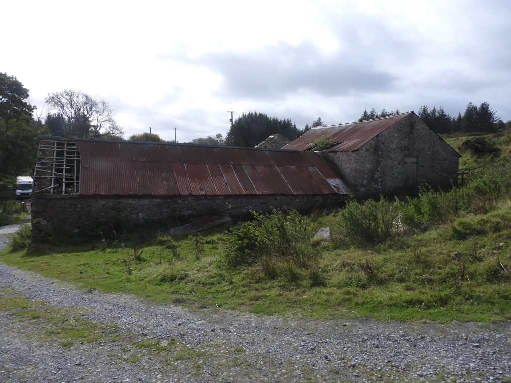
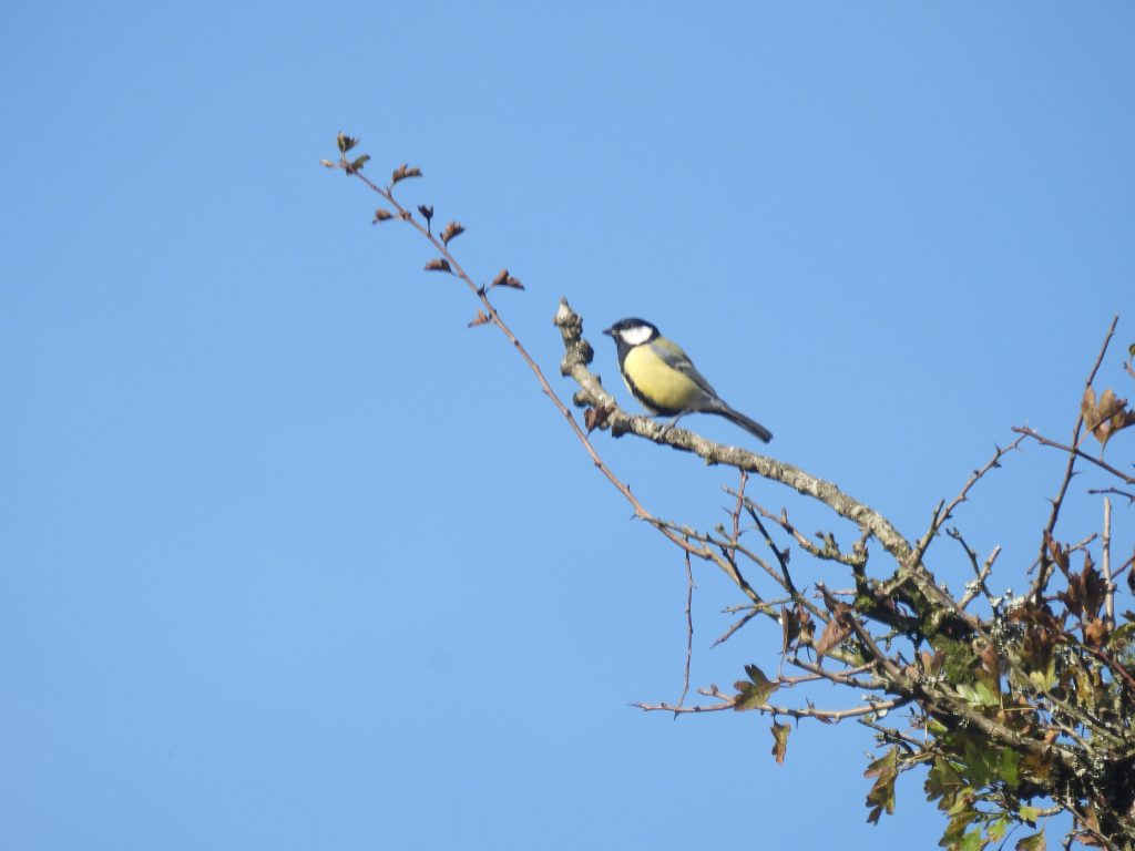
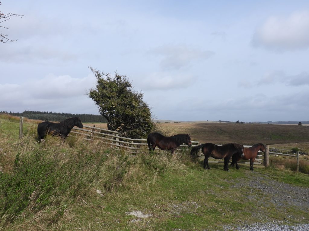
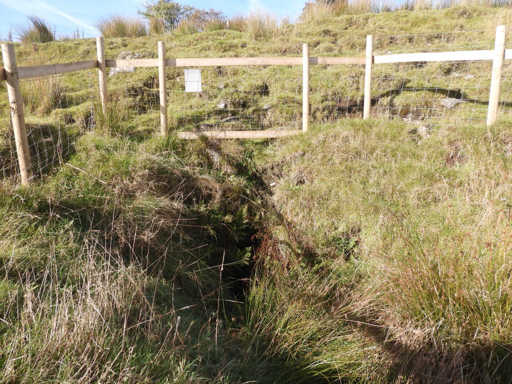
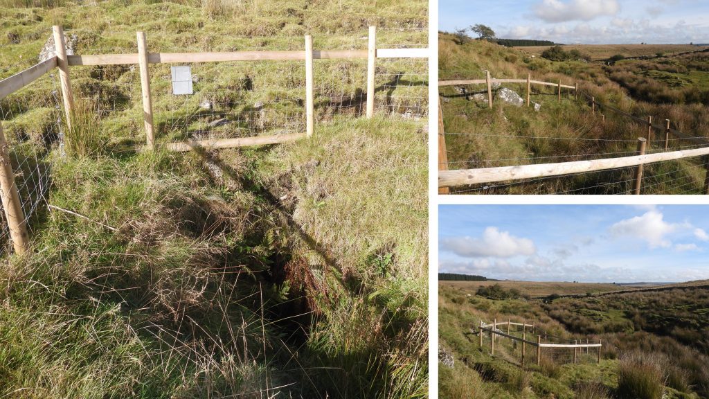
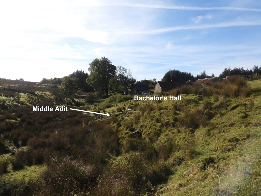
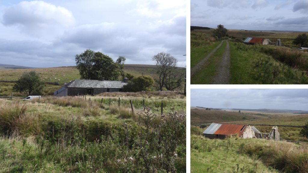
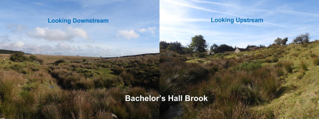
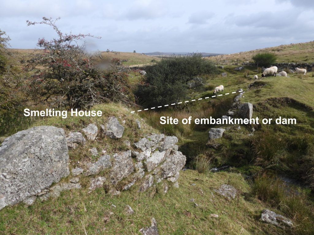
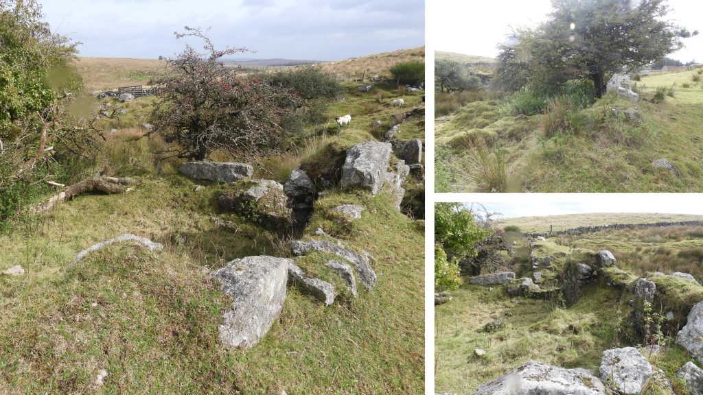
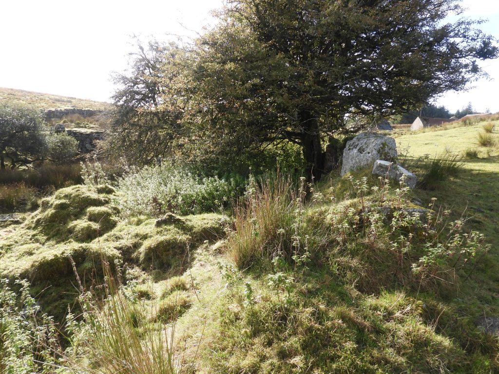
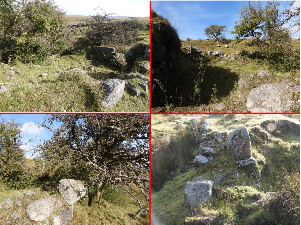
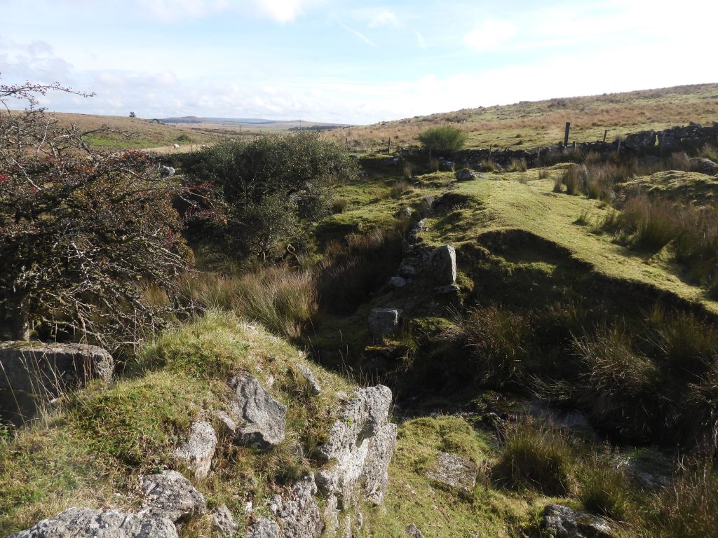
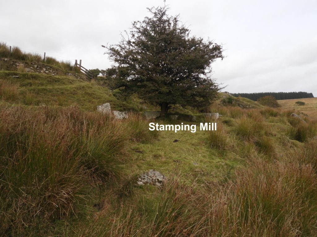
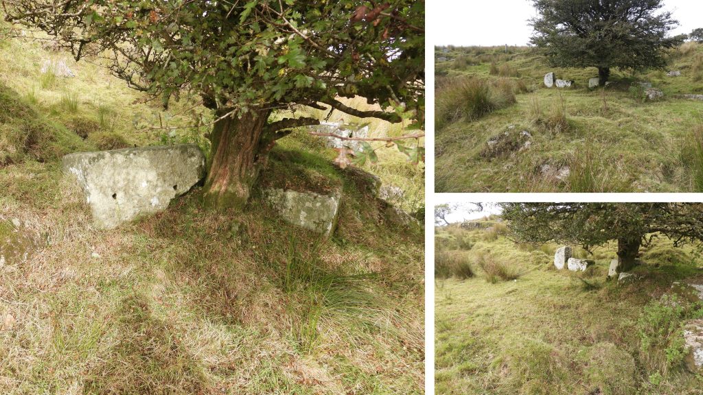
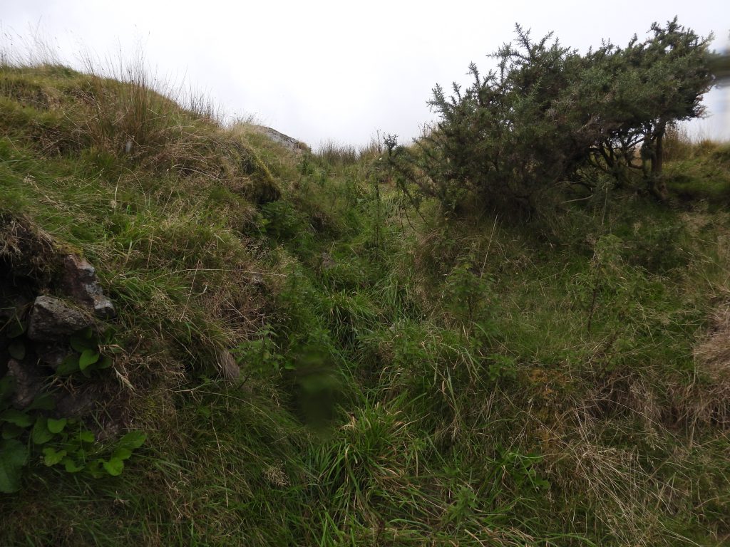
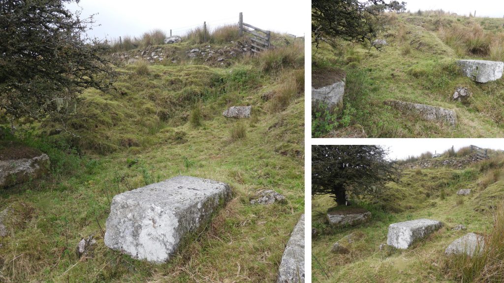
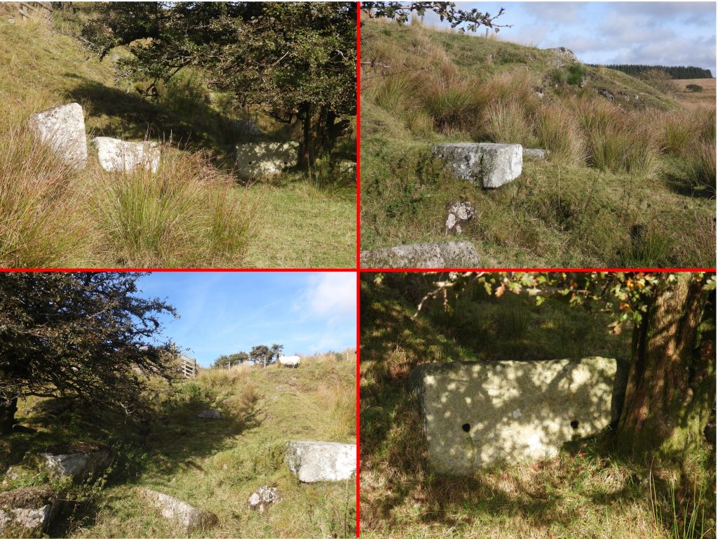
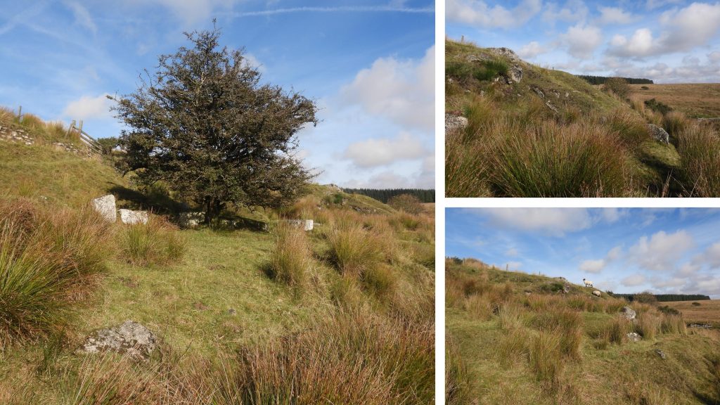
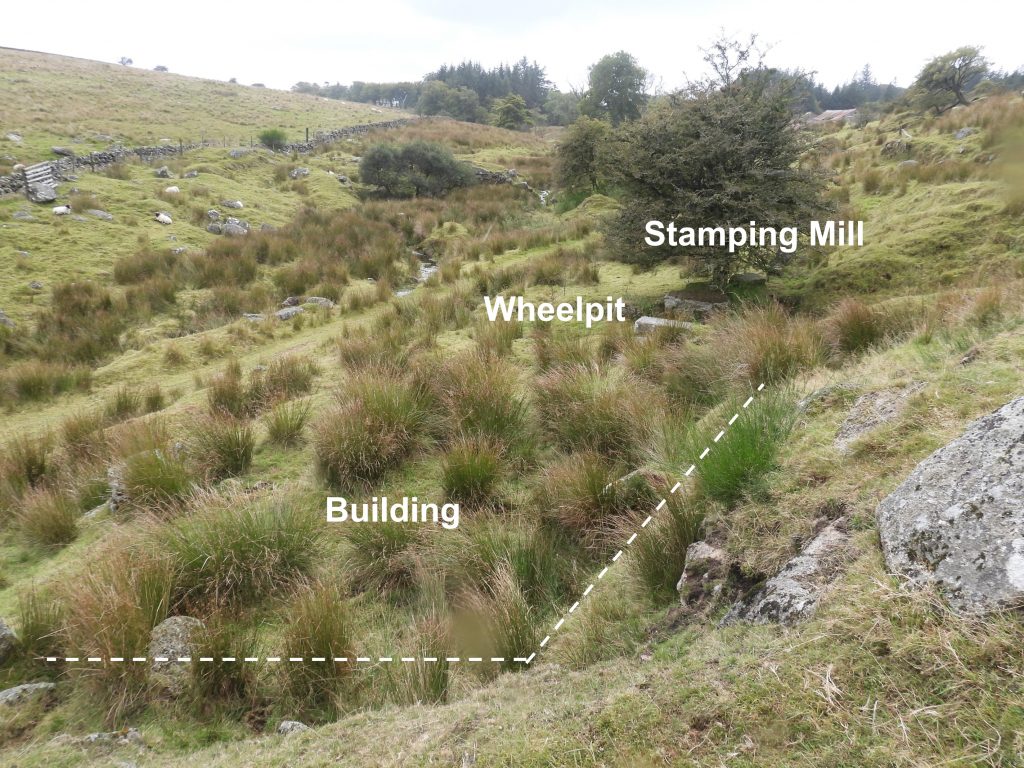
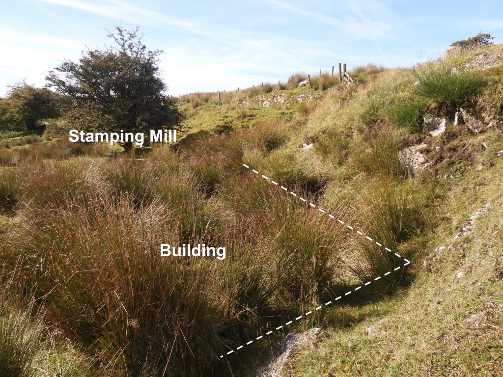
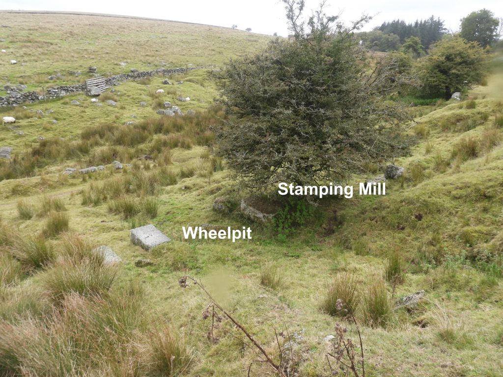
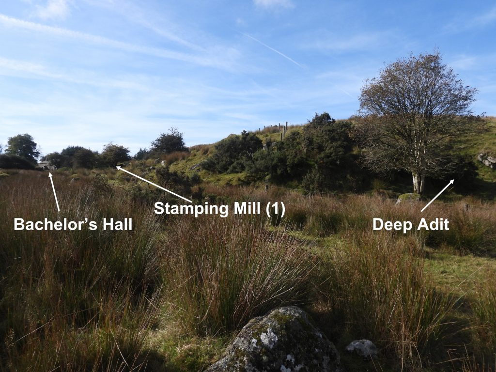
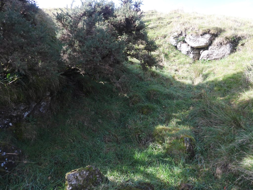
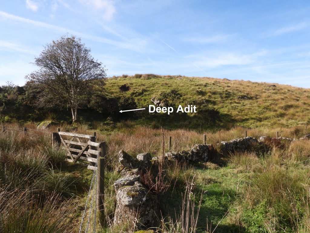
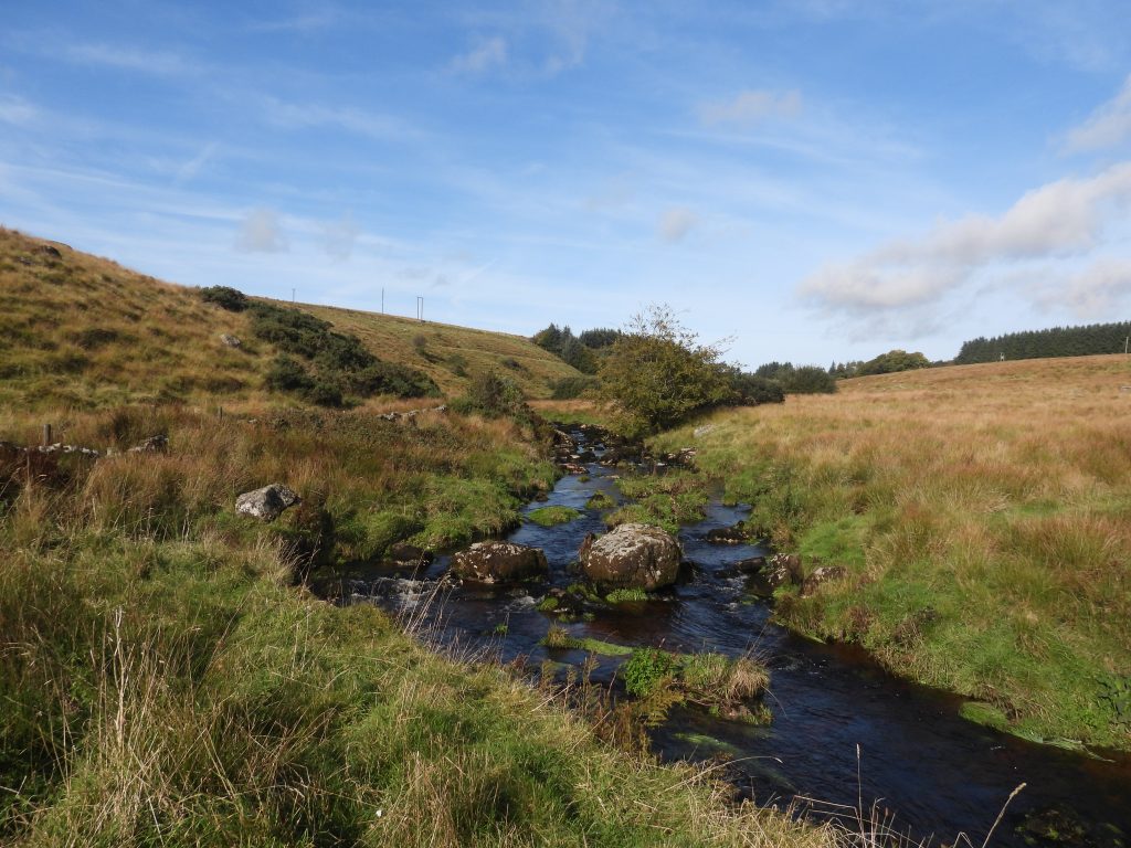
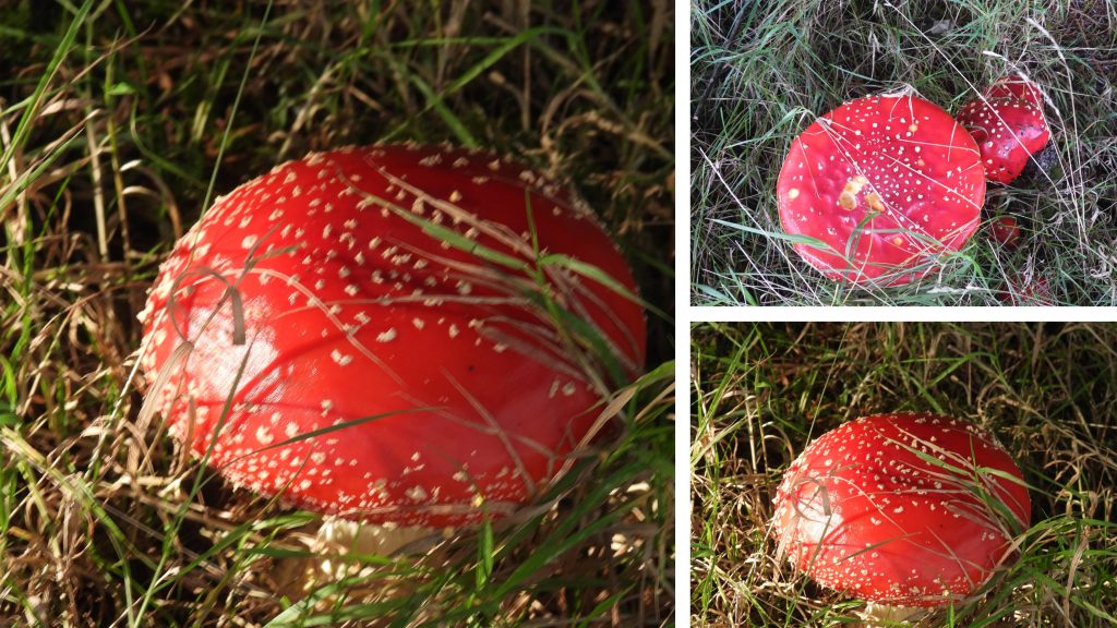
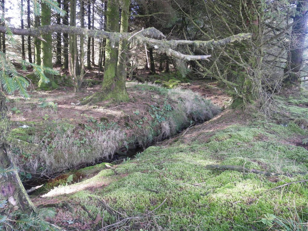
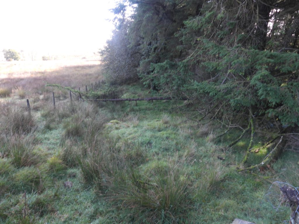
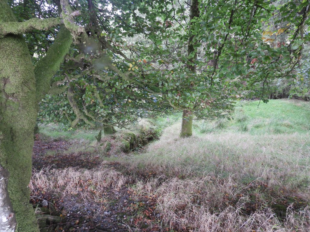
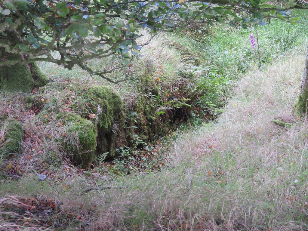
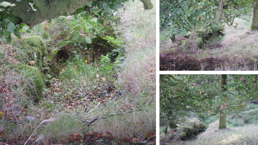
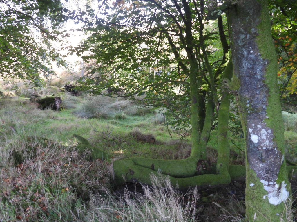
This sketch map is based on a similar map found in the John Robins publication ‘Follow the Leat’ (page 57 – figure 10). The authors sketch, however, has added a little more detail than the original. In spite being on private land, all the features shown on the sketch (except the whim plat) can be viewed (albeit from afar). The mine had three shafts, ‘Footway’, ‘Engine’ and ‘Ann’s’ which are now collapsed and capped. There were also three adits known to have been associated with the mine, ‘Shallow’, ‘Middle’ and ‘Deep’ plus two dressing floors with associated earthen platforms for buddles. Each of the dressing floors had a wheelpit associated with stamps. There was also a main wheelpit which drove pump (flat) rods in a gully from this waterwheel up to ‘Engine Shaft’. This annotated Google Map shows the complete area on the mine from the origins around the Bachelor’s Hall Brook to the main area which lies to the south of the New London (Princetown) to Bachelor’s Hall track.This annotated Google Map shows clearly the features of the mine including its three shafts, two dressing floors and flat rod gully. What is intriguing by this view is that the two leats which fed the three waterwheels, namely; Prison (Foul) Leat and Blackbrook Leat are still very discernible. Indeed the Prison (Foul) Leat carries on beyond the site and it is thought to have been used by Sir Thomas Tyrwitt at his cattle park beyond Tor Royal house at one time.The easiest route to Bachelor’s Hall tin mine is via the footpath from Princetown which passes near New London and the former railway crossing gates as shown in the photograph. These level crossing gates were originally located at Dousland at Iron Mine Lane. The railway track crossed the road at ‘Prowses Crossing’ and ran behind the house now called ‘The Crossing’, which was originally the crossing-keeper’s house.The public footpath / bridlepath leading from New London (Princetown) to Bachelor’s HallAs the footpath descends towards Bachelor’s Hall, some old tin shafts as shown on Dartmoor National Park survey of Tor Royal farm (still marked on modern OS maps) can be found. The upright post here was recorded at SX59618 73703Descending the path further (in an easterly direction), the original Prison (Foul) Leat, which today is bounded by a low wall can be found. The water in this leat once came from the effluent (sewage) from the prison and hence the word ‘foul’. It was one of two leats used by the mine.From the footpath and looking over the fenceline the two leats feeding the mine (Prison (foul) leat and Blackbrook leat) can be discerned by the small banks running across the hillside. The embankment of Devonport Leat also comes into view.To the north of the public footpath the author’s attention was drawn to the gateway shown in the photographs, mainly due to the height of the gateposts (the western most gatepost is now recumbent). The remaining upright (western) gatepost was recorded at SX59880 73573Close up of the Prison (Foul) Leat. The Blackbrook Leat would have (obviously) had water taken from the Blackbrook River. The prison drew its water supplies from the Walkham, and as such the water in the Prison (Foul) Leat would have partially been from that source.General view of the main area of the tin mine on the north side. The line of trees mark the gully where the flat rods were located. As access across this tract of land in prohibited, a different approach is needed to view the rest of the mine beyond the trees. Taking the lower (east side) bank of the Devonport Leat enables the explorer to view the rest of the mine (from afar). Note: The gatepost is at SX59859 73538View looking west from near Devonport Leat, with the banks of the two mine leats being quite clear (by the sheep and the large tree)The Devonport Leat running through North Plantation.A resident of the area have a paddle in Devonport LeatDevonport Leat looking north towards Beardown TorsClapper bridge over Devonport Leat where the footpath from New London (Princetown) to Bachelor’s Hall crosses.From the footpath. The three shafts of the mine are indicated alongside the overgrown gully which contained the flat rods.At Devonport Leat looking west the upturned earth of the banks of the two leats used in the mine are very evident.The left bank (eastern) footpath of Devonport Leat can be followed to see other parts of the mineWhilst the main area of Bachelor’s Hall Tin Mine is on private land, by taking the (east bank) path alongside Devonport Leat much of the workings can be seen and discerned. On the north side of the site the two main leats which fed the dressing floors (which have previously been shown in this post), can be seen. Also on the north side of the site, a line of trees (which lie in a gully) represent where a line of flat rods connected the main wheelpit, which was located near Devonport Leat and the Engine Shaft which is at the top of the hill.The first Sheep Leap on Devonport Leat after leaving the Princetown / Bachelor’s Hall track. It can be found at SX59911 73474.The area containing the main wheelpit is now very overgrown. Even if access had been possible the view of the pit is unlikely to have been any better ! The wheel here was used to drive the flat rods which lead to the beam engine at Engine Shaft at the top of the hill.The Engine shaft had a beam pumping engine, which was operated using a water wheel and a flat rod system.First views of the dressing floors and a wheelpit associated with stamps which would have operated here.The two tiers of the two dressing floors very discernible looking across Devonport Leat.The lower dressing floor wheelpit can be made outThe line of the water course which lead to the wheelpit can be made out. The upper dressing floor wheelpit is hidden in this photograph behind the tree branch.Another angle of the lower dressing floor and associated wheelpit. The question the author has is would the mine owners have discharged the overflow from the two dressing floor water wheels into Devonport Leat, after all the origins of the water was from the Prison (Foul) Leat and the destination of the Devonport Leat water was for drinking water !The path along the east bank of Devonport Leat affords great views of the former Dressing Floors of Bachelor’s Hall Mine.The exit point of shallow adit (one of three for the mine). The shallow adit also had two air shafts.Close up of shallow adit. The sketch map in this post shows the course it took up to Engine Shaft. The adit is shown as a spring on modern OS maps and discharges into Devonport Leat. A second Sheep Leap at Devonport Leat. It can be found at SX59918 73371.Sluice gate next to Devonport Leat at SX59940 73321. This point is shown on modern OS maps as discharging water towards the Bachelor’s Hall / Bull Park track.Next to (upstream) the sluice is a fenced off area, which appears to be complemented with a submerged granite post in the leat. The two appear linked somehow, but for what purpose is unclear. There is no record in the Dartmoor HERZoomed in view of the earthworks surrounding the Engine Shaft, beyond which is a whim plat.Unusual construction a short distance (downhill) from Devonport Leat. The author speculates that this might have been a loading platform. It looks like the construction is from two periods. Firstly, it was a drystone construction, which appears to have been added to with a substantial facing of concrete. It is located at SX60009 73577.These cows were concerned about the calf which can just be seen by the reeds as it had somehow managed to get out of the field and was ‘outside’ the fence. Farm Sheds of Bachelor’s HallFarm Sheds of Bachelor’s Hall with the track which leads to the entrance. Bachelor’s Hall, was a 16th century farm (source of the date taken from the Bachelor’s Hall website) and for many years used as a youth hostel. Today (in 2022) it is a large group residential facility and can sleep up to 52 people.Blue tit near Bachelor’s HallPonies guarding the gate which leads to the smelting house and stamping mill (1)Just below the track which leads from Bachelor’s hall to the Blackbrook River the exit point of Middle Adit can be located. This adit also lead up to Engine Shaft.Middle Adit is located at SX60120 73666.View of Bachelor’s Hall and Middle Adit looking south from the bridlepath / footpath which leads (downhill) to the Smelting House, Stamping Mill (1) and the Blackbrook River.Views of Bachelor’s Hall and farm shedsViews of Bachelor’s Hall BrookNorth of the farm sheds of Bachelors Hall and middle adit are the remains of a building which could well have been the smelting-house erected by Mr Gray. Also of interest is a solidly built embankment high enough to have conducted water via an aqueduct into or beside the house. A leat can be traced from the ’embankment’ to the ford on the stream below the farm sheds. That said, some observers state that the leat by-passes the embankment an this was the site of a dam which may have once contained a sluice or even a waterwheel.The ‘Smelting House’ is described as “…..measuring 20.5m by 7.8m, the crumbling coursed mortared walling composed of boulders and stones is 1.1m wide and now up to 2.1m high. The interior, sub-divided into three rooms, and covered by debris is very overgrown”. (Source: Royal Commission for the Historical Monuments of England, 1987-1993, Duchy Farms Project Survey Visit (Report – Survey). SDV350839 from Dartmoor HER).More views of the overgrown smelting house. Some observers suggest this building may have in fact been a corn mill, which was later converted to a naphtha works. This is debateable.General views of the smelting house. The south west corner of the house nearest the track was recorded at SX60137 73714.The suggested ‘dam’ which crosses Bachelor’s Hall Brook extends from the SE corner of the building. It is recorded as being 21m long with a 1.9m high, 1.8m thick coursed wall on the lower side and an earthen bank 3.8m to 5.0m wide on the upper side. Down-stream from the smelting house is the site of the stamping-mill with a wheel-pit and levelled area for the stamps.Levelled area next to the tree may have been used for stampsThere are two levelled areas by the possible stamping mill, between which cut into the steep east facing slope is an eroded gully. This gully is where it is suggested a leat to the west along the hedge/wall was constructed and fed the stamping mill waterwheel. The leat is certainly discernible on Google Earth and can be traced back to the Prison (Foul) Leat.John Robins in ‘Follow the Leat’ on page 55 shows a picture of these views from the early 1980’s under the title “Remains of wheel-pit associated with Bachelor’s Hall Mine”. General views of the (probable) stamping mill and wheelpit. The dressed stone with the two holes was recorded at SX60138 73759The levelled area where the stamping mill would have been is recorded as being 13m by 4.2m.To the north of the stamping mill and wheelpit is a second levelled area, which would have had a building on it. The second levelled area is recorded as measuring 11m by 5.8m. The stamping mill is described in the Dartmoor HER as having “….the uphill sides are crudely edged by large boulders and notably there are a number of large rectangular dressed granite blocks lying about”.A short distance to the north of stamping mill (1) towards Blackbrook River the third adit (Deep Adit) can be found.Location of Deep Adit. It is recorded in the John Robins publication as being “7ft by 3ft entrance”. It was commenced with the intention of reaching rich ground 12 fathoms beneath the existing level of the Engine Shaft. This adit was never completed and was still 120 fathoms (around 218m) short of its objective when the mine closed in 1862. Had it been completed it would have been 400-500 m long. Deep Adit can be found at SX60140 73807.Access to ‘Deep Adit’ can be gained through the gate shown in the photograph. There is little to see of the adit as it has long since been filled in.Blackbrook River what the point where is is fed by Bachelors Hall Brook Fly Agaric (Amanita Muscaria) near the tailrace between the main mine and Stamping Mill (2) alongside the track.Following the track between Bachelor’s Hall and Bull park, the tail race from the main mine (which would have had an aqueduct across Devonport Leat) can be seen amongst the treesThe possible tail race on the east side of the trackAmongst the trees on the east side of the track are the (possible) remains of a wheelpit and another stamping mill (labelled number 2 on the sketch map)Close up of possible wheel pitThe wheel pit is recorded (Dartmoor HER) as measuring 6 metres by 1.4 metres wide and is 1.2 metres deepIs this the stamping mill (2) working floor? Access is not possible in this small wood as there is a barbed wire fence. The working floor is described in the Dartmoor HER as measuring “18.6 metres by 11 metres with a coursed drystone retaining wall up to 1.4m high on the uphill side”. The author is unsure that the description truly fits the photograph taken.