A collection of walks, discoveries, insights and pictures of exploring Dartmoor National Park
April 9, 2024
West Section of the Buckfast – Tavistock Abbey Monastic Route
This post covers part of the western section of what maybe is Dartmoor’s oldest trans-moorland route. The route, dating as far back as the 11th century was a inter-Monastic route between the two great Abbeys at Buckfast (Buckfestre) and Tavistock.
The full Monastic Route between the Abbeys should not be confused with another route known as the “Abbots Way”, a 23 mile route between the two Abbeys. The “Abbots Way” was first dubbed in 1794 by a traveller called John Andrews, although earlier records name this route as being simply the ‘Jobber’s Way’. So until 1794, the “Abbots Way” didn’t exist ! Alternative names for the Jobbers’ Way are Jobbers’ Path or Jobbers’ Cawse and relates to a Jobber’s or Jobler’s who were men who bought wool and woven cloth purchased from the various farms and monastic houses and then sold it to spinners on the moorland edges. Sometimes it is believed they (the Jobber’s) would then buy back the finished woven cloth and trade it on. The Jobber’s carried their loads across the moor on trains of pack animals and as stated by Eric Hemery in ‘High Dartmoor’ (page 55): “…once established, their routes would soon become well worn and easily detectable”
Returning to the Buckfast – Tavistock (11th century) Monastic Route, to complement this post there are two other posts covering this monastic route on the Dartmoor Explorations website and they can be found here:
This history of the two Abbeys dates to 10th and 11th centuries. At Buckfeste (the ‘fastness or stronghold of the deer’) in 1018AD, King Canute founded a house for a Benedictine community. At that time, the only other pre-conquest monastery around Dartmoor was in Tavistock where, a monastery dedicated to St. Rumon was already in existence, having been completed by Ordulf in 981AD. The two Abbacies were held in the 11th century by two remarkable men, Alwin at Buckfast and Livingus at Tavistock who are said to have been very charismatic and enthusiastic. With this background it was likely that there was a call for regular communication and interchange between the two Abbeys.
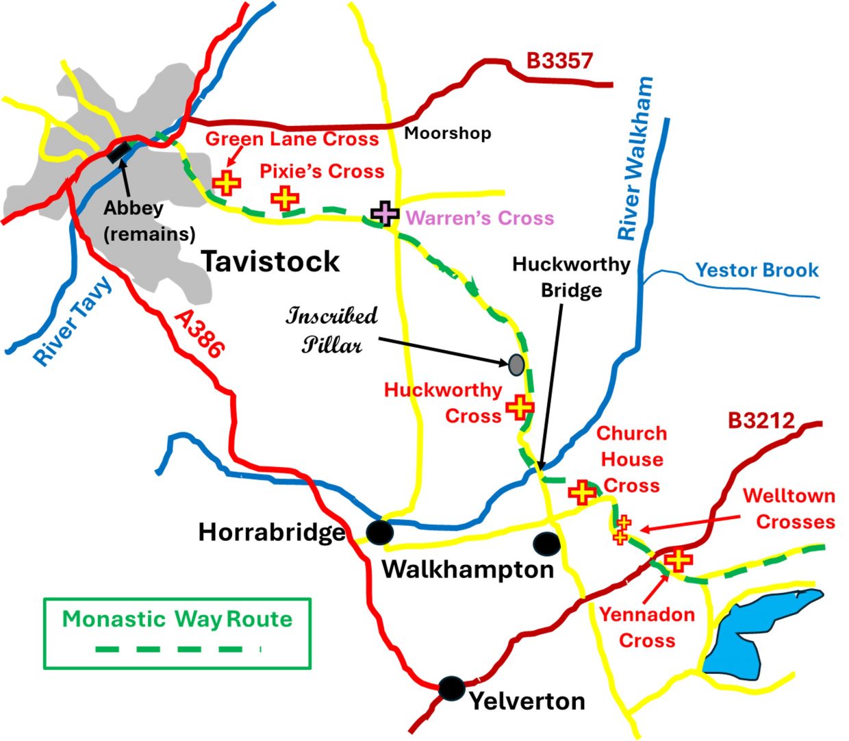
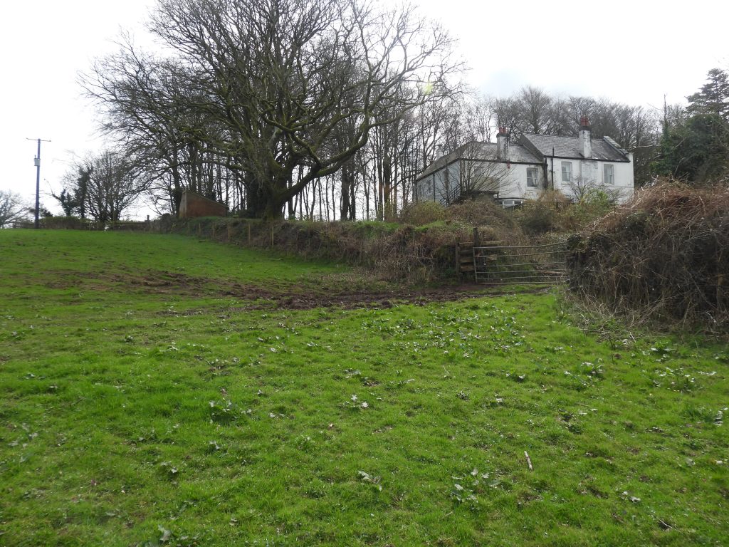
This post covers the final western section of the inter-Monastic route between Yennadon Cross (on B3212) and Tavistock Abbey (site of). The route takes the traveller to Church House Cross by Walkhampton Church, then to Huckworthy Cross via Huckworthy Hamlet and onto Plaster Down. From there the route passes by Warren’s Cross and onto Pixie’s Cross on the golf course and finally onto Green Lane Cross before descending Green Lane into Tavistock via Vigo Bridge, one of the oldest river crossings.
Bibliography
Walking Dartmoor’s Ancient Tracks – Eric Hemery – 1986 – Track 12 (pages 141-159)
Legendary Dartmoor – ‘Abbots Way’
High Dartmoor (1983) – Eric Hemery
Hamilton-Leggett, (2016) – A Brief Guide to St. Mary the Virgin, Walkhampton
Department of Environment, (1988), Walkhampton
F.H Starkey, (1983), Dartmoor Crosses and Some Ancient Tracks
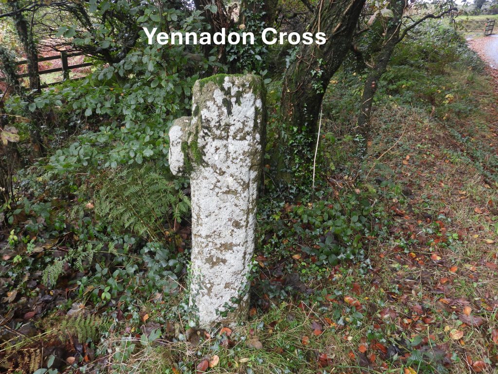
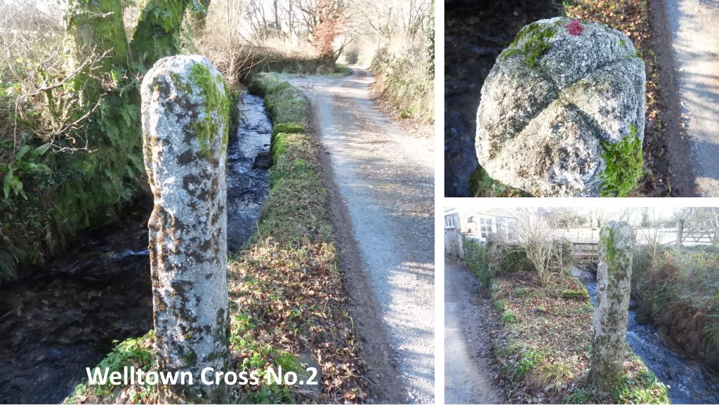
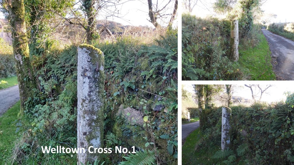
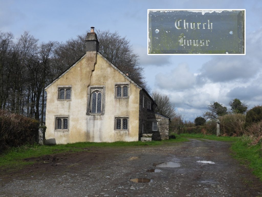
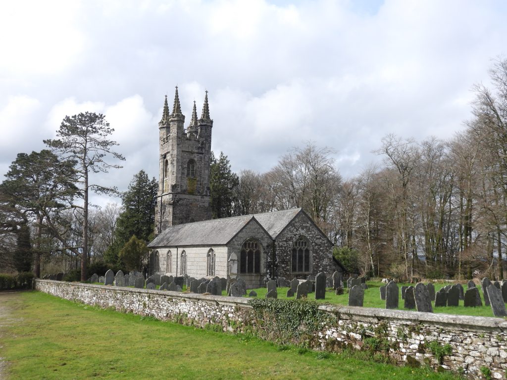
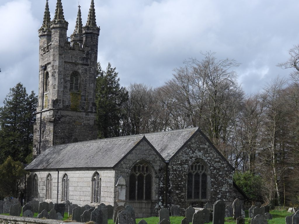
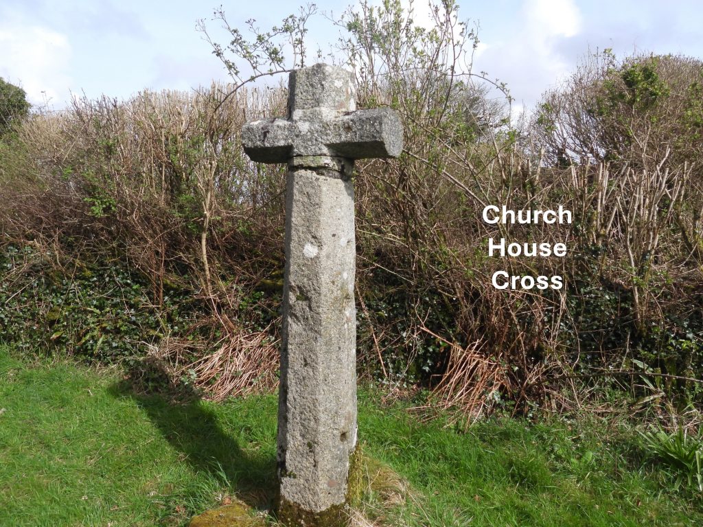
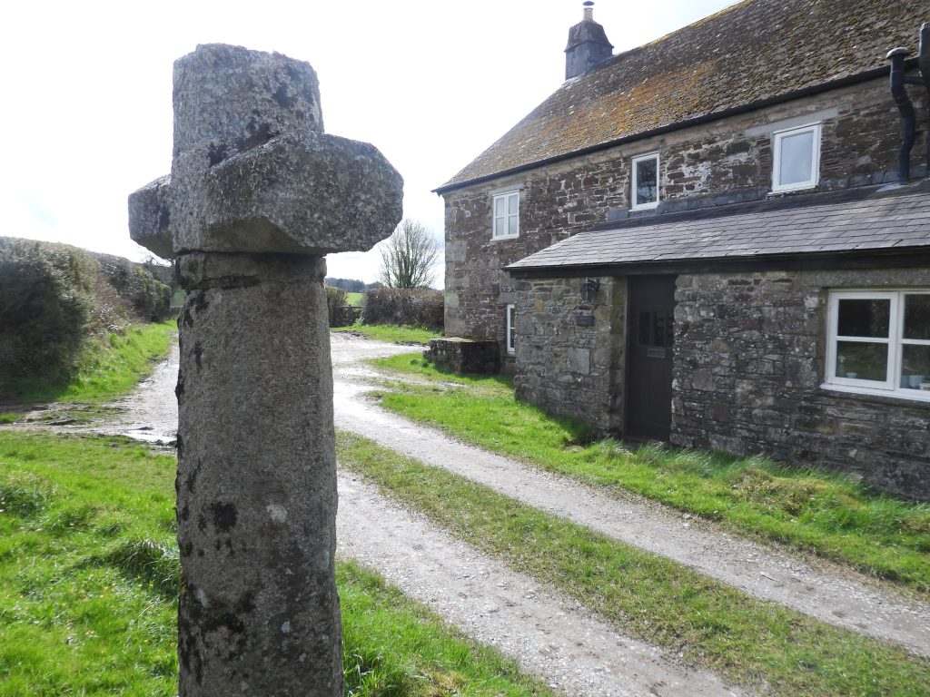
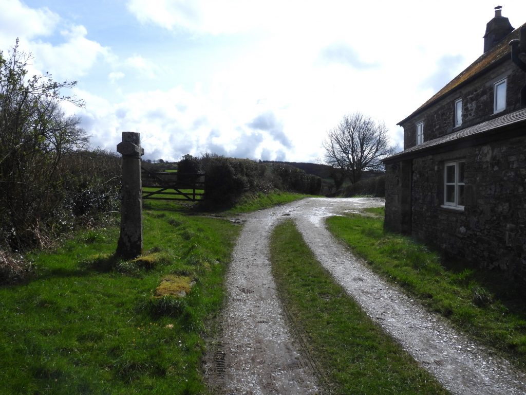
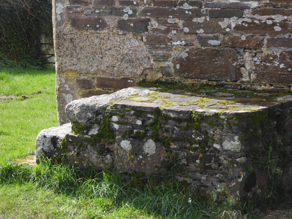
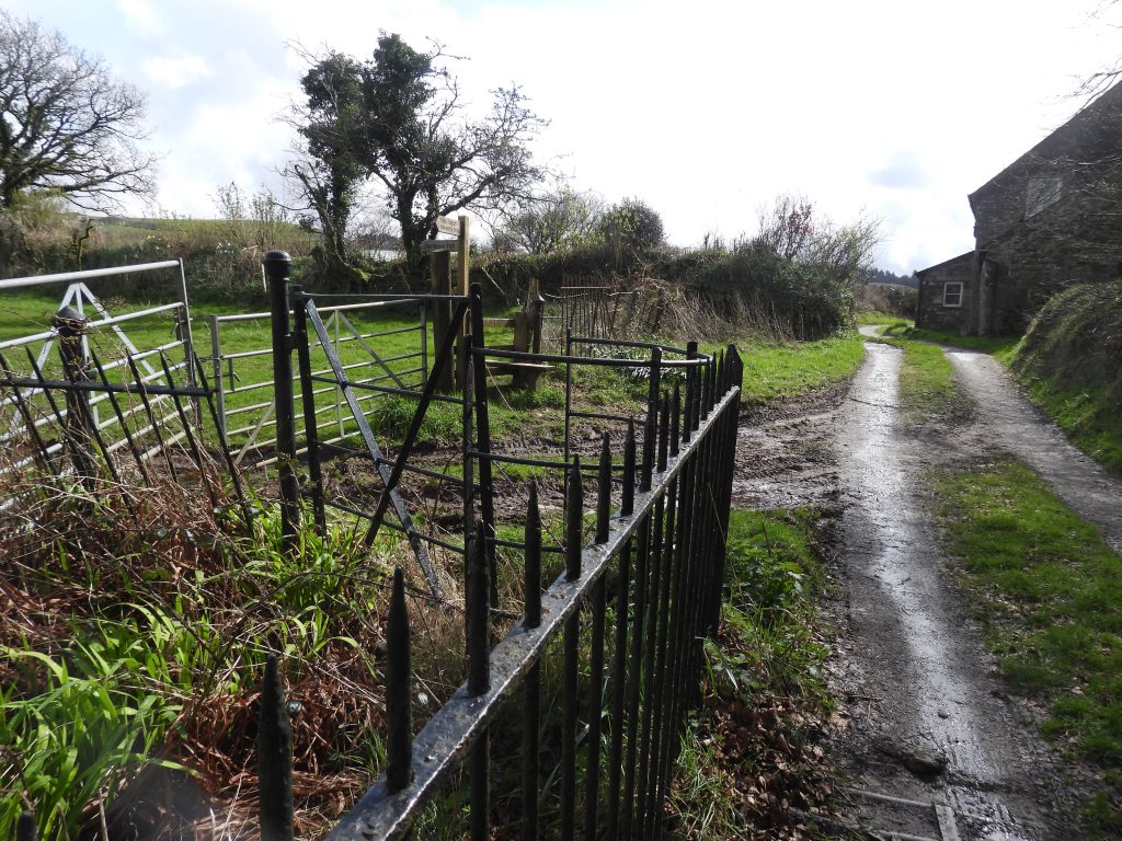
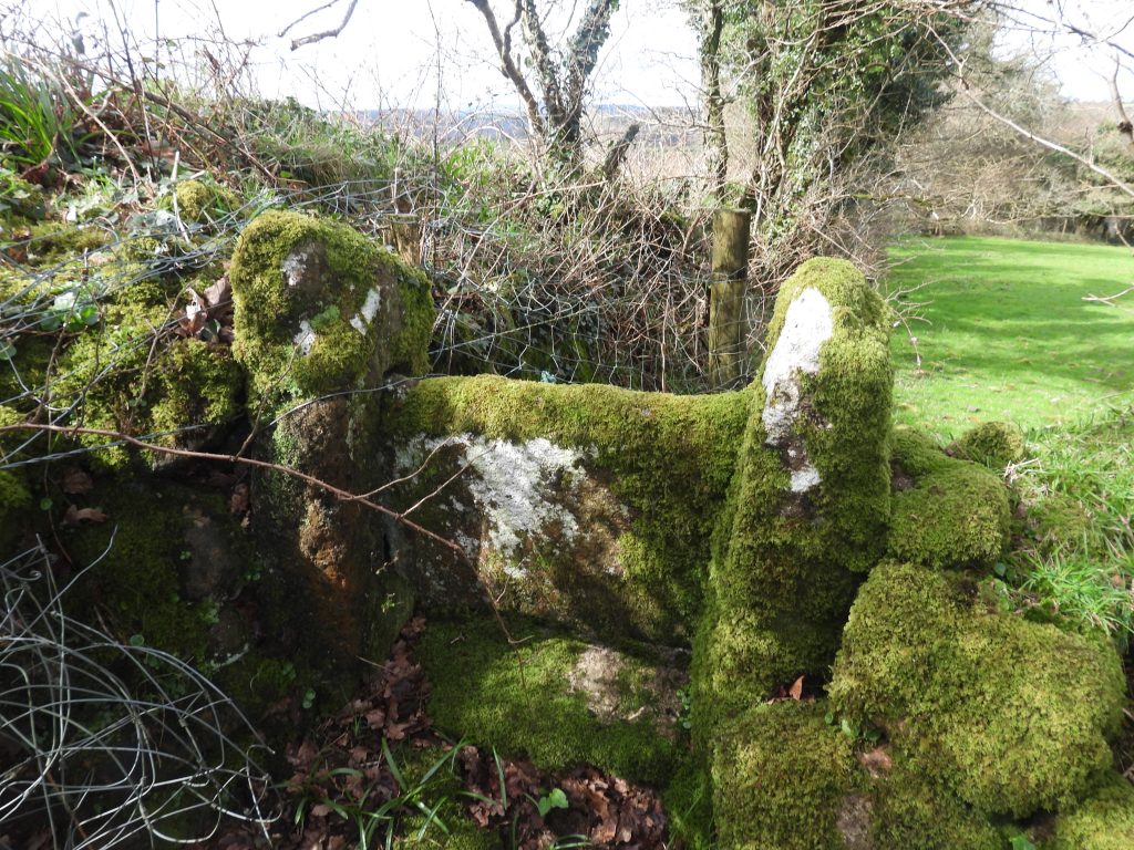
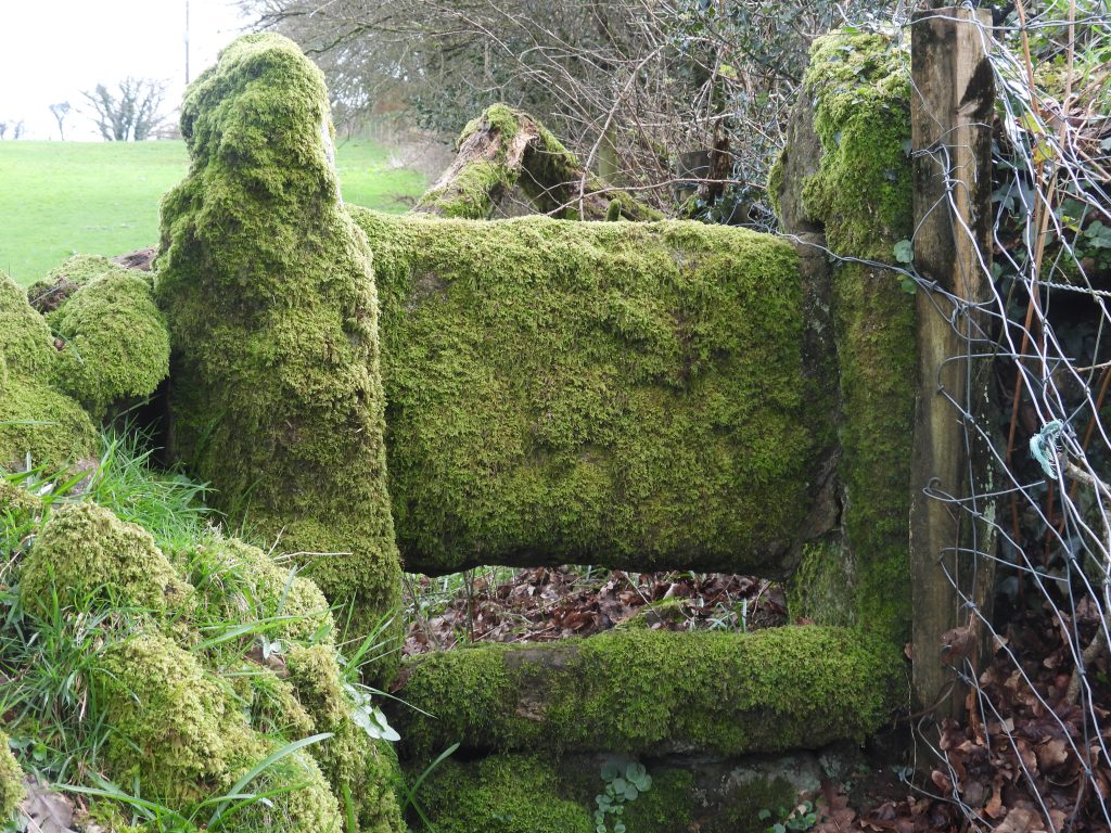
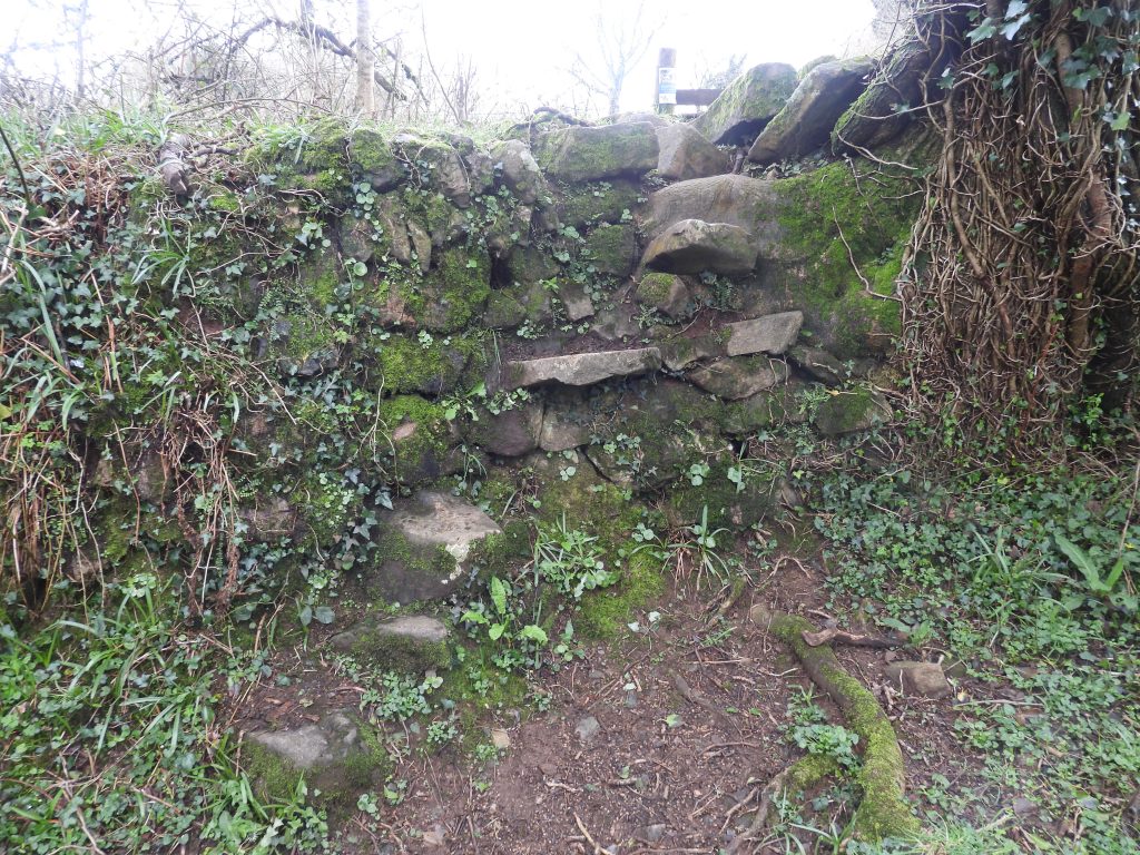
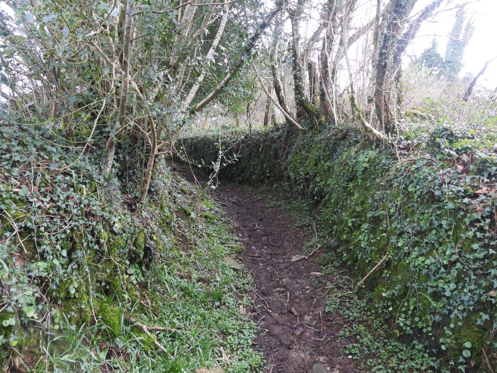
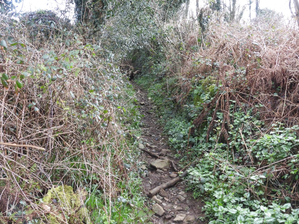
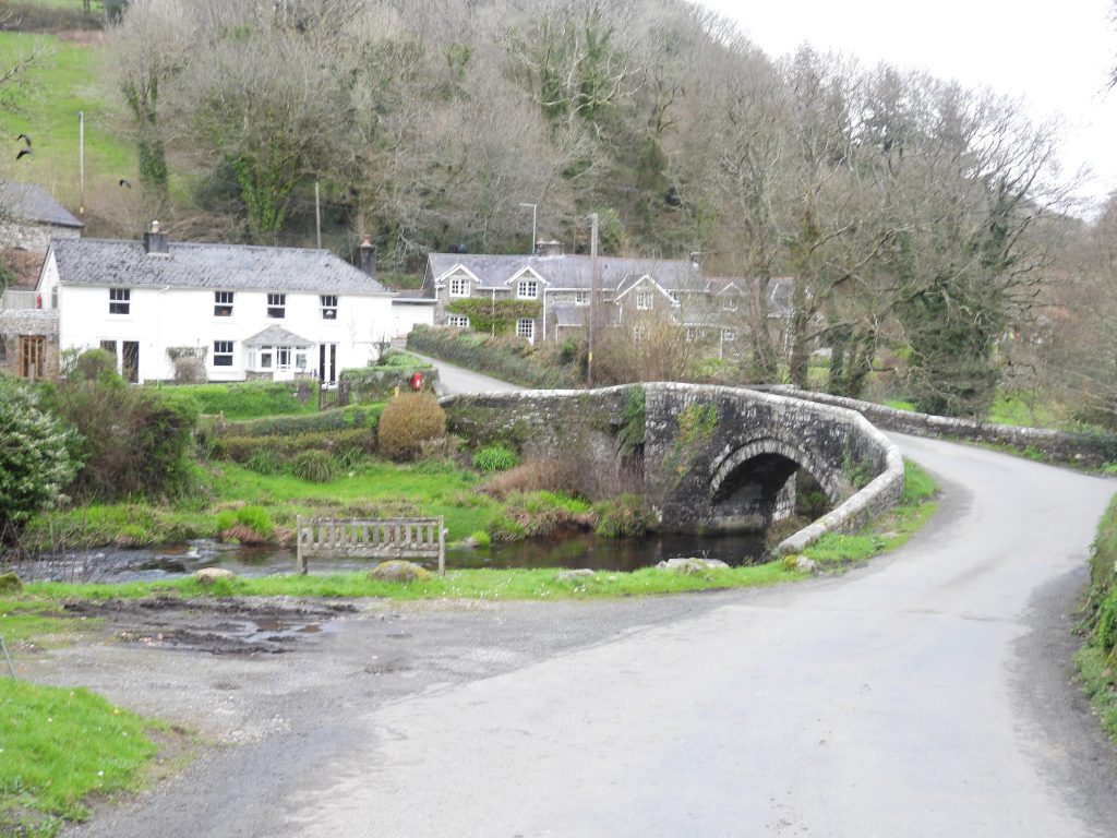
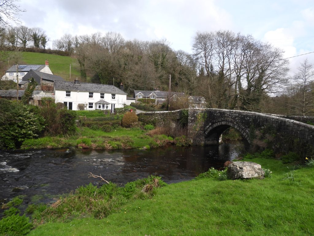
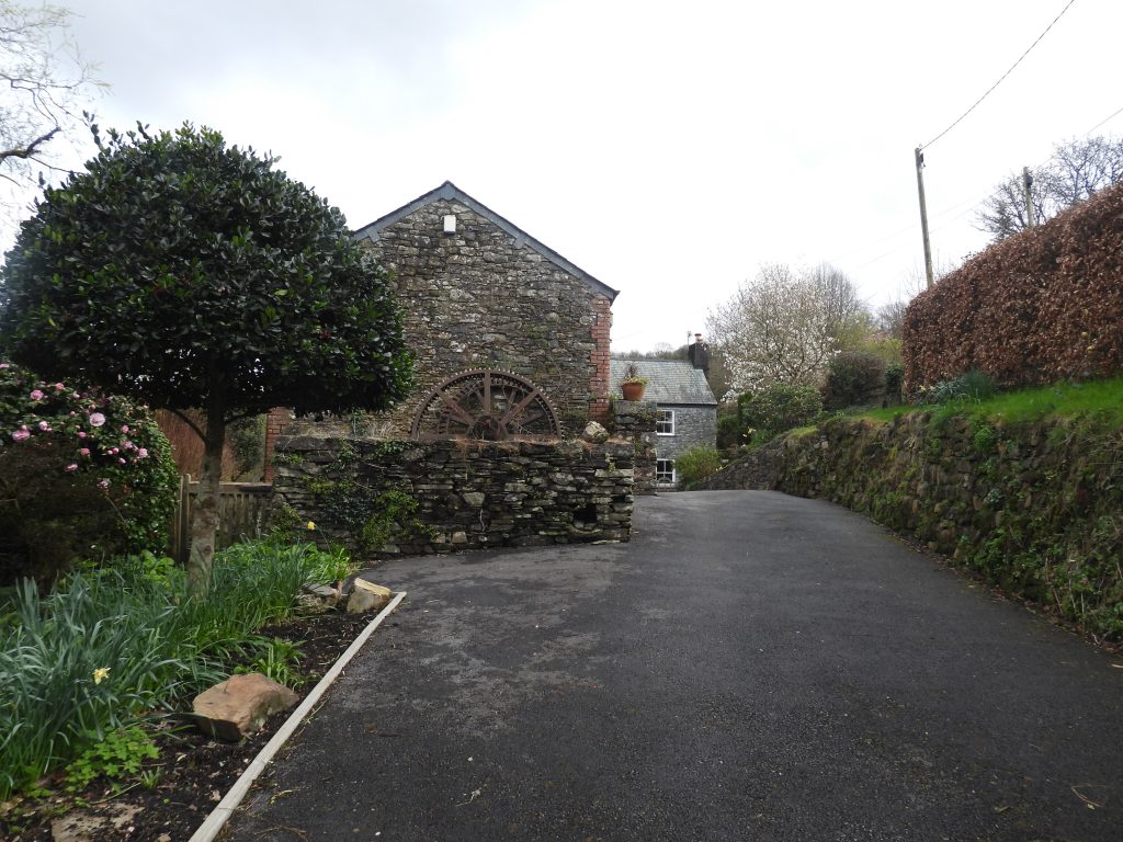
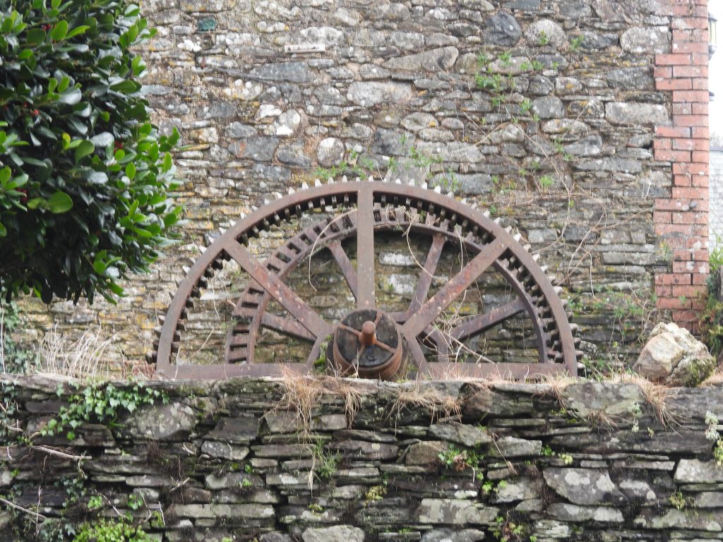
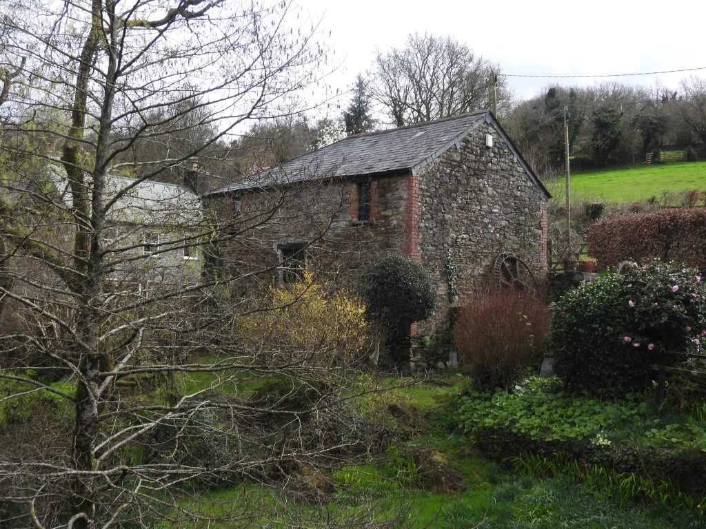
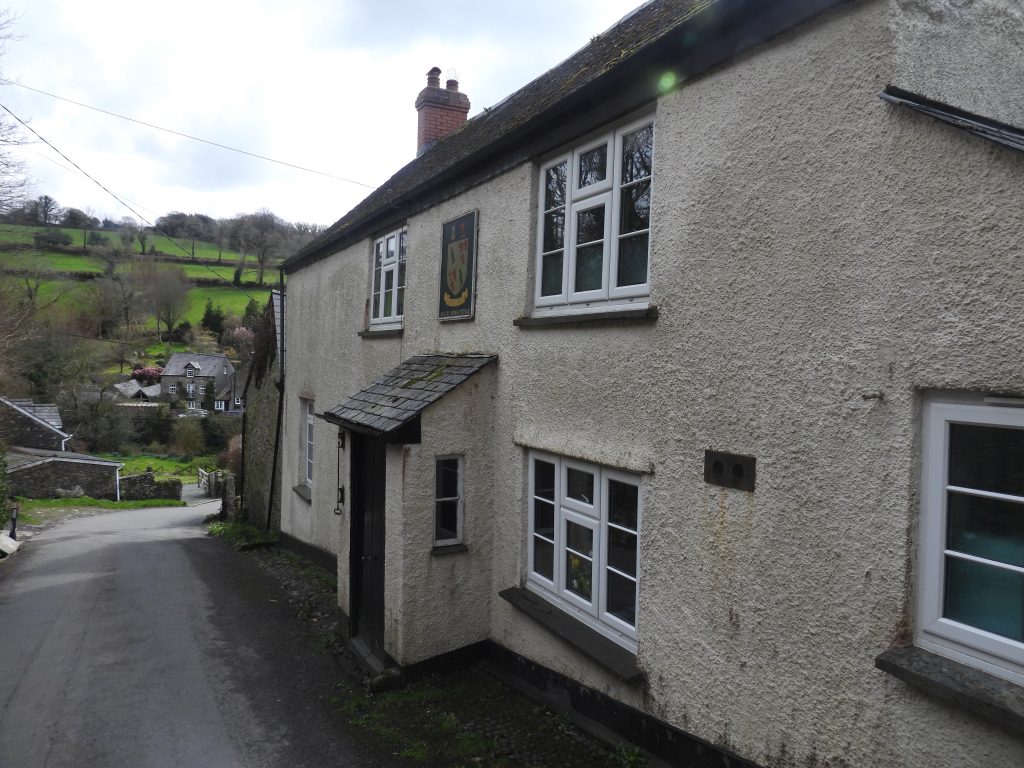
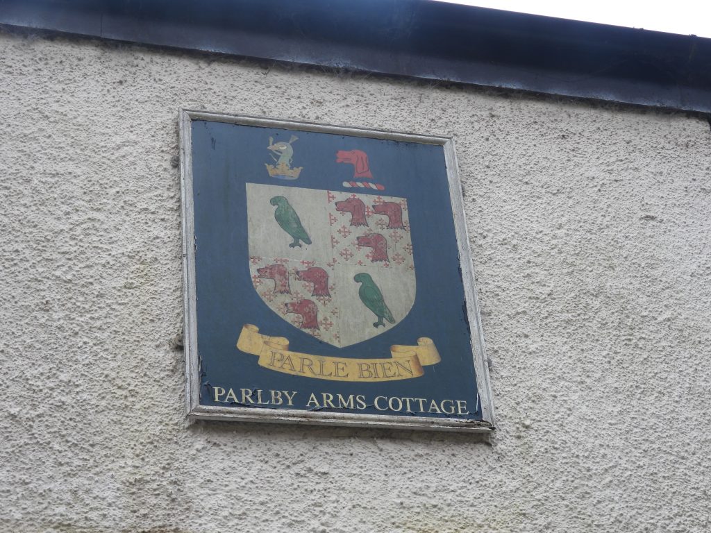
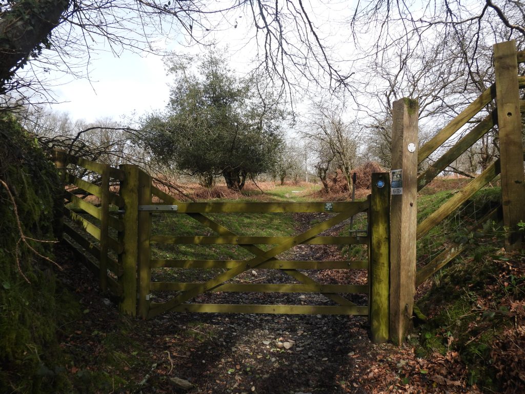
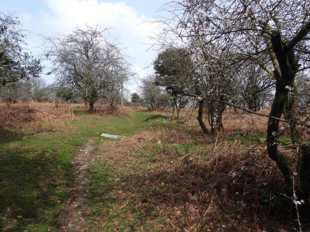
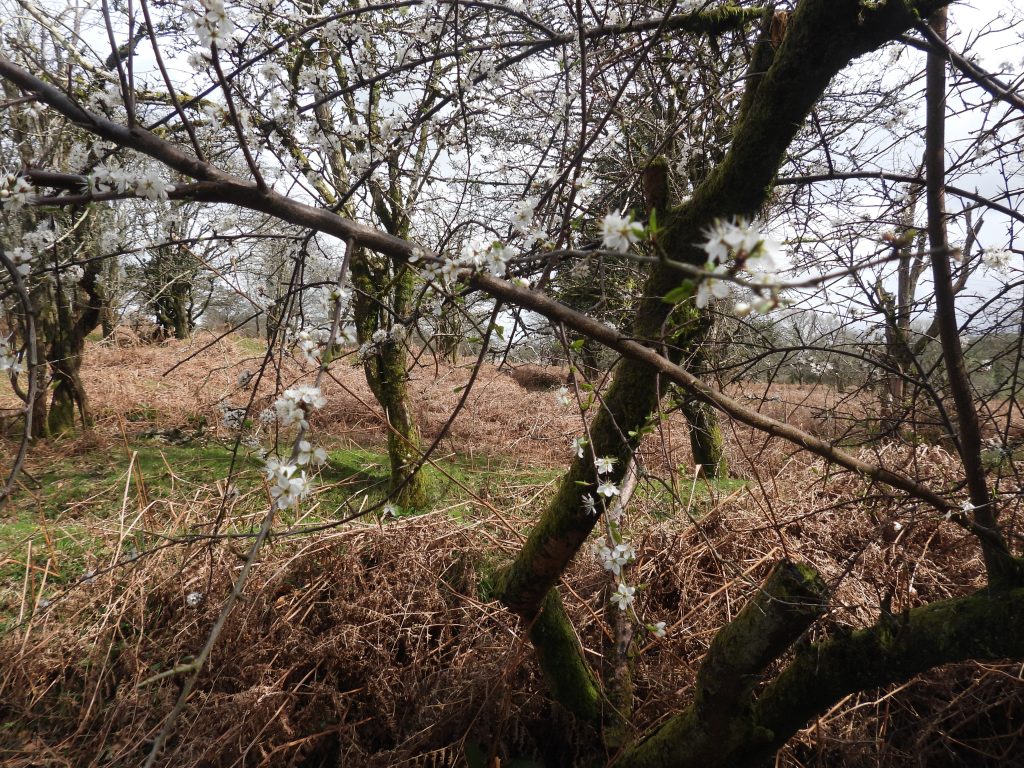
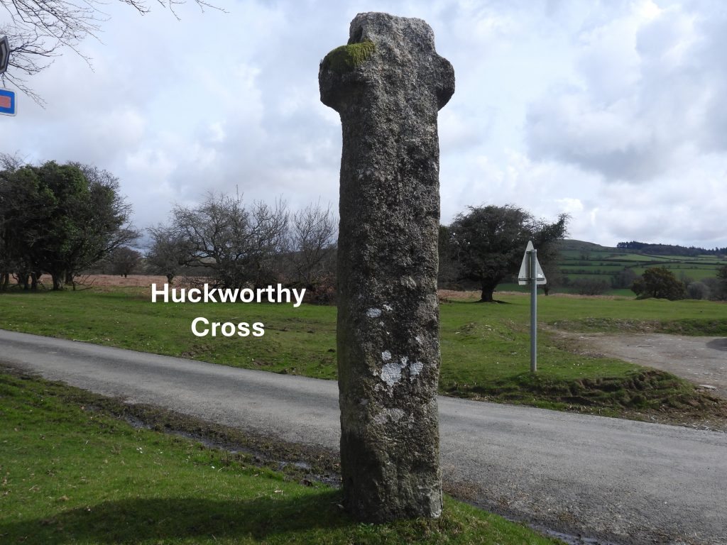
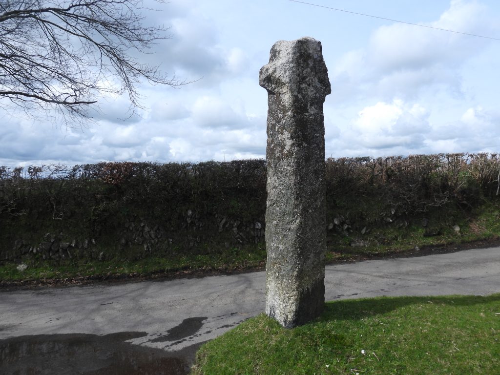
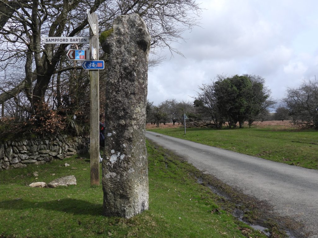
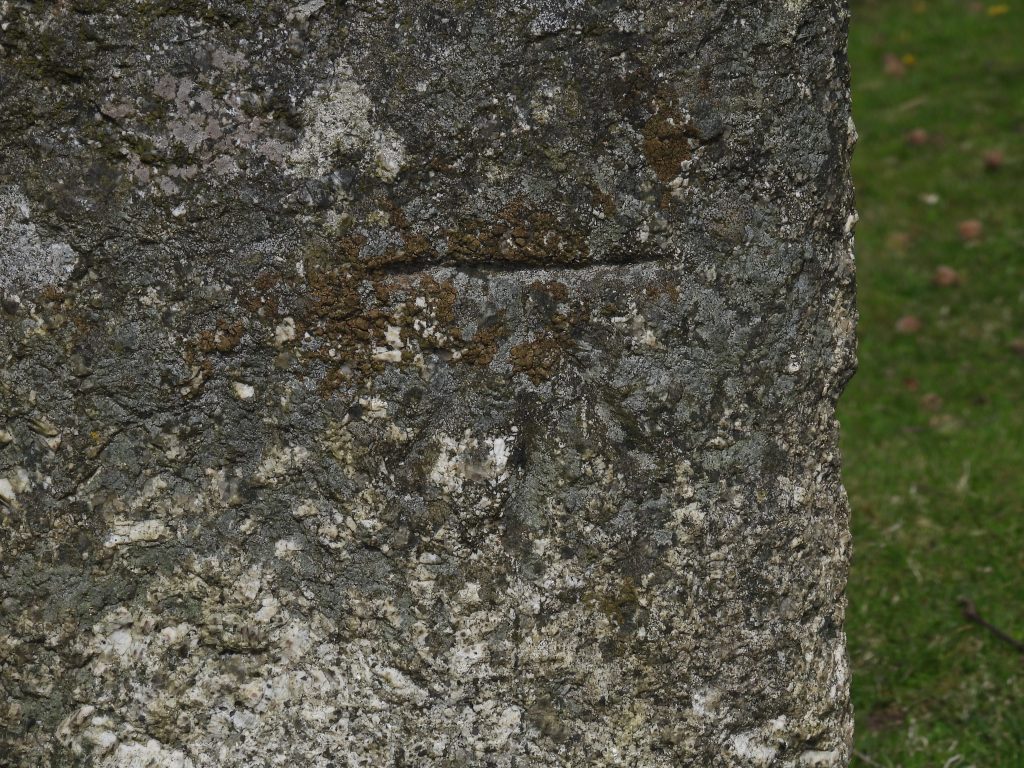
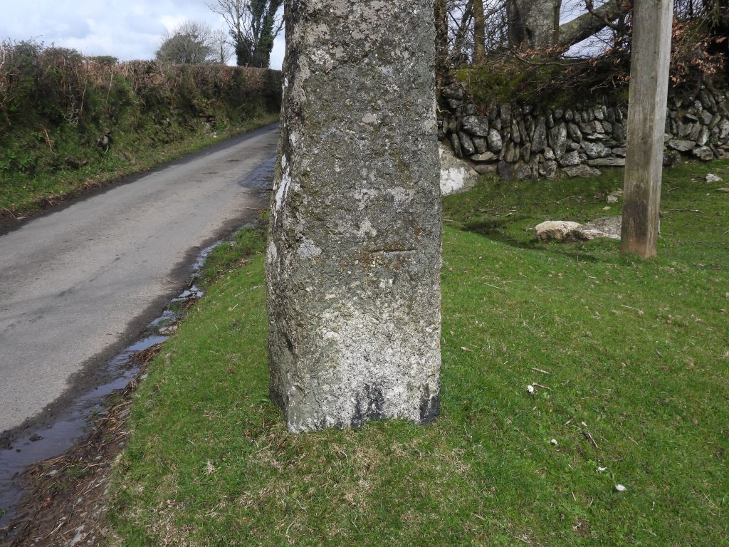
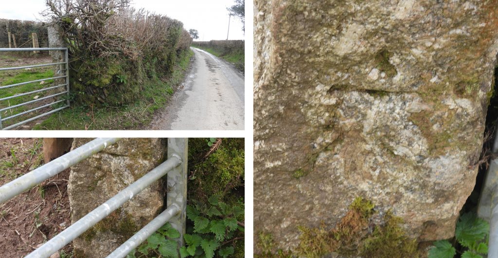
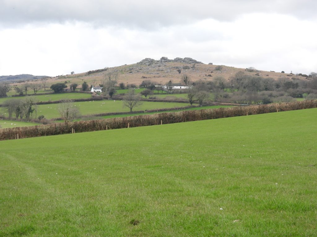
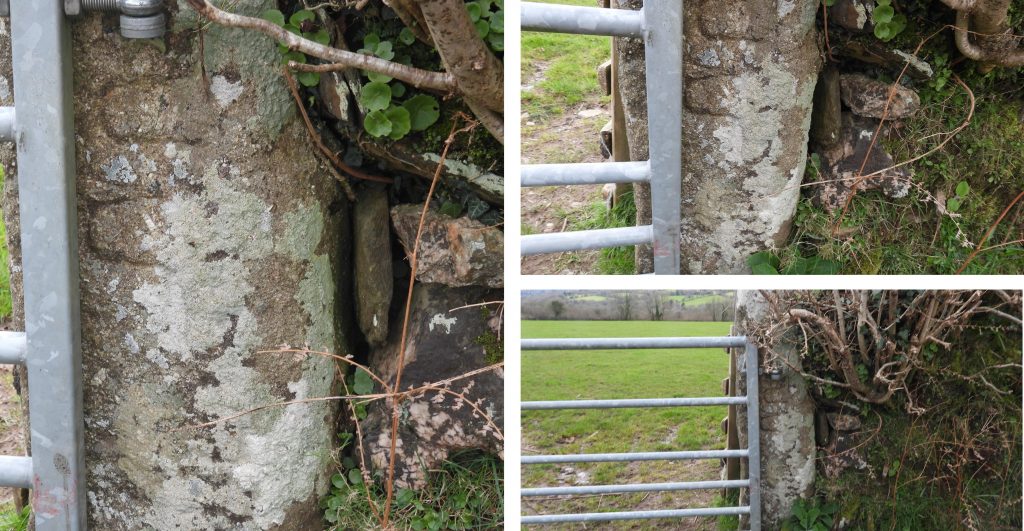
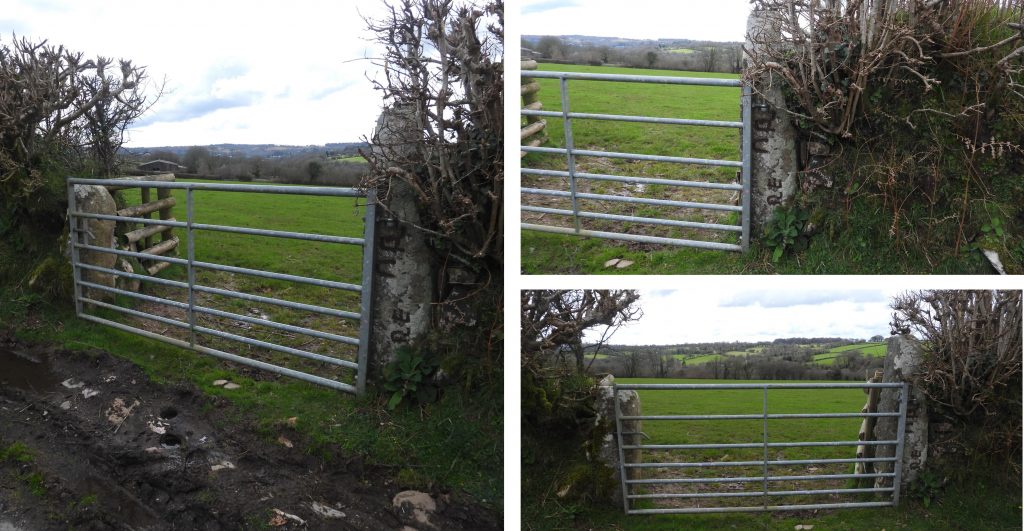
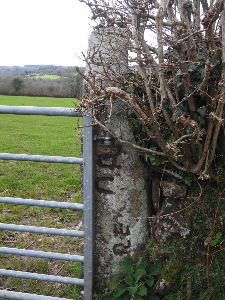
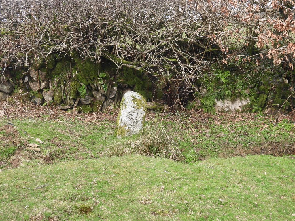
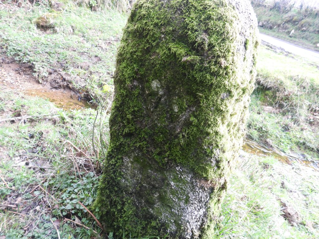
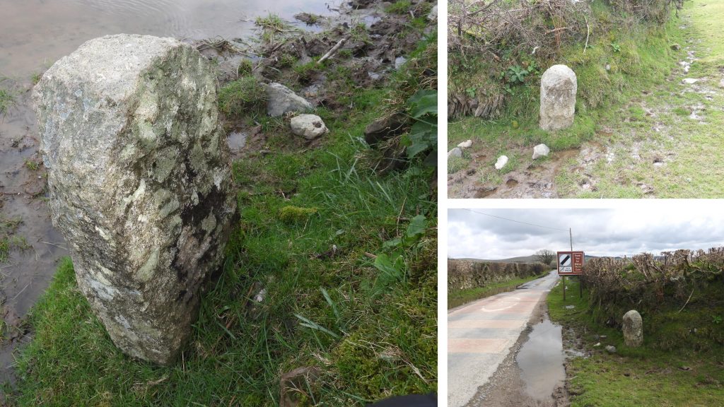
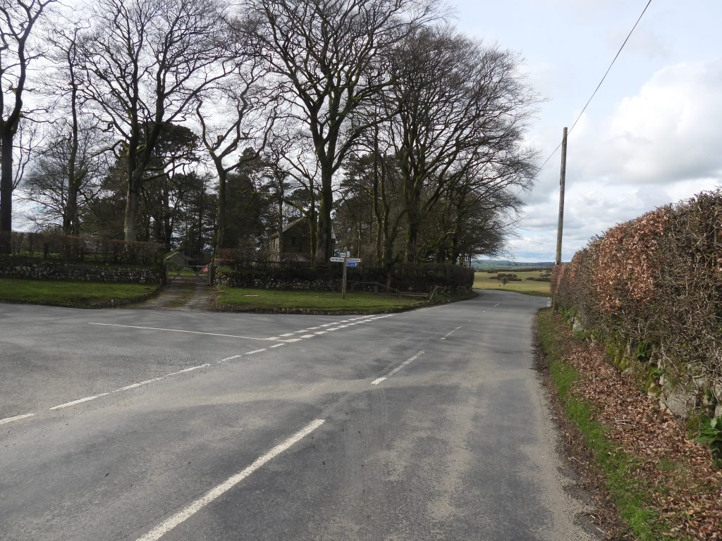
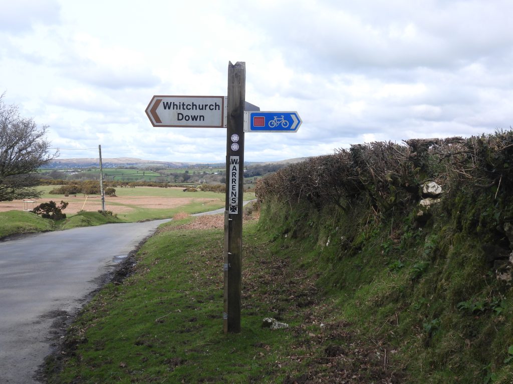
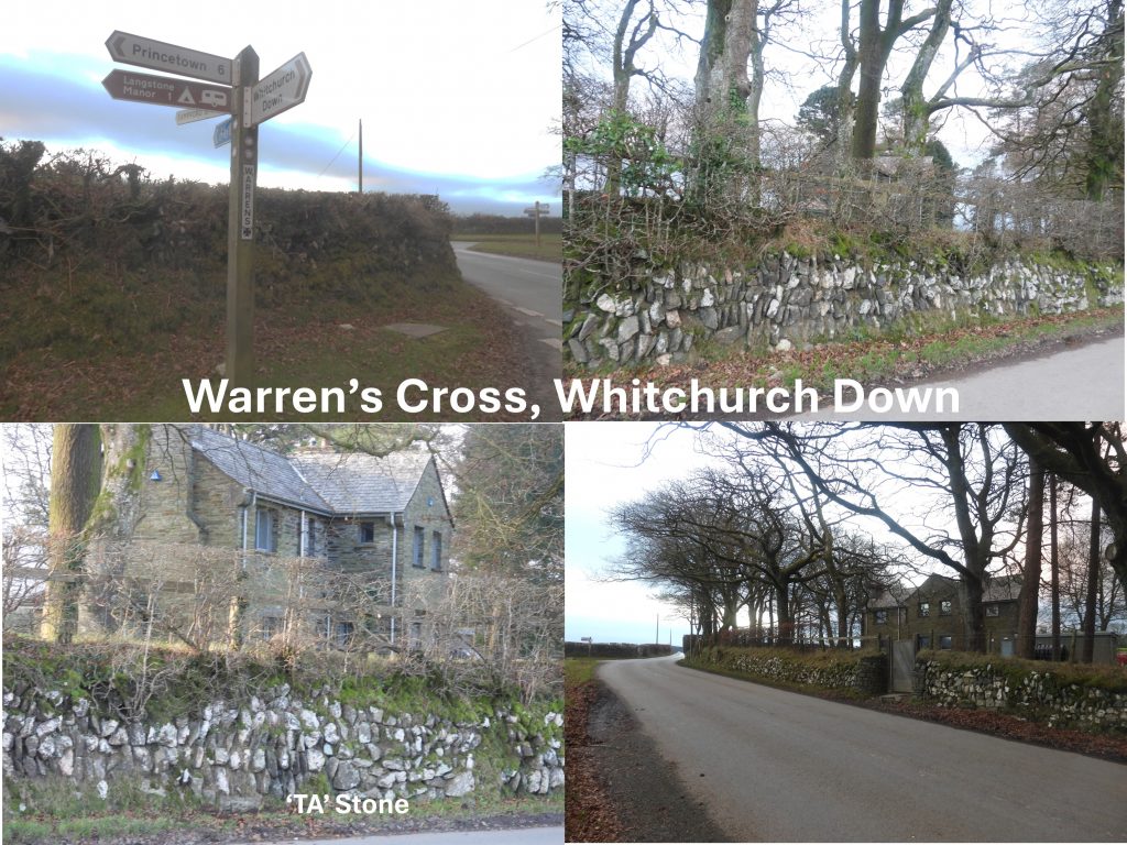
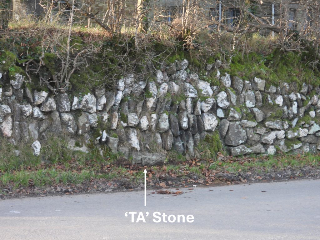
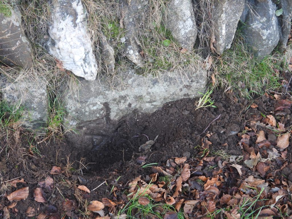
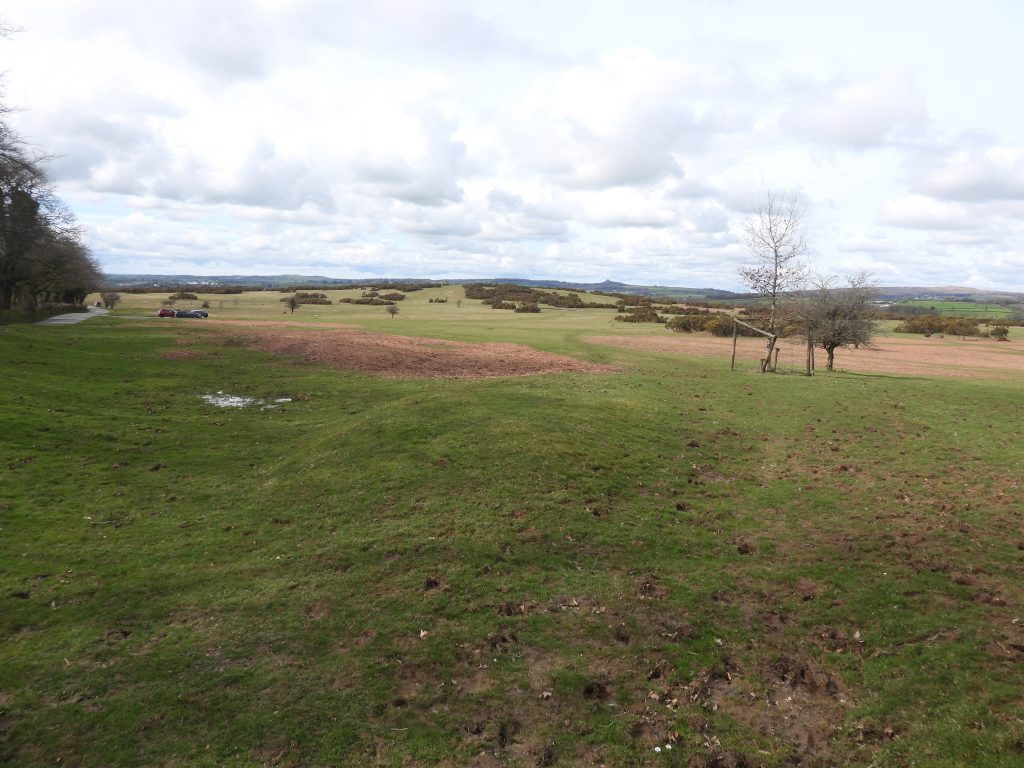
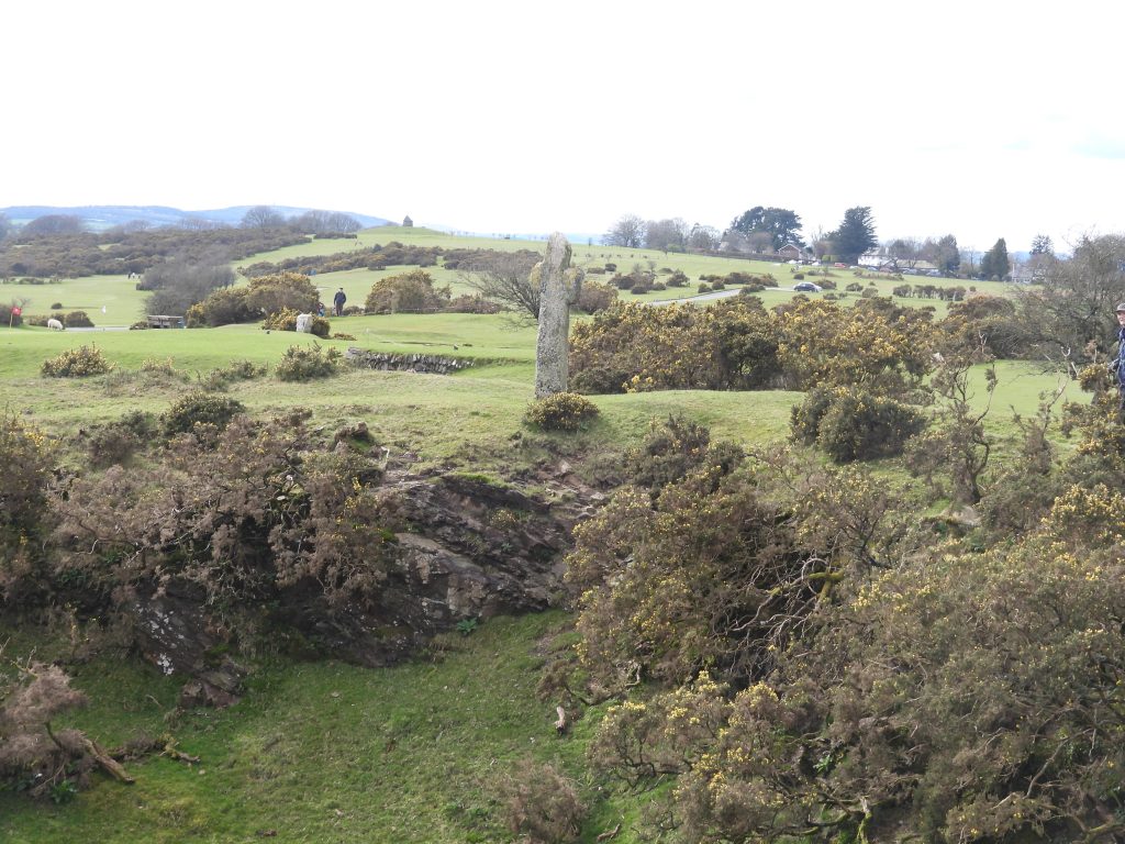
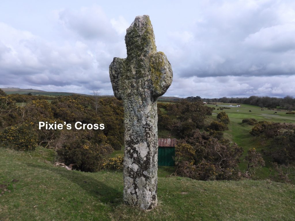
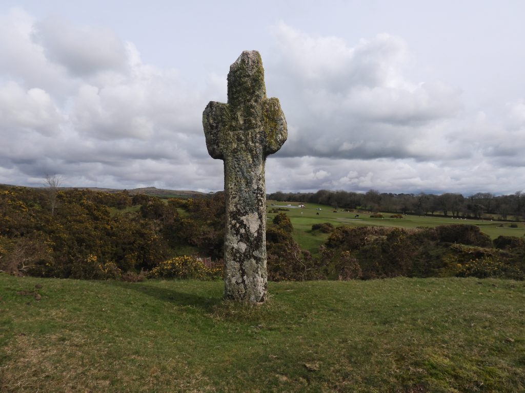
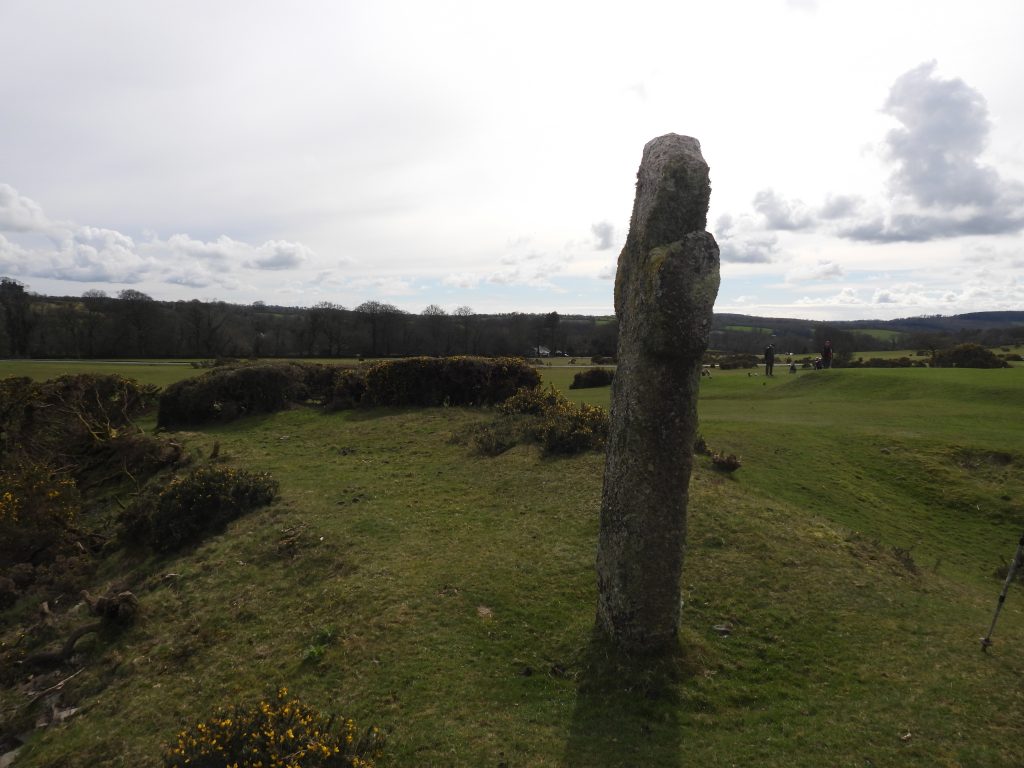
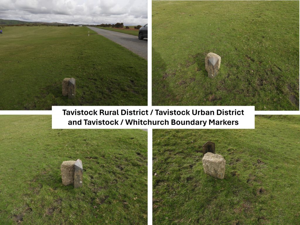
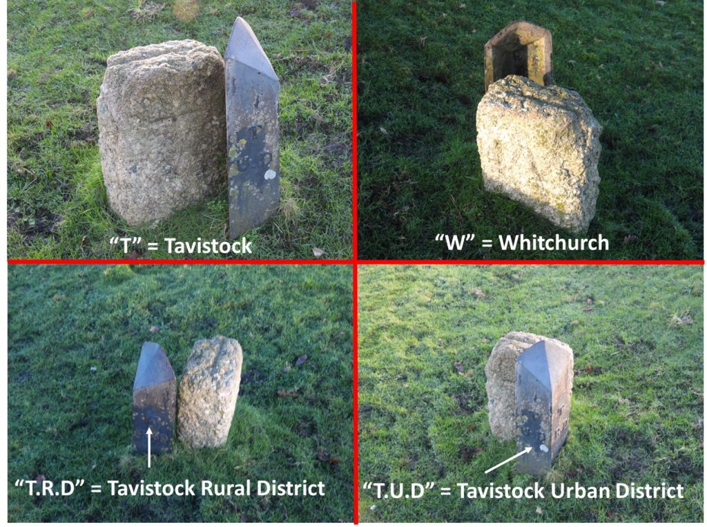
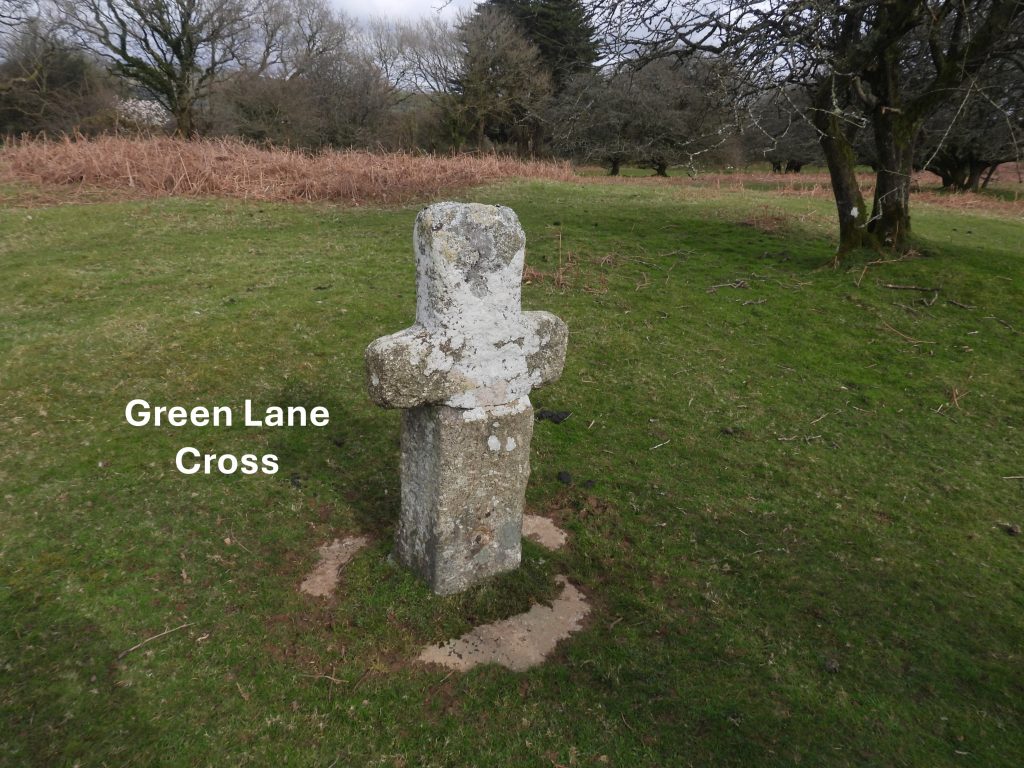
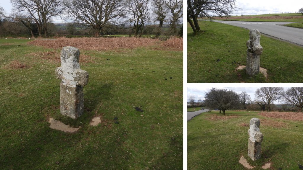
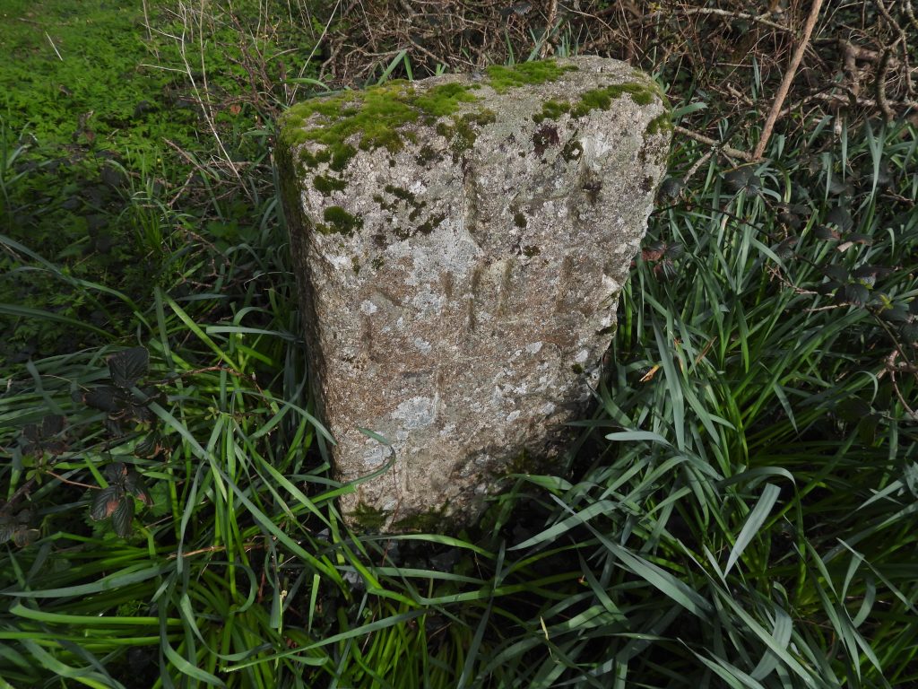
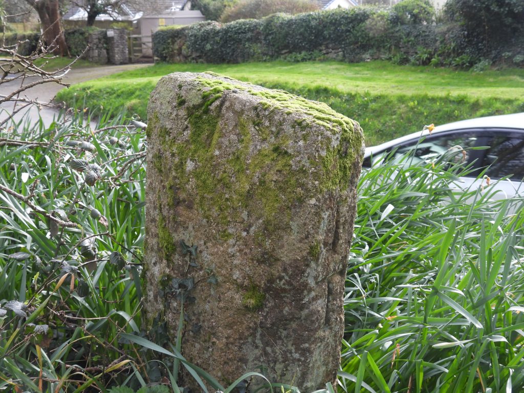
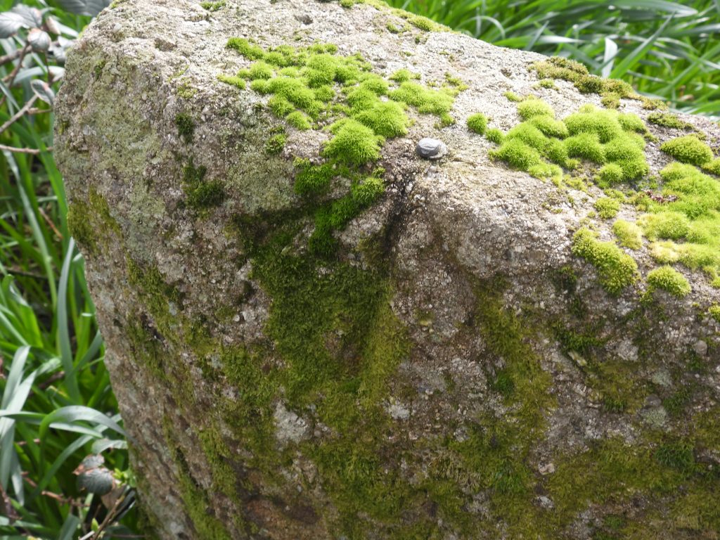
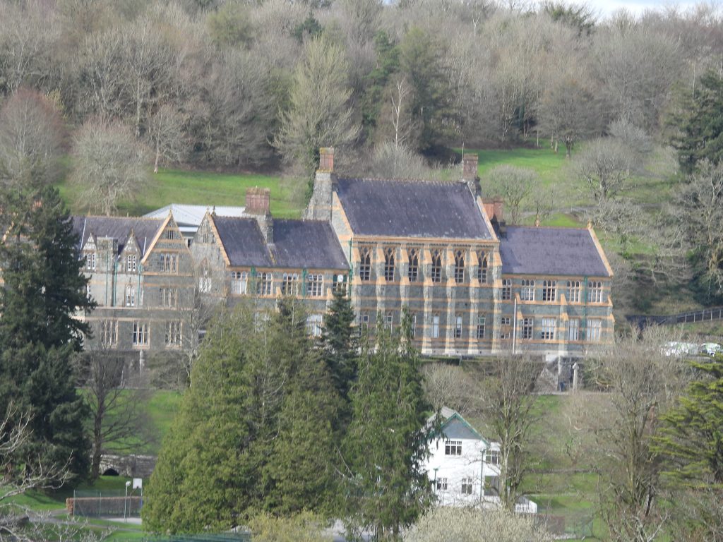
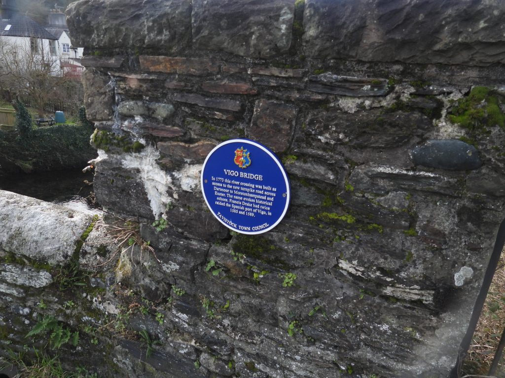
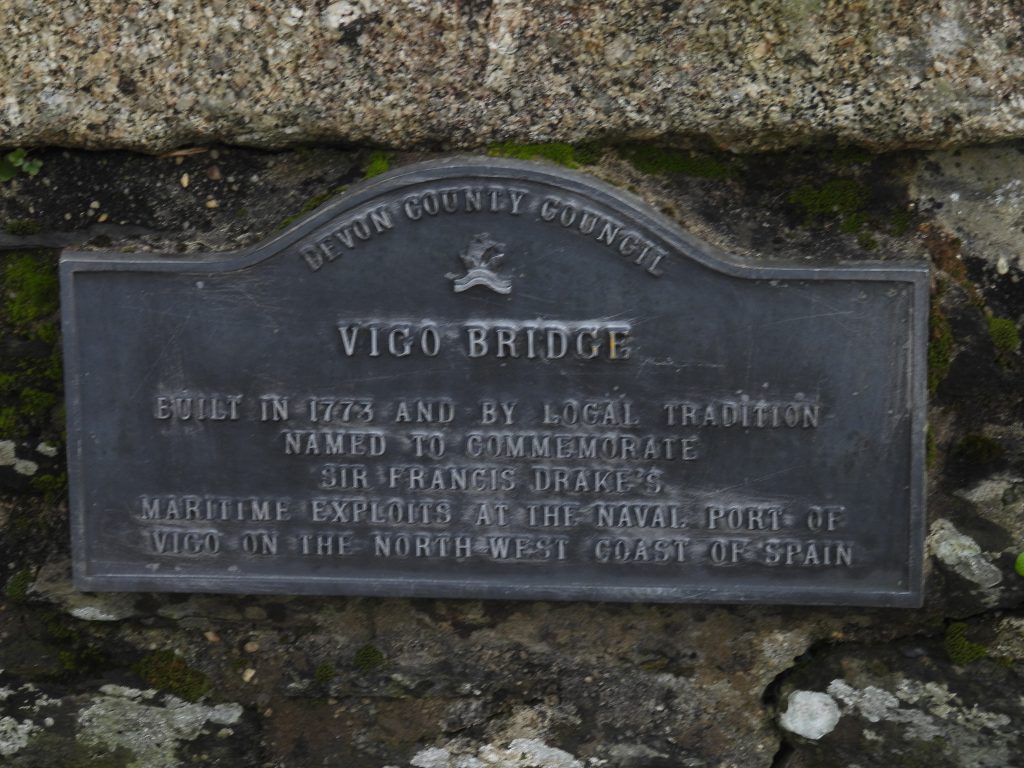
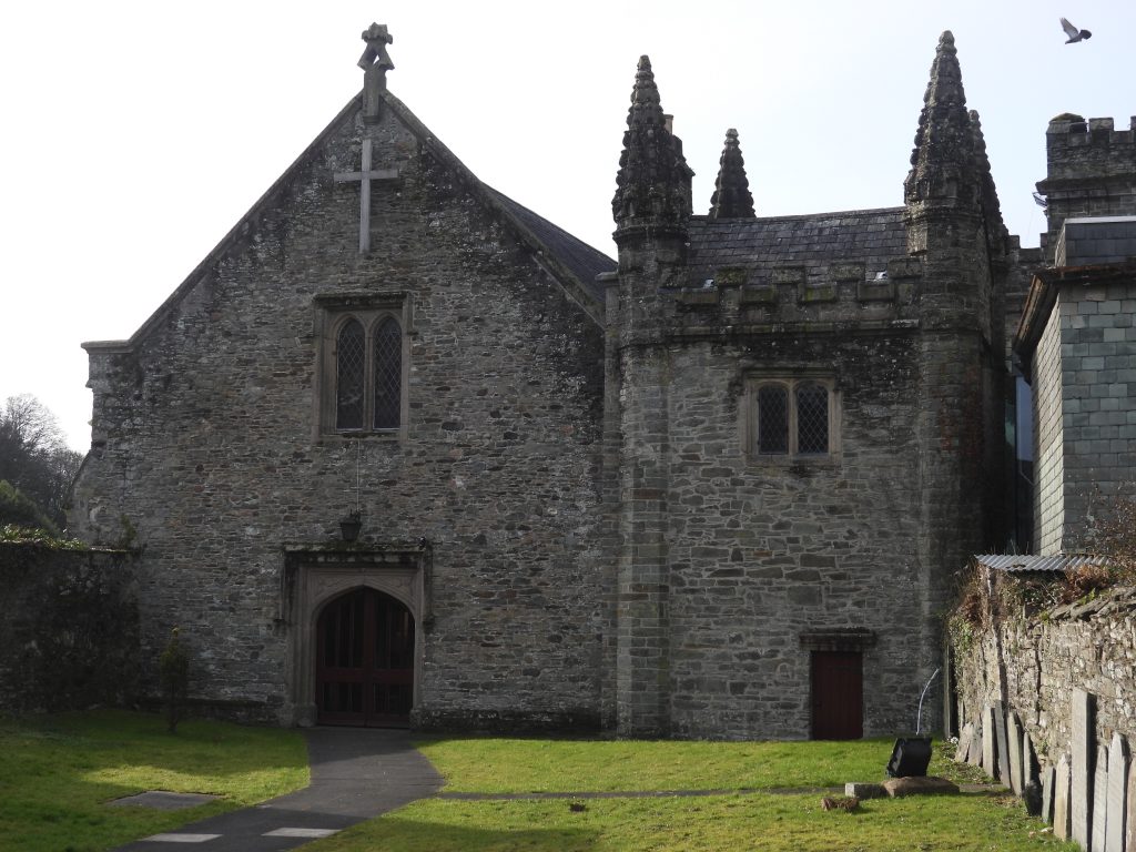
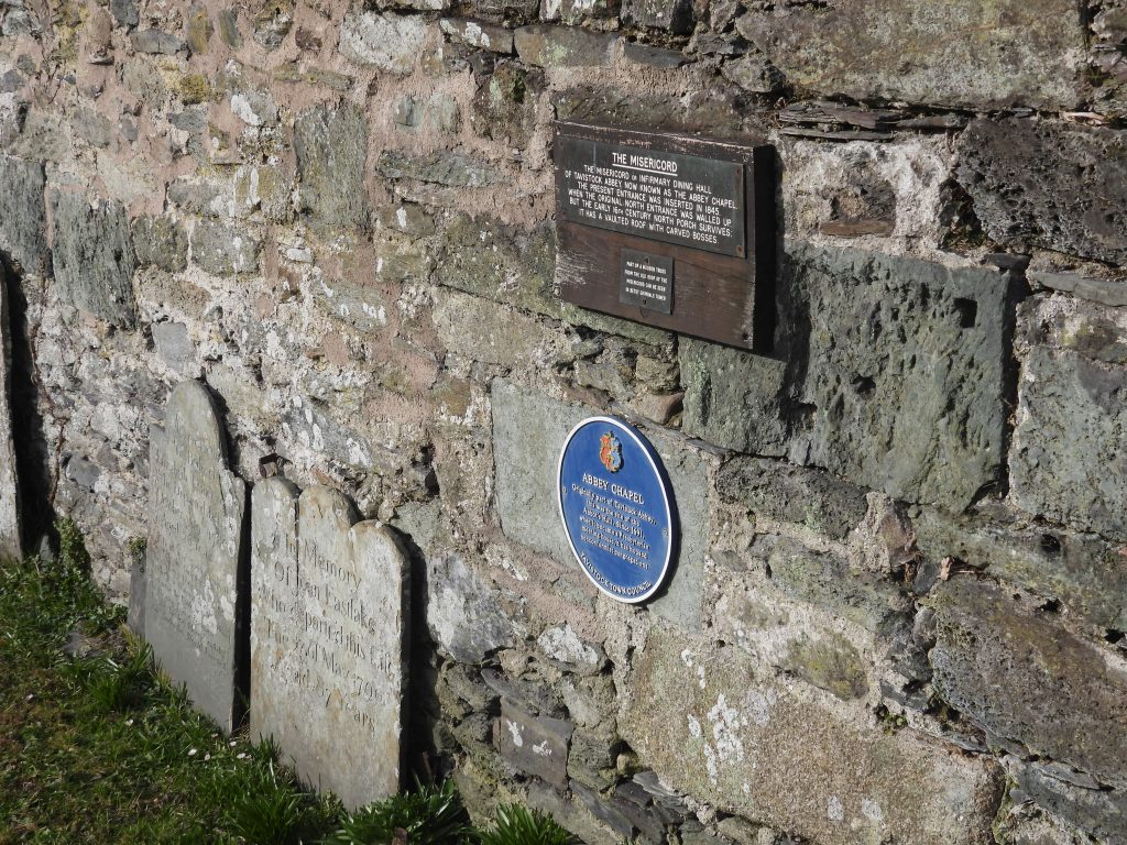
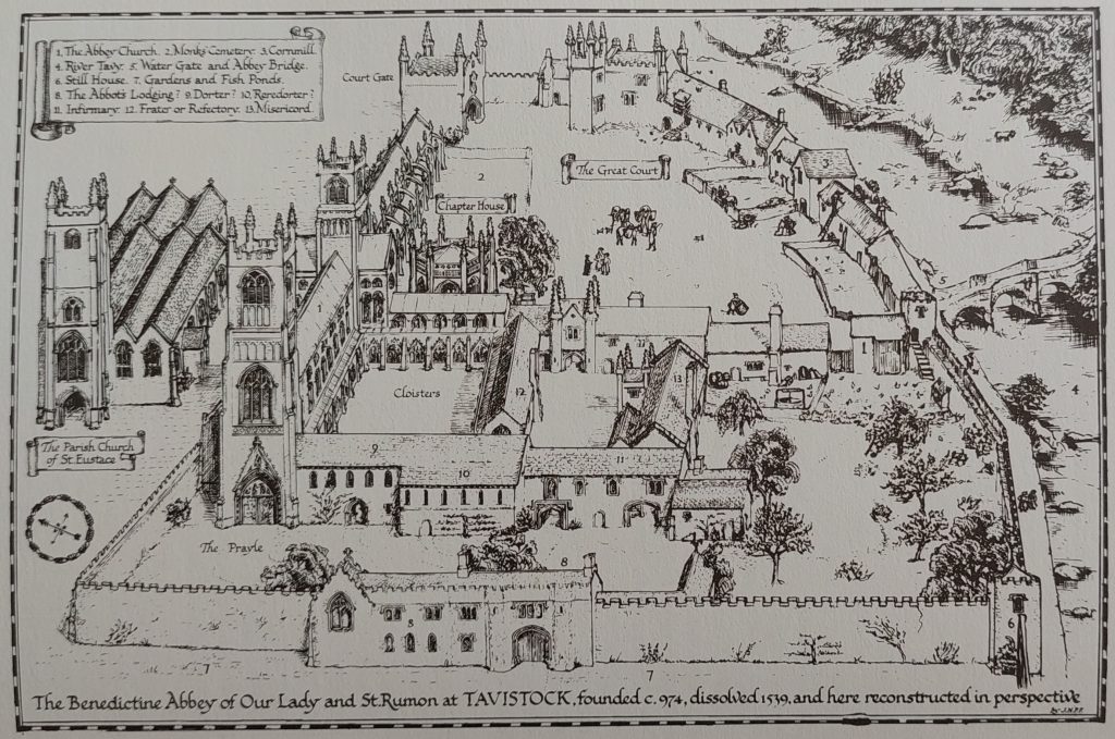
Sketch of the route covered in this postYennadon Cross is located next to B3212 and its junction with a minor road which leads to Burrator Reservoir via Yennadon Down. It was once built into a wall at Burnham Farm (as recorded by William Crossing), prior to the end of the 19th century and was moved to its present site in 1974, arranged by Mr Masson Phillips (Ref: Sandles, T. 1997 A Pilgrimage to Dartmoor’s Crosses and Dartmoor-Crosses.org.uk). There is one arm missing and there is evidence that it may have once been used as a gatepost. Burham Farm is located midway between the junction where the cross now stands and Walkhampton. Welltown Cross No 2 is the second of two crosses located in the hamlet of Welltown. It lies next to the Black Brook between the hamlet and the crossroads where Yennadon Cross is located. Unusually this granite post has a deeply incised cross on top. The stone was erected by the same person and at the same time as two gateposts at the entrance to the nearby Walkhampton Churchyard. (Source: http://www.dartmoor-crosses.org.uk/welltown_2.htm)Welltown Cross No 1 is one of two crosses located in the hamlet of Welltown and is located to the north west of Yennadon Down and close to Walkhampton. This cross was in a nearby farm building and erected at its current site by the Dartmoor National Park Authority. The cross does not have any head and arms and it seems they were removed when the cross was being used as a gatepost. (Ref: http://www.dartmoor-crosses.org.uk/welltown_1.htm)These two cottages, were originally the Church House dating from early 16th century. The Church House was modified in 1698, and altered in late 19th century and finally then restored in later 20th century. There is a cross to the east of the Church House, which can be seen in the photographSt. Mary the Virgin, Walkhampton. On 5th April 1889, the North East pinnacle of the Church was struck by lightning which was sent crashing through the roof of the nave. The west end of the nave was entirely demolished by this incident. However, a new pinnacle was commissioned soon after and the damage was soon made good. Into the 20th century, the tower was re-pointed and in 1965 and steel bracing added to strengthen the pinnacles. Early in 1985, thieves stole the reserved Sacrament from the church. On Lady Day (25th March), the Bishop of Plymouth rededicated the church.A church at Walkhampton (locally ‘Waketon’) was first mentioned in 1259, with a document from 1342 mentioning the need for rebuilding. The current church dates from circa late 15th and 16th centuries. Later, in the 19th century, there were appeals for assistance, due to the ‘ruinous’ condition of the church. Some additions were made in 1832. An unusual feature of the church is that it faces north-east, not the normal due east. North east, of course, is the point of sunrise at the Summer Solstice. On this north east alignment is a old rock next to a road which is known locally as Gipsy Rock.F.H (Harry) Starkey wrote in 1983 that the socket stone and the octagonal shaft (with square end) formed part of the same cross. He further stated that they (socket and shaft), were removed from the wall in 1976 awaiting restoration, located opposite the Church House.The cross and socket stone were ‘united’ in a restoration in 1984, when socket was slightly enlarged to accommodate shaft. Finally the head was added in the 1990s, to see the finished artefact we see todayThe Monastic route passes between the Church House and the restored cross on a hard track which leads to Ward HouseAlongside the Church House is a mounting block, perhaps testament to the days when it was an Inn. The house ceased to be the Church House Inn in 1855.On the lane leading to Ward House, an unusual iron kissing gate can be found.Ward HouseLovely stone stile north of Ward House next to the footpathThe stone stile is located at SX53564 70268This step wall leads to a narrow packhorse lane below. It is located at SX53514 70302The packhorse lane had associations with a former Walkhampton village and is known as ‘Jimmie Pickle’s Lane’From the wall steps, the packhorse lane leads to the Walkhampton – Eggworthy lane, a distance of around 350m. At the lane, the route turns left (south west), then right (north) heading towards Huckworthy Bridge. That said, the original route would have most likely used a field path from Jimmie Pickle’s Lane down to Huckworthy BridgeHuckworthy Bridge, sometimes called ‘Huxworthy’ is was recorded in 1665 (as being in need of repair). The bridge replaced a clapper which originally stood here (where monastic routes to Tavistock and Buckland converged). The ‘tudor’ bridge parapet walls were partly rebuilt in 19th century. That said, the bridge does appear to be struck on a regular basis by modern vehicular traffic. The bridge spans about 15.0 metres and is only about 2.5 metres across.This bridge has two arches, with one being larger than the other. On the day this picture was taken a large school bus crossed the bridge and struck the eastern side! One occupant of the bus checked the damage to the bus and just a few seconds later they carried on their journeyHuckworthy Corn Mill and house are depicted from early 19th century maps onwards. Intriguingly, the mill may date back a further 300 years. The Plymouth and West Devon Record Office hold a source dating the leat which fed the mill from late 16th century. The source is a licence, which is dated 30th November 1578 to Jerome Mayhowe of Boringdon, esquire and Nicholas Slanning of Bickleigh, esquire: “To construct and maintain a weir at Byklym Wood alias Buckym Wood (Bicklime Wood) in the water called the Walkham, for his mill at Hokeford Bridge (Huckworthy)”.Helen Harris recorded an entry in her book Industrial Archaeology of Dartmoor in 1968 (page 225) stating: “Huckworthy Mill has recently been modernised. The wheel is gone and the wheel pit filled in. A water-wheel still in position in the village formerly served a wheelwrights shop”.Other snippets of history: On 17th June 1822, it was recorded that Thomas Pomeroy for building a Cart Linhay at Huckworthy Mills and was allowed £5 19s 3d. 20 years later, on 23rd June 1842, Sir Ralph Lopes leased Huckworthy Mill (and two adjacent meadows) to John French and John Gents of St. Budeaux for 7 years at £51 per annum (equivalent to around £7,230 in 2024). There is a benchmark with associated rivet on the east (upstream parapet). B.M 370.6Parlby Arms Cottage is on the north side of Huckworthy Hamlet and is depicted on the Tithe Map as Fox Inn Tenement. It ceased to function as an inn in the late 1930s.The sign (crest) at Parlby Arms Cottage is very interesting and following some research the author believes is a combination of two family crests, namely, the Parlby’s and the Hall’s. The french saying ‘Parle Bien’ literally translates “Speaks Well”. Summary of the research into the history of the crest: 1. The green parrot (x2) on the crest initially links it to a Thomas Parlby (b.1727 – d.1766), a man who excelled in Civil Engineering and working for the Royal Navy, won a contract to rebuild the dockyard in Plymouth in 1763, which doubled its size. The parrot crest appears on a chimney piece at Stover House. 2. The Three Talbots’ Heads (x2) on the crest relate to the name ‘Hall‘. Indeed, the Three Talbots’ Heads can be seen on a hatchment for Humphrey Hall in St Mary’s church, Sampford Spiney. 3. One of Thomas Parlby’s descendants was John Alexander Parlby (b. d.1849), who was a JP, who married in 1792, Laetitia Hall (b. 1772 – d.1848), daughter and co-heir of Humphrey Hall of Manadon, Crown Hill. Humphrey Hall also owned the estates at Sampford Spiney as well as Manadon. 4. John Alexander Parlby and Laetitia Hall had a son, John Hall Parlby (b. 1805) and it seems that the crest relates to him or the union between the Parlby’s and the Hall’s in 1792. John Hall Parlby was ordained on June 22nd 1828 5. On the Sampford Spiney tithe apportionment, two properties and garden, (numbers 114, 115 and 116) below Parlby Arms (which was the Fox Inn by this time) were owned by Rev. John Hall Parlby. In 1840 Parlby Arms (Fox Inn) was owned by the ‘Trustees of Humphrey Hall’, Sir George Pownell Adams and John William Spicer. Gate leading onto Huckworthy CommonHuckworthy CommonHawthorn bloom on Huckworthy CommonHuckworthy Cross lies at the northern edge of Huckworthy Common. The cross is around 1.8m high and appears to have one short and one broken arm.Huckworthy Cross is Grade II listed. Although the cross does not appear to be of great antiquity.Huckworthy Cross lies on the junction of the road from Horrabridge to Sampford Spiney and the Sampford Barton turning. The road to Sampford Barton leads on to Plasterdown and eventually Warren’s CrossThere is a benchmark on Huckworthy Cross. The benchmark reference is B.M 642.8Entrance to Sampford Barton Farm. The farmstead is likely to date from the early 16th century, based on the age of the farm buildings. It is depicted on the Tithe Map from 1840.Between Sampford Barton Farm entrance and the Inscribed Pillar is a benchmark, inscribed into a gate post. The author is unaware of a reference number for this benchmark as it does not appear on 19th century maps. It is possible the benchmark dates from the 20th century. It is located at SX53006 71440Pew (Pu) Tor as seen from the laneThe Inscribed Pillar has been recorded (Greeves) as 1.6 metres high by 0.36 metres wide by 0.39 metres deep. It is located on the west side of the lane and now forms a gatepost on the north side of a gateway. The 4 character inscription when first viewed is difficult to discern, so some mud painting is required to enhance it. The pillar is located at SX52983 71680Okasha (2002) conjectures that the 4 character inscription(s) may indicate names and possible assertion of ownership of the pillar and suggest it is likely to date to the 6th-8th century.After a mud paint the letters on the pillar become quite clear. The letters appear to be in two parts (2 characters each) in a rather irregular line which seem to be read upwards facing right. The inscription has been cut into the east face of the pillar. Greeves records the letters as being 0.10 – 0.11 metres high and states letters ‘R’ and ‘E’ are set close to the chamfered edge (at the bottom) of the stone with an ‘N’ and an ‘A’ or ‘R’ (in the middle of the stone).This Boundary stone is approx 1km north of Huckworthy Cross. The face shown in the photograph is inscribed ‘SB’ which stands for Sampford Bounds. The Boundary stone is set back from the road next to a small stream. The face shown in the photograph is inscribed ‘WB’ which stands for Whitchurch Bounds. It is thought to date from 1822A couple of hundred metres further up the lane is another SB / WB inscribed Boundary stone which lies on the edge of Plaster DownApproaching Warren’s Cross. The road on the left of the photograph leads to Horrabridge, straight ahead the road leads to Whitchurch DownWarren’s Cross. Eric Hemery in Walking Dartmoors Ancient Tracks (page 156) mentions his surprise that there is no sign of a stone cross here. Hemery suggests that one of two old crosses, now at Buckfast Abbey may well have once stood at this spot.It is thought that Warren’s Cross was also located on the route of the Tavistock – Ashburton Packhorse track. Next to the crossroads by a drystone wall (semi-buried) is a ‘TA’ stone which Dave Brewer labels no. 24 in his paper / report on the Tavistock – Ashburton Packhorse track. Warren’s Cross also is part of the route on the modern day ‘Dartmoor Way’. On the wooden post is a Dartmoor Way sign, which was put up by the author in 2019. Location of the ‘TA’ stone at Warren’s Cross. Recorded in the Dave Brewer publication it is recorded that: “Under the ‘Removal of Direction Signs Order 1940’, this stone once had its inscription facing inwards. After the war, the stone was taken out of the wall and put back so the incised face was re-exposed”.Dave Brewer records this as being a “small piece of rectangular section on the northern side of the wall at Warren’s Cross, having the incised letters ‘TA’ on the exposed face – thought of as being part of an old guide stone”. It is interesting that the ‘T’ and the ‘A’ are on the same side of this stone. Digging down a bit further might well reveal that there is also a ‘V’ making ‘TAV’ for Tavistock?From Warren’s Cross, the next cross westward is Pixie’s Cross, which is hidden from view behind thick gorse on Whitchurch Down. The Down once provided an area of pastureland for the commoners. Today, much of the Down is now a golf courseMasson-Phillips in 1937 described Pixie’s Cross as being “…a tall, very rudely shaped cross of rough rectangular section with peculiarly misshapen arms”. There is an incised cross between the arms on the western face. It is located at the edge of a disused quarry. The aesthetics of the cross are quite magnificent with two-thirds of shaft curving slightly to west-north-west and with crude stumpy arms aligned north-north-east by south-south-west.Pixie’s Cross does not appear to possess a socket stone. It is firmly secured in the turf and stands around 2.25m highHistoric England describe Pixie’s Cross as “one of the best preserved and most visually impressive of all medieval wayside crosses on Dartmoor”. The author would not argue against that descriptionApproaching Green Lane (and the last granite cross), these two boundary markers can be found. Tim Jenkinson, (2007) in ‘Miscellaneous Milestones and Boundary Markers of Dartmoor Roads’ wrote: “Boundary stone just down from the second tee of Tavistock Golf Club on side of fairway / grass verge beside TUD/TRD iron marker” He further stated that it (the stone) is thought to date from 1822.The boundary marker(s) are on the Whitchurch / Tavistock parish boundary. The granite post is shown on 19th century maps and is located at SX49543 73710. The author is unaware of the date of the iron post but is assumed to be early 20th century (possibly around the time of the Duke of Bedford farm sales in 1911). The author would be most grateful if anyone could pinpoint a date and confirm if anymore iron markers are extant on the common.Green Lane Cross is medieval in origin an is located at the north-west end of Whitchurch Down, near the Tavistock golf clubhouse. It has been restored. It is located at SX49293 73851 on the 20th / 21st century parish boundaries of Whitchurch / TavistockE.N Masson Phillips, (1937) in ‘The Ancient Stone Crosses of Devon: Part I, 315-316’ records about this cross: “A roughly-shaped socket-stone sunk in the turf (with a square socket- hole penetrating the stone) bears a modern stumpy shaft, on which is mounted the ancient head portion with the arms of the cross of rough rectangular section. On each face between the arms, there is an incised cross. Restored in 1934”.Entering Green Lane before the route descends into Tavistock, this Milestone can be found. The inscription on the road side reads “14 MILES to PLYMo” on one faceOn the slim, north face of the milestone is the inscription “1 T”, which stands for one mile to Tavistock.The milestone also has an inscribed benchmark and rivet (bolt) on it. It is referenced as B.M 514.5 on 19th century maps suggesting it was inscribed between 1840 and 1860 (first geodetic period). Towards the bottom of Green Lane is a footpath which leads down to the A386 (near the old railway bridge of the Tavistock and Launceston branch of the Great Western Railway). From the footpath is a fabulous view of Kelly College (now Mount Kelly). The College is a Public school which was built between 1872-1874, with a west wing added in 1897. It was founded by Admiral Kelly on land donated by the Duke of Bedford.In Tavistock, the first river crossing reached is Vigo Bridge. A Blue Plaque on Vigo Bridge which states: “In 1773 this river crossing was built as access to the new turnpike road across Dartmoor to Moretonhampstead and Exeter. The name evokes historical echoes. Francis Drake had twice raided the Spanish port of Vigo, in 1585 and 1589”.Another Vigo Bridge sign states: “Built in 1773 and by local tradition named to commemorate Sir Francis Drake’s maritime exploits at the naval port of Vigo on the north west coast of Spain”One of the Tavistock Abbey buildings. “The Abbey Chapel” was built adjacent to the monastic infirmary and was the dining-hall for the use of the sick. The earliest mention of the building is in 1348.The Town Council blue plaque states: “Originally part of Tavistock Abbey, this was the site of the Abbot’s Hall. Since 1691, when it became a Presbyterian meeting house, it has housed nonconformist congregations”.St. Eustachius Church originally dates from 1265. http://www.tavistockparishchurch.org.uk/church/history/ The abbey church and cloisters were destroyed soon after the dissolution in 1539.Tavistock Abbey – an imaginary reconstruction by Mrs J.P.R. Finberg