A collection of walks, discoveries, insights and pictures of exploring Dartmoor National Park
January 27, 2024
Tavistock – Ashburton Packhorse Track
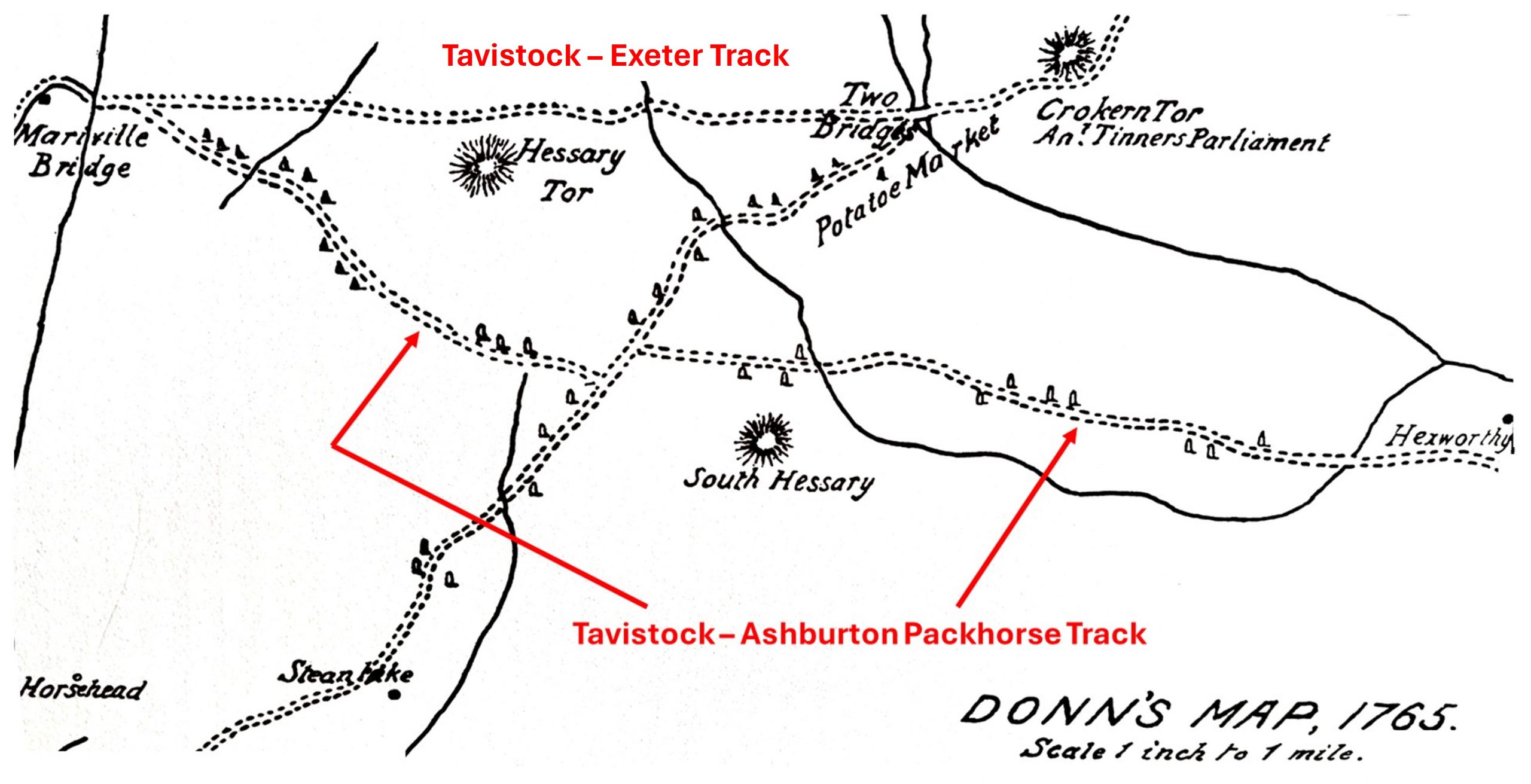
The old packhorse track between Tavistock and Ashburton was an important trans-moor trading route until it was largely superseded by the turnpike road in 1792. The route is believed to date to at least late 17th / early 18th century and follows in part the more ancient Monastic Way between Buckfast and Tavistock Abbeys (the Maltern Way, which may date as far back as the 11th century). The route is marked at its western end by granite crosses (which marked part of the Truro – Exeter ‘Kings Road’ via Tavistock) and by guide stones elsewhere. The packhorse traders (jobbers or merchants), who were often not from the area needed a well-defined track (with markers or guide stones) across the southern central basin of Dartmoor. Their need was for a well defined route was especially prevalent, as although guide stones may have been present these would have been erected well before any map was published showing their location. Indeed, the Tavistock – Ashburton packhorse track, in spite having probable medieval origins, does not appear on maps until 1765 with the publication of Benjamen Donn’s one inch to one mile scale map.
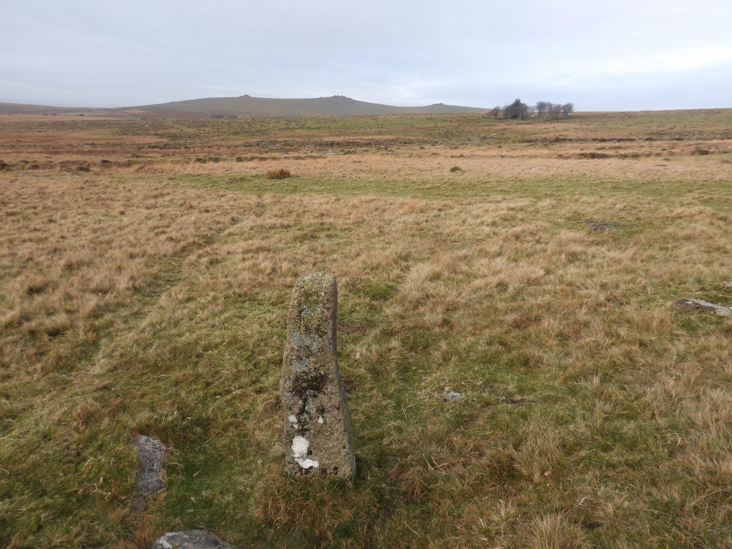
The guide stones on the Tavistock – Ashburton pack horse track route, bear the initials ‘T’ and ‘A’ indicating the terminal towns of Tavistock and Ashburton. The cross as a way marker was largely abandoned after an act of parliament in 1696, when justices were empowered to erect guide stones where they were required across the moor. To this end, the receivers book for Plymouth Corporation (1696-1700) records an entry where £2 was paid for the erecting of ‘Moorestones on Dartmoor in the way leading from Plymouth towards Exon for guidance of travellers passing that way’. It is believed this lead to the origin of the Tavistock – Ashburton (‘T’ / ‘A’ stones), many of which are still extant and (in the main) can be found between Princetown and Merrivale. This evidence seems to date these guide stone from around late 17th century or early 18th century. In any case Donn on his map records these stones by 1765 (having completed his survey between 1759 and 1765) and thus dates these stones most likely between 1696 and 1759. Other guide stones marked the Truro – Exeter ‘Kings Road’ via Tavistock, and the Plymouth – Exeter road via Two Bridges, but the stones from there were lost when the turnpike was built and when Princetown was being expanded early 19th Century.
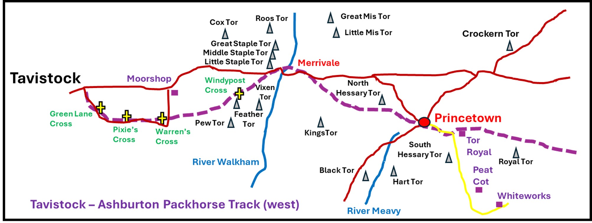
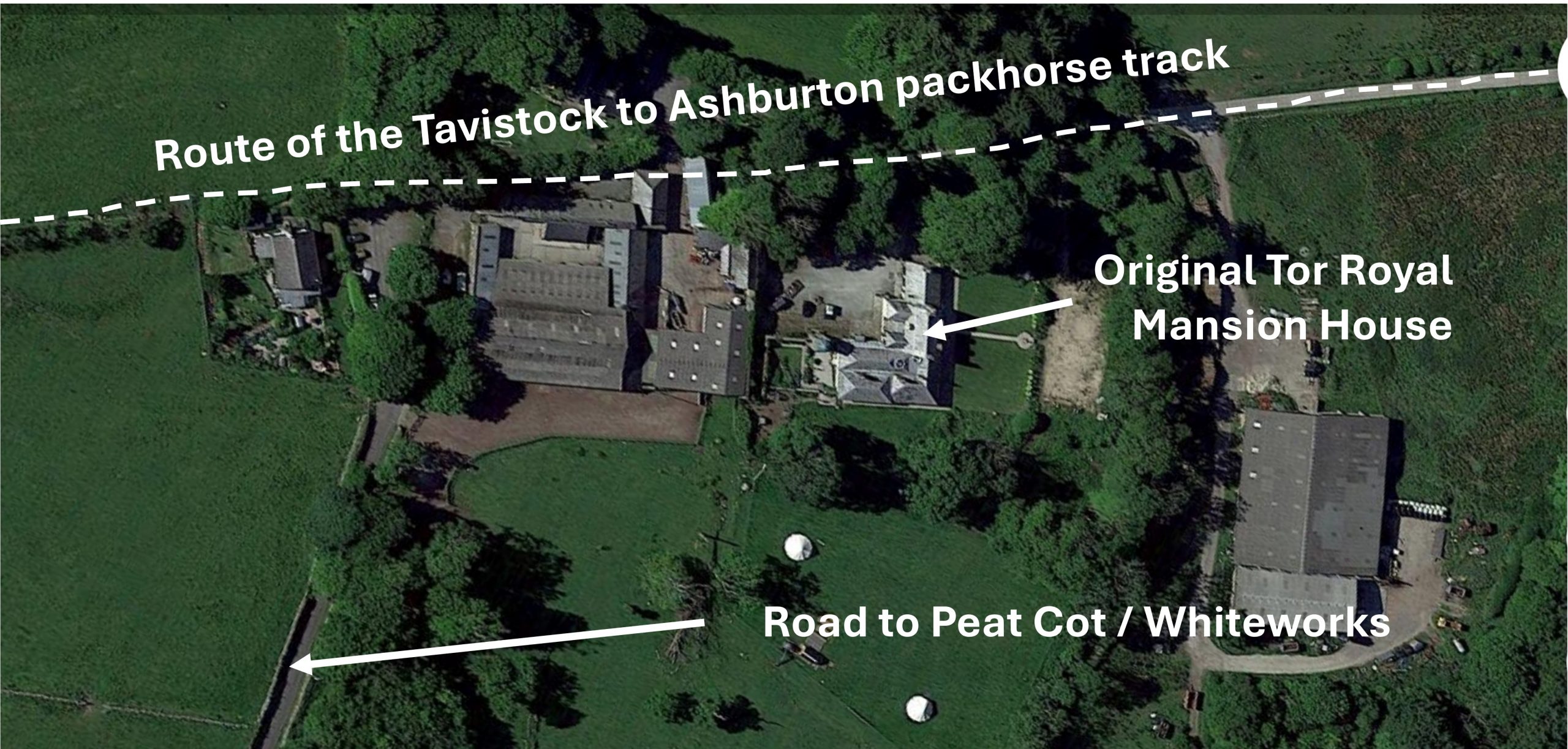
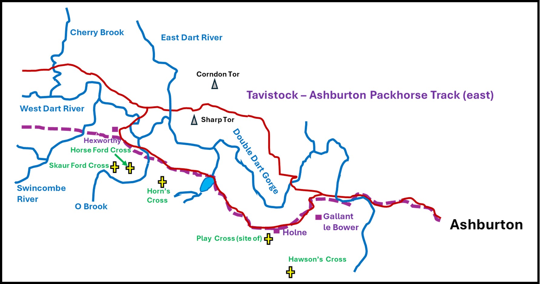
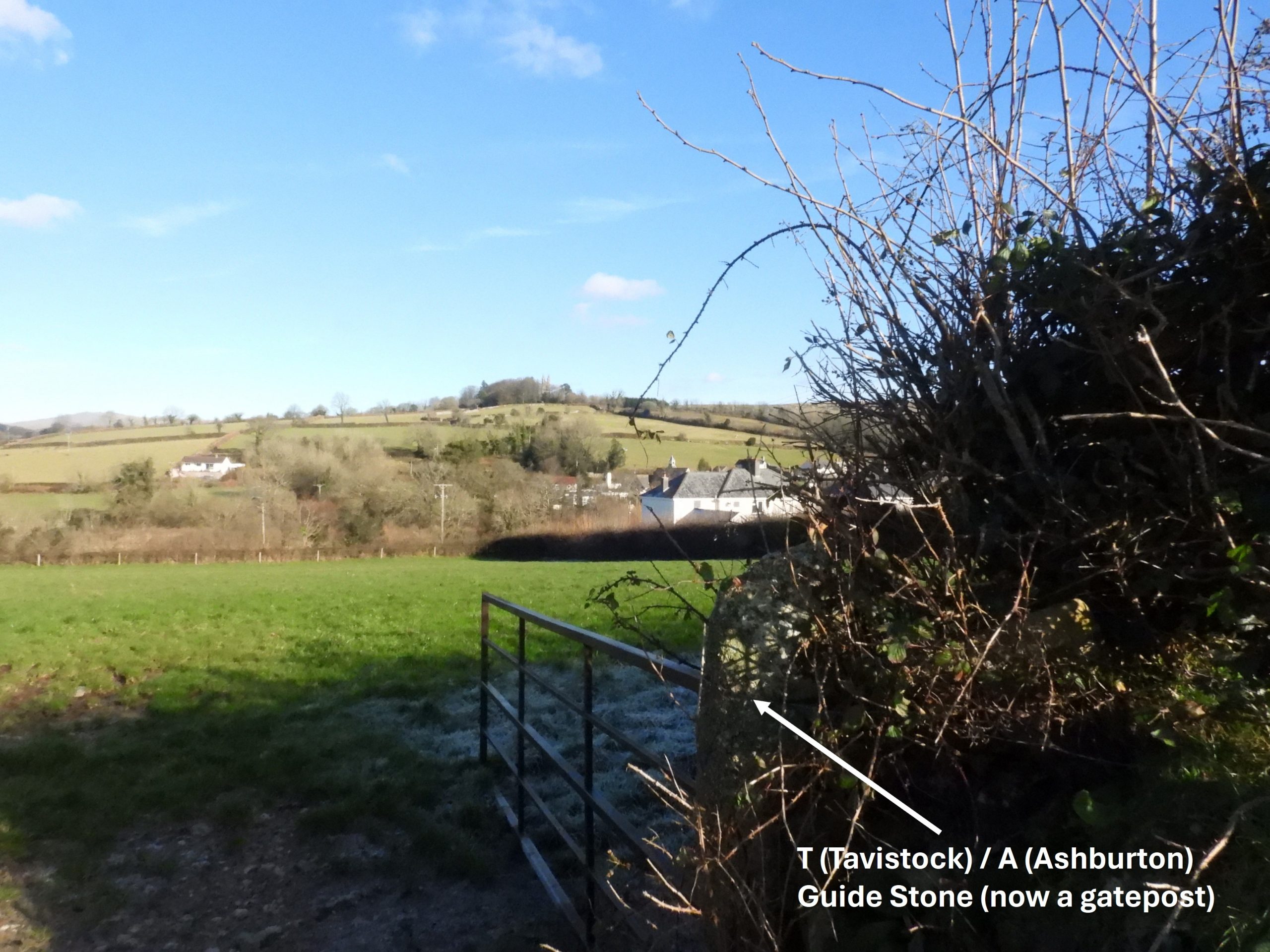
The packhorse track (west to east) starts at the Great Bridge (now Abbey Bridge) in Tavistock, and guided the traveller to Merrivale via Green Lane Cross (aka Whitchurch Cross), Pixies Cross, Warrens Cross and past Moortown to Windypost Cross, before crossing the Beckabrook at the ford before reaching Merrivale Bridge. This part of the route was shared with the ‘Exeter-Truro’ Kings Road. A short distance to the east of Merrivale Bridge the Kings Road and Tavistock-Ashburton track splits, the latter taking the traveller near to the Merrivale Bronze Age antiquities (in particular the twin double stone rows), then onto Yellomeade enclosures (Yellowmeade Farm was built in 1860s so wasn’t extant when the packhorse track was being used). The route then takes a contour around the south flank of North Hessary and leads to the south and west of Princetown. The route then continued past Tor Royal and along what is now Conchies Road to Swincombe Farm and Hexworthy. The route then passes the moor around Venford Reservoir and onto Holne before descending (possibly via Gallant Le Bower) to Holne Bridge then along the lanes to Ashburton.
The detail in this post would not have been possible had it not been for the excellent information found in the publications referenced in the Bibliography by Dave Brewer, Richard Hansford Worth and Eric Hemery
Bibliography
The TAVISTOCK – ASHBURTON PACKHORSE TRACK and its GUIDESTONES – Dave Brewer (1991)
Worth’s DARTMOOR (Third Impression 1981)
Walking DARTMOOR’S Ancient Tracks – A guide to 28 routes – Eric Hemery (1986)
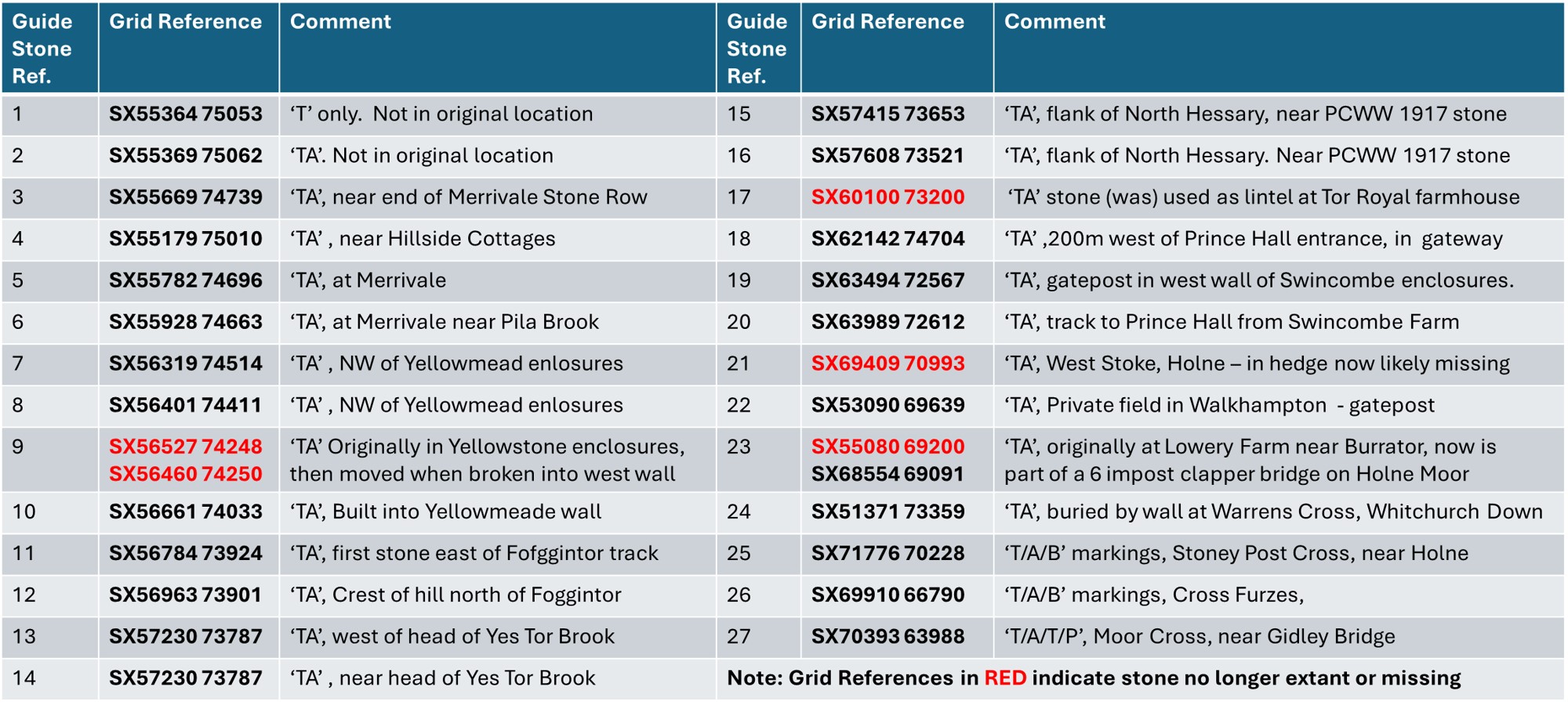
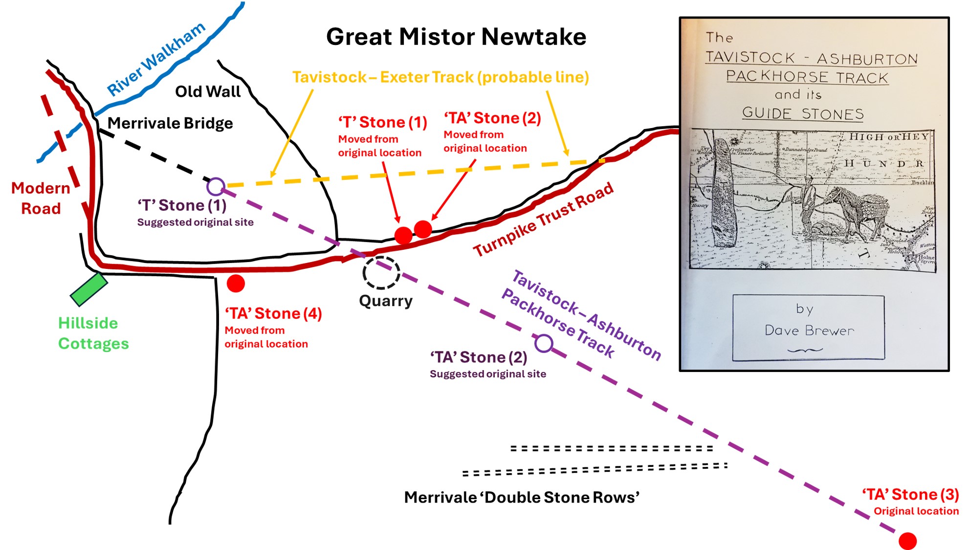
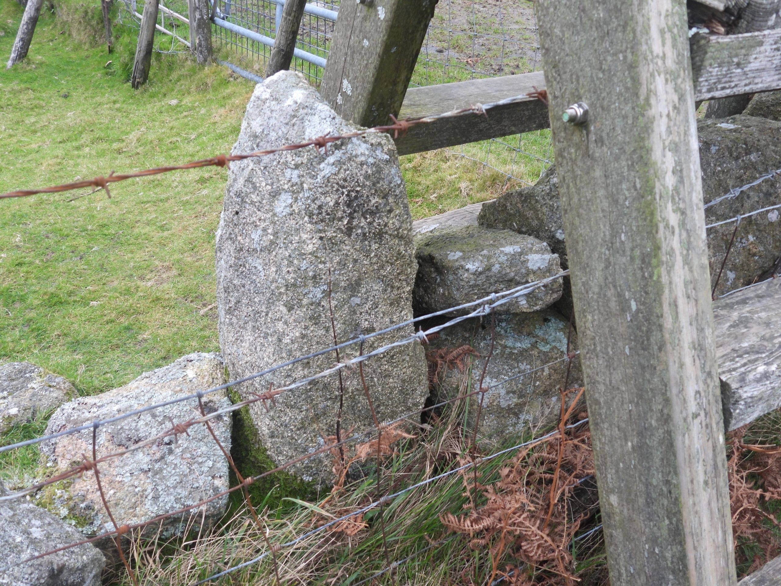
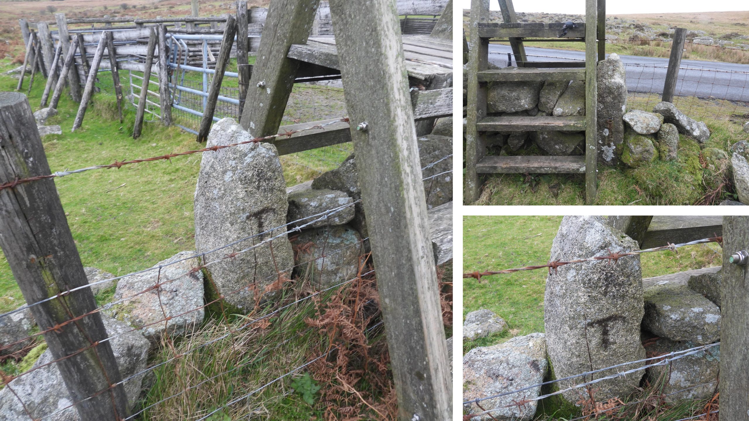
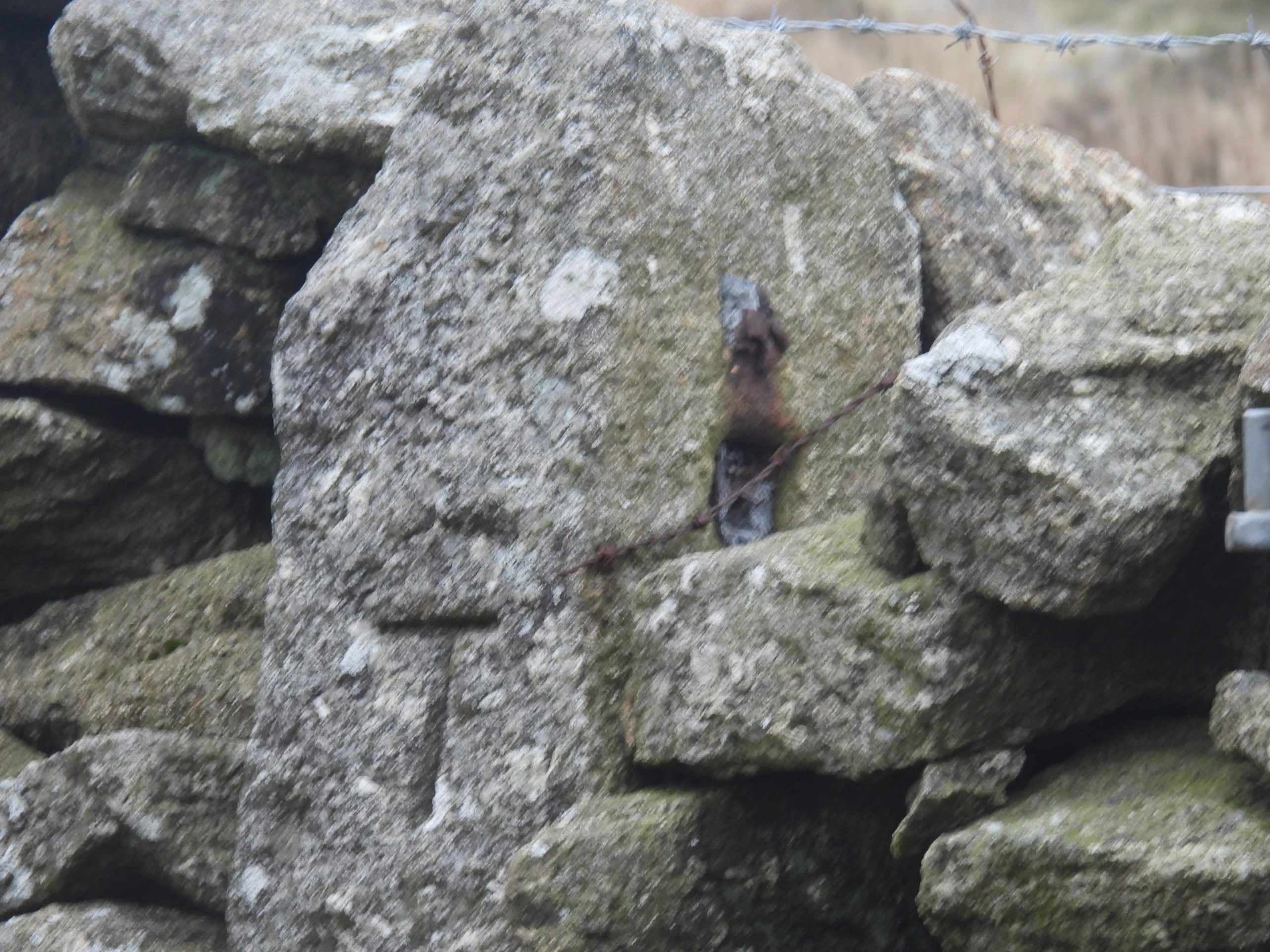
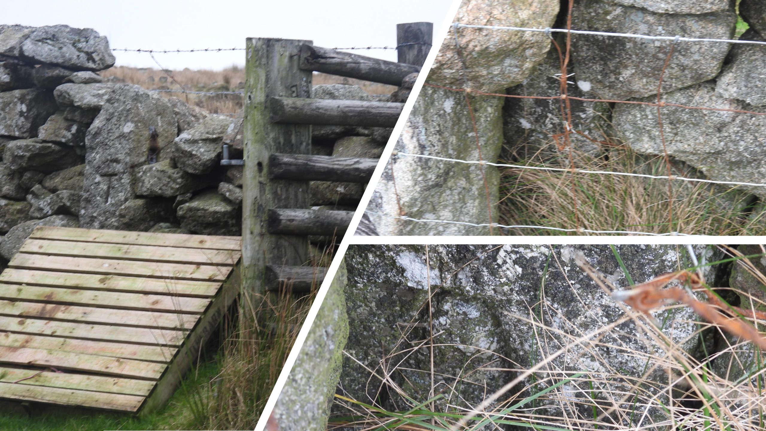
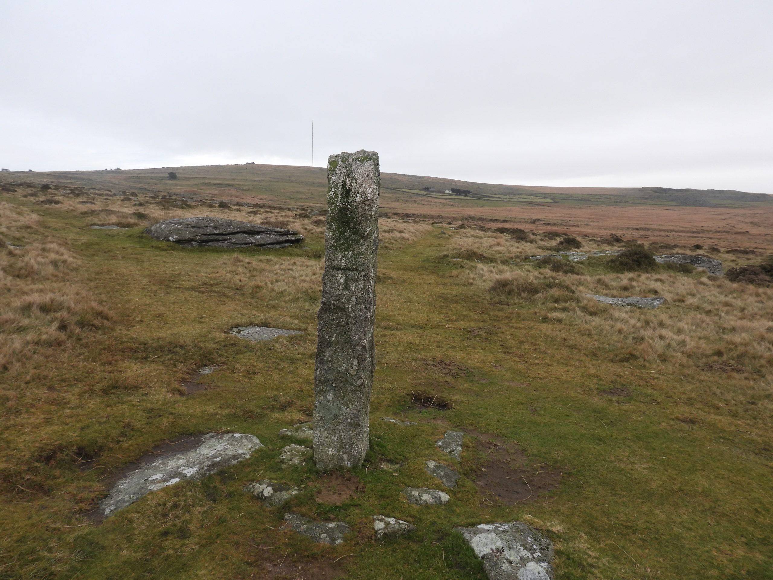
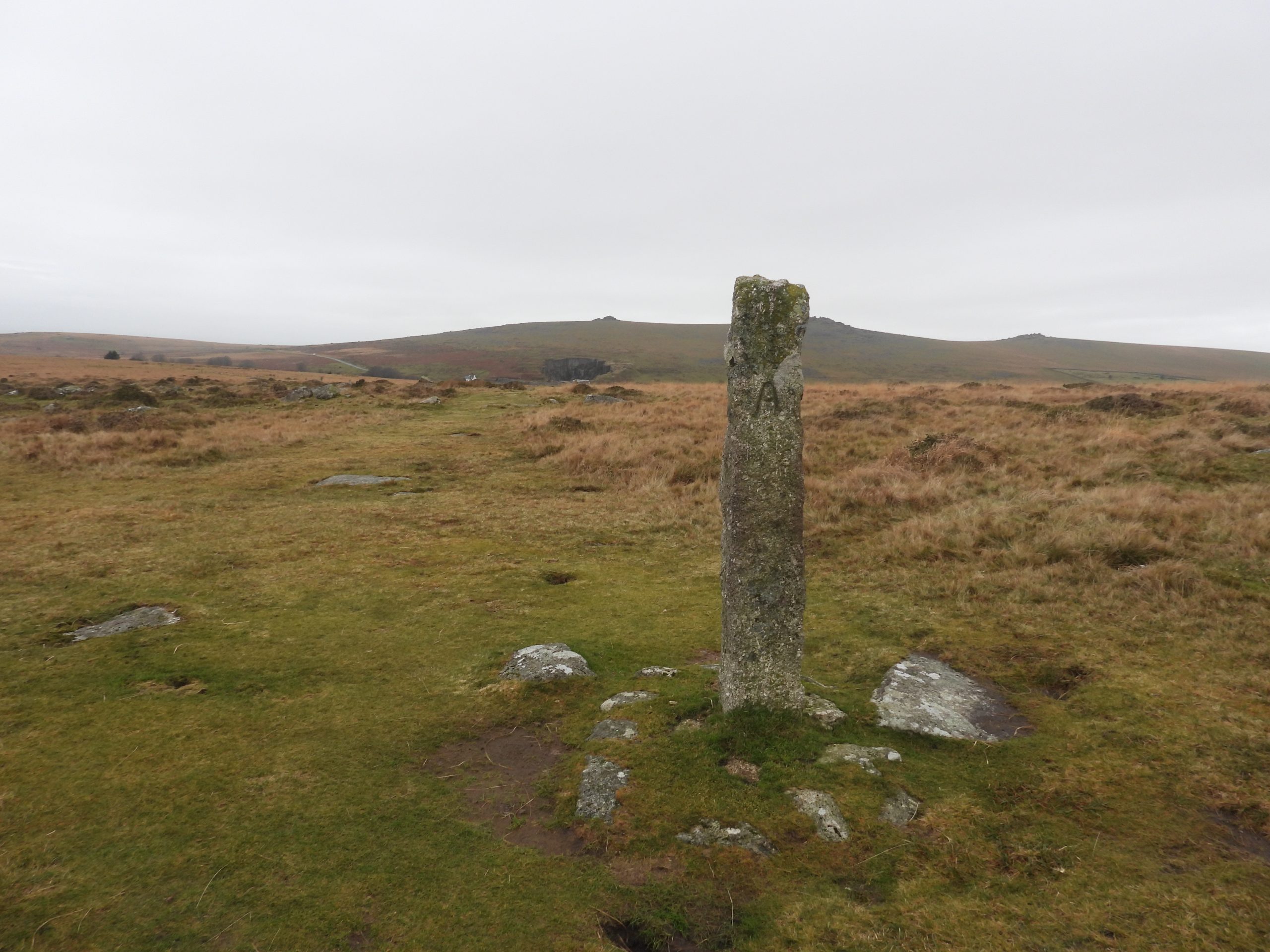
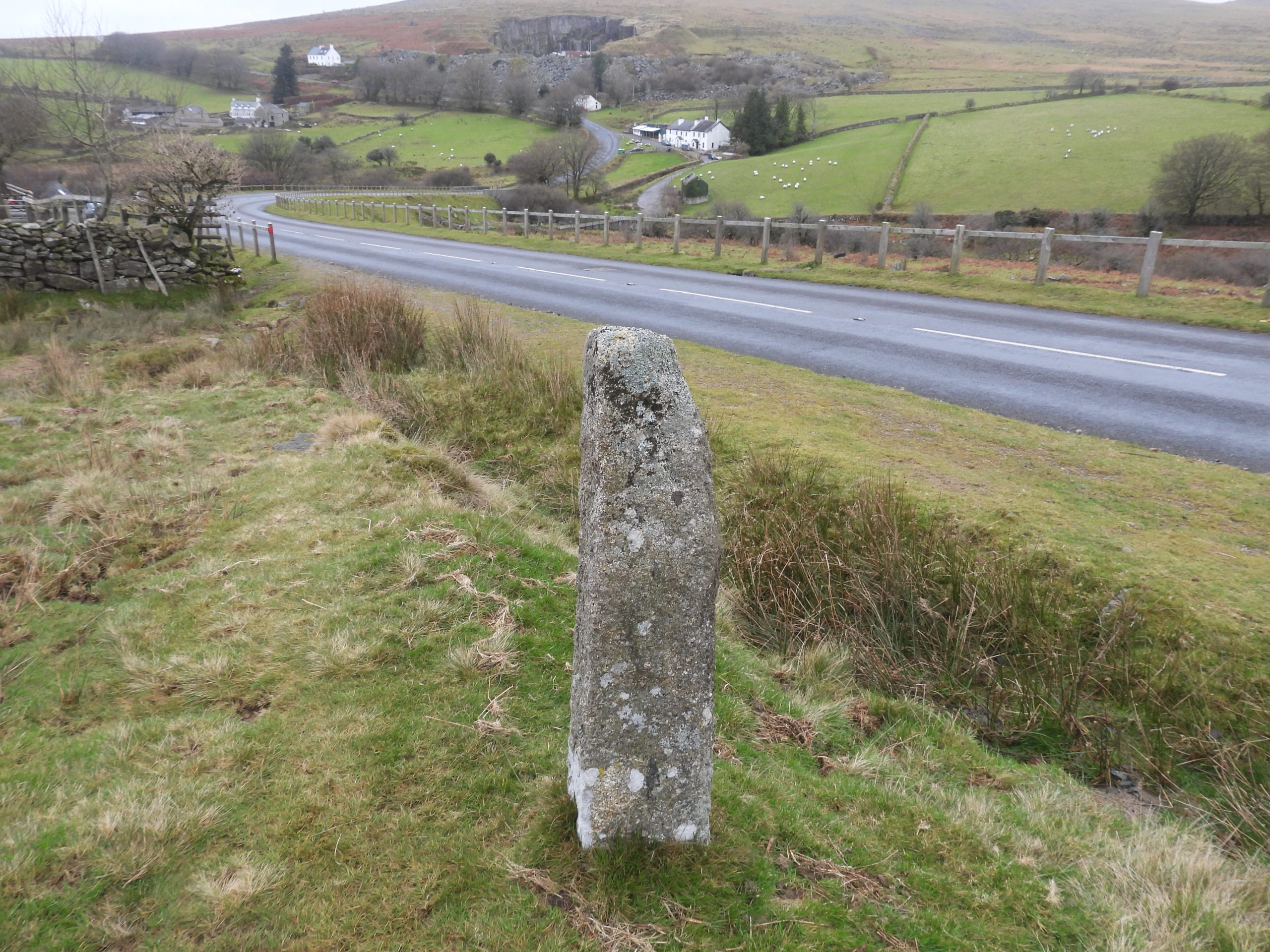
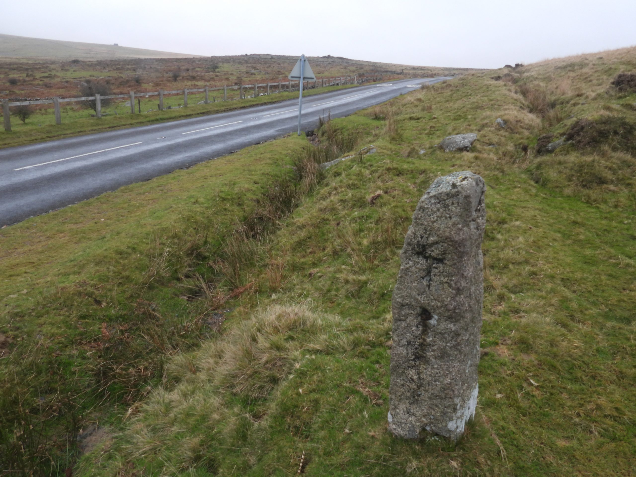
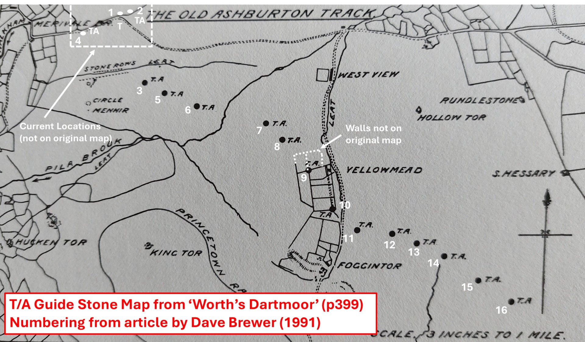
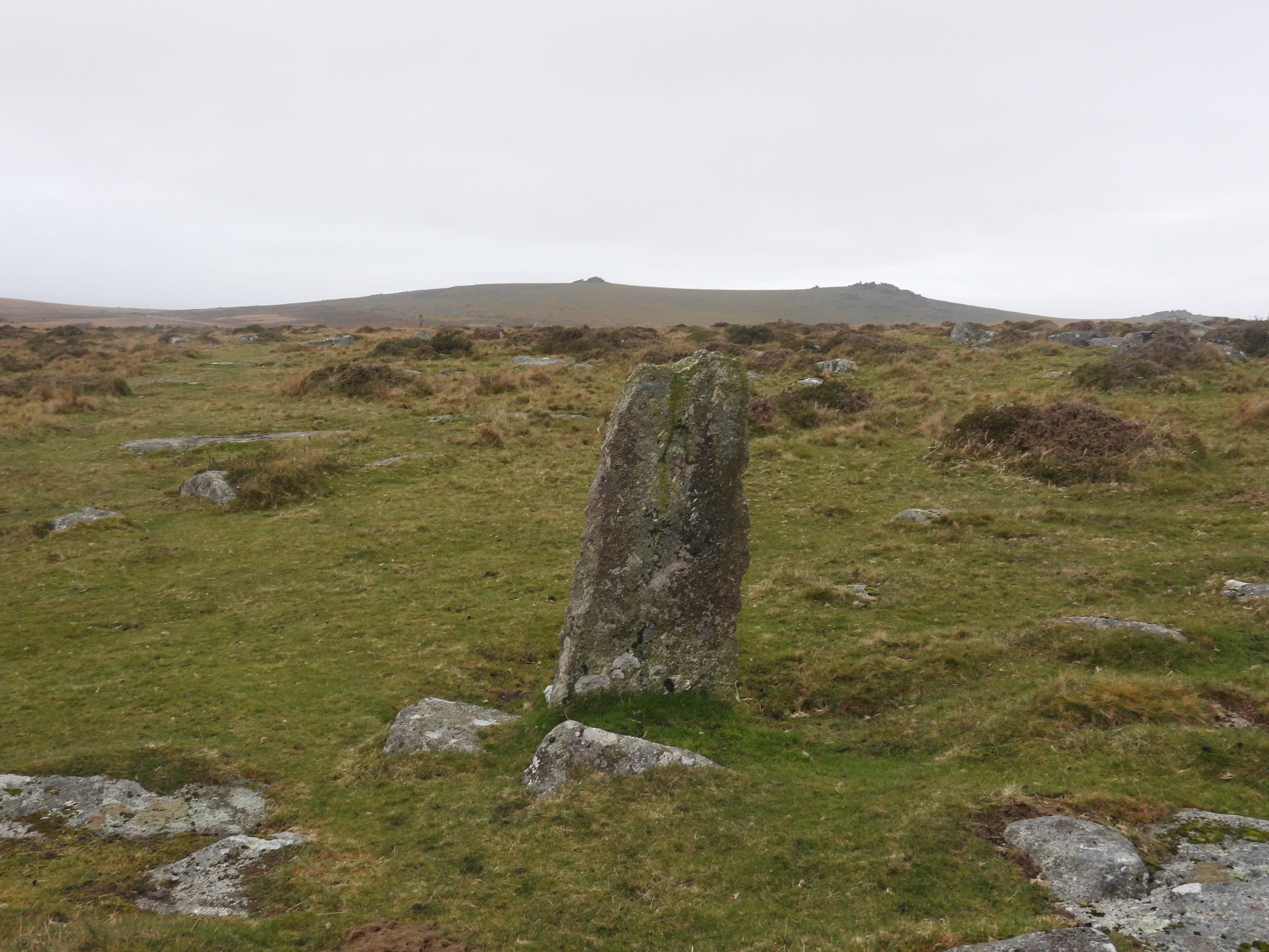
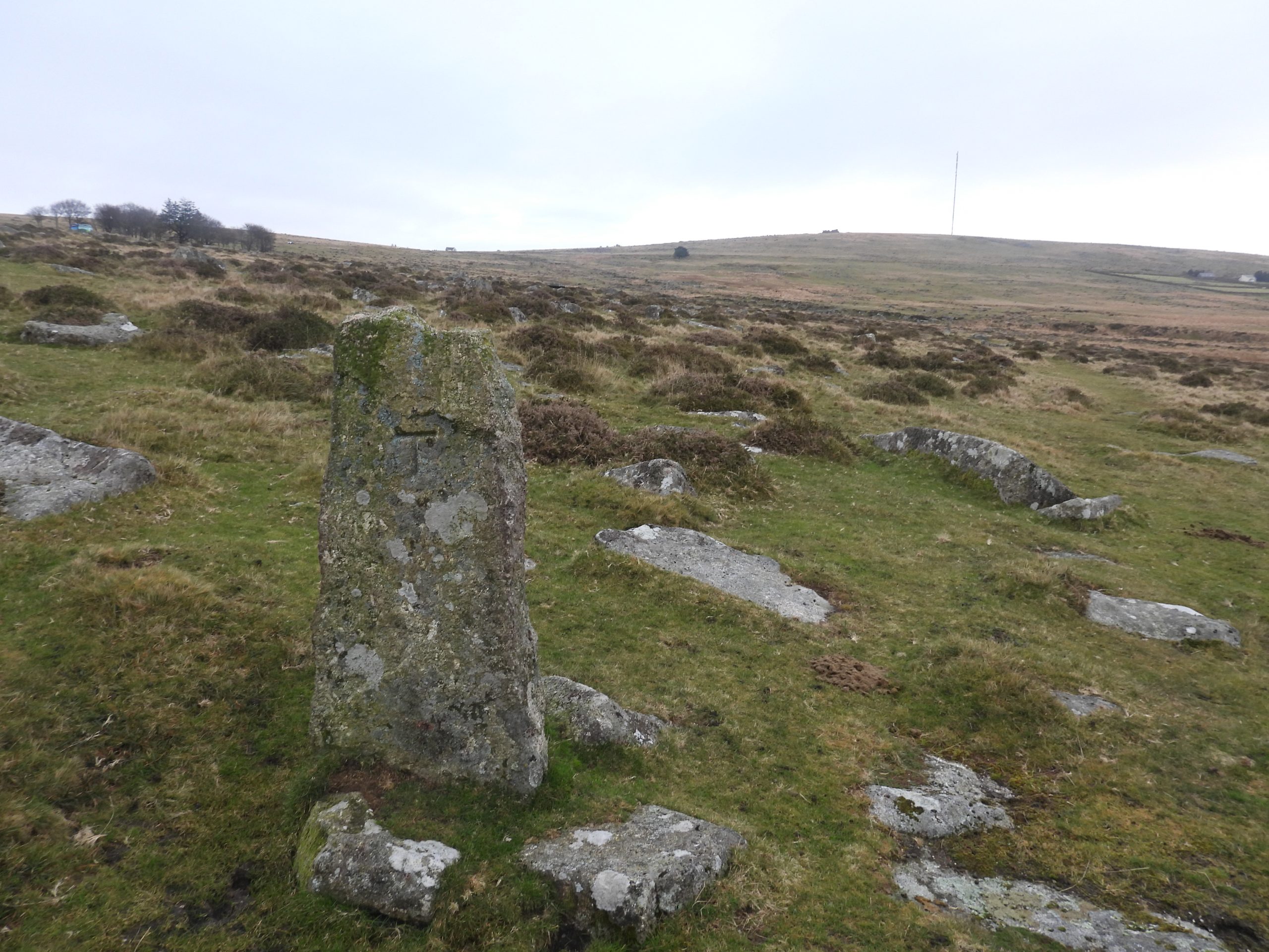
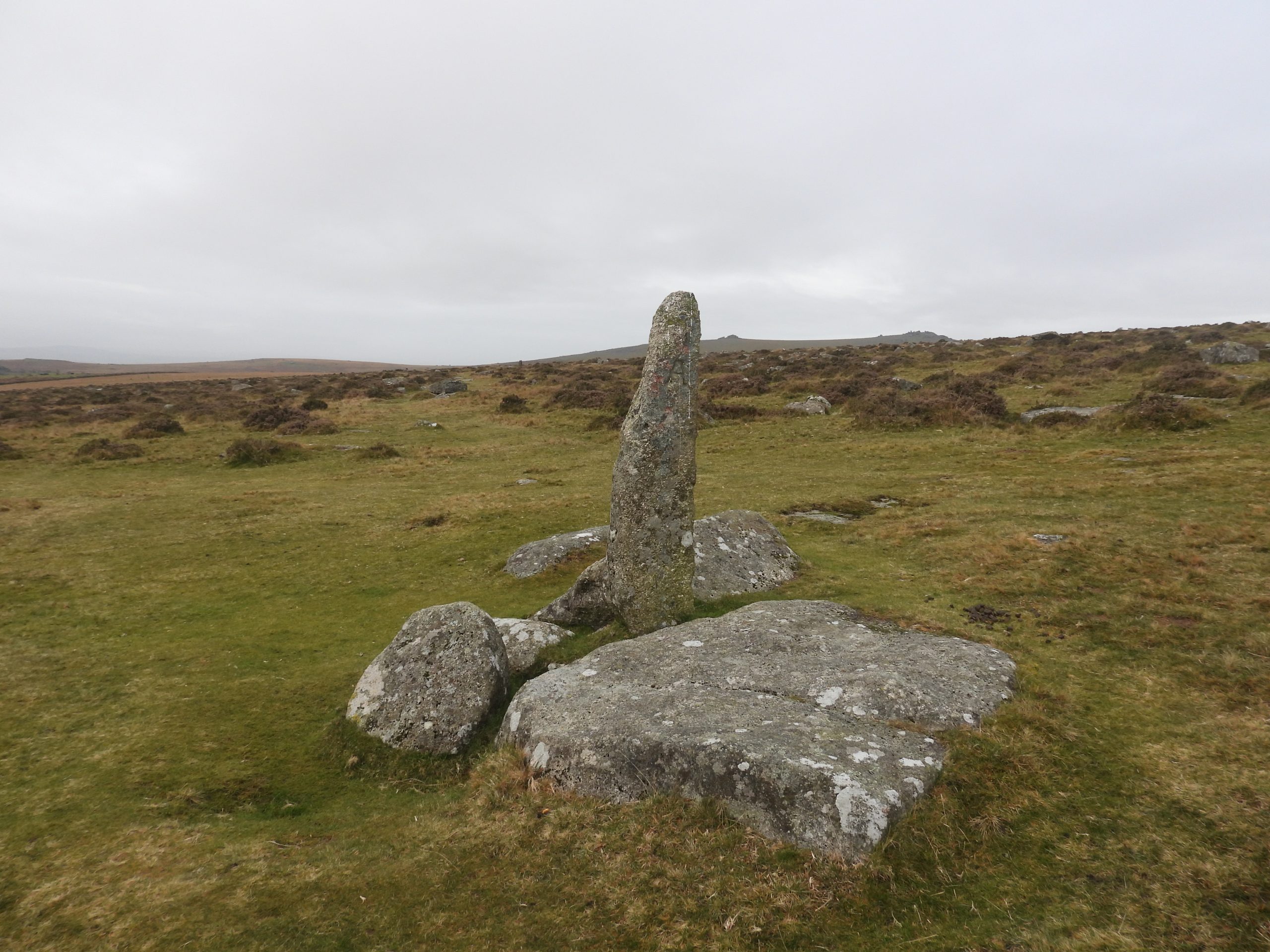
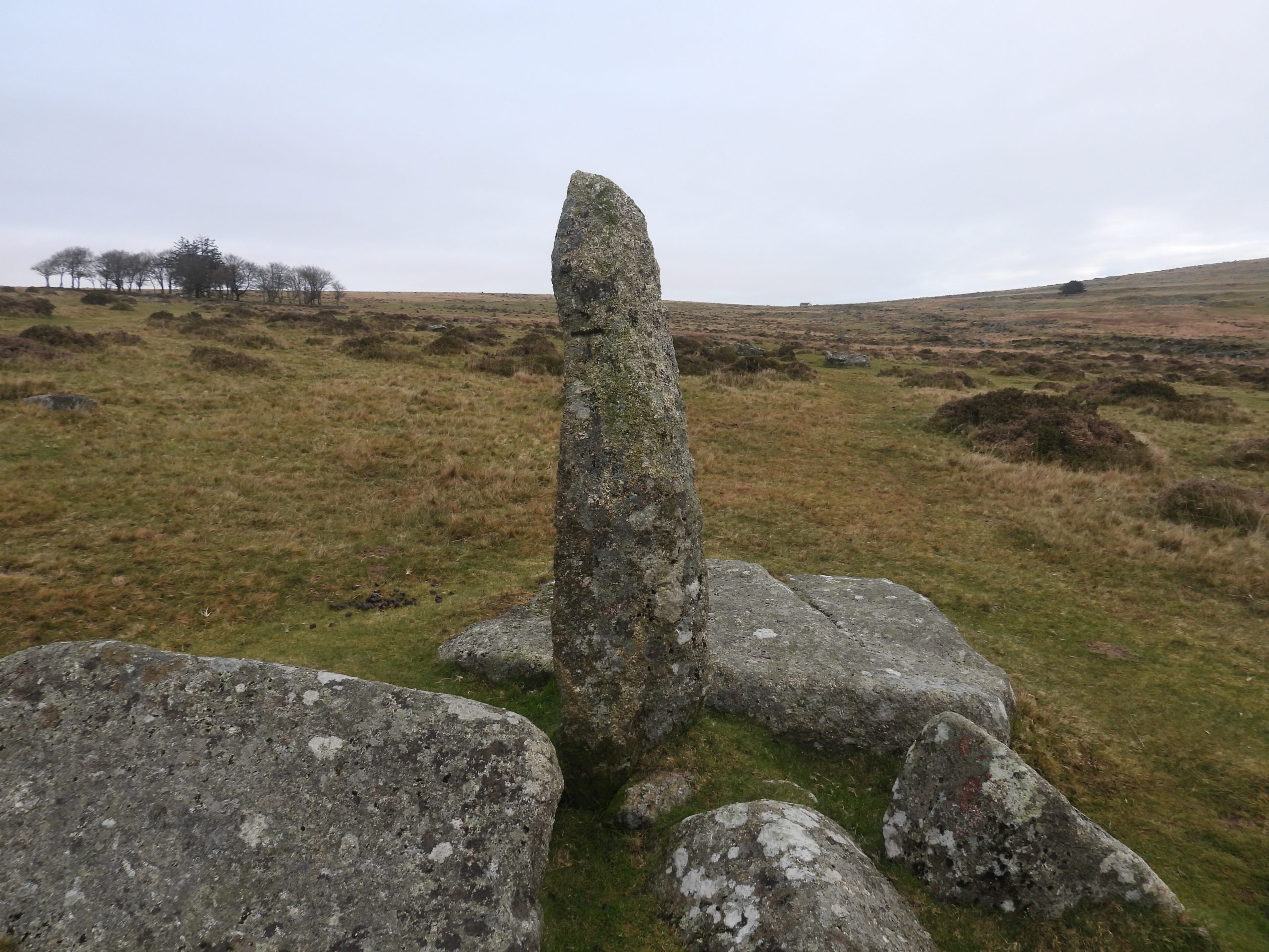
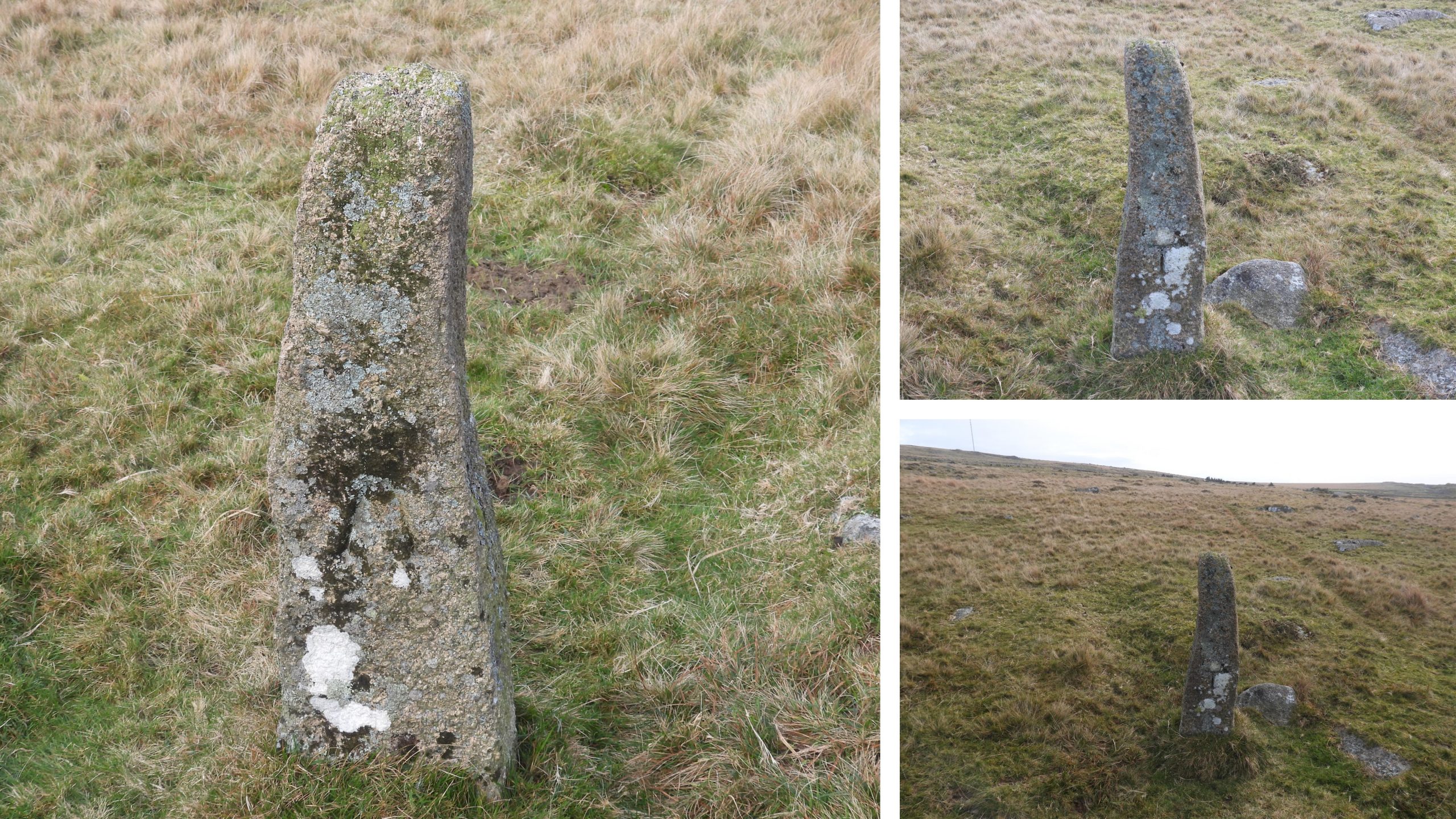
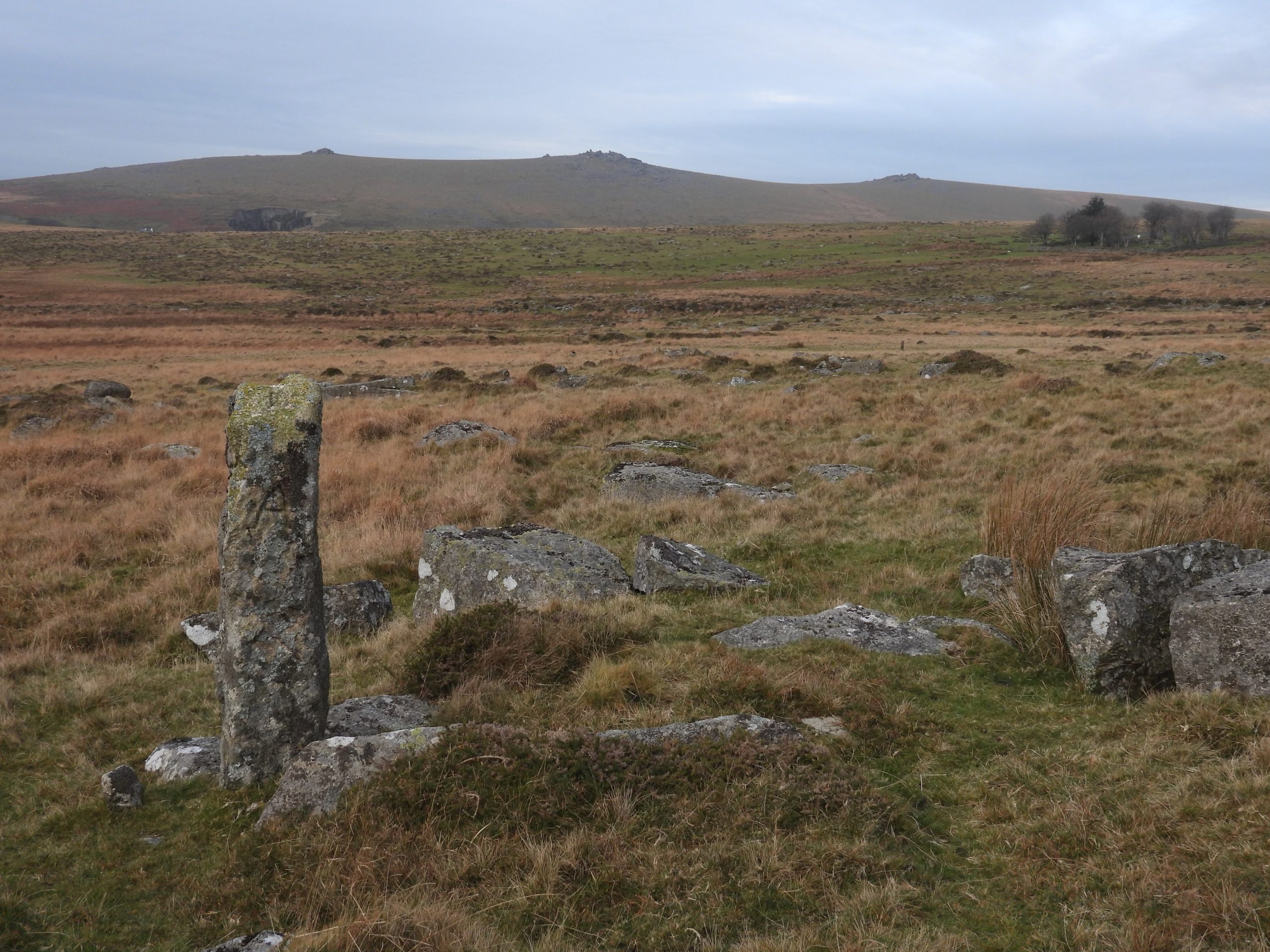
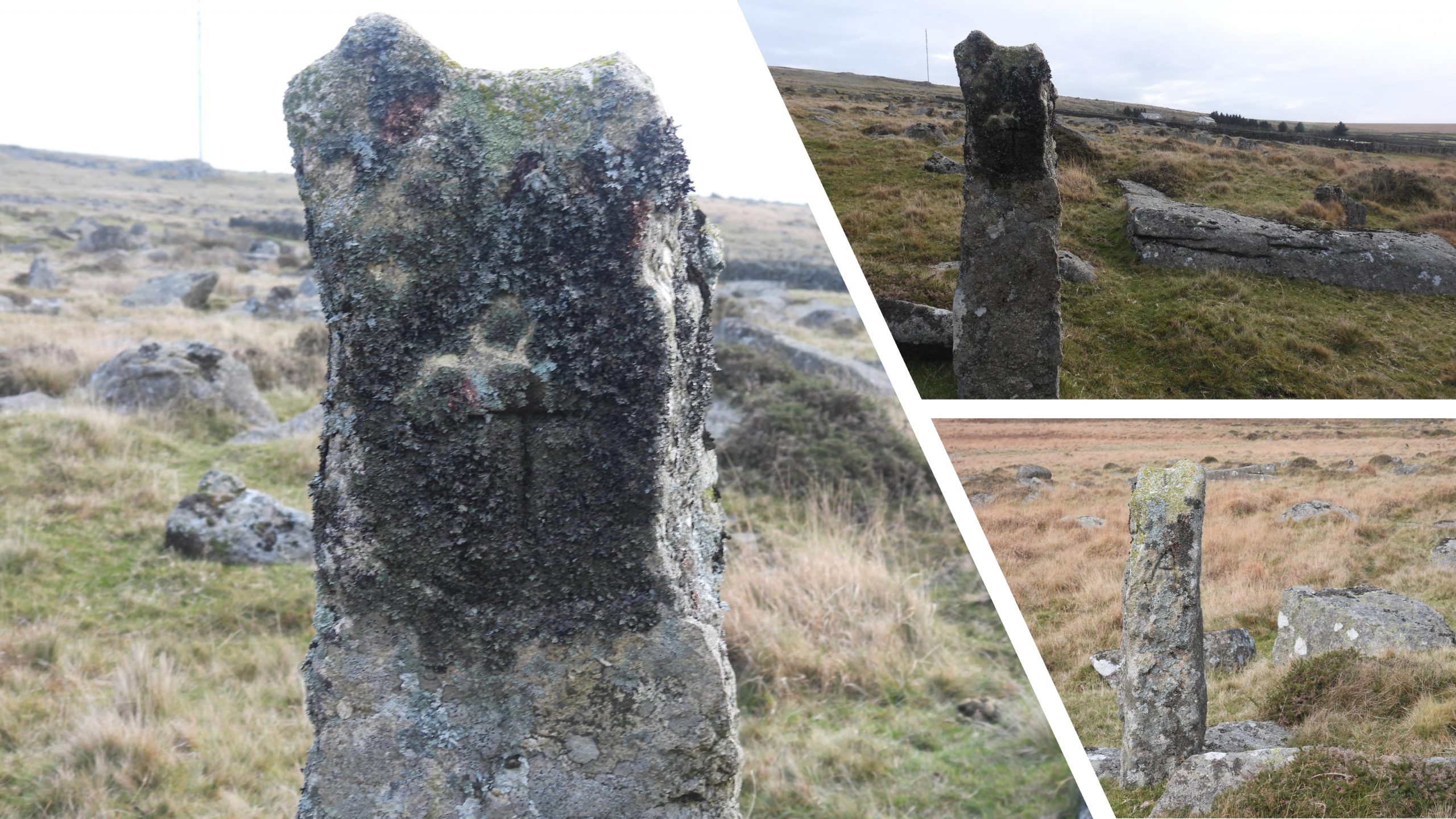
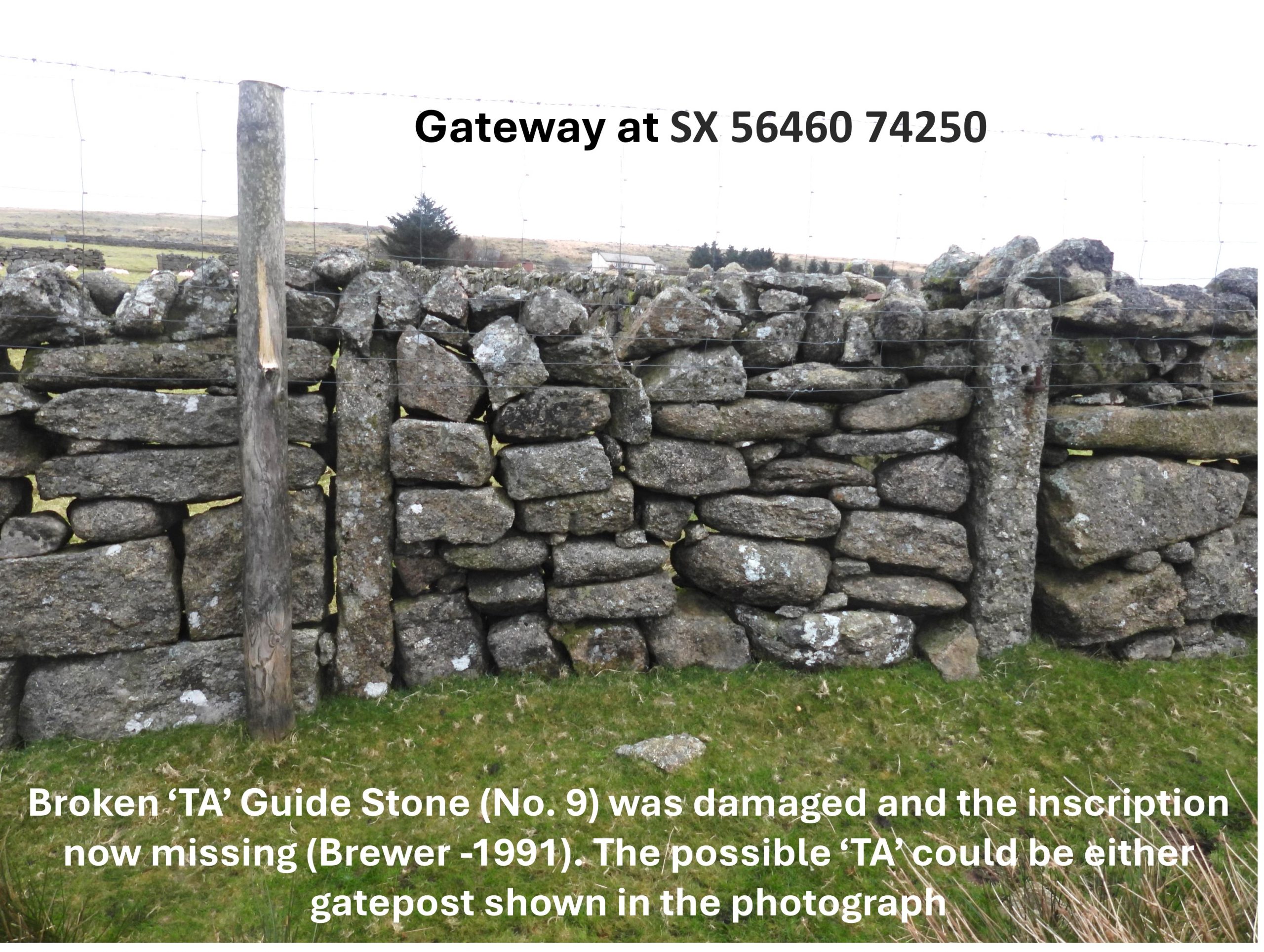
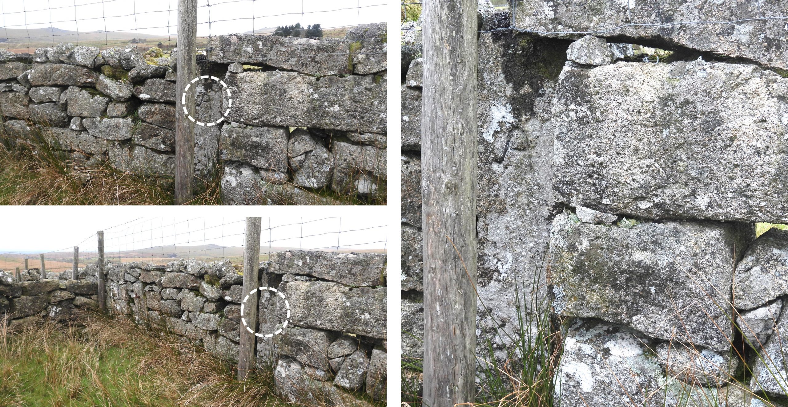
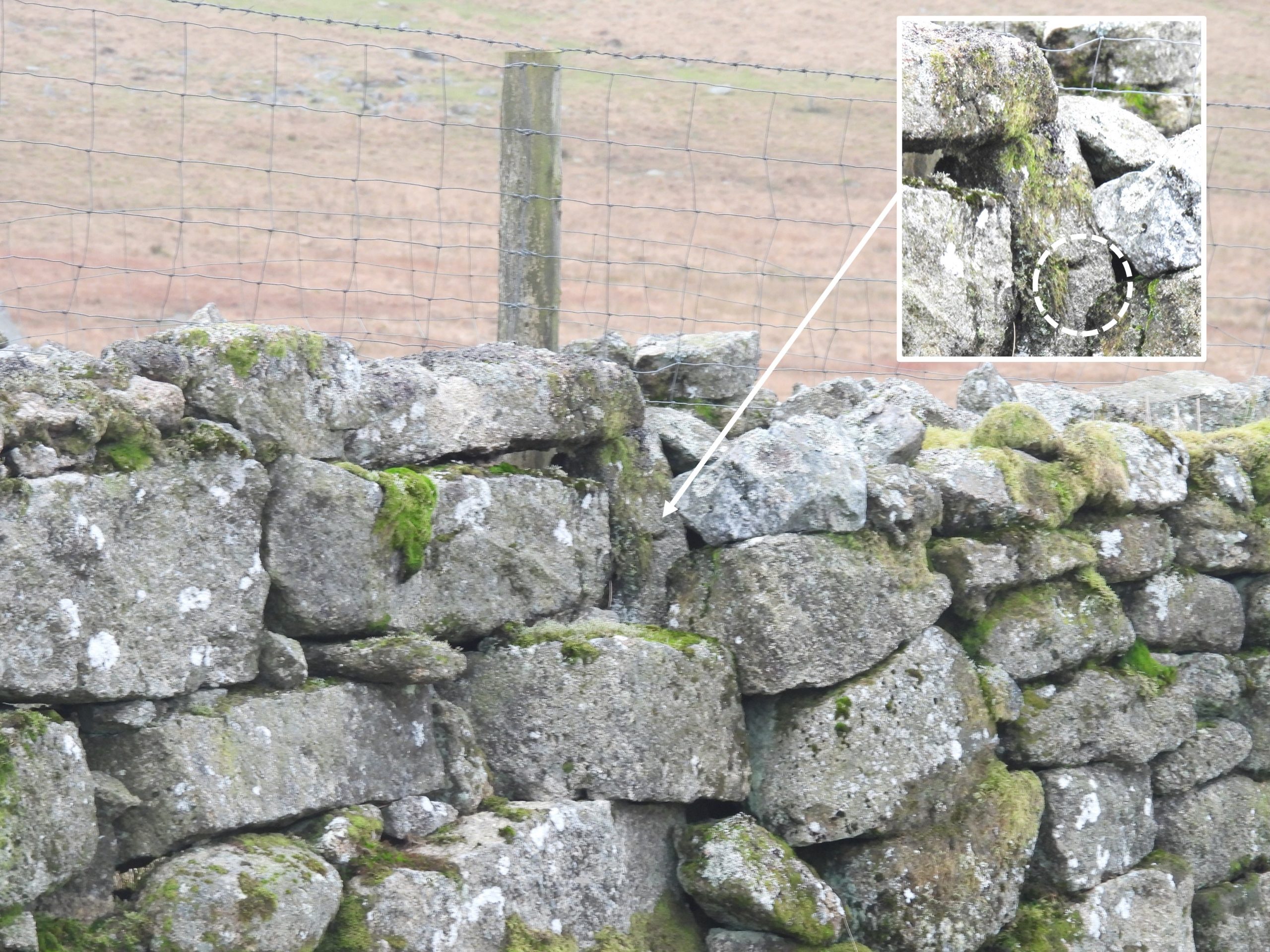
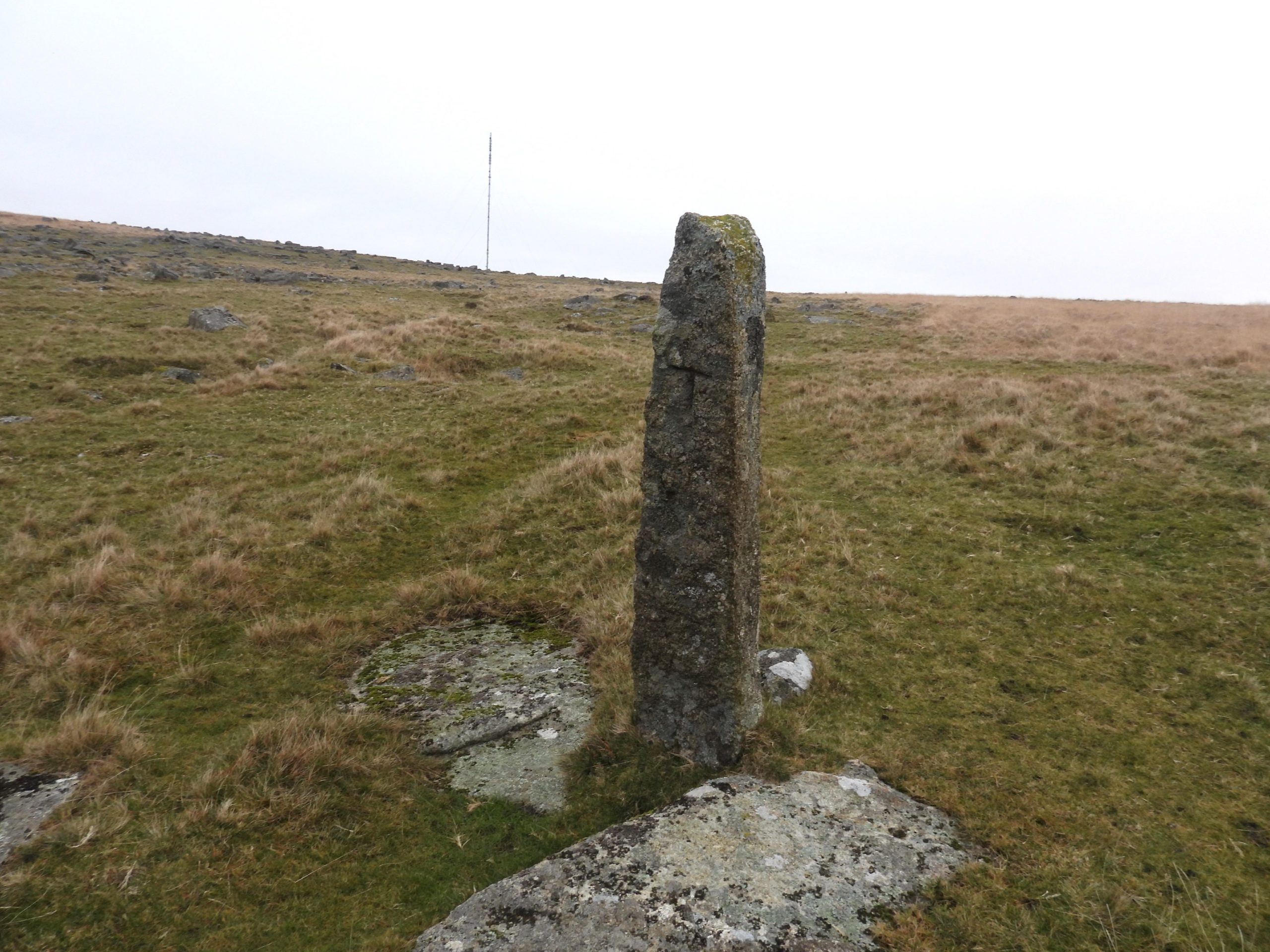
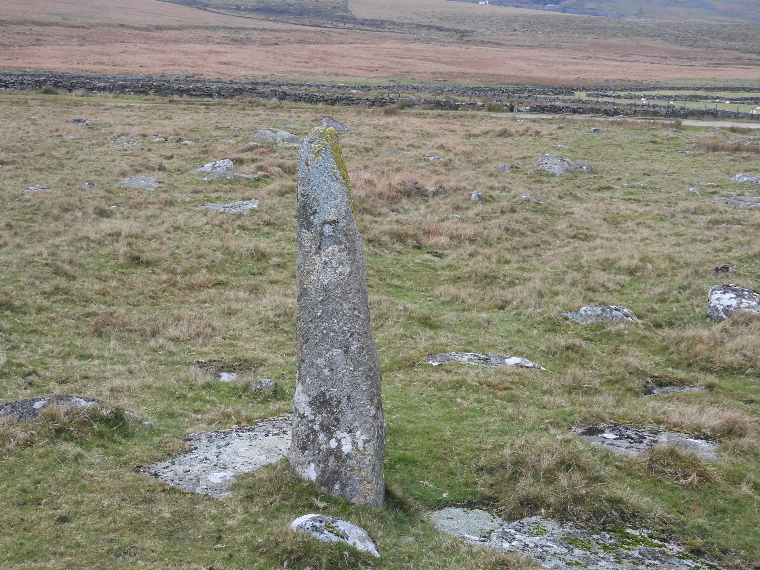
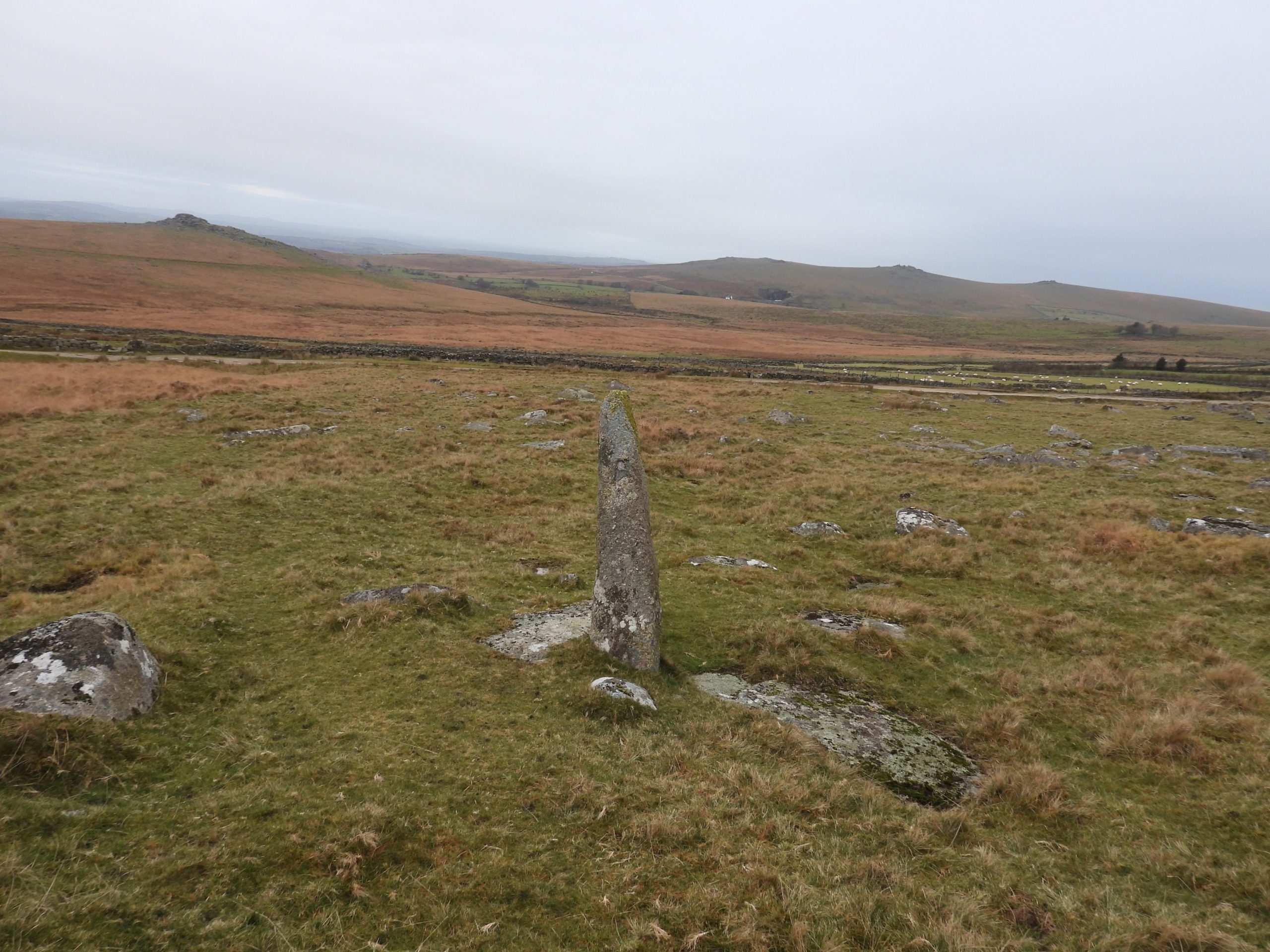
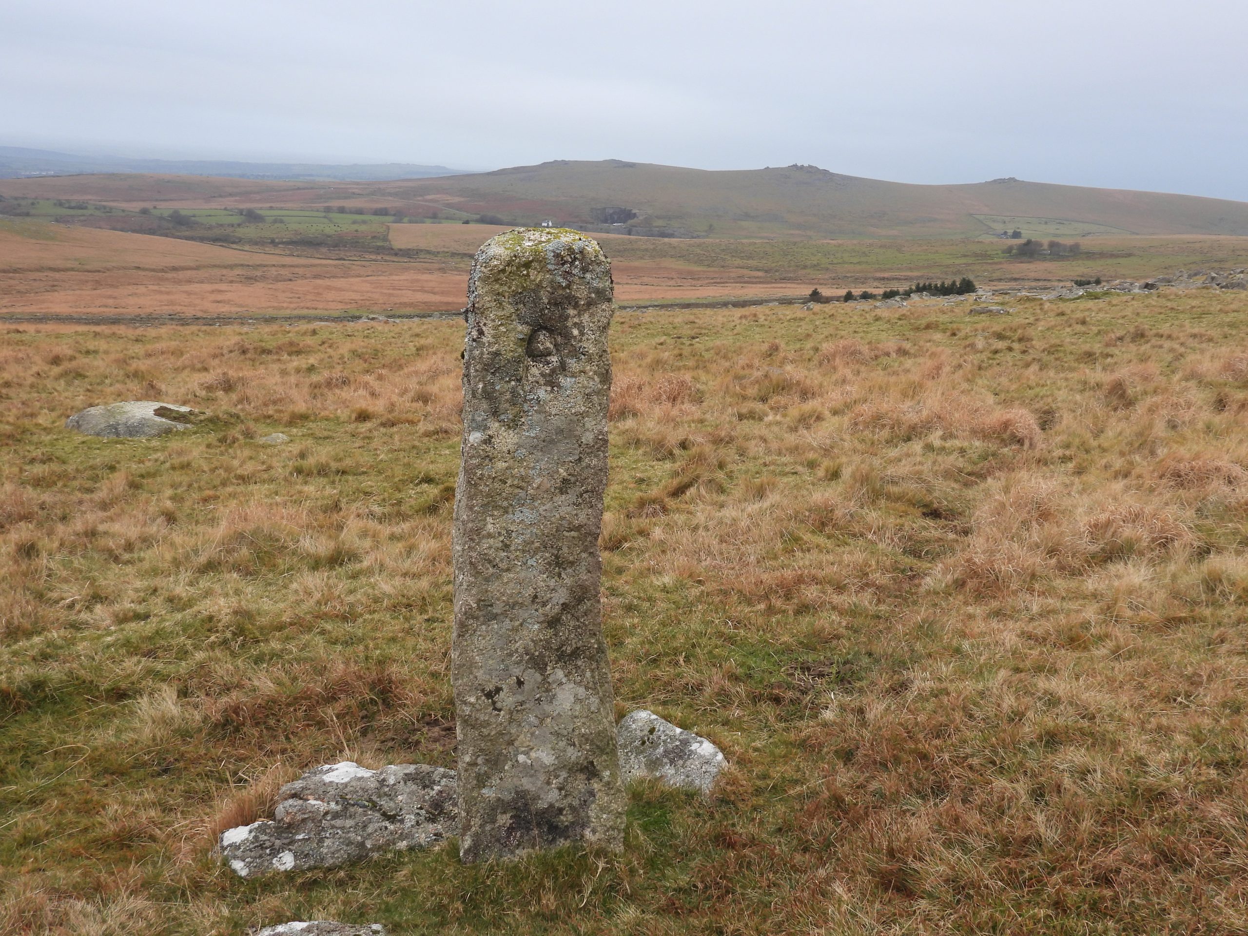
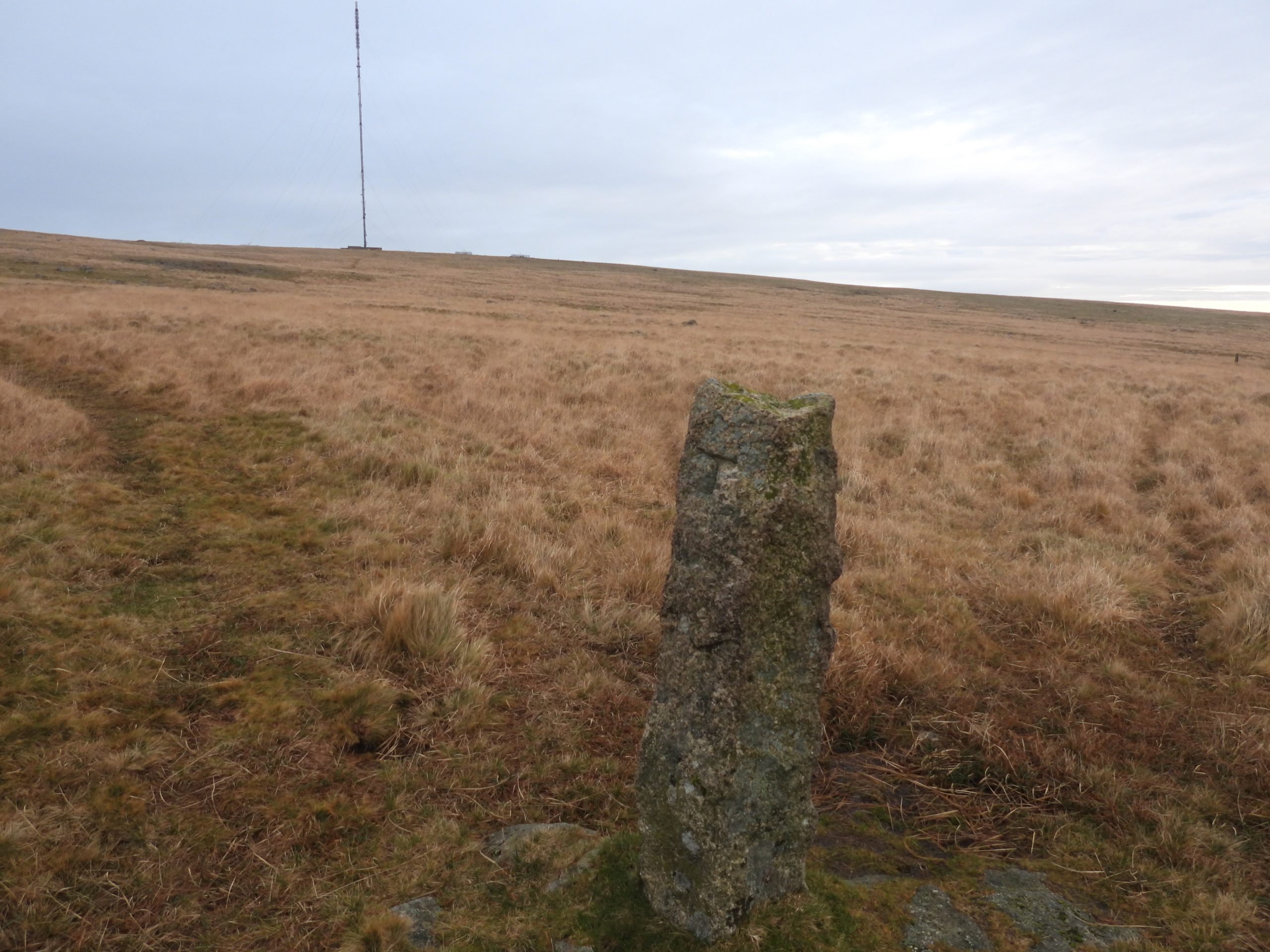
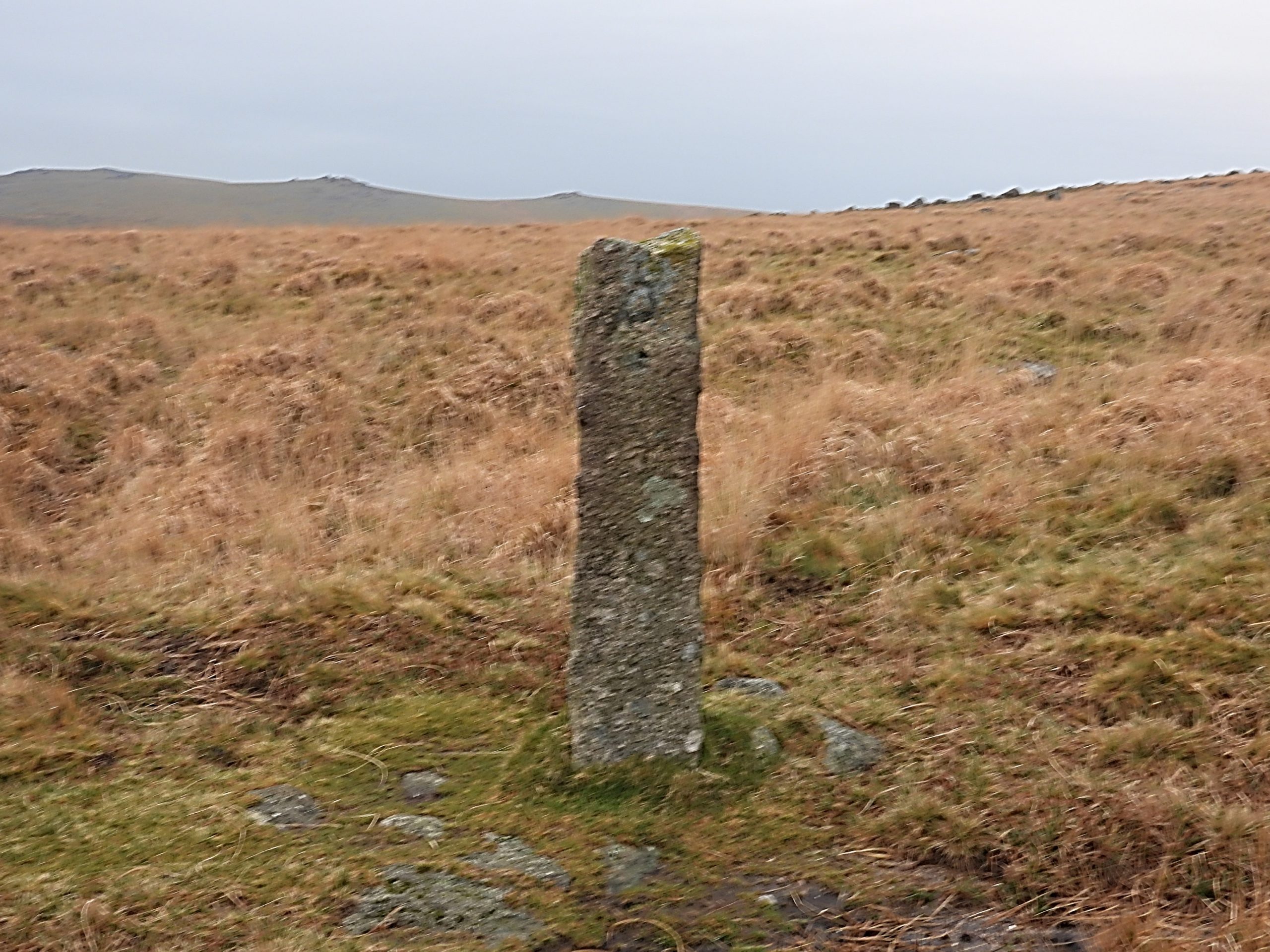
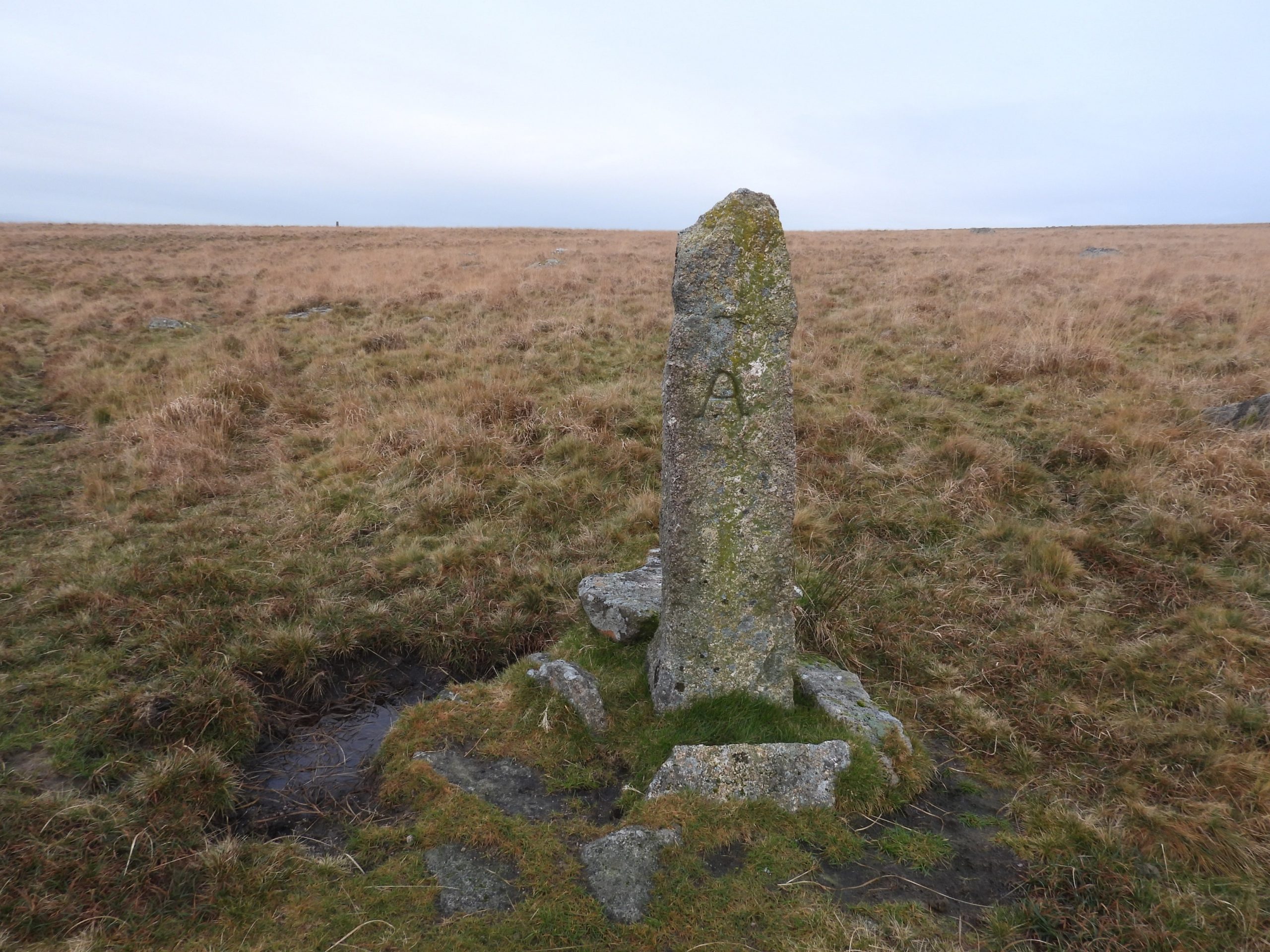
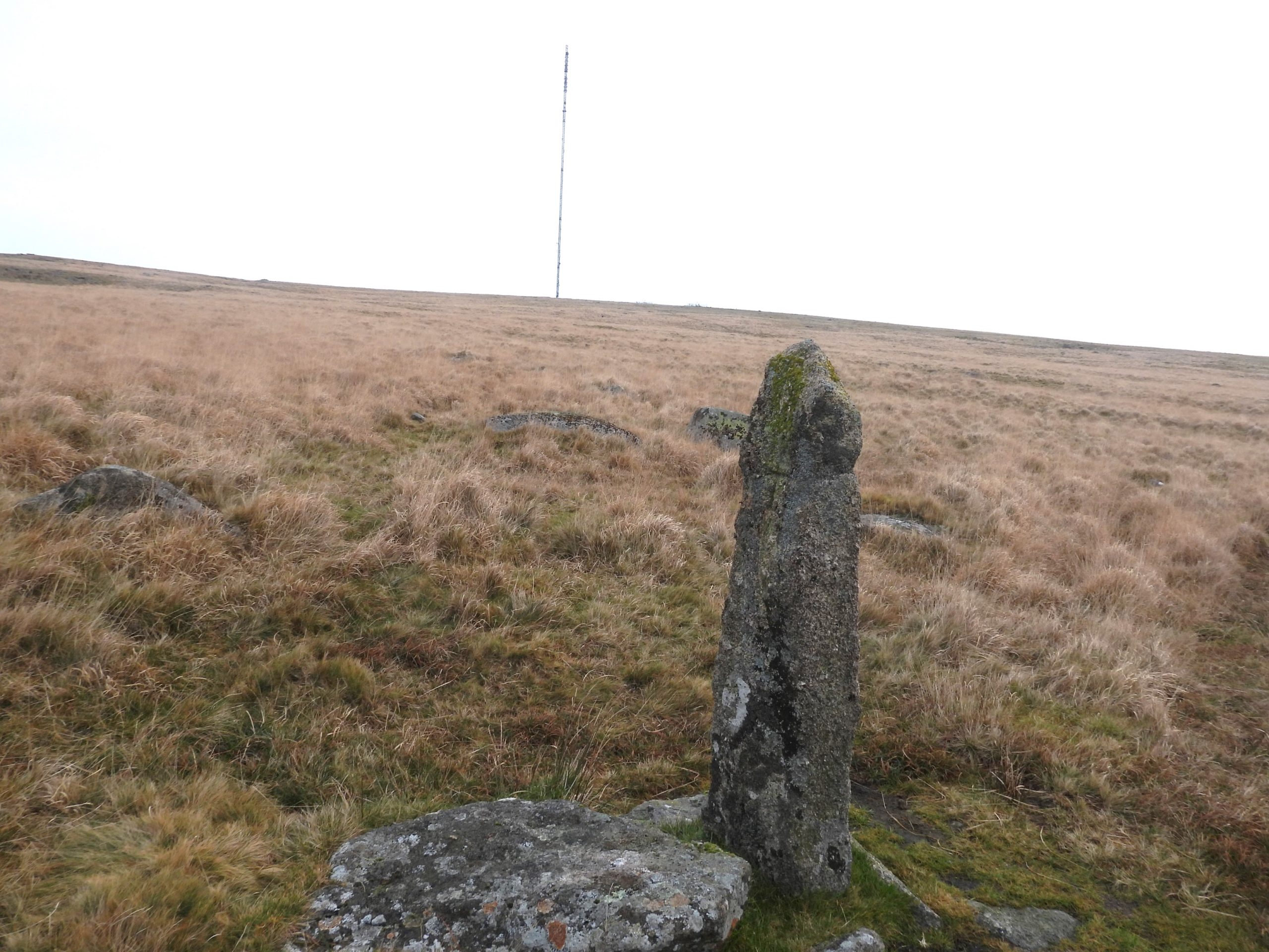
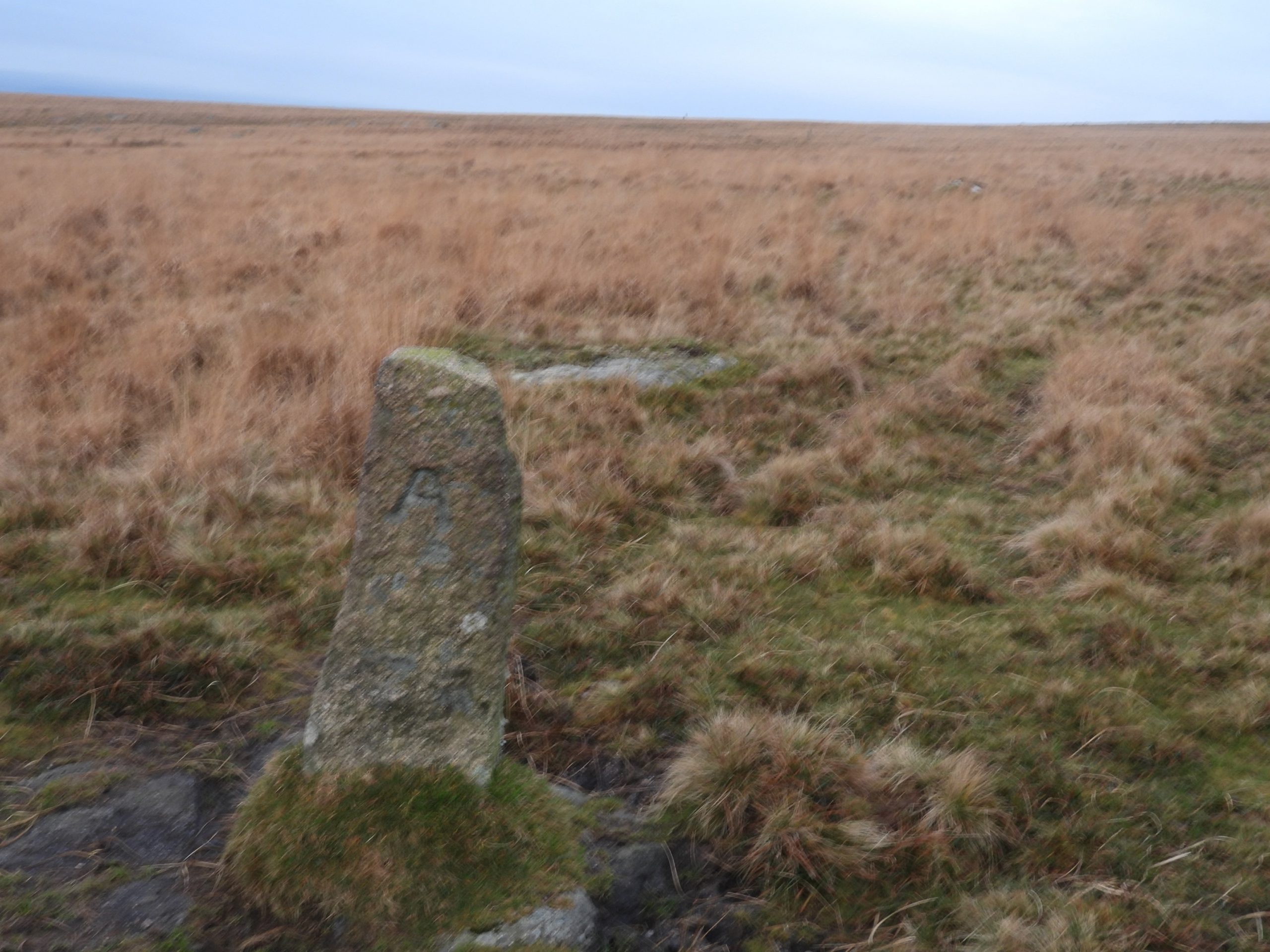
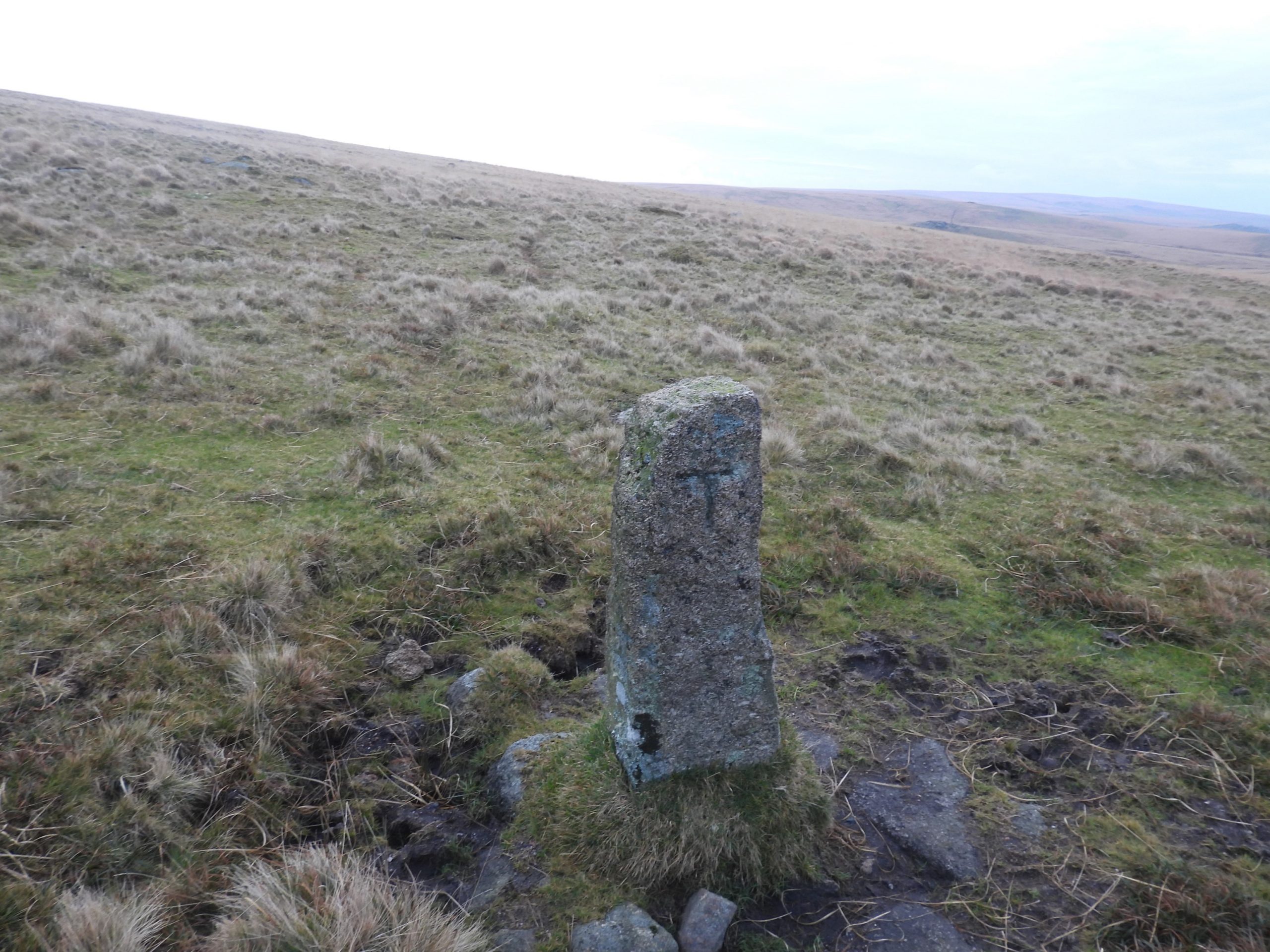
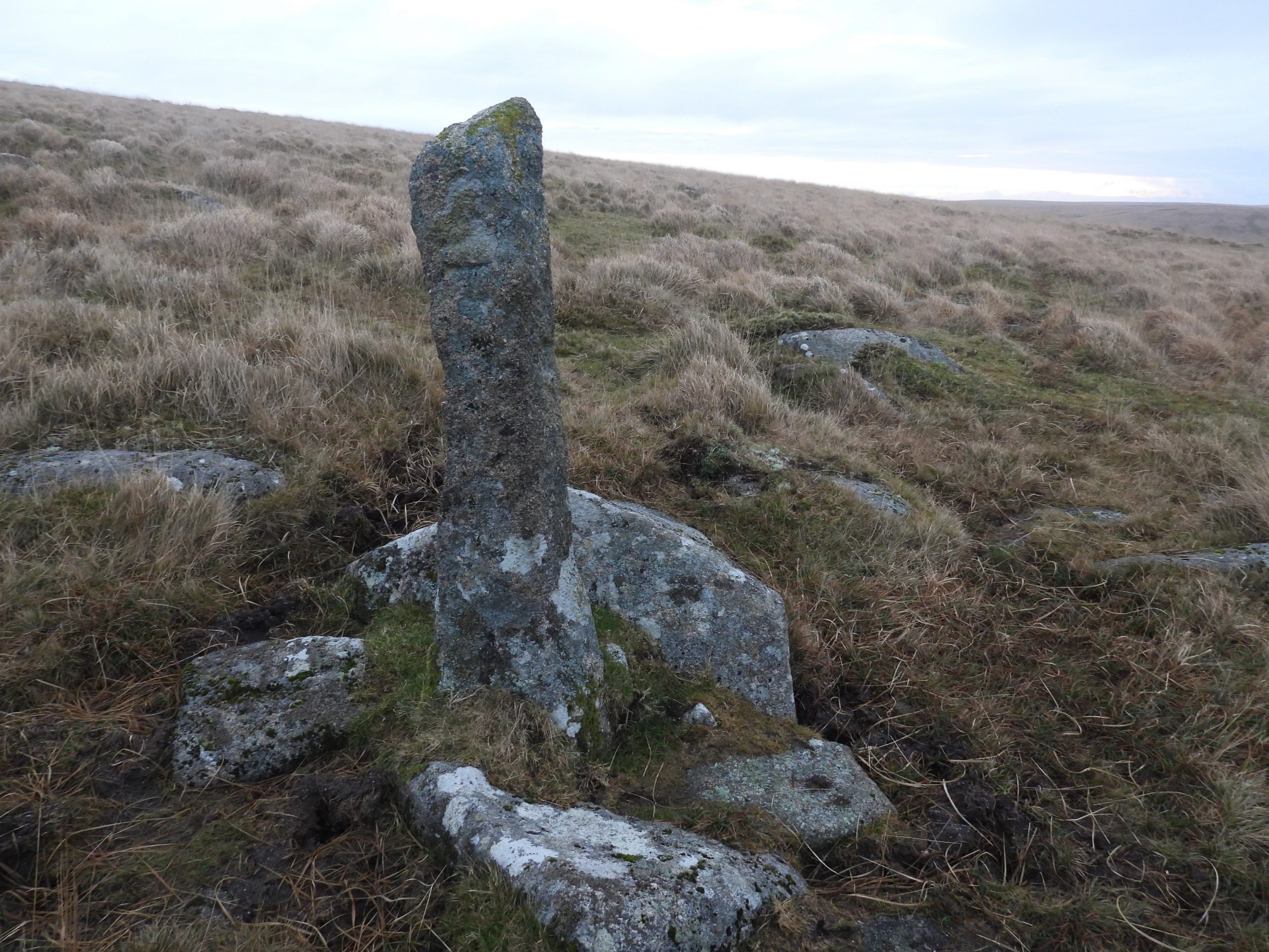
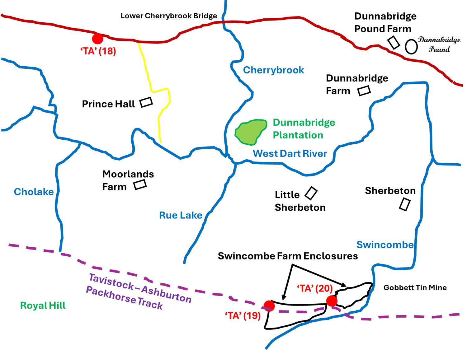
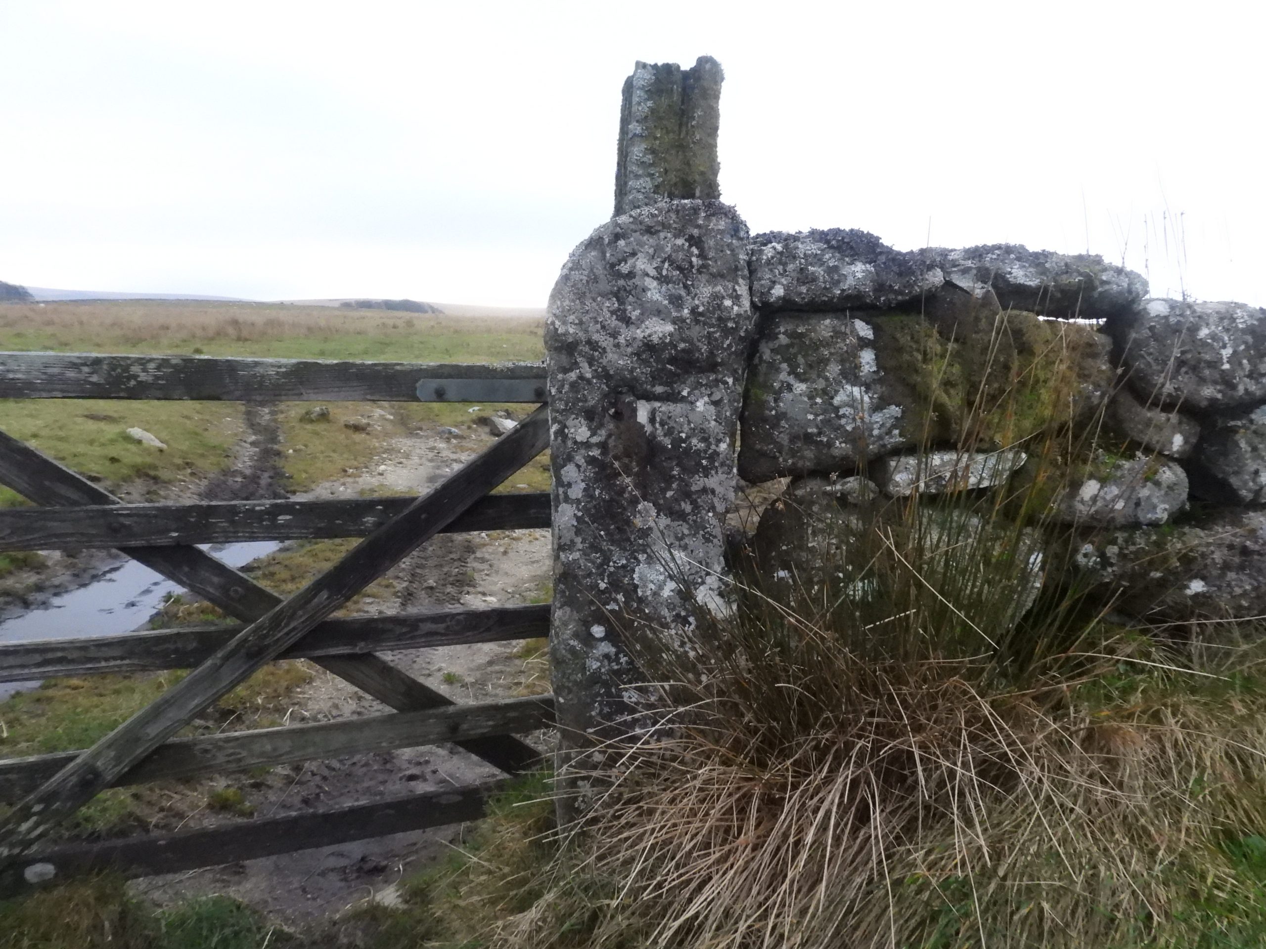
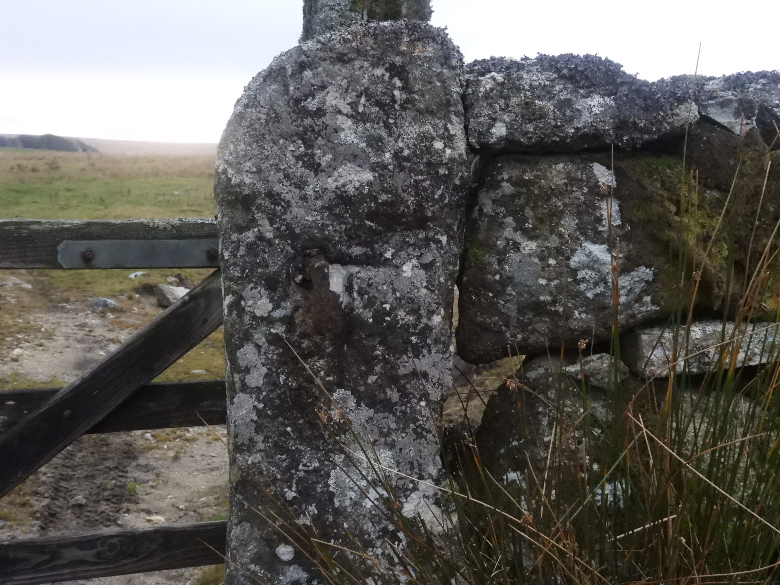
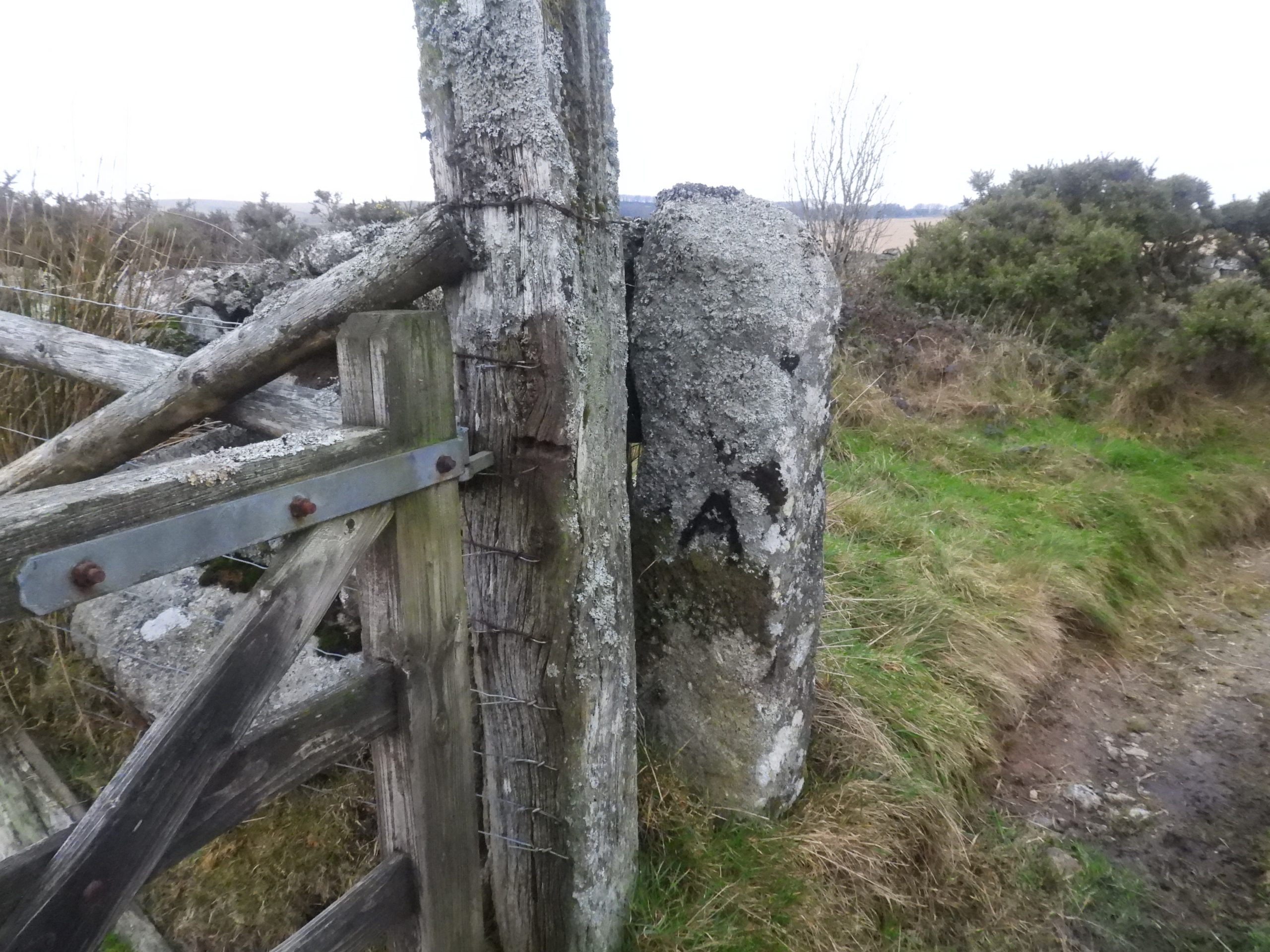
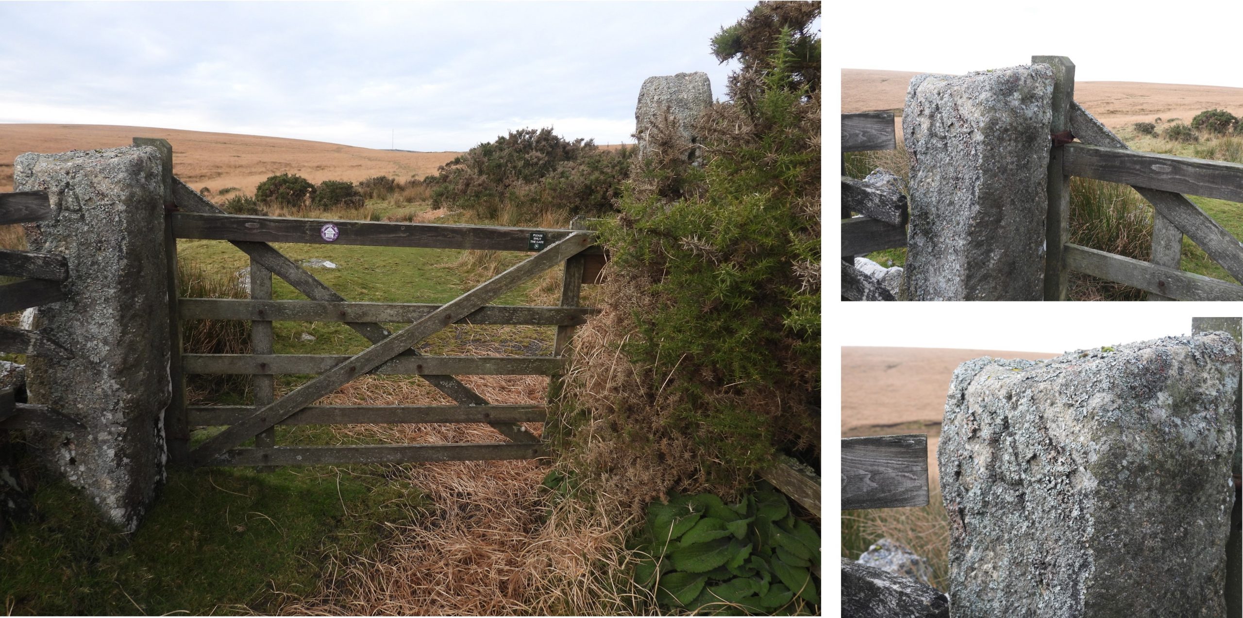
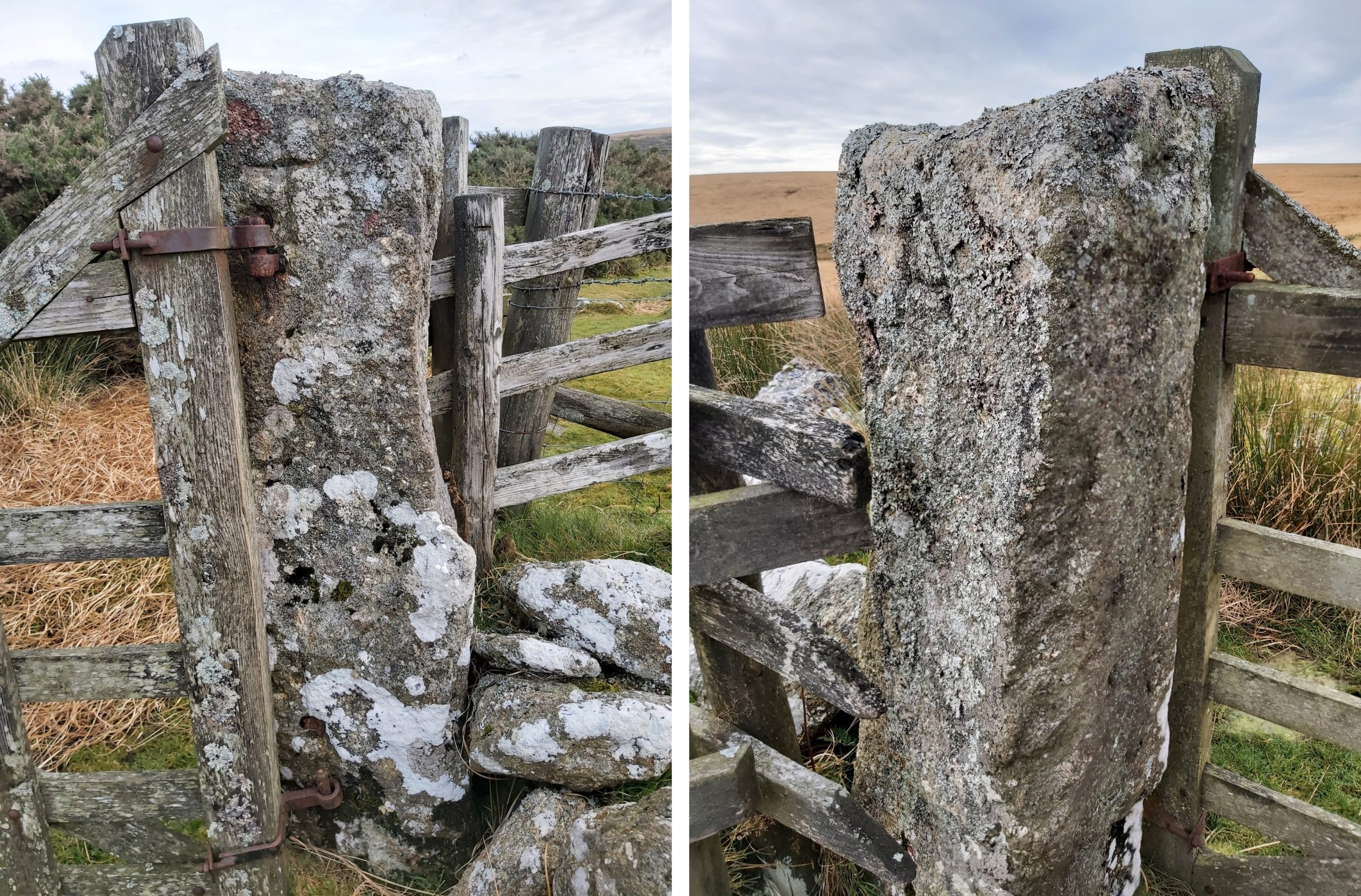
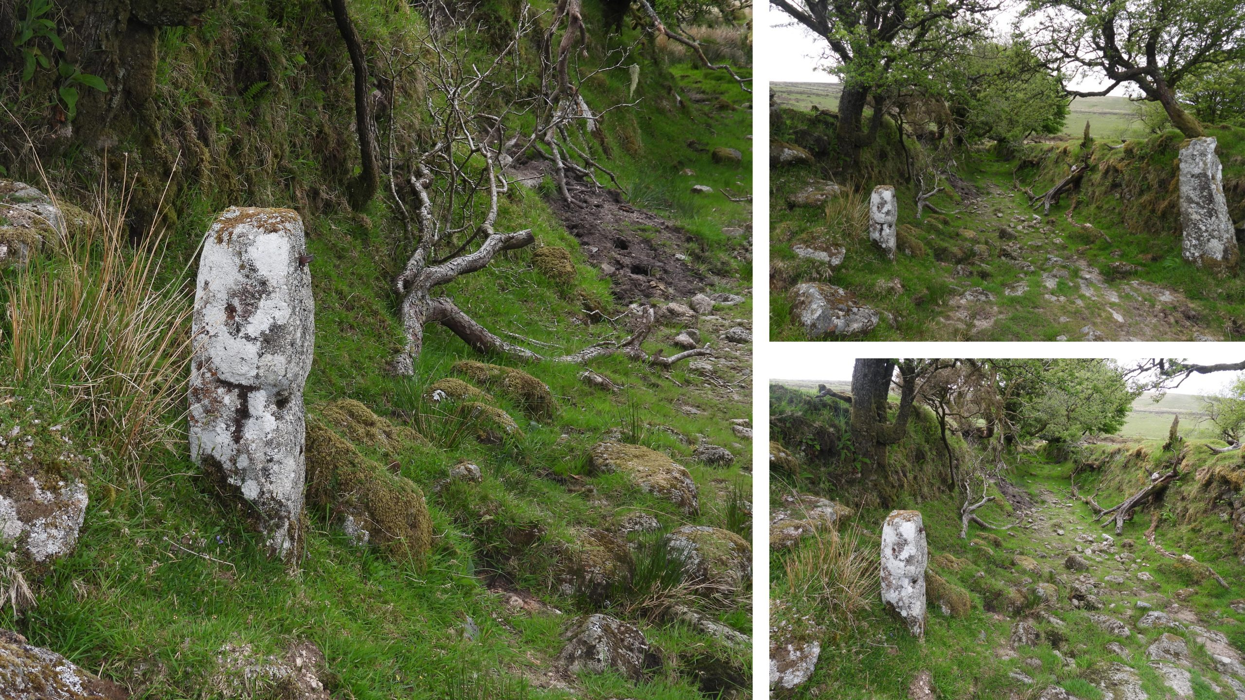
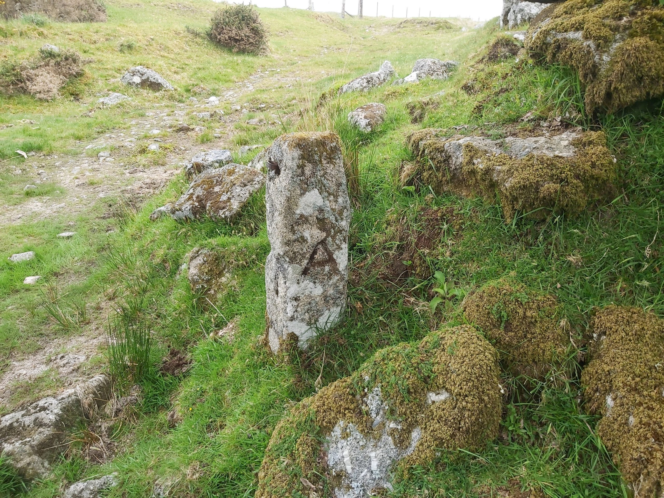
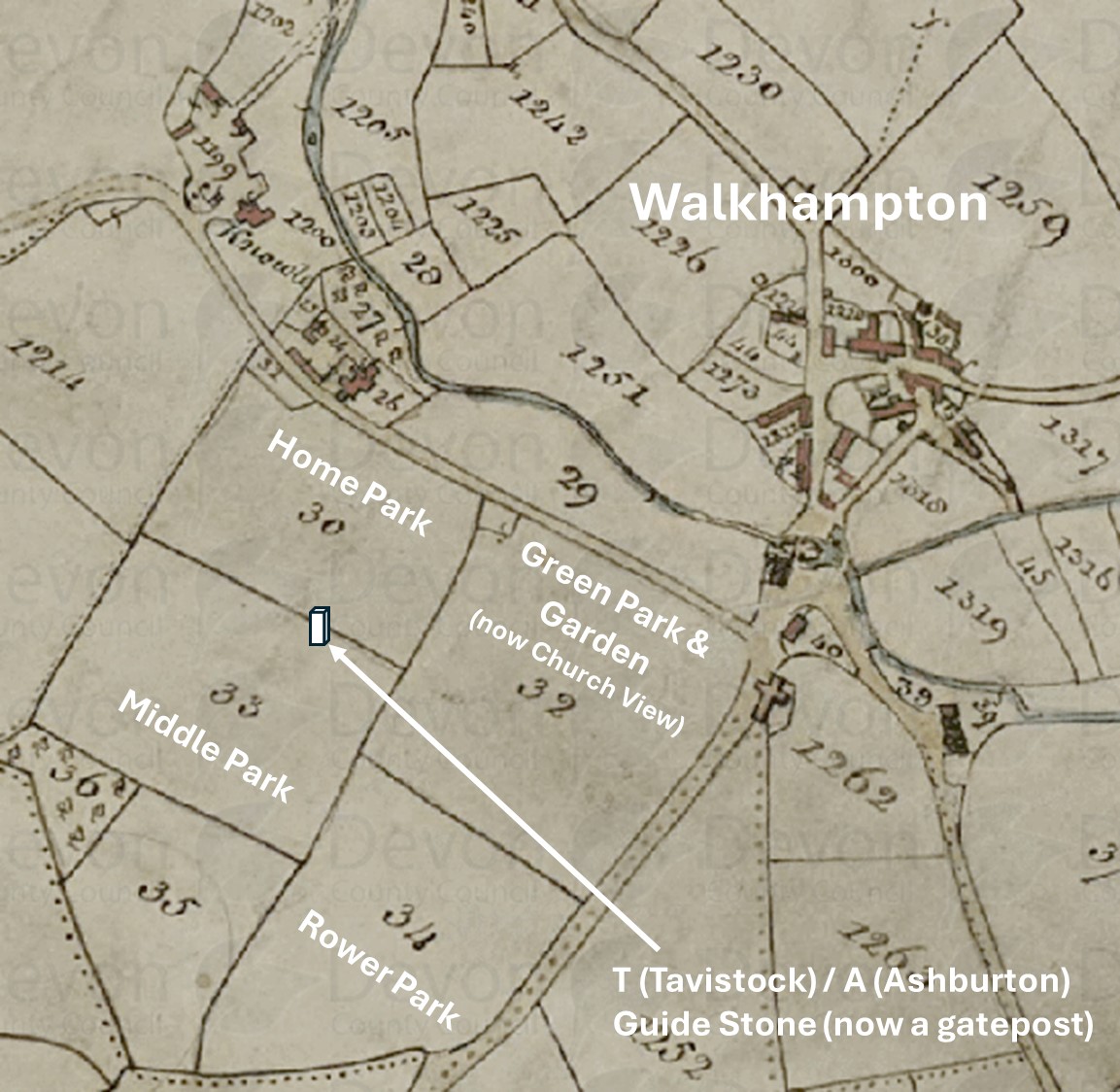
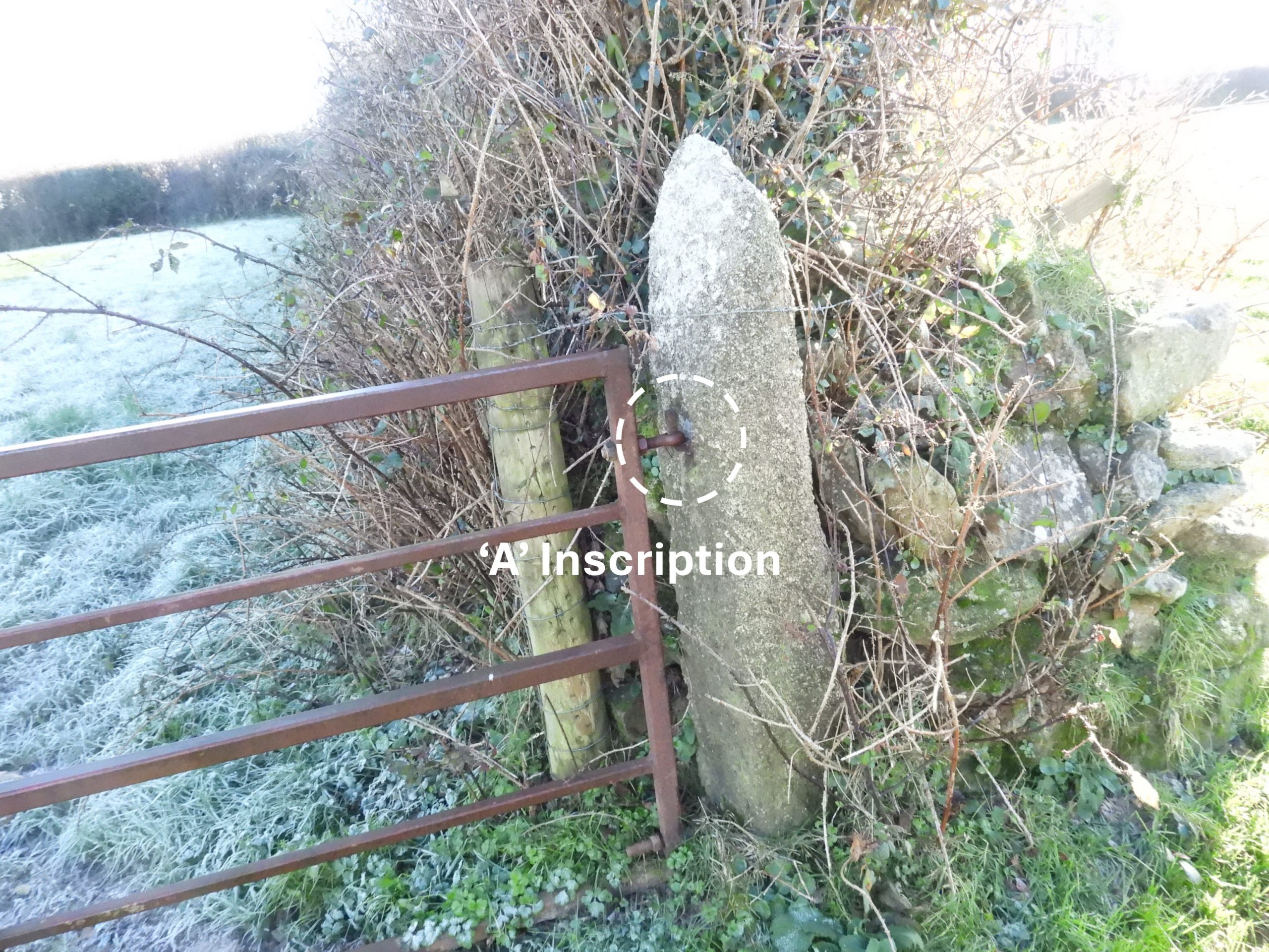
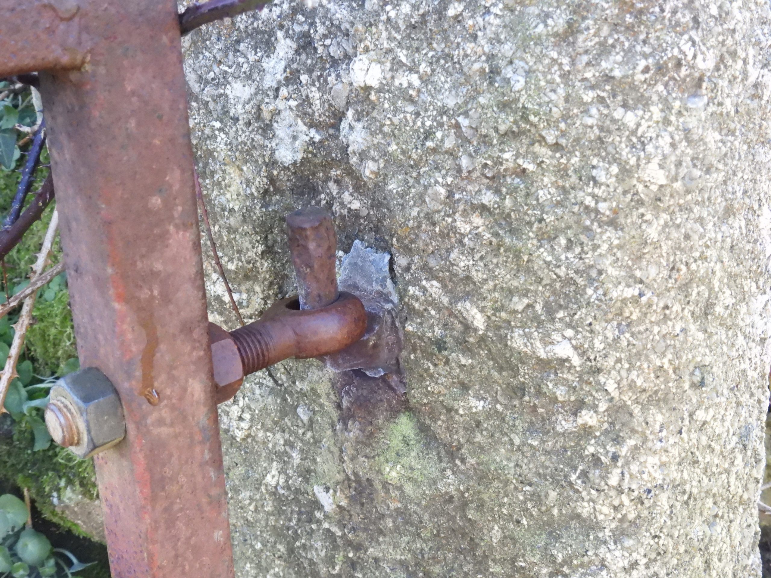
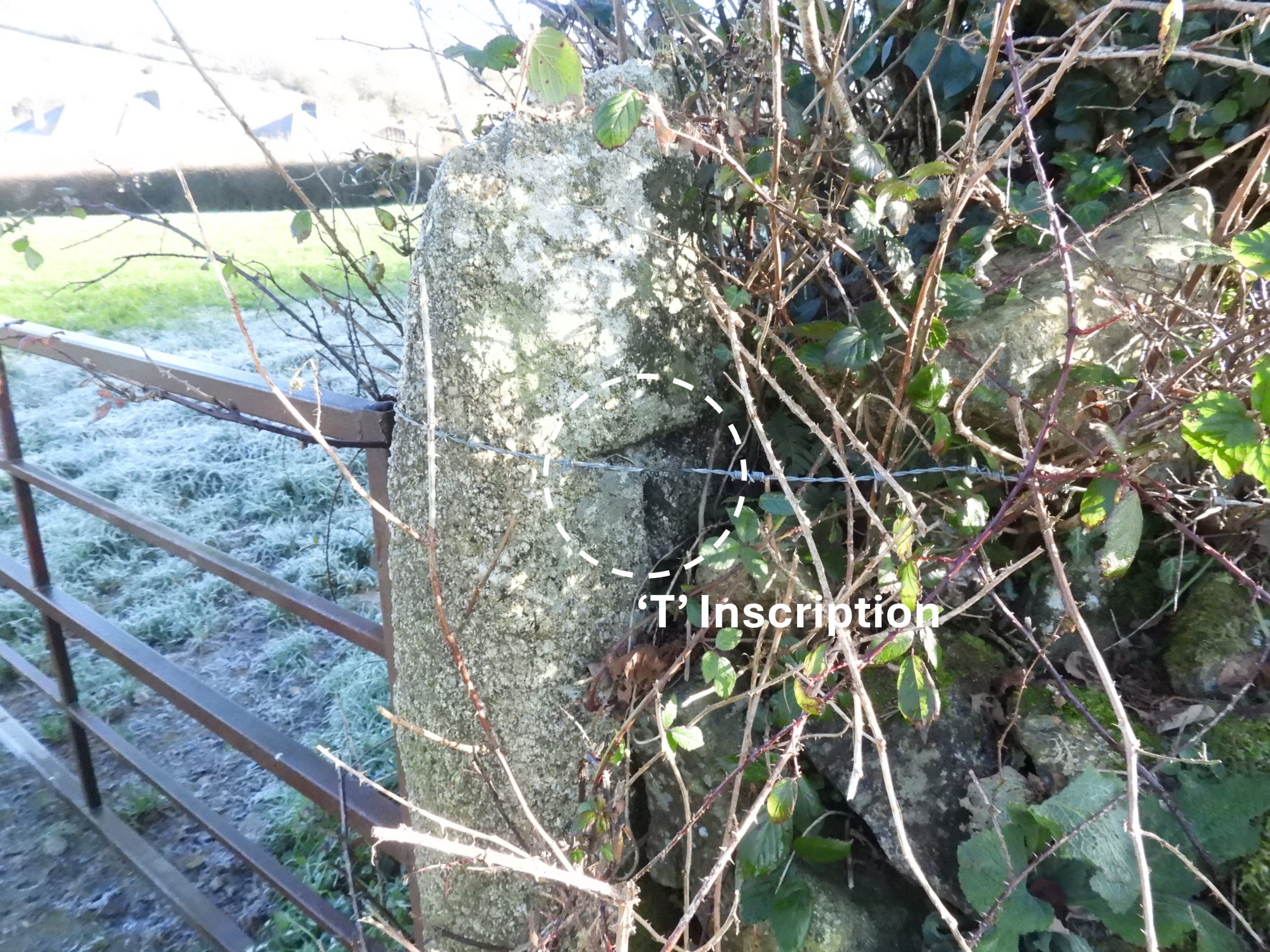
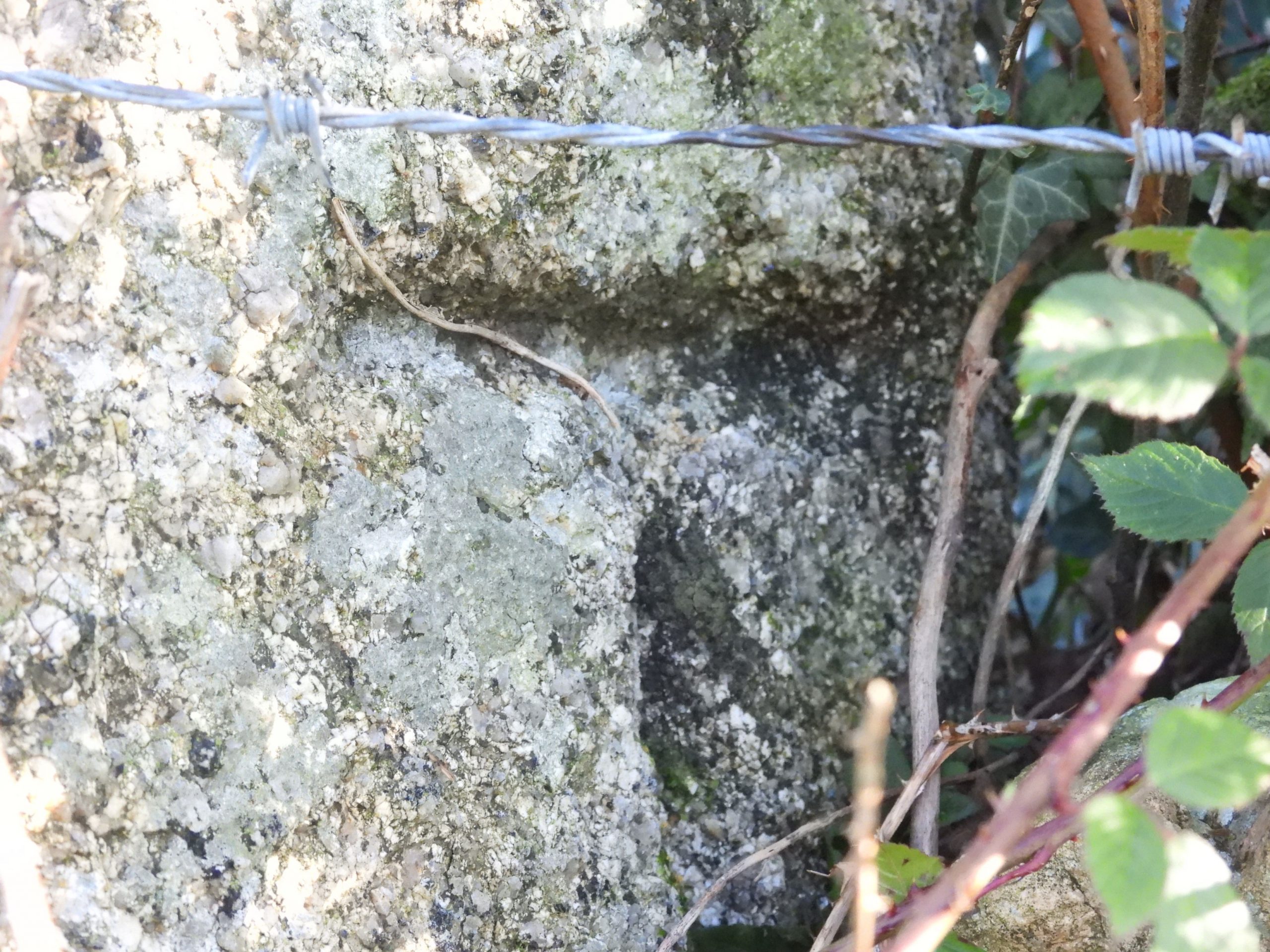
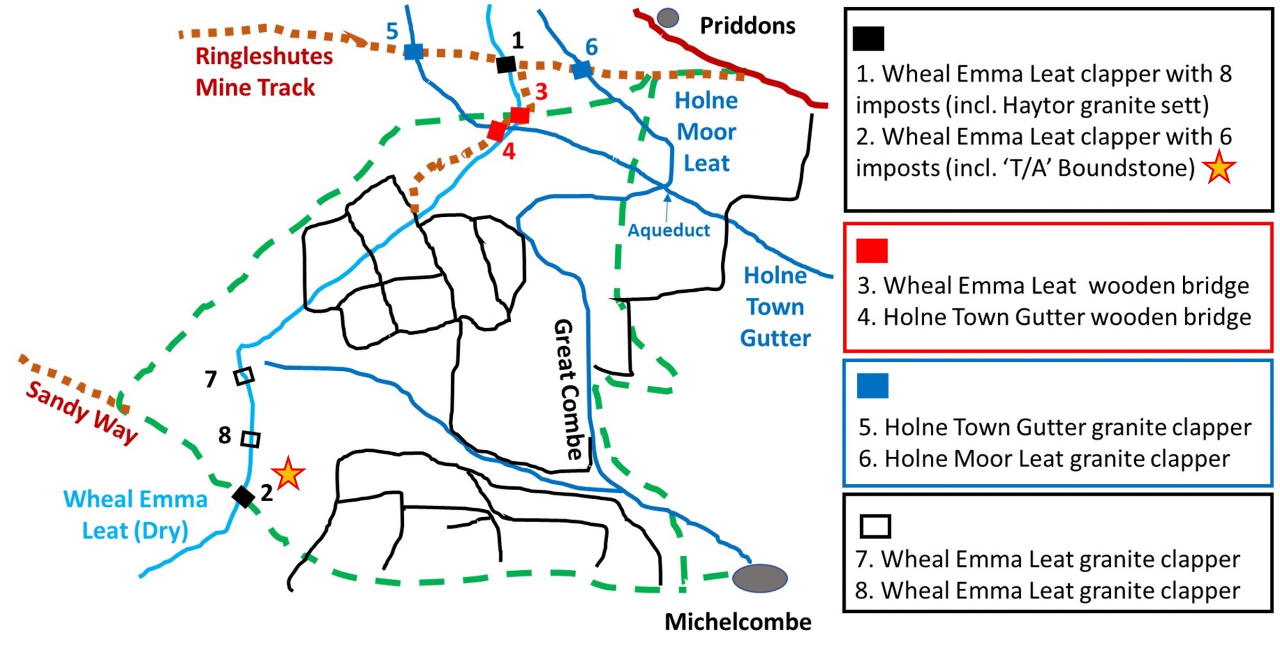
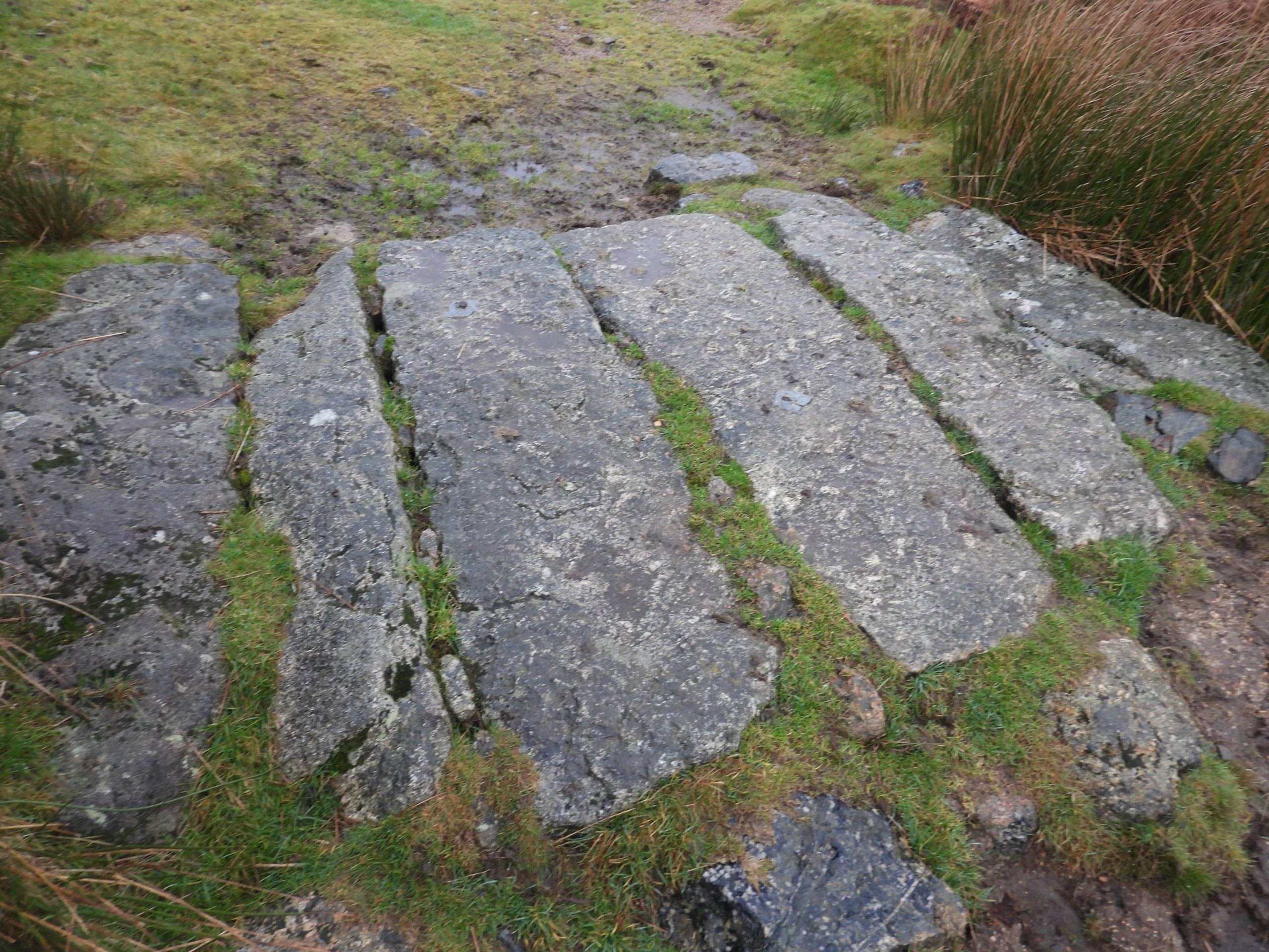
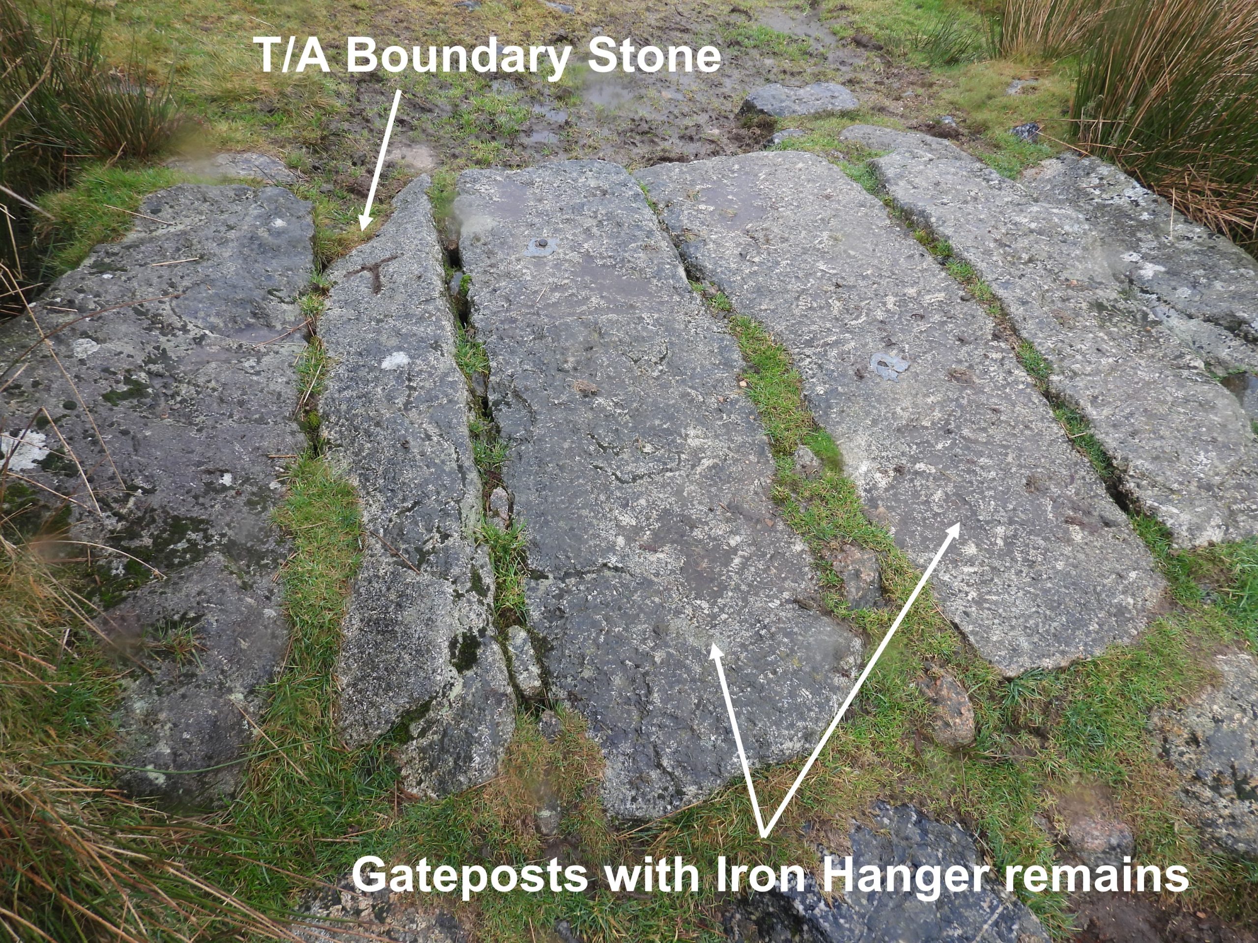
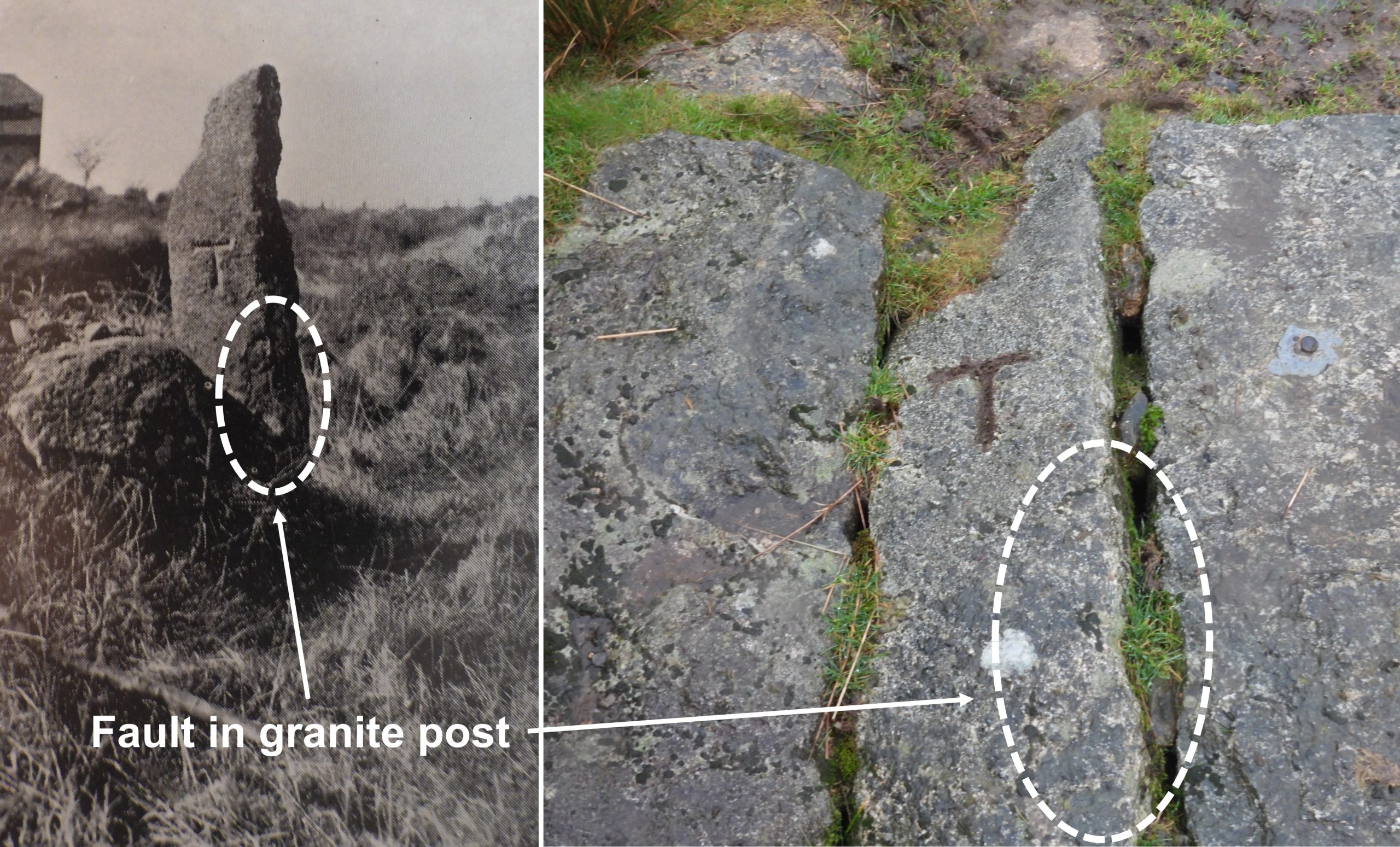
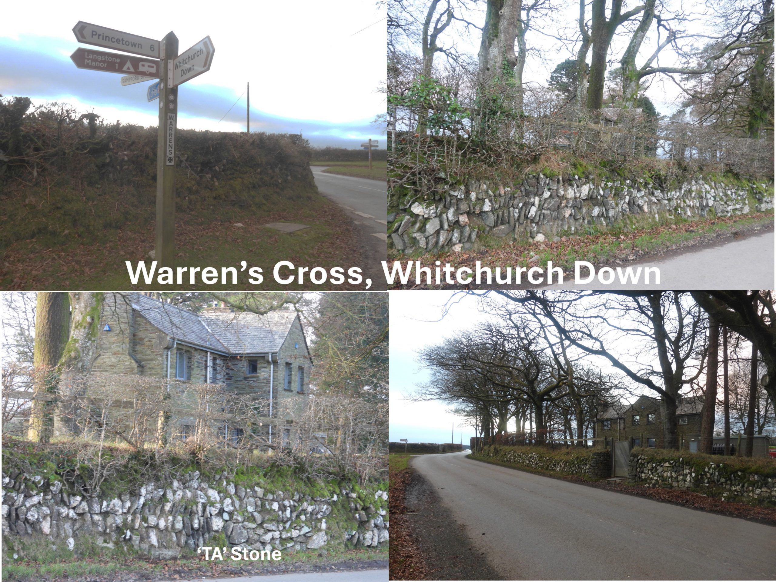
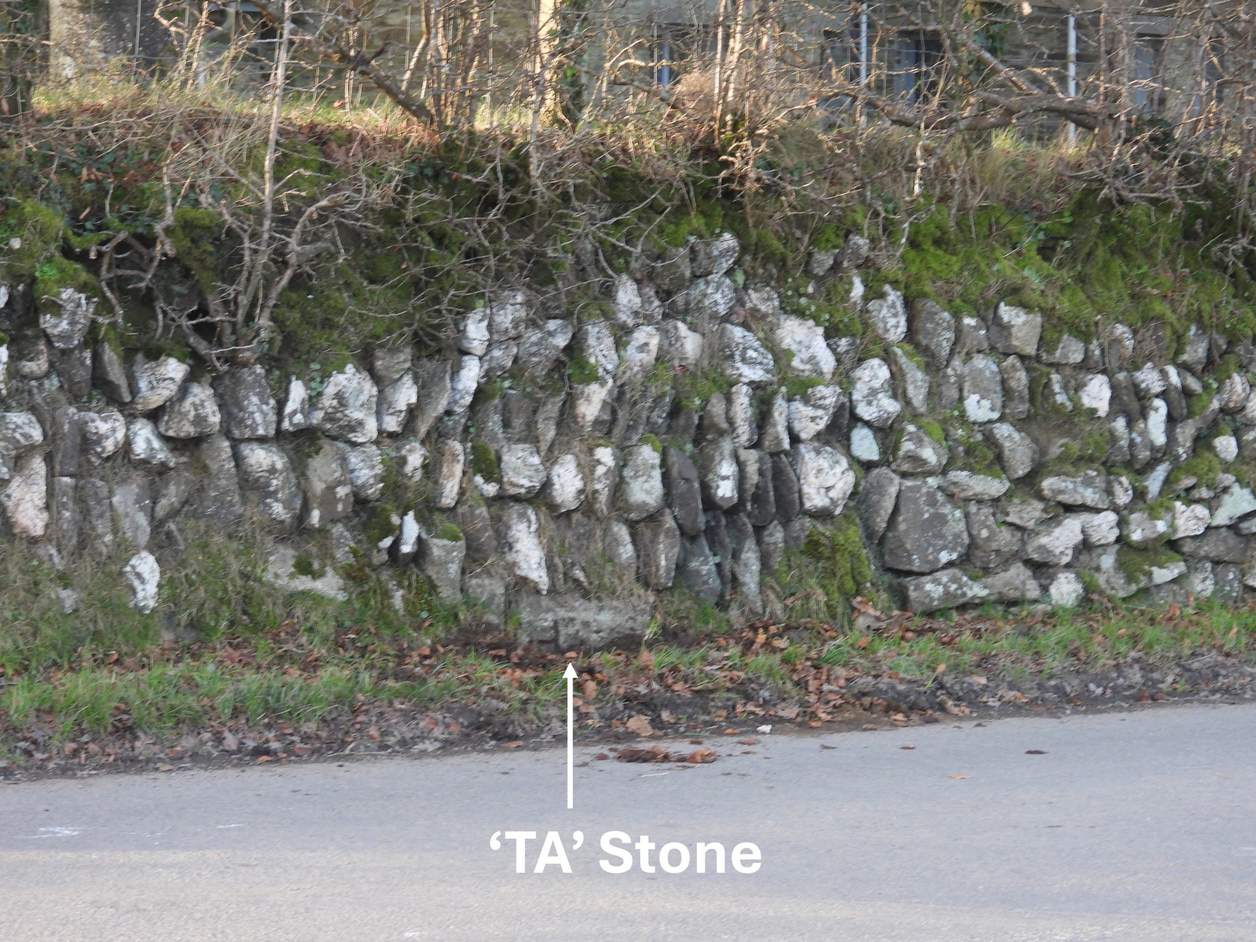
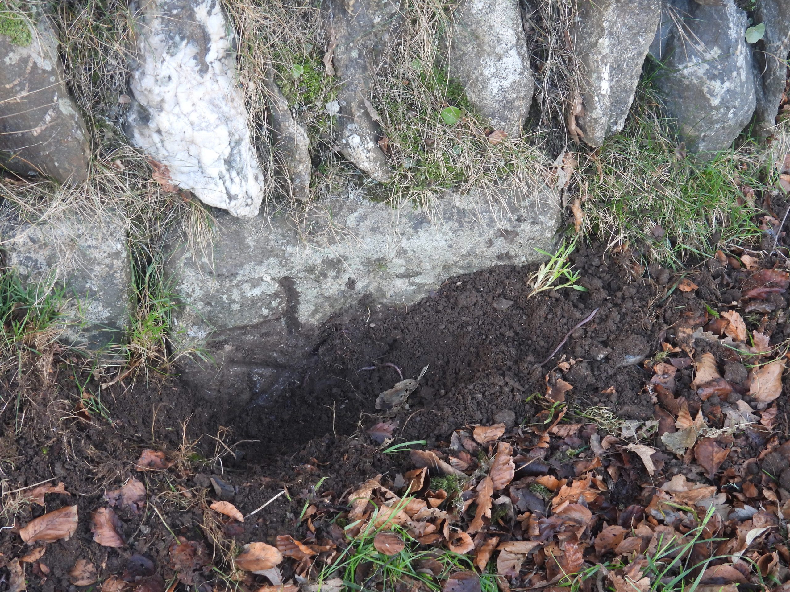
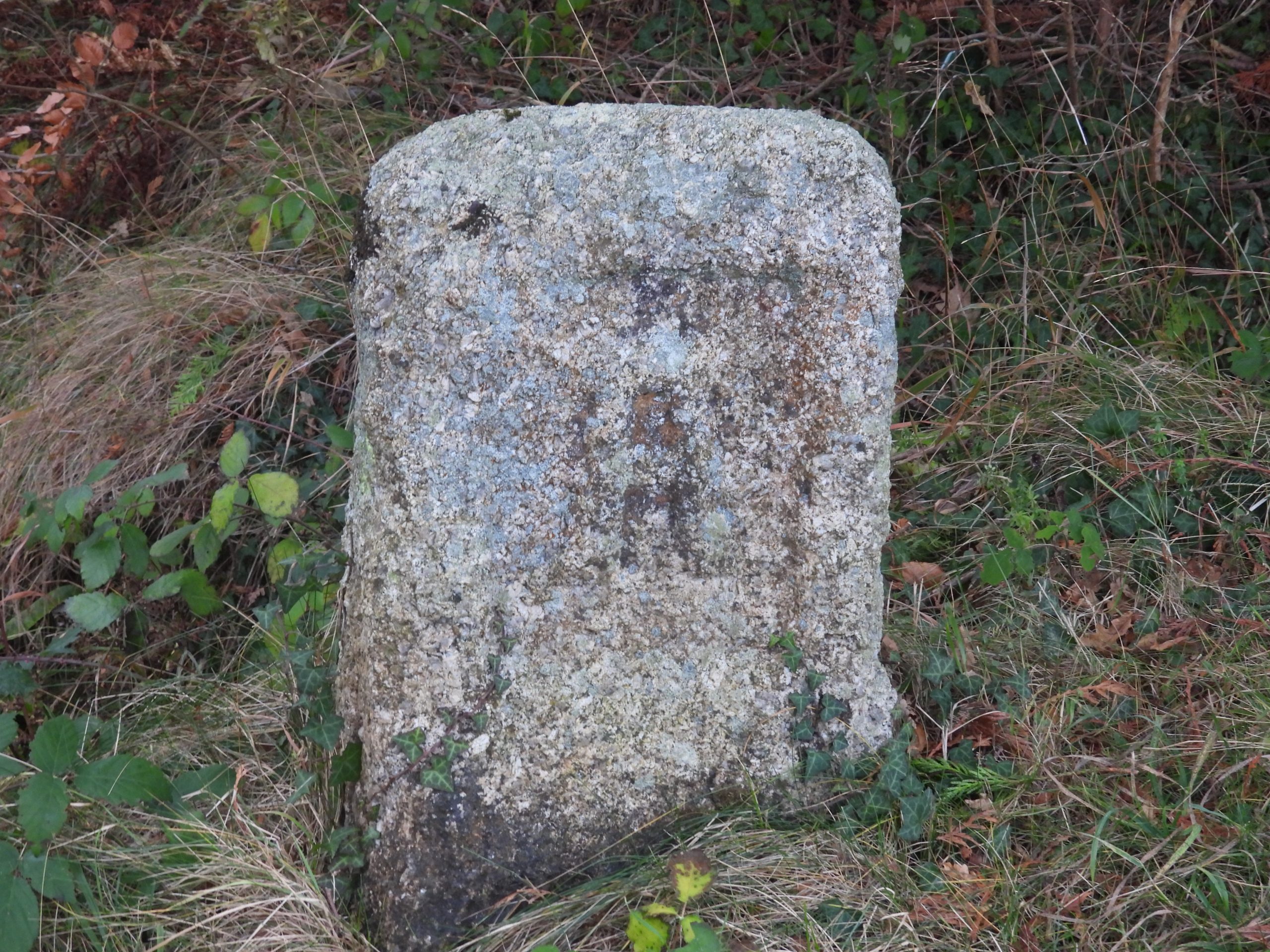
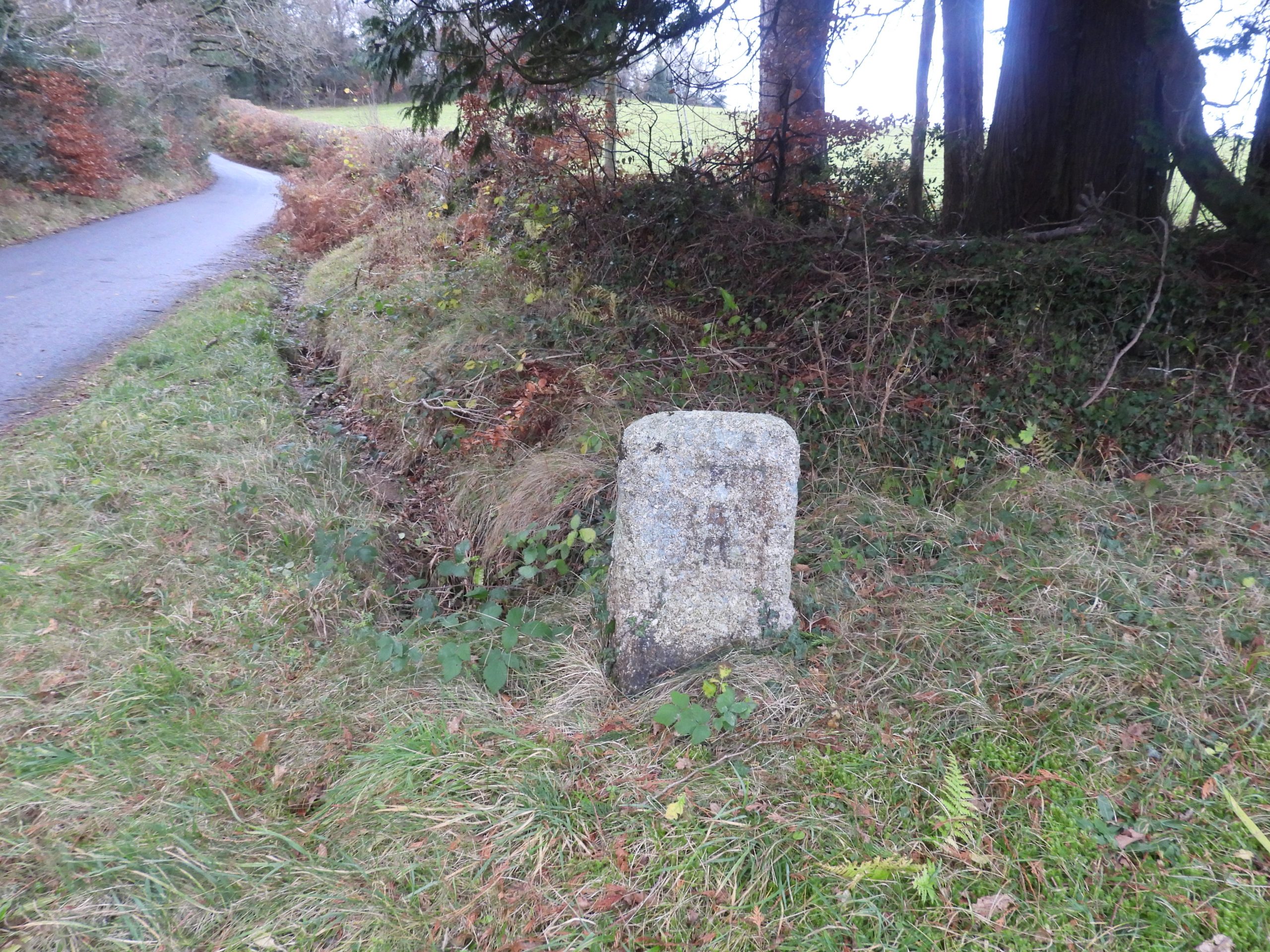
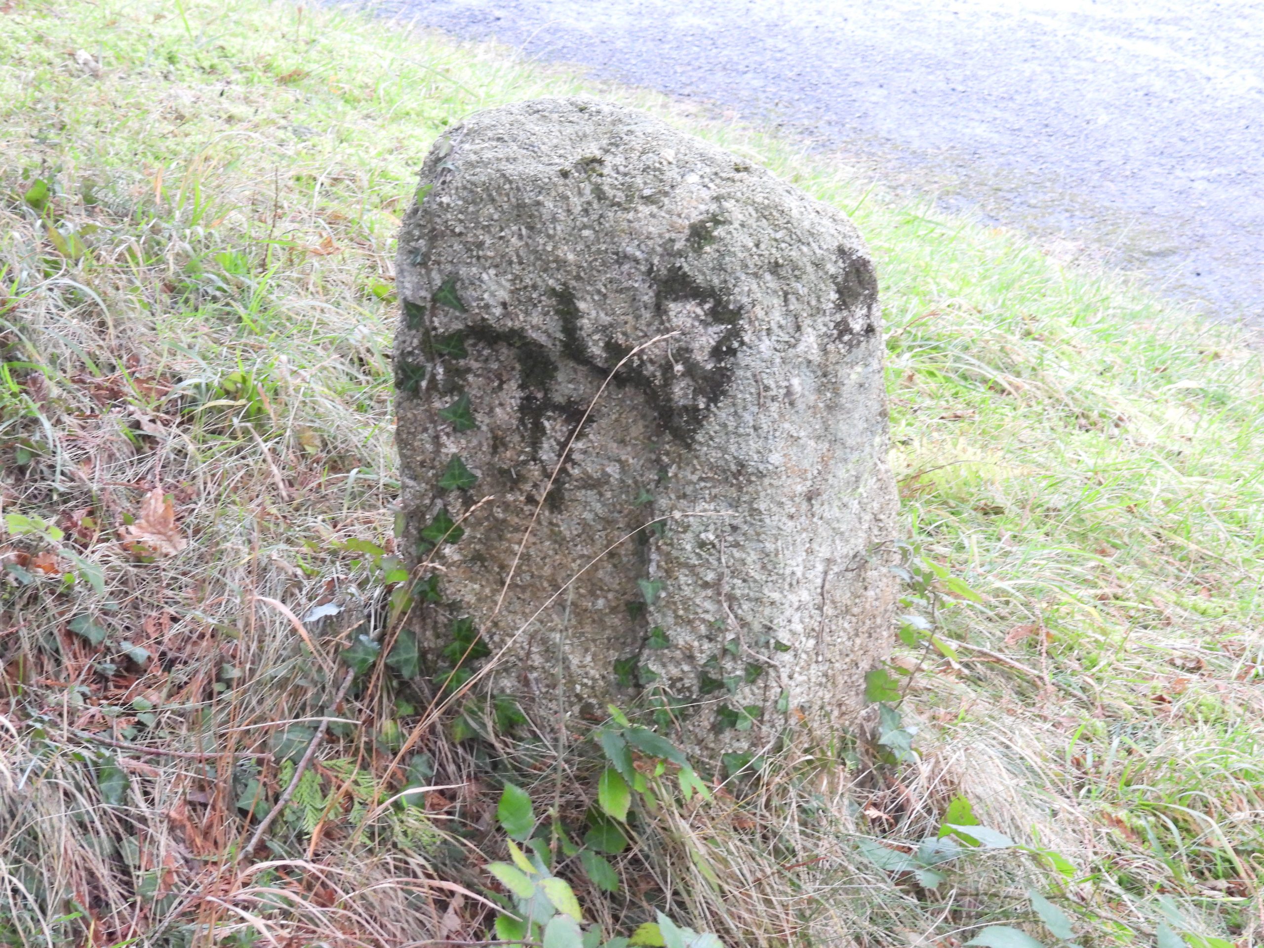
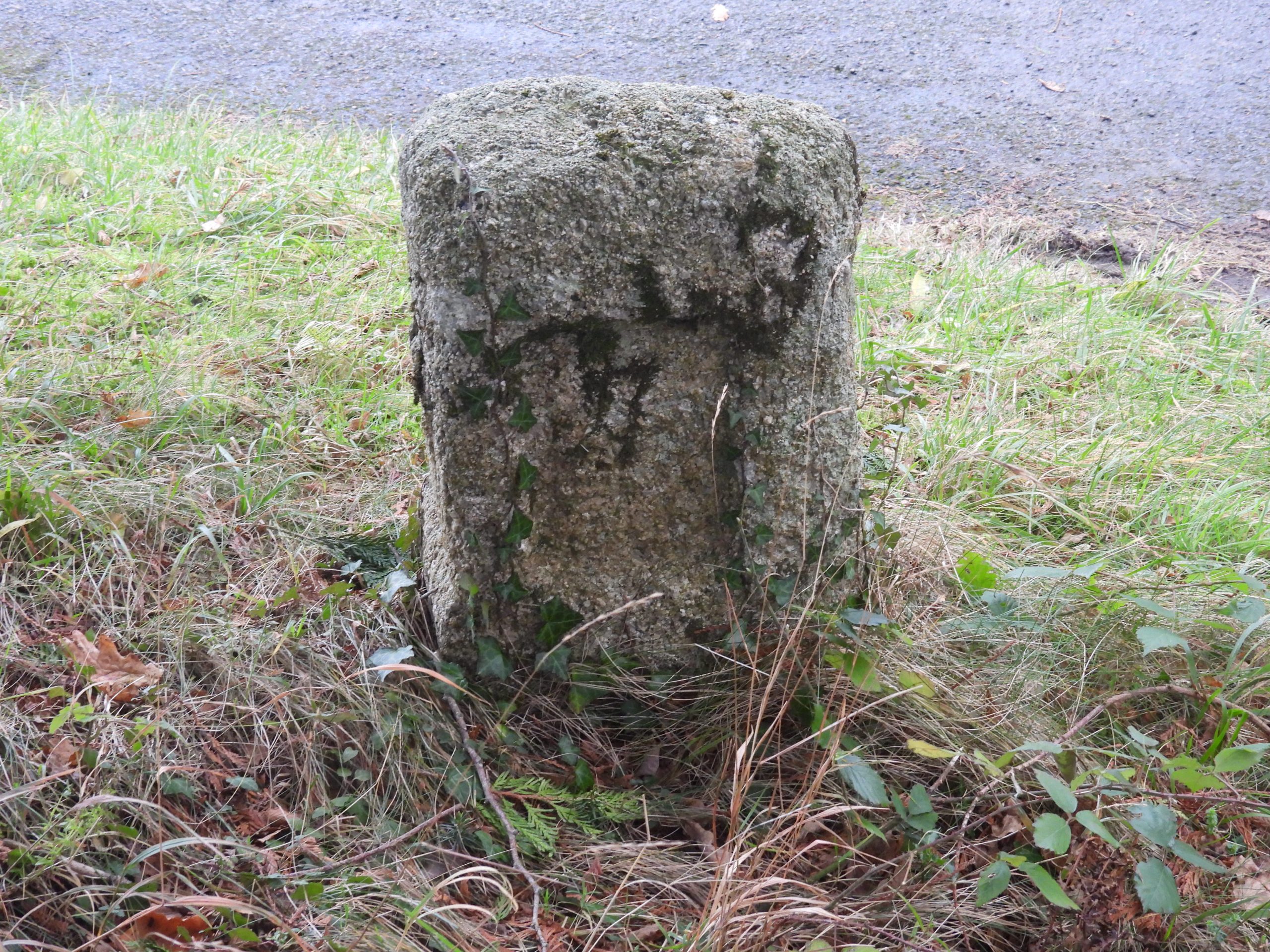
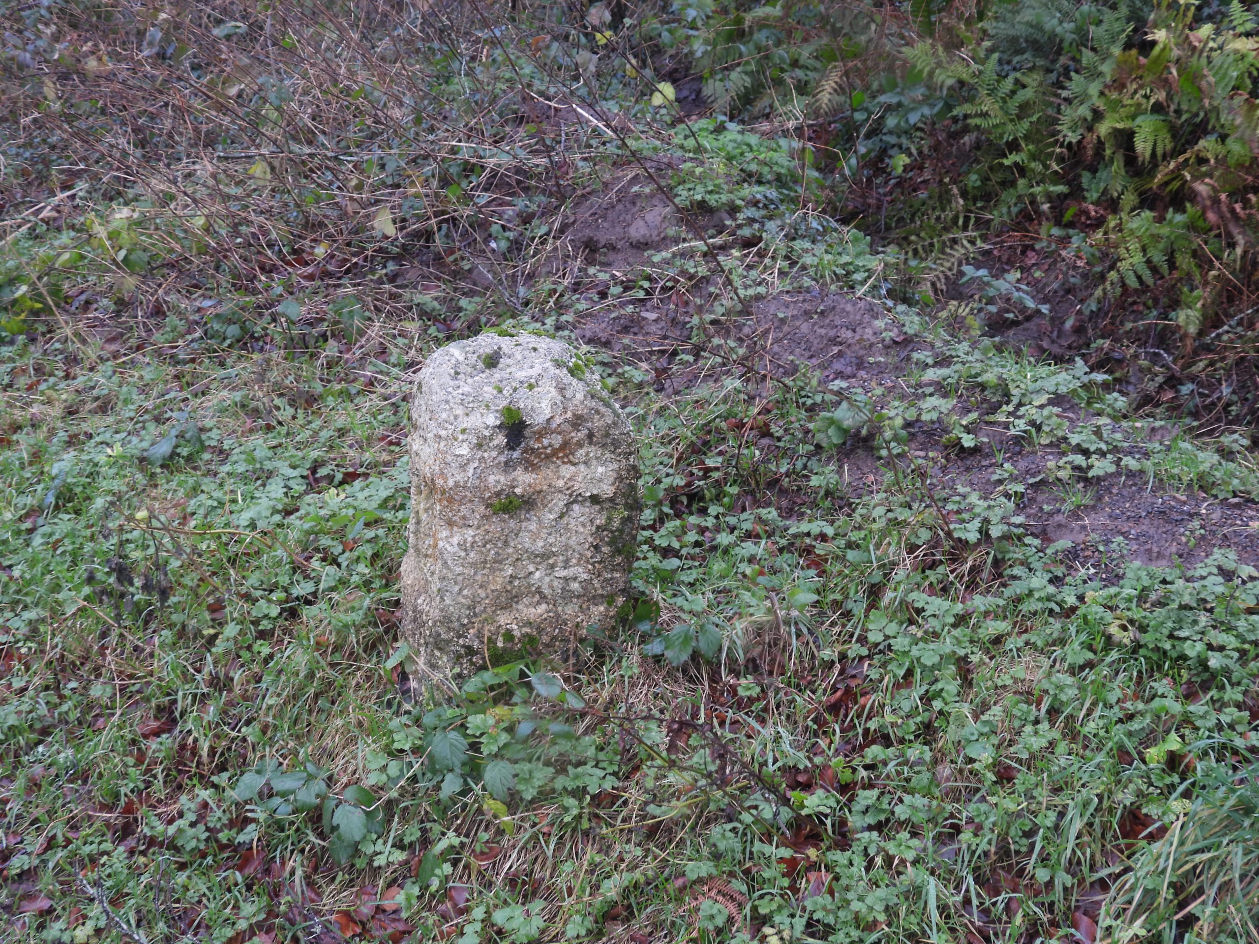
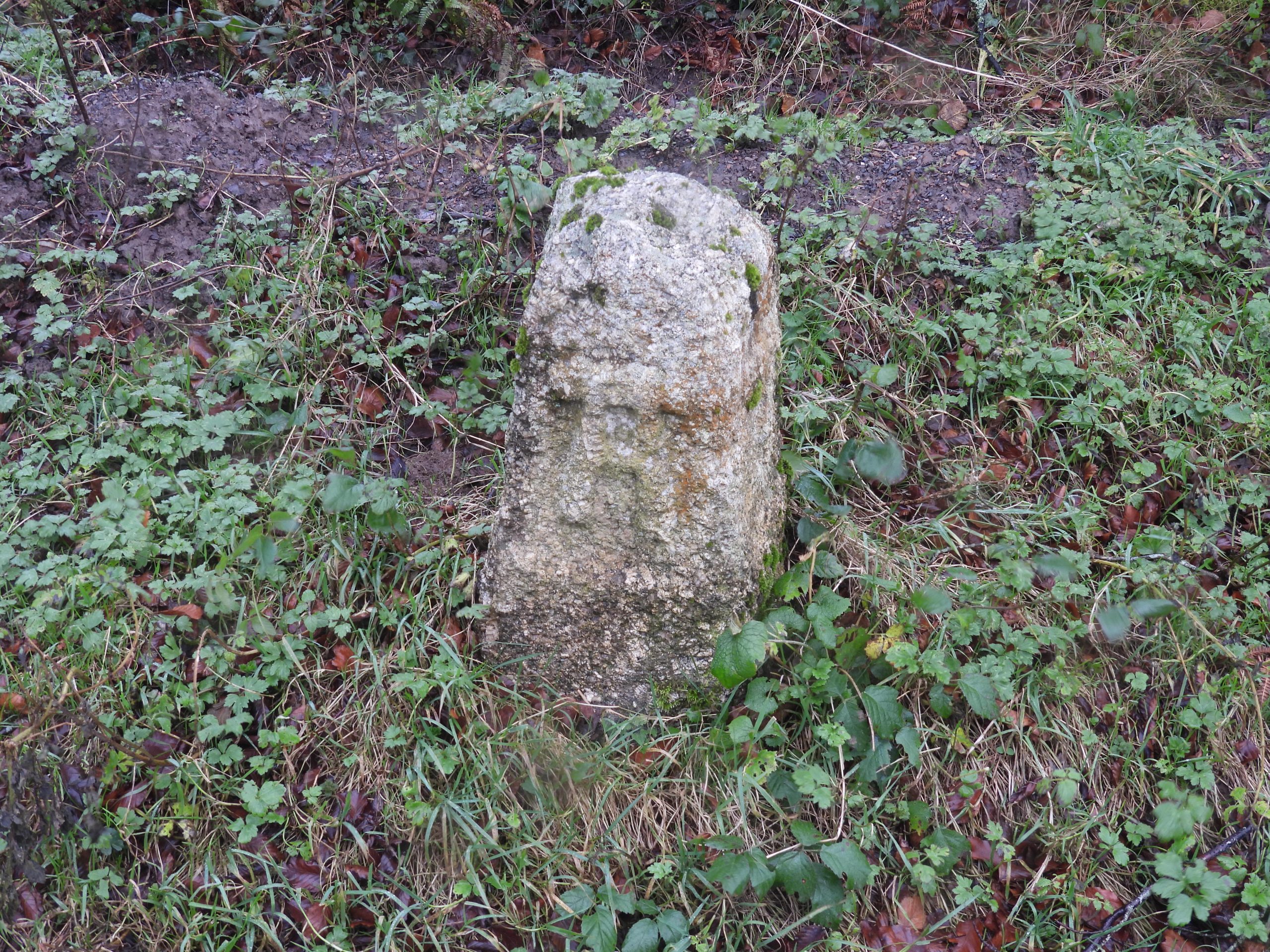
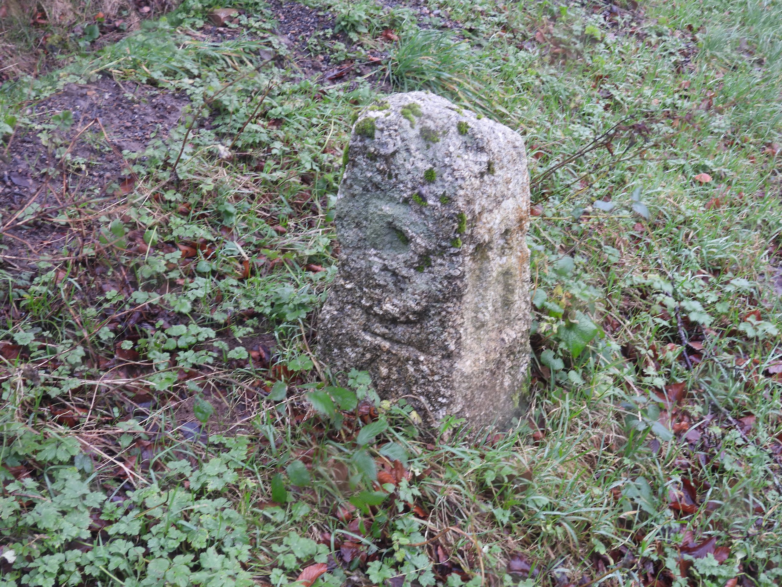
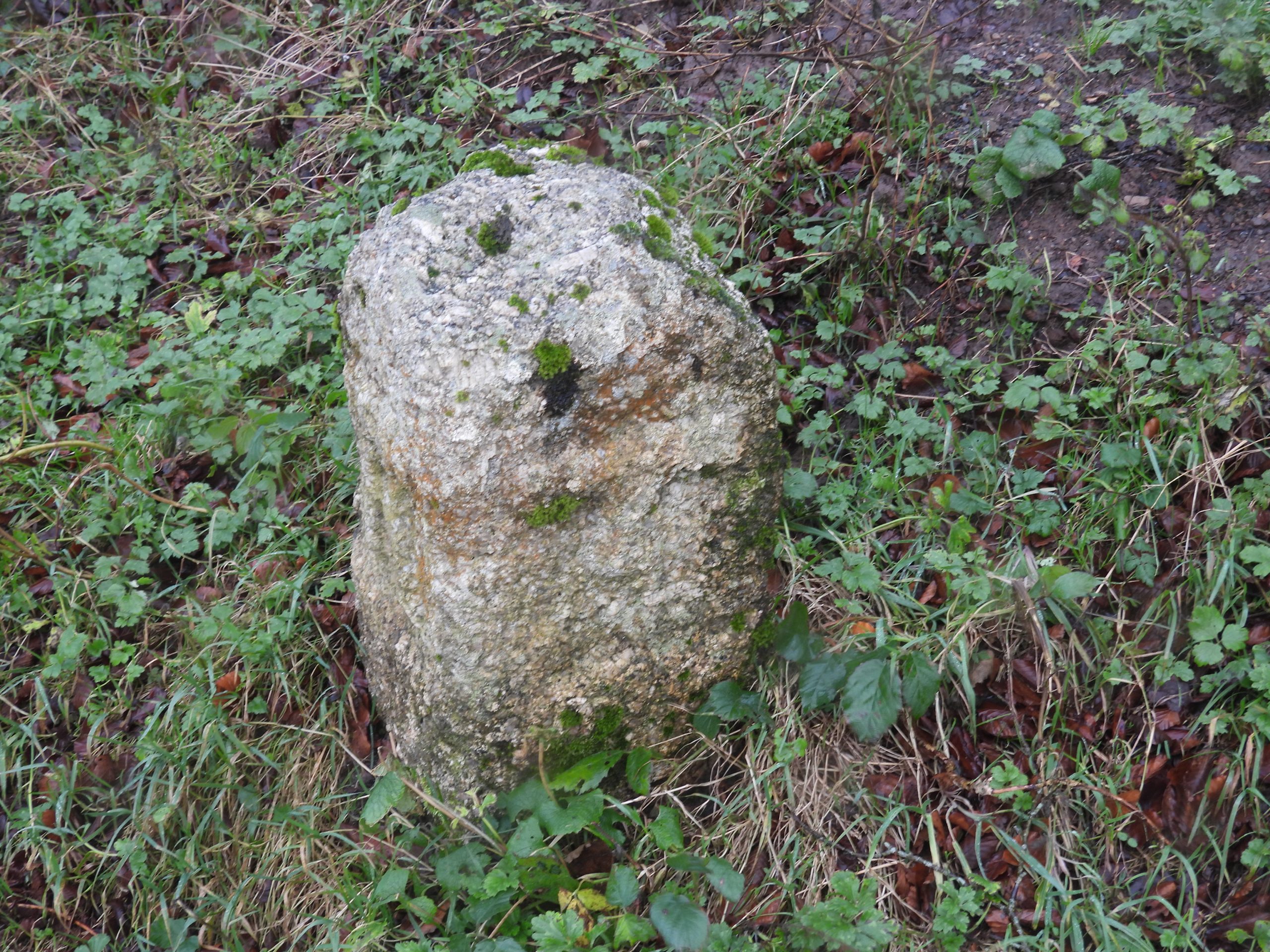
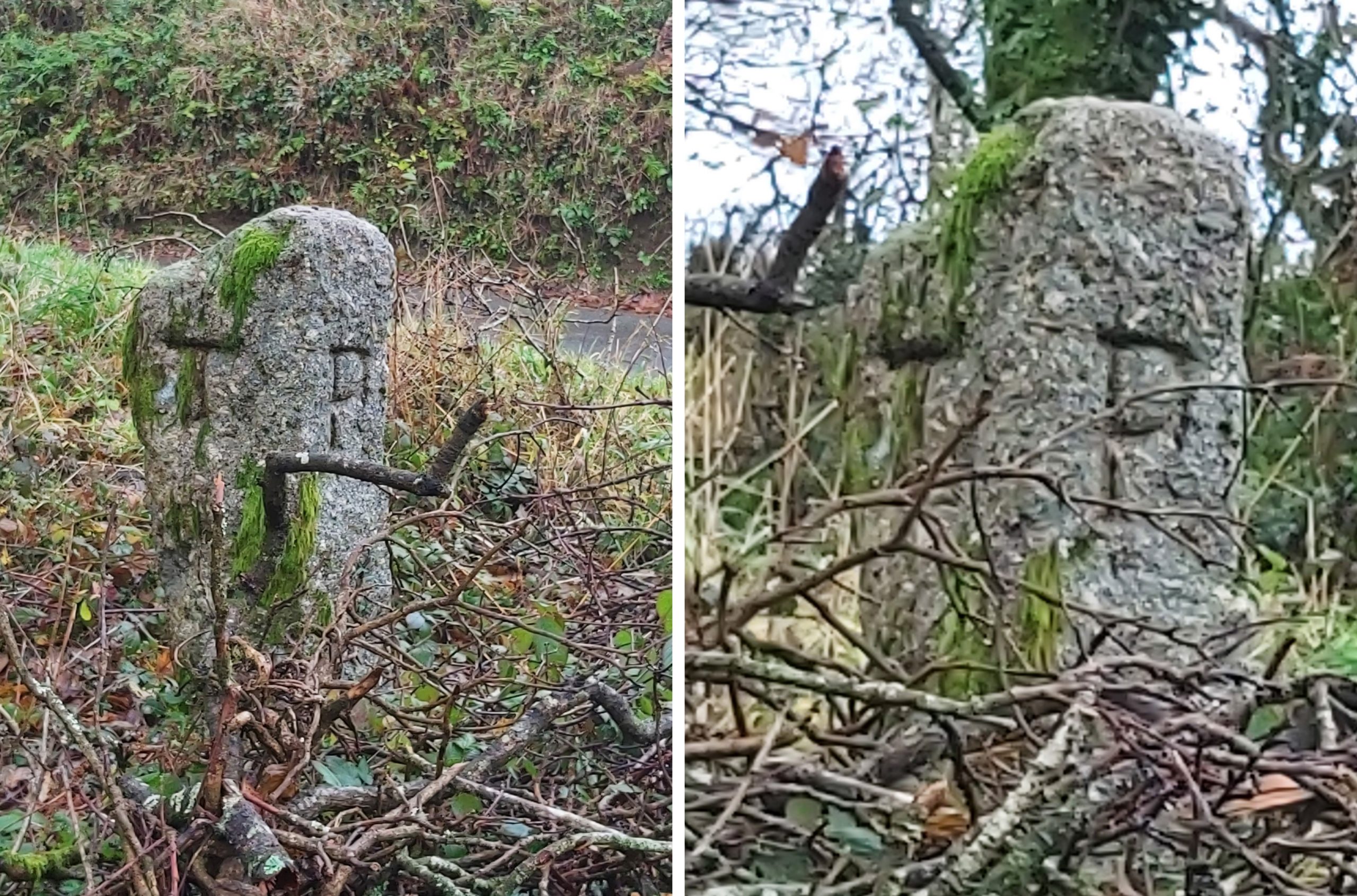
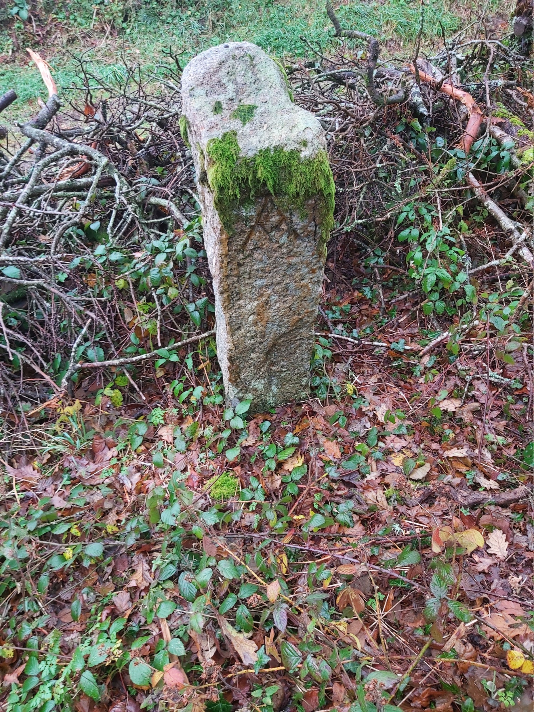
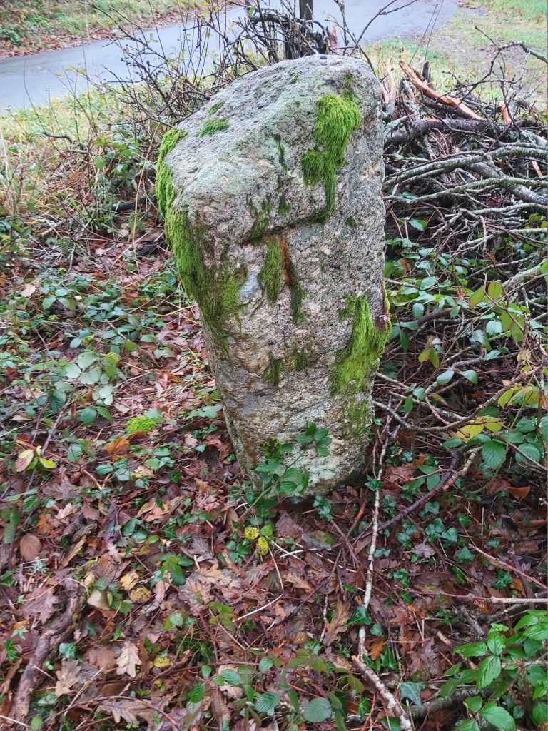
Part of Benjamin Donn’s map from 1765, can be found in Worth’s Dartmoor (page 398). It is believed to be the first map ever to show guide stones on Dartmoor. The map shows the route of the Tavistock – Ashburton Packhorse Track and that of the Exeter – Tavistock track. The tracks converged just above Merrivale Bridge, the likely location being inside the current Great Mis Tor Newtake wall. Intriguingly the Tavistock – Ashburton track appears to have a ‘kink’ around near where Princetown now is, albeit in the 18th century at the time of the map there would have been no buildings to influence such a deviation. Benjamin Donn was a surveyor from Bideford, who on 29th November 1765 was honoured by the award of ‘first premium’ given by the Society for the Encouragement of Art, Manufactures and Commerce for an ‘Accurate, Actual Survey of any County’ (ref: www.jstor.org)This table records the locations of the ‘TA’ guide stones with numbers 1-23 being recorded by Dave Brewer as being ‘directly’ linked with the Tavistock – Ashburton Packhorse Track. Numbers 24-27 have been recorded as being ‘associated with’ the packhorse track. Note that the stones marked in RED are believed to be missing or lost from their locations indicated. Also note that stones 9 and 23 have two grid references each showing locations that they were known to have be once positioned.Dave Brewer in his paper / article titled: ‘The TAVISTOCK – ASHBURTON PACKHORSE TRACK and its GUIDE STONES’ considers the guide stones 1-4 in a sketch map showing three of these have been moved from their original locations. The author has re-created the Brewer sketch above with the inset (top right) of the aforementioned publication. ‘TA’ stones 1 and 2 are considered to have moved from their locations in the Merivale area to become part of a drystone wall. ‘TA’ stone 4 seems to have moved at least twice since it was originally erected and is considered later in this post. ‘TA’ stone 3 is likely to be in its original location.All the known guide stones ‘directly’ linked with the Tavistock – Ashburton Packhorse Track have been labelled by Brewer starting at Merrivale Bridge, then following the route eastwards. Stone 1 is inscribed with a ‘T’ only and is located adjacent to a stile which leads into the south west part of the Great Mis Tor Newtake (shown as Mistor Newtake on the Walkhampton Tithe Map). The ‘T’ of stone 1 with a mud makeover showing how deep the inscription is. It is believed this stone was acting as a gatepost from early to mid 19th century. However, it was re-erected in 1986 (4th April) to its current location after the gateway was widened with consideration to be “sympathetic” to the probable original location (see re-created Brewer sketch map). The significance of there being only a ‘T’ is believed to have come from the fact it had originally been located further down the hill towards Merrivale Bridge where the Exeter and Ashburton routes converged before continuing to Tavistock. This convergence is depicted on the 1765 Donn Map which is shown earlier in this post. The access stile was built after the stone was re-erected.The second guide stone is the first inscribed ‘TA’. Like guide stone 1, it is incorporated into a drystone wall and is not in its original location. The ‘T’ inscription is on the north side of the wall.The ‘A’ inscription is just about discernible very low down on the road side of the drystone wall. Its original location is believed to have been approx. half way between where ‘TA’ stone 3 is located and where the ‘T’ inscribed guide stone 1 would have been located at the junction of the Exeter / Ashburton to Tavistock tracks as per the Donn map (see re-created Brewer sketch map).‘TA’ guide stone 3 is considered to be in its original location and is located close to the two ‘double’ Merrivale stone rows. It is the most westerly of the ‘TA’ stones to remain it its original location. It is through the location of this guide stone and the probable location of guide stone 1 (at junction of the Ashburton / Exeter – Tavistock tracks junction) that stone 2 original location was estimated.‘TA’ guide stone 3 did not appear on OS maps until 1906 (the survey being from 1904). It is intriguing that Benjamin Donn’s map, around 140 years earlier showed representations of 12 guide stones between Merrivale Bridge and what is now the Princetown – Yelverton road. It is possible that this was one of the stones surveyed by Donn and this represented on his map?‘TA’ guide stone 4 lies uphill from Hillside Cottages and overlooks Merrivale Bridge and is not in its original location. It is known to have been used as a gatepost on the lane leading to Beardon (Beardown), on Beardown Farm prior to being set up in its current position by the Dartmoor Preservation Association (DPA) in the 1950’s.The DPA believed ‘TA’ guide stone 4 had originally been located in this spot as it lined up (more or less) with ‘TA’ guide stone 3 and Merrivale Bridge. The Brewer research seems to confirm that guide stones 1-3 are from this area with this stone 4 being an anomaly and in all likelihood originally (before it was located at Beardown Farm) was located on the Royal Hill section of the route. This maybe one of the three Benjamin Donn’s represented stones seen just north of South Hessary from his 1765 map.Under a section titled: ‘Tracks and Guide-Stone’ Richard Hansford Worth in his DARTMOOR publication on page 399 sketches the locations of ‘TA’ guide stones 3-16. The map has been annotated with the Brewer numbering with guide stones 1,2 and 4 added for completeness. Of particular interest in Worth’s map is the location of ‘TA’ guide stone 9 at Yellowmead. The farm enclosure walls at the time the map was produced do not seem complete (as we know them today on modern OS maps). Thus ‘TA’ guide stone 9 may well have at the time of the Worth map been located on the edge of the Yellowmead enclosure but using the modern OS map would be located within the enclosure.‘TA’ guide stone 5 is located to the east of stone 3. Like stone 3, this guide stone is shown on the 1906 OS map.‘TA’ guide stone 5 is a lot shorter and wider than guide stone 3, presumably because the line of sight here between the guide stone is very good. The path to the next stone being quite obvious in this picture.‘TA’ guide stone 6 is located near Pila Brook and like numbers 3 and 5 were shown on the 1906 OS map. Guide stone 6 has a distinctive ‘list’. ‘TA’ guide stone 7 was one of five, which were found recumbent and described as being ‘uprooted’ on the 1982 1:10k OS map. They were re-erected on (or around) 2nd October 1984 by Dartmoor National Park mostly due to the enthusiasm of Bud Ambrose who persuaded the DNP archaeologist (Dr Tom Greeves at the time) to carry out the work. The guide stones re-erected were numbers 7, 12, 13, 14 and 15.During the re-erection of the five stones, it was decided to leave number 6 ‘listing’. On 12th October 1984 a DNPA information sheet made reference to the re-erection of the five stones. It was stated: “Archaeology: T-A stones re-erected. The T-A stones marked an old route from Tavistock to Ashburton. The route ran from Tavistock to Merrivale Bridge, up over the south west flank of North Hessary Tor, just west of where Princetown now stands, then crossed what is now Tor Royal Newtake, then over the moor to Holne. The stones were probably set up in about 1700. There are 17 stones now standing and records of three other sites. 5 stones were re-erected in the Foggintor area by Tom Greeves, and Rangers Eddie Hain and Simon Ford with the help of others one day last week. The project was the brainchild of Mr and Mrs Ambrose of Tavistock”‘TA’ guide stone 8 can be found to the north west of Yellowmead enclosures‘TA’ guide stone 8 as with other 3, 5-7 was shown on the 1906 OS MapEric Hemery in his book ‘Walking DARTMOOR’S Ancient Tracks – a guide to 28 routes’ has a section dedicated to the Tavistock – Ashburton Packhorse Track. Hemery records it as Track 10 on pages 109 through 122. The above sketch is a re-created map which was produced on page 110 of the publication. The sketch map shows the probable ‘west’ half of the route from Tavistock to just beyond Royal Tor. Hemery did not show the positions of guide stones on his map.As previously mentioned in this post ‘TA’ guide stone 9 may well have at the time of the Worth map been located on the edge of the Yellowmead enclosure. However, using the modern OS map the ‘worth location’ would be located within the enclosure. Worth located stone 9 as being around grid reference SX56527 74248. In Worth’s ‘DARTMOOR’ (page 397) when referring to Dr David C. Prowse it is recorded that Prowse wrote: “In October 1925, I noticed a gate post in the Yellowmead enclosures, near Foggintor Quarries, which bore the letters ‘T-A’, and the farmer Mr. Edward Cole, told my wife and myself that there was another near the farmhouse. This, my wife, Dr. Dorothy E. Prowse, located”. Brewer stated in his paper / report that this stone later became broken and the lower part was used as a gatepost on the west wall of the enclosure. For completeness of this post (with permission) the author recorded the original location of the stone.Brewer records the new location of ‘TA’ stone 9 as being at SX56460 76250, which as he suggests is where there is now a blocked in gateway. Additionally, Brewer states the inscribed section of the guide post / gate post is now missing.‘TA’ stone 10 is likely to be the one found by Dr. Dorothy E. Prowse in October 1925. It appears that the stone was once used as a gatepost. The ‘A’ inscription is located on the public accessible side of the southern end of the Yellowmead enclosures.The ‘T’ inscription of stone 10 is located on the private (farm) side of the southern end of the Yellowmead enclosures. The ‘T’ can best be seen when zooming in to take a photograph.‘TA’ guide stone 11 is close to the Foggintor track and appears to have remained in situ and upright‘TA’ stone 11 was one also shown on the 1906 OS Map‘TA’ guide stone 11 looking towards Yellowmead Enclosures with Kings Tor, Merrivale, the Staple Tor and Roos Tor‘TA’ guide stone 12 was one of the five re-erected in 1984. The stone had fallen with ‘A’ side uppermost. Worth mentioned four recumbent stones in his ‘DARTMOOR’ publication on page 401. These four stones are likely to have been stones 12 (as shown above), 13, 14 and 15. Worth recorded: “We now fill an apparent gap by identifying the two stones used as gate-posts at Yellowmead; and we add five five other stones, carrying the line about one thousand yards ESE from its apparent former terminus. Of these stones all but the easternmost have fallen”. The author assumes Worth recorded the easternmost (which had remained upright) as being number 16.‘TA’ guide stone 13 was one of the five re-erected in 1984 and is likely to be one of the four mentioned by Worth. The stone had fallen with its ‘A’ uppermost.‘TA’ guide stone 13 unlike others did not appear on the 1982 OS 1:10k map. The stone is located to the west of Yes Tor Brook Head.‘TA’ guide stone 14 was the fourth (of the five) re-erected in 1984. It was simply marked ‘stone’ on the 1982 OS 1:10k map. The stones at the base of the guide stone look like the ‘chocking’ stones from 40 years ago.Stone 14 is likely to be one of the four mentioned by Worth. It is located near Yes Tor Brook Head. When it was recumbent the stone had fallen with its ‘T’ uppermost.‘TA’ guide stone 15 was the last (of the five) re-erected in 1984.When it was recumbent the stone 15 had fallen with its ‘T’ uppermost. This stone was not shown on the 1982 OS 1:10k map. ‘TA’ guide stone 16 appears to have remained upright (at least over the last 100 years). It is the easternmost of the series of stones between Merrivale Bridge and Princetown. It was recorded on the OS 1906 map. Stone 16 is mentioned by Worth (in relation to stone 15) on page 401, viz: “There is one fallen stone (ie number 15) about 200 yds eastward of the last shown (ie on Worths map), which is in doubt, but excavation will determine the question as to whether it is a member of the series”.‘TA’ guide stone 17 was most likely located on the route of the packhorse track near to Tor Royal (built from 1785 to 1790’s for Sir Thomas Tyrwitt). Worth (page 397) recorded there was a ‘TA’ stone here : “In August 1924 the late George French told my father that he remembered a stone with ‘T’ and ‘A’ on opposite sides being found when the old farmhouse was taken down; it had been serving as a lintel”. The stone does not appear to have been seen (or its location identified) over the last 100 years.‘TA’ guide stones 18, 19 and 20 are located as shown on the above sketch map. Stone 18 lies adjacent to the Dartmeet to Two Bridges road and clearly has been relocated. Stones 19 and 20 are located within the Swincombe Farm enclosures‘TA’ guide stone 18 is located in a gateway and can be found around 200m to the west of the Prince Hall drive entrance in the direction of Two Bridges.The ‘T’ inscription is located on the north side (road side) side of the gatewayOn initial viewing from the road, the guide stone looks like it is being used as a gatepost. On closer inspection, on the ‘A’ inscribed side it is clearly just a granite upright and the gatepost is wooden. The guide stone would have originally been the gate ‘stop’ with the hanger being at the other end of the gate. This stone was re-discovered in 1986 by a walks guide called Mason (first name unknown to the author)A mud makeover of the ‘A’ to make the inscription a little more distinctive. As the guide stone is free from its use as a gatepost, it would be lovely to think it could be relocated on the former packhorse track perhaps somewhere south of Rue Lake / Moorlands farm.‘TA’ guide stone 19 is now being used as a gatepost on the western side of the Swincombe Farm enclosure and likely to be located on the line of the original packhorse track.This guide stone is mentioned in Worth’s DARTMOOR on page 397. Dr. David C. Prowse wrote: “In 1911, or perhaps earlier, my father, the late Col. A. B. Prowse, ………….also found another post in the series acting as a gatepost in the Swincombe Farm enclosures”.The upper gate hanger on stone 19 is located just below (and to the left) of the ‘T’ inscription. Brewer suggests this stone has been re-set close to its original site. He also states the track here was once called a ‘Green Road’.‘TA’ guide stone 20 is located at Swincombe Farm. Like stone 19, it is also mentioned in Worth’s DARTMOOR (page 397). Once again recorded by Dr. David C. Prowse, it is recorded that: “In October 1925 I found a second stone in the enclosures of Swincombe Farm, also serving as a gatepost”. Dave Brewer suggests that stone 20 has been removed from the Royal Hill section of the packhorse track to its present site. The location of this stone lies a short distance to the north of the assumed packhorse track routeAs previously mentioned in this post, Eric Hemery in his book ‘Walking DARTMOOR’S Ancient Tracks – a guide to 28 routes’ has a section dedicated to the Tavistock – Ashburton Packhorse Track and recorded it as Track 10 on pages 109 through 122. The above sketch is a re-created map which was produced on page 118 of the publication. The sketch map shows the probable ‘east’ half of the route from just east of Hexworthy to Ashburton. As with the ‘west’ half, Hemery did not show the positions of guide stones on his map.‘TA’ guide stone 21 is recorded by Dave Brewer as having been found at West Stoke Farm, near Holne. Apparently it was found by a Mr N. Perryman, a farmer there of 30 years standing (in 1990), who recalled finding it whilst clearing out a hedge ‘in the 1960’s’. He stated it was approx. 18in x 2ft (400cm x 600cm). It was then apparently re-used to repair another gap in the hedge. The author spoke to the current farmer who did not have any knowledge of any stone. Dave Brewer does not mention whether he had located the stone. As has been recorded in this post, it is known, that many of the original ‘TA’ incised stones were removed for use as gateposts and lintels. Another such re-purposed ‘TA’ guide stone (Brewer, number 22) can be found in a field in Walkhampton, described by Dartmoor authors Dave Brewer and Eric Hemery as being at Knowle Farm with it being used as a gatepost. Furthermore, Dave Brewer stated that the re-purposed ‘TA’ stone was located in a field called “Irish’s Meadow” at grid reference SX5308 6955 . Looking at the tithe map and apportionment, there does not appear to be reference to “Irish’s Meadow” (at that time) and the gatepost is located between fields named ‘Home Park’ and ‘Middle Park’The ‘TA’ gatepost is located at SX53090 69639.The upper hanger pierces the letter ‘A’.Close up of the ‘A’On the reverse side of the gatepost is the letter ‘T’ is deep cutClose up of the ‘T’The next guide stone (‘TA’ guide stone 23) to record appears to have had rather an interesting history. The sketch map of the clappers and bridges on the east side of Holne Moor. Of interest is Clapper no. 2 marked on the map. It comprises 6 imposts, one of which is a former ‘TA’ guide stoneAbove Michelcombe where the Sandy Way crosses the Wheal Emma Leat is this 6 granite impost bridge (ref 2 on map). One of the imposts is a former Tavistock – Ashburton ‘T/A’ stone. The bridge is believed to have been built / refurbished around the same time as the Ringleshutes bridge (1987-8) and can be found at SX68554 69091After a “mud makeover” the ‘T” of T/A becomes more obvious. The post originally (at least for part of its life) can be traced back to Lowery Farm, near Burrator. It was recorded by Hansford Worth (ref: “Worth’s Dartmoor” (page 401)) that this stone had been “taken” for use as a gatepost by Lowery Crossing. Prior to the stone prior to being taken to Lowery it came from Princetown. Worth states: “Mr Samuel Pearce, of Broomhill, Harford tells me that this stone was, he understands, brought back to Lowery by his great uncle, on his return with an empty cart from Princetown, where he had been delivering farm produce to the prison. Mr Pearce believes, it was taken from some point between the end of the range of stones as we have now planned it, and the present site of the Princetown Railway”.The stone was removed from Lowery in 1969 (believed due to the consequence of conifer growth) by the DNP Head Warden. The stone spent some time at Two Bridges (acting as a step in the mobile information caravan located there). It then was moved to Postbridge Information Centre, where it was left recumbent. The final piece of the evidence to confirm this stone is the one located at Lowery is by comparing a Worth photograph (plate 79B between pages 334 and 335 in “Worth’s Dartmoor”) with one from today. Comparing the photographs, the shape looks similar and as compelling is the location of a fault line below and to the right of the inscribed “T”. This ‘TA’ stone, Dave Brewer labelled no. 23 in his paper / report.Warren’s Cross is believed to have been on the route of the Tavistock – Ashburton Packhorse track (see map on the west section earlier in this post). On the wooden post is a Dartmoor Way sign, which was put up by the author in 2019. Next to the crossroads by a drystone wall is another ‘TA’ stone which Dave Brewer labelled no. 24 in his paper / report.Location of the ‘TA’ stone at Warren’s Cross. Recorded in the Dave Brewer publication it is recorded that: “Under the ‘Removal of Direction Signs Order 1940’, this stone once had its inscription facing inwards. After the war, the stone was taken out of the wall and put back so the incised face was re-exposed”. Dave Brewer records this as being a “small piece of rectangular section on the northern side of the wall at Warren’s Cross, having the incised letters ‘TA’ on the exposed face – thought of as being part of an old guide stone”. It is interesting that the ‘T’ and the ‘A’ are on the same side of this stone. Digging down a bit further might well reveal that there is also a ‘V’ making ‘TAV’ for Tavistock?Stoney Post Cross, near Holne is described by Dave Brewer in the section labelled ‘Other Guide Stones Associated with the Tavistock-Ashburton Packhorse Track’. He labels this guide stone as number 25. This guide stone has faint letters in relief and is suggested might pre-date the other ‘TA’ stones. The guide stone lies near the assumed route of the packhorse track not far from a location called Gallant Le Bower.The guide stone bears the letters ‘A’ (for Ashburton) on its northern side and ‘B’ (for Buckfastleigh) on its southern side. On its western (narrower) edge is the letter ‘T’ (for Tavistock).The ‘A’ and the ‘B’ are set into a panel but the ‘T’ is not, perhaps suggesting (ref: Edward (Ted) Masson Phillips) that the ‘T’ was an afterthought. Dave Brewer suggests the lack of panel was purely due to the narrow width of the stone. An interesting debating point.The 4th side of the guide stone called Stone Post Cross is plain with no inscriptions. Of interest (as recorded in Eric Hemery’s ‘Ancient Tracks’ on pages 120/1, is the route of the packhorse track from this location. Hemery writes that the route given by Donn (and the 1809 OS map) from this point to Ashburton is an ‘indirect’ curve. He further records that Edward (Ted) Masson Phillips had once suggested that a more ‘direct’ route from this point existed via Gallant Le Bower* and North Park Wood. *The meaning of Gallant Le Bower is believed to be where a ‘Bower’ is where a ‘Gallant’ (gentleman) may escort his lady in peace and privacy.The next guide stone recorded by Dave Brewer to be ‘associated with’ the Tavistock-Ashburton packhorse track is located near Cross Furzes and is labelled as number 26. This small guide stone has three sides labelled in relief. As at Stoney Post Cross (number 25), the guide stone bears the letters ‘A’ (for Ashburton), ‘B’ (for Buckfastleigh) and ‘T’ (for Tavistock).The ‘A’ in relief. This stone is where the Jobbers Cawse (or relatively modern named Abbot’s Way) passes through en-route westwards (over Lambs Down)The ‘B’ in reliefThe ‘T’ in reliefMoor Cross, near Skerraton Down is described by Dave Brewer in the section labelled ‘Other Guide Stones Associated with the Tavistock-Ashburton Packhorse Track’, as guide stone number 27 and is the last recorded in his paper / article. The guide stone was intended to direct the traveller towards Holne. It has all four sides inscribed. The ‘T’ to the north stands for Tavistock and the ‘P’ on the west side stands for ‘Plymouth’ according to Dave Brewer. The author thinks the ‘P’ may stand for ‘Plympton’ as The ‘A’ stands for Ashburton. The ‘A’ inscription is unusual insofar as it has a ‘v’ shaped cross bar. A benchmark rivet can just about be made out on the very stop of the guide stoneThe ‘T’ on the south side stands for TotnesThe ‘T’ on the north side stands for Tavistock.