A collection of walks, discoveries, insights and pictures of exploring Dartmoor National Park
April 11, 2024
Military artefacts (Mortar Emplacements) between ‘Viewpoint’ Car Park on Tavistock – Merrivale Road and Langstone Moor
Having enjoyed exploring Dartmoor for the last 5 decades, the author is regularly on the lookout for artefacts (whether ancient or modern) to visit, which hitherto the existence of which, he was not aware. To this end, the author researched and visited a number of features between the ‘Viewpoint’ Car Park on the Tavistock to Merrivale road and Langstone Moor, which on first viewing look like a Bronze Age Hut Circles, but in actual fact are Mortar Emplacements (Pits). They are located within a former military training area, which was used by allied troops in the build up to D-Day on 6th June 1944. Some of the Mortar Emplacements (Pits) have associated rectangular ammunition holes.
This post is a photographic record of 12 Mortar Emplacements, some of which have associated ammunition holes nearby. The author believes he has interpreted the locations of all the Mortar Emplacements correctly and would welcome any corrections if this were not the case. There is also a rectangular shaped building included in the post, which is located near to the ‘Viewpoint’ Car Park and although unlikely to be military origin (as it dates from late 19th century), is of interest.
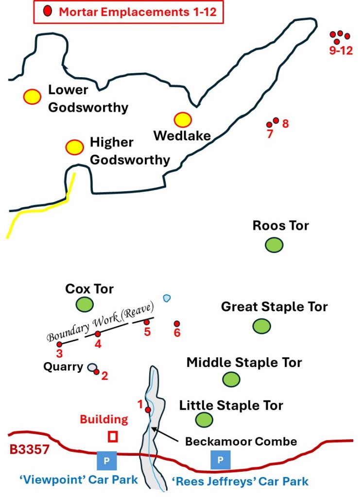
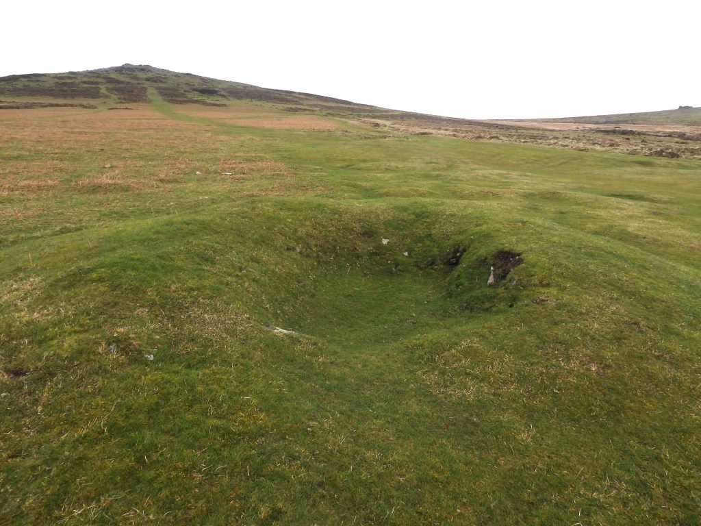
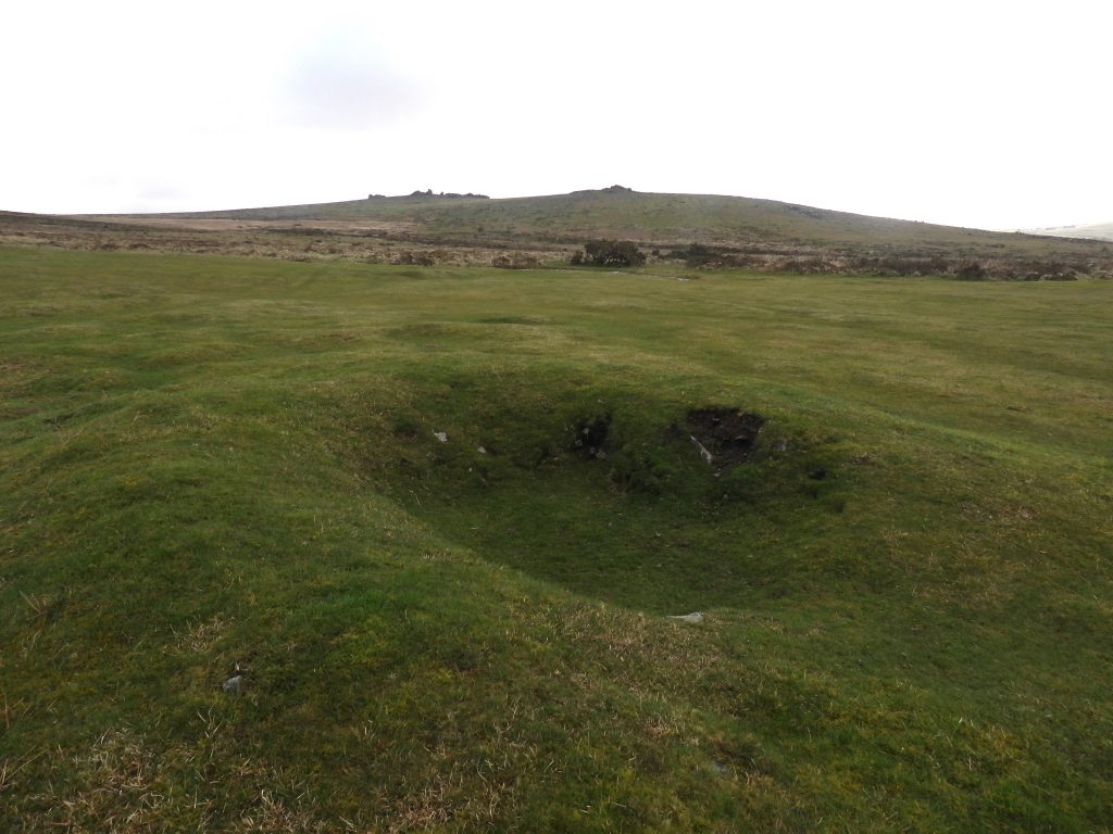
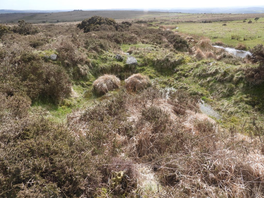
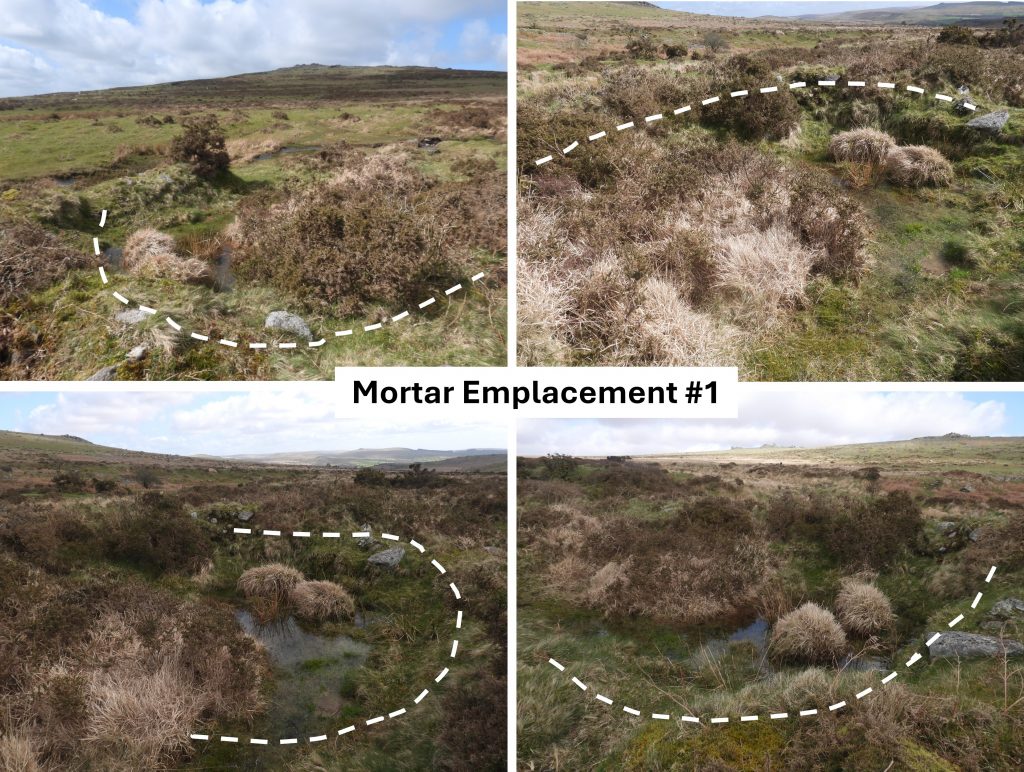
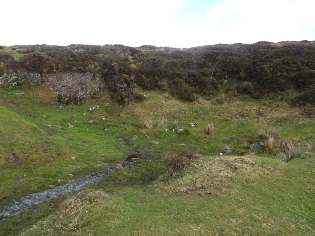
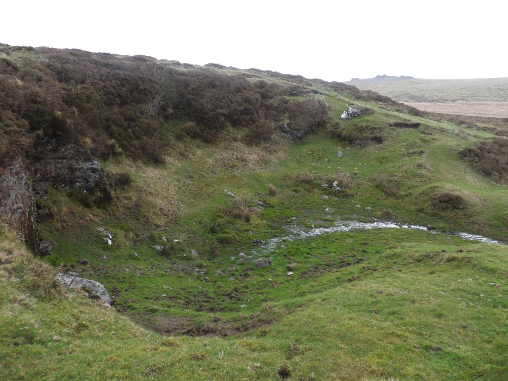
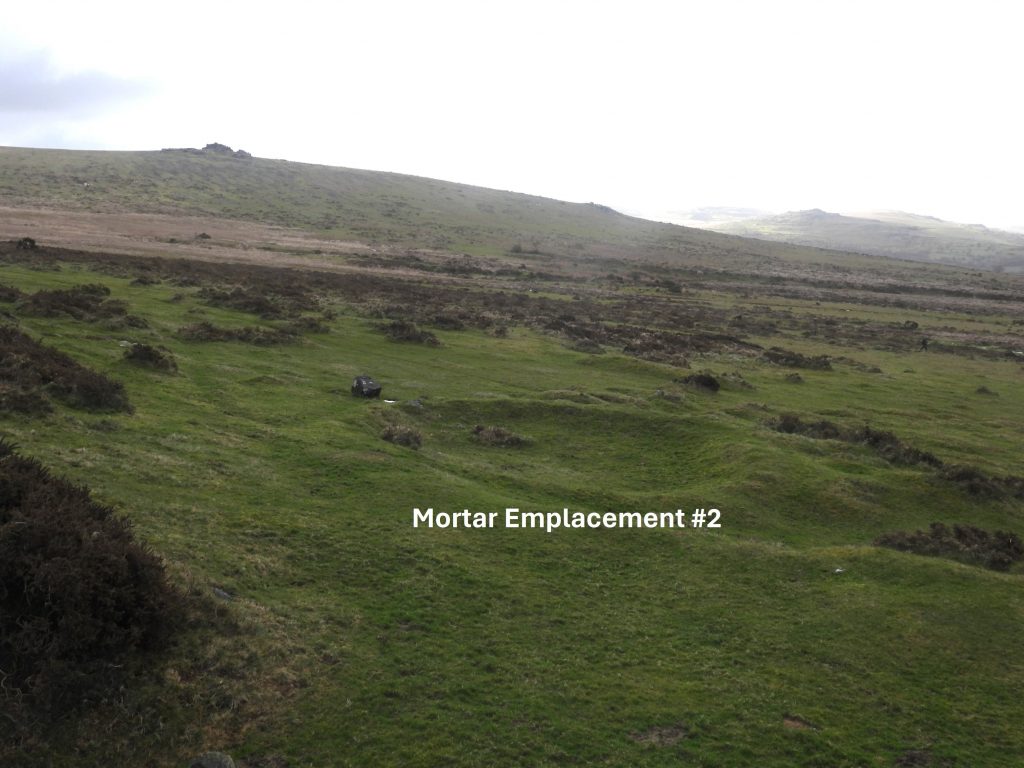
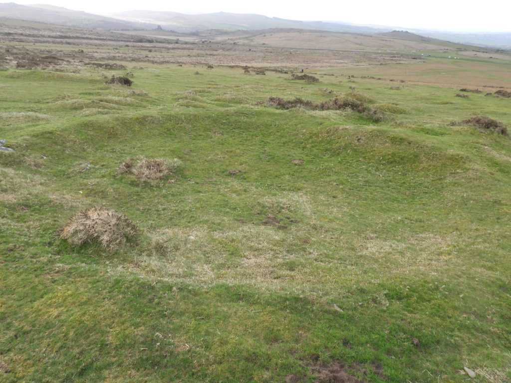
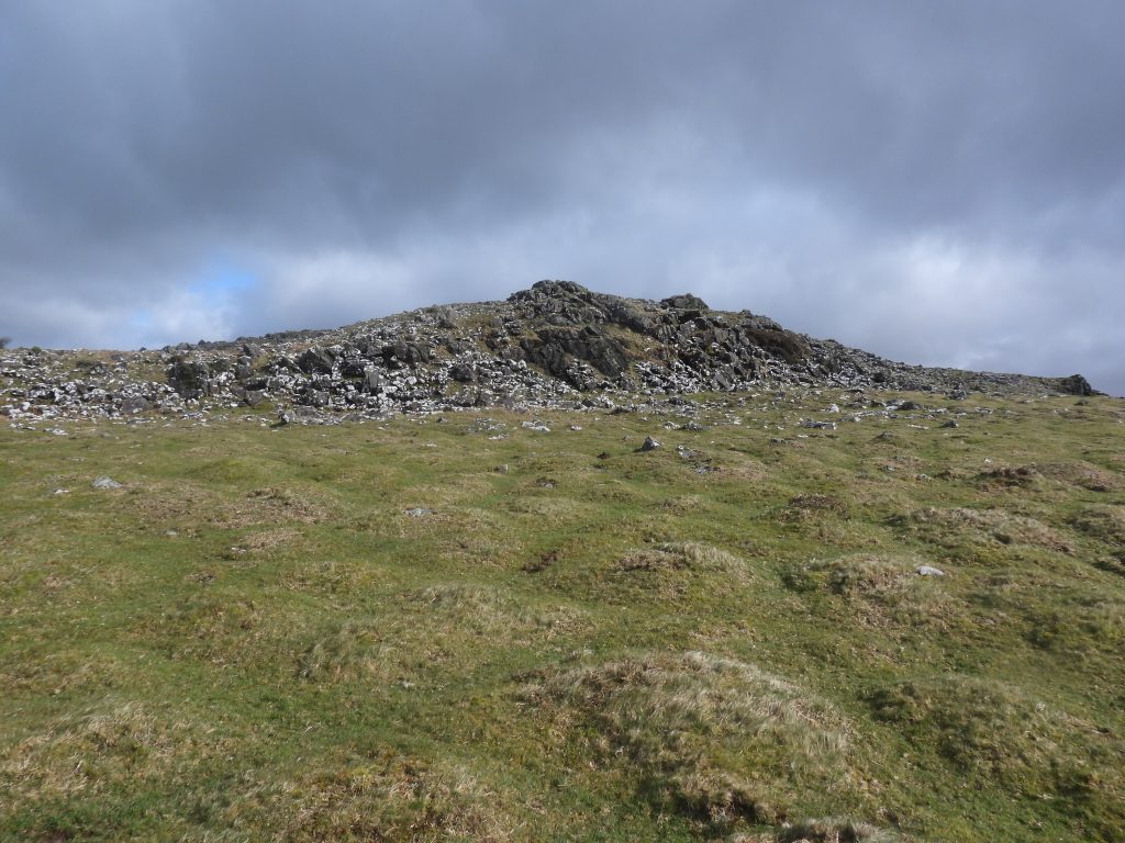
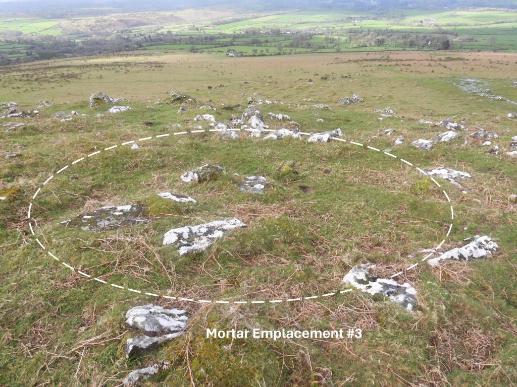
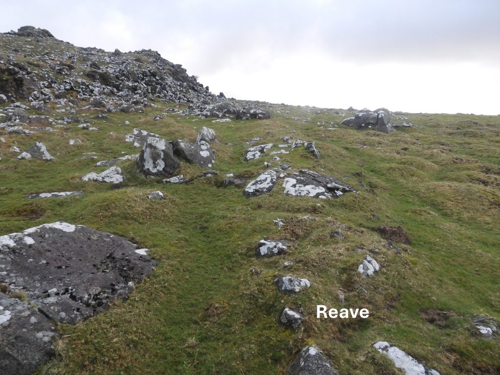
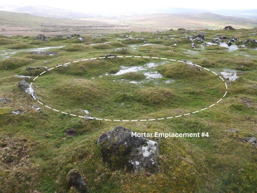
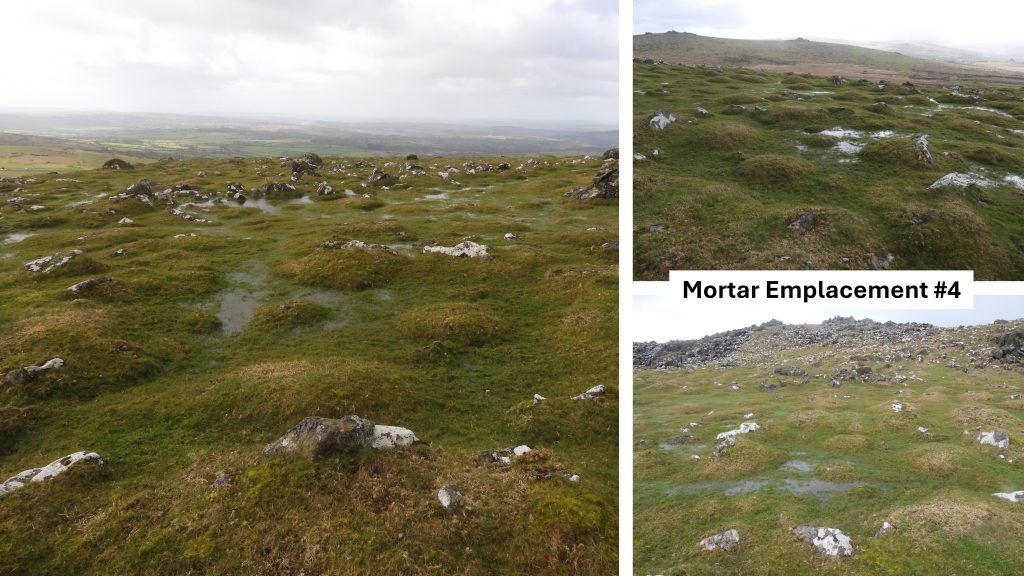
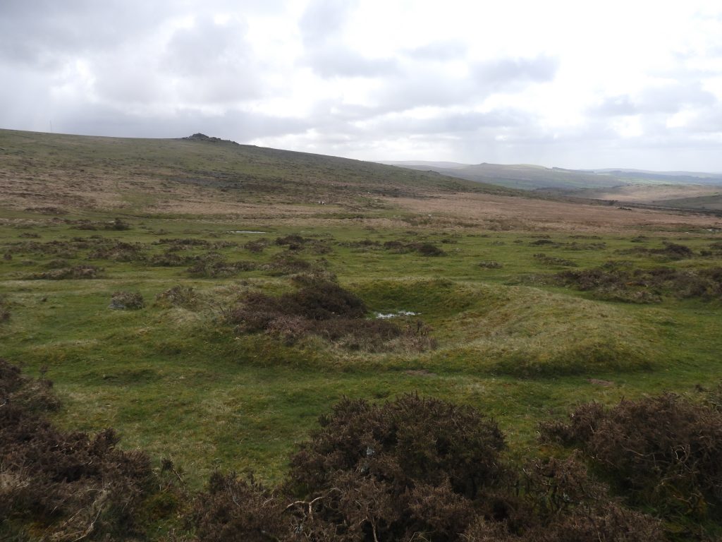
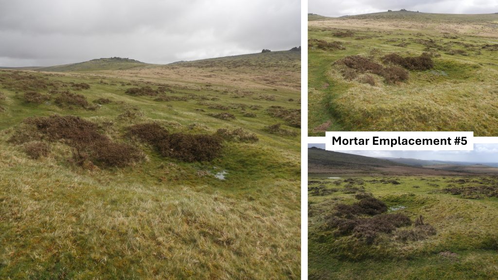
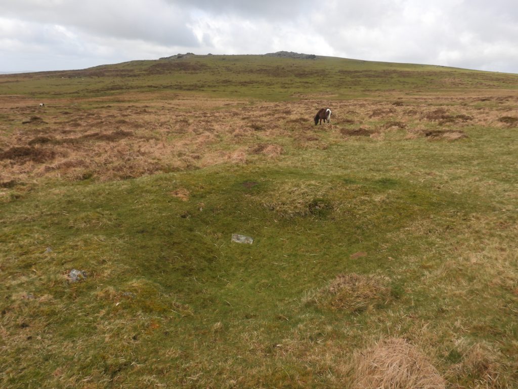
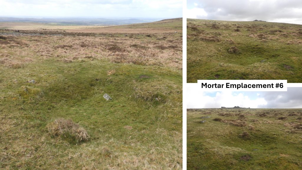
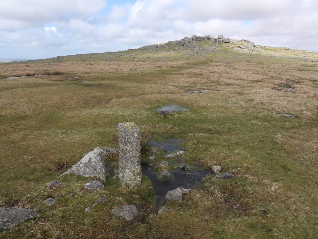
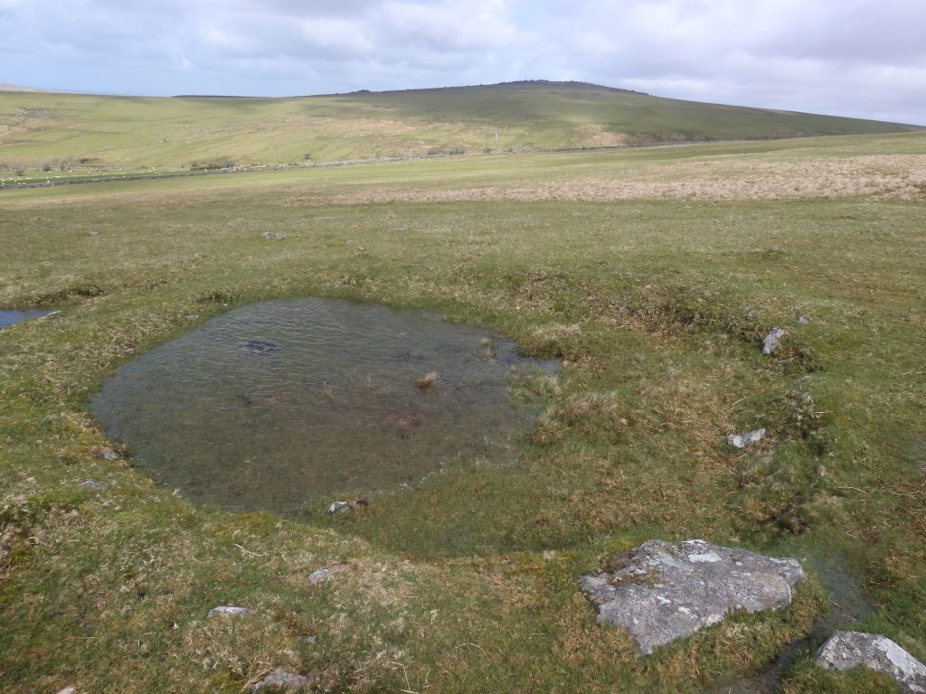
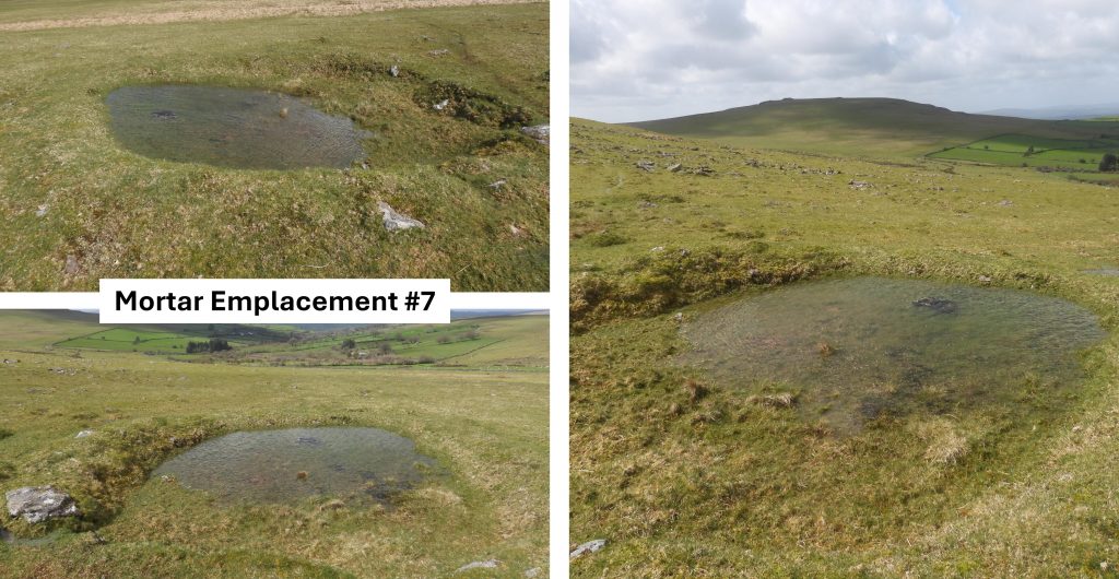
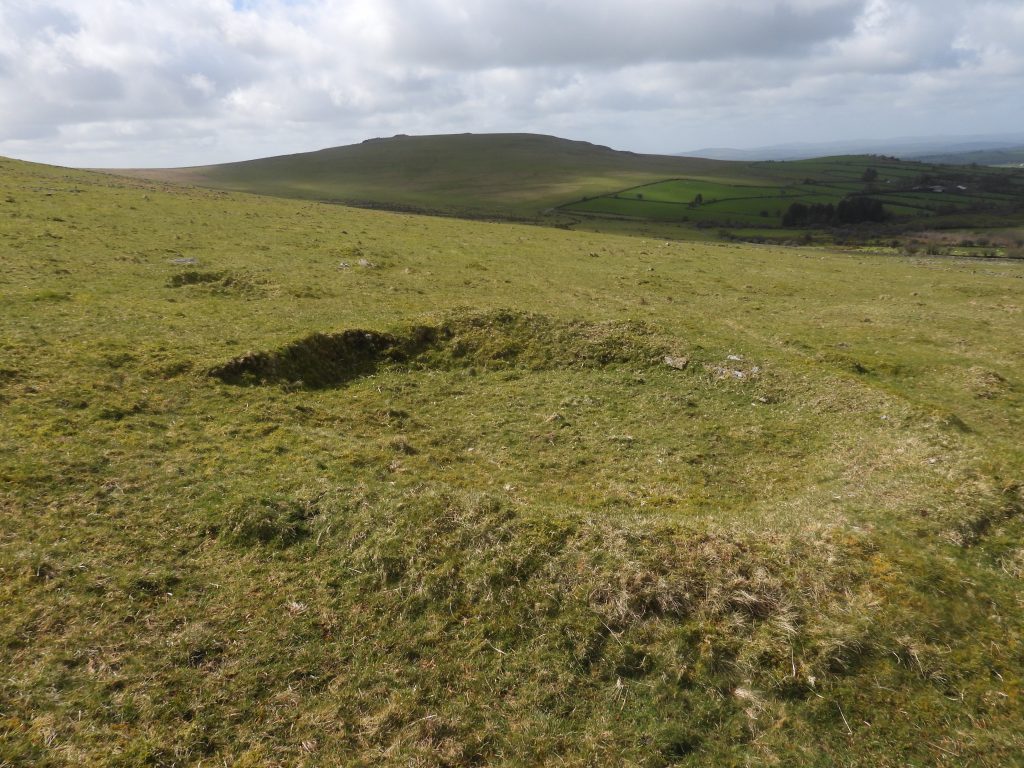
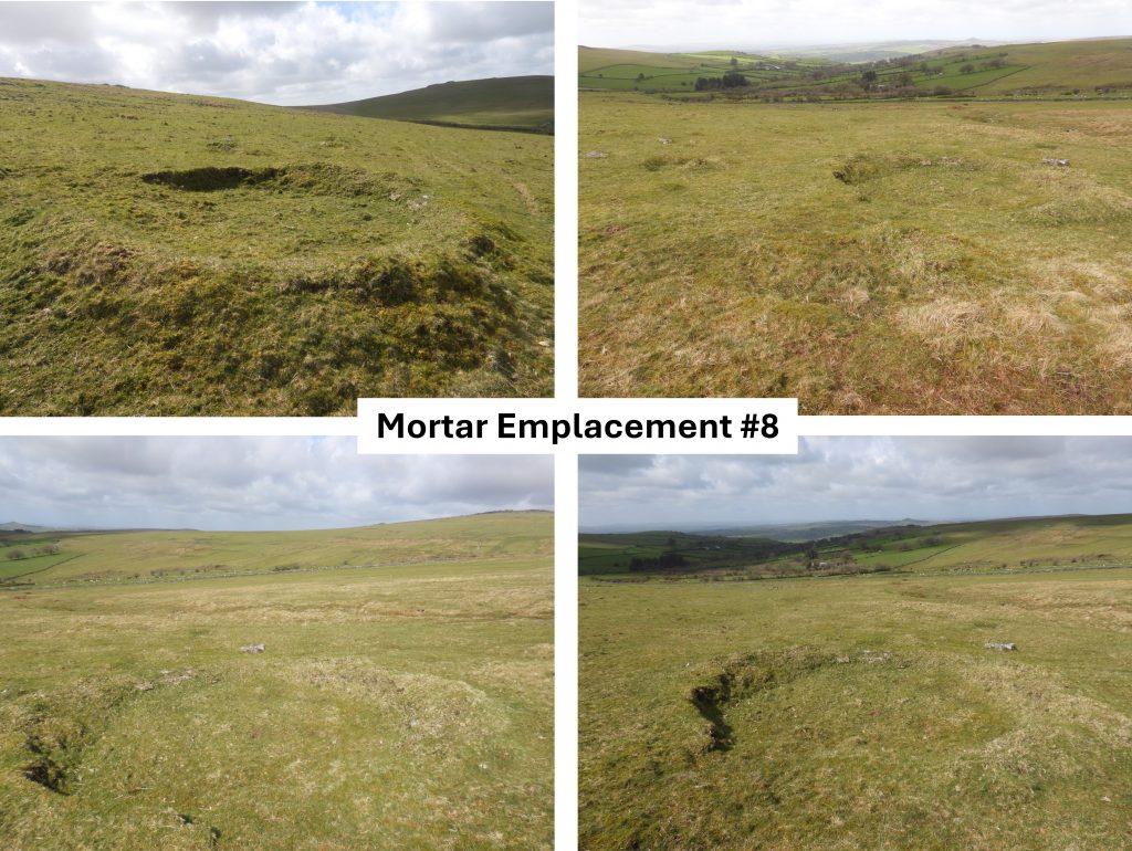
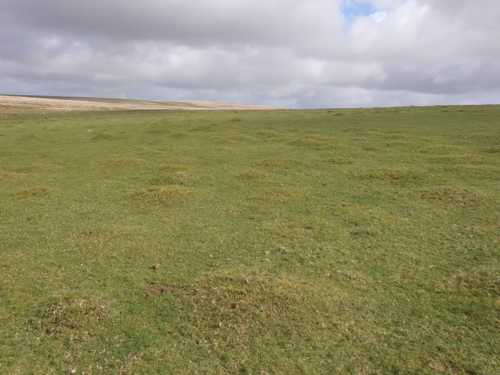
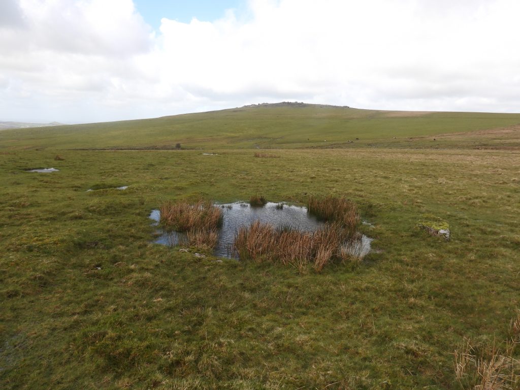
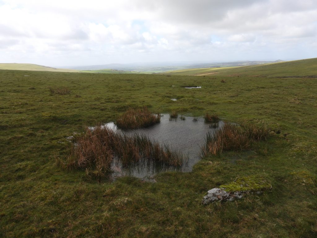
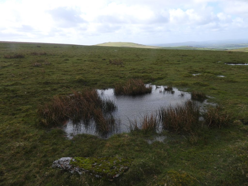
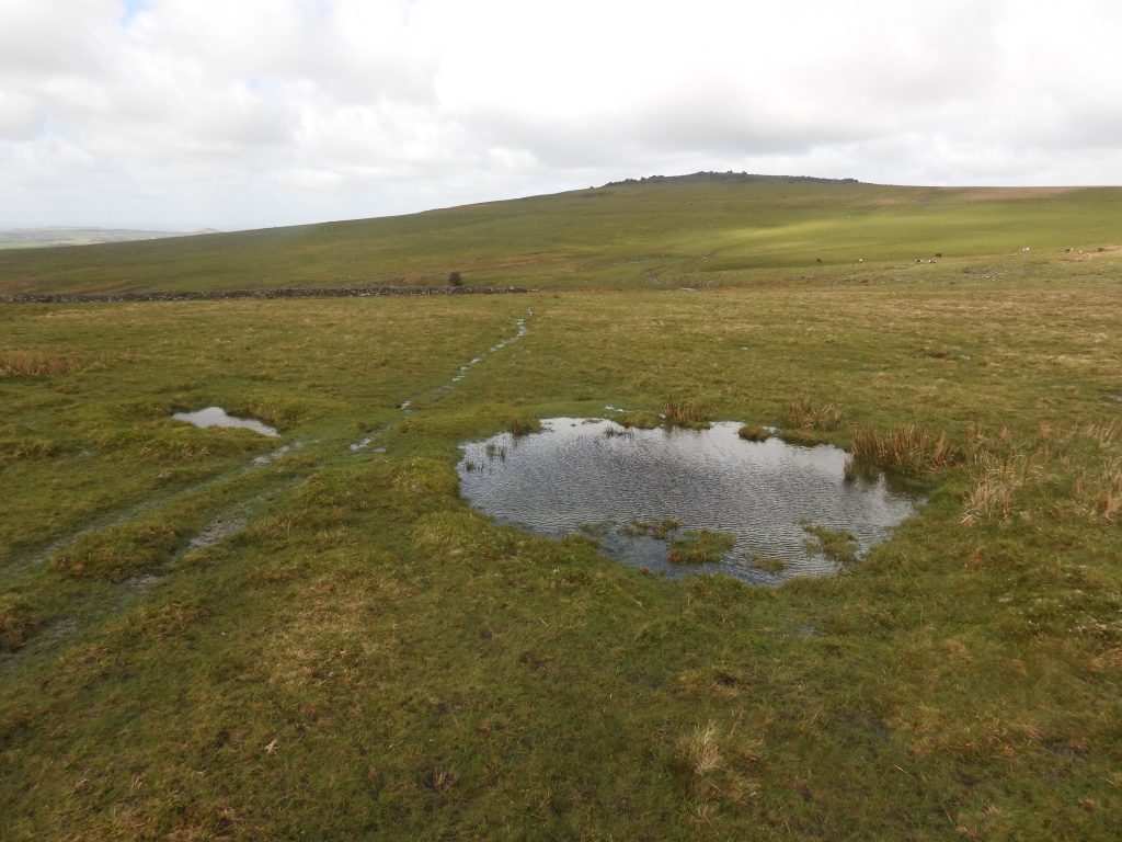
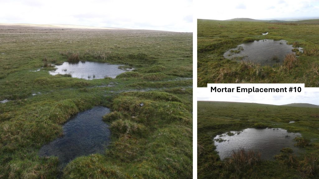
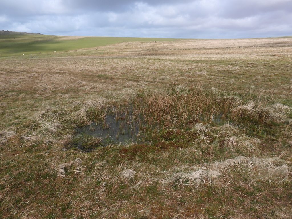
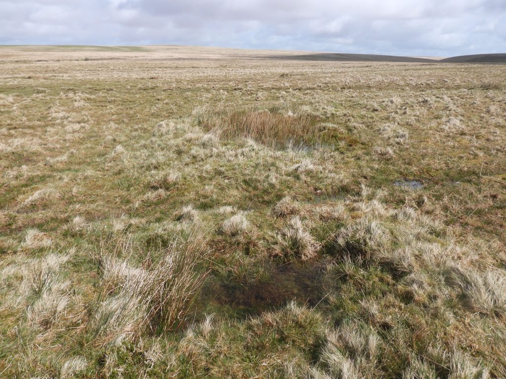
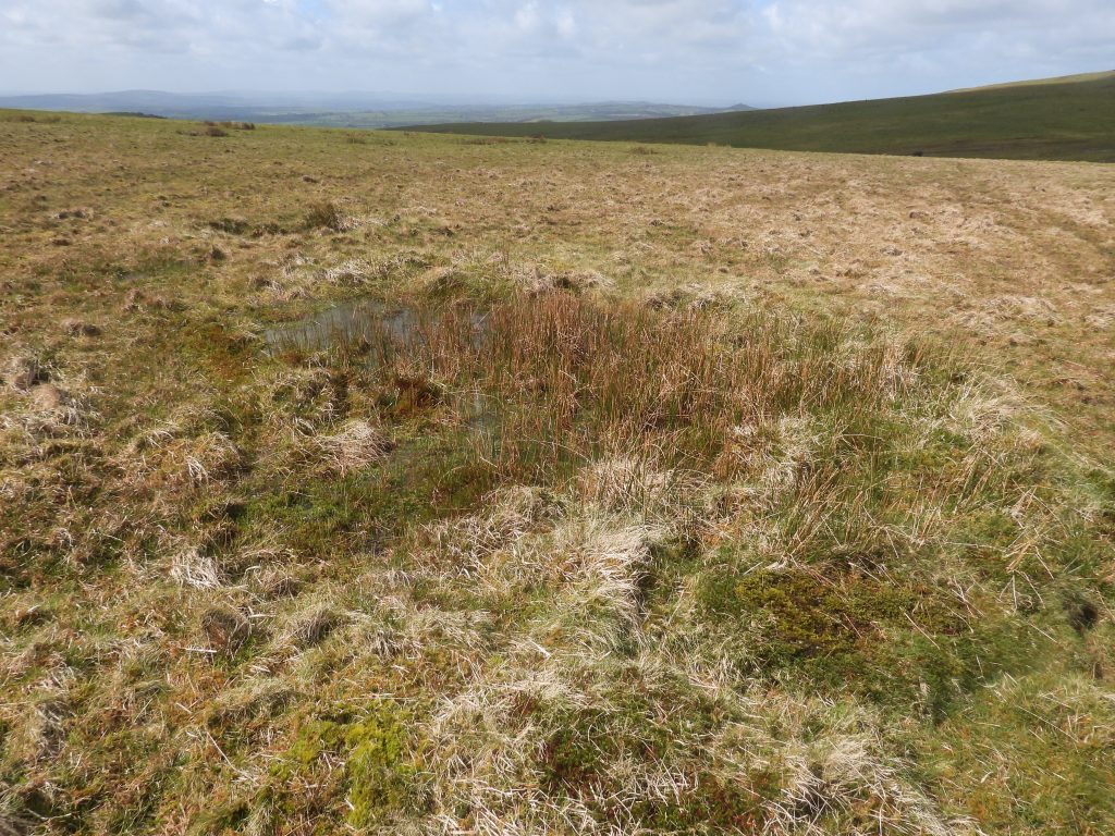
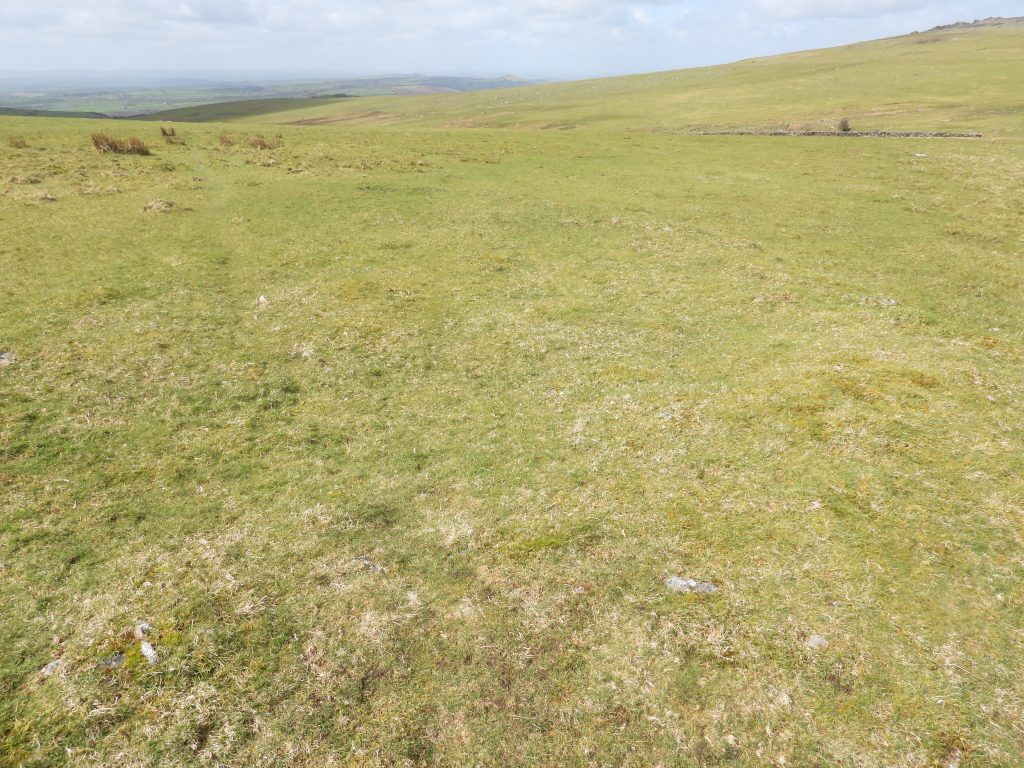
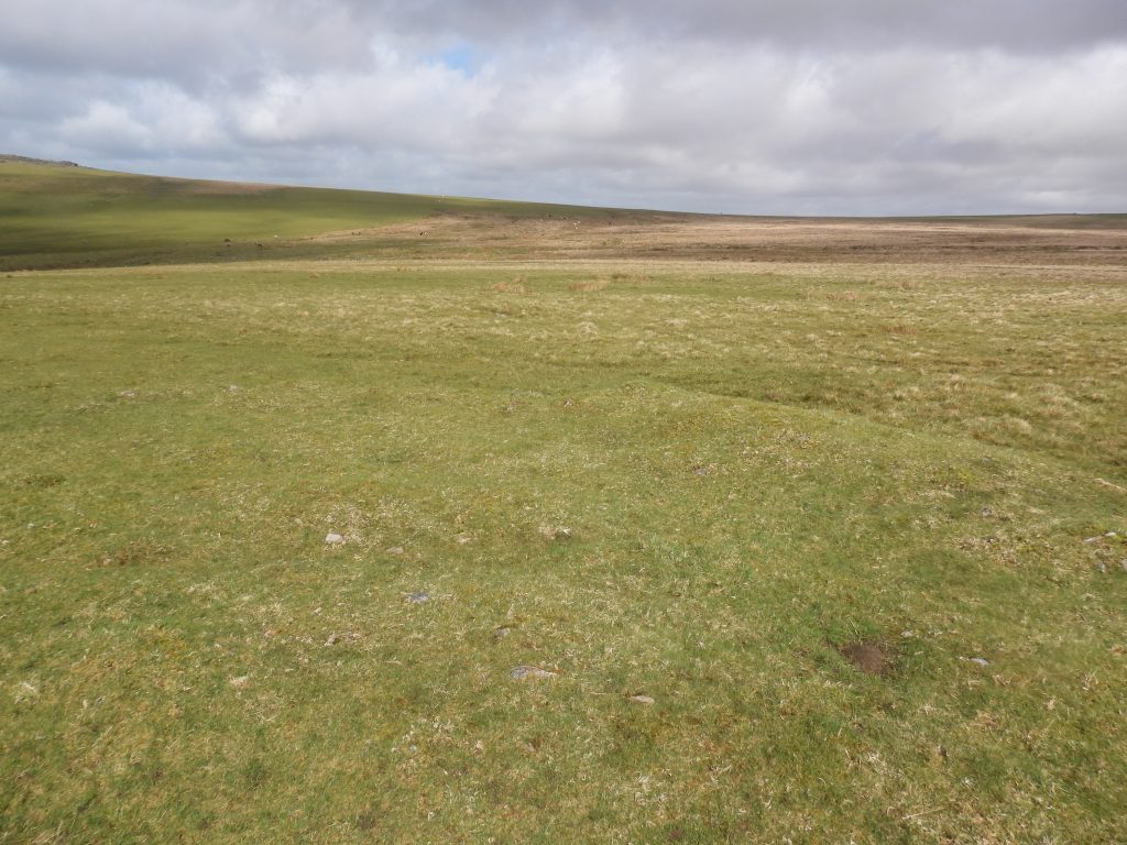
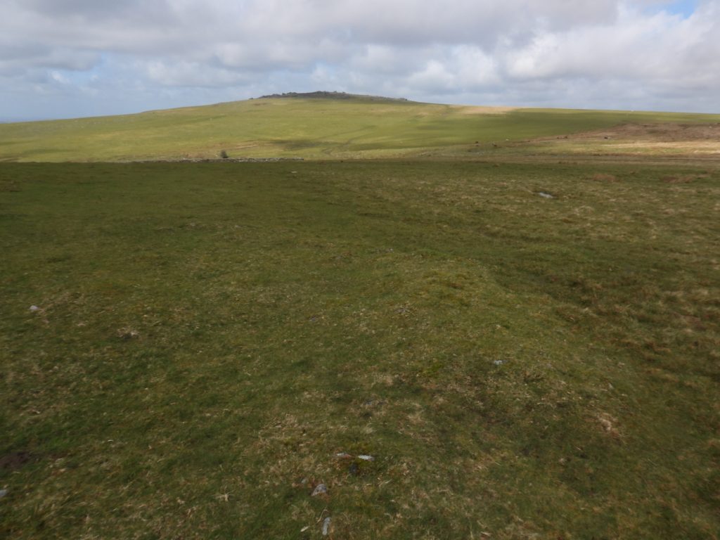
Sketch map of the locations of the 12 Mortar Emplacements and other features covered in this postThis rectangular shape near the ‘Viewpoint’ car park is the foundations of an old building, although it does look like a possible military artefact. The building can be quite accurately dated to around 1880 as it does not appear on an OS map dated 1873 but does appear on an OS map dated 1888. The function of the building is unknownThe building foundations measure 3.5m x 2.7m and can be found at SX53088 75219.On the edge of Beckamoor Combe, an area of extensive tin streamworks is the first of the Mortar Emplacements covered in this post. A ‘tell-tale’ sign of its military origins is a rectangular Ammunition Hole a short distance to the westMortar Emplacement #1 has been recorded by Royal Commission for the Historical Monuments of England as variously over the years as being associated with the Tinstreaming or even a Hut Circle. Later interpretation (including that conducted by the Dartmoor Tinworking Research Group) considered the ‘sharply cut down interior’ which suggests a later use of this feature that previously considered. This has lead to the interpretation that it is likely to be a 20th century Mortar Emplacement. The structure looks very similar to the other Emplacements covered by this post.Mortar Emplacement #1 can be found at SX53456 75549Just to the south of Cox Tor is this small quarry. There does not appear to be any significant history relating to this featureThe quarry appears to be in two parts with a smaller section located to the south east of the main section. It is below this area where the second (possible) Mortar Emplacement is located The Dartmoor Historic Environment Record describe this circular depression as being 7.0m. in diameter and 0.7m. deep. It is suggested that it is not a hut circle but probably associated with the quarry working. That said, the author believes it is more likely to be of military origin and looks very similar to other Mortar Emplacements covered in this post. The only doubt in the author’s mind is the size, which is much larger than others in the area.Close up of Mortar Emplacement #2. It can be found at SX53131 75712South west side of Cox Tor. Here is the western end of a reave which is shown on modern maps as ‘Boundary Work’. The reave was part of prehistoric field boundariesThe Dartmoor Historic Environment Record (HER) describes three military Mortar Emplacements located on a south facing slope of Cox Tor, of which two of the three cut into a prehistoric reave. The picture above is the closest the author could find of the western most one. This possible Mortar Emplacement (#3) was found at SX52881 75919 The prehistoric reave below Cox Tor survives as a low rubble bankThe picture above is the closest the author could find of the middle Mortar Emplacement along the Cox Tor ReaveThis possible Mortar Emplacement (#4) was found at SX53093 75969The easternmost Mortar Emplacement is the most discernible of the three which are located along the length of the Cox Tor reave. The Historic Environment Records describes this Mortar Emplacement very well, namely: ‘……a triangular area measuring 3.5 metres by 3.5 metres and defined by an earthwork bank up to 0.4 metres high’Mortar Emplacement (#5) can be found at SX53494 76052The Ordnance Survey Archaeology Division in 1950, described this circular feature as the ‘remains of hut circle, much despoiled’. Fast forward to 1980, the description had changed to: ‘the appearance is that of an industrial or military work rather than a hut circle’. The author consequentially has suggested this is another Mortar Emplacement (#6)Mortar Emplacement (#6) can be found at SX53723 75962Whilst walking on the col between Great Staple Tor and Roos Tor, a coastguard helicopter flew overhead. The locations for Mortar Emplacements (7-12) are to the north of Roos TorOn the col between Great Staple Tor and Roos Tor is a boundary stone inscribed with ‘W’ (for Walkhampton) and ‘P’ (for Peter Tavy) as its on the parish boundaryMortar Emplacement #7 is partially water filled. White Tor can be seen in the background. There is a possible ammunition hole to the westMortar Emplacement (#7) can be found at SX54366 77286Mortar Emplacement #8 appears to have an ammunition hole to the southMortar Emplacement (#8) can be found at SX54331 77339Between Mortar Emplacements 7-8 and 9-12 there are some Thurfur’s, which are particularly apparent around the Cox Tor and White Tor areas. Thurfur’s were formed by ice age glaciation. Thurfurs are: “A special form of cryoturbation is represented by earth hummocks or thufur, they are vegetated oval mounds with heights of 30 to 50 cm. Earth hummocks develop because of local patchy freezing of pore-water in the active layer, yet no pure ice core forms but a small proportion of the soil freezes. This core of frozen ground causes moisture migration towards it, concurrently causing a small scaled displacement of soil material in the same direction. Frost heaving leads to the development of a small mound, and as the freeze/thaw processes re-occur many times, this displacement is amplified” ref: https://adriancolston.wordpress.com/2014/12/16/what-are-these-bumps-on-the-moor/There are a cluster of four Mortar Emplacements located at the edge of Langstone Moor. There are a few hollows in the area, so a little interpretation was called upon. The hollow in the picture, the author has labelled Mortar Emplacement #9The Mortar Emplacement (#9) location is consistent with the grid references provided by Phil Newman as recorded on the Dartmoor Historic Environment Record. The water filled smaller hollow to the west is a probable ammunition holeMortar Emplacement (#9) can be found at SX54843 77968Mortar Emplacement #10 with probable ammunition hole to the west. White Tor on the near horizonMortar Emplacement (#10) can be found at SX54816 77990Probable location for Mortar Emplacement #11Probable Mortar Emplacement #11 with nearby ammunition hole (foreground)Mortar Emplacement (#11) can be found at SX54896 77964This faint outline is possibly Mortar Emplacement #12, albeit the bank is quite shallow. It certainly looks man madeThe bank associated with the possible Mortar Emplacement #12 is a bit more discernible when viewed from the south.Mortar Emplacement (#12) can be found at SX54841 77917