A collection of walks, discoveries, insights and pictures of exploring Dartmoor National Park
May 4, 2024
Tanner’s Path and the huntsman’s route from River Avon to Blacklane
In the northern fen on Dartmoor, there are around a dozen peat passes, which were cut around the turn of the 19th century to enable travellers, the hunts and farmers to traverse the fen a lot easier. Many of the peat passes were cut by Frank Phillpotts between 1895 and 1905, most of which today are marked by plaques mounted on a small granite pillar. Around 15 years after the Phillpotts peat passes had been finished being cut, in similar vain, a path was cut cross a miry plain in the southern fen between the River Avon and the eastern flank of Green Hill. This cut became known as Tanner’s Path.
The cut (or path) is named after E. Fearnley Tanner, who was “a prodigious huntsman” (description afforded by Eric Hemery in High Dartmoor on page 324). He cut the path during the early years after WWI being assisted by Jan Waye of Huntingdon. The author has found in Mike Brown’s ‘Guide to Dartmoor’ (which was produced nearly 20 years after Eric Hemery’s ‘High Dartmoor’), that he casts doubt that Tanner actually cut the path himself. Brown’s research records that the only E. Fearnley Tanner he could identify was a justice. He further records about Tanner that he was : “……..perhaps once a master of the local hunt. It is doubtful that he would have got his own hands dirty doing such a grim job in such an inhospitable place, and that the path was simply named after him. Of course, I might be mistaken, and it may have been cut by a son of the same name”.
Notwithstanding who physically cut the path, both Eric Hemery and Mike Brown agree where Tanner’s Path is located. Eric Hemery adds that Tanner’s Path provided a quick route to Fishlake Gully and so to Blacklane in the central basin. He adds that on the “West rim of Fish Lake Head is the once hoof-worn junction, now practically disused and faintly defined, of Fishlake Gully, with the path to Aune Head and the approach to Tanner’s Path. The junction was known as Black Hut, as near it stood a peat cutters’ shelter of that name”.
This post details an exploration of the huntsman’s route between the River Avon and Blacklane to find the locations of Tanner’s Path and Black Hut, where once E. Fearnley Tanner and the local hunt once rode, just over 100 years ago
Bibliography
Eric Hemery (1983) – High Dartmoor pages 301, 302 and 324
Mike Brown (2001) – Guide to Dartmoor (CD)
Dr Tom Greeves (2020) – Barrow, tinners’ lodge & tinners’ cache discovered on south Dartmoor (HER reference SDV363711)
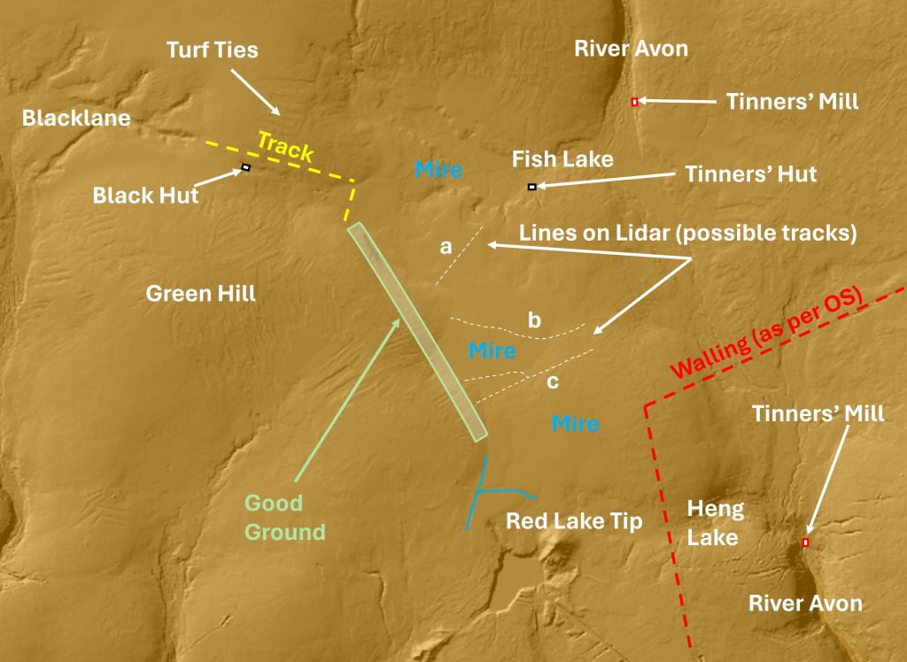
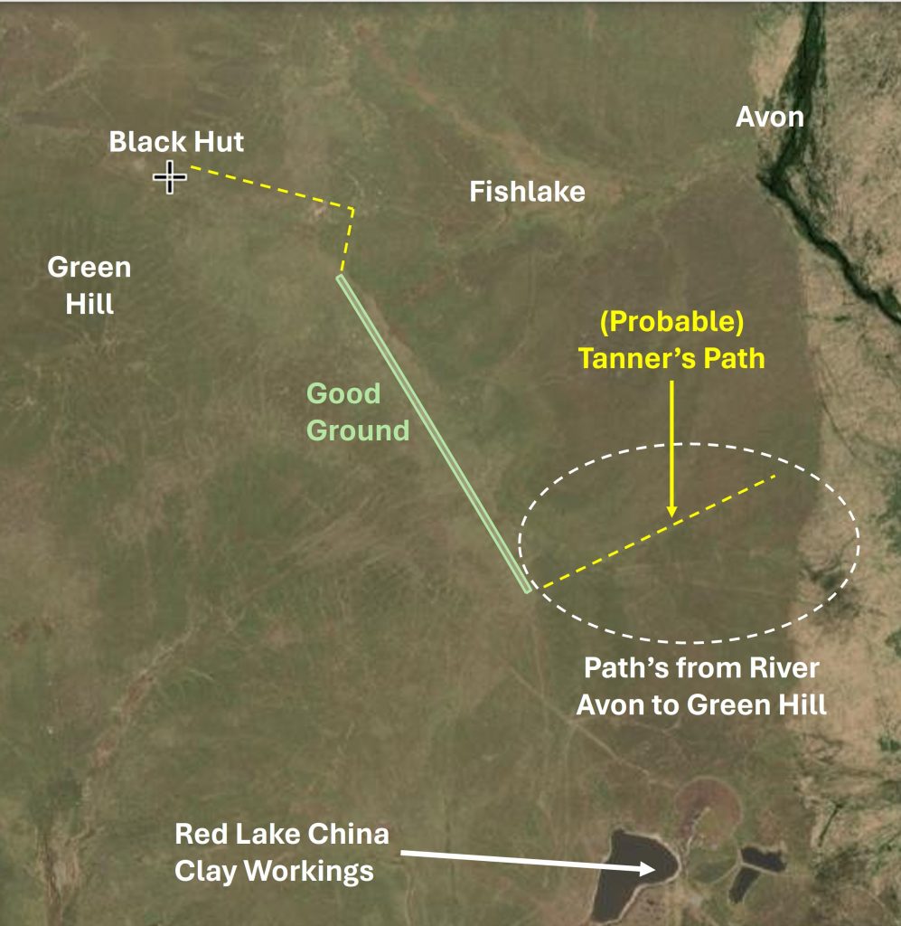
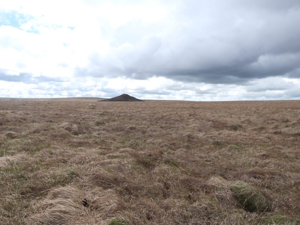
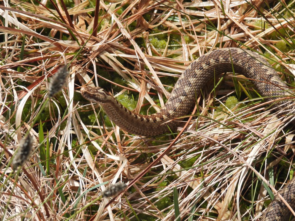
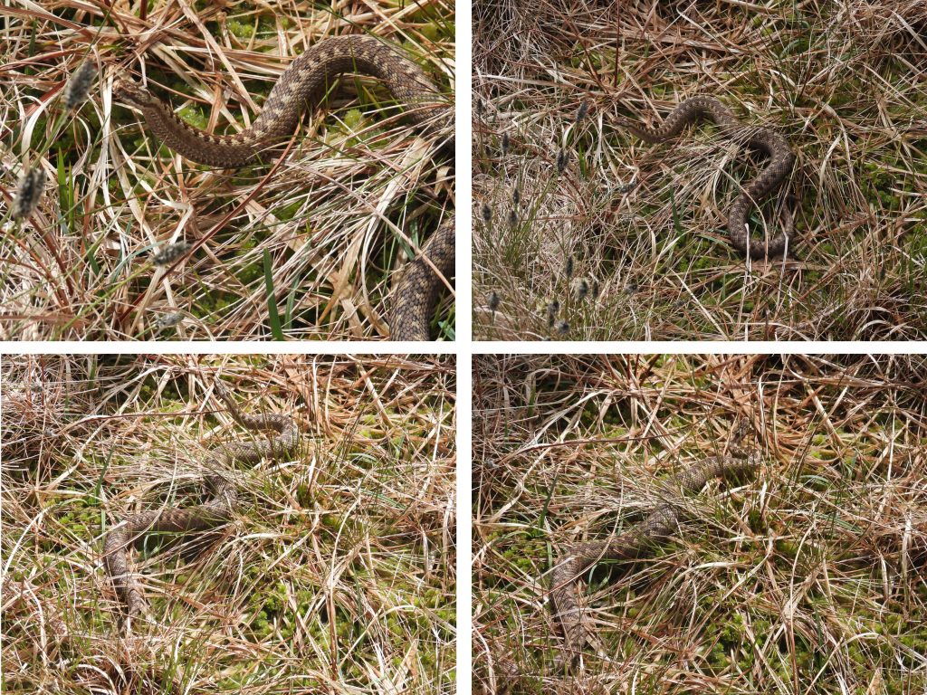
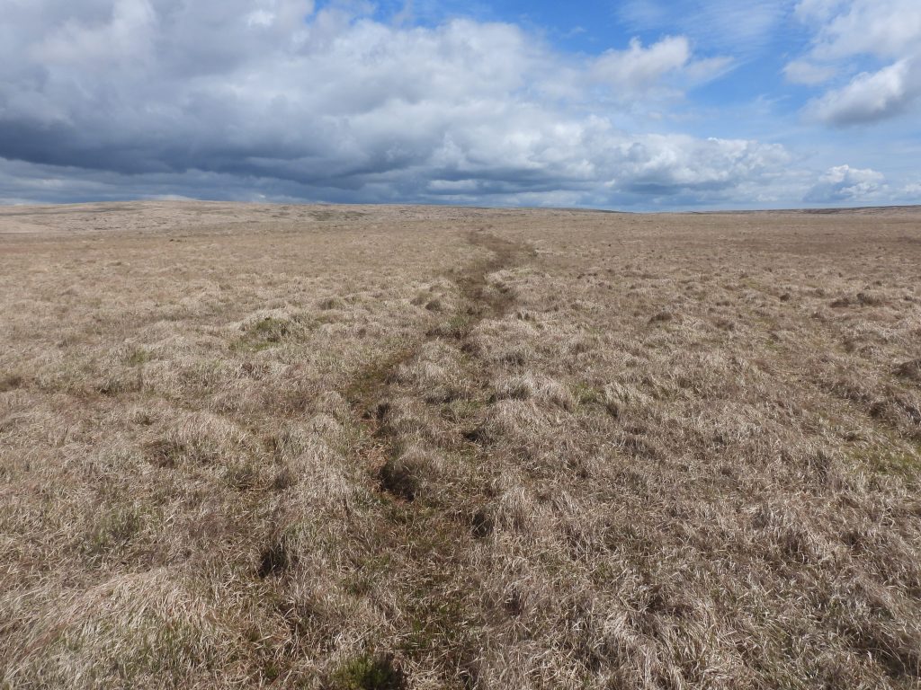
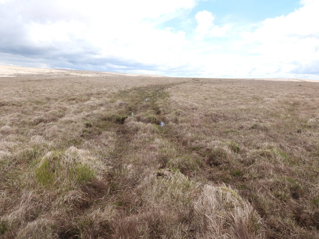
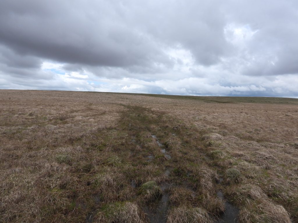
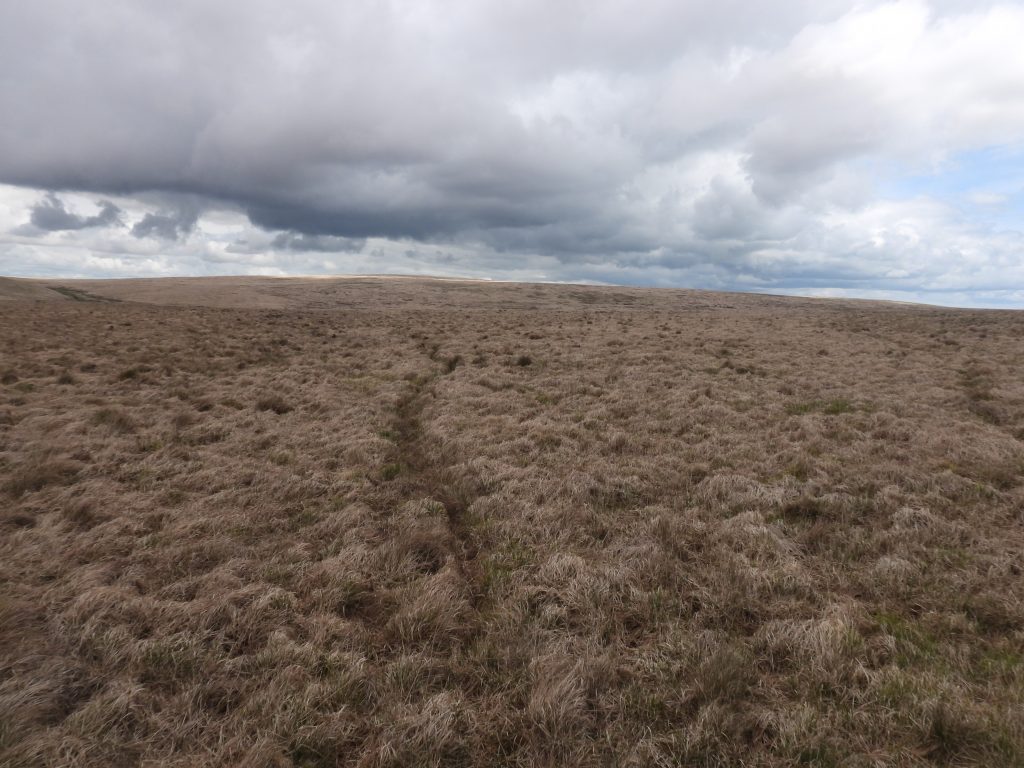
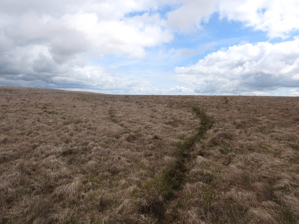
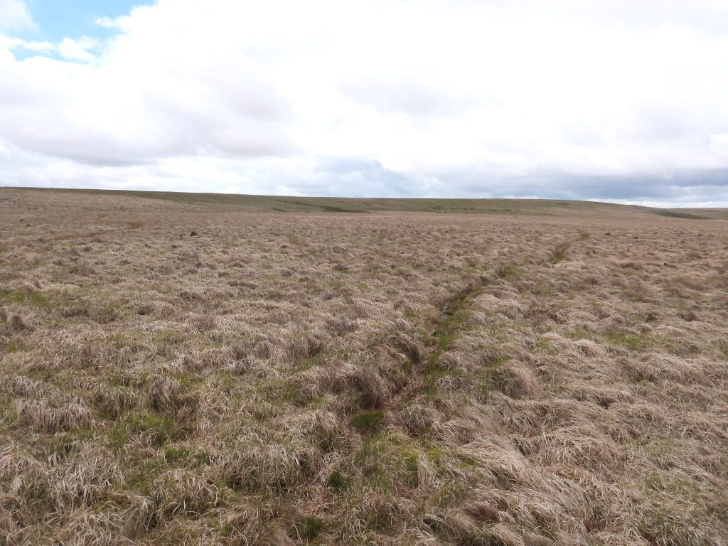
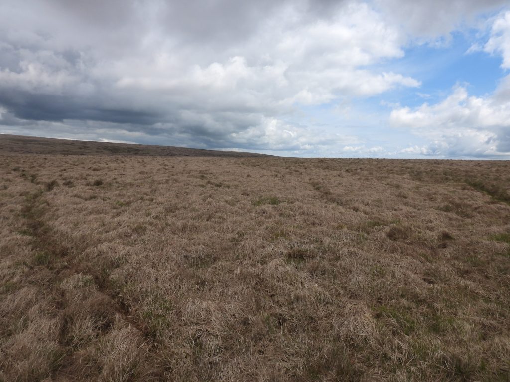
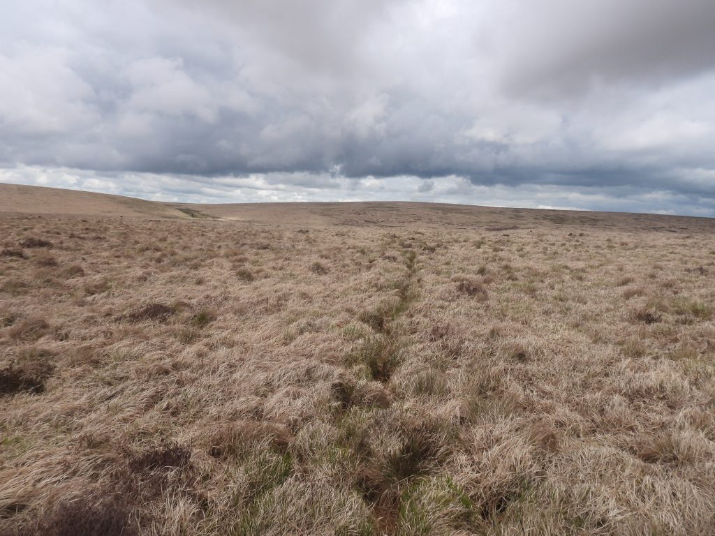
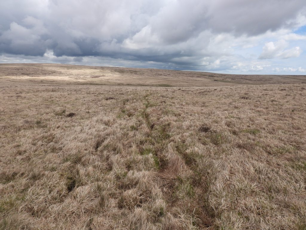
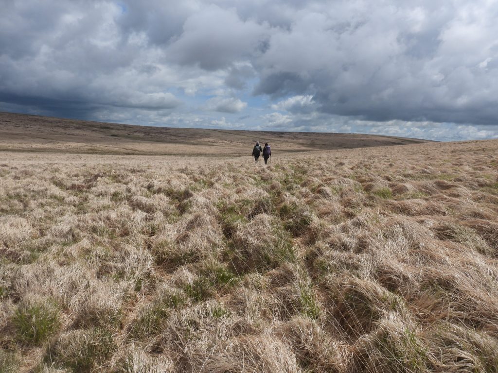
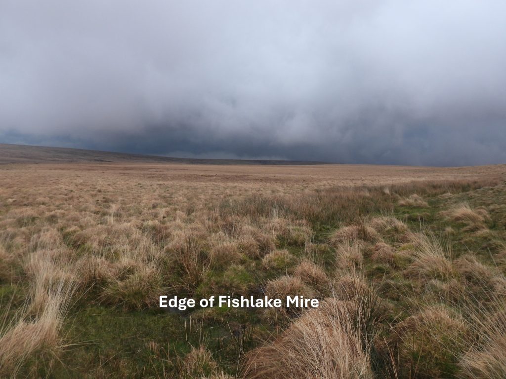
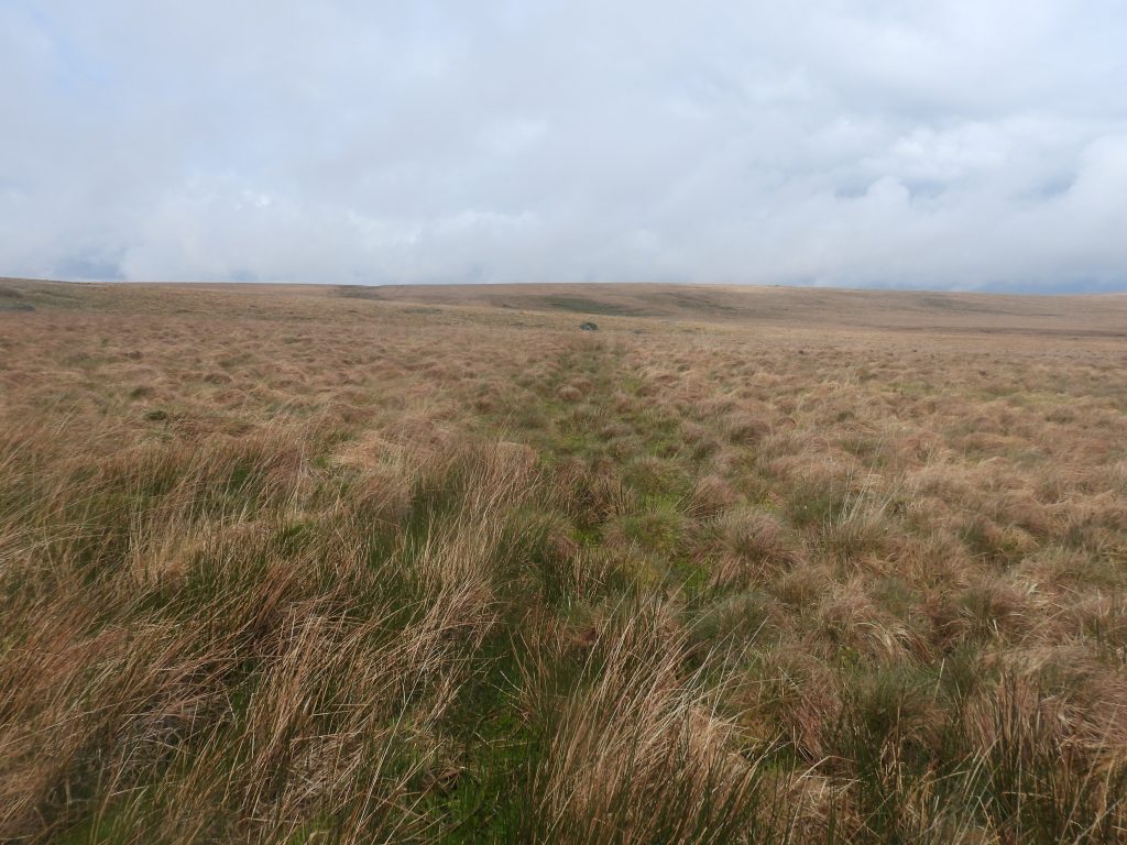
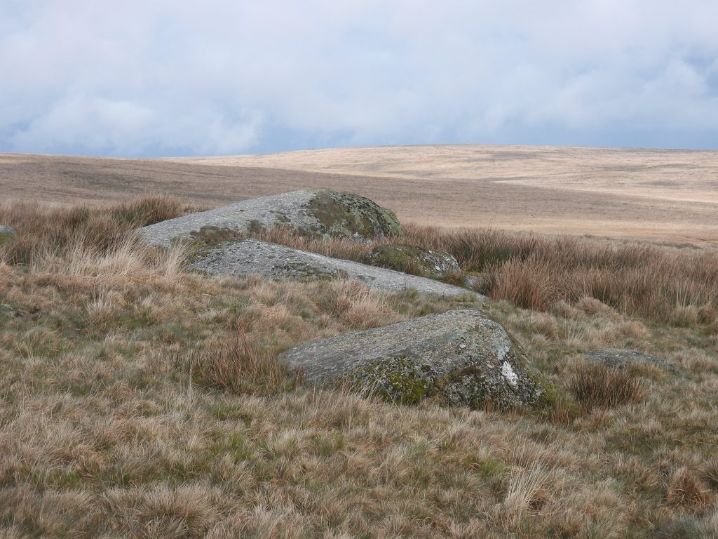
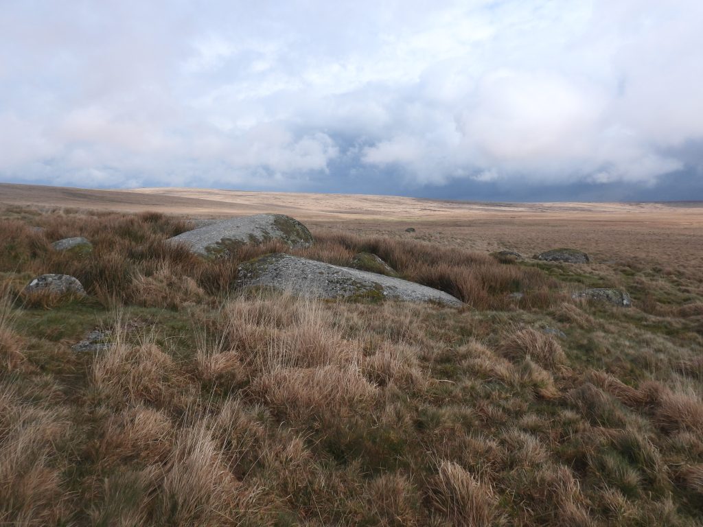
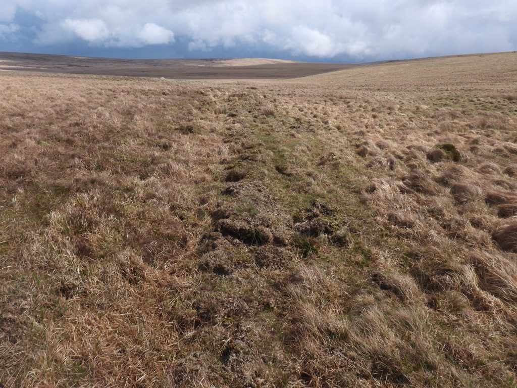
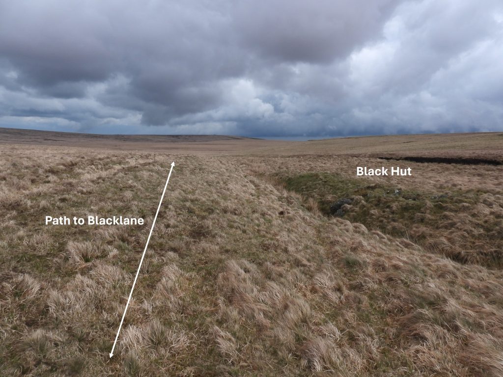
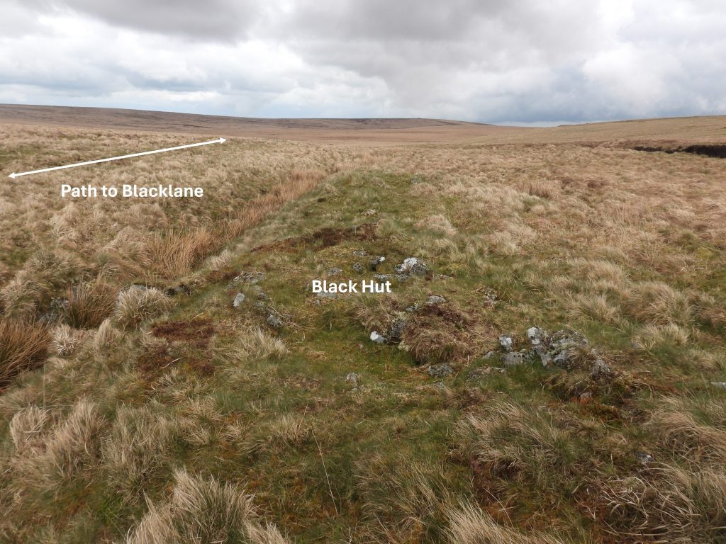
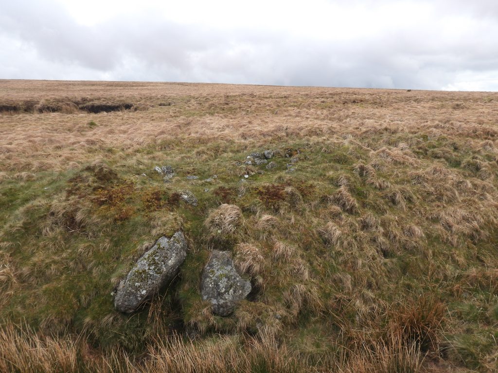
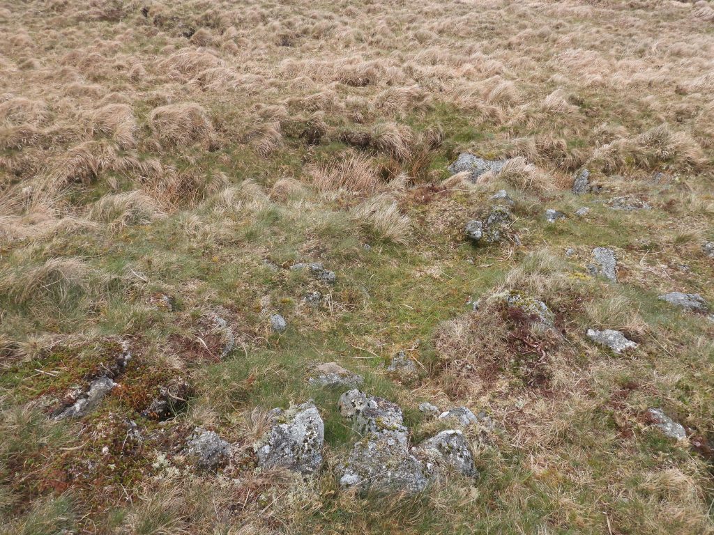
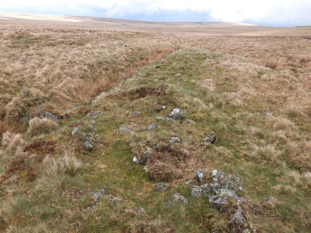
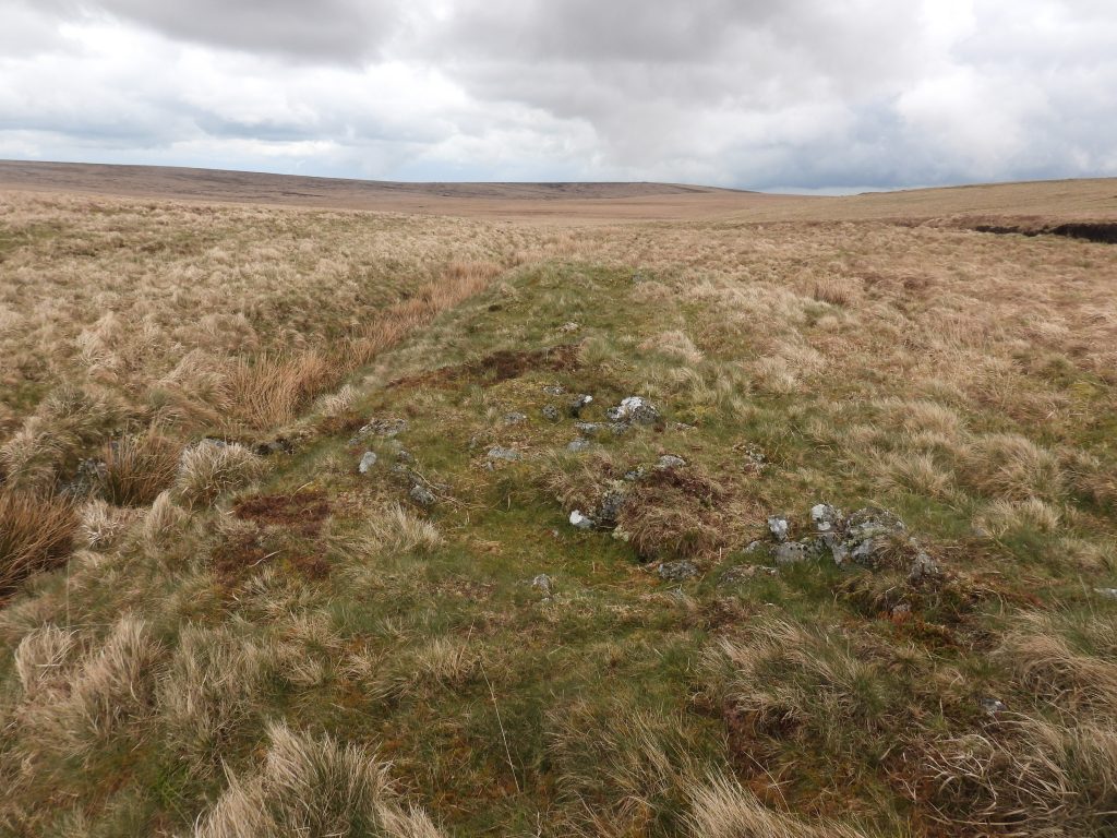
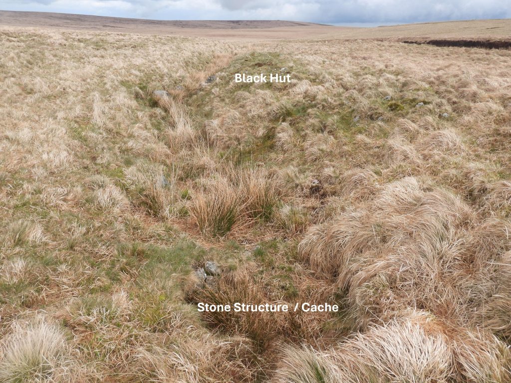
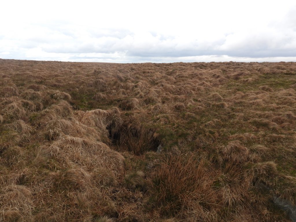
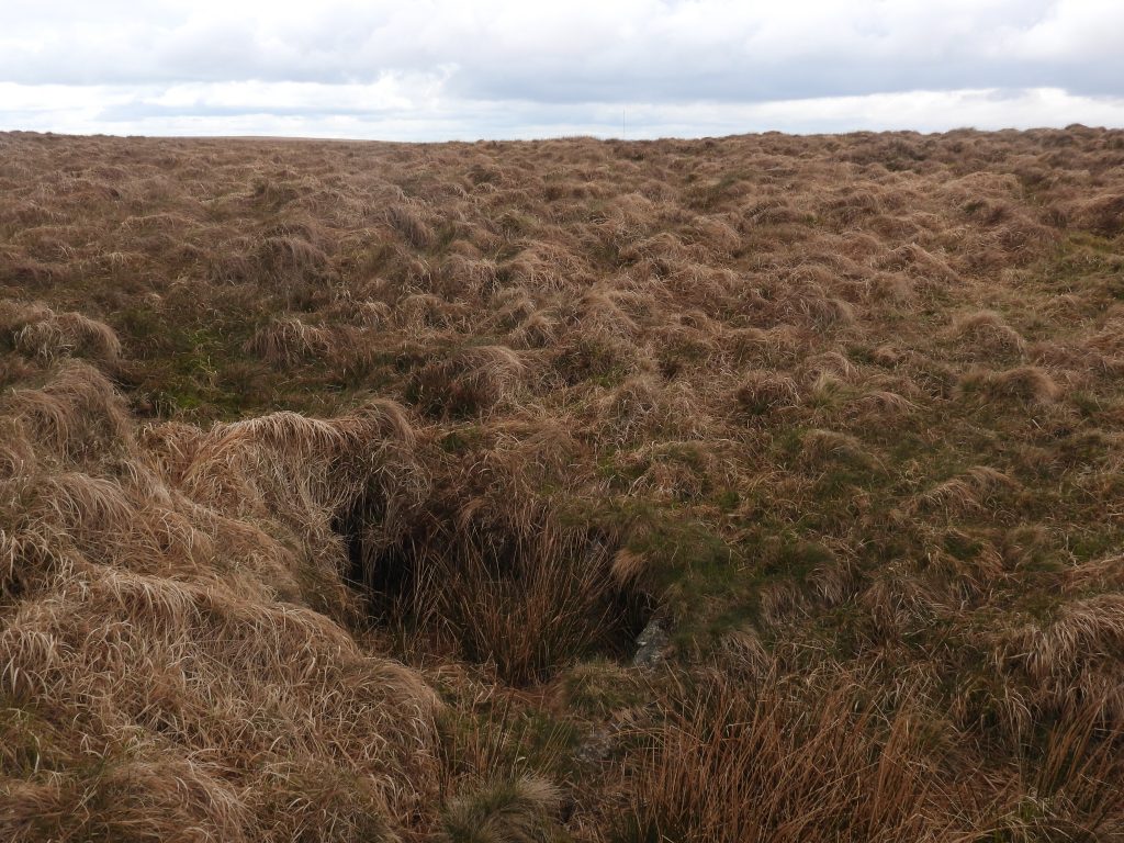
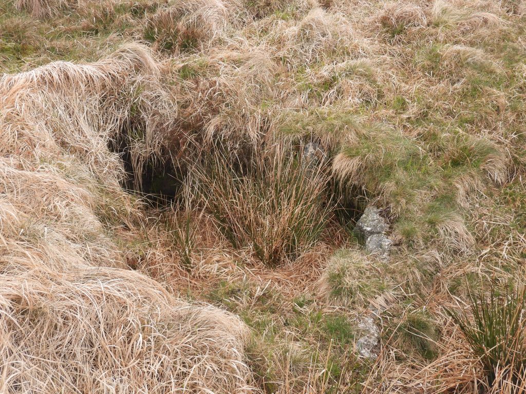
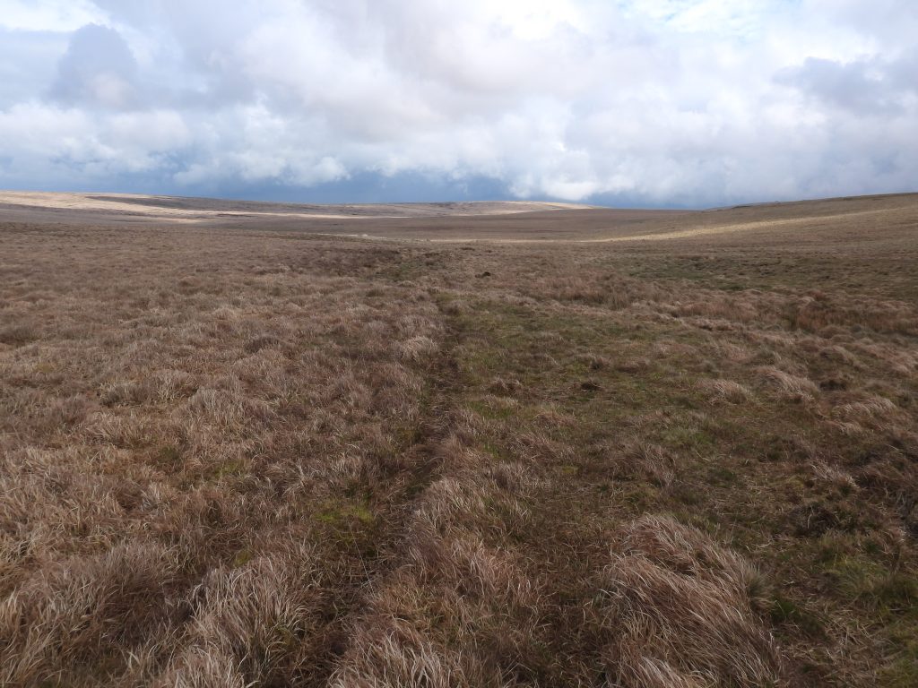
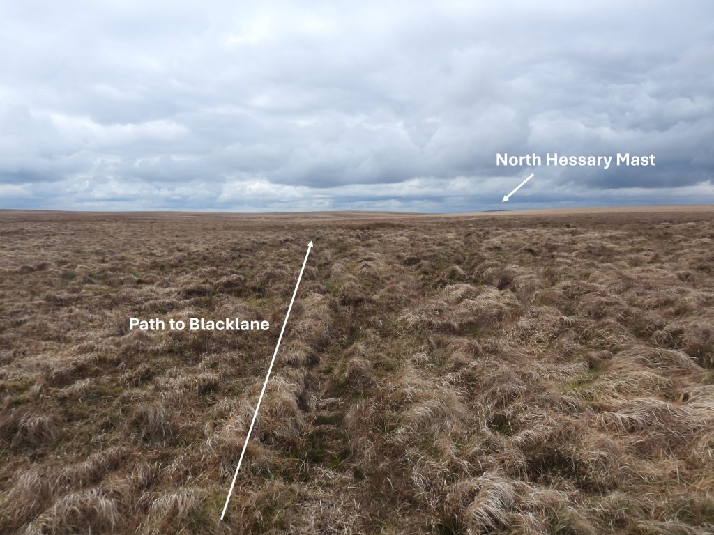
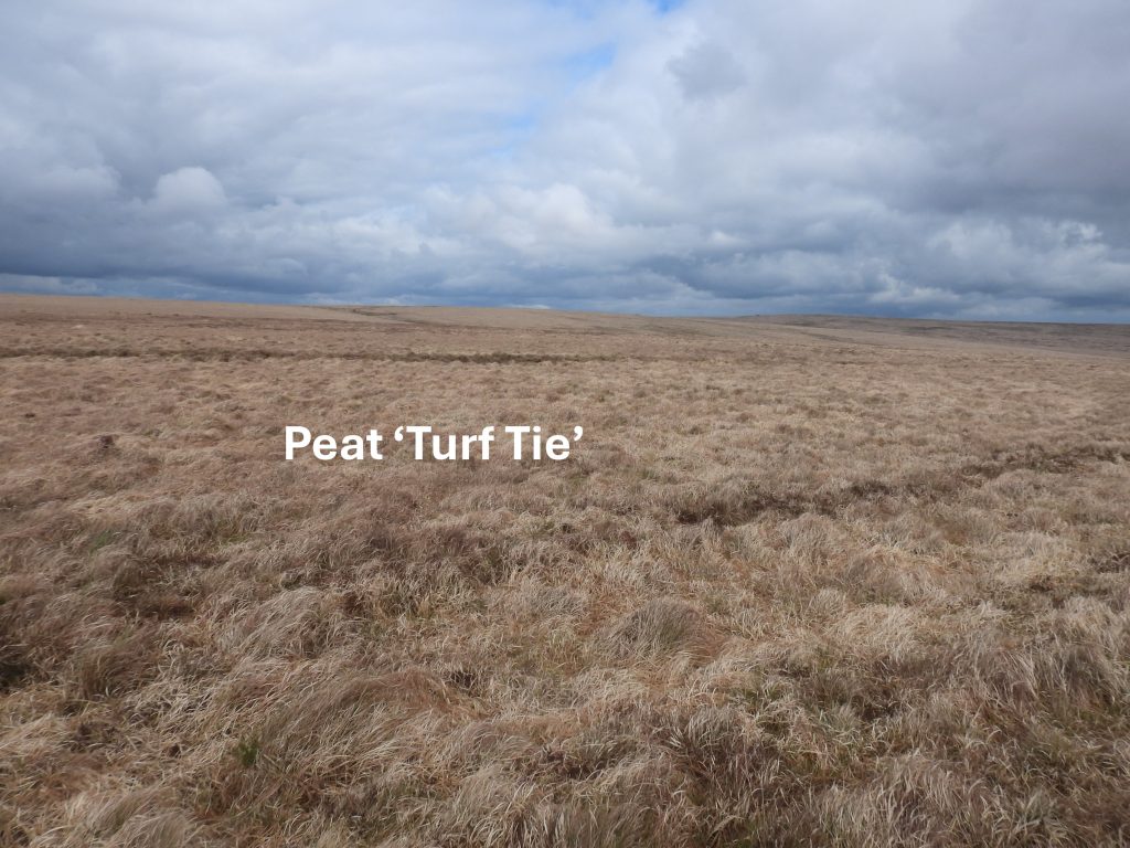
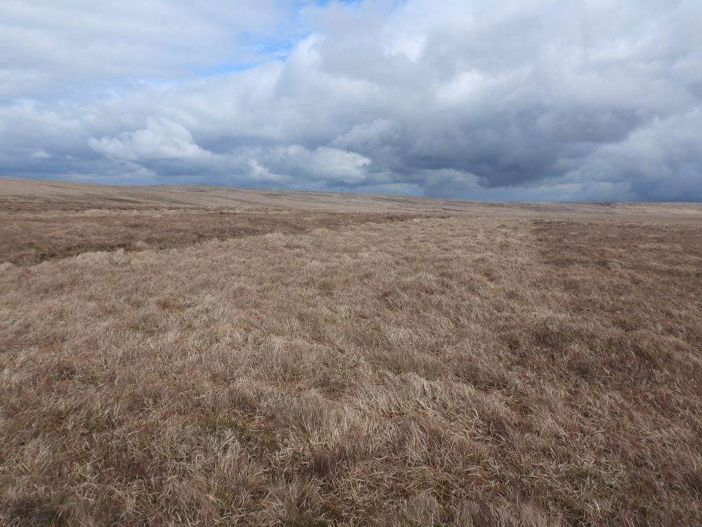
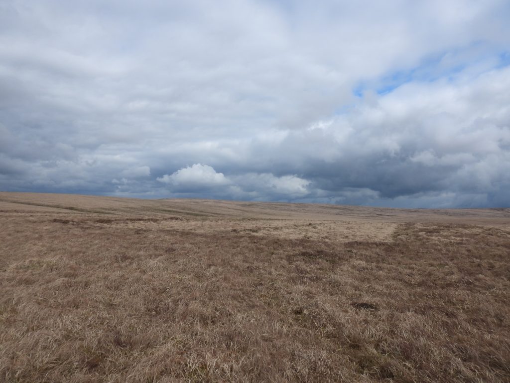
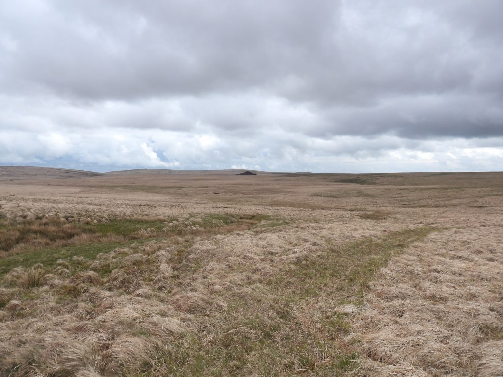
Using a LIDAR (Light Detection And Ranging) of the ground between the River Avon and Blacklane and the descriptions of the possible huntsman’s (E. Fearnly Tanner) route between these two water courses by Mike Brown and Eric Hemery, the author conclusions are that the route was ‘line c’ from the Avon, then it followed the ‘good ground’ (in green), then followed the ‘yellow dotted line’ to Blacklane (via Black Hut) as shown on the above annotated map.Using Google Earth and the description by Mike Brown of Tanner’s Path, the author has estimated the its location. Mike Brown described the path as following a north east to south west direction and is located at SX645 676. This line of Tanner’s Path meets up with ‘good ground’ on the east flanks of Green Hill. Further north this good ground meets up with paths around Black Hut which lead to BlacklaneTo the north of Redlake Tip amongst the tussocks and mire looking for the location of Tanner’s PathA surprising find in the rather wet terrain was this adder (Vipera Berus). The author believes this was a young female (brown zig-zag pattern)One of the first tracks to be found to the north of Redlake Tip extends in the north westerly direction towards Green Hill and can be discounted as a possible Tanner’s PathCrossing the miry plain is this rather wide track which follows an west-east course. This track appears (relatively) modern and the author believes is a track which can be followed from Ryders Hill through to Green Hill (southern flanks). This view is looking east towards the AvonA view of the wide track looking west towards the southern flanks of Green HillA little way north of the ‘Wide Track’ is the first candidate to Tanner’s Path. The author discounted this track as its orientation is more or less east-west and thus is different from the description provided by Mike BrownAnother potential Tanner’s Path on the miry plain. The grid reference is slightly out and the orientation is once again east-westIt was this path, which the author believes is the most probable of all the candidates found to be Tanner’s Path. This one runs north east – south west as per the Mike Brown description. This path is located very close to the grid reference provided by Mike Brown (SX645 676)The probable Tanner’s Path is on left side of this photograph. There are other animal tracks in the area.The probable Tanner’s Path continues in a north east direction. Of interest, Mike Brown’s research on E. Fearnley Tanner, provides a lovely piece of trivia. He (Tanner) was the principal speaker at a reception and presentation given to W. P. Hamlyn of Buckfastleigh in February 1900, a trooper with the Devon Imperial Yeomanry who had just returned to the village after active service in the Boer War. Eric Hemery tells us (written in early 1980s) that Tanner’s Path was a drainage gutter and part of it was a stone causeway, marked with guidestones. Mike Brown (2001) states: “The faint track of a former route ‘Tanner’s Path’ runs approximately southwest-northeast just north of the broad shallow crest of the plain but the path is now so overgrown and ‘gone back to moor’ that its harder surface actually offers little relief to the walker”. The path the author identified is the most probable candidate, albeit no exposed stone causeway was found. Having walked due north across the miry plain, the author has no doubts that at least once of the tracks recorded in this post is Tanner’s Path. If anyone reading this post has further information or photographs this would be gratefully received.Returning to the Avon via a faint animal track, the ridge line between Heap o Sinners and Ryders Hill on the horizonEdge of Fishlake Mire with the ‘Miry Plain’ where Tanner’s Path crosses beyond. The flank of Ryders Hill on top left of the photographOn the north east flank of Green Hill on the western edge of Fishlake Mire this path can be found. It is a north south route which passes to the east of Fishlake Rocks (which can be seen on the top left edge in this photograph). This path is annotated on the LIDAR and Google Earth maps on this post (yellow dashes) and appears to link the good ground to the east of Green Hill with the well worn track next to Black HutFishlake Rocks – these 5 slabs are located near to ‘Black Hut’ but do not appear to be mentioned by Eric Hemery or others to this authors knowledge. Their naming has come from the ‘Tors of Dartmoor’ website (https://www.torsofdartmoor.co.uk/tor-page.php?tor=fishlake-rocks) and is a 21st century origin. That said, the name without any other provenance is as good as any. The only other possible name the author might consider is ‘Black Hut Rocks’ since this area (junction of paths) was historically named as such.Fishlake Rocks can be found at SX 63978 68059This causeway (hard path) can be found immediately to the north of Fishlake Rocks. It leads to the Black Hut area and onwards to Blacklane. The photograph was taken at SX63784 68111Alongside the faint path leading to Blacklane and across a shallow linear gully is ‘Black Hut’Both Eric Hemery and Mike Brown describe ‘Black Hut’ as a peat cutters’ hut. Dr Tom Greeves describes ‘Black Hut’ as an indistinct tinners’ lodge against the south side of a linear gully (Fishlake Gully). ‘Black Hut’ is located at SX63715 68119‘Black Hut’ is about 3m by 2m internally with walls about 1 metre wide and no more than 0.3 metres high (ref: Greeves). Dr Tom Greeves states that the linear gully, “which has probably been worked for tin, ends a few metres to the west of the lodge”. The gully actually lies to the east not westBoth Eric Hemery and Mike Brown state that ‘Black Hut’ is a “long vanished peat-cutter’s hut”. The author speculates that the ruins here, which were visited by Dr Tom Greeves in May 2020 is the same structure mentioned by Hemery (40 years earlier) and Brown (20 years earlier). Contextual view of ‘Black Hut’ and a nearby stone structure / cache. A linear gully, which might be water run off lies immediately below the stone structure and to the east of the hutTo the east of ‘Black Hut’ is a linear gully, which Dr Tom Greeves suggest was worked for tin, albeit there is no obvious upcast of earth along its edges. At the head of this gully is the small stone structure / cache which looks like it might be fed from water run off on the slope behind itDr Tom Greeves suggest the walling here might have been “to protect a water supply”. It certainly might have been a very small reservoir used for drinking purposes for the users / occupiers of the nearby hutThis photograph shows the stones within the structure, which is located at SX63704 68125Path leading from ‘Black Hut’ towards BlacklaneLooking north west towards Blacklane and North Hessary on the horizonClose by ‘Black Hut’ are several peat ‘turf ties’ suggesting that peat cutting was prevalent in the area. Does this evidence suggest ‘Black Hut’ was indeed a peat cutters’ hut as stated by Hemery and Brown (or was it a tinners’ lodge – Greeves) ? The name ‘Black’ may refer to peat ?Another turf tie with distinctive edgesYet another turf tieThis is the path (foreground) leading from the ‘Black Hut’ area leading to Aune Head. Red Lake tip can be seen mid picture. The large miry plain where Tanner’s Path is located would have been somewhere just above the faint green area of Fishlake Mire which can be seen approx. half way up and to the left hand side of the photograph