A collection of walks, discoveries, insights and pictures of exploring Dartmoor National Park
March 22, 2024
East section of the Buckfast Abbey – Tavistock Abbey Monastic route (Buckfast to Horn’s Cross)
This post covers part of the eastern section of what maybe is Dartmoor’s oldest trans-moorland route. The route, dating as far back as the 11th century was a inter-Monastic route between the two great Abbeys at Buckfast (Buckfestre) and Tavistock.
At Buckfeste (the ‘fastness or stronghold of the deer’) in 1018AD, King Canute founded a house for a Benedictine community. At that time, the only other pre-conquest monastery around Dartmoor was in Tavistock where, a monastery dedicated to St. Rumon was already in existence, having been completed by Ordulf in 981AD. The two Abbacies were held in the 11th century by two remarkable men, Alwin at Buckfast and Livingus at Tavistock who are said to have been very charismatic and enthusiastic. With this background it was likely that there was a call for regular communication and interchange between the two Abbeys.
Although circumstantial, with no documentary evidence, it is believed that the route was purposely surveyed and marked up with rough hewn granite crosses. Certainly, the probable route across the high moorland section, from Holne-Moor Gate in the east through to Cockles Gate in the west contains around a dozen crosses, some of which may well have been extant from the medieval period or earlier.
A great description of this inter-Monastic route was written by Eric Hemery in his book, Walking Dartmoor’s Ancient Tracks (Track 12). Hemery records that the monks and lay-brothers from Buckfast, would have used Dartmoor Commons for stock-grazing over Dean, Buckfastleigh and Holne moors. It is the latter moor, at Holne moor gate where the route entered the high moor on a section from which (from a later date) is believed to have been known as the ‘Maltern Way’. This post covers this eastern part of the inter-monastic route from Buckfast to Holne Moor covering the sites of two granite crosses (Hawsons and Horn’s) and the probable locations of two further crosses (Play and Two Thorns).
Bibliography
Walking Dartmoor’s Ancient Tracks – Eric Hemery – 1986 – Track 12 (pages 141-159)
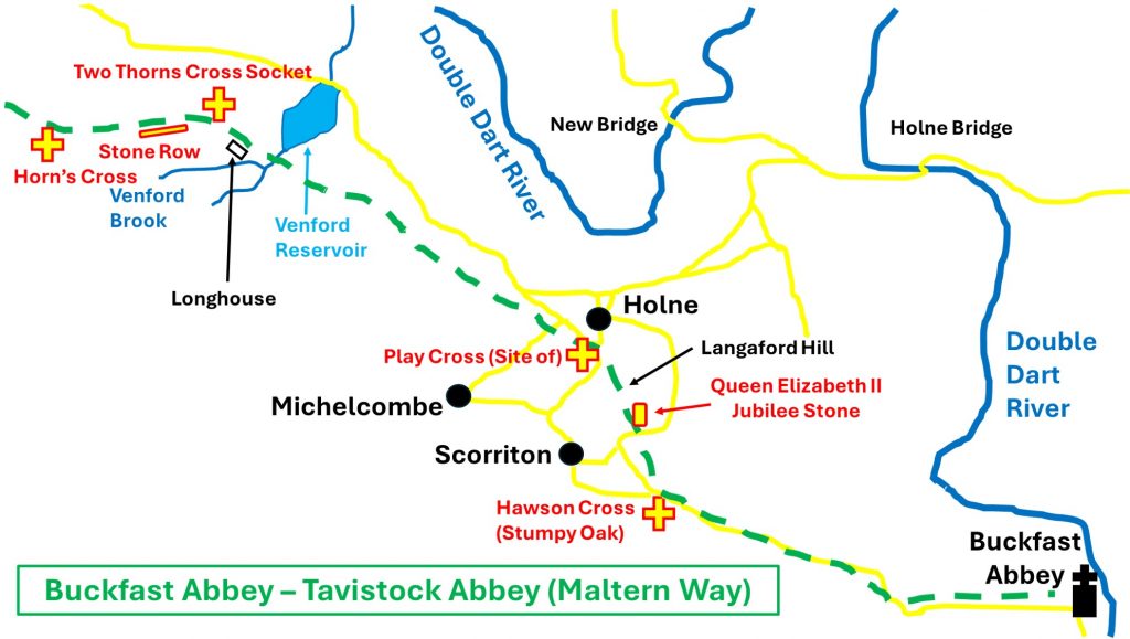
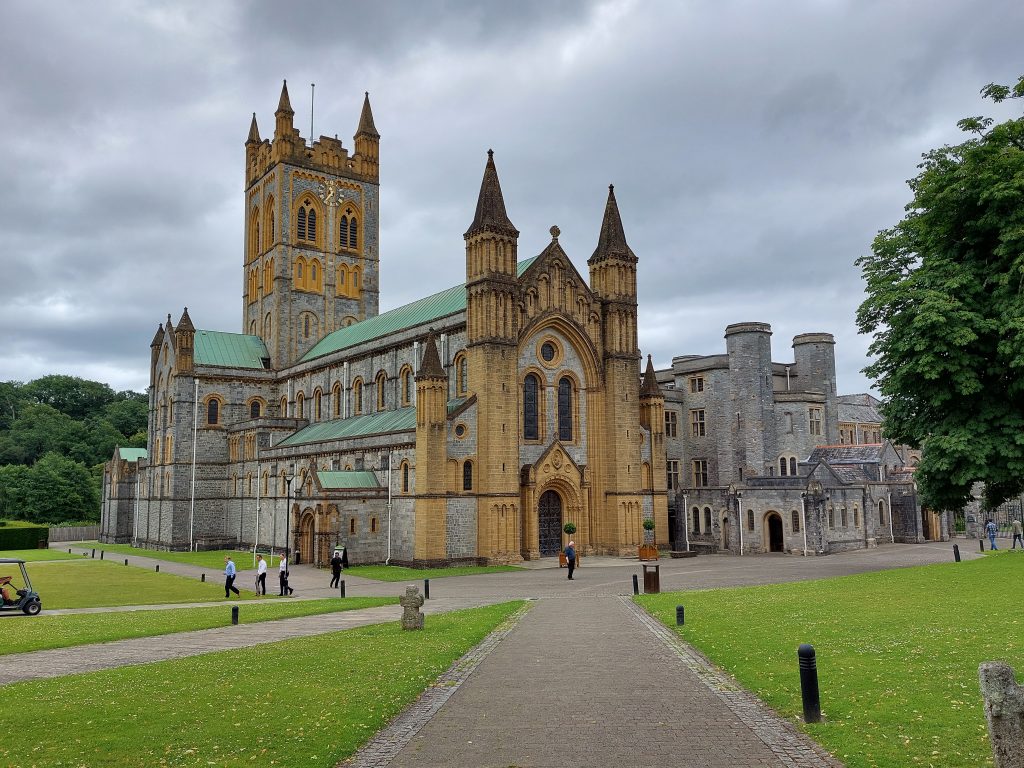
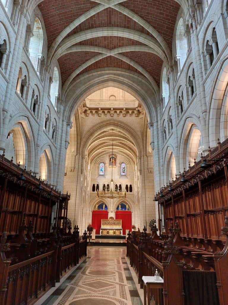
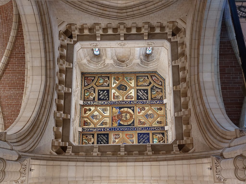
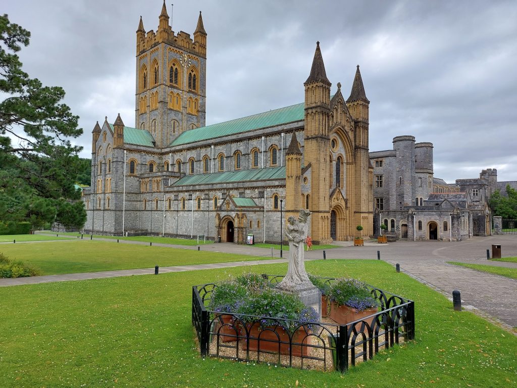
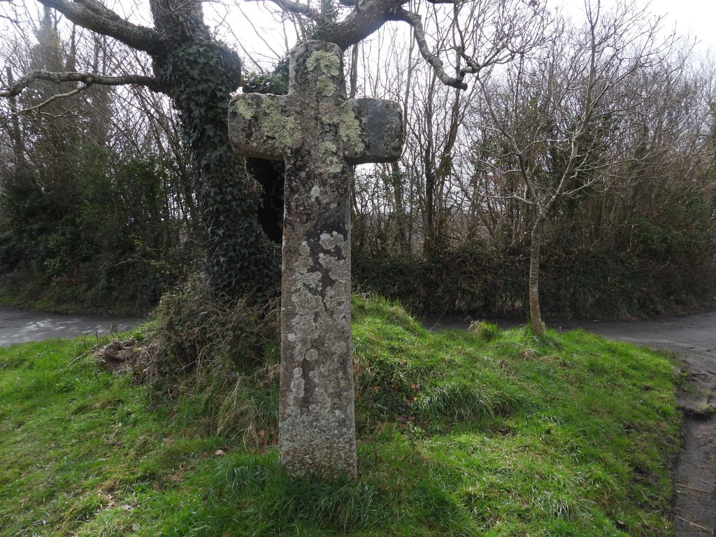
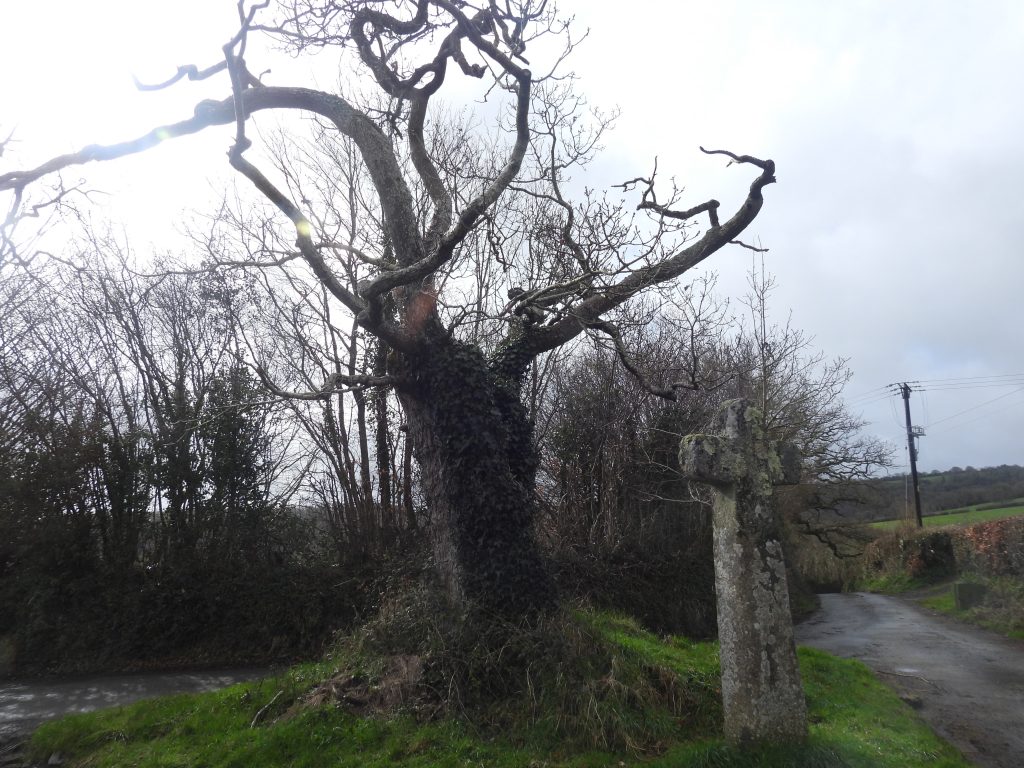
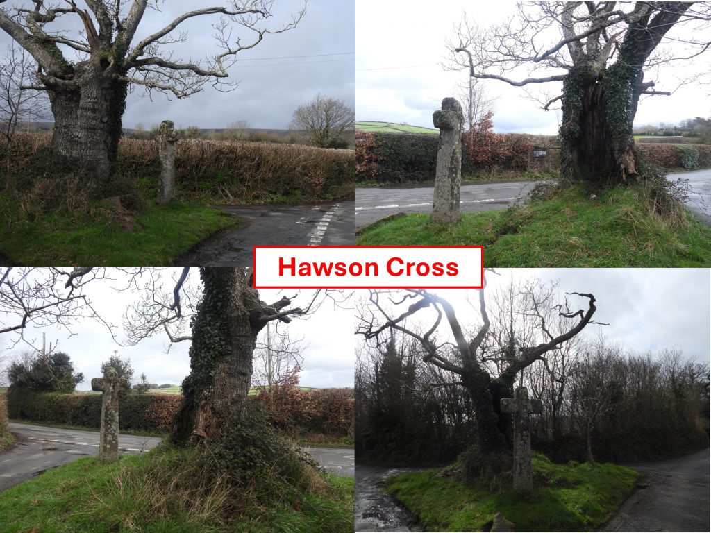
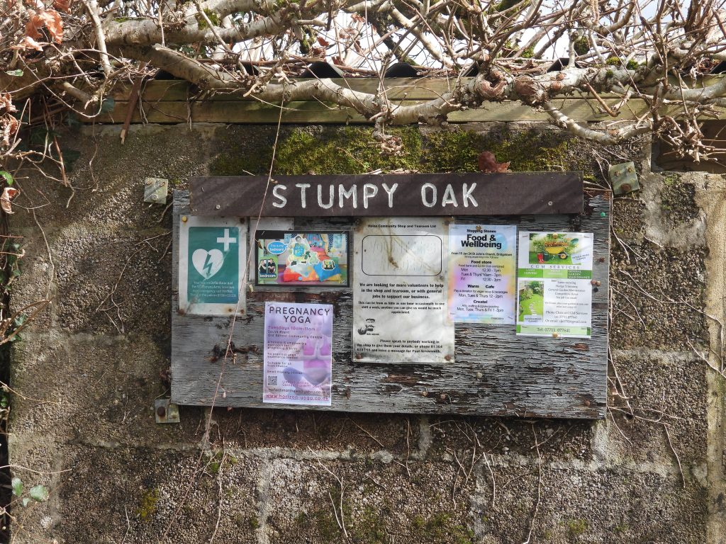
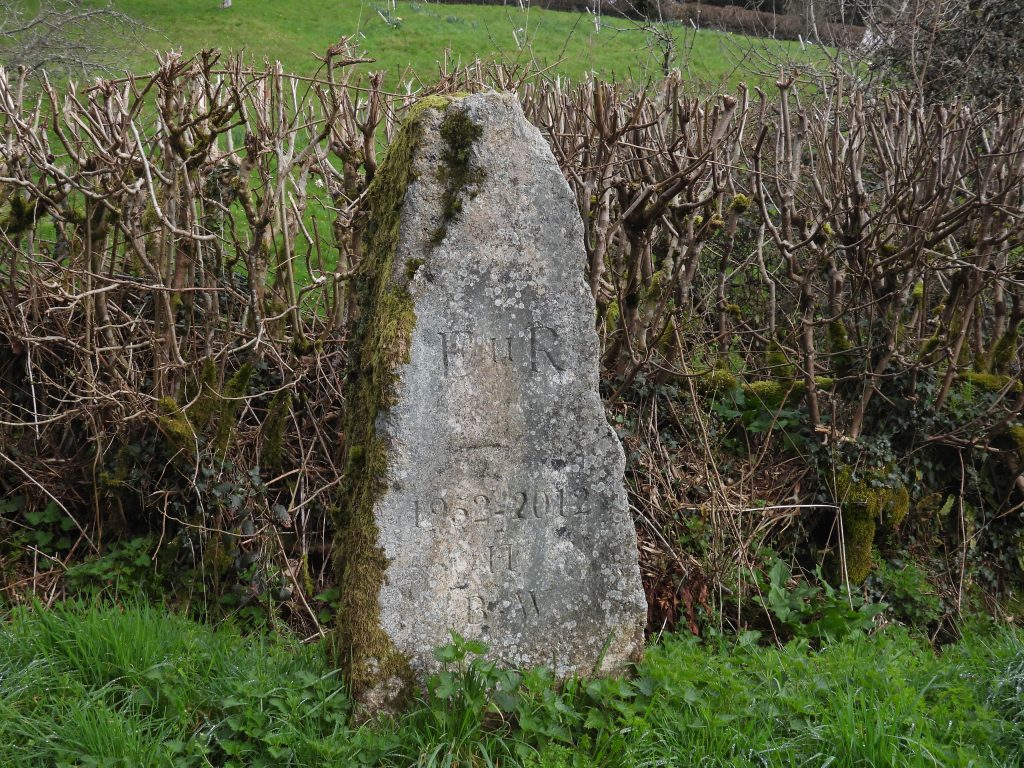
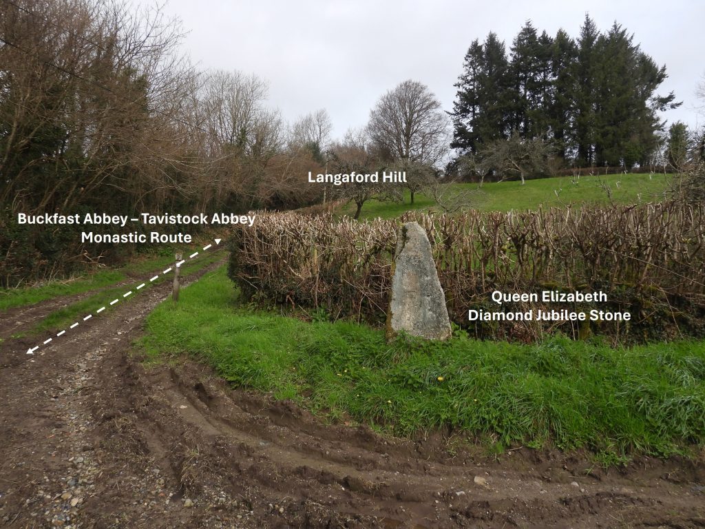
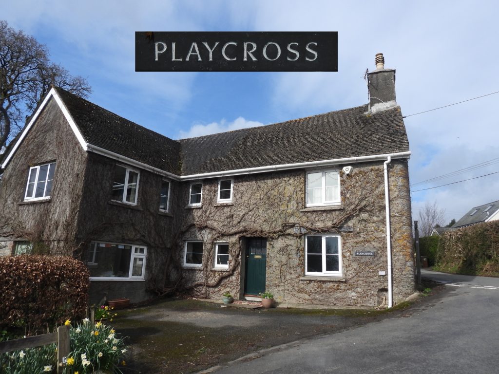
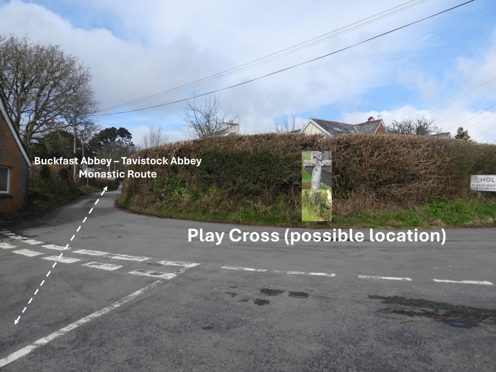
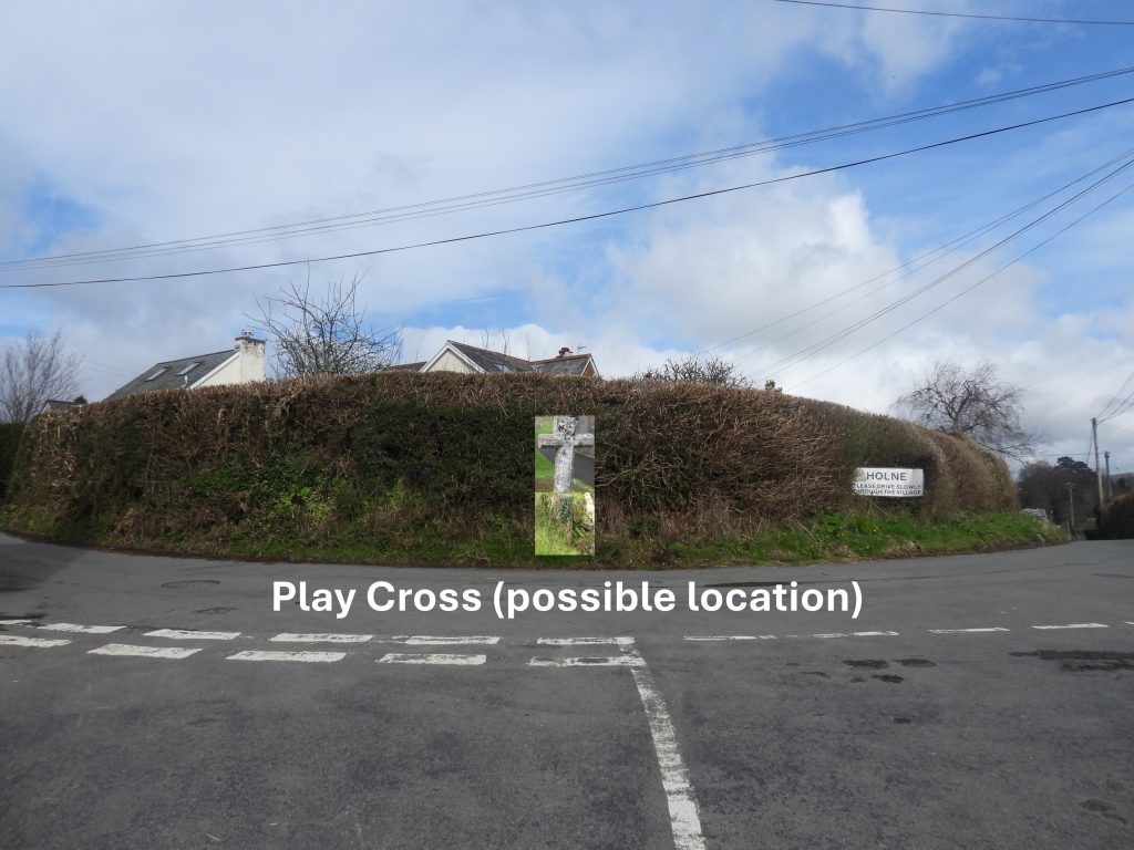
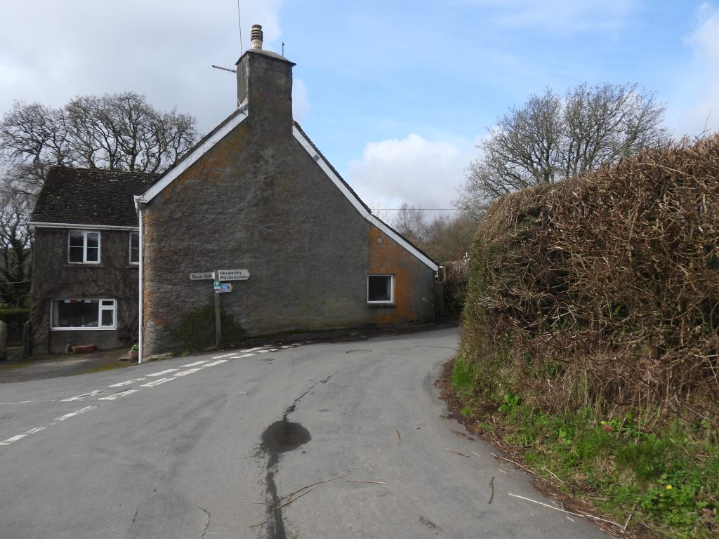
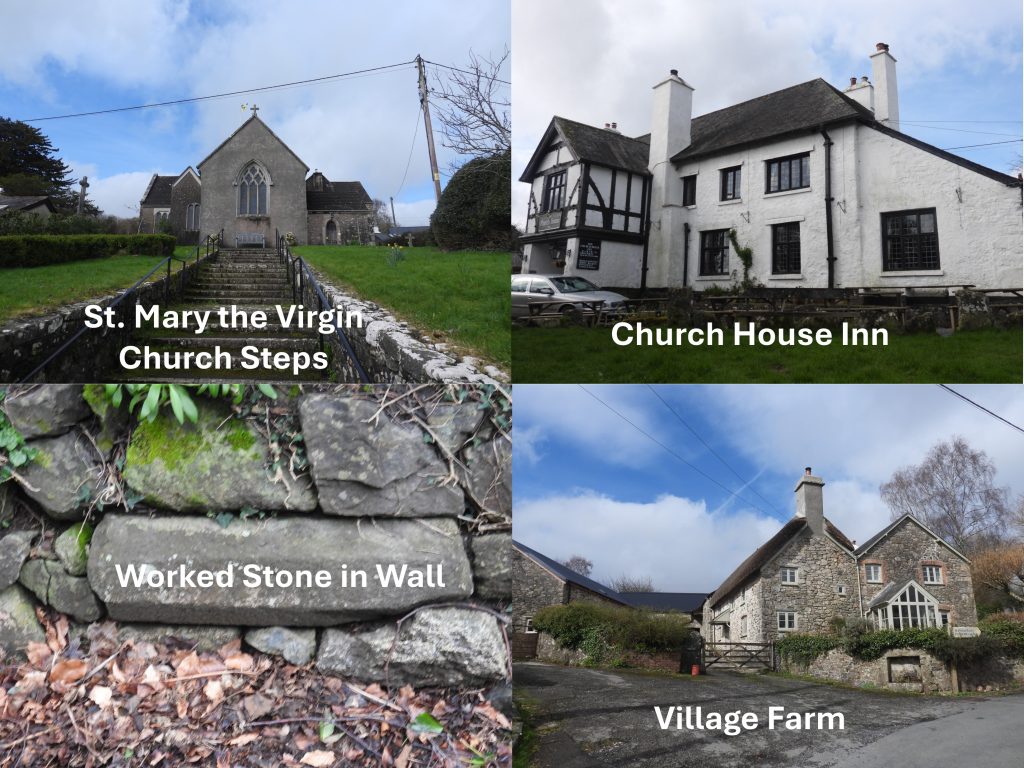
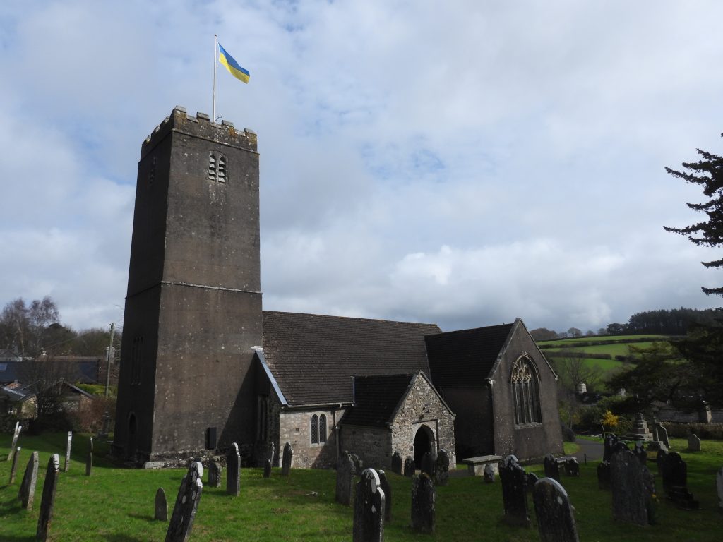
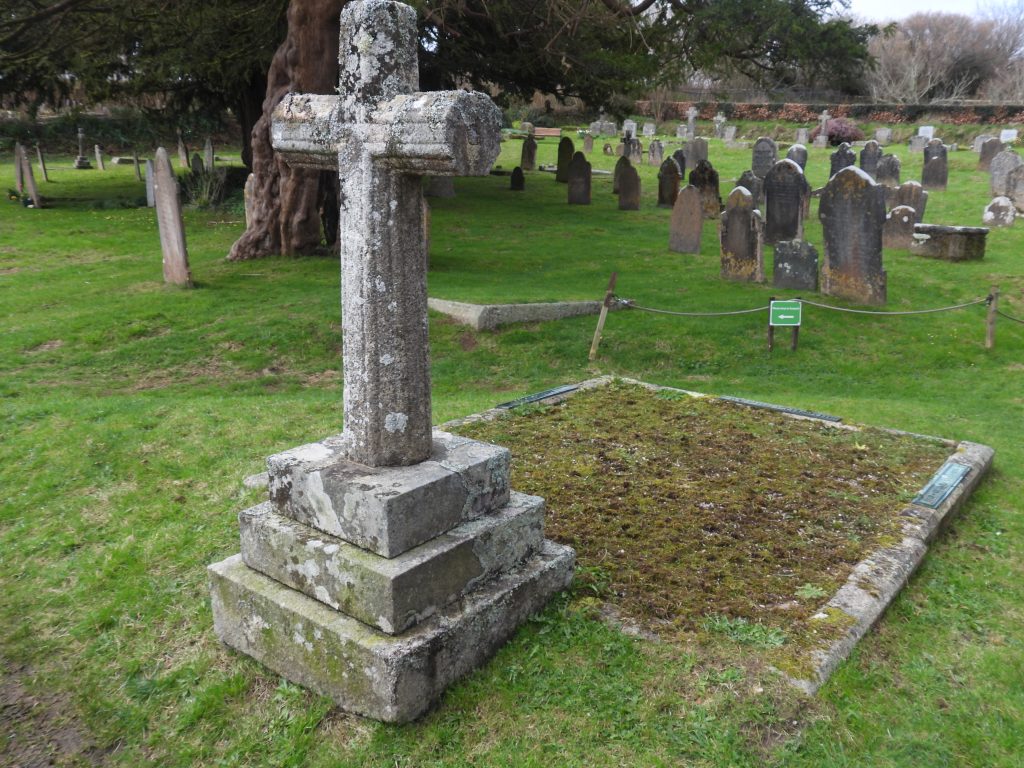
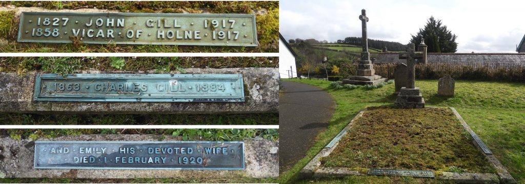
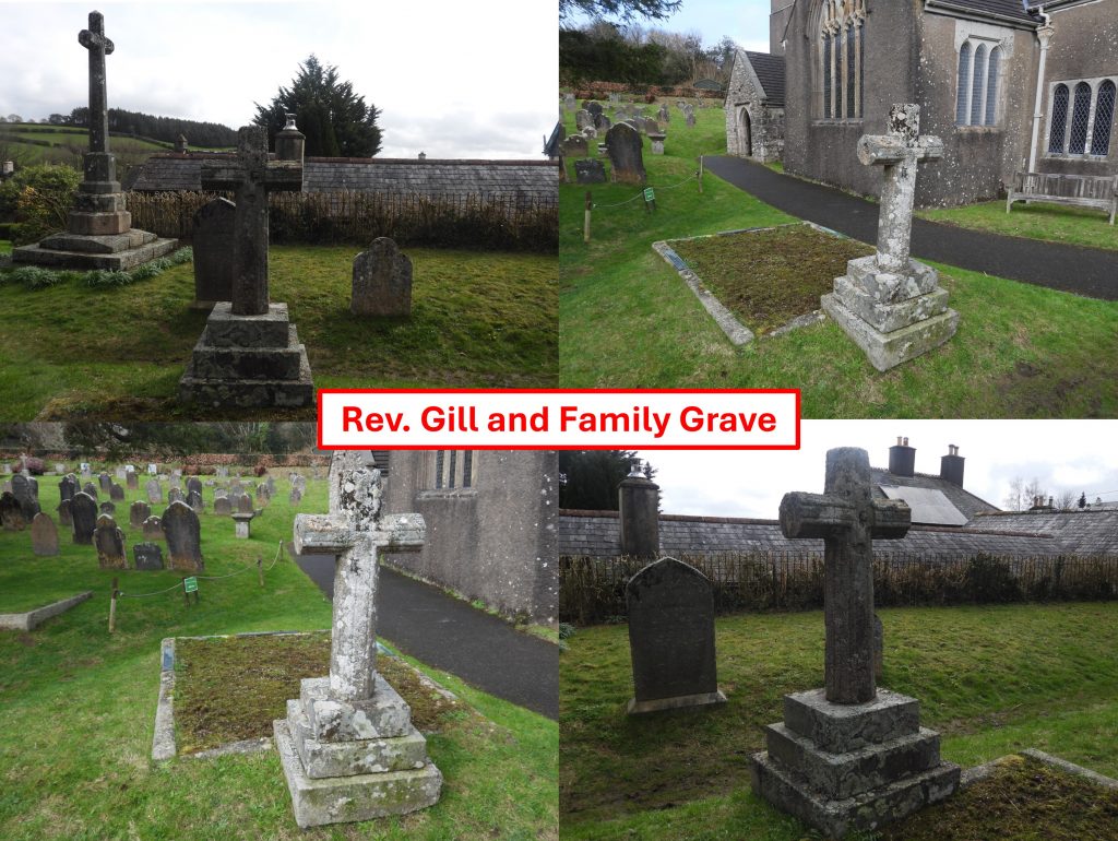
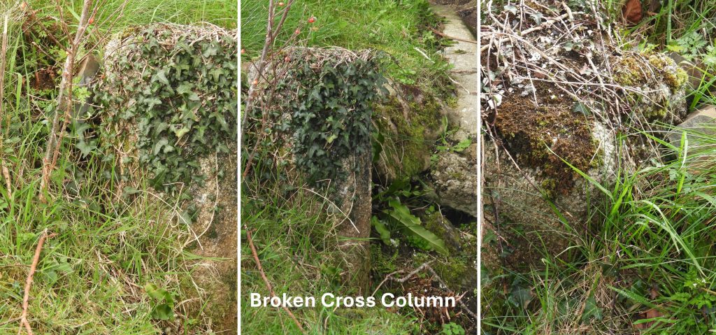
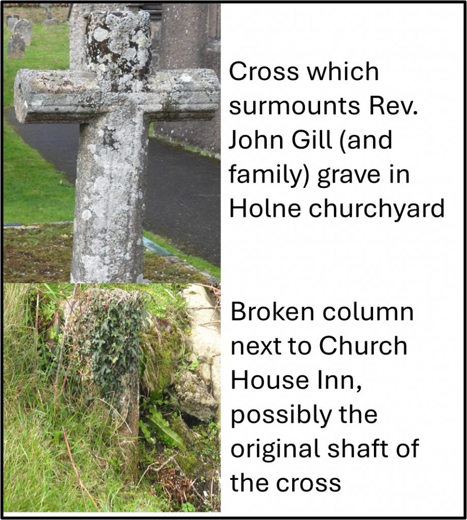
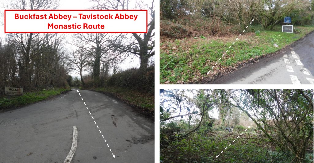
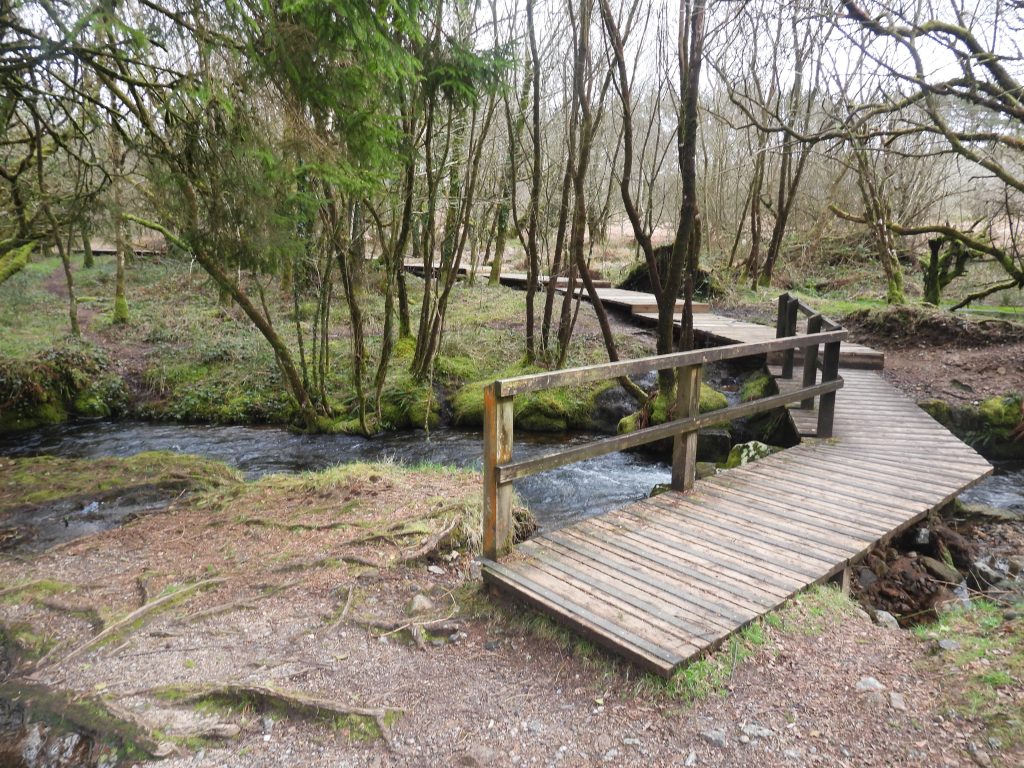
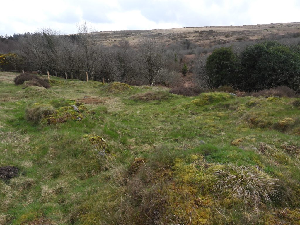
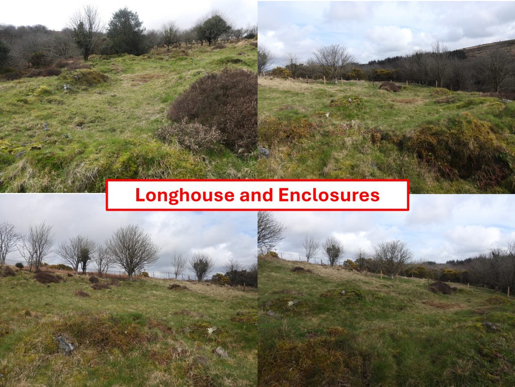
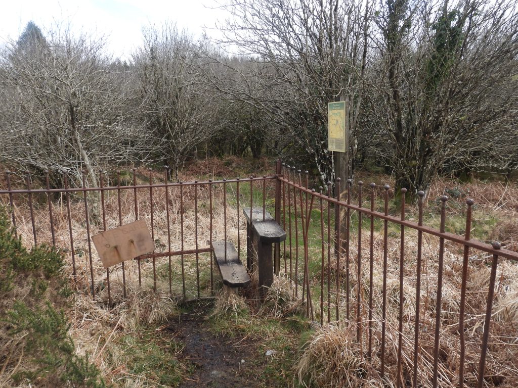
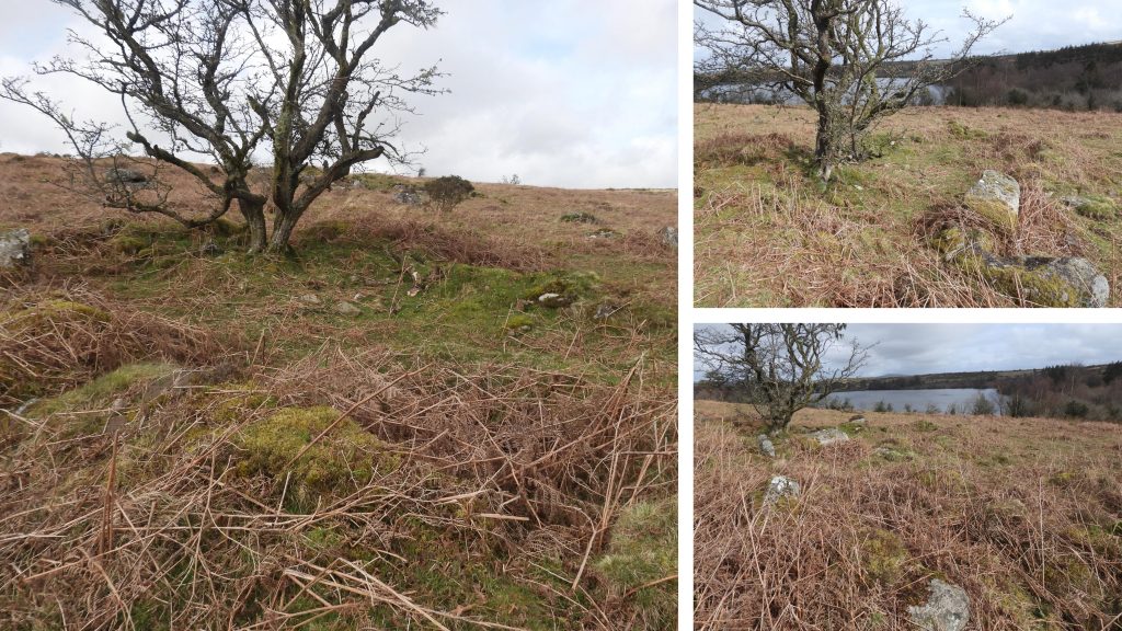
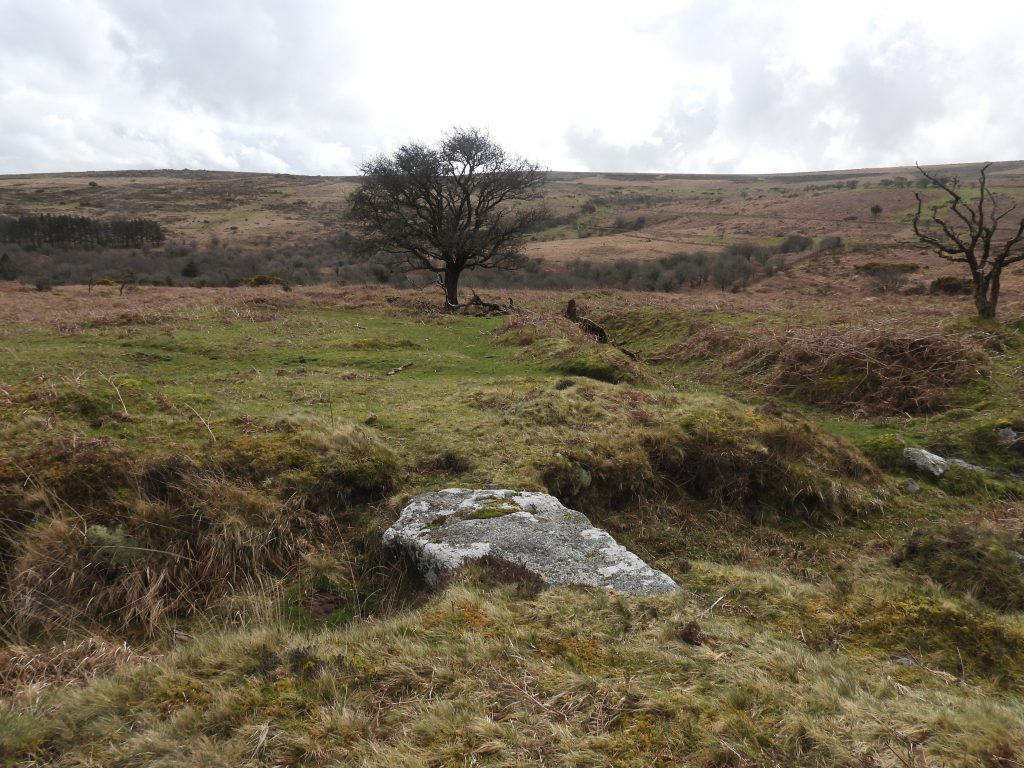
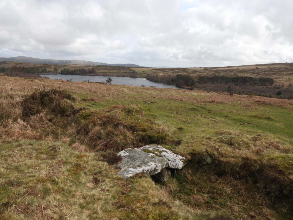
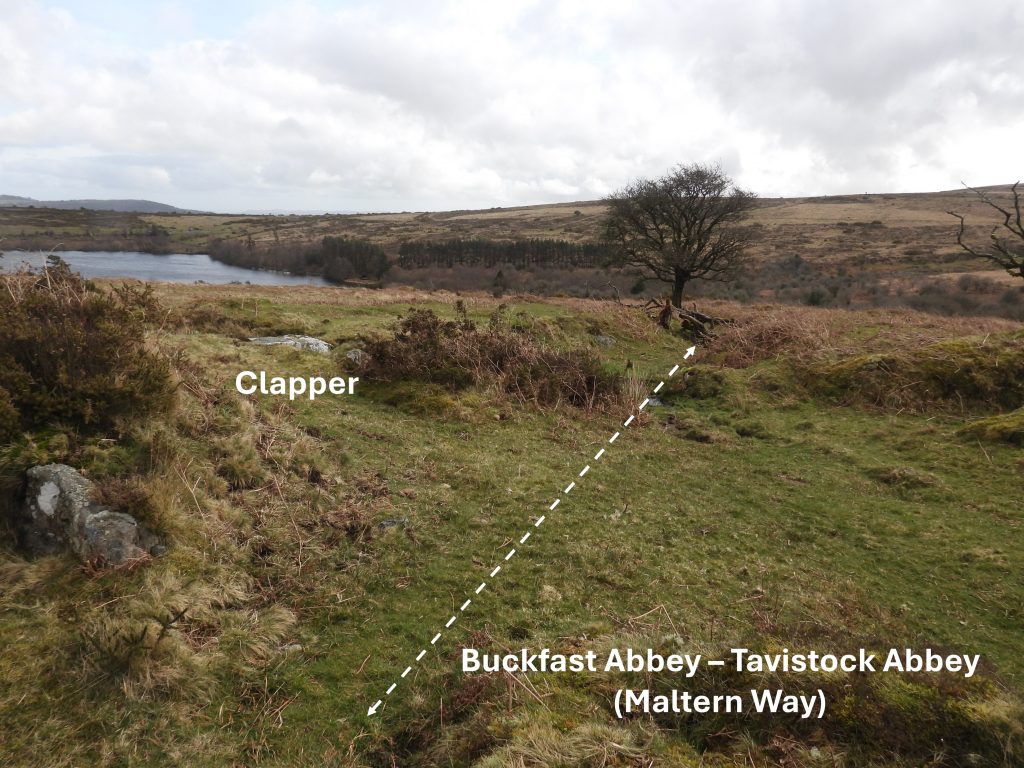
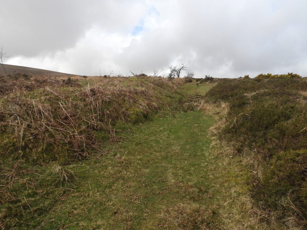
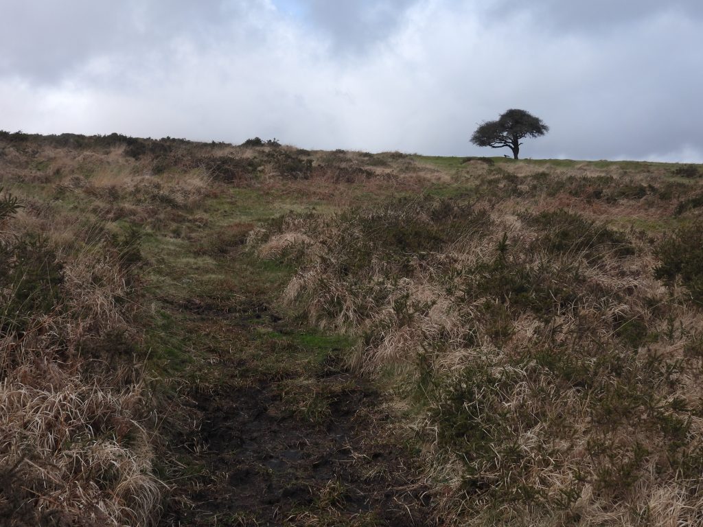
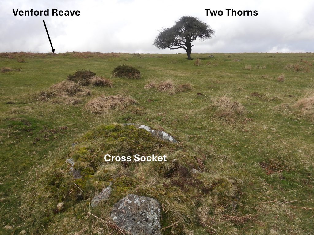
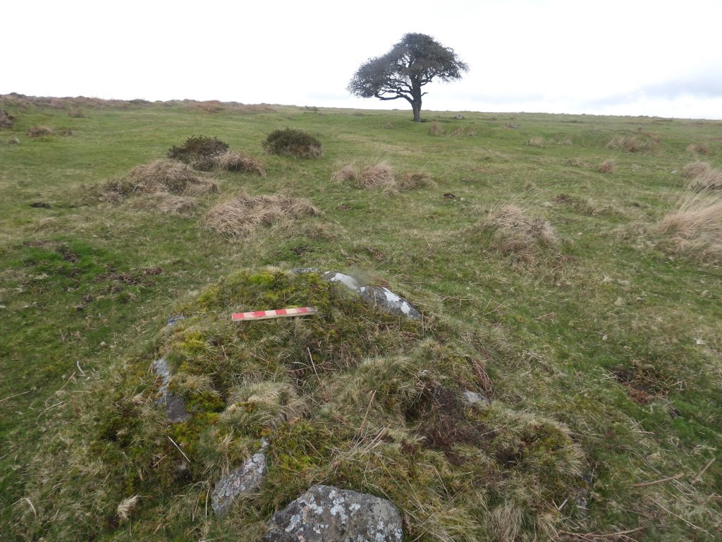
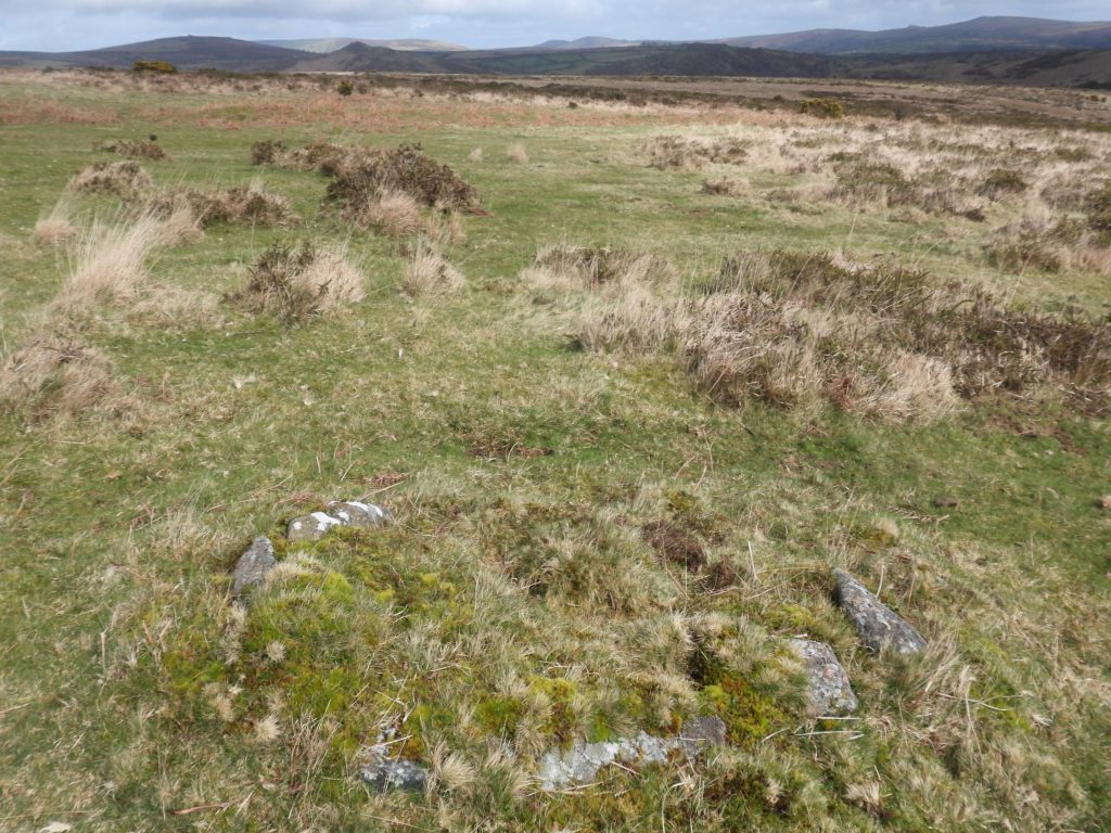
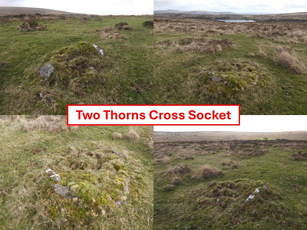
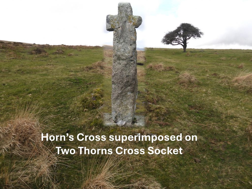
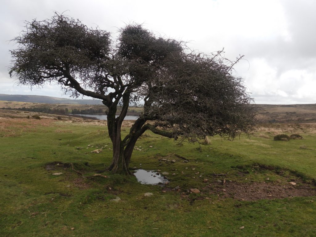
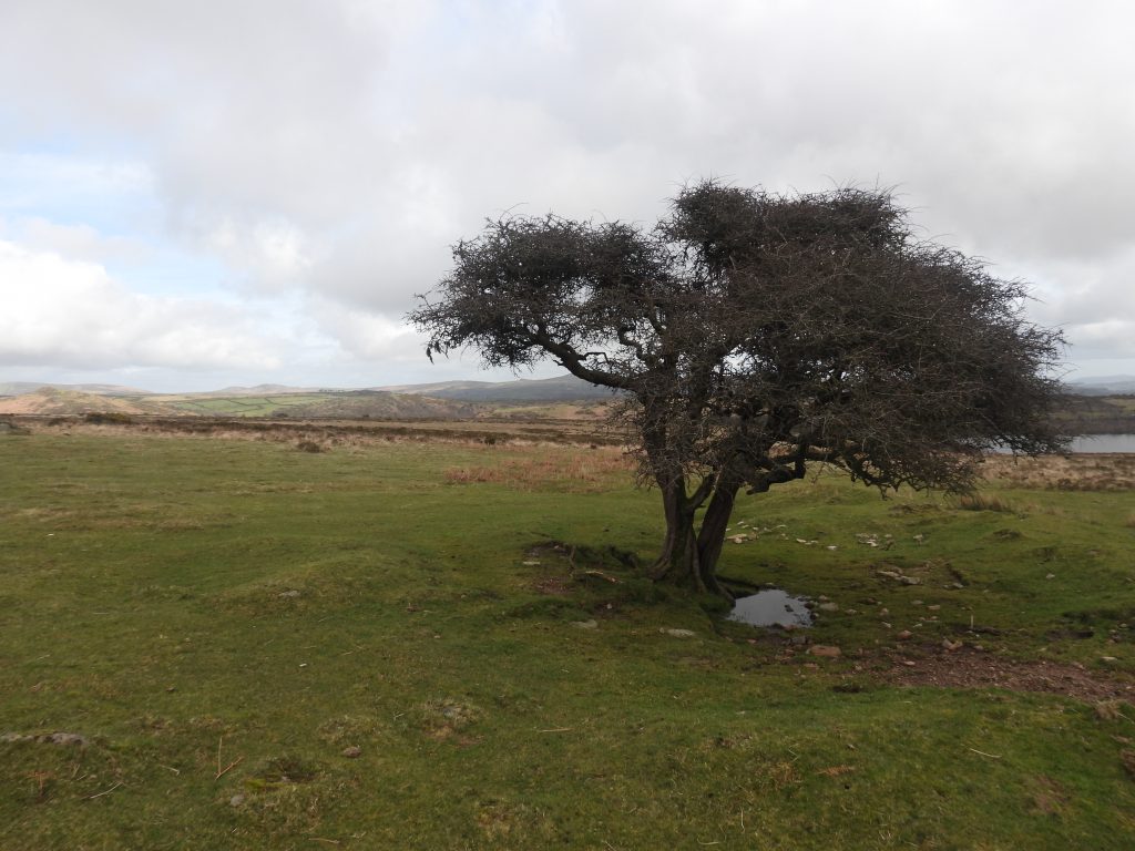
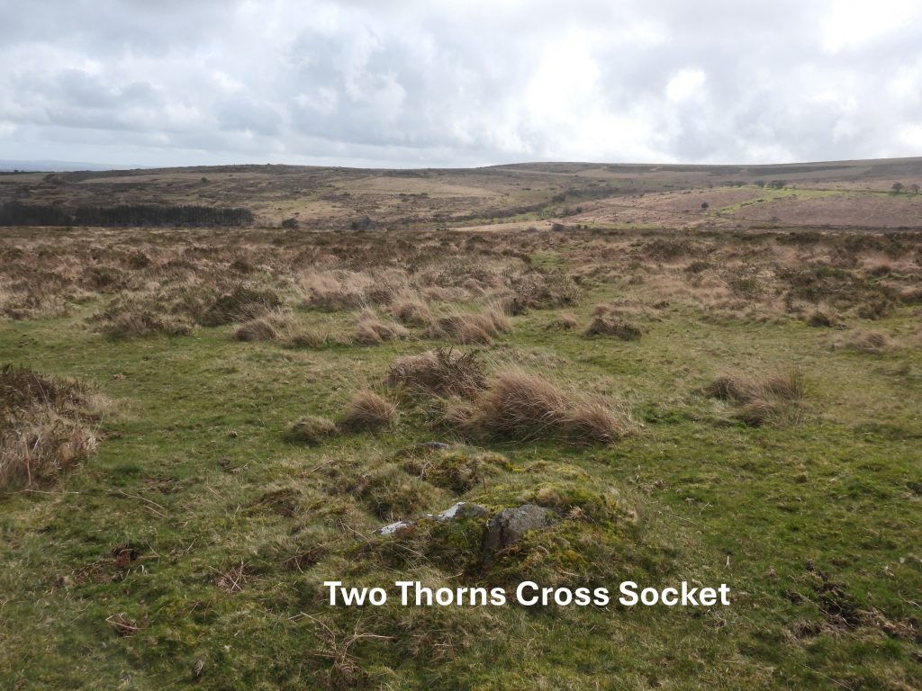
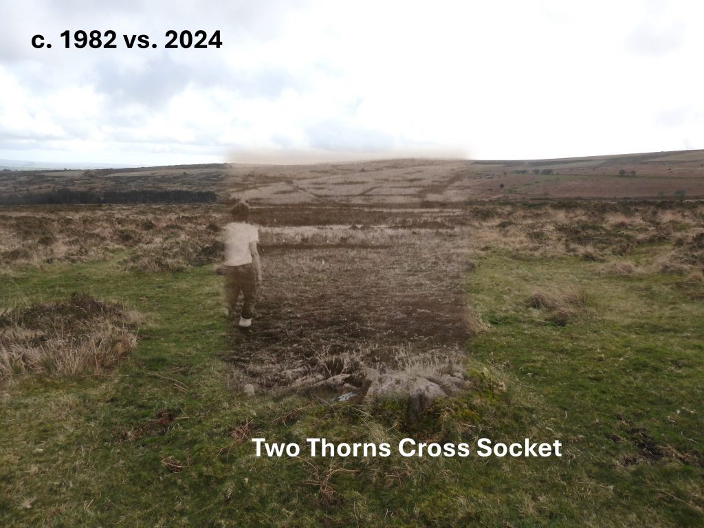
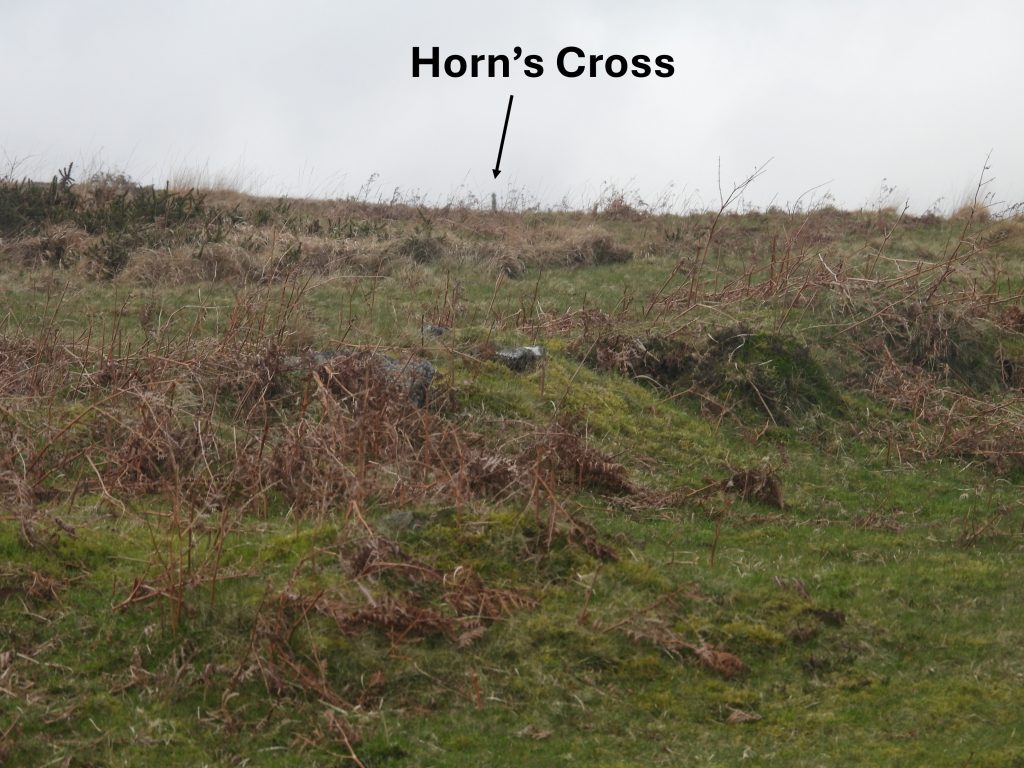
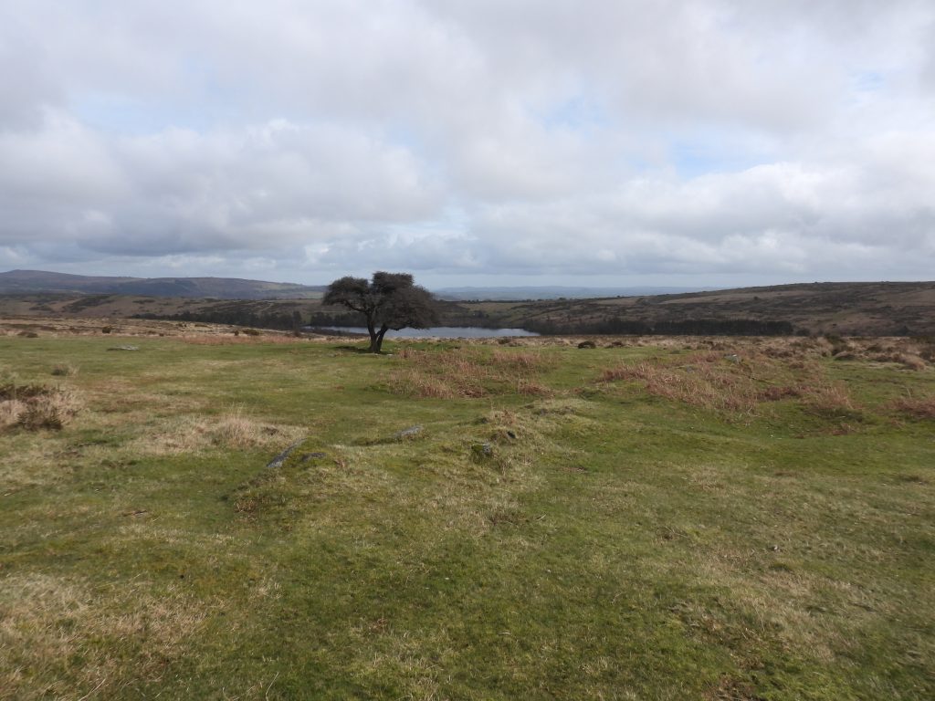
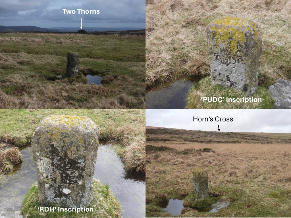
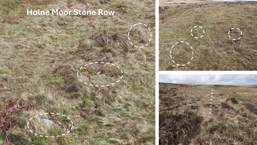
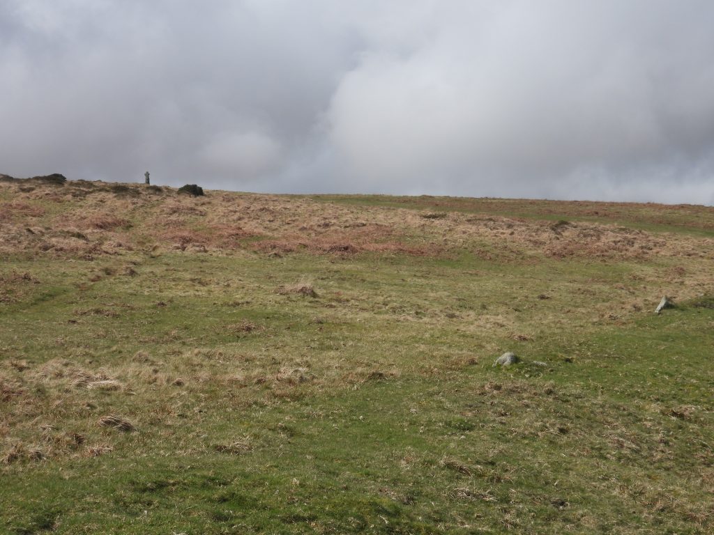
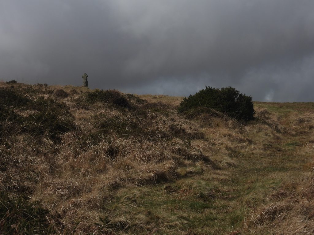
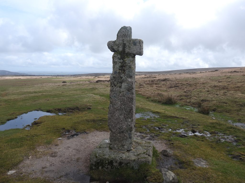
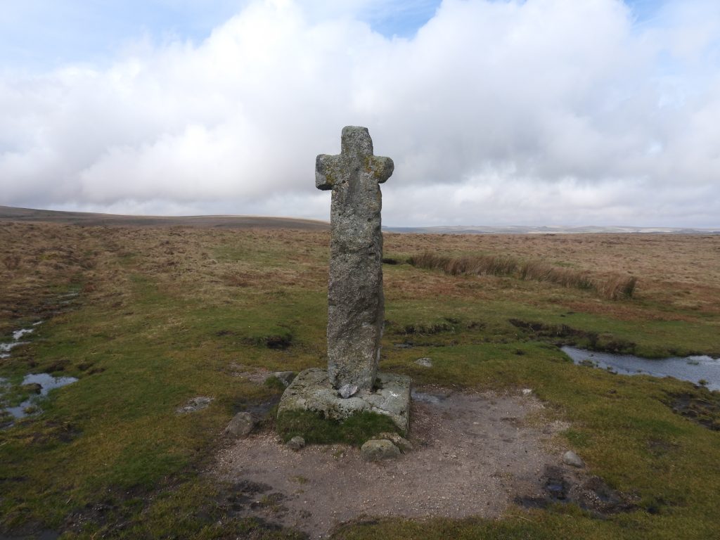
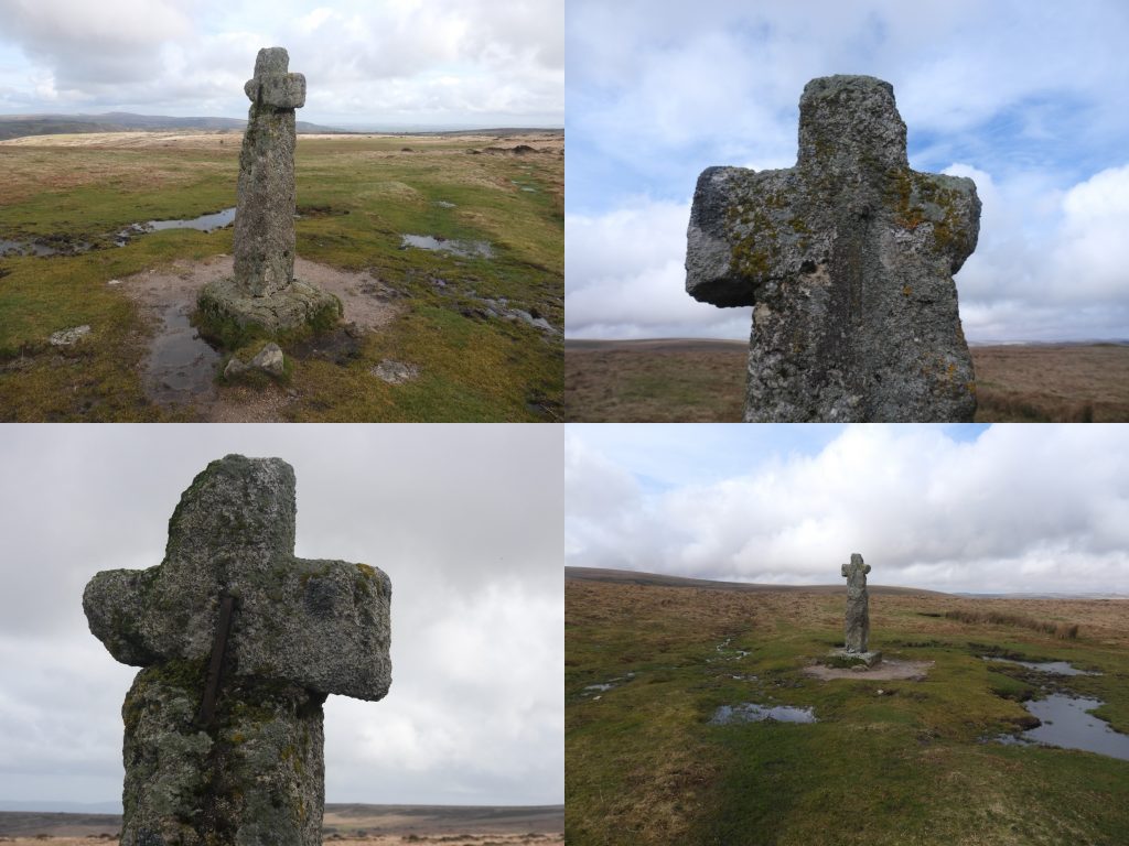
The inter-Monastic route covered in this post from ‘lowland up to the open moor’, went west from Buckfast via Hockmoor Head, then to Hawsons Cross, passed over Langaford Bridge and then over Langaford Hill to Play Cross. The route then by-passed Holne, onwards to Holne-moor gate and Venford Bottom. From there the route passed Two Thorns Cross, a double stone row and onto Horn’s Cross. This sketch map shows this route and some of the features covered in this post.St Mary’s Abbey Church at Buckfast Abbey is a 20th century building on 12th century foundations. Behind the church is the Abbey, which was originally a Saxon and Medieval Benedictine Abbey, later Cistercian. A century after the Benedictine abbey was founded (circa 1018), it became a daughter-house of Savigny in 1136, thus becoming Cistercian.St Marys church is a mixture of English Cistercian and French early Gothic (with the exception of the Benedictine tower).The ceiling of the Lantern Tower, painted by Dom Charles Norris in 1939 in the Byzantine style. The picture is a refection hence the writing appears reversedThe construction of the ‘modern’ church of St Mary began in 1907 and was consecrated in 1932 (6 years before the tower completed in 1938). It is described by the Department of Environment as being a ‘Large stone built abbey church in Norman and Early English style’.In 1937 E.N Masson Phillips, wrote in ‘The Ancient Stone Crosses of Devon: Part I’ of a Cross built into the wall near the gate leading to Hawson. He further wrote the find was “a small portion of the shaft, with head and arm, of a cross of rectangular section”. A new shaft was made and the cross was relocated to its current site on the Buckfast / Buckfastleigh to Holne Road at Stumpy Oak crossroads. Hawsons Cross was the first way-point mentioned by Eric Hemery in Walking Dartmoor’s Ancient Tracks (Track 12, page 144), where he records the cross having been ‘found in a nearby wall’. The Latin cross stands on a triangular-shaped road island next to an old tree known as Stumpy Oak. The cross was restored and re-erected to what was believed to have been its original site in 1954. Historic England record the dimensions of the cross thus: ‘2.18m high with ‘modern shaft’ measuring 0.36m by 0.34m at the base and 0.28m by 0.29m at the top with the arms of the cross measure 0.8m wide and the head is 0.27m high’. The cross is Listed Grade II. The cross socket is now buried under the turf.Stumpy Oak sign opposite Hawsons CrossAt the bottom of Langaford Hill is a Diamond Jubilee commemorative stone for Queen Elizabeth II (1952-2012). From here the road turns to the right (east) and climbs the hill into Holne villageThe monastic route would have ascended the narrow lane over Langaford Hill en-route to the next waypoint at Play CrossPlay Cross is located a few hundred metres south of Holne village centre. This location is suggested was the second waypoint on the monastic route.House named Playcross at the junction of the road from Michelcombe to Venford with Holne.This annotated photograph shows the combination of the cross / shaft from St Mary the Virgin Church at Holne as it may have been located at Play Cross junction.Play Cross junction is located at the edge of HolneView of the Play Cross junction as viewed coming from HolneThe monastic route would have by passed Holne. That said, a visit to this pretty Dartmoor village is always a pleasure and certain artefacts found around the church relate to the story of the monastic route. The collage of pictures of Holne are: St. Marys the Virgin steps (Church dates from 1300, enlarged in 1500), Church House Inn (dating from 1329, with Oliver Cromwell being a famous visitor in the 17th century), shaped worked stone in wall almost opposite Village Farm and Village Farm (17th century).St. Marys the Virgin was restored in the late 19th centuryIn the churchyard of St Marys the Virgin is a Medieval cross, atop a ‘modern’ three tier base which stands alongside the grave of a former vicar of Holne and his family. It is the cross which William Crossing suggests formerly stood at Play Cross, just outside the village and thus stood on the monastic route.The grave is that of Rev. John Gill, Charles Gill and Emily Gill. Of note is that Rev. Gill incumbency lasted 59 years (from 1858 to 1917). The cross (not including base) is about 1.3 metres, with the mean diameter of section of shaft is 0.25 metres, span of arms 0.70 metres. F.H (Harry) Starkey, wrote in 1983 in his book, Dartmoor Crosses and Some Ancient Tracks, that the original socket stone is probably that now utilised in the nearby the nearby war memorial. This fragment of a broken column, is thought could be the shaft of the cross on the Gill family grave. It stands in a ditch under the wall of the Church House Inn near the Church steps. The broken column is located at SX70606 69494It is thought the cross at Play Cross was made up of three elements; Cross shaft from the Gill family grave, the broken column next to Church House Inn and the cross socket utilised in the war memorial. At the road junction heading north from Play Cross towards Venford, the Monastic route would have followed a lane (behind a property called ‘Bear Wood’). This lane enters the moor near a property called Stoke Shallows (formerly called ‘The Shanty’), which is located a few hundred metres from the small quarry near a cattle grid where the modern road enters the open moor.New board walk at the point where Venford Brook enters the reservoir at Workman’s Ford. The Monastic route would have passed close by, a few hundred metres up stream on the brook, where the Venford Reave crossed the brook.The outline of a Medieval longhouse near the old Monastic Route. There is a path from Workman’s Ford which leads to the Longhouse, which is centred at SX68232 70647. Internally, the Longhouse measures 18.1 metres long by 4.7 metres wide with coursed boulder walls 0.7 metres wide and a maximum of 0.7 metres high. It is a delightfully peaceful spot. Sandwiched between the Longhouse and the reservoir fence is a pound (or courtyard), which is centred at SX68218 70653. The pound is square and approx 15m x 15m. It is thought that the Longhouse was the lower terminal point for a sunken lane which heads up the hill (west).The Longhouse is within the confines of the fenced off area surrounding Venford reservoir and its immediate watershed. This convenient stile enables access across the fence to a couple of outbuildings, which may have been associated with the LonghouseHaving crossed the stile, the explorer can find two outbuildings associated with the Longhouse. There are approx. 50 metres to the north. These buildings will be overgrown in summer. The two outbuildings are centred at SX68239 70702 and SX68248 70698. From these buildings a shallow lane can be followed west to a clapper bridge across the former Wheal Emma Leat then onwards to the Two Thorns The shallow lane and the clapper over the former Wheal Emma Leat. The leat was dug around 1859 and it is likely the clapper is of similar vintage. The clapper is located at SX68045 70765Eric Hemery suggests that the clapper may well have represented the continuing use of the route in the 19th centuryAs the monastic route enters the open moor, it is suggested that at a later date the route was also known as the ‘Maltern Way’Above the clapper, the Venford reave ascends the hill alongside the lane.The reave approaches two thorn trees as the top of the ridge is approached. Close to the two thorns is a stone setting (cross socket), which was discovered in 1982 by Dr Andrew Fleming of the University of Sheffield. Fleming and his co-researcher Nicholas Ralph suggested in a publication ‘Report on Medieval Settlement and Land Use on Holne Moor, Dartmoor: the Landscape Evidence’ that: “This stone setting was the site of the most easterly cross on the route across Dartmoor, and that the route was established before 1239…….”The cross socket was crudely measured by the author as around 1.5m (n-s) by 1.75m (e-w)The cross socket is located at SX67818 70886Views from the Two Thorns Cross SocketHorn’s Cross superimposed onto the Two Thorns Cross Socket. Horn’s Cross cannot be seen from this location is on foot but possibly may just be visible if on a horse. Horn’s Cross can be seen 20 paces uphill from this point The Two Thorns close up. From a distance the two tree look like just one.The Two Thorns are located at SX67799 70903In Eric Hemery’s ‘Walking Dartmoor’s Ancient Tracks – Track 12 (Plate 21 between pages 128 and 129), there is a picture of Dr Andrew Fleming near the Two Thorns Cross Socket walking towards Venford BottomThis picture was taken in March 2024 from the same location of the Dr Andrew Fleming photograph from 1982The 1982 and 2024 photographs combined. Dr Andrew Fleming transported forward 42 years !Approx 20 paces uphill from the Two Thorns Cross Socket, Horn’s Cross is (just about) discernibleLooking back at the Two ThornsA few hundred metres west of the Two Thorns en-route to Horn’s Cross there is a Venford Reservoir catchment boundary Stone, from which both Horn’s Cross and the Two Thorns can be seen. The stone is inscribed on one side ‘PUDC’ which stands for Paignton Urban District Council. On the reverse it is inscribed RD with a line underneath then an H. Eric Hemery suggests this stands for Rural District of Holne. The ‘RDH’ inscription is more commonly thought of as standing for Richard Dawson / Holne as it was he who signed over the parcel of land to PUDC in c.1907 in preparation for the build of Venford Reservoir. The reservoir still serves Paignton, Torquay and Widecombe.Close to the line of the Monastic route is a triple stone row (clearly marked on modern OS maps). The reality on the ground is that the stones in the row barely break the turf. The row measures 147 metres long with rows on average 1.5 m apart.Back on the monastic route approaching Horn’s CrossHorn’s Cross when approached from the east is very visibleThis Medieval Latin cross, known as Horn’s Cross has been restored. The socket stone and the head and arms are original but the crude shaft was added sometime after 1800.E.N Masson Phillips, in 1937, in his publication ‘The Ancient Stone Crosses of Devon: Part I’ recorded Horn’s Cross. The dimensions are as follows: ‘The length of the shaft is 1.9 metres, the width of the arms is 0.6 metres. The whole is set in a large socket stone 0.8 by 0.8 metres’. The ancient head piece is joined to the modern shaft by two iron clamps. The shaft can be dated by virtue of there being evidence of it once being a gate post (iron fittings) and it has traces of tare and feather working. The route of the monastic way heading across the moor is further covered in the post found at: https://dartmoorexplorations.co.uk/maltern-way-crosses-and-others-on-or-near-the-route-of-the-ancient-track/