A collection of walks, discoveries, insights and pictures of exploring Dartmoor National Park
January 3, 2022
Virtuous Lady Mine
The Virtuous Lady Mine is famously said to have been named in honour of Elizabeth I having been worked from 1588. That said, the earliest known documentation relating to the mine only confirms an early 18th century date. It is stated (Harris, H., 1986, Industrial Archaeology of Dartmoor) that the mine was worked from 1588 until 1807. Then it reopened in the 1830s before finally closing in 1879. Other sources (Rendell, P. Exploring the Lower Walkham Valley) suggest the mine re-opened in 1816 and closed in 1873.
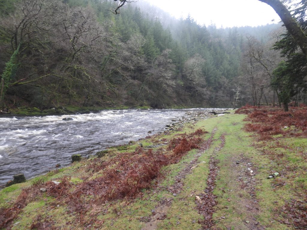
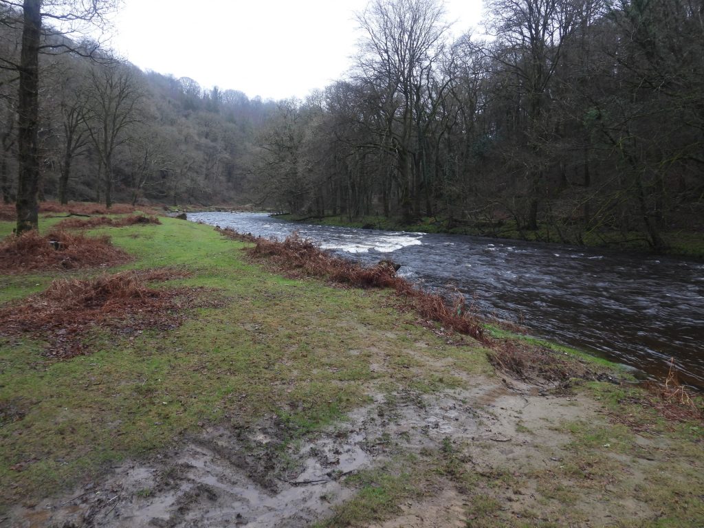
The mine is dispersed over a small ‘peninsula’ of the River Tavy just downstream from Double Waters, where the Rivers Walkham and Tavy meet. The earliest workings are believed to have been at the western end of the site, at the foot of a ‘cliff’ outcrop below Tavy Cottage. Copper extraction was produced around 4000 tons annually in the mid-19th century. In 1870, some of the workings were reported to have been to a depth of 120 feet (36.5m) with up to 43 people being employed. (Harris).
There was no processing (smelting) of the ore on site (just rock crushing). The ore was removed by packhorse over a bridge initially to a place called “Orestocks” to the west, thence to Morwellham in a train of horse-drawn wagons. From Morewellham it was shipped to South Wales for smelting (Rendell).
For the explorer there is quite a considerable above-ground features relating to the mine still to be found. The Devon and Dartmoor HER (ref MDV5458) has been used for a lot of the information contained herein. The features are not always obvious if just taking a walk on the track between Double Waters and Buckland Monachorum. The author has annotated grid references of the main features in this post to aid the reader.
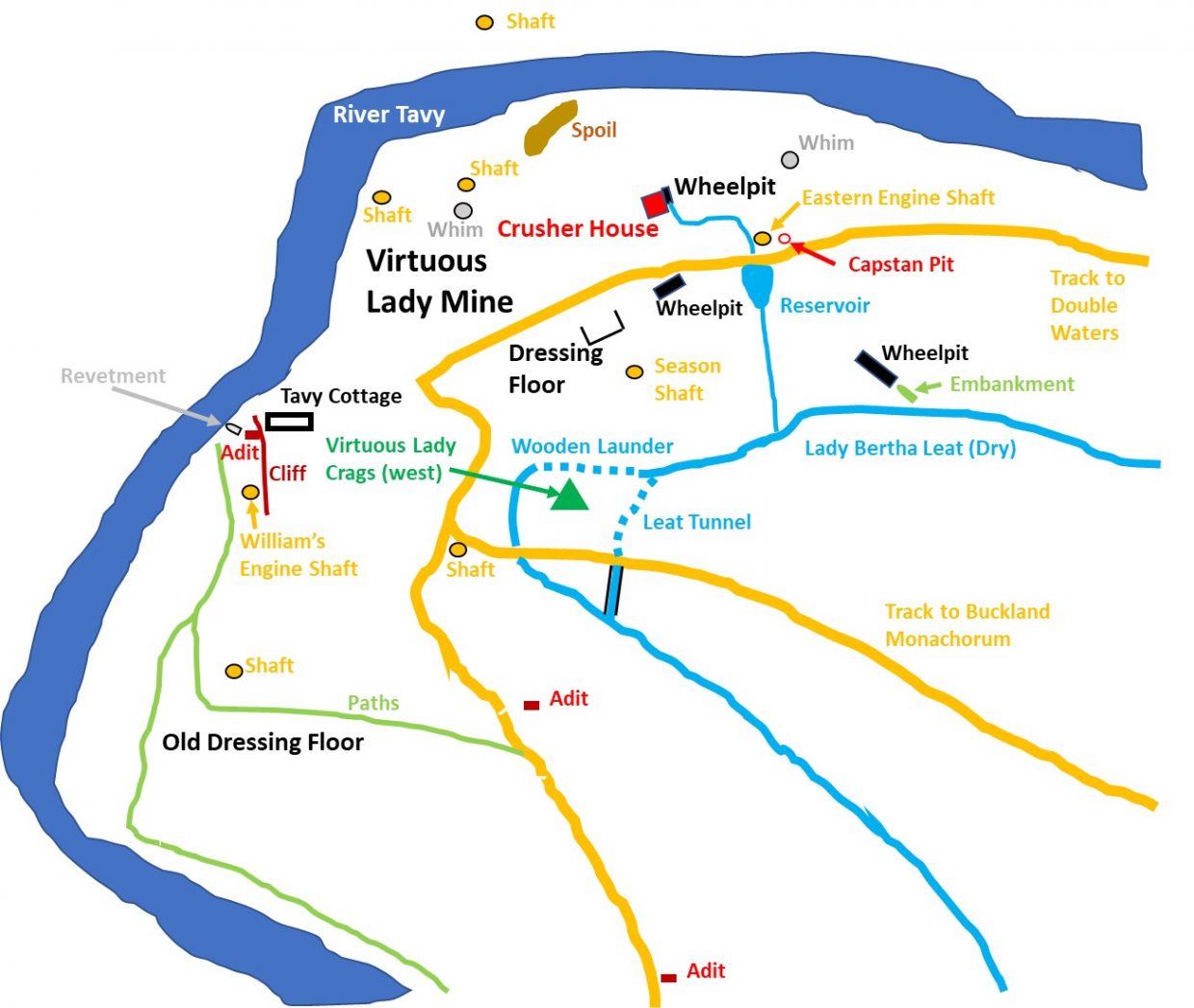
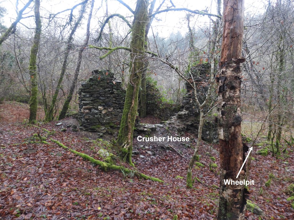
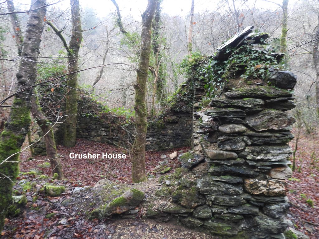
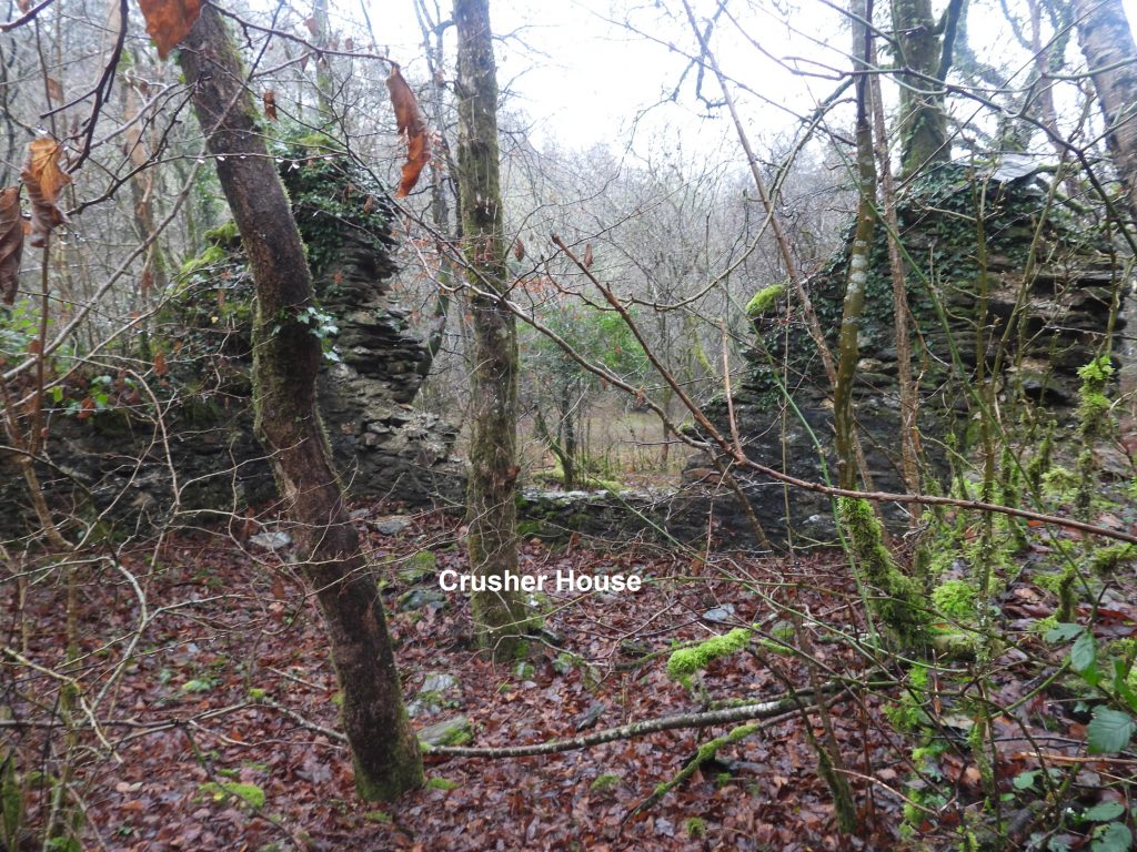
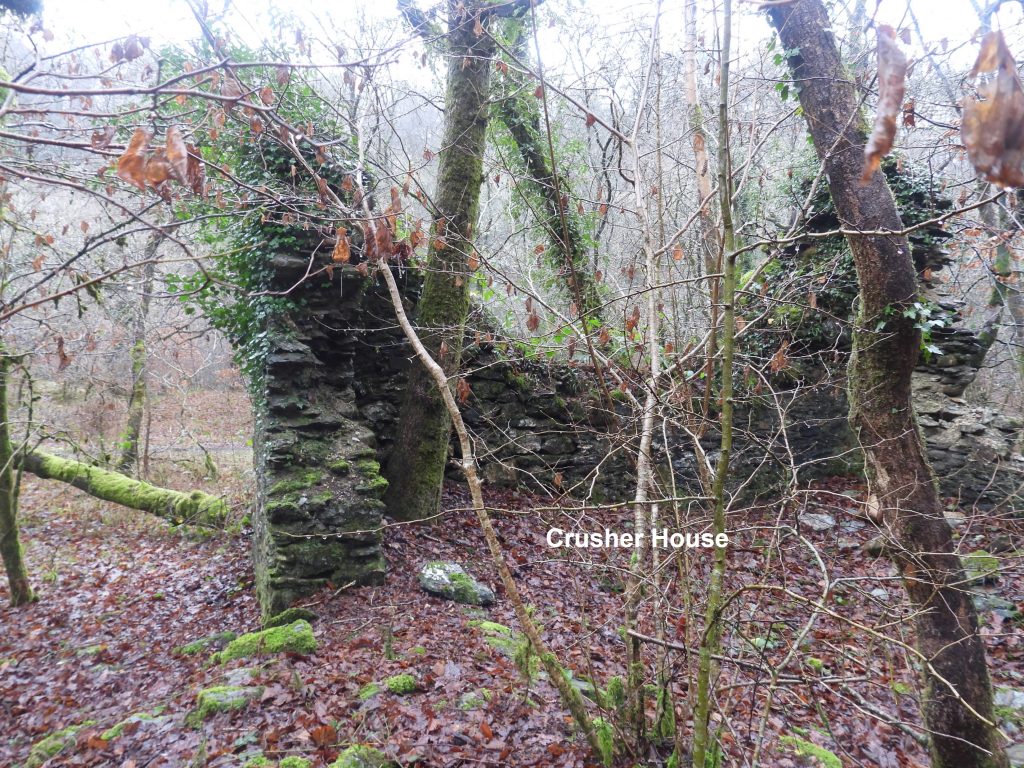
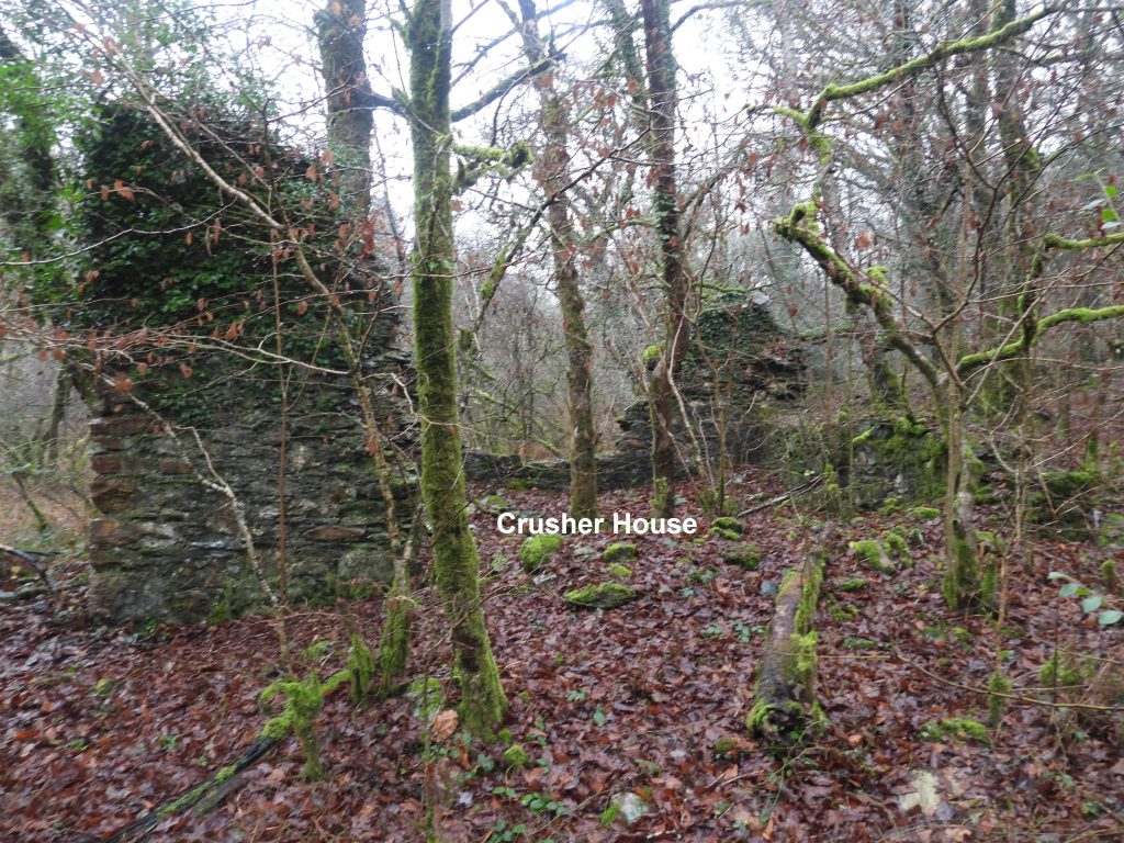
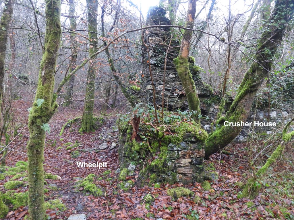
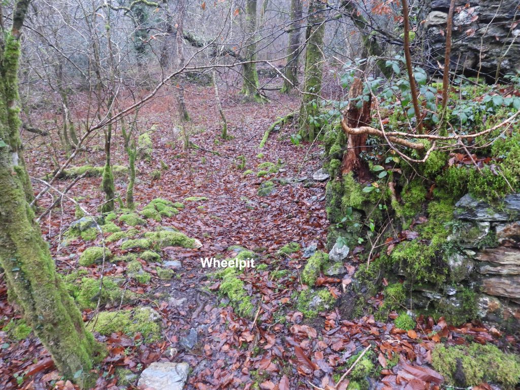
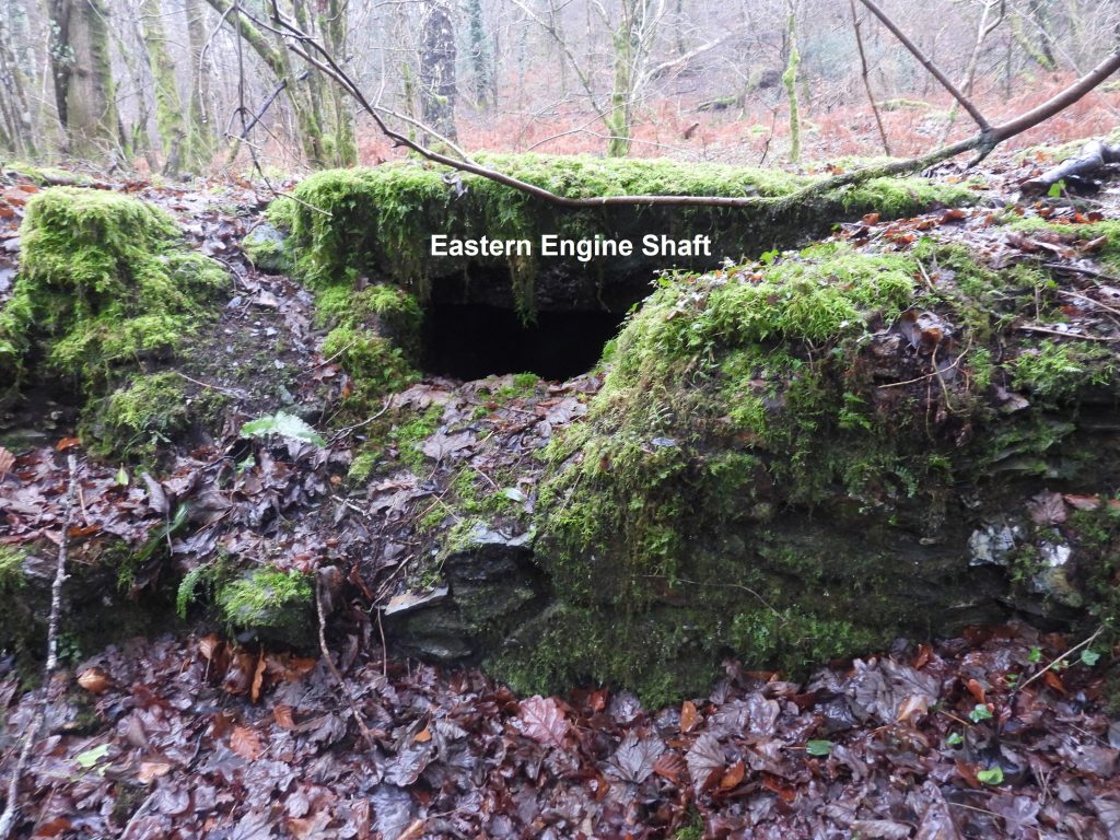
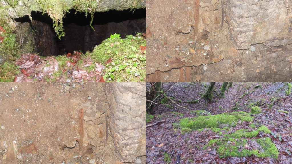
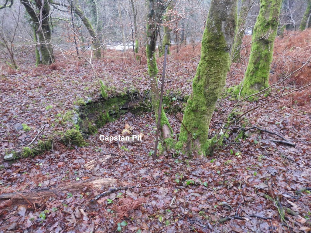
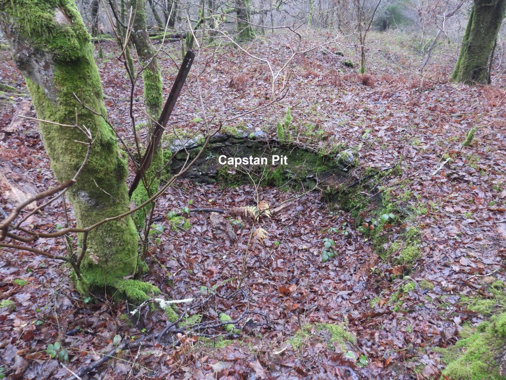
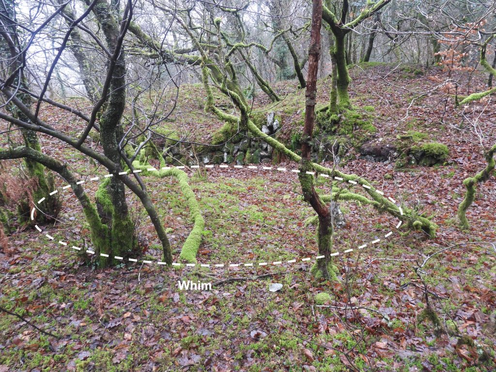
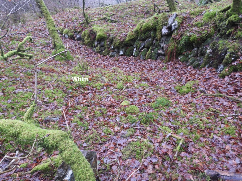
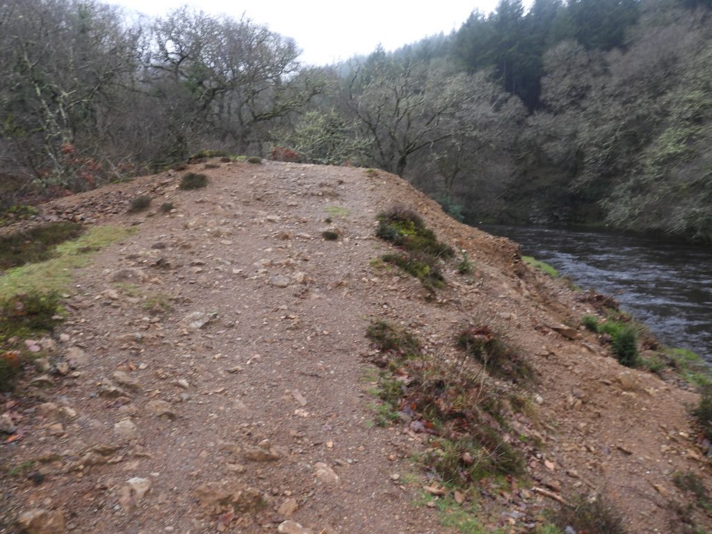
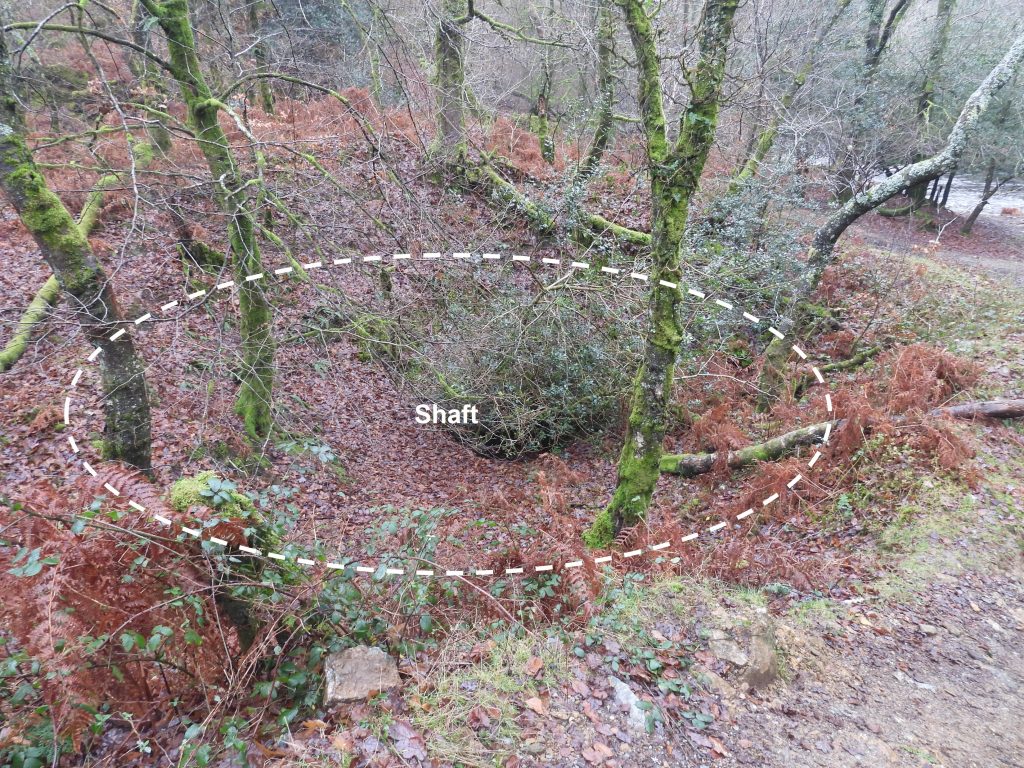
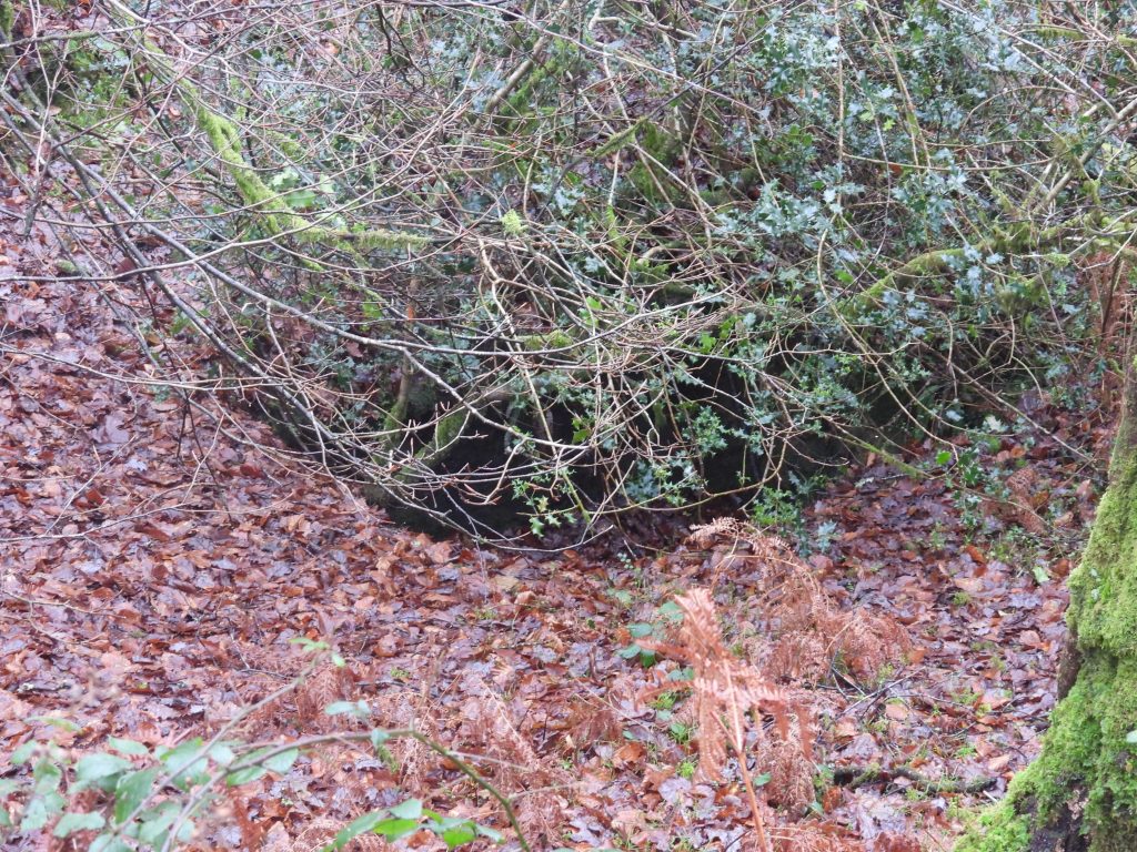
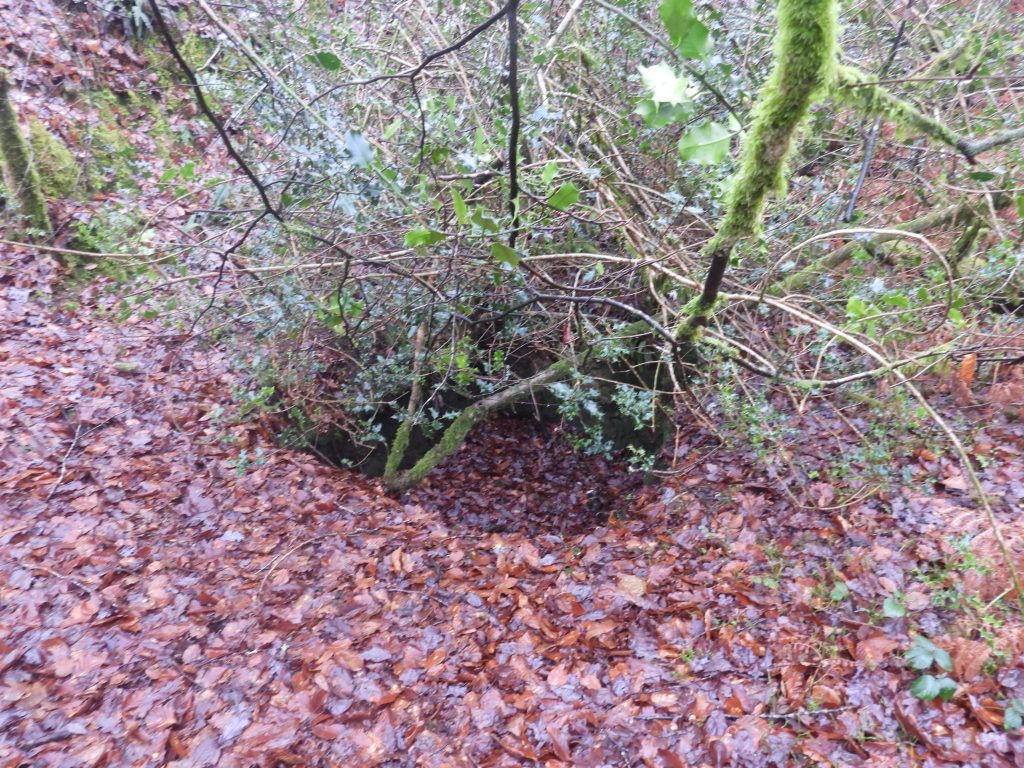
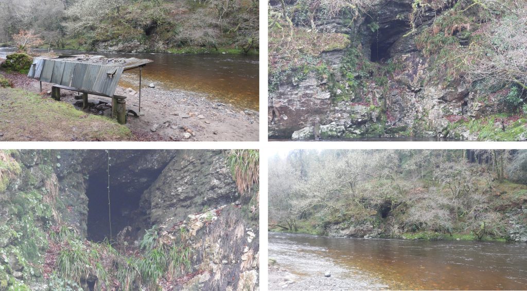
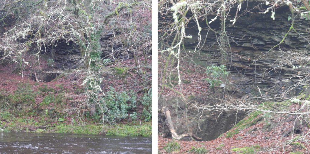
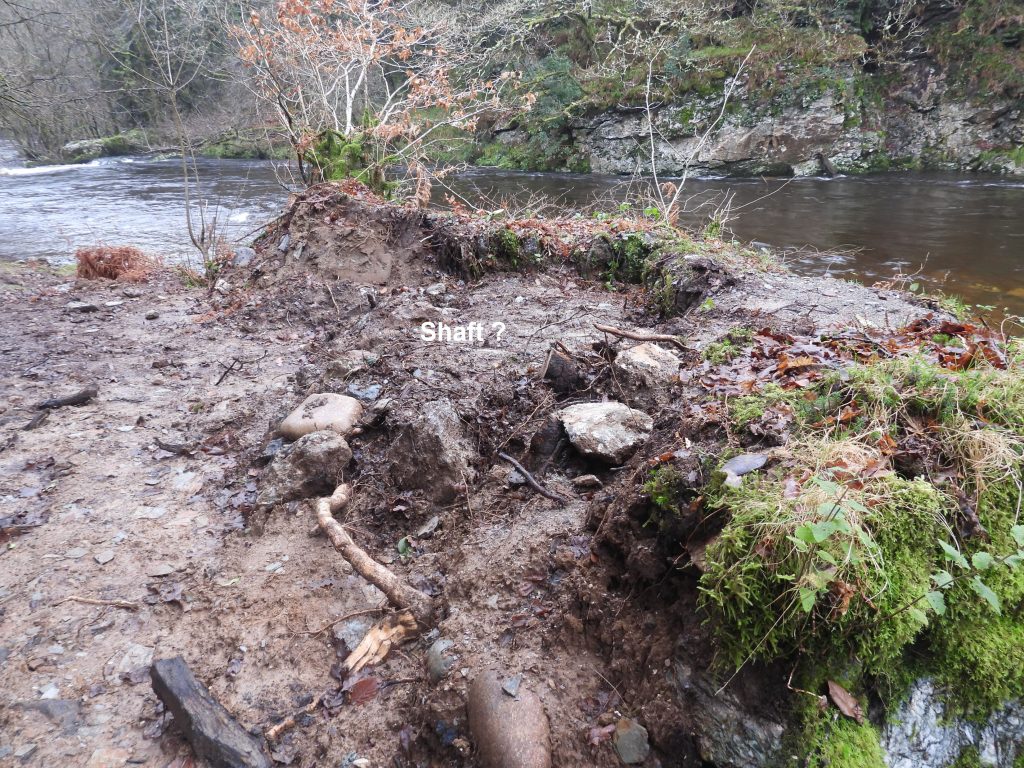
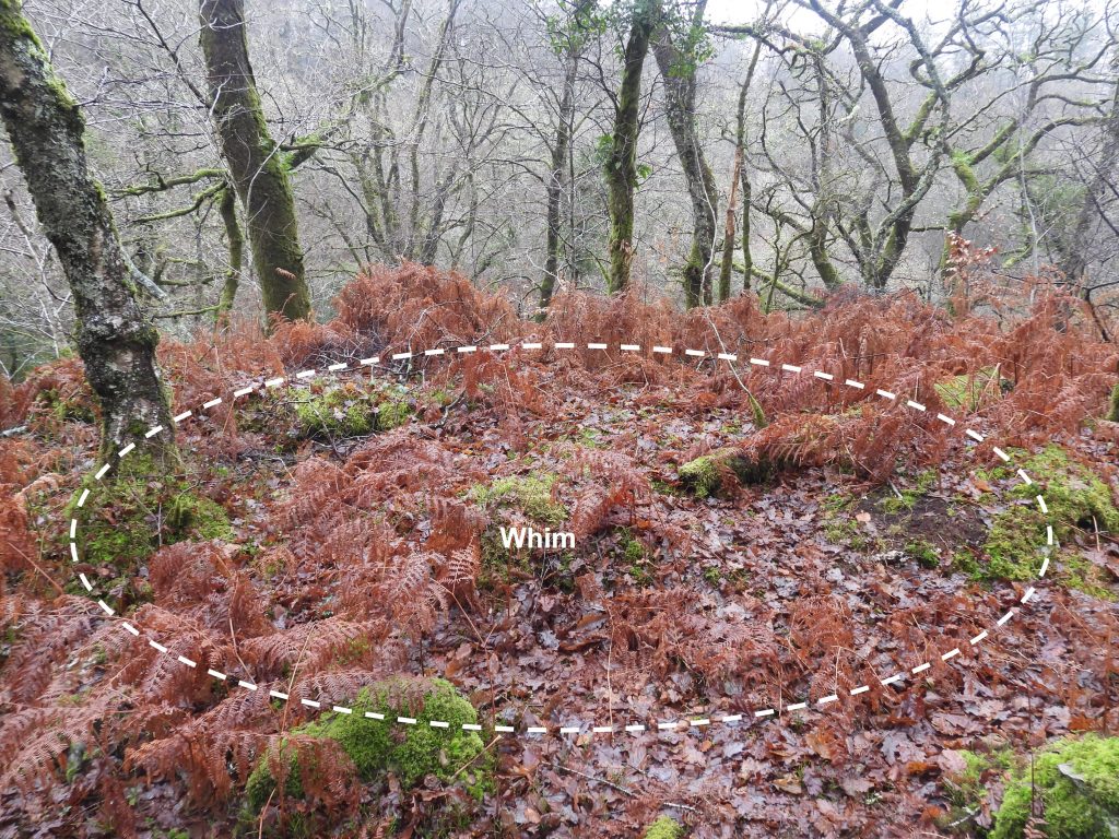
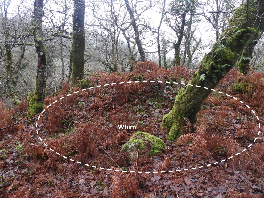
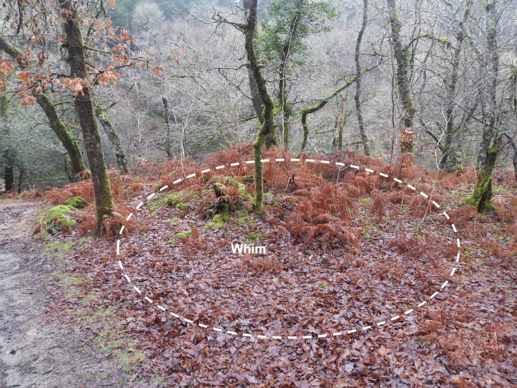
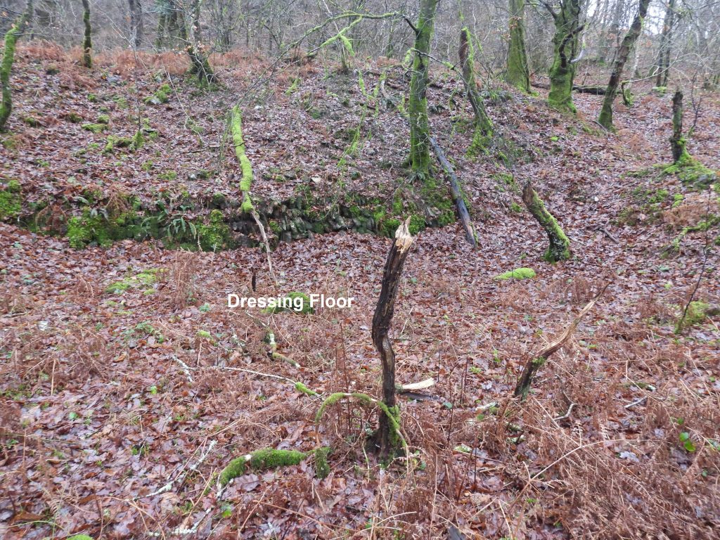
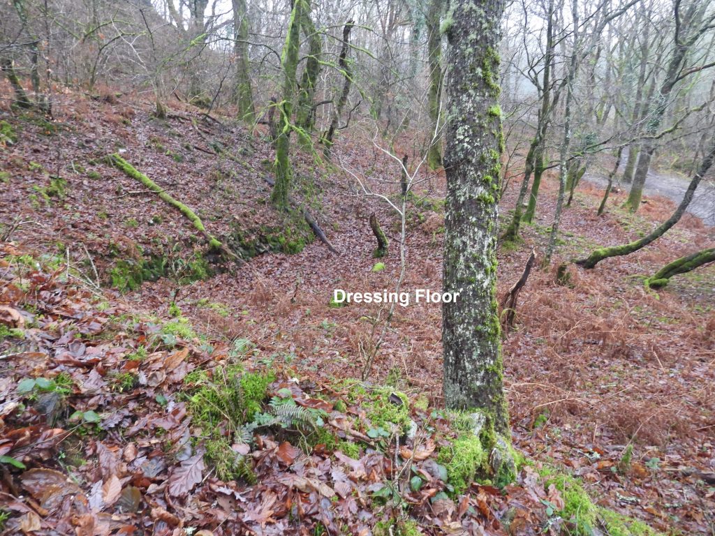
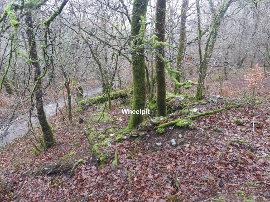
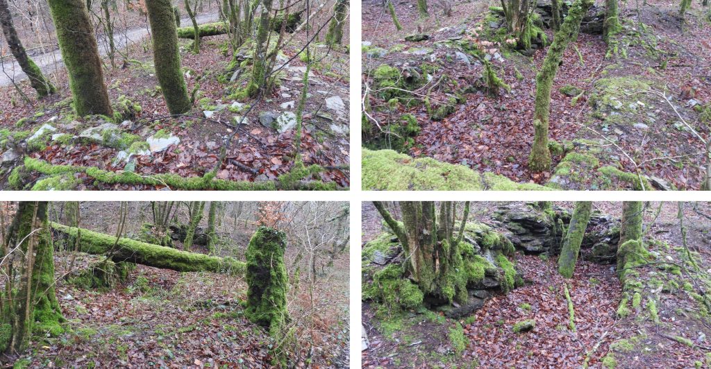
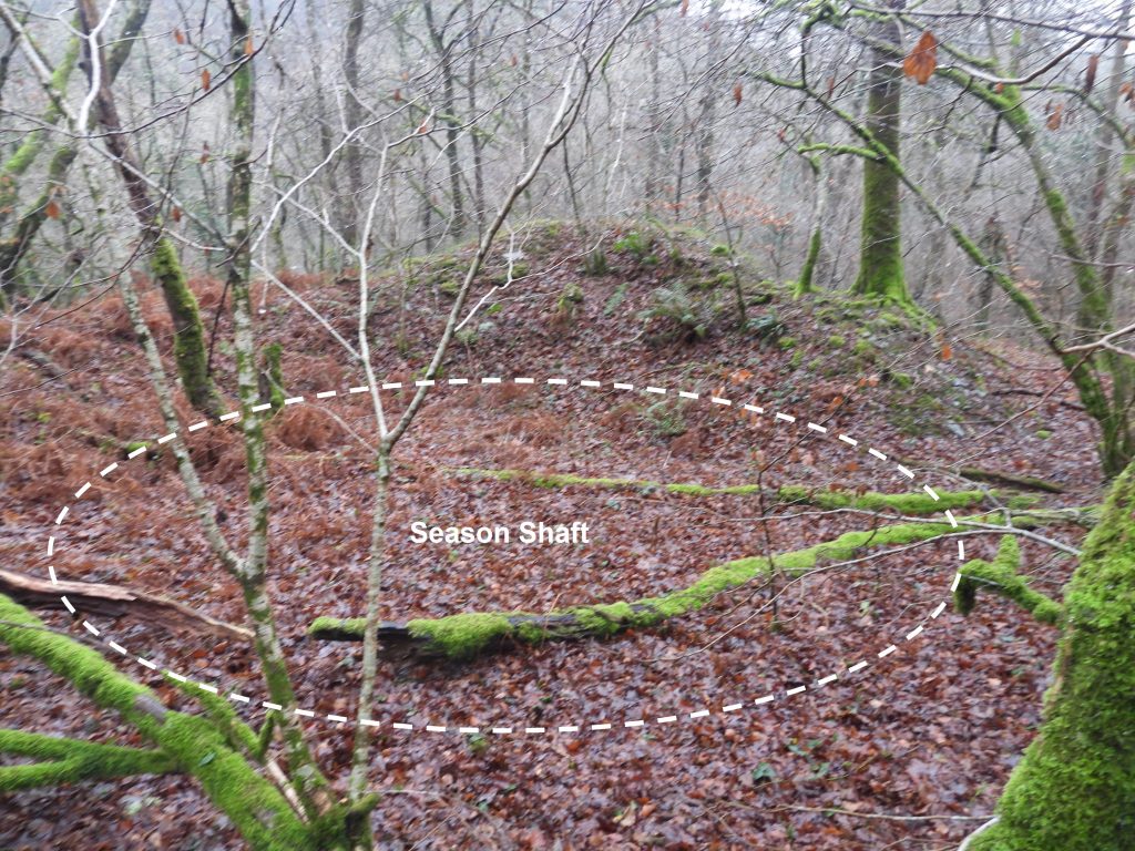
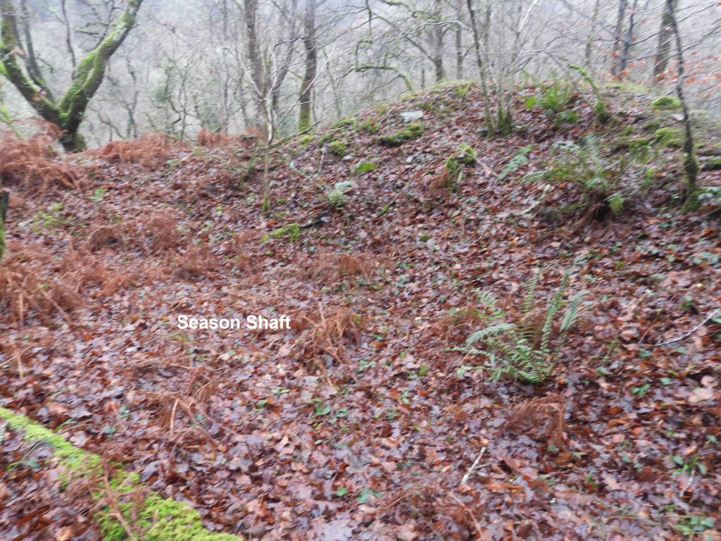
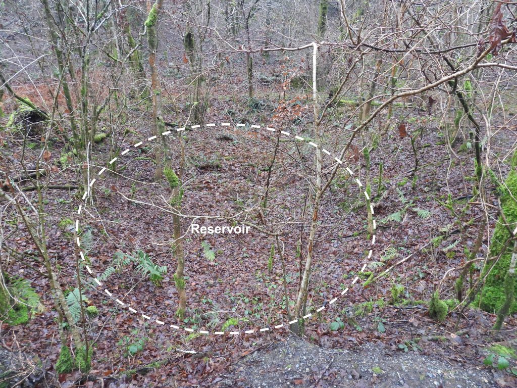
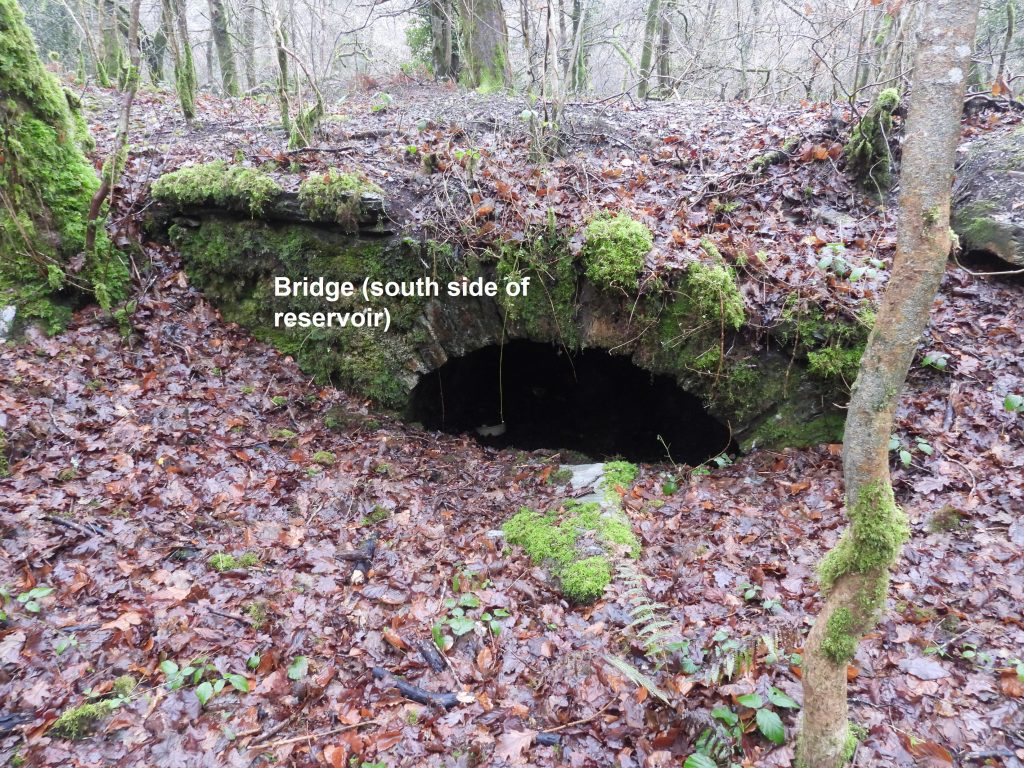
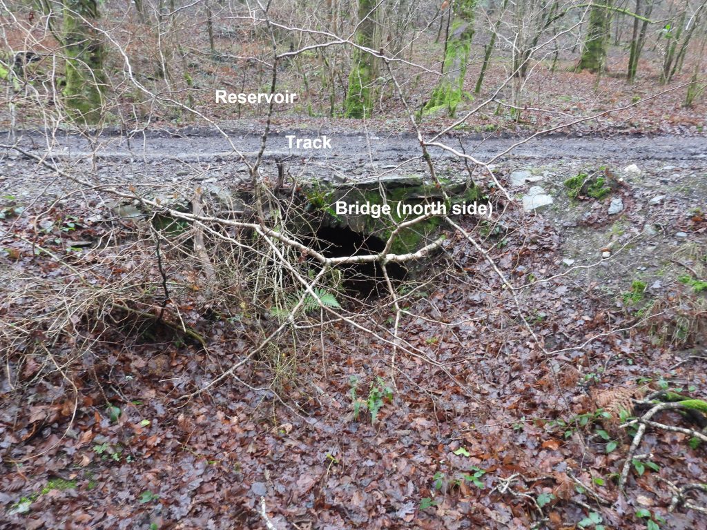
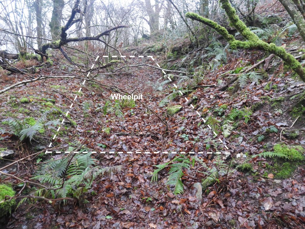
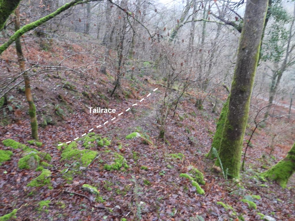
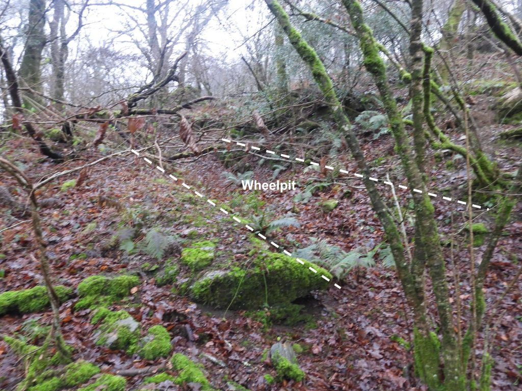
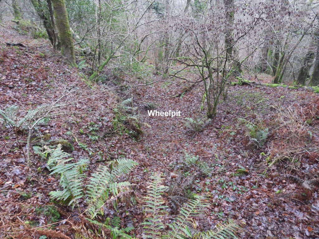
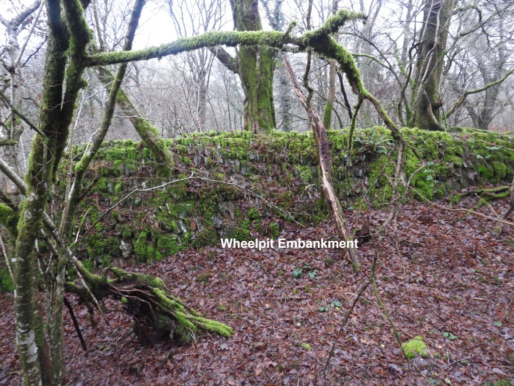
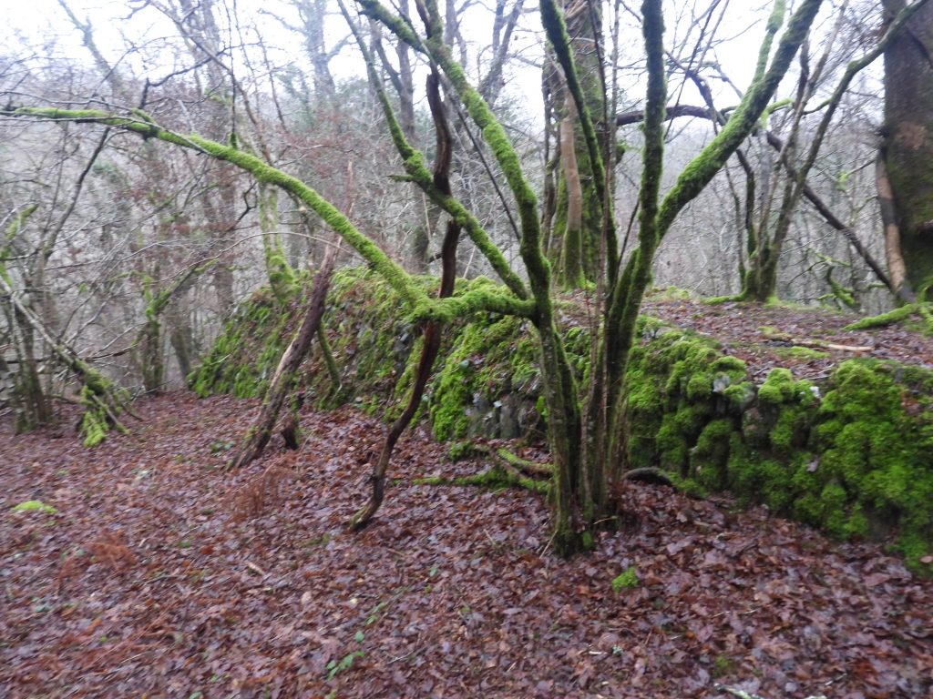
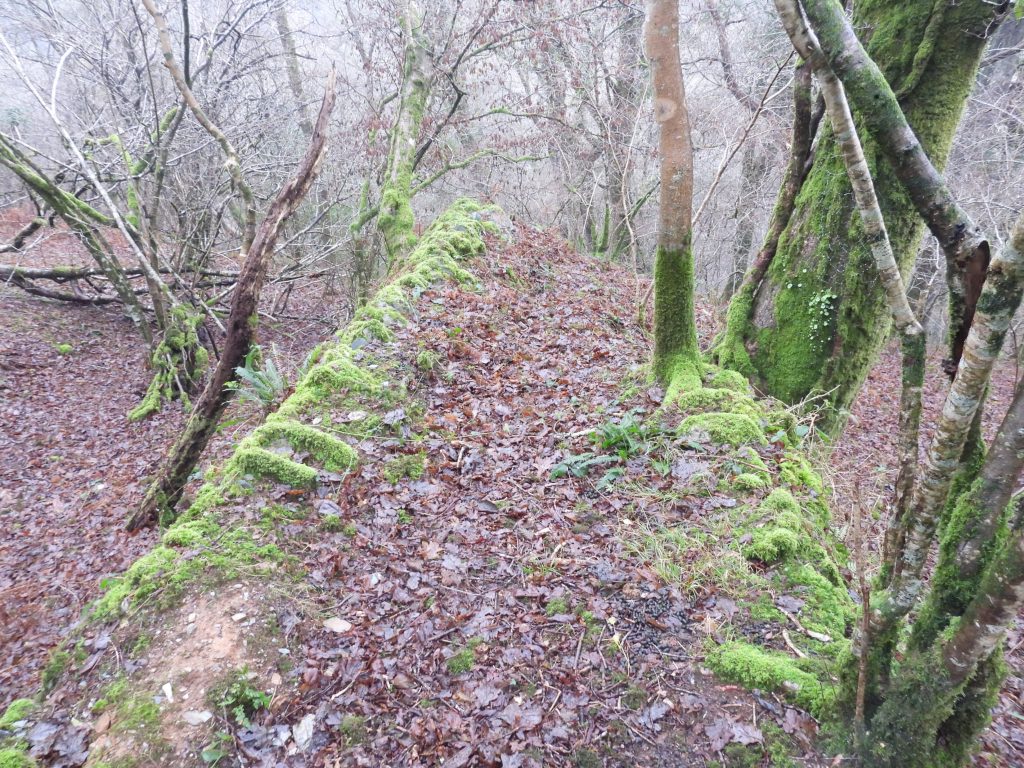
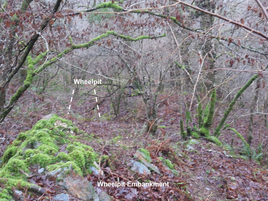
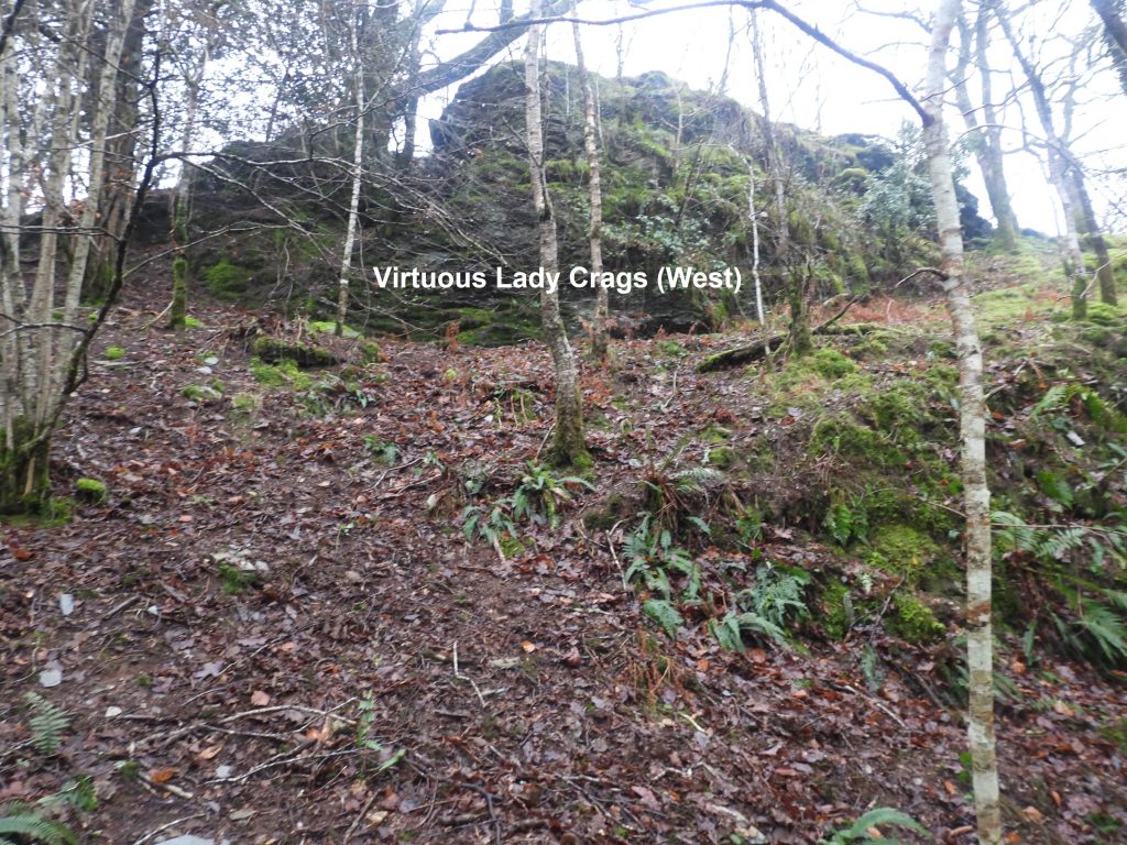
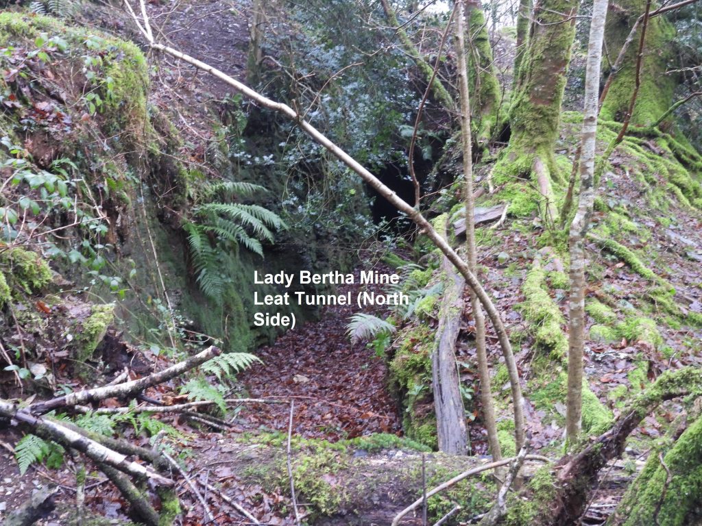
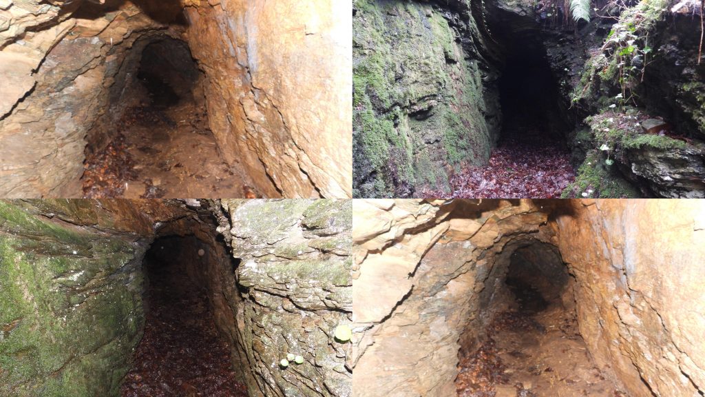
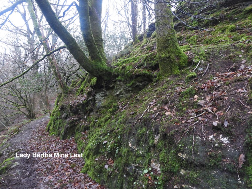
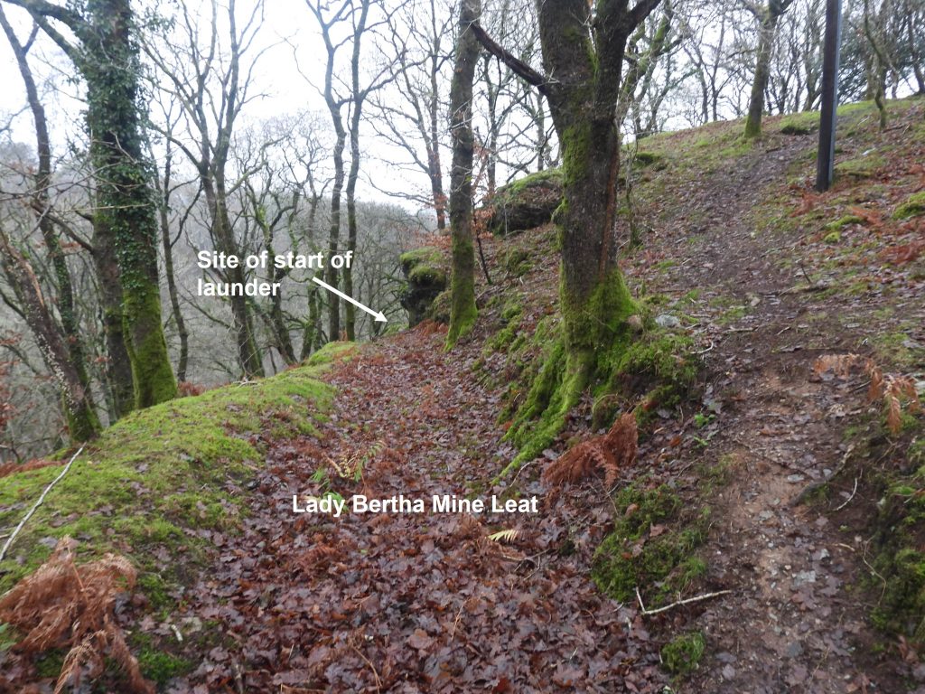
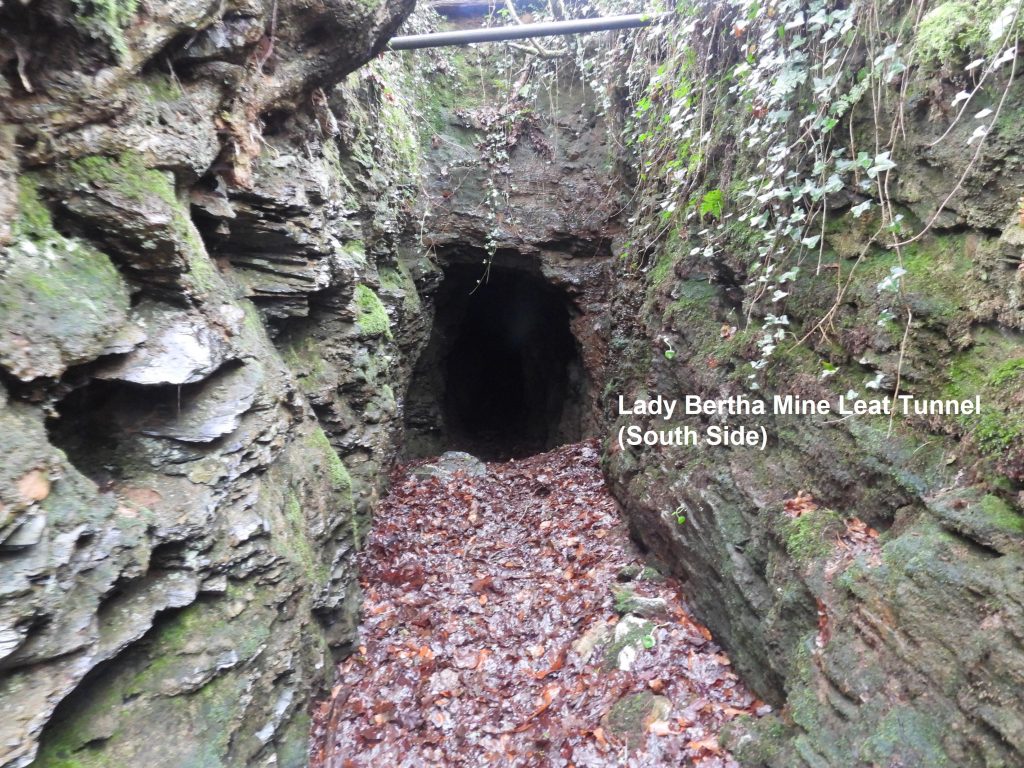
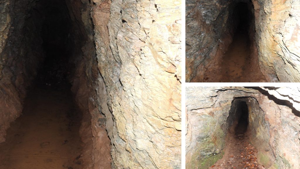
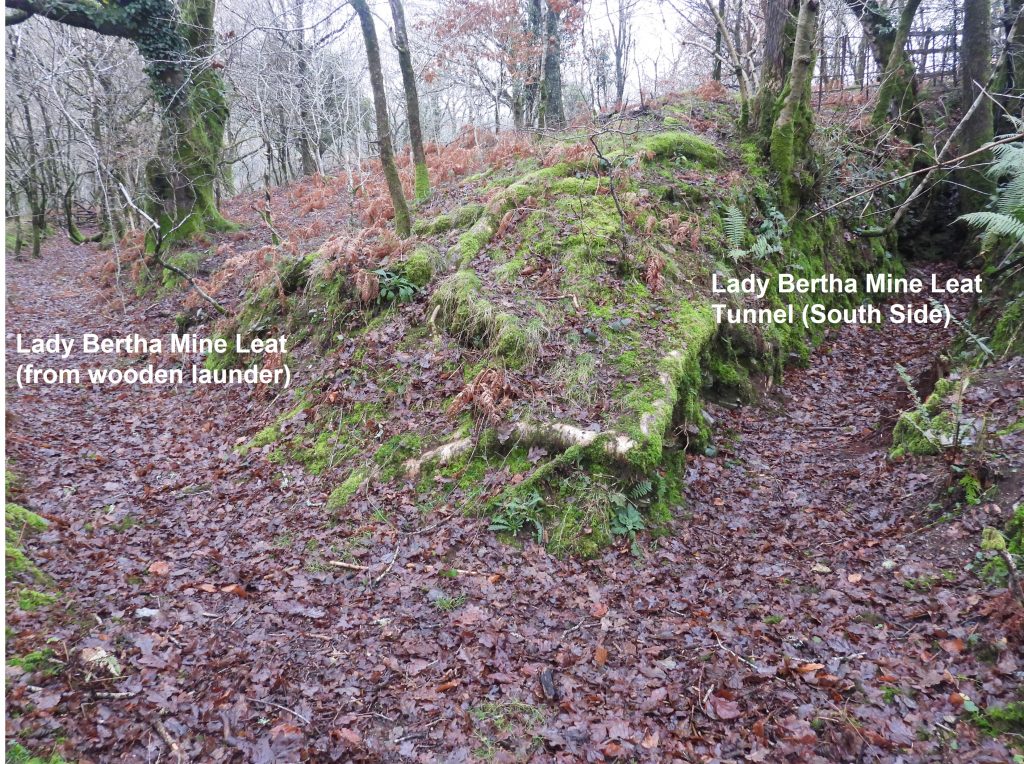
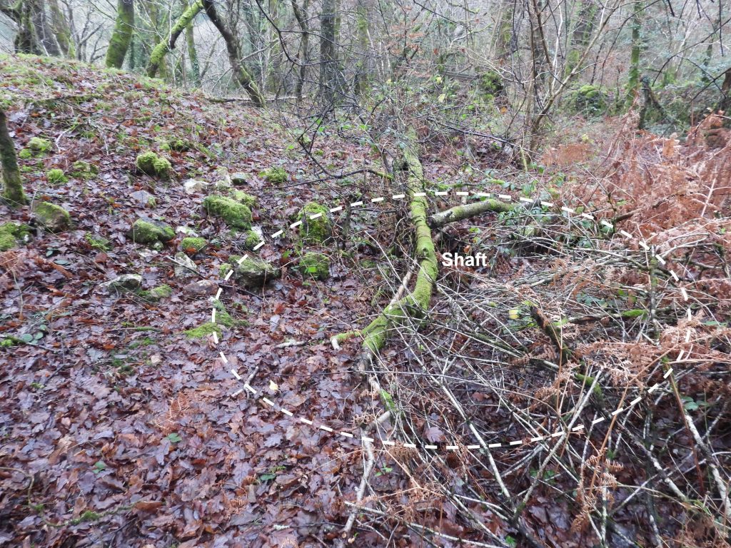
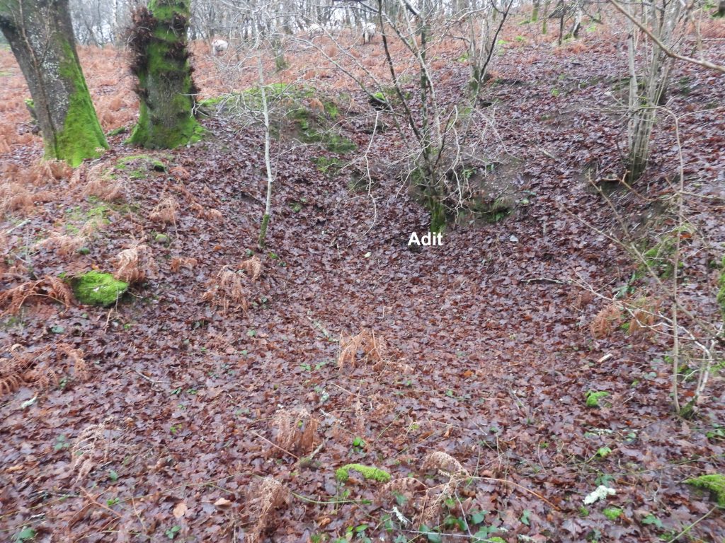
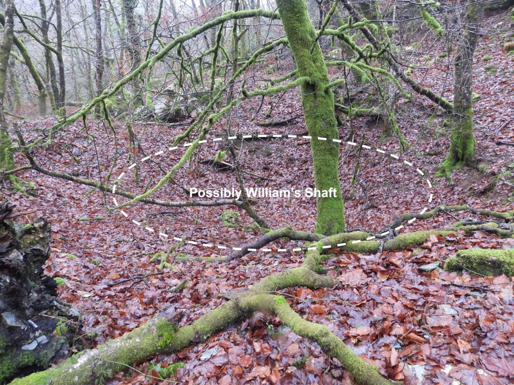
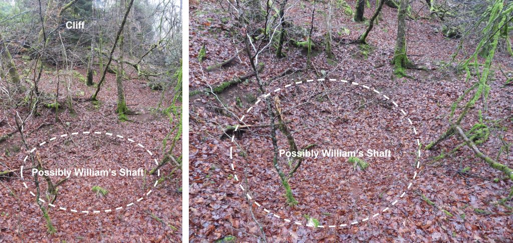
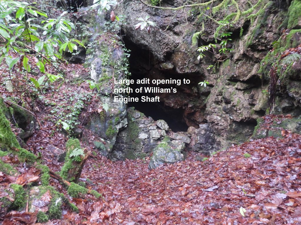
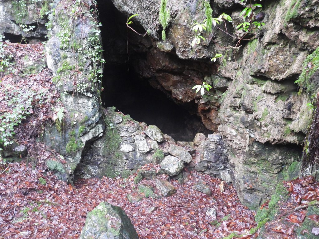
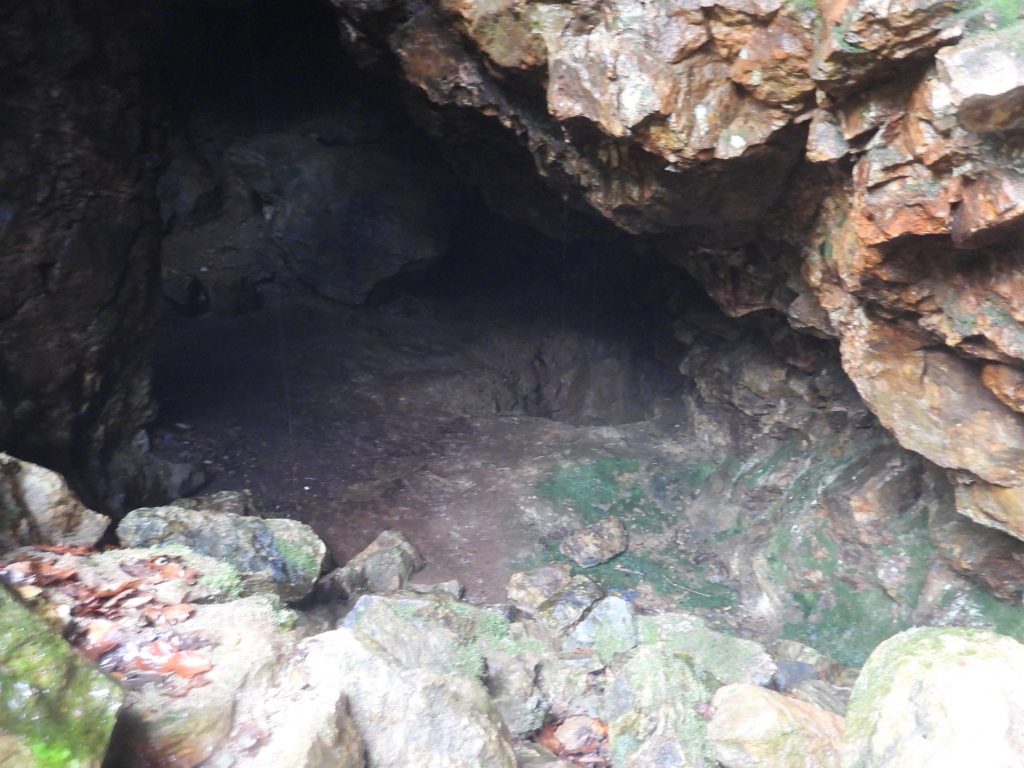
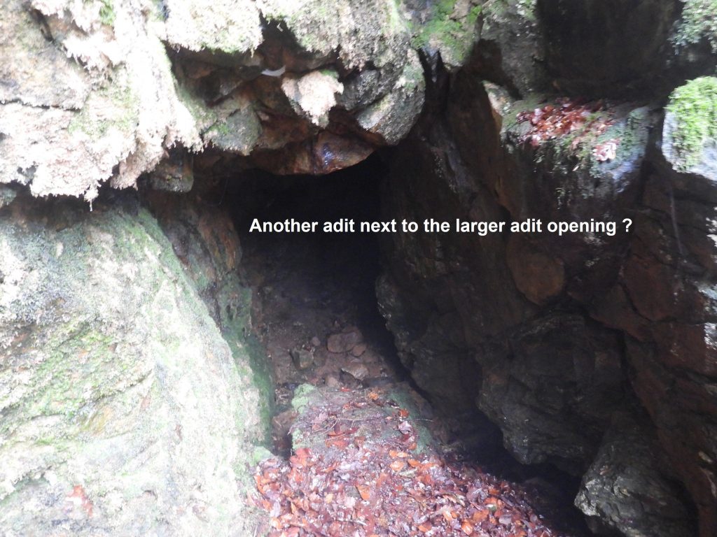
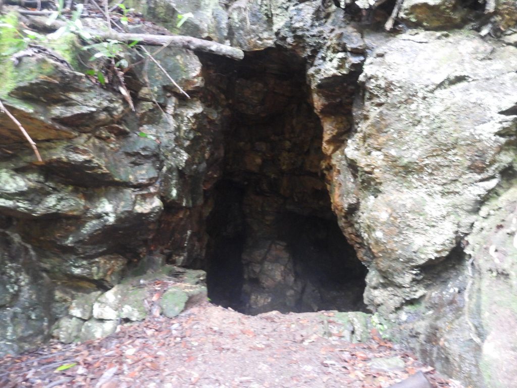
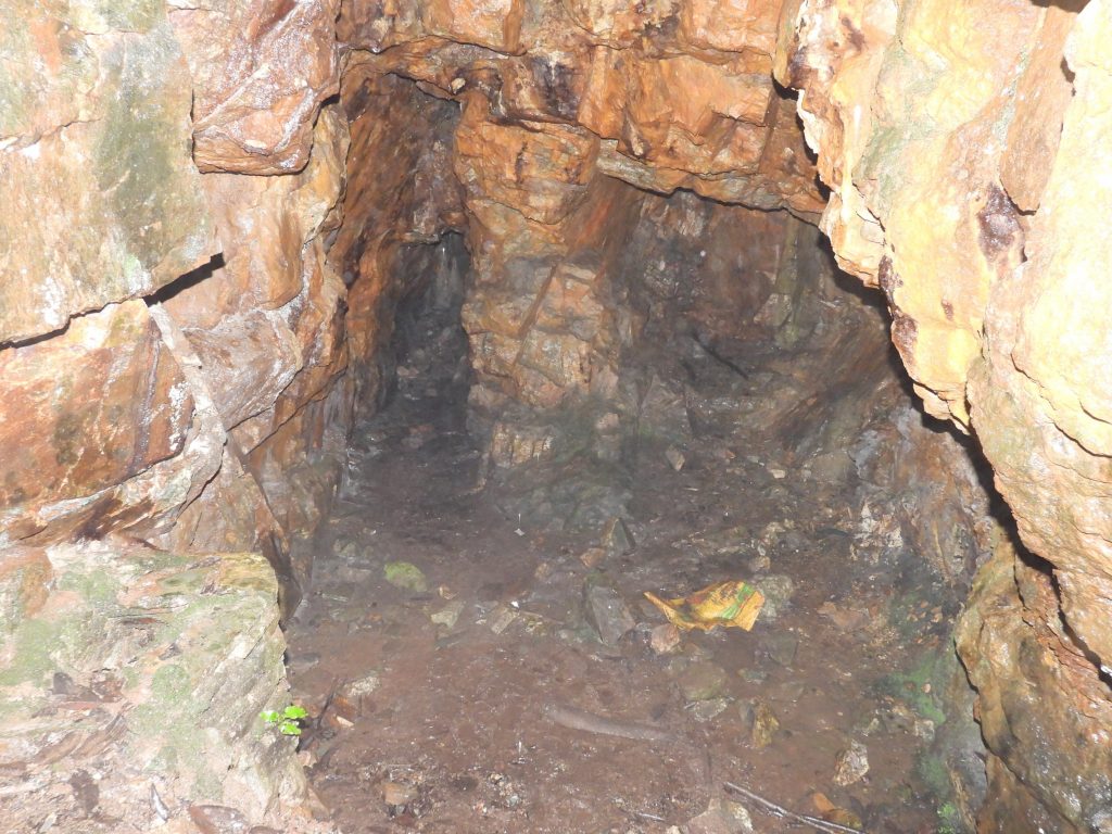
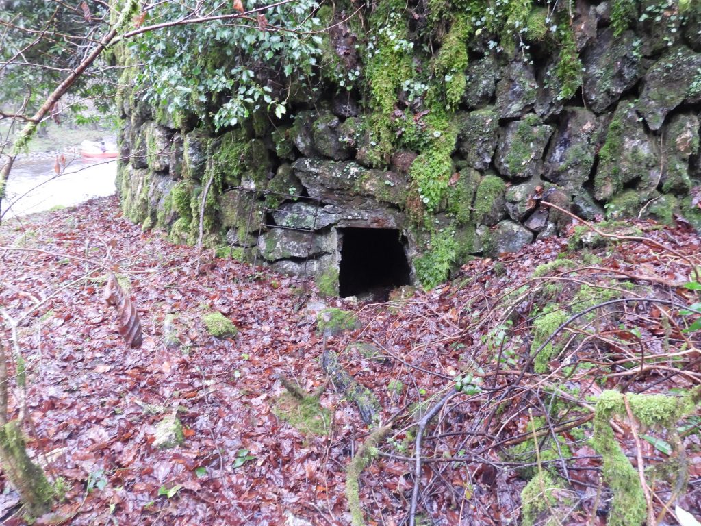
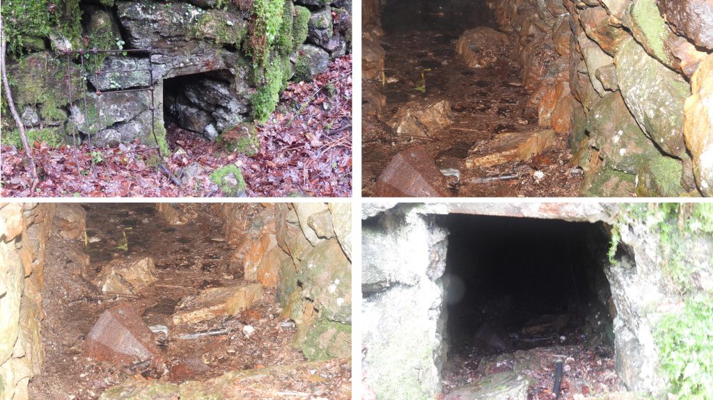
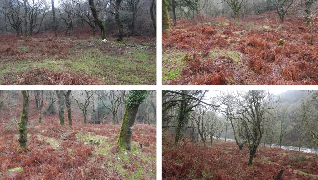
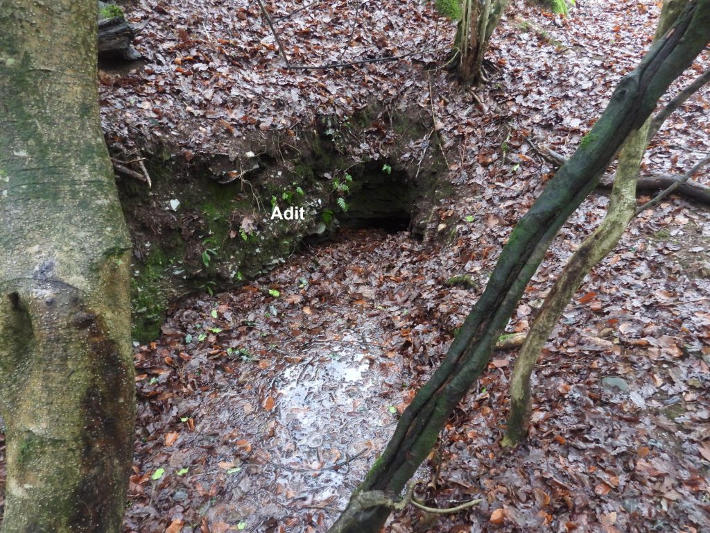
This sketch map shows the key features of the Virtuous Lady Mine site, which are covered in this post.The Crusher House at Virtuous Lady Mine is a very ruined building constructed from killas. The term Killas is a Cornish mining term for metamorphic rock strata of sedimentary origin which were altered by heat from the intruded granite. Next to the Crusher House are the remains of a wheelpit.The building would have contained crushing rollers powered by the waterwheel. Three corners of the structure survive, with the tallest around 3m high. The Dartmoor HER records states that the interior dimensions are 4.9m by 5.6m with walls of 0.65m thick. The Crusher House still has some timber lacing of the walls in situ.The centre of the Crusher House was recorded at SX47381 69896The wheelpit from which the wheel powered the crusher rollers is on the eastern end of the Crusher House. It is recorded as being 8.3m long by approximately 1.5m wide, albeit the wheelpit has been backfilled. The wheelpit is at SX47379 69893. It is suggested (Rendell) that the wheelpit also drove a flat rod system to aid the pumping out of shafts on the opposite side of the river (at Wheal Bedford Mine).Water for the wheel was provided by a spillway, which diverted water from the Lady Bertha Mine Leat, 100m uphill from this point (which is covered later in this post). The water, upon reaching the bottom of the slope (by the track) entered a hollow earthwork reservoir / pond for storage. A lovely stone arched tunnel allowed the water to run beneath the track before a short section of leat then diverted it to the wheel. The water would then have returned to the River Tavy nearby. The Lady Bertha Mine Leat take off point is on the River Walkham near Grenofen Bridge, several km’s away.The Eastern Engine shaft is quite close to the track and has been capped with long granite stones. It is relatively inconspicuous unless approached from the Crusher House or River Tavy when a small opening at the top of a gully makes it quite obvious. It can be located at SX47419 69869The internal views of the shaft show some apparent grooving, which may have been as a result to equipment being used for ascent / decent. It is known that cables were used here as to the east of the shaft is a well-preserved capstan pit. The shaft does not appear to have any associated drainage adit, so water was pumped to surface. The power for the pumps came from a water wheel sited approximately 60m south-east up a steep slope (which is covered later in this post).The Capstan Pit lies along a 11m earthwork channel leading from the Eastern Engine shaft. The Capstan Pit is recorded at SX47441 69871The Dartmoor HER describe this feature thus: “It sits within a 4.4m diameter plat and the central pit is stone lined with a slight batter: it has a diameter of 2.7m”. A possible whim lies at the bottom of the slope from the Eastern Engine Shaft. This is a best guess location by the author.The possible whim is located at SX47411 69897This large spoil heap of approx. 50m long runs close by the river at was recorded (on its summit) at SX47341 69908This capped shaft within a large conical pit is surrounded spoil. It can be located at SX47309 69898It is recorded that this might have been a hauling shaft.Close up of the shaftLooking across the River Tavy from the make shift shelter by the rivers’ edge is what appears to be a cave or probable adit associated with Wheal Bedford copper mine. The mine was first recorded in 1807 and is believed to have been the Virtuous Lady Mine in 1857.A little further upstream from the adit / cave there is a possible shaft (not explored by the author). Wheal Bedford Mine lies on private land.An old 19th century map places another shaft close to the waters edge. It does seem rather inconceivable that one would have been sunk here for the obvious flooding reasons and there is no apparent means of pumping. The author is not convinced that this feature is indeed a shaft but was recorded at SX47273 69876Close to the shaft located at SX47309 69898 is a levelled out piece of ground believed to have been the location of a whim.The Dartmoor HER states that “although not well defined, the position of a whim would have been on the south side”. It certainly is quite indistinct.The whim is located at SX47298 69877Dressing Floor next to (south) the trackThe Dressing Floor was recorded at SX47349 69859The wheelpit (10.5m by 1.6m), which is constructed from killas, is quite conspicuous beside the track (south side). It speculated that the wheel may have powered pumps at the Eastern Engine Shaft a short distance away. This would have been either before the larger wheel uphill by the Lady Bertha Mine Leat was installed (or even after the larger wheel became disused).The wheel pit can be found at SX47384 69861.Close to the Dressing Floor and just uphill from the Wheelpit lies Season Shaft. A spoil heap to the north is indicative of waste material hauled up this shaft. Season Shaft can be found at SX47377 69832 As recorded earlier in this post water from a spillway from Lady Bertha Mine was diverted downhill. Upon reaching the bottom of the slope (by the track) entered a hollow earthwork reservoir / pond for storage. This water was used to driver the waterwheel at the Crusher House. Photographing this reservoir / pond doesn’t provide the ‘depth’ of vision needed. The centre of the hollow is recorded at SX47413 69848The stone arched bridge / tunnel on the south side (reservoir side) of the track The stone arched bridge / tunnel on the north side of the track with the reservoir beyondNear Lady Betha Mine Leat is the rather ruined wheelpit which housed a wheel used to power pumps at Eastern Engine Shaft The tailrace from the wheelpit is obvious and probably the best route to follow when ascending the hillside. The Eastern Engine Shaft lies downhill diagonally right behind the larger three trees on the right.Fragments of wall still survive today and it is suggested the wheelpit measures 1.4m wide by up to 15m long. The wheelpit was recorded at SX47482 69826As cited in the Dartmoor HER, it is most unusual for a pumping waterwheel to be located at higher elevation than the shaft in which it powered pumps. Is this possibly the reason why a smaller (supplementary) wheel was built further down the slope ?Upslope of the wheelpit is a fabulous embankment, which almost abuts Lady Bertha Mine Leat.The embankment has a wedge-like profile and is stone clad.The embankment is recorded as being 13m long by approx. 2m high and being 2m wide along the top. The end of the embankment was recorded at SX47490 69810View from the end of the embankment with with the wheelpit below. The wheel must have been an impressive site when in place.Virtuous Lady Crags (West) lie above Lady Bertha Mine Leat. More information including how these crags were named can be found at https://www.torsofdartmoor.co.uk/tor-page.php?tor=virtuous-lady-cragsThe Lady Bertha Mine Leat took water from the Walkham near Grenofen Bridge to Lady Bertha Mine where it served four waterwheels. As can be seen by this post it also served three waterwheels at the Virtuous Lady Mine. Near to the crags, the leat splits, with one section passing through a tunnel and the second section passing around the slope on what would have been a wooden launder. The tunnel entrance is at SX47373 69782The Lady Bertha Mine Leat Tunnel at the north side. The author met a local who informed him that it was possible to walk through the tunnel (which is approx 100m long), though would not be recommended.Lady Bertha Leat (non-tunnel route) as it follows the contours of the hill.The site of where the wooden launder was most likely located on the Lady Bertha Mine Leat.The south side to the Lady Bertha Mine Leat tunnel can be located next to the track to Buckland MonachorumJust inside the south entrance of the Lady Bertha Mine Leat Tunnel. The tunnel does look very well constructed. The author is not aware which came first the wooden launder or the tunnel but suspects the launder came first which maybe was subsequently replaced by the tunnel as the route for the leat.The two leat routes combine just below the track.All that remains on the ground of this shaft (which is capped) is a small spoil heap. This is located at SX47303 69751This blocked trial adit just north of a track on moderately sloping ground lies at SX47338 69713Is this blocked shaft William’s Shaft ?This shaft lies below the cliff near Tavy Cottage and can be located at SX47223 69737. The HER states that “William’s Engine shaft is marked on the Abandoned Mine Plan (Devon Record Office AMP R80B) to the west of Tavy Cottage. Its location is likely to be at the foot of the cliff where an indentation in the ground may represent the capped shaft”. This “indentation” was the closest the author could find which met the description.The Dartmoor HER states that: “A particularly large adit opening north of William’s Shaft has a stone revetted level platform built just outside the portal which would have served as a working area”. The author believes this is possibly the location. Location is SX47189 69775. Inside the portalIs this another adit ? There is another large adit opening at SX47214 69797Inside the adit portal, there appears to be two tunnels.Just outside the adit portal is a large stone revetted level platform which would have served as a working area. At its base is a small opening, which appears at one tine would have had a metal grille. The opening is located at SX47203 69793The author is unaware what this small opening / tunnel would have been used for at the base of the stone revetted platform. Does anyone reading this post know the answer ?The remains of the ‘Old Dressing Floor’ which is annotated on the Abandoned Mine Plan.Track next to the ‘old dressing floor’ next to the River TavyLooking south down the River Tavy in the direction of Lady Bertha mine.This partially open adit drives east into the hillside. It is on the east uphill side of a track.The adit is located at SX47383 69617
I live in Buckland and am interested in the social history of the mine – the workers, how it was worked etc. I have been doing some research at The Box and online. I would be interested in making contact since you have clearly found out a lot about the working parts of the operation and our work is complementary.
Thank you for your comment. The information I have obtained for my post is available in the public domain, which I am sure I can assist with to point you in the right direction.
With my website and posts, my aim is simple and that is to record pictorially these sites as there are today alongside an interpretive map.
Great write up, me and a mate cycled down yesterday and using a combination of old maps and your map and photos I think we found most of these!
Having looked at the HER though when I got home, I think what you’ve labelled as Williams Engine Shaft is in fact the “particularly large adit opening north of William’s Shaft (which) has a stone revetted level platform built just outside the portal”. It seems to suggest that William’s Shaft is the “indentation in the ground (at the foot of the cliff) which may represent the capped shaft”.
We stepped inside the larger adit and even found a piece of old machinery, possibly part of a winch. Have some photos if you’d be interested.
Many thanks for your comments and taking time to make them.
I have had another look at my pictures, my grid references and the HER and conclude my initial interpretation was made in haste,
I did take some pictures of a shaft “indentation” which lies below the cliff near Tavy Cottage which can be located at SX47223 69737. The HER states that “William’s Engine shaft is marked on the Abandoned Mine Plan (Devon Record Office AMP R80B) to the west of Tavy Cottage. Its location is likely to be at the foot of the cliff where an indentation in the ground may represent the capped shaft at SX 4723 6979”. My GR is pretty close to the HER GR, so I have amended my post accordingly.
I’d be happy to receive photographs from you of the “machinery” and can add to the website if you wish.
Thank you once again for taking the trouble to comment.
Do you happen know of the identity of the woman who was living in Tavy Cottage in 1970? Her name, if my memory serves me, may have been something like Mary Oxenford. She was, at any rate, a geologist of some international renown with a rather spectacular collection of geological samples, most of which she had collected locally.
Peggy Oxenford lived at Tavy Cottage which was formerly known as the Virtuous Lady House and Cottage in censuses. You can find pictures of her taken in August 1973 in the Tavy and Tamar magazine from when she took Vic Gardener from the Tavistock Gazette and photographer Jim Thorington down the mine. They write about caverns and slipping through tunnels! The magazine is available at Tavistock Subscription Library and Jim Thorington’s photos are archived with the Tavistock Museum.
The lady who lived at Tavy cottage was in fact Mrs Oxenford (didn’t know her first name) and she was still there in the mid-seventies. She had a fine collections of local minerals and she would take visitors on a tour of the mine. I never went and I never saw her mineral collection and I wondered what happened to it. She had a daughter living with her who was tragically drowned in the pool opposite in 1957; I remember the tragedy well as an assembly was held for her at school.
I was taken down the mine by Mrs Oxenford with a school group in 1976: She showed us huge remaining deposits of Malachite lining the walls of one of her store houses (presumably now at the property called Tavy Cottage),and a crystal chamber inside the mine lined by huge quartz crystals – I think this may have been robbed since then judging from online posts. PArts of the mine were flooded but you could see all the way to the bottom of the shafts because the water was so clear. Mrs Oxenford was of the view that there was plenty of ore still to be mined there but it would need the exhaustion of cheaper opencast mines elsewhere before it would become economic again. The visit to the mine took about an hour and there were extensive dry workings above the flooded levels.. I found several good examples of iron pyrite crystals in the slag heaps by the edge of the tavy near to the mine.
I don’t suppose you came across any of the boundary stones near the Viruous Lady mine area. In a recent search with Paul Rendell we managed to find the one rediscovered by Mr & Mrs Vane, but failed to locate the one I rediscovered with Chris Kelland, in 2014.
According to my research, so far, old maps have revealed the possible sites of 32 BSs 14 x Lopes on the left bank / 18 x Bedford on the right bank, going downstream.

Tracy Dearing August 14, 2022
I live in Buckland and am interested in the social history of the mine – the workers, how it was worked etc. I have been doing some research at The Box and online. I would be interested in making contact since you have clearly found out a lot about the working parts of the operation and our work is complementary.
SteveGrigg1961 August 17, 2022 — Post author
Hi Tracy,
Thank you for your comment. The information I have obtained for my post is available in the public domain, which I am sure I can assist with to point you in the right direction.
With my website and posts, my aim is simple and that is to record pictorially these sites as there are today alongside an interpretive map.
Thank you for you comment and interest.
Kind Regards,
Dartmoor Explorations (Steve)
Phil September 5, 2022
Great write up, me and a mate cycled down yesterday and using a combination of old maps and your map and photos I think we found most of these!
Having looked at the HER though when I got home, I think what you’ve labelled as Williams Engine Shaft is in fact the “particularly large adit opening north of William’s Shaft (which) has a stone revetted level platform built just outside the portal”. It seems to suggest that William’s Shaft is the “indentation in the ground (at the foot of the cliff) which may represent the capped shaft”.
We stepped inside the larger adit and even found a piece of old machinery, possibly part of a winch. Have some photos if you’d be interested.
Thanks again for this, great afternoon out!
SteveGrigg1961 September 6, 2022 — Post author
Hi Phil,
Many thanks for your comments and taking time to make them.
I have had another look at my pictures, my grid references and the HER and conclude my initial interpretation was made in haste,
I did take some pictures of a shaft “indentation” which lies below the cliff near Tavy Cottage which can be located at SX47223 69737. The HER states that “William’s Engine shaft is marked on the Abandoned Mine Plan (Devon Record Office AMP R80B) to the west of Tavy Cottage. Its location is likely to be at the foot of the cliff where an indentation in the ground may represent the capped shaft at SX 4723 6979”. My GR is pretty close to the HER GR, so I have amended my post accordingly.
I’d be happy to receive photographs from you of the “machinery” and can add to the website if you wish.
Thank you once again for taking the trouble to comment.
Kind Regards,
Dartmoor Explorations (Steve)
Ralph de Rijke October 24, 2023
Hello Steve,
Do you happen know of the identity of the woman who was living in Tavy Cottage in 1970? Her name, if my memory serves me, may have been something like Mary Oxenford. She was, at any rate, a geologist of some international renown with a rather spectacular collection of geological samples, most of which she had collected locally.
SteveGriggDartmoor October 27, 2023 — Post author
Hello Ralph,
I’m afraid I do not know the name of the lady to whom you refer. Sorry.
Kind Regards,
Dartmoor Explorations (Steve)
Tracy Dearing April 3, 2024
Peggy Oxenford lived at Tavy Cottage which was formerly known as the Virtuous Lady House and Cottage in censuses. You can find pictures of her taken in August 1973 in the Tavy and Tamar magazine from when she took Vic Gardener from the Tavistock Gazette and photographer Jim Thorington down the mine. They write about caverns and slipping through tunnels! The magazine is available at Tavistock Subscription Library and Jim Thorington’s photos are archived with the Tavistock Museum.
SteveGriggDartmoor April 3, 2024 — Post author
Hi Tracy,
Thank you for this information. I’ll make a visit to the library.
Kind Regards,
Dartmoor Explorations (Steve)
GRAHAM CLARKE November 13, 2023
The lady who lived at Tavy cottage was in fact Mrs Oxenford (didn’t know her first name) and she was still there in the mid-seventies. She had a fine collections of local minerals and she would take visitors on a tour of the mine. I never went and I never saw her mineral collection and I wondered what happened to it. She had a daughter living with her who was tragically drowned in the pool opposite in 1957; I remember the tragedy well as an assembly was held for her at school.
Mark Halliday July 25, 2024
I was taken down the mine by Mrs Oxenford with a school group in 1976: She showed us huge remaining deposits of Malachite lining the walls of one of her store houses (presumably now at the property called Tavy Cottage),and a crystal chamber inside the mine lined by huge quartz crystals – I think this may have been robbed since then judging from online posts. PArts of the mine were flooded but you could see all the way to the bottom of the shafts because the water was so clear. Mrs Oxenford was of the view that there was plenty of ore still to be mined there but it would need the exhaustion of cheaper opencast mines elsewhere before it would become economic again. The visit to the mine took about an hour and there were extensive dry workings above the flooded levels.. I found several good examples of iron pyrite crystals in the slag heaps by the edge of the tavy near to the mine.
SteveGriggDartmoor July 25, 2024 — Post author
Hi Mark,
Thank you for your recollections of Virtuous Lady Mine
Kind Regards,
Dartmoor Explorations
MarkF May 19, 2025
I don’t suppose you came across any of the boundary stones near the Viruous Lady mine area. In a recent search with Paul Rendell we managed to find the one rediscovered by Mr & Mrs Vane, but failed to locate the one I rediscovered with Chris Kelland, in 2014.
According to my research, so far, old maps have revealed the possible sites of 32 BSs 14 x Lopes on the left bank / 18 x Bedford on the right bank, going downstream.
SteveGriggDartmoor May 22, 2025 — Post author
Hi Mark,
In researching and visiting the site, I did not consider any boundary stones. It would be great to go and revisit sometime.
Kind Regards,
Steve (Dartmoor Explorations)