A collection of walks, discoveries, insights and pictures of exploring Dartmoor National Park
February 28, 2022
Early 20th Century protection of a Prehistoric Enclosure and Huts at Addicombe.
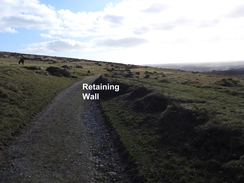
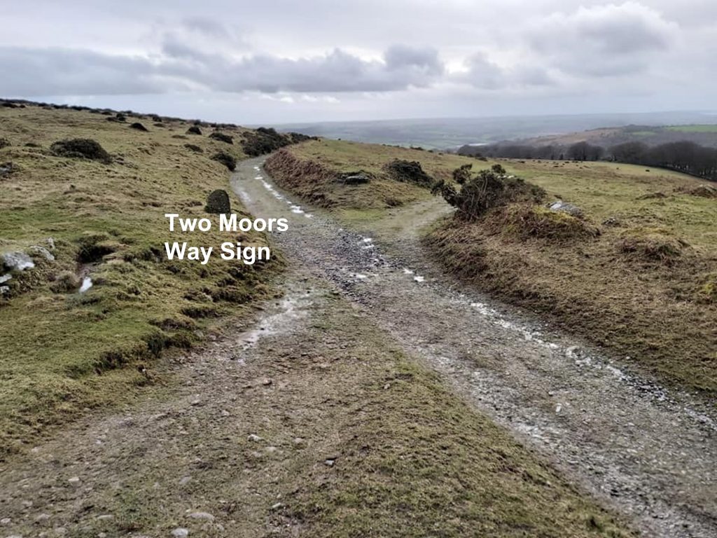
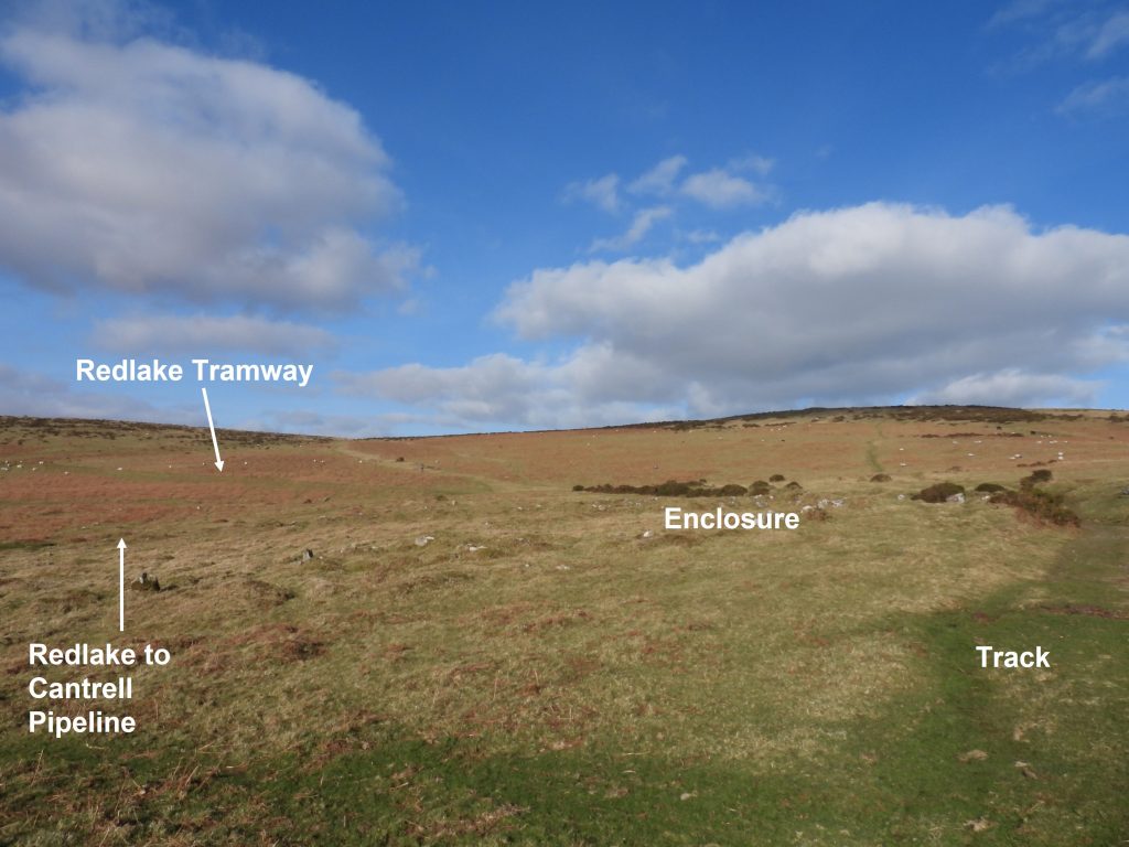
At 1 mile 25 chains (NOTE: there are 80 chains in one mile) from the Redlake Tramway locomotive shed below Western Beacon, the tramway enters a shallow cutting, where the modern Two Moors Way meets the tramway. At this point there is a 3ft (0.9m) high, 71ft (21.6m) long raised dry-stone platform. One theory as to why this raised dry-stone platform was constructed is that it was to serve houses in the Erme Valley, a ½ mile to the west. However, a possibly more feasible explanation is that this construction (which realistically was not necessary) was down to the surveyor (Richard Hansford Worth) who could have insisted on this to protect the Addicombe Enclosure and Huts immediately to the west. The author believes this attention to detail becomes more evident when one considers the pipeline passes the other side of the Enclosure. The survey was conducted in 1909 and the tramway and pipeline were constructed in 1910/11. The tramway officially opened on 11th September 1911.
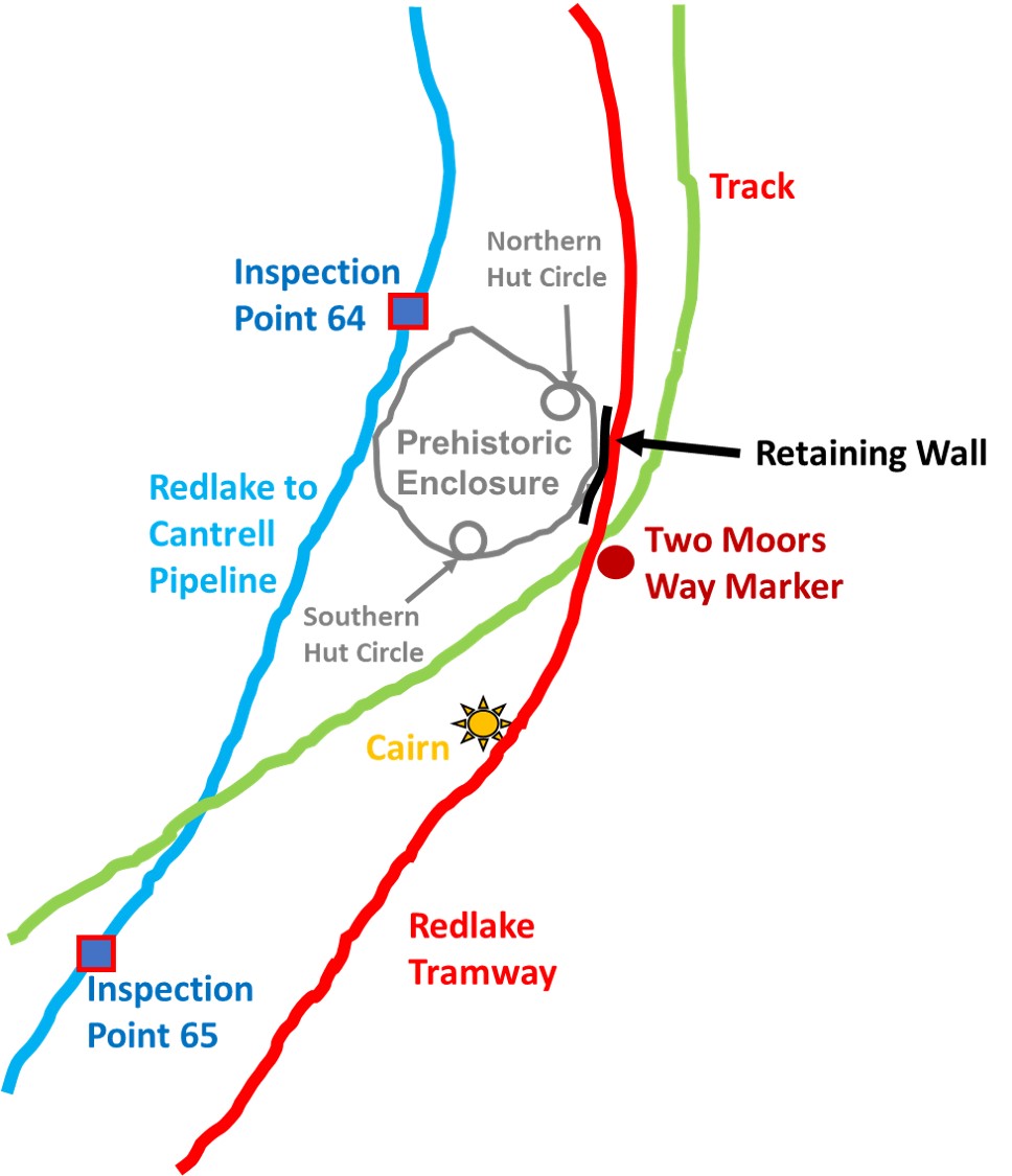
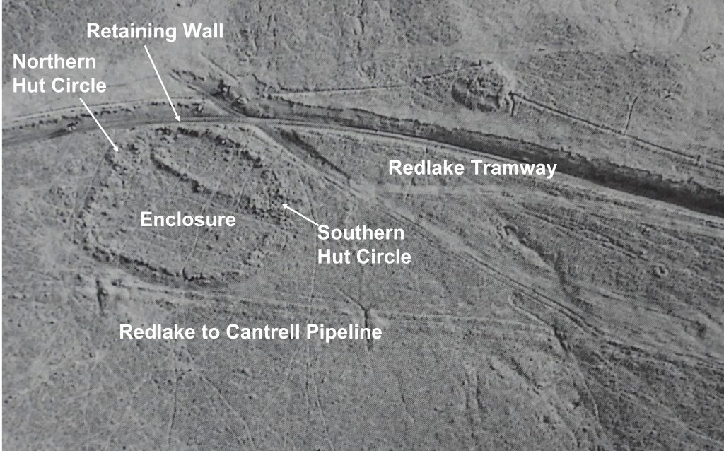
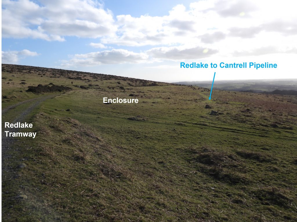
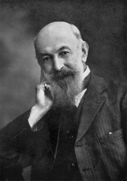
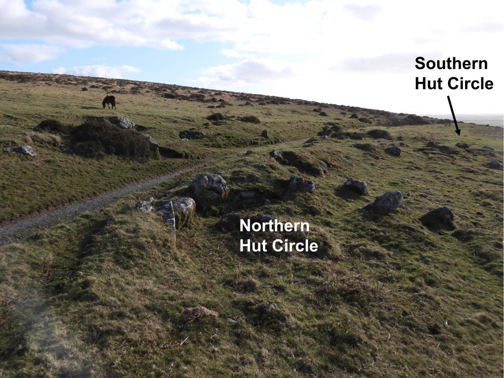
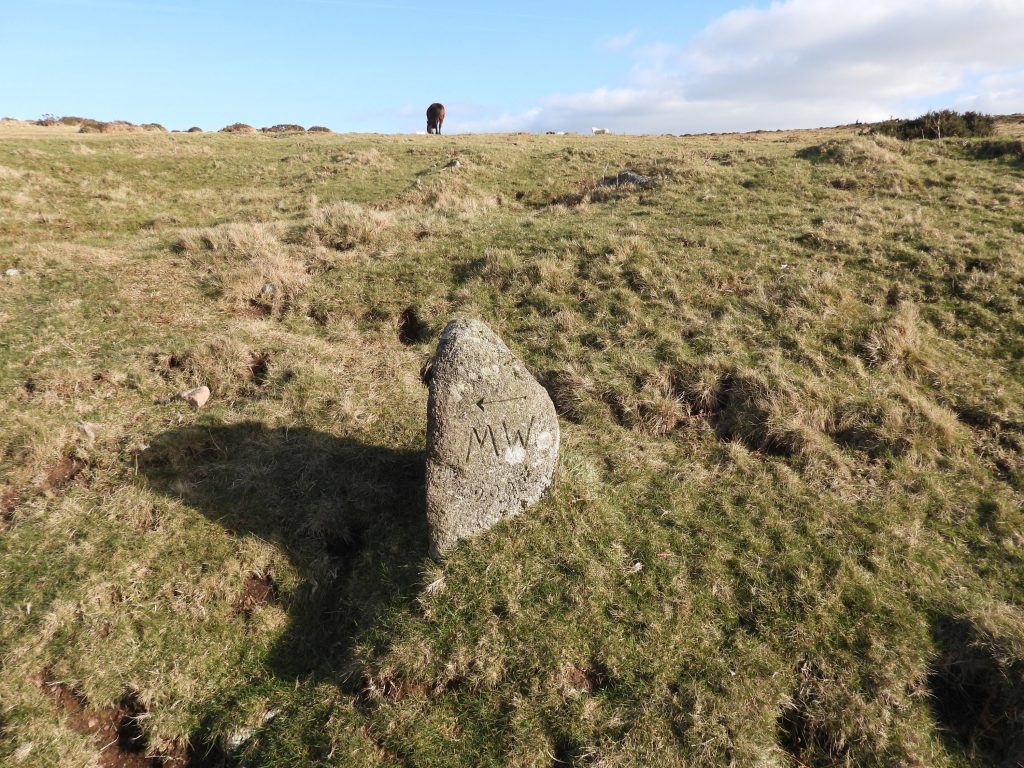
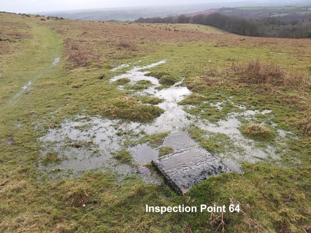
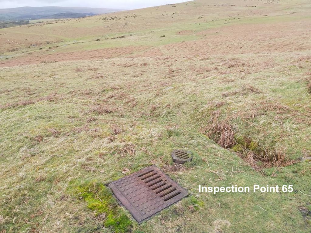
Sketch map showing the items covered in this post.An aerial photograph of the area, crystallises the view of how the enclosure and hut circles have been bisected by the Redlake Tramway and the clay pipeline which ran from (near) Redlake works down to Cantrell.Looking south at the bend in the tramway where the the Addicombe Enclosure is located. The Enclosure features in Jeremy Butler’s Dartmoor Atlas of Antiquities: Volume Four – The South-East, Map 53. It is also described in the Dartmoor HER as being “Irregular shaped prehistoric Enclosure of 46 metres by 46 metres with walls 1.2 metres wide by 0.9 metres high, an entrance to the south and an internal division”. The north end of the 3ft (0.9m) high, 71ft (21.6m) long raised dry-stone platform protecting the Addicombe Enclosure.Richard Hansford Worth (5 November 1868 – 11 November 1950) is a bit a a hero to the author. He was a civil engineer, geologist, archaeologist and writer on Dartmoor. He was the author of numerous papers published by the Devonshire Association some of which became the basis of the book Worth’s Dartmoor published posthumously. The author has no doubt that he ensured many antiquities were saved when the Redlake Tramway and pipeline were constructed. His connection with Robert Burnard, Sabine Baring-Gould, Dr Gray et. al. in the Dartmoor Exploration Committee of the Devonshire Association no doubt would have helped enormously. The Dartmoor HER records that ‘a shallow granite trough found by R. Hansford worth when surveying the enclosure’.View of the two Hut Circles as views from atop the retaining wall. The Dartmoor HER describes the Northern Hut Circle as ‘being 9 metres diameter with walls 1.1 metres wide by 0.7 metres high, with upright facing stones and an entrance to the south’. Furthermore the Southern Hut Circle is described as being ‘sub-rectangular of 13 metres by 9 metres with walls 1 metre wide by 0.5 metres high with an internal division’.The Two Moors Way marker inscribed ‘MW 2002’ to guide walkers onto /off the tramwayThe “crossroads” of the track and tramway as shown on the sketch map.South end of the retaining wall as viewed from the Two Moors Way MarkerThere were 80 inspection points along the twin stoneware pipeline (roughly one every tenth of a mile or around 230-240 paces). This one is number 64 at SX65083 58284. The clay was gravity fed and had the consistency of cream. The pipes were flushed out before the clay was sent down the pipe.Inspection point 65 at SX65014 58155. Apparently, when initially commissioned it was found that surface water percolated into the pipe and joints had to be improved, delaying things somewhat. Richard Hansford-Worth was in charge of the construction and was dismissed because of this as he has personally supervised the pipeline contract.View of the site as viewed from the south. In the distance Butterdon Hill (right) and Weatherdon Hill (left) are on the horizon.