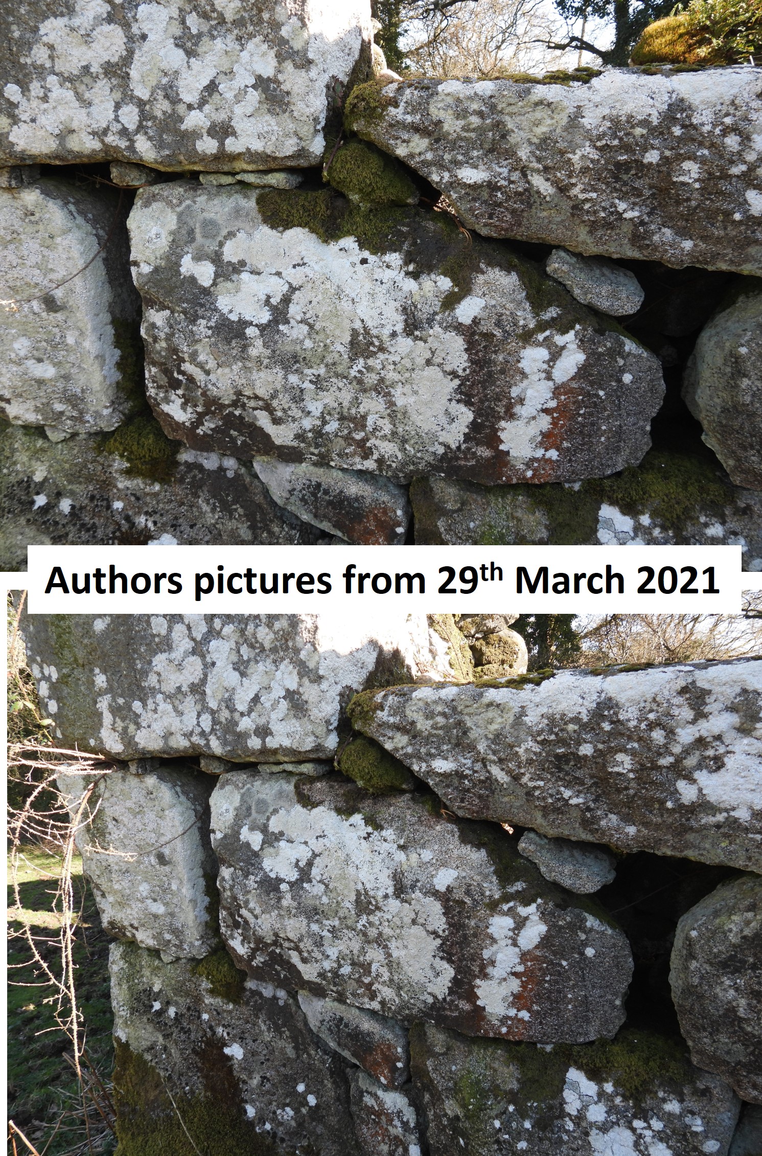
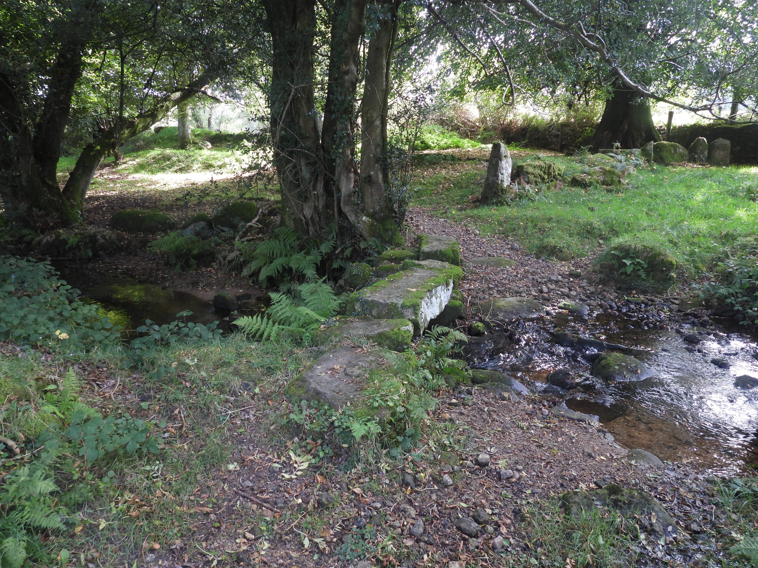
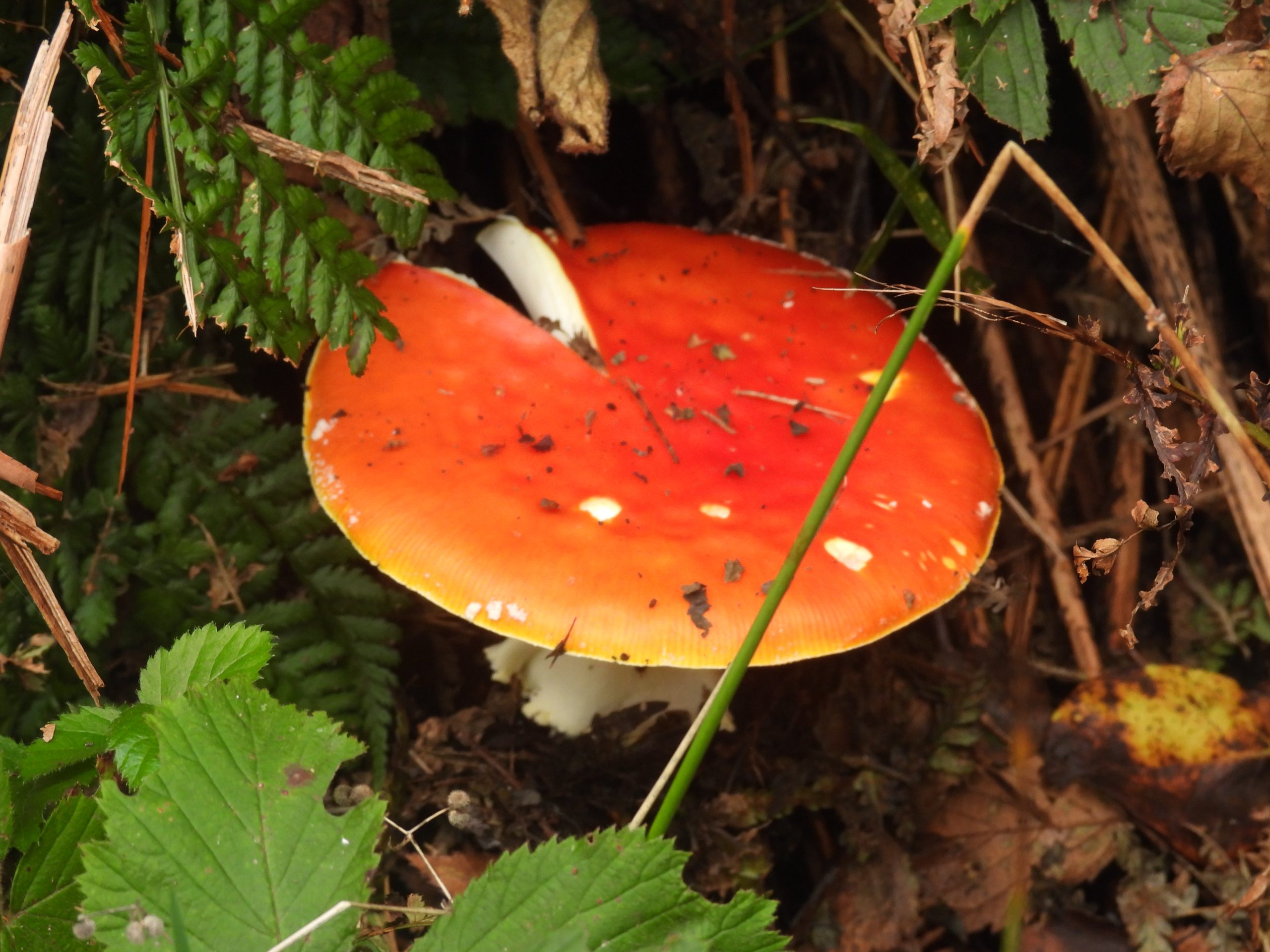
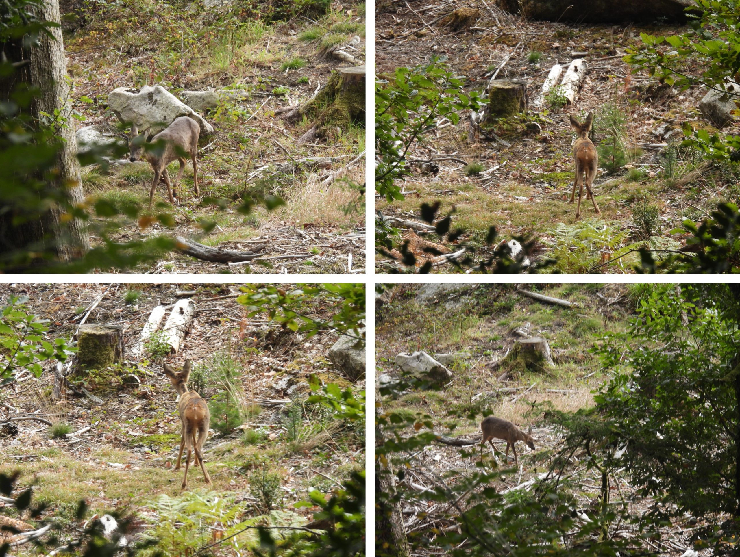
This post records two historic buildings on (or near to) the Mariner’s Way between Frenchbeer and Moortown. The buildings are a 13th Century ruinous Chapel (close to Moortown and Chapple) and another Ash House (at Frenchbeer). The whole Mariner’s Way is old trackway which ran from Bideford to Dartmouth and it is said the route was used by sailors who would be changing ships between the two ports, a journey of some 70 miles. The track is believed to be centuries old, possibly from at least 17th or 18th century.
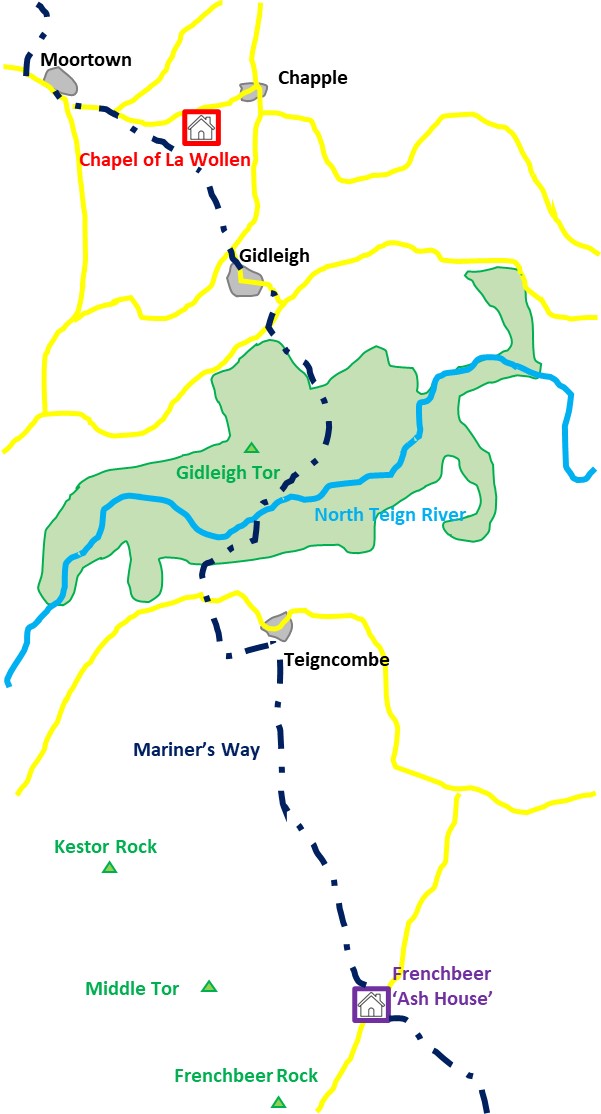
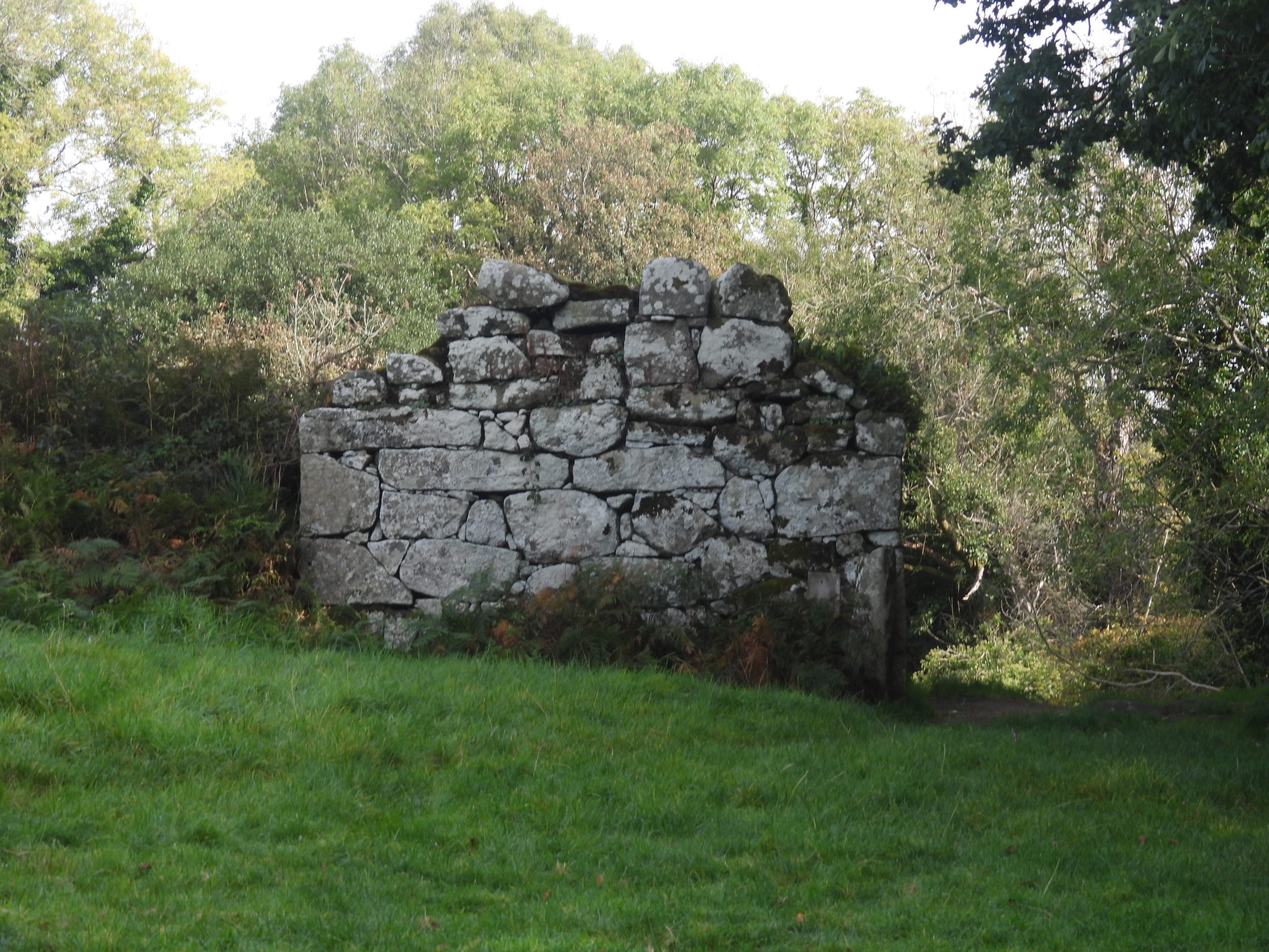
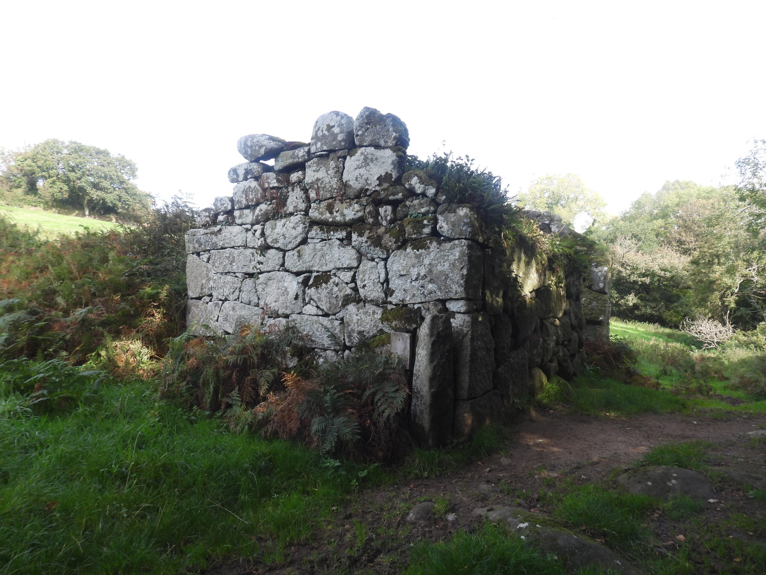
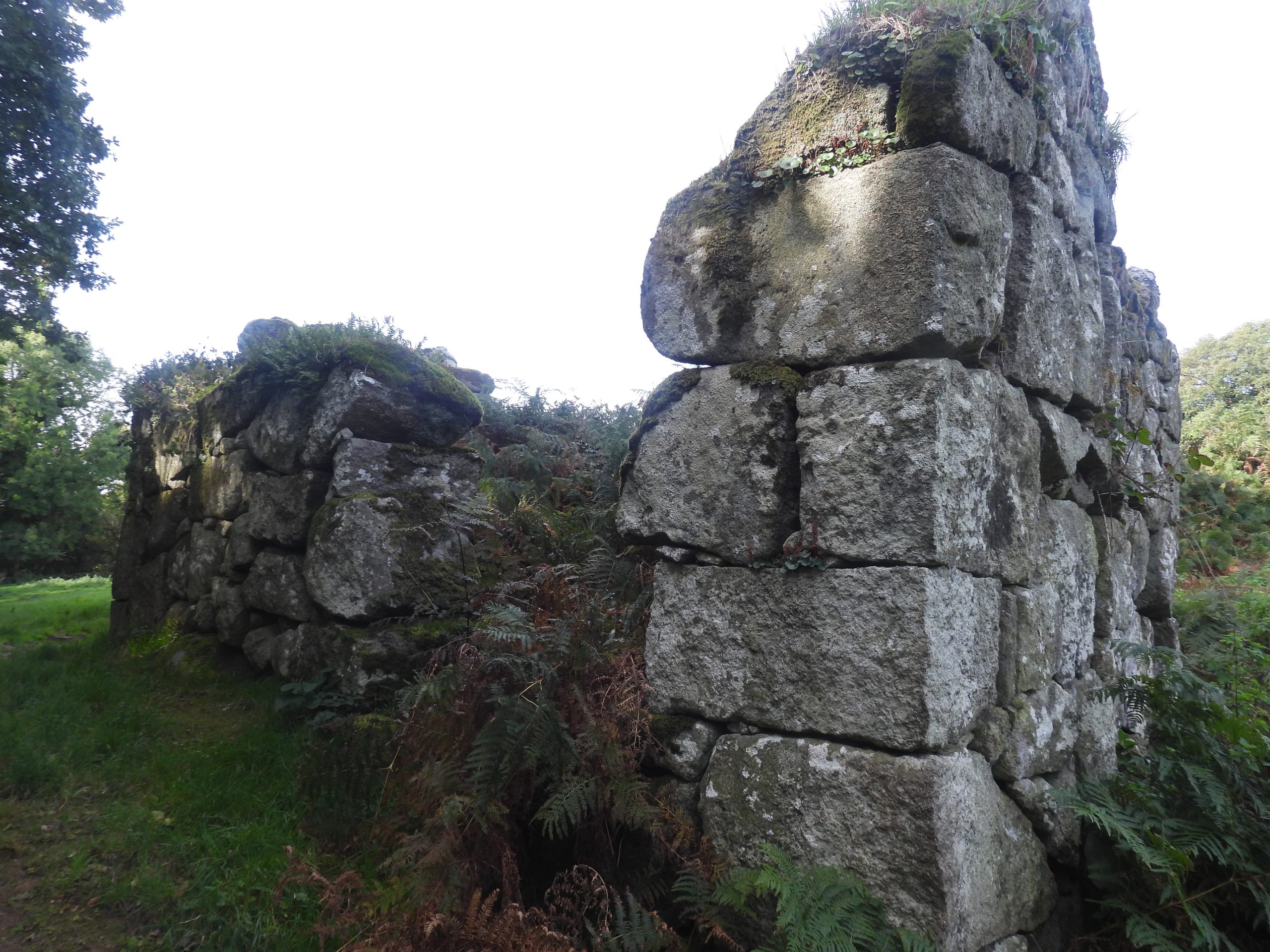
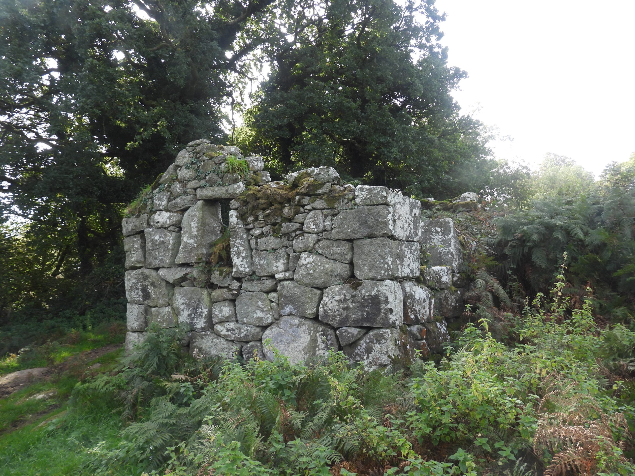
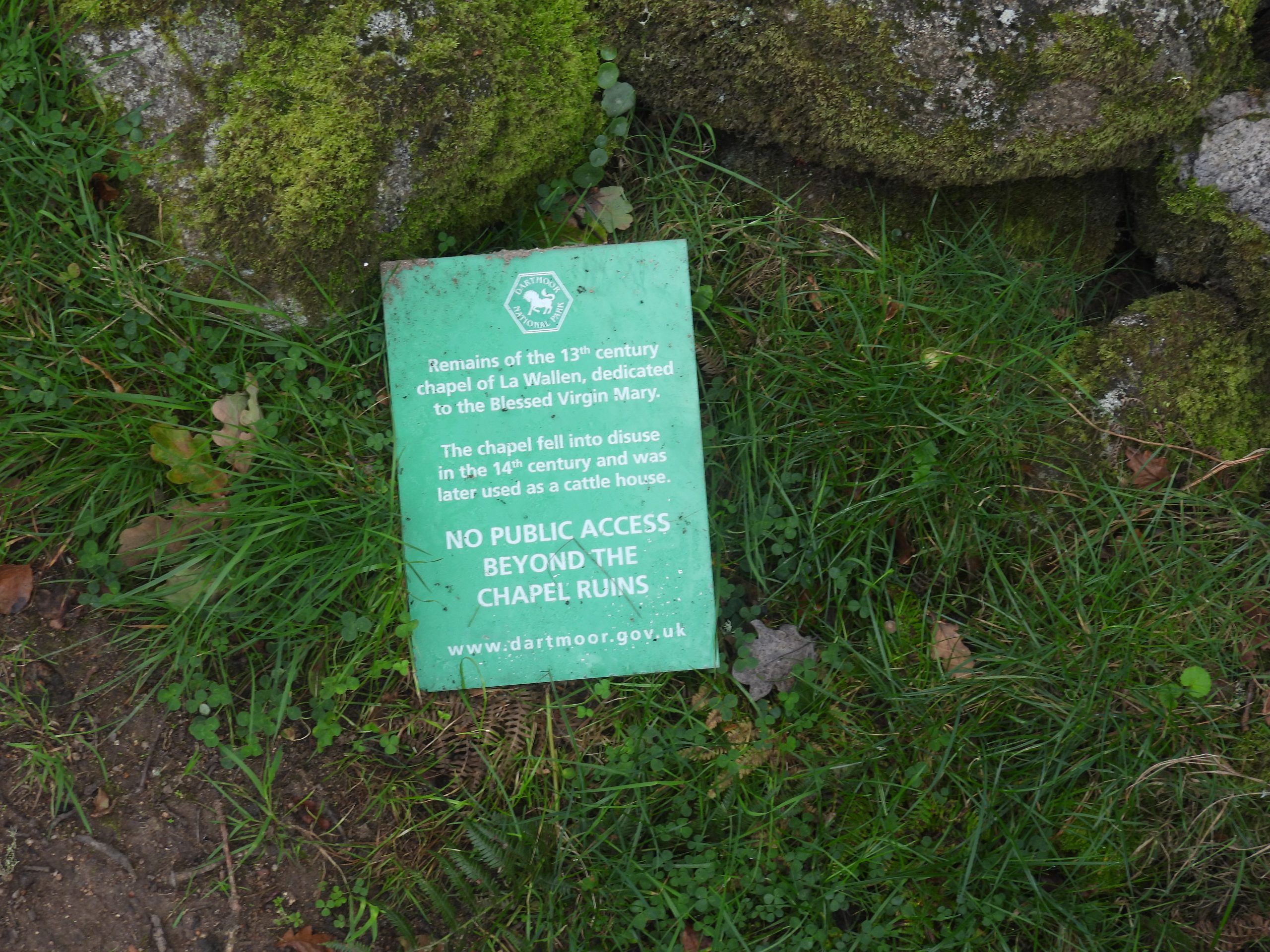
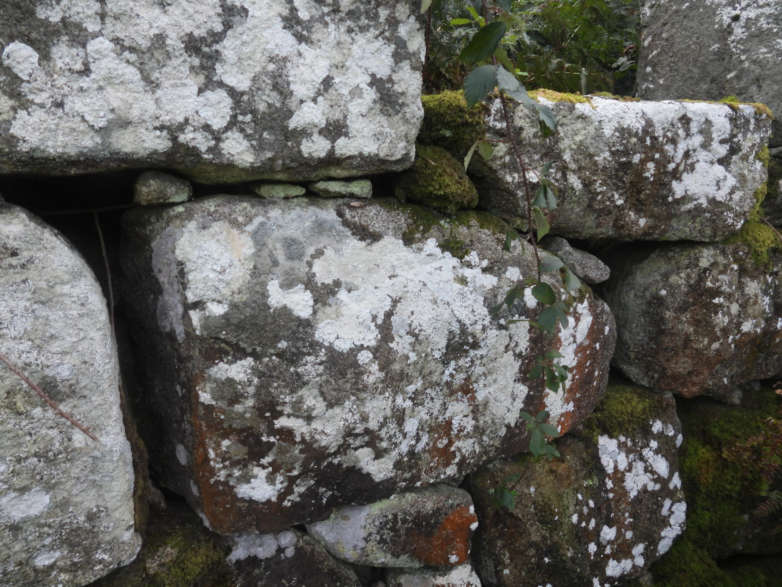
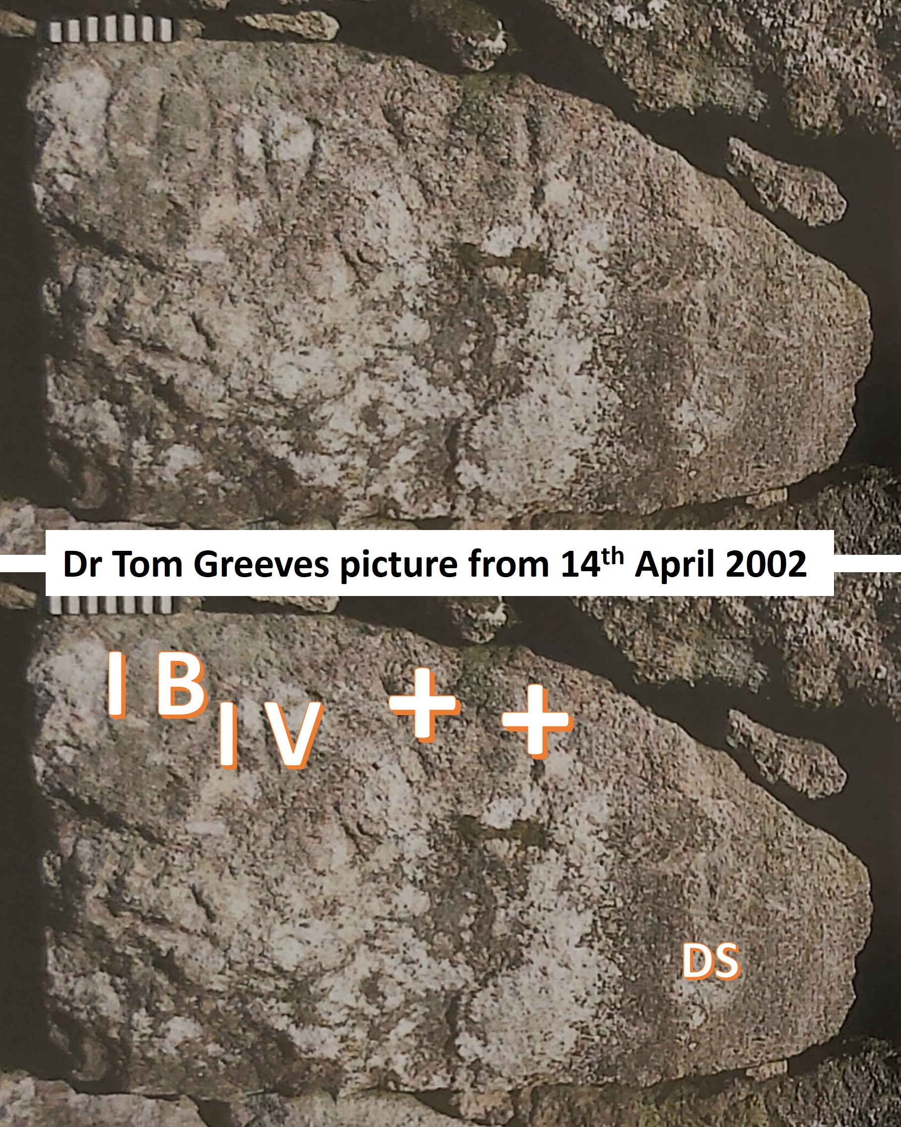
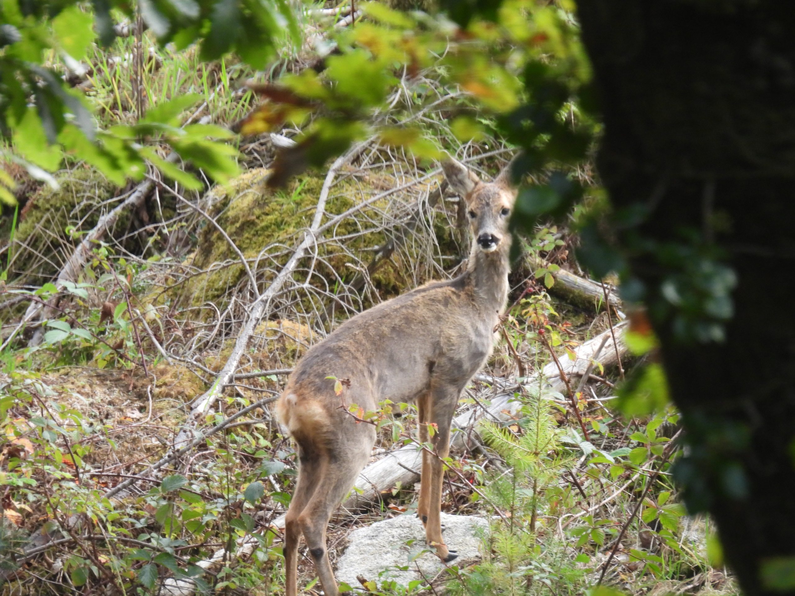
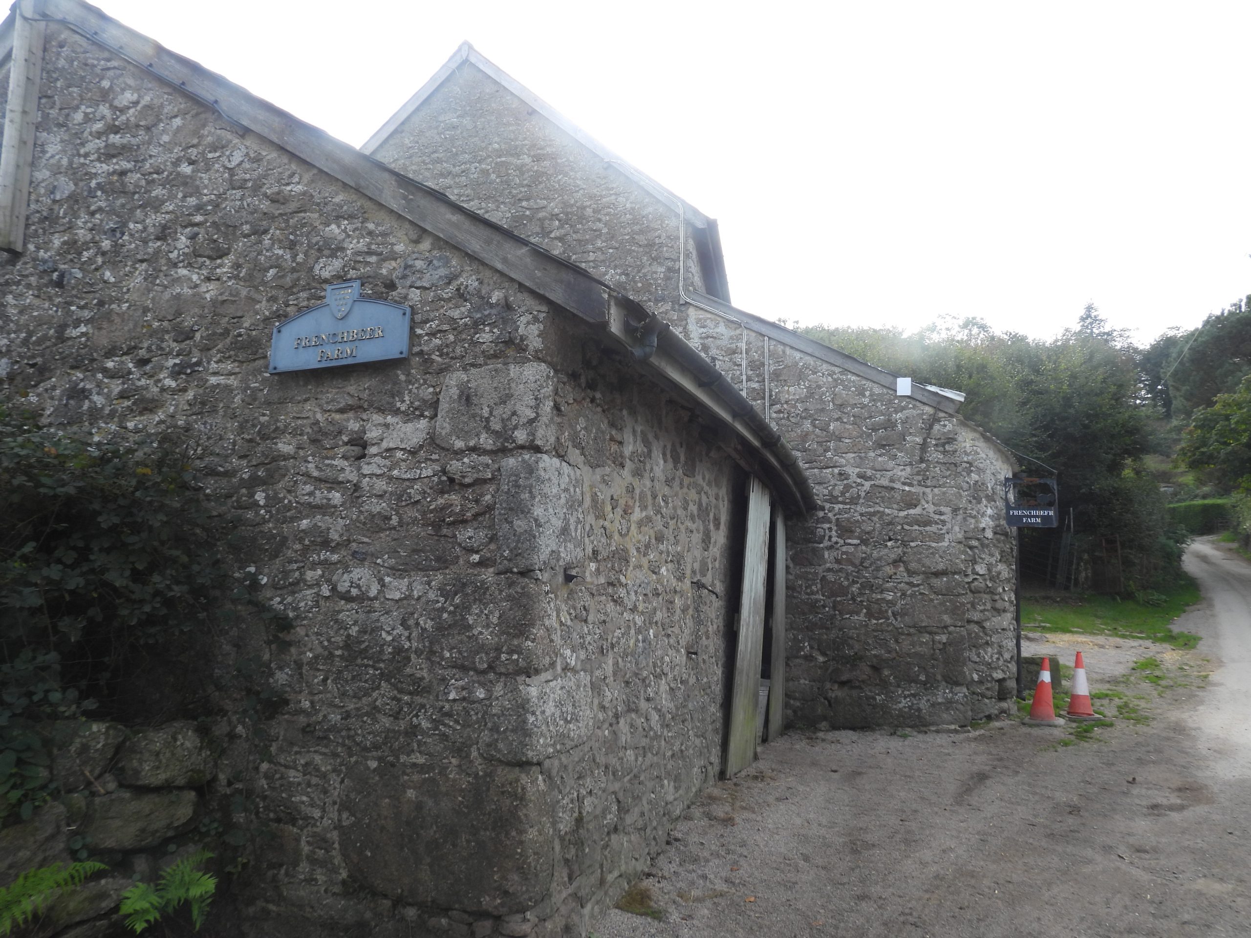
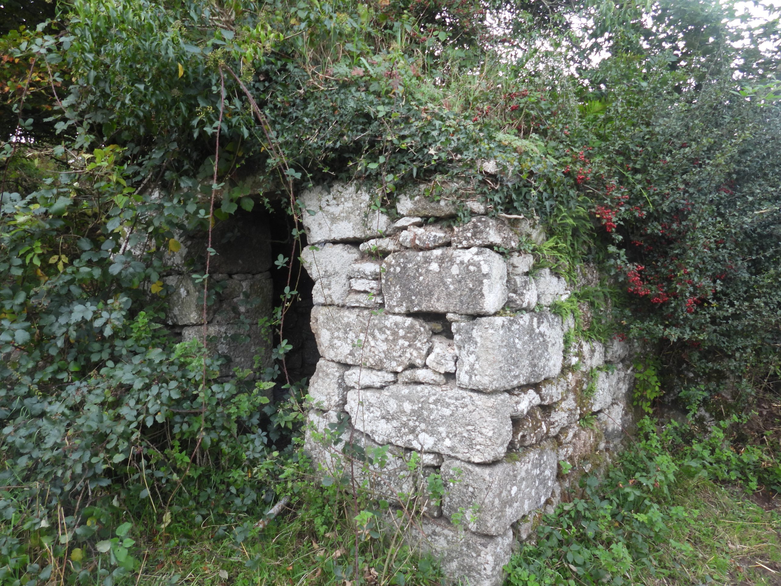
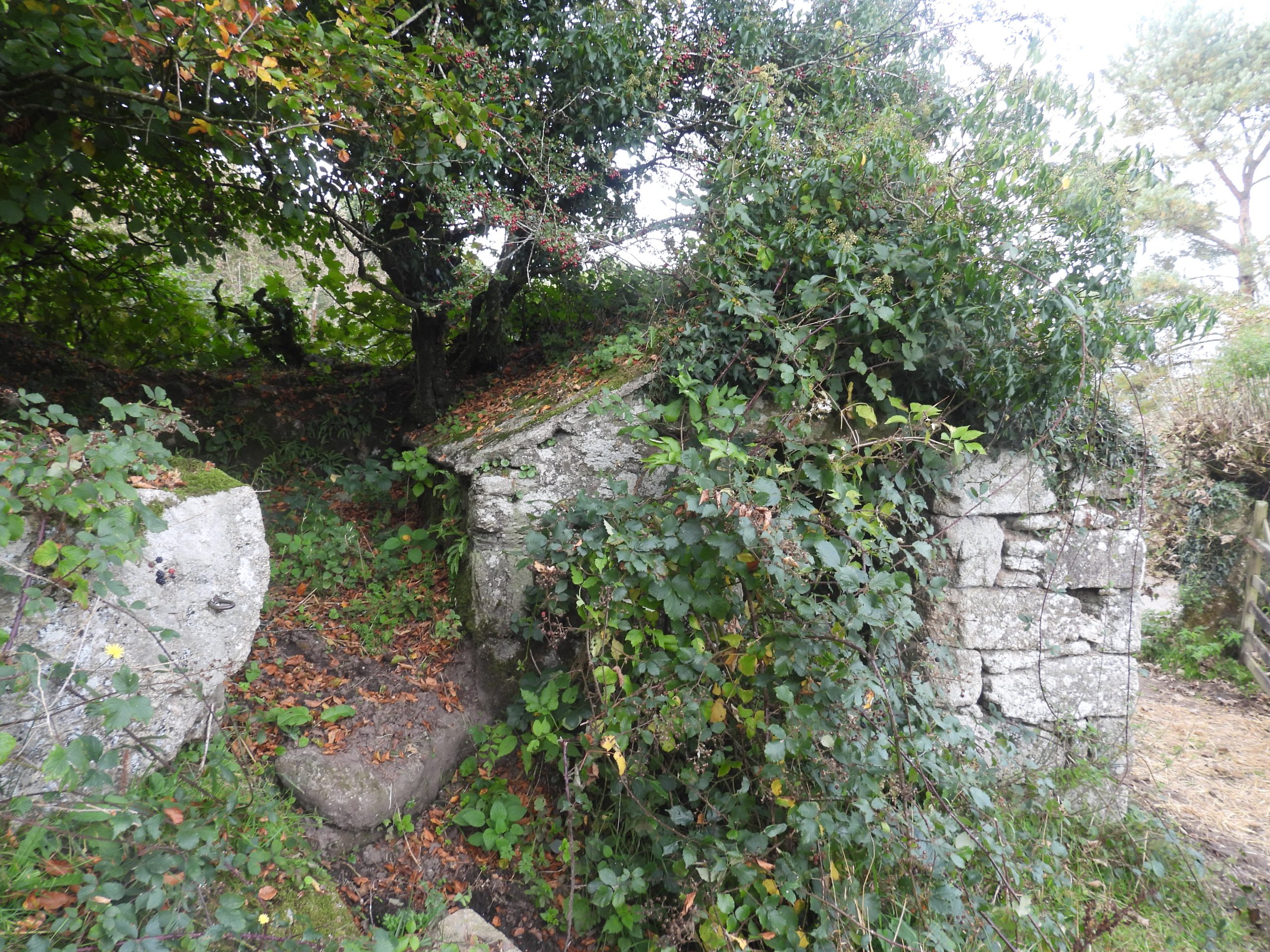
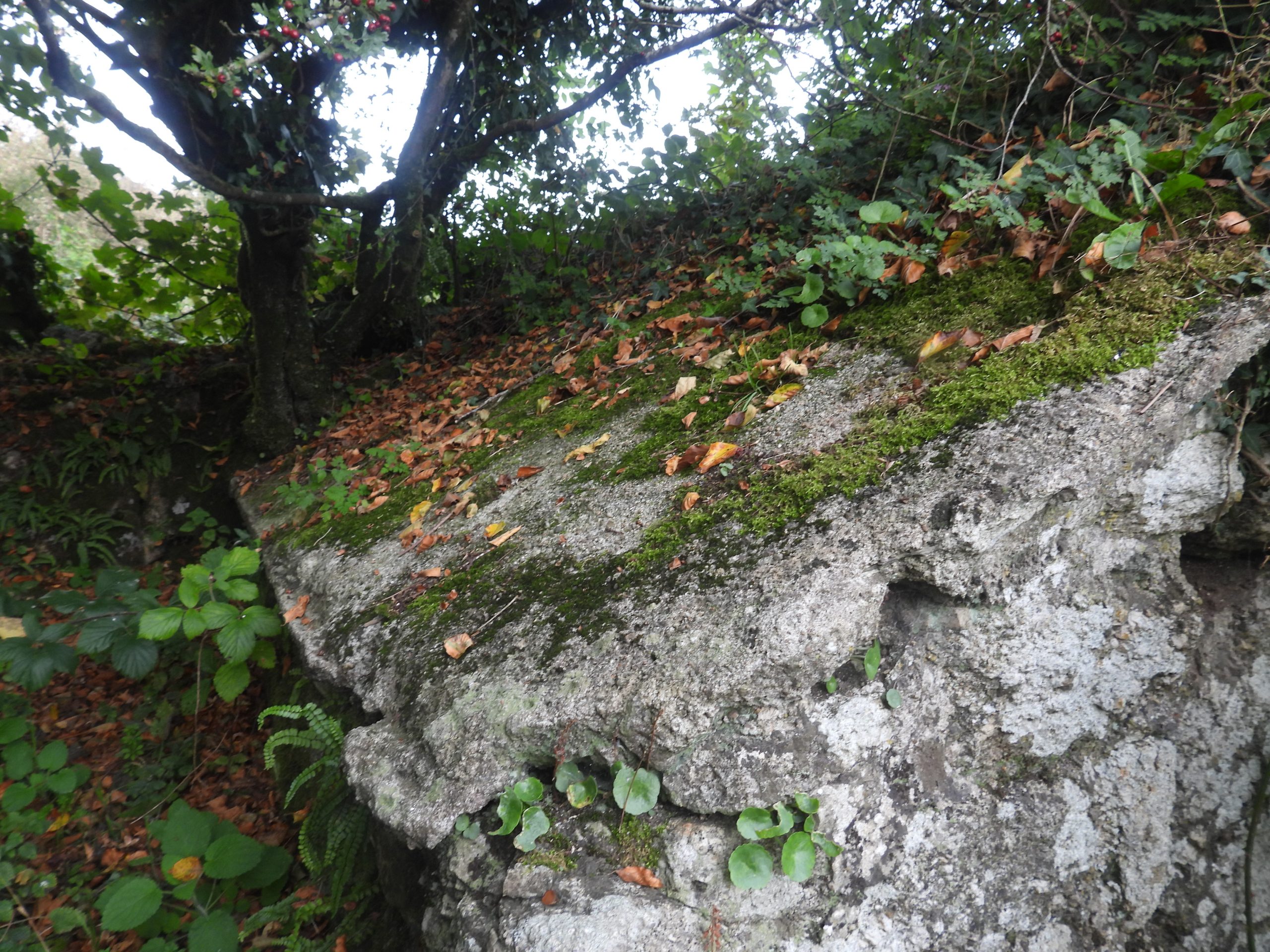
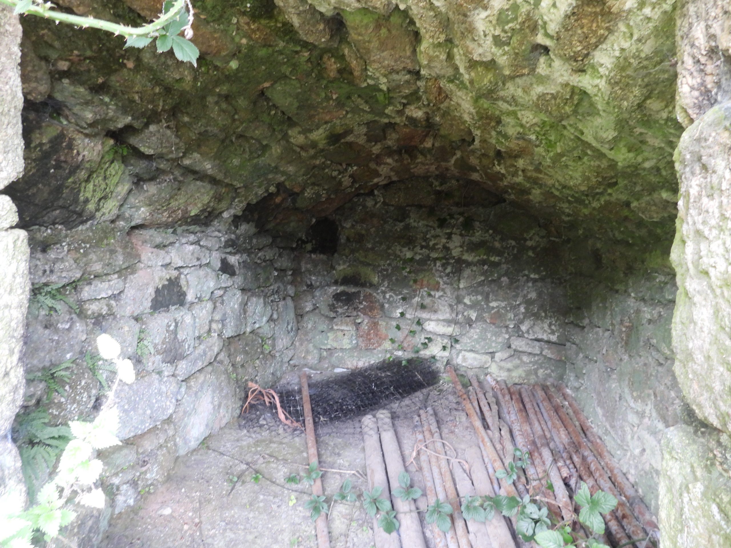
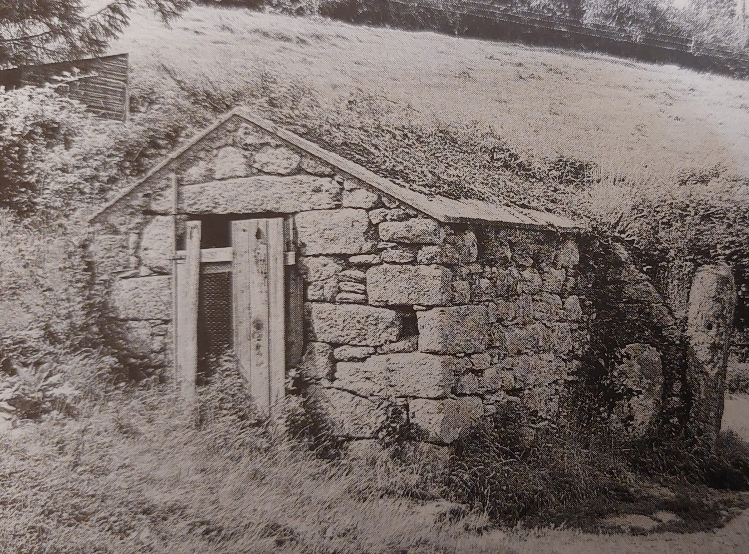
Sketch map showing the locations of the respective two buildings covered in this post. There is also a folly near Gidleigh Tor (Princeps Folly) which is interesting to visit but at time of writing (October 2023) is virtually impossible to visit due to the dense and high vegetation. The Mariner’s Way route shown here has been taken from ‘Walking Dartmoor’s Ancient Tracks’ by Eric Hemery. However, the 1992 publication from Terry Bound called ‘The Greatest Walks of Dartmoor’ (Chapter 10), suggests the track takes a different direction to / from Gidleigh veering from / towards Gidleigh Mill and Providence Place as opposed to the Hemery route which leads via Moortown passing Chapel of La WollenAccording to the Historic England website: “The Rev. J Rawson argues convincingly that this small building is the remains of the Chapel of La Wallen, dedicated to the Blessed Virgin Mary”.It is located a short distance from the Mariner’s Way, near ChappleHistoric England further state: “The Chapel was desecrated in 1332 when the clerk Robert de Middlecotte committed a murder there. The alignment, construction and disposition of the windows certainly look like a small chapel and it is probably no accident that the nearby farmhouse is called Chapple”.Another comment from the Historic England website : “Probably in the C16 or C17 the west end was demolished and the building shortened and it was converted to a (cow) byre”The building contains “….a small rectangular window in the east end, another towards the east end of the north wall and a third is assumed opposite in the south wall but a doorway has since been knocked through here. The original entrance is thought to have been in the west end but this has been demolished and a new west wall built” (Historic England).Public access is allowed to the Chapel, albeit the sign was found laying on the ground (October 2023). Intriguingly the National Park state the chapel, fell into disuse in the 14th century (was this after the desecration in 1332?)Of interest on the north wall of the chapel is this stone, which is inscribed. It is located at SX66928 88943On 14th April 2002, Dr Tom Greeves reported his discovery of an inscription in the outside, north wall of Chapel of La Wallen. He reported two sets of inscribed initials (IB and IV) towards the top left of the boulder with two crosses to the right of them. Towards the bottom right of the boulder is the initials DS. Dr Greeves, stated that in the book Gidleigh – A Dartmoor village past and present, both Chapple Farm and Moortown Farm (on which the chapel is located) had links with the Brock and Vogel families over many centuries. The conjecture is that the initials “IB and IV” relate to these two families – possibly a betrothal. The author took these pictures in March 2021 and has yet to visit when the light is good enough to cast shadows across the inscriptions. This small clapper, which crosses Moortown Brook is close to the access point for the Chapel of La Wollen. It is located at SX66872 88886 and is on the (Hemery version) Mariner’s WayFungi on track above North ParkOne of two deers seen through the trees (across the North Teign River) where trees have been felled in South ParkThe second deer fortunately for the author turned and faced the camera just at the right moment to capture this pictureFrenchbeer – a duchy farmJust off the main tarmac lane to the west of Frenchbeer Farm, this Ash House can be found. The Ash House lies in the west corner of the yard at Little Frenchbeer Farm with the Mariner’s Way passes next to it. The original Dartmoor Ash Houses were round (with a conical roof) with a hatch facing the house and with a door facing into a field. The later Ash Houses, like this one at Frenchbeer had no hatch, were rectangular and had either a flat or sloping roof.The Ash House measures internally 2.8m by 1.6m with a maximum height above floor level of 1.5mThe corbelled roof of the Ash House is capped with a layer of cementThe interior of the Frenchbeer Ash House shows the roof is corbelled (like the round versions of these houses). The Frenchbeer Ash House from circa late 1980’s as taken by Stephen H. Woods in ‘Dartmoor Stone’ by Devon Books (page 153). The difference in vegetation over the last 35 years or so is quite stark.