A collection of walks, discoveries, insights and pictures of exploring Dartmoor National Park
October 19, 2023
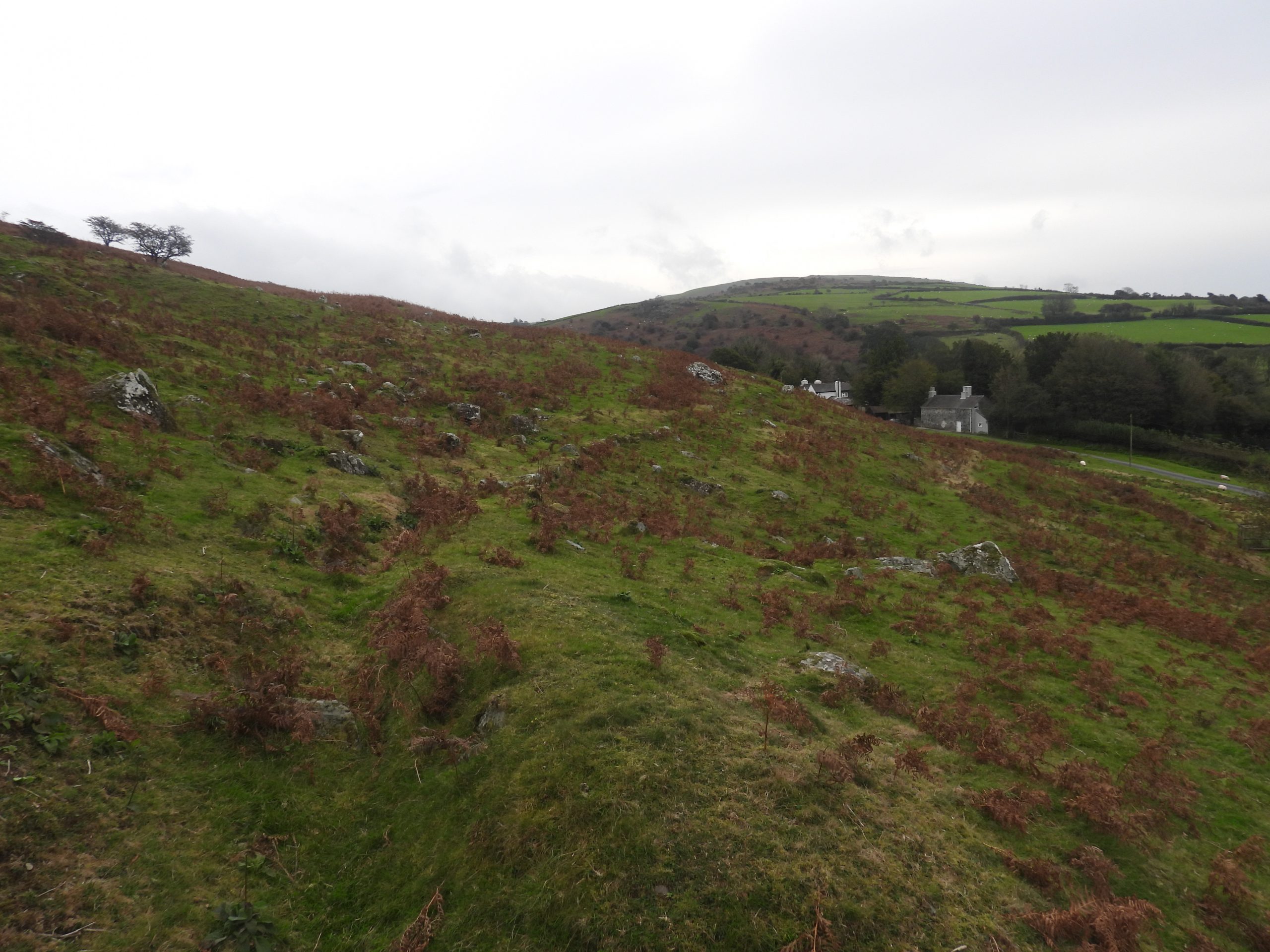
Smeardon Down Ochre Works
In the Peter Tavy area during the early 19th century there was a hive of activity with mineral extraction, specifically Devon United Mines, which comprised three mines, North, Central and South. They were set up around 1820, initially to look for copper in the early years but it is recorded that tin and arsenic were also produced into the 20th century. During part of the period of operation of these mines a little known and little recorded venture was being undertaken close by on the lower slopes of Smeardon Down, namely an Ochre Works.
Ochre is a yellow clay-like substance which occurs as a decomposition of lavas and igneous rocks (namely pyrite). It is a form of Iron Oxide (hydrated ferric oxide) and in trading terms the term ochre, can vary in colour from a buff yellow, through brown to shades of red and has a a ferric oxide content of below 75%. Ochre is usually associated with colour pigment for paint, paper making, bricks and cement.
In Devon, recorded quantities of ochre were extracted at Devon Great Consols in the Tamar Valley. However, the venture on Smeardon Down appears to have had very little written about it and certainly no production figures appear to have been recorded. There is some information available such as newspaper articles dating from as early as 1845 / 1846 (advertising for a manager of the works, offering shares and share information for ‘adventurers’) and in 1859 when permission was granted by the Duke of Bedford to extract ochre in Peter Tavy parish for £25 rent with dues (initially) of one-fifteenth on metals and one-ninth on ochre ‘to be dug, broken, raised and gotten to the limits (of the sett)’. The 1859 indenture was granted to a consortium of London men: William Sarl, Abraham Sarl and Joseph Sarl. In 1859 and 1861, two newspapers recorded that William Sarl was taken to court over non payment of wages and materials.
Armed with this information, a 19th century map (1870’s) and descriptions of the site from the Historic Environment Record (HER) and Helen Harris (Devon Historian article) both from circa 1991, the author made a visit to the site to try and get (an amateur) interpretation on the operation of the Ochre Works. The author has theorised on the operation of the works and there certainly seems to be lots of unanswered questions. The author would welcome any comments on any interpretations found in this post.
References and Acknowledgements
Helen Harris, A Dartmoor ochre works : Devon Historian ; 43, 1991. – Pages 20-25
Chris Wordingham, Peter Tavy Inn : 19th century Newspaper articles (Western Times, Sherborne Mercury, Royal Cornwall Gazette and Tavistock Gazette)
Disused ochre works on Smeardon Down, Peter Tavy – HER MDV56622
Leat on Smeardon Down, Peter Tavy – HER MDV29176
Mike Brown – Gazetteer of Dartmoor Names (1993)
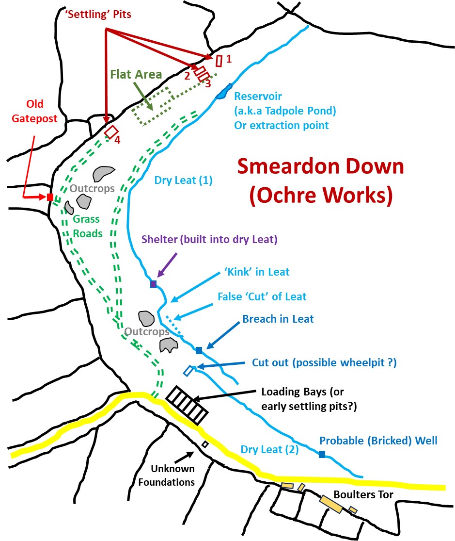
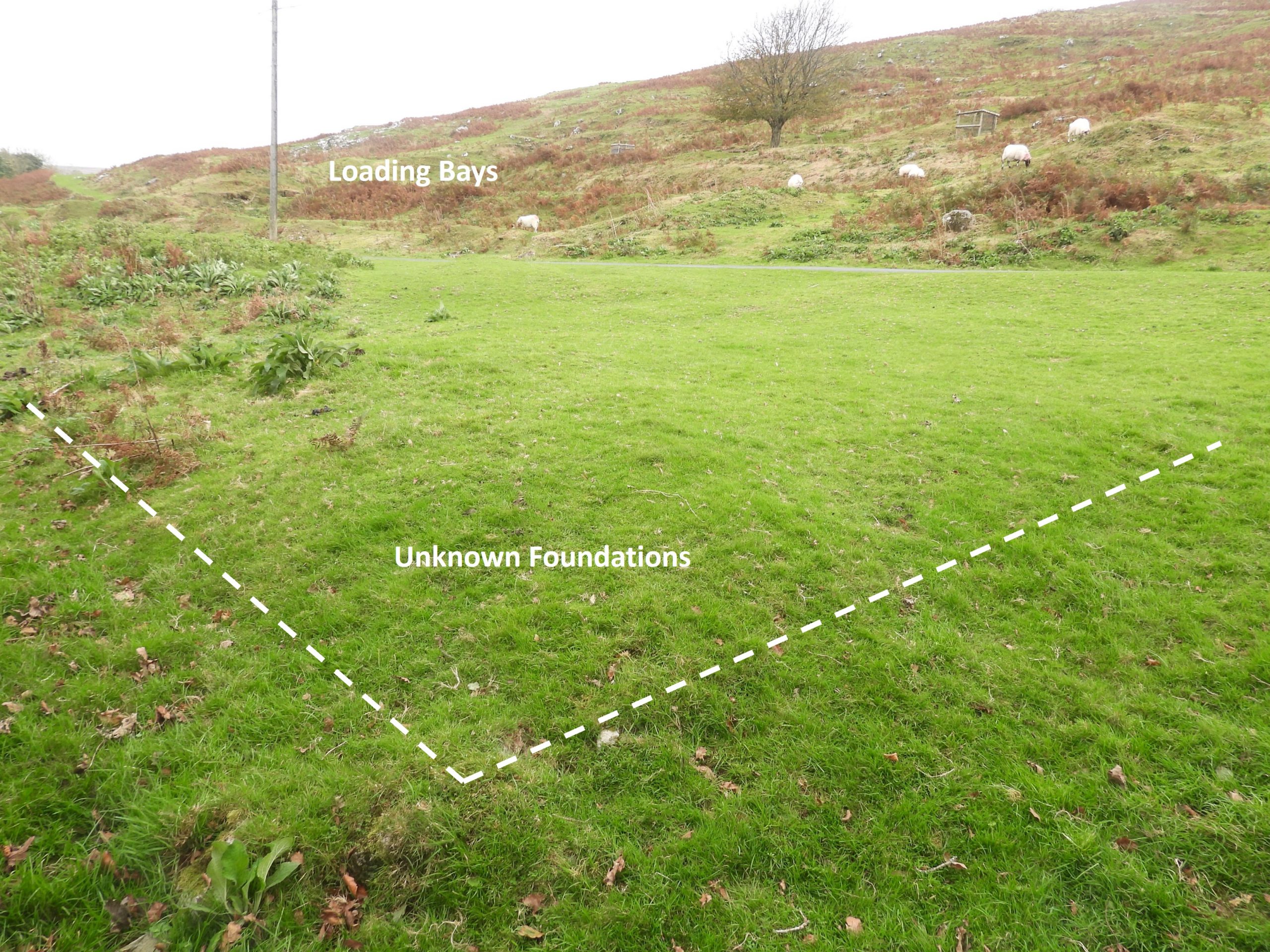
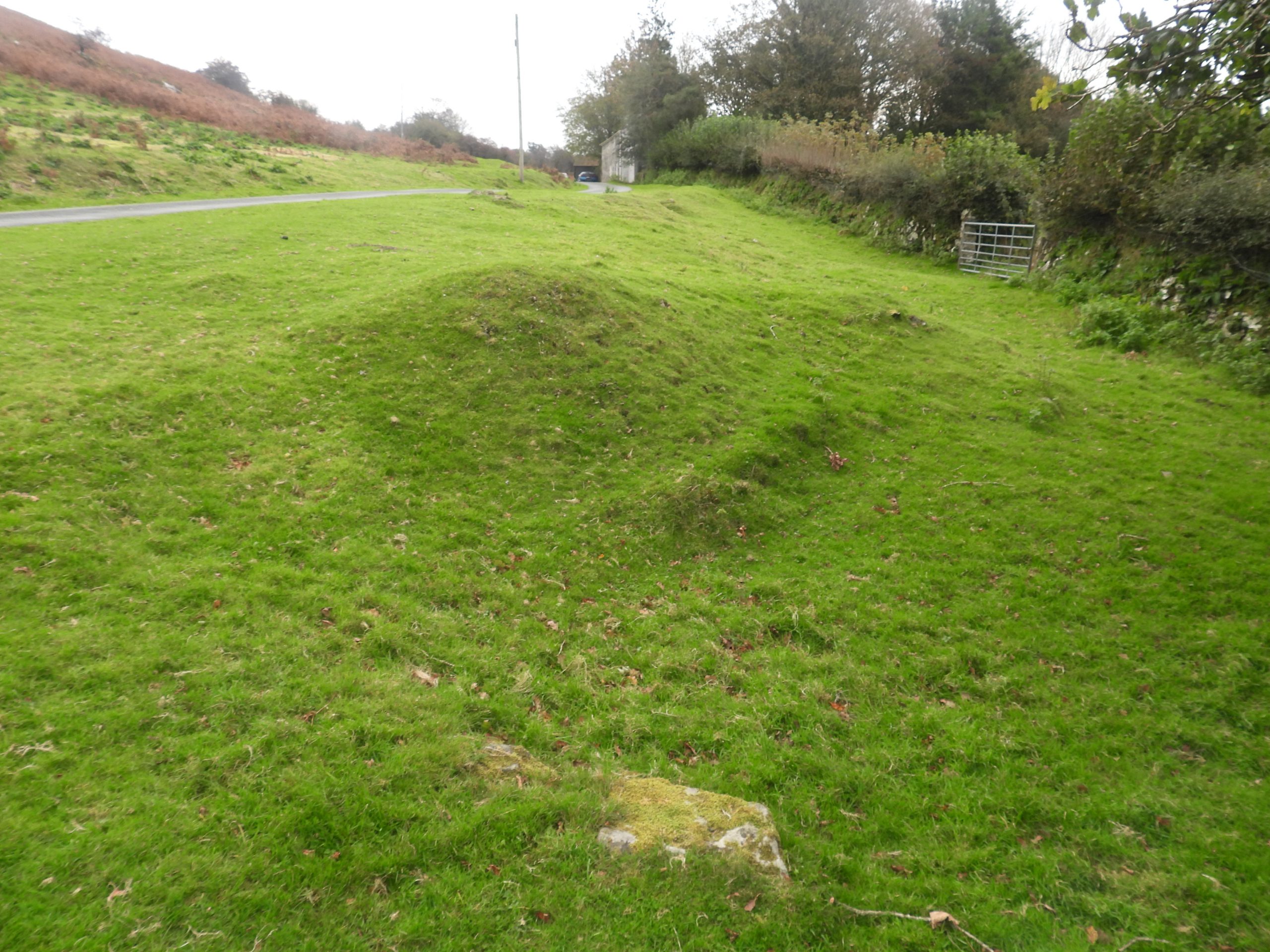
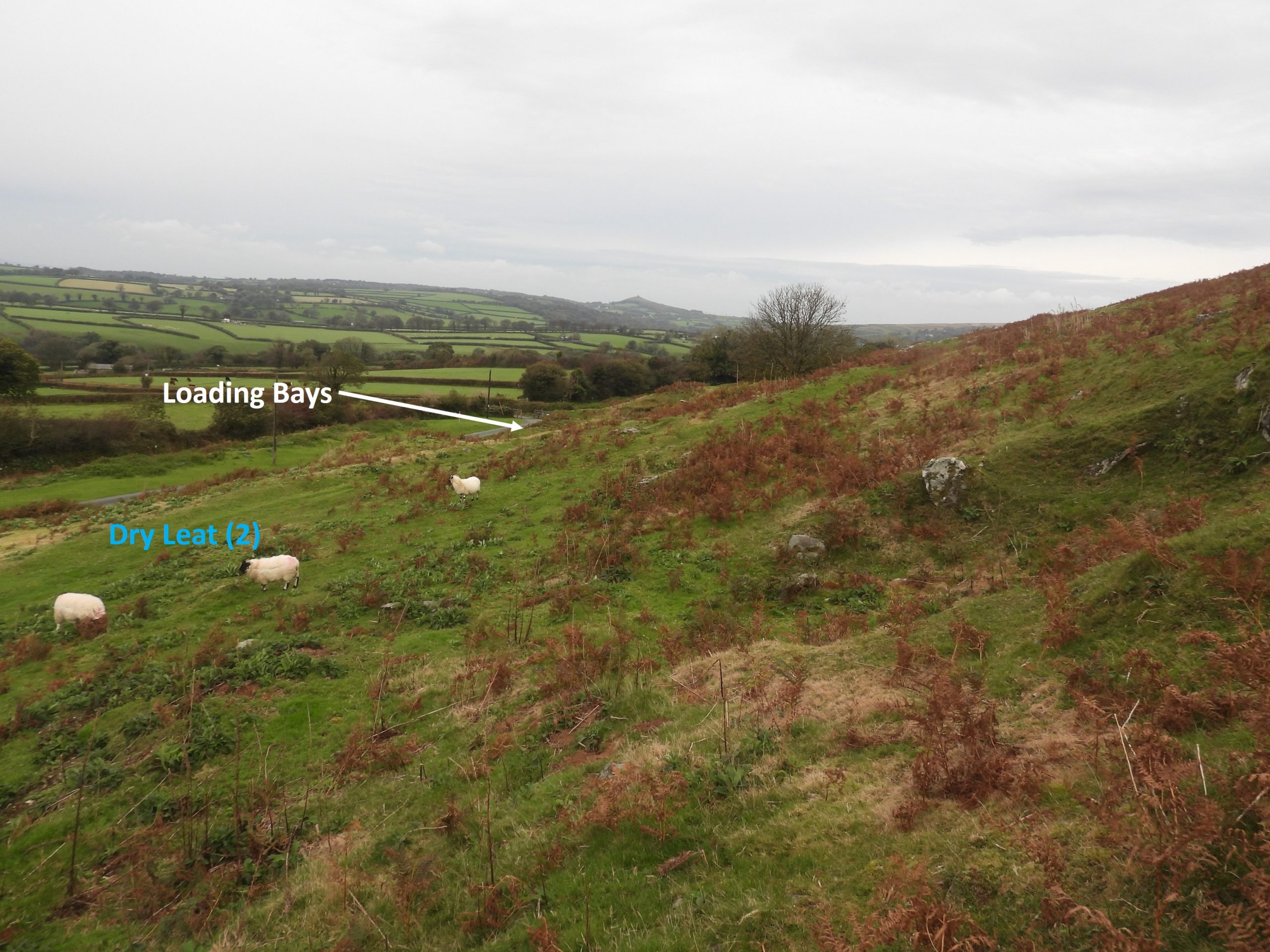
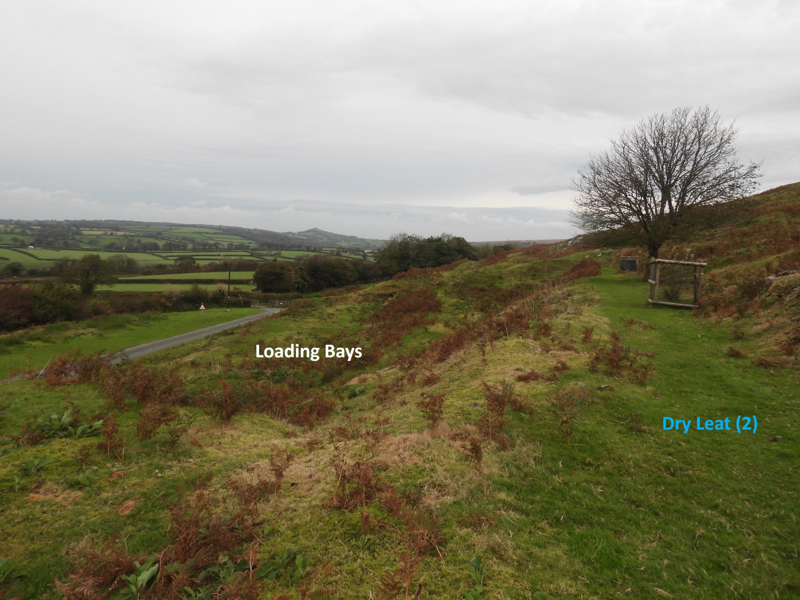
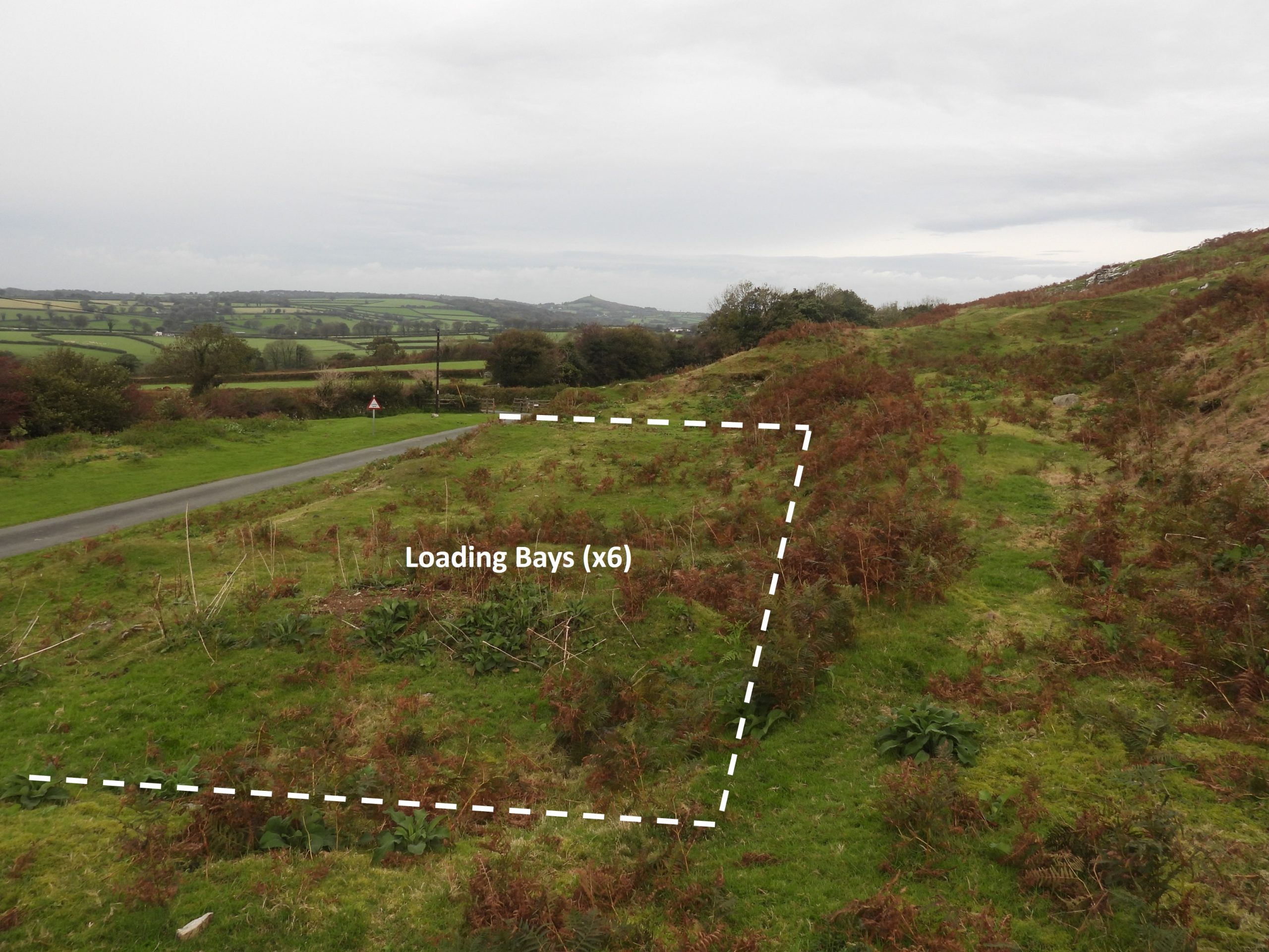
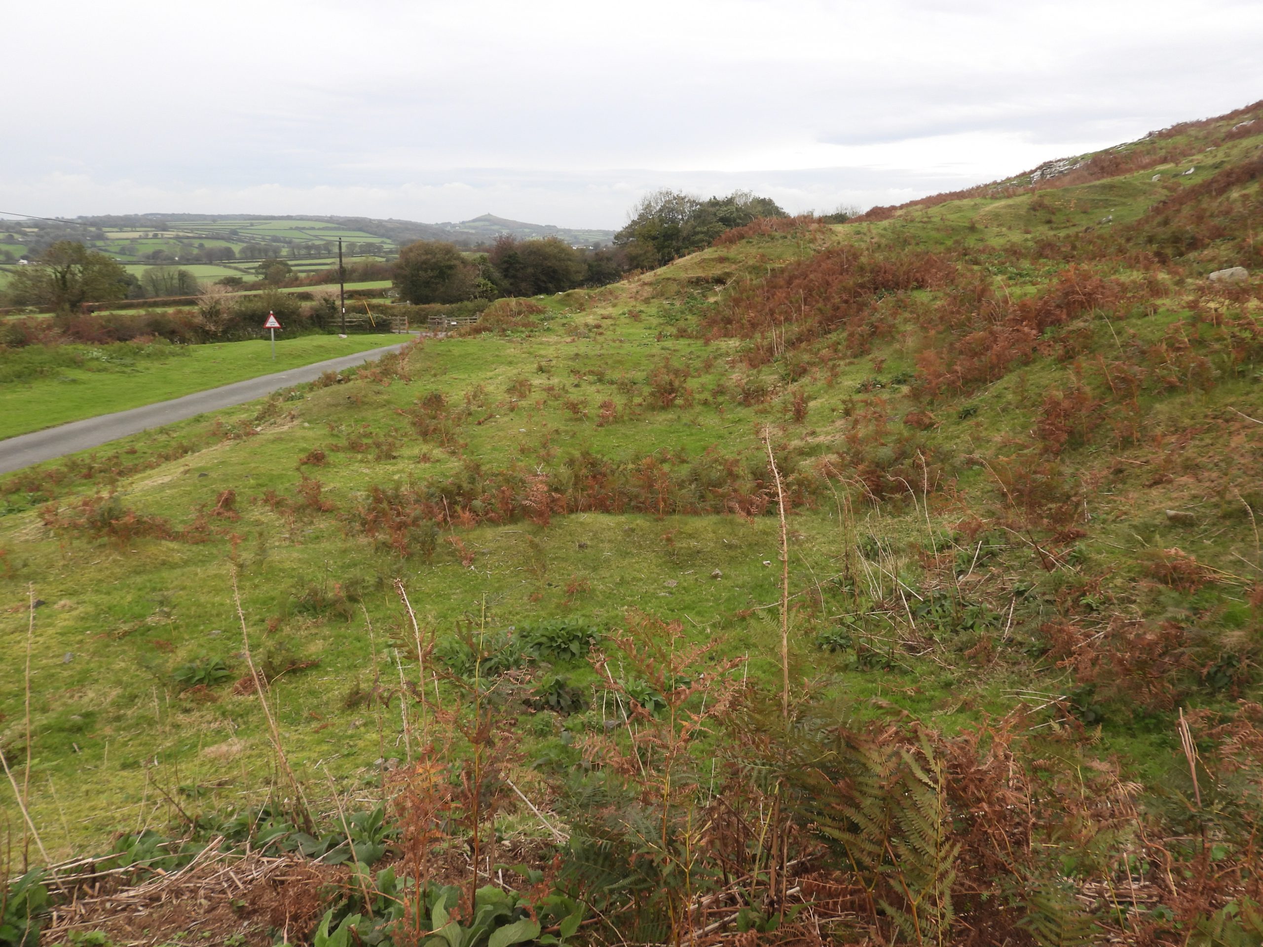
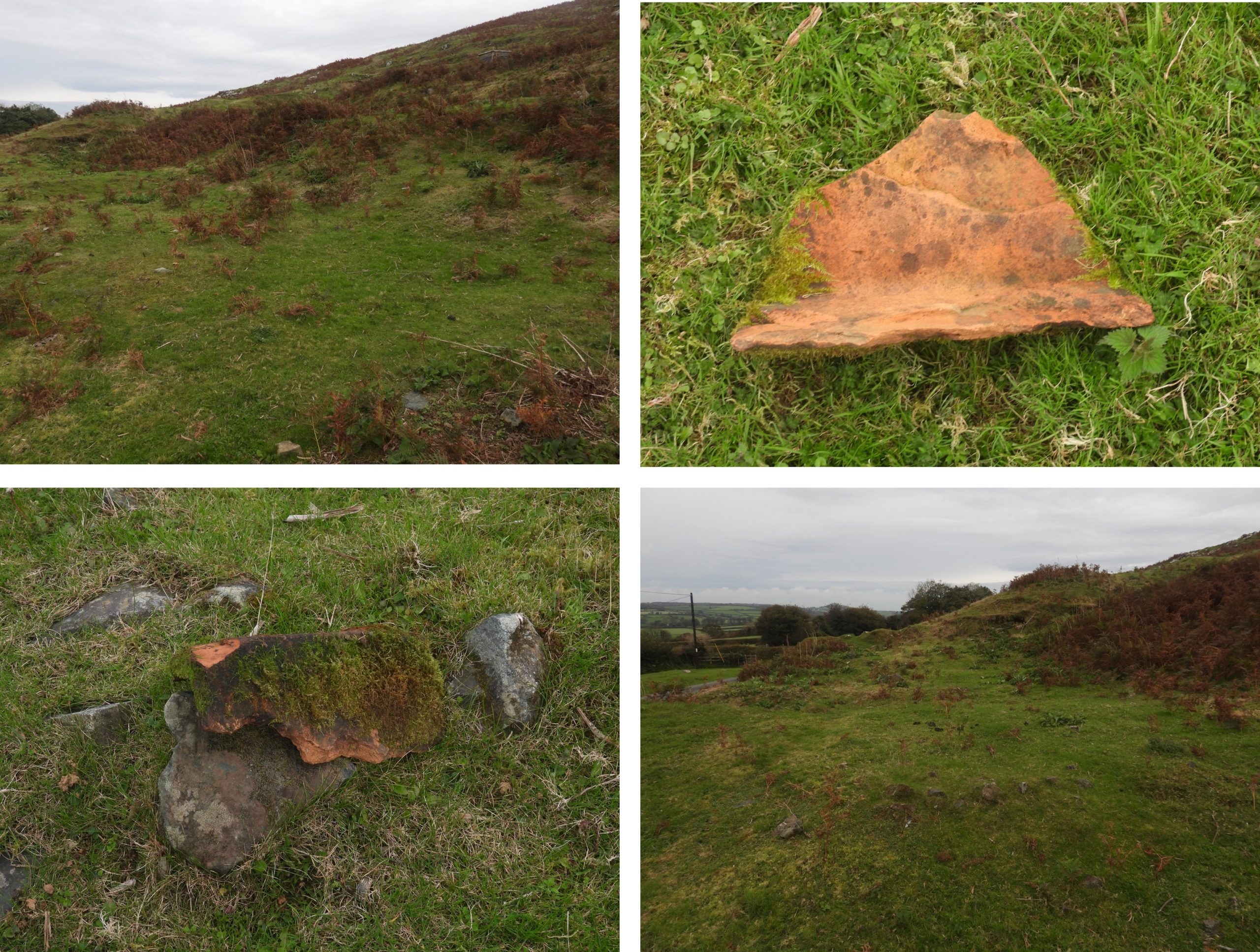
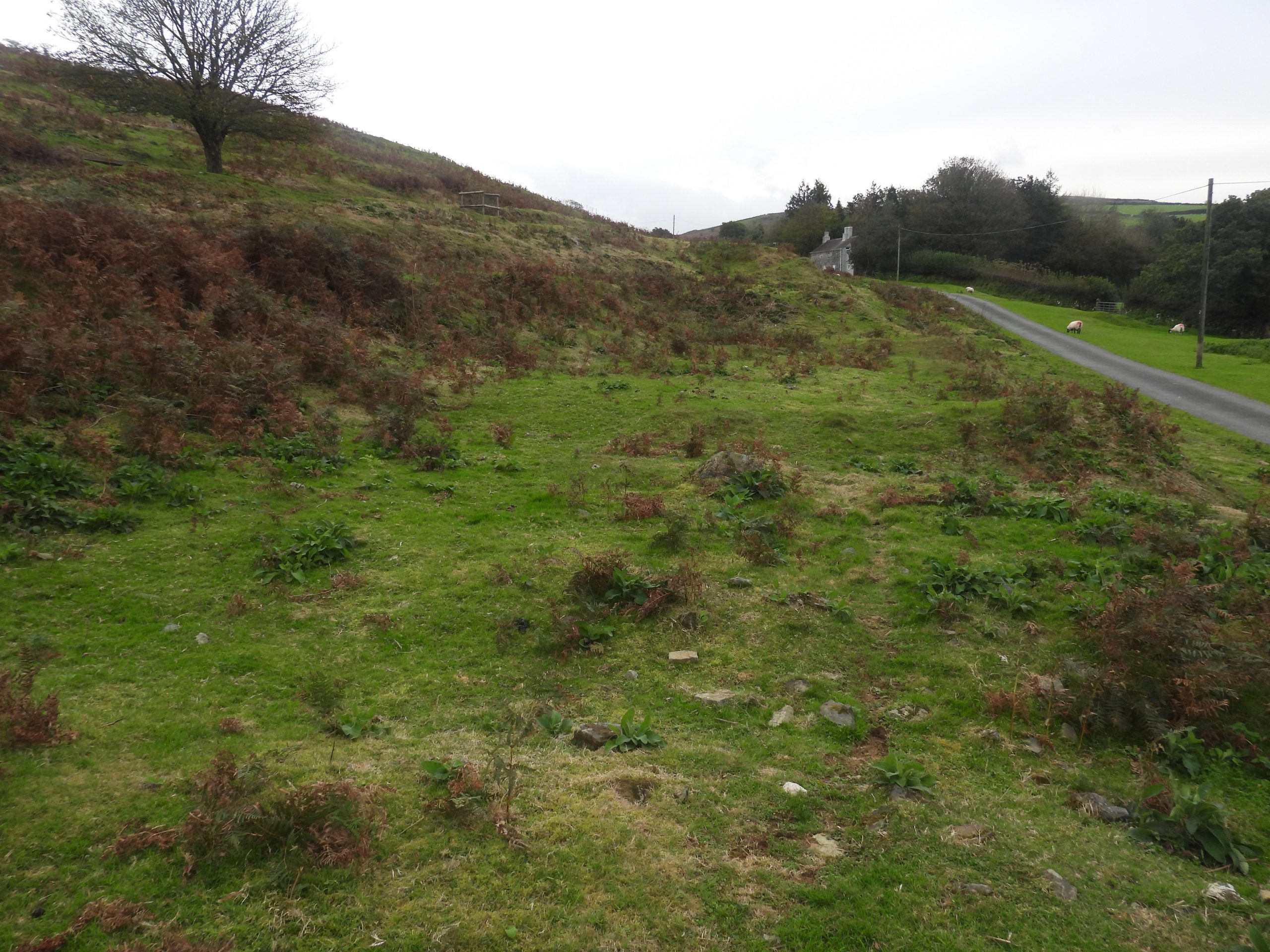
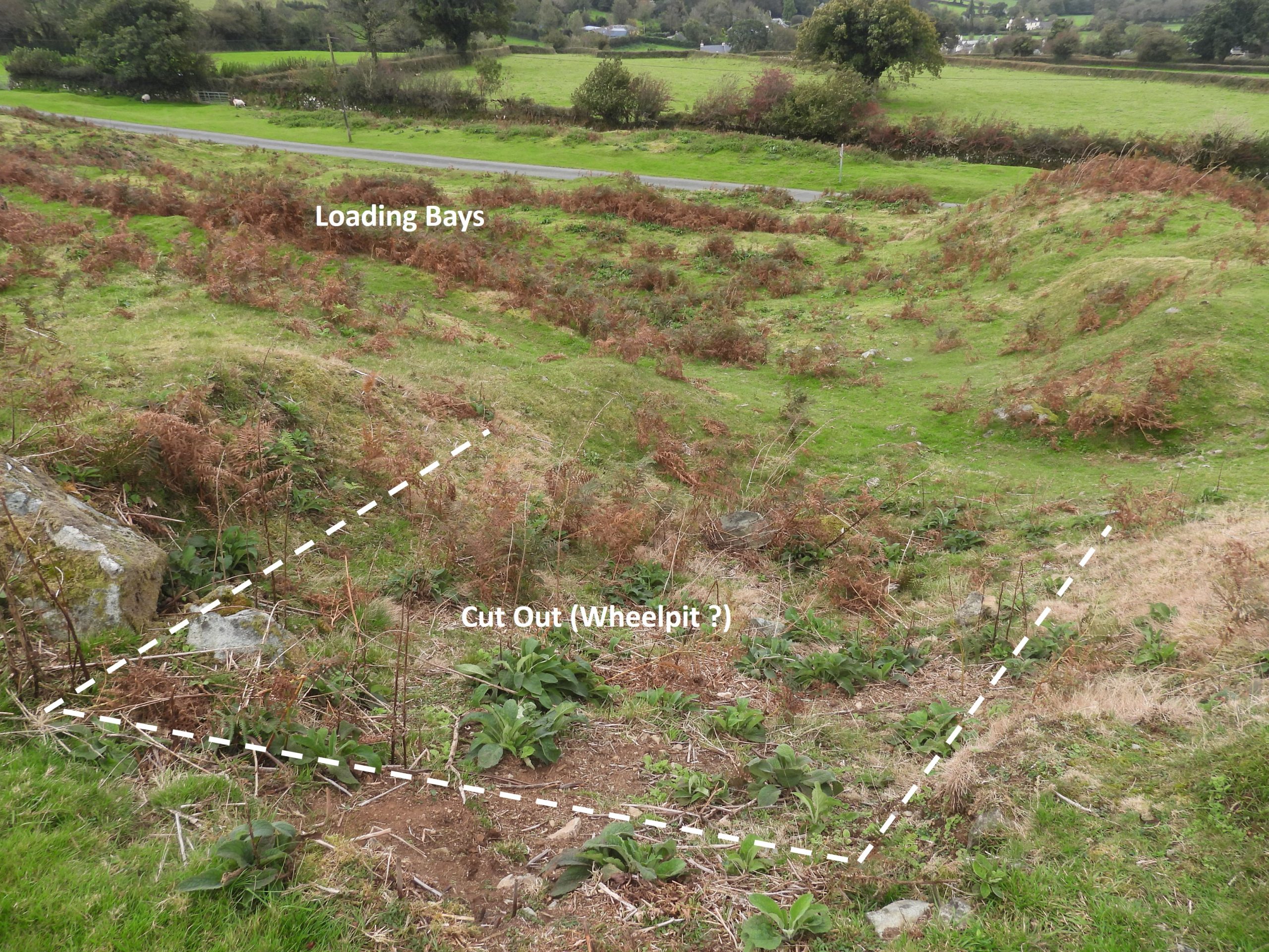
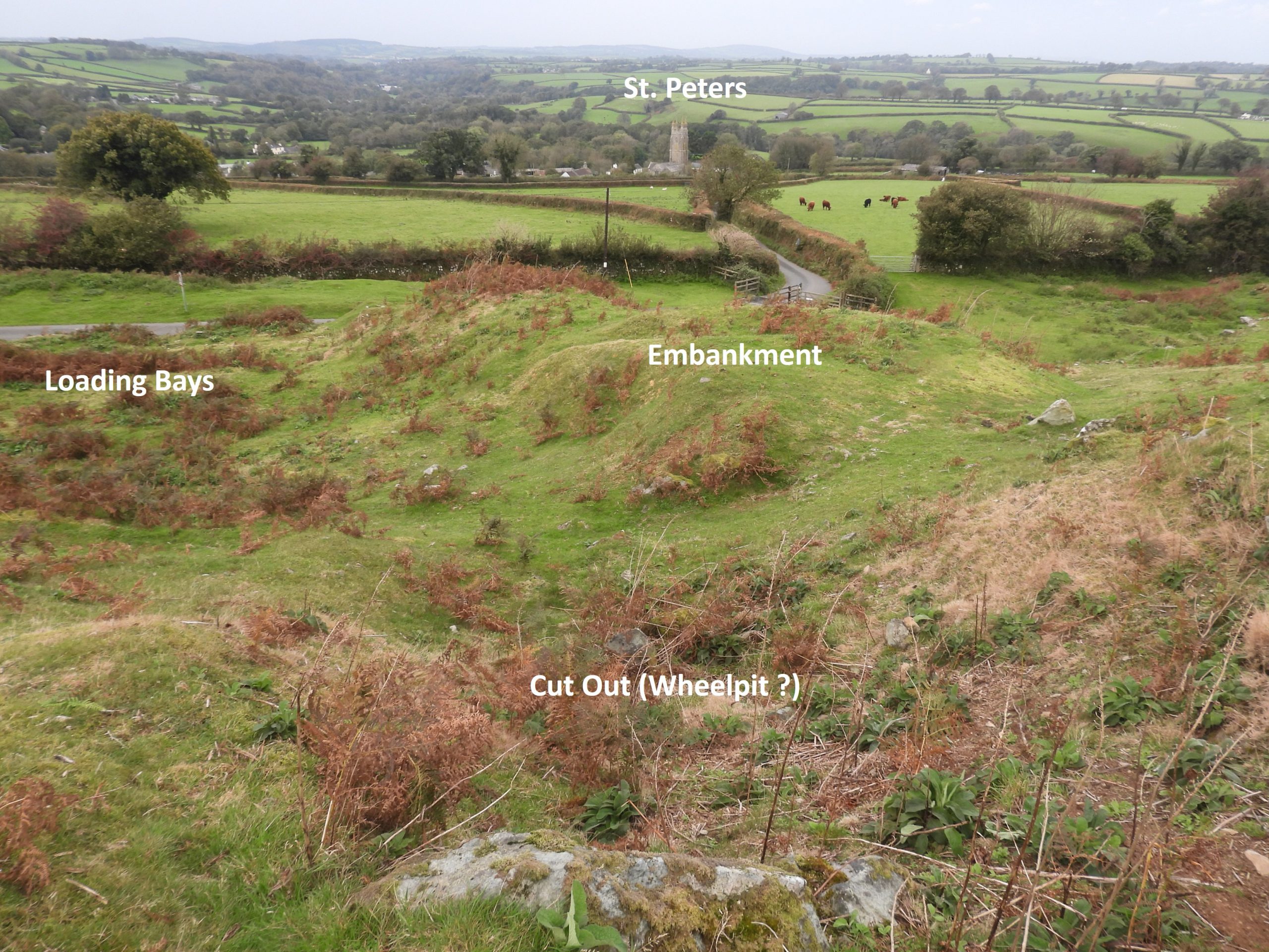
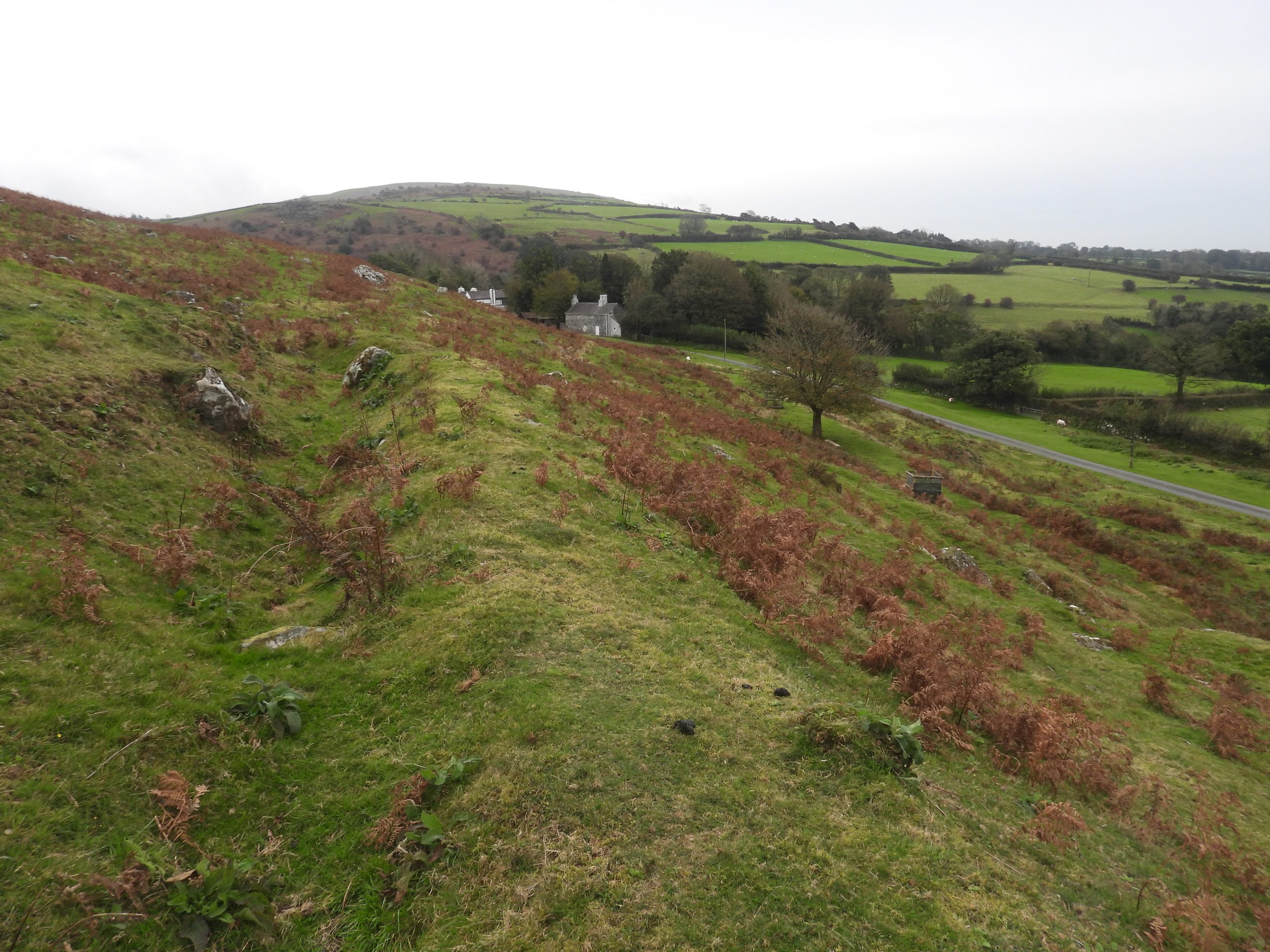
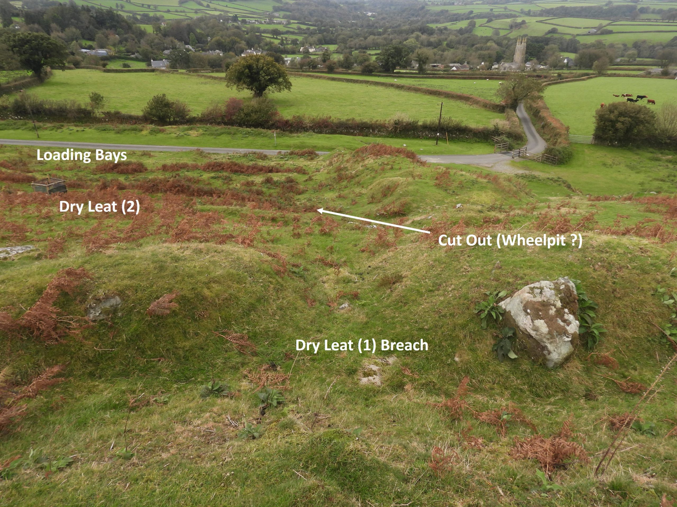
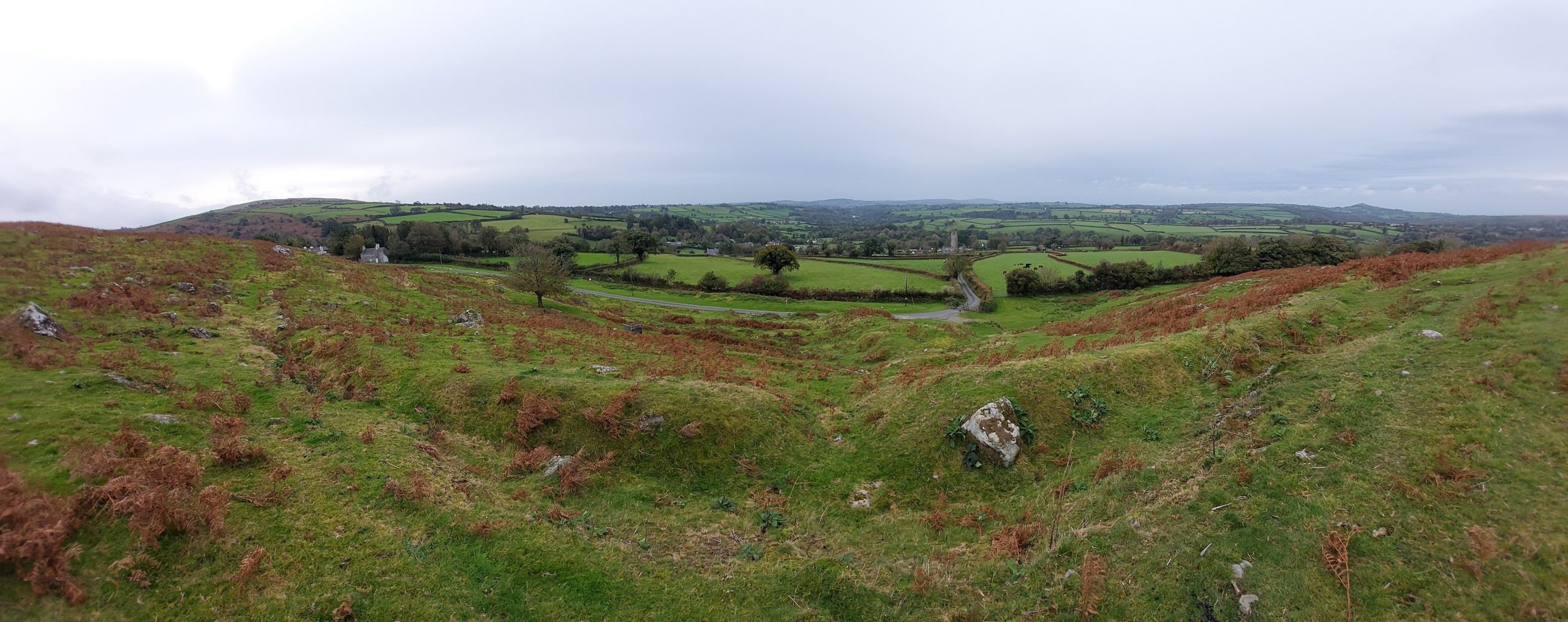
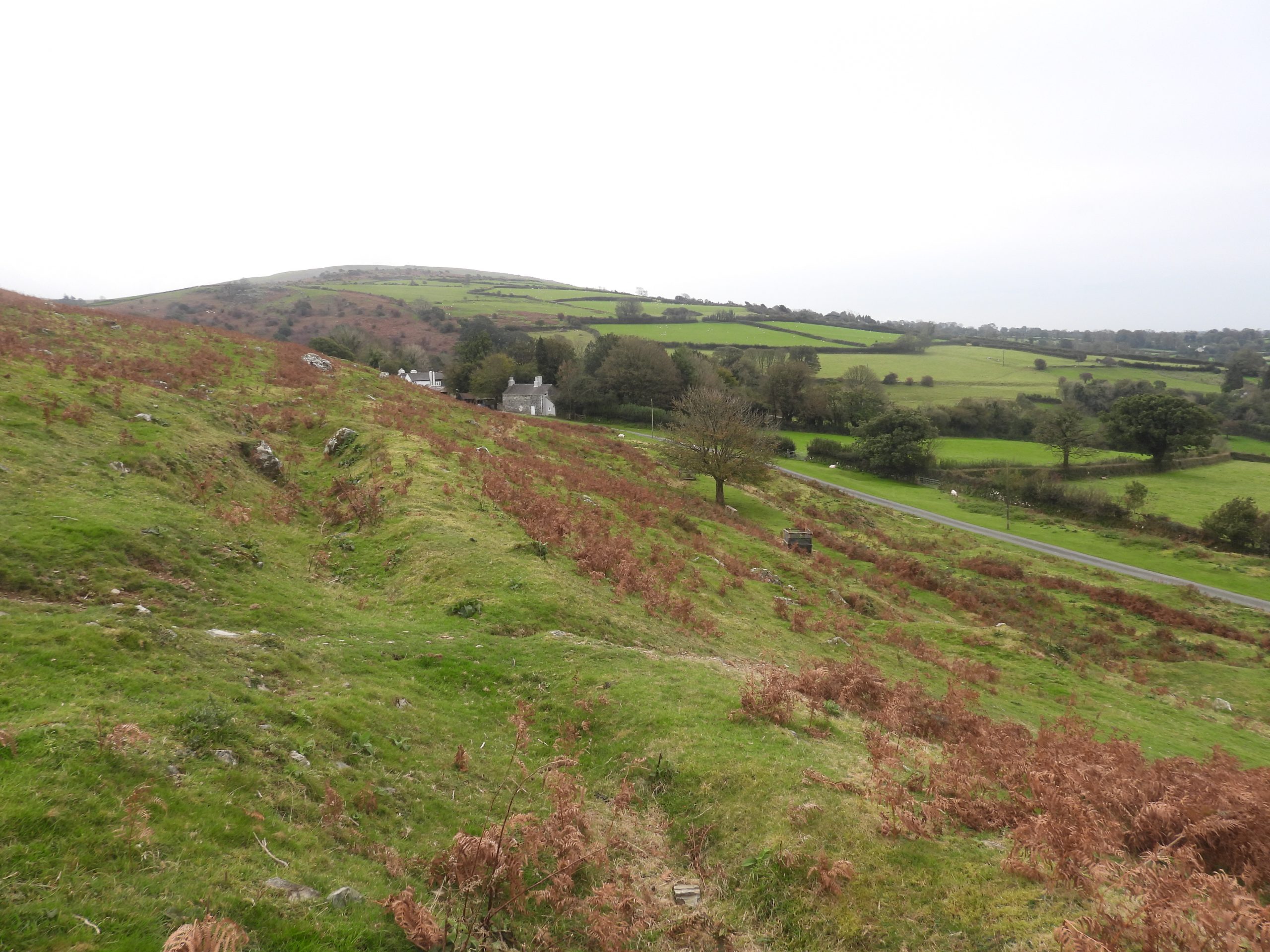
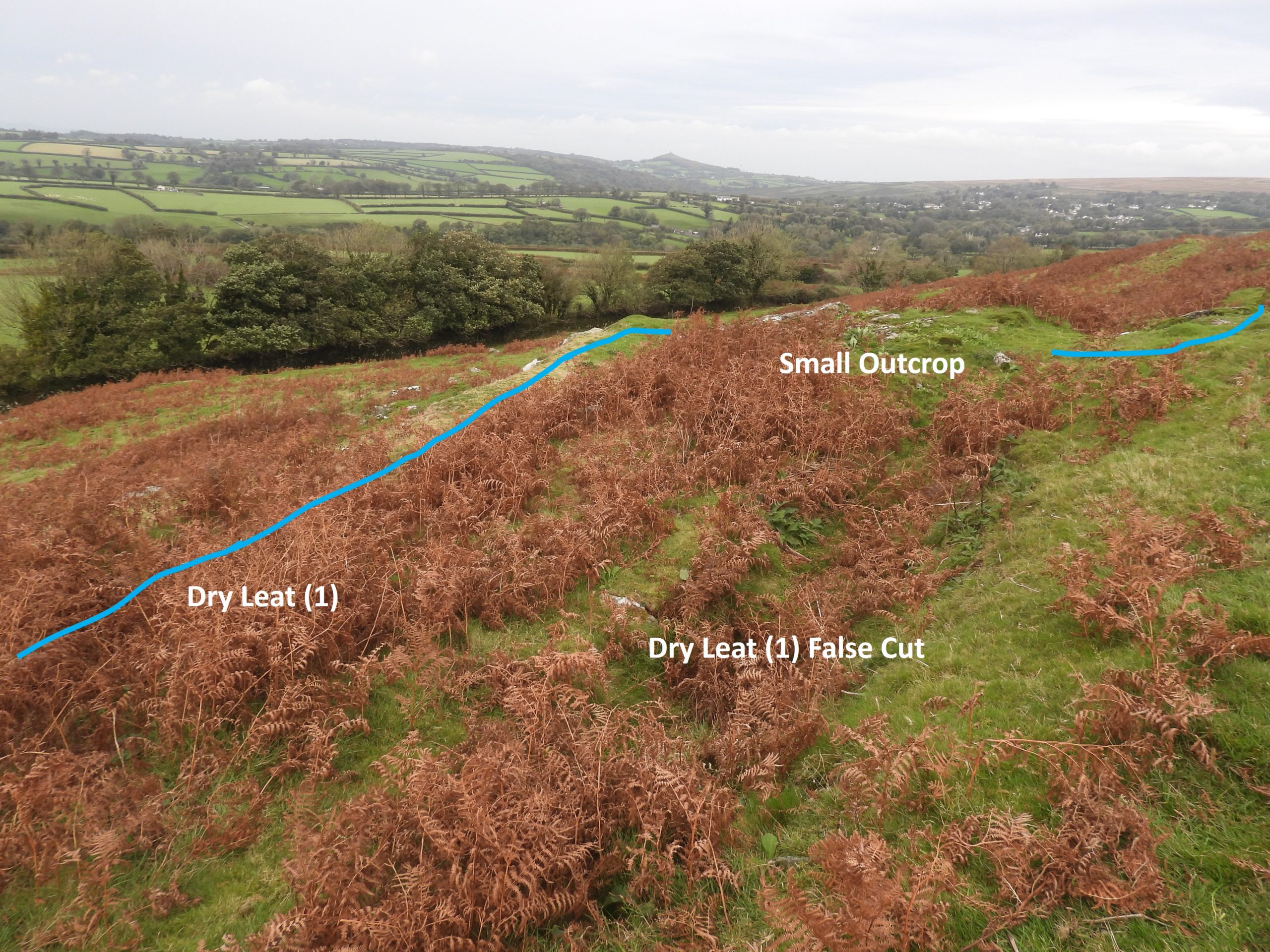
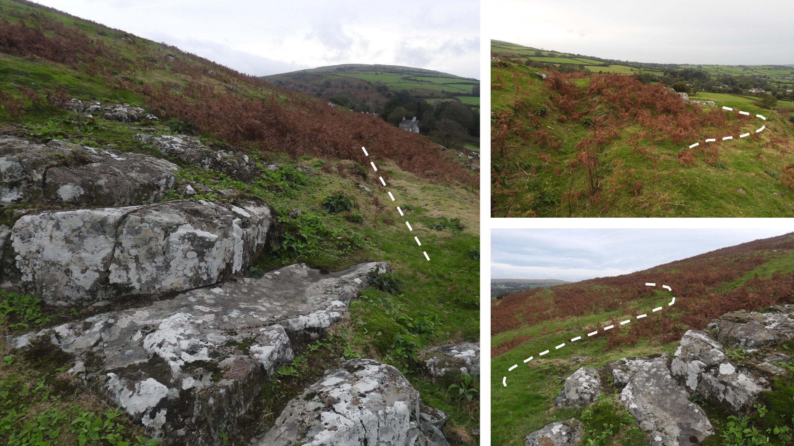
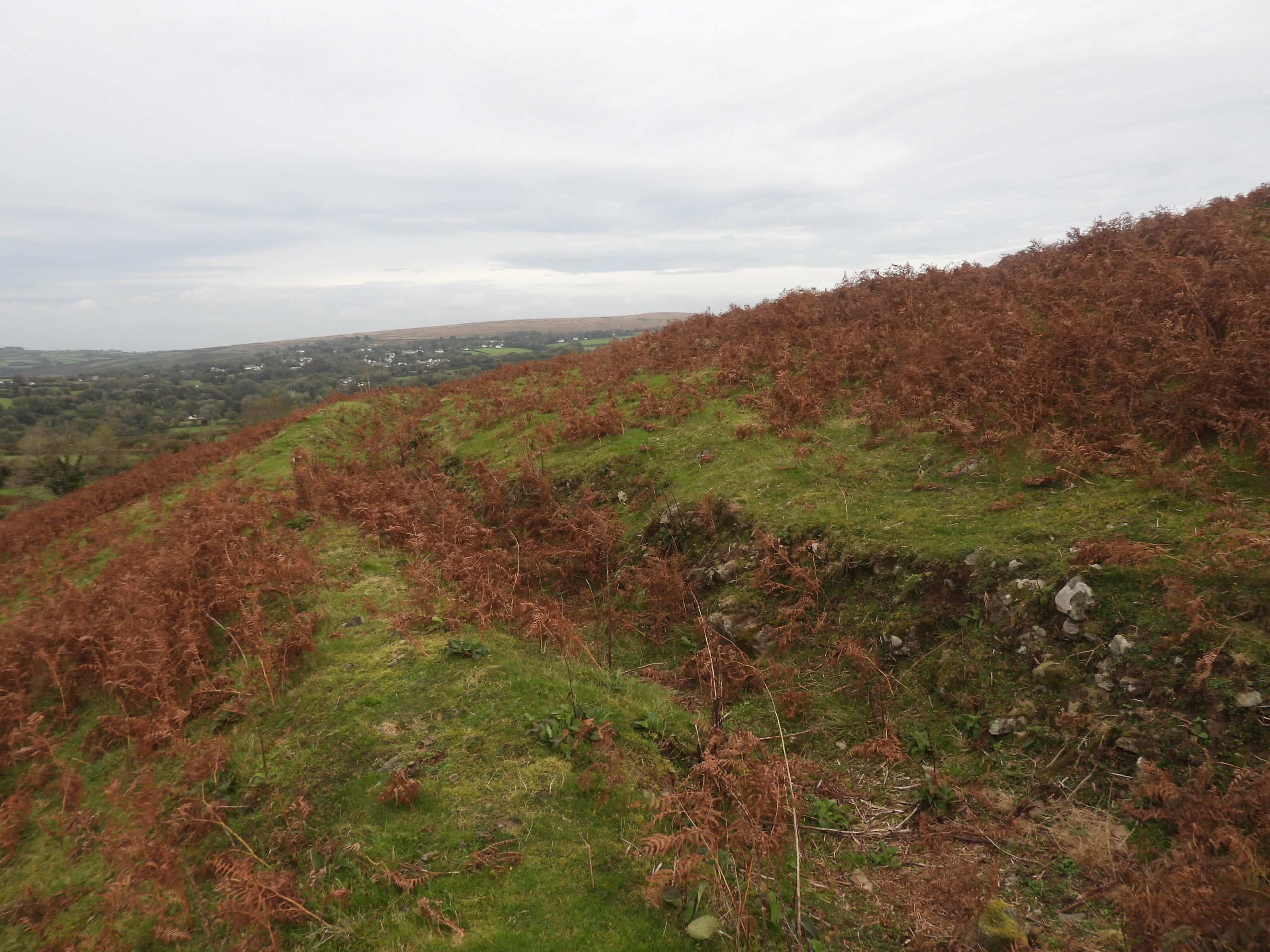
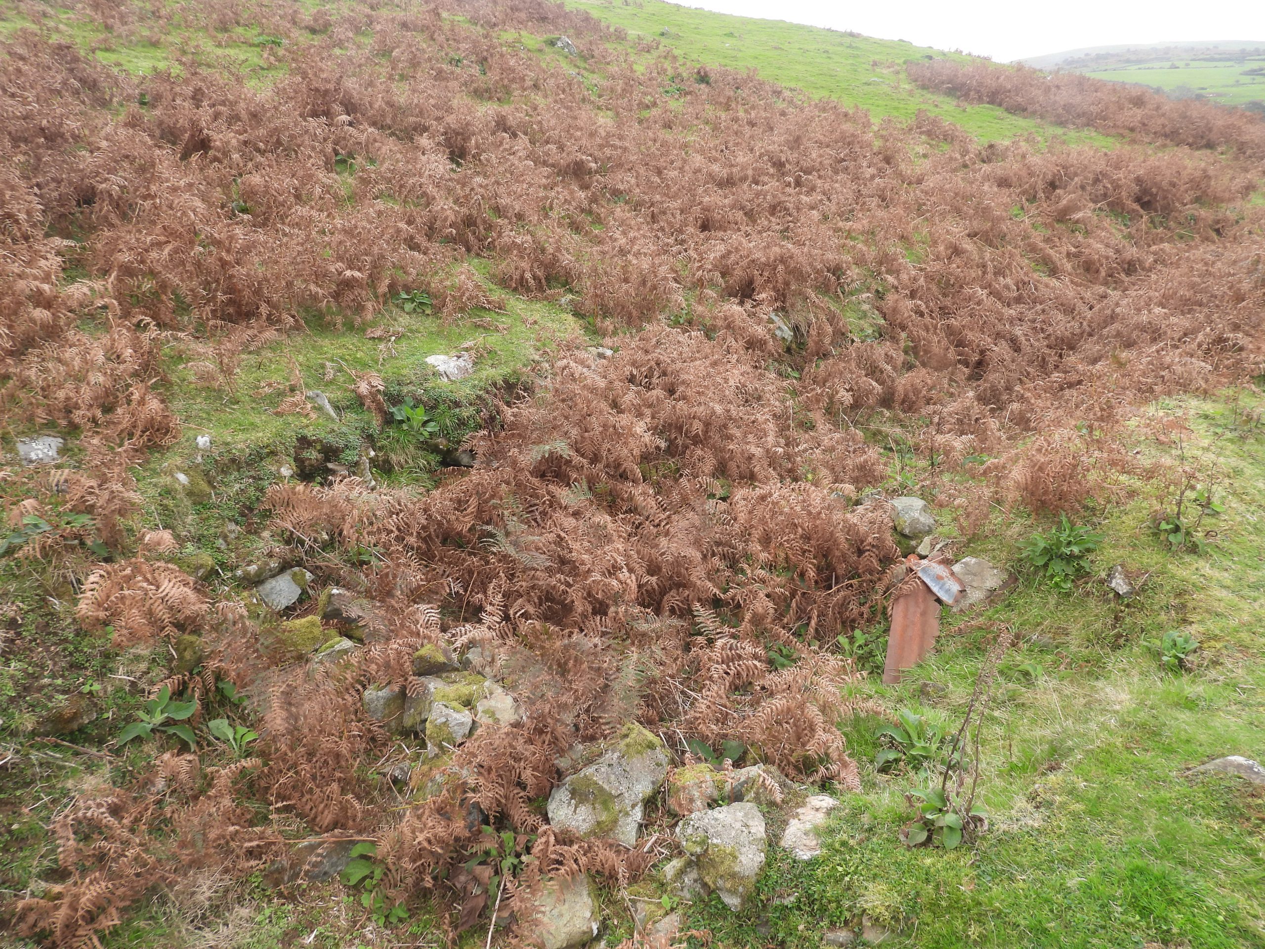
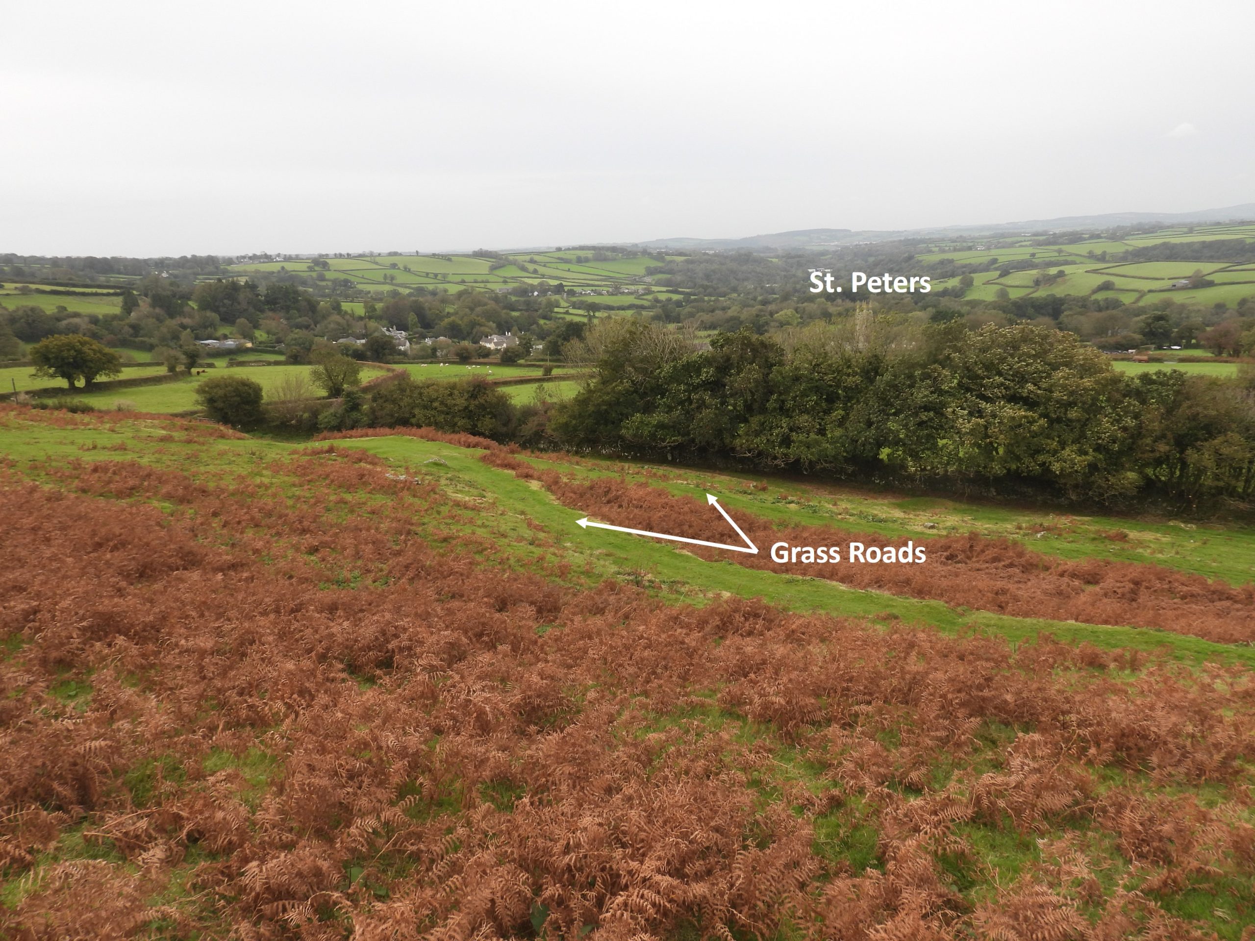
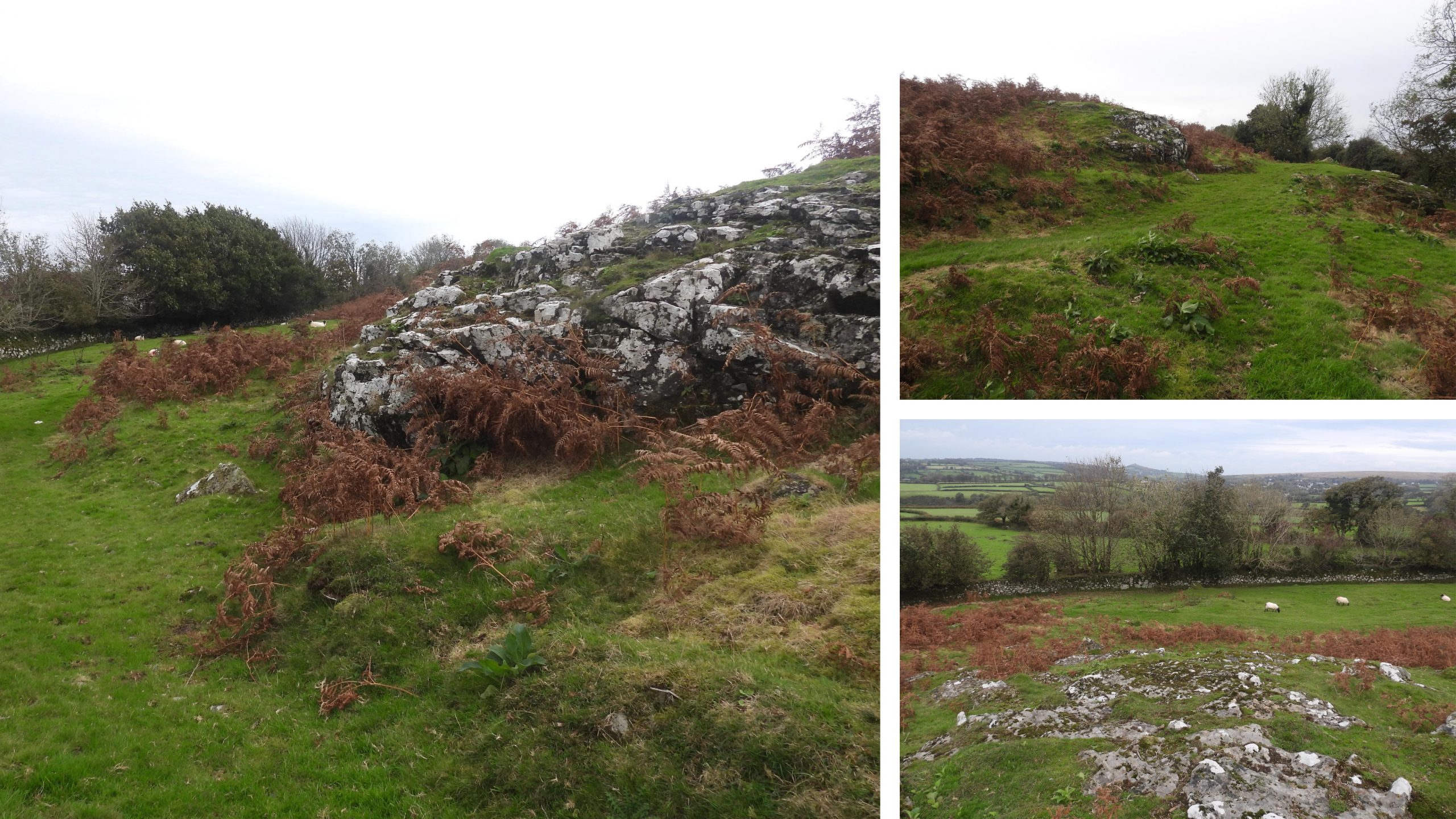
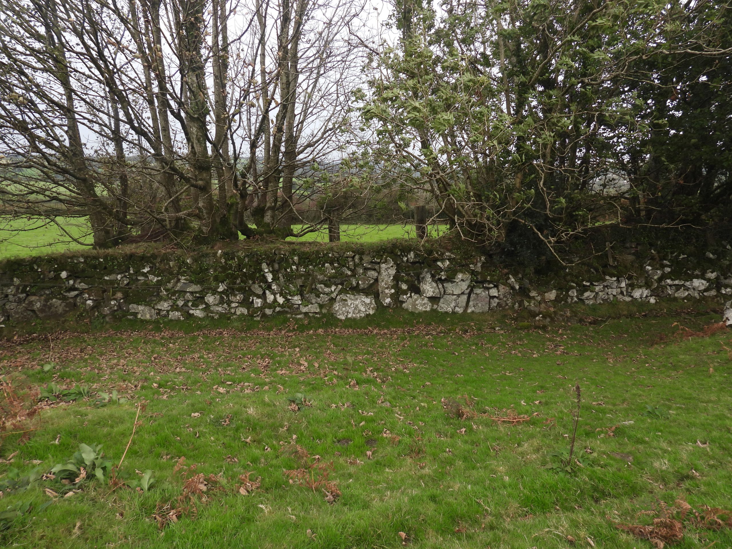
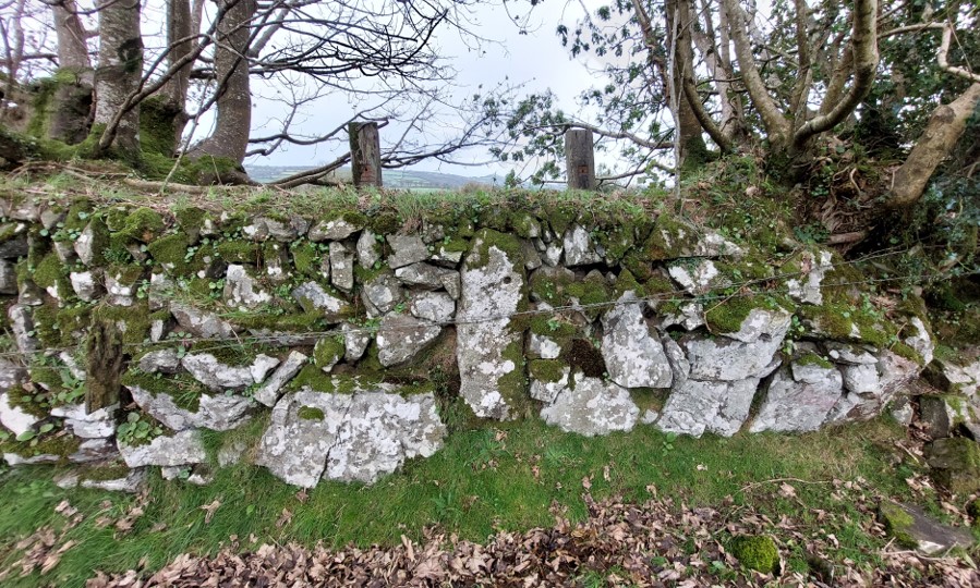
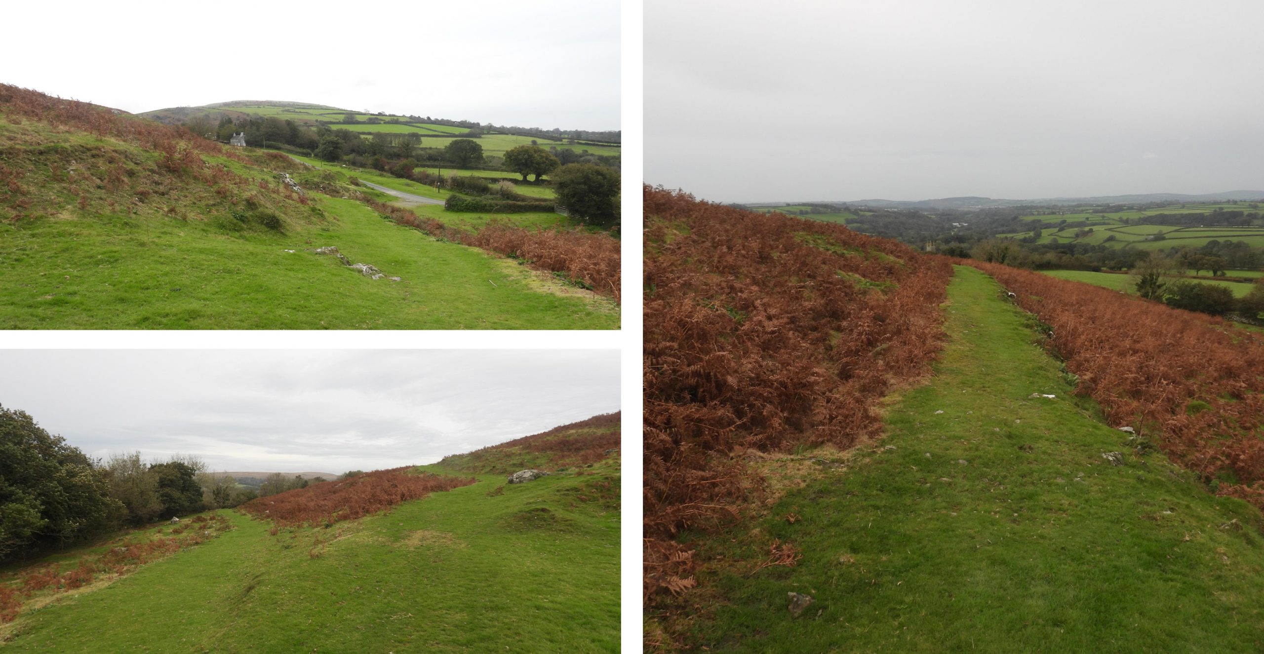
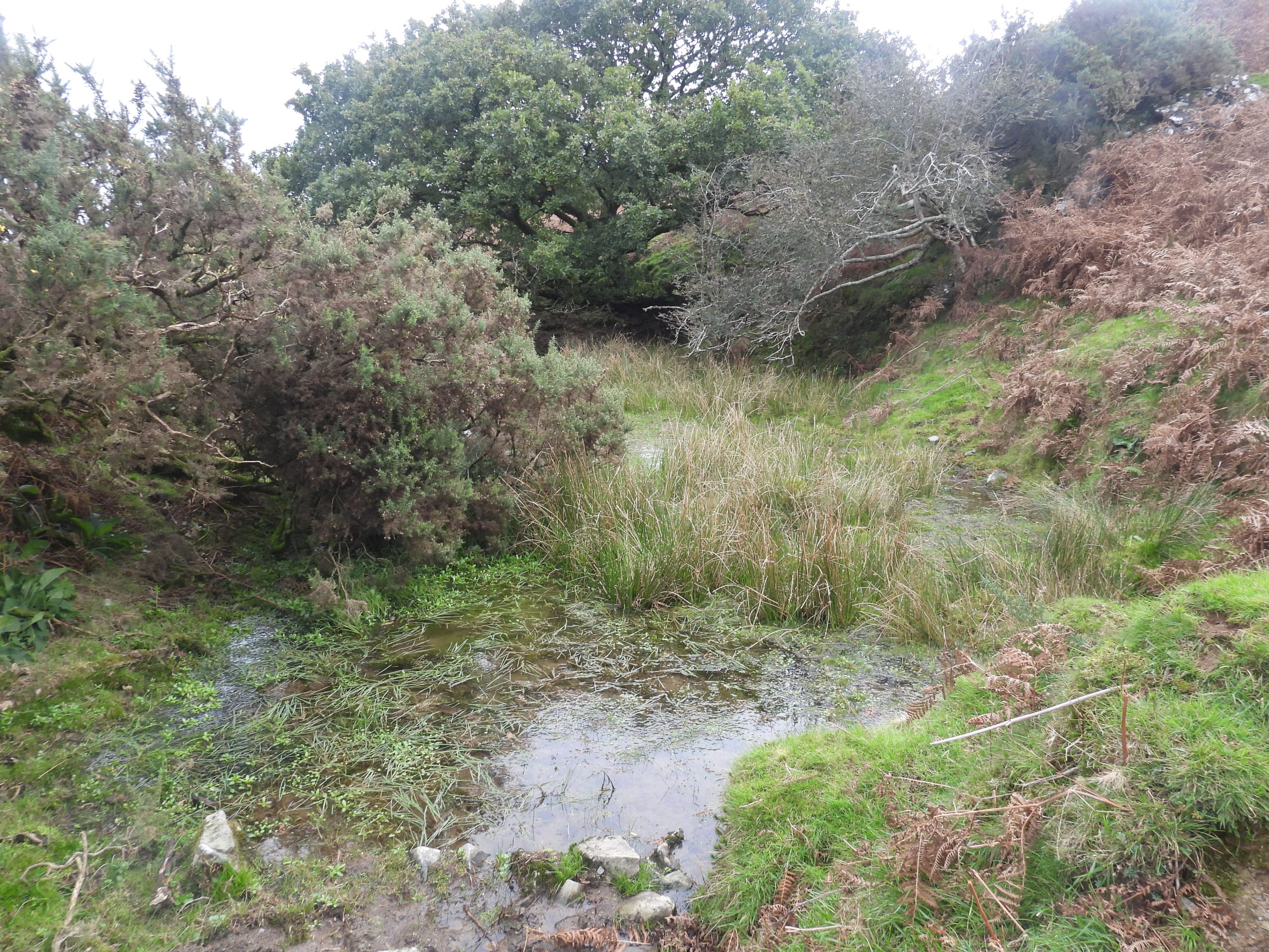
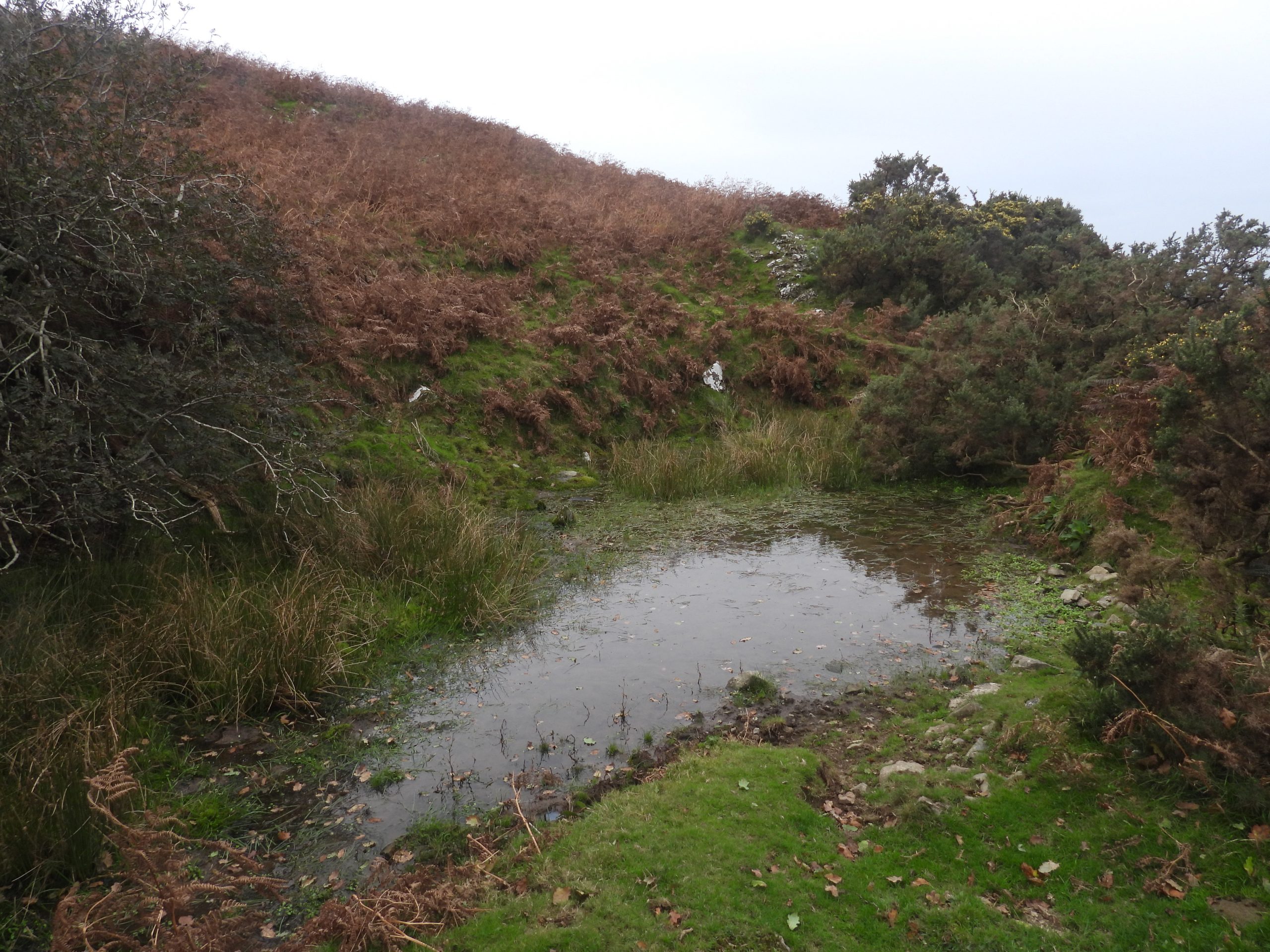
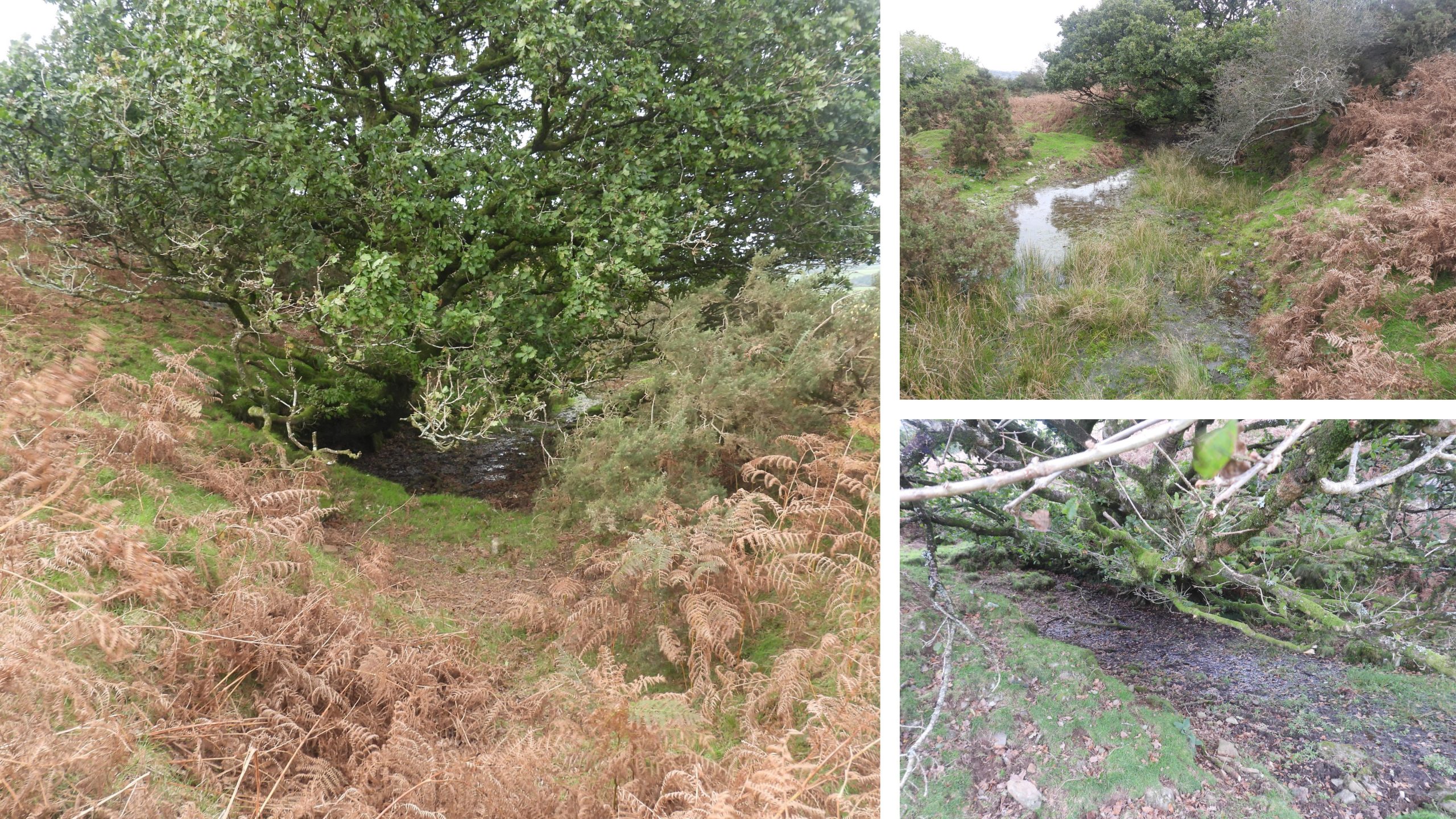
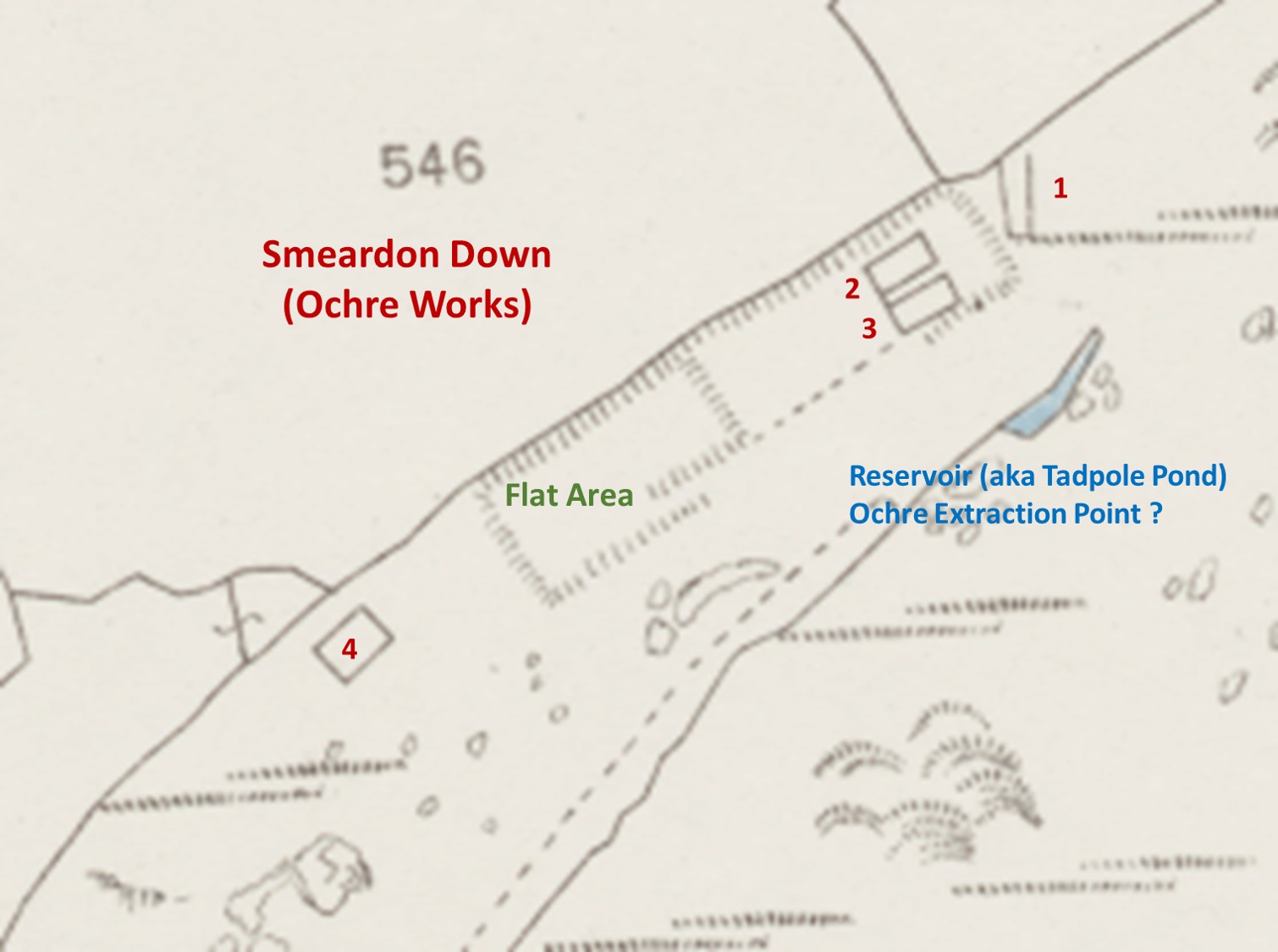
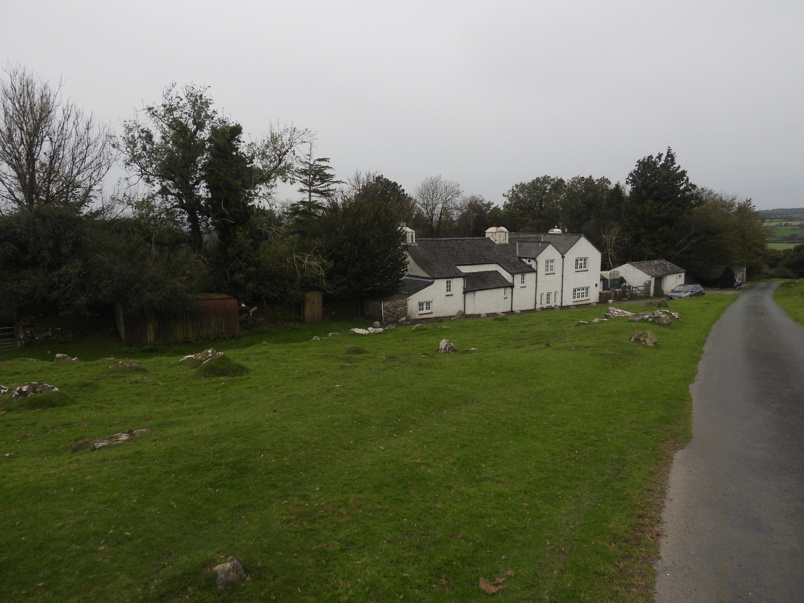
This sketch map is based on an 19th century map (1870’s), Devon County Council Environment Viewer Environment Gateway plus additional observations recorded on a visit to the site. Descriptions of these features are contained within this postClose to and south of the tarmac road leading to Lower Godsworthy and Wedlake are the remnants of some foundations, which are clearly identified on the 19th century (1870’s) map. There are foundation stones in the turf.The reason for there foundations are unknown. As they are on the opposite side of the road to the Ochre Works they may relate to farming. They are located at SX51670 77881In the Heritage Gateway, it is suggested what looks like a grassy path is in actual fact a dry leat (#2 on the sketch map). The leat appears to run from east to west with a drop of around 25ft (7.6m) from the road , above what is considered to be loading bays and onto a ‘cut out’ section which may have been a wheelpit(?)The area next to the tarmac road appears to have been used as loading bays (or maybe was the location of the storage area or even early settling pits). Dry Leat (2) does look like a grassy path (albeit it is quite wide).The loading bays are a ‘cut out’ area next to the tarmac road and appear to have been split into 6 sections. This number of sections are very evident on the 19th century (1870’s) map. This area is the most logical location where the ochre was loaded onto carts for onward transportation. The market wasn’t a large one being specific and restricted. Profits (if any) were in in £100’s not £1000’s. In all likelihood, the operation here would not have lasted very longThe centre of the loading bays was recorded at SX51665 77916Whilst exploring the loading bays, the author came across, a moss covered ridge tile. If this tile was part of the works, then this might be evidence that the loading bays had a roof, maybe linhay in style. The loading bays have evidence of stone foundations. The earliest known (to the author) reference for the Ochre Works was on the Western Times, dated Saturday 26th April 1845: “PETERTAVY OCHRE WORKS, NEAR TAVISTOCK. WANTED, a MANAGER, who will be expected to understand the Manufacture of Ochre in all its variety, to superintend the raising, washing, and drying; and competent in every respect to undertake the management of the above concern. Application by letter to Messrs. WINTER and DAINTY, Tavistock, will meet with prompt attention”. The same advert appeared one week late in the Sherborne Mercury – Saturday 3th May 1845Above the west end of the loading bays is a ‘cut out’ which is clearly shown on the 19th century (1870’s) map. The author speculates that this may have been a wheelpit as it is located at the west end of dry leat (2) and below a breach found in dry leat (1). If it is a wheelpit, what was any power needed for? If its not a wheelpit, what possible use is this ‘cut out’, especially due to its location to two dry leats? It might have been the location for a holding tank ?The top of ‘cut out’ (wheelpit ?) is located at SX51658 77966. Lovely views of St. Peters Church can be had from this location.Further uphill from the ‘cut out’ wheelpit and loading bays is another dry leat (#1 on sketch). This leat is generally about 1m deep and 1m across at the bottom widening to 2m across at the top. The author does have a theory that the early processing of the Ochre may have been attempted by flowing the ochre in water ‘suspension’ (as was done for China Clay at Red Lake) and in fact the loading bays were the original settling tanks. Is this theory just too fanciful ? The wheelpit may have, in actual fact, been a holding tankDry Leat (1) continues past and above the loading baysDry Leat (1) appears to have a deliberate breach in its bank at SX51669 77978. This appears directly above the termination point of dry leat (2) and where the ‘cut out’ (wheelpit?) is located. This appears to be too much of a co-incidence to be anything other than supplying water below !A panoramic view (hence picture distortion) of the ‘breach’ shows clearly dry leat (1) continuing east. From the reservoir (pond) near the Ochre Works at the extraction point to the breach is a drop of around 40ft (15m) hence the leat would have flowed west to east in the opposite direction to leat 2Continuing west along dry leat (1), it is crossed by a modern path / trackThe author observed on the 19th century map used that the leat had a ‘kink’ in it. On the ground this is caused by what looks like a ‘false cut’ and the need to route the leat around a small outcrop. The ‘false cut’ can be found at SX51637 78012Kink in dry leat 1, which passes around a small outcrop. The outcrop is at SX51627 78021. It is possible that the leat was laundered around this outcropThe leat (#1) continuing beyond the ‘kink’ towards the Ochre Works extraction. The leat would have flowed towards the camera at this pointA short distance from the ‘kink’ the leat appears to have been used in part for the construction of a stone building (or small enclosure). There are some corrugated sheets pieces here. The author speculates that this might be a small enclosure used by farmers previously to pen animals (e.g lambs). It can be found at SX51621 78052Below dry leat (1), there are two grass roads which lead to the Ochre WorksOutcrops between the two grass roads. One outcrop was recorded by the author at SX51552 78132The lower of the two grass roads (according to the 19th century map) once terminated at a location where there appears to have once been a gateway. The grass road appears to (in reality) continue past this point to the Ochre Works.The gatepost (with hole in it) is located at SX51518 78147. Note the two upright railway sleepers on the other side of the drystone wallThe two grass roads which lead from the loading bays area to the Ochre Works. The lower one, leads to the settling pits etc, whilst the upper one leads to the reservoir (pond). As these appear to be carefully constructed (with drainage), one can assume any processed ochre may have been initially removed from the works by horse and cartAt the main Ochre Works there is what on first viewing appears to be a reservoir / pond, and which appears to have been supplied by tapped springs near to beyond the drystone walling to the north. The ‘reservoir / pond’ is named as ‘Tadpole Pond’ in Mike Browns Gazetteer of Dartmoor names. It is also known to some as ‘Black Shells’ The author took a GPS reading of SX51696 78248 at the location where the photograph was takenHelen Harris speculates that this was the main extraction point and states: …”is marked by a small elongated pond, 25-30 metres in extent, banked by waste mounds on the lower side”. With this in mind, was the leat (fed by springs) above the extraction point used to ‘wash out’ the ochre? If this is the case then, the settling pits (of which there are at least 4) below would have been used at the next stage of the process. This still begs the question as to why there is a leat leading from the reservoir / pond (downhill) and onwards towards the loading bays. The author has two theories; Firstly, in the early days of the Ochre extraction it was carried ‘in suspension’ by the leat to the area labelled as ‘loading bays’ which were the first settling pits or secondly the water was used to drive a waterwheel near the loading bays. In either case, there does appear to be settling pits below this reservoir / pond (or extraction point).Annotated 19th century map of the Ochre Works. There is contradictory evidence of when these works may have started. Before the Duke of Bedford permission was granted (1859) there were two adverts / articles placed in the Royal Cornwall Gazette – Friday 8th May 1846 and in the North Devon Journal – Thursday 14th May 1846, which both have the same wording : “Ochre Works on Dartmoor. — A company has been established for working an extensive sett, in the parish of Peter Tavy, found to be very productive of yellow ochre ; which is stated can be raised at a great profit to the adventurers ; upwards of 25 tons can be returned, and prepared for the market weekly, at from 25s. to 30s. per ton, which can be readily sold at £5 and £6 per ton. The company is divided into 200 shares, with a capital of £400 paid up, and it is calculated that about £150 more will be sufficient to bring them into a profitable state”. So did the works commence in the 1840’s or even as late as 1850’s / 1860’s ?
The operation of the Ochre Works may well have started as early as 1840’s but it would appear that there had financial problems as reported in the Tavistock Gazette – Friday 21st October 1859: “Jeremiah Bray, v. William. Sarl.— A claim for £10 16s. 6d. for salary due to plaintiff as agent of the Peter Tavy ochre works, in which defendant was a shareholder. Mr. Henry Elworthy acted for plaintiff, and Mr. Chilcott for defendant. This case occupied a very long time in hearing, the defence being that proper notice to discontinue his services had been given to plaintiff, and this claim was for salary subsequent to notice. Mr. Chilcott admitted that his client was a shareholder in the works, but the company (who were very rich.) had determined on resisting this claim because they felt it was unjust. Some conflicting evidence was then given as to the time and place of giving the notice, it not unfrequently happening that one shareholder would go on the works and give orders, and probably a day or two afterwards another shareholder would also go and countermand the orders of the former one, and give fresh instructions. His Honour was satisfied of there being £7 17s. 6d. due to plaintiff, and gave judgment for him accordingly”.
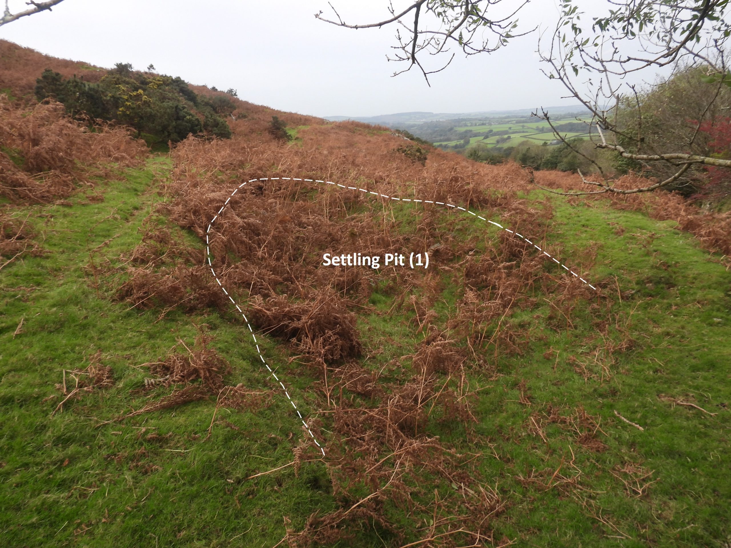
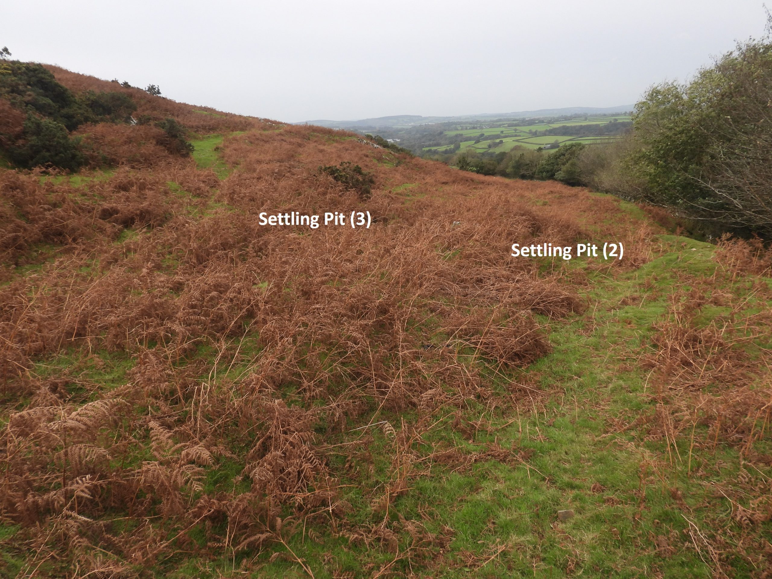
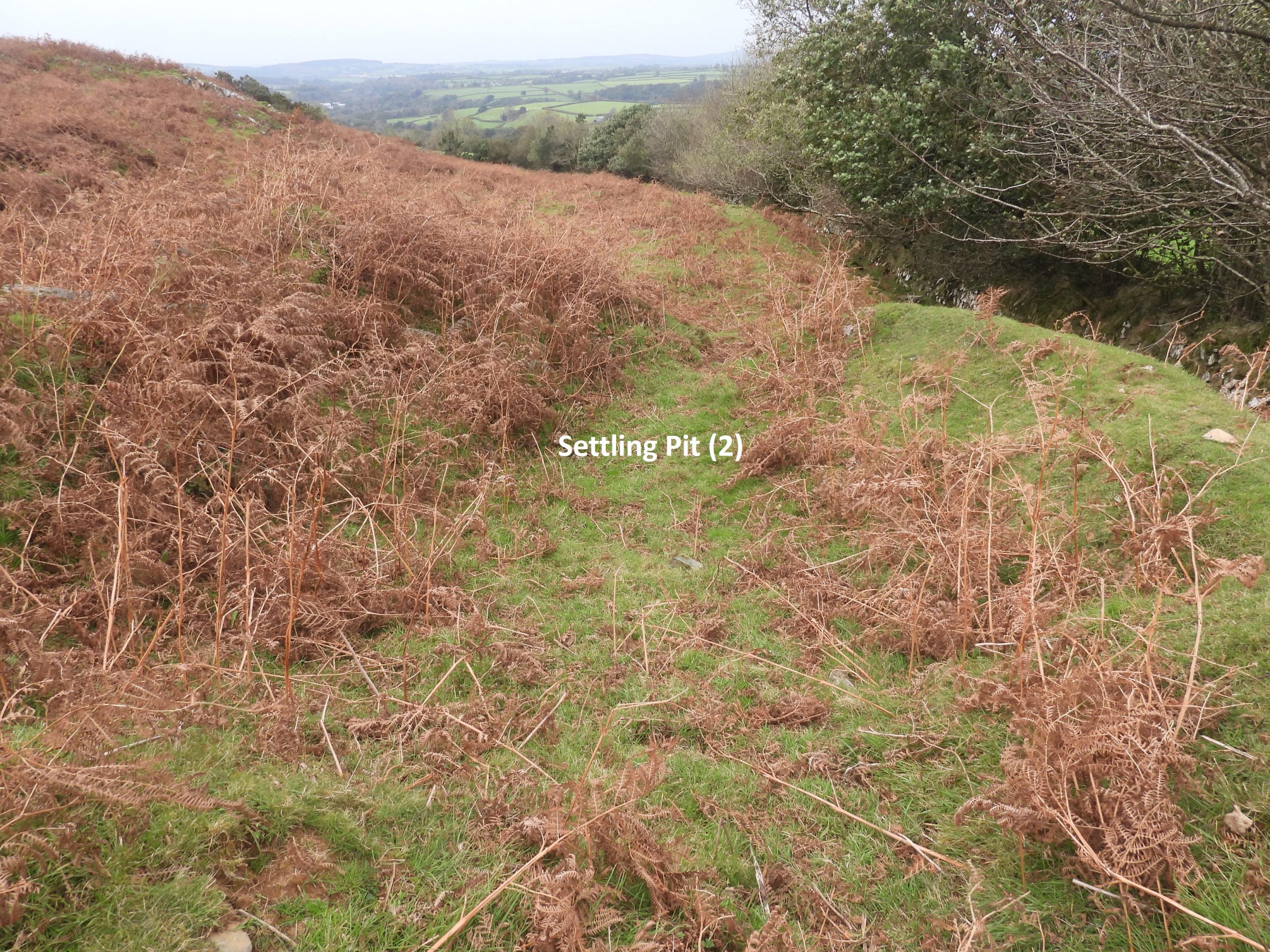
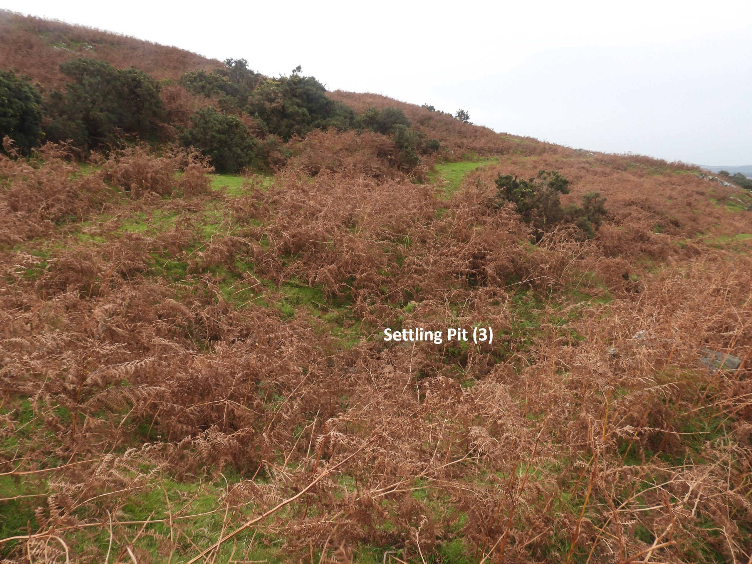
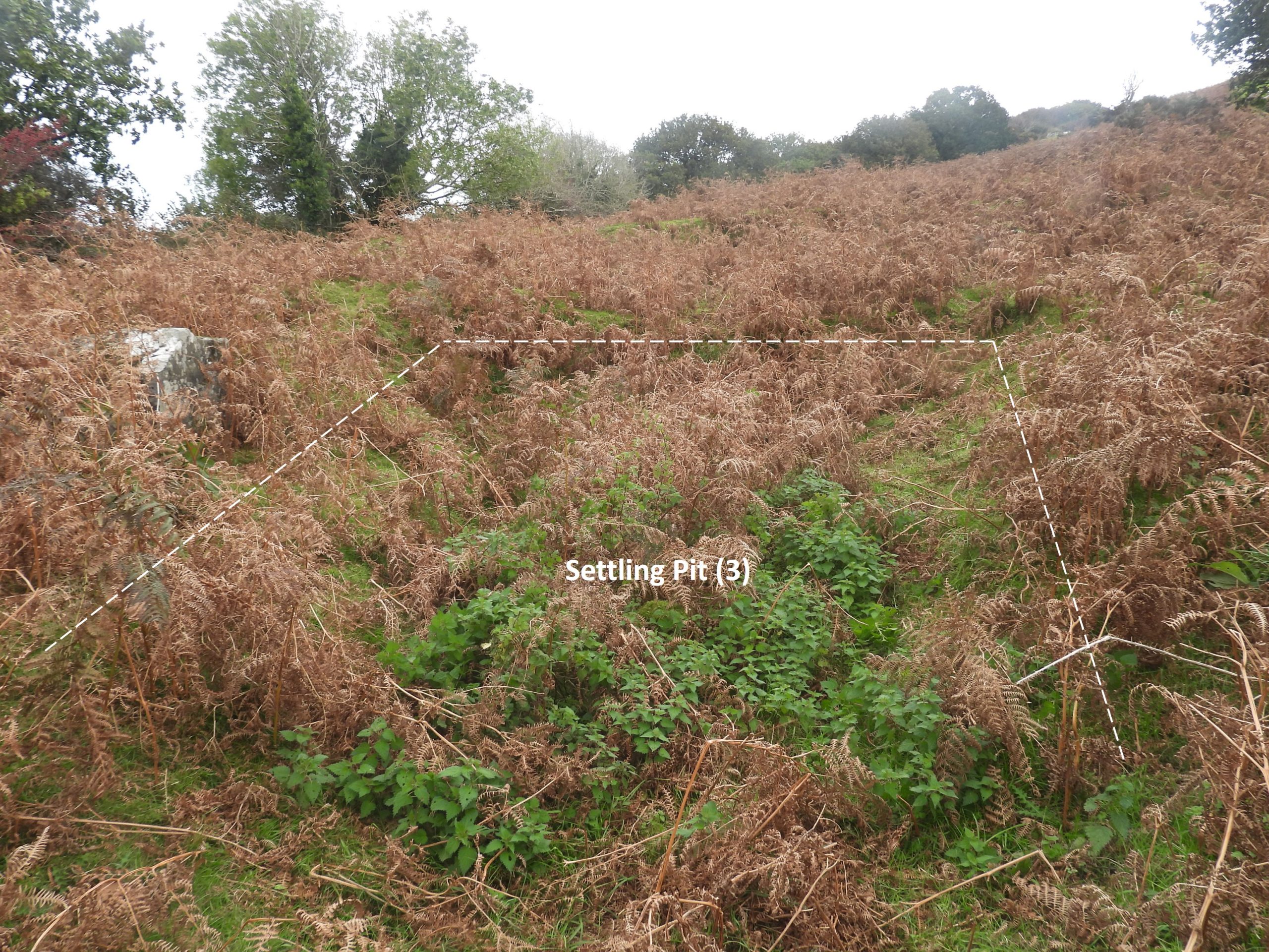
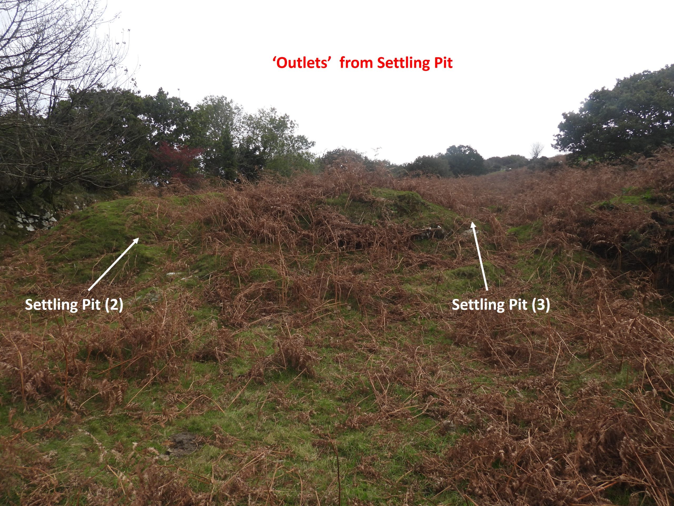
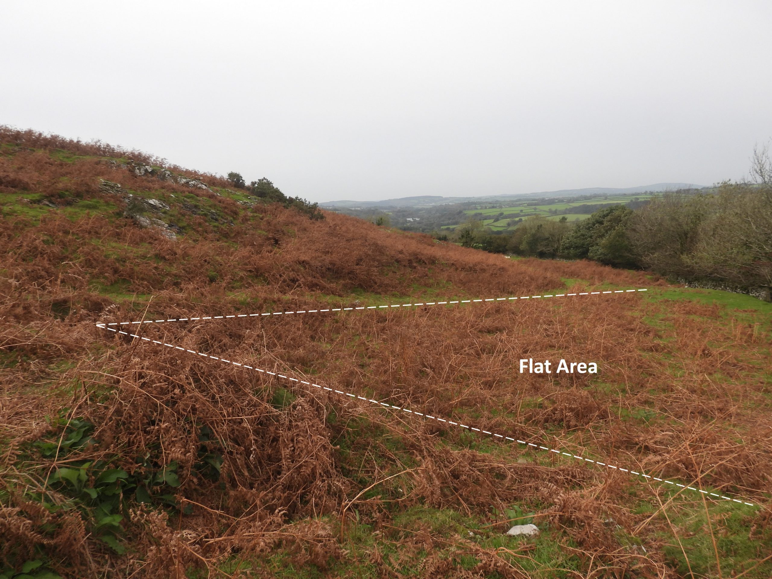
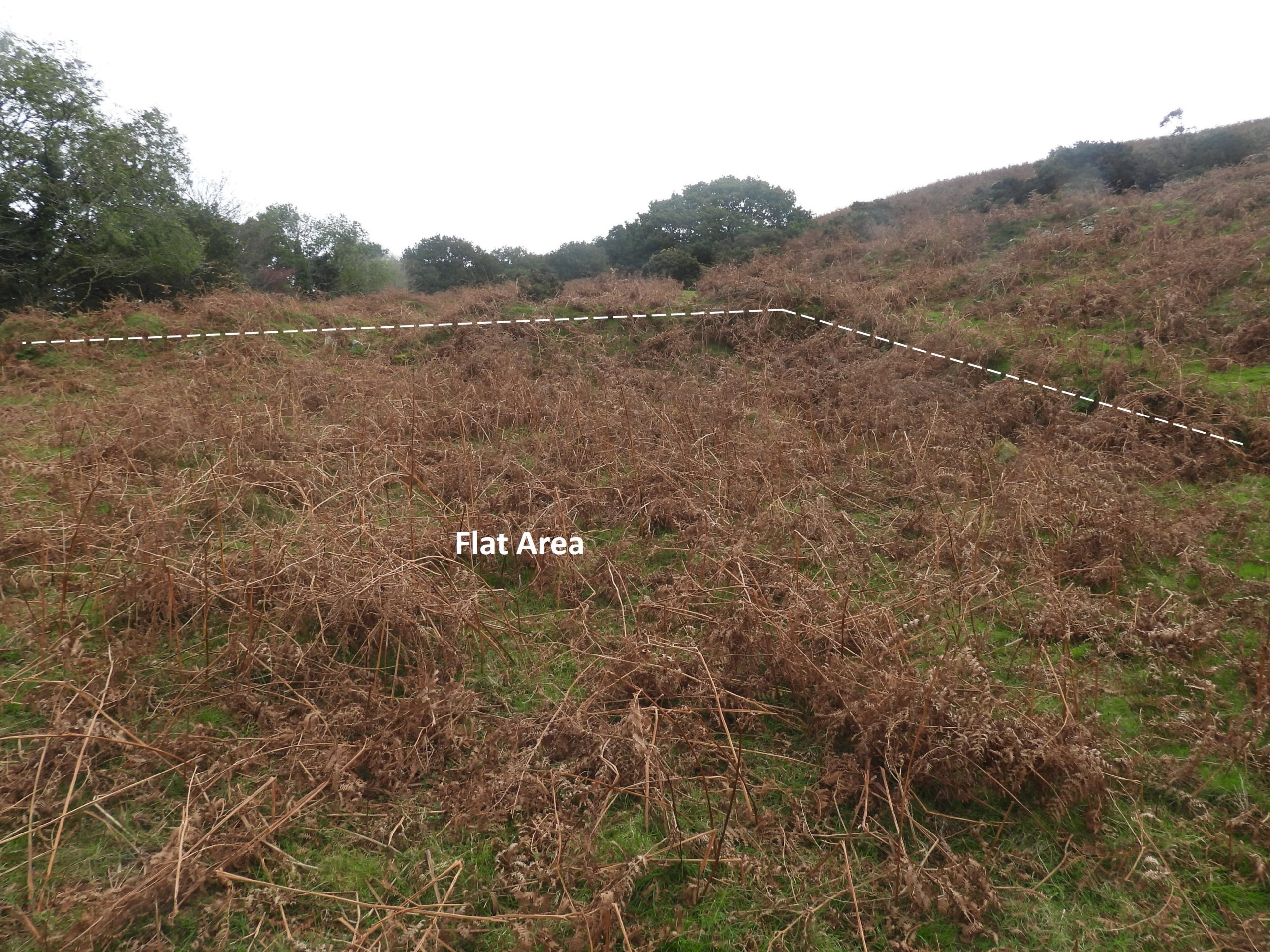
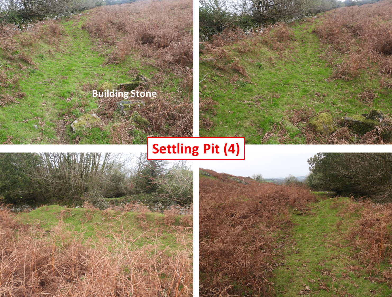
Immediately below the reservoir / pond (or indeed extraction point) is settling pit (1) as shown on sketch map and as identified on the annotated 19th century map. It is located at SX51693 78278. Can one assume this was the first processing ‘drying stage’? Ochre processing involved washing the material out of beds (in a similar method to china clay), the resulting slurry flowed into a series of settling tanks where coarser grit would separate and settle.Helen Harris describes there is ‘much ground disturbance’ here and has been divided by banks into ‘quarters’. The 19th century map doesn’t show ‘quarters’ as such but just two outlines, which the author has annotated as setting pit (2) and settling pit (3). These lie down hill from the first settling pit (1)Settling Pit (2) is located at SX51670 78267. Settling Pit (3) is located at SX51671 78263 and is adjacent to settling pit (2)Inside settling pit (3). As can be seen from the vegetation, a visit to the site would be made in Autumn or WinterAt the lower end of settling pit (2) and settling pit (3), there appears to be two ‘exit points’, which suggest there were further processes down hillSettling pits (2) and (3) lead to a large flat(ish) area, which appears to have been cut-into the bank on its north east side and banked up on its south west side. This area is clearly shown on the 19th century map. Helen Harris suggested that she found lumps of a yellow substance (presumably ochre) here.The ‘flat area’ when visited does appear to have a minor slope running north east to south west. Was this deliberate to allow further run off of water (if the ochre was placed here?). The centre of the flat area was recorded at SX51635 78240Slightly downhill from the flat area is a banked up area the author has annotated as settling pit (4). It has some building stone within it and is located at SX51580 78210. The (extended) lower grass road terminates just below (south west) of this point. Of interest, is that the residents of Higher Mill (between Combe and Peter Tavy) complained that their waterwheel at the mill was stained yellow “when they released water from the ‘settling tanks’ from the ‘Ochre Pits’ into the mill leat below”. With this observation, it does appear more probable that the ochre water came from near the ‘loading bay’ area that this area, due to the contouring of the hillside. This does suggest that leat (1) did have ochre coloured water in it as this is the only way this would have reached the mill leat !
In addition to the financial issues of the venture in 1859 (recorded earlier in this post), there were further financial issues recorded in the Tavistock Gazette – Friday 22th March 1861: “Tavistock County Court (Before Matthew Fortescue, Esq., Judge), Saturday March 16th 1861. Tavistock Gas Company v. William. Sarl.— Plaintiffs, for whom Mr. Luxton appeared, sought to recover the sum of £7 5s. 0d. for Coke and Tar supplied to the Peter Tavv Ochre Works, in which defendant was a shareholder. Mr. Sarl is the great silversmith of Cornhill, and is understood to be the proprietor of these Ochre Works. He did not appear however, and the late agent having proved the receipt of all the supplies at the works, judgment was given for immediate payment”.
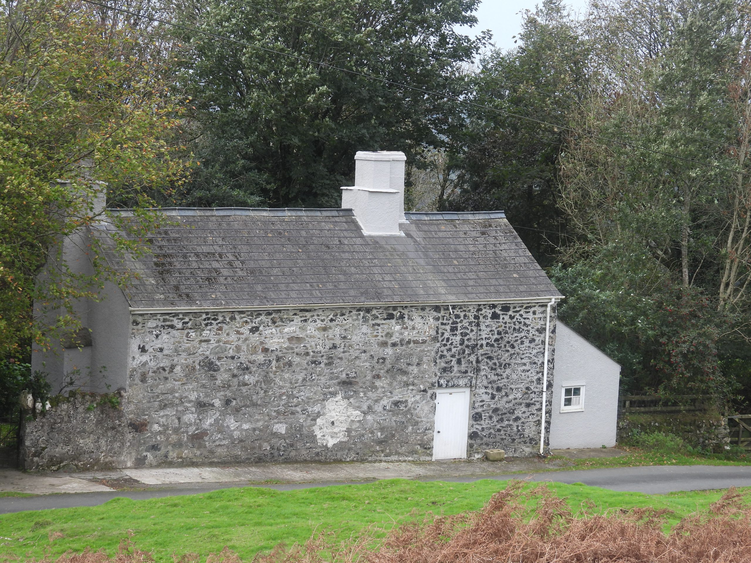
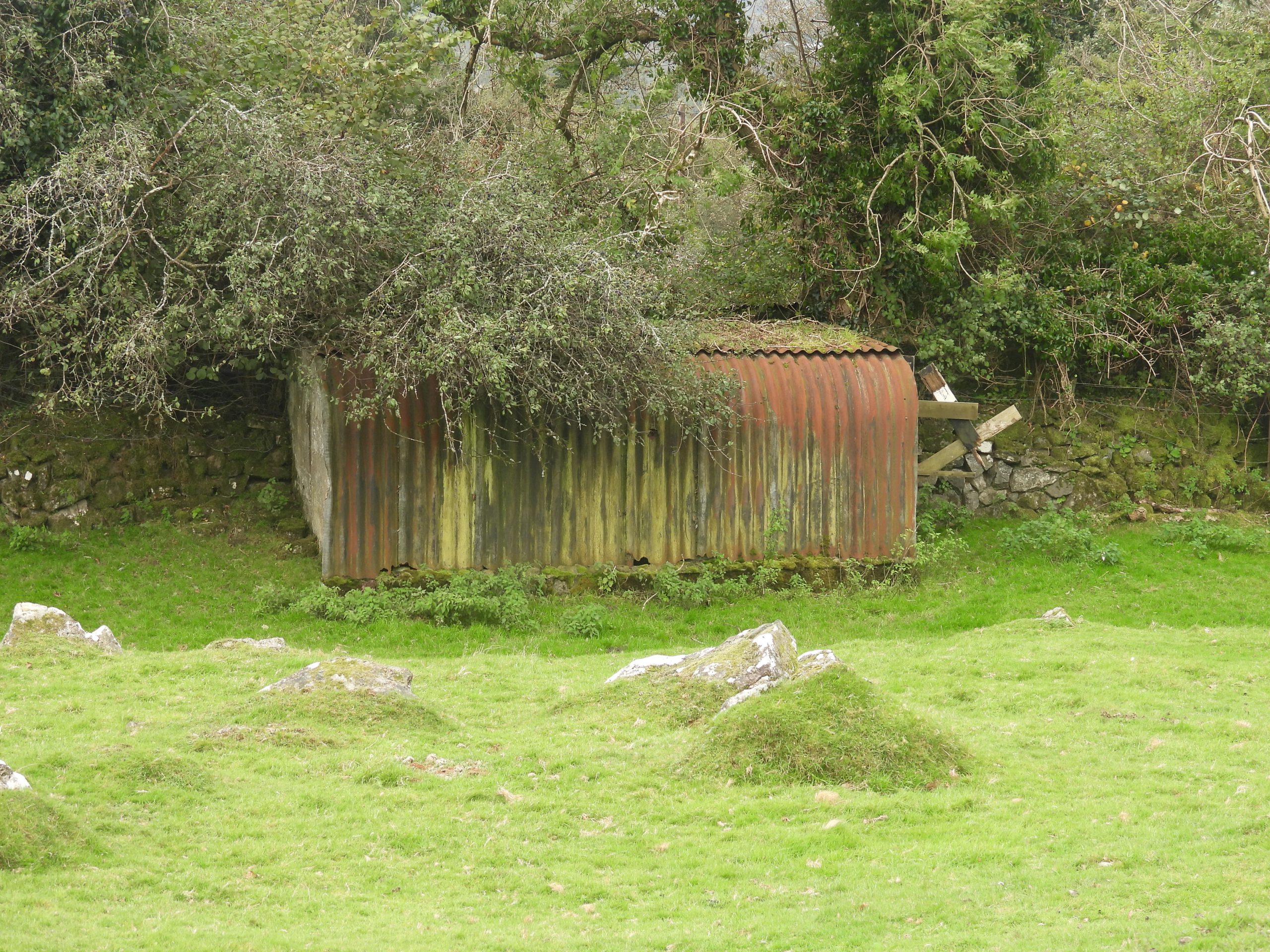
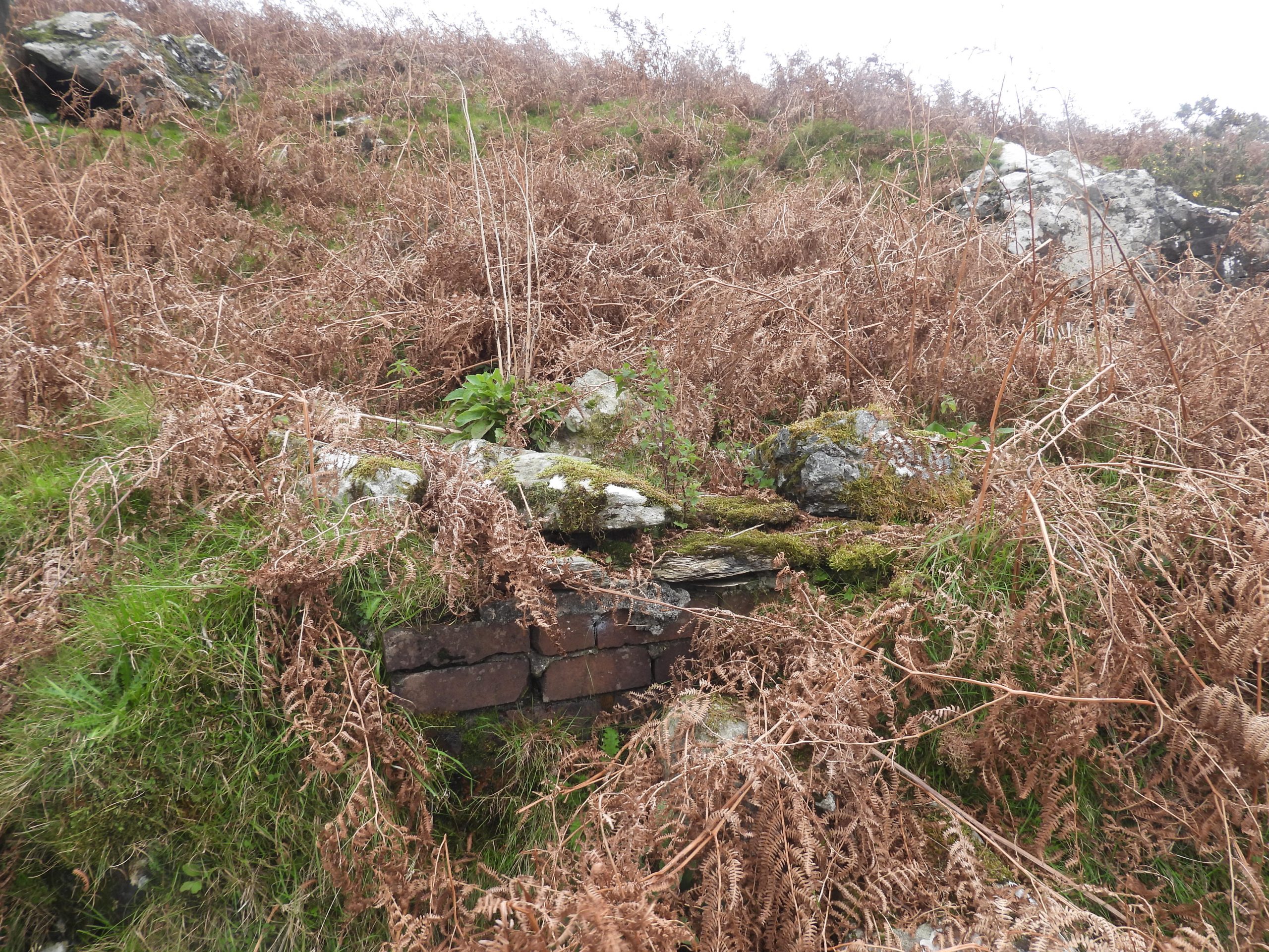
Near to dry leat (2) and the loading bays are these buildings, which are not named on OS maps or indeed have any name plate. The author has, however found a name on the Heritage Gateway (Devon County Environment Viewer) as ‘Boulters Tor’. These buildings would have been here when the Ochre Works were in operation.Another view of Boulters Tor. To the south west of Boulters Tor, under the vegetation, a lean to type shed caught the authors eye, which looked like it had been constructed out of an old Anderson Shelter (from WWII)One of the Boulters Tor buildingsIs this constructed from an old Anderson Shelter ?Close to the course of dry leat (2) is this probable bricked well at SX51783 77878. The top is covered in flat slabs which give a hollow ‘sound’ when tapped with a walking pole. One assumes this is spring fed and is the same water which was leat fed to the loading bay area. No doubt this water was once used to supply ‘Boulters Tor’
The Sarl family were involved in multiple dodgy dealing in mining in the West Country, including iron ore around Haytor and at Bowden Hill, Hennock, and in North Devon. Invariably the investors lost money.
Nick Walter April 27, 2026
The Sarl family were involved in multiple dodgy dealing in mining in the West Country, including iron ore around Haytor and at Bowden Hill, Hennock, and in North Devon. Invariably the investors lost money.