A collection of walks, discoveries, insights and pictures of exploring Dartmoor National Park
November 27, 2022
Torre Abbey Land – Buckland in the Moor
Buckland in the Moor dates from Saxon times. By the 12th century, the lands at Buckland were held by the de Boklondes, who took their name from the manor. In the 13th century, the de Boklondes gave generously to the Canons of Torre Abbey (Torquay) who were a Premonstratensian Order (founded in 1196) and who originated from Prémontré in Northern France.
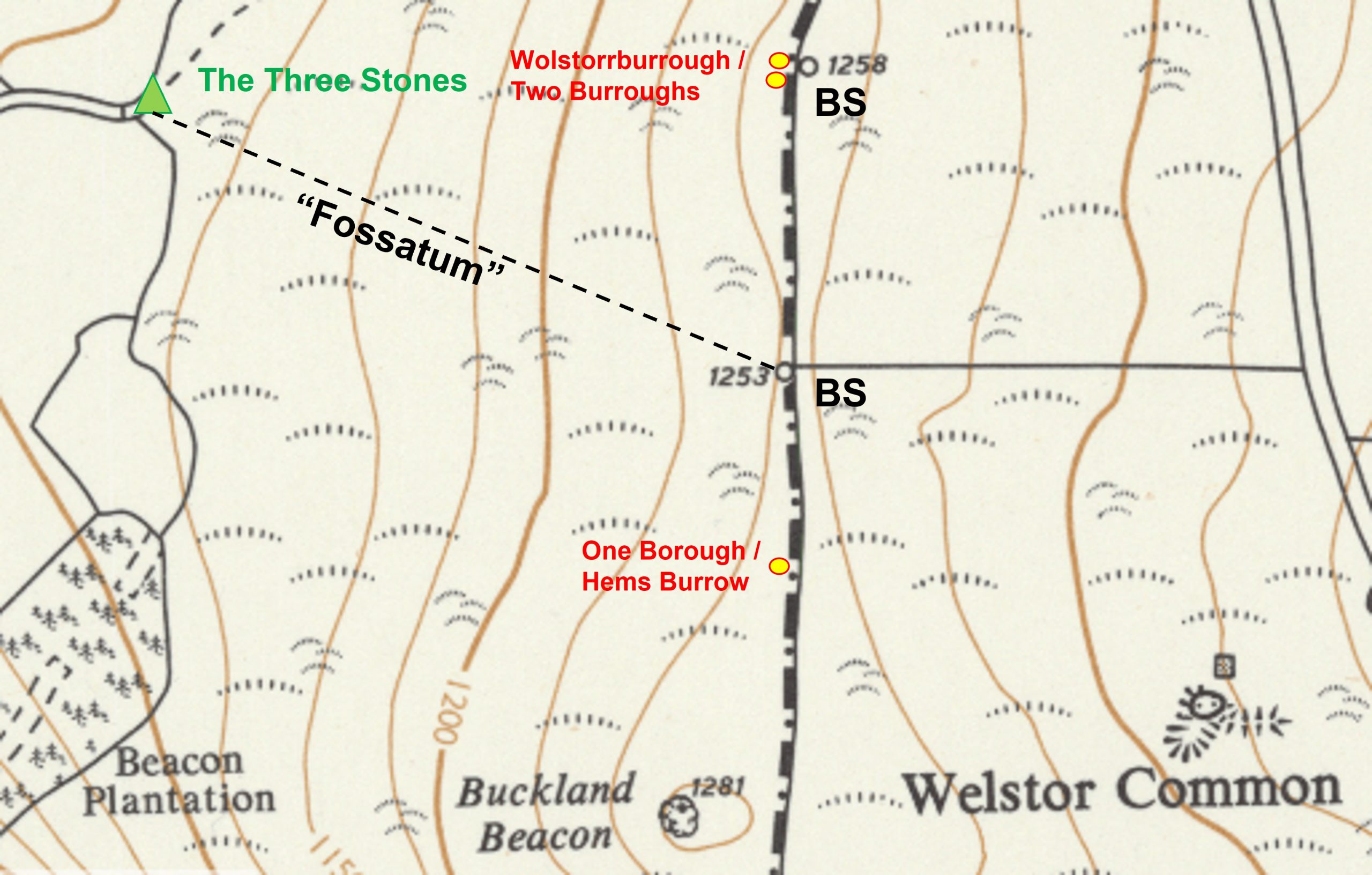
Between 1200 and 1250 a charter records this gift of lands to Torre Abbey : a gift for his own* soulandthatofAlice,hiswife, woodland, glebe and open moorland defined as extending from ‘Colreforda’ (Bridge on the Buckland Road), up the Millbrook or Ruddylceave Water, to a point just below Bowden Farm, thence to ‘Three Rocks’ at ‘Mahimorhead’, thence via ‘Fossatum’ (sunken way) to top of the hill, then down the southern side to ‘Blyndewyll’ (Blind Well or Stidwell Spring) and south again to ‘Bolshayburna’ and then back (along the Buckland road) to the start.
*The author has discovered a further charter dated c. 1250 relating to Roger, Lord of Boklond, son of Roger de Boklond, thus one assumes Alice’s husband was called Roger (presumably the son).
Intriguedby the route, which was published alongside a sketch map in the Dave Brewer publication “Dartmoor Boundary Markers” (second edition) pages 104/5, the author, with this post has recorded a 21st century circumnavigation of the gift of lands to Torre Abbey given 800 years ago.
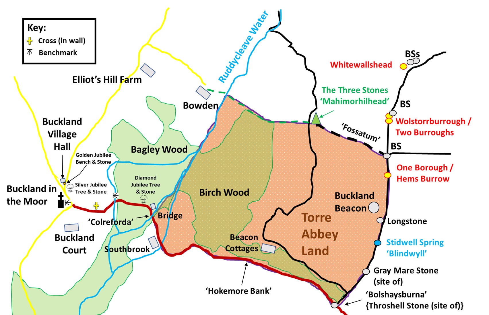
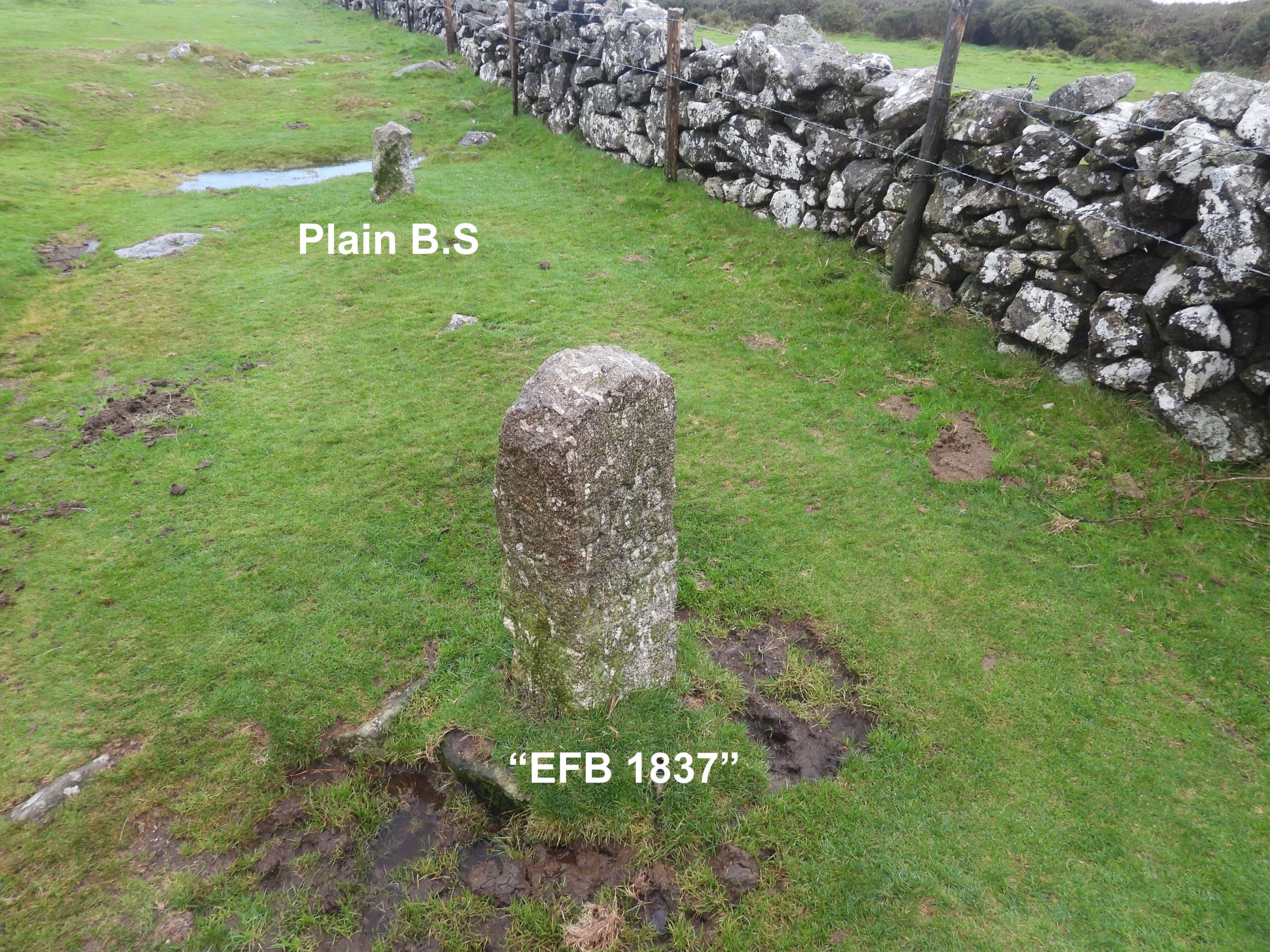
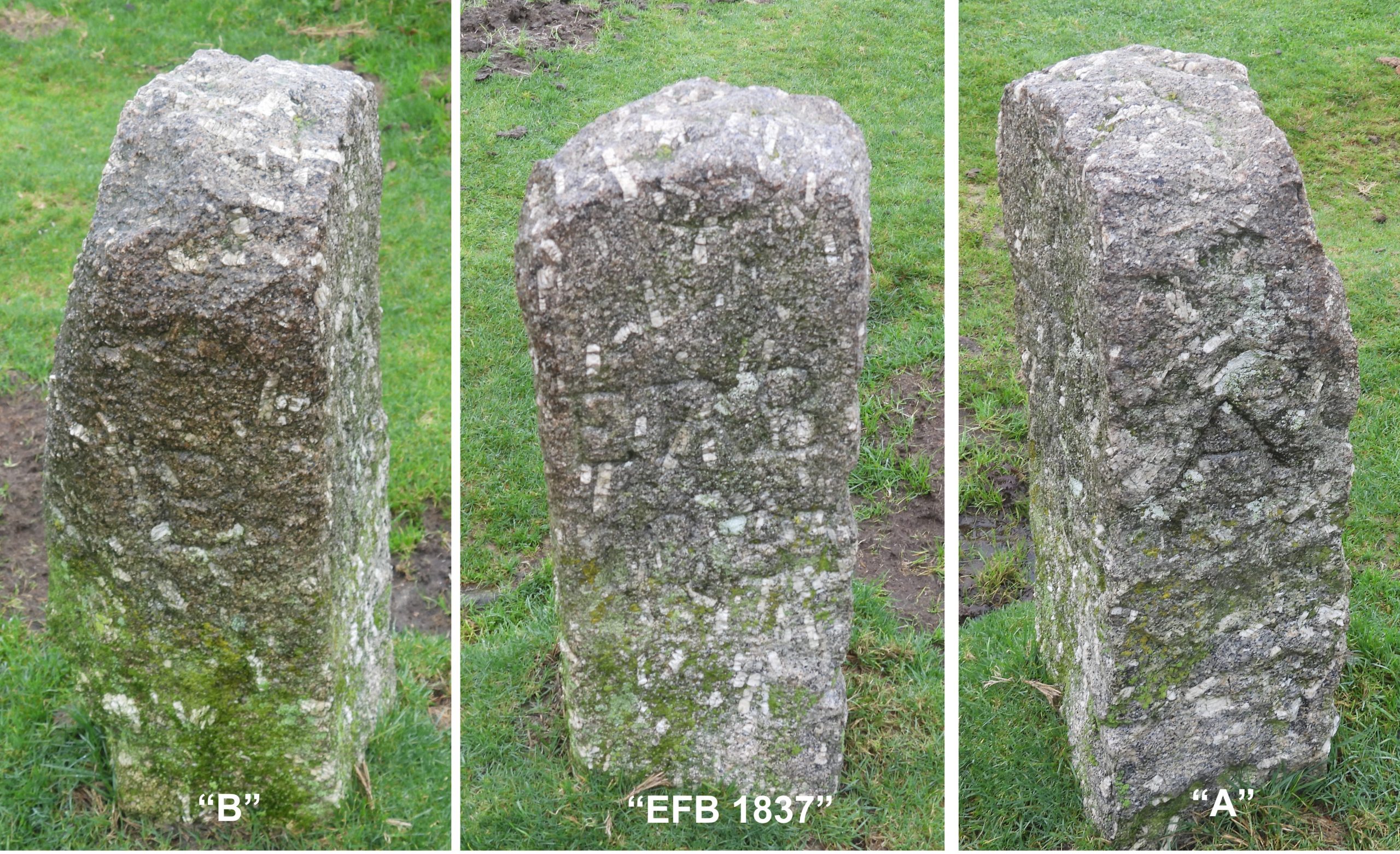
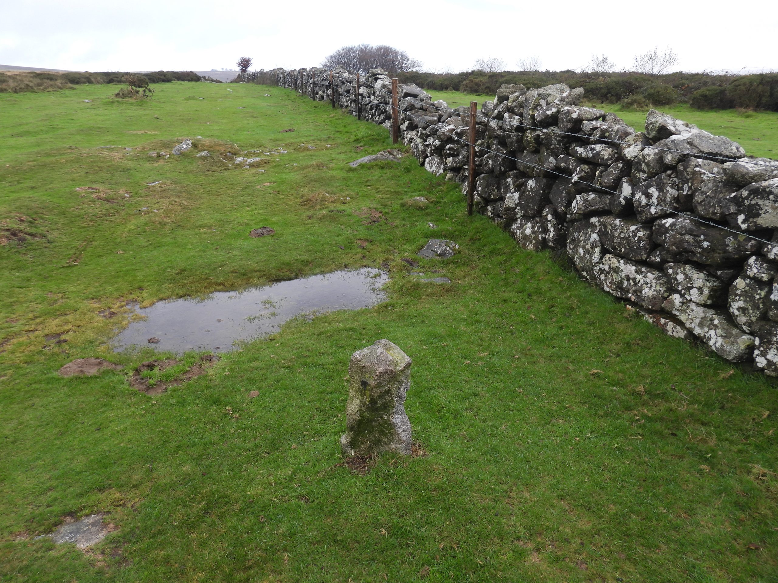
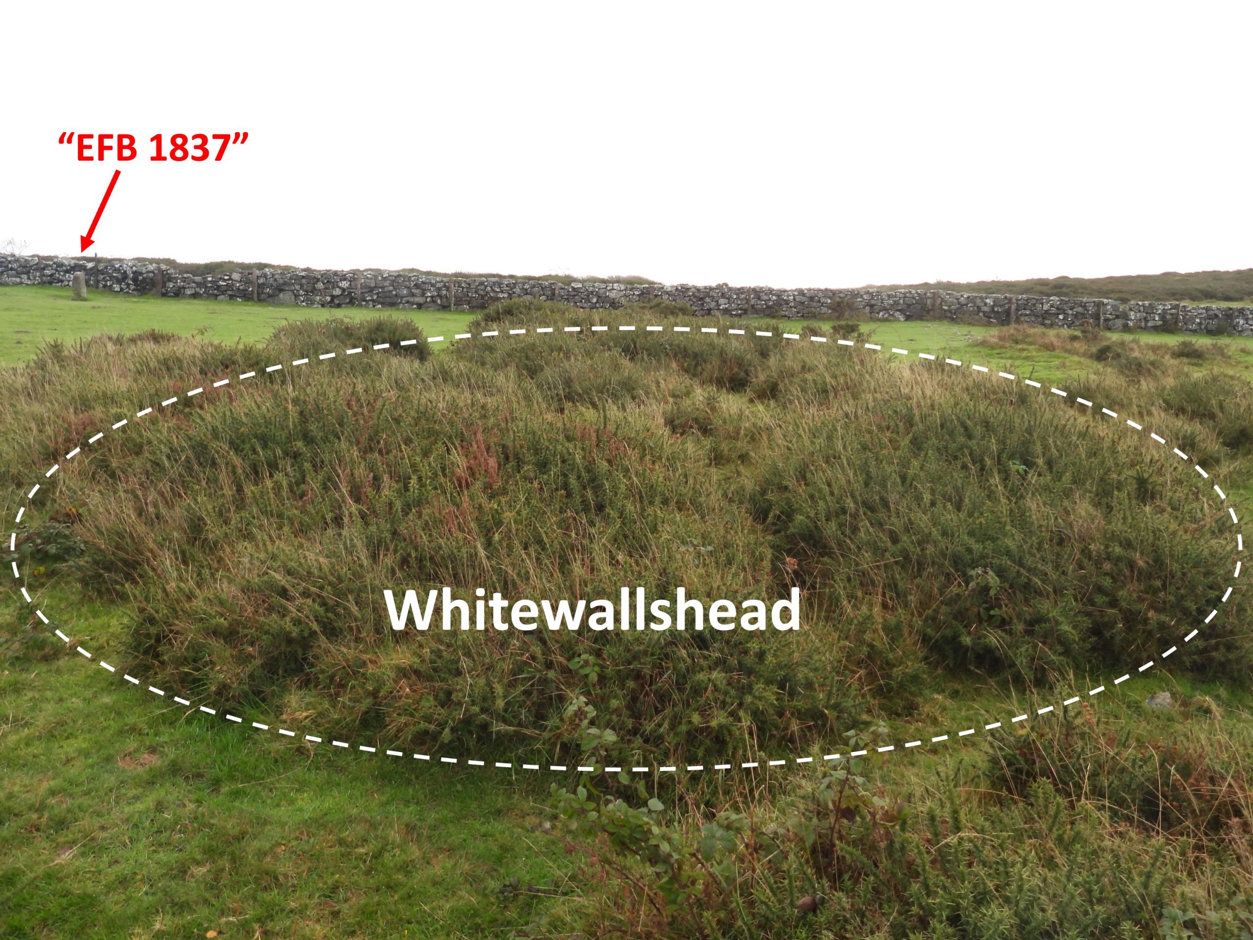
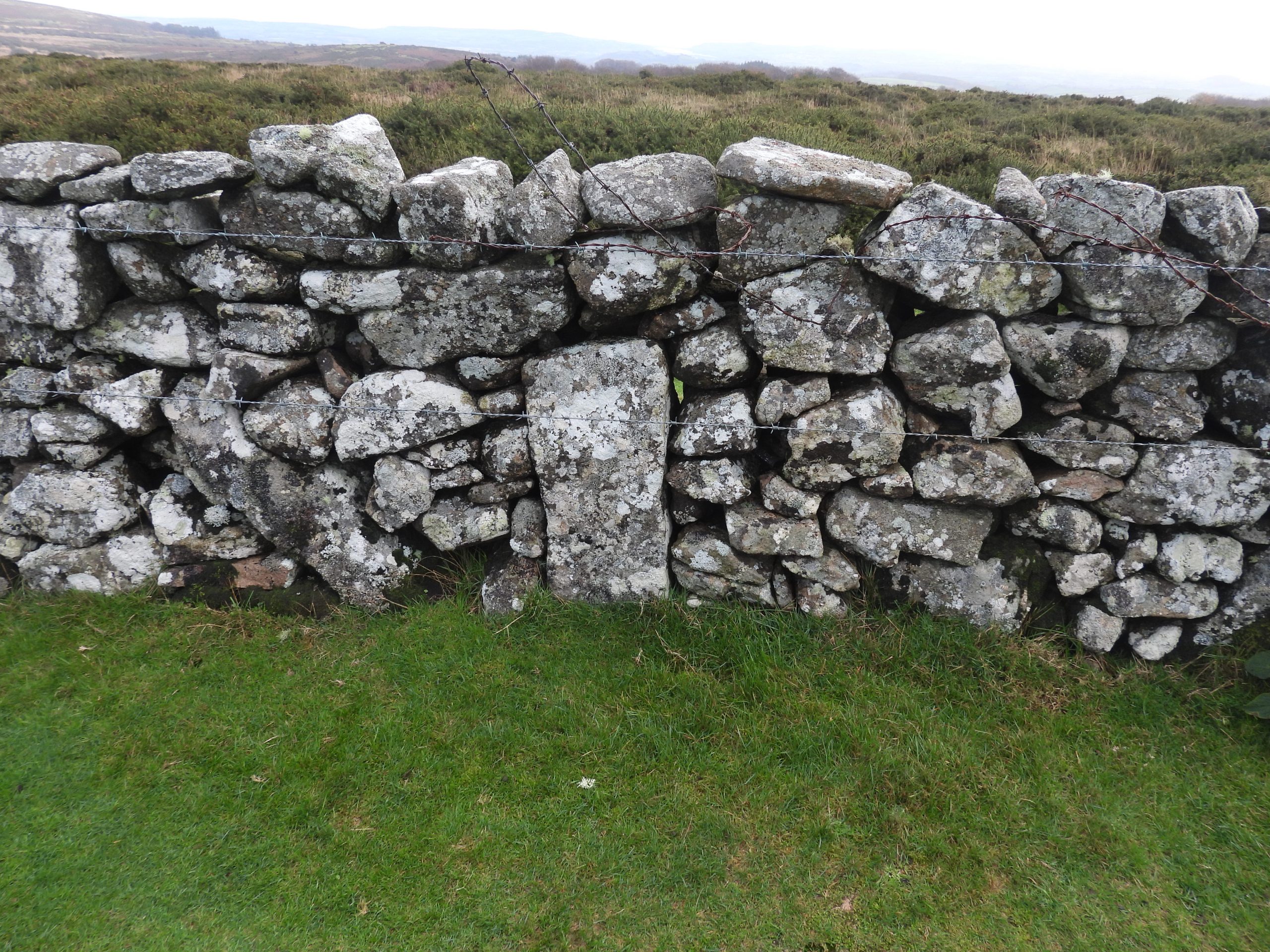
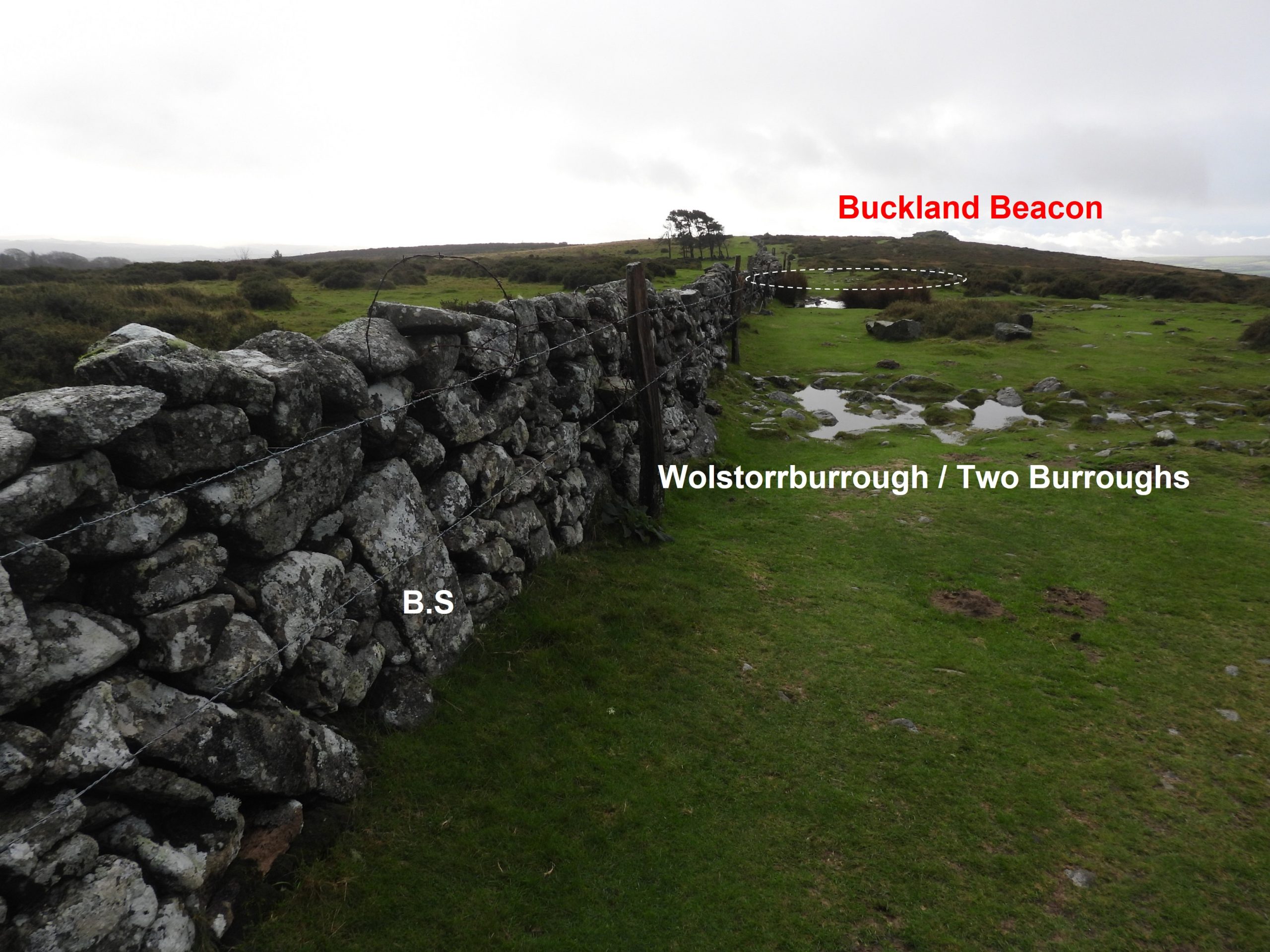
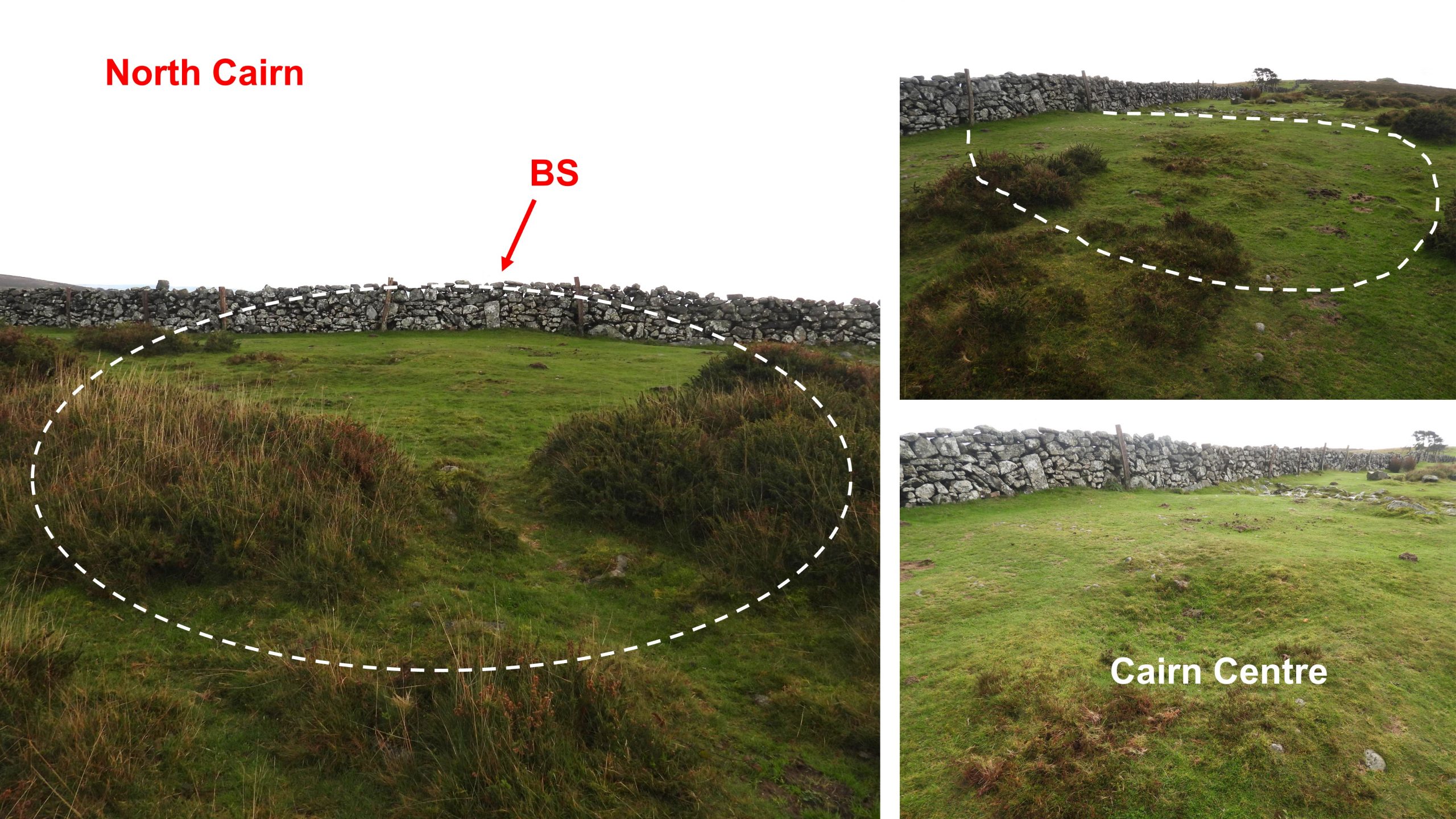
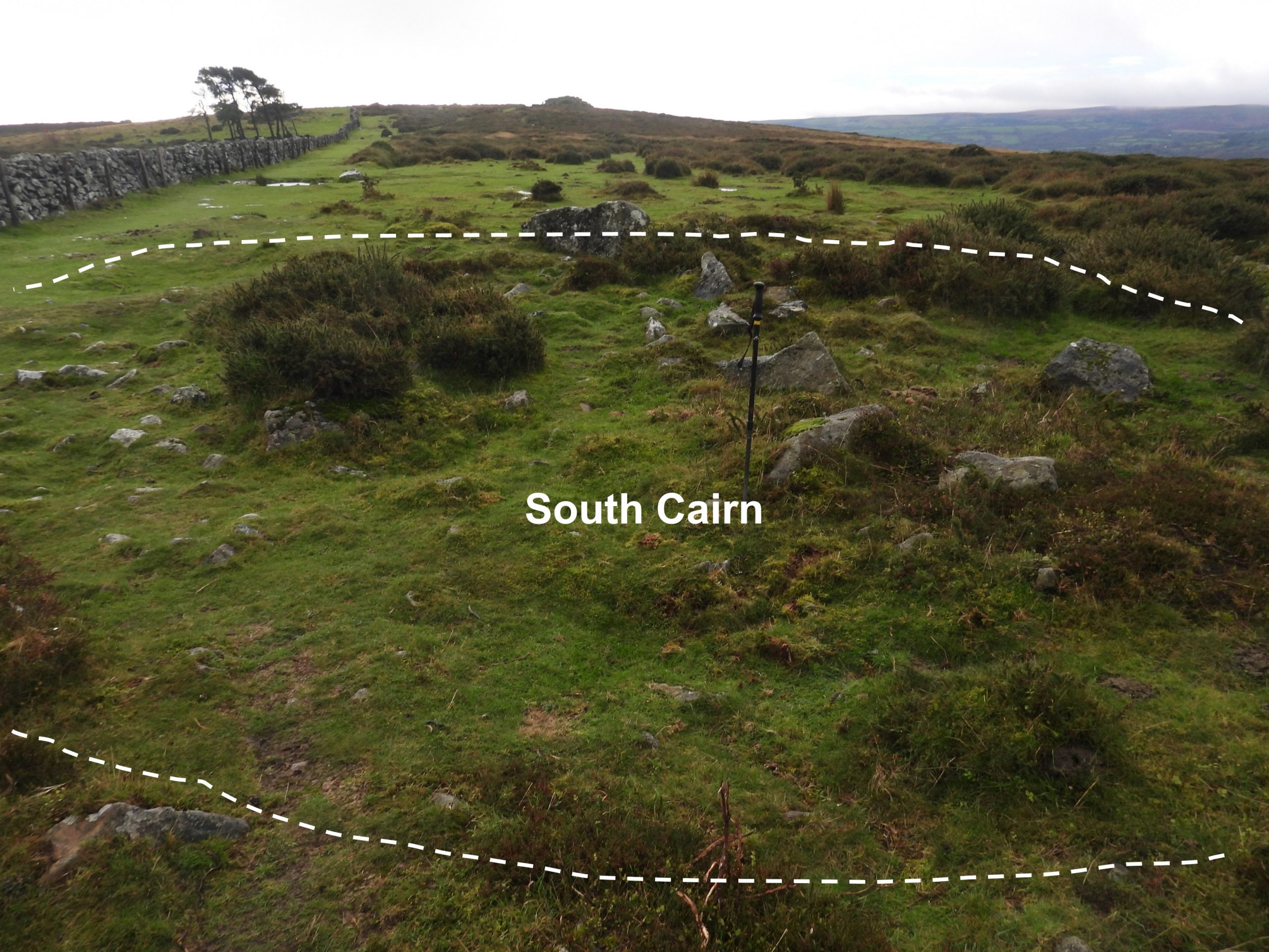
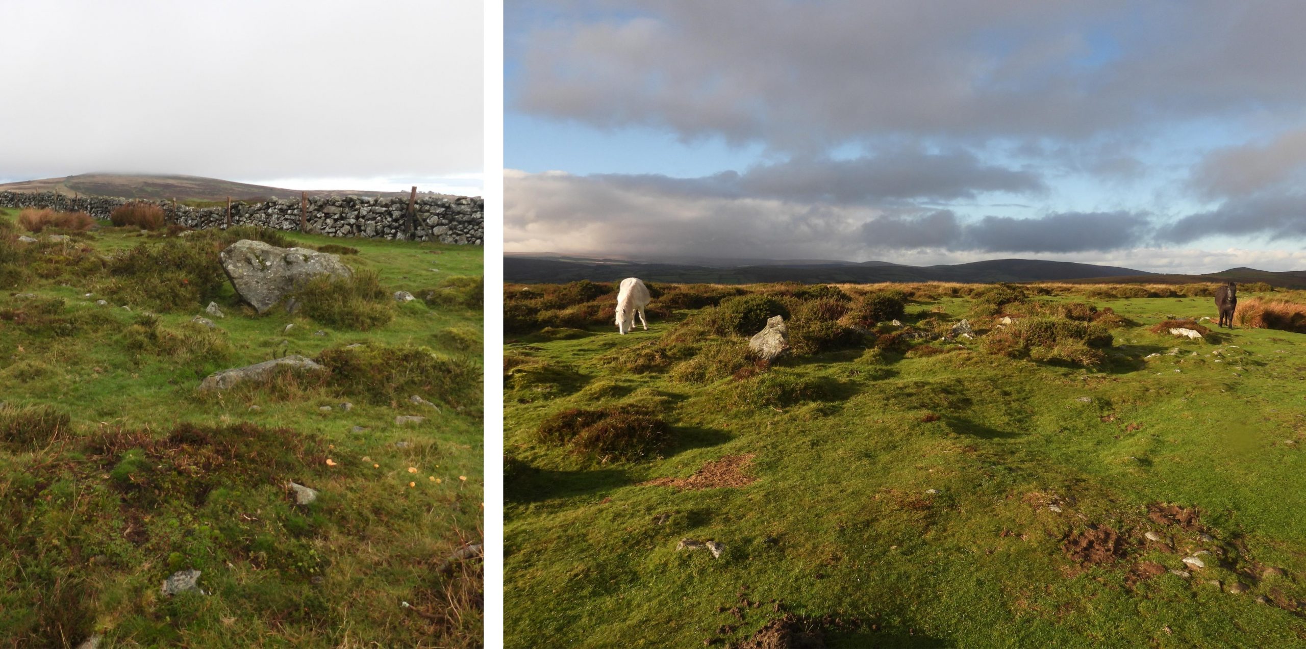
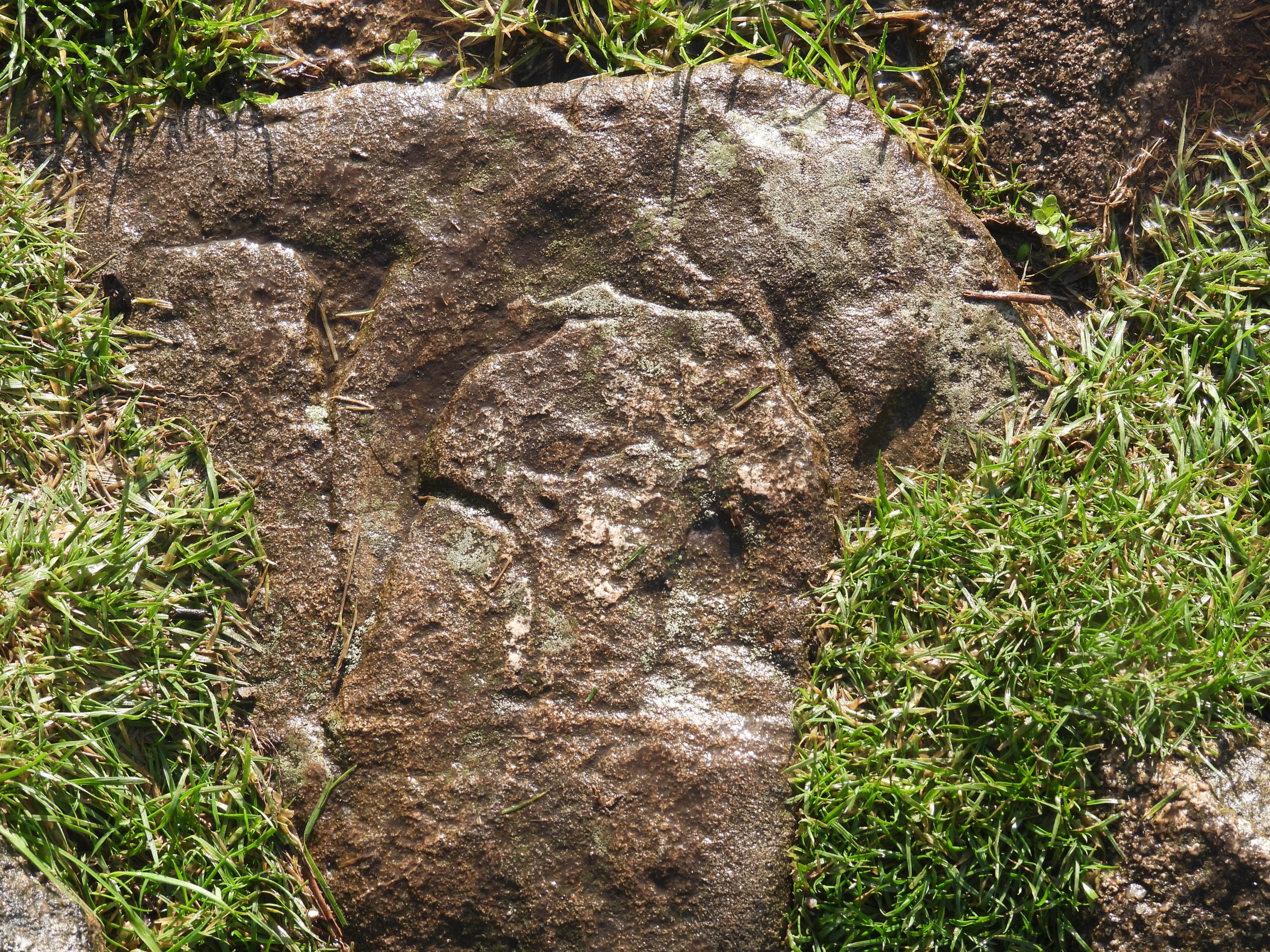
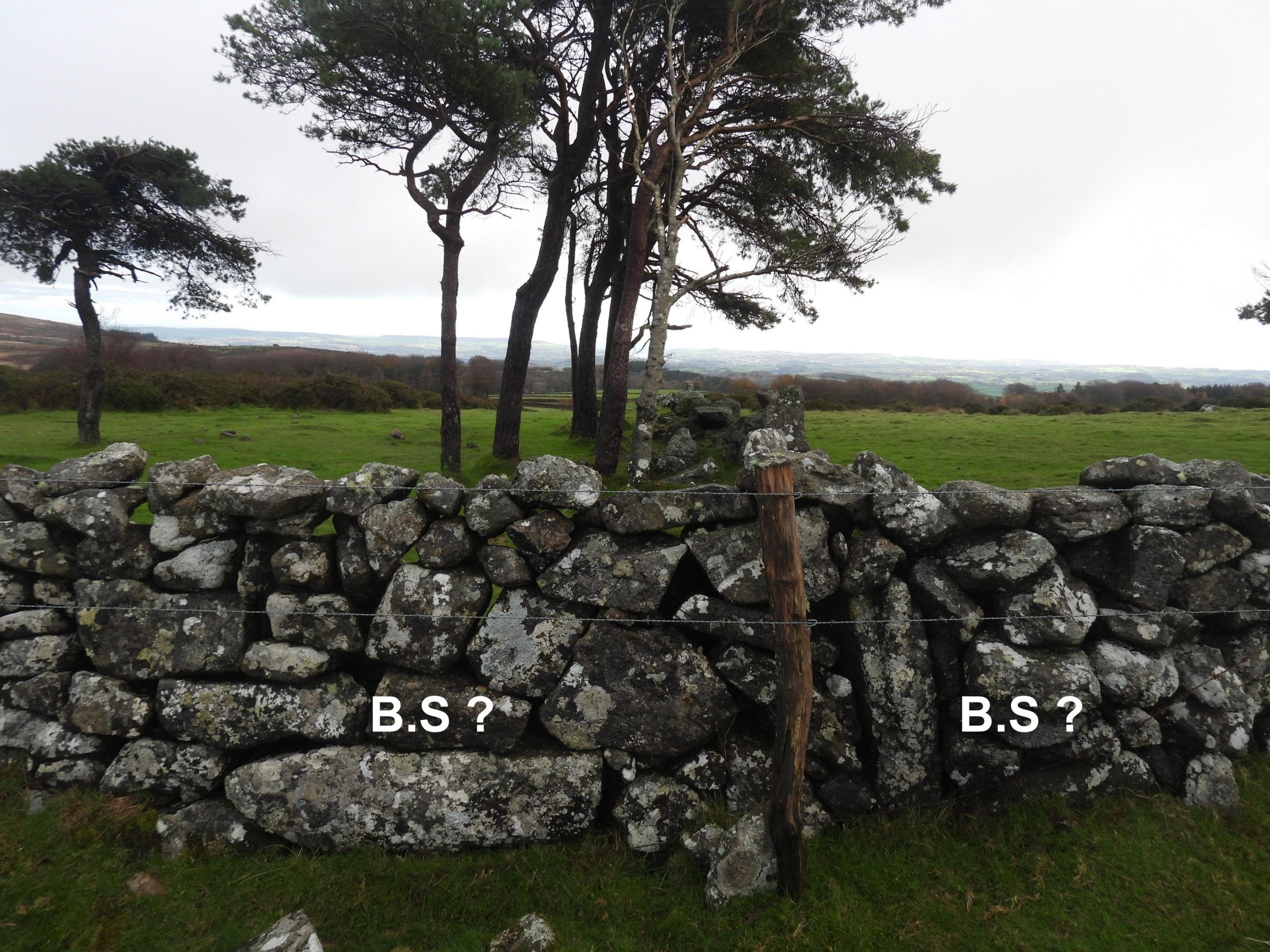
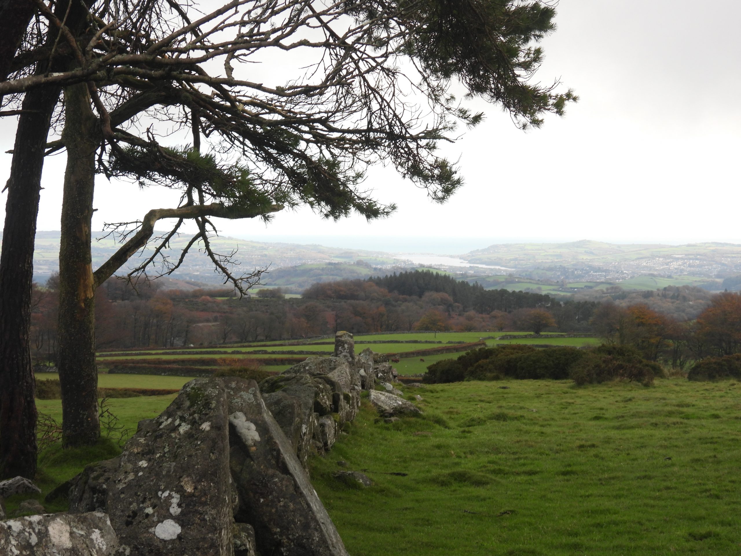
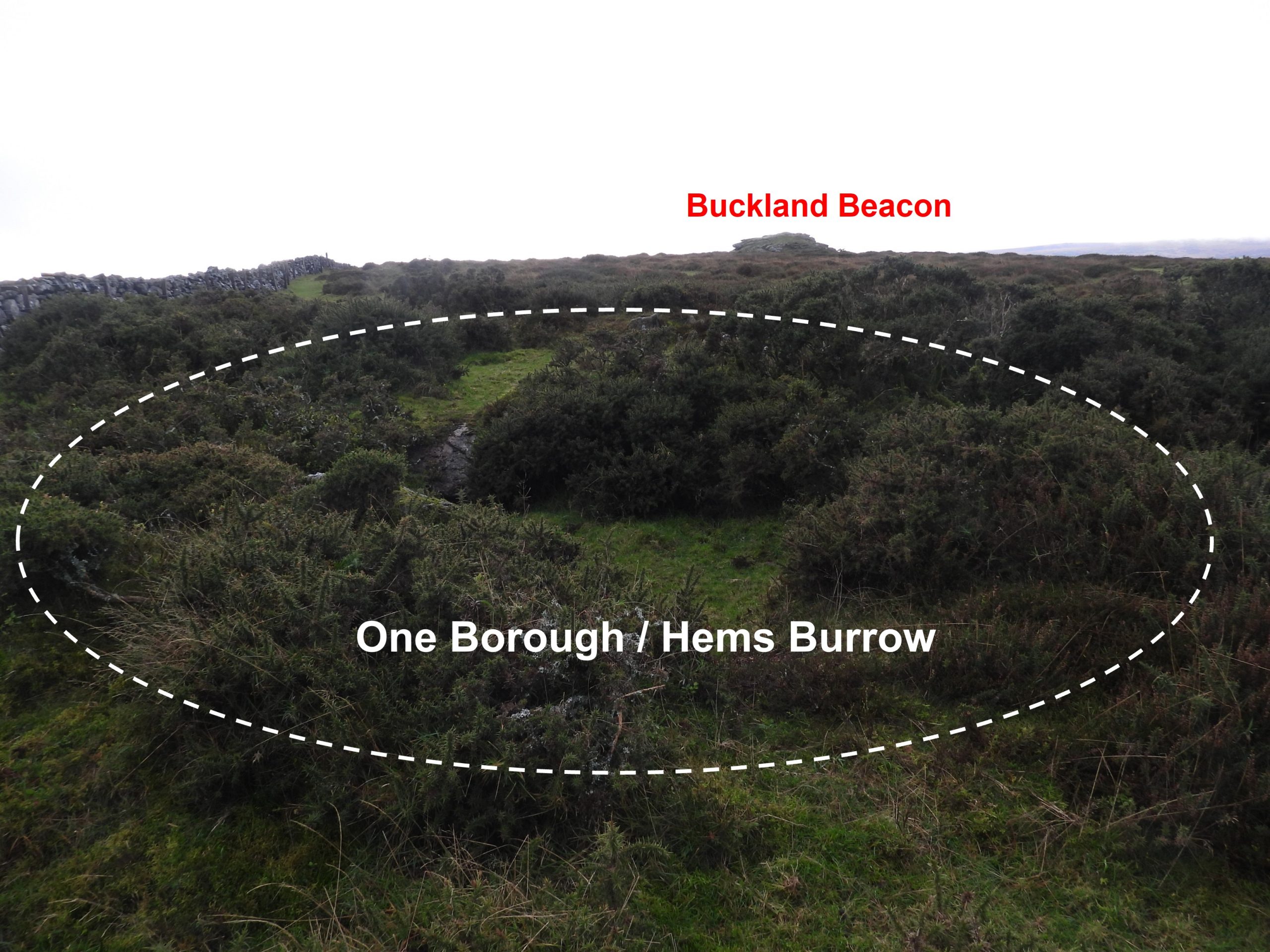
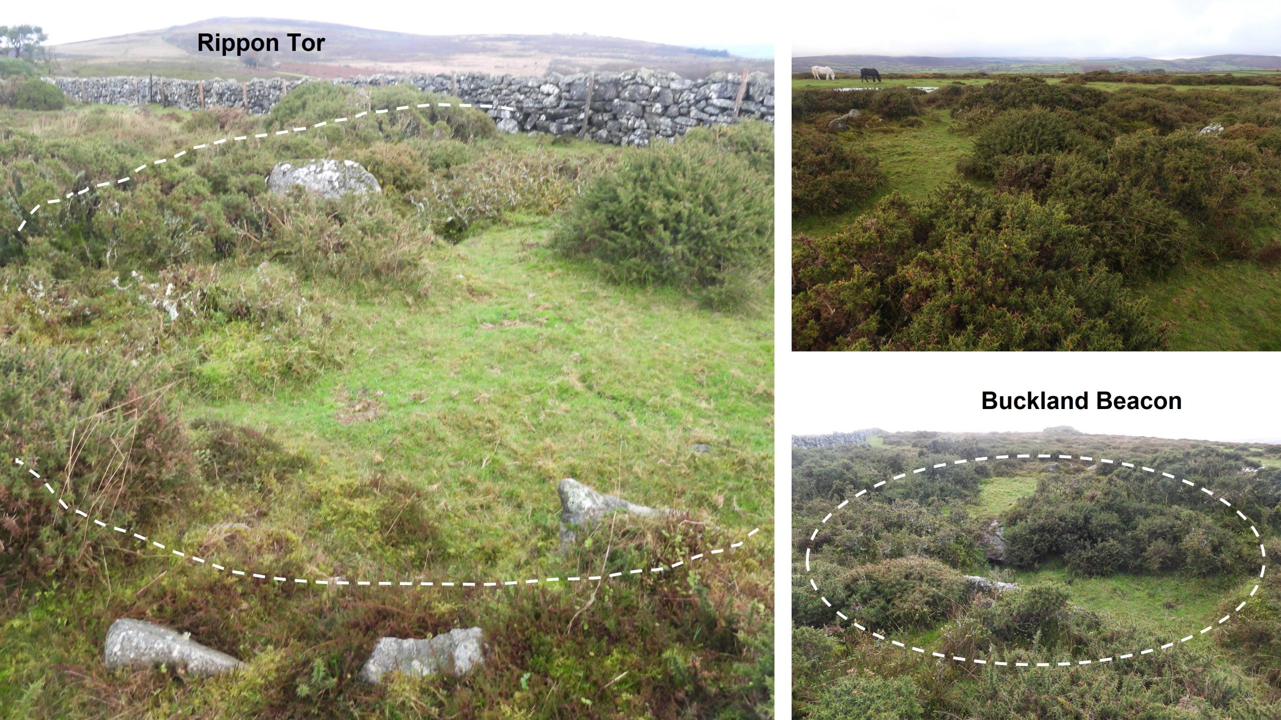
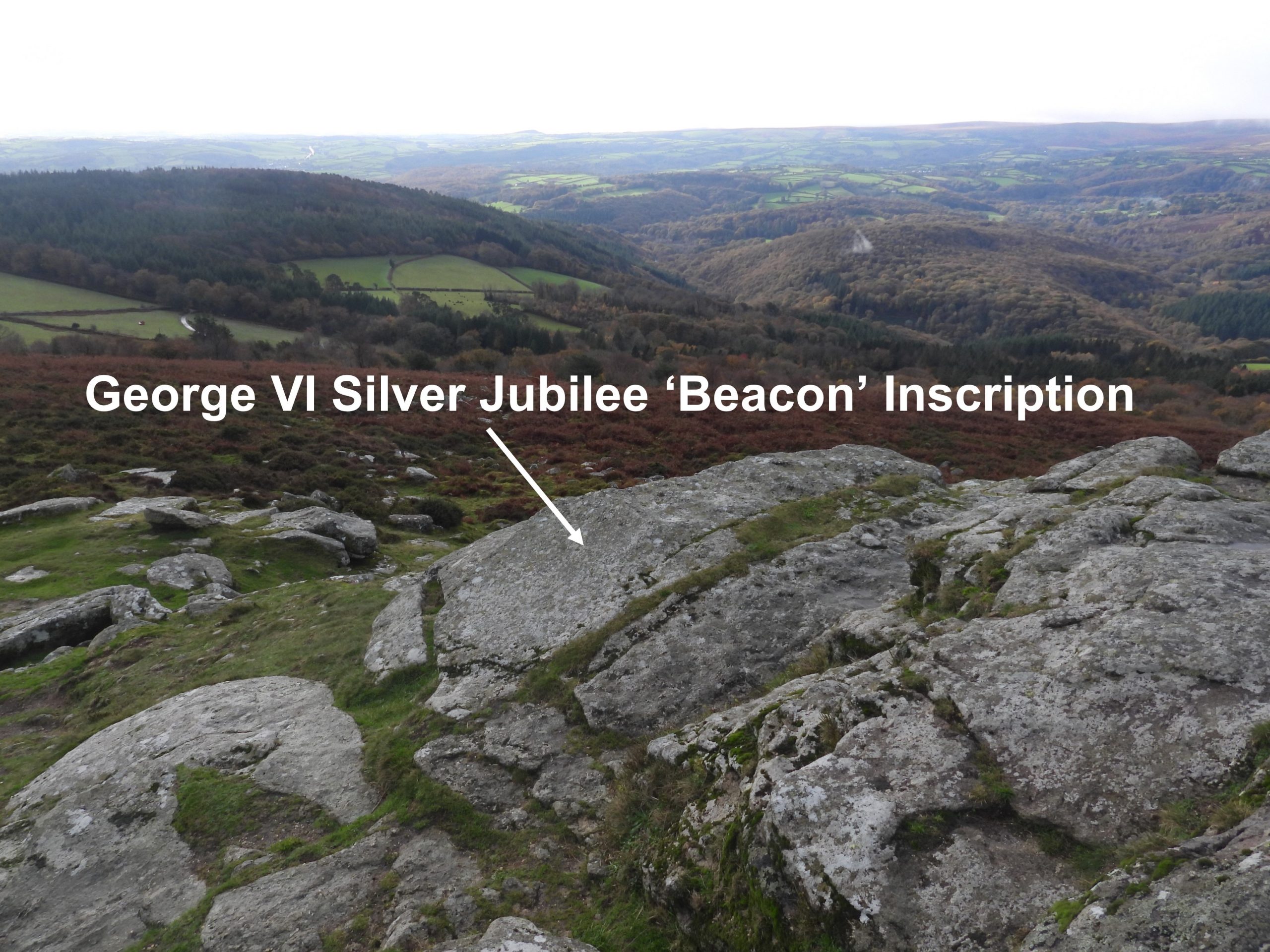
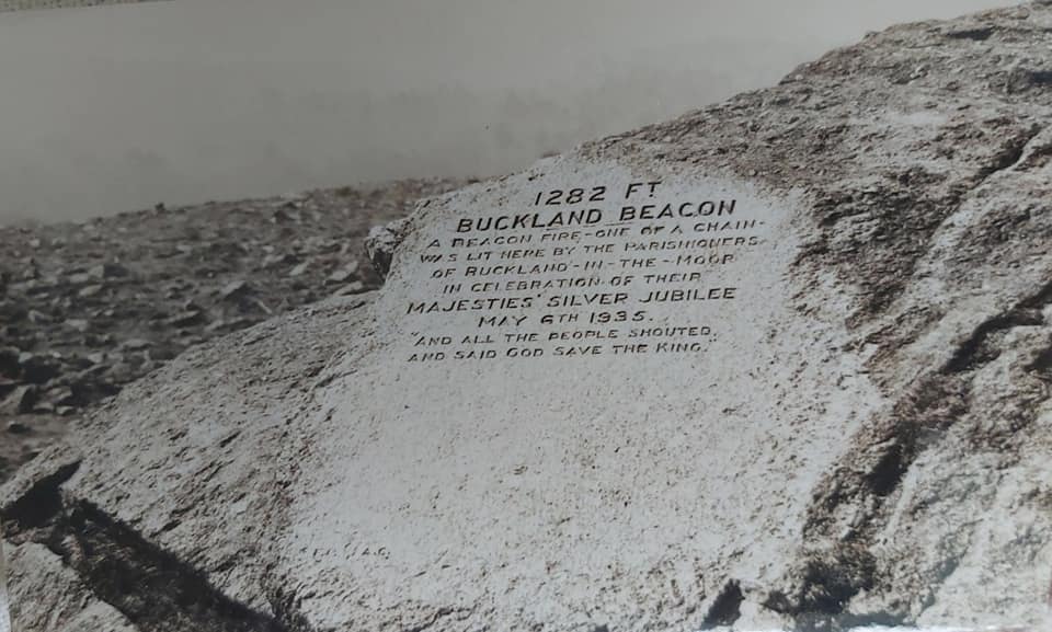
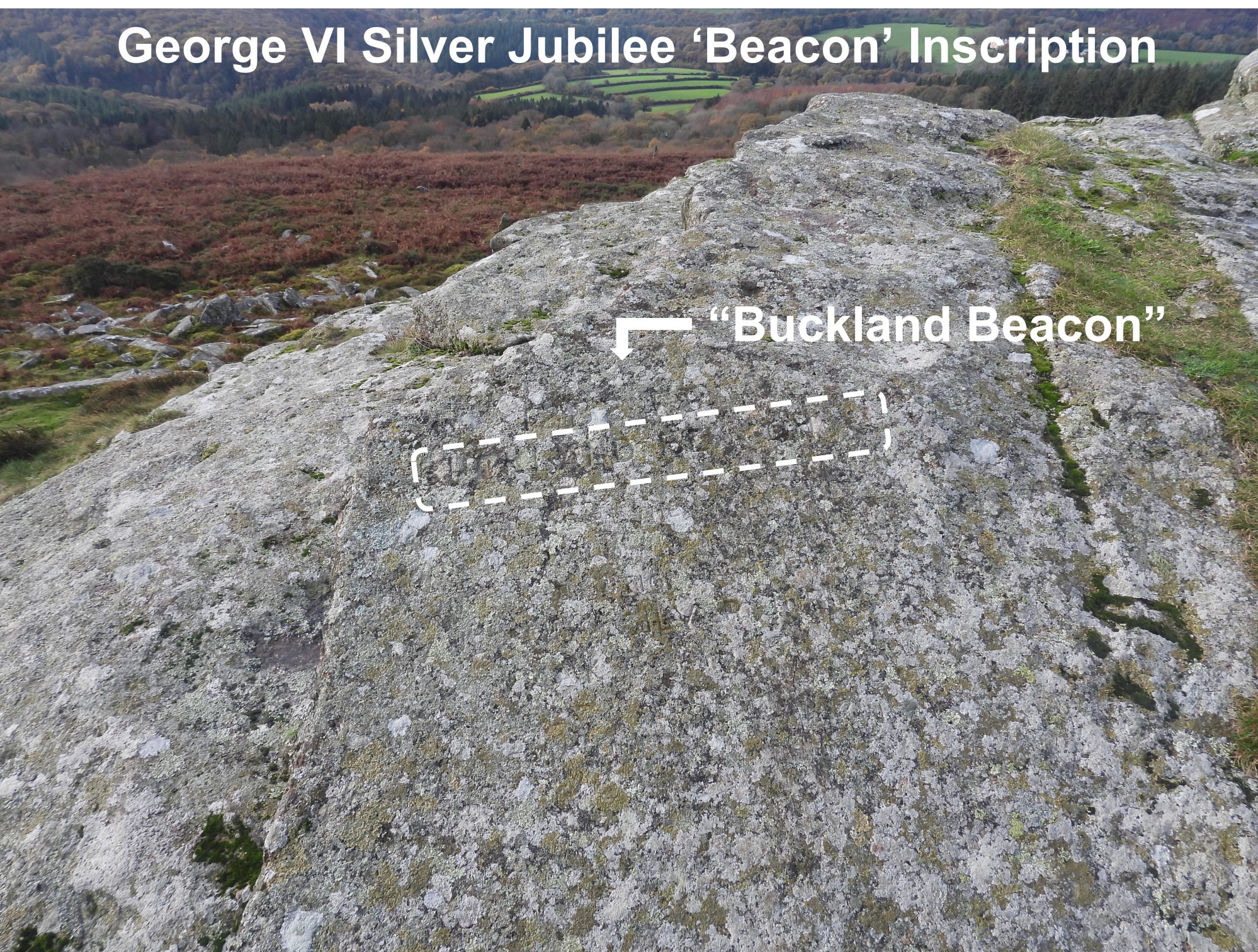
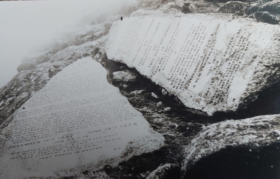
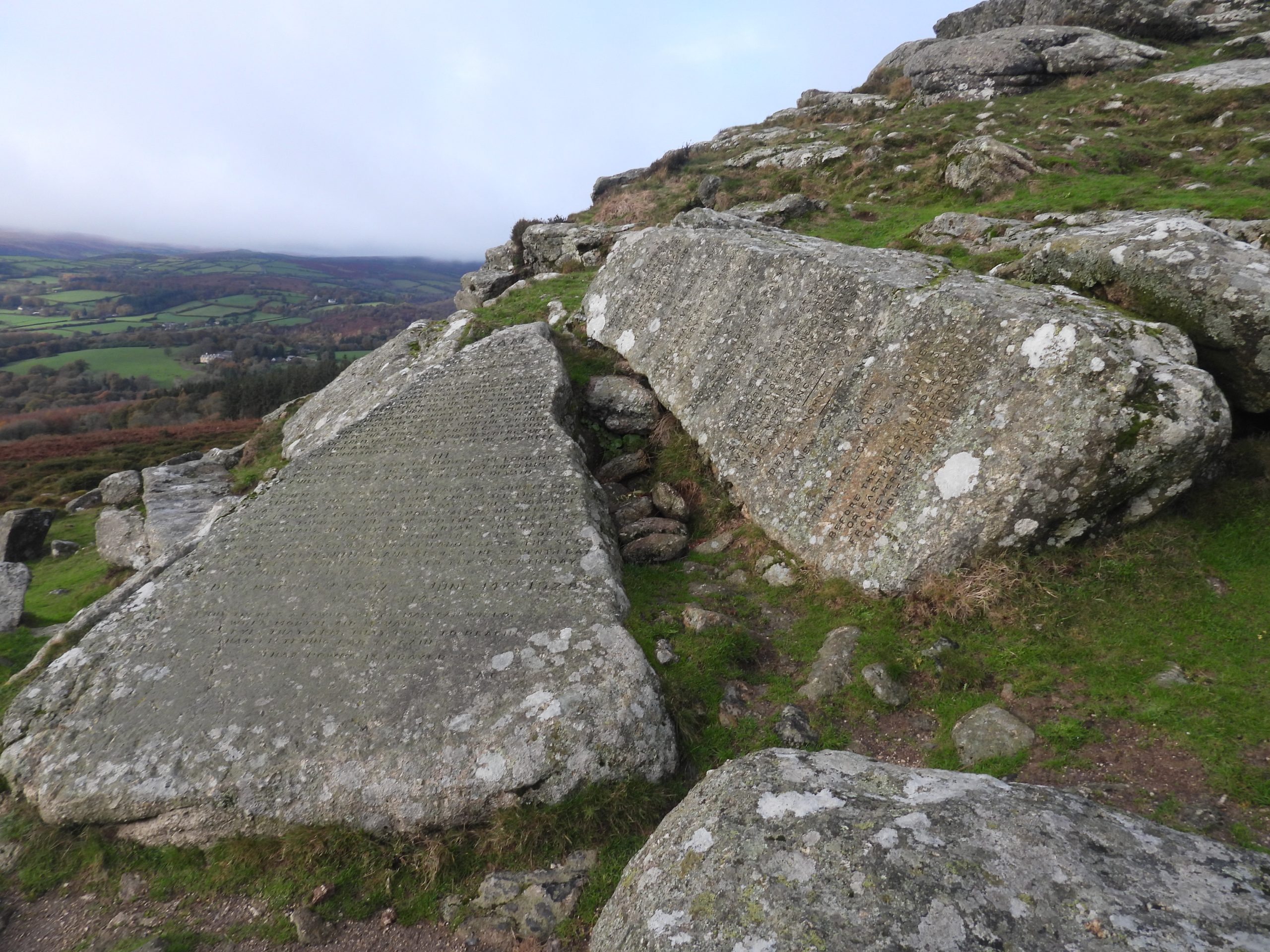
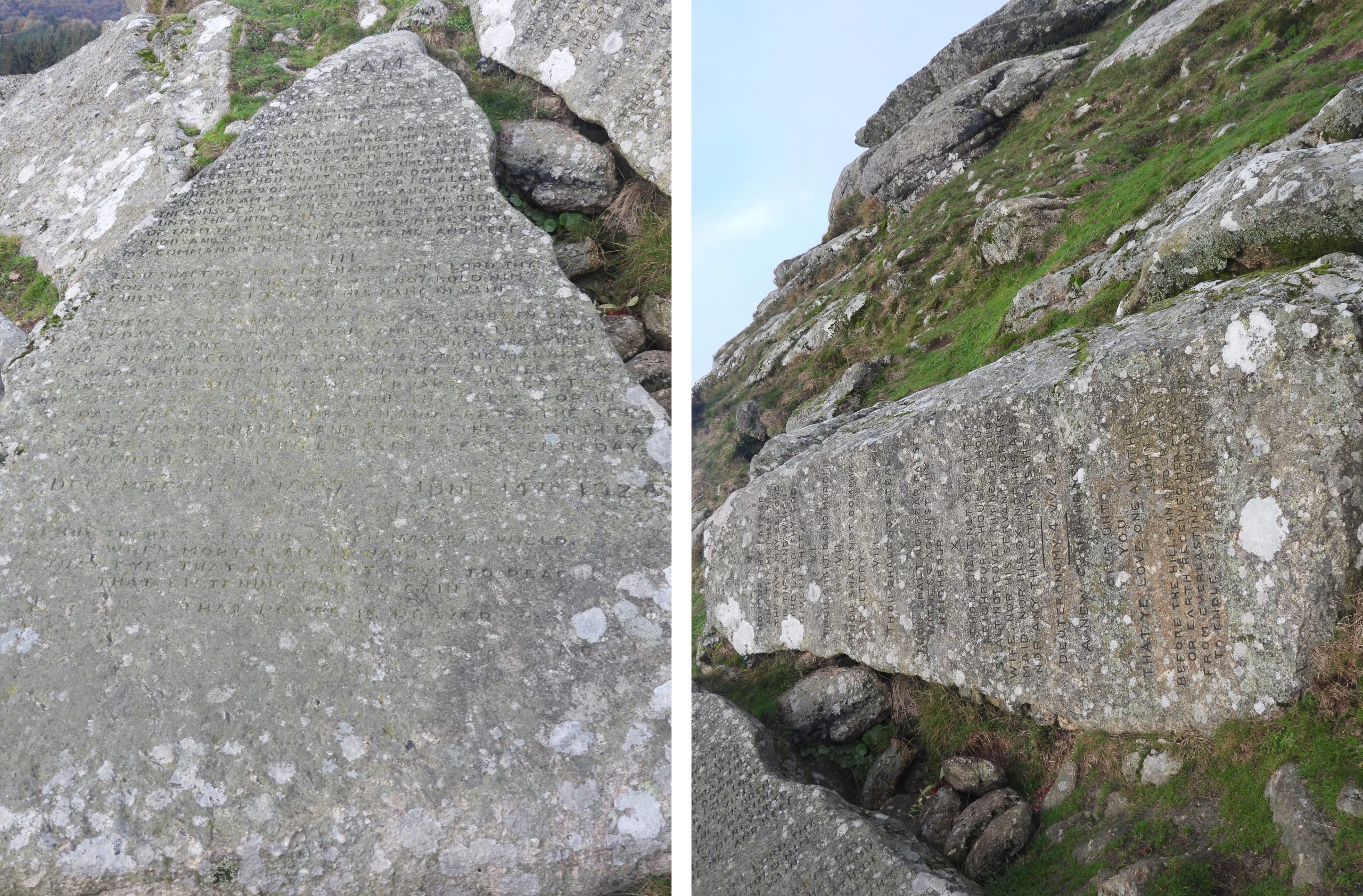
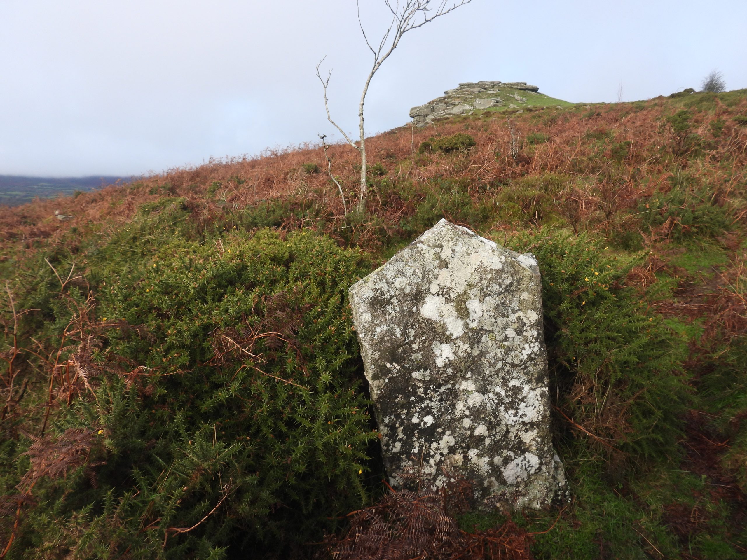
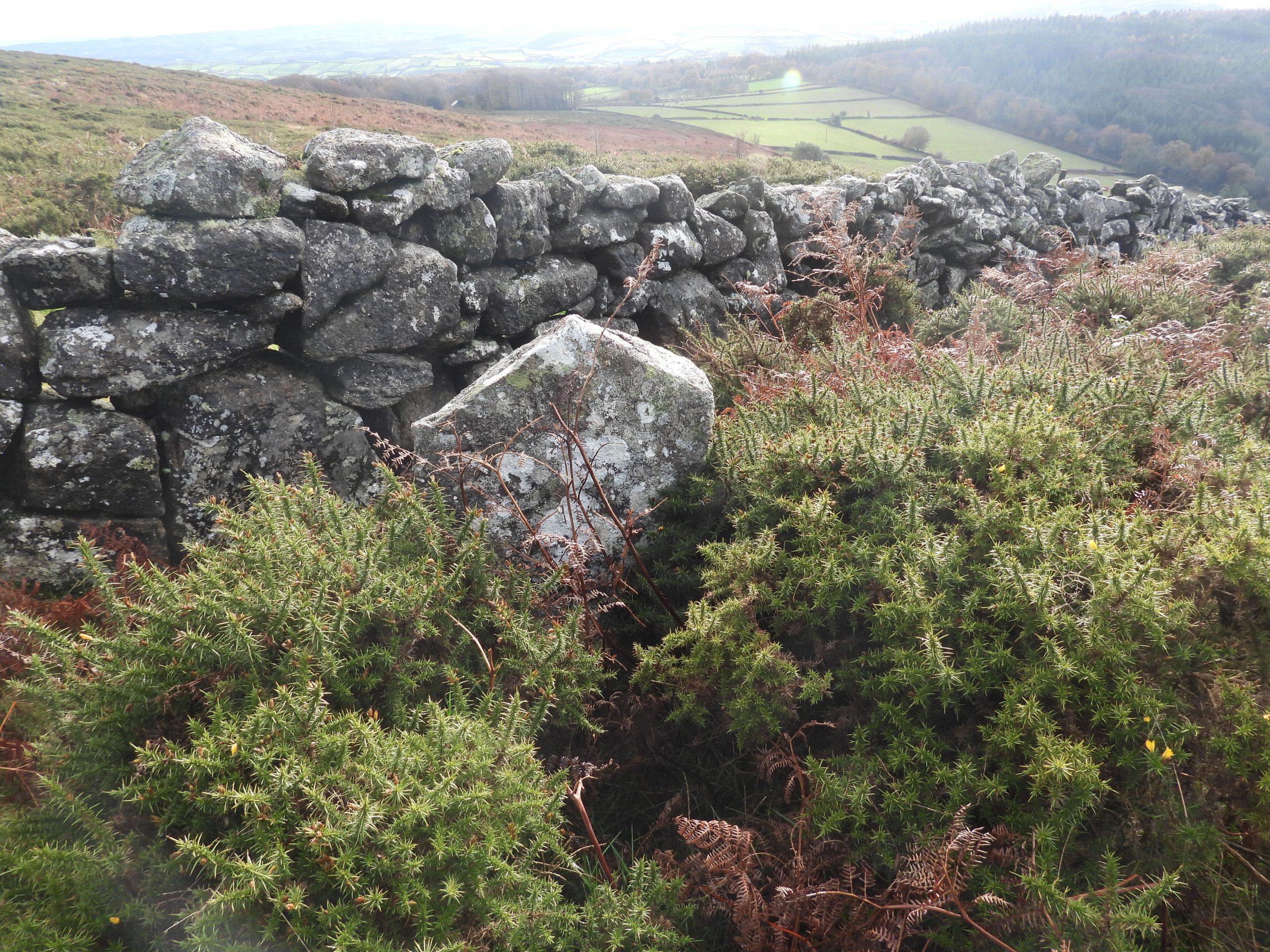
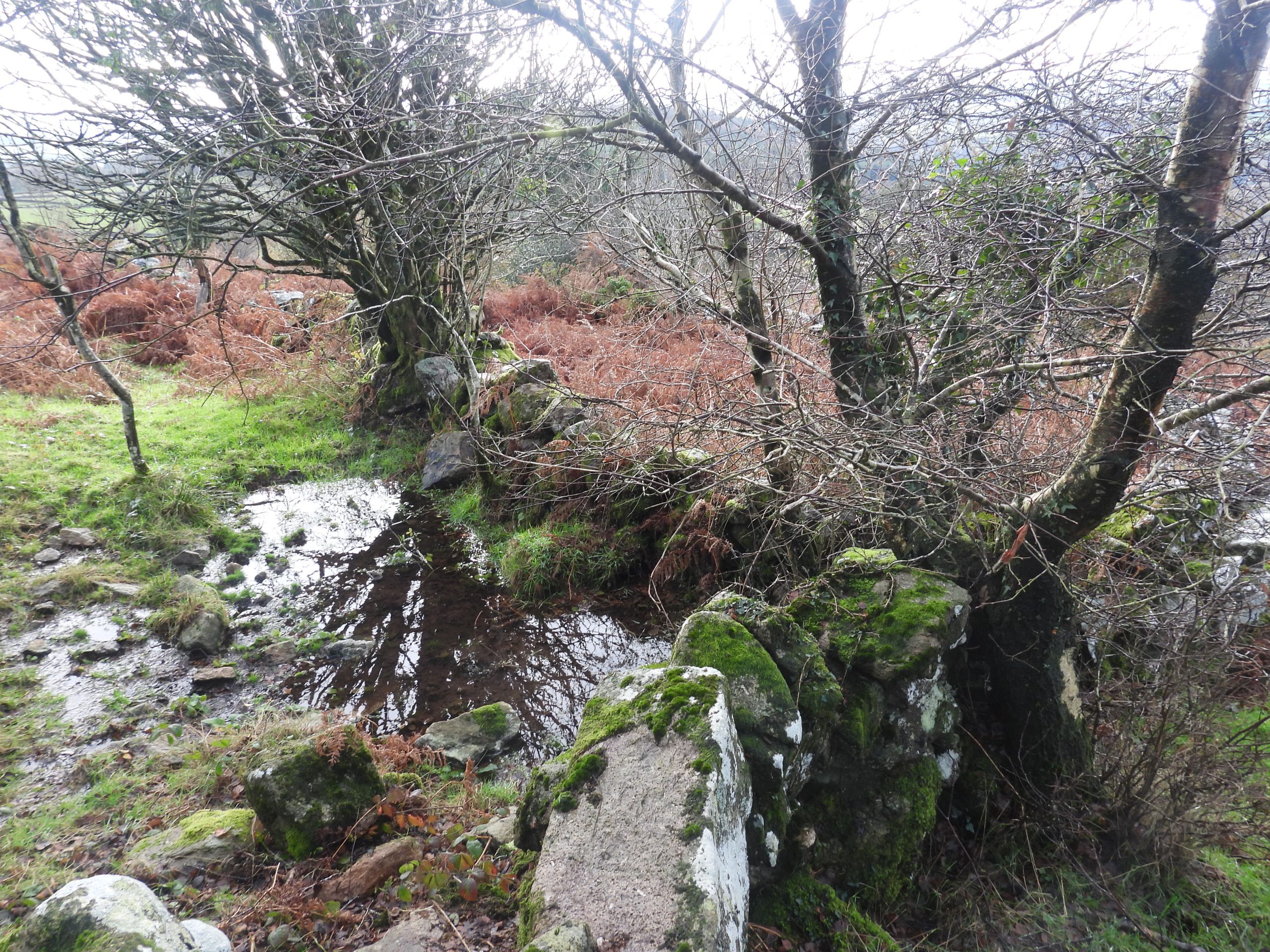
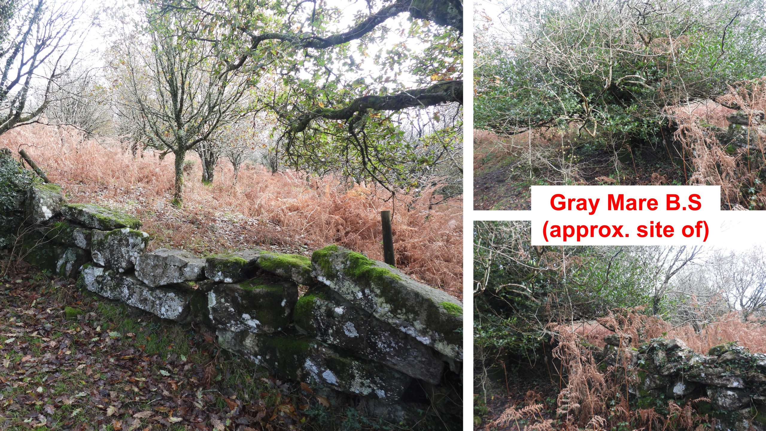
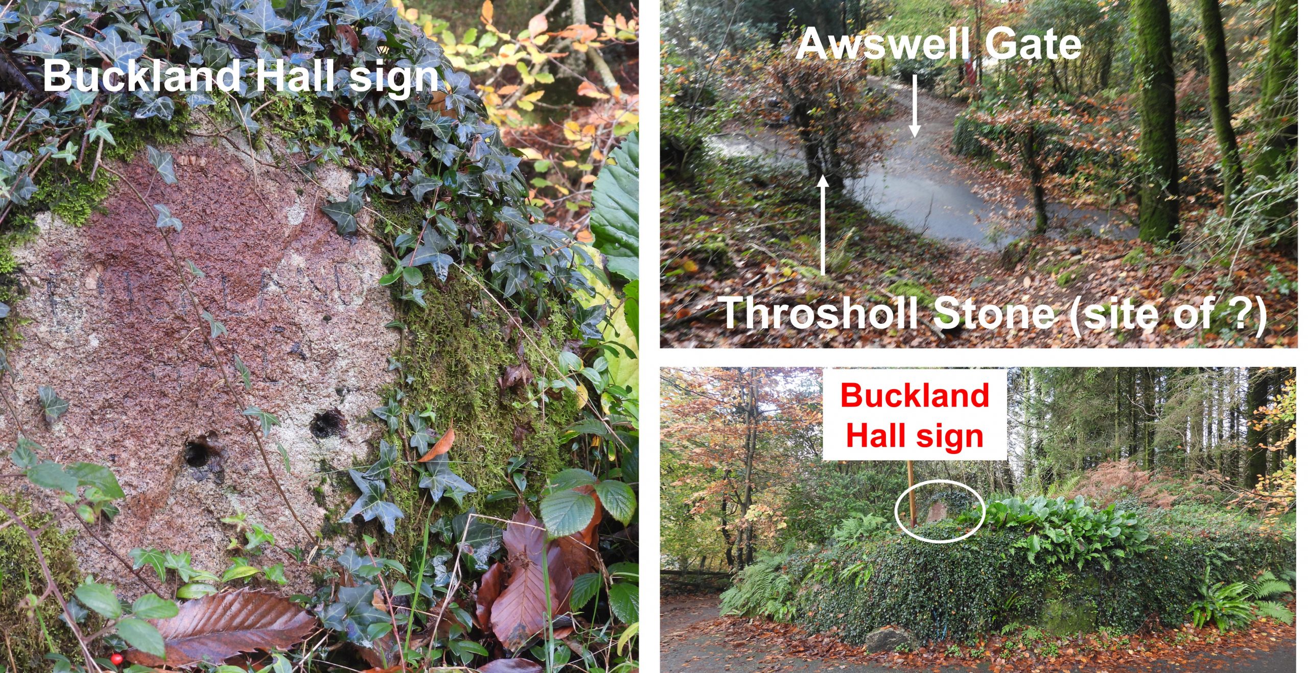
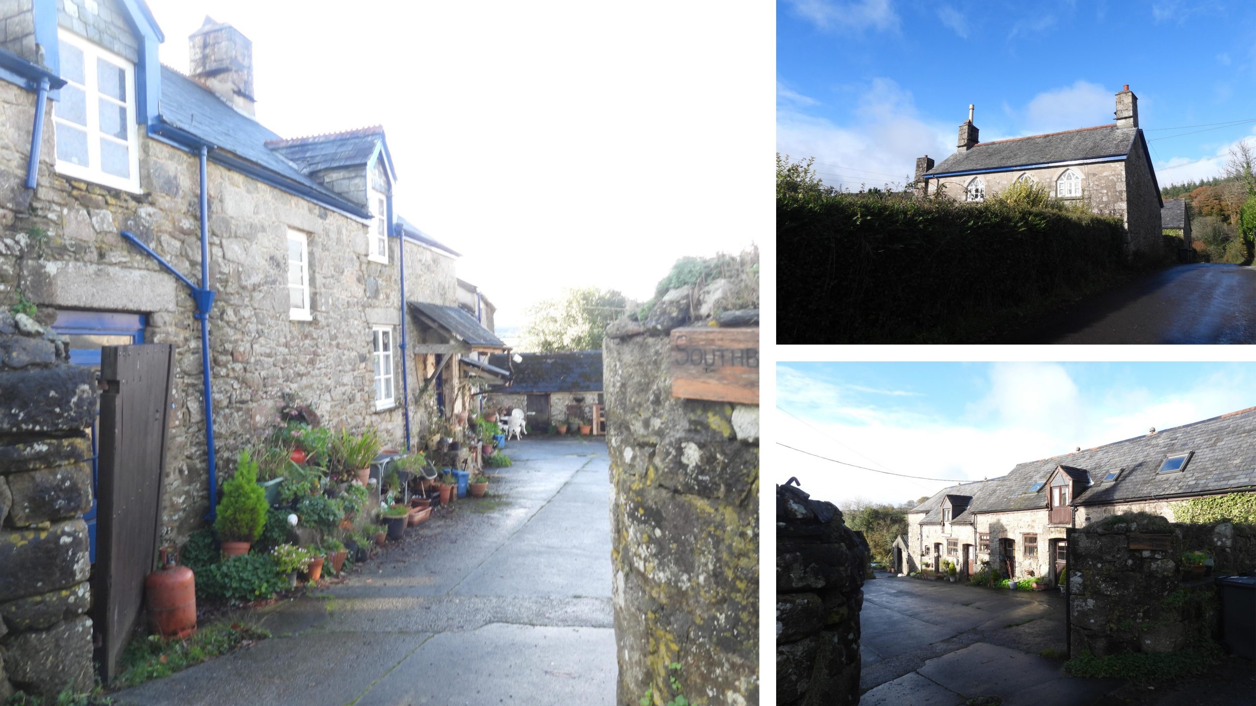
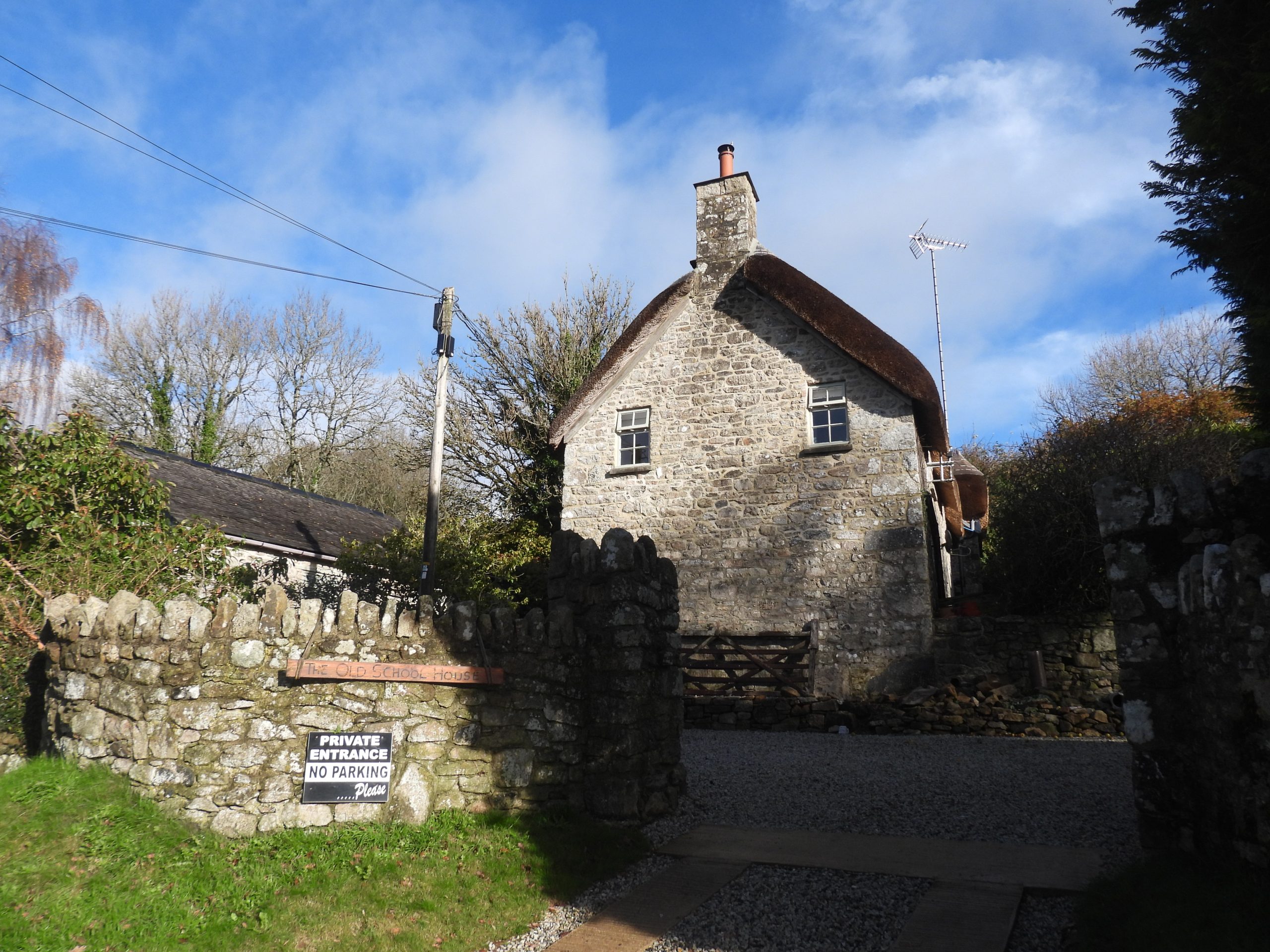
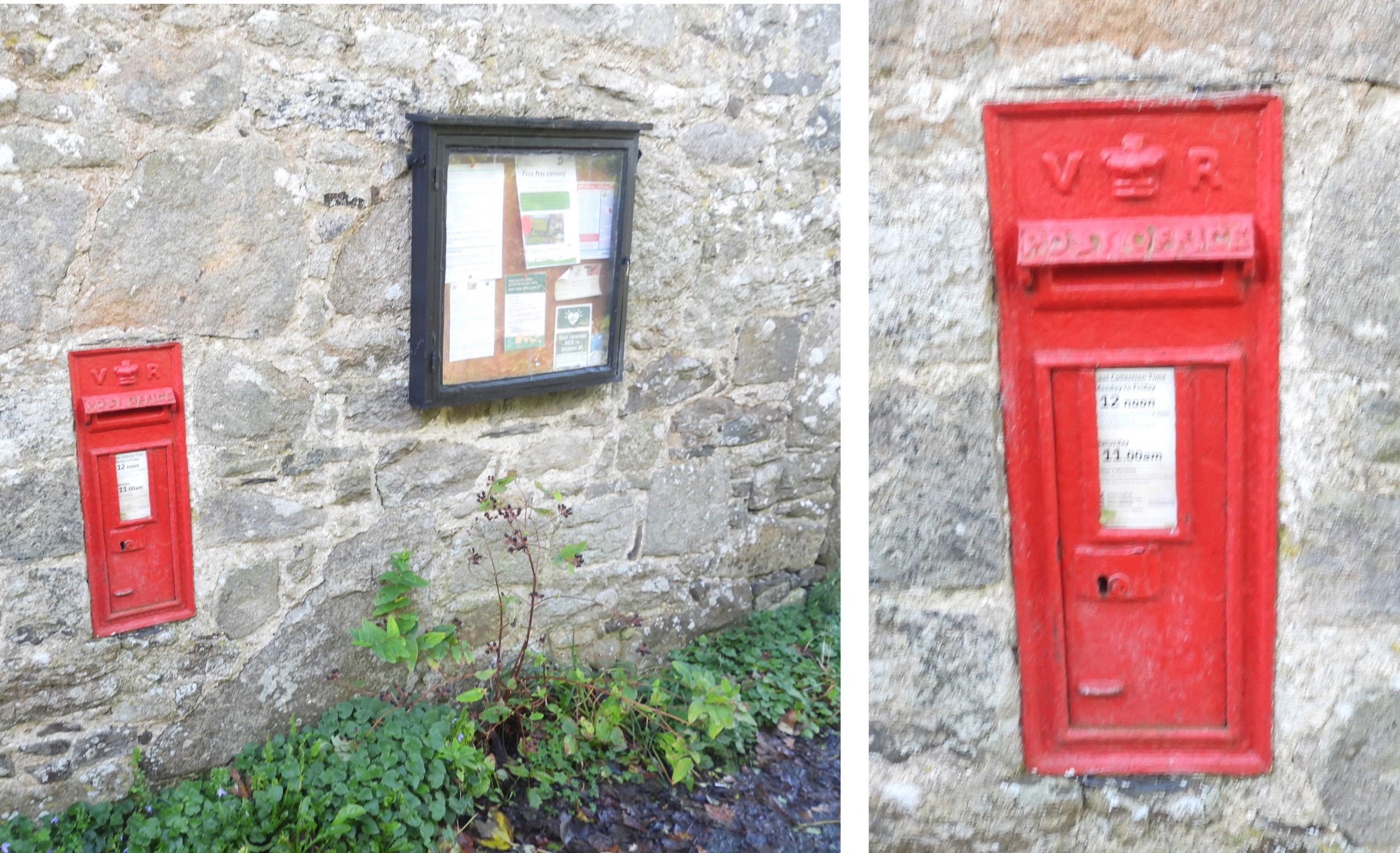
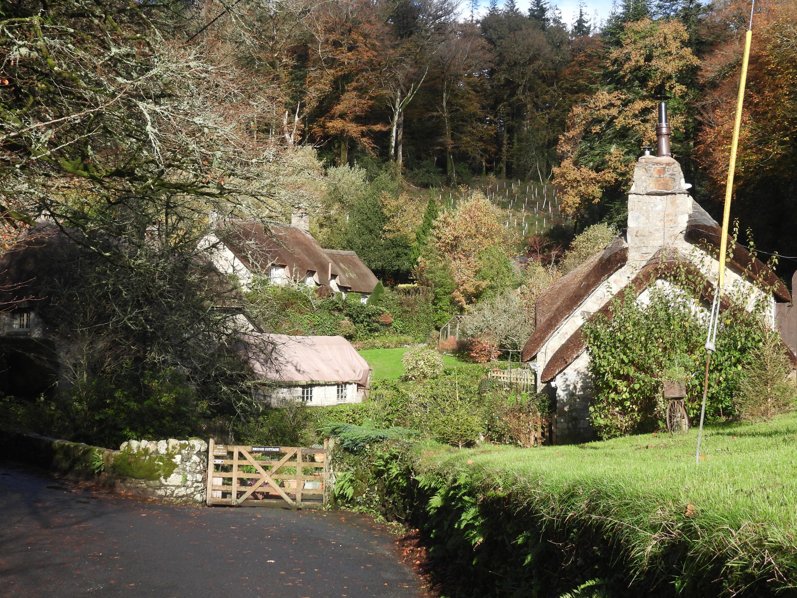
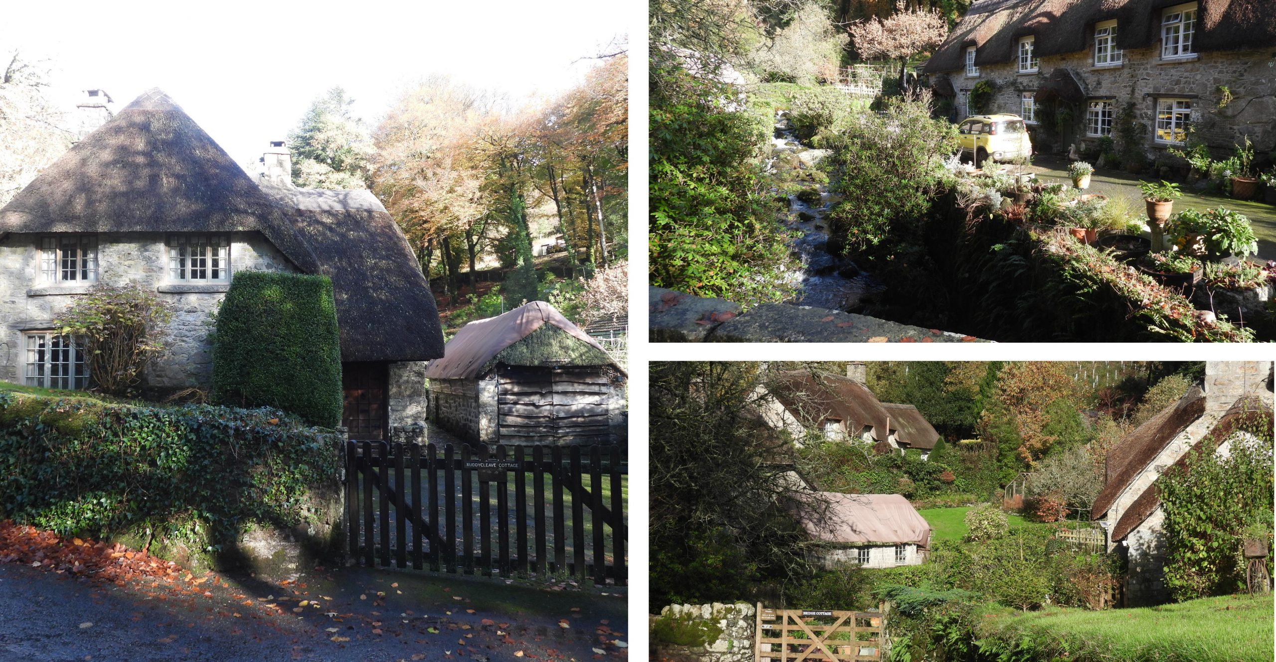
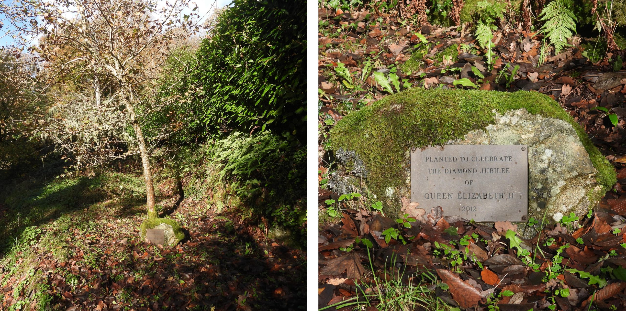
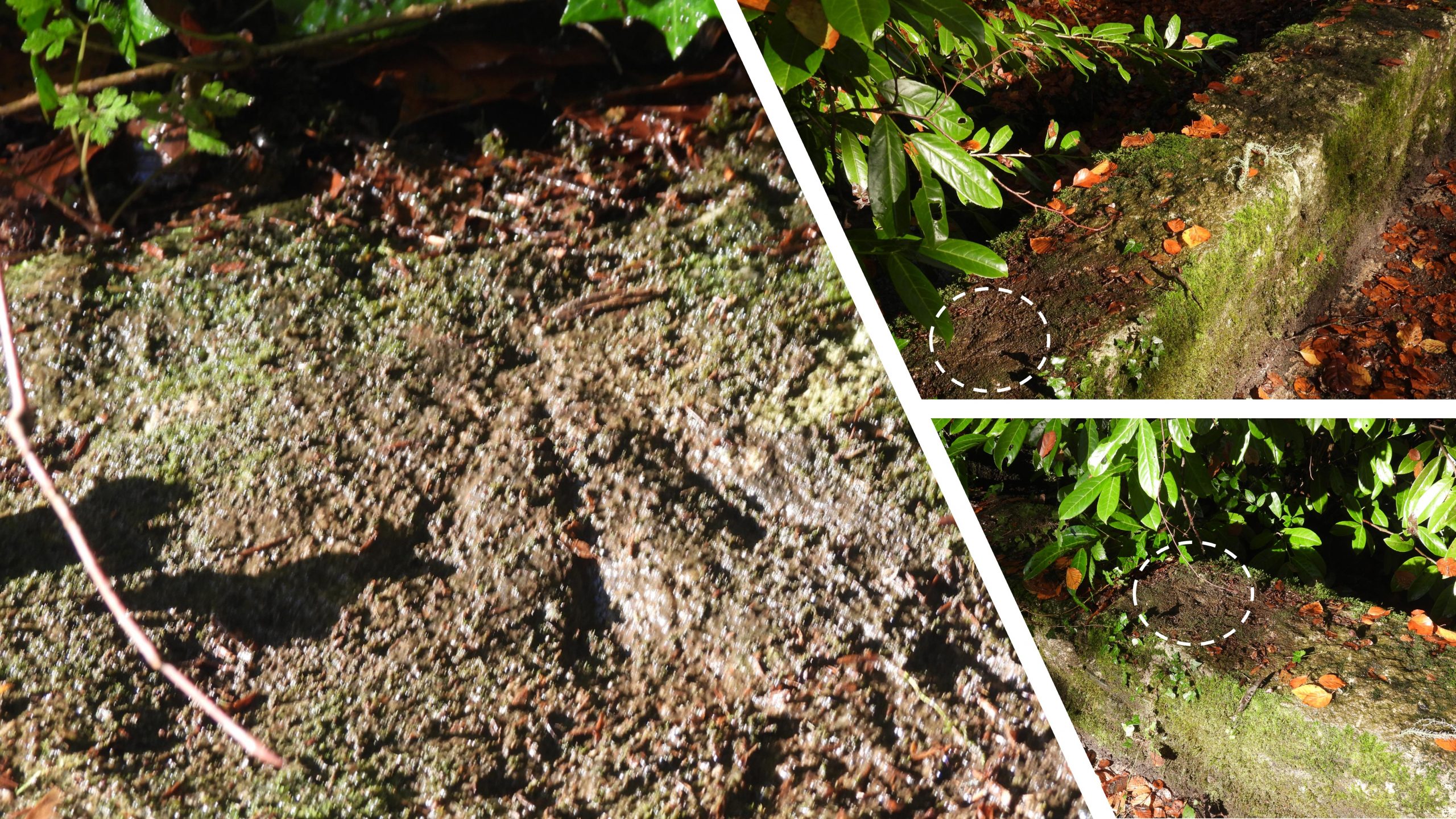
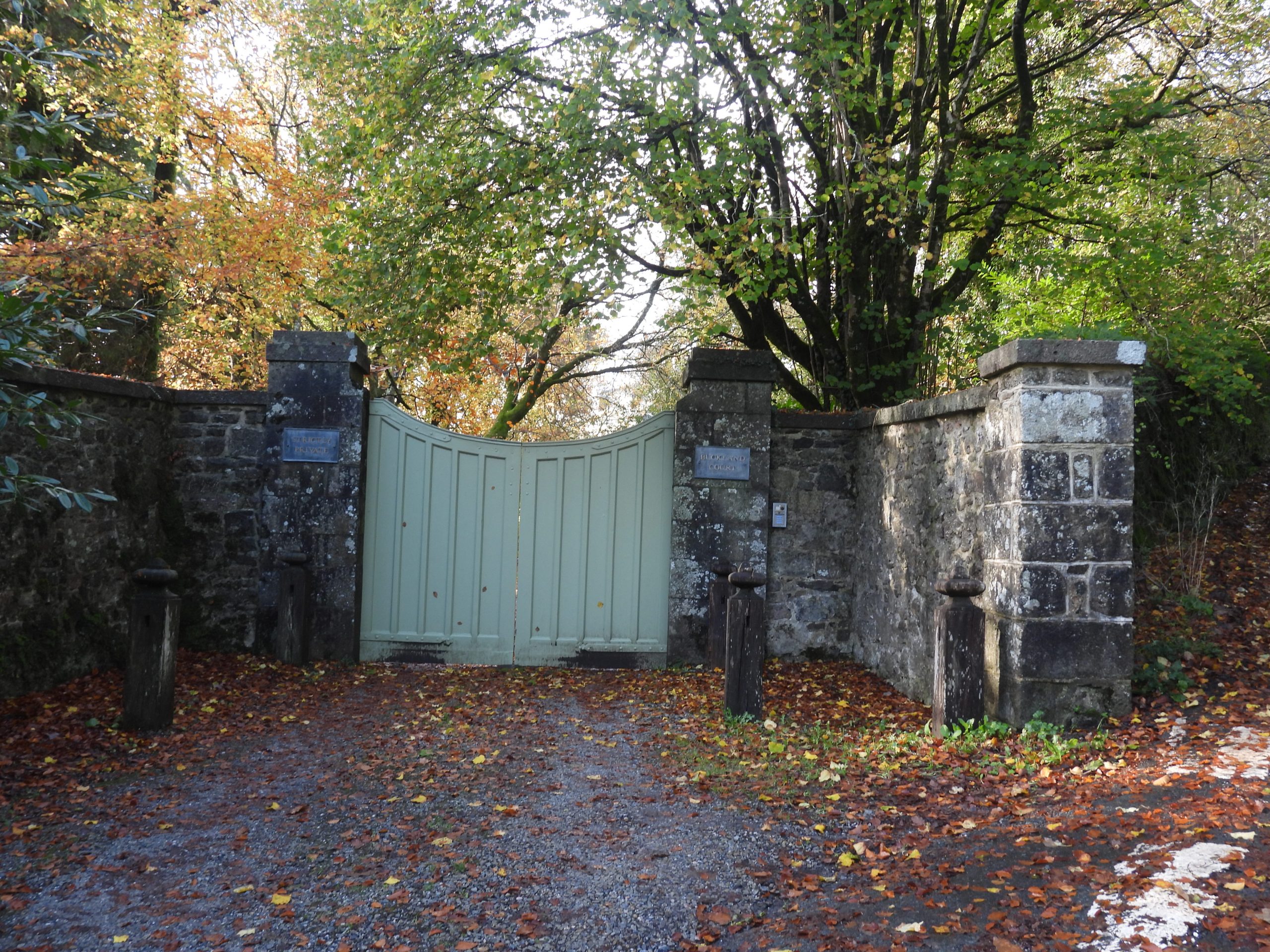
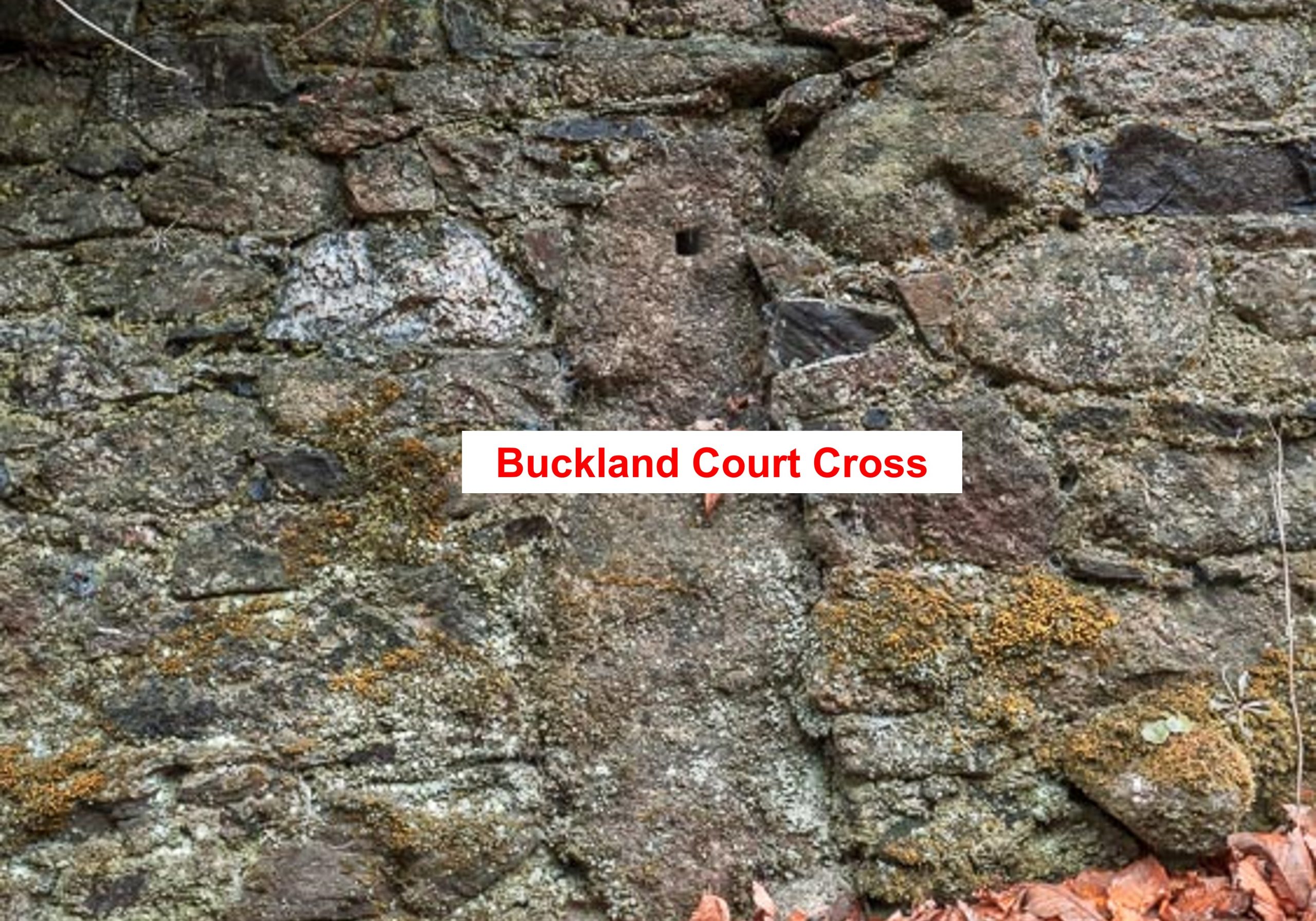
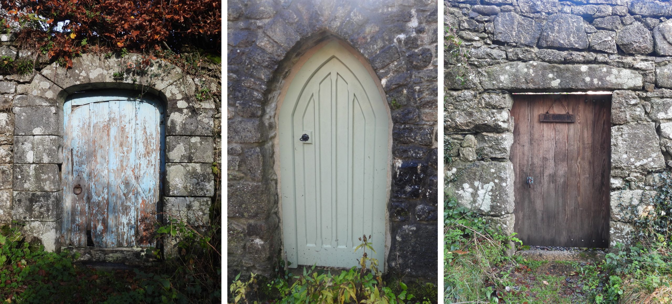
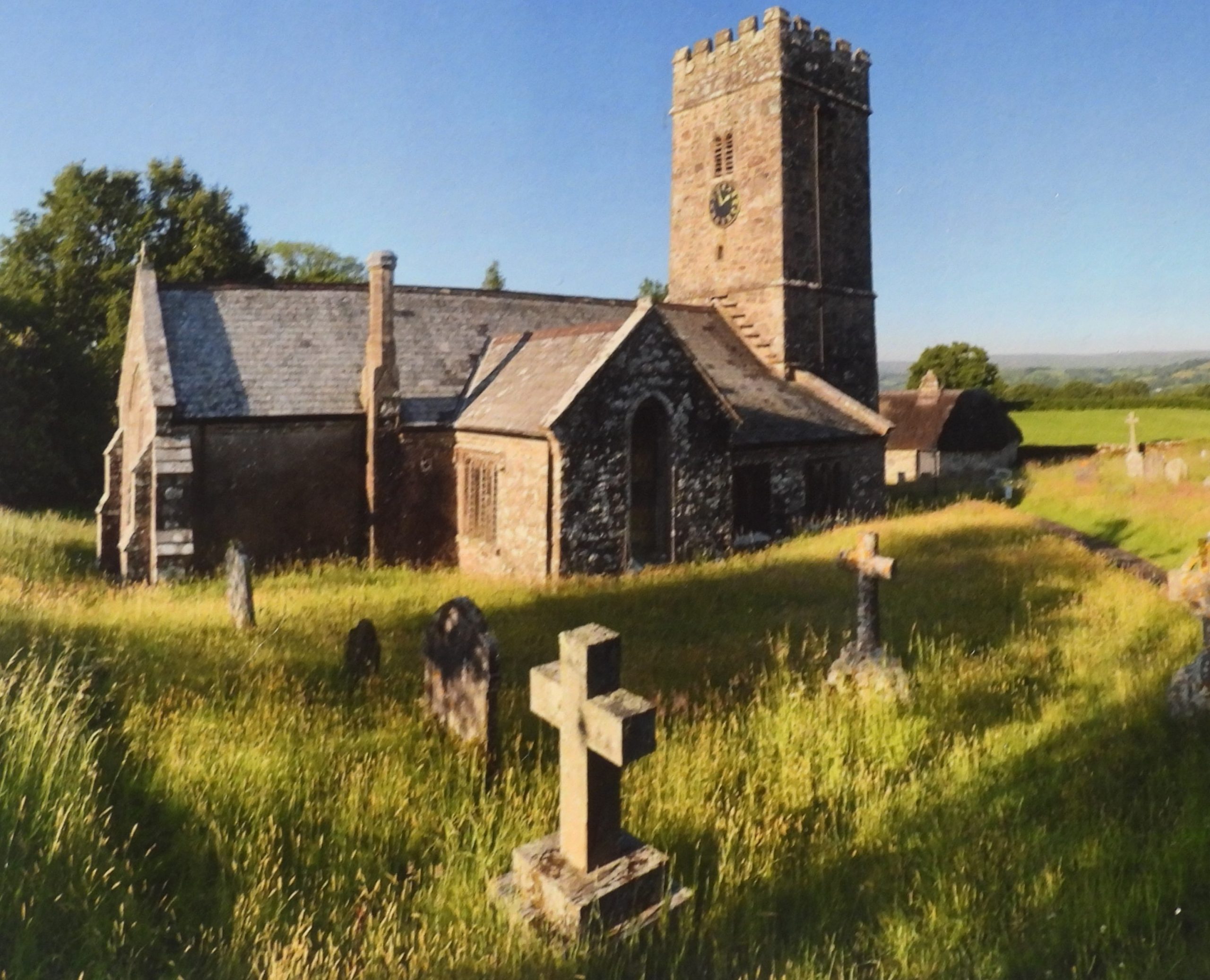
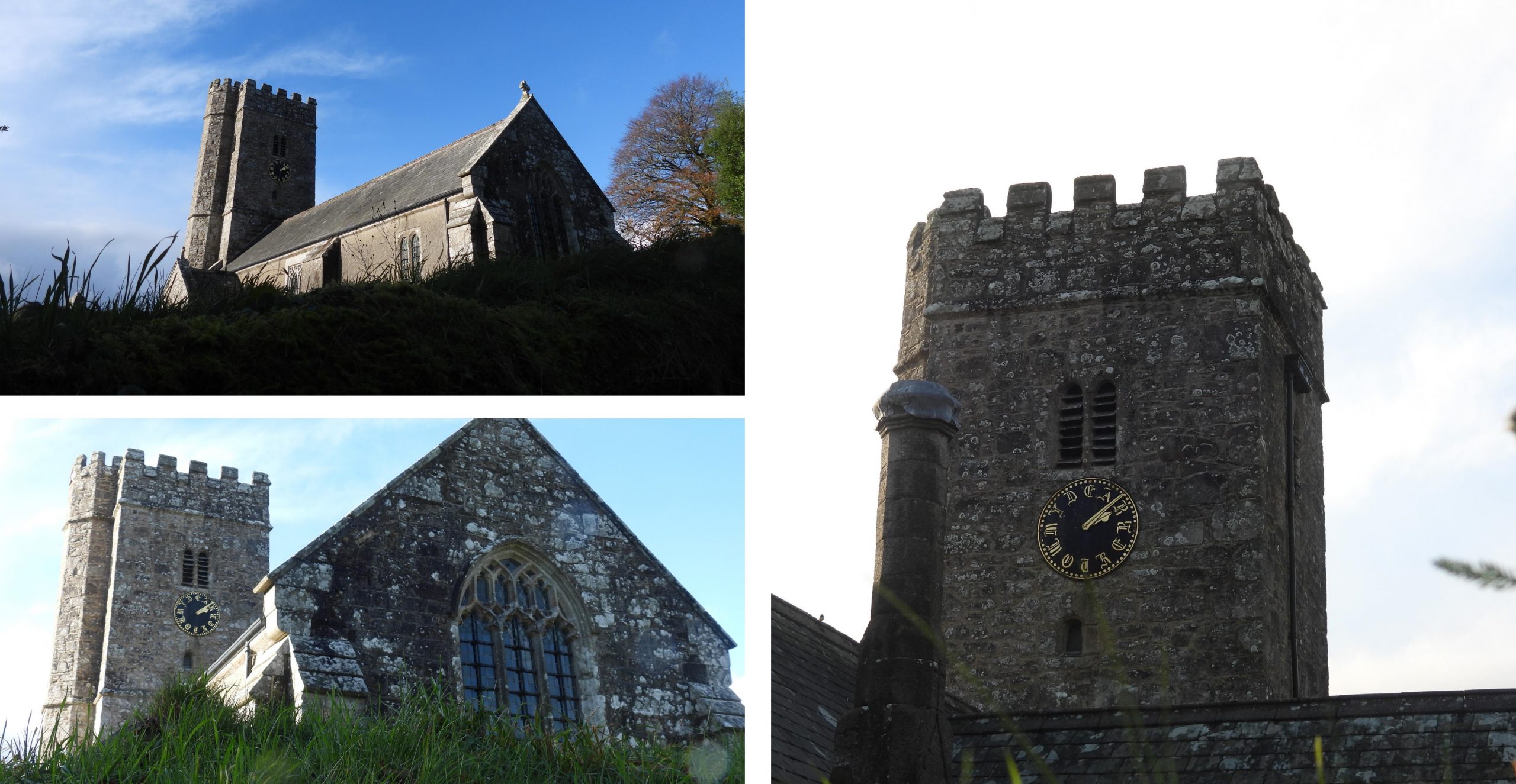
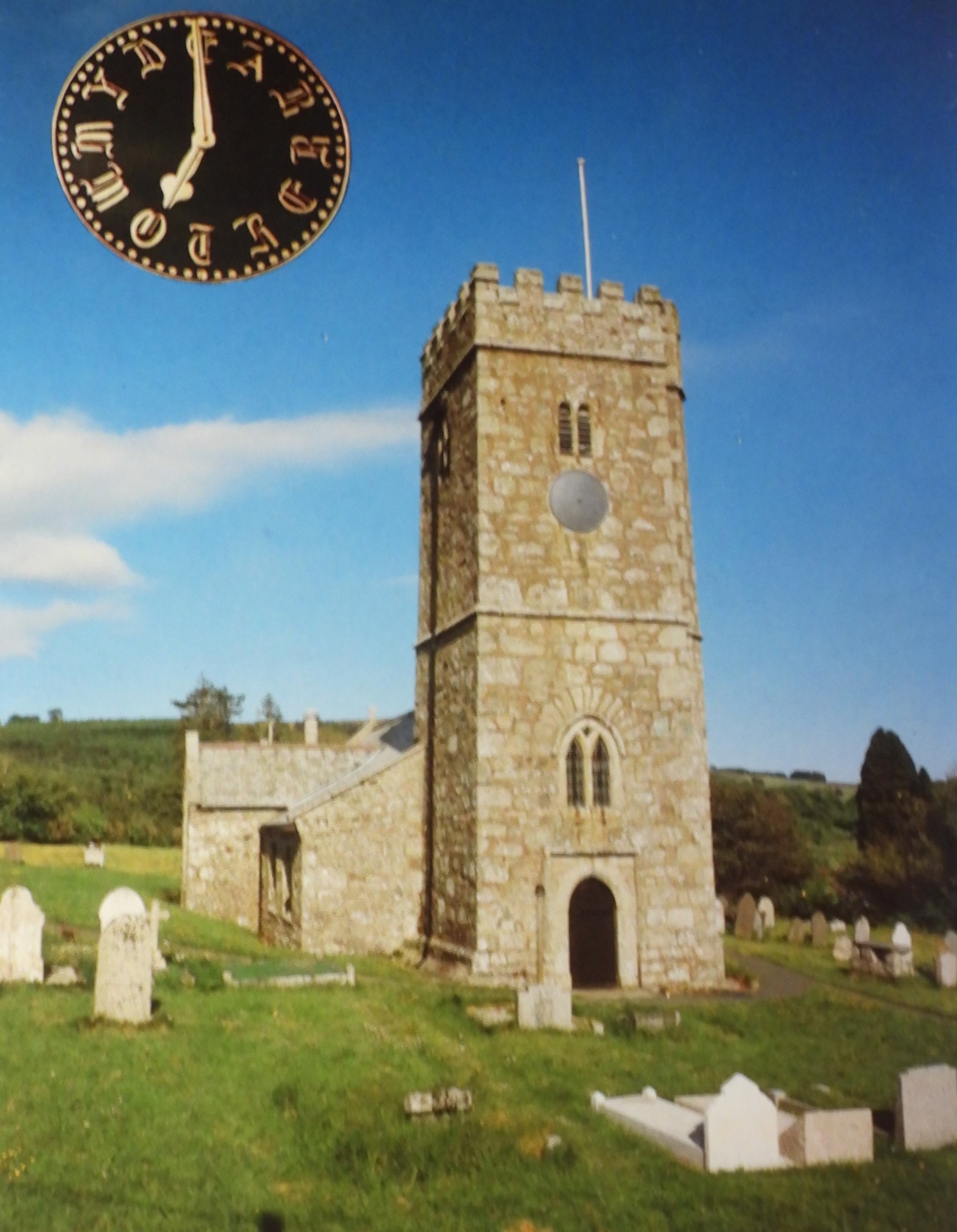
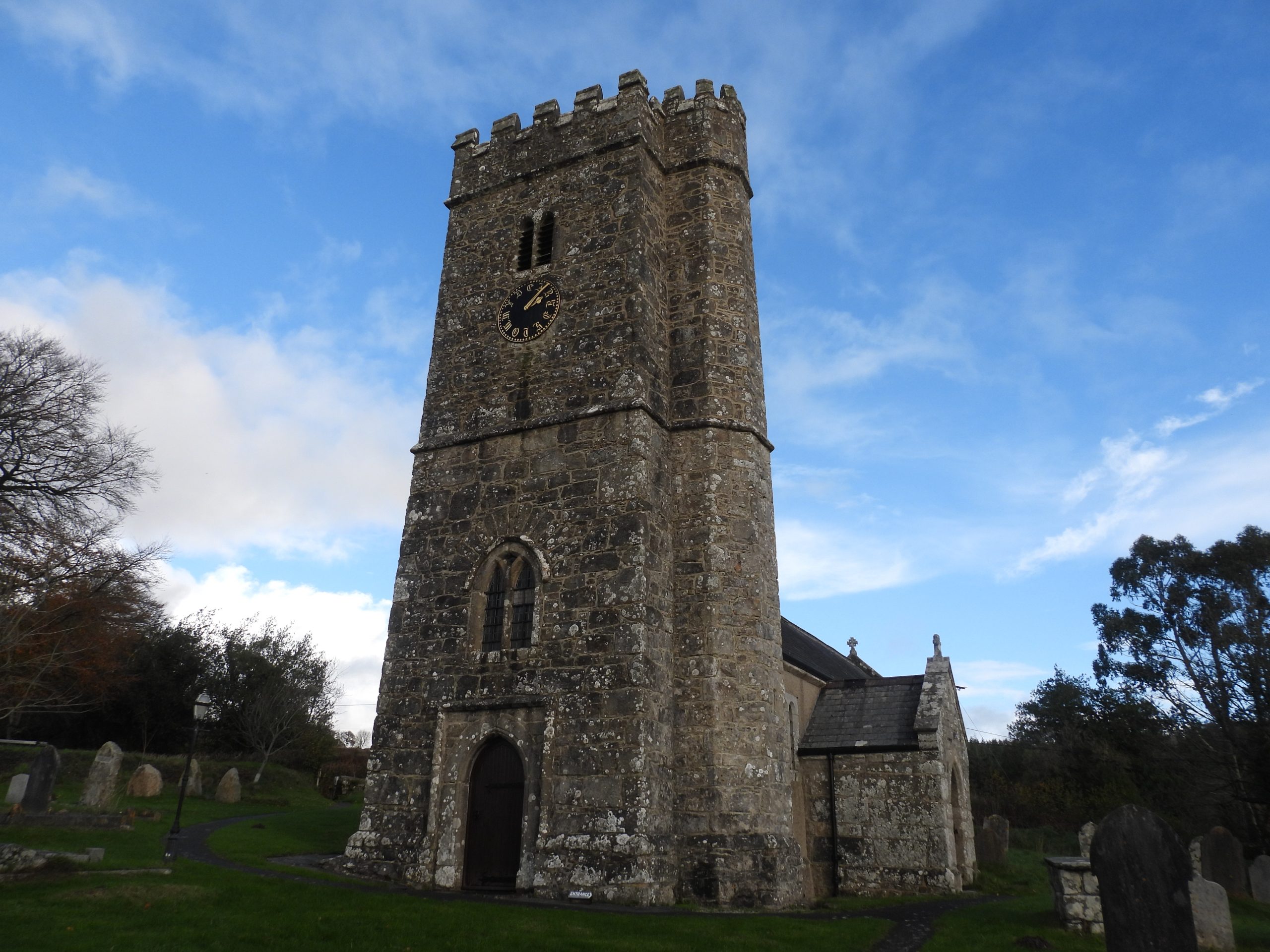
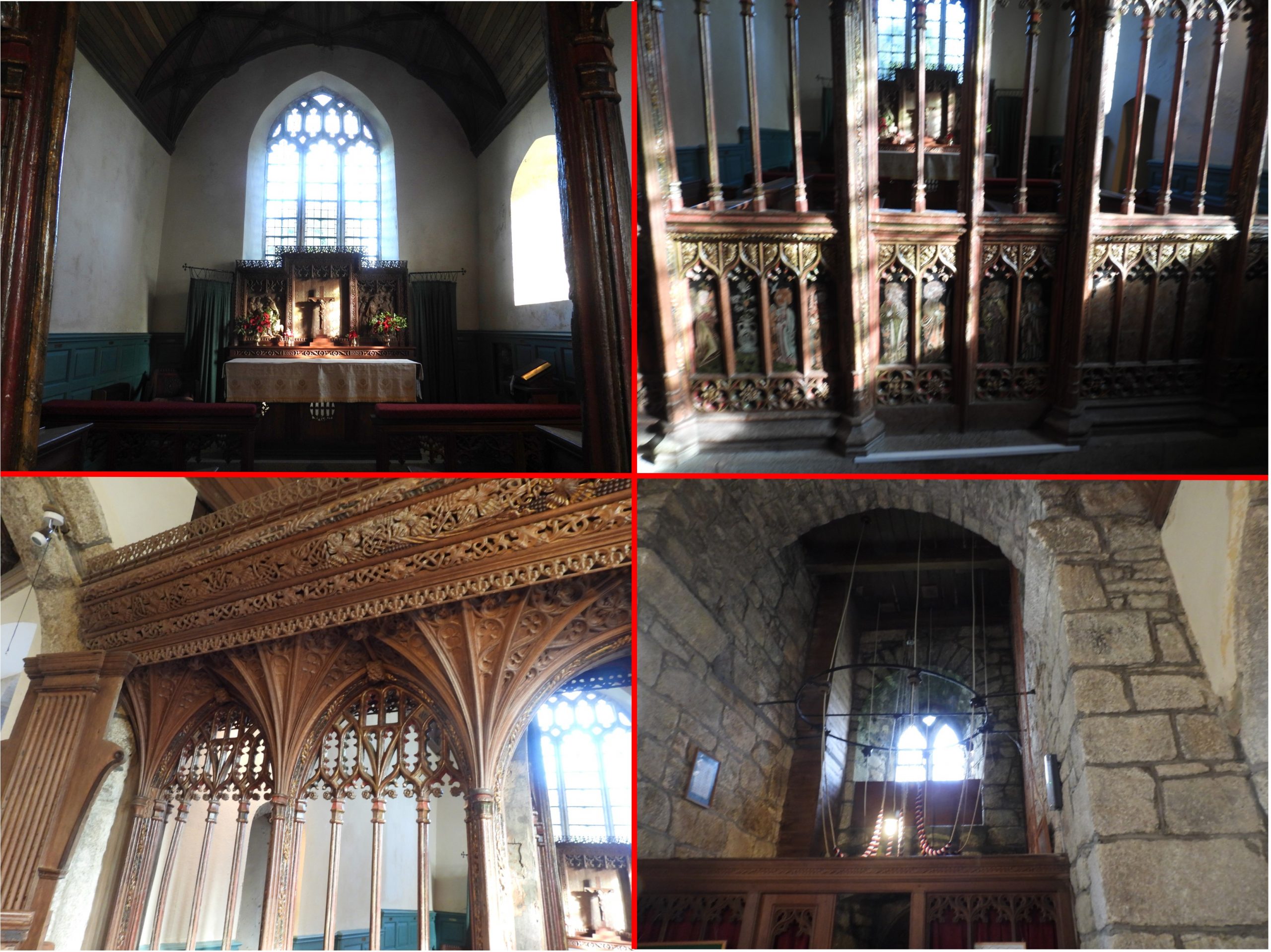
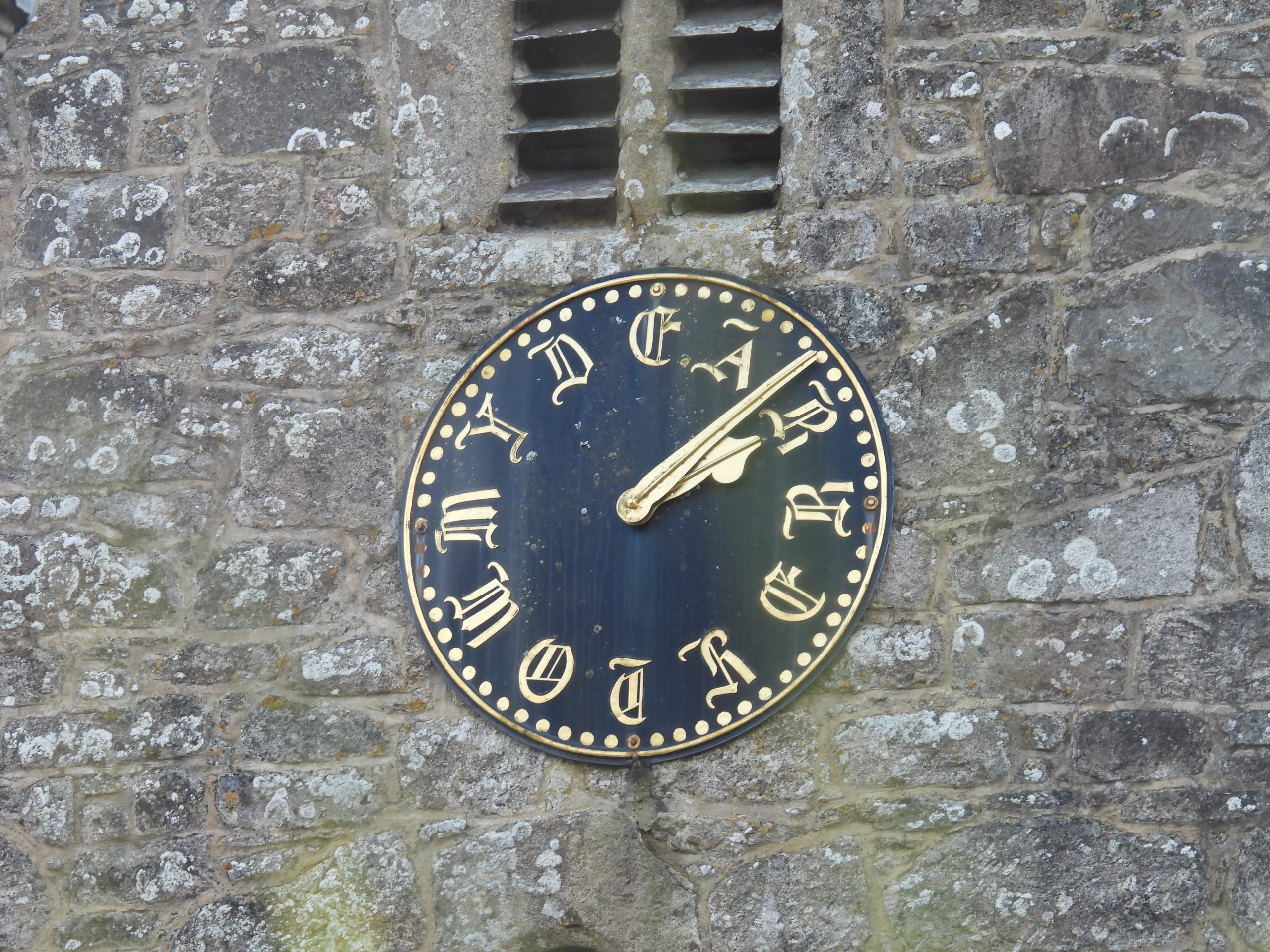
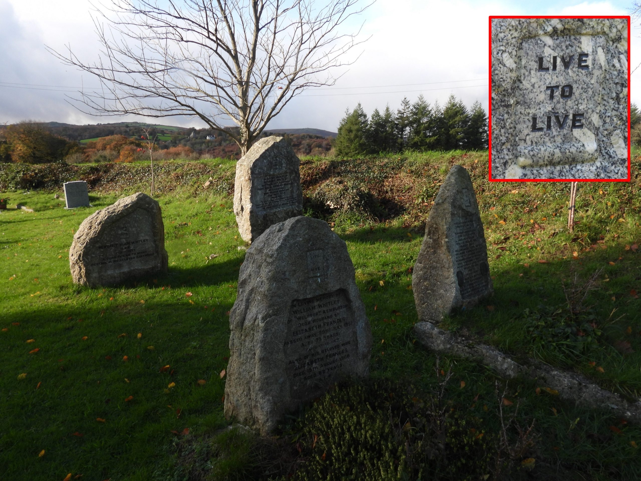
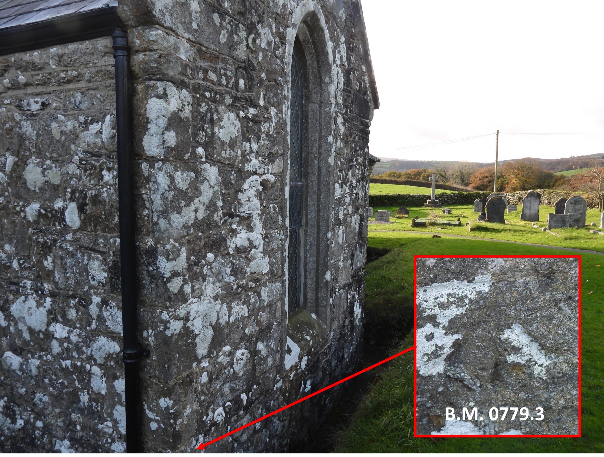
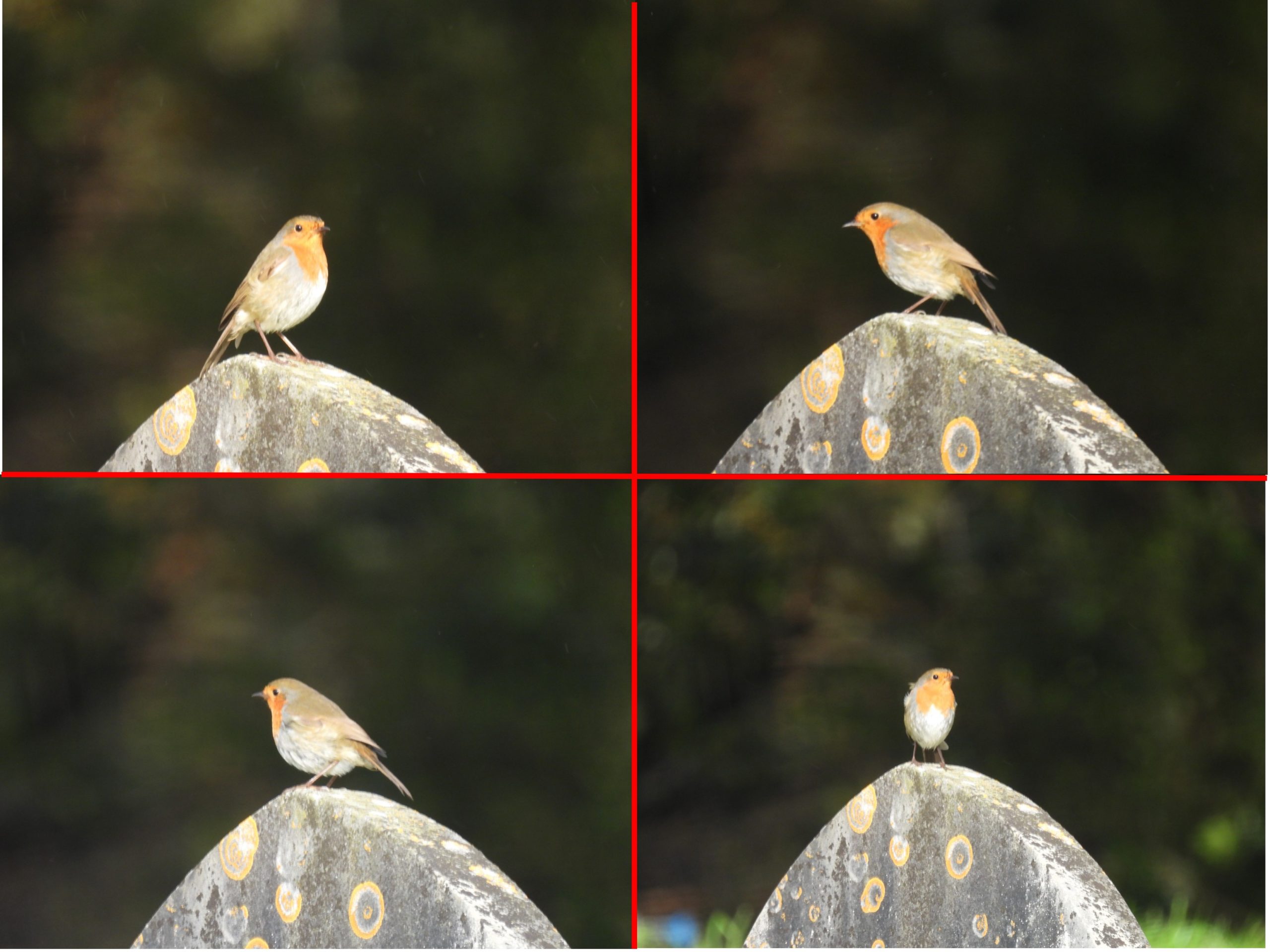
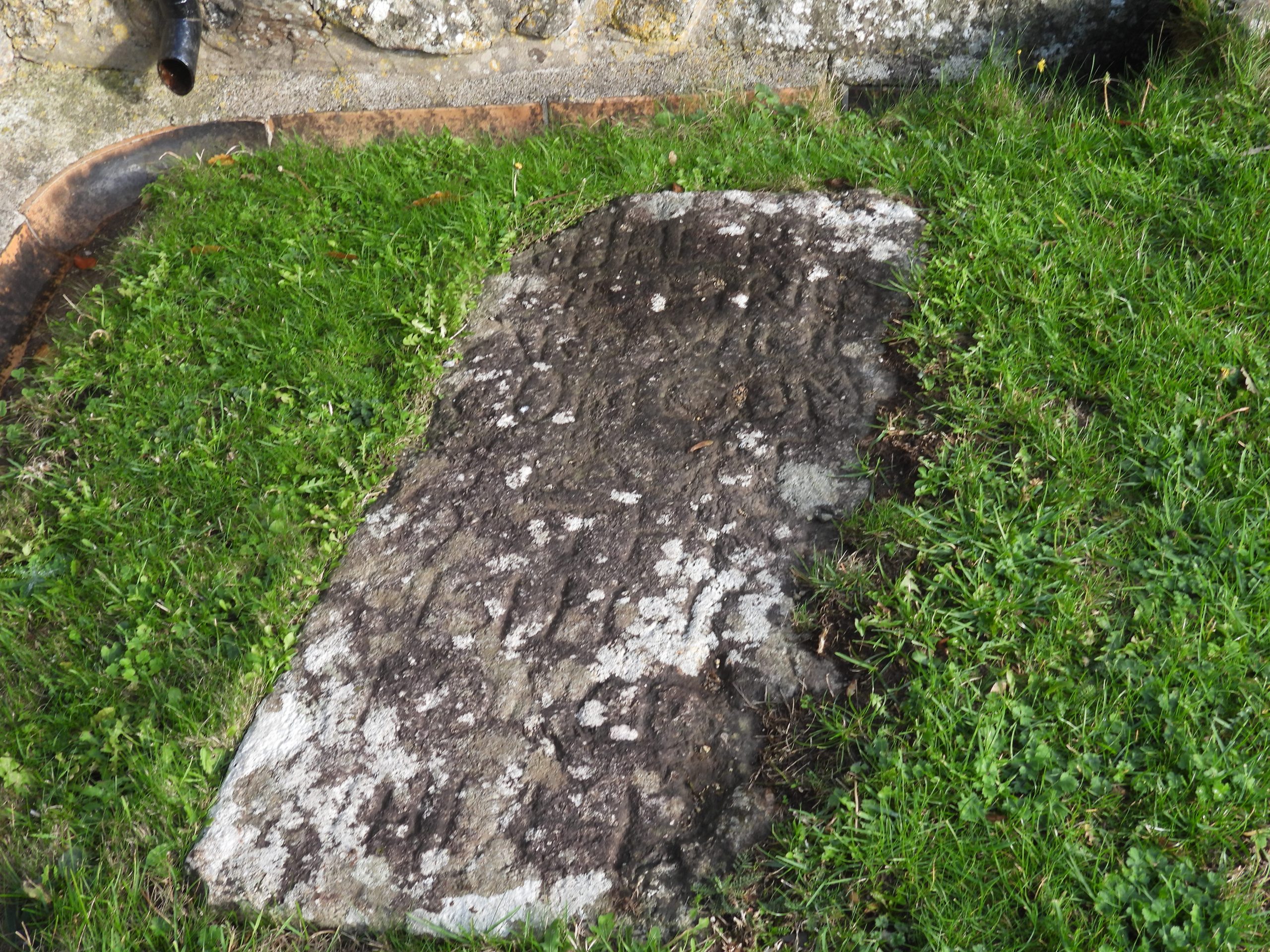
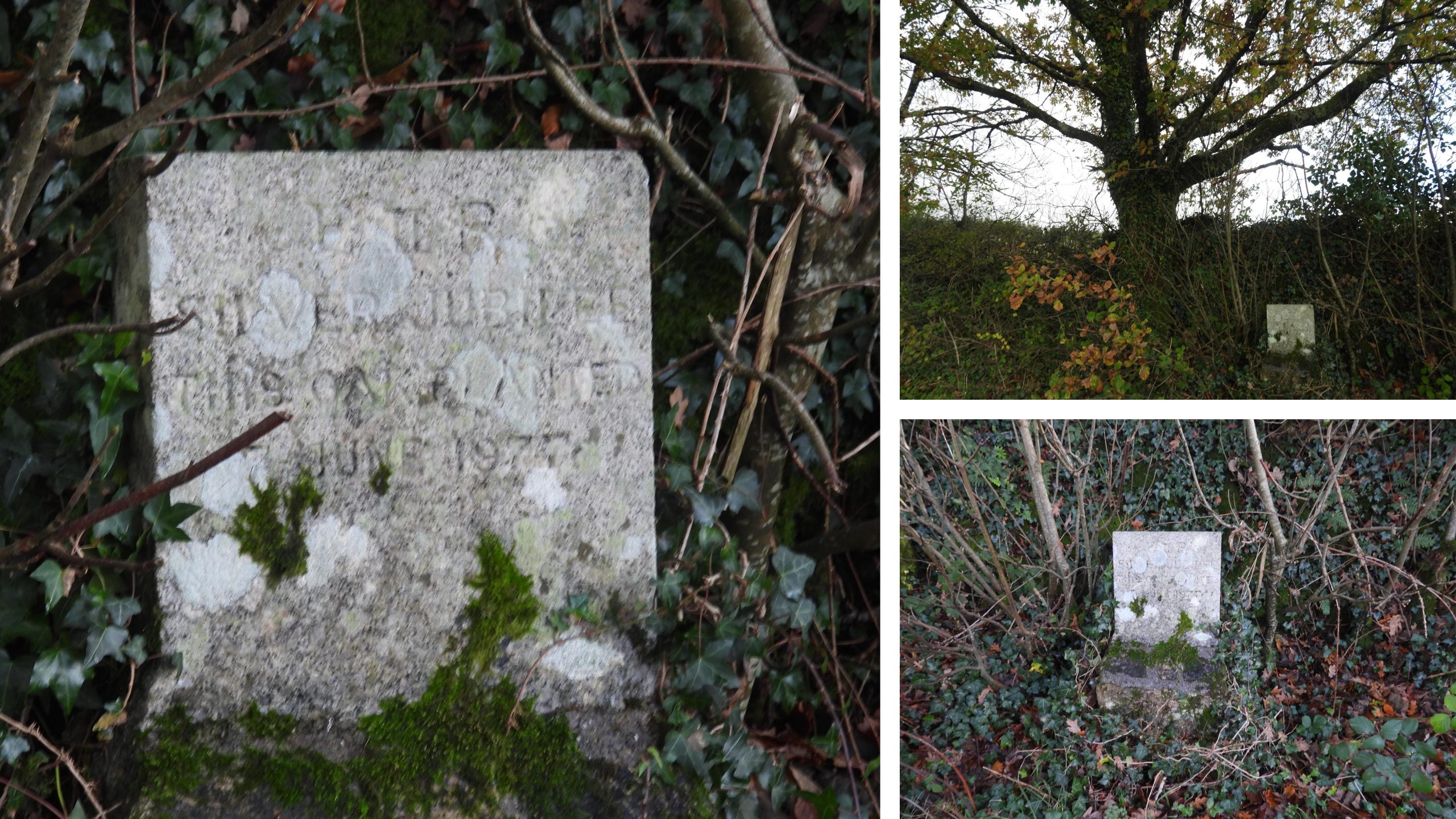
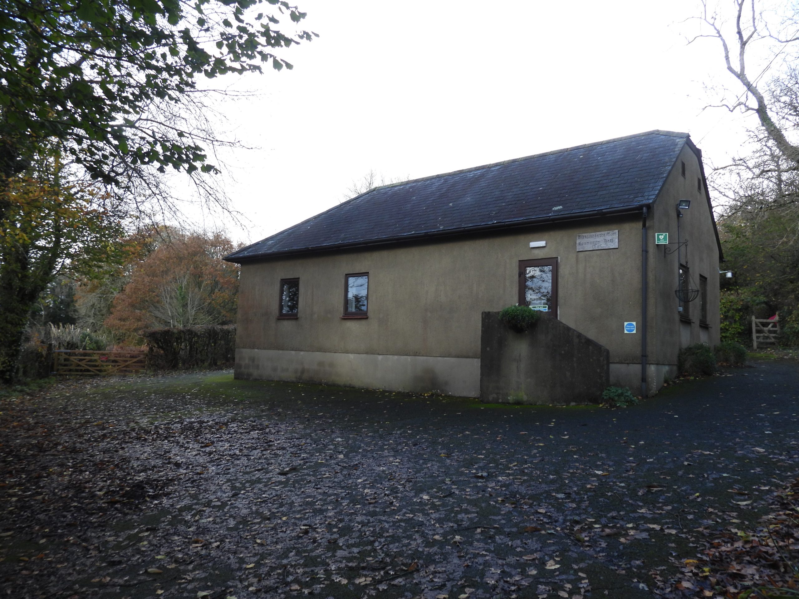
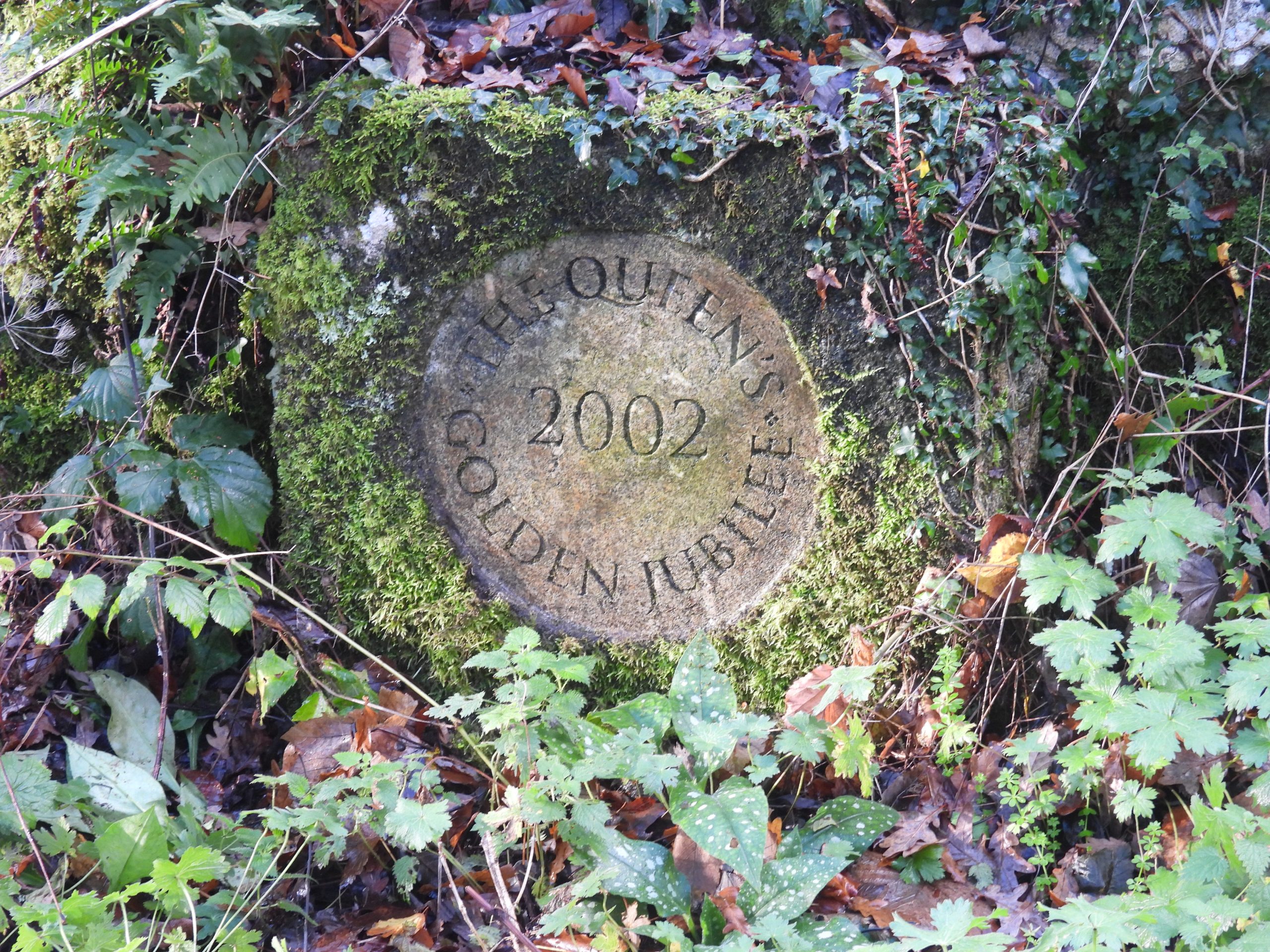
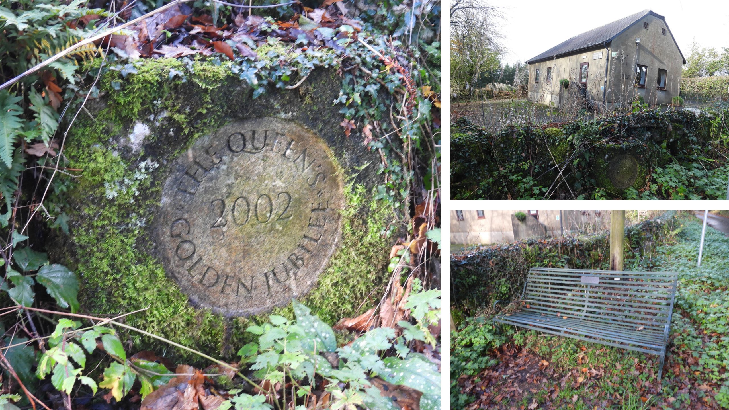
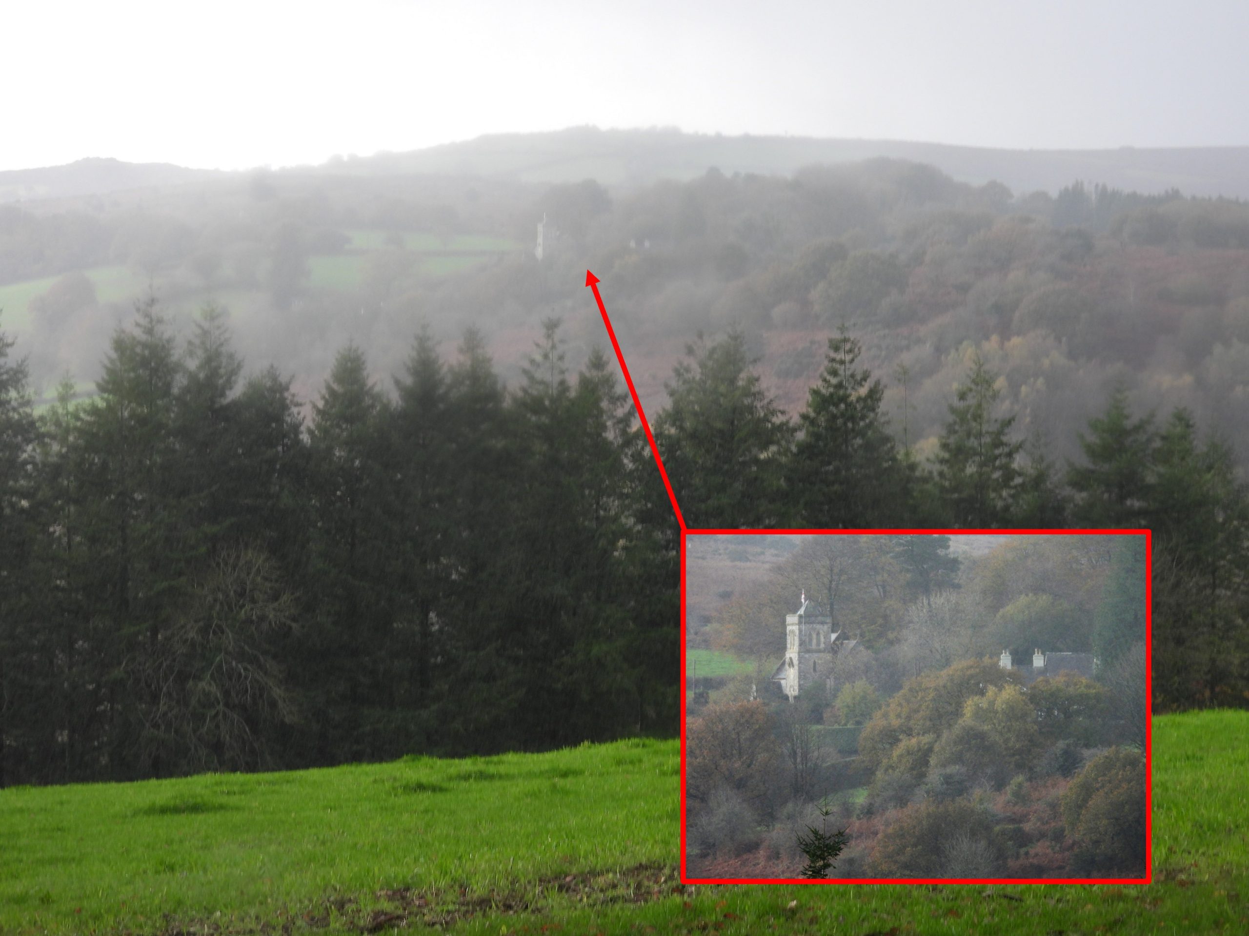
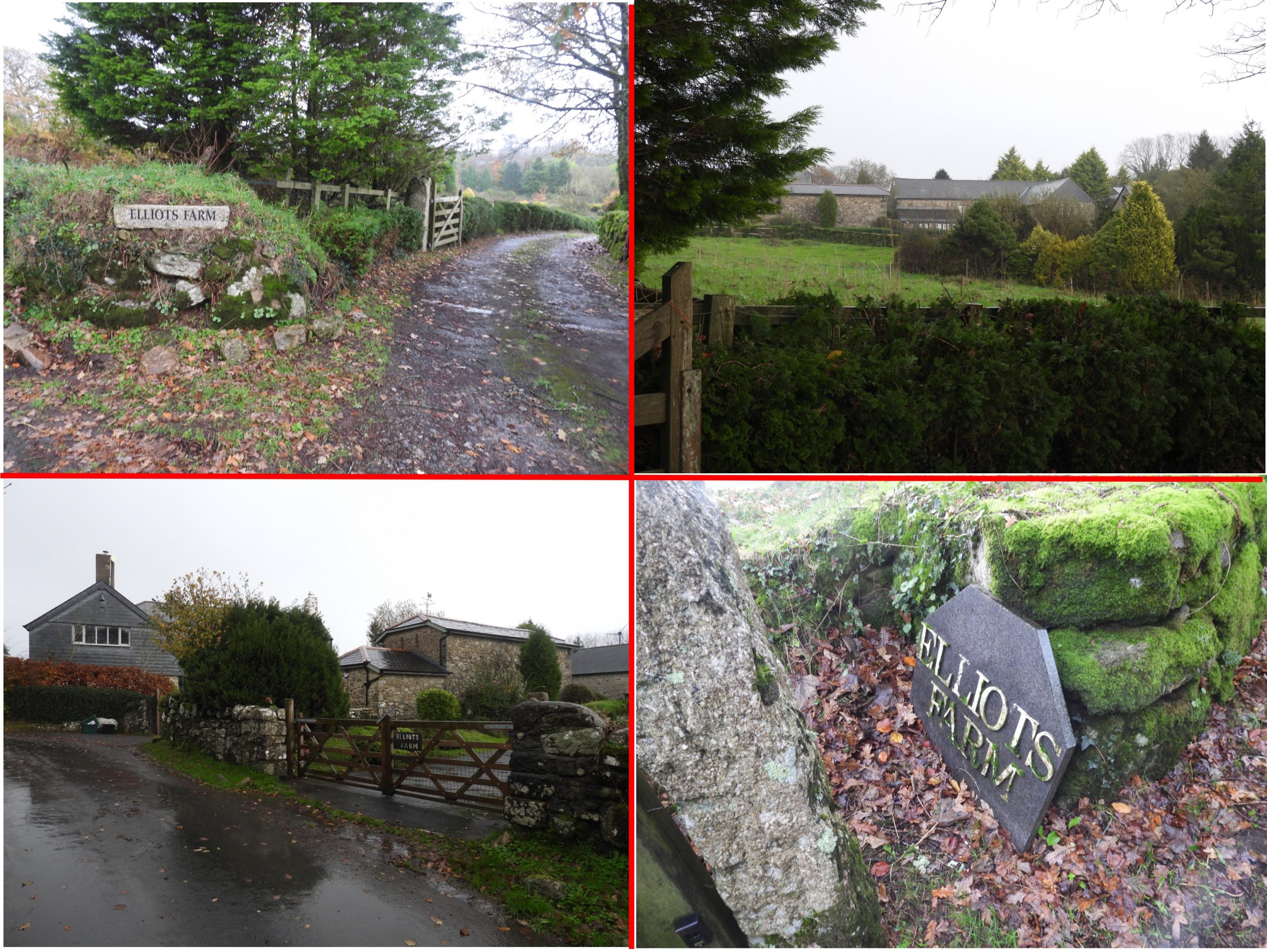
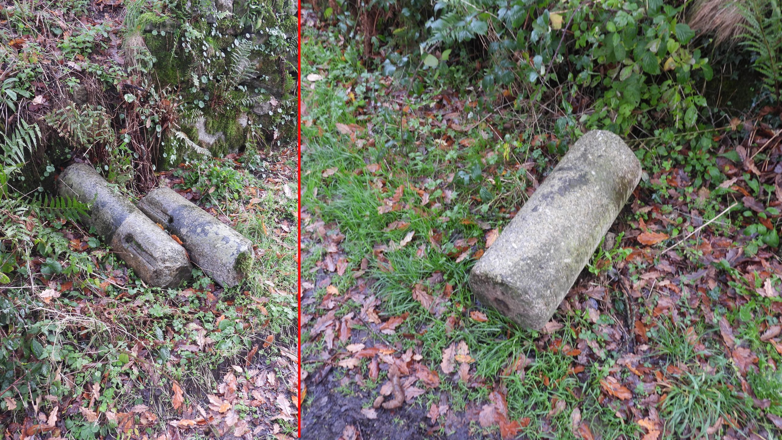
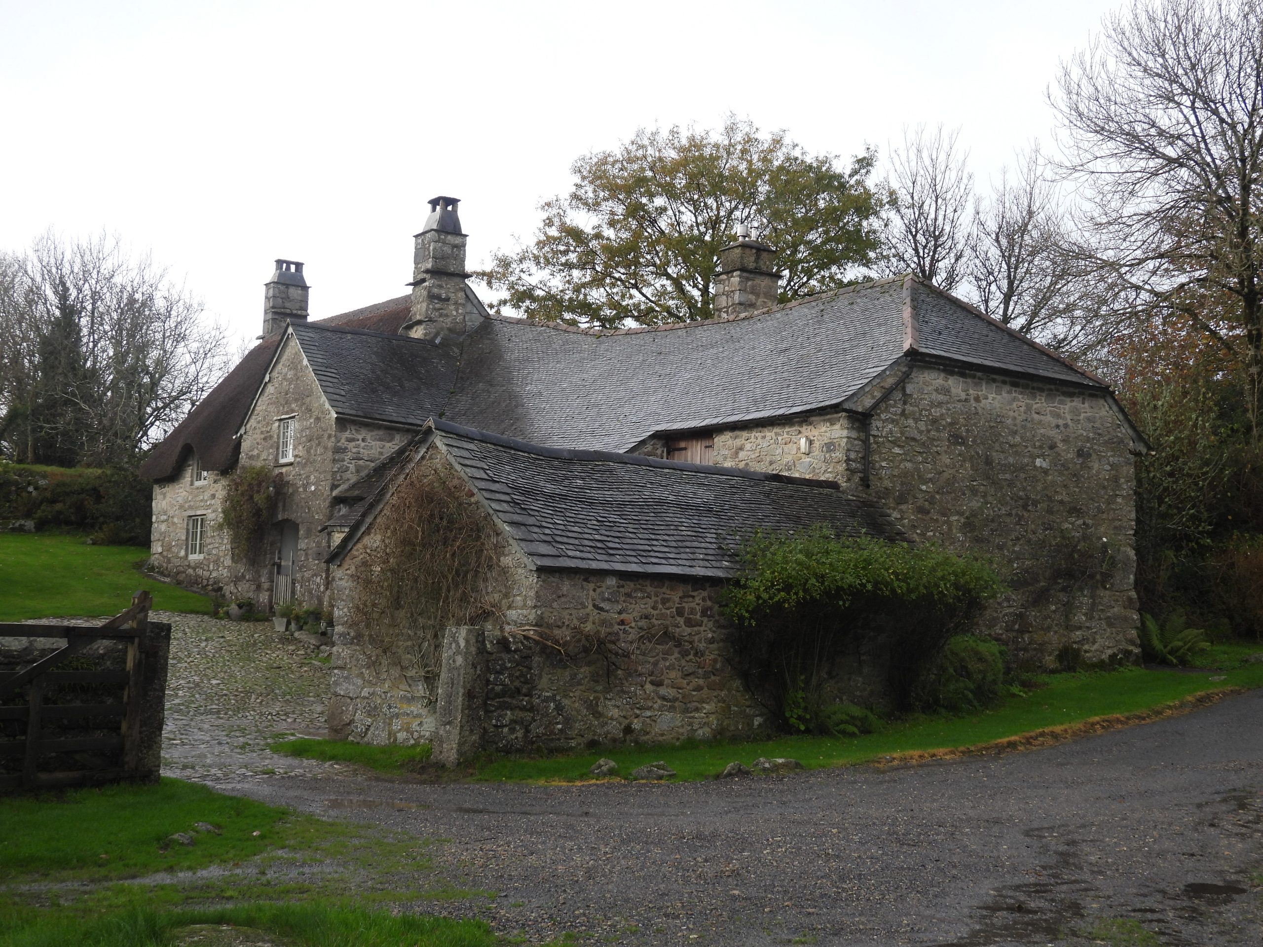
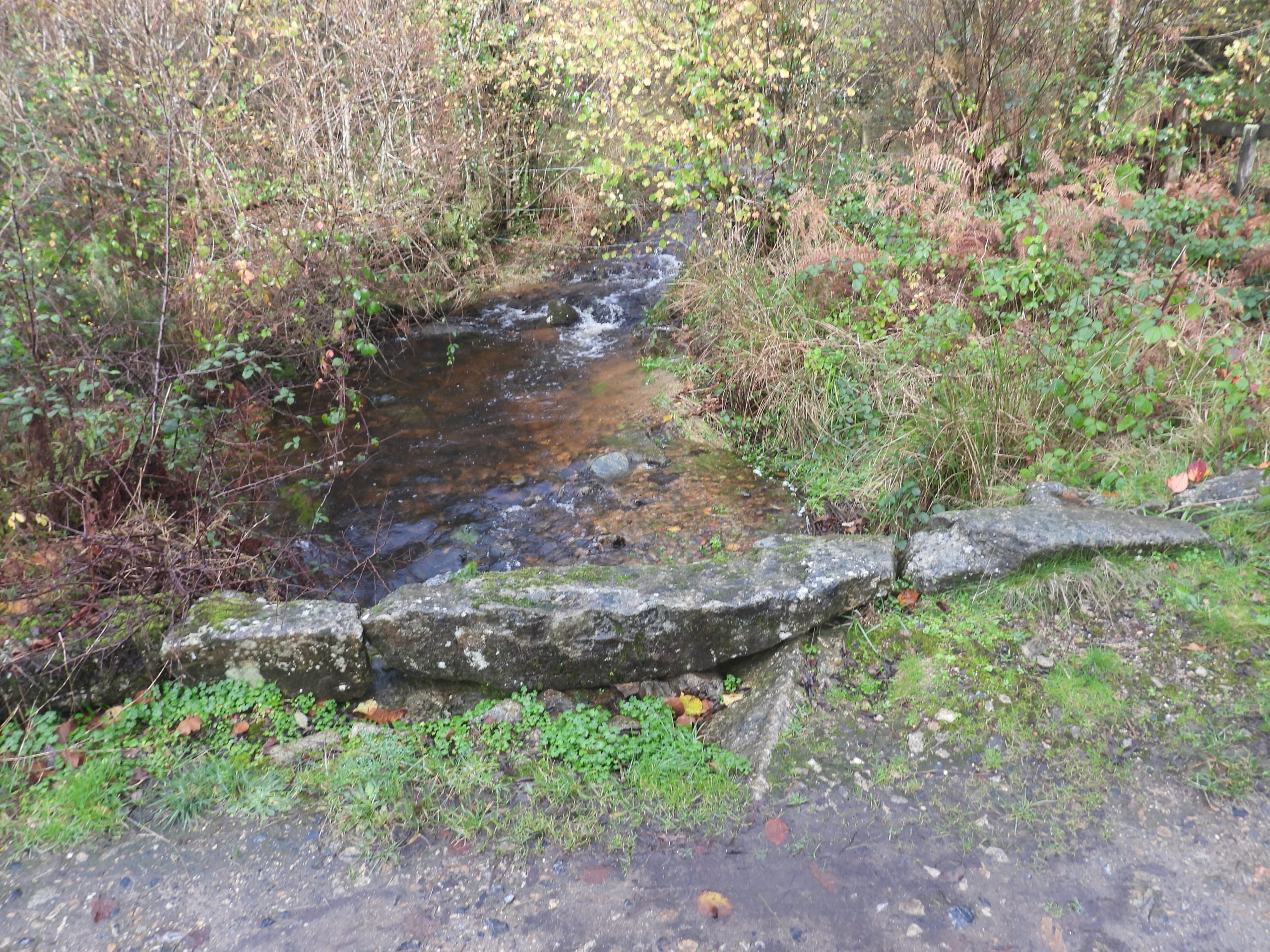
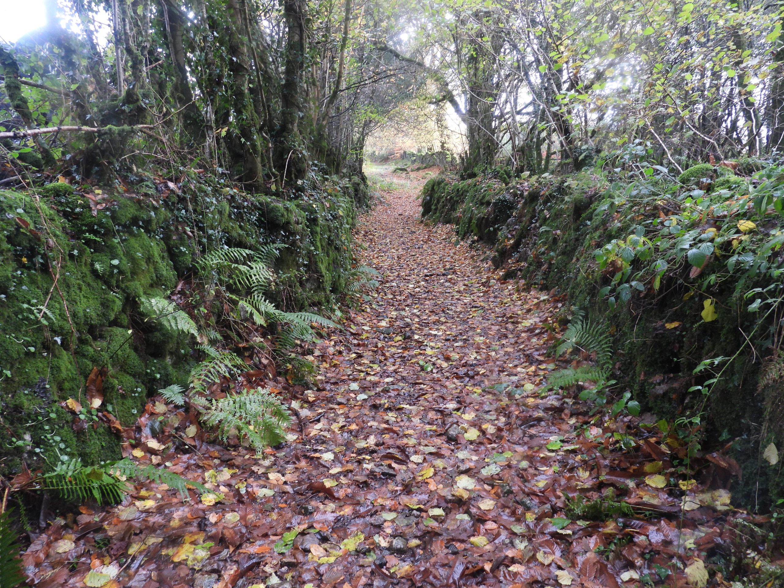
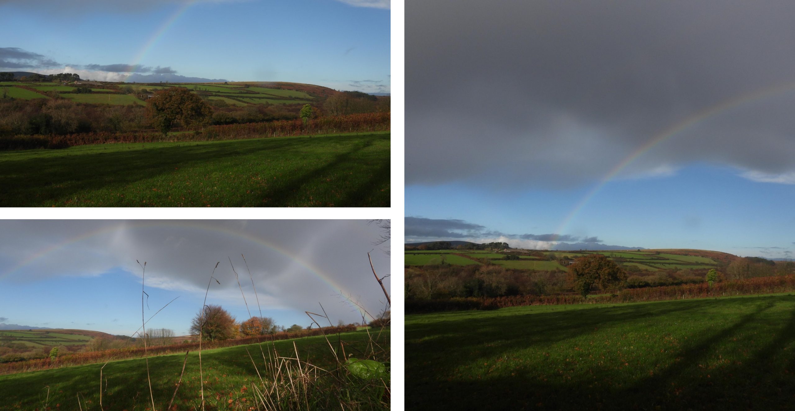
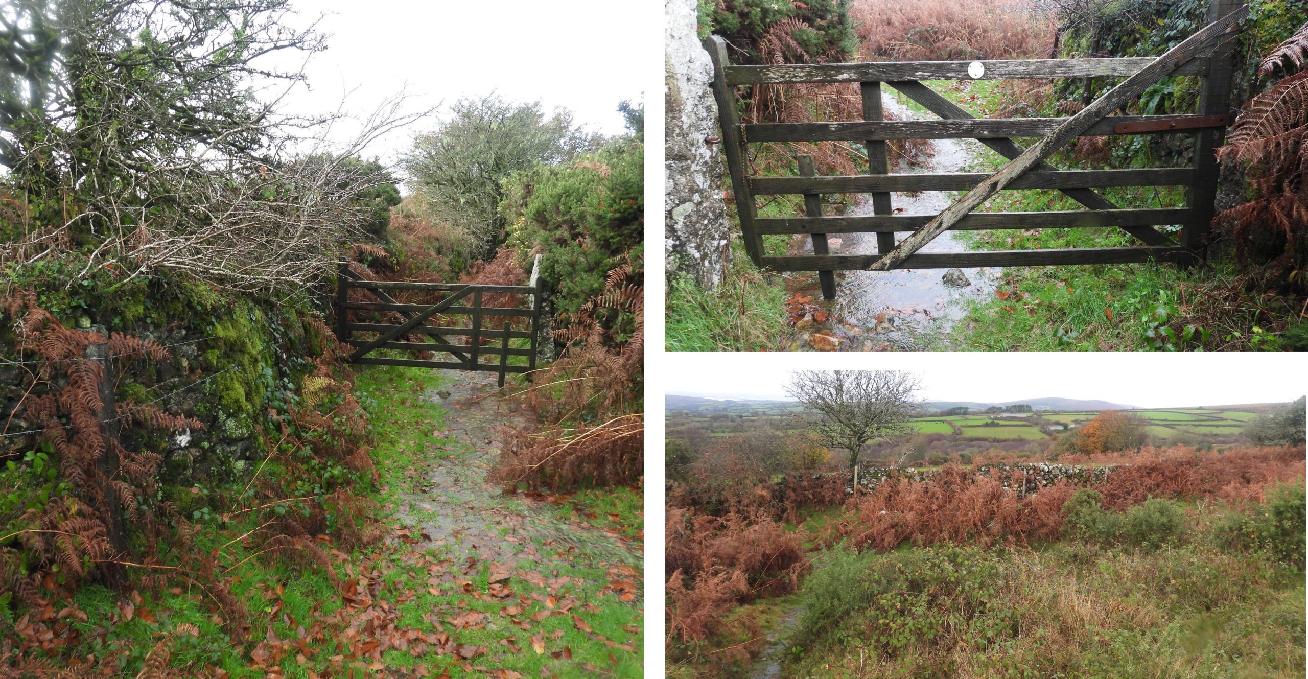
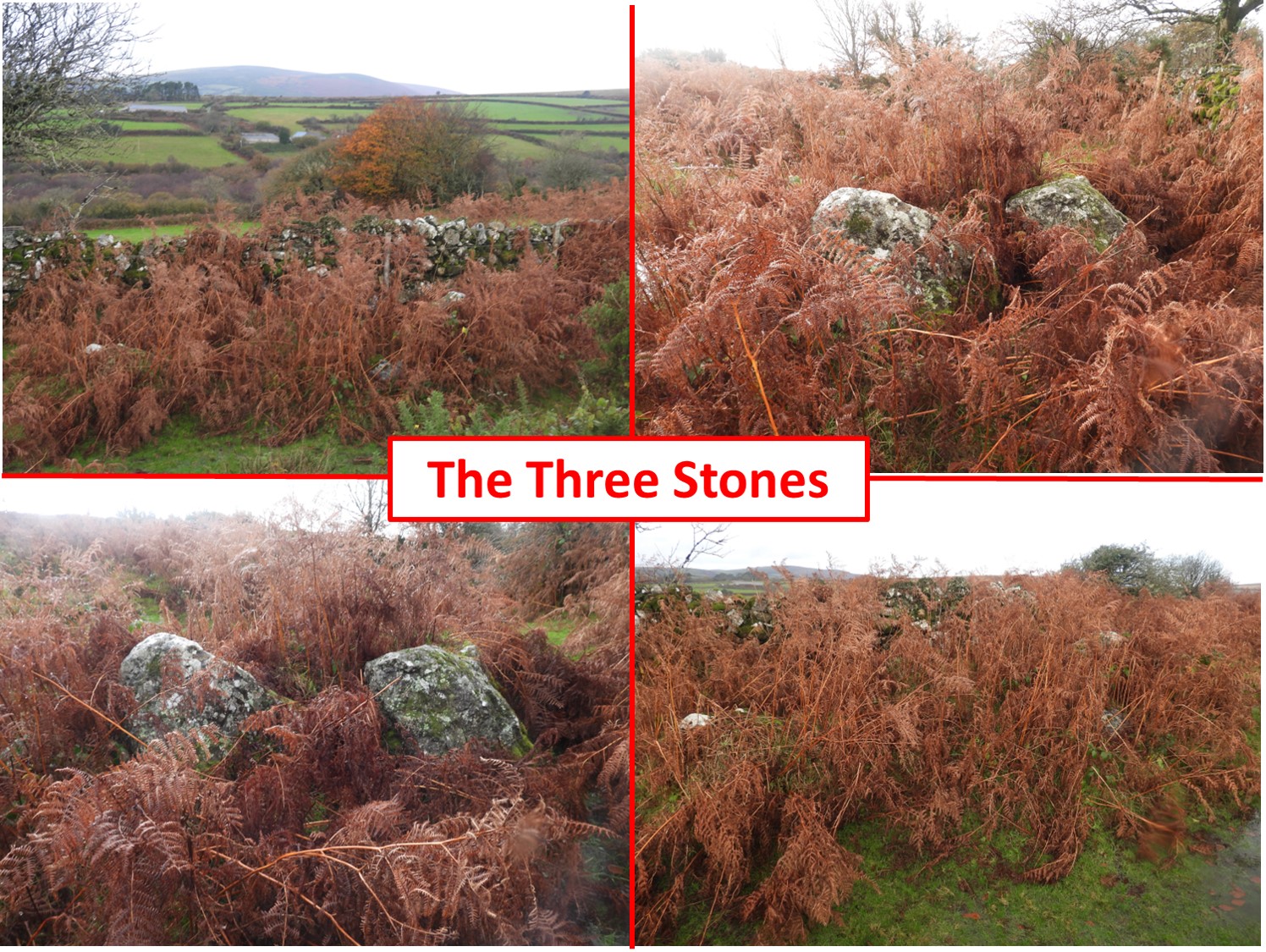
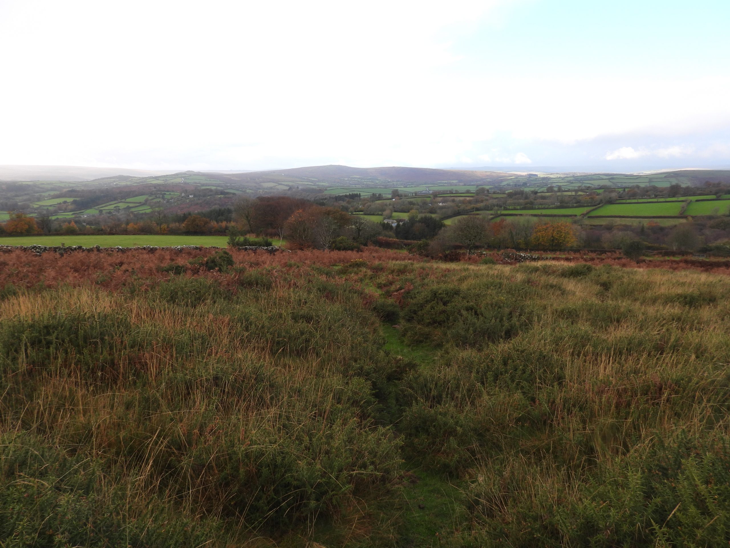
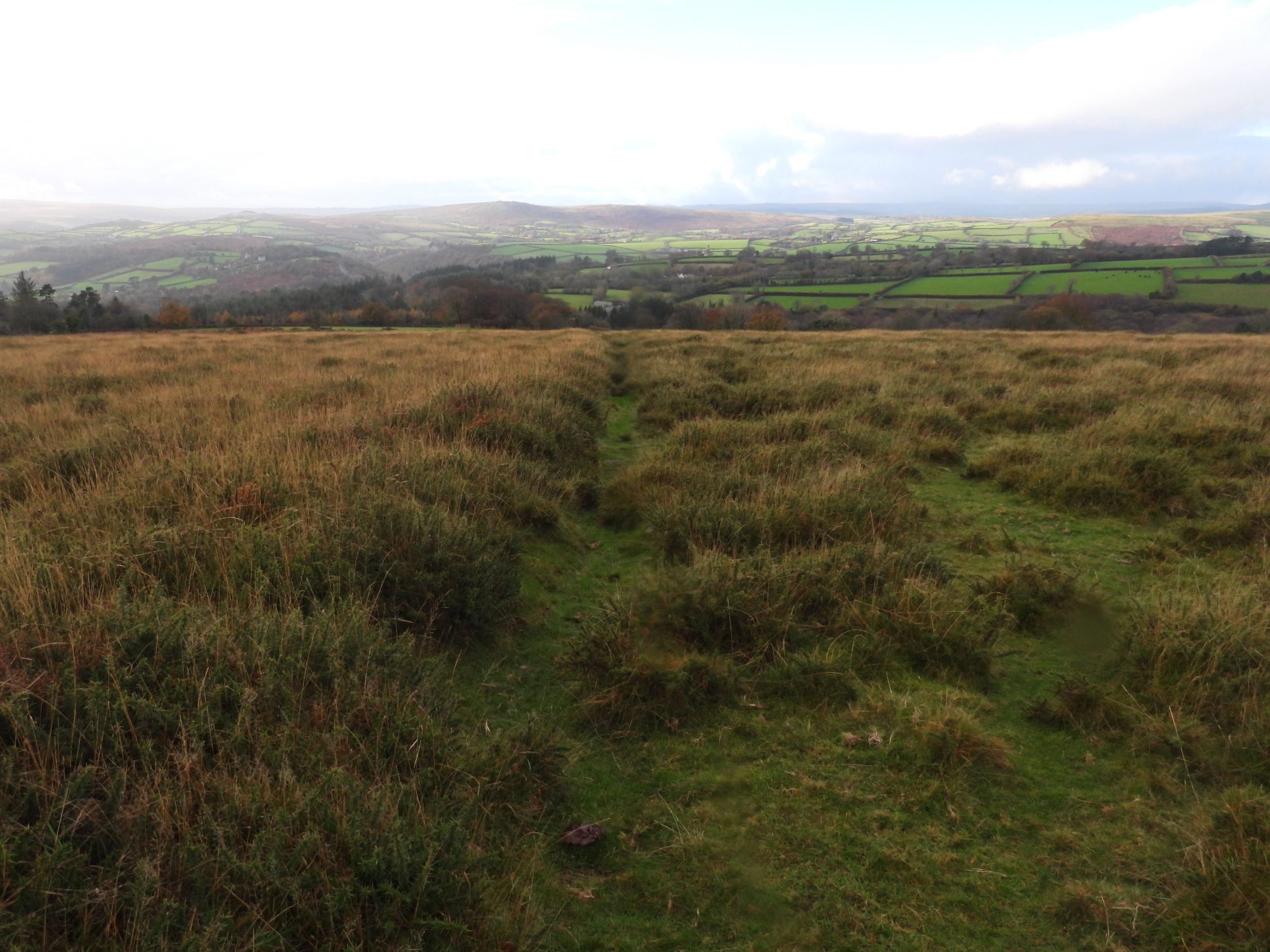
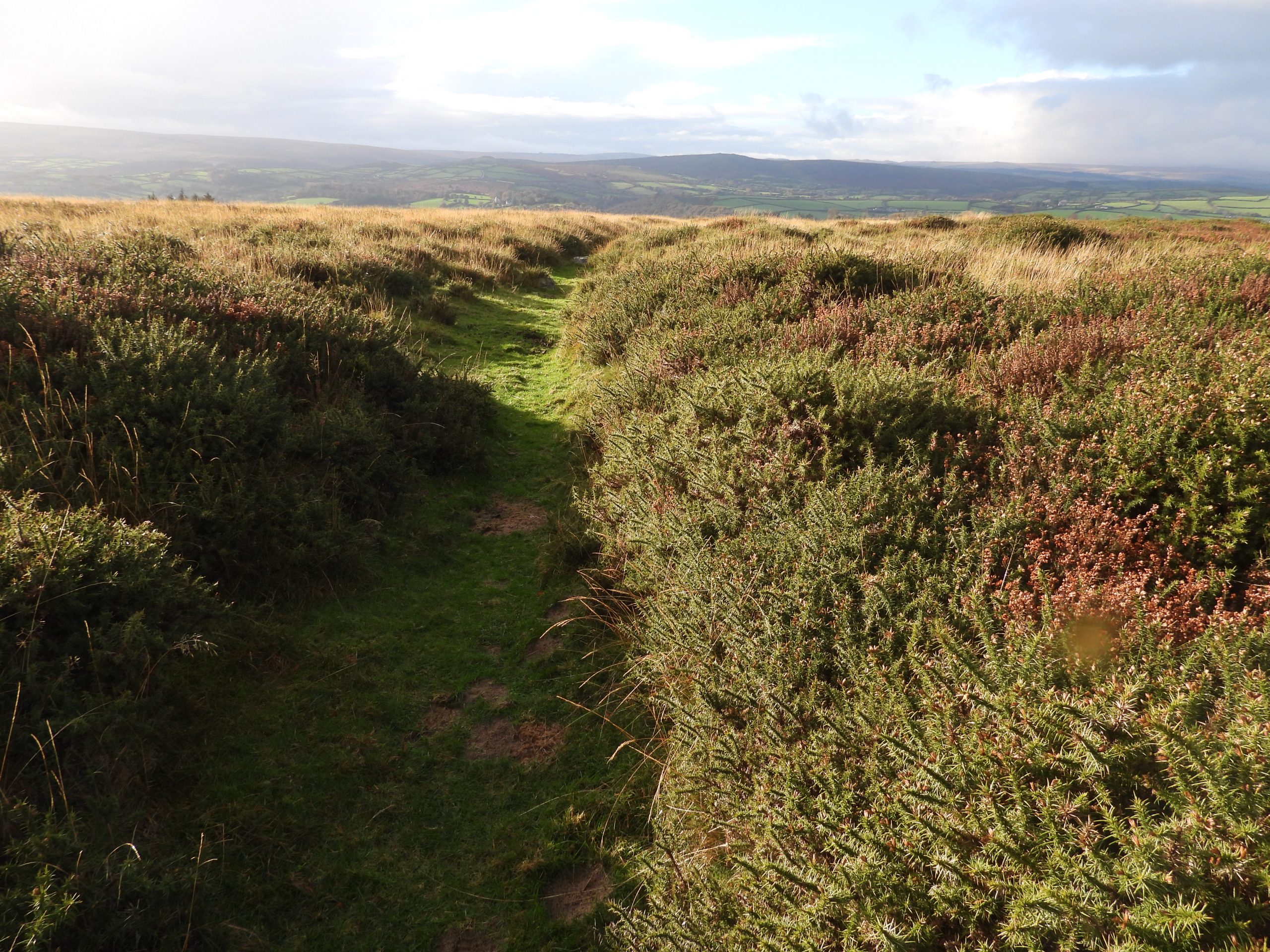
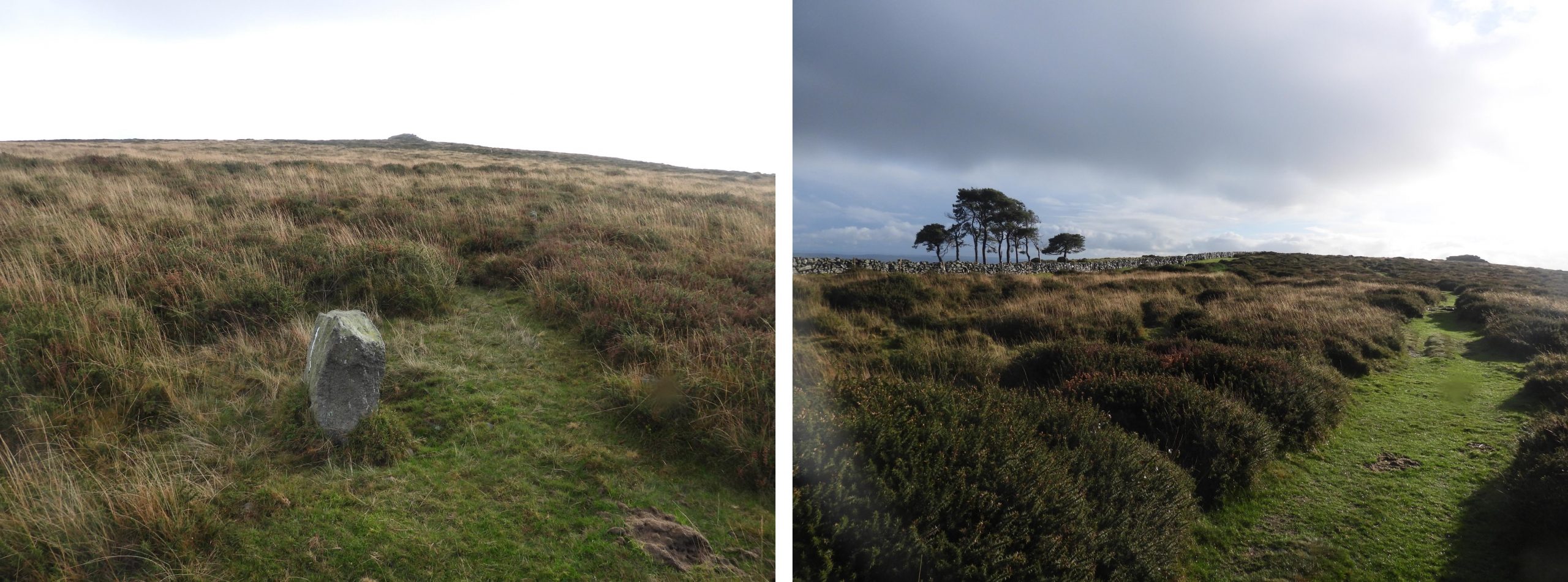
This sketch map shows the Torre Abbey Land in relation to modern roads, houses and walls. Ruddycleave Water between Birch Wood and Bagley Wood is on private property but the of the rest of the route can be followed exactly as per the map. The western portion of the circumnavigation can be achieved by using the lanes to from Bridge (‘Colreforda’) to Buckland then north to Elliot’s Farm and then east to Bowden. Approaching the ‘Torre Abbey Lands’ from the north, at the right angled wall corner south west of Cold East Cross (formerly known as Ham Hill Cross) there are two boundary stones. One is plain and the other is engrave ‘EFB 1837’ on one face. The ‘EFB 1837’ granite post marks the Buckland / Ashburton parish boundary. EFB stands for Edmund Pollexfen Bastard, who had the posts erected when he was owner of the manor of Buckland in the Moor. He was at one time the MP for Dartmouth (1812-1816) and was High Sheriff of Devon from 1834. The granite post also has an “A” (for Ashburton) and a “B” (for Buckland).The plain boundary stone is assumed was a parish marker which pre-dates the ‘EFB 1837’ markerWhitewalls Head was described as a “Great Heap of Stones” in 1709 and 1791 as part of the Buckland / Ashburton boundary. Just outside the Welstor wall and near the ‘1837’ stone are the remains of a large cairn, which is 10.5 m in diameter. Eric Hemery (1983), in High Dartmoor, page 665 comments that “South of the corner (of the boundary wall) is the outline of a cairn, the stones of which have been removed for building the wall”. Dave Brewer speculated that Whitewallshead may have related to two nearby reaves but the comments about a “Great Heap of Stones” and the Hemery observation leans the author to thinking the cairn is Whitewallshead. The cairn is located at SX73667 73770Marked on 19th century maps is a boundary stone at SX73580 73530. If this is the stone, it has been incorporated into the wall.Next to the Boundary Stone, which is incorporated into the wall are a pair of cairns, which are known as Wolstorrburrough or Two Burroughs. The name Wolstorrburrough was first mentioned in 1593 with Two Burroughs first being mentioned in 1613. They too, mark the Buckland / Ashburton boundary. The cairns are approx. 30m apart.The north cairn of Wolstorrburrough / Two Burroughs is very indistinct with a pit at the south end. Turner (1985-6) records that it has an inside diameter of 10.5 m. The wall has been part built over the bank on the eastern side of the stone ring. The south cairn is centred around SX73575 73531.The south cairn of Wolstorrburrough / Two Burroughs, as recorded by Turner (1985-6) is a much robbed cairn 16 m in diameter standing only 0.4 metres high. There are traces of an inner kerb circle 9 m in diameter. Like the north cairn, it too has the wall part built over the bank on the eastern section.The south cairn is centred at approx. SX73571 73492.At SX73575 73466 is a mystery stone which appear to be partly inscribed. The author asked for comments on this stone via the ‘Dartmoor Information Exchange’ facebook page and received feedback on it stating it could be : the beginnings of a Celtic Cross, or an axe head inscription (similar to those at stonehenge) or cup marks. Onto the boundary of the Torre Abbey Lands. The north east corner of the boundary (according to Dave Brewer) is where the north – south Buckland / Ashburton boundary wall meets a wall which runs perpendicular away from it to the east. At this point according to old map there is a Boundary Stone.The north east point of the Torre Abbey boundary. There are two possibilities for the marked Boundary Stone. This point is at SX73579 73361. Are either of these stones a former Buckland / Ashburton boundary marker.There is a lovely view of the Teign Estuary from the north east point of the Torre Abbey boundary. Moving south along the Torre Abbey Lands boundary towards Buckland Beacon is a very overgrown cairn known as One Borough (mentioned in 1709) or Hems Burrow (mentioned in 1837). It is centred at approx. SX73574 73252One Borough / Hems Burrow lies close to the highest point of Buckland common. There are several slabs which stand on a circular bank which is 19m across. The large central pit seems to have reached bedrock around half a metre below the surface.Buckland Beacon outcrop is surrounded by small, turf-covered stones indicating a possible tor cairn. Beacon fires have been lit here for centuries.Fabulous views to the south from Buckland Beacon. The wooded valley of the Dart is very prominent. A beacon fire, one of a chain lit at Buckland Beacon by the parishioners of Buckland in the Moor in celebration of his Majesties Silver Jubilee on May 6th, 1935. There is an inscribed stone near the summit, which is now barely discernible An old picture of the stone reveals the inscription reads: 1282 FT BUCKLAND BEACON A BEACON FIRE – ONE OF A CHAIN- WAS LIT HERE BY THE PARISHIONERS OF BUCKLAND-IN’THE-MOOR IN CELEBRATION OF THEIR MAJESTIES SILVER JUBILEE MAY 6TH 1935 AND ALL OF THE PEOPLE SHOUTED AND SAID GOD SAVE THE KINGThe only words discernible on the day this picture was taken is “Buckland Beacon”.One of the most recognisably curiosities on Dartmoor are the Ten Commandments Stones. The carving of the stones on Buckland Beacon commenced on 23rd July 1928. The work was undertaken by a W. Arthur Clements (from Exmouth) and whilst he was undertaking the work (he finished on 31st August 1928) he lived in a small hut on the fringe of the woods below the Beacon. The hut was little more than a cattle shed and the only light he had was a candle. He used to wash in a nearby stream. The Lord of the Manor of Buckland (Mr William Whitley) wished to commemorate the rejection of Parliament of the proposed new book of common prayer in 1928 as he considered it to be a “victory for the Protestants over popish trends” so he had the stones engraved. Source: Article by Judy Chard in Autumn 1988 edition of Dartmoor Magazine.Apparently Mr Whitley would often ride up to the Beacon with his dogs to see how Arthur Clements was progressing and gave him the nickname of Moses! After completing the ten commandments it was found that there was quite a big space left, so the third verse of the hymn “O God our Help in Ages Past” was engraved, which is considered quite profound given the location of the hills and tors of Dartmoor. It reads: “Before the hills in order stood, Or earth received her frame, From everlasting thou art God, To endless years the same”. Of note, there is also also a quotation after the fourth commandment, viz: “But there’s a power, which man can wield, When mortal aid is vain, That eye, that arm, that love to reach, The listening ear to gain, That power is prayerThis standing stone is named (incorrectly) on some 19th century maps as “Gray Mare”. It is a plain stone and is correctly called the “Longstone” (ref: Mike Brown 1996). The Buckland 18th and 19th century accounts reference the “Gray Mare” stone as being south of Stidwell Spring (ref: Dave Brewer). This boundary stone lies to the north of Stidwell Spring at SX73554 73031.‘Blyndewyll’ was first mentioned circa 1200 when the Torre Abbey Lands were gifted. In 1771 the Buckland accounts referenced Blind Well as a “well to be divided”, that is between the commons of Buckland and Ashburton. A court case in 1771 stated the division had not occurred and it was ordered that there be provision of a “Moorstone Trough to be eighteen inches deep and which trough is to be fixed in or near the well and to contain at least thirty gallons”. On modern maps it is shown as Stidwell Spring at SX73520 72935.South of Stidwell Spring the “Gray Mare” Boundary Stone was located. The stone was moved / destroyed during the building of the Welstor newtake wall in 1771. The author estimates the location was approx SX73473 72807.A view descending the hill towards the Ashburton – Buckland road of Bowdley Cottage, an historic farmstead which is now known as Beacon Hill Farm. The upper building looks derelict from the angle of the picture.At Awsewell Corner / Awswell Gate on the Ashburton – Buckland road, at the south east corner of the Torre Abbey lands, there used to be a stone known variously over the centuries as Roswolstone (1593), Thrytle (1683), Drossillstone (1698), Drosell (1709) and Throsholl. Throstle is the Anglo-Saxon word for a song-thrush from the Germanic Drossell. Brewer considers this may have been the origins of the name of this stone as it was a point where song thrush cock birds may have declared their territory. At the time of the gift of the lands this location was called ‘Bolshayburna’. The approx location of the stone would have been SX73340 72650.Moving west along the road towards Buckland on the southern boundary of Torre Abbey lands is the substantial Southbrook farmstead. The farmstead was mentioned in the Domesday Book where it stated that Mortain holds ‘Sotebrook’ from Ordulf. The first part of Southbrook on the south side of the road is a barn and horse-engine house, which now have been converted into self-contained flats. The author met the owners in the village who stated part of the horse mill is still in situ.Southbrook appeared in the Torre Abbey cartulary (circa 1200) where the name was spelt ‘Suthbrok’. The farmhouse probably dates from mid 19th century. On the north side of the road is the old school house. The school was built by the Bastard family (the Lords of the Manor) and was closed prior to 1914.On north west building of Southbrook (closest to Buckland), there is a ‘Victoria’ letterbox. The location is SX72493 72966The hamlet ‘Bridge’ as marked on modern OS Maps. At the time of the Torre Abbey lands gift this was called ‘Colreforda’ and is where Ruddycleave Water passes under the Ashburton – Buckland road on its was to meet the Dart to the south. Bridge cottage on the right is on the site of a former woollen mill. ‘Colreforda’ – There were formerly two mills here, one on either side of the Ruddycleave Brook (formerly the Mill Brook). Ruddycleave Cottage (left hand picture) might be on the former site of a corn mill (Mike Brown – 1996). The Torre Abbey lands from this point follow the course of the river upstream.Just to the west of ‘Colreforda’ is a tree planted to celebrate the Diamond Jubilee of Queen Elizabeth II. The plaque and tree are located at SX72439 73108. It is strange that the tree has been planted underneath some power lines and which possibly cause future problems.There is a small 19th century clapper bridge to the west of the bridge over Ruddycleave Water. On this bridge, on the north parapet is a nicely carved benchmark, which according to 19th century maps (on National Library of Scotland) is B.M. 0670.7. It is located at SX 72295 73136Gates to Buckland Court, an early 19th century mansion house which incorporates part of a smaller late 17th-early 18th century building, which itself overlies remains of an older stone structure. Over the centuries the house here has been owned by the Bastard (Edmund Pollexfen) family and William Whitley (of Ten Commandments fame).There is a possible medieval cross which has been built into the Buckland Court wall. Masson Phillips, (1937), The Ancient Stone Crosses of Devon: recorded this cross stating : “Built into the wall of the lawn, between the entrance door and the higher gate, a very roughly fashioned cross of rectangular section, much damaged. It is much damaged, one arm projects slightly, the other is hidden in the wall. A rectangular hole cut in the face may indicate former use as a gate-post”.As the village of Buckland in the Moor is entered from the east, there are some lovely photogenic doowways either side of the road. The centre of Buckland in the Moor is dominated by St Peter’s Church, Buckland-in-the-Moor. The above picture is a postcard which can be bought from inside the church.The church is believed to date from late 15th or early 16th century. It was restored in 1907 by G. H. Fellowes Prynne (ref: Belsey, (1983 – 1987), Buckland In The Moor Parish Checklist) .The above picture is a postcard which can be bought from inside the church. The clock on the tower was donated by William Whitley (of Ten Commandments fame) in 1930 (or possibly 1931*) and has the letters ‘MY DEAR MOTHER’ replacing numerals on both the west and east faces. *There are two dates quoted by various references as to when this occurred.View of the two stage unbuttressed west towerInternal views of the church. Of note are the fine wagon roofs and 15th century rood screen (which originated from Bradninch Church). The screen features a red and gold frieze with foliage and bunches of grapes, together with a series of painted panels. The west side of the panels depict the Annunciation, the Wise Men and several Saints (ref: John Pegg: Discover the churches of Dartmoor – 1986). According to the church warden’s accounts the new bells were hung in 1731.Close up of the ‘MY DEAR MOTHER’ clock face. This is a dedication to Elizabeth, mother of William Whitley who passed away a year before the clock faces were installed.Part of the graveyard with the Whitley family (four brothers) graves, each gravestone has the motto inscription ‘Live to Live’ on it.On the church is a benchmark (B.M 0779.3). It is in an unusual position insofar as other churches on the moor have benchmarks on the tower. A friendly robin has made the churchyard part of his territory.Long tailed tit (I believe) on the top of the south porch.Outside the south porch is a rather old, yet grand tombstone. The author was unable to decipher the inscription.Views of Buckland Beacon from the village.At the junction to the lane leading to Elliots Hill farm (east side of the lane) is an inscribed stone erected in June 1977 to celebrate the Silver Jubilee of Elizabeth II. The stone indicates the adjacent tree was planted at that time.Buckland Village Hall. Also at the junction to the lane leading to Elliots Hill farm (west side of the lane) is a 2nd inscribed stone erected in 2002 to celebrate the Golden Jubilee of Queen Elizabeth II.As well as the inscribed stone celebrating Golden Jubilee of Queen Elizabeth II, there is bench just a few metres away which was installed at the same time. The picture (top right) shows the location of the inscribed stone in relation to the village hall.Climbing the hill (north) to Elliots Hill farm a splendid view towards Leusdon Church can be had. It was raining at the time the pictures here were taken.Elliots Hill Farm. The farmhouse is said to date from at least the 18th century and was greatly extended in the mid-late 19th century.Near to Elliots Hill farm are several rollers (or possible posts). They are quite short being approx 1.5m long each.Bowden. It was first documented as ‘Boghedoune’ in 1330, thus would have been around in some form when the Torre Abbey lands were gifted. The farmstead was owned by the Woolcott’s (late 16th century) and the Jennynge’s (early 17th century). It was sold to Buckland Manor in 1639 for £200. Bowden is a real hidden ‘gem’. The farmstead lies a short distance to the west of Ruddycleave Water, where the Torre Abbey lands boundary is located.Bridge over Ruddycleave Water. At this point the Torre Abbey lands boundary would have turned from south-north direction to a west-east direction.Lane leading away from Ruddycleave Water on the Torre Abbey lands boundary. The lane is bounded by Birch Wood on its south side.View from the lane towards Pudsham Down and Ruddycleave Farm. A full rainbow adding to the fabulous vista.Gate at the top of the lane. Dave Brewer marks this location as ‘Mahimorhilhead’ – see sketch map. This location is also known as Ripman’s Gate. Adjacent (north east) to Ripman’s Gate are several large boulders which are likely to be stone clearance pile. That said, this is the approx. location of a place called “The Three Stones” mentioned in the original Torre Abbey charter. The stone clearance pile is located at SX73220 73527Leaving the “Three Stones” the final section of the Torre Abbey lands boundary is described as ‘Fossatum’ (or sunken way). There is a path through the heather and gorse, which conceivably have been ‘Fossatum’.The path (‘Fossatum’) on the hillside looking west.The ‘Fossatum’ is described in the Dartmoor HER as a “Banked lane leading down towards the drift lane to Bowden”. Of interest close to the ‘Fossatum’ is an upright stone (picture on left) which doesn’t look natural. It is located at SX73434 73419. The Torre Abbey lands boundary has now been circumnavigated
Very interesting. My grandmother was born at Southbrook. Her mother, Agnes Preston taught at the village school in the 1870s.
The Preston family also had links with Bowden Farm.
Great to see pictures. I have visited the village, back in the 1990s to see places where my family origins lie.
Tinroofrusty November 28, 2022
…….another informative and well put together post.
SteveGriggDartmoor November 29, 2022 — Post author
Thank you very much
Sue Lester February 4, 2025
Very interesting. My grandmother was born at Southbrook. Her mother, Agnes Preston taught at the village school in the 1870s.
The Preston family also had links with Bowden Farm.
Great to see pictures. I have visited the village, back in the 1990s to see places where my family origins lie.
SteveGriggDartmoor February 4, 2025 — Post author
Hi Sue,
Thank you for sharing your family recollections.
Kind regards,
Dartmoor Explorations (Steve)