A collection of walks, discoveries, insights and pictures of exploring Dartmoor National Park
November 8, 2022
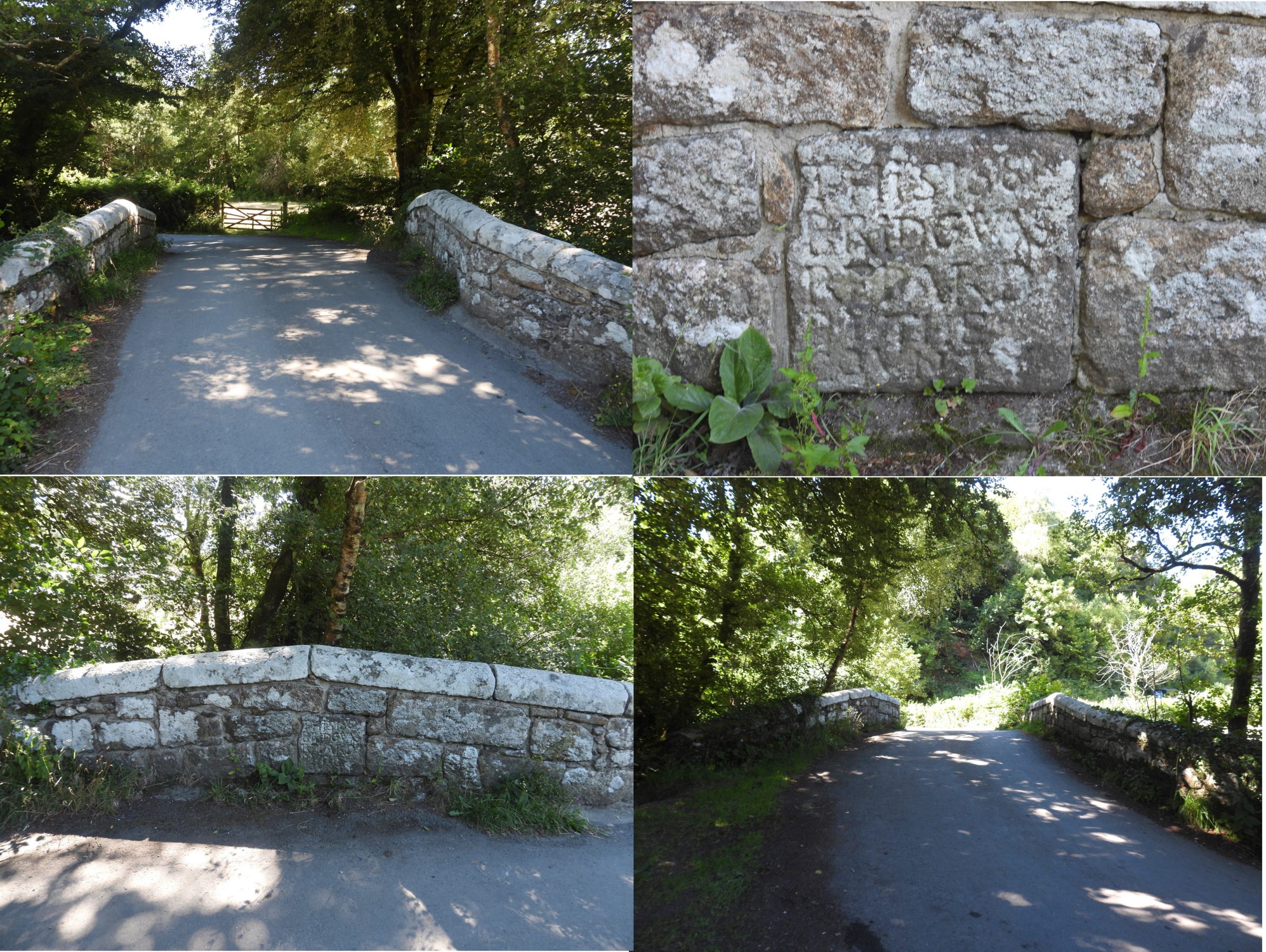
Inscribed tablets on Wilford and Drakeford Bridges
Another aspect of boundaries on Dartmoor, or as Dave Brewer states in Dartmoor Boundary Markers, 2nd edition, “boundaries of responsibility”, are bridges which were maintained by the county. Wilford and Drakeford Bridges are two such bridges where the county had responsibility for their repair. Both bridges span the River Bovey and have beautifully inscribed tablets on them which date from the 17th and 18th centuries indicating when they were repaired. Ironically these bridges also are located on modern day boundaries, namely; the Lustleigh Parish Boundary and in the case of Wilford Bridge also on the National Park boundary.
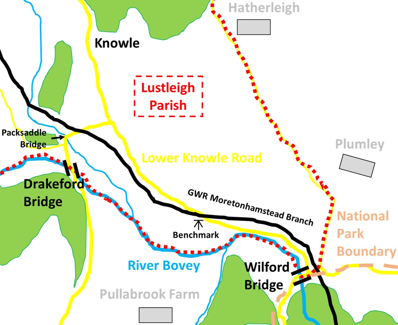
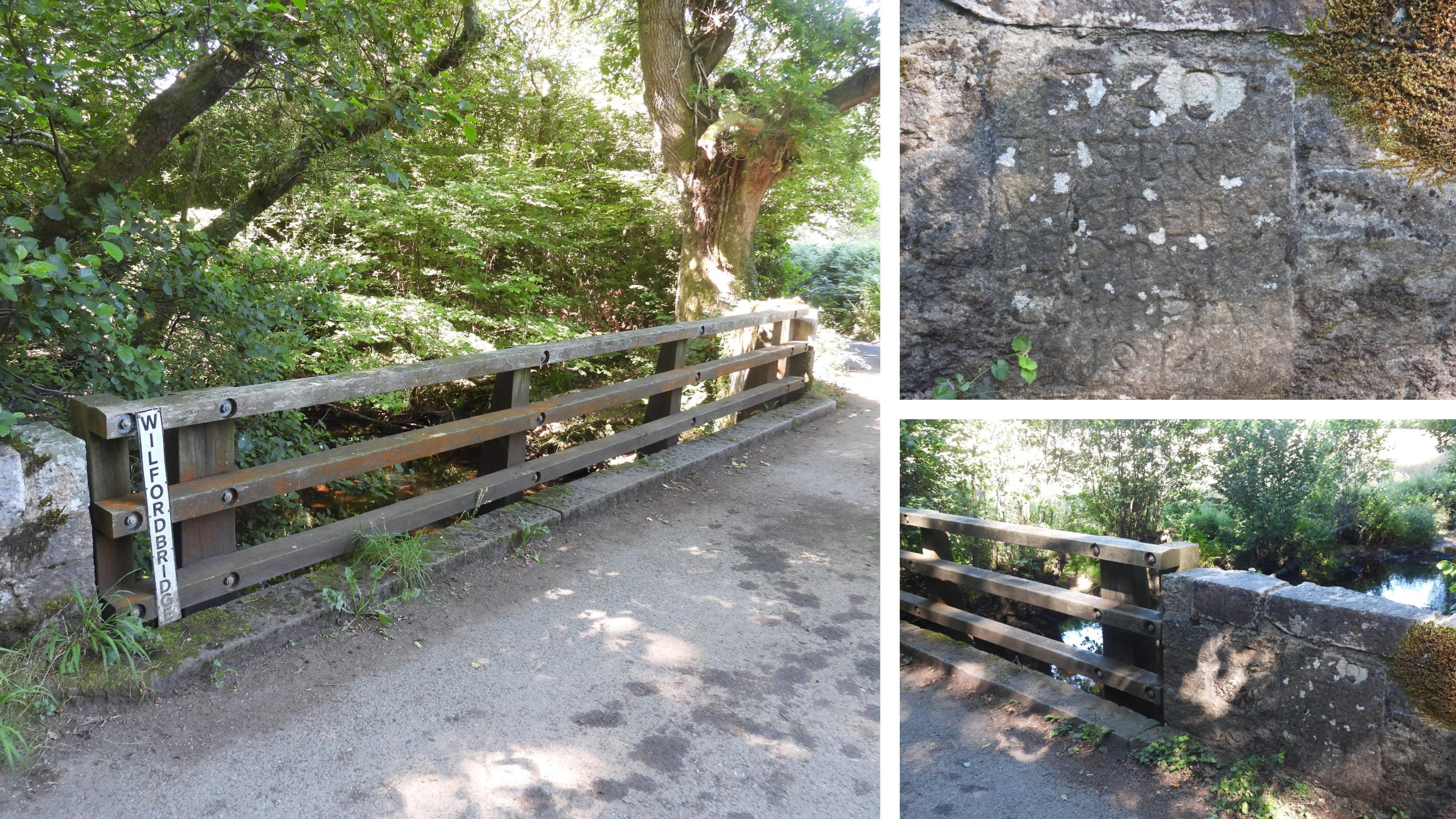
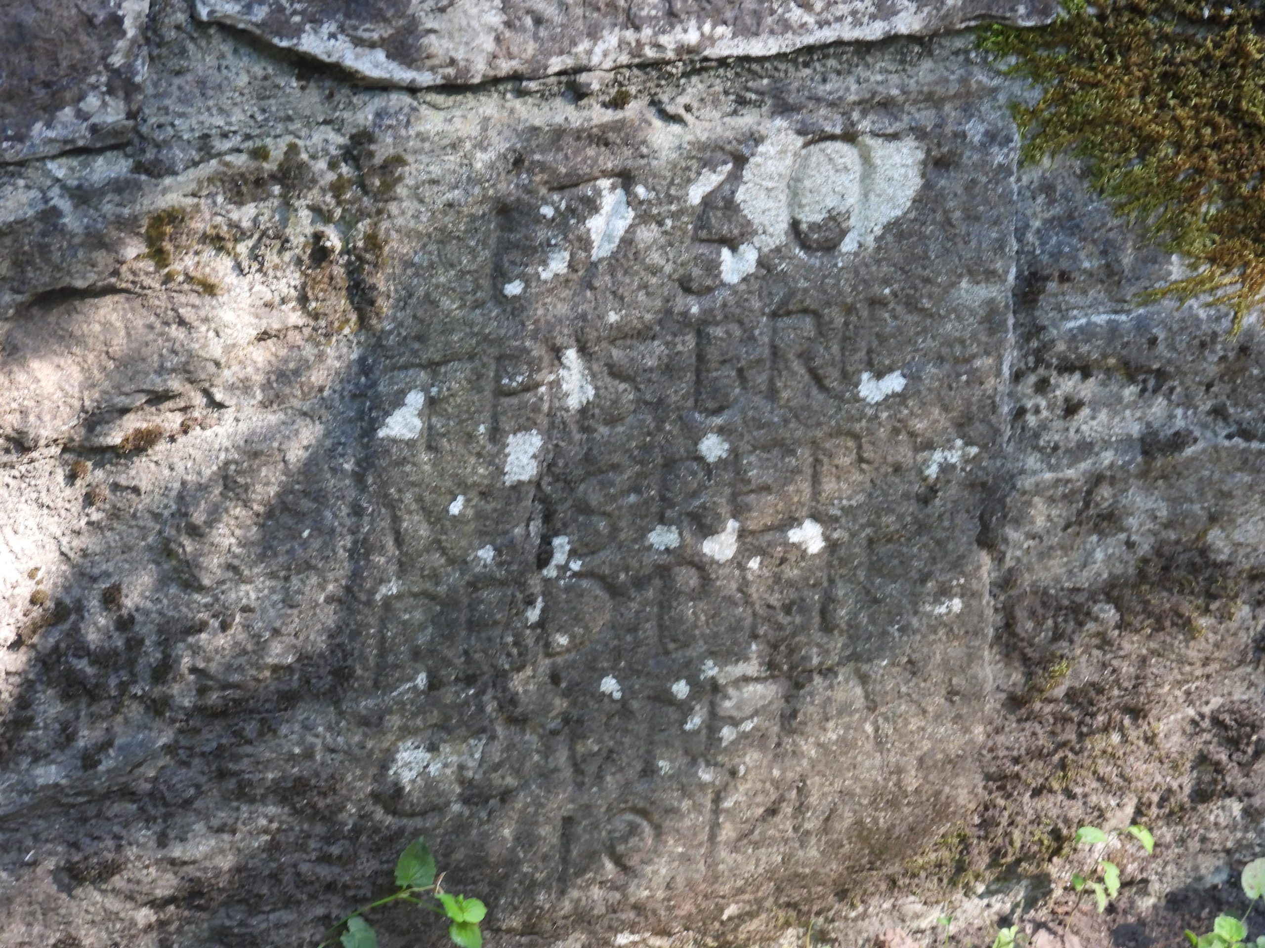
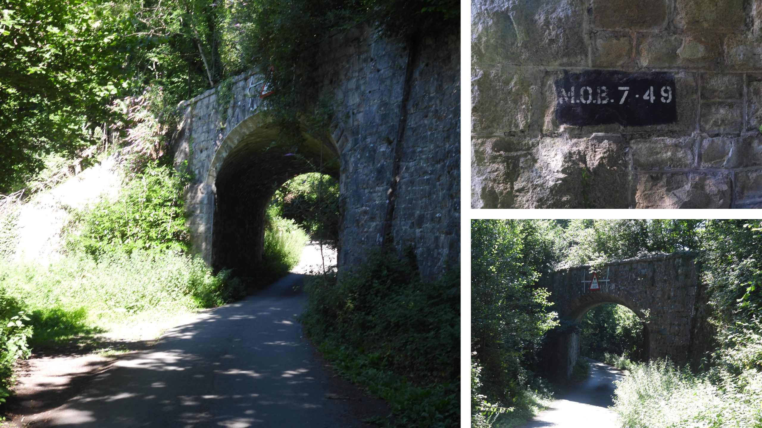
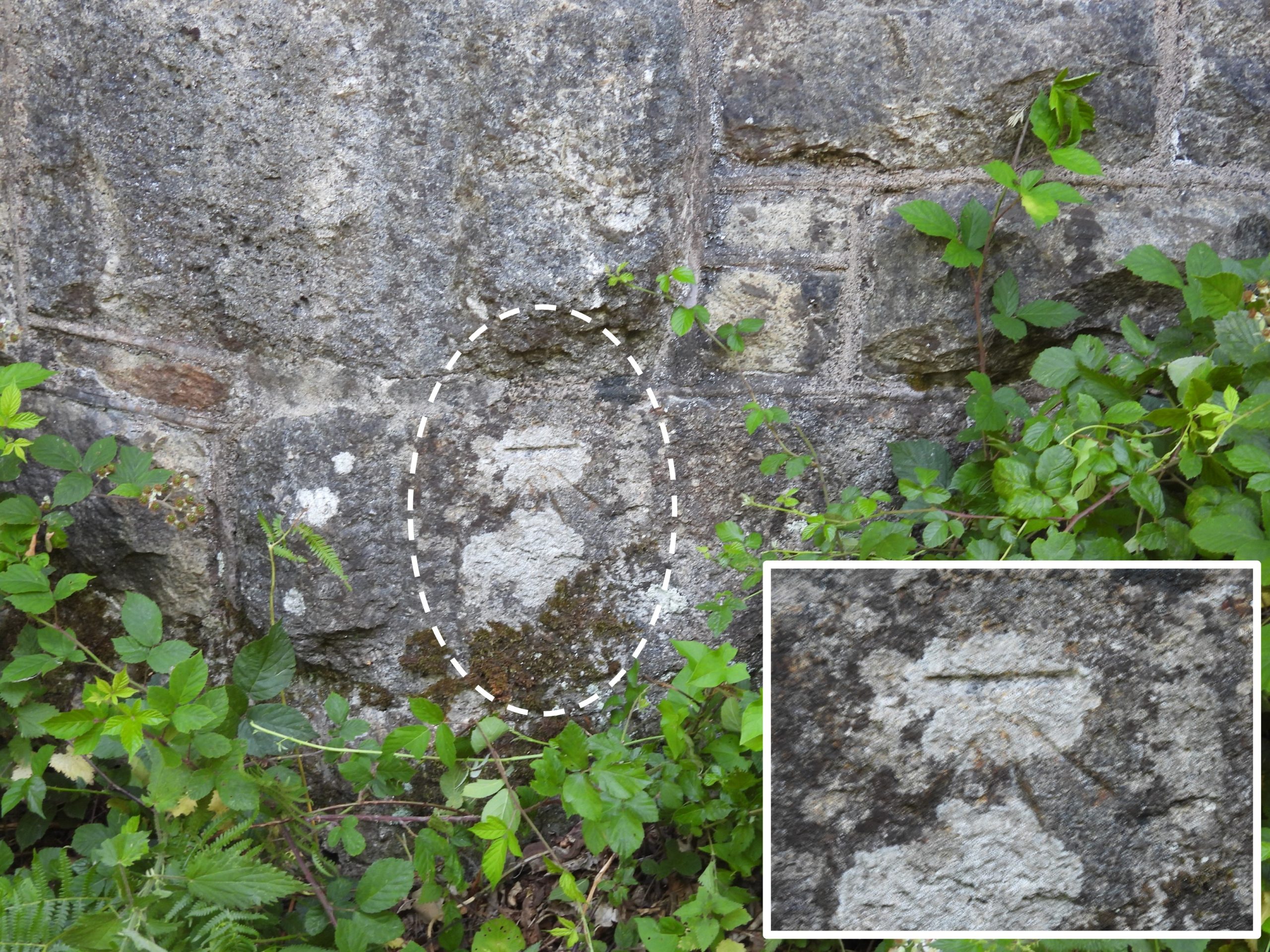
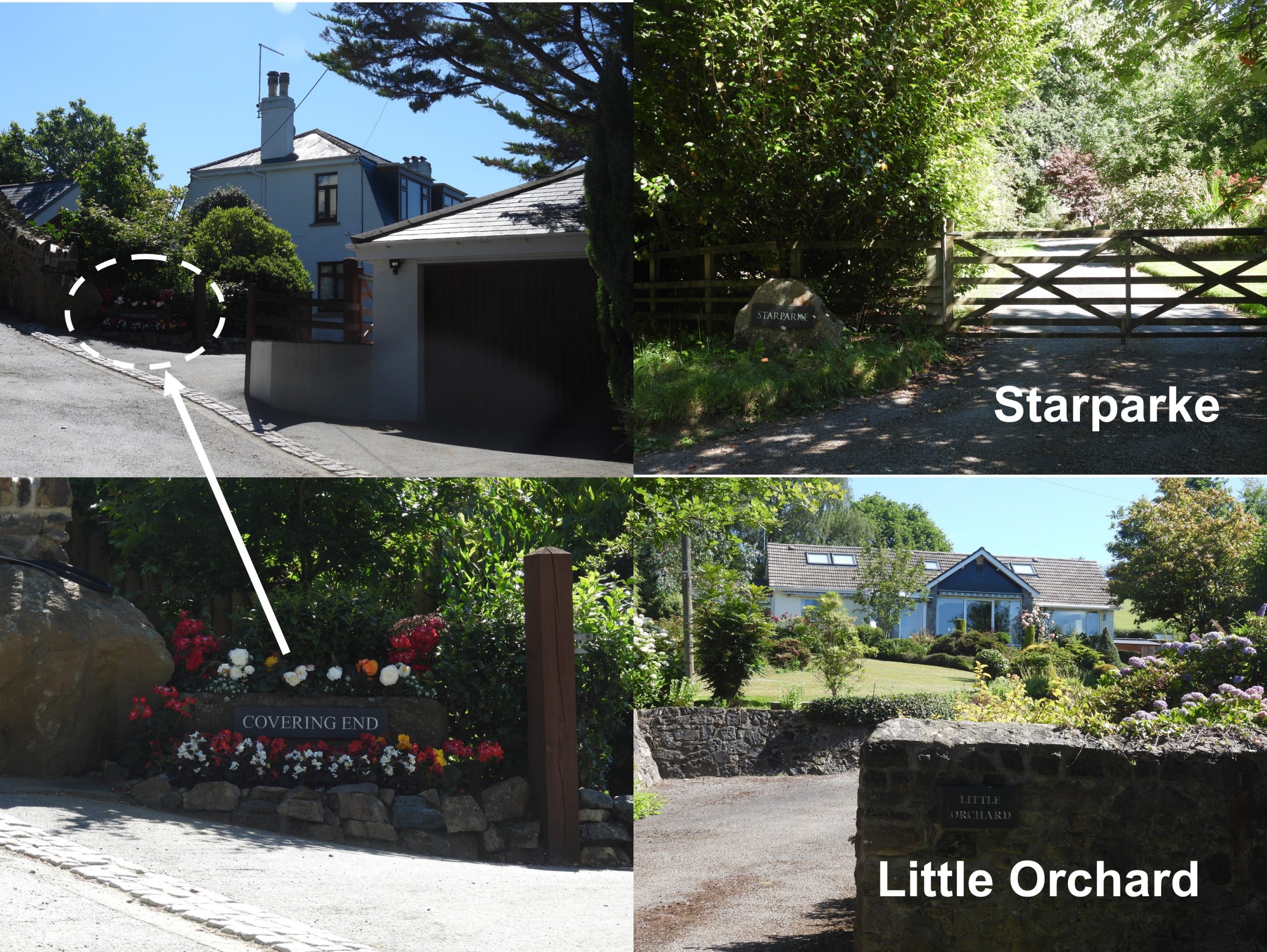
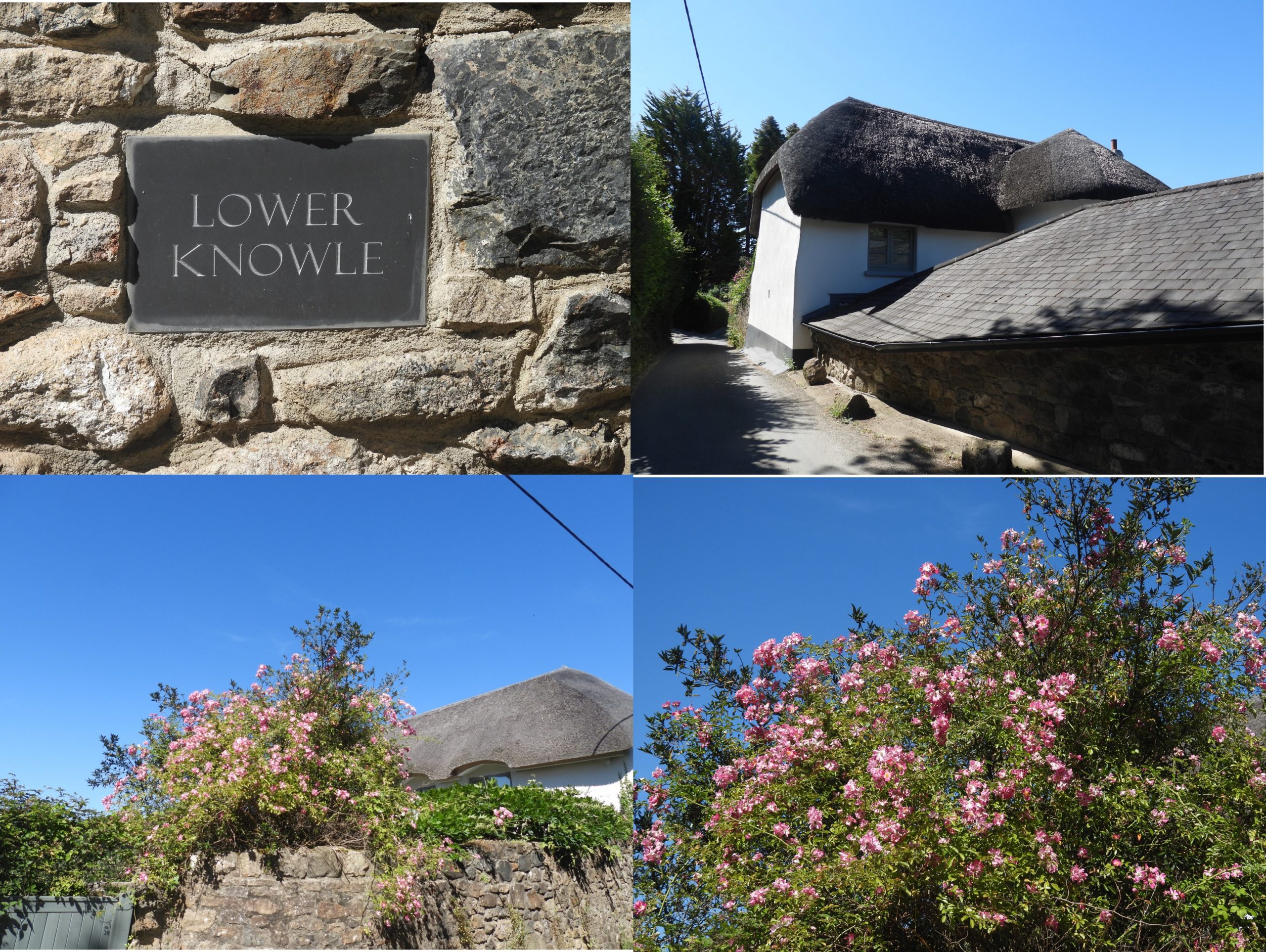
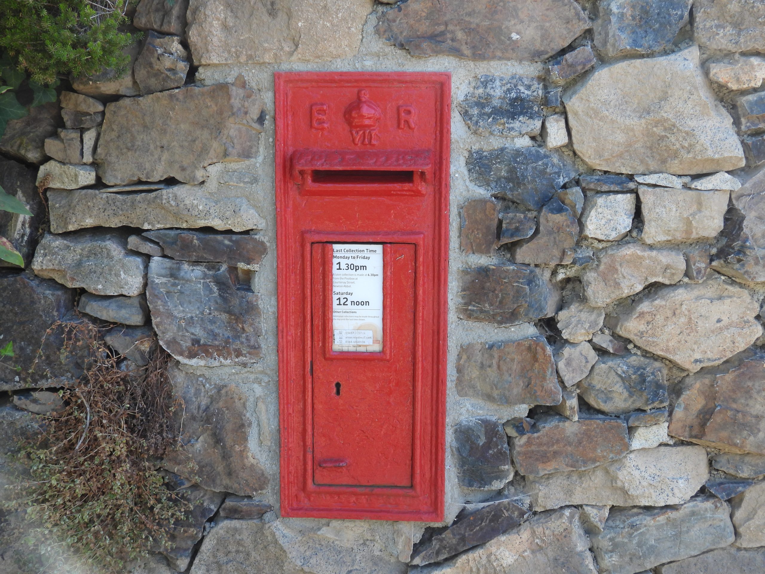
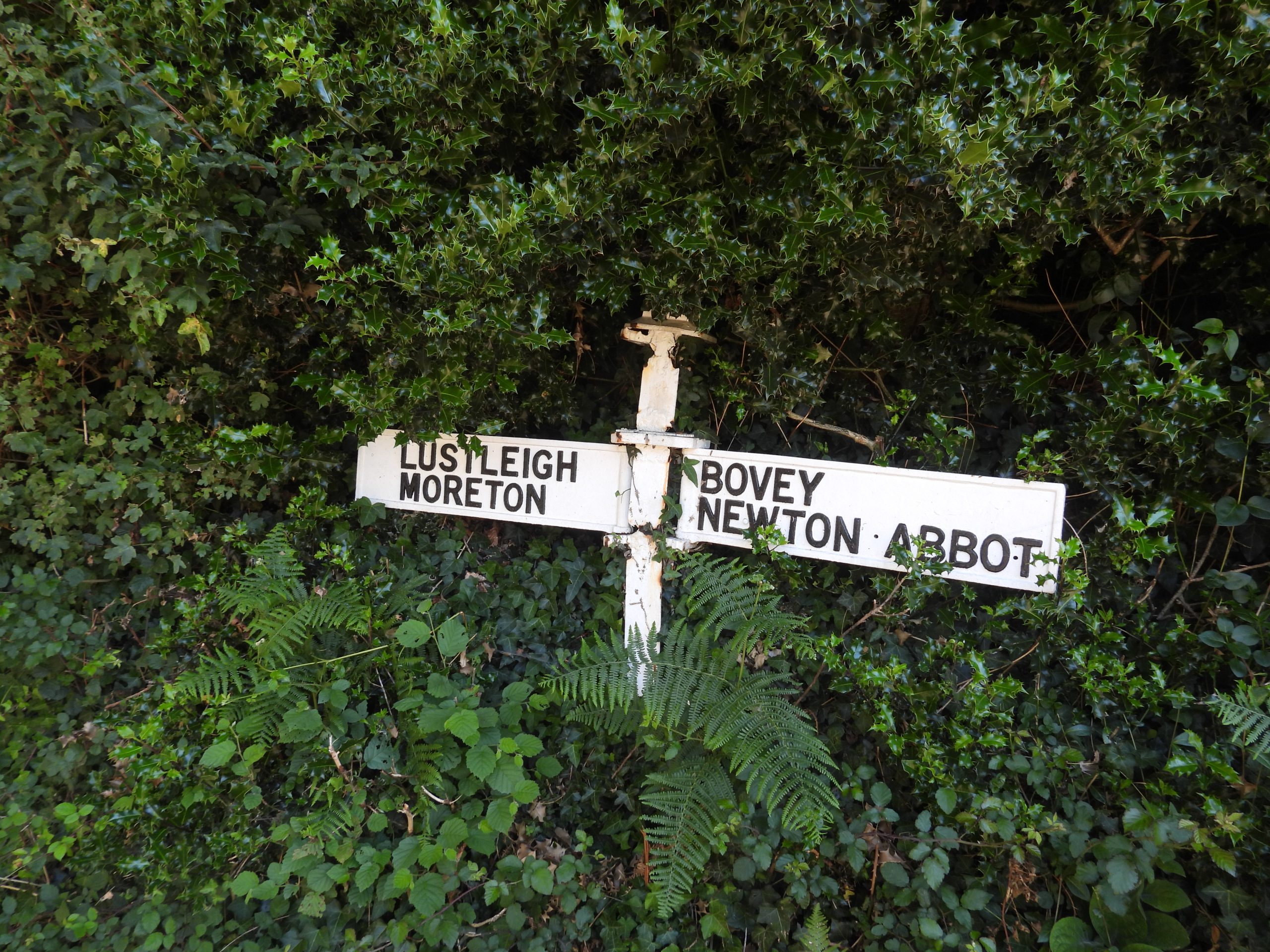
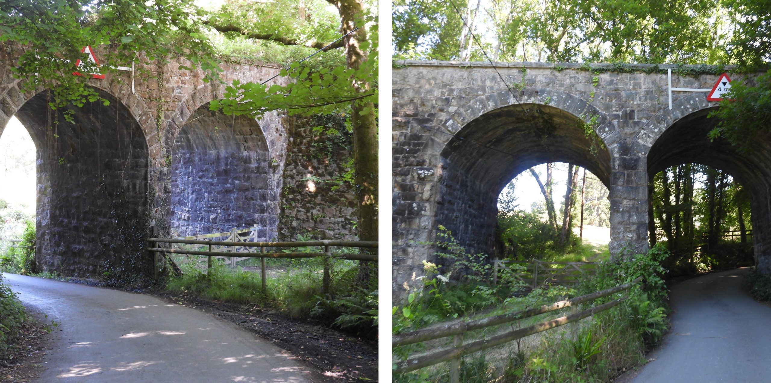
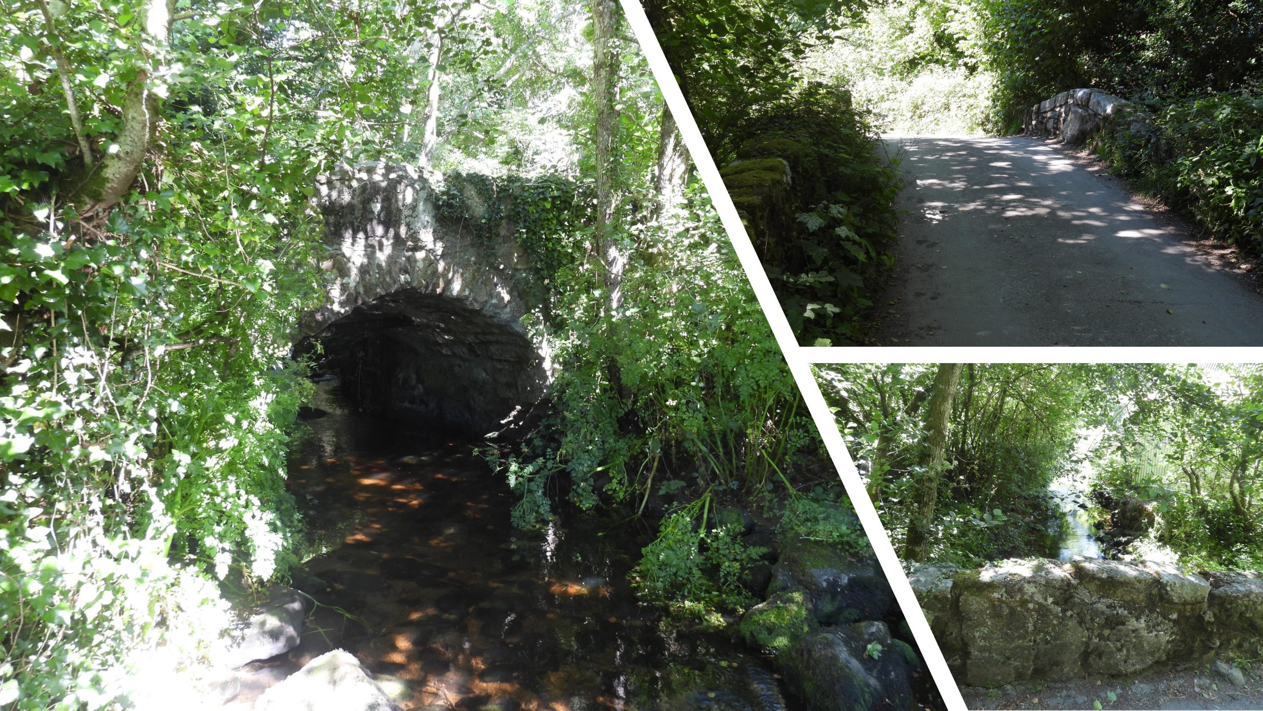
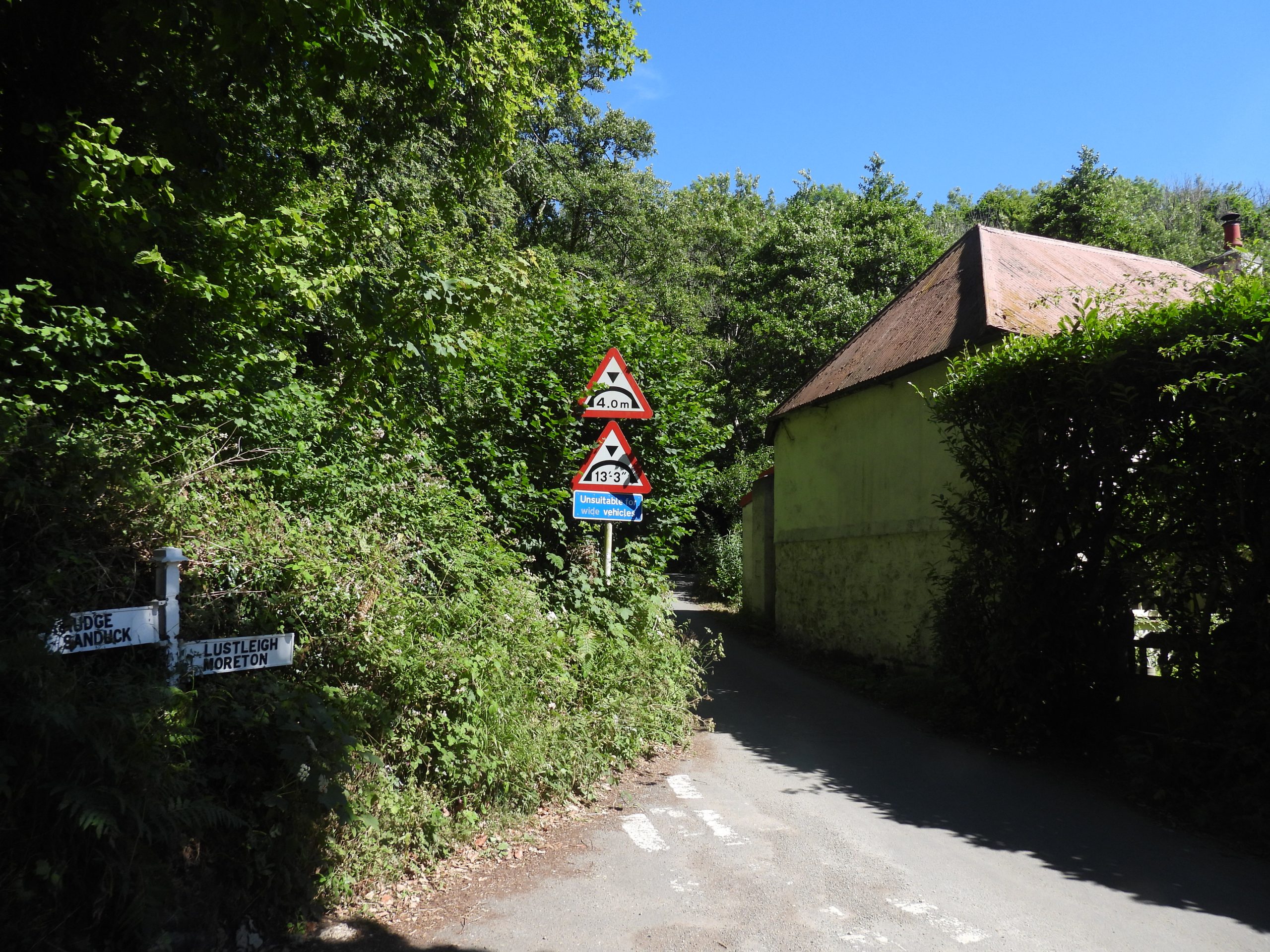
Sketch map showing the locations of Wilford and Drakeford Bridge in relation to River Bovey, the old GWR Moretonhampstead Branch line, the Lustleigh Parish boundary and the National Park Boundary.Wilford (Woolford) Bridge, spans the River Bovey on the boundary of Lustleigh Parish and Dartmoor National Park. It lies just a few 10s of metres from the Dartmoor Way and the former GWR (Great Western Railway) Moretonhampstead Branch line. The bridge has an inscribed tablet stating when the bridge was repaired.The Wilford Bridge tablet reads : “1750 THIS BRIDG WAS REPA RED BY the COUNTY 1914″ In the 17th century some courts continued in their consideration of imposing levies for the repair of roads and bridges when presentment were made. The constables made these presentments to the Grand Jury at sessions. This tablet recognises the repair of this bridge in 1750, presumably following the process previously described. The tablet was the forerunner to “C” (county) stones found elsewhere. The date 1914 has been added, which one assumes was when the old 17th century bridge was replaced as the present roadway is carried across the River Bovey on iron girders. (Ref: Dartmoor Boundary Markers, 2nd Edition by Dave Brewer – page 221)The Lower Knowle road passes under the old GWR Moretonhampstead branchline just to the south of Lower Knowle. On the bridge there is a mileage marker “M.O.B 7 .49”, which the author believes refers to this bridge being 7 miles and 49 chains from Newton Abbot. The M.O.B may refer to Moretonhampstead Branch.On the south east end of the bridge is a benchmark. This one does not appear to have a reference on 19th century maps or the Dartmoor HER.Dwellings near Lower Knowle on Lower Knowle Lane: Starparke, Little Orchard and Covering End.Lower Knowle dates to at least the early-mid 19th century, but may be much older. It appears on the tithe map. This Edward VII post box is located in a stone garden wall on the east side of Lower Knowle Road. A part of the wall collapsed along with the box in 2021, requiring the box to be removed temporarily by the Post Office. The work done to reinstate it is evident with the cement looking out of place in a drystone wall.The Dartmoor Way turns west at this point towards Packsaddle Bridge and Drakeford Bridge. Note the shortened spelling for Moretonhampstead and Bovey Tracey.The road passes under the Moretonhampstead branchline again enroute to the Packsaddle Bridge and Drakeford Bridge. The bridge is a double arch, one being used for the road and the other appears to be for possible farming use.Packsaddle Bridge is a humpback bridge, with low walled large granite stone. There is lots of evidence of repair where it appear to have been repeatedly struck by traffic. Having watched a couple of drivers negotiating the bridge the author can see why it has been struck.Just to the south of Packsaddle Bridge is a small building called ‘Ivy Cottage’. It is marked on the late 19th century historic maps, but is not shown on the 1840s Tithe Map, thus dating it to the mid-late 19th century.Drakeford Bridge is a medieval bridge, which appear to have been repaired by the county in 1684 (it has a tablet like Wilford Bridge indicating this). It was widened by 6ft on the upstream side in 1809 by James Green (County Surveyor), under the 1803 Bridge Act.The Drakeford Bridge tablet is very well inscribed. It is interesting to note the use of upper and lower case letters, the spelling of “Bridge” and the reversed “4”.
Interestingly, the railway bridge benchmark IS shown on the OS benchmark archive website maps, but as you say, not on the historical OS maps. If I’m out exploring, I now always check both references as neither seems complete….
I have walked under this spectacular bridge many times and never noticed the mark – great spot!

Matthew Johnson December 19, 2024
Thanks Steve,
Interestingly, the railway bridge benchmark IS shown on the OS benchmark archive website maps, but as you say, not on the historical OS maps. If I’m out exploring, I now always check both references as neither seems complete….
I have walked under this spectacular bridge many times and never noticed the mark – great spot!
SteveGriggDartmoor December 19, 2024 — Post author
Thank you Matt