A collection of walks, discoveries, insights and pictures of exploring Dartmoor National Park
November 3, 2022
Boundary Markers on Okehampton / Sampford Courtenay Parish Boundary
Just outside the Dartmoor National Park, on the boundary of the parishes of Okehampton and Sampford Courtenay are two boundary markers, each having a story to tell.
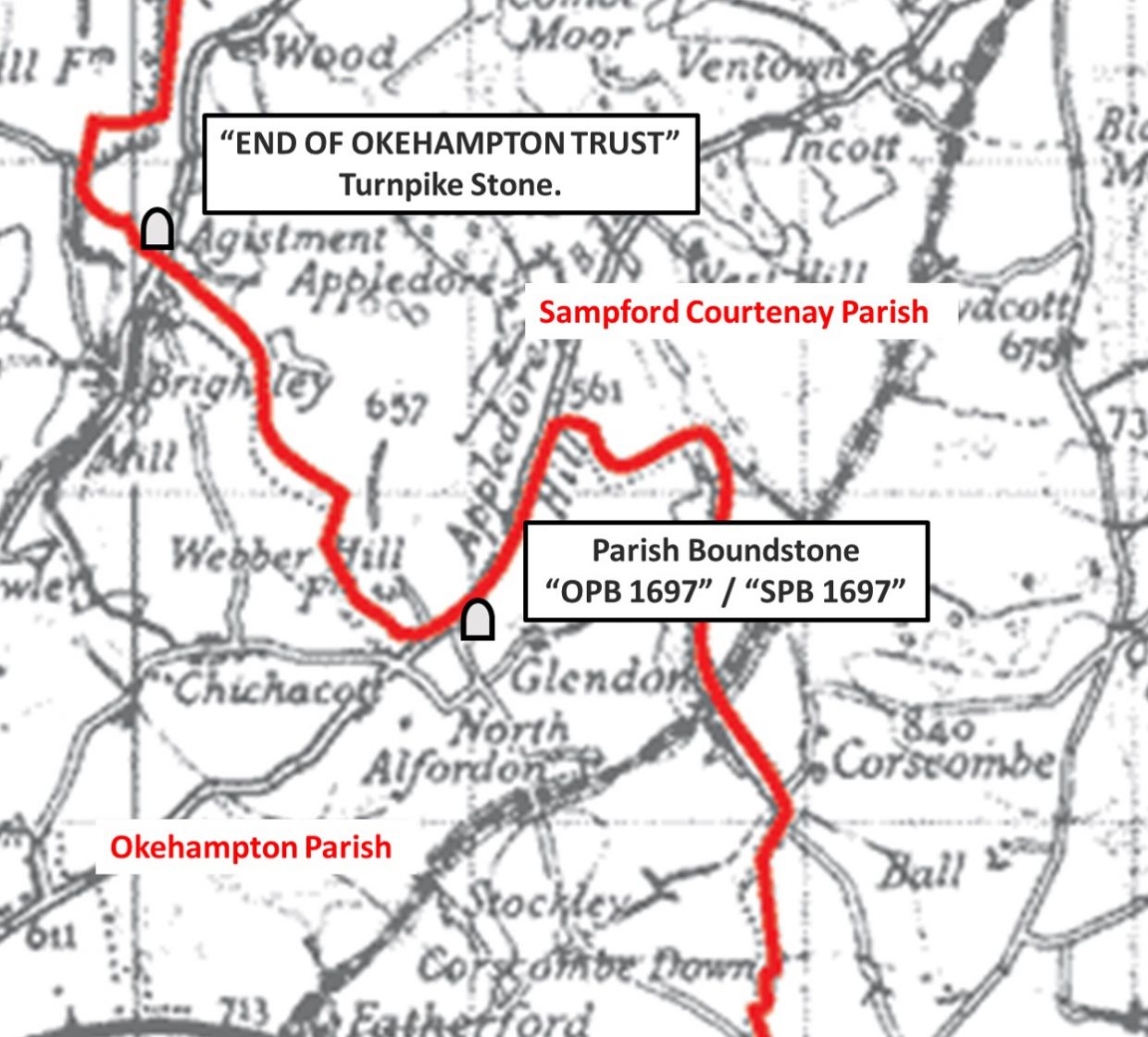
Firstly, on the Exbourne road out from Okehampton is a “END OF OKEHAMPTON TRUST” marker, which was one of seven (originally) which marked the limits of the Okehampton Turnpike Trust and dates from around 1760, when the turnpike roads were set up. Secondly, there is a 17th century parish boundary stone (from 1697) at Glendon Cross, which is deeply inscribed on two sides. Both of these markers are mentioned in Dave Brewers book Dartmoor Boundary Markers (second edition), from which information for parts of this post was obtained.
This post not only covers the aforementioned boundary markers but also includes some other features in the area such as three benchmarks and a very picturesque thatched cottage in the hamlet of Brightly.
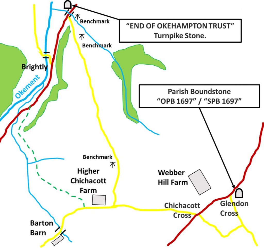
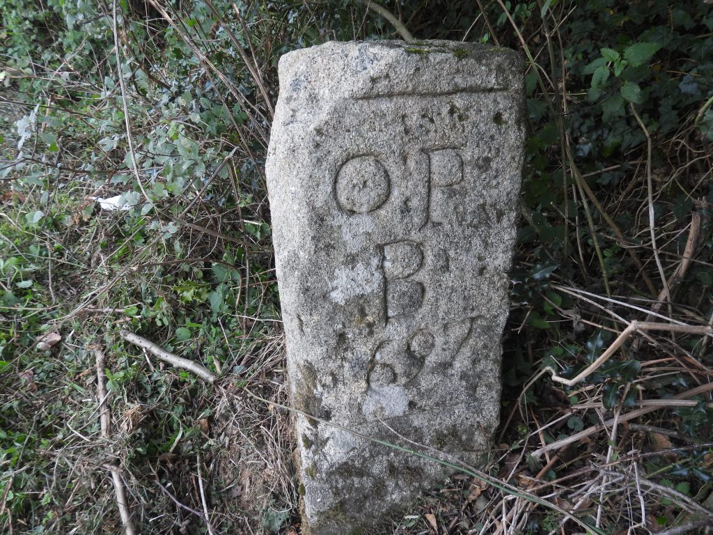
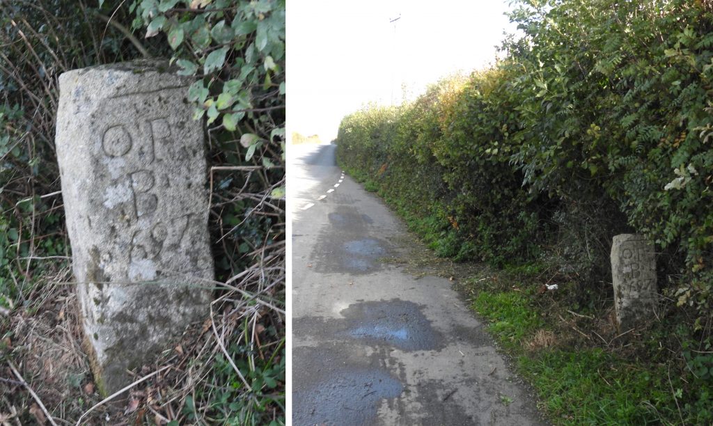
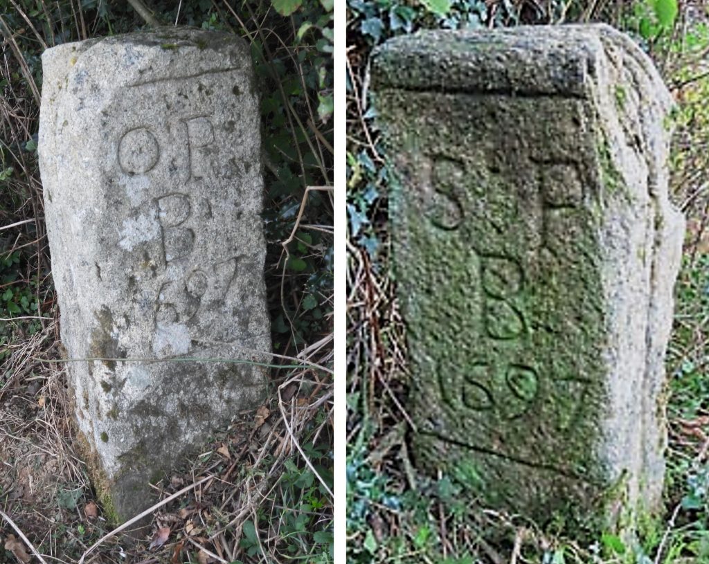
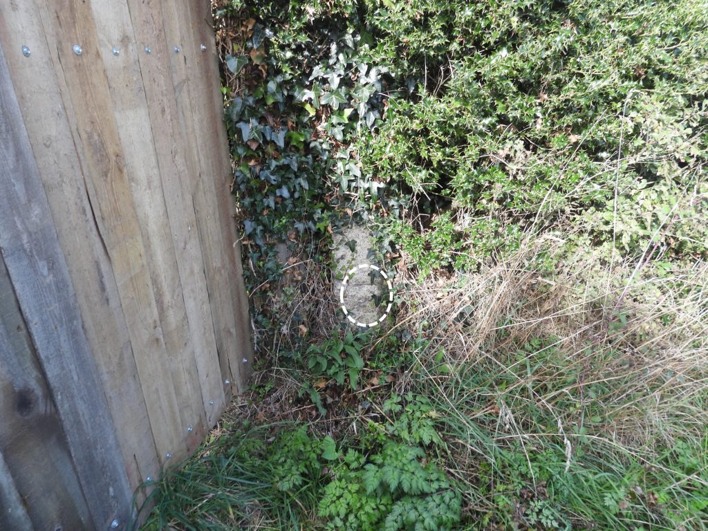
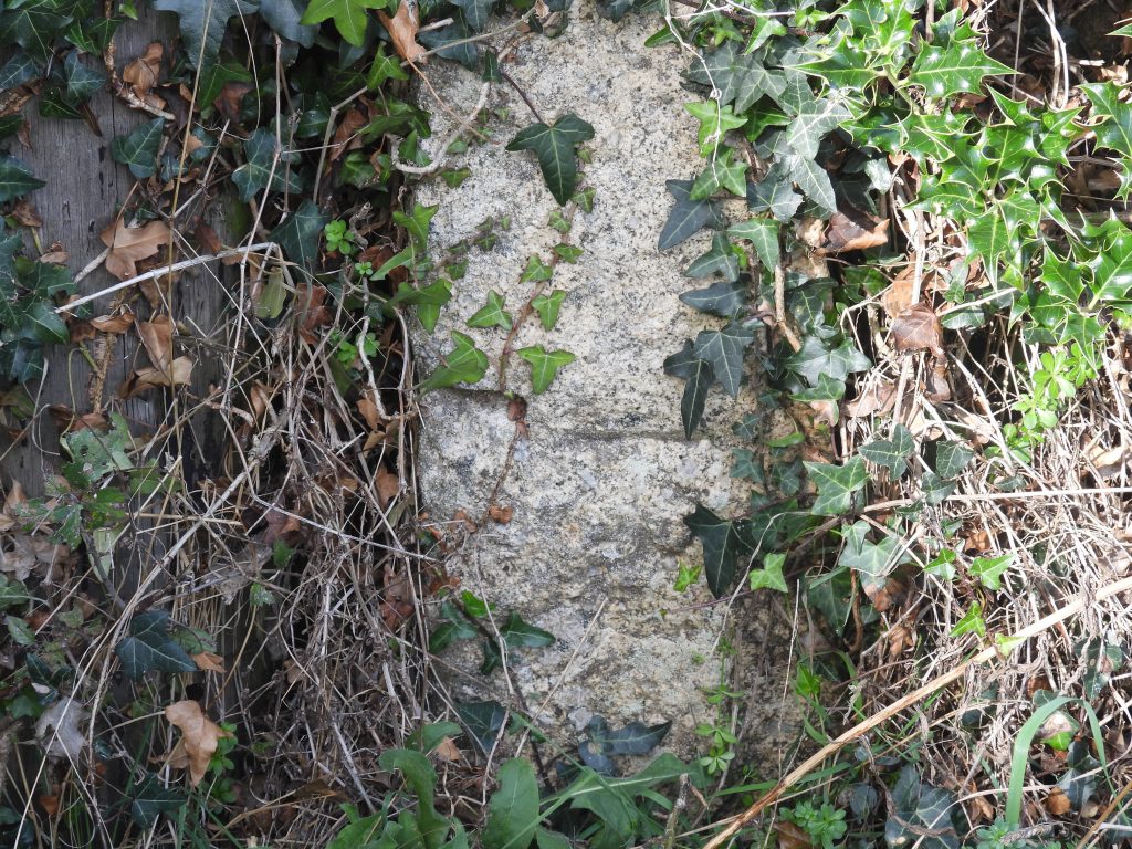
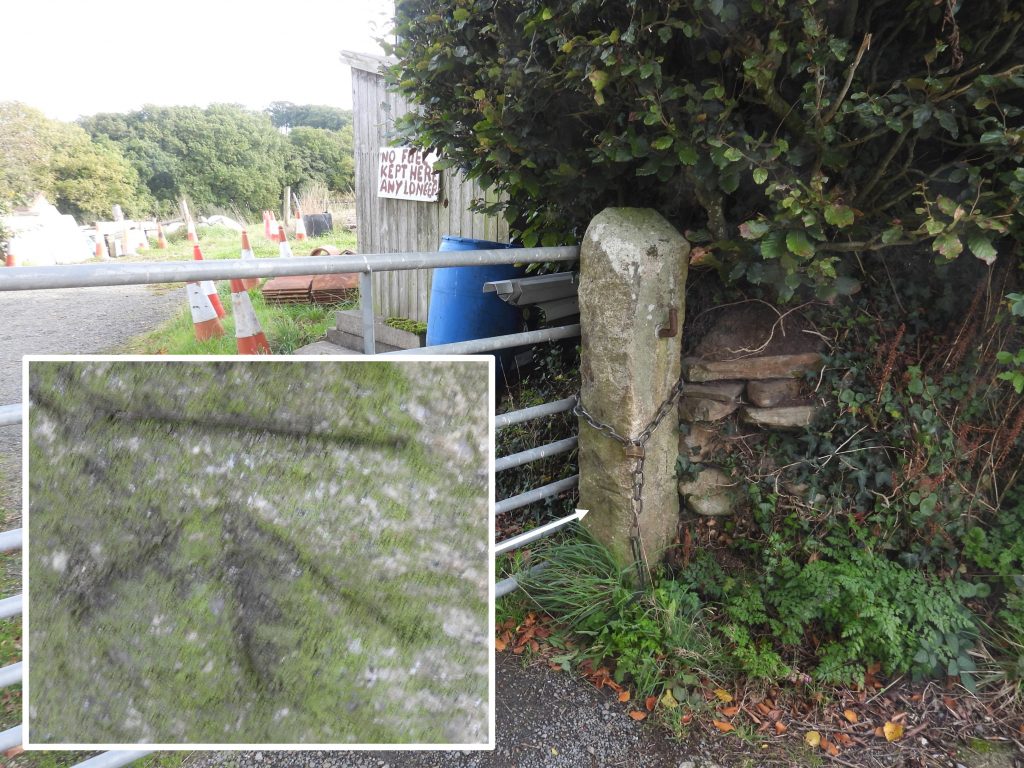
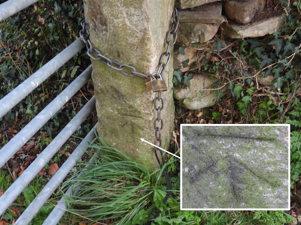
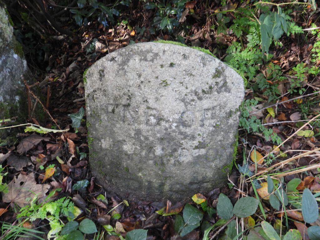
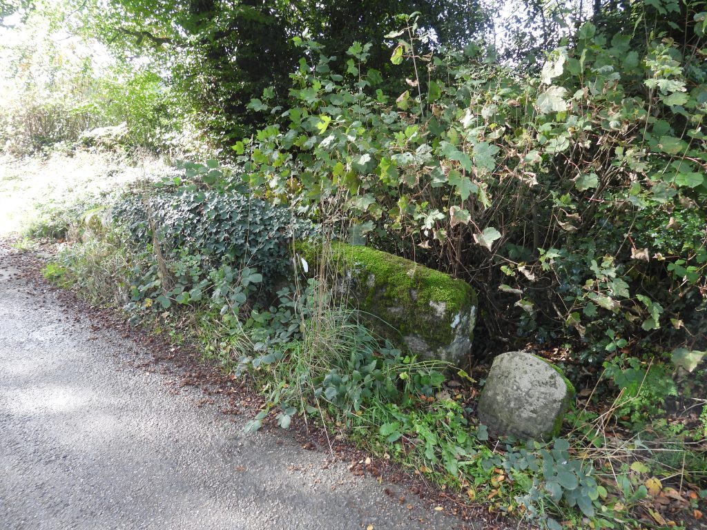
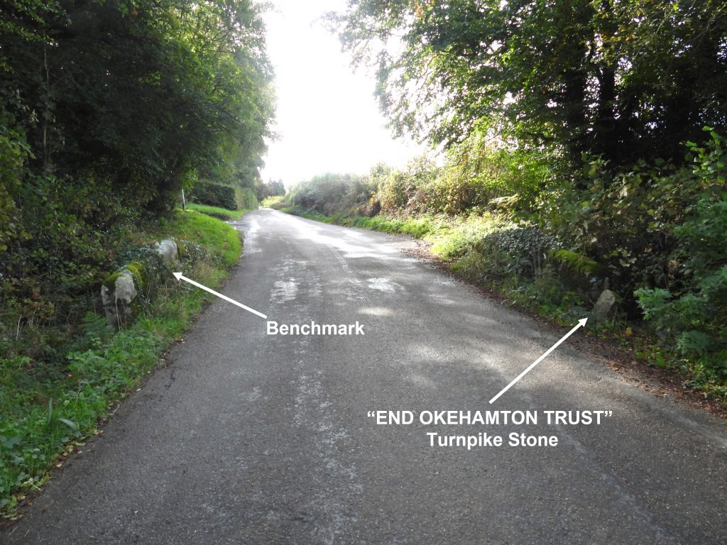
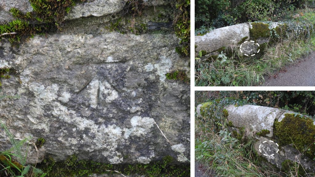
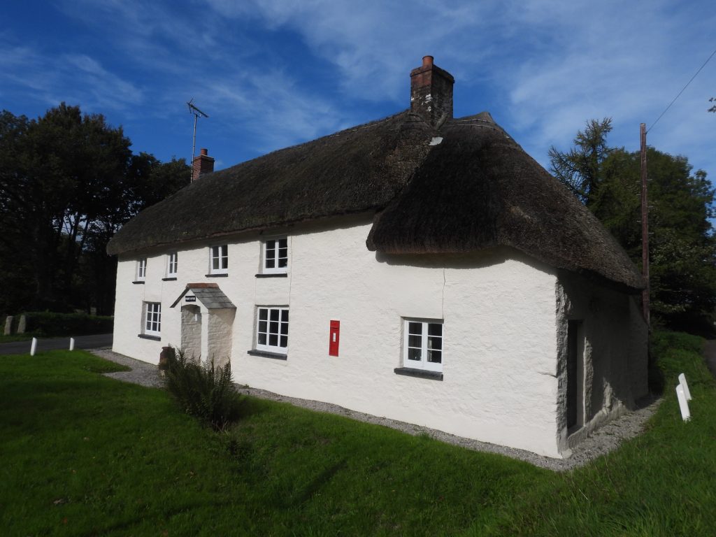
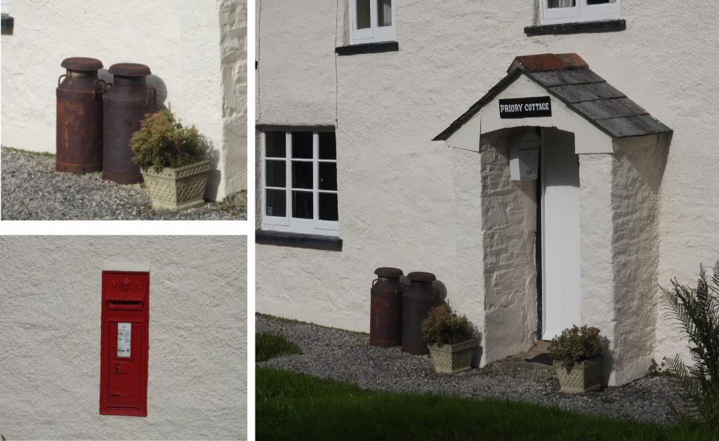
Sketch map of the area covered in this post. The area can be walked to from Okehampton down minor lanes and has far reaching views along the way. The Sampford Courtenay / Okehampton Boundary from a 19th century map, showing the relative locations of the two boundary markers covered in this post. This boundary is still shown today on modern maps as a line of dots. The boundary follows various roads and water courses. In the lay-by on the B3215 at Glendon Cross, near Okehampton the parish boundary marker can be found. It is inscribed “OP / B / 1697” on its south west face. The inscription is quite deep and the letters and numbers are very legible. The OPB (Okehampton Parish Bounds) marker is located at SX60984 96647On the reverse side (north east face) of the parish boundary marker is the inscription “SP / B / 1697”. The letters stand for Sampford Parish Bounds. The boundary marker is shown in the Dave Brewer book (page 181) and looks recumbent, so might have been re-erected in the last 20 years or so. On the lane between Higher Chichacott Farm and the Okehampton / Exbourne road two benchmarks were recorded by the author. This benchmark is shown on the Devon County Council Environmental Viewer but not on any 19th century maps from National Library of Scotland, so the reference number is unknown.This benchmark is located on the gatepost at SX60298 96788The second benchmark recorded on the lane between Higher Chichacott Farm and the Okehampton / Exbourne road is also on a gatepost. This benchmark is also shown on the Devon County Council Environmental Viewer but not on any 19th century maps from National Library of Scotland, so the reference number is unknown.This benchmark is located at SX60064 97534. There is / was a third benchmark along the lane (approx SX60183 97106) which was not searched for by the author.“END OF OKEHAMPTON TRUST” boundary marker at Chichacott Down bridge on the Okehampton / Exbourne road. The Okehampton Turnpike Roads were created in 1760 as a town-centred trust covered a network of roads radiating north, west and east from the town. Turnpike trusts were bodies set up by individual acts of Parliament, with powers to collect road tolls for maintaining the principal roads. .The Okehampton Turnpike Trust boundary marker is approx. 0.5m x 0.5m and as is located on the east side of the bridge just inside the Sampford Courtenay parish (as the boundary follows the line of the stream which runs under the bridge). The marker is located at SX60015 97677Chichacott Down Bridge with the locations of the Okehampton Turnpike Trust boundary marker and a benchmark which is inscribed into the bridge.The benchmark is referenced on 19th century maps as B.M. 0415.9. It is located at SX60018 97676A short distance from Chichacott Down bridge (towards Okehampton) is the delightful hamlet of Brightly with the “chocolate box” thatched cottage of priory cottage especially catching the eye.Priory cottage is believed to date from 18th century and has 19th century additions. It is rendered with (probable) stone rubble and cob walls. The letterbox is a “Victoria” (VR).