A collection of walks, discoveries, insights and pictures of exploring Dartmoor National Park
October 16, 2020
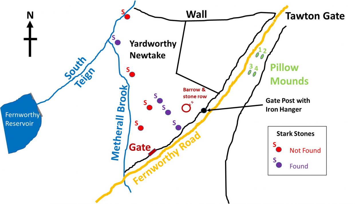
YARDWORTHY NEWTAKE & STARK FAMILY
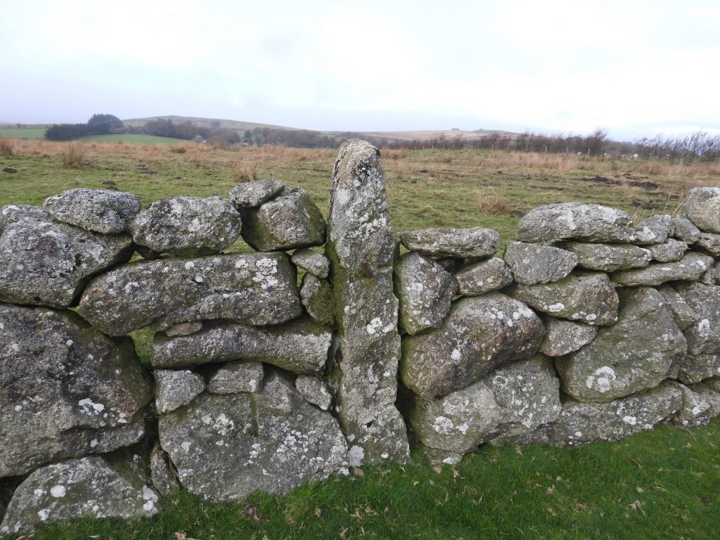
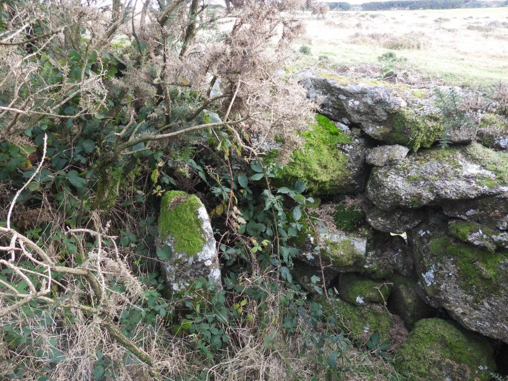
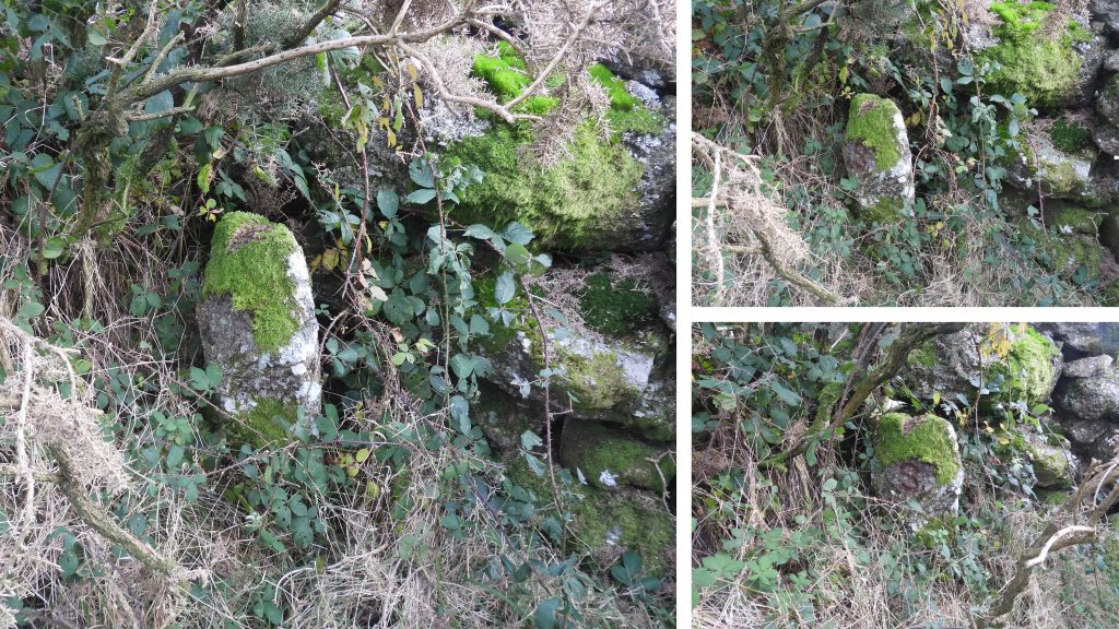
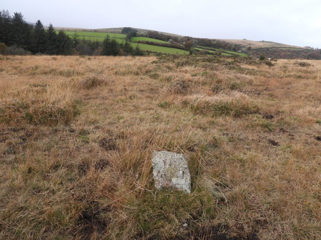
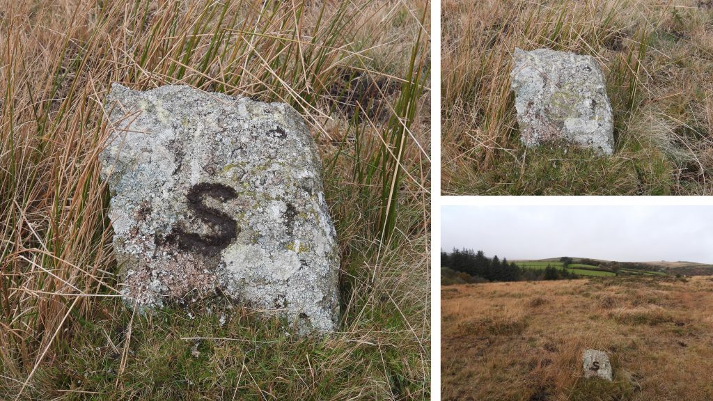
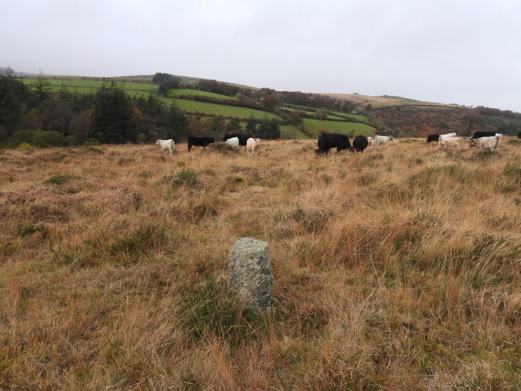
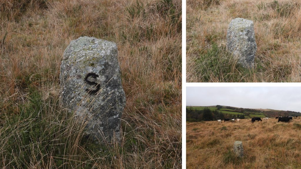
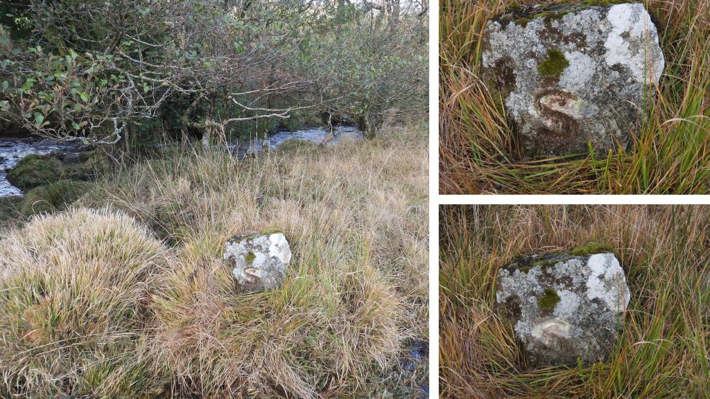
Yardworthy Newtake lies to the West of the Fernworthy Road between Tawton Gate and Metherall Brook and is bordered by a wall to the north and the South Teign River to the East. Within the Newtake, there are a number of small set bound stones, inscribed with a letter “S”. Dave Brewer in the 2nd edition of Dartmoor Boundary Markers, states that 8 of these stones have been identified. The inscriptions face different directions. This post contains the photographs and four of these stones with their locations.
It is conjectured that these stones refer to the Stark family. Robert Stark was a sculptor and painter from late 19th / early 20th century. After buying a 275-acre estate in the 1890’s, he built the properties of Ford Park, Great and Little Frenchbeer. He sold Ford Park in 1912 but retained 7 acres near the South Teign. It is thought that the stones mark this area and that it was earmarked for the site of another house. The land slopes down quite steeply to the river where it is quite marshy.
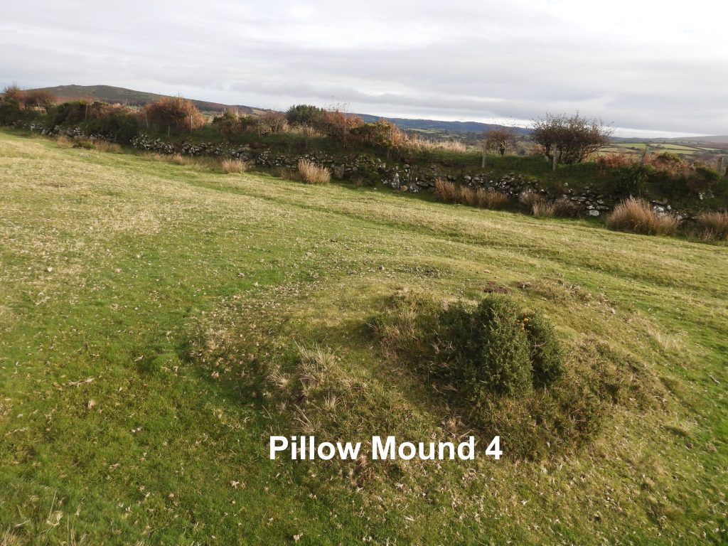
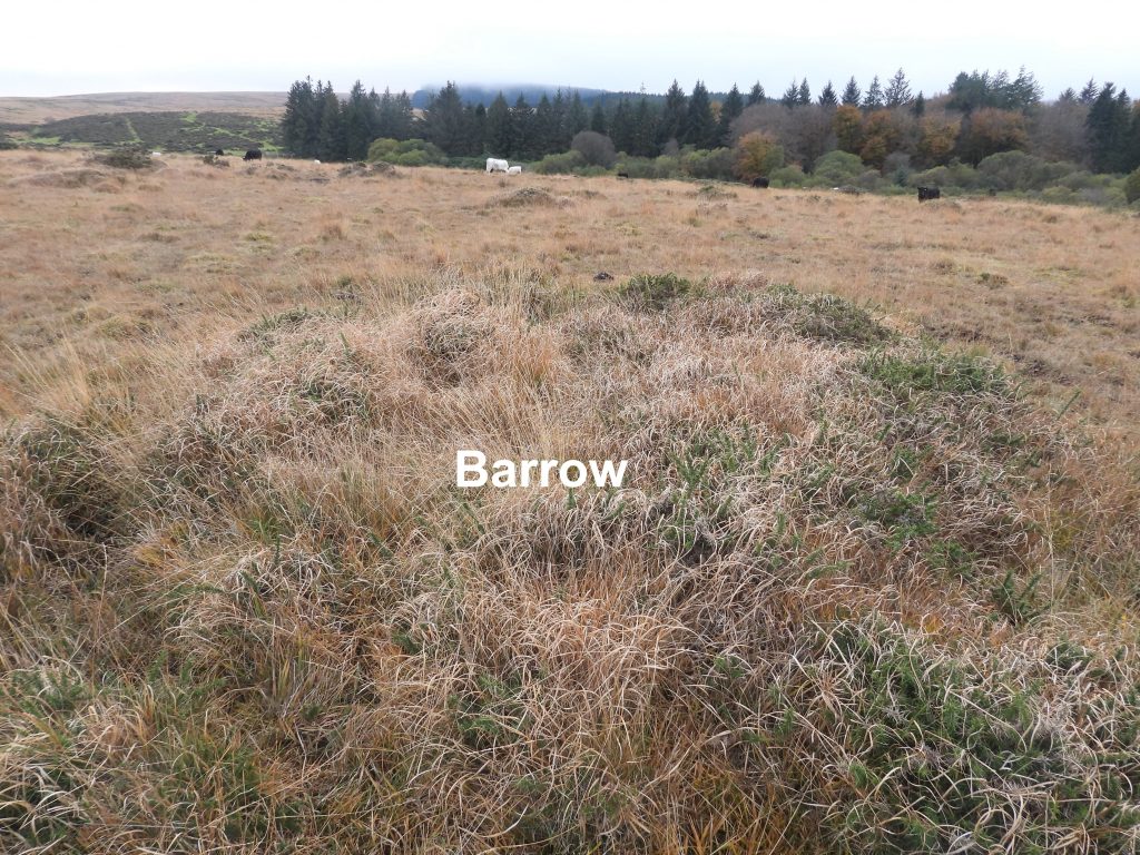
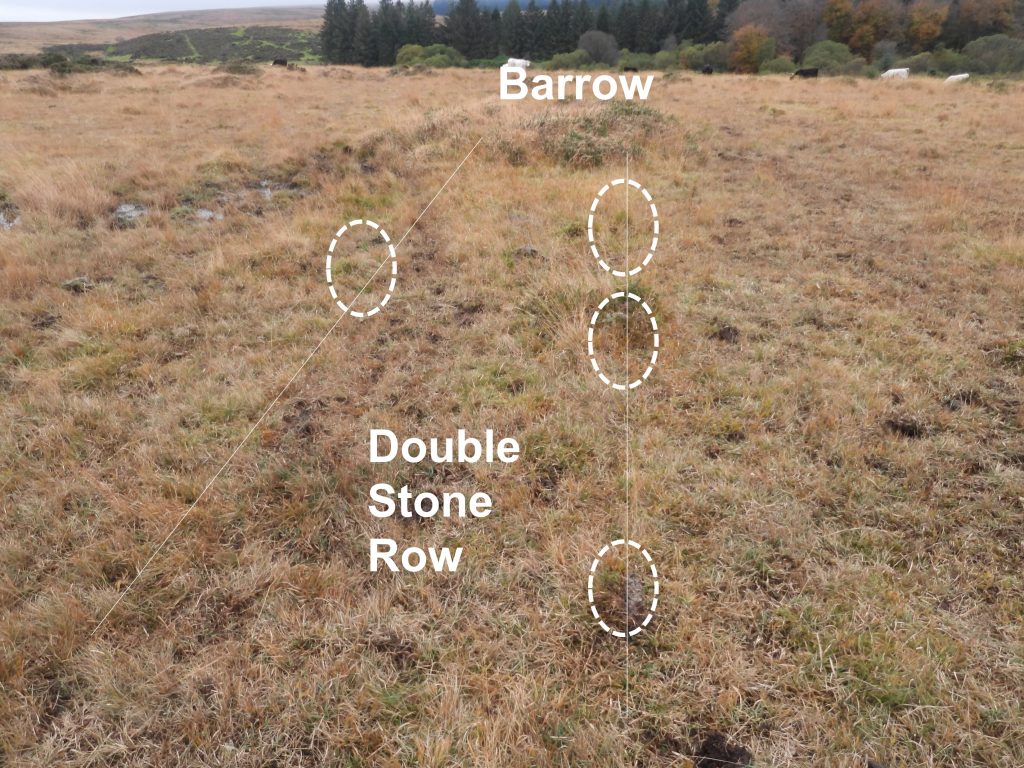
Also within the area is a Barrow and short stone row (within the Newtake), a gate post with an iron hangers and 4 pillow mounds believed to have been for domestic supply of rabbits.
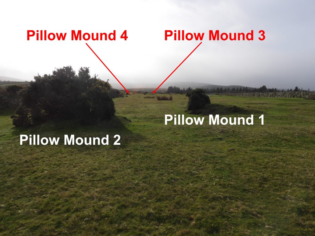
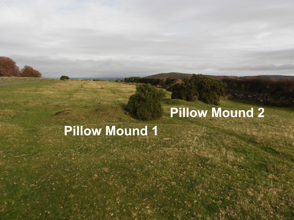
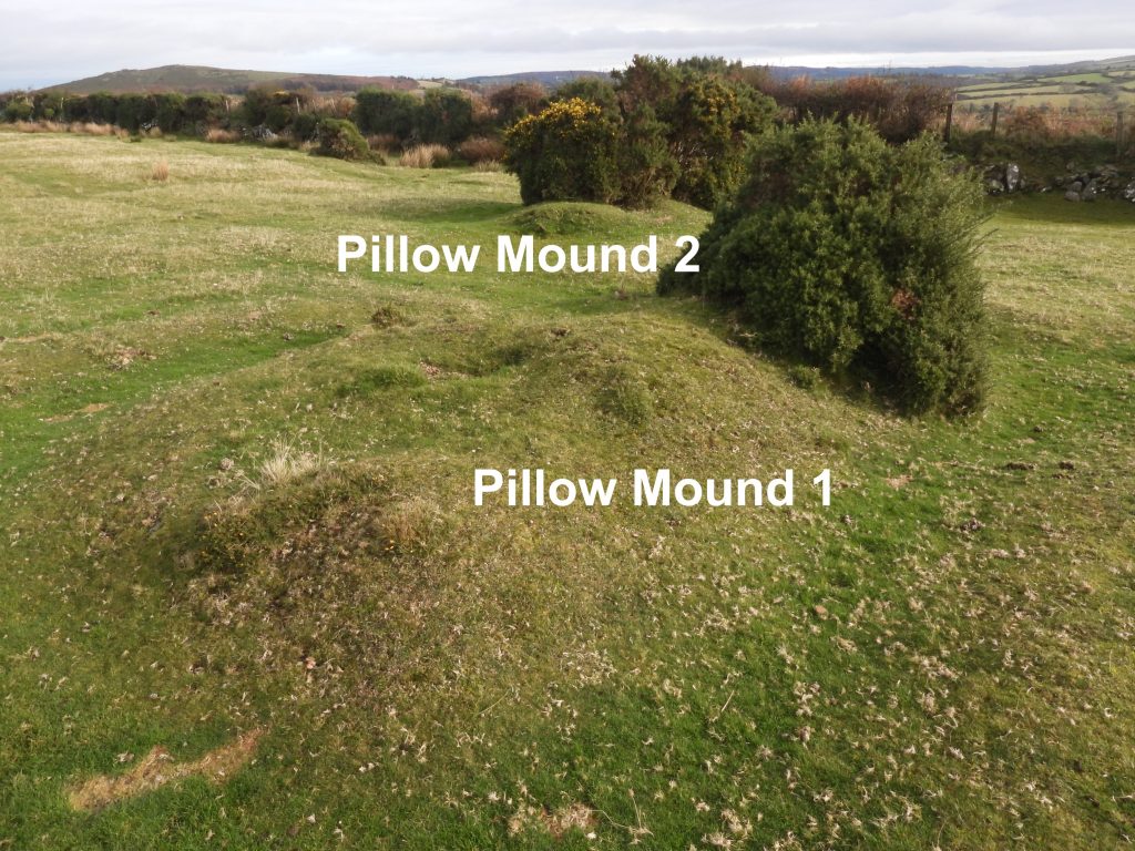
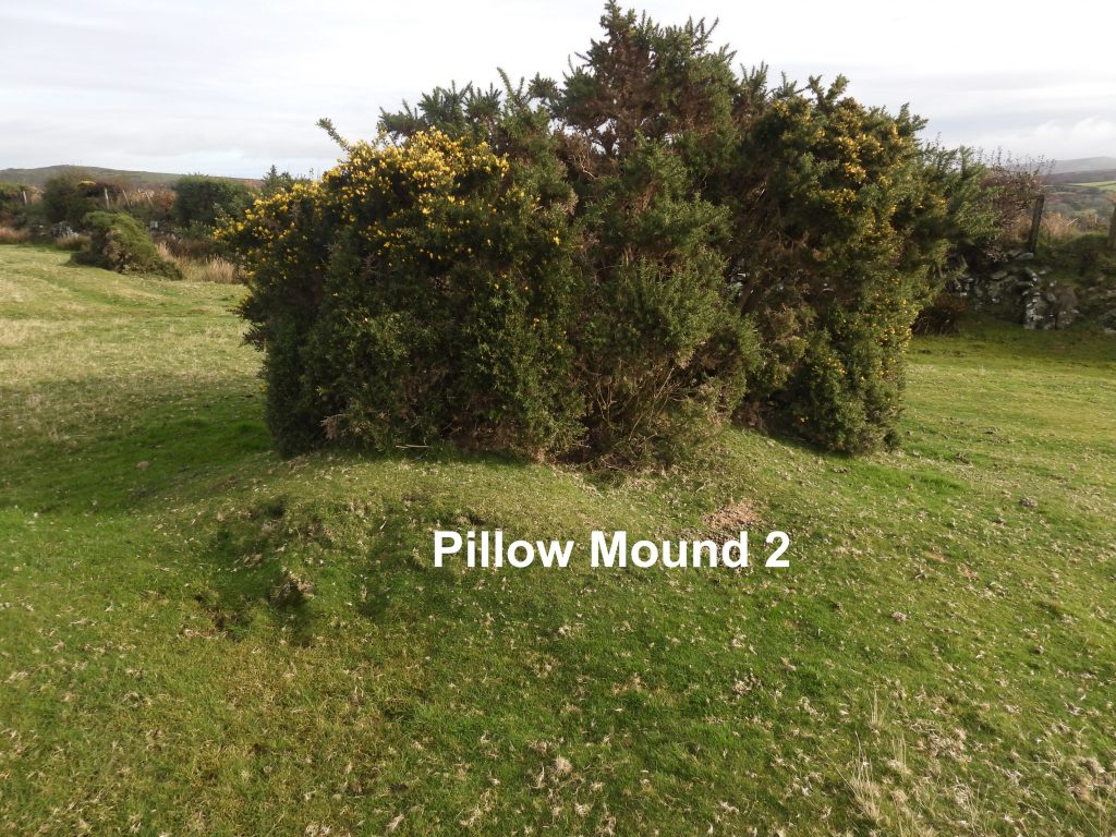
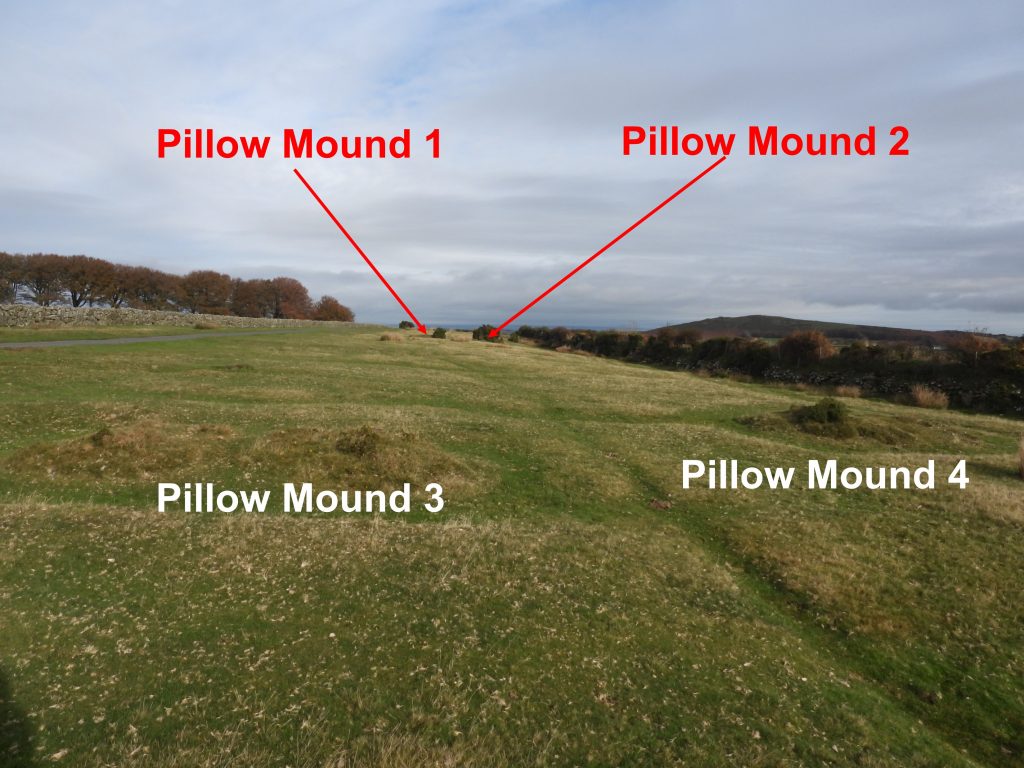
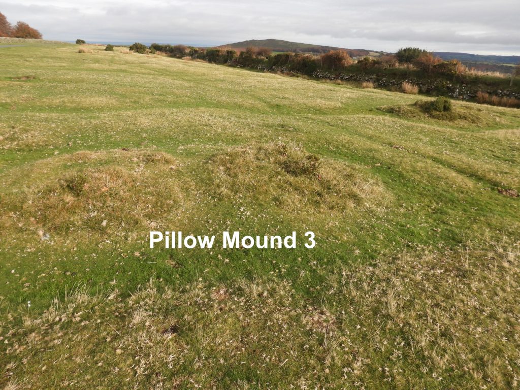
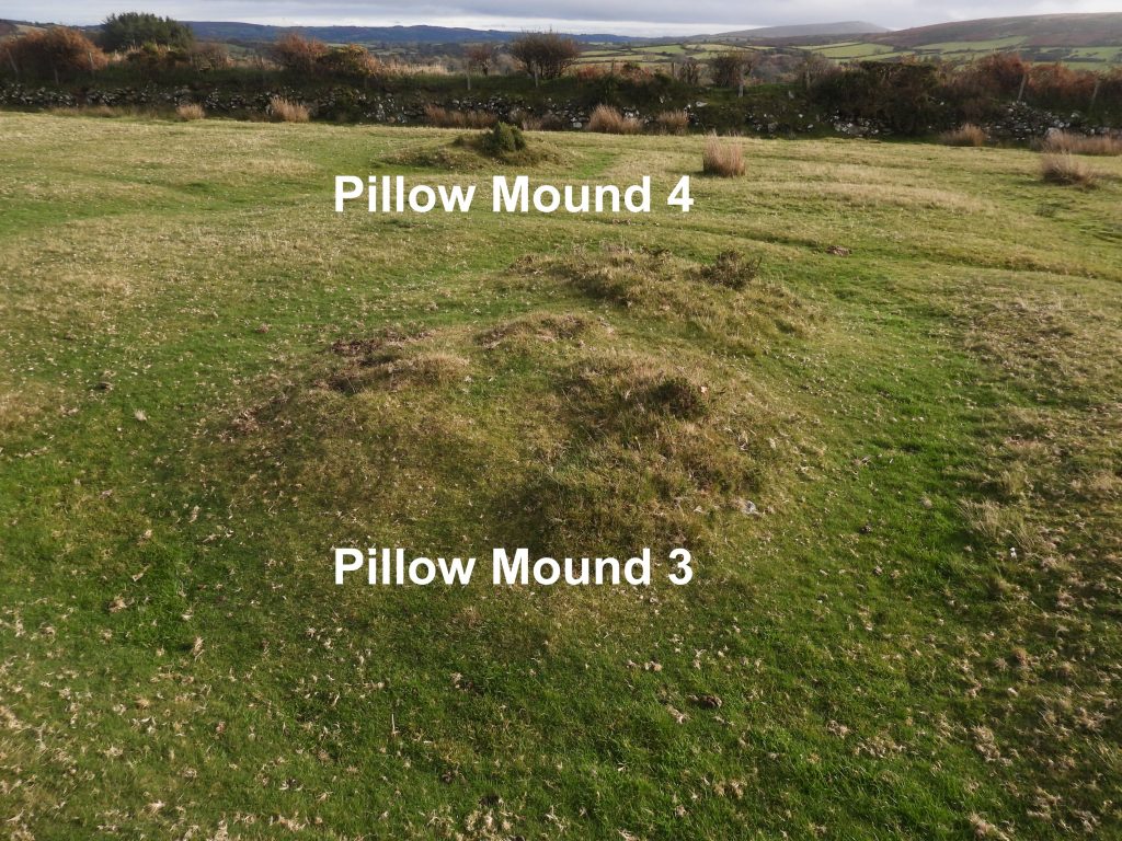
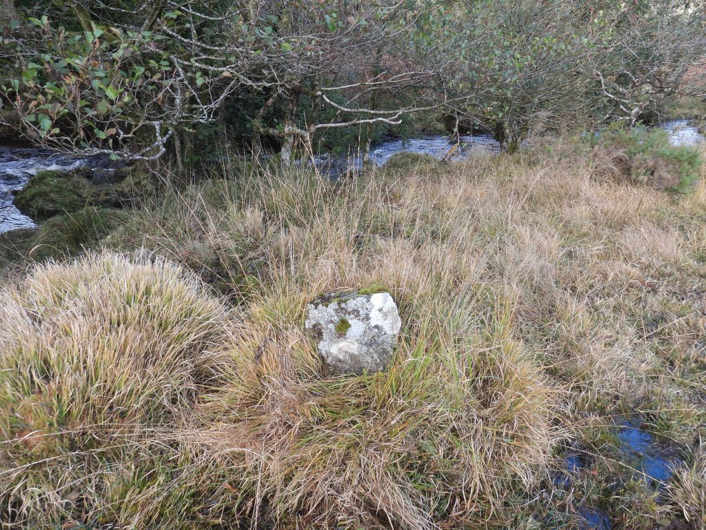
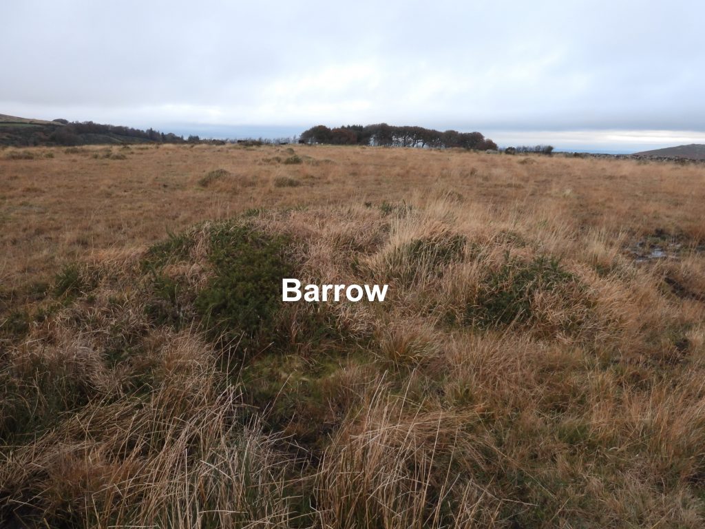
This is a reconstructed sketch from the Dave Brewer publication with additional features covered in this postThere are a group of four mounds on a narrow strip of greensward between the Fernworthy road and the early enclosed land of Shapley. They are mentioned in the Heritage Gateway.All the (pillow) mounds are all oriented north-west to south-east to accord with the slight ground slope and originally all were rectangular with a ditch around themPillow Mound 1 is located at SX67783 84635.There is cutting across this mound which seems exploratory. Pillow Mound 2 is located at SX67795 84640.The 4 pillow mounds as viewed looking north.Pillow Mound 3 is located at SX67747 84557.The depressions across mounds 3 and 4 are similar to those often found on large pillow mounds, being the collapse of construction tunnels. The small size and number of mounds suggests they were made for a domestic supply rather than as a commercial enterprise. Source: Heritage Gateway.Pillow Mound 4 is located at SX67758 84557.Within the Yardworthy Newtake wall is a former gatepost with iron hanger. It is located at SX67657 84461.This “S” stone is located alongside the Newtake wall. It is buried behind several large gorse bushes. The first visit to the Newtake, the author was unable to locate this stone. Mark Fenlon kindly pointed the author in the direction of the Devon Environment Viewer which provided more location information for the stones. Hence a second visit to the Newtake, the author was able to locate this one.This “S” stone is located at SX67609 84283.This “S” stone is approx 50m from the Fernworthy Road. This “S” stone is located at SX67563 84320.This stone is approx 50m from the one previously pictured.This “S” stone is located at SX67522 84361.This “S” stone lies close to the South Teign River, in a marshy area.This “S” stone is located at SX67331 84631.From Heritage Gateway: Small barrow with a maximum diameter of 5 metres and approximately 0.5 metres high with the remains of an apparent double stone row leading from it in a north-easterly direction.This Barrow is located at SX67592 84380.With the assistance of the description in the Heritage Gateway the short Stone row in Yardworthy Newtake, next to the Barrow was located. The description states: “Apparently the remains of a double row starts 3.0 metres from a low barrow and extends to the north-east for 7.0 metres. The north-west side consists of four stones, 2.0 to 2.5 metres apart. The south-eastern side about 1.4 metres distant has only one stone and two turf humps which may conceal others. Visible stones are barely 0.1 metres high. Immediately beyond the north-east end is a hollow or stone pit about 4.0 by 2.0 metres diameter. This, and clearance in the area may have destroyed any continuation.” NOTE: The author could only locate 3 of the 4 stones mentioned on the north west side of the row.