A collection of walks, discoveries, insights and pictures of exploring Dartmoor National Park
October 16, 2020
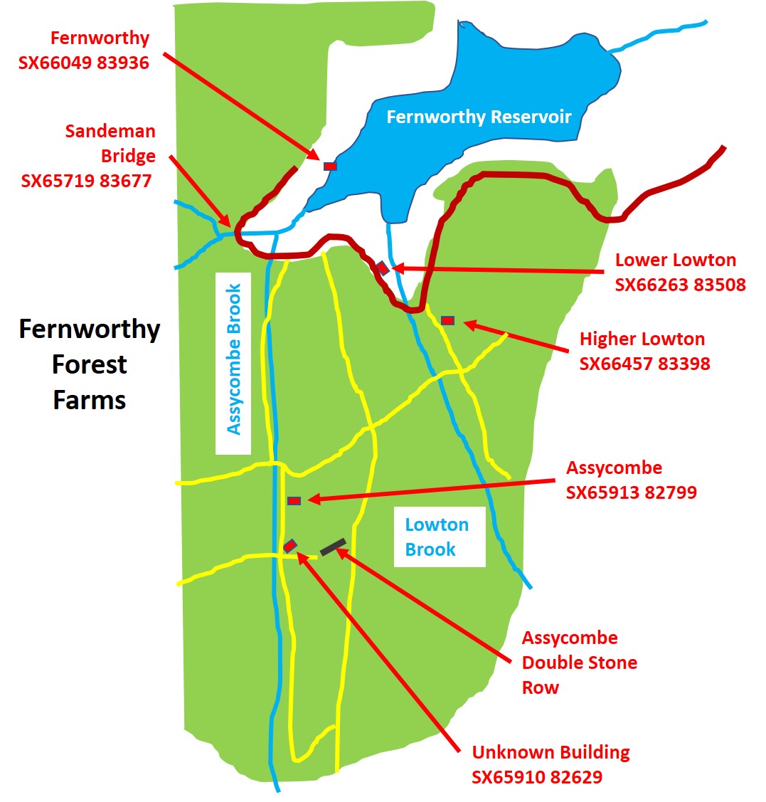
FERNWORTHY FOREST FARMS
Steve Grigg and Frank Collinson
This 2020 exploration was inspired by information taken from the Dartmoor Historic Environment Record (HER) and the plans of farmsteads surveyed by Dr Phil Newman in his archaeological survey of 2013. The farmsteads visited were Higher Lowton, Lowton, Fernworthy and Assycombe plus and unknown building a few hundred metres south of Assycombe.
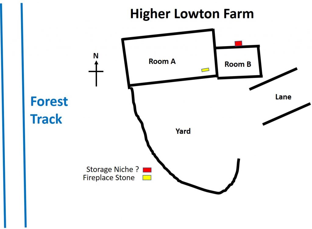
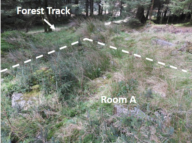
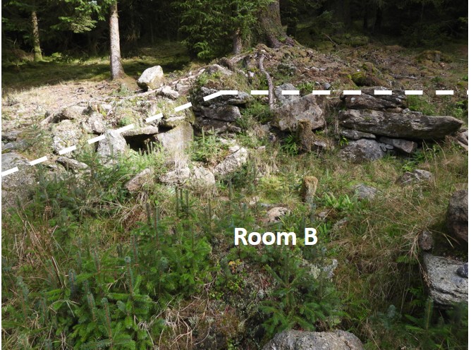
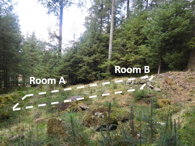
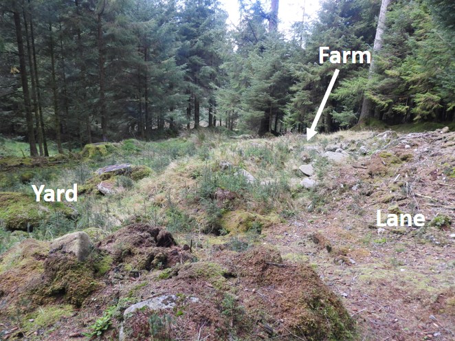
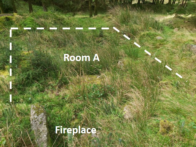
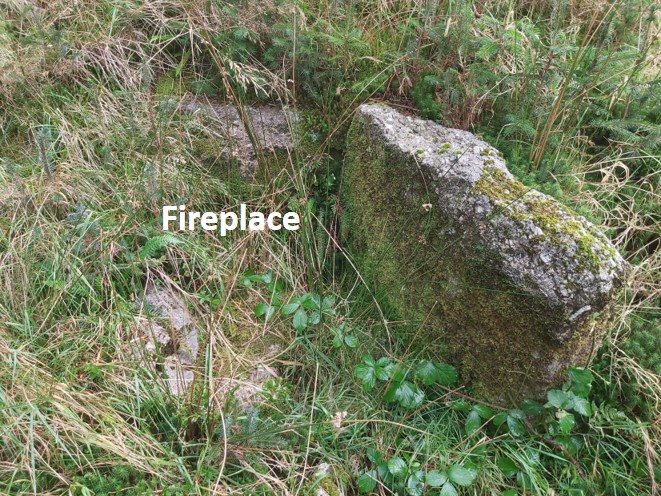
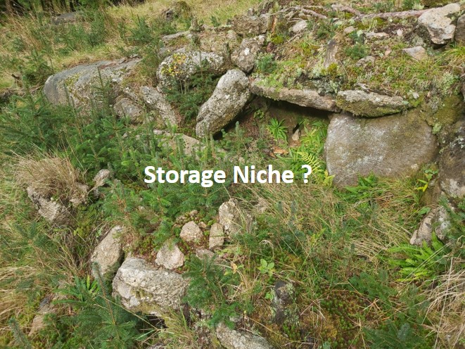
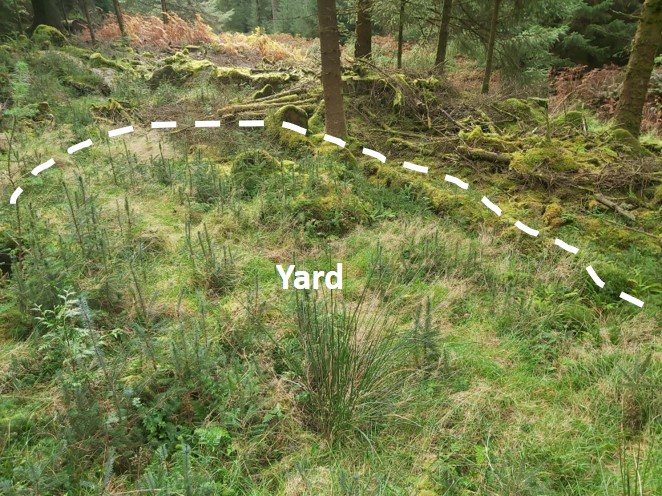
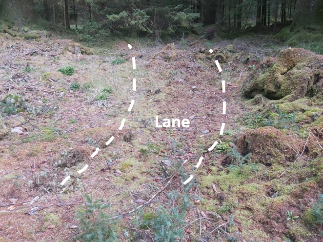
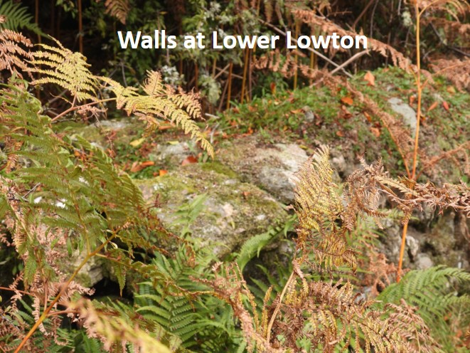
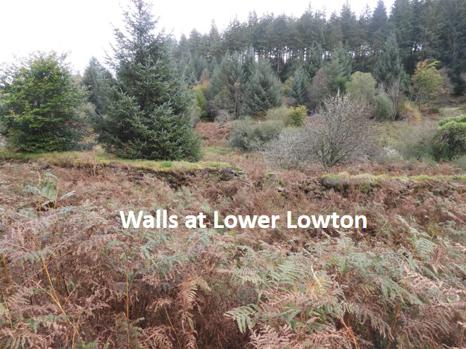
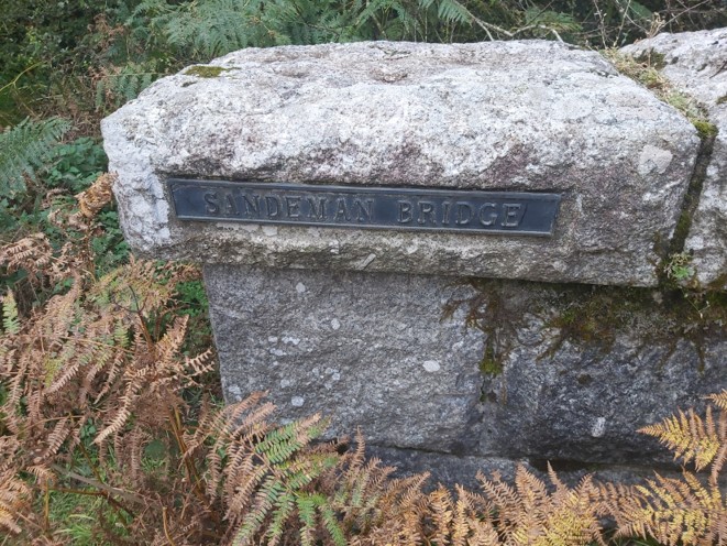
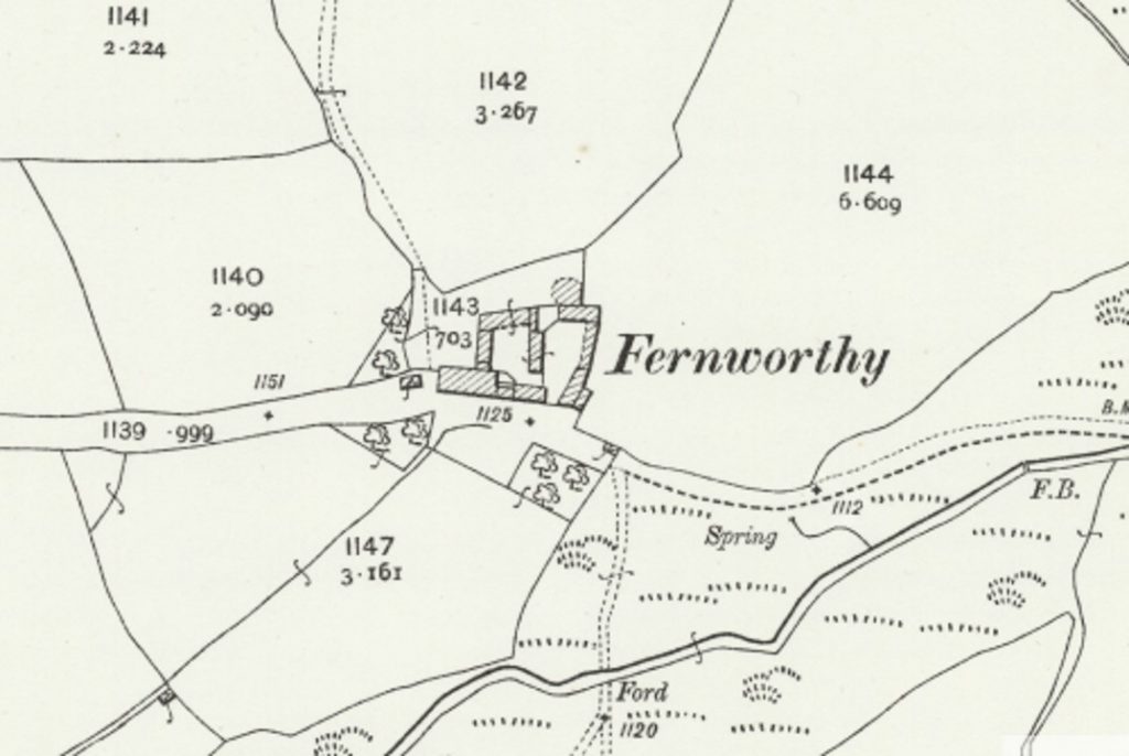
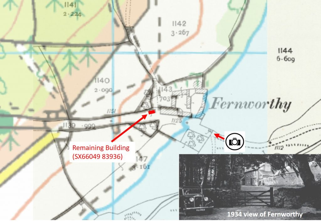
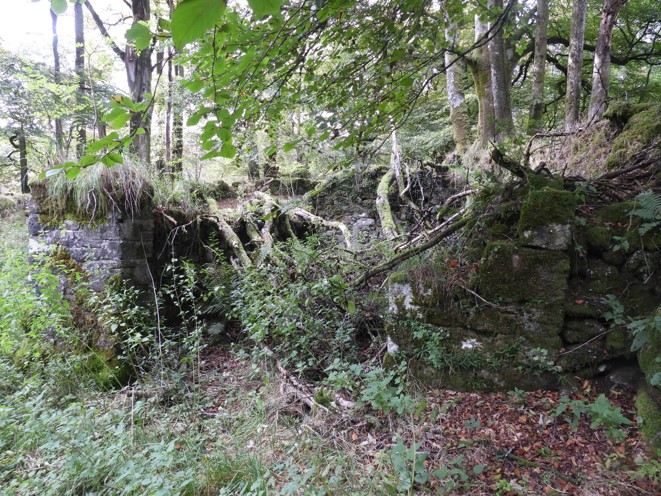
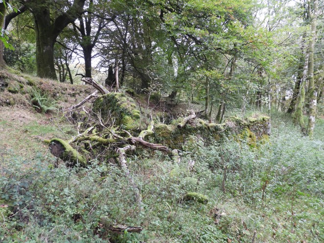
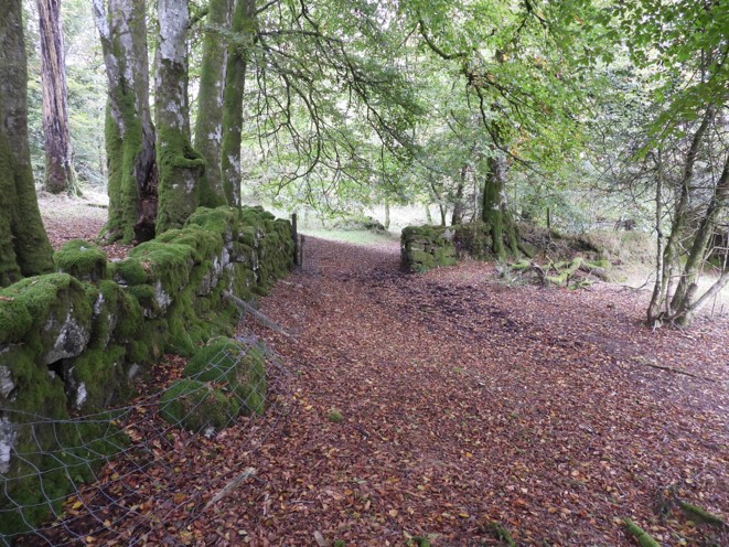
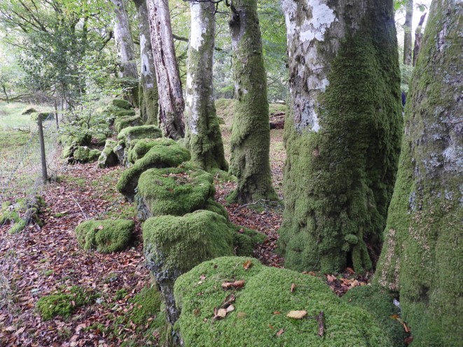
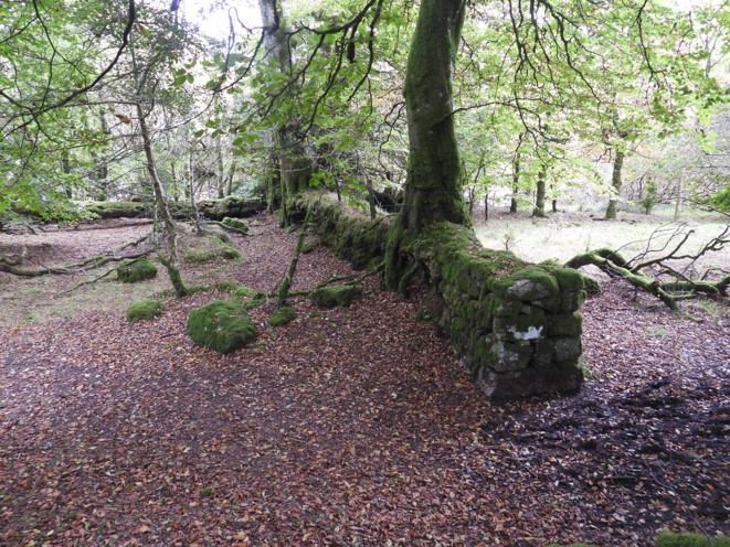
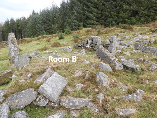
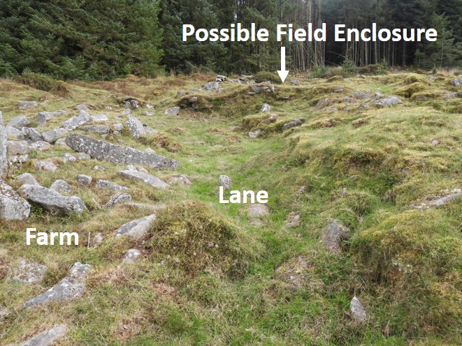
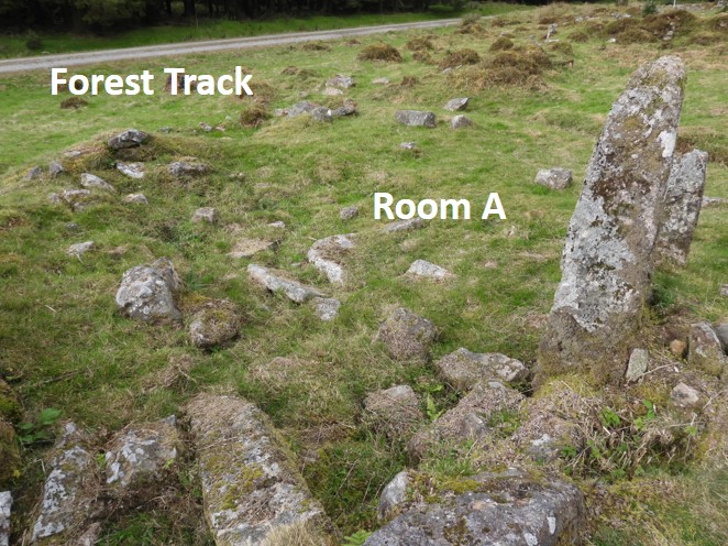
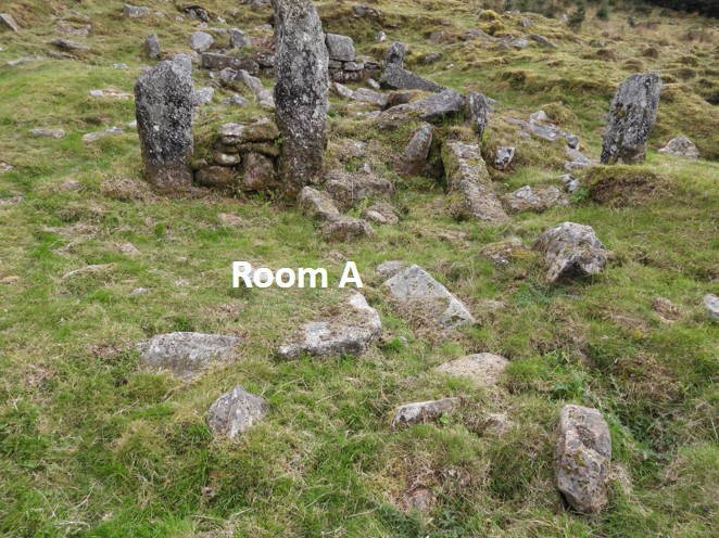
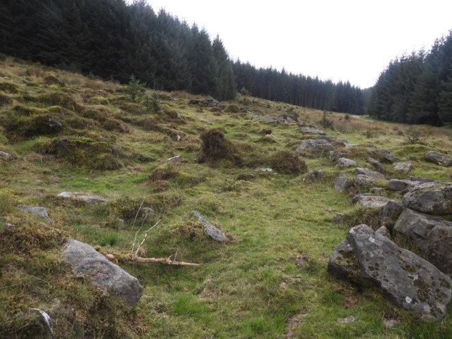
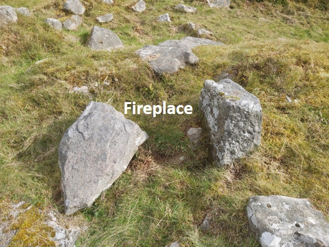
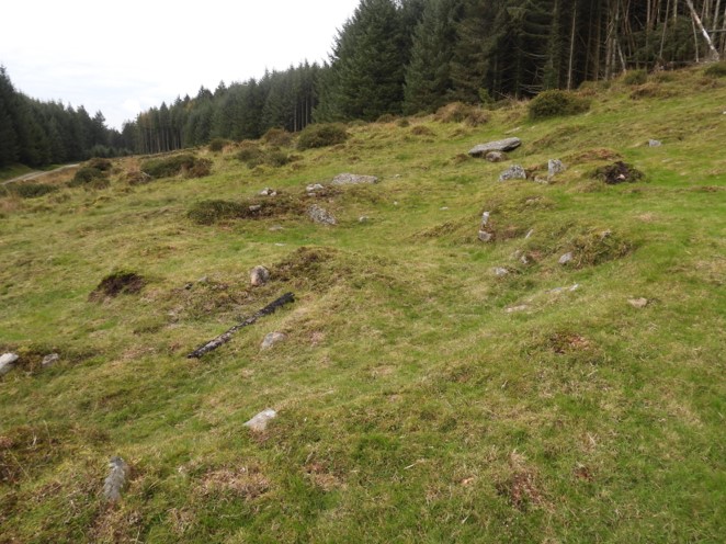
This sketch shows the relative locations of the farmsteads in this post. All are easily accessed via forest tracks or the modern tarmac road around Fernworthy ReservoirHigher Lowton Farm – a very simplified sketch. The farm is just a few hundred metres from the tarmac road and about 30 metres from a forest track. The farmstead was first shown on 19th century OS maps but is believed to have dated from a much earlier periodHigher Lowton is a two roomed building, which has overgrown since the 2013. There are conifer saplings abound the whole site and it is a little uneven. The photograph shows Room A in relation to the forest track below. Room A is rectangular and is approximately 9m x 4m.Room B is uphill (East) from Room A and is a more square shape and is approx. 4m x 4mFrom the south the land on which the farm building was constructed can be seen to be on quite a slopeReading the survey from 2013, a yard and lane were depicted, which were depicted in an early OS MapA lone stone in the corner of Room A has been identified as the location of a probable fireplace.Fireplace stone close upThis section of wall in Room A looks (to the author) like a possible storage niche. To add however, this is not an official part of the professional archaeological survey.The yard can be depicted (just)The lane can also be depicted.This farmstead is difficult to explore despite being adjacent to the main tarmac road. The farmstead, as with Higher Lowton, was first shown on 19th century OS maps. The forestry commission (I assume), have placed a fence topped with barbed wire in the way. There is no stile access. Field wallsSandeman Bridge crosses the South Teign near the end of the tarmac road19th century map of Fernworthy. From Dartmoor HER record (MDV6630); “The mention of Fernworthie Hedges in a Dartmoor Perambulation of 1609 is suggestive of a settlement here at that time and earlier documentary references to Fernworthy or Vernaworthy in the 14th and 16th century may suggest that the farm had much earlier origins. Worth considered the suffix ‘worthy’ to possible indicate a Saxon origin.”Overlaying the modern OS map on the 19th century map, it can be appreciated the extent of the waters of the reservoir (from 1940s) in relation to the farm. The thumbnail picture was taken on 22nd September 1934 and is part of the Dartmoor Archive (link below). The location of where the photographer stood, is most likely as indicated above, is now underwater.
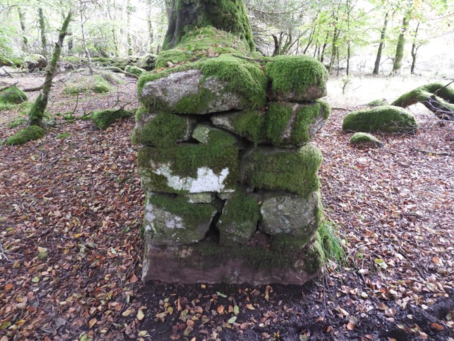
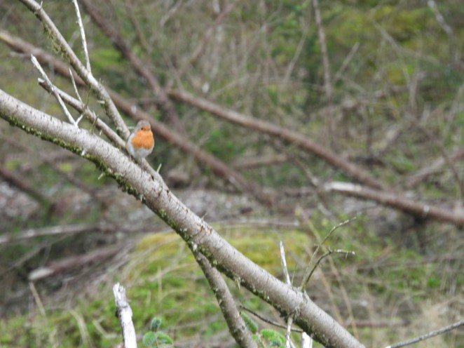
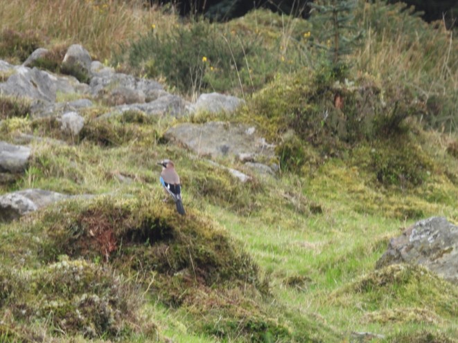
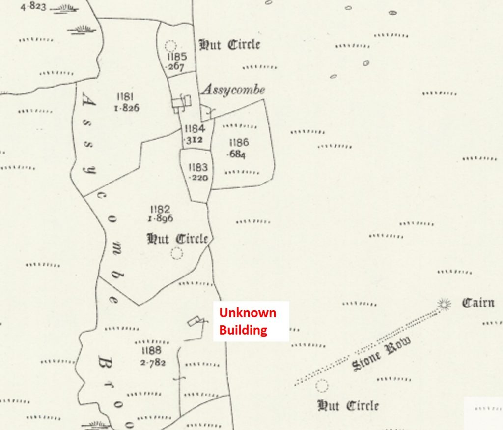
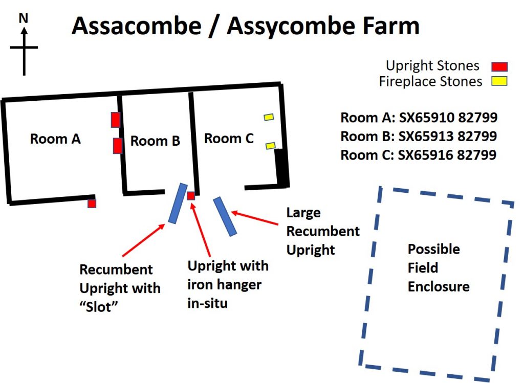
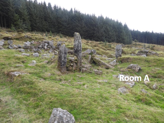
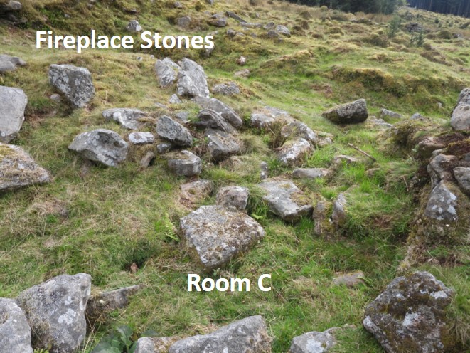
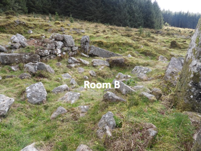
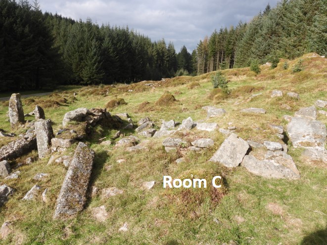
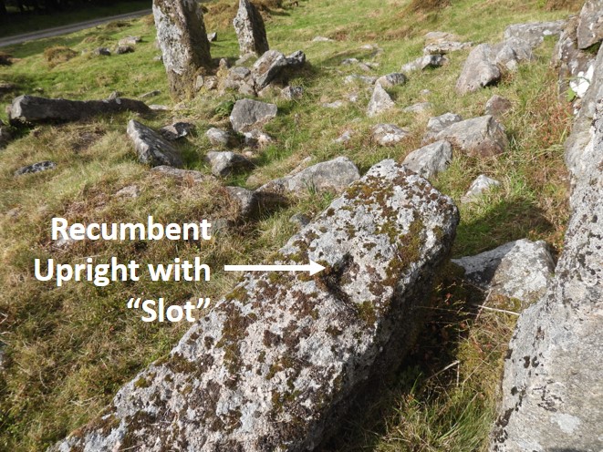
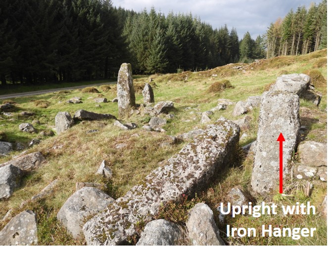
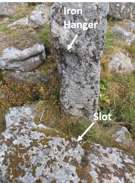
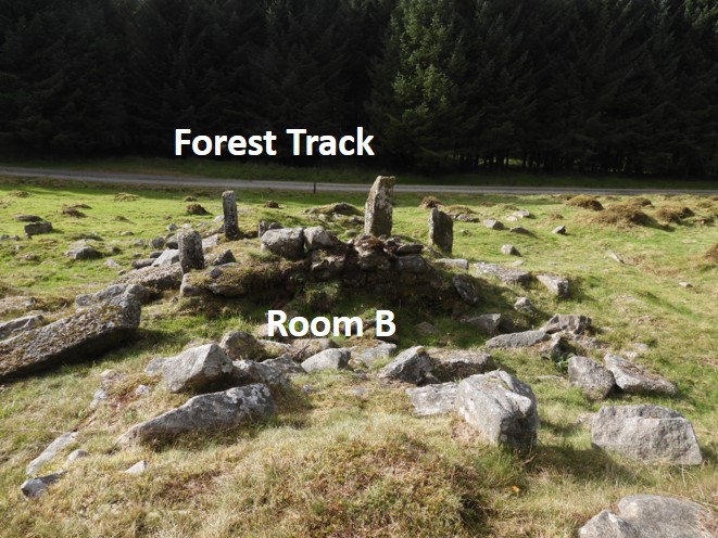
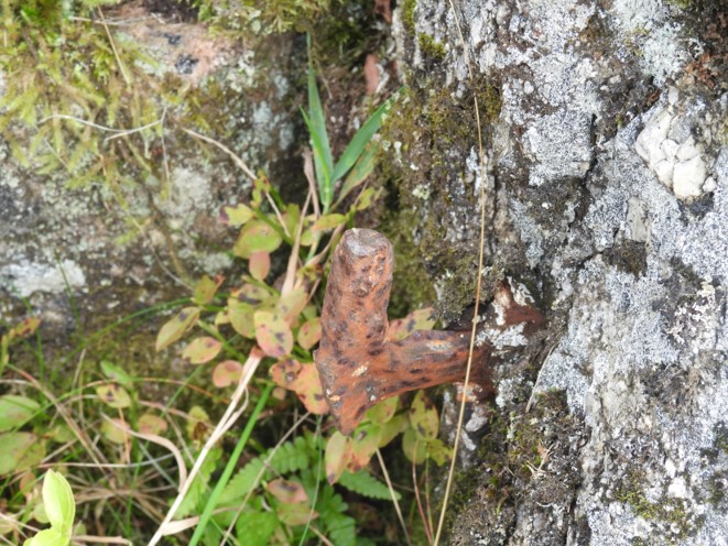
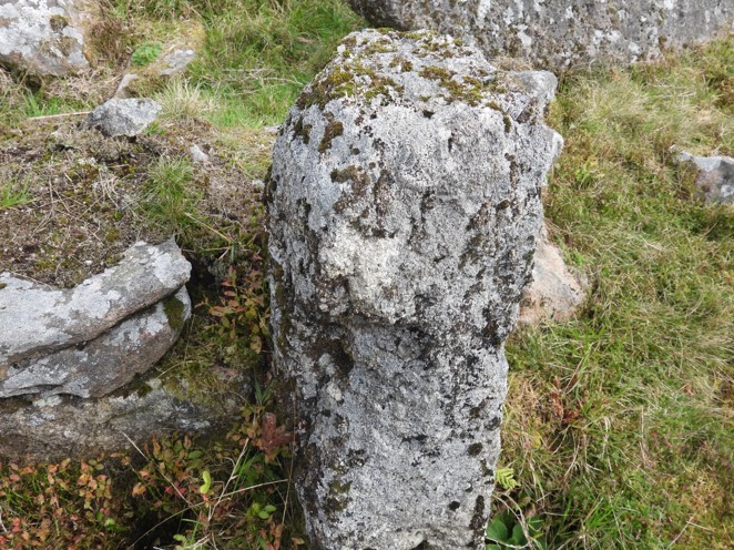
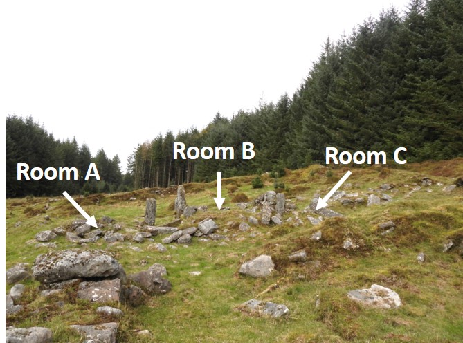
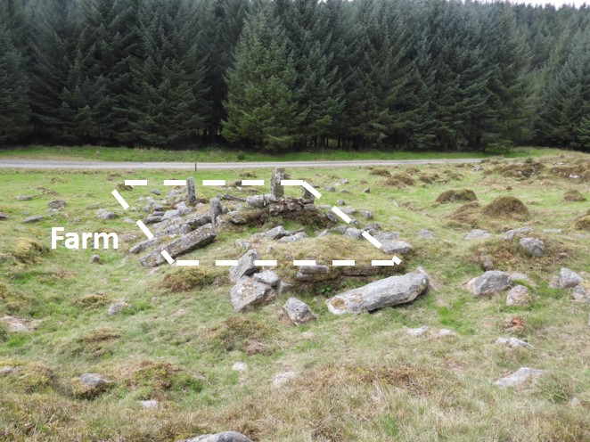
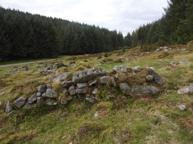
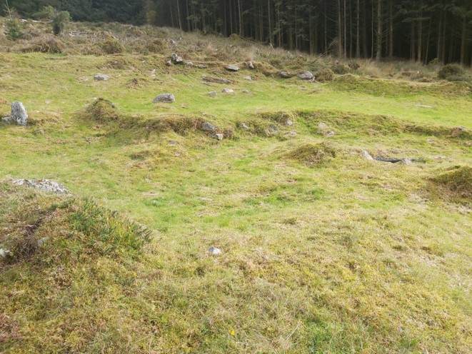
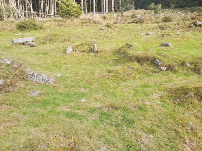
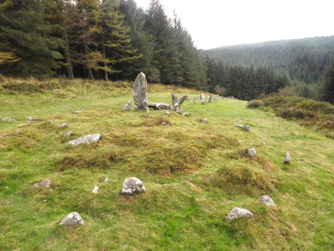
The remaining building at Fernworthy. All buildings were destroyed when the dam and reservoir were constructed except this one, which to the author looks like a small barn.Another view (from the south) of the one remaining building at Fernworthy.Gate within the Fernworthy enclosuresLots of moss covered wallsAnother wall within the Fernworthy enclosuresThe walls are very wideTop end of the west side lane leading to Fernworthy.En-route to Assycombe Farm from Fernworthy Farm, saw this little chapA rare sighting of a Jay, just a few hundred metres from Assycombe Farm ruins.19th century map of Assycombe Farm, the unknown building in relation to the double stone row. Mentioned in Dartmoor HER (ref SDV351784), viz: The placename is first documented in 1488 and it is possible that a small farmstead was established here by that time.A very simplified plan of the Assycombe Farm building (aka Assacombe). It was a three roomed dwelling and is around 40m from the forest track. It is orientated approx. W-E. The building is approx 12m x 4.5m.The most striking part of the ruins in 2020 are the uprights between Room A and Room B. Room A is the largest of the three at around 5m long.Room B is uphill (East) of Room A.Next (south) of the farm looks like an old lane. Uphill is what is assumed to be the field enclosure shown on the 19th century map.Another view of Room A, showing how close the farm is to the Forest TrackRoom A looking East (into Rooms B and C)Looking south from the farm buildingThe top building (most easterly) contains a fireplace. It is believed Rooms B and C were interconnected.Another view of Room BRoom C, looking from the southAn interesting recumbent stone with a slot adjacent to Room BNext to the recumbent stone with the slot is an upright with an iron hanger still in situ.Looking East into Room BThe iron hanger on the Room B uprightThe iron hanger uprightView of Assycombe Farm building from the South. This is taken from a similar location to one found on the Dartmoor Archive from 29th May 1894 (Burnard collection). Each of the three rooms had an entrance on the south side, which clearly can be seen from the 1894 picture. The uprights still extant in 2020 can still be made out in the 1894 picture.
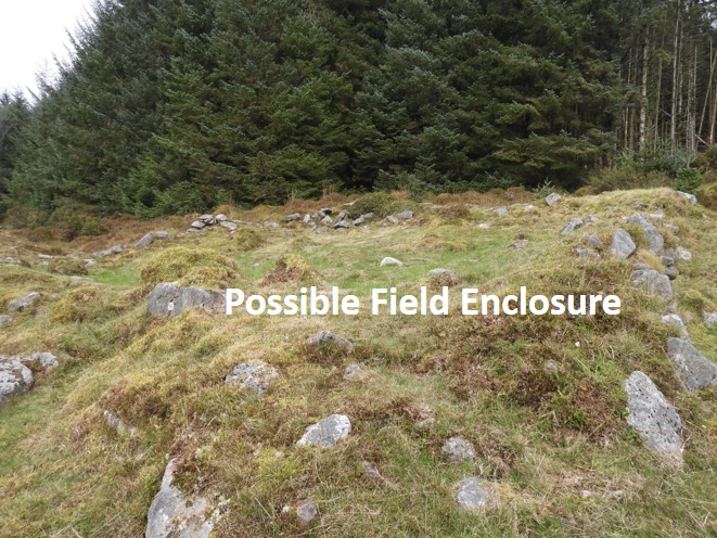
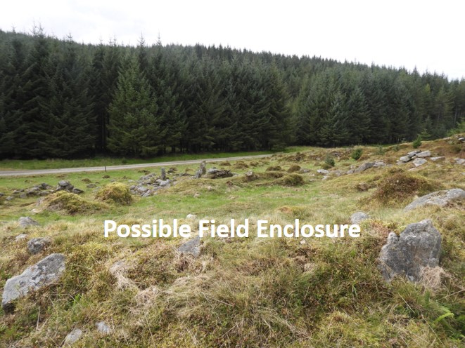
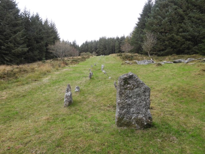
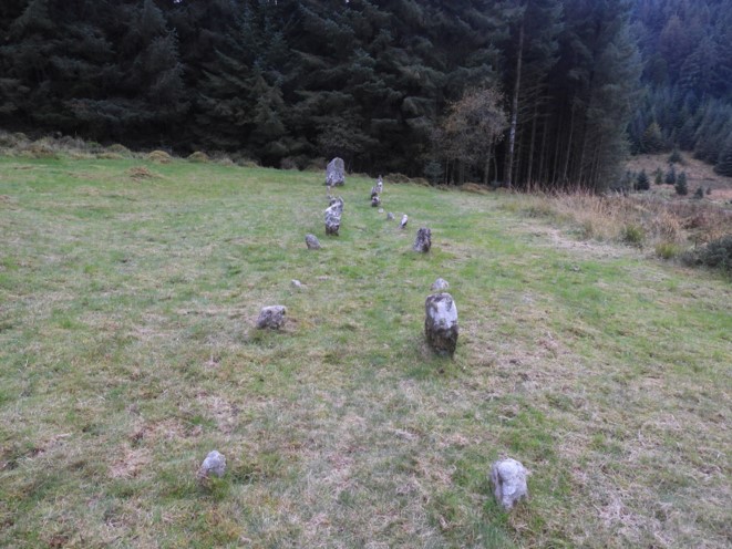
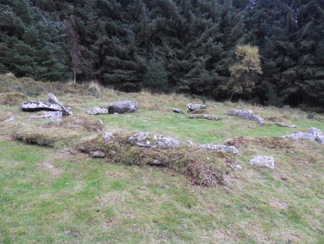
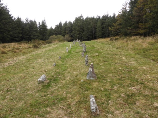
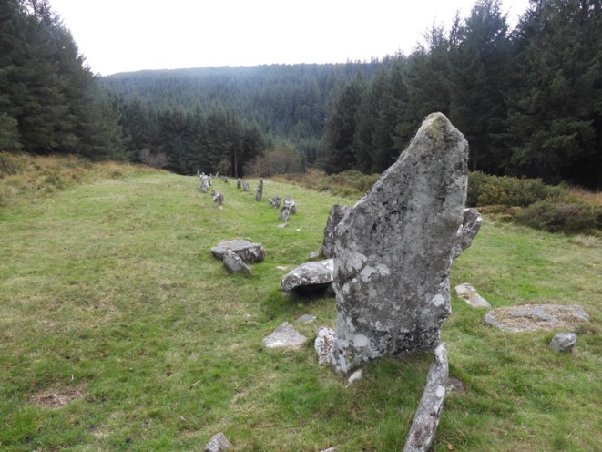
The fireplace stones in Room ASouth East(ish) is a possible field enclosure. It is believed that the walls of the enclosures were maintained until the 19th century. They have been disturbed by forestry activity in places and may also have been the victims of stone robbing in the early 19th century.From the field enclosure looking North-West(ish) over the farm building towards the forest track. The enclosure is at SX65940 82782 Between the enclosure and the farmEnclosure walls, looking north.South of Assycombe lies an unknown building shown on the 19th century map. It is at SX65910 82629The building ruinsA small L-shaped inner yard is built against the south-east corner of the house.Attached to the eastern end of the yard at a slightly higher level is a roughly rectangular enclosure, 11m by 9m which is likely to have been a garden plot.A visit to the area wouldn’t be complete without a visit to the wonderful Assycombe double stone row. This is the east end with a terminal stoneClimbing the hillHut Circle adjacent to the stone row, as can be seen on the 19th century mapLooking up the row (East)Top end (East) of the stone rowCairn at eastern end of the stone row (also shown on 19th century map)