A collection of walks, discoveries, insights and pictures of exploring Dartmoor National Park
December 27, 2022
‘Old’ Ditsworthy Warren Boundary Stones and an Eylesbarrow Bond Stone.
To the south of Whittenknowles Rocks and on the north western slopes of Eastern Tor, four upright stones can be found, which are all recorded in Mike Brown’s Dartmoor Gazetteer. None of the stones bears any inscription, are all crudely fashioned between 1m and 2m tall and bound and area of around 45000 sq. metres (or 11 acres). Following some research, the author has managed to find three sources of information relating to the stones, which may provide some theories and reasons as to their origin and function.
The first research source comes from Fletcher, Newman and Probert who suggest in their survey of the area that the Stones date from the medieval (or later periods) and probably relate to Ditsworthy Warren to the south. No other information is supplied.
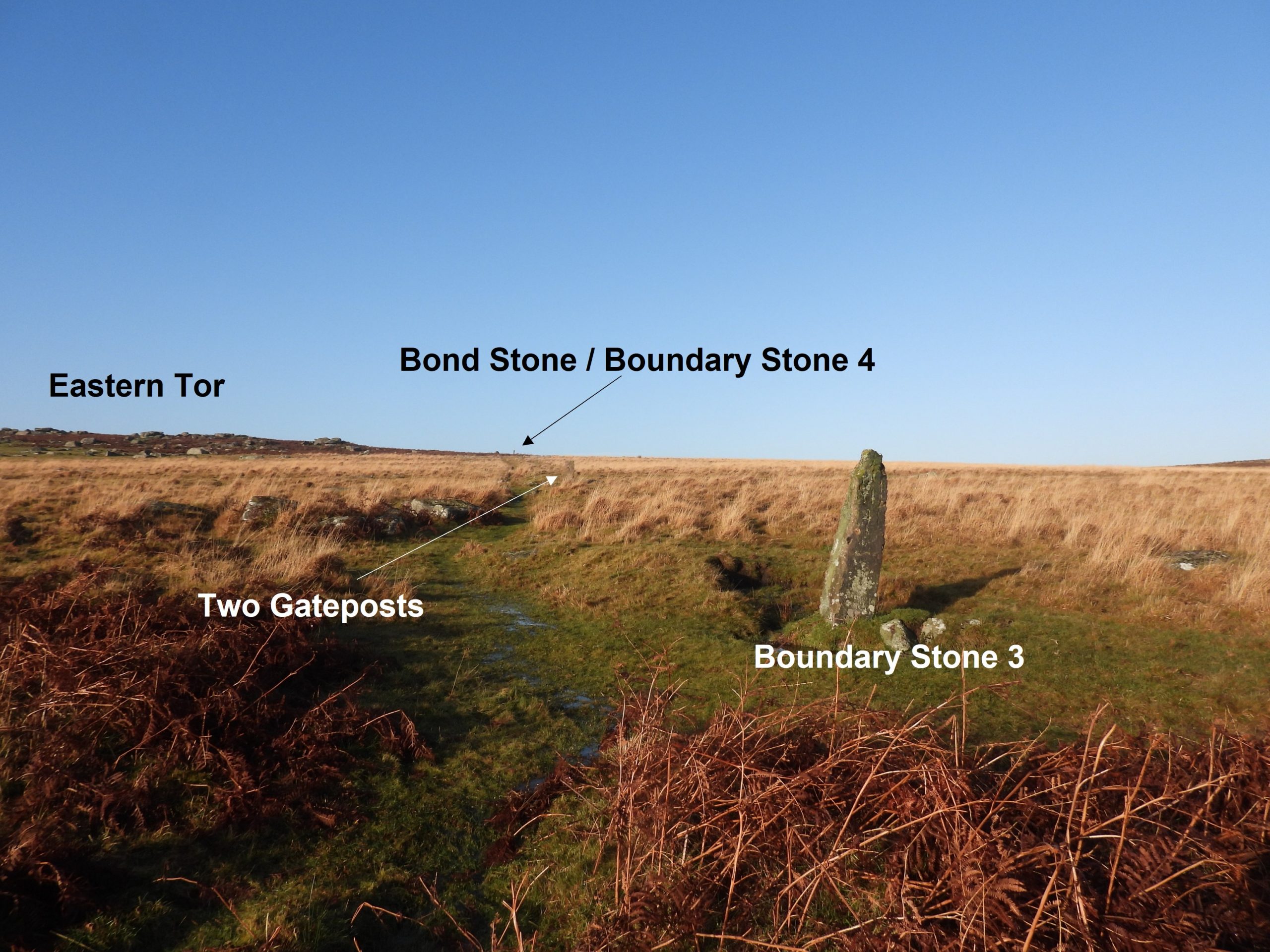
The second research source comes from Eric Hemery in High Dartmoor (Page 187), where he states: “On the east side of the tor (Eastern) stands a bond-stone of Eylesbarrow Mine, and near it, what appears at first sight to be a reave running down hill from Whittenknowles Rocks to Thrushel Combe Foot. It is actually a crumbled rabbit warren wall of ancient Ditsworthy, considerably pre-dating the lease of ‘Aylesborough’ to Warrener Ware in 1859. A gateway interrupts the wall at the foot of the hill, one post being erect, the other fallen and having a gate hanger”.
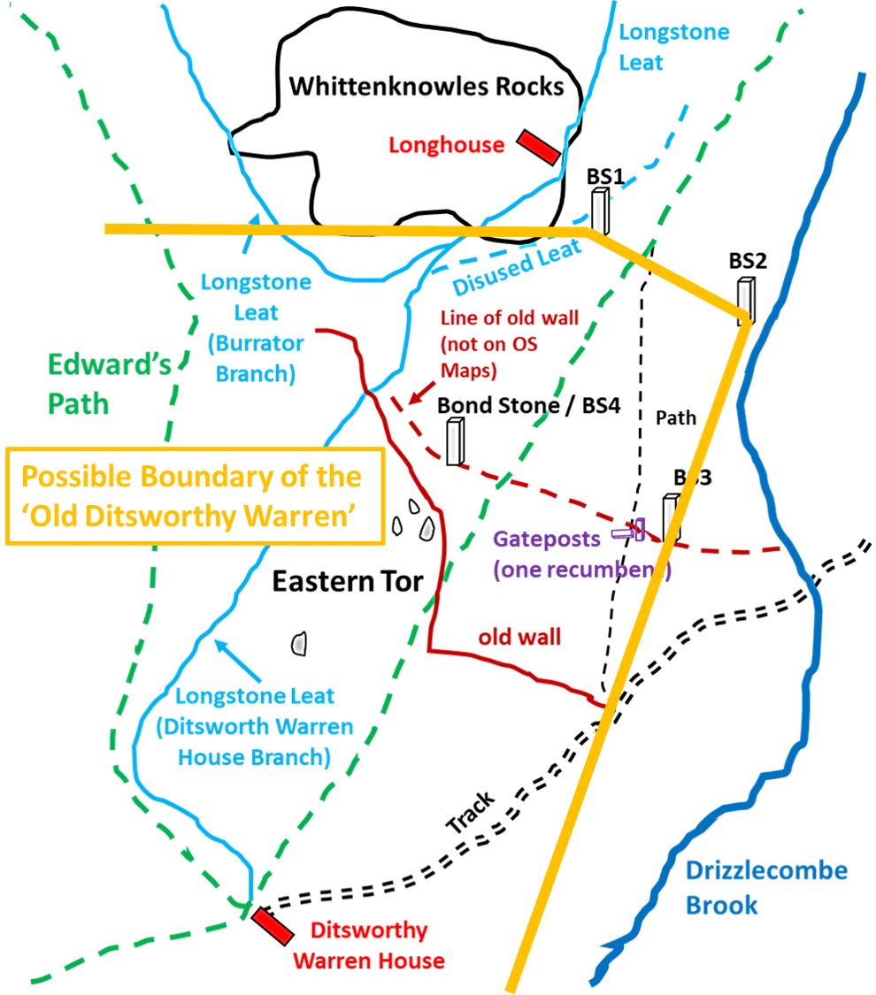
The third research source comes from R.G.Haynes (Vermin Traps and Rabbit Warrens on Dartmoor)where he states: “Ditsworthy Warren was (originally) approx 220 acres. Its boundary was defined as on the south by the Plym; on the west by a long wall from the Legis Tor Warren boundary to Sheepstor Brook at Burrcombe Gate. The eastern boundary down to the Plym is problematical but is believed Sheepstor Brook upstream for a little distance then east to the ridge of Eastern Tor then following a line of unmarked boundary stones to Drizzlecombe Brook and the Plym”.
From the above three sources, the author concludes that it is probable that three of the stones in all likelihood relate to ‘Old Ditsworthy’ boundary (Haynes), with the most south westerly of the four stones being a just a bond-stone for Eylesbarrow Mine and is not a Boundary Stone (Hemery). That said, the author has given a second theory at the end of the post, which has all four stones as part of the ‘Old Ditsworthy’, with the fourth stone doubling up as a bond-stone. This post details the locations of these four stones and some surrounding features and considers the evidence as to their origin an function.
Further to the above, according to Historic England these 4 stones marked the corners of a (temporary) enclosure which was created around 2001 following an outbreak of sheep scab.
Bibliography:
Fletcher, Newman, and Probert, 1999, Drizzlecombe, Eylesbarrow, Ditsworthy and Hartor areas in the Plym Valley (Survey)
Hemery 1983, ‘High Dartmoor’ (page 187)
Haynes, 1970, Vermin Traps and Rabbit Warrens on Dartmoor
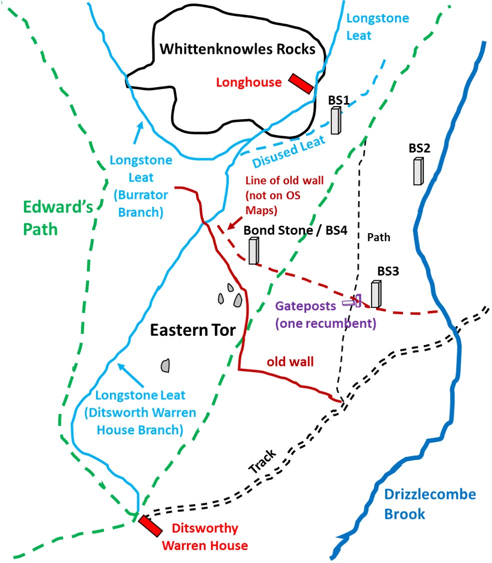
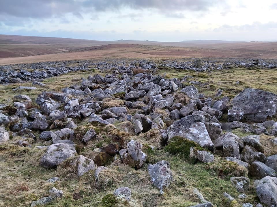
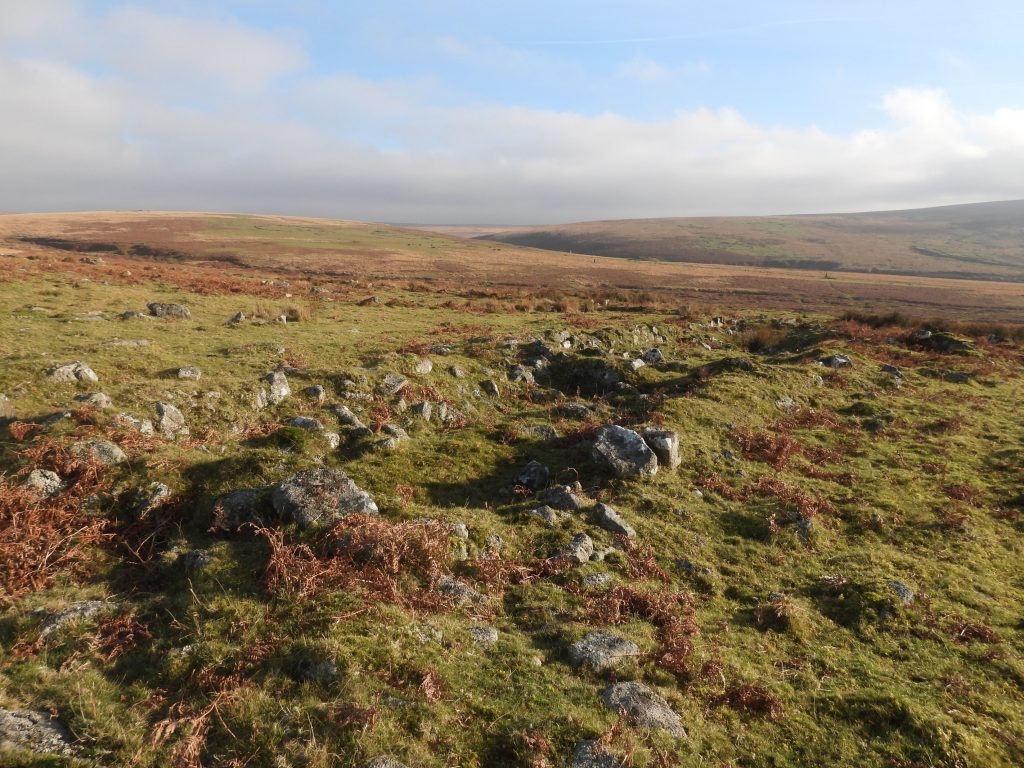
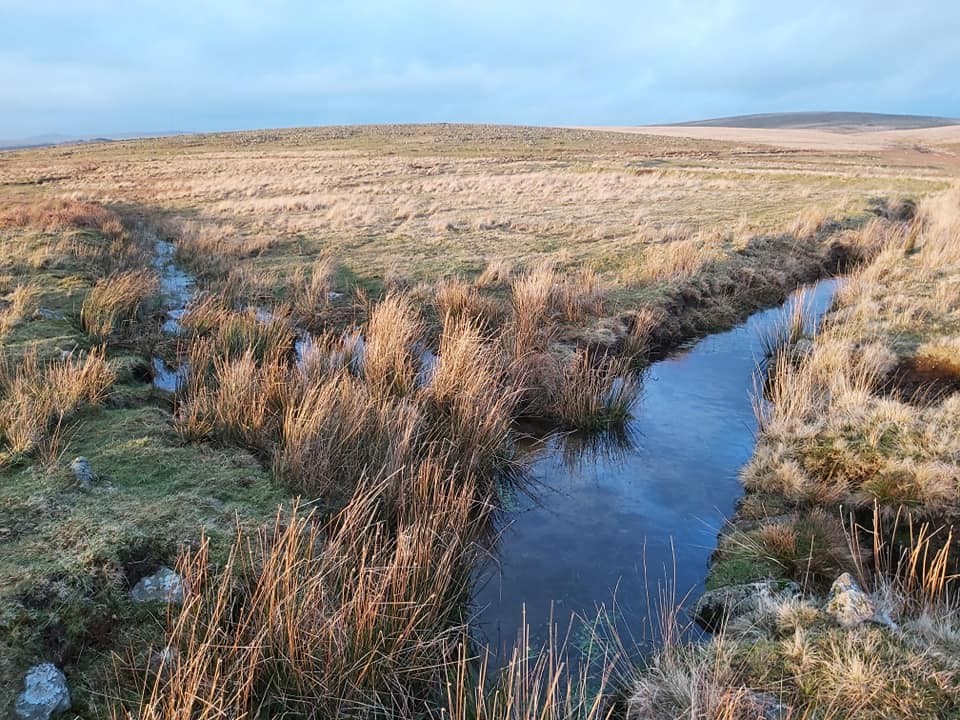
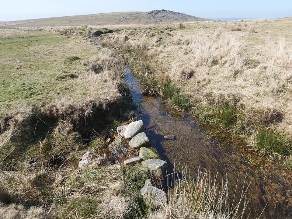
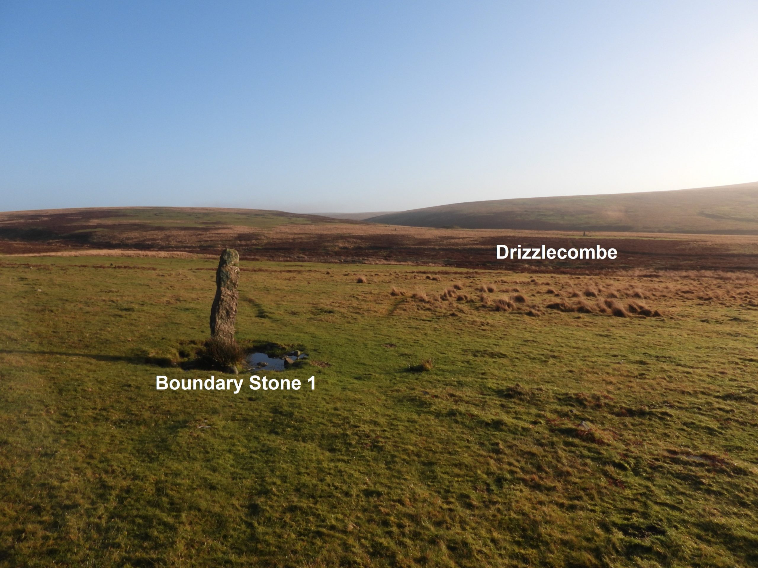
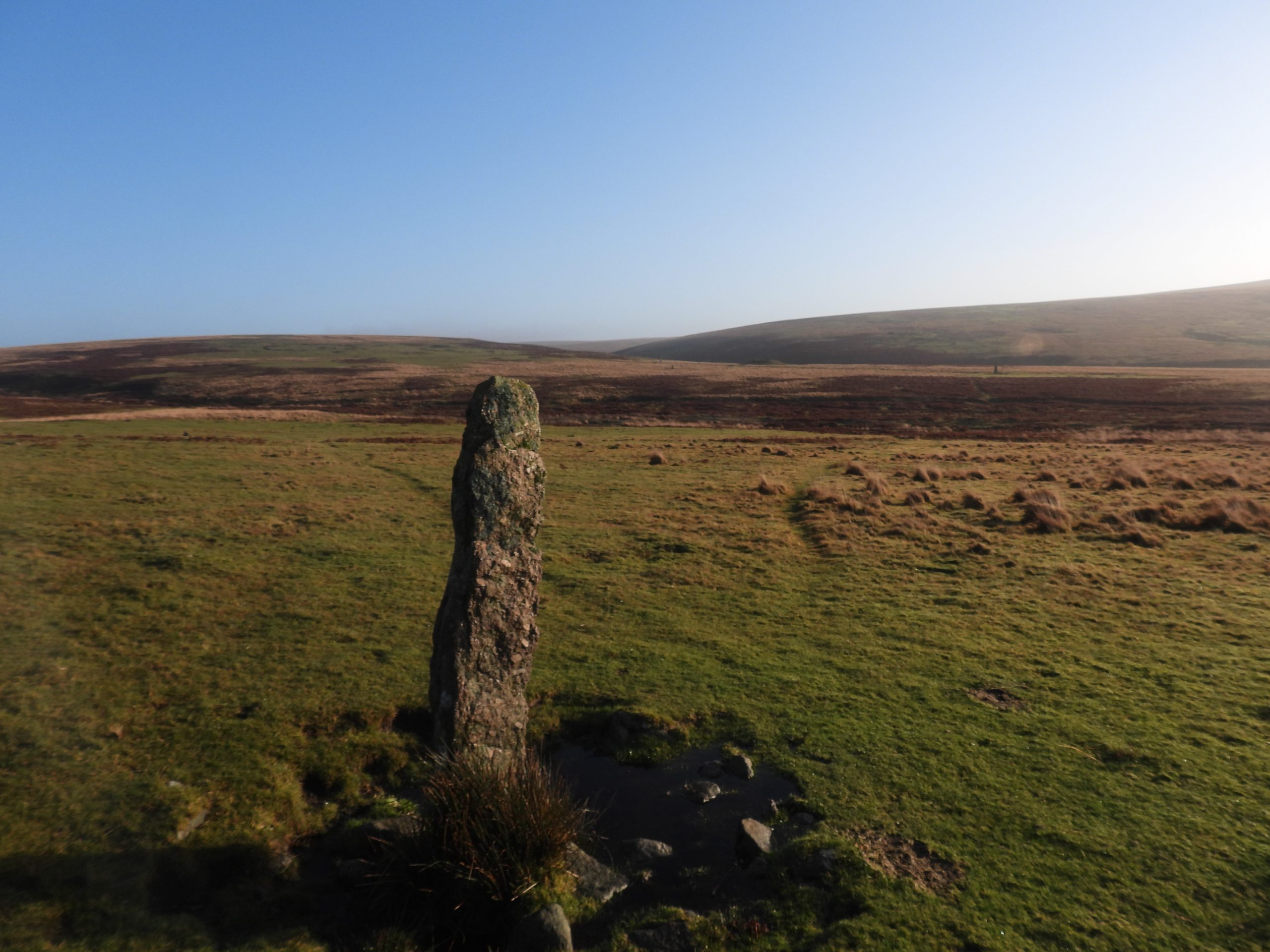
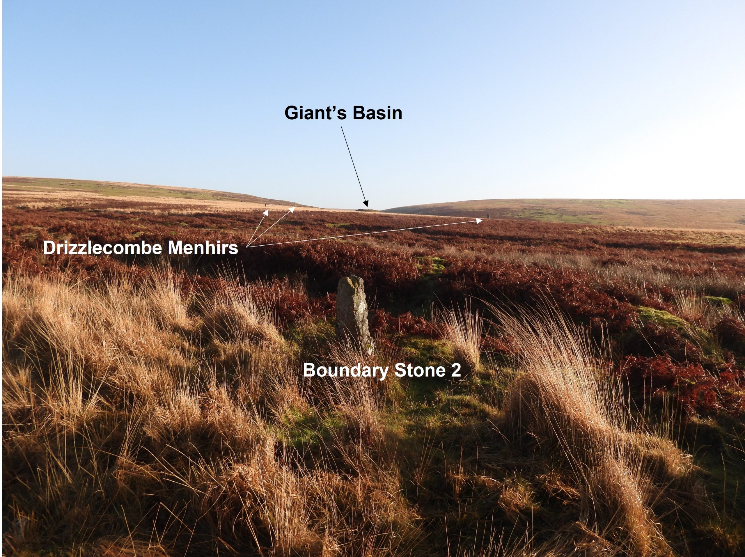
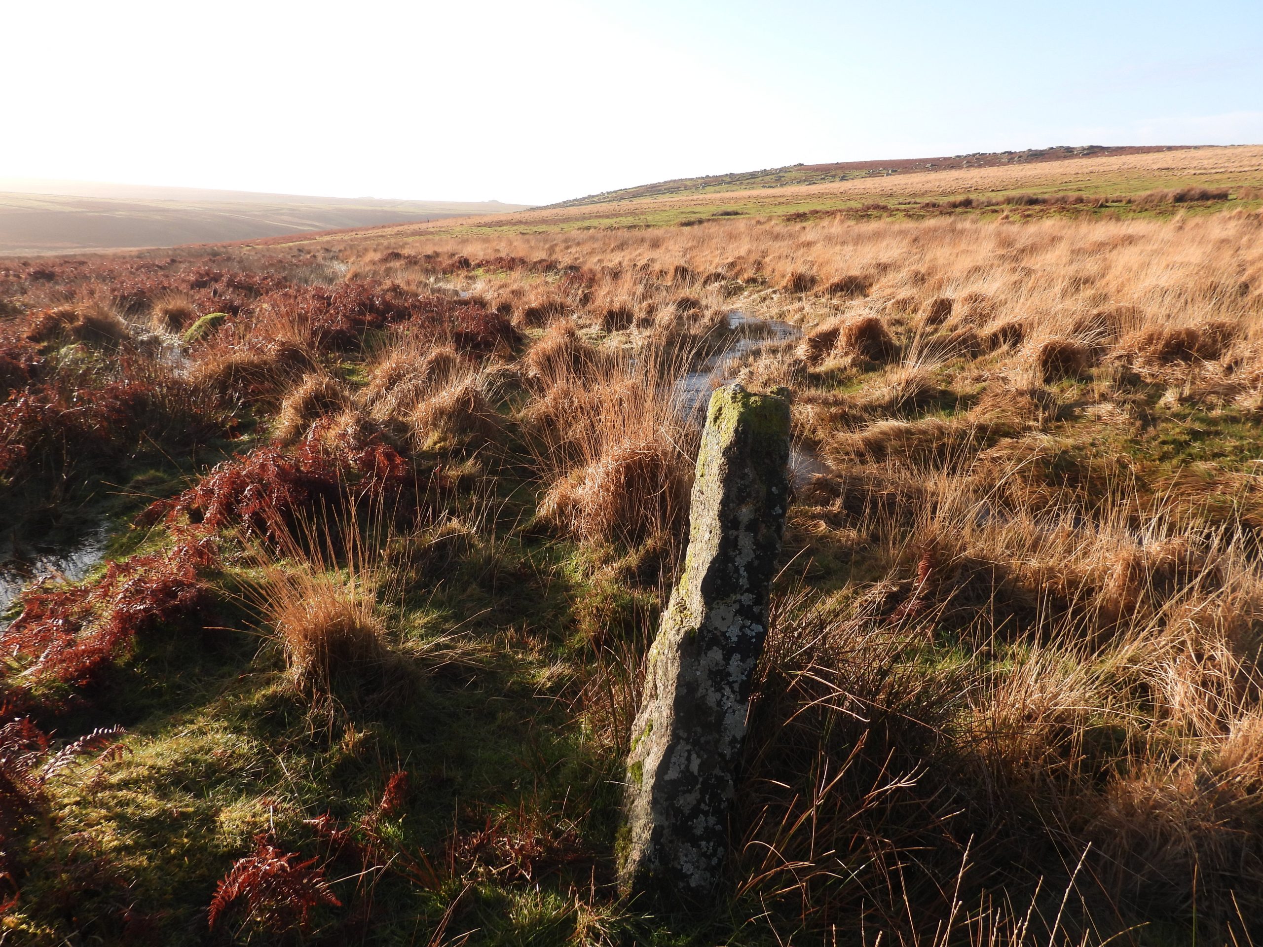
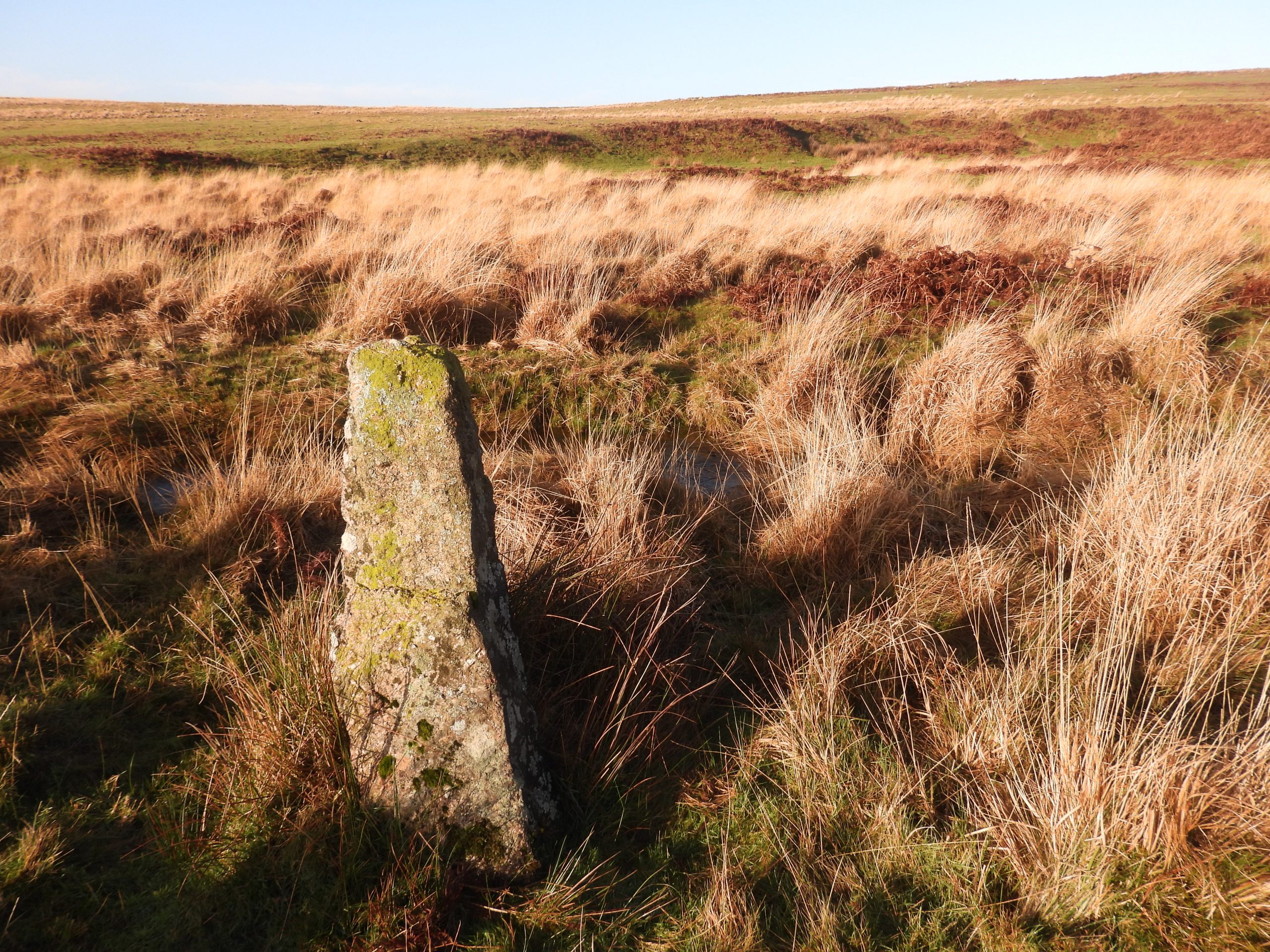
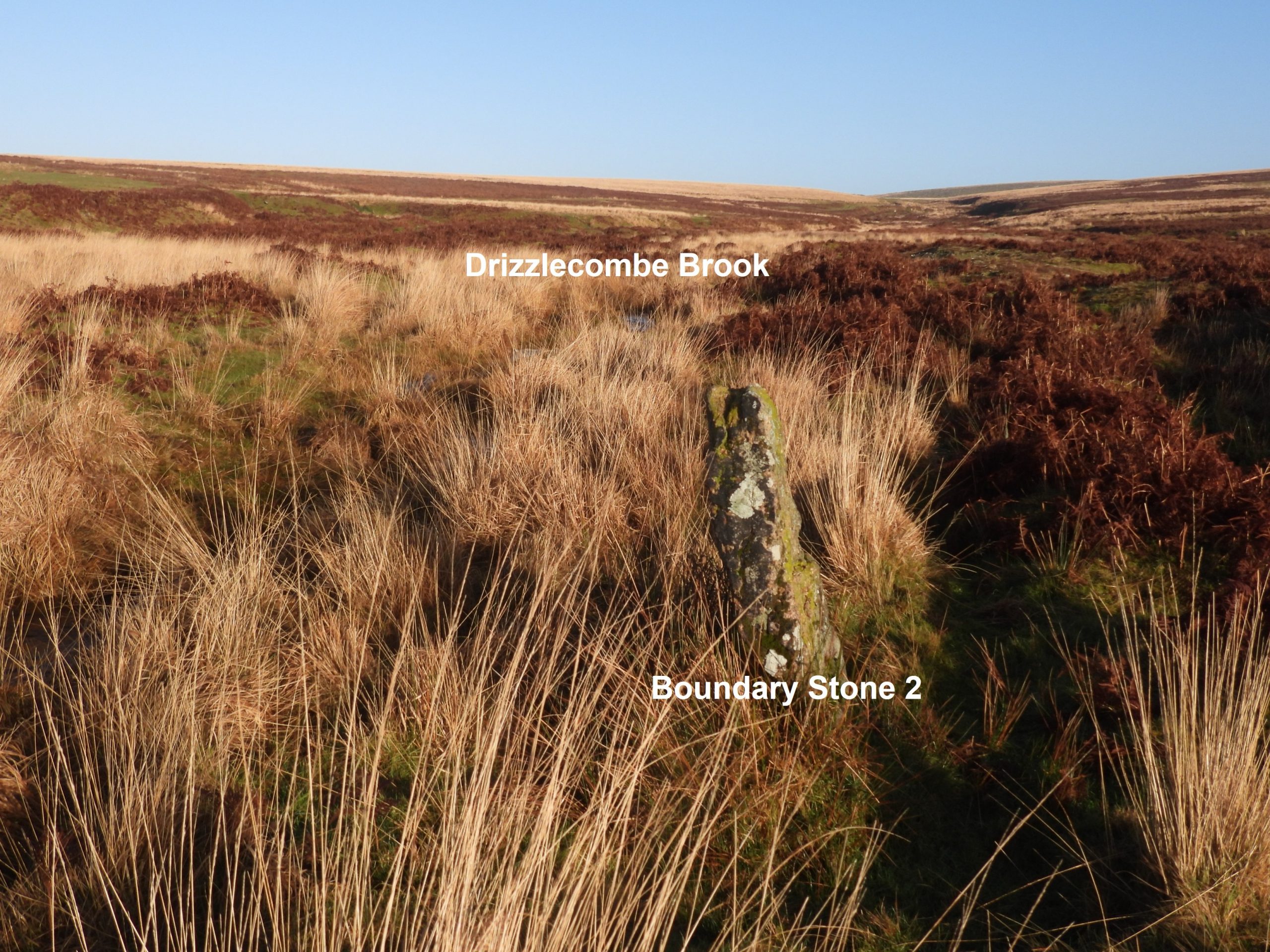
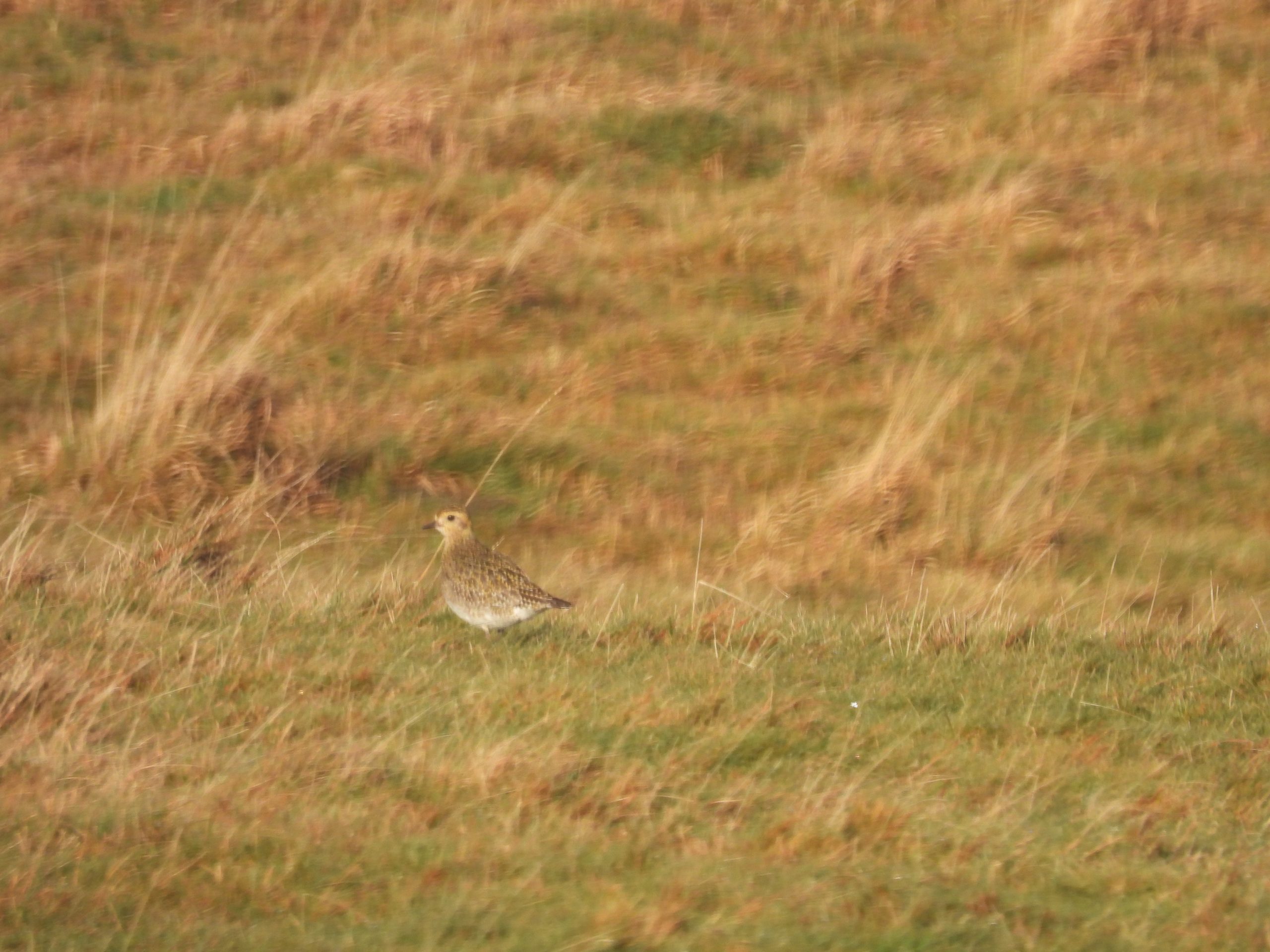
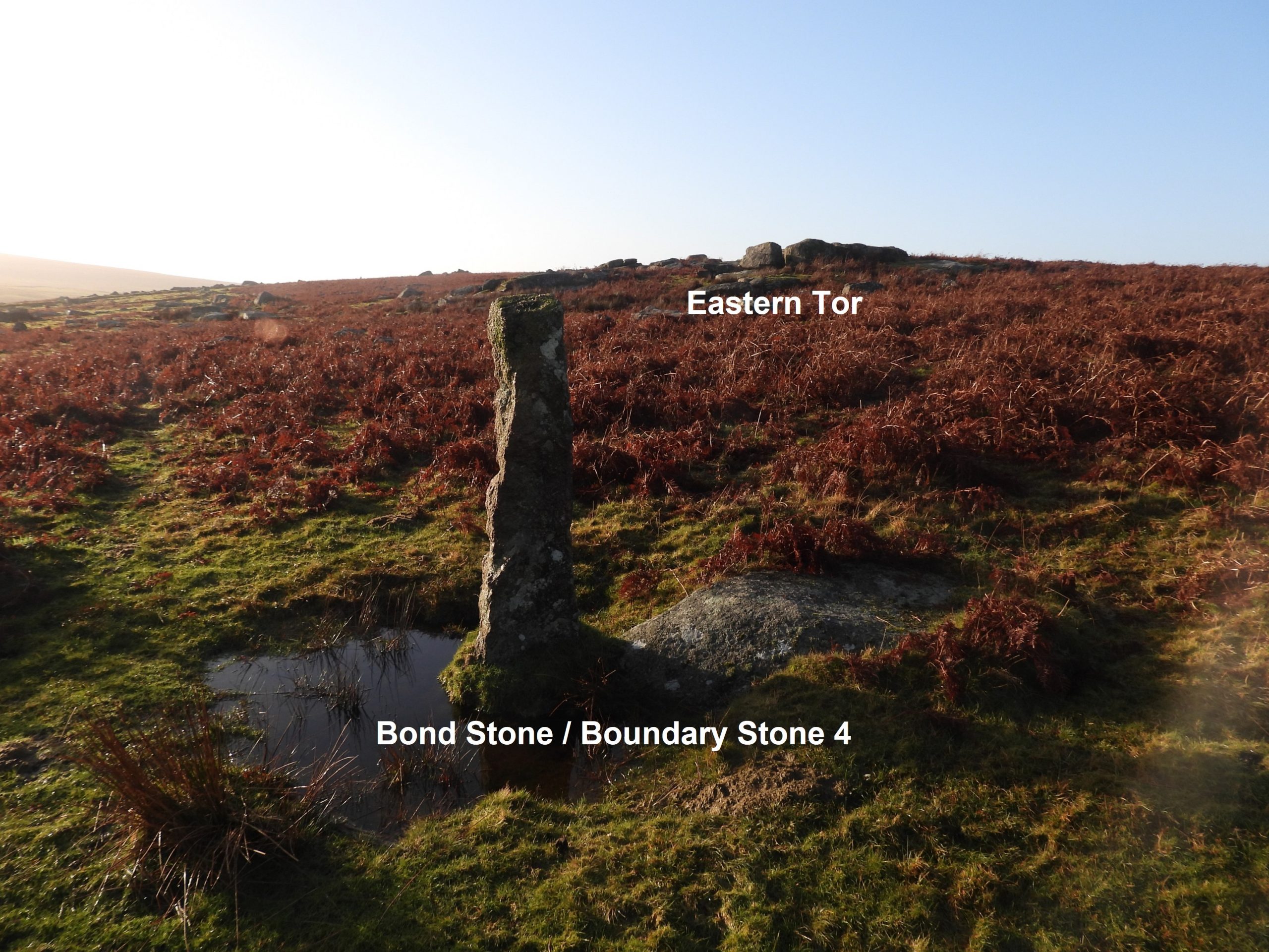
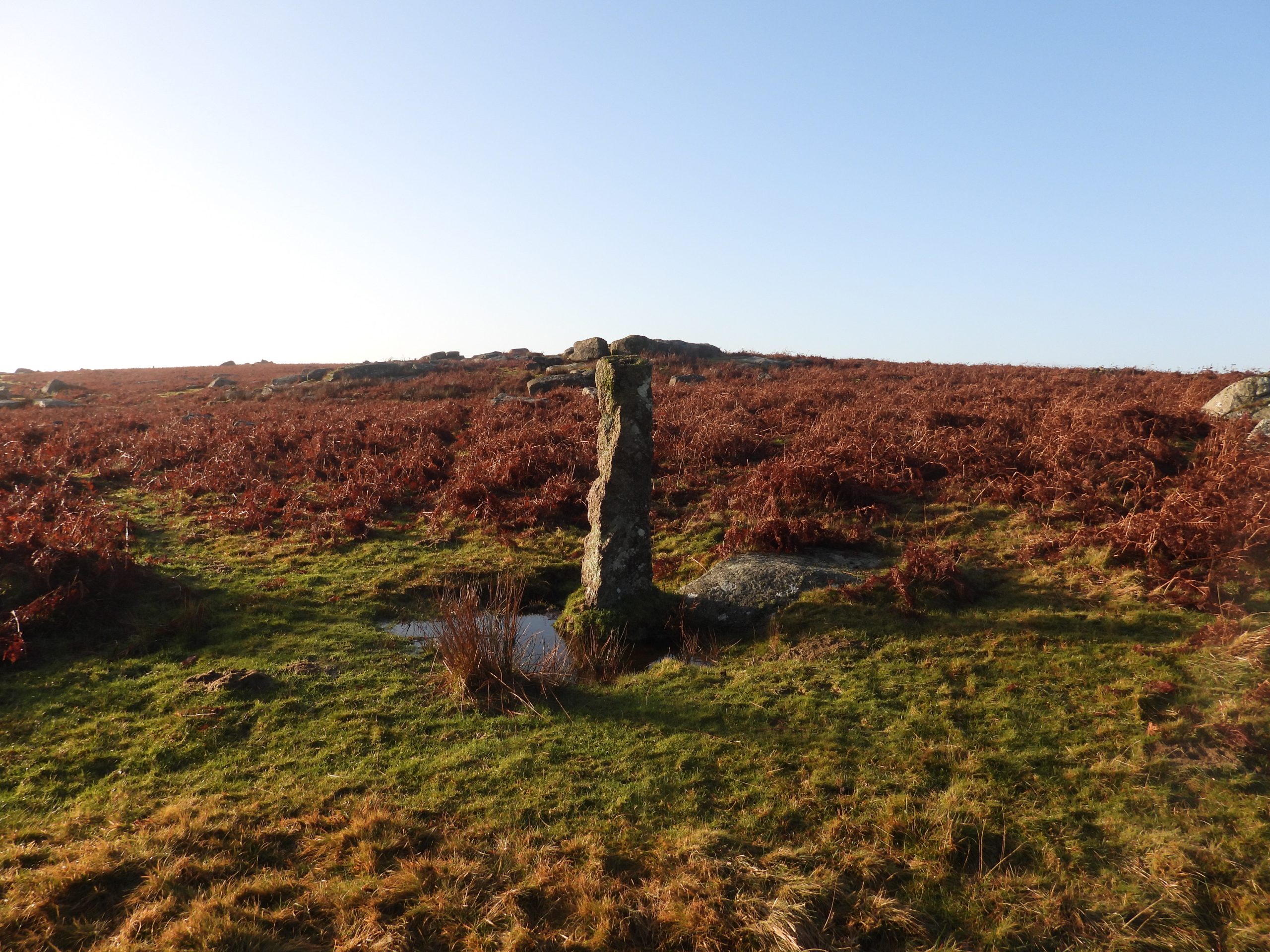
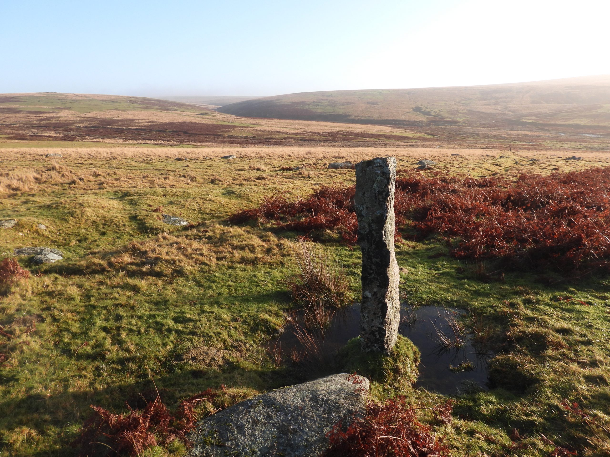
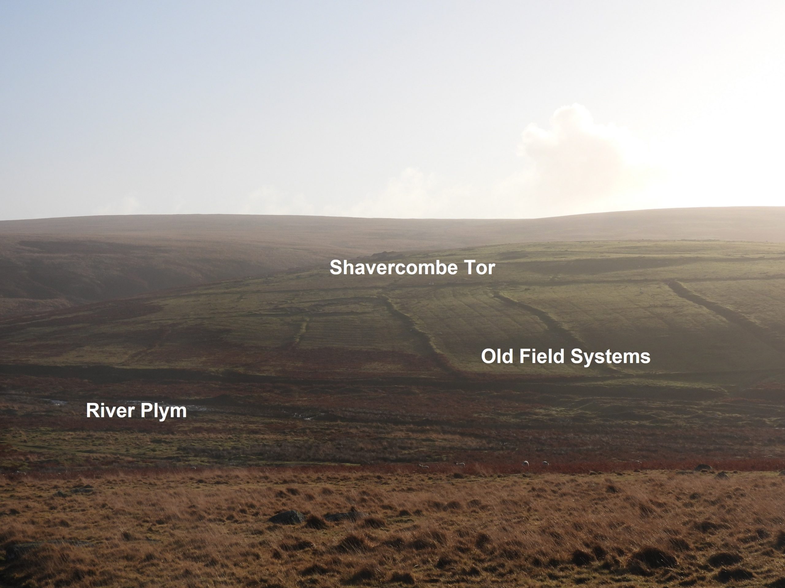
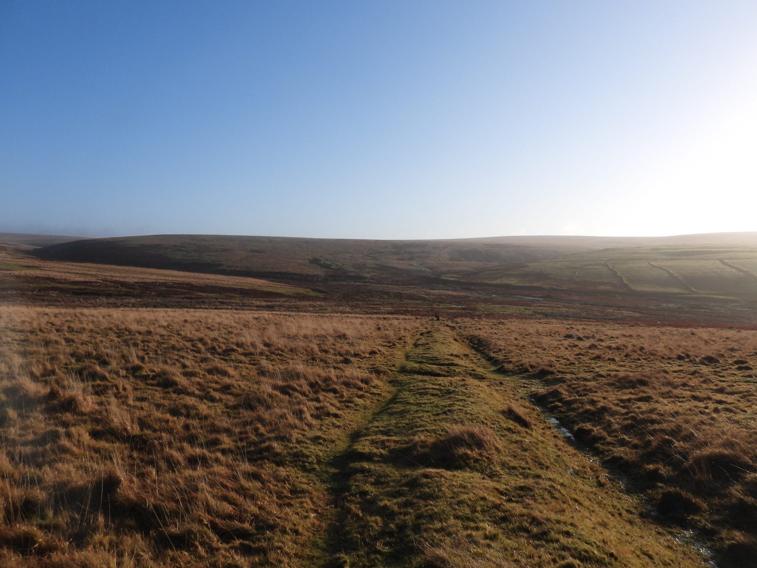
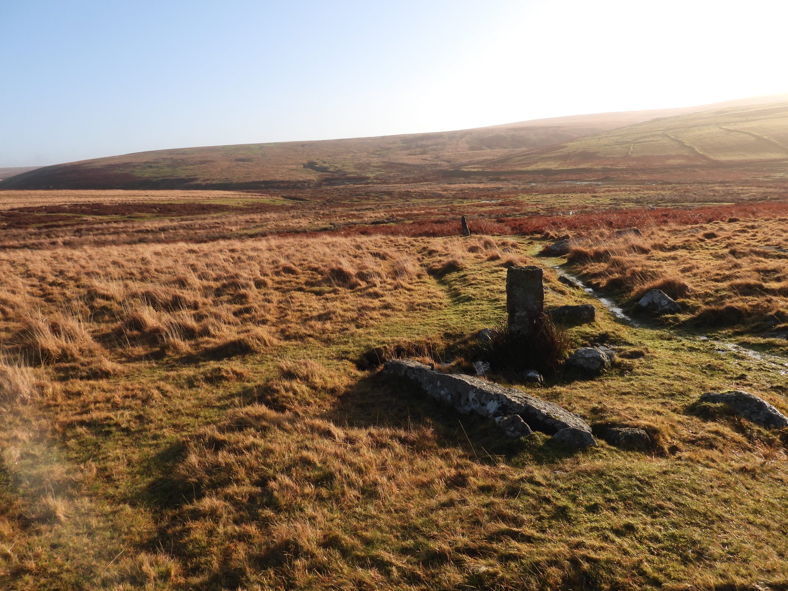
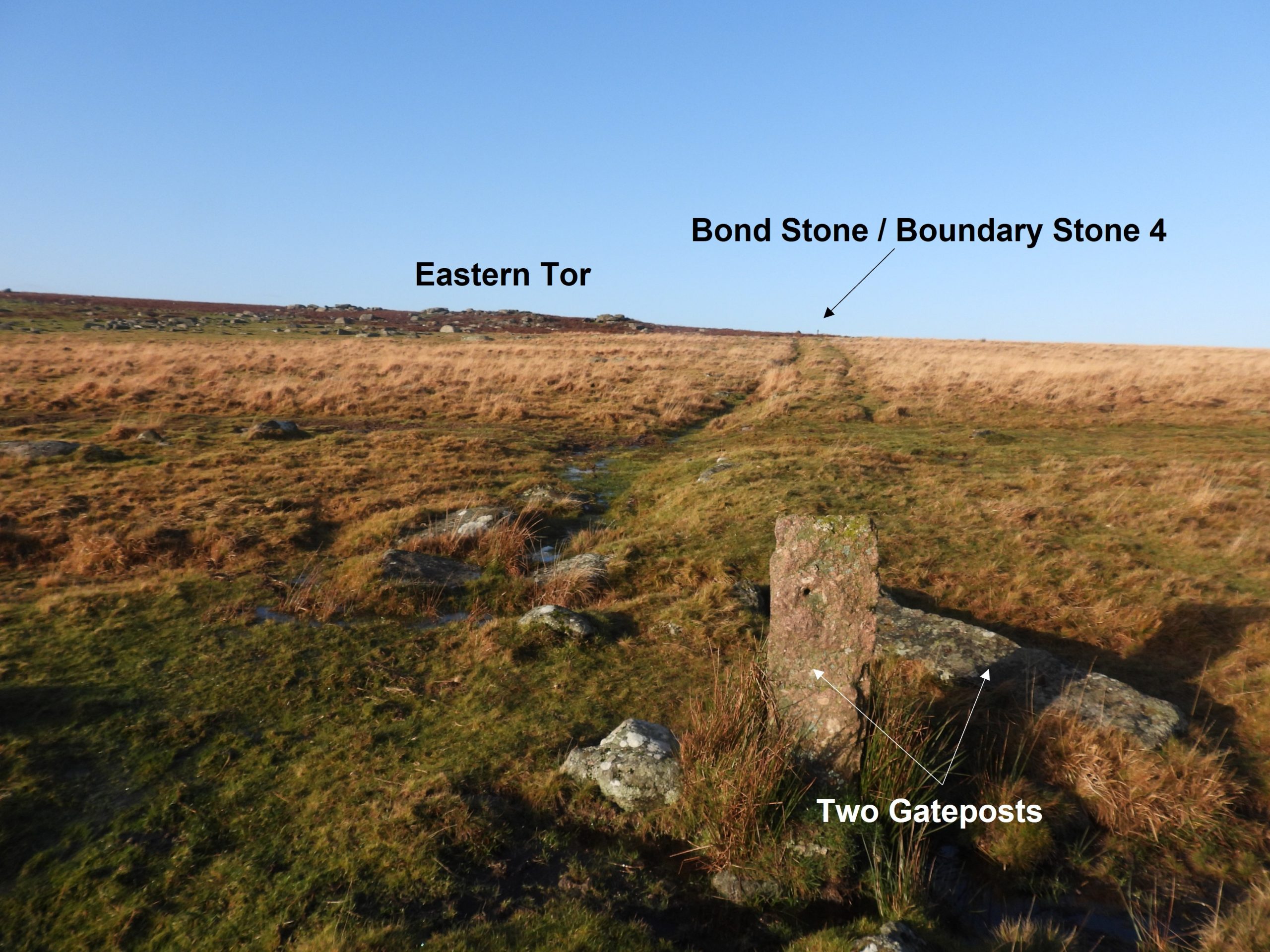
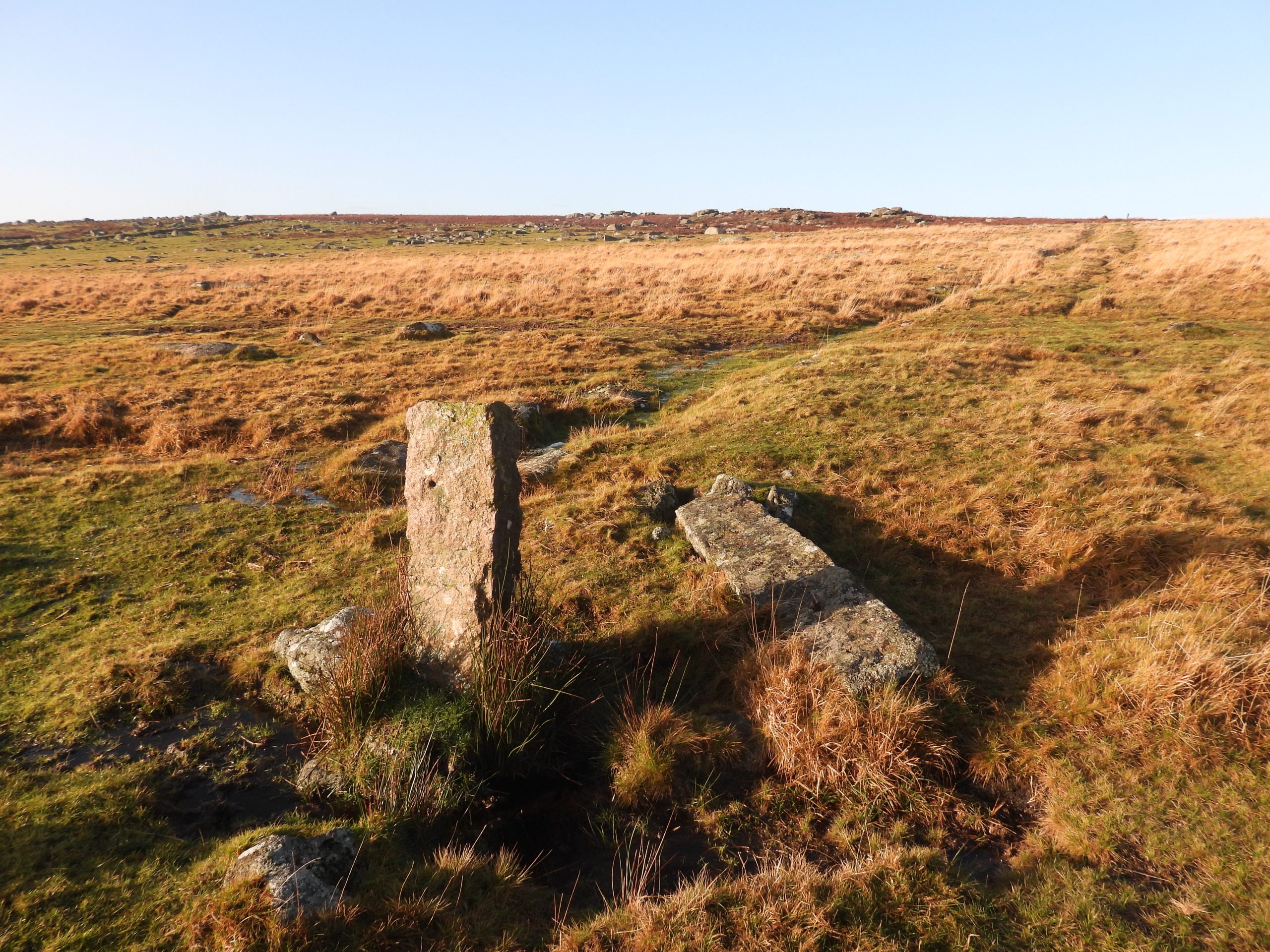
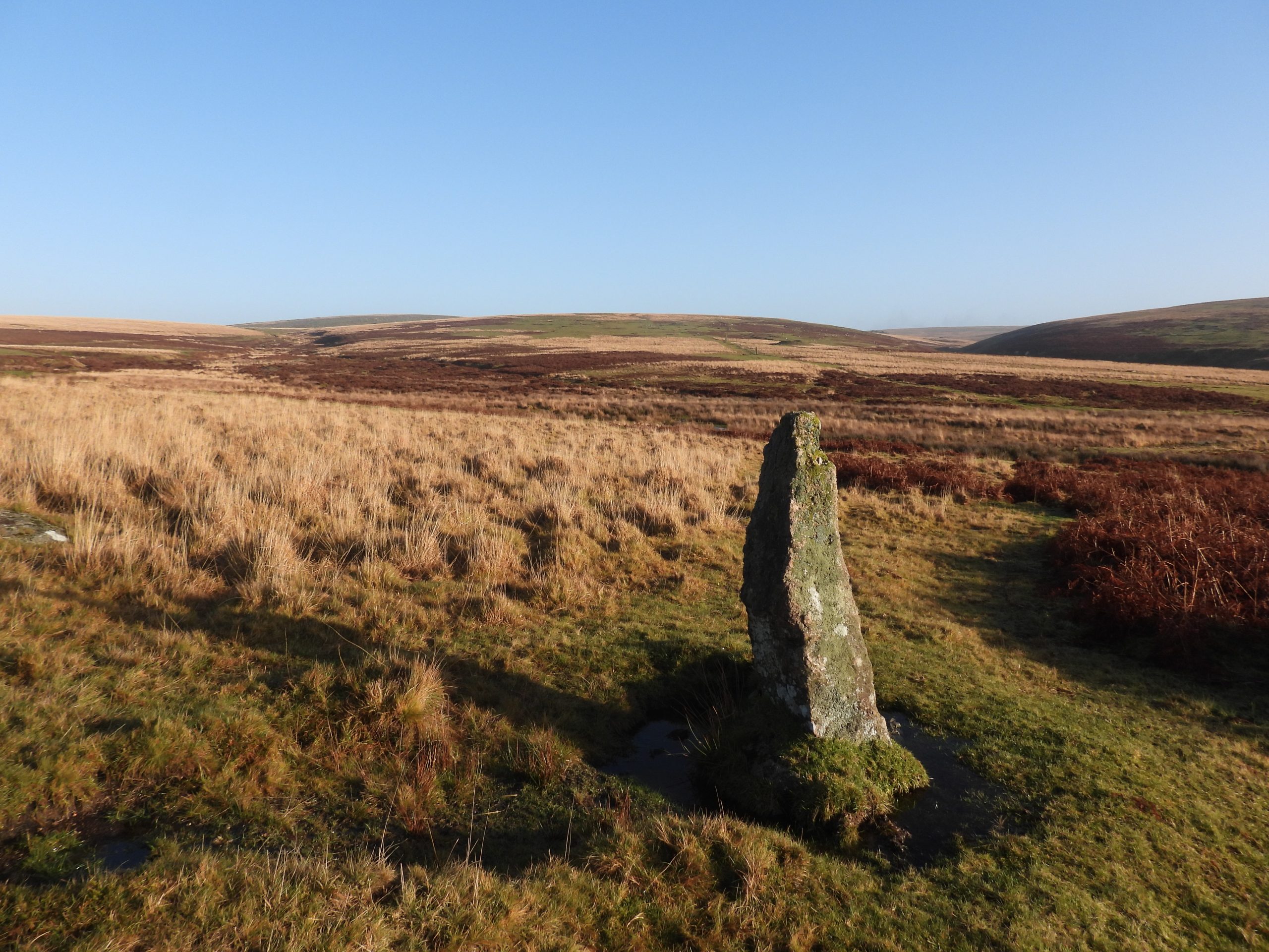
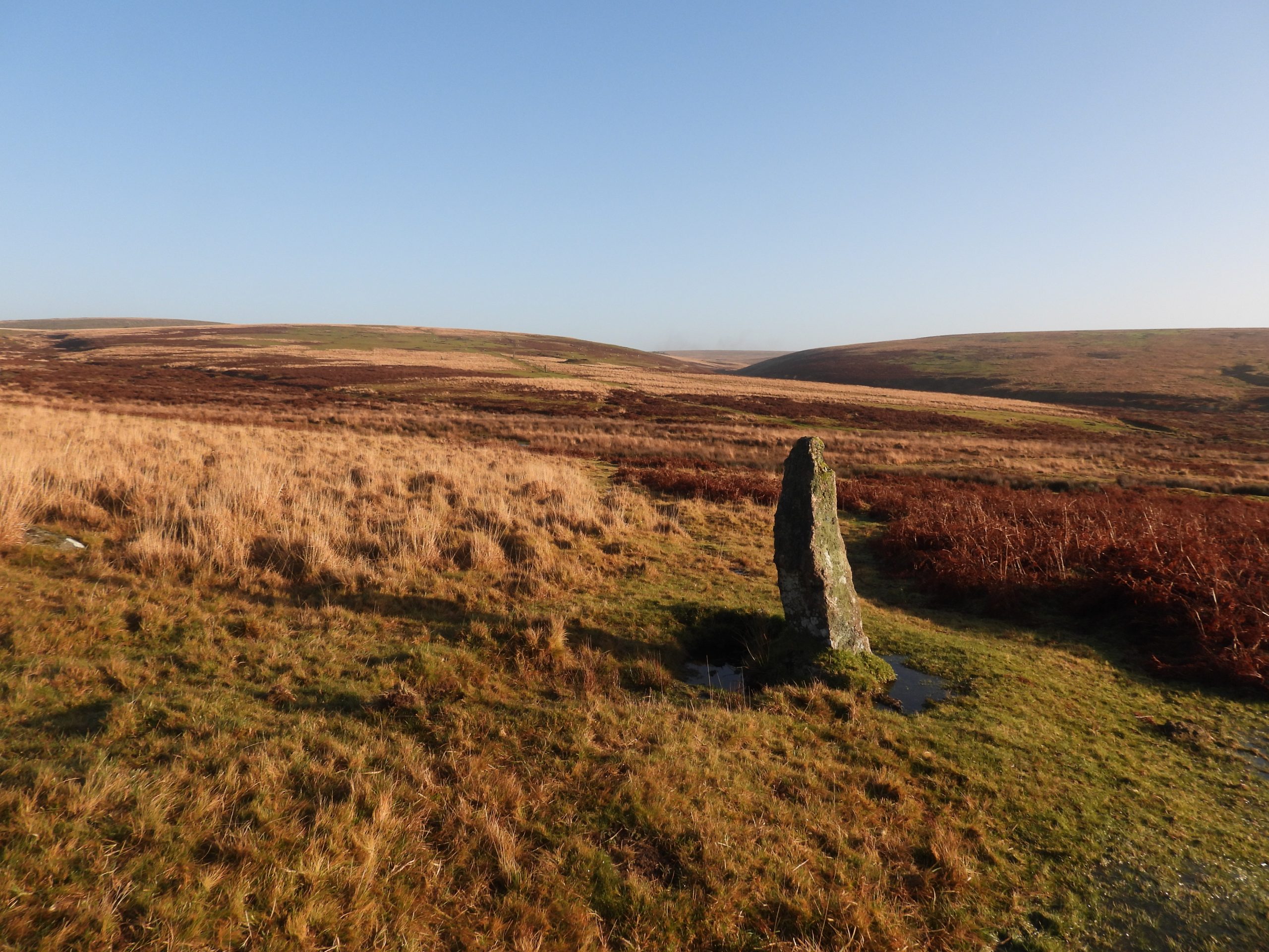
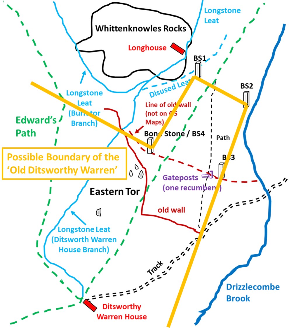
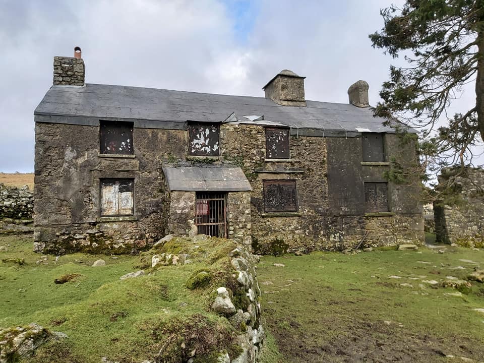
Sketch map showing the four Boundary Stones in relation to the features in their immediate surroundings. To the west, between Stones 1 and 4 the area is is bounded by an old wall and a branch of Longstone Leat. To the east, between Stones 2 and 3 the area is bounded by Drizzlecombe Brook. Of particular interest are the remains of an old crumbled warreners wall (ref Hemery) between Stones 3 and 4, which is not shown on OS maps. On the line of the old wall is a pair of gateposts, one of which is recumbent as noted by Hemery. Other features of interest on the are Whittenknowles Rocks, a longhouse, several leats and Ditsworthy Warren House.Most visitors to the area are likely to come in from the west or north having parked near Burford Ford (by the ‘Scout Hut’). En-route Whittenknowles enclosure and huts are likely to be encountered. In Jeremy Butler’s ‘Dartmoor Atlas of Antiquities: Volume Three – The South-West‘ where he states that the enclosure is a hut circle settlement over an area of 4.37 hectares and contains 38 hut circles linked by walling or natural lines of clitter subdividing the enclosed area into small paddocks. The longhouse at Whittenknowles Rocks is oriented east to west and is said to be 28 metres long internally (Probert, S. A. J., 1999, Whittenknowles Rocks (Report – Survey) or 26.5 metres long internally (Butler, J., 1994, Dartmoor Atlas of Antiquities: Volume Three – The South-West, 126-7, Map 49, Figure 49.11 ) . Probert states it is divided into four compartments, whereas Butler describes it as being a long rectangular building with a porch on the south side and two small extensions to the west.The Ditsworthy branch of the leat looking towards Whittenknowles Rocks from the South (near Eastern Tor). Whittenknowles rocks are the shallow dome on the mid horizon.Longstone Leat split at SX58560 66937. Ditsworthy Warren (Longstone) leat branch to the left (south) and Sheepstor area branch (Longstone) leat to the right (north). Gutter Tor in the background. Boundary Stone 1 with views to the Drizzlecome Plain beyond. Is the the line between this stone and Boundary Stone 2, the original boundary of the ‘Old Ditsworthy Warren’ ?Boundary Stone 1 is located at SX58712 66944The three Drizzlecombe Menhirs and the Giant’s Basin can be seen from Boundary Stone 2.Boundary Stone 2 is located at SX58856 66856Boundary Stone 2 looking north west towards Whittenknowles RocksBoundary Stone 2 is located close to Drizzlecombe Brook. Drizzlecombe PlainPlover near Boundary Stone 1. Stone 4 lies close to Eastern Tor. One assumes this is the stone directly mentioned by Eric Hemery in High Dartmoor (Page 187), where he states: “On the east side of the tor (Eastern) stands a bond-stone of Eylesbarrow Mine”Stone 4 (Bond Stone) also lies near the west end of old crumbled warreners wallStone 4 is located at SX58571 66711View from near Stone 4, across the River Plym towards some old field systems below Shavercombe Tor. The field systems are believed to be late medieval or post medieval and relate to an intensive phase of arable cultivation. The old crumbled warreners wall as mentioned by Hemery. This picture is looking east towards the gateposts (one recumbent) and Boundary Stone 3.Gateposts on the old warreners wall (foreground) and Boundary Stone 3 (background).As mentioned by Hemery “A gateway interrupts the wall at the foot of the hill, one post being erect, the other fallen and having a gate hanger”. These gateposts are located at SX58739 66656Boundary Stone 3 looking across Drizzlecombe PlainBoundary Stone 3 is located at SX58770 66647View from Boundary Stone 3 looking west along the old warreners wall towards the two gateposts, Bond Stone / Boundary Stone 4 and Eastern TorTHEORY 1: Considering the information from Hemery (Bond Stone / BS4) and the probable Warren Boundary (Haynes), the author speculates that the above sketch map may define the extent of the warren boundary (up until the time of Eylesbarrow Mine closure). Stone 4 is just a bond-stone.THEORY 2: Considering the information of the probable Warren Boundary (Haynes), where he states the boundary runs from “Sheepstor Brook upstream for a little distance then east to the ridge of Eastern Tor then following a line of unmarked boundary stones to Drizzlecombe Brook and the Plym”. Is it possible that Stone 4 was not only a Bond-stone (Hemery) but also used as a ‘Old Warren’ Boundary Marker as shown in the sketch map. If anyone can add help solve this mystery, the author would be most grateful in receiving any information. Ditsworthy was recorded as a warren dating back to 1676. It was held by Edward Meade, William Nicholls, John Nicholls, Nicholas Ware and Percy Ware. Warrening came to an end in 1947 when the Ware family finally closed down the warren in upon the death of Percy Ware. Of note is that after the abandonment of Eylesborough mine about 1853, Ditsworthy took in the whole of this area to Eylesborough and Evilcombe on the Plym, and much later still took control of Legis Tor Warren, making its area more than 1 000 acres.