A collection of walks, discoveries, insights and pictures of exploring Dartmoor National Park
February 24, 2023
The Haytor Quarries
Dartmoor granite had, in all likelihood, first gained prominence in London high society, at the turn of the 19th century. This was largely due to Thomas Tyrwhitt, a Dartmoor ‘improver’ and forefather of Princetown, with his connections including the Prince of Wales. Tyrwhitt no doubt extolled the virtues of the strength, good weight bearing and weathering qualities of Dartmoor granite, which must have made it a good choice for the construction of buildings and bridges in the Capital.
By 1820, there was an act of parliament for the rebuilding of (John Rennie’s) London Bridge which specified three types of British granite, namely: Aberdeen (purple), Peterhead (red brown) and Devonshire Heytor (light grey). With this contract, the quarrying of granite from the Haytor (Heytor) area was ramped up by the land owner George Templer (1781-1843). Templer needed to provide assurances of supply and had constructed, at his own expense (believed to be around £30,000), a granite tramway, which would take the quarried granite from the quarries to Stover canal, which had been built by his father, James Templer II (1748-1813). The canal had been built between 1790-92 for the transportation via barge of ball clay from the Bovey Tracey basin. The canal from 1820 would now assist with transportation of granite to Teignmouth where it would be transferred to sea going vessels for onward transportation to London. In January 1829, George Templer had overspent his resources and was forced to sell his entire estate, which included Stover House, the Stover Canal and the Haytor Granite Tramway. The new owner was Edward St Maur (11th Duke of Somerset). The tramway and quarries were closed by 1860 due to cost and competition, albeit a few pieces of granite were still used for specialist constructions into the 20th century (e.g Exeter War Memorial by the Cathedral in 1919).
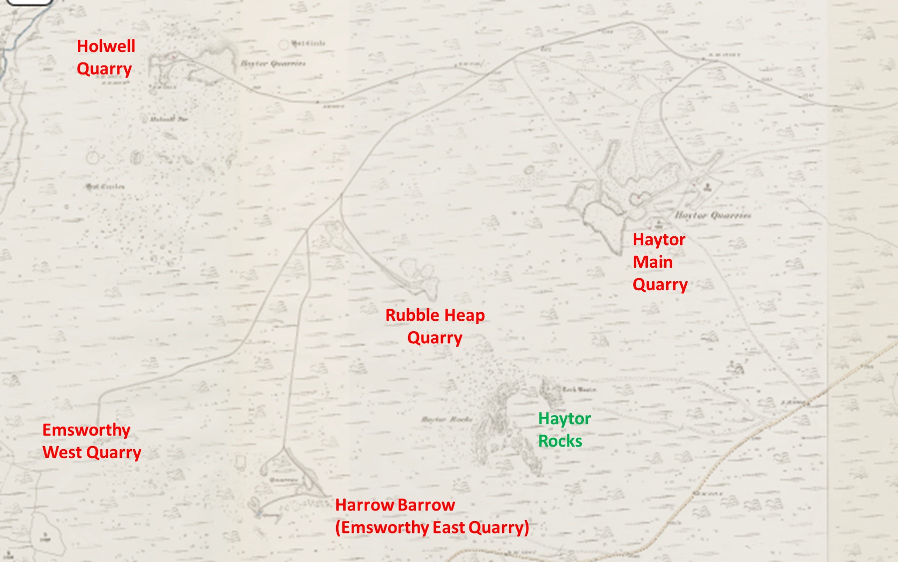
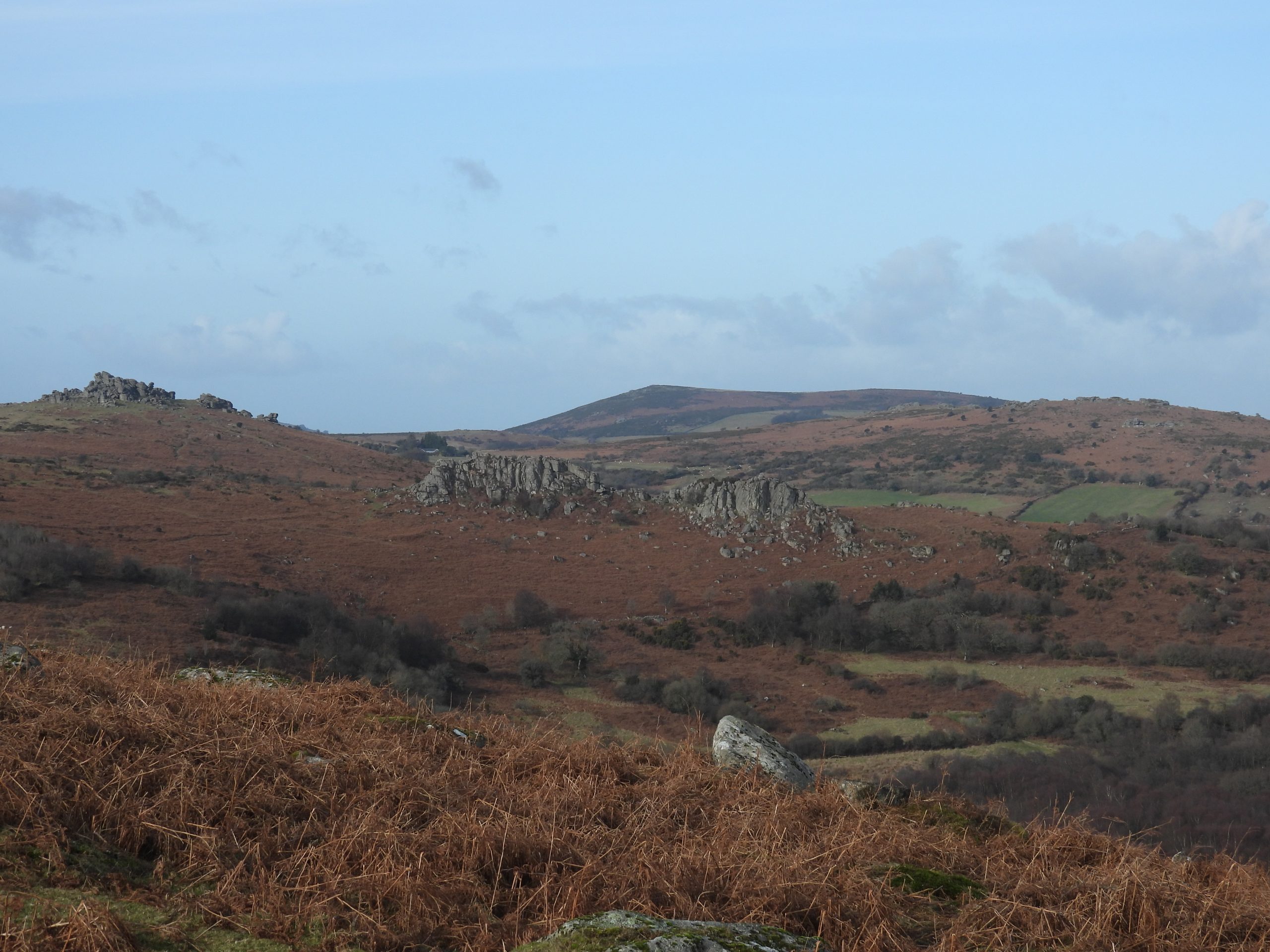
The land on which the five quarries around Haytor Down are located was first purchased by George Templers grandfather (James Templer I) in the 18th century. Surface granite from the area was used to build Stover House (1776-1780) with the quarries only having been developed on a small scale around the turn of the 19th century. The five separate quarries in the area are Haytor (Main) Quarry, Holwell Quarry, Rubble Heap Quarry, Harrow Barrow (Emsworthy East Quarry) and Western Quarry (Emsworthy West Quarry). This post covers an exploration of each of all these quarries, the granite tramway which interconnects them plus other features of interest in the area.
Bibliography:
The Haytor Granite Tramway and Stover Canal by Helen Harris – 1994 (Peninsula Press)
Walking the Dartmoor Railroads by Eric Hemery – 1983 (David and Charles) – Chapter 7 (Hey Tor Granite Tramroad)
Haytor Down (Report – Survey) by Dr P. Newman, 1999 / 2002.
The Quarry Landscape of Haytor Down by Dr P. Newman – Autumn 2020 – Dartmoor Magazine (pages 30-32)
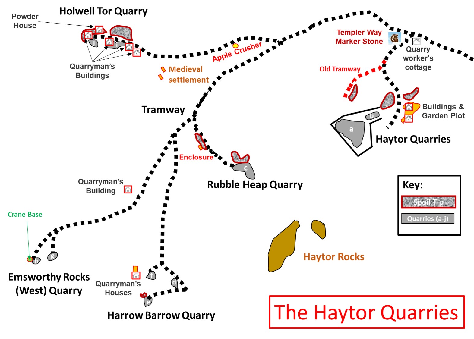
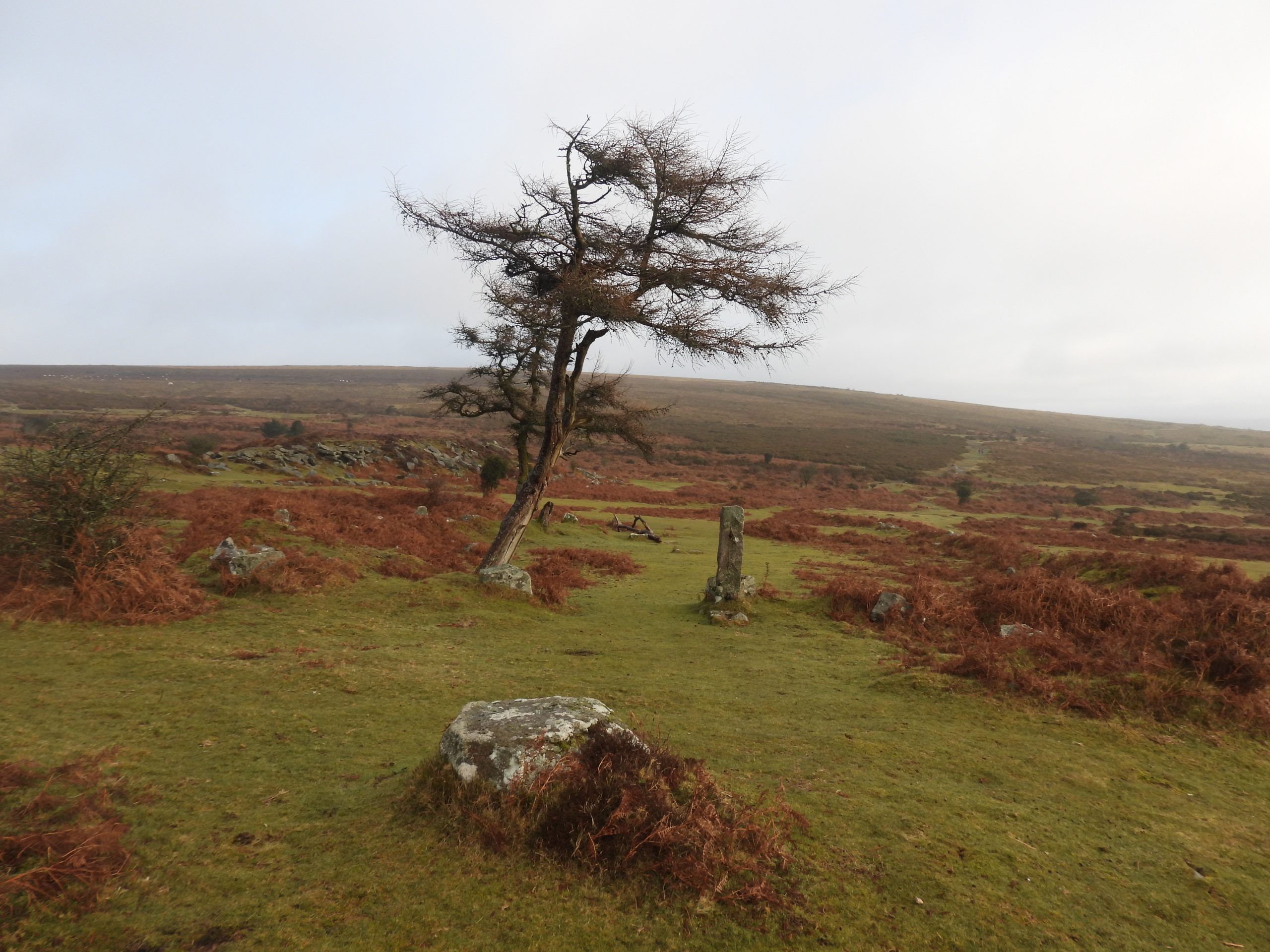
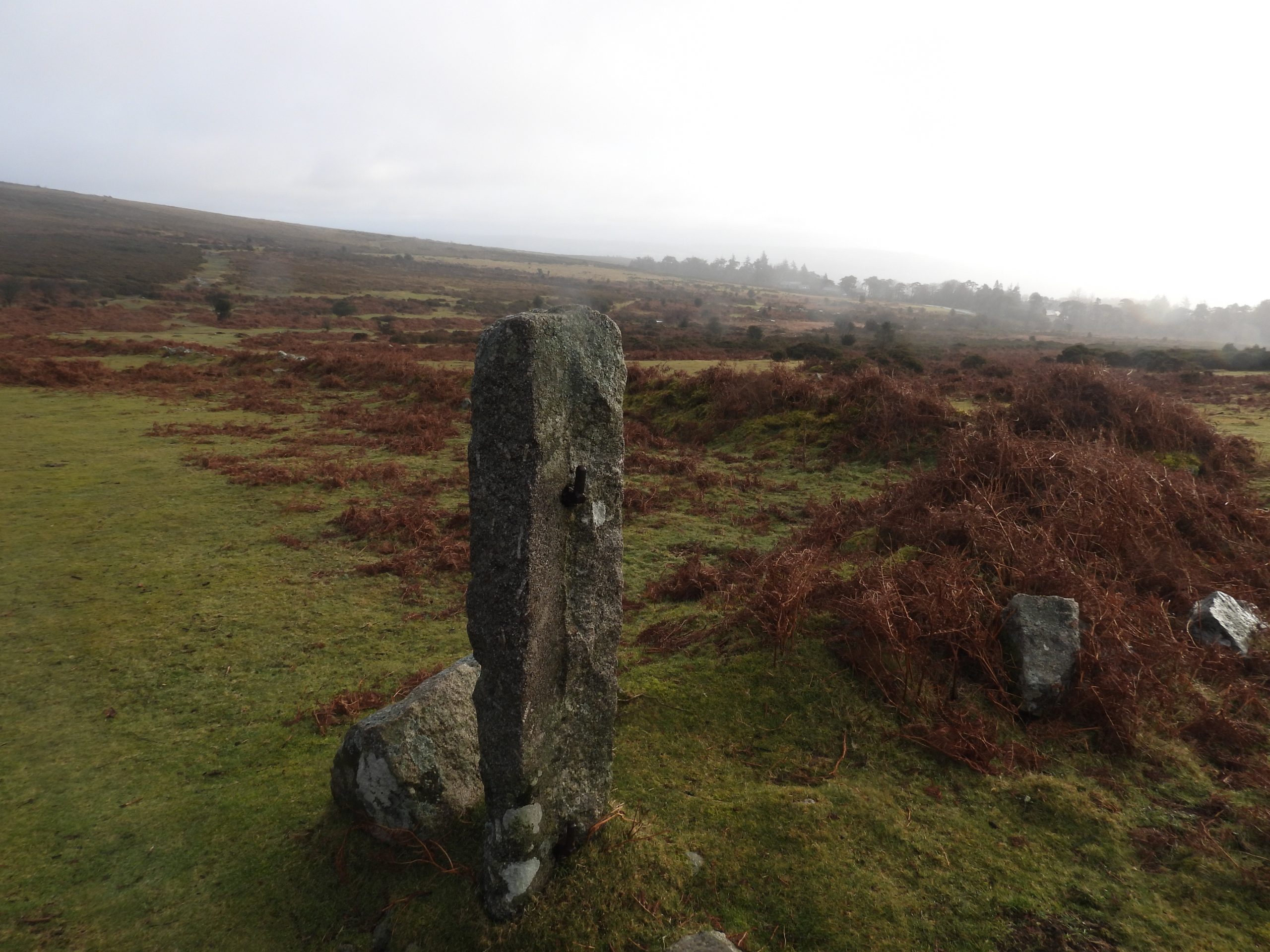
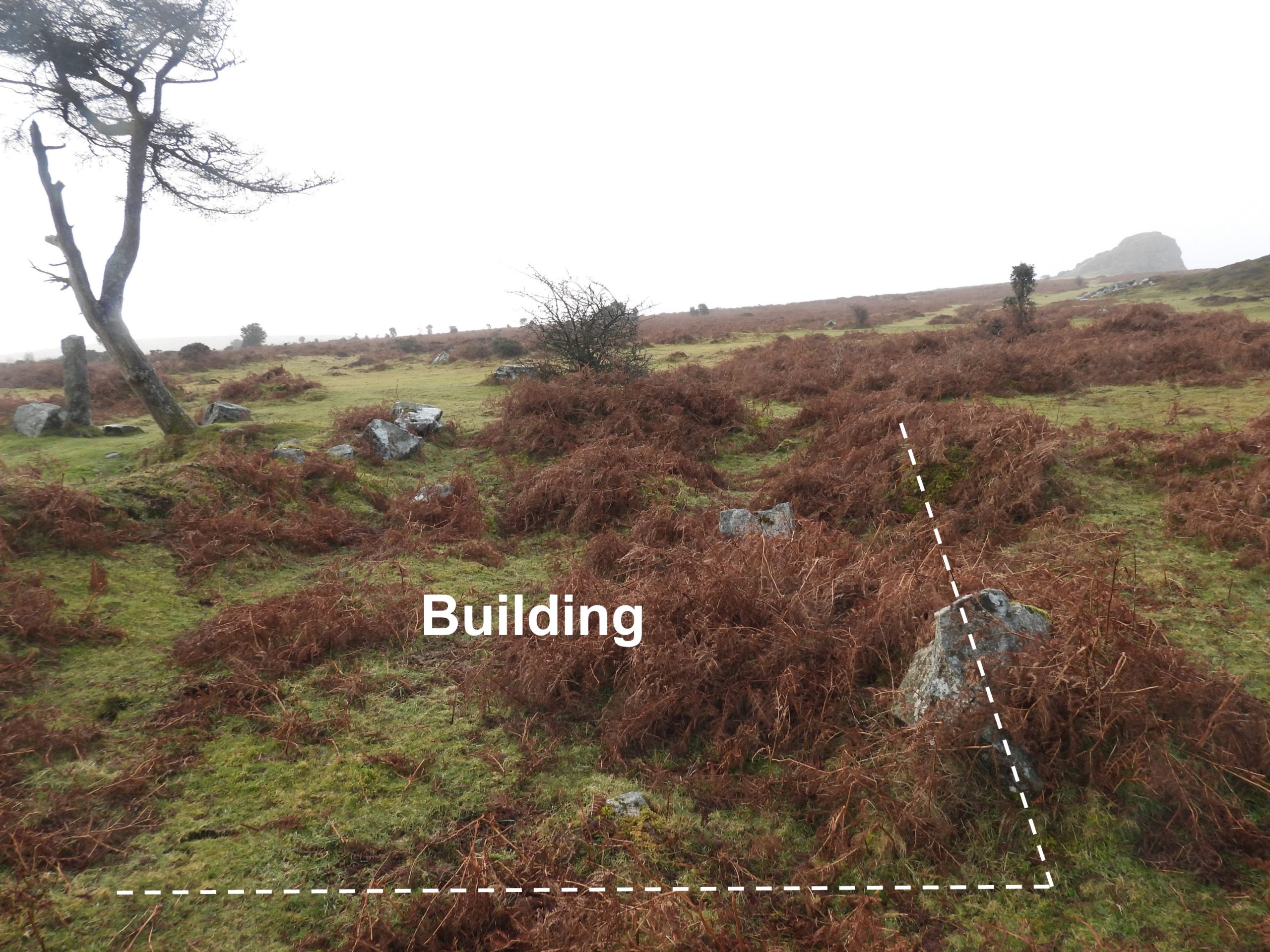
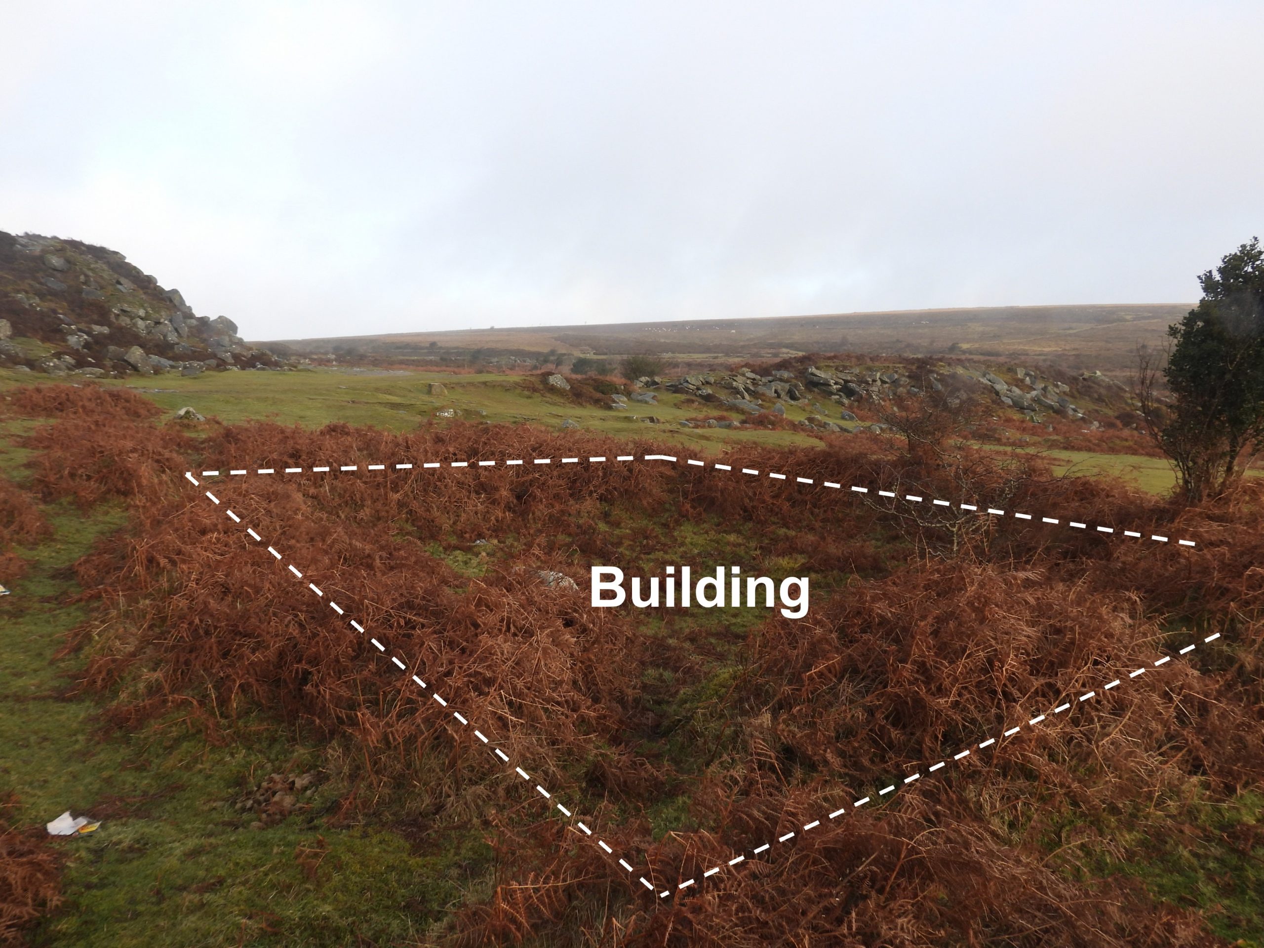
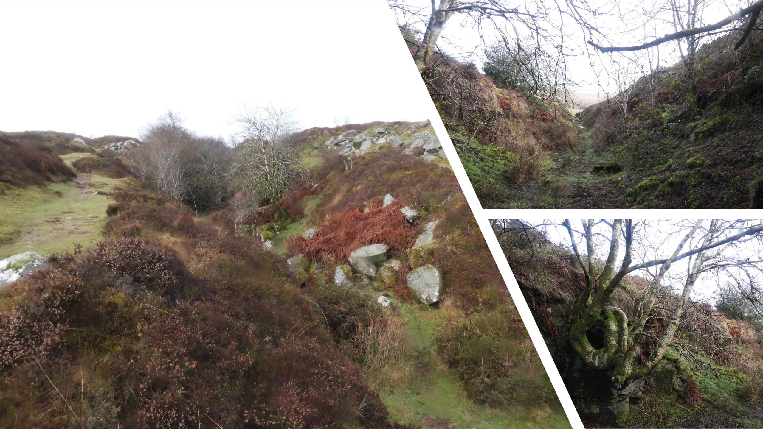
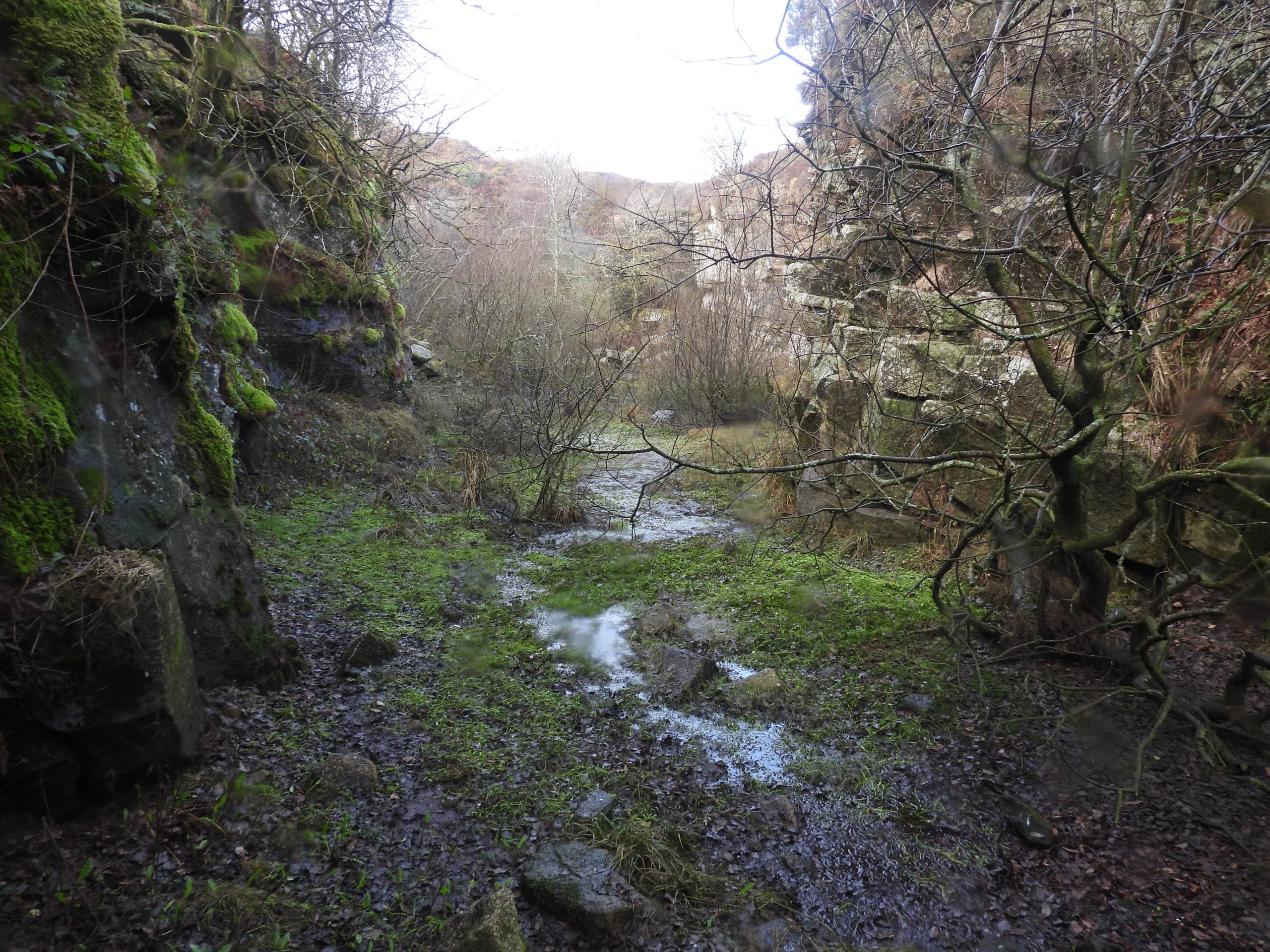
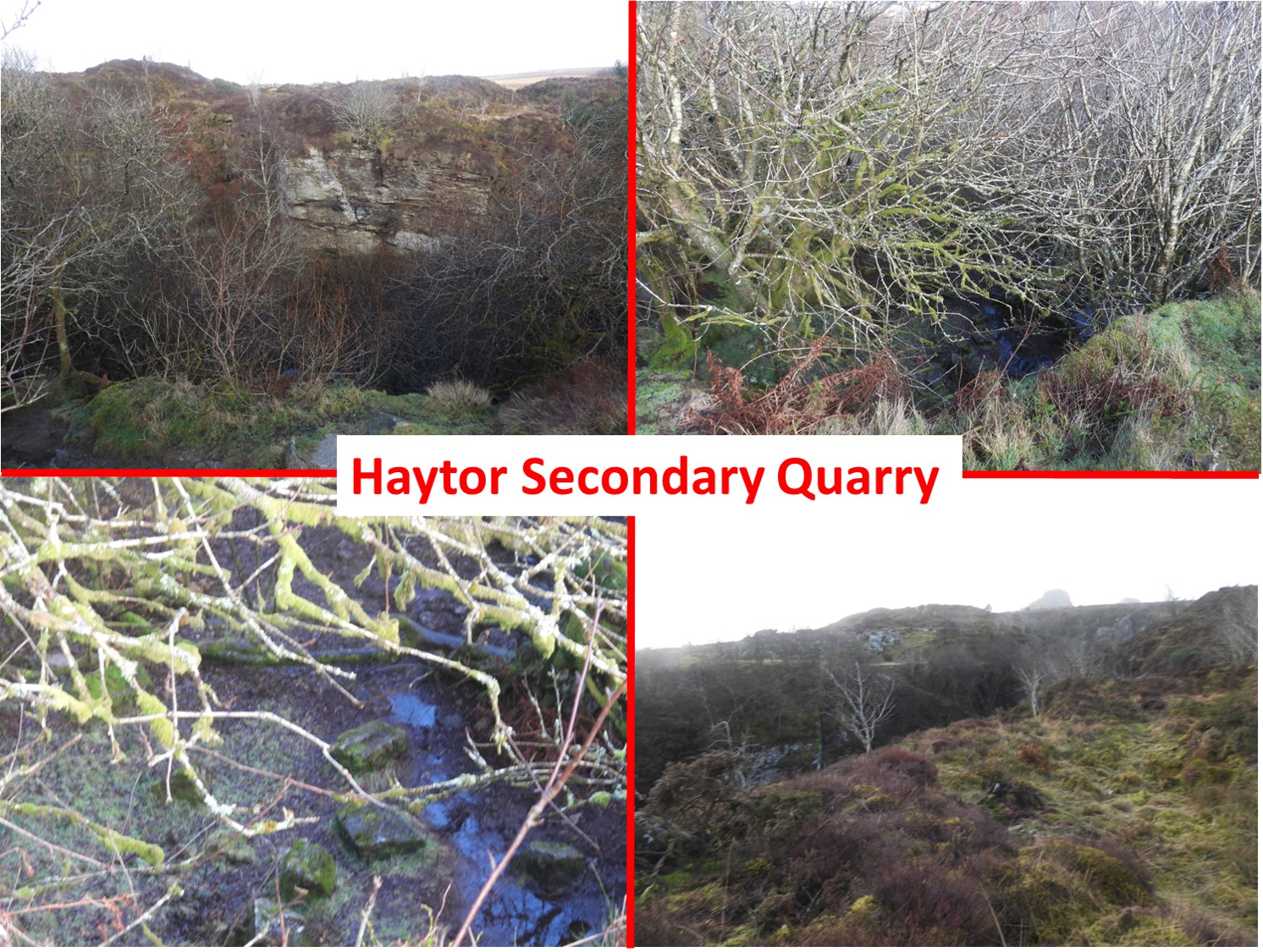
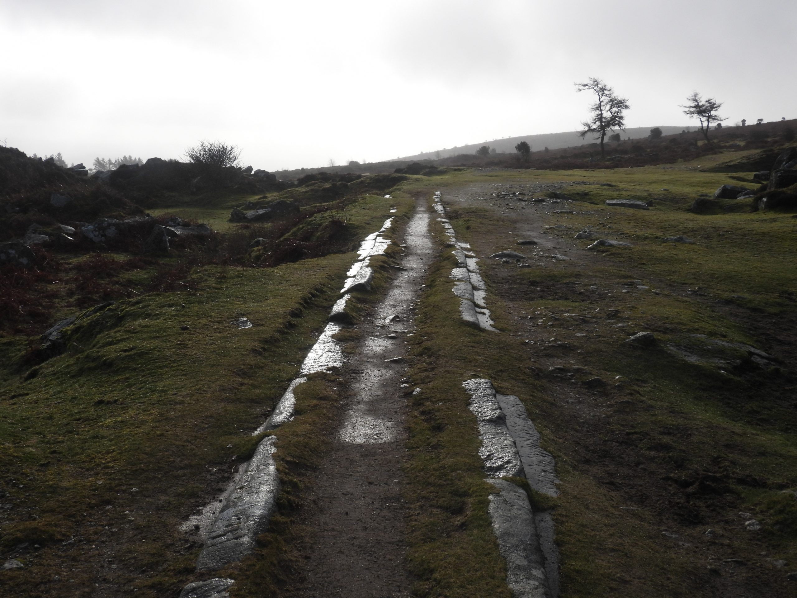
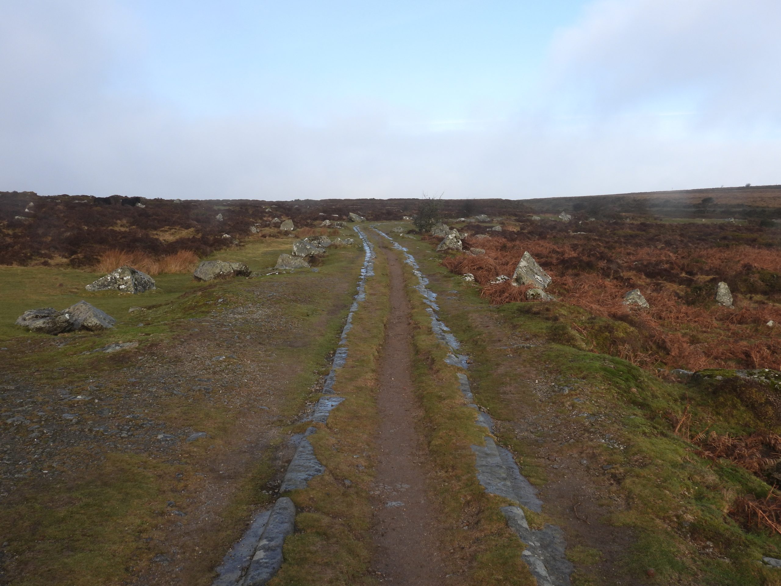
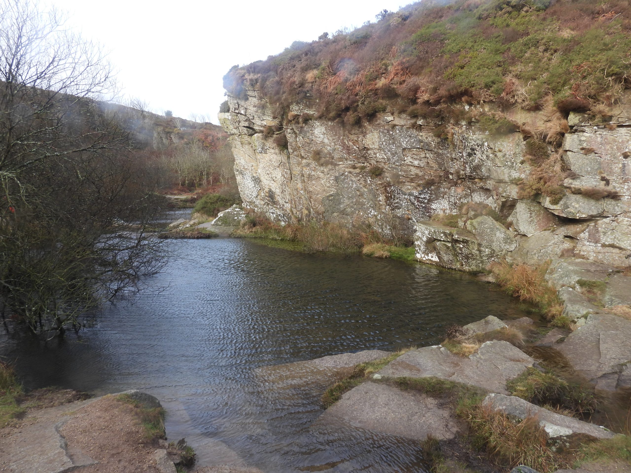
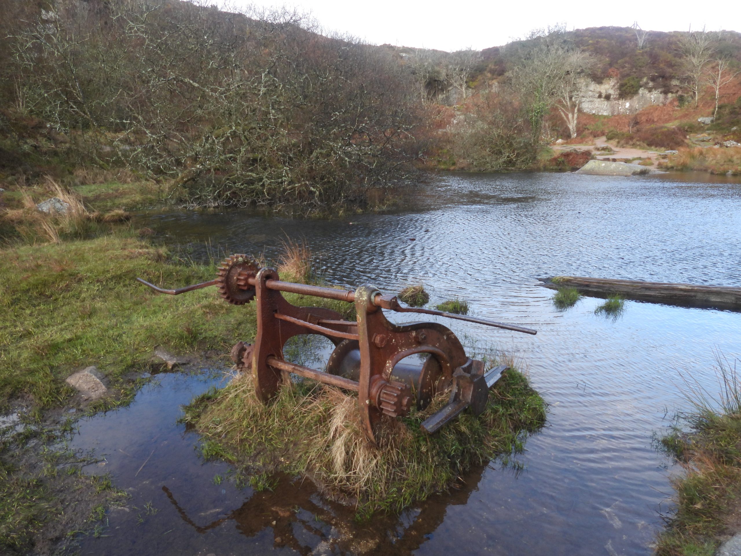
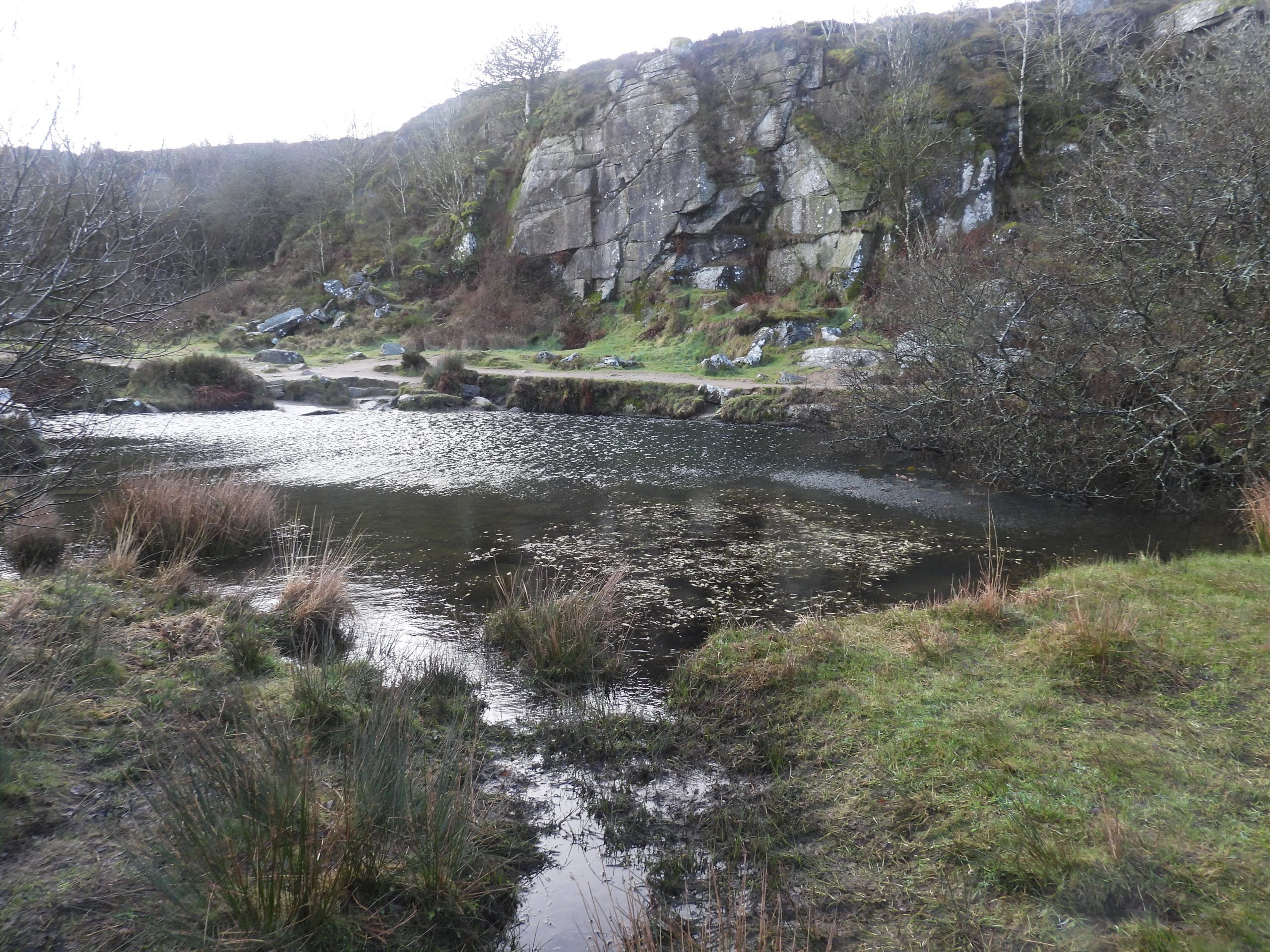
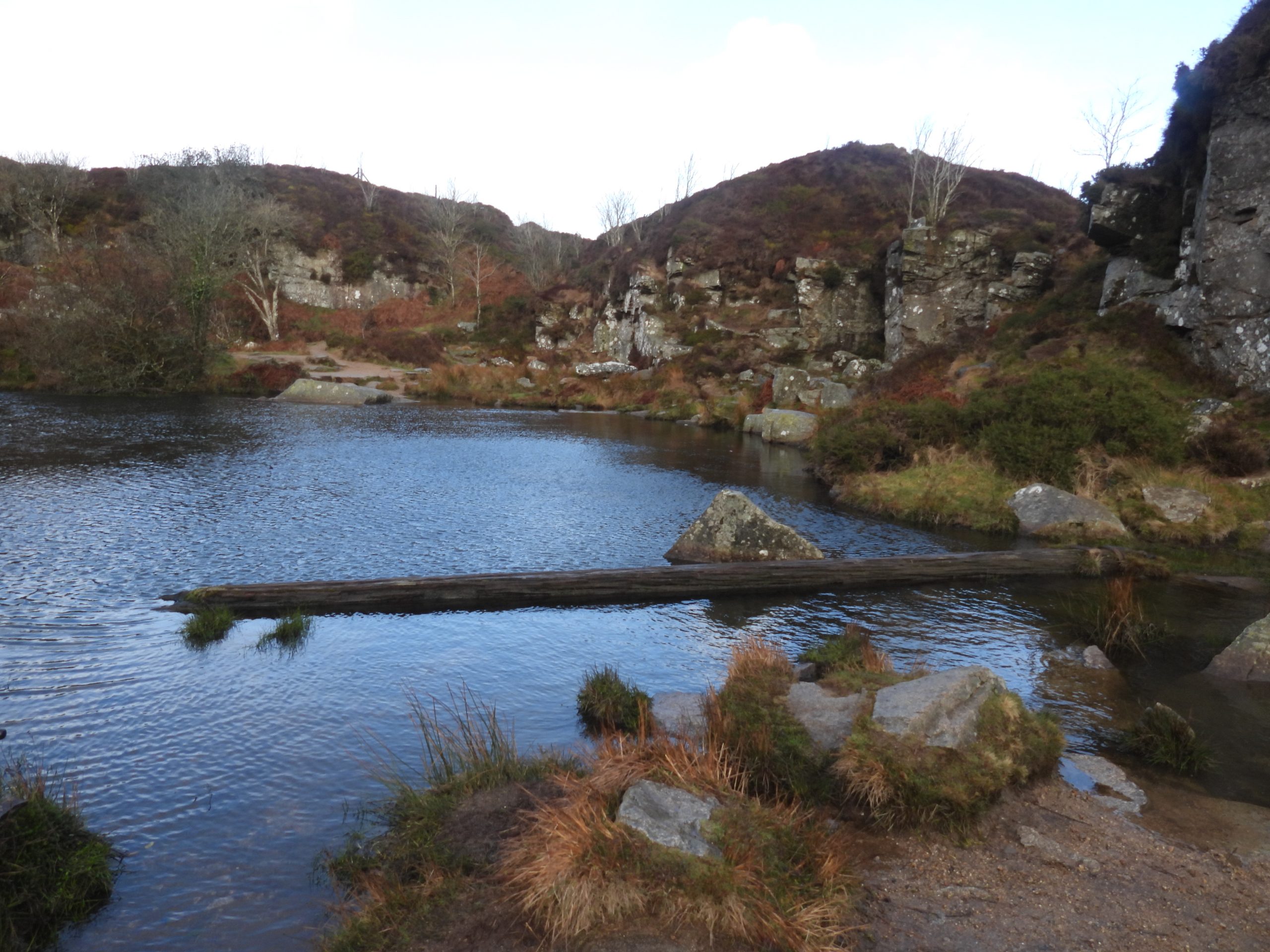
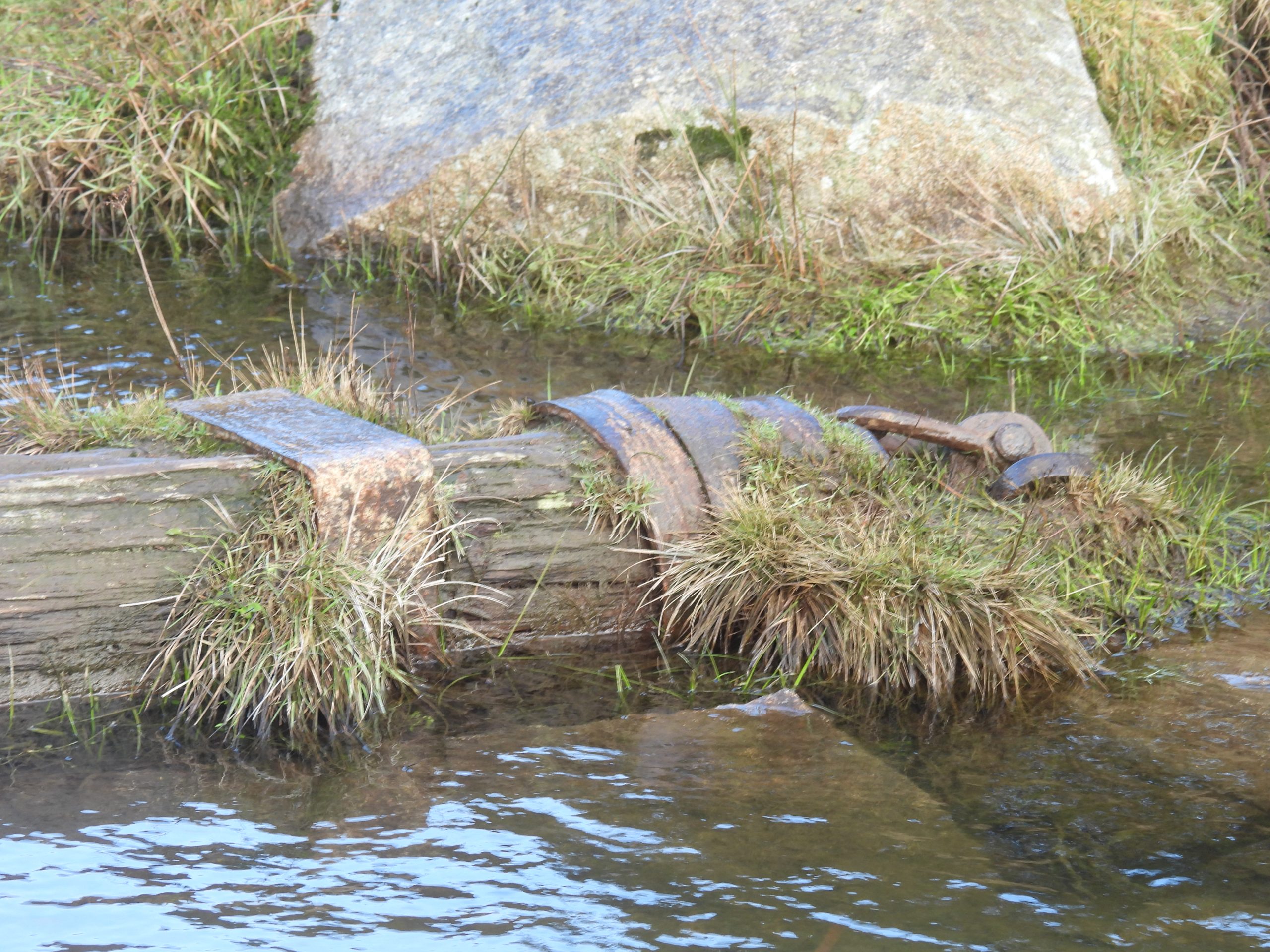
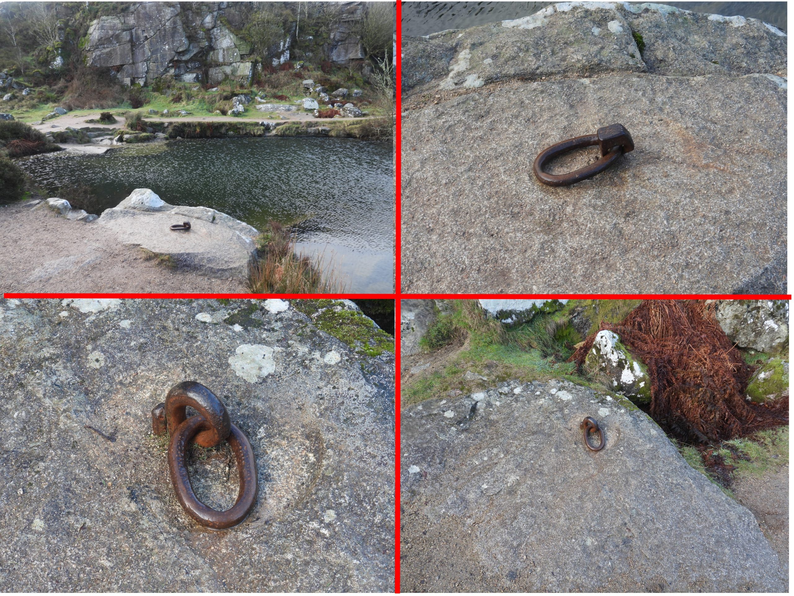
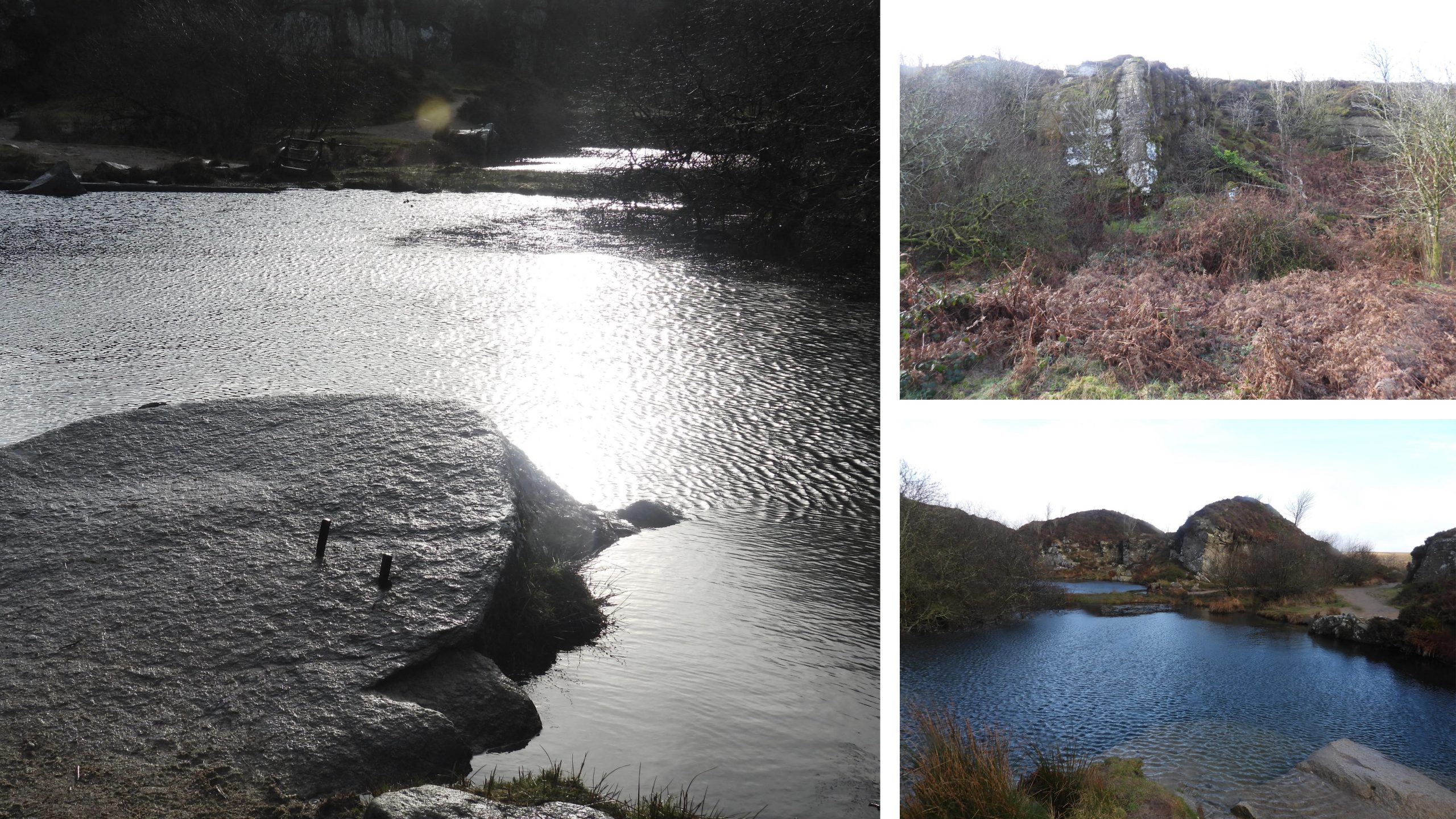
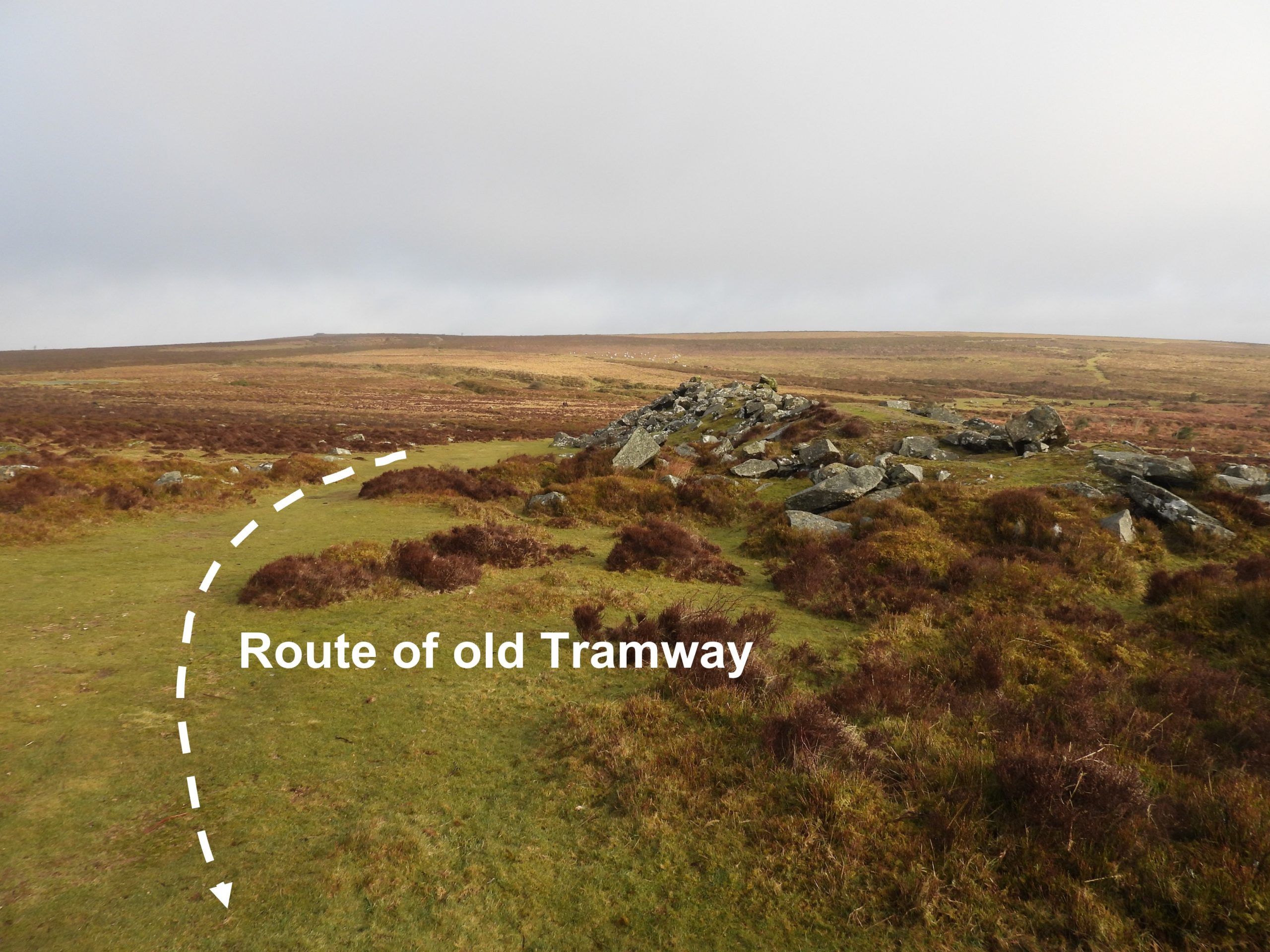
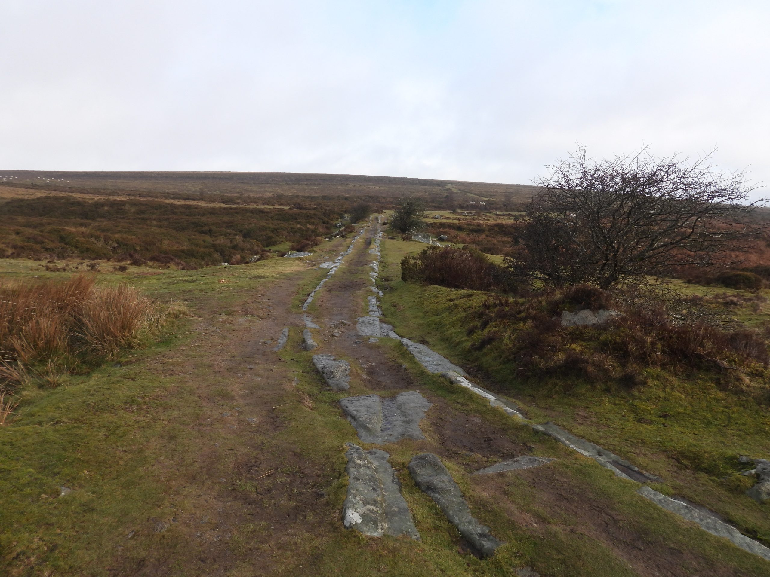
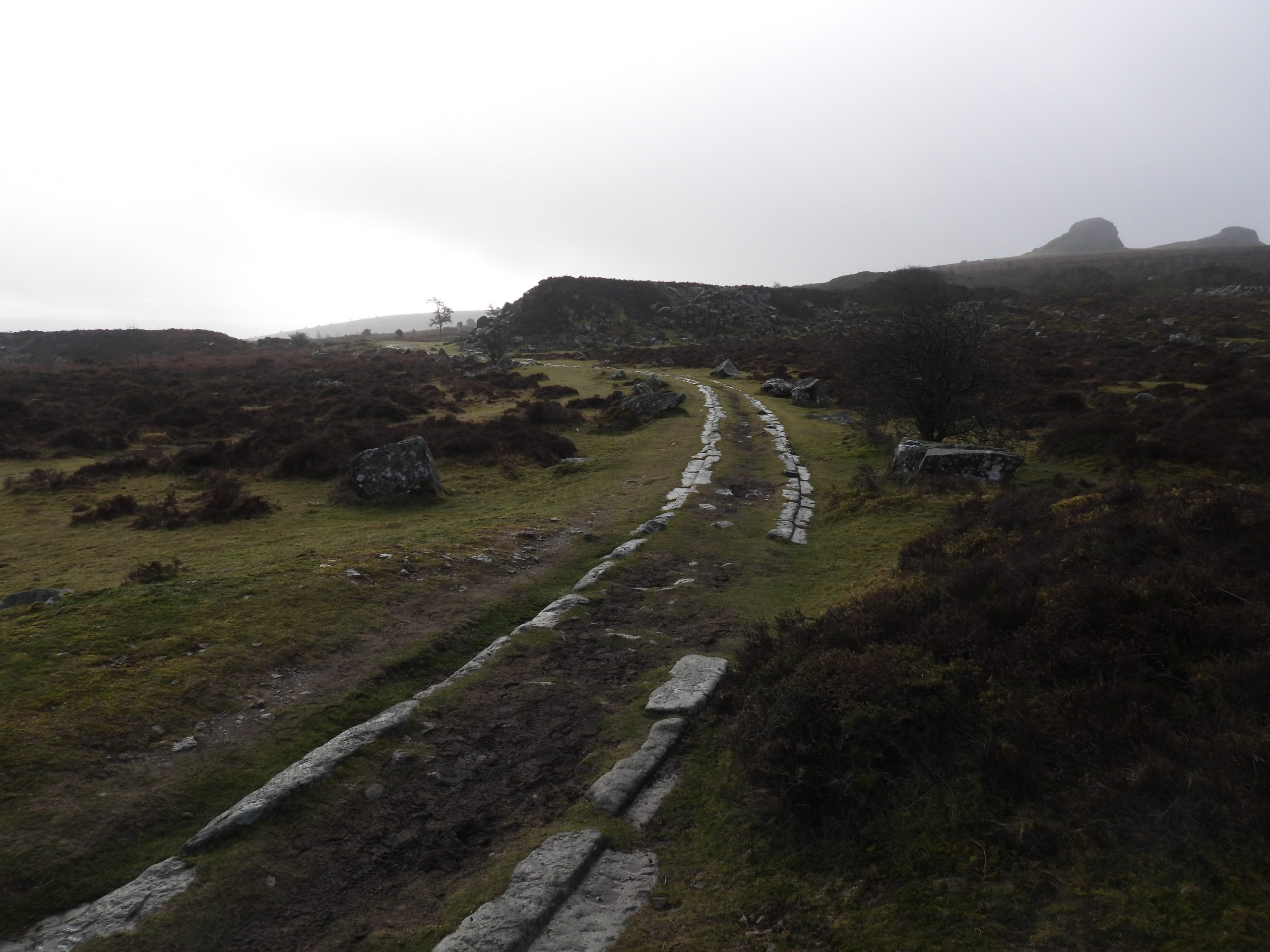
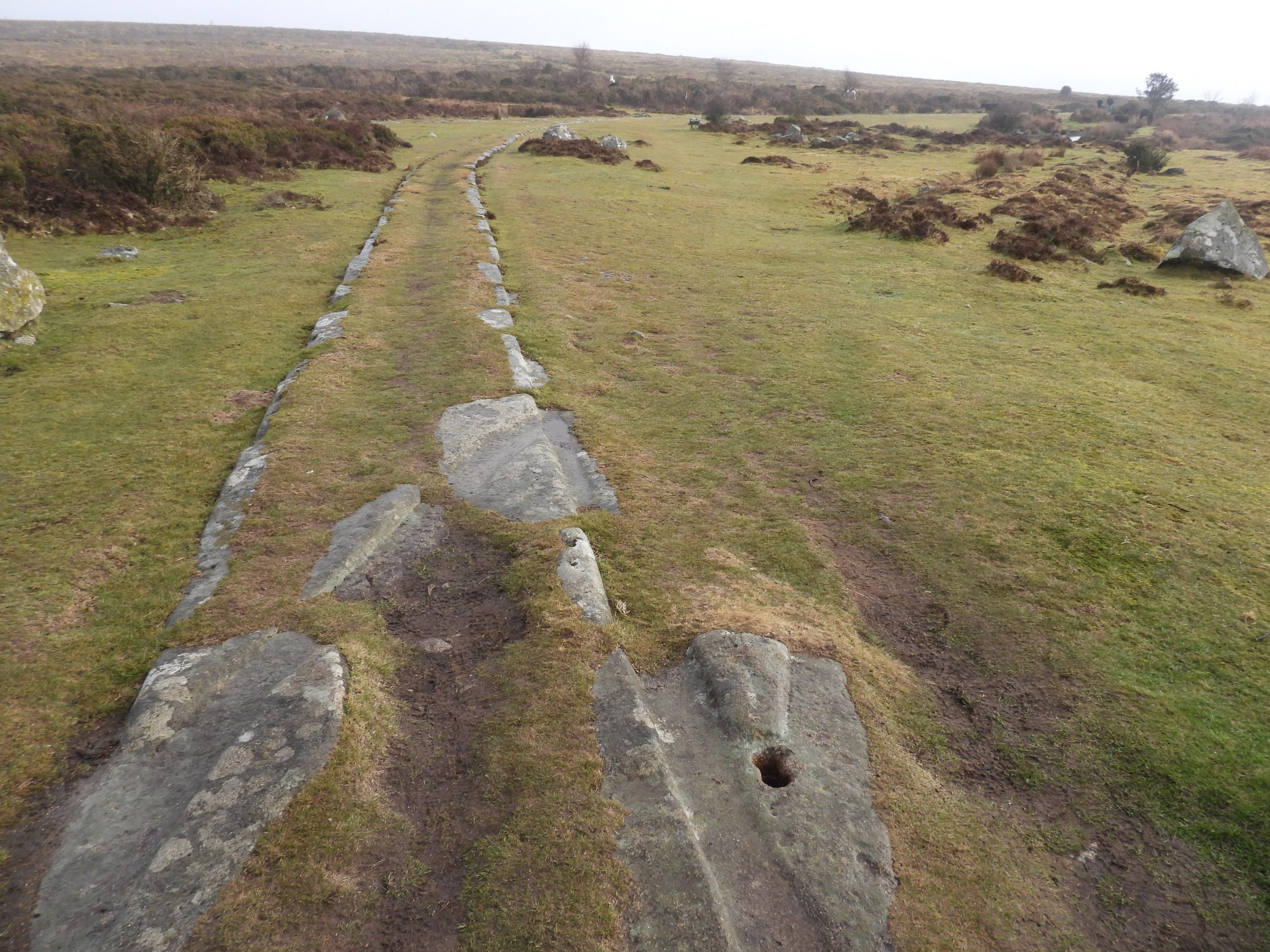
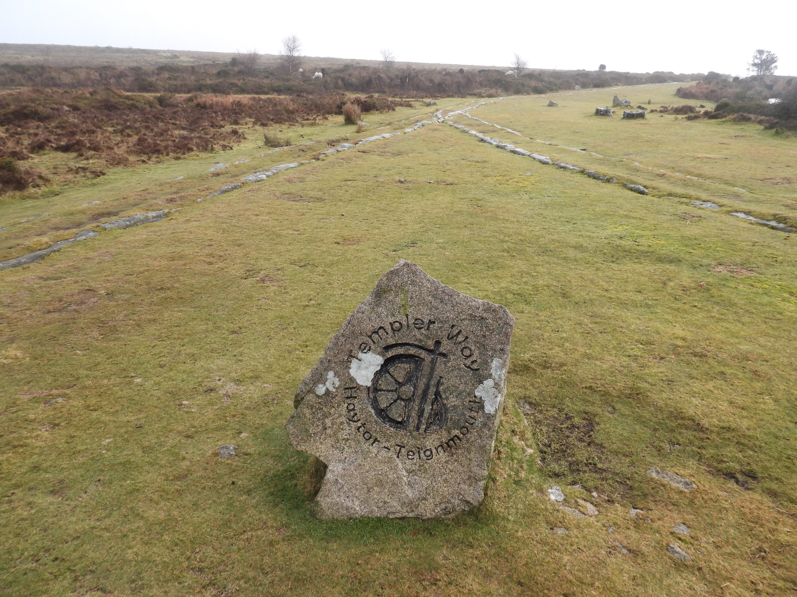
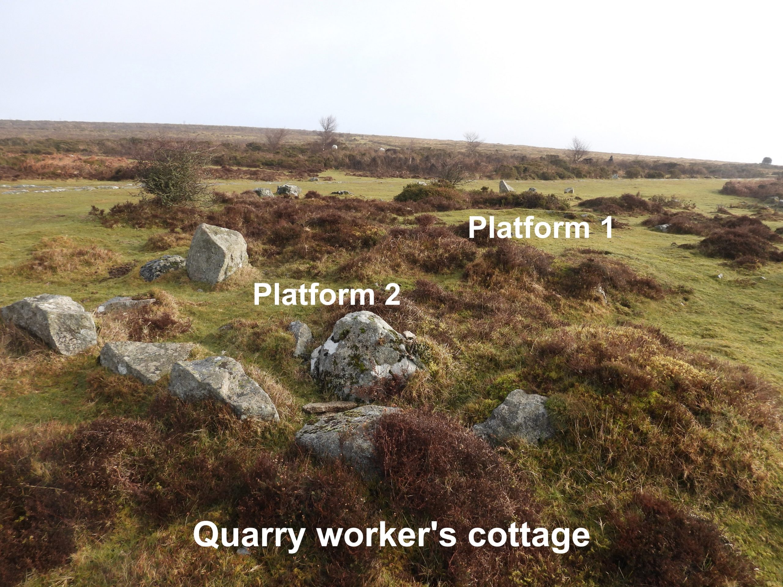
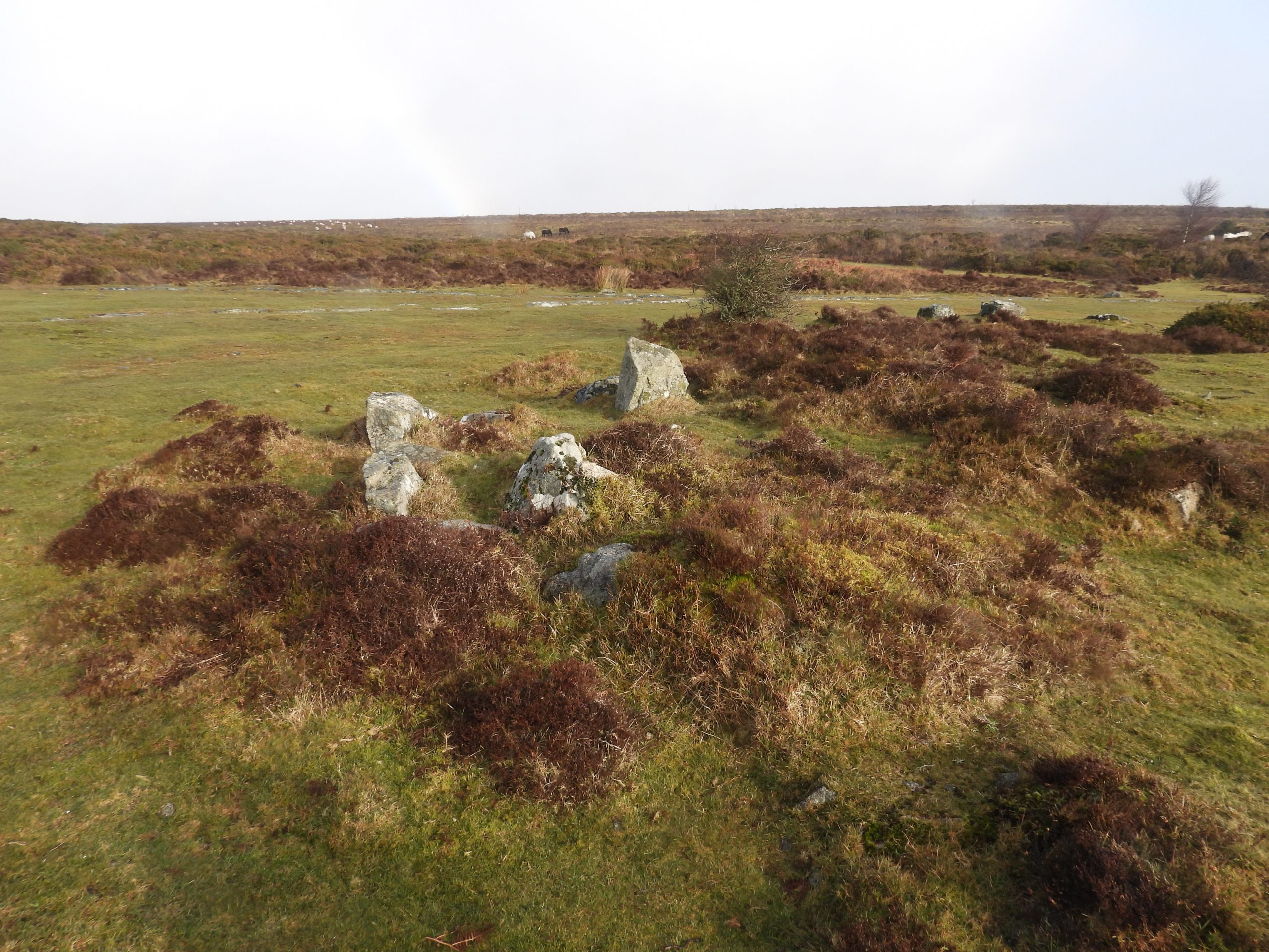
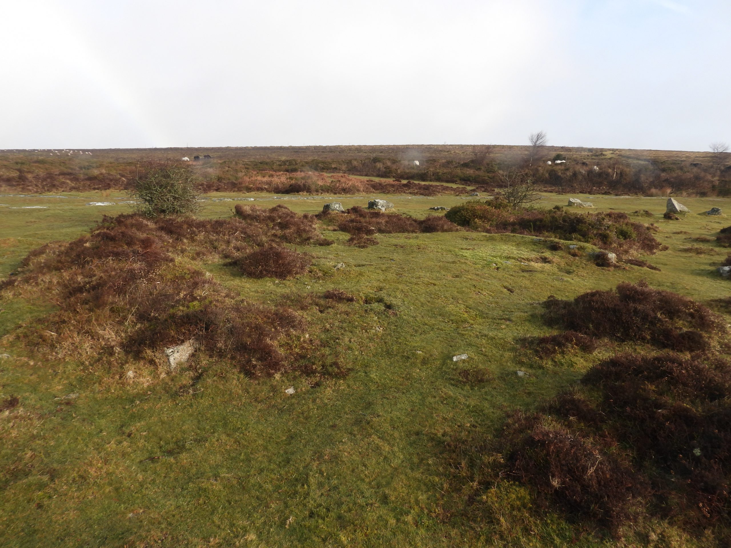
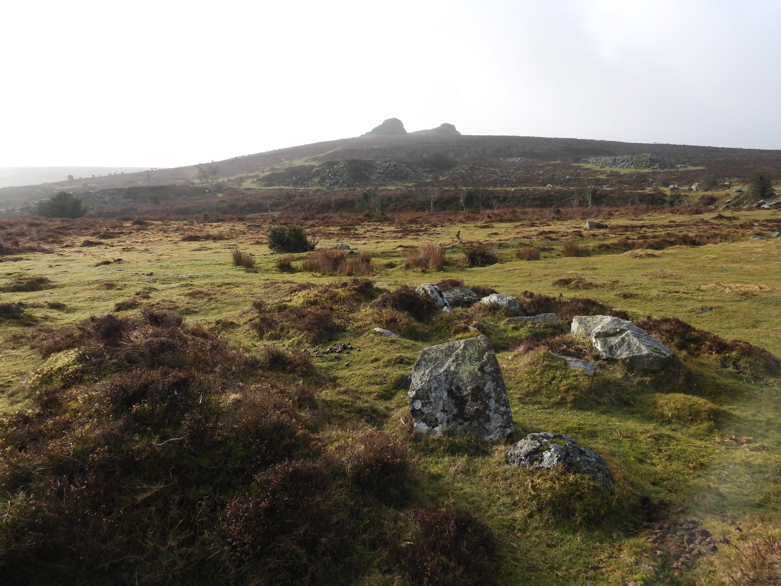
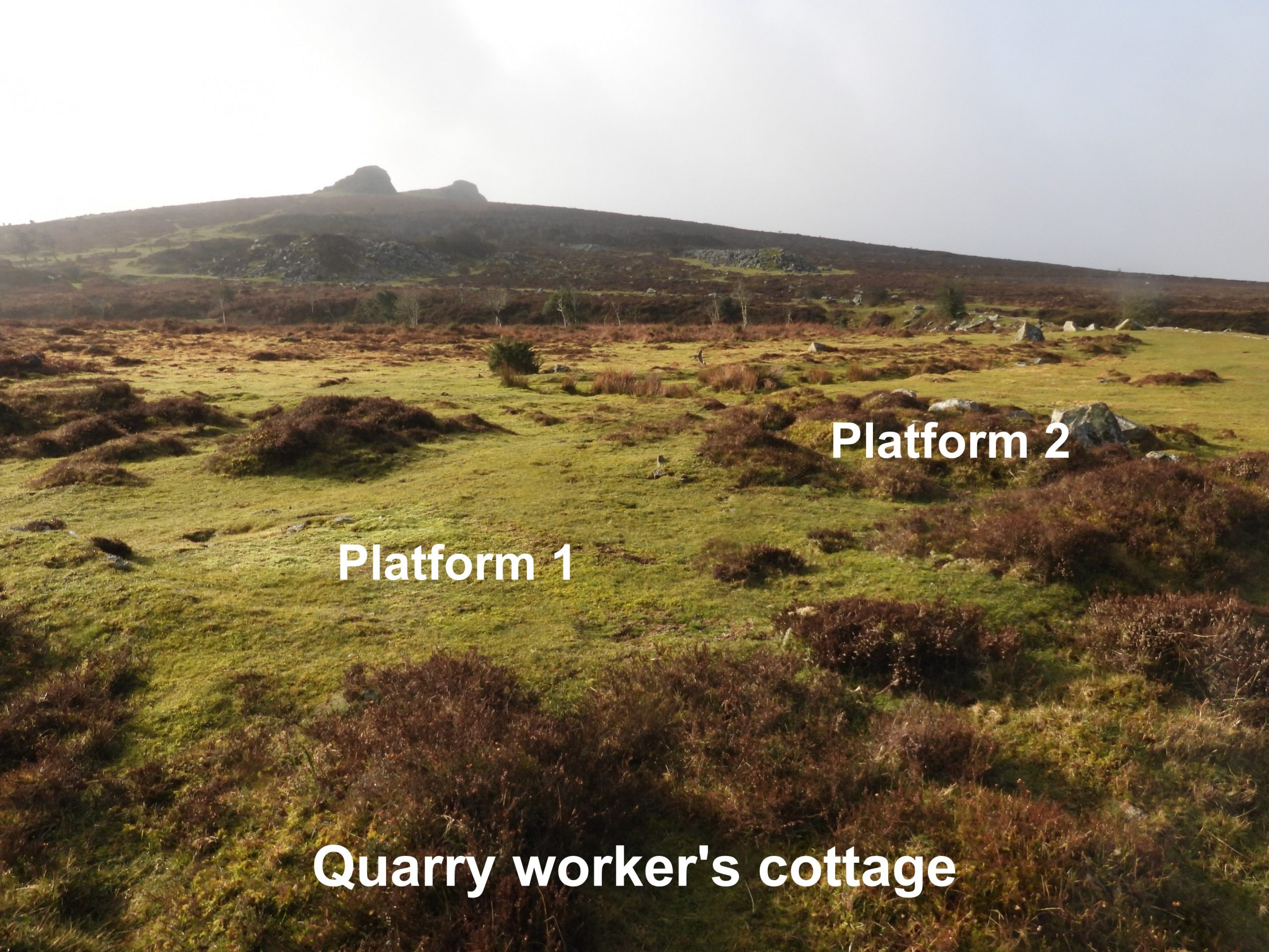
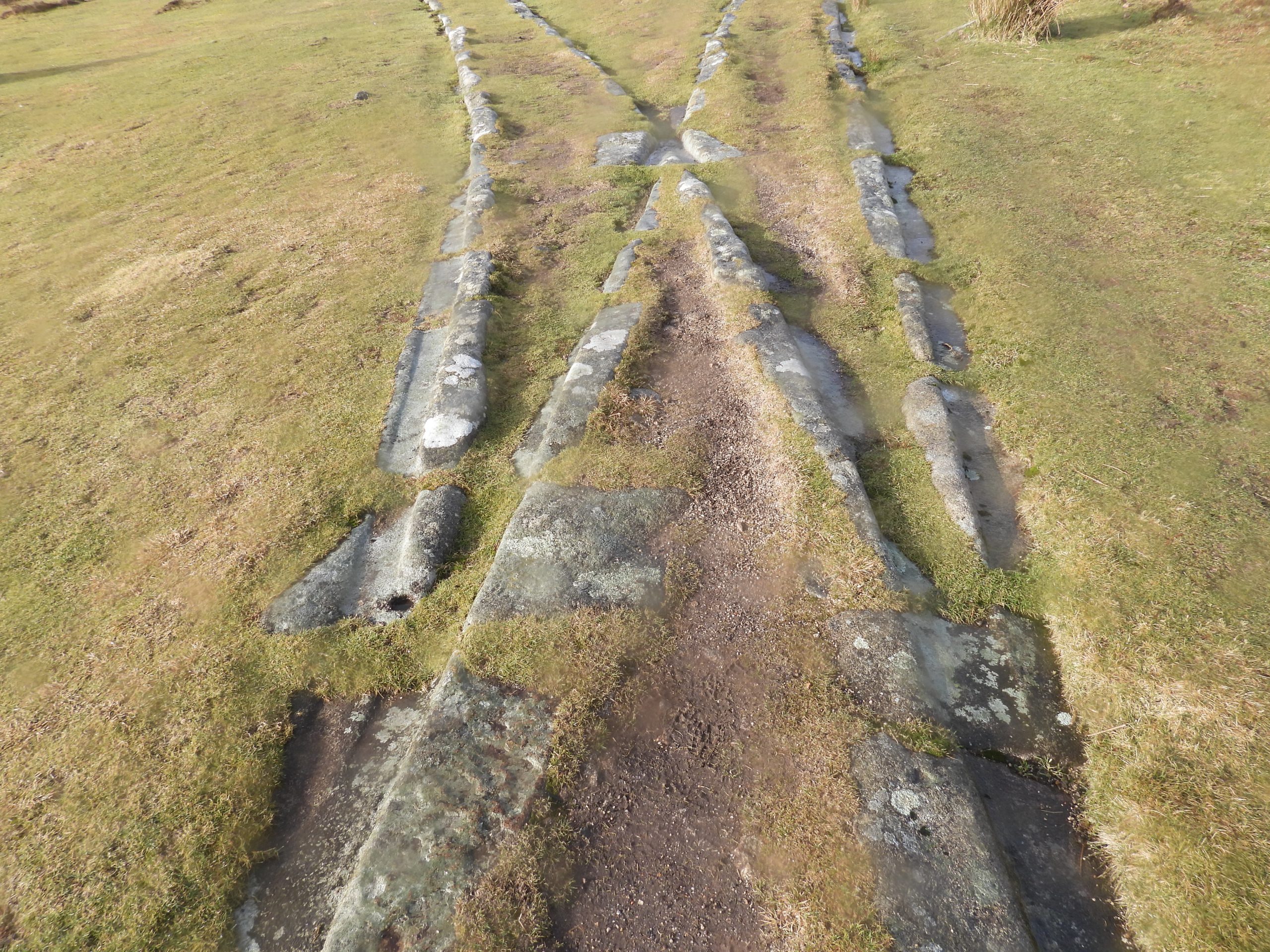
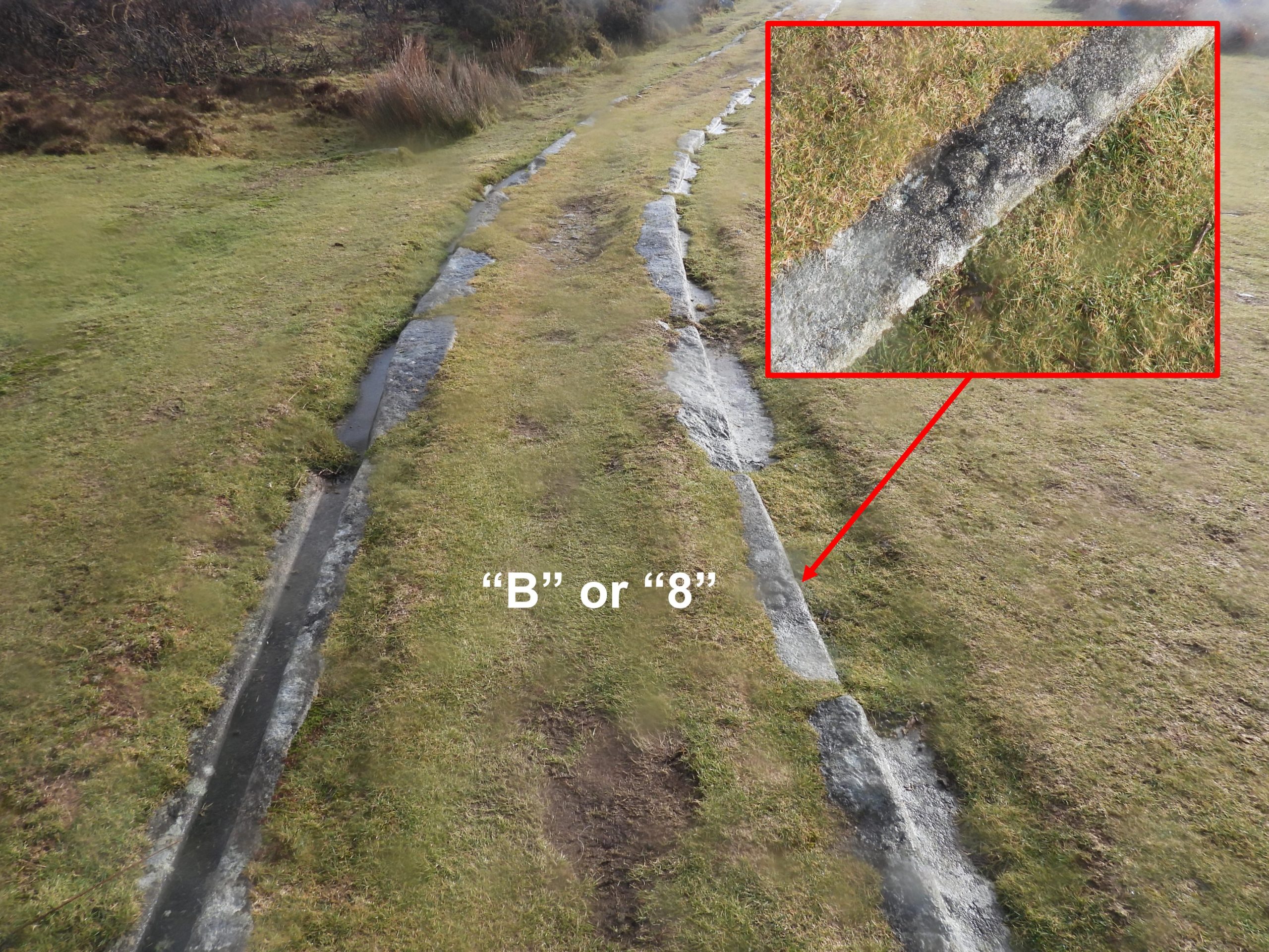
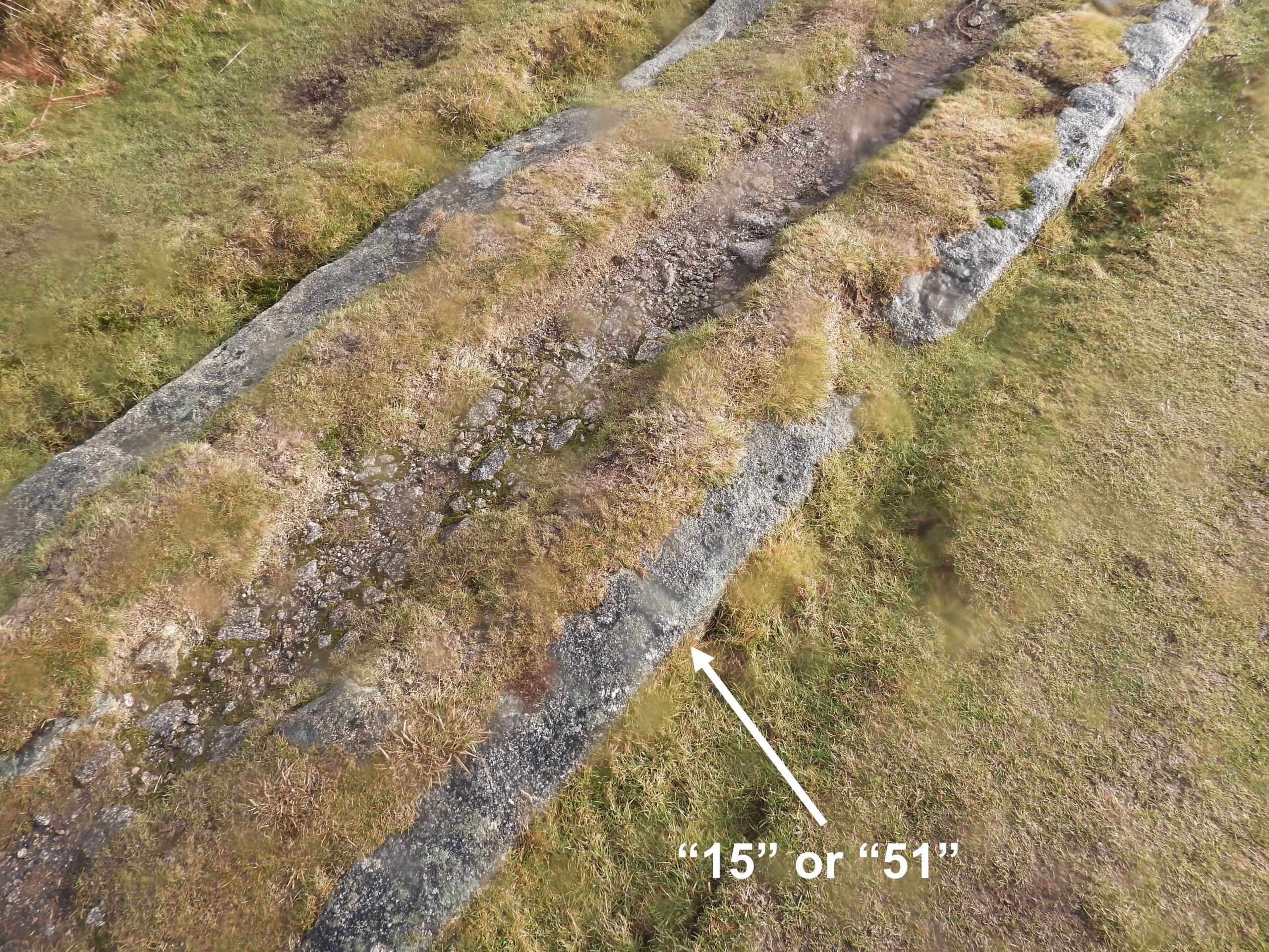
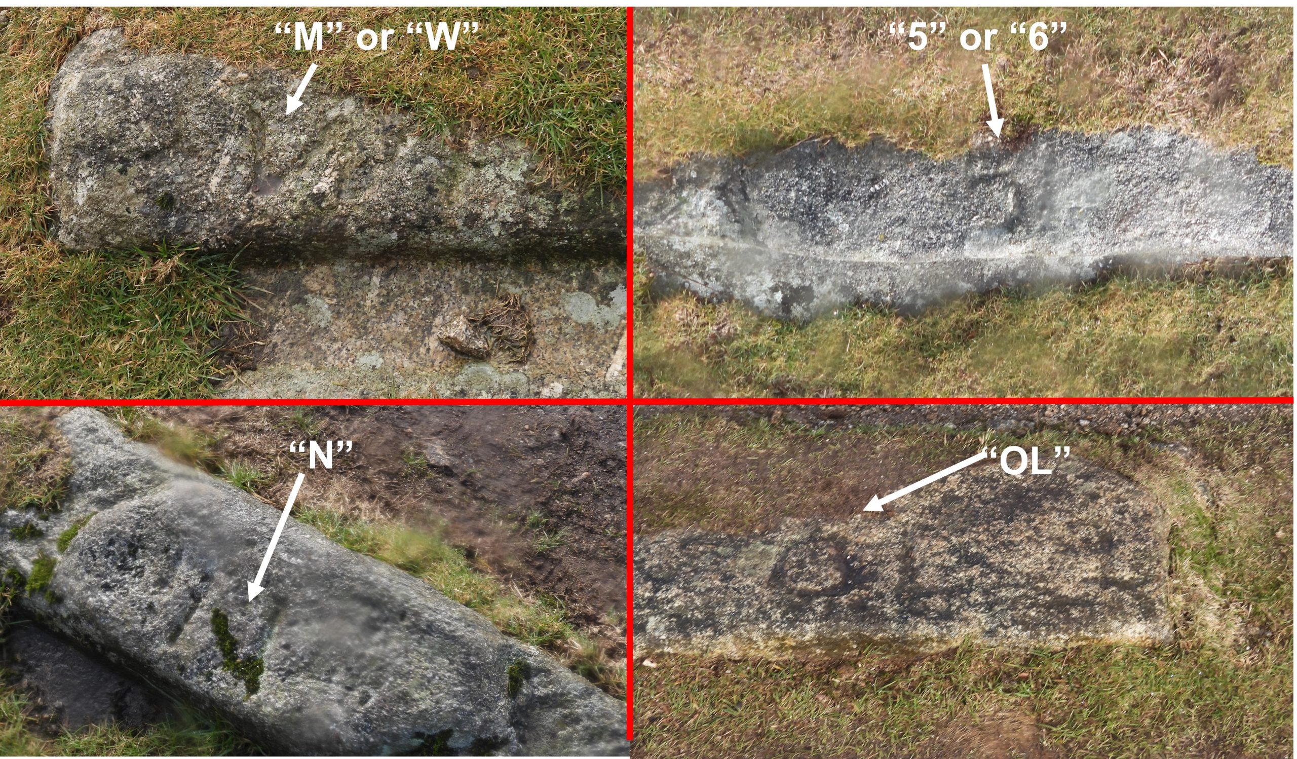
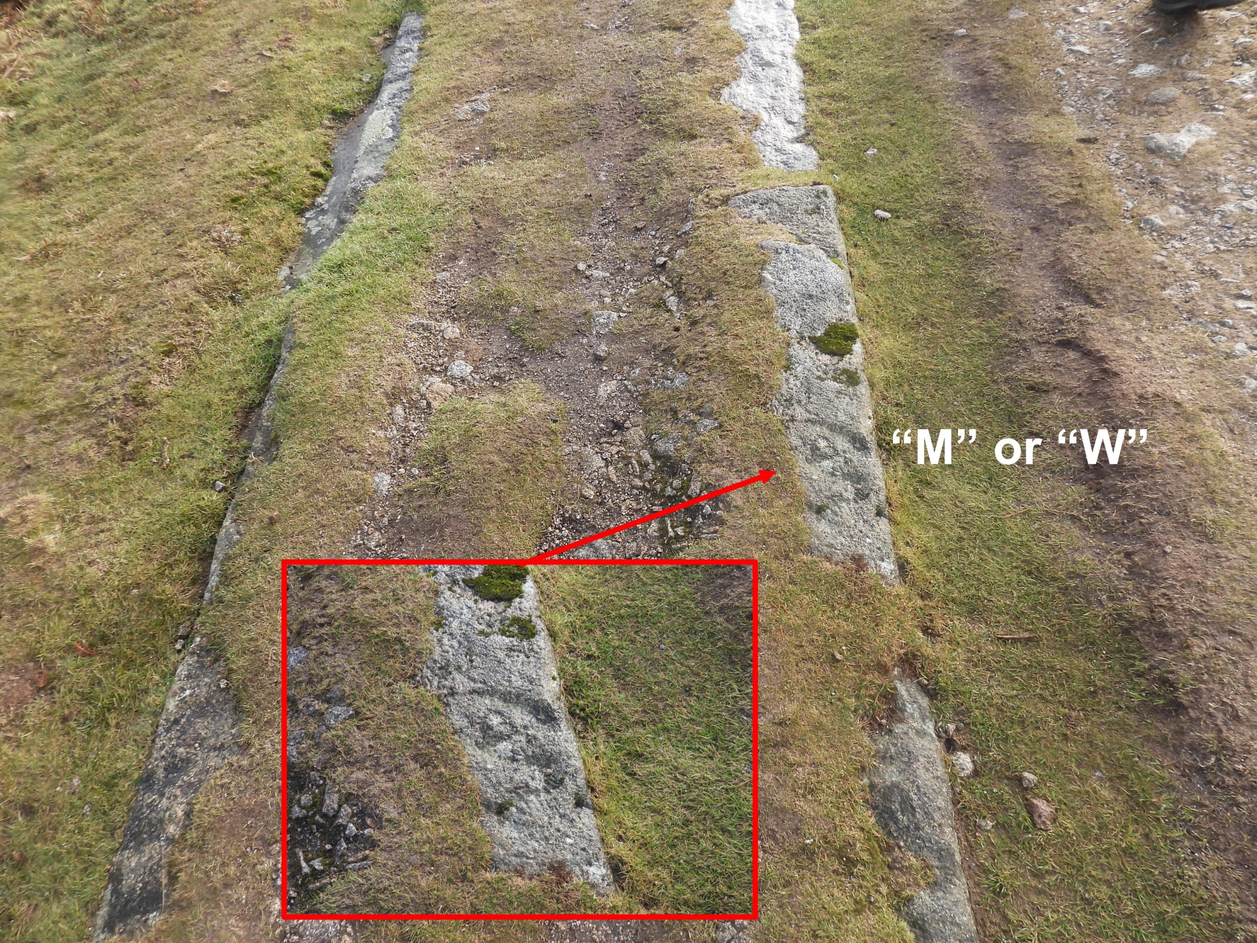
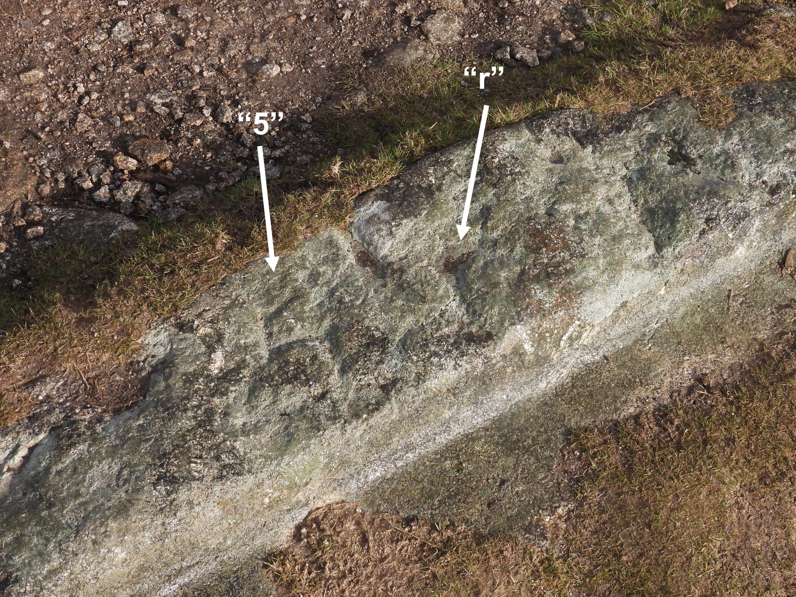
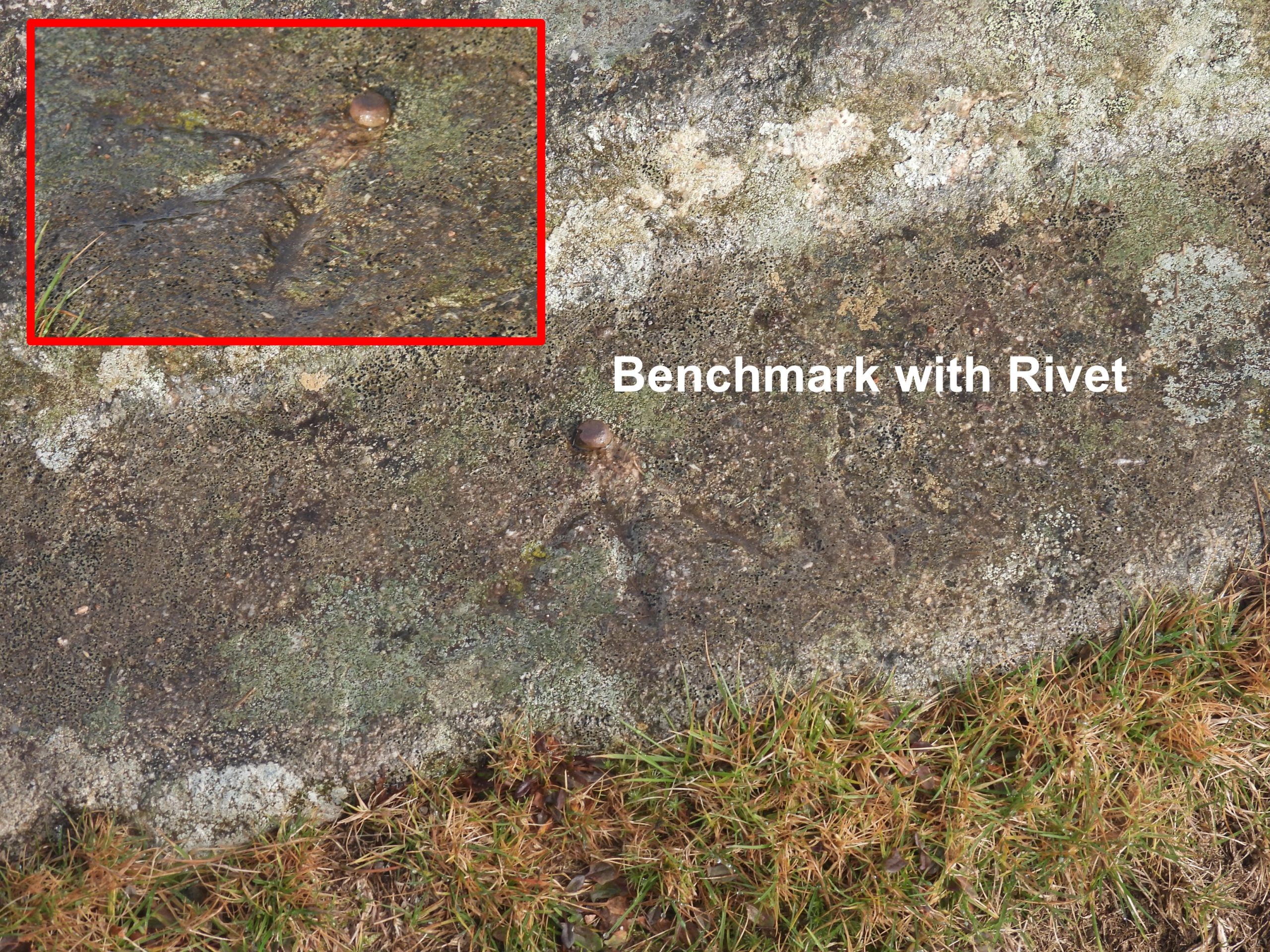
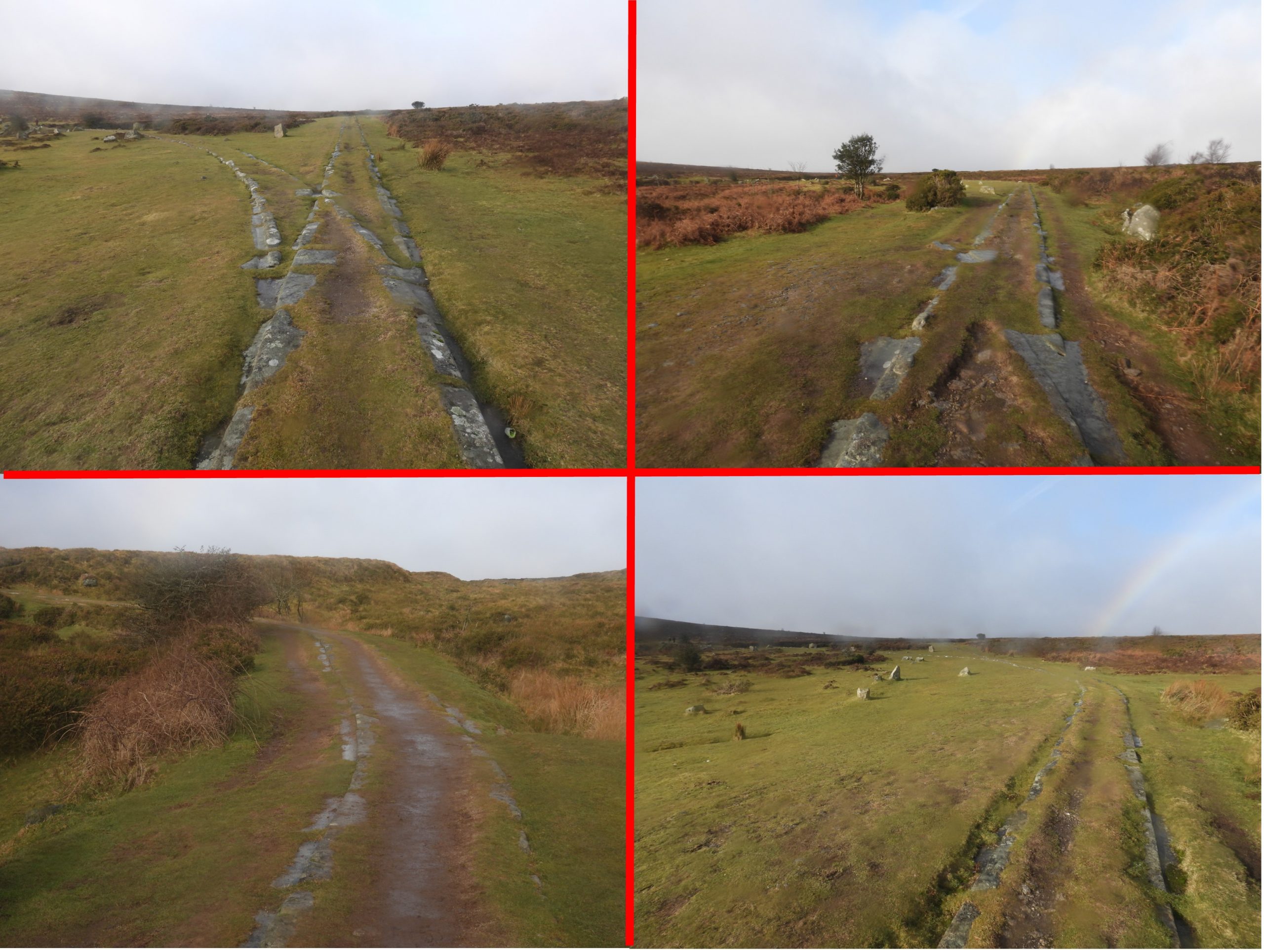
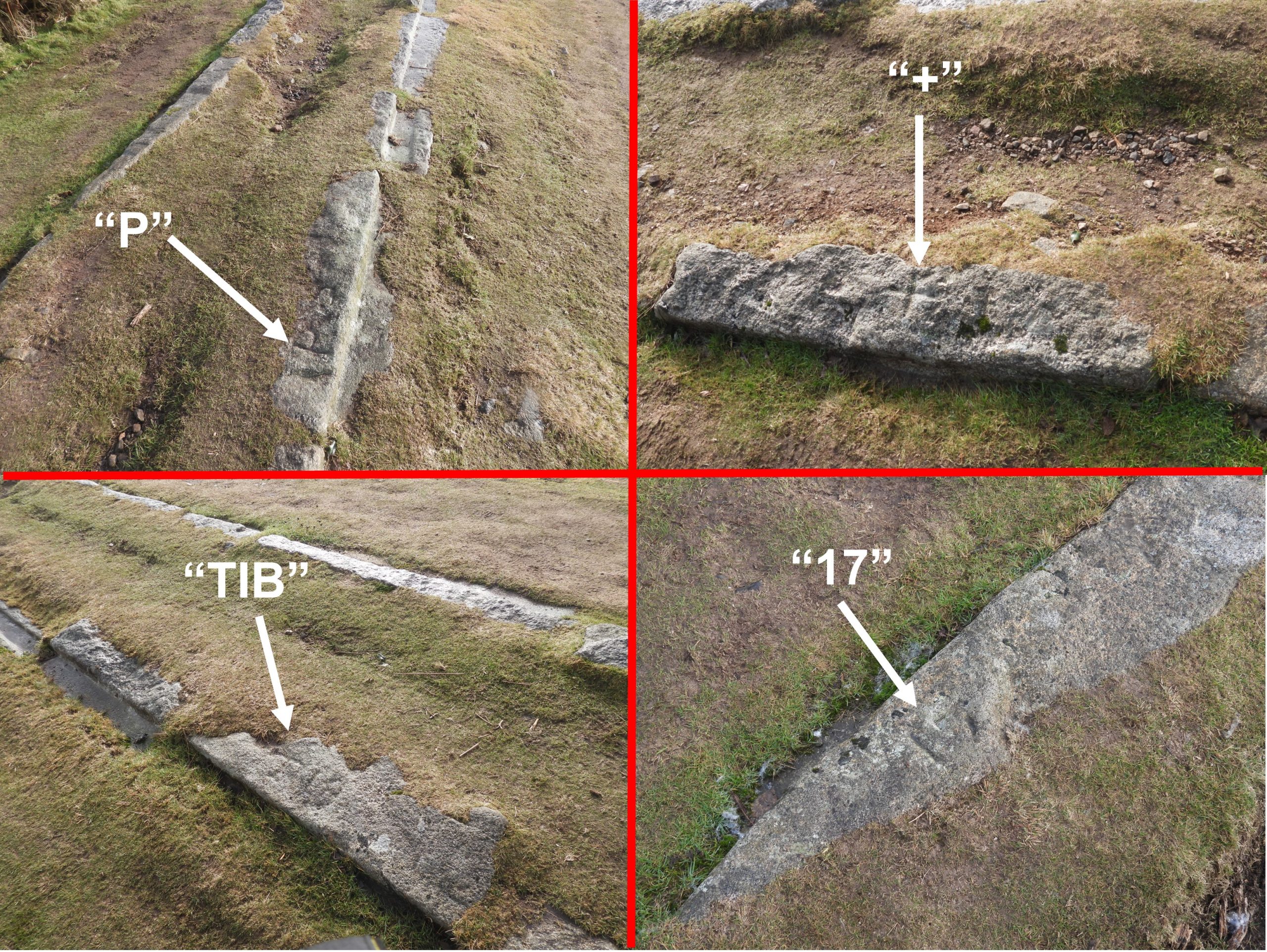
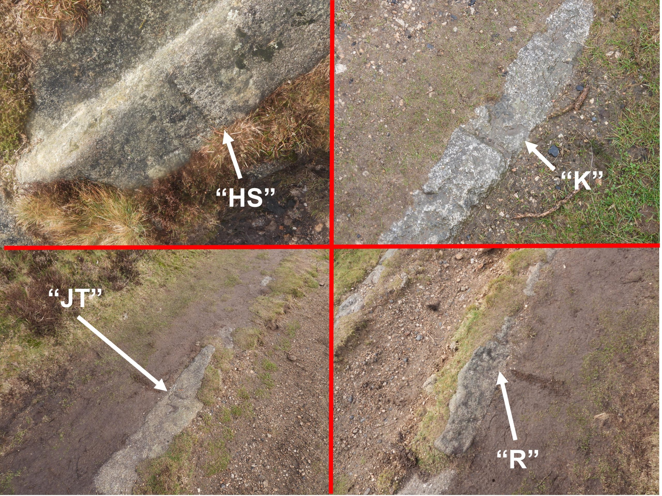
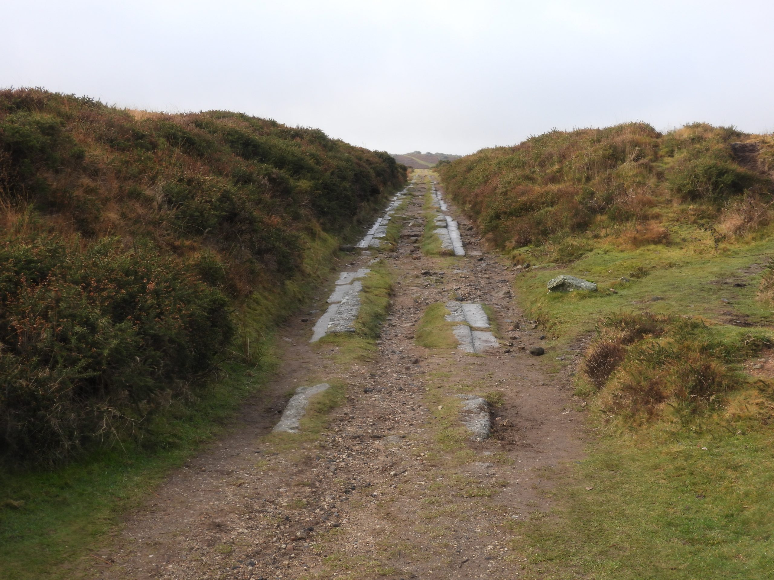
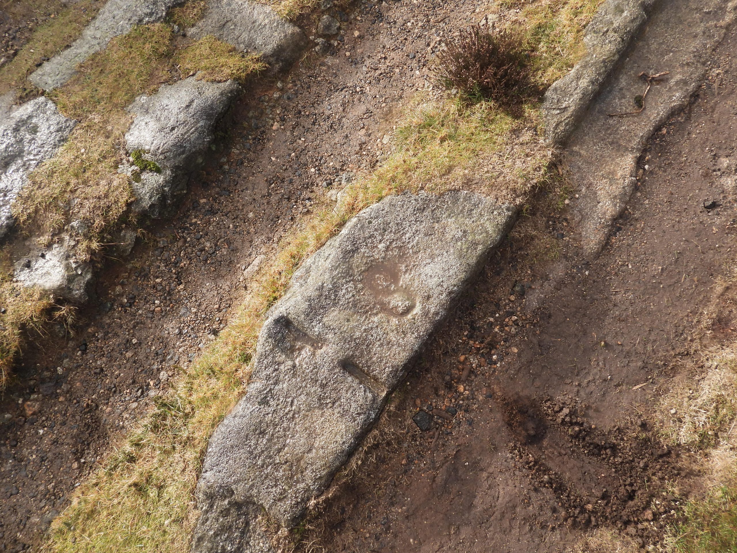
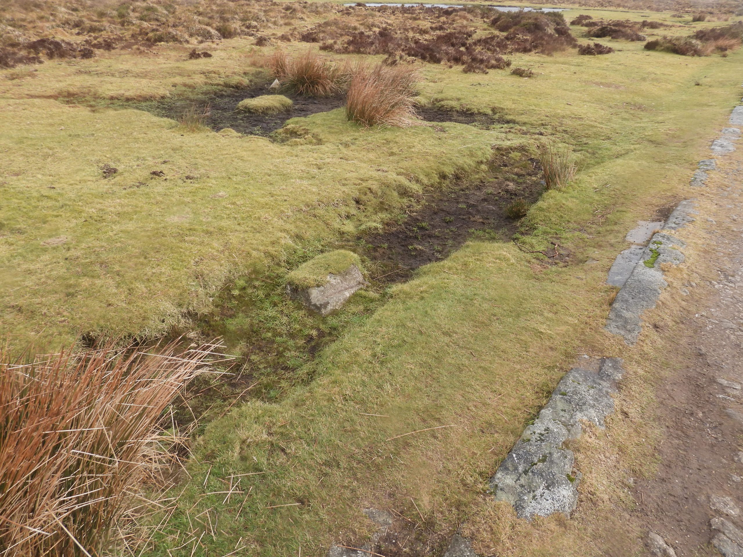
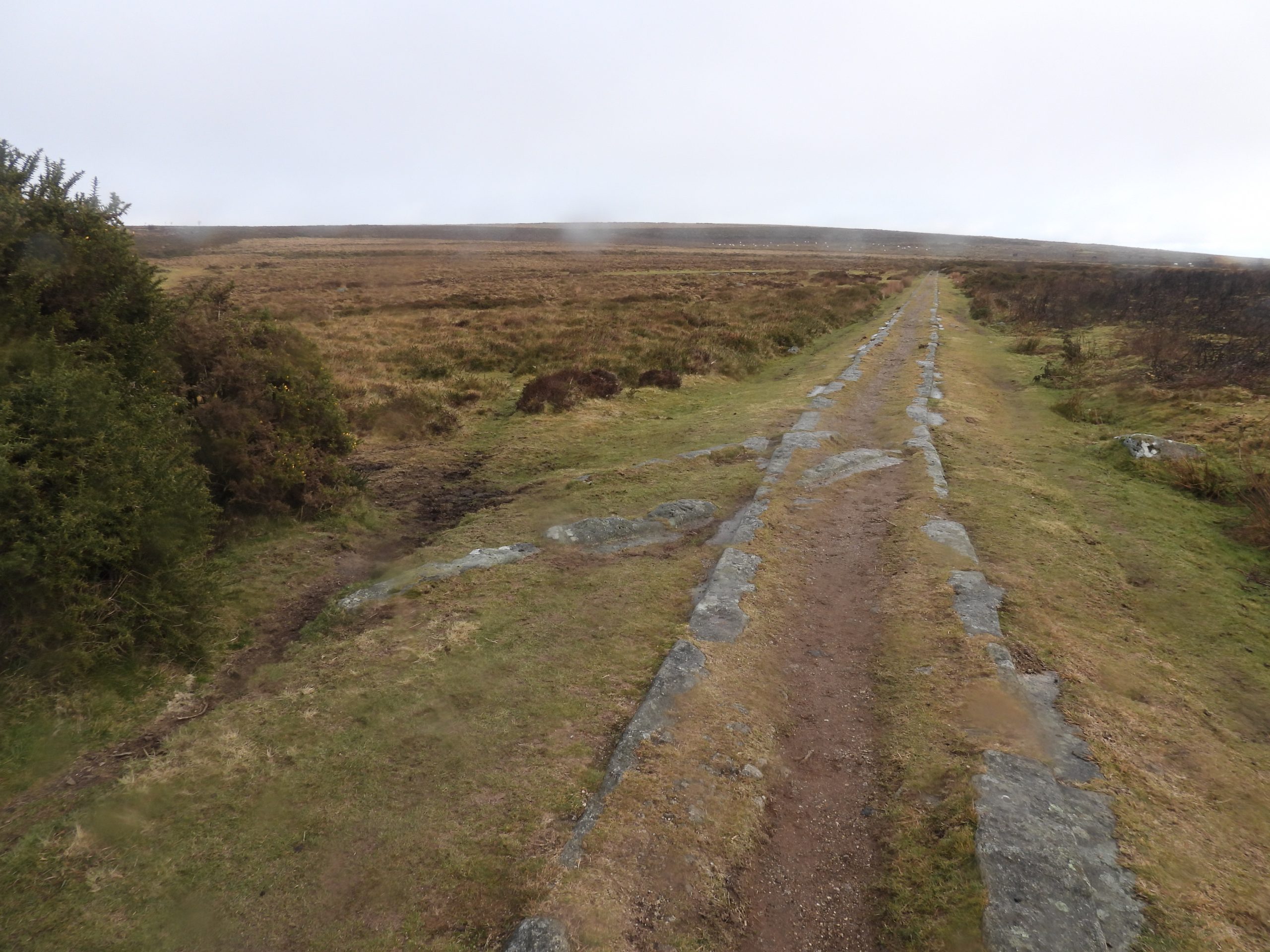
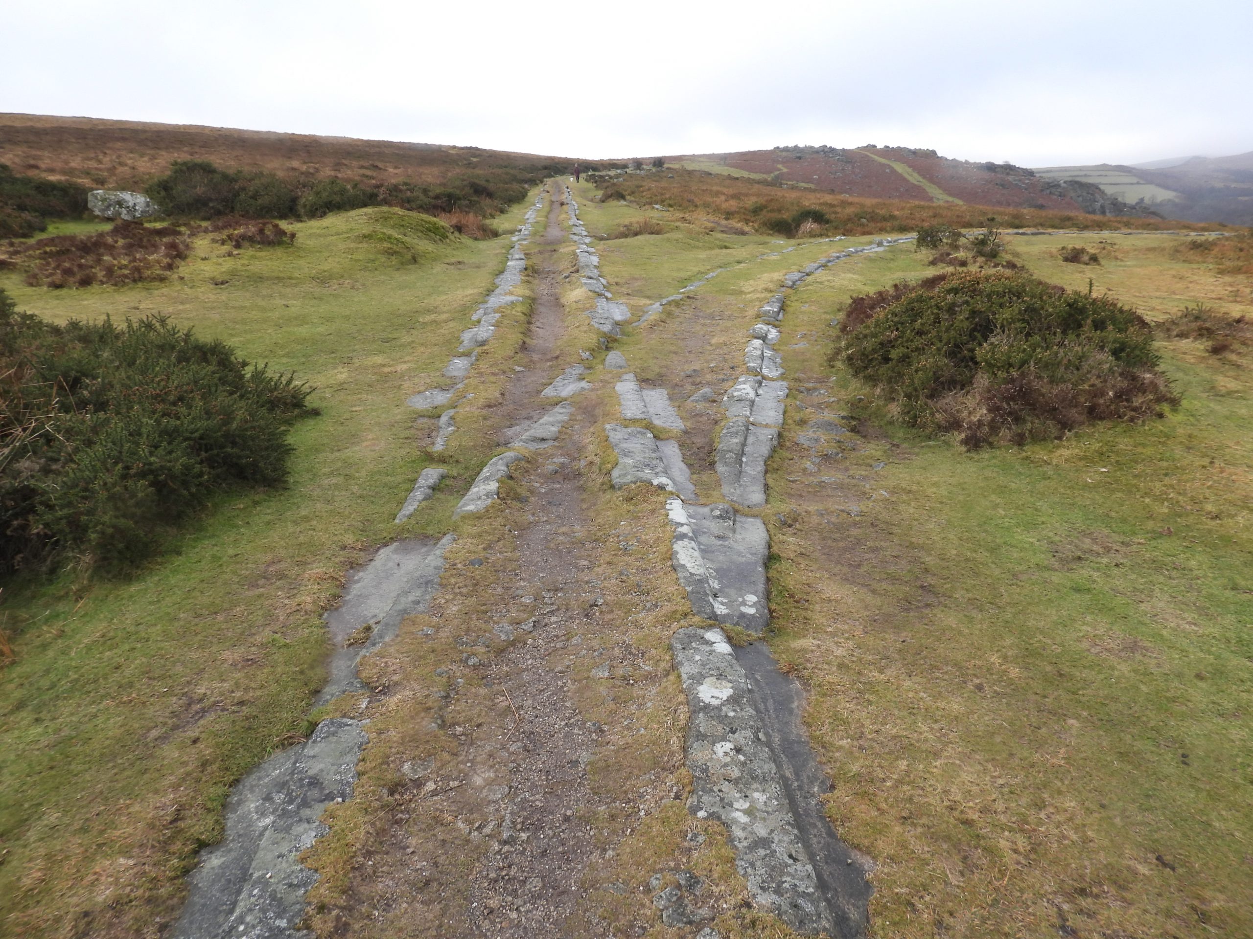
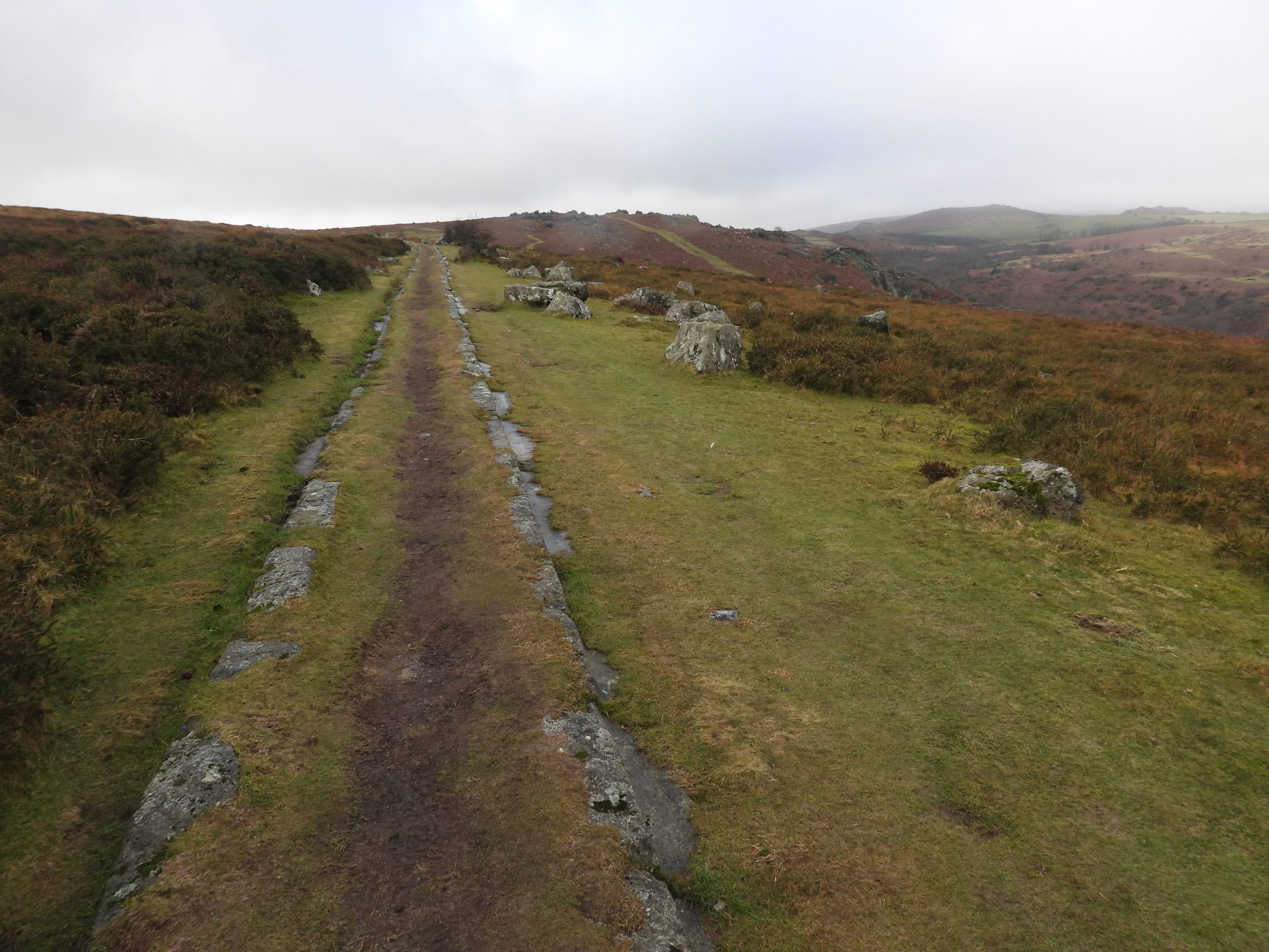
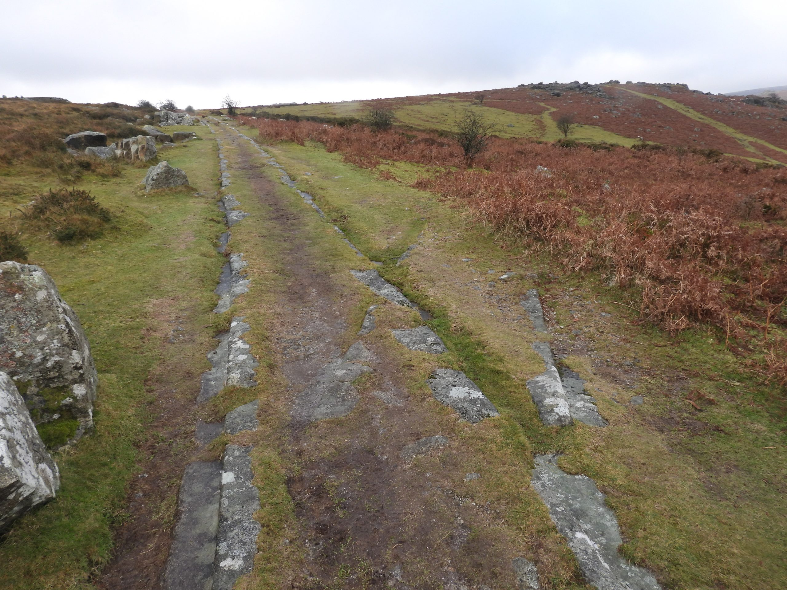
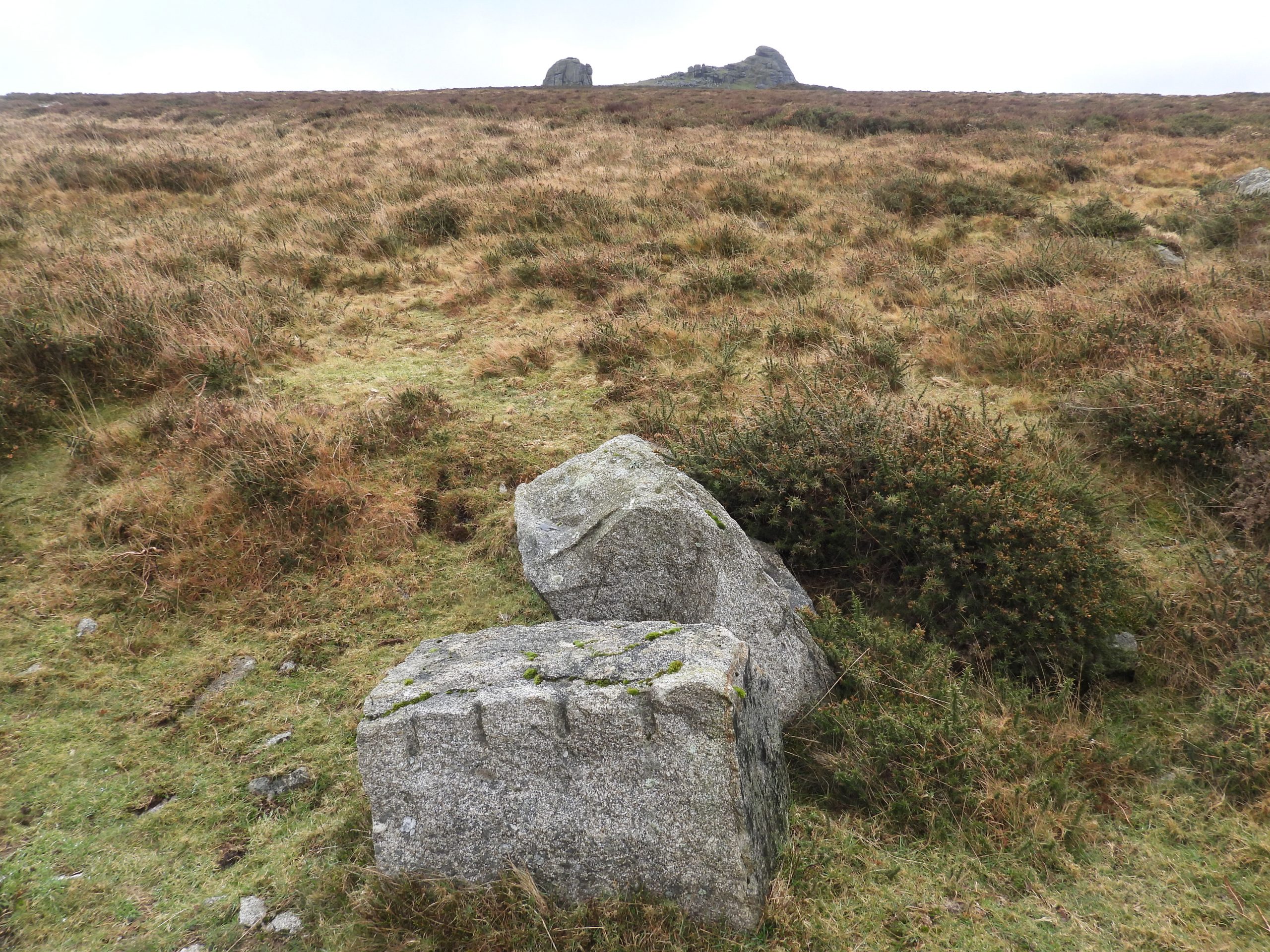
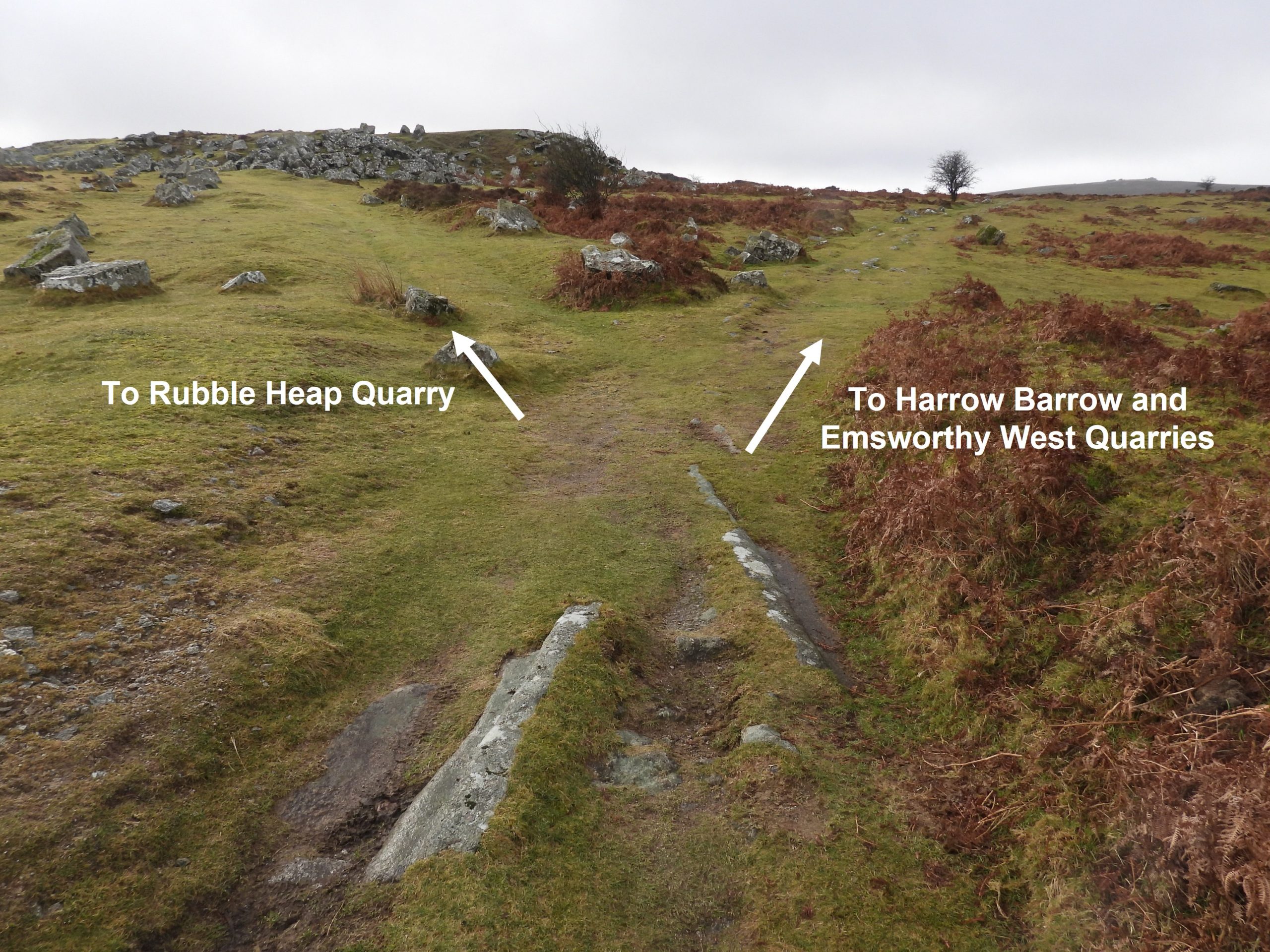
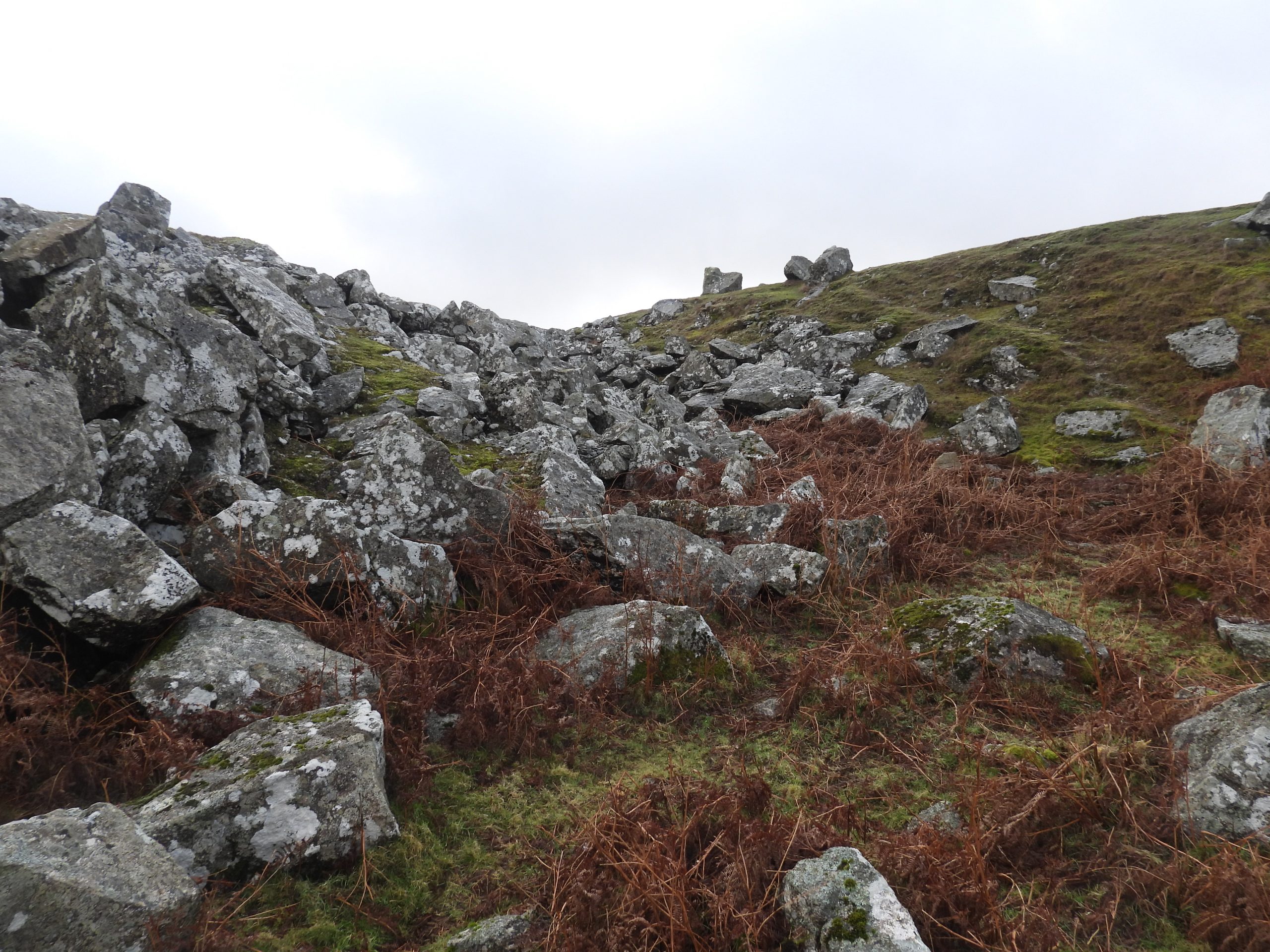
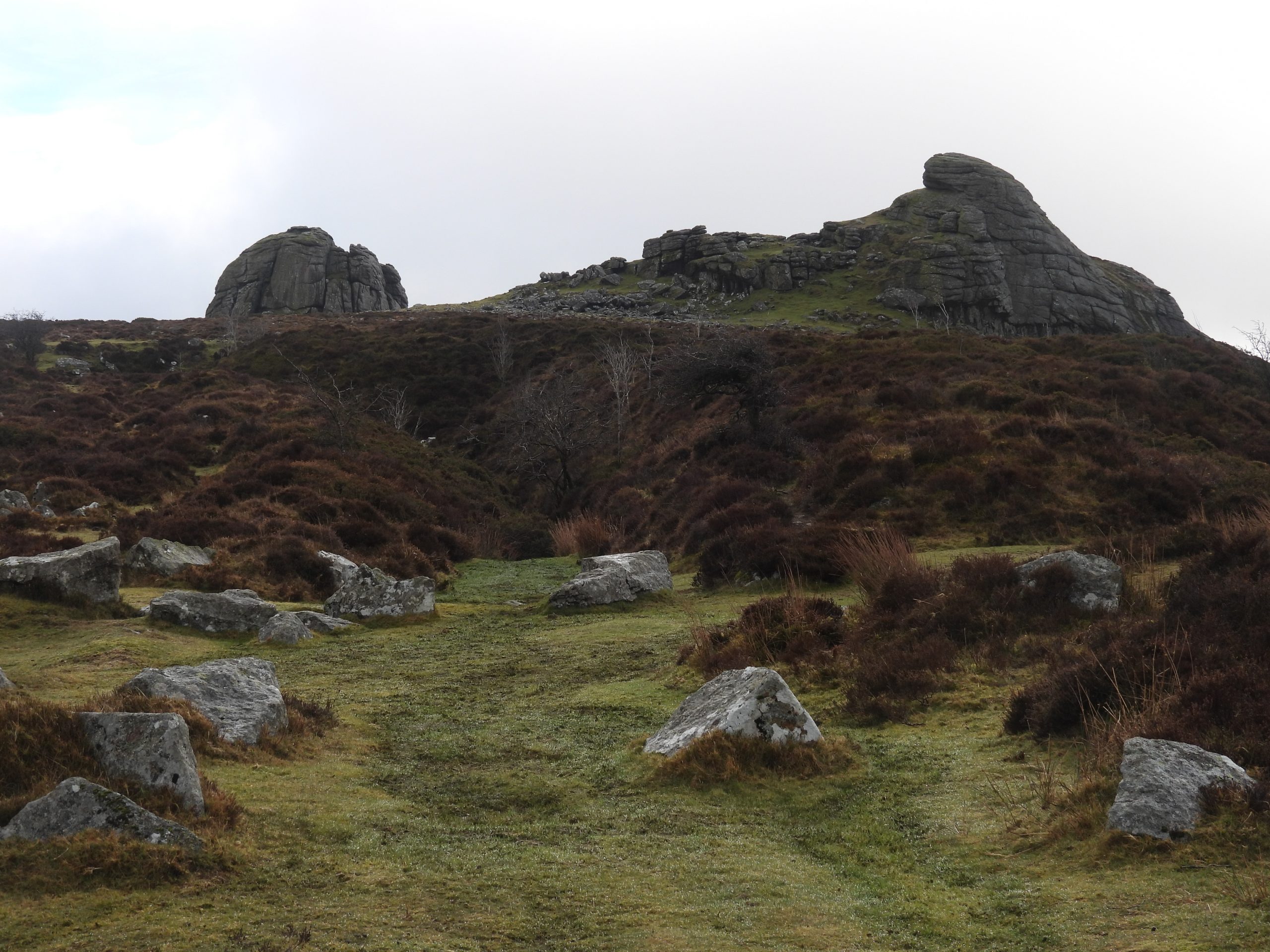
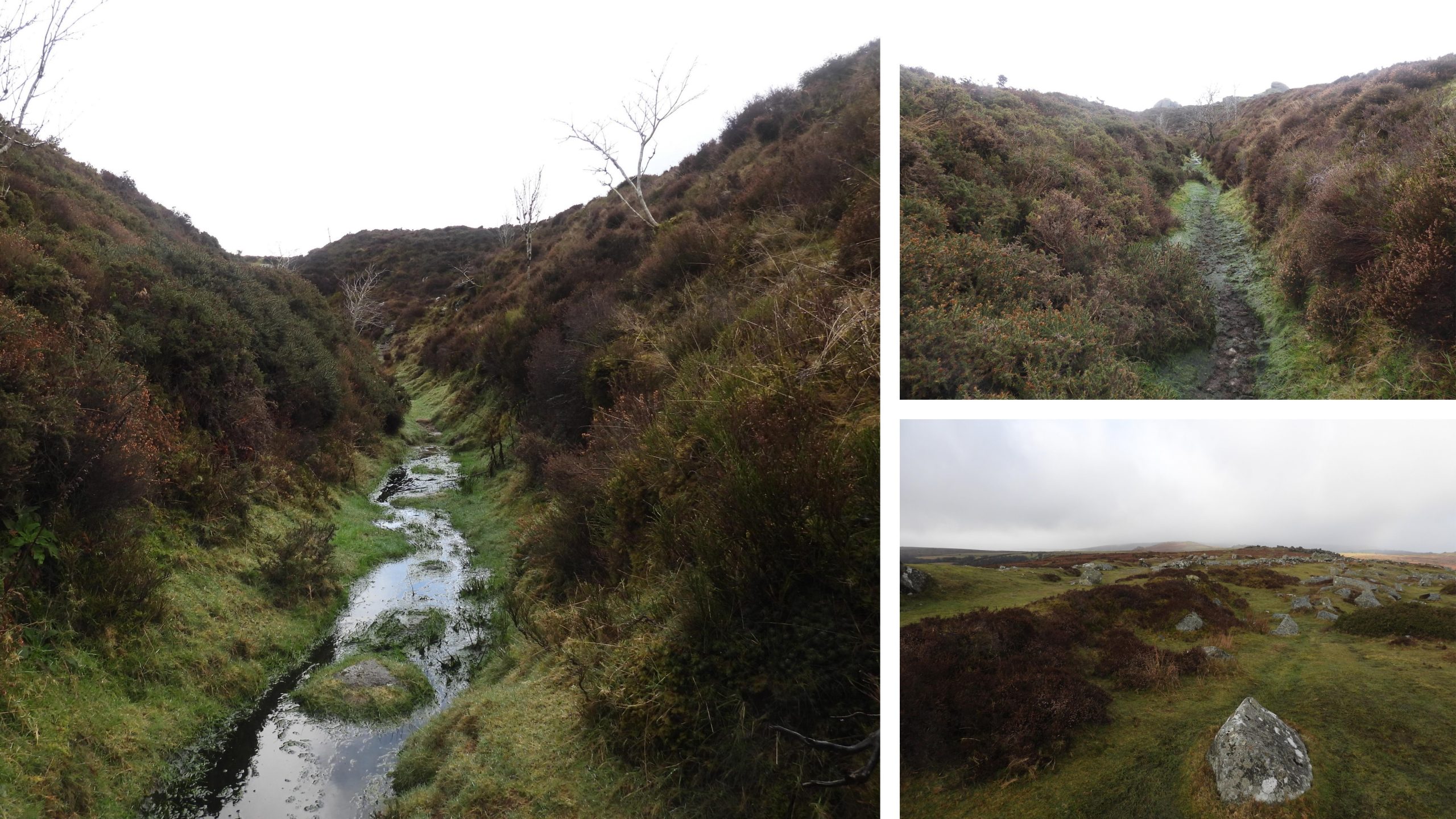
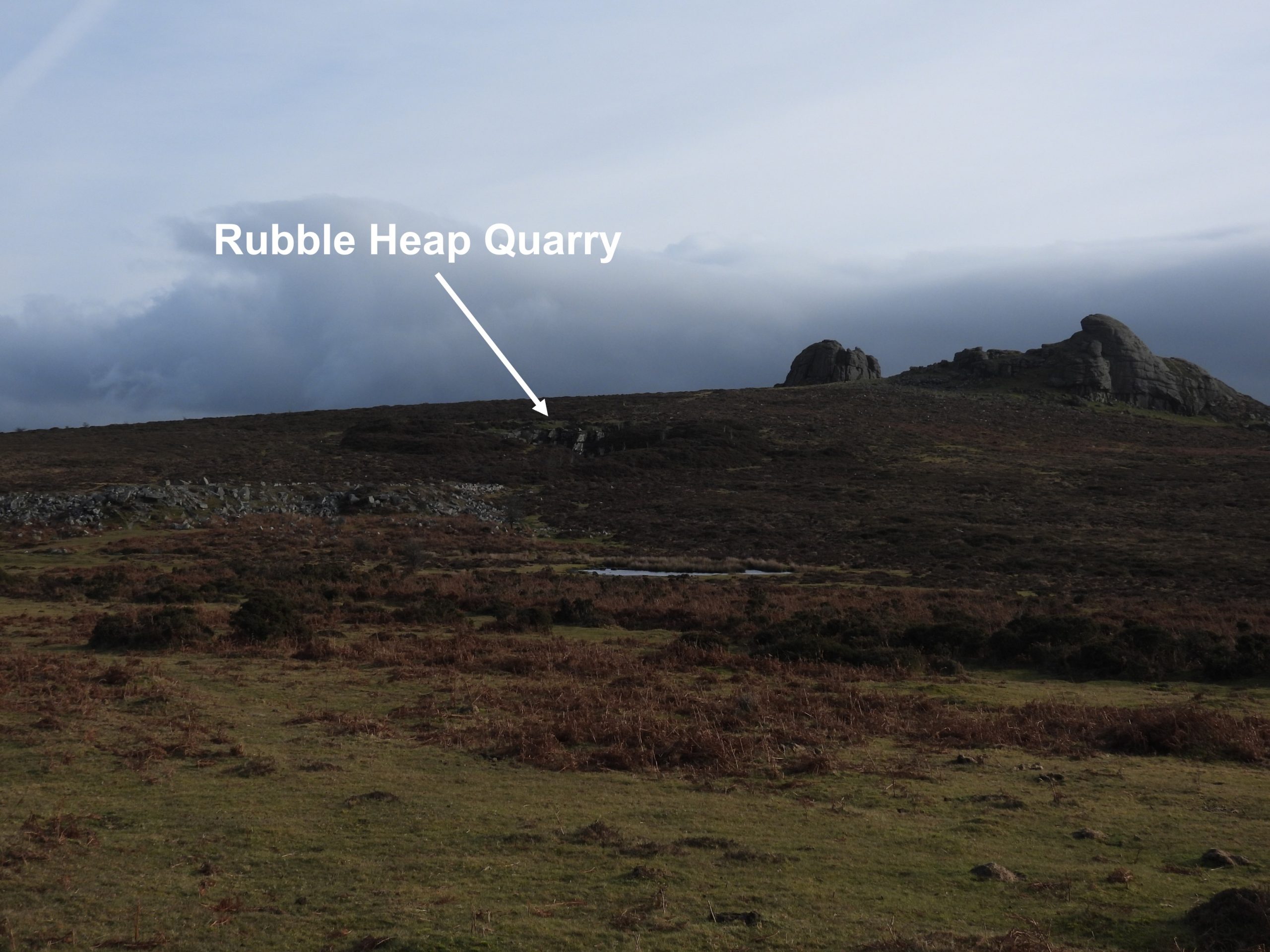
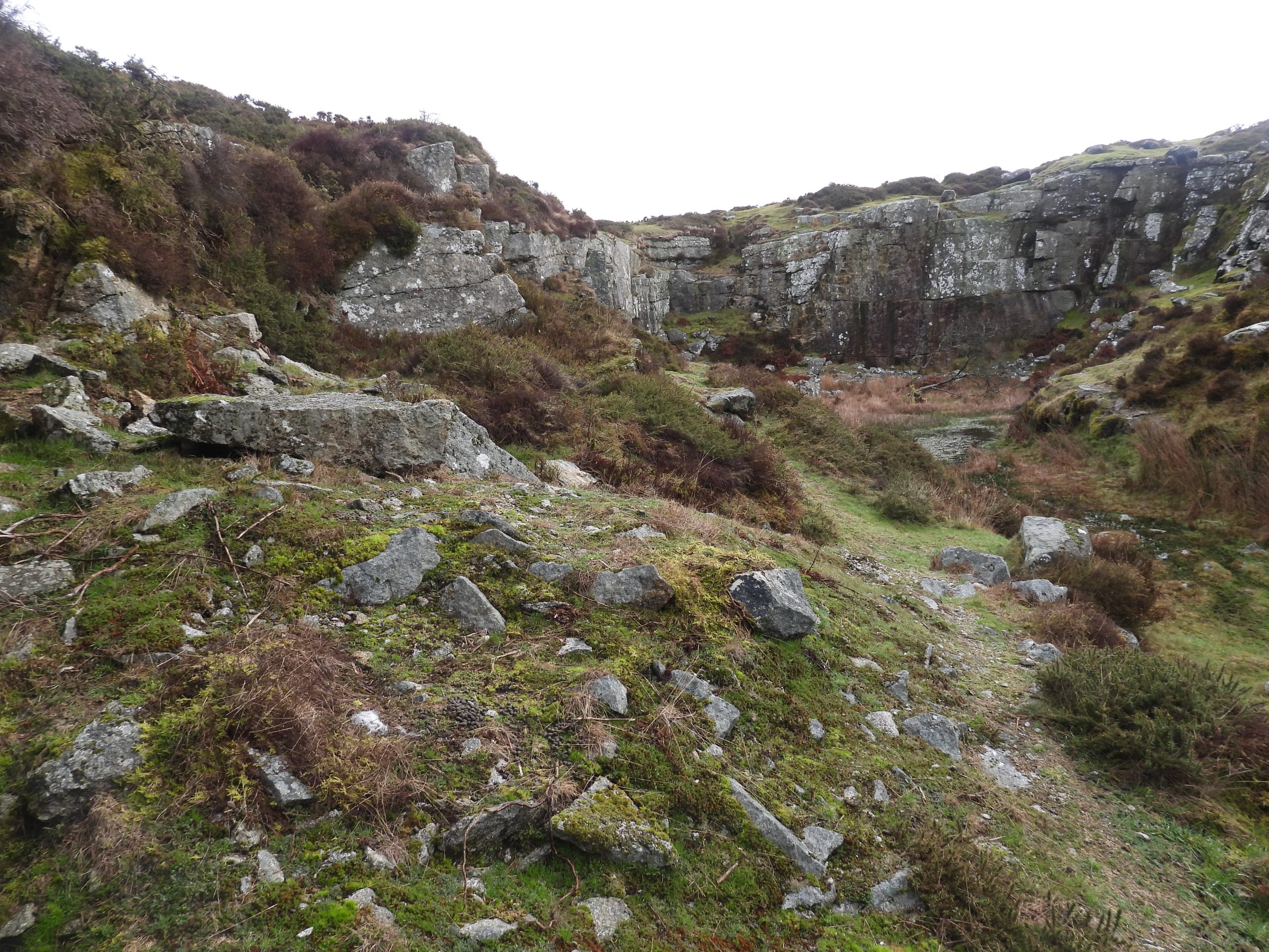
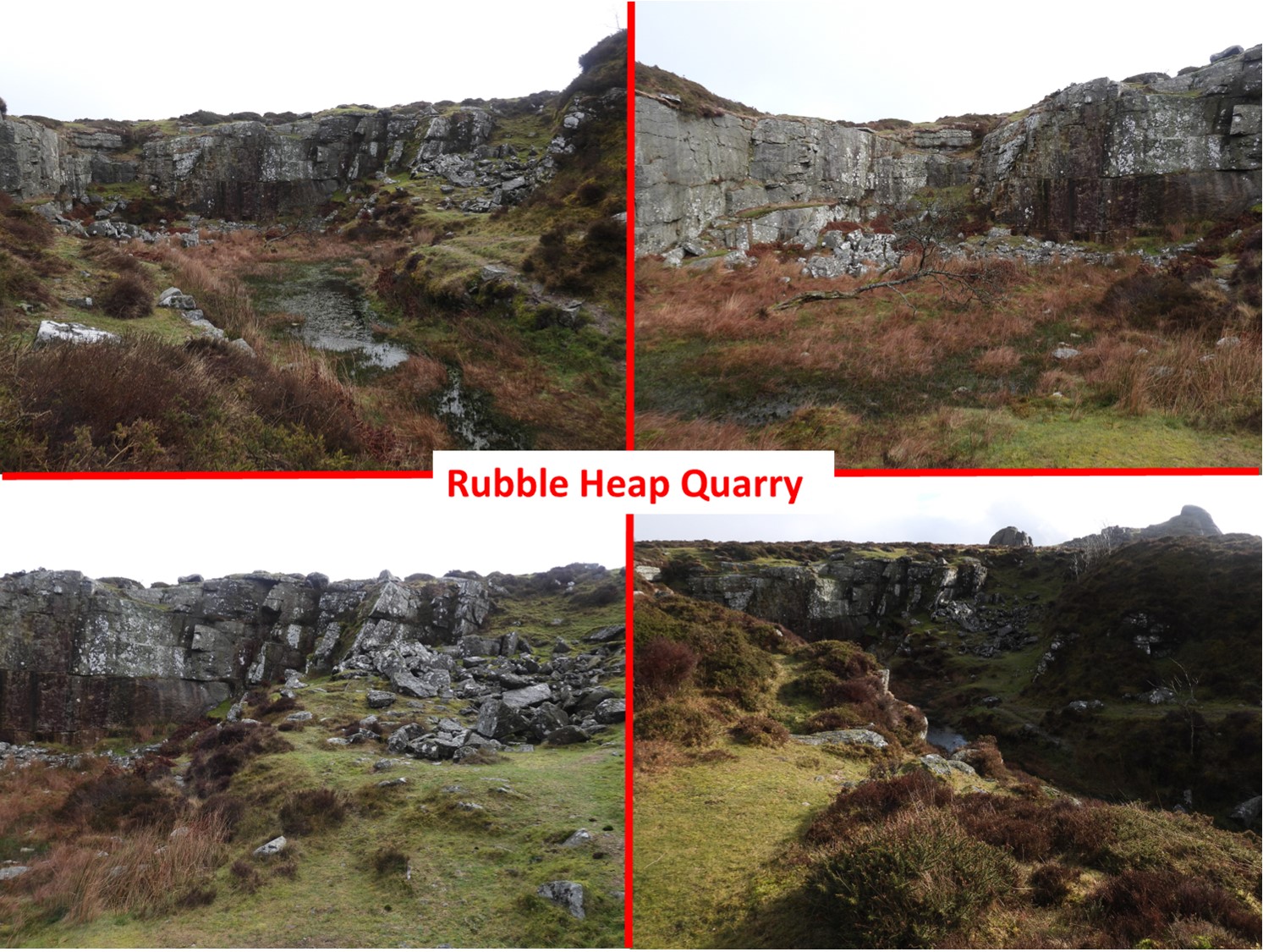
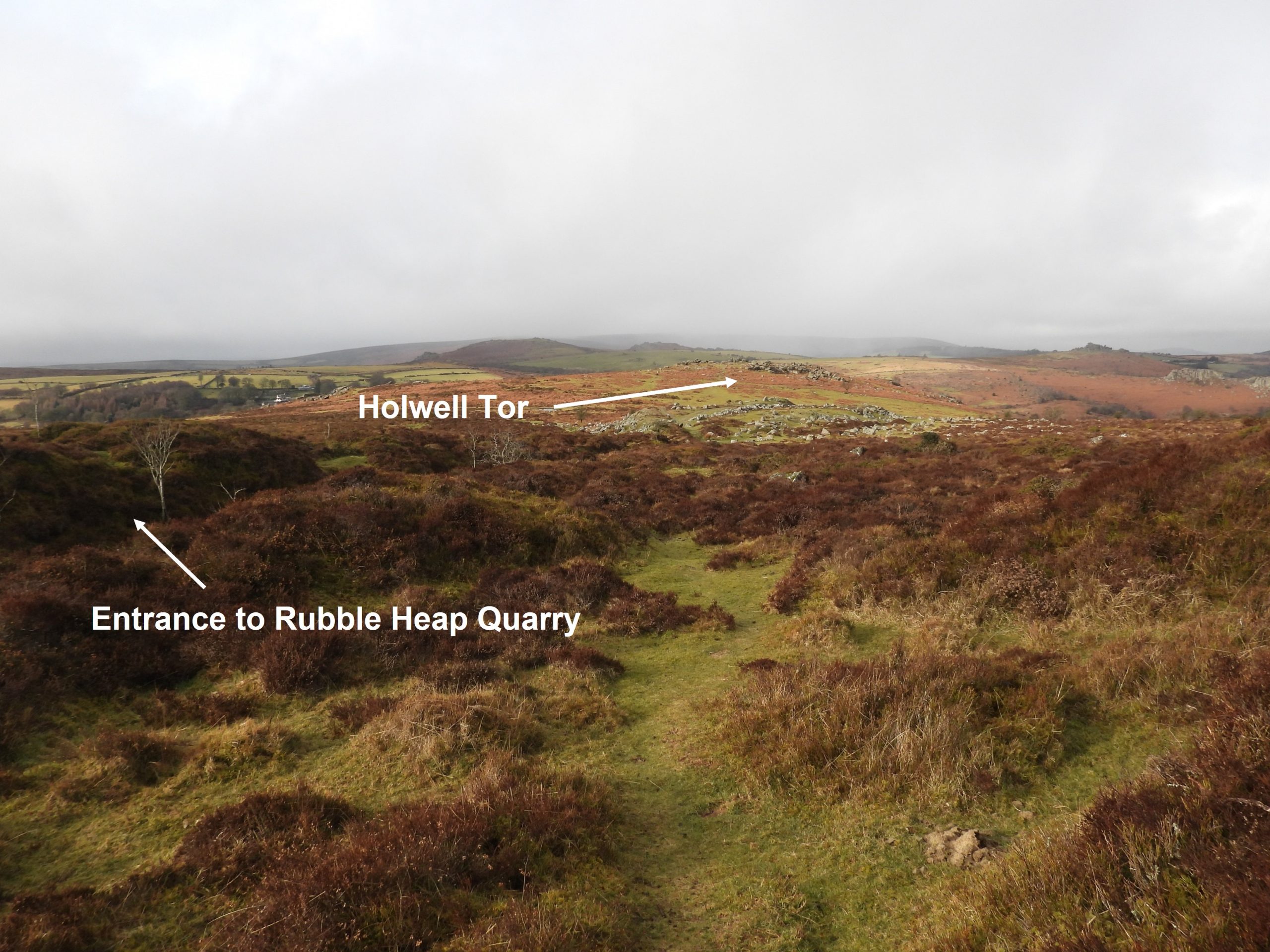
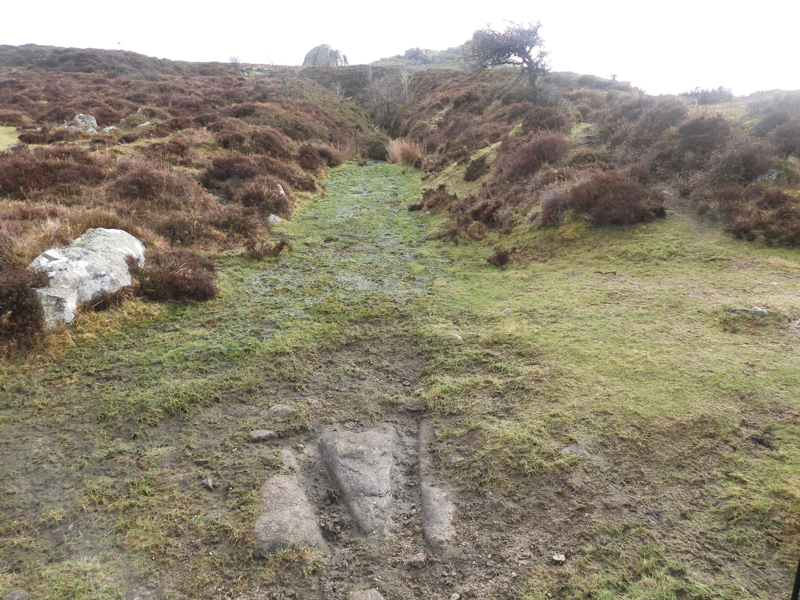
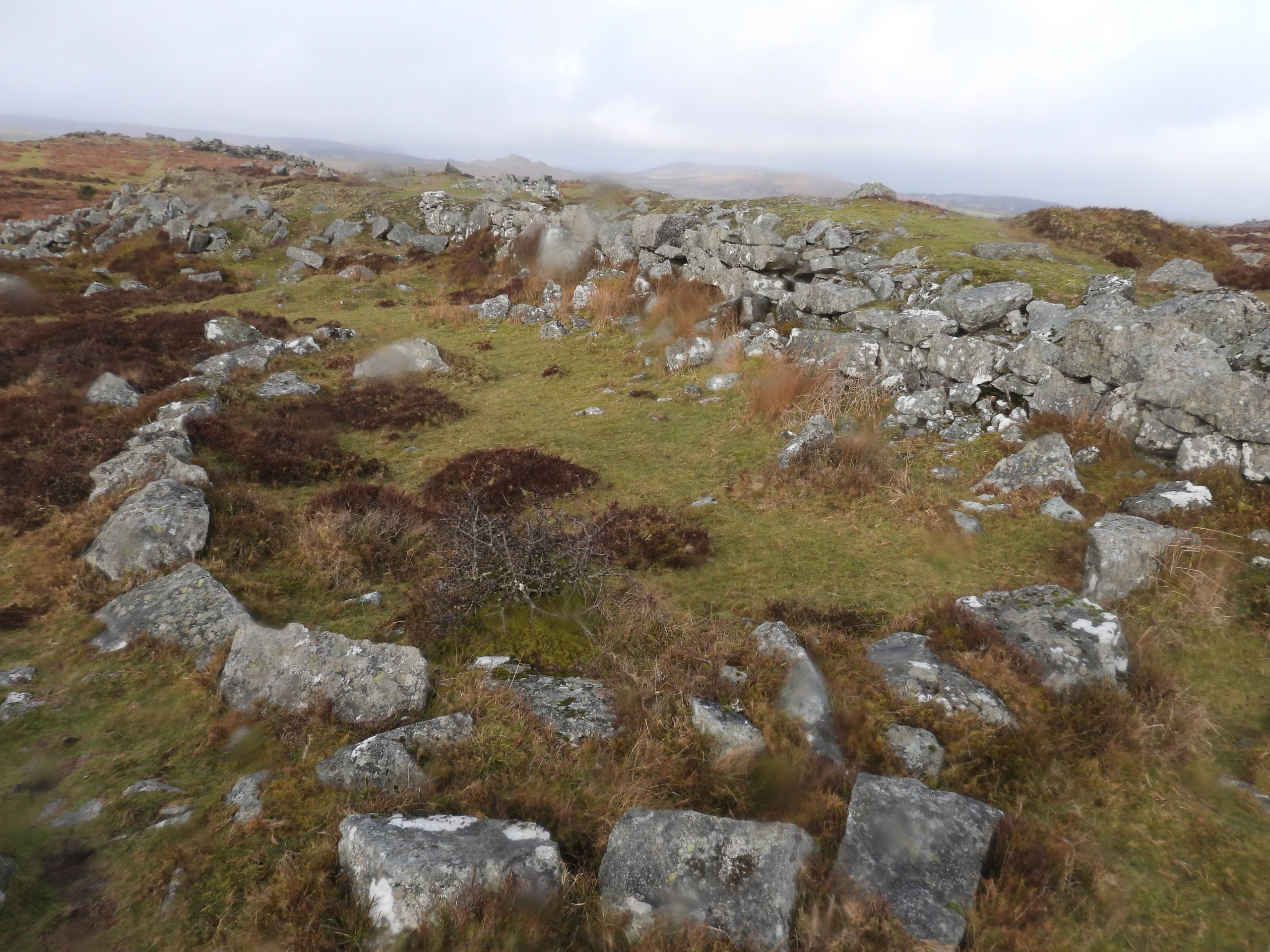
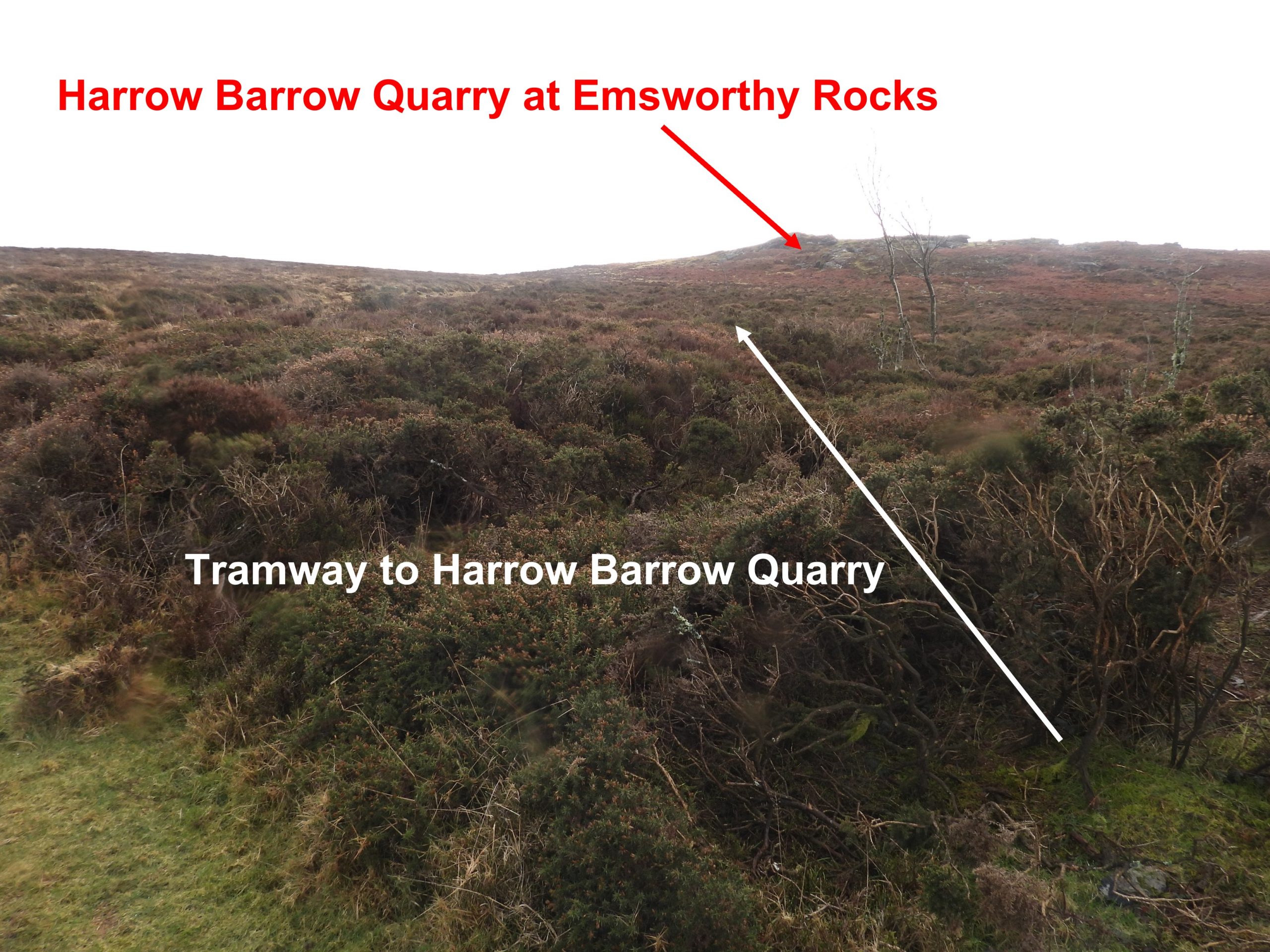
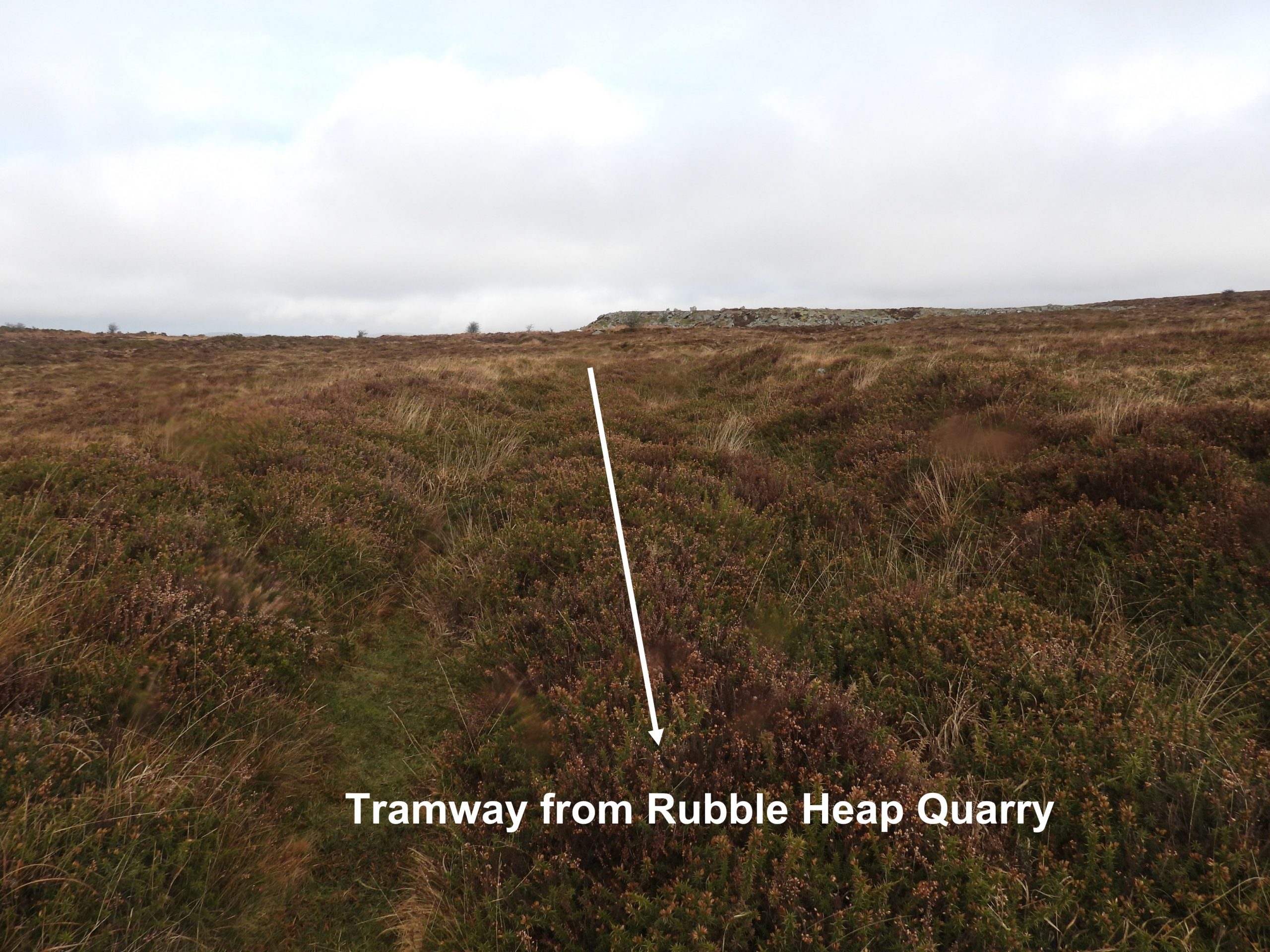
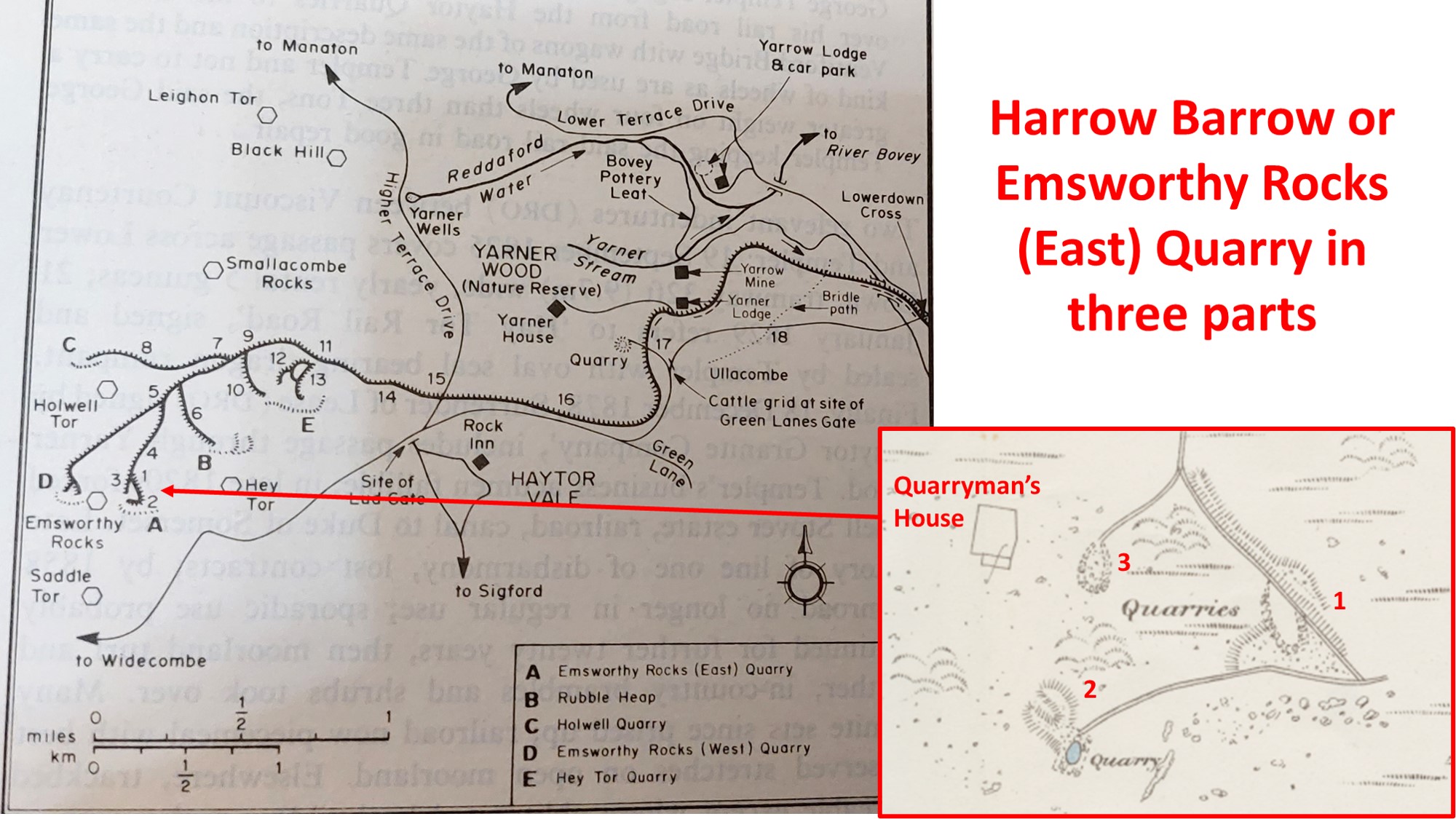
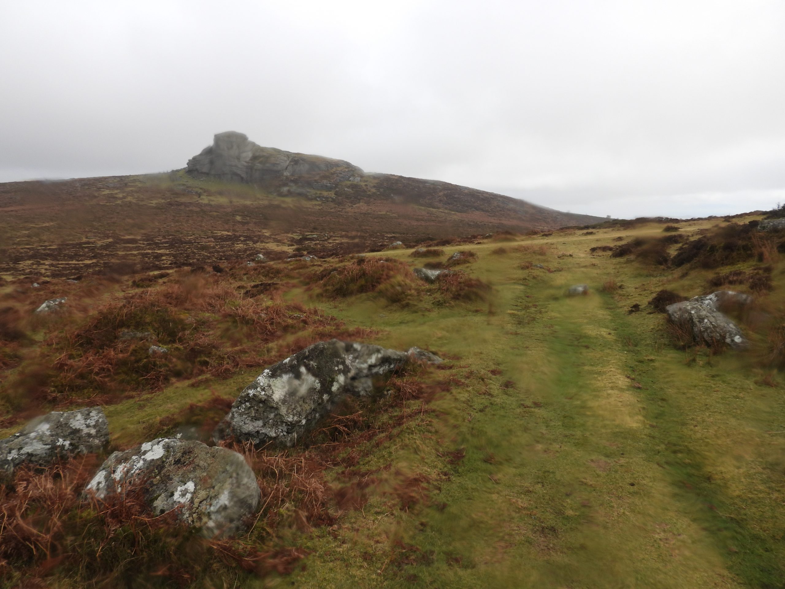
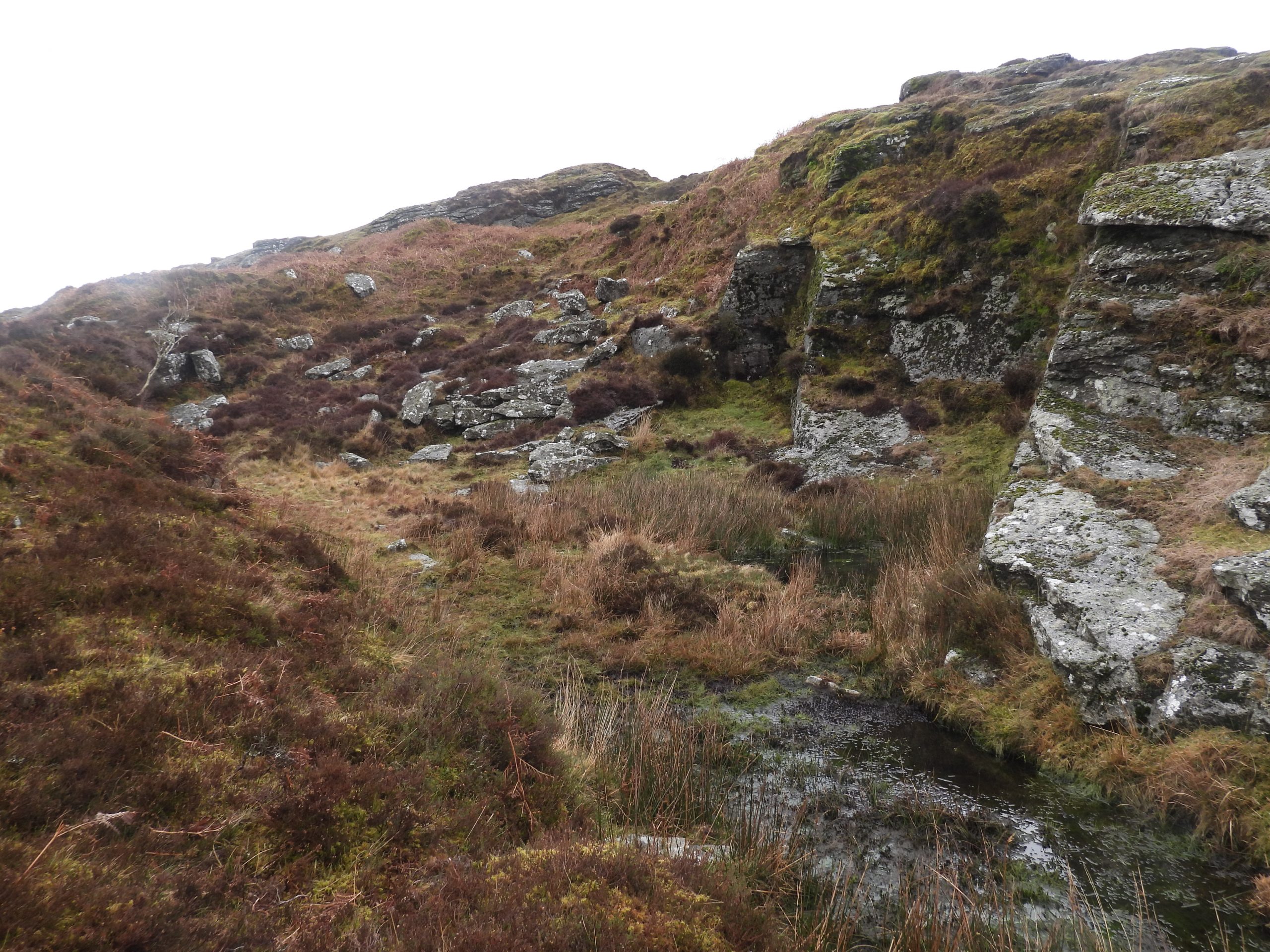
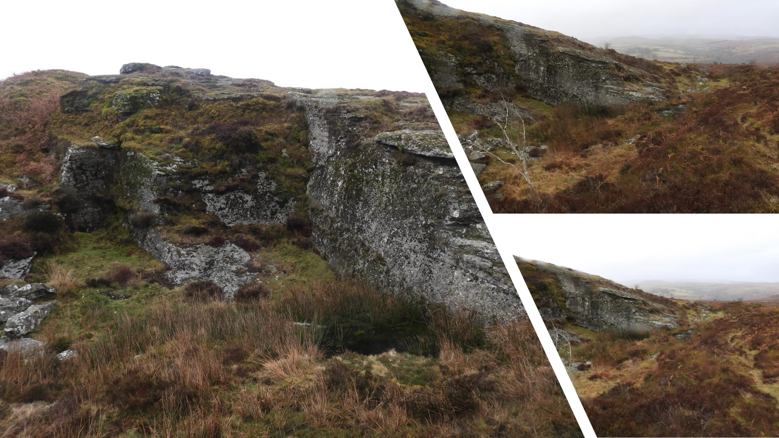
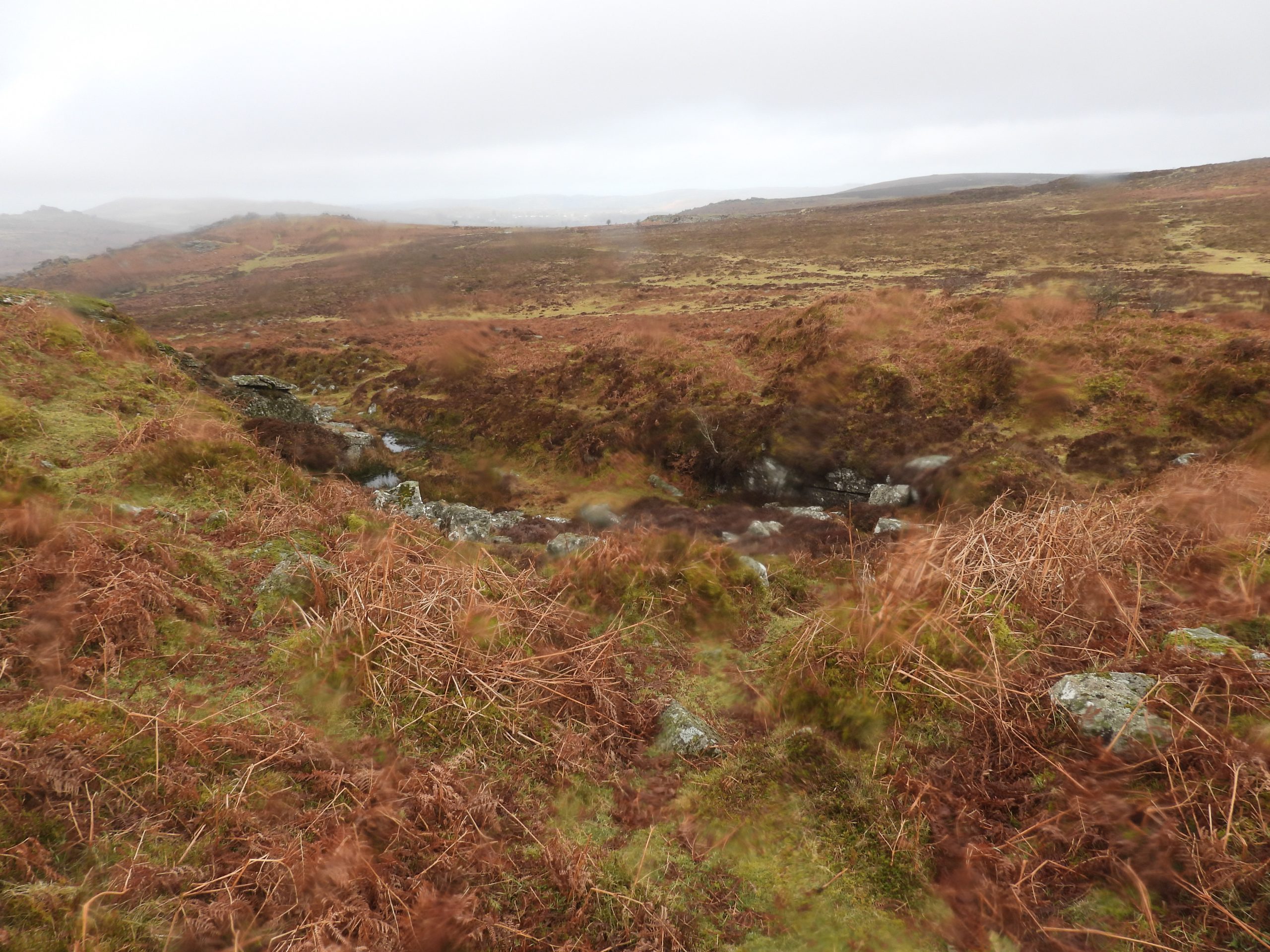
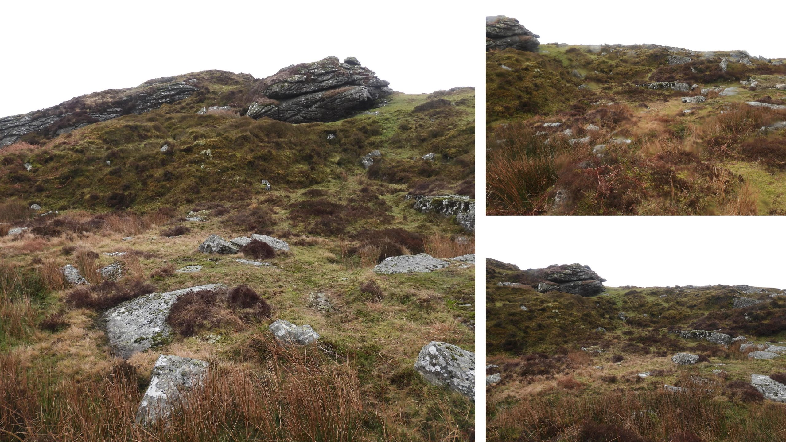
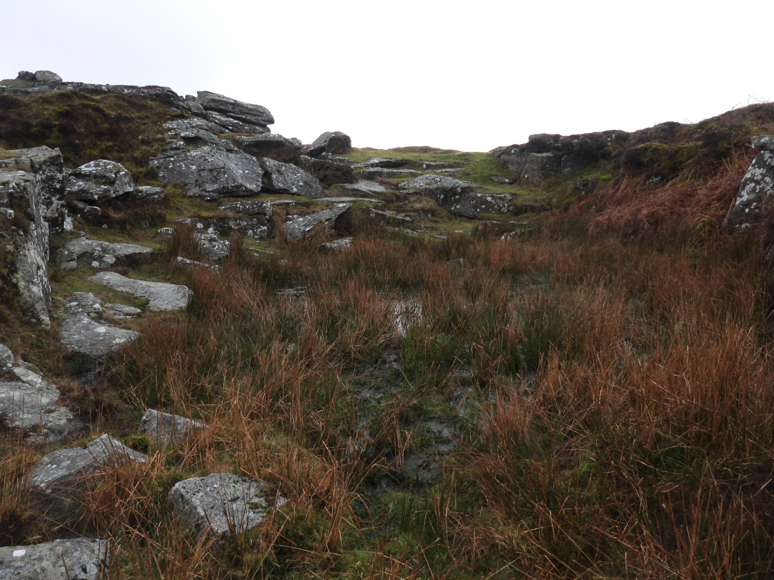
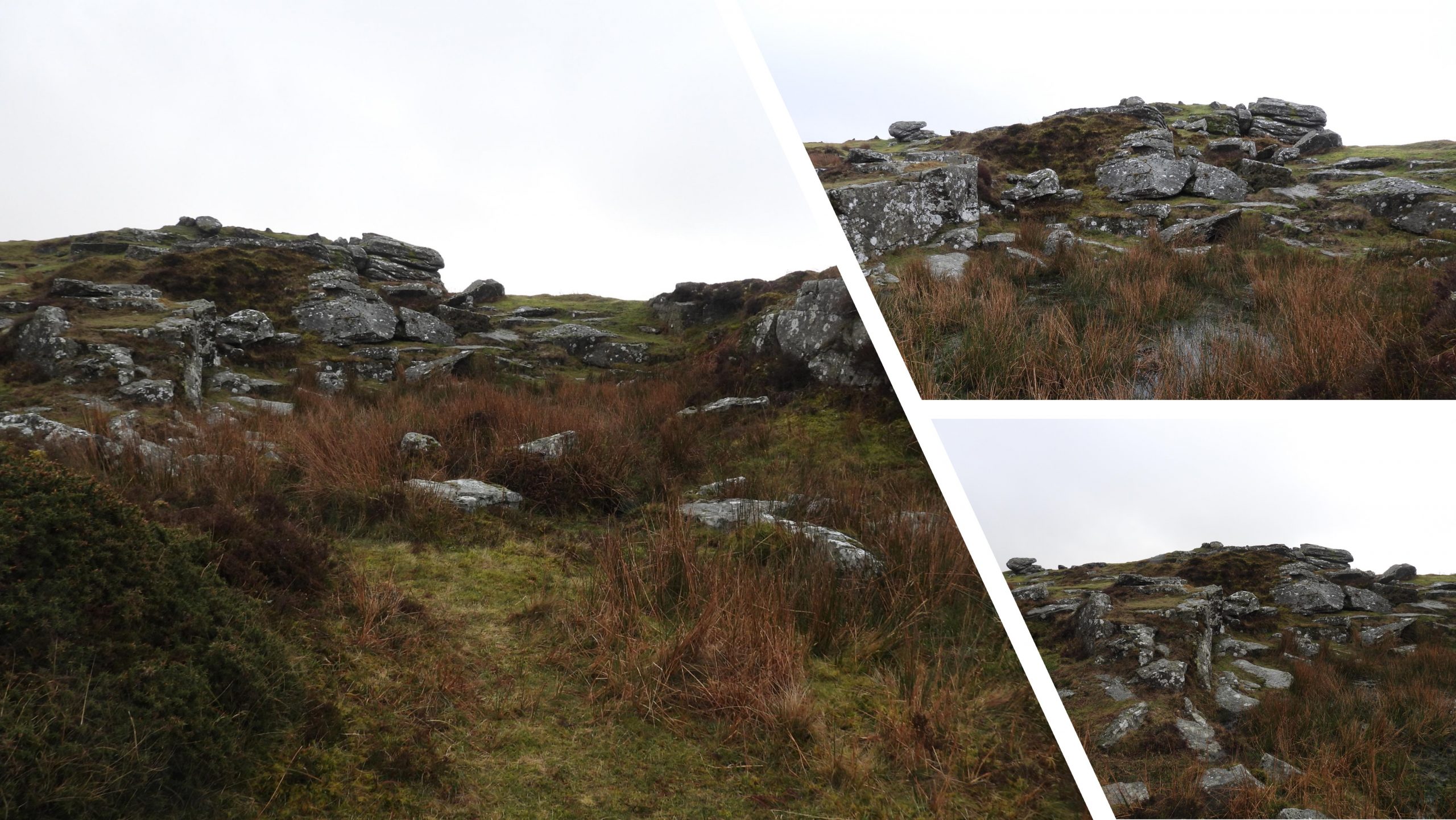
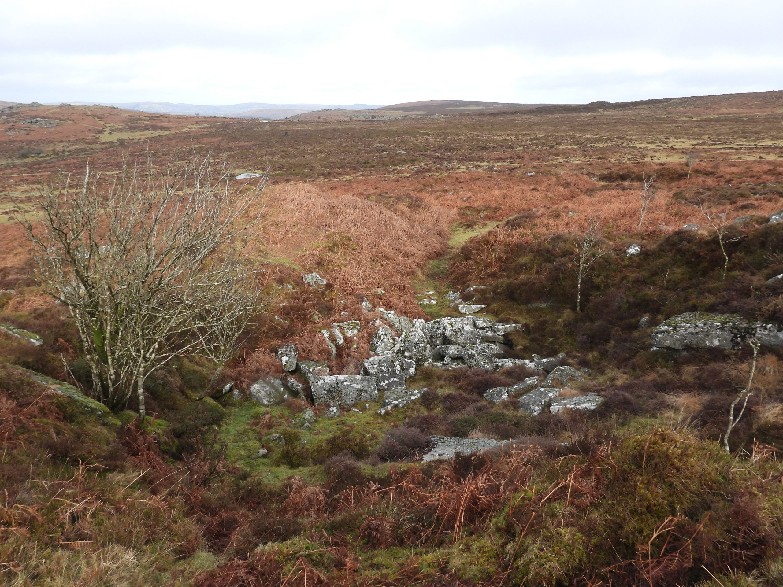
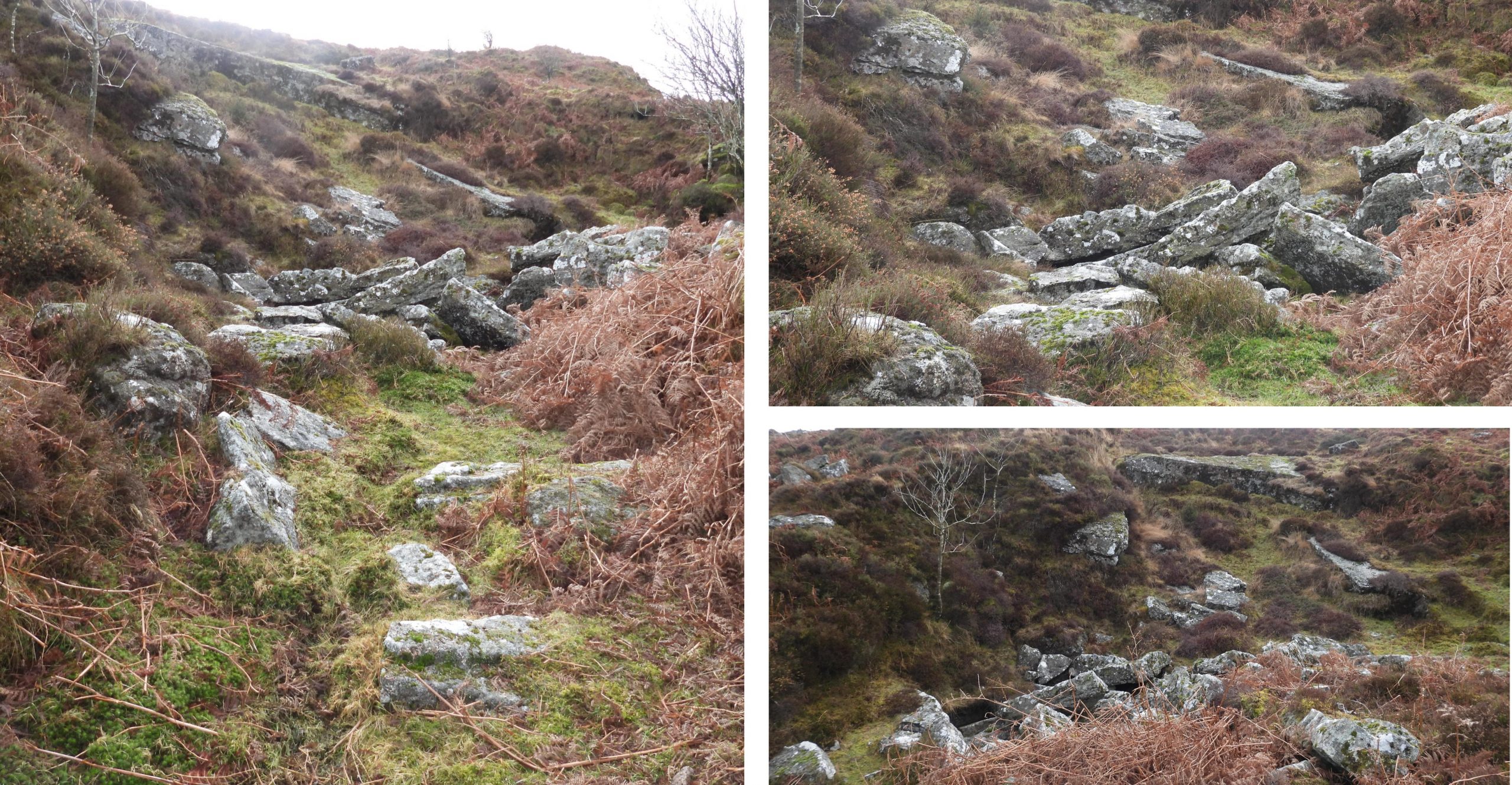
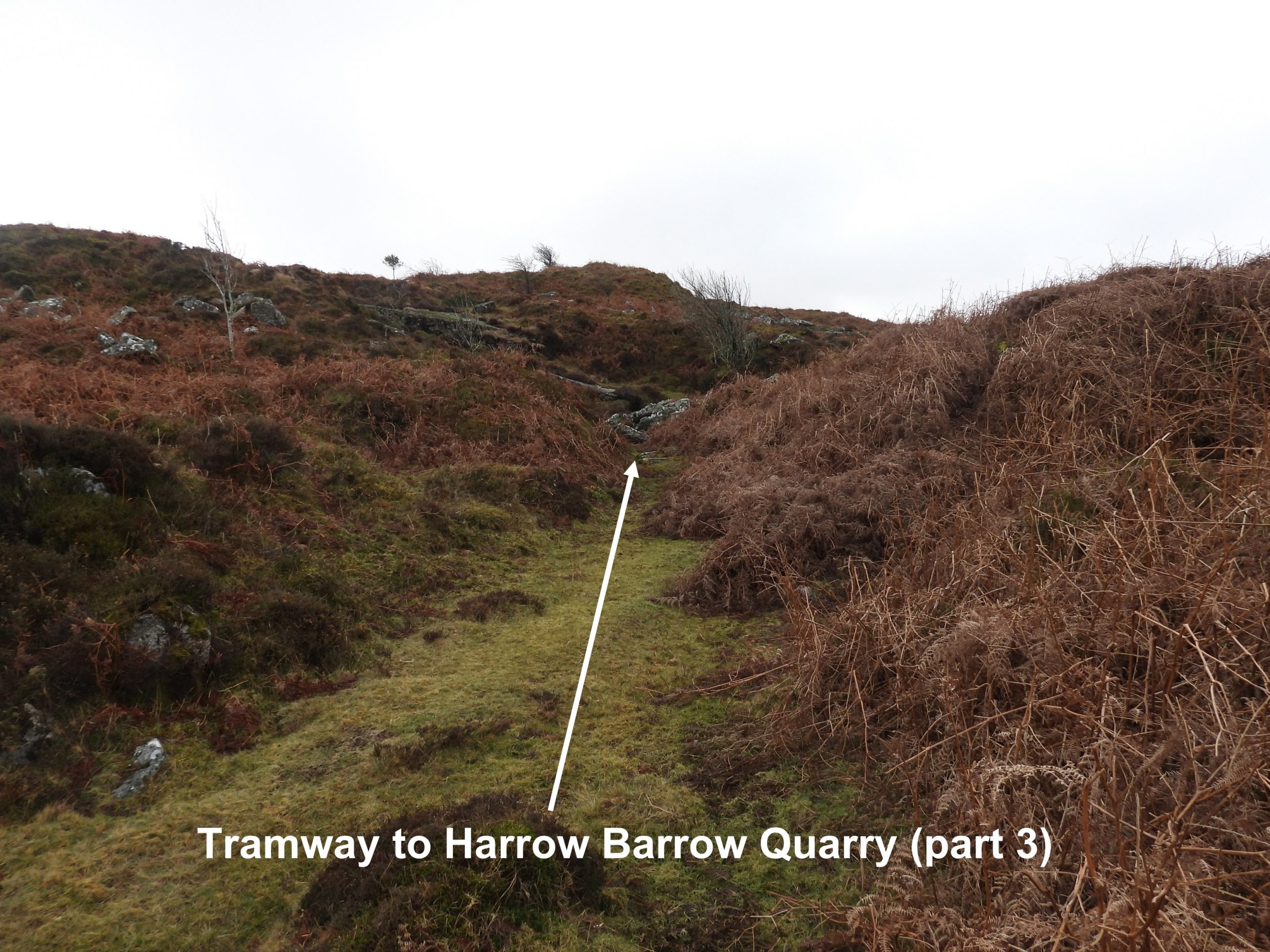
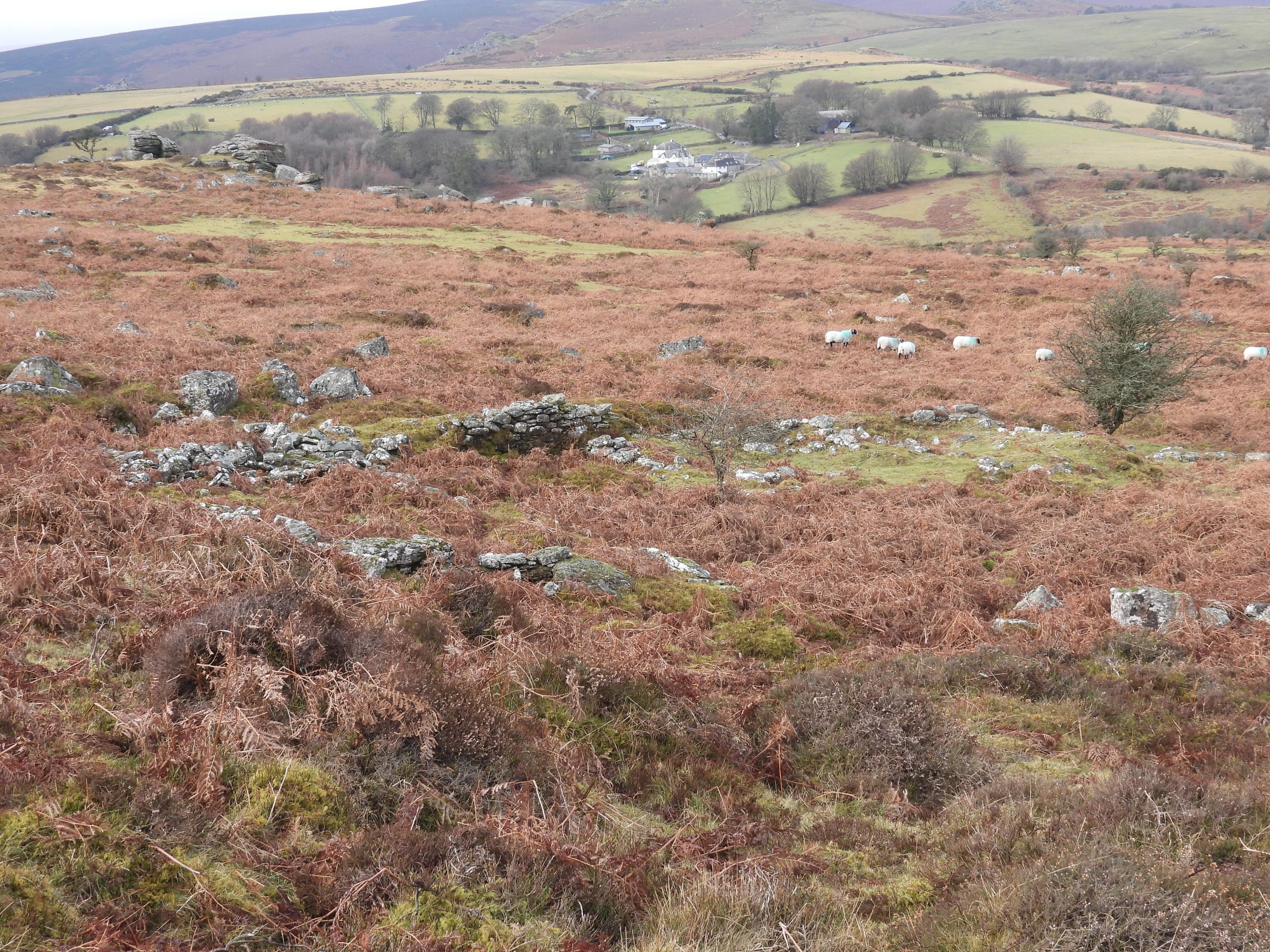
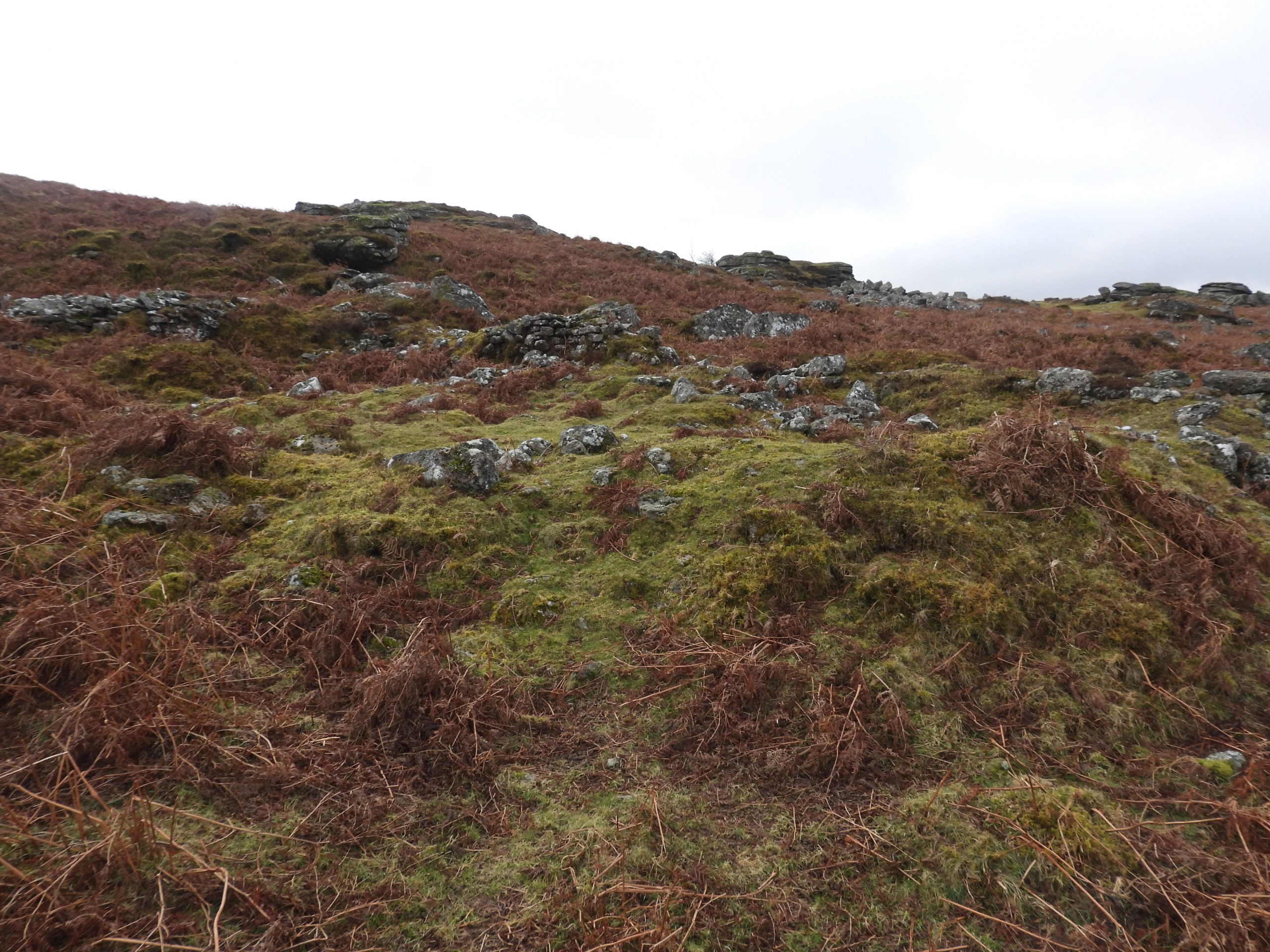
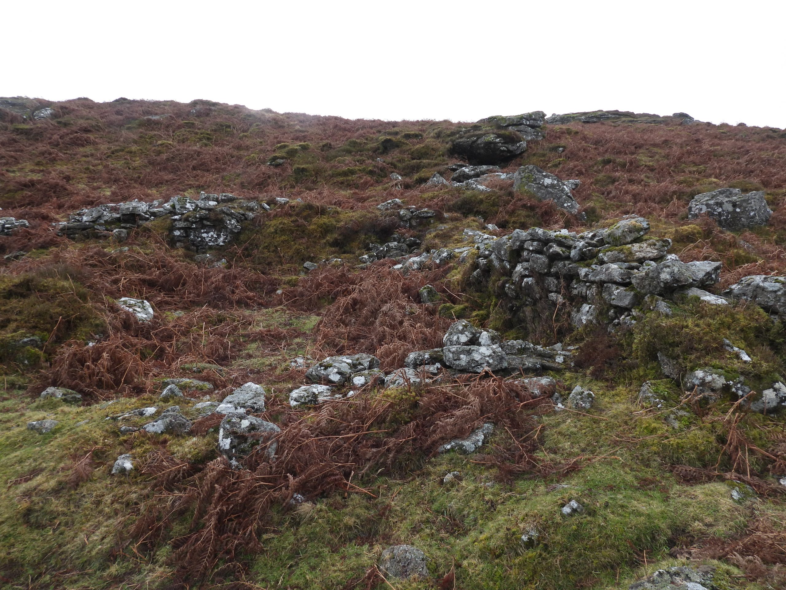
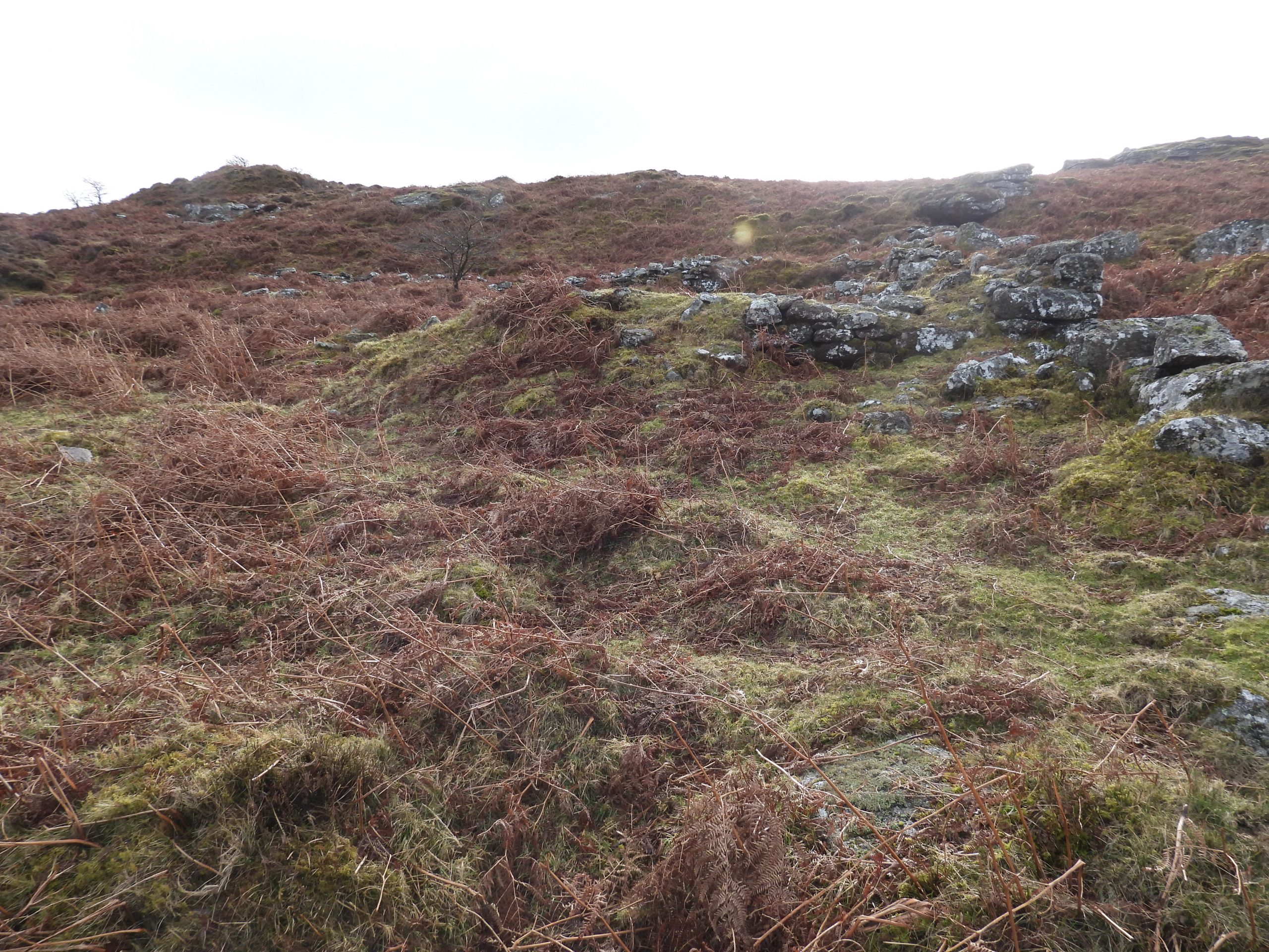
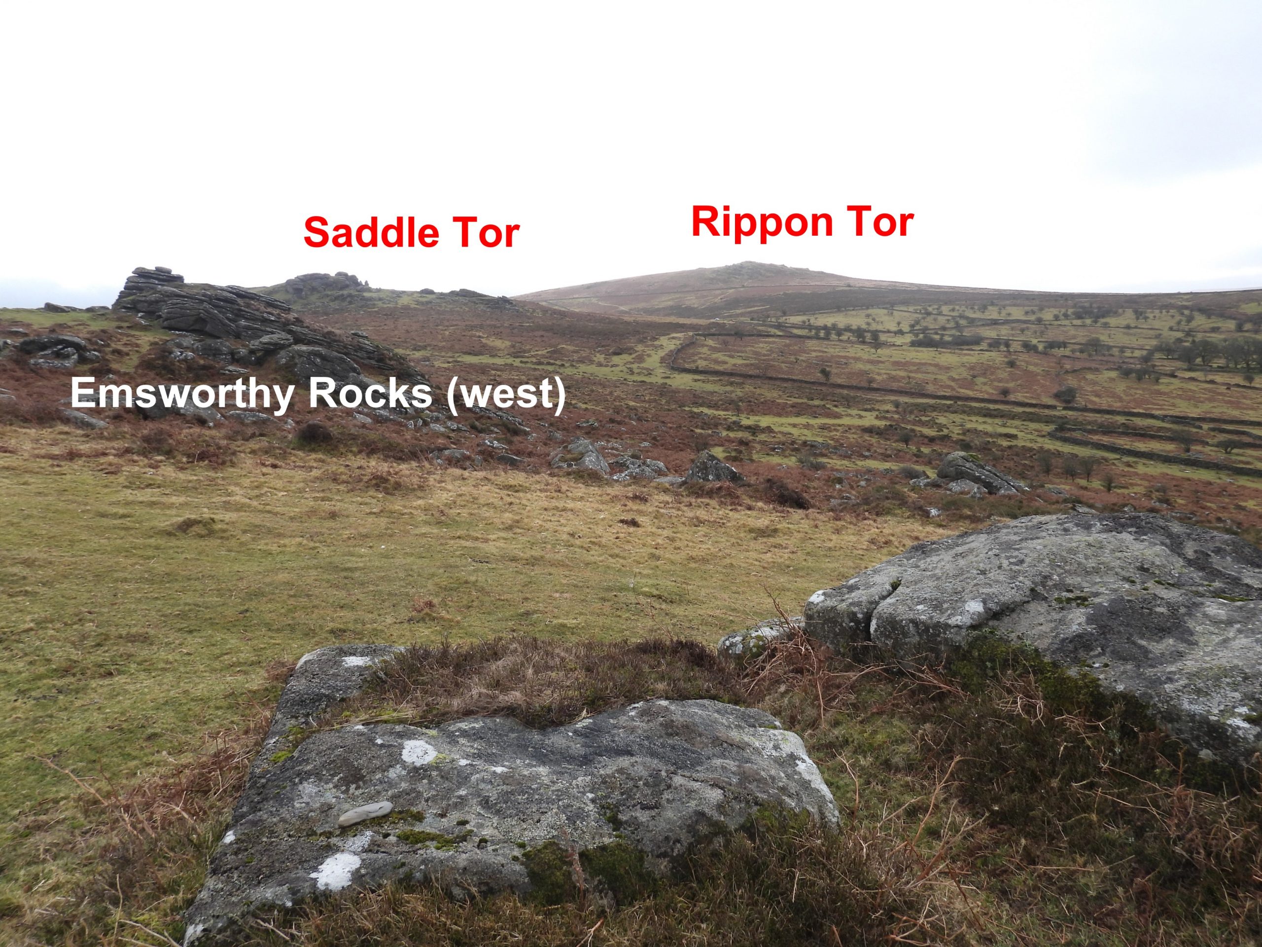
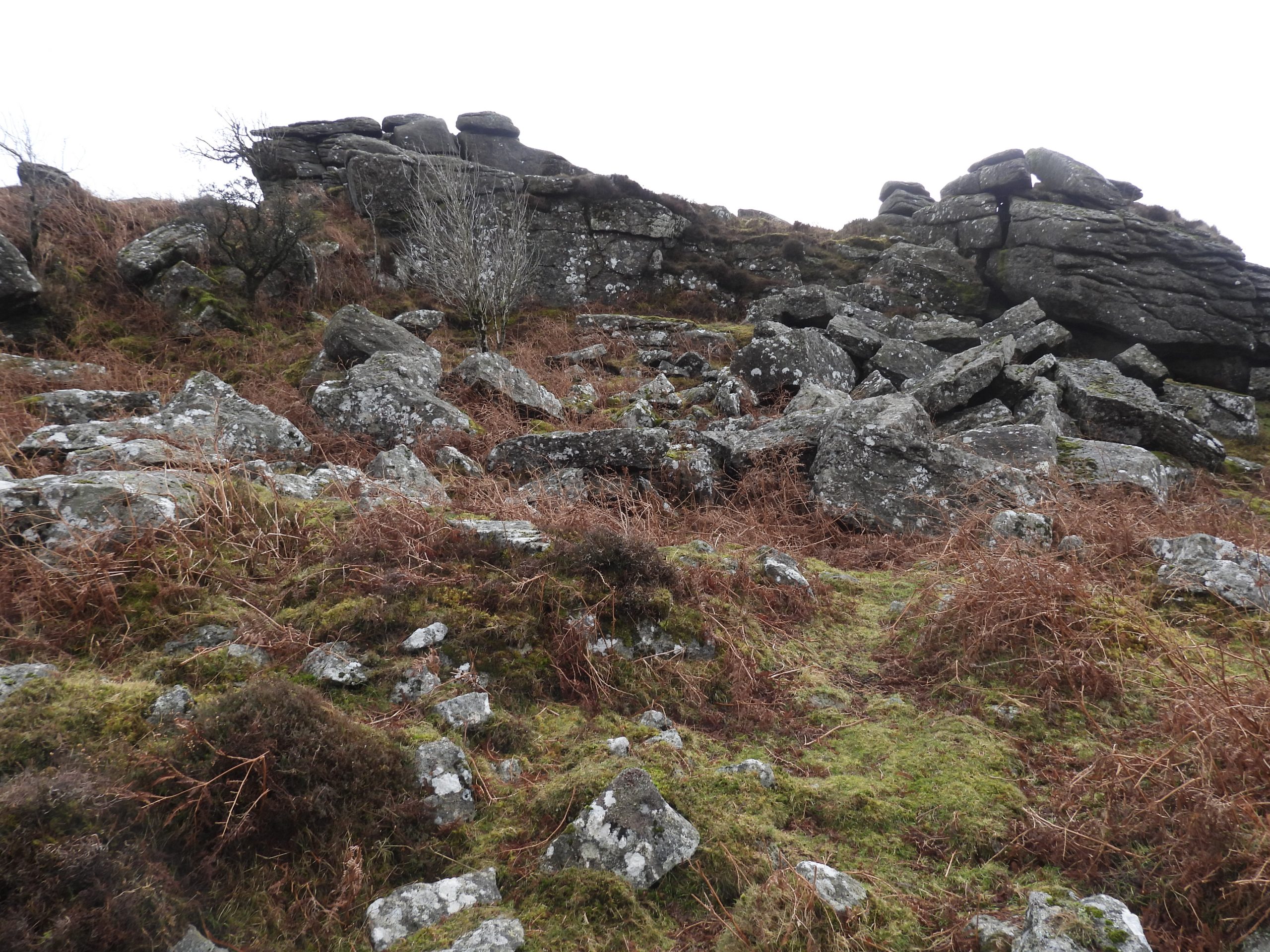
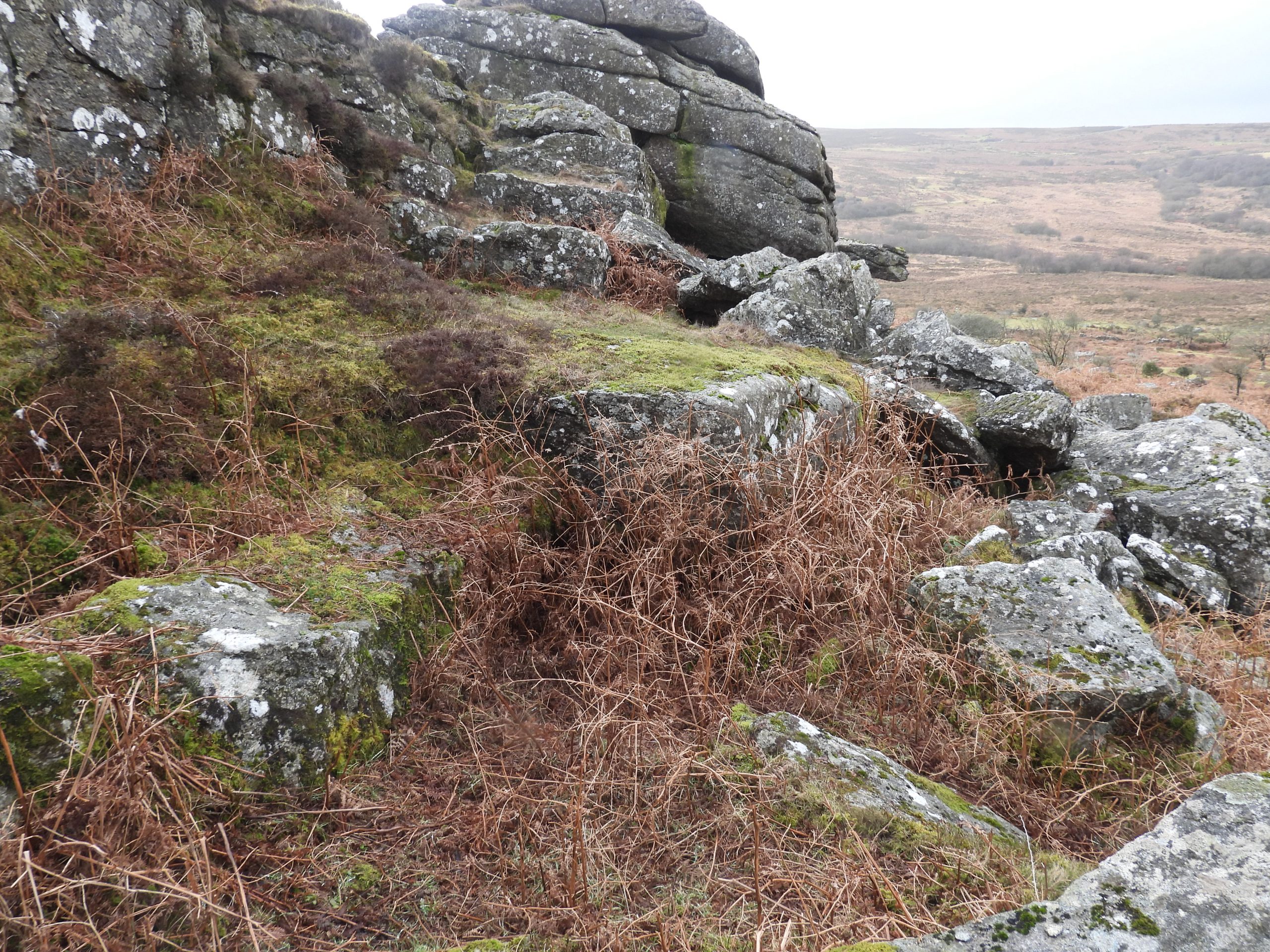
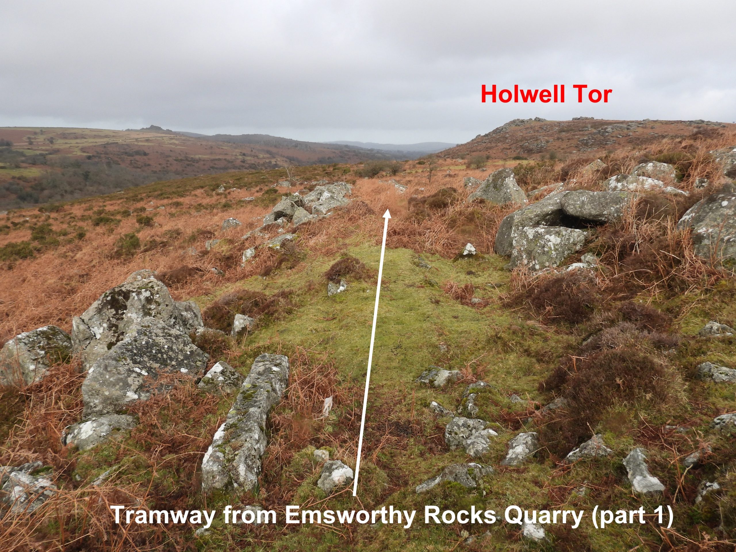
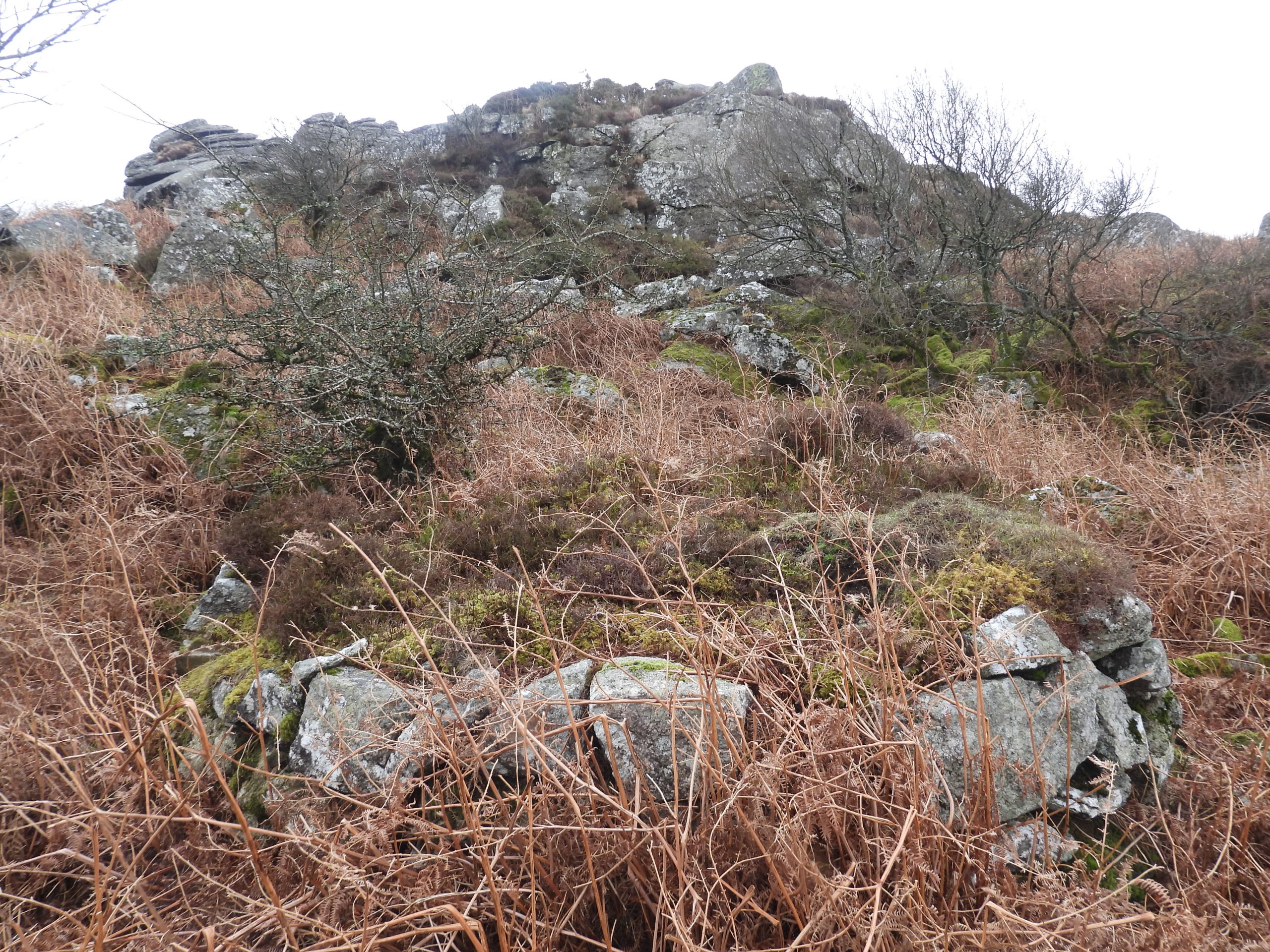
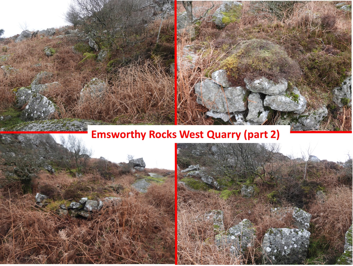
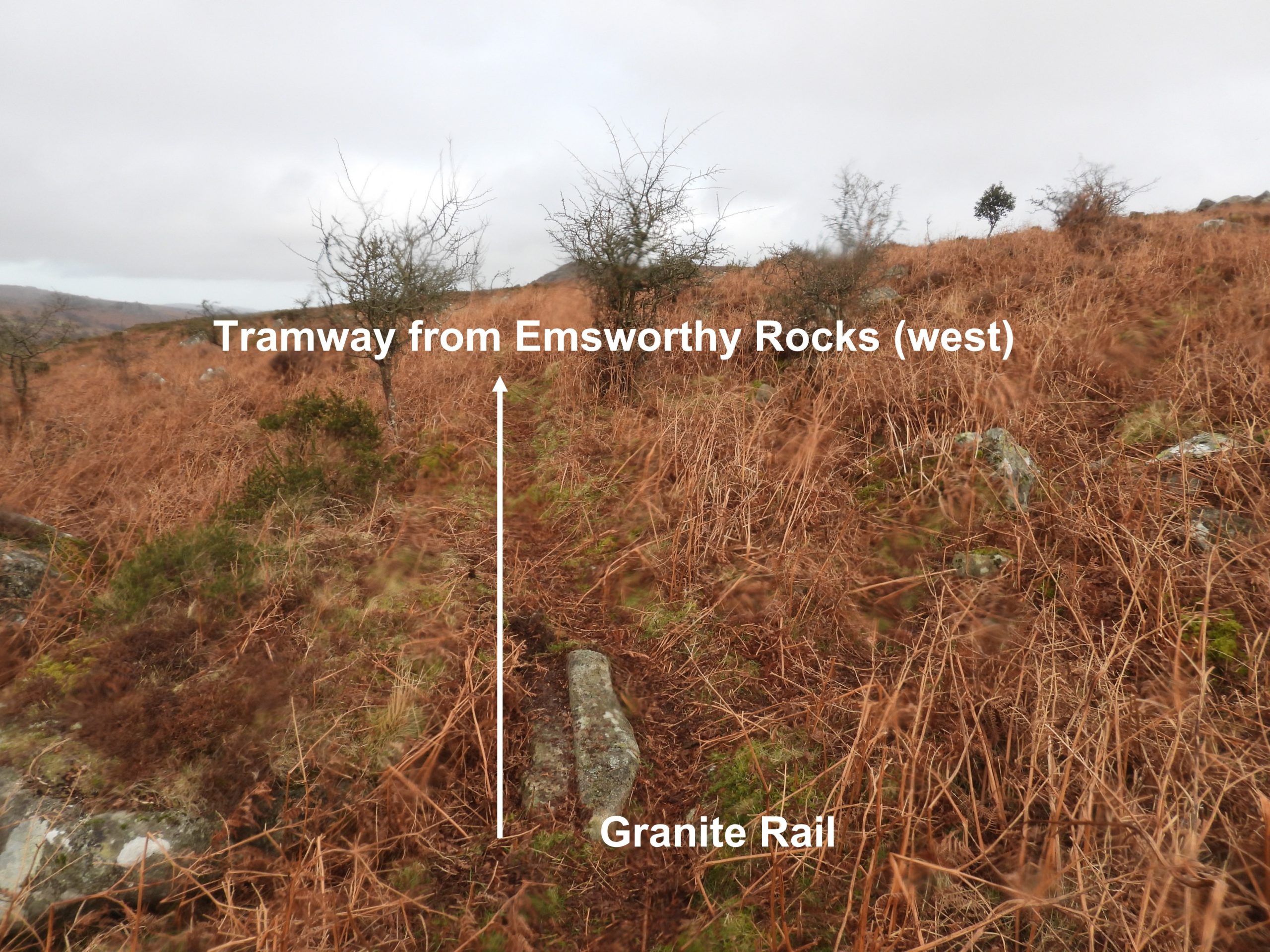
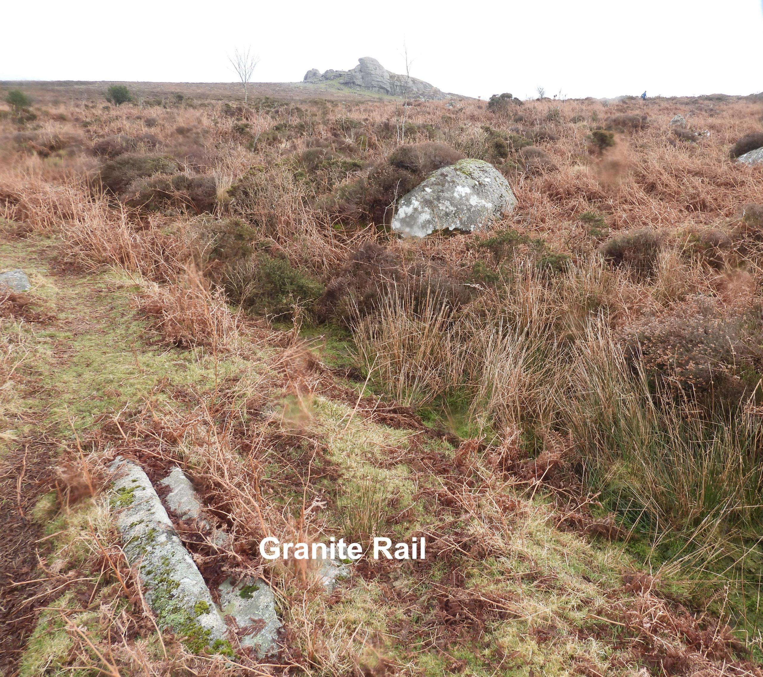
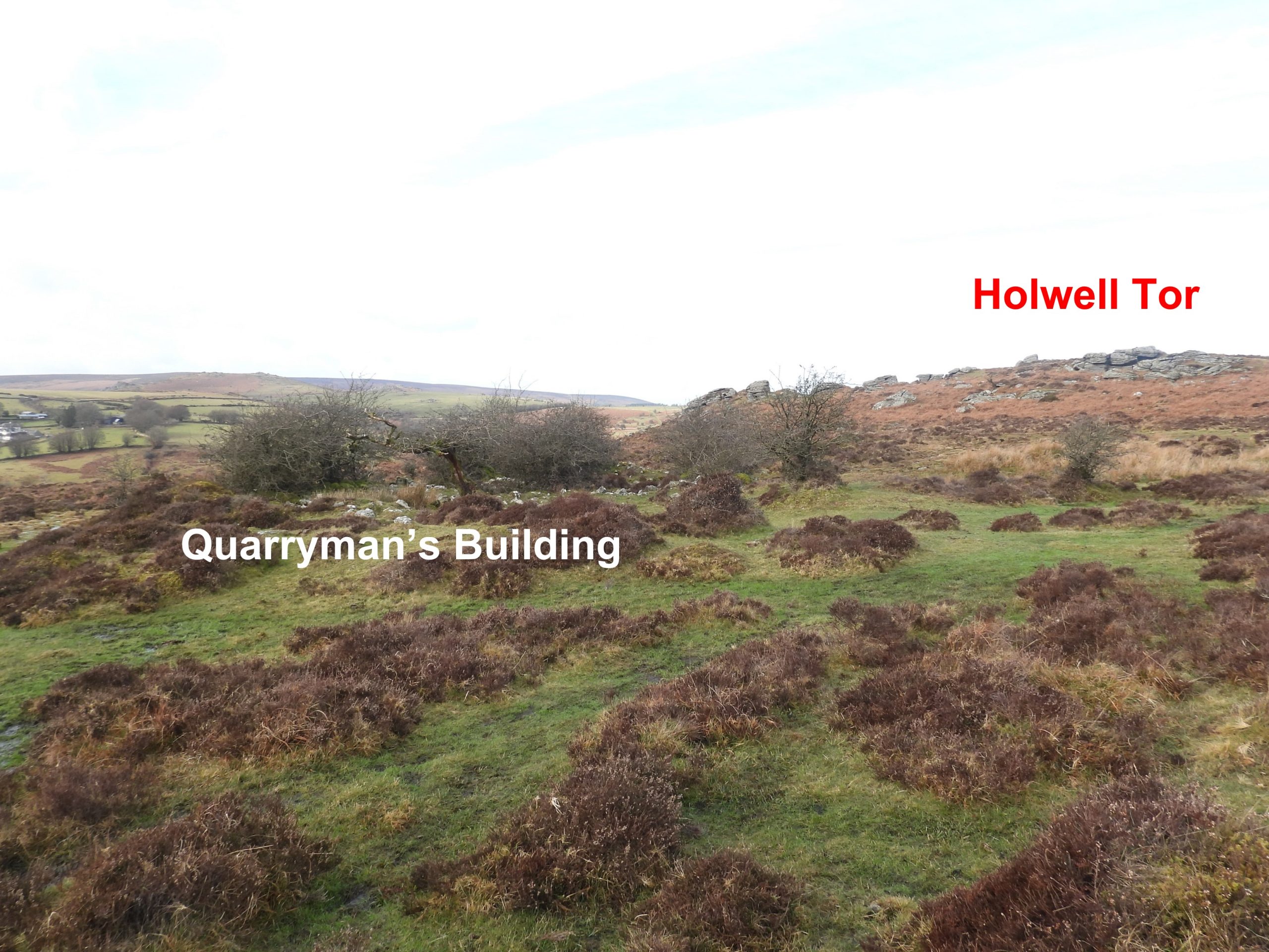
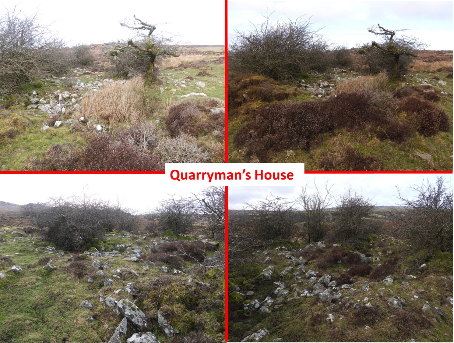
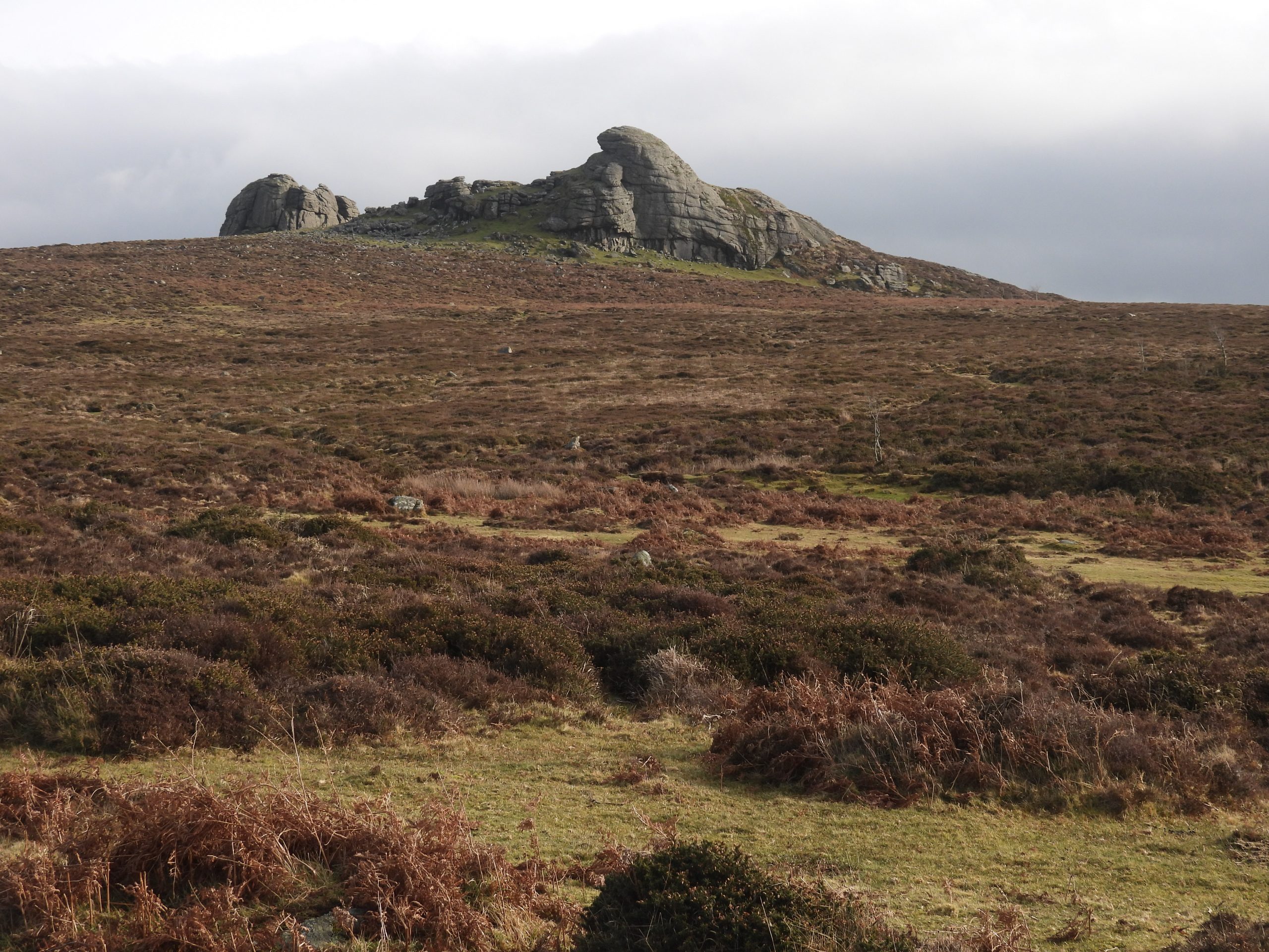
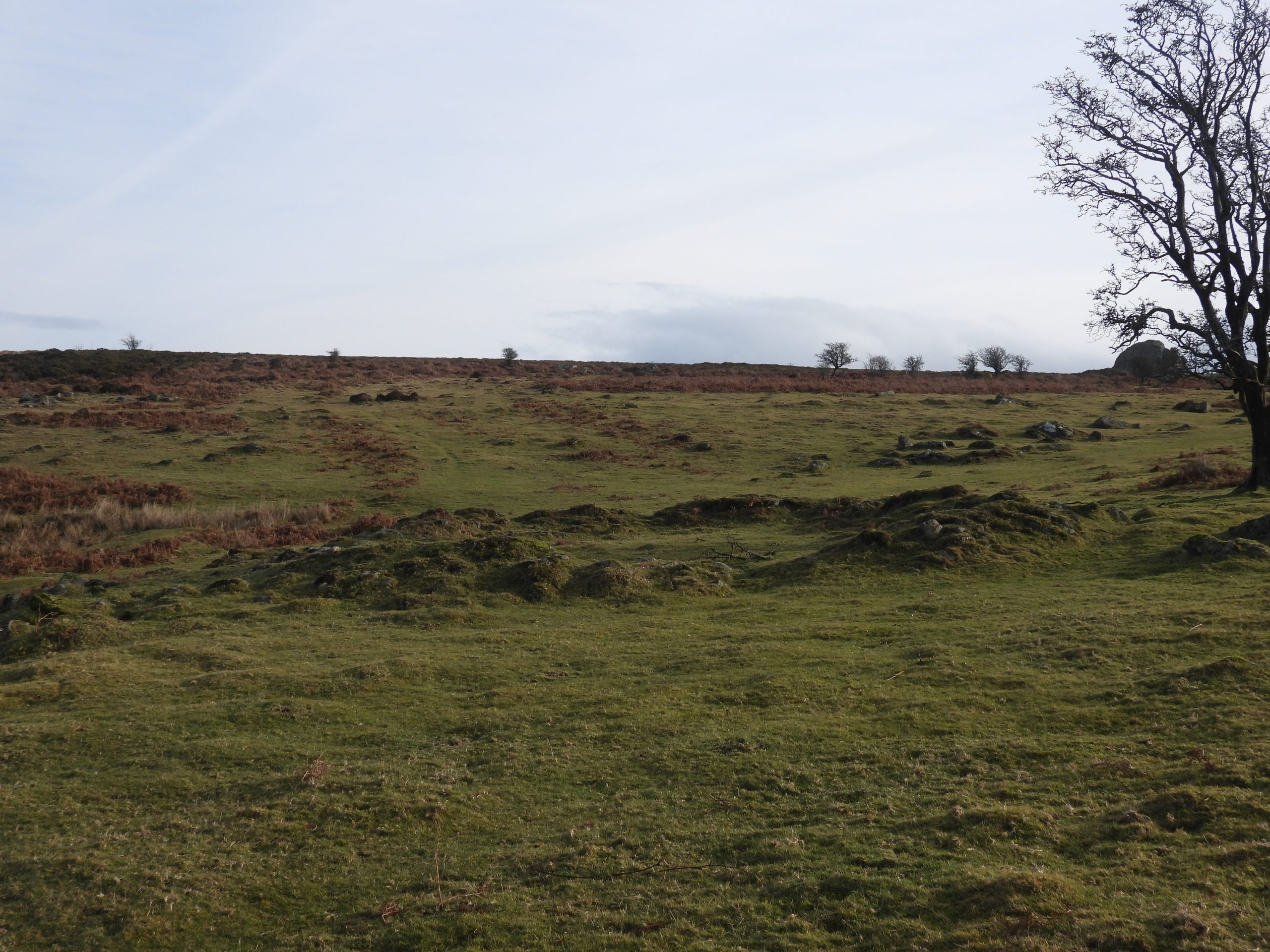
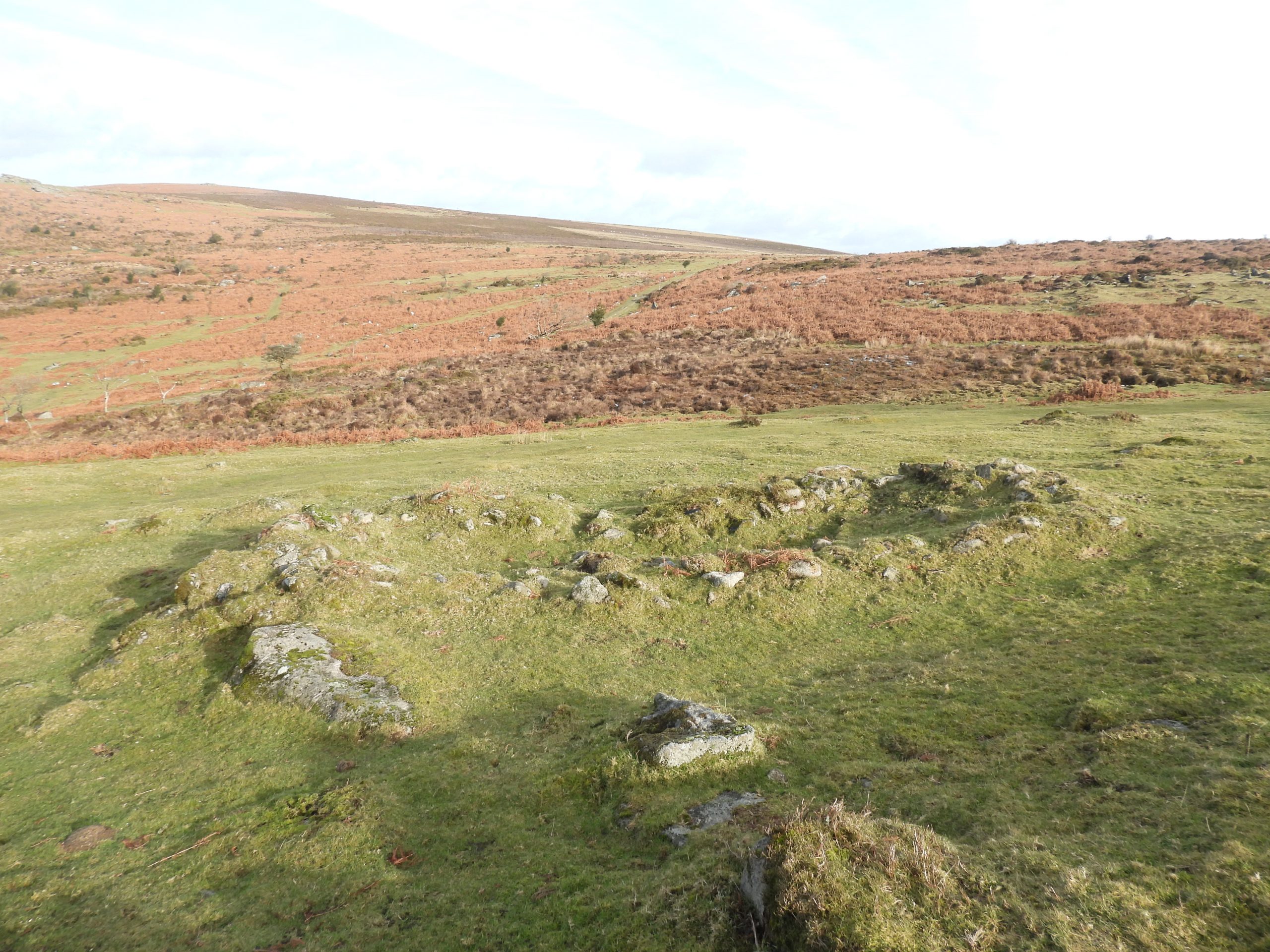
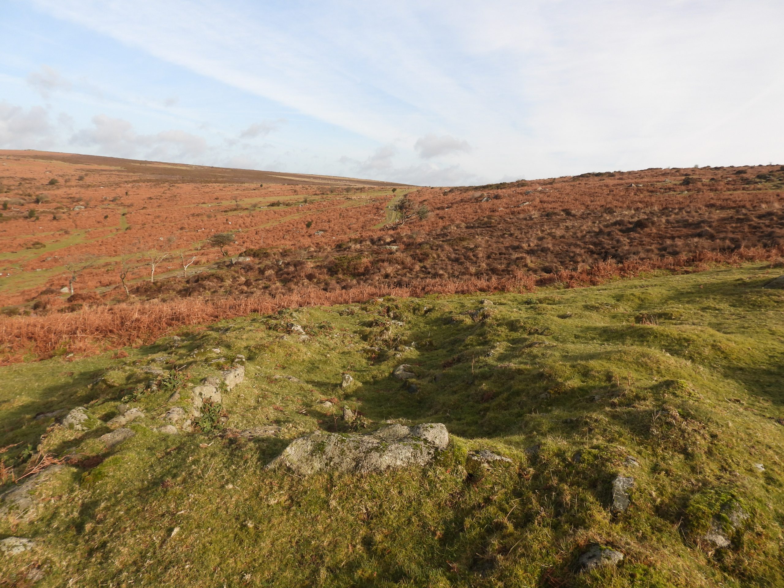
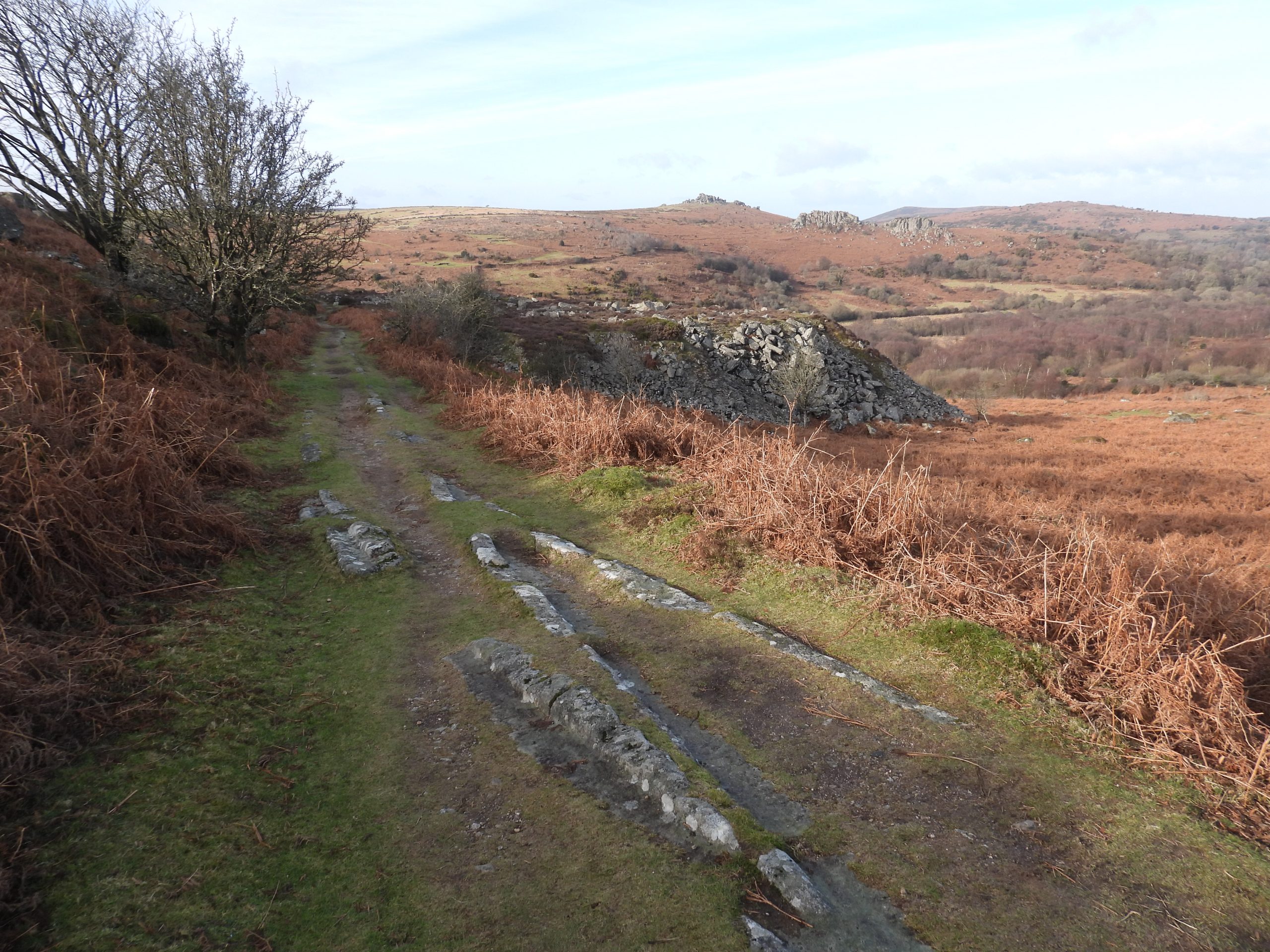
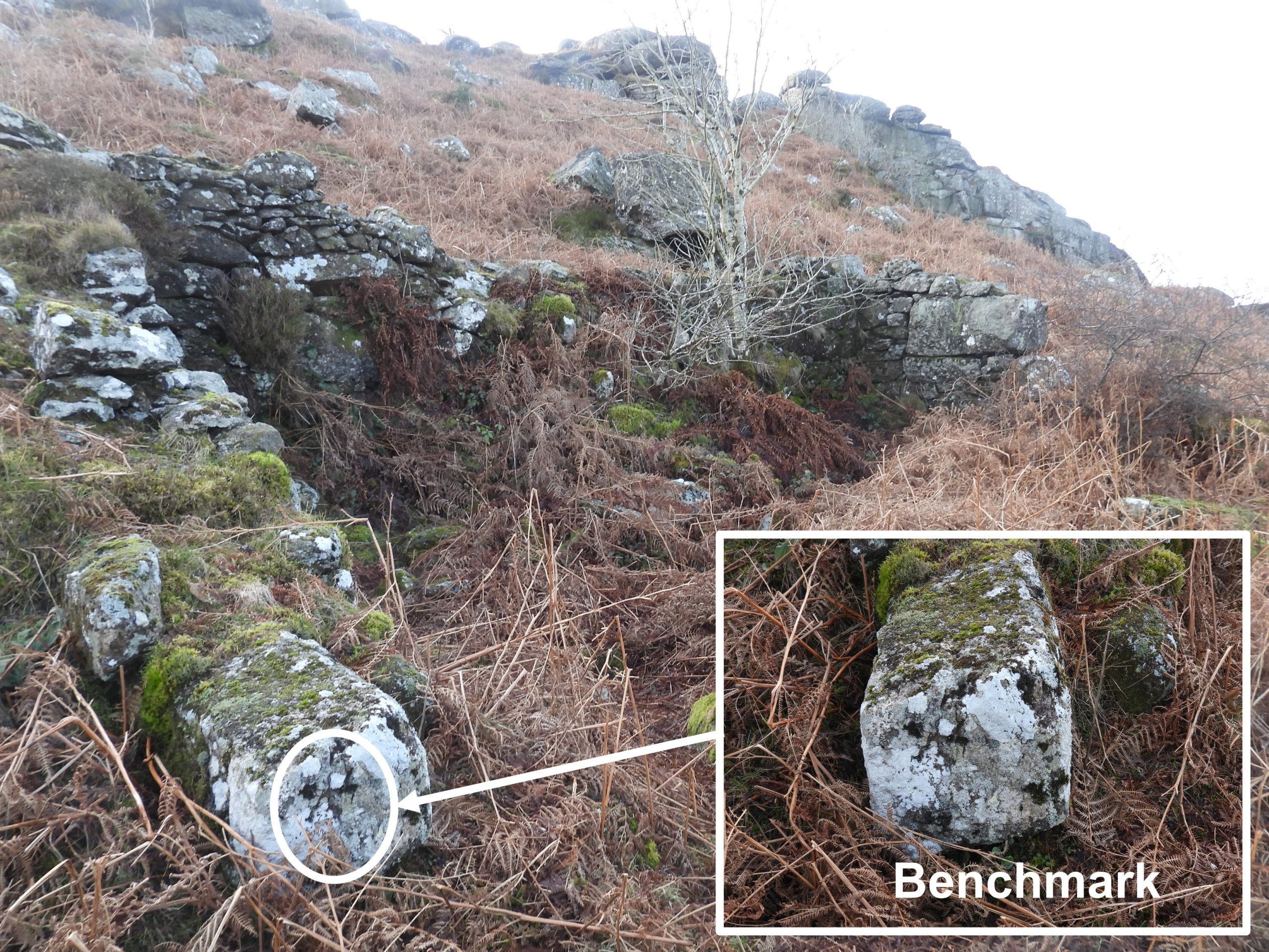
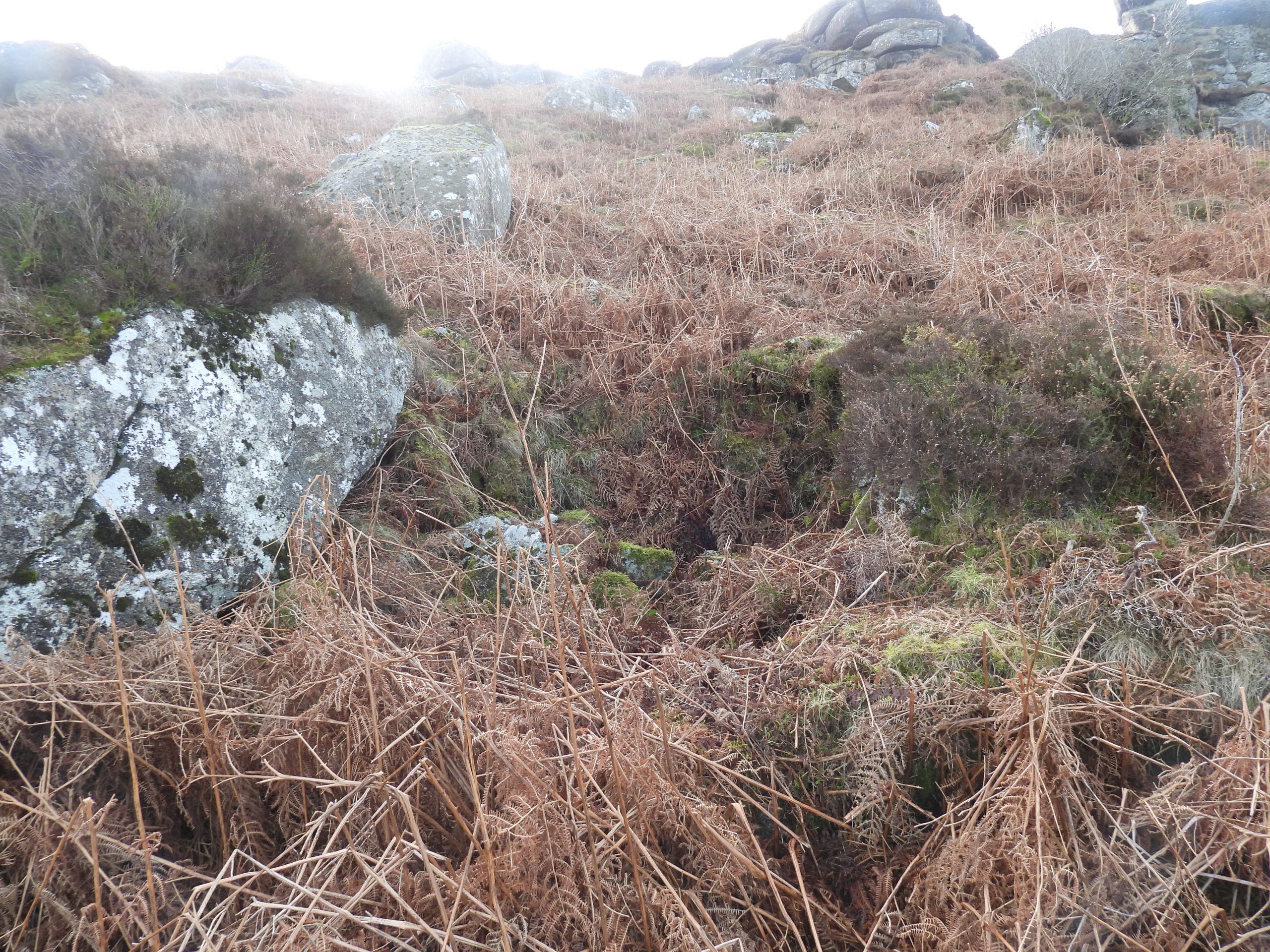
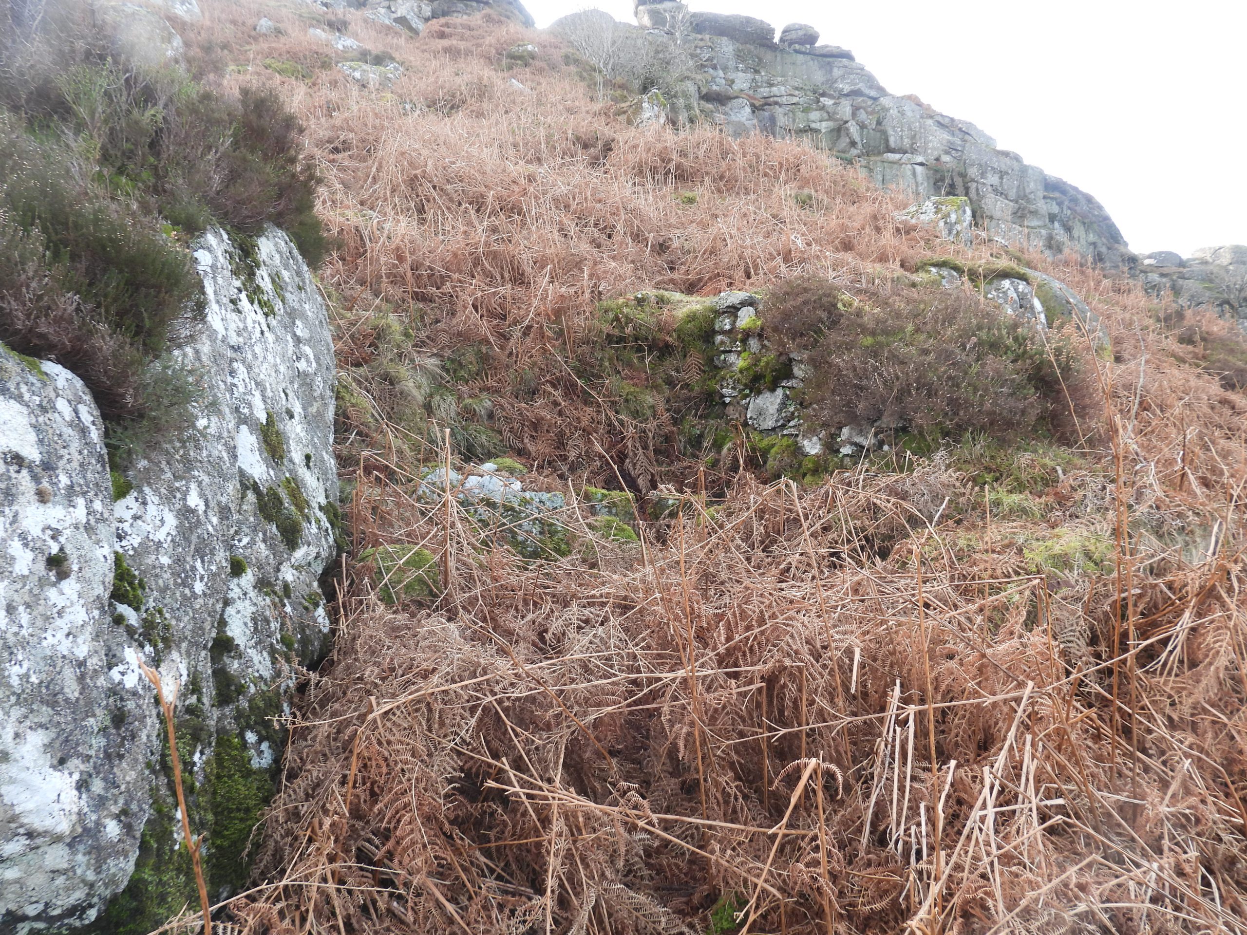
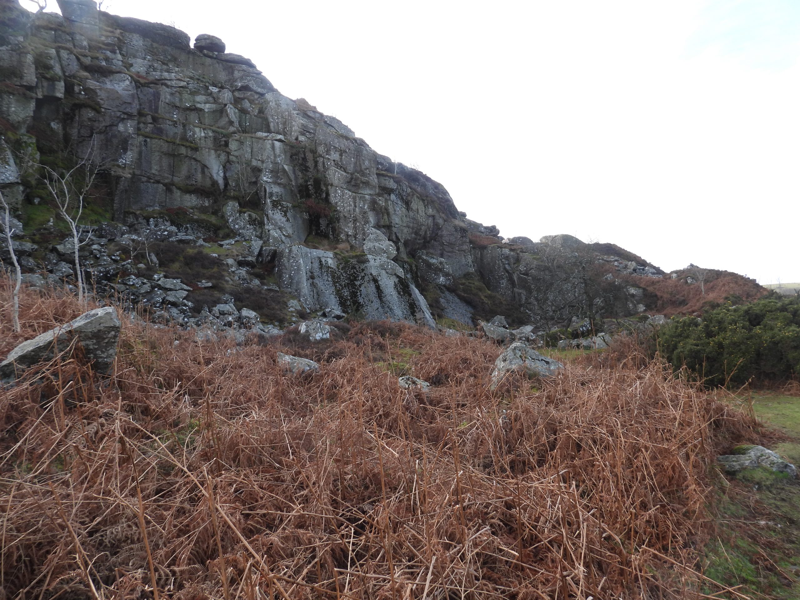
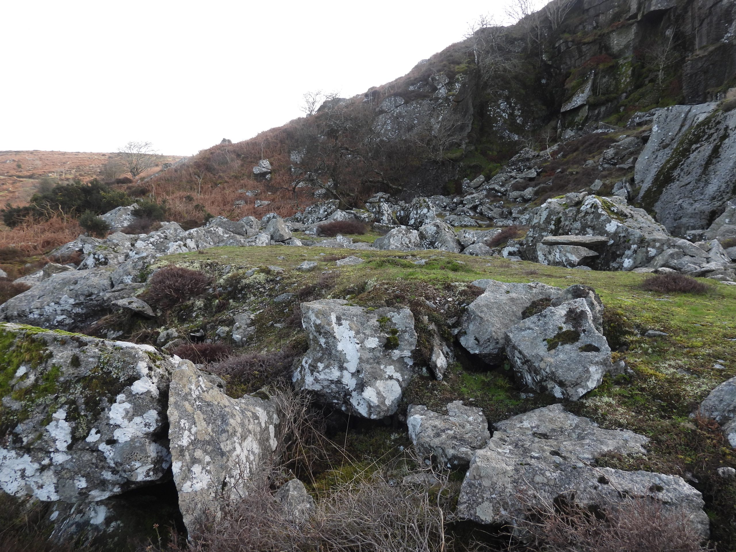
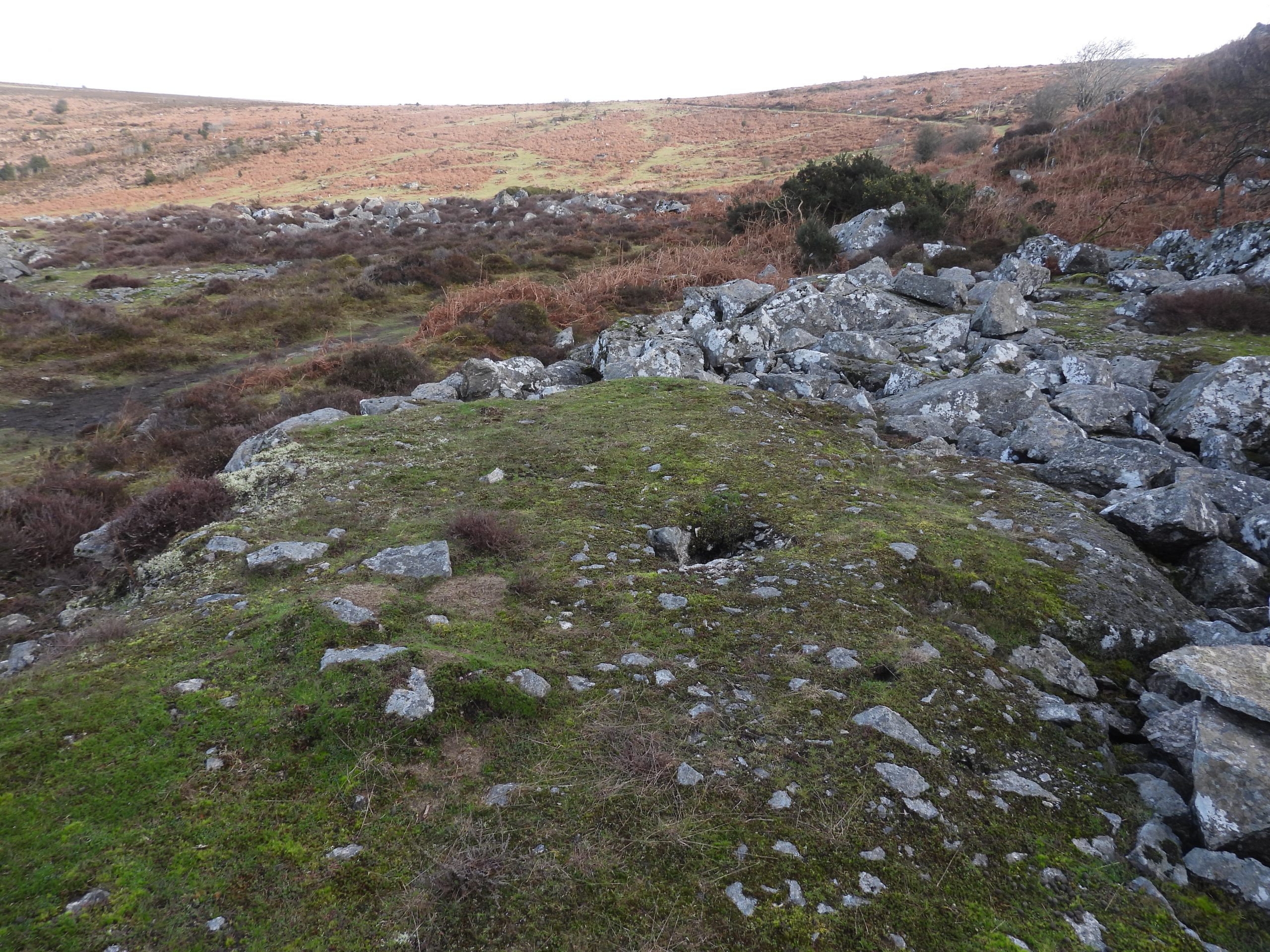
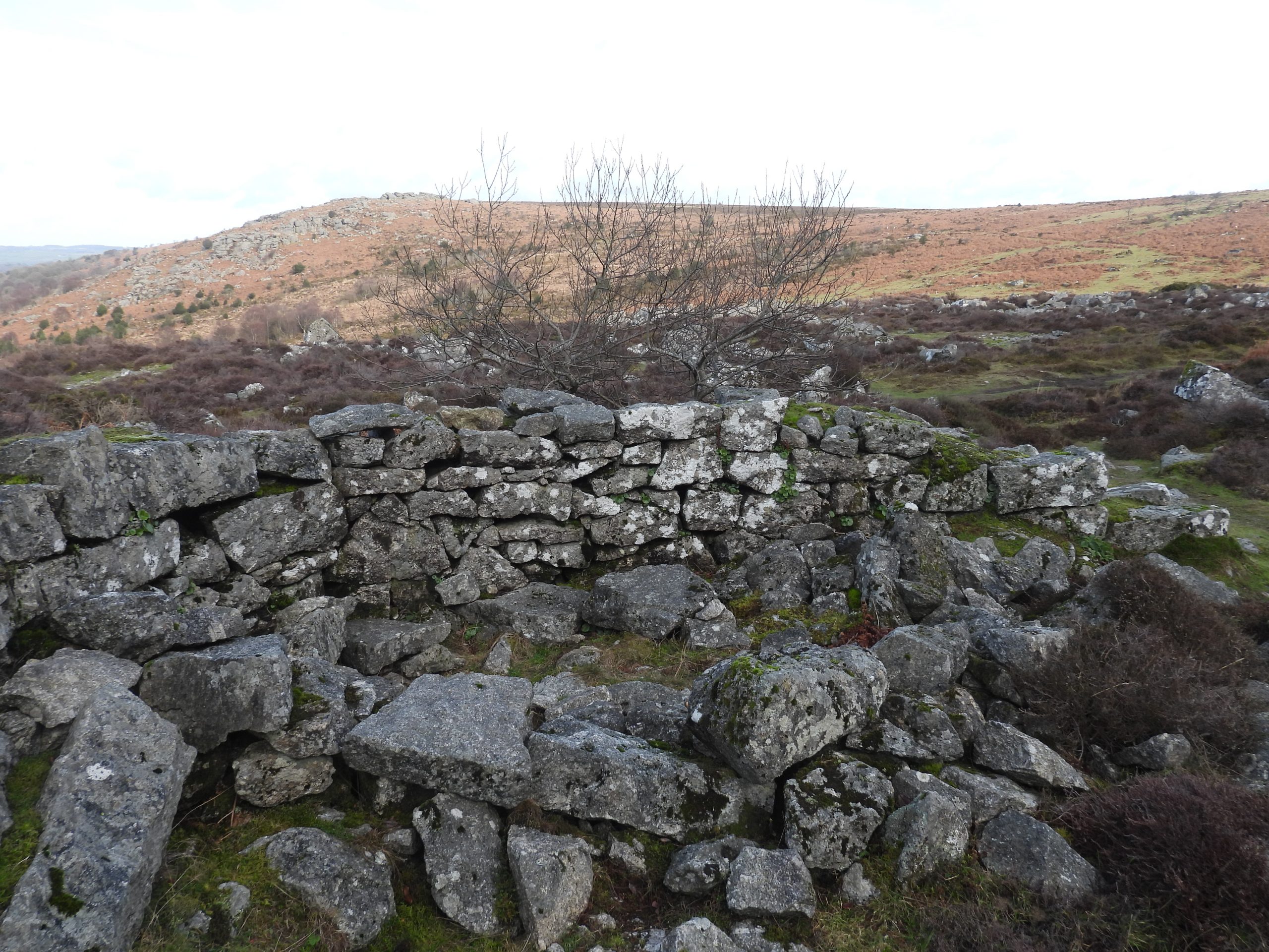
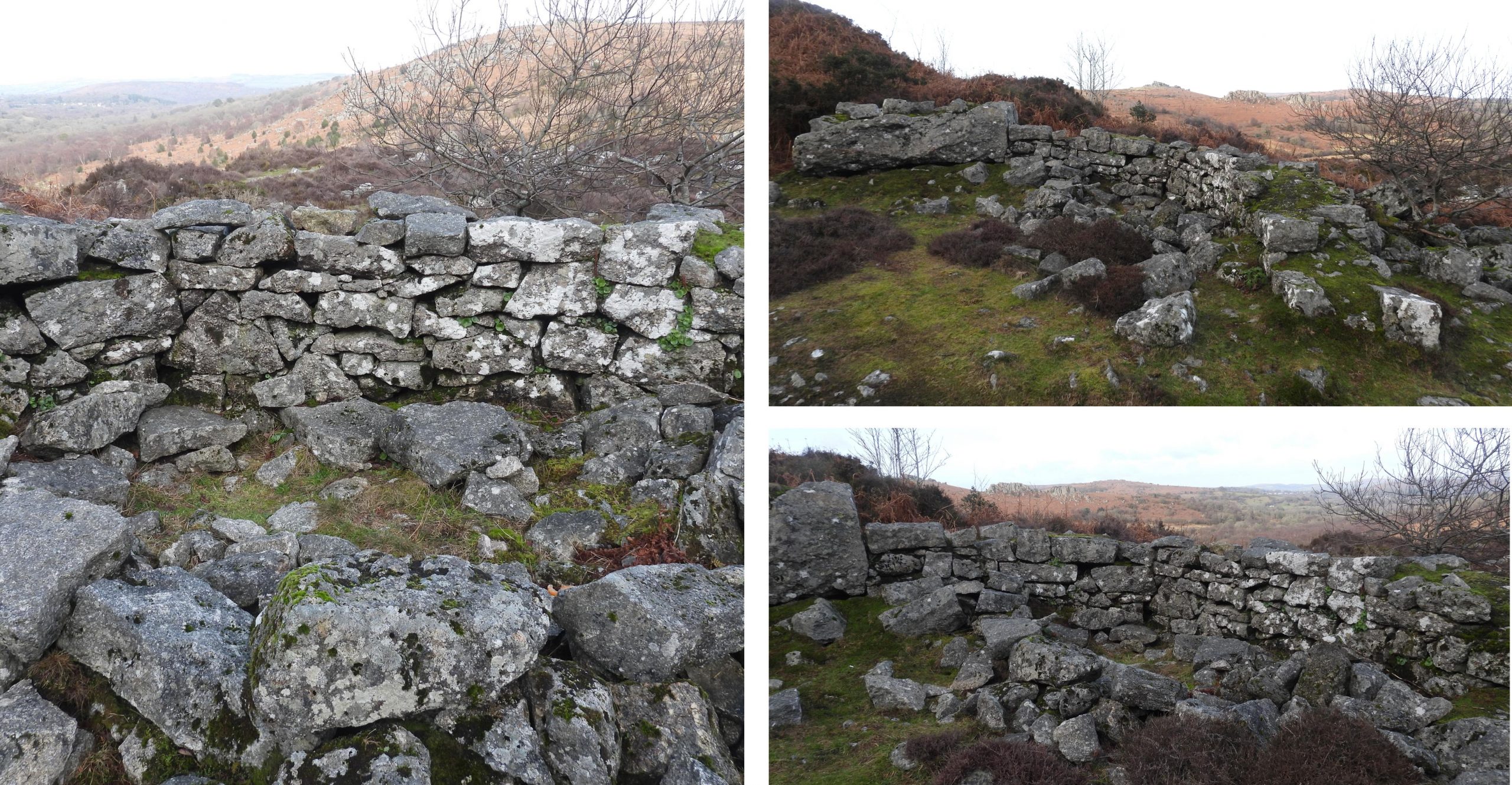
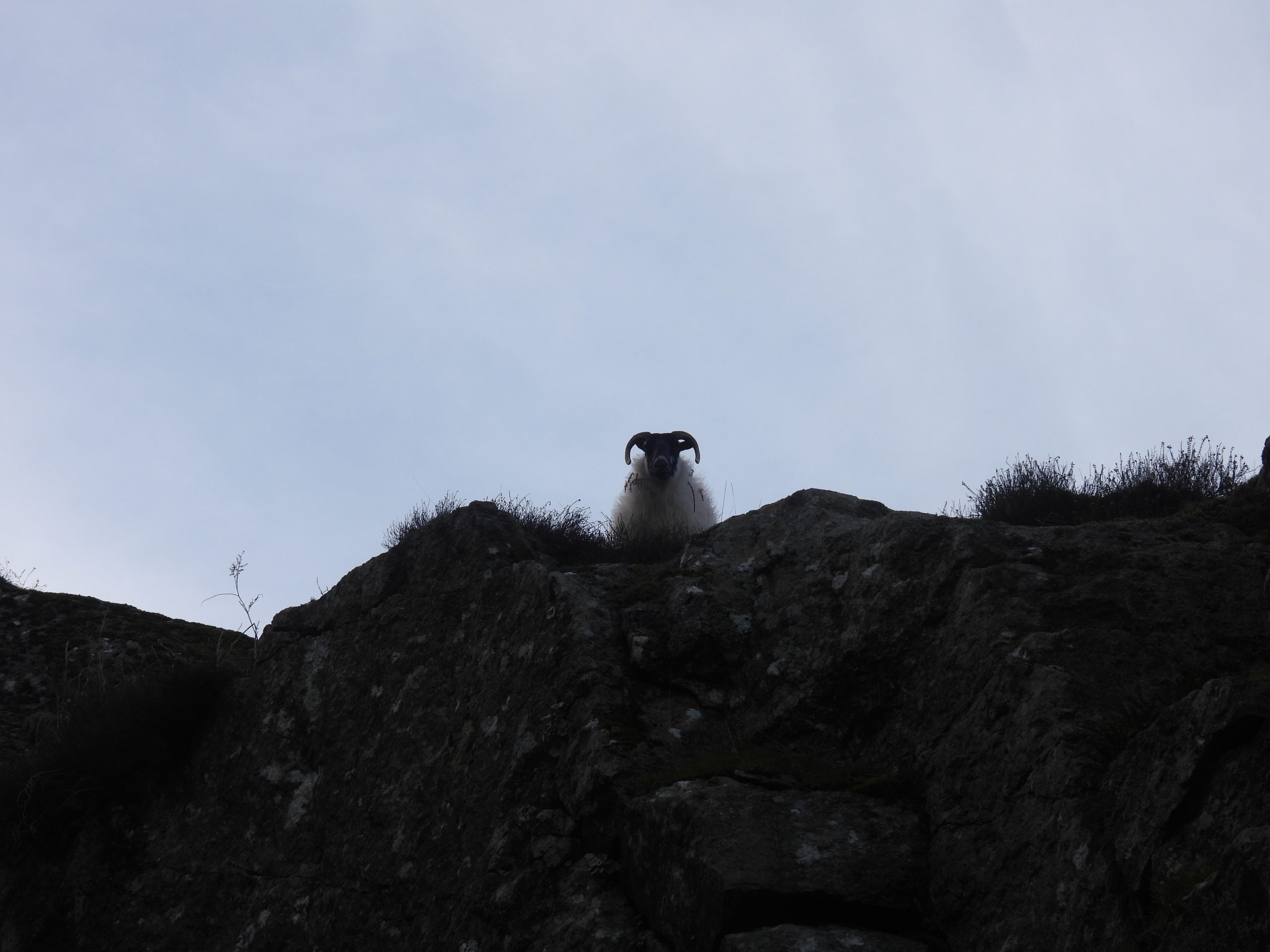
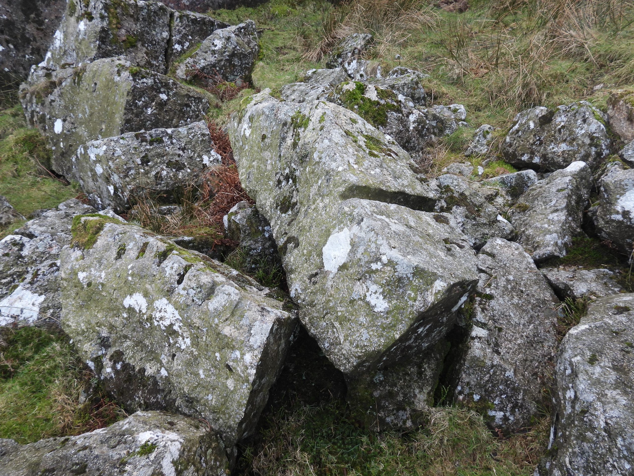
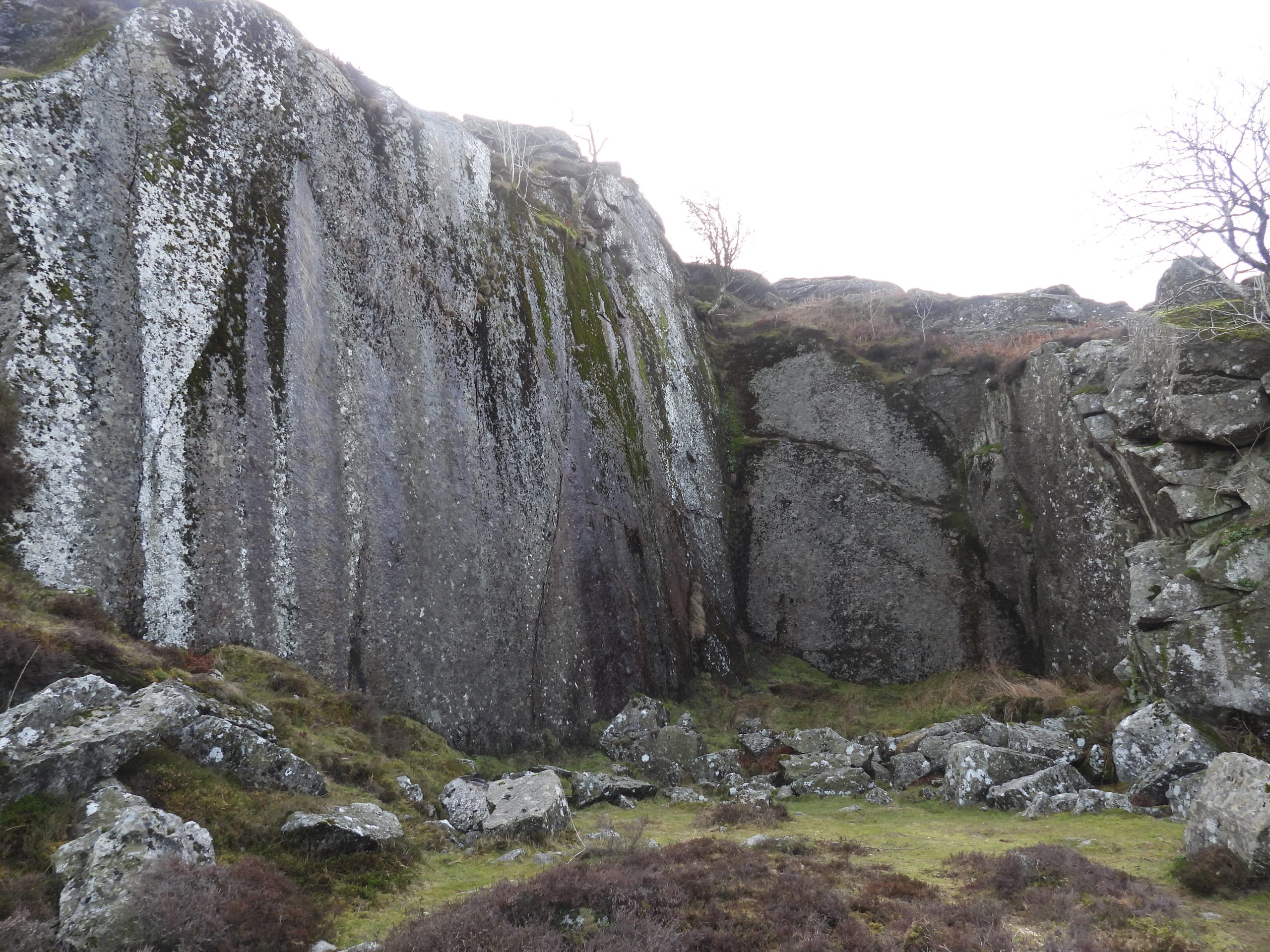
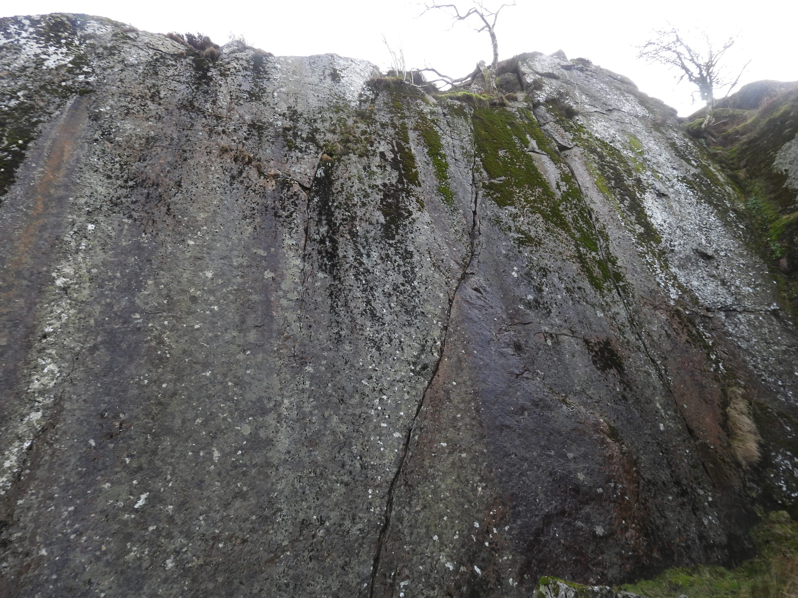
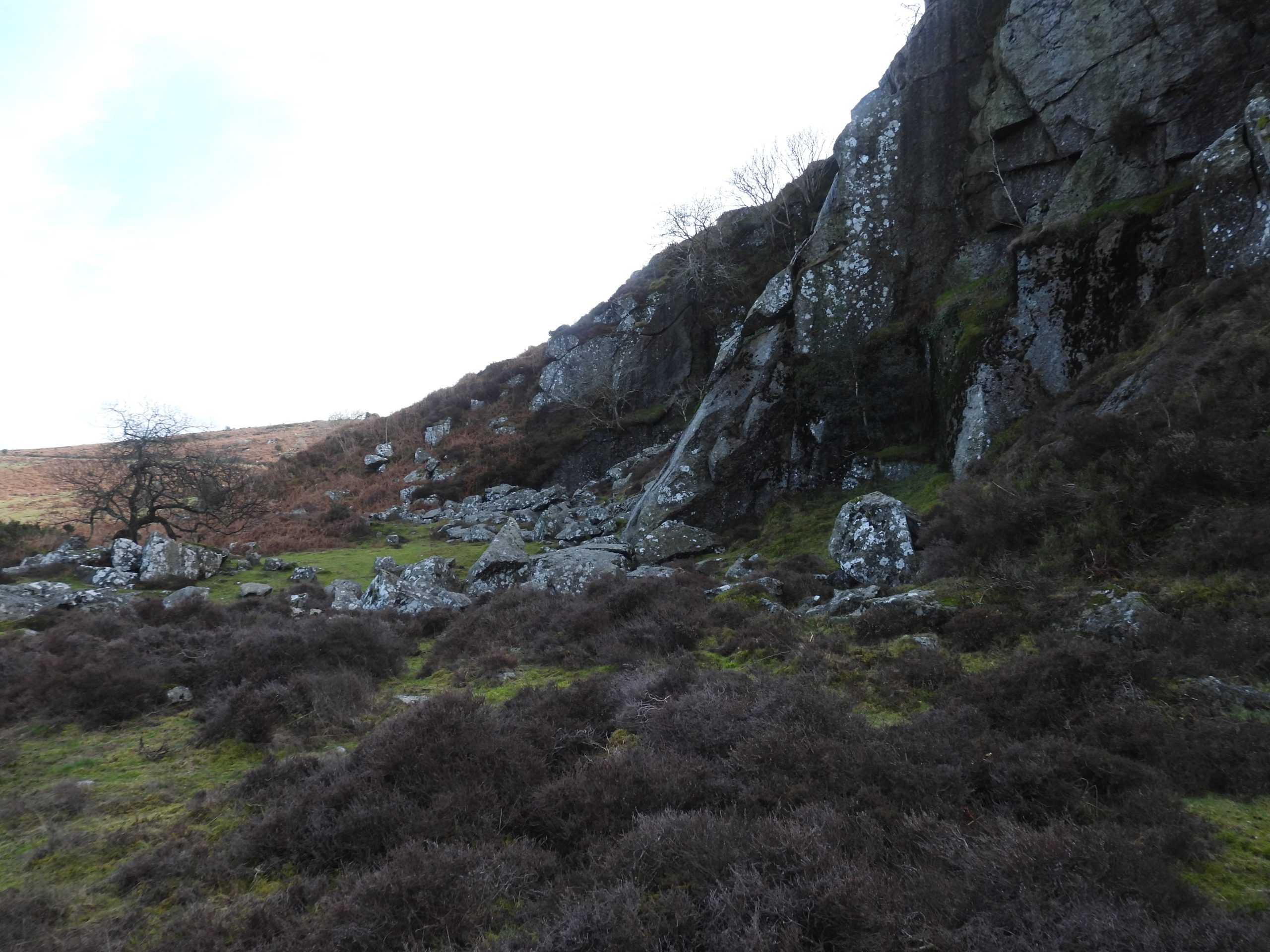
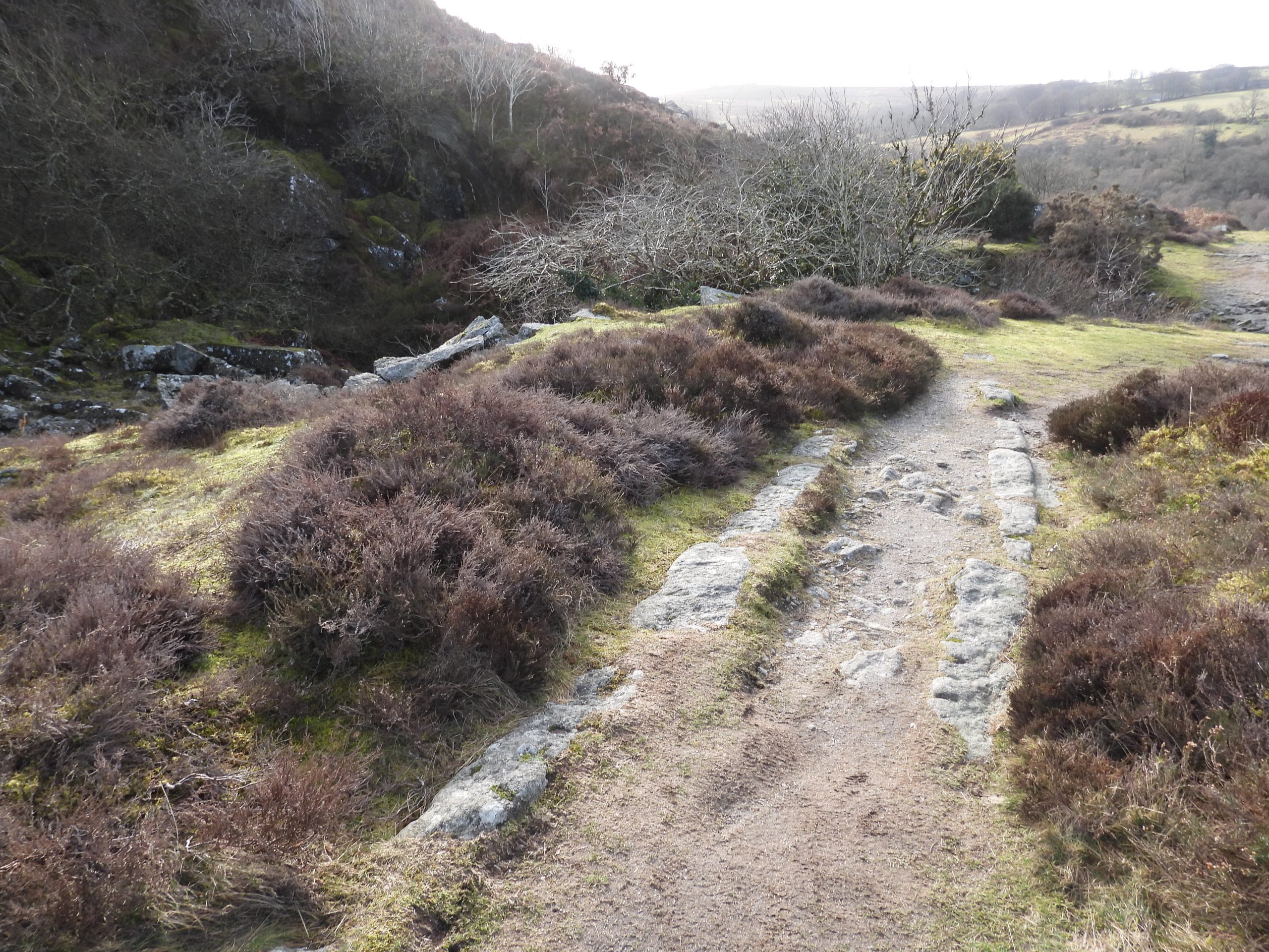
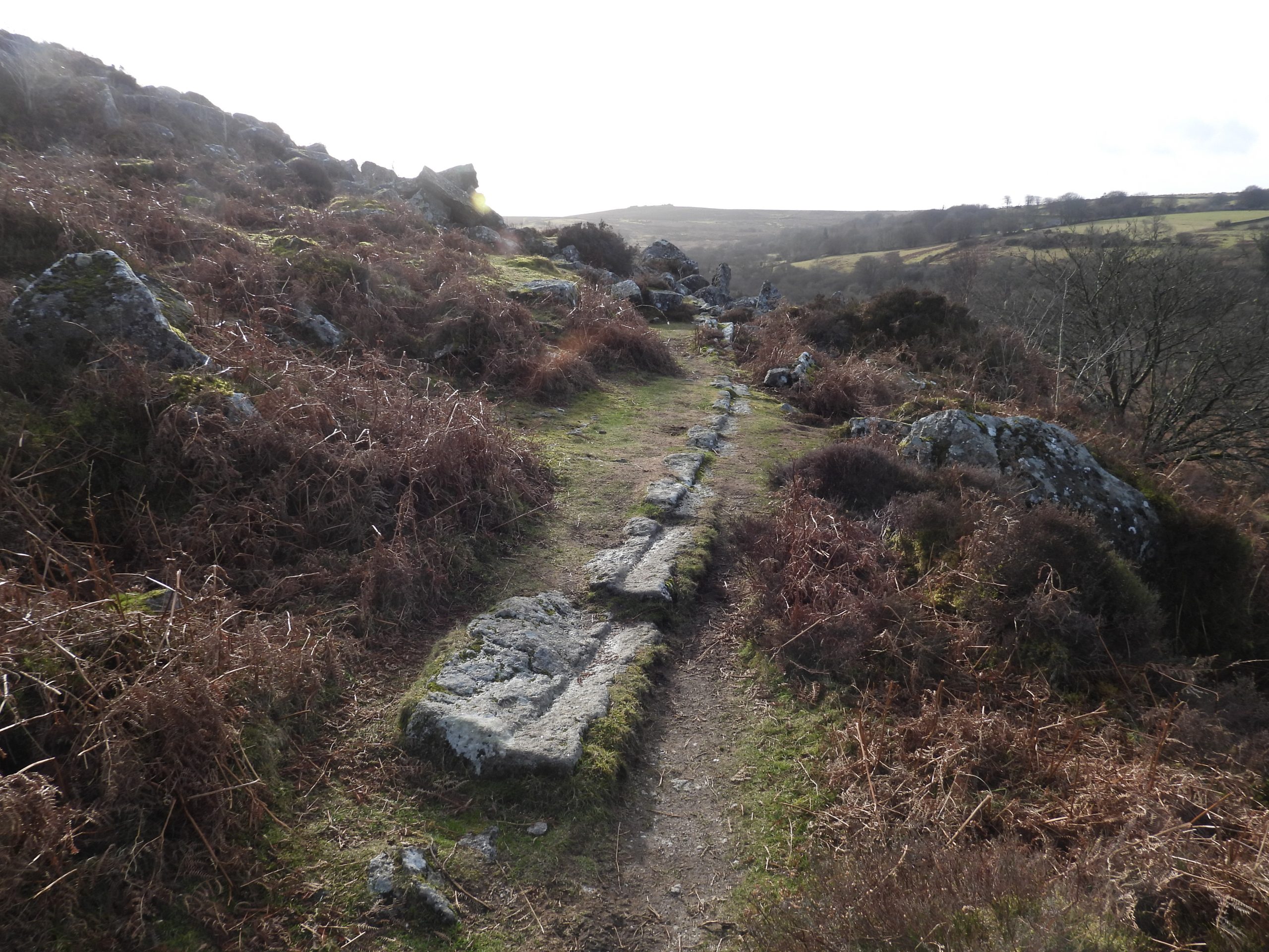
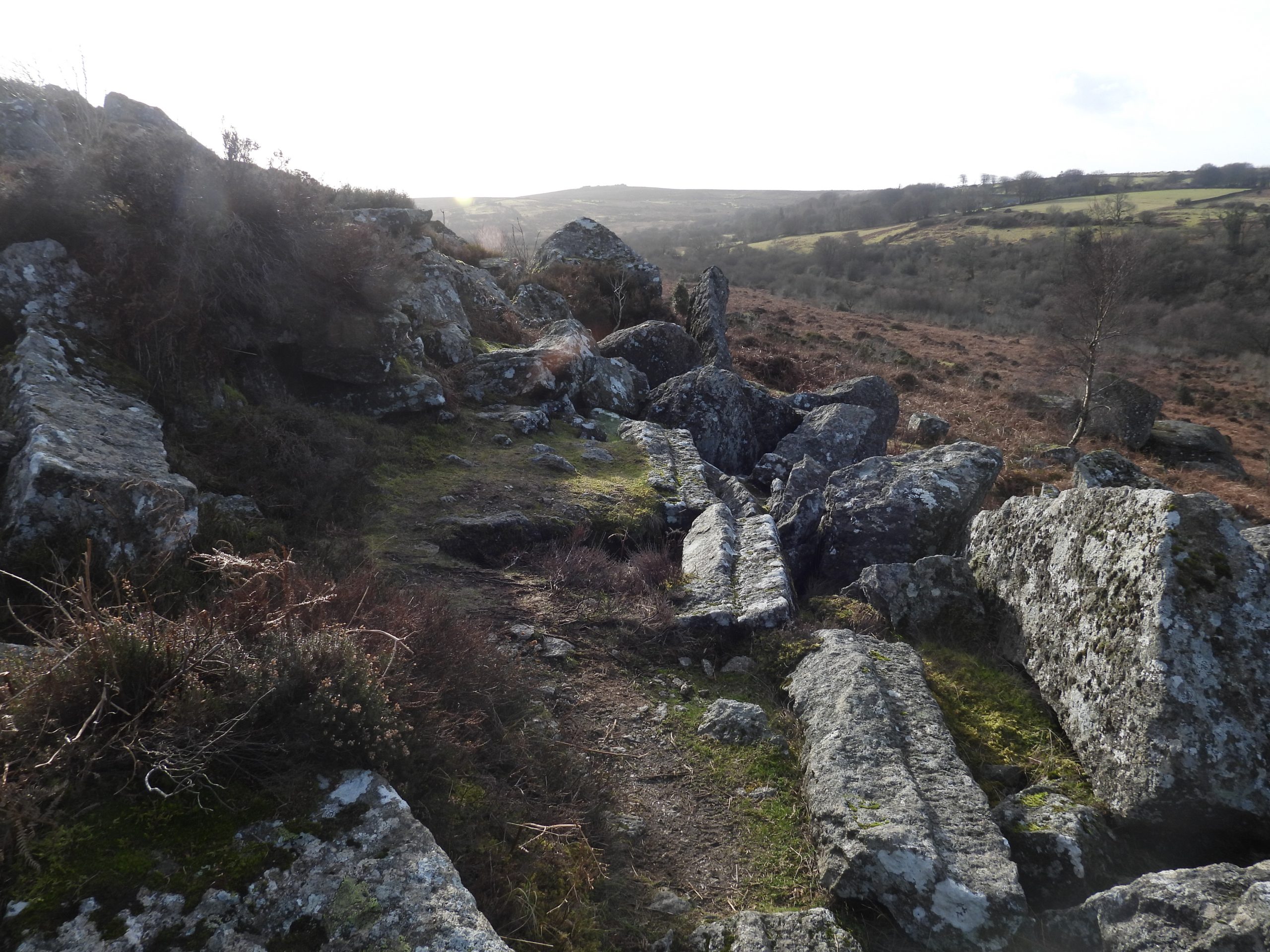
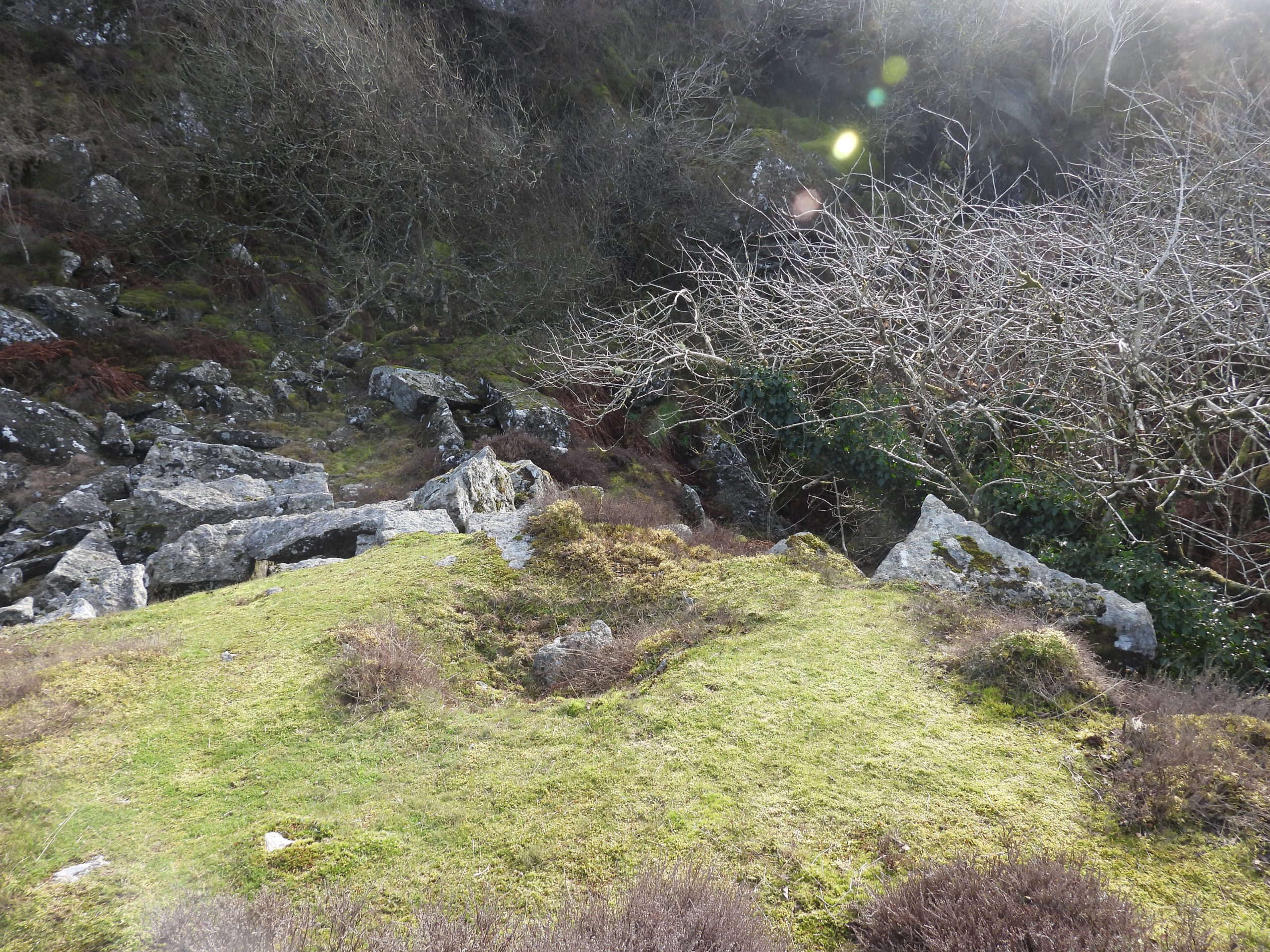
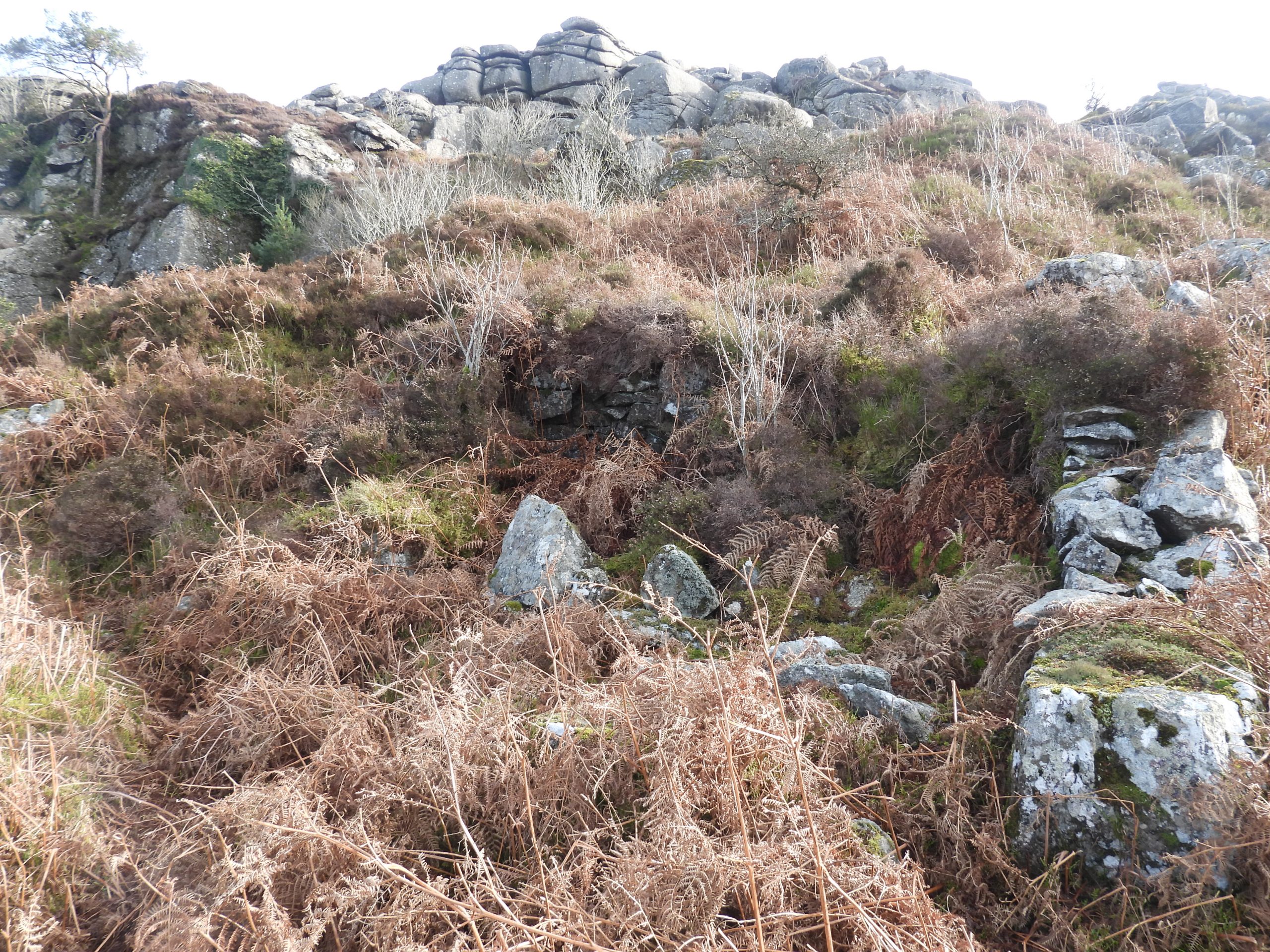
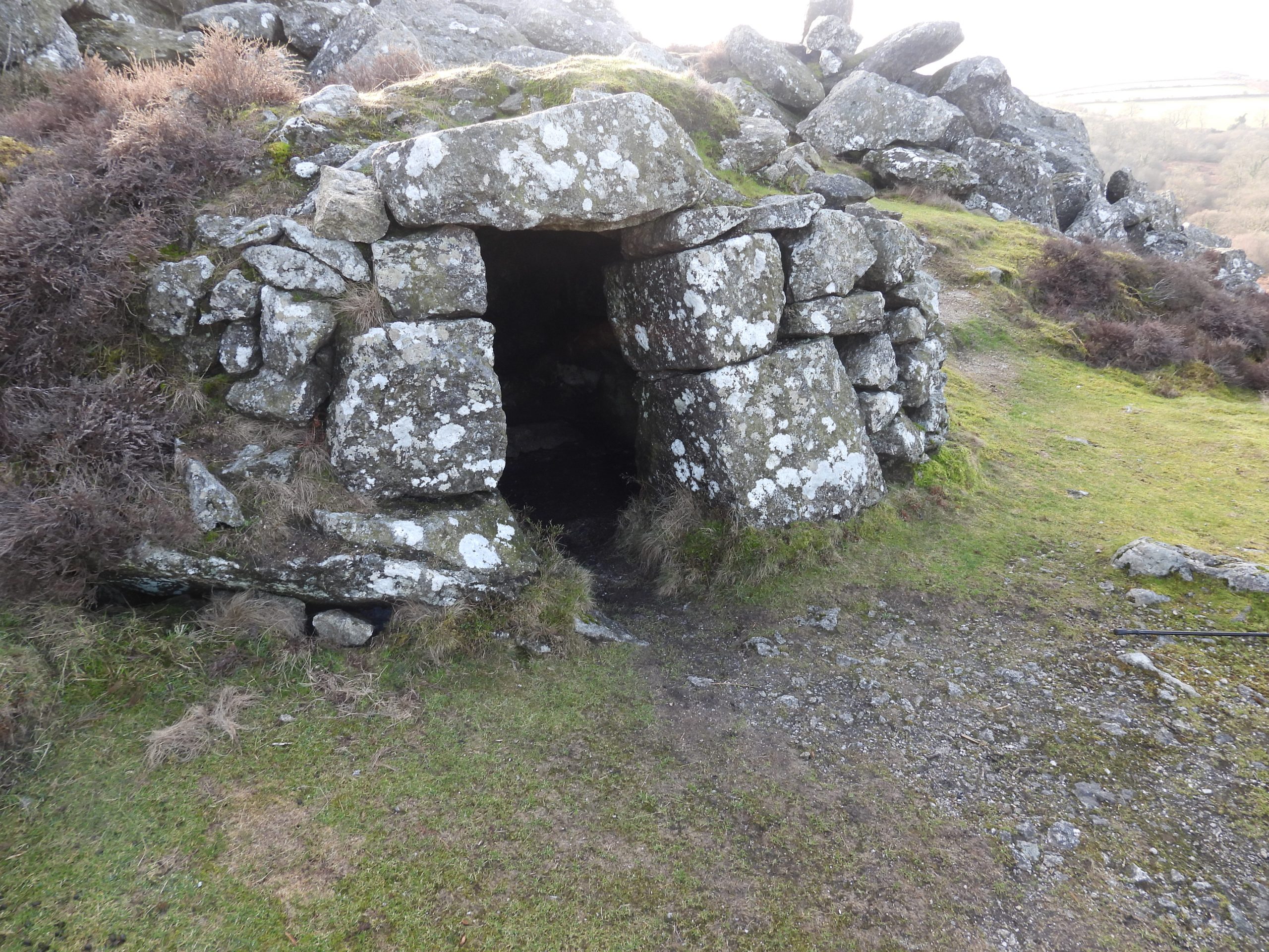
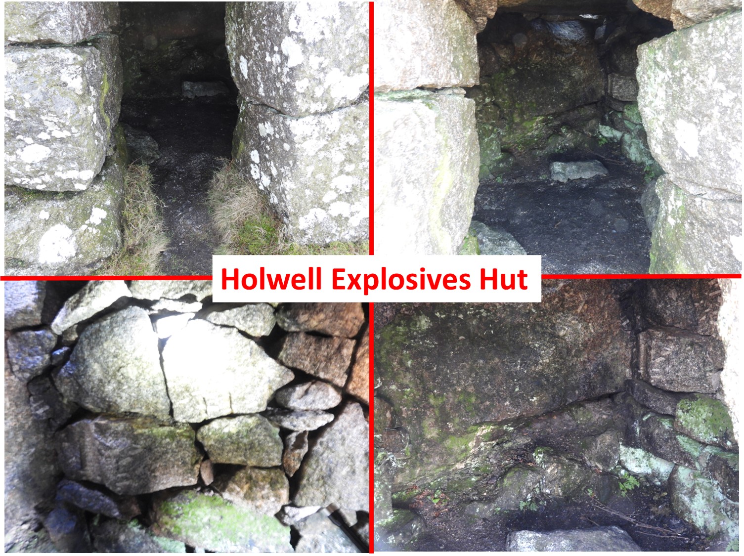
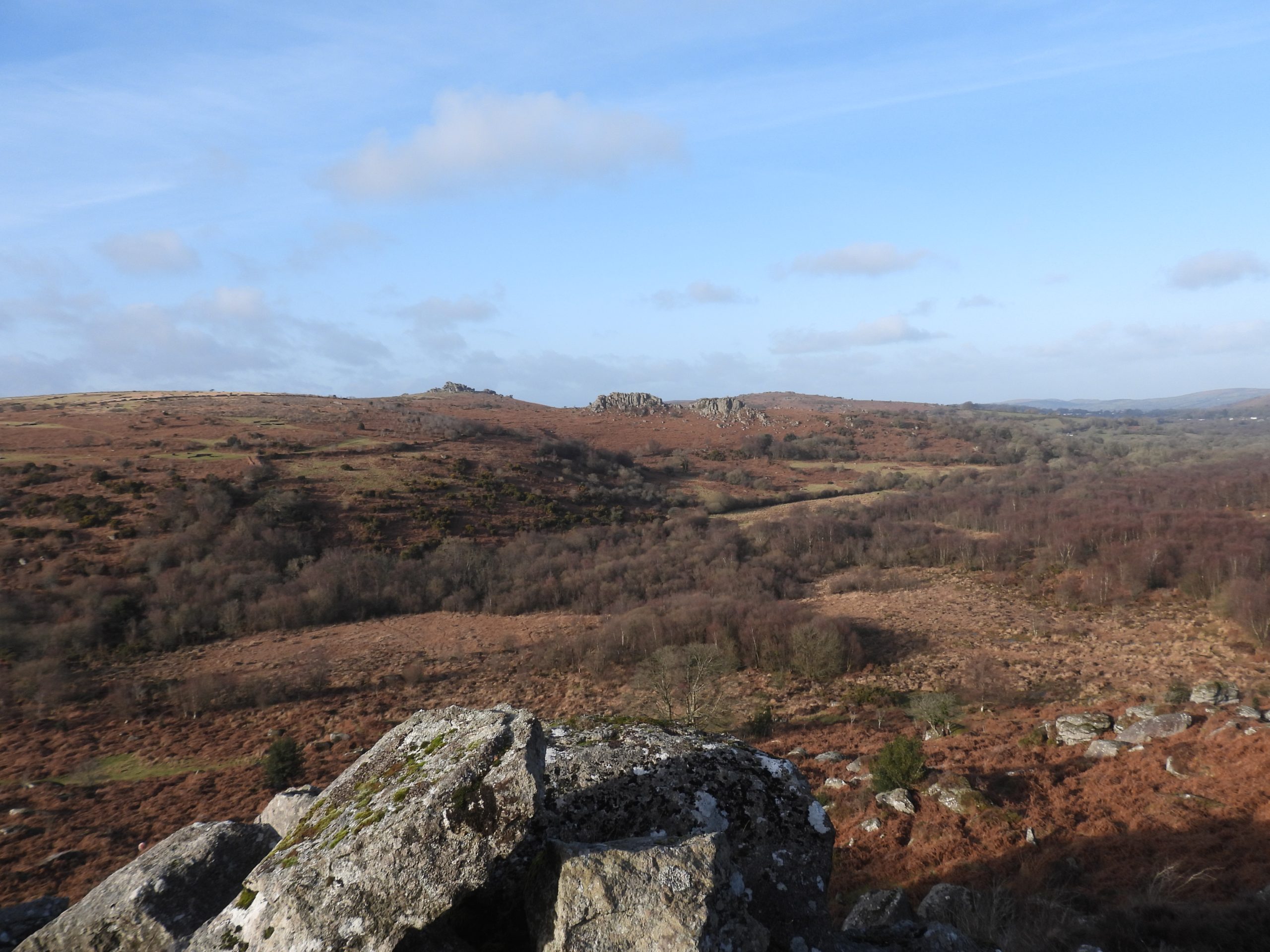
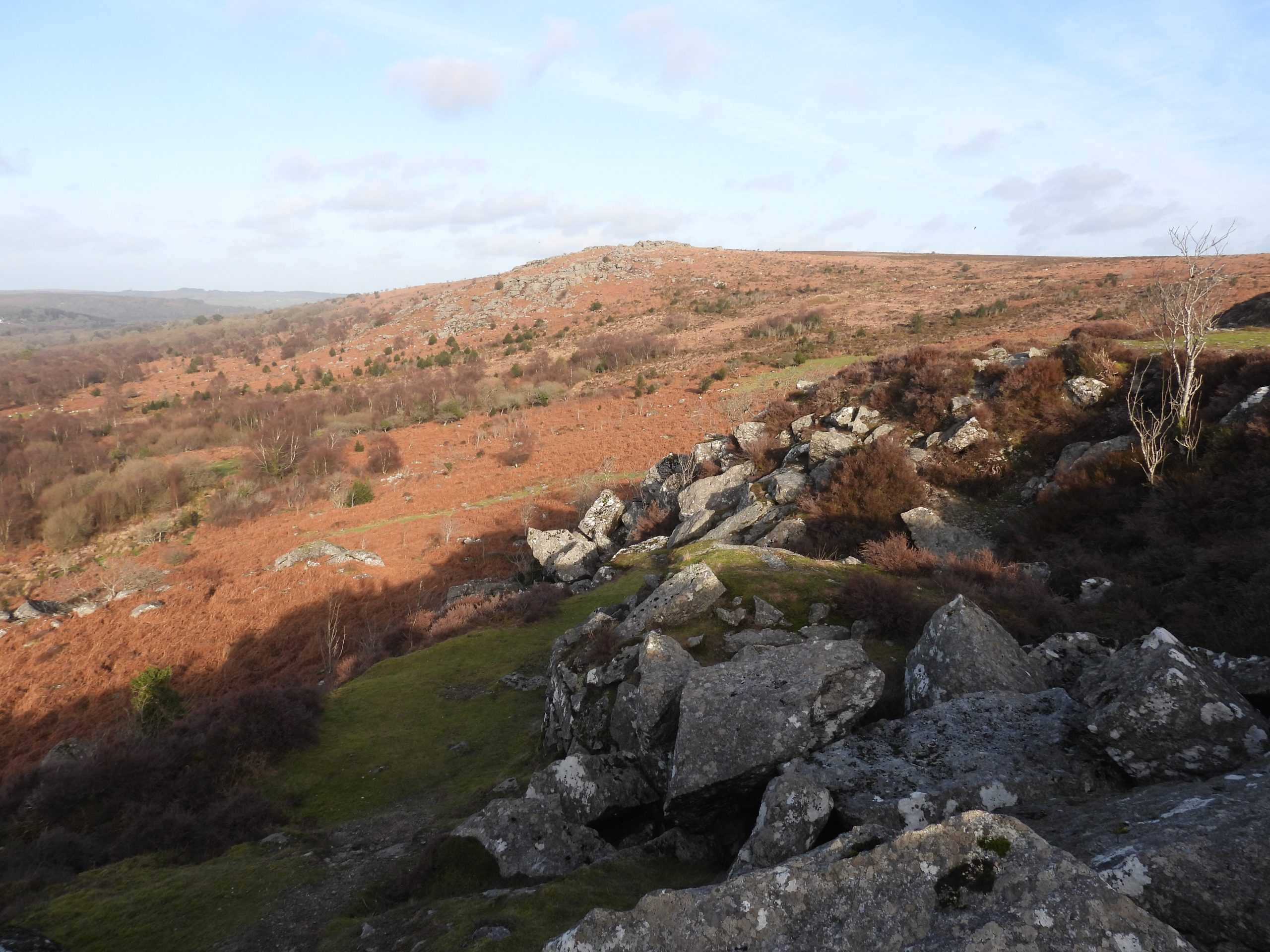
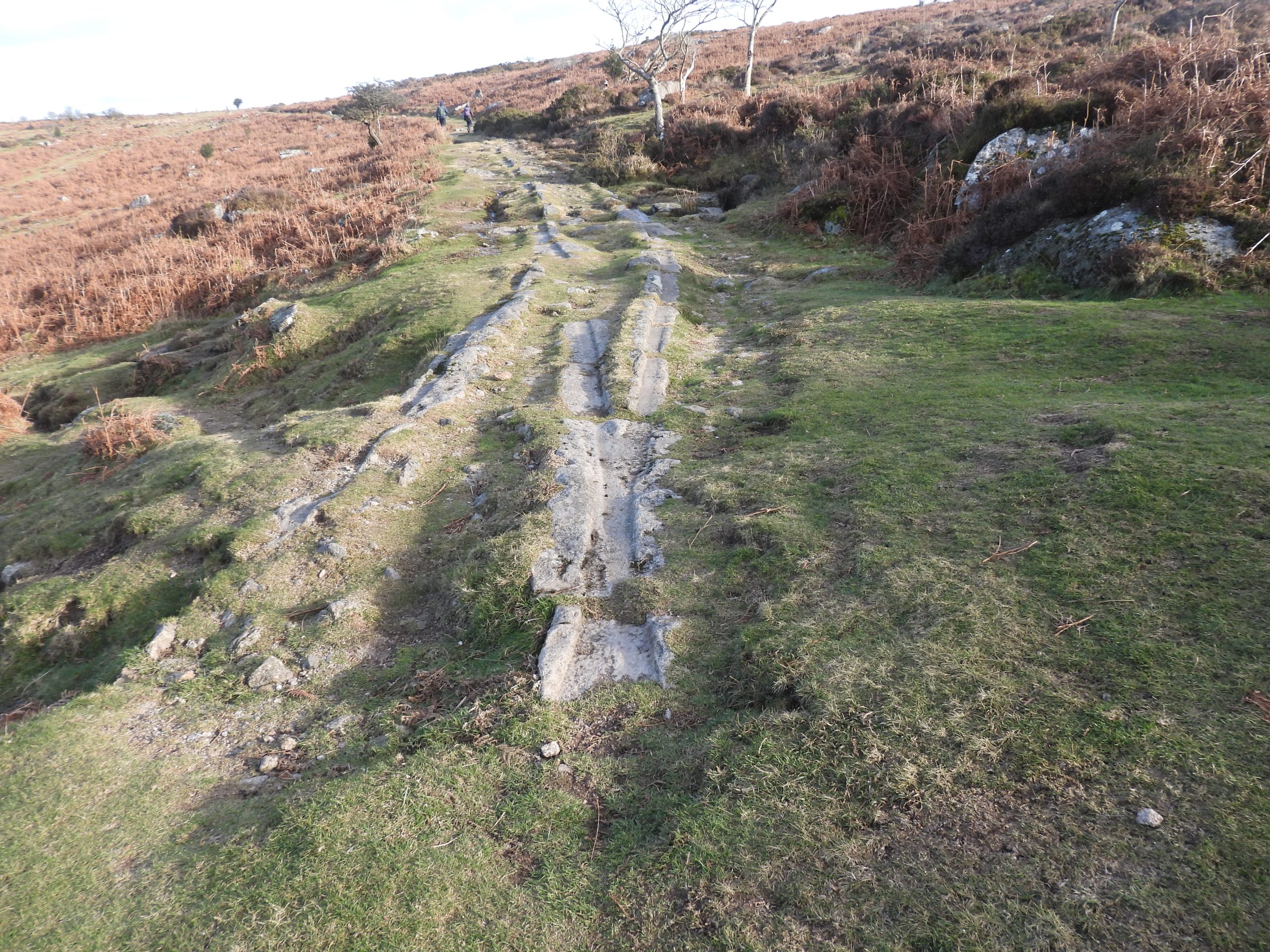
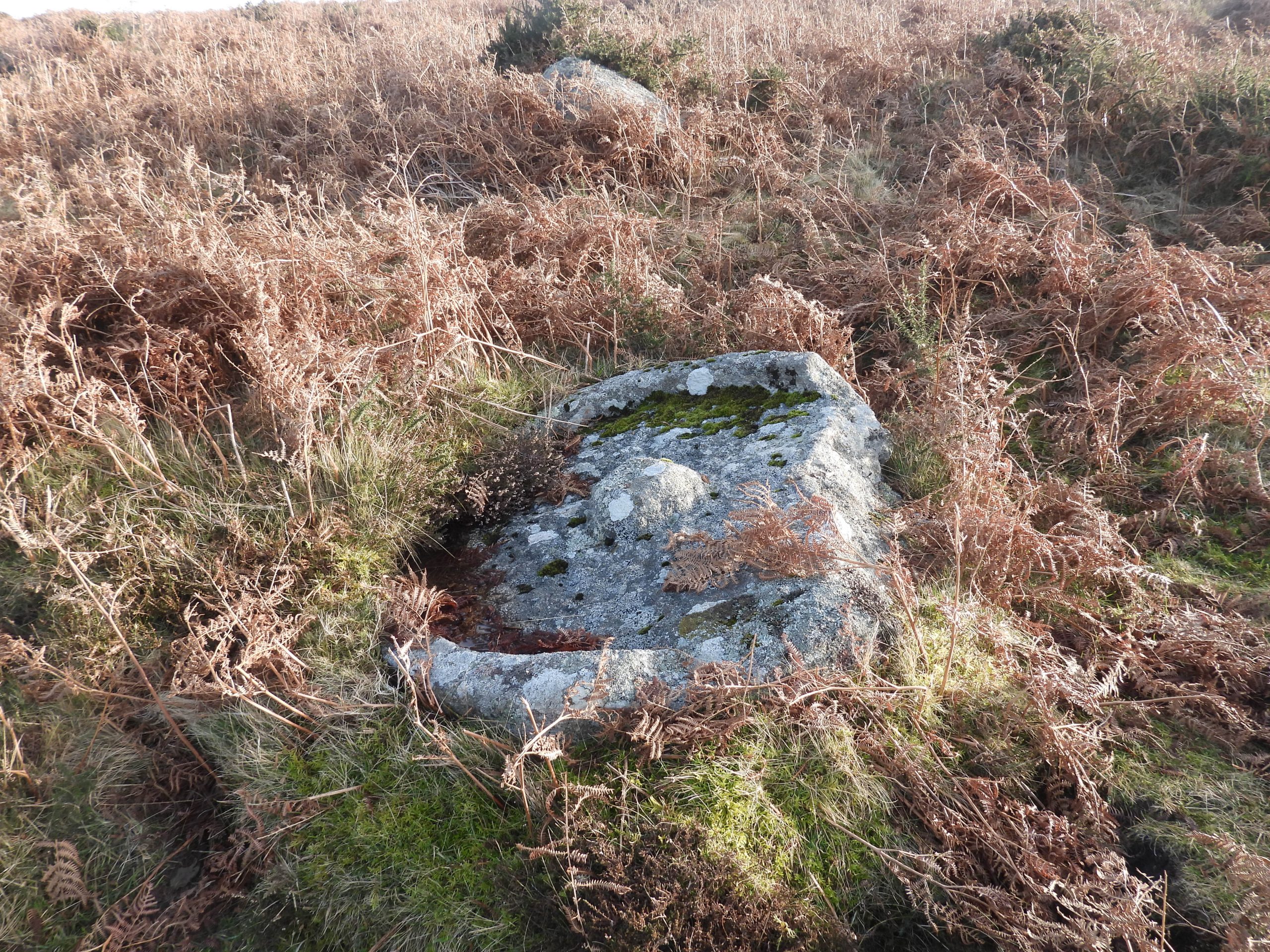
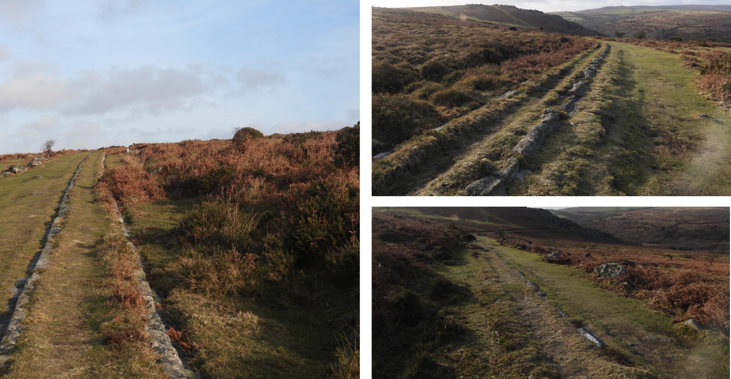
This sketch map has been developed using 19th century maps of the area and shows the key features covered in this post. The features include the quarries, the tramway, quarrymen ruined buildings and constructions, enclosures and a medieval settlement.This annotated 19th century map shows the five main quarry sites. The tramway between Haytor quarry, Holwell quarry and Rubble Heap quarry is easy to follow today. However, the tramway to Harrow Barrow (Emsworthy East) and Emsworthy West quarries is quite overgrown in parts and little more than a footpath in sections.The start of the exploration of the area. To the east of the Haytor main quarry are the remains of some buildings, a garden, and enclosure, which are alongside a conspicuous tree and gatepost. The apportionment for land owned by the Duke of Somerset lists field ‘1859’ as ‘Cottage and Garden with right of de-pasture on Haytor Down’. Field Number 1860 is listed as ‘Garden’.This gatepost (with hanger) can be found at SX76115 77448One of two buildings in the area, now totally demolished and survive only as slight rectangular earthworks. They are conjectured to be related to the quarry (1820-1858). The second building would be difficult to discern in the summer as it has been overgrown with bracken.Haytor Quarryis the largest and probably the most productive of the five major quarries in the ‘Haytor group’. There are two distinct quarried areas, a larger (older) one to the south west and a smaller (newer) one to the north east. The pictures show the entrance to the smaller of the two quarries. Access to this quarry was via a deeply cut narrow linear gully extending for 75m to the north-east.The smaller of the two Haytor quarries is believed to have been the newer of the two. This later quarry is around 0.1ha in area and approximately 8-10m. This quarry is labelled ‘b’ on the sketch map in this post.The author has labelled this newer quarry as a ‘secondary quarry’ by virtue of its size, compared with the main quarry. It is very overgrown and viewing it from above is difficult. For best views following the narrow gully to its entrance from the bottom is best. Some observers have stated that it is possible that the two quarries here were worked together for a period.Newest part of the granite tramway leading to Haytor quarries. This part leads to the east side (near the buildings and garden). Another view of the newest portion of granite tramway leading to the two extraction areas of Haytor quarry. The main (earlier) quarry consists of a deep pit, now flooded. The area is approximately 0.5ha, being enclosed on all sides by vertical working faces.Classic picture in the Haytor main quarry of the remains of a crane. It comprises an iron winch (aka mangle / windlass) and the broken boom of the derrick (to the right in picture), which is recumbent in the pond. The quarry is labelled ‘a’ on the sketch mapThe Haytor main quarry has two entrances. The southern of these (to the left and out of view in the picture) was probably in use first. The entrance is a wide corridor through a shallow granite cutting, opening out into the quarry area. The quarry faces (above water level) are all vertically worked with additional faces at a lower level penetrating the quarry floor. These latter faces now creating a permanently water filled pond in the quarry interior.The broken boom of the derrick. On the far side of the pond and to the right is the second quarry entrance. As recorded by Dr Phil Newman : “The second entrance is on the north-west corner and was clearly an afterthought as its steep-sided corridor cuts through the earlier heaps of overburden”.Close up of the top of the boom of the derrickStanchions were once the bases for tensioning cables. This would have safely secured crane(s) upright and are still visible within the quarry. They comprise of fixed iron pegs, with loose iron loops threaded through a holed. The pegs were inserted into ‘earth fast’ granite. Miscellaneous views of the main Haytor quarry. Note the two iron pegs in the left hand picture, which no doubt were used for tensioning of some description.Exiting the main Haytor quarry by the north west entrance the route of an old tramway (no granite rails) can be found. Note the granite waste (overburden).Following the old tramway in a northerly direction, the granite railed tramway can be found. The picture shows some ‘points’ where the tramway from the east side of the quarry (near the buildings / garden) joins.View of the tramway coming from the east side of the quarry. Note the granite waste ‘overburden’ and iconic twin granite bosses of Haytor (Hey Tor).More ‘points’ near the junction of the Haytor quarry tramway and that of the main tramway which leads to the other four quarried areas.Templer Way sign. This marks the start (or end) of a a defined 18 mile walk to Teignmouth. The two sections of tramway beyond the sign are from Haytor quarry (right) and from the other 4 quarries (left). The tramway was officially opened on 16th September 1820. There were bands, speeches and dancing (all at George Templer’s expense) which was chronicled in the Exeter Flying Post on 21st September. Near the tramway junction by the Templer sign are the remains of an old quarry workers cottage. This building is shown on parish Tithe Map of 1842 as’ cottage and garden’, owned by Duke of Somerset. The Quarry worker’s cottage, comprises platform 1, measuring 8 metres by 5.5 metres and an adjoining platform 2, measuring 5.5 metres by 3.1 metres (Source: Everett, 1988, Haytor Down)Platform 2 is centred at SX76161 77728Platform 1 is centred at SX76169 77730View of Haytor and the main Haytor quarry from platform 2 of the quarry workers cottage.View of Haytor and the main Haytor quarry looking across both platforms of the quarry workers cottage.The ‘points’ leading to Haytor quarry (left) and the other 4 quarries right. The ‘points’ would have had metal ‘cheek’ pieces deflecting truck wheels onto a desired line.The tramway granite rails are between 0.9m and 2.4m in length. There are several dozen discernible stone masons marks on rails, some of which are more discernible than others. This rail (or sett) appears to have a “B” or a “8” inscribed on it.This rail (or sett) appears to have a “15” or “51” inscribed on it.Other stonemasons marked interpreted by the author as “M” or “W”, “5” or “6”, “N” and “OL”. “M” or “W” markThese two inscriptions by the stonemason look like a “5” and an “r”.This benchmark (with rivet / bolt) most likely was inscribed and set in place after 1860 (ie when the tramway was closed). It is located at SX 76574 77655The gauge of the granite rails was 4 ft 3 in (or 1.3m). Unlike modern iron rails these shaped granite blocks allowed the running of wagons with plain wheels (ie without flanges). A very unique design.“P”, “+”, “TIB” and “17” as interpreted by the author.“HS”, “K”, “JT” and “R” as interpreted by the author.A tramway cutting (the only one) leading towards Holwell quarry, Rubble Heap quarry, Harrow Barrow quarry and Emsworthy West quarry. The same style granite rails were used on both straight sections as well as curves.Another stonemasons mark. Possibly another “8”.There are many ‘abandoned’ rails to be found along the tramway, such as the one shown in the above picture.Another set of ‘points’ on the tramway.Straight ahead section of tramway leads to Rubble Heap, Harrow Barrow and Emsworthy West quarries. The section to the right leads down to Holwell quarryStraight section with Hollwell Tor and quarry in view‘Points’ to nowhere.Cut Block at side of tramway.More ‘points’ leading to Rubble Heap quarry (left) and Harrow Barrow / Emsworthy West quarries (right).Waste tip (overburden) near the entrance to Rubble Heap quarryNear the entrance of Rubble Heap quarry with the ‘twin bosses’ of Haytor beyond.Narrow Access to Rubble Heap quarry is via a curved steep-sided cutting with a ‘V’ profile on the west side. A tramway, of which only a few granite sets remain visible, ran along the floor of this gully leading back to a junction with the main trunk 120m to the north of the quarry. The gully is barely 1m in parts, barely wide enough for trucks (source: Dr P. Newman).Rubble Heap quarry as viewed from the west.Inside Rubble Heap quarry. The working area on the left (SX75549 77305) looks like a possible site where setts were made (by virtue of the ‘stone chippings’ found). There is no positive reference to this by the ‘professional’ Dartmoor observers, however.Various views of Rubble Heap quarry. The working area of the quarry is around 0.15 ha. The near vertical granite quarry faces are approximately 10m deep. This quarry is labelled ‘c’ on the sketch map.Above Rubble Heap quarry looking west.A granite ‘point’ near the entrance to Rubble Heap quarry.Alongside the spoil to Rubble Heap quarry is what looks like a small enclosure. The author is unaware of what this enclosure was for but conjectures it might have been some sort of animal ‘pen’ It is located at SX75439 77362From Rubble Heap quarry, the tramway to Harrow Barrow is very overgrown and difficult to follow. Another view of the overgrown tramway leading from Rubble Heap quarry.Harrow Barrow quarry is also known as Emsworthy Rocks (East). Eric Hemery in his Dartmoor Railroads book (page 64) showed three parts (1-3) , which appears to be replicated on 19th century maps (see inset above). These are labelled ‘d’, ‘e’ and ‘f’ on the sketch map in this post. That said, in his article in the Dartmoor Magazine (Autumn 2020), Dr Phil Newman indicated there were 5 small quarries in the immediate locale (4 clustered together with one more 80 m away to the west). To add further confusion, there are some other observers (published on the internet) who appear to have named two of these quarries (1&2 on map above), Emsworthy Rocks (East) and Emsworthy Rocks (West), the latter which is actually 700m away to the north west.Harrow Barrow quarry tramway on north east side of Emsworthy Rocks.This small quarry is labelled ‘d’ on the first sketch map in this post and as number ‘1’ on the Eric Hemery and annotated 19th century maps.This part of Harrow Barrow quarry (labelled ‘d’ and ‘1’ on the various sketches / pictures in this post) is located at SX75324 76906. View from the top of the Hemery ‘1’ quarry (sketch map label ‘d’) looking northThere is evidence of very small granite extraction, near the summit of Emsworthy Rocks (east), which can be found between the Hemery quarries ‘1’ and ‘2’ (labelled ‘d’ and ‘e’ on sketch map). The author believes this area is shown by Dr P. Newman in his Dartmoor Magazine article (Autumn 2020) as the 4th (of 4) clustered together. This area is located at SX75275 76868This small quarry is labelled ‘e’ on the first sketch map in this post and as number ‘2’ on the Eric Hemery and annotated 19th century maps. This quarry is noted by its small pool, which is also shown on 19th century maps.This part of Harrow Barrow quarry (labelled ‘e’ and ‘2’ on the various sketches / pictures in this post) is located at SX 75223 76845.This small quarry is labelled ‘f’ on the first sketch map in this post and as number ‘3’ on the Eric Hemery and annotated 19th century maps. This part of Harrow Barrow quarry (labelled ‘f’ and ‘3’ on the various sketches / pictures in this post) is located atSX75236 76933The tramway entrance to the Hemery quarry ‘3’ (or ‘f’ on sketch map). There are a range of ruined buildings with a derelict enclosure sited to the north-west of the Harrow Barrow quarry.The primary building sits on an artificial level terrace. There are some building remains which are incorporated into the western enclosure wall. It has a measurement of 16 metres by 5.0 metres. This building is located at SX75175 76944The two buildings on site have an associated enclosure of 0.5 hectares in area,Moving in a westerly direction another quarry (in two parts) can be found around the western section of Emsworthy Rocks.This part of Emsworthy Rocks (West) is labelled ‘g’ on the sketch map in this post.Emsworthy Rocks (West) – labelled ‘g’, is located at SX74901 76999. The tramway can be discerned at the base of this quarryEmsworthy Rocks (West) tramway. An old granite rail (sett) can be seen in the photograph. From this point a lovely view looking north to Holwell Tor can be had.A little further west, there is a second quarry (labelled ‘h’ on sketch map), which forms part of Emsworthy Rocks (West) quarry. Next to the quarry is this circular stone-built structure measures 3.5m diameter by 0.9m high, with one side collapsed. It is believed this is likely to have been the base for a crane, used for loading large blocks onto the tramway wagons. It is located at SX74837 76984Various views of the second part of the Emsworthy Rocks (West) quarry. The area is very overgrown and doesn’t appear to be visited on a regular basis. Dr Phil Newman records that the heap here “….has traces of a tramway on its top surface suggesting further development at the site was anticipated but never realised”.Along a faint path leading from Emsworthy Rocks (West) quarry, evidence of the granite tramway can be found. More evidence of the granite tramway leading from Emsworthy Rocks (West). Haytor rocks can be seen in the background.This building can be found near the granite tramway near to Holwell Tor. The structure is sited on a level stance and measures very approximately 15.4m by 5.5m. It has been recorded by some as a longhouse but by Jeremy Butler, (1991) in Dartmoor Atlas of Antiquities: Volume One – The East, as probably associated with the quarry activity. Dr Phil Newman agrees with Jeremy Butler citing that the building relates to the quarrying activities between 1820 and 1860. Butler records that ‘although the interior is filled with tumble, internal cross partitions are visible, giving the building four compartments’.View of Haytor from near the quarryman’s building.View from near summit of Holwell Tor towards Hound Tor and Grea Tor Rocks (amongst other summits).Descending the slope to the tramway leading to Holwell Tor quarry, a probable Medieval settlement comprising three possible buildings, can be found. Jeremy Butler, (1991) in Dartmoor Atlas of Antiquities: Volume One – The East, records that little trace of the first settlement (bronze age) remains here. He states that: “The granite tramway and shallow tinner’s pits encroach on the site. Most of the damage has been caused by the Medieval occupation of the site”. The above building is located at SX75294 77615. The granite tramway to Holwell Tor quarry can be discerned in the picture.The above building is located at SX75292 77641. Onto the granite tramway leading to Holwell Tor quarry.There are 5 ruined buildings associated with Holwell Tor quarry. The first building is located on the left (south) side of the granite tramway and is believed to have once been an office. There is a crude benchmark located on the north – east corner. The building is located at SX75209 77715. A short distance down the track from the first building, a second much smaller building can be found. Its former use is unknown.The second building is located at SX75191 77726Just passed the second building, the first view of the main Holwell Tor quarry can be had. It is identified at ‘i’ on the sketch map.This flat feature in the main quarry looks like a crane base but the author has yet to find any reference to it.This feature (crance base) is located at SX75141 77750A third building is located next to the main quarry.This open-fronted structure inside the quarry is conjectured to have been associated with the working of stone, possibly stone dressing. Alternatively is may have been a workshop for servicing machinery and tools. It is located at SX75125 77754Curious sheep at top of quarry.Worked stone in the main quarry.Holwell Tor quarry is the second largest of all the Haytor quarries. Most of the granite has been exploited from the large granite outcrop on the north face of Holwell Tor. It is recorded that this quarry was active in 1820, as it is specifically mentioned in association with the opening of the tramway. (Ref: Newman).The main rock face has a very large crack in it. The quarry appears on prints of 1825 and 1829 as a busy working quarry. The rock faces here are over 20m high.The quarry looking east.From the main Holwell Tor quarry, the granite tramway continues west. A continuation of the tramway around the contour of the tor.The termination point of the tramway.The secondary quarry at Holwell Tor. The circular feature in the foreground may well be another crane base.A fourth building can be found at SX75028 77742Just below the tramway between granite spoil tips is a fifth building. It may have been a quarryman’s hut but it is very small. One of the common beliefs is that this could have been an explosive store. It is located at SX 75076 77791The inner roof is constructed from two massive slabs designed to contain the blast in the event of an accidental detonation.Views from near the Holwell Tor ‘secondary’ quarry looking north east across the Becka Brook to Greator Rocks and Hound Tor.Views from near the Holwell Tor ‘secondary’ quarry looking north across some spoil tips towards Smallacombe Rocks.Leaving Holwell Tor quarry area, some ‘points’ are located and were probably provided as a passing place. Adjacent to the granite tramway is an abandoned (broken) apple crusher. Its location is SX75510 77718The tramway leading down to Holwell Tor quarry is quite steep. A poem written by Thomas Taverner (a sailor) reveals: “Nineteen stout horses it was known, From Holwell Quarry drew the stone, And mounted on twelve-wheeled car ‘Twas safely brought from Holwell Tor”