A collection of walks, discoveries, insights and pictures of exploring Dartmoor National Park
April 27, 2023
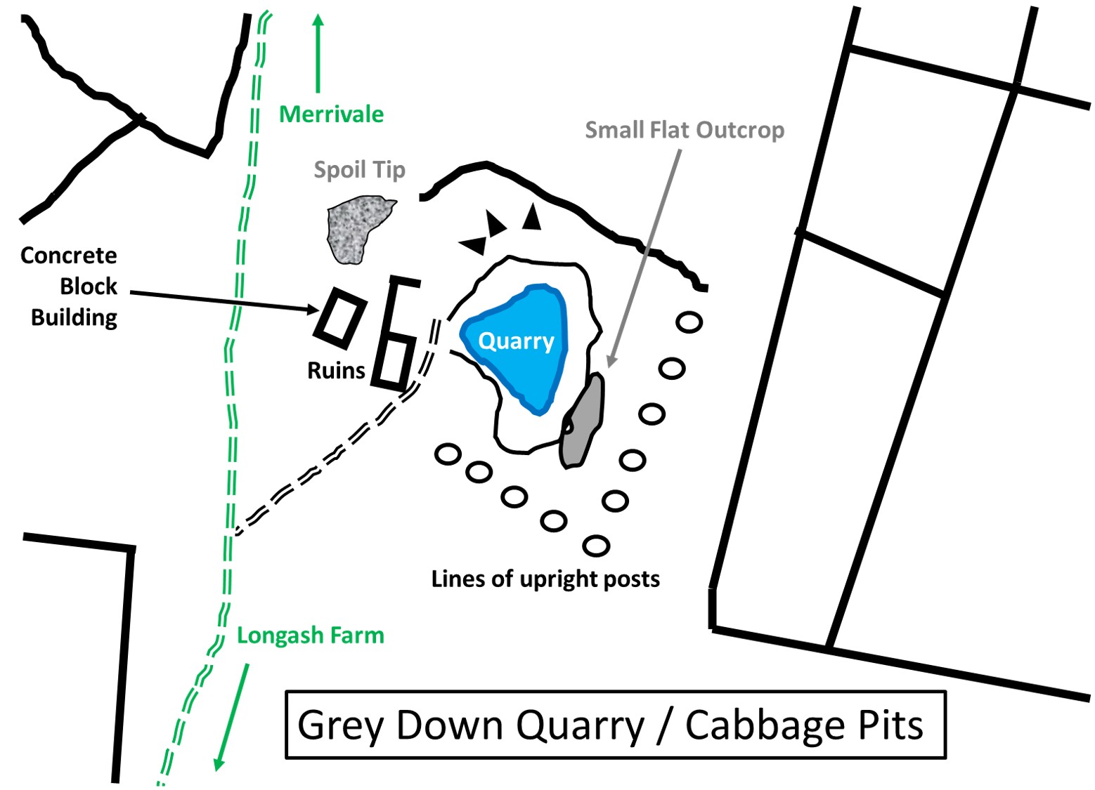
Grey Down Quarry (aka Grey Dawn or Cabbage Pits)
To the east of the track between Merrivale Bridge and Long Ash Farm above the Walkham Valley is a small quarry, which opened in the mid 1930’s to produce setts and kerbstones. The quarry doesn’t appear on OS 1:25,000 1937-61 map but does appear on OS 1:10,000 1949-72 map, so is assumed to have begun operations some time after 1937. The author has found little information about the quarry apart from it being known as ‘Grey Down’ (ref: Legendary Dartmoor Gazetteer) or ‘Cabbage Pits’ (ref: Phil Newman, via Dartmoor Information Exchange facebook page, who cites this name being given to him by Roy Hext, the son of a quarry worker who once lived at Mis Tor Cottage). Simon Dell, MBE has suggested it might also have been known as Grey Dawn in the publication Dartmoor Sett Makers’ Bankers (An industrial mystery solved?)
The close proximity of its ‘big brother’, Merrivale quarry (previously Tor quarry), begs the question whether the two were part of the same company. That said, the track leading from the quarry, north towards Merrivale Bridge isn’t that wide or appear to have been especially enlarged of modified maybe suggesting this was a very minor operation. There are a few features around the quarry, which are of interest and certainly ask questions as to the history and the full story behind the operation.
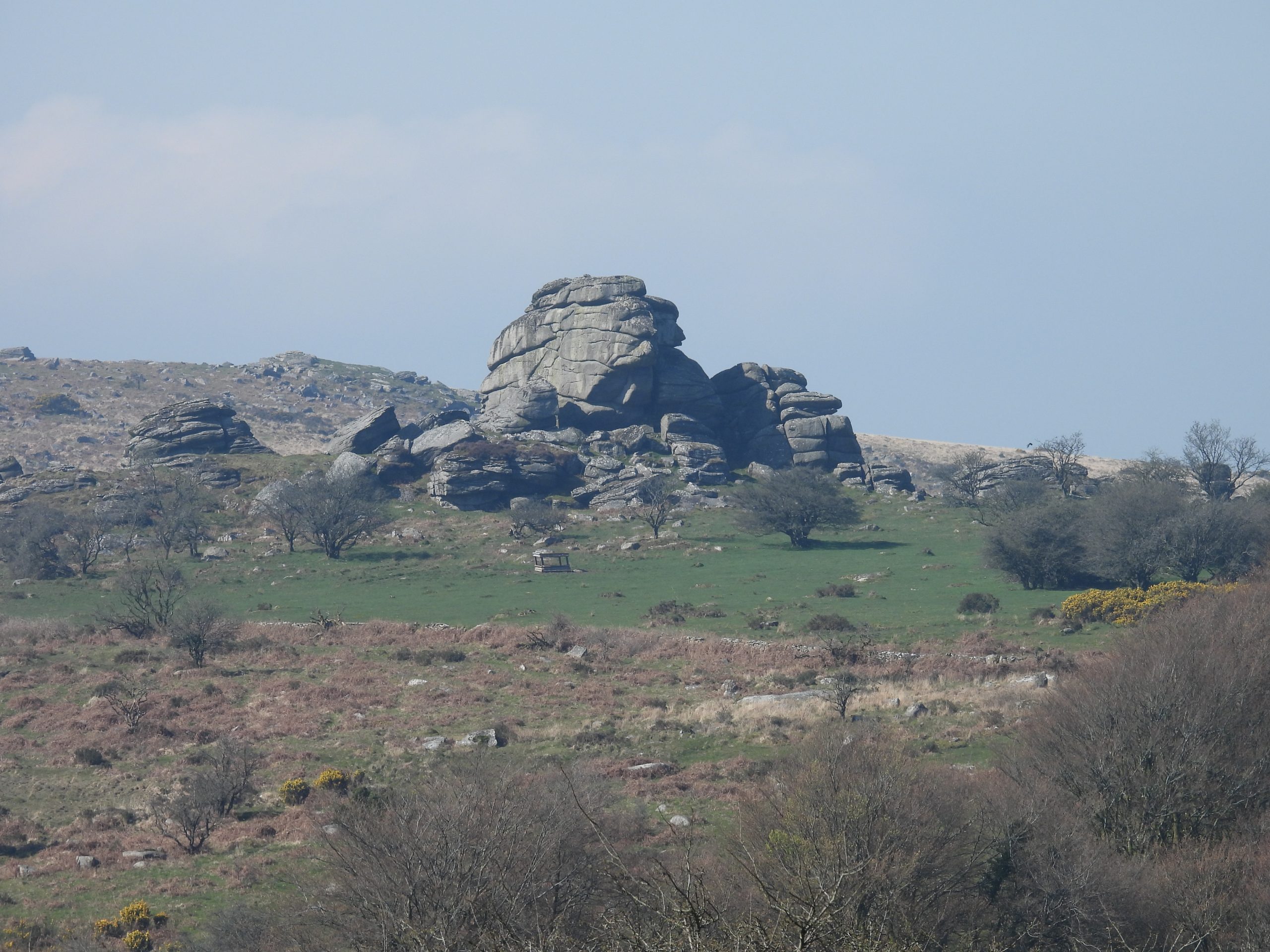
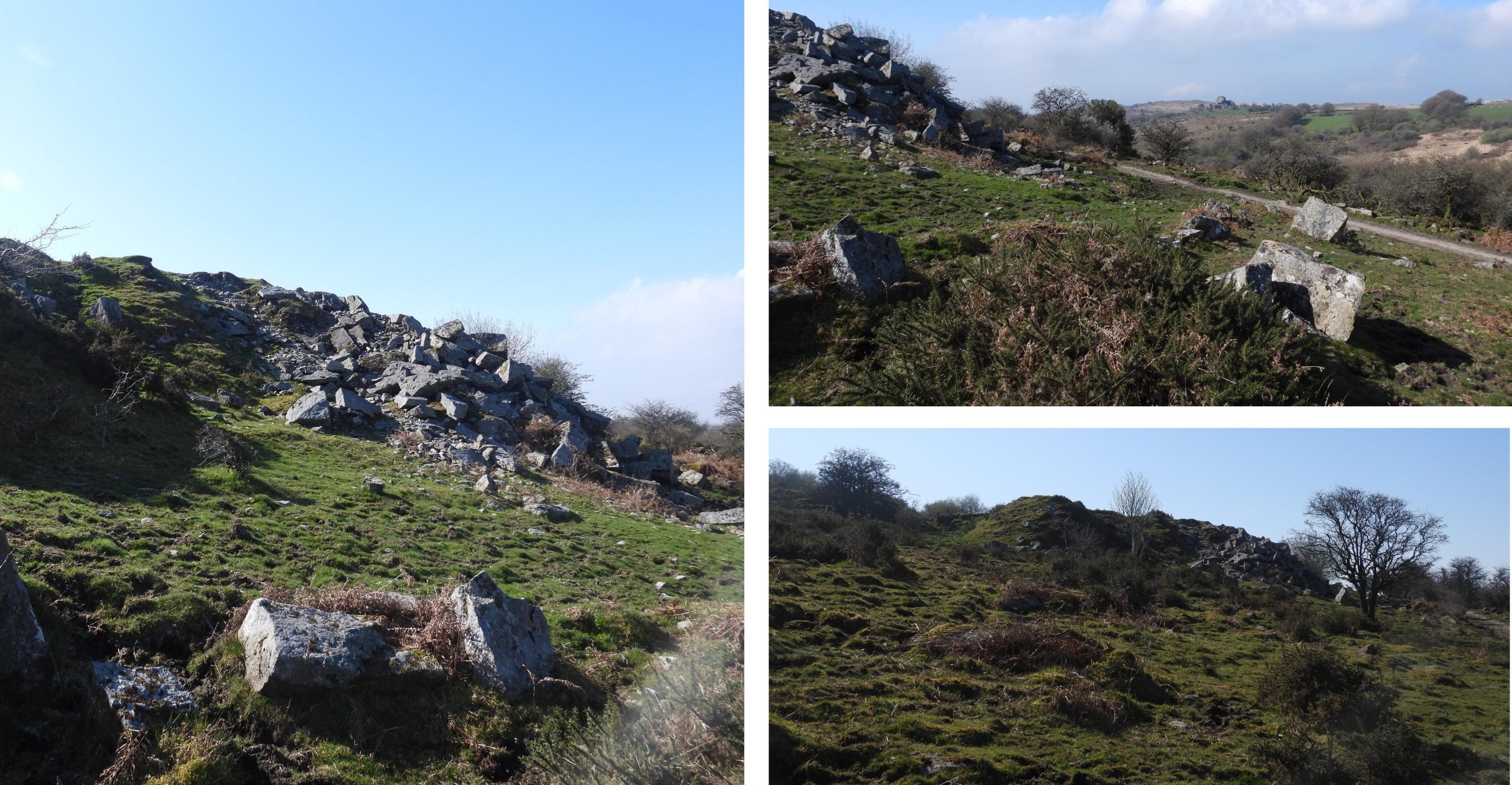
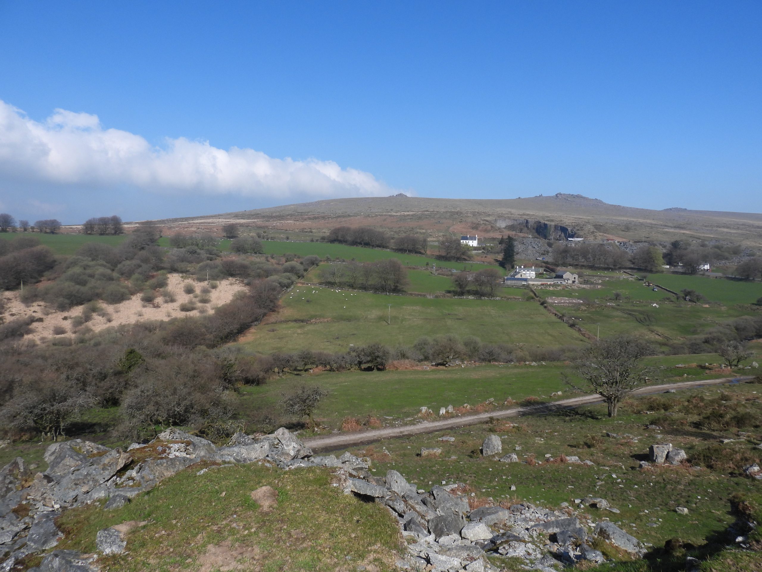
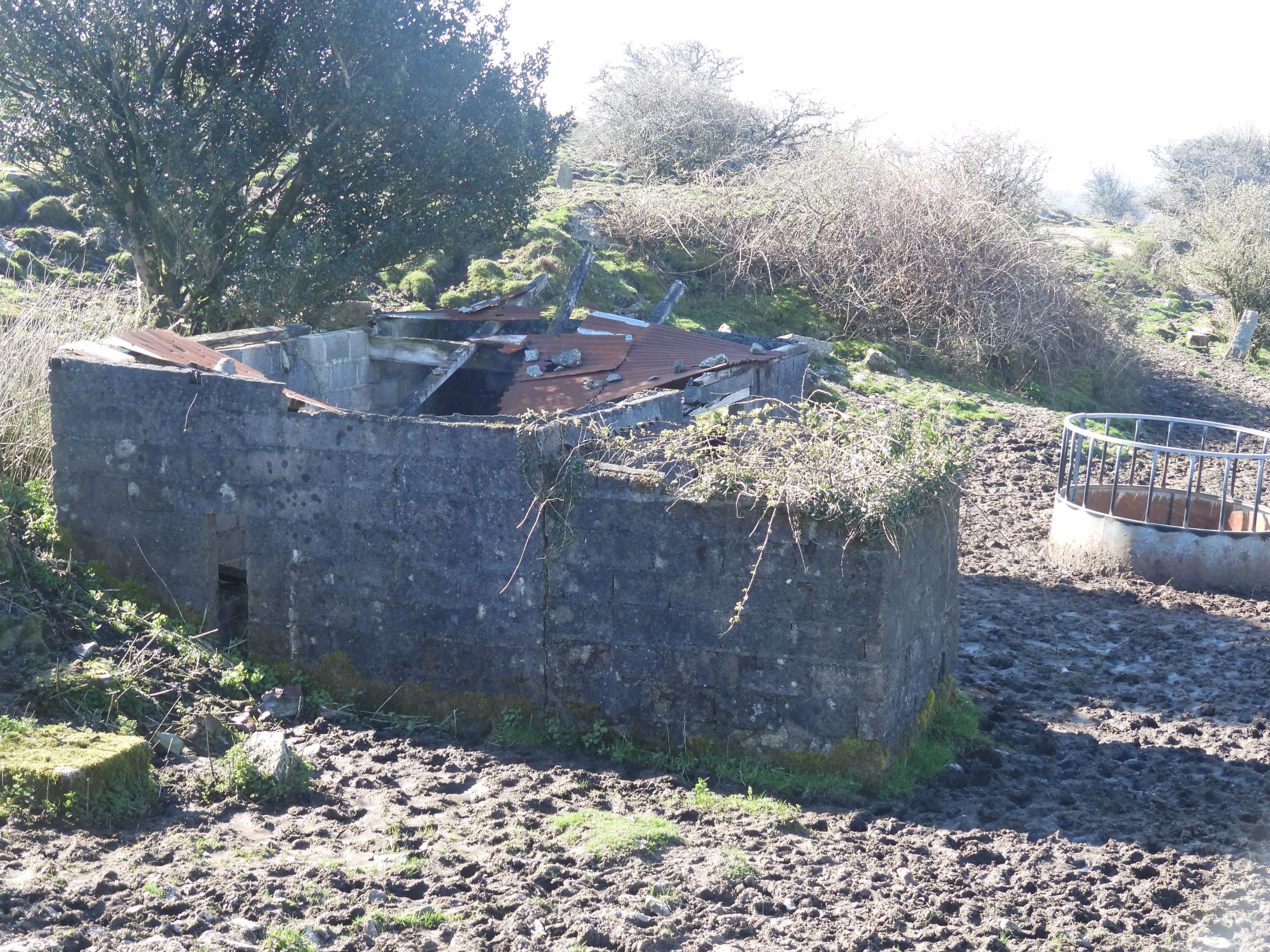
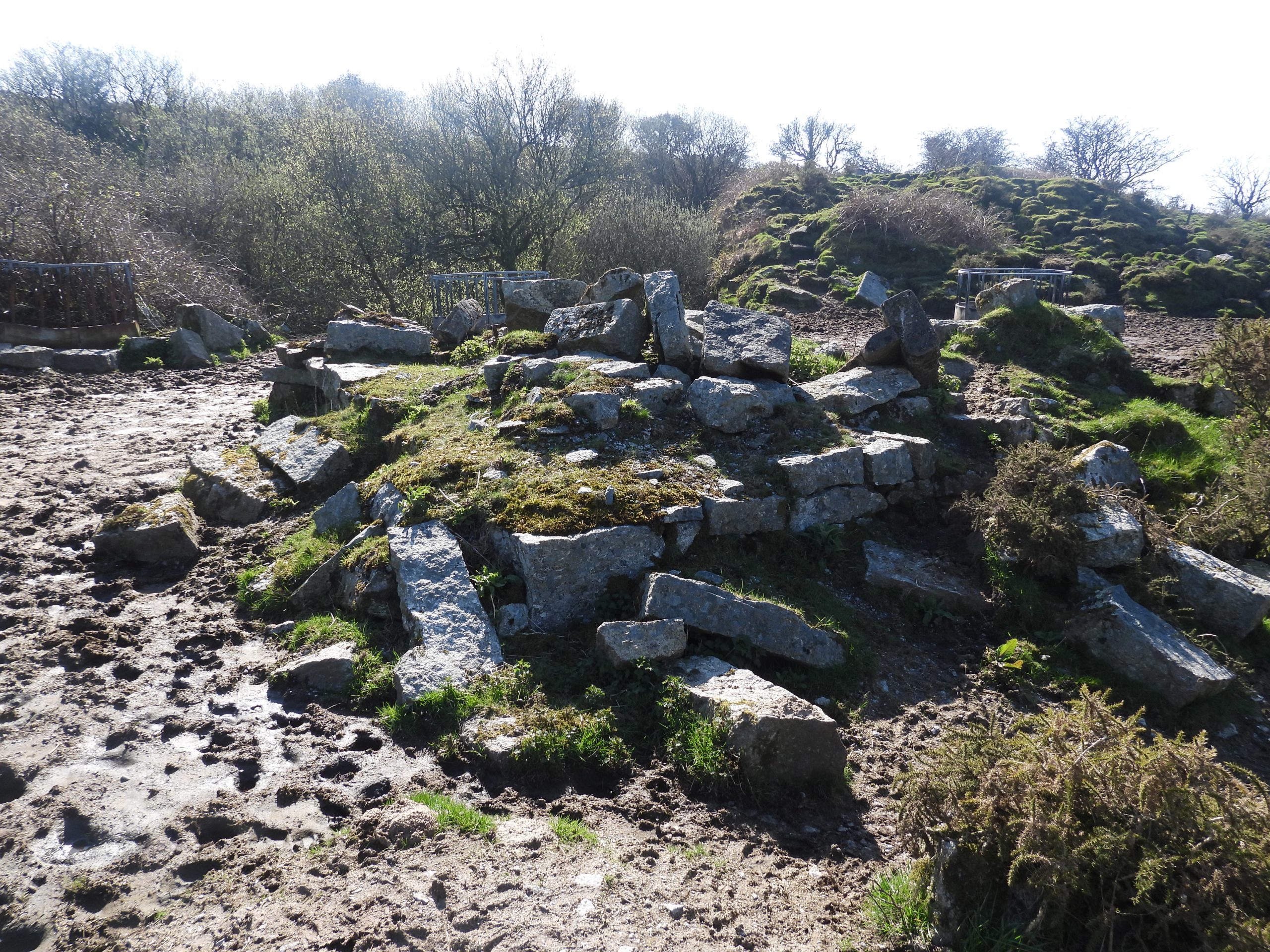
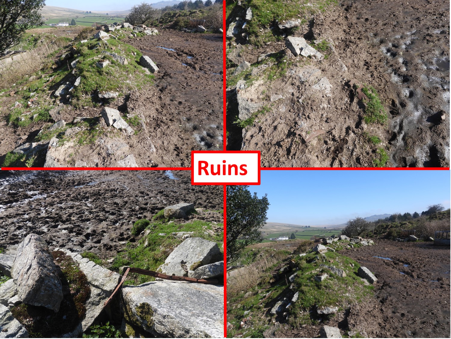
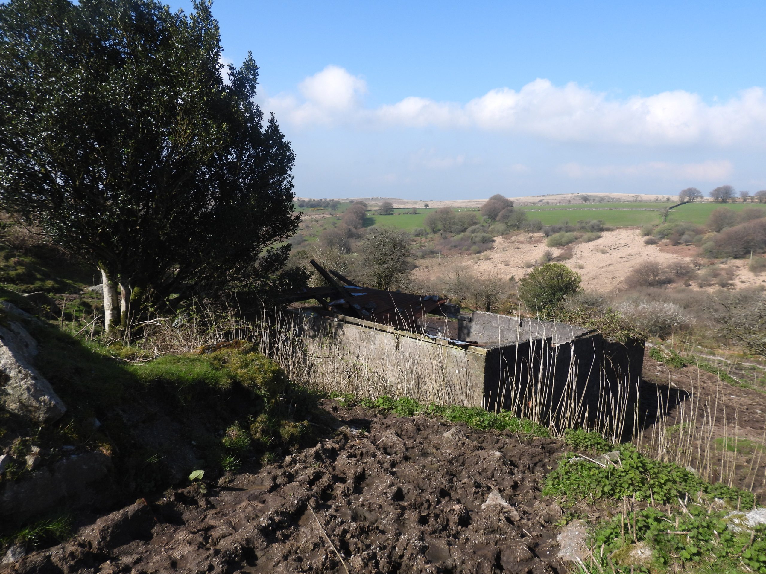
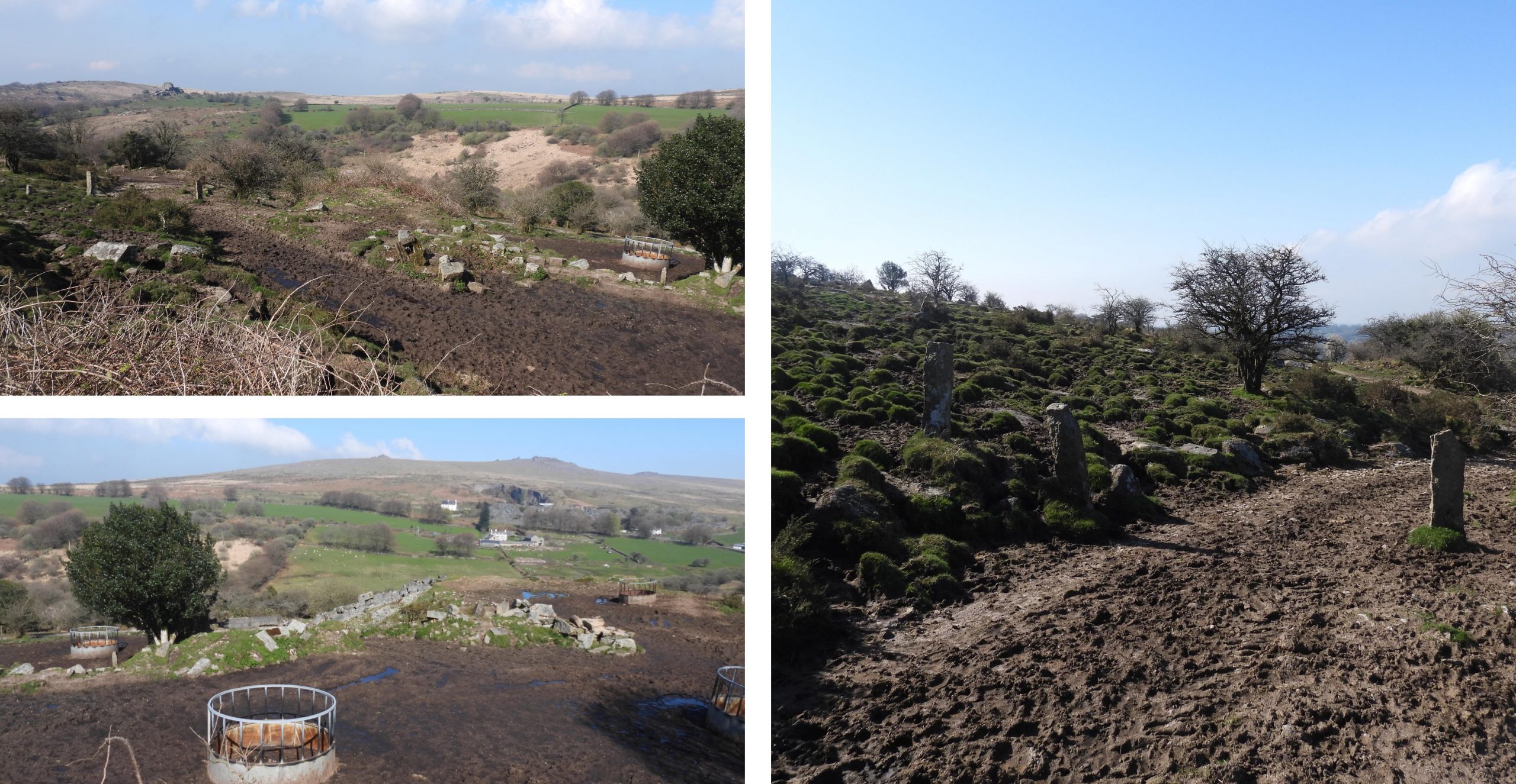
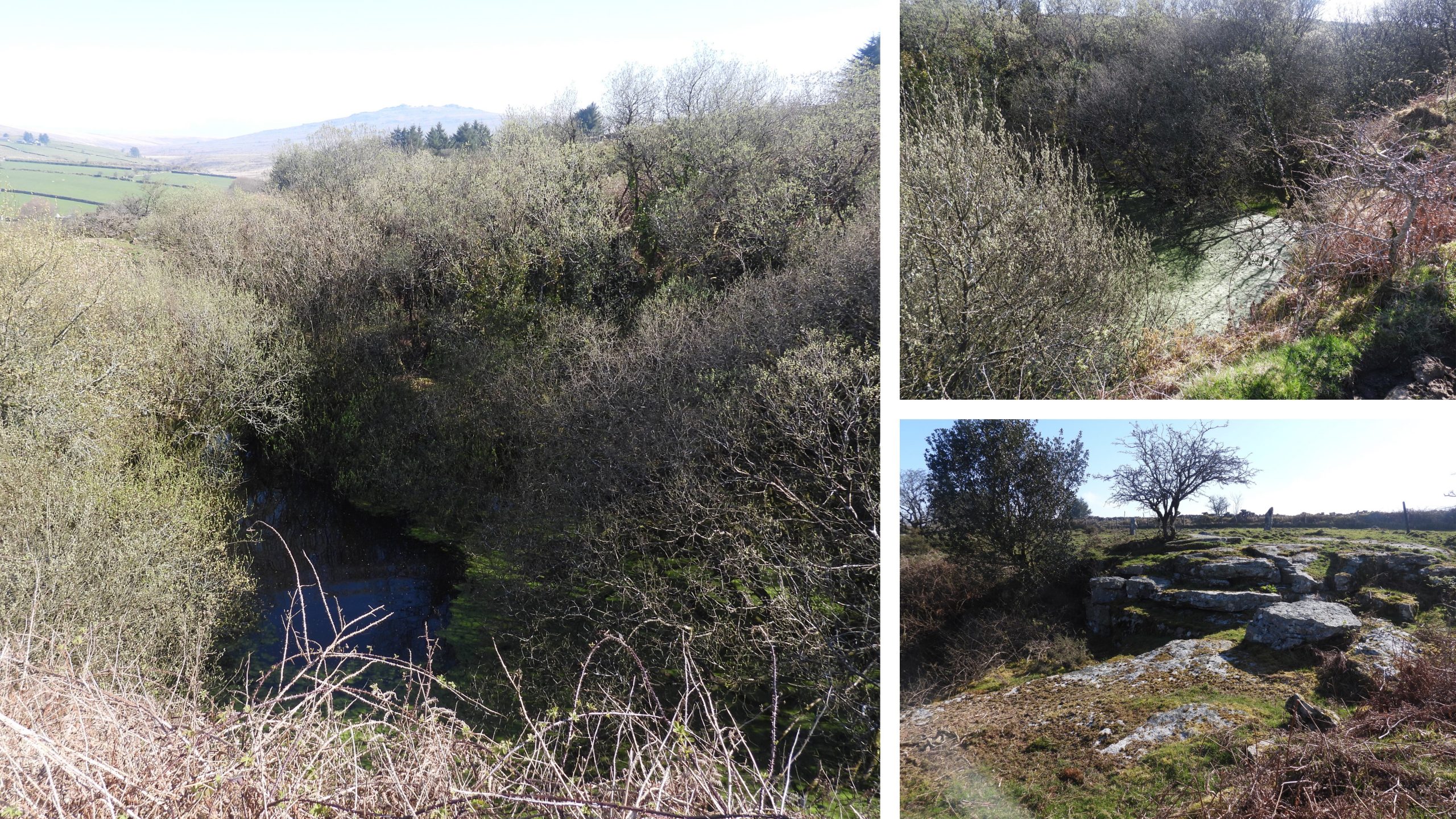
Sketch map of the quarry showing the main features found by the author.Leaving Merrivale (via the track through Hillside Farm), there are striking views across the Walkham Valley, including Vixen Tor to the south west.Approaching the quarry from the north west, the soil tip is the first feature which is encountered. There are a couple of large blocks (in the foreground in the left hand and top right hand pictures), which appear to help define a small track which borders the north side of the quarry.View from the top of the spoil, looking north west to the ‘big brother’ Merrivale quarry. On the ridgeline are the Staple Tors and Roos Tor.This rather dilapidated block building is below the main quarry. The building appears on the OS 1949-72 map but not the OS 1937-61, so is assumed dates to when the quarry started operations. Today, there are a number of cattle feeders and the ground is rather churned up. The setts and kerbstones may well have been manufactured here.At the same level as the quarry are the remains of another structure (marked as ‘ruins’ on the sketch map). This portion looks like a platform of some description.Within the ‘Ruins” are some tare / feathered rocks and some metal. The ‘Ruins’ are several 10’s of metres long and slightly curved. The reason behind this structure is not known, although it is probable, it is within the structure the setts and kerbstones were manufactured. That said, on Dartefacts it is (or at least part of it) is called a chimney. The author is intrigued by this classification and would welcome to know how this designation came about. A view of the block building from the ‘ruins’General views if the main track leading into the area in front of the quarry.The quarry is very overgrown. It is flooded and impossible to explore from within. Of interest is what the area would have looked like before the quarry as there is a small flattish outcrop on the top (east) of the quarry.
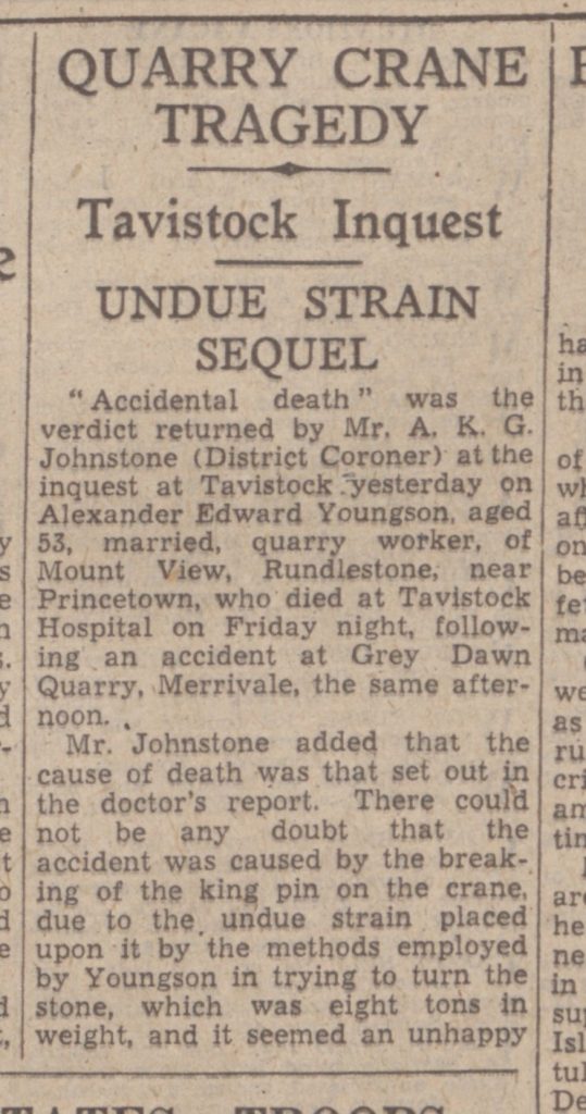
This newspaper article records an unfortunate fatal accident which occurred at the quarry in 1944. Note the name of the quarry was recorded as ‘Grey Dawn’
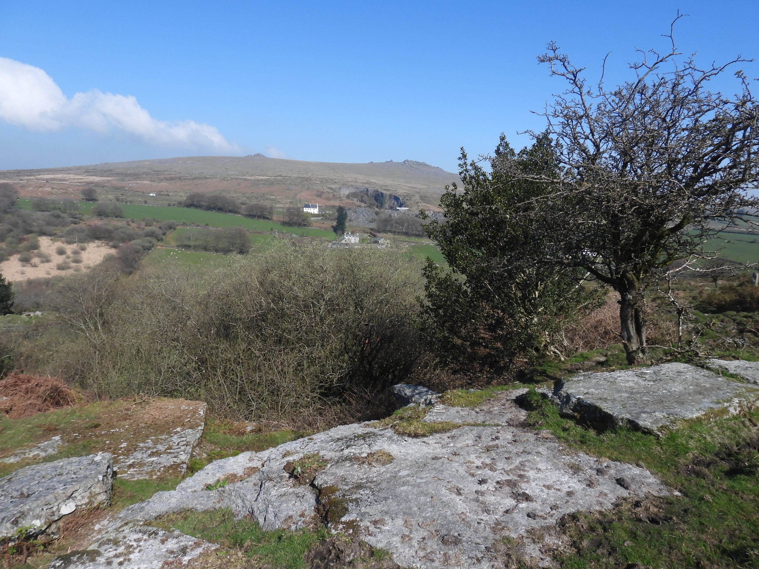
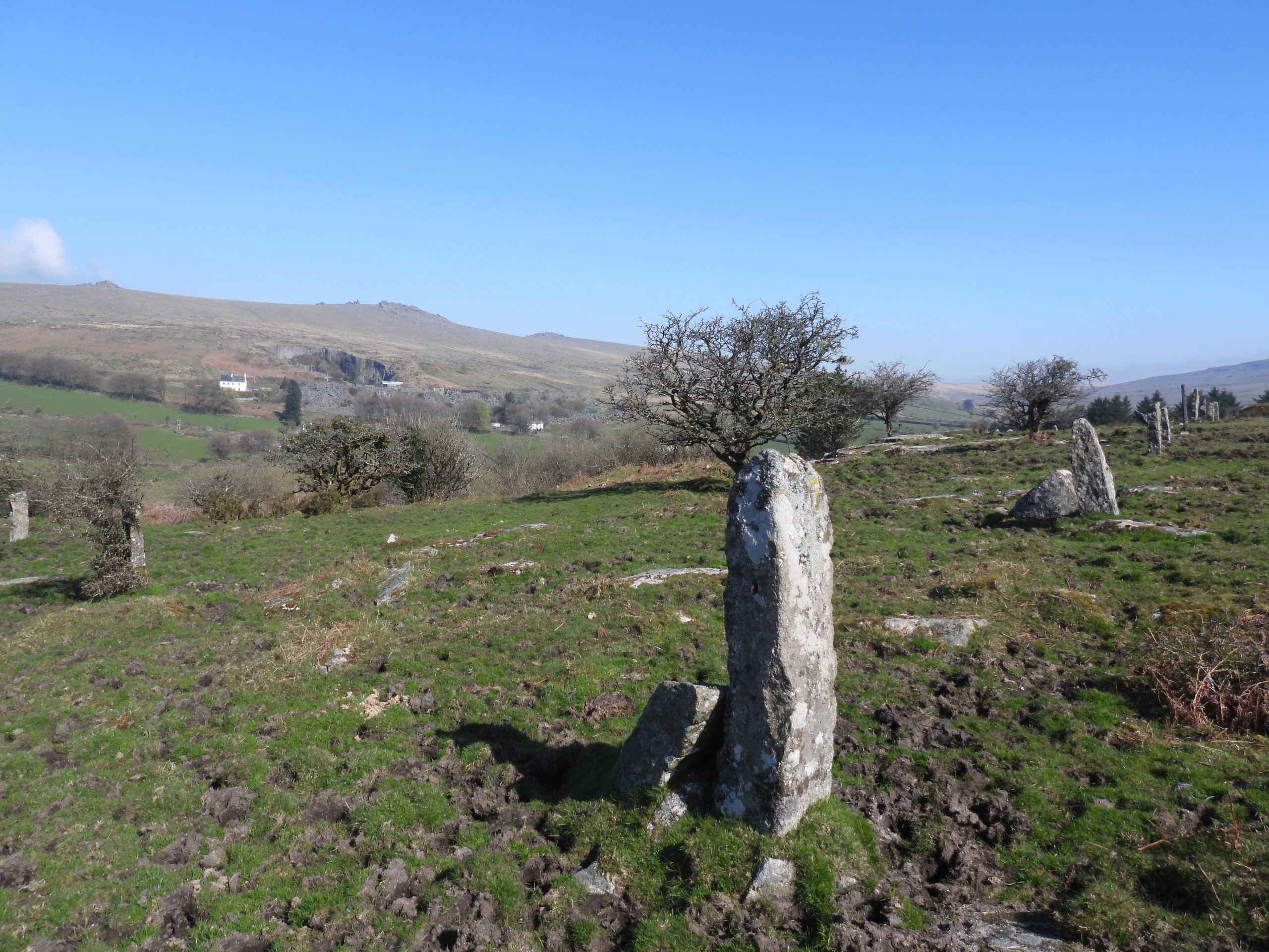
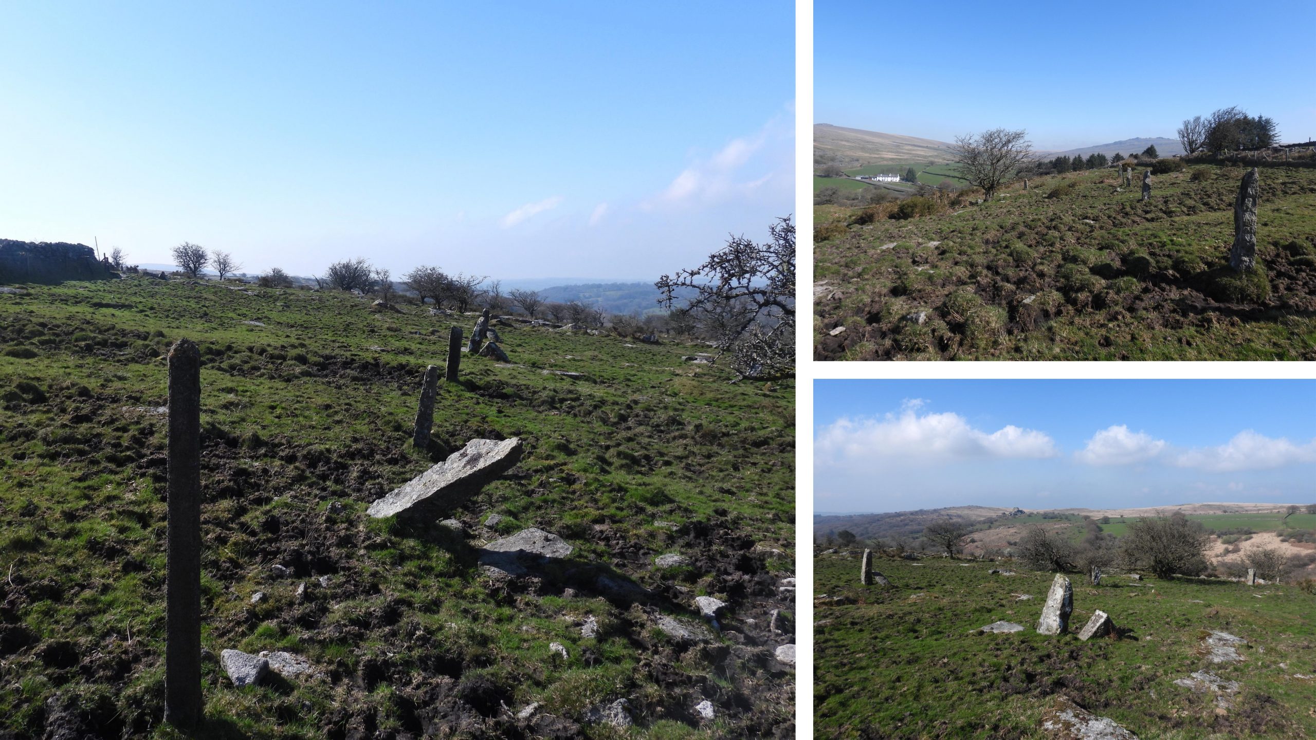
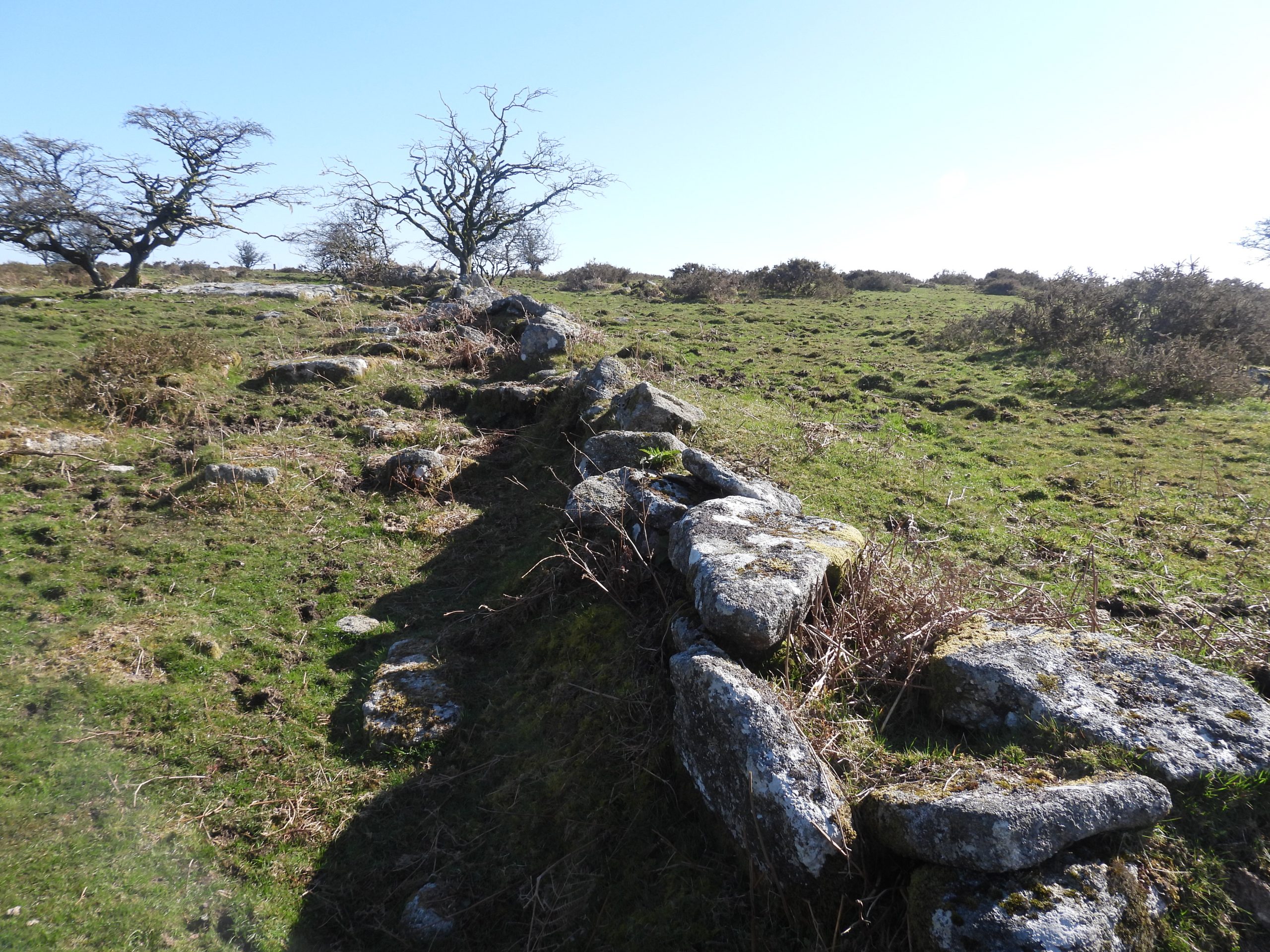
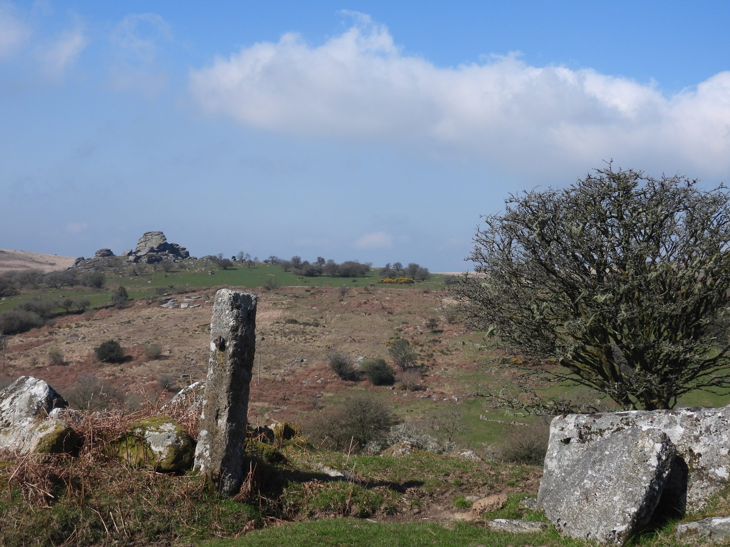
These slabs are at the top of the quarry. Was there ever a tor here ? Perhaps Grey Down Tor, was once here or was the rock just quarried from the side of a hillside like Merrivale quarry.Above and to the south of the quarry are a line of granite uprights, which almost certainly were used to mark the extent of the sett. Of course, they might have also been used to keep animals safe from the quarry operations.Interspersed between the granite uprights are a number of concrete posts. The erection of these posts was no small feat.Close to the quarry (to the site) is a dry stone wall, which appears to have been constructed as a ‘Ha Ha’ (also known as sunk fence, blind fence, foss or deer wall).Heading back to the track, this gatepost with hanger, seems to perfectly complement the views of the Walkham Valley and Vixen Tor in the background.